TO: Mr. T.E. Lee FROM: Mr. G.F. Macnab, Chief Director Planning Division Provincial Parks Branch Provincial Parks Branch Victoria, B.C. Victoria, B.C.
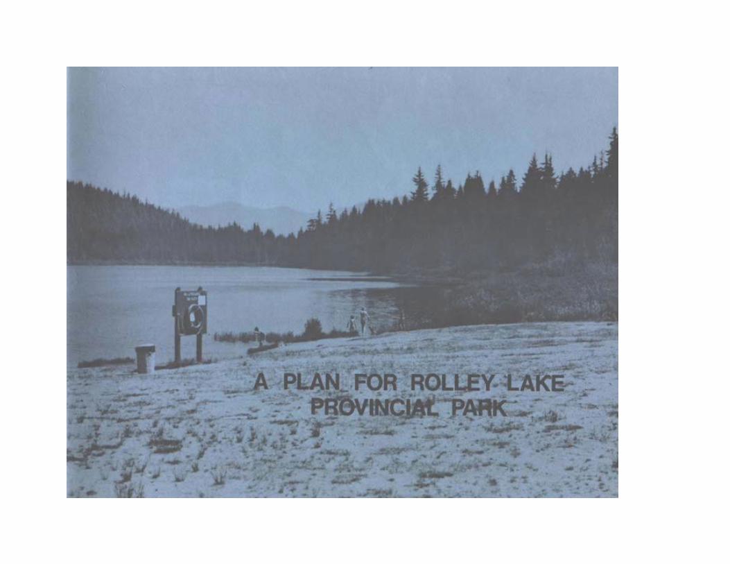
THIS REPORT, ENTITLED A PLAN FOP ROLLEY LAKE PROVINCIAL PARK, IS SUBMITTED FOR YOUR APPROVAL.
G. F. Macnab, Chief Planning Division
RECOMMENDED: ____________________ ______________________
G.F. Macnab, Chief Date Planning Division
APPROVAL: ____________________ ______________________
T.E. Lee Date Director
TABLE OF CONTENTS PAGE
Introduction 2 Abstract 3
Concept 5
History and Development 6
Zoning
Development Zone 10 Preservation Zone 13
Service Zone 14
Natural Zone 14
Management 15
Phasing 16 Appendix I - Use 17
Appendix II - Boundaries 19
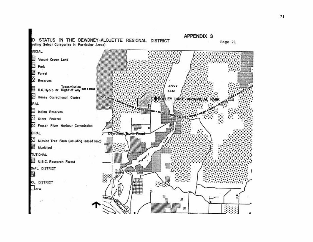
Appendix III - Land Status in Dewdney
Alouette Regional District 21
2
INTRODUCTION
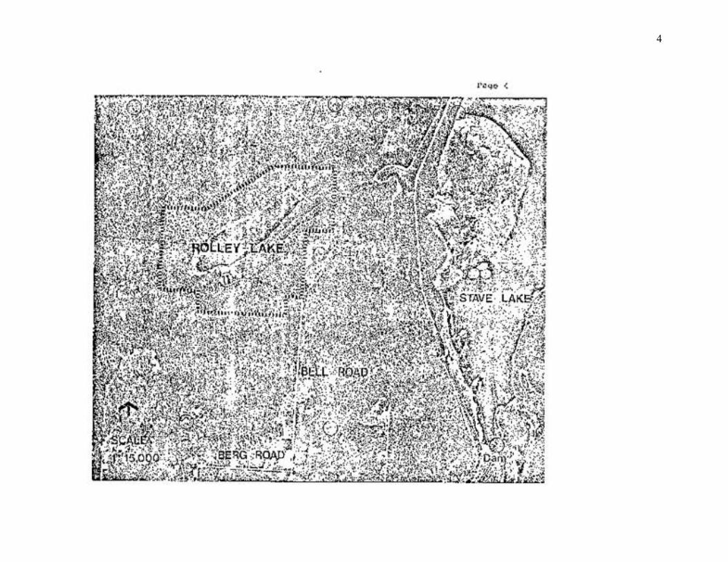
Rolley Lake Provincial Park contains 115 hectares and is 4 km from Stave Falls near the outlet of Stave Lake.
This Class ‘A’ Provincial Park, category 6 is accessible off the Dewdney Trunk Road, approximately 24 km east of Haney or 23 km north west of Mission City. It is less than one hours drive from Vancouver providing both camping and lake-oriented day use recreation.
Rolley Lake Park lies within the Wet Subzone of the Coastal Western Hemlock biogeoclimatic zone (Krajina). The vegetation in this zone is represented by Douglas fir, western hemlock, western red cedar and Pacific silver fir. PHOTOGRAPH NOT AVAILABLE PHOTOGRAPH NOT AVAILABLE DAY USE BEACH AREA VIEWING TO EAST END OF ROLLEY LAKE
3
ABSTRACT
Rolley Lake Provincial Park provides numerous recreational opportunities for Lower Mainland residents. Emphasis will be placed on day use activities such as picnicking, swimming, fishing and canoeing; camping; and interpreting the natural features associated with the eutrophic lake.
The present campground experiences predominantly weekend use usually reaching 100% capacity before Golden Ears Provincial Park which lies 20 km west. The majority of the 60,000 park visitors (per annum) are from the Lower Mainland region and local residents constitute the greatest proportion of day users.
This plan proposes to offer greater recreational opportunities for Rolley Lake visitors by improving the hiking trails; developing an 'open space' playground; enlarging the day use beach area; and constructing a group campground while still preserving the natural features and aesthetic beauty of Rolley Lake Provincial Park.
4
5
CONCEPT
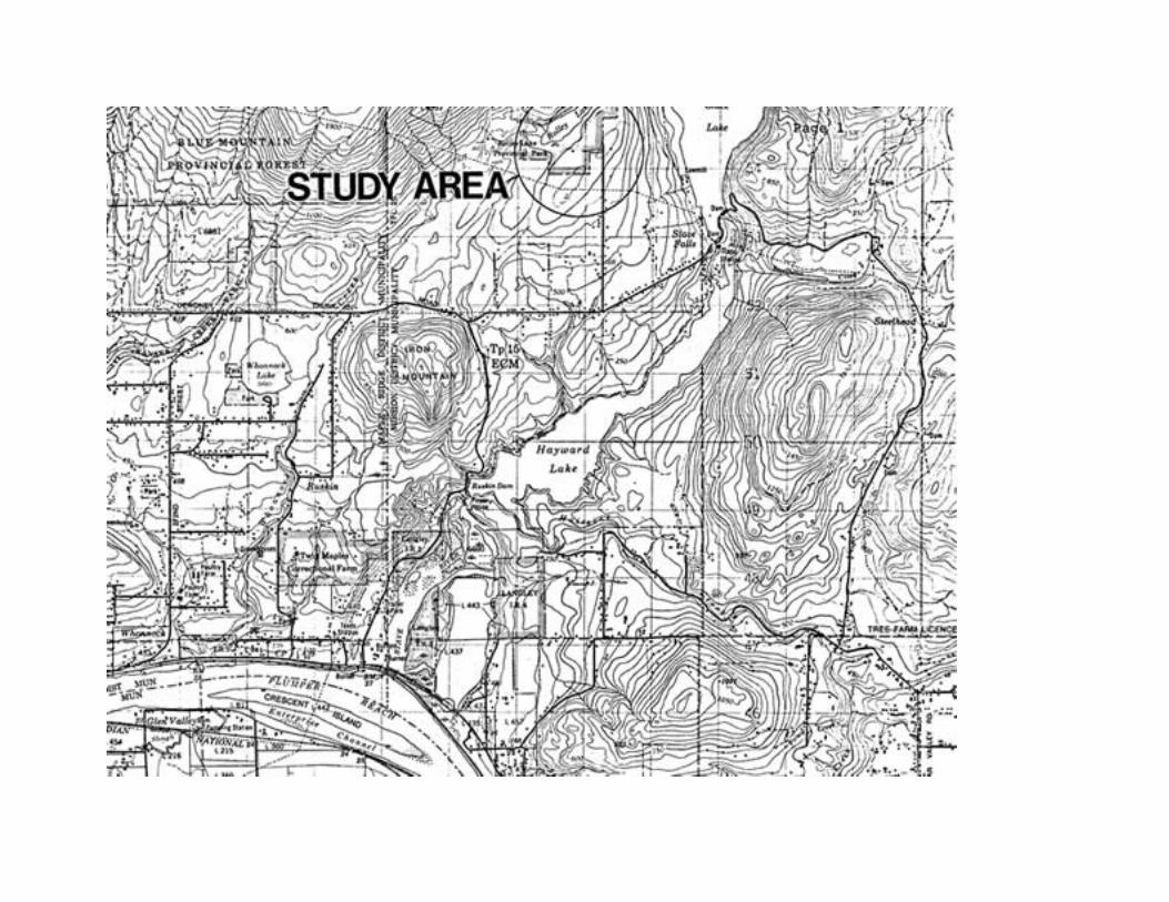
It is the concept for Rolley Lake Provincial Park to provide recreationists with both lake-oriented camping and day use opportunities. Access is via Dewdney Trunk Road to Bell Road 24 km from Haney.
Associated in this coastal hemlock zone are recreational activities for camping, picnicking, fishing, canoeing, hiking, group camping, and nature interpretation. The small lake, being approximately 1.2 km in length is restricted to non-power boats. PHOTOGRAPH NOT AVAILABLE PHOTOGRAPH NOT AVAILABLE POPULAR DAY USE BEACH ROLLEY LAKE PROVINCIAL CAMPGROUND AND LAKE AREA COASTAL WESTERN HEMLOCK BIOGEOCLIMATIC ZONE
6
HISTORY AND DEVELOPMENT
Rolley Lake Provincial Park was established as a Class 'A' park by an Order-in-Council in 1961. It has a 65 unit campground and a fine day-use area on the lake.
Historically, Rolley Lake was in the midst of logging operations that at one time milled 35,000 board feet of lumber per day for the Vancouver and Haney markets.
In the early 1920's, Rolley Lake was used as a holding pond for a shingle bolt operation using cedar found on the mountain above the lake. This ended when most of the cedar was logged off, but the 1930's brought renewed activity to Rolley Lake when two logging operations and a sawmill began production. These were Japanese-Canadian operations and a few remnants are still visible today. Though no traces of either logging camp or sawmill were found, there are scatterings of old refuse, including tin cans with Japanese labels and pieces of pottery and a plank road which runs south of the Lake.
The timber operations at Rolley Lake were not large or significant in themselves, but they were representative of the many small hand logging operations that existed in the 1920's and 1930's.
The human history of Rolley Lake is a possible subject for a proposed interpretation program. Such a program would be limited to signing on a self-guided trail and a subject incorporated into the naturalist's talk.
In 1959, a 39 unit campground was constructed adjacent to the northeast side of Rolley Lake. In addition, a beach area, terraced picnic sites, service yard, and three day use parking lots were also built that year. In 1973/74, 26 additional units were added to the campground. These years also saw the service yard receive power, telephone, and a maintenance building.

7
Present development at Rolley Lake Provincial Park includes a 65 unit campground, 28 picnic tables, day use parking for 120
vehicles, 91 m of developed beach, and 4 km of hiking trails. PHOTOGRAPH NOT AVAILABLE PHOTOGRAPH NOT AVAILABLE
BEACH AND PICNIC AREA
8
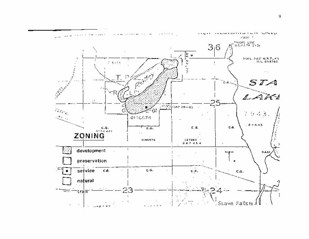
ZONING
The accompanying map illustrates the location of the zones relative to Rolley Lake Provincial Park.
The Development Zone includes areas throughout the park where construction of facilities is necessary to enhance or enable public recreation.
Within the Preservation Zone are features that are of particular environmental significance or sensitivity. Any development within this zone will be limited to that which will sufficiently protect or preserve the identified features. Interpretation may or may not be a function within this zone.
The Service Zone is merely a "spot" zone to indicate the location of buildings and service yard necessary for the maintenance or operation of this park.
The remaining lands within the Park fall into the Natural Zone, denoting that no specific developments or preservation features are identified and that the area will remain in its natural state.
9
10
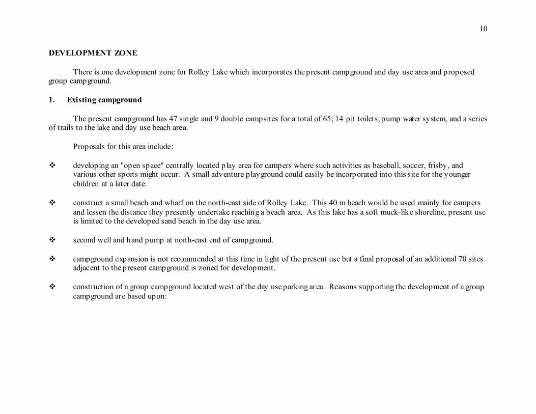
DEVELOPMENT ZONE
There is one development zone for Rolley Lake which incorporates the present campground and day use area and proposed group campground. 1. Existing campground
The present campground has 47 single and 9 double campsites for a total of 65; 14 pit toilets; pump water system, and a series of trails to the lake and day use beach area.
Proposals for this area include:
developing an "open space" centrally located play area for campers where such activities as baseball, soccer, frisby, and various other sports might occur. A small adventure playground could easily be incorporated into this site for the younger children at a later date.
construct a small beach and wharf on the north-east side of Rolley Lake. This 40 m beach would be used mainly for campers
and lessen the distance they presently undertake reaching a beach area. As this lake has a soft muck-like shoreline, present use is limited to the developed sand beach in the day use area.
second well and hand pump at north-east end of campground.
campground expansion is not recommended at this time in light of the present use but a final proposal of an additional 70 sites
adjacent to the present campground is zoned for development.
construction of a group campground located west of the day use parking area. Reasons supporting the development of a group campground are based upon:
11
a) existing management structure at Rolley Lake and staff ability to operate and maintain a group campground. b) present level of facilities - all major services are now found at Rolley Lake Park. c) ease of access. Rolley Lake Provincial Park is accessible via Dewdney Trunk Road, 24 km east of Haney. The road is
paved up to the Park entrance and is wide enough to allow trailers to pass easily. Rolley Lake is just over an hour's drive from Vancouver and serves as both a transient and destination campground to visiting campers.
d) Rolley Lake is one of the few warm water lakes to be found in the Lower Mainland region. It receives high day use from
local residents and also serves as a major destination campground for Lower Mainland residents.
improve the existing day use area. Rolley Lake receives relatively high day use attendance and minor landscaping would improve the park's aesthetic appeal. There are picnic tables which are poorly located and because of new tree growth, views of the lake are limited. The open beach area needs hydro seeding or a type of grass covering and the planting of some native shrubs to make it a more attractive recreation area. The shoreline and upland west of the sandy beach area should further be improved with some clearing.
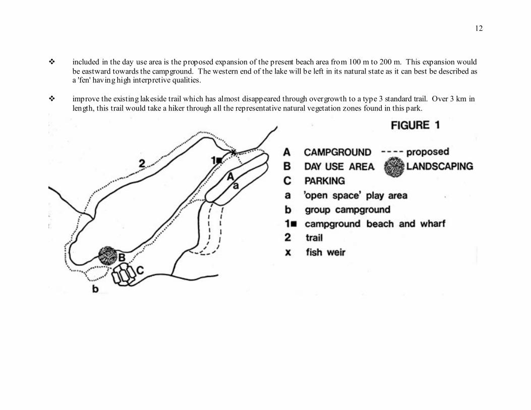
12
included in the day use area is the proposed expansion of the present beach area from 100 m to 200 m. This expansion would
be eastward towards the campground. The western end of the lake will be left in its natural state as it can best be described as a 'fen' having high interpretive qualities.
improve the existing lakeside trail which has almost disappeared through overgrowth to a type 3 standard trail. Over 3 km in
length, this trail would take a hiker through all the representative natural vegetation zones found in this park.
13
PRESERVATION ZONE
The lands at either end of Rolley Lake have been zoned for preservation. The west supports a relatively eutrophic 'fen' which is probably of highest interpretive value the park. The boardwalk over the boggy 'muck' area allows visitors to observe a wide variety of vegetation that attracts many birds and small animals. The eastern end of the lake including the main outlet stream should also be preserved in its natural state, having no development. As there is no formal interpretive program in this park it is proposed that a complementary program be set up with that offered at Golden Ears Provincial Park. The extent of an interpretation program in Rolley Lake Provincial Park would be limited to a few self-guiding interpretive trails appropriate signing (ie) flora identification and 'ecological lake succession' and perhaps a weekly naturalists talk at the proposed "open space" area within the campground. PHOTOGRAPH NOT AVAILABLE PHOTOGRAPH NOT AVAILABLE OLD CORDUROY ROAD SOUTH WEST ‘FEN’ AT WEST END OF ROLLEY OF ROLLEY LAKE BUILT FOR HAULING LAKE LOGS.
14
SERVICE ZONE
The service zone consisting of service yard and workshop is a small "spot" zone necessary for the maintenance and operation of Rolley Lake Provincial Park. It is also contained within the development zone. NATURAL ZONE
The remaining lands within this Park fall into the Natural Zone. This zone suggests no development or specific preservation but rather identifies an area that will remain in its natural state. A lakeside trail is the only development found within this zone.
PHOTOGRAPH NOT AVAILABLE
VIEW TO NORTH SIDE OF ROLLEY LAKE
15
MANAGEMENT
Management of Rolley Lake Provincial Park will continue from the Alouette District Office. Both Youth Crew and Haney Correctional Institute inmates will be used periodically for maintenance purposes and spring clean-up.
Power boats are not allowed on Rolley Lake due to its small size. Many of its boating users are canoeists who like to fish for rainbow trout, coastal cutthroat and Dolly Varden. Due to the popularity in fishing and the small number of fish actually caught, this report proposes that a weir be constructed on the eastern outlet of Rolley Lake. As popularity increases at Rolley Lake Provincial Park, there will be a higher demand on fishing related activities. By constructing a weir, many trout that might normally escape through the outlet stream to Stave Lake will now remain in Rolley Lake. Fish restocking of Rolley Lake, by request, will be provided by the Fish and Wildlife Branch. As part of a regular program, they will replenish the trout population when stocks become depleted by fishermen, birds, or other natural hazards.
16
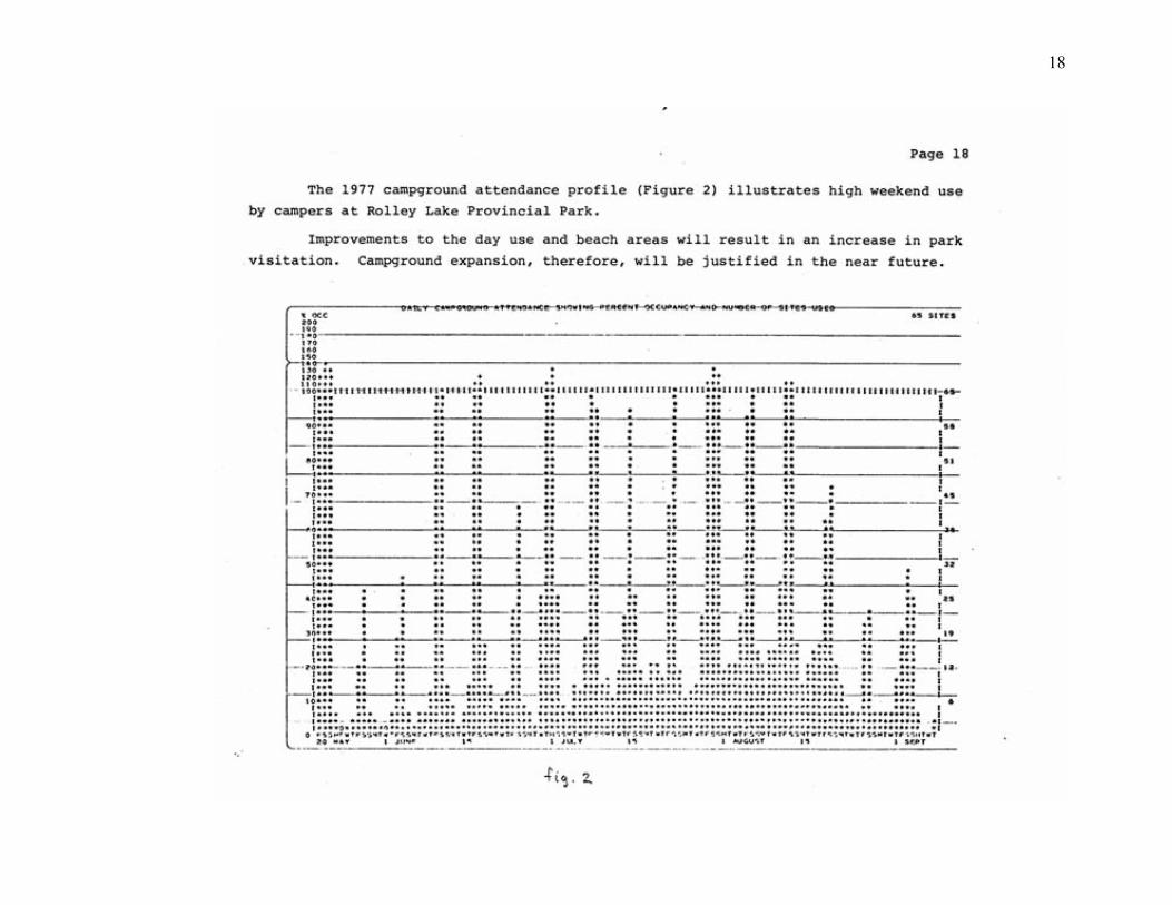
PHASING PHASE I Upgrade existing lakeside trail. - erect interpretive signs along trail. Landscape day use area, seed grass - clear underbrush and prune decid- and tree planting to improve visual uous trees which hamper picnickers' aesthetics. view of lake from picnic bench area. Double existing beach area from 100 to 200 metres, clearing upland where possible. Lower lake level by minimum two - construct small camper beach and feet, sand out into water and return float at northeast end of lake. to original lake level. - construct weir at northeast outlet. Campground. - develop "open space" playground for campers centrally located in campground. - centrally located well and hand pump in campground. PHASE II Develop a group campground (50 per- sons) west of day use parking area. (Figure 1) PHASE III Expansion of campground with an ad- ditional 70 sites to a total of 135 units is approved as attendance in- creases at Rolley Lake Provincial Park.
17
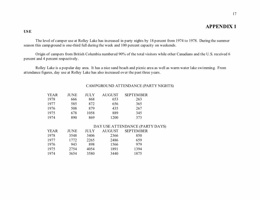
APPENDIX 1 USE
The level of camper use at Rolley Lake has increased in party nights by 18 percent from 1974 to 1978. During the summer season this campground is one-third full during the week and 100 percent capacity on weekends.
Origin of campers from British Columbia numbered 90% of the total visitors while other Canadians and the U.S. received 6 percent and 4 percent respectively.
Rolley Lake is a popular day area. It has a nice sand beach and picnic area as well as warm water lake swimming. From attendance figures, day use at Rolley Lake has also increased over the past three years.
CAMPGROUND ATTENDANCE (PARTY NIGHTS)
YEAR JUNE JULY AUGUST SEPTEMBER 1978 666 868 653 263 1977 585 872 656 365 1976 508 879 435 267 1975 678 1058 889 345 1974 890 869 1200 373
DAY USE ATTENDANCE (PARTY DAYS) YEAR JUNE JULY AUGUST SEPTEMBER 1978 3548 3406 2366 850 1977 1772 2265 2486 659 1976 943 898 1566 979 1975 2754 4054 1891 1394 1974 3654 3580 3440 1875
18
19
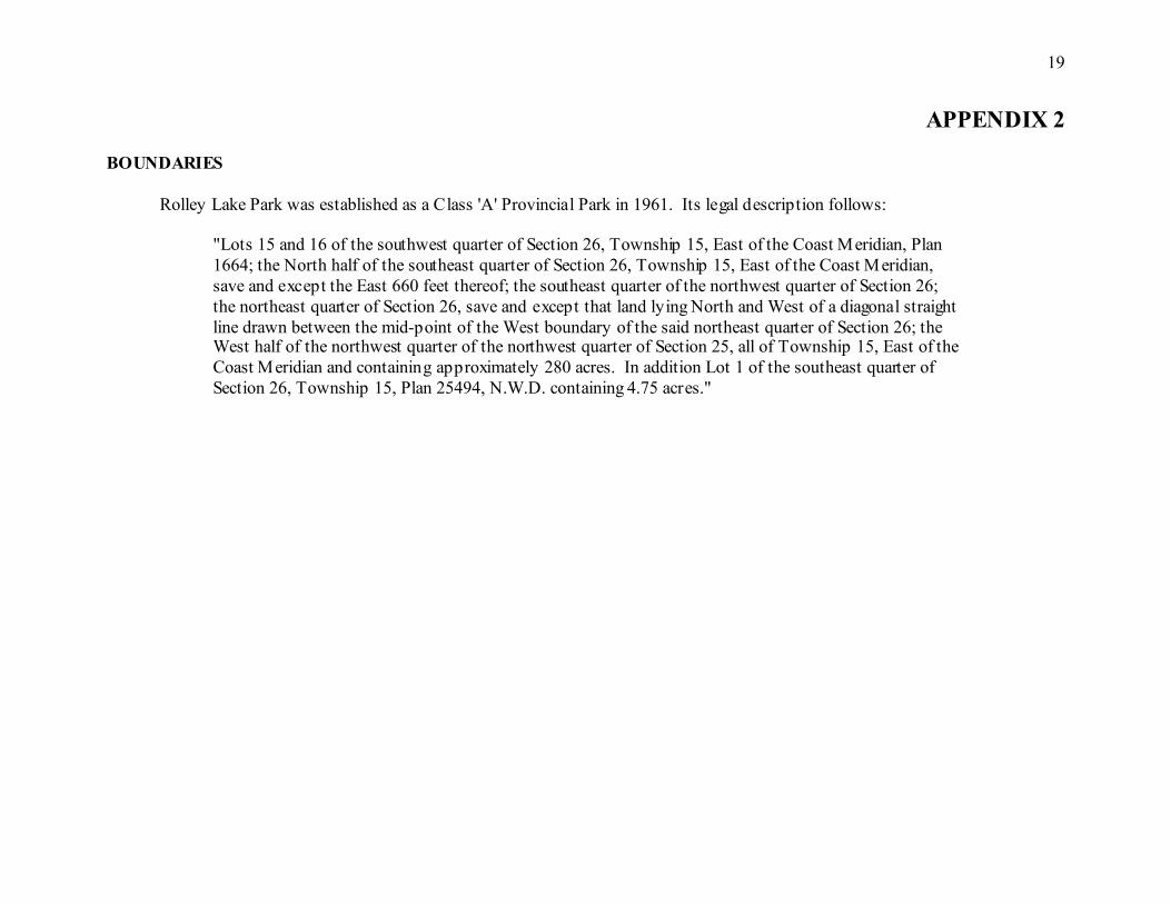
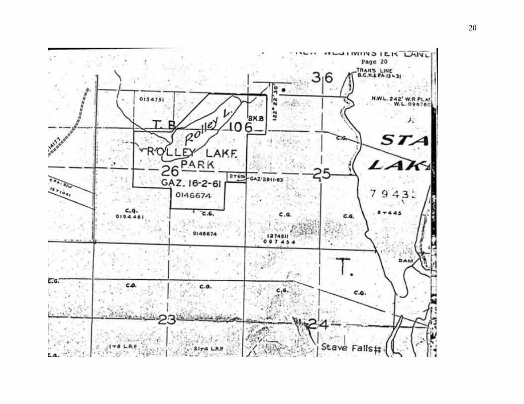
APPENDIX 2 BOUNDARIES
Rolley Lake Park was established as a Class 'A' Provincial Park in 1961. Its legal description follows:
"Lots 15 and 16 of the southwest quarter of Section 26, Township 15, East of the Coast Meridian, Plan 1664; the North half of the southeast quarter of Section 26, Township 15, East of the Coast Meridian, save and except the East 660 feet thereof; the southeast quarter of the northwest quarter of Section 26; the northeast quarter of Section 26, save and except that land lying North and West of a diagonal straight line drawn between the mid-point of the West boundary of the said northeast quarter of Section 26; the West half of the northwest quarter of the northwest quarter of Section 25, all of Township 15, East of the Coast Meridian and containing approximately 280 acres. In addition Lot 1 of the southeast quarter of Section 26, Township 15, Plan 25494, N.W.D. containing 4.75 acres."
20
21


