
Wireless 911 call Routings Using Population Weighted Address Points
Li Zou, Ph.D.GIS Specialist
St. Clair County (IL) ETSB 911
July 11, 2017
Introduction
Problems for the existing routing assignments
Benefits of improving call routing assignments
Methodology to improve call routing assignments
New call routing assignment process
Conclusions
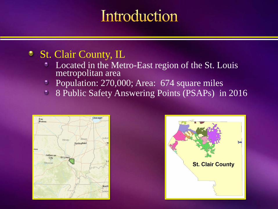
St. Clair County, ILLocated in the Metro-East region of the St. Louis metropolitan areaPopulation: 270,000; Area: 674 square miles8 Public Safety Answering Points (PSAPs) in 2016
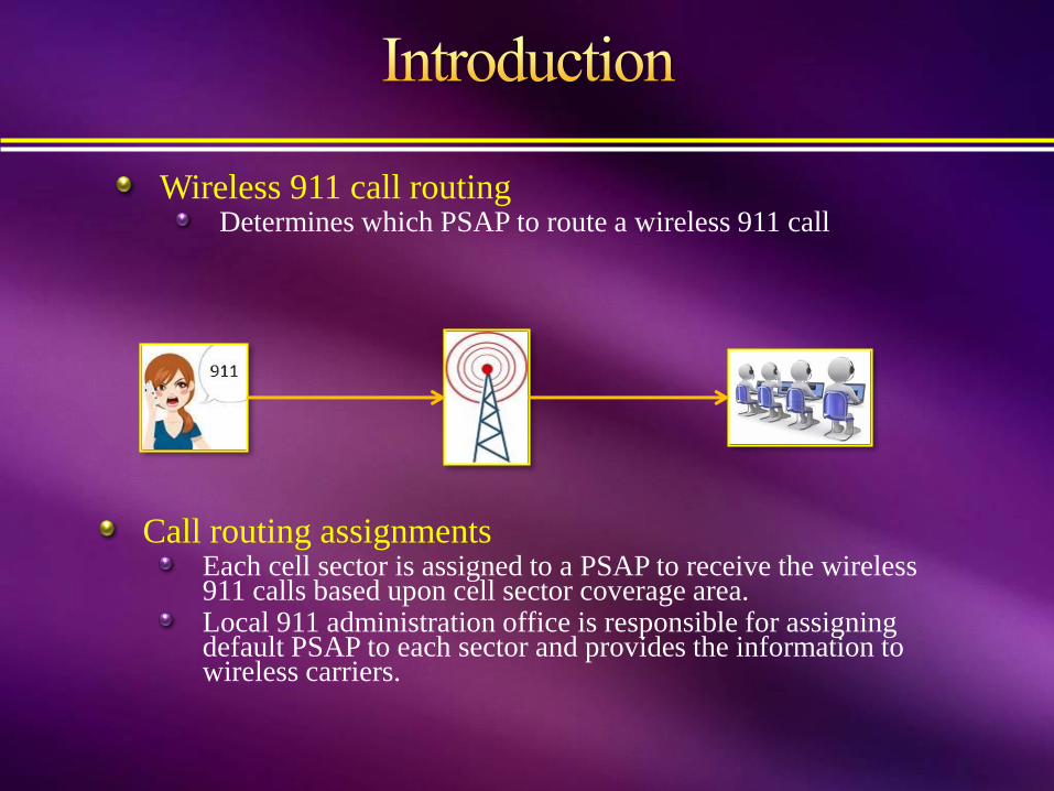
Wireless 911 call routingDetermines which PSAP to route a wireless 911 call
Call routing assignmentsEach cell sector is assigned to a PSAP to receive the wireless 911 calls based upon cell sector coverage area.Local 911 administration office is responsible for assigning default PSAP to each sector and provides the information to wireless carriers.

Cell towers/sitesCellular networks use directional antennas to radiate.Cell sites can either be omnidirectional or sectored.
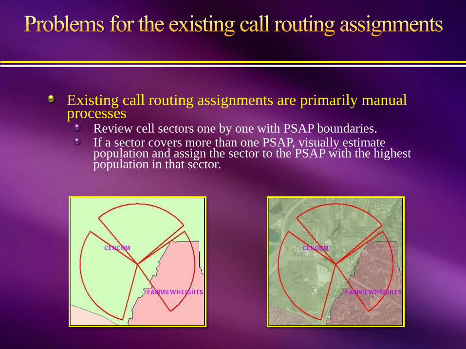
Existing call routing assignments are primarily manual processes
Review cell sectors one by one with PSAP boundaries.If a sector covers more than one PSAP, visually estimate population and assign the sector to the PSAP with the highest population in that sector.
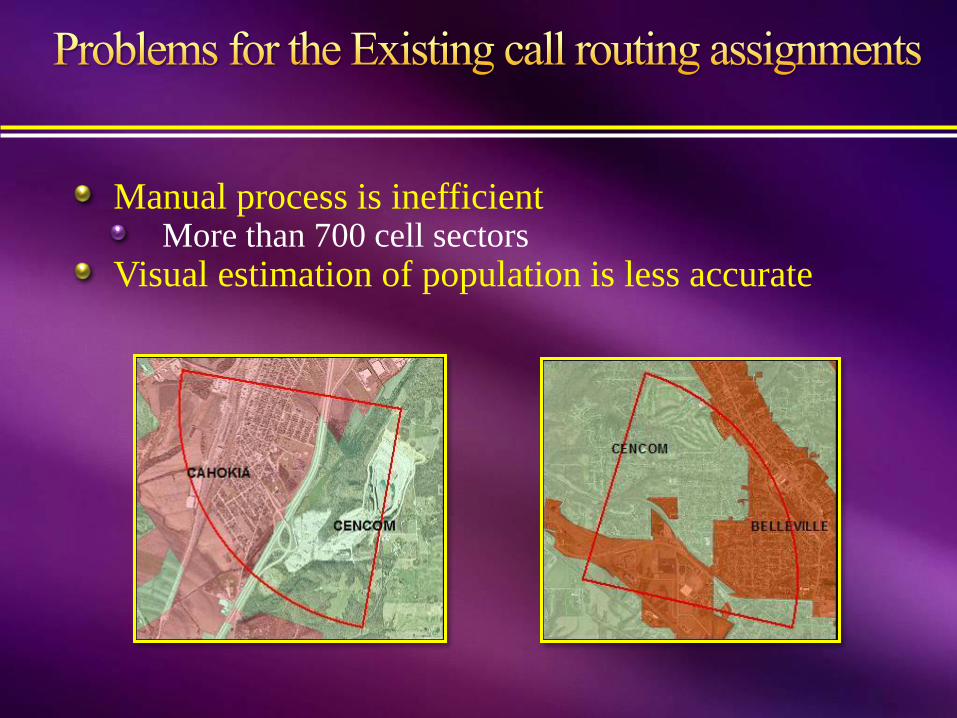
Manual process is inefficientMore than 700 cell sectors
Visual estimation of population is less accurate

If a 911 call is routed to a wrong PSAP, it has to be transferred to the right PSAP, which takes time
In an emergency, seconds matter
When seconds matter, we save secondsCreating more accurate methods for PSAP assignments could reduce:
call transfers emergency response timeworkload at 911 call centers
calls getting answered twice
Developing more accurate methods to assign PSAP to
each cell sector are necessary and important.

Develop more accurate population estimate methods at a given geographic unit.
Calculate the number of people present at any cell sector – PSAP polygons.
Assign PSAP to each cell sector based upon population counts.
Review and adjust results.
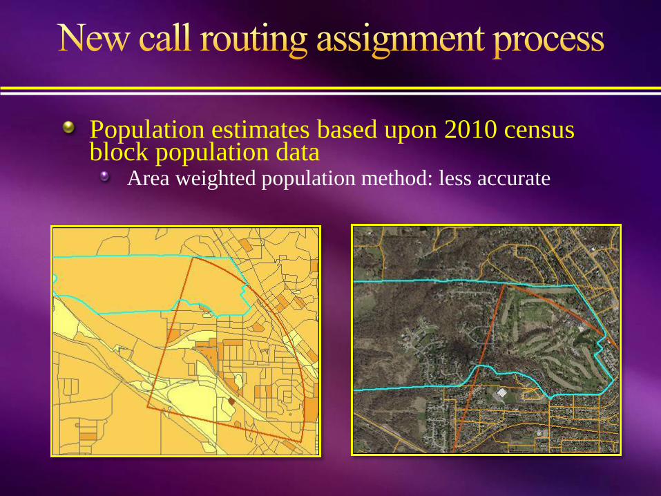
Population estimates based upon 2010 census block population data
Area weighted population method: less accurate
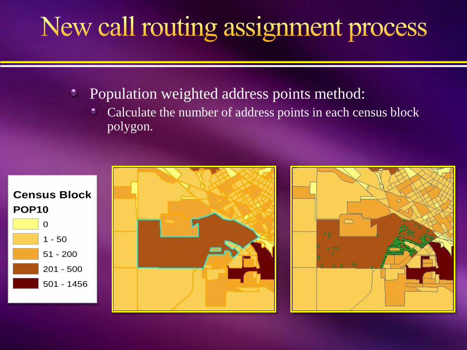
Population weighted address points method:
Calculate the number of address points in each census block polygon.
Census Block
POP10
0
1 - 50
51 - 200
201 - 500
501 - 1456

Calculate average population of each address point in each census block.
Each address point is weighted by its population.

Call routing assignments
ArcGIS desktop Model Builder is used to create models to automate workflows.
Create cell sector –PSAP polygons

Calculate population estimates in each sector – PSAP polygon using population weighted address points.

Python scripts are used to loop through the sector-PSAP polygon population attributes to identify the PSAPs which contain the highest percentage of population in each cell sector.
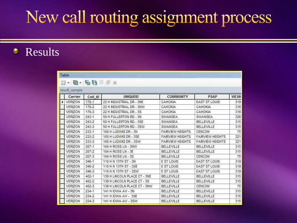
Results

Result Adjustments
Mapped 20,000 wireless 911 calls
Hot spot analysis

Adjustment example
More accurate wireless 911 call routing assignments reduce
Volume of call transfers
Response time
Two new processes improve call routing assignments:
Primary assignment uses population weighted address points method
Secondary routing validation uses wireless 911 call hot spot analysis
Process is repeatable using computer programs
Reduces workload when PSAP boundaries change, new towers are built, or sector coverage polygons change


