earth boot camp #1 - home - old post road...
TRANSCRIPT
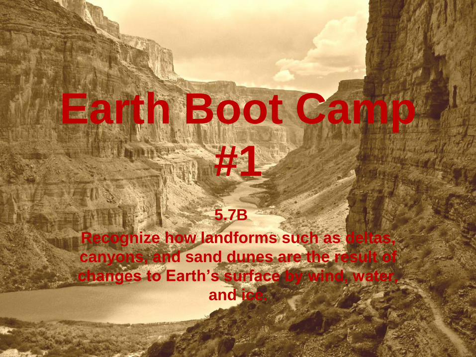
Earth Boot Camp
#15.7B
Recognize how landforms such as deltas,
canyons, and sand dunes are the result of
changes to Earth’s surface by wind, water,
and ice.

1. Glaciers are masses of ice that move
slowly on land. Which of these features
was most likely formed by a glacier?
F. A wide valley
G. A deep ocean
H. A lava flow
J. A mountain range
STAAR 2013 #20; RC3; Readiness

1. Glaciers are masses of ice that move
slowly on land. Which of these features
was most likely formed by a glacier?
F. A wide valley
G. A deep ocean
H. A lava flow
J. A mountain range
STAAR 2013 #20; RC3; Readiness

2. Most canyons are the result of erosion
caused by —
A a river
B a volcano
C a hurricane
D an earthquake

2. Most canyons are the result of erosion
caused by —
A a river
B a volcano
C a hurricane
D an earthquake

3. Which landform was most likely made
by the process of depositing sediments?
A C
B D
TAKS Study Guide, #22

3. Which landform was most likely made
by the process of depositing sediments?
A C
B D
TAKS Study Guide, #22
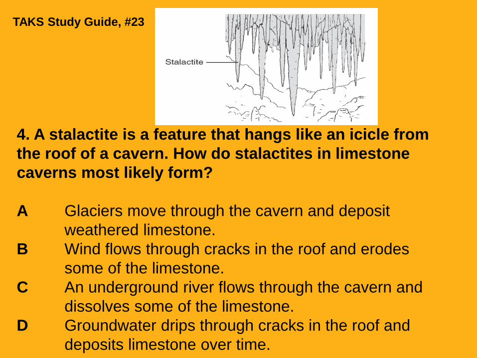
4. A stalactite is a feature that hangs like an icicle from
the roof of a cavern. How do stalactites in limestone
caverns most likely form?
A Glaciers move through the cavern and deposit
weathered limestone.
B Wind flows through cracks in the roof and erodes
some of the limestone.
C An underground river flows through the cavern and
dissolves some of the limestone.
D Groundwater drips through cracks in the roof and
deposits limestone over time.
TAKS Study Guide, #23
5. A student placed some clean rocks in a clear
plastic jar. The jar was filled with clean water and
covered with a lid. Then the student shook the
jar for five minutes. The student noted that
smaller pieces had broken off some of the rocks
and that there was a fine grit on the bottom of
the jar. Which change of Earth’s surface was the
student modeling?
A Physical weathering
B Chemical weathering
C Erosion of sediments
D Forming deltas
TAKS Study Guide, #24
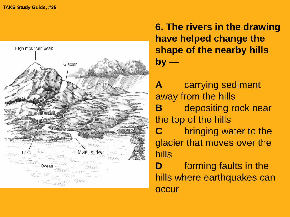
6. The rivers in the drawing
have helped change the
shape of the nearby hills
by —
A carrying sediment
away from the hills
B depositing rock near
the top of the hills
C bringing water to the
glacier that moves over the
hills
D forming faults in the
hills where earthquakes can
occur
TAKS Study Guide, #35

7. The prairie is ideal for the growth of
grasses because it has rich topsoil. All of
these processes help form topsoil
EXCEPT —
F decay of trees
G weathering of rocks
H erosion of hills
J movement of oceans
2003—#12 (49%)

7. The prairie is ideal for the growth of
grasses because it has rich topsoil. All of
these processes help form topsoil
EXCEPT —
F decay of trees
G weathering of rocks
H erosion of hills
J movement of oceans
2003—#12 (49%)

8. Which experiment would best show
how different methods of plowing fields
on a hill affect erosion?
A C
B D
2003—#24 (55%)

8. Which experiment would best show
how different methods of plowing fields
on a hill affect erosion?
A C
B D
2003—#24 (55%)

9. Which of these can cause sharp, rough
mountains to become rounded and
smooth over time?
F Wind and rain
G The sun’s rays
H Light and darkness
J Earth’s magnetic field
2006—#34 (85%)

9. Which of these can cause sharp, rough
mountains to become rounded and
smooth over time?
F Wind and rain
G The sun’s rays
H Light and darkness
J Earth’s magnetic field
2006—#34 (85%)

10. The Davis Mountains in West Texas
used to be taller than they are now.
Which of the following conditions most
likely caused the mountains to become
shorter over time?
A Heat and pressure
B Soil deposition
C Rain and wind
D River formation
2009—#23 (77%)
10. The Davis Mountains in West Texas
used to be taller than they are now.
Which of the following conditions most
likely caused the mountains to become
shorter over time?
A Heat and pressure
B Soil deposition
C Rain and wind
D River formation
2009—#23 (77%)
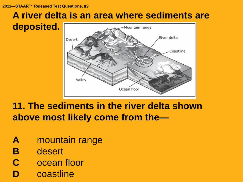
A river delta is an area where sediments are
deposited.
11. The sediments in the river delta shown
above most likely come from the—
A mountain range
B desert
C ocean floor
D coastline
2011—STAAR™ Released Test Questions, #9

A river delta is an area where sediments are
deposited.
11. The sediments in the river delta shown
above most likely come from the—
A mountain range
B desert
C ocean floor
D coastline
2011—STAAR™ Released Test Questions, #9
12. Which of the following constructive
forces will produce a new landform in the
shortest amount of time?
A Deposition of ocean sediment
B Deposition of river sediment
C Volcanic eruptions along plates
D Plate pressure causing uplift

12. Which of the following constructive
forces will produce a new landform in the
shortest amount of time?
A Deposition of ocean sediment
B Deposition of river sediment
C Volcanic eruptions along plates
D Plate pressure causing uplift
13. The sides of the Grand Canyon show
many different layers of rock. Which
statement describes how the Grand Canyon
was formed?
A. The canyon has a waterfall.
B. Big rainstorms washed rocks out of the canyon.
C. A flowing river cut into rocks to form the canyon.
D. The canyon was formed from the uplifting of rock.

13. The sides of the Grand Canyon show many different
layers of rock. Which statement describes how the Grand
Canyon was formed?
A. The canyon has a waterfall.
B. Big rainstorms washed rocks out of the canyon.
C. A flowing river cut into rocks to form the canyon.
D. The canyon was formed from the uplifting of rock.
Why A, B, D are wrong:
A. Canyons are deep, narrow valleys
and would not be formed from a
waterfall.
B. Rainstorms provide the water that
weathers the rock.
D. Uplifting of rock forms mountains.
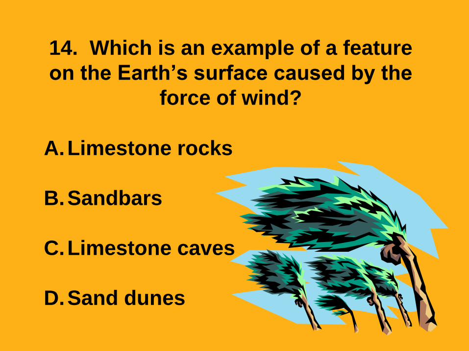
14. Which is an example of a feature
on the Earth’s surface caused by the
force of wind?
A.Limestone rocks
B.Sandbars
C.Limestone caves
D.Sand dunes
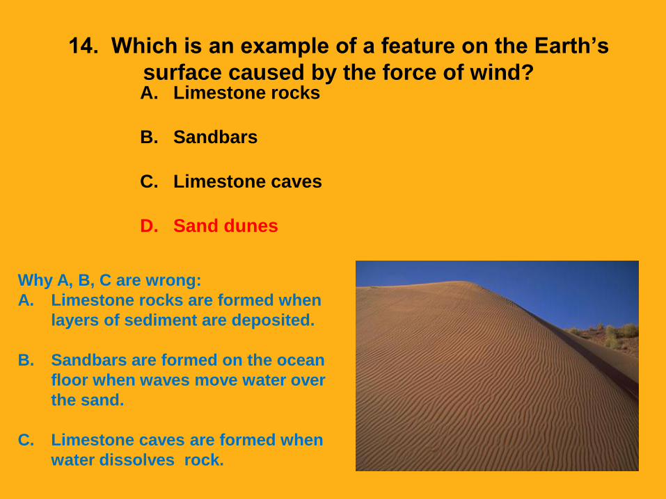
14. Which is an example of a feature on the Earth’s
surface caused by the force of wind?A. Limestone rocks
B. Sandbars
C. Limestone caves
D. Sand dunes
Why A, B, C are wrong:
A. Limestone rocks are formed when
layers of sediment are deposited.
B. Sandbars are formed on the ocean
floor when waves move water over
the sand.
C. Limestone caves are formed when
water dissolves rock.

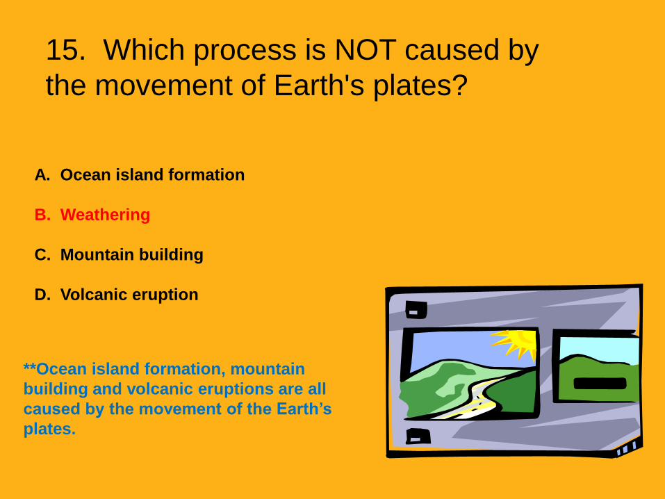
15. Which process is NOT caused by
the movement of Earth's plates?
A. Ocean island
formation
B. Weathering
C. Mountain building
D. Volcanic eruption
15. Which process is NOT caused by
the movement of Earth's plates?
A. Ocean island formation
B. Weathering
C. Mountain building
D. Volcanic eruption
**Ocean island formation, mountain
building and volcanic eruptions are all
caused by the movement of the Earth’s
plates.
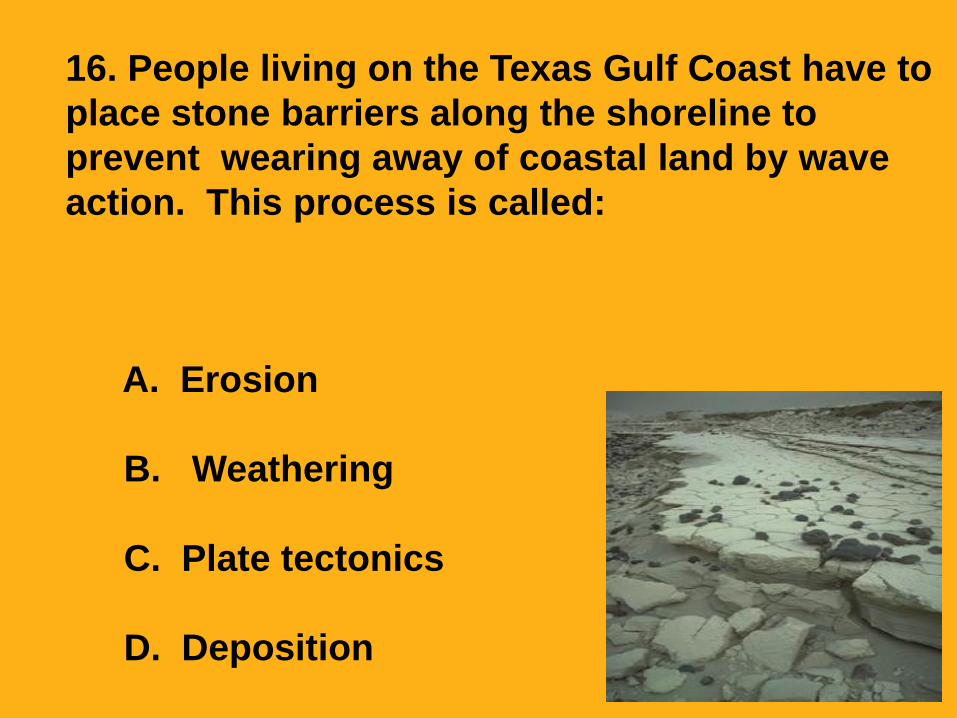
16. People living on the Texas Gulf Coast have to
place stone barriers along the shoreline to
prevent wearing away of coastal land by wave
action. This process is called:
A. Erosion
B. Weathering
C. Plate tectonics
D. Deposition

16. People living on the Texas Gulf Coast have to place stone barriers along
the shoreline to prevent wearing away of coastal land by wave action. This
process is called:
A. Erosion
B. Weathering
C. Plate tectonics
D. Deposition
Why B, C, D are wrong:
B. Weathering is the breaking down of rock into smaller
particles.
C. Plate tectonics is a theory that explains the movements of
the Earth’s plates.
D. Deposition is the process of depositing sediment in a
new location.

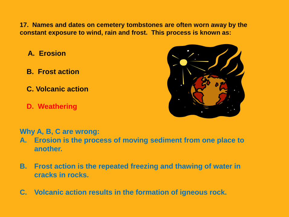
17. Names and dates on cemetery
tombstones are often worn away by the
constant exposure to wind, rain and frost.
This process is known as:
A. Erosion
B. Frost action
C. Volcanic action
D. Weathering
17. Names and dates on cemetery tombstones are often worn away by the
constant exposure to wind, rain and frost. This process is known as:
A. Erosion
B. Frost action
C. Volcanic action
D. Weathering
Why A, B, C are wrong:
A. Erosion is the process of moving sediment from one place to
another.
B. Frost action is the repeated freezing and thawing of water in
cracks in rocks.
C. Volcanic action results in the formation of igneous rock.

18. Rivers running quickly through the
same area for millions of years would likely
form:
A. Mountains
B. Volcanoes
C. Valleys
D. Glaciers
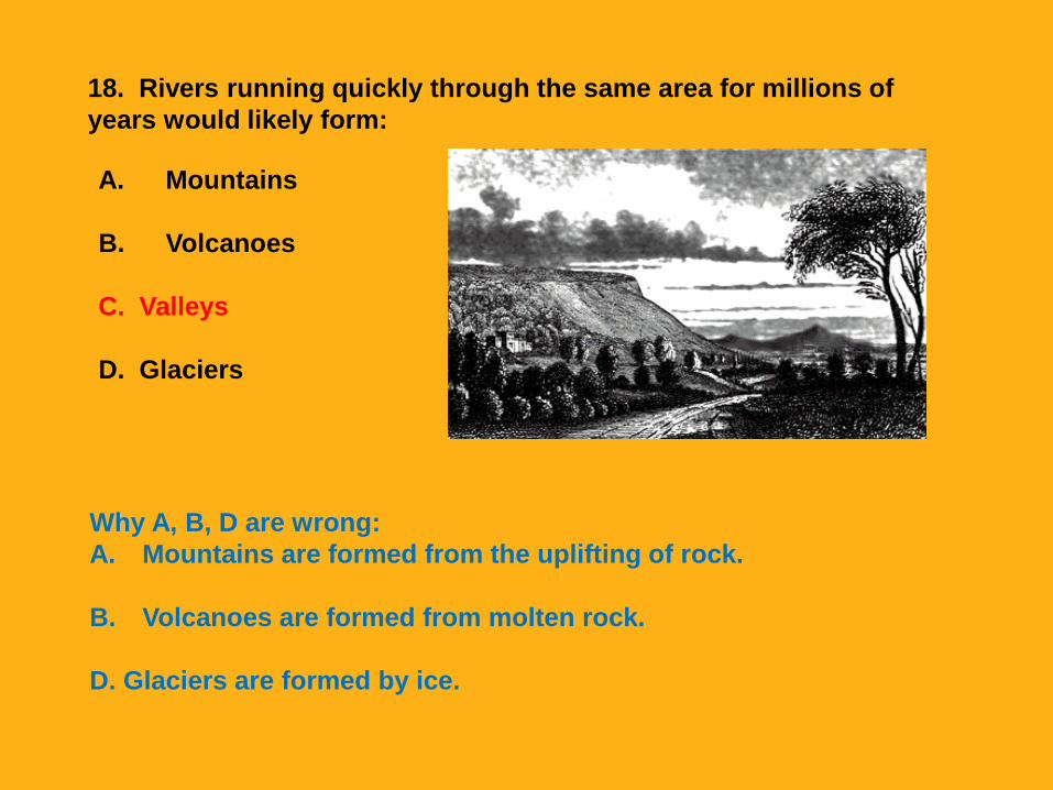
18. Rivers running quickly through the same area for millions of
years would likely form:
A. Mountains
B. Volcanoes
C. Valleys
D. Glaciers
Why A, B, D are wrong:
A. Mountains are formed from the uplifting of rock.
B. Volcanoes are formed from molten rock.
D. Glaciers are formed by ice.

19. Two students noticed cracks on the
school’s outside basketball court. Which
process can the students conclude
caused the cracks?
A. Erosion
B. Weathering
C. Deposition
D. Wind

19. Two students noticed cracks on the
school’s outside basketball court. Which
process can the students conclude
caused the cracks?
A. Erosion
B. Weathering
C. Deposition
D. Wind
The cement of the basketball court is broken down into soil, sand, and other small particles by the process of weathering.
Why A, C, D are wrong: A. Erosion is the process of moving particles
from one place to another.
C. Deposition is the process in which sediments are dropped from one place to another.
D. Wind is a force that produces weathering or erosion.
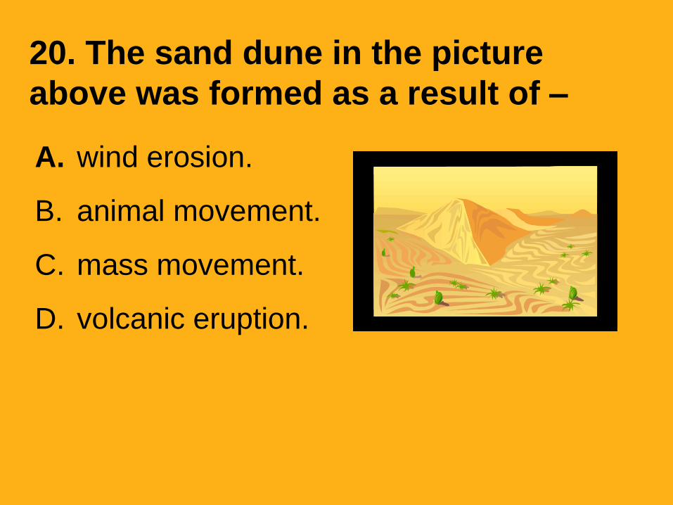
20. The sand dune in the picture
above was formed as a result of –
A. wind erosion.
B. animal movement.
C. mass movement.
D. volcanic eruption.
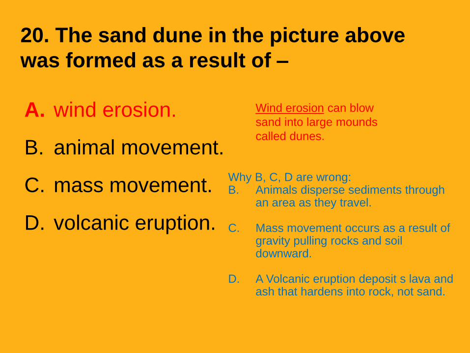
20. The sand dune in the picture above
was formed as a result of –
A. wind erosion.
B. animal movement.
C. mass movement.
D. volcanic eruption.
Why B, C, D are wrong: B. Animals disperse sediments through
an area as they travel.
C. Mass movement occurs as a result of gravity pulling rocks and soil downward.
D. A Volcanic eruption deposit s lava and ash that hardens into rock, not sand.
Wind erosion can blow
sand into large mounds
called dunes.
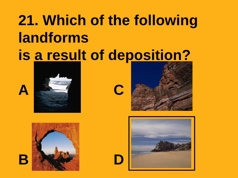
21. Which of the following
landforms
is a result of deposition?
A C
B D

21. Which of the following
landforms
is a result of deposition?
A C
B DA beach shore is formed
as waves deposit sand
and ocean sediments
onto the land.
A. A sea cave is formed
after soft rock is eroded
by ocean waves.
B. Cliffs are formed by
weathering of rock due to
wind erosion and rain.
C. Arches are formed by
weathering away of rock.

22. This diagram shows a profile of soil layers.
Which layer of soil would be affected the most by
weathering and erosion?
A. 1
B. 2
C. 3
D. 4

22. This diagram shows a profile of soil layers.
Which layer of soil would be affected the most by
weathering and erosion?A. 1
B. 2
C. 3
D. 4
Layer 1 is the top layer of soil is
exposed to wind, rain, flooding, and ice
or snow. It will be the layer most
affected by the agents of weathering
and erosion.
Layers 2-4 are all below the surface of the Earth. They are not as
readily affected by wind, ran, flooding, ice or snow.
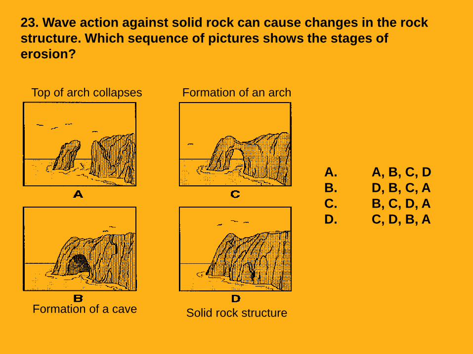
Top of arch collapses
Formation of a cave
Formation of an arch
Solid rock structure
23. Wave action against solid rock can cause changes in the rock
structure. Which sequence of pictures shows the stages of
erosion?
A. A, B, C, D
B. D, B, C, A
C. B, C, D, A
D. C, D, B, A
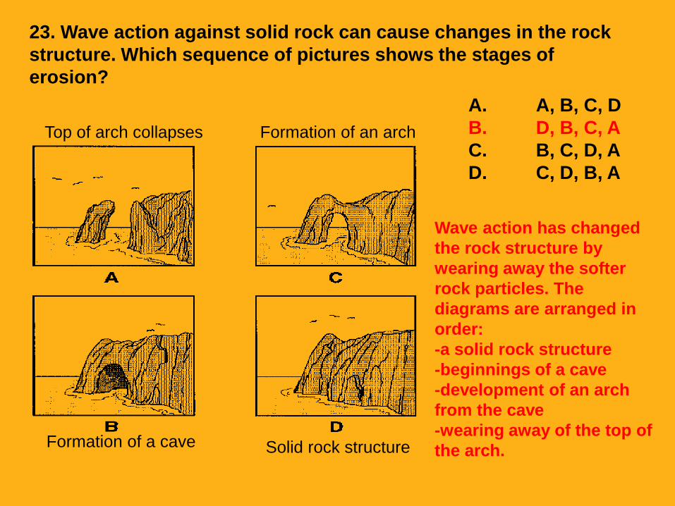
Top of arch collapses
Formation of a cave
Formation of an arch
Solid rock structure
23. Wave action against solid rock can cause changes in the rock
structure. Which sequence of pictures shows the stages of
erosion?
A. A, B, C, D
B. D, B, C, A
C. B, C, D, A
D. C, D, B, A
Wave action has changed
the rock structure by
wearing away the softer
rock particles. The
diagrams are arranged in
order:
-a solid rock structure
-beginnings of a cave
-development of an arch
from the cave
-wearing away of the top of
the arch.
24. When the ocean waves hit shore, the land is
affected. If the shore is rock which of the
following would you expect to see?
A. Erosion
B. Deposition
C. Earthquake
D. Dunes

24. When the ocean waves hit shore, the land is
affected. If the shore is rock which of the
following would you expect to see?
A. Erosion
B. Deposition
C. Earthquake
D. Dunes
Erosion occurs when
the water hits the
rocks and carries off
pieces of rock

25. When the ocean strikes the land
different landforms can form.
Which of the following would NOTbe a landform you would expect to
find?
• A. Beaches
• B. Valleys
• C. Mountains
• D. Craters

25. When the ocean strikes the land
different landforms can form.
Which of the following would NOTbe a landform you would expect to
find?
• A. Beaches
• B. Valleys
• C. Mountains
• D. Craters
Mountains will not form when oceans strike the land. Mountains form by the movement of the earth’s plates or volcanoes.

26. A slow moving stream will probably
deposit the most sediment where the
stream bed is—
A narrow and steep
B narrow and level
C wide and level
D wide and steep
26. A slow moving stream will probably
deposit the most sediment where the
stream bed is—
A narrow and steep
B narrow and level
C wide and level
D wide and steep
27. Freeport, Texas, is built on a growing delta at the
mouth of the Brazos River. The land on which Freeport
is built continues to grow because—
A the ocean waves cause weathering on the delta
B the Brazos River is eroding sediments from the delta
C the Brazos River is depositing sediments on the
delta
D the ocean is depositing sediments on the delta

28. Which landform might be created
by the action of folding and pushing
together of the Earth’s crust?
A A river
B A plain
C A mountain
D A plateau
28. Which landform might be created
by the action of folding and pushing
together of the Earth’s crust?
A A river
B A plain
C A mountain
D A plateau

29. Which of the following is a result
of erosion over a long period of
time?
A The creation of a deep valley
B The formation of a thick glacier
C The creation of a hill or
mountain
D The formation of a river delta
29. Which of the following is a result
of erosion over a long period of
time?
A The creation of a deep valley
B The formation of a thick glacier
C The creation of a hill or
mountain
D The formation of a river delta

30. In which of the following areas might
rich fertile soils affected by river
deposition be found?
A On a desert plain
B On a rocky plateau
C In a limestone cave
D In a river valley
30. In which of the following areas might
rich fertile soils be affected by river
deposition be found?
A On a desert plain
B On a rocky plateau
C In a limestone cave
D In a river valley
31. Which statement best describes how
canyons like the Grand Canyon are formed?
A Most canyons are formed from falling water.
B Big rainstorms wash rocks out of the canyon.
C Flowing rivers cut into riverbanks to form
canyons.
D Canyons are formed from big rocks that
come from other places.
31. Which statement best describes how
canyons like the Grand Canyon are formed?
A Most canyons are formed from falling water.
B Big rainstorms wash rocks out of the canyon.
C Flowing rivers cut into riverbanks to form
canyons.
D Canyons are formed from big rocks that
come from other places.

32. Which of the following is a
constructive result of weathering and
erosion?
A River deltas are filled with sediments.
B New soil and landforms are created.
C Rich topsoil is blown or washed away.
D Rocks are turned into sandpaper.

32. Which of the following is a
constructive result of weathering and
erosion?
A River deltas are filled with sediments.
B New soil and landforms are created.
C Rich topsoil is blown or washed away.
D Rocks are turned into sandpaper.

33. Which of the following would
probably change the surface of the Earth
in the shortest amount of time?
A A massive hurricane
B A volcanic eruption
C Waves on a beach
D A large tornado

33. Which of the following would
probably change the surface of the Earth
in the shortest amount of time?
A A massive hurricane
B A volcanic eruption
C Waves on a beach
D A large tornado

34. Which of the following is a
constructive force that changes the
surface of the Earth over time?
A Deposition
B Earthquakes
C Tidal waves
D Weathering
34. Which of the following is a
constructive force (build up) that
changes the surface of the Earth over
time?
A Deposition
B Earthquakes
C Tidal waves
D Weathering

35. For millions of years, wind and water have
weathered the surface of the Earth and worn
rocks into sediments. Why is the surface of
the Earth NOT totally level after all of this
weathering?
A Constructive forces build up the land.
B Wind and rain cannot affect solid rock.
C Wind and rain pile dirt into mounds.
D Droughts keep the Earth from becoming flat.

36. Which of the following landforms was
NOT formed by erosion from rivers or
glaciers?
A A canyon
B A mountain
C A valley
D A river delta

36. Which of the following landforms was
NOT formed by erosion from rivers or
glaciers?
A A canyon
B A mountain (from earthquakes/plate movement)
C A valley
D A river delta
37. Which of the following landforms is
formed mostly by erosion?
A Delta
B Glacier
C Mountain
D Valley

37. Which of the following landforms is
formed mostly by erosion?
A Delta
B Glacier
C Mountain
D Valley

38. Sand dunes like the ones pictured above
are most likely caused by —
A rain
B glaciers
C streams
D wind

38. Sand dunes like the ones pictured above
are most likely caused by —
A rain
B glaciers
C streams
D wind
39. What are Earth’s surface features
called?
A Rocks
B Continents
C Landforms
D Earthquakes

39. What are Earth’s surface features
called?
A Rocks
B Continents
C Landforms
D Earthquakes

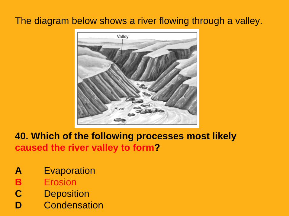
The diagram below shows a river flowing through a valley.
40. Which of the following processes most likely
caused the river valley to form?
A Evaporation
B Erosion
C Deposition
D Condensation
The diagram below shows a river flowing through a valley.
40. Which of the following processes most likely
caused the river valley to form?
A Evaporation
B Erosion
C Deposition
D Condensation
41. What most likely caused these mountains
to have a rough surface?
A Sunlight heated the surface and the rocks
cracked.
B Rocks were weathered and then eroded.
C Seasons have gotten warmer over the years.
D At one time ocean waves crashed against
the mountains.

41. What most likely caused these mountains
to have a rough surface?
A Sunlight heated the surface and the rocks
cracked.
B Rocks were weathered and then eroded.
C Seasons have gotten warmer over the years.
D At one time ocean waves crashed against
the mountains.

42. Which landforms can result when
running water such as a river erodes
sediments from an area?
A Mountains and volcanoes
B Valleys and canyons
C Plains and mountains
D Deltas and caves

42. Which landforms can result when
running water such as a river erodes
sediments from an area?
A Mountains and volcanoes
B Valleys and canyons
C Plains and mountains
D Deltas and caves

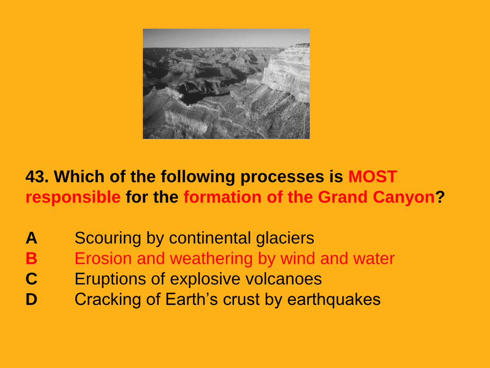
43. Which of the following processes is MOST
responsible for the formation of the Grand Canyon?
A Scouring by continental glaciers
B Erosion and weathering by wind and water
C Eruptions of explosive volcanoes
D Cracking of Earth’s crust by earthquakes
43. Which of the following processes is MOST
responsible for the formation of the Grand Canyon?
A Scouring by continental glaciers
B Erosion and weathering by wind and water
C Eruptions of explosive volcanoes
D Cracking of Earth’s crust by earthquakes

44. All of the following are ways in which
Earth’s landforms, or physical features can be
changed EXCEPT—
A Glaciers scraping over mountains and hills
B Rain washing away mud from cliffs and
hillsides
C Animals migrating across the hills and plains
D Rivers weathering and eroding rocks and
sediments

45. What is one way that ocean currents
affect the land? Ocean currents—
A create mountains and valleys on the
land
B cause weathering, deposition, and
erosion
C cause temperatures to be lower on land
D cause ships to roll in high waves
45. What is one way that ocean currents
affect the land? Ocean currents—
A create mountains and valleys on the
land
B cause weathering, deposition, and
erosion
C cause temperatures to be lower on land
D cause ships to roll in high waves
46. The movement of sand along the
beach and the erosion of rock on the
shore are the direct result of –
A environmental pollution
B river flooding
C glacial deposition
D wave action
46. The movement of sand along the
beach and the erosion of rock on the
shore are the direct result of –
A environmental pollution
B river flooding
C glacial deposition
D wave action
47. Why are rocks and pebbles found in a river usually
smooth?
A The rocks and pebbles found in rivers are not very
old and are still very smooth.
B The flowing river water makes the rocks and pebbles
rub against each other.
C Rough rocks and pebbles would stop the flow of the
river, so they must be smooth.
D Fish and other animals nest on the rocks and
pebbles and make them smooth.
48. The process of the ocean waves
breaking down the seashore or beach is
called—
A erosion
B deposition
C weathering
D sedimentation
48. The process of the ocean waves
breaking down the seashore or beach is
called—
A erosion
B deposition
C weathering
D sedimentation
49. Galveston Island is a barrier island along the Gulf
Coast of Texas. Galveston Island was formed when –
A ocean currents and waves deposited sand and
debris near the Texas coast over thousands or millions of
years
B tropical storms eroded sand and debris from the
Texas coast over several years during the early 1900s
C a large hurricane deposited sand and debris near
the Texas coast during the very early 1900s
D ocean currents and waves deposited sand and
debris near the Texas coast over dozens of years
50. What factor is most responsible for
the formation of sand dunes along
Galveston Bay’s shoreline?
A Rain
B Wind
C Earthquakes
D Glacial deposits
50. What factor is most responsible for
the formation of sand dunes along
Galveston Bay’s shoreline?
A Rain
B Wind
C Earthquakes
D Glacial deposits