evaluation of the 2012 indian ocean coseismic fault model
TRANSCRIPT

Evaluation of the 2012 Indian Ocean coseismic fault model in 3-D heterogeneousstructure based on vertical and horizontal GNSS observationCecep Pratama, Takeo Ito, Takao Tabei, Fumiaki Kimata, Endra Gunawan, Yusaku Ohta, Tadashi Yamashina,Irwandi Nurdin, Didik Sugiyanto, Umar Muksin, Nazli Ismail, and Irwan Meilano
Citation: AIP Conference Proceedings 1987, 020011 (2018); doi: 10.1063/1.5047296View online: https://doi.org/10.1063/1.5047296View Table of Contents: http://aip.scitation.org/toc/apc/1987/1Published by the American Institute of Physics
Articles you may be interested inSeismic microzonation of Bandung basin from microtremor horizontal-to-vertical spectral ratios (HVSR)AIP Conference Proceedings 1987, 020004 (2018); 10.1063/1.5047289
Attenuation function of earthquake in the subduction zone (megathrust) of the Sunda arcAIP Conference Proceedings 1987, 020005 (2018); 10.1063/1.5047290
The change in forest fire danger and burnt area related to the change in meteorological forcing variabilityAIP Conference Proceedings 1987, 020008 (2018); 10.1063/1.5047293
Study of the Indonesia atmospheric condition for the wildfires & transboundary pollution haze/smokeoccurrences during 1990 - 2017AIP Conference Proceedings 1987, 020010 (2018); 10.1063/1.5047295
Caused and condition of the hydrometeorological hazard during dry season period 2017AIP Conference Proceedings 1987, 020007 (2018); 10.1063/1.5047292
The prediction of building damages and casualties in the Kuta Alam sub district-Banda Aceh caused by differentearthquake modelsAIP Conference Proceedings 1987, 020012 (2018); 10.1063/1.5047297
Evaluation of the 2012 Indian Ocean Coseismic Fault Model in 3-D Heterogeneous Structure based on Vertical and
Horizontal GNSS Observation
Cecep Pratama1, a) Takeo Ito1 Takao Tabei2 Fumiaki Kimata3 Endra Gunawan4 Yusaku Ohta5 Tadashi Yamashina2 Irwandi Nurdin6 Didik Sugiyanto6 Umar
Muksin6 Nazli Ismail6 Irwan Meilano7
1Graduate School of Environmental Studies, Nagoya University D2-2(510), Furo-cho, Chikusa-ku, Nagoya-shi, Aichi, JAPAN 464-8601
2Department of Applied Science, Faculty of Science, Kochi University 2-5-1 Akebono-cho, Kochi-shi, Kochi, JAPAN 780-8520
3Tono Research Institute of Earthquake Science Applied Science 1-63 Akiyocho-cho, Yamanouchi, Mizunami-shi, Gifu, JAPAN 509-6132
4Graduate Research on Earthquake and Active Tectonics, Bandung Institute of Technology Jalan Ganesha 10, Bandung, West Java, INDONESIA 40132
5Graduate School of Science, Tohoku University 6-3 Aramaki Aza-Aoba, Aoba-ku, Sendai JAPAN 980-8578
6Faculty of Physics, Syiah Kuala University Jalan Syech Abdurrauf no 3, Banda Aceh, Aceh, INDONESIA 23111
7Faculty of Earth Sciences and Technology, Bandung Institute of Technology Jalan Ganesha 10, Bandung, West Java, INDONESIA 40132
a) Corresponding author: [email protected]
Abstract. Lack of observation network in the vicinity of oceanic intraplate earthquake lead the estimation of coseismic fault slip with high uncertainty. Satriano et al. [2] and Wei et al. [3] found NNE trending left-lateral slip as the primary features. In another hand, Yue et al. [4] and Hill et al. [5] proposed WNW trending right-lateral faults structure as the main characteristic. Here, we investigate the coseismic fault model that could explain the coseismic offset both vertical and horizontal in a 3-D heterogeneous earth structure. We constructed finite element model that include three-dimensional velocity structure, topography/bathymetry, spherical-earth and subducting slab. In this study, we employed scaling slip to adjust slip amount and total seismic moment. Instead of original slip amount, we preserve seismic moment as a basis comparison. Based on vertical and horizontal observation data, WNW trending right-lateral fault could fit better than NNE trending left-lateral fault. The present study demonstrates best-fit calculation using scaling slip optimized to the horizontal or vertical observation lead the both fault model worsen the misfit of vertical or horizontal component, respectively. This result analysis indicates a trade-off between vertical and horizontal component and reflects the importance of revisiting the fault slip modeling incorporating vertical and horizontal data equally.
INTRODUCTION
The first quarter in 2012, a great oceanic intraplate earthquake known as Indian Ocean earthquake struck 400 km offshore Sumatra. The earthquake sequence occurred in extremely complex conjugate faults consisting at least three fault planes for the first shock [2], [3], [4], [5] as shown in Figure 1a. However, those conclusions of fault
International Symposium on Earth Hazard and Disaster Mitigation (ISEDM) 2017AIP Conf. Proc. 1987, 020011-1–020011-7; https://doi.org/10.1063/1.5047296
Published by AIP Publishing. 978-0-7354-1703-8/$30.00
020011-1

model have several essential different characteristics. In the case of the 2012 Indian Ocean earthquake, previous studies suggest difference on coseismic fault slip orientation and the largest faulting. Initially, the complex conjugate fault has been found to be NNE trending left-lateral fracture zones as the main features with dominant deep slip [2], [3] (Figure 1c). On the other hand, WNW trending right-lateral faults structure was greater slip has been found with dominant shallow slip [4], [5] (Figure 1d). Previous studies [6] and [7] investigate the best-fit coseismic model using horizontal component of GNSS data with the assumption of homogeneous half-space and layered spherical-earth model, respectively. However, those studies reached different conclusions of the best-fit coseismic model. Pratama et al. [1] reported systematic effect of model simplification. Simplification such as half-space model or homogeneous earth structure may affect the result [1]. Here, we improved the investigation using 3-D heterogeneous earth model based on horizontal and vertical GNSS data which never been included in the last analysis. In this study, we focus on the established two-fault model that significantly differs each other. The fault model hereafter in this paper will be stated as Wei Model [3] and Hill Model [5].
FIGURE 1. (a) Red arrows and green bar indicate observed horizontal and vertical GNSS data, respectively. Purple line and
yellow line shows different fault trace of Wei Model and Hill Model, respectively. Red lines in Sumatra Island are Great Sumatra Fault while white line with triangle represents Sunda Trench. Surface topography and bathymetry are based on Becker et al.
2009, (b) Interest area, (c) Fault slip distribution of Hill Model (d) Fault slip distribution of Wei Model.
020011-2

DATA AND METHODS
Observation Data
We compiled GNSS site position based on daily solution taken from previous studies [5], [6], [7], [9], [10], [11]. Total of observation data is 100 stations that include mid-field and far-field permanent GNSS site from several networks. The 100 stations consist of 200 offset for horizontal and 34 offset for vertical. Because clear vertical offset only seen on Mid-field network (Figure 1a). Mid-field network (<500 km site-to-source distance) consist of AGNeSS (Aceh GNSS Network for the Sumatran fault system), SuGAr (Sumatran GPS Array), and InaCORS (Indonesian Continuously Operating Reference Stations). Meanwhile, far-field network consist of SuGAr, InaCORS, IGS (International GNSS Service) and Nicobar-Andaman Island Network.
We obtained clear landward displacement and subsidence in northern Sumatra as shown in Figure 1a. In the northern part, the Nicobar-Andaman Island network observed southward. Meanwhile, in the southern part, the SuGAr and InaCORS network observed northward. Those deformation exhibited strike slip characteristic mechanism.
Coseismic Fault Model
Coseismic fault model that tested in this study was reported by [3] and [4]. We summarized the main differences of both fault models as shown in Table 1. Wei et al. [3] reported fault model for the mainshock Mw 8.6 and the largest aftershock Mw 8.2. Meanwhile, Hill et al. [4] only inferred fault model for the mainshock Mw 8.6. Since the provided horizontal and vertical GNSS data was a daily solution, we modified fault model from [4] with additional fault plane for Mw 8.2 based on [3] (we found that the offset based on the largest aftershock Mw 8.2 is significant).
Uniform slip scaling was used to adjust the fault model in three-dimensional heterogeneous structure. The uniform slip scaling means that we multiply each slip distribution with a scalar as a factor that controls the slip magnitude. In addition, we used this scaling to analyze trade-off between horizontal and vertical component.
TABLE 1. Coseismic fault model characteristic for Wei model and Hill model
Parameter Wei Model Hill Model Main Orientation NNE WNW Number of Fault Plane (Mw8.6) 3 6 Maximum Coseismic Slip Amount 28 m 48 m Dominant Depth Slip Deep Shallow Original Seismic Moment 13 × 1021 N m 12 × 1021 N m Original Data Constraint Regional, teleseismic Regional, teleseismic, 1-Hz
GPS data
Finite Element Model
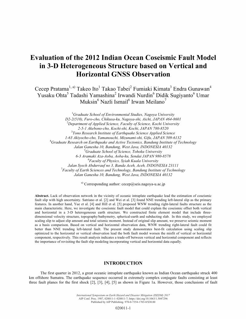
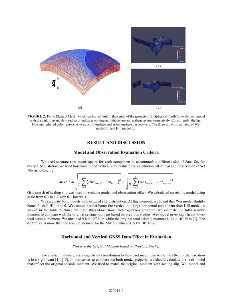
The meshed geometry model incorporate subducted elastic slab, earth curvature and three dimensional velocity structures. A detailed explanation of the model and boundary condition could be found in separate publication [1], [10]. We fixed the oceanic lithosphere thickness as 75 km from seafloor [10]. The finite element mesh is shown in Figure 2a.
We carried out finite element method using PyLith code from Computational Infrastructure for Geodynamics (https://geodynamics.org/cig/software/pylith) with fault interface using domain decomposition method [12], [13]. In this model, we simulate kinematic slip to produce surface displacement at each site and compare the calculation offset to observation offset. Figure 2b and Figure 2c shows slip distribution from Wei model and Hill model in three-dimensional view, respectively.
020011-3
(b)
(a) (c)
FIGURE 2. Finite Element Mesh, which has buried fault in the center of the geometry. (a) Spherical-Earth finite element model
with the dark blue and dark red color indicates continental lithosphere and asthenosphere, respectively. Concurrently, the light blue and light red color represents oceanic lithosphere and asthenosphere, respectively. The three-dimensional view of Wei
model (b) and Hill model (c).
RESULT AND DISCUSSION
Model and Observation Evaluation Criteria
We used separate root mean square for each component to accommodate different size of data. So, for every GNSS station, we used horizontal i and vertical n to evaluate the calculation offset Cal and observation offset Obs as following
𝑀𝑖𝑠𝑓𝑖𝑡 =1𝐼 𝑂𝑏𝑠!!",! − 𝐶𝑎𝑙!!",!
!!
!!!
+1𝑁 𝑂𝑏𝑠!"#,! − 𝐶𝑎𝑙!"#,!
!!
!!!
Grid search of scaling slip was used to evaluate model and observation offset. We calculated coseismic model using scale from 0.3 to 1.7 with 0.1 intervals.
We calculate both models with original slip distribution. At this moment, we found that Wei model slightly better fit than Hill model. Wei model predict better the vertical but large horizontal component than Hill model as shown in the table 2. Since we used three-dimensional heterogeneous structure, we estimate the total seismic moment to compare with the original seismic moment based on previous studies. Wei model gives significant lower total seismic moment. We obtained 9.8 × 10²¹ N m while the original total seismic moment is 13 × 1021 N m [3]. The difference is more than the seismic moment for the Mw 8.2 which is 2-3 × 10²¹ N m.
Horizontal and Vertical GNSS Data Effect in Evaluation
Preserve the Original Moment based on Previous Studies
The elastic modulus gives a significant contribution to the offset magnitude while the effect of the variation is less significant [1], [15]. In that sense, to compare the both model properly, we should calculate the fault model that reflect the original seismic moment. We tried to match the original moment with scaling slip. Wei model and
N
E
020011-4

Hill model need to scale up to 1.33 and 1.09 times from the original slip (Tabel 2), respectively. For both models, horizontal misfits are lessening slightly but the vertical misfits are worsening more significant than horizontal misfit. The total misfit suggests Hill model predict better than Wei model for both horizontal and vertical observation. Coseismic offset based on Hill model estimate a slightly underestimate horizontal observation but overestimate vertical observation (Figure 3b). However, Wei model produce overestimate coseismic offset for both horizontal and vertical component (Figure 3a).
Gunawan et al. [7] have been investigated numerous coseismic models in a layered spherical earth model [16]. They showed that Hill model is a best model based on the original slip distribution. They also have tested using the half-space model [14] and found Hill model had worsen misfit than in a layered spherical earth. In addition, Maulida et al. [6] using half-space model found the Hill model have the largest misfit. A first potential problem in those studies is the evaluation derived without verification of the total moment magnitude of each fault model. A second potential problem that those studies only constrained by horizontal component where the vertical component gives a significant contribution with the opposite sense as shown in table 2. Hence, the best-fit model would be depending on the assumption of earth parameter such as elastic modulus, model geometry and the data constraint. Based on a complete GNSS component and a consistent total seismic moment, we found the Hill model is the best-fit fault model for the 2012 Indian Ocean earthquake.
(a) (c) (e)
(b) (d) (f)
FIGURE 3. Coseismic pattern and best fit with several criteria. We preserve the original seismic moment based on the model for (a) Wei Model and (b) Hill Model. Best fit based on horizontal data only for (c) Wei model and (d) Hill model. Best fit based on
vertical data only for (e) Wei model and (f) Hill model.
Scaled Slip to Fit Horizontal or Vertical Components of GNSS Observation
Vertical component is a new data to analyze where previous studies do not have. First, we tested both fault model to lessen the horizontal misfit by scaled the coseismic slip to fit horizontal component (Figure 3c-d). We obtained the vertical offset is overestimate and vertical misfit getting worst (Table 2). Secondly, we lessen the vertical misfit by scaled the coseismic slip to fit the vertical component (Figure 3e-f). We obtained the horizontal offset is underestimate and horizontal misfit went larger. This trade-off shows significant contribution of vertical component where had only small weight (about 20%) compared to horizontal component in previous GNSS based source inversion [5]. In addition, 3-D heterogeneous structure may play important role in vertical component. Incorporation of equal weight of vertical offset in the mid-field area for source inversion analysis using 3-D heterogeneous structure may change the coseismic slip distribution and maximum slip magnitude.
020011-5

Wei model changes in Figure 3a-c-e correspond with scale of 0.6, 1.17 and 1.33. The maximum interval of those scales is about 0.73. Besides, the maximum interval of scale for Hill model in Figure 3b-d-f is about 0.64 (1.14 minus 0.5). This may indicates that changing of a shallow slip magnitude (Hill model) is slightly more sensitive to the vertical component than changing of a deep slip magnitude (Wei model).
TABLE 2. Evaluation of each model compared to observation data
Fault Model Optimized to Misfit
Scale Factor Total Moment* (N m) Hor. Ver. Total
Wei Model Original Slip 26.19 10.56 36.75 1 9.8 × 10²¹ Hill Model Original Slip 23.94 13.04 36.98 1 11.04 × 10²¹ Wei Model Original Moment 26.01 15.06 41.07 1.33 13.04 × 10²¹ Hill Model Original Moment 22.74 14.63 37.37 1.09 12.03 × 10²¹ Wei Model Horizontal 23.56 12.77 36.33 1.17 11.47 × 10²¹ Hill Model Horizontal 22.48 15.54 38.02 1.14 12.59 × 10²¹ Wei Model Vertical 46.78 7.48 54.26 0.6 5.88 × 10²¹ Hill Model Vertical 51.59 7.16 58.75 0.5 5.52 × 10²¹
*Removed Mw 8.2 seismic moment In postseismic studies, different coseismic model will produce different pattern of coseismic stress change
and possibly change the relative contribution of different postseismic mechanisms [19]. Thus, maintaining the model in a consistent manner is important to justify the result and minimizes uncertainty. The consistent model will have similar assumption of the model between coseismic and postseismic analysis as has been demonstrated by Freed et al. [20]. Otherwise, verification of the appropriate coseismic model in postseismic modeling is indispensable process.
The limitation of evaluation for coseismic fault model in this study is using coseismic offset as a constraint. The coseismic offset only represent one day offset. However, postseismic rate have a longer daily solution where it is controlled by viscosity and coseismic stress change. There is no rigorous investigation of scaling slip effect on postseismic modeling while have been used in numerous postseismic studies [17], [18]. Further research need to clarify the effect of coseismic stress change pattern due to uniform slip changing.
CONCLUSION
We have been demonstrated the evaluation of the 2012 Indian Ocean fault model based on coseismic offset for both horizontal and vertical component of GNSS observation. Despite of limitation of our analysis only involve coseismic offset, based on our result we conclude that
• Hill model is a best-fit model based on horizontal and vertical component in an appropriate total seismic moment using three-dimensional heterogeneous spherical earth.
• Vertical component has significant trade-off with horizontal component. Hence, this component is indispensable to include on source inversion study in term of equal weight. This study reflects the importance of re-visiting and re-considering vertical component on coseismic slip inversion analysis.
• For further research, we consider to continue our analysis to investigate comprehensively based on postseismic signal. In addition, scaling factor analysis shows that both fault slip model are slightly larger than the original slip distribution. This result should be investigated for postseismic modeling because the stress pattern produced by original slip distribution might be different than the scaled fault slip.
ACKNOWLEDGMENTS
We thank anonymous reviewer for constructive comments. Also thank the Computational Infrastructure for Geodynamics (http://geodynamics.org), which is funded by the National Science Foundation under awards EAR-
020011-6

0949446 and EAR-1550901. This study was partially supported by Monbukagakusho Scholarship from the Ministry of Education, Sports, Science, and Technology of Japan. The map figures were generated using GMT [16].
REFERENCES
1. C. Pratama, T. Ito and T. Tabei, Inhomogeneous spherical-earth finite element model of coseismic offset due to the 2012 Indian Ocean earthquake, AIP Conference Proceedings, 1857, 040002 (2017)
2. C. Satriano, E. Kiraly, P. Bernard, and J.-P Vilotte, The 2012 Mw 8.6 Sumatra earthquake: Evidence of westward sequential seismic ruptures associated to the reactivation of a N-S ocean fabric, Geophys. Res. Lett., 39, L15302 (2012)
3. S. Wei, D. Helmberger, and J.-P. Avouac, Modeling the 2012 Wharton Basin earthquakes off-Sumatra: Complete lithospheric failure, Journal Geophysical Research: Solid Earth, 118, 3592-3609 (2013)
4. H. Yue, T. Lay, and K.D. Koper, En echelon and orthogonall fault ruptures of the 11 April 2012 great intraplate earthquakes, Nature, 490, 245-249 (2012)
5. E.M. Hill, H. Yue, S. Barbot, T.Lay, P.Tapponnier, I. Hermawan, J. Hubbard, P. Banerjee, L. Feng, D.H. Natawidjaya, and K. Sieh, The 2012 Mw 8.6 Wharton Basin sequence: A cascade of great earthquakes generated by near-orthogonal, young, oceanic mantle faults, Journal of Geophysical Research: Solid Earth, 120, 3723-3747 (2015)
6. P. Maulida, I. Meilano, E. Gunawan and J. Efendi, Analysis of 2012 M8.6 Indian Ocean earthquake coseismic slip model based on GPS data, 1730, 040006 (2016)
7. E. Gunawan, P. Maulida, I. Meilano, M. Irsyam and J. Efendi, Analysis of coseismic fault slip models of the 2012 Indian Ocean earthquake: Importance of GPS data for crustal deformation studies, Acta Geophysica, 64, 6 (2016)
8. J.J. Becker, D.T Sandwell, W.H.F Smith, J. Braud, B. Binder, J. Depner, D. Fabre, J. Factor, S. Ingalls, S-H. Kim, R. Ladner, K. Marks, S. Nelson, A. Pharaoh, R. Trimmer, J. Von Rosenberg, G. Wallace, and P. Weatherall, Global bathymetry and elevation data at 30 arc seconds resolution: SRTM30_PLUS, Marine Geodesy, 32:4, 355-371 (2009)
9. R.K. Yadav, B. Kundu, K. Gahalaut, J. Catherine, V.K. Gahalaut, A. Ambikapthy, and M.S. Naidu, Coseismic offsets due to the 11 April 2012 Indian Ocean Earthquakes (Mw 8.6 and 8.2) derived from GPS measurements, Geophysical Research Letters, 40, 3389-3393 (2013)
10. C. Pratama, T. Ito, R. Sasajima, T. Tabei, F. Kimata, E. Gunawan, Y. Ohta, T. Yamashina, N. Ismail, I. Nurdin, D. Sugiyanto, U. Muksin and I. Meilano, Transient rheology of the oceanic asthenosphere following the 2012 Indian Ocean earthquake inferred from geodetic data, Journal of Asian Earth Sciences, 147, 50-59 (2017)
11. L. Feng, E.M. Hill, P. Banerjee, I. Hermawan, L.L.H. Tsang, D.H. Natawidjaja, B.W. Suwargadi, and K. Sieh, A Unified GPS-based earthquake catalog for the Sumatran plate boundary between 2002 and 2013, Journal Geophysical Research: Solid Earth, 120, 3566-3598 (2015)
12. B.T. Aagaard, M.G. Knepley and C.A. Williams, A domain decomposition approach to implementing fault slip in finite element models of quasi-static and dynamic crustal deformation, Journal of Geophysical Research: Solid Earth, 118 (2013)
13. B.T. Aagaard, S. Kientz, M.G. Knepley, L. Strand, and C.A. Williams, Pylith User Manual: version 2.1.0, Davis, California: Computational Infrastructure of Geodynamics (2015)
14. Y. Okada, Internal deformation due to shear and tensile faults in a half-space, Bull. Seismol. Soc. Am., 82, 1018-1040 (1992)
15. F.F. Pollitz, Gravitational viscoelastic posteseismic relaxation on a layered spherical earth, Journal Geophysical Research, 102(B8), 17921-17941 (1997)
16. P. Wessel, W.H.F. Smith, R. Scharroo, J. Luis and F. Wobbe, Generic Mapping Tools:Improved version released, Eos Trans. AGU, 94(45), 409 (2013)
17. Y. Hu and K. Wang, Spherical-Earth finite element model of short-term postseismic deformation following the 2004 Sumatra earthquake, Journal of Geophysical Research, 117, B05404 (2012)
18. T. Sun, K. Wang, T. Iinuma, R. Hino, J. He, H. Fujimoto, M. Kido, Y. Osada, S. Miura, Y. Ohta, and Y. Hu, Prevalence of viscoelastic relaxation after the 2011 Tohoku-oki earthquake, Nature, 514, 84-87 (2014)
19. E. Gunawan, I. Meilano, H.Z. Abidin, N.R. Hanifa, and Susilo, Investigation of the best coseismic fault model of the 2006 Java tsunami earthquake based on mechanisms of postseismic deformation, Journal of Asian Earth Sciences, 117, 64-72 (2016)
20. A.M. Freed, A. Hashima, T.W. Becker, D.A. Okaya, H. Sato, and Y. Hatanaka, Resolving depth-dependent subduction zone viscosity and afterslip from postseismic displacements following the 2011 Tohoku-oki, Japan earthquake, Earth and Planetary Science Letters, 459, 279-290 (2017)
020011-7