exploiting delay/doppler altimetry in coastal zone with ... · pdf file5 laser retroreflector...
TRANSCRIPT


Exploiting Delay/Doppler
Altimetry in Coastal Zone with
Sentinel-3
Jérôme Benveniste
&
Sample Datasets from CryoSat-2
Next Generation Altimetry
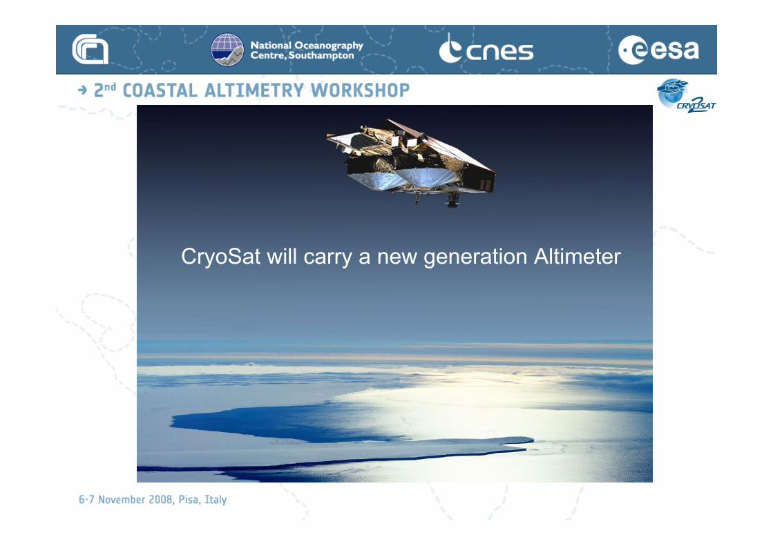
CryoSat will carry a new generation Altimeter
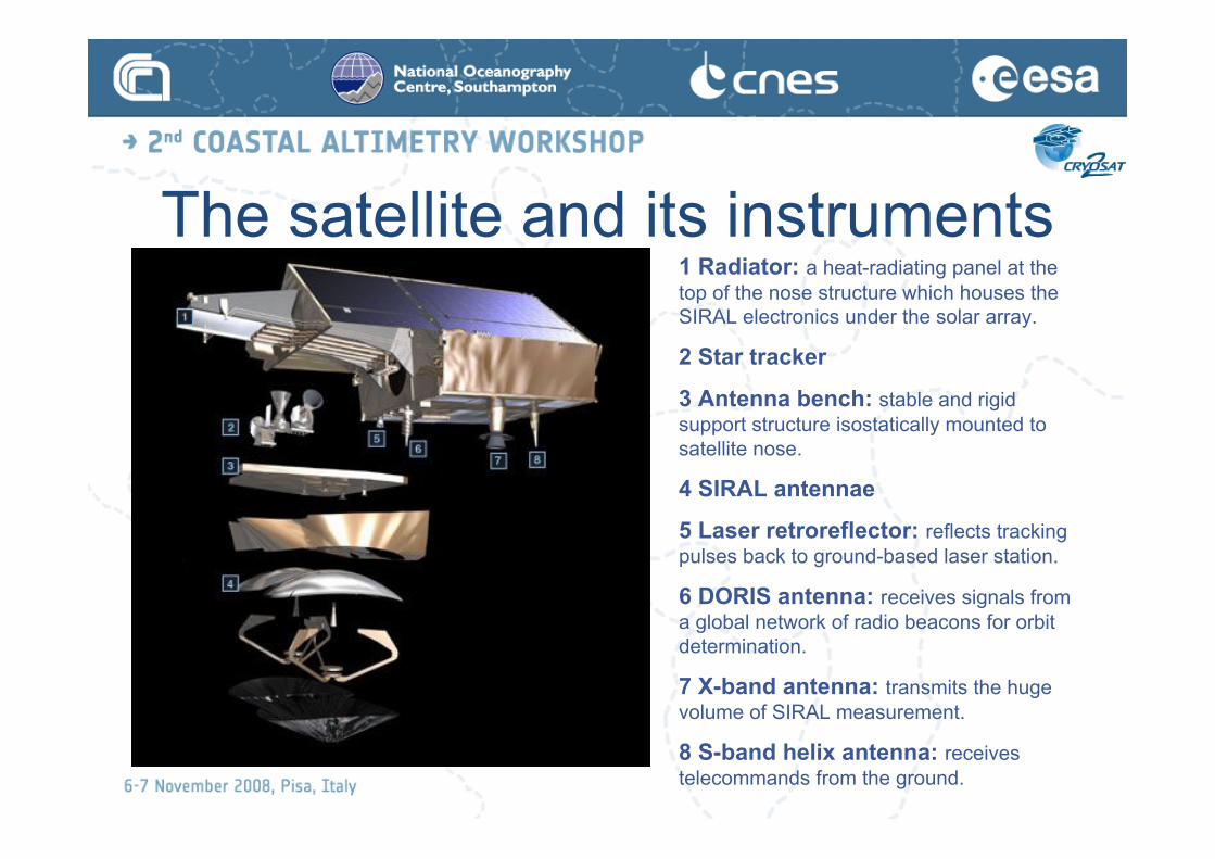
The satellite and its instruments1 Radiator: a heat-radiating panel at the
top of the nose structure which houses the
SIRAL electronics under the solar array.
2 Star tracker
3 Antenna bench: stable and rigid
support structure isostatically mounted to
satellite nose.
4 SIRAL antennae
5 Laser retroreflector: reflects tracking
pulses back to ground-based laser station.
6 DORIS antenna: receives signals from
a global network of radio beacons for orbit
determination.
7 X-band antenna: transmits the huge
volume of SIRAL measurement.
8 S-band helix antenna: receives
telecommands from the ground.

The satellite and its instruments
Thermal
Radiator
Magnetometer
Star Trackers
SIRAL
Antennas
Laser
Retroreflector
DORIS
Antenna
X-Band
Downlink
Antenna
S-Band
Communications
Antenna

CryoSat’s High-Resolution• Transmits bursts of 64 pulses:
sequential echoes are correlated
• Satellite moves 250 m between
bursts
• Aperture Synthesis technique
gives 250 m along-track
resolution, much higher than
conventional altimeters (ERS-2,
Envisat RA-2)
• SAR Mode used over sea-ice to
measure ice-floe freeboards and
retrieve thickness
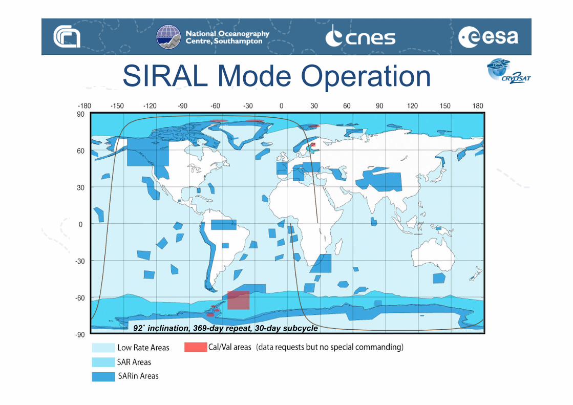
92˚ inclination, 369-day repeat, 30-day subcycle
SIRAL Mode Operation

SIRAL Mode Operation

SIRAL Mode Operation

SIRAL Mode Operation

CryoSat Launch: 8 Oct 2005
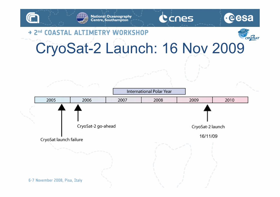
CryoSat-2 Launch: 16 Nov 2009
16/11/09

CryoSat-2 Mission Fact SheetCryoSat Mission
To determine fluctuations in the mass of the Earth’s major land and marineice fields.
Mission Duration
• 6 months commissioning
• 3 year operational mission.
Mission Orbit
• Type: LEO, non sun-synchronous
• Repeat cycle: 369 days (30 d sub-cycle)
• Mean altitude: 717 km
• Inclination: 92!
• Nodal regression: 0.25!/d
Spacecraft and Payload
Recurrent spacecraft and payload from lost CryoSat 1
Instruments
SIRAL (SAR/Interferometric Radar Altimeter):
• Low-Resolution Mode provides conventional pulse-width limited altimetryover central ice caps and oceans;
• SAR Mode improves along-track resolution (~250 m) over sea ice bysignificantly increased pulse repetition frequency and complex groundprocessing;
• -SAR Interferometric Mode adds a second receive chain to measure thecross-track angle of arrival of the echo over topographic surfaces at themargins of ice caps.
Star Trackers (3) measure the interferometric baseline orientation, as wellas driving satellite attitude control.
DORIS enables precise orbit determination, as well as providing on-orbitposition to the satellite attitude control.
Laser Retroreflector enables tracking by ground-based lasers.
Spacecraft
Simplified rigid structure with no moving parts; all electronics mounted on
nadir plate acting as radiator; SIRAL antennas on iso-statically mounted
plate with Star Trackers; dedicated SIRAL radiator. 2x GaAs body-
mounted solar arrays, with 850 W each at normal solar incidence; 78 Ah
Li-ion battery. Attitude: 3-axis stabilised local-normal pointing, with 6!
nose-down attitude, using magneto-torquers and 10 mN cold-gas
thrusters.
- Dimensions 4.60 m x 2.34 m x 2.20 m
- Mass 720 kg (incl. 37 kg fuel)
- Power 850 W
- Datavolume: 320 Gbit/day
- on-board storage by SSR 256 Gbits
Launch Vehicle
DNEPR
Flight Operations
Mission control from ESOC via single ground station at Kiruna. Up to 11
useable downlink passes for science data.
RF Links
- X-band data downlink: 100 Mbps at 8.100 GHz
- S-band TTC link: 2 kbps uplink,16 kbps downlink
Payload Data Processing
Data processing facility at the Kiruna ground station. Local archiving of data
with precision processing after one month following delivery of precision
orbits from DORIS ground segment (under CNES responsibility).
Possibility of quick-look data. Direct dissemination of data from Kiruna.
User Services coordinated via ESRIN.
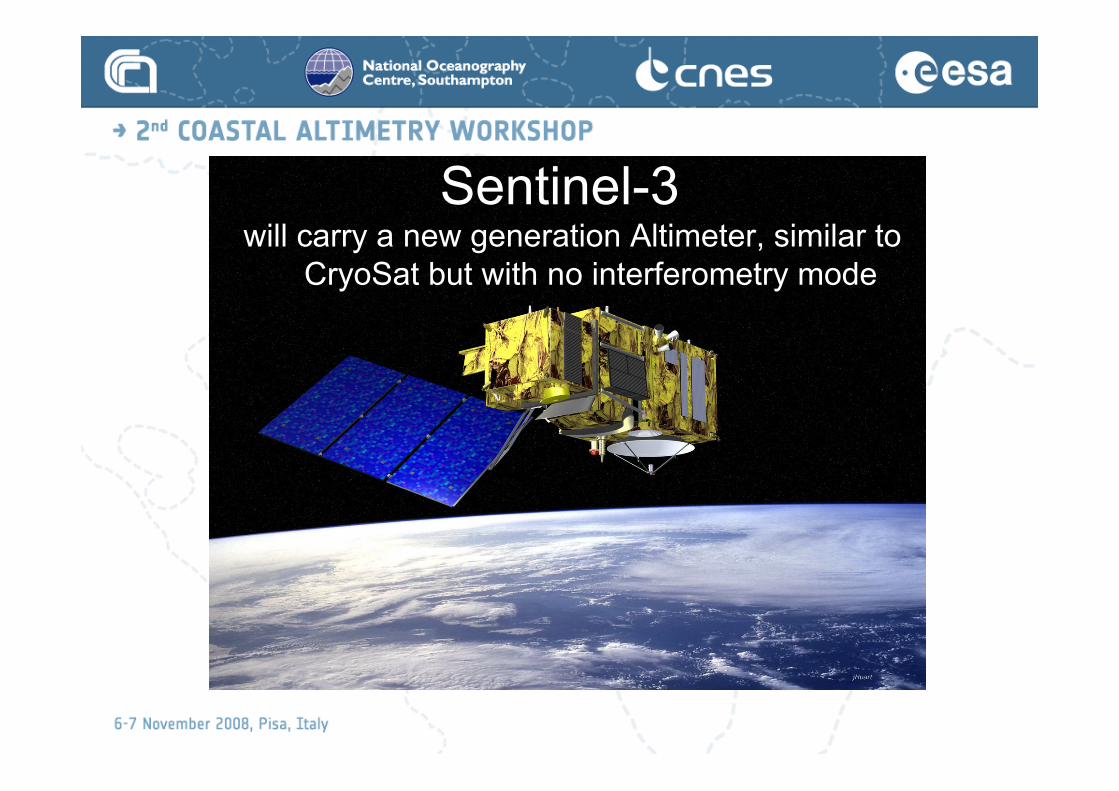
Sentinel-3will carry a new generation Altimeter, similar to
CryoSat but with no interferometry mode

S-3 Observational RequirementsThe objectives for a series of Ocean Observer Missions (GMES Sentinel-3)encompass the commitment to consistent, long-term collection of remotelysensed marine data, of uniform quality, for operational ocean state analysis,forecasting and operational service provision, in the context of GlobalMonitoring for Environment and Security (GMES). A network of global oceanobservations is required to provide input data for advanced numericalforecasting models. For the remote sensing variables the following set ofobservational requirements have been established:
• Sea surface topography (SSH) and, significant wave height (SWH) over the global ocean to anaccuracy and precision equivalent to that of Envisat RA-2.
• Sea surface temperature (SST) determined globally to an equivalent accuracy and precision asthat presently achieved by A/ATSR (i.e. <0.3 K), at a spatial resolution of 1 km. Coastalzone waters require an increased resolution of < 300 m.
• Visible and Thermal Infrared radiances (“Ocean Colour”) for oceanic and coastal waters,determined to an equivalent level of accuracy and precision as MERIS data with completeEarth coverage in 2 to 3 days, and coregistered with SST measurements.

S-3 Observational Requirements
Coastal Zones Monitoring: Demands for informationon the state of coastal waters are growing in response topopulation pressure. Thus, there is a requirement forenvironmental monitoring of phenomena such asharmful algal blooms (HAB) and habitat assessment inaddition to weather and ocean nowcasting andforecasting. The characteristics of the coastalphenomena and the importance of the area foraquaculture, sea-defences, and tourism each justify theobservation of coast related parameters with enhancedaccuracy and resolution.
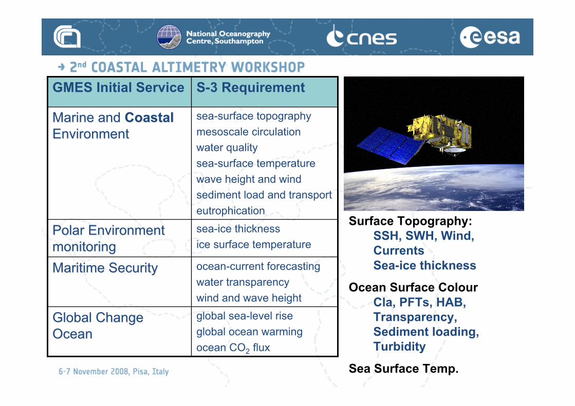
global sea-level rise
global ocean warming
ocean CO2 flux
Global ChangeGlobal Change
OceanOcean
ocean-current forecasting
water transparency
wind and wave height
Maritime SecurityMaritime Security
sea-ice thickness
ice surface temperaturePolar EnvironmentPolar Environment
monitoringmonitoring
sea-surface topography
mesoscale circulation
water quality
sea-surface temperature
wave height and wind
sediment load and transport
eutrophication
Marine and Marine and CoastalCoastal
EnvironmentEnvironment
S-3 RequirementGMES Initial Service
Surface Topography:
SSH, SWH, Wind,
Currents
Sea-ice thickness
Ocean Surface Colour
Cla, PFTs, HAB,
Transparency,
Sediment loading,
Turbidity
Sea Surface Temp.


LAUNCH : Q4-2012

SAMOSA
• Exploiting the SAR mode over Ocean, Coastal
Zone, Inland water:
• Competitive Tender
– “Development of SAR Altimetry Mode Studies and
Applications over Ocean, Coastal Zones and Inland
Water”
• Won by SATOC, NOCS, Starlab,DNSC, DMU
• SAMOSA Start: 31 July 07 for a 15-month duration
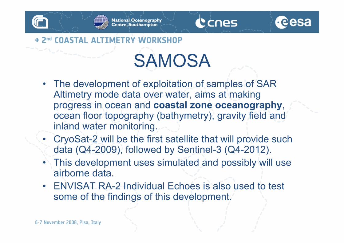
SAMOSA• The development of exploitation of samples of SAR
Altimetry mode data over water, aims at makingprogress in ocean and coastal zone oceanography,ocean floor topography (bathymetry), gravity field andinland water monitoring.
• CryoSat-2 will be the first satellite that will provide suchdata (Q4-2009), followed by Sentinel-3 (Q4-2012).
• This development uses simulated and possibly will useairborne data.
• ENVISAT RA-2 Individual Echoes is also used to testsome of the findings of this development.

SAMOSA Work Packages• WP1a State of the art assessment
• WP1b Ordering, provision and management of simulateddata sets
• WP2 Range error as a function of ocean surface
• WP3 Recovery of short wavelength geophysical signals
• WP4 SAR altimeter echo model over water
• WP5 New re-tracking method over water
• WP6 Improvement of coastal zones, estuaries, riversand lakes
• WP7 Assessment of RA-2 individual echoes over water
• WP8 Validation using ASIRAS data

SAMOSA Deliverables• Deliverable Title Date
• D1.1 State of the art assessment 09/07
• D1.2 Data requirements 09/07
• D2 Range error as a function of ocean surface 11/07
• D3 Recovery of short wavelength signals 12/07
• D4 Theoretical echo model development 02/08
• D5 Specification of new re-tracking method 07/08
• D6 Results over coastal and inland waters 08/08
• D7 Assessment of RA-2 individual echoes 10/08
• D8 Exploitation of ASIRAS data 11/08

SAMOSAKR: A request to each of the three key speakers in our session:
In your 15' brief, please include a concise and candid list of
(1) advantageous features, as well as
(2) disadvantages and limitations of your respective new technical
approach to coastal altimetry.
You may want to be prepared to address how spatial and/or temporal
averaging requirements and benefits play with respect to your
particular technological theme in the coastal environment.

SAMOSA
• High resolution along-track
(250 m) to be averaged, at loss
of resolution, for better
accuracy.
• The expected height precision
(based on simulations) of the
DDA relative to conventional is
approximately 2x better, and
shows less degradation to
increasing SWH.
• Envisat RA-2 performs at
1.8 cm r.m.s. (7 km, 1Hz) over
the global ocean.Jensen & Raney (1998)
(1) advantageous features
SAMOSA(2) disadvantages and limitations of your respective new
technical approach to coastal altimetry.
Along track data only (nadir)
-> Need Sentinel-3B in orbit to guarantee uninterrupted data
supply -- will augment sampling
-> And Jason-3! (Synergy with JA3 is part of the S-3 requirements)

SAMOSA• Presentation in this Workshop
Cristina Martin-Puig et al. (Starlab SL, Spain):
SAMOSA retracker for SAR Altimeter
observations over water
• Spatial and/or temporal averaging
– One data point every 250 m in SAR mode
– May be averaged to reduce noise
– Use simulated data from CRYMPS to quantify by the next
workshop
