flagstaff's route 66
TRANSCRIPT

Flagstaff’s Route 66Flagstaff’s Route 66Flagstaff’s Route 66Flagstaff’s Route 66
1926 — Visitor Center The history of the road that would become
Route 66 through Flagstaff begins in 1857 when Lt. Edward Beal led an expedition through this region to build a wagon road to California. This road was followed by many emigrants, and then by the Atlantic & Pacific Railroad in 1882. Between 1880 and 1916 bicyclists who were not happy with road conditions in the United States began the Good Roads Movement. This led to a Federal Act in 1916, and the creation of a system of U.S. highways. One of these, The National Old Trails Highway, stretched from Maryland to California. Originally the highway was to swerve south into Phoenix, but a delegation from Flagstaff was able to convince the builders to bring the road through Northern Arizona. In 1921 a second Federal Highways Act led to an improved system, and the actual designation of the highway running from Chicago to Santa Monica as Route 66.
Now Route 66 has become firmly established in the annals of Americana. The lore of the road paints romantic pictures of a simpler time. It conjures images of weary travelers in classic cars resting for the night at rustic auto courts in quaint little towns where Mom and Pop still ran the soda fountain and a dime store sold things for a dime. It quietly reveres the sad lot of those people who were displaced from their homes and driven along by the ravages of the Dustbowl and the Great Depression. It beckons to the adventurer with the promise of new experiences and excitement beyond each turn.
Santa Fe PlazaFrom the Visitor Center walk 1 block east on Route 66
to the old steam engine parked at Santa Fe Plaza. As Route 66 comes into downtown Flagstaff, it leaves the route of Beal’s trail and follows the path of the railroad. Behind you is the 1897 depot, which ultimately became the center of growth in Flagstaff. In the early days this stretch of Route 66 was called Front Street. As you look
east you will see the lot for Babbitt Ford. The Babbitt family was very influential in the development of Flagstaff, and in
promoting the automobile in Flagstaff. In 1910 Edwin Babbitt owned one of the only cars in town. Realizing that this was the wave of the future, he and the Babbitt family opened a dealer-ship and garage. In 1958 the dealership moved to this Route 66 location, which prior to that had been the site of a Shell station and garage. Babbitt Ford has been a prominent Route 66 landmark ever since. The Arizona Music Pro building on the next block was the site of the Greyhound bus terminal. Greyhound started as a small business serving miners in Min-nesota, but by 1927 the line ran buses along Route 66 to California on a regular basis. Greyhound became a familiar sight in Flagstaff, bringing tourists to the Southwest. The next blocks looking west comprise the oldest part of Flagstaff. This was our Front Street area. Once filled with saloons and gambling, it became a major spot for Route 66 commerce – boasting hotels, restaurants, and businesses. It still caters to the tourist trade as visitors come to shop and eat along Route 66.
Downtowner MotelReturn to San Francisco St., cross the tracks and go to the
corner of San Francisco St and Phoenix Ave. Here you will leave the actual path of Route 66 for a short distance, but see the effect the route had on Flagstaff. The Downtowner Motel was created by K.J. Nackard in 1919 to provide lodging near the route of the Old Trails Highway through Flagstaff. The first building of what was then called The Nackard Hotel was the Ramey Building, which was built in 1900 and used as a brothel. The second building was called the Dutch Annie Building, and was owned by Annie Marie Sutter until she was murdered in 1916. After Nackard bought and improved the buildings, he built his home on this site. In the 1930’s, once Route 66 had been firmly established as a major route across the nation, Nackard remodeled his home and made it part of his new Auto Inn, which catered to the automobile traffic along the route. Now the property houses the Grand Canyon International Youth Hostel and private apartments.
Turn right and take a stroll down Phoenix Ave. to Beaver St. As you walk along this road you see the results of tourism in the area, both as a result of the railway and along Route 66. All of the buildings on the left were hotels and/or boarding houses catering to itinerant travelers.
5 POINTS
Ori
gina
l
Rou
te 6
6 (Downtowner Motel)
(1897 Depot)
23
1
4
5
6
7
8
Highland Country
Inn
The Furniture
Barn
Canyon Inn
KnightsInn
Lero
ux
San
Fran
cisc
oMIL
TON
Bea
ver
Rodeway Inn
Chamber of Commerce
BabbittFord
Arizona Music Pro
Grand CanyonInternational Youth Hostel
De Beau Motel
Pow Wow Traders
RodewayTownhouse
Motel
FlagstaffCity Hall
Our Lady of Guadalupe Catholic Church
Double Circle Garage
B&M Auto CampGranny’s
Closet
Santa Fe Plaza
Phoenix
Cottage
Benton
Visitors Center(Train Station)
BEGIN HERE
Parking
Buildings
Tour
Street
One-Way
Railroad
Bridge
Compiled and Written by James Hardy
1
2
Start
Check out our Visitor Center G
ift Shop
5M 11/10
Flagstaff’s Route 66Self-Guided Historic Walking Tour
Printed on recycled paper using vegetable-based ink.
FLAGSTAFF viSiTor cenTerOne East Route 66 p Flagstaff, Arizona 86001-5530 USA
800-842-7293 p 928-774-9541flagstaffarizona.org
DuBeau Motel When you reach the corner of Phoenix Ave. and Beaver
St., you have returned to the original alignment of Route 66 through Flagstaff, and the site of the first motel in Flagstaff. Here the route crossed the railroad tracks and began heading south and west out of Flagstaff. This spot was the perfect site for A.E.
DuBeau to build his “Motel Inn” in 1929. DuBeau came to Flagstaff from Los Angeles and chose this spot to create a hotel designed specifically for “the better class of motorist.” The property rented rooms for anywhere from $2.50 to $5.00 per night and boasted such amenities as in-room
baths and toilets, double beds, carpeting, and heated garages for the cold winter nights. The DuBeau continues to serve visitors to Flagstaff as an International Youth Hostel.
Cross Beaver St. and continue down Phoenix Ave. to Mike’s Pike. Take a look at the concrete guard rail on the right. This is one of the spots where Route 66 crossed the Rio de Flag. The guard rail is part of that original bridge. Again along this walk you can see how Route 66 affected the area. The build-ings you will pass were built as retail shops and cafes until you reach the stone building near Mike’s Pike. This building was erected after Route 66 was realigned, and was the Coca Cola bottling plant. Suddenly the focus turned from tourism to more industrial use after Route 66 bypassed Phoenix Ave.
Mike’s Pike & Cottage Ave. Turn left and stroll down Mike’s Pike. Here you can see
how use along this stretch evolved from residential to tourism, then industrial as Route 66 came and went. A great example of this is the B&M Auto Camp on the corner of Mike’s Pike and Cottage Ave. The building (a private residence today) is marked clearly with a 100 address. You can see the obvious original struc-ture was a bungalow house built in 1896 by E.R. McGonigle. In 1926, when Route 66 arrived, Battista Mascherana bought the property, built the boxy front building as a convenience store,
added several small cabins on the property and created the B&M Auto Camp. Some evidences of the Auto Court can be seen in the sheds behind the house. Continue down Mike’s Pike and you will see Our Lady of Guadalupe Church. While not the oldest church in Flagstaff, it is the oldest standing Catholic Church, and was completed in the 1930s. The Double Circle Garage was built
in 1926 to service the motor traffic along the route, and serves as a mechanic’s shop to this day.
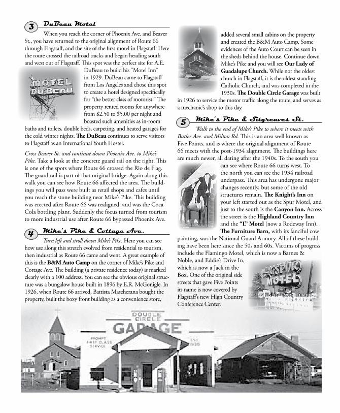
Mike’s Pike & Sitgreaves St.Walk to the end of Mike’s Pike to where it meets with
Butler Ave. and Milton Rd. This is an area well known as Five Points, and is where the original alignment of Route 66 meets with the post-1934 alignment. The buildings here are much newer, all dating after the 1940s. To the south you
can see where Route 66 turns west. To the north you can see the 1934 railroad underpass. This area has undergone major changes recently, but some of the old structures remain. The Knight’s Inn on your left started out as the Spur Motel, and just to the south is the Canyon Inn. Across the street is the Highland Country Inn and the “L” Motel (now a Rodeway Inn). The Furniture Barn, with its fanciful cow
painting, was the National Guard Armory. All of these build-ing have been here since the 50s and 60s. Victims of progress include the Flamingo Motel, which is now a Barnes & Noble, and Eddie’s Drive In, which is now a Jack in the Box. One of the original side streets that gave Five Points its name is now covered by Flagstaff’s new High Country Conference Center.
Granny’s Closet Turn Right and walk up Route 66
toward the underpass. The restaurant on your right is Granny’s Closet. This was built around 1960 as the Paul Bunyan Café, then became the Lumberjack Café. The wooden lumberjack on the south wall is a reminder of those days, and also a memorial to a bit of Route 66 history that no longer stands here. The Lumberjack Café was once guarded by a 40-foot-tall fiberglass lumberjack. This figure and many like it were called “Muffler Men.” Originally created by a muffler chain as an advertising gimmick, the idea caught on, and the giant figures quickly became Route 66 icons. Some were Muffler Men holding mufflers, some were Cowboys holding lariats, some held tires and some even held hot dogs. Our particular Muffler Man was a lumberjack holding an axe. Oddly enough the very first Muffler Man to roll off the assembly line was the lumberjack that stood in front of the Paul Bunyan Café. While the big lumberjack is no longer on Route 66, it still resides in Flagstaff and can be found near the Skydome at Northern Arizona University, where it has become the proud mascot of the NAU Lumberjacks.
UnderpassContinue to the Underpass. In the depression years several
things happened along Route 66. Long lines of emigrants followed the route to California from the drought-stricken Midwest. This mass migration, as well as greater usage of the route in general, caused major traffic problems at the railroad crossing on Beaver St. At this time, Franklin D. Roosevelt’s New Deal projects included provisions to re-align and improve Route 66. Flagstaff applied for and received part of this federal aid, and on Dec 24, 1934, this underpass was completed and Route 66 was re-aligned through Flagstaff. The underpass, like Five Points
to the south, quickly became a Flagstaff landmark, and the re-alignment gave the city the distinctive sharp turn on its main thoroughfare.
Flagstaff Chamber of CommerceContinue up Route 66
along the curve, back to Beaver St. This is an area that under-went a great deal of change in the 1980s. The City Hall complex replaced gas stations, cafes, and a car dealership, but many evidences of the route remain. On your right as you were walking you passed another concrete bridge wall where the route crossed the Rio De Flag. The Pow-Wow Traders building across the street was the depot for both Greyhound and Continental Trailways buses in the 1960s and 70s. The Rodeway Townhouse Motel has undergone a great deal of change over the years. In the 60s this motel was a single story. The concrete drive-port attached to a house-like main building with the row of units behind it. This building, like many, evolved as automobile traffic on Route 66 increased. Ultimately, though, that traffic spelled the end of the route. By 1970 Interstate 40 had bypassed most of the cities along the route in Arizona, and finally Route 66 was decommissioned in 1985. Now the route is a historic byway and a renaissance of interest in the route has reawakened new life to this great American icon.
If you have any questions about our city, please ask our friendly Visitor Center Staff.
PHOTO CREDITS Spur Motel, Double Tree Garage, Lumberjack Cafe, Chamber of Commerce; images courtesy of Cline Library, Northern Arizona University.
3
4
5
6
8
7

DuBeau Motel When you reach the corner of Phoenix Ave. and Beaver
St., you have returned to the original alignment of Route 66 through Flagstaff, and the site of the first motel in Flagstaff. Here the route crossed the railroad tracks and began heading south and west out of Flagstaff. This spot was the perfect site for A.E.
DuBeau to build his “Motel Inn” in 1929. DuBeau came to Flagstaff from Los Angeles and chose this spot to create a hotel designed specifically for “the better class of motorist.” The property rented rooms for anywhere from $2.50 to $5.00 per night and boasted such amenities as in-room
baths and toilets, double beds, carpeting, and heated garages for the cold winter nights. The DuBeau continues to serve visitors to Flagstaff as an International Youth Hostel.
Cross Beaver St. and continue down Phoenix Ave. to Mike’s Pike. Take a look at the concrete guard rail on the right. This is one of the spots where Route 66 crossed the Rio de Flag. The guard rail is part of that original bridge. Again along this walk you can see how Route 66 affected the area. The build-ings you will pass were built as retail shops and cafes until you reach the stone building near Mike’s Pike. This building was erected after Route 66 was realigned, and was the Coca Cola bottling plant. Suddenly the focus turned from tourism to more industrial use after Route 66 bypassed Phoenix Ave.
Mike’s Pike & Cottage Ave. Turn left and stroll down Mike’s Pike. Here you can see
how use along this stretch evolved from residential to tourism, then industrial as Route 66 came and went. A great example of this is the B&M Auto Camp on the corner of Mike’s Pike and Cottage Ave. The building (a private residence today) is marked clearly with a 100 address. You can see the obvious original struc-ture was a bungalow house built in 1896 by E.R. McGonigle. In 1926, when Route 66 arrived, Battista Mascherana bought the property, built the boxy front building as a convenience store,
added several small cabins on the property and created the B&M Auto Camp. Some evidences of the Auto Court can be seen in the sheds behind the house. Continue down Mike’s Pike and you will see Our Lady of Guadalupe Church. While not the oldest church in Flagstaff, it is the oldest standing Catholic Church, and was completed in the 1930s. The Double Circle Garage was built
in 1926 to service the motor traffic along the route, and serves as a mechanic’s shop to this day.
Mike’s Pike & Sitgreaves St.Walk to the end of Mike’s Pike to where it meets with
Butler Ave. and Milton Rd. This is an area well known as Five Points, and is where the original alignment of Route 66 meets with the post-1934 alignment. The buildings here are much newer, all dating after the 1940s. To the south you
can see where Route 66 turns west. To the north you can see the 1934 railroad underpass. This area has undergone major changes recently, but some of the old structures remain. The Knight’s Inn on your left started out as the Spur Motel, and just to the south is the Canyon Inn. Across the street is the Highland Country Inn and the “L” Motel (now a Rodeway Inn). The Furniture Barn, with its fanciful cow
painting, was the National Guard Armory. All of these build-ing have been here since the 50s and 60s. Victims of progress include the Flamingo Motel, which is now a Barnes & Noble, and Eddie’s Drive In, which is now a Jack in the Box. One of the original side streets that gave Five Points its name is now covered by Flagstaff’s new High Country Conference Center.
Granny’s Closet Turn Right and walk up Route 66
toward the underpass. The restaurant on your right is Granny’s Closet. This was built around 1960 as the Paul Bunyan Café, then became the Lumberjack Café. The wooden lumberjack on the south wall is a reminder of those days, and also a memorial to a bit of Route 66 history that no longer stands here. The Lumberjack Café was once guarded by a 40-foot-tall fiberglass lumberjack. This figure and many like it were called “Muffler Men.” Originally created by a muffler chain as an advertising gimmick, the idea caught on, and the giant figures quickly became Route 66 icons. Some were Muffler Men holding mufflers, some were Cowboys holding lariats, some held tires and some even held hot dogs. Our particular Muffler Man was a lumberjack holding an axe. Oddly enough the very first Muffler Man to roll off the assembly line was the lumberjack that stood in front of the Paul Bunyan Café. While the big lumberjack is no longer on Route 66, it still resides in Flagstaff and can be found near the Skydome at Northern Arizona University, where it has become the proud mascot of the NAU Lumberjacks.
UnderpassContinue to the Underpass. In the depression years several
things happened along Route 66. Long lines of emigrants followed the route to California from the drought-stricken Midwest. This mass migration, as well as greater usage of the route in general, caused major traffic problems at the railroad crossing on Beaver St. At this time, Franklin D. Roosevelt’s New Deal projects included provisions to re-align and improve Route 66. Flagstaff applied for and received part of this federal aid, and on Dec 24, 1934, this underpass was completed and Route 66 was re-aligned through Flagstaff. The underpass, like Five Points
to the south, quickly became a Flagstaff landmark, and the re-alignment gave the city the distinctive sharp turn on its main thoroughfare.
Flagstaff Chamber of CommerceContinue up Route 66
along the curve, back to Beaver St. This is an area that under-went a great deal of change in the 1980s. The City Hall complex replaced gas stations, cafes, and a car dealership, but many evidences of the route remain. On your right as you were walking you passed another concrete bridge wall where the route crossed the Rio De Flag. The Pow-Wow Traders building across the street was the depot for both Greyhound and Continental Trailways buses in the 1960s and 70s. The Rodeway Townhouse Motel has undergone a great deal of change over the years. In the 60s this motel was a single story. The concrete drive-port attached to a house-like main building with the row of units behind it. This building, like many, evolved as automobile traffic on Route 66 increased. Ultimately, though, that traffic spelled the end of the route. By 1970 Interstate 40 had bypassed most of the cities along the route in Arizona, and finally Route 66 was decommissioned in 1985. Now the route is a historic byway and a renaissance of interest in the route has reawakened new life to this great American icon.
If you have any questions about our city, please ask our friendly Visitor Center Staff.
PHOTO CREDITS Spur Motel, Double Tree Garage, Lumberjack Cafe, Chamber of Commerce; images courtesy of Cline Library, Northern Arizona University.
3
4
5
6
8
7

5 POINTS
Original Route 66
23
1
4
5
6
7
8
Highland Country
Inn
The Furniture
Barn
Canyon Inn
KnightsInn
Lero
ux
San
Fran
cisc
oMIL
TON
Bea
ver
Rodeway Inn
Chamber of Commerce
BabbittFord
Arizona Music Pro
Grand CanyonInternational Youth Hostel
(Downtowner Motel)
De Beau Motel
Pow Wow Traders
RodewayTownhouse
Motel
FlagstaffCity Hall
Our Lady of Guadalupe Catholic Church
Double Circle Garage
B&M Auto CampGranny’s
Closet
Santa Fe Plaza (1897 Depot)
Phoenix
Cottage
Benton
Visitors Center(Train Station)
BEGIN HERE
Flagstaff’s Route 66Flagstaff’s Route 66Flagstaff’s Route 66Flagstaff’s Route 66
1926 — Visitor Center The history of the road that would become
Route 66 through Flagstaff begins in 1857 when Lt. Edward Beal led an expedition through this region to build a wagon road to California. This road was followed by many emigrants, and then by the Atlantic & Pacific Railroad in 1882. Between 1880 and 1916 bicyclists who were not happy with road conditions in the United States began the Good Roads Movement. This led to a Federal Act in 1916, and the creation of a system of U.S. highways. One of these, The National Old Trails Highway, stretched from Maryland to California. Originally the highway was to swerve south into Phoenix, but a delegation from Flagstaff was able to convince the builders to bring the road through Northern Arizona. In 1921 a second Federal Highways Act led to an improved system, and the actual designation of the highway running from Chicago to Santa Monica as Route 66.
Now Route 66 has become firmly established in the annals of Americana. The lore of the road paints romantic pictures of a simpler time. It conjures images of weary travelers in classic cars resting for the night at rustic auto courts in quaint little towns where Mom and Pop still ran the soda fountain and a dime store sold things for a dime. It quietly reveres the sad lot of those people who were displaced from their homes and driven along by the ravages of the Dustbowl and the Great Depression. It beckons to the adventurer with the promise of new experiences and excitement beyond each turn.
Santa Fe PlazaFrom the Visitor Center walk 1 block east on Route 66
to the old steam engine parked at Santa Fe Plaza. As Route 66 comes into downtown Flagstaff, it leaves the route of Beal’s trail and follows the path of the railroad. Behind you is the 1897 depot, which ultimately became the center of growth in Flagstaff. In the early days this stretch of Route 66 was called Front Street. As you look
east you will see the lot for Babbitt Ford. The Babbitt family was very influential in the development of Flagstaff, and in
promoting the automobile in Flagstaff. In 1910 Edwin Babbitt owned one of the only cars in town. Realizing that this was the wave of the future, he and the Babbitt family opened a dealer-ship and garage. In 1958 the dealership moved to this Route 66 location, which prior to that had been the site of a Shell station and garage. Babbitt Ford has been a prominent Route 66 landmark ever since. The Arizona Music Pro building on the next block was the site of the Greyhound bus terminal. Greyhound started as a small business serving miners in Min-nesota, but by 1927 the line ran buses along Route 66 to California on a regular basis. Greyhound became a familiar sight in Flagstaff, bringing tourists to the Southwest. The next blocks looking west comprise the oldest part of Flagstaff. This was our Front Street area. Once filled with saloons and gambling, it became a major spot for Route 66 commerce – boasting hotels, restaurants, and businesses. It still caters to the tourist trade as visitors come to shop and eat along Route 66.
Downtowner MotelReturn to San Francisco St., cross the tracks and go to the
corner of San Francisco St and Phoenix Ave. Here you will leave the actual path of Route 66 for a short distance, but see the effect the route had on Flagstaff. The Downtowner Motel was created by K.J. Nackard in 1919 to provide lodging near the route of the Old Trails Highway through Flagstaff. The first building of what was then called The Nackard Hotel was the Ramey Building, which was built in 1900 and used as a brothel. The second building was called the Dutch Annie Building, and was owned by Annie Marie Sutter until she was murdered in 1916. After Nackard bought and improved the buildings, he built his home on this site. In the 1930’s, once Route 66 had been firmly established as a major route across the nation, Nackard remodeled his home and made it part of his new Auto Inn, which catered to the automobile traffic along the route. Now the property houses the Grand Canyon International Youth Hostel and private apartments.
Turn right and take a stroll down Phoenix Ave. to Beaver St. As you walk along this road you see the results of tourism in the area, both as a result of the railway and along Route 66. All of the buildings on the left were hotels and/or boarding houses catering to itinerant travelers.
Compiled and Written by James Hardy
1
2
Start
Check out our Visitor Center G
ift Shop
5M 11/10
Flagstaff’s Route 66Self-Guided Historic Walking Tour
Printed on recycled paper using vegetable-based ink.
FLAGSTAFF viSiTor cenTerOne East Route 66 p Flagstaff, Arizona 86001-5530 USA
800-842-7293 p 928-774-9541flagstaffarizona.org