flora and fauna assessment...flora and fauna assessment report lot 1 dp 218016, lot b dp 370979...
TRANSCRIPT

Flora and Fauna Assessment
Report
Lot 1 DP 218016, Lot B DP 370979 & Lot 22 DP 564065
166 - 176 St Andrews Road, Varroville, NSW.
December 2018 (REF: 18NETT02)


Flora & Fauna Assessment
Lot 1 DP 218016, Lot B DP 370979 & Lot 22 DP 564065 166-176 St. Andrews Road
Varroville, NSW
DECEMBER 2018
Report Authors: Michael Sheather-Reid B. Nat. Res. (Hons.) - Senior Ecologist
Lindsay Holmes B. Sc. - Botanist
Robert Sansom B. Sc. (Hons.) - Botanist
Corey Mead B. App. Sc. - Fauna Ecologist
Fauna fieldwork: Tim Buckley B. Sc. – Fauna Field Ecologist
Plans prepared: Sandy Cardow B. Sc. and Alexandra Scott B. Sc. – GIS technicians
Checked by: Michael Sheather-Reid
Date: 12/12/18
File: 18NETT02
This document is copyright © Travers bushfire & ecology 2018
Disclaimer: This report has been prepared to provide advice to the client on matters pertaining to the particular and specific development proposal as advised by the client and / or their authorised representatives. This report can be used by the client only for its intended purpose and for that purpose only. Should any other use of the advice be made by any person including the client then this firm advises that the advice should not be relied upon. The report and its attachments should be read as a whole and no individual part of the report or its attachments should be interpreted without reference to the entire report. The mapping is indicative of available space and location of features which may prove critical in assessing the viability of the proposed works. Mapping has been produced on a map base with an inherent level of inaccuracy, the location of all mapped features are to be confirmed by a registered surveyor.
TBE Environmental Pty Ltd ABN 85 624 419 870 PO Box 7138 Kariong NSW 2250
38A The Avenue Mt Penang Parklands Central Coast Highway Kariong NSW 2250
t: 02 4340 5331
www.traversecology.com.au


i
Executive Summary Travers bushfire & ecology has been engaged by Catholic Metropolitan Cemeteries Trust c/- Urbis to undertake flora and fauna survey and assessment for a development application for proposed memorial park within Lot 1 DP 218016, Lot B DP 370979 & Lot 22 DP 564065, 166-176 St. Andrews Road, Varroville. These combined lots will be referred to as the study area. The ‘subject site’ alternatively refers to all proposed development inclusive of APZ’s. Initial flora and fauna surveys for a due diligence assessment were undertaken in 2013 & updated in September 2015 and April 2017 for selective fauna groupings and hollow inspections. The recording of threatened ecological communities (TEC’s) and threatened fauna species habitat at this time directed the location of works for the proposed memorial park. Consequently the impacts on TEC’s, threatened species and or their habitat has been avoided and minimised through the design process. Proposed buildings, asset protection zones, infrastructure, memorials/plaques and roads are dominantly located in existing clearings however vegetation will be required to be removed for roads and dam safety works and pathways. Any areas of native vegetation directly affected by proposed memorials has been accounted for in the expected impacts but has generally been avoided by conserving existing native vegetation and restoring riparian corridors and areas of significant vegetation. Riparian buffers have been provided to existing watercourses which will provide opportunity for Cumberland Plain Woodland restoration and enhancement of habitat connectively in accordance with the prepared vegetation management plan (Travers bushfire & ecology, updated in July 2018).
Biodiversity Conservation (Savings and Transitional) Regulation 2017 The proposal was lodged during the savings and transitional provisions period. This report serves as an update to address Council’s queries. The NSW Government has established transitional arrangements related to biodiversity assessment for the various categories of development consent or approval that are underway or have been made already. These are set out in the Biodiversity Conservation (Savings and Transitional) Regulation 2017, and are summarised below:
All development applications which were submitted before commencement (25th of August 2017) will be considered under previous legislation.
Local developments Local developments in the City of will have 15 months from 25 August 2017 to submit an application under the previous legislation.
Major Projects (state significant development/state significant infrastructure) Major resources projects that have submitted a conceptual project development plan to the Division of Resources & Geoscience by 25 August 2017 will have 24 months to submit a development application under the previous legislation.

ii
For other major projects, development applications can be considered under the previous legislation if assessment requirements have been issued or substantial environmental assessment was undertaken before 25 August 2017 (as determined by the Secretary of the Department of Planning and Environment). These development applications must be submitted within 18 months of 25 August 2017.
These deadlines can be extended by the Department of Planning and Environment up to 3 years from 25 August 2017 by reissuing the assessment requirements.
This project is within the Campbelltown LGA and the proponent has opted to submit the project in accordance with the savings and transition provisions. Consequently this Flora and Fauna Assessment has been prepared in accordance with the requirements of the TSC Act.
Recorded threatened flora, fauna and endangered ecological communities (EECs) Ecological survey and assessment has been undertaken in accordance with relevant legislation including the Environmental Planning and Assessment Act (EP&A Act), the Threatened Species Conservation Act (TSC Act), the Environment Protection and Biodiversity Conservation Act (EPBC Act) and the Fisheries Management Act (FM Act). In respect of matters required to be considered under the EP&A Act and relating to the species / provisions of the TSC Act, five (5) threatened fauna species including:
Cumberland Plain Land Snail (Meridolum corneovirens),
Grey-headed Flying-fox (Pteropus poliocephalus),
Eastern Bentwing-bat (Miniopterus orianae oceansis),
East-coast Freetail Bat (Micronomus norfolkensis) and
Large-footed Myotis (Myotis macropus). No threatened flora species have been recorded however one (1) critically endangered ecological community, Cumberland Plain Woodland was recorded within the study area. In accordance with Section 5A of the Environmental Planning and Assessment Act 1979, the 7 part test of significance concluded that the proposed memorial park will not have a likely significant impact on any threatened species, populations or EECs. Therefore, a Species Impact Statement should not be required for the proposal. In respect of matters required to be considered under the EPBC Act one (1) threatened fauna species Grey-headed Flying-fox (Pteropus poliocephalus), one (1) protected migratory bird species, Cattle Egret (Ardea ibis), no threatened flora species, and one (1) critically endangered ecological community, Cumberland Plain Shale Woodlands and Shale-Gravel Transition Forest listed under this Act were recorded within the study area. With respect to EPBC Act legislation, the removal of Cumberland Plain Shale Woodlands and Shale-Gravel Transition Forest that is part of a patch larger than 0.5 ha requires a significance assessment and potential referral to DOEE. However, the impacts including 1.73 ha of Cumberland Plain Woodland (7.35%) can be compensated by a combination of revegetation works and/or biodiversity offsets and are not considered to be significant. Proposed buildings and constructed roads and pathways inclusive of APZ management amount to an impact of 1.73 ha upon Cumberland Plain Woodland. As shown on Table 4.2, the moderate or better quality areas of vegetation have been avoided as much as possible and selectively directing works into areas of low condition vegetation. Therefore whilst a total of 1.73 ha of native vegetation will be impacted, 0.5 ha of moderate or better quality

iii
vegetation and 1.23 ha is of low condition vegetation will be impacted. This demonstrates the avoidance and minimisation of impact strategy used in the design of the facility. In respect of matters relative to the FM Act, no suitable habitat for threatened marine or aquatic species was observed within the study area. The proposal is also unlikely to cause any significant impact on threatened marine or aquatic species habitat therefore there are no matters requiring further consideration under this Act. Mitigation measures have been recommended to reduce the identified potential impacts of the proposal on threatened biodiversity.
Ecological constraints It should be noted that the vegetation communities on the escarpment area have changed due to correspondence with Council who inferred that Moist Shale Woodland does not occur in the local government area (LGA). At the time of flora survey in or before 2013, the main resource available for referring vegetation types in the locality was that undertaken by NSPW in 2002 who marked the local escarpment as containing Moist Shale Woodland. As the escarpment is heavily infested with African Olive, the number of native species is very low. Many of the species observed are listed in the final determination of Moist Shale Woodland, however they also occur in Cumberland Plain Woodland. In June 2018, Travers bushfire & ecology revisited the escarpment area and undertook a series of 20x20m plots and a meander to see if some of the more mesic species were present that would indicate Moist Shale Woodland. The results showed these mesic species are absent, even though the soil types, topography and south facing slopes were present. Tozer (2003) and OEH (2013) describe a variation of Cumberland Plain Woodland which occurs in the southern part of the Cumberland Plain Woodland on the hills. One (1) of the dominant sub-canopy species present is Acacia implexa which helps to distinguish this variation, and it was present on the escarpment. Therefore, Moist Shale Woodland has been removed from the figures and redescribed as part of the Cumberland Plain Woodland community. The key ecological constraints (shown on Figures 3 & 4) are as follows:
Threatened Ecological Communities (TECs) – Cumberland Plain Woodland occurs throughout the site in variable condition and River-flat Eucalypt Forest on Coastal Floodplains occurs on the adjoining crown lands, but no high quality remnants were observed because of grazing, clearing and dense infestations of African Olive. There is approximately 23.52 ha of Cumberland Plain Woodland of which 7.02 ha is of low condition. Cumberland Plain Woodland occurs on the gentle topography in the mid and lower slopes of the study area. A variation of Cumberland Plain Woodland occurs on the steeper south-facing slopes in the northern most part of the study area. River-flat Eucalypt Forest on Coastal Floodplains occurs in very small fragmented patches on the lower floodplains within the adjoining crown land.
Hollow dependent threatened fauna species habitat - Two (2) of the three (3) recorded threatened microbat species East-coast Freetail Bat (Micronomus norfolkensis) and Large-footed Myotis (Myotis macropus) utilise hollows for roosting and breeding. The Large-footed Myotis is also known to utilise subterranean habitats

iv
and artificial structures for roosting. Given the recorded level of presence by these species there is real potential that valuable roosting and/or breeding habitat is present within the site or the nearby locality. Exact locations of such trees are difficult to determine without extensive targeted surveys. The assessment of these species is therefore often dependent on the estimated loss of hollow bearing trees, the availability of other hollow resources in the locality and the creation of supplementary habitat (such as nest boxes) on site. Hollow-bearing tree surveys were initially undertaken in woodland patches in close proximity to proposed buildings as well as isolated dead trees across the landscape that may be removed by the proposal. Detailed habitat tree surveys were then applied across the entire site during 2017 tree health assessments (refer to Figure 3). The concentrated areas of foraging by these bat species were across the riparian channels and dams which will be retained by the proposal. Therefore the proposal has given due consideration to the retention of threatened bat species habitat and further habitat improvement works under a VMP will also improve such habitat.
Cumberland Plain Land Snail - This endangered snail was recorded below one log within the study area following detailed searches within quality woodland portions throughout the study area both during 2013 and 2015 surveys. This log contained two dead shells and one (1) living specimen (see Figure 4). Cumberland Plain Woodland (CPW) is the host community for this snail species. The recorded CPW location is considered as limited habitat due to its narrow size and the low availability of shelter habitat. This patch is recommended to be retained and improved under a VMP to ensure the longevity of Cumberland Plain Land Snail at this location. The other most suitable patch of CPW was found to be dominated by an exotic snail species. All other patches of CPW are considered poor quality habitat for the Cumberland Plain Land Snail due to their small size, understorey disturbance by cattle, absence of shelter opportunity or dominance by African Olive. Therefore it is anticipated that the recorded location is the only likely area supporting Cumberland Plain Land Snail activity.
Potential ecological impacts Due to the rural nature of the landscape, the highly fragmented remaining vegetation patches surrounding the proposed development areas and the extensive grazing practices over many years, the ecological impacts of the proposal on these remaining portions is regarded as low level linear impacts which are not likely to be significant. The proposed memorial park landscape proposes to retain the majority of on-site vegetation remnants and has clearly demonstrated an approach that avoids causing direct impacts on threatened species habitat. Hollow-bearing trees, open water foraging opportunities and quality Cumberland Plain Land Snail habitat areas will be retained and enhanced or relocated. Over the life of the memorial park, approximately 150 years, the proposed memorial park concept is expected to result in:
Loss or modification of 1.73 ha of Cumberland Plain Woodland for APZs for the proposed buildings and pathways;
Removal of approximately thirty-five (35) hollow-bearing trees containing up to 113 small hollows (0-10cm), 21 medium hollows (10-30cm) and 1 large (30+) hollow;
One hundred and nineteen (117) assessed trees in total are expected to be removed;

v
Potential loss of trees suitable for nesting and perching by birds of prey, particularly the threatened Little Eagle which is known in the locality. Dead trees in-particular are used as perches for raptors and such trees will be likely targeted for removal for safety or visual reasons;
Increased human presence affecting the condition or trampling of vegetation or habitat;
Impacts upon Cumberland Plain Land Snail and its habitat through proposed pathways; and
Increased lighting and potential foraging behavioural changes for microbats. The increased human presence on site is not considered to be a noteworthy impact in respect to fauna behaviour by comparison the current effect of cattle grazing and their trampling on the understorey. The presence of rabbits and foxes may be more effectively managed as part of the memorial park management however the reduced presence of rabbits may reduce the site foraging capacity for the Little Eagle which was not recorded during surveys but has been recorded in the locality. As the memorial park will be staged it is not expected to cause mass habitat loss at any point in time that cannot be compensated by revegetation works. Riparian lands are available to be used for restoration of Cumberland Plain Woodland, which would result in more than a 10:1 ratio for vegetation restored versus vegetation lost or modified. Travers bushfire & ecology recommends that a site wide integrated vegetation management plan be prepared as part of any development applications that stages the restoration works and outlines the vegetation and fauna habitat enrichment works that can be undertaken to achieve an overall positive biodiversity conservation outcome onsite, especially to control African Olive on the steep northern slopes.
Conclusion It is concluded that the proposed Macarthur Memorial Park within Lot 1 DP 218016, Lot B DP 370979 & Lot 22 DP 564065, 166-176 St. Andrews Road, Varroville, is unlikely to result in a significant impact on any threatened species, populations or EECs or their habitats. The proposal is also considered unlikely to cause a significant impact on EPBC Act Matters of National Environmental Significance Cumberland Plain Shale Woodlands and Shale-Gravel Transition Forest. Recommendations have been outlined within Section 5.2 to minimise the identified potential ecological impacts, address threatening processes and to create a positive ecological outcome for threatened species and their associated habitats. Based on the concept plan and given that the types of burials can be located to minimise impacts on ecology, the land is considered to be capable and suitable for the proposed memorial park based on the ecological constraints of the site. The land is also capable of supporting any offsets for loss of vegetation within the site using revegetation at greater than a 10:1 offset ratio. Over the long term a Vegetation Management Plan can be used to guide the ongoing restoration on the existing native vegetation areas, and to protect and restore native landscape.

vi
List of abbreviations
APZ asset protection zone
BPA bushfire protection assessment
CLUMP conservation land use management plan
DCP Development Control Plan
DEC NSW Department of Environment and Conservation (superseded by DECC from April 2007)
DECC NSW Department of Environment and Climate Change (superseded by DECCW from October 2009)
DECCW NSW Department of Environment, Climate Change and Water (superseded by OEH from April 2011)
DEWHA Commonwealth Department of Environment, Water, Heritage & the Arts (superseded by SEWPAC)
DOEE Commonwealth Department of Environment & Energy
EEC endangered ecological community
EPA Environmental Protection Agency
EP&A Act Environmental Planning and Assessment Act
EPBC Act Environment Protection and Biodiversity Conservation Act
ESMP ecological site management plan
FF flora and fauna assessment
FM Act Fisheries Management Act
FMP fuel management plan
HTA habitat tree assessment
IPA inner protection area
LEP Local Environment Plan
LGA local government area
NES national environmental significance
NPWS NSW National Parks and Wildlife Service
NSW DPI NSW Department of Primary Industries
OEH Office of Environment and Heritage (Part of the NSW Department of Premier and Cabinet)
OPA outer protection area
PBP Planning for bushfire protection 2006
POM plan of management
RF Act Rural Fires Act
RFS NSW Rural Fire Service
ROTAP rare or threatened Australian plants
SEPP 44 State Environmental Protection Policy No 44 – Koala Habitat Protection
SEWPAC Commonwealth Dept. of Sustainability, Environment, Water, Population & Communities (superseded by DOEE)
SIS species impact statement
SULE safe useful life expectancy
TEC threatened ecological community
TPO tree preservation order
TPZ tree preservation zone
TRRP tree retention and removal plan
TSC Act Threatened Species Conservation Act
VMP vegetation management plan

vii
Table of Contents
SECTION 1.0 – INTRODUCTION ............................................. 1
1.1 Aims of the assessment ...................................................................................... 1 1.2 Statutory requirements ........................................................................................ 1
1.2.1 Threatened Species Conservation Act 1995 (TSC Act) ........................................ 1 1.2.2 Fisheries Management Act 1994 (FM Act) ............................................................ 1 1.2.3 Environment Protection and Biodiversity Conservation Act 1999 (EPBC Act) ...... 2
1.3 Proposed works .................................................................................................. 3 1.4 Site description ................................................................................................... 6
SECTION 2.0 – SURVEY METHODOLOGY ............................ 7
2.1 Information collation, technical resources, desktop assessments, specialist identification and licences ................................................................................... 7
2.2 Flora survey methodology ................................................................................... 8 2.3 Fauna survey methodology ................................................................................. 8 2.4 Field survey effort ............................................................................................... 9 2.5 Site specific survey techniques ......................................................................... 12 2.6 Survey limitations .............................................................................................. 13
SECTION 3.0 – SURVEY RESULTS ...................................... 15
3.1 Flora results ...................................................................................................... 15 3.1.1 Flora species ....................................................................................................... 15 3.1.2 Vegetation communities ...................................................................................... 17
3.2 Fauna results .................................................................................................... 19
SECTION 4.0 – ECOLOGICAL ASSESSMENT .................... 24
4.1 Previous surveys reviewed ............................................................................... 24 4.2 Flora ................................................................................................................. 24
4.2.1 Local / Regional flora matters .............................................................................. 25 4.2.2 State legislative flora matters............................................................................... 25 4.2.3 Matters of national environmental significance - flora ......................................... 28 4.2.4 Flora and EEC conclusions ................................................................................. 29
4.3 Fauna ............................................................................................................... 30 4.3.1 Fauna habitat ....................................................................................................... 30 4.3.2 Habitat trees......................................................................................................... 31 4.3.3 Local fauna matters ............................................................................................. 37 4.3.4 State legislative fauna matters ............................................................................ 38 4.3.5 National environmental significance - fauna ........................................................ 42
4.4 Vegetation connectivity ..................................................................................... 43 4.5 Key ecological observations .............................................................................. 45 4.6 Potential ecological impact ................................................................................ 46
SECTION 5.0 – CONCLUSION .............................................. 47
5.1 Conclusions ...................................................................................................... 47 5.2 Recommendations ............................................................................................ 48
BIBLIOGRAPHY .......................................................................... 51

viii
Figures Figure 1 – Master plan ......................................................................................................... 4 Figure 2 – Concept staging plan .......................................................................................... 5 Figure 3 – Flora survey effort and results ........................................................................... 22 Figure 4 – Fauna survey effort and results ......................................................................... 23 Figure 5 – Local connectivity .............................................................................................. 44
Tables Table 1.1 – Site features ....................................................................................................... 6 Table 2.1 – Fauna survey effort ............................................................................................ 9 Table 2.2 – Flora survey effort ............................................................................................ 11 Table 3.1 – Flora observations for the subject site .............................................................. 15 Table 3.2 – Fauna observations for the study area ............................................................. 19 Table 4.1 – State listed threatened flora species with suitable habitat present .................... 25 Table 4.2 – Vegetation impact and restoration calculations ................................................. 26 Table 4.3 – Nationally listed threatened flora species with suitable habitat present ............. 28 Table 4.4 – Observed fauna habitat .................................................................................... 30 Table 4.5 – Significant habitat tree data .............................................................................. 33 Table 4.6 – State listed threatened fauna species with suitable habitat present .................. 38 Table 4.7 – Nationally listed threatened fauna species with suitable habitat present ........... 42 Table A2.1 – Threatened flora habitat assessment ............................................................. 62 Table A2.2 – Threatened fauna habitat assessment ........................................................... 69 Table A2.3 – Migratory fauna habitat assessment ............................................................... 87
Appendices Appendix 1 – TBE fauna survey methodologies Appendix 2 – Threatened & migratory species habitat assessment Appendix 3 – 7 part test of significance Appendix 4 – Matters of National Environmental Significance - Significant Impact Criteria

Travers bushfire & ecology - Flora & Fauna Assessment 1
SECTION 1.0 – INTRODUCTION
Travers bushfire & ecology has been engaged by Catholic Metropolitan Cemeteries Trust c/- Urbis to undertake a flora and fauna assessment within Lot 1 DP 218016, Lot B DP 370979 & Lot 22 DP 564065, 166-176 St. Andrews Road, Varroville. These combined lots will be referred to as the ‘study area’. The ‘subject site’ refers to all proposed development works inclusive of but not limited to landscaping, buildings roads, APZ’s and proposed burial and memorial areas.
1.1 Aims of the assessment The aims of the flora and fauna assessment are to:
Carry out a botanical survey to describe the vegetation communities and their conditions
Carry out a fauna survey for the detection and assessment of fauna and their habitats
Complete target surveys for threatened species, populations and ecological communities
Prepare a flora and fauna impact assessment in accordance with the requirements of the Environment Protection and Biodiversity Conservation Act 1999 (EPBC Act), the Threatened Species Conservation Act 1995 (TSC Act), the Fisheries Management Act 1994 (FM Act) and Threatened species assessment guidelines, the assessment of significance (DECC 2007)
1.2 Statutory requirements
1.2.1 Threatened Species Conservation Act 1995 (TSC Act) The specific requirements of the TSC Act must be addressed in the assessment of impacts on threatened flora and fauna, populations and ecological communities. The factors to be taken into account in deciding whether there is a significant effect are set out in Section 5A of the Environmental Planning and Assessment Act 1979 (EP&A Act) and are based on a 7 part test of significance. Where a proposed activity is located in an area identified as critical habitat, or such that it is likely to significantly affect threatened species, populations, ecological communities, or their habitats, a Species Impact Statement (SIS) is required to be prepared.
1.2.2 Fisheries Management Act 1994 (FM Act) The FM Act provides a list of threatened aquatic species that require consideration when addressing the potential impacts of a proposed development. Where a proposed activity is located in an area identified as critical habitat, or such that it is likely to significantly affect threatened species, populations, ecological communities, or their habitats, an SIS is required to be prepared.
Introduction
1

Travers bushfire & ecology - Flora & Fauna Assessment 2
1.2.3 Environment Protection and Biodiversity Conservation Act 1999 (EPBC Act) The EPBC Act requires that Commonwealth approval be obtained for certain actions. It provides an assessment and approvals system for actions that have a significant impact on matters of national environmental significance (NES). These may include:
World Heritage Properties and National Heritage Places
Wetlands of International Importance protected by international treaty
Nationally listed threatened species and ecological communities
Nationally listed migratory species
Commonwealth marine environment Actions are projects, developments, undertakings, activities, and series of activities or alteration of any of these. An action that needs Commonwealth approval is known as a controlled action. A controlled action needs approval where the Commonwealth decides the action would have a significant effect on an NES matter. Where a proposed activity is located in an area identified to be of NES, or such that it is likely to significantly affect threatened species, ecological communities, migratory species or their habitats, then the matter needs to be referred to the Commonwealth Department of Environment (DOEE) for assessment. In the case where no listed federal species are located on site then no referral is required. The onus is on the proponent to make the application and not the Council to make any referral. A threshold criterion apply to specific NES matters which may determine whether a referral is or is not required, such as for the EPBC listed ecological communities Cumberland Plain Woodland and Shale-Gravel transition Forest. Consultation with DOEE may be required to determine whether a referral is or is not required. If there is any doubt as to the significance of impact or whether a referral is required, a referral is generally recommended to provide a definite decision under the EPBC Act 1999 thereby removing any further obligations in the case of ‘not controlled’ actions. A significant impact is regarded as being:
important, notable, or of consequence, having regard to its context or intensity and depends upon the sensitivity, value, and quality of the environment which is impacted and upon the duration, magnitude, and geographical extent of the impacts. A significant impact is likely when it is a real or not a remote chance or possibility.
Source: EPBC Policy Statement
Guidelines on the correct interpretation of the actions and assessment of significance are located on the department’s web site http://www.environment.gov.au/epbc/publications.

Travers bushfire & ecology - Flora & Fauna Assessment 3
1.3 Proposed works A master plan has been developed (Figure 1) which has been designed based on ecological, riparian and bushfire constraints. The project is intended to be staged over 150 plus years as shown on Figure 2. The master plan provides for the following built facilities:
one chapel with the capability to be divided into three separate chapels seating 150 in each
one condolence room
one café In addition to these built assets, the vision for the memorial park is to provide for the following:
a distinctive landscaped memorial park providing concealed, private and low lying burial spaces to minimise visual impact;
a sculpture park, offering opportunities for local and Australian artists; and
an arboretum for future preservation and education of generations to come. The design of the proposed memorial park has avoided impacting on significant ecological constraints of the site. Minor impacts on existing vegetation areas are identified by a purple line representing the proposed pathways on Figure 3. One (1) small dam in the upper slopes will be removed. All other dams will be retained for habitat and restored as vegetated wetlands. The existing dam walls have however been deemed unsafe, therefore these larger dams will be reconstructed. This will happen in succession with the upper dams repaired first so open water habitat will be present throughout this process. The result will attempt to achieve a similar extent of open water surface however the wetland may be shallower. This will also increase potential for fringing macrophytes and other aquatic surface vegetation. This process will eventually enhance long term-habitat potential for waterfowl and wading birds as well as frog breeding and small reptiles. The master plan has been assessed to identify the bushfire constraints and minimum APZs required for the proposed future built assets on site (refer Bushfire Protection Assessment, Travers bushfire & ecology, 2015). The site is currently zoned under the Campbelltown Local Environmental Plan (LEP) – District 8 (Central Hills Lands) 2008 as 7(d1) Environmental Protection (Scenic) and part 6(c) Open Space (regional). Figure 1 shows the master plan and Figure 2 shows the concept staging plan.

Travers bushfire & ecology - Flora & Fauna Assessment 4
Figure 1 – Master plan

Travers bushfire & ecology - Flora & Fauna Assessment 5
Figure 2 – Staging plan

Travers bushfire & ecology - Flora & Fauna Assessment 6
1.4 Site description Table 1.1 provides a summary of the planning, cadastral, topographical, and disturbance details of the subject site.
Table 1.1 – Site features
Location St. Andrews Road, Varroville
Local government area City of Campbelltown
Grid reference 299000E 6235700N
Elevation 40-140m AMSL
Topography Situated on a steady SE sloping landscape parallel to St Andrews Road with a steeper incline towards the vegetated northern boundary.
Geology and soils Geology; Shale carbonaceous claystone, laminate, coal in parts. Unnamed sandstone member – fine to medium grained quartz-lithic sandstone.
Catchment and drainage
Catchment – Bunbury Curran Creek Small creeks and tributaries across the site drain SE joining until they reach Bunbury Curran Creek.
Vegetation
Where present, native vegetation has a riparian structure due to small creeks and tributaries running through the site. In most areas, trees are around 15-25m tall, there is a limited mid-storey which is mostly made up of weeds such as African Olive, and a ground layer of grasses and herbs. The vegetation is highly modified throughout the study area due to previous clearing.
Existing land use Rural, grazing and unmanaged
Clearing The majority of the study area has been previously cleared for indicated land uses.

Travers bushfire & ecology - Flora & Fauna Assessment 7
SECTION 2.0 – SURVEY METHODOLOGY
2.1 Information collation, technical resources, desktop assessments, specialist identification and licences
A review of the relevant information pertinent to the subject site was undertaken. Client documents reviewed include:
Masterplan prepared by Florence Jaquet Landscape Architects Standard Technical Resources utilised:
Threatened Biodiversity Survey and Assessment: Guidelines for Developments and Activities 2004 (working draft), Department of Environment and Conservation (DEC)
Aerial photographs (Google Earth Pro / Spatial Information Exchange)
Topographical maps (scale 1:25,000)
Threatened Species Conservation Act 1995 (TSC Act)
Fisheries Management Act 1994 (FM Act)
Environment Protection and Biodiversity Conservation Act 1999 (EPBC Act)
Rare or Threatened Australian Plants (ROTAP)
Vegetation mapping of the Cumberland Plain (NPWS 2002)
Campbelltown Local Environmental Plan – District 8 (Central Hills Lands)
Draft Campbelltown Local Environmental Plan 2014 Desktop Assessment: To determine the likely and actual occurrence of flora species, fauna species and plant communities on the subject site, desktop assessments were undertaken including:
A literature review – A review of readily available literature for the area was undertaken to obtain reference material and background information for this survey.
A data search – A search of the Atlas of NSW Wildlife (OEH 2017) was undertaken to identify records of threatened flora and fauna species located within a 10km radius of the site. Searches were also undertaken on the DOEE – ‘protected matters search tool’ website to generate a report that will help determine whether matters of national environmental significance or other matters protected by the EPBC Act are likely to occur in the area of interest. The search was broadened to a 10km radius like the Atlas search. These two searches combined, enabled the preparation of a list of threatened flora and fauna species that could potentially occur within the habitats found on the site (Tables A2.1, A2.2 and A2.3).
Accuracy of identification: Specimens of plants not readily discernible in the field were collected for identification. Structural descriptions of the vegetation were made according to Specht et al (1995).
2 Survey
Methodology

Travers bushfire & ecology - Flora & Fauna Assessment 8
Photographic representations of snails recorded were sent to Michael Shea, Malacology Section, Australian Museum. Licences: Individual staff members of Travers bushfire & ecology are licensed under Clause 20 of the National Parks and Wildlife (Land Management) Regulation 1995 and Sections 120 & 131 of the National Parks and Wildlife Act 1974 to conduct flora and fauna surveys within service and non-service areas. NPWS Scientific Licence Numbers: SL100848. Travers bushfire & ecology staff are licensed under an Animal Research Authority issued by the Department of Agriculture. This authority allows Travers bushfire & ecology staff to conduct various fauna surveys of native and introduced fauna for the purposes of environmental consulting throughout New South Wales.
2.2 Flora survey methodology An initial inspection was undertaken on the 26th of April 2007. No specific survey was undertaken at that time but a reconnaissance of the vegetation types against NPWS mapping, and extent of African Olives (weed species) within remnant vegetation. Flora survey was undertaken on 1 July, 2013. A random meander search was undertaken in accordance with Cropper (1993) to create a broad species list. Thirteen (13) 20x20m floristic biometric style quadrats were assessed within vegetation portions of the study area. Target searches for threatened species were undertaken for those considered to have potential habitat during the random meander and stratified surveys. A review of the Atlas of NSW Wildlife (OEH 2013) was undertaken prior to the botanical survey to identify threatened species previously recorded within 10km of the study area and determine whether target searches were needed to be undertaken. In August 2017, database searches were undertaken to see if any new records or species needed further consideration. Regarding the additional species, their habitats and likelihood of occurrence it was considered that further survey was unnecessary. In June 2018, additional plots and a meander were undertaken within the escarpment area to check whether it was Moist Shale Woodland or a variation of Cumberland Plain Woodland.
2.3 Fauna survey methodology Site survey effort accounting for techniques deployed, duration, and weather conditions are outlined in Table 2.1 and are depicted on Figure 4. Current standard fauna survey techniques employed by Travers bushfire & ecology in line with relevant survey guidelines as well as current survey knowledge are provided in Appendix 1. Fauna survey techniques that have been tailored to the site are provided in Section 2.6.

Travers bushfire & ecology - Flora & Fauna Assessment 9
2.4 Field survey effort Tables 2.1 and 2.2 below detail the flora and fauna survey effort undertaken for the subject site.
Table 2.1 – Fauna survey effort
Fauna group
Date Weather conditions Survey technique(s) Time effort (24hr)
Diurnal birds
10/7/13 7-2/8 cloud, no wind, no rain, temp 18oC Diurnal opportunistic 3hrs 55min 1320 - 1715
Diurnal bird census points x 3 > 60min
11/7/13 0/8 cloud, light W wind, no rain, temp 20-10oC Diurnal opportunistic 7hrs 15min 1000 - 1715
Diurnal bird census points x 7 >1400min
8/9/15 3/8 cloud, no wind, no rain, temp 20-17oC Diurnal opportunistic 3hrs 1500 - 1800
9/9/15 0/8 cloud, no wind, no rain, temp 22oC Diurnal opportunistic 3hrs 15min 1245 - 1600
26/4/17 6/8-8/8 cloud, light-moderate S wind, passing rain, 21oC-13oC
Diurnal opportunistic 6hrs 30min 1100 - 1730
Nocturnal birds
10/7/13 1/8 cloud, no wind, no rain, ¼ moon, temp 10-8oC
Spotlighting 2hrs 1730 - 1930
Call playback (Section 2.6 species) Commenced @ 1815
11/7/13 0/8 cloud, no wind, no rain, ¼ moon, temp 10-9oC
Spotlighting 3hrs 5min 1715 - 2020
Call playback (Section 2.6 species) Commenced @ 1915
8/9/15 3/8 cloud, no wind, no rain, temp 17-14oC Spotlighting 2hrs 40min 1750 - 2030
Call playback (Section 2.6 species) Commenced @ 1815
26/4/17 8/8 cloud, light-moderate S wind, no rain, 13oC Spotlighting 30min 1700 - 1730
Call playback (threatened owls) Commenced @ 1700
Stag-watching 1hr 1630 - 1730
Arboreal mammals
10/7/13 1/8 cloud, no wind, no rain, ¼ moon, temp 10-8oC
Spotlighting 2hrs 1730 - 1930
Call playback (Section 2.6 species) Commenced @ 1830
11/7/13 0/8 cloud, no wind, no rain, ¼ moon, temp 10-9oC
Spotlighting 3hrs 5min 1715 - 2020
Call playback (Section 2.6 species) Commenced @ 1930
8/9/15 3/8 cloud, no wind, no rain, temp 17-14oC Spotlighting 2hrs 40min 1750 - 2030
26/4/17 8/8 cloud, light-moderate S wind, no rain, 13oC Spotlighting 30min 1700 - 1730
Stag-watching 1hr 1630 - 1730
Terrestrial mammals
10/7/13 1/8 cloud, no wind, no rain, ¼ moon, temp 10-8oC
Spotlighting 2hrs 1730 - 1930
Stag-watching 1hr 1630 - 1730

Travers bushfire & ecology - Flora & Fauna Assessment 10
Fauna group
Date Weather conditions Survey technique(s) Time effort (24hr)
11/7/13 0/8 cloud, no wind, no rain, ¼ moon, temp 10-9oC
Spotlighting 3hrs 5min 1715 - 2020
8/9/15 3/8 cloud, no wind, no rain, temp 17-14oC Spotlighting 2hrs 40min 1750 - 2030
26/4/17 8/8 cloud, light-moderate S wind, no rain, 13oC Spotlighting 30min 1700 - 1730
Stag-watching 1hr 1630 - 1730
11/7/18 0/8 cloud, light SW wind, no rain, max temp 17oC
Spot assessment technique and call-playback 10hrs 1030 - 2030
17/7/18 1/8 cloud, moderate NW wind, no rain, max temp 22oC
Spot assessment technique 5hrs 1030 – 1530
Bats
10/7/13 1/8 cloud, no wind, no rain, ¼ moon, temp 10-8oC
Spotlighting 2hrs 1730 - 1930
Anabat SD-1 (Active monitoring) 2hrs 1730 - 1930
Anabat SD-1 (Passive monitoring) x1 o’night from 1930
Anabat SD-1 (Passive monitoring) x2 o’night from 1715
11/7/13 0/8 cloud, no wind, no rain, ¼ moon, temp 10-9oC
Spotlighting 3hrs 5min 1715 - 2020
Anabat SD-1 (Active monitoring) 3hrs 1715 - 2015
Anabat SD-1 (Passive monitoring) x2 3hrs 10min 1715 - 1850
8/9/15 3/8 cloud, no wind, no rain, temp 17-14oC Spotlighting 2hrs 40min 1750 - 2030
26/4/17 8/8 cloud, light-moderate S wind, no rain, 13oC Spotlighting 30min 1700 - 1730
Anabat SD-1 (Active monitoring - stagwatch) x1 1hr 1630 - 1730
Anabat II ultrasonic recording (passive monitoring) x1
o’night from 1730
SM4 ultrasonic recording (passive monitoring) x2 o’night from 1730
26/6/17 2/8 cloud, no wind, no rain, 16oC Videoscope hollows 4hrs 0900 - 1300
Reptiles
10/7/13 7-2/8 cloud, no wind, no rain, temp 18oC Habitat search, diurnal opportunistic 3hrs 55min 1320 - 1715
11/7/13 0/8 cloud, light W wind, no rain, temp 20-10oC Habitat search, diurnal opportunistic 7hrs 15min 1000 - 1715
8/9/15 3/8 cloud, no wind, no rain, temp 20-17oC Habitat search, diurnal opportunistic 3hrs 1500 - 1800
9/9/15 0/8 cloud, no wind, no rain, temp 22oC Habitat search, diurnal opportunistic 3hrs 15min 1245 - 1600
26/4/17 6/8-8/8 cloud, light-moderate S wind, passing rain, 21oC-13oC
Diurnal opportunistic 6hrs 30min 1100 - 1730
Amphibians 10/7/13 1/8 cloud, no wind, no rain, ¼ moon, temp 10-
8oC Spotlighting & call identification 2hrs 1730 - 1930

Travers bushfire & ecology - Flora & Fauna Assessment 11
Fauna group
Date Weather conditions Survey technique(s) Time effort (24hr)
11/7/13 0/8 cloud, no wind, no rain, ¼ moon, temp 10-9oC
Spotlighting & call identification 3hrs 5min 1715 - 2020
8/9/15 3/8 cloud, no wind, no rain, temp 17-14oC Spotlighting & call identification 2hrs 40min 1750 - 2030
26/4/17 8/8 cloud, light-moderate S wind, no rain, 13oC Spotlighting & call identification 30min 1700 – 1730
Molluscs
10/7/13 7-2/8 cloud, no wind, no rain, temp 18oC Diurnal searches in woodland remnants x3 >60min
11/7/13 0/8 cloud, light W wind, no rain, temp 20-10oC Diurnal searches in woodland remnants x4 >140min
8/9/15 3/8 cloud, no wind, no rain, temp 20-17oC Diurnal searches in woodland remnants x2 3hrs 1500 - 1800
9/9/15 0/8 cloud, no wind, no rain, temp 22oC Diurnal searches in woodland remnants x4 3hrs 15min 1245 - 1600
Table 2.2 – Flora survey effort
Flora survey Survey technique(s) Dates
Vegetation communities Brief inspection of site looking at vegetation communities and African Olive extent Survey of the boundaries of all communities – field verification and aerial photographic interpretation Vegetation assessment – Biometric field method Plots and random meander through escarpment area to review previously mapped Moist Shale Woodland
26/4/07 1/7/13 20/6/18
Stratified sampling 20x20m quadrats in all existing bushland or remnant areas 1/7/13
Target searches Target searches in known habitats 1/7/13

Travers bushfire & ecology - Flora & Fauna Assessment 12
2.5 Site specific survey techniques Diurnal birds Ten (10) diurnal bird census points were undertaken within the study area in 2013 and five of these census points in better woodland patches close to the proposed development were resurveyed in 2015. A minimum of 20 minutes of survey was undertaken at each census point in an area radiating out to between 30-50m. Bird census points were selected to give an even spread and representation across the site and its communities (Figure 3). Census points were also commenced in locations where bird activity was apparent, as often different small bird species are found foraging together. Opportunistic diurnal bird survey was conducted between census points and whilst undertaking other diurnal surveys. All dams were approached slowly for inspections of waterfowl and wading birds by binoculars. Nocturnal birds Given the varying suitability of habitat present Masked Owl (Tyto novaehollandiae), Powerful Owl (Ninox strenua), Barking Owl (Ninox connivens) and Bush Stone-curlew (Burhinus grallarius) were targeted by call playback techniques. Call playback targeting Black Bittern (Ixobrychus flavicollis), Australian Bittern (Botaurus poiciloptilus) was undertaken at the lower was undertaken at the lower dams in 2015 (Figure 4 for survey locations). Arboreal and terrestrial mammals Given the limited suitability of habitat present Koala (Phascolarctos cinereus), Yellow-bellied Glider (Petaurus australis) and Squirrel Glider (Petaurus norfolcensis) were targeted by call-playback techniques in 2013. Following Council’s response, Koala spot assessment techniques and call-playback was undertaken at several locations across the study area in July 2018. The locations are shown on Figure 4. Bats Mobile vehicle Anabat active recording was undertaken on both nights of 2013 survey through the areas of the site accessible by vehicle. The northern hills and ridgeline was not surveyed by active Anabat recording, however, a passive recording station was located along this ridge (Figure 4). Amphibians Habitat searches for snails also contributed to habitat search survey effort for amphibians located under logs. Invertebrates Given the proximity to previous Atlas of NSW Wildlife (OEH 2015) records of Cumberland Plain Land Snail (Meridolum corneovirens) and the recorded presence of its typical host community, target surveys were undertaken in 2013. Habitat searches were undertaken within thirteen (13) areas including ten (10) locations in which the best quality remnant Cumberland Plain Woodland fragments occur as well as three (3) search areas undertaken across the northern hill-slope outside of the typical host community (see Figure 4).

Travers bushfire & ecology - Flora & Fauna Assessment 13
Further searches were undertaken of woodland remnants near proposed development areas in 2015. Within search areas the most appropriate areas of observed habitat were targeted. Dense areas of leaf litter with likely moisture retaining properties were scraped using a three pronged rake. Logs, stumps, artificial refuse and rocks were also turned over. Significant habitat trees Significant habitat trees were identified throughout the study area during 2013 survey. Significant habitat trees are defined as trees containing large hollows suitable for use by owls and / or containing a number of good quality hollows typically consisting of more than one (1) medium (10-30cm) sized hollow. A tree may also be considered significant where evidence of use by select fauna is found such as Yellow-bellied Glider sap feed tree, raptor nest, or owl roost. Data such as the number of hollows present in each size category (or other reason for selection), tree species, diameter at breast height, canopy spread and overall height were collected. A summary of significant habitat tree results is provided in Table 4.3. Habitat trees Hollow-bearing trees were identified and recorded within and close to the proposed development areas (subject site) during 2015 survey. All hollow-bearing trees were later identified during comprehensive tree health surveys in 2017. All data such as hollow types, hollow size, tree species, diameter at breast height, canopy spread and overall height were collected in addition to health parameters on a Trimble handheld GPS unit. A metal tag with the tree number was placed on the trunk for field relocation purposes. Other habitat features such as nests and significant sized mistletoe for foraging were also noted. Hollow-bearing trees identified within and close to the proposed road locations including trees HT2 (T413), HT4 (T1437), HT5 (T1438), T1362, SHT9 (T1364) and T1365 that were inspected for fauna activity directly by way of a tree climber on the 26/6/17. The procedure for the inspection involved a visual check of the hollow using a torch-light to detect any fauna present. If the base of the hollow could not be seen then a small hole was drilled near the base and an endoscope camera probe was inserted to detect for any fauna present. Other signs of fauna activity such as scats, scratches, diggings, nesting material, feathers and fur were also noted during inspections. All other habitat trees have not been inspected for occupation. A summary of hollow-bearing tree results is also provided in Table 4.3.
2.6 Survey limitations It is important to note that field survey data collected during the survey period is representative of species occurring within the subject site for that occasion. Due to effects of fire, breeding cycles, migratory patterns, camouflage, weather conditions, time of day, visibility, predatory and / or feeding patterns, increased species frequency or richness may be observed within the subject site outside the nominated survey period. Habitat assessments based on the identification of micro-habitat features for various species of

Travers bushfire & ecology - Flora & Fauna Assessment 14
interest, including regionally significant and threatened species, have been used to minimise the implications of this survey limitation. Given the limited potential for threatened species to occur on site because of the heavily disturbed (and removed understorey), it is unlikely that there are any significant limitations of this study. Flora survey limitations Whilst some flora species are difficult to identify unless flowering, the presence of some species on site may have been overlooked. Care has been taken to target any area where native vegetation was present traversing in a zig zag pattern. Survey has been limited to winter which may be more difficult to detect Pimelea spicata, although it can flower throughout all parts of the year. The degraded nature of the remnant Cumberland Plain Woodland as being restricted largely to canopy only vegetation, and ongoing grazing activities greatly reduces the potential for occurrence. Searches for the species were conducted more vigorously in slightly less disturbed areas that contained Bursaria and native groundcovers. Fauna survey limitations Migratory birds or birds with seasonal movements may be present within the site outside of the survey period. Due consideration has been made to these species in the habitat assessment in Appendix 2 and the significance of impact assessment in Appendix 3. Given the size of the site and the extent of hollow resources there is potential that threatened hollow-dependent microbats are roosting and breeding within the study area. The locating of bat roosts is an exhaustive and costly process. Specific hollow-bearing trees should be inspected prior to removal to ensure that there is no occupying threatened species and to manage to welfare of any animals within. The identification of a hollow bearing tree containing a threatened species may require its protection or management to relocate the hollow to adjoining suitable trees.

Travers bushfire & ecology - Flora & Fauna Assessment 15
SECTION 3.0 – SURVEY RESULTS
3.1 Flora results
3.1.1 Flora species The plants observed within the vegetation communities of the study area are listed in Table 3.1 below.
Table 3.1 – Flora observations for the subject site
Family Scientific name Common name
Trees
Myrtaceae Eucalyptus crebra Narrow-leaved Ironbark
Myrtaceae Eucalyptus moluccana Grey Box
Myrtaceae Eucalyptus tereticornis Forest Red Gum
Myrtaceae Melaleuca decora -
Shrubs
Mimosaceae Acacia implexa Hickory
Pittosporaceae Bursaria spinosa var. spinosa Native Blackthorn
Apocynaceae Gomphocarpus fruticosus* Narrow Leaf Cotton Bush
Verbenaceae Lantana camara* Lantana
Solanaceae Lycium ferocissimum* African Boxthorn
Oleaceae Olea europaea subsp. cuspidata* African Olive
Phytolaccaceae Phytolacca octandra* Inkweed
Polygalaceae Polygala virgata* -
Rosaceae Rubus fruticosus sp. agg.* Blackberry Complex
Groundcovers
Amaranthaceae Amaranthus viridis* Green Amaranth
Myrsinaceae Anagallis arvensis* (Lysimachia arvensis) Scarlet Pimpernel
Poaceae Aristida vagans Three-awn Speargrass
Asparagaceae Asparagus aethiopicus* Asparagus Fern
Poaceae Austrodanthonia tenuior Wallaby Grass
Poaceae Austrostipa pubescens Tall Speargrass
Poaceae Axonopus fissifolius* Narrow-leafed Carpet Grass
Acanthaceae Brunoniella australis Blue Trumpet
Acanthaceae Brunoniella pumilio Dwarf Blue Trumpet
Crassulaceae Bryophyllum delagoense* Mother-of-Millions
Carophyllaceae Cerastium glomeratum* Mouse-ear Chickweed
Sinopteridaceae Cheilanthes sieberi Rock Fern
Poaceae Chloris gayana* Rhodes Grass
Poaceae Chloris ventricosa Tall Chloris
Asteraceae Cirsium vulgare* Spear Thistle
Asteraceae Conyza bonariensis* Flaxleaf Fleabane
Asteraceae Conyza sumatrensis* Fleabane
Poaceae Cynodon dactylon Common Couch
3
Survey Results

Travers bushfire & ecology - Flora & Fauna Assessment 16
Family Scientific name Common name
Cyperaceae Cyperus gracilis -
Apiaceae Daucus carota* Wild Carrot
Convolvulaceae Dichondra repens Kidney Weed
Boraginaceae Echium plantagineum* Patterson's Curse
Poaceae Ehrharta erecta* Panic Veldtgrass
Chenopodiaceae Einadia hastata Berry Saltbush
Chenopodiaceae Einadia polygonoides -
Poaceae Eleusine tristachya* Goose Grass
Poaceae Entolasia marginata Bordered Panic
Poaceae Eragrostis brownii Brown’s Lovegrass
Geraniaceae Geranium solanderi Cutleaf Cranesbill
Clusiaceae Hypericum gramineum Small St Johns Wort
Asteraceae Hypolepis muelleri* Flatweed
Poaceae Joycea pallida Silvertop Wallaby Grass
Juncaceae Juncus usitatus Common Rush
Lomandraceae Lomandra filiformis Wattle Mat-rush
Fabaceae Lotus suaveolans* Hairy Bird's Foot Trefoil
Malvaceae Malva sylvestris* Tall Mallow
Fabaceae Medicago polymorpha* Burr Medic
Poaceae Microlaena stipoides var. stipoides Weeping Grass
Malvaceae Modiola caroliniana* Red-flowered Mallow
Poaceae Oplismenus aemulus Basket Grass
Cactaceae Opuntia stricta* Prickly Pear
Oxalidaceae Oxalis corniculata* Yellow Wood Sorrel
Oxalidaceae Oxalis perennans -
Poaceae Panicum simile Two Colour Panic
Poaceae Paspalum dilatatum* Paspalum
Poaceae Pennisetum clandestinum* Kikuyu
Euphorbiaceae Phyllanthus tenellus* Hen and Chicken
Plantaginaceae Plantago lanceolata* Ribwort
Poaceae Poa annua* Winter Grass
Polygonaceae Rumex crispus* Curled Dock
Asteraceae Senecio madagascariensis* Fireweed
Poaceae Setaria parviflora* -
Malvaceae Sida corrugata -
Malvaceae Sida rhombifolia* Paddy's Lucerne
Solanaceae Solanum nigrum* Black Nightshade
Solanaceae Solanum prinophyllum Forest Nightshade
Asteraceae Soliva sessilis* Jojo
Asteraceae Sonchus oleraceus* Common Sow-thistle
Poaceae Sporobolus creber Slender Rat’s Tail Grass
Lamiaceae Stachys arvensis* Stagger Weed
Asteraceae Taraxacum officinale* Dandelion
Poaceae Themeda triandra Kangaroo Grass
Fabaceae Trifolium repens* White Clover
Typhaceae Typha orientalis Cumbungi
Scrophulariaceae Verbascum virgatum* Twiggy Mullein
Verbenaceae Verbena brasiliensis* -
Plantaginaceae Veronica plebeia Creeping Speedwell
Campanulaceae Wahlenbergia gracilis Australian Bluebell
Vines

Travers bushfire & ecology - Flora & Fauna Assessment 17
Family Scientific name Common name
Apocnyaceae Araujia sericifera* Mothvine
Vitaceae Cayratia clematidea Native Grape
Chenopodiaceae Einadia nutans subsp. linifolia Climbing Saltbush
Fabaceae Glycine clandestina Twining Glycine
Fabaceae Glycine microphylla -
3.1.2 Vegetation communities Five (5) disturbed vegetation communities were identified within the study area through ground truthing.
Vegetation Community 1 – Cumberland Plain Woodland
Vegetation Community 2 – African Olive
Vegetation Community 3 – Heritage Gardens
Vegetation Community 4 – Exotic Vegetation
Vegetation Community 5 – Dam with Occasional Fringing Sedges Cumberland Plain Woodland This vegetation community encompasses the remnant native terrestrial vegetation south of the escarpment and commensurate with the EEC of the same name under the TSC Act. This vegetation community also corresponds to ‘Cumberland Plain Shale Woodlands and Shale-Gravel Transition Forest’ which is listed as a Critically Endangered Ecological Community (CEEC) within the Commonwealth EPBC Act (1999). There is approximately 16.5 ha of moderate-good and 7.02 ha of low condition Cumberland Plain Woodland present within the study area. Condition assessment has been determined using the biometric field assessment method such as used for BioBanking applications. The canopy comprises mostly a mixture of Eucalyptus tereticornis and Eucalyptus moluccana to a height of between 15-25m and a projected foliage cover of 10-30% dependent upon the age of the trees. There were seldom any Eucalyptus crebra within the canopy. The mid-storey is largely dominated by the exotic African Olive trees. Where native mid-storey was present, the diversity was very low and generally restricted to just Bursaria spinosa var. spinosa. The ground layer was found to be sparse in the majority of remnants due to a lack of light and competition from African Olives. Consequently, there was regularly less than 20% coverage of natives in the ground layer. Often half of the ground cover was dominated by African Olive seedlings. Some native species that were found regularly amongst the quadrats included Microlaena stipoides, Oplismenus aemulus, Themeda triandra, Glycine clandestina, Brunoniella pumilio, Dichondra repens, Cheilanthes sieberi and Solanum prinophyllum. Escarpment area The canopy comprises mostly a mixture of Eucalyptus tereticornis and Eucalyptus moluccana to a height of between 20-30m and a projected foliage cover of 10-30% dependent upon the age of the trees.

Travers bushfire & ecology - Flora & Fauna Assessment 18
The mid-storey is largely dominated by the exotic African Olive trees. Where native mid-storey was present, the diversity was very low and generally restricted Acacia implexa and less frequently Bursaria spinosa var. spinosa. The ground layer was found to be sparse in the majority of remnants due to a lack of light and competition from African Olives. Ground layer vegetation was similarly suppressed with less than 5% coverage, 50% of the ground cover was dominated by African Olive seedlings. Some native species that were found amongst the quadrats included Oplismenus aemulus, Microlaena stipoides, Brunoniella spp., Dichondra repens and Cyperus gracilis. African Olive stands African Olives were abundant on the escarpment, in particular, on the eastern side where it is the primary vegetation type. Within this vegetation community, native species was generally around five (5) species or less per 0.04 ha area, and typically treeless or less than 5% coverage. Severe African Olive infestations account for 7.36 ha of vegetation coverage within the site. Heritage gardens These are landscaped garden beds that surround the existing dwelling which form part of the heritage curtilage. In the immediate surrounds, the gravelled carriage drive, lawn tennis court site and plantings are elements of a substantially intact mid-19th century garden. The garden contains Moreton Bay Figs, Hoop Pines, Funeral Cypresses, White Cedars, Pepper and Coral Trees, a Norfolk Island Hibiscus, Bauhinia, Agaves, Oleanders, Mauritius hemp (the stretch of original drive in front of the house is a forest of these), Yuccas, Aloes and hedges of Tecoma capensis, common olive and African Boxthorn. The kitchen garden, laid out in 1809 and described in Sturt’s 1839 sale advertisement may have occupied sloping ground to the north west of the house (http://www.scenichills.org.au/history_6.html) Exotic vegetation This describes largely the planted rows of African Olives around driveways and near the existing dwelling. Dam with occasional fringing sedges This describes the dams on site and their fringing vegetation on low adjacent topography. No target floristic surveys were conducted within the dams.

Travers bushfire & ecology - Flora & Fauna Assessment 19
3.2 Fauna results Fauna species observed throughout the duration of fauna surveys are listed in Table 3.2 below.
Table 3.2 – Fauna observations for the study area
Common name Scientific name Method observed
Birds July 2013 Sept 2015 April 2017
Australasian Grebe Tachybaptus novaehollandiae O O O W
Australian Hobby Falco longipennis O
Australian King Parrot Alisterus scapularis O O
Australian Magpie Gymnorhina tibicen O O O W
Australian Pelican Pelecanus conspicillatus O
Australian Raven Corvus coronoides O O O W
Australian White Ibis Threskiornis molucca O
Australian Wood Duck Chenonetta jubata O O O W
Barn Owl Tyto alba O
Bar-shouldered Dove Geopelia humeralis W W
Bell Miner Manorina melanophrys W W O W
Black-faced Cuckoo-shrike Coracina novaehollandiae O
Black-fronted Dotterel Elseyornis melanops O
Black-shouldered Kite Elanus axillaris O
Brown Gerygone Gerygone mouki O
Brown Goshawk Accipiter fasciatus O
Cattle Egret Ardea ibis O
Chestnut Teal Anas castanea O
Common Blackbird * Turdus merula O W
Common Myna * Acridotheres tristis O O
Common Starling * Sturnus vulgaris O O O
Crested Pigeon Ocyphaps lophotes O O O W
Double-barred Finch Taeniopygia bichenovii O
Dusky Moorhen Gallinula tenebrosa O O O
Eastern Rosella Platycercus eximius O O O W
Eastern Yellow Robin Eopsaltria australis O W
Eastern Whipbird Psophodes olivaceus W
Eurasian Coot Fulica atra O O
Fairy Martin Hirundo ariel O
Fan-tailed Cuckoo Cacomantis flabelliformis W W
Galah Cacatua roseicapilla O O
Golden Whistler Pachycephala pectoralis O W
Grey Butcherbird Cracticus torquatus O O O W
Grey Fantail Rhipidura fuliginosa O O O W
Grey Shrike-thrush Colluricincla harmonica W
Grey Teal Anas gracilis O
Hardhead Aythya australis O O O
Laughing Kookaburra Dacelo novaeguineae W O
Lewin’s Honeyeater Meliphaga lewinii W W O W
Little Black Cormorant Phalacrocorax sulcirostris O O
Little Pied Cormorant Phalacrocorax melanoleucos O O
Long-billed Corella Cacatua tenuirostris WPR W O W
Magpie-lark Grallina cyanoleuca O O O W

Travers bushfire & ecology - Flora & Fauna Assessment 20
Common name Scientific name Method observed
Masked Lapwing Vanellus miles O O O W
Nankeen Kestrel Falco cenchroides O
Noisy Miner Manorina melanocephala O O O W
Pacific Black Duck Anas superciliosa O O O W
Peregrine Falcon Falco peregrinus O
Pied Currawong Strepera graculina W
Purple Swamphen Porphyrio porphyrio O O
Rainbow Lorikeet Trichoglossus haematodus O O O W
Red-browed Finch Neochmia temporalis O O
Red-rumped Parrot Psephotus haematonotus O O O W
Red-whiskered Bulbul * Pycnonotus jocosus O W O W
Rose Robin Petroica rosea O W
Silvereye Zosterops lateralis O O O
Spotted Pardalote Pardalotus punctatus O W
Spotted Turtle-Dove * Streptopelia chinensis O W
Straw-necked Ibis Threskiornis spinicollis O
Striated Pardalote Pardalotus striatus O W
Sulphur Crested Cockatoo Cacatua galerita W
Superb Fairy-wren Malurus cyaneus O O O W
Wedge-tailed Eagle Aquila audax O
Welcome Swallow Hirundo neoxena O O O W
White-browed Scrubwren Sericornis frontalis WPR O W
White-faced Heron Egretta novaehollandiae O O
White-winged Chough Corcorax melanorhamphos O W
Willie Wagtail Rhipidura leucophrys O O O W
Yellow-faced Honeyeater Caligavis chrysops W
Yellow-rumped Thornbill Acanthiza chrysorrhoa O
Yellow Thornbill Acanthiza nana O O W
Yellow-billed Spoonbill Platalea flavipes O
Mammals
Black Rat * Rattus rattus E O
Domesticated Cattle * Bos taurus O O O W
Domesticated Dog * Canis lupus familiaris W
East-coast Freetail Bat TS Micronomus norfolkensis U U U
Eastern Bentwing-bat TS Miniopterus orianae oceansis U U U
Eastern Freetail-bat Mormopterus ridei U U U
European Red Fox * Vulpes vulpes O O
Goat * Capra hircus O
Gould’s Wattled Bat Chalinolobus gouldii U U U
Grey-headed Flying-fox TS Pteropus poliocephalus O
Horse * Equus caballus O O
Large-footed MyotisTS Myotis macropus U U U
Little Forest Bat Vespadelus vulturnus UPR UPR
Rabbit * Oryctolagus cuniculus O O O
Southern Forest Bat Vespadelus regulus U
Sugar Glider Petaurus breviceps O
Wallaby sp. Wallabia or Macropus sp. PPR
White striped Freetail Bat Austronomus australis U
Reptiles
Cream-striped Shining Skink Cryptoblepharus virgatus O
Eastern Long-necked Turtle Chelodina longicollis O

Travers bushfire & ecology - Flora & Fauna Assessment 21
Common name Scientific name Method observed
Bar-sided Skink Eulamprus tenuis O
Grass Skink Lampropholis guichenoti O O
Red-Bellied Black Snake Pseudechis porphyriacus O
Amphibians
Common Eastern Froglet Crinia signifera W W W
Dwarf Tree Frog Litoria fallax W W
Peron’s Tree Frog Litoria peronii W
Smooth Toadlet Uperoleia laevigata O W W
Striped Marsh Frog Limnodynastes peronii W
Spotted Marsh Frog Limnodynastes tasmaniensis W
Whistling Tree Frog Litoria verreauxii W W W
Mollusc
Cumberland Plain Land Snail TS Meridolum corneovirens O
Brown Garden Snail * Cornu aspersum W W
Semi-slug (Helicarionidae) Stanisicia freycineti W W
Note: * indicates introduced species TS indicates threatened species PR indicates species identified to a ‘probable’ level of certainty – more likely than not
PO indicates species identified to a ‘possible’ level of certainty – recorded to a moderate to a high level of uncertainty usually applied to a threatened species of note.
E - Nest/roost F - Tracks/scratchings FB - Burrow G - Crushed cones H - Hair/feathers/skin K - Dead O - Observed OW - Obs & heard call
P - Scat Q - Camera T - Trapped/netted U - Anabat/ultrasound W - Heard call X - In scat Y - Bone/teeth/shell Z - In raptor/owl pellet

Travers bushfire & ecology - Flora & Fauna Assessment 22
Figure 3 – Flora survey effort and results

Travers bushfire & ecology - Flora & Fauna Assessment 23
Figure 4 – Fauna survey effort and results

Travers bushfire & ecology - Flora & Fauna Assessment 24
SECTION 4.0 – ECOLOGICAL ASSESSMENT
4.1 Previous surveys reviewed The 2002 NPWS regional vegetation mapping of the Cumberland Plain was examined to identify the potential vegetation communities’ onsite. The escarpment area contains a mixture of Map Unit 13 and 14 which relates to Western Sydney Dry Rainforest and Moist Shale Woodland respectively. Western Sydney Dry Rainforest typically does not contain eucalypts and is found on sheltered lower slopes of steep topography over shale. The conditions are appropriate for this vegetation to occur but it was not observed within the study area. Moist Shale Woodland contains eucalypts and a relatively sparse shrub stratum dominated by mesomorphic species. This vegetation community usually grades from Cumberland Plain Woodland on the lower slopes to Moist Shale Woodland where the slope gradients are higher and there is some shelter. The topographic elements and typical canopy is present, but the lower strata are mostly absent and the little that is present contains elements that are characteristic of Moist Shale Woodland. The remaining areas below the escarpment have been mostly mapped as Map Unit 9 and some Map Unit 10 which both relate to Cumberland Plain Woodland vegetation. We concur that these two (2) communities are present. One (1) small area along the western boundary just south of the location of Quadrat 13 has been mapped as Map Unit 11, Alluvial Woodland. This is incorrect, the vegetation is Cumberland Plain Woodland for the entire patch. OEH mapping (2013) indicates the presence of Cumberland Plain Woodland on the escarpment and flat areas, with a small amount of River-flat Eucalypt Forest on Coastal Floodplains along the major drainage lines. Ecological reports by ERM (2006) and SKM (2005) undertook survey of lands to the immediate east. The same TECs were observed and no threatened flora species were found. Cumberland Plain Land Snail was observed as well as the Eastern Freetail-bat. No threatened flora species were observed, nor were any species considered to have potential habitat given the extent of clearing, grazing and weed invasion.
4.2 Flora A number of landscaping species were observed within the western portion of the study area around the existing dwelling. These were generally not taken into consideration in preparing the species list. Section 3 of the report provides a description of the heritage gardens as referenced from the Scenic Hills Association website (www.scenichills.org.au). All species are listed in Table 3.1. No threatened flora species were observed.
4 Ecological
Assessment

Travers bushfire & ecology - Flora & Fauna Assessment 25
4.2.1 Local / Regional flora matters The following species occur within the site that are considered to have some local value within the Campbelltown LGA, however none are listed as regionally significant as they have a widespread distribution across the Cumberland Plain of Sydney.
Chloris ventricosa
Einadia polygonoides
Geranium solanderi
Glycine microphylla
Oxalis perennans
Sida corrugata
Sporobolus creber
4.2.2 State legislative flora matters (a) Threatened flora species (NSW) TSC Act – A search of the Atlas of NSW Wildlife (OEH 2017) indicated a list of species that have been recorded within a 10km radius of the study area. Those species are considered for suitable habitat and potential to occur in Table A2.1 (Appendix 2). Based on the habitat assessment within Appendix 2, it is considered that the study area provides varying levels of potential habitat for the following state listed threatened flora species:
Table 4.1 – State listed threatened flora species with suitable habitat present
Common name TSC Act
Potential to occur
Cynanchum elegans E1 Low – escarpment area
Grevillea parviflora var. parviflora V Low
Pimelea spicata E1 Low – Cumberland Plain Woodland
Note: Full habitat descriptions for these species are provided in Appendix 2 Whilst low quality potential habitat for Acacia pubescens may be present, it was considered unlikely to occur based on a lack of nearby records, the limited association of certain plant species, and level of impact by African Olive trees. As such there is not expected to be any potential habitat loss for the species and no 7 part test is considered necessary. Despite any potential habitat, no state listed threatened flora species were observed during survey. (b) Endangered flora populations (NSW) There is one (1) known endangered population within a 10km radius of the study area, Marsdenia viridiflora subsp. viridiflora population in the Bankstown, Blacktown, Camden, Campbelltown, Fairfield, Holroyd, Liverpool and Penrith local government areas (LGAs). Some parts of the remnant Cumberland Plain Woodland may provide marginal habitat for the population to occur, however, no specimens were observed during the botanical survey.

Travers bushfire & ecology - Flora & Fauna Assessment 26
(c) Threatened ecological communities (NSW) One (1) TECs, Cumberland Plain Woodland was observed within the study area. Cumberland Plain Woodland occurs throughout the site in variable conditions, but no high quality remnants were observed because of grazing, clearing and dense infestations of African Olive. There is approximately 23.52 ha of Cumberland Plain Woodland of which 7.02 ha is in low condition. The low quality remnants are those which meet the criteria for low condition under a biometric assessment as the over storey is less than 25% of the lower benchmark figure and the ground layer contained greater than 50% exotic coverage. Low condition vegetation patches are deemed to have a low long-term viability and are all less than 0.5 ha. Proposed buildings and constructed roads and pathways inclusive of APZ management amount to an impact of 1.73 ha upon Cumberland Plain Woodland. As shown on Table 4.2, the moderate or better quality areas of vegetation have been avoided as much as possible and selectively directing works into areas of low condition vegetation. Therefore whilst to total pf 1.73 ha of native vegetation will be impacted, 0.5 ha of moderate or better quality vegetation and 1.23 ha is of low condition vegetation will be lost. This demonstrates the avoidance and minimisation or impact strategy adopted for the site. The impacts will not cause a significant impact given the amount of both EECs being retained and proposed for restoration, nor will the proposal further isolate or fragment these EECs. The proposal will retain 21.80 ha of CPW. It is proposed to retain and manage these remnants of CPW under a Vegetation Management Plan (VMP). This VMP will enhance the quality and extent of all retained native vegetation within the study area, and also by full revegetation of an additional 17.82 ha of CPW. Therefore the proposal has minimised the impacts to a total of 1.73 ha, and will manage and restore the CPW to a total of 39.62 ha. It is concluded that the proposal will not likely to cause a significant impact upon endangered ecological communities.
Table 4.2 – Vegetation impact and restoration calculations
EEC
Remove Total (ha)
Retain Total (ha)
Loss (%)
Loss due to
pathways (ha)
Reveg Total (ha)
Final Area (ha)
Total Gain (%)
Cumberland Plain Woodland (low) 0.50 6.52 7.12% 0.13ha
Cumberland Plain Woodland (mod) 1.23 15.28 7.45% 0.46ha
Total CPW 1.73 21.80 7.35% 0.59ha 17.82 39.62 168%
Dam with occasional fringing sedges 0.08 3.15 2.5% NIL
Total Dam Sedges 0.08 3.15 2.5% NIL 1.42 4.57 141%

Travers bushfire & ecology - Flora & Fauna Assessment 27
4.2.2.4 Endangered wetland communities A number of wetland communities have been listed as an 'endangered ecological community' under the NSW TSC Act. We note that ‘wetlands’ are included in the definition of ‘waterfront lands’ in accordance with the Water Management Act 2000 due to their inclusion in the definition of a ‘lake’ under the same act. Impacts on wetland communities must be assessed under the TSC Act and if present the management of wetland communities must be given due consideration in accordance with the objectives and principles of management as contained within the NSW Wetlands Policy (2010), and appropriate management as determined by WaterNSW. This may include but not limited to the provision of buffers, management of stormwater runoff and maintenance of natural inflows or runoff into those wetland communities.
Artesian springs ecological community - endangered ecological community listing
Castlereagh swamp woodland community - endangered ecological community listing
Coastal saltmarsh in the NSW North Coast, Sydney Basin and South East Corner bioregions - endangered ecological community listing
Freshwater wetlands on coastal floodplains of the NSW North Coast, Sydney Basin and South East Corner bioregions - endangered ecological community listing
Kurri sand swamp woodland in the Sydney Basin Bioregion - endangered ecological community listing
Lagunaria swamp forest on Lord Howe Island - endangered ecological community listing
Maroota Sands swamp forest - endangered ecological community listing
Newnes Plateau Shrub Swamp in the Sydney Basin Bioregion - endangered ecological community listing
Swamp oak floodplain forest of the NSW North Coast, Sydney Basin and South East Corner bioregions - endangered ecological community listing
Swamp sclerophyll forest on coastal floodplains of the NSW North Coast, Sydney Basin and South East Corner bioregions - endangered ecological listing
Sydney Freshwater Wetlands in the Sydney Basin Bioregion - endangered ecological community listing
The shorebird community occurring on the relict tidal delta sands at Taren Point - endangered ecological community listing
Upland wetlands of the drainage divide of the New England Tableland Bioregion - endangered ecological community listing
Wingecarribee swamps
No endangered wetland communities were present within the subject site. 4.2.2.5 Groundwater dependent ecosystems (GDEs) Groundwater dependent ecosystems are communities of plants, animals and other organisms whose extent and life processes are dependent on groundwater. Some examples of ecosystems which depend on groundwater are:
wetlands;
red gum forests, vegetation on coastal sand dunes and other terrestrial vegetation;
ecosystems in streams fed by groundwater;
limestone cave systems;
springs; and
hanging valleys and swamps.

Travers bushfire & ecology - Flora & Fauna Assessment 28
Alluvial groundwater system discharging into a river Groundwater dependent ecosystems are therefore ecosystems which have their species composition and their natural ecological processes determined by groundwater (NSW State Groundwater Dependent Ecosystems Policy April 2002). No Groundwater Dependent Ecosystems (GDEs) were present within the subject site.
4.2.3 Matters of national environmental significance - flora (a) Threatened flora species (national) A review of the schedules of the EPBC Act indicated the potential for a list of threatened flora species to occur within a 10km radius of the site. These species have been considered for habitat presence and potential to occur within Appendix 2.1. Based on the habitat assessment within Appendix 2.1, it is considered that the study area provides varying levels of potential habitat for the following nationally listed threatened flora species:
Table 4.3 – Nationally listed threatened flora species with suitable habitat present
Common name EPBC
Act Potential to occur
Cynanchum elegans E Low – escarpment area
Grevillea parviflora var. parviflora V Low
Pimelea spicata E Low – Cumberland Plain Woodland
Despite potential habitat, no nationally listed threatened species were observed during the field survey.

Travers bushfire & ecology - Flora & Fauna Assessment 29
(b) Endangered ecological communities (national) Cumberland Plain Woodland under the TSC Act may be recognised as Cumberland Plain Shale Woodlands and Shale-Gravel Transition Forest under the EPBC Act. Low quality remnants of vegetation may not be included in the definition of the community under the EPBC Act. If the native perennial understorey is less than 30%, then it is not part of the EPBC Act listed community. Referencing the data for the thirteen (13) plots on Figure 3, only three (3) of the plots may be considered equivalent to the EPBC definition, however because of connectivity or distance to adjacent patches, other areas may be included. None of the escarpment vegetation or lower slope vegetation along the eastern boundary meets the criteria. The central patches of vegetation only just meet the criteria or are close enough to warrant inclusion. Therefore it is concluded that Cumberland Plain Shale Woodlands and Shale-Gravel Transition Forest occurs across the central portion of the site only, within the vicinity of plots 8, 9, 11 and 13 (refer to Figure 3 for locations). The proposal has placed buildings strategically to limit the amount of modification required to retained bushland. Critically endangered and endangered species significant impact criteria In accordance with the EPBC Act significance assessment guidelines, an action is likely to have a significant impact on a critically endangered or endangered species if there is a real chance or possibility that it will;
lead to a long-term decrease in the size of a population
reduce the area of occupancy of the species
fragment an existing population into two or more populations
adversely affect habitat critical to the survival of a species
disrupt the breeding cycle of a population
modify, destroy, remove, isolate or decrease the availability or quality of habitat to the extent that the species is likely to decline
result in invasive species that are harmful to a critically endangered or endangered species becoming established in the endangered or critically endangered species’ habitat
introduce disease that may cause the species to decline, or
interfere with the recovery of the species. The proposal is not considered to be significant in respect to EPBC Act matters regarding TECs. The proposed revegetation and regeneration works on site for Cumberland Plain Shale Woodland and Shale-Gravel Transition Forest will result in a significant, positive, long term outcome for the ecology of the site. The proposed memorial park was not considered to have a significant impact on matters of national environmental significance. As such a referral to Department of Environment should not be required.
4.2.4 Flora and EEC conclusions Whilst potential habitat for threatened flora includes the species Acacia pubescens, Cynanchum elegans, Grevillea parviflora subsp. parviflora and Pimelea spicata, the study area is unlikely to support Acacia pubescens given past land management or lack of recent or nearby records, and thus a 7 part test of significance would not be required for this species. For Cynanchum elegans, Grevillea parviflora subsp. parviflora and Pimelea spicata,

Travers bushfire & ecology - Flora & Fauna Assessment 30
a 7 part test of significance is required. As there have been no observations of any threatened flora species, a significant impact will not be caused upon these species. As there have been no observations of the endangered population of Marsdenia viridiflora subsp. viridiflora within the study area, the 7 part test concluded a not significant impact upon this endangered population. The presence of state and nationally listed critically EECs poses constraints for future development. Cumberland Plain Woodland which occurs within riparian corridors will in the majority be protected insitu as buffers are required to all watercourses as stipulated in the waterway management plan (Travers bushfire & ecology, 2015). Creek lines and associated vegetation will have a variable width buffer for protection of 10-30m either side of the creek line. The TEC vegetation on the escarpment is mostly steep and has connectivity values to woodland on the adjacent properties, and is proposed to be retained and regenerated. The proposal will impact upon 7.36% of low and moderate to good quality Cumberland Plain Woodland vegetation for the construction of roads / tracks, including the construction of tracks leading up to the top of the site which will be used for memorial purposes. These tracks will meander up the slope but the impacts can be minimised by location and design and mitigated through long term revegetation works. There is ample land within the riparian zone that will be rehabilitated to Cumberland Plain Woodland to compensate for the loss caused by the proposed memorial park. The revegetation of the riparian zones and regeneration of further stands of CPW within the site will result in an increased diversity and integrity of CPW in the long term. Development and impacts in the escarpment area are limited due to the topography in the area. As it is connected to similar vegetation across the hillside on adjoining properties, the local area impact is low. The 7 part test (Appendix 3) concluded a not significant impact upon CPW. With respect to EPBC Act legislation, the removal of Cumberland Plain Shale Woodlands and Shale-Gravel Transition Forest requires an EPBC significance assessment and potential referral to DOEE. However, the impacts are minor, can be compensated by revegetation works and are not considered to be significant under the EPBC Act.
4.3 Fauna All fauna species recorded during survey(s) are listed in Table 3.2.
4.3.1 Fauna habitat The fauna habitats present within the site are identified within Table 4.3.
Table 4.4 – Observed fauna habitat
Topography
Flat Gentle Moderate Steep Drop-offs
Vegetation structure
Closed Forest Open Forest Woodland Heath Grassland
Disturbance history
Fire Under-scrubbing Cut and fill works
Tree clearing Grazing

Travers bushfire & ecology - Flora & Fauna Assessment 31
Soil landscape
DEPTH: Deep Moderate Shallow Skeletal
TYPE: Clay Loam Sand Organic
VALUE: Surface foraging Sub-surface foraging Denning / burrowing
WATER RETENTION: Well drained
Damp / moist Water logged Swamp / soak
Rock habitat
None
Feed resources
FLOWERING TREES: Eucalypts Corymbias Melaleucas
SEEDING TREES: Allocasuarinas Conifers
WINTER FLOWERING EUCALYPTS:
C. maculata E. crebra E. globoidea E. sideroxylon
E. robusta E. tereticornis E. agglomerata E. siderophloia
FLOWERING PERIODS:
Autumn Winter Spring Summer
OTHER: Mistletoe Figs / fruit Sap / manna Termites
Foliage protection
UPPER STRATA: Dense Moderate Sparse
MID STRATA: Dense Moderate Sparse
PLANT / SHRUB LAYER:
Dense Moderate Sparse
GROUNDCOVERS: Dense Moderate Sparse
Hollows / logs
TREE HOLLOWS: Large Medium Small
TREE HOLLOW TYPES:
Spouts / branch
Trunk
Broken trunk Basal cavities Stags
GROUND HOLLOWS: Large Medium Small
Vegetation debris
FALLEN TREES: Large Medium Small
FALLEN BRANCHES: Large Medium Small
LITTER: Deep Moderate Shallow
HUMUS: Deep Moderate Shallow
Drainage catchment
WATER BODIES: Wetland(s) Soak(s) Dam(s)
Drainage line(s)
Creek(s) River(s)
RATE OF FLOW: Still Slow Rapid
CONSISTENCY: Permanent Perennial Ephemeral
RUNOFF SOURCE: Urban / Industrial
Parkland Grazing Natural
RIPARIAN HABITAT: High quality Moderate quality Low quality Poor quality
Artificial habitat
STRUCTURES: Sheds Infrastructure Equipment
SUB-SURFACE: Pipe / culvert(s) Tunnel(s) Shaft(s)
FOREIGN MATERIALS:
Sheet Pile / refuse
4.3.2 Habitat trees Data on significant habitat trees located across the entire study area was collected in 2013 and identified by GPS; locations are depicted on Figure 4 and data is provided in Table 4.4 below. Significant habitat trees are defined as trees containing large hollows suitable for use by owls and / or containing a number of good quality hollows typically consisting of more than one (1) medium (10-30cm) sized hollow. A tree may also be considered significant where evidence of use by threatened fauna is found. Although some large hollows were identified within the study area and the small Barn Owl was recorded present during survey, these hollows were not considered to be suitable for use by the threatened large forest owls due generally to their limited size and the surrounding habitat types.

Travers bushfire & ecology - Flora & Fauna Assessment 32
Data on all habitat trees containing hollows or other notable habitat features was collected within and surrounding the proposed development area (subject site) during 2015 survey. Detailed tree health surveys in early 2017 considered the location also of all remaining hollow-bearing trees within the study area (not including the hill vegetation in the far north). These trees are indicated in the remaining part of Table 4.4. All trees on site with a DBH>15cm have a corresponding tree number and tag place on it at this time, these have been provided for each habitat tree in Table 4.4. The tree assessment report prepared by Travers bushfire & ecology (2017) later identified a total of thirty-five (35) hollow-bearing trees requiring likely removal due mostly to poor health and safety reasons. These trees contain a total of one hundred and thirteen (113) small (0-10cm) hollows, 21 medium (10-30cm) hollows and 1 large (30+) hollow that will be removed. Many of these trees and their respective hollows have not been inspected for use by stag-watching or tree climber. The tree surveys identified seven trees likely affected due to their location along the proposed road layout. Six (6) of these including trees HT2 (T413), HT4 (T1437), HT5 (T1438), T1362, SHT9 (T1364) and T1365 were inspected by a tree climber with a torch and videoscope under the direction of a fauna ecologist on the 26th June 2017. Tree SHT7 (T1249) could not be inspected at this time due to safety reasons with the presence of a beehive. Hollow dependent fauna species were recorded during survey including Sugar Glider, Barn Owl, Australian King Parrot, Australian Wood Duck, Eastern Rosella, Galah, Laughing Kookaburra, Long-billed Corella, Pacific Black Duck, Rainbow Lorikeet, Red-rumped Parrot, Striated Pardalote, Eastern Freetail-bat, Gould’s Wattled Bat, Little Forest Bat, Dwarf Tree Frog and Whistling Tree Frog as well as two (2) threatened fauna species including East-coast Freetail Bat and Large-footed Myotis. Given the number of hollows proposed for removal and the potential for the two (2) threatened microbats to occur it is recommended that all remaining hollow-bearing trees to be removed are stag-watched during warmer months to determine any use by microbats. This should be undertaken with an ultrasonic recorder so that any emerging bats can be identified. These hollows may alternatively be inspected by tree climber and videoscope for signs of current or previous use. Any of these trees recorded to contain a threatened microbat should be retained within the landscape with appropriate protection measures imposed. If the tree is unsafe and cannot be made safe should be fenced for safety reasons. If the tree is too dangerous to be retained and requires removal then the hollow section should be effectively cut and relocated into a suitable nearby recipient tree to permit its ongoing use. This is particularly important given that artificially constructed bat boxes have not been demonstrated effective for any threatened microbat species. If the hollow is a large section this may require the use of a crane and advanced securing measures and the selection of a large and structurally sound recipient tree. The removal of all hollows should be under the supervision of a fauna ecologist. Any hollows found to contain fauna or otherwise identified as high quality hollows by the fauna ecologist should also be prepared for reattachment to a retained tree at a later date. The management and relocation of resident fauna should be undertaken by the fauna ecologist at the time of hollow removal and priority measures for threatened species encountered. It is recommended that all hollows that are not relocated to another tree are instead replaced with a constructed nest box. The number and type of boxes should be estimated and installed prior to any habitat tree removal so that a represented number of the boxes may be used as temporary housing for the recovered displaced fauna. Therefore boxes suitable for the various fauna likely to be encountered should be provided. The residual number of constructed boxes can be calculated following complete hollows removal.

Travers bushfire & ecology - Flora & Fauna Assessment 33
Hollow-bearing tree HT3 (T430) is an isolated large dead tree within the open landscape. The hollow within this tree is good quality and is located 6m from the ground. As a preferred management option, all upper limbs above this hollow may be removed for safety and thus retaining the trunk and hollow. These measures would not be warranted if an inspection of the hollow by tree climber revealed no use by fauna. Tree T579 and T610 were observed to be utilised by the locally significant Peregrine Falcon and Hobby Falcon during surveys. Both trees are dead and are located along the ridgeline within the eastern boundary and hence are important as outlook perches for these and other raptors. T579 has been identified for removal. It is recommended that this tree is retained and fenced and/or managed limbs if deemed to be unsafe.
Table 4.5 – Habitat tree data
Tree No Common name DBH (cm)
Spread (m)
Height (m)
Vigour (%)
Hollows and other habitat features recorded
Significant habitat trees (study area)
SHT1 (T428)
Forest Red Gum 115 24 30 70 2x 0-5 branch hollows, 1x 30-35cm trunk hollow
SHT2 (T46)
Forest Red Gum 100 13 24 30 2x 0-5 branch hollows, 3x 0-5cm trunk hollows, 2x 10-15cm branch hollows
SHT3 (T610)
dead tree 90 13 19 0
3x 0-5 branch hollows, 2x 5-10cm trunk hollows, 2x 5-10cm branch hollows, 4x 10-15cm branch hollows
SHT4 (T814)
dead tree 110 13 27 0
5x 0-5 branch hollows, 2x 0-5cm trunk hollows, 1x 5-10cm branch hollows, 2x 15-20cm branch hollows
SHT5 (T518)
Forest Red Gum 90 19 28 70 4x 0-5 branch hollows, 2x 5-10cm branch hollows, 3x 10-15cm trunk hollows
SHT6 (T241)
dead tree 90 12 22 0 4x 0-5 branch hollows, 5x 5-10cm branch hollows, 1x 15-20cm trunk hollows
SHT7 (1249)
dead tree 110 13 25 0
1x 0-5 branch hollows, 1x 5-10cm trunk hollows, 2x 5-10cm branch hollows, 1x 10-15cm branch hollows, 2x 10-15cm trunk hollows (good quality), 1x 15-20cm broken trunk hollows
SHT8 Grey Box 45 11 26 65 Small-sized raptor nest
SHT9 (T1364)
Grey Box 65 14 29 60
1x 5-10cm trunk hollows, 1x 5-10cm branch hollows, 1x 10-15cm branch hollows, 1x 25-30cm broken trunk hollow (good quality)
SHT10 (T1201)
Grey Box 110 17 32 60 2x 5-10cm branch hollows, 2x 10-15cm branch hollows, 2x 15-20cm broken trunk hollows
SHT11 (T1200)
Grey Box 80 13 27 65 2x 10-15cm branch hollows, 2x 15-20cm blow branch hollows
SHT12 (T1169)
Grey Box 80 14 25 60 1x 5-10cm trunk hollow (good quality), 1x 10-15cm trunk hollow, 1x 15-20cm branch (bee nest inside)
SHT13 Grey Box 120 20 28 60 2x 10-15cm branch hollows, 1x 15-20cm branch, 1x 25-30cm broken trunk hollow (good quality)
SHT14 dead tree 70 6 23 0 1x 10-15cm branch hollows, 1x 20-25cm broken trunk hollow
SHT15 Forest Red Gum 85 17 28 55 2x 10-15cm branch hollows
Habitat trees (subject site)
HT1 (T102)
Forest Red Gum 110 16 19 70 2x 0-5cm branch, 1x 10-15cm trunk base

Travers bushfire & ecology - Flora & Fauna Assessment 34
Tree No Common name DBH (cm)
Spread (m)
Height (m)
Vigour (%)
Hollows and other habitat features recorded
HT2 (T413)
Forest Red Gum 80 17 25 75 1x 0-5cm branch, 1x 0-5cm trunk
HT3 (T430)
dead tree 75 12 22 0 1x 5-10cm trunk (good quality) hollow 6m from ground. Trunk and hollow may be retained following upper limb management
HT4 (T1437)
dead tree 90 2 12 0 Hollow stag
HT5 (T1438)
Grey Box 85 17 20 65 Epicormic growth
HT6 (T45) Forest Red Gum 80 14 25 65
1x 0-5cm branch spout hollow, 2x 5-10cm branch hollows (1 low with bees), suppressed below
HT7 (T102) Forest Red Gum 150 16 25 70
1x 0-5cm trunk hollow, 1x 5-10cm trunk split cavity, rabbit warren at base, lean, hollows, deadwood, broken crown
HT8 (T186) Dead Stag 70 3 10 0
7x broken spout hollows, dead, dangerous
HT9 (T203) Forest Red Gum 90,45 10 22 90
Bar-sided Skink shelter, 1x 0-5cm trunk hollow, good shape & form
HT10 (T206) Grey Box 35,35 4 20 40
1x 0-5cm trunk hollow, cambium damage at base, dehydrated, dieback, deadwood, narrow canopy
HT11 (T207) Grey Box 100 13 25 70 1x dead trunk, kino, deadwood
HT12 (T208) Grey Box 140 22 26 70
bird nest, 1x 0-5cm branch spout hollow, 1x 5-10cm trunk hollow, rabbit warren at base kino, deadwood
HT13 (T216) Forest Red Gum 175 25 35 90
1x 0-5cm branch spout hollow, remove weedy understorey, deadwood
HT14 (T380) Forest Red Gum 86 24 30 80
2x 0-5cm branch spout hollows, remove weeds around base
HT15 (T415) Dead Stag 65 13 15 0
1x 0-5cm branch spout hollow, 1x 5-10cm trunk base hollow
HT16 (T429) Grey Box 90 22 29 80
1x 0-5cm branch spout hollow, deadwood, small kino
HT17 (T434) Forest Red Gum 110 23 20 70
3x 0-5cm branch spout hollows, rabbit burrows around base, weeds around base, possibly good bat roost
HT18 (T513) Forest Red Gum 190 25 35 75
1x 0-5cm branch spout hollow, rabbit warren at base, remove weedy understorey and competition, broken branches
HT19 (T515) Forest Red Gum 130 20 35 90 1x 5-10cm branch spout hollow
HT20 (T516) Forest Red Gum 80,80 13 25 0
3x 0-5cm branch spout hollows, 1x 0-5cm trunk hollow, 1x 5-10cm branch spout hollow, 1x 15-20cm trunk hollow, broken limbs, 1x trunk dead
HT21 (T517) Forest Red Gum 140 20 30 95
2x 0-5cm branch spout hollows, 1x 0-5cm trunk hollow (good quality), 1x 5-10cm branch spout hollow, remove weedy understorey and competition, good shape & form
HT22 (T519) Dead Stag 100 4 16 0
3x 0-5cm branch spout hollows, 3x 0-5cm trunk hollow, 2x 5-10cm branch spout hollow, 1x 5-10cm trunk hollow, 3x 10-15cm branch spout hollows, 3x 15-20cm trunk hollow, 1x 15-20 branch spout hollow Significant habitat(hollows), manage broken spout but keep
HT23 (T520) Forest Red Gum 110 20 30 90
1x 5-10cm branch spout hollow, remove weedy understorey and competition, good shape & form

Travers bushfire & ecology - Flora & Fauna Assessment 35
Tree No Common name DBH (cm)
Spread (m)
Height (m)
Vigour (%)
Hollows and other habitat features recorded
HT24 (T579) Dead Stag 80 4 13 0
3x 0-5cm branch spout hollows, 3x 0-5cm trunk hollow, 3x 5-10cm branch spout hollow
HT25 (T620) Dead Stag 110 20 36 0 3x 0-5cm branch spout hollows
HT26 (T630) Dead Stag 95 21 29 0
2x 0-5cm branch spout hollows, 1x 0-5cm trunk hollow, 2x 5-10cm branch spout hollows, hollow right through trunk
HT27 (T648)
Narrow-leaved Ironbark 16,3 5 9 80
1x 0-5cm broken trunk hollow, broken trunk, small deadwood
HT28 (T651)
Narrow-leaved Ironbark 60 18 30 45
2x 0-5cm branch spout hollows, deadwood, epicormic growth, remove weeds below
HT29 (T652)
Narrow-leaved Ironbark 75 18 22 45
1x 10-15cm low branch spout hollow, remove weeds around base, deadwood, old cambium damage at base
HT30 (T653)
Narrow-leaved Ironbark 115 27 29 65
2x 0-5cm branch spout hollows, 1x 0-5cm branch hollow, 1x 5-10cm branch spout hollow, remove weeds around base, epicormic growth, prominent tree
HT31 (T664) Dead Stag
43,10,7,20 9 16 40
1x 10-15cm low branch spout hollow, main stem dead
HT32 (T741) Dead Stag 100 10 35 0
3x 0-5cm branch spout hollows, 2x 0-5cm trunk hollow, 2x 5-10cm branch spout hollow, 1x 10-15cm branch spout hollow, 1x 15-20cm branch spout hollow, dead, potential raptor tree
HT33 (T977) Forest Red Gum
80,85,100 15 28 90
2x 0-5cm branch spout hollows, good shape & form, some erosion near base
HT34 (T979) Forest Red Gum 160 15 30 90
2x 0-5cm branch spout hollows, 1x 0-5cm trunk hollow, good shape & form
HT35 (T1077) Forest Red Gum 180 15 20 50
1x 0-5cm branch spout hollows, 1x 0-5cm trunk hollow, 1x 5-10cm branch spout hollow, strangled by fig tree, unbalanced, large broken limbs
HT36 (T1202) Dead Stag 60 16 21 0 1x 0-5cm branch spout hollow
HT37 (T1236) Grey Box 75 23 30 95
1x 0-5cm branch spout hollow, magnificent tree, prominent
HT38 (T1237) Grey Box 70 11 28 55
1x 0-5cm branch spout hollow, 1x 5-10cm branch spout hollow, epicormic growth, bracket fungi in main fork, remove weeds and small trees around base
HT39 (T1242) Forest Red Gum 55 11 30 75
1x 0-5cm branch spout hollow, lean, deadwood
HT40 (T1276) Grey Box 75 10 23 80
1x 0-5cm branch spout hollows, 1x 0-5cm trunk hollow, remove weed understorey and smaller competition
HT41 (T1277) Grey Box 90 13 25 85
2x 0-5cm branch spout hollows, 1x 5-10cm branch spout hollow, remove weed understorey and smaller competition
HT42 (T1278) Dead Stag 85 1 11 0
3x 0-5cm branch spout hollows, 3x 0-5cm trunk hollows, 3x 5-10cm trunk hollows
HT43 (T1279) Grey Box 90 5 13 60
2x 0-5cm branch spout hollows, 2x 5-10cm trunk hollows, declining from nearby competition
HT44 (T1280) Forest Red Gum 115 15 26 90
2x 0-5cm branch spout hollows, remove weed understorey and smaller competition
HT45 (T1281) Dead Stag 110 7 15 5
1x 0-5cm branch spout hollows, 2x 0-5cm trunk hollow, 1x 5-10cm broken trunk hollow,

Travers bushfire & ecology - Flora & Fauna Assessment 36
Tree No Common name DBH (cm)
Spread (m)
Height (m)
Vigour (%)
Hollows and other habitat features recorded
1x 20-30cm broken trunk hollow,
HT46 (T1283) Grey Box 30 4 10 5
1x 5-10cm trunk hollow, 1x 5-10cm branch spout hollow
HT47 (T1284) Grey Box 90 17 30 85
1x 0-5cm branch hollow, 1x 5-10cm branch spout hollow, remove weed understorey and smaller competition
HT48 (T1285) Forest Red Gum 60 8 13 55
1x 0-5cm branch spout hollow, 1x 5-10cm broken trunk hollow, suppressed above, broken limbs, low foliage
HT49 (T1286) Grey Box 110 15 33 75
2x 0-5cm branch spout hollows, 1x 5-10cm trunk hollow, 1x 10-15cm branch spout hollow, remove weed understorey and smaller competition
HT50 (T1318) Dead Stag 19 3 7 0 2x 0-5cm fissures - suitable for microbats
HT51 (T1322) Dead Stag 73 15 24 0 1x 0-5cm split cavity
HT52 (T1323) Dead Stag 93 13 22 0
1x 0-5cm branch hollow, 2x 0-5cm split cavities
HT53 (T1327) Dead Stag 80 16 25 0
3x 0-5cm branch hollows, 2x 0-5cm split cavities
HT54 (T1328) Dead Stag 78 10 24 0
3x 0-5cm branch hollows, 1x 0-5cm split cavity
HT55 (T1362) Grey Box 100 15 27 80
3x 0-5cm branch spout hollows, 1x 5-10cm trunk hollow, 1x 10-15cm branch hollow, remove weed understorey & smaller competition
HT56 (T1365) Grey Box 90 3 18 10
3x 0-5cm branch hollows, rabbit warren at base
HT57 (T1366) Grey Box 60 10 23 60
2x 0-5cm branch spout hollows, 1x 0-5cm trunk hollow
HT58 (T1370) Grey Box 55 3 15 5{+
2x 0-5cm branch spout hollows, 1x 5-10cm trunk hollow, bracket fungi, epicormic growth, deadwood, hollows
HT59 (T1374) Grey Box 100 10 30 45
2x 5-10cm branch spout hollows, 1x 5-10cm trunk hollow, hollows, suppressed above, fungal damage, insect attack borers, deadwood, broken limbs
HT60 (T1388) Dead Stag 100 10 32 0
3x 0-5cm branch spout hollows, 3x 0-5cm trunk hollow, raptor lookout
HT61 (T1389) Forest Red Gum 100 23 42 90
2x 5-10cm branch hollows, remove weed understorey & smaller competition
HT62 (T1390) Grey Box 116 15 35 90
1x 0-5cm branch spout hollow, 1x 10-15cm trunk hollow (good quality), 1x 15-20cm trunk hollow (good quality), remove weed understorey & smaller competition
HT63 (T1391) Grey Box 100 20 35 80
1x 5-10cm branch spout hollow, 1x 10-15cm trunk hollow
HT64 (T1393) Grey Box 110 16 25 80
3x 0-5cm branch spout hollows, medium deadwood
HT65 (T1394) Grey Box 100 12 24 85
1x 0-5cm branch spout hollows, stressed, burl
HT66 (T1399) Grey Box
100,100 17 30 75
2x 0-5cm branch spout hollows, 2x 5-10cm branch spout hollows, bird nest, remove weed understorey & smaller competition
HT67 (T1404) Dead Stag 30 1 8 0 2x 5-10cm trunk hollows
HT68 (T1405) Grey Box 31 8 20 45
1x 0-5cm branch spout hollow, dieback
HT69 (T1406) Grey Box 46 10 26 5 1x 5-10cm broken trunk hollow
HT70 (T1414) Grey Box 75 18 28 75
2x 0-5cm branch spout hollows, 1x 5-10cm branch spout hollow, remove weeds and small trees around base

Travers bushfire & ecology - Flora & Fauna Assessment 37
Tree No Common name DBH (cm)
Spread (m)
Height (m)
Vigour (%)
Hollows and other habitat features recorded
HT71 (T1415) Grey Box 47 9 12 45
1x 0-5cm branch spout hollow, suppressed above, tilting canopy, deadwood
HT72 (T1416) Forest Red Gum 35 2 9 20
1x 5-10cm broken trunk hollow, broken crown
HT73 (T1417) Forest Red Gum 65 12 25 65
1x 0-5cm branch hollow, epicormic growth
HT74 (T1418) Grey Box 70 13 15 40
1x 0-5cm branch spout hollow, 1x 10-15cm branch spout hollow, heavy lean
HT75 (T1419) Dead Stag 65 2 5 0
1x 0-5cm branch spout hollow, 1x 5-10cm branch hollow
HT76 (T1420) Grey Box 65 20 28 60
1x 0-5cm branch spout hollow, 1x 5-10cm branch spout hollow, reduced foliage, deadwood
HT77 (T1421) Grey Box 42 10 19 45
1x 5-10cm branch spout hollow, tilting canopy, next to poor tree
HT78 (T1423) Dead Stag 70 14 14 0 2x 5-10cm branch spout hollows
HT79 (T1424) Forest Red Gum 110 20 31 70
1x 0-5cm branch spout hollow, 1x 5-10cm branch spout hollow, lean, lower deadwood
HT80 (T1425) Forest Red Gum 85 20 28 55
1x 0-5cm branch spout hollow, reduced foliage, unbalanced canopy
HT81 (T1426) Dead Stag 65 8 13 0
1x 0-5cm branch spout hollow, 1x 10-15cm branch spout hollow
HT82 (T1428) Forest Red Gum 150 20 23 80
1x 0-5cm branch spout hollow, prominent, significant sized base, deadwood
HT83 (T1429) Grey Box 60 12 28 15
2x 5-10cm branch spout hollows, all upper tree dead
HT84 (T1431) Grey Box 65 10 24 15
1x 5-10cm branch spout hollow, 1x 10-15cm branch spout hollow, 1x 30-40cm trunk split cavity, split at first fork, 1/2 canopy dead
HT85 (T1432) Grey Box 70 19 27 60
1x 5-10cm branch spout hollow, part broken crown, mistletoe
HT86 (T1433) Grey Box 58 8 25 35
2x 0-5cm branch spout hollow, lean, broken crown, cambium damage strip
HT87 (T1434) Grey Box 80 30 27 75
1x 5-10cm branch spout hollow, remove weeds around base
4.3.3 Local fauna matters Regionally significant fauna species observed during survey and listed within the Native Fauna of Western Sydney - Urban Bushland Biodiversity Survey (NPWS 1997) include the Wedge-tailed Eagle, Peregrine Falcon, Bar-shouldered Dove, Swamp Wallaby and Smooth Toadlet. The Wedge-tailed Eagle was observed as a breeding pair high in flight and likely nesting in the nearby locality. The steep northern portions of the site just off the ridgeline are suitable for nesting, however, no nests were observed during survey. Small raptor or corvid nests were observed and identified by GPS and located on Figure 3. These nests may be utilised by Peregrine Falcon. The Peregrine Falcon and Hobby Falcon were both observed utilising the two prominent dead trees (stags) located along the eastern boundary as a perching outlook point. A number of individual Smooth Toadlets were located below a log in the vegetated area surrounding the south eastern dam indicating this area is utilised for breeding. This highlights the significance of maintaining understory habitat within the remaining remnants, particularly those in current good condition and located close to aquatic habitat. The Swamp Wallaby was not observed, however, scats located on the suitable steep vegetated landscape in the northern portions were considered likely to be this species,

Travers bushfire & ecology - Flora & Fauna Assessment 38
particularly given its previous recording on the neighbouring site. The Bar-shouldered Dove was heard calling in the Cumberland Plain Woodland in the central portions of the site; it is likely that this species is nesting in this area. The recording of these species highlights the need for staged and progressive management of the African Olive so that this is not removed all at the same time and subsequent terrestrial shelter opportunity is retained in the interim period of all restoration effort. In addition to these species, regionally significant fauna recorded on the neighbouring lands to the east and surveyed by ERM (2006) include White-winged Chough and Lace Monitor. As none of the abovementioned species are threatened they are not likely to offer any real constraint to the proposal. These species will benefit from retention and enhancement of larger remnants and restoring connectivity along riparian channels within the study area.
4.3.4 State legislative fauna matters (a) Threatened fauna species (NSW) TSC Act – A search of the Atlas of NSW Wildlife (OEH, 2017) provided a list of threatened fauna species previously recorded within a 10km radius of the subject site. These species are listed in Table A2.2 (Appendix 2) and are considered for potential habitat within the subject site. Based on the habitat assessment within Appendix 2, it is considered that the subject site provides varying levels of potential habitat for the following state listed threatened fauna species:
Table 4.6 – State listed threatened fauna species with suitable habitat present
Common name TSC Act
Potential to occur
East-coast Freetail Bat V recorded
Eastern Bentwing-bat V recorded
Large-footed Myotis V recorded
Grey-headed Flying-fox V recorded
Cumberland Plain Land Snail E recorded
Little Eagle V
Square-tailed Kite V
Swift Parrot E
Varied Sittella V
Yellow-bellied Sheathtail-bat V
Dusky Woodswallow V
Eastern Falsistrelle V
Greater Broad-nosed Bat V
Little Lorikeet V low
Powerful Owl V low
Australasian Bittern E unlikely
Spotted Harrier V unlikely
Speckled Warbler V unlikely
Black-chinned Honeyeater V unlikely
Regent Honeyeater E4A unlikely
Scarlet Robin V unlikely
Flame Robin V unlikely
Diamond Firetail V unlikely
Little Bentwing-bat V unlikely

Travers bushfire & ecology - Flora & Fauna Assessment 39
Note: Full habitat descriptions for these species are provided in Appendix 2 Five (5) state listed threatened fauna species including Cumberland Plain Land Snail (Meridolum corneovirens), Grey-headed Flying-fox (Pteropus poliocephalus), Eastern Bentwing-bat (Miniopterus orianae oceansis), East-coast Freetail Bat (Micronomus norfolkensis) and Large-footed Myotis (Myotis macropus) were recorded within the study area during surveys. These species have been assessed in detail within Appendix 3. The impact assessment for these species has concluded a not significant impact. This is provided that the strict hollows management procedures outlined in Section 5.2 are undertaken. FM Act – No habitats suitable for threatened aquatic species were observed within the subject site and as such the provisions of this act do not require any further consideration. (b) Endangered fauna populations (NSW) There are no endangered fauna populations identified specifically to the Campbelltown LGA; however, the site does fall within the Sydney Metropolitan Catchment Management Authority area. An endangered population of White-fronted Chat (Epthianura albifrons) is identified to this area however this is made up of two (2) known isolated sub-populations; one (1) at Newington Nature Reserve on the Parramatta River and one (1) at Towra Point Nature Reserve in Botany Bay. The study area provides only marginally suitable habitat for this species which was not recorded present during survey. Therefore, this species is not likely to offer a constraint to habitat removal and development within the study area. (c) SEPP 44 Koala Habitat Protection SEPP 44 Koala Habitat Protection applies to land within Local Government Areas (LGAs) listed under Schedule 1 of the Policy. In addition, Part 2 of the Policy outlines a three (3) step process to assess the likelihood of the land in question being potential or core koala habitat. Part 2 applies to land which has an area of greater than 1 hectare or has, together with any adjoining land in the same ownership, an area of more than 1 hectare.
The subject site is required to be considered under SEPP 44 as it falls within the Campbelltown LGA, which is listed on Schedule 1 of this Policy. In addition, the total area of the subject site is greater than 1 hectare, hence Part 2 – Development Control of Koala Habitats, of the Policy applies. Potential Koala Habitat (PKH) is defined as land where at least 15% of the total number of trees in the upper or lower strata constitutes any of the tree species listed in Schedule 2 of the policy.
Core Koala Habitat (CKH) is defined as an area of land with a resident population of koalas, evidenced by attributes such as breeding females (i.e. females with young) and recent sightings of and historical records of a population.
A Draft Comprehensive Koala Plan of Management (KPoM 2016) for the Campbelltown Council LGA. We make specific reference to the Development Assessment Flowchart (Figure 6.1 of the KPoM) and is addressed within this following assessment. The KPoM applies to the vegetated patches within the study area as shown in mapping on Figure 2.1 of the KPoM. Step 1 – Is the land PKH? One (1) Koala food tree species, Forest Red Gum (Eucalyptus tereticornis) as listed on Schedule 2 of SEPP 44, was recorded within the study area. These trees comprised greater than 15% of the total number of trees within the woodland vegetation communities and therefore are classified under SEPP 44 as PKH.

Travers bushfire & ecology - Flora & Fauna Assessment 40
The major vegetation parcels within the study area are mapped by the Campbelltown Draft KPoM (2016) as ‘Potential Koala Habitat – Secondary (Class B). The site is not mapped within any of the four (4) Koala Management Precincts or as a ‘Habitat Linkage Area’. Under the KPoM requirements, a Vegetation Assessment Report (VAR) is required. These requirements have been satisfied within Sections 3.1.1 and 3.1.2 of this report. Preferred Koala Feed Trees (PKFTs) are present and include Forest Red Gum (Eucalyptus tereticornis) within the Cumberland Plain Woodland, which occupies the majority of the naturally occurring vegetation present. Step 2 – Is the land CKH? No Koalas have been directly observed during fauna surveys completed to date including SAT assessment and further update surveys in 2018. The target Koala survey has included diurnal searches of trees for the presence of hollows (with the exception of detailed searches on upper slopes) and nocturnal call-playback and spotlighting. In addition, there was no secondary evidence of Koala habitation in the area including characteristic scratches on trees and scats beneath trees. Section 6.3.2 of the KPoM applies to land outside the boundaries of a Koala Management Precinct (KMP) on which Preferred Koala Food Trees (PKFTs) have been identified. In this case a Koala Activity Assessment Report (KAAR) must be prepared employing Appendix D methods. For an over 50 ha site this requires a SAT sampling intensity of 700m intervals to an overlay grid. This would have resulted in a maximum of six (6) SATs within the study area located to the outer edges and mostly within the cleared landscape. Eight (8) SATs were instead undertaken within each of the remnant patches of woodland containing feed trees as part of recent 2018 surveys (refer to Figure 4 for locations). These were located up to 700m apart with the closest two (2) 200m apart. No Koala scats were recorded below the 240 trees surveyed. This summary satisfies the KAAR requirements. A search of the Atlas of NSW Wildlife (OEH 2018) found several hundred Koala records within 10km of the study area. With the exception of three (3) isolated records from Middleton Grange (approximately 8km to the north) all remaining records are from the well-known and researched Koala population that occurs along the Georges River east of Campbelltown. There is no opportunity for connectivity of habitat between these records and the study area and no other nearby records. As such, the study area is not considered to comprise CKH as defined under SEPP 44. Step 3 – Koala Plan of Management The Campbelltown Draft KPoM is relevant to be applied to the study area. As no Koala activity levels have been identified, the DA is to outline if it meets the discretionary planning controls in Part 6.5.1. PKFTs - With respect to the retention of PKFTs (Primary Koala Feed Trees), the proposal will remove thirty-six (36) Forest Red Gum trees. Thirty (30) of these are greater than 200mm DBH. These trees (15) are being removed due to their poor health or due to their location in the development landscape. For comparison, nine hundred and nine (909) Forest Red Gum trees will be retained below the steep escarpment within the proposed memorial gardens. Six hundred and ninety-five (695) of these are greater than 200mm DBH. This calculates to 4.3% of PKFTs >200mm DBH proposed for removal within the proposed memorial gardens. It should also be noted that this is the count of trees only below the steep escarpment. All Forest Red Gum PKFTs on the northern slopes of the study area will be additionally retained.

Travers bushfire & ecology - Flora & Fauna Assessment 41
The proposal has therefore deliberately maximised the retention of all native trees including retention of PKFTs as thus been maximised by the proposal. Other discretionary controls may apply: Swimming pools – No pools will be constructed by the proposal. All dams will permit shallow surrounds that will prevent drowning. Domestic dogs – No residential lots are part of the proposal therefore this control does not apply. The bringing of domesticated animals such as pets are to be prohibited within the site Other fencing - No residential lots are part of the proposal therefore this control does not apply. Nonetheless, constructed fencing will be consistent with the specified controls to ensure they do not impede koala movement. Road design – The proposed internal road network incorporates design standards and/or vehicle calming devices and a maximum speed limit of 40km/hr will be imposed. These roads are not predicted to accommodate an excess of 1,500 vehicle movements per day therefore further controls are not warranted. Part 7 of the KPoM also applies to Discretionary Planning Controls. The DA however does not meet the definition of ‘minor’ or ‘major’ development under the KPoM. Nonetheless, A VMP has been prepared for the proposal which will revegetate the escarpment reserve with at least 18.44 ha of Cumberland Plain Woodland (CPW) with one (1) canopy tree every 50m2 (3688 trees) and (1) sub-canopy tree every 30m2 (6146 trees). Within the remaining woodland reserves and riparian zones with at least 22.81 ha of CPW with one (1) canopy tree every 100m2 (2281 trees) and (1) sub-canopy tree every 50m2
(4,562 trees). The VMP requires a minimum of 25% is to consist of E. tereticornis as a dominant species. This amounts to a total estimate of 16,677 trees planted as part of restoration works. Based on the requirement for a minimum 25% to be E. tereticornis we estimate 4170 PKFTs are to be planted in the entire landscape over the life of the project. Eucalyptus tereticornis will be planted into the restoration areas across the site as a key canopy species. The outcome of the VMP restoration works is that there will be a significant increase in Koala habitat over the life of the project. The project will provide a future foraging resource for the species in the locality should they ever move into the locality. With twelve trees species identified by the VMP this is approximately 500 Forest Red Gum trees planted if accounted for in equal amounts. Part 7.1 (vii) indicates that the proponent may undertake compensatory planting and/or habitat rehabilitation measures however such an action cannot be used to discount the obligations of Part 7.1 unless an agreement as outlined in 7.1(iii)(b) is in place. Such an agreement is to be at the applicants expense and legally binding with Council to undertake rehabilitation works in areas identified by the Koala Rehabilitation Program detailed in Part 8 of the KPoM. The VMP has been prepared and conforms to Part 8 of the KPoM and can form part of the agreement as a suitable compensatory measure for the impact on PKFts. Conclusion: The abovementioned compensatory measures have been incorporated into the VMP and recommendations of this report and are considered to sufficiently align to the provisions of the Campbelltown Draft KPoM.

Travers bushfire & ecology - Flora & Fauna Assessment 42
4.3.5 National environmental significance - fauna (a) Threatened fauna species (National) EPBC Act – A review of the schedules of the EPBC Act identified a list of threatened fauna species or species habitat likely to occur within a 10km radius of the subject site. These species have been listed in Table A2.2 (Appendix 2), and those with potential habitat within the subject site are considered in the seven-part test within Appendix 3. Based on the habitat assessment within Appendix 2, it is considered that the subject site provides varying levels of potential habitat for the following nationally listed threatened fauna species:
Table 4.7 – Nationally listed threatened fauna species with suitable habitat present
Common name EPBC
Act Potential to occur
Grey-headed Flying-fox V recorded
Swift Parrot E
Australasian Bittern E unlikely
Regent Honeyeater E unlikely
One (1) nationally listed threatened fauna species Grey-headed Flying-fox (Pteropus poliocephalus) was recorded in flight over the study area during 2013 and 2015 surveys. This species was not observed foraging on any trees within the study area however this is expected as seasonal foraging resources permit. The Significant Impact Criteria for a vulnerable species listed under the EPBC Act 1999 (Appendix 4) was reviewed to assess the impacts on this species as a result of the proposed subdivision layout within the subject site. As the subject site does not contain any likely roosting or subsequent breeding habitat for Grey-headed Flying-fox and foraging habitat will remain well represented in the locality, it is concluded that there will not be any significant impact on this species, or other nationally listed threatened fauna species with potential to occur, as a result of the subdivision proposal. (b) Protected migratory species (National) The EPBC Act Protected Matters Report provides additionally listed terrestrial, wetland and marine migratory species of national significance likely to occur, or with habitat for these species likely to occur, within a 10km radius of the subject site. The habitat potential of migratory species is considered in Table A2.3 (Appendix 2). The habitat potential of threatened migratory species is considered in Table A2.3 Table A2.2 (Appendix 2). One (1) protected migratory species, the Cattle Egret (Ardea ibis) was recorded present during survey in 2013 but not in 2015. No evidence of nesting was observed on site by this species however potential for nesting within the riparian vegetation fringing the existing dams cannot be ruled out. The retention and restoration of riparian habitats within the site as part of the proposal will ensure that any breeding habitat is retained. This potential will also be enhanced with revegetation surrounding the dams. Current breeding within the site is not expected. One small dam on the upper slopes will be removed. This is insignificant with respect to the Cattle Egret and other migratory species with potential to occur, as this dam has limited potential for use by comparison to the larger and shallower dams on the lower floodplain. All dams to remain will be reconstructed however this will be staged commencing at the upper

Travers bushfire & ecology - Flora & Fauna Assessment 43
reaches and finishing at the lower dams, such that open water habitat opportunities for foraging will remain present at all times. The reconstructed dams will aim for a similar extent of open water surface however they may become shallower as a result of these works. This combined with restoration efforts towards vegetated wetlands will improve fringing habitat potential for foraging and perhaps breeding potential for Cattle Egret and other migratory waders. The use of the site as a cemetery will also maintain the quiet ambience for birds. Site use by the Cattle Egret will be reduced by the removal of grazing by cattle providing a foraging host. The surrounding rural landscape and livestock will support ongoing local foraging habitat for this species. The removal of cattle will however improve the habitat potential of the dams/wetlands. The impact assessment for this species and other nationally protected migratory species with potential to occur has concluded a not significant impact.
4.4 Vegetation connectivity The vegetation along the steep northern slopes of the study area does continue into the local surrounding landscape and provides a refuge for locally occurring fauna, however, this connectivity eventually terminates before reaching any large regional conservation areas (as seen in Figure 5). Therefore, the vegetation within the study area is not part of any contiguous regional corridor. The connectivity that exists within the combined local patch continues along nearby riparian channels, hillsides and other non-cleared rural landscapes. Typically, a corridor is valued to ensure wildlife can move between vegetation parcels that contain habitat characteristics suitable for each taxa and foraging opportunities for those taxa. In other words they need protection and food. They also need mating opportunity and, for some wildlife, movement opportunity is quite small as they are territorial whilst others are more opportunistic and migrate over larger areas. For some wildlife, the dispersal (home) range is quite small whilst others migrate over larger areas. Where wildlife numbers, particularly some populations, and diversity are in large quantities and require movement to and from large areas (ecosystems) then a suitable large corridor linkage should be provided. Likewise, if a small quantity of wildlife is known to be present then a smaller corridor may accommodate these species / populations adequately. Therefore, the local corridors are not expected to facilitate regional movement of large terrestrial native fauna but do still retain a valued function in the locality. For example, during survey the steep hillside woodland areas to the north was found to contain denning habitat for a local Sugar Glider population as well as roosting and possible nesting habitat for a local Barn Owl pair. Hobby and Peregrine Falcons hunt birds off the woodland fringes and utilise the old tall trees and stags for outlooks. All these species are not likely well represented in the region and the combined total woodland areas of the site provide for a high overall diversity of native bird and bat species.

Travers bushfire & ecology - Flora & Fauna Assessment 44
Figure 5 – Local connectivity Despite the fragmented vegetation in the locality, connectivity will be enhanced as a result of protecting and restoring escarpment as well as habitats along riparian corridors. Future planning and corridor establishment will ensure the following local biodiversity values:
Threatened species habitat – The higher quality areas of each of the natural vegetation communities present within the study area as well as the major riparian channel will become connected.
Ecosystem variation – Different tree species flower during different seasons and the
diversity of trees from hilltop to lower depressions provides more reliable year round foraging opportunity, particularly where these are all connected.
Ambrose (2007) advised that wildlife corridors allow movement of flora and fauna between patches of wildlife habitat (Soule & Gilpin 1991). The preservation or establishment of corridors to link habitats has been proposed as a practical conservation measure to ameliorate habitat loss and fragmentation effects (Bennett 1990). It is essential for a corridor to have the following characteristics in order to be effective:
Vegetated corridors that comprise a mosaic of different habitats are considered more likely to contain the necessary food, shelter and nesting resources for fauna. Therefore, corridors that link patches over the entire ecological gradient from ridge to

Travers bushfire & ecology - Flora & Fauna Assessment 45
gully would conserve more species, especially those that have large home ranges and changing seasonal requirements (Lindenmayer et al. 1994).
The quality of the habitat within the corridor is important. Some fauna would
reluctantly utilise corridors of low quality, such as areas invaded by weeds or subject to frequent fires, or due to a reduction in the availability of essential resources (such as feeding, shelter, roosting and breeding sites).
The size of the corridor is also important. For example, corridors with mature trees,
but with little or no understorey may afford good habitat for birds, bats and some arboreal fauna, but not for ground dwelling fauna.
Thus, the restoration of selected corridors such as the riparian land and the escarpment will enhance connectivity through the site and ameliorate habitat loss as a result of any clearance of isolated or fragmented woodland areas.
4.5 Key ecological observations The key ecological observations (shown on Figure 3 and 4) are as follows:
TECs – Cumberland Plain Woodland occurs throughout the site in variable condition and River-flat Eucalypt Forest on Coastal Floodplains occurs on the adjoining crown lands, but no high quality remnants were observed because of grazing, clearing and dense infestations of African Olive. There was approximately 23.52 ha of Cumberland Plain Woodland of which 7.02 ha is of low condition. Cumberland Plain Woodland occurs on the gentle topography in the mid and lower slopes of the study area. A variant occurs on the steeper south-facing slopes in the northern most part of the study area. River-flat Eucalypt Forest on Coastal Floodplains occurs in very small fragmented patches on the lower floodplains within the adjoining crown land.
Riparian habitat – Riparian areas provide habitat for freshwater wildlife including turtles, frogs, native wading birds and waterfowl, some of which are migratory protected species or locally significant.
Cumberland Plain Land Snail habitat - This endangered snail species was recorded during recent 2015 survey from one living and two dead specimens below a single large log located along the Cumberland Plain Woodland strip in between St Andrews Road and the on-site dams. This woodland patch, as well as the patch behind the proposed office building, whilst both not ideal, provide the best available habitat for the species on-site. The patch behind the proposed office was found to be dominated by the exotic Brown Garden Snail. The recorded patch is a constraint to development and it is recommended that this patch is retained and enhanced as an on-site protection area for the species.
Hollow dependent threatened fauna species habitat - Two (2) of the three (3) recorded threatened microbat species, East-coast Freetail Bat (Micronomus norfolkensis) and Large-footed Myotis (Myotis macropus), utilise hollows for roosting and breeding. The Large-footed Myotis is also known to utilise subterranean habitats and artificial structures for roosting. Given the recorded level of presence by these species, there is real potential that valuable roosting habitat is present within the site or nearby locality. Exact locations of roosting and breeding trees is difficult to determine without extensive target surveys and therefore assessment of these species is often dependent on the estimated loss of hollow bearing trees, the availability of other hollow resources in the locality and the relocation of any suitable hollows identified.

Travers bushfire & ecology - Flora & Fauna Assessment 46
4.6 Potential ecological impact The rural nature of the landscape and highly fragmented vegetation has resulted in a low level impact on any vegetation and habitat within the site. Consequently, the impacts caused are not considered to be significant. The proposed memorial park landscape proposes to retain the majority of on-site vegetation remnants and has clearly demonstrated an approach that attempts to avoid causing direct impacts. Over the life of the memorial park, approximately 150 years, the proposed memorial park concept will result in:
Loss or modification of 1.73 ha of Cumberland Plain Woodland for APZs to proposed buildings and pathways;
Loss or modification of 0.08 ha of fringing sedges in dams
Removal of approximately thirty-five (35) hollow-bearing trees containing up to one hundred and thirteen (113) small hollows (0-10cm), 21 medium hollows (10-30cm) and 1 large (30+) hollow;
Potential loss of trees or treed areas suitable for nesting and perching by birds of prey, particularly the threatened Little Eagle which is known in the locality. Dead trees in-particular are used as perches for raptors and such trees will be likely targeted for removal for safety or visual reasons;
Increased human presence;
Impacts upon Cumberland Plain Land Snail and its habitat;
Increased lighting and potential foraging behavioural changes for microbats. As the memorial park will be staged it is not expected to cause mass habitat loss at any point in time that cannot be compensated by revegetation works. Approximately 8.3 ha of riparian lands are available to be used for restoration of Cumberland Plain Woodland. Given a loss of 1.73 ha of Cumberland Plain Woodland of low to moderate conservation value, a potential offset ratio of greater than 10:1 can be achieved. This is a good biodiversity offset outcome that can be implemented progressively over the life of the memorial park.

Travers bushfire & ecology - Flora & Fauna Assessment 47
SECTION 5.0 – CONCLUSION
Travers bushfire & ecology has been engaged by Catholic Metropolitan Cemeteries Trust c/- Urbis to undertake a flora and fauna assessment within Lot 1 DP 218016, Lot B DP 370979 & Lot 22 DP 564065, 166-176 St. Andrews Road, Varroville. These combined lots will be referred to as the ‘study area’. The ‘subject site’ refers to all proposed development works and activities. Ecological survey and assessment has been undertaken in accordance with relevant legislation including the Environmental Planning and Assessment Act 1979, the Threatened Species Conservation Act 1995, the commonwealth Environment Protection and Biodiversity Conservation Act 1999 and the Fisheries Management Act 1994.
5.1 Conclusions Ecological survey and assessment has been undertaken in accordance with relevant legislation including the Environmental Planning and Assessment Act (EP&A Act), the Threatened Species Conservation Act (TSC Act), the Environment Protection and Biodiversity Conservation Act (EPBC Act)and the Fisheries Management Act (FM Act). In respect of matters required to be considered under the EP&A Act and relating to the species / provisions of the TSC Act, five (5) threatened fauna species including:
Cumberland Plain Land Snail (Meridolum corneovirens),
Grey-headed Flying-fox (Pteropus poliocephalus),
Eastern Bentwing-bat (Miniopterus orianae oceansis),
East-coast Freetail Bat (Micronomus norfolkensis) and
Large-footed Myotis (Myotis macropus) No threatened flora species have been recorded but one (1) TEC, Cumberland Plain Woodland was recorded within the study area. In accordance with Section 5A of the Environmental Planning and Assessment Act 1979, the 7 part test of significance concluded that the proposed memorial park will not have a likely significant impact on any threatened species, populations or EECs. Therefore, a Species Impact Statement should not be required for the proposal. In respect of matters required to be considered under the EPBC Act one (1) threatened fauna species Grey-headed Flying-fox (Pteropus poliocephalus), one (1) protected migratory bird species, Cattle Egret (Ardea ibis), no threatened flora species, and one (1) TEC, Cumberland Plain Shale Woodlands and Shale-Gravel Transition listed under this Act were recorded within the study area. The proposal is not considered to cause a significant impact on EPBC Act Matters of National Environmental Significance (Cumberland Plain Shale Woodlands and Shale-Gravel Transition Forest) hence an EPBC referral is not required. Proposed buildings and constructed roads and pathways inclusive of APZ management amount to an impact of 1.73 ha upon Cumberland Plain Woodland. As shown on Table 4.2, the moderate or better quality areas of vegetation have been avoided as much as possible
5
Conclusion

Travers bushfire & ecology - Flora & Fauna Assessment 48
and selectively directing works into areas of low condition vegetation. Therefore whilst a total of 1.73 ha of native vegetation will be impacted, 0.5 ha of moderate or better quality vegetation and 1.23 ha is of low condition vegetation will be impacted. This demonstrates the avoidance and minimisation of impact strategy used in the design of the facility. In respect of matters relative to the FM Act, no suitable habitat for threatened marine or aquatic species was observed within the study area. The proposal is also unlikely to cause any significant impact on threatened marine or aquatic species habitat therefore there are no matters requiring further consideration under this Act. Mitigation measures have been recommended to reduce the identified potential impacts of the proposal on threatened biodiversity.
5.2 Recommendations Travers bushfire & ecology recommends that a vegetation management plan (VMP) to be prepared that stages the restoration works within the escarpment, riparian landscape and remnant bushland within the mid to lower slopes. The VMP is to include the revegetation and fauna habitat enrichment works that can be undertaken to achieve an overall positive biodiversity conservation outcome onsite, and to manage the African Olive plumes in remnant native vegetation. Measures that can be put in place to mitigate the potential ecological impacts include: Flora
Progressively revegetate riparian corridors to provide connective habitat. These works may be staged in terms of the area of development release and may include advanced regeneration or planting of future stages;
For trails through the escarpment area (if required), provide fencing or a handrail style barrier along the track to limit the pedestrian access to remnant bushland on the slope;
Target weed control initially focussing on African Olive & African Boxthorn with appropriate sediment mobilisation and erosion controls;
Erosion control measures are to be in place to reduce temporary erosion and sedimentation risks to adjacent TEC vegetation and any nearby drainage channels and dams;
Revegetation works to utilise locally sourced provence material and plants of Cumberland Plain Woodland origin; and
Standard Phytophthora cinnamomi protocol applies to the cleaning of all plant, equipment, hand tools and work boots prior to delivery onsite to ensure that there is no loose soil or vegetation material caught under or on the equipment and within the tread of vehicle tyres. Any equipment onsite found to contain soil or vegetation material is to be cleaned in a quarantined work area or wash station and treated with anti-fungal herbicides.
Fauna
All hollow-bearing trees to be removed are stag-watched during warmer months to determine any use by microbats. This is to be undertaken with an ultrasonic recorder so that any emerging bats can be identified. These hollows may alternatively be inspected by tree climber and videoscope for signs of current or previous use;

Travers bushfire & ecology - Flora & Fauna Assessment 49
Any habitat trees observed to contain a threatened microbat is to be retained within the landscape with appropriate protection measures if safe to do so. If the tree is unsafe and cannot be made safe then it is to be fenced to exclude access. If the habitat tree requires removal then the hollow section is to be effectively cut and relocated into a suitable nearby recipient tree to permit its ongoing use. This is particularly important given that artificially constructed bat boxes have not been demonstrated effective for any threatened microbat species. If the hollow is a large section this may require the use of a crane and advanced securing measures and the selection of a large and structurally sound recipient tree;
The removal of all hollows is to be under the supervision of a fauna ecologist. Any hollows found to contain fauna or otherwise identified as high quality hollows by the fauna ecologist is to be prepared for reattachment to a retained tree. The management and relocation of resident fauna is to be undertaken by the fauna ecologist at the time of hollow removal and priority measures for threatened species encountered;
It is recommended that all hollows that are not relocated to another tree are instead replaced with a constructed nest box. The number and type of boxes is to be estimated and installed prior to any habitat tree removal so that a represented number of the boxes may be used as temporary housing for the recovered displaced fauna. Therefore boxes suitable for the various fauna likely to be encountered is to be provided;
Hollow-bearing tree HT3 is an isolated large dead tree within the open landscape which may be a priority for removal for safety reasons. The hollow within this tree is good quality and is located 6m from the ground. As a preferred management option, all upper limbs above this hollow may be removed for safety and thus retaining the trunk and hollow. Such retention would not be warranted if an inspection of the hollow by tree climber revealed no use by fauna;
Tree T579 and T610 were observed to be utilised by the locally significant Peregrine Falcon and Hobby Falcon during surveys. Both trees are dead and are located along the ridgeline within the eastern boundary and hence are important as outlook perches for these and other raptors. T579 has been identified for removal. It is recommended that this tree is instead retained and fenced and/or limbs managed if deemed to be unsafe;
The strip of Cumberland Plain Woodland vegetation located between St Andrews Road and the on-site dams where the Cumberland Plain Land Snails were recorded is to be retained as a Snail Protection Area for this species. An inspection is to be undertaken prior to any works in this locality to avoid impacts and relocate if appropriate. Selected dead trees, deadwood limbs or ground deadwood to be removed from development areas are to be relocated into this area as on-ground refugia for snails under the direction of a fauna ecologist;
The locally significant Smooth Toadlet was located below a log in the vegetated area surrounding the south eastern dam indicating this area is utilised for breeding. This highlights the significance of maintaining understory habitat within the remaining remnants, particularly those in current good condition and located close to aquatic habitat. Selected dead trees removed from the development landscape are to be placed as on the ground habitat within remaining quality habitat patches under the direction of the fauna ecologist; and
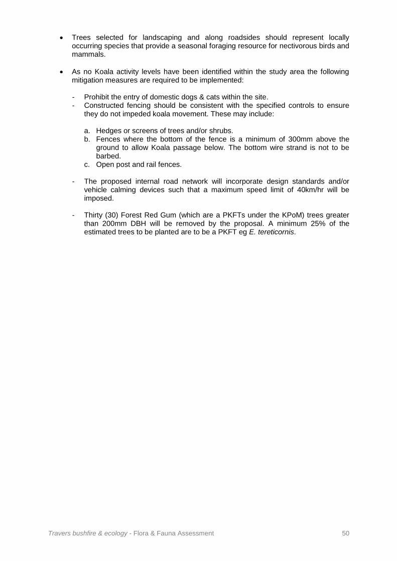
Travers bushfire & ecology - Flora & Fauna Assessment 50
Trees selected for landscaping and along roadsides should represent locally occurring species that provide a seasonal foraging resource for nectivorous birds and mammals.
As no Koala activity levels have been identified within the study area the following mitigation measures are required to be implemented:
- Prohibit the entry of domestic dogs & cats within the site. - Constructed fencing should be consistent with the specified controls to ensure
they do not impeded koala movement. These may include:
a. Hedges or screens of trees and/or shrubs. b. Fences where the bottom of the fence is a minimum of 300mm above the
ground to allow Koala passage below. The bottom wire strand is not to be barbed.
c. Open post and rail fences. - The proposed internal road network will incorporate design standards and/or
vehicle calming devices such that a maximum speed limit of 40km/hr will be imposed.
- Thirty (30) Forest Red Gum (which are a PKFTs under the KPoM) trees greater than 200mm DBH will be removed by the proposal. A minimum 25% of the estimated trees to be planted are to be a PKFT eg E. tereticornis.

Travers bushfire & ecology - Flora & Fauna Assessment 51
Bibliography Ambrose, S. (2007) Supplementary Fauna Survey and Assessment – Proposed Plant
Nursery, Enterprise Drive, Glenning Valley, Ambrose Ecological Services. Auld, B. A. & Medd, R. W. (1996) Weeds. Inkata Press. Barker, J., Grigg, G. C. & Tyler, M. J. (1995) A Field Guide to Australian Frogs. Surrey
Beatty & Sons. Bennett, A. F. (1990a) Habitat Corridors: Their Role in Wildlife Management and
Conservation (Department of Conservation and Environment, Victoria). Bishop, T. (1996) Field Guide to the Orchids of New South Wales and Victoria. UNSW
Press. Briggs, J. D. & Leigh, J. H. (1995) Rare or Threatened Australian Plants. CSIRO. Churchill, S. (2008) Australian Bats, 2nd Ed., Jacana Books, Crows Nest, Sydney. Clark, S. A. (2009) A review of the land snail genus Meridolum (Gastrpoda: Camaenidae)
from central New South Wales, Australia. in Molluscan Research 29(2): 61-120. Malacological Society of Australasia & Society for the Study of Molluscan Diversity
Clark, S. A. & Richardson, B.J. (2002) Spatial analysis of genetic variation as a rapid
assessment tool in the conservation management of narrow-range endemics. in Invertebrate Systematics 16(4) 583-587 Cogger, H. G. (1996) Reptiles and Amphibians of Australia. Reed Books Australia.
DEC (2004) Threatened Species Survey and Assessment: Guidelines for developments and
activities (working draft), New South Wales Department of Environment and Conservation, Hurstville, NSW
Ehmann, H. (1997) Threatened Frogs of New South Wales. FATS Group. EPBC (1999) Environmental Protection and Biodiversity Conservation Act 1999 - Interactive
Map Database Search - http://epbcweb.ea.gov.au/image/otherbatch.html EPBC Listing Advice (2009) Advice to the Minister for the Environment, Heritage and the
Arts from the Threatened Species Scientific Committee on an amendment to the List of Threatened Ecological Communities and the EPBC Act 1999 – Cumberland Plain Woodlands and Shale-Gravel Transition Forest.
Griffiths, K. (1997) Frogs and Reptiles of the Sydney Region. University NSW Press. Harden, G. (1993) Flora of New South Wales. University NSW Press. Hoser, R. (1989) Australian Reptiles and Frogs. Pierson & Co. Lamp, C. & Collett, F. (1996) A Field Guide to Weeds in Australia. Inkata Press. Lindenmayer, D. B. (1994) Wildlife Corridors and the mitigation of logging impacts on fauna
in wood production forests in south-eastern Australia: a review. Wildlife Resources. 21:323-340.

Travers bushfire & ecology - Flora & Fauna Assessment 52
Lindenmayor, D. B. Cunningham, R. B., Donnelly, C. F., Triggs, B. J. and Belvedere, M. (1994) The conservation of arboreal marsupials in montane ash forests of the Central Highlands of Victoria, south-eastern Australia. Patterns of use and the microhabitat requirements of the Leadbeater’s Possum Gymnobelidus leadbeateri in linear retained habitats (wildlife corridors). Biological Conservation. 68 43-51.
Lunney, D., Urquart, C .A. & Reed, P. (1988) Koala Summit, NPWS. Marchant, S., & P. J. Higgins (Eds) (1990). Handbook of Australian, New Zealand and
Antarctic Birds. Volumes 1-7 Oxford University Press, Melbourne. Morrison, R. G. B. (1981) A Field Guide to the Tracks & Traces of Australian Animals. Rigby. Murphy, C. L. & Tille, P. J. (1993) Soil Landscapes of the Sydney 1:100,000 Sheet Map,
Department of Conservation & Land Management. NSW National Parks and Wildlife Service (1997) Urban Bushland Biodiversity Survey NSW
NPWS, Hurstville. National Parks and Wildlife Service (2002) Vegetation Mapping of the Cumberland Plain. OEH (2014) Bio-banking Methodology. OEH (2013 / 2015 / 2017) Atlas of NSW Wildlife Bionet search. OEH (2014) Biodiversity Certification Operation Manual. Parnaby, H. (1992) An interim guide to identification of insectivorous bats of south-eastern
Australia. The Australian Museum, Sydney, Technical Report, No. 8. Pizzey, G. & Knight, F. (1997) A Field Guide to the Birds of Australia. Angus & Robertson. Reader’s Digest (1976) Complete Book of Australian Birds. Richardson, F. J., Richardson, R. G. & Shepherd, R. C. H (2007) Weeds of the South-East:
an Identification Guide for Australia. Everbest Printing Co. Pty. Ltd. China.
Robinson, L. (1994) Field Guide to the Native Plants of Sydney. Kangaroo Press.
Robinson, M. (1996) A Field Guide to Frogs of Australia. Reed.
Schodde, R. and Tidemann, S. (Eds) (1986) Readers Digest complete book of Australian Birds. Second Edition. Reader’s Digest Services Pty Ltd, Sydney.
Simpson & Day (1996) Field Guide to the Birds of Australia. Viking.
Specht, R. L., Specht, A., Whelan, M. B. & Hegarty, E. E. (1995) Conservation Atlas of Plant Communities in Australia. Southern Cross University Press, Lismore.
Triggs, B. (1996) Tracks, Scats & Other Traces: A Field Guide to Australian Mammals. Oxford University Press, Melbourne.
Trounson, Donald & Molly (1998) Australian Birds Simply Classified. Murray David Publishing Pty Ltd, NSW.
Van Dyke, S. and Strahan, R. (Eds) (2008) The Mammals of Australia (3rd Edn). Reed New Holland: Sydney.

Travers bushfire & ecology - Flora & Fauna Assessment 53
Wheeler, D. J. B., Jacobs, S. W. L. & Norton, B. E. (1994) Grasses of New South Wales. University of New England.
Wilson, K. W. and Knowles, D. G. (1988) Australia’s Reptiles - A Photographic Reference to the Terrestrial Reptiles of Australia. Cornstalk Publishing.

Travers bushfire & ecology - Flora & Fauna Assessment 54
A1 Fauna Survey Methodologies The fauna survey methods outlined within this Appendix are techniques employed by Travers bushfire & ecology, based on industry standards as well as additional methods found to be effective for select fauna groups. The fauna survey techniques deployed for each specific site are outlined within the survey effort table in the main body of this report. The techniques selected will depend upon the site characteristics and extent of available habitat as well as restrictions such as available survey time and weather conditions. If any additional or target survey techniques for fauna species are undertaken, beyond the methods outlined within this Appendix, the details of these will be described within the main body of this report. 1 Standard survey techniques 1.1 Diurnal birds Diurnal birds are typically identified visually and / or by calls during diurnal surveys. Habitat searches to identify nests, feathers, eggs, or signs of foraging may be utilised more specifically for identifying threatened diurnal bird species. Visual observations are made more accurate with the use of binoculars and where necessary or practical, with the use of a spotting scope. Binoculars are carried by the fauna surveyor at all times during nocturnal and diurnal fauna surveys. A birding field guide is always available in the field when required for verifications. Calls are identified in the field by the fauna surveyor. If an unknown call is heard it is cross-matched to comprehensive bird call reference libraries taken into the field. A call library of birds occupying the NSW coastal areas is also stored into a mobile phone for a quick reference. This phone is carried into the field at all times and may be used for call-playback methods and recording calls for later analysis. Diurnal bird census points may be undertaken at large sites where the total area may not be effectively covered during the survey period, or as a measure to ensure focused bird only survey. 1.2 Nocturnal birds Searches for evidence of Owl roosts, key perches and potential Owl roosting / breeding hollows are made during diurnal site searches. Whitewash, feathers or regurgitated pellets give key information. Pellets are sent for analysis of contents to assist in identification where necessary. The presence of nocturnal birds during the nocturnal period is first determined by quiet listening after dusk for calls by individuals emerging from diurnal roosts. Following this, and provided no calls are heard, call-playback techniques are employed for threatened species that have suitable habitat present.
A1 Fauna Survey Methodologies

Travers bushfire & ecology - Flora & Fauna Assessment 55
Threatened nocturnal birds known to provide response to call-playback techniques include Masked Owl (Tyto novaehollandiae), Powerful Owl (Ninox strenua), Barking Owl (Ninox connivens), Sooty Owl (Tyto tenebricosa), Grass Owl (Tyto capensis), Black Bittern (Ixobrychus flavicollis), Australian Bittern (Botaurus poiciloptilus) and Bush Stone-curlew (Burhinus grallarius). Each call is typically played for five minute periods with five minute intervals of quiet listening for a response. This is followed with spotlighting and periods of quiet listening throughout the nocturnal survey. Separation distances between broadcasting stations during a single night of survey are advised for different species within survey guidelines. These include 1km between Owl calls and 3km between Bush Stone-curlew calls. Subsequent to this, separate broadcasting stations will be deployed on the same night where sites of significant size are surveyed. Separations for bitterns are not advised and these may be broadcast at a number of stations along suitable habitat areas. Stag-watching will be undertaken where suitable large hollows for Owl nesting / roosting show signs of activity or are located within development areas. Stag-watching of nesting trees should be undertaken during the recognised nesting period for Owls with potential to occur. 1.3 Arboreal mammals Arboreal mammals may be surveyed using Elliott type A, B and / or C traps, small and / or large hair tubes, spotlighting, call-playback techniques, scat searches or searches for other signs of activity.
Baiting and layout for Elliott trapping and hair tubing are typically incorporated into terrestrial trapping and hair tubing effort, unless where target survey is undertaken. Standard baiting and layout is therefore described in Section A1.3.2 below within terrestrial survey methods. Where gliders are targeted, the standard bait mix may be additionally laced with a nectarivor powder mix used for feeding captive birds. Where Brush-tailed Phascogales are targeted the standard bait mix may be additionally laced with an insectivore powder mix. Where Eastern Pygmy Possum is targeted, the bait mix will be more heavily laced with honey. Elliott traps for arboreal captures are placed onto tree mounted platforms that are attached to the trunk 2-3m above the ground, at an incline to facilitate drainage during inclement weather. Plastic sleeves are placed around or over traps when there is a possibility of wet weather in the forecast. Arboreal hair tubes are attached to the trunk of trees using rubber bands with the tube entry facing down, preventing water entry. For all arboreal traps and hair tubes a mixture of honey and water is sprayed onto the trunk up to 8m above the trap and around the trap as a lure. Where Eastern Pygmy Possum is targeted, a high concentrate honey water mix is also sprayed from the base of trunk up and along connective branches. Arboreal traps and hair tubes are placed in trees selected to bias target species. These are often flowering or sap flow trees for gliders, rough-barked trees for the Brush-tailed Phascogale and Banksias for the Eastern Pygmy possum. Where habitat is suitable, the presences of Koala (Phascolactos cinereus), Yellow-bellied Glider (Petaurus australis) and Squirrel Glider (Petaurus norfolcensis) may be targeted by call-playback techniques. Calls are played for five minute periods during nocturnal surveys. This is followed by quiet listening and spotlighting.

Travers bushfire & ecology - Flora & Fauna Assessment 56
1.3.1 Koala survey Koala survey is undertaken where the site is considered to provide potential habitat under the definitions of SEPP 44 - Koala Habitat Protection, or in the presence of feed trees listed in Appendix 1 of the Recovery Plan for the Koala. Habitat may also be defined according to locally prepared Koala Plans of Management. SEPP 44 is applied to land within Local Government Areas (LGAs) listed under Schedule 1 of the Policy. Part 2 is applied to land which has an area of greater than 1 ha or has, together with any adjoining land in the same ownership, an area of more than 1ha. To determine Potential Koala Habitat (PKH) under the definitions of SEPP 44 an estimate of the percentage density of each tree species within vegetation communities is determined by averaging the percentage of stems counted. PKH is defined as land where at least 15% of the total number of trees in the upper or lower strata constitutes any of the tree species listed in Schedule 2 of the Policy. Where Koala habitat is considered to be present, the site will be surveyed on foot, with known Koala food trees being inspected for signs of use. Trees are inspected for characteristic scratch and claw marks on the trunk and scats around the base of each tree. Koalas may also be targeted during nocturnal survey involving call-playback techniques and spotlighting. For large sites, Koala search quadrats may be employed within portions of communities where feed trees are present at suitable densities. All Koala feed trees within quadrats are searched for signs of activity including characteristic claw marks on the trunk and faecal pellets around the base. Pellet searches are undertaken according to the tree base search methods described in Phillips & Callaghan (2008). Search quadrats are less labour intensive than the SAT techniques described below but may only be an initial survey effort to determine presence / absence. Where any Koala activity is recorded the complete Spot Assessment Technique (SAT) described by Phillips & Callaghan (2008) may be undertaken as a measure of Koala activity. This technique may also be employed in the first instance as an indicator of presence / absence, particularly where a site has potential Koala activity based on previous records. For any survey technique, the location and density of Koala droppings, if found, are documented. 1.4 Terrestrial mammals Various traps may be used to survey for the presence of terrestrial mammals. These include Elliott trapping, medium and large cage trapping, small and large hair tubing and pitfall traps. Other survey methods for terrestrial mammals include the use of camera surveillance, spotlighting and activity searches. Arboreal and terrestrial Elliott traps and hair tubes are placed in grids, or more commonly along trap-lines of 5-10 traps separated by distances of 20-50m, depending on site size and variation of habitat. Trap or hair tube sizes selected at each trap station may alternate or may have an emphasis on certain sizes according to target species. Selection of terrestrial Elliott trap, cage trap, hair tube or pitfall trap locations has an emphasis on nearby foliage, runways, shelters and signs of activity.

Travers bushfire & ecology - Flora & Fauna Assessment 57
Standard bait mix for all Elliott traps, medium cage traps and hair tubes is a mixture of rolled oats, honey and peanut butter. Standard bait mix may be supplemented with sardines in large hair tubes or cage traps to simultaneously target Spotted-tailed Quoll. Cage traps may also be baited solely with meat or roadkill to target Spotted-tailed Quoll. Where Potoroos or Bandicoots are targeted, truffle oil may be used to lace the standard bait mix or used on its own. Where difficult to access, sensitive or extended trapping periods are undertaken, surveillance cameras can be used in terrestrial mammal surveys. The surveillance camera is mounted on a tree and directed towards a closed baited cage trap. Surveillance cameras may also be used to detect use or monitor activity at burrows, hollows, nests, etc. During diurnal site searches, assessment is made of ‘found’ scats, markings, diggings, runways and scratches located. Any scats or pellets not readily identifiable (particularly predator scats) may be collected and sent to Barbara Triggs for identification of contents, hair or bone fragments. 1.5 Bats Micro-chiropteran bats are surveyed by echolocation using Anabat detectors or trapped using harp (Constantine) traps, mist nets or trip lines. Microchiropteran bats are also surveyed by searches of subterranean habitats such as caves, tunnels or shafts where present, or by searching structures such as under bridges and abandoned buildings or wall / ceiling cavities, where entry is possible. Anabat Mk 2 and SD-1 detectors are used in fixed passive monitoring positions and / or during active nocturnal monitoring. Active monitoring is used in conjunction with spotlighting or during stag-watching for greater accuracy of recorded call identification. Bat call recordings are interpreted through Anabat V and Anabat CF Storage and Interface Module ZCAIM devices and analysed using Anabat 6 and Analook 3.3q computer software packages. Harp traps and mist nets are placed along suitable ‘flyways’ such as along open narrow road / river corridors to maximise the likelihood of captures. Traps may be purpose set to capture bats emerging from roosts by being placed at the entry of tunnels / caves or draped over the edge of bridges. Trip lines are placed over water to trip low flying drinking bats into the water. These bats are collected as they swim to the waters edge. Harp traps are checked during early nocturnal survey, as well as each morning. Mist nets and trip lines require constant monitoring. Captured bats are identified using field identification guides. Bats are released at the point of capture after dusk or placed under trunk bark / splits of nearby trees. Mega-chiropteran bat species, such as Grey-headed Flying-fox, are surveyed by targeting flowering / fruiting trees during spotlighting activities and by listening to distinctive vocalisations. Suitable roosting habitat is searched for presence of small or large established camps during diurnal survey periods. 1.6 Amphibians Amphibians are surveyed by vocal call identification, call-playback, spotlighting along the edge of water-bodies, pitfall trapping, funnel trapping, by driving along sealed roads near waterways, habitat searches and collection of tadpoles.

Travers bushfire & ecology - Flora & Fauna Assessment 58
Calls are identified in the field by the fauna surveyor. For similar calling species, or if an unknown male call is heard, it is cross-matched to frog call reference libraries taken into the field. A call library of frogs occupying the NSW coastal areas is also stored into a mobile phone for a quick reference. This phone is carried into the field at all times and may be used for call-playback methods and recording calls for later analysis. All threatened frog species may be targeted by use of call-playback techniques where suitable habitat exists, with some species more reliable than others in providing a response. Red-crowned Toadlet may also be targeted by clapping and loud retort along suitable habitat drainages in order to evoke a call response. Any amphibians found are visually identified and, when required to be examined, are handled with latex gloves and kept moist until release. Any tadpoles requiring capture are collected with a scoop net and placed within a snap-lock clear plastic bag for analysis of colour and morphological features. Amphibian survey yields best results during or following wet periods with seasonal breeding and subsequent male calling varying according each species. Targeted survey is thus undertaken in appropriate seasons. 1.7 Reptiles Reptiles are surveyed opportunistically during diurnal site visit(s), but also by habitat searches, pitfall trapping, funnel trapping, by driving along roads on humid nights and by camera surveillance at burrows. Habitat searches for reptiles are undertaken in likely localities such as under logs, rocky slabs on rock surfaces, under sheet debris, under bark exfoliations and leaf litter at the base of trees and along the edge of wetlands. Aspect and land surface thermal properties are considered to determine best search locations particularly along rocky escarpments. During warmer months spotlighting may assist survey effort particularly during humid conditions. 1.8 Invertebrates Target survey is undertaken for the Cumberland Plain Land Snail (Meridolum corneovirens) when in proximity to previous Atlas of NSW Wildlife records and particularly where its typical host vegetation community is present. The most appropriate areas of observed habitat are searched. Dense areas of leaf litter with likely moisture retaining properties are scraped using a three pronged rake. Logs, stumps, artificial refuse and rocks are also turned over. In large survey areas, search quadrats are undertaken evenly across highest quality habitat areas to estimate population size. The top (spiral side), side (showing aperture) and underside (showing umbilicus) of snail specimens found are photographed and sent to Michael Shea of the Australian Museum Malacology Unit for confirmation of identification. 2 Habitat trees Hollow-bearing tree surveys use a Trimble handheld GPS unit to log both field reference location as well as tree data. Data such as hollow types, hollow size, tree species, diameter at breast height, canopy spread and overall height are documented. A metal tag with the tree number is placed on the trunk for field relocation purposes. Other habitat features such as nests and significant sized mistletoe for foraging are also noted.

Travers bushfire & ecology - Flora & Fauna Assessment 59
3 Survey effort table descriptors Target - Where effort is specifically concentrated towards an individual species. Selected target species will be identified within the survey effort table and where necessary described within the report.
Opportunistic - Where birds are identified by observation, call or indirect methods as the opportunity arises.
Habitat search - Where suitable areas of habitat for selected fauna groups such as frogs, reptiles and invertebrates are specifically searched.
Diurnal bird census point(s) - Bird surveys are undertaken within a specified area surrounding a point (or in a quadrat) for a specified amount of time. Size and time will be specified in the survey effort table. These are more typically undertaken across larger sites where the total area cannot be effectively covered during the survey period. Subsequently census points are selected to adequately represent each of the habitat areas present and particularly areas designated for proposed development. Often census points are commenced at locations where bird activity is noticeably high.
Spotting-scope outlook - A Nikon spotting scope with 16~47 zoom at x60 magnification on a mounted tripod is used for distant inspections of diurnal birds. This is undertaken at wetlands for viewing waterfowl and waders but also other difficult to access areas. It may also be used for inspecting activity at nests, hollows and combined with spotlight for a panoramic search in open areas.
Call-playback - This involves broadcasting recorded calls through a 15 watt Toa ‘Faunatech’ amplifier to evoke a response from species known to reply. Species selected for call-playback will be indicated in the survey effort table.
Spotlighting - Is carried out using a hand held 55 watt spotlight powered by a 12 volt rechargeable battery. This technique involves walking amongst the woodland areas, forest fringes, along roads, trails and fence lines so that a maximum number of trees can be observed. Spotlighting around water-bodies and particularly along the shallow fringes is used for finding frogs. Spotlighting is used in combination with binoculars or spotting scope for closer night inspections.
Stag-watching - Involves watching hollows in the dusk period approximately 15 minutes prior to dark until 30 minutes following dark. Placement of the observer on the ground allows for a silhouette of any emerging fauna to be seen against the lighter sky background such that a spotlight is not required, which would likely to disrupt emergence behaviour. Where any movement is observed, a spotlight may then be used for identification purposes.
Search quadrats - Are undertaken within a specified area surrounding a point (or in a quadrat) for a specified amount of time. These are more typically undertaken across larger sites where the total area cannot be effectively covered during the survey period. Subsequently quadrats are selected to adequately represent each of the suitable habitat areas present and particularly areas designated for proposed development. The use of this technique simply as an initial time-effective suitable indicator of presence / absence of Koalas has been discussed with Koala expert, Stephen Phillips.
Koala Spot Assessment Technique (SAT) - Method outlined by Phillips & Callaghan (2008) and accepted by the Australian Koala Foundation to determine Koala activity levels. Activity levels are calculated from the proportion of trees showing signs of Koala use as indicated by the presence of scats as well as site location within the state.
Elliott trapping - Using Elliott type A (33x10x10cm) and Type B (45x15x15cm), B and / or Type C traps for trapping small sized mammals. Trapping nights’ effort will be indicated in the survey effort table. Trapping layout, trap sizes, baiting and trapping period will be outlined within the site specific methodology section.

Travers bushfire & ecology - Flora & Fauna Assessment 60
Medium cage trapping - Using medium sized cage traps (17x17x45cm foldout cages with tread-plate mechanism or 22x25x58cm rigid cage with tread-plate mechanism) for trapping up to cat/bandicoot sized mammals. Trapping layout, target species, baiting and trapping period will be outlined within the site specific methodology section.
Large cage trapping - Using large sized cage traps (25x25x50cm foldout cages with pull lever (meat) mechanism, 28x28x60cm foldout cages with tread-plate mechanism or 30x30x70cm rigid cage with tread-plate mechanism) for trapping up to quoll sized mammals. Trapping layout, target species, baiting and trapping period will be outlined within the site specific methodology section.
Hair tubing - Using small (40mm diameter x 120mm long) and/or large (90mm diameter x 200mm long) PVC pipe sections for collecting mammal hair samples. At one end of each tube is an enclosed chamber where the bait is placed and capped. Small drill holes in the inside face of the chamber allow the smell of the bait to permeate out through the tube without allowing access to the bait. At the other open entry end, double-sided tape is attached around the inner rim so hair samples of animals entering the tube are collected. Hair samples collected are sent to Barbara Triggs for identification. Trapping layout, tube sizes, baiting and trapping period will be outlined within the site specific methodology section.
Pitfall trapping - Is used to survey for small terrestrial mammals, frogs, reptiles and invertebrates. Pitfall trapping involves the use of 15cm diameter and 60cm long PVC stormwater pipe sections placed vertically into pre dug holes. The pipe is placed and set firm with surrounding soil so that the top rim is level with the ground surface. Drift fences made of damp-proof-course 270mm wide are held tight and upright by wooden and steel pegs and run along the length of each trap-line. Drift fences are run over the middle of each pit in the trap line ensuring at least 5m of fencing is run along each side of each pit. Ground fauna passing beyond the pitfall transect are diverted towards the pits along the fence line.
Funnel trapping - Is used to survey mainly for frogs and reptiles. Funnel traps are 18cm x 18cm x 75cm long and constructed of shade cloth with an internal spring and wire frame in a similar design to yabby traps. At each end an inward facing funnel directs fauna through a 4cm hole and into the trap. Herpetofauna search the walls and corners for an exit and discover it difficult to re-find the internal exit hole. As with pitfall traps, funnel traps are used with drift fences that divert fauna towards the trap entry. At least 5m of fencing is run between each funnel trap which may be placed on either side of the fence. Trapping layout, target species, fence lengths and trapping period will be outlined within the site specific methodology section.
Passive Anabat monitoring - Involves leaving the bat recorder in a fixed mounted position to record call-sequences of passing bats. Recording locations are determined in order to represent different available foraging structures for various micro-chiropteran bat species. Dams, cleared flyways, high insect activity areas, forest edges and ecotones are particularly targeted.
Active Anabat monitoring - Is a method of active microbat recording during stag-watching or during complete nocturnal survey. Active monitoring involves an SD-1 recorder allied with a PDA for viewing call-sequences in real-time. When calls are heard the transducer microphone is actively directed towards the calling animal with the aid of a spotlight, so longer and clearer call sequences may be recorded. When calls of a potential threatened species are observed on the PDA screen a view by spotlight of the bat size and wing morphology is attempted for greater identification accuracy.
Active vehicle Anabat monitoring - Is a method of active microbat recording deployed when large distances need to be covered in a nocturnal survey period. A Hi-mic extension cable allows the transducer microphone to be placed on a bracket on the roof of a travelling vehicle so calls may be viewed whilst driving. The vehicle travels at no more than 40km/h to

Travers bushfire & ecology - Flora & Fauna Assessment 61
prevent wind interference. When calls of a potential threatened species are observed on the dash mounted PDA screen active spotlighting is undertaken.
Harp trapping - Is used to capture microchiropteran bats. Harp traps have an aluminium frame with a two-bank 4.2m2 area and calico capture bag set along the base area.
Mist netting - Is used to capture microchiropteran bats. The mist net capture area is 2.4m high and 9m wide and supported by two 3.5m poles which are braced with ropes and pegs. Design is a 0.08mm ultrafine nylon monofilament thread arranged in a 14x14mm mesh, with four horizontal capture pockets. These features are specific for the use to capture micro-chiropteran bat species and are provided from the only known supplier in Poland.
Trip lining - Is used to capture microchiropteran bats. Fishing line is strung tight on pegs in a zig-zag pattern across open water-bodies just above the water surface to trip drinking bats into the water.
Camera surveillance - Is used to monitor activity at burrows, hollows, etc. or to survey for species presence at baited stations. A Reconyx Hyperfire digital weatherproof camera is used with a passive infrared motion detector and a night-time infrared illuminator. The camera is mounted on a tree or tripod and takes three consecutive photo frames on the detection of movement up to 30m away or the detection of a heat/cold source different to the ambient temperature.
Weather conditions - Survey effort for each fauna group accounting for methods undertaken, duration, and weather conditions are provided in the survey effort table. Weather details are documented for all survey techniques and include:
air temperature
cloud cover
rain (e.g. none, light drizzle, heavy drizzle, heavy rain)
recent rain events (where relevant)
wind strength e.g. calm, light (leaves rustle), moderate (moves branches), strong (moves tree crowns)
wind direction
moon (where relevant) (e.g. none, 1/4 moon, 1/2 moon, 3/4 moon, full moon)

Travers bushfire & ecology - Flora & Fauna Assessment 62
A2 Habitat Assessment Table A2.1 provides an assessment of potential habitat within the subject site for state and nationally listed threatened flora species recorded within 10km on the Atlas of NSW Wildlife (OEH) or indicated to have potential habitat present within 10km on the EPBC Act Protected Matters Tool.
Table A2.1 – Threatened flora habitat assessment
Scientific name
DATABASE SOURCE
TSC Act
EPBC Act
Growth form and habitat requirements
Recorded on site ()
If not recorded on-site
7 Part test required
()
Suitable habitat present
()
Nearby and/or high number of record(s)
() Notes 1,2 & 3
Record(s) from
recent years
() Notes 1,2 & 3
Potential to occur
Acacia bynoeana
EPBC
E1 V Erect or spreading shrub to 0.3m high growing in heath and dry sclerophyll Open Forest on sandy soils. Often associated with disturbed areas such as roadsides. Distribution limits N-Newcastle S-Berrima.
x x - - x x
A2 Threatened & Migratory Species Habitat Assessment

Travers bushfire & ecology - Flora & Fauna Assessment 63
Scientific name
DATABASE SOURCE
TSC Act
EPBC Act
Growth form and habitat requirements
Recorded on site ()
If not recorded on-site
7 Part test required
()
Suitable habitat present
()
Nearby and/or high number of record(s)
() Notes 1,2 & 3
Record(s) from
recent years
() Notes 1,2 & 3
Potential to occur
Acacia pubescens
OEH EPBC
V V Spreading shrub 1-4m high open sclerophyll growing in open forest and woodlands on clay soils. Distribution limits N-Bilpin S-Georges River.
x marginal
Nearest record is approx.
3km away, however
most local records are north in the
area of Prestons
and Lurnea,
8km away.
unlikely x
Allocasuarina glareicola
EPBC
E1 E Small shrub 1-2m high growing in open sclerophyll forest on lateritic soils derived from tertiary alluviums. Distribution limits Castlereagh NR region.
x x - - x x
Asterolasia elegans
EPBC
- E Erect shrub 1-3m high growing in moist sclerophyll forests on Hawkesbury sandstone slopes hillsides. Distribution limits Maroota region.
x x - - x x
Callistemon linearifolius
OEH
V - Shrub to 4m high. Dry sclerophyll forest on coast and adjacent ranges. Distribution limits N-Nelson Bay S-Georges River.
x x - - x x
Cryptostylis hunteriana
EPBC
V V Saprophytic orchid. Grows in swamp heath on sandy soils. Distribution limits N-Gibraltar Range S-south of Eden.
x x - - x x

Travers bushfire & ecology - Flora & Fauna Assessment 64
Scientific name
DATABASE SOURCE
TSC Act
EPBC Act
Growth form and habitat requirements
Recorded on site ()
If not recorded on-site
7 Part test required
()
Suitable habitat present
()
Nearby and/or high number of record(s)
() Notes 1,2 & 3
Record(s) from
recent years
() Notes 1,2 & 3
Potential to occur
Cynanchum elegans
OEH EPBC
E1 E Climber or twiner to 1m. Grows in rainforest gullies, scrub & scree slopes. Distribution limits N-Gloucester S-Wollongong.
x
Only 1 record
locally but within a
2km radius
escarpment area –
low
Dillwynia tenuifolia
OEH
V V Erect shrub 0.6-1m high. Grows in Woodlands and Open Forest on sandstone shale or laterite. Distribution limits N-Howes Valley S-Cumberland Plain.
x x - - x x
Diuris aequalis
OEH
E1 V Terrestrial orchid which occurs in montane Eucalypt forest with grassy-heathy understorey. Very rare apart from Boyd Plateau. Distribution limits N-Blue Mountains S-Braidwood.
x x - - x x
Eucalyptus benthamii
EPBC
V V Blue gum to 40m high. Wet forest on sandy alluvial soils. Distribution limits N-Yarramundi S-Bents Basin.
x x - - x x
Eucalyptus scoparia
OEH
E1 V Smooth-barked tree only known from vicinity of Bald Rock. x x - - x x
Genoplesium baueri
OEH EPBC
E1 - A terrestrial orchid that grows in sparse sclerophyll forest and moss gardens over sandstone. Distribution limits N – Hunter Valley S – Nowra
x x - - x x

Travers bushfire & ecology - Flora & Fauna Assessment 65
Scientific name
DATABASE SOURCE
TSC Act
EPBC Act
Growth form and habitat requirements
Recorded on site ()
If not recorded on-site
7 Part test required
()
Suitable habitat present
()
Nearby and/or high number of record(s)
() Notes 1,2 & 3
Record(s) from
recent years
() Notes 1,2 & 3
Potential to occur
Grevillea parviflora subsp. parviflora
OEH EPBC
V V Open to erect shrub to 1m. Grows in woodland on light clayey soils Distribution limits N-Cessnock S-Appin.
x marginal
Nearest record is approx.
9km away
x low
Gyrostemon thesioides
OEH
E1 - Multi-stemmed shrub to 70cm. Grows on hillsides and riverbanks. Confined to Georges and Nepean Rivers and believed extinct.
x x - - x x
Haloragis exalata subsp. exalata
EPBC
V V Shrub to 1.5m high. Grows in damp places near watercourses. Distribution limits N-Tweed Heads S-south of Eden.
x x - - x x
Leucopogon exolasius
OEH EPBC
V V Erect shrub to 2m high. Rocky hillsides and creek banks in Sydney Sandstone Gully Forest. Confined to Woronora and Georges Rivers and Stokes Creek.
x x - - x x
Leucopogon fletcheri subsp. fletcheri
OEH
E1 - Shrub to 1.8m high growing in woodland on lateritic soils. Distribution limits N-St Albans S-Springwood. x x - - x x
Melaleuca deanei
OEH EPBC
V V Shrub to 3m high. Grows in heath on sandstone. Distribution limits N-Gosford S-Nowra.
x x - - x x
Pelargonium sp.
Striatellum
EPBC
E1 E Herb to 90cm tall which grows in damp places especially beside streams and lakes. Occasionally in swamp forest or associated with disturbance. Varied distribution from SE NSW to QLD.
x x - - x x

Travers bushfire & ecology - Flora & Fauna Assessment 66
Scientific name
DATABASE SOURCE
TSC Act
EPBC Act
Growth form and habitat requirements
Recorded on site ()
If not recorded on-site
7 Part test required
()
Suitable habitat present
()
Nearby and/or high number of record(s)
() Notes 1,2 & 3
Record(s) from
recent years
() Notes 1,2 & 3
Potential to occur
Persoonia hirsuta
OEH EPBC
E1 E Erect to decumbent shrub. Grows in dry sclerophyll forest and woodland on Hawkesbury sandstone with infrequent fire histories. Distribution limits N-Glen Davis S-Hill Top.
x x - - x x
Persoonia nutans
OEH EPBC
E1 E Erect to spreading shrub. Grows in dry sclerophyll forest and woodland on laterite and alluvial sands. Distribution limits Cumberland Plain.
x x - - x x
Pimelea curviflora var. curviflora
EPBC
V V Woody herb or sub-shrub to 0.2-1.2m high. Grows on Hawkesbury sandstone near shale outcrops. Distribution Sydney.
x x - - x x
Pimelea spicata
OEH EPBC
E1 E Decumbent or erect shrub to 0.5m high. Occurs principally in woodland on soils derived from Wianamatta Shales. Distribution limits N-Lansdowne S-Shellharbour.
x
Nearest record is approx. 2.5km away
Cumberland Plain
Woodland - low
Pomaderris
brunnea
OEH EPBC
V V Shrub to 3m high. Confined to Upper Nepean and Colo Rivers where it grows in open forest.
x x - - x x
Pterostylis gibbosa
EPBC
E1 E Terrestrial orchid which occurs near Wollongong and in Hunter Valley in sclerophyll forest, sometimes with paperbarks.
x x - - x x

Travers bushfire & ecology - Flora & Fauna Assessment 67
Scientific name
DATABASE SOURCE
TSC Act
EPBC Act
Growth form and habitat requirements
Recorded on site ()
If not recorded on-site
7 Part test required
()
Suitable habitat present
()
Nearby and/or high number of record(s)
() Notes 1,2 & 3
Record(s) from
recent years
() Notes 1,2 & 3
Potential to occur
Pterostylis nigricans
OEH
V - Terrestrial orchid. Prefers coastal heathland with Heath Banksia (Banksia ericifolia), and lower-growing heath with lichen-encrusted and relatively undisturbed soil surfaces, on sandy soils. The Dark Greenhood occurs in north-east NSW north from Evans Head, and in Queensland.
x x - - x x
Pterostylis saxicola
OEH EPBC
E1 E Terrestrial orchid. Grows in shallow sandy soil above rock shelves, usually near Wianamatta / Hawkesbury transition. Distribution limits N-Hawkesbury River S-Campbelltown.
x x - - x x
Pultenaea parviflora
OEH EPBC
E1 V Erect shrub. Grows in dry sclerophyll forest at the intergrade between Tertiary Alluviums and Wianamatta Shales. Distribution limits Cumberland Plain.
x x - - x x
Pultenaea pedunculata
OEH
E1 - Prostrate shrub. Grows in dry sclerophyll forest and disturbed sites. Confined to Prestons and Villawood in NSW.
x x - - x x
Syzygium paniculatum
OEH EPBC
V V Small tree. Subtropical and littoral rainforest on sandy soil. Distribution limits N-Forster S-Jervis Bay.
x x - - x x

Travers bushfire & ecology - Flora & Fauna Assessment 68
Scientific name
DATABASE SOURCE
TSC Act
EPBC Act
Growth form and habitat requirements
Recorded on site ()
If not recorded on-site
7 Part test required
()
Suitable habitat present
()
Nearby and/or high number of record(s)
() Notes 1,2 & 3
Record(s) from
recent years
() Notes 1,2 & 3
Potential to occur
Thelymitra sp. ‘Kangaloon’
(Thelymitra kangaloonica)
EPBC
- Critic.
E
A terrestrial orchid with dark blue flowers, presented in mid-late spring. Only known from the Robertson area in the Southern Highlands. Often in association with the endangered ecological community Temperate Highland Peat Swamps on Sandstone.
x x - - x x
Thesium australe
OEH EPBC
V V Erect herb to 0.4m high. Root parasite. Grassland or woodland often damp. Distribution limits N-Tweed Heads S-south of Eden.
x x - - x x
OEH - Denotes species listed within 10km of the study area on the Atlas of NSW Wildlife (OEH 2013)
EPBC - Denotes species listed within 10km of the study area in the EPBC Act habitat search
V - Denotes vulnerable listed species under the relevant act
E or E1 - Denotes endangered listed species under the relevant act
NOTE:
1. This field is not considered if no suitable habitat is present within the study area
2. ‘records’ refer to those provided by the Atlas of NSW Wildlife (OEH 2013)
3. ‘nearby’ or ‘recent’ records are species specific accounting for home range, dispersal ability and life cycle

Travers bushfire & ecology - Flora & Fauna Assessment 69
Table A2.2 provides an assessment of potential habitat within the subject site for state and nationally listed threatened fauna species recorded within 10km on the Atlas of NSW Wildlife (OEH) or indicated to have potential habitat present within 10km on the EPBC Act Protected Matters Tool.
Table A2.2 – Threatened fauna habitat assessment
Common name
Scientific name
DATABASE SOURCE
TSC Act
EPBC Act
Preferred habitat
Distribution limit
Recorded on site ()
If not recorded on site
7 Part test required
()
Suitable Habitat Present
()
Nearby and/or high
number of record(s)
()
Notes 1,2 & 3
Record(s) from
recent years
()
Notes 1,2 & 3
Potential to occur
Giant Burrowing Frog
Heleioporus australiacus
OEH EPBC
V V Inhabits open forests and riparian forests along non-perennial streams, digging burrows into sandy creek banks. Distribution Limit: N-Near Singleton S-South of Eden.
- -
Red-crowned Toadlet
Pseudophryne australis
OEH
V - Prefers sandstone areas, breeds in grass and debris beside non-perennial creeks or gutters. Individuals can also be found under logs and rocks in non-breeding periods. Distribution Limit: N-Pokolbin. S-near Wollongong.
- -
Green and Golden Bell Frog
Litoria aurea
OEH EPBC
E V Prefers the edges of permanent water, streams, swamps, creeks, lagoons, farm dams and ornamental ponds. Often found under debris. Distribution Limit: N-Byron Bay S-South of Eden.
marginal - Not likely

Travers bushfire & ecology - Flora & Fauna Assessment 70
Common name
Scientific name
DATABASE SOURCE
TSC Act
EPBC Act
Preferred habitat
Distribution limit
Recorded on site ()
If not recorded on site
7 Part test required
()
Suitable Habitat Present
()
Nearby and/or high
number of record(s)
()
Notes 1,2 & 3
Record(s) from
recent years
()
Notes 1,2 & 3
Potential to occur
Littlejohn’s Tree Frog
Litoria littlejohnii
EPBC
V V Found in wet and dry sclerophyll forest associated with sandstone outcrops at altitudes 280-1,000m on eastern slopes of Great Dividing Range. Prefers flowing rocky streams. Distribution Limit: N-Hunter River S-Eden.
- -
Southern Bell Frog
Litoria raniformis
EPBC
E V Prefers the edges of permanent water, streams, swamps, creeks, lagoons, farm dams and ornamental ponds. Often found under debris. Distribution Limit: N-ACT Bay. S-Albury.
marginal - Not likely
Rosenberg’s Goanna
Varanus rosenbergi
OEH
V - Hawkesbury sandstone outcrop specialist. Inhabits woodlands, dry open forests and heathland sheltering in burrows, hollow logs, rock crevices and outcrops. Distribution Limit: N-Nr Broke. S-Nowra Located in scattered patches near Sydney, Nowra and Goulburn.
- -
Broad-headed Snake
Hoplocephalus bungaroides
OEH EPBC
E V Sandstone outcrops, exfoliated rock slabs and tree hollows in coastal and near coastal areas. Distribution Limit: N-Mudgee Park. S-Nowra.
- -

Travers bushfire & ecology - Flora & Fauna Assessment 71
Common name
Scientific name
DATABASE SOURCE
TSC Act
EPBC Act
Preferred habitat
Distribution limit
Recorded on site ()
If not recorded on site
7 Part test required
()
Suitable Habitat Present
()
Nearby and/or high
number of record(s)
()
Notes 1,2 & 3
Record(s) from
recent years
()
Notes 1,2 & 3
Potential to occur
Blue-billed Duck
Oxyura australis
OEH
V - A completely aquatic species occurring mainly throughout the Murray-Darling basin in cool to warm temperate deep permanent freshwater lakes, lagoons and swamps with extensive reed-beds. Distribution Limit: N-Tenterfield. S-Albury.
marginal Not likely
Freckled Duck
Stictonetta naevosa
OEH
V - Occurs mainly within the Murray-Darling basin and the channel country within large cool temperate to sub-tropical swamps, lakes and floodwaters with cumbungi, lignum or melaleucas. Distribution Limit: N- Tenterfield. S-Albury.
marginal - Not likely
Black-necked Stork
Ephippiorhynchus asiaticus
OEH
E - Occurs in tropical to warm temperate terrestrial wetlands, estuarine and littoral habitats such as mangroves, tidal mudflats, floodplains, open woodlands, irrigated lands, bore drains, sub-artesian pools, farm dams and sewerage ponds. Distribution Limit: N-Tweed Heads. S-Nowra.
marginal - Not likely
Australasian Bittern
Botaurus poiciloptilus
OEH EPBC
E E Found in or over water of shallow freshwater or brackish wetlands with tall reedbeds, sedges, rushes, cumbungi, lignum and also in ricefields, drains in tussocky paddocks, occasionally saltmarsh, brackish wetlands. Distribution Limit: N-North of Lismore. S- Eden.
marginal unlikely

Travers bushfire & ecology - Flora & Fauna Assessment 72
Common name
Scientific name
DATABASE SOURCE
TSC Act
EPBC Act
Preferred habitat
Distribution limit
Recorded on site ()
If not recorded on site
7 Part test required
()
Suitable Habitat Present
()
Nearby and/or high
number of record(s)
()
Notes 1,2 & 3
Record(s) from
recent years
()
Notes 1,2 & 3
Potential to occur
Black Bittern
Ixobrychus flavicollis
TBE
V - Found in shadowy, leafy waterside trees such as callistemons, casuarinas, paperbarks, eucalypts, mangroves and willows along tidal creeks, freshwater and brackish streams and ponds, sheltered mudflats and oyster slats. Distribution Limit: N-Tweed Heads. S-South of Eden.
marginal - Not likely
Spotted Harrier
Circus assimilis
OEH
V - Utilises grassy plains, crops and stubblefields; saltbush, spinifex associations; scrublands, mallee, heathlands; open grassy woodlands. Distribution Limit: N-Tweed Heads. S-South of Eden.
marginal unlikely
White-bellied Sea Eagle
Haliaeetus leucogaster
OEH
V - Occupies coasts, islands, estuaries, inlets, large rivers, inland lakes and reservoirs. Sedentary; dispersive. N-Tweed Heads. S-South of Eden.
sub-
optimal not likely
Little Eagle
Hieraaetus morphnoides
OEH
V - Utilises plains, foothills, open forests, woodlands and scrublands; river red gums on watercourses and lakes. Distribution Limit - N-Tweed Heads. S-South of Eden.

Travers bushfire & ecology - Flora & Fauna Assessment 73
Common name
Scientific name
DATABASE SOURCE
TSC Act
EPBC Act
Preferred habitat
Distribution limit
Recorded on site ()
If not recorded on site
7 Part test required
()
Suitable Habitat Present
()
Nearby and/or high
number of record(s)
()
Notes 1,2 & 3
Record(s) from
recent years
()
Notes 1,2 & 3
Potential to occur
Square-tailed Kite
Lophoictinia isura
OEH
V - Utilises mostly coastal and sub-coastal open forest, woodland or lightly timbered habitats and inland habitats along watercourses and mallee that are rich in passerine birds. Distribution Limit: N-Goondiwindi. S-South of Eden.
Red Goshawk
Erythrotriorchis radiatus
EPBC
E V Inhabits tall open forests and woodlands. Breeds in tall trees adjacent to watercourses of wetlands. Distribution Limit: N-Border Ranges National Park. S-Foster.
- -
Black Falcon
Falco subniger
OEH
V - Inhabits plains, grasslands, foothills, timbered watercourses, wetland environs, crops; occasionally over towns and cities. N-Tweed Heads. S-South of Eden
Not likely
Bush Stone-curlew
Burhinus grallarius
OEH
E - Utilises open forests and savannah woodlands, sometimes dune scrub, savannah and mangrove fringes. Distribution Limit: N-Border Ranges National Park. S-Near Nowra.
marginal Not likely
Australian Painted Snipe
Rostratula australis
EPBC
E V Most numerous within the Murray-Darling basin and inland Australia within marshes and freshwater wetlands with swampy vegetation. Distribution Limit: N-Tweed Heads. S-South of Eden.
marginal - Not likely

Travers bushfire & ecology - Flora & Fauna Assessment 74
Common name
Scientific name
DATABASE SOURCE
TSC Act
EPBC Act
Preferred habitat
Distribution limit
Recorded on site ()
If not recorded on site
7 Part test required
()
Suitable Habitat Present
()
Nearby and/or high
number of record(s)
()
Notes 1,2 & 3
Record(s) from
recent years
()
Notes 1,2 & 3
Potential to occur
Gang-gang Cockatoo
Callocephalon fimbriatum
OEH
V - Prefers wetter forests and woodlands from sea level to > 2,000m on the Great Dividing Range, timbered foothills and valleys, timbered watercourses, coastal scrubs, farmlands and suburban gardens. Distribution Limit: mid north coast of NSW to western Victoria.
marginal - Not likely
Glossy Black-Cockatoo
Calyptorhynchus lathami
OEH
V - Open forests with Allocasuarina species and hollows for nesting. Distribution Limit: N-Tweed Heads. S-South of Eden. - -
Little Lorikeet
Glossopsitta pusilla
OEH
V - Inhabits forests, woodlands; large trees in open country; timbered watercourses, shelterbeds, and street trees. Distribution Limit: N-Tweed Heads. S-South of Eden.
- low
Swift Parrot
Lathamus discolour
OEH EPBC
E E Inhabits eucalypt forests and woodlands with winter flowering eucalypts. Distribution Limit: N-Border Ranges National Park. S-South of Eden.
Turquoise Parrot
Neophema pulchella
OEH
V - Inhabits coastal scrubland, open forest and timbered grassland, especially ecotones between dry hardwood forests and grasslands. Distribution Limit: N-Near Tenterfield. S-South of Eden.
unlikely

Travers bushfire & ecology - Flora & Fauna Assessment 75
Common name
Scientific name
DATABASE SOURCE
TSC Act
EPBC Act
Preferred habitat
Distribution limit
Recorded on site ()
If not recorded on site
7 Part test required
()
Suitable Habitat Present
()
Nearby and/or high
number of record(s)
()
Notes 1,2 & 3
Record(s) from
recent years
()
Notes 1,2 & 3
Potential to occur
Barking Owl
Ninox connivens
OEH
V - Inhabits principally woodlands but also open forests and partially cleared land and utilises hollows for nesting. Distribution Limits: N-Border Ranges National Park. S-Eden.
marginal - Not likely
Powerful Owl
Ninox strenua
OEH
V - Forests containing mature trees for shelter or breeding and densely vegetated gullies for roosting. Distribution Limits: N-Border Ranges National Park. S-Eden.
Sub-
optimal low
Masked Owl
Tyto novaehollandiae
TBE
V - Open forest and woodlands with cleared areas for hunting and hollow trees or dense vegetation for roosting. Distribution Limit: N-Border Ranges National Park. S-Eden.
Sub-
optimal Not likely
Sooty Owl
Tyto tenebricosa
OEH
V - Tall, dense, wet forests containing trees with very large hollows. Distribution Limit: N-Border Ranges National Park. S-South of Eden.
- -
Brown Treecreeper
Climacteris picumnus victoriae
OEH
V - Occupies Eucalypt woodlands, open woodland lacking a dense understorey with fallen dead timber. Distribution Limit:(Sub species victoriae) Central NSW west of Great Div. Cumberland Plains, Hunter Valley, Richmond, Clarence, and Snowy River Valleys.
unlikely

Travers bushfire & ecology - Flora & Fauna Assessment 76
Common name
Scientific name
DATABASE SOURCE
TSC Act
EPBC Act
Preferred habitat
Distribution limit
Recorded on site ()
If not recorded on site
7 Part test required
()
Suitable Habitat Present
()
Nearby and/or high
number of record(s)
()
Notes 1,2 & 3
Record(s) from
recent years
()
Notes 1,2 & 3
Potential to occur
Eastern Bristlebird
Dasyornis brachypterus
EPBC
E E Coastal woodlands, dense scrubs and heathlands, especially where low heathland borders taller woodland or dense tall tea-tree. Distribution Limit: N-Tweed Heads. S-South of Eden.
- -
Speckled Warbler
Chthonicola sagittata
OEH
V - Found in temperate eucalypt woodland and open forest including forest edges, wooded farmland and urban areas with mature eucalypts. Distribution Limit: N-Urbanville. S-Eden.
unlikely
Painted Honeyeater
Grantiella picta
TBE EPBC
V V A nomadic bird occurring in low densities within open forest, woodland and scrubland feeding on mistletoe fruits. Inhabits primarily Boree, Brigalow and Box-Gum Woodlands and Box-Ironbark Forests. Distribution Limit: N-Boggabilla. S-Albury with greatest occurrences on the inland slopes of the Great Dividing Range.
none - unlikely
Black-chinned Honeyeater
Melithreptus gularis gularis
OEH
V - Found in woodlands containing box-ironbark associations and River Red Gums, also drier coastal woodlands of the Cumberland Plain and Hunter Richmond and Clarence. Distribution Limit: N-Cape York Pen. Qld. S-Victor H. Mt Lofty Ra & Flinders Ra. SA.
unlikely

Travers bushfire & ecology - Flora & Fauna Assessment 77
Common name
Scientific name
DATABASE SOURCE
TSC Act
EPBC Act
Preferred habitat
Distribution limit
Recorded on site ()
If not recorded on site
7 Part test required
()
Suitable Habitat Present
()
Nearby and/or high
number of record(s)
()
Notes 1,2 & 3
Record(s) from
recent years
()
Notes 1,2 & 3
Potential to occur
Regent Honeyeater
Xanthomyza phrygia
OEH EPBC
E4A E Found in temperate eucalypt woodland and open forest including forest edges, wooded farmland and urban areas with mature eucalypts. Distribution Limit: N-Urbanville. S-Eden.
unlikely
White-fronted Chat
Epithianura albifrons
OEH
V - Found in open damp ground, grass clumps, fencelines, heath, samphire saltmarshes, mangroves, dunes, saltbush plains. Distribution Limit: N-Tweed Heads. S-South of Eden.
Not likely
Varied Sittella
Daphoenositta chrysoptera
OEH
V - Open eucalypt woodlands / forests (except heavier rainforests); mallee, inland acacia, coastal tea-tree scrubs; golf courses, shelterbelts, orchards, parks, scrubby gardens. Distribution Limit: N-Border Ranges National Park. S-South of Eden.
Sub-
optimal

Travers bushfire & ecology - Flora & Fauna Assessment 78
Common name
Scientific name
DATABASE SOURCE
TSC Act
EPBC Act
Preferred habitat
Distribution limit
Recorded on site ()
If not recorded on site
7 Part test required
()
Suitable Habitat Present
()
Nearby and/or high
number of record(s)
()
Notes 1,2 & 3
Record(s) from
recent years
()
Notes 1,2 & 3
Potential to occur
Dusky Woodswallow
Artamus cyanopterus cyanopterus
OEH V -
Found in woodlands and dry open sclerophyll forests, usually dominated by eucalypts, including mallee associations. It has also been recorded in shrublands and heathlands and various modified habitats, including regenerating forests; very occasionally in moist forests or rainforests. Prefers habitat with an open understorey. Often observed in farmland tree patches or roadside remnants. Widespread in eastern, southern and southwestern Australia.
x
1.5km W (93
records within 10km)
2007
Hooded Robin
Melanodryas cucullata cucullata
OEH
V - Found in Eucalypt woodlands, Acacia scrubland, open forest, and open areas adjoining large woodland blocks, with areas of dead timber. Distribution Limit: N-Central Qld. S-Spencer Gulf SA.
unlikely
Scarlet Robin
Petroica boodang
OEH
V - Found in foothill forests, woodlands, watercourses; in autumn-winter, more open habitats: river red gum woodlands, golf courses, parks, orchards, gardens. Distribution Limit: N-Tweed Heads. S-South of Eden.
- unlikely

Travers bushfire & ecology - Flora & Fauna Assessment 79
Common name
Scientific name
DATABASE SOURCE
TSC Act
EPBC Act
Preferred habitat
Distribution limit
Recorded on site ()
If not recorded on site
7 Part test required
()
Suitable Habitat Present
()
Nearby and/or high
number of record(s)
()
Notes 1,2 & 3
Record(s) from
recent years
()
Notes 1,2 & 3
Potential to occur
Flame Robin
Petroica phoenicea
OEH
V - Summer: forests, woodlands, scrubs, from sea-level to c. 1800 m. Autumn-winter: open woodlands, plains, paddocks, golf courses, parks, orchards. Distribution Limit: N northern NSW tablelands. S-South of Eden.
unlikely
Diamond Firetail
Stagonopleura guttata
OEH
V - Found in Eucalypt woodlands, forests and mallee where there is grassy understorey west of the Great Div. also drier coastal woodlands of the Cumberland Plain and Hunter Richmond and Clarence River Valleys. Distribution Limit: N-Rockhampton Q. S-Eyre Pen Kangaroo Is. SA.
unlikely
Spotted-tailed Quoll
Dasyurus maculatus
OEH EPBC
V E Dry and moist open forests containing rock caves, hollow logs or trees. Distribution Limit: N-Mt Warning National Park. S-South of Eden.
- -
Southern Brown Bandicoot
Isoodon obesulus
EPBC
E E Utilises a range of habitats containing thick ground cover - open forest, woodland, heath, cleared land, urbanised areas and regenerating bushland. Distribution Limit: N-Kempsey. S-South of Eden.
- -

Travers bushfire & ecology - Flora & Fauna Assessment 80
Common name
Scientific name
DATABASE SOURCE
TSC Act
EPBC Act
Preferred habitat
Distribution limit
Recorded on site ()
If not recorded on site
7 Part test required
()
Suitable Habitat Present
()
Nearby and/or high
number of record(s)
()
Notes 1,2 & 3
Record(s) from
recent years
()
Notes 1,2 & 3
Potential to occur
Koala
Phascolarctos cinereus
OEH EPBC
V V Inhabits both wet and dry eucalypt forest on high nutrient soils containing preferred feed trees. Distribution Limit: N-Tweed Heads. S-South of Eden.
- Not likely
Eastern Pygmy Possum
Cercatetus nanus
OEH
V - Found in a variety of habitats from rainforest through open forest to heath. Feeds on insects but also gathers pollen from banksias, eucalypts and bottlebrushes. Nests in banksias and myrtaceous shrubs. Distribution Limit: N-Tweed Heads. S-Eden.
- -
Yellow-bellied Glider
Petaurus australis
OEH
V - Tall mature eucalypt forests with high nectar producing species and hollow bearing trees. Distribution Limit- N-Border Ranges National Park. S-South of Eden.
- -
Squirrel Glider
Petaurus norfolcensis
OEH
V - Mixed aged stands of eucalypt forest & woodlands including gum barked & high nectar producing species & hollow bearing trees. Distribution Limit: N-Tweed Heads. S-Albury.
Sub-optimal
- Not likely

Travers bushfire & ecology - Flora & Fauna Assessment 81
Common name
Scientific name
DATABASE SOURCE
TSC Act
EPBC Act
Preferred habitat
Distribution limit
Recorded on site ()
If not recorded on site
7 Part test required
()
Suitable Habitat Present
()
Nearby and/or high
number of record(s)
()
Notes 1,2 & 3
Record(s) from
recent years
()
Notes 1,2 & 3
Potential to occur
Greater Glider
Petauroides volans
EPBC
- V Favours forests with a diversity of eucalypt species, due to seasonal variation in its preferred tree species. Population density is optimal at elevation levels at 845 m above sea level. Prefer overstorey basal areas in old-growth tree stands. Highest abundance typically in taller, montane, moist eucalypt forests, with relatively old trees and abundant hollows Distribution Limit: N-Border Ranges National Park. S- South of Eden.
- -
Long-nosed Potoroo
Potorous tridactylus
EPBC
V V Coastal heath and dry and wet sclerophyll forests with a dense understorey. Distribution Limit: N-Mt Warning National Park. S-South of Eden.
- -
Brush-tailed Rock-wallaby
Petrogale penicillata
EPBC
E V Found in rocky gorges with a vegetation of rainforest or open forests to isolated rocky outcrops in semi-arid woodland country. Distribution Limit: N-North of Tenterfield. S-Bombala.
- -

Travers bushfire & ecology - Flora & Fauna Assessment 82
Common name
Scientific name
DATABASE SOURCE
TSC Act
EPBC Act
Preferred habitat
Distribution limit
Recorded on site ()
If not recorded on site
7 Part test required
()
Suitable Habitat Present
()
Nearby and/or high
number of record(s)
()
Notes 1,2 & 3
Record(s) from
recent years
()
Notes 1,2 & 3
Potential to occur
Grey-headed Flying-fox
Pteropus poliocephalus
OEH EPBC
V V Found in a variety of habitats including rainforest, mangroves, paperbark swamp, wet and dry open forest and cultivated areas. Forms camps commonly found in gullies and in vegetation with a dense canopy. Distribution Limit: N-Tweed Heads. S-Eden.
Yellow-bellied Sheathtail-bat
Saccolaimus flaviventris
OEH
V - Rainforests, sclerophyll forests and woodlands. Distribution Limit: N-North of Walgett. S-Sydney.
East-coast Freetail Bat
Micronomus norfolkensis
OEH
V - Inhabits open forests and woodlands foraging above the canopy and along the edge of forests. Roosts in tree hollows, under bark and buildings. Distribution Limit: N-Woodenbong. S-Pambula.
Sub-
optimal - - unlikely
Large-eared Pied Bat
Chalinolobus dwyeri
OEH EPBC
V V Warm-temperate to subtropical dry sclerophyll forest and woodland. Roosts in caves, tunnels and tree hollows in colonies of up to 30 animals. Distribution Limit: N-Border Ranges National Park. S-Wollongong.
marginal - Not likely

Travers bushfire & ecology - Flora & Fauna Assessment 83
Common name
Scientific name
DATABASE SOURCE
TSC Act
EPBC Act
Preferred habitat
Distribution limit
Recorded on site ()
If not recorded on site
7 Part test required
()
Suitable Habitat Present
()
Nearby and/or high
number of record(s)
()
Notes 1,2 & 3
Record(s) from
recent years
()
Notes 1,2 & 3
Potential to occur
Eastern Falsistrelle
Falsistrellus tasmaniensis
OEH
V - Recorded roosting in caves, old buildings and tree hollows. Distribution Limit: N-Border Ranges National Park. S-Pambula.
Sub-
optimal
Little Bentwing-bat
Miniopterus australis
OEH
V - Roosts in caves, old buildings and structures in the higher rainfall forests along the south coast of Australia. Distribution Limit: N-Border Ranges National Park. S-Sydney.
unlikely
Eastern Bentwing-bat
Miniopterus orianae oceansis
OEH
V - Prefers areas where there are caves, old mines, old buildings, stormwater drains and well-timbered areas. Distribution Limit: N-Border Ranges National Park. S-South of Eden.
Sub-
optimal - - unlikely
Large-footed Myotis
Myotis macropus
OEH
V - Roosts in caves, mines, tunnels, buildings, tree hollows and under bridges. Forages over open water. Distribution limits: N-Border Ranges National Park. S-South of Eden.
Sub-
optimal - - unlikely

Travers bushfire & ecology - Flora & Fauna Assessment 84
Common name
Scientific name
DATABASE SOURCE
TSC Act
EPBC Act
Preferred habitat
Distribution limit
Recorded on site ()
If not recorded on site
7 Part test required
()
Suitable Habitat Present
()
Nearby and/or high
number of record(s)
()
Notes 1,2 & 3
Record(s) from
recent years
()
Notes 1,2 & 3
Potential to occur
Greater Broad-nosed Bat
Scoteanax rueppellii
OEH
V - Inhabits areas containing moist river and creek systems, especially tree lined creeks. Distribution Limit: N-Border Ranges National Park. S-Pambula.
New Holland Mouse
Pseudomys novaehollandiae
EPBC
- V Occurs in heathlands, woodlands, open forest and paperbark swamps and on sandy, loamy or rocky soils. Coastal populations have a marked preference for sandy substrates, a heathy understorey of leguminous shrubs less than 1m high and sparse ground litter. Recolonise of regenerating burnt areas. Distribution Limit: N-Border Ranges National Park. S-South of Eden.
- -
Cumberland Plain Land Snail
Meridolum corneovirens
OEH
E - Inhabits remnant eucalypt woodland of the Cumberland Plan. Shelters under logs, debris, clumps of grass, around base of trees and burrowing into loose soil. Distribution Limit: Cumberland Plain of Sydney Basin Region.
Sub-
optimal low

Travers bushfire & ecology - Flora & Fauna Assessment 85
Common name
Scientific name
DATABASE SOURCE
TSC Act
EPBC Act
Preferred habitat
Distribution limit
Recorded on site ()
If not recorded on site
7 Part test required
()
Suitable Habitat Present
()
Nearby and/or high
number of record(s)
()
Notes 1,2 & 3
Record(s) from
recent years
()
Notes 1,2 & 3
Potential to occur
Dural Woodland Snail
Pommerhelix duralensis
EPBC
- E Occurs on shale-sandstone transitional landscapes The species is found within the Local Government Areas of Blue Mountains City, Penrith City, The Hills Shire, Wollondilly Shire, Hornsby Shire and Parramatta City. The species has a strong affinity for communities in the interface region between shale-derived and sandstone-derived soils, with forested habitats that have good native cover and woody debris. It favours sheltering under rocks or inside curled-up bark. It does not burrow nor climb. The species has also been observed resting in exposed areas, such as on exposed rock or leaf litter, however it will also shelter beneath leaves, rocks and light woody debris.
- -
Macquarie Perch
Macquaria australasica
EPBC
V
(FM Act)
E Occurs in south east Australia at moderate to high altitudes in rivers and reservoirs. Historical records show the species was widespread and abundant in the upper reaches of the Lachlan, Murrumbidgee and Murray Rivers and their tributaries. Allen (1989) states that introduced populations are present in Nepean River and water supply dams in the Sydney area. Occurs in lakes and flowing streams, usually in deep holes.
- -

Travers bushfire & ecology - Flora & Fauna Assessment 86
Common name
Scientific name
DATABASE SOURCE
TSC Act
EPBC Act
Preferred habitat
Distribution limit
Recorded on site ()
If not recorded on site
7 Part test required
()
Suitable Habitat Present
()
Nearby and/or high
number of record(s)
()
Notes 1,2 & 3
Record(s) from
recent years
()
Notes 1,2 & 3
Potential to occur
Australian Grayling
Prototroctes maraena
EPBC
Part 2, Section
19 – Protected
Fish
(FM Act)
V Clear, moderate to fast flowing water in the upper reaches of rivers (sometimes to altitudes above 1,000m). Typically found in gravel bottom pools. Often forming aggregations below barriers to upstream movement (e.g. weirs, waterfalls).
- -
OEH - Denotes species listed within 10km of the study area on the Atlas of NSW Wildlife (OEH 2013)
EPBC - Denotes species listed within 10km of the study area in the EPBC Act habitat search
TBE - Denotes additional species considered by Travers bushfire & ecology to have potential habitat based on regional knowledge and other records
V - Denotes vulnerable listed species under the relevant act
E - Denotes endangered listed species under the relevant act
NOTE:
1. This field is not considered if no suitable habitat is present within the study area
2. ‘records’ refer to those provided by the Atlas of NSW Wildlife (OEH 2013)
3. ‘nearby’ or ‘recent’ records are species specific accounting for home range, dispersal ability and life cycle

Travers bushfire & ecology - Flora & Fauna Assessment 87
Table A2.3 provides an assessment of potential habitat within the subject site for nationally protected migratory fauna species recorded within 10km on the EPBC Act Protected Matters Tool. Nationally threatened migratory species are considered in Table A2.2.
Table A2.3 – Migratory fauna habitat assessment
Common name
Scientific name
Preferred habitat
Migratory breeding
Suitable habitat present
()
Recorded on site
()
Comments
White-bellied Sea Eagle (Haliaeetus leucogaster)
Coasts, islands, estuaries, inlets, large rivers, inland lakes, reservoirs. Sedentary; dispersive.
Sub-optimal
-
Oriental Cuckoo (Cuculus optatus)
It mainly inhabits forests, occurring in coniferous, deciduous and mixed forest. It feeds mainly on insects and their larvae, foraging for them in trees and bushes as well as on the ground.
-
White-throated Needletail (Hirundapus caudacutus)
Airspace over forests, woodlands, farmlands, plains, lakes, coasts, towns; companies forage often along favoured hilltops and timbered ranges. Breeds Siberia, Himalayas, east to Japan. Summer migrant to eastern Australia.
-
Rainbow Bee-eater (Merops ornatus)
Open woodlands with sandy, loamy soil; sandridges, sandspits, riverbanks, road cuttings, beaches, dunes, cliffs, mangroves, rainforest, woodlands, golf courses. Breeding resident in northern Australia. Summer breeding migrant to south east and south west Australia.
- -
Black-faced Monarch (Monarcha melanopsis)
Rainforests, eucalypt woodlands; coastal scrubs; damp gullies in rainforest, eucalypt forest; more open woodland when migrating. Summer breeding migrant to coastal south east Australia, otherwise uncommon.
- -
Spectacled Monarch (Monarcha trivirgatus)
Understorey of mountain / lowland rainforest, thickly wooded gullies, waterside vegetation, mostly well below canopy. Summer breeding migrant to south-east Qld and north-east NSW down to Port Stephens from Sept/Oct to May. Uncommon in southern part of range.
- -
Yellow Wagtail (Motacilla flava)
The yellow wagtail typically forages in damp grassland and on relatively bare open ground at edges of rivers, lakes and wetlands, but also feeds in dry grassland and in fields of cereal crops.
-
Satin Flycatcher (Myiagra cyanoleuca)
Heavily vegetated gullies in forests, taller woodlands, usually above shrub-layer; during migration, coastal forests, woodlands, mangroves, trees in open country, gardens. Breeds mostly south east Australia and Tasmania over warmer months, winters in north east Qld.
- -

Travers bushfire & ecology - Flora & Fauna Assessment 88
Common name
Scientific name
Preferred habitat
Migratory breeding
Suitable habitat present
()
Recorded on site
()
Comments
Rufous Fantail (Rhipidura rufifrons)
Undergrowth of rainforests / wetter eucalypt forests / gullies; monsoon forests, paperbarks, sub-inland and coastal scrubs; mangroves, watercourses; parks, gardens. On migration, farms, streets buildings. Breeding migrant to south east Australia over warmer months. Altitudinal migrant in north east NSW in mountain forests during warmer months.
Sub-optimal
-
Great Egret (Ardea alba)
Shallows of rivers, estuaries; tidal mudflats, freshwater wetlands; sewerage ponds, irrigation areas, larger dams, etc. Dispersive; cosmopolitan.
-

Travers bushfire & ecology - Flora & Fauna Assessment 89
Common name
Scientific name
Preferred habitat
Migratory breeding
Suitable habitat present
()
Recorded on site
()
Comments
Cattle Egret (Ardea ibis)
Stock paddocks, pastures, croplands, garbage tips, wetlands, tidal mudflats, drains. Breeds in summer in warmer parts of range including NSW.
Two individual Cattle Egrets were recorded during survey foraging with cattle as a host.
The study area provides suitable foraging, roosting and nesting habitat. This habitat is otherwise well
represented in the locality and previous nesting activity
was not observed during survey. Development within
the open landscape and removal of cattle as a
foraging host will reduce overall foraging habitat and
reduce the potential for occurrence, however this
species is not likely to offer a constraint to development. Retention of drainages and
dams and restoration of riparian habitat will improve
suitability for breeding habitat but again will be less likely utilised in the absence of cattle and large foraging
areas.
Latham’s Snipe (Gallinago hardwickii)
Soft wet ground or shallow water with tussocks and other green or dead growth; wet parts of paddocks; seepage below dams; irrigated areas; scrub or open woodland from sea-level to alpine bogs over 2,000m; samphire on saltmarshes; mangrove fringes. Breeds Japan. Regular summer migrant to Australia. Some overwinter.
-

Travers bushfire & ecology - Flora & Fauna Assessment 90
Common name
Scientific name
Preferred habitat
Migratory breeding
Suitable habitat present
()
Recorded on site
()
Comments
Common Greenshank (Tringa nebularia)
Found in a wide variety of inland wetlands and sheltered coastal habitats (with large mudflats and saltmarsh, mangroves or seagrass) of varying salinity, Habitats include embayments, harbours, river estuaries, deltas and lagoons. It uses both permanent and ephemeral terrestrial wetlands, including swamps, lakes, dams, rivers, creeks, billabongs, waterholes and inundated floodplains, claypans and saltflats. Also artificial wetlands, including sewage farms and saltworks dams, inundated rice crops and bores. In NSW the Hunter River estuary has been identified as a site of international importance. Breeds in Eurasia, the northern British Isles, Scandanavia, east Estonia and north-east Belarus, through Russia and east.
-
Osprey (Pandion haliaetus)
Favours coastal areas, especially the mouths of large rivers, lagoons and lakes. Feeds on fish over clear, open water. Breeds from July to September in NSW. Nests are made high up in dead trees or in dead crowns of live trees, usually within one kilometer of the sea.
-
Fork-tailed Swift (Apus pacificus)
Aerial: over open country, from semi-arid deserts to coasts, islands; sometimes over forests, cities. Breeds Siberia, Himalayas, east to Japan south east Asia. Summer migrant to east Australia. Mass movements associated with late summer low pressure systems into east Australia. Otherwise uncommon.
-

Travers bushfire & ecology - Flora & Fauna Assessment 91
A3 Significance of Impact Test The determining authority is required to consider the impact upon threatened species, populations and / or EECs from any development or activity via the process of a 7 part test of significance. The significance of the assessment is then used to determine the need for a more detailed SIS. The following 7 part test of significance relies on the ecological assessment provided in Sections 3 and 4 of this report and should be read as such. Flora and fauna investigations and habitat assessments of the study area have resulted in the identification of suitable habitat for the following threatened species and populations with varying potential to occur. Species recorded or with a considered potential to occur have been noted. The potential for any direct or indirect impacts on these species has also been considered and noted. Threatened flora
Scientific name TSC Act
Potential to occur Potential impact
Cynanchum elegans E1 Low – escarpment areas
Minimal impact on some low to
moderate quality potential habitat
Grevillea parviflora var. parviflora
V Marginal / Low
Minimal impact on some low to
moderate quality potential habitat
Pimelea spicata E1 Low – Cumberland Plain Woodland
Minimal impact on some low to
moderate quality potential habitat
A3 Significance of
Impact Test

Travers bushfire & ecology - Flora & Fauna Assessment 92
Threatened fauna
Common Name TSC Act
Potential to occur
Potential impact
East-coast Freetail Bat V recorded Direct – on potential roosting / breeding hollows
Eastern Bentwing-bat V recorded None anticipated
Large-footed Myotis V recorded Direct – on potential roosting / breeding hollows
Grey-headed Flying-fox V recorded None anticipated
Cumberland Plain Land Snail E recorded
Indirect – on shelter habitat from increase human presence
Little Eagle V
Indirect – removal of dead perching trees and management of rabbits
Square-tailed Kite V None anticipated
Dusky Woodswallow V
Indirect – removal of understorey scrub vegetation and timber from selected woodland portions
Swift Parrot E None anticipated
Varied Sittella V None anticipated
Yellow-bellied Sheathtail-bat V Direct – on potential roosting / breeding hollows
Eastern Falsistrelle V Direct – on potential roosting / breeding hollows
Greater Broad-nosed Bat V Direct – on potential roosting / breeding hollows
Little Lorikeet V low Direct – on potential roosting / breeding hollows
Powerful Owl V low None anticipated
Australasian Bittern E unlikely Indirect – increased human presence
Spotted Harrier V unlikely None anticipated
Speckled Warbler V unlikely
Indirect – removal of understorey scrub vegetation from selected woodland portions
Black-chinned Honeyeater V unlikely None anticipated
Regent Honeyeater E4A unlikely None anticipated
Scarlet Robin V unlikely
Indirect – removal of understorey scrub vegetation and timber from selected woodland portions
Flame Robin V unlikely
Indirect – removal of understorey scrub vegetation and timber from selected woodland portions
Diamond Firetail V unlikely
Indirect – removal of understorey scrub vegetation and timber from selected woodland portions
Little Bentwing-bat V unlikely None anticipated
Endangered populations Marsdenia viridiflora subsp. viridiflora population in the Bankstown, Blacktown, Camden,
Campbelltown, Fairfield, Holroyd, Liverpool and Penrith local government areas (LGAs). None for fauna Endangered ecological communities Cumberland Plain Woodland The 7 part test of significance is as follows: a) In the case of a threatened species, whether the action proposed is likely to
have an adverse effect on the life cycle of the species such that a viable local population of the species is likely to be placed at risk of extinction

Travers bushfire & ecology - Flora & Fauna Assessment 93
The direct impacts of the proposal within the subject site are considered as:
Removal/modification of 1.73 ha Cumberland Plain Woodland
Subsequent removal of threatened fauna species foraging habitat
Potential loss of trees or treed areas suitable for nesting and perching by birds of prey, particularly the threatened Little Eagle which is known in the locality. Dead trees in-particular are used as perches for raptors and such trees will be likely targeted for removal for safety or visual reasons.
Potential removal of a small number of small sized hollows The potential indirect impacts of the proposal from the subject site are considered as:
Potential to increase edge effects or spread of non-native vegetation into bushland remnants
Increased human presence and spill-over into adjacent natural habitats. With consideration to the relative direct and indirect impacts on all threatened species with varying potential to occur, it is considered that the proposal is unlikely to disrupt the life cycle for any of these listed species such that a viable local population would be placed at risk of extinction. This is provided that the mitigation measures to protect hollow-dependent threatened microbats as outlined in Section 5.2 are undertaken. Species recorded present during survey, previously recorded nearby or with high potential to occur and requiring further discussion given potential impacts are further discussed in detail below. Flora species No threatened flora species were observed within the study area despite detailed targeted searches. Therefore it is considered that the proposed development or activity is unlikely to have an adverse effect on the life cycle of the species such that a viable local population of the species is likely to be placed at risk of extinction. Fauna species Cumberland Plain Land Snail (Meridolum corneovirens) Meridolum corneovirens is wholly restricted to western Sydney and is primarily associated with the Cumberland Plain and Castlereagh Woodland vegetation types (Clark 2009). The species occasionally occurs along the edges of Coastal River Flat Forest, where it meets either of the above forest types. M corneovirens occurs generally in areas characterised by moist soils together with growths of various species of lichen. This species is known to shelter under logs, other debris, and in leaf litter or around the base of trees where exfoliations occur. Where conditions permit it will bury into loose soil especially under logs and around the bases of large trees (Clark 2009). Spatial autocorrelation analysis indicates that M. corneovirens populations are highly structured at very short distances (2 m) and that the radius of a genetic neighbourhood is approximately 350 m (Clark & Richardson 2002). Recent 2015 survey recorded the presence of one living and two dead snail specimens below a single large log located along the Cumberland Plain Woodland strip in between St Andrews Road and the on-site dams. This woodland patch, as well as the patch behind the proposed office building, whilst both not ideal, provide the best available habitat for the species on-site.

Travers bushfire & ecology - Flora & Fauna Assessment 94
The patch behind the proposed office was found to be dominated by the exotic Brown Garden Snail and therefore despite detailed searches it is considered that this area does not support the species. The recorded patch is deficient in on-ground logs providing shelter and likely contributes to roadside vegetation along St Andrews Road. It is recommended that this best patch is retained and enhanced as an on-site protection area for the Cumberland Plain Land Snail (see Figure 4). No understorey management or clearance of habitat, particularly leaf litter and logs is to occur in this area. Selected dead trees, deadwood limbs or ground deadwood to be removed from development areas in other woodland patches are to be relocated into this area to enhance the available shelter habitat and subsequently improve the carrying capacity of this remnant. Such an exercise will result in an improved on-site outcome for this species. Further measures to ensure any other remaining snails present within woodland patches to be cleared are effectively recovered are outlined in Section 5.2 recommendations. The proposed development or activity is unlikely to have an adverse effect on the life cycle of the species such that a viable local population of the species is likely to be placed at risk of extinction. Grey-headed Flying-fox (Pteropus poliocephalus) Grey-Headed Flying-foxes are canopy feeding frugivores and nectarivores, inhabiting a wide range of habitats including rainforest, mangroves, paperbark forests, wet and dry sclerophyll forests and cultivated areas. This species roosts in camps, which may contain tens of thousands of individuals. Camps are commonly formed in gullies, typically not far from water and usually in vegetation with a dense canopy (Tidemann 1998). Camps can be found in riparian rainforest patches, Melaleuca stands, mangroves, riparian woodland or modified vegetation in urban areas. Loyalty to a site is high and some camps in NSW have been used for over a century (NSW NPWS 2001). Some camps are used at the same time every year by hundreds of thousands of flying-foxes while others are used sporadically by a few hundred individuals (Strahan 1995). Generally foraging is within 20km of camps but individuals are known to commute up to 50km to a productive food source. A single individual Grey-headed Flying-fox was recorded low in flight over the study area both during 2013 and 2015 surveys. This species was not observed foraging on any trees within the study area however this is expected as seasonal foraging resources permit. The study area provides no suitable roosting or subsequent breeding habitat. Foraging habitat is otherwise well represented in the surrounding locality and will be enhanced by landscape planting throughout the site. Therefore the removal of habitat associated with the proposal will not significantly impact on a local population. It is recommended that landscaping trees selected for planting are represented by locally occurring flowering eucalypts. Large-footed Myotis (Myotis macropus) and East-coast Freetail Bat (Micronomus norfolkensis) These two species, whilst having separate microhabitat and foraging preferences, both may rely on hollows as important roosting and subsequent breeding habitat, therefore they have been considered here together. The Large-footed Myotis inhabits rainforests and open forests predominantly foraging along creeklines and over water bodies where it takes insects and small fish from on and just below the water’s surface (Richards 1995). The Large-footed Myotis roosts in tree hollows, caves, mines, under bridges, in tunnels and occasionally buildings (Richards 1995).

Travers bushfire & ecology - Flora & Fauna Assessment 95
The East-coast Freetail Bat forages above the canopy of open forests and woodlands and in clearings at forest edges, feeding on small insects (Allison, Hoye & Law 2008). This species is thought to roost predominantly in tree hollows but also under loose bark and occasionally in houses and outbuildings (Allison, Hoye & Law 2008). Until recent findings of a roost within mangroves, all known natural roosts had occurred within hollow spouts of large mature eucalypts. The species is often found close to dams and waterholes. The East-coast Freetail Bat species will utilize paddock trees and isolated remnant vegetation when in proximity to larger forest remnants (Allison, Hoye & Law 2008). Hoy et. al (2008) suggest that despite a female recorded 6km from its roost, this species generally forages within a few kilometres of roosts. PhD student Anna McConvill found that cleared and semi-cleared landscapes were found to have higher activity levels than urban or forested landscapes. Riparian sites were also found to have high activity levels. It is considered that the study area provides suitable roosting, breeding and foraging habitat for these two microbat species. Both species, with the Large-footed Myotis in particular, will concentrate foraging behaviour over the existing water-bodies. These water bodies and the otherwise open foraging landscape will be retained by the proposal. A total of thirty-five (35) hollow-bearing trees containing up to 113 small (0-10cm) hollows, 21 medium (10-30cm) hollows and 1 large (30+) hollow will potentially be removed by the proposal. Many of these trees and their respective hollows have not been inspected for use by stag-watching or tree climber for use by fauna, particularly threatened microbats. Given the large number of hollows proposed for removal and the potential for the two threatened microbats to occur it is recommended that all remaining hollow-bearing trees to be removed are stag-watched during warmer months to determine any use by microbats. This should be undertaken with an ultrasonic recorder so that any emerging bats can be identified. These hollows may alternatively be inspected by tree climber and videoscope for signs of current or previous use. Any of these trees recorded to contain a threatened microbat should be retained within the landscape with appropriate protection measures imposed. If the tree is unsafe and cannot be made safe by securing it with cable or poles then it should be fenced for safety reasons. If this cannot be achieved and the tree requires removal then the hollow section should be effectively cut and relocated into a suitable nearby recipient tree to permit its ongoing use. This is particularly important given that artificially constructed bat boxes have not been demonstrated effective for any threatened microbat species. If the hollow is a large section this may require the use of a crane and advanced securing measures and the selection of a large and structurally sound recipient tree. The removal of all hollows should be under the supervision of a fauna ecologist. Any hollows found to contain fauna or otherwise identified as high quality hollows by the fauna ecologist should be prepared for reattachment to a retained tree. If a threatened (or non-threatened) microbat colony is found at the time of tree removal the relocation process should ideally be done over a single day with the microbat colony maintained inside. Thus blocking the entry and very careful management of the section is of major importance. Maintaining the colony inside will increased the potential for the species ongoing use of the hollow. The recipient tree selected should be in good health to permit a similar height and orientation to the hollow. Affixment methods should ensure safety, longevity and not disturb the resident animals.

Travers bushfire & ecology - Flora & Fauna Assessment 96
It is recommended that all hollows that are not relocated to another tree are instead replaced with a constructed nest box. This should be represented with an adequate number of bat boxes. These should be installed prior to any habitat tree removal so that they may be used as temporary housing if required. The proposed development or activity is unlikely to have an adverse effect on the life cycle of these two microbat species such that a viable local population of the species is likely to be placed at risk of extinction. Eastern Bentwing-bat (Miniopterus orianae oceanensis) The Eastern Bentwing-bat forages above and below the canopy within open forests and woodlands, feeding on small flying insects, predominantly moths (Dwyer 1995). The Eastern Bentwing-bat is known to roost in a range of habitats including stormwater channels, under bridges, occasionally in buildings, old mines and, in particular, caves (Dwyer 1995). Caves are an important resource for this species, particularly for breeding where maternity caves must have suitable temperature, humidity and physical dimensions to permit breeding (Dwyer 1995). Roost sites in tree hollows have not been reported within the literature reviewed. It is considered that the study area provides only suitable foraging habitat for the Eastern Bentwing-bat. As such foraging habitat is otherwise well represented in the locality and no roosting or breeding habitat will be impacted, the proposed development or activity is unlikely to have an adverse effect on the life cycle of the species such that a viable local population of the species is likely to be placed at risk of extinction. It is considered that as no threatened flora species have been recorded and the site does not provide habitat that is of likely importance to threatened fauna species, the proposal is unlikely to result in a serious or irreversible impact on threatened flora or fauna species and their populations. b) In the case of an endangered population, whether the action proposed is likely
to have an adverse effect on the life cycle of the species that constitutes the endangered population such that a viable local population of the species is likely to be placed at risk of extinction
There are no endangered fauna populations identified specifically to the Campbelltown LGA; however, the site does fall within the Sydney Metropolitan Catchment Management Authority area. An endangered population of White-fronted Chat (Epthianura albifrons) is identified to this area however this is made up of two (2) known isolated sub-populations; one (1) at Newington Nature Reserve on the Parramatta River and one (1) at Towra Point Nature Reserve in Botany Bay. The study area provides only marginally suitable habitat for this species which was not recorded present during survey. Therefore, this species is not likely to offer a constraint to habitat removal and development within the study area. The Marsdenia viridiflora subsp. viridiflora population in the Bankstown, Blacktown, Camden, Campbelltown, Fairfield, Holroyd, Liverpool and Penrith local government areas (LGAs) is required to assessed. Some parts of the remnant Cumberland Plain Woodland may provide marginal habitat for the population to occur, however, no specimens were observed during the botanical survey. Therefore, it is considered that the action proposed is not likely to have an adverse effect on the life cycle of these species that constitute the endangered populations such that a viable local population of these species is likely to be placed at risk of extinction.

Travers bushfire & ecology - Flora & Fauna Assessment 97
c) In the case of a critically endangered or endangered ecological community, whether the action proposed:
i. Is likely to have an adverse effect on the extent of the ecological community
such that its local occurrence is likely to be placed at risk of extinction, or Cumberland Plain Woodland Buildings have been strategically placed to minimise impacts upon remnant bushland patches and all will require bushfire protection APZs. Pathway construction is also proposed which will meander around existing trees thus only affecting the ground layer, much of which is >70% exotic pasture species. There is 23.52 ha of CPW on site and buildings, APZs and pathways are expected to impact upon 1.73 ha (7.36%) of CPW vegetation. The riparian zones provide an opportunity for more than a 10:1 revegetation offset ratio such that a positive outcome will be achieved for this CEEC. The proposal will revegetate additional CPW within the riparian areas as well. The proposed burial sites are largely located in cleared open space or in areas of very poor condition vegetation. Remnants of moderate quality will be retained with generally no impact. Parts of the community are located on steep lands that are difficult to build upon, therefore will be protected and restored. As such, it is considered that the proposal is unlikely to have an adverse effect on the extent of the CPW CEEC such that its local occurrence is likely to be placed at risk of extinction.
ii. Is likely to substantially and adversely modify the composition such that its local occurrence is likely to be placed at risk of extinction,
Modification to TEC vegetation may be enacted through clearance of the understorey for pathways or application of any APZ within remnant bushland patches. The removal of African Olive as part of those operations may assist in some localised native species regeneration, therefore proposed weed management works and revegetation of areas are expected to have a positive impact on the diversity values of the TECs. As such, the proposal is not likely to substantially and adversely modify the composition of the ecological community such that its local occurrence is placed at risk of extinction. d) In relation to the habitat of threatened species, populations or ecological
community: It is considered that the habitat attributes of the subject site provide known or potential habitat for Cynanchum elegans, Grevillea parviflora var. parviflora, Pimelea spicata, Cumberland Plain Woodland, East-coast Freetail Bat, Eastern Bentwing-bat, Large-footed Myotis, Little Eagle, Square-tailed Kite, Swift Parrot, Varied Sittella, Grey-headed Flying-fox, Yellow-bellied Sheathtail-bat, Eastern Falsistrelle, Greater Broad-nosed Bat, Little Lorikeet, Powerful Owl, Cumberland Plain Land Snail, Australasian Bittern, Spotted Harrier, Speckled Warbler, Black-chinned Honeyeater, Regent Honeyeater, Scarlet Robin, Flame Robin, Diamond Firetail and Little Bentwing-bat.
i. The extent to which habitat is likely to be removed or modified as a result of the action proposed, and
The subject site contains approximately 26.68 ha of native vegetation, with large areas (7.35 ha) of dense African Olive. The proposal will remove or modify 1.81 ha (6.78%) of native

Travers bushfire & ecology - Flora & Fauna Assessment 98
vegetation with potential or known habitat for the aforementioned species or TECs. This vegetation will ultimately be increased in area and biodiversity by the revegetation of an additional 17.94 ha of native vegetation under a Vegetation Management Plan (VMP) resulting in a total of approximately 39.33 ha of native vegetation within the site to be progressively restored throughout the life of the project.
ii. Whether an area of habitat is likely to become fragmented or isolated from other areas of habitat as a result of the proposed action, and
The existing natural vegetation patches across the study area are already somewhat fragmented and isolated as with other nearby connected remnants in the locality. Therefore there is no extensive contiguous vegetation extending beyond the site available for threatened species habitat. Whilst some tree loss will occur, the existing remnants that are present will be retained within the landscape of the memorial park such that this habitat will be continually available as stepping stones for birds and flying mammals. The proposal will also remove African Olive from a large area and will revegetate an additional 17.94 ha of native vegetation under a Vegetation Management Plan (VMP) resulting in a total of 39.33 ha of native vegetation within the site to be progressively restored throughout the life of the project. Therefore, it is considered that known habitat for a threatened species, population or ecological community within the local area and region is unlikely to become further isolated or fragmented as a result of the proposal.
iii. The importance of the habitat to be removed, modified, fragmented or isolated to the long-term survival of the species, population or ecological community in the locality
In respect to threatened fauna species, the hollow-bearing trees identified for removal have potential to be utilised for important roosting and breeding habitat by the recorded Large-footed Myotis and East-coast Freetail Bat. In this case these trees would be regarded as important in the context to the long-term survival of these species in the locality. Thus their protection or effective relocation has been specifically outlined in the recommended mitigation measures to ensure this importance is maintained wherever possible. With respect to remaining threatened fauna species recorded or with potential to occur the proposed area of impact is not likely of high quality, of any breeding importance or central to the home range requirements such that behaviour or ecology of these species will be significantly altered in any way. The proposal will remove or modify 7.36% of CPW. A VMP has been proposed that will enhance the existing Cumberland Plain Woodland, and be augmented with species commensurate with the community to increase the extent and quality of the TEC on site, hence increasing the importance of the retained and augmented native vegetation within the site. e) Whether the action proposed is likely to have an adverse effect on critical
habitat (either directly or indirectly) The site has not been identified as critical habitat within the provisions of the TSC Act. Therefore this matter does not require any further consideration at this time.

Travers bushfire & ecology - Flora & Fauna Assessment 99
f) Whether the action proposed is consistent with the objectives or actions of a recovery plan or threat abatement plan
Approved state recovery plans have been prepared for the following threatened species with potential habitat within the subject site:
Large Forest Owls ((Powerful Owl (Ninox strenua), Sooty Owl (Tyto tenebricosa) and Masked Owl (Tyto novaehollandiae)) (DEC 2006)
Pimelea spicata (DEC 2004)
Cumberland Plain Recovery Plan (DECC 2010) It is considered that the proposed development is generally consistent with the objectives or actions of the above-mentioned draft and approved recovery plans. The site is not part of a priority conservation area under the Cumberland Plain Recovery Plan. g) Whether the action proposed constitutes or is part of a key threatening
process or is likely to result in the operation of, or increase the impact of, a key threatening process.
A key threatening process is defined as a process that threatens, or could threaten, the survival or evolutionary development of species, populations or ecological communities. The current list of key threatening processes, and whether the proposed activity is recognised as a threatening process, is shown below.
Listed key threatening process (as described in the final determination of the Scientific Committee to list the threatening process)
Is the development or activity proposed of a class of development or activity that is recognised as a threatening process?
Likely Possible Unlikely
Alteration of habitat following subsidence due to longwall mining
Alteration to the natural flow regimes of rivers and streams and their floodplains and wetlands
Anthropogenic Climate Change
Bushrock removal
Clearing of native vegetation
Competition and habitat degradation by feral goats
Competition and grazing by the feral European Rabbit (Oryctolagus cuniculus)
Competition from feral honeybees
Death or injury to marine species following capture in shark control programs on ocean beaches
Entanglement in, or ingestion of anthropogenic debris in marine and estuarine environments
Forest Eucalypt dieback associated with over-abundant psyllids and bell miners
High frequency fire resulting in the disruption of life-cycle processes in plants and animals and loss of vegetation structure and composition
Herbivory and environmental degradation caused by feral deer
Importation of red imported fire ants into NSW

Travers bushfire & ecology - Flora & Fauna Assessment 100
Listed key threatening process (as described in the final determination of the Scientific Committee to list the threatening process)
Is the development or activity proposed of a class of development or activity that is recognised as a threatening process?
Likely Possible Unlikely
Infection by Psittacine circoviral (beak and feather) disease affecting endangered psittacine species and populations
Infection of frogs by amphibian chytrid causing the disease chytridiomycosis
Introduction and establishment of Exotic Rust Fungi of the order Pucciniales pathogenic on plants of the family Myrtaceae
Infection of native plants by Phytophthora cinnamomi
Introduction of the large earth bumblebee (Bombus terrestris)
Invasion and establishment of exotic vines and scramblers
Invasion and establishment of Scotch Broom (Cytisus scoparius)
Invasion and establishment of the Cane Toad (Bufo marinus)
Invasion, establishment and spread of Lantana camara
Invasion of native plant communities by bitou bush & boneseed Chrysanthemoides monilifera
Invasion of native plant communities by exotic perennial grasses
Invasion of native plant communities by African Olive (Olea europaea subsp. cuspidata)
Invasion of the Yellow Crazy Ant (Anoplolepis gracilipes)
Loss of Hollow-bearing trees
Loss and/or degradation of sites used for hill-topping by butterflies
Predation and hybridisation by feral dogs (Canis lupus familiaris)
Predation by the European Red Fox (Vulpes vulpes)
Predation by the Feral Cat (Felis catus)
Predation by Plague Minnow or Mosquito Fish (Gambusia holbrooki)
Predation by the Ship Rat (Rattus rattus) on Lord Howe Island
Predation, habitat degradation, competition & disease transmission from Feral pigs (Sus scofa)
Removal of dead wood and dead trees
The above key threatening processes have been considered in reference to the proposal. It was considered that the proposal may contribute to a small degree to a number these processes as described below. It was considered that the proposal is unlikely to have a large or significant impact on any of the following key threatening processes. Some mitigation measures have been listed under each process to minimise or reduce such impacts upon those processes. Summary of “likely” or “possible” Key Threatening Processes This section identifies what mitigation measures can be implemented to address threatening processes.

Travers bushfire & ecology - Flora & Fauna Assessment 101
Clearing of native vegetation The proposal will remove or modify vegetation for buildings, APZ management and/or pathways. It will also remove some poor quality habitats in the future for burial sites. Generally most moderate quality vegetation will be retained with the objective of improvement through restoration under the guidance of a vegetation management plan. The amount of native vegetation impacted is 1.59 ha however a vegetation management plan will assist in improving the quality of retained remnant vegetation and guide revegetation planning. The amount of native vegetation on site would increase under the guidance of such a plan if riparian buffers are revegetated. Competition and grazing by the feral European rabbit It is expected that the proposed development will provide an opportunity to decrease the current extent of rabbit invasion through the study area. Rabbit management and control such as through exclusion fencing, destruction of warrens and target “Pindone” baiting is recommended as a standard protocol. The presence of rabbit on this is not however considered to impact on threatened fauna species and in fact may contribute to local foraging potential by Little Eagle. Infection of native plants by Phytophthora cinnamomi The proposal may temporarily increase the risk of fungal infection on site as it may be spread via vehicular movement and relocation of soil and vegetation. Consequently standard Phytophthora cinnamomi protocol applies to the cleaning of all plant, equipment, hand tools and work boots prior to delivery onsite to ensure that there is no loose soil or vegetation material caught under or on the equipment and within the tread of vehicle tyres. Any equipment found to contain soil or vegetation material is to be cleaned in a quarantined work area or wash station and treated with anti-fungal pesticides. Introduction and establishment of Exotic Rust Fungi of the order Pucciniales pathogenic on plants of the family Myrtaceae ‘Myrtle Rust’ may be spread via machinery, animals and humans as well as by environmental factors such as wind. The presence of machinery and construction works is likely to slightly increase the potential for spread of this newly listed key threatening process. Similar protocols as to Phytophthora cinnamomi should be applied. Invasion and establishment of exotic vines and scramblers The main exotic vine on site is Moth Vine. This species is not too prevalent on site, however disturbances typically initiate the growth of new species, often invasive species such as Moth Vine. A weed control program within the vegetation management plan is recommended to ensure there is adequate eradication, and control of invasive vines species. Invasion of native plant communities by exotic perennial grasses The proposal is of a class of development recognised as a threatening process due to possible incursions of grasses such as Pennisetum clandestinum (Kikuyu). However the vegetation within the subject site is of a degraded nature and the proposed development is not expected to significantly increase the prevalence of exotic perennial grasses. Weed control as directed under the vegetation management plan would assist in controlling exotic perennial grasses within remnant bushland areas.

Travers bushfire & ecology - Flora & Fauna Assessment 102
Invasion of native plant communities by African Olive (Olea europaea subsp. cuspidata) This tall shrub / small tree heavily invades many patches of vegetation across the site. Further disturbances may trigger more growth. A vegetation management plan is required to assist in the management of the species to promote native regrowth in its place. Loss of hollow-bearing trees Loss of Hollow-bearing trees Thirty-five (35) hollow-bearing trees require likely removal due mostly to poor health and safety reasons. These trees contain a total of 113 small (0-10cm) hollows, 21 medium (10-30cm) hollows and 1 large (30+) hollow that will be removed. Many of these trees and their respective hollows have not been inspected for use by stag-watching or tree climber. Some hollow dependent fauna species were recorded during survey including Sugar Glider, Barn Owl, Australian King Parrot, Australian Wood Duck, Eastern Rosella, Galah, Laughing Kookaburra, Long-billed Corella, Pacific Black Duck, Rainbow Lorikeet, Red-rumped Parrot, Striated Pardalote, Eastern Freetail-bat, Gould’s Wattled Bat, Little Forest Bat, Dwarf Tree Frog and Whistling Tree Frog as well as two threatened fauna species including East-coast Freetail Bat and Large-footed Myotis. Given the large number of hollows proposed for removal and the potential for the two (2) threatened microbats to occur strict recommendations have been outlined to prevent impacts on potential resident animals in hollows to remove and to relocate quality or important hollows. Nesting boxes are required for the residual number of hollows removed such that there will be no net loss of hollow resources across for various hollow-dependent species across the study area overall. Removal of dead wood and dead trees The proposal will require the removal of deadwood and dead trees for safety and aesthetic reasons. As such the proposal would be a class of development recognised as a threatening process. Threatened fauna species with potential habitat within the subject site and likely dependent on dead wood or dead trees include Varied Sittella, Cumberland Plain Land Snail, Scarlet Robin and Flame Robin. Of these species the Cumberland Plain Land Snail was recorded within the study area. This species was recorded in the western strip of Cumberland Plain Woodland and this area has been identified as a Snail Protection Area. It is recommended that selected deadwood recovered from the development area should be relocated into the Snail Protection Area to enhance snail habitat in this area where appropriate. Given the low quality habitat associated with deadwood and dead trees present within the proposed development areas, the removal of dead wood and dead trees from these areas is not considered likely to impact on threatened species or the biodiversity of the local area.

Travers bushfire & ecology - Flora & Fauna Assessment 103
A4 EPBC Impact Criteria Under the EPBC Act an action will require approval from the Australian Government Environment Minister if the action has, will have, or is likely to have, a significant impact on a matter of national environmental significance. The following significant impact criteria were sourced from the EPBC Act Policy Statement 1.1 (May 2006):
CRITICALLY ENDANGERED AND ENDANGERED SPECIES
Significant impact criteria
An action is likely to have a significant impact on a critically endangered or endangered species if there is a real chance or possibility that it will:
• Lead to a long-term decrease in the size of a population; • Reduce the area of occupancy of the species; • Fragment an existing population into two or more populations; • Adversely affect habitat critical to the survival of a species; • Disrupt the breeding cycle of a population; • Modify, destroy, remove, isolate or decrease the availability or quality of habitat to the
extent that the species is likely to decline; • Result in invasive species that are harmful to a critically endangered or endangered
species becoming established in the endangered or critically endangered species’ habitat;
• Introduce disease that may cause the species to decline; or • Interfere with the recovery of the species. >> What is a population of a species?
A ‘population of a species’ is defined under the EPBC Act as an occurrence of the species in a particular area. In relation to critically endangered, endangered or vulnerable threatened species, occurrences include but are not limited to: • a geographically distinct regional population, or collection of local populations; or • a population, or collection of local populations, that occurs within a particular bioregion. >> What is habitat critical to the survival of a species or ecological community?
‘Habitat critical to the survival of a species or ecological community’ refers to areas that are necessary: • For activities such as foraging, breeding, roosting, or dispersal; • For the long-term maintenance of the species or ecological community (including the maintenance of species essential to the survival of the species or ecological community, such as pollinators); • To maintain genetic diversity and long term evolutionary development; or • For the reintroduction of populations or recovery of the species or ecological community. Such habitat may be, but is not limited to: habitat identified in a recovery plan for the species or ecological community as habitat critical for that species or ecological community; and/or habitat listed on the Register of Critical Habitat maintained by the Minister under the EPBC Act.
A4
National - Significant Impact Criteria

Travers bushfire & ecology - Flora & Fauna Assessment 104
VULNERABLE SPECIES
Significant impact criteria
An action is likely to have a significant impact on a vulnerable species if there is a real chance or possibility that it will:
• lead to a long-term decrease in the size of an important population of a species; • reduce the area of occupancy of an important population; • fragment an existing important population into two or more populations; • adversely affect habitat critical to the survival of a species; • disrupt the breeding cycle of an important population; • modify, destroy, remove or isolate or decrease the availability or quality of habitat to the
extent that the species is likely to decline; • result in invasive species that are harmful to a vulnerable species becoming established in
the vulnerable species’ habitat; • introduce disease that may cause the species to decline; or • interfere substantially with the recovery of the species. >> What is an important population of a species?
An ‘important population’ is a population that is necessary for a species’ long-term survival and recovery. This may include populations identified as such in recovery plans, and/or that are: • Key source populations either for breeding or dispersal; • Populations that are necessary for maintaining genetic diversity; and/or • Populations that are near the limit of the species range.
CRITICALLY ENDANGERED AND ENDANGERED ECOLOGICAL COMMUNITIES
Significant impact criteria
An action is likely to have a significant impact on a critically endangered or endangered ecological community if there is a real chance or possibility that it will:
• Reduce the extent of an ecological community; • Fragment or increase fragmentation of an ecological community, for example by clearing
vegetation for roads or transmission lines; • Adversely affect habitat critical to the survival of an ecological community; • Modify or destroy abiotic (non-living) factors (such as water, nutrients, or soil) necessary for
an ecological community’s survival, including reduction of groundwater levels, or substantial alteration of surface water drainage patterns;
• Cause a substantial change in the species composition of an occurrence of an ecological community, including causing a decline or loss of functionally important species, for example through regular burning or flora or fauna harvesting;
• Cause a substantial reduction in the quality or integrity of an occurrence of an ecological community, including, but not limited to:
– assisting invasive species, that are harmful to the listed ecological community, to become established; or
– causing regular mobilisation of fertilisers, herbicides or other chemicals or pollutants into the ecological community which kill or inhibit the growth of species in the ecological community; or
• Interfere with the recovery of an ecological community.

Travers bushfire & ecology - Flora & Fauna Assessment 105
MIGRATORY SPECIES
Significant impact criteria
An action is likely to have a significant impact on a migratory species if there is a real chance or possibility that it will:
• Substantially modify (including by fragmenting, altering fire regimes, altering nutrient cycles or altering hydrological cycles), destroy or isolate an area of important habitat for a migratory species;
• Result in an invasive species that is harmful to the migratory species becoming established in an area of important habitat for the migratory species; or
• Seriously disrupt the lifecycle (breeding, feeding, migration or resting behaviour) of an ecologically significant proportion of the population of a migratory species.
>> What is important habitat for a migratory species?
An area of ‘important habitat’ for a migratory species is: a) Habitat utilised by a migratory species occasionally or periodically within a region that
supports an ecologically significant proportion of the population of the species; and/or b) Habitat that is of critical importance to the species at particular life-cycle stages; and/or c) Habitat utilised by a migratory species which is at the limit of the species range; and/or d) Habitat within an area where the species is declining. >> What is an ecologically significant proportion?
Listed migratory species cover a broad range of species with different life cycles and population sizes. Therefore, what is an ‘ecologically significant proportion’ of the population varies with the species (each circumstance will need to be evaluated). Some factors that should be considered include the species’ population status, genetic distinctiveness and species specific behavioural patterns (for example, site fidelity and dispersal rates). >> What is the population of a migratory species?
‘Population’, in relation to migratory species, means the entire population or any geographically separate part of the population of any species or lower taxon of wild animals, a significant proportion of whose members cyclically and predictably cross one or more national jurisdictional boundaries including Australia.