fort fraser trail - friends of the...
TRANSCRIPT
FORT FRASER TRAIL20
10PSC/USF Campus Trailhead Parking
DRIVING DIRECTIONS From I-4 east or west, take the Polk Parkway (Toll Road 570) and exit at US Hwy. 98 south, Exit 10. Continue south to the PCCC/USF entrance and follow the signs for the Fort Fraser Trail parking. The parking area is located behind the sheriff’s substation.
Trail Entrance GPS Coordinates:N27°59.512W081°53.689
TREK TEN TRAILS CACHE COORDINATES: N 27° 58.764 W 081° 53.215
FIND THE CACHE WITHOUT GPS: Follow the trail sourth from the parking area. You will pass a covered bridge over Banana Creek. Continue south until you see the cemetery on the east side of the trail. Look for a very large oak tree on the west side of the trail at the southern end of the cemetery. The geocache is located at the base of the tree.
ATTRIBUTES:
FORT FRASER TRAIL is named for the fort constructed in 1837 during the Second Seminole War. The fort itself was named for Captain Upton S. Fraser who was killed in the first battle of the war nearly two years earlier. Late in November of 1837, the fort was activated when Col Zachary Taylor ar-rived with Company B & E of the 1st US Infantry along with 80 wagons of supplies to construct a new military road that ran roughly west to east from Ft. Brooke in Tampa and ended at the Kissimmee River. Fort Fraser was officially closed by the US Army six months later and Col. Zachary Taylor later became our nation’s 12th president.
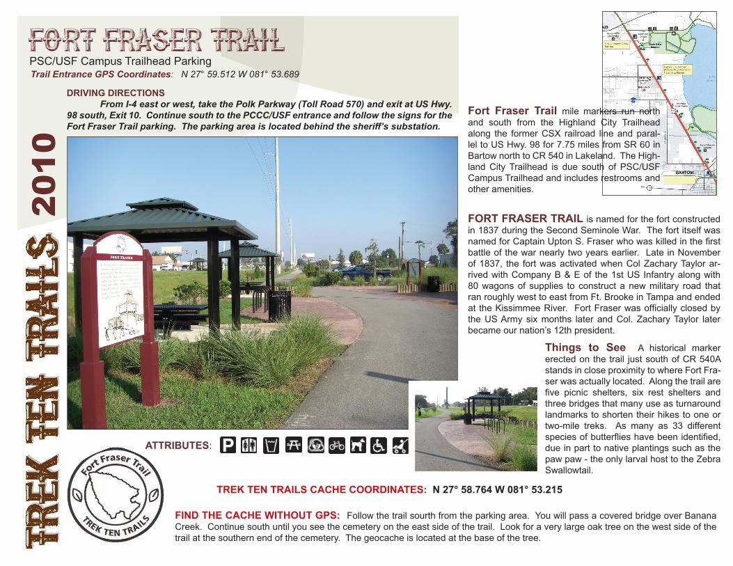
Things to See A historical marker erected on the trail just south of CR 540A stands in close proximity to where Fort Fra-ser was actually located. Along the trail are five picnic shelters, six rest shelters and three bridges that many use as turnaround landmarks to shorten their hikes to one or two-mile treks. As many as 33 different species of butterflies have been identified, due in part to native plantings such as the paw paw - the only larval host to the Zebra Swallowtail.
Fort Fraser Trail mile markers run north and south from the Highland City Trailhead along the former CSX railroad line and paral-lel to US Hwy. 98 for 7.75 miles from SR 60 in Bartow north to CR 540 in Lakeland. The High-land City Trailhead is due south of PSC/USF Campus Trailhead and includes restrooms and other amenities.