frantic about frances richard h. grumm and john lacorte national weather service state college, pa...
Post on 20-Dec-2015
214 views
TRANSCRIPT

Frantic About Frances
Richard H. Grumm and John LaCorte
National Weather Service
State College, PA 16803
Introduction
• Significant Hurricane as approached Florida– Had a big impact on Florida– Raised issues of impacts as it moved north– Would the track and timing be better than with…Charlie?
• Big issue was the transition stage– Heavy rains, tornadoes, and winds – Frances was a large storm lots of anomalies in wind, moisture and
pressure fields – And timing of heavy rain, tornadoes, and wind– Timing was in doubt due to model differences in the speed of
movement
• Heavy rains on north and west side of the storm in Pennsylvania, New York, and Ohio– Cold conveyor rains (heavy) in western New York, PA, and
OH.

Frances…the hurricane…not the mule…
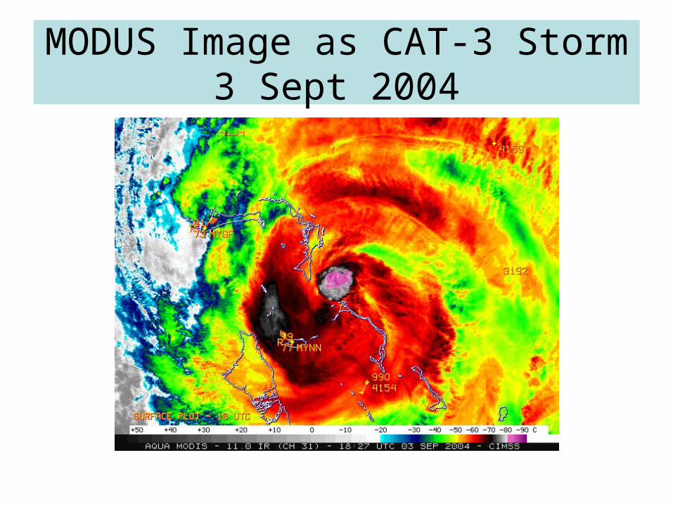
MODUS Image as CAT-3 Storm3 Sept 2004

4 Sept GOES-12
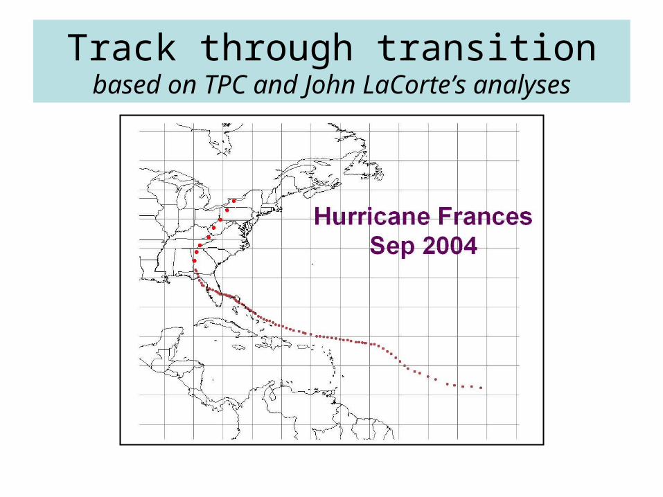
Track through transitionbased on TPC and John LaCorte’s analyses
Florida and beyond
• Big impact of Big Storm Florida’s East Coast– Winds and rain– Tornadoes
• Expectations of storm as it moved northward– Charlie had a bad “track” record (more on this later!)– Where would it rain and would there be significant
winds etc.– Tornadoes were a problem too
• Mainly in the feeder bands within the warm tropical air mass.• Okay, Ivan, terrible as it was…produced more tornadoes.

Tornadoes on the 6th
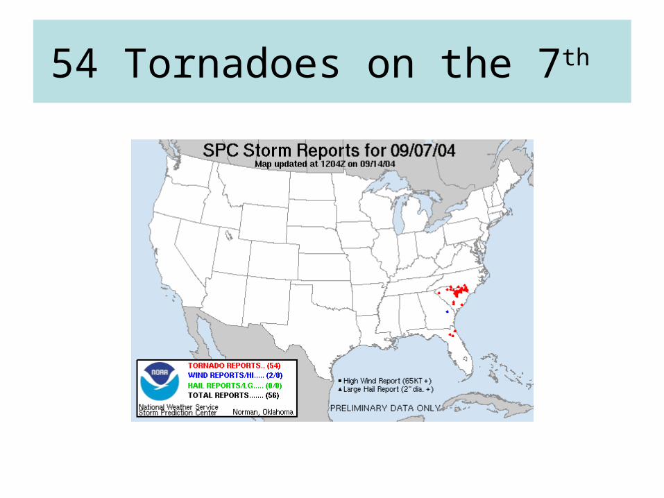
54 Tornadoes on the 7th
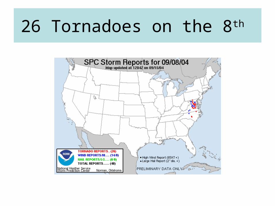
26 Tornadoes on the 8th

Eta 00-hour 850 hPa wind anomalies0000 UTC 8 September
•Extremely anomalous southerly winds ahead of the system
•5-6 Standard Deviation above normal winds
•Strong shear produced tornadoes
•The strong wind anomalies persisted, though weakened as the storm moved northward
•Note evolving easterly jet north of the cyclone…focus for heavy rains
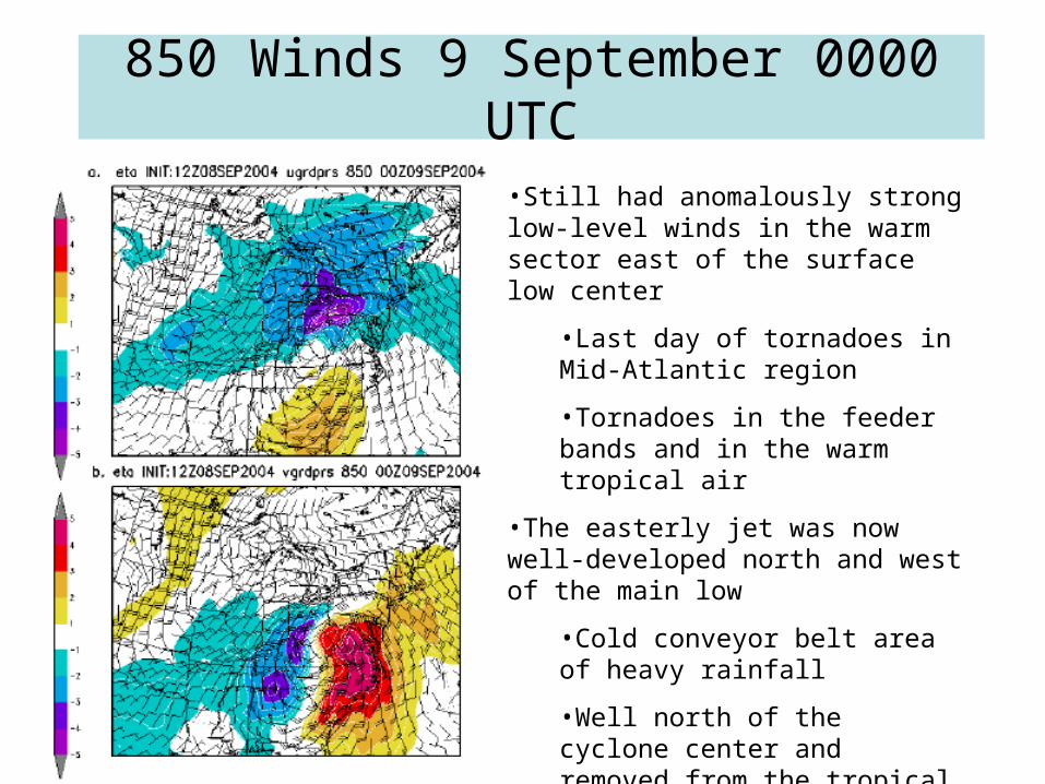
850 Winds 9 September 0000 UTC
•Still had anomalously strong low-level winds in the warm sector east of the surface low center
•Last day of tornadoes in Mid-Atlantic region
•Tornadoes in the feeder bands and in the warm tropical air
•The easterly jet was now well-developed north and west of the main low
•Cold conveyor belt area of heavy rainfall
•Well north of the cyclone center and removed from the tropical air at low-levels
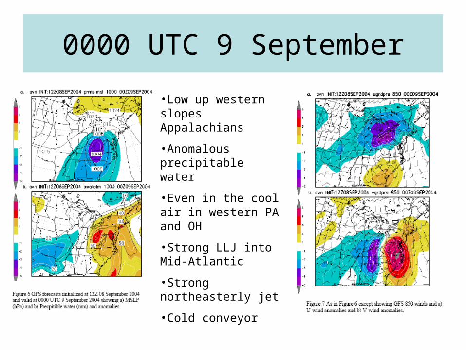
0000 UTC 9 September
•Low up western slopes Appalachians
•Anomalous precipitable water
•Even in the cool air in western PA and OH
•Strong LLJ into Mid-Atlantic
•Strong northeasterly jet
•Cold conveyor
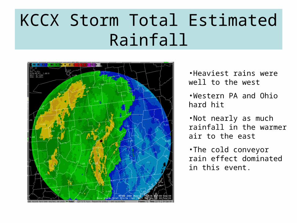
KCCX Storm Total Estimated Rainfall
•Heaviest rains were well to the west
•Western PA and Ohio hard hit
•Not nearly as much rainfall in the warmer air to the east
•The cold conveyor rain effect dominated in this event.
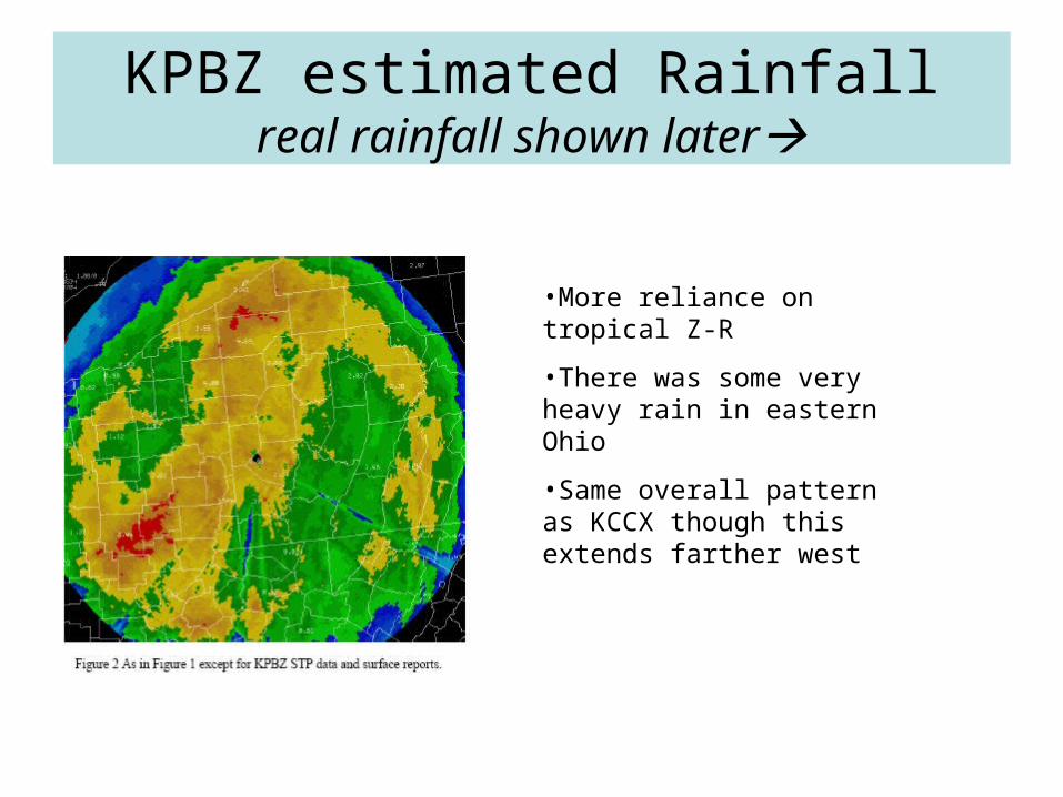
KPBZ estimated Rainfallreal rainfall shown later
•More reliance on tropical Z-R
•There was some very heavy rain in eastern Ohio
•Same overall pattern as KCCX though this extends farther west
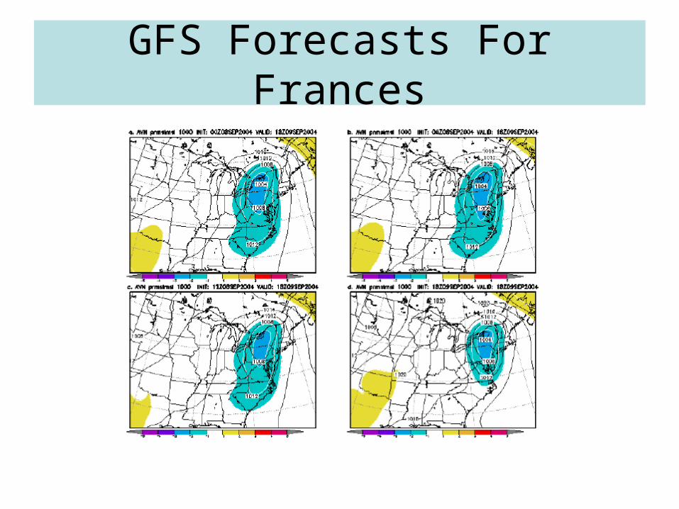
GFS Forecasts For Frances

Eta Forecasts For FrancesEta taken it slowly?

0000 UTC 09 September
Heavy rains in cold conveyor belt region
Note temperatures in the 60s.
L

0000 UTC 09 September
Heavy rains in cold conveyor belt region
Note temperatures in the 60s.
Tropical air
L

Cold conveyor rain
• Rain shield heavy rain north and west of surface low
• Strongly baroclinic– Northern ageostrophic winds– Strong low- and mid-level forcing
(Frontogensis)
• Not most common concept heavy rain in tropical systems but big in Mid-Atlantic /northeastern US

Frontogenetic Rains0000 UTC 9 Sept 850 FGEN/OBS/AGE 1000 hPa
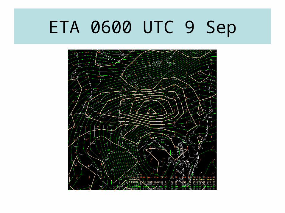
ETA 0600 UTC 9 Sep
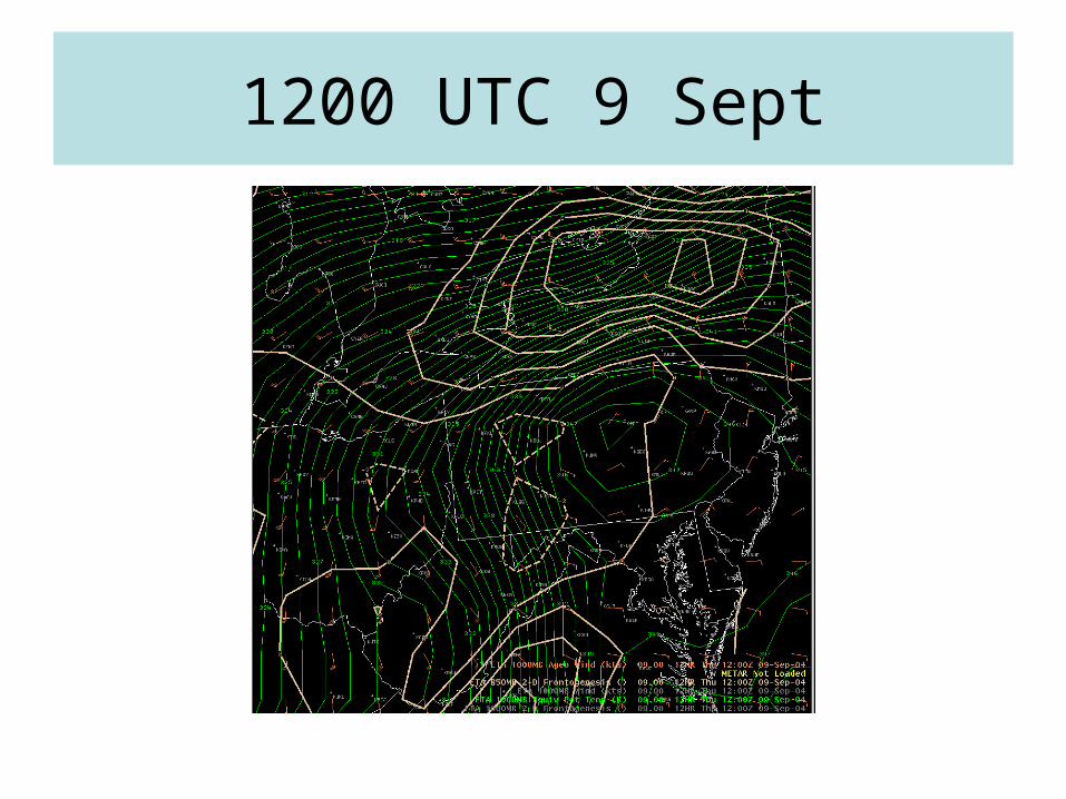
1200 UTC 9 Sept
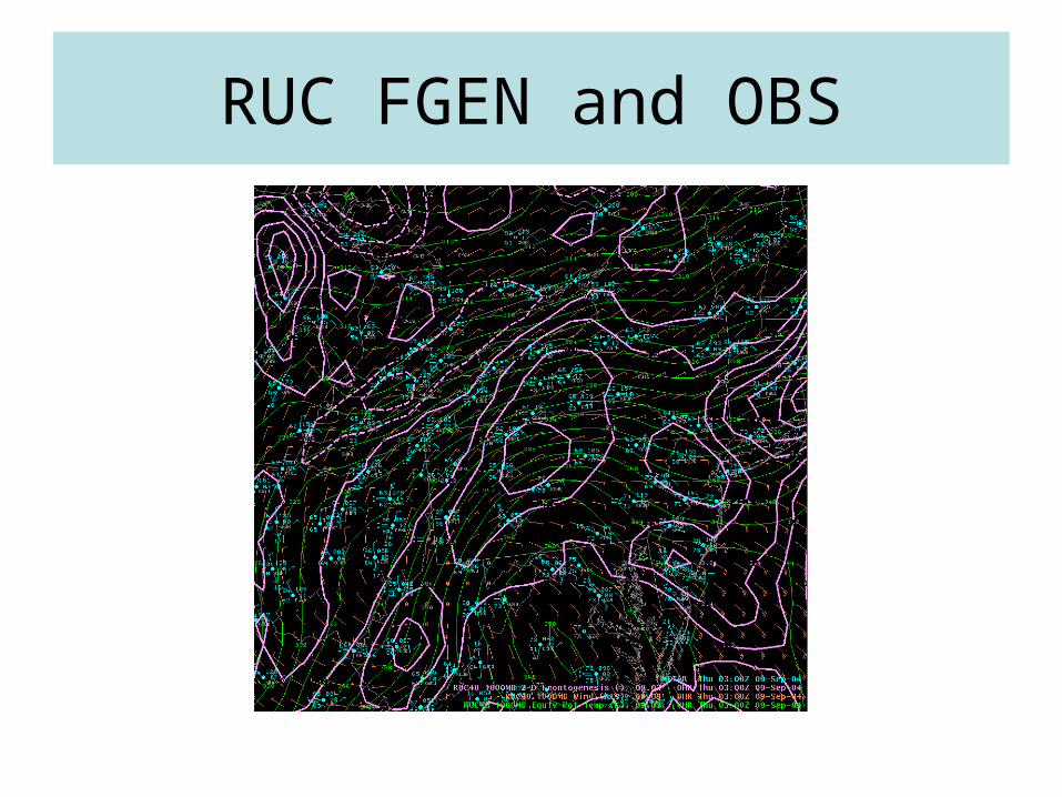
RUC FGEN and OBS
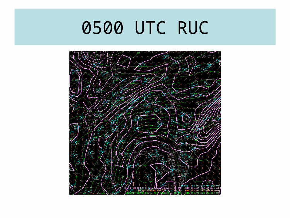
0500 UTC RUC
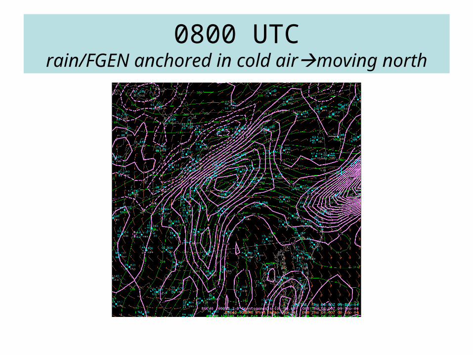
0800 UTCrain/FGEN anchored in cold airmoving north
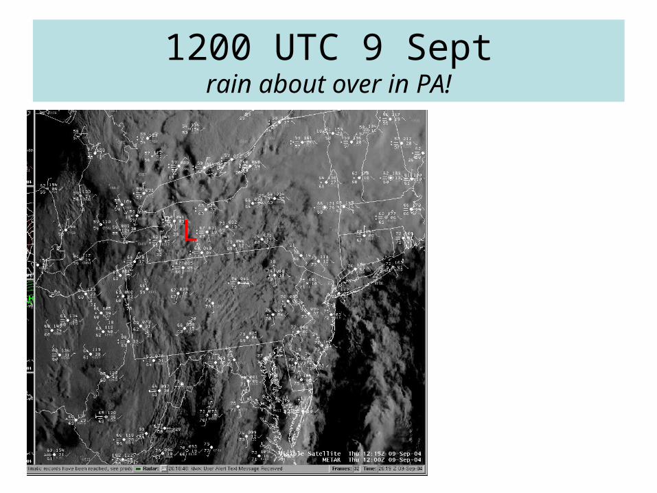
1200 UTC 9 Septrain about over in PA!
L

1800 UTC 9 September
L

Eta Forecasts For FrancesEta got faster with time but initially missed Oswego area locaiton!

The Eta and Tropical Storm Tracks
• The Eta was too slow with Frances– The GFS did a better job and was more
consistent– SREFS were good too….– This lead to rainfall forecasts and flood
products talking about rainfall into the day of the 9th in PA
• The rain ended in most locations before 1200 UTC
• Lets look at the woeful Eta forecasts for Charlie
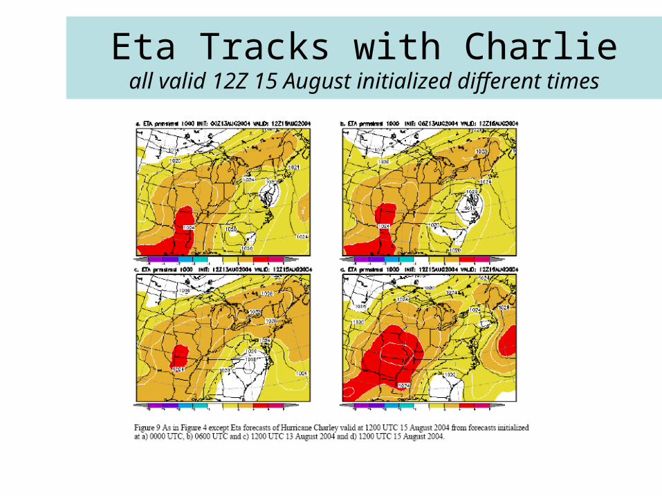
Eta Tracks with Charlieall valid 12Z 15 August initialized different times
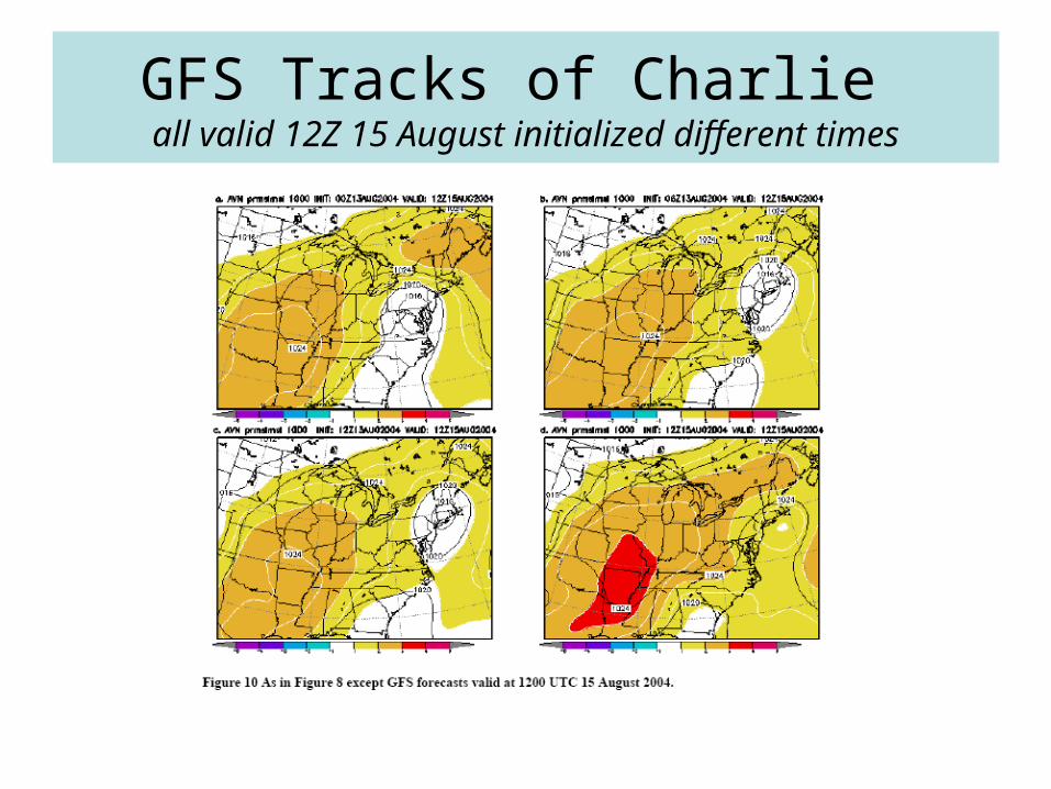
GFS Tracks of Charlie all valid 12Z 15 August initialized different times
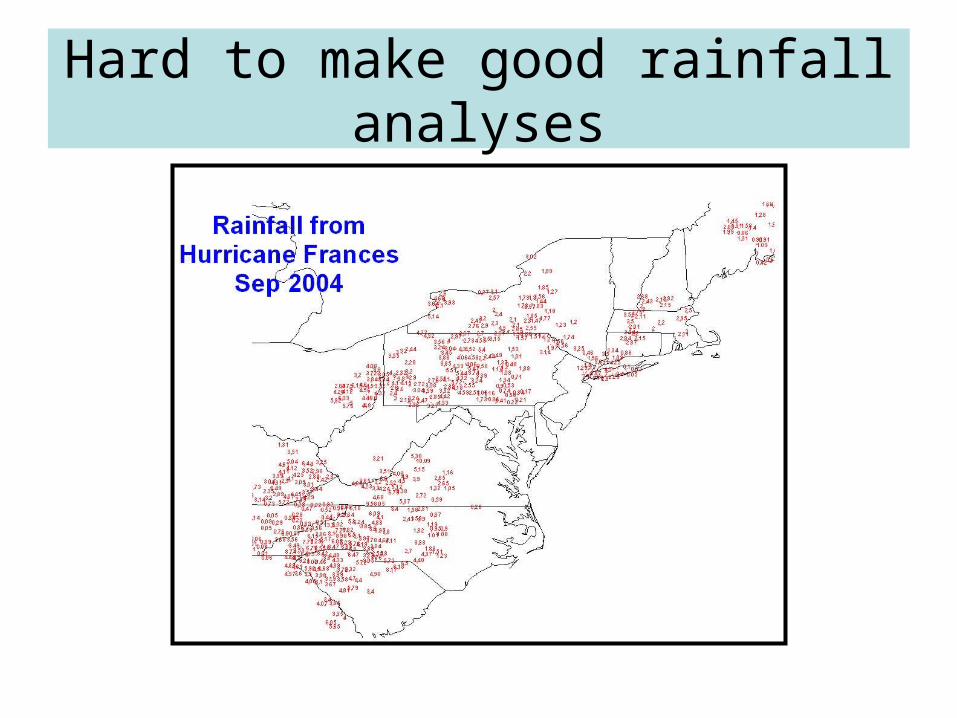
Hard to make good rainfall analyses

Central Appalachian Zoomed in viewpower of databases and arcview
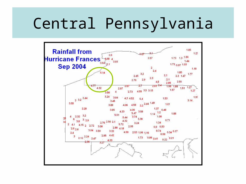
Central Pennsylvania
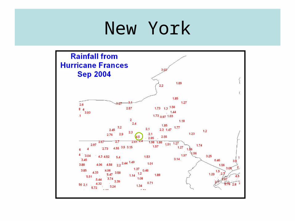
New York
A word about rainfall
• Not very standardized data• We need better means/methods to share data• Post analysis is not so easy with such
sporadic data• We could put together most but not all of the
picture• We really need to improve sharing
– Snowfall and rainfall data for good case reviews– This needs to be done in near real-time
Conclusions
• Frances wreaked some havoc– In Florida as a hurricane– In the southeast-Mid-Atlantic as
• Rain and tornado machine– Central PA had mainly a cold rain
• Remained in cool low-level air when the heavy rains arrived
• Track of the storm– The GFS was faster with storm progression and better than the
track of the Eta– The Eta has this slow bias with moving tropical storms….what's
up with that?– Ensembles (not shown) are a better way to go.