from paper maps to point based statistics
TRANSCRIPT
From paper mapsto point based statistics
Mirosław MigaczChief GIS Specialist
Central Statistical Office of [email protected]
INSPIRE Geospatial World Forum ConferenceLisbon, May 27th 2015
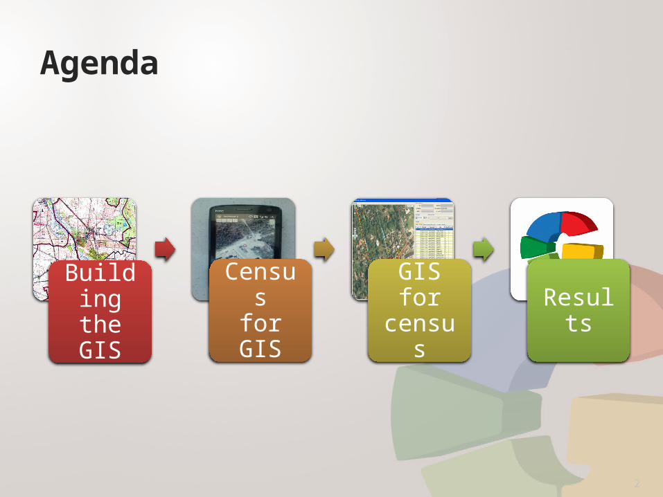
Agenda
Buildingthe GIS
Censusfor GIS
GISfor
censusResults
2

BUILDING THE GIS

What we had (2009)
BUILDING THE GIS
4
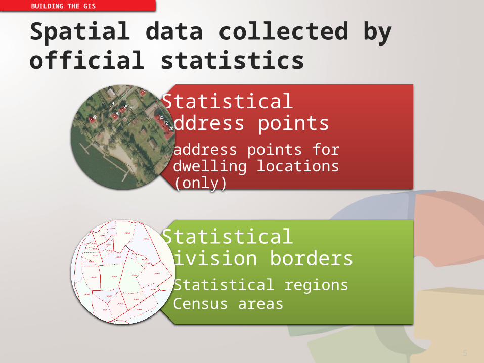
Spatial data collected by official statistics
BUILDING THE GIS
Statistical address points• address points for dwelling
locations (only)
Statistical division borders• Statistical regions• Census areas
5

Reference materials
BUILDING THE GIS
• Ortophotomap,• Cadastral Data,• Administrative
division borders,
Primary:
• LPIS (Land Parcel Identification System),
• Road and street network (commercial),
• Geographical Names.• Topographic Data
Base.
Secondary:
6
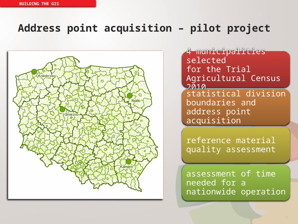
Address point acquisition – pilot project
BUILDING THE GIS
4 municipalities selectedfor the Trial Agricultural Census 2010
statistical division boundaries and address point acquisition
reference material quality assessment
assessment of time needed for a nationwide operation
7
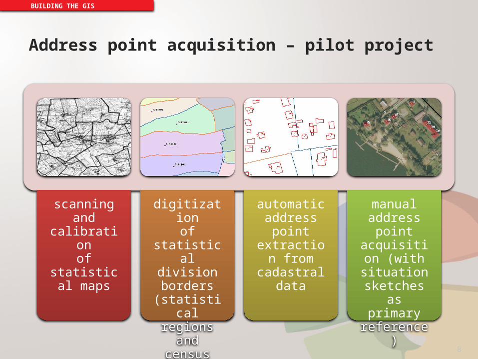
Address point acquisition – pilot project
BUILDING THE GIS
scanningand calibration
of statistical maps
digitizationof statistical
division borders
(statistical regions and
census areas)
automatic address point
extraction from cadastral data
manual address point
acquisition (with situation
sketchesas primary reference)
8

Work schedule (nationwide)
BUILDING THE GIS
• reference material collection
January 2009 – December 2009
• reference material processing
January 2010 – May 2010 • address point
acquisition
January 2010 – June 2010
• address point database update
continuously since July 2010
9
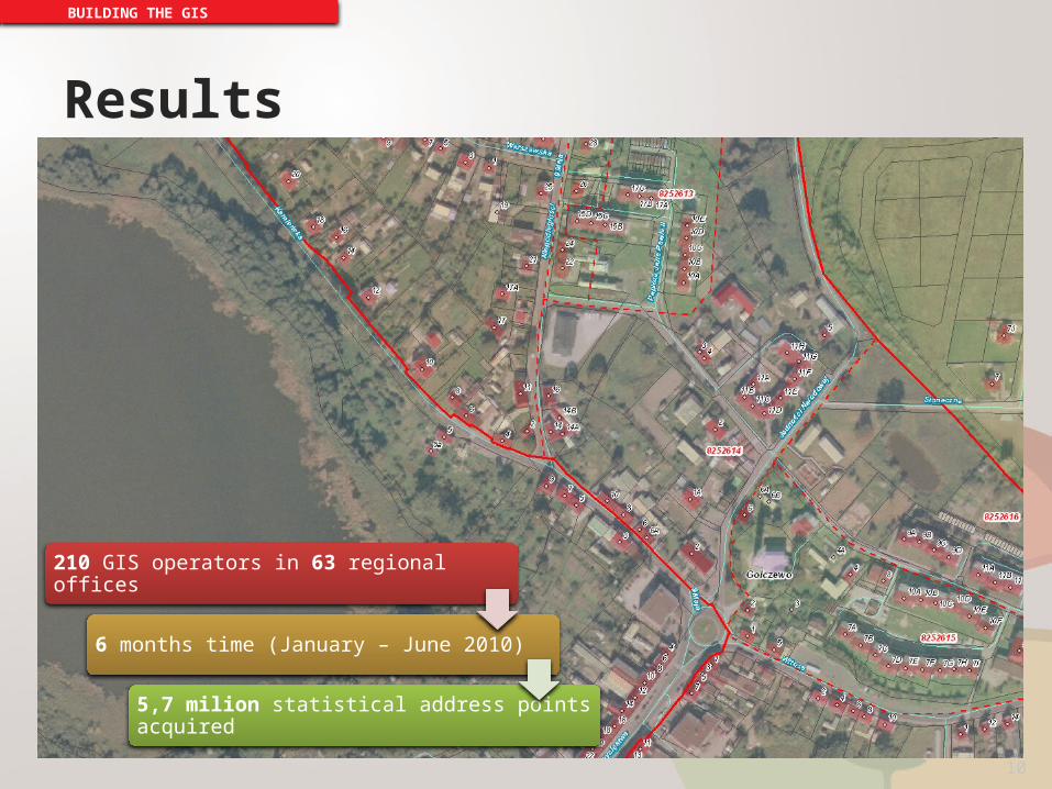
Results
BUILDING THE GIS
210 GIS operators in 63 regional offices
6 months time (January – June 2010)
5,7 milion statistical address points acquired
10
CENSUS UPDATEOF ADDRESS POINTS
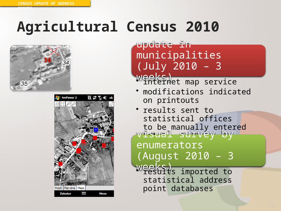
Agricultural Census 2010
CENSUS UPDATE OF ADDRESS POINTS
update in municipalities(July 2010 – 3 weeks)• internet map service• modifications indicated
on printouts• results sent to statistical offices
to be manually entered intothe databases
visual survey by enumerators(August 2010 – 3 weeks)• results imported to statistical
address point databases
36
12
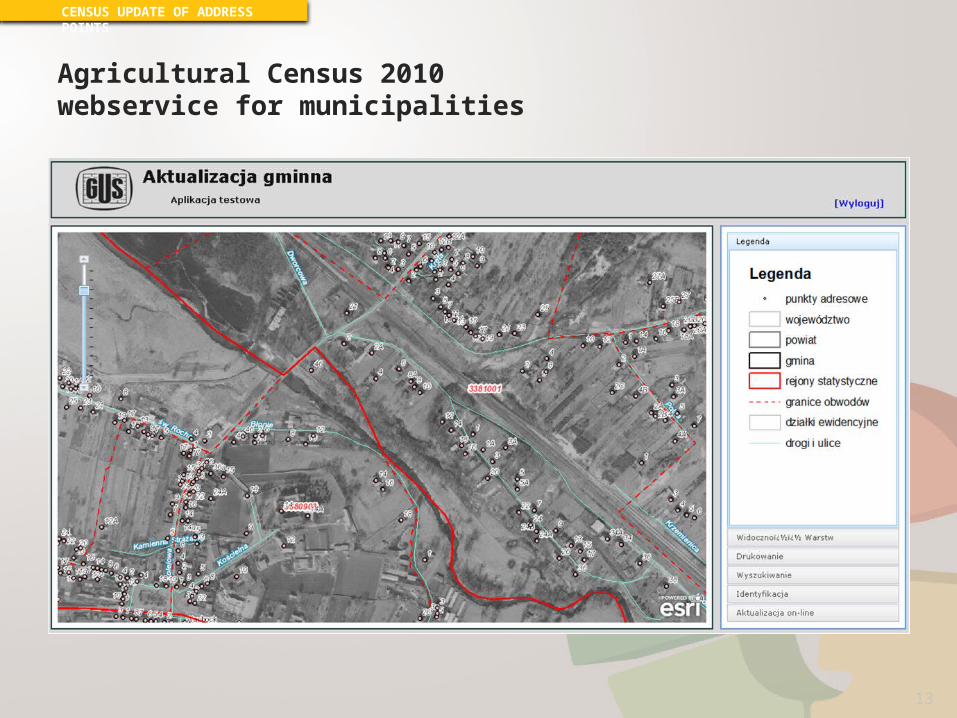
Agricultural Census 2010 webservice for municipalities
CENSUS UPDATE OF ADDRESS POINTS
13
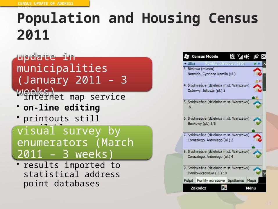
Population and Housing Census 2011
CENSUS UPDATE OF ADDRESS POINTS
update in municipalities (January 2011 – 3 weeks)• internet map service• on-line editing• printouts still available
visual survey by enumerators (March 2011 – 3 weeks)• results imported to statistical
address point databases
14

Population and Housing Census 2011 webservice for municipalities
CENSUS UPDATE OF ADDRESS POINTS
15
Results
CENSUS UPDATE OF ADDRESS POINTS
16
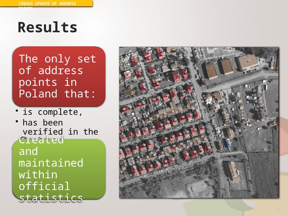
The only setof address points in Poland that:
• is complete,• has been verified in
the field,
Createdand maintained within official statistics
GIS IN CENSUSES
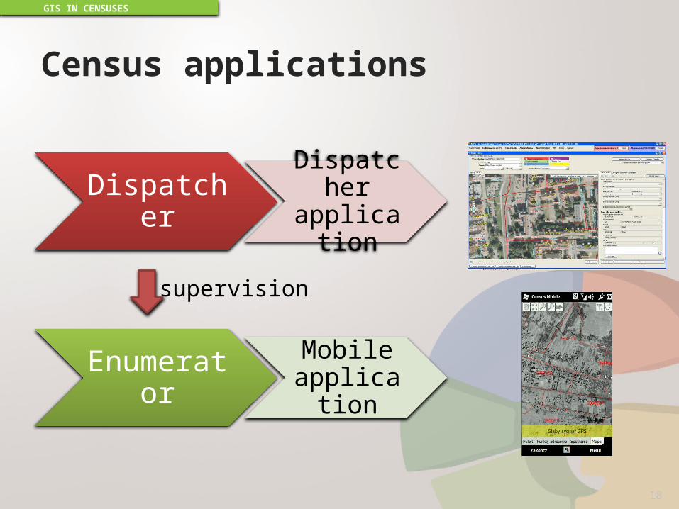
Census applications
GIS IN CENSUSES
18
Dispatcher Dispatcher application
Enumerator Mobile application
supervision

Dispatcher application
Enumerator supervision• task assigment
• address points• interviews
• trail monitoring• support
Census completeness monitoring
GIS IN CENSUSES
19

Dispatcher application – table view
GIS IN CENSUSES
20
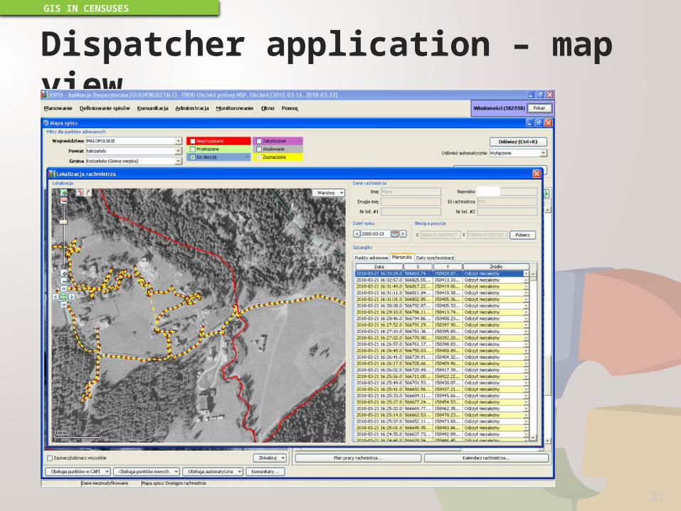
Dispatcher application – map view
GIS IN CENSUSES
21
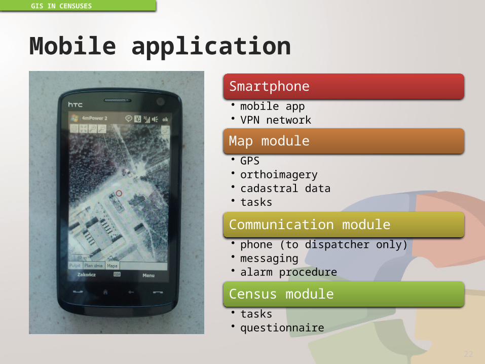
Mobile applicationSmartphone• mobile app• VPN network
Map module• GPS• orthoimagery• cadastral data• tasks
Communication module• phone (to dispatcher only)• messaging• alarm procedure
Census module• tasks• questionnaire
GIS IN CENSUSES
22

Mobile application
GIS IN CENSUSES
23

Mobile application – map module
GIS IN CENSUSES
24
GEOSTATISTICS PORTAL
GEOSTATISTICS PORTAL
26
GEO.STAT.GOV.PLLAUNCHED: JULY 2013

GEOSTATISTICS PORTAL
27
What’s it for?• statistical data
geovisualization• spatial data publishing• network services
(INSPIRE)
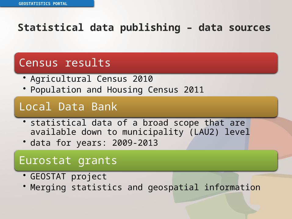
Statistical data publishing – data sources
Census results• Agricultural Census 2010• Population and Housing Census 2011
Local Data Bank• statistical data of a broad scope that are available down to
municipality (LAU2) level• data for years: 2009-2013
Eurostat grants• GEOSTAT project• Merging statistics and geospatial information
GEOSTATISTICS PORTAL
Statistical data publishing– cartographic presentation methods
GEOSTATISTICS PORTAL
29
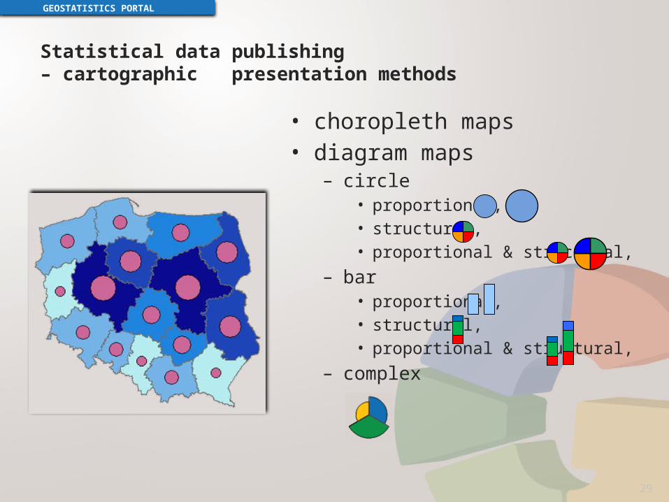
• choropleth maps• diagram maps
– circle• proportional,• structural,• proportional & structural,
– bar• proportional,• structural,• proportional & structural,
– complex
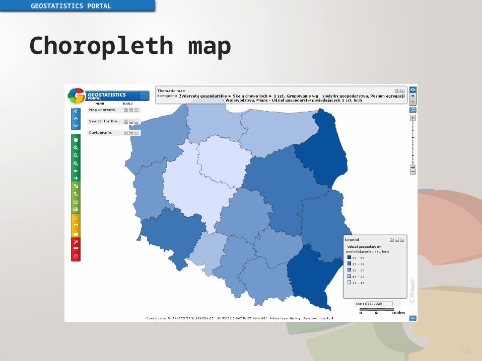
Choropleth map
GEOSTATISTICS PORTAL
30

Diagram maps
GEOSTATISTICS PORTAL
31

Publishing statistical data on grids
GEOSTATISTICS PORTAL
32
GEOSTAT project
Merging statistical data and geospatial information
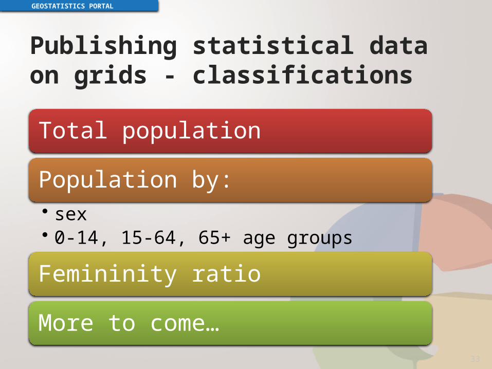
Publishing statistical data on grids - classifications
GEOSTATISTICS PORTAL
33
Total population
Population by:• sex• 0-14, 15-64, 65+ age groups
Femininity ratio
More to come…

Network services – INSPIRE
GEOSTATISTICS PORTAL
Central Statistical Office of Polandis the authority responsible for two annex III spatial data themes:
statistical unitsSU
population distribution (demography)PD
34
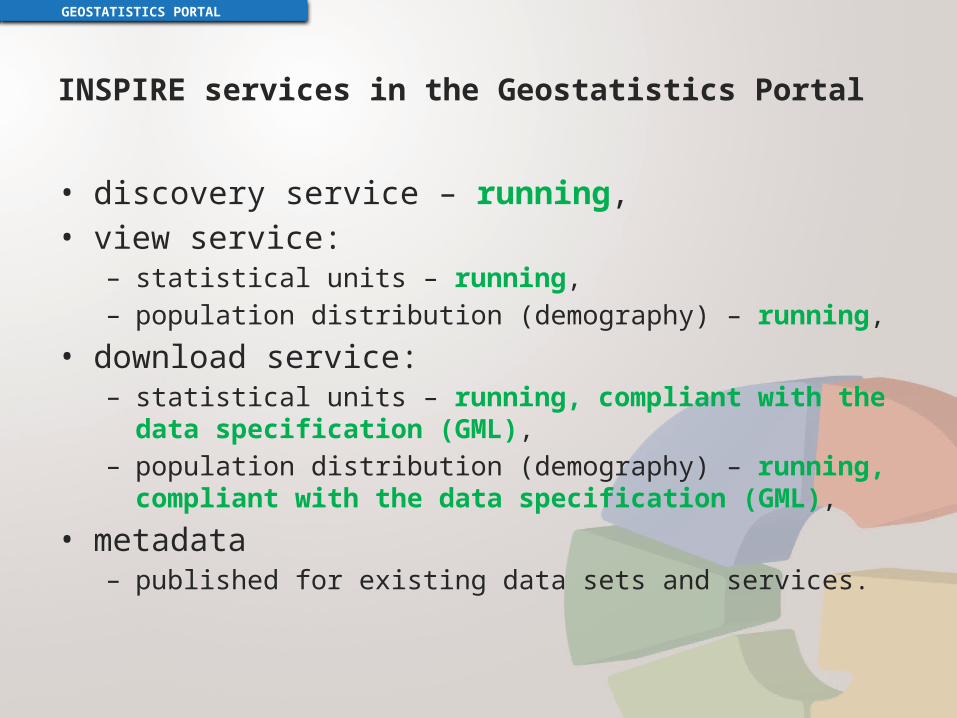
INSPIRE services in the Geostatistics Portal
• discovery service – running,• view service:
– statistical units – running,– population distribution (demography) – running,
• download service:– statistical units – running, compliant with the data specification
(GML),– population distribution (demography) – running, compliant with the
data specification (GML),
• metadata– published for existing data sets and services.
GEOSTATISTICS PORTAL
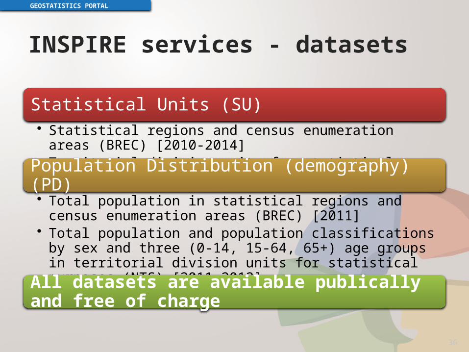
INSPIRE services - datasets
GEOSTATISTICS PORTAL
36
Statistical Units (SU)• Statistical regions and census enumeration areas (BREC) [2010-2014]• Territorial division units for statistical purposes (NTS) [2010-2014]
Population Distribution (demography) (PD)• Total population in statistical regions and census enumeration areas
(BREC) [2011]• Total population and population classifications by sex and three (0-14,
15-64, 65+) age groups in territorial division units for statistical purposes (NTS) [2011-2012]
All datasets are available publically and free of charge

INSPIRE Thematic Clusters
GEOSTATISTICS PORTAL
37
• On-line collaboration platform for:– sharing experiences,– asking questions,– solving problems
regarding INSPIRE implementation of:
https://themes.jrc.ec.europa.eu/

NEW DEVELOPMENTS
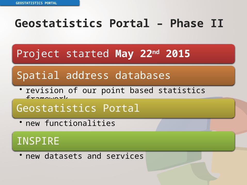
Geostatistics Portal – Phase II
GEOSTATISTICS PORTAL
Project started May 22nd 2015
Spatial address databases• revision of our point based statistics framework
Geostatistics Portal• new functionalities
INSPIRE• new datasets and services
Spatial address databases
GEOSTATISTICS PORTAL
To make it easier to maintain our point base statistics framework:• Software update
• ArcGIS 9.3.1 -> ArcGIS 10.3• Reference data distribution automation• Operational data reporting and backup
automation• Minor improvements in the dedicated application

Geostatistics Portal
GEOSTATISTICS PORTAL
advanced spatial analysis on microdata
Local Data Bank – full scope
on-the-fly visualizationof user-supplied data
mobile application
other minor improvements

Advanced spatial analysis on microdata
all census results collected with reference to an address point
spatial analysis possible in any desired area
available for users within official statistics

Local Data Bank – full scope
a huge database with lots of historical statistical data
most data availablefor years 2003-2014
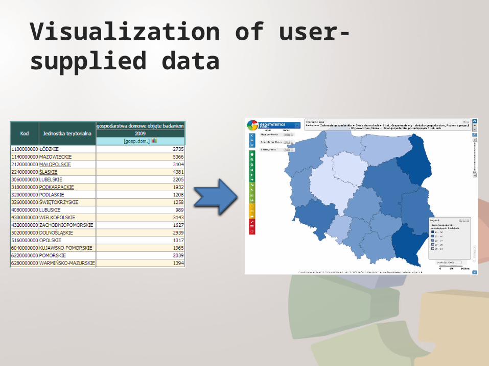
Visualization of user-supplied data
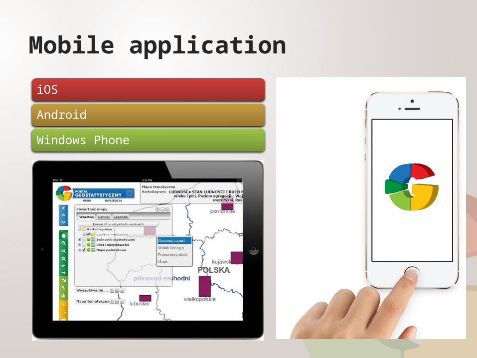
Mobile application
iOS
Android
Windows Phone
Other improvements
upgrade of the website’s CMS• W3C Web Content
Accessibility Guidelines
upgrade of the usage monitoring system• hit counters for specific
webpages, modules, services• INSPIRE services monitoring
tools for administrators• user management upgrade• language version manager
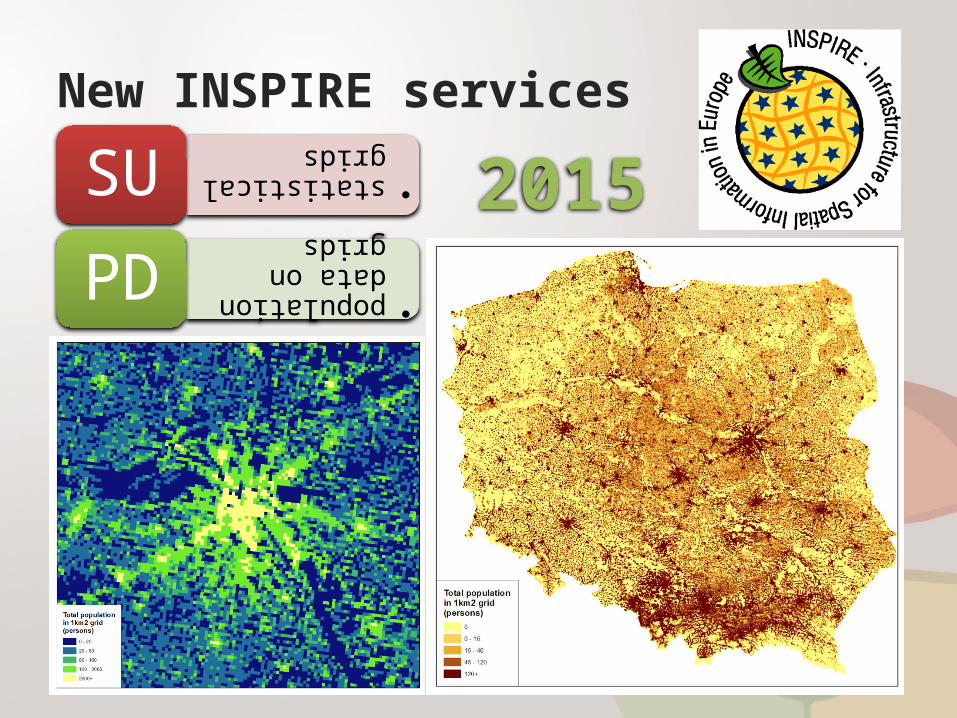
New INSPIRE services
•statistical grids
SU
•population data on grids
PD2015
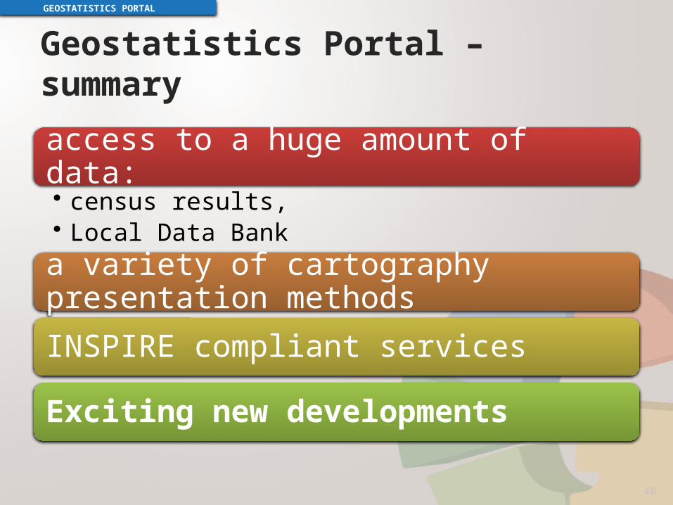
Geostatistics Portal – summary
access to a huge amount of data:• census results,• Local Data Bank
a variety of cartography presentation methods
INSPIRE compliant services
Exciting new developments
GEOSTATISTICS PORTAL
48
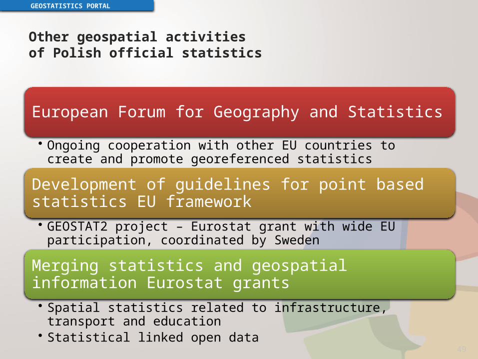
Other geospatial activitiesof Polish official statistics
European Forum for Geography and Statistics
• Ongoing cooperation with other EU countries to create and promote georeferenced statistics
Development of guidelines for point based statistics EU framework• GEOSTAT2 project – Eurostat grant with wide EU participation, coordinated by
Sweden
Merging statistics and geospatial information Eurostat grants
• Spatial statistics related to infrastructure, transport and education• Statistical linked open data
GEOSTATISTICS PORTAL
49

From paper mapsto point based statistics
Mirosław MigaczChief GIS SpecialistCentral Statistical Office of Poland
@mireslav
www.linkedin.com/in/migacz
www.slideshare.net/MirosawMigacz
GEO.STAT.GOV.PL