fscp 2014 presentation watershedworkshopsg15
DESCRIPTION
https://fscp.foothillsri.ca/sites/default/files/FSCP_2014_Presentation_WatershedWorkshopSG15.pdfTRANSCRIPT

An Overview, March 5th, 2015
Stream Crossing Partnership

I
Background q Ini$al concept was developed by West Fraser and Foothills Research
Ins$tute in 2004 q First official mee$ng on April 5, 2005 in Calgary q Goal, Objec$ves of program established q MOU approved by members in June of 2005 q Stream Crossing Inspec$on Manual finalized in spring of 2006
(currently being updated) q First inspec$ons completed in summer of 2006 q Hired a full $me fishery biologist in 2008 q SubmiRed first remedia$on plans in 2009 q Developed a new data base collec$on and storage system in 2011
and 2012 q working with ESRD to establish the working relationship
between the regulators and SCP that will add value to membership and the watershed approach to stream crossing remediation.

Goal of the SCP
“…….. to help companies and crossing owners to manage stream crossings in the long term…….. “

0 Objec=ves
• Develop an industry-‐driven approach • Establish a standardized stream crossing inspec=on process and protocol
• Establish a system to iden=fy priori=es for maintenance and replacement
• Coordinate watershed level remedia=on planning
• Monitor results

000000000000000000000000000000000
What we do………
p Inspect crossings p Work with regulators to set watershed priori=es for remedia=on
p Coordinate watershed remedia=on plans
p Maintain the data base p Monitor results (re-‐inspec=ons; electrofishing)
p Liaison with the regulators

Main Area of Opera=on
Edson
Sundre
Hinton
Stavely
Okotoks
Canmore Calgary
McLennan
Cardston
Red Deer
Edmonton
Fox Creek
High River
Whitecourt
Swan Hills
Valleyview
Slave LakeBeaverlodge
Spirit River
Fort Macleod
Grande Cache
High Prairie
Pincher CreekCrowsnest Pass
Drayton Valley
Grande Prairie
Rocky Mountain House
Legend
HydrologicUnitCode8WatershedsOfAlberta
New_Duvernay_PilotArea_April2014shp
Major Highways
SCP Inspected Crossings
ARTR_Distribution_Area
Phase 1
ESRD Operational Regions
SCP Current Opeartional Area and Potential Phase 1
of Stream Crossing Roll Out
³ 50 0 5025 Kilometers
Map prepared by Ngaio BarilFor Jan 20-21, 2014Waterhed PriorizationWorkshop
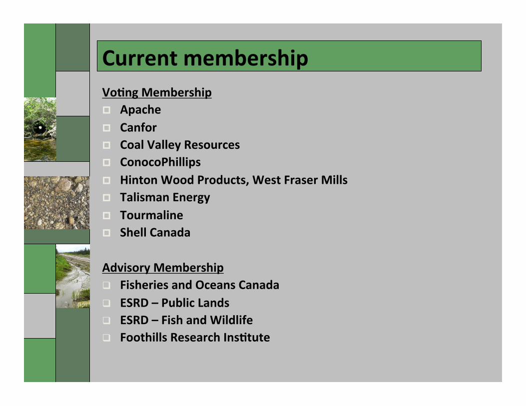
0 Current membership Vo=ng Membership p Apache p Canfor p Coal Valley Resources p ConocoPhillips p Hinton Wood Products, West Fraser Mills p Talisman Energy p Tourmaline p Shell Canada
Advisory Membership q Fisheries and Oceans Canada q ESRD – Public Lands q ESRD – Fish and Wildlife q Foothills Research Ins=tute

0
• Safety • Water quality
(Erosion, sedimentation)
• Fish passage
Inspections
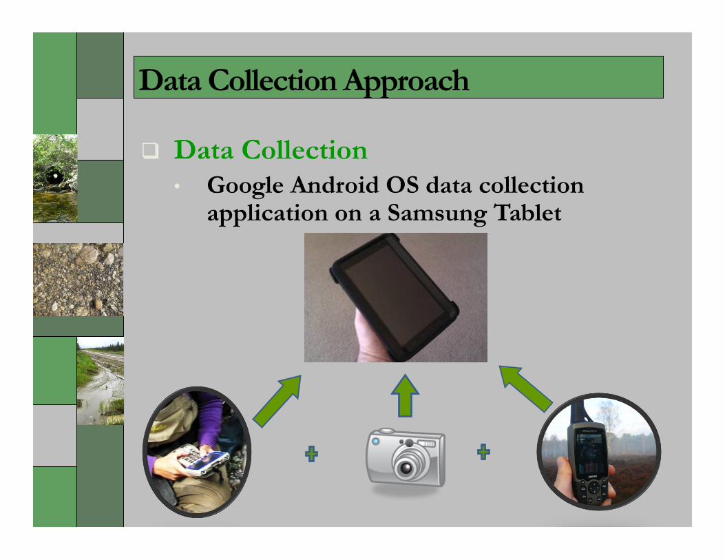
Data Collection Approach
q Data Collection • Google Android OS data collection
application on a Samsung Tablet

New Data Management Approach
q Data Collection Benefits • Application is designed according to most recent
data requirements
• Extensive data validation
• Camera, GPS and datalogger all in one
• Easy transfer to outside groups conducting inspections
• Immediate upload of data to online tool

New Data Management Approach
q Data Interaction
• 13,000 inspections of 8000 individual crossings

Data Management
q Data Interaction
• Companies can access data at anytime
• Search data by attributes of the crossings
• Can download spatial data and PDF reports and photos
• Watershed views of connectivity and sedimentation (over time)
• Multi level passwords available per company

Stream and Watershed Health
Watershed Metrics (5yrs)
Stream & Watershed Health • Single layer (streams & watershed)
• User set year of interest control • Streams
• Blocked: Red • Not Blocked: Blue
• Watersheds (% total len blocked) • >= 20: Red • >= 5 & < 20: Yellow • < 5: Green

000000000 In Summary
The Stream Crossing Partnership provides:
q An inspection protocol
q Data management and storage
q GIS support
q Fish biologist
q Remediation and improved habitat over
the long term
q A managed approach to a broad problem