full project proposal
TRANSCRIPT
8/12/2019 Full Project Proposal
http://slidepdf.com/reader/full/full-project-proposal 1/23
1
Conservation of surface and ground water in a Western watershed experiencing rapid lossof irrigated agricultural land to development
A proposal to the Integrated Research, Education, and Extension Competitive Grants Program—
National Integrated Water Quality Program (NIWQP), U.S. Department of Agriculture,Cooperative State Research, Education, and Extension Service
Project DirectorRobert W. Van Kirk
Department of Mathematics and Environmental Systems Graduate ProgramHumboldt State University
Arcata, CA 95521
Project SummaryRural watersheds throughout the West are experiencing rapid replacement of irrigatedagricultural land with suburban, exurban, and resort development, resulting in increased waterdemand and alteration of traditional irrigation practices. Furthermore, changes in waterwithdrawal, conveyance and use have altered ground-surface water interactions, exacerbatingconflicts among users. To achieve NIWQP watershed-scale objectives to develop waterconservation strategies, promote effectiveness of such strategies, and train the next generation ofwater professionals, we propose a research, extension, and education project in the Henry’s ForkSnake River watershed that will 1) develop quantitative models of ground and surface water useand flow pathways under historic, current, and anticipated future water/land use scenarios; 2)identify socioeconomic and physical mechanisms that will encourage water conservation andefficient water management on developed lands; 3) prepare and distribute to decision-makers,
planners, and stakeholders educational materials describing the watershed’s hydrologic systemand water conservation benefits and strategies; 4) facilitate development by the Henry’s ForkWatershed Council of a water conservation and management strategy to increase wateravailability for agriculture while enhancing ecological benefits in key stream reaches; and 5)
provide experiential training to an interdisciplinary team of environmental science graduate andundergraduate students. A model of surface and ground water flow will be constructed fromexisting hydrologic data and measurements of stream and canal gain/loss and will be calibratedto traditional irrigation management conditions. This model will be used to predict futureconditions under hypothesized land/water-use scenarios. Decision-makers and stakeholders will
be involved throughout the project to ensure that project outputs meet their information needs,are disseminated effectively, and contribute to development of stakeholder-driven conservationstrategies.

8/12/2019 Full Project Proposal
http://slidepdf.com/reader/full/full-project-proposal 2/23
2
CONTENTS
INTRODUCTION………………………………………………………………………………...2
Population Growth and Collaborative Watershed Management in the “New” West……..3Study Area………………………………………………………………………………...4Previous and Ongoing Research and Management Activities…………………………….8Project Team………………………………………………………………………………9Stakeholder Involvement in Identifying Project Need…………………………………...10
OBJECTIVES……………………………………………………………………………………12Research………………………………………………………………………………….12Extension………………………………………………………………………….……...12Education………………………………………………………………………………...12
METHODS………………………………………………………………………………………13Stakeholder Involvement………………………………………………………………...13
Methodology by objective………………………………………………………………14Objective 1. Hydrologic model development…………………………………...14Objective 2. Identification of water conservation mechanisms…………………15Objective 3. Preparation and dissemination of educational materials…………..16Objective 4. Development of water conservation and management strategy…...17Objective 5. Experiential training for an interdisciplinary team of students……17
Project Deliverables……………………………………………………………………...18Potential Pitfalls and Limitations………………………………………………………...18Project Evaluation………………………………………………………………………..19
TASKS AND TIMETABLE….……………………………………………………………...….19REFERENCES...........................................………………………………...................................21
INTRODUCTION
Conflicts over water use in the arid and semi-arid Western United States date back to the 19 th century. Early in the settlement of West, conflicts occurred over uses for mining and agriculture.The socioeconomic institutions that were developed to manage these conflicts include the priorappropriation doctrine, cooperative investment in water infrastructure, federal programs designedto develop the West’s water resources, and government agencies charged with measuring, storingand delivering these resources (Reisner 1993, Fiege 1999). By the middle of the 20 th century,irrigation became the dominant use of water in the West, accounting for over 90% of total waterwithdrawals and consumptive use in most rural watersheds. Although conflicts will always
occur between junior and senior water rights holders in a prior appropriation system, traditionalmechanisms of apportionment and delivery of surface water served agriculture well from the1940s through the 1970s, in part because of a favorable combination of factors including lowhuman population densities, relatively stable climate, and little demand for other uses. Since thelate 1970s, however, these traditional water management practices have been unable to meet theneeds of irrigation, let alone other uses, in the face of requirements for environmental flows (e.g.,Kenney 1999), increases in ground-water withdrawal (e.g., Johnson et al. 1999), and changes inclimate (e.g., Service 2004, Mote 2006). Currently, rapid population growth in the West is

8/12/2019 Full Project Proposal
http://slidepdf.com/reader/full/full-project-proposal 3/23
3
adding another significant challenge to water management through increased demand for water,conversion of irrigated land to suburban, exurban, and resort development, and alteration oftraditional water management practices. We propose to address this emerging challenge to waterallocation and management in the rural West.
Population Growth and Collaborative Watershed Management in the “New” West
Over the past three decades, the population of the rural West has increased substantially, as people seek a higher quality of life, which includes scenic beauty, access to public lands, andopportunities for outdoor recreation (Johnson and Rasker 1995, Riebsame et al. 1996, Rudzitis1999, Frentz et al. 2004). Although a number of researchers have investigated the consequencesof population growth to ecological processes and conservation (e.g., Theobald et al. 1996,Hansen et al. 2002, Gosnell et al. 2006), most of this work has focused on terrestrial ecosystemsand landscape conservation rather than on aquatic ecosystems and water conservation.Conversely, most research into the ecological consequences of human use and management ofwater resources in the West has focused on the effects of dams and water withdrawal associatedwith traditional uses (e.g., Collier et al. 1996, Richter et al. 1997, Rood et al. 2003) and not onthe effects of population expansion into irrigated regions. Concurrently, sociologists haveinvestigated the theory that newcomers to rural areas place a higher value on environmental
protection than do long-term residents and thus that “green migration” of new residents canresult in greater support for conservation of natural resources in rural areas (e.g., Jones et al.2003). In the West, discussion over the legitimacy of this theory has often been framed as the“cows versus condos” debate, in which the relative consequences to environmental quality areweighed between a traditional ranching/farming landscape and one dominated by exurbandevelopment, albeit one perhaps inhabited more environmentally enlightened residents (e.g.,Wuerthner 1994, Knight et al. 1995). In at least some areas of the rural west (including theTeton Valley within the proposed study area of this project), long-time residents are actuallymore likely to support limits to population growth, maintenance of traditional land uses at theexpense of economic growth, and protection of environmental quality than are newcomers(Smith and Krannich 2000). Preston (2005) has taken this observation a step further by likeningimmigration into the rural West to the fable of the charmed goose—people move to the ruralWest because of its natural amenities, but development associated with this immigration resultsin degradation of the very amenities attracting the new residents. Although natural amenities caninclude water and aquatic resources, this inclusion is often implicit rather than explicit, andtheories of both sociological and ecological consequences of rapid population growth in the ruralWest have rarely been applied to effects on traditional irrigation systems and conservation ofaquatic ecosystems.
Given the emphasis placed on effects of population growth on land use and terrestrialecosystems, it is ironic that the social institutions generally considered most successful inaddressing natural resource management conflicts in the West have grown up around waterissues. Watershed councils and other collaborative, stakeholder-driven groups have proliferatedin the rural West, providing alternatives to government decision-making in management of waterresources (Kenney 1999, Lant 1999, Weber 2000). Success of watershed councils inimplementing changes on the ground can be hampered by limited participation, lack ofregulatory authority, and restricted funding availability (Griffin 1999), but such councils have
8/12/2019 Full Project Proposal
http://slidepdf.com/reader/full/full-project-proposal 4/23
4
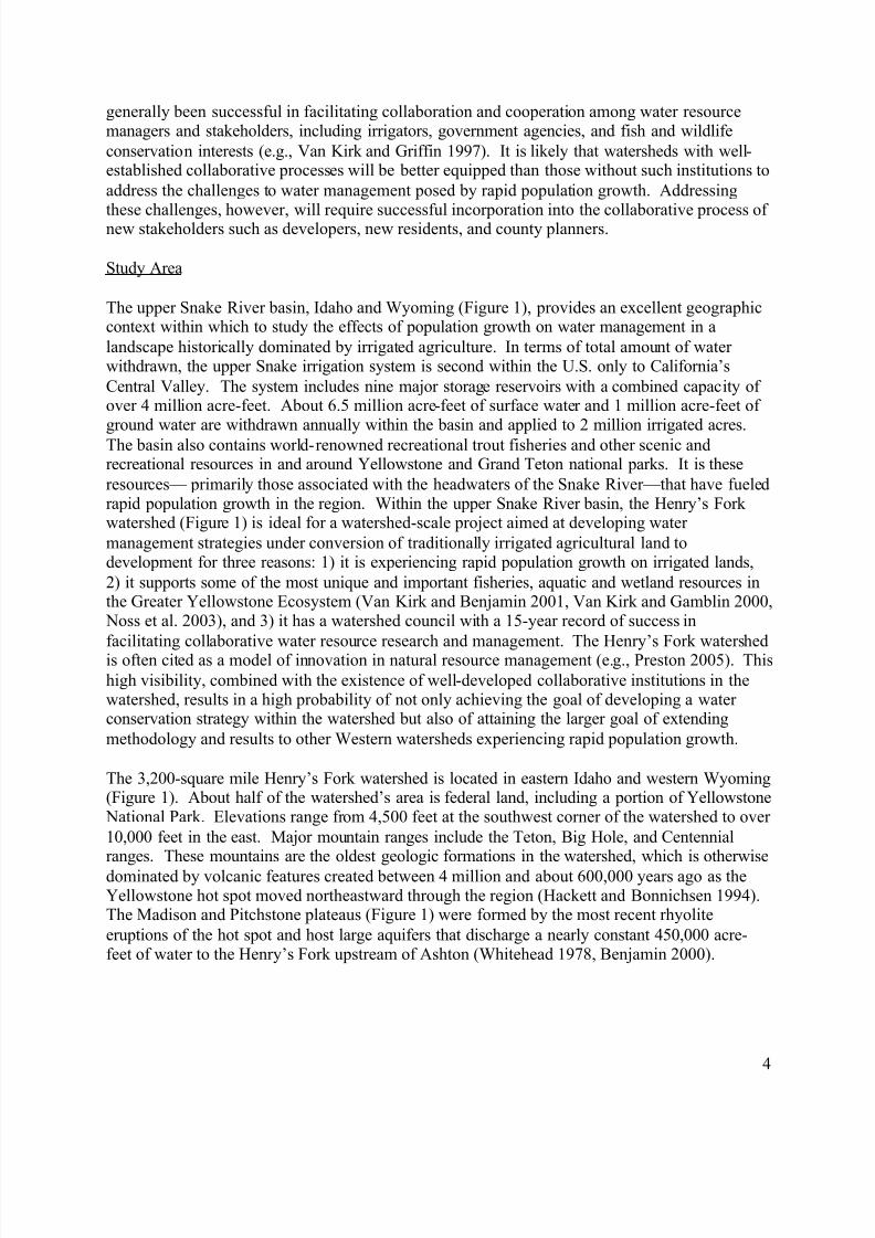
generally been successful in facilitating collaboration and cooperation among water resourcemanagers and stakeholders, including irrigators, government agencies, and fish and wildlifeconservation interests (e.g., Van Kirk and Griffin 1997). It is likely that watersheds with well-established collaborative processes will be better equipped than those without such institutions toaddress the challenges to water management posed by rapid population growth. Addressing
these challenges, however, will require successful incorporation into the collaborative process ofnew stakeholders such as developers, new residents, and county planners.
Study Area
The upper Snake River basin, Idaho and Wyoming (Figure 1), provides an excellent geographiccontext within which to study the effects of population growth on water management in alandscape historically dominated by irrigated agriculture. In terms of total amount of waterwithdrawn, the upper Snake irrigation system is second within the U.S. only to California’sCentral Valley. The system includes nine major storage reservoirs with a combined capacity ofover 4 million acre-feet. About 6.5 million acre-feet of surface water and 1 million acre-feet ofground water are withdrawn annually within the basin and applied to 2 million irrigated acres.The basin also contains world-renowned recreational trout fisheries and other scenic andrecreational resources in and around Yellowstone and Grand Teton national parks. It is theseresources— primarily those associated with the headwaters of the Snake River—that have fueledrapid population growth in the region. Within the upper Snake River basin, the Henry’s Forkwatershed (Figure 1) is ideal for a watershed-scale project aimed at developing watermanagement strategies under conversion of traditionally irrigated agricultural land todevelopment for three reasons: 1) it is experiencing rapid population growth on irrigated lands,2) it supports some of the most unique and important fisheries, aquatic and wetland resources inthe Greater Yellowstone Ecosystem (Van Kirk and Benjamin 2001, Van Kirk and Gamblin 2000,
Noss et al. 2003), and 3) it has a watershed council with a 15-year record of success infacilitating collaborative water resource research and management. The Henry’s Fork watershedis often cited as a model of innovation in natural resource management (e.g., Preston 2005). Thishigh visibility, combined with the existence of well-developed collaborative institutions in thewatershed, results in a high probability of not only achieving the goal of developing a waterconservation strategy within the watershed but also of attaining the larger goal of extendingmethodology and results to other Western watersheds experiencing rapid population growth.
The 3,200-square mile Henry’s Fork watershed is located in eastern Idaho and western Wyoming(Figure 1). About half of the watershed’s area is federal land, including a portion of Yellowstone
National Park. Elevations range from 4,500 feet at the southwest corner of the watershed to over10,000 feet in the east. Major mountain ranges include the Teton, Big Hole, and Centennialranges. These mountains are the oldest geologic formations in the watershed, which is otherwisedominated by volcanic features created between 4 million and about 600,000 years ago as theYellowstone hot spot moved northeastward through the region (Hackett and Bonnichsen 1994).The Madison and Pitchstone plateaus (Figure 1) were formed by the most recent rhyoliteeruptions of the hot spot and host large aquifers that discharge a nearly constant 450,000 acre-feet of water to the Henry’s Fork upstream of Ashton (Whitehead 1978, Benjamin 2000).

8/12/2019 Full Project Proposal
http://slidepdf.com/reader/full/full-project-proposal 5/23
5
Figure 1. Location of Henry’s Fork watershed within the upper Snake River basin (top), andwatershed map (bottom). Light-colored areas in the top map represent irrigated lands.

8/12/2019 Full Project Proposal
http://slidepdf.com/reader/full/full-project-proposal 6/23
6
Mean annual temperature and precipitation, respectively, range from about 42 °F and 12 inchesat the lowest elevations to less than 33 °F and over 40 inches cm at the highest elevations.Precipitation is nearly uniformly distributed throughout the year at the lowest elevations but ischaracterized by a large early-winter peak at the higher elevations. The vast majority ofdischarge in the watershed’s streams is derived from snowfall at elevations greater than 6,000
feet. The higher elevations of the Henry’s Fork watershed lie in the Middle Rockies ecoregion;the lower elevations lie in the Snake River Basin/High Desert ecoregion (Omernik 1987). Priorto the development of cultivated agriculture in the watershed, elevations below 5,000 feet were
primarily grassland and shrub steppes. Mixed conifer-aspen and spruce-fir forests occur athigher elevations, and alpine meadows are found at the highest elevations.
The Henry’s Fork watershed consists of three U.S. Geological Survey (USGS) hydrologiccataloging units (Figure 2), Upper Henry’s (17040202), Lower Henry’s (17040203) and Teton(17040204). Mean annual water yield is 1.1 million acre-feet from the upper Henry’s Fork, 0.9million acre-feet from Falls River, and 0.7 million acre-feet from the Teton River. Of this, about1.5 million acre-feet of surface water and 0.3 million acre- feet of ground water are withdrawn forirrigation, accounting for 99% of total water withdrawals in the watershed. About 0.7 millionacre-feet returns to the surface water system, resulting in total annual discharge from thewatershed of about 1.7 million acre-feet (Van Kirk, unpublished data). Irrigation water is storedin three reservoirs in the watershed, Island Park Reservoir (135,000 acre-feet), Henry’s Lake(90,000 acre-feet), and Grassy Lake (15,000 acre-feet). A fourth storage reservoir wascompleted in 1975 on the Teton River northeast of Rexburg, but this dam failed on June 5, 1976,claiming 11 lives and causing significant property damage downstream. The earliest water rightsin the watershed were claimed in 1879, when Mormon pioneers from Utah first settled in theRexburg area (Van Kirk and Benjamin 2000). Water right priority dates become progressivelyyounger with distance upstream from Rexburg, and nearly all water rights in the watershed are
junior to those further downstream in the Snake River system. Irrigated land in the watershedtotals about 275,000 acres, most of which is located in the lower third of the watershed and inTeton Valley. Primary irrigated crops are wheat, barley, seed potatoes, hay, and pasture.
The Henry’s Fork watershed boundary coincides roughly with that encompassing the Idahocounties of Fremont, Madison and Teton (Figure 1). A small portion of Teton County,Wyoming, consisting mostly of national forest, national park, and wilderness, comprises theeastern edge of the watershed. In 2006, the three primary counties had a combined population of51,600, which represented a 27% increase over the previous decade. Growth rates over this time
period for Fremont, Madison, and Teton counties were 4.7%, 33.5% and 47.6%, respectively. In2006, 436 new building permits were issued in Teton County alone, where the number ofhousing units had already increased 50% over the previous six years. Growth in Teton County isdriven by its proximity to Jackson, Wyoming, and outdoor recreation opportunities and iscomprised largely of resort and exurban development, nearly all of which is replacing irrigatedland. By contrast, most of the growth in Madison County has been driven by expansion ofBrigham Young University-Idaho into a four-year university and consists of suburbandevelopment into agricultural land. Fremont County is currently experiencing the initial phasesof exurban and resort development similar to that which occurred in Teton County about 20years ago. Although most of the resort development in Fremont County is occurring in

8/12/2019 Full Project Proposal
http://slidepdf.com/reader/full/full-project-proposal 7/23
7
Figure 2. Hydrography of the Henry’s Fork watershed.
Island Park, where the climate is too cold to support agriculture, exurban development in theAshton area and suburban development north of Rexburg is beginning to encroach onto irrigatedland. Economic trends in the watershed reflect a decrease in the importance of agriculture. In1996, farming accounted for 11.5% of all jobs in the watershed; in 2005, this figure was 8%.Over the same time period, construction increased from 5.4% of all jobs to 8%. Farmingcurrently supports about 2060 jobs in the watershed. Recreational fishing and boating on theHenry’s Fork supports about 870 jobs, but if the Snake River immediately adjacent to theHenry’s Fork watershed is included, this figure jumps to 2020 jobs (Loomis 2005, Loomis
8/12/2019 Full Project Proposal
http://slidepdf.com/reader/full/full-project-proposal 8/23
8
2006). Thus at a regional scale, the economic importance of fishing and other river-relatedrecreation is approaching that of agriculture.
Previous and Ongoing Research and Management Activities
Van Kirk and Griffin (1997) have recorded the history of conflicts over water management anduse in the Henry’s Fork watershed, which included the formation of the Henry’s Fork WatershedCouncil in 1993. The Council is a grassroots, community forum co-facilitated by the Fremont-Madison Irrigation District (FMID), representing about 1700 irrigators in the watershed, and thenon-profit Henry’s Fork Foundation (HFF), representing a roughly equal number of anglers andriver conservationists. Concurrent with formation of the Watershed Council, HFF launched aresearch program aimed at providing the scientific knowledge needed to inform collaborativewater resource management. The PD on this proposal served from 1994 to 1998 as theFoundation’s first research director. Research conducted by HFF and its collaborators hasincluded fisheries biology, aquatic ecology, human dimensions of natural resource management,and hydrology, and has been published in numerous regional, national and international journals.The PD co-edited a special issue of the Intermountain Journal of Sciences devoted to the aquaticresources of the watershed (Van Kirk and Zale 2000), which serves as standard referencematerial for new scientists and managers working in the watershed. Much of the research
published in this and other journals was facilitated in part by the Watershed Council, and theresults have been used to develop innovative water and aquatic resource conservation andmanagement strategies in the watershed. In 2000, Friends of the Teton River (FTR), a sisterorganization to HFF, was founded to address water and aquatic resource issues specific to theTeton subwatershed. Both HFF and FTR have been nationally recognized for their collaborative,research-based approach to water management issues.
As a university faculty member, the PD has conducted several research projects in the watershedwith funding from HFF, FTR, the Watershed Council and other governmental and non-governmental organizations. These projects analyzed anthropogenic alteration of hydrologicregimes throughout the watershed (e.g., Figure 3) for the purposes of identifying ecologicalconsequences of such alteration and investigating relationships among hydrologic regimes andthe basin’s hydrogeology (Van Kirk and Burnett 2004, Van Kirk and Jenkins 2005, Bayrd 2006).The results of these investigations have formed the scientific basis for conservation andmanagement efforts throughout the watershed, including the Henry’s Fork Drought ManagementPlan that was mandated by federal legislation authorizing transfer of title of some irrigationinfrastructure in the watershed from the federal government to FMID. One of the major outputsof these research efforts is a large database of calculated natural flows for every major stream inthe watershed. These natural flow data are important not only because quantify the hydrologicregimes under which native aquatic and riparian species evolved but also because they quantifythe watershed’s inherent inflow to the water management system that supports irrigation, river-related recreation, and development. The PD is currently collaborating with University of Idahoresearchers to develop models of surface-ground water interactions on the Snake River Plain,
part of which lies in the Henry’s Fork watershed.

8/12/2019 Full Project Proposal
http://slidepdf.com/reader/full/full-project-proposal 9/23
9
0
2,000
4,000
6,000
8,000
10,000
1 - O c t
1 - N o v
1 - D e c
1 - J a n
1 - F e b
1 - M a r
1 - A p r
1 - M a y
1 - J u n
1 - J u l
1 - A u g
1 - S e p
D i s c h a r g e
( c f s ) NaturalRegulated
Figure 3. Mean natural and regulated flow in the Henry’s Fork at Rexburg for the period 1972-2003. The cumulative difference between the two curves represents consumptive use of about1,000,000 acre-feet of water in the watershed.
The Watershed Council, HFF, FTR, and other partners have facilitated numerous fisheriesconservation and water quality improvement projects, including re- introduction of native fish, re-watering of dewatered stream reaches, and construction of fish passage facilities. In many cases,these projects have benefited irrigators through replacement of aging irrigation infrastructure andimprovements in efficiency. Numerous such projects in the watershed have involved USDAfunding and/or technical assistance through the Natural Resources Conservation Service(NRCS). An important water quality improvement project currently underway in the watershedis an effort to reduce high nitrogen concentrations in ground water near Ashton. The IdahoDepartment of Environmental Quality has designated the area as a ground water quality priorityarea. The NRCS has recently implemented a project to reduce fertilizer application rates in thisarea, and the PD currently serves with representatives from NRCS and other agencies on thelocal planning team tasked with developing nitrate management strategies. The watershed’snongovernmental organizations, particularly FTR, have complement science and restorationactivities with comprehensive education and outreach programs that build collaborations andcreate a community of informed and engaged watershed stakeholders.
Project Team
For several years, the PD has been seeking a funding opportunity to address water conservationand management issues associated with population growth. Beginning in August 2008, the PDwill begin a faculty position at Humboldt State University (HSU) in California, which has long
been recognized for its outstanding programs in environmental engineering, mathematicalmodeling, and natural resource planning. This new position gives the PD the opportunity toassemble an interdisciplinary team of faculty with the expertise to successfully tackle a largeinterdisciplinary water resources project such as this. To ensure that project outputs meet theinformation needs of watershed stakeholders and decision-makers and are communicatedappropriately to them, the academic component of the team will be complemented in thewatershed by staff from HFF, FTR, and FMID. The project’s senior personnel (Table 1) willsupervise an interdisciplinary team of three graduate students and one undergraduate student
both in the academic setting at HSU and in the watershed field setting.
8/12/2019 Full Project Proposal
http://slidepdf.com/reader/full/full-project-proposal 10/23
10
Table 1. Project senior personnel (in alphabetical order) Name Title and affiliation ExpertiseJ. Mark Baker Asst. Prof. of Government and
Politics, HSUCommunity-based natural resourcemanagement, socioeconomics
Yvonne Everett Assoc. Prof. of Natural Resources
Planning, HSU
Natural resource planning,
community-based managementBrad Finney Prof. of Environmental Resources
Engineering HSUSurface and ground water hydrology,water resource management
Steve Steinberg Assoc. Prof. GIS/Remote Sensing,Dir., Spatial Analysis Institute, HSU
Spatial Analysis, GIS applications insocial sciences
Dale Swensen Executive Director, Fremont-MadisonIrrigation District
Irrigation management, co-facilitatorof Henry’s Fork Watershed Council
Steve Trafton Executive Director, Henry’s ForkFoundation
Fisheries conservation, co- facilitatorof Henry’s Fork Watershed Council
Rob Van Kirk Assoc. Prof. of Statistics, HSU Hydrologic modeling and dataanalysis, water resource management
Amy Verbeten Education and Outreach Director,Friends of the Teton River Experiential and environmentaleducation
Stakeholder Involvement in Identifying Project Need
The PD spent the 2005-2006 academic year on sabbatical as a visiting scholar at the Idaho WaterResources Research Institute, with funding from the National Science Foundation. As part ofthis sabbatical, he organized and/or facilitated several meetings of the Henry’s Fork WatershedCouncil devoted to socioeconomic change in the watershed and its effects on traditional land andwater uses. These meetings drew large attendance from a variety of stakeholder groups,including county and city planners. Guest speakers included experts on socioeconomic issues in
the region and irrigation managers who had experience with rapid development in their districtselsewhere in the state. Discussions at these and subsequent meetings identified three majorissues that need to be addressed in order to develop water management and conservationstrategies appropriate for the urbanizing landscape.
1. Decreases in ground water tables. As a result of conversion from flood to sprinklerirrigation practices and increased pumping of ground water that occurred during the1970s throughout the West, the amount of water recharged to unconfined aquifers inirrigated regions has declined dramatically since its peak in the 1950s and 1960s(Whitehead 1994, Johnson et al. 1999, Miller et al. 2003). While this conversion resultedin increased “efficiency” (e.g., Venn et al. 2004), the largely unintended result of this
efficiency has been a steady decrease in water tables over the past several decades(Figure 4). These declines, in turn, result in increased pumping costs for ground-waterusers and decreased return flow to streams. Although this problem has been largelycreated by the water management community itself, and some may argue that high watertables experienced during the 1950s and 1960s were maintained at artificially high levelsthat are not sustainable today, development threatens to make this problem even worse.Even under sprinkler irrigation, seepage from typical canal systems averages about 35%(Wytzes 1980, Battikhi and Abu-Hammad 1994, Venn 2004), and this recharge is

8/12/2019 Full Project Proposal
http://slidepdf.com/reader/full/full-project-proposal 11/23
11
4800
4805
4810
4815
4820
10/1/1961 10/1/1969 10/1/1977 10/1/1985 10/1/1993 10/1/2001
W a t e r T a b l e
H e i g h t ( f t )
Figure 4. Water table height in a well located in the southwestern part of the Henry’s Forkwatershed. Note the strong seasonal periodicity resulting from recharge during irrigation seasonand the steady decline following conversion to sprinkler irrigation.
important to maintaining ground water resources in irrigated landscapes. Loss ofirrigated land to development could further reduce recharge incidental to irrigation (e.g.,Kettle et al. 2007), especially if development results in replacement of ditch and canalsystems with pipelines. Among numerous proposed physical and regulatory solutions tothe problem of declining water tables in Idaho is the concept of crediting irrigators forreturn flow instead of simply charging them for the total amount withdrawn. There isthus great interest on the part of irrigators, including FMID, in quantifying return flowand accounting for both surface and ground water within an irrigation system.Furthermore, a quantitative model of surface and ground water flow in the watershed has
been identified as an important research need to inform development of nitratemanagement strategies in the Ashton ground water quality priority area.
2. Theoretical water savings from urbanization . Because domestic use, even withreasonable allocation for lawn and landscape irrigation, requires much less water per acrethan is traditionally applied for irrigation, there is the potential for a large amount ofwater to be saved in an urbanizing landscape. In many if not most cases of resort andexurban development, the replacement of irrigated land with development occurs inheadwater areas, where water rights are junior in priority to those downstream. Hence,such “saved water” could supply increased flows for aquatic and riparian ecosystems as itis delivered through natural stream channels to irrigators with more senior rights.Furthermore, if one buys into the “condos” side of the cows versus condos debate, newresidents may have an interest in conserving water if the savings can be applied toecological restoration and fisheries enhancement. However, these theoretical savingshave not materialized, and it is not clear what the sociological, economic, and physicalfactors are that act to prevent or encourage such water savings.
3. Challenges to managing irrigation conveyance systems in an urbanizing landscape.Although most irrigation water is currently applied with pressurized sprinkler systems,almost all conveyance occurs in an intricate system of canals and ditches. These systemsrequire a great deal of cooperation and coordination among users and watermasters toensure that each user takes only his allocated right, leaving an adequate amount to reach

8/12/2019 Full Project Proposal
http://slidepdf.com/reader/full/full-project-proposal 12/23
12
users further down the system. These cooperative systems were developed over a centuryago when a typical ditch or canal company may have consisted of only a dozen users,each of which irrigated large acreages with relatively large amounts of water. Withsubdivision of this land, the number of users on such a ditch system can easily increase
by a factor of ten and the amount allocated to each user reduced by this factor. The
obvious challenge of managing cooperative systems with large numbers of users is madeeven more challenging because the new users are not experienced with irrigation.Typical problems include difficulties in accessing and maintaining irrigationinfrastructure and users diverting more than their allocated amount. Other problemsoccur when water rights are not sold with land or are purchased by third parties whoneither own land in the subdivision nor intend to use the rights for irrigation of cropland.
OBJECTIVES
The research objectives of the proposed project follow from the stakeholder observationsdescribed above. Extension objectives follow from the widespread observation among thoseinvolved in collaborative watershed management that it is effective only when scientificinformation is communicated to stakeholders and decision-makers in a meaningful way, andstakeholders remain involved throughout the process of converting research into policy andmanagement (e.g., Grigg 1999). Furthermore, it is critical to the future evolution and success ofcollaborative water resource research and management that the next generation of waterscientists and managers are trained in a collaborative, interdisciplinary atmosphere, thusmotivating our educational objective.
Research Objectives
1. Develop quantitative models of ground and surface water flow pathways and use underhistoric, current, and anticipated future water/land use scenarios.
2. Identify economic, regulatory, and physical mechanisms that will a) encourage waterconservation and b) facilitate efficient water management on developed lands.
Extension Objectives
3. Prepare and distribute to decision-makers, planners, and stakeholders educationalmaterials describing the watershed’s hydrologic system and water conservation benefitsand strategies.
4. Facilitate development by the Henry’s Fork Watershed Council of a water conservationand management strategy to increase water availability for agriculture while enhancingecological benefits in key stream reaches.
Education Objective
5. Provide experiential training to an interdisciplinary team of environmental sciencegraduate and undergraduate students.

8/12/2019 Full Project Proposal
http://slidepdf.com/reader/full/full-project-proposal 13/23
13
METHODS
Stakeholder Involvement
Because the project is designed to address issues identified by watershed stakeholders and
decision-makers, they will be active participants throughout the project. Here we outline themajor stakeholder groups that will be involved, the methods we will use to involve and engageeach group, and the role of stakeholder involvement during each of the three years of the project.We have identified four major groups that we will engage during the project:
1. “traditional” water users: irrigators on working farms and ranches. Because most ofthese irrigators belong to FMID and/or to private canal companies, this group alsoincludes these entities as organizations.
2. “development-oriented” water users: developers, property and resort managers,landscaping businesses, homeowners associations in new exurban developments, andnew residents, whether full-time or part-year. Some municipalities have acquired surfacewater rights to ensure supplies for future expansion and are thus included in this group.
3. “non-consumptive” users of fish, wildlife and scenic resources, including fishing guidesand outfitters, anglers, and organizations representing their interests.
4. planners and decision-makers: county and municipal planners, in addition to the moretraditional state and federal management agencies such as the Idaho Department of WaterResources (IDWR) and the U.S. Bureau of Reclamation.
The traditional water users and management agencies and fish and wildlife conservation interestshave been active participants in the Watershed Council since its inception. Thus, manyrepresentatives of this group will be involved via their participation in the Watershed Council.Although development-oriented users and county and municipal planners have occasionally
participated in the Council, we cannot assume that they will be adequately included in the projectthrough participation in the Watershed Council. We will rely heavily on FTR and HFF to helpreach these stakeholders and decision-makers, as both organizations, particularly FTR, havedeveloped collaborative relationships with a number of important members of these groups.Beginning with Watershed Council, small-group, or individual discussions with members of thefour stakeholder/decision-maker groups with whom members of the project team have alreadyestablished relationships, we will use a snowball method to identify other key members of thesegroups from whom to collect information. This method will result in a greater degree of trustand cooperation than blind sampling methods or large public meeting formats. Reachingstakeholders through introductions from known and trusted individuals will also help avoid
placing students in potentially hostile situations.
Stakeholder/decision-maker participation in the project will occur in three phases, one for eachyear of the project. During the first year, we will pursue each of the three primary stakeholder-identified issues listed above by collecting more detailed information on stakeholder concernsand information needs. We are particularly interested in what types of information and datawould be most helpful to them in making water management decisions and what future scenariosof land and water use they would like to see us analyze. We will devote two Watershed Councilmeetings during the first year to collecting this information and rely on FTR to help facilitateother outreach activities to recruit and engage groups that do not attend the Council meetings.
8/12/2019 Full Project Proposal
http://slidepdf.com/reader/full/full-project-proposal 14/23
14
During the second year, we will use an adaptive approach to data analysis and modeldevelopment by providing progress reports and examples of model output and requestingfeedback on whether our outputs are likely to meet stakeholder needs. This phase may alsoinclude collection of additional data that can be used to analyze differences in perceptions aboutwater conservation and management among the four stakeholder groups. We will devote one
Council meeting, an all-day Council field tour and other activities as appropriate during thesecond year. During the third year we will deliver research results to stakeholders and decision-makers through a variety of mechanisms, including Watershed Council meetings and publiceducational forums such as FTR’s monthly “water-wise” series.
Methodology by objective
Objective 1. Hydrologic model development. The hydrologic model will begin with thenatural flow data already compiled by the PD. These data are in the form of estimated daily flowin every major headwater ground and surface water source in the watershed over a 30-year
period. A time series model that generates 30-year synthetic stream flow sequences that have thesame probability structure as the observed dataset will be used as inputs to the hydrologic model.The time series model includes a methodology recently developed by the PD that includesnonstationarity by utilizing Fourier analysis of variance components of the parent distribution. Ifdesired, the means and variances can be altered to simulate potential changes in natural flowcaused by climate change. Simulated stream inflow will then be subjected to storage, withdrawaland loss to ground water. The PD has already compiled daily storage and withdrawal data forevery reservoir and canal in the watershed over the period 1972-2006, the majority of which hasoccurred during the “modern” period of reservoir management and sprinkler irrigation(Benjamin and Van Kirk 1999, Van Kirk and Burnett 2004, Van Kirk and Jenkins 2005). ThePD has also compiled what storage and withdrawal data exist for years prior to 1972. Althoughnot nearly as complete as the post-1972 set, these data will be adequate for estimation ofwithdrawal rates that occurred during flood irrigation. These two data sets will be sufficient tomodel withdrawal and storage under historic flood and current sprinkler irrigation conditions.Because storage, delivery and withdrawal rates are functions of both water supply and waterrights seniority, the model will account for the general seniority of priority dates in the Henry’sFork watershed relative to those in the rest of the upper Snake River system (Benjamin and VanKirk 1999).
Development of the hydrologic model will require estimates of stream and canal losses andgains. The PD has compiled stream channel loss data collected by IDWR in Teton Valley duringthe 1930s. Wytzes (1980) measured stream and canal losses in the lower part of the watershedduring the late 1970s, and the USGS has estimated stream channel losses and gains in theHenry’s Fork downstream of Ashton (Hortness and Vidmar 2003). After analyzing these dataand hydrogeologic characteristics (Kilburn 1964, Nicklin 2003), we will calculate channel lossesand gains from existing data where available and develop a sampling plan to collectmeasurements of canal and stream channel discharge in key reaches between existing streamgage stations. The PD’s analysis to date suggests that key reaches in need of field measurementwill include all streams and canals on highly conductive alluvial fans in Teton Valley, the lowerTeton River, the Henry’s Fork at Warm River, the Henry’s Fork at numerous points between thegages at St. Anthony and Rexburg, and all of the large canals in the lower watershed. Flow

8/12/2019 Full Project Proposal
http://slidepdf.com/reader/full/full-project-proposal 15/23
15
measurements on small streams and canals will be made using a standard wading methodology.Those on larger canals will be made from bridges and other structures, and those on the largerrivers will be made from a boat.
Other information on ground-water flow characteristics will be obtained from well data available
from IDWR databases and other existing sources. These data will be used to estimate groundwater pumping rates. Analysis of stream loss/gains and the well data (e.g., Figure 4) will allowestimation of aquifer input-output relationships. Standard techniques (e.g., Ferris 1963, Manga1997) will then be applied to these input-output relationships to estimate aquifer hydraulicconductivities. Once these are known, recharge from stream and canal losses and from snowmeltcan be used as source terms in the partial differential equations governing transient ground-waterflow. Additional source (e.g., recharge from flood irrigation) or sink (e.g., pumping) terms andmodifications to canal and stream channel seepage rates under different hypothesized land andwater use scenarios can then be added to model different conditions. Identification of currentand anticipated future spatial patterns in land and water use will be facilitated by analysis ofGeographic Information Systems data available from county planning offices and IDWR.Analytical and numerical solutions to the ground-water flow equations will then allow estimationof water table heights and discharge back to surface flow. The PD has developed and tested suchmodels on scales ranging from individual streams to the entire Teton Valley (Van Kirk andJenkins 2005), and these relatively simple, analytical models have proven to provide adequate
prediction of stream flow under different water and land use scenarios (Figure 5). While it isexpected that these simple models will have sufficient resolution to be applied to the otheraquifers in the Henry’s Fork watershed, a standard numerical ground-water flow package such asMODFLOW will also be used if the analytical models prove insufficient or intractable. Modeloutputs will consist of simulated stream flow at the major gage station locations and particularstream reaches important to maintenance of fishery and ecological values under natural (no waterwithdrawal), flood irrigation, sprinkler irrigation, and potential future land and water useconditions (e.g., conversion of all agricultural land in Teton Valley to development with andwithout water conservation measures). We will provide water managers and stakeholders with auseful computational tool and supporting data that they can use to calculate the effects of variousmanagement strategies on surface and ground water flow in the watershed.
Objective 2. Identification of water conservation and management mechanisms . Based oninformation needs and challenges identified by stakeholders and decision-makers in phase one ofthe stakeholder involvement, we will investigate potential physical, economic, regulatory, andsocial mechanisms that could be applied in the watershed to promote water conservation andefficient management on developed lands. Examples of physical mechanisms could includewater-saving landscaping methods and new infrastructure appropriate to irrigation systems withlarge numbers of users. Economic and regulatory mechanisms could include water banking,water rights transfers, and market-based approaches (e.g., Aylward et al. 2005, Ward et al. 2007).Social mechanisms may be as simple as education of new residents or as complicated as creationof a modern, exurban version of the cooperative canal and ditch companies that wereinstrumental in building and operating irrigation systems in the 19 th century. Identification ofconservation and management mechanisms will require research in the primary and grayliterature and continued stakeholder involvement as part of phase two. This second phase ofinterviews with stakeholders, decision-makers, planners and water managers will be used to
8/12/2019 Full Project Proposal
http://slidepdf.com/reader/full/full-project-proposal 16/23
16
10
100
1000
1 - O c t
1 - N o v
1 - D e c
1 - J a n
1 - F e b
1 - M a r
1 - A p r
1 - M a y
1 - J u n
1 - J u l
1 - A u g
1 - S e p
D i s c h a r g e
( c f s ) naturalflood irrigationsprinkler irrigation
Figure 5. Simulated 30-year mean discharge from Teton Creek into the Teton River under
natural, flood irrigation, and sprinkler irrigation conditions.
provide insight into factors that prevent or encourage water conservation in developed areas.These additional interviews will be especially important in developing innovative responses tothe social and institutional changes canal companies face as they attempt to maintain waterdistribution systems, resolve conflicts among and between traditional and development-relatedwater users, and maintain the integrity of the traditional irrigation institutions under conditionsof rapid socioeconomic change. Friends of the Teton River has developed relationships bothwith traditional irrigators in the watershed and with other organizations involved in developingsocioeconomic and regulatory water conservation and management mechanisms elsewhere in thewest, and information from these organizations will also be useful in meeting this objective.
Objective 3. Preparation and dissemination of educational materials. Driven byinformation gathered from stakeholders and decision-makers in phases one and two, we willdevelop and disseminate educational and informational materials summarizing our researchfindings in formats appropriate to each stakeholder group as part of phase three. Some of thisinformation will focus on steps individual landowners can take to conserve water and help ensureefficient management of existing irrigation systems. Other information aimed at thedevelopment-oriented user group will include explanation of the basic hydrology of thewatershed as well as the physical and biological connections between their own use of water andmaintenance of ecological values associated with streams and rivers. Information targetingcounty and municipal planners will include estimates of water availability to support continueddevelopment and predicted effects of future development on water supplies. Disseminationmethods will include public presentations, informational brochures and web site content, andreports and data in formats useful to planners and managers. During this phase, we will continueto employ the snowball approach to reaching key stakeholders and decision-makers so that ourinformation extension reaches the largest audience possible. We will also utilize an adaptiveapproach to developing and disseminating information as we receive feedback from keyinformants on what methods are most effective at reaching members of each stakeholder group.

8/12/2019 Full Project Proposal
http://slidepdf.com/reader/full/full-project-proposal 17/23
17
Objective 4. Development of water conservation and management strategy. During thethird year of the project, we will devote three Watershed Council meetings to development ofthis strategy. Although we know that not all stakeholders and decision-makers regularly attendCouncil meetings, we will attempt to increase participation at these meetings through additionaladvertising and direct communication with non-Council participants we encounter during the
first two phases of stakeholder involvement. The first two of these meetings will be held duringthe spring of year three to identify and agree upon and outline and key components of thestrategy. The Council’s consensus-based Watershed Integrity Review and Evaluation (WIRE)
process (Weber 2000) will be used to develop this outline. During the summer, when theCouncil does not meet regularly, members of the project team will write a strategy document
based on this outline. In the fall of the final project year, the Council will review the documentusing its WIRE criteria, hopefully reaching consensus to endorse the document in some form.
Objective 5. Experiential training to an interdisciplinary team of students. Aninterdisciplinary team of three master’s students and one undergraduate student will carry outmost of the work of the project, under the supervision of the project’s key personnel. All three ofthe graduate students will receive full support (tuition/fees and stipend) for five academicsemesters, and will work on an hourly basis in the watershed for two summers. The time frameof five semesters plus two full summers is generally longer than required for most master’sdegree programs, but the work involved in this project is somewhat larger than that usuallyexpected of master’s students. Additionally, we want the students to spend two summers in thewatershed as possible in order to gain as much interdisciplinary and applied experience as
possible. Additional funding will be available to support graduate student travel to present theirwork at professional meetings and conferences. Each student’s master’s degree program,advisor(s), and project involvement is given here.
a. Environmental Systems, Environmental Resources Engineering Option. Thesis advisor:Finney. Research will focus on the physical aspects of the hydrologic model, includingfield measurement of canal and stream gains/losses, estimation of aquifer properties, andcompilation and analysis of existing water and land use data.
b. Environmental Systems, Mathematical Modeling Option. Thesis advisor: Van Kirk.Research will focus on the mathematical aspects of the hydrologic model, includingstatistical analysis of data, generation of stochastic hydrologic inputs, and solution ofground-water flow equations. The two Environmental Systems students will worktogether, especially in the field.
c. Natural Resources Planning and Interpretation (NRPI). Thesis advisors: Everett andBaker. Research will focus on the socioeconomic aspects of the project, includinggathering information from the four stakeholder groups, analyzing differences in attitudestoward water conservation and management among these groups, elucidatingsocioeconomic impediments to water conservation on developed land, and identifyingmechanisms that will promote water conservation and efficient water management in thedeveloping landscape.
During the project’s second summer, a recent bachelor’s degree recipient in NRPI with particularskills and interest in interpretation will be hired to work under the supervision of Amy Verbeten,FTR’s Education and Outreach Director. This student will assist in development of education

8/12/2019 Full Project Proposal
http://slidepdf.com/reader/full/full-project-proposal 18/23
18
and outreach materials that will be disseminated during the project’s final year. Thedevelopment activities conducted by this student will include phase-two stakeholder involvementto help identify the most effective types of outreach for each stakeholder group.
During their summer field seasons, the students will be integrated into the well-established
seasonal programs of HFF and FTR, which will give the students on this project the opportunityto interact with other students, interns and seasonal employees working on a variety of related projects including fisheries biology, habitat restoration, hydrology, stream ecology and humandimensions. This integration will include sharing seasonal housing and work space with otherstudents. During the course of their field work, the students will interact with people in a varietyof agencies and organizations. Students will be encouraged to occasionally assist each otherwith field work, an arrangement that promotes a great dea l of camaraderie and interdisciplinaryexperience among the students. The students will also attend various education and outreachactivities during their time in the watershed. During their second summer, the students, withappropriate supervision, will design and lead the Watershed Council’s annual field trip.
Project Deliverables
In addition to information shared with stakeholders and decision-makers through the WatershedCouncil, other formal meetings and presentations, and informal communication, the project will
produce, at a minimum, the following tangible products.
1. Three master’s theses2. Computational tool for modeling watershed hydrology3. Education/outreach informational materials in brochure and web formats4. Water conservation and management strategy document5. Four articles submitted to peer-reviewed journals: one to specialized journals in the field
of each master’s thesis (e.g., Irrigation and Drainage Engineering ASCE , Water Resources Research , Society and Natural Resources , respectively) and one to Journal ofthe American Water Resources Association , an interdisciplinary journal.
6. Presentations by students and faculty at professional meetings and conferences.
Potential Pitfalls and Limitations
Based on the PD’s previous experience with projects such as this, the most common problemsencountered involve reluctance on the part of watershed stakeholders and decision-makers toattend meetings and provide information. Some of this reluctance is caused by time constraints;for example, Watershed Council meetings are held on Tuesdays from 8 a.m. to noon, when manywould-be participants simply cannot attend. We will attempt to overcome this problem byreaching out to stakeholders through other mechanisms. In other cases, reluctance to provideinformation results from distrust of motivation for collection of the information. We hope thatour snowball scheme for identifying stakeholders, beginning with those with whom we alreadyhave established relationships, will minimize this problem. Field work always presents logisticalchallenges, including problems and delays in obtaining access to canals and streams on privateland, difficulty with stream flow measurements during high water conditions, and equipmentchallenges. Problems with access to cana ls in the lower watershed should be minimized by the

8/12/2019 Full Project Proposal
http://slidepdf.com/reader/full/full-project-proposal 19/23
19
participation of FMID in the project. In Teton Valley, FTR serves as the IDWR-designatedwatermaster and so has authority to access canals and streams and measure flow. In case of ahigh flow year, runoff is usually finished by mid-July, still leaving at least four weeks of fieldseason during which to measure stream flows. The planning of two field season for datacollection allows us a second field season for collection of data we were unable to obtain during
the first season.
Limitations inherent to the methodology will be reflected primarily in accuracy of stream andcanal gain/loss and aquifer property estimates. Ideally, these quantities would be estimated fromlong time series of data with a high resolution in both space and time. Where such time seriesdata exist (e.g., at long-term stream gaging stations and monitored wells), we will obtain betterestimates than in locations where we will, at best, be able to make one measurement per weekover one or two 12-week field seasons. Thus, at the stream or canal reach scale, our estimatesmay be relatively poor and unable to capture temporal variability. However, at larger spatialscales (e.g., between long-term gage stations or at the confluence of major streams), we will beable to calculate relatively accurate estimates of these quantities. Our hydrologic model will beconstructed and analyzed at the same spatial scale at which the data are collected to avoid the
possibility of spurious output resulting from an attempt to force more resolution from the modelthan the data inherently support.
Project Evaluation
The project will be evaluated by its success in: 1) providing decision-makers and stakeholderswith an understandable model of the watershed’s hydrology and a useful tool to evaluate theimpact of various water management practices, including water conservation, on the watercycling in the basin; and 2) facilitating development of a management strategy by the WatershedCouncil. At the end of the project, we will devote Watershed Council meeting time to evaluationof the project using the WIRE criteria.
TASKS AND TIMETABLE
The project will take place during calendar years 2009, 2010, and 2011. We plan to begingraduate student support in spring semester 2009 and have all of the theses finished by spring of2011. However, if a student cannot begin coursework until fall 2009, that student will still beable to work the first two summers in the field and graduate in fall 2011. Faculty workload onthe project is weighted toward the third year, when primary tasks will include submitting papersfor publication, delivering products to the stakeholders, speaking at meetings and conferences,and writing the water conservation strategy document. Major tasks, by semester and year, aresummarized in Table 2.

8/12/2019 Full Project Proposal
http://slidepdf.com/reader/full/full-project-proposal 20/23
20
Table 2. Major project tasks and responsibilit ies.Year Spring semester Summer Fall semester2009 •Recruit students (faculty)
•Design field sampling programs(faculty and students)•Hold 2 Watershed Councilmeetings to gather stakeholder input(Swensen, Trafton)
•Design plan to reach non-Council participant stakeholders (Verbeten)
•Convene entire project team in study areato initiate field work and meet with keystakeholders/decision-makers (whole team)•Collect hydrologic data (environmentalsystems students and Van Kirk)•Collect Phase 1 stakeholder input,
targeting non-Council participants (NRPIstudent and Verbeten)•Begin investigation of water conservationstrategies (NRPI student and Verbeten)
•Analyze field data (faculty andstudents)•Compile spatial data (students,Steinberg)•Begin hydrologic model development(environmental systems students,
Finney, Van Kirk)•Continue investigation of waterconservation strategies (NRPI student)
2010 •Continue data analysis•Analyze spatial data to supportmodel development•Continue hydrologic modeldevelopment•Continue investigation of waterconservation strategies•Hold 1 Watershed Council meetingto update stakeholders and obtainadaptive (Phase 2) input (Swensen,Trafton)
•Collect additional field data as needed(students, Van Kirk, Verbeten)•Continue data analysis and modeldevelopment•Continue Phase 2 stakeholder input (NRPIstudent and Verbeten)•Design and lead Council field trip(students, Verbeten, Trafton, Van Kirk)•Develop educational and outreachmaterials (Verbeten and undergraduatestudent)
•Apply hydrologic model to futurescenarios (environmental systemsstudents, Finney, Van Kirk)•Integrate hydrologic model results withwater conservation strategies (allstudents and faculty)•Develop tools and products tocommunicate results for stakeholders(all)•Give presentations at professionalmeetings and conferences (all)
2011 •Hold 2 Watershed Councilmeetings to deliver results (Phase 3)and outline conservation strategy(Verbeten, Swensen, Trafton)•Students finish theses•Continue presentations at
professional meetings andconferences (all)
•Continue Phase 3 stakeholderinvolvement, including dissemination ofeducational materials and presentation of
public talks (Verbeten, Trafton, Van Kirk)•Submit papers for publication (all)•Finalize water conservation strategydocument (all)•Continue presentations at professionalmeetings and conferences (all)
•Hold 1 Council meeting to considerfinal strategy document and evaluate
project through WIRE process (Trafton,Swensen, Van Kirk)•Complete presentation and publicationof results

8/12/2019 Full Project Proposal
http://slidepdf.com/reader/full/full-project-proposal 21/23
21
REFERENCES
Aylward, B., J. Bandyopadhyay, J-C Belausteguigotia and 27 contributing authors. FreshwaterEcosystems. Pp. 43-84 in: K. Chopra, R. Leemans, P. Kumar, and H. Simons, editors,Ecosystems and Human Well-Being: Policy Responses, Vol. 3. Findings of the working
group of the millennium ecosystem assessment. Island Press.Battikhi, A.M., and A.H. Abu-Hammad. 1994. Comparison between the efficiencies of surfaceand pressurized irrigation systems in Jordan. Irrigation and Drainage Systems 8:109-121.
Bayrd, G. B. 2006. The influences of geology and water management on hydrology and fluvialgeomorphology in the Henry’s Fork of the Snake River, eastern Idaho and westernWyoming. M.S. Thesis, Department of Geosciences, Idaho State University.
Benjamin, L. 2000. Groundwater hydrology of the Henry’s Fork springs. IntermountainJournal of Sciences 6:119-142.
Benjamin, L. and R. W. Van Kirk. 1999. Assessing instream flow and reservoir operations onan eastern Idaho river. Journal of the American Water Resources Association 35:899-909.
Collier, M., R. H. Webb, and J. C. Schmidt. 1996. Dams and rivers: a primer on the downstreameffects of dams, U. S. Geological Survey, Tucson, Arizona.
Ferris, J.G. 1963. Cyclic water-level fluctuations as a basis for determining aquifertransmissivity. U.S. Geological Survey Water Supply Paper 1536-I.
Fiege, M. 1999. Irrigated Eden. University of Washington Press, Seattle.Frentz, I.C., F.L. Farmer, J.M. Guldin, and K.G. Smith. 2004. Public lands and population
growth. Society and Natural Resources 17:57-68.Gosnell, H., J.H. Haggerty, and W.R. Travis. 2006. Ranchland ownership change in the Greater
Yellowstone Ecosystem, 1990-2001: implications for conservation. Society and NaturalResources 19:743-758.
Griffin, C.B. 1999. Watershed councils: an emerging form of public participation in naturalresource management. Journal of the American Water Resources Association 35:505-518.
Grigg, N.S. 1999. Integrated water resources management: who should lead, who should pay?Journal of the American Water Resources 35:527-534.
Hackett, B., and B. Bonnichsen. 1994. Volcanic Crescent. Pp. 24-61 in: T. Shallat, ed., Snake:the plain and its people. Boise State University, Boise, ID.
Hansen, A.J. and nine other authors. 2002. Ecological causes and consequences of demographicchange in the new west. BioScience 52: 151-162.
Hortness, J., and P. Vidmar. 2003. Seepage study on the Henrys Fork and Snake River, Idaho.Final progress report. USGS, Boise, ID.
Johnson et al. 1999. Recharge of the Snake River Plain aquifer: transitioning from incidental tomanaged. Journal of the American Water Resources Association 35:123-131.
Johnson, J.D., and R. Rasker. 1995. The role of economic and quality of life values in rural business location. Journal of Rural Studies 11:405-416.
Jones, R.E., J.M. Fly, J. Talley, and H.K. Cordell. 2003. Green migration into rural America:the new frontier of environmentalism? Society and Natural Resources 16:221-238.
Kenney, D.S. 1999. Historical and sociopolitical context of the western watersheds movement.Journal of the American Water Resources Association 35:493-503.
Kettle, N., L. Harrington, and J. Harrington Jr. 2007. Groundwater depletion and agriculturalland use change in the high plains: a case study from Wichita County, Kansas. TheProfessional Geographer 59:221-235.
8/12/2019 Full Project Proposal
http://slidepdf.com/reader/full/full-project-proposal 22/23
22
Kilburn, C. 1964. Ground water in the upper part of the Teton Valley Teton Counties, Idahoand Wyoming. U.S. Geological Survey Water Supply Paper 1789. U.S. GovernmentPrinting Office, Washington, DC.
Knight, R.L., G.N. Wallace, and W.R. Riebsame. 1995. Ranching the view: subdivisions versusagriculture. Conservation Biology 9:459-461.
Lant, C.L. 1999. Introduction: human dimensions of watershed management. Journal of theAmerican Water Resources Association 35:483-486.Loomis, J. 2005. The economic value of recreational fishing and boating to visitors and
communities along the upper Snake River. Project completion report to the Henry’s ForkFoundation and Trout Unlimited. Department of Agricultural and Resource Economics,Colorado State University, Ft. Collins, CO.
Loomis, J. 2006. Use of survey data to estimate economic value and regional economic effectsof fishery improvements. North American Journal of Fisheries Management 26:301-307.
Manga, M. 1997. A model for discharge in spring-dominated streams and implications for thetransmissivity and recharge of quaternary volcanics in the Oregon Cascades. WaterResources Research 33:1813-1822.
Miller, S.A., G.S. Johnson, D.M. Cosgrove, and R. Larson. 2003. Regional scale modeling ofsurface and ground water interactions in the Snake River basin. Journal of the AmericanWater Resources Association 39:517-528.
Mote, P.W. 2006. Climate-driven variability and trends in mountain snowpack in western NorthAmerica. Journal of Climate 19:6209-6220.
Nicklin Earth and Water. 2003. Ground-water model for the upper Teton watershed. Projectcompletion report to Cascade Earth Sciences, Inc., Pocatello, ID. Nicklin Earth and Water,Inc., Bozeman, MT.
Noss, R.F., C. Carroll, K. Vance-Borland, and G. Wuerthner. 2002. A multicriteria assessmentof the irreplaceability and vulnerability of sites in the Greater Yellowstone Ecosystem.Conservation Biology 16:895-908.
Omernik, J. M. 1987. Ecoregions of the conterminous United States. Annals of the Associationof American Geographers. 77:118-125 plus map supplement.
Preston, C.R. 2005. Saving the charmed goose: reconciling human demands with inherentlimitations in the Greater Yellowstone Ecosystem. Yellowstone Science 13(4):5-14.
Reisner, M. 1993. Cadillac Desert. Penguin Books, New York.Richter, B. D., J. B. Baumgartner, R. Wigington, and D. P. Braun. 1997. How much water does a
river need? Freshwater Biology 37: 231-249.Riebsame, W.E., H. Gosnell, and D.M. Theobald. 1996. Land use and landscape change in the
Colorado Mountains I: theory, scale, and pattern. Mountain Research and Development16:395-405.
Rood, S. B., C. R. Gourley, E. A. Ammon, L. G. Heki, J. R. Klotz, M. L. Morrision, D. Mosley,G. G. Scoppettone, S. Swanson, and P. L. Wagner. 2003. Flows for floodplain forests: asuccessful riparian restoration. BioScience 53:647-656.
Rudzitis, G. 1999. Amenities increasingly draw people to the rural west. Rural DevelopmentPerspectives 14(2):9-13.
Service, R.F. 2004. As the west goes dry. Science 303:1124-1127.Smith, M.D., and R. S. Krannich. 2000. “Culture clash” revisited: newcomer and longer-term
residents’ attitudes toward land use, development, and environmental issues in ruralcommunities in the Rocky Mountain west. Rural Sociology 65: 396-421.
8/12/2019 Full Project Proposal
http://slidepdf.com/reader/full/full-project-proposal 23/23