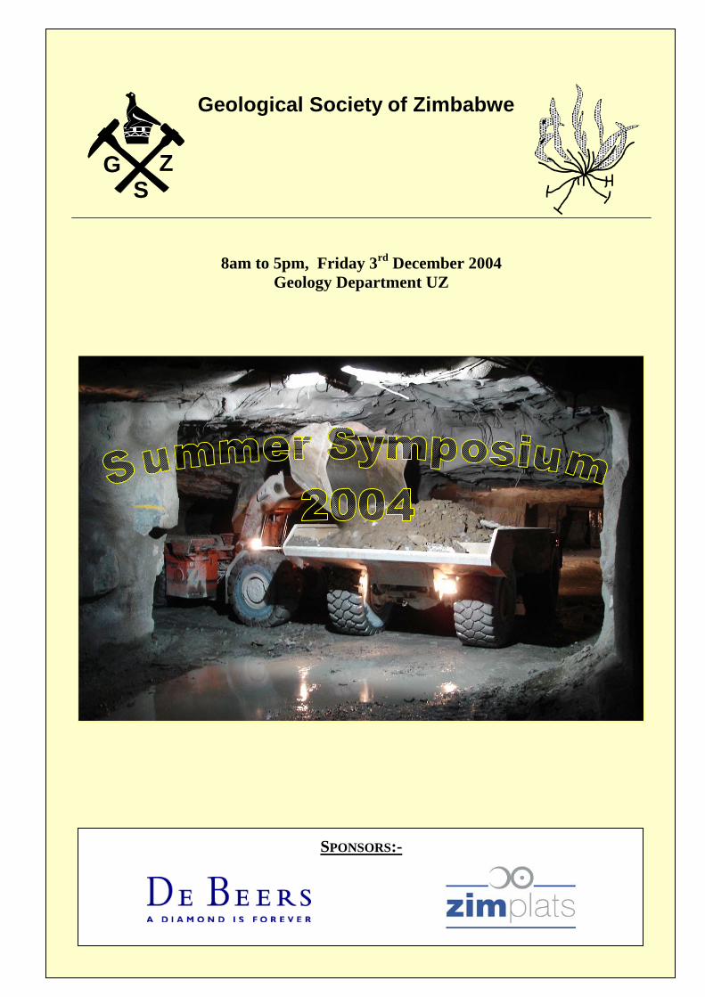
geological society of zimbabwe · 2016-05-11 · geological society of zimbabwe 8am to 5pm, friday...
TRANSCRIPT
Z G
S
Geological Society of Zimbabwe
8am to 5pm, Friday 3rd December 2004
Geology Department UZ
SPONSORS:-


PROGRAMME
Start Topic Speaker 8:00 Registration
8:15 Welcome G. Hanssen, Chairman Geol Soc
8:30 Opening T. G. Zengeni, Dean of Science UZ
8:50 The Department Of Geology From 2003 To Present And An Insight Into The Future N. Matura - Chairman Geology Dept UZ
9:10 Zimbabwe Exclusive Prospecting Orders – An Overview Of Exploration Efforts S. Mangezi and G. Gundani, ZGS
9:30 Implications of the changes introduced by the new Mines and Minerals Act 2004 L. Chimsasa, Ministry of Mines
9:50 Tea
10:10 Exploration Philosophy And Management B. Barber, SRK
10:30 The Geochemical And Volcanological Evolution Of The Mt. Meru/Mt. Kilimanjaro Volcanic Province In N. Tanzania M. Roberts, De Beers
10:50 Modelling of Mine Dewatering - Lonshi Mine DRC R.Owen, MRC, Geology Dept. UZ
11:10
The use of PGE and base metal grades and ratios to determine the stratigraphic location of samples at Ngezi Mine, Great Dyke, Zimbabwe S. Duma, Makwiro Platinum
11:30 3D Model of Ayrshire Mine with GEMCOM V. Trashliev, Pan African Mining
11:50 Application of Mineralisation Models in Exploration - Is Conventional Wisdom Always Wise? A. Martin, SRK
12:10 Ngezi Open Pit Mine: The Grade Control Process M. Matema, Makwiro Platinum
12:30 Mineral Depreciation And Sustainable Development In Zimbabwe: An Intergenerational Perspective L. Mlambo IMR
12:50 Lunch
14:00 The Mange Kimberlites, Eastern Zimbabwe E. Mhuruyengwe, De Beers
14:20
The Hwange Coals trace and heavy element distribution: indicators of the nature of the atmosphere and source rocks during their formation S. Ravengai - Geology Dept UZ
14:40 Introduction to Gemmology S. Makoni - MMCZ
15:00
HHyyddrrooggeeoocchheemmiiccaall AAsssseessssmmeenntt AAtt AA MMiinneerraall PPrroocceessssiinngg PPllaanntt IInn ZZiimmbbaabbwwee --MMoovviinngg TToowwaarrddss EEnnvviirroonnmmeennttaall CClleeaannuupp AAnndd IIssoo1144000000 CCeerrttiiffiiccaattiioonn N. Tobani - Geology Dept UZ
15:20 Tea
15:40 The use of PIMA (Portable Infrared Mineral Anaylser) in diamond exploration. A. Patsanza, De Beers
16:00 Directional Diamond Drilling W. Davies, Raldril
16:20 Summary K. Viewing

THE DEPARTMENT OF GEOLOGY FROM 2003 TO PRESENT AND AN INSIGHT INTO THE FUTURE
N. MATURA
Chairman, Geology Dept, University of Zimbabwe.
Introduction The Geology Department (DG) is a teaching and research Department, offering undergraduate courses as part of BSc, BSc Honours Mining Engineering, BSc Honours Environmental Sciences and BSc Honours Soil Science. The core of undergraduate teaching is for geology students in the BSc programme. Postgraduate programmes offered are: BSc Honours Geology (fourth year special honours), MSc Exploration Geology, MPhil Geology (research dissertation only) and PhD Geology. Staff from the DG also teach on the following programmes: MSc Exploration Geophysics, MSc Integrated Water Resource Management, MSc Tropical Resource Ecology and MSc Water Resources Engineering and Management. The DG has developed an active research programme, focused on environmental geology, hydrogeology and exploration geology. BSc and BSc Honours geology graduates from the DG are employed at various levels in mining and exploration companies in Zimbabwe. DG graduates have been sought-after in the SADC region: BSc and BSc Honours Geology graduates have been welcomed into postgraduate studies in various prestigious South African universities, whilst BSc Honours and MSc graduates have been head-hunted by international mining companies. An insight in the future of the DG If a viable DG is to be rebuilt and if the Zimbabwean mining industry is to be served, then the focus must be on core BSc and BSc Honours teaching. This is currently impossible due to lack of staff, funding for fieldtrips and student sponsorship for the honours programme. One or more endowed chairs (professorships), as is the practice in a number of major mining countries, e.g. Canada, Australia, South Africa, USA: Chairs in petrology and in economic geology who can lead in the teaching, student supervision, research and offer consultancy to the mining industry. It would go a long way in not only maintaining the high standards our department has always been associated with but could better them. A geologist of high standing occupying such a position would provide leadership and guidance to our Department. To make the positions of the endowed chairs in the above categories attract people with the right qualifications (PhDs and proven record of research, publishing and industrial experience in the relevant fields), salaries and incentives should be equivalent to the most senior geology position in the mining sector. In addition to this, an annual travel allowance would be needed for contact with senior geologists in other countries, as well as a research allowance for journal subscriptions, analyses and so on. Faculty (lecturers and teaching assistants) would be happy to remain at the DG if their conditions were better. This could be achieved through top-up stipends paid out either monthly or as part of annual contact visits to other universities for research purposes. Such a system would also enable the DG to recruit qualified new staff and start rebuilding. Alternatives to a monetary package could also be considered, eg allowances for school fees, motor vehicles and so on. Parachuting external faculty: Faculty from universities in the region could be hired to teach individual modules. They would require some kind of stipend and a travel allowance. The problem of inadequate funding for fieldtrips is a critical one which can put the department’s reputation at stake. This we propose may be solved by having funds of up to $50m (figure can be

reviewed upwards in line with inflation) per year set aside through the Chamber of mines and managed by the Chamber. The department can then submit its needs through the Chairman and the Chief Technician from time to time. Individual companies can also give their donations directly to the department in cash or in kind towards these fieldtrips. This should enable us to train hands on geologists. Companies are also urged through the chamber to give full sponsorship to honours students as it is the most appropriate industrial entry requirement.

ZIMBABWE EXCLUSIVE PROSPECTING ORDERS – AN OVERVIEW OF
EXPLORATION EFFORTS
S. MANGEZI
Zimbabwe Geological Survey
Exploration in Zimbabwe commenced in early 19th century with the ancient native people pioneering in prospecting and extraction of gold and some base. Unlike gold and base metals little was known about diamonds and the discovery of diamonds in the Somabula gravels in 1903triggered diamond exploration, which experienced an unprecedented exploration boom in the early 90s. The diamond exploration boom was triggered possibly by the increased awareness by international and local organizations of the diamond potential of Zimbabwe due to a marked increase in geo-scientific data availability and accessibility. The availability of the second series aeromagnetic data and the commissioning of River Ranch mine aided in the resumption of diamond exploration in the country (Valliers, 1993). Due to such increased exploration activity, a large database consisting of Exclusive Exploration Order (EPO) progress and final reports is available at the Zimbabwe Geological Survey. Though accessible to individuals and corporate organizations, it is regrettable that the database is not being fully utilized maybe because the hardcopy database has become so large. It is the objective of the project this abstract is accompanying to critically analyze and synthesize mineral exploration data in Zimbabwe with a viewpoint of establishing an EPO GIS prospectivity outline of Zimbabwe highlighting the extent and pattern of exploration. The digital database accompanied by indexed diamond and gold-base metal EPO maps of Zimbabwe will become a one-stop shop where information on EPO status and geo-scientific data is available as one package. The database is intended to be dynamic, encompassing all EPOs in the country. Analysis and synthesis of EPO reports and study of unpublished technical reports is being conducted with emphasis on quality and nature of results, exploration techniques and detail of exploration work. Five and four EPO classes outlined below were identified for diamond and gold-base metal EPOs respectively based on the above parameters. Table 1: Diamond EPO Classification EPO CLASS DESCRIPTION
1 EPO where kimberlites/parakimberlites were discovered 2 EPO where anomalies were delineated and systematically followed-up
(No discovery) 3 EPO where anomalies were delineated and limited or no follow-up
conducted 4 EPO where exploration work was systematic but no anomalies were
delineated 5 EPO where limited or no exploration work was conducted (No
anomalies delineated) Table 2: Gold-Base Metal EPO Classification
EPO CLASS DESCRIPTION 1 Exploration considered successful, claims pegged/mine opened 2 Exploration considered unsuccessful, but work systematically
done 3 Exploration yielded positive results but no follow-up was
conducted 4 No work done/Insufficient work
The MS Access based database that was designed with assistance from De Beers, is equipped with interlinked forms, queries, tables and thematic map presentations. The database which will be commissioned early next is sure sign of growing cooperation between government and the exploration industry (De Beers Zim.) and is intended to fully serve the mineral research needs of the exploration industry and stimulate a scientific approach to mineral exploration.
IMPLICATIONS OF THE CHANGES INTRODUCED BY THE NEW MINES AND MINERALS ACT 2004
L. CHIMSASA,
Ministry of Mines

EXPLORATION PHILOSOPHY AND MANAGEMENT
BRENT BARBER
SRK Consulting Zimbabwe EXPLORATION PHILOSOPY Why and For Who Is The Exploration Being Undertaken Hunt Where The Beast Lives EXPLORATION TARGET Artisinal / Small / Medium / Large / Giant Size Deposits Elephants In Hunting Reserves Mice In Holes METALLURGENY / ROCK AND MINERAL DISTRIBUTION Careful Selection Manageable Exploration Tenement On Sound Geological Grounds Including Ore Body Models MINERAL AND TARGET AREA SELECTION Where Can You Find, Safely Explore And Ultimately Profitably Mine The Rock Or Mineral Wanted EXPLORATION / MINING CONSTRAINTS•SECURITY – Country Risk: Capital / Corporal Punishment LOCATION AND INFRASTRUCTURE Getting The Piggy To Market. SECURITY OWNERSHIP Transparency And Transferability Of Exploration And Mining Title:Lack Or Flight Of Foreign Risk Capital •Bad Governance / Corruption •Nationalisation / Indigenisation•Reservation Portions Mining Sector EXPLORATION EXPERTISE •MANAGERIAL •GEOLOGICAL ••TECHNICAL ••“UNSKILLED EXPLORATION MANAGER The Vulture That Flies In Unwanted? Job to discover deposits employing good exploration staff – above all excellent Exploration Geologists: Hiring (Firing) / Training / Delegating / Motivation / Remuneration And Conditions Employment EXPLORATION GEOLOGIST What Makes Good Exploration Geologists Such Rare Creatures Responsible for everything from project planning / implementation, through equipment maintenance to provision / use supplies, through communication head office incl. progress reports. Innovative and enquiring technically competent geologist, capable of working extensively unsupervised, who is an effective and efficient project organizer. TECHNICAL TEAM•Field Team / Camp Supervisors •Drivers / Mechanics •Sampling Technicians Indispensable Heart Of The Project But No Room For Primadonna’s LABOUREyes And Hands With Important Local Knowledge Foreign: Expertise not readily taught or language problems or Local: Knowledge old workings PRE-FIELD PREPARATION 1.Data Compilation / Evaluation 2.Site Evaluation

3.Equipment Procurement, cultural hierarchy and sites, etc. DATA COMPILATION AND EVALUATION• Today’s exploration geologist often faced overwhelming amount data. ••Investigation this information infinitely cheaper than conducting exploration – Regional geological mapping / old mine records, etc. •Type Database Dependent Explor-ation Programme Requirements. •Main Issue Is Knowing Where And How To Cost Effectively Obtain And Use The Available Information. •Quality and quantity information differs not only between countries - Topo map availability and projections. ••General rule older data more dependent on individual expertise and dated concepts. PRE-MOBILISATION FIELD VISIT EVALUATE: ••Security •Communications •Medical Facilities •Provisions incl. food, water, fuel •Base / Fly Camps •Roads / River /Air •Environmental Considerations EQUIPMENT PROCUREMENT: •Transport incl. tools and spares •Accommodation / Food •Communication •Field Gear incl. GPS, Computers •Sample Storage And Preparation NATIONALISATION / INDIGENISATION SUCCESS OR FAILURE Celebration Or Party Over

-
THE GEOCHEMICAL AND VOLCANOLOGICAL EVOLUTION OF THE MT. MERU/MT. KILIMANJARO VOLCANIC PROVINCE IN N. TANZANIA.
DR. MARTIN ROBERTS
Regional Geologist (Eastern Zimbabwe),De Beers Zimbabwe Prospecting Limited
The Mt. Meru/Kilimanjaro volcanic region in northern Tanzania is a young (<5Ma) expression of the volcanism within the Gregory Rift which is associated with the East African mantle plume. The oldest igneous rocks in the region (2-5 Ma) are alkali basalts from the regional flood lavas, the Monduli volcanic centre, and early basaltic activity at Kilimanjaro. These magmas are mildly alkaline and volatile-poor. Volcanism younger than 1.2Ma includes the melilitite, melanephelinite and basanite cones (+-carbonatite) that were erupted through the flood lavas, and the evolved nephelinites, phonolites and carbonatites associated with explosive volcanism. Major and trace element modeling suggests that the easrly basaltic lavas (>2 Ma) have a significant melt contribution from the East African mantle plume, whilst the younger basanitic-nephelinitic rocks show a stronger lithospheric signature. Lithospernic in the region appears to be variable (100-150 km), with a greater mantle plume contribution associated with melt generation below regions with thinner lithosphere. The lithospheric signature becomes increasingly important with time, and thermal models suggest that conductive heating of the metasomatized lithospheric mantle by the mantle plume may produce melting of the volatile-rich peridotite over the required time scales.

THE USE OF GROUNDWATER FLOW MODELLING TO GUIDE MINE DEWATERING: A CASE HISTORY FROM LONSHI MINE, DRC.
RICHARD OWEN
Mineral Resources Centre, Geology Dept, University of Zimbabwe.
Mine dewatering can be a major cost in mine development, particularly in areas with high rainfall and where the mineral resource is hosted in aquifer units. Groundwater flow modelling can be used in order to optimise mine dewatering activities. Modelling allows the mine operator to identify the most favourable localities for dewatering boreholes, to select the optimum pumping rates, to predict the water levels within the aquifer during pumping and to calculate the groundwater inflows into the mine. This presentation describes a groundwater flow model constructed for Lonshi mine, an open cast copper mine in the DRC pedicle. The mine occurs in a sequence of meta-sediments, which includes a dolomite aquifer. The ore is found in the Lonshi conglomerate horizon below the dolomite and also in the Terre Noir, and earthy wad that is closely associated with and wraps around the dolomite. The dolomite appears to be sub-horizontal wedge thrust from the east over the local bedrock, a micaceous tectonized fine grained sandstone, known as the footwall sandstone. The dolomite is overlain by a fine grained confining unit known as the footwall siltstone. Water flows from the highly fractured into the deepening mine pit. The proposed dewatering strategy is to drill high yield dewatering wells into the dolomite aquifer and by pumping heavily, to lower the water levels in the dolomite, such that inflows from this unit into the mine are minimized. Simultaneously, dewatering is taking place by pumping from sumps constructed in the floor of the mine pit. A single pumping test has been performed in order to quantify the aquifer hydraulic parameters; hydraulic conductivity, storativity and specific yield. The piezometric levels in the dolomite aquifer have been monitored in a number of observation wells. A 3D groundwater flow model has been constructed using Visual Modflow® software. The model has been used to identify the main sources of inflow into the pit, the optimum location for dewatering wells, and the pumping discharge that will be required to reduce the inflow into the pit as the pit deepens. Initial model results show that for the expected pit floor elevation at the end of March 2005, a combined pumping of 100,000 m3/day from the dolomite and 45,000 m3/day from the pit floor sumps (145 ML/day) would be sufficient to keep the pit “dry”. During the subsequent drilling of dewatering holes, well blowing yields have been far less than the yield experienced from the pump test borehole, suggesting that the dolomite is not everywhere so fractured and the initial dewatering estimates are therefore probably too high.
THE USE OF PGE AND BASE METAL GRADES AND RATIOS TO DETERMINE THE
STRATIGRAPHIC LOCATION OF SAMPLES AT NGEZI MINE, GREAT DYKE, ZIMBABWE
STEVE DUMA & ANDREW DU TOIT
Zimbabwe Platinum Mines
The MSZ of the Great Dyke is cryptic and without obvious stratigraphic markers. Although there are trends in the dimensions of the PGE and base metal profiles across the Hartley Complex, the profiles are virtually invariant within a particular mining area. Ratios derived from these profiles are used to interpret diamond drill cores drilled ahead of underground development. Detailed logging of oriented core shows the exact position of faults. Metal ratios are used to estimate fault throw to within 25cm. It is possible to draw detailed sections showing the extent of ground disturbance well ahead of mining. The method has been confirmed by mining and by drilling inclined holes through the fault blocks.

3D MODEL OF AYRSHIRE MINE WITH GEMCOM
V.S. TRASHLIEV
Group Geologist, Pan African Mining
The Ayrshire Mine is a medium sized underground gold extraction operation owned by Pan African Mining and is located to the N of Banket some 100 km NW of Harare. In 1890, Ayrshire Mine was probably one of the first mines discovered in Mashonaland. The first claims were registered in 1893 and covered 2 ancient open pit workings, but it was only in 1899 that the mine started regular gold production. The Edward’s shaft sunk in 1901
was then the deepest shaft in the country. The early
history of the mine is a tale of optimism and great hopes built on false promises, followed by a most depressing tale of errors, accidents and failures forcing the mine to cease production in January 1909. Since then the mine remained more or less dormant until 1987 when the claims were taken over by Pan-African Mining.
To replace much of the tedious manual work needed to maintain and up-date resources and reserves at Ayrshire Mine, a Gemcom license was obtained 2 years ago. Most of the first year included learning the software and organizing all raw data. The Ayrshire Mine database now contains more then 35 000 assay records. Managing and documenting these together with the survey plans, geological mapping, drilling and imagery escalates the project into a serious IT data management exercise. Furthermore alternative solutions to perceived local differences and requirements were investigated. At this stage we felt that having the initial shape of the models look realistic proves to be valuable to the geologist giving an extra insight to the authentic geologic units. To achieve 3D rendered visualization in an expressive way, Gemcom models were exported to AutoCAD or Bryce 3D, because AutoCAD render options are far superior in creating shadows, reflection effects and so give a much better sense of the volume of the objects. AutoCAD can also be used to create a simple animated "walk through" of any 3D model which is an extremely useful technique for presenting visually different types of exploitation or progress in mining, to the mining personnel who may not necessarily have a good understanding of plans.
Gemcom solid modeling uses a patchwork of triangles to define a complex-shaped surface. The triangles can be immediately exported to AutoCAD as 3D faces and rendered. To achieve better sense of the object’s volume and spatial position, the different models created in Gemcom were exported into AutoCAD or Bryce3D where shadows and reflection effects were added. In such a way, the Gemcom interface, apart from giving valuable insights into the Ayrshire grade trends, was used extensively for presentation purposes and helped to communicate the otherwise complex geological patterns.
Estimation of the spatial variations at Ayrshire Mine using Gemcom is now an essential part of the mine planning process. However we believe that success in discovering new reefs is not simply related to the amount of money spent, nor the high tech exploration methods used. Experience and intuition, as well as plain luck, remain crucial ingredients for successful exploration. Moreover the core of any successful prospecting is still the basic traditional methods such as geological mapping (at a scale of metres if necessary), sampling and drilling, to develop a “mental” geological model. Only after all the geological constraints are known can a good computer model be generated. If the model does not fit the geological controls, then it is of very little use.

APPLICATION OF MINERALISATION MODELS IN EXPLORATION - IS
CONVENTIONAL WISDOM ALWAYS WISE?
DR. A. MARTIN
SRK Consulting Zimbabwe
A mineralisation model may be defined as a conceptual and/or empirical standard which embodies the essential features of some population of geological phenomena. Models can be strictly descriptive but most contain interpretive elements. To build a model requires an excellent working knowledge of the geology, the characteristics and associations of what you are trying to find, how to identify these, and how to relate them to appropriate exploration techniques. Flexibility is required as models can cause problems if rigidly adhered to. In particular conventional thinking must always be questioned as blind acceptance of previous models can lead into blind alleys. To be useful the characteristics and associations forming the model must be observable in the field either directly or by geochemical or geophysical means. Some criteria used may be scale specific but others not. For example a lithological association may be significant in determining where to locate a geochemical grid but of little use in siting a drilling programme. Alteration haloes may be useful for both approaches to exploration. Once a model has been created the reliability of criteria must be assessed by evaluating the frequency of association of particular criteria with the mineralisation and just as important an absence of association in areas without mineralisation. The types of criteria that can be used are listed below but these are not exhaustive.
Lithological associations, spatial or temporal
Stratigraphic position
Mineral Associations – major and minor metals
Physical characteristics of mineralisation
Geophysical characteristics
Alteration associations
Weathered mineralisation characteristics and regolith dispersion
Structural associations, spatial and temporal
Faults – type, orientation and characteristics
Folds – type, orientation and characteristics
Genetic associations
Once these associations and characteristics have been established their significance needs to be assessed and then rated in terms of reliability and usefulness in exploration There must be a distinction between an empirical model with no genetic or interpretive arguments and a model incorporating these arguments to explain empirical relationships in terms of geological processes. ‘Unexplained’ phenomena that do not fit the model must not be discarded.

NGEZI OPEN PIT MINE: THE GRADE CONTROL PROCESS
M. MATEMA
Makwiro Platinum
The Ngezi Open Pit Mine reef is a blind orebody mined from top downwards. The accurate location of the reef becomes critical for quality mining. Faults ranging from 0.5m up to 12m are encountered in the pit and are taken into consideration during mine planning. Due to the orientation of the faults staggered grade control drilling grids are favoured over square grids to get better resolution on the faulting. The reverse circulation drilling sampling intervals range between 0.15m and 0.5m in the reef zone. The quality of the sampling is assured by accurate flushing of the sample collection system after every sample collected. The location of the orebody is heavily reliant on assay data from reverse circulation samples. The reef shows strong element correlations which can be utilized for reconciling the quality of mining and for determining further cleaning of surfaces for ore on the bottom of reef surface or removal of waste on the top of reef surface

MINERAL DEPRECIATION AND SUSTAINABLE DEVELOPMENT IN ZIMBABWE: AN INTERGENERATIONAL PERSPECTIVE
LYMAN MLAMBO
Institute of Mining Research, University of Zimbabwe
Over time policy in Zimbabwe has, among other objectives, sought to encourage expanded mineral production and export. However, the exhaustible nature of minerals has naturally raised questions of sustainability of the mining sector, in particular, and the whole economy, in general. This paper attempts to derive indicators of the effect of mining on intergenerational sustainability and the trend of such effect in Zimbabwe from 1973 to 1998. Twelve minerals, which have contributed about 95% of total value of annual mineral production, are considered. The paper finds that sustainability concerns for all minerals except gold and silver have been reduced, in the short-term, by the existence of large resources of the minerals in the country and a continuous world technological progress that has consistently increased economic reserves and improved extractive efficiency. However, these concerns remain in the long-term due to the increasing costs of mining technology and the depressive effect of general technological progress on world demand for primary mineral exports. Therefore, it is necessary that current production and primary export be further expanded in these minerals while further possibilities for domestic processing and industrial use are explored for the long-term. In the case of gold and silver sub-sectors, policies that seek to discourage consumption and encourage re-investment in other income yielding assets should be put in place in the interest of the sustainability of the economy as a whole.

THE MANGE KIMBERLITES, EASTERN ZIMBABWE
E. MHURUYENGWE
De Beers Zimbabwe Prospecting Limited
The Marange kimberlites are situated about 80km SW of Mutare in East Zimbabwe. Four kimberlite bodies were discovered by De Beers Zimbabwe Prospecting Limited in 1997 and the bodies vary in size from 5.5 to 0.5 hectares in surface area. Largest body 01 is 5.5 hectares, Marange 02 is 1.5 hectares, Marange 03 is 1.34 hectares and Marange 04 is 0.5 hectares. Marange bodies found to belong to Group 1 kimberlites. Studies have shown that these kimberlites are mainly diatreme and hypabyssal facies. Diatreme facies specimen from Marange 01 was described as being a Tuffisitic Kimberlitic Breccia while the Hypabyssal facies was classified as Segregationary Kimberlite with macrocrystic texture. Macrocrystic are mainly olivines. The Marange kimberlite bodies are highly altered due to regional metamorphism and are quite hard and the extent of the metamorphic overprinting in these kimberlites has destroyed most of the primary mineralogy. Olivine microcrysts and macrocrysts have been altered to serpentine, magnetite and haematite.

THE HWANGE COALS TRACE AND HEAVY ELEMENT DISTRIBUTION: INDICATORS OF THE NATURE OF THE ATMOSPHERE AND SOURCE ROCKS DURING THEIR
FORMATION
B. MAPANI A, B. FINKELMAN B & S. RAVENGAI C
a University of Namibia, Geology Department, Windhoek, Namibia. b United States Geological Survey, Virginia, USA. c University of Zimbabwe, Department of Geology, , Harare, Zimbabwe. The Hwange coals of Zimbabwe were deposited in fresh water lakes lying on either side of a great elevated tract of Archean basement during the Permian times. Initially the lake was shallow, as observed from sedimentological data, and eventually the lake became deeper during the Karoo times of southern Africa. Sedimentation began with the melting of the Carboniferous ice cap of the then south and central Africa. The Karoo succession in the Mid-Zambezi Valley shows that climatic cycles of glacial to semi-glacial and finally to post glacial occurred to very hot, humid and arid conditions towards the end of the sedimentation period. Four sedimentary cycles are reflected at Hwange, the first being fluvial-glacial beds, followed by flooding associated with the Lower Wankie Sandstones. At the end of this phase, there followed a general increase in flora and fauna, responsible for the coal forming measures observed in the Main Coal Seam. Above this succession is the Lower Carbonaceous Mudstones of the Wankie succession. The unconformity of the Upper Wankie Sandstones with the Lower Mudstones marks the end of the coal bearing horizons. Above the Upper Wankie Sandstones further flooding at a large scale occurred, which was rapid, as there occurs no coal seam associated with this mudstone in the whole of the Zambezi valley. A systematic study of heavy elements, ash, moisture content and arsenic, shows that during the deposition of the Hwange coals of the Main Coal Seam there was in the source areas significant amounts of gallium, germanium, niobium, vanadium and chromium, together with metals of felsic affinity such as strontium, tin and lithium. There occurs a systematic relationship between ash content and heavy mineral content in the coal. For coals with a high heavy metal content, their ash contents are low, such as sample E-202324, whereas the reverse is the case for samples E202322 and E202323. While we can easily attribute the source of the felsic affliated elements to the basement granites, heavy metals are interpreted to have been fixed in anoxic conditions when the organic matter was being converted to coal.

INTRODUCTION TO GEMMOLOGY
S. MAKONI
Minerals Marketing Corporation Zimbabwe
What is a gemstone? A mineral of beauty, durability and rarity. What then is a mineral?
What are the origins of gemstones? Synthetic gemstones Artificial gemstones Natural Gemstones
What are the major classifications of gemstones? Chemical classification Classification by origin Classification by value
How are gemstones identified?
Crystal System Colour Lustre etc.
What are the trade names for common gemstones? What are the uses of gemstones? How are gemstones priced?
HHYYDDRROOGGEEOOCCHHEEMMIICCAALL AASSSSEESSSSMMEENNTT AATT AA MMIINNEERRAALL PPRROOCCEESSSSIINNGG PPLLAANNTT IINN ZZIIMMBBAABBWWEE --MMOOVVIINNGG TTOOWWAARRDDSS EENNVVIIRROONNMMEENNTTAALL CCLLEEAANNUUPP AANNDD IISSOO1144000000
CCEERRTTIIFFIICCAATTIIOONN
N. TOBANI,
University of Zimbabwe, Department of Geology Obtaining international standards’ accreditation for best environmental protection practices in a mineral processing plant is an onerous task. The process requires holistic appraisals of past and current material flow processes that are liable to pollute the environment together with the assessment of environmental management systems (EMS) in place. Such appraisals must be subjected to investigative input from independent assessors who have critical understanding of pollution generation from the process flows, mode of transportation and its attenuation in the environment. The task should be designed in a cyclic fashion allowing for corrective feedback as an effective monitoring and assessment tool of the process itself. This paper presents some insight into a part of the process carried out to identify the material process flows at a mineral treatment plant that are likely to cause environmental degradation. In recent developments, besides the environmental protection legislature becoming more stringent (EMA, 2002), companies are adopting open and progressive environmental protection policies. This is deliberate positive move towards best practices and also in order to obtain international accreditations like ISO14000. In doing this, companies must be aware of the damages caused to the environment by their past and current activities. An understanding of the distribution of the dissolved toxic elements and their speciation in and around the mine dumps and treatment ponds is vital when assessing the impact of these activities on the environment. To implement an environmental rehabilitation and monitoring program from such potential pollution, investigations should comprise, as an integral part, surface water and groundwater water quality investigations. Work towards assessing the potential impacts of mineral processing at a site in Zimbabwe were carried
out during December 2003 and January 2004. In this report investigation procedures, preliminary findings and recommendations for further investigations are discussed. It is evident that pollution is
prevalent at the site. Further investigations will target on delineating the extent of plume development beneath an old slag dump and a new course dump.

THE USE OF PIMA (PORTABLE INFRARED MINERAL ANAYLSER) IN DIAMOND
EXPLORATION.
A. PATSANZA
De Beers Zimbabwe Prospecting Limited Short wavelength infrared (SWIR) spectrometry is a useful technique for mineral identification because many minerals have characteristic spectral signatures or spectra. This is because a mineral spectrum is dependent on various crystallographic factors unique to each mineral species. When a sample is illuminated by the light source in the spectrometer, certain wavelengths of the light are absorbed by the minerals in the sample, as a result of sub-molecular vibrations. This vibration is the result of bending and stretching of molecular bonds in the minerals. The bonds giving rise to absorption features in the SWIR include those in hydroxyl, water, carbonate and ammonia and between Al-OH, Mg-OH and Fe-OH. These molecules are found as major components in: Phyllosilicates (including clay, chlorite and serpentine minerals), hydroxylated silicates (such as epidote and amphiboles), sulphates (alunite, jarosite and gypsum), carbonates and ammonium minerals. The majority of the spectral absorption features that distinguish different silicates in the SWIR are due to vibrational transitions associated with hydroxyl and water, producing absorption features near 1400nm, (OH and water) and 1900nm (water). Other important and diagnostic spectral absorption features occur at or near 2200nm, 2250 and 2330nm and are related to the bending and stretching of the bonds between ALOH, FeOH and MgOH respectively. The diagnostic spectrum in the SWIR2 region (2000 to 2500nm) has absorption features located near 2300nm and 2380nm and results from MG-OH bearing minerals including serpentine, talc and phlogopite. When weathered, kimberlites break down into smectite clays, primarily saponite. Saponite has a similar spectral signature to the primary Mg-OH bearing minerals. This aspect has an important bearing to diamond exploration. The spectra of sulphates have diagnostic OH absorptions that are easy to distinguish from the silicate absorptions. Carbonates also have characteristic spectra and display a strong diagnostic carbonate absorption feature between 2300 – 2350, crystallinity variations. SWIR can provide information on the degree of crystallinity of mineral, discriminate compositional variations within mineral groups. This is significant as mineral composition may vary systematically in an alteration system as a function of the temperature and composition of the alteration fluids and with proximity to the zones of mineralization. This has an important bearing to gold and base metal exploration.

DIRECTIONAL DIAMOND DRILLING
WILF DAVIES
Raldril (Pty) Ltd, South Africa
Directional Drilling with Slide Show Devico System Other Systems Survey Guidance Systems What can be achieved. Examples of Past Projects