gitews – the german-indonesian tsunami early … · · 2015-06-17components of gitews (1)...
TRANSCRIPT
GITEWS –The German-Indonesian
Tsunami Early-Warning System
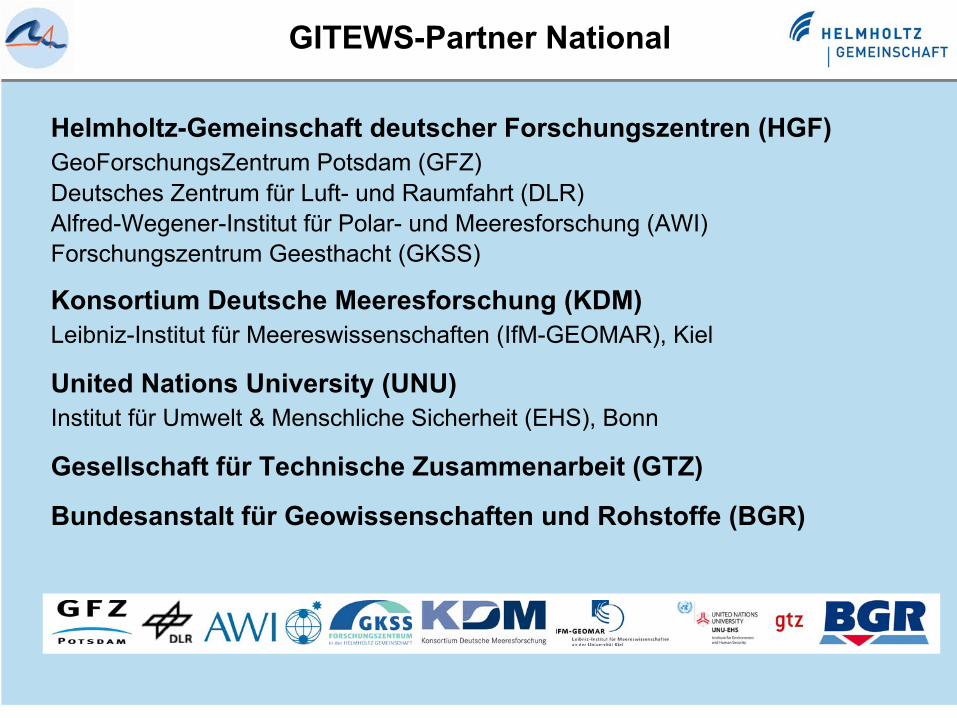
Helmholtz-Gemeinschaft deutscher Forschungszentren (HGF) GeoForschungsZentrum Potsdam (GFZ) Deutsches Zentrum für Luft- und Raumfahrt (DLR) Alfred-Wegener-Institut für Polar- und Meeresforschung (AWI) Forschungszentrum Geesthacht (GKSS)
Konsortium Deutsche Meeresforschung (KDM) Leibniz-Institut für Meereswissenschaften (IfM-GEOMAR), Kiel
United Nations University (UNU) Institut für Umwelt & Menschliche Sicherheit (EHS), Bonn
Gesellschaft für Technische Zusammenarbeit (GTZ)
Bundesanstalt für Geowissenschaften und Rohstoffe (BGR)
GITEWS-Partner National
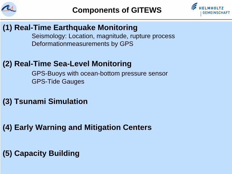
Components of GITEWS
(1) Real-Time Earthquake MonitoringSeismology: Location, magnitude, rupture processDeformationmeasurements by GPS
(2) Real-Time Sea-Level MonitoringGPS-Buoys with ocean-bottom pressure sensorGPS-Tide Gauges
(3) Tsunami Simulation
(4) Early Warning and Mitigation Centers
(5) Capacity Building
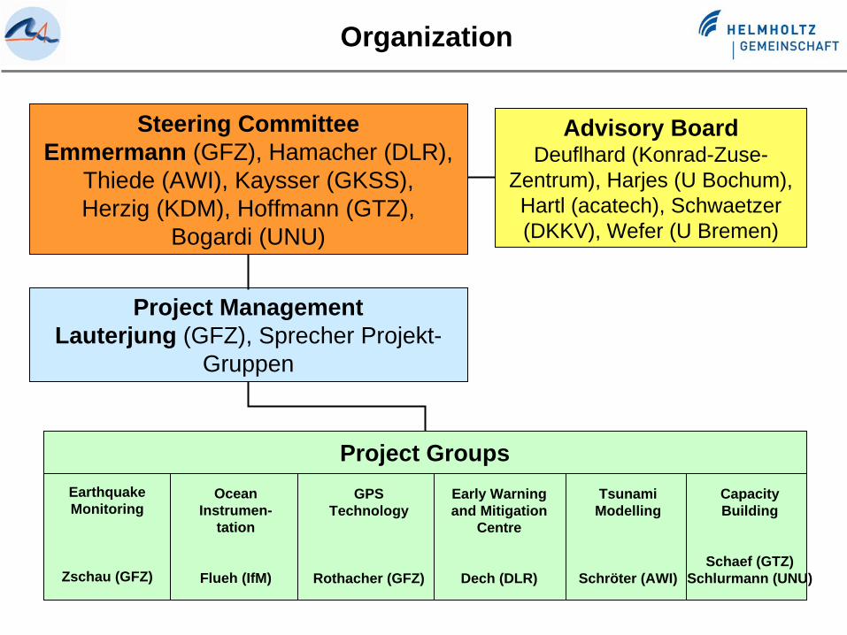
Organization
Steering CommitteeEmmermann (GFZ), Hamacher (DLR),
Thiede (AWI), Kaysser (GKSS), Herzig (KDM), Hoffmann (GTZ),
Bogardi (UNU)
Project ManagementLauterjung (GFZ), Sprecher Projekt-
Gruppen
Project-GroupsEarthquake Monitoring
Zschau (GFZ)
Ocean Instrumen-
tation
Flueh (IfM)
GPSTechnology
Rothacher (GFZ)
Early Warning and Mitigation
Centre
Dech (DLR)
Tsunami Modelling
Schröter (AWI)
Capacity Building
Schaef (GTZ) Schlurmann (UNU)
Advisory BoardDeuflhard (Konrad-Zuse-
Zentrum), Harjes (U Bochum), Hartl (acatech), Schwaetzer (DKKV), Wefer (U Bremen)
Project Groups
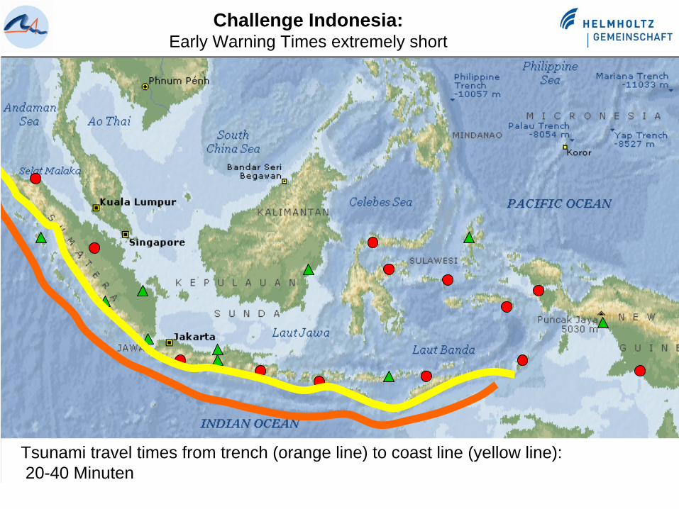
Challenge Indonesia:Early Warning Times extremely short
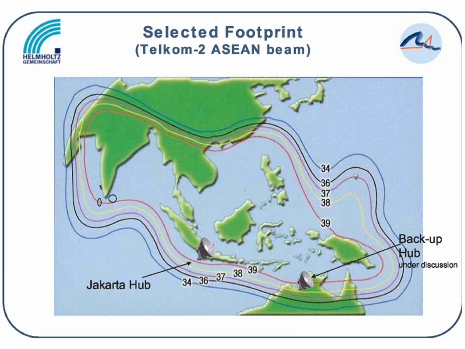
Tsunami travel times from trench (orange line) to coast line (yellow line):20-40 Minuten

Distribution of seismic stations in Indonesia(German contribution)
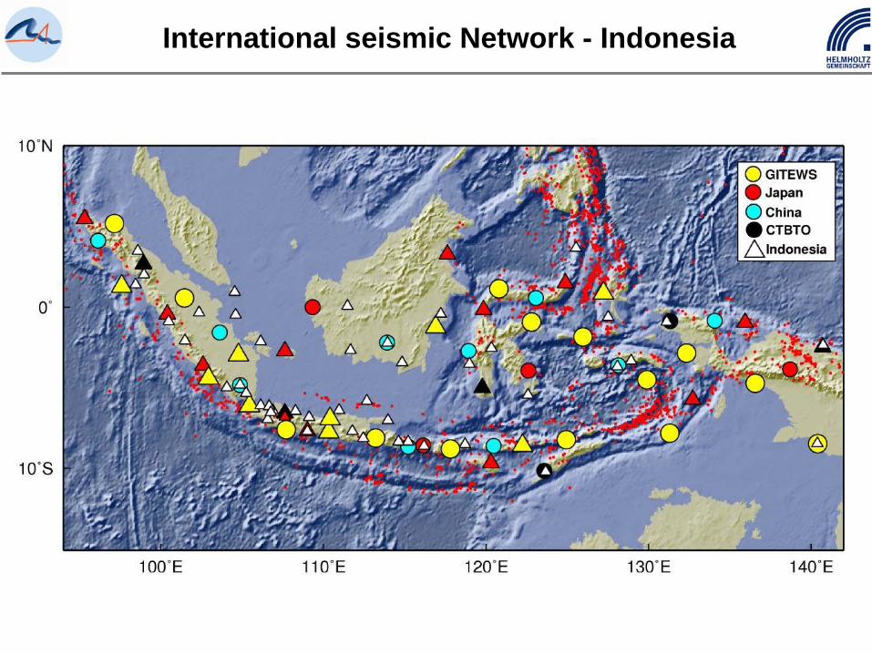
International seismic Network - Indonesia
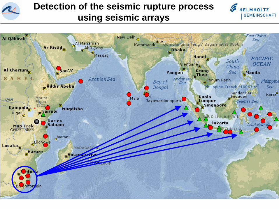
Detection of the seismic rupture process using seismic arrays
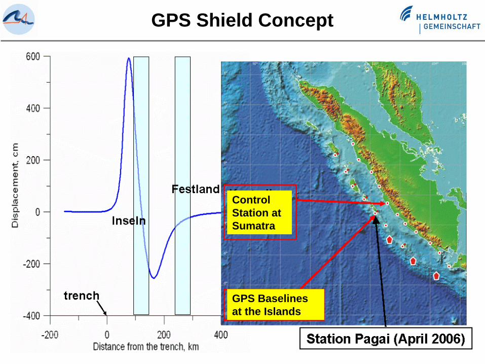
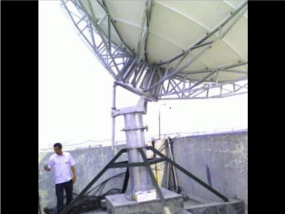
Control Station at Sumatra
GPS Baselines at the Islands
GPS Shield Concept
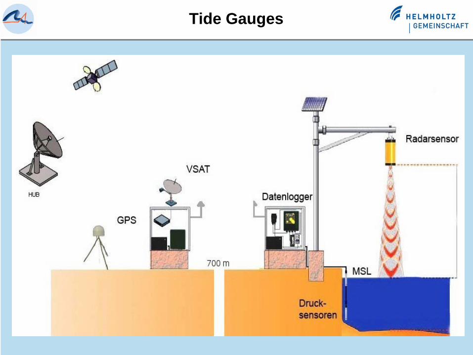
Tide Gauges
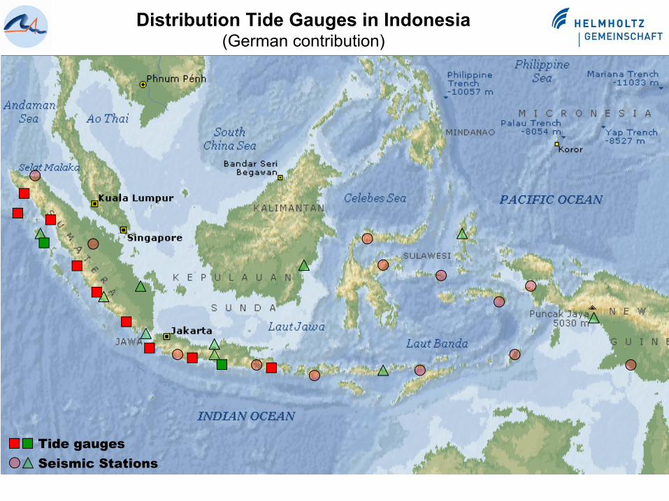
Distribution Tide Gauges in Indonesia(German contribution)
Tide gaugesSeismic Stations
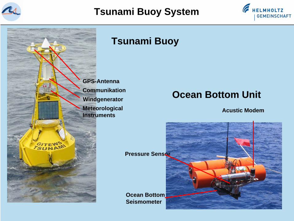
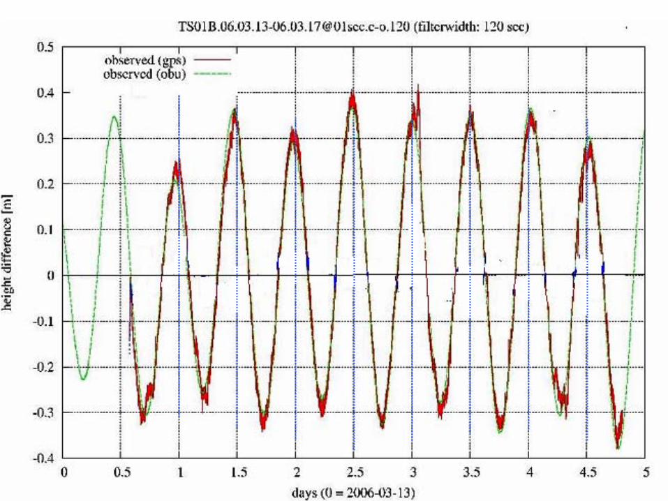
Tsunami Buoy System
Tsunami Buoy
GPS-Antenna
WindgeneratorCommunikation
Meteorological Instruments
Acustic Modem
Pressure Sensor
Ocean Bottom Seismometer
Ocean Bottom Unit
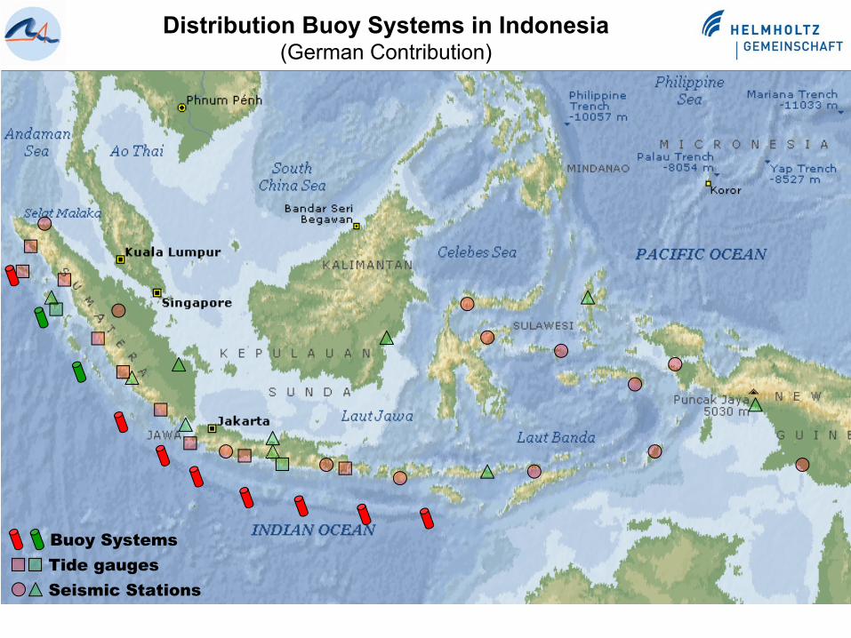
Distribution Buoy Systems in Indonesia(German Contribution)
Tide gaugesSeismic Stations
Buoy Systems
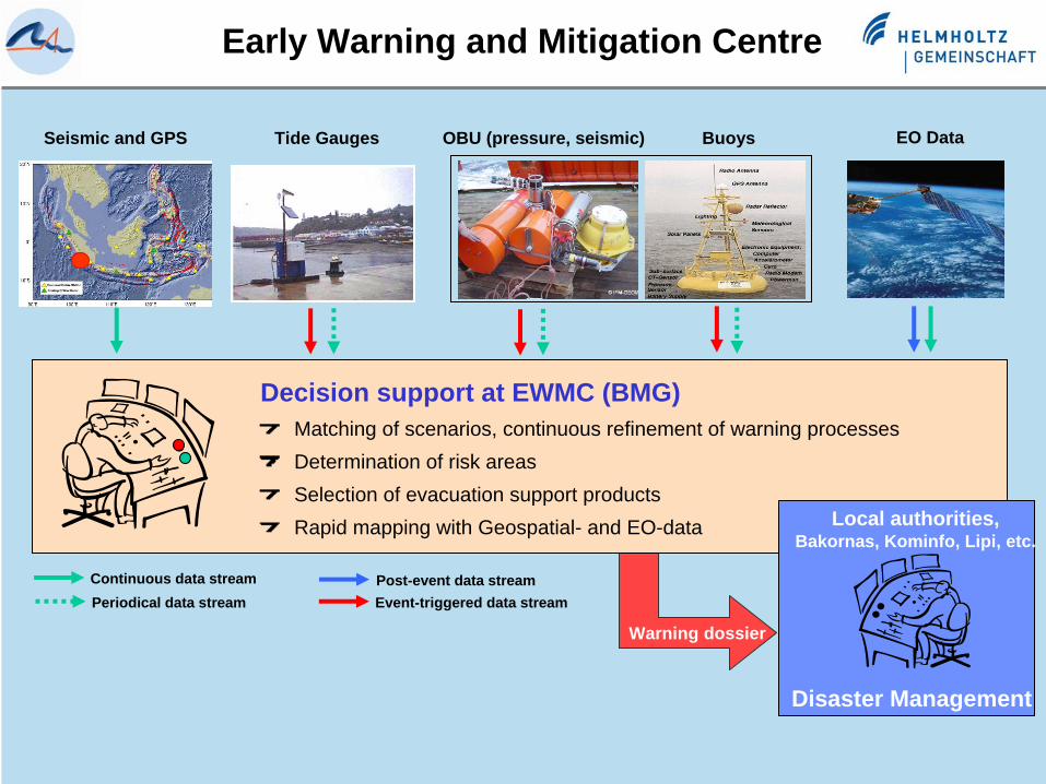
Early Warning and Mitigation Centre
Warning dossier
Decision support at EWMC (BMG)Matching of scenarios, continuous refinement of warning processesDetermination of risk areasSelection of evacuation support productsRapid mapping with Geospatial- and EO-data
Seismic and GPS BuoysTide Gauges OBU (pressure, seismic) EO Data
Local authorities,Bakornas, Kominfo, Lipi, etc.
Continuous data streamEvent-triggered data streamPost-event data stream
Disaster Management
Periodical data stream
EO Images (incl.Meteo)
Display
Sea Level Display
GPS Display
GPS Land Based
System
Buoys/OBU System
Seismogram Display
Simulation System
Tide Gauge System
EO System
Seismic System Geofon
catalogue queries
data request
EO images (satellite)
command GEOFON change mode
(normal or tsunami)
signal datasignal data
command land station change mode
(normal or tsunami)
command buoy change mode
(normal or tsunami)
height wave length
sea level
command gauge change mode
(normal or tsunami)
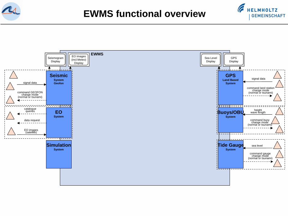
EWMS
EWMS functional overview
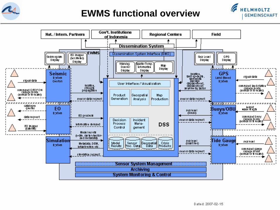
EWMS functional overview
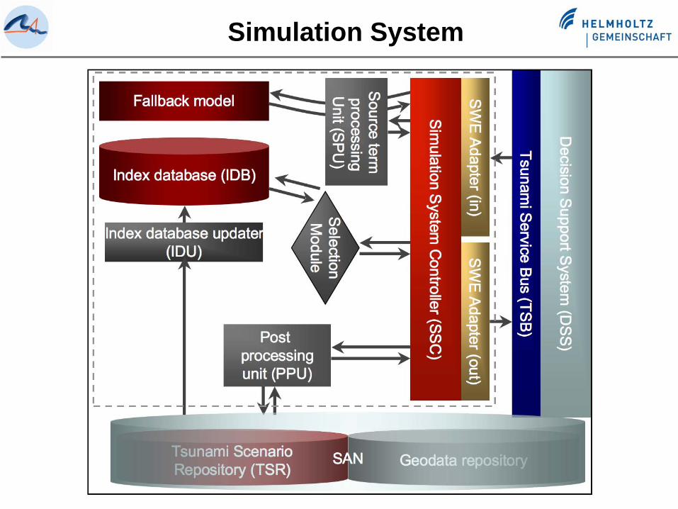
Simulation System

Bathymetry
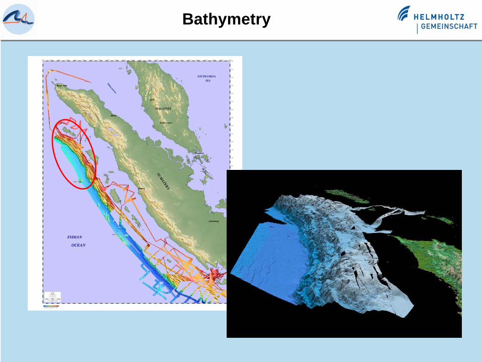
Bathymetry
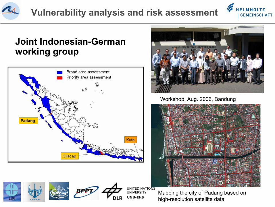
Joint Indonesian-German working group
Vulnerability analysis and risk assessment
Workshop, Aug. 2006, Bandung
Mapping the city of Padang based on high-resolution satellite data
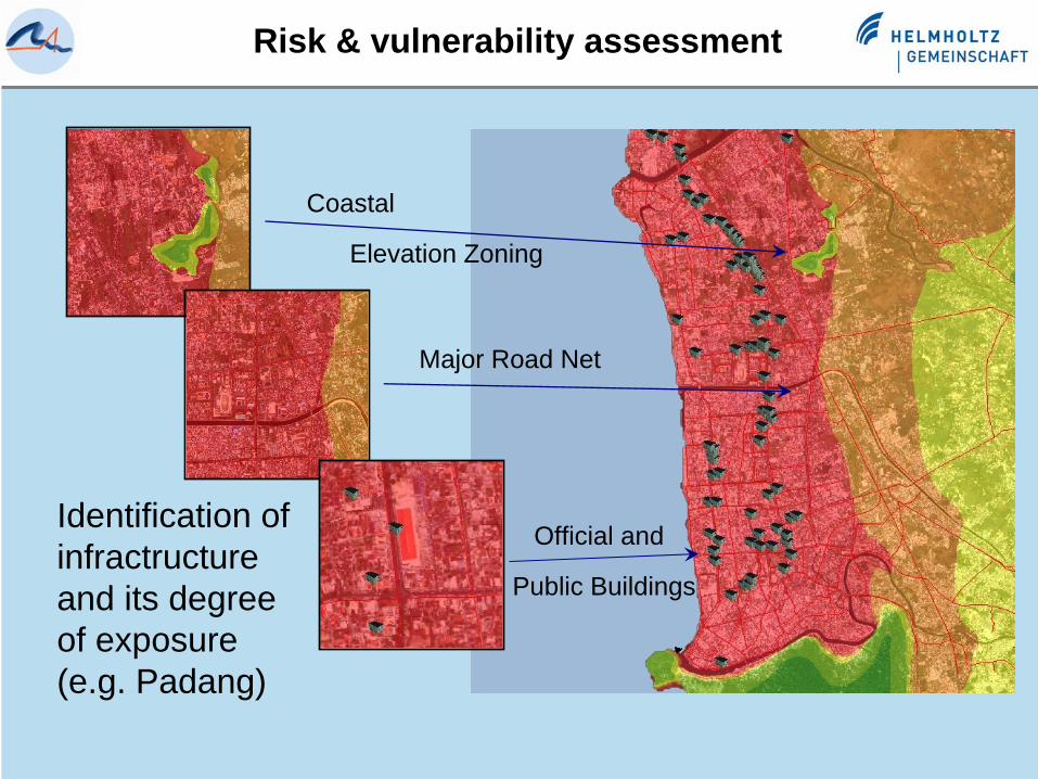
Risk & vulnerability assessment
Major Road Net
Official and
Public Buildings
Coastal
Elevation Zoning
Identification of infractructureand its degreeof exposure(e.g. Padang)
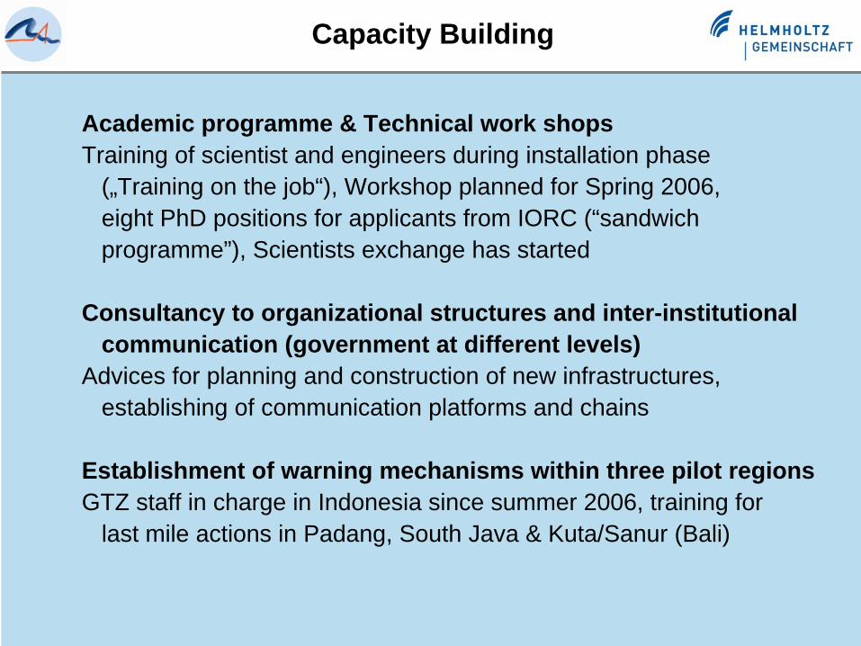
Capacity Building
Academic programme & Technical work shopsTraining of scientist and engineers during installation phase
(„Training on the job“), Workshop planned for Spring 2006,eight PhD positions for applicants from IORC (“sandwich programme”), Scientists exchange has started
Consultancy to organizational structures and inter-institutionalcommunication (government at different levels)
Advices for planning and construction of new infrastructures,establishing of communication platforms and chains
Establishment of warning mechanisms within three pilot regionsGTZ staff in charge in Indonesia since summer 2006, training for
last mile actions in Padang, South Java & Kuta/Sanur (Bali)

Training and Capacity Building
Training Course Seismology, Data Analysis and Tsunami Detection29 Jan – 18 Feb 2007 in JakartaOrganized by: GFZ Potsdam, BMG Jakarta and USGS30 Paticipants
PhD-Program with 9 Scholarships for 3 years at german research institutions started this yearParticipants from Indonesia, Malaysia, Madagascar
Post-Doc Programe for the exchange of Scientists (2-4 Months) started
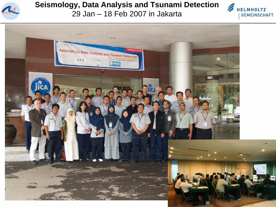
Seismology, Data Analysis and Tsunami Detection29 Jan – 18 Feb 2007 in Jakarta
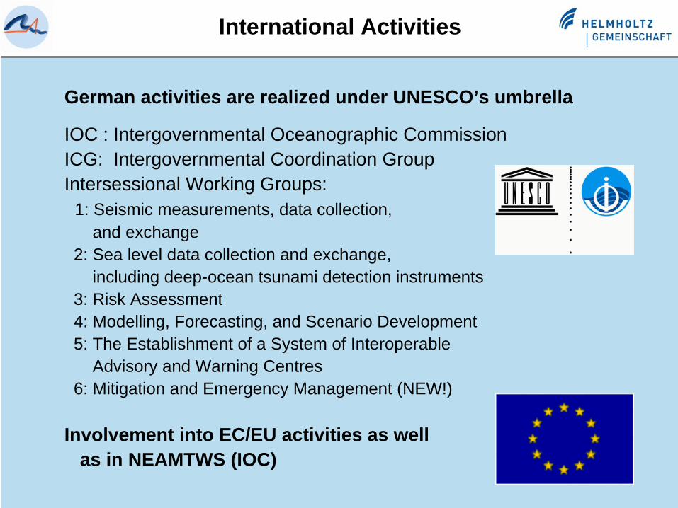
German activities are realized under UNESCO’s umbrella
IOC : Intergovernmental Oceanographic CommissionICG: Intergovernmental Coordination GroupIntersessional Working Groups:
1: Seismic measurements, data collection,and exchange
2: Sea level data collection and exchange,including deep-ocean tsunami detection instruments
3: Risk Assessment4: Modelling, Forecasting, and Scenario Development5: The Establishment of a System of Interoperable
Advisory and Warning Centres6: Mitigation and Emergency Management (NEW!)
Involvement into EC/EU activities as well as in NEAMTWS (IOC)
GNSS-AltimetryInternational Activities
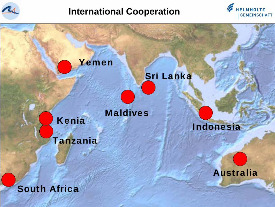
South Africa
Australia
IndonesiaMaldives
Sri Lanka
International Cooperation
Yemen
Tanzania
Kenia
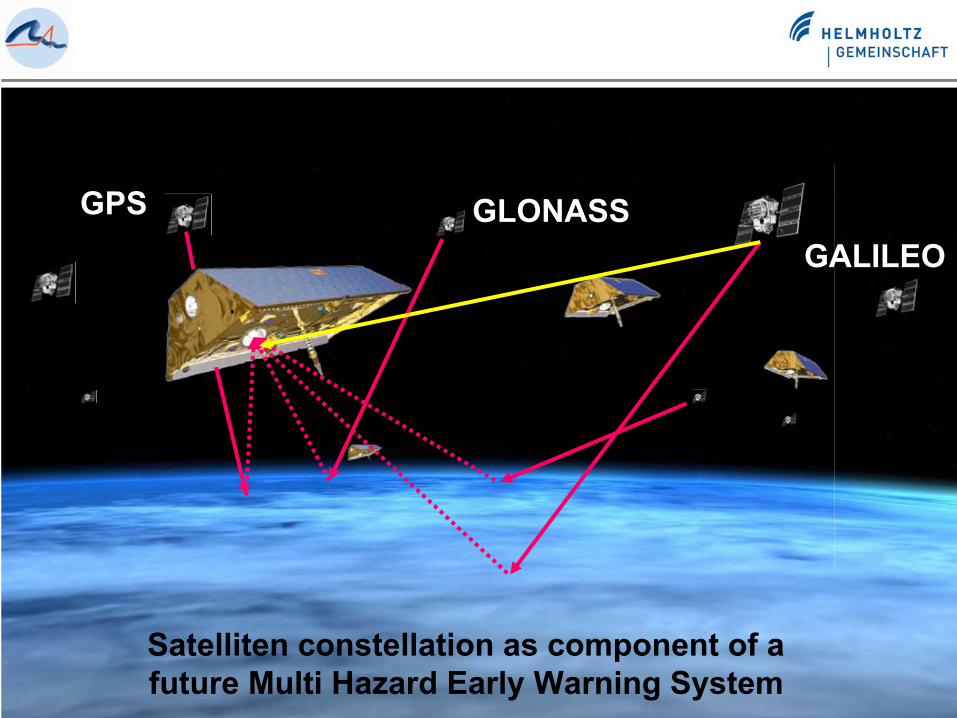
GPS GLONASSGALILEO
Satelliten constellation as component of a future Multi Hazard Early Warning System
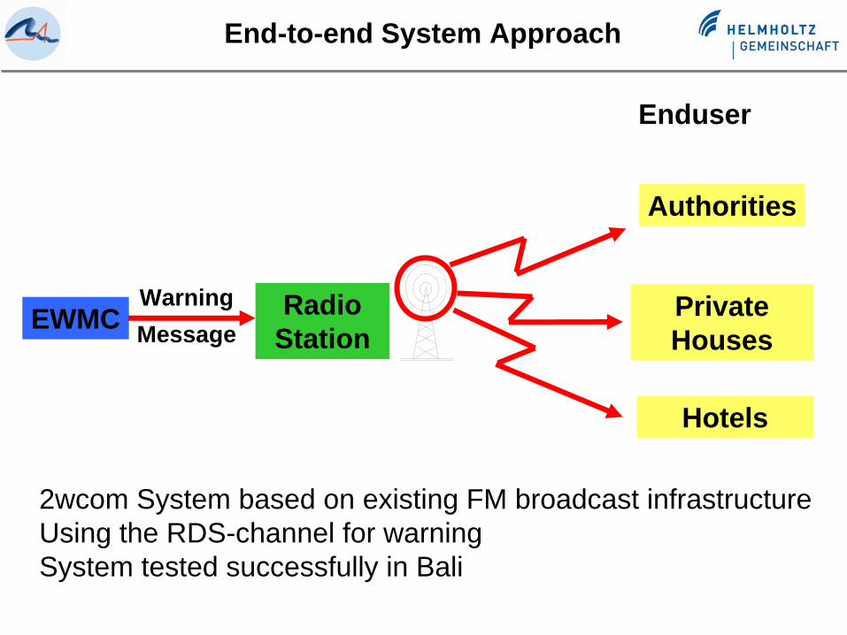
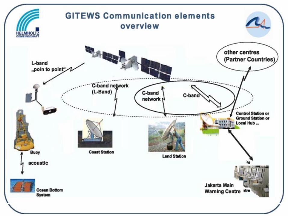
End-to-end System Approach
EWMC Radio Station
Enduser
Hotels
PrivateHouses
Authorities
WarningMessage
2wcom System based on existing FM broadcast infrastructureUsing the RDS-channel for warningSystem tested successfully in Bali
End
Thank you
Terima kasih
Website: http://www.gitews.org
Funding by the German Federal Ministry for Education and Research (BMBF) is gratefully acknowledged