gse_photolink+_v1 (5).pdf - geospatial experts
TRANSCRIPT
Advanced photo mapping to improve efficiency in the field and in the officeGeoSpatial Experts applications help users streamline photo-based field data collection and information management. Specialized processes and tools for photo mapping save businesses money by increasing the efficiency of photo data capture, digital processing, annotation, file sharing, reporting, mapping, and database integration. Designed for easy integration with existing systems and protocols, GPS-Photo Link+ is compatible with Esri’s ArcGIS, as well as the Ricoh G700SE, Trimble handheld computers, other GPS cameras including cell phones and tablets, and actually any digital camera coupled with any handheld GPS.
The power and agility of the GPS-Photo Link+ subscription software enables businesses to meet compliance requirements, effectively capture project data, or capitalize on new business opportunities.
GPS-Photo Link+software that maps your photos
GeoSpatial Experts, Inc., founded in 2001, is the world leader in photo mapping software for businesses. Over the past decade, GPS-Photo Link has been the industry standard solution for mapping photographs because of its advanced functionality, consistency and reliability.
Industry Application
Federal government Real property field auditLocal government Emergency response deployment and FEMA applicationsEngineering Environmental impact assessment for land use permitsUtilities Routine infrastructure inventoriesWater & waste water Field audit of water metersOil & gas NPMS & PODS documentation & oil spill responseNatural resource management Wildlife surveys Law enforcement Crime scene mappingMilitary Mapping and cataloging travel routes
www.geospatialexperts.com | 303.255.2908 | [email protected]
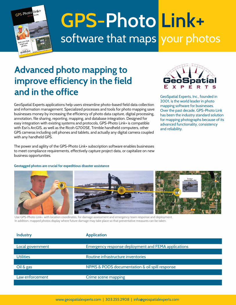
Use GPS-Photo Link+, with location coordinates, for damage assessment and emergency team response and deployment. In addition, mapped photos display where future damage may take place so that preventative measures can be taken.
Geotagged photos are crucial for expeditious disaster assistance
+
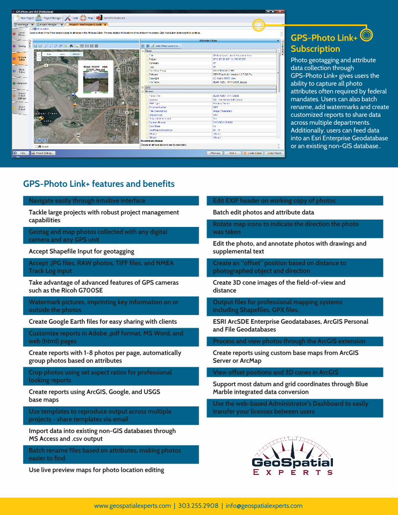
GPS-Photo Link+SubscriptionPhoto geotagging and attribute data collection through GPS-Photo Link+ gives users the ability to capture all photoattributes often required by federal mandates. Users can also batch rename, add watermarks and create customized reports to share data across multiple departments. Additionally, users can feed data into an Esri Enterprise Geodatabase or an existing non-GIS database..
www.geospatialexperts.com | 303.255.2908 | [email protected]
Navigate easily through intuitive interface
Tackle large projects with robust project management capabilities
Geotag and map photos collected with any digital camera and any GPS unit
Accept Shapefile Input for geotagging
Accept .JPG files, RAW photos, TIFF files, and NMEA Track Log input
Take advantage of advanced features of GPS cameras such as the Ricoh G700SE
Watermark pictures, imprinting key information on or outside the photos
Create Google Earth files for easy sharing with clients
Customize reports in Adobe .pdf format, MS Word, and web (html) pages
Create reports with 1-8 photos per page, automatically group photos based on attributes
Crop photos using set aspect ratios for professional looking reports
Create reports using ArcGIS, Google, and USGS base maps
Use templates to reproduce output across multiple projects - share templates via email
Import data into existing non-GIS databases through MS Access and .csv output
Batch rename files based on attributes, making photos easier to find
Use live preview maps for photo location editing
GPS-Photo Link+ features and benefits
Edit EXIF header on working copy of photos
Batch edit photos and attribute data
Rotate map icons to indicate the direction the photo was taken
Edit the photo, and annotate photos with drawings and supplemental text
Create an “offset” position based on distance to photographed object and direction
Create 3D cone images of the field-of-view and distance
Output files for professional mapping systems including Shapefiles, GPX files,
ESRI ArcSDE Enterprise Geodatabases, ArcGIS Personal and File Geodatabases
Process and view photos through the ArcGIS extension
Create reports using custom base maps from ArcGIS Server or ArcMap
View offset positions and 3D cones in ArcGIS
Support most datum and grid coordinates through Blue Marble integrated data conversion
Use the web-based Administrator’s Dashboard to easily transfer your licenses between users