intelligent transportation systems (its) using technology ... · intelligent transportation systems...
TRANSCRIPT

INTELLIGENT TRANSPORTATION SYSTEMS (ITS)
USING TECHNOLOGY FOR THE SAFETY AND MOBILITY OF ALL MODES
MARSHALL ELIZER, P.E., PTOE MAY 13, 2015
1

FDOT Complete Streets Implementation Plan
A project to implement FDOT’s Complete Streets policy that promotes safety, quality of life, and economic development in Florida.
Mission: Determine what modifications to FDOT policies, guidance, manuals, procedures and general practices are needed to put the FDOT Complete Streets Policy into action, and develop a Work Plan to accomplish identified document modifications.

FDOT’s CS/M2D2 Program Objectives1. Provide the project stakeholder group (PSG) with a state-of-
the practice understanding of the capabilities/requirements of each transportation mode and the opportunities/tradeoffs that exist in a multimodal system.
2. Review the current policies, guidance, manuals, procedures and practices of FDOT and identify ways Florida’s state, regional and local government agencies can balance those needs and modes collectively when multiple modes coexist.
3. Identify/understand barriers, gaps, & opportunities that exist in current FDOT documents and practices to address the needs of all modes in a variety of contexts.
4. Complete an implementation plan and associated schedule for addressing the various actions and strategies needed to put FDOT Complete Streets Policy into everyday practice.

Today’s ITS Workshop Topics
• Overview of ITS• State of the ITS Practice in Florida• ITS Strategies and Applications for All Modes• Small Group Discussion - Advancing use of
Multimodal ITS in FDOT Programs, Processes and Projects
• Key Actions & Next Steps

Today’s Learning Objectives• Understand all “ITS” has to offer and its potential
benefit to the safety and mobility of all modes.• Understand the past and future of ITS applications
and strategies.• Understand state-of-the-practice in FDOT and
Florida, and Nationally.• Identify how ITS is being applied to benefit
multimodal transportation.• Identify ITS technology & strategies that FDOT
and its partners can advance to better serve multimodal interests today and into the future.
• Identify how to get those applications into FDOT’ policies, standards, practices and processes.

SECTION 1
OVERVIEW OF INTELLIGENT TRANSPORTATION SYSTEMS

ANYONE HEARD OF “IVHS”?
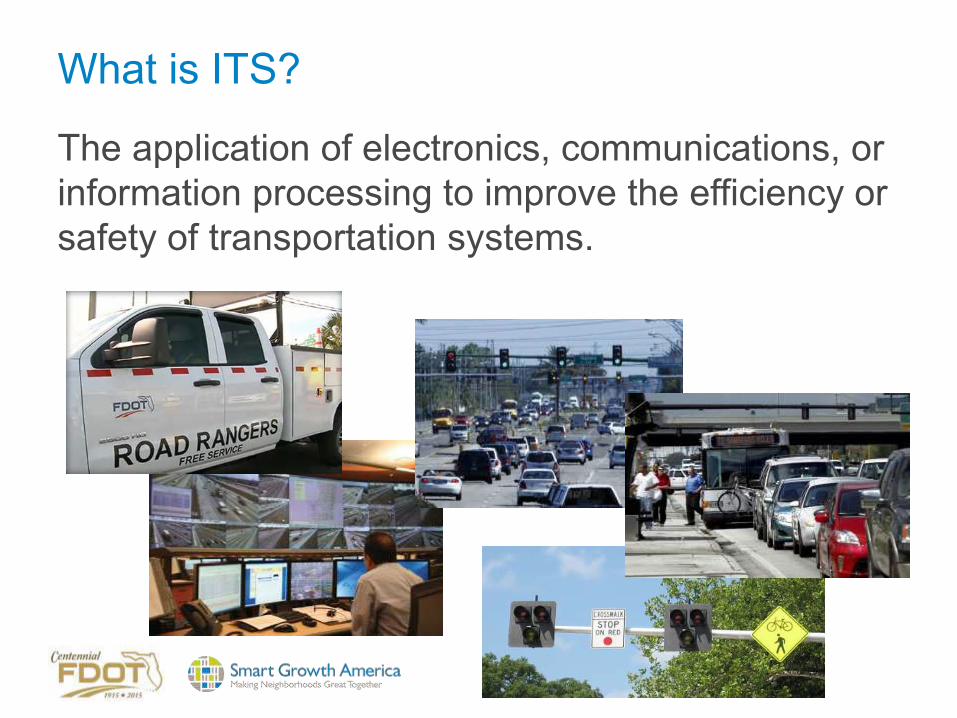
What is ITS?
The application of electronics, communications, or information processing to improve the efficiency or safety of transportation systems.
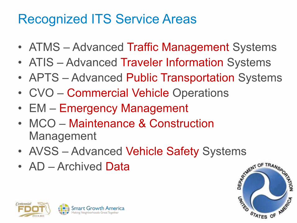
Recognized ITS Service Areas
• ATMS – Advanced Traffic Management Systems • ATIS – Advanced Traveler Information Systems • APTS – Advanced Public Transportation Systems • CVO – Commercial Vehicle Operations • EM – Emergency Management • MCO – Maintenance & Construction
Management • AVSS – Advanced Vehicle Safety Systems • AD – Archived Data

ITS is...freeway traffic management
• Variable Message Signs
• CCTV Video
• Traffic Detection
• Ramp Metering
• Active Traffic Management

ITS is...surface road advanced traffic management
• Signal Coordination
• Real-time Adaptive Signal Timing
• Transit, Pedestrian, Bicycle controls

Traffic Management Services
• Network Surveillance • Traffic Probe
Surveillance • Traffic Signal Control • Traffic Metering • HOV Lane
Management • Traffic Information
Dissemination • Regional Traffic
Management
• Traffic Incident Management System
• Transportation Decision Support and Demand Management
• Electronic Toll Collection
• Emissions Monitoring and Management
• Roadside Lighting System Control
• Border crossing support

Traffic Management Services
• Standard and Advanced Railroad Grade Crossing
• Railroad Operations Coordination
• Parking Facility Management
• Regional Parking Management
• Reversible Lane Management
• Speed Warning and Enforcement
• Drawbridge Management • Roadway Closure
Management • Variable Speed Limits • Dynamic Lane
Management and Shoulder Use
• Dynamic Roadway Warning
• VMT Road User Payment
• Mixed Use Warning Systems
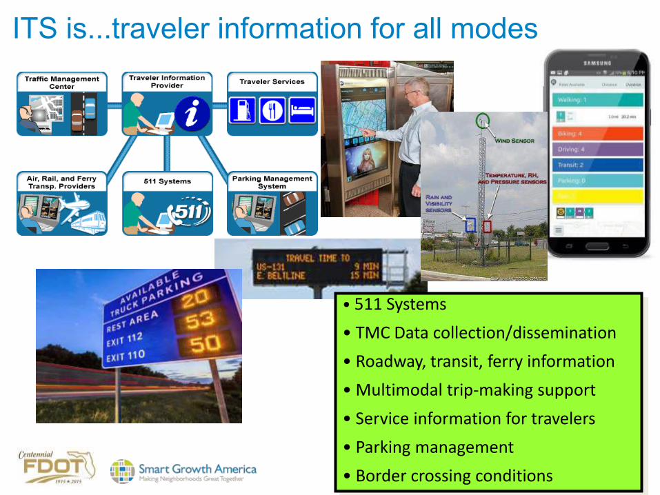
ITS is...traveler information for all modes
• 511 Systems
• TMC Data collection/dissemination
• Roadway, transit, ferry information
• Multimodal trip-making support
• Service information for travelers
• Parking management
• Border crossing conditions

Traveler Information Services
• Broadcast Traveler Information
• Interactive Traveler Information
• Autonomous Route Guidance
• Dynamic Route Guidance
• ISP Based Trip Planning and Route Guidance
• Transportation Operations Data Sharing
• Travel Services Information and Reservation
• Dynamic Ridesharing • In-Vehicle Signing • Short Range
Communications Traveler Information

ITS is...incident, emergency, freight management• Incident Detection & Response
• Computer Aided Dispatch
• Goods Movement Management & Tracking
• Freeway Service Patrols
• Adaptive Traffic Signals
• Variable Message Signs
• Highway Advisory Radio, CCTV

ITS is...enforcement support
• Incident Support
• Red Light Running Systems
• Automated Speed Enforcement
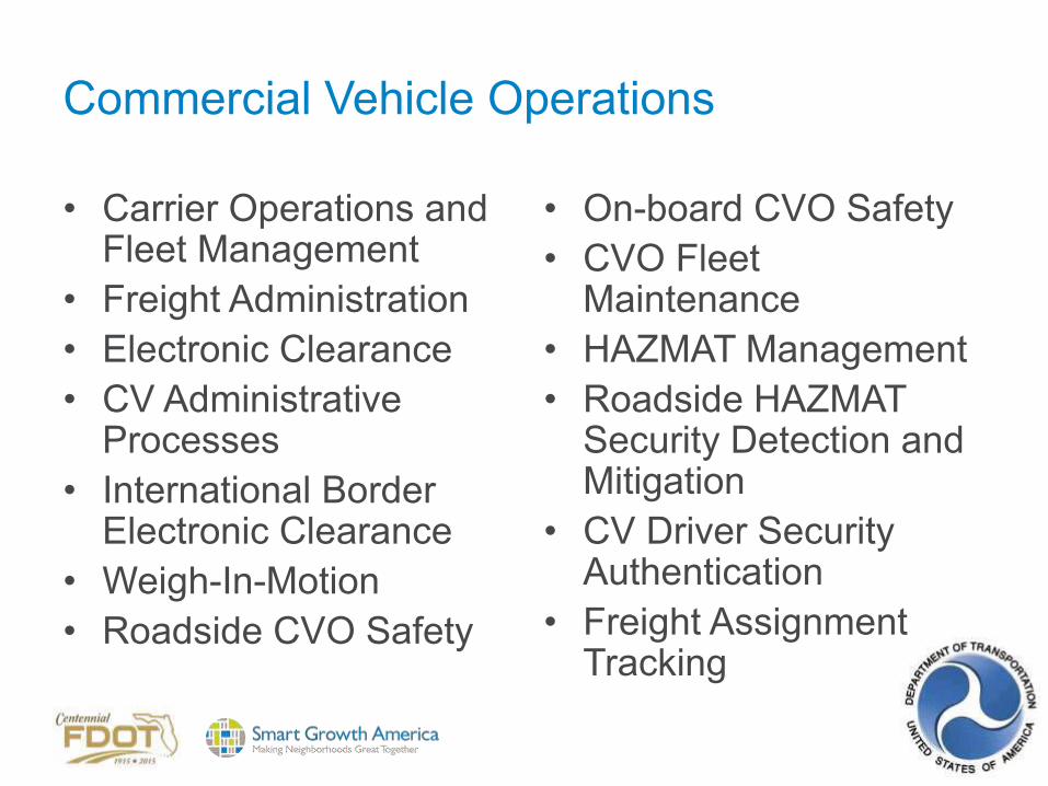
Commercial Vehicle Operations
• Carrier Operations and Fleet Management
• Freight Administration • Electronic Clearance • CV Administrative
Processes • International Border
Electronic Clearance • Weigh-In-Motion • Roadside CVO Safety
• On-board CVO Safety • CVO Fleet
Maintenance • HAZMAT Management • Roadside HAZMAT
Security Detection and Mitigation
• CV Driver Security Authentication
• Freight Assignment Tracking
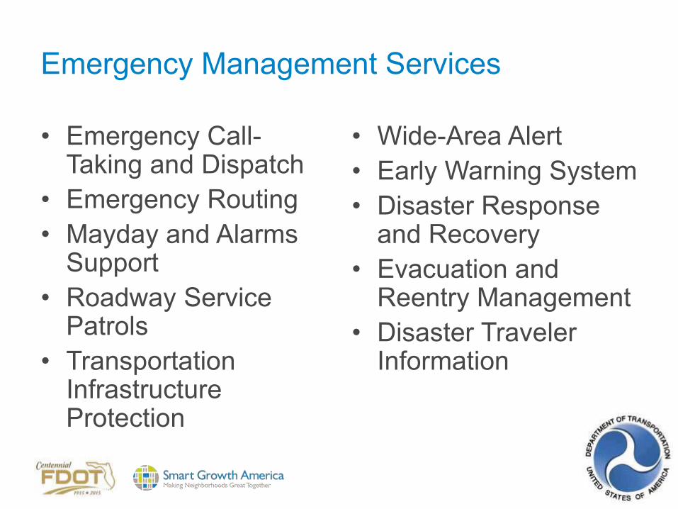
Emergency Management Services
• Emergency Call-Taking and Dispatch
• Emergency Routing • Mayday and Alarms
Support • Roadway Service
Patrols • Transportation
Infrastructure Protection
• Wide-Area Alert • Early Warning System • Disaster Response
and Recovery • Evacuation and
Reentry Management • Disaster Traveler
Information

ITS is...transit management
• Automatic Vehicle Location
• Computer Aided Dispatch
• Electronic Payment Systems
• Real-Time Schedule Information
• Transit priority/preemption

Public Transportation Services
• Transit Vehicle Tracking • Transit Fixed-Route
Operations • Demand Response
Transit Operations • Transit Fare Collection
Management • Transit Security
• Transit Fleet Management
• Multi-modal Coordination
• Transit Traveler Information
• Transit Signal Priority • Transit Passenger
Counting • Multimodal Connection
Protection
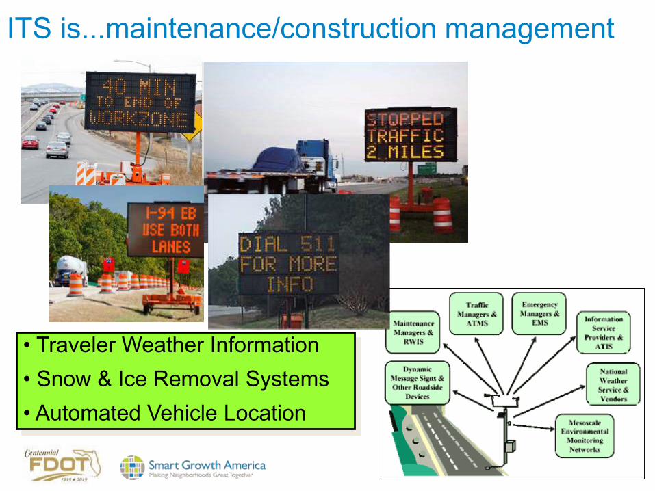
ITS is...maintenance/construction management
• Traveler Weather Information• Snow & Ice Removal Systems• Automated Vehicle Location

Maintenance & Construction Management
• Maintenance and Construction Vehicle and Equipment Tracking
• Road Weather Data Collection
• Weather Information Processing and Distribution
• Roadway Automated Treatment
• Winter Maintenance
• Roadway Maintenance and Construction
• Work Zone Management • Work Zone Safety
Monitoring • Maintenance and
Construction Activity Coordination
• Environmental Probe Surveillance
• Infrastructure Monitoring

ITS is...futuristic
• Connected Vehicles
• Vehicle-to-Vehicle communications
• Vehicle-to-Infrastructure communications
• Self-driving “autonomous” vehicles
• Automated highways

Vehicle Safety Systems
• Vehicle Safety Monitoring
• Driver Safety Monitoring
• Longitudinal Safety Warning
• Lateral Safety Warning • Intersection Safety
Warning • Pre-Crash Restraint
Deployment
• Driver Visibility Improvement
• Advanced Vehicle Longitudinal Control
• Advanced Vehicle Lateral Control
• Intersection Collision Avoidance
• Automated Vehicle Operations
• Cooperative Vehicle Safety Systems

ITS is really…getting information…processing information...sharing information…to support safer, more efficient and more sustainable transportation.
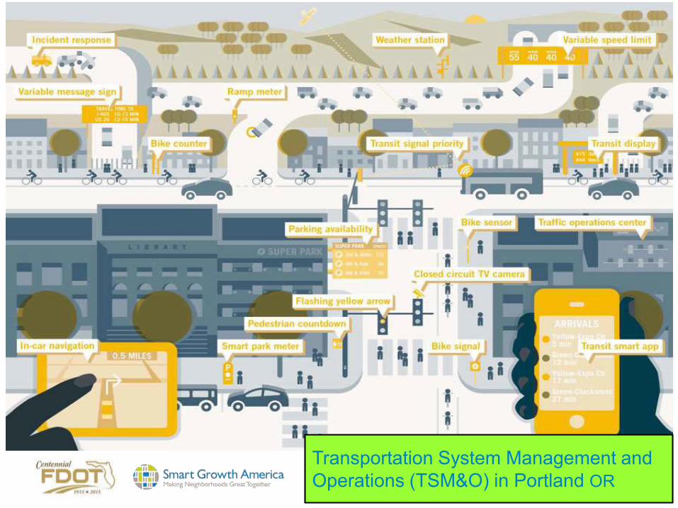
Transportation System Management and Operations (TSM&O) in Portland OR
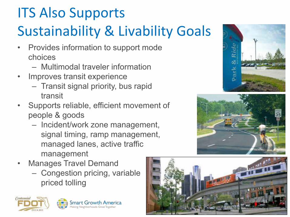
ITS Also Supports Sustainability & Livability Goals• Provides information to support mode
choices– Multimodal traveler information
• Improves transit experience– Transit signal priority, bus rapid
transit• Supports reliable, efficient movement of
people & goods – Incident/work zone management,
signal timing, ramp management, managed lanes, active traffic management
• Manages Travel Demand– Congestion pricing, variable
priced tolling

Benefits of ITS• Travelers are the primary beneficiaries as they experience
improved safety of travel, including reduction in fatalities, injuries, and the costs associated with crashes.
• Travelers also benefit from real-time, multimodal information that leads to more efficient and eco-friendly choices regarding travel routes and modal choices.
• Transportation agencies benefit by being able to see and respond dynamically to manageconditions on the transportation network across all of the modes.
• Operators benefit from having tools to manage the multi-modal system more efficiently, saving fuel, and reducing environmental impact.

National Guidance & Standards
The National ITS Architecture and Standards program ensures that States and jurisdictions have the framework they need to deploy interoperableITS systems for seamless travel.

Current ITS Deployment Statistics
USDOT 2013 Intelligent Transportation System (ITS) Deployment Tracking Survey• Freeways• Arterials• Transit

Freeway Management Deployment Trends, 2000 – 2013

Technologies Adopted by Freeway Agencies, 2000, 2010 and 2013

Adoption of Probe Readers by Freeway and Arterial Agencies

Methods Used to Distribute Traveler Information on Freeways, 2010 – 2013

Arterial Management Deployment Trends, 2000 – 2013

Technologies Adopted by Arterial Agencies, 2000 - 2013

Types of Traveler Information Distributed by Arterial Agencies, 2010-2013

Media Used to Distribute Traveler Information by Arterial Agencies, 2010 - 2013

Performance Measures Used by Freeway and Arterial Agencies

Types of Information Distributed by Freeway and Arterial Agencies

Benefit Ratings Assigned to ITS Technologies by Freeway Agencies, 2010 – 2013

Benefit Ratings Assigned to ITS Technologies by Arterial Agencies, 2010 – 2013

Incident Management Deployment Indicators, 2000 - 2013

CURRENT USDOT DIRECTION IN ITS
Connected Vehicles• Connected vehicle safety applications will
enable drivers to have 360-degree awareness of hazards and situations they cannot even see.
• Through in-car warnings, drivers will be alerted to imminent crash situations, such as merging trucks, cars in the driver’s blind side, or when a vehicle ahead brakes suddenly.
• By communicating with roadside infrastructure, drivers will be alerted when they are entering a school zone, if workers are on the roadside, and if an upcoming traffic light is about to change

Current USDOT ITS Research Activities• Vehicle to Vehicle (V2V)Communications for Safety:
investigates key questions such as whether vehicle-based safety applications using V2V communications are effective and do they have benefits.
• Vehicle to Infrastructure (V2I) Communications for Safety: investigates similar questions of effectiveness and potential benefits as that being conducted for V2V communications. The initial focus of the research is on applications that relay traffic signal phase and timing information to vehicles. Low-cost rural ITS safety countermeasures are included as part of this effort.
• Vehicle to Pedestrian (V2P): investigates V2P and Pedestrian to Infrastructure (P2I) technologies that help to eliminate or reduce pedestrian crashes.
• Road Weather Management: investigates how vehicle-based data on current weather conditions can be used by travelers and transportation agencies to enable decision-making that takes current weather conditions and future weather forecasts into account.
Other USDOT ITS Research Applications for the Environment: Real-Time Information Synthesis (AERIS)• Dynamic Mobility Applications: Examines what
technologies can help people and goods effortlessly transfer from one mode of travel (car, bus, truck, train, etc.) or route to another for the fastest and most environmentally friendly trip.
• The research seeks to make cross-modal travel truly possible for people and goods, and enable agencies and companies to manage their systems in light of the fact that people and goods will be changing modes often.

Accessible Transportation Technologies Research Initiative (ATTRI)• Research to improve the mobility of travelers with disabilities
through the use of ITS and other advanced technologies. • Research, development, and implementation of transformative
technologies, solutions, applications, or systems for people of all abilities to effectively plan their personal and independent travel.
• Goal: enhance the capability of travelers to reliably and safely execute independent travel.
• Goal: identify, develop, and deploy new transformative technologies, applications or systems, along with supporting policies and institutional guidance, to address mobility challenges of all travelers, in particular, travelers with disabilities.
• ATTRI will also develop technological solutions to lower or remove barriers to transportation according to four functional disabilities: visual, hearing, cognitive and mobility.

Discussion
Based on what we’ve just covered…..
What are the best opportunities for ITS to benefit FDOT’s multimodal
customers?

SECTION 2
STATE OF THE ITS PRACTICE IN FDOT
RUSSELL ALLENINTELLIGENT TRANSPORTATION
SYSTEMSTRAFFIC ENGINEERING/OPERATIONS

ITS-Related Plans/Documents/Processes • Long Term Plans
– 2014 Update to ITS Strategic Plan– 2014-2024 Ten-Year ITS Cost Feasible Plan– Connected Vehicle Initiative (FDOT website)
• Studies & Reports– ITS Performance Measures Annual Report 2012-2013– ITS Program Annual Report FY 2013-14– Integrated Corridor Management & Advanced Technologies for Florida 2012– Selecting the Most Effective ITS Application for Pedestrian Safety in Florida
• Procedures– Removal of Unwarranted, Nonconforming or Unauthorized Traffic Control
Signals– Signalization Preemption Design Standard– 511 website
• Manuals/Handbooks– Florida Intersection Design Guide– Florida’s ITS Integration Handbook 2002
• General Planning & Review Practices– Traffic Engineering Manual

Other Plans/Documents that can Impact FDOT’s ITS Program
• 2060 Florida Transportation Plan• Florida Strategic Intermodal System Strategic
Plan• 2040 Multimodal Unfunded Needs Plan • Florida Freight Mobility and Trade Plan• Florida Rail System Plan• Florida Strategic Highway Safety Plan• Florida Transportation Trends and Conditions
Report• Florida TOD Guidebook

Good Example: Best Design Practices for Walking and Bicycling in Michigan includes ITSSignalized Intersection Improvements • Fixed Time Signals or Pedestrian Push-Buttons • Pedestrian Countdown Signal • Leading Pedestrian Interval • Pedestrian-Only Phase (Scramble) • Exclusive Left (Leading/Lagging) • Flashing Yellow Arrow • Prohibited Left Turns (Florida Left) • Prohibited Right Turn on Red • Bicycle Signal Detection • Bike Box • Two-Stage Bike Left Turn • Bicycle Signals Unsignalized Ped Crossing Improvements • Rectangular Rapid Flash Beacon • Pedestrian Hybrid Beacon • Midblock Signal

Good Example: CalTrans Complete IntersectionsThe Department views all transportation improvements as opportunities to improve safety, access, and mobility for all travelers in California and recognizes bicycle, pedestrian, and transit modes as integral elements of the transportation system.“
– Policy Statement– Implementation Action Plan– Complete Intersections guide for how
to design or redesign intersections to optimize safety for pedestrians and bicyclists
– Updates to all relevant department manuals, guides, policies, processes

Discussion - How does the current ITS program support and link to other FDOT programs?

Discussion
• Are there missed opportunities to take full advantage of what ITS has to offer for multimodal purposes in FDOT’s planning, design, operations and management processes?

SECTION 3
ITS STRATEGIES AND APPLICATIONS FOR ALL
MODES
Modal Applications of ITS
• Passenger vehicles• Transit (road and rail)• Freight/goods movement• Pedestrians• Bicycles
and tying the modes together…• Traveler information services

ITS for Vehicles
• Primary focus of the ITS industry• Vehicle applications dominate to address
highway system efficiency and safety needs

ITS for Transit
Transit ITS• Fleet Operations and Management – implemented to
facilitate transit operations and provide input to senior management
• Traveler Information – customer-interface technologies that provide trip planning and real-time operational information
• Safety and Security – improve safety and security of transit staff and passengers
• Automated Fare Payment – fare collection and payment technologies
• Maintenance – facilitate maintenance activities• Other – other technologies and systems, such as data
management and the use of open data

Transit Management Deployment Indicators, 2000 - 2013

Technologies Adopted by Transit Agencies, 2000, 2010, and 2013

Media used by Transit Agencies to Distribute Dynamic and Static Traveler Information
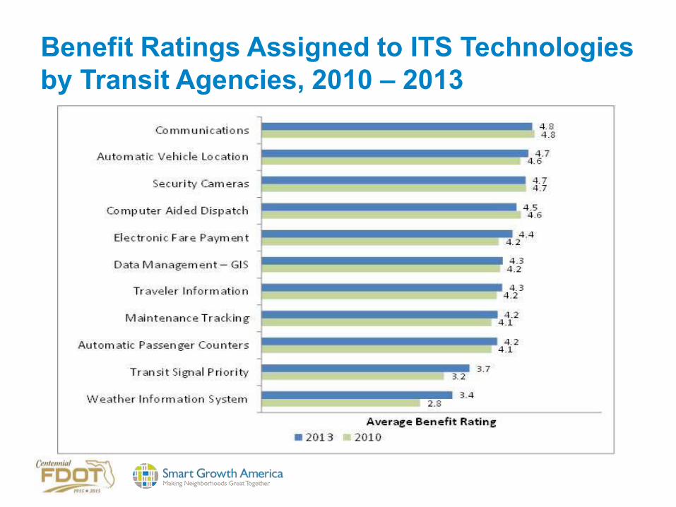
Benefit Ratings Assigned to ITS Technologies by Transit Agencies, 2010 – 2013

Fleet Operations and Management
Communications Technologies• Depend on infrastructure and devices
used to transmit voice and data• Can transmit voice, text, data, and video
over radio, cellular, or other wireless networks• Types of wireless networks:
– Wide area wireless (WAW)– Wireless local area network
(WLAN)– Dedicated short-range
communications (DSRC)– Land line and cellular
telephone networks– Internet and intranet

Fleet Operations and Management
Automatic Vehicle Location (AVL) and Computer-aided Dispatch (CAD)
• For operations management-periodically receives real-time updates on vehicle locations and schedule/route status
• Onboard computer with Global Positioning System and mobile data communications
• Provides decisions support tools used by dispatchers and supervisors, allowing proactive management of operations
• Allows for "single point" logon for all onboard systems

Fleet Operations and Management
Automatic Passenger Counters (APCs)• Monitors passenger activity and uses algorithm to
count number of boarding and alighting passengers• Data can either be stored for
downloading/uploading or transmitted in real-time• Most common types are treadle mats and infrared
technology• Ability to "stamp" data with
exact bus stop location and time of day through integration with AVL

Fleet Operations and Management
Scheduling Software
Fleet Operations and Management
Transfer Connection Protection (TCP)• Triggered when vehicle operator of incoming vehicle
makes a transfer request using a mobile data terminal (MDT) to enter outgoing route
• Central system determines whether outgoing vehicle can and should be held based on estimated arrival time of incoming vehicle
• Central system will notify:– Incoming vehicle’s operator whether outgoing vehicle
will be held– Outgoing vehicle’s operator if it is to hold, until what
time, and for what route• Dispatcher reviews current pending transfers

Fleet Operations and Management
Transit Signal Priority (TSP)• Give authorized transit vehicles ability to automatically
change the timing of traffic signals• Can be limited to extending green cycle, but can result in
red cycle truncation and phase insertion• May be done “conditionally” based on passenger load,
type of service (Bus Rapid Transit (BRT) vs. local), and schedule adherence

Fleet Operations and Management
Yard Management• Automatically locates
vehicles within certain distance accuracy inside yard
• Allows yard attendants to adjust vehicle locations manually on a yard map
• Provides interface with CAD/AVL system to record pull-in and pull-out time, and assigned vehicle operators
• Can be interfaced with fixed-route scheduling software to access vehicle operator information in real-time
Fleet Operations and Management
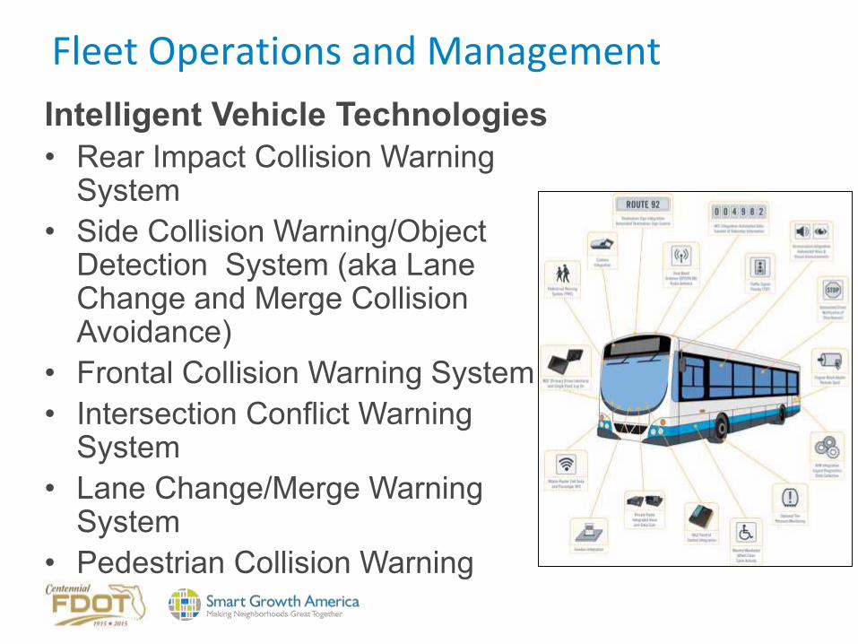
Intelligent Vehicle Technologies• Rear Impact Collision Warning
System• Side Collision Warning/Object
Detection System (aka Lane Change and Merge Collision Avoidance)
• Frontal Collision Warning System• Intersection Conflict Warning
System• Lane Change/Merge Warning
System• Pedestrian Collision Warning

Fleet Operations and ManagementIntelligent Vehicle Technologies (continued)• Lane Control Technologies• Vehicle Assist and Automation (VAA):
– Lateral Guidance (aka lane keeping for operating on narrow rights-of-way, such as freeway shoulders)
– Vehicle Platooning– Precision Docking– Automated Operations

Transit Traveler Information
Automatic Voice Announcements (AVA)• Audio and visual announcements to onboard riders and
those waiting to board• As fixed-route vehicle approaches a stop or other
designated location:– Digitally recorded announcement automatically
made over onboard public address system speakers– Displayed on dynamic message signs inside vehicle
to inform passengers about upcoming stops, major intersections landmarks
– Can make time-based, location-based, and vehicle operator-initiated announcements/displays

Transit Traveler Information
En-route/Wayside Traveler Information
Transit Traveler Information
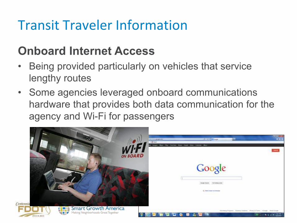
Onboard Internet Access• Being provided particularly on vehicles that service
lengthy routes• Some agencies leveraged onboard communications
hardware that provides both data communication for the agency and Wi-Fi for passengers

Transit Traveler Information
511, 311, and 211 Systems• On July 21, 2000, Federal
Communications Commission (FCC) assigned 511 as nationwide telephone number for traveler information -provided statewide and/or regionally
• FCC designated 211 to be used for locally/regionally operated "community information and referral services" phone systems
• FCC designated 311 to be used for locally/regionally operated, staffed (live operator) phone systems for “non-emergency policy and other government services” information

Transit Traveler Information
Google Transit

Transit Traveler Information
Third-Party Smartphone Applications

Transit Safety and Security
Mobile (onboard and exterior) and Fixed Video Surveillance
• Review recorded images• Potential crime prevention• Identify criminal activity and perpetrator(s)• Identify improper
passenger and driver behavior
• Incident/ insurance investigation

Transit Safety and Security
Covert Emergency Alarm and Covert Live Audio Monitoring
• Allows dispatchers to listen in on what is happening inside vehicle while an incident is taking place
• Covert microphones are one-way communications in order not to alert person responsible for incident that dispatcher/police are listening in
• Driver in distress presses a covert switch that activates the covert microphone and monitor in dispatcher’s office automatically displays the information for that vehicle and map display zooms in on that vehicle

Automated Fare Payment
Automated fare media• Magnetic stripe cards• Smart cards - integrated circuit (or chip)
card that has microprocessor and built-in logic: contact, contactless, and combi-card
• Accommodate options such as stored value, stored trip, various lengths of passes, and capped-trip passes
• Facilitates transfers

Automated Fare Payment
Automated Fareboxes and Faregates

Technology Integration
• Opportunities for technologies to be integrated with systems that are external to transit agency, such as a regional traffic management center or an information services provider
• Integration, when implemented from enterprise-wide perspective and regional perspective when appropriate, improves overall usability of technology environment made up of products from different vendors on multiple platforms and data from different systems

Discussion Point
• What is FDOT’s role in advancing the application of transit ITS in Florida?
• Integrating roadway ITS with transit ITS?
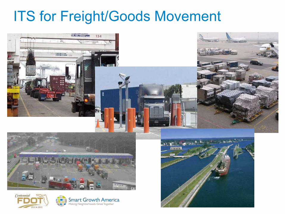
ITS for Freight/Goods Movement

Core ITS Freight Technologies • Asset tracking
– "Where is my equipment?" – enables better fleet management and supply chain
visibility • On-board status monitoring
– Vehicle condition sensors– Cargo condition sensors – Driver behavior sensors
• Gateway facilitation – Ties in with CVO and CVISN
• Freight and network status info – Requires major database
access and management capabilities

Freight Signal Priority (FSP)• Freight Signal Priority concept
provides signal priority along an arterial corridor near a freight facility based upon current and projected freight movements into and out of the freight facility.
• The goal of freight signal priority application is to reduce delays and increase travel time reliability for freight traffic, and enhance safety at intersections around the freight facility.

ITS Applications for Freight Mobility• Freight Advanced Traveler Information System
(FRATIS) - provides traveler information to freight operators and drivers such as real-time travel estimates with route guidance to freight facilities, and basic incident alert, road closure and work zone information.
• Freight Dynamic Route Guidance - determines, in real-time, and potentially while a truck is already on a route, the best route (or re-routing, if applicable) between freight facilities for each carrier that subscribes to the service.
• Drayage Optimization: This application optimizes drayage operations so that load movements are coordinated between freight facilities.

ITS for Pedestrians

Available Pedestrian ITS StrategiesSignalized Intersection Improvements • Fixed Time Signals or Pedestrian
Push-Buttons• Pedestrian Countdown Signal • Leading Pedestrian Interval • Pedestrian-Only Phase • Exclusive Left (Leading/Lagging) • Flashing Yellow Arrow • Prohibited Left Turns• ADA Treatments• Pedestrian detection• Automated pedestrian counts

Available Pedestrian ITS Strategies
Unsignalized Pedestrian Crossing Improvements • Rectangular Rapid Flash
Beacon • Pedestrian Hybrid Beacon
(HAWK) • Midblock Signal

Pedestrian Sensors for Street Crossing• Uses video camera technology to detect how
many pedestrians are waiting at crossings• Automatically adjusts the traffic signal timings
to extend the signal for pedestrians to cross the road when it detects that large numbers of people are waiting to cross
• Also can cancel calls when a pedestrian who placed a call has either crossed before the signal goes green or walks away

GPS Mobile ITS for Pedestrian Safety • This future application collects the position data of
pedestrians by communicating with GPS mobile phones carried by pedestrians
• This information is then sent to the server where it is determined if the driver and/or pedestrian should be alerted
• Informs the driver of the presence of unseen pedestrians via navigation voice message and display

Pre-collision System (PCS) with Pedestrian-avoidance Steer Assist • Uses automatic steering in addition to increased pre-collision
braking force and automatic braking to help prevent collisions with pedestrians
• An on-board sensor detects pedestrians and issues a visual alert on the dashboard if the system determines a risk of collision
• If the likelihood of a collision increases, an audio/visual alarm encourages the driver to take evasive action and pre-collision braking force and automatic braking functions are activated
• If the system determines that a collision cannot be avoided by braking alone and there is sufficient room for avoidance, steering assist is activated to steer the vehicle away from the pedestrian

Pedestrian Presence Sensors• Detector/camera combination uses predefined
detection zones for dynamic control of traffic signals and pedestrian warning lights
• As soon as a pedestrian enters the predefined zone, the sensor triggers the traffic light controller or activates a warning signal
• Detects pedestrians who are crossing the road, approaching or waiting at the crossing.

ITS for Bicycles

Available Bicycle ITS Strategies• Bicycle Signal Detection • Bicycle Signals • Pre-green Queue Jumping• Two-Stage Bike Left Turn • Rectangular Rapid Flash
Beacon • Hybrid Beacon Crossing • Midblock Signal • “Protected” intersection• Automated bicycle counting

Evolving Concept: “Protected” Intersection for Bicycles

Advanced Traveler Information for Modal Integration

Real-Time Travel InformationInformation types and impacts
Pre-Trip• Trip departure time• Mode of travel• Route choice
En Route • Change route • Change mode (if alternate mode available)• Expected arrival times

Real-Time Travel InformationDissemination• Web– State/Local traveler information Web sites– Pre-trip information– Wide geographic area coverage– Images from CCTV cameras on real-time conditions
• 511 System– More than 40 511 systems in use today– Highest usage under major events
• Extreme weather • Major road closures/incidents

Real-Time Travel InformationDissemination• Dynamic Message Signs• Highway Advisory Radio (HAR)• E-mail • TV/Radio• Kiosks • Private Information Providers – In-vehicle navigation – Handheld devices
• Social Networking Media

Real-Time Travel Information:Methods Used to Distribute Traveler Information by Freeway and Arterial Agencies

Real-Time Travel Information
Benefits
Improved Traveler Decision Making• Make accurate and timely decisions– Routing– Time of departure– Mode– Not make the trip
• Sense of “self control” to traveler
Reduced Frustration and Irrational Behavior• Improve perceived level of service

Real-Time Travel Information
Benefits
Spread or Reduce Peak Traffic Demand• Over space: alternative routes• Over time• Alternative modes• Eliminating discretionary trips
Field Evaluation Results• Traveler information users perceived time
savings • In-vehicle travel time savings are small

Parking Information
Public Agencies/Operators• Maps with Parking Facilities• Information on the Web:
location/characteristics
Parking Lots• Space Availability
Private Service ProvidersWeb/Mobile Applications• Real-time Parking Availability• Online Reservation/Payment

Parking InformationMultimodal Information
• Driving Times• Parking Availability at Transit
Stations• Transit Information– Departure/Arrival Times
• Influences Mode Choice– Travel Time Savings – Perceived Congestion
Multimodal Electronic Payment Systems
• Regional multimodal electronic payment system -all modes of transportation addressed by single payment system
• While there may be one single payment system there may be different payment devices– For example, vehicle-based payment can be
achieved by transponder or tag while personal based payments such as ticketing for transit systems can be accomplished with a smartcard
– The same account can be used for both even if different payment devices are used

MTC’s Transit.511.org Website (SF Region)

MTC 511 Transit App for Android Multiple-agency, nine-county public transit trip planner using GPS-based location tools for smartphones. It allows users to plan a trip on over 700 transit lines across the region including buses, trains and ferries. • Door-to-door transit trip planning and scheduled departure times for
transit routes near your location or from a location you specify. It includes information for over 30 agencies, 720 routes and more than 23,700 transit stops throughout the region.
• An interactive, dynamic San Francisco Bay Area map showing transit trip routes, nearby stops and major landmark locations.
• Personalization, including saved recently viewed locations and trips.
• Walking directions to and from stops. • A listing of stops passed along the route to alert
riders when their stop is approaching. • Fares (including transfers). • Current transit agency announcements on the
itinerary that may affect the trip.

The 511 Transit App includes an interactive, dynamic San Francisco Bay Area map showing transit trip routes and stops.

Integrated Corridor Management
• What is ICM?• Discussion – Are there opportunities for FDOT
to apply ICM to benefit multimodal goals? If yes, where?

Corridors • Currently surface transportation systems are made
up of several independent networks– Freeways, including managed lanes– Arterials– Bus Routes– Rail Transit
• Efforts to date to “reduce congestion” have focused on optimization of individual networks
• These adjacent network links overlay to form transportation corridors
• Corridors offer an opportunity to operate and optimize the entire system as opposed to the individual networks
116

Generic Corridor
117
Local Jurisdiction 2 – Traffic Signal System
Local Jurisdiction 1 – Traffic Signal System
Bus Company – AVL system
State DOT – Freeway Management System
Regional Rail Agency – Train Management System
P
Local Jurisdiction 2 – Traffic Signal System
Local Jurisdiction 1 – Traffic Signal System
Bus Company – AVL system
State DOT – Freeway Management System
Regional Rail Agency – Train Management System
P

Missing Integration
• Technical Integration– Lack of cross network device-to-device
data, communication, and procedure integration
• Operational Integration – Lack of integrated cross network operational
strategies and analysis capabilities• Institutional Integration
– Lack of operational capability and technology that supports cross network distribution of responsibilities and sharing of control
118
USDOT Integrated Corridor Management Initiative (ICM)• Goal of Initiative
– to provide the institutional guidance, operational capabilities, and ITS technical methods needed for effective Integrated Corridor Management Systems.
• Purpose– To demonstrate that ITS technologies can be used to
efficiently and proactively manage the movement of people and goods in major transportation corridors by facilitating integration of the management of all the networks in a corridor.
• Future State– Widespread use of integrated corridor management
tools and strategies to improve mobility through integrated management of transportation assets.
119

I-75 Integrated Corridor Management
• Developed to improve mobility, safety, and optimize corridor capacity on the I‐75 corridor from M‐102 (8‐Mile Road) to Baldwin Blvd.
• Led by FDOT in collaboration with many local stakeholders
• The project presents an opportunity for collaboration across jurisdictions to further integrate freeway and arterial networks under non‐incident conditions, as well as incident and weather conditions.
• Project purpose is to develop an integrated framework that creates a steady, constant traffic flow throughout the corridor.

Discussion
• Are there opportunities for FDOT to expand ICM to benefit multimodal goals?
• If yes, where and how?

SECTION 4
ESTABLISHING A MULTIMODAL ITS VISION FOR FDOT
SMALL GROUP DISCUSSION

What barriers exist in FDOT’s policies, standards, practices and guidance for ITS
applications and strategies to better address the needs of all modes in a
variety of contexts (urban core, suburban, small urban, rural)?

What gaps exist in FDOT’s (and FHWA/FTA) ITS policies, standards, practices and
guidance that could be filled to enhance the departments multimodal performance?

What other opportunities exist for FDOT ITS that should be explored within the context of the Complete Streets/M2D2
project?

Who should be at the table with FDOT as these issues are addressed?

Breakout Session1. What barriers exist in FDOT’s policies, standards,
practices and guidance for ITS applications and strategies to better address the needs of all modes in a variety of contexts (urban core, suburban, small urban, rural)?
2. What gaps exist in FDOT’s (and FHWA/FTA) ITS policies, standards, practices and guidance that could be filled to enhance multimodal performance?
3. What opportunities exist for FDOT ITS that should be explored within the context of the CS/M2D2 project?
4. Who should be at the table with FDOT as these issues are addressed?

RECAP
OTHER THOUGHTS?

THANK YOU.

Multimodal Development and Delivery (M2D2) is a partnership between the Florida Department of Transportation (FDOT) and Smart Growth America to identify modifications
to FDOT policies, guidance, manuals, procedures and general practices needed to implement FDOT’s Complete Streets policy in order to promotes safety, quality of life, and
economic development in Florida.
www.smartgrowthamerica.org