iset acccrn cop15rptfinal:layout 1 - ucsd ssi
TRANSCRIPT
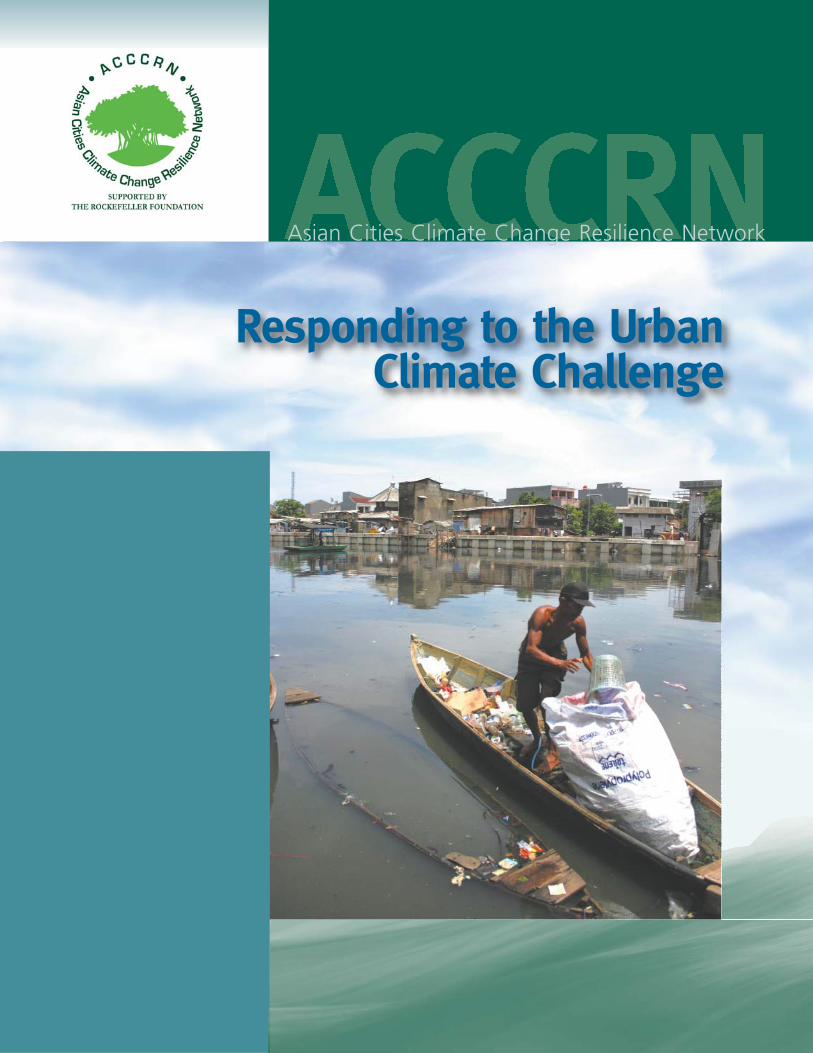
Responding to the Urban Climate Challenge
Asian Cities Climate Change Resilience Network

Edited and Produced by ISET
Contributing Authors
Please use the following reference for this report:
Asian Cities Climate Change Resilience Network (ACCCRN): Responding to the Urban Climate
Challenge. Eds. ISET, Boulder, Colorado, USA, 60 pp.
Institute for Social and Environmental Transition
This publication is made possible by the support of the Rockefeller Foundation. Views and opin-
ions expressed within do not necessarily reflect the positions of all the ACCCRN partners. The
findings, interpretations and conclusions expressed in this paper are the result of a collaborative
effort between partners.
Any part of this publication may be cited, copied, translated into other languages or adapted to
meet local needs without prior permission from ISET provided that the source is clearly stated.
November 2009
ISBN: 978-0-9843616-0-1
Editors: Sarah Opitz-Stapleton, Laura Seraydarian, Karen MacClune, Greg Guibert & Sarah Reed
Published by: Institute for Social and Environmental Transition
Design and Layout: mary a. pettigrew, ampersand graphic design LLC, Boulder, Colorado, USA
Cover Photo: Fisherman in Kangkung District, Bandar Lampung, Indonesia© Indrawan, Mercy Corps Indonesia, 2009
Country Section Cover Graphic: Angie Hulsebus, 2009.
Printed at: Tewell Warren Printing, Denver, Colorado, USA
ii
Table of ContentsAsian Cities Climate Change Resilience Network (ACCCRN) 1
How ACCCRN is Responding to the Challenge 2
Core Themes of ACCCRN 4
The ACCCRN Process 6
ACCCRN Case Studies 10
ACCCRN City Cases Vietnam 11Can Tho 15
Da Nang 17
Quy Nhon 19
India 21Gorakhpur 25
Surat 29
Indore 31
Indonesia 35Semarang 39
Bandar Lampung 43
Thailand 47Chiang Rai 51
Hat Yai 51
ACCCRN Partner Organizations 53
iii

iv
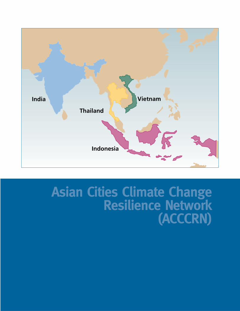
Asian Cities Climate Change Resilience Network
(ACCCRN)
India
Thailand
Vietnam
Indonesia
ACCCRN: Responding to the Urban Climate Challenge
2
THE URBAN CLIMATE RESILIENCE CHALLENGE
Human-induced climate change, in conjunction with environmental degradation, willhave unavoidable effects on cities. UN-Habitat estimates that 70% of the world’s
population will live in urban areas by 2050, and approximately 60% of the growth isexpected to take place in Asia. Climate change will lead to warmer temperatures, greater
variability in local conditions, and changes in the frequency,intensity, and location of precipitation and storms. Medium-sized cities are growing particularly rapidly and lack theresources of larger, more established cities to address the com-pounding challenges of climate change, urbanization, poverty,and environmental degradation. How will these cities managethe stresses and respond to the inevitable shocks and surprisesof climate change while assuring the wellbeing of their grow-ing populations?
How ACCCRN is Responding to the ChallengeAlthough it is not possible to predict with absolute certaintythe exact nature of climate impacts and resulting challengeseach city will face, the Asian Cities Climate Change ResilienceNetwork (ACCCRN) helps cities and their citizens build flexi-ble and dynamic systems and institutions that identify andrespond to the challenges climate change poses to urban areas.ACCCRN is a cutting edge research and urban climateresilience action program being piloted in 10 cities in Asia.
Through collaboration between outside experts, national partners, local governments,and other organizations, ACCCRN enables each partner city to confront the complexi-ties of climate change and develop the local capacity to address their specific challenges.The current phase of the ACCCRN program is assisting partner cities to developresilience strategies and associated implementation proposals.
Cities engaged in the ACCCRN process will be able to anticipate how their vulnerabili-ties will be exacerbated and altered by climate change, identify urban populations mostaffected by changing conditions, and develop climate resilience strategies and actions to
CLIMATE CHANGE AND CITIES
Sudden onset natural hazards such as floods, ex-
treme rainfall events, and urban heat waves often
receive the attention of city leaders and planners.
Climate change is likely to increase the frequency,
intensity, and duration of such extreme events in
unpredictable ways and will require cities to de-
velop adaptation strategies that enable them to
manage this variability and uncertainty. Equally
important but less visible are slow-onset, creep-
ing events associated with climate change. Slow-
onset events happen over weeks, months, and
years and may be difficult to perceive and are
typically easier to ignore. They include gradually
rising temperatures that lead to lower productiv-
ity of city food suppliers, sea level rise that erodes
low-lying cities, or gradually disappearing glaciers
and snowfields that have in the past sustained
city water supplies. �
Asian Cities Climate Change Resilience Network
3
meet the most serious climate impacts. Poorand vulnerable populations within each cityare already challenged by urbanization andenvironmental degradation and have thepotential to be further marginalized by cen-tralized planning processes. Therefore, ACCCRN is engaging multiple community-based organizations and vulnerable stake-holder groups, as well as local governments,from the outset of the urban resilience plan-ning process. ACCCRN is comprised of keystakeholders in each city, national partners ineach country who are familiar with the cli-mate change and disaster risk reductionpolicies of their countries, and internationalexperts. ACCCRN partners are committedto building urban climate resilience as a continual process, realizing that as the climatechanges, and urban areas grow, responses will need to constantly evolve. ACCCRNis buildinf local capacity and ownership to ensure that resilience plans, strategies,and actions are sustainable and can advance even after the formal program ends.
ACCCRN is already helping the cities to:
� Identify their current climate vulnerabilities across sectors and populations.� Enable them to think about how climate change will exacerbate current
vulnerabilities and create new opportunities and challenges.� Engage vulnerable populations and community organizations as stakeholders
in urban climate resilience planning.� Build capacity to analyze the direct and indirect impacts of climate change.� Develop locally appropriate resilience strategies.� Test and refine methods and tools for engaging stakeholders and planning
climate resilience action.� Pilot interventions to build resilience.
The ACCCRN process will:
� Enable cities to develop resilient strategies and implement interventions to increaseresilience
� Build a replicable base of lessons for engaging stakeholders.� Introduce actions that mainstream climate resilience into city planning and
operations.� Point to strategies that support the most vulnerable groups within the cities to
respond effectively to climate change risks.� Support the transfer and sharing of lessons to other cities not involved the program.� Engage other funders, practitioners, and policy-makers to support urban
climate resilience for poor and vulnerable people.
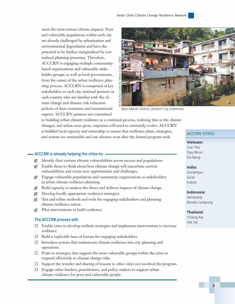
ACCCRN CITIES:
Vietnam:Can ThoQuy NhonDa Nang
India:GorakhpurSuratIndore
Indonesia:SemarangBandar Lampung
Thailand:Chiang RaiHat Yai
�
�
�
�
�
�
�
Batu Merah District, Ambon City, Indonesia
© T
hatc
her
Coo
k fo
r M
ercy
Cor
ps, 2
009
ACCCRN: Responding to the Urban Climate Challenge
4
Core Themes of ACCCRNACCCRN partners use a few core themes as the starting point for building adaptationand learning frameworks. ACCCRN examines the intersection of climate change, urbansystems, and vulnerability to test resilience strategies by considering both direct and indi-
rect impacts of climate change.
CLIMATE CHANGE
Part of building urban resilience to climate change is tounderstand what climate projections and historical infor-mation can and cannot say about the future, and thereforebe able to develop adaptive solutions that do not presumea single climate future. Climate change projections areuncertain for many reasons – not the least of which beingthat we do not know what kind of energy and lifestylechoices will be made in the future. While climate projec-tions cannot give exact estimates of how much precipita-tion will fall in one of the ACCCRN cities by 2050, forexample, the projections provide very useful informationon the changes in trends and ranges of climate conditions.Uncertainty in climate change projections for ACCCRNcities is challenging them to explore innovative actions andstrategies that are capable of being resilient against a widerange of climate conditions, rather than relying on tradi-tional approaches to planning and engineering that assumethe future climate, including extreme events, are simplypredictable reflections of historical trends. ACCCRNworks with city partners to identify the broad trends andranges of climate projections for their regions and todevelop resilience strategies around multiple what-if cli-mate scenarios that do not depend on precise knowledgeof the future.
URBAN SYSTEMS AND VULNERABILITY
A city is comprised of high population densities withindefined political and administrative units where the capac-ity of local ecosystems to provide the basic food and waterrequirements of the city are exceeded. The urban systemstherefore depend on sources of food, energy, and rawmaterials from elsewhere, accessed through regional,national, and global networks and markets. Cities’ socio-economic systems tend to be quite resilient because of theinnovative, interlinked, and flexible systems on which they
are founded. Yet cities are intricate systems whose components interact in complex andoften unpredictable ways. Urban physical, socio-economic, institutional, and ecological
DIRECT AND INDIRECT IMPACTS OF CLIMATE CHANGE
The impacts of climate change on urban systems are
not always direct and may cause secondary impacts.
For instance, a drop in power due to heat waves and
increased energy demand for air conditioning could
halt sewage and drinking water treatment. Con-
versely, lack of water, whether due to drought or
water lines being destroyed in a flood or storm, could
disrupt power delivery because water is necessary for
cooling power grid systems. In many developing cities,
these types of formal infrastructure and services
simply do not exist, particularly in informal settle-
ments. Yet these communities may rely on other core
urban systems, such as transportation and communi-
cation, in order to acquire basic services, including
sanitation and fresh water, indirectly. �
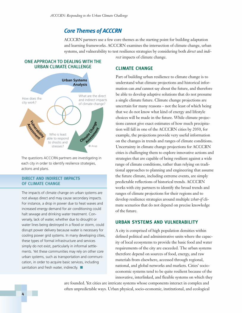
© Arup
How does the city work?
Urban SystemsAnalysis
What are the direct and indirect impacts of climate change?
Who is leastable to respondto shocks and
stresses?
Assessm
ent
Vulnerability
Asses
smen
t
Clim
ate
Chan
ge
The questions ACCCRN partners are investigating in
each city in order to identify resilience strategies,
actions and plans.
ONE APPROACH TO DEALING WITH THEURBAN CLIMATE CHALLENGE
systems can fail, and when they do, the results can becatastrophic for large populations directly and indirectlyaffected. The impacts of climate change:
� Will directly affect ecosystems that produce thefood and water on which cities depend;
� Will have disproportionate impacts on poor andvulnerable urban populations; and
� May overwhelm the infrastructure that ensuresmovement of people, goods, and services; provides security and health to city residents,and assures livelihood opportunities and economic benefits to increasing numbers ofurban migrants.
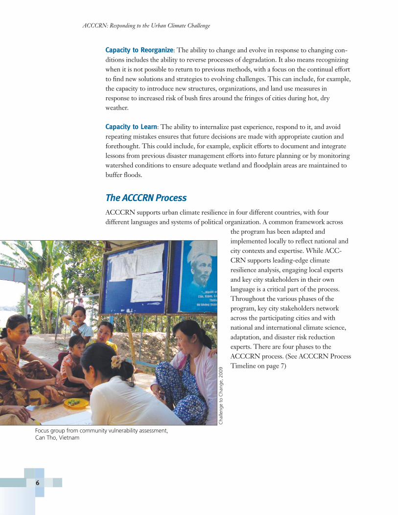
RESILIENT CITIES
Given the current hazards cities face and the likelyimpacts of climate change on climate variability andbaseline conditions, what can cities do to be resilientagainst a variety of shocks and slow-onset changes? Resilient cities create, enable, andsustain the services and institutions required for basic ongoing survival and are character-ized by their ability to generate new opportunities for their residents. They avoid relyingon solutions that depend on anticipating specific hazards, and instead take a broader,integrated approach. A resilient city is able to withstand a variety of challenges becausethe following elements are incorporated into urban systems and the ways in which peopleconstruct and maintain those systems:
Redundancy: Several urban systems can serve similar functionsand provide substitutable services when another system is dis-rupted. If redundancy is eliminated, urban vulnerability increases.An example of infrastructure redundancy may be the use of mul-tiple energy sources with a variety of pathways distributing powerto all parts of the city. Redundancy can also build social capacity.For example, training individuals in dispersed neighborhoods inbasic health and emergency response so that when an extremeevent occurs, fragmented neighborhoods can provide immediatetriage and basic medical services until transportation and commu-nication systems are restored.
Flexibility: Resilient cities have the ability to absorb shocks and slow-onset challenges inways that avoid catastrophic failure if thresholds are exceeded. In the event that a systemor institution fails, it does so with minimal impact to other systems. Flexibility caninclude such things as a diversified economic base not exclusively dependent upon agri-culture or a single industry, or actions like coastal ecosystem restoration to serve as abuffer against flooding, rather than relying on levies.
Flexibility
Capacityto Learn
Capacity toReorganize
Redundancy
Resilience
Asian Cities Climate Change Resilience Network
5
Adapted from the Resilience Alliance.
ELEMENTS OF URBAN RESILIENCE
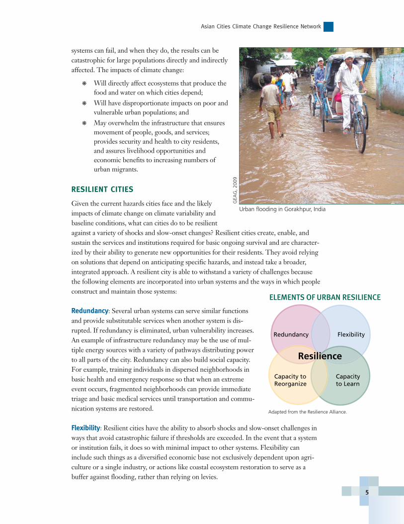
Urban flooding in Gorakhpur, India
GEA
G, 2
009
ACCCRN: Responding to the Urban Climate Challenge
Capacity to Reorganize: The ability to change and evolve in response to changing con-ditions includes the ability to reverse processes of degradation. It also means recognizingwhen it is not possible to return to previous methods, with a focus on the continual effortto find new solutions and strategies to evolving challenges. This can include, for example,the capacity to introduce new structures, organizations, and land use measures inresponse to increased risk of bush fires around the fringes of cities during hot, dryweather.
Capacity to Learn: The ability to internalize past experience, respond to it, and avoidrepeating mistakes ensures that future decisions are made with appropriate caution andforethought. This could include, for example, explicit efforts to document and integratelessons from previous disaster management efforts into future planning or by monitoringwatershed conditions to ensure adequate wetland and floodplain areas are maintained tobuffer floods.
The ACCCRN ProcessACCCRN supports urban climate resilience in four different countries, with four different languages and systems of political organization. A common framework across
the program has been adapted and implemented locally to reflect national andcity contexts and expertise. While ACC-CRN supports leading-edge climateresilience analysis, engaging local expertsand key city stakeholders in their own language is a critical part of the process.Throughout the various phases of the program, key city stakeholders networkacross the participating cities and withnational and international climate science,adaptation, and disaster risk reductionexperts. There are four phases to the ACCCRN process. (See ACCCRN ProcessTimeline on page 7)
6
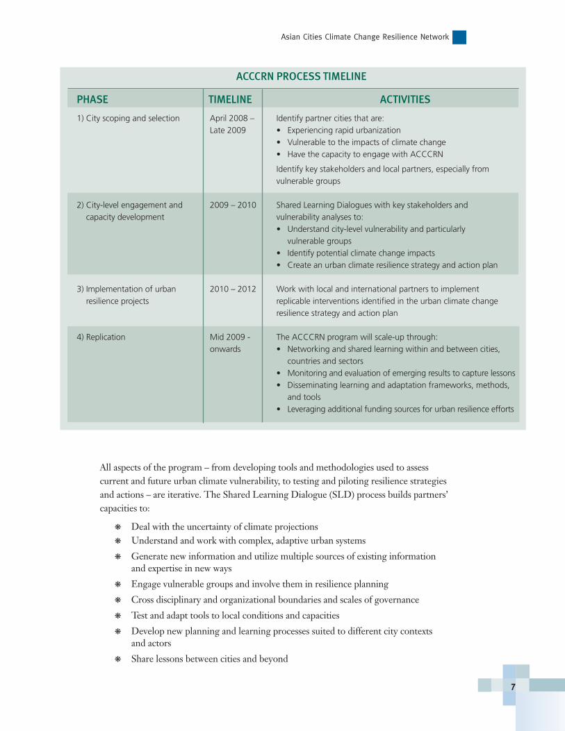
Focus group from community vulnerability assessment, Can Tho, Vietnam
Cha
lleng
e to
Cha
nge,
200
9
All aspects of the program – from developing tools and methodologies used to assess current and future urban climate vulnerability, to testing and piloting resilience strategiesand actions – are iterative. The Shared Learning Dialogue (SLD) process builds partners’ capacities to:
� Deal with the uncertainty of climate projections� Understand and work with complex, adaptive urban systems
� Generate new information and utilize multiple sources of existing informationand expertise in new ways
� Engage vulnerable groups and involve them in resilience planning
� Cross disciplinary and organizational boundaries and scales of governance
� Test and adapt tools to local conditions and capacities
� Develop new planning and learning processes suited to different city contexts and actors
� Share lessons between cities and beyond
Asian Cities Climate Change Resilience Network
7
ACCCRN PROCESS TIMELINE
PHASE TIMELINE ACTIVITIES
1) City scoping and selection April 2008 – Identify partner cities that are:Late 2009 • Experiencing rapid urbanization
• Vulnerable to the impacts of climate change• Have the capacity to engage with ACCCRN
Identify key stakeholders and local partners, especially from vulnerable groups
2) City-level engagement and 2009 – 2010 Shared Learning Dialogues with key stakeholders andcapacity development vulnerability analyses to:
• Understand city-level vulnerability and particularlyvulnerable groups
• Identify potential climate change impacts• Create an urban climate resilience strategy and action plan
3) Implementation of urban 2010 – 2012 Work with local and international partners to implementresilience projects replicable interventions identified in the urban climate change
resilience strategy and action plan
4) Replication Mid 2009 - The ACCCRN program will scale-up through:onwards • Networking and shared learning within and between cities,
countries and sectors• Monitoring and evaluation of emerging results to capture lessons• Disseminating learning and adaptation frameworks, methods,
and tools• Leveraging additional funding sources for urban resilience efforts
ACCCRN METHODS AND TOOLS
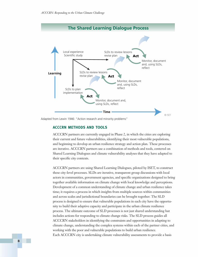
ACCCRN partners are currently engaged in Phase 2, in which the cities are exploringtheir current and future vulnerabilities, identifying their most vulnerable populations,and beginning to develop an urban resilience strategy and action plan. These processesare iterative. ACCCRN partners use a combination of methods and tools, centered onShared Learning Dialogues and climate vulnerability analyses that they have adapted totheir specific city contexts.
ACCCRN partners are using Shared Learning Dialogues, piloted by ISET, to constructthese city-level processes. SLDs are iterative, transparent group discussions with localactors in communities, government agencies, and specific organizations designed to bringtogether available information on climate change with local knowledge and perceptions.Development of a common understanding of climate change and urban resilience takestime; it requires a process in which insights from multiple sources within communitiesand across scales and jurisdictional boundaries can be brought together. The SLDprocess is designed to ensure that vulnerable populations in each city have the opportu-nity to build their adaptive capacity and participate in the urban climate resilienceprocess. The ultimate outcome of SLD processes is not just shared understanding butincludes actions for responding to climate change risks. The SLD process guides all ACCCRN stakeholders in identifying the constraints and opportunities in adapting toclimate change, understanding the complex systems within each of the partner cities, andworking with the poor and vulnerable populations to build urban resilience. Each ACCCRN city is undertaking climate vulnerability assessments to provide a basis
© ISET
SLDs to plan implementation
Local experience Scientific study
Learning
The Shared Learning Dialogue Process
SLDs to review lessonsrevise plan
Monitor, document and, using SLDs, reflect
Monitor, document and, using SLDs, reflect
Act
Act
SLDs to review lessonsrevise plan
Monitor, document and, using SLDs, reflect
Act
Time
Adapted from Lewin 1946: “Action research and minority problems”
ACCCRN: Responding to the Urban Climate Challenge
8
for better understanding how individuals, communities, and urban systems specific totheir city may be affected by future climate impacts – both directly and indirectly.Through the climate vulnerability assessments, the cities are exploring what existingcapacities can enhance their ability to adapt and be more resilient to climate change. Theassessments result in vital information that feeds into the iterative SLD and resilienceplanning processes. They help ensure that resilience strategies, actions, and interventionswill target the most vulnerable populations, address vulnerabilities of urban sectors andsystems, and build on existing capacities. During the assessment phase of the ACCCRNprogram, there is equal emphasis on identifying local and regional capacities as on vul-nerabilities. ACCCRN partners adapt existing tools and methodologies for conductingvulnerability assessments to their specific contexts, but each climate vulnerability assessment entails:
� An understanding of projected climate scenarios and potential impacts andthe limitations of the projections
� Identification of who/what are the most vulnerable groups, areas, sectors,and urban systems and how they may be affected
� Identification of the range of factors that systematically combine to makethem vulnerable, including both direct (e.g. exposure to hazards) and indirect(e.g. regional or international food security) factors
� Assessment of existing capacities to adapt
NEXT STEPS: PILOT PROJECTS TO IMPLEMENTATION
The ACCCRN cities are using SLDs and climate vulnerability assessments to beginthinking about resilience strategies and action plans. In the short term, cities are conduct-ing in-depth “sector studies” for deeper analysis on priority issues facing the city and testing small pilot activities to explore specific vulnerability needs or small areas in whichthey can begin making changes and monitoring the outcomes. Armed with knowledge ofkey vulnerabilities and existing adaptive capacities, and drawing on both international andlocal experience, the cities are developing climate resilience strategies and action plansthat will enable them to better prepare for the challenges of current and future climatevariability. This includes a process of identifying, assessing, and prioritizing actions thatwill effectively build climate resilience of the city’s systems and resilience of its poorestand most vulnerable populations. These resilience strategies and action plans will be integrated with city planning processes, but may also require additional financial andtechnical support from government departments, donors, private sector, and othersources. Over the next few years, cities will implement and learn from these strategiesand interventions as well as monitor how effective these efforts are in strengtheningresilience. Through networking and shared learning within and between cities, countries,and sectors, ACCCRN hopes to scale-up and replicate successful strategies both withinand beyond the ACCCRN network.
Asian Cities Climate Change Resilience Network
9
ACCCRN: Responding to the Urban Climate Challenge
10
ACCCRN Case StudiesThis publication is intended for other cities and decision-makers looking for practicalprocesses and examples of how to build urban climate resilience. Each of the ACCCRN
city and country partners have contributedinformation to this guidebook documentingthe steps they are taking to identify city-specific climate vulnerability, their vulnera-ble populations, and the points of entry inexploring resilience strategies and actionplans. The cities in India and Vietnam havejust finished conducting their vulnerabilityanalyses with the help of national partnersand outside experts and are analyzing theirpoints of vulnerability. The Indonesianpartner cities are currently assessing theirvulnerabilities. The cities in Thailand havejust joined ACCCRN and are at the begin-ning stages the program. The case studiespresent where each city is in the ACCCRNprocess and how they are evaluating theurban climate resilience challenge. In 2010,ACCCRN cities will focus on resilienceplanning, actions and strategies, and designinterventions to test these activities.
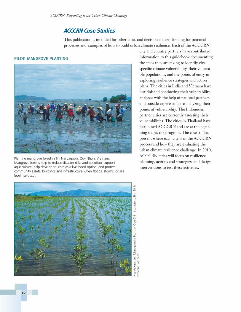
Planting mangrove forest in Thi Nai Lagoon, Quy Nhon, Vietnam. Mangrove forests help to reduce disaster risks and pollution, support aquaculture, help develop tourism as a livelihood option, and protect community assets, buildings and infrastructure when floods, storms, or sealevel rise occur.
PILOT: MANGROVE PLANTING
Huy
nh X
uan
Loi,
Man
agem
ent
Boar
d of
Con
Chi
m e
cosy
stem
, Bin
h D
inh
Prov
ince
, Vie
tnam
.
ACCCRN City Cases: Vietnam
India
Thailand
Vietnam
Indonesia
ACCCRN: Responding to the Urban Climate Challenge
12
Can Tho
Da Nang
QuyNhon
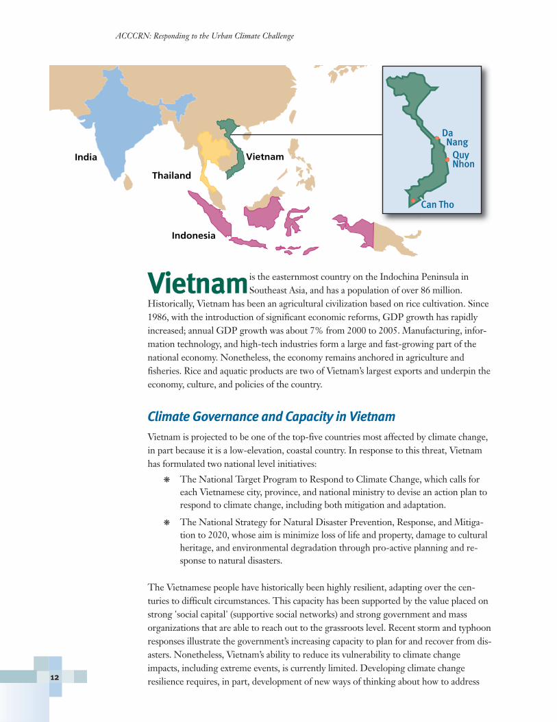
Vietnamis the easternmost country on the Indochina Peninsula inSoutheast Asia, and has a population of over 86 million.
Historically, Vietnam has been an agricultural civilization based on rice cultivation. Since1986, with the introduction of significant economic reforms, GDP growth has rapidlyincreased; annual GDP growth was about 7% from 2000 to 2005. Manufacturing, infor-mation technology, and high-tech industries form a large and fast-growing part of thenational economy. Nonetheless, the economy remains anchored in agriculture and fisheries. Rice and aquatic products are two of Vietnam’s largest exports and underpin theeconomy, culture, and policies of the country.
Climate Governance and Capacity in VietnamVietnam is projected to be one of the top-five countries most affected by climate change,in part because it is a low-elevation, coastal country. In response to this threat, Vietnamhas formulated two national level initiatives:
� The National Target Program to Respond to Climate Change, which calls foreach Vietnamese city, province, and national ministry to devise an action plan torespond to climate change, including both mitigation and adaptation.
� The National Strategy for Natural Disaster Prevention, Response, and Mitiga-tion to 2020, whose aim is minimize loss of life and property, damage to culturalheritage, and environmental degradation through pro-active planning and re-sponse to natural disasters.
The Vietnamese people have historically been highly resilient, adapting over the cen-turies to difficult circumstances. This capacity has been supported by the value placed onstrong 'social capital' (supportive social networks) and strong government and massorganizations that are able to reach out to the grassroots level. Recent storm and typhoonresponses illustrate the government’s increasing capacity to plan for and recover from dis-asters. Nonetheless, Vietnam’s ability to reduce its vulnerability to climate changeimpacts, including extreme events, is currently limited. Developing climate changeresilience requires, in part, development of new ways of thinking about how to address
vulnerability and climate risk. However, in much of Vietnam, centralized, target-drivenplanning still hinders this development.
The ACCCRN Process in VietnamThe goal of the ACCCRN project in Vietnam is todevelop collaborative action plans for adaptation toclimate change to benefit poor and vulnerable resi-dents in three cities: Da Nang, Can Tho, and QuyNhon. In each city, project leadership rests withthe People’s Committee, who approve the projectand its management structure. A Vice Chairman ofthe People’s Committee leads the Project SteeringCommittee, which is comprised of relevant techni-cal departments and civil society organizations,with the participation of Challenge to Change(CtC) and ISET. Climate Working Groups in eachcity provide technical support.
In Vietnam, the political boundaries of citiesencompass built-up, high-density areas, suburbanareas, and rural areas. Consequently, addressing“urban” climate change in Vietnam includes addressing impacts to rural settings, communities, and peoples.
The most vulnerable populations in the three Vietnamese ACCCRN cities include:
� Recent migrants who lack residential registration: This group is particularly vulnerable as they live in hazardous locations and are not entitled to compensa-tion if flooded.
� At-risk communities in coastal or floodplain sites that are resettled to new loca-tions: Often the resettlement process reduces the ability of these populations toearn a livelihood, and new sites may still be vulnerable. The current approach toplanning and management of resettlement needs to be reconsidered to ensure thatthe process does not further impoverish and imperil the most vulnerable groups.
� Women, children and parents: These groups are especially affected by flood andstorm related hazards, including contaminated drinking water. Poor sanitationservices and lack of piped water supply contribute to the problems. Longer dura-tion seasonal floods (e.g. in Can Tho) can mean loss of schooling for childrentrapped at home and loss of income for parents who have to stay with them.Lack of swimming skills is also a significant risk for children in areas with frequent and lengthy flooding.
� Poor: Those in poverty often have high exposure to climate hazards because theyhave limited livelihood options. The fisheries sector is particularly vulnerable to hazards. Vulnerability would be reduced through diversification of livelihoodoptions.
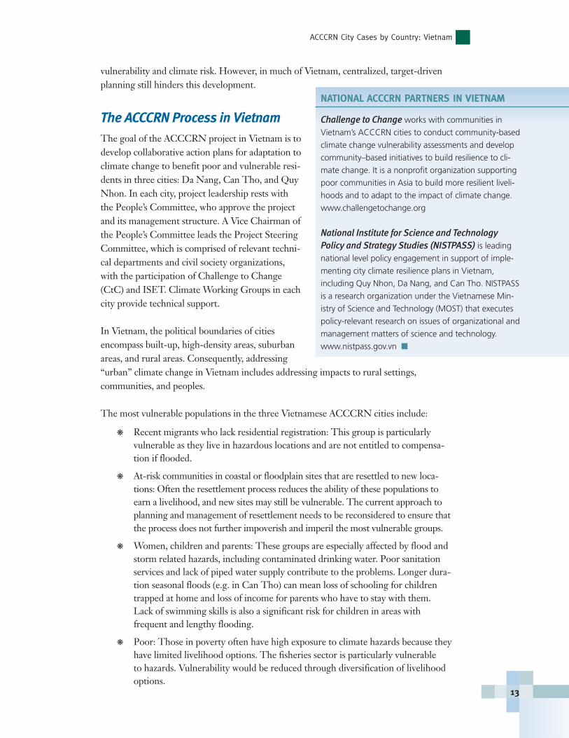
NATIONAL ACCCRN PARTNERS IN VIETNAM
Challenge to Change works with communities in
Vietnam’s ACCCRN cities to conduct community-based
climate change vulnerability assessments and develop
community–based initiatives to build resilience to cli-
mate change. It is a nonprofit organization supporting
poor communities in Asia to build more resilient liveli-
hoods and to adapt to the impact of climate change.
www.challengetochange.org
National Institute for Science and Technology Policy and Strategy Studies (NISTPASS) is leading
national level policy engagement in support of imple-
menting city climate resilience plans in Vietnam,
including Quy Nhon, Da Nang, and Can Tho. NISTPASS
is a research organization under the Vietnamese Min-
istry of Science and Technology (MOST) that executes
policy-relevant research on issues of organizational and
management matters of science and technology.
www.nistpass.gov.vn �
ACCCRN City Cases by Country: Vietnam
13
ACCCRN: Responding to the Urban Climate Challenge
14
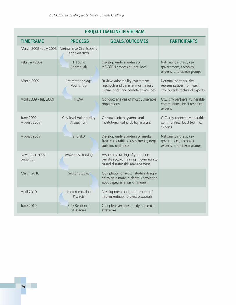
PROJECT TIMELINE IN VIETNAM
TIMEFRAME PROCESS GOALS/OUTCOMES PARTICIPANTS
March 2008 - July 2008 Vietnamese City Scoping and Selection
February 2009 1st SLDs Develop understanding of National partners, key (Individual) ACCCRN process at local level government, technical
experts, and citizen groups
March 2009 1st Methodology Review vulnerability assessment National partners, city Workshop methods and climate information; representatives from each
Define goals and tentative timelines city, outside technical experts
April 2009 - July 2009 HCVA Conduct analysis of most vulnerable CtC, city partners, vulnerable populations communities, local technical
experts
June 2009 - City-level Vulnerability Conduct urban systems and CtC, city partners, vulnerable August 2009 Assessment institutional vulnerability analysis communities, local technical
experts
August 2009 2nd SLD Develop understanding of results National partners, key from vulnerability assessments; Begin government, technical building resilience experts, and citizen groups
November 2009 - Awareness Raising Awareness raising of youth andongoing private sector; Training in community-
based disaster risk management
March 2010 Sector Studies Completion of sector studies design-ed to gain more in-depth knowledgeabout specific areas of interest
April 2010 Implementation Development and prioritization of Projects implementation project proposals
June 2010 City Resilience Complete versions of city resilience Strategies strategies
ACCCRN City Cases by Country: Vietnam
15
Key Challenges and OpportunitiesThe existing national policies and initiatives around climatechange have catalyzed awareness and interest across thecountry. Consequently, cities and communities have beenopen to learning about climate change and its potentialimpacts. Existing mechanisms in place for annual city anddisaster planning can be used to address climate changeadaptation, and the ACCCRN process in Vietnam to datehas produced significant interest and ownership on the partof key city stakeholders. Despite early interest, there remainsignificant challenges, which include:
� Limited awareness on the part of local governments and communities regarding climate change and its potential impacts.
� Weak coordination mechanisms between different local departments and organizations, and between the public and private sector.
� Lack of information sharing and management across sectors.
� Lack of tools and methodology to support the decision making and adaptation planning process(e.g. lack of integration of climate change issues into local development plans).
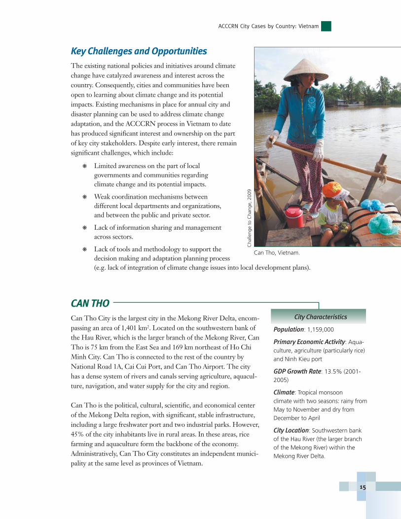
CAN THOCan Tho City is the largest city in the Mekong River Delta, encom-passing an area of 1,401 km2. Located on the southwestern bank ofthe Hau River, which is the larger branch of the Mekong River, CanTho is 75 km from the East Sea and 169 km northeast of Ho ChiMinh City. Can Tho is connected to the rest of the country byNational Road 1A, Cai Cui Port, and Can Tho Airport. The cityhas a dense system of rivers and canals serving agriculture, aquacul-ture, navigation, and water supply for the city and region.
Can Tho is the political, cultural, scientific, and economical centerof the Mekong Delta region, with significant, stable infrastructure,including a large freshwater port and two industrial parks. However,45% of the city inhabitants live in rural areas. In these areas, ricefarming and aquaculture form the backbone of the economy.Administratively, Can Tho City constitutes an independent munici-pality at the same level as provinces of Vietnam.
City Characteristics
Population: 1,159,000
Primary Economic Activity: Aqua-culture, agriculture (particularly rice)and Ninh Kieu port
GDP Growth Rate: 13.5% (2001-2005)
Climate: Tropical monsoon climate with two seasons: rainy fromMay to November and dry from December to April
City Location: Southwestern bankof the Hau River (the larger branchof the Mekong River) within theMekong River Delta.
Can Tho, Vietnam.C
halle
nge
to C
hang
e, 2
009
ACCCRN: Responding to the Urban Climate Challenge
16
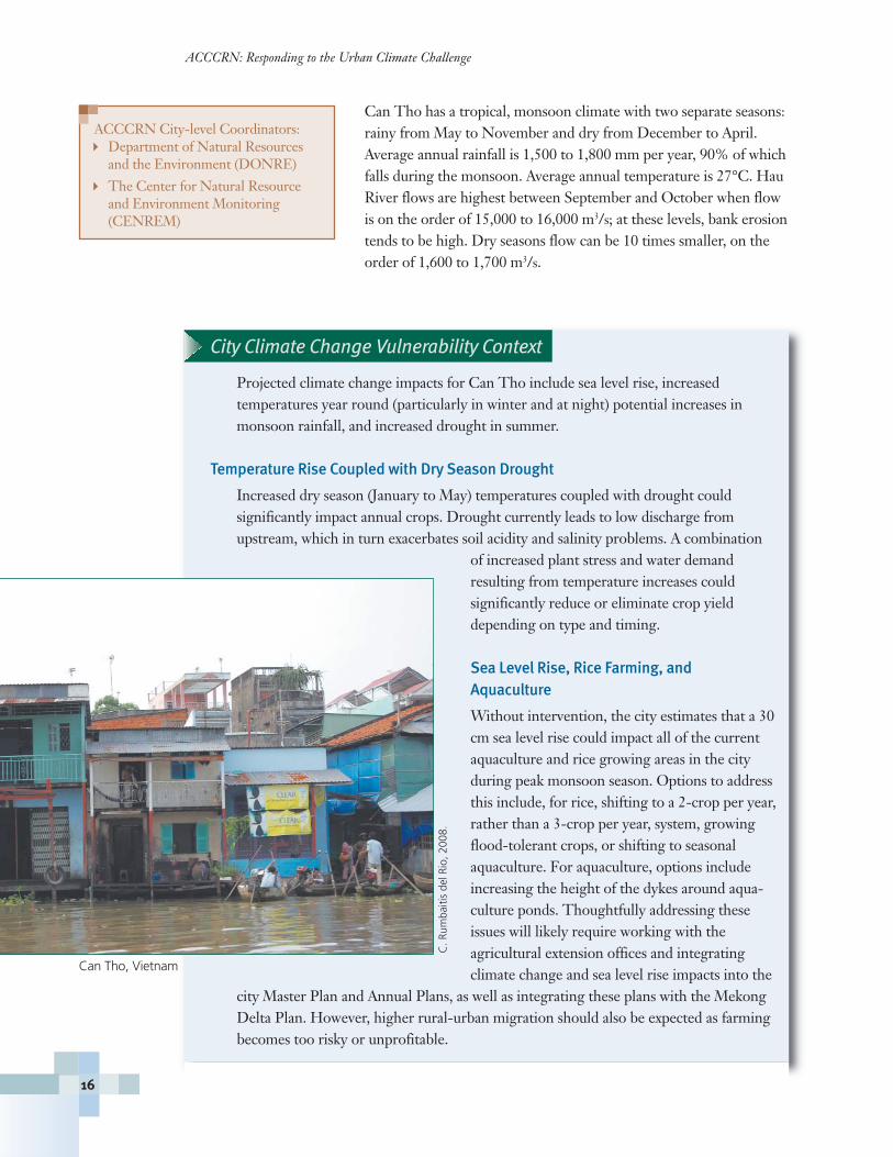
Can Tho has a tropical, monsoon climate with two separate seasons:rainy from May to November and dry from December to April.Average annual rainfall is 1,500 to 1,800 mm per year, 90% of whichfalls during the monsoon. Average annual temperature is 27°C. HauRiver flows are highest between September and October when flowis on the order of 15,000 to 16,000 m3/s; at these levels, bank erosiontends to be high. Dry seasons flow can be 10 times smaller, on theorder of 1,600 to 1,700 m3/s.
City Climate Change Vulnerability Context
Projected climate change impacts for Can Tho include sea level rise, increased temperatures year round (particularly in winter and at night) potential increases in monsoon rainfall, and increased drought in summer.
Temperature Rise Coupled with Dry Season Drought
Increased dry season (January to May) temperatures coupled with drought could significantly impact annual crops. Drought currently leads to low discharge fromupstream, which in turn exacerbates soil acidity and salinity problems. A combination
of increased plant stress and water demand resulting from temperature increases could significantly reduce or eliminate crop yielddepending on type and timing.
Sea Level Rise, Rice Farming, and Aquaculture
Without intervention, the city estimates that a 30cm sea level rise could impact all of the currentaquaculture and rice growing areas in the cityduring peak monsoon season. Options to addressthis include, for rice, shifting to a 2-crop per year,rather than a 3-crop per year, system, growingflood-tolerant crops, or shifting to seasonal aquaculture. For aquaculture, options includeincreasing the height of the dykes around aqua-culture ponds. Thoughtfully addressing theseissues will likely require working with the agricultural extension offices and integrating climate change and sea level rise impacts into the
city Master Plan and Annual Plans, as well as integrating these plans with the MekongDelta Plan. However, higher rural-urban migration should also be expected as farmingbecomes too risky or unprofitable.
ACCCRN City-level Coordinators:� Department of Natural Resources
and the Environment (DONRE)
� The Center for Natural Resource and Environment Monitoring (CENREM)
C. R
umba
itis
del R
io, 2
008.
Can Tho, Vietnam
ACCCRN City Cases by Country: Vietnam
17
Climate Change Impacts to Built-Infrastructure
With the exception of sea level rise, which could lead to inundation of some of the un-diked portions of the city, built-infrastructure vulnerability to climate change is currently assessed as low. However, temperature rise coupled with drought could lead to water supply issues.
Areas Requiring Further Study
Areas that have not yet been addressed in the vulnerability analyses but that have been noted ascritical include: salinity intrusion under projectedsea level rise; reduction of food security; increasingsocial problems resulting from livelihood reduction of rural farmers and urban poor and theimpacts of migration from rural to urban areas; andincreases in vector-borne disease due to weatherchanges and degraded water quality.
DA NANGLocated on the central coast of Vietnam, and encompassing an areaof 1,256 km2, Da Nang is the largest city in central Vietnam andone of the country's most important ports. Ringed by mountainson one side and the East Sea on the other, the city is geographicallyconstrained. Da Nang is connected to the rest of the country byNational Highways 1 and 14B, Tien Sa Port, Da NangInternational Airport, and by the Unification Train System.
Da Nang has a tropical, monsoonal climate driven by theNortheast Monsoon. The monsoon rainfall is at its peak fromSeptember to December; Da Nang is driest in March and April.The primary rain-producing systems within the monsoon periodare tropical depressions and typhoons. Average annual rainfall isfrom 2,000 to 2,700 mm per year, 40 to 60% of which falls duringthe monsoon. Average annual temperature is 25 to 26°C.
Da Nang is impacted by both river and tidal/sea level issues. TheSong Han River, which flows through central Da Nang, is unregu-lated. Peak flows occur during the rainy season, and comprise 70 to80% of the annual flow. Da Nang is also affected by irregular diur-nal tides with amplitudes of 1.2 to 1.5 m. During the rainy season ifrains coincide with peak tide, water levels 0.4 to 1.0 m higher than regular maximum sea water level can result.
City Characteristics
Population: 887,100 (2009)
Primary Economic Activity:Tourism, fishing, light industry, TienSa port
GDP Growth Rate: 11.35% (2007)
Climate: Tropical, monsoonclimate with two seasons, typhoonand non-typhoon; peak rainfall Sep-tember - December, associated withtyphoons and tropical depressions.
City Location: Coastal city lying onthe central-eastern seaboard at themouth of the Song Han River, ringedby mountains.
ACCCRN City-level Coordinator: � Department of Foreign
Affairs (DOFA)
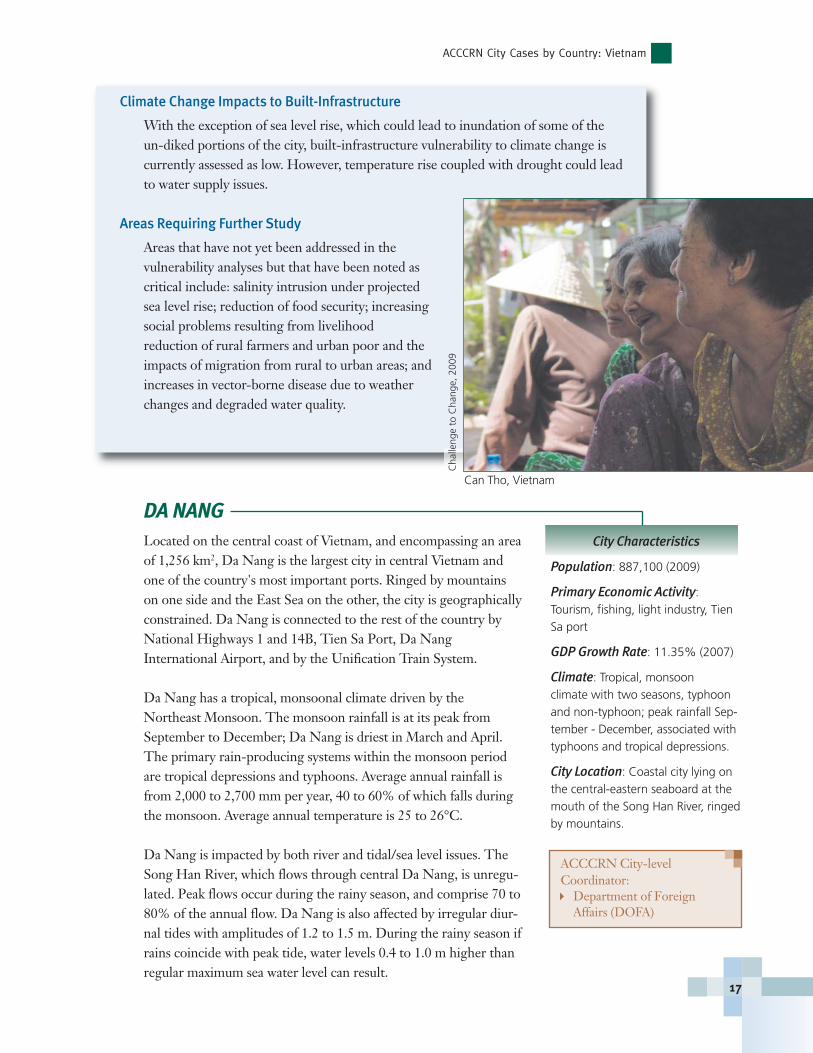
Can Tho, Vietnam
Cha
lleng
e to
Cha
nge,
200
9
ACCCRN: Responding to the Urban Climate Challenge
18
City Climate Change Vulnerability Context
The primary climate change hazards for Da Nang are typhoons, typhoon- and rain-induced flooding, drought, sea level rise, and storm surge.
On average, Da Nang is struck by one typhoon a year. Major storms, such as in 2006,can result in significant damage. Typhoon impacts include rain, strong wind, flooding,
flash floods, and riverbank and coastal erosion. Heavy, multi-day rainstorms are also problematic. Storms can deposit 500to 1000 mm or more of rain over a few days, resulting inflash floods, inundation, landslides, and high erosion. Inurban areas, large rains often cause inundation, seriouslyaffecting the environment and livelihoods. With climatechange, typhoon intensity and frequency and other intenseprecipitation events are all projected to increase.
During the dry months, Da Nang can experience prolongeddrought that significantly impacts agriculture production andcity water supply. In recent years, shifts in timing and dura-tion of dry spells have been severe enough that farmers arebeginning to shift rice-cropping patterns. Saline intrusion isoften observed at the same time as drought — the moresevere the drought, the more serious the saline intrusion,especially during the most arid months. Prolonged salineintrusion will seriously affect agricultural cultivation anddomestic and industrial supply in some sections of the city.
Tourism
Tourism plays a large and growing role in the economy of Da Nang. Without adequateplanning, increases in the intensity and frequency of storms and floods could result insignificant losses in this sector.
� Restaurants, hotels, and resorts have developed primarily in the coastal areasand mountains, the areas most vulnerable to natural disasters.
� Environmental pollution resulting from indiscriminate discharge of waste, par-ticularly from restaurants along the coastal tourist areas, has been and will con-tinue to be a significant problem until addressed. In the context of climatechange, sea level rise, coupled with existing pollution and the current poordrainage system, has the potential to create a significant health hazard.
� Tourism development does not currently address coral reef conservation. Pollution, compounded by increased temperatures under climate change,could severely impact the reefs, reducing their efficacy for coastal protection.
Cha
lleng
e to
Cha
nge,
200
9
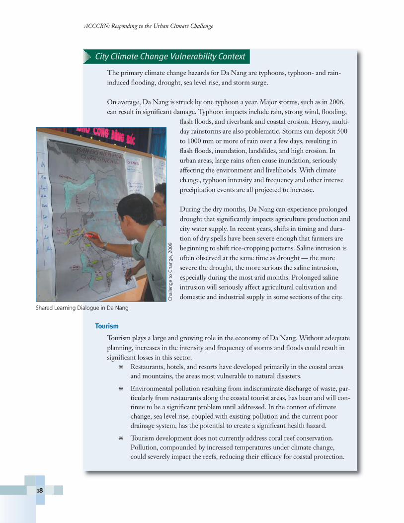
Shared Learning Dialogue in Da Nang
QUY NHONQuy Nhon is the capital city of Binh Dinh province located justsouth of the Ha Thanh River. The city is comprised primarily oflow-lying coastal land with mountains running alongside the entirewestern edge of the city, constraining its expansion. The city expe-riences considerable diurnal tidal variation. Quy Nhon’s climate istropical, with an average monthly maximum temperature of 32.5°Cfrom March to September. Approximately 80% of annual rainfall isduring the months of September to January, associated with theNortheast Monsoon. The primary rain producing systems withinthis monsoon period are tropical depressions and typhoons.
Given its current status as a Class 2 city in Vietnam, most adminis-trative authority, planning decision-making, and project manage-ment rest with Binh Dinh province. However, Quy Nhon isexpanding its boundaries within the next 3 to 5 years and will attainClass 1 city status, which will grant the city administrative authorityseparate from the province. The city will soon have much moreability to actively incorporate climate resilience activities andstrategies into planning, development, and urban operations.
City Climate Change Vulnerability Context
All areas in Quy Nhon city are currently affectedby flooding, particularly peninsula and coastalareas and along the banks of Thi Nai lagoon.Flash floods and river flooding, both originatingin the mountains on the western side of the city,are frequent during the rainy season. Duringstorm-related flooding, the city often also experi-ences storm surges and sea flooding along thecoastline, leading to inundation of portions of thecity from two sides. Sea level rise and a projectedincrease in the frequency and intensity of stormswill exacerbate flooding hazards in the city. Sealevel rise will also intensify saline intrusion anderosion issues.
During the dry season, various urban sectors andpopulations are disproportionately affected byheat waves and drought conditions. Projected
City Characteristics
Population Estimates: 264,800(2006)
Primary Economic Activity: Oceanfishing, aquaculture, agriculture,wharf / industrial activity, service sectors, tourism
GDP Growth Rates: 12% (2006)
Climate: Tropical, monsoonal climate with two seasons, typhoonand non-typhoon; peak rainfall Sep-tember to December, associated withtyphoons and tropical depressions
City Location: Low-lying coastalland, south of the Ha Thanh River,bordered by mountains to the west
ACCCRN City Cases by Country: Vietnam
19
ACCCRN City-level Coordinator:� DONRE (Department of
Natural Resources and theEnvironment) of Binh DinhProvince
S. O
pitz
-Sta
plet
on, 2
009
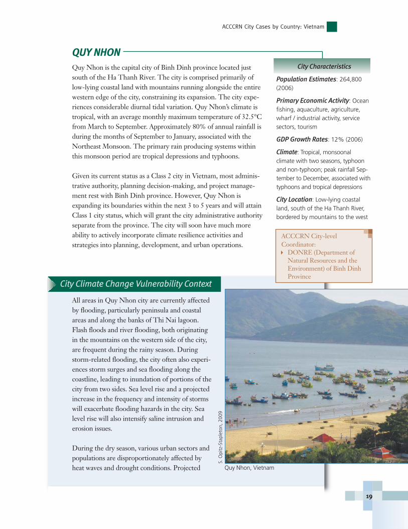
Quy Nhon, Vietnam
ACCCRN: Responding to the Urban Climate Challenge
20
increases in drought and prolonged high temperatures will impact agriculture, willincrease forest fire risk in forested areas, and may impact city water supply.
One or more of the above natural disasters will affect most areas in the city. The most affected areas include:
� The Thi Nai lagoon area, which is affected by inundation, drought, saline intrusion, and flood-tide.
� Coastal wards and communes, which are affected by coastal erosion, saline intrusion, and inundation by flood-tide.
� Wards and communes, which are affected by forest fire because of longdrought and high temperature.
Built-Infrastructure
City planners in Quy Nhon have conducted assessments of areas in the city that mayexperience deep inundation or that play critical roles in the city’s drainage network,delineating these as unfavorable for development. Construction which negativelyimpacts the size of water bodies or their water storage and control capacity is notallowed, nor is construction within 30 m of the edge of water bodies. In areas where con-struction is pursued, planned elevations must be higher than the common severe floodlevels. Though currently these planning regulations do not address the potential changesto flood frequency or inundation depth under climate change, the province is conductingexperimental land-use planning with integration of climate change in two districts.
Electrical System
Quy Nhon’s electricity is currently supplied by the Vihn SonHydropower Plant. The city’s electricity development strategythrough 2020 forecasts a demand of 1500 kWh/person-year in theinner-city by year 2020. However, temperature increases, and, inparticular an increase in the frequency and duration of hot, sunnyweather, would increase electricity demand. This, in turn, wouldimpact the load capacity of lines and substations and require addi-tional supply.
Water Supply
Quy Nhon municipal water supply is obtained from groundwater,with current pumping rates of 58,500 m3/day, with an additional12,000 m3/day planned. The renewable groundwater yield in Quy
Nhon has been assessed at 51,000 m3/day. Therefore, current underground waterexploitation is likely exceeding renewable supply, and demand is anticipated to increasewhen Quy Nhon becomes a Class 1 city. Declining water tables, coupled with increaseddrought and sea level rise projected under climate change will increase saline intrusionrisk. Plans for a sustainable water supply are needed.
S. O
pitz
-Sta
plet
on, 2
009
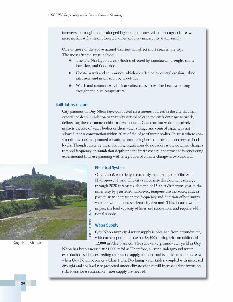
Quy Nhon, Vietnam

ACCCRN City Cases: India
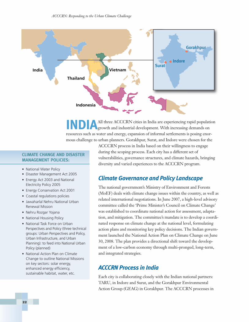
INDIAAll three ACCCRN cities in India are experiencing rapid populationgrowth and industrial development. With increasing demands on
resources such as water and energy, expansion of informal settlements is posing enor-mous challenge to urban planners. Gorakhpur, Surat, and Indore were chosen for the
ACCCRN process in India based on their willingness to engage during the scoping process. Each city has a different set of vulnerabilities, governance structures, and climate hazards, bringingdiversity and varied experiences to the ACCCRN program.
Climate Governance and Policy LandscapeThe national government’s Ministry of Environment and Forests(MoEF) deals with climate change issues within the country, as well asrelated international negotiations. In June 2007, a high-level advisorycommittee called the ‘Prime Minister’s Council on Climate Change’was established to coordinate national action for assessment, adapta-tion, and mitigation. The committee’s mandate is to develop a coordi-nated response on climate change at the national level, formulatingaction plans and monitoring key policy decisions. The Indian govern-ment launched the National Action Plan on Climate Change on June30, 2008. The plan provides a directional shift toward the develop-ment of a low-carbon economy through multi-pronged, long-term,and integrated strategies.
ACCCRN Process in IndiaEach city is collaborating closely with the Indian national partners:TARU, in Indore and Surat, and the Gorakhpur EnvironmentalAction Group (GEAG) in Gorakhpur. The ACCCRN processes in
ACCCRN: Responding to the Urban Climate Challenge
22
CLIMATE CHANGE AND DISASTERMANAGEMENT POLICIES:
• National Water Policy• Disaster Management Act 2005
• Energy Act 2003 and National Electricity Policy 2005
• Energy Conservation Act 2001
• Coastal regulations policies
• Jawaharlal Nehru National Urban Renewal Mission
• Nehru Rozgar Yojana
• National Housing Policy
• National Task Force on Urban Perspectives and Policy (three technicalgroups: Urban Perspectives and Policy,Urban Infrastructure, and Urban Planning): to feed into National UrbanPolicy (planned)
• National Action Plan on ClimateChange to outline National Missionson key sectors: solar energy, enhanced energy efficiency, sustainable habitat, water, etc.
India
Thailand
Vietnam
Indonesia
SuratIndore
Gorakhpur
the three cities have been very different, tailored to the varying physical, socio-economic,and hazard contexts each city faces. The process in each city is described in greater detailwithin the city-specific sections. Due to the national election in 2009, it was not possibleto hold SLDs to engage key stakeholders in each city. Instead, a number of one-on-oneconsultations and small group meetings were held at the city and state levels. There areplans to partner with key government and non-government agencies at the national levelto facilitate linkages of ACCCRN with relevant policies and programs through SLDs,now that the elections have concluded.
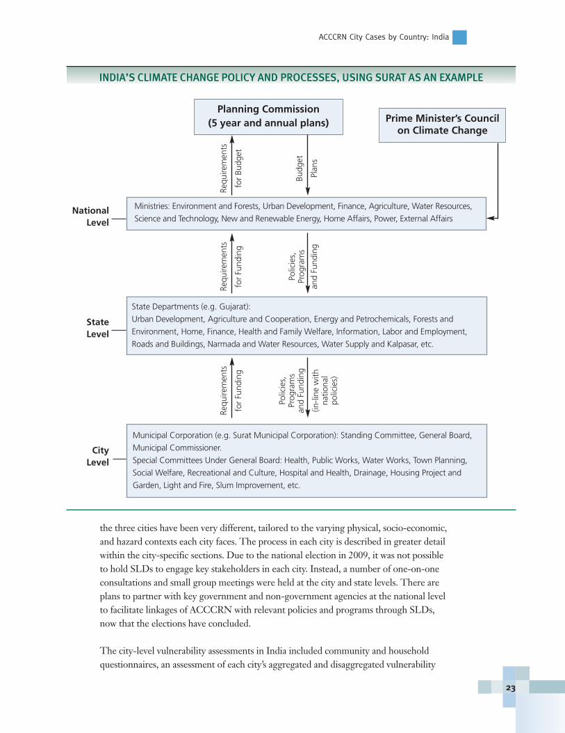
The city-level vulnerability assessments in India included community and householdquestionnaires, an assessment of each city’s aggregated and disaggregated vulnerability
National Level
State Level
City Level
ACCCRN City Cases by Country: India
23
Planning Commission (5 year and annual plans) Prime Minister’s Council
on Climate Change
Ministries: Environment and Forests, Urban Development, Finance, Agriculture, Water Resources,
Science and Technology, New and Renewable Energy, Home Affairs, Power, External Affairs
State Departments (e.g. Gujarat):
Urban Development, Agriculture and Cooperation, Energy and Petrochemicals, Forests and
Environment, Home, Finance, Health and Family Welfare, Information, Labor and Employment,
Roads and Buildings, Narmada and Water Resources, Water Supply and Kalpasar, etc.
Municipal Corporation (e.g. Surat Municipal Corporation): Standing Committee, General Board,
Municipal Commissioner.
Special Committees Under General Board: Health, Public Works, Water Works, Town Planning,
Social Welfare, Recreational and Culture, Hospital and Health, Drainage, Housing Project and
Garden, Light and Fire, Slum Improvement, etc.
Requ
irem
ents
for
Budg
et
Budg
et
Plan
s
Requ
irem
ents
for
Fund
ing
Polic
ies,
Pr
ogra
ms
and
Fund
ing
Requ
irem
ents
for
Fund
ing
Polic
ies,
Pr
ogra
ms
and
Fund
ing
(in-li
ne w
ithna
tiona
l po
licie
s)
INDIA’S CLIMATE CHANGE POLICY AND PROCESSES, USING SURAT AS AN EXAMPLE
capacity index (VCI), and an evaluation of institutionaland service delivery mechanisms for basic services such aswater supply and sanitation, drainage, and sewerage. InSurat and Indore, GIS-enabled vulnerability analysis wasutilized to provide information on the spatial distributionof risks and vulnerability to explore targeted options foradaptation. This approach coupled spatially explicit datawith a variety of indirect indicators to better understandlocal socioeconomic and vulnerability parameters: loca-tion (core, periphery, distance from markets/industriesetc), road access, building size, and roof types that can beeasily discerned from remote imagery/maps.
ACCCRN: Responding to the Urban Climate Challenge
24
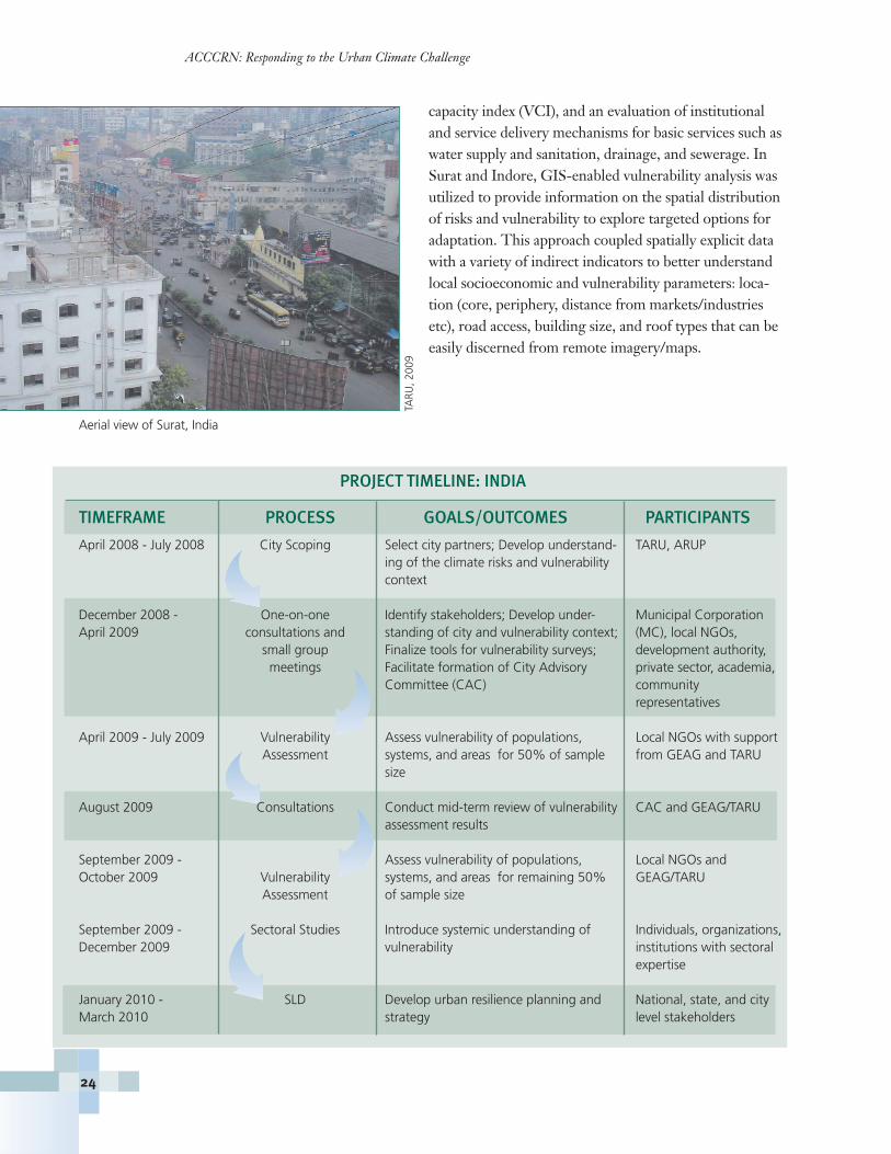
Aerial view of Surat, IndiaTA
RU, 2
009
PROJECT TIMELINE: INDIA
TIMEFRAME PROCESS GOALS/OUTCOMES PARTICIPANTS
April 2008 - July 2008 City Scoping Select city partners; Develop understand- TARU, ARUP ing of the climate risks and vulnerability context
December 2008 - One-on-one Identify stakeholders; Develop under- Municipal CorporationApril 2009 consultations and standing of city and vulnerability context; (MC), local NGOs,
small group Finalize tools for vulnerability surveys; development authority,meetings Facilitate formation of City Advisory private sector, academia,
Committee (CAC) community representatives
April 2009 - July 2009 Vulnerability Assess vulnerability of populations, Local NGOs with support Assessment systems, and areas for 50% of sample from GEAG and TARU
size
August 2009 Consultations Conduct mid-term review of vulnerability CAC and GEAG/TARUassessment results
September 2009 - Assess vulnerability of populations, Local NGOs and October 2009 Vulnerability systems, and areas for remaining 50% GEAG/TARU
Assessment of sample size
September 2009 - Sectoral Studies Introduce systemic understanding of Individuals, organizations, December 2009 vulnerability institutions with sectoral
expertise
January 2010 - SLD Develop urban resilience planning and National, state, and city March 2010 strategy level stakeholders

Key Opportunities and ChallengesThe national elections and the Election Code of Conduct con-strained the initial ACCCRN engagement process by restrictinglarge structured workshops/meetings. Additionally, the continuityof leadership has been hard to maintain due to transfer of key gov-ernment officials. Other challenges have included:
� Identifying key actors to anchor the process at city level.This has been problematic in some cities, particularly inIndore.
� Bringing divergent interest groups to the same city levelplatform.
� Lack of adequate and appropriate data/information.
� Lack of capacity for urban vulnerability surveys.
� Relating climate change phenomenon to on-the-ground realities.
� Retaining interest of stakeholders from one consultation to another.
There are, however, a number of important opportunities that are reflected in the posi-tive early engagement by the mayor of Surat in the first city-partner ACCCRN, as wellas the innovative pilot projects being proposed in Surat and other locations.
GORAKHPURGorakhpur is located in the middle of northern India’s GangeticPlain, an almost featureless plain whose primary topographic varia-tion is due to shifting of river channels. The city encompasses anarea of 3383 km2, 77% of which is agricultural land and 2% ofwhich is forest. Eighty percent of the population lives in rural areaswhere agriculture is the economic base, with the remaining 20% ofthe population residing in urban areas. Two rivers flow throughGorakhpur, the Rapti and Rohini, both of which originate in theHimalayas. (For additional information, visit:http://gorakhpur.nic.in/city1.htm)
Divided by two rivers and bordered by a lake, Gorakhpur is subjectto chronic flooding and soil saturation (also known as waterlogging).Drainage challenges compound existing problems with the sewersystem, which is old, in need of renovation, and covers only 22% ofthe city. Frequent clogging of the system, where it exists, results inraw sewage discharge to local water bodies and ultimately, the RaptiRiver. Together the waterlogging, poor drainage, and sewer issues result in a high inci-dence of vector borne diseases and related health problems and contamination of ground-water. Climate change and its consequences — for example, increased incidence andseverity of flood, drought, and hot or cold waves — will exacerbate these problems.
City Characteristics
Population: Estimated at 0.6 million
Growth Rate: 23.61% (1991-2001)
Poor Population: 33% slum population
Primary Economic Activity: Agriculture
Climate: Dominated by the monsoon with an average annualrainfall of ~100 mm
City Context: Inland, bounded onthe northeast by the Himalayas, by ariver to the west, and a lake to thesouth with an elevation of ~ 80 mabove mean sea level
ACCCRN City Cases by Country: India
25
GEA
G, 2
009
Community adaptation: bamboobridges in waterlogged area

ACCCRN: Responding to the Urban Climate Challenge
26
The ACCCRN Process in GorakhpurThe ACCCRN process in Gorakhpur is led by GorakhpurEnvironmental Action Group (GEAG), an NGO based in the city.During Phase 1 of the ACCCRN process, GEAG engaged key citystakeholders including Gorakhpur Municipal Corporation (GMC)through individual meetings and focus group discussions. Theobjective of these meetings and discussions was to identify primaryclimate risks and hazards in the city and to prioritize them in termsof severity, coverage, and population affected. The major issues aris-ing during these discussions were degradation of water bodies,increased severity and duration of waterlogging, groundwater con-tamination, solid waste disposal, and health.
Even before the constitution of a formal project advisory committeein Gorakhpur, key actors were identified and engaged with the proj-ect process. A series of meetings, as part of the shared learning dia-logue process, were conducted to assess the current levels of climatevulnerability, both spatially and socio-economically, withinGorakhpur. The meetings were also used to identify the causal loopsfor various risks and the responsible parties for planning, implemen-tation, and maintenance of the urban services.
The meetings were followed by a vulnerability assessment, wherethe approach was to first categorize the city into specific andhomogenous socio-economic units, primarily based upon housingtypes identified through GIS-based maps, as high, middle, and lowincome groups. Information and ideas discussed during the sharedlearning process fed into and informed the vulnerability analysis.This method of creating typologies in the city helped in distinguish-ing the different factors contributing to vulnerability for each group.The socio-economic classification maps were then superimposed onrisk maps and the resulting information was used to determine thespatial distribution of differential patterns of vulnerability. Instead ofa detailed and intensive questionnaire survey, GEAG used a numberof other methods, supplemented with a small sample of householdlevel surveys. The final assessment, now underway, will present the vulnerabilities in both quantitative and qualitative aspects, includingseasonality of waterlogging and health impacts, measuring satisfaction with urban services, and trend analysis.
KEY CITY PARTNERS
Gorakhpur Environmental Action Group (GEAG)
Gorakhpur Municipal Corporation (GMC)
Gorakhpur Development Authority (GDA)
Gorakhpur Industrial Development Authority (GIDA)
Public Works Department
Town and Country Planning Department
Gorakhpur Jalkal
Uttar Pradesh Jal Nigam
Mayor, Gorakhpur City and Corporators from different wards
NGOs (Indo Nepal Friendship Society, Sikh Association, Purvanchal Gramin Vikas Shansthan, Daud Memorial)
Pharmaceutical Association
Academic institutions
D.D.U Gorakhpur University, BRD Medical College, Gorakhpur
Mahatama Gandhi P.G. College, Gorakhpur
NATIONAL PARTNERS
TARU is a leading South Asian research
consulting firm specializing in development
planning and implementation of multi-sector
public policy and development initiatives
focused on building safe and sustainable
cities. TARU is leading the vulnerability
analysis work in the city of Indore and Surat.
www.taru.org.
Gorakhpur Environmental Action Group(GEAG) is leading the vulnerability analysis
work in the city of Gorakhpur. GEAG is a
leading resource institution on sustainable
agriculture, participatory approaches
methodologies, and gender in north India.
www.geagindia.org. �

ACCCRN City Cases by Country: India
27
City Climate Change Vulnerability Context
A 2009 report by ISET and ISET-Nepal indicates that the projected climate impactsfor Gorakhpur include increased precipitation during the monsoon season, resulting inincreased intensity and frequency of floods, particularly small scale flooding. Climatechange will also exacerbate waterlogging and result in increased mean temperatures.Combined, these conditions will worsen the already frequent incidences of water bornediseases that are common after floods, such as jaundice, malaria, and Japaneseencephalitis (JE).
Hazard: Flooding
The Rapti River, with a catchment of over 23,000 km2,flows along the western edge of the city. Devastatingfloods are common at least once in a decade. Duringhigh rainfall and a concurrent rise in the water level ofthe river, drainage pumping becomes inadequate andparts of the city remain under knee deep water for aconsiderable period of time.
Direct and Indirect Impacts
Waterlogging
Most parts of the city are below the riverbed level,resulting in water saturation of lands and periodicflooding. The bulk of the waterlogging, affecting about 40% of the city, is to the southand west. However, the drainage system for the entire city is challenged. Waterlogginghas been getting worse in recent years, in part due to changes in rainfall, but also toincreased sedimentation of local bodies of water. Rainfall has not increased overall, butthe average intensity of rainfall in the summer months has increased. Waterloggingissues now impact some areas of the city for 3 to 4 months of the year.
Sewage
Only a small part of the city (22%) is served by the underground municipal seweragesystem. The total drain length is approximately 55 km and the sewerage disposal ismainly through open drains and sewer lines. The low lying areas, low slope gradient,open drains, and lack of proper solid waste management systems increase the city’s vul-nerability. The sewer lines are also linked to the freshwater bodies existing in the city,causing eutrophication and degradation of the water reservoirs. Malaria and dysenteryhave historically been a problem; recent years have seen a rise in diarrhoeal diseases andthe introduction of Japanese encephalitis.
Solid Waste
The solid waste generation in the city amounts to approximately 300 tons per day andwill increase as population grows and access to consumer goods increases. There is no organized solid waste management in place and the accumulation and disposal of solid
GEA
G, 2
009
Flooding in Gorakhpur, India
ACCCRN: Responding to the Urban Climate Challenge
28
waste is a major concern. The increasing usage of polythene (plastic) shopping bags andother items, as well as the disposal of waste into open drains, has increased drainage congestion, exacerbating the incidence of waterlogging. The city lacks an incinerator todispose of bio-medical wastes.
Drinking Water
The ground water table is high in the region and as a result, the majority of the popula-tion depends upon personal electrified borewell pumps and hand pumps for drinkingwater. The municipal water supply only covers 65% of the city area. One of the sec-ondary impacts of the waterlogging and poor drainage is groundwater contamination.With easy accessibility to groundwater and low levels of literacy and awareness, peopletend to depend on shallow hand pumps that provide contaminated water. Waterextracted from these shallow hand pumps generates health problems and induces bacte-riological and gastro-intestinal disorders in a large percentage of the population.
Energy Issues
The state of Uttar Pradesh, and particularly the eastern districts, is electricity deficient,with supply significantly below the demand level. Gorakhpur city has almost 10 to 12hours of power outages per day. As a result, diesel generators are common alternativesources of energy. During monsoon months, approximately 50 electricity-poweredpumps are deployed to drain the waterlogged areas, which further contributes to anenergy drain in the city. The duration of waterlogging in various areas amounts to 2 to3 days a month.
Key Opportunities and ChallengesThe residents of Gorakhpur have a high degree of awareness of the environmental issuesfacing the city, the result of a large, citywide campaign to conserve lakes and other bodiesof water. Although this public awareness can be positively leveraged for the ACCCRNproject, currently city officials are insufficiently sensitized to the scope of issues needed toeffectively address climate adaption and may lack the political will to implement the nec-essary plans and efforts. Other challenges include:
� Inter-departmental convergence: All departments work in specific sectors withvery little scope for coordination across departments.
� Energy: Gorakhpur faces chronic energy shortages. Developing urban resilienceprovides an opportunity to address this issue.
� Mainstreaming climate change in the Master Plan: A Master Plan was preparedprior to climate change becoming an important concern for the city, and the political-economic conditions make integrating climate-related initiatives a challenge.
� Sensitizing policy planners: The success of an urban resilience program will de-pend heavily on the impact it has on shaping appropriate policies and programsthat are climate-resilient.
� Lack of data: One of the core needs for proper resilience planning is adequate,accurate, and reliable data.
ACCCRN City Cases by Country: India
29
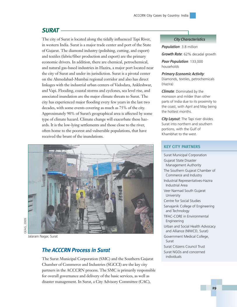
SURATThe city of Surat is located along the tidally influenced Tapi River,in western India. Surat is a major trade center and port of the Stateof Gujarat. The diamond industry (polishing, cutting, and export)and textiles (fabric/fiber production and export) are the primaryeconomic drivers. In addition, there are chemical, petrochemical,and natural gas-based industries in Hazira, a major port located nearthe city of Surat and under its jurisdiction. Surat is a pivotal centeron the Ahmedabad-Mumbai regional corridor and also has directlinkages with the industrial urban centers of Vadodara, Ankleshwar,and Vapi. Flooding, coastal storms and cyclones, sea level rise, andassociated inundation are the major climate threats to Surat. Thecity has experienced major flooding every few years in the last twodecades, with some events covering as much as 75% of the city.Approximately 90% of Surat’s geographical area is affected by sometype of climate hazard. Climate change will exacerbate these haz-ards. It is the low-lying settlements and those close to the river,often home to the poorest and vulnerable populations, that havereceived the brunt of the inundations.
The ACCCRN Process in SuratThe Surat Municipal Corporation (SMC) and the Southern GujaratChamber of Commerce and Industries (SGCCI) are the key citypartners in the ACCCRN process. The SMC is primarily responsiblefor overall governance and delivery of the basic services, as well asdisaster management. In Surat, a City Advisory Committee (CAC),
City Characteristics
Population: 3.8 million
Growth Rate: 62% decadal growth
Poor Population: 133,000 households
Primary Economic Activity: Diamonds, textiles, petrochemicals(Hazira)
Climate: Dominated by the monsoon and milder than otherparts of India due to its proximity tothe coast, with April and May beingthe hottest months.
City Layout: The Tapi river dividesSurat into northern and southernportions, with the Gulf of Khambhat to the west.
KEY CITY PARTNERS
Surat Municipal Corporation
Gujarat State Disaster Management Authority
The Southern Gujarat Chamber of Commerce and Industry
Industrial Representatives-Hazira Industrial Area
Veer Narmad South Gujarat University
Centre for Social Studies
Sarvajanik College of Engineering and Technology
TIFAC-CORE in Environmental Engineering
Urban and Social Health Advocacy and Alliance (NIWCD, Surat)
Government Medical College, Surat
Surat Citizens Council Trust
Surat NGOs and concerned individuals
GEA
G, 2
009
Jalaram Nagar, Surat
ACCCRN: Responding to the Urban Climate Challenge
30
with SMC and SGCCI as pivotal organizations, was formed and is taking on the leader-ship role in the ACCCRN process. The process has been most effective with high levels ofparticipation by key and diverse actors. The ACCCRN process to date has involved one-to-one meetings, small group meetings, and CAC meetings. The sectoral studies havebeen undertaken by sub-groups, with each sub-group led by a CAC member. SLDs will beconducted during the rest of the program as well, now that elections have concluded.
City Climate Change Vulnerability Context
Projected climate change impacts for Surat include the possibility of increased precipi-tation, sea level rise, and increased temperatures. The core urban systems affected bythese risks include water supply, sanitation, and housing, while secondary and tertiarysystems include health and industry, respectively. Transport and communication, ascross-cutting systems, are also impacted, the nature and extent depending on intensityof risk. The majority of slums are located in low-lying areas facing high flood risks dueto Tapi and Khadi river floods and sea level rise.
Tapi Floods
The Tapi River is controlled upstream by the Ukai dam. The river divides Surat intonorthern and southern sections. Tapi flood hazards primarily affect the western portionof the city due to overflow from the Ukai dam during and following heavy rainfall inthe catchments between Kakrapar and Surat.
Khadi Floods
Khadi floods, generated by local rains combined with high tides, often inundate thesouth/southwest portions of the city, and also affect the southeast portion of the city.
Sea Level Rise
Sea level rise is a flooding concern for areas below the high tide zone in the westernpart of the city. As the sea rises, new areas of the western part of the city will also beimpacted. Sea level rise will also likely impact groundwater as saline waters encroachupon aquifers.
Surat Preparedness Measures
The SMC has some measures for flood preparedness including a disaster managementplan (DMP) and ongoing maintenance of drainage (i.e. dredging and cleaning ofcreeks, clearing of storm drains, temporary trenching before each monsoon). TheDMP was initially supported by the United Nations Development Program (UNDP),but it requires revision to incorporate climate risks in sectors such as water, energy,health, housing and infrastructure. Local coping strategies include the construction ofhouses on raised plinths or stilts, and provision of lofts in low-income group houses.SMC’s long-term plans include raising and straightening of the Tapi River embank-ment, increasing the coverage of storm drainage systems, and relocating of informalhousing to less flood-prone areas.
ACCCRN City Cases by Country: India
31
Key Opportunities and Challenges The ACCCRN project in Surat benefits from a high level of enthusiasm and participa-tion from key and diverse interest groups. Projected sea level rise and increased inunda-tion pose serious threats to industries, which are a significant economic driver, and hascatalyzed a high degree of participation. Additionally, the effective leadership of SMCand SGCCI, as well as cost sharing by the key agencies involved in assessments, has pro-pelled the process forward and is likely to maintain momentum into future projectphases. Previous signature disaster events, the 1994 floods followed by plague and the2006 floods, in particular, triggered cooperative action by diverse city actors. One of theprincipal challenges remains communicating linkages of the climate change phenomenonto local risks and hazards.
INDOREIndore is the most populated city in the central Indian state ofMadhya Pradesh, located near the drainage divide between theChambal and Narmada Rivers. Indore is primarily a trading center,serving as a hub for trade and commerce to all of western India.
Though the city is prosperous, 50% of the population has access toonly informal housing in the form of squatter settlements.According to a 2006 study by the National Institute of PublicFinance and Policy, more than 15% of the population lives in unau-thorized communities with inadequate facilities. The city also suf-fers from the lack of physical infrastructure. Only 54% of the cityhas access to water, with an average supply of 80 liters per capita perday. The local water table is 150 m below the surface, and the wellsthat have not gone dry are generally low yield. Drainage for the cityis inadequate and in many cases non-existent. (For more informa-tion, visit: http://jnnurm.nic.in/nurmudweb cdp_apprep_pdf/CDP_Appraisals_Nipfp/CDP-Indore.pdf.)
All of these factors, including the city’s location on the banks of tworivers, high density in core areas, and high slum population, makethe city vulnerable to climate change and its consequences. Water scarcity is a primarythreat with water demand far outstripping supply and leaving a large section of the popu-lation without a formal water supply system. Demand for clean water is increasing rapidlywith population growth and extensive industrial development. Although the problem ofwater scarcity is not new, increasing incidence and severity of drought and floods areadding new demands and increasing stress on the city’s population.
City Characteristics
Population: 2.4 million
Growth Rate: 4% annually
Poor Population: 260,000 reside inslums
Primary Economic Activity: Textile units, food processing, pharmaceuticals, iron, steel, leather,industrial chemicals, and automobilecomponents.
Climate: Temperatures range seasonally from 40oC to 2oC withprecipitation dominated by the monsoon from June to September
City Context: Located in the KhanRiver basin on flat terrain at an alti-tude of approximately 550 m abovemean sea level
ACCCRN: Responding to the Urban Climate Challenge
32
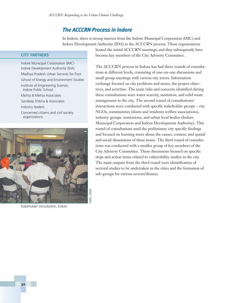
The ACCCRN Process in IndoreIn Indore, there is strong interest from the Indore Municipal Corporation (IMC) andIndore Development Authority (IDA) in the ACCCRN process. These organizations
hosted the initial ACCCRN meetings, and they subsequently havebecome key members of the City Advisory Committee.
The ACCCRN process in Indore has had three rounds of consulta-tions at different levels, consisting of one-on-one discussions andsmall group meetings with various city actors. Informationexchange focused on city problems and issues, the project objec-tives, and activities. The main risks and concerns identified duringthese consultations were water scarcity, sanitation, and solid wastemanagement in the city. The second round of consultations/interactions were conducted with specific stakeholder groups – cityNGOs, communities (slums and residents welfare associations),industry groups, institutions, and urban local bodies (IndoreMunicipal Corporation and Indore Development Authority). Thisround of consultations used the preliminary city specific findingsand focused on learning more about the causes, context, and spatialand social dimensions of these issues. The third round of consulta-tions was conducted with a smaller group of key members of theCity Advisory Committee. These discussions focused on specificsteps and action items related to vulnerability studies in the city.The main outputs from the third round were identification of sectoral studies to be undertaken in the cities and the formation ofsub-groups for various sectors/themes.
CITY PARTNERS
Indore Municipal Corporation (IMC)Indore Development Authority (IDA)
Madhya Pradesh Urban Services for Poor
School of Energy and Environment Studies
Institute of Engineering Science, Indore Public School
Mehta & Mehta Associates
Sandeep Shikha & Associates
Industry leaders
Concerned citizens and civil society organizations
TARU
, 200
9
Stakeholder consultation, Indore

ACCCRN City Cases by Country: India
33
City Climate Change Vulnerability Context
Projected climate change impacts for Indore include increases in precipitation on theorder of 200 to 400 mm/year with increased variability of timing and intensity, andincreases in summer temperatures by about 1.5oC to 2.0oC. The impacts of thesechanges will fall most heavily on the slum population.
Water Scarcity/Droughts
Water for Indore is being pumped from a distantsource while the groundwater level in the city isdecreasing rapidly. Large surface reservoirs remainempty most of the year. Two rivers, the Saraswatiand Khan, which used to be city lifelines and werealmost perennial, remain dry for most of the year.Water scarcity will be exacerbated by projectedincreases in precipitation variability. The coreurban systems impacted will include water supplyand sanitation. Industries will also be exposed torisks due to water scarcity and drought.
Flooding
Indore has experienced flood events due to suddenand heavy downpour more frequently in therecent years (2005, 2007, and 2009). Flood risk isexacerbated by the almost complete absence of stormwater drains and poor solid waste disposal system. Flooding impacts water supply andsanitation, as well as housing, industry, transportation, and communication sectors.
Health
Indore has witnessed increased incidence of vector borne diseases, e.g. chickengunia,malaria, and dengue, particularly after flooding events. The projected increase in vari-ability in precipitation and temperature will exacerbate the health risks.
Energy
Owing to distant water sources being tapped for municipal supply coupled withincreasing number of deep bore wells requiring enormous energy for lift and conveyance, the city’s energy demand has increased significantly in recent years. Withprojected increase in temperatures, the demand for cooling and refrigeration will poseadditional challenges to energy security. Risks in the energy sector will also impact tertiary systems (industry) and core urban systems (water supply).
TARU
, 200
9
Women lining up to purchase water, Indore
ACCCRN: Responding to the Urban Climate Challenge
34
Key Opportunity and ChallengesWith the conclusion of the national elections, the ACCCRN process in Indore can nowbegin to engage a broader range of community members through larger, structuredworkshops and meetings. Furthermore, the head of Indore Municipal Corporation (high-est urban body in a city) was transferred and the process of influencing city stakeholdersto engage in the ACCCRN process has had to be restarted. Indore’s divergent and con-flicting interest groups pose challenges to effective multi-stakeholder deliberations andadds additional complexity in the capacity building process. Other challenges include:
� Communicating linkages between climate change consequences and local riskssuch as water scarcity. It is difficult to relate the global climate change phenome-non with specific consequences on the ground.
� Lack of adequate and appropriate data/information.
� Lack of capacity for urban vulnerability surveys. Most of the local organizationsare not familiar with climate change issues. Hence, it requires orientation andbuilding capacity, which takes time, for conducting citywide vulnerability surveys.
While the ACCCRN project is largely a capacity building initiative with minimal fund-ing for direct implementation, there are large ongoing donor aided projects such as ADB,DfID and WaterAid aimed at improving delivery of urban services to poor, which have astrong interest from the city stakeholders. There is a need to develop synergies with theselarge projects to gain interest from city officials and stakeholders.
ACCCRN City Cases: Indonesia
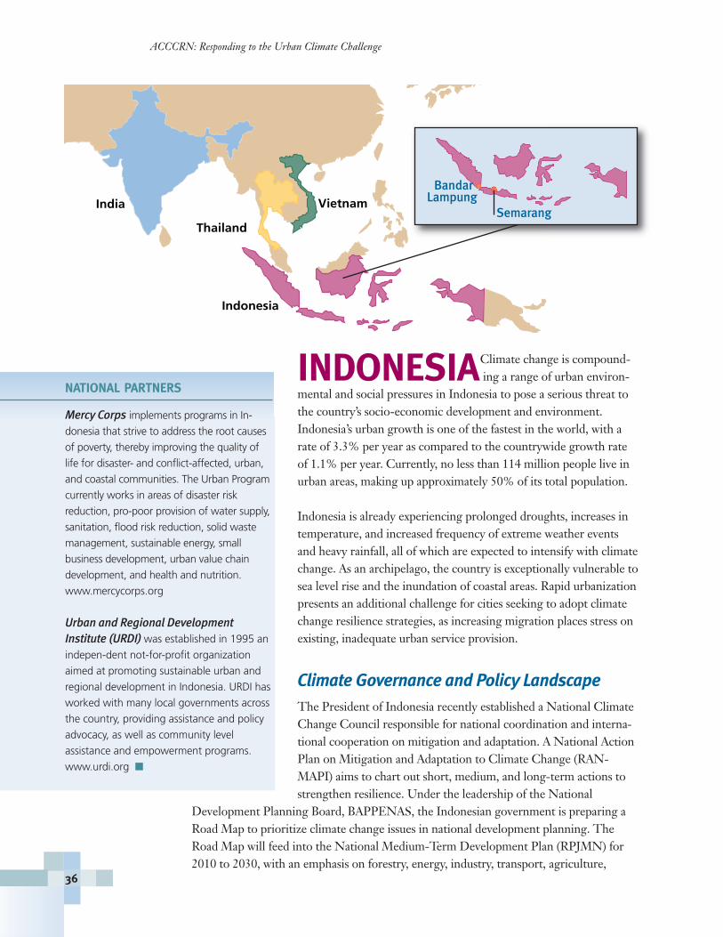
INDONESIAClimate change is compound- ing a range of urban environ-
mental and social pressures in Indonesia to pose a serious threat tothe country’s socio-economic development and environment. Indonesia’s urban growth is one of the fastest in the world, with arate of 3.3% per year as compared to the countrywide growth rateof 1.1% per year. Currently, no less than 114 million people live inurban areas, making up approximately 50% of its total population.
Indonesia is already experiencing prolonged droughts, increases intemperature, and increased frequency of extreme weather eventsand heavy rainfall, all of which are expected to intensify with climatechange. As an archipelago, the country is exceptionally vulnerable tosea level rise and the inundation of coastal areas. Rapid urbanization presents an additional challenge for cities seeking to adopt climatechange resilience strategies, as increasing migration places stress onexisting, inadequate urban service provision.
Climate Governance and Policy LandscapeThe President of Indonesia recently established a National ClimateChange Council responsible for national coordination and interna-tional cooperation on mitigation and adaptation. A National ActionPlan on Mitigation and Adaptation to Climate Change (RAN-MAPI) aims to chart out short, medium, and long-term actions tostrengthen resilience. Under the leadership of the National
Development Planning Board, BAPPENAS, the Indonesian government is preparing aRoad Map to prioritize climate change issues in national development planning. TheRoad Map will feed into the National Medium-Term Development Plan (RPJMN) for2010 to 2030, with an emphasis on forestry, energy, industry, transport, agriculture,
ACCCRN: Responding to the Urban Climate Challenge
36
NATIONAL PARTNERS
Mercy Corps implements programs in In-
donesia that strive to address the root causes
of poverty, thereby improving the quality of
life for disaster- and conflict-affected, urban,
and coastal communities. The Urban Program
currently works in areas of disaster risk
reduction, pro-poor provision of water supply,
sanitation, flood risk reduction, solid waste
management, sustainable energy, small
business development, urban value chain
development, and health and nutrition.
www.mercycorps.org
Urban and Regional Development Institute (URDI) was established in 1995 an
indepen-dent not-for-profit organization
aimed at promoting sustainable urban and
regional development in Indonesia. URDI has
worked with many local governments across
the country, providing assistance and policy
advocacy, as well as community level
assistance and empowerment programs.
www.urdi.org �
India
Thailand
Vietnam
Indonesia
BandarLampung
Semarang
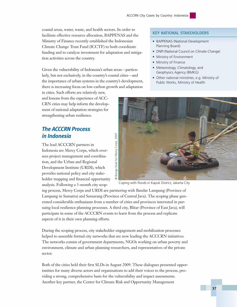
coastal areas, water, waste, and health sectors. In order tofacilitate effective resource allocation, BAPPENAS and theMinistry of Finance recently established the IndonesianClimate Change Trust Fund (ICCTF) to both coordinatefunding and to catalyze investment for adaptation and mitiga-tion activities across the country.
Given the vulnerability of Indonesia’s urban areas—particu-larly, but not exclusively, in the country’s coastal cities—andthe importance of urban systems in the country’s development,there is increasing focus on low-carbon growth and adaptationin cities. Such efforts are relatively new,and lessons from the experience of ACC-CRN cities may help inform the develop-ment of national adaptation strategies forstrengthening urban resilience.
The ACCCRN Process in IndonesiaThe lead ACCCRN partners inIndonesia are Mercy Corps, which over-sees project management and coordina-tion, and the Urban and RegionalDevelopment Institute (URDI), whichprovides national policy and city stake-holder mapping and financial opportunityanalysis. Following a 3-month city scop-ing process, Mercy Corps and URDI are partnering with Bandar Lampung (Province ofLampung in Sumatra) and Semarang (Province of Central Java). The scoping phase gen-erated considerable enthusiasm from a number of cities and provinces interested in pur-suing local resilience planning processes. A third city, Blitar (Province of East Java), willparticipate in some of the ACCCRN events to learn from the process and replicateaspects of it in their own planning efforts.
During the scoping process, city stakeholder engagement and mobilization processeshelped to assemble formal city networks that are now leading the ACCCRN initiatives.The networks consist of government departments, NGOs working on urban poverty andenvironment, climate and urban planning researchers, and representatives of the privatesector.
Both of the cities held their first SLDs in August 2009. These dialogues presented oppor-tunities for many diverse actors and organizations to add their voices to the process, pro-viding a strong, comprehensive basis for the vulnerability and impact assessments.Another key partner, the Center for Climate Risk and Opportunity Management
ACCCRN City Cases by Country: Indonesia
37
KEY NATIONAL STAKEHOLDERS
• BAPPENAS (National Development Planning Board)
• DNPI (National Council on Climate Change)
• Ministry of Environment
• Ministry of Finance
• Meteorology, Climatology, and Geophysics Agency (BMKG)
• Other national ministries, e.g. Ministry ofPublic Works, Ministry of Health
Coping with floods in Kapuk District, Jakarta City
© B
unga
Sira
it fo
r M
ercy
Cor
ps, 2
007
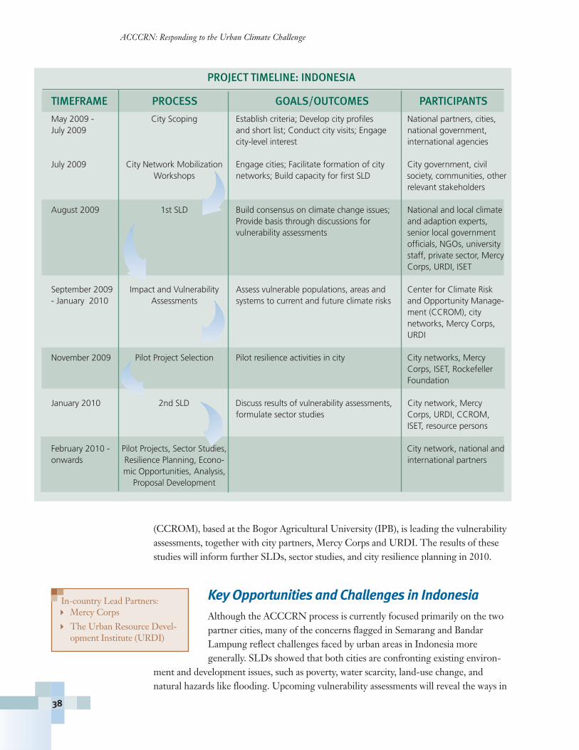
(CCROM), based at the Bogor Agricultural University (IPB), is leading the vulnerabilityassessments, together with city partners, Mercy Corps and URDI. The results of thesestudies will inform further SLDs, sector studies, and city resilience planning in 2010.
Key Opportunities and Challenges in Indonesia Although the ACCCRN process is currently focused primarily on the twopartner cities, many of the concerns flagged in Semarang and BandarLampung reflect challenges faced by urban areas in Indonesia more generally. SLDs showed that both cities are confronting existing environ-
ment and development issues, such as poverty, water scarcity, land-use change, and natural hazards like flooding. Upcoming vulnerability assessments will reveal the ways in
ACCCRN: Responding to the Urban Climate Challenge
38
In-country Lead Partners: � Mercy Corps
� The Urban Resource Devel-opment Institute (URDI)
PROJECT TIMELINE: INDONESIA
TIMEFRAME PROCESS GOALS/OUTCOMES PARTICIPANTS
May 2009 - City Scoping Establish criteria; Develop city profiles National partners, cities,July 2009 and short list; Conduct city visits; Engage national government,
city-level interest international agencies
July 2009 City Network Mobilization Engage cities; Facilitate formation of city City government, civilWorkshops networks; Build capacity for first SLD society, communities, other
relevant stakeholders
August 2009 1st SLD Build consensus on climate change issues; National and local climateProvide basis through discussions for and adaption experts,vulnerability assessments senior local government
officials, NGOs, university staff, private sector, Mercy Corps, URDI, ISET
September 2009 Impact and Vulnerability Assess vulnerable populations, areas and Center for Climate Risk- January 2010 Assessments systems to current and future climate risks and Opportunity Manage-
ment (CCROM), citynetworks, Mercy Corps, URDI
November 2009 Pilot Project Selection Pilot resilience activities in city City networks, Mercy Corps, ISET, Rockefeller Foundation
January 2010 2nd SLD Discuss results of vulnerability assessments, City network, Mercyformulate sector studies Corps, URDI, CCROM,
ISET, resource persons
February 2010 - Pilot Projects, Sector Studies, City network, national and onwards Resilience Planning, Econo- international partners
mic Opportunities, Analysis, Proposal Development
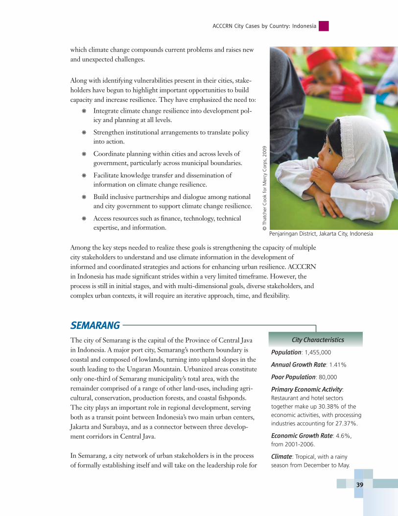
which climate change compounds current problems and raises newand unexpected challenges.
Along with identifying vulnerabilities present in their cities, stake-holders have begun to highlight important opportunities to buildcapacity and increase resilience. They have emphasized the need to:
� Integrate climate change resilience into development pol-icy and planning at all levels.
� Strengthen institutional arrangements to translate policyinto action.
� Coordinate planning within cities and across levels of government, particularly across municipal boundaries.
� Facilitate knowledge transfer and dissemination of information on climate change resilience.
� Build inclusive partnerships and dialogue among nationaland city government to support climate change resilience.
� Access resources such as finance, technology, technical expertise, and information.
Among the key steps needed to realize these goals is strengthening the capacity of multiplecity stakeholders to understand and use climate information in the development ofinformed and coordinated strategies and actions for enhancing urban resilience. ACCCRNin Indonesia has made significant strides within a very limited timeframe. However, theprocess is still in initial stages, and with multi-dimensional goals, diverse stakeholders, andcomplex urban contexts, it will require an iterative approach, time, and flexibility.
SEMARANGThe city of Semarang is the capital of the Province of Central Javain Indonesia. A major port city, Semarang’s northern boundary iscoastal and composed of lowlands, turning into upland slopes in thesouth leading to the Ungaran Mountain. Urbanized areas constituteonly one-third of Semarang municipality’s total area, with theremainder comprised of a range of other land-uses, including agri-cultural, conservation, production forests, and coastal fishponds.The city plays an important role in regional development, servingboth as a transit point between Indonesia’s two main urban centers,Jakarta and Surabaya, and as a connector between three develop-ment corridors in Central Java.
In Semarang, a city network of urban stakeholders is in the processof formally establishing itself and will take on the leadership role for
City Characteristics
Population: 1,455,000
Annual Growth Rate: 1.41%
Poor Population: 80,000
Primary Economic Activity: Restaurant and hotel sectors together make up 30.38% of theeconomic activities, with processingindustries accounting for 27.37%.
Economic Growth Rate: 4.6%,from 2001-2006.
Climate: Tropical, with a rainy season from December to May.
ACCCRN City Cases by Country: Indonesia
39
Penjaringan District, Jakarta City, Indonesia
© T
hatc
her
Coo
k fo
r M
ercy
Cor
ps, 2
009
the ACCCRN process. The network includes government departments, NGO actors,climate science and urban planning researchers, and members of the private sector.
Semarang itself is under the authority of the Semarang municipality,which is headed by a mayor.
Semarang is already facing significant environmental and climatepressures, including storms, coastal erosion, and drought, withresulting problems of flooding, coastal inundation, and depletedwater supplies. Land subsidence and inadequate drainage exacerbatethese impacts by disrupting the local economy, endangering liveli-hoods, and increasing health problems. A number of existing cityprograms and local initiatives are aiming to address these issuesthrough disaster mitigation planning, mangrove reforestation,
coastal infrastructure, drainage improvement, greening, and tree planting, among others.Although these initiatives illustrate strong awareness of environmental challenges andsuggest the political will to meet them, the city also recognizes that they currently lack anintegrated adaptive strategy sufficient to manage the likely increased magnitude, inten-sity, and frequency of climate events and uncertainties. City stakeholders have identifiedlimitations in managing the scale of hazards and lack of coordination across sectors. Themayor and city network hope that ACCCRN can help inform city adaptation planning totarget needs of the poor and most vulnerable people in the city.
The ACCCRN Process in SemarangIn August 2009, Semarang’s city stakeholders completed a rigorous 3-month ACCCRNcity selection process. As a result of the process, a formal city network was formed, whichis now awaiting ratification by Semarang’s mayor. The main initial challenge of the ACCCRN process in Semarang has been building understanding among city stakehold-ers about climate change impacts. In later phases, Mercy Corps, URDI, and theSemarang city network will look towards integrating climate change frameworks intogovernment development plans and programs.
The ACCCRN process is only in initial stages in Semarang, and its first SLD was held inAugust 2009. Local stakeholders and national resource managers shared knowledgeabout existing and potential future climate impacts in Semarang. The city network, withthe support of Mercy Corps, URDI, ISET and CCROM, subsequently engaged in aseries of constructive discussions about existing vulnerabilities, recent climate events, andcity and local strategies to address them. Understanding the current vulnerabilities andadaptation strategies of Semarang provides a strong initial basis to inform future climatevulnerabilities, as many current problems are likely to become exacerbated by climatetrends. The city’s vulnerability assessments, now underway, seek to explore new and/orintensifying vulnerabilities, assess which populations and urban systems may be most vul-nerable to future climate variation, and identify existing adaptation capacities.
KEY ACCCRN CITY STAKEHOLDERS IN SEMARANG
• BAPPEDA (City Development PlanningBoard)
• City Environmental Board
• Other city government agencies
• Diponegoro University
• Bintari (NGO)
• LEPASS (NGO)
ACCCRN: Responding to the Urban Climate Challenge
40
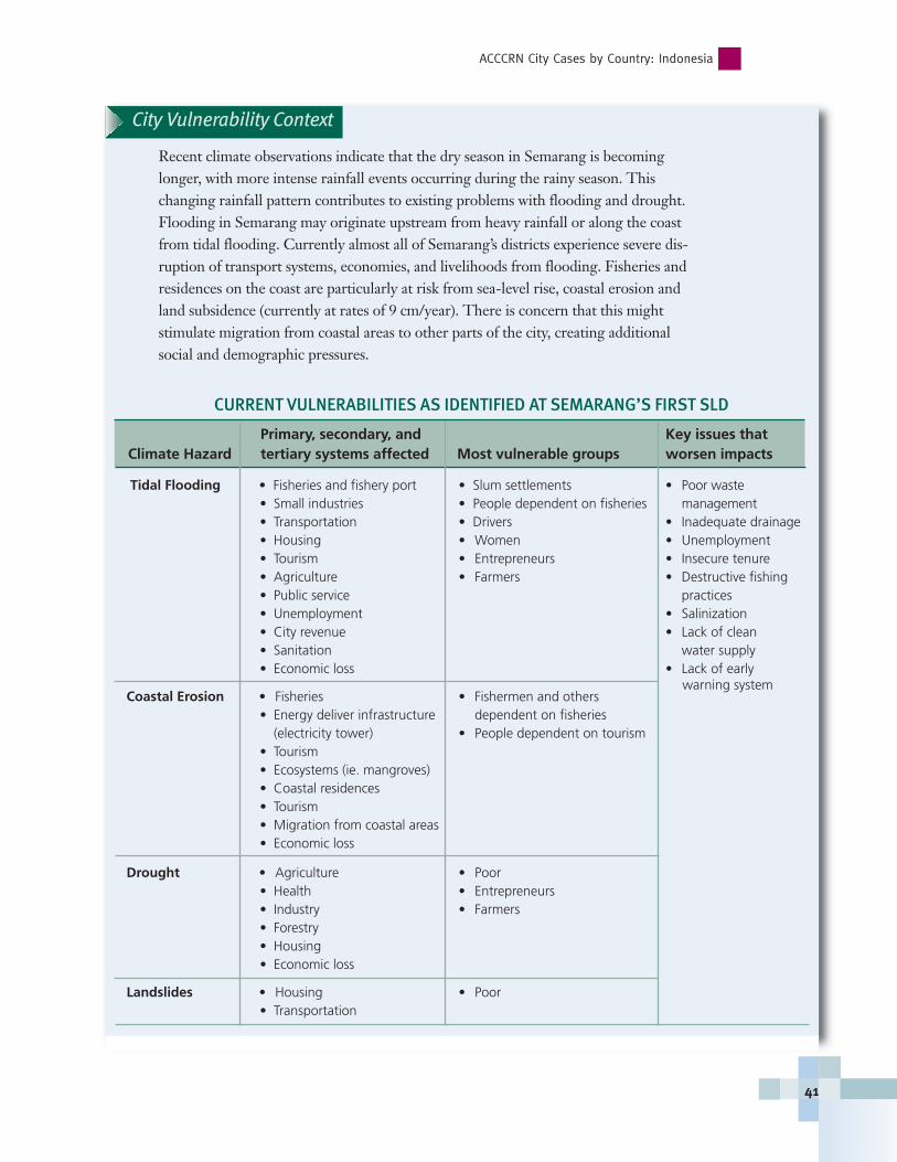
City Vulnerability Context
Recent climate observations indicate that the dry season in Semarang is becominglonger, with more intense rainfall events occurring during the rainy season. Thischanging rainfall pattern contributes to existing problems with flooding and drought.Flooding in Semarang may originate upstream from heavy rainfall or along the coastfrom tidal flooding. Currently almost all of Semarang’s districts experience severe dis-ruption of transport systems, economies, and livelihoods from flooding. Fisheries andresidences on the coast are particularly at risk from sea-level rise, coastal erosion andland subsidence (currently at rates of 9 cm/year). There is concern that this might stimulate migration from coastal areas to other parts of the city, creating additionalsocial and demographic pressures.
ACCCRN City Cases by Country: Indonesia
41
CURRENT VULNERABILITIES AS IDENTIFIED AT SEMARANG’S FIRST SLD
Primary, secondary, and Key issues that Climate Hazard tertiary systems affected Most vulnerable groups worsen impacts
Tidal Flooding • Fisheries and fishery port • Slum settlements • Poor waste • Small industries • People dependent on fisheries management• Transportation • Drivers • Inadequate drainage• Housing • Women • Unemployment• Tourism • Entrepreneurs • Insecure tenure • Agriculture • Farmers • Destructive fishing• Public service practices• Unemployment • Salinization • City revenue • Lack of clean• Sanitation water supply• Economic loss • Lack of early
Coastal Erosion • Fisheries • Fishermen and others• Energy deliver infrastructure dependent on fisheries
(electricity tower) • People dependent on tourism• Tourism• Ecosystems (ie. mangroves)• Coastal residences• Tourism• Migration from coastal areas• Economic loss
Drought • Agriculture • Poor • Health • Entrepreneurs• Industry • Farmers• Forestry• Housing• Economic loss
Landslides • Housing • Poor • Transportation
warning system

The city also experiences severe water scarcity related to drought, urban developmentof catchment areas, over-extraction of groundwater, and inadequate water utility infrastructure to meet increasing demand. Longer dry seasons and droughts have led
recently to failed harvests and death of vegetation. In addition,over-extraction of groundwater contributes to saline intrusion,and overflow of seawater onto shores.
Other major concerns in Semarang include the inadequacy ofsanitation and solid waste disposal; the pollution of the TapakRiver and drinking wells from liquid industrial waste; difficultymeeting energy demands due to the city’s rapid development;river erosion; and, concerns that heavy rain will trigger land-slides. Slum settlements in Semarang lacking basic services andinfrastructure are among the most vulnerable groups to thesehazards and secondary and impacts. They are particularly sus-ceptible to water-related health challenges and threats to liveli-hoods. Due to Semarang’s role as a major port, there is concernthat impacts may reverberate far beyond the city’s boundaries.
Key Opportunities and ChallengesCity stakeholders have expressed the need to augment existingcity efforts to manage these issues and to better mainstream climate change into city planning efforts. ACCCRN will helpfacilitate city actors to develop strategies and actions that willstrengthen urban resilience in the short and medium-term andthat will target those most vulnerable and poor populations.
ACCCRN: Responding to the Urban Climate Challenge
42
Inadequate waste management is a serious challenge in both Bandar Lampung and Semarang, with solid waste blocking drainage systems and exacerbating flood and health hazards.
© In
draw
an, M
ercy
Cor
ps In
done
sia,
200
9
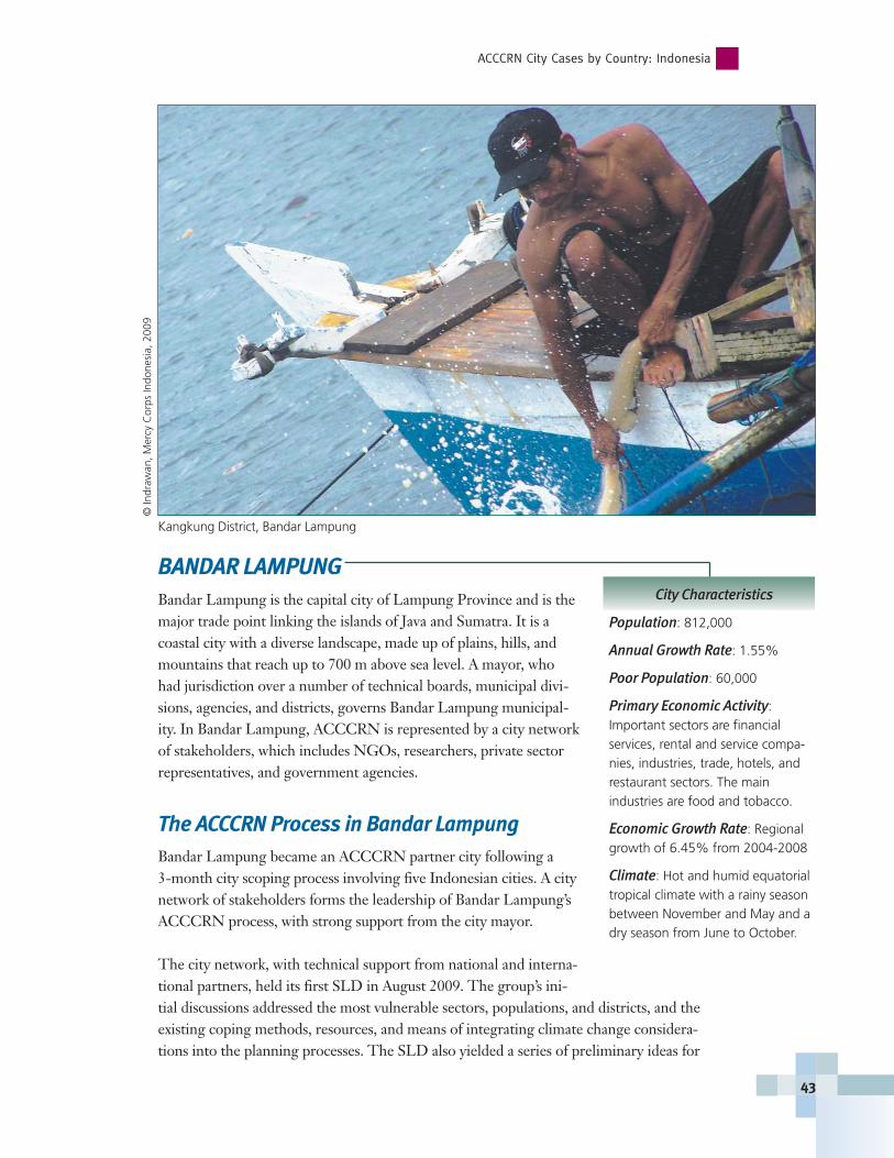
BANDAR LAMPUNGBandar Lampung is the capital city of Lampung Province and is themajor trade point linking the islands of Java and Sumatra. It is acoastal city with a diverse landscape, made up of plains, hills, andmountains that reach up to 700 m above sea level. A mayor, whohad jurisdiction over a number of technical boards, municipal divi-sions, agencies, and districts, governs Bandar Lampung municipal-ity. In Bandar Lampung, ACCCRN is represented by a city networkof stakeholders, which includes NGOs, researchers, private sectorrepresentatives, and government agencies.
The ACCCRN Process in Bandar LampungBandar Lampung became an ACCCRN partner city following a 3-month city scoping process involving five Indonesian cities. A citynetwork of stakeholders forms the leadership of Bandar Lampung’sACCCRN process, with strong support from the city mayor.
The city network, with technical support from national and interna-tional partners, held its first SLD in August 2009. The group’s ini-tial discussions addressed the most vulnerable sectors, populations, and districts, and theexisting coping methods, resources, and means of integrating climate change considera-tions into the planning processes. The SLD also yielded a series of preliminary ideas for
ACCCRN City Cases by Country: Indonesia
43
City Characteristics
Population: 812,000
Annual Growth Rate: 1.55%
Poor Population: 60,000
Primary Economic Activity: Important sectors are financial services, rental and service compa-nies, industries, trade, hotels, andrestaurant sectors. The main industries are food and tobacco.
Economic Growth Rate: Regionalgrowth of 6.45% from 2004-2008
Climate: Hot and humid equatorialtropical climate with a rainy seasonbetween November and May and adry season from June to October.
© In
draw
an, M
ercy
Cor
ps In
done
sia,
200
9
Kangkung District, Bandar Lampung
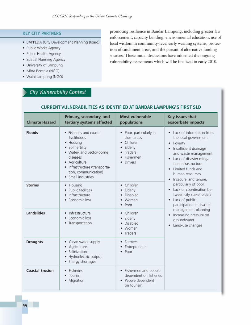
Primary, secondary, and Most vulnerable Key issues thatClimate Hazard tertiary systems affected populations exacerbate impacts
Floods • Fisheries and coastal • Poor, particularly in • Lack of information from livelihoods slum areas the local government
• Housing • Children• Soil fertility • Elderly• Water- and vector-borne • Traders
diseases • Fishermen• Agriculture • Drivers• Infrastructure (transporta-
tion, communication)• Small industries
Storms • Housing • Children• Public facilities • Elderly• Infrastructure • Disabled• Economic loss • Women
• Poor
Landslides • Infrastructure • Children• Economic loss• Transportation
Droughts • Clean water supply • Farmers• Agriculture • Entrepreneurs• Salinization • Poor • Hydroelectric output• Energy shortages
Coastal Erosion • Fisheries • Fishermen and people • Tourism dependent on fisheries• Migration • People dependent
on tourism
promoting resilience in Bandar Lampung, including greater lawenforcement, capacity building, environmental education, use oflocal wisdom in community-level early warning systems, protec-tion of catchment areas, and the pursuit of alternative fundingsources. These initial discussions have informed the ongoingvulnerability assessments which will be finalized in early 2010.
ACCCRN: Responding to the Urban Climate Challenge
44
KEY CITY PARTNERS
• BAPPEDA (City Development Planning Board)
• Public Works Agency
• Public Health Agency
• Spatial Planning Agency
• University of Lampung
• Mitra Bentala (NGO)
• Walhi Lampung (NGO)
• Poverty • Insufficient drainage
and waste management • Lack of disaster mitiga-
tion infrastructure • Limited funds and
human resources• Insecure land tenure,
particularly of poor• Lack of coordination be-
tween city stakeholders• Lack of public
participation in disaster management planning
• Increasing pressure ongroundwater
• Land-use changes
• Elderly• Disabled • Women• Traders
City Vulnerability Context
CURRENT VULNERABILITIES AS IDENTIFIED AT BANDAR LAMPUNG’S FIRST SLD
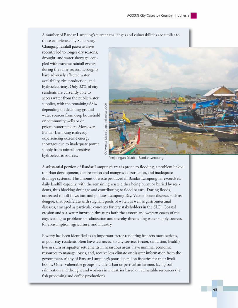
A number of Bandar Lampung’s current challenges and vulnerabilities are similar tothose experienced by Semarang.Changing rainfall patterns haverecently led to longer dry seasons,drought, and water shortage, cou-pled with extreme rainfall eventsduring the rainy season. Droughtshave adversely affected water availability, rice production, andhydroelectricity. Only 32% of cityresidents are currently able toaccess water from the public watersupplier, with the remaining 68%depending on declining groundwater sources from deep householdor community wells or on private water tankers. Moreover,Bandar Lampung is already experiencing extreme energy shortages due to inadequate powersupply from rainfall-sensitivehydroelectric sources.
A substantial portion of Bandar Lampung’s area is prone to flooding, a problem linkedto urban development, deforestation and mangrove destruction, and inadequatedrainage systems. The amount of waste produced in Bandar Lampung far exceeds itsdaily landfill capacity, with the remaining waste either being burnt or buried by resi-dents, thus blocking drainage and contributing to flood hazard. During floods,untreated runoff flows into and pollutes Lampung Bay. Vector-borne diseases such asdengue, that proliferate with stagnant pools of water, as well as gastrointestinal diseases, emerged as particular concerns for city stakeholders in the SLD. Coastal erosion and sea-water intrusion threatens both the eastern and western coasts of thecity, leading to problems of salinization and thereby threatening water supply sourcesfor consumption, agriculture, and industry.
Poverty has been identified as an important factor rendering impacts more serious, as poor city residents often have less access to city services (water, sanitation, health);live in slum or squatter settlements in hazardous areas; have minimal economicresources to manage losses; and, receive less climate or disaster information from thegovernment. Many of Bandar Lampung’s poor depend on fisheries for their liveli-hoods. Other vulnerable groups include urban or peri-urban farmers facing soil salinization and drought and workers in industries based on vulnerable resources (i.e.fish processing and coffee production).
ACCCRN City Cases by Country: Indonesia
45
Penjaringan District, Bandar Lampung
© A
wan
da, M
ercy
Cor
ps In
done
sia,
200
9
ACCCRN: Responding to the Urban Climate Challenge
46
Key Opportunites and ChallengesIn Bandar Lampung, NGOs and other actors are addressing some of these challengesthrough watershed management initiatives that enhance clean water supply, coastal zonemanagement to strengthen coastal protection, stronger land use planning and zoning,and improvements to drainage infrastructure. The city is also trying to learn from previ-ous experiences in disaster management to inform future planning efforts. However,stakeholders recognize that these efforts are not sufficient to address both current andfuture climate impacts, particularly among the poor and most vulnerable groups. ACC-CRN will help the city network to better understand how climate change may exacerbateexisting challenges, render new vulnerabilities, and develop strategies and actions thatwill best strengthen resilience to current and future climate impacts.
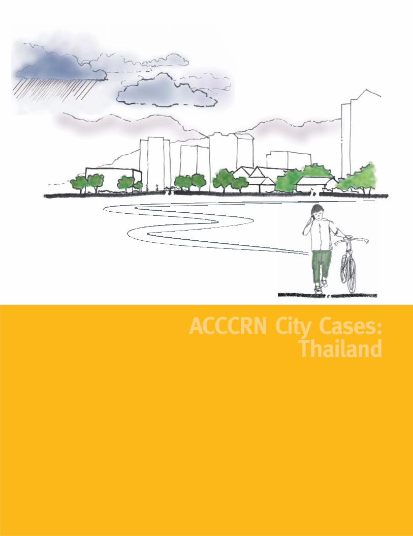
ACCCRN City Cases: Thailand
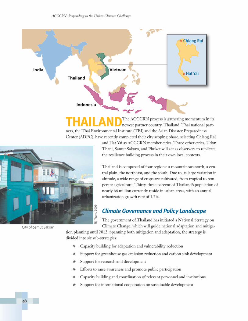
THAILANDThe ACCCRN process is gathering momentum in itsnewest partner country, Thailand. Thai national part-
ners, the Thai Environmental Institute (TEI) and the Asian Disaster PreparednessCenter (ADPC), have recently completed their city scoping phase, selecting Chiang Rai
and Hat Yai as ACCCRN member cities. Three other cities, UdonThani, Samut Sakorn, and Phuket will act as observers to replicatethe resilience building process in their own local contexts.
Thailand is composed of four regions: a mountainous north, a cen-tral plain, the northeast, and the south. Due to its large variation inaltitude, a wide range of crops are cultivated, from tropical to tem-perate agriculture. Thirty-three percent of Thailand’s population ofnearly 66 million currently reside in urban areas, with an annualurbanization growth rate of 1.7%.
Climate Governance and Policy Landscape The government of Thailand has initiated a National Strategy onClimate Change, which will guide national adaptation and mitiga-
tion planning until 2012. Spanning both mitigation and adaptation, the strategy isdivided into six sub-strategies:
� Capacity building for adaptation and vulnerability reduction
� Support for greenhouse gas emission reduction and carbon sink development
� Support for research and development
� Efforts to raise awareness and promote public participation
� Capacity building and coordination of relevant personnel and institutions
� Support for international cooperation on sustainable development
ACCCRN: Responding to the Urban Climate Challenge
48
City of Samut Sakorn
TEIT
eam
, 200
9
India
Thailand
Vietnam
Indonesia
Hat Yai
Chiang Rai
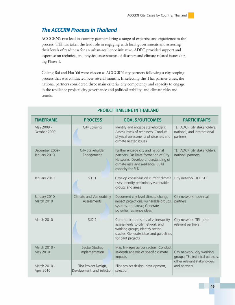
The ACCCRN Process in ThailandACCCRN’s two lead in-country partners bring a range of expertise and experience to theprocess. TEI has taken the lead role in engaging with local governments and assessingtheir levels of readiness for an urban-resilience initiative. ADPC provided support andexpertise on technical and physical assessments of disasters and climate related issues dur-ing Phase 1.
Chiang Rai and Hat Yai were chosen as ACCCRN city partners following a city scopingprocess that was conducted over several months. In selecting the Thai partner cities, thenational partners considered three main criteria: city competency and capacity to engagein the resilience project; city governance and political stability; and climate risks andtrends.
ACCCRN City Cases by Country: Thailand
49
PROJECT TIMELINE IN THAILAND
TIMEFRAME PROCESS GOALS/OUTCOMES PARTICIPANTS
May 2009 - City Scoping Identify and engage stakeholders; TEI, ADCP, city stakeholders, October 2009 Assess levels of readiness; Conduct national, and international
physical assessments of disasters and partnersclimate related issues
December 2009- City Stakeholder Further engage city and national TEI, ADCP, city stakeholders, January 2010 Engagement partners; Facilitate formation of City national partners
Networks; Develop understanding of climate risks and resilience; Build capacity for SLD
January 2010 SLD 1 Develop consensus on current climate City network, TEI, ISET risks; Identify preliminary vulnerable groups and areas
January 2010 - Climate and Vulnerability Document city-level climate change City network, technical March 2010 Assessments impact projections, vulnerable groups, partners
systems, and areas; Generate potential resilience ideas
March 2010 SLD 2 Communicate results of vulnerability City network, TEI, other assessments to city network and relevant partnersworking groups; Identify sector studies; Generate ideas and guidelines for pilot projects
March 2010 - Sector Studies Map linkages across sectors; Conduct May 2010 Implementation in-depth analysis of specific climate City network, city working
impacts groups, TEI, technical partners,other relevant stakeholders
March 2010 - Pilot Project Design, Pilot project design, development, and partnersApril 2010 Development, and Selection selection
The ACCCRN process in Thailand will benefit from the experiences and resources ofthe more advanced ACCCRN processes in Vietnam, India, and Indonesia. Moving into
Phase 2, the main goal of ACCCRN in Thailand is to engage multiplecommunity-based organizations and vulnerable stakeholder groups, aswell as local government, national partners, and internal climate, urbanadaptation, and disaster risk reduction experts. During Phase 2, the ACCCRN Thai partners will identify and assess city-level current andfuture climate risks and vulnerabilities in Hat Yai and Chiang Rai; identifyand develop pilot projects and city-level climate resilience strategies; and,engage and collaborate with other ACCCRN partner cities and nationalagencies to highlight urban resilience strategies and actions.
The city scoping process revealed that the five short-listed cities (ChiangRai, Hat Yai, Udon Thani, Samut Sakorn, and Phuket) share many similarchallenges, for instance: environmental and social issues such as flooding,water shortage, poor waste management, pollution, and problematic land-use, with information gaps on poverty, poor communities, illegal immi-grants, past disasters, and city-level climate profiles. However, there arealso many significant differences between the five short-listed cities. Thiswas particularly significant with regard to the awareness, preparedness,and capacity of city governments and stakeholders. At the end of the scop-ing process, Chiang Rai and Hat Yai were engaged as ACCCRN partners,with the other three cities expressing interest in ACCCRN and continu-ing to act as observers.
City Vulnerability Context
Climate change is likely to exacerbate many existing vulnerabilities in Thailand whilecreating new pressures on groups and systems. A limited number of climate models havesuggested that in Thailand, dry seasons may become drier, with the amount of rainfallduring the monsoon increasing. Likewise, the hot season may become longer and thecool season shorter. For more information, see IPCC 2007: http://www.ipcc.ch/. Sea level rise is also a concern for Thailand, with a significant proportion of the country living in low elevation coastal zones.
SLDs and vulnerability assessments have not yet been undertaken in Chiang Rai or Hat Yai. Once initiated, these will provide valuable insights into current and futurevulnerabilities.
ACCCRN: Responding to the Urban Climate Challenge
50
NATIONAL ACCCRN PARTNERSIN THAILAND
Thailand Environment Institute (TEI) is an NGO focusing
on environmental issues and the
conservation of natural resources in
Thailand and at wider regional and
global levels.
www.tei.or.th
Asian Disaster Preparedness Center (ADPC) is a non-profit
organization supporting the ad-
vancement of safer communities and
sustainable development through
implementing programs and projects
that reduce the impact of disasters
upon countries and communities in
Asia and the Pacific.
www.adpc.net �
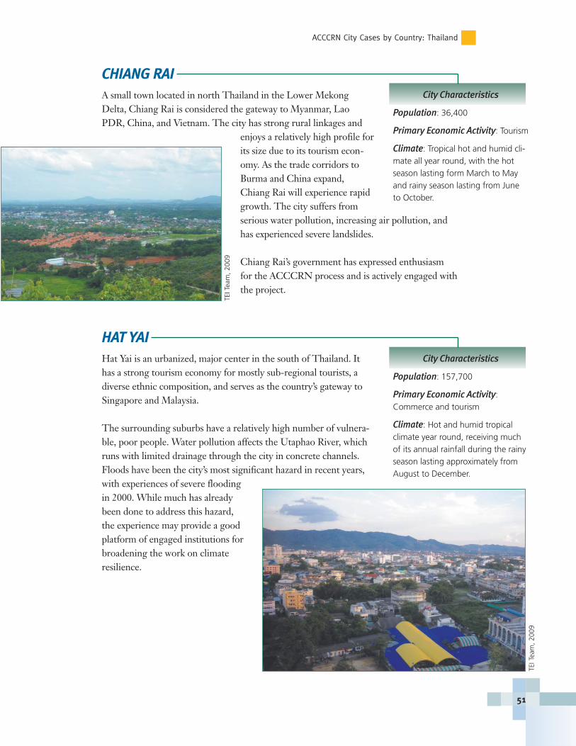
ACCCRN City Cases by Country: Thailand
CHIANG RAIA small town located in north Thailand in the Lower MekongDelta, Chiang Rai is considered the gateway to Myanmar, LaoPDR, China, and Vietnam. The city has strong rural linkages and
enjoys a relatively high profile forits size due to its tourism econ-omy. As the trade corridors toBurma and China expand,Chiang Rai will experience rapidgrowth. The city suffers fromserious water pollution, increasing air pollution, andhas experienced severe landslides.
Chiang Rai’s government has expressed enthusiasmfor the ACCCRN process and is actively engaged withthe project.
HAT YAIHat Yai is an urbanized, major center in the south of Thailand. Ithas a strong tourism economy for mostly sub-regional tourists, adiverse ethnic composition, and serves as the country’s gateway toSingapore and Malaysia.
The surrounding suburbs have a relatively high number of vulnera-ble, poor people. Water pollution affects the Utaphao River, whichruns with limited drainage through the city in concrete channels.Floods have been the city’s most significant hazard in recent years,with experiences of severe floodingin 2000. While much has alreadybeen done to address this hazard,the experience may provide a goodplatform of engaged institutions forbroadening the work on climateresilience.
City Characteristics
Population: 36,400
Primary Economic Activity: Tourism
Climate: Tropical hot and humid cli-mate all year round, with the hotseason lasting form March to Mayand rainy season lasting from Juneto October.
51
City Characteristics
Population: 157,700
Primary Economic Activity: Commerce and tourism
Climate: Hot and humid tropicalclimate year round, receiving muchof its annual rainfall during the rainyseason lasting approximately fromAugust to December.
TEIT
eam
, 200
9
TEIT
eam
, 200
9
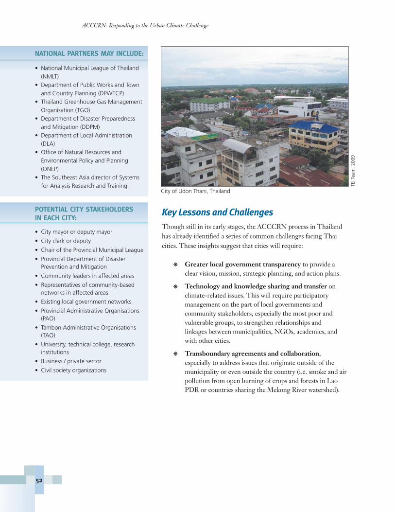
NATIONAL PARTNERS MAY INCLUDE:
• National Municipal League of Thailand(NMLT)
• Department of Public Works and Townand Country Planning (DPWTCP)
• Thailand Greenhouse Gas ManagementOrganisation (TGO)
• Department of Disaster Preparedness and Mitigation (DDPM)
• Department of Local Administration (DLA)
• Office of Natural Resources and Environmental Policy and Planning (ONEP)
• The Southeast Asia director of Systemsfor Analysis Research and Training.
POTENTIAL CITY STAKEHOLDERSIN EACH CITY:
• City mayor or deputy mayor
• City clerk or deputy
• Chair of the Provincial Municipal League
• Provincial Department of Disaster Prevention and Mitigation
• Community leaders in affected areas
• Representatives of community-based networks in affected areas
• Existing local government networks
• Provincial Administrative Organisations(PAO)
• Tambon Administrative Organisations(TAO)
• University, technical college, research institutions
• Business / private sector
• Civil society organizations
Key Lessons and ChallengesThough still in its early stages, the ACCCRN process in Thailandhas already identified a series of common challenges facing Thaicities. These insights suggest that cities will require:
� Greater local government transparency to provide aclear vision, mission, strategic planning, and action plans.
� Technology and knowledge sharing and transfer on climate-related issues. This will require participatory management on the part of local governments and community stakeholders, especially the most poor and vulnerable groups, to strengthen relationships and linkages between municipalities, NGOs, academics, andwith other cities.
� Transboundary agreements and collaboration, especially to address issues that originate outside of the municipality or even outside the country (i.e. smoke and airpollution from open burning of crops and forests in LaoPDR or countries sharing the Mekong River watershed).
ACCCRN: Responding to the Urban Climate Challenge
City of Udon Thani, Thailand
TEIT
eam
, 200
9
52
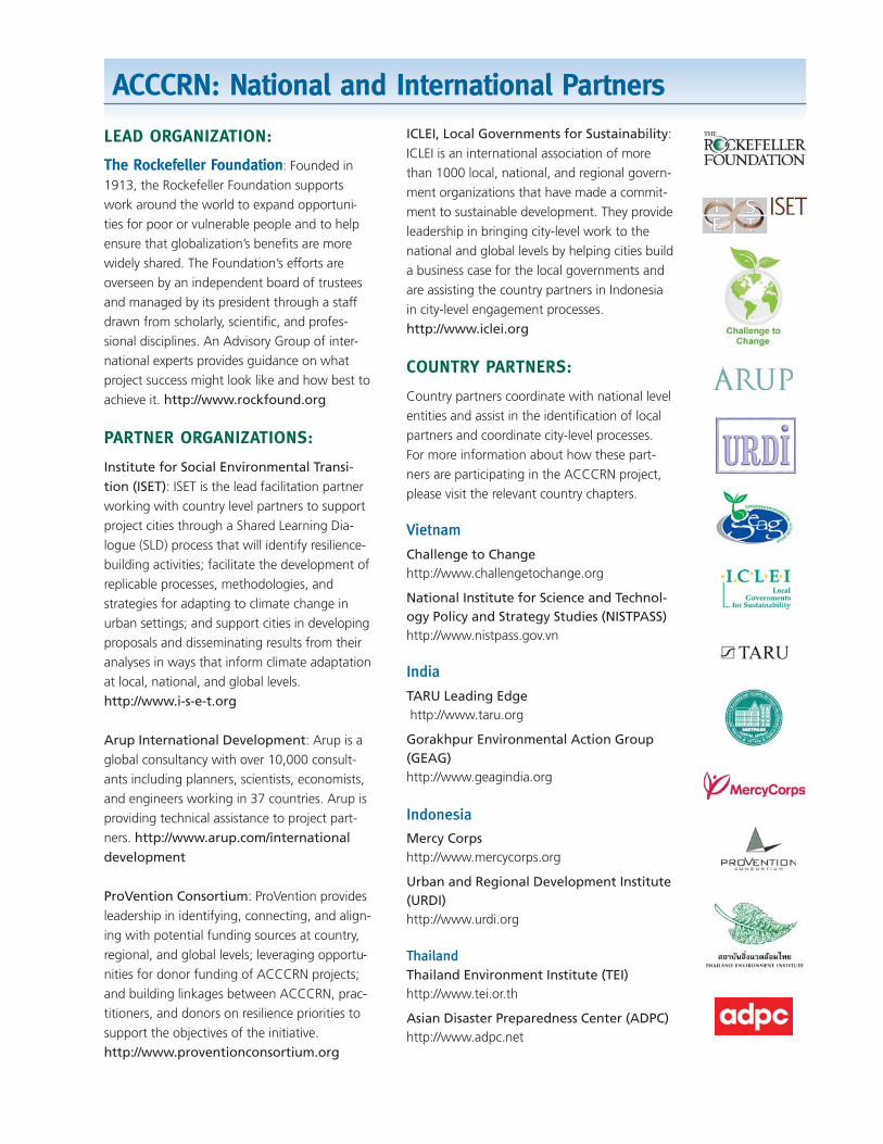
ACCCRN: National and International Partners
LEAD ORGANIZATION:
The Rockefeller Foundation: Founded in
1913, the Rockefeller Foundation supports
work around the world to expand opportuni-
ties for poor or vulnerable people and to help
ensure that globalization’s benefits are more
widely shared. The Foundation’s efforts are
overseen by an independent board of trustees
and managed by its president through a staff
drawn from scholarly, scientific, and profes-
sional disciplines. An Advisory Group of inter-
national experts provides guidance on what
project success might look like and how best to
achieve it. http://www.rockfound.org
PARTNER ORGANIZATIONS:
Institute for Social Environmental Transi-tion (ISET): ISET is the lead facilitation partner
working with country level partners to support
project cities through a Shared Learning Dia-
logue (SLD) process that will identify resilience-
building activities; facilitate the development of
replicable processes, methodologies, and
strategies for adapting to climate change in
urban settings; and support cities in developing
proposals and disseminating results from their
analyses in ways that inform climate adaptation
at local, national, and global levels.
http://www.i-s-e-t.org
Arup International Development: Arup is a
global consultancy with over 10,000 consult-
ants including planners, scientists, economists,
and engineers working in 37 countries. Arup is
providing technical assistance to project part-
ners. http://www.arup.com/internationaldevelopment
ProVention Consortium: ProVention provides
leadership in identifying, connecting, and align-
ing with potential funding sources at country,
regional, and global levels; leveraging opportu-
nities for donor funding of ACCCRN projects;
and building linkages between ACCCRN, prac-
titioners, and donors on resilience priorities to
support the objectives of the initiative.
http://www.proventionconsortium.org
ICLEI, Local Governments for Sustainability:
ICLEI is an international association of more
than 1000 local, national, and regional govern-
ment organizations that have made a commit-
ment to sustainable development. They provide
leadership in bringing city-level work to the
national and global levels by helping cities build
a business case for the local governments and
are assisting the country partners in Indonesia
in city-level engagement processes.
http://www.iclei.org
COUNTRY PARTNERS:
Country partners coordinate with national level
entities and assist in the identification of local
partners and coordinate city-level processes.
For more information about how these part-
ners are participating in the ACCCRN project,
please visit the relevant country chapters.
Vietnam
Challenge to Change http://www.challengetochange.org
National Institute for Science and Technol-ogy Policy and Strategy Studies (NISTPASS)http://www.nistpass.gov.vn
India
TARU Leading Edgehttp://www.taru.org
Gorakhpur Environmental Action Group(GEAG)http://www.geagindia.org
Indonesia
Mercy Corpshttp://www.mercycorps.org
Urban and Regional Development Institute(URDI)http://www.urdi.org
ThailandThailand Environment Institute (TEI)http://www.tei.or.th
Asian Disaster Preparedness Center (ADPC)http://www.adpc.net
INSTITUTE FOR SOCIAL AND ENVIRONMENTAL TRANSITION
948 NORTH ST. SUITE 9
BOULDER, CO 80304 USA
720 564 0650
recycled content fsc bug