key infrastructure map a information map
TRANSCRIPT
!
!
!
!
!
!
!
!
!
!
!
!
!
!
!
!
!
!
!
!
!
!
!
!
!
!
!
!!
!!
!!
!
!
!
!
!
!
!
!
!
!!
!!
!!
!!
!!
!!
!
!
!
!
!
!
!
!
!
!
!
!
!
!
!
!
!
!
!!
!!
!!
!!
!!
!
!
!
!
!
!
!
!
!
!
!
!
!!
!!
!!
!!
!
!
!
!
!
!
!
!
!
!
!
!
!
!
!
!
!
!
!
!
!
!
!
!
!
!
!
!
!
!
!
!
!
!
!
!
!
!
!
!
!
!
!
!
!
!
!
!
!
!
!
!
!
!
!
!
!
!
!
!
!
!
!
!
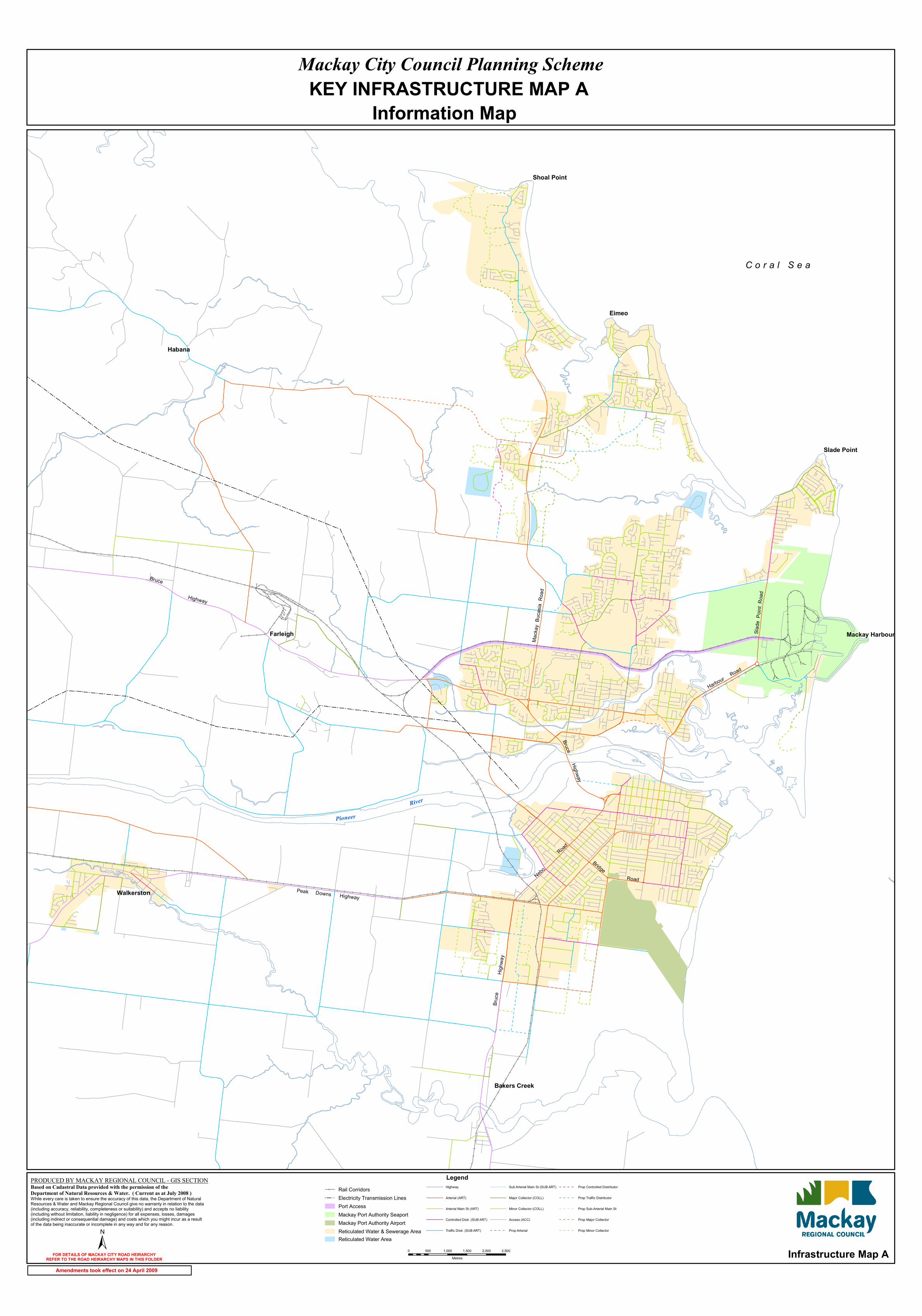
Eimeo
Habana
Farleigh
Walkerston
Slade Point
Shoal Point
Bakers Creek
Mackay Harbour
±
Rail Corridors! ! Electricity Transmission Lines
Port AccessMackay Port Authority SeaportMackay Port Authority AirportReticulated Water & Sewerage AreaReticulated Water Area
Mackay City Council Planning SchemeKEY INFRASTRUCTURE MAP A
Information Map
C o r a l S e a
Bruce
Highway
Peak Downs Highway
Bruc
eHig
hway
Nebo
Road
Harbour Road
Mack
ay B
ucas
ia R
oad
Slade
Poin
t Roa
d
Road
Bridge
BruceHighway
Legend
0 500 1,000 1,500 2,000 2,500Metres
PioneerRiver
Infrastructure Map A
Highway
Arterial (ART)
Arterial Main St (ART)
Controlled Distr. (SUB ART)
Traffic Distr. (SUB ART)
Sub Arterial Main St (SUB ART)
Major Collector (COLL)
Minor Collector (COLL)
Access (ACC)
Prop Arterial
Prop Controlled Distributor
Prop Traffic Distributor
Prop Sub-Arterial Main St
Prop Major Collector
Prop Minor Collector
PRODUCED BY MACKAY REGIONAL COUNCIL - GIS SECTION Based on Cadastral Data provided with the permission of the Department of Natural Resources & Water. ( Current as at July 2008 ) While every care is taken to ensure the accuracy of this data, the Department of Natural Resources & Water and Mackay Regional Council give no warranty in relation to the data (including accuracy, reliability, completeness or suitability) and accepts no liability (including without limitation, liability in negligence) for all expenses, losses, damages (including indirect or consequential damage) and costs which you might incur as a result of the data being inaccurate or incomplete in any way and for any reason.
FOR DETAILS OF MACKAY CITY ROAD HEIRARCHYREFER TO THE ROAD HEIRARCHY MAPS IN THIS FOLDER
Amendments took effect on 24 April 2009