kingscliff locality plan 108 version 2
TRANSCRIPT

Kingscliff Locality Plan 108Version 2.1
Kingscliff Locality Plan 109Version 2.1
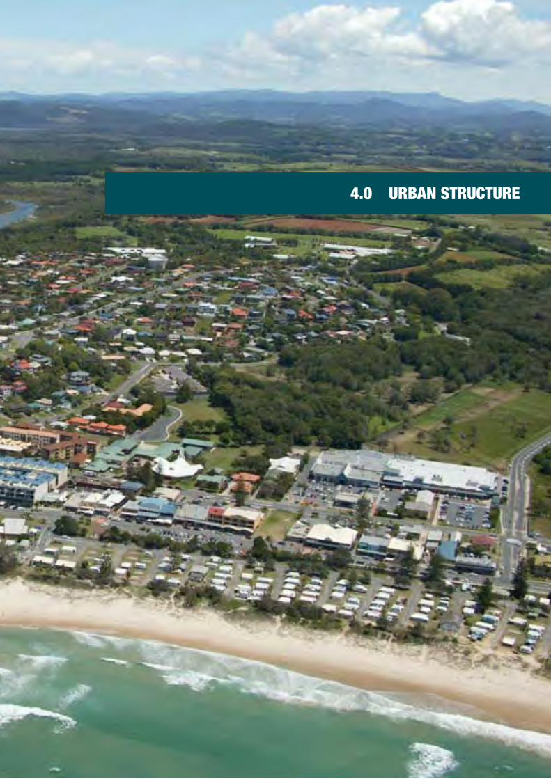
4.0 URBAN STRUCTURE

Kingscliff Locality Plan 110Version 2.1
4.1 Regional contextThe Tweed Coast extends from the NSW-Queensland State Border approximately 35 km south to Wooyung and comprises of a unique stretch of the NSW coast. The area exhibits significant environmental qualities that include highly valued beaches and coastal reserves, expansive wetlands, rivers and estuaries, native bushland and prime agricultural land. The natural areas provide important habitat for an array of flora and fauna. The range of available habitats and the subtropical climate make the Tweed Coast one of the most bio-diverse regions in Australia.
The coastal settlements of the Tweed Coast possess an over arching theme of confined urban footprints surrounded by areas of natural environment. The relationship between built form and the natural environment is one of the key reasons of why Tweed Coast continues to be a popular tourist destination, provides a particular point of difference to the adjoining Gold Coast and is one of the fastest growing regions of NSW.
The relationships and hierarchy between existing coastal settlements are diagrammed overleaf in Figure 4.1. Regionally, Kingscliff sits below the more highly urbanised centres of the Gold Coast, Coolangatta / Tweed Heads and Murwillumbah which provide a more diverse range of higher order services, retail, commercial and employment opportunities. Byron Bay to the south has traditionally fulfilled more of a tourism, entertainment and recreation relationship with the Tweed rather than the provision of higher order regional services. This includes the various musical festivals held within Byron Bay Shire which attract substantial numbers of tourists to the region each year and thereby has flow on tourism benefits for the Tweed.
Within the Tweed Coast context Kingscliff is the recognised sub-regional centre servicing the network of coastal villages including Fingal Head, Chinderah and Cudgen as well as villages further south including Casuarina, Cabarita, Hastings Point and Pottsville. Whilst Kingscliff has a resident population of approximately 9,000 people, it has the potential to be a sub-regional centre to approximately 30,000 people which includes the development and future resident population of Kings Forest. As such Kingscliff has the potentially to be equivalent to or even surpass Murwillumbah in terms of its footprint size, projected population catchment and provision of higher order services.
This stronger subregional role is foreshadowed within the North Coast Regional Plan 2036 where Kingscliff forms part of the Tweed Regional City catchment further underpinned by the development of the Tweed Valley Hospital and planning framework to establish a Business and Innovation Precinct. The development of the new Tweed Valley Hospital will not only be a regional referral hospital meeting the health care needs of the region but will be a key economic driver for a numerous businesses and associated industries to be established within the locality.
The masterplanned community of Kingsforest will also be a substantial influence on kingscliff. The development site has a net developable area of 437ha and the potential to accommodate 11,000 people across residential fourteen precincts which will have a mix of housing types including low rise medium density housing types and traditional detached dwellings comprising 4,500 dwellings. This new settlement will also have a mixed use town Centre and two neighbourhood centres and employment lands. Whilst these new activity centres will cater to the needs of the resident population may also serve the needs and provide employment opportunities for the catchment.
As part of the Tweed Regional City catchment, Kingscliff has the potential for extensive urban and employment generating development which would further assert the locality as a strategically important town within Tweeds hierarchy of settlements.
A clear vision of how Kingscliff's combined precincts develop is necessary to ensure that the development outcomes are in step with its hierarchical settlement role as a growing coastal town. The future strategic planning direction must achieve the appropriate balance between facilitating development, economic development and employment opportunity to meet the needs of the growing locality and subregion while protecting and strengthening the highly valued environment and working agricultural hinterland.

Kingscliff Locality Plan 111Version 2.1
Byron Bay – Town
32,790 people (Shire)5,905 people (town)Tourism - 3.85 million domesticServiceCultureEntertainmentHealth (small hospital)Education (Pr, HS, TAFE)
Tweed Coast Villages
13,131 people• Pottsville (6704 people)• Hastings Point (582 people)• Cabarita (3167 people)• Casuarina (2678 people)
Separate local retail centresLocal HealthEducation (Pr)
Kingscliff – Coastal town
9,611 people (census district)ServiceTourismHospital & HealthEducation (Pr, HS, TAFE)
Fingal Head – Coastal Hamlet
Chinderah – River Village
Kingsforest
11 000 est.Separate local retail centresLocal HealthEducation (Pr)
Tweed Heads – Regional city
8,349 people (Tweed Heads)5984 (Coolangatta)10-12000 (est.Cobaki) Tourism - 1.6 million domesticHigher order services
Gold Coast – Large city
576,918 people (LGA)Toursim - 4.2 million domesticHigher order servicesMajor retail centresInternational airportRegional tertiary education
Figure 4.1 Diagrammatic relationship of regional settlements and centres – Whilst the smaller coastal villages to the south use Kingscliff as a subregional centre, the larger regional service centres of Tweed and Gold Coast including Robina Town Centre cater for higher order retail, commercial, health and recreational shopping demand for the broader region. Population numbers based on census 2016.
Gold Coast
1 hr 15 min
Mullumbimby
Ocean Shores
Brunswick Heads
47 min
43 min34 min
34 min 8000 trips to work
NSW into QLD
5000 trips to work
QLD into NSW
56 min
31 min
30 min
30 min
Byron Bay
Murwillumbah
Coolangatta / Tweed Heads
Kingscliff
Murwillumbah – Inland town
9,245 people (2016 census)Retail centreIndustrial estateArts and CultureHospital & HealthEducation (Pr, HS, TAFE)

Kingscliff Locality Plan 112Version 2.1
4.2 Urban structure and land use contextUrban Structure is the way in which land uses, streets, buildings, open spaces, public domain areas and natural landscapes all come together to determine the functionality, sense of place and character of a locality. It underpins the integration of existing patterns of development, movement, developable footprints and conservation footprints overlaid against the biogeographic features of an area. In doing so understanding existing urban structure sets the framework to establish, build upon and overlay future strategies and objectives.
4.2.1 Urban growth
The growth of the Kingscliff settlement and the resultant urban structure is largely a response to the local topographic condition with the street pattern largely evolving from a series of the ancient trails. These trails often tracked the top of ridgelines as this provided the easiest grades and provided the best observation points across the landscape. The main ridgeline trails then had a series of secondary trails running perpendicular or zigzag down the side of the ridgelines to the Kingscliff flats to the north, the river mouth and beach to the east and Cudgen Creek to the south. Many of these trail alignments became roads which have since shaped much of the pattern of development within Kingscliff (Figure 4.2).
As described in more detail in Section 3.1 Historical Context Cudgen was one of the earliest settlements within this part of the Tweed and was a centre for local farming activity. Kingscliff was initially a popular day tripping destination however campsites were soon supplemented by trading posts and small workers and fishing cottages. Early land releases and subdivision saw development initially across Kingscliff Hill and along the Marine Parade coastal strip which was followed by the development of precincts further west as land was progressively drained, filled, subdivided and developed.
The establishment of the sand mining industry within the locality accelerated development with the rapid provision of essential electrical, water infrastructure as well as the construction of the first bridge across Cudgen Creek. These infrastructure improvements enabled the growth of Kingscliff north of Cudgen Creek and post sand mining, opened up development footprint for settlements south of Cudgen Creek.
The most recent ‘wave’ of development growth has predominately focused on the Salt and more recently Seaside City developments, at the southern end of Kingscliff. With development commencing in 2004, the Salt Precinct has a strong tourism focus, particularly the Salt development, which includes a number of dedicated tourist facilities such as Peppers and Mantra Resorts. Whilst the precinct of Seaside is newer land release areas, the original subdivision plans dating back to the 1920s. With construction still underway the precinct will include a mix of coastal housing typologies centred around a small local centre.
For more than a decade Kingscliff’s geographic position and availability of land suitable for development has seen it grow as the focal point to the Tweed Coast, and its population and provision of services has now elevated its status from a coastal village to coastal town. The Coastal Design Guidelines for NSW identifies population thresholds to describe settlement size. Within those guidelines a coastal village typically has less than 3000 residents, a coastal town has between 3000 – 20,000 residents and a coastal city has over 20,000.
Kingscliff’s role as a coastal town has more recently been emphasised by residential land releases on its southern periphery including Casuarina and Miramar, future release area of Kingsforest and development of the Tweed Valley Hospital. Whilst each of these new settlements have access to local centres to serve their immediate resident populations, Kingscliff township will continue to be elevated as a destination for higher order services, recreation retail, food and beverage offer and access to the beach and creek.
In consideration of Kingscliff's latent greenfield development sites which have the potential to further increase employment, education, service and cultural functions, its subregional role will continue to expand. Future greenfield development sites need to be balanced within a strategic planning framework to ensure that the urban growth is in step with sub-regional needs, community expectation, appropriate infrastructure provision and protection of the natural environmental and agricultural areas. Maintaining the character and identity of Kingscliff, which is a locality in transition, will be an ongoing imperative consideration.

Kingscliff Locality Plan 113Version 2.1
0
0
10
0
0
20
100
10
00
10
0
0
10
0
0
0
0
0
10
10
10
10
0
0
0
10
0
10 10
10
0
0
10
10
100
10
0
30
20
0
0
0
0
10
0
0
10
10
10
0
10
0
0
30
40
0
100
10
10
0
20
0
30
10
10
0
0
10
20
40
0
0
10
30
0
10
0
10
10
0
0
0
10
0
0
20
20
10
20
0
10
10
0
10
20
10
10
30
10
10
10
10
10
10
10
20
20
10
10
0
40
10
10
30
10
10
30
20
10
0
0
0
10
0
40
20
10
30
0
0
0
0
0
0
0
0
0
0
0
0 0
0
0
0
0
0
0
0
0
0
0
0
0
0
0
0
0
0
0
0
00
0
0
0
0
0
0
0
0
0
0
10
0
0
10
0
10
10
0
0
30
0
0
0
0
0
0
20
0
0
0
0
0
0
0
20
0
0
0
0
0
0
10
0
0
0
0
0
0
0
0
0
0
0
30
10
0
0
10
20
10
0
0
0
0
10
0
10
0
10
0
10
0
0
30
10
10
0
10
0
10
30
0
0
20
30
0
0
0
0
40
0
0
10
10
10
0
0
0
0
10
30
10
0
30
10
0
40
0
0
30
10
0
10
10 20
0
20
30
0
0
20
0
1020
20
30
10
10
20
PACIFIC HIGHWAY
TERRACE STRE ET
LORI
EN
WAY
MARINE
PARADE
CUDGEN ROAD
WAUGH STREET
ELRO
ND
D
RIVE
OZONE STREET
WINDSONG WAY
BEACH STREET
OCEAN STREET
SHELL STREET
M OSSST
REET
PHIL
LIP
STRE
ET
SEAV
IEW
STR
EET
QUIGAN STREE T
GIBSON
STREET
MONAR CH DRIVE
SURF STREET
M CPHAILAVENUE
KINGSCLIFF
STREET
TWEED
COAST
ROAD
KING
SCLIF FLAN
E
BARR EL STREET
WOMMIN BAY ROAD
MURPHYS
ROAD
YALE
STRE
ET
DEPOT ROAD
WA
LSH
ST
REET
ORI
ENT
STRE
ET
OCEAN DRI V E
YAO
STR
EET
NARU S TR
EET
SUTH
E RLAND
STREET
SAIL
FISH
W
AY
BANZAI STREET
INDIGO LANE
VIK ING STRE ET
BOSU
N
BOULEVARD
MORTON STREET
SALTWA TE
RCR
ESCE
NT
PLANTATION ROAD
SEA
SID
E D
RIV
E
REA
RDO
NS
ROAD
ALTONA ROADTURNOCK
STREET
CASU
ARI
NA
WAY
SAN
D
STRE
ET
CYLI
NDER
S D
RIVE
CRESCEN
T ST
REET
CHINDERAHRO
AD
CHINDERAHBAY
DRIVE
VULCAN STREET
SHE-
OAK
LAN
E
AV OCA STREET
PEARL STREET
OX
FORDSTREET
NAU
TILU
S W
AY
PACIFIC HIGHWAY
BELLS
BOULEVARD
Surface Map- E levat ion
0 0.50.25 Kilometres
1:25,000 º
LegendLand to which this Plan applies
Hydrology
CONTOURS5 metre contour
10 metre contour
SLOPEElevation
> 90
80 - 90
70 - 80
60 - 70
50 - 60
40 - 50
30 - 40
20 - 30
10 - 20
< 10
'Contour data is supplied by Fugro Spatial Solutions Pty Ltd''2012 Aerial Photography supplied by AAM'
Figure 4.2 The underlying physical structure of Kingscliff evolved from ancient bush tracks and the first roads and pathways which followed key topographic features enabling ease of passage between Kingscliff, Cudgen and Chinderah.
1944
Roads
Track
2012

Kingscliff Locality Plan 114Version 2.1
4.2.2 Locality structure characteristics
The growth of Kingscliff has established a number of clear physical and urban structure characteristics as illustrated in Figure 4.3 and include the following:
• The settlement is predominately bound by the natural environment and open spaces, namely the Pacific Ocean to the east, environmental protection to the north, and agricultural land to the west.
• The non-urban approaches to Cudgen and Kingscliff adding to the locality’s overall character and sense of contained urban areas surrounded by agricultural and environmental lands.
• A distinctive ridgeline running from the Cudgen Plateau to the edge of the Kingscliff town centre with floodplains to the west of Tweed Coast Road and north of the Cudgen Plateau.
• Cudgen, the locality’s oldest settlement within the locality located on Cudgen plateau on corner of Tweed Coast Road and Cudgen Road surrounded by state significant farmland.
• The existing Kingscliff town centre located at the centre of the settlement on the confluence of Cudgen Creek and the Ocean Beach.
• Undeveloped Sutherland Point (Cudgen Headland) to the south of the Cudgen Creek.
• A street and development pattern and hierarchy which was largely derived from topographic conditions and historic tracks and trails.
• The majority of movement is along a north-south alignment, whether that be Tweed Coast Road along the western settlement edge, or Marine Parade, Kingscliff, Pearl and Casuarina Way along the eastern edge.
• The pattern of residential development within Kingscliff represents different stages of the growth of the locality which present as distinct character precincts. These include the town centre, the Beach front, North Kingscliff, West Kingscliff, Kingscliff Hill the new coastal areas of Salt and Seaside City and Cudgen.
• A frontal ocean beach dune system which has a cycleway connecting surrounding northern and southern settlements with Kingscliff, the ocean beaches and Cudgen Creek.

Kingscliff Locality Plan 115Version 2.1
Figure 4.3 Kingscliff locality urban footprint

Kingscliff Locality Plan 116Version 2.1
4.2.3 Kingscliff and Cudgen land use and settlement precincts
The KLP footprint is generally grouped into identifiable precincts based on land use and development release as illustrated in Figure 4.3. These different land use and settlement character precincts have been illustrated in Figure 4.4 and are discussed briefly below and in detail within Part B.
The Town Centre Precinct – Centred around Marine Parade, Seaview, Pearl and Turnock Streets, the existing town centre contains a range of retail, commercial, entertainment and leisure, food and beverage and accommodation uses. The town centre comprises predominantly single and two storey buildings with newer three storey shop top development including the Paradiso, Azura and the Kingscliff Central commercial building. The town centre currently has a mix of built form and architectural styles reflecting the development of town centre buildings over many decades; the eclectic built form and architectural styles underpins town centre built form character.
With the exception of the recently completed Rowan Robinson Park, there is currently no recognisable civic or public domain area within the town centre. Much of the community life including markets, sporting activities and other events currently play out within the coastal reserves. Throughout the town centre there is currently little pedestrian amenity by way of widened footpaths, through block connections street trees and street furniture. There is a sense that vehicles have clear priority over pedestrians. There is opportunity to continue public domain improvements from Rowan Robinson Park across the town centre precinct.
Coastal Foreshore Precinct – The Coastal foreshore precinct includes the long linear strip of coastal foreshore land extending from Cudgen Creek north to the locality’s northern boundary as well as the land on either side of Cudgen Creek taking in Cudgen Headland and Lot 1 & 2 DP1117599. This coastal and estuarine precinct represents perhaps the most highly valued areas by community in terms of environmental protection, recreation, lifestyle and locality character. This precinct includes the North Kingscliff and Kingscliff Beach Holiday Parks, the Cudgen Headland Surf Life Saving Club, Faulks Park, the Boat Ramp, Rotary Park. This precinct has been the subject of a number of staged public domain and parkland improvement projects over recent years in accordance with the adopted Kingscliff Foreshore Masterplan including Faulks Park and the now completed Kingscliff Revitalisation Project which included the creation of the Rowan Robinson Park over part of the reduced Kingscliff Beach Holiday Park site.
Community consultation undertaken as part of the locality plan process revealed a split opinion regarding the long term continuation of the Kingscliff Beach Holiday Park in its present location. Out of the 297 community vision surveys received, 52 comments were made that Kingscliff Beach Holiday Park should be relocated from the current site and the land used as open coastal parkland. Relocation sites suggestions include an expanded Kingscliff North Holiday Park, and a new site over the coastal foreshore south of Cudgen Creek as identified within the Tweed Coast Regional Crown Reserve Plan of Management. 10 responses within the survey supported the Kingscliff Beach Holiday Park citing affordable holiday family accommodation and economic flow on benefits to the local town centre businesses as the key reasons for its retention.
The precinct provides two distinctly differing town experiences. Marine Parade is a typical linear ‘High Street’ (albeit single sided) with fine grain of retail frontages along the street edge which look across at the coastal foreshore and Pacific Ocean beyond. This retail strip is particularly bustling on the weekend when the outdoor dining areas come to life. Contrasting in experiential qualities, the Kingscliff Shopping Village is an internalised shopping mall anchored by the Woolworths supermarket and a large at grade car parking area which adjoin its Turnock Street and Pearl Street frontages. This serves more of the retail pragmatic needs rather than serve as a place where users wish to linger and recreate.
The current planning framework foreshadows a westerly extension of the town centre along Turnock Street. The presence of significant greenfield land immediately adjoining an existing centre presents a genuinely unique opportunity to meet the needs of a growing resident population. This retail and commercial land use growth needs be undertaken concurrently with public domain and landscape improvements with a focus on improving connectivity and pedestrian amenity. The existing levels of the greenfield sites in this location present good opportunity to integrate car parking across these sites without compromising public domain and pedestrian amenity.

Kingscliff Locality Plan 117Version 2.1
Figure 4.4 Kingscliff and Cudgen Precincts

Kingscliff Locality Plan 118Version 2.1
Beach front Precinct – The Beach front precinct extends north from the Town Centre along Marine Parade and the parallel Pearl and Kingscliff Streets. As one of the first parts of Kingscliff to be developed, over time the small beach cottages have been redeveloped as larger residential flat buildings reflective of the medium density zoning. The redevelopment of this precinct has largely occurred within the past 25 years, and as such there is a mix of different architectural styles and building forms; many of which are not reflective of the coastal subtropical climatic context. Along the eastern edge of the precinct is the linear coastal foreshore reserve which provides a well used community and recreation space providing walking and cycle access to the town centre.
North Kingscliff Precinct – North Kingscliff precinct has a low density residential character. Housing within the precinct was primarily developed through the 1980s. More recently many of the homes have been substantially renovated and expanded with contemporary features and inclusion of secondary dwellings. The relatively large suburban blocks which has good proximity to the beach and coastal foreshore reserve make this a popular precinct for residing families.
There is a large undeveloped parcel of land zoned R1 General Residential under the TLEP 2014 located to the south of Ozone Street. This key site has the capacity within the existing planning framework to develop a diversity and range of residential accommodation types and provide a built form transition along the interface of medium and low density residential. The development of this key site will provide critical north-south and east-west connections, linking the North Kingscliff and Elrond Drive Residential Precincts.
Another significant land use within the precinct is the North Kingscliff Sports fields which host a range of 'active open space' pursuits including cricket, soccer and athletics. A sports fields masterplan has been developed which focuses on progressively updating sporting facilities and amenities to meet growing needs.
West Kingscliff Residential Precinct – Located to the west of the Kingscliff township, the Elrond Drive residential precinct was developed in the late 1990s with fill from the Noble Lake site used to elevate the precinct above flood levels. Development within the precinct is predominantly single and two storey detached dwellings on 600 – 700 sqm allotments. A number of dual occupancies, low rise medium density and multi-unit aged care housing has also been developed within the precinct.
Directly adjoining the Elrond Drive residential precinct is the approximately 22 ha over 55s Noble Lakeside Park. This manufactured home estate contains 254 lots configured around a large artificial lake and provides an affordable form of seniors housing. The site is accessed via Monarch Drive, however the site also has a 370 m frontage to Tweed Coast Road.
Further along Elrond Drive is a site developed as a storage shed facility. Given the flat nature of the land and adjoining land uses, this site present opportunity to transition to a future residential land use.
Kingscliff Hill – Kingscliff Hill was part of the first residential release areas of Kingscliff with the first subdivision dating back to 1912. This was largely due to its proximity to Cudgen, favourable elevated aspect and panoramic views. Many of the residential allotments on Kingscliff Hill take advantage of these expansive views across the township of Kingscliff, Cudgen Creek, the Pacific Ocean and north to Cook Island. The retention of views and level of ‘view sharing’ has regularly been debated within the precinct and continued design guidance will be required as smaller, older stock dwellings are replaced with larger contemporary development.
Whilst predominantly having a low density character there is are substantial areas of Kingscliff Hill which are zoned R3 Medium Density with a 9.0m height limit within proximity of Seaview Street down to Moss Street fronting Cudgen Creek. As such there are a number of low rise medium density housing types also located within this precinct.
Other significant landuses within the precinct include the Tweed Valley Hospital site, Kingscliff TAFE, Kingscliff Public School, Kingscliff Pool, Kingscliff library and community health services. Combined these land uses make Kingscliff Hill one of the most diverse within the locality..

Kingscliff Locality Plan 119Version 2.1
Town Centre Precinct offers two divergent retail experiences. This includes the open and active pedestrian friendly scale of Marine Parade with street side dining areas contrasting with the enclosed shopping centre of Kingscliff Village serving more of a pragmatic retail shopping need. There is opportunity for new development, new public domain areas and landscaping throughout the town centre to strengthen the coastal character and improve the pedestrian amenity.
Coastal Foreshore Precinct includes the coastal foreshore areas and land both sides of Cudgen Creek are the areas most highly valued by the community and underpins Kingscliff’s character. The careful future management including coastal foreshore hazards and ongoing protection of key environmental areas are a high priority.
Beachfront Precinct includes a concentration of large three storey medium density residential flat buildings.
Kingscliff North Precinct includes predominantly low density residential dwellings, with larger residential homes replacing the small beach side shack which previously characterised the precinct.

Kingscliff Locality Plan 120Version 2.1
Tweed Valley Hospital – The Kingscliff Hill Precinct also includes the site selected by NSW Health Infrastructure for the new Tweed Valley Hospital which was confirmed in June 2018 following a two staged site selection process. Despite the State Significant Farmland status, the site was ultimately selected having regard to its elevation above the Probable Maximum Flood (PMF), proximity to the road network including the M1 highway, central location in the context of the region and favourable site amenity including site orientation and opportunity for views. The new Tweed Valley Hospital will be a referral hospital serving the surrounding region. As of July 2019 the site has been acquired and State Significant Development (SSD) approval granted for site early works (Stage 01) with Stage 02 SSD application for building works lodged. As a key economic driver the hospital will present significant employment opportunities not only for health care professions but the myriad of ancillary and support businesses associated with its construction and ongoing operation. This includes new opportunities across health care, medical research, education, tourism and agricultural industries.
Kingscliff High School and TAFE – NSW North Coast TAFE Kingscliff Campus and Kingscliff High School are located off the southern side of Cudgen Road and gains access off Cudgen Road with the high school gaining access off Oxford Street. The 16.697 ha TAFE presents as a series buildings in a ‘campus configuration’ across the downward sloping site. The adjoining 8.515 ha Kingscliff High School site presents as a series of connected linear building forms with a series of small courtyards between them which gives way to open grassed playground, hard courts and a sports field adjoining the creek. The school site is edged by a significant tract of native bushland along its eastern and southern boundaries.
Both the high school and TAFE occupy large sites and are considered to hold the opportunity to expand through additional buildings. Despite a recent drop in enrolment numbers, Kingscliff TAFE maintains an enrolment of approximately 7600 students. This is however likely to substantially increase in future years in light of the development of the Tweed Valley Road on the opposite side of Cudgen Road. It is likely that Kingscliff TAFE will broaden available courses related to health care services.
Kingscliff High School, which is the only public high school along the Tweed Coast, currently has 1143 students has a present capacity for 1281 students. Given expected population growth rates sub-regionally combined with current State Government strategy to consolidate existing facilities rather than construct new facilities, it is likely the Kingscliff High School campus will need to expand.
Pool, library and community health precinct – This collection of community based buildings are accessed off Turnock Street and Cudgen Road. Each of these facilities are highly valued and well used by the community although the library is under sized in relation to the catchment population. Similarly the Kingscliff Pool is well used by the community, by it is an aging facility with limited opportunity to expand on account of the sloping land which surrounds the site. There will be a need to appraise these facilities within the future to determine the ongoing operational needs.
Cudgen village – Located to the west of Tweed Coast Road, Cudgen Village is the oldest settlement within the locality, traditionally serving the agricultural pursuits of the Cudgen Plateau. Unfortunately, there is very little built form retained reflecting its historic context. The existing urban structure of Cudgen Village today is curvilinear in form, with several cul-de-sacs accessed off the looping John Rob Way. Crescent Street provides through access linking Cudgen Road with Tweed Coast Road to the north. The Cudgen Public school on the western side of Collier Street forms the western edge to the village which interfaces with state significant agricultural lands of the Cudgen plateau.
Land use within the village is predominantly low density residential with predominantly detached dwellings, some dual occupancies and a low rise multi-unit development which located on the intersection of Tweed Coast Road and Cudgen Road. A new residential subdivision off Collier Street will accommodate an additional 40 allotments. More significantly, there is a parcel of undeveloped land to the immediate north of the existing Cudgen urban footprint previously approved for 96 allotments. Combined, these development parcels represent a significant increase to Cudgen's settlement size. This is an important consideration which will prompt a strategy to address potential future traffic management issues within Cudgen Village and more the relationship of these local roads with the locality wide network.

Kingscliff Locality Plan 121Version 2.1
Elrond Drive within the West Kingscliff Precinct consists of predominantly low density single storey brick and tile dwellings.
Noble Lakeside Park within the West Kingscliff Precinct is an over 55s manufactured home park centred around an artificial lake.
Kingscliff Hill Precinct includes predominantly low density brick and tile residential dwellings to medium density residential flat buildings closer to the town centre. The elevated topography affords some of the best views within the locality.
Cudgen Village Precinct is a contained low scale residential settlement surrounded by agricultural land uses. Being elevated there are a number of long views experienced around the village. In terms of built form, dwellings within Cudgen includes a mix of brick and tile as well as lightweight low density residential dwellings with some dual occupancy developments and a single multi-unit development.

Kingscliff Locality Plan 122Version 2.1
Despite Cudgen being the historic trading centre for the locality, there is currently no retail or commercial uses within the settlement. Given the proximity to existing agricultural land uses and market gardens, a fresh produce retail opportunity exists within Cudgen which could fulfil day-to-day convenience needs of the local population and day-tripping tourists alike. A future development over Lot 101 DP 1056576 could potentially meet this need. While the site is zoned R2 Low Density Residential, required agricultural buffers may make residential development on this site preclusive. As such a more compatible land use may be retail, produce market, food and beverage related land use(s).
Salt Village – Located across Cudgen creek is the Salt precinct which combines tourist, retail, open space and residential land uses. Developed in the early 2000's the masterplanned community has the Salt Central Park at its core which is activated by a retail strip including food and beverage offer, and the Salt Pub. The retail strip is anchored by two large tourist developments (Peppers and Mantra). As a masterplanned community, the design criteria which includes use of light weight cladding materials and predominantly white and lighter toned finishes are articulated across the constructed built forms.
Surroundings the village centre residential development is predominantly large single and two storey detached dwellings which have a high median house price relative to the remainder of Kingscliff and the Tweed. This is largely due to the precincts proximity to the beach and village centre and the high quality architecturally designed houses which have been built within the area.
Recent trends in holiday accommodation being arranged by online internet booking systems have given rise to more informal holiday accommodation within low density zones along the entire Tweed Coast but particularly within the Salt precinct. Whilst meeting the needs to short term holiday accommodation and providing an alternative income stream for land owners there have been instances where it has given rise to complaints from neighbours. NSW Council's are currently awaiting a legislative framework in association with short term holiday rentals.
Seaside City – One of the most recent land releases areas along the Tweed Coast, Seaside is also one of the oldest. The original subdivision design of the 32 hectare site was undertaken in the 1920s. As identified with Section B11 – Seaside City of the Tweed Development Control Plan 2008, the vision for Seaside City is to create a community that has a clear individual identity of its own while contributing and connecting to the Tweed Coast as a whole. Seaside City provides a range of housing types and density options, centred on a mixed-use activity centre at the eastern end of Ocean Avenue. The subdivision design also possesses an integrated network of open spaces and pathways orientated back towards the centre and coastal reserve where cycle and pedestrian access can be gained north to Kingscliff or south to Casuarina and Cabarita.
Chinderah industrial area – Located to the north of the settlement and directly adjoining the Chinderah Service Centre is the Chinderah Industrial precinct which gains access off Tweed Coast Road via Ozone Street. This industrial area has an overall site area of approximately 8.6 ha and currently accommodates a range of light industrial uses including but not limited to building and landscape supplies, automotive and mechanical repairs workshops, recycling depot, concrete batching, kitchen and joinery workshops and showrooms and adult services.
There is the opportunity to improve the overall access and connectivity of this industrial area by extending Ozone street east towards Kingscliff Street. The estate is considered as part of the overall masterplanning strategy for the large tract of land to the immediate south of this industrial area (Business and Innovation Precinct), which has the potential to accommodate a range of employment generating and residential land uses. Given the industrial estates strategic location but limitations for further light industrial expansion, there is opportunity over time to transition more towards a business park and or mixed use precinct which could facilitate a wider range of landuses including food hub production in association with the agricultural industry, creative industries hub, food and beverage offer and entertainment uses Precedents include 'Habitat' in Byron Bay and Miami marketta.

Kingscliff Locality Plan 123Version 2.1
Kingscliff TAFE and Kingscliff High School are arranged as a campus configuration being a series buildings in a landscaped setting. The Kingscliff TAFE has good opportunity to forge a new education relationship with the Tweed Valley Hospital on the opposite side of Cudgen Road.
Salt Village Precinct accommodates two large tourism developments and small neighbourhood centre surrounded by predominantly low density residential characterised by large contemporary coastal homes.
The Kingscliff library, community health and meals on meals currently form a community facilities precinct accessed off Cudgen Road and Boomerang St.
Seaside Precinct is a new residential release areas which has a variety of lot sizes aimed at encouraging a diversity of housing typologies with a mixed use area adjoining the beach front.

Kingscliff Locality Plan 124Version 2.1
4.2.4 Urban structure and land use issues
Like many expanding coastal settlements which have experienced significant growth, there are associated pressures of that growth. Some of those perceived or real pressures currently being experienced in Kingscliff, some of which were reinforced from the community vision survey include:
• The risk to settlement character from the impact of increasing traffic and car parking on streetscape, public domain and pedestrian amenity.
• Loss of identity and character created by expanding and new surrounding subdivisions and building design which do not reflect the character of the area.
• Inappropriately tall new buildings and loss of street and pedestrian amenity.
• Potential degradation of the economic viability of the town centre by new competing commercial and retail uses developed remotely from the existing town centre.
• Lack of long term employment opportunities due to the imbalance of residential over employment generating land uses and under development of available retail and commercial land.
• Impact on the environment and character caused by new settlements, subdivision areas and expanding major commercial, retail and tourist developments.
• Reduction in the green space and natural areas between settlements.
• Degradation of water quality in waterways from increasing populations and development activity.
• Degradation of historic built form and landscape elements.
• Pressure to protect existing buildings in areas subject to natural hazards including coastal hazard.
Other more specific issues which were identified in feedback from the community vision survey and community workshop include:
• The need for greater connectivity (pedestrian) within the Town centre.
• The need to create greater employment opportunity.
• New buildings to contribute to the coastal character with no high rises.
• Mixed opinion on the long term future of the town centre caravan park with some respondents supporting its recent reduced footprint whereas other felt it would be better located elsewhere.

Kingscliff Locality Plan 125Version 2.1
4.2.5 Urban structure and land use opportunities
In identifying future settlement urban structure and land use opportunities, it is imperative to contextualise those opportunities against the aspirations, concerns and values of the community to inform strategic decisions. Key community consultation feedback relating to the future growth and development of the Kingscliff locality centred on maintaining the ‘village character’ and unique village feel despite Kingscliff now being a 'town' in consideration of its population size. In addition to this overriding sentiment were a number of other observations which provided a deeper understanding of what that village character actually is, including:
• Maintaining generally low scale coastal character buildings (3 stories) within the town centre.
• Improving pedestrian amenity and walkability within the town centre shifting from the existing dominance of traffic and car parking.
• Making adequate provision for car parking and traffic to enable convenience but still achieving good public domain outcomes with more pedestrian orientated streets.
• Improving public domain and open space areas including building upon the existing cycle and path network to connect up all the surrounding precinct areas with the town centre.
• Visually improve the town centre, both in terms of streetscape and buildings.
• Improve access to the beach and creek, the two most valued natural assets.
Potential Business and Innovation Precinct – The existing Chinderah Industrial Precinct, located directly adjoining the Pacific Highway is a relatively small light industrial area accommodating a range of building, landscape supply, mechanical repair, recycling uses. Given its strategic location and land availability, there is significant opportunity to position this broader precinct as a future Business and Innovation activity centre by facilitating employment generating land uses over lands to the south and west, and form new east west road connections.
Pacific Hwy
Tweed Coast RdChinderah
Industrial Park
Chinderah
KingscliffTown Centre
Business and Innovation Precinct

Kingscliff Locality Plan 126Version 2.1
Other urban structure opportunities include:
• Maintaining the primacy of the existing town centre by enabling opportunity for expansion to the west whilst retaining the low rise character to Marine Parade.
• Enabling another business/retail centre within the locality which could reduce some of the future growth pressure on the existing town centre particularly in terms of traffic management and car parking.
• The new Tweed Valley Hospital will be a regional referral hospital delivering state-of-the-art health services to the Tweed region and beyond. As a key economic driver the hospital will present significant employment opportunities not only for health care professions but the myriad of ancillary and support businesses associated with its construction and ongoing operation. In the context of the creation of a health and education precinct the KLP recognises the synergies which can be established between both the TVH site and Kingscliff TAFE. Both sites have substantial future development opportunity to meet additional future growth without needing to rezone any adjoining state significant farmland.
• There will be need to facilitate additional business park, education, commercial, retail and accommodation land uses across the locality, much of which could be accommodate within the Business and Innovation precinct.
• There will also be a need for additional tourist accommodation as well as additional seniors living housing development which could be accommodated across the Turnock Street, West Kingscliff and North Kingscliff greenfield development sites and remaining development parcels within Salt and Seaside precincts..
• There will also be a good opportunity for the productive Cudgen farmlands to provide fresh food and produce to the health and education precinct and locality in general as well as capitalising on agri-tourism and paddock to plate ventures.
• Preserving key natural environments and open space areas by clearly defining the extents of urban development and enhancing ecological links through regeneration and street tree planting.
• Fostering and nurturing the individual characteristics of the precincts established within the locality.
• Utilising future infill development sites to provide for additional housing diversity, local open space as well as connectivity between each of the precincts.
• Undertaking detailed site and context analysis for each of the greenfield development sites to minimise land use and design conflict upon sensitive precinct characteristics and optimising development opportunity.
• Improving settlement connectivity with addition north-south and east west vehicle, pedestrian and cycling links.
• Improving traffic management and car parking within the town centre to absorb increased growth pressures.
Tweed Valley Hospital – As a regional referral hospital the TVH will deliver health care services and will be a key economic driver for the subregion. There is opportunity to create a health and education precinct across the TVH site and Kingscliff TAFE which would capitalise on synergies between education and health care.

Kingscliff Locality Plan 127Version 2.1
Figure 4.5 Urban Structure Opportunities

Kingscliff Locality Plan 128Version 2.1
4.4 Urban structure and land use strategies
Urban structure
1. Recognise Kingscliff as a defined town which forms part of the Tweed Regional City catchment area. With the development of the Tweed Valley Hospital and future Business and Innovation precinct the locality will serve a regional and subregional role in the hierarchy of Tweed settlements.
2. Require future urban development to be contained within the defined developable footprint and undertake appropriate land use planning and management measures to protect and strengthen the defined conservation footprint.
3. Undertake masterplanning processes over greenfield development sites within areas defined as development footprint. Apply appropriate land use zoning and development standards based on masterplanning outcomes.
4. Undertake detailed context and site analysis over each of the greenfield development sites to determine the constraints and development opportunities as part of the masterplanning, planning proposal and/or development application process. Use the outcomes of the context and site analysis to inform design and planning opportunities in terms of vision and desired future character, housing typology and density opportunity, environmental protection, open space and community infrastructure opportunity.
5. Implement Tweed Road Development Strategy 2017 actions including upgrade works to the Tweed Coast Road and Tweed Coast Road / Cudgen Road intersection in association with the Tweed Valley Hospital. Also undertake detailed design (landowner led in consultation with TSC) to extend Turnock Street through to the Tweed Coast Road.
6. Implement precinct specific strategies, planning and design principles to guide future development within each precinct to achieve overall locality plan visions and strategies.
7. Recognise the development potential of the Kingsforest site as a future new mixed, residential, commercial, community use settlement with residential population of approximately 11 000 people. The masterplanned community will include a mix of housing types, a mixed use town centre and neighbourhood centre, community and education facilities, employment land, open space facilities and substantial areas of environmental protection.
Town centre
1. Reinforce the existing role and function of the Marine Parade/ Pearl St town centre block as the town centre core where the existing retail, cafe and restaurant niche is further encouraged. This would include:
• Strengthening the ‘fine grain’ retail experience along Marine Parade and Pearl Street promoting active ground floor uses and building on the existing cafe and restaurant and recreational retail niche.
• Discouraging allotment amalgamation resulting in larger building forms. • Explore upper level / rooftop food and beverage uses to Marine Parade to take advantage of the ocean views.• Maintain the low rise scale of Marine Parade by reducing building height from 13.6m to 11m.• Retain 13.6m height limit along Pearl St to encourage mixed use development where sites can accommodate adequate
driveway access and onsite car parking.• Create new pedestrian laneways between Pearl Street and Marine Parade.
2. Encourage the staged redevelopment of the Kingscliff Shopping Village site including that rationalising of car park into basement and multi-storey configuration, encouraging additional retail expansion, providing a strong active and pedestrian orientated footpath edge to Pearl and Turnock Street and integrating public domain spaces befitting of the prominent town centre location.
3. Facilitate opportunities for town centre staged growth and expansion along the western side of Pearl Street and along Turnock Street to include an expanded range of retail, commercial, community, open space, tourist and residential uses (shop top housing) with a 13.6m building height.

Kingscliff Locality Plan 129Version 2.1
4. Integrate traffic management and car parking within the development of the sites fronting Turnock Street to ito meet the needs of new development and reduce the pressure of future traffic impacts along Marine Parade and Pearl Street. Encourage the development of basement car parking (existing natural ground level which is below Turnock Street level).
5. Develop a new town centre bus stop / interchange within the Town Centre Precinct.
6. Develop a multipurpose community facilities within or within proximity of the town centre in accordance with Council’s Community Facilities Plan.
7. Promote opportunity for additional shop top residential and tourist accommodation within the town centre to further contribute to the range and diversity of housing and take advantage of access to town centre amenity. Noting that shop top housing would be preclusive on many current allotment configurations due to driveway access limitations and inability to provide sufficient on-site car parking.
8. Continue to implement actions within the Kingscliff Foreshore Masterplan including promoting the Rowan Robinson Park as the premier community open space and event space for the Kingscliff town centre. Integrating any future foreshore protection works with public domain and good urban design outcomes.
9. Initiate a Public Domain and Streetscape Masterplan to promote a higher level of pedestrian priority and streetscape amenity This would include:
• Wider foot paths and consistent footpath finish within the high pedestrian areas of Marine Parade, Pearl Street and Turnock Street.
• Through block pedestrian lane ways between Pearl Street and Marine Parade.
• Provide additional seating, break out spaces, street furniture including seating, bike packing and water.
• Rationalise location of outdoor dining spaces with design guidelines.
• Additional landscape areas and street trees,
• Incorporation of locality history within public domain and art works.
• Identify measures to generally improve the visual amenity of the town centre including the screening of unsightly back of house service and refuse storage areas and taking advantage of long featureless elevations as green walls or as a ‘canvas for urban art’ especially where they front a public street or pedestrian connection route.
• Continue to implement actions within the Kingscliff Foreshore Masterplan including promoting the Rowan Robinson Park as the premier community open space and event space for the Kingscliff town centre. Integrating any future foreshore protection works with public domain and good urban design outcomes.
Tweed Valley Hospital
1. Recognise the Tweed Valley Hospital as a key economic driver to the region. The hospital will present significant employment opportunities not only for health care professions but the myriad of ancillary and support businesses which will be created or benefit from its construction and ongoing operation into the future.
2. Undertake a masterplan process facilitate the establishment of a health and education precinct between the Tweed Valley Hospital Site and Kingscliff TAFE sites (not adjoining farmland) which can accommodate additional ancillary health and education uses and services.
3. Retain State Significant Farmland within proximity of the Tweed Valley Hospital and promote opportunities for local agriculture to provide fresh food to the hospital and locality in general.
4. Promote the Business and Knowledge Precinct and other greenfield development sites to accommodate additional land uses which can not be accommodate over the Tweed Valley Hospital site or TAFE site. These uses may include additional larger scale education campuses, expanded ancillary health services and industries, residential housing and accommodation associated with or complimentary to the Tweed Valley Hospital.

Kingscliff Locality Plan 130Version 2.1
Business and Innovation precinct
1. Promote the Business and Innovation Precinct as a new activity centre, employment generating landuse development site with a 13.6m building height limit. This precinct has the potential to accommodate many employment generating landuses including a business park, education campus as well as a new retail centre to meet local and surrounding residential catchment needs. This precinct is of sufficient size to accommodate a wide range of new business and land use opportunities which built on the existing economic pillars and/or in support of the new hospital including health care focussed education, research and development.
2. Undertake retail, commercial and industrial needs analysis to inform a masterplanning process to determine an appropriate proportional mix of these contributory land uses. The masterplan process will also design for a range of housing and accommodation types across the site including shop top housing, residential flat buildings, student housing, low rise medium density housing types, seniors housing and aged care.
3. Investigate opportunity over lands west of Tweed Coast Road to explore larger floor plate and integrated developments such as a home maker centre, hardware and showrooms (Business Development). These uses would need to be considered in the context of the key constraints of flood and access.
Other retail centres
4. Where new retail and commercial development is accommodated outside of the existing town centre boundaries, the size, scale and offer of service should be complementary to the existing town centre hierarchy, role and function. The size and scale of a new centre should be underpinned by a retail and commercial strategy/needs analysis to ensure that the primacy of the existing town centre is retained.
5. Continue to promote the provision of neighbourhood shops providing convenience goods and services within a walkable catchment of all residential areas including Cudgen which currently does not have a neighbourhood centre.
6. Recognise the development potential for a new retail centre within the Kingsforest development. Whilst currently planned to meet the needs of the Kingsforest residential population, it has the potential to serve a wider population catchment.
Residential precincts
1. Take advantage of the relatively flat greenfield development sites within close proximity to the town centre to provide a range and diversity of housing typologies including shop top housing, residential flat buildings and range of low rise medium density housing. The intent is to increase density by facilitating diverse housing types which will appeal to a wide demographic and socio-economic profile within a walkable catchment of the town centre.
2. Utilise the Kingscliff Development Control Plan which provides character statements and specific strategies as required for each defined residential precinct area to guide future development outcomes.
Coastal foreshore precinct
1. Continue to reinforce the roles and functions of the coastal foreshore reserve areas as areas of environmental significance, areas of premier open space and public domain whilst co-ordinating the findings of the Coastal Hazards Management Plan.
2. Investigate long term options of the town centre holiday park in terms of future coastal hazards, redevelopment and design considerations in terms of urban structure, public domain and urban design considerations, access and view fields.
3. Improve and rationalise access to beach and estuary areas through detailed design projects within the Kingscliff Foreshore Masterplan and Town centre public domain improvement plans.

Kingscliff Locality Plan 131Version 2.1
4.3 Building height
Building height influences locality character, amenity and density. The relationship between the height of buildings, setback, landscape, building form and materials all come together to influence a range of psychological, emotive and qualitative human perceptions of that space. This in turn influences street, precinct and locality character.
Building height also directly impacts and influences amenity. Amenity relates to the usability and attractiveness of a place or space. In this regard overall building height can also impact natural sunlight access, view and outlook, overlooking and privacy. It can also affect the usability of private and public open spaces. For example a tall building may overshadow an adjoining coastal reserve impacting its use and amenity.
Building height and density are inextricably linked. Best practice planning and urban design principles indicate that development sites which have good proximity to existing activity centres is where additional density and building height should be pursued; providing additional housing choice and is a more efficient use of existing infrastructure. Height and density however needs to be balanced with character and amenity. Within an urban structure context, different buildings height are used to promote different land use, building and housing types specific to locality planning and design objectives.
4.3.1 History of Building Height in Kingscliff
The evolution of building types and building heights in Kingscliff has been in a constant state of change since European settlement in the early 1800s. Cudgen was one of the earliest settlements within this part of the Tweed and was a centre for local farming activity. Early Kingscliff tent campsites were soon supplemented by trading posts and small beach and fishing cottages. Early land releases and subdivision saw development initially across Kingscliff Hill and along the Marine Parade coastal strip which was followed by the development of precincts further west as land was progressively drained, filled, subdivided and developed.
During the 1970’s a number of mid to high rise schemes and interim town plans would have facilitated high rise development across many parts of the Tweed. Within Kingscliff these development concepts included a 5 storey and a 14 storey development which was being considered along Marine Parade and an 8 storey proposal along Murphy Road. The Murphy Road proposal was ultimately approved (but not completed) as a 5 storey 16.5m high residential flat building by the then Minister for Planning and Tweed Shire Council.
Following the spate of these larger development propositions along the Tweed Coast, at the Minister of Planning’s request an inquiry into the desirability, location and design of high rise development in the Tweed was undertaken in 1982. The Ministerial Inquiry into high rise building sought to provide more locally specific guidelines into assessing and managing development within the Tweed. One of the key directives of this enquiry was the introduction of a view and height plane methodology which sought to establish a relationship between view field from key aspects and vantages, landscape, including dominant vegetation canopy height and building height.
As an outcome of the Ministerial Enquiry the Tweed LEP 1987 instituted a blanket building height control for three storey’s across the shire with the exception of Kingscliff Hill which had a two storey height limit and Tweed Heads where a merits assessment based on the height and view plane methodology was in place. TLEP 1987 was replaced by LEP 2000 where building height was defined and measure in terms of storeys and individual storey’s were measured in terms of metres. TLEP 2000 was in turn replaced by TCLEP 2012 and TLEP 2014 prepared in alignment with the LEP Standard instrument which instituted building height measured in metres above existing ground level as a means of providing land owners and neighbours with a greater level of built form certainty.
Each of these planning frameworks have to date influenced Kingscliff’s built form character. For example, many of the locality’s largest residential buildings today are located along the northern section of Marine Parade which reflect the medium density zoning and prevailing building height controls. Whilst there is a mix of single, double and three storey buildings within this precinct more recent development has seen four storey buildings achieving development approval and being constructed within its 13.6m building height limit. This has been a more recent source of community based concern which led to a petition opposing building heights above 3 stories being tabled in NSW Parliament in 2016.

Kingscliff Locality Plan 132Version 2.1
4.3.2 Building height existing condition
Maximum building height is a development standard defined and mapped within the Tweed LEP 2014 with the overall building height being the vertical distance from the existing ground level to the highest vertical point of a building. Within Kingscliff building height is predominantly aligned with the land use zoning and the types of buildings permissible within those zones as identified within Table: Relationship between land use zoning and building height. Built form including existing building height character within each of the precinct is discussed in more detail in Part B: Precinct Plans.
The Kingscliff town centre, particularly Marine Parade has a low rise character. Most buildings within the town centre are either single or two storey development with only several buildings being three storey (Paradiso, Azure, Nor Nor East, Kingscliff Central, Kingscliff Professional Suites). Of note none of the buildings within the town centre currently capitalise on the prevailing 13.6m maximum building height limit. This lower rise pattern of development within the town centre is largely a condition of allotment size and shape. The relatively narrow allotments and restricted access constrain larger development and ability for on site car parking. The more recent larger mixed use developments where achieved through amalgamating multiple allotments and constructing basement car parks.
The masterplanned precinct of Salt was first constructed in the early 2000s and includes tourist accommodation, retail and commercial uses within a 13.6m height limit configured around the central open space area and a 9.0m building height to surrounding R2 residential areas. Directly adjoining the Salt to the south, the Seaside precinct combines B4 mixed Use, R3 medium density and R2 low density land uses with varying building heights in a stepped configuration. The higher mixed use buildings are configured along the main street (13.0m) which then step down in height to medium density (11.0m) and lower density (9.0m) housing types moving away from the centre.
Outside of the business, medium density and tourist zones the R2 low density suburban areas of Kingscliff and Cudgen are predominantly single and two storey houses with a 9.0m building height. New houses constructed in newer release areas and replacing older dwellings are typically substantially larger in terms of height and floor area than the older housing stock but are on the whole constructed within the prevailing 9.0m building height.
4.3.3 Building height consideration during KLP Community Consultation
Throughout the KLP&DCP consultative process, the issue of building height and the relationship of building height to character has been a dominant topic generating significant interest from local residents and land owners.
Community Vision Survey
During the initial community vision consultation, the idea of retaining the existing built form character particular along the town centre length of Marine Parade was clearly identified. The low set character of building height in this location (Marine Parade) was considered to be synonymous with retaining the character of Kingscliff.
Further analysis of built form along Marine Parade indicated that despite the prevailing 13.6m maximum building height development standard within the Tweed LEP 2014, most buildings along Marine Parade are either single or two storey buildings and below 11.0m in height. This was largely a condition of the narrow allotments with limited car and parking access which may other enable larger mixed use buildings. The exception is the newer infill three storey buildings along Marine Parade including the Paradiso and Nor Nor East which have amalgamated multiple allotments in order to construct a basement car park accessed from Pearl Street and Hungerford Lane.
Enquiry by Design and Shop Front Exhibition
Concepts surrounding increasing building density and building with walkable proximity to the town centre and other activity centres was an outcome of the TSC facilitated enquiry by design process. Opportunity to increase density was particularly identified on the greenfield development sites to the west of the existing town centre accessed off Turnock Street. These enquiry by design concepts evolved into a ideas for stepped building forms within the town centre ranging from 11.0m to Marine Parade, retaining 13.6m along Pearl St but enabling higher buildings to 16.6m further west.

Kingscliff Locality Plan 133Version 2.1
The Salt precinct has a 13.6m building height limit facilitating larger tourist accommodation development.
Larger dwellings taking up a larger proportion of the site but still within the 9.0m height limit are typical on the newer low density estates.
Recently completed mixed use development in Seaside precinct achieves a four storey building within a 13.0m height limit.
Mixed use buildings within the town centre building within the 13.6m height limit.
Additional low rise medium density is encouraged in parts of Kingscliff.
Older dwellings such as this Cudgen farm house add significantly to the locality’s built form character.
Residential flat building Marine Parade which includes a roof top deck.
Existing character of many buildings along Marine Parade is single and two storey buildings.
Kingscliff building height – Kingscliff built form character is defined by low rise buildings within both the business zones and medium density zones and low density development within suburban precincts.

Kingscliff Locality Plan 134Version 2.1
Zone Existing height CommentR1 General Residential 13.6m R1 General residential zones generally apply to undeveloped greenfield
development sites which will be the subject of future masterplanning processes. R1 General Residential facilitates the broadest range of permitted uses and building typologies out of the residential zones including residential flat buildings, shop top housing and tourist accommodation. A 13.6m maximum building height generally applies.
There are also number of sites within Kingscliff which are zoned R1 and have a 13.6m building height but have been developed as low density residential. These areas will be rezoned to R2 Low Density with a corresponding 9.0m building height. Similarly greenfield development sites currently zoned R1 General residential may ultimately be developed as R2 low density or R3 medium density. These sites would also be rezoned in alignment with endorsed greenfield site masterplans, with corresponding building heights.
R2 Low Density 9.0m R2 Low density facilitates predominantly dwelling houses which include single detached dwellings, secondary dwellings, group homes and boarding houses. Attached and detached dual occupancies and multi-unit development is permissible where site area allows but larger development such as residential flat builds are not permissible. A substantial part of the locality’s urban footprint is zoned R2 low density with a 9.0m building height including parts of the North Kingscliff, West Kingscliff, Kingscliff Hill, Salt, Seaside and Cudgen Precincts.
R3 Medium Density 13.6m, 13.0m, 11m, 10m & 9.0m
Area dependent
R3 Medium density facilitates a range of building types including residential flat buildings, shop top housing, tourist accommodation, boarding houses, low rise medium density types (row houses, terrace houses, manor houses), dual occupancy as well as dwelling houses. Most R3 zones within the locality have a 13.6m building height to facilitate these building typologies such as north along Marine Parade and Pearl Street / Kingscliff Street. The exception is an area of R3 on Kingscliff hill which has a 9.0m building height and parts of Seaside which has stepped building height within R3 zones including 13m, 11m, 10m and 9m building heights reflective of character zones and envisaged building type.
B4 Mixed Use
B2 Local Centre
13.6m, 13.0m & 10m
Area dependent
B4 Mixed Use facilitates a range of building types including shop top housing, tourist accommodation as well as retail and commercial buildings. The B4 zone currently applies to the Kingscliff town centre (13.6m) and properties on the intersection of Ocean Avenue and Cylinders Drive in the Seaside Precinct (13m and 10m). There is only one area of B2 zoned land which is the undeveloped site (former service station site) on the intersection of Wommin Bay Drive and Sand Street and has a 13.6m building height limit.
SP3 Tourist 13.6m The Salt Precinct and Lots 1&2 DP1117599 (former Lot 490) have a SP3 Tourist zoning with 13.6m building height which facilitate tourist accommodation building types.
IN1 10m The Chinderah Industrial estate and Lot 11 DP 830659 and Lot 2 DP868369 are zoned IN1 and have a 10m building height which can accommodate a variety of industrial building types. If these areas were to transition to a business zone in the future (B5 Business Development, B7 Business Park) they would have a building height of 13.6m.
RU1 & RU2 10m The 10m building height in rural zones facilities a number of rural and rural industry building types.
RE1 and RE2 10m The 10m building height in recreation zones facilities a number of public and private recreation building types.
Table: Existing relationship between land use zoning and building height.

Kingscliff Locality Plan 135Version 2.1
The concept behind increasing building height was to provide additional housing stock within walkable proximity to the town centre and coastal foreshore areas without blocking existing views or impacting the visual character and amenity of the coastal foreshore area. A building height of 20m was also conceptuses for the new Business and Innovation precinct which was based on building heights found across other business parks and university campuses regionally and nationally.
These building height ideas along with a number of other draft strategies were exhibited as part of a ‘shop front exhibition’ held in March 2016. As part of the consultation process, shop front attendees were asked to provide their preference for the three key building height considerations including:
• Reducing building height in Marine Parade from 13.6m to 11.0m;
• Increasing building height west of Pearl Street from 13.6m to 16.6m; and
• Increasing building height across the Business and Innovation Precinct to 20m.
Whilst there was substantial support to reduce the height along Marine Parade from 13.6m to 11.0m (80%) in favour, preference for increasing building heights west of Pearl Street and within the Business an Knowledge Precinct were less clear with 49.5% and 43% preferences indicated respectively. The shop front consultation feedback report including specific feedback on building height was reported to Council for consideration and included recommendations to undertake further building height consultation.
Council Building Height Resolution and Re-Exhibition
Given the mixed view on building height from previous consultations, a key recommendations of the Shop front Exhibition Feedback Report was to further understand the interrelationship of different building height and density scenario’s over Kingscliff’s greenfield development sites. Rather than pursue additional specific building height investigations, at Council’s meeting of the 16th March 2017 it was resolved to nominate building heights to be integrated into a re-exhibited draft Kingscliff Locality Plan and DCP to include:
• 11.0m to Marine Parade within the town centre precinct;
• 13.6m to other Business zones; and
• 12.2m to R3 Medium density zones.
Following this Council resolution the re-draft Kingscliff Locality Plan and DCP with these amended building heights was prepared and placed on public exhibition. This included an exhibition period from 20th August 2018 to 24th September 2018 that included a series of round table consultation workshop sessions. Feedback review indicated that the majority of roundtable comments supported retaining the three storey building heights limit in Kingscliff and generally endorsed the proposed building height amendments as exhibited. A total of eight (8) written submissions expressed a preference for the exhibited buildings heights and generally retaining the 3 storey status quo with three individual submissions indicating support for increased building heights in some locations.
The draft Kingscliff Locality Plan and DCP was again formally exhibited in December 2019 - January 2020. During this exhibition eight (8) building height related comments were made. These comments included support of the exhibited building heights, objection to reducing building heights and submissions expressing uncertainty of controlling building height limits within the context of the new Tweed Valley Hospital which substantially exceeds all other building heights within the locality.
4.3.4 Tweed Valley Hospital
In June 2018 the NSW Government confirmed the Cudgen site as the new Tweed Valley Hospital. Following the acquisition of the site a State Environmental Planning Policy was gazetted in February 2019 which rezoned the site from RU1 Primary Production to SP2 Infrastructure (Health Services Facility). The amendments also remove development standards relating to building height, minimum lot size and floor space ratios. Following the gazettal of the SEPP, Health Infrastructure lodged a State Significant Development (SSD) with the Stage 1 works application approved and Stage 02 application for building and construction works determined by the NSW Department of Planning, Industry and Environment.

Kingscliff Locality Plan 136Version 2.1
The TVH is described as a ‘compact tower’ configuration organised into four quadrants. It’s building form comprises a series of intersecting volumes which at its highest point would be approximately 37m (6 storey plus plant and helipad). The building form steps down at each of the quadrant edges where building height is approximately 23m and 31m dependent on the varying existing ground levels. In addition the standalone multi-deck car park located to the western portion of the site will be approximately 24m in height accommodating 10 levels of car parking including 2 basement levels.
In consideration of these building heights and the elevation of the site the TVH will be visually prominent both within the immediate context as well as the wider visual catchment. In terms of its overall form and floor area, it will also be the largest building within the Tweed Shire. In addition to the main TVH building and car park, additional development stages have also been nominated on the site. Future stages includes a series of 'health hub' lower set buildings which would front Cudgen Road.
4.3.5 Building height strategy
1. Implement building height changes through a planning proposal process to amend the Tweed Local Environmental Plan 2014. Based on the consultative process and Council resolutions to date, the proposed building height changes are reflected in Figure 4.6 and Table: Proposed TLEP 2014 building height amendments.
Table: Proposed TLEP 2014 building height amendments
Zone Existing height Proposed height CommentR1 General Residential 13.6m 13.6m Greenfield development sites will be subject to masterplanning
processes where alternate land use zones may be pursued and corresponding building heights applied. R1 areas which have been developed as low density will be rezoned R2 Low Density with 9.0m building height.
R2 Low Density 9.0m 9.0m The existing 9.0m building height within R2 low density areas would be retained.
R3 Medium Density 13.6m ,13.0m, 11m, 10m & 9.0m
Area dependent
12.2m, 11, 10m & 9.0m
Medium density zones with 13.6m and 13.0m building height will be reduced to 12.2m in alignment with Council’s resolution dated 16th March 2017. R3 areas with building heights lower than 12.2m will be retained. The Kingscliff Hill area zoned R3 medium density would be retained at 9.0m.
B4 Mixed Use
B2 Local Centre
13.6m, 13.0m & 10m
Area dependent
13.6m, 13.0m, 11.0m & 10.0m
It is proposed that the Marine Parade portion within the Kingscliff Town Centre Precinct would be lowered from 13.6m down to 11.0m. The intent of this reduced building height is to ensure future development is of a compatible scale with the predominate existing building height scale. Other business zone building heights would remain unchanged.
SP3 Tourist 13.6m 13.6m No change. The Salt Precinct and Lots 1 & 2 DP1117599 (former Lot 490) have a SP3 Tourist zoning with 13.6m building height which facilitate tourist accommodation building types.
IN1 10m 10m No change. IN1 areas subject to masterplanning processes where alternate land use zones may be pursued and corresponding building heights applied.
RU1 & RU2 10m 10m No change. The existing 10m building height in rural zones facilities a number of rural and rural industry building types.
RE1 and RE2 10m 10m No change. The existing 10m building height in recreation zones facilities a number of public and private recreation building types.

Kingscliff Locality Plan 137Version 2.1
Figure 4.6 Proposed TLEP 2014 building height amendments