lake ontario lakewide management plan – moving … lake ontario lakewide management plan ... were...
TRANSCRIPT

The Lake Ontario Lakewide Management Plan(LaMP) has wrapped up the three year workplanpublished in the May 1998 Stage 1 report. Thebinational workplan identified activities to furtherreduce inputs of critical pollutants to Lake Ontario,reassess beneficial use impairments in open lakewaters, manage biological and habitat issues anddevelop ecosystem objectives and indicators. Manyof the actions identified in the workplan have beencompleted and reported in the LaMP 1999 and2000 Updates. Other actions have been initiated orare in the planning stage, and will be carried over tothe new workplan.
The LaMP Update 2001 highlights the LaMP’songoing progress to better define sources andloadings of critical pollutants, define a strategy to
lead to action on sources, and establish targets andmeasures to show environmental progress in thelake.
Reducing Inputs of Critical Pollutantsand Other Pollutants
The Lake Ontario LaMP Stage 1 identified PCBs,DDT, mirex, dioxins/furans, mercury and dieldrinas critical pollutants responsible for lakewideproblems requiring coordinated binationalactions. Several articles in this Update discussactivities by the Four Parties: U.S. EnvironmentalProtection Agency (U.S. EPA), EnvironmentCanada (EC), New York State Department ofEnvironmental Conservation (NYSDEC), and the
Lake Ontario Lakewide Management Plan –Moving Forward
L A K E O N TA R I OL A K E W I D EM A N A G E M E N TPLAN UPDATE 2001
C O N T E N T S
Moving Forward.........................1
Canadian Studies on SedimentMapping ....................................3
U.S. Survey and Evaluation of Sediment Quality ..................4
Wet Weather Flow ManagementMaster Plan for theCity of Toronto ...........................6
Kingston’s Sewage Success Story.7
Greater Rochester Storm WaterManagement..............................8
Ontario’s Approach to PriorityPollutant Track-Down in LakeOntario Tributaries .....................9
Developing EcosystemIndicators for Lake Ontario.........9
Critical Pollutant Sources andLoadings Reduction Strategy.....12
Contaminant Trends In Lake OntarioSport Fish – Ontario Side............13
Reporting on the Status of Fish andWildlife Habitats in the CanadianWatershed of Lake Ontario ........15
Fish and Wildlife Habitat in theUnited States Lake OntarioWatershed ...............................16
RAP Update .............................18
Public Involvement...................20
Next Steps ...............................21
Binational Workplan.................22
Lake Guardian, U.S. EPA research and monitoring vessel.
Limnos, EC research and monitoring vessel.
(continued on page 2)
Sour
ce: E
C
Sour
ce: U
.S. E
PA

Managing Biological and Physical Factors
The status of fish and wildlife habitat in the LakeOntario watershed is the subject of two articleson pages 15 and 16 of this Update. The articlescontain information from both Canada and theU.S. to provide a general picture of the health ofthe Lake Ontario habitat. Physical, biologicaland chemical threats are discussed. Habitatprotection and restoration activities throughRemedial Action Plans (RAPs), volunteer-basedprojects, multi-partner binational, regional andlocal programs, as well as private land stewardshipprojects are highlighted.
A report on the Status and Trends in Fish andWildlife Habitat on the Canadian Side of LakeOntario has been completed and will soon beavailable from Environment Canada. Furtherinformation on protection and restorationprojects in the U.S. can be found on the web at:www.epa.gov/glnpo.
Monitoring and Evaluating
The LaMP has developed an inventory ofmonitoring efforts, which describes the programsin place within various agencies in the U.S. andCanada. The inventory includes monitoringprograms for tributaries, point sources, water,sediment, fish, plankton, benthos, birds andwaterfowl, wetlands/habitat, contaminant effectsand exotic species. This review of existingprograms provided valuable information andidentified data gaps, which will assist in planninga future binational cooperative monitoringproject.
At the same time, studies have been underway onboth sides of Lake Ontario to help us learn moreabout sediments in the lake. The Canadian studyfocuses on mapping of lake sediment types, whilethe U.S. study provides an estimate of pollutantconcentrations in lake sediments (see articles onpages 3 and 4). Together, these studies contribute toa greater understanding of Lake Ontario sedimenttype and quality.
Moving Forward in Partnership
The articles contained within this LaMP Updatedescribe some of the activities being undertaken inthe Lake Ontario basin by the Four Parties and ourpartners, including an update on Lake Ontario RAPactions (see page 18). We encourage you to getinvolved in actions to improve the Lake Ontariobasin ecosystem, and look forward to working withyou in partnership to restore and protect the lake.
Ontario Ministry of the Environment (OMOE),and other partners to improve our understandingof these critical pollutants and develop reductionstrategies.
A binational Critical Pollutant Sources and LoadingsReduction Strategy has been agreed upon by theFour Parties. The Four Parties have also developedplans to identify significant sources of contaminantsto the lake. This important foundation, describedon page 12, outlines how both countries plan toreduce the critical pollutants identified by the LaMPas causing beneficial use impairments in LakeOntario.
Last year we featured an article on a strategicsampling project in the City of Rochester’smunicipal waste water system to locate potentiallysignificant PCB sources. Similar studies areunderway in Carthage and Lockport, New York tohelp identify and control sources of criticalpollutants entering Lake Ontario.
An example of work currently underway in Ontariocan be found in this year’s Ontario’s Approach toPriority Pollutant Track-Down in Lake OntarioTributaries article, found on page 9. This workbuilds on a 1998 study summarized in the LaMP2000 Update, which identified contaminants in sixLake Ontario tributaries that could require follow-up “source trackdown” monitoring.
Once significant sources are identified, actions canbe developed in the U.S. and Canada to implementreductions. Progress on the identification of sourcesand follow-up actions will be reported in the LaMP2002 report.
The Wet Weather Flow Management Master Planfor the City of Toronto is a plan to divert combinedsewer overflows and reduce pollutants from enteringthe lake. (See article on page 6.) Similar projects inthe Greater Rochester area in New York andKingston, Ontario offer additional examples ofwork underway to deal with long-term solutions tomunicipal pollution sources.
Developing Ecosystem Indicators
The Four Parties proposed an initial set of 11ecosystem indicators at the State of the LakesEcosystem Conference (SOLEC) 2000 in Hamilton,Ontario. These indicators are linked to the LaMPgoals and ecosystem objectives, and will be used tohelp measure progress in restoring the beneficial usesof Lake Ontario. An article on page 9 describes thedevelopment and intent of the proposed indicators. Afinal suite of indicators will be adopted and reportedin the LaMP 2002 report. The LaMP partners willcontinue to fine-tune the indicators, adding availabledata and targets as these are developed.
2
L A K E W I D E M A N A G E M E N T P L A N U P D A T E 2 0 0 1
• Moving Forward
Lake Ontario Lakewide Management Plan – Moving Forward(continued from page 1)

3
L A K E W I D E M A N A G E M E N T P L A N U P D A T E 2 0 0 1
• Putting Together Pieces ofthe Puzzle
• Canadian Studies onSediment Mapping
In 1998, EC’s National Water Research Institute(NWRI) repeated a survey of Lake Ontario bottomsediments which had last been run in 1968. Theprimary objective was to determine any changes inthe spatial, or geographic, distribution of contam-inants over that time span. In addition to thecollection of samples on the original grid, anacoustic sediment survey was run through the gridpoints with a system called RoxAnn. RoxAnncollects continuous data using bottom echoesproduced by an echosounder and is able to interpretthem as bottom-sediment types. This is datarequired for updating the substrate maps needed byLaMP habitat programs and for understanding therate and scale of changing sediment patternsthrough time as the result of lake-bed erosion andsedimentation.
The 1998 survey results were disappointing in thatno useful RoxAnn data were collected in depthsgreater than 30m because the ship sounder wasunder-powered. Fortunately, the echosounderrecords themselves were of excellent quality and itwas possible to map major changes in sediment typefrom their properties.
A second sampling survey in 2000 provided theopportunity for a second RoxAnn trial, this timewith a new deep-water echosounder. Good resultswere obtained in this case to depths of about 90 mand at the normal ship’s speed of 10 knots or about5 metres per second. As the results of sampleanalysis have just become available, the acousticbottom types from RoxAnn and the echosoundingrecords have yet to be confirmed with data from the
sediment samples. EC has used RoxAnn successfullyfor the past several years in surveys of contaminatedsediment sites and in nearshore surveys in LakeOntario. Because other equipment for acousticclassification of sediments has now becomeavailable, a trial was arranged to compare RoxAnnperformance with two other systems. This involvedcollaboration with the Fresh Water Institute whichmade available their QTC View system with anoperator, and the local Canadian HydrographicService which conducted a survey using their multi-beam sonar system. QTC View is a RoxAnn-likesystem which operates on slightly differentprinciples; the multi-beam sonar is a newhydrographic tool that can provide very highresolution, 3-dimensional maps of bottom depthand shape and which has the potential to mapsubstrate types as well. Trials were conducted withall three systems at Stoney Creek in Lake Ontario inSeptember 2000 and were followed-up withsampling and underwater television surveys toprovide independent data on bottom types. Goodresults were obtained in all surveys and data are nowbeing processed.
Experience of this type should be helpful in selectingthe best system for future work at both contam-inated sites and in Great Lakes habitat mapping. Itwill also contribute to a binational initiativeunderway by the Canadian and U.S. geologicalsurveys and the Canadian Hydrographic Service ondetailed mapping of Great Lakes basin sediments,using state-of-the-art sonar and positioning systems.
Putting Together Pieces of the PuzzleBelow you will find two articles written on sediment studies - one being conducted in the U. S.,the other in Canada. While their subject matter is not the same, they help us to learn differentthings about lake sediments and add to our body of knowledge about the topic.
The Canadian study will give a detailed map of lake sediment types. This is important forunderstanding habitats for aquatic life. Also, because many of the toxic pollutants tend to attachto finer particulate matter, the study will help to show us where these pollutants might be moreprevalent.
The U.S. study uses the random design to allow us to make a reasonably accurate estimate ofpollutant concentrations in lake sediments as a whole. It will also allow us to estimate thepercentage of lake sediments that exceed various guidelines. However, while we will have goodestimates of “how much,” further studies will be needed to give insight into “where” the pollutantsare in the lake.
Each study gives us a piece of what we need to know, and they do complement each other.
Canadian Studies on Sediment MappingNorm Rukavina, EC
A total of 67 locations was sampled over a five dayperiod during the 1997 survey. The samples wereanalyzed for metals, PCBs, pesticides, diox-ins/furans, polyaromatic hydrocarbons, total or-ganic carbon, grain size, and toxicity. In addition,samples at each location were sieved, and thebenthic organisms in each sample were identifiedand counted.
Lake sediments were also tested for overall toxicitywith a standardized laboratory procedure utilizingmidge larvae (Chironomus tentans). The test exposeslarvae to sediment samples for a 10 day period, andthe number of surviving organisms is counted. Theadvantage of this type of test is that it can provide ameasure of overall sediment toxicity, independent ofchemical analyses. Sediments are considered to benon-toxic if more than 80% of the test organismssurvive to the end of the test.
Sediment Guidelines
In order to evaluate the meaning of the analyticaldata obtained from the project, it is necessary tocompare data with guidelines which give numericallevels by which ecotoxic effects may be estimated.The most commonly used chemical guidelines forLake Ontario are the OMOE’s “Guidelines for theProtection and Management of Aquatic SedimentQuality in Ontario.” (OMOE, 1993). Theseguidelines define three levels of ecotoxic effects,based on chronic, long term effects of contaminantson benthic organisms:
No Effect Level: No toxic effects have beenobserved on aquatic organisms. This is the level atwhich no biomagnification through the food chainis expected.
Lowest Effect Level (LEL): A level of sedimentcontamination that can be tolerated by the majorityof benthic organisms. However, an adverse effectcan be expected on some more sensitive species.
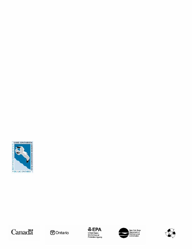
Lake sediments are an especially useful medium formeasuring progress in reducing overall levels ofcritical pollutants in the lake. The six criticalpollutants identified in the Lake Ontario LaMPbelong to classes of chemicals which tend to bindwith particles in the water rather than remaindissolved, and thus are carried to the lake floor.There, critical pollutants affect aquatic life in twomajor ways: 1) they are consumed along withorganic matter by organisms, sometimes causingimmediate toxic effects, and certainly enter thefood chain, and 2) they may reenter the dissolvedstate, becoming available for direct absorption byfish and other organisms. Ultimately, as inputs ofcritical pollutants to the lake are reduced, contam-inated sediments will be covered by cleanersediments and will become isolated from theaquatic ecosystem.
In the fall of 1997, scientists from the U.S. EPA,National Oceanic and Atmospheric Administration(NOAA), and the NYSDEC, cooperated on acomprehensive study of sediment quality in LakeOntario. The project was intended to evaluatesurficial (the top 2-4 inches) sediment quality in thelake as a whole, establishing a baseline of environ-mental information by which future trends could bemeasured. This cooperative study had three basicobjectives:
• To establish a baseline of data for chemicals ofconcern in Lake Ontario surface sediments and tocharacterize the degree of lake wide sedimentcontamination for each of these chemicals.
• To determine the biological quality of thesediments by means of analyses that includeidentifying the benthic species present at the varioussampling locations, counting the number ofindividuals of each species, and performinglaboratory tests to determine the toxicity of thesediments themselves.
• To identify any specific relationships betweenlevels of chemical contamination and macroinver-tebrate (bottom dwelling) populations. Thisinformation can then be used by environmentalmanagers to assign priorities for future actions.
Sampling Design
The sampling design for the project tookadvantage of the power of statistical analysis toestimate environmental conditions over a widearea. This capability depends on a strategy ofrandom selection of sampling locations. If asufficient number of samples is collected, it ispossible to characterize the entire study area with areasonable level of confidence for whateverconditions are evaluated.4
L A K E W I D E M A N A G E M E N T P L A N U P D A T E 2 0 0 1
• U.S. Survey and Evaluationof Sediment Quality
U.S. Survey and Evaluation of Sediment Quality Richard Coleates, U.S. EPA
U.S. EPA scientists retrieving a sediment sample ona Lake Ontario survey.
Sour
ce: U
.S. E
PA

5
L A K E W I D E M A N A G E M E N T P L A N U P D A T E 2 0 0 1
• U.S. Survey and Evaluationof Sediment Quality
Severe Effect Level (SEL): The level at whichsignificant impacts on the sediment-dwellingcommunity can be expected. At this concentration,a majority of benthic species would be adverselyaffected.
Results
The volume of data generated by the survey wasquite large, and the necessary statistical analyses ofthe results is still taking place. However, it ispossible at this time to draw some early conclusionsfrom the results.
Toxicity:
For this project, 100% of the sediments were foundto be not acutely toxic. It should be noted that thistest measures acute toxicity, and does not evaluatelong term sublethal effects of contamination.
Mercury:
Mercury is widely used in modern society andenters the lake via runoff, surface water discharges,and air deposition. The mean mercury concen-tration for Lake Ontario sediments was 0.36 partsper million (ppm). This exceeds the LEL guidelineof 0.2 ppm. Approximately 60% of the surfacesediments in Lake Ontario exceeded the LELguideline. However, on a more positive note, noneof the sediments sampled exceeded the SELguideline of 2.0 ppm.
Dieldrin:
Dieldrin is a pesticide which has been banned fromuse in the U.S. and Canada for a number of years.The mean concentration of dieldrin in the lakesediments was 2.03 parts per billion (ppb). This isvery close to the LEL guideline of 2.0 ppb. Morethan 95% of the sediments in the lake had dieldrinconcentrations below the LEL guidelines.
Mirex:
The mean concentration of mirex (widely used as afire retardant) in the lake sediments was 4.47 ppb.This is well below the LEL guideline of 7.0 ppb.However, an estimated 30% of the lake’s sedimentsdid exceed the LEL guideline.
DDT:
Although the use of DDT has been banned in theU.S. and Canada for more than 25 years, thepesticide still persists in the environment. Themean concentration of DDT in Lake Ontariosediments was 5.26 ppb. This is below the LELguidelines for DDT, of 8.0 ppb. An estimated 80%of the lake’s sediments had DDT concentrationsbelow the LEL guideline.
In order to get a more complete picture of contam-ination resulting from past use of DDT, it is usefulto consider the sum of DDT and its metabolites,DDD and DDE. Planned statistical analyses willinclude consideration of the sum of DDT and itsmetabolites.
Work Remaining
Analytical data for PCBs and dioxins are still beingevaluated.
Physical data are being evaluated to see if theassessment of lake sediments can be further refinedto provide separate assessments of the near-shoreand deeper central areas of the lake. NOAAscientists are evaluating the communities of benthicorganisms observed, to determine the relativehealth of these communities, and to see if there arelinkages with other factors such as chemicalcontamination.
@Check It Out!
The Lake Ontario LaMP has a website.Read about the Lake and LaMP activities; find reports and fact sheets; and learn about
upcoming meetings and opportunities to participate!
Find more information at either:
www.epa.gov/glnpo/lakeontor
www.on.ec.ca/glimr/lakes/ontario

Stormwater runoff and combined sewer overflowsfrom municipalities are important sources of criticalpollutants during wet weather conditions. Wetweather flow impacts in the Toronto area have beennoted as the major impediment to the restoration ofbeneficial uses along the Lake Ontario waterfrontand within the watersheds draining to thewaterfront. To combat this problem, the City ofToronto has implemented a range of wet weatherflow management measures including: downspoutdisconnections and the use of rain barrels onindividual properties, correction of “leaky” stormsewer pipes, construction of end-of-pipe treatmentfacilities such as stormwater management wetlands,as well as innovative flow balancing systems such asthe $12 million Eastern Beaches storage tanks andthe $56 million Western Beaches Storage Tunnel (tobe completed by the spring of 2001). Thesemeasures are making a difference. For example,since constructing the Eastern Beaches tanks,nearshore water quality has improved and beachpostings have been drastically reduced.
The City of Toronto has recently undertaken thedevelopment of a master plan which will furtherformulate strategies for the prevention, control andreduction of wet weather flow impacts across the city.
GOAL“To reduce, and ultimately eliminate the adverse effectsof wet weather flow on the built and naturalenvironment in a timely and sustainable manner, andto achieve a measurable improvement in ecosystemhealth of the watersheds.”
PROGRESS TO DATEIn consultation with a multi-stakeholder SteeringCommittee and the public, city staff and technicalconsultants gathered and analyzed huge amounts ofinformation on water quality, flows, pollutantloading, and practices used in other jurisdictions.This review provided a more complete under-standing of existing environmental conditions inToronto and how wet weather flows affect ourenvironment. A key outcome of the work was theadoption of a new philosophy developed in consul-tation with key stakeholders which is:
“Rainwater is to be treated as a resource to be utilizedto enhance and nourish the city’s environment. Wetweather flow quantity and quality issues are to bemanaged on a watershed basis to enhance and preserveecosystem health through a hierarchy of source,conveyance and end-of-pipe control and/or treatmentmeasures. Source control measures will be consideredfirst in this hierarchy in a manner that is balancedwith the other two measures in terms of environmental,social and economic impacts.”
Wet Weather Flow Management Master Plan for the City of Toronto
Michael D’Andrea, City of Toronto
The hierarchical approach to managing wet weatherflows reflects the “pollution prevention principle”:
• At Source: first deal with stormwater where itlands on the urban landscape; through measuressuch as downspout disconnection and raingardens, stormwater is removed from the systemand contained at the “lot level”.
• During Conveyance: next deal with stormwater asit is transported; through measures such asroadside swales/ditches or buried perforated pipes,stormwater quality is improved and can be used tohelp re-establish the natural hydrologic cyclethrough infiltration.
• End-of-Pipe: lastly, end-of-pipe treatmentfacilities can be used before the stormwater orcombined sewer overflows are discharged to thereceiving water body; these systems includemeasures such as stormwater managementwetlands and underground storage tanks.
OBJECTIVESThe Master Plan will contribute to achieving thefollowing objectives:
• Meet guidelines for water and sediment quality inwater courses and along the lake waterfront
• Virtually eliminate toxics in groundwater andsurface water through pollution prevention
• Improve water quality in rivers and the lake forbody contact recreation
• Improve aesthetics in surface water throughelimination of objectionable debris, nuisancealgae growth, colour, turbidity and odour
• Preserve and re-establish a more naturalhydrologic process
• Reduce erosion impacts on habitats and property• Eliminate or minimize threats to life and pro-
perty from flooding
6
L A K E W I D E M A N A G E M E N T P L A N U P D A T E 2 0 0 1
• Wet Weather FlowManagement Master Planfor the City of Toronto
Disconnected downspouts and rainbarrels keep rainout of sewers.
Sour
ce: C
ity o
f Tor
onto

Kingston’s Sewage Success Story John Allen, OMOE
Kingston residents should once again enjoy their beaches this summer without the need for beach closures.
The City of Kingston has not had to close its beaches due to high bacteria levels for three years nowthanks to an extensive program that involves significant upgrades to the sewer system. The programwas initiated in 1992 as a result of a Pollution Control Planning Study which recommended severalactions, including the separation of combined sewers.
Combined sewers take both storm water and sewage into one sewer. Normally this can be handledby the sewage system, but during periods of heavy rain the amount of storm water can be so great thatthe sewage treatment plant can’t handle all of the water in the combined sewer. As a result, thecombined storm water and raw sewage is bypassed - discharged directly to the lake - resulting in thepollution of Lake Ontario and higher bacteria levels at Kingston’s waterfront and beaches.
The bypassing problem was a result of two main deficiencies in Kingston’s sewer system. Because of theaging infrastructure, the system suffered from pipes that were too small and pumps at the sewagetreatment plant didn’t have a large enough capacity to handle the additional water during heavy storms.
Recognizing the problem, the city took a number of corrective actions, and has invested over $12 million to date.
Two combined sewer overflow tanks were installed to handle the excess water during wet weather.They are capable of storing up to 6,300 m3 of untreated sewage and storm water until the sewagetreatment plant can accept and process the excess wastewater.
The city has made upgrades to its sewers by installing larger pipes, and by replacing aging pumpswhere necessary with new, higher capacity pumps at its pumping station. The city has also beenpursuing the separation of combined sewers. By separating these sewers, only the sewage is directedto the treatment plant while the non-polluting storm water is discharged into the lake.
Thanks to these proactive steps taken by the City of Kingston, bacteria levels have been lowered,beaches have not been closed in over three years, and most importantly, the amount of pollutionentering Lake Ontario has been lessened.
• Protect, enhance and restore natural features (eg.wetlands) and functions
• Achieve healthy aquatic communities• Reduce fish contamination and consumption
advisories• Eliminate discharges of sanitary sewage including
combined sewer overflows, treatment plant bypassesand illegal cross-connections and spills
• Reduce infiltration and inflow to sanitary sewers • Reduce basement flooding
DEVELOPMENT OF THE MASTER PLANThe aim is to develop a Wet Weather Flow Man-agement Strategy for the City of Toronto. The cityhas been divided into five study areas (see map onpage 8). Four of these generally conform to theboundaries of those portions of the majorwatersheds that lie within the City (Mimico andEtobicoke Creeks, the Humber River, the DonRiver, and the Rouge River and Highland Creek).The fifth study area includes all the sections ofToronto in which there are still combined sewers.
Geographic information systems (GIS) are beingused extensively to present data on existing environ-mental conditions, to support the development ofcomputer simulation models and to identify 7
L A K E W I D E M A N A G E M E N T P L A N U P D A T E 2 0 0 1
• Wet Weather FlowManagement Master Planfor the City of Toronto
• Kingston’s Sewage SuccessStory
opportunities and po-tential sites for variouswet weather flow con-trol measures.
Hydrologic, hydraulicand water quality sim-ulation models are beingdeveloped to assess theeffectiveness of the var-ious control optionsagainst receiving watertargets.
The U.S. EPA Hydro-logic Simulation Program(HSPF) is being appliedto simulate the flow andwater quality response within each of thewatersheds. The Dorsch QQS model is being deve-loped for the land based combined sewer servicearea within the city. The output from this modelwill be used as input to the HSPF watershed modelsfor the Humber and Don Rivers. Furthermore,continuous time series of flow and water quality
(continued on page 8)
Porous pavement allowsrainfall to infiltrate theground.
Sour
ce: C
ity o
f Tor
onto

8
L A K E W I D E M A N A G E M E N T P L A N U P D A T E 2 0 0 1
• Wet Weather FlowManagement Master Planfor the City of Toronto
• Greater Rochester StormWater Management
Greater Rochester Storm Water ManagementMonroe County’s Frank E. VanLare Publicly Owned Treatment Works serves the largest metropolitanarea in New York’s portion of the Lake Ontario Basin. Wastewaters are collected from the City ofRochester as well as a number of surrounding communities to be properly treated before they aredischarged to Lake Ontario. The development of wet weather flow controls for this sewage treatmentplant was identified as a high priority, given the large volume of wastewater handled by the plant.
Portions of the City of Rochester’s collection system date back to the 1800s, when untreated wasteand storm water ran into the same sewer lines and were discharged to Irondequoit Bay and theGenesee River. These combined sewer overflow systems (CSOs) worked well except during rainyperiods, when high volumes of storm water entering the CSOs exceeded the capacity of the sewagetreatment plants. Large volumes of untreated storm water would then be discharged directly towaterways, resulting in widespread contamination. To address this problem, Monroe Countydeveloped the Combined Sewer Overflow Abatement Program. A $550 million deep rock tunnelsystem was constructed to capture and hold major storm runoff and wastewater until it could beproperly treated. Construction on the tunnel system began in 1982 and was completed in 1991.
Before installation of the tunnel systems, there was an average of 30-40 overflow events per year. Nowduring wet weather the storm water is directed into this huge network of tunnels, which is capable ofstoring up to 175 million gallons. After the storm is over, the storm water is sent to the plant fortreatment. Since the system has been fully operational (1993), it has captured more than 26 billiongallons of combined sewer overflow that otherwise would have spilled into local waterways, and waterquality in the Genesee River has improved significantly.
Wet Weather Flow Management Master Plan forthe City of Toronto(continued from page 7)
will be generated for each of the six watersheds andfor each combined sewer overflow discharge alongthe waterfront. These will then serve as input to awaterfront water quality simulation model whichwill assess the cumulative impact of all flows acrossthe entire waterfront.
Watershed groups, government agencies, munici-palities within each of the watershed study areas, andthe public at large, will be consulted throughout theprocess to provide public input at key decision pointsthroughout the plan development process. The planis expected to be completed by December 2001.________________For more information on the City of Toronto’s WetWeather Flow Management Master Plan, please seethe City of Toronto website at:http://www.city.toronto.on.ca/wetweatherflow/
City of Toronto WWFMMP Study Areas.
Sour
ce: C
ity o
f Tor
onto

9
L A K E W I D E M A N A G E M E N T P L A N U P D A T E 2 0 0 1
• Ontario’s Approach toPriority Pollutant Track-Down in Lake OntarioTributaries
• Developing EcosystemIndicators for Lake Ontario
The reduction of critical pollutants entering LakeOntario has been identified as a key objective inthe LaMP. As reported in the “LaMP Update2000”, results of the joint 1997-98 OMOE andEC tributary sampling program for prioritypollutants revealed a relatively uniform back-ground concentration of total PCB at the mouthsof six Lake Ontario tributaries across a range ofdifferent land uses.
Since concentrations of total PCB in some LakeOntario tributaries have been found to exceed theProvincial Water Quality Objective of 1.0 ng/L(nanogram per litre) in the 1997-98 study as wellas other investigations, a commitment was madeby OMOE to confirm these findings using anintegrated high-frequency sampling approach tocharacterize typical concentrations of PCB alongwith other priority pollutants including poly-nuclear aromatic hydrocarbons (PAHs), andorganochlorine compounds (including DDT andmirex). This approach involves the collection offour-week composite samples made up of sub-samples collected every six hours throughout theentire year, rather than relying on 10 to 15 grabsamples to characterize annual conditions. In thisway, a more complete range of seasonal hydro-logical conditions within the watershed is takeninto account. This approach was applied to se-veral Lake Ontario tributaries from July 2000through June 2001.
In addition to this refinement in the sampling ap-proach, OMOE is also developing and applying atributary “trackdown” strategy to answer thequestions:
Ontario’s Approach toPriority PollutantTrack-Down in LakeOntario Tributaries
Fred Fleischer, OMOE
1. Are concentrations of PCB and other prioritypollutants significantly elevated at Lake Ontariotributary mouths relative to headwaters? and
2. Is there evidence of significant, local sourcesof PCB and other priority pollutants within LakeOntario tributaries?
In essence, the goal is to determine whetherobserved concentrations of PCB and other prioritypollutants are attributable to locally controllablesources, or whether they reflect recycled contam-inants from diffuse historical sources.
These questions will be answered for selectedtributaries by: (a) quantifying upstream-down-stream differences in total concentrations (andcongener patterns where possible) of PCB inwater, sediment, and juvenile fish tissue; and (b)quantifying differences in biomonitored (cagedmussel) tissue PCB concentrations and congenerpatterns at selected points throughout thewatershed.
Three pilot watershed projects are being selectedfrom Lake Ontario tributaries where elevatedPCB levels were found and good screening leveldata are available from both provincial and federalstudies. These include water quality and juvenilefish data from the 2000-01 and 1997-98 studiesdescribed above, along with previous data fromthe 1991-92 Toronto area six tributary study.
Based on these criteria, Twelve Mile Creek wasselected as the first of these pilot projects in thewestern part of the Lake Ontario basin; field workfor the PCB trackdown started here during thesummer of 2000 and is scheduled to becompleted during summer of 2001. Work on theother two pilot projects, Etobicoke Creek andCataraqui River, located in the central and theeastern part of the basin, commenced during thesummer of 2001.
Once the sample results are available, a summaryreport will be prepared with recommendations fortargeted action within the watershed if asignificant, controllable source of PCB or otherpriority pollutants is identified.
The restoration of a healthy Lake Ontario ecosystemis the goal of the Lakewide Management Plan. Butwhat is a “healthy ecosystem” and how do wemeasure progress towards this goal?
In May 1998, after consultation with other naturalresource agencies and the public, the Four Partiesfinalized the Stage 1 LaMP report for LakeOntario. The LaMP addresses issues that are
Developing Ecosystem Indicators for Lake OntarioFred Luckey, U.S. EPA/NYSDEC
lakewide in nature and require binational actionsto resolve. The Stage 1 report identified theproblems (known as beneficial use impairments)that exist lakewide in Lake Ontario, and thechemical, physical, and biological causes of theseimpairments.
(continued on page 10)

10
L A K E W I D E M A N A G E M E N T P L A N U P D A T E 2 0 0 1
• Developing EcosystemIndicators for Lake Ontario
Lakewide Beneficial Use Impairments
Restrictions on fish and wildlife consumption
Degradation of wildlife populations
Bird or animal deformities or reproductiveproblems.
Loss of fish and wildlife habitat
Lakewide Critical Pollutants and Other FactorsCausing Impairments
PCBs, Dioxins, Mirex, Mercury, DDT
PCBs, Dioxin, DDT
PCBs, Dioxin, DDT
Lake Level ManagementExotic SpeciesPhysical loss, modification and destruction ofhabitat
*Dieldrin is also included on the Lake Ontario LaMP List of Critical Pollutants although it is not directlyassociated with a use impairment.
The Four Parties, through the LaMP, are working torestore these beneficial uses by reducing the amountof critical pollutants in the Lake Ontario ecosystemand by addressing the biological and physical factorsthat have been identified.
The development of well defined goals andobjectives provides a way for the LaMP to definewhat its goals are and to identify the tools needed tomeasure progress. A considerable amount of workhas gone into the development of Lake Ontario eco-system objectives and indicators over the last decade.The earlier Lake Ontario Toxics Management Planbegan the development of ecosystem goals andobjectives with the formation of the Lake OntarioEcosystem Objectives Work Group (EOWG). Thisgroup, consisting of U.S. and Canadian monitoringexperts, assisted in the development of broad eco-system goals for Lake Ontario, which have beenadopted by the LaMP.
The EOWG also developed proposed Lake Ontarioecosystem objectives that address variouscomponents of the ecosystem and beneficial useimpairments. The LaMP presented these five draft
Ecosystem Objectives for Lake Ontario
Aquatic Communities: The lake waters shall sup-port diverse and healthy reproducing and self-sus-taining communities in dynamic equilibrium,with an emphasis on native species.
Wildlife: The perpetuation of a healthy, diverse,and self-sustaining wildlife community thatutilizes the lake habitat and/or food shall beensured by attaining and sustaining the waters,coastal wetlands, and upland habitats of the basinin sufficient quantity and quality.
Human Health: The waters, plants and animalsshall be be free from contaminants and organismsresulting from human activities at levels thataffect health or aesthetic factors such as taintingodor, and turbidity.
Habitat: Offshore and nearshore zonessurrounding tributary, wetland, and uplandhabitats shall be of sufficient quality and quantityto support ecosystem objectives for the health,productivity, and distribution of plants andanimals in and adjacent to the lake.
Stewardship: Human activities and decisionsshall embrace environmental ethics and acommitment to responsible stewardship.
Ecosystem Goals for Lake Ontario
The Lake Ontario Ecosystem should be main-tained and as necessary restored or enhanced tosupport self-producing diverse biological com-munities. The presence of contaminants shall notlimit uses of fish, wildlife, and waters of the LakeOntario basin by humans and shall not causeadverse health effects in plants and animals.
As a society we recognize our capacity to creategreat changes in the ecosystem and we shall con-duct our activities with responsible stewardshipfor the Lake Ontario Basin.
ecosystem objectives for Lake Ontario in their 1998report:
The LaMP is now ready to develop indicators withspecific goals, measures and targets needed to trackprogress in restoration of the impaired beneficialuses.
Ideally, selected indicators will reflect broadecosystem trends, reflect lakewide conditions andbe sensitive to a number of stressors. For example,
Developing Ecosystem Indicators for Lake Ontario(continued from page 9)
11
L A K E W I D E M A N A G E M E N T P L A N U P D A T E 2 0 0 1
• Developing EcosystemIndicators for Lake Ontario
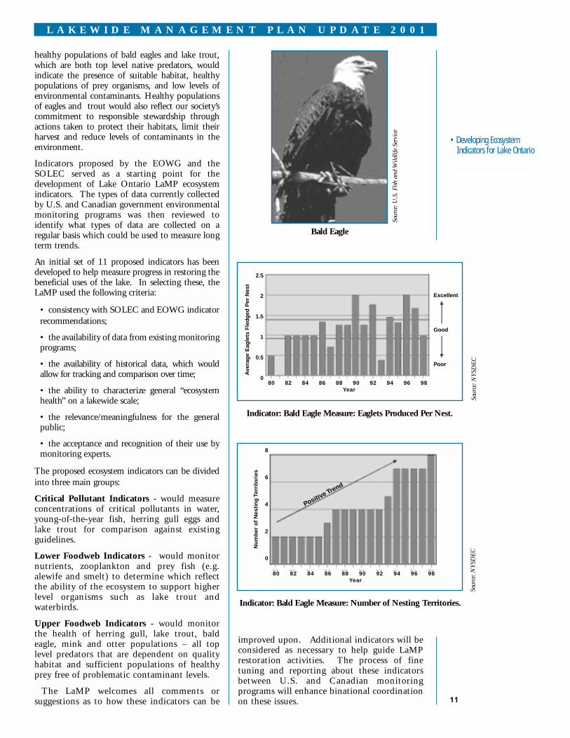
Indicator: Bald Eagle Measure: Eaglets Produced Per Nest.
Indicator: Bald Eagle Measure: Number of Nesting Territories.
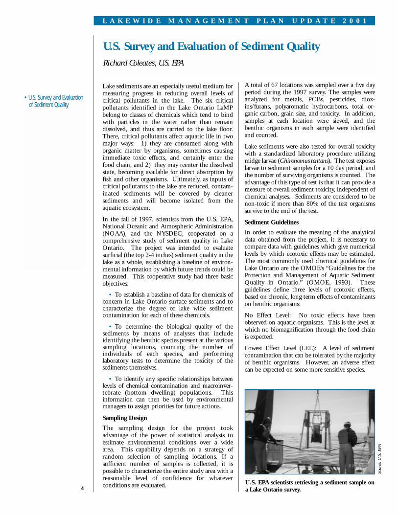
Bald Eagle
Sour
ce: N
YSD
ECSo
urce
: NYS
DEC
Sour
ce: U
.S. F
ish a
nd W
ildlif
e Se
rvic
e
healthy populations of bald eagles and lake trout,which are both top level native predators, wouldindicate the presence of suitable habitat, healthypopulations of prey organisms, and low levels ofenvironmental contaminants. Healthy populationsof eagles and trout would also reflect our society’scommitment to responsible stewardship throughactions taken to protect their habitats, limit theirharvest and reduce levels of contaminants in theenvironment.
Indicators proposed by the EOWG and theSOLEC served as a starting point for thedevelopment of Lake Ontario LaMP ecosystemindicators. The types of data currently collectedby U.S. and Canadian government environmentalmonitoring programs was then reviewed toidentify what types of data are collected on aregular basis which could be used to measure longterm trends.
An initial set of 11 proposed indicators has beendeveloped to help measure progress in restoring thebeneficial uses of the lake. In selecting these, theLaMP used the following criteria:
• consistency with SOLEC and EOWG indicatorrecommendations;
• the availability of data from existing monitoringprograms;
• the availability of historical data, which wouldallow for tracking and comparison over time;
• the ability to characterize general “ecosystemhealth” on a lakewide scale;
• the relevance/meaningfulness for the generalpublic;
• the acceptance and recognition of their use bymonitoring experts.
The proposed ecosystem indicators can be dividedinto three main groups:
Critical Pollutant Indicators - would measureconcentrations of critical pollutants in water,young-of-the-year fish, herring gull eggs andlake trout for comparison against existingguidelines.
Lower Foodweb Indicators - would monitornutrients, zooplankton and prey fish (e.g.alewife and smelt) to determine which reflectthe ability of the ecosystem to support higherlevel organisms such as lake trout andwaterbirds.
Upper Foodweb Indicators - would monitorthe health of herring gull, lake trout, baldeagle, mink and otter populations – all toplevel predators that are dependent on qualityhabitat and sufficient populations of healthyprey free of problematic contaminant levels.
The LaMP welcomes all comments orsuggestions as to how these indicators can be
Excellent
Good
Poor
80 82 84 86 88 90 92 94 96 98Year
2.5
2
1.5
1
0.5
0
Ave
rag
e E
agle
ts F
led
ged
Per
Nes
t
80 82 84 86 88 90 92 94 96 98Year
8
6
4
2
0
Nu
mb
er o
f N
esti
ng
Ter
rito
ries
Positive Trend
improved upon. Additional indicators will beconsidered as necessary to help guide LaMPrestoration activities. The process of finetuning and reporting about these indicatorsbetween U.S. and Canadian monitoringprograms will enhance binational coordinationon these issues.
12
L A K E W I D E M A N A G E M E N T P L A N U P D A T E 2 0 0 1
• Critical Pollutant Sourcesand Loadings ReductionStrategy
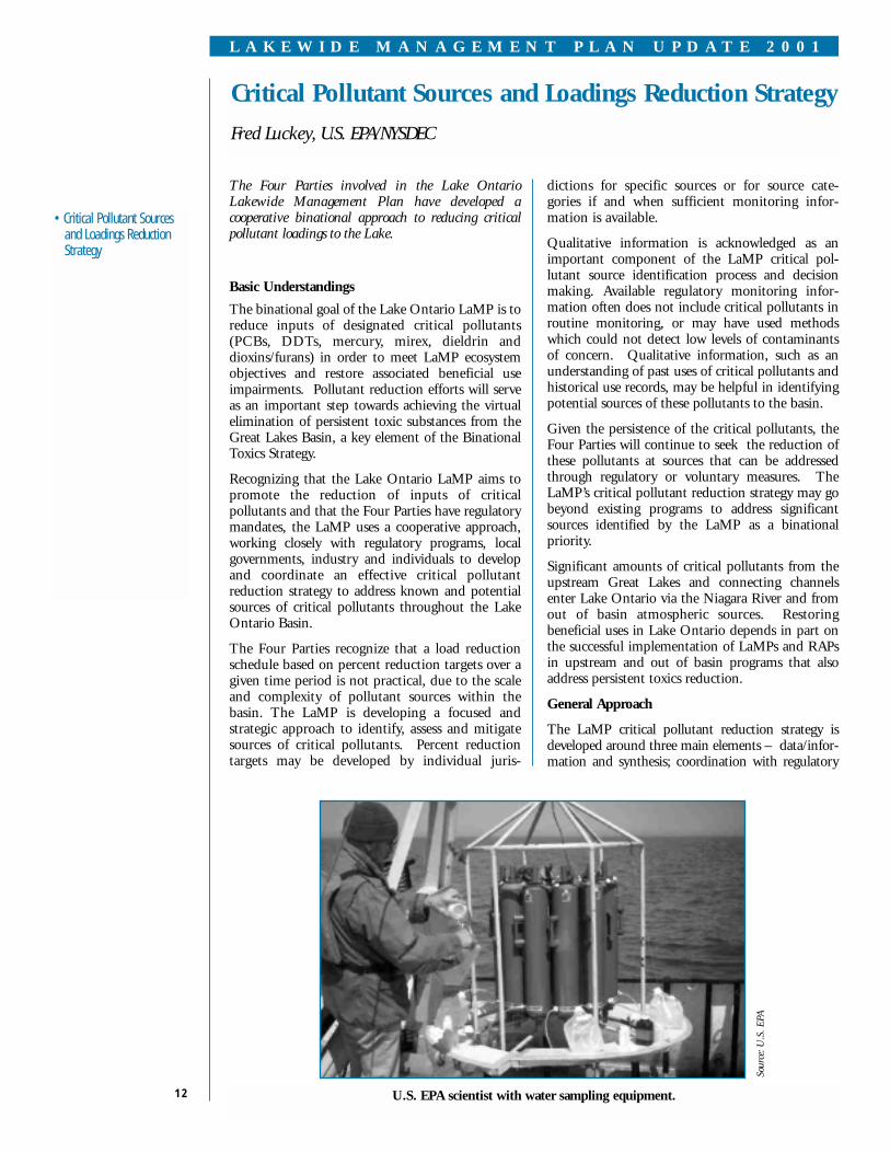
The Four Parties involved in the Lake OntarioLakewide Management Plan have developed acooperative binational approach to reducing criticalpollutant loadings to the Lake.
Basic Understandings
The binational goal of the Lake Ontario LaMP is toreduce inputs of designated critical pollutants(PCBs, DDTs, mercury, mirex, dieldrin anddioxins/furans) in order to meet LaMP ecosystemobjectives and restore associated beneficial useimpairments. Pollutant reduction efforts will serveas an important step towards achieving the virtualelimination of persistent toxic substances from theGreat Lakes Basin, a key element of the BinationalToxics Strategy.
Recognizing that the Lake Ontario LaMP aims topromote the reduction of inputs of criticalpollutants and that the Four Parties have regulatorymandates, the LaMP uses a cooperative approach,working closely with regulatory programs, localgovernments, industry and individuals to developand coordinate an effective critical pollutantreduction strategy to address known and potentialsources of critical pollutants throughout the LakeOntario Basin.
The Four Parties recognize that a load reductionschedule based on percent reduction targets over agiven time period is not practical, due to the scaleand complexity of pollutant sources within thebasin. The LaMP is developing a focused andstrategic approach to identify, assess and mitigatesources of critical pollutants. Percent reductiontargets may be developed by individual juris-
dictions for specific sources or for source cate-gories if and when sufficient monitoring infor-mation is available.
Qualitative information is acknowledged as animportant component of the LaMP critical pol-lutant source identification process and decisionmaking. Available regulatory monitoring infor-mation often does not include critical pollutants inroutine monitoring, or may have used methodswhich could not detect low levels of contaminantsof concern. Qualitative information, such as anunderstanding of past uses of critical pollutants andhistorical use records, may be helpful in identifyingpotential sources of these pollutants to the basin.
Given the persistence of the critical pollutants, theFour Parties will continue to seek the reduction ofthese pollutants at sources that can be addressedthrough regulatory or voluntary measures. TheLaMP’s critical pollutant reduction strategy may gobeyond existing programs to address significantsources identified by the LaMP as a binationalpriority.
Significant amounts of critical pollutants from theupstream Great Lakes and connecting channelsenter Lake Ontario via the Niagara River and fromout of basin atmospheric sources. Restoringbeneficial uses in Lake Ontario depends in part onthe successful implementation of LaMPs and RAPsin upstream and out of basin programs that alsoaddress persistent toxics reduction.
General Approach
The LaMP critical pollutant reduction strategy isdeveloped around three main elements – data/infor-mation and synthesis; coordination with regulatory
Critical Pollutant Sources and Loadings Reduction Strategy
Fred Luckey, U.S. EPA/NYSDEC
U.S. EPA scientist with water sampling equipment.
Sour
ce: U
.S. E
PA

13
L A K E W I D E M A N A G E M E N T P L A N U P D A T E 2 0 0 1
• Critical Pollutant Sourcesand Loadings ReductionStrategy
• Contaminant Trends InLake Ontario Sport Fish –Ontario Side
actions; and promoting voluntary actions. A numberof approaches can be developed for each element.
Information Synthesis
The organization of data on critical pollutants fromambient monitoring, known or suspected excee-dences of criteria or standards, and point and non-point sources can assist in developing a picture ofcritical pollutant sources in watersheds of concern.Pollutant reduction strategies can then be developed todeal with specific problems, with links to appropriatelocal governments and community organizations.
Information on concentrations, sources, loadingsand pathways of critical pollutants are beingevaluated, with the aim of identifying sourcereduction actions. The identification of priorityactions will be a primary focus of the LaMP 2002report. Actions could include, for example,watershed evaluations, further monitoring, andsource reduction activities.
Regulatory Actions
Regulatory actions have resulted in tremendousreductions in environmental concentrations ofmost of Lake Ontario’s critical pollutants over thelast three decades and continue to make adifference.
The LaMP will identify and highlight specificremedial and other regulatory program effortsunderway that are contributing to LaMP pollutantreduction goals and that LaMP strategies can buildupon. The LaMP will also ensure that regulatoryprograms are kept apprised of any information
relevant to enforcement or monitoring require-ments, so that regulatory tools can be applied asappropriate to address specific LaMP prioritysources.
Voluntary Actions
Many communities, organizations and localgovernments in the Lake Ontario Basin havedeveloped voluntary pollution prevention programssuch as pesticide “clean sweeps” and mercuryequipment/thermometer collection programs.
The LaMP’s role in promoting voluntary effortsincludes ensuring that community and localgovernment programs are aware of LaMP goals andobjectives; communicating and highlighting theimportance of voluntary efforts (success stories);and encouraging accelerated product phase-outs,pollutant minimization plans or other actions fromindustry or local governments.
Cooperative Binational Strategy
The U.S. and Canada will use compatibleapproaches in source reduction strategies, to bestutilize current initiatives, historic actions andindividual human and information resources. TheU.S. intends to evaluate all watersheds within itsportion of the basin. Canada will focus on actionswithin priority watersheds, based on availableambient monitoring information and emissionsdata for industrial, municipal and other non-pointsource discharges (e.g. combined sewage over-flows/stormwater, waste sites). Strategies will bedeveloped to address identified sources of criticalpollutants in these watersheds.
Various jurisdictions around the Great Lakes carry outsport fish monitoring programs that provideconsumption advice. The LaMP recognizes there aredifferences in reporting and consumption advisoriesbetween jurisdictions in Canada and the U.S. Thisarticle highlights recently released information fromOntario’s Sport Fish Contaminant MonitoringProgram.
Sport fish from the Canadian waters of LakeOntario are monitored on an annual basis. Theresults are published every other year - along withconsumption advice for sport fish from Ontario’sinland lakes, rivers and Great Lakes - in the Guideto Eating Ontario Sport Fish. The guide offers size-specific consumption advice based on healthprotection guidelines developed by Health Canadafor approximately 1,700 species.
Between 4,000 and 6,000 fish per year are testedthrough the Sport Fish Contaminant MonitoringProgram. Staff involved in the program, a partnership
Contaminant Trends in Lake Ontario Sport Fish – Ontario SideAlan Hayton, OMOE
Lake trout, rainbow trout, brown trout and cohosalmon.
(continued on page 14
Sour
ce: C
ente
r fo
r G
reat
Lak
es a
nd A
quat
ic S
cien
ces
between the Ontario Ministries of Natural Resourcesand the Environment, have been testing Ontario sportfish for more than 25 years. Staff from both ministries

14
L A K E W I D E M A N A G E M E N T P L A N U P D A T E 2 0 0 1
• Contaminant Trends InLake Ontario Sport Fish –Ontario Side
PCB Concentration in 65 cm Lake Ontario CohoSalmon.
Concentration of DDT and Metabolites in 65 cmLake Ontario Coho Salmon (1976-2000).
Mirex Concentration in 65 cm Lake Ontario CohoSalmon.
Mercury Concentration 9mg/kg in 65 cm LakeOntario Coho Salmon.
The Guide to Eating Ontario Sport Fish, published bythe Ministry of Natural Resources, is available on theinternet at www.ene.gov.on.ca. Ontario anglersshould refer to this guide for specific consumptionadvisories.
U.S. anglers should refer to New York StateDepartment of Health’s Chemicals in Sportfish andGame, also available on the internet atwww.health.state.ny.us/nysdoh/environ/fish.htm.
Contaminant Trends in Lake Ontario SportFish – Ontario Side(continued from page 13)
collect fish and send them to the Ministry of theEnvironment laboratory in Toronto. The skinless,boneless dorsal fillets of the fish are analyzed for avariety of substances, including mercury, PCBs,mirex/photomirex, and dioxins/furans - contaminantsidentified by the LaMP as critical pollutants.
In Ontario, consumption restrictions on LakeOntario sport fish are the result of PCBs (47 percent of advisories), mercury (26 per cent), mi-rex/photomirex (24 per cent), toxaphene (2 percent) and dioxins/furans (1 per cent). Other chlo-rinated organic contaminants such as DDT, hexa-chlorobenzene, octachlorostyrene, chlordane andlindane are regularly detected in Lake Ontario sportfish but do not result in consumption restrictions.
Coho salmon from the Credit River spawning run,southwest of Toronto, are illustrated to show long-term trends in Lake Ontario salmon and trout. Inthe mid 1990s, coho salmon stocks in the CreditRiver were low and no samples of fish wereobtained. Contaminant levels have been steadilydecreasing since monitoring began in the mid1970s. PCBs and mirex, as well as other contam-inants not illustrated, declined substantially duringthe past two decades. Levels of mercury, which wasfound at relatively low levels in the 1970s, does notappear to have changed markedly.
Levels of total DDT (DDT and its metabolitesDDD and DDE) also decreased between 1976 and2000. However, the greatest decrease in theindividual compounds is in the concentration of theparent compound DDT. DDT decreased fromapproximately 200 micrograms per kilogram(ug/kg) in the mid 1970s to the detection limit of10 ug/kg in 2000. In most years DDE concen-trations have fluctuated between 200 and 400ug/kg, showing no clear trend.
Ontario, through its Sport Fish ContaminantMonitoring Program, will continue to monitor LakeOntario sport fish on an annual basis for trends incontaminant concentrations and to provide up-to-date consumption advice to anglers.
Sour
ce: O
MO
ESo
urce
: OM
OE
Sour
ce: O
MO
ESo
urce
: OM
OE
1200
1000
800
600
400
200
76 78 80 82 84 86 88 90 92 94 96 98 00 Year
77 79 81 83 85 87 90 91 93 95 97 99
Year
.35
.30
.25
.20
.15
.10
.05
.00
Mer
cury
(m
g/k
g)
77 79 81 83 85 87 90 91 93 95 97 99
Year
4000
3500
3000
2500
2000
1500
1000
500
PC
Bs
(ug
/kg
)
76 78 80 82 84 86 88 90 92 94 96 98 00
Year
250
200
150
100
50
Mirex(ug/kg)
ug/kg
DDT
DD
otal

15
L A K E W I D E M A N A G E M E N T P L A N U P D A T E 2 0 0 1
• Reporting on the Status ofFish and Wildlife Habitatsin the Canadian Watershedof Lake Ontario
Reporting on the Status of Fish and Wildlife Habitatsin the Canadian Watershed of Lake OntarioRonald A. Reid, Consultant to EC
A healthy Lake Ontario includes healthy habitats for fish and wildlife, both in the lake and its watershed. Astatus report prepared for EC documents current habitat conditions, recent trends and stresses on theCanadian side of the lake. It also looks at the wide range of programs involved in habitat restoration andprotection.
How well are habitats doing? There is no single answer to that question, but by looking at various parts ofthe ecosystem, a general picture emerges.
In the lake’s watershed, which stretches from the fruitlands of the Niagara Peninsula almost to the forestedhills of Algonquin Provincial Park, much of the original forest and other natural cover was lost whenEuropeans settled the area. Forest cover has partly recovered in most areas, but fragmentation of theremaining forests into smaller and smaller pieces is creating problems for many species of wildlife. Wetlandsand other original habitats such as prairies have been greatly reduced. Human populations are expandingvery rapidly within the watershed, and urban growth in the Greater Toronto Area and the Hamilton-Niagararegion is putting enormous stress on natural habitats.
The tributaries feeding into the lake are vital ecological connectors. Their quality is directly affected byactivities on the lands around them, and most tributaries became significantly degraded from land clearing,poor farming practices, dams, and pollution. Most tributaries still have impaired fish communities, and donot come close to meeting local goals for streamside cover. However, in recent years the levels of suspendedsediments and pollutants within streams have declined significantly. Unstable flow patterns resulting fromurbanization and excessive water-taking are significant stresses.
Nearshore lands and waters have been a focal point for human activity, which has led to habitat loss and thealtering of natural processes such as lake level fluctuations and the patterns of lakeshore erosion and sandtransport by wave action. But nearshore pollution has been considerably reduced, with the phosphorusconcentrations that produced algal blooms now reduced to target levels, and fewer toxins remaining atelevated levels. Fish and wildlife populations have responded to these improved conditions, from a healthiermix of bottom invertebrates to rebounding populations of most gulls and terns. However, the invasion ofzebra and quagga mussels has overwhelmed some lakebed communities such as native clams, and is alteringhabitat conditions at a rapid rate.
In deeper offshore waters, major pollution problems that were affecting fish populations have been largelyovercome, although some concerns about contaminated bottom sediments remain. However, the offshoreaquatic communities are now dominated by introduced species as a result of accidental introductions and fishstocking. Fish, plankton, and invertebrate populations are very unstable, and their future composition ishighly unpredictable.
Habitat protection and restoration activities have been widespread, through RAPs, volunteer-based projects,agency and municipal programs, and private land stewardship. Tree-planting and naturalization projects havebeen especially popular in urban areas, and farmers have been active in improving water quality through thedevelopment of Environmental Farm Plans and no-till cultivation techniques. Some examples of high qualityhabitats are protected in public parks and conservation areas, or through municipal planning policies.
(continued on page 16)
The LaMP has begun the process of evaluating Lake Ontario habitat issues. It is important to recognizethat much of the lake’s natural habitat has been irrevocably altered since pre-colonial times and much ofthe genetic diversity and many native species have been lost forever. The challenge facing us now is howto preserve the quality and quantity of remaining fish and wildlife habitats while at the same time, meetthe needs of human populations. In addition, options to restore lost or degraded habitats need to beexplored. Fortunately, there has been significant progress, both in the protection and restoration areas.Today, more than 20% of Lake Ontario’s wetlands are fully protected while additional areas are subjectto a variety of government rules and regulatory programs. The following review outlines various issuesto be considered in developing the LaMP’s habitat assessment.
16
L A K E W I D E M A N A G E M E N T P L A N U P D A T E 2 0 0 1
• Reporting on the Status ofFish and Wildlife Habitatsin the Canadian Watershedof Lake Ontario
• Fish and Wildlife Habitat inthe United States LakeOntario Watershed
Reporting on the Status of Fish and Wildlife Habitats in the Canadian Watershed of Lake Ontario (continued from page 15)
However, additional efforts are needed, especially to conserve the remaining areas of high quality habitatand to address emerging issues. The invasion of non-native species such as zebra mussels and the potentialimpact of climate change are major challenges for the future. Only through ongoing effort can the richdiversity of fish and wildlife in Lake Ontario and its watershed be assured for the future.
A report on Status and Trends in Fish and Wildlife Habitat on the Canadian Side of Lake Ontario is available. Fora summary report, please contact: Marlene O’Brien, EC, at (905) 336-4552.
Fish and Wildlife Habitat in the United States Lake OntarioWatershed
Karen Rodriguez, U.S. EPA
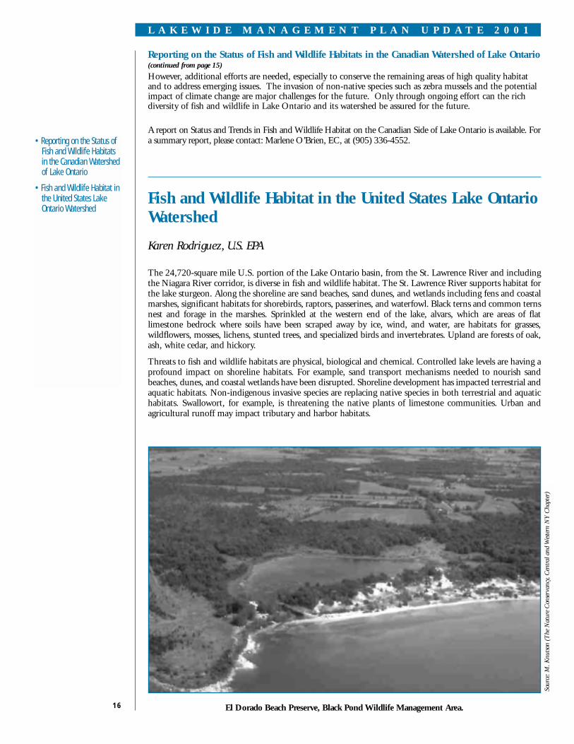
The 24,720-square mile U.S. portion of the Lake Ontario basin, from the St. Lawrence River and includingthe Niagara River corridor, is diverse in fish and wildlife habitat. The St. Lawrence River supports habitat forthe lake sturgeon. Along the shoreline are sand beaches, sand dunes, and wetlands including fens and coastalmarshes, significant habitats for shorebirds, raptors, passerines, and waterfowl. Black terns and common ternsnest and forage in the marshes. Sprinkled at the western end of the lake, alvars, which are areas of flatlimestone bedrock where soils have been scraped away by ice, wind, and water, are habitats for grasses,wildflowers, mosses, lichens, stunted trees, and specialized birds and invertebrates. Upland are forests of oak,ash, white cedar, and hickory.
Threats to fish and wildlife habitats are physical, biological and chemical. Controlled lake levels are having aprofound impact on shoreline habitats. For example, sand transport mechanisms needed to nourish sandbeaches, dunes, and coastal wetlands have been disrupted. Shoreline development has impacted terrestrial andaquatic habitats. Non-indigenous invasive species are replacing native species in both terrestrial and aquatichabitats. Swallowort, for example, is threatening the native plants of limestone communities. Urban andagricultural runoff may impact tributary and harbor habitats.
El Dorado Beach Preserve, Black Pond Wildlife Management Area.
Sour
ce: M
. Knu
tson
(The
Nat
ure
Con
serv
ancy
, Cen
tral
and
Wes
tern
NY
Cha
pter
)

17
L A K E W I D E M A N A G E M E N T P L A N U P D A T E 2 0 0 1
• Fish and Wildlife Habitat inthe United States LakeOntario Watershed
The current status of fish and wildlife habitats that takes into account natural resource values and threats isincomplete. Efforts are now underway to assess particular habitats by a number of agencies and organi-zations. The U.S. Fish and Wildlife Service is continuing to update endangered species, wetland inventory,and aquatic habitat information and inventories. Regional bird conservation mapping being undertaken byVermont University will help to characterize habitat used by songbird migrants. The Nature Conservancy iscompleting its second iteration of ecoregional planning that defines habitat protection and restoration needsfor a number of Lake Ontario sites. The multi-partner International Alvar Initiative inventoried alvar sitesand proposed direct actions to preserve habitats. The binational Marsh Monitoring Program utilizes citizenvolunteers to monitor coastal wetlands and their amphibian and marsh bird populations. Local watershedsand partnerships, such as the Ontario Dunes Coalition, are conducting assessments of local natural resourcesand threats.
The following listing of completed and ongoing projects, funded in part by U.S. EPA, illustrates the scopeof current protection and restoration activities and partnerships in the Lake Ontario basin and the potentialfor additional actions.
The Nearshore Habitat Priorities for Migratory Songbirds (Vermont University and State AgriculturalCollege) project is identifying concentrations of songbirds in nearshore Lake Ontario and eastern Lake Eriehabitats using a new remote sensing technique.
The Landscape-Level Conservation on Tug Hill project (The Nature Conservancy) is launching acommunity-based conservation program to protect the wetlands, rivers, streams, and working forests of theTug Hill Plateau in New York.
The Collaborative Restoration and Education at Eastern Lake Ontario project (The Nature Conservancy,New York Sea Grant, Oswego County, Lake Ontario Dunes Coalition) is implementing a coordinatedDune Steward Program for the beaches and dunes of eastern Lake Ontario, restoring and re-vegetatingdamaged dunes using locally-grown native beachgrass, protecting dunes with sensitive public access, andengaging the local community through a dune/wetland education program.
The Contributing Factors in Habitat Selection by Lake Sturgeon project (Research Foundation of StateUniversity of New York) is determining the preferred prey types of St. Lawrence River juvenile and adultlake sturgeon, and examining the relationship between feeding characteristics of juvenile and adult lakesturgeon and the benthic invertebrate community.
The Identification of Lake Sturgeon Habitat in the St. Lawrence River (State University of New YorkCollege of Environmental Sciences and Forestry) project is obtaining new information about specifichabitat preferences by the critical juvenile stage lake sturgeon in the St. Lawrence River near Massena, NewYork.
The Controlling the Spread of Swallowort project (The Nature Conservancy) is developing newtechniques for controlling the non-indigenous invasive plant swallowort, which is threatening limestonecommunities from New York to Wisconsin.
The Restoration of Rush Oak Openings project (The Nature Conservancy) is working with state, local,and regional partners to develop and effect a joint restoration plan to unite ownerships, and to use volunteerand paid staff to implement restoration of the relict oak savannah community.
The Sand Transport in the Barrier Beach Ecosystem of Eastern Lake Ontario project (The NatureConservancy and U.S. Army Corps of Engineers ) is addressing the issue of changes in the coastal processesaffecting distribution and transport of beach sands along the barrier beaches of eastern Lake Ontario.
The Conversion of Dry Basins to Created Wetlands for Mitigation of Runoff Water Quality project(Monroe County Environmental Health Laboratory) is demonstrating conversion of suburban dryretention basins into wetland detention ponds to provide treatment and thermal moderation of stormrunoff, reducing hydraulic, thermal, and nutrient loading of receiving bodies while providing wetlandhabitat functions.
The Eastern Lake Ontario Conservation Initiative (The Nature Conservancy) identified key resources andecosystem stresses, initiated land protection activities, developed partnerships with state, local, and citizen’sgroups active in the area, conducted outreach, and developed an initial conservation plan with specificprotection, stewardship, and outreach programs for the Eastern Lake Ontario 29,000-acredune/wetland/alvar system.
Detailed information about each project can be found at www.epa.gov/glnpo.

18
L A K E W I D E M A N A G E M E N T P L A N U P D A T E 2 0 0 1
• Remedial Action PlansUpdate
The Lakewide Management Plans for the Great Lakes focus on those environmental problemswhich are lakewide in nature and need a combined Canadian and U.S. effort to resolve. RAPsconcentrate on identifying and addressing local environmental problems (beneficial useimpairments) in 43 Areas of Concern (AOCs).
The RAP process strives to identify the pollutants causing the problems; locate the sources of thepollutants; recommend and implement remedial activities to restore the beneficial uses; anddocument progress towards restoration. The ultimate goal is to restore the area’s beneficial usesand be able to delist the AOC.
Recognizing that there is an ecosystem linkage between the LaMPs and the RAPs, this Updateprovides a summary of progress on some of Lake Ontario’s RAPs. You can also find informationon the following websites: www.on.ec.gc.ca/glimr/raps/intro.html or www.great-lakes.net/places/aoc/ontaoc.html.
Eighteenmile Creek (NY)
The RAP is focused on continuing the investigationand assessment of creek sediments; evaluatingpossible sources of PCBs and other contaminants;remediating inactive hazardous waste sites in thearea; monitoring the creek; improving combinedsewer overflows; and continuing surveillanceactivities. Implementation activities includesediment core sampling; an investigation of thehazardous waste site at Williams Street Island; andan evaluation of potential contaminant sourceswithin the sewer system in the City of Lockport,NY. An investigative study of the planktoncommunity is planned to establish the status of thisuse impairment indicator. A RAP status report isscheduled for later this year.
Rochester Embayment (NY)
Activities underway or completed that contribute tothe Rochester Embayment RAP implementationinclude three watershed planning projects; pointand non-point source pollution abatement projects;combined sewer overflow abatement; a mercurypollution prevention project; monitoring activities;and educational efforts. An Addendum to the RAPwas published in 1999 to update and report onremedial measures, studies, and monitoringmethods. Considerable progress has been made inestablishing delisting criteria and monitoring needsto address impaired uses. A status update isplanned for 2001.
Oswego River (NY)
Remedial strategies continue to focus on upstreamwatershed activities such as federal relicensing of theOswego River power dams and the restoration ofhabitat through hydrologic modification; inactivehazardous waste site remediation, including the
Onondaga Lake cleanup; ongoing fish flesh studiesin Lake Ontario and the Oswego River area; andconducting further investigations needed to assist inuse impairment remediation. The RemedialAdvisory Committee (RAC) has recently beenrevitalized with a new chairperson, facilitator, andsub-committee to address the use impairmentindicators and enhance public involvementactivities. A use impairment evaluation strategyand public involvement plan are underdevelopment by the RAC.
Hamilton Harbour (Ontario)
The City of Hamilton is developing a strategicwater quality plan to upgrade the wastewatertreatment plant and eliminate combined seweroverflows to the harbour. Public input is beingsought on the proposal. Excellent progress isbeing made on improving fish and wildlifehabitat. To date, approximately 340 hectares (of atarget 372 hectares) of habitat has been re-established around the harbour. A major highlightthis year was the official opening of the HamiltonHarbour Waterfront Trail. This 3.5 kilometrelong trail, which connects the West Harbour toCootes Paradise, incorporates shoreline natural-ization and fish and wildlife habitatenhancements, while allowing greater publicaccess to the harbour. Unfortunately, the RandleReef contaminated sediment clean-up project hasbeen delayed. The aim now is for a spring 2002start-up date.
Toronto and Region (Ontario)
Over the last few years there has been heightenedinterest in reversing the degradation of thewaterfront. Major initiatives underway include theToronto Waterfront Revitalization Project, with a
Remedial Action Plans Update

19
L A K E W I D E M A N A G E M E N T P L A N U P D A T E 2 0 0 1
• Remedial Action PlansUpdate
major emphasis on restoring soil and water quality;the City of Toronto’s Wet Weather FlowManagement Master Plan, which when fullyimplemented should eliminate combined seweroverflows; and updating of Toronto’s Official Planand Waterfront Plan. The City has also put in placea new Sewer Use By-Law, which sets strict limits ondischargers to the sewer system and requiresindustries in key sectors to prepare mandatorypollution prevention plans to reduce the amountand type of pollutants discharged to sanitary andstorm sewer systems. At the watershed level,strategies are being implemented in the Don,Humber and Rouge river watersheds, and are beingprepared for the Etobicoke/Mimico and Highland.More than $10 million worth of restoration projectswere funded last year across the RAP area throughgovernment/private partnerships, involving thou-sands of volunteers.
Port Hope (Ontario)
Sediment contaminated with low-level radioactivewaste in the Port Hope Harbour is the primaryenvironmental issue in the Port Hope Area ofConcern. A conceptual plan to build a storagefacility for this waste was approved locally in 1999.Currently, Natural Resources Canada is in negoti-ations with the Town of Port Hope and othergovernment departments to determine the course
of action to be taken. Clean up of the contam-inated sediment would lead to the restoration ofthe harbour.
Bay of Quinte (Ontario)
New initiatives by the Bay of Quinte RestorationCouncil will build on the success of previousprograms, which have resulted in the conversionof more than 30,000 hectares of farmland toconservation tillage; annual reductions of 16,500kilograms of phosphorus from rural sources; andan over 50% reduction of phosphorus loads to thebay from sewage treatment plants. Habitatprograms have secured the protection of 385hectares of wetlands and rehabilitated anadditional 256 hectares. Current and futureactions include developing Natural HeritageStrategies, in partnership with the communitiesbordering the shores of the bay. A Fish HabitatManagement Strategy is being developed as anaquatic complement for the protection of fishhabitat critical to all life stages of the desiredspecies. Ongoing research by scientists engagedin Project Quinte and other investigationsprovides information to determine the ecologicalstatus of the Bay of Quinte and documentprogress toward delisting.
Lake Ontario Drainage Basin.
Sour
ce: E
C

Update on Public Involvement
Marlene O’Brien, EC
Since the last edition of Update, the Four Partiesinvolved in the Lake Ontario LaMP have been busyfinalizing a number of activities from the previouswork plan and setting in motion plans for the nextwork plan.
The past year has shown progress in the deve-lopment of Ecosystem Indicators – a significantcomponent of the LaMP. A proposal for an initialgroup of indicators was unveiled at SOLEC 2000in Hamilton, Ontario on October 19, 2000.Participants in a breakout session asked questionsand commented on the proposed indicators.
You will find an article on the proposed EcosystemIndicators on pages 9-11. These will also be postedshortly on the binational Lake Ontario web site, andwe welcome your views. The final suite of indicatorswill be published in the Lake Ontario LaMP 2002report, scheduled for release next Spring.
The formal Lakewide Advisory Network conceptplanned in the last workplan will be substituted withongoing dialogue with RAPs and other partners,posting of information on the Lake Ontario LaMPweb site, and mailings to interested parties.
The LaMP continues to seek out potentialpartnerships with groups that share the goal ofrestoration and protection of Lake Ontario. We have
been compiling a list of groups that may beinterested in opportunities for cooperation onprojects of common interest, and would beinterested in meeting to discuss ideas and gatherinput and suggestions.
To add your name to the mailing list, or for otherinformation about the LaMP, contact:
Marlene O’BrienEnvironment CanadaCanada Centre for Inland Waters867 Lakeshore RoadBurlington, Ontario L7R 4A6Phone: (905) 336-4552 Fax: (905) 336-4906e-mail: [email protected]
Mike BasileU.S. Environmental Protection AgencyPublic Information Office345 Third Street, Suite 530 Niagara Falls, NY 14303Phone: (716) 285-8842 Fax: (716) 285-8788e-mail: [email protected]
20
L A K E W I D E M A N A G E M E N T P L A N U P D A T E 2 0 0 1
• Update on PublicInvolvement
State of the Lakes Ecosystem Conference (SOLEC) in Hamilton, Ontario, October 2000.
The annual Lake Ontario LaMP/Niagara RiverToxics Management Plan public meeting will beheld on October 16, 2001. A notice will bemailed to those on the U.S. and Canadianmailing lists and will be posted on the LakeOntario LaMP website at www.on.ec.ca/glimr/lakes/ontario/ orwww.epa.gov/glnpo/lakeont/
Sour
ce: E
C

21
L A K E W I D E M A N A G E M E N T P L A N U P D A T E 2 0 0 1
• Lake Ontario Lakewide ManagementPlan Next Steps
Lake Ontario Lakewide Management Plan Next Steps
Janette Anderson, EC
December 2000 took us to the end of the three year workplan which was published in the Lake OntarioLaMP Stage 1 document in 1998. In this Update, you will find a new LaMP Work Plan (pg.22) which hasbeen developed to focus and structure activities for the two year period from January 2001 to December2002. Work towards broadening LaMP activities to encompass issues that go beyond chemicals and addressbiological and physical stresses on the ecosystem have been added to LaMP priorities as we move forward intothe next phase.
While many LaMP activities are ongoing and will be continued from the old workplan into the new, someactivities are new to the workplan, such as a new monitoring project and habitat assessment actions.
Continual updating of the information base is critical to understanding the changes that are beingexperienced in the Lake Ontario basin. Source information is being refined, allowing more specificabatement or remedial actions to be targeted. New and better approaches to pinpoint sources and deal withthem are being used in trackdown activities in the tributaries to Lake Ontario, and as this activity becomesmore common, it will become more efficient.
With respect to our ecosystem objectives and proposed indicators, information gaps have been defined byconducting inventories of monitoring programs and modeling efforts and by the evaluation of data. Acooperative monitoring project is proposed for 2003, which aims to collect data needed by the LaMP forrefining models, running scenarios, decision making and effectively reporting on progress.
In the area of habitat management, Canada will use its habitat assessment report and the U.S. will review itsinformation base to identify priorities and follow up on recommendations. A binational habitat strategy forthe LaMP will follow in future years.
The 2001-2002 workplan calls for the finalization and reporting of the ecosystem indicators (pages 9-11) inthe LaMP 2002 report. Ongoing activities include using opportunities to meet with existing groups, formingpartnerships locally to assist in LaMP projects, and providing information when requested and regularlythrough the LaMP web site and mailings. Annual reporting and the public meeting held each year in NiagaraFalls continues, as does participation in other meetings such as SOLEC and International Joint Commission(IJC) biennial sessions.
In July 1999, the Great Lakes Binational Executive Committee (BEC), which is the group of seniorgovernment representatives to the Great Lakes Water Quality Agreement, adopted a resolution that called forthe reporting on all elements of LaMPs every two years. In 2002, the Lake Ontario LaMP will present itsfirst biennial LaMP report. It will include results of the work outlined in the load reduction strategy, detailson trackdown efforts and implementation plans to reduce critical pollutant sources. A habitat strategy willbe under development and routine reporting of environmental conditions through ecosystem indicators willcommence. In addition, a cooperative monitoring strategy will be in the last phases of planning.
The Lake Ontario ecosystem has seen many changes since the early beginnings of the Lake Ontario ToxicsManagement Plan through to the transition to the LaMP. Critical pollutant levels have declined dramat-ically since the mid 1970s and with our continued collective efforts, we will stay on the road to recovery.

22
L A K E W I D E M A N A G E M E N T P L A N U P D A T E 2 0 0 1
• Binational Workplan for theLake Ontario LakewideManagement Plan
Binational Workplan for the Lake Ontario Lakewide Management PlanJanuary 2001 - December 2002
LaMP Activities
A. Chemical. Reduce inputs of LaMP’s sixcritical pollutants
1. Goals, objectives and targets
a. Establish set of ecosystem indicators andtarget levels for critical pollutants.
2. Problem identification
a. Update current total lake contaminantproblem.
b. Cooperative monitoring
3. Source identification
a. Inventories
b. Source trackdown
4. Reduction strategies
a. Regulatory and voluntary actions
b. Mass balance model
B. Physical/biological
1. Goals, objectives and targets
a. Establish set of ecosystem indicators andtargets for physical and biological objectives(e.g. mink, otter and other populations)
Products **
Report on proposed indicators (Update 2001). First set of indicators adopted and reported on (2002). Make progress onadditional indicators as information becomes available; evaluateinformation to complete the assessment of beneficial use impairments.
Updated Table 3-3 “Preliminary Estimates of Lake Ontario CriticalPollutant Loadings Information”. Data for mercury to be added.
U.S. Summary on sediment monitoring (Update 2001).Canadian summary of sediment mapping (Update 2001).Canadian summary of sediment quality (2002).
Evaluation of sediment data for contribution to the contaminant problem;determine action plan.
Workplan for cooperative monitoring project to be developed by 2002.Project proposed for implementation in 2003.
Binational Sources and Loadings Strategy, to include updating of tables,maps, identification of air and water sources and prioritized listings ofsources.
U.S.: Sources and Loadings Report by Watershed
Canada: Report on priority watersheds to include status information;remedial measures; monitoring; recommendations for further action.
Binational summary report on trackdown of contaminants from sources.
U.S. Summary of preliminary reports of trackdown at Rochester Van Lare,Lockport, Carthage, Kelsey Creek and Wine Creek.
Canadian Summary of PCB trackdown at 12 Mile Creek, Lower TrentRiver and Etobicoke Creek.
Draft Binational Sources and Loadings Strategy (Update 2001).
Binational Sources and Loadings Strategy document
Second cut of mass balance model (LOTOX2) to describe criticalpollutants entering and leaving the lake. The 4 parties will:- develop scenarios to assess management options- develop a technical workplan for evaluating the model- plan for binational management oversight - plan for independent peer review
Binational evaluation of applying the model for PCB load reductionactivities.
Binational proposed indicators in LaMP Update 2001. First set of indicators to be adopted and reported on (2002). Makeprogress on additional indicators as information becomes available.

Should you wish to receive further information on the Lake Ontario LaMP, (Binational Workplan, Next Steps, andPublic Involvement) please contact one of the following:
in Canada: Marlene O'Brien, Environment Canada867 Lakeshore Rd., Burlington, Ontario L7R 4A6Phone: (905) 336-4552 • Fax: (905) 336-4906 • e-mail: [email protected]
in the United States: Mike Basile, U.S. Environmental Protection Agency Public Information Office345 Third Street; Suite 530, Niagara Falls, NY 14303 Phone: (716) 285-8842 • Fax: (716) 285-8788 • e-mail: [email protected]
For further information regarding specific articles contained in this Update, please contact one of the following:
U.S. EPA (U.S. Environmental Protection Agency)EC (Environment Canada) NYSDEC (New York State Department of Environmental Conservation)OMOE (Ontario Ministry of Environment)
Sediment Mapping: Norm Rukavina, EC, (905) 336-4880Sediment Quality: Richard Coleates, U.S. EPA, (732) 321-6662Wet Weather Flow: Fred Fleischer, OMOE, (416) 235-6222 Kingston’s Sewage: Fred Fleischer, OMOE, (416) 235-6222
Storm Water Mgmt.: Fred Luckey, NYSDEC, (518) 402-8133Track-Down: Fred Fleischer, OMOE, (416) 235-6222Sources/Loadings: Fred Luckey, NYSDEC, (518) 402-8133Ontario Sport Fish: Alan Hayton, OMOE, (416) 327-7470Ecosystem Indicators: Fred Luckey, NYSDEC, (518) 402-8133Canadian Habitat: Nancy Patterson, EC, (416) 739-5824U.S. Habitat: Karen Rodriguez, U.S. EPA, (312) 353-2690Canadian RAPs: Rimi Kalinauskas, EC, (416) 739-5836U.S. RAPs: Bob Townsend, NYSDEC, (518) 402-8284
23
L A K E W I D E M A N A G E M E N T P L A N U P D A T E 2 0 0 1
• Binational Workplan for theLake Ontario LakewideManagement Plan
2. Problem identification
a. Habitat assessment
C. Public outreach, consultation, reportingand communicating
1. Ecosystem indicators consultation
2. Promote partnerships
3. Maintain information connection
4. Binational Lake Ontario Meetings
5. Annual reports
6. Annual meeting
7. SOLEC/IJC meetings
Summary report of Canadian habitat assessment.U.S. draft habitat strategy to be developed.
Establish value added linkages to International Joint Commission’s waterlevel study
Posting on web site with request/submission form feedback.Meet with interested groups.Publish proposed indicators in Update 2001.Publish adopted indicators in LaMP 2002.
Establish contact with groups working on issues with goals similar to thoseof the LaMP, with a view to cooperating on projects and consulting onagency activities.
Review existing material, e.g. fact sheets; display unit.Update and develop new materials as appropriate.Update and maintain Lake Ontario LaMP web site.Mailings as appropriate to Lake Ontario mailing list to provideinformation or seek input.Review mailing list and add appropriate organizations as needed.
Convene binational meetings as necessary to meet specific objectives.
LaMP Update 2001. LaMP Update to be produced, released and postedon the web site.
LaMP 2002. LaMP report will be produced, released and posted on theweb site.
Annual Joint Lake Ontario/Niagara River Toxics Management Plan(NRTMP) public meeting.
Participate in SOLEC and/or IJC meetings as required.
** Date of deliverable product is 2002, unless otherwise indicated.