lamu case study of the swahili town
TRANSCRIPT
LAMUCASE STUDY OF THE SWAHILI TOWN
Usam Isa Ghaidan
A thesis submitted in fulfillment for the degree of M.A. Architecture in the University of Nairobi.
1974

This thesis is my original work and has not been presented for a degree in any other University.
This thesis has been submitted for examination with our approval as University supervisors.
Professor ,F
Head, '
DepartmentUniversity of Nairobi
Director,British Institute of Archaeology in Eastern Africa,Nairobii

CONTENTS
List of illustrations ................. 5
Summary ................................. 7Introduction - the historical background 10
Part One - The area1-1 The Lamu archipelago and its hinterland 22 1-2 The t o w n ................................. 401- 3 The house ............................ 55*^
Part Two - General conclusions2- 1 Swahili concepts of space ............ 702-2 Structure of the Swahili town .. .. 86
Notes and references ................. 98Bibliography ............................ 106Illustrations

ILLUSTRATIONS
Frontispiece Lamu town - main street at MkomaniFigure
1
1 The East African coast2 Creek north of Lamu3 Spread of Islam before the fifteenth
century (source - Roolvink)4 The Ishikani tomb
(courtesy - J.de V. Allen)5 The Lamu archipelago6 Lamu island - land use7 Shelia Friday mosque - view from east8 Sheila Friday mosque - plan9 Shelia Friday mosque - section
10 Sheila Friday mosque - view fromablution
11 Sheila Friday mosque - north facade12 Sheila Friday mosque - east facade13 The coastal hinterland of the
archipelago14 Matondoni Friday mosque15 Northern Swahili mosques - comparative
plans (source - Garlake)16 Mosque in Sheila - detail of mlhrab17 Lamu - the stone town
(photo - Survey of Kenya)18 Lamu - view of promenade19 Lamu - the mud and wattle town showing
rope-walk (photo - Survey of Kenya)20 Lamu town - piazza
(photo - H.R. Hughes)21 Lamu town - rope-walk22 Lamu town - streetscape23 Lamu town - mltaa24 Lamu town - house in Mkomani, ground
floor plan25 Lamu town - house in Mkomani, first
floor plan26 Lamu town - house in Mkomani, plans27 Lamu town - carved door28 Sheila Friday mosque - carved door29 Lamu town - door motifs30 Carved door from Dubai31 House in Mkomani - kiwanda32 House in Mkomani - msana wa tinj33 House in Mkomani - msana wa yuu34 House in Mkomani - ngao showing mwandi35 House in Mkomani - view towards ndani
(photo - H. Snoek)

3637383940
41424344454647484950515253
6
House in Mkomani - ndani (photo - H. Snoek)
House in Shelia - ruined zldaka House in Shelia - ruined zidaka Mzab - interior
(source - Roche)Mesopotamian miniature
(courtesy - Bibliotheque Nationals, Paris)
Church in Alahan (Anatolia) - detail of window (source - Pevsner)
Tundwa - ruined house Swahili houses - comparative plans
(source - Garlake)Lamu town - barazaLamu town - main street in LangoniStreet in LamuLamu town - boat launchingLamu town - main streetLamu lamia - the Friday prayersLamu lamia - after the Friday prayersShelia Friday mosque - interiorLamu town - land useKilwa - Husuni Kubwa (model)
(source - Garlake)

7
SUMMARY
The Swahili coast between Kismayu in the north and the Zambezi river in the south, and many of the islands facing it have been the locations of important settlements. Maritime trade brought these settlements into contact with various regions of the Indian Ocean, and exposed them to their cultureGradually new styles of expression began to emerge. These are evident in all aspects of Swahili material culture: the art, the architecture and, not least, the towns which are the subject of this thesis.
The thesis analyses the structure and discusses the types and function of these towns. It does this by focusing on the in-shore island town of Lamu on the northern coast of Kenya. This town is a convenient milieu for such a 3tudy because it preserves more of its original character than any of! the other Swahili settlements. It is one of the few existing Swahili towns that managed to survive physical destruction by war-like tribes, commercialization by tourism and the urban surgery of progress.
The Introduction is a brief historical background Against this background the three chapters of Part One focus on Larau town and its immediate environment.
8
Chapter 1-1 describes the Larau archipelago and the coastal stretch of Kenya north of the Tana river. It discusses the function, economy and patterns of architecture of the towns of the area.
Chapter 1-2 focuses on the town of Lamu. It discusses its form and traces its historical development until the beginning of the present
century.
In Chapter 1-3 the plan of the Lamu house is analysed in relation to patterns of behaviour and compared to Swahili house plana of earlier dates.
Part Two draws conclusions about the Swahili town generally. Chapter 2-1 di3cusses the factors that appear to have dictated Swahili planning iaenls; Swahili concepts of space are discussed under three headings: Pedigree, Involvement and Privacy.
The final chapter, 2-2, deals with the various types of the Swahili town. It discusses the influences thAt appear to have affected the form of these towns, and includes an assessment of the impact of Islam on the acceleration of Swahili urban growth.

9
The thesis is the result of research work carried out in the north Kenya coast, on and off, since July 1969. Moat of the field work was completed by August 1971. On two occasions the author was accompanied by students from the department of architecture in tha University of Nairobi when he wa3 lecturer there, the measurements for the buildings shown on Figures 8, 24, 25 and 26 were taken by them.
The time since August 1971 was spent in recording and assessing the information collected, supplementing it with library research, and writing un.This part of the research was supervised by Professor Flemming Jorgensen and Mr. Seville Chittick. Mr• Chittick is a orimary source on the history of the Fast African coast; grateful acknowledgements arc due to him for his invaluable help and ftuid nee.
The author also wishes to record his gratitude to his father, hr. Isa Ramzi Uhnidan of Baghdad, Iraq,
I
for the time he spent in copying out and sending long extracts from some of the sources quoted inthe Introduction.

10
INTRODUCTION
The Historical background
The East African littoral (Fig.l) may be divided into two geographic regions: the Somali coast to the north and the Swahili coast to the south. The two regions meet at Kiemayu, the former extends north along the Somali border and the latter stretches south to the Zambezi river. The Somali coast ir arid anu lined with a nd dunes, and it is inhabited by a majority of nomads. ^The Swahili coast, on the other hand, enjoys good rainfall, it is fringed by coral reefs and lined for Biost of its length with thick mangrove forests (rig.2) which provide timber for building and export. The oorsl reefs, together with the large off-shore islands of Pemba, Mafia and Zanzibar provide good shelter from the open oceon.
The Swahili coa t has a number of deep inlets which in ,so!ne c ses enclose small islands. Such islands, because of their protected positions and deep nchorages attracted many settlements. A number of
the towns, e.g. *vilwa, Mombasa and the towns of the lamu archipelago are situated on such sites. The population of this part of the const and the islands facing it are Swahili speaking Muslims.

11
The littoral haa occupied a fairly prominent place in the trade of the Indian Ocean since the early centuries of our era, when it was known to the Greeks by the name of Azania. It is shown on the twelfth century map of Al-Idrisi where it is divided into five different regions (1).
The earliest account of the trade of the East African coast is in the Perlplus of the Erithraean oea. which is a traders* handbook to the commerce of the Indian Ocean. By the time it was written (probably second century A.D.), coastal trade was connected to the trade of the Gulf of Aden and was therefore a part of the commercial system of the Indian Ocean.
The coast had a number of ports to which ships sailed from south-west Arabia and western India with the north-east monsoon, bringing grain, oil, sugar, ghee, cotton cloth and a number of manufactured
Icommodities in exchange for cinnamon, frankincense, palm-oil, fragrant gums, tortoise shells, ivory and other natural products, dome of these items may have been re-exports.
The Periplus mentions a number of places by their Greek names which are difficult to identify now.

12
One such name, the Pyralaon Islands appears to refer to the Lamu archipelago; but the most important plaoe mentioned in the Perinlus. Rhapta, where iron weapons were exchanged for ivory, remains unknown. Here Arab traders lived among the inhabitants and in some cases intermarried with them.Local chiefs ruled under the overall authority of the ruler of the south Arabian kingdom of Himyer.
The next extensive piece of information after the Periplus dates to the tenth century, at which time the region between the upper Nile and Sofala was known by the name of Bilad-al-Zen.1. the country of the Zenj. The trade of the area seems to have moved from the Gulf of Aden to Oman, whose shipowners employed navigators from the port of Siraf in south-west Iran. The upper part of the coast was known as Bilad Jifuni and the most important town in the region was Uanbalu or Qanbala on an island by the same name. Bilad Jlfunl overlooked the Gulf of Barbara which was a part of the Sea of Zen;), a very rough and treacherous waterway.
Al-Mas'udi, (died A.D.956), to whom we owe this information, travelled on this sea a number of times; once from Sin Jar, the O'pital of Oman, to t^anbalu and "the last time I sailed on ihis sea was in the

13
year 304 A.H. (A.D. 916) from the island of Uanbalu
to Oman” (2).
In Qanbalu, says Al-Mas’udi, Muslims lived amon^ the non believing Zeal, suggesting that the latter were the majority; but in another work he says the population of the town were Muslims (3). "The town is famous for ivory which is exported by the merchants to the Muslim countries ... the diet of the people consists of maize, bananas, meat and honey" (4). At the outer stretches of the country of the Zen.1 was Bilad Waa Waa "where there is much gold" (5). The 3ite of Qanbalu, like that of Hhapta, has not been found.
Al-Mas'udi does not refer to the export of slaves from the coast although Arab historians of his time and before it confirm the presence of large numbers of Zenj in Arabia. These were employed in various agricultural pursuits, mainly land improvement, such as reclamation from swamps by drainage, scraping the salty subsoil layers and so on. These became major industries during the middle and late Abbasid period (ninth century and after), with the transformation of Abbasid economy from smallholdings to large scale agriculture. This transformation was encouraged by the state through the institution of

14
ikta' (6). Under this system large tracts of barren land were granted and the grantees were entitled to claim freehold rights over them after Improving them within a specified period.
Contemporary Arab historians refer to large numbers of black slaves employed in soraping "mountains of salt" from the land adjoining Basrah and other towns. Al-Tabari (died A.D. 922) speaks of gangs consisting of over 500 Zen.1 each; one working in Ahwaz had 1,500 men (7). These organized a revolt which lasted fourteen years (A.D. 869-883), and their army was estimated at 300,000 men, some of whom were recent arrivals (8).
The earliest existing indication of the origins of the Zen.1 of Arabia is given by the ninth century writer Al-Jahiz (died A.D. 869)» who lived in Basrah. He lists Qanbalu, Mkier, Mithkir, Barbara and Linjwiya as Zen.1 homelands (9). The Omani boats described by Al-Mas'udi no doubt took large numbers of slaves as cargo on their return voyages to Oman where they were resold. The existence of a slave market in Oman is mentioned in a mid-tenth century Persian account which states that slaves sold there fetched up to thirty dirhems per he*d (10).

15
The earliest known Swahili site is that of the ninth century town of Manda which was excavated by Neville Chittick in 1966. Chittick's view is that the town was the creation of colonizers from overseas. This, if correct, confirms a reference by Al-Mas'udi to Muslim immigrants to the coast in the eighth century A.D.
During the twelfth century the focus of this coastwise immigration appears to have been Mogadishu, which became a place of consequence during the twelfth, thirteenth and fourteenth centuries, largely due to the opening up of the gold trade with Sofala. These immigrants are remembered by coastal traditions as of Shirazi origin.
Towards the end of the thirteenth century, Kilwa, under a new Dhirazl dynasty, which issued its own coins, took over the control of the gold trade.
vIts prosperity during the opening decades of the fourteenth century is attested by an abundance of stone buildings including domed and vaulted structures, and by its import of large quantities of Chinese porcelain and glazed beads.
The status of Mogadishu and Kilwa as major urban centres on the East African coast is oonfirmed by the eye-witness account of Ibn-Battuta who visited

16
both towns around A.D. 1332. lie describes Mogadishu as "endless" In size, where two hundred camels were slaughtered dally to provide for the population.It was a busy entrepot of trade and arriving merchants were accommodated in the homes of local agents. He found Kilwa wealthy and its rulers pious. It used to conduct periodic raids against the tribal hinterland.
Ibn Battuta's description is supplemented by some archaeological evidence which indicates thnt all along the coast were townships: Mogadishu, Barawa, Lamu, Pate, Malindi, Mombasa, Kilwa, Zanzibar and others, mostly independent of each other and living in more or less general harmony with the surrounding tribes.
The fifteenth century has left us a large number ofmosques and tombs, an indication that the process
*of Islamization which probably began two centuries earlier was completed during this century (Pig.3).There is archaeological evidence for many small
»settlements between the towns indicating an increase in population. The more important towns were in the region of Mombasa and Malindi, and what is now Lamu District. At the time of the arrival of the Portuguese, at the end of the century, Mombasa, a

17
place of little importance during Ibn-Battuta'a visit, appears to have become the main port of call on the Swahili coast.
The prime aim of Portugal in the circumnavigation of Africa was commercial: i.e. to gain control of the oriental sources of wealth in India and the Far East. Their purpose in East Africa was the establishment of a transit base for which they needed the cooperation of the existing Swahili city states. They proposed to ensure this by the imposition of treaties. With the exception of Malindi and to a lesser degree Zanzibar these treaties were not honoured and a number of t owns were sacked by the Portuguese as a result: Kilwa (1505), Mombasa (1505and 1528), Zanzibar (1503 and 1509), Oja (1505) and Barawa (1505).
In the southern Swahili region, the Portuguese tried to penetrate beyond the coast in an attempt to control and monopolize the interior sources of gold; but these attempts only succeeded in upsetting existing patterns of trade and decreased the amount of gold traded.
During the sixteenth century the Swahili towns remained generally independant of Portugal's control and under the government of their traditional

18
Shirazi ruling families. However, due to Portugal's disruptive commercial policy, the sixteenth century was a period of decline. During the second half of the century a new oceanic power, Turkey, made two brief appearances on the Swahili coast and succeeded in inciting local revolts against the Portuguese.After defeating the Turks, the Portuguese decided to consolidate their power in Hast Africa by keeping a permanent garrison in order to ensure continued control on their dominions.
The construction of Port Jesus of Mombasa began in 1593 to the designs of JSao Batista Cairato, an Italian architect in the employ of the Portuguese in India. It is a heavily fortified building with elaborate outworks, moats and salients to counter the effectiveness and accuracy of the new projectiles. The salients were so arranged that any one bastion could come to the aid of the other by means of crossfire. Its plan consists of a central court, with
1bastions at the corners. Gunports and turrets were placed to control entering ships and the main streets of the town. It is an example of High Renaissance fortification, which was to enhance the power of Mombasa in later years. In the same year of the construction of the fort, the Portuguese acknowledged

their ally, the king of Malindi as ruler of Mombasa. Thereafter Mombasa was headquarters for Portuguese garrisons on the coast.
During the seventeenth century Portugal succeeded in asserting its ascendency over the larger stretch of the coast. Portuguese garrisons occupied several points -in the area and the Portuguese kept a customs house in Pate. During the second half of this century Portugal's position in the Indian Ocean was deteriorating in the face of intense competition from Dutch and English commercial interests. This deterioration, coupled with the emergence of a new Arab maritime power, the Ya'rubi dynasty of Oman, encouraged the Swahili city states to revolt against the Portuguese.
Swahili dissent was led by Pate town which, aided by Oman, rose against the Portuguese five times during the seventeenth century. Portugal's end came with the capture of Fort Jesus by the Omani Arabs in 1669 after a siege of thirty months.
However, the expulsion of the Portuguese from the East African coast did not mean an automatic entry by Oman. Attempts by Oman to impose garrisons on the coast even led to plotting with the Portuguese

20
and a reinstatement of their power for a short period (1728-29). Oman's political influence remained prevalent on a limited soale through the Mazrui, a clan of Omani Arabs who established themselves as hereditary rulers of Mombasa. Under their rule Mombasa dominated most of the towns of the northern coast until the end of the eighteenth century. By 1746 with the overthrow of the Ya'rubi dynasty in Oman, the Mazruis declared their independence from Oman. During the following decades Mombasa grew in strength and signed a treaty of alliance with its old time rival town, Pate. The alliance came to a breaking point in 1812 after the joint forces of Mombasa and Pate lost a decisive battle against Lamu town. Lamu, fearful of similar acts of agression appealed to Oman for protection. This gave Oman's new leader, Sayyid Ja'id, an opportunity for direct intervention and a base which he later consolidated by terminating Mazrui rule in Pate and then in Mombasa. In 1832 Sayyid 8a'id transferred his capital from Muscat to Zanzibar.
The establishment of the Zanzibari sultanate in 1840 marks the beginning of a new era in coastal history. Before the nineteenth century the Bast African coast

21
vraa a part of the continent of Africa in a geographical sense only. During the decades following Omani presence Swahili caravan trade was bringing the coast and interior into continuous contact.The influence of the trade routes which penetrated over a thousand miles inland in places is attested by the fact that Ki-Swahili is lingua franca in the eastern regions of the Zair, and by the appointment of Tipu Tip, one of Sayyid Barghash's men, viceroy over Belgium's central African possessions in the eighties of the last century(11).
The slave trade, first under French control, later\
under the Arabs reached its highest peak during the middle of the nineteenth century to provide cheap labour for the new plantations societies in Zanzibar Pemba, and elsewhere, and for export.
Zanzibar's economy was growing through the encourage ment of foreign, mainly Indian investors and the town was on its way to becoming an international port.

22
PART ONE: THIS AREA
1-1. The Lamu Archipelago and Its Hinterland
Lamu is the name of one of the districts of Kenya's Coast Province; the name is also given to an archipelago, one of its islands and to the largest town on that island. The inhabitants of the town call it Amu and from this the name of one of the three major Ki-Swahili dialects, Ki-Amu, is derived. The more popular version of the name, Lamu, may be a corruption of Al-Amu; the prefix being the definite article in Arabic.
THE ARCHIPELAGO
The entrance to Kenya in the immediate vicinity of Port Lurnford is marked by two tombs with high pillars whose site may-have once been a pre-Islamic market, possibly one of the emporia mentioned in the Periplus. It is also believed to be the legendary Shvpigwaya of African tradition, claimed by Kitab-ul- Zonuj to have been the dispersal point for a large number of African tribes during the 12th or 13th centuries. Six miles to the south of Port Lurnford are the remains of the walled town of Ishikani, with a similar tomb. South of Ishikani is a large striking rectangular panelled tomb (Pig.4) over

23
1.2 m high covering an area of about eighty square metres. Three of its walls are decorated with asymmetrical, apparently abstract motifs in low relief. The designs do not appear to bo Islamic.No doubt the motifs were meant to symbolize something; magnificence perhaps, or even immortality; but to the spectator of today they are only objects d 'ert. Ten miles further south are the ruin3 of a mosque belonging to the site of a large settlement on the island of Kiunga opposite, where there is another tomb with a pillar in a bad 3tate of repair.
Kiunga stands at the head of a long chain of islands running parallel to the coast and making a sheltered navigable channel for about seventy miles. The majority of the islands are uninhabited; but there are a number of settlements on the mainland along the coast. These islands, and the coastal strip facing them, represent the farthest northern limit of the Swahili cultural unit.
j f
At akokoni the coastline turns slightly to the west, in a manner suggesting that a fault in the coral ridge may have caused a partial collapse; the combination of sea water and the shallow bed of soil create excellent conditions for the growth of thick mangrove forests. Here the more important islands

24
of the arohipelago: Faza, Manda and Lamu, are
situated (Fig.5).
The largest of these is Faza Island, whioh has three townships and a number of smaller settlements. The most important of them, Pate town, is situated to the south of the island, protected from the open sea by the small uninhabited island of <isingati. Pate was a city state of importance during the seventeenth and eighteenth centuries. The town's own history, the Pate Chronicle, claims that it was a place of consequence as early as the fourteenth century when the Nabahanis are supposed to have established theirsultanate there (12). During this time the town is/supposed to have commanded the large stretch of the coast between the iienadir in the north and Songo Mnara in the south. An examination by H.N.Chittick of the chronicle in the light of archaeological and external historical evidence however, shows that Pate was of little importance before the sixteenth
fcentury (13). In this study the establishment of the Nabahani dynasty at Pate is dated to the seventeenth century. A poem written in Pate in 1652 suggests that by this time the town was a centre of literary activity (14).
Pate's relation with the Portuguese was one of

25
perpetual defiance and submission. Among the Swahili city states it was the only one to dare face them in bloody street fightings finally forcing them to fle8 in 1679 (15). However, because of later disagreements with the Omani Arabs, Pate played a part in helping to reinstate the Portuguese in 1728.
The town entered a phase of rapid decline after losing a bloody battle in Lamu in 1812. Al-Inkishafi, a poem written in Pate during the same decade, mourns its days of gre' tness like this:-
"The lighted mansions are uninhabited,The young bats cling up above,You hear no whisperings nor shoutings,Spiders orawl over the beds."The wall niohes for porcelain in the houses,Are now the resting-place for nestlings,Owls hoot within the house,Mannikin birds and ducks dwell within." (16)
The Nabahanis were finally deposed and their last leader, sultan Ahmed bin Pamoluti, fled to the mainland about 1840 A.D. He established himself in Wituand later received German protection against Zanzibar. Prom Witu he organized regular raids on the mainland plantations of the Archipelago. He died in 1888.
Pate is now occupied by a population of about 700

26
who earn the main share of their living from tobacco plantations. It has five mosques, eight shops and one Koran School.
The next town, Faza, also called Rasini, is to the north of the island, and has a slightly bettor harbour. It is now an administrative centre - with a population of 1500. During the Portuguese interlude it kept friendly relatione with them and in the middle of the seventeenth century actually helped - them against Pate. During the Omani Arabs* seizureof Port Jesus, the defence of the fort was for a
(period led by a member of Paza's royal house.
The last town, Siyu, lies just south of Paza town.It has the remains of a fort containing a ruined mid-nineteenth century mosque. The Priday mosque has an elegant mlnbar or lectern dated the equivalent of 1521 A,D. Siyu had a substantial Somali minority represented in thetown's government. It is famous foij' skills in furniture-making and leather-work.Its prosperity continued longer than that of Pate.
A channel about five kilometres wide separates Faza island from that of itenda. This island, now deserted, wa3 once the site of three towns including that of the oldest known Swahili settlement, Manda town, on the north eastern tip of the island overlooking a

27
shallow oreek covered by thick mangrove. Recent excavations have revealed a comparatively prosperous ninth century level which lasted until the thirteenth century. Wanda's excavator, Neville Chittick, uncovered tenth century houses built of square coral blocks in rough courses with mud and lime mortar. There is evidence of ninth and tenth century trade with Iran. Portions of the seaward wall of the town, built of large coral blocks weighing up to one ton, have survived.
On a low hill to the south of the island are theruin3 of Takwa, which, according to J.3. Kirkman, belong to the sixteenth and seventeenth centuries (17). Takwa has the remains of a large mosque; above its mihrab is a pillar, as at the small domed mosque of Kilwa. There are remains of another town east of Takwa. The Pate Chronicle claims that one
7
of these towns succumbed to the power of Pate andsome of the inhabitants escaped across the creek to
1Lamu island. The story is continued in the Lamu chronicle which says that although the people of lamu were prepared to give them shelter they did QQt, however, permit them to build their houses of stone.
The island of Lamu (Pig 6) is the most important in

28
the archipelago; it has an excellent natural harbour and is fringed along the west, north and north-east by mangrove forests. No crops can be cultivated on its 3andy soil, but there are shamba or cultivated grounds west of the town where mangoes and coconuts are grown. To the south of the island is a sandy bench rising to a height of about twenty metres at the estuary of Lamu Bay. The sand dunes are formed by the north-east monsoon which blows between November and February. Here is the village of 3hella, now occupied by a population of only two to three hundred. The site is probably over five hundred years old (18) and reached its zenith in the middle of thelast century. It has an interesting Friday mosque
2which covers an area of 290 m and has a conical minaret approached by a spiral staircase of fifty eight steps, (figs.7-12). Mosques like this, located close to the sea on headlands, are a characteristic feature of the Fast African coast (19). The present lmf̂ m of the mosque remembers its musalla (prayer hall) being filled by the congregation during the second decade of this century, suggesting that the town was much larger then Stigand's reference to a qadhi in Bhella (20) at about the same period confirms this. The township now has the largest number of fishing vessels in the archipelago (fig.5)..

29
To the west of Sheila the sand ia interrupted by thicket8 and swamps. On the other side is the small village of Kipungani, from which a roadstead runs parallel to the shore to the fishing village of Matondoni and oontinues in a southerly direction towards Gamu town about two miles north of the open
sea.
The population of the islands and the mainland strip opposite ia a mixture of many groups! Bajunis, coastal Bantus, Arabs, Somalis and Indians. The Bajunis, also called Watikuu, are the biggest group
and in the northern part of the region they are virtually the only inhabitants. There is a tradition which traces their dispersal centre to Shungwaya along with a number of other Kenya African tribes. In the hinterland are a few hunting peoples who 3peak a Cushitic language.
The economy of the archipelago depends on dhow tr-jde, the sale of mangrove poles, fishing and cattle. A recent count showed that over 400 ships visit its harbours annually, some from as far as Kuwait, Iran and Iraq (21).
TUB CGABTAL HINTERLAND
Because of the sandy soil of the majority of the

30
islands only limited cultivation is possiblei tobacco plantations in Patef and coconuts, mangoes and bananas in Lamu. For essential ground crops suoh as millet, simsim, Indian corn and rice the inhabitants of the island towns used to hold large crop plantations (makonde. singular konde) on the fertile strip of the mainland opposite the archipelago, stretching from Bur Gao in the north to Ras Tenewi in the south (Fig.13). Mainland cultivation followed a system of land rotation. Agricultural workers consisting of individual free men and groups of slaves belonging to rich plantation owners would clear an area by burning, each man would then take a piece about a hectare and a half in area, measuring 100 paces in width by 200 paces in length; the measurement was determined by "the practice of having a slave cultivate one ungwe per day, a narrow strip of 5 paces by 200 paces" (22); the whole piece would thus be cultivated by one slave in twenty days. The plot8 would be planted for one or two seasons before being abandoned in favour of others in the same area, the deserted plots would be allowed to regenerate over a period of ten to twelve years before being cleared again by the same process of burning. Many plantation villages, consisting of mud houses, market banda. wells and mosques were

31
founded. Due to the Impermanent nature of their materials, most of these villages have disappeared; but traoes of two of them can still be seen: Hindiwithin the plantations of Lamu town and Mgini within those of Pate. The sites are now deserted and overgrown, but in Hindi three wells and the remains of a mosque have survived. According to local informants it was the site of about two hundred and fifty houses.
Plantation slaves (w-tumwa wa shamba) were either granted their own patches of land where they were allowed to work for two days in the week in return for their labour during the remainder of the week on the masters' plantations, or they worked on their masters' land on their own account and paid him rent (i.lara) (23). They were supervised by a manager (nokoa) chosen by the owner from among the slaves.
Existing evidence shows that the fifties, sixties and /seventies of the nineteenth century were years of intense agricultural activity. In 1859 over eight million pounds of simsim worth £20,000 was exported from the area to Zanzibar for re-export (24). In 1874 a European eye-witness found the area south of Mokowe covered with huge plantations. "The rice paddies produced enough rice for about seven thousand

32
people." (25). This prosperity extended south as far as Malindl which, during that period, held plantations extending up to about twelve miles inland and "only the fear of the Galla and Wasanye prevented cultivation from extending to Tak-ungu" (26),
thir'y five miles to the south.
The next decade was one of deoay. Two eye-witnesses,one in 1885 (27), the other in 1892 (28) found most of the area derelict, overgrown and neglected. Its deterioration is a reflection of the general state of decline of the northern Swahili coast discussed In the next chapter.
With the development of makonde plantations, country and town were brought into a natural symbiotic relationship; the former providing the food surplus required to replenish the urban larder and at the same time relying on the centralized power of the latter to keep its system running. No doubt the output of these plantations played a part in regulating population densities in the towns.Trimlngham's description of dwahili towns as "parasitic in that they had no organic relation with the region in which they were precariously situated" (29) cannot therefore be accepted.
The area surveyed briefly above is known by the

33
particular name of Jwahlllal to distinguish it from the rest of the Swahili world. The term Swahillni is generally understood to refer to the part of the ooast between the Tana river mouth in the south and Kismayu in the north. "There is a consensus of opinion among most important authorities that this part of the coast, i.e. the Lamu archipelago and the mainland ju3t to the north and south of it, is the original homeland of the Swahili cultural entity, and that here also the language Kiswahili came into
being" ( 30) .
THE ARCHITECTURE
The most important building material on the East African coast is coral of shich two varieties were used: soft reef coral for jambs, lintels, mihrabsand similar oarved elements; and hard terrestrial coral for foundations, walls and other parts of the structure, ^oral was also slaked to provide lime for'mortax and plaster, ^ngrove poles were used as 'structural timber; either in round sections (boriti) or in square, dressed sections (banaa), for floor joists and roof rafters. The roofs were covered with layers of coral and lime plaster to thicknesses of 30 cm to 50 cm. Few of the existing roofs so constructed are older than one hundred and

34
fifty years. Roofs constructed in this manner did not last very long because of wet rot in the supporting wood. Water leaking through roofs accumulates and penetrates by capillary action into the end grain; excessive checking occurs when the swollen wood dries, thus facilitating further wetting. Nevertheless, this form of roofing is widely used on the coast and almost universally in domestic architecture. Some mosques depart from this mode of construction, and are roofed with stone vaults (Rig.14)■ A notable example is the small mosque of rtvana north of the Tana delta which possibly dates to the fourteenth century. It is roofed by ten conical domes (supported by octagonal cornices on square or rectangular bays) and two semi-circular barrel vaults. There are examples where the two common building materials, coral and mangrove poles, were used in conjunction. In the 9th century site of Manda there is evidence of mangrove poles used as horizontal wall reinforcement. The late fifteenth oentury new Friday mosque of Ungwnna on the Tana delta shows a similar technique.The feature also occurs in a number of buildings in Kilva. Wall thicknesses vary from 44 to 56 cm; which appears to be the standard cubit (dhlraa) measure as it has been found that dimensions of measured buildings
35
are multiples of it (31). Frames to doors and windows are commonly of dressed mangrove; but two local varieties of hardwood are also used for carved frames, centre posts and lintels.
iiuilding types in the area may be grouped under three main headings: mosques, tombs and houses (32).
The musalla or prayer hall in most mosques is asingle rectangular space, divided into two, threeor four spans by square or rect-mgular stone piers(fig.15). The size of the muoalla was determinedby the function of the mosque (Friday mosques beinglarger than others) and the wealth of the town atthe time of the construction of the mosque. Thelargest existing pre-nineteenth century mosque inthe archipelago is the seventeenth century Friday
2mosque of toanda, which measures over 140 m . At the short end of the rectangular musalla is the prayer niche (mihrab). orientated towards the qibla in Mecca. Moat mihrabs are round in plan, normally arched and capped by a semi-dome and framed by a decorated frieze which is sometimes rebated (Fig.16). The view of the mlhrab in two or four span mosques is obscured by the central row of columns. Almost all surviving mosques in Pate are ao planned; so is the small mosque in Siyu fort, built in the mid-

36
nineteenth century, the large seventeenth century ^ancia Friday mosque and the small sixteenth century mosque of Ungwana. The sixteenth century musalla of Ta^wa mosque is flanked by two side aisles that open on to the prayer hall through arched openings. The two Ungwana mosques have one side room each along the eastern wall of the musalla.
The ablution cistern is normally built along one of the long sides of the mosque. Supply and disposal of water is through stone conduits. Muslim prayer is preceded by ablutionj the position of the ablution cistern therefore determines that of the entrance doors. Most mosques are approached from the long side, perpendicular to the direction of the prayer. This is the case in Taicwa, the domed mosque of Mwana and the small mosque of Ungwana.The new sixteenth century Friday mosque of Ungwana is similar, but has two exit doorways on either side of the mihrab (33). The musalla in the Friday mosque of Manda and the mosque of Shala Fatani in Faza town are approached from the south where the ablution cistern is situated; but each mosque has an exit door in one of the long walls.
None of the mosques has a sahn. or colonnaded courtyard which is a common feature of mosque

37
plana In Arab and Persian Muslim towns. There is also no evidence to show that a maaaura screen (34) was ever used. Minarets are rare too. In the area under discussion only one exists, that of the mid - nineteenth century Friday mosque of iihalla. Absence of minarets has been attributed to possible influence from Ibadhis (35), a purist Muslim sect who fled from Iraq during the tenth century and settled, among other places, in the Mzab area south of the Sahara in Algeria where they founded a number of towns. Until the arrival of the Shafii sharifs to the Eaot African coast in large numbers, the major Muslim sect was Ibadhi.
The erection of a pillar on top of mosque roofs is a local invention. The Takwa mosque on Manda island has a stone column about 2.5 m high at its northern end. The feature appears once more in the fifteenth century domed mosque of Kilwa where the stone pillar is (fluted. Because of the association between pillars and tombs on the East African coast, Kirkman, who excavated Takwa mosque, has suggested that the feature indicates a funeral mosque.
The tombs of the area provide a very rich variety in form. Borne are rectangular, surrounded by low boundary walls which are sometimes buttressed. In

>8
some oases the walla step up at the comers then rise sharply in a sweeping curve in tho form of horns. 3uch tofcbs are ofton capped by pillars.Thoro Is a tomb at 3iyu which probably aignifies a later typo. It is a square structure carrying a conical done with diagonal groins. The walls are divided into rectangular panels framing arched niches. The panels must have had porcelain bowls set in them, for a number have still survived.
One feature of the Swahili tomb, the pillar, has been the focus of some debate on its possible phallic representation; it has been suggested that it may derive from similar structures in southern Ethiopia. In fact there is no reason to 3uppose that its origin is any less Islamic than other patterns of Swahili architecture. The custom of erecting pillar like structures on tombs became popular in the late Abbasid period. Two such examples, namely the tomb of Zamarrad Khatun and the tomb of Al-Sahrawardi (bdth in Baghdad) have high conical towers in the form of pillars over polygonal brick enclosures.
The largest number and probably best examples of the third building type, houses, are preserved in Lamu town, and are the subject of Chapters 1-3.

In viewing Swahili architecture one notes a striking>lack of precision in technique and an absence of
standardisation and geometric discipline. Even the Husuni Kubwa in Kilwa, called by Gtarlake "the fountainhead of all pre-eighteenth oentury (coastal) architecture" (36) suffers from what would now be regarded as unacceptable discrepancies (37). It appears that precision as a criterion per se was not considered by the Swahili master-builder as an important quality in finished objects. It is however not a quality that comes naturally to man. Lewis Mumford has noted that precision and standardization appeared at an early date in the formations, exercises, and tactics of the army. The mechanization of men is a first step toward the mechanization of things" (38). Garlake highlights discrepancies in Swahili bulldinge by comparing Last African coastal architecture with that of Abbasid Islam. This is an incorrect comparison as the Abbasid dynasty had an established army and one of its caliphs, Harun al-Rashid, once made a present of a clock, that great symbol of precision, to Charlemagne (39). Prins's suggestion that imprecision is a typical feature of maritime cultures (40) cannot be accepted either as it is precisely on the qualities of control and precision that maritime endeavour relies to distinguish itself in the competitive world of trade.

40
1-2. The Town
SPATIAL ORGANIZATION
Lamu town ia an administrative centre and the seat of the coast's largest religious academy. It is also a place of pilgrimage; its annual celebrations of the Prophet's birthday (maulldi) attract large numbers of visitors from all parts of the Muslim coast. The town stretches between the sea to the east and a low range of hills to the west for a distance of about a kilometre and a third. Its maximum width occurs roughly at the middle of its ong axis where it measures a bout three hundred metres. To the north and south of this point the landward edge sweeps gently towards the sea giving the town the shape of a segment of a circle.
It haB a population of about 6.000, of mixed origins, all Muslims mostly dunnis of the dhafi'i sect. Their livelihood depends largely on maritime endeavour such as shipping, mangrove poles and fishing, supplemented by fruits from the island's ahamba•These lie to the west of the town; in some of them summer houses and other amenities are provided. The town produces the country's best varieties of mangoes and coconuts. The latter provide raw material for a few home industries such as rope making, mat weaving

41
and oil extraction, Lamu district is also Kenya's trading centre for Somali cattle.
Lamu has a good natural harbour, protected by the island of Manda from the open ocean, which is here due south-east. The promenade and harbour wall were rebuilt after the first world war. At low tide the water retreats to a distance of about twenty metres and at high tide it covers the jetty and sometimes spills on to the promenade. There are two jetties; the main southern one faces the customs house, the other is for the use of the local administration.
Lamu consists of three parts (Fig.52): the oldtown west of the main street, where the Swahili stone houses are to be found (Fig.17), thenineteenth and early twentieth century Indian additions along the promenade (Fig.18), and the impermanent mud and wattle section mainly to the south where the poorer families live (Fig.19). The first and second parts meet at the main street which runs north-south and accommodates over a hundred and fifty shops. Opposite the main jetty, south of the stone town, is a large piazza bound by the early nineteenth century fort on the west and the lawn's market on the south (Fig.20). Immediately north of the fort is Pwani mosque which claims the old foun-

42
datlon date of the equivalent of A.D. 1370. The name Pwani (Swahili * coast) ia evidence that the town'8 edge used to run fifty metres west of its present position. When the fort was built it faced the sea and its bastions oovered the harbour. The
mihrab of the .lamia or Friday mosque, in the northern • part of the town, incorporates an inscription reading the equivalent of A.D. 1511 which may belong to the mihrab of the older Friday mosque on the site of which the present one stands. In the middle of the town is a medieval tomb; and on the south-west, at the edge of the town, is a tomb with a fluted pillar. None of the other existing buildings is likely to be of very great age.
A number of the town's maritime industries, such as boat building, sail mending and rope making, take place in the open; the first two along the sea, the last within the mud and wattle section to the south (Fige.19 & 21). The mosque college of Lamu stands in the middle of a large open space south of the fort. The surrounding space is filled with dancers during maulidi celebrations. Maulidl is a popular religious festival held annually to oelebrate the birthday of the Prophet; the custom is over a hundred years old. The college was established in 1900; its founder Al-Habib .Jalih was a Comoran Arab

43
of Hadhrami stock who arrived in Lamu at the end of the 19th century and lived there until hie death in 1933. The academy runs courses lasting two to five years and has students from countries as far apart as the Congo and Madagascar. Al-Habib Ualih is also responsible for the introduction of a new and controversial cult, that of music and song in mosques. The mosque he founded, Riyadha, which is also the seat of the academy, holds song sessions three times a week during which Arabic verse in praise of the Prophet is sung to the music of tambourines.
The town slopes down towards the sea; all lanes and ̂
drainage channels follow this natural gradient, taking waste and surface water down to the Ocean. Night soil discharges into subterranean soakage pits through large stone ducts. The main axis of the town stretches at right angles to the direction of( the kaskazl or north-east monsoon which blows in as a pleasant breeze and provides natural thermal comfort during the humid months of March to October.
The townscape is informal and intimate in scale (Pig.22). As there is no wheeled traffic, streets are entirely used for pedestrian communi ations.They are lined with hard, richly textured surfaces \

producing Tarious densities of shadow. Facades are often windowless, interrupted only by house entranoe porches which are tunnelled through the coral walls and flanked by stone seats. Some of the houses have annexes spanning the street, oarried over mangrove pole beams. It is not clear whether the town was walled or not. One of the neighbourhoods south of the fort is known by the name of Langoni (Sw = at the door). The local inhabitants divine from the name a reference to a gate in the town wall. It ia difficult however to see the need for a wall in a town which enjoyed such excellent protection from the ocean. Pate town, sharing an island site with two rival towns, was surrounded by a wall to which there is a Portuguese reference in 1637 (41).
lamu is divided into a large number of small wards (mltaa: singular mtaa). each being a group ofbuildings where a number of closely related lineages*
live (Pig.23). Mitaa vary in size and character; but the inhabitants of each mtaa enjoy the same social status, and are often related by blood or v̂ . united through clan or common ancestry. Most mltaa have their own mosques and jointly shoulder the [
V
responsibility for their maintenance. The mitaa are not always defined by roads, open spaoes or similar urban edges and cannot therefore be easily

45
Identified on a map. It is not uncommon for houses in one block to belong to different mitaa: therelation of houses to mitaa being more or less deter mined by the position of the entrance door. Mitaa names are in some c see derived from the urban functions performed in them, e.g. madutcani or "at the shops"; in others from distinctive features, O.g. chfr, foytol or "roadside veil"; othernames refer to places of origin like landar Abbas and Maskati referring to place names in Iran and Oman respectively.
•Until recently the affairs of each mtaa used to be regulated by a local council of elders, wazee wa mtaa. Councils of related clans were represented on the town's government. Of such affiliated clans Mombasa and Faza had three each, Siyu had two and so on. Lamu town also had two: Suudl and Zelna whohad permanent representative councillors. The post of i!amu President rotated between the two groups every five years (42). The symbol of government was a ceremonial horn or siwa of cast bronze blown on important occasions and kept by descendants of an old clan. The free men of the town could borrow the siwa for blowing in social family functions for atoken consideration.

46
HISTORY
The earliest known historical reference to the town is preserved in an Arabic manuscript (43) which describes a meeting between the fifteenth century Arab historian Al-Maqrizi and the qadhi or judge of Lamu in Mecca in the year 1441 A.D. The town is described as a city state accruing its natural wealth from the sea and from fruit orchards, and its site is described as being engulfed by sand. The qadhi impressed the Arab historian by his scholarship. The office of a oadhi i3 normally a requirement of a large town, and his scholarship may be regarded an indication of an evolved culture.
The town's own history, the Lamu Chronicle, describes two independent townships, Hidabu and Weyuni, to the north and south of the present town respectively, as the forerunners of the present town. After a period of wars, the two sections are supposed to have jointly chosen the present town site which has the advantage of a deep sea channel. Hidabu was the subject of archaeological investigations by Neville Chittick in 1966. His conclusions are that its occupation "extends back at least to the thirteenth century and ceased in the fifteenth(44). The town described by Al-Maqrizi must have been the original settlement on Hidabu Hill. The

47
present site is therefore not likely to be older than the fifteenth century and the date incorporated in the mihrab of Pwani mosque is almost certainly a later addition.
The town is mentioned by the Portuguese in 1506 when TristSo da Cunha blockaded it and imposed a tribute which was paid without resistance. In 1585 the Turkish captain Mir Ali Beque visited the town and took an ex-Portuguese captain prisoner. The town was later punished twice for this, onoe in 1589 and again in 1678; in each case the town's ruler was executed by the Portuguese in Pate.
The seventeenth century was the period of Pate's supremacy; during this time Lamu was a subsidiary of Pate. The excellent siting of the towns of the archipelago protected them against attack from the mainland warlike tribes which during this century almostdestroyed many Swahili mainland towns together with
1the island towns of Kilwa and Mombasa. The eighteenth century witnessed renewed activity in stone buildings, the Palace of Pate was built and many ruined mosques were rebuilt. In 1812 the joint forces of Pate and Mombasa were repulsed by Lamu in a fierce battle on the beaches of Sheila. In the same year Lamu sought and received protection from the sultan of Oman; the

48
Lamu fort wa3 completed and garrisoned by Omani soldiers. Lamu, thanks to its special relationship with the Omani rulers who later established the sultanate of Zanzibar, grew into a busy trade entrepot. By the middle of the century its dhows were trading in ivory, mangroves, oil seeds, hides, grains, cowries, tortoise shells and hippopotamus teeth in large quantities. Ivory was bought from the Wasania hunters through the intermediary of Kipini, Kau and the other settlements of the Tana river. Kirk, writing at the end of 1873, talks of oanoes carrying groups of fifty men leaving in December and January, when the Tana was at its height. "This riverine caravan trade was in time extended further inland to reach Mount Kenya" (45).
The commodities listed above probably constituted the traditional exports of the town. Its rise during the nineteenth century was however due to the town's participation in the Arab controlled East African slave trade whioh grew in volume towards the beginning of the nineteenth century with the creation of a plantation economy on Zanzibar and Pemba islands and the establishment of an Omani Arab commercial empire in the north-western Indian Ocean. The establishment of an organized state in Zanzibar
49
was responsible for a great increase in the number •\
of slaves being exported to Arabia. When the /3ultan of Zanzibar, Barghash bin Sa’id, threatened by a British naval blockade, was forced to sign the Anglo-Zanzibari Treaty of 1873 banning the slave trade, this trade was actually at its height. The slave traders naturally began to explore new methods of operation. Lamu was the northernmost point on the coast along which the coastwise traffic in slaves was allowed by the 1845 treaty. It was excluded from the limitations Imposed by the agreement of 1873, which forbade export of slaves within the domain of the Buitan of Zanzibar and abolished existing slave markets. As a result large numbers of slaves found their way north and north-east from i^amu's harbour every season. Slaves smuggled from Kilwa and Zanzibar normally stopped in Lamu before sailing to the Benadir and Arabian ports in Lamu dhows. In 1861 General Rigby saw 600 slaves awaiting shipment from Lamu, having arrived from southern ports, and in 1871 Kirk reported that 1901 slaves reached Lamu during that year, compared with only 53 to Mombasa and 39 to Pemba (46). Many of these were taken from Lamu district overland to Somalia.In 1869 the Sultan of Zanzibar garrisoned the town of Kismayu where a new settlement had been founded.

50
"This new settlement and the subsequent expulsion of the Galla from the neighbourhood opened up a fairly safe land route for the slave traffic between Lamu and the Benadir ports, thus rendering the sea- watch by British cruisers less effective" (47).Most slaves destined for export from Lamu were brought from Kllwa and Lake Nyasa areas on foot.Only a few of the slaves traded In Lamu and the other Island towns were from the tribes of the near mainland, either because they were considered unsuitable or because they were not available.
During the third quarter of the century new waves of migrants from various regions of the Indian Ocean were arriving to Lamu, attracted by the town's economic prosperity. Lamu's population, Judging by the number of ruined houses, was probably twice that of today. The Hindu community alone could support an independent primary school. The arrival of Asian traders to Lamu was part of a large
I
migratory wave prompted by Sayyid Sa'id's policy of importing commercial skills and capital required for the expansion of his own enterprises.
The prosperity did not last long. Masai raids and the famine of 1884 were causing plantation villages to be abandoned. The situation was worsened by the

cattle plague of 1889 (48) and the increased restrictions on slave labour. By this time the East African ooast was beginning to attract European interests. In the north the Germans were inciting the ruler of Vitu to lay claim to the large coastal stretch between Kipini and Kiwayu. He also instituted taxes on the produce of the islands' plantations. Thus the traditional laissez-faire understanding no longer operated and agricultural activity dwindled. In the south, Sultan Barghash of Zanzibar, unable to stem the tide of German imperialism, conceded to a British Company, the East African Association, the right to administer the ooast between Vanga and Kipini in his name.
The combined result of these factors was the beginning of the disintegration of the Swahili cultural unit. During the following years the coast became a stage for European rivalries, in 1895 it was formally declared a protectorate of Britain. The twentieth century brought new and superior technological media. Colonial interests were directed more and more towards the interior of East Africa. The slave plantations and monsoon-based trade were no longer sufficient to ensure a continued lease of life for the towns of the archipelago and they, as a result, entered a phase of rapid decline.

52
After 1813, when Lamu became a protectorate of Oman, the town was administered by local llwalie (viceroys), answerable to the Omani sultans ruling first from Muscat and, after 1840, from Zanzibar. After 1895 the llwalls of Lamu were linked to the British oolonial administration through the llwall of the coast sitting in Mombasa. Between 1813 and 1963 Lamu had twenty-four liwalls; the la9t, Aziz bin Rashid, took office in 1948 and continued until Kenya's independence in 1963.
Until the end of the nineteenth century the population of the own and its hinterland consisted of large numbers of slaves, watumwa and a smaller number of free men, waum^wana. The majority of the former, i.e. those working on the plantations, did not live in the towns; the domestio slaves, who were smaller in number, normally lived in the houses of their owners. The latter sometimes intermarried with their slaves.I
i
The free men were divided into three groups: the highest socially being the land-owning merchants, descendants of influential lineages, who lived in stone houses of the kind described in the next chapter. They wore luxurious silk and cotton clothes, and ate off imported porcelain bowls. Their women

53
used gold and silver jewellery, including earrings and bangles.
The second group of free men was that of the sharifs, immigrants from the Hadhramout who, on account of their supposed descent from the Prophet, constituted the religious oligarchy. Their function included teaching at mosque schools, arranging wedding and divorce formalities and acting as "local doctors".The last group was that of fishermen, artisans and so on, who, possessing neither the pedigree of the first group, nor the esteem of the second, were limited in wealth and influence. The various social groups were kept together by a unifying language and a unifying religion.
The society was, as it still is, patriarchal; polygamy was the rule rather than the exception.Women walked in the streets inside shira1s. portable tents supported on four wooden poles carried by slaves'. Men meeting a shira* were required to stop and turn towards the wall until it passed out of sight.
Children received their education in mosque schools, madarasa. where they learnt the Koran, religious practice, ethics, Arabic language etc. Marriage was usually arranged by parents whose duty it was to give

54
their house to their newly wed daughter. Henoe the Lamu proverb: "The decent girl drives her parents out of their house, the bad one drives them out of town" (49).
1

55
1-3. The House
The stone-built house of Lamu is a self-contained building housing all living, sleeping and service accommodation that a labge family and its domestic staff require. It stands on a small plot averagingr
leas than 250 square metres in area, and except for the internal courtyard, it covers the plot entirely, giving a coverage ratio of over seventy per cent per floor. Host existing houses in Lamu are double storeyed, often with an additional pent-house. The ground floor is, by tradition, the slaves* quarters; the first floor contains the rooms of the free owners (Fig.24-26).
The entrance to the house is through a porch daka (plural madaka) about three metres wide, raised one to three steps above the level of the street and lined with stone seats. The daka has two carved doors, usually double leafed, one leading to the ground1 floor, the other to the first floor. Door carving is restricted to the frame, lintel and centre post (Figs.27 & 28). The latter is not a structural member and is nailed to one of the door panels.Carved motifs are in some cases organic and sometimes include Kuranic inscriptions; in other cases they consist of shallow geometric patterns (Fig.29).

56
Carved doors of this type are common in tho domestio architecture of the Indian Ocean region (Fig.30).
The door leading to the first floor opens on to the staircase which half-way up gives access to a sabule or guest room. This is not a constant feature in all houses; it is sometimes plaoed at ground floor level, accessible from the daka through a separate external door. The staircase ends at a covered landing, tekani. overlooking an open rectangular courtyard, kiwanda (Fig.31). This is the nucleus of the house where most of the daytime activities, i.e. play, laundry, etc. take place and around which the rest of the house spaces are organized. Opposite the tekani is another verandah which serves as the family's work space, attached to which is a
9
b throom and toilet. The third side of the kiwanda very often has a staircase leading to the pent-house where the kitchen (kidari cha meko) ie placed. The fourth side opens on to a series of parallel rect-
Iangular galleries, which are the main spaces of the house. Thus the kiwanda has traffic generated from all sides and does not therefore have the customary dead-end of some modern patios.
The first of the house spaces, msana >.a tlni (Fig.32) is a verandah overlooking the courtyard.
57
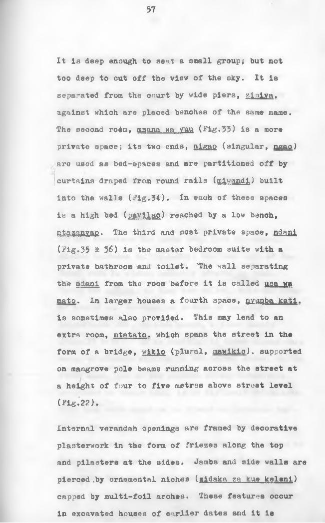
It is deep enough to sent a small group; but not too deep to cut off the view of the sky. It is separated from the court by wide piers, zioiva. against which are placed benches of the same name.The second rodra, msana wa vuu (Fig.33) is a more private space; its two ends, nigao (singular, ngao) are used as bed-spaces and are partitioned off by curtains draped from round rails (taiwandl) built into the walls (Fig.34). Ia each of these spaces is a high bed (pavilao) reached by a low bench, ntaganvao. The third and most private space, ndani (Fig.35 & 36) is the master bedroom suite with a private bathroom and toilet. 'The wall separating the ndani from the room before it is called U3a wa mato. In larger houses a fourth space, nyumba katl. is sometimes also provided. This may lead to an extra room, mtatato. which spans the street in the form of a bridge, wikio (plural, mawiklo). supported on mangrove pole beams running across the street at a height of four to five metres above street level (Fig.22).
Internal verandah openings are framed by decorative plasterwork in the form of friezes along the top and pilasters at the sides. Jambs and side walls are pierced .by ornamental niches (gidaka za kue keleni) capped by multi-foil arches. These features occur in excavated houses of earlier dates and it is

58
customary to describe them as niches for lamps.In Lamu they are used for keeping copies of the Kuran and informants agree that this in fact has always been their function. One cannot help agreeing with this explanation as the shape of the niches would out off a considerable portion of the light if used for lamps. On the evidence of house plans from earlier dates it may be assumed that internal doorways were left as permanent openings, i.e. with no wooden door leaves.
As one traverses the house away from tho oourt, niches increase in frequency; the last wall of the inner room is almost entirely covered by them.Here, the zldaka. as they are called, take the form of arched and rectangular niches of varying proportions and, in most cases, a fixed module (Figs.37 & 38). It is doubtful if these niches were meant as storage alcoves in the normal sense; on the other hand, due to the absence of any decorative treatment at their back, it i3 difficult to believe that they were meant to be viewed as patterns for their own sake. The horizontal and vertical repetition and the variety in shapes and sections of individual niches do break the scale of the space and hence the sense of monotony of the dark room where the wife is expected to spend the rest of her

59
life. This technique is used in the Hadhramout, where niches are carved in the form of windows on the external walls of buildings, giving them the effect of multi-storey structures. The reference to porcelain in zidaka in the early nineteenth century poem quoted in Chapter 1-1, and information received from elders in Lamu town, seem to suggest that the zidaka were used for display rather than storage. In the niches the wife arranged her showpieces: imported pottery, bronze artifacts, ornamented manuscripts, etc. Some existing zidaka in Lamu have wooden shelves built across the niches seemingly for this purpose. By varying the arrangement of objects in the niches the look of the room could be changed at will.
The plaster of which the zidaka and friezes are made is prepared from lime, slaked from coral and probably mixed with a retarding agent. When used in vertical sections to divide niches from each other the plaster is usually reinforced with broken shells. It is not known whether carving was done by hand after the plaster was applied, or whether it was stamped by a mould. Probably a combination of both techniques was used, i.e. wooden moulds being stamped on the walls before the plaster was set and the pattern being worked later by hand.

60
Because of the discouragement of imagery in art by Islam, figurative representation in plasterwork is very rare. Motifs vary from stylised leaves in a spiral surround to chain, zigzag or fluted patterns. The turtle is a popular motif in plasterwork and a number of stylised examples of it still exist (Pig. 42). The design, patterns and details of the plasterwork are sophisticated, and pose an interesting problem of scholarship. The zidaka are similar to the niches in the houses of the tenth century Ibadhi towns of the Mzab (Pig.39) and there is a Mesopotamian miniature by the thirteenth century Baghdadi painter and illustrator Al-Wasiti, which shows what looks like wall zidaka with books in the niches (Pig.40). The plasterwork around internal doorways of Swahili houses are very similar to carving in ashlar masonary on the fifth century Anatolian church of Alahan (Kodja Kalesi)(50) shown in Pig.41. However there is no evidence to indicate
Idirect links with either the Algerian Mzab or Turkey.
House walls are built of uncoursed coral in lime mortar. Roofs and floors are of thick coral supported on wood Joists at close centres, rarely more than 30 cms (Fig.34). Rooms conform to a constant module which limits their width to about 2.7 m to 3 m. This is a convenient planning grid

61
for domestic buildings and has probably been dictated by the spanning limitations of mangrove poles. In mosques, where larger spans are required, primary beams of twin soft wood members, rectangular in section, were often used. Large wood sections requiring advanced felling and seasoning techniques are rare. Roofs are made of layers of coral lumps, sealed with lime plaster. When this sets the roof acts as a shallow arch buttressed by the thick side walls.
Ruined sites are used as tambuu or betel tree gardens. The nut of this tree is crushed and ohewed and is said to have an intoxicating effect; it is not prohibited by Islam and is therefore in widespread use. Betel gardens were a common feature of Swahili towns. In the sixteenth century town of Jumba ya Mtwana, surface water from streets is drained into the large sunken courtyards of houses which were apparently used for growing betel trees (51).
Houses usually face north or south; apart from the rationale of sun protection, it is possible that facing the aibla has popularized this practice; the Ki-Swahili term for north orientation is upande ya Kibla. This preference has sometimes produced complex staircase layouts to make them land in the

62
right direction. Such concern with orientation ie prevalent throughout the coaat. Garlake states that "only two complete houses in the entire coast face westwards and both are subsidiary units within large palace complexes" (52).
Wells provide sweet water fbr domestic use. In some of the other towns of the archipelago, Pate for instance, rainwater is collected from roofs and stored. Many of the mosques of Lamu have their own wells and there are a number of independent ones as well. Water is emptied into a funnel, mllzamu. placed outside the bathroom wall and connected to the cistern, blrlka. through a half-round stone conduit laid to fall along the inside surface of the wall. The cistern is rectangular in plan, about 1.5 m long, 60-80 cms deep. A low partition separates the bathroom from the toilet which is of the pit-latrine type, capped by a coral stone platform,. The back wall of the toilet is sometimes semi-circular in plan in the shape of an apse.Upper floor toilets discharge into the pit through large stone ducts. A bidet consisting of twoelevated foot rests is often included in the bathroom

63
DEVELOPMENT OP HOUSE FORM
The house described above does not date back further than the mid-eighteenth century and we have no evidence of earlier planning patterns from Lamu town.
Older structures do exist below ground level, but until archaeological search uncovers earlier prototypes it will not be possible to establish with any certainty the lines the Lamu house has followed during the course of its development.
There is a ruined two-storeyed house in the deserted 18th century site of Mtwapa, about ten miles northof Mombasa. It was part of a compact terrace, and/consists of three room spaces behind a courtyard.Few pre-eighteenth century multi-storeyed houses have survived though we know from Portuguese accounts that they did exist (53). In Kilwa, where the Portuguese saw many two and three storey structures,there are traces of two double-storeyed houses
1behind the Great Mosque. There are also the remains of two houses that appear to have been doublestoreyed in Omwe and She-Jafari on the mainland opposite the island of Simambaya, about fifty miles north of Lamu. They are similar in plan to the houses of Lamu and are probably older than the eighteenth century (54).

64
The eighteenth century palaces of Kil a and Kua, are double-storeyed; so is one of the houses within the Kilwa palace enclosure.
In Bongo Mnara many houses are preserved, all single storeyed. They include the smallest and the largest known Swahili houses of this type, named by Garlake "minor” and "double" respectively. In Gedi, fourteen houses have been excavated. Like the Lamu house, all these consist of series of long, narrow spaces stacked behind an open court. The same arrangement also exists in the oldest preserved house plans, within the thirteenth century complex of the palace of Husuni Kubwa in Kilwa. Here, north and south of the Palace Court are a "normal" and a "double" house respectively of similar plans to those described above.
The houses of Bongo Mnara have entrance lobbies, which lead to sunken courtyards (Pig.43). Adjoining the entrance lobby is an isolated room for servants. The house proper is entered from the court and consists of a long anteroom, leading to a main room of the same size and proportions. Behind are two bedrooms, eaoh half the main room in length. At the sides of the built area of the house are two other rooms, one on each side. In most of these, Jambs to

65
openings are adorned with decorative niches.
Some of the houses of 3ongo Mnara show remains of timber shelves built across the width of some of the rooms, about 1 m wide and 1 m above the level of the floor. This feature Is also found in the thirteenth century Husuni Kubwa of Kilwa. It appears twice in Gedi, where it is built of masonry, and twice on the eighteenth century palace of Kilwa. One of the rooms in the residential core of the latter shows masonry supports for a mezzanine that covered an area of 2.8 x 2 . 5 m at a height of about 1.3 m above ground level. To allthese Garlake gives the designation "bed" (55).
iHowever, these structures are unsuitable for this function, being too high, and, in one case, too short for a bed (56). It would have been easier and cooler to sleep on the floor; it is difficult to imagine these built-in structures being used for anything other than storage.
The rooms marked (A) on the 3ongo Mnara plan illustrated in figure 43, which are called by Garlake Main Private Rooms, were probably guest rooms. They hnve secluded entrances and in many oases private latrines attached to them.

66
Gedi houses are similar to those of Songo Mnara; they have fewer niches but some Internal walls have decorative pilasters. Some of the houses of Gedi show the addition of a store, accessible from a high trap door, reached by a ladder. Gedi's excavatar, James Kirkman, believes that they may have been safes for the storage of cowtie currency (5 7).
In the Lamu houses the servants rooms are said to have occupied entire floors. According to the inhabitants of the town, living, sleeping, work and hygiene accommodation for the domestic slaves were arranged on the ground floors below those of the owners. This however seems hardly credible as in some cases ground floors have more intricate decorative plasterwork than upper floors (5 8 ).
The courtyards of Gedi and Kilwa are smaller than those of Gongo Mnara and, due to the compactness of the built-up areas of the towns, they are more
I
varied in arrangement, and often sunk to ensure a deeper shadow. The two-storey Lamu house has two courtyards, one for each floor. The first-floor courtyard is smaller and covers part of the grounnd- floor one, while the uncovered portion continues through the first storey in the form of a well (see Figs.24 & 25). This is probably the most striking
67
difference between these houses and courtyard houses in the Arab world and elsewhere where the open well continues vertically in the form of a single shaft.
The finely carved niches at jambs and end rooms, and the decorative plasterwork in houses generally are almost certainly attempts to counteract the monotony generated by the practice of stacking the lopg narrow spaces of the house behind each other. Garlake's observation that decoration is less common in Swahili domestic architecture than in mosques (59) is true of the southern Swahili houses, probably because ornamentation was there substituted by hangings draped from wall pegs (60).In the houses of the Lamu archipelago decorative plasterwork appears to be the product of an artistically mature period. The skill portrayed in its execution represents the highest attainable within ,the limitations of the medium of coral lime worked with basic tools. Its chief interest lies
. in its intrinsic relationship to the architecture that embodies it; a relationship in which decoration, structure and plan patterns are complementary to each other.
The houses discussed above share two important

68
qualities: firstly a single-minded axiality in plan, and secondly a constant module limiting room widths to about three metres. The latter, as we saw, is the result of the development of a domestic planning grid dictated by the limiting technology of the materials used. The first is more difficult to explain; but, on account of its universality, it must also be accepted as a permanent pattern. There are some non-axial houses, but these are so few that they can be considered as independent exceptions.
The large number of houses in the eighteenth century island town site of Kua, about thirty miles east of the Rufiji mouth, are a variant of the pattern described above. They are twin houses, eaoh with its own large court, but both sharing a common entrance. Garlake believas they were the household quarters of the two wives (61). If this is so they are the only known Swahili houses where a privacy of this kind was considered necessary. There are remains of a house in Dondo (62) on the mainland above Faza island, which is also not axial in plan.A daka is flanked by two long rooms, one on each side entered from an outer passage accessible from the daka. The rest of the plan is not clear, but it could have been similar in organization to those of

69
Kua mentioned above.
The houses of the poor would have been built of mud and wattle walls roofed with palm leaves or grass thatch. These are impermanent materials which deteriorate within a very short span of time. Although such dwellings undoubtedly housed the great majority of the population very little is known about them.
I

70
PART TWO: GENERAL CONCLUSIONS
2-1. Swahili Concepts Of Space
The study of the modelling and use of urban spaces is meant to find out how a building, a neighbourhood or a town have come to be the result of the action of available skills on existing materials to produce a specific environment for a particular way of life. Urban spaces and the manner in which people use them are interdependent in the sense that systems of behaviour can only fundtion within an appropriate shell, and the shell, once formed, gives permanence
culturally determined activity, "we can choose the form of our houses no more than the cut of our clothes. The one is imposed on us to the same degree as the other by social usage." (6 3 )
Below is an attempt to analyse the form of Lamu town 4.as an expression of the specific "mood" of Swahili culture, and to draw general conclusions on the morphology of the Swahili town generally.
PEDIGREE
to these The patterning of space is a
V—
Figure 23 shows the town of Lamu divided into thirty-six mitaa The group to the north, known as Mkomani, is made up of large stone storeyed mansions

71
whioh are the quarters of the town's Influential lineages. The southern ones, called Langoni, are the quarters of the poorer sections whose houses are built of mud walls and thatch roofs of coconut palm. Each group has its own mosques; but the important Friday mosque is in Mkomani and its mkhatlbu. reader of the Friday sermon, is always chosen from one of the lineages of Mkomani.
Frins has noted that Lamu inhabitants distinguish two types of citizens depending on the part of the town they occupy: wa-Amu. the original inhabitants, are the occupants of the stone sector, and watu wa Amu, occupants of the mud and wattle sector. He describes a tendency for patrician family heads to move to the northern half of the town with advancing years. He has also noted a resistance among stone house owners to letting out houses or rooms to prospective tenants who do not belong or aspire to belong to "people of pedigree" (64). Even the
f
founder of Lamu's important mosque college, Al-Habib 3alih, as a new arriver to the town, had to build his house outside the stone zone (65). The college he founded is likewise situated there. It is of course fitting that this should have been so, as the academy houses a large number of foreign boarders for whom it would have been very difficult to find

72
accommodation in ilkomani anyway. During the last day of the maulldi celebrations, when participants collectively pay the customary homage to Al-Habib Salih's grave, the two sections send separate representatives as though they were two different entities (6 6 ).
The stone sector is the traditional power oentre of the city state. All decision-making rights such as choice of ruler, declaration of war, peace settlements etc., have traditionally remained the exclusive rights of the occupants of the stone section. The baraza. the traditional discussion forum, which consists of benches placed along the harbour (Fig.4 4 ), is still only used by the occupants of the stone town (67). When a "stranger" greets a baraza in session the customary karibu (3w. a welcome to join us) is not said in reply.
The general Swahili term for descendants of influ-1
ential lineages is Wa-Arabu (sing. Mwnrabu) in contradistinction to recent migrants from Oman and the Hadhramoht known as Wa-Manga and Wa-3hlhirl respectively.
The term Wa-Arabu is not a distinction of race, as it may imply, but of pedigree. The majority of

73
people known by this name do not in fact speak Arabic, and those who do use it as a second language. irfhen Ibn-Battuta visited Mogadishu (c.1332 A.D.), the sultan, who knew Arabic, spoke the local language, and from the poor Arabic of the Kilwa Chronicle (c.1530) we may divine that Ki-Swahili, or a prototype of it, and not Arabic, was the first language of its writer. The three taifa of Lamu, the original tribal groupings from which the town's present clans descend, all have Swahili names (6 8 ).
In Lamu, the local name for Wa-Arabu is Ziloho (sing. Kiioho). The word is derived from .1 oho. the name of their exquisitely embroidered ceremonious gowns. Dress is traditionally a distance preserver and has here given its name to the ruling class in this pedigree conscious society. The pedigree of Wa-Arabu is a function of the antiquity of their ancestry on the East African coast. This wasfnoticed by Burton in Mombasa in 1857 when he found the Mvita "the older and consequently the nobler of the Swahili groups" (69). There were few women among early waves of Arab migrants, which meant that most men would have married African wives. As a result, nobility in Swahili society is patriarchal, i.e. a Mwarabu father keeps the pedigree for his offspring

74
irrespective of the colour or ethnicity of their mother. The situation is not the same in the case of a Mwarabu wife with a non-pedigree husband. An informant remembers his grandmother reserving in her sitting-room a wooden stool for one of her visitors
whose husband had African blood from his father's side, in distinction from other guests who sat on padded chairs.
Reference has already been made to a tradition that the present inhabitants of Sheila, the original escapees from Manda, being strangers to Lamu, were only given shelter on the condition that they did not build in stone. Stone houses, no doubt because of their permanence and grandeur, are regarded the privilege of people, of pedigree. The general Swahili word for house is nvumba; but a multi-storey stone house is called belt. There is a current tradition among rural Bajunis which says that at the turn of this century an epidemic broke out in their islands, killing about seventy percent of them. As a result the demoralized survivors vowed never to build in stone again. The story is interesting in that it implies that rural Bajunis are original stone house dwellers and hence people of pedigree. Recently, a European who was finding difficulty in recruiting local workmen for a factory he was intending to set

75
up south of Kl3mayu found the people much more eager when they realized that the factory was to be built of stone. "'Aiyee, dtone', came the surprised murmur from all round, and I realized that in this word lay the proof, in all their minds, of the enduringness of the work. 'Yes’, I added ... 'and the walls are as thick a3 this ...' 'Aiyee - 30
thick? and the walls all of stone? Then it is a building of ten generations!' Prom this point the whole attitude of the villages changed" (7 0 ).
The difference in life-style between the two halves of the town is reflected in the character of the main street. Shops are concentrated in Langoni (Pig.45)i they become less in number and larger as one approaches Mkomani (Frontispiece). At its entrance they almost disappear, and the busy, crowded main street changes into the quiet thoroughfare that a rich aristocracy expects to find in its own quarters. The absence of shops is axiomatic of the Zllohoa* contempt for manual work. It is said that until recently the gentlemen merchants of Lamu used to send their garments for starching to the Hadhra- mont. When the Jahadhmis, the town's first shopkeepers, arrived from Oman during the seventeenth century, the shop they set up in their house gave its name to the whole mtaa: Madukani (Sw. at the

shops)
All the town's caf^s are concentrated in Langoni.A Kljoho would not normally be seen in one. When the present writer, out of ignorance, insisted on one Joining him for coffee, the caf6 was soon surrounded by an astonished crowd. It was then explained that that was the first time a Kijoho had ever sat in a oaf 6. Until recently the madaka of houses were used for this purpose. Visitors normally arrived after supper to spend the evenings talking, fingering beads and eating halwa (71) with coffee. Beads, coffee and halwa are traditional adjuncts of talk in Swahili society; one of the captains in Vasco da Gama's fleet was treated to halwa by the Sheikh of Mozambique in 1498. He was also made a present of a string of black pearl beads (72).
INVOLVEMENT
A study of Swahili house groupings suggests that the mtaa may have developed along the following lines: a house was built on a large site; with the demand for additional accommodation other units were added, arranged around a central private access. Through intermarriage, clans and mltaa sometimes merged. After a while, la^d available for expansion became

77
soarce, houses expanded vertically and, where possible, bridged over streets. Densities rose, plots shrunk, ground coverage reached maximum limits, and party walls and sometimes other shared facilities increased (7 3 ).
Within housing blocks units bulge into each other in a manner suggesting that a high degree of cooperation existed between neighbours and that adjoining houses were built at the same time, perhaps by related families. We have archaeological proof of this from Gedi and Songo Mnara. In the first, part of one house was taken over by an adjoining one apparently while both were under occupation (74). In the second, fifteen adjoining houses were combined to form what is now called the Songo Mnara palace (75). The room, spanning over the street mentioned in Chapter 1-3, the so-called wlkio. belongs to one house but depends for structural stability on external walls of others.
IIn Lamu there are twenty-three mawaikio (Fig.52),the longest one measuring eighteen metres.>•
The streets of the Swahili town provide usable public space (Fig.46). Their function may be contrasted to that of streets in modern cities which are strictly meant for "going through", where

78
"staying in" is synonymous with loitering, and is sometimes punishable by law. In the Swahili street one is constantly brought face to face with others; as a result the common phenomenon of street behaviour intensifies. To avoid an abrupt change from the formal environment of the street to the intimate atmosphere of the house (often a shortcoming of modern house designs), a form of transition becomes necessary to achieve a feeling of arrival and to ease the momentum of tension appropriate to street behaviour. In the Swahili house this is achieved by the daka porch, where the changes of level, materials and light intensity help to break the effect of outside behaviour.
This form of involved living is common in expatriate communities and has here been accelerated by the high involvement ratio of the inhabitants' cultures of origin in South Arabia and the Gulf region. In interpersonal encounters this involve- ment runs high. In funerals the coffin is followed to the cemetery by a large procession of mourners who take turns in carrying it. By the time it is lowered each mourner will have carried the coffin more than once. The launching of a new boat is also a communal activity. It normally takes place on a .Friday afternoon; the Friday noon congregation

79
leaves the mosque directly for the launching ground where they all join in pulling it to the water (fig. 47). The operation is accompanied by unison chants.
Pushing and shoving in public places is character- istio of the 3wahili town (fig.48). When an informant was told that in some oountries touching during an argument could be legally claimed as assault he was shocked. To the Swahili the sense of touch is a natural means of communication; the habit of hand kissing is but an extension of this.
Although many of the inhabitants know how to read and write it cannot be said that the written word has played a major role in communications in Swahili society; the most important medium remained the spoken word. News were announced by special town criers Just as the oall to prayers is today shouted out from mosque roofs. Important announcements were accompanied by music (76). An early nineteenth century poem begins by oalling upon the different categories of
f
criers to announce the news of war like this;"Zez® and Asha Haraadi,Say to our brave men,'Those who may come,Will find our door3 latched.'Kyumbe, strike with the palm leaves the copper plates!Blower, blow hard the alwaLet the sound of the horn follow!The ornaments of the siwa Improve its resonance." (77)

80
In Lamu important items of news such as new film shows, bus departure times, etc., are still cried out in this manner. Stigand, writing in 1909, complains about the coastal man frilling to distinguish between hearsay and direct evidence. 'He will relate any story he has heard as if it has occurred to himself, and thus one is abld to get first hand the relation of so many marvels, all of which the narrator alleges to have seen for himself." (7 8 ).Marshall Mcluhan, writing about fifty years after
*»Stigand, examines similar situations and concludes that this is a natural state of affairs brought about by the oral mode of communications. "The literate society develops the tremendous power of acting in any matter with considerable detachment from the feelings of emotional involvement that a non-literate society would experience" (79).
The high involvement ratio has set the scale of streets and open spaoes at an intimate level. It has also had the effeot of reducing the "personal space" (80) of the Wa-Swahili to a minimum. The prayer hall of the Lamu Friday mosque, which measures le38 than 250 square metres, accommodates the entire male population of the town during the Friday noon prayers (Figs.49 & 50). This gives an area of less than three-quarters of a square metre per person.

81
Involvement is also responsible for the absence of any expression of grandeur from Swahili architectural patterns. The Swahili mosque for instance is not a large building, and cannot always be easily distinguished from houses externally. As we saw, it has no minaret nor is it built to the scale of mosques of the great Islamic capitals. When a number of Lamu elders were shown pictures of the great mosques of bin Tolon, Qairawan and Cordova, they were impressed by their grandeur, but said they would not like to pray in them because they found them too vast and impersonal (81). The Yumbe or government house of Lamu is no more than a fifteenth of a hectare in area and no different from any other town house in plan, that of Gedi being only slightly larger. This is generally the sort of scale for rulers' residences throughout the Swahili coast. The thirteenth century Husuni Kubwa, which appears to be an exception, is referred to in the next chapter.
PRIVACY
The plan of the Swahili stone built house gives maximum length to communication lines between rooms; a similar quality is achieved in the streets by staggering the front doors on plan; both devices

82
are brought about by considerations of privacy. Another interesting dictate of privacy is found in the 15th - 16th century houses in Gedi where house plans "almost always ensure that the doors of outer rooms are never placed directly opposite the doors leading on to the inner rooms. Thus if both anteroom and main room occur, the ante-room will have two doors, and the main room a single central door at the front. At the rear of the main room, the bedrooms will, of course, again each have a door.If there is no ante-room, the main house will be entered from the court by a single central door unless there is only a single bedroom with a central door in which case the main room has two doors" (82). In the north wall of the main block of Gedi palace Kirkman found a blocked doorway which he suggests was a small door through which pedlars could sell their wares. "It is possible that pedlars were not always pedlars and they sometimes offered more interesting wares than cloth and beads" (83).
The house is a closed box; despite the high relative humidity no external window openings are tolerated. The environmental requirements of daylight and ventilation are performed through the kiwanda or courtyard. As a result the street

83
acquires a privacy of its own; in a sense it acts as a public lounge, an extension of the madaka or the semi-open porch/reception rooms of houses.
Street facades are uniform and, except for entrance doors' openings, opaque. Front doors are endowed with so much embellishment as to make them unique components of their kind in domestic architecture anywhere. This highly personalized treatment is meant to restore the identity of the house in the setting of the standardized facades; it is not uncommon to find a carved door in front of a mud hut built on the ruins of a stone mansion. The carved door appears to be an early feature of the architecture of the region; when the Portuguese plundered the town of Paza in 1 5 8 7, among the loot carried away were a large number of carved doors (84). The Portuguese historian Barbosa found the doors in Kilwa houses "well carved with excellentjoinery" (8 5 ).
1
Like the Egyptian temple, the Swahili house is axial in plan; as one follows the axis in the direction of the interior of the house, spaces become gradually darker, more decorated and more intimate. The axis acts as an intimacy gradiant; the further up a room is placed, the more private

84
It is. The gradient is marked at its ends by the daka and ndani. the most formal and informal places respectively; the former is the antithesis to privacy, the latter the antithesis to involvement.
The Swahili town has a large number of mosques.There are twenty-three in Lamu town alone giving the very high ratio of about one mosque per one hundred adult males. It has been customary to contribute this to exceptional preoccupation with religion. Whilst this observation may not be incorrect, it does not describe the entire function of mosques on the East African coast. They serve as the town's public lounges; the equivalents of the common, the Georgian Square or the public park; or the "social clubs" of the Swahili town. Like clubs which generally draw their members from specific social classes or ethnic groups, the Swahili mosques draw their visitors from descendants of specific lineages. In Lamu, for instance, the mosques of Anisa, dated 1830 on Figure 23» and Raskopu, dated 1797, are used by the non-pedigree; Utukani, dated 1823, is used by descendants of the Mhdali lineage; Pwani, dated 1370, and Nna Lalo, dated 1753, are for the Ma'awis; Mpiya, dated 1845, is for the Jahadhmis, and so on.

85
The thick stone vails and cool matted floors of the Swahili mosques provide the protection men need from the external environment and the involved existance of everyday living (Fig.51). Until recently, contrary to Muslim practice, Lamu had a womens’ mosque where they too could spend some time in solitude when needed.

86
2-2. Structure of the Swahili Town
The shape and layout of the linear Swahili harbour town, of which Lamu is an example, is determined by a heirarchic road network. Lamu's main street is the principal communication spine, as the suq or covered market street is to the Muslim Arab town, and the rienamanuB was to the Imperial Roman town. Lamu's market square, facing the fort, continues to the harbour forming an east-west hinge which bisects the main street in the same manner as the Roman corda bisects the decamanus at the forum. The market is placed at the intersection just as it would be in the market towns of medieval Europe
(Fig.52).
About two hundred and fifty metres north of this axis is a straight wide road which connects the sea-front to the town's traditional council chambers (yumbe) and continues west to a large mtaa named Utuku Mkuu, which means "great market". There is no market here now; but it is probable that this street was the original corda of the town during the eighteenth century or maybe earlier. At its east end is the mosque of Nna Lalo which stands in its own precinct and has the equivalent date of A.D.1755 inscribed on its mihrab. Dates in Lamu mosques

87
are not always reliable, but that of Nna Lalo Is probably the least suspect (8 6 ). The Ndia Kuu (main street) of Mombasa Is placed In the town in the same relative position as the main street of Lamu. This is crossed by a square overlooked by the market and now, the customs house. The market square opens on to the town's old harbour.
The two axes lead to the mitaa through secondary lanes which become smaller and less ordered the deeper they penetrate the residential quarters; in some cases terminating in cul-de-sacs at house daka entrances. This is very similar to the road-net of the linear merchant city of the Muslim orient (87).The chief difference of the Swahili harbour town from the Muslim town is one of scale. Because of the seasonal nature of its trade, dictated by the rhythm of the monsoon, and the relatively limited volume of its merchandise, the Swahili market did not grow to anything like the Muslim covered suq.The large building complex of Husuni Kubwa (Fig.53), which covers an area of about a hectare is thought by its excavator to have been intended as an emporium (8 8 ). If this is so its foundation represents a landmark in Swahili town development in that it is the first example where the function of trade is given architectural embodiment in a scale

88
comparable to that of the larger merchant oltiea of thdt time.
The spatial division of Lamu into a stone-built town and a mud and wattle sector is a general pattern in the spatial organization of the Swahili town. In the mid-nineteenth century Burton found Qavana, the old town of Mombasa, built of "narrow huts clustering around a few one-storeyed flat roofed boxes of glaring lime and coral rag" (89). Fifteenth century Portuguese eye witnesses describe coastal towns in similar terms. Some like Moz mbique and Oja had few stone buildings, others like Malindi had many (90).All had their own sections of mud and thatoh buildings.
The division of the town into mitaa being residential sectors for families of related clans is also a general East African coastal pattern. The Arab geographer laqut, writing between A.i). 1212 and 1229, describes Moqadlshu as being occupied by "tribal sections, having no sultan but each clan having a sheikh whose orders they carry out" (91). This draws upon precedents from Muslim Arab towns.Ta'qubi describes the seventh oentury town of Kufa in western Iraq as consisting of several tribal quarters; each having its own mosque, public bath, and, in some cases, a market. In Samarra, the Abbasid Caliph

89
Al-Mu'tasim allocated independent wards to the different ethnic units.
Unlike the mltaa of the mercantile towns of the East African coast the neighbourhoods of the Persian and Arab towns later developed into merchants’ guild wards as the towns grew into trade termini. When Ibn Jubair visited Baghdad in c.1184 A.D. he found the eastern part of the town made up of seventeen quarters. One of them, Itabiyyah, was famous for silk and cotton weaving of various colours. The word tapestry owes its origin to this name. This diversification was reflected in the Muslim towns where "producers or retailers of the same kind of goods will always occupy adjacent stalls, in fact each trade is likely to have one of the market lanes completely to itself" (92). The Swahili harbour town did not have the chance to follow this line of development (93). It may therefore be described as a variant of a Muslim market town; its development towards a fully-fledged merchant city was arrested for a variety of reasons, chief among them being a scarcity of raw materials (9 4 ) and prolonged foreign intervention.
Although there can be no doubt that the prime raison d 13tre for coastal urbanisation was trade, it must

90
not be assumed that all civilizing and town building activities on the East African coast were dictated directly by the demands and limitations of trade. There was, for example, the town of Gredi, four miles from the sea and two miles from Mida creek which was during the fourteenth, fifteenth and sixteenth centuries a large town covering an area of about forty five acres within the outer walls. It was not a commercial town or it would not have been ignored by the Portuguese chroniclers. The reason for its existence is not known, possibly it was a resort for absentee landlords who belonged originally to Malindi (9 5 ).
There is also the town of Pate, which, despite a very poor harbour, became a wealthy city-state of considerable importance. Pate and perhaps Faza, which has a slightly better but also poor harbour, exemplify a type of economy which did not rely on shipping movement in their harbours for their wealth.
IThey were^ not "depot" towns as was the case with Lamu which relied on its excellent harbour to play the role of the middle-man of trade, i.e. storing commodities for reshipment. Pate was famous for its fine coloured woven fabrics; apparently the quality of the produce was so high that the term "Pate cloth" became a general term to describe the richer varieties

91
of fabrics. The town is also, according to its own history, supposed to have manufactured the first locally made ocean-going ships (96). It is mentioned in an account of a voyage by a Portuguese captain undertaken in 1547 as having been a place in which large vessels for the orossing to India could be hired (97). Pate was a "workshop" in distinction from a "depot" town. There is evidence of industry elsewhere too: iron working in Manda,Kilwa and possibly Malindi (9 8 ), cotton weaving in Mogadishu the Kerimba islands and the adjacent coast. The Portuguese historian Duarte Barbosa records an interesting observation about weaving in Sofala where locally produced white cloth had woven into it blue and other coloured threads drawn from material of Indian origin.
It is tempting to argue that had these towns had the chanoe to develop naturally they could have grown into industrial centres. However, such an argument is offset by the puzzling fact that a town like Manda which enjoyed four centuries of uninterrupted existance, rather than developing along these lines, died out by the end of the thirteenth century (9 9 ).
The makonde cultivations described in Chapter 1-1 produced the agricultural villages which housed the

92
plantation workers (mostly slaves) and their families. These were seasonal villages in places, but at others they grew into permanent townships. Judging by the remains of some of these villages, Hindi for example, on the mainland opposite Lamu island, it appears that they included a number of mosques and had communal wells. The largest of the mosques was used as a Friday mosque and was placed at a central position. The sermon was delivered by a travelling , m khatibu who belonged to the town owning the plantations. "Muslim Canon law does not insist on the faithful to recite his prayers in a prayer house; but the Friday community prayer may only be held in a fixed settlement with a permanent population of whom at least forty adults must be present to make the ceremony valid" (100). This stipulation tended to accelerate the growth of towns generally, without which the inhabitants would have been precluded from full religious life.
One must pause a little to consider the reasons and then the results of the success of Islam in the East African coastal region. It demanded little in the way of religious duties or ritual; but offered in return an enhanced social position, signified by the cap and gown, a membership in a large community and, not least, a paradise with green lawns, rich orchards,

93
attending hourls and so on. Islam did not abolish slavery, although the Koran, In several places, demands a fair treatment for them (101). The religion appears to have provided an attractive world for the multitudes of plantation slaves emerging as they were from a secure existence where man's destiny was seen through the collective destiny of the tribe to the organized relations generated by the new class society. The sherif soon distinguished himself as the propounder of the divine message. He took the place of the ritual leader, priest and doctor of the tribal world. To a large extent he still acts in these capacities nowadays.
A reading of the history of Muslim expansion and the resulting acceleration of urban growth shows that the religion embodies a strong urban message.Muhammed was himself a townsman who, since the age of twelve had been joining his merchant uncle on caravan journeys to Syria and elsewhere. His
fmessage came as the ethics of the sedentary over those of the nomad. Trimingham quotes "an intelligent and well read faaih (learned man)" in Ujiji as saying that, from his experience, Islam needed an urban centre to root itself (102); and Meek, discussing Islam in Nigeria, records a similar observation (103).
94
On the East African coast no evidence of pre- Islamic urbanisation has yet come to light through archaeology. This does not mean that no permanent settlements existed. An examination of the exports of the coast during the early centuries of our era has led Neville Chittlck to suggest that permanent settlements did exist (104). The same writer also notes that the lower strata at Kilwa, showing remains of rectangular houses may also be pre-Islamic. The scaroity of visible traces of these pre-Islamic settlements probably indicates that stone building techniques were not known. The towns would have been constructed of less permanent materials which do not normally survive in this climate where every man-made thing seems destined to be overwhelmed by nature and forgotten.
These settlements, according to one theory, began their life as seasonal towns and grew gradually through trade into market towns (105). This important change was probably facilitated by the development of the makonde plantations which ensured not only a surplus of food for the town dwellers, but also goods for their trade. We do know that some of the agricultural produce of these plantations were exported to Arabia during the fifteenth

95
century (106).
We do not know when the tnakonde work pattern took form or how It developed. If the Kenya Land Commission on evidence is anything to go byf we may assume that much of the hinterland had been in effectual and effective occupation by the Lamu townsmen or their slaves since the thirteenth oentury (107). The word kundl appears in a short Jwahili vocabulary recorded by Al-Idrisi in the twelfth oentury from which some scholars divine a reference to konde (108). However, these dates do not indicate the origin of the system which is likely to be older. Its growth is almost certainly linked to the growth of towns as these plantations needed to rely on an organized power structure of a type that only an urban centre could provide. Equally, without a food-producing hinterland of this kind, the townsmen could not have turned their energy to the requirements of trade.
I
ttany features of the 3wahili town show similarities to prototypes in Arabia, Iran, India and other regions of the Indian Ocean. James Kirkman has attributed certain techniques of arch building found on the Swahili coast to India. Neville Chittick
has compared one of the tenth century houses of rtanda

96
to contemporary plans in the Persian port of Siraf; and the thirteenth century Husuni Kubwa to the eighth century Ahbasid Palace of Ukhaidir in West Iraq. The n^alawa or Swahili double outrigger canoe, the coconut and other items have been traced to ancestral places in Indonesia and Malaya. The marked spatial segregation in the Swahili town between pedigree and non-pedigree quarters may be compared to that found in Indian villages where the quarters of the caste sections are divided from those of the outcasts harlIans. The Swahili cultural unit owes many of its elements to regions in the Indian Ocean with which, until the nineteenth century, it had more in common than with places on the continent of Africa (109). It was not until the opening up of the trade routes with the interior, especially after the establishment of the Zanzibari sultanate that the picture began to change. Prior to this the coast's main lines of contact were maritime. During this time many skills and techniques were imported to the Swahili coast mainly through migrations, some of which took place on a large scale.
It is altogether fitting that this should be so."In so far as culture is an adaptation to a special enviomment, it must be modified by transfer to a

97
different environment and the degree of modification is likely to be inversely proportional to the culture's technological level" (110).
The imported impulses gradually underwent local modifications resulting in a culture with its own personality reflecting the social structure, state of knowledge and skills of this distinct historical period. In architecture for instance we saw that a number of design patterns and building types are sui generis (111). In the field of religious institutions Trimingham cites local religious practices where orthodox Muslim dogma is modified by local mythology. Examples of other cultural manifestations showing sililar modifications can also be cited (112).
1

98
NOTES AND REFERENCES
(1) . They are, from the Horn of Africa down: BiladBarbara (the Country of Barbara), al-'Ard al-wafrah-al-Judan (the Barren Land of the Black Peoples). 'Ard al-Zenj (the Land of Zen.1). * Ard Sufalat al-Tibr (the Land of Sufala, where there is gold) and Ard Waa Waa (the Land of Waq Waq).
(2) . Al-Mas'udi, tturu.l. Vol.2, pp.107-109.(3) . Al-Mas'udi, Al-Tanbih. p.51.(4) . Al-Mas'udi, Muruj. Vol.2, p.17.(5) . Ibid.. Vol.2, p.6.(6) . A form of administrative grant of land under
which portions were made over in semi-ownership subject to tithe. Many types of 'ikta' were practiced but the one that concerns us here is that dealing with barren land: 'ikta' al-'ard al-mawat. which became widespread during the period under consideration. Al-Balathiri (Putuh) pp.501, 503, 505-506, states that tracts, some as large as the equivalent of 1,200 hectares were sometimes given over.(See Encyclopaedia of Islam, Vol.3, pp.1088- 1091, and Al-Duri, A.A. (1970).
(7) . Al-Tabari, Tarlkh ... Vol.3, p.1750.(8) . This is attested by the fact that the leader of
the Zen.1 revolt in Basrah, Ali Ibn Muhammed, after delivering his famous 1Id-ul-Fitr speech (A.D. 869), asked "those who understood to translate to those who did not." See Al-Tabari, op.cit.. Vol.7, p.547.
(9) . Al-Jahiz (ed. Van Vloten), pp.57-85.(10) . Freeman-Grenville, G.S.P. (1966), p.9.(11) . Tippu Tip (1970), p.121.(12) . The Nabahani (Arabic Nabhani) is a clan of an
Arab tribe that ruled Oman for two and a half centuries until the beginning of the fifteenth century.
(13) . Chittick, H.N. (1969), passim.(14) . The poem, entitled al-Hamziya, is written in

99
the Ki-Amu dialect by a Bwana Mwenga. It is a translation of a thirteenth century Arabic poem written in Egypt. According to Dr. Knappert, to whom I am indebted for this information, this is the earliest known Swahili poem.
(15) . There is an account in 1648 of an adventurousPortuguese plan made by a captain Salvador Correa de Sa who wanted to start from West Africa and traverse the whole continent in order to force Pate to acknowledge allegience to Portugal. See Strandes, J. (1968), p . (99 .
(16) .^uyumbe zao mbake ziwele tame,Makinda ya popo iyu wengeme.Husikii hisi wale ukeme,Zitanda matandu walita ndiye.Madake ya nyumba ya zishani,Sasa walaliye wana wa nyuni.Bumu hukoraoma kati nyumbani,Zisiji na kotne waikaliye.Harries, L. (1962), pp.96-98.
(17) .( 18) .
(19) .( 20) .
( 21) .
(22).
(23) .(24) .
(25) .
Kirkman, J.S. (1957), passim.Kirkman, J.S. (1964), p.73.Garlake, P.S. (1966), p.98.Stigand, C.H. (1913), p. 122.Prins, A.H.J. (1965), p. 228.Ylvisaker, M. (1971), p. 6.Trimingham, J .3. (1964), p. 147Official correspondence quoted in Salim, A.I. (1973), p. 24.Greffulhe, H. (1878), pp. 3228-3233.
(26) . Official report quoted in Salim, A.I.(1973), p. 38.
(27) . Jackson, P. (1930), p. 21, p. 37, p. 42 and p.91.(28) . Chanler, W.A. (1896), pp. 17-18.

100
(29) . Trimingham, J.3. (1964), p. 12.(30) . Prins, A.H.J. (1967), p. 12.(31) . GctrUk^pp. 78-79 and Kirkman, J.3. (1954), p.10.(32) . In addition there are two nineteenth century
forts in the area, one in Siyu, the other in Lamu. There are also the remains of a palace in Pate which ia not excavated. 3uch structures are classified by Garlake as an independent building type; he also includes the stone lined wells as a fifth type.
(33) . The reference to some mosque external doors asexit doors is made on the knowledge that, during prayer times, they could not have acted as entrance doors as they by-pass the ablution facilities.
(34) . This is placed in front of the mihrab to protect the ruler during prayers. It was introduced by the first Umayyad Caliph (seventh century A.D.).
(35) . Kirkman, J.S. (1964), p. 102.(36) . Garlake, P.S. (1966), p. 98.(37) . Ibid.. pp. 13-14. Garlake notes dimensional
irregularities and imprecision in the setting out of the main axis.
(38) . Mumford, L. (1967), facing p. 84.(39) . Hitti, P.K. (1967), p. 298.(40) . Prins, A.H.J. (1965), pp. 263-275.(41) . In a treaty signed between the Portuguese and
Pate in 1637 one of the conditions imposed on Pate was the destruction of the town walls.See Strandes, J. (1968), p. 186.
(42) . Orally from informants. Prins (1971), p. 47,presumably also relying on oral evidence, records similar conclusions.
(43) . Abu-l-Mahasim. Al-Manhal al-3afi wal-Jiustaufjba'dal wafi. Quoted in Guillain, G. (1856), Vol.l, pp. 299-300.

101
(44) . Chittick, H.N. (1967)(45) . Sir John Kirk, The British Consul General,
quoted in Salim, A.I. (1973), p. 39.(46) . Salim, A.I., (1973)(47) . Ibid., p. 20.(48) . For the cattle disease see Fitzgerald (1898),
p. 344-348.
(49) . "Mwana wakike akioka hukutoa ayumba, akioiahukutoa mui."
(50) . Pevsner (1967), p. 195.(51) . Rainwater from streets is drained down to the
courtyard through short, earthenware drains.I am indebted for the interpretation mentioned in the text to Dr.Kirkman who excavated the site in 1972.
(52) . Garlake, P.S. (1966), p. 89. One of theexamples is at Gedi and the other is at Kilwa within the Husuni Kubwa complex. Other west- facing examples do exist in fact. See Wilding, R. (1972), p. 43.
(53) . Freeman-Grenville, G.S.P. (1966), p.66.(54) . Wilding, R. (1972), p. 43.(55) . Garlake, P.S. (1966), pp. 92-93.(56) . House No.12 Songo Mnara; see ibid, p. 93 and
Fig. 74.(57) . Klirkman, J.3. (4963), p. 20.(58) . Existing evidence indicates that slaves, having
lived with their masters for so long, had adopted their style of life. "They cannot always be distinguished from their masters as they are allowed to imitate them in dress and in other particulars." See Richards and Place (1967), p. xxii, quoting Captain Owen on domestic slaves in Mombasa (c.1833).
(59) . Garlake, P.S. (1966), p. 87.(60) . Ibid.

102
(61) . P- 1°8 *(62) . Dondo la recorded by Chittiok (1967), p.66, aa
being the site of a Portuguese settlement previously thought to be in Tundwa on Paaa island.
(63) . Childe, V.O. (195«), p.7.(64) . Prin8, A.H.J. (1972), p.^\(65) . Leinhardt, P. (1959), p. 231.(66) . IMi., p. 239.(67) . The harass consists of benches placed at a
prominent position that act as a meeting forum for elders.
(68) . They are: Kina Mti, Kfamao and Ungwana wa Yumbe.I am indebted for this information to Sheikh Ahmed al-Jahadhmi. The Lamu Chronicle (p.13) mentions a fourth group named Nayublli or Wayunbili.
(69) . Quoted in Salim, A.I. (1973), p. 27.(70) . Travis, W. (1967), p. 55.(71) . A sweet jelly made of brown sugar, flour and
ginger.(72) . Strandes, J. (1968), p. 18, quoting a Portuguese
source. The Portuguese historian refers to the string of be^ds as a rosary. In fact these have no religious significance.
• t
(73) . An example of shared facilities is the kino orstone for sharpening swords. It is said to have been brought from Oman to Lamu three hundred years ago. It was built into the plinth of the house of the original owner and made available for public use. Sword sharpening is the prelude to a special kind of dance.
(74) . Garlake, P.S. (1966), p. 90.
(75) . M m P. 118.(76) . Leinhardt, P. (1959), p. 232, describes the
traditional annual bull sacrifice ceremony in Lamu in which a bull is led round the northernsector of the town before it is slaughtered and eaten communally. The ceremony is accompanied by the blowing of horns.

103
(77) . zeza na Asha Hamadi,Wahuburinl malenga,Ayao napige hodi, mllango tumeifunga,Uivumize Muyumbe, siwa yetu ya Myeo,Na yaandamane na pembe,Yamshabaka furungu,Uvumizapo Muyumbe.
(78) . Stigand, C.H. (1913), p. 124.(79) . Mcluhan, M. (1964), p. 79.(80) . Hall, E.T. (1966), p. 112, defines personal
space as "the distance consistently separating the members of non-contact species. It might be thought of as a small protective sphere or bubble that an organism maintains between itself and others”.
(81) . I am indebted to Mr. J. de V. Allen for thisinformation.
(82) . Oarlake, P.S. (1966), p. 95.(83) . Kirkman, J.S. (1964), p. 107.(84) . Strandes, J. (1968), p. 131.(85) . Quoted in Richards and Place (1967), pp.xvii
and xviii.(86) . On t)ie day before the traditional bull sacrifice
ceremony the animal is led round the town starting from Nna Lalo mosque. See Leinhardt, P. (1959), p. 233.
(87) . L. Torres Baibas (quoted in Von Grunebaum, G.E.(1955), p. iss ) describes the road nets of Muslim towns as follows:"Lea villes musulmanes possedaient aussi un certain nombre de voies transversales ou radiales qui mettaient en communication les porteo opposes de 1'enceinte fortifee de la Medina et squi se prolongeaient a travers les faubourges immediats. Mais sur elles se greffaient des rues 6troites et tortueuses d'ou partaient a leur tour un grand nombre de ruelles sans issue, qui se remifiaient a la fa?on d'un labyrinthe, commes les vienees du crops humain”.

104
(88) . See Chittick’s article in Zamanl. ed. Ogot andKieran (1968), p. 112.
(89) . Burton, R. (1872), p. 40.(90) . See Strandes, J. (1968), pp. 17, 25 and 66.(91) . Quoted in Trimingham, J.3. (1964), p. 5n.(92) . Van Grunebaura, G.E. (1955), p. 146.(93) . There is no evidence to substantiate a remark
by Trimingham (1964), p. 146, that Swahili towns "have streets of artisans plying specialized occupations".
(94) . Coupland, R. (1968), pp. 56-57 notes that "theeconomic exploitation of the East African coast proved difficult enough with the aid of modern science. In the seventeenth and eighteenth and early nineteenth centuries it was impossible".
(95) . Prins, A.H.J. (1965), p. 32, describes thevillage of Kipungant on Lamu island as "the former country town of the big city (of Lamu)... many Lamu merchants had their mansions here". He does not the source.
(96) . Pate Chronicle (Stigand version), p. 45.(97) . See Strandes, J. (1968), p. 117.(98) . Iron working in Malindi i3 mentioned by the
twelfth century Al-Idrisi. See Freeman- Grenville, G.S.P. (1966), pp. 19 and 20.
(99) . There is a group of economic historians whobelieve that because East Africa’s role in international trade was a passive one, underdevelopment is concomitant with it. See Alpers, E.A. (1973)* passim.
(100) . Von Grunebaura, G.E. (1955), p. 142.(101) . The Koran, chapters 2:221, 5:89, 24:33 and
58:3.

105
( 102) .
(103) .(104) .
(105) .(106) .
(107) .
(108) .
(109).
(110).
(111).
(112).
Trimingham, J.S. (1964), p. 74.Meek, C.K. (1925), pp. 1, 4 and 5.Chit-kick's article in Lamanl. ed. Ogot and Kieran (1968), pp. 105-106. Chittick here examines the exports of the coast mentioned in the Periolus. The list includes coconut oil which shows "that some people at least were living in permanent settlements" to attend to the coconut shamba.Oliver & Mathew (1963), Vol.I, p. 115.Chittick's discussion of Kirkman's paper (1966), p. 253.Kenya Land Commission on evidence (1934),Vol.III, pp. 2610-2611.For Al-Idrisi's passage and Sacleux’s interpretation see Whiteley, W. (1969), pp. 28-29.There is evidence of influence from the interior too but this is comparatively slight. There is reference to what sounds like the Swahili ivory slwa horn in Ibn- Battuta's description of the palace of Sultan Mana3l of Mali. Ibn-Battuta visited Mali in 1353• A game popular on the East African coast known as bau played on a board with rows of holes where nuts are distributed is similar to one played in Sierra Leone where it is called mankala; see Parrinder, G. (1969),p. 110.Child, V.G., p. 137. (1956).
f
Mathew ' 3 remark (Oliver and Mathew (1963),Vol.I, p. 118) that "the domes in Swahili buildings are reminiscent of Indian Muslim architecture" cannot be aocepted.This is evident in preserved dance patterns with spirit connections. The practice is normally anathema to Islam.

106
BIBLIOGRAPHY
Allen, J.de V., 'A Proposal for Indian Ocean Studies',in Mwazo. Vol.2, Nfi 1. June 1969.
Alpers, E.A., The East African Slave Trade. HistoricalAssociation of Tanzania Paper N2 3.
'Rethinking African Economic History', Kenya Historical Review, Vol.l. N®2, 1973.
Al-Baladhiri, Futuh Al-Buldan. Cairo, 1901 (Arabic)Boxer, C.R., and Azevedo, C. de, Fort Jesus and the
Portuguese in Mombasa. London, I960.Burton, R.F., Zanzibar. City Island and Coast. 2 Vols.
London, 1872.Chanler, W.A., Through jungle and desert. London, 1896.Childe, V.G., Piecing together the past. London } 1956.
Chittick, H.N., 'Notes on Kilwa', Tanganyika Notes and Rgcords, Nfi 53, October 1959.'The "Shirazi" colonization of East Africa', Journal of African History. Vol.VI, N2 3, 1965.'Discoveries in the Lamu Archipelago', Azania. Vol.II, 1967.'A new look at the history of Pate', Journal of African History. Vol.X,N2 3, 1969.
1'The East coast, Madagascar and the Indian Ocean c.800-1600', The Oxford History of Africa (forthcoming).
Coupland, R., East Africa and its invaders. London,1968.
Creswell, K.A.C., A short history of early Muslim architecture. London, 1958.
Al-Duri, A.A., 'The birth of lkta' in Islamicsocieties', Bulletin of the Iraq Academy. Vol.20, 1970. (Arabic).

107
Encyclopaedia of Islam.Fitzgerald, W.W.A., Travels In the coaatlanda of
British East Africa and the islands of Zanzibar and Pemba. London, 1898.
Freeman-Grenville, G.3.P., The East African coast:select documents from the first to the earlier nineteenth century. London, 1966.
Frisk, H. (ed.), The Periplus of the Erlthrean Sea. Goteborg, 1927.
Garlake, P.S., The early Islamic architecture of the East African coast. Nairobi & London, 1966.
Ghaidan, U.I., ’The stone houses of Lamu', The Journal of the Architectural Association of Kenya. May-June 1971.'Swahili plasterwork', African Art.Los Angeles, Winter 1973.
Greffulhe, H., 'Voyage de Lamoo a Zanzibar', Bulletin de la Society de Glographle et d'Etudes Coloniales de Marseilles. 11, 1878.
Grotanelli, V.L., Pescatori dell'Oceano Indlano. Rome, 1955.
Guillain, M., Documents »ur 1'hlstoire. la geographic et le commerce de l'Afrique Orientale.3 vols., Paris, 1856,
Hall, E.T., The hidden dimension. New York, 1966.Harris,;!., Swahili poetry. London, 1962.Hitti, P.K., History of the Arabs. London, 1971.Ibn-Battuta, Tuhfat ... , Cairo, 1928. (Arabic).
Al-Idrisi, Surat ul-'ard. edited and annotated map by M.B. Al-Athari and M. Jawad, Baghdad,1970 (Arabic).
Jackson, F., Early days in East Africa. London, 1930.Al-Jahiz, Three treatise (ed. Van Vloten), Leiden,
1903 (Arabic).

108
Kenya Land Commission on evidence. Nairobi, 1934.Khasbak, S., 'Ibn Jubair's journey ...', Iraqi
Geographical Journal. Vol.VII,November 1971 (Arabic).
Kirkman, J.S., The Arab city of Gedi. London, 1954.'Takwa', Are Orlentalls. Vol.II, 1957.'Excavations at Ras Mkumbuu on the island of Pemba1, Tanganyika Notes and Records. N2 53, October 1959.Gedi: the palace. The Hague, 1963.Men and monuments on the East African coast, London, 1964.'The coast of Kenya as a factor in the trade and culture of the Indian Ocean', paper presented at The International Maritime history seminar. Beyrout, September 1966.
Kitab-ul-Zunuj, Cerulli, E. (ed.), Somalia, scrittl vral edj,U ed, lnediti, Rome, 1957.
The Koran.Lamu Chronicle, Hitchens, W., (translator and editor),
Bantu Studies, 12, 1938.Lienhardt, P., 'The Mosque College of Lamu and its
social background', Tanganyika Notes and Records. Bp 53, October 1959.
Al-Mas'udi, Muru.1 -ul-Lhabab wa Ma'adin-ul-Jawhar., Cairo, 1964 (Arabic).
Al-T^nblj^wal-lshraf, Leiden, 1891 (Arabic).Mcluhan, M., Understanding media. London, 1964.Meek, C.K., The Northern tribes of Nigeria. London,
1925.Moholy-Nagy, S., Matrix of man:, an illustrated,, histpry
qf urban environment, London, 1968.

109
Mumford, L., Technics and civilization. London, 1967.Ogot, B.A., and Kieran, J.A. (eds.), Zamani. Nairobi,
1968.
Olabi, S . A ., Thawrat-al-Zen.l. Beyrout, 1961 (Arabic).Oliver, R., and Mathew, 0., History of Bast Africa.
Vol.l, London, 1968.Pevsner, N., 'The exploring eye', The Architectural
Review, London, March 1967, pp.95-97.Pate Chronicle (two versions): Werner, A., 'A Swahili
history of Pate', Journal of African Society. XIV (1913-14), p. 149 ffj and Stigand, (see below) Chapters 2, 3, & 4.
Parrinder, G., African mythology. London, 1969.Patterson, G.D., 'Some notes on the ecology and
agricultural economy of the Lamu hinterland', unpublished manuscript, 1955.
Posnansky, M. (ed.), Prelude to East African history. London, 1966.
Prins, A.H. J., The Swahili-speaking peoples of Zanzibar and the East African coast.London, 1967.Sailing from Lamu. Assen, 1965.Dldemlc Lamu. Gruningen, 1971-
Richards, C. and Place, J. (eds.), Hast African explorers. London, 1967-
Roche, M., Le Mzab. Prance, 1970.Roolvink, R., (compiler), Historical Atlas of the
Muslim Peoples. D.lambatan (undated).Salim, A.I., Swahili-speaking peoples of Kenya's
coast. Nairobi, 1973.Al-Samir, P., Tharat al-Zen.1. Baghdad, 1971 (Arabic).Strandes, J., The Portuguese period in Bast Africa.
Nairobi, 1968.Stigand, C.H., The land of Zln,1. London, 1913.

no
Sutton, J.E.G., The East African Coast. Historical Association of Tanzania Paper Nfi 1,1966.'Early Iron Age pottery', Azanla.Vol.I, 1966.
Al-Tabari, Tarlkh al-Rusul wal-muluk. Leiden, 1964.(Arabic.)
Tipu Tip, Maisha ya .... trans. W.H.Whiteley, •Nairobi, 1970.
Travis, W., The voice of the turtle. London, 1967.Trimingham, J.3., Islam in East Africa. London, 1964.Von Grunebaum, Islam. London, 1955.Whiteley, V., Swahili: the rise of a national
language. London, 1969.Wilding, R., 'The ancient buildings of the north
Kenya coast', Journal of the Architectural Association of Kenya.
Ylvisaker, M., Shamba na konde. Seminar paper presented at the University of Nairobi, October 1971.

1 The East African coast

L i2 Creek north of Lamu
J
3 Spread of Islam before the fifteenth century

i H fl H 1 1
k The Ishikani tombtop to bottom: west, east, south and north facades
Lamu archipelago

7 Sheila Friday mosque- View from east

a 0
9
s> ® r
© ® a[© © 0
© o © E
0cm™ —
© . i
f-
*!fU
°__l i__J 4 U
8 Shelia Friday mosque- Plan
9 Sheila Friday mosque- Section

10 Sheila Friday mosquo- View from ablution

11 Sheila Friday mosque- North facade
12 Sheila Friday mosque- East facade

I AMU TO VK P O S S £ S S lO S \
T£ r o * N A O S S f*± / O A S P A \ tN t T O * N P O L S iS S r O * *
SfU r o w * r'CSS/’S i/O vl
n r u U J L T A N A T € W S » I S S /< W S
rOS±£5 i/OHS Of nAr**K*Mi **
3 n rw
P The coastal hinterland of the archipelago

lA Matondoni Friday mosque

MWANA0 I aj 4 1 6 M
1
DD
J
15 Northern Swahili moaques- Comparative plans

-l£ Mosque in Shelia- Detail of raihrab

13 Laura tovax- Promenade

19 Lamu- The mud and wattle town showing rope-walk
J
20 Lamu town- Piazza
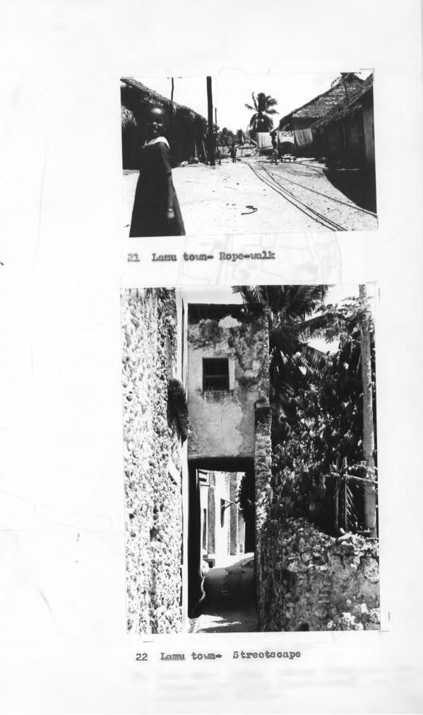
22 7-nrm town- Strootacape

23 Lomu town- Ilitaa* Mosque foundation dates (copied from dhrab inscriptions) are not necessarily reliable

25 Lomu- Houoo in Ilkonanl, first floor

1
27 Laxnu- Carved door

28 Sheila Friday mosque, entrance door

29 Lamu- Door motifs

30 Carved door from Dubai
31 House in Mkomani- Kiv/anda

32 House in Mkomani- Msana wa tini
33 House in Mkomani- Ms ana v/a yuu

3^ House in Mkomani- Ngao showing mwandi
35 House in Mkomani- View towards ndani

37 House In Shelia* Ruined zidaka

*
I 39 Mzab- Interior

4-0 Al-Wasiti- Thirteenth century Meoapotamian miniature
1

*fl Church in Alahan, Anatolia- Detail of window

k3 Swahili houses-a7 Comparative plans

44 Lamu town- Baraza
>
l
4-5 Lamu- Main street at Langoni

1

47 Lamu town- Boat launching
48 Lamu tovm- Main street
49 Lamu jamia - The Friday prayers

51 Sheila Friday mosque- Interior

V '
52 Lanu tovm- Land use

53 Kilwa- Husuni Kubwa