land use plan - amazon web...
TRANSCRIPT

Land Use Plan
Part of the Manchester Airport Master Plan to 2030


1
Chapter 1 - Introduction 3
Chapter 2 - Context 5
Chapter 3 - Planning Policy Framework 9
Chapter 4 - Development Appraisal 15
Chapter 5 - Land Use Proposals 17
Chapter 6 - Surface Access and Car Parking 34
Chapter 7 - Operational Area and Green Belt 41
Chapter 8 - Environment and Mitigation 47
Chapter 9 - Next Steps 48
Appendix 1 50
Appendix 2 52
Appendix 3 62
Appendix 4 63
Contents

2
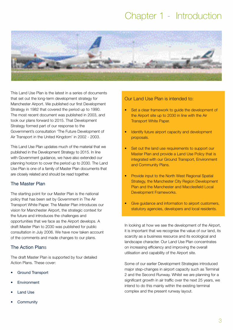
This Land Use Plan is the latest in a series of documents
that set out the long-term development strategy for
Manchester Airport. We published our first Development
Strategy in 1982 that covered the period up to 1990.
The most recent document was published in 2003, and
took our plans forward to 2015. That Development
Strategy formed part of our response to the
Government’s consultation ‘The Future Development of
Air Transport in the United Kingdom’ in 2002 - 2003.
This Land Use Plan updates much of the material that we
published in the Development Strategy to 2015. In line
with Government guidance, we have also extended our
planning horizon to cover the period up to 2030. The Land
Use Plan is one of a family of Master Plan documents that
a re closely related and should be read together.
The Master Plan
The starting point for our Master Plan is the national
policy that has been set by Government in The Air
Transport White Paper. The Master Plan introduces our
vision for Manchester Airport, the strategic context for
the future and introduces the challenges and
opportunities that we face as the Airport develops. A
draft Master Plan to 2030 was published for public
consultation in July 2006. We have now taken account
of the comments and made changes to our plans.
The Action Plans
The draft Master Plan is supported by four detailed
Action Plans. These cover:
• Ground Transport
• Environment
• Land Use
• Community
Our Land Use Plan is intended to:
• Set a clear framework to guide the development of
the Airport site up to 2030 in line with the Air
Transport White Paper.
• Identify future airport capacity and development
proposals.
• Set out the land use requirements to support our
Master Plan and provide a Land Use Policy that is
integrated with our Ground Transport, Environment
and Community Plans.
• Provide input to the North West Regional Spatial
Strategy, the Manchester City Region Development
Plan and the Manchester and Macclesfield Local
Development Frameworks.
• Give guidance and information to airport customers,
statutory agencies, developers and local residents.
In looking at how we see the development of the Airport,
it is important that we recognise the value of our land, its
scarcity as a business resource and its ecological and
landscape character. Our Land Use Plan concentrates
on increasing efficiency and improving the overall
utilisation and capability of the Airport site.
Some of our earlier Development Strategies introduced
major step-changes in airport capacity such as Terminal
2 and the Second Runway. Whilst we are planning for a
significant growth in air traffic over the next 25 years, we
intend to do this mainly within the existing terminal
complex and the present runway layout.
3
Chapter 1 - Introduction
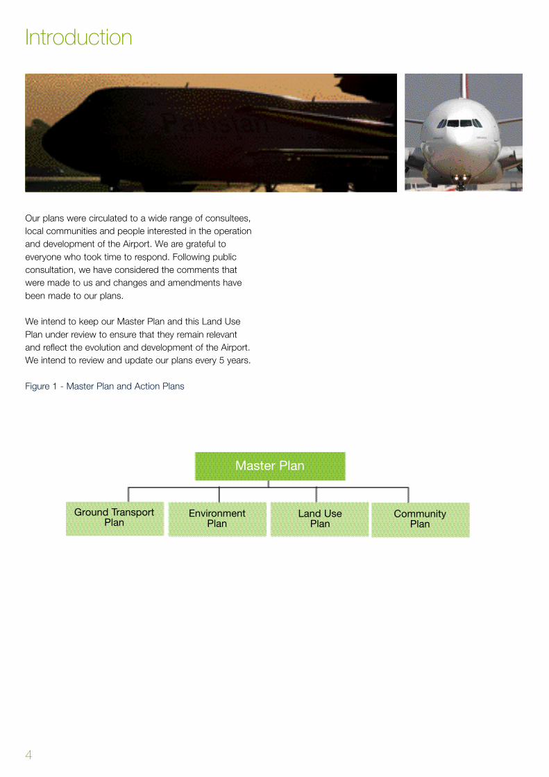
Our plans were circulated to a wide range of consultees,
local communities and people interested in the operation
and development of the Airport. We are grateful to
everyone who took time to respond. Following public
consultation, we have considered the comments that
were made to us and changes and amendments have
been made to our plans.
We intend to keep our Master Plan and this Land Use
Plan under review to ensure that they remain relevant
and reflect the evolution and development of the Airport.
We intend to review and update our plans every 5 years.
Figure 1 - Master Plan and Action Plans
Introduction
4
Master Plan
Ground TransportPlan
Environment Plan
Land Use Plan
Community Plan

Manchester Airport is the largest airport outside London
and handles more traffic than some European capital city
airports. The Airport serves as the major international
gateway for much of Northern Britain. In 2006, over 22
million passengers travelled on over 226,000 aircraft
movements to over 200 worldwide destinations.
Manchester is also an important cargo airport handling
150,000 tonnes of freight in 2006.
The growth in air traffic over the years has resulted in
investment in new and improved passenger facilities and
transport links. The Airport has three passenger
terminals, two runways and we have the ability to handle
a significantly higher passenger throughput without the
need for another runway or a major new terminal.
The Airport is also successfully developing as a public
transport hub following the opening of The Station. This
facility provides easy access between air, rail, coach and
bus services. As passenger throughput increases, so we
expect to see a substantial increase in passengers and
staff using public transport services.
Future Growth
As prosperity across our catchment area continues to
increase, it brings an increasing demand to travel.
Increased affordability, and the widening choice of
destinations, are opening up new opportunities to travel
both to and from the North West.
As part of our Master Plan, we have assessed the likely
scale of airline activity at Manchester. In doing this, we
have carefully considered the changing trends in the
airline industry, in particular the dramatic growth of ‘no
frills’ or ‘low cost’ carriers and increasing environmental
pressures. We have also taken account of the
opportunity to expand our network of scheduled
services, especially to long-haul destinations. We expect
that there will be:
• An overall annual increase in demand of between
4 – 6%
• Continued growth in the ‘no frills’ market
• Further expansion of the Airport’s long-haul network
• The consolidation of airlines in to major alliances
Our Master Plan and this Land Use Plan is not forecast.
Whilst annual passenger forecasts are widely used to
give an indication of the overall scale of airport activity
and future growth, our focus is on maximising the
capacity of our existing and future facilities and
increasing the efficiency of all our assets.
5
Chapter 2 - Context
40
35
30
25
20
15
10
5
Year

The national consultation undertaken by the Depart m e n t
for Tr a n s p o rt1 was underpinned by very detailed fore c a s t s
of passenger and and air traffic movements. This work
included detailed national air traffic forecasts that were
then allocated to particular airports. This modelling
assumed that there would be significant growth, not just at
M a n c h e s t e r, but also at the other airports in the Nort h .
As part of this process we provided our own data and
material to assist with and cross check the work carr i e d
out by the Department for Tr a n s p o rt. As part of our Master
Plan, we have reviewed our passenger forecasts for 2015
and 2030. We broadly agree with the Government that the
A i r p o rt will be handling between 37 and 38 million
passengers a year by 2015 and that this could reach 50
million passengers a year by 2030. This produces a
combined annual growth rate of around 6% over the
period to 2015. This assumes high growth in the ‘no frills’
market and the growth and the development of the
A i r p o rt ’s long-haul services. In the period up to 2030 it is
assumed that the overall annual growth rate will be
significantly slower as the Airport ’s market matures and
m o re routes are developed from other airports in the
re g i o n .
Our forecasts also assume the aviation industry paying
increased costs for its environmental impact. So the
modelling takes account of the effects of an economic
instrument, such as an emission trading scheme, on
future demand. The Department for Transport’s forecasts
suggested that a 100% fuel tax would have the effect of
reducing demand by 10%. The forecasts also included
projections of future air transport movements. In 2006
the Airport handled 226,704 movements. Movements are
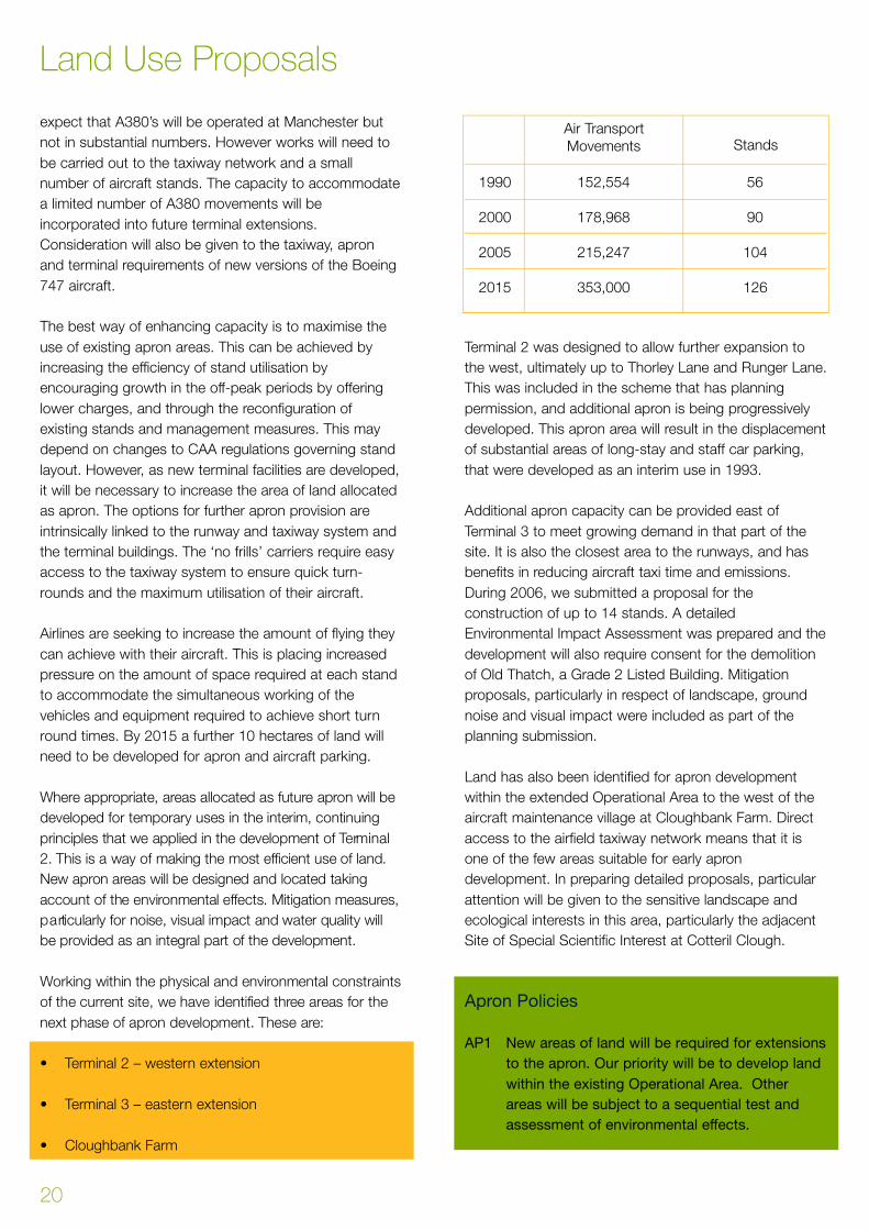
forecast to grow to 353,000 by 2015.
The Government’s forecasts were reviewed in 2006 and
the updated forecasts remain in line with those produced
for the White Paper.
Annual passenger throughput is often used to quantify
activity and anticipated levels of future growth. In
preparing our Master Plan and this Land Use Plan, we
have also used forecasts of future hourly passenger,
aircraft and traffic flows to shape our future plans. This is
a much better way of identifying future land and facility
requirements, and this approach also ensures that
efficiency improvements are a key consideration.
Drivers of Capacity
The Airport’s operations are characterised by flows of
both arriving and departing passengers throughout any
given day. In the summer peak, the demands on the
airport system are greater than during the quieter winter
months. The trigger for additional capacity is a result of
the peak flows of passengers taken alongside the
standards of service that we provide for our customers.
Context
6
1 The Future Development of Air Transport in the United Kingdom:
North England. Department for Transport July 2002.

Peak Passenger Flows
The trigger for additional terminal capacity is derived from
both annual passenger throughput and also the number
of passengers anticipated to pass through the facility in a
typical busy hour. By spreading this peak in relative
terms to the total number of passengers using the
Airport throughout the day, we will be able to make a
greater and more efficient use of the existing facilities.
This improves efficiency in the use of land as well as the
use of resources. Since 1993, the overall efficiency in
asset utilisation has improved by more than 15%. We
intend to continue this approach.
In looking ahead, improving our efficiency is fundamental
to delivering growth. Our pricing policy is designed to
encourage off-peak growth, however stringent controls
will continue to be placed on aircraft operations at night.
Runway 23L-05R is not usually used between 22:00 and
06:00. In addition, between 23:30 and 06:00, controls
are placed on the numbers and the types of aircraft that
are permitted to operate.
We intend to further improve the overall efficiency of the
Airport terminals by spreading the peaks and through the
use of technology and new operational procedures. This
will help us contain the overall size of the Airport site as
well as minimising the environmental effects of growth.
Service Standards
We operate in an increasingly competitive business, and
the level of service that we are able to offer our airline
customers and their passengers is critical to our
continued success. We are also re q u i red to operate the
A i r p o rt in accordance with specific internationally agre e d
criteria. This is regulated and audited by the UK Civil
Aviation Authority (CAA). We have to operate in
a c c o rdance with our aero d rome licence and we have to
satisfy and constantly adhere to precise safety standard s .
These influence the layout and the future development of
the Airport and the surrounding area and are a major
consideration in the airport master planning pro c e s s .
The Department for Transport regulate the Airport’s
security requirements and procedures. Security can have
an influence on the space requirements within the
terminals and can also affect the need and the location
of future development.
We are very conscious that our facilities should be
developed to meet the needs of the airlines and their
passengers. These needs are different depending on the
type of airline. For example the ‘no frills’ carriers need a
very different level of facility to the long-haul scheduled
airlines. In planning our facilities we use a series of
international service standards (developed by ICAO2) that
include:
• Space provision, including the size of lounges and
key processing facilities such as security, check-in
and baggage reclaim
• Number of seats
• Standards of service, such as the balance of
passengers served from a pier rather than bussed to
remote aircraft stands
The level of service can be considered as a range of
values or assessments of the ability of the terminal space
to meet the demand. It combines both qualitative and
quantitative assessments of relative comfort and
convenience.
7
Context
2 International Civil Aviation Organisation - a UN agency covering civil
aviation worldwide.

These can be expressed in terms of space per
passenger and are:
These standards conform to IATA Service Standard ‘C’.
This represents a good level of service, stable flows and
a good level of passenger comfort. Our service
standards are constantly monitored, reviewed and
incorporated into new building design and refurbishment
schemes.
Technology
The development, delivery and use of new technologies will
underpin all of our future development schemes.
The needs and expectations of our airline customers and
passengers are changing. The quality of service that we
deliver will continue to be a key driver of future success.
We have a major programme ‘Customer First’ that
focuses on delivering the highest levels of service to all
our customers. We see an increasing potential for new
technologies and innovative changes to the check-in
process that will improve levels of service, improve
passenger convenience and reduce the scale of new
development on-site. This is expected to generate further
efficiency improvements and a capacity improvement of
at least 10%. Options being explored range from home
check in, through check in at key rail stations and at
other key points on the strategic transport network.
There are issues relating to security, baggage handling
and cost, but we have successfully dealt with these in
The Station. A trial in an on-site car park will give further
experience that can then be extended to, say
Manchester Piccadilly and Crewe rail stations.
Context
8
Check-in
Concourse and Lounge
Gate Area
Baggage Reclaim
1.4 sq metres per passenger
1.9 sq metres per passenger
1.0 sq metres per passenger
1.6 sq metres per passenger
Our Master Plan sets out the strategic context for the
development of the Airport. The key elements of national
and regional strategic policy that influence it are:
• The Air Transport White Paper – 2003
• The Northern Way Growth Strategy – 2004
• The North West Regional Spatial Strategy –
Consultation Draft – 2006
• The Greater Manchester City Region Development
Programme – 2005
• The Wythenshawe Strategic Regeneration
Framework – 2004
Having set out a national air transport policy, the
Government have encouraged airport operators to
prepare Master Plans. These are intended to set out the
strategic framework for growth, and the approach taken
to development. Airport Master Plans do not have a
statutory status, but the Government clearly expects
them to be taken into account in the preparation of
regional and local policies and in the making of planning
decisions.
Government Guidance in Planning Policy Statement Note
1: Delivering Sustainable Development3, sets out
overarching policies for the delivery of sustainable
development through the UK planning system and that
regional and local development plans promote outcomes
that achieve environmental, economic and social
objectives together over time.
A clear strategic planning framework is important if the
Airport is to continue to grow. This allows all
stakeholders to influence and understand our proposals.
A simple and speedy planning process is essential if we
are to capture the growth opportunities that the Airport
brings, as well as making sure that future development is
sustainable.
Our Master Plan shows how national and regional policy
will shape the future development of the Airport. This
Land Use Plan sets out the statutory planning framework
for the region and for the local area.
Regional Planning Framework
The North West Regional Spatial Strategy provides the
framework for the preparation of development plans by
local planning authorities. The Regional Spatial Strategy
is in draft and will replace the existing Regional Planning
Guidance for the North West (RPG13)4. Both the adopted
Regional Planning Guidance and the emerging Regional
Spatial Strategy set out a vision for the North West. It is
intended that this vision will be achieved by capitalising on
the re g i o n ’s international connections, highly developed
s e rvice and knowledge sectors and flourishing culture ,
s p o rt and leisure industries. Manchester Airport is
identified as a world-class asset and as a key economic
d r i v e r. In RPG 13, Policy T5 states:
• “The role of Manchester Airport as the north of
England’s key international air gateway and its
potential to become an important multi-modal
interchange are recognised and supported.”
Local Planning Framework
The local planning framework is the statutory
responsibility of the various Local Planning Authorities
who prepare plans to guide future developments within
9
Chapter 3 - Planning Policy Framework
3 PPS1 : Delivering Sustainable Development - February 20054 RPG13 - Regional planning guidance for the North West - March 2003
their areas. The adopted plans with policies that directly
apply to the Airport site are:
• The Manchester Unitary Development Plan (The
Manchester Plan) 1995
• The Cheshire County Structure Plan (2005)
• The Macclesfield Borough Local Plan (2004)
Further away from the Airport, a number of development
plans in Greater Manchester and Cheshire contain airport
related policies, covering such issues as development,
environmental impact, inward investment and transport.
We will continue to contribute to planning policy in this
wider area.
The Planning and Compensation Act 2004 has
fundamentally changed this system of plan making.
Authorities are now required to prepare a Local
Development Framework. This is a suite of documents,
that includes a core strategy, a proposals map, and area
action plans. Until such time that these are in place the
policies of adopted plans will be ‘saved’. Our Land Use
Plan sets out the long-term land use requirements for the
Airport and it is intended to contribute to the preparation
of a new planning framework for the local area.
Manchester Unitary Development Plan
The majority of the Airport site is within the City of
Manchester. The Manchester Plan sets out the City
Council’s twin aims of improving the City as a place to
live, work and visit, and revitalising the local economy.
The Airport is clearly seen as one of the strengths on
which the City can build, and it is acknowledged as a
major contributor to Manchester’s international status.
The Airport plays a key role in attracting new business
and inward investment to the City, and in encouraging
the development of high technology industries. Within
the Plan, the City Council aims to capitalise on this
connection through the provision of high quality
development sites that offer good access to the Airport.
The key policies are:
Part 1 Policies
Policy E2.1 relates to development within the Green Belt.
In the supporting text it states that although Manchester
Airport is within the Green Belt, its growth and
development has always been regarded in a special way.
The contribution of the Airport to the economic life and
vitality of the City is growing as it expands its range of
facilities and services. As well as being a major employer,
the Manchester Plan goes on to highlight the role the
Airport plays in supporting jobs away from the site, and
that it plays an important part in initiatives to attract
inward investment and tourism. For these reasons, the
City Council is committed to enhancing the Airport’s
status as the major international airport serving northern
England. So whilst it seeks high environmental standards
in its operation and future development, there are special
circumstances that support airport development within
the Green Belt.
Policy I1.1 relates to employment and economic
development. It states that the Council will ensure that
sufficient allocation of a range of sites suitable for a
variety of different commercial uses is made. In location
terms, sites with good access to the Airport are identified
as key opportunities.
Policy T4.1 states that the Council will continue to
manage the expansion of the Airport in line with policies
and proposals that were contained in the former Ringway
Planning Policy Framework
10

Local Plan and incorporated into the UDP. The policy
goes on to state that land will be safeguarded until the
Airport’s plans for expansion become clearer (the UDP
was prepared prior to a decision on the Second Runway)
and that the Council will seek to promote development in
an environmentally sensitive manner.
Policy T4.2 expresses the Council’s wish to improve
surface access to the Airport so that infrastructure in the
area surrounding the Airport continues to keep pace with
the expected growth in activity. Emphasis is put on the
need for modern, high quality transport links. It highlights
the intention of the Council to use its influence to deliver
the necessary enhancements, particularly to the quality
of public transport. Support is explicitly given to
development of Metrolink between the Airport and the
City Centre.
Part 2 Policies
General Policy EW1 seeks to promote the development
of Manchester Airport in a manner that is consistent with
the achievement of high environmental standards, to
enable the Airport to play its full role in the economy and
life of the conurbation as well as the wider North West.
The current boundary of the Airport Operational Area is
defined on the Proposals Map within the UDP. It is the
area originally defined in the Ringway Local Plan
published in 1987. At that time, the Airport’s throughput
was some 8.7 million passengers per year. In publishing
its Development Strategy to 2005 in May 1993, the
Airport sought to extend the Operational Area. Policy
EW19 indicated that the City Council did not wish to
promote these proposals until the Second Runway
proposal had been fully considered by the formal
planning process. Land between the Airport and the
River Bollin was however safeguarded.
The principle of support for future expansion and
development of the Airport within the Operational Area is
reflected in Policies EW20 to EW35 of the Manchester
Plan. The view of the Council was that the size of the
Operational Area should be no more than that necessary
to accommodate the anticipated growth in passenger
and freight traffic. The UDP seeks to ensure the finite
supply of land is not used for activities that could
reasonably be located elsewhere.
Policy EW21 is a modification adopted in November
2001. It sets out in detail the approach to be taken by
the Council to development in the Green Belt at the
Airport. EW21 identifies a significant part of the Airport as
a ‘Major Developed Site’. Infilling and re-development
within the boundary of this ‘Major Developed Site’ are to
be treated as “appropriate development” providing it
meets the tests set out in PPG2 Annex C5 with respect
to openness and impact. Development proposals which
do not meet the above infilling or re-development criteria,
but are for certain specified uses (airfield operational
activities, cargo terminal facilities, passenger terminals
and related facilities, airport ancillary facilities,
transportation, waste disposal infrastructure and
landscaping) will be subject to the test of “very special
circumstances” as set out in Policy E2.1. The location of
airport development proposals within the Major
Developed Site is a material consideration in determining
whether very special circumstances exist.
Policies EW24 and EW25 require the provision of high
quality design and landscaping throughout the
operational area and Policy EW4 refers to the special
noise policies that will apply to the area around
Manchester Airport.
Cheshire County Structure Plan
This Plan sets out the strategic plan for the County up to
2016. It has sustainability as its underpinning philosophy
and aims to accommodate the economic and social
needs of Cheshire whilst conserving the environment and
natural resources for the benefit of future generations.
The Plan identifies the importance of the Airport to the
regional economy. It notes the County Council’s legal
agreement with the Airport Company in respect of the
Second Runway and identifies the importance of
minimising environmental impacts and avoiding harm to
ecological interests
Policy T14 states that development proposals at
Manchester Airport should:
• Have no detrimental impact on Sites of Special
Scientific Interest or the Green Belt;
• Minimise other environmental impacts by appropriate
noise and other environmental controls and by
application of landscape and habitat management
programmes; and
11
Planning Policy Framework
5 Planning Policy Guidance Note 2 ‘ Green Belts’ January 1995

• Ensure that the resulting surface transport demand
can adequately be accommodated within the
capacity of transport links, and include measures to
increase the use of public transport.
This will be the last Structure Plan for Cheshire as the
new planning system, based on a Regional Spatial
Strategy and Local Development Frameworks will
eventually take on its current role.
Macclesfield Borough Local Plan
The Macclesfield Borough Local Plan was originally
adopted in 1997, and was subject of a review and
Inquiry in 2002. The Borough Council adopted the
revised Local Plan in January 2004.
The Plan covers the area of land to the south and south-
west of the Airport site. At a local level, it develops the
relevant policies and general proposals contained in the
Cheshire County Structure Plan. As with much of the
site, the part of the Airport that is within Macclesfield is
also in the Green Belt.
The Borough Council recognises that the safe and
efficient operation of the Airport can have implications for
land within the Plan area. Only essential airport related
activities are permitted in the Green Belt outside the
Airport Operational Area, except in very special
circumstances, in accordance with the Policy T20.
Policy T21 of the Plan states that the Borough Council
will encourage airport related development to be located
within the Operational Area or within nearby urban areas
where this is compatible with other Local Plan policies.
Policy T18 deals with restrictions applying to noise
sensitive development in the vicinity of the Airport.
The Local Plan defines an Operational Area. This
includes parts of Runway 23L-05R (The Second
Runway), and an area of undeveloped land to the north
of Moss Lane Styal that is allocated for airport use. This
is set out in Policy T23 and the uses identified include
airfield operational facilities, airport ancillary facilities,
transportation infrastructure and landscaping works.
The Macclesfield Local Plan also includes policies to
control new development in areas around the Airport that
are affected by aircraft noise (Policy T18) and controls on
development within the Public Safety Zones (Policy T19).
Other Local Authority Plans
Surrounding Local Authorities in Greater Manchester and
Cheshire have adopted a variety of planning policies that
guide them when considering proposals for development
at or related to Manchester Airport. These variously
support the development of the Airport in principle, and
in the case of those authorities in close proximity to the
Airport site, provide guidance on how to deal with
development that is related to the Airport, but takes
place away from the main airport site. Improving
transport links is a common theme in these Plans.
The Airport and Development Control
Land use at and within the vicinity of the Airport, is
influenced by Government advice on Noise, Aerodrome
Safeguarding and Public Safety Zones. This is to protect
the amenity and health of local residents, and to control
new development in areas that are affected by airport
and aircraft operations. This guidance is then translated
into development control policy by local planning
authorities.
Planning Policy Framework
12

Noise
Planning Policy Guidance Note (PPG) 246 outlines the
considerations that Local Planning Authorities should
take into account when determining planning
applications for noise sensitive developments and for
those activities that generate noise. This guidance seeks
to ensure that wherever practicable, new noise sensitive
developments are protected from major sources of noise.
PPG 24 also refers to noise contours that help in
considering planning applications in areas affected by
aircraft noise. They are used by Local Planning
Authorities to assess which areas are likely to be subject
to high levels of noise and, where necessary, impose
conditions requiring noise insulation measures, or even
refuse applications on the grounds of noise impact.
Guidance is also provided in respect of other noise
sensitive developments such as hospitals or schools.
Aerodrome Safeguarding
C e rtain civil aero d romes, by virtue of their importance to
the air traffic system, are protected under a pro c e s s
known as Aero d rome Safeguarding. This functions
t h rough the planning system, and aims to protect the
safety of aircraft operations. The key issues for
s a f e g u a rding are heights of buildings in relation to an
a i r p o rt ’s ‘protected surfaces’, developments that have the
potential to attract birds, and also windfarms that have the
potential to interf e re with radar and navigation systems.
G o v e rnment advice is set out in Circular 1/20037, which
details the consultation arrangements to be undert a k e n
by local authorities and the safeguarding authority. The
C i rc u l a r, which came into force in Febru a ry 2003,
t r a n s f e rred the consultation process from the CAA to the
relevant aero d romes. The Local Authority must now re f e r
c e rtain developments to the relevant aero d rome operator.
The Airport Company is the safeguarding authority for
Manchester Airport, and in carrying out this duty we will
continue to ensure the safety of airport operations and,
ultimately, that public safety, is not compromised.
Public Safety Zones
Public Safety Zones are designated areas of land at the
end of runways within which development is restricted.
The shape and size of Public Safety Zones are based on
risk contours and are specific to the type and volumes of
air traffic using a particular runway at an individual airport .
Government advice is set out in a Department of
Transport Circular 1/2002. Public Safety Zones are a
planning policy tool designed to prevent new
developments such as houses, that would result in a
significant increase in the number of people living,
working or congregating within these areas. The advice
also suggests that, over time, existing numbers should
be reduced.
The area of the Public Safety Zone is formed by an
elongated isosceles triangle, extending from the landing
thresholds of the runways. Within this, there is a much
smaller triangle where the risk of aircraft accident is
higher. The Public Safety Zone policy requires that
residential and commercial property within these inner
areas be purchased, emptied and demolished. There are
4 Public Safety Zones, one at each end of the two
runways and there are currently no properties in these
inner zones at the ends of the runways at Manchester.
Section 106 and other Agreements
The Airport Company has signed legal agreements with
local planning and highway authorities as part of the
development process. The most significant is an
agreement with Cheshire County Council and
Manchester City Council under Section 106 of the Town
and Country Planning Act 1991 relating to the
construction of the Second Runway. This agreement
contains 38 guarantees (or planning obligations) that:
• Reduce the adverse impacts of developments
• Control and manage the environmental implications
of the Second Runway scheme
• Provide enhanced mitigation measures, and
• Give assurances about future expansion.
The agreement contains 116 sub clauses, or points of
action. These cover topics such as night flying, noise,
landscape and habitat management, community
relations, car parking, public transport and highway
13
Planning Policy Framework
6 Planning Policy Guidance Note 24 ‘Planning and Noise’ September (1994)7 ODPM Circular 1/2003 ‘Safeguarding Aerodromes, Technical sites
and Military Explosives Storage Areas: The Town and Country Planning
(Safeguarded Aerodromes, Technical sites and Militaary Explosives
Storage Areas) Direction 2002’

improvements. Cheshire County Council annually review
our compliance with the agreement using independent
auditors. Since the agreement was signed in 1994, we
have continually complied with its obligations. The overall
agreement runs until 2011, although a number of
obligations are subject to a regular review.
The Second Runway planning conditions include a
number of controls on the use of the runway at night, the
noise impact of the Airport, and restrictions on aircraft
engine testing. Compliance with the planning conditions
is reported annually to Manchester City Council and
Macclesfield Borough Council.
We will work with Cheshire County Council and
Manchester City Council to revise, update and extend
our legal agreement. This is to make sure that it remains
relevant to local communities in containing the
environmental impact of the Airport’s operation, but also
securing and directing the benefits to the areas of
greatest need.
Planning Policy Framework
14
Sustainability Appraisal
High level Sustainability Appraisals were undertaken as
part of the Department for Transport’s national
consultation. The Master Plan is our detailed statement
on how national policy in the Air Transport White Paper
can be brought forward. The Master Plan and this Land
Use Plan have no statutory planning status, but they are
intended to influence the Regional Spatial Strategy and
Local Development Frameworks. Formal Sustainability
Appraisals will form part of both processes.
In preparing our Master Plan and this Land Use Plan, we
have sought to apply the principles of Sustainability
Appraisal. We have tried to place our Master Plan in the
context of the national policy set out in Government’s
Sustainability Strategy8. In preparing our Land Use Plan
we have used the general principles of Sustainability
Appraisal that are set out in Annex I and II of EU Directive
2001/42/EC.
Sequential Appraisal
In considering the future extent of the Operational Area,
we have identified the proposed extensions and given
careful consideration to how we prioritise the use of our
land. The proposed Operational Area extensions are
detailed in Appendix 2. There are 5 areas that have been
identified. Three of these, with a total area of around 80
ha were first promoted in 1993. An area of around 6ha to
the east of the Airport was included in the Development
Strategy to 2015, published in 2003. This Master Plan
looks to 2030, and we have considered the Airport’s
future land requirements and proposed Operational Area
extensions. We have now identified a further area of land
to the west of the A538 at Oak Farm (approx 38 ha).
Around the Airport there are strong and clear boundaries.
These include the residential areas to the north and the
east, the National Trust’s Styal estate to the south, the
Bollin Valley and the M56. Potential Operational Area
extensions included land to the south of the Airport
around Moss Lane Styal and land to the west at Oak
Farm. We concluded that it would not be appropriate to
promote an extension to the Operational Area to the
south of the Airport. Land at Oak Farm is considered to
be more appropriate because of its relationship to the
main airport site, links to the main transport corridors
and the limited effect on local residents. It is recognised
however that there are sensitive environmental features
and the effects of airport development will need to be
compensated and mitigated.
To ensure that the main site is used in the most efficient
manner possible, we will apply a series of sequential
tests to determine the most appropriate use. The
technique has been used to select our preferred
development option. Our approach takes into account of
the need to use land effectively and efficiently, whilst at
the same time meeting the needs of our customers,
delivering economic benefit and minimising environmental
impact.
We will adopt a sequential approach to future
development both in the preparation of our plans and in
considering future development proposals. Proposals will
be evaluated using a series of tests and other criteria to
ensure that we achieve the most efficient and effective
utilisation of our land. The appraisal will incorporate the
following tests:
• Use: The development must be required for the
operational efficiency or amenity of the Airport.
• Technology: Can proven technology be employed to
minimise or defer requirements for additional land-
take?
15
Chapter 4 - Development Appraisal
8 Securing the Future - DEFRA 2005
• Redevelopment: Establish whether existing
developed sites within the Operational Area are
suitable for the location of the development. This
includes the redevelopment of previously used or
under used sites, ‘in fill’ and the redevelopment or
extension of existing buildings if economically viable.
• Operational Area: Are appropriate sites available
within the Operational Area?
• Environment: How can the proposed development
be undertaken whilst minimising the environmental
impact?
This sequential approach will be used along with a set of
criteria for site assessment. It will also ensure that any
development proposal is in line with our Master Plan as
well as our Ground Transport Plan and Environment Plan.
Location requirements will play a key role in our site
assessments. A number of uses will require direct access
to the airfield and the terminals. In preparing our Land
Use Plan, development will be directed to appropriate
locations within the Operational Area. Safety and security
and the needs of our customers are also key
considerations when identifying future land uses and
airport activity.
Development Appraisal
16
This chapter looks at the broad categories of land use on
the Airport site, and sets out specific development
p roposals. It anticipates the likely changes during the
strategy period and whether as a result we believe it will
be appropriate to allocate additional land on site to a
p a rticular use. The highest priority will be given to those
activities that need to take place on areas adjoining
existing apron, taxiways and runways or which are
needed for the safe and efficient operation of the airf i e l d .
Runways and Taxiways
Since February 2001 the Airport has two main
operational runways (23R-05L and 23L-05R)9. The
runways have paved lengths of 3,048 metres and are 46
metres wide. In addition Runway 23L-05R (the Second
Runway) has a starter extension of 150 metres. Runway
23R-05L has 23 metre wide reinforced shoulders on
either side of the runway itself. This additional
strengthening means that the new generation of large
wide-bodied aircraft such as the Airbus A380 and new
versions of the Boeing 747 can operate from this runway.
The passenger throughput and the terminal capacity of
an airport is often expressed in millions of passengers
per year (mppa). However, this is not the best measure
of the capacity and the capabilities of an airfield and
runway system. Runway capacity is determined and best
expressed as the number of aircraft movements that can
be handled per hour. The opening of the Second
Runway (23L-05R) provided a substantial increase in the
hourly runway capacity of the Airport. One of the
priorities of this Land Use Plan is to maximise the peak
hour capacity of the twin runway system, therefore
avoiding the need for any third runway. Forecasts and
traffic growth assumptions are set out in our Master Plan
and Chapter 2 of this Land Use Plan.
Factors that influence runway capacity include, taxiway
geometry, the mix of air traffic and air traffic control
regulations and facilities. The present declared peak hour
capacity of the runway system at Manchester is 61
movements per hour.
The Airport ’s regular mode of operation is for aircraft to
d e p a rt to the southwest towards Knutsford with arr i v i n g
a i rcraft approaching from the northeast over Stockport .
The Airport operates in this direction for appro x i m a t e l y
80% of movements. This is determined by the pre v a i l i n g
westerly winds. With the two runways the airfield usually
operates in ‘segregated mode’ with one runway (23L)
used for depart u res and the other (23R) for arrivals. This
is with westerly winds. In easterly winds, the operation is
reversed, with the Second Runway (05R) used for arr i v a l s
and runway 05L for depart u res. During the night (between
the hours of 22:00 and 06:00) when the number of
a i rcraft movements is reduced, all operations norm a l l y
re v e rt to Runway 23R-05L. This is one of the operational
c o n t rols that were put in place by the planning perm i s s i o n
for the Second Runway. We have no proposals to open
Runway 23L-05R (R2) at night, except in an emerg e n c y
or when maintenance is being carried out on Runway
23R- 05L (R1). Major repairs to Runway 23R-05L are
planned from 2008.
The two runways, when the airfield layout is fully
developed, will provide sufficient runway capacity at
Manchester for the foreseeable future. The Second
Runway Legal Agreement included an obligation that no
proposals for a third runway would be considered during
the period up to 2011. In preparing our Master Plan and
Land Use Plan, we are not planning for a third runway in
the period up to 2030.
There will, however, be a need for changes to the airfield
layout and local air traffic control procedures. In
developing capacity, it is important to recognise that the
17
Chapter 5 - Land Use Proposals
9 Because of magnetic field shifts, the runways were renamed from 7th July
2007. They changed from 24 to 23 (Westerly) and 06 to 05 (Easterly).
Community Relations Data Sheet - Febru a ry 2007.

airfield and runways operate as a system, and that the
release of constraints in one element may lead to
constraints elsewhere. We propose, during the period up
to 2015, to increase the peak hourly capacity of the
airfield to handle 76 aircraft movements an hour. In
addition some works will be required to accommodate
some of the new large aircraft. Capacity enhancements
in five main areas will be needed:
• Taxiway improvements
• Changes to local aircraft departure procedures
• An additional runway crossing point
• Refinements to airfield procedures
• Modifications to handle new large aircraft including
the Airbus A380
Further improvements in the runway and airfield capacity
will be required for the period beyond 2015. These will
be influenced by improvements in technology and
changes to operational procedures. These will be
brought forward in future reviews of our Land Use Plan.
A network of taxiways, linking the terminal buildings with
the runways, is crucial to the safe and efficient operation
of the Airport. The size and layout of taxiways is govern e d
by a number of factors, including safety re q u i rements and
i n t e rnational standards. An efficient taxiway layout is a key
factor in determining the overall capacity of the airf i e l d
system and limiting our environmental impact. Ta x i w a y s
a re needed to link all the aircraft manoeuvring areas and,
as these are extended, there will be a need to extend and
alter the current system. The design and layout of the
Second Runway allows for additional taxiways and fast
t u rn offs, that may be re q u i red to meet incre a s e d
numbers of movements.
The Second Runway planning approval included the
development of a taxiway that would fill the gap between
the two A538 road tunnels. It was intended that this
would be built in phases. The work to construct the
taxiway is likely to be in the period 2015 – 2020. This
work will require a major upgrade to the road tunnel.
Additional taxiways will also be constructed at the
Eastern end of Runway 23L-05R
Enhancing the overall efficiency of the airfield, and the
way that aircraft move around within it, is an important
factor in maintaining overall capacity. Measures to be
introduced will include revised aircraft push-back
procedures, changes and additions to aircraft taxi routes,
and alterations to aircraft towing procedures. These
operational improvements can also have environmental
benefits because reducing aircraft taxi and holding times
can help reduce aircraft emissions.
As part of the development of Terminal 2, the apron has
been extended to the north west. This has increased the
numbers of aircraft that are parked in this area and to
ensure the efficient movement of aircraft, additional
taxiways are required. To achieve this a dual taxiway will
be provided between the My Travel hangar and Pier C.
This will result in the loss of several aircraft stands and
these will be re-provided as part of the further
development of the Terminal 2 apron.
In it’s usual operating mode, Runway 23L-05R is the
principal depart u re ru n w a y. Because of the airfield layout,
d e p a rting aircraft have to cross the arrival runway (23R).
T h e re are presently three crossing points where aircraft can
be held before receiving an instruction to cross. The two
central crossing points are increasingly congested and it is
p roposed to add at least one more crossing point toward s
the eastern end of Runway 23R.
On departure, most aircraft are issued with a Preferred
Noise Route. These are defined procedures to route
Land Use Proposals
18
aircraft through the local airspace immediately after
departure. In the period up to 2015 there is likely to be a
need to alter the Preferred Noise Routes, particularly
those to the west of the Airport, in order to increase the
overall departure rate. This will mean adjusting the
departure procedures in order that the northern and
s o u t h e rn turns are closer to the airfield and made
available to a wider range of aircraft types. No detailed
p roposals presently exist, however they will be subject to
a separate and extensive consultation process in line with
the Civil Aviation Authority’s re q u i rements and with a wide
range of stakeholders and local residents before any
decisions are taken. In addition to local airspace
p ro c e d u res, it is important to ensure that there is suff i c i e n t
airspace capacity in areas further away from the Airport ,
and that this capacity is integrated with the growth in
operations at other airports in the Midlands and the Nort h
of England. Further details on our policies to contro l
a i rcraft noise can be found in our Environment Plan.
With the introduction of these measures, we estimate
that the overall movement rate of the airfield can be lifted
to around 76 aircraft movements per hour by 2015. As
mentioned above, the airfield operates in segregated
mode (one runway used for departures, the other for
arrivals). This is likely to remain the case for the period up
to 2015. The construction of a full-length parallel taxiway
along the north side of Runway 23L-05R may be needed
beyond 2015. The Second Runway was designed to
accommodate this extension, and it would involve a
modest extension to the current airfield boundary in
Mobberley to the south west of the River Bollin. Beyond
2015 it is likely that an increase in the movement rate
above 76 movements per hour will be required. This is
likely to require the introduction of some mixed mode
activity (both runways used for arrivals and departures),
airspace adjustments and technological improvements.
Runway and Taxiway Policies
RT1 The airfield will continue to be designed and
operated to meet the standards and the
requirements of the Civil Aviation Authority.
RT2 No proposals exist to construct a third runway
during the period of this Strategy.
RT3 We will bring forward proposals to maximise the
peak hour capacity of the twin runway system.
RT4 Additional taxiways and runway crossing points
will be provided to enhance the capacity of the
runway system.
RT5 Land will be protected for the development of a
full length parallel taxiway to Runway 23L-05R.
RT6 Proposals to adjust the local aircraft departure
procedures and Preferred Noise Routes will be
brought forward during the Strategy period.
These will be subject to a separate public
consultation process.
Apron
As the Airport has developed, the amount of land
allocated as apron (parking stands for aircraft) has
increased in line with growing terminal capacity and
changes in aircraft size and operation. Aircraft stands
can be divided into two categories - terminal stands,
where the passenger can gain direct access into the
terminal and remote stands, where passengers have to
be bussed to and from the terminal building.
Airfield safety influences aircraft parking and governs
how much space the taxiways and aircraft stands
require. These guidelines are set out in the Civil Aviation
Authority publications CAP168 and CAP642 . Stands
must be provided to deal with all types of aircraft that are
anticipated to use the Airport.
The range in size is considerable - from small regional
aircraft with a wingspan of 20 metres, through to the
largest widebodied aircraft such as the new Airbus A380
that has a wingspan of 79 metres. Aircraft length is also
likely to increase. Currently, the longest aircraft are
approximately 75 metres in length. In order to ensure
efficient use of land, we have, for many years, designed
stands to be as flexible as possible, so that the largest
stands are configured to accommodate one large aircraft
or two smaller aircraft. This policy will continue. The
aircraft parking and manoeuvring and servicing area
currently extends over 81 hectares and as the Airport
grows additional land will be required.
The Airbus A380 is to be introduced into passenger
service during 2007/08. Several airlines that operate at
the Airport will have these aircraft in their fleets. We
19
Land Use Proposals
expect that A380’s will be operated at Manchester but
not in substantial numbers. However works will need to
be carried out to the taxiway network and a small
number of aircraft stands. The capacity to accommodate
a limited number of A380 movements will be
incorporated into future terminal extensions.
Consideration will also be given to the taxiway, apron
and terminal requirements of new versions of the Boeing
747 aircraft.
The best way of enhancing capacity is to maximise the
use of existing apron areas. This can be achieved by
increasing the efficiency of stand utilisation by
encouraging growth in the off-peak periods by offering
lower charges, and through the reconfiguration of
existing stands and management measures. This may
depend on changes to CAA regulations governing stand
layout. However, as new terminal facilities are developed,
it will be necessary to increase the area of land allocated
as apron. The options for further apron provision are
intrinsically linked to the runway and taxiway system and
the terminal buildings. The ‘no frills’ carriers require easy
access to the taxiway system to ensure quick turn-
rounds and the maximum utilisation of their aircraft.
Airlines are seeking to increase the amount of flying they
can achieve with their aircraft. This is placing increased
pressure on the amount of space required at each stand
to accommodate the simultaneous working of the
vehicles and equipment required to achieve short turn
round times. By 2015 a further 10 hectares of land will
need to be developed for apron and aircraft parking.
W h e re appropriate, areas allocated as future apron will be
developed for temporary uses in the interim, continuing
principles that we applied in the development of Te rm i n a l
2. This is a way of making the most efficient use of land.
New apron areas will be designed and located taking
account of the environmental effects. Mitigation measure s ,
p a rticularly for noise, visual impact and water quality will
be provided as an integral part of the development.
Working within the physical and environmental constraints
of the current site, we have identified three areas for the
next phase of apron development. These are:
• Terminal 2 – western extension
• Terminal 3 – eastern extension
• Cloughbank Farm
Terminal 2 was designed to allow further expansion to
the west, ultimately up to Thorley Lane and Runger Lane.
This was included in the scheme that has planning
permission, and additional apron is being progressively
developed. This apron area will result in the displacement
of substantial areas of long-stay and staff car parking,
that were developed as an interim use in 1993.
Additional apron capacity can be provided east of
Terminal 3 to meet growing demand in that part of the
site. It is also the closest area to the runways, and has
benefits in reducing aircraft taxi time and emissions.
During 2006, we submitted a proposal for the
construction of up to 14 stands. A detailed
Environmental Impact Assessment was prepared and the
development will also require consent for the demolition
of Old Thatch, a Grade 2 Listed Building. Mitigation
proposals, particularly in respect of landscape, ground
noise and visual impact were included as part of the
planning submission.
Land has also been identified for apron development
within the extended Operational Area to the west of the
aircraft maintenance village at Cloughbank Farm. Direct
access to the airfield taxiway network means that it is
one of the few areas suitable for early apron
development. In preparing detailed proposals, particular
attention will be given to the sensitive landscape and
ecological interests in this area, particularly the adjacent
Site of Special Scientific Interest at Cotteril Clough.
Apron Policies
AP1 New areas of land will be required for extensions
to the apron. Our priority will be to develop land
within the existing Operational Area. Other
areas will be subject to a sequential test and
assessment of environmental effects.
Land Use Proposals
20
Air Transport
Movements Stands
56
90
104
126
152,554
178,968
215,247
353,000
1990
2000
2005
2015

AP2 To maximise land use efficiency some existing
uses will be displaced to the Airport periphery to
enable apron development. These will include
ancillary uses and car parking.
AP3 Additional areas of apron will be developed to
the west of Terminal 2 and to the east of the
Terminal.
AP4 Proposals will be brought forward for the
development of an area of apron on land at
Cloughbank Farm.
AP5 In the longer term, apron development will be
considered on the land to the west of the A538
(Oak Farm)
The Terminal Development Strategy
Since the publication of the Draft Development Strategy to
2015, and in the light of the 2003 Air Tr a n s p o rt White
P a p e r, we have carried out a detailed review of future
t e rminal capacity. This has been done to provide a basis
for the wider master planning of the Airport site.
A pro g ressive enhancement to the terminal facilities will be
re q u i red to accommodate the growth in passenger
numbers and to maintain the Airport ’s standards of service.
We have carried out detailed studies into our future
t e rminal development strategy and considered a number
of options. Our over-riding principle is to maximise
e fficiency and make the best use of the terminal facilities
that we have before putting forw a rd major development
p roposals. We have made substantial investments in new
technology particularly in respect of the check-in pro c e s s .
The Airport will require substantial increases in terminal
capacity both in the period up to 2015 and also from
2016 to 2030. We have considered a number of
alternative options. The options that have been
considered in detail are:
• The full demolition and re-building of Terminal 1 and
Terminal 3, along with an expansion of Terminal 2.
• The demolition and re-building of Terminal 1 along
with an expansion of Terminal 2 and the
development of a 4th terminal complex.
• The re-development of Terminal 1 and Terminal 3
along with an expansion of Terminal 2.
• The re-development of Terminal 1 and Terminal 3, an
expansion of Terminal 2 and the development of a
4th terminal complex.
Our pre f e rred option is to concentrate initially on
enhancing the capacity of the existing terminal complex.
This will re q u i re major extensions to Te rminal 2 and the
refurbishment extension and rebuilding of parts of
Te rminals 1 and 3. The development of the existing
t e rminal complex brings several benefits and advantages,
in that it centralises activity, improves connectivity
between the terminals, and concentrates on the existing
public transport and surface access links. A summary of
the terminal option appraisal is in Appendix 1.
Potential sites for a 4th terminal complex were
considered as part of the appraisal process. The Airport
site is relatively small with limited options for the
development of a major terminal within the existing
Operational Area. Two areas were identified; these were
on land to the south east in Styal; or land to the west at
Oak Farm. The Oak Farm site was the only one
evaluated for terminal development but not selected.
21
Land Use Proposals

We are also conscious of the changing needs of our
airlines and passengers, especially in the growing ‘no
frills’ sector. These airlines need very convenient access
to the runways and a very different level of facility. We are
reviewing how best to meet those needs. This may
include adapting existing facilities or providing new
remote facilities that could be either to the east or the
west of the existing apron. We will complete this work in
2007 in consultation with out airline customers.
Terminal 1
When it was opened in 1962, Terminal 1 was designed
to have an annual capacity of 2.5 million passengers a
year. There have been many redevelopment and
expansion schemes over the years and the building is
currently handling around 11 million passengers a year.
During the next few years, we intend to bring forward
several schemes that will increase the overall capacity of
the terminal. These include:
• Airside retail development and security improvements
• Extension of the main Check-In Hall
• Extension to the Arrivals area
• Baggage Hall extension
We will need to selectively refurbish and redevelop parts
of Terminal 1 to improve efficiency, increase capacity and
raise standards. We believe these enhancements will
provide sufficient capacity before the opening of
additional capacity at Terminal 2. Beyond this we will
assess the need for the redevelopment of Piers B and C
and in the longer term we will bring forward proposals for
the further redevelopment of parts of the terminal site.
Terminal 2
The first phase of Te rminal 2 was opened in 1993 with an
initial capacity of 6 million passengers a year. Subsequent
i m p rovements have increased its capacity and it is now
handling around 7.6 million passengers a year
Development of the second phase of Terminal 2 was
granted planning consent in 1997 and some preliminary
construction work has already been carried out. We
intend to progressively develop Terminal 2, and it could
ultimately handle around over 20 million passengers a
year. This will include an extension of the main terminal
to the north-west. Additional contact stands will be
provided by the extension of the West Pier. Land has
been safeguarded for the construction of remote satellite
piers in the Terminal 2 apron. We expect to develop an
airside link between Terminal 1 and Terminal 2 as a way
of improving the efficiency of both terminals.
Terminal 3
Te rminal 3 opened in 1998 when the former Te rminal 1
(Domestic) was expanded and renamed to accommodate
both domestic and international flights. This Te rminal is
c u rrently used by British Airways and bmi and handles
a round 5 million passengers a year.
F u rther extensions and improvements will be needed.
P roposals will be brought forw a rd for the development of
additional apron to the east, and land will be safeguard e d
for future terminal and pier extensions. Consideration will
also be given to the airlines operating from Te rminal 3 to
maximise operational efficiency of the terminal facilities. In
the longer term, we intend to maximise the capacity of the
whole Te rminal 1 and Te rminal 3 complex and we will
amalgamate the two buildings to create one single term i n a l
operation. We estimate that this complex could ultimately
handle around, over 20 million passengers a year.
Land Use Proposals
22

The Station
The Station now has check-in and some baggage
handling facilities. This is the first stage in offering remote
passenger processing. It has proved to be a success
and will be continued and eventually extended to other
remote sites. This is an important element in improving
efficiency and customer service.
The Station will continue to play an important part in the
provision of capacity. It offers a high standard of service
for passengers arriving by public transport and this is a
key element in encouraging passengers on to rail and
coach services. Baggage handling and security facilities
have been developed for The Station check-in. These will
continue to comply with the Department for Transport’s
standards, and the baggage and security requirements
will be important considerations in future off-site facilities.
Terminal Policy
T1 We will focus future terminal development on the
current three terminal complex.
T2 Further phases of Terminal 2 will be developed,
including an extension to the main building, the
West Pier and the construction of a remote
satellite pier.
T3 We will regularly review the allocation of airlines
to terminal to meet customer needs and
maximise efficiency. Dedicated use of terminal
facilities will only be permitted where it will not
have a detrimental effect upon overall long-term
capacity.
T4 Major improvements will be made to Terminal 1
especially to check-in, arrivals and piers, but
largely within the present footprint of the
building and its car park.
T5 Dedicated facilities for ‘no frills’ airlines will be
developed.
T6 An airside link between Terminal 1 and Terminal 2
will be developed to ensure the capacity
potential of each terminal can be fully exploited.
T7 Proposals to extend Terminal 3 on land to the
east will be devloped.
T8 A network of off-site passenger handling facilities
will be developed, following the successful
trialling of the concept in The Station. Potential
locations include Manchester Piccadilly and Cre w e .
Cargo
The World Freight Terminal is situated to the west of the
passenger terminal complex but cargo aircraft share the
Terminal 2 apron. The facilities have been developed in
phases since 1986 and the World Freight Terminal now
provides a range of cargo facilities including Transit
Sheds, warehouses and offices.
As the Airport has developed, cargo throughput has
grown significantly from 34,900 tonnes in 1985 to
150,849 tonnes in 2006. This growth has been achieved
through the development of long-haul passenger
services but also through the expansion of freighter
operations. Air cargo is a valuable element of the airport
activity and facilities will continue to be provided and
developed as a core part of the Airport’s activity. Cargo is
valuable in maintaining the viability of passenger services,
as a high proportion of the Airport’s cargo throughput is
carried in the holds of passenger aircraft.
23
Land Use Proposals

Transit Sheds
The current Transit Sheds offer some 27,000 square
metres of lettable space with an overall potential
productivity level of between 8 to 10 tonnes of cargo per
square metre. This translates into an annual capacity of
between 216,000 and 270,000 tonnes. We will work
closely with the Transit Shed operators to increase the
productivity level of the existing units to around 12
tonnes per square metre. This will be achieved through
the development of new facilities, technology and
operational improvements. Our policy of encouraging
growth at off-peak times of the day will also play a part.
On the basis of forecast cargo business growth and the
capacity of the existing units, additional Transit Shed
capacity will be re q u i red before 2015. Land will be
re s e rved for redevelopment and extension of the Wo r l d
F reight Te rminal. Any new Transit Shed Units will
incorporate mechanised handling facilities, where it is
economically viable, and have a target productivity of 15
tonnes per square metre. By 2015 around 9 ha of land will
be re q u i red for Transit Shed facilities. This will increase to
a round 11 ha by 2030. It is important that the cargo facility
has high quality road access as freight is delivered or
collected by road. The World Freight Te rminal has good
access to the M56 at Junction 6. Further impro v e m e n t s
will be made to the road network in 2007 – 2009.
Freight Forwarding and Logistics
Freight forwarding and logistics is a fast growing and
rapidly evolving activity. Manchester Airport is an
important international gateway for goods and services
supporting economic growth and development in the
City Region and the wider Northern economy.
Freight forwarding is becoming multi-modal and
increasingly sophisticated as ‘just in time’ concepts
move further into the supply chain. These trends are
resulting in the establishment of global logistics
businesses with airports providing a specific function for
the fast movement of freight across continents and
between trading centres in Europe.
The growth in logistics activity is creating an additional
need for freight warehouse units. The specific
requirements for air related logistics is speed of
movement of goods and therefore Freight Forwarders
have located close to the Transit Shed activity at the
Airport. Many of the major worldwide freight forwarders
and logistics companies have a presence at the Airport.
There is presently some 46,500 square metres of freight
forwarding floor space within the World Freight Terminal.
The future size and scope of the freight forwarding and
logistics business has been the subject of detailed
analysis as part of the preparation of our Master Plan.
Land for freight forwarding will continue to be provided
as an important airport use and an integral part of the
Airport’s Air Cargo product. We estimate that around
140,000 square metres of freight forwarding warehouse
space will be required, however not all of this can be
accommodated within the Operational Area. The Master
Plan identifies freight forwarding and logistics as an
important economic opportunity for the City Region and
for Wythenshawe. We will work with our partners to
capture this opportunity and will seek to identify one or
more sites, preferably within the development corridors
shown in the Wythenshawe Strategic Regeneration
Framework area. Such sites will need to be in close
proximity to the Airport and will require high quality links
to the Airport site and the strategic road network. This is
considered further in Chapter 7.
Cargo Policies
CA1 Air cargo is a core element of the Airport activity
and we will work with the Transit Shed
Land Use Proposals
24
Operators to grow the business and increase the
overall utilisation of the Transit Shed facilities.
CA2 Over the period of this Land Use Plan, we will
encourage the Transit Shed operators to
increase efficiency to an average of 12 tonnes
per square metre.
CA3 We will bring forward proposals for additional
Transit Shed capacity within the existing World
Freight Terminal complex.
CA4 We will work to identify appropriate sites in the
local area for the development of a freight
forwarding and logistics facility.
Other Operational Facilities
Aircraft Maintenance
Aircraft maintenance is an essential part of an airline’s
operations and a key activity at many international
airports. All aircraft are required to undergo regular
inspections that can range from a simple check to major
re-assembly. Whilst many of the modern aircraft can
operate for longer periods between checks, with the
increasing sophistication of aircraft systems and
materials, most maintenance work now needs to be
undertaken in a hangar.
The world’s fleet of commercial aircraft is forecast to
increase substantially over the next 25 years. The
availability of modern hangar facilities is an important part
of the portfolio necessary to attract or retain major airline
operations.
The aircraft maintenance village covers an area of some
9 hectares and is located on the West Side of the
Airport. The hangar facilities at Manchester are generally
modern, most being constructed during the period 1989
– 1996. There are 4 wide-bodied maintenance bays in
the three major hangars. The aircraft maintenance
industry is a highly cyclical business, and as a result of
recent shifts in the maintenance market, there is at
present some spare hangar capacity at the Airport.
Given this surplus capacity, the principal focus will be to
maximise the use of the existing facilities before any
additional land is allocated for this use. Aircraft
maintenance hangars can take up significant areas of
land and future developments will be prioritised by their
overall contribution to the Airport’s growth and
development. In the longer term, post 2015, we will
review the options for redevelopment. We expect that
land will be allocated for a further two aircraft hangars
within an extended maintenance area covering 15 ha.
Cloughbank Farm has been identified for apron
development in the period up to 2015. With the
development of additional apron, this may provide an
opportunity for the redevelopment and relocation of the
maintenance area. This would provide additional aircraft
parking and also improved airfield circulation. The effect
of major maintenance development would require
substantial environmental works to mitigate or
compensate for the effect on the Cotteril Clough Site of
Special Scientific Interest.
Aircraft Maintenance Policy
OF1 Aircraft maintenance activities will be retained
with effort focussed on ensuring the most
efficient use and commercial sustainability of the
existing operation.
OF2 Proposals will be considered for the
redevelopment of Hangar 4.
25
Land Use Proposals

OF3 Cloughbank Farm is the preferred location for
additional hangars associated with future apron
development beyond 2015.
Air Traffic Control and Navigation Aids
The Airport’s Air Traffic Control facility is located within
the Terminal 1 Tower Block where National Air Traffic
Services (NATS) operate a major facility. This complex
includes the Visual Control Room (VCR) that is on the
top of the Tower Block and the Manchester Centre that
includes the main radar facility for Northern England.
Increased activity and new technology may require
improvements to the VCR.
The VCR will be affected by any substantial
redevelopment of Terminal 1. This work would require the
construction of a new Control Tower. The preferred sites
for a new facility are within the central T1/T3 complex or
a new site adjacent to the aircraft maintenance village at
Cloughbank Farm.
The Airport also requires a range of radar and navigation
facilities. Most of the equipment is now located within the
airfield or on the roofs of airport buildings. In the future
there will be a need to relocate or provide new
equipment. These proposals will include the installation
of a second Surface Movement Radar. This is to be sited
on land to the rear of the South Fire Station.
We expect that the airfield, in the period up to 2015 will
continue to operate in ‘segregated mode’. In order to
sustain a movement rate of 76 aircraft an hour, we expect
that there will a need for a replacement and upgrade of
the navigation and telecommunication equipment. This
may include new surface movement radars and upgraded
I n s t rument Landing Systems. It will also be important to
s a f e g u a rd the land around the navigation aids to ensure
that their operation is not aff e c t e d .
Air Traffic Control and Navigation Aid Policy
OF4 In developing proposals for Terminal 1, we will
bring forward proposals for a new Air Traffic
Control facility including a new Visual Control
Room.
OF5 Proposals will be brought forward for the
installation of new radar facilities on a site to the
rear of the South Fire Station in 2007.
OF6 Land will be safeguarded for the upgrading of
the Instrument Landing Systems.
Fire and Rescue Facilities
The Airport’s licence includes a mandatory requirement
to provide Fire and Rescue Services that are appropriate
to the aerodrome and the types of aircraft that use it.
The CAA set out the requirements and facilities that are
required. This is generally referred to as the Rescue and
Firefighting Category (RFF). Currently Manchester is
licensed to Rescue and Firefighting Category 9. This level
of service covers the regular operation of aircraft up to
Boeing 747-400 size and also permits operations by a
limited number of aircraft from Category 10. This highest
category includes aircraft such as the Antonov AN124
and the new Airbus A380.
The Airport Fire Stations must be located so that the Fire
and Rescue Service can reach all parts of the airfield in
two to three minutes. It was for this reason that the South
F i re Station was constructed as part of the Second
Runway development. The South Fire Station is a modern
purpose-built facility. The North Fire Station is located
adjacent to the aircraft maintenance village and was
originally constructed in the 1960’s. Because of its age,
this facility is becoming increasingly difficult and expensive
to maintain. The building is located adjacent to one of the
main taxiways and it is likely that it will need to be
relocated to enable the extension of the taxiway network.
Any new Fire Station still needs to meet the necessary
response times, so it is likely to remain close to the
existing site.
The Airport’s Fire and Rescue Service require regular
access to training facilities for live fire drills and training
programmes. The Fire Training Area is located on the
South Side of the Airfield and has to be equipped to
comply with CAA requirements. A major upgrade was
completed in 2006 to meet licensing requirements,
especially for large aircraft and to provide higher
environmental standards.
Land Use Proposals
26
Fire and Rescue Policies
OF7 The site of the North Fire Station will be required
for future taxiway improvements. A site will be
identified in the vicinity of the existing facility or
in the Cloughbank Farm area for a new Fire
Station. The Fire and Rescue Service will
continue to meet the CAA’s requirements.
OF8 The Fire Training Area will be maintained to
ensure compliance with the CAA’s training and
performance standards.
Flight Catering
The flight catering units are located on the west side of
the Airport and are operated by two companies LSG Sky
Chef and Alpha Catering. Both units have been extended
over recent years and now extend to approximately 2 ha.
There are additional facilities away from the Airport on
nearby industrial estates.
The airline in-flight catering market has changed
significantly in recent years. This is principally as a result
of the changing requirements of the ‘no frills’ carriers and
the charter airlines. Flight catering will however remain an
important operational use and around 2 ha of land will be
reserved for additional catering units on land on the
western area of the Airport site.
Flight Catering Policies
OF9 Land will continue to be provided for Flight
Catering Facilities. Areas will be safeguarded for
extensions to the existing units and land
reserved on the West Side for an additional
catering unit.
Fuel Farm
The Fuel Farm is situated on the West Side of the Airport
between the aircraft maintenance village and the World
Freight Terminal. The site is close to the main West Side
security point and offers aircraft fuelling vehicles
convenient access to the airfield.
An underground pipeline supplies most of the aviation
fuel to the site. This avoids the need for substantial
tanker movements on the local road network. Distribution
of fuel within the airfield is through an underground
hydrant system and all new aircraft stands are to be
served by the hydrant system. It is necessary to have
sufficient fuel storage capacity within the Fuel Farm. This
is to balance the fuel within the system and also to
ensure a continuity of supply should there be any faults
with the main supply pipeline.
The Fuel Farm presently has a total storage capacity of
11,558 m3 of Jet A-1 aviation fuel. To accommodate
future growth it is planned to develop an additional
storage tank in 2007. In the longer term, land has been
safeguarded to the rear of the Fuel Farm to cater for the
development of larger or additional storage tanks. In the
period up to 2015 , the development of a second fuel
supply pipeline will need to be considered and land
safeguarded off-site for this use. It will be important that
this proposal is sensitively designed and executed.
Aircraft Fuel Policy
OF10 Capacity for additional aircraft fuel capacity will
be provided by the development of enlarged and
new tanks within the existing Fuel Farm.
OF11 Land will be safeguarded for the extension of
the Fuel Farm, and a possible second pipeline.
27
Land Use Proposals
General Aviation
General and Business Aviation facilities are presently
provided on the West Side of the Airport. Business
Aviation is the principal activity, made up of corporate
aircraft operations and air taxi services. There is a
purpose-built facility to the rear of the aircraft
maintenance village. This is operated by Northern
Executive Aviation, who provide passenger handling,
aircraft parking and aircraft maintenance facilities.
Business Aviation is an established part of the Airport’s
services and is important in serving the business and
corporate sector in the North West. Relocation may be
required as part of a redevelopment of the aircraft
maintenance village.
The Airport has limited space and, in the longer term,
limited runway capacity to accommodate private flying
operations. There is presently a Flying School operating
from a site adjacent to the Aviation Viewing Park. This is
likely to be displaced as a result of the development of
aircraft apron and taxiways in this area. It is not
envisaged that the relocated Aviation Viewing Park will
provide for Flying School activities at its new site.
General Aviation Policy
OF12 Facilities will continue to be provided for
Business Aviation Activity.
Operational Accommodation
We need to provide facilities for a range of operational
functions that are required to keep the Airport operating
safely and efficiently. They cover a wide range and
usually require a location that has direct or convenient
access to the airfield. These uses include:
• Accommodation for Airport Operations, Airlines and
Handling Agents.
• Parking and storage for apron and airfield equipment.
• Vehicle and equipment maintenance areas.
• Aircraft cleaning and washing facilities.
• Material storage.
• Snow fleet.
The Airfield Safety Unit is located on the West Side of the
Airport adjacent to the My Travel aircraft hangar. This
provides accommodation and vehicle parking for airfield
safety and airfield maintenance activities. This facility will
need to be relocated as a result of the demand for
increased and centralised facilities and changes to the
airfield layout. In selecting any new site, the development
of a single Airfield Operations Centre will be considered.
Airfield Operations require storage and workshop areas
that are close to the airfield. This includes the Snow Fleet
that is presently housed close to the Runway 23R
Passing Bay. This site will be redeveloped as part of the
long-term development of apron to serve Terminal 3. A
new facility will be required and a site either between, or
to the south of the runways will be considered.
Vehicle and equipment maintenance is carried out in the
old war-time hangars on the West Side. This
accommodation is increasingly inappropriate for such
uses and the redevelopment of this area will provide
more efficient purpose-built units to serve the Airport’s
maintenance requirements. Whilst most of this activity
requires a location on the airport site, opportunities will
be investigated to displace non-essential uses to an off-
airport location.
At major airports with a substantial fleet of based aircraft,
there is a need to provide facilities for Handling Agents to
wash aircraft. As a result of the need for stringent
controls on the quality of run-off from the airfield,
dedicated areas have been provided for aircraft washing.
These are at Stand 60 next to the My Travel hangar and
at Stand 86 on the West Apron. These areas include a
separate drainage system to protect local watercourses
from contamination by washing chemicals. Stand 60 will
be lost as a result of this area being used as a
permanent taxiway and a replacement stand for aircraft
washing will be provided as part of the apron
development schemes including Terminal 3 and
Cloughbank Farm.
Land Use Proposals
28

Operational Facilities Policy
OF13 A site on the West Side will be identified for a
relocated and redeveloped Airfield Safety Unit
and Airfield Maintenance Unit.
OF14 A new facility for the Airport Snow Fleet will be
developed.
OF15 The existing vehicle and equipment unit will be
redeveloped to provide more efficient purpose-
built facilities.
OF16 Aircraft washing stands will be provided as part
of future apron developments at Terminal 3 and
at Cloughbank Farm.
Security and Control
The policing of the Airport site is managed from the sub-
divisional HQ of Greater Manchester Police. The existing
Police Station is located close to Te rminal 3. This site is
too small for the present and future operational demands
of the Airport and cannot easily be extended. Some
t e m p o r a ry accommodation has been provided for Gre a t e r
Manchester Police, but it is considered that a new Police
Station will be re q u i red in the period up to 2015. This will
need to be within the Operational Area with access to the
Te rminals and the local road system. The Te rminal 2
Phase 2 development and its associated road scheme
may provide a site in the Thorley Lane / Runger Lane
a rea, however detailed feasibility studies will be re q u i re d .
In the longer term, the current operational facility on the
West Side will also re q u i re relocation as part of the
redevelopment of that are a .
Facilities and accommodation for the Control Authorities
including HM Customs, HM Immigration and Special
Branch will continue to be provided, mainly within the
terminals. This is to ensure that we continue to meet the
regulatory and operational needs of the authorities.
Security facilities will be provided within the terminals. In
addition, Security Search Areas at various points around
the site will be provided or extended as required to meet
the increasingly stringent security requirements.
Security Control Policy
OF17 In the period up to 2015, proposals will be
brought forward for the development of a new,
enlarged Police Station. A detailed feasibility
study for the development of a facility to the
west of Terminal 2 will be undertaken.
OF18 Appropriate facilities for the Control Authorities
will be provided.
OF19 Security Search facilities will be improved to
meet future security requirements.
Utilities
Over the years a network of services and utilities has
been developed across the site. These include:
• Electricity
• Gas
• Water
• Sewerage
29
Land Use Proposals
• Drainage
• Telecommunications
We have carried out a major review of the capacity of the
principal utility networks. As the Airport grows there will
be a need to upgrade and increase the capacity of all of
the principal services. Where possible services and
utilities will be routed in ‘service corridors’, and the
preferred location will be on the periphery of the site,
where the ratio of buildings to land is at its lowest. This
avoids constant relocation and enables easier access by
the utility companies.
Over recent years, we have made a substantial
investment in surface water and foul drainage systems.
This ensures that run-off, contaminated by the use of de-
icing chemicals, is prevented from reaching local
watercourses. The drainage system was enlarged as part
of the development of the Second Runway, and further
capacity will be required as apron developments increase
the overall paved area. The existing storage and
discharge area is to the south east of Runway 23R-05L
and is the preferred location for any new facility.
Whilst surface water lagoons tend to be the largest land
use for utilities, sites will also be identified and
s a f e g u a rded for improvements and upgrades. These will
include new electrical sub-stations and pumping stations.
Utilities Policy
OF20 A series of service corridors will be developed
across the site.
OF21 Proposals will be brought forward to provide
additional capacity to the surface water and
foul sewage systems. Land will also be
reserved for new or replacement substations
and pumping stations.
OF22 The utility network will be developed to
support the increase in capacity but will also
incorporate efficiency measures as set out in
the Environment Plan.
Ancillary and Support Services
A major international airport requires a variety of office,
commercial and other facilities within or close to the site.
As the Airport has grown, so has the range of such
facilities around the site and in areas of Wythenshawe.
This is a result of the increasing scale of the airport
operation, the enhanced expectation of airport users and
operators, and also to seek to capitalise on the
economic development opportunities that the Airport
brings to the area.
Office Accommodation
The growth and development of the Airport continues to
generate a large number of jobs, and the levels of on-site
employment will increase as the Airport grows. As the
number of people employed at the Airport increases, so
does the need for accommodation for the wide and
growing variety of companies on the site. Airport office
accommodation can be broken down into the following
broad categories:
• Airport Company offices.
• Airline, Handling Agent and Aviation related offices.
• Statutory and Control Authority offices.
• Ancillary offices including commercial and
concession related activities.
Each of these categories of user generates a re q u i re m e n t
for both general office space and accommodation that is
d i rectly related to operational activity within the term i n a l s
and the World Freight Te rminal. Airport and aviation re l a t e d
tenants, such as airlines, tour operators, handling agents
and cargo agents often re q u i re accommodation with dire c t
access to the passenger areas, the apron and airc r a f t
f reight handling areas. Similarly, the statutory and contro l
authorities, such as HM Customs, HM Immigration and
the Port Health Unit re q u i re accommodation within the
t e rminal buildings, usually adjacent to specific passenger
a reas. In addition, the Airport Company and many serv i c e
p a rtners re q u i re office space for administrative,
c o m m e rcial and training functions. There are a number of
o ffices in areas around the Airport site including areas of
Wythenshawe which add to the supply of space clustere d
a round the Airport .
Land Use Proposals
30
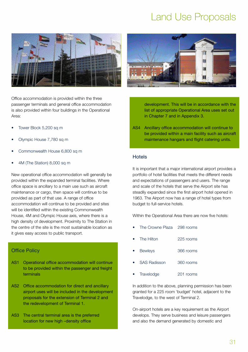
Office accommodation is provided within the three
passenger terminals and general office accommodation
is also provided within four buildings in the Operational
Area:
• Tower Block 5,200 sq m
• Olympic House 7,780 sq m
• Commonwealth House 6,800 sq m
• 4M (The Station) 8,000 sq m
New operational office accommodation will generally be
provided within the expanded terminal facilities. Where
office space is ancillary to a main use such as aircraft
maintenance or cargo, then space will continue to be
provided as part of that use. A range of office
accommodation will continue to be provided and sites
will be identified within the existing Commonwealth
House, 4M and Olympic House axis, where there is a
high density of development. Proximity to The Station in
the centre of the site is the most sustainable location as
it gives easy access to public transport.
Office Policy
AS1 Operational office accommodation will continue
to be provided within the passenger and freight
terminals
AS2 Office accommodation for direct and ancillary
airport uses will be included in the development
proposals for the extension of Terminal 2 and
the redevelopment of Terminal 1.
AS3 The central terminal area is the preferred
location for new high –density office
development. This will be in accordance with the
list of appropriate Operational Area uses set out
in Chapter 7 and in Appendix 3.
AS4 Ancillary office accommodation will continue to
be provided within a main facility such as aircraft
maintenance hangars and flight catering units.
Hotels
It is important that a major international airport provides a
portfolio of hotel facilities that meets the different needs
and expectations of passengers and users. The range
and scale of the hotels that serve the Airport site has
steadily expanded since the first airport hotel opened in
1963. The Airport now has a range of hotel types from
budget to full-service hotels.
Within the Operational Area there are now five hotels:
• The Crowne Plaza 298 rooms
• The Hilton 225 rooms
• Bewleys 366 rooms
• SAS Radisson 360 rooms
• Travelodge 201 rooms
In addition to the above, planning permission has been
granted for a 225 room ‘budget’ hotel, adjacent to the
Travelodge, to the west of Terminal 2.
On-airport hotels are a key requirement as the Airport
develops. They serve business and leisure passengers
and also the demand generated by domestic and
31
Land Use Proposals
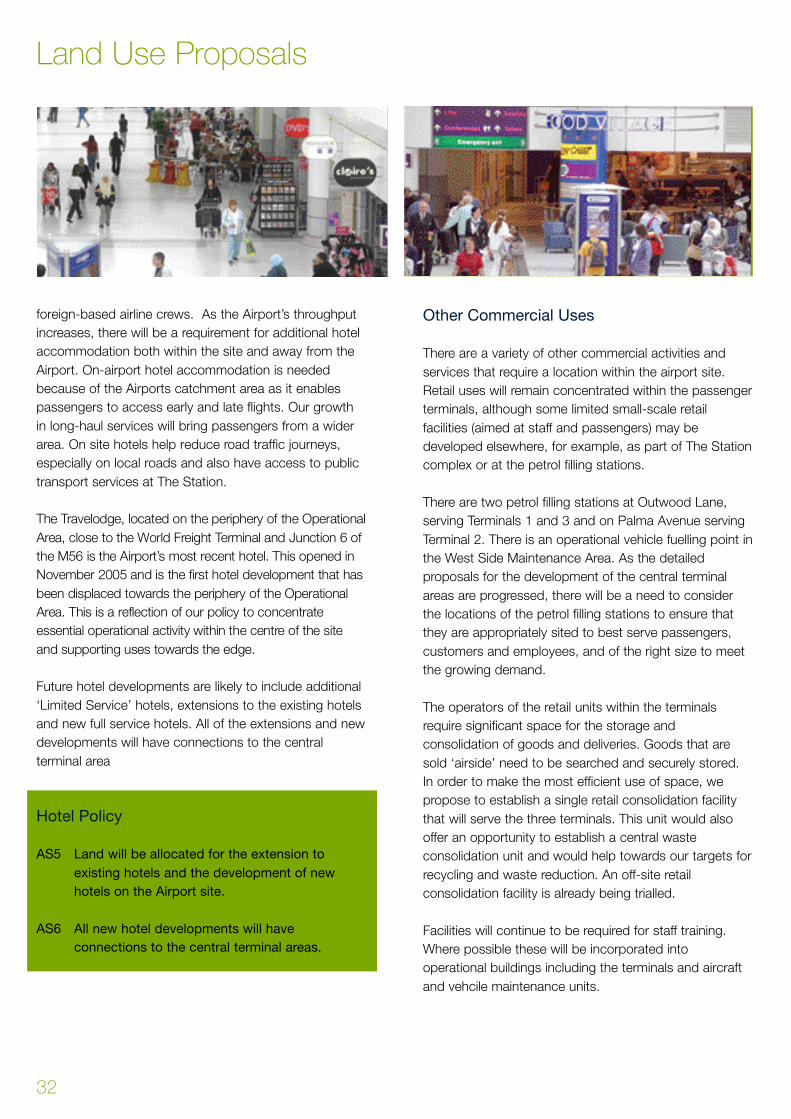
foreign-based airline crews. As the Airport’s throughput
increases, there will be a requirement for additional hotel
accommodation both within the site and away from the
Airport. On-airport hotel accommodation is needed
because of the Airports catchment area as it enables
passengers to access early and late flights. Our growth
in long-haul services will bring passengers from a wider
area. On site hotels help reduce road traffic journeys,
especially on local roads and also have access to public
transport services at The Station.
The Travelodge, located on the periphery of the Operational
A rea, close to the World Freight Te rminal and Junction 6 of
the M56 is the Airport ’s most recent hotel. This opened in
November 2005 and is the first hotel development that has
been displaced towards the periphery of the Operational
A rea. This is a reflection of our policy to concentrate
essential operational activity within the centre of the site
and supporting uses towards the edge.
Future hotel developments are likely to include additional
‘Limited Service’ hotels, extensions to the existing hotels
and new full service hotels. All of the extensions and new
developments will have connections to the central
terminal area
Hotel Policy
AS5 Land will be allocated for the extension to
existing hotels and the development of new
hotels on the Airport site.
AS6 All new hotel developments will have
connections to the central terminal areas.
Other Commercial Uses
There are a variety of other commercial activities and
services that require a location within the airport site.
Retail uses will remain concentrated within the passenger
terminals, although some limited small-scale retail
facilities (aimed at staff and passengers) may be
developed elsewhere, for example, as part of The Station
complex or at the petrol filling stations.
There are two petrol filling stations at Outwood Lane,
serving Terminals 1 and 3 and on Palma Avenue serving
Terminal 2. There is an operational vehicle fuelling point in
the West Side Maintenance Area. As the detailed
proposals for the development of the central terminal
areas are progressed, there will be a need to consider
the locations of the petrol filling stations to ensure that
they are appropriately sited to best serve passengers,
customers and employees, and of the right size to meet
the growing demand.
The operators of the retail units within the terminals
require significant space for the storage and
consolidation of goods and deliveries. Goods that are
sold ‘airside’ need to be searched and securely stored.
In order to make the most efficient use of space, we
propose to establish a single retail consolidation facility
that will serve the three terminals. This unit would also
offer an opportunity to establish a central waste
consolidation unit and would help towards our targets for
recycling and waste reduction. An off-site retail
consolidation facility is already being trialled.
Facilities will continue to be required for staff training.
Where possible these will be incorporated into
operational buildings including the terminals and aircraft
and vehcile maintenance units.
Land Use Proposals
32

The overall land requirements for ancillary activities are
likely to be modest. The pressure for space for uses
such as aprons, terminals and taxiways will result in
some existing activities being displaced to locations on
the airport periphery.
Other Commercial Uses Policy
AS7 New Petrol Station locations will be identified in
the detailed proposals to redevelop the central
terminal area.
AS8 A site will be identified and developed for a
centralised retail delivery and distribution facility.
Spectator Facilities
T h e re remains a continuing demand for facilities to
accommodate visitors and spectators. The Airport is a
significant visitor attraction and viewing facilities are
p rovided within the Te rminal 1 complex and at the
Aviation Viewing Park that is located off Old Wi l m s l o w
Road, to the south of Cloughbank Farm. Pro v i d i n g
viewing facilities helps remove pre s s u re on the central
t e rminal complex and from the local road network. The
Aviation Viewing Park is a largely open use, and whilst it
needs to have good views of the airfield and the ru n w a y s ,
it is a use that can be situated on the perimeter of the
Operational Area. The south side of the Airport is
c o n s i d e red to be the most appropriate long-term location.
The Aviation Viewing Park has, in recent years, been
developed to provide a wider range of attractions for
visitors and spectators. These include several static
aircraft exhibits, the highlight of which is one of British
Airways’ Concorde aircraft. It is proposed to further
develop the Viewing Park’s facilities. This will include the
development of a purpose-built hangar for Concorde and
upgraded spectator facilities.
The existing Aviation Viewing Park will be affected by
a p ron development to the west of the airc r a f t
maintenance village described earlier. Planning perm i s s i o n
has been granted for the development of an airc r a f t
viewing facility to the south of Runway 23L-05R adjacent
to the South Fire Station. This site is smaller than the
p resent temporary location and we will work with key
stakeholders, including Macclesfield Borough Council to
consider how best to provide replacement facilities.
Spectator Facilities Policy
AS9 Detailed proposals will be developed and
b rought forward for the relocation of the
Aviation Viewing Park to a site on the South
Side of the Airport next to the South Fire Station.
AS10 A hangar to house Concorde will be provided.
33
Land Use Proposals
The Airport relies on being accessible. Fast, efficient and
safe access is critical to future growth and development.
Accessibility is also important if we are to develop as a
major transport hub and a key point in the region’s
strategic network. Government policy encourages the
development of integrated transport systems and seeks
to direct new development to locations that are well
served by public transport. Airports are identified as
major opportunities to deliver these objectives. Airport
operators, with the support of their partners, are
expected to take the lead in improving the quality of
surface transport access. Both regional and local policies
are very clear in the promotion of these objectives.
The Airport is one of the most sustainable locations in
South Manchester and North Cheshire with our extensive
network of public transport services operating from a high
quality interchange. Our commitment to public transport
has been demonstrated over a number of years, with
many of our initiatives becoming examples of best
practice. We published our first Ground Tr a n s p o rt
Strategy in 1997 and this was updated in 2004. Since
publishing our Green Travel Plan in 1998, more
passengers and staff are using public transport to access
the Airport. We have a £60 million transport interchange –
The Station. The pro p o rtion of vehicle trips per air
passenger has decreased by 26% in the last 12 years
and employee car use has fallen by 10% since 1998.
Whilst improving public transport is a key priority, the need
to improve road capacity remains. Carefully targeted and
focussed local improvements to protect the strategic ro a d
network for airport access, car parking and managing the
g rowth in non-airport traffic are the main areas for action.
We intend to manage the growth in road traffic in a
sustainable and responsible way. This is because of:
• Environmental concerns, especially local air quality
and CO2 emissions. 60% of the Airport’s CO2
emissions are from road traffic.
• Increasing congestion and capacity constraints on
the strategic road network.
• National policy to encourage more sustainable
transport modes.
The Ground Transport Plan explains our proposals in
more detail. This Land Use Plan identifies the land
demands that are connected with surface access and
how we intend to address them.
Public Transport
The Airport ’s railway station centrally located between
Te rminal 1 and 2 opened in 1993. It has seen a significant
g rowth in traffic – handling nine inbound and nine
outbound trains an hour and 1.2 million passengers a year.
In 2002, all public transport services were concentrated in
a new transport interchange at the Rail Station. This
reflects our commitment to improving the range, fre q u e n c y
and inter-connectivity of public transport serv i c e s .
The Section 106 Agreement with Cheshire County
Council as part of the development of the Second
Runway included several surface access and public
transport obligations. Land has been reserved for a
number of strategic enhancements to the public
transport systems and these include:
• The construction of the Metrolink light rail system to
the Airport. We have committed financial support and
advance works on site have been undertaken,
including a 75m tunnel that formed part of the
Station project.
• The development of a 3rd rail platform to be built in
2007/08.
• Safeguarding land within the site for a western
extension to the heavy rail line serving the Airport.
Chapter 6 - Surface Access and Car Parking
34
• The development of high quality public transport
facilities.
The Station
The development of high quality public transport facilities
is central to our aspirations to alter the pattern of surface
access journeys to the Airport. This unique facility brings
together rail, bus and coach in one location and also
provides ‘check in’ facilities for passengers using
alternatives to the private car. The first phase of the
interchange, called ‘The Station’ includes:
• New bus stands and comfortable waiting areas for
local bus passengers.
• A coach station for express and charter services with
twelve coach stands (at Phase 1) and dedicated
waiting area.
• Airline check-in desks and baggage handling.
• Integrated ticket and information facilities.
• Catering and retail units.
• A Cycle Centre.
The development of the Station is an opportunity to
experiment with the way passengers and baggage is
processed. If the onsite trials are successful the
integration of check-in and other processes, will be
considered for application at other key points on the
regional transport network, in particular major rail stations
such as Crewe and Manchester Piccadilly, and dedicated
park and ride facilities.
Metrolink
Metrolink, Greater Manchester’s highly successful light
rail system, will be extended to the Airport as part of the
13 mile line which will run from the City Centre via
Trafford Bar, Chorlton, Sale Moor and Wythenshawe. It
will enhance the accessibility of the Airport and open up
opportunities for employment throughout Greater
Manchester. Metrolink will help reduce journeys to work
by private car by staff living close to the expanded network.
We expect the Airport Metrolink line to carry around 8
million passengers a year and remove around 1.2 million
car journeys off the local roads. We believe that Metrolink
will considerably enhance the accessibility of the Airport
and will open up employment opportunities to residents
of Wythenshawe and other areas along the route.
SA1 Metrolink is an important part of our Ground
Transport Plan . We will work to progress the
construction and operation of the link between
the Airport and Wythenshawe and will safeguard
a route within the Airport site.
Heavy Rail
The rail station has been a great success and a network
of direct rail services to destinations across the North
and the Midlands has developed. We will continue to
promote and develop improved services and facilities to
increase the level of rail use. Further development of
facilities in The Station will be important as we implement
our Ground Transport Plan. We will work closely with
Network Rail and the Greater Manchester PTE to
develop a 3rd rail platform. In the longer term, we will
work with our strategic partners to bring forward the
extension of the rail line to the west of the Airport. This is
a proposal that may bring wider benefits to the rail
network and improve links to, and from, the south and
west. The alignment through the Airport site has been
protected although no detailed proposals exist. The
development of a western rail extension is a long-term
scheme and is dependent on funding from Network Rail.
SA2 A third Rail Platform will be developed on land
adjacent to Bewleys Hotel for completion in
2008
SA3 We will support and work with the rail industry
and our regional partners to enhance the
capacity of the Region’s rail network and
improve access to the Airport
SA4 We will consider the feasibility and demand for
new rail infrastructure including a rail link to the
west.
SA5 We will safeguard land within the Airport site for
the construction of a western rail extension.
35
Surface Access and Car Parking
Strategic Highways
The Airport enjoys direct access to the motorway
network that serves most of our wide catchment area.
An efficient road network serving the Airport will remain
essential for the substantial numbers of passengers
travelling by road. Good road links are also necessary for
access by buses, coaches and courtesy vehicles and to
assist in dispersing the economic and social benefits
generated by the Airport. In the long-term, growth in
road traffic generally will mean that parts of the external
highway network will become overloaded during peak
periods and will require improvement. On a typical day
approximately 80,000 vehicles enter or leave the Airport
site. Approximately 80% of road traffic uses the M56
(75% from the north and 25% from the west). The rest of
the road traffic is distributed on other routes such as the
A538 and Ringway Road.
Air passenger road journeys are dominated by ‘pick up
and drop off’. Around 31% of passengers are dropped
off or picked up by others. A further 30% of passengers
use taxis, mainly private-hire operators. Private-hire taxis
are not able to ‘ply for hire’ and therefore in road traffic
terms, are very similar to ‘pick up and drop off’. This
means that around 70% of passengers use a travel
mode that involves 4 road journeys for every return air
trip. In contrast a passenger driving to the Airport and
parking on the site will generate 2 road journeys per
return air trip, and a passenger using public transport
generates no airport car journeys.
Staff journeys are another significant contributor to local
road traffic and account for 27% of total airport vehicle
movements. Currently 73% of staff journeys are by those
travelling alone in a car. As a result of our Green
Commuter Plan policies, there have been substantial
reductions in staff driving alone and this remains a major
element in our Ground Transport Plan.
The majority of airport road traffic will continue to access
the site via the M56. As part of the Second Runway
approval, we have entered into agreements with the
Highways Authorities to fund improvements to key parts
of the network. These works will provide an improved link
from Junction 6, M56 to Terminal 2; improvements
between Junction 5 and Junction 6 of the M56; and
improvements to the M56 spur and Hilton roundabout.
To the east, access is of a lower standard and a legal
agreement is in place for us to fund a diversion of
Ringway Road, between Styal Road and Shadow Moss
Road.
On a wider scale, a review of the strategic and local
transport needs of south-east Manchester and north
east Cheshire has been completed (SEMMMS). The
A555 Manchester Airport Link West is planned to be built
to dual carriageway standard with most junctions ‘at
grade’. Capacity on the road is to be safeguarded for the
provision of priority heavy goods and/or public transport
lanes, particularly to benefit access to the Airport.
There are a number of development sites that are
immediately adjacent to the Airport or are in close
proximity. These offer opportunities for development that
is in part connected to the Airport activity. In capturing
the economic benefits of the Airport, it is important that
good transport links to the Airport and to the strategic
road network are in place.
SA6 We will work with the Highways Agency and
local highway authorities to promote
improvements to the highway network and
improve the accessibility of the Airport.
SA7 We will bring forward proposals for the
improvement of Thorley Lane, Runger Lane and
Surface Access and Car Parking
36

Junction 6 of the M56 during the period up to
2010 in line with our obligations.
SA8 We support the completion of the SEMMMS
road proposals and we will contribute to
improvements to Ringway Road, between Styal
Road and Shadow Moss Road
Internal Roads
Within the Operational Area, the road system has to
cater for the efficient and safe movement of traffic
entering and leaving the site and accessing the
passenger and cargo terminal areas. As terminal
capacity grows to accommodate increasing passenger
numbers, the internal road system will be improved to
ensure the free flow of traffic around the site.
Improvements to be undertaken are:
• Terminal 2 - implementation of works associated with
T2 Phase 2
• Construction of a new road between Outwood Lane
and Ringway Road West to replace the existing
Ringway Road to facilitate apron and terminal
developments
As the road systems around the Airport are improved,
the current use and allocation of space within the pick up
and drop off areas for each terminal will be reviewed as
part of our overall traffic management strategy. This is to
ensure that there is sufficient capacity and it will also
improve the passenger experience and the overall
efficiency of the local road network. Controlling traffic
around the terminals is important for safety and security
and is also part of our policy to reduce car use.
SA9 As terminal capacity grows to accommodate
increasing passenger numbers the internal road
system will be developed to ensure the efficient
flow of traffic around the site.
Car Parking
As the Airport grows, many passengers and staff will still
use the private car to get to the Airport and we have a
range of facilities to meet the needs of these customers.
There are many forms of car parking required by
passengers, visitors and staff. They are an integral part of
our Ground Transport Plan and play a role in managing
traffic and CO2 emissions. Short-stay car parking is
provided in the central terminal area in multi-storey car
parks. Surface car parks on the edge of the Operational
Area provide both long-stay and staff car parking. The
short-stay car parks are the most intensively used, and it
is essential that they are close to the terminals.
Car parks are provided within the Operational Area and
are operated by the Airport Company. In addition, there
are also ‘off-airport’ car parking sites that are
independently owned and operated. Demand for car
parking is influenced by many factors, including
customer convenience, time of travel, the utilisation of
public transport, the mix between business and leisure
passengers and also the mix of charter and scheduled
flights. The issues surrounding car parking and the pick-
up and drop-off of passengers are therefore complex.
From a congestion, safety, convenience and operational
point of view, it is necessary for the Airport to have
sufficient on-site car parking capacity. This is balanced
alongside our policy to increase public transport use and
to contain the growth in airport road traffic.
Historically, we have pursued a variety of actions to
manage demand for car parking. This has included
pricing and restricting supply of on-site long-stay car
parking spaces. Whilst these measures have been
successful, it has generated significant increase in private
37
Surface Access and Car Parking
25000
20000
15000
10000
5000
01997
Year2000 2003 2005
Short StayLong Stay
On-Airport
Long Stay
Off-Airport
Public Parking Provision
hire and pick-up and drop-off activity. Our policy is to
reduce the traffic caused by this activity. We have now
introduced restrictions on passenger pick-up. This has
been achieved by restricting access to the terminal
forecourts and altering charges. In the longer term we
intend to consider further measures such as cordon
charging and other access restrictions.
Short Stay Car Parking
The most intensively used public car parks at the Airport
are those designated for short stay parking, and are
close to the three terminals. There are currently 5,375
short stay spaces in three multi storey car parks and a
further 450 surface spaces. Analysis of short stay car
parking demand indicates that air passengers driving
themselves represent a minority of users; the majority are
people accompanying air passengers, or meeting them
on arrival.
The provision of short-stay parking is essential for the
safe and efficient operation of the road network and
terminals. We will continue to provide this type of parking
within the central area, and adjacent to each terminal.
Schemes to increase capacity will be brought forward as
part of the terminal development strategy. We anticipate
that the overall demand for short stay spaces will rise by
around 1,500 by 2015.
SA10 We will develop additional short stay parking
capacity within the central terminal area. This is
most likely to include extensions to existing
multi-storey car parks at Terminal 2 and Terminal
3 along with the possibility of a new multi-storey
car park to the rear of Commonwealth House.
Long Stay Car Parking
Long-stay car parking is currently provided by both the
Airport Company and at sites run by independent
operators off site. 10,901 long-stay spaces are currently
provided on the Airport site but the majority of spaces for
this type of parking are ‘offsite’ ( 60%) in car parks that
are independently managed and operated. In 2006 there
were 15,727 off-airport spaces on 27 sites. The
development of off-airport sites is subject to local
authority planning policy.
Within the Airport site, long stay car parks are operated
in two ways. A vehicle can be ‘self-parked’ by a
passenger on surface car parks remote from the
terminals. These passengers can either have pre-booked
a space or just turned up at the Airport. These
passengers are then transferred to the terminals by
courtesy bus. Alternatively passengers can pre-book a
parking space and have their car ‘block parked’. The
passenger gives details of their departure and arrival
times and reports to a designated reception area and
then bussed to the terminal complex. The vehicle is then
parked in a column of cars that are arranged so that they
can be easily returned for the passenger to collect.
‘Block parking’ is a more efficient use of land, but it relies
on a passenger having a precise travel schedule. This
lack of flexibility is unattractive for some travellers and
means that the Airport has to cater for a range of
different car park activity including a large number who
arrive at the Airport and expect to find adequate and
convenient car parking capacity.
As the Airport develops, it is important that our Land Use
Plan recognises that a number of land uses have very
precise location requirements. These include taxiways,
apron and terminal facilities and are concentrated in the
centre of the site. This has resulted in several land uses
being pushed towards the periphery. In the case of long-
stay and staff car parking, these are uses that are largely
open in character, low level and low density. This can be
a better use than more intrusive built development
adjoining residential or rural areas.
Whilst off - a i r p o rt operators contribute to the total supply
of parking spaces, their operation is typically pre - b o o k e d ,
is often seasonal, and they can control their occupancy
levels. Surplus demand from the off-site operators
typically falls to us to provide, this means that we need to
p rovide our own facilities. Limiting the overall supply of
long stay spaces also encourages an increase in ro a d
t r a ffic associated with the dropping off and picking up of
air passengers. An increase in overall car parking capacity
will be a necessary feature of our future development as
our passengers need the certainty of supply and we will
e n s u re that a sufficient level of parking provision is made
in line with our Ground Tr a n s p o rt Plan. Our fore c a s t s
show a need to accommodate a peak re q u i rement for
a p p roximately 35,000 long-stay spaces on or off airport
when passenger throughput reaches around 40 million
passengers a year. Car park demand and supply beyond
2015 will be kept under re v i e w.
Surface Access and Car Parking
38

We are also exploring ways of how best to move
passengers from remote car parks to the terminal area.
Innovative solutions are now emerging and we will aim to
reduce the number of vehicle transfer journeys.
SA11 Car parking will play a key role in our Ground
Transport Plan and we will continue to provide
sufficient long-stay car park capacity.
SA12 Additional and replacement long-stay car parks
will be developed in the period up to 2015 on land
to the North of Ringway Road, at Moss Nook, to
the north and south of the Rail Link, land to the
north of Moss Lane Styal, and on land at
Cloughbank Farm and Oak Farm to the west.
SA13 We will seek to optimise the density of long-stay
car parking on the Airport site in the context of
the varied needs of our consumers and our
Ground Transport Plan. We will explore
opportunities to identify and promote park and
ride facilities remote from the Airport site.
SA14 A route will be safeguarded for a light-rail
people-mover system linking the Terminal
complex with the long-stay car park.
Staff Parking
C u rrently there are 5,306 surface car parking spaces
allocated for staff on the Airport site. Due to pre s s u re
f rom competing uses, employee car parking has larg e l y
been consolidated at a few large sites on the western
perimeter of the Airport. This provides a better utilisation
of space and helps to manage demand for space; it also
helps to intercept road traffic on main approaches fro m
the west. As pre s s u re for core operational facilities
i n c reases, there will be a need to displace more staff
parking to the edge of the site. This is part of our Gro u n d
Tr a n s p o rt Plan to make public transport services more
attractive in comparison to the private car. It also re l e a s e s
land within the central terminal area for those land uses
that re q u i re strong connections to the runways, apro n s
and term i n a l s .
SA15 New and replacement staff car parks will be
developed on the periphery of the Airport site to
relieve the internal road network and to
encourage greater use of public transport for
journeys to work. These areas may include land
at Cloughbank Farm, Oak Farm and land to the
north of Ringway Road.
The success of our policies to encourage the use of
public transport, and manage car use for staff journeys
to work should reduce the proportion of staff car parking.
However a significant number of spaces will still be
required as the working population grows from the
current 19,201 people employed on site. During peak
hours for highway usage, staff trips account for 27% of
the road traffic entering the Airport. One element of our
Ground Transport Plan is the implementation of a Green
Travel Plan. This contains a commitment to reduce staff
parking relative to on-site employment. We have a target
ratio of four staff parking permits per space. It is currently
around 3.5 permits per space. Given the projected
growth in on-site employment to 26,000 by 2015, this
would result in a maximum provision of 6,500 staff
parking spaces located either on or off site to sustain
operational activities at the Airport.
The 24-hour nature of Airport operations and high
p ro p o rtion of shift-working staff, means that their journ e y s
do not impose a burden on the road network during peak
39
Surface Access and Car Parking

hours. Our first priority will be on those journeys that
contribute to peak hour flows on the road network.
Car Rental Facilities
Rental cars are used by around 2-3% of passengers.
The majority of these are business travellers. There are
six operators licensed to operate from the Airport. They
provide customer service facilities within each terminal,
and ready and return spaces in each of the multi storey
car parks. Three companies have maintenance depots
on site.
Whilst the provision of some ready and return spaces will
continue within the terminal complex, as demand for
short-stay public parking spaces increases the
proportion of these spaces to be provided either at the
periphery of the existing site or off-site will increase.
Rental desks will continue to be provided within the
terminal buildings. However, vehicle storage,
maintenance and administrative operations may need to
be displaced off airport or to the periphery of the site to
allow for expansion of operational facilities.
SA16 A site will be identified for the relocated car
rental maintenance facilities.
Cycle Ways and Footpaths
A network of key cycle and footpath routes has been
developed, both within the site (linking key employment
areas) and links to surrounding areas, such as the Black
Path to Wythenshawe and links to Hale Barns. We will
continue to provide recreation links around the area, to
improve access to the Bollin Valley and Styal village.
Within the Airport site there are a number of dedicated
cycle parking areas together with a Cycle Centre within
the Station. Users have access to lockers and washing
facilities.
SA17 We will seek to develop enhanced footpath links
to local residential areas and recreational
facilities.
SA18 We will promote the provision of new cycle
routes on the road network within the vicinity of
the Airport.
Full details of our surface access policies can be found in
the Ground Transport Plan, one of our four Action Plans.
Surface Access and Car Parking
40

Earlier Chapters have set out the forecast growth of the
Airport and the developments that will be required. Whilst
this Land Use Plan promotes the need to increase the
utilisation and efficiency across all of the airport facilities,
we have concluded there will be a need to extend the
Airport’s Operational Area. This is to provide enough land
for the long term development of the Airport.
Operational Area Policy
The ‘Operational Area’ was first defined in 1974. The aim
was to provide a reservoir of land to accommodate the
development of the Airport into the 1990s (up to around
10 million passengers a year). It defined the area within
which airport development would be contained, bearing
in mind the Green Belt location. It also served to protect
the land for airport use and to prevent non-airport
development. This Operational Area covered some 505
hectares of land.
The Development Strategy to 2005 was published in
1991 and considered the activities and the requirements
of an airport handling 30 million passengers a year.
Extensions to the Operational Area were identified along
with the proposal to develop a Second Runway. The
approval and development of the Second Runway, along
with the adoption of the Macclesfield Borough Local
Plan, extended the 1974 Operational Area to the 625
hectares that it is today.
The Development Strategy to 2005 proposed three other
extensions to the Operational Area. These were:
• Land between the Airport’s western boundary and
the A538 (Cloughbank Farm)
• Land to the North of Ringway Road, bounded by
Shadowmoss Road and Trenchard Drive
• Land within the M56 Junction 5.
These proposed extensions to the Operational Area were
not formalised within the Manchester Unitary
Development Plan due to uncertainty at that time about
the proposed Second Runway. With the publication of
the Draft Development Strategy to 2015 in 2003, these
extensions were retained; but now in the context of an
airport handling 40 million passengers a year. That
Strategy also included a small area of land to the south
of Ringway Road, between Tedder Drive and Styal Road.
These proposed extensions increased the Operational
Area to 710 hectares.
The Government, in the Air Transport White Paper, asked
airport operators to prepare long-term plans to guide
future development. We have carried out a review of the
Operational Area to see what land would be needed in
the period up to 2030, for an airport with an annual
throughput of 50 million passengers a year. In order to
accommodate a further 15 years of growth, and an
additional 10 million passengers per year, we propose a
further extension to the Operational Area.
After careful analysis of a range of options, we have
concluded that this should be to the west, into the area of
Oak Farm between the River Bollin and the A538.
A l t e rnative areas have been considered, however given
the local geography of the Airport site and local
e n v i ronmental constraints, there are few alternatives. To
the north of the Airport is the Manchester Business Park
and the residential areas of Wythenshawe. To the east is
the residential area of Moss Nook and land in Styal to the
n o rth of Holly Lane. To the south is the National Tru s t
estate part of Quarry Bank Mill, and to the west is the
open land of Cloughbank Farm and Oak Farm, dro p p i n g
down into the Bollin Va l l e y. From our analysis we have
concluded that the land at Oak Farm re p resents the most
a p p ropriate extension to the Operational Area subject to
the implementation of substantial environmental mitigation
and the extension to the Second Runway Landscape and
Habitat Management Plan Area. Further details on our
41
Chapter 7 - Operational Area and Green Belt
landscape and nature conservation proposals can be
found in our Environment Plan.
Of the Oak Farm site, a substantial part is wooded, sloping
and unsuitable for development. There is around 38 ha of
land, adjacent to the A538 that would form a logical
extension to the rest of the Operational Area. The re m a i n i n g
land will be subject to a comprehensive programme of
e n v i ronmental works to increase its landscape, nature
c o n s e rvation and re c reational value. The Environment Plan
includes proposals to extend the landscape and habitat
management plan area by around 100 ha.
Operational Area Policy
DP1 The operation and the development of the
Airport up to 2030 will be contained in a defined
Operational Area of approximately 750 ha.
Land Use Within the Operational Area
In Chapter 6, we have identified those types of
development that we consider to be appropriate within
the Operational Area. To meet this test, development
must be necessary for the operational efficiency or
amenity of the Airport. This principle was first established
in 1974 and has subsequently been adopted by
Manchester City Council within the Unitary Development
Plan. This approach is also consistent with Government
Guidance in PPG1311 and recognises the Green Belt
location of the Airport. The Operational Area uses are
specific, in order to enable the development of the
Airport to meet the requirements set out in the Air
Transport White Paper. The uses considered to be
appropriate within the Airport Operational Area are:
Operational Facilities and infrastru c t u re including:
• Runways and taxiways;
• Aircraft apron and handling services buildings and
facilities;
• Aircraft fuelling and storage facilities;
• Emergency Services and control authorities facilities;
• Control tower, air traffic control accommodation,
ground and air navigational aids, airfield and
approach lighting;
• Facilities for the maintenance, repair and storage of
service vehicles;
• Airfield drainage facilities.
Passenger and terminal facilities including:
• Terminal facilities including passenger handling,
lounges, baggage handling, catering and retail;
• Administrative accommodation for airlines, handling
agents, tour operators, airport authority and
Government agencies;
• Public and staff car parking;
• Public transport facilities, including rail, light rail,
buses, coaches and taxis;
• Facilities for general and business aviation (including
air taxi, helicopter and private use).
Operational Area and Green Belt
42
11 Planning Policy Guidance Note 13 ‘Transport’ March 2001

Cargo facilities including:
• Freight forwarding and handling facilities and bonded
warehouses;
• Associated accommodation for airline agencies,
freight forwarders, integrators and Government
agencies;
• Lorry parking, fuelling and servicing facilities;
• In-flight catering and flight packaging facilities.
Airport ancillary infrastructure including;
• Car rental, maintenance and storage facilities;
• Hotel accommodation;
• Training centres for airlines and airport related serv i c e s ;
• Ancillary office accommodation;
• Maintenance facilities for aircraft and avionics;
• Petrol filling stations;
• Utility infrastructure including sewage, waste,
telecommunications, water, gas and electricity.
Landscaping works including:
• Strategic planting, earth mounding and habitat
creation.
Internal highways and infrastructure including:
• Cycleways, footways and roadways.
We have included the full list of uses in Appendix 3. The
uses considered to be appropriate within the Operational
Area in Macclesfield are detailed in Policy T23 in the
Macclesfield Borough Local Plan. This approach has
been established over many years and has enabled the
growth and development of the Airport. It has also
resulted in the displacement of some airport uses away
from the main airport site. We have no proposals to
change this approach or the range of uses that we
consider to be appropriate within the Operational Area.
The Operational Area has been defined following a
detailed appraisal of environmental effects, land
demands and business needs. We have drawn a careful
balance between the main physical constraints,
environmental impacts and the need to provide land for
future growth. The extensions to the Operational Area
have been contained to the minimum that we believe are
needed and achievable and this land is only for uses that
are considered to be appropriate in the Operational Area.
The proposed operational area extensions have been
identified in order to secure land for future airport
development. These sites are immediately adjacent to
the Operational Area. Other non-green belt sites have
either been developed or have land use allocations for
employment uses in the Manchester UDP and in the
Trafford UDP.
Our long-term land use strategy for the site is set by the
following policies:
DP2 We will only allow appropriate development
within the Airport Operational Area.
DP3 In line with Government expectations, we will
promote the extensions to the Operational Area
as part of Manchester City Council’s Local
Development Framework.
DP4 We will continually review our land holdings and
seek to maximise the efficiency of all airport
facilities.
DP5 We will give priority to the use of land for
activities that are associated with the handling of
aircraft and passengers and that require to take
place on areas that adjoin existing apron,
taxiways and runways or which are needed in
connection with the safe and efficient operation
of the airfield.
43
Operational Area and Green Belt
DP6 We will invest in technology to improve capacity
utilisation and to provide a higher quality of
service to our passengers.
DP7 We will seek to minimise pressure on the ground
transport network by relocating uses to sites
outside the Operational Area as opportunities
arise, or as needs dictate.
Proposed Extensions to the Operational Area
This Land Use Plan identifies five proposed extensions to
the existing Airport Operational Area. These are shown
on Plan 4 and are:
• Land to the east of the A538 (Cloughbank Farm)
(38 hectares)
• Land to the north of Ringway Road (30 hectares)
• Land within Junction 5 of the M56 (12 hecatres)
• Land to the south of Ringway Road, between Tedder
Drive and Styal Road (6 hectares)
• Land to the west of the A538 (Oak Farm) (38
hectares)
Preliminary planning appraisals have been undertaken
and are summarised in Appendix 2.
Adjacent & Near Airport Development Sites
Our Master Plan explains in some detail the economic
and regeneration opportunity that the growth and
development of the Airport represents. There are a
number of development sites that are either immediately
adjacent to the Operational Area or are in close proximity.
These sites have some close links with the airport activity
and provide accommodation for airport service
companies or for other businesses that need to be close
to the Airport. They also provide an opportunity to
capture some of the benefits arising from future growth.
They include:
• Land to the north of Ringway Road – Manchester
Business Park
• Land at Thorley Lane – Manchester Business Park
• Atlas Business Park
• Davenport Green (not yet developed)
• Sharston Industrial Estate
• Roundthorn Industrial Estate
These sites all have planning approvals or are used for a
range of commercial uses. None of these uses are
specifically identified as being airport-related, and several
have been developed for a range of general commercial
office uses.
Our Master Plan and the section of this document that
deals with air freight and logistics, clearly identifies a
significant opportunity for the development of a major air
freight logistics operation that is focussed on the Airport.
It would not be appropriate to promote the extension of
the Operational Area to support all of this activity,
however the logistics opportunity can be identified on an
adjacent or ‘near airport’ development site.
The development of a freight forwarding and logistics
centre that is linked to the Airport will enable a step-
change in the range of facilities that the Airport can offer.
This activity needs to be located in close proximity to the
main airport site. There are a range of sites, including
land at Roundthorn (both on the existing industrial estate
and to the south of it) that are situated in the
development corridors identified within the Wythenshawe
Strategic Regeneration Framework. High quality
transport connections both to the Airport and to the
motorway network will be important in securing this
development opportunity.
DP8 We will work with Manchester City Council to
identify appropriate locations for a freight
forwarding and logistics facility in areas close to
the Airport. The improvement of access links to
the Airport will be a key requirement of such a
facility.
Operational Area and Green Belt
44
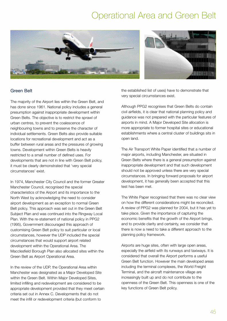
Green Belt
The majority of the Airport lies within the Green Belt, and
has done since 1961. National policy includes a general
presumption against inappropriate development within
Green Belts. The objective is to restrict the sprawl of
urban centres, to prevent the coalescence of
neighbouring towns and to preserve the character of
individual settlements. Green Belts also provide suitable
locations for recreational development and act as a
buffer between rural areas and the pressures of growing
towns. Development within Green Belts is heavily
restricted to a small number of defined uses. For
developments that are not in line with Green Belt policy,
it must be clearly demonstrated that ‘very special
circumstances’ exist.
In 1974, Manchester City Council and the former Greater
Manchester Council, recognised the special
characteristics of the Airport and its importance to the
North West by acknowledging the need to consider
airport development as an exception to normal Green
Belt policy. This approach was set out in the Green Belt
Subject Plan and was continued into the Ringway Local
Plan. With the re-statement of national policy in PPG2
(1995), Government discouraged this approach of
customising Green Belt policy to suit particular or local
circumstances, however the UDP included the special
circumstances that would support airport related
development within the Operational Area. The
Macclesfield Borough Plan also allocated sites within the
Green Belt as Airport Operational Area.
In the review of the UDP, the Operational Area within
Manchester was designated as a Major Developed Site
within the Green Belt. Within Major Developed Sites,
limited infilling and redevelopment are considered to be
appropriate development provided that they meet certain
criteria set out in Annex C. Developments that do not
meet the infill or redevelopment criteria (but conform to
the established list of uses) have to demonstrate that
very special circumstances exist.
Although PPG2 recognises that Green Belts do contain
civil airfields, it is clear that national planning policy and
guidance was not prepared with the particular features of
airports in mind. A Major Developed Site allocation is
more appropriate to former hospital sites or educational
establishments where a central cluster of buildings sits in
open land.
The Air Transport White Paper identified that a number of
major airports, including Manchester, are situated in
Green Belts where there is a general presumption against
inappropriate development and that such development
should not be approved unless there are very special
circumstances. In bringing forward proposals for airport
development, it has generally been accepted that this
test has been met.
The White Paper recognised that there was no clear view
on how the different considerations might be reconciled.
A review of PPG2 was planned for 2004, but it has yet to
take place. Given the importance of capturing the
economic benefits that the growth of the Airport brings,
and to provide clarity and certainty, we consider that
there is now a need to take a different approach to the
planning policy framework.
Airports are huge sites, often with large open areas,
especially the airfield with its runways and taxiways. It is
considered that overall the Airport performs a useful
Green Belt function. However the main developed areas
including the terminal complexes, the World Freight
Terminal, and the aircraft maintenance village are
increasingly built up and do not contribute to the
openness of the Green Belt. This openness is one of the
key functions of Green Belt policy.
45
Operational Area and Green Belt
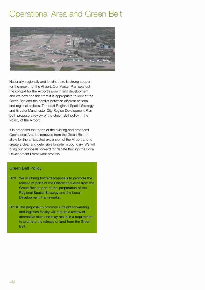
Nationally, regionally and locally, there is strong support
for the growth of the Airport. Our Master Plan sets out
the context for the Airport’s growth and development
and we now consider that it is appropriate to look at the
Green Belt and the conflict between different national
and regional policies. The draft Regional Spatial Strategy
and Greater Manchester City Region Development Plan
both propose a review of the Green Belt policy in the
vicinity of the Airport.
It is proposed that parts of the existing and proposed
Operational Area be removed from the Green Belt to
allow for the anticipated expansion of the Airport and to
create a clear and defensible long-term boundary. We will
bring our proposals forward for debate through the Local
Development Framework process.
Green Belt Policy
DP9 We will bring forward proposals to promote the
release of parts of the Operational Area from the
Green Belt as part of the preparation of the
Regional Spatial Strategy and the Local
Development Frameworks.
DP10 The proposal to promote a freight forwarding
and logistics facility will require a review of
alternative sites and may result in a requirement
to promote the release of land from the Green
Belt.
Operational Area and Green Belt
46
The Air Transport White Paper recognised the potential
environmental and social impact of significant growth at
Manchester. But Government judged that these were
challenging but manageable and were not so severe that
constraints should be imposed on the development of
the Airport. In setting out our long-term development
strategy, it is important to set out clear environmental
limits, targets and measures that are necessary to both
secure the Airport’s growth and to minimise the impact
on the environment and surrounding communities.
The development of the Second Runway included a
major environmental programme, including the
preparation and implementation of a landscape and
habitat management plan. This covers 350 ha and forms
part of a comprehensive programme of landscape and
habitat management around the south west of the site.
Over the period of this Land Use Plan, it is our intention
to add new areas to the landscape and habitat
management plan. This is in order to offset the proposed
extension to the Operational Area. The area identified lies
either side of the Bollin Valley between the M56 and
Castle Hill Farm.
An appraisal of the consequences of growth has been
undertaken. This builds on the work that was carried out
by the Department for Transport (as part of the Air
Transport White Paper) and also the process to prepare
our Environment Plan. The full details of our
environmental programme is set out in our Environment
Plan. The Draft Land Use Plan included policies on
environmental impact and mitigation. These policies have
now been included in the Environment Plan which has
been significantly revised following public consultation.
47
Chapter 8 - Environment and Mitigation
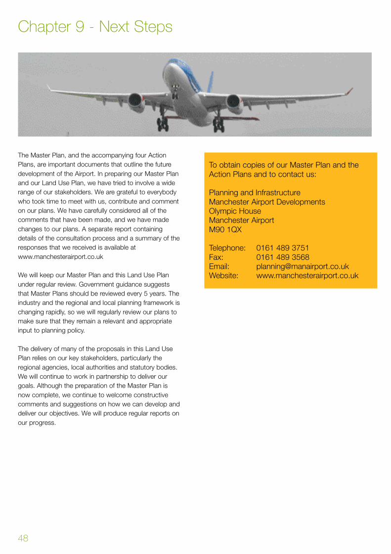
The Master Plan, and the accompanying four Action
Plans, are important documents that outline the future
development of the Airport. In preparing our Master Plan
and our Land Use Plan, we have tried to involve a wide
range of our stakeholders. We are grateful to everybody
who took time to meet with us, contribute and comment
on our plans. We have carefully considered all of the
comments that have been made, and we have made
changes to our plans. A separate report containing
details of the consultation process and a summary of the
responses that we received is available at
www.manchesterairport.co.uk
We will keep our Master Plan and this Land Use Plan
under regular review. Government guidance suggests
that Master Plans should be reviewed every 5 years. The
industry and the regional and local planning framework is
changing rapidly, so we will regularly review our plans to
make sure that they remain a relevant and appropriate
input to planning policy.
The delivery of many of the proposals in this Land Use
Plan relies on our key stakeholders, particularly the
regional agencies, local authorities and statutory bodies.
We will continue to work in partnership to deliver our
goals. Although the preparation of the Master Plan is
now complete, we continue to welcome constructive
comments and suggestions on how we can develop and
deliver our objectives. We will produce regular reports on
our progress.
To obtain copies of our Master Plan and the
Action Plans and to contact us:
Planning and Infrastructure
Manchester Airport Developments
Olympic House
Manchester Airport
M90 1QX
Telephone: 0161 489 3751
Fax: 0161 489 3568
Email: [email protected]
Website: www.manchesterairport.co.uk
Chapter 9 - Next Steps
48
Appendix 1 - Option Appraisal - Future Terminal Development 50
Appendix 2 - Proposed Operational Area Extensions 52
Area A 52
Area B 54
Area C 56
Area D 58
Area E 60
Appendix 3 - Appropriate Operational Area Uses 62
Appendix 4 - Plans 63
49
Appendices Contents

50
This section describes the process that has been
undertaken to select a preferred strategy for terminal
development in the period up to 2030
The Options
The Air Transport White Paper supports a significant
expansion of terminal capacity at Manchester Airport in
order to make maximum use of the available runway
capacity. In establishing the options for terminal
expansion, the White Paper referred both to the
development of existing facilities as well as the
development of a major new terminal complex that
Government recognised might require land outside the
existing airport boundaries.
Selecting the Preferred Strategy
Airports are complex entities whose development needs
to take account of a wide range of stakeholders,
including airlines, passengers, regulators, local
authorities, and local communities.
The demands of the airlines are many and varied and
give rise to significant challenges especially with the
trend towards major global alliances, the rise of ‘no frill’
operators and the desire of charter operators to develop
dedicated and branded facilities for their passengers.
Changes to the Security and Control regimes may
reduce flexibility, efficiency and capacity. It is however
also anticipated that there will be a considerable scope
for the development and use of technology to improve
the way that passengers and baggage are processed.
This will enable the Airport to become more efficient in
the use of space within the terminals. Examples of new
technologies include electronic ticketing, remote and
home check-in, mobile baggage collection and
sophisticated baggage tracking devices.
In assessing the potential options for the terminal
development strategy, a range of factors were
considered including:
• Environment
• Operations
• Customer Service
• Planning
• Finance
The evaluation was undertaken under three key areas:
• Implementation
• Service
• Finance
A number of alternative terminal development strategies
have been considered. The options explored focussed
on the size to which the terminals should be expanded
and the extent to which the terminals should be
redeveloped or rebuilt. As part of this exercise the
following were considered:
• The full demolition and re-building of Terminal 1 and
Terminal 3 along with an expansion of Terminal 2
• The demolition and re-building of Terminal 1 along
with an expansion of Terminal 2 and the
development of a new terminal complex
Appendix 1 - Option Appraisal - Future Te rminal Development
• The redevelopment of Terminal 1 and Terminal 3
along with an expansion of Terminal 2
• The redevelopment of Terminal 1 and Terminal 3, an
expansion of Terminal 2 and the development of a
new terminal complex
Implementation
Environment: Each of the four strategies performed
differently in terms of the impact on a range of
environmental issues. These included community impact,
landscape, ecology, noise and air quality. Whilst the four
strategies were seeking to accommodate the same level
of airport activity the environmental impacts were
significantly influenced by the distribution of the future
activity across the Airport site.
Deliverability: This element assessed the delivery of each
of the strategies within the planning and regulatory
framework.
Development Flexibility: The aviation industry is
demanding, dynamic and ever-changing. It is therefore
necessary for an airport to develop facilities that are
capable of being adapted to meet this change.
Development flexibility is therefore a key factor in
ensuring the continued success of the Airport. There
were significant levels of flexibility in each of the four
strategies that were considered.
Service
Passenger Experience: Each of the strategies performed
to different levels of passenger experience. Larger
facilities involve longer walking and transit distances as
well as challenges in terms of the ease of use and way-
finding.
Airline Experience: The re q u i rements of the customer
airlines place specific demands on the operation and
development of terminal facilities. Operational eff i c i e n c y,
the availability of contact stands and the delivery of fast
a i rcraft turn - rounds are just some of the factors that
airlines re q u i re to deliver their product and service. Each
of the four strategies perf o rmed to diff e rent airline
experience levels. In this criteria, direct contact to areas of
a p ron and the level of contact stand provision were the
key factors in the choice of terminal development
s t r a t e g y.
Surface Access: Detailed surface access requirements
and proposals are set out in the Land Use Plan, however
the ability of any of the terminal strategies to deliver high
quality access for both passengers and staff is an
important consideration. This is reflected in the ability for
the terminal development options to link effectively to the
public transport facilities and well as accessibility from
the strategic highway network.
Financial
Cost: Manchester Airport operates in a highly
competitive commercial environment. With the
development of ‘low-cost’ or ‘no frills’ airlines, the
demands on the Airport Company to deliver new
capacity at the right price is of significant importance to
the Airport’s airline customers. As with the other criteria,
the strategies performed to different levels in terms of the
capital expenditure required and the project’s investment
profile and cost plan.
The Appraisal
There are a range of competing factors within the criteria
that have been used to consider the terminal
development options and developing the preferred
strategy. The criteria were chosen to ensure that the
strategy was both internally and externally focussed to
reflect the wide range of influences on the development
of the Airport. Several fundamental development
principles have been reached.
• The Airport must maximise the use of its existing
assets
• The Airport can only develop in a way that is
sensitive to the environment and surrounding
communities
• The use of new technology will be used to improve
operational processes and provide high levels of
customer service
• Development flexibility is a key element in any
successful airport operation
• High quality surface access is of fundamental
importance to the long-term strategy
Option Appraisal- Future Te rminal Development
51
52
A rea A - Land to the East of the A538
(Cloughbank Farm)
Site Description:
This is an area of approximately 38.5 hectares adjacent to
the western Airport boundary. The site is bounded by the
A538 to the west and the existing airfield to the south.
This site presently lies within the Green Belt and is
characterised predominantly by agricultural plain, severe d
by Cotteril Clough. Cotteril Clough is an area of ancient
woodland that is designated as a Site of Special Scientific
I n t e rest (SSSI). A Grade C Site of Biological Import a n c e
(SBI) lies adjacent to Cotteril Clough.
The current land use is mixed. Approximately half of the
site is in agricultural use under a short-term farm tenancy
agreement and based around Cloughbank Farm that is a
Grade 2 listed building. The remainder of land is non-
agricultural and includes the Aviation Viewing Park (AVP),
the Romper public house, Ringway Church (presently
used as an office) and Churchyard and a small number
of residential properties.
Development Principles:
In line with adopted development principles, a site brief
will be pre p a red. Site A is a visually attractive area of open
c o u n t ryside that includes SSSI woodland of national
i m p o rtance and a Grade C SBI. Proposals will there f o re
include measures to mitigate the impact on the SSSI, as
well as substantial landscape provision in keeping with
the area to create an attractive landscaped setting.
The development appraisal highlighted the importance,
value and sensitivity of the Church of Ringway St Mary.
The church is no longer in ecclesiastical use but the
building is subject to listed building controls. In advance
of any development, substantial screening and planting
would be put in place to protect, and retain the quality of
the setting and thereby shelter the Churchyard from
future development.
It is likely that access will be gained either directly fro m
the airfield or from a reconfiguration or extension of
Wilmslow Old Road depending upon the uses pro p o s e d .
Any submission should there f o re include details of access
p rovision and how public transport links can be impro v e d .
Environmental Impacts and Mitigation:
Specialist environmental studies and surveys of the site will
be carried out to gain an accurate understanding of the
e n v i ronmental effects that would result from development.
Landscape, ecology, nature conservation and land use
(agricultural, heritage and re c reational) would all be impacted
upon to some extent. Suitable mitigation measures will be
developed as a key element of any development pro p o s a l s ,
however where possible, landscape and habitat features will
be retained where appro p r i a t e .
The Cotteril Clough SSSI is of significant ecological and
landscape interest. Disturbance or ecological isolation of
the Clough would therefore have a substantial adverse
impact on the ecology and nature conservation of a
nationally important site and ancient woodland. It is
proposed to extend the Second Runway Nature
Conservation and Habitat Management Plan to areas in
the Bollin Valley to the west of the Airport site.
The ponds present within the SBI contain colonies of the
Great Crested Newt, which are a protected species.
Mitigation proposals will be developed and involve the
creation of new ponds to replace those that have been
lost, and the translocation of newts to these.
Further studies to establish the impact on other species,
such as bats and badgers would be necessary and an
assessment made of the most appropriate means of
mitigation to be carried out, such as those implemented
as part of the Second Runway works involving the
building of bat barns and replacement of badger setts.
Possible Future Uses:
Cloughbank Farm is one of the few development sites that
lie adjacent to the existing taxiways and runways. This site
p rovides an ideal location for uses requiring a direct link to
the airfield. These are generally operational in nature.
F u t u re development scenarios will include apro n
extensions, additional stands and taxiways. The site also
p rovides the optimal location for extension of the We s t
Side aircraft maintenance village. It is clear that airc r a f t
parking cannot be developed outside the Operational
A rea. Alternatives have been considered, but this is the
only proposed Operational Area extension that has a dire c t
link on to the airfield. Development in this area will be
prioritised for apron and aircraft parking. Initial stages of
the apron development may be in the period 2010 –2020.
Appendix 2 - Proposed Operational Area Extensions - Area A

53
P roposed Operational Area Extensions - Area A
54
Area B - Land to the North of Ringway Road
Site Description:
This is a site of some 30 ha. It lies within the Green Belt
and is an area described as urban fringe. It is currently
an undeveloped site that is bounded on 2 sides by
residential development. Approximately 70 properties are
located along the southern boundary to Ringway Road
and further residential areas are located to the west and
to the east. Existing commercial areas, the Atlas
Business Park and Ringway Trading Estate, lie to the
north and west of the site. Part of this area lies within the
Public Safety Zone. This imposes constraints on the
types of development than can be accommodated in this
area.
Development Principles:
The residential properties on Ringway Road and Tedder
Drive will be retained and will not form part of any future
development area. Because of the proximity of the
residential areas, the social, visual and environmental
impacts of any development will play an important role in
the formation of any development brief for this site.
Proposals will be included to screen the development
from residential areas. This will incorporate substantial
landscaping to protect and enhance the visual amenity of
the area. It is anticipated that development on this site
will be of medium to low density to preserve the
openness of the Green Belt and to uphold Public Safety
Zone policy.
Access to the site is likely to be from Shadow Moss
Road. Public transport provision is excellent as Site B lies
on main bus routes and has well developed cycle ways
and pedestrian links. It is also proposed for the Metrolink
line to run adjacent to the site with a proposed stop on
Shadow Moss Road.
Environmental Impacts and Mitigation:
It is considered unlikely that this area contains any
national or regionally important sites for nature
conservation. There are some isolated trees, and these,
along with the large areas of grassland are likely to be of
lesser importance. There is a slight possibility that bats
may be present in the tress and a survey will be required.
The site is overflown by aircraft that are landing or taking
off on Runway 23R-05L and therefore the site and the
surrounding properties are subject to high levels of
aircraft noise.
The properties on Ringway Road, Shadow Moss Road
and Trenchard Drive have open views across the area. It
is proposed that any development of this site will
incorporate substantial landscape works including areas
of new planting. This is to screen views from nearby
residential properties.
Possible Future Uses:
Uses to be promoted on this site are likely to be a
mixture of Airport car parking and the possible extension
of the Ringway Trading Estate for Airport related
operational and commercial activity such as airline
o ffices, flight catering or freight agents units which re q u i re
close linkages to the Airport site, but do not re q u i re dire c t
access to the aprons and runways. A large part of this
site is within the Airport ’s Public Safety Zone, and all the
a rea is subject to limits on the heights of buildings and
s t ru c t u res. This area is generally open in nature and it is
c o n s i d e red to be appropriate for surface car parking. The
car park capacity provided in this area will provide a
replacement for car parking displaced by the
development of the Te rminal 2 and the Te rminal 3 apro n .
This forms part of the Airport ’s overall car park supply and
cannot be provided away from the Airport site.
Proposed Operational Area Extension - Area B

55
Proposed Operational Area Extension - Area B
56
Area C – Land Within Junction 5 of the M56
Site Description:
This site covers an area of approximately 12 hectares.
The land falls into two distinct parts; land contained
within the Junction 5 slip road and land running to the
north of Thorley Lane. The whole of Site C is located
within the Green Belt.
The land within the Junction 5 slip road is isolated and
there is only one residential property nearby. In visual
terms the site is cut off from the surrounding areas by
the slip roads. It is presently characterised by a low
grade wooded area. Access to this part of the site will be
a key issue in any prospective development plans.
Thorley Lane and Painswick Park bound the second part
of the site, which contains a small number of residential
properties and the existing airport crèche. This part of
the site has good access.
Development Principles:
Access will be a key issue for the site within the Junction 5
slip road and there f o re proposals should address this.
Links to The Station should also be considered for both
sites. As the site is on the principal access route to the
A i r p o rt, design and landscape will also be important issues.
Environmental Impacts and Mitigation:
There is little information on any nature conservation
interest on this site, and detailed ecological surveys will
be required. It is possible that some of the ponds on the
land to the north of Thorley Lane may contain Great
Crested Newts and detailed surveys will be required.
Should any protected species be recorded, detailed
translocation and mitigation proposals will be developed.
Possible Future Uses:
The site within Junction 5 is suitable for a wide range of
uses. Typical uses could be Airport commercial uses
such as offices or hotels, car parking or park and ride
facilities. The site to the north of Thorley Lane is suitable
for smaller scale operational uses such as the expansion
of the crèche.
Proposed Operational Area Extension - Area C

57
Proposed Operational Area Extension - Area C
58
Area D - Land to the South of Ringway Road,
Between Tedder Drive and Styal Road
Site Description:
This site is the smallest of the new areas to be
incorporated into the Airport Operational Area. It covers
some 6 hectares. The northern part of this site is used
for a mixture of existing (petrol filling station) and
redundant commercial uses. Two dwellings are situated
on Tedder Drive, which forms the western part of the
site. The small open fields that constitute the southern
part of the site consist primarily of agriculturally improved
grasslands, bounded by hedgerow, neither of which have
any particular nature conservation value.
Development Principles:
P roposals should recognise the Green Belt location of the
site. Its proximity to the residential pro p e rties along
Ringway Road will influence access and landscape
a rrangements for any development. In seeking to minimise
disturbance for local residents measures should be
included to screen development and to protect and
enhance the visual amenity of the site. The new SEMMMS
road will make a major change to access and views.
Environmental Impacts and Mitigation:
This is an area that can be described as urban fringe in
character containing a petrol filling station, a small
number of dwellings and a commercial business. There
are no sites of national or regional conservation
importance nearby and it is considered that this part of
the site is of low nature conservation interest.
The site is on the periphery of the proposed Operational
Area and close to residential areas. Development
proposals will incorporate landscape planting to mitigate
and screen views from nearby residential properties.
Possible Future Uses:
Uses considered appropriate for the site are likely to be a
mixture of commercial and operational uses that do not
require direct access to the aprons and runways. The
major development in this area is the proposed
SEMMMS road scheme that is planned to connect
Ringway Road to the A555 at Handforth. Subject to
funding and the planning process, it is anticipated that
construction could commence in 2012 –2014.
Proposed Operational Area Extension - Area D
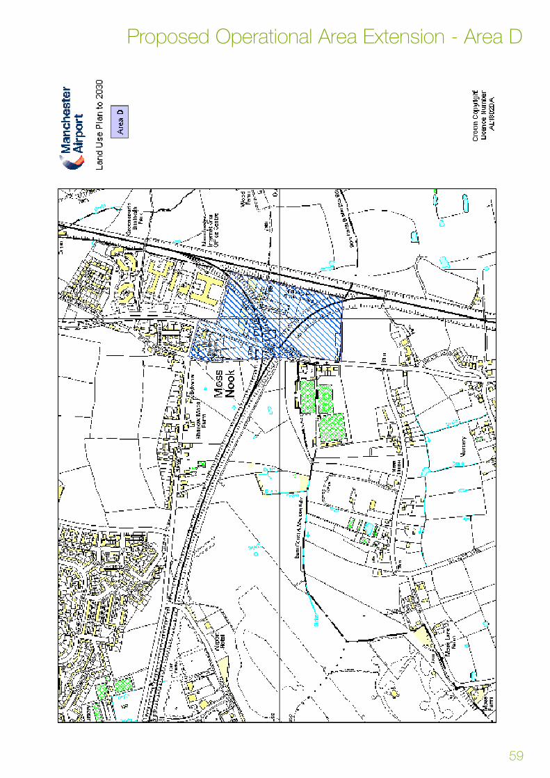
59
Proposed Operational Area Extension - Area D

60
Area E - Land to the West of the A538
(Oak Farm)
Site Description:
This site covers some 38 hectares. The majority of this
site is characterised by open agricultural plain consisting
of clipped hedgerows, pastoral fields and mature
hedgerow trees. This distinctly rural character is eroded
slightly to the north and east due to the influence of the
M56 and development associated with the existing
airport. The south western part of Area E is within the
Bollin Valley Area and comprises part of the steeply
wooded Cotteril Clough and Sunbank Wood, and the
steeply sloping valley sides of the River Bollin. Grade A
Sites of Biological Importance are also present within this
site.
Oak Farm is a dairy farm unit covering approximately 76
hectares of the agricultural plain. A small number of
isolated residential properties are located along Sunbank
Lane and Mill Lane.
Development Principles:
Area E is well located in terms of road access due to it
being adjacent to Junction 6 of the M56. However, it is a
sensitive area, particularly in its southern and western
reaches. Development would thereby be most
appropriate in the northern parts of the site where there
would be fewer significant impacts. There is however
great potential for environmental enhancement in the
southern half of the site especially in the Bollin Valley and
Sunbank Wood area that could build upon environmental
works implemented as part of the second runway
development.
The residential buildings located within Area E are
c o n s t ructed using vernacular styles and there f o re any
development would need to be of a high quality in keeping
with the distinct character of the surrounding are a .
Environmental Impacts and Mitigation:
The concentration of designated wildlife sites adjacent to
the Bollin Valley, which are of local/regional importance
and Cotteril Clough SSSI, which is a feature of national
importance, enhances the nature conservation value of
this site. Therefore mitigation measures must be a priority
of any development scheme to protect and enhance the
visual amenity and conservation value of this site. Good
design practice would be a priority during the
development of detailed proposals allowing for a buffer
around the sites of ecological importance to reinforce
and retain these habitats. It is likely that protected
species such as the Great Crested Newt, bats and
badgers are present in this area. Detailed ecological
surveys will be undertaken.
There is also great potential for ecological and nature
conservation works within Area E. These could
potentially neutralise the adverse impacts of development
or transfer these to benefits with a major integrated
habitat creation scheme including creation of
scrub/woodland to connect existing woodland, species
rich grassland and pond creation. These areas to the
west of the Airport site would be incorporated into the
Landscape and Habitat Management Plan area.
Possible Future Uses:
Development would be focused more on the nort h e rn
and eastern part of Area E. Car parking is a potential
development option and this area of the site could be
used for a relocated World Freight Te rminal that would be
re q u i red to enable the ultimate development of Te rminal 2
and the west apron. The development in this area would,
as with the rest of the Operational Area, be restricted only
to those uses that are necessary for the operational
e fficiency or amenity of the Airport (as listed in Appendix
3). It is likely that uses displaced from the central term i n a l
complex, such as Cargo handling, flight catering and
a i r p o rt car parking will be developed in this are a .
Proposed Operational Area Extension - Area E

61
Proposed Operational Area Extension - Area E

62
Appropriate Operational Area Uses –
Manchester UDP
1) Essential operational facilities on or adjacent to the
airfield which include runways, taxiways and associated
navigation aids, passenger and cargo handling facilities,
paved aircraft stands, aircraft maintenance hangars,
fuelling facilities, storage of aviation fuel, aircraft washing
plant, aircraft engine testing plant, general aviation
facilities (for air taxi, helicopter and private use), vehicle
washing, repair and maintenance facilities, facilities for
the repair and maintenance of specialised plant and
equipment, flight catering units, apron services buildings,
emergency services buildings, essential staff car parking,
staff facilities, specialised staff training accommodation
and operational accommodation.
2) Cargo terminal facilities, which include warehouses for
the storage of goods and livestock for distribution by air,
bonded warehouses, associated accommodation for
airline agencies, freight forwarders and Government
agencies, administrative accommodation, staff catering,
staff car parks, lorry parks, and vehicle refuelling and
servicing facilities.
3) Passenger terminal building and related facilities,
which include public and staff car parks, public transport
facilities, administrative accommodation for airlines,
handling agencies, tour operators and government
agencies, petrol filling and service stations, car rental
facilities, staff and air passenger shopping facilities, and
ancillary public viewing facilities.
4) Airport ancillary facilities, which include staff car parks,
car rental, maintenance and storage facilities, hotel
accommodation, and staff training and recreational
facilities.
5) Roads, footways and public transport infrastructure.
6) Sewage and other waste disposal facilities.
7) Landscaping works, including strategic tree planting
and earth mounding.
8) Any other uses which are not specifically mentioned
above and which in the opinion of the City Council
require a location within the Operational Area.
Macclesfield Borough Local Plan
Policy T23 sets out the approved Operational Area uses
for that part of the site in Macclesfield to the north of
Moss Lane. This policy states:
‘Uses which will be permitted within this area are those
which can be demonstrated to the satisfaction of the
local planning authority to be necessary for the
operational efficiency and amenity of the Airport. These
shall include airfield operational facilities, airport ancillary
facilities, transportation infrastructure and landscaping.’
Appendix 3 - Appropriate Operational Area Uses
Plans
Plan 1 Existing Land Use
Plan 2 Proposed Land Use
Plan 3 Existing Operational Area
Plan 4 Proposed Operational Area Extensions
Plan 5 Constraints
63
Appendix 4 - Plans
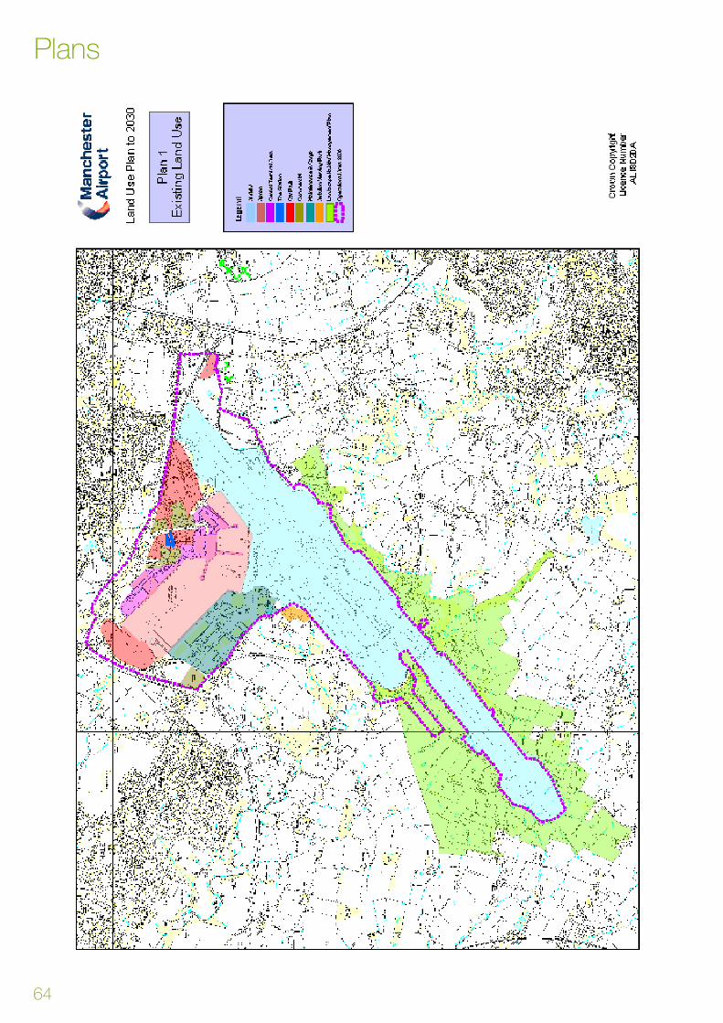
64
Plans

65
Plans

66
Plans
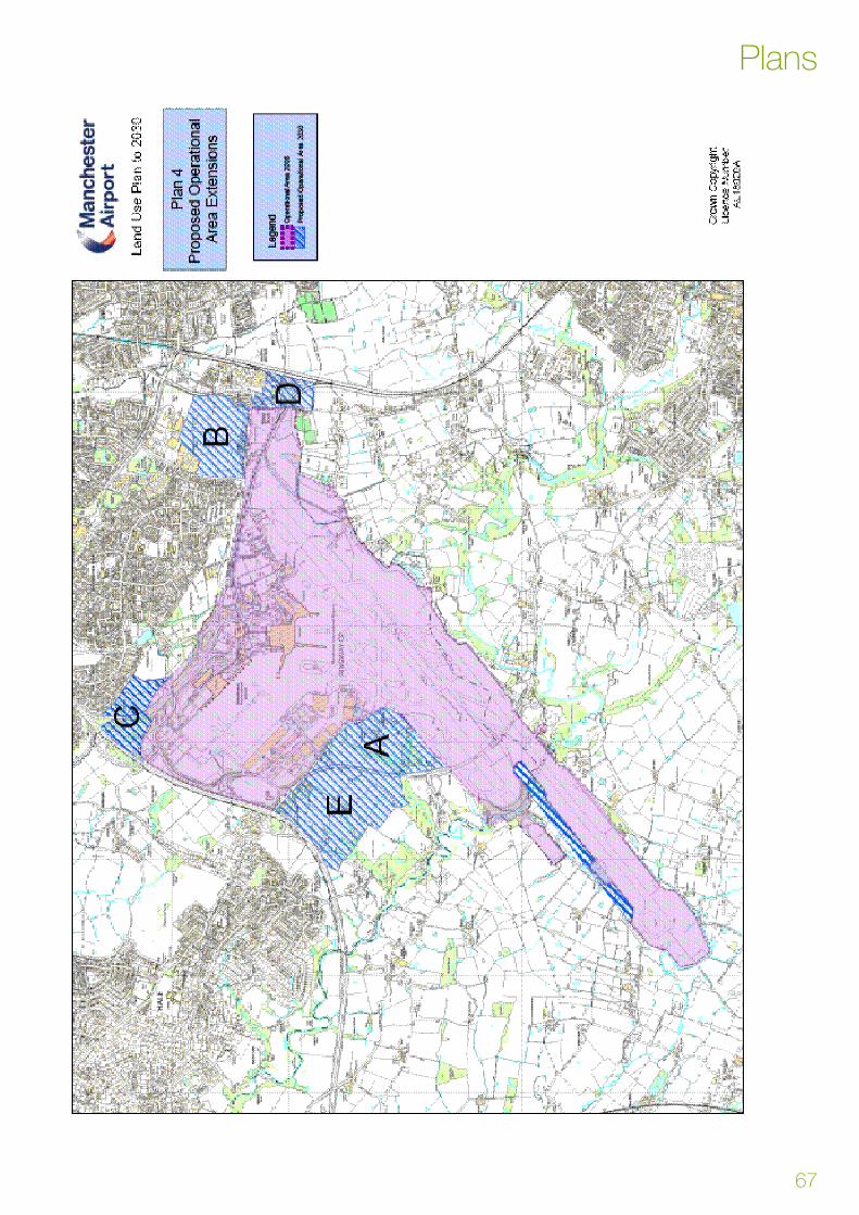
67
Plans
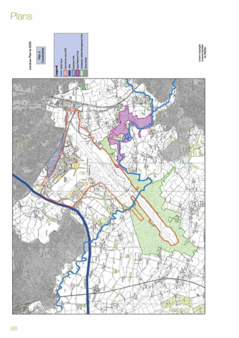
68
Plans

69

www.manchesterairport.co.uk
Manchester Airport
Manchester
M90 1QX