learning arcgis desktop topics covered in module 1 cven 2012 – geomatics university of colorado...
Post on 20-Dec-2015
218 views
TRANSCRIPT

Learning ArcGIS Desktop Topics Covered in Module 1
CVEN 2012 – GeomaticsUniversity of Colorado – Boulder
April 2006
Alyssa McCluskey

Topics Covered in Lab Exercise
• ArcGIS Desktop• Layout and Data
Views• Zooming, Panning,
Bookmarks• Layers• Scale• Find• Attribute Tables
• Measuring Distance• ArcCatalog• Metadata• ArcToolbox (Buffer,
Union)• Selecting Features
(Location, Attributes)• Creating a Map
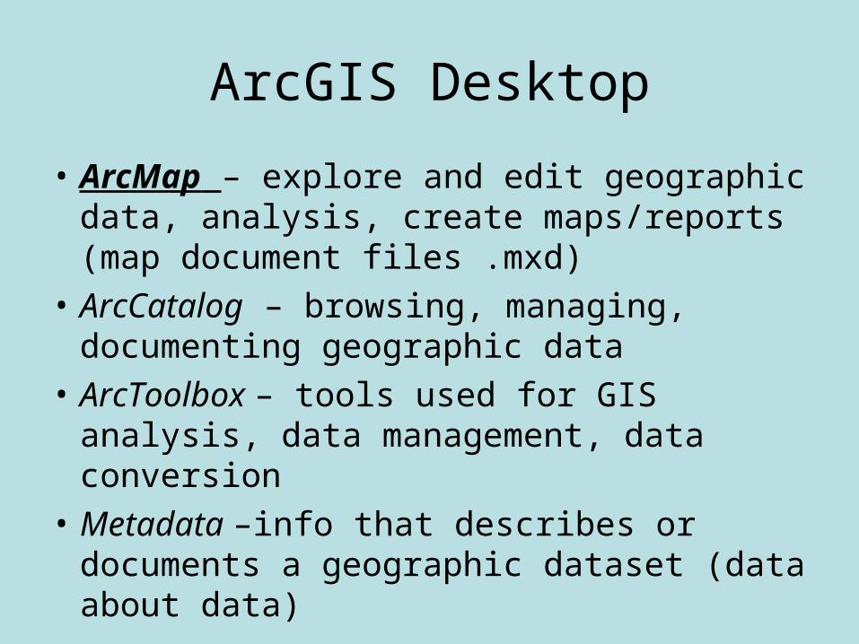
ArcGIS Desktop
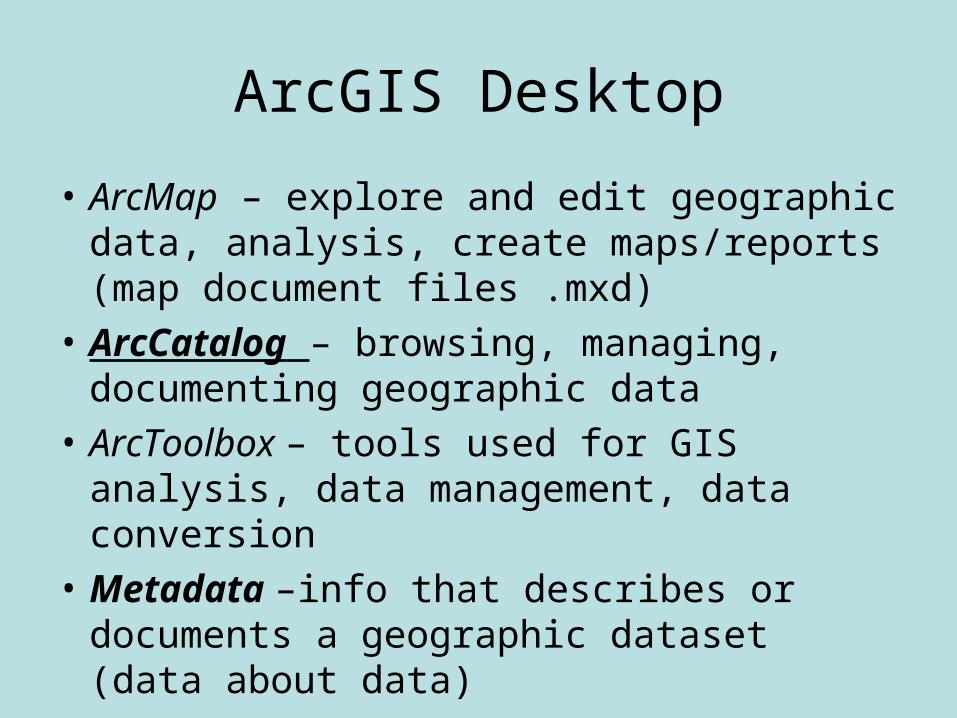
• ArcMap – explore and edit geographic data, analysis, create maps/reports (map document files .mxd)
• ArcCatalog – browsing, managing, documenting geographic data
• ArcToolbox – tools used for GIS analysis, data management, data conversion
• Metadata –info that describes or documents a geographic dataset (data about data)

Layout and Data View
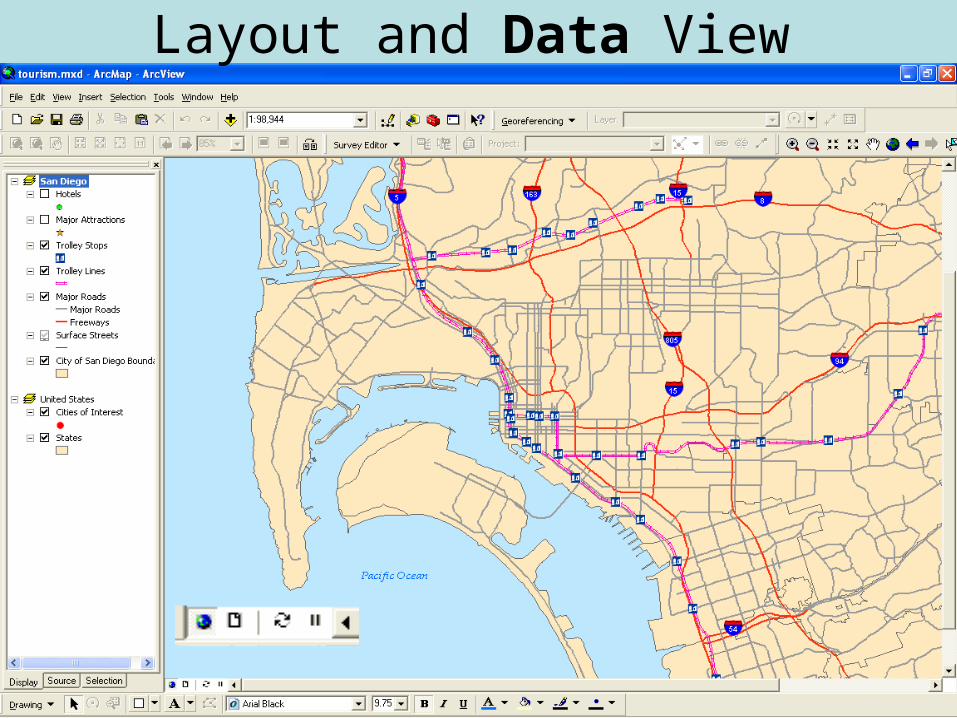
Layout and Data View

Layout View - Dataset Frames
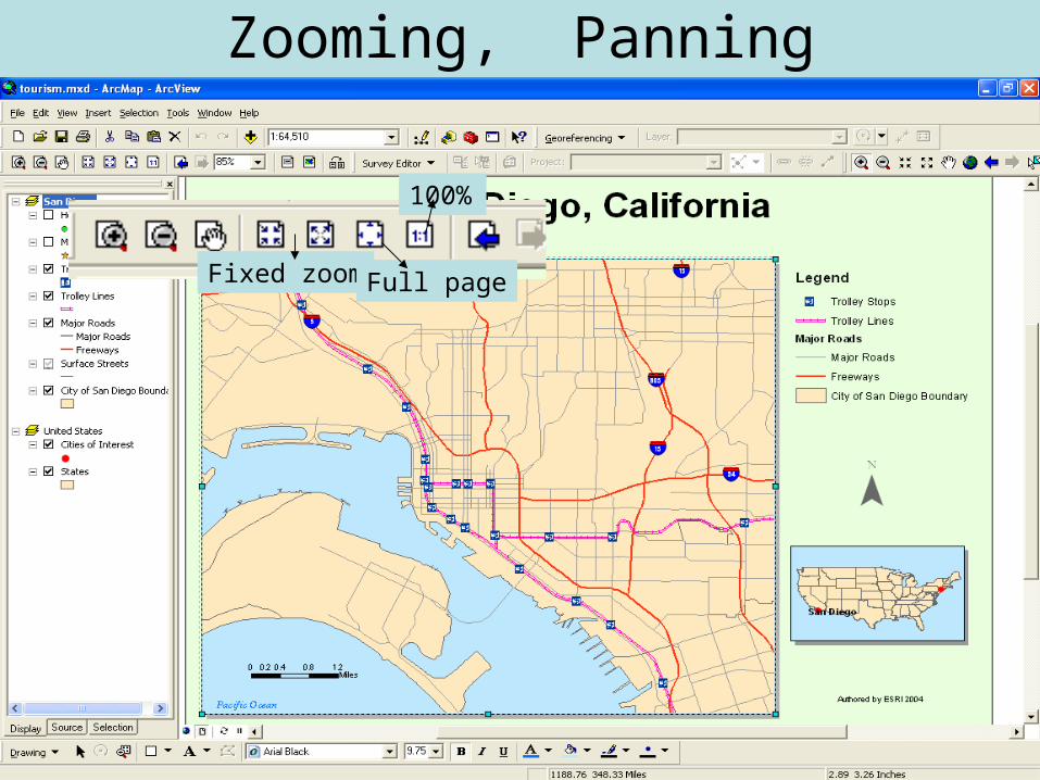
Zooming, Panning
Fixed zoom Full page
100%

Bookmark (associated with data frame)

Layout and Data View

Zooming, Panning, Bookmarks
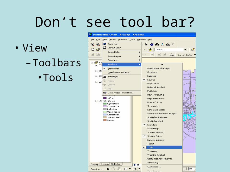
Don’t see tool bar?
• View
– Toolbars
• Tools

Layers
Lables
Attribute Table
Zoom to Layer
Clear Selections
Data
Properties

Layer Properties - General

Layer Properties - Source

Layer Properties - Selection

Layer Properties - Lables

Symbology

Symbology

Symbology

Symbology

Symbology

Symbology - States


Scale• Scale is the relationship between the size of features on
a map and the size of the corresponding objects in the real world. Scale is commonly expressed as a ratio, or representative fraction, such as 1:24,000. This scale means one unit on the map is equal to 24,000 units on the earth. Another way of thinking about it is that the objects on the earth are 24,000 times larger than the features on the map which represent them.
• Large-scale map such as a map of city streets or a building plan, covers a small area in more detail.
• A small-scale map, such as a world map, covers a
large area in less detail.
• GIS maps are dynamic—you can change the scale to see more or less detail as desired.

Scale - Dynamic

Find

Attribute Tables

Attribute Tables

Attribute Tables

Selection Tool
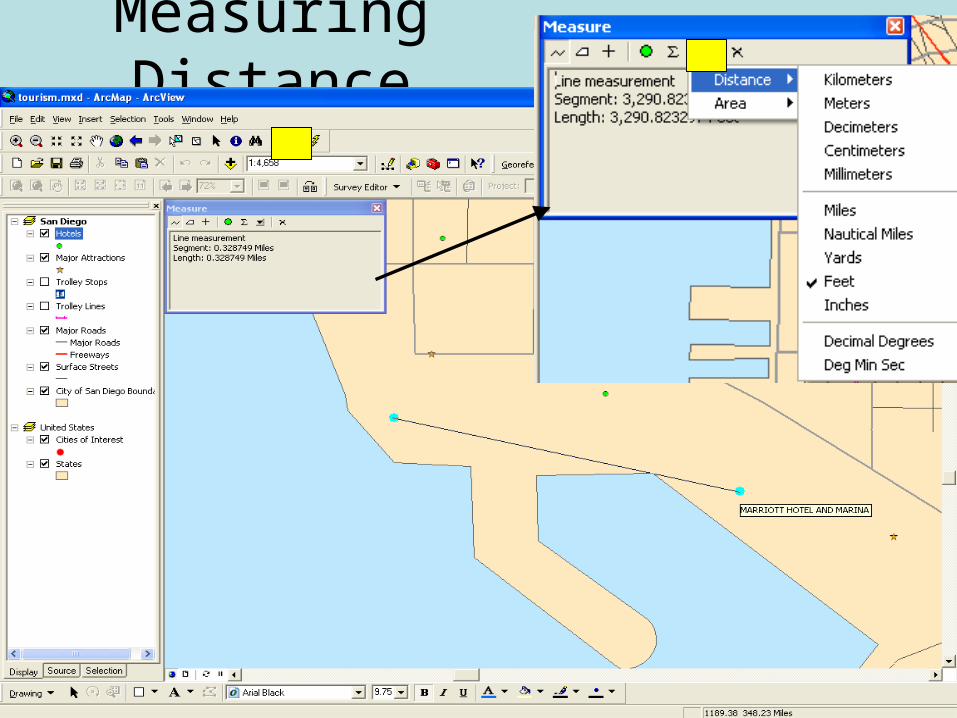
Measuring Distance
ArcGIS Desktop
• ArcMap – explore and edit geographic data, analysis, create maps/reports (map document files .mxd)
• ArcCatalog – browsing, managing, documenting geographic data
• ArcToolbox – tools used for GIS analysis, data management, data conversion
• Metadata –info that describes or documents a geographic dataset (data about data)

ArcCatalog – Browse Data

ArcCatalog – Preview Data

ArcCatalog – Preview Data
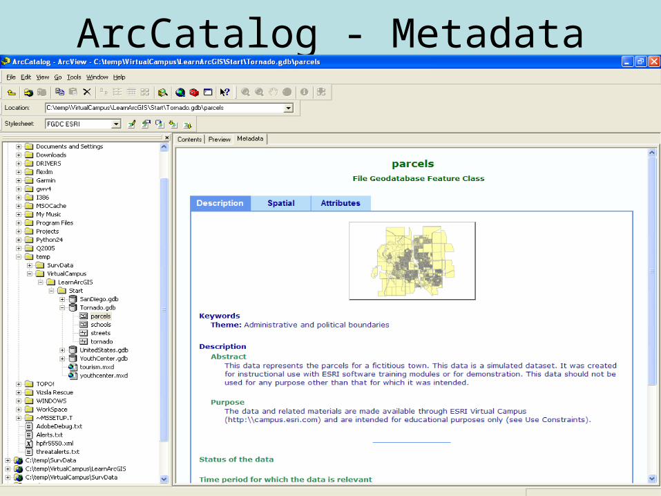
ArcCatalog - Metadata

Adding Layers from ArcCatalog

Adding Layers in ArcMap

Changing Symbol Color/Width

ArcGIS Desktop
• ArcMap – explore and edit geographic data, analysis, create maps/reports (map document files .mxd)
• ArcCatalog – browsing, managing, documenting geographic data
• ArcToolbox – tools used for GIS analysis, data management, data conversion
• Metadata –info that describes or documents a geographic dataset (data about data)

ArcToolBox

ArcToolBox
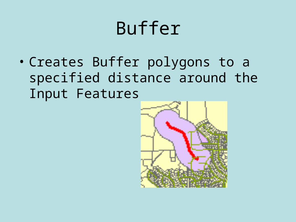
Buffer
• Creates Buffer polygons to a specified distance around the Input Features

Buffer
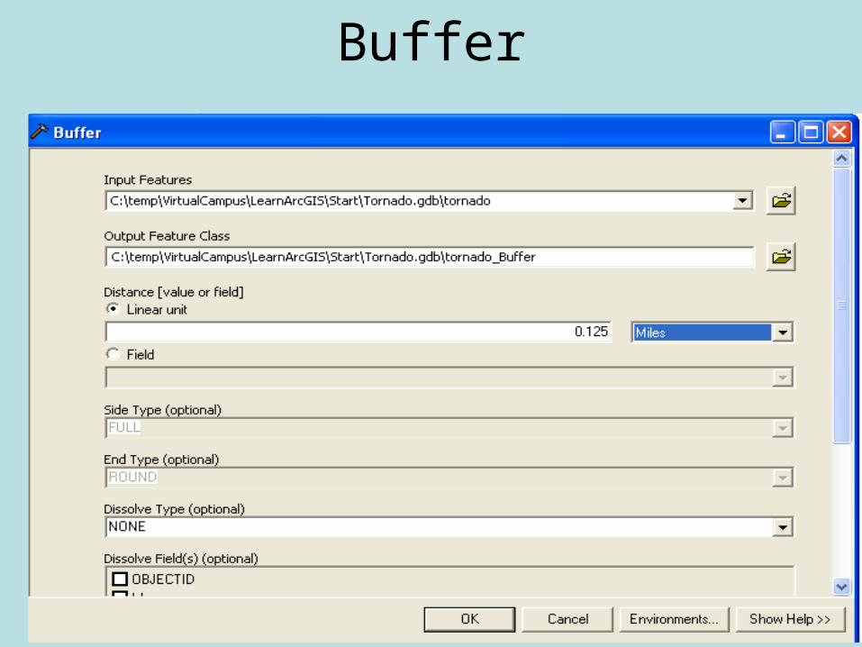
Buffer

Buffer

Union
• Creates a geometric intersections of the Input Features.
• All features will be written to the Output Feature Class with the attributes from the Input Features, which it overlaps.
• In terms of a table, want both irrigated area and county name.

Union

Union

UnionCity ZonesCensus Blocks
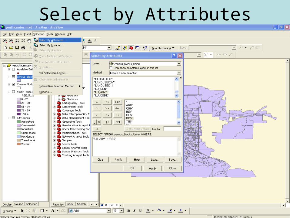
Select by Attributes

Select by Attributes
Select the residential areas

Select by Attributes
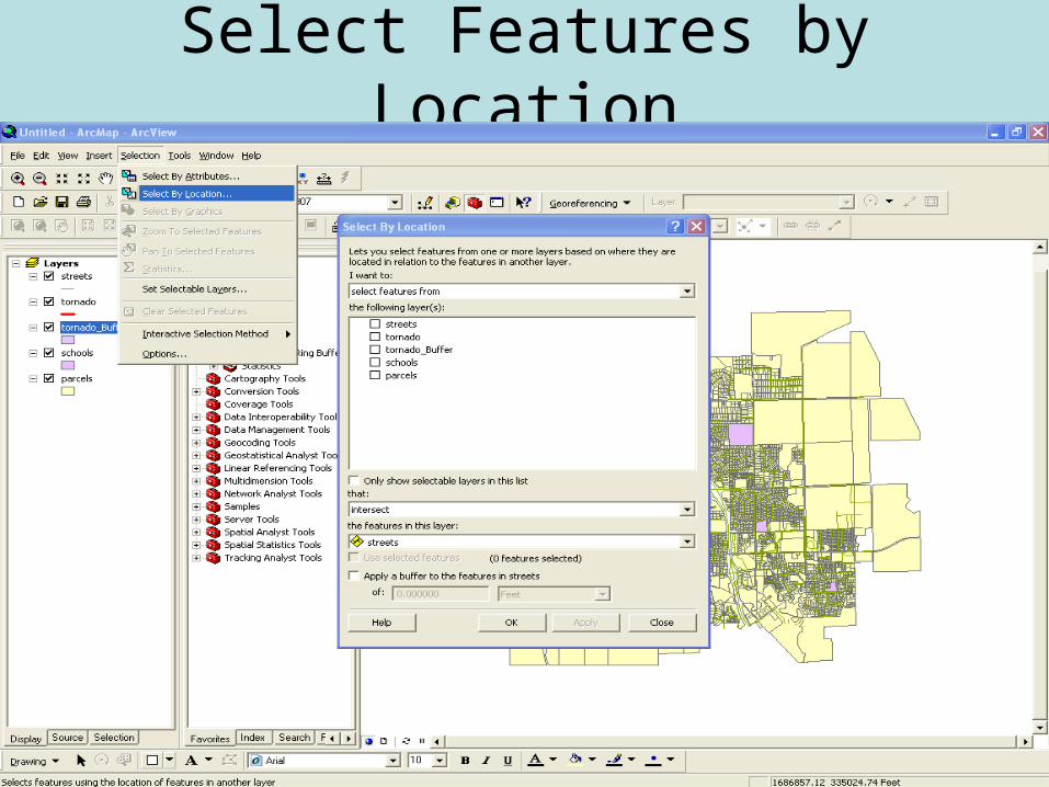
Select Features by Location
Select Features by Location
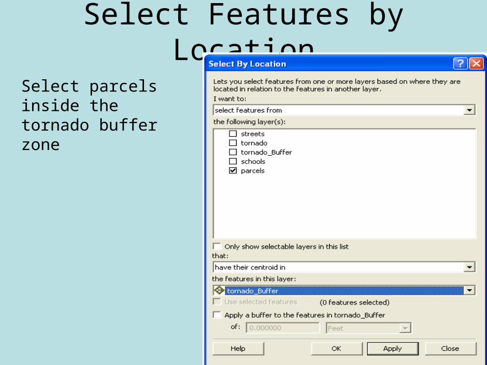
Select parcels inside the tornado buffer zone

Select Features by Location

Statistics

Statistics
Look at building value of selected parcels

Exporting Data

Creating a Map
• Title
• Enough data frames for reference (usually a large and small scale map)
• Scale Bar
• North Arrow
• Legend
• Your name and info (i.e., lab time)

Presentation Map Qualities

Insert Second Dataset Frame
Copy and paste layersActivate Layer

Adding Map Elements
Properties to change units

Exporting Map

Lab 1: GIS• Learning ArcGIS Desktop
– Module1
• Create a map showing the potential youth center locations without using the map template. Save this as a jpeg and either email to me or print and hand in. Spend some time making it nice!
• Turn in Module1 Completion Certificate (email or print and turn in)
• Due Friday April 20th

Saving/Printing Module Certificate

Saving/Printing Module Certificate
• Print and turn in
or• Screen Dump (ctrl-
print screen)• Paste in Word• Email Word document

Next Class
• Try to email questions before class
• Go over Lab 2: – Learning ArcGIS Spatial Analyst Module 1