lexington’s growth
TRANSCRIPT
LEXINGTON’S GROWTH:A BRIEF HISTORY OF OUR BOUNDARY
CHRIS WOODALL, AICP, MANAGER OF LONG-RANGE PLANNING, CITY OF LEXINGTON
Sustainable Growth Task Force Meeting – 12.11.19

• Urban Service Area Boundary (“USB”) Purpose
• Historical Review of the USB
• Urban County Council & Planning Commission Role in the current USB Process
• Past Process for USB Changes
• 1996 USB Expansion Process
Overview

What is the USB?• The Urban Service Area
Boundary is a border that defines where in Fayette County new urban development can occur.
• Separates Fayette County into the “Urban Service Area” and the “Rural Service Area”
• Established in 1958 and was the first in the nation
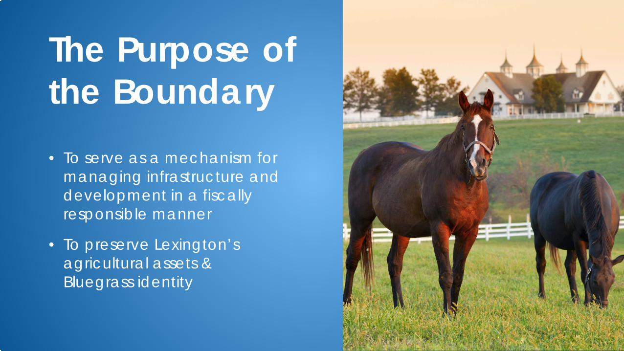
• To serve as a mechanism for managing infrastructure and development in a fiscally responsible manner
• To preserve Lexington’s agricultural assets & Bluegrass identity
The Purpose of the Boundary
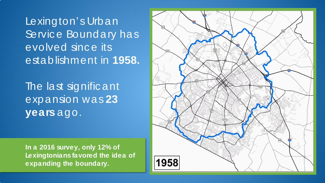
Lexington’s Urban Service Boundary has evolved since its establishment in 1958.
The last significant expansion was 23 years ago.
In a 2016 survey, only 12% of Lexingtonians favored the idea of expanding the boundary.

Land Analysis70%
of Lexington’s total area is
considered to be rural, but contains only
7% of the
population
30% of Lexington’s total area is
considered to be urban, but
contains
93% of the
population
200 sq. mi
85 sq. mi

Let’s go back in time…
1928 1931 1958 1996 1999 2018
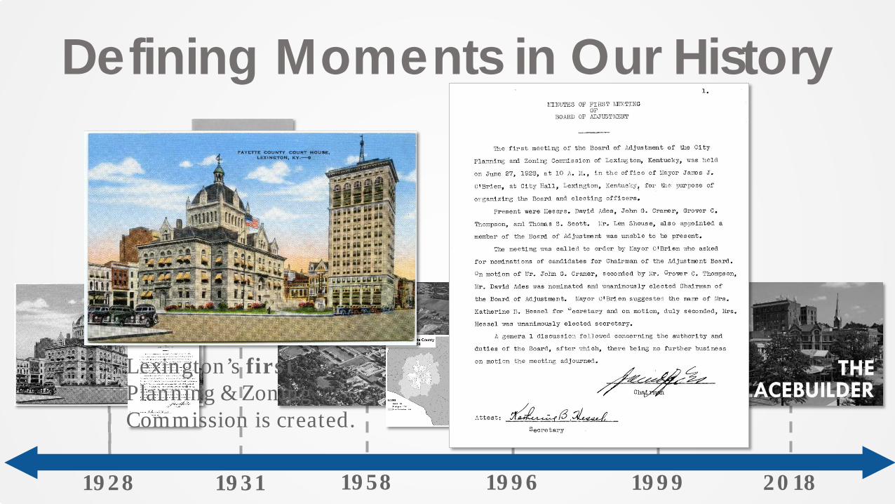
Lexington’s firstPlanning & Zoning Commission is created.
Defining Moments in Our History

1931
Lexington’s firstComprehensive Plan is approved & implemented.
Defining Moments in Our History

1958
Lexington instates the first urban growth boundary in the U.S.
Defining Moments in Our History

1996
Planning Commission approves the Expansion
Area Master Plan, which offers principles
for guiding development within newly designated
expansion areas.
Defining Moments in Our History

1999
Planning Commission approves the Rural Land Management Plan, which offers guidance for development within the Rural Service Area.
Defining Moments in Our History

2018
Planning Commission adopts The Placebuilder as an element of
the 2018 Comprehensive Plan. This document specifies criteria
for future development and provides a common language
across stakeholder groups.
Defining Moments in Our History
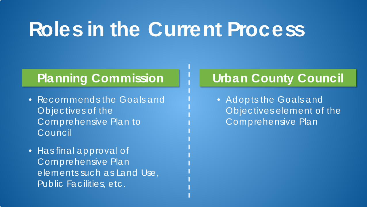
• Recommends the Goals and Objectives of the Comprehensive Plan to Council
• Has final approval of Comprehensive Plan elements such as Land Use, Public Facilities, etc.
Planning Commission• Adopts the Goals and
Objectives element of the Comprehensive Plan
Roles in the Current Process
Urban County Council

Past Process for USB Changes
Data Collection & Studies
• Growth projections• Current Land Use• Vacant Land• Scenarios
Application from Property Owners
• Pre-2013 plan• Opportunity for rural
owners to request inclusion
Recommendation from Planning Commission &
approval by Urban County Council
Input from the Public
• Surveys, public feedback forms, focus groups
• Public hearings

1996 USB Expansion Process EXP 3
EXP 1
EXP 2A
EXP 2B
EXP 2C
• In 1996, approximately 5,330 acres adjacent to the existing Urban Service Area were designated as Expansion Areas.
• This acreage was divided among 3 core areas, each envisioned for a pre-set range of uses.

1996 USB Expansion Process EXP 3
EXP 1
EXP 2A
EXP 2B
EXP 2C
• The Expansion Area Study Committee was formed to direct the process.
• Principles for Guiding Development • Natural Environment• Land Use• Open Space• Housing• Community Design
• Public Facilities• Fiscal• Economic
Development• Fairness

1996 USB Expansion Process EXP 3
EXP 1
EXP 2A
EXP 2B
EXP 2C
• The 1996 Expansion Area Master Plan was approved by the Planning Commission on July 18, 1996
• Plans for each Expansion Area are composed of 4 elements based on EAMP committee principles:
• Comprehensive Development Exaction Program
• Future Land Use Element
• Community Design Element
• Infrastructure Element• Implementation
Element

Lynchpin of Lexington’s Growth Management• Manage infrastructure and development in a fiscally responsible
manner
• Preserve Lexington’s agricultural assets & Bluegrass identity
• Part of Lexington’s progressive planning past, and part of Lexington’s progressive planning future