ltmp 2013 report
DESCRIPTION
LandTRANSCRIPT

master planLAND TRANSPORT
2013


Contents
Executive Summary
Annex A - Summary of Initiatives
1 06
19
27
50
53
13
38
43
02
2
Taking Stock1.1 Making Public Transport a Choice Mode of Travel1.2 Managing Road Usage1.3 Meeting Diverse Needs1.4 How Did We Do?
2.1 Key Areas of Concern2.2 Immediate Challenges2.3 Consulting the Public2.4 How We Are Tackling the Challenges Ahead2.5 What Will the Public See with LTMP 2013?
3.1 Expanding Our Rail Network 3.2 More Bus Services3.3 Facilitating More Walking and Cycling3.4 Sustainable Expansion of the Road Network
4.1 Improving Rail Services4.2 Improving Bus Services4.3 Welfare of Transport Workers4.4 Taxis and Car-Sharing4.5 Travelling the Smart Way4.6 What Commuters Can Do
5.1 No Barriers: Improving Mobility for Seniors and the Less Mobile5.2 Reducing Noise Levels5.3 Safer Roads for All5.4 Environmental Sustainability5.5 Reclaiming Our Public Spaces: Car-free and Car-less Zones
6.1 The Vehicle Growth Rate6.2 Stabilising Supply of COEs6.3 Next Generation ERP6.4 Tackling Congestion Today6.5 Parking Policy6.6 Enforcement Against Illegal Parking6.7 A Mindset Shift
Singapore: Today and Tomorrow
More Connections
Better Service
Liveable and Inclusive Community
Reducing Reliance on Private Transport
Our Vision
3
4
5
6
7

Executive Summary
All of us use land transport, from the pavements on which we walk, to the trains, buses and other vehicles that carry us and the roads that these vehicles use. We would like the land transport system to get us safely, efficiently, reliably and comfortably to our destination.
Executive Summary

Land Transport Master Plan 2013 / 02-03
It has been five years since we launched the last Land Transport Master Plan. We have made much progress on the plans announced in 2008. However, our environment has changed significantly since and the Master Plan must be refreshed to take into account these changes.• Commuterexpectationsandnormsarechangingas
Singaporeans aspire to a higher quality of life. We look forward to continued improvement in the travel experience. We want to be connected to more places and we want to get there faster and in comfort. Beyond our own needs, we also want our environment to be even more liveable and our transport system to be more inclusive in catering to the diverse needs of the members of our community.
• Asourpopulationandeconomycontinuetogrow,morepeople and goods will need to be transported. The capacity of our transport system needs to grow correspondingly1.
Therefore, as we continue to build up and improve the land transport system, it is important to us that you, the Commuter, are at the heart of our system and that the system is able to meet your needs.
• Movingforward,Singaporewillfacetighterlandconstraintsin view of competing demands. In planning and building our transport system, we need to balance capacity build-up with liveability and sustainability considerations.
It is thus timely that we review the Master Plan to see how it can better meet our travel needs over the next 20 years.
Listening to YouIn reviewing the Master Plan, we reached out to many Singaporeans, from public transport commuters to motorists, pedestrians and cyclists, from youths to the elderly and less mobile and from those passionate about environmental issues as well as academics. We gathered views on how we can improve your travel experience and received over 1,700 feedback contributions. We met about 400 of you personally over five months in 2012. We have also taken in many ideas from the 3,500 feedback contributions we receive daily.
01
1 By 2030, we expect the daily number of journeys to increase by about 50 per cent while we double the overall size of our rail network. For travel into the city, we will increase our peak hour rail capacity by 110 per cent with new rail lines, additional trains and upgraded signalling systems.
01 Buses form an important part of the public transport network

A more comprehensive public transport network and better quality MRT and bus services are the most popular requests. Many of you have also shared with us that walking and cycling should be made more comfortable and safer.
enhancing Your traveL experienceFor the 2013 Master Plan, we will continue to work towards our vision of a “People-Centred Land Transport System”, focussing on “Enhancing Your Travel Experience”. We will work on three areas that you have said are most important for you:
More connectionsAs we continue to grow as a city, we can expect many more exciting developments. We will build a more comprehensive rail network that will keep pace with and serve these new developments well. We will make it faster and more convenient for you to take the rail to reach your destination. We will provide you with more walking, cycling and bus routes to connect to the rail network by building more sheltered walkways and cycling paths and expanding our bus network. Indeed, by 2030, we plan for eight in 10 homes to be within a 10-minute walk of a train station. With more integrated transport hubs, you will be able to switch between different types of transport easily and you will be able to access shopping, dining and other lifestyle services at the same location as well.
Better serviceWe want you to be able to enjoy better levels of services when you take public transport, whether it is by rail, bus or taxi. To shorten waiting time and reduce crowding, we will ramp up the capacity of both our rail and bus systems, improve their
Mor
e Co
nnections Better Service
Liveable and Inclusive Community
We will build and run our transport system w
ith th
ewell-being of our diverse community at heart and we w
ill givem
ore consideration to how it enhances our common living sp
ace.
We
will
con
nect
you to
more places,
whe
re y
ou w
ork,
liv
e and play. reliability, comfort and ef ciency.
you use, we will improve its
Whichever mode of travel
enhancing Your travel experience
reliability and also spread out demand by encouraging off-peak travel. We aim to give you more travel options, for example, by making it easier for you to catch a taxi or take part in car-sharing services. Information to facilitate your travel on the various modes will be made easily and widely available.
LiveaBLe and incLusive coMMunitYWe must have greater consideration for the diverse needs of our community which includes the physically less mobile among us. In particular, we must make sure that our public transport network is accessible to them. That is why we are making our public transport system barrier-free. There is also a need to look into how our public transport system can support a high quality and sustainable way of life within our densely built-up city-state. We will do this by promoting the use of lower emissions and environmentally-friendly vehicles. Building noise barriers and other efforts to reduce noise levels will also be important. In the longer term, we will work with planning and development agencies to provide more vibrant public places that have fewer or no cars.
puBLic transport – an attractive Mode of traveLLike all major cities with land constraints such as London, Hong Kong and New York, public transport will have to be the main mode of travel. It is the most space-efficient and environmentally-sustainable option. Here in our city-state, about 63 per cent of all trips during the peak periods are made on public transport, up from 59 per cent in 2008. Our aim is that 75 per cent of trips during both the morning and evening peak hours will be made by public transport by 2030.
To make public transport more attractive, we will focus on improving the capacity and reliability of train and bus services. For travel into the city, we will increase our peak hour rail capacity by 110 per cent with new rail lines, additional trains and upgraded signalling systems. We will look beyond just increasing capacity to cater to peak periods because building capacity for a narrow window of travel during the mornings and evenings is not cost-efficient. Many of you have come to realise this too, that we need to spread travel beyond the peak hours and encourage off-peak travel for those of us who are able to do so.
In the longer term, we will significantly expand the rail network, the backbone of our land transport system. We will continue to add to and adjust our bus network, not just to facilitate your connecting journey on our expanded rail system but also to help you reach more places directly and more conveniently. We will complement the bus network with more extensive infrastructure for cycling and walking as attractive alternatives to move around and to get to the train stations. With these measures, we seek to have 85 per cent of journeys on public transport that are less than 20km (which is the distance from almost all parts of Singapore to the city centre) to be completed within 60 minutes by 2030. This will be an improvement from 76 per cent of journeys today.
Executive Summary

Land Transport Master Plan 2013 / 04-05
reducing reLiance on private transportWith better connections and faster journey times on public transport, we believe that more of you will find public transport attractive and a good alternative to driving. We will invest resources and effort to encourage you to use public transport and to rely less on your personal car. In major cities around the world, the trend is towards reduced dependency on driving to meet travel needs. This is even more necessary in Singapore because it is not possible to build ever more roads to cater to private transport due to competing needs for our scarce land. Roads already account for 12 per cent of our land area today, only a little under housing, which takes up 14 per cent. We will continue to expand our road network, but at a more sustainable pace, mainly to serve newly developed areas and improve the movement of buses. We will also have to continue to restrain private car travel to have smooth-flowing traffic on our roads.
To ensure that Singapore remains a liveable city-state, we will review our policies for private cars taking into consideration the plans to improve public transport capacity and connectivity. We will have to review whether a further reduction in the vehicle growth rate is necessary and the appropriate time to do so, taking into consideration improvements in our public transport system. To address the fluctuations in the supply of Certificates of Entitlement (COE), we will look at possible measures to stabilise the supply of COEs available in the long term, without changing the fundamentals of the COE system. We are also developing the next generation Electronic Road Pricing (ERP) system using global navigation satellite system technology to manage traffic congestion in a more targeted, flexible and fairer way. In the interim, we will implement a few more ERP gantries to tackle heavy congestion and continue to monitor hotspots that may also require congestion pricing. In the city centre,
parking supply will continue to be moderated through parking standards for buildings.
concLusionOur goal is to create a more people-centred land transport system with more connections to where you want to go and better service whichever mode of travel you use. Our land transport system will give more consideration to the well-being of our diverse community and enhance the liveability of our environment. We will make public transport an attractive mode of travel so that you will rely less on the personal car.
To achieve this shared goal, we will need to plan in advance and this refreshed Master Plan is another step in that direction. We hope you will work closely with us on this as it is your aspirations, your ideas and your views that will help us shape a land transport system that we can be proud of, one that meets the needs of all Singaporeans.
01
01 Public Transport is space efcient and environmentally sustainable

Taking Stock
All of us use land transport every day. From the moment we leave home till the time we reach our destination, we walk, cycle, drive or take trains, buses or taxis. All these different forms of travel make up our land transport system.
When we wanted to improve on the plans laid out in the Land Transport Master Plan (LTMP) 2008, we started by looking at what we had already accomplished and then at how we could further improve commuters’ travelling experience in the next 20 years.
1Chapter 1 - Taking Stock

Land Transport Master Plan 2013 / 06-07
In LTMP 2008, we outlined the challenges that Singapore’s transport system faces: increasing travel demand, limited land, declining public transport modal share, and changing demographics and expectations of transport. We divided our work into three strategic thrusts to tackle the challenges: Making Public Transport a Choice Mode, Managing Road Usage, and Meeting Diverse Needs.
Here is an overview of the progress we have made so far:
1.1 Making puBLic transport a choice Mode of traveL
Public transport is key to meeting our long-term land transport needs sustainably, both as a nation with limited space and as a member of the global community helping to reduce resource consumption and pollution. Over the last five years, we have made public transport more attractive by helping commuters reach their destinations more quickly and conveniently, so we can ultimately persuade more people to choose public transport.
1.1.1 More rail lines and trainsSince 2008, we have increased the length of our rail network from 138km to 178km with the opening of the Boon Lay Extension in 2009, the Circle Line from 2009 to 2011 and the Circle Line Extension in 2012. We have already started work on the Downtown Line, North-South Line Extension, the Tuas West Extension of the East-West Line, and the Thomson Line.
As part of the Jurong East Modification Project in 2011, we built an additional new platform at Jurong East Interchange station and added 22 more trains to the North-South and East-West Lines (NSEWL).
The installation of half-height platform screen doors in all 36 elevated stations in 2012 reduced delays in train service due to track intrusions.
1.1.2 improved bus services LTA took on the role of central bus planning for Singapore in 2009. We work with local communities and the bus operators, SBS Transit (SBST) and SMRT Buses (SMRTB), to identify areas where bus services can be improved.
To give commuters even more bus options and make it easier to connect to MRT stations and amenities, some bus routes have changed and new services have been added. We have also more than doubled the number of Premium Bus Services to 91 as of January 2013, up from 42 five years earlier.
The length of time spent waiting and crowding density are important service metrics and we have tightened our bus Quality of Service (QoS) standards to reduce the wait and crowding. Now a minimum of four in five bus services run every 10 minutes or less during weekday peak hours, an improvement from every 15 minutes in 2008. Feeder bus services are also more frequent now with 90 per cent of feeder bus services running at intervals of 10 minutes or less during the weekday peak periods, tightened up from 85 per cent.
Since June 2010 the LTA together with the bus operators, SBST and SMRTB, has run a quarterly review process of the most heavily-utilised bus services. As a result, higher-capacity buses have been deployed and more bus trips operated to better match demand with capacity. As of the second quarter of 2013, 165 bus
01 02
01 Platform screen doors at MRT stations 02 LTA took on role of central bus planner since 2009

services under this initiative (110 SBST and 55 SMRTB) have been improved.
Another 35km of normal bus lanes and 16km of full day bus lanes have been added to our roads to help bus commuters get to their destinations faster by increasing travel speeds along these corridors by 7 per cent on average. The Mandatory Give-Way to Buses scheme, implemented at 218 bus bays island-wide since 2008, also enables buses to exit the bays faster, by as much as over 70 per cent in some cases, for quicker travel.
1.1.3 integrated transfers on public transportIn 2010, the introduction of distance fares gave commuters a more equitable fare structure based on distance travelled regardless of the number of valid transfers made. With distance fares, commuters pay the same fare whether they travel directly to their destination, or make transfers during the journey. Commuters have the flexibility now to decide on the best route to reach their destination. Many are also paying less in fares.
For commuters who make transfers, we are transforming our interchanges and stations into lifestyle hubs where commuters can shop and have a meal before hopping on the train or bus to their next destination. Those who live or work near Boon Lay (completed in 2009), Serangoon (2011) and Clementi (2011) are already enjoying these new integrated transport hubs.
1.1.4 improved transport information We introduced our PublicTransport@SG website in 2008 to help commuters plan their journeys using public transportation. The site’s interactive map covers bus and rail trips that can be made across the island and the site also features a simple calculator to compute fares.
In 2011, we launched MyTransport.SG, a portal that consolidates information and eServices for all land transport users, including motorists and cyclists. MyTransport.SG Mobile gives commuters this information on mobile devices, including real-time bus arrival information that is also shown on display panels at over 50 bus stops across the island.
1.1.5 More convenient taxi travel We launched a common taxi booking number — 6-DIAL CAB (6342 5222) — in July 2008 so that commuters could dial one number to access the services of all taxi companies. Our taxi Quality of Service (QoS) standards have been refined and phone booking standards tightened. As of 1 January 2013, new Taxi Availability standards make sure that taxis are more readily available, especially during peak periods.
1.2 Managing road usage The LTMP 2008 concluded that, as Singapore’s fundamental constraint is land scarcity, the growth rate of our vehicle population must be further constrained as road building opportunities will be more limited in the future, mainly serving new developments. Beyond slowing down the vehicle population growth rate, we will also improve the effectiveness of road pricing in new ways. Technology will also play a greater role in how traffic is managed in the future.
01
02
03
Chapter 1 - Taking Stock

Land Transport Master Plan 2013 / 08-09
04
05
01 Bus lanes improve journey time for commuters
02 Boon Lay Integrated Transport Hub
03 More convenience with a common taxi booking number
04 Improved road system for motorists
05 Parking Guidance System helps reduce circulating trafc
1.2.1 improved road system Since 2008, we have expanded the road network by constructing the Kallang-Paya Lebar Expressway (KPE) (completed in 2008), widening the Central Expressway (CTE) from Yio Chu Kang Road to Bukit Timah Road (2011) and upgrading the Woodsville Interchange (2012). The Marina Coastal Expressway (MCE) is slated to be completed by the end of 2013 and the Sentosa Gateway Tunnel to be completed in 2015. The North-South Expressway is also in the pipeline.
To better manage vehicle movement on our roads, we have increased the number of Junction Eyes (J-Eyes) and Expressway Monitoring Advisory System (EMAS) cameras to nearly 600, up from 509 in 2008. We have extended the EMAS system to six arterial roads where 336 cameras are keeping motorists well-informed of traffic conditions. We will continue to expand this surveillance coverage to four more major arterial corridors by the middle of 2014.
We also introduced the Parking Guidance System (PGS) in the city and near HarbourFront to guide drivers to the nearest parking facility with available parking spaces, thus reducing the need for vehicles to cruise around to find parking spaces.

1.2.2 Moderated vehicle population growth rateThe vehicle population growth rate was reduced from 3 per cent to 1.5 per cent per annum in 2009, and further reduced in the second half of 2012 to 1 per cent per annum and to 0.5 per cent from 2013 onwards.
1.2.3 fine-tuned road usage charges We have continued to adjust our Electronic Road Pricing (ERP) system to keep congestion in check. In 2008, we fine-tuned the criteria for adjusting ERP rates so that motorists would enjoy speeds within an optimal range at least 85 per cent of the time. In the same year, we installed ERP gantries along the Singapore River cordon to manage traffic passing through the Central Business District (CBD) area in the evening. The CBD cordon was extended to the Marina Bay area in 2010.
Adjusting ERP to manage traffic requires us to constantly take into account changing traffic conditions and public feedback. In 2011, we shortened the evening ERP operating hours for gantries along the northbound CTE and southbound Singapore River Line. In 2012, we reduced the Saturday ERP operating hours for the Orchard cordon by 1.5 hours and lowered the rates for the Bugis-Marina Centre cordon from S$2 to S$1 during certain hours on Saturdays.
1.2.4 improved road safety To enhance pedestrian safety, we have extended a variety of road engineering measures such as pedestrian crossing lines with enhanced dash markings, traffic calming markings and “pedestrian crossing ahead” road markings to more locations from 2009. We also introduced “Your Speed” electronic signs that display the speed of a passing vehicle so that motorists are more aware of their speeds and more likely to keep to the speed limit. We have also installed road studs that flash in tandem with the green man crossing signal at more locations to alert motorists to stop for pedestrians on the road.
For motorcyclists, we have doubled the number of rain shelters on expressways from 32 in 2008 to 64 today so that there are more safe places to take shelter during storms.
1.3 Meeting diverse needsIn LTMP 2008, we highlighted the need to pay more attention to the vital social role of transport, to ensure that everyone—including the young, elderly, disabled and those in need—can access amenities and participate in our society and economy.
01
Chapter 1 - Taking Stock

Land Transport Master Plan 2013 / 10-11
1.3.1 greater accessibility Today, all of our MRT stations have at least one lift, are fully equipped with a tactile guidance system and have wheelchair-accessible toilets. With the installation of ramps and additional lifts in 16 MRT stations in 2011, all stations are now barrier-free and more than 80 per cent have at least two barrier-free access routes. Today, all bus interchanges are barrier-free and have wheelchair-accessible facilities.
Beyond transport nodes, we have also stepped up efforts to make the roads and related amenities, such as walkways, taxi stands and bus stops, more accessible to the less mobile. In March 2011, we completed a S$60 million island-wide programme to make such facilities barrier-free as much as possible.
Shelters have also been installed on 349 existing pedestrian overhead bridges since 2008. Overhead bridges next to six MRT stations (Aljunied, Bishan, Khatib, Kranji, Sengkang and Yew Tee) are being retrofitted with lifts to allow better barrier-free access by the first quarter of 2014.
04
01 ERP helps keep congestion in check
02 “Your Speed” electronic sign reminds motorists to keep to speed limits
03 More crossing time with the Green Man Plus
04 Lifts at pedestrian overhead - a boon for the elderly and less mobile
05 More conducive and safer cycling around the neighbourhood
05
02 03
All new public buses registered in Singapore since 2006 are wheelchair-accessible, and by 2020 all public buses will be wheelchair-accessible. As of August 2013, 64 per cent of our public buses were wheelchair-accessible, and were deployed on over 70 per cent of bus routes (184 out of 260).
We also recognised that elderly pedestrians and those with disabilities may require more time to cross roads so we developed the Green Man Plus scheme to give these pedestrians more crossing time. After a successful pilot at five locations, we are extending the scheme to another 500 pedestrian crossings by 2015. To date, Green Man Plus has already been installed at 256 pedestrian crossings.
1.3.2 facilitating cycling More people are cycling to get to MRT stations, bus interchanges and nearby community amenities. To cater to the growing popularity of cycling, we have added 1,500 bicycle racks at 10 MRT stations as at the end of 2012. Foldable bicycles on trains and buses have been allowed during off-peak hours since March 2009. To provide a safe and pleasant cycling environment within neighbourhoods, 6.4km of off-road cycling paths have been completed in five HDB towns as of 2012. Cyclists can now easily find information on cycling paths on the MyTransport.SG portal and mobile application.

1.3.3 promoting environmental sustainabilityIn our quest for a high quality and sustainable living environment, reducing air pollution from vehicles requires stricter standards on vehicle emissions and promoting greener alternatives. We reviewed a number of schemes to help us achieve environmental sustainability.
Under the previous Green Vehicle Rebates (GVR) scheme, environmentally-friendly car and taxi owners enjoyed rebates of 40 per cent from their Additional Registration Fee (ARF). In 2009, we extended the scheme to give a 10 per cent ARF rebate for electric motorcycles and scooters. This helped to increase the green vehicle population in Singapore from 1,543 in 2007 to 9,885 by the end of 2012.
1.3.4 engaging the community The LTA set up its Community Partnership division in 2008 to actively engage the community. Dedicated teams are assigned to each Group Representation Constituency and Single Member Constituency to work with community leaders to resolve day-to-day local road and traffic issues and to reach out to the community. Our colleagues have interacted with many in the community about transport issues in the last five years.
LTA has also conducted a number of public consultations in the last few years in which members of the public have been invited to participate, whether through surveys or focus group discussions. Members of the public have also been invited to participate in other activities, such as visits to rail construction sites, to gain more insight into the work that LTA is doing to expand the transport network.
The widest reach of our engagement occurs every day through our calls and emails with the public. Members of the public are welcome to call and write in to us with their questions and suggestions, especially to highlight needed actions. In 2012, we answered nearly 200,000 email queries and took over one million calls at our 24/7 call centre.
We also engage the public through our Facebook page “We Keep Your World Moving” and on Twitter. Over 37,000 users have “liked” our Facebook page while Twitter followers can find real-time updates on traffic conditions and related news. We will continue to use these platforms to keep everyone informed of the latest developments in land transport and to gather more views from the public.
01
01 Commuters at Serangoon Circle Line station
2 Household Interview Travel Survey in 2008 (or HITS 2008)
1.4 how did we do? Above all, LTMP 2008 aimed to increase the public’s use of public transport. In 1997, 67 per cent of trips during the morning peak hours were on public transport but that fell to 63 per cent in 2004 and then about 59 per cent in 20082. This was because car usage had grown much faster than public transport ridership between 2004 and 2008, at 31 per cent compared to only 16 per cent for public transport ridership.
The results of the 2012 Household Interview Travel Survey (HITS) showed an improvement in the percentage share of public transport trips during the morning and evening peak hours to about 63 per cent. This is a move in the right direction and suggests that the LTMP 2008 initiatives are working. We will continue to do more to make public transport attractive to commuters so the percentage share of public transport trips keeps rising.
Total travel time matters to commuters and we still have to work harder to shorten travel time on public transport. The percentage of public transport journeys in peak periods that take less than 60 minutes to complete has fallen from about 72 per cent in 2008 to about 69 per cent in 2012. For public transport journeys of less than 20km in the same period, the corresponding decrease was from 79 per cent to 76 per cent. We attribute these downward trends to commuters travelling longer distances between their homes and workplaces, and to more challenging conditions faced by buses on our roads.
Clearly, we have achieved much since 2008 but there is still a lot more to be done to make public transport the travel mode of choice for Singaporeans. As we build new rail lines—a new line or extension will be added to our rail network nearly every year from now to 2021— we will also implement a wide array of other initiatives that will bring improvement to all aspects of our public transport network to make our journeys more comfortable and the service more satisfying.
Chapter 1 - Taking Stock

Land Transport Master Plan 2013 / 12-13
Singapore: Today and Tomorrow
LTMP 2008 identified the long-term challenges for our land transport policy and planning: rising expectations, changing demographics and limited land. As the driving forces behind these long-term challenges unfold and new considerations emerge, we need to adjust our plans accordingly. LTMP 2013 takes into account how Singapore has changed and what this means for our transportation system in the long term.
2

2.1 keY areas of concernWe see three key challenges ahead:
2.1.1 changing commuter expectations and norms Singapore’s Gross Domestic Product (GDP) was about 28 per cent higher in 2012 than 2008. As incomes have risen, so have expectations for a better quality of life and the desire to have a say in how things are done. Reflecting these trends, the volume of feedback, both written feedback and phone calls, that LTA received over the last five years has risen about 35 per cent, from over 900,000 in 2009 to more than 1.2 million in 2012, equivalent to one issue being raised by the public every 25 seconds.
As we plan our transport systems, policies and service improvements, we consider changes from the commuter’s point of view. Much of the feedback that LTA receives from the public tells us they want to be connected to more places and get to them faster and more comfortably. Increasingly people are also voicing concerns about the impact of our transport system on the environment, whether it is noise pollution or carbon emissions, or impact on greenery and recreational space. We want our transport system to not only serve our immediate transport and lifestyle needs but also to contribute to a cleaner and more liveable environment.
2.1.2 growing population and economy Singapore’s population grew from 4.8 million in 2008 to 5.3 million in 2012. Today, 12.5 million journeys are made each day across the island. Population growth in the last five years has brought new urgency to some of the plans we had already outlined. Our economy is also expected to continue to grow at an average annual rate of 3 to 4 per cent over the next 10 to 15 years so we can expect that more people and goods will need to be transported.
We are already planning for infrastructure to meet this future demand as this will take 10 years or more from conceptualisation to completion. By 2030, we expect the daily number of journeys to increase by about 50 per cent as we double the overall size of our rail network. For travel into the city, we will increase our peak hour rail capacity by 110 per cent with new rail lines, additional trains and upgraded signalling systems.
01
01 Peak hour commuting at Bishan Circle Line station
02 Roads take up 12% of Singapore’s total land area
Chapter 2 - Singapore: Today and Tomorrow

Land Transport Master Plan 2013 / 14-15
02
2.1.3 tighter land constraints and more difficult trade-offs
Roads already take up 12 per cent of Singapore’s total land area, compared to 14 per cent for housing. The trade-off between using land space for roads or for other purposes will become more acute in the coming years.
We should therefore expect slower growth in the road network in future, and that growth will be prioritised to facilitate bus movement and connect to new areas being developed. Public transport is the only sustainable way to meet the competing needs of transport growth and land use. We are working closely with other agencies to develop additional alternatives such as a more aggressive de-centralisation strategy for a better geographic distribution of jobs and people, as well as being more creative with using space in our bus and rail infrastructure.
2.2 iMMediate chaLLengesIn the last few years while we formulated and executed long-term plans to increase our public transport capacity, commuters experienced crowding on buses and trains and occasional train disruptions. The December 2011 train disruptions in particular highlighted the need for us to be vigilant about the immediate condition of our older rail lines that are under strain as train and rail assets grow older while travel demand increases. We ask the public to bear with us as large-scale infrastructure changes take time. We are doing what is possible now to address the immediate challenges facing commuters.
NSEWL: North-South and East-West Lines
NSL: North-South Line
EWL: East-West Line
NEL: North East Line
CCL: Circle Line
BPLRT: Bukit Panjang LRT
SPLRT: Sengkang and Punggol LRTs
nsewL
+1310% Capacity
neL
+1870% Capacity
nsewL
+2820% Capacity
BpLrt
+1350% Capacity
ccL
+2460% Capacity
spLrt
+1640% Capacity
nsL
20% Capacity
Complete Re-signalling
ewL
20% Capacity
Complete Re-signalling
2014 2015 2016 2018
figure 1: More trains in the next few years
EASING CROWDING IN TRAINS Here’s what we are doing to improve commuter journeys now to ease crowding, especially during peak hours:
BETTER TRAIN SERVICE Since 2011 we have been adding trains to existing lines and we will continue to add trains from 2014 over several years (see Figure 1 on page 15). Just as importantly, we are renewing the NSEWL signalling system to support a higher frequency of train service. In addition, the Downtown Line will be opened in stages from this year onwards to connect commuters between Bukit Panjang and Changi to the city centre.
SPREADING TRAVEL DEMAND OUTSIDE PEAK PERIODS Spreading out travel demand will relieve the pressure on our public transport system during the morning peak period. Under the Incentives for Singapore’s Commuters (INSINC) programme, commuters get more chances of winning cash prizes when they shift their commuting time out of the morning peak hour. In June 2013, we launched a one-year programme to encourage those who can make changes to their travel schedule to choose to travel before the peak hour into the city area. Under this programme, commuters enjoy free travel on the rail network if they end their journeys before 7.45am on weekdays at 16 designated MRT stations within the city area. If they exit at these stations between 7.45am and 8.00am, they get a discount of up to 50 cents off their train fare.
MORE PARALLEL BUS SERVICES To offer commuters an alternative to the MRT, we will introduce a total of 14 parallel bus services connecting major HDB towns to the city area via the expressways. To augment the resources of the public transport operators, 10 of these will be City Direct services provided by private operators.
JOURNEY PLANNING To help commuters better plan their journeys, we will provide information about the crowd density level at each station routinely throughout the day. We are also improving the accuracy of our bus arrival time information.
2.3 consuLting the puBLic LTMP 2013 reaffirms our commitment to achieve our long-term vision to create a “People-Centred Land Transport System”. We need to listen to the voices of our commuters to put them at the heart of our land transport system, so we reached out to Singaporeans through a series of consultation sessions in 2012.
Different groups offered their feedback – public transport commuters, motorists, pedestrians, cyclists, youths, the elderly and less mobile, environmentalists and academics. Many spoke on how to improve public transport and how to make our environment more conducive to cycling and walking. There were also lively discussions on car ownership and demand management measures for road use. We would like to thank everyone who gave us valuable feedback on how we can improve the overall travel experience.
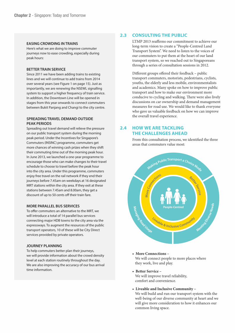
2.4 how we are tackLing the chaLLenges ahead
From this consultation process, we identified the three areas that commuters value most:
Making Public Transport a Choice Mode
Managing Road Usage
M
eeting D
iver
se N
eeds
Liveable & Inclusive Community
Mor
e Co
nnectio
ns Better Service
People-Centred
Chapter 2 - Singapore: Today and Tomorrow
• More Connections – We will connect people to more places where they work, live and play.
• Better Service – We will improve travel reliability, comfort and convenience.
• Liveable and Inclusive Community – We will build and run our transport system with the well-being of our diverse community at heart and we will give more consideration to how it enhances our common living space.

Land Transport Master Plan 2013 / 16-17
Main concerns
18%
28% 54%
Making public transport a choice mode
Meeting diverse needs
Managing road usage
2.5 what wiLL the puBLic see with LtMp 2013?
Beyond an expanding rail and bus network between now and 2030, commuters will also see numerous improvements to make walking and cycling to transport nodes and other locations more attractive. More commuting by public transport, walking and cycling will mean a cleaner environment and healthier commuters.
Between now and 2021, a new train line or line extension will open nearly every year, with still more to come between 2020 and 2030. More trains will be added to existing lines over several years from 2014. While these train service improvements are less immediate and there will still be crowding at some
THANK YOU FOR YOUR FEEDBACK LTA hosted a series of consultation sessions between June 2012 and October 2012 as part of our review of LTMP 2008. We thank the many people who contributed their views and suggestions. We have incorporated many ideas from these sessions into this report.
ONLINE CONSULTATION Our online consultation took the form of surveys and discussion forums as well as an LTMP review email address to which Singaporeans could send their comments. We posed questions to get the dialogue going such as: What would encourage you to travel off-peak to work? Would you be open to alternatives to owning a car, such as car-sharing or car-pooling? What would encourage you to walk or cycle to the MRT station or bus interchange?
FOCUS GROUP DISCUSSIONS We held nine focus group discussion (FGD) sessions with Friends of LTA and other members of the public on the topics of public transport, private transport, sustainability, cycling and road safety. More than 400 people participated in these sessions, which saw robust conversation and debate. These sessions enabled participants to appreciate the perspectives of different users of land transport and to consider the trade-offs involved in choosing one policy path over another.
GRASSROOTS ENGAGEMENT Some grassroots representatives also conducted their own workshops and surveys with residents and shared their insights and ideas. We would like to convey special thanks to the Yuhua Single Member Constituency and the National Community Leadership Institute for their comprehensive contributions.
AREAS OF FEEDBACK The majority of the feedback focussed on improvements to public transport such as expanding the public transport network and improving service quality. Many highlighted the need for higher frequencies for trains and buses, more accurate service information, fewer disruptions, more direct bus services to the city centre, and how to spread out the morning and evening peak hour public transport commute through telecommuting and staggered working hours. Some also suggested allowing foldable bikes on trains at all times, providing signboards with larger print for the elderly, and installing more noise barriers, more sheltered footpaths and overhead bridges. In addition to more rail lines, others suggested making the Circle Line a complete loop to improve rail connectivity. Another suggestion was to
turn more roads into pedestrian-only routes. We also saw that many people are very keen to better facilitate cycling and walking as first-and-last-mile connections to the public transport system.
On private transport, many commented on car ownership issues and trafc issues at specific locations. Some commented on the need to shift more people from using private transport to public transport, making comparisons with other major cities.

stations during peak hours, commuters can expect to start seeing improvements in service frequency and reliability from the end of 2013, as we add trains, make improvements to the existing rail network and open new lines. Commuters can already take advantage of fare discounts or even travel for free, if they travel early.
Between now and 2016, bus commuters will experience shorter waiting time, less crowding, more convenient connections to the MRT network and faster travel to their destinations as we increase the number of buses on the road under the Bus Service Enhancement Programme (BSEP) and grant greater priority to buses on roads.
Over the next five years, walking to bus interchanges or MRT stations will become more pleasant as we gradually extend the network of sheltered walkways. As the MRT network expands, most of us will come to live within easy walking distance of an MRT station.
For those who prefer to cycle, there will be more dedicated cycling tracks and bicycle racks at MRT stations. Eventually cyclists will be able to cycle on dedicated cycling tracks in all HDB housing estates that connect easily to the Park Connector Network.
We are gradually tightening taxi availability standards so that commuters will more easily get a taxi when they need one. Our options to do more for car transportation are increasingly limited but we remain committed to keeping traffic flowing smoothly and the road space safe for all road users.
For the one in five Singaporeans who will be above the age of 65 by 2030, our infrastructure and transport system will be more user-friendly and access to transportation safer and more convenient. An example is the installation of more lifts at overhead bridges near MRT stations for seniors. With the rollout of LTMP 2013 initiatives, commuters will see public transport become more accessible and comfortable.
01
02
Chapter 2 - Singapore: Today and Tomorrow
01 More cycling paths coming your way
02 Barrier-free access: Lifts at pedestrian overhead bridges
figure 2: More rail lines coming your way!
Opening of Downtown Line 1
Opening of Downtown Line 2
Opening of Tuas West Extension
Completion of North-South Line re-signalling
Completion of East-West Line re-signalling
Opening of North-South Line Extension
Opening of Downtown Line 3
Opening of Eastern Region Line
2013 2014 2016 2017 2018 2019/20/21 Beyond 2020
Opening of Thomson Line

Land Transport Master Plan 2013 / 18-19
More Connections
In the future we can look forward to more exciting destinations across Singapore. We will improve public transport connectivity across our island to make it more convenient and comfortable for commuters to reach these destinations. With better connectivity, we will shorten travel time and make travel on public transport even more attractive.
3

3.1 expanding our raiL network LTMP 2008 outlined plans to double our rail network from 138km to approximately 280km by around 2020 with the addition of the Thomson Line, Eastern Region Line, the Tuas West Extension of the East-West Line and an extension to the North-South Line. To connect more people to even more parts of the island, we will build another two lines and extend three other lines between 2020 and 2030. This will bring the length of our rail network to around 360km in 2030, higher than Tokyo or Hong Kong today. By then, we will have a rail density comparable to London3.
Besides providing faster and more convenient travel, we will have a more resilient network. Commuters will be less affected by a train disruption on an MRT line because they will be able to switch to other lines in the network to reach their destination. A larger network will also allow us to shut down parts of the network for longer periods when necessary for upgrading and improvement works.
The two new lines and three extension lines we will be building by 2030 are:
3.1.1 cross island Line (crL)The Cross Island Line (CRL) will span the length of Singapore, connecting east to west. Starting from Changi, it will pass through Loyang, Pasir Ris, Hougang and Ang Mo Kio before reaching Sin Ming. Continuing westward, it will serve Bukit Timah, Clementi and West Coast and then terminate at Jurong Industrial Estate. The CRL is targeted to be completed by around 2030 and will be approximately 50km in length. As an alternative for east-west travel, the CRL will reduce crowding on the East-West and North East Lines, bringing more rail options to commuters and shortening journey times significantly. An eastern segment of the CRL will also extend into the centre of Punggol. Residents in Punggol will be able to travel to Pasir Ris, a popular destination, in only 10 to 15 minutes instead of today’s 40-minutes by bus.
With the completion of the LTMP 2008 rail lines, nearly everyone in the Central Business District (CBD) will be within a five-minute walk of an MRT station. There will be 30 interchange stations, including LRT interchange stations, when the Thomson Line opens, doubling the 15 today. By 2030, eight in 10 homes island-wide will be within a 10-minute walk of a train station. More areas, including West Coast, Thomson, Marine Parade, Loyang, Jurong Industrial Estate and Punggol North, will be connected to the MRT network.
figure 3: absolute length of rail network figure 4: rail density (rail km/million population)
new York
London
tokyo
hong kong
singapore
tokyonew York
Londonhong kong
with new lines by 2030
with LtMp 2008 lines
today
0 100 200 300 400 500 0 20 40 60
373 34
45
53
30
54
47
34
436
304
218
360
3 Sources for charts: Hong Kong : MTR Annual Report 2012, Census and Statistics Department – Hong Kong Statistics (http://www.censtatd.gov.hk/hkstat/sub/bbs.jsp) London : Greater London Authority – GLA Intelligence Update 2012; Transport for London Annual Report and Statement of Accounts 2011/12 New York: New York City Department of City Planning – Population, Land Use (http://www.nyc.gov/html/dcp/html/subcats/resources.shtml) Singapore: Land Transport Authority, Department of Statistics Singapore – Key Annual Indicators (http://www.singstat.gov.sg/stats/keyind.html#popnarea) Tokyo: Bureau of Transportation Annual Report 2011; Tokyo Metro Co. Ltd Securities Report 2010/11; Tokyo Metropolitan Government – Statistics of Tokyo (http://www.toukei.metro.tokyo.jp/homepage/bunya.htm)
Chapter 3 - More Connections

Land Transport Master Plan 2013 / 20-21
3.1.2 Jurong region Line (JrL)The 20km-long Jurong Region Line (JRL) will bring greater connectivity to areas such as Jurong West, Jurong Industrial District, West Coast, Choa Chu Kang and new developments in Tengah. The JRL will connect these areas to main activity centres in Boon Lay, Jurong East and the future Jurong Gateway. Targeted to open around 2025, the JRL will serve a diverse range of commuters: students at Nanyang Technological University, workers in Jurong Industrial Estate and Jurong Island and residents in the west. Commuters from the north will also be able to bypass Jurong East and enter the Jurong region directly via the JRL. This will not only shorten their travel time but also reduce crowding at the heavily-used Jurong East Interchange Station.
3.1.3 extensions to circle Line (ccL), downtown Line (dtL) and north east Line (neL)
We will also build extensions to the Circle Line (CCL), the Downtown Line (DTL) and the North East Line.
Firstly, we will close the loop for the Circle Line by linking HarbourFront Station to Marina Bay Station with the completion of Circle Line Stage 6 (CCL6) by around 2025. CCL6 will provide another avenue for commuters in the west to travel directly to the CBD. With new stations on CCL6 and Thomson Line, we estimate that more than 90 per cent of buildings in the CBD will be within 400m of an MRT station by around 2025. Transfers to other rail lines via the CCL will also be much shorter. Today, commuters going from Kent
Ridge to Marina Bay must make two MRT transfers via three lines but after we close the loop of the Circle Line, they will be able to reach their destination in a single train ride and save 15 minutes of travel time.
Secondly, we will extend the Downtown Line (DTL) to connect the Downtown Line, East-West Line and Eastern Region Line to better serve commuters in the eastern corridor. This extension will enable commuters to easily re-route their journeys in the event of a disruption on the East-West Line.
Finally, we will extend the North East Line by another station to serve Punggol North, including the new Punggol Downtown. It will be built in tandem with other developments in the area so that it will be available when residents move into Punggol North.
We are also studying the feasibility of adding a new station on the North-South Line between Yishun and Sembawang in anticipation of future developments in the area.
These improvements in rail infrastructure will support Singapore’s long-term development and ensure that the rail network will comfortably meet the expected increase in public transport ridership over the next two decades. While the new train lines will take some time to build, commuters can expect to start to see improvements in their travel experience very soon as a new line or extension will open almost every year from 2013 to 2021.
01
01 By 2030, our rail network will double to about 360km

Existing Rail LinesLand Transport Master Plan 2008 Rail LinesLand Transport Master Plan 2013 Rail Lines
JurongRegion Line
Thomson Line
Cross IslandLine
North East LineExtension
Downtown Line
Downtown LineExtension
Eastern RegionLine
North-South LineExtension
Circle LineStage 6
Downtown Line
Tuas WestExtension
Note: LTMP 2008 Rail lines include Thomson Line, Eastern Region Line, Tuas West Extension, and North-South Line Extension.
3.1.4 singapore-Johor Bahru rapid transit system Link
At the Singapore-Malaysia Leaders’ Retreat in May 2010, Prime Minister Lee Hsien Loong and Malaysian Prime Minister Dato’ Sri Mohd Najib Tun Abdul Razak agreed to jointly develop a Rapid Transit System (RTS) Link to enhance connectivity between Iskandar Malaysia and Singapore.
The terminating stations of the RTS Link will be in the vicinity of JB Sentral in Johor Bahru and Republic Polytechnic in Singapore. The RTS Link will be integrated with the Thomson Line at its northernmost terminal station. It will have a co-located Customs, Immigration & Quarantine (CIQ) facility in Singapore with a similar facility in Johor Bahru so that commuters need only clear immigration at a single location each way. Phase One of the joint engineering study to determine the technical parameters for the RTS link is complete and both countries are now evaluating the options.
3.1.5 kuala Lumpur – singapore high speed railAt the Singapore-Malaysia Leaders’ Retreat in February 2013, the two Prime Ministers agreed to build a High Speed Rail (HSR) link between Kuala Lumpur and Singapore, a move that both heads of government called a “game-changer”. The HSR will dramatically improve connectivity between Malaysia and Singapore by facilitating seamless travel between Kuala Lumpur and Singapore, enhancing business linkages and bringing the people of Malaysia and Singapore closer.
We will be working with the Malaysian authorities on these transport links. When completed, commuters and travellers will be able to enjoy better and more convenient connectivity between Malaysia and Singapore.
01
Chapter 3 - More Connections
figure 5: rail network expansion

Land Transport Master Plan 2013 / 22-23
3.2 More Bus servicesWe are adding about 40 new bus services to enhance our bus network connectivity under the Bus Service Enhancement Programme (BSEP). BSEP will improve connectivity among newly-developed areas, major transport nodes and key neighbourhood community and commercial facilities. We will also introduce 14 new parallel bus services to connect major HDB towns as well as fringe towns to the city area. These parallel bus services will ply along expressways and offer commuters an alternative to taking the MRT. Of these 14 parallel bus services, four will be provided by the incumbent public bus operators and the remaining 10 will be competitively tendered out for other bus operators to run under the City Direct programme. As of September 2013, 14 new BSEP services including four parallel bus services and one City Direct service have been introduced.
02
01 Rail network expansion underway
02 New “City Direct” Bus Services – Your One Ride to the CBD
As the central bus planner, LTA continues to work with the community and bus operators to review the bus network to introduce more bus services and improve existing services. Besides regularly analysing ticketing data to better understand travel patterns, we conduct field surveys at major transport nodes to get a first-hand understanding of commuters’ needs. We also draw on feedback from the public, grassroots leaders and local communities on transport improvements they would like to see in their neighbourhoods.

3.3 faciLitating More waLking and cYcLing
Everyone knows that walking and cycling are good for us and our environment. We are looking for ways to incorporate more cycling and walking into our daily journeys to get healthier and reduce our carbon footprint. During our public consultations, many people told us that they would take public transport if we could improve the walking experience between MRT stations and their homes. Many felt that that the first and final legs of their journeys could be improved given our tropical climate and sometimes unpredictable weather.
02
01
01 More extensive cycling path network in future
02 More than 200km of sheltered walkways by 2018
03 Additional bicycle racks at MRT stations
Chapter 3 - More Connections

Land Transport Master Plan 2013 / 24-25
Here’s what we are doing:
3.3.1 walk2rideToday, LTA provides sheltered walkways between MRT stations and bus stops to schools and healthcare facilities within 200m of our public transport nodes. To improve the walking experience, we have launched a new Walk2Ride programme that will significantly extend this sheltered walkway network to connect:•MRTstationstotrip-generatinghubs,suchas schools, healthcare facilities, public amenities, offices and residential developments within 400m of the stations; •BusinterchangesandLRTstationstodevelopments within a 200m radius; •Selectedbusstopswithveryhighusagetotrip- generating hubs within a 200m radius.
These new connections are a significant expansion beyond providing walkways between transport nodes. The Walk2Ride programme will take five years to complete as we construct more than 200km of sheltered walkways by 2018. By then, the total length of sheltered walkways will stretch more than four times from today’s 46km.
Covered walkways will also offer rest areas, directional signs and pedestrian route maps at key points along the walkway to guide commuters to the nearest MRT station.
We will also improve underground connectivity between our train stations and surrounding developments in the city centre. Where feasible, we will increase the number of exits and linkages at stations.
As our society ages, we will see more of our seniors using wheelchairs and other mobility aids to get around. As such, we are reviewing the design requirements for our pedestrian infrastructure to better accommodate those with mobility challenges.
4 The National Cycling Plan includes seven HDB towns (Tampines, Yishun, Pasir Ris, Sembawang, Taman Jurong, Changi-Simei and Bedok) and the Marina Bay area. 5 The Remaking Our Heartland initiative covers East Coast, Jurong Lake and Punggol Eco-Town.
3.3.2 More cycling infrastructure and facilities To help cyclists safely travel to a variety of destinations, we are expanding our existing cycling networks. We are extending the off-road cycling path networks to all HDB towns so residents can cycle to major transport nodes and key amenities such as community centres, food centres, libraries, schools, supermarkets. As part of the National Cycling Plan4 and the Remaking our Heartland initiatives5, we will complete the off-road cycling paths in Tampines and Sembawang in 2013 and will finish connecting the remaining towns, Bedok, Changi-Simei, Pasir Ris, Taman Jurong and Yishun as well as the East Coast, Jurong Lake District, Marina Bay and Punggol Eco-Town, by 2015.
After 2015, we will add 90km more of cycling paths to more HDB towns to bring the total off-road cycling path network to around 190km by 2020. Our long-term aim is to provide all 26 HDB towns with a comprehensive cycling network so residents can easily and safely cycle to MRT stations and neighbourhood centres.
To support cycling longer distances, we are working with the National Parks Board (NParks) and Town Councils to incorporate local bicycle path information on map boards at major transport nodes and key amenities. We have also identified 10 locations within our initial seven HDB towns with off-road cycling paths where we will install mid-block bicycle crossings to link up cycling paths across roads. We are constructing these crossings at the same time as the cycling path networks.
Over the next 15 years, we will connect cycling path networks between adjacent towns where there is sufficient demand. We will also integrate intra-town networks with NParks’ Park Connector Networks (PCNs) to give cyclists a comprehensive island-wide cycling path network that will reach over 700km in length.
We will work closely with the relevant agencies such as the Urban Redevelopment Authority (URA), NParks and the Housing & Development Board (HDB) to explore providing inter-town cycling routes to link various towns to the CBD to make it possible for cyclists to commute into the city centre.
We are installing more racks to secure up to 3,000 bicycles at 32 MRT stations by the end of 2014, with even more planned later. To make bicycle trips even easier within HDB towns, we will work with Town Councils and other agencies to provide bicycle racks at HDB blocks, amenities, schools and other places where there is demand. We are looking into enhancing
03

security for bicycles through better design of parking facilities and public education campaigns. To cater to bicycle parking within private developments, we are working with URA to establish guidelines that encourage developers to provide bicycle parking.
For those who want to cycle but prefer not to own a bicycle, we are planning a pilot bicycle-sharing scheme. We plan to conduct the pilot at Jurong Lake District as it will have a comprehensive network of cycling paths by the end of 2015.
3.3.3 integrated transport hubs We will build more integrated public transport hubs where air-conditioned bus interchanges and MRT stations are co-located with developments as part of our drive to improve connectivity. Commuters will be able to make more comfortable transfers and enjoy the greater convenience offered by such hubs.
Currently, there are integrated transport hubs already at Ang Mo Kio, Boon Lay, Clementi, Sengkang, Serangoon and Toa Payoh. Over the next 10 years we will build seven more at Bedok, Bukit Panjang, Hougang, Joo Koon, Jurong East, Marina South and Yishun together with developments in these areas. More hubs will be created as redevelopment plans for other areas are finalised.
Our goal is that these hubs become fun and convenient lifestyle places for commuters to embark on their journey and also places to meet, live, work and play.
3.4 sustainaBLe expansion of the road network
While we continue to promote the use of public transport, we will still expand our road network, though at a much slower pace. Our priority will be to serve new areas, cater to commercial traffic that supports economic activities, and improve bus speeds for commuters.
3.4.1 north-south expresswayAs noted in LTMP 2008, a major road project will be the North-South Expressway (NSE), Singapore’s 11th expressway. The NSE will run largely parallel to the Central Expressway (CTE), catering to the increase in travel demand along the north-south corridor as well as alleviating the traffic load on the heavily-utilised CTE and nearby major arterial roads such as Thomson Road and Marymount Road.
LTA has completed the NSE alignment study and we are now starting on a detailed engineering study. Advance works for the project started in 2013 and major construction works are expected to start in 2015 with the NSE expected to be completed around 2020.
3.4.2 reversible flow along kranji expresswayWe will also be studying the feasibility of a “reversible flow” traffic scheme along the Kranji Expressway-Pan Island Expressway (KJE-PIE) where the traffic flow is tidal in nature, moving heavily in one direction during morning peak hours and heavily in the opposite direction in the evening. This will help us optimise our limited road space.
3.4.3 ongoing review of the singapore underground road system (surs)
SURS was originally conceived as two concentric rings of underground tunnels, each about 15km in length, encircling the city centre where most commercial activity is concentrated and also directly serving the Marina Bay area.
With new commercial and residential developments planned for the Marina South area and the new southern waterfront city area that will extend from Marina Bay along the waterfront from Keppel Channel, through Telok Blangah to Pasir Panjang Terminal, we are now studying how SURS can serve these new developments in the long term. As we continue to monitor the pace of development in the Marina South area and the new southern waterfront city, we will review the implementation plans for SURS.
Chapter 3 - More Connections
01
01 More Integrated Transport Hubs mean less walking to your next ride

Land Transport Master Plan 2013 / 26-27
Better Service
A good public transport system is one that does more than just getting us from point A to B. We believe that a good transport system should get us to our destinations efficiently, reliably and comfortably. We will continue to improve the service standards of our public transport network.
4

4.1 iMproving raiL servicesAs we expand the rail network, we will also improve the quality of existing train services. We are adding more trains to every rail line, so commuters can expect more frequent train arrivals, less crowding, and more comfortable rides island-wide.
To enable trains to run at shorter intervals, we are upgrading the signalling system for the North-South and East-West Lines. Once completed by 2016 and 2018 respectively, trains will be able to run at 100-second intervals during peak hours, down from 120 seconds today. This means that six trains will arrive every 10 minutes instead of the current five, a significant 20 per cent increase in capacity. For commuters, this will mean shorter waiting times and less crowded trains for a more pleasant train ride. For travel into the city with the new rail lines, additional trains and upgraded signalling system, we will increase our peak hour rail capacity by 110 per cent.
4.1.1 enhanced Mrt operating performance standards (ops)
Outside peak periods, we will also have higher train frequencies to reduce waiting time. Trains will arrive at no more than five minutes apart outside of peak periods, except when there is extremely low ridership. We will also set new requirements for tighter train frequencies during the shoulder peak periods, which are the half hours just before and just after the morning and evening weekday peak periods, extending to 9pm on weekday nights for commuters returning home from the CBD.
We will tighten standards that the train operators must meet in minimising service delays. For instance,
financial penalties will be imposed if train disruptions lasting more than 30 minutes occur more than once in any four-week period. New standards will also be introduced to penalise excessive occurrences of shorter train delays, (delays of more than 5 minutes), that cause inconvenience to commuters.
We will also enforce more stringent maintenance and service reliability requirements by increasing the penalties that operators face for breaching them. In this regard, we are considering pegging the revised maximum penalty to a percentage of the affected MRT line’s total annual fare revenue. These tightened regulatory and penalty frameworks reflect the importance that we place on a safe and reliable MRT system, particularly on the impact that serious breaches and service delays can have on commuters.
4.1.2. enhancing system reliability We need to detect potential problems early and take timely corrective action to improve service reliability for our commuters. We have established stronger maintenance requirements, and together with the operating performance indicators submitted by train operators, we now have greater oversight on whether operators are taking timely and appropriate maintenance actions.
We have begun a major upgrading programme to replace and upgrade ageing components on the North-South and East-West Lines, which have been in operation since 1987. For example, we are replacing all wooden sleepers on the two lines. All work will be done in a planned and coordinated manner to minimise disruptions to regular service and avoid inconvenience to commuters.
rail Line current no. of train/train-cars
no. of additional
trainsYear
percentage increase from today’s train
fleet size
North-South and East-West Lines
128 trains13 trains In 2014
30%28 trains From 2016
North East Line 25 trains 18 trains From 2015 70%
Circle Line 40 trains 24 trains From 2015 60%
Bukit Panjang LRT 19 train-cars 13 train-cars From 2014 70%
Sengkang and Punggol LRTs
41 train-cars 16 train-cars From 2016 40%
Chapter 4 - Better Service
figure 6: upcoming train purchases for rail lines

Land Transport Master Plan 2013 / 28-29
01
02
03
01 Shorter wait of 100 seconds for the train by 2018
02 Major signalling upgrading underway for older lines
03 More new trains mean getting home sooner
4.2 iMproving Bus servicesToday commuters make more than 60 per cent of their public transport trips entirely or partly on buses. Even with the future expanded MRT network when eight in 10 households will be within a 10-minute walk to a train station, buses will continue to play a significant role in our public transport system, particularly in serving as feeders to the rail network. Short bus trips of less than 10km may also be quicker than taking a feeder bus and then connecting to the rail network. Buses will also continue to be needed in areas not yet well served by the rail network.
We are taking immediate steps to significantly improve bus services given their important role. We will have more buses to improve service frequency, reliability and comfort levels, and we will have more integrated transport hubs, bus hubs, bus priority measures and real-time information for commuters.
4.2.1 Bus service enhancement programme (Bsep) As new rail lines take time to build, we introduced the Bus Service Enhancement Programme (BSEP) in 2012 to address some of commuters’ most immediate concerns, particularly bus crowding and frequency. We have partnered with the public bus operators to significantly increase the bus fleet by about 20 per cent, equivalent to 800 new buses over the next five years. Of these 800 buses, the government will fund 550 with the remaining funded by the public bus operators.
Under the BSEP, the public bus operators will be required to improve bus frequencies during peak periods. Today, 80 per cent of bus services must be operated within 10-minute scheduled intervals and all services must operate within 30-minute scheduled intervals. With BSEP, 90 per cent of all bus services must operate within 10-12 minute intervals and all services must operate within 20-minute scheduled intervals.

01
03
02
01 BSEP added 248 buses over a one-year period
02 More buses coming your way
03 Reduced bus loading levels mean more space on board
In particular, 95 per cent of feeder bus services, an increase from today’s 90 per cent, will run at scheduled intervals of 10 minutes or less, with morning and evening peak hours increased to two hours instead of the current one hour. To address crowding, the public bus operators will be required to reduce their loading levels to 85 per cent, down from today’s 95 per cent of licensed capacity.
We are also exploring with private bus operators how to use their capacity to run shorter route services during peak hours, such as localised routes in estates to bring residents to MRT stations. Such services would help address concerns over crowded feeder services during peak periods. We are inviting tenders for these short services this year, and will implement them progressively from 2014 onwards if the response from private operators is encouraging.
Higher service frequency and less crowded buses will make for shorter waiting times and more comfortable travel. The BSEP has already helped to boost bus service levels and bus network connectivity. We are encouraged by the improvements brought about by the BSEP since its implementation, and we will work with the public bus operators to accelerate the implementation of the BSEP.
Chapter 4 - Better Service

Land Transport Master Plan 2013 / 30-31
4.2.2 More bus priority measuresWe are rolling out more bus priority schemes to improve bus speeds and reliability. Over the next two years, we will spend around S$50 million to add another 30km of bus lanes and expand the Mandatory Give-Way to Buses scheme to about 150 more bus stops island-wide on top of the current 218 locations. In addition, we are exploring bus-triggered signal priority that will allow traffic signals to turn green in favour of buses when they approach junctions.
We have also introduced bigger and longer bus stops, known as bus hubs, to create more waiting and boarding space for commuter comfort. We have already implemented them at 18 locations as at June 2013 and will add about 20 more.
4.2.3 Better travel informationCommuters need accurate information to plan their journeys. For example, if a commuter knows one bus is running late, he may choose to hop on another going in the same direction. We have worked with the public bus operators so that commuters can see departure times of all bus services departing from interchanges. Currently, bus arrival times appear on display panels at 51 bus stops and we are adding 31 more bus arrival information panels this year. We are also studying the feasibility of providing information on the level of crowding on buses so that commuters can make more informed choices for their journeys.
peak-hour service Level improvements
existing Quality of service standards
service Levels by end 2014 (under Bsep)
Loading levelsall Bus services (feeders + trunks)
95% of licensed capacity 85% of licensed capacity
frequency
feeder Bus services
90% to operate at scheduled intervals of 10 minutes or less during peak periods (currently over 1-hour period)
95% to operate at scheduled intervals of 10 minutes or less during peak periods (over entire 2-hour period)
100% to operate at scheduled intervals of 15 minutes or less during peak periods (over entire 2-hour period)
all Bus services (feeders + trunks)
80% of all basic bus services to run at scheduled intervals of 10 minute or less during peak periods
Maximum 30 minute scheduled intervals during peak hours
80% of all basic bus services to run at scheduled intervals of 10 minute or less during peak periods (no change)
90% of all basic bus services to run at scheduled intervals of 12 minute or less during peak periods
Maximum 20 minute scheduled intervals during peak hours
figure 7: summary of Bus service standard improvement
01
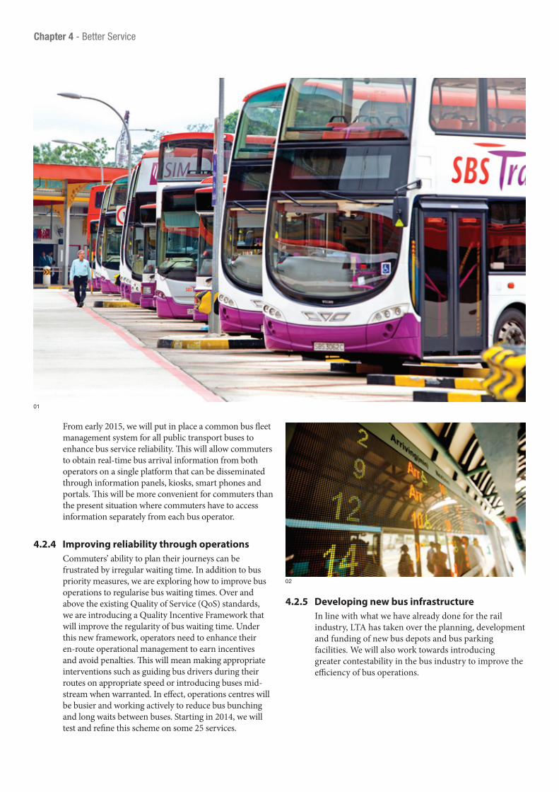
From early 2015, we will put in place a common bus fleet management system for all public transport buses to enhance bus service reliability. This will allow commuters to obtain real-time bus arrival information from both operators on a single platform that can be disseminated through information panels, kiosks, smart phones and portals. This will be more convenient for commuters than the present situation where commuters have to access information separately from each bus operator.
4.2.4 improving reliability through operationsCommuters’ ability to plan their journeys can be frustrated by irregular waiting time. In addition to bus priority measures, we are exploring how to improve bus operations to regularise bus waiting times. Over and above the existing Quality of Service (QoS) standards, we are introducing a Quality Incentive Framework that will improve the regularity of bus waiting time. Under this new framework, operators need to enhance their en-route operational management to earn incentives and avoid penalties. This will mean making appropriate interventions such as guiding bus drivers during their routes on appropriate speed or introducing buses mid-stream when warranted. In effect, operations centres will be busier and working actively to reduce bus bunching and long waits between buses. Starting in 2014, we will test and refine this scheme on some 25 services.
4.2.5 developing new bus infrastructureIn line with what we have already done for the rail industry, LTA has taken over the planning, development and funding of new bus depots and bus parking facilities. We will also work towards introducing greater contestability in the bus industry to improve the efficiency of bus operations.
02
Chapter 4 - Better Service

Land Transport Master Plan 2013 / 32-33
01 Improving bus operations to regularise waiting time
02 More real-time bus arrival information panels to be installed
03 Taxi services to be improved in both quality and availability
03
4.3 weLfare of transport workers
We will examine more closely how our transport infrastructure supports public transport workers.
New bus interchanges, for example, will have larger staff lounges, kitchens and canteen spaces to provide more space and comfort for bus captains and operations staff when taking meals or resting during breaks. For existing bus interchanges, we will work with the public bus operators to upgrade the facilities where possible.
4.4 taxis and car-sharing Our overall goal is to make sure that commuters in Singapore can choose from a variety of reliable transport options to get them where they need to go. Sometimes, people need to get somewhere in a hurry or want a more personalised transport service and opt for a taxi. We are working to improve the quality and availability of two alternative options – taxis and car-sharing.
We have introduced new regulations that require taxi companies to ensure more of their taxis are on the roads through the day and not only during peak periods.
6 From 6 - 11am and 5pm - 12 midnight daily except for weekends, public holidays and their eves, where only the evening standards will be computed (5pm – 12 midnight).
Taxi availability standards took effect in January 2013 and will be further phased in over three years. During peak periods today6, 65-70 per cent of our taxis must be on the road and this will increase to 80-85 per cent by 2015. Today, we require at least 70 per cent of taxis to achieve a minimum daily mileage of 250km and that will also increase to 85 per cent by 2015.
The Singapore Taxi Academy has enhanced driver training so that drivers are more knowledgeable about routes and can provide better customer service such as helping passengers with disabilities board and alight and guiding passengers to find their way to medical institutions.
Today, people do not have to own a car to have access to one as car-sharing can meet the occasional need for a car such as running errands or bringing family members for appointments. Car-sharing differs from conventional car rental in that it offers greater flexibility to access and use of a car, and the hirer pays only for time and mileage. We are working to facilitate the creation of more car-sharing ports in HDB estates so that this industry can make car-sharing more accessible to potential hirers.

01
7 The 16 designated stations are Bayfront, Bras Basah, Bugis, Chinatown, City Hall, Clarke Quay, Dhoby Ghaut, Esplanade, Lavender, Marina Bay, Orchard, Outram Park, Promenade, Raffles Place, Somerset and Tanjong Pagar.
01 Tap on Travel Free scheme to enjoy more space on board trains
02 MyTransport.SG - a portal that provides land transport information
4.5 traveLLing the sMart waYSpreading some of the morning peak hour crowds to the pre-peak period will help to ease crowding on city-bound stretches of the MRT network. Some commuters are already doing this but others need a bit of an extra nudge. So in June 2013, we started the one-year Travel Free trial on our rail network. Those who end their journey before 7.45am on weekdays at 16 designated MRT stations7 in the city area get to travel for free on the rail network. Commuters exiting these stations between 7.45am and 8am will enjoy a discount of up to 50 cents off their train fare.
Under the Incentives for Singapore’s Commuters’ (INSINC) programme launched in January 2012, commuters can also be rewarded with cash prizes for travelling during off-peak periods, including the chance to win up to S$200. Apart from directly encouraging commuters to travel during the pre-peak period, we are also working with employers to offer more flexible work and travel arrangements. We are piloting the “Travel Smart” programme with 12 organisations that together have a total of more than 20,000 employees.
Many commuters want to work and communicate while on the move. They can soon stay connected through a trial of free WiFi access along the North East Line and at major interchange stations from early 2014.
Chapter 4 - Better Service

Land Transport Master Plan 2013 / 34-35
02
MOBILITY ON THE MOVE: MyTransport.SG LTA knows commuters want more information to manage travel decisions and so we developed the My Transport.SG portal and smartphone application to bring them real-time transport information. Commuters can minimise their waiting time with real-time bus arrival information while maps provide directions to the nearest MRT stations, bus-stops and taxi stands. Motorists get real-time trafc news updates and information on car park availability, ERP rates and trafc speeds on expressways and major roads to plan optimal routes. Cyclists can find cycling routes across Singapore. And MyConcierge enables commuters to store their favourite and most commonly accessed features within the MyTransport.SG app.
MyTransport.SG can be used to give feedback too. If a motorist or commuter encounters road infrastructure that needs repair, they can use the Snap & Send feature to take a picture and send it to LTA on the spot.
We will keep improving the MyTransport.SG application. In 2014, MyTransport.SG will show sheltered walkway routes to MRT stations and bus-stops, and in 2015, bus and train platform crowd updates will be added to help commuters avoid crowds. From 2014, the application will also include the new Discover Singapore service that will enable local commuters and visitors to
discover places of interest and events in and around the city, plus advice on how to get there. Trafc conditions, crowding conditions on public transport, taxi availability, walking routes, weather conditions and other travel information, combined with promotional offerings linked to travel passes, will be integrated to create a single mobility experience.
4.6 what coMMuters can do Apart from infrastructure investments, service improvements and shifting travel patterns, commuters themselves can do a lot to influence the quality of their own journeys and those of others through their actions. Simple acts such as queuing to board trains and buses, giving up seats to those who need them more and allowing others to alight first before boarding can make a significant difference in our daily commutes.
To recognise such efforts and highlight how they can make a difference, LTA has been working together with the Public Transport Council, the Singapore Kindness Movement and public transport operators since 2009 on various programmes that promote greater consideration among commuters when using public transport.

01
02 03
Chapter 4 - Better Service

Land Transport Master Plan 2013 / 36-37
04
05
01 Simple acts of graciousness bring cheer to fellow commuters
02 Little graciousness ambassadors at Choa Chu Kang station
03 Graciousness heroes and heroines from South View Primary
04 & 05 Posters comprising quotes from students, accompanied by comics
TAKING CHARGE: Making Considerate Commuting a Way of Life Since 2012 LTA has been inviting public transport users to participate in efforts to encourage gracious commuting. These efforts draw on ideas from students, working adults and seniors, such as:
South View Primary students were one of the first to take the lead in promoting graciousness on public transport. Dubbed “Embrace Gracious Behaviours”, this April 2013 graciousness drive saw about 40 students greeting commuters at Choa Chu Kang MRT station with bright, cheery placards carrying messages that encouraged gracious behaviour. Many commuters were amazed at the enthusiasm of the students.
In another show of support, students from various schools took part in a contest in which they came up with quotes and poems to encourage fellow commuters to behave graciously. At 4,500, the number of entries received in the 2013 contest was almost three times that of the previous competition, a testament to young people’s growing eagerness to get involved.
Working adults and senior citizens have also demonstrated a keenness to do their part in promoting graciousness. One group offered helpful quotes to remind commuters of the need to be gracious so that all of us will have a more pleasant ride on board trains and buses. The quotes, along with those from students, were subsequently turned into posters accompanied by comic strips for an added touch of humour.
In 2013, we adopted a new approach of amplifying positive social norms to encourage more commuters to do the right thing by spreading awareness that many fellow commuters already show consideration to others. Commuters saw the posters and stickers at different commuter touch points island-wide, including train windows, platform screen doors and on buses and at bus stops.
We have not overlooked the power of online media to shift behaviour. We noticed a “queuing culture” forming at Bishan MRT and produced a video in June 2012 to showcase this positive example to other commuters. The video went viral and before long, commuters were queuing at other stations.

Our land transport system plays an integral role in society by enabling the public to access essential services, amenities and opportunities. We must continue to make our transport network more inclusive by considering the needs of seniors and the less mobile.
5 Liveable and Inclusive Community
Chapter 5 - Liveable and Inclusive Community
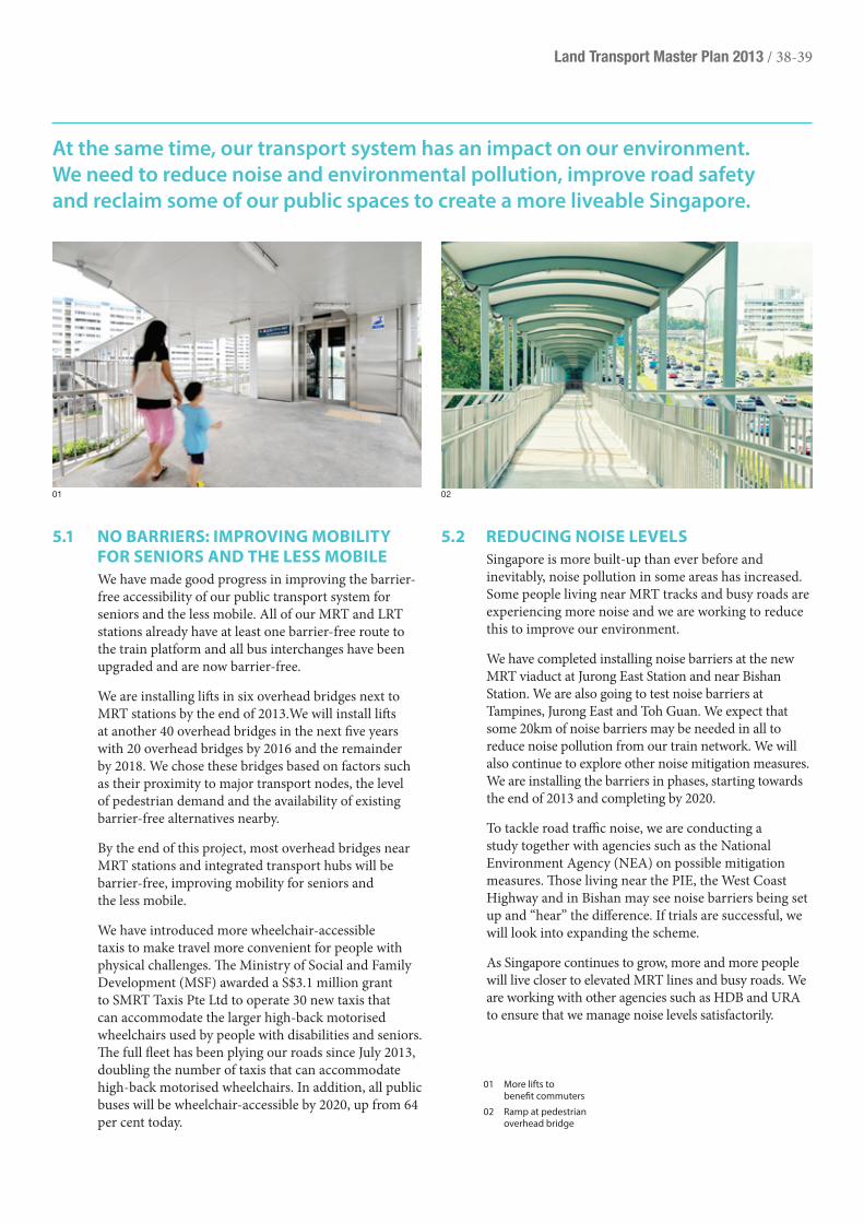
Land Transport Master Plan 2013 / 38-39
At the same time, our transport system has an impact on our environment. We need to reduce noise and environmental pollution, improve road safety and reclaim some of our public spaces to create a more liveable Singapore.
5.1 no Barriers: iMproving MoBiLitY for seniors and the Less MoBiLe
We have made good progress in improving the barrier-free accessibility of our public transport system for seniors and the less mobile. All of our MRT and LRT stations already have at least one barrier-free route to the train platform and all bus interchanges have been upgraded and are now barrier-free.
We are installing lifts in six overhead bridges next to MRT stations by the end of 2013.We will install lifts at another 40 overhead bridges in the next five years with 20 overhead bridges by 2016 and the remainder by 2018. We chose these bridges based on factors such as their proximity to major transport nodes, the level of pedestrian demand and the availability of existing barrier-free alternatives nearby.
By the end of this project, most overhead bridges near MRT stations and integrated transport hubs will be barrier-free, improving mobility for seniors and the less mobile.
We have introduced more wheelchair-accessible taxis to make travel more convenient for people with physical challenges. The Ministry of Social and Family Development (MSF) awarded a S$3.1 million grant to SMRT Taxis Pte Ltd to operate 30 new taxis that can accommodate the larger high-back motorised wheelchairs used by people with disabilities and seniors. The full fleet has been plying our roads since July 2013, doubling the number of taxis that can accommodate high-back motorised wheelchairs. In addition, all public buses will be wheelchair-accessible by 2020, up from 64 per cent today.
5.2 reducing noise LeveLsSingapore is more built-up than ever before and inevitably, noise pollution in some areas has increased. Some people living near MRT tracks and busy roads are experiencing more noise and we are working to reduce this to improve our environment.
We have completed installing noise barriers at the new MRT viaduct at Jurong East Station and near Bishan Station. We are also going to test noise barriers at Tampines, Jurong East and Toh Guan. We expect that some 20km of noise barriers may be needed in all to reduce noise pollution from our train network. We will also continue to explore other noise mitigation measures. We are installing the barriers in phases, starting towards the end of 2013 and completing by 2020.
To tackle road traffic noise, we are conducting a study together with agencies such as the National Environment Agency (NEA) on possible mitigation measures. Those living near the PIE, the West Coast Highway and in Bishan may see noise barriers being set up and “hear” the difference. If trials are successful, we will look into expanding the scheme.
As Singapore continues to grow, more and more people will live closer to elevated MRT lines and busy roads. We are working with other agencies such as HDB and URA to ensure that we manage noise levels satisfactorily.
01 More lifts to benefit commuters
02 Ramp at pedestrian overhead bridge
01 02
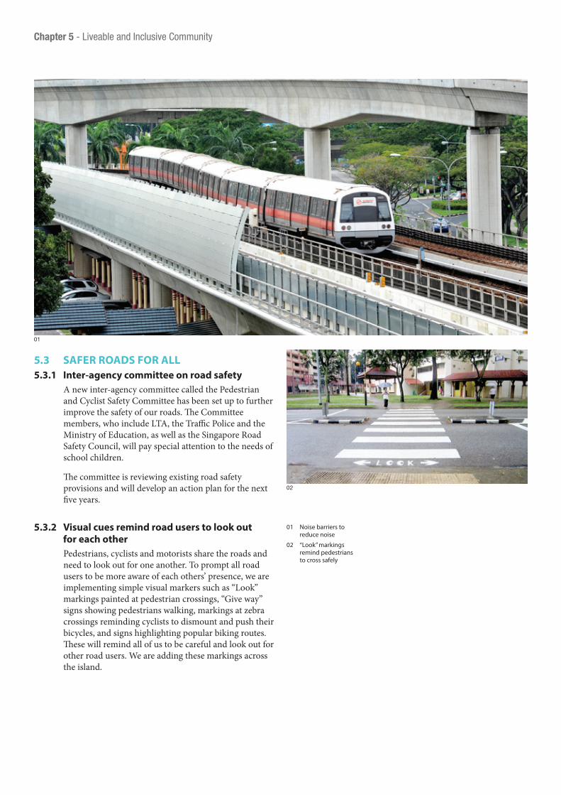
5.3 safer roads for aLL5.3.1 inter-agency committee on road safety
A new inter-agency committee called the Pedestrian and Cyclist Safety Committee has been set up to further improve the safety of our roads. The Committee members, who include LTA, the Traffic Police and the Ministry of Education, as well as the Singapore Road Safety Council, will pay special attention to the needs of school children.
The committee is reviewing existing road safety provisions and will develop an action plan for the next five years.
5.3.2 visual cues remind road users to look out for each other
Pedestrians, cyclists and motorists share the roads and need to look out for one another. To prompt all road users to be more aware of each others’ presence, we are implementing simple visual markers such as “Look” markings painted at pedestrian crossings, “Give way” signs showing pedestrians walking, markings at zebra crossings reminding cyclists to dismount and push their bicycles, and signs highlighting popular biking routes. These will remind all of us to be careful and look out for other road users. We are adding these markings across the island.
01
02
01 Noise barriers to reduce noise
02 “Look” markings remind pedestrians to cross safely
Chapter 5 - Liveable and Inclusive Community

Land Transport Master Plan 2013 / 40-41
transport Mode i’m using
average carbon footprint
(co2 per 10km)My own two feet 0
Pedalling a bicycle 0
Taking the bus 0.19kg*
Taking the MRT 0.13kg*
Driving a car 1.87kg*
5.3.3 More time to cross: the green Man plus scheme
Seniors and the less mobile among us will be able to cross more roads safely as we extend the Green Man Plus scheme to more parts of our island. Tapping the senior citizen concession card or the Green Man Plus card on the readers mounted above the standard push button on traffic light poles gives, on average, an additional 5 seconds of green time for pedestrians.
Following the successful launch of our pilot at five locations in 2009, we are extending the scheme to another 500 crossings by 2015. As of the middle of 2013, the Green Man Plus can be found at 256 pedestrian crossings.
5.3.4 helping the visually impaired: the audio tactile system
We are introducing the audio tactile system to more housing estates to aid the visually-impaired. As of the middle of 2013, about 700 traffic signals have the audio tactile system installed and we will install more as needed. This system guides the visually-impaired so they can cross the roads safely.
28
5.4 environMentaL sustainaBiLitYWe all have a part to play in protecting our environment for future generations to enjoy. Transport is responsible for about 20 per cent of carbon emissions.
Using public instead of private transport is one of the best ways to help protect our environment. Trains and buses are much more efficient carriers of passengers than cars and take up far less space, leaving land for other uses such as parks. Public transport is also more energy efficient, thus conserving our natural resources. Reducing the number of cars on the roads will reduce carbon emissions.
Note* Assuming an average loading of 80 passengers per bus and 1,100 per train.
figure 9: comparison of carbon footprint
figure 8: how the green Man plus works
*Applicable only to CEPAS-Compliant Senior Citizen Concession Card holders and Green Man + Card holders.
Tap your card* on the reader. The LED indicator will light up and for Green Man + card holders, there will be additional sound and vibration alerts.
Green Man will appear with extended timer.

5.4.1 More information and incentives for consumers to help protect the environment
Consumers increasingly want to know how much different vehicle models contribute to air pollution so they can make an informed purchase. To encourage the use of greener vehicles, we introduced the mandatory Fuel Economy Labelling Scheme (FELS). Under FELS, all cars and light goods vehicles that are displayed for sale must be affixed with the new fuel economy labels that provide more information on their fuel consumption.
In January 2013, we also launched the new Carbon Emissions-based Vehicle Scheme (CEVS) to replace the Green Vehicle Rebate introduced in 2001. CEVS encourages consumers to buy more fuel-efficient vehicles. Under the CEVS, all new cars and imported used cars registered from January 2013 with carbon emissions of less than or equal to 160g per kilometre (CO2/km) qualify for rebates of S$5,000 to S$20,000 to offset against the Additional Registration Fee (ARF) payable, subject to a minimum ARF payable of S$5,000. From July 2013 cars with carbon emissions equal to or more than 211g CO2/km will incur a registration surcharge of between S$5,000 and S$20,000. We will review the scheme before 2015 and adjust it periodically to ensure that it remains effective.
In April 2013, together with the National Environment Agency (NEA), we implemented a new Early Turnover Scheme to encourage the early replacement of old diesel goods vehicles, with models that comply with at least Euro V diesel standards or their equivalent. Under the two-year scheme, owners can de-register their diesel goods vehicles that were registered before 1 January 2001, which are predominantly Pre-Euro and Euro I models, and register a new goods vehicle by paying a discounted Prevailing Quota Premium (PQP).
5.4.2 environmental considerations: planning transport infrastructure
Protecting the environment is an essential consideration when we plan and design our transport infrastructure. Growing transport demand must be considered together with the need to preserve Singapore’s natural heritage. Rail and road alignments take into account many other factors too such as overall travel time, impact on existing communities and properties, noise generated and technical feasibility.
A good example of how we weigh these factors is the proposed Cross Island Line that may either go under or skirt around the Central Catchment Nature Reserve. We have already begun a dialogue with various groups, including the nature and environmental groups and residents living near the area, to understand their concerns.
5.5 recLaiMing our puBLic spaces: car-free and car-Less Zones
In cities around the world, pedestrians are gaining ground. We too are redesigning our land transport network so more public spaces will flourish and make our city more vibrant.
We are working with other agencies like the Urban Redevelopment Authority (URA) to introduce car-free/car-less zones within selected commercial and historical areas in the city centre such as Club Street-Ann Siang Road and Haji Lane. Both locations have been developed as pilot projects where traffic is closed off for two to three evenings each week to provide more space for walking.
As a joint initiative with URA, we are also developing a car-free/car-less residential area with Kampong Bugis as the pilot district for this initiative. With increased space along the sidewalks and streets for activities and events, walking around the neighbourhood will become even more enjoyable.
01
01 “Car-free” zones will soon become a reality
Chapter 5 - Liveable and Inclusive Community
BLUR

Land Transport Master Plan 2013 / 42-43
The preceding chapters set out our plans to improve our public transport system. These plans reflect our overarching priority in promoting public transport as the preferred mode of travel.
Private transport does have a role to play in meeting our personal mobility needs and in delivering goods and services, but its role must evolve given our long-term transportation needs and land constraints.
6 Reducing Reliance on Private Transport

With limited land available, we cannot keep building roads to accommodate more vehicles. Roads today already take up 12 per cent of our total land area and we have limited room to further expand the road network. Therefore, it is not realistic to plan for every household in Singapore to own a car. Today, about 45 per cent of households in Singapore own a car, up from 40 per cent in 2008. Our per capita car population and road density rates are higher than Hong Kong’s8.
01
The car is not a basic necessity in Singapore given our easy access to public transport. Going forward, we will build new roads primarily to serve new residential centres and economic activities. Expansion and improvements to existing roads will mainly be to support the movement of buses so as to bring about a better public transport experience.
We will continue with our vehicle ownership and usage restraint measures to try to ensure that roads are smooth-flowing and congestion-free. On the whole, these policies have worked well. Members of the public frequently write on private transport policies, but few have suggested abandoning the current system of Certificates of Entitlement (COE) and Electronic Road Pricing (ERP). Painful as it is, Singaporeans understand that these policies are necessary if our road system is to function efficiently. Still, we recognise that the system can be improved to make it more efficient and fair. We will adjust our policies where appropriate and deploy technology to optimise road use so that as many users as possible can benefit from our limited road space.
8 Singapore’s road density is 4.8km/km2 compared to Hong Kong’s 1.9km/km2. Singapore’s car per 100 persons is 10.1 vs Hong Kong’s 6.34. Source: Monthly Traffic and Transport Digest Jam 2013, Transport Department, Hong Kong; Hong Kong The Facts: Highways; Highway Department.
Chapter 6 - Reducing Reliance on Private Transport

Land Transport Master Plan 2013 / 44-45
6.1 the vehicLe growth rateSince 1990, the COE system has enabled us to exercise effective control over the vehicle population growth rate. Together with the ERP system, we have been able to ensure that our road network is optimally used.
Some members of the public would like us to rely more on vehicle usage measures such as ERP to curb congestion while increasing the number of COEs so that more people can own a car. While higher ERP charges would be a direct and targeted approach to tackle congestion, the COE system ensures that our vehicle population will not exceed what our land area is able to accommodate.
The conventional wisdom that we can have more cars as long as they do not contribute to congestion is true only up to a point. As Singapore becomes more urbanised, the social cost of car ownership will also increase. This is because land has to be set aside for parking spaces not only where we reside, but also at the places where we work, study and play. Using more land for car parks means less land for other developments, such as housing, schools or healthcare facilities. Illegal parking and congestion in local neighbourhoods may also become more prevalent.
02
9 The number of COEs has been declining from 127,021 per year in 2008 to 47,555 in 2012.
Over the years, we have gradually reduced the annual vehicle growth rate from 3 per cent in 1990 to 1.5 per cent in 2009, 1 per cent in August 2012 and 0.5 per cent since February 2013. In view of the limited scope for further increase of the road network, we will review whether a further reduction in the growth rate is necessary.
6.2 staBiLising suppLY of coesThrough the LTMP 2013 consultation last year, people voiced concerns about the provision and allocation of COEs, especially the rapid increase in COE prices since 2009. The rapid rise in COE prices was in part due to the fall in the number of COEs from 2007 to 2012. The number of COEs for each bidding period is influenced by the number of vehicles that motorists deregister in the earlier bidding period9. The number of de-registrations in turn can fluctuate because of economic conditions and the difference between present COE prices and the COE price at the time an owner purchased his car. We will explore measures that can provide more stability to the number of certificates issued at each bidding period.
01 New roads to serve economic activities
02 Annual Vehicle Growth reduced to 0.5% in February 2013

6.3 next generation erpBeyond our personal decisions of how we travel, traffic congestion also imposes a cost on all motorists along a congested stretch of road and on the rest of society as well. Motorists caught in a traffic jam use more fuel and have longer journey times. Society at large has to suffer increased air pollution and the loss of land to build more road space to ease the congestion. Thus, each motorist imposes a cost upon other motorists and on society.
With ERP, motorists are made to bear the cost of their decision to use congested roads, particularly roads in the city centre and major expressways. ERP encourages motorists to consider avoiding congested areas by using alternative routes, adjusting their time of travel or using public transport instead. Since 1998, ERP has helped manage congestion within the city area. The traffic volume into the city area grew at a slower pace than the overall growth in car population, as seen in the figure below.
Chapter 6 - Reducing Reliance on Private Transport
01
500
450
400
350
300
250
200
150
100
50
0
1975
1978
1981
1984
1987
1990
1993
1996
1999
2002
2005
2008
2011
2014
Trafc Volume to City (AM Peak) Vehicle Population Car Population
figure 10: traffic volume compared to vehicle and car population
01 & 02 Vehicles on the roads

Land Transport Master Plan 2013 / 46-47
ERP has been in operation for 15 years and our current priorities for ERP are to make it more targeted and flexible.
We are moving to a new road pricing system based on global navigation satellite system (GNSS) technology to accomplish this. GNSS-based ERP overcomes the inflexibility of physical gantries. These gantries cannot be widely deployed and the system can only charge fixed rates at each location. GNSS-based ERP will make possible distance-based congestion charging along a stretch of road. This is more equitable because a motorist pays for the amount he contributes to congestion. A motorist travelling a short distance will pay less than a motorist who travels a longer distance and contributes more to congestion.
At the same time, we can use this next generation ERP system to bring an array of services to motorists. For example, we could administer the Off-Peak Car (OPC) scheme on this platform so OPC owners can avoid the hassle of needing to buy licences online or at kiosks. Variants to the current OPC scheme that can allow greater and more flexible usage of OPCs at non-congested roads could also be offered. We are also looking at using the ERP2 technology to deliver more targeted traffic and parking information to motorists. There will be many other interesting opportunities for LTA to partner with other agencies and industry players
10 Roads will be charged only if they are found to be congested. The charging rates will increase if traffic speeds along a stretch of road falls below the optimal speed range (45kph to 65kph on expressways and 20kph to 30kph on arterial roads). When traffic speeds exceed the optimal speed range, the charges will be decreased to avoid under-utilisation of the road. In order to optimise the capacity of the road network and ensure congestion-free roads, the 85th percentile speed of an individual road or a basket of roads (for a cordon) will continue be used to review the rates. The measure of 85th percentile speeds is chosen over average speeds because it reflects more closely your driving experience.
to provide innovative value-added services on the ERP2 platform that can enhance motorists’ travel experience.
The fundamental purpose of ERP under the new system remains the same: roads will be charged only if congested and we will adjust rates when traffic speeds on a priced road fall below the optimal speed range10.
6.4 tackLing congestion todaYIn the meantime, we will continue to ensure smooth-flowing traffic on our roads by erecting new ERP gantries where they are required. In particular, traffic conditions on the AYE around Clementi have been deteriorating as speeds have fallen below optimal levels during the morning peak period over the last year. Three new gantries will manage eastbound traffic for both the morning and evening peak periods, and one gantry is planned to manage westbound traffic for the evening peak period. These gantries will be activated once they are completed by the middle of 2014 if the heavy congestion persists.
We will continue to monitor other major roads such as Alexandra Road, Jalan Bukit Merah, Commonwealth Avenue, Telok Blangah Road, Holland Road and Depot Road. Currently, the traffic speeds along these roads are within the optimal speed range. Should these roads become congested, we will implement ERP there as well.
02

01
6.5 parking poLicYMotorists often decide whether to drive or use public transport or taxis based also on parking availability. Today our parking policy requires that each privately-owned building or facility provide a minimum level of parking based upon the space developed, type of use and location. This is to ensure that sufficient car park space is provided to avoid the consequences of insufficient parking space such as illegal parking and cars queuing for car parking along surrounding roads.
We need to balance the negative impact of insufficient parking with the cost of providing too much parking in our land-scarce island state. Over the last two decades we have tightened parking standards progressively in the city centre and in and around transport nodes. In 2005 together with URA, we implemented the Range-based Car Parking Standard that gives developers the flexibility to provide up to 20 per cent fewer parking spaces than the prevailing standard. This enables developers to better match parking provisions with their assessment of demand based on operational and business considerations.
The overall parking supply in the city centre today is still significantly higher than what would be if all the buildings complied with current standards because many of the buildings were built prior to the introduction of these standards. Parking charges, especially season parking rates, are also low relative to other major cities, as shown in the table below. We expect the parking supply to gradually decrease over time as older buildings make way for newer buildings
Season parking in CBD (S$) (average per month)
Singapore $278.20
Hong Kong $919.41
London $1,337.77
Tokyo $918.52
Source: Colliers International CBD Parking Rate Survey 2011. Using SGD to USD exchange rate of 0.81.
that follow the current standards. One example is the redevelopment of the Market Street Car Park (MSCP). This car park was built in the 1960s with 704 parking spaces at a time when there was a shortfall of car park spaces and when public transport was inadequate in the CBD and Telok Ayer Conservation Area. Given the improvement in public transport and convenient access to MRT stations, along with adequate parking around the MSCP, it was allowed to be closed in 2011 to be redeveloped as a commercial building.
Chapter 6 - Reducing Reliance on Private Transport
01 Balancing parking spaces in land-scarce Singapore
figure 11: comparison of season parking charges and parking provisions in cBd

Land Transport Master Plan 2013 / 48-49
6.6 enforceMent against iLLegaL parking
As we slow down our road growth and work to reduce car ownership and traffic congestion, we must make the best use of our existing road space. Therefore, we need to do more to tackle illegal parking as it impedes traffic and affects the safety of road users. We will be installing 30 closed-circuit television (CCTV) cameras at key locations by the end of 2014 to support the work of our enforcement officers.
6.7 a Mindset shiftResidents of many major cities around the world choose not to own cars because walking and cycling is easy and healthy and their train and bus options are plentiful. We, too, want Singaporeans to rely less on private vehicles with all we are doing to strengthen and expand our public transport facilities. But private vehicles nevertheless still have a place in our transport system and we want to make sure we can accommodate them judiciously, with an eye toward a cleaner, healthier and more sustainable landscape.
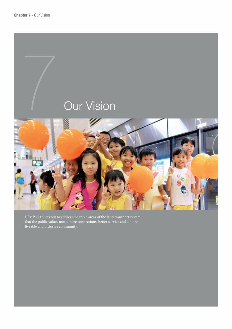
LTMP 2013 sets out to address the three areas of the land transport system that the public values most: more connections, better service and a more liveable and inclusive community.
7 Our Vision
Chapter 7 - Our Vision

Land Transport Master Plan 2013 / 50-51
We see a future where we all can get to more places faster and in greater comfort as we enhance our rail, bus, cycling and sheltered walkway networks, take steps to improve the quality of our public transport services and support new options such as car sharing. Under this plan, our goal is nothing short of transforming daily journeys so that we spend less time travelling.
Realising this vision means that by 2030, Singapore will have:
Our community and living environment will be transformed too. With a transport system that is easier for everyone to use, seniors and the less mobile will find it more convenient to get around with barrier-free access at transport nodes and more lifts at overhead bridges. With more people using public trans-port, the most efficient people-carrier, we will leave a smaller carbon footprint on the environment. We will enjoy cleaner air and more road spaces can be freed up for other public uses. We will have more liveable communities as we add noise barriers, enhance road safety and create more car-free zones.
households living within a 10-minute walk from a
train station
8 in10of public transport journeys (less than 20km) completed
within 60 minutes
85%of all journeys in peak hours
undertaken on public transport
75%
Just as this document updates LTMP 2008, we will continue to review our strategies to adapt to the changing environment and new challenges that we will face in the future. We will review our plans again closer to 2020 to take in changes and refresh our initiatives.
Though specific initiatives may change to meet new challenges, our vision remains the same: A People-Centred Land Transport System. We look forward to continuing our partnership with you to help us in our pursuit of this vision.

Long Term Initiatives
2021 - 2025 2025 - 2030
Opening of Eastern Region Line
Opening of Jurong Region Line
Opening of Circle Line Stage 6
Opening of Downtown Line Extension
Complete 7 more Integrated Transport Hubs
Opening of Cross Island Line
Opening of North East Line Extension
Complete an island-wide cycling path network of over 700km
Medium Term Initiatives
2017 2018 2019 2020 2021
Opening of Downtown Line 3
Completion of Walk2Ride programme
Install lifts at about another 40 pedestrian overhead bridges
Complete East-West Line re-signalling
Opening of Thomson Line 2
Add 90km of off-road cycling paths to more HDB towns to bring the total network to around 190km
Complete North-South Expressway
Install 20km of rail noise barriers
Opening of Thomson Line 1
Opening of Thomson Line 3
Chapter 7 - Our Vision
Short Term Initiatives
2013 2014 2015 2016
Opening of North-South Line Extension
Addition of 13 trains for North-South and East-West Lines
Addition of 13 train-cars for Bukit Panjang LRT
Completion of the bulk of BSEP improvements
Introduce Quality Incentive Framework to improve regularity of bus waiting time
Completion of more racks to secure 3,000 bicycles at 32 MRT stations
Install 30 CCTV cameras to deter illegal parking
Review the Carbon Emissions-based Vehicle Scheme
Addition of 18 trains for North East Line
Addition of 24 trains for CCL
Conduct pilot bicycle-sharing scheme at Jurong Lake District
Implement a common bus fleet management system for all public transport buses
Extend Green Man Plus Scheme to another 500 crossings
Opening of Downtown Line 2
Opening of Tuas West Extension
Completion of North-South Line re-signalling
Addition of 28 trains for North-South and East-West Lines
Addition of 16 train-cars for Sengkang and Punggol LRTs
Opening of Downtown Line 1
Addition of 31 real-time bus arrival information panels
figure 12: Milestones of Land transport initiatives
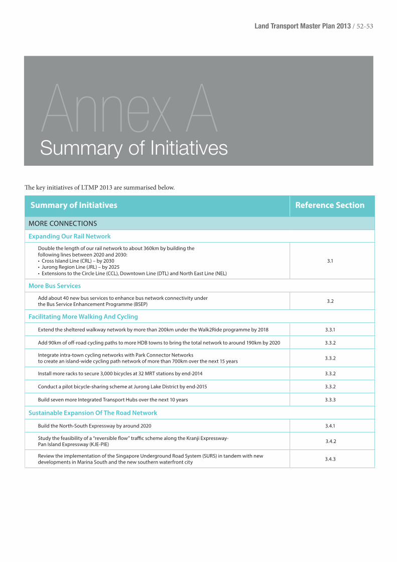
Land Transport Master Plan 2013 / 52-53
summary of initiatives reference section
MORE CONNECTIONS
Expanding Our Rail Network
Double the length of our rail network to about 360km by building thefollowing lines between 2020 and 2030:• Cross Island Line (CRL) – by 2030• Jurong Region Line (JRL) – by 2025• Extensions to the Circle Line (CCL), Downtown Line (DTL) and North East Line (NEL)
3.1
More Bus Services
Add about 40 new bus services to enhance bus network connectivity under the Bus Service Enhancement Programme (BSEP) 3.2
Facilitating More Walking And Cycling
Extend the sheltered walkway network by more than 200km under the Walk2Ride programme by 2018 3.3.1
Add 90km of off-road cycling paths to more HDB towns to bring the total network to around 190km by 2020 3.3.2
Integrate intra-town cycling networks with Park Connector Networks to create an island-wide cycling path network of more than 700km over the next 15 years 3.3.2
Install more racks to secure 3,000 bicycles at 32 MRT stations by end-2014 3.3.2
Conduct a pilot bicycle-sharing scheme at Jurong Lake District by end-2015 3.3.2
Build seven more Integrated Transport Hubs over the next 10 years 3.3.3
Sustainable Expansion Of The Road Network
Build the North-South Expressway by around 2020 3.4.1
Study the feasibility of a “reversible flow” trafc scheme along the Kranji Expressway- Pan Island Expressway (KJE-PIE) 3.4.2
Review the implementation of the Singapore Underground Road System (SURS) in tandem with new developments in Marina South and the new southern waterfront city 3.4.3
The key initiatives of LTMP 2013 are summarised below.
Summary of InitiativesAnnex A

summary of initiatives reference section
BETTER SERVICE
Improving Rail Services
Add more trains to every rail line for the next few years from 2014 4.1
Upgrade the signalling system for the North-South Line by 2016 and the East-West Line by 2018 4.1
Enhance the MRT Operating Performance Standards to move towards higher train frequencies, minimise service delays, and enforce more stringent maintenance and service reliability requirements
4.1.1
Improving Bus Services
Increase the bus fleet by about 20 per cent i.e. the equivalent of 800 new buses under the BSEP over five years 4.2.1
Ensure that 95 per cent of feeder bus services run at scheduled intervals of 10 minutes or less over two hours during both the morning and evening peak periods. Ensure that 90 per cent of all bus services operate within 10 to 12 minute scheduled intervals, with all bus services operating within 20 minute scheduled intervals
4.2.1
Require public bus operators to reduce their loading levels to 85 per cent of a vehicle’s licensed capacity 4.2.1
Work with private bus operators to explore how to tap on their resources to run short services during peak hours such as localised bus routes to bring residents from their homes to MRT stations 4.2.1
Accelerate the implementation of BSEP 4.2.1
Add another 30km of bus lanes and expand the Mandatory Give-Way to Buses scheme to about 150 more bus stops island-wide 4.2.2
Implement 20 more bus hubs 4.2.2
Add 31 real-time bus arrival information panels in 2013 4.2.3
Study the feasibility of providing information on the level of crowding on buses 4.2.3
Implement a common bus fleet management system for all public transport buses to enhance service reliability from early 2015 4.2.3
Introduce a Quality Incentive Framework to improve the regularity of bus waiting time starting from 2014 4.2.4
Taxis And Car-Sharing
Improve the quality and availability of taxis and car-sharing 4.4
Annex A - Summary of Initiatives

Land Transport Master Plan 2013 / 54-55
summary of initiatives reference section
LIVEABLE AND INCLUSIVE COMMUNITY
No Barriers: Improving Mobility For The Elderly and The Less Mobile
Install lifts at about another 40 pedestrain overhead bridges by 2018 5.1
Reducing Noise Levels
Install 20km of rail noise barriers by 2020 5.2
Study measures to mitigate road trafc noise 5.2
Safer Roads For All
Implement visual cues to remind road users to look out for one another such as “Look” markings at pedestrian crossings; “Give way” signs showing pedestrians walking, markings at zebra crossings reminding cyclists to dismount and push their bicycles, and signs highlighting popular biking routes
5.3.2
Extend the Green Man Plus Scheme to another 500 crossings by 2015 5.3.3
Introduce the audio tactile system to more housing estates to aid the visually-impaired 5.3.4
More Information And Incentives For Consumers To Help Protect The Environment
Review the Carbon Emissions-based Vehicle Scheme before 2015, and adjust it periodically to ensure that it remains effective 5.4.1
Reclaiming Our Public Spaces: Car Free And Car-Less Zones
Work with other agencies to introduce car-free/car-less zones within selected commercial and historical areas in the city centre 5.5
REDUCING RELIANCE ON PRIVATE TRANSPORT
Review vehicle growth rate to determine if a further reduction is necessary 6.1
Explore measures to provide stability to the number of Certificates of Entitlement (COEs) issued at each bidding period 6.2
Move to a new road pricing system based on global navigation satellite system (GNSS) technology 6.3
Continue to ensure smooth-flowing trafc by erecting new Electronic Road Pricing (ERP) gantries where required 6.4
Install 30 closed circuit television (CCTV) cameras by end-2014 to deter illegal parking 6.6

www.lta.gov.sg www.facebook.com/WeKeepYourWorldMoving www.twitter.com/LTAsg1800-CALL LTA (1800 2255 582)