mag & em sur rpt - geologyontario.mndmf.gov.on.ca · introduction : \' "magnetic and...
TRANSCRIPT
42A10SE0137 2.2064 CURRIE
• : !S,".' r'f~"-:' - : ' . ; . 1'1 *,' V.' .. v..' - ;*
MAGNETIC * ..tk'?.CTfiC)MftGfl(ETIC
on,
FALCHNBHIDUE-. NJCHtL 'KINE^-r) t lMlTtD
Bond and Currie Twpa.,
"••J-'V.
010
. 12,
H., .., aradehaw, jj*,
':/'

42AI0SE0137 2.2064 CURRIE
TABLE, w. .ww...........
. . ,Introduction . . . . . . . . . . ,., .-.. . . , . .. . , . . . . , . . '. ;v^i*V* . .;. .' "I.-
PrapartiBa, Location and MccaSf ^ ' , , . l"' ;Group A . .,.,,,v,4v.,V, .^^.....vv^i'^V. .v^. ' 1Uroup O . . . . .•..;; ..-'i,'.V..*-.".t .Vy. . ..*y..*'*... iVii-V 2Group C . . . , . , , .. . .... , ,,.,;* ,.. . . . , . . .y....i.*y. . 2Group O . . , . . . . . . . . . . . . . . . . . . . . . . . . . . yy . . ,',y , 2
Previoun
Gaology ,
Magnetic Survey Heaul'ts anri Interpretation , . -•(; v Group A ..... . .,.......,....,,......,. i*-..,.. .'i-V- fc'iraup B . . . .|, ......,.....,,... -,.,.. .-. ^-^. ,^.. bGroup'C .'.. , l . ,,i. 4 i^-... t i ,-, .i ,-; . . i i.. |. ( '. | 4 ',L 4i||'i.^ * 5. Group O"-.'. . .'. . . ;. .v..',";. .V s. /... ;,y.7 TVv,r.lH..yv'. S
tluctromagnntic --iurvey ^f?8ultGroup a . /. i.' . . . ,". . : . /. . ; . t . .G.rOUp Q . . . . . . . | .-. ..?,-j f *.*r... .,*r . . . iV'.*'f*( **'j|i'V i;*i * . . . 7
LirOUP U . . . . t'. . . i . '* i . * . , . . . . .r/', t . * ,V . *V. t . . . . . B
Group D . . . . . . . . '. . . . . . . . . . . . .y ?;... 4, . . . .., 4,.. 9
Conclusions ,, , ,.Group A . . . . . , . .. ,. . . .*... , . . .. ,'v",.V.v ..j.* i.. . . 10aroup a . . . . . . . ... . . . , :... .y. , . . . . . . . y. .^V. . . . y. . ' 10Group C. . . . . . . ..^..s^.k^^^Vv.**^.,^.*:*.;*.,;.'. .... .11Group D . . . . . ., ...y. .''.',f.,.. : i-. , .. ..... . .y,*,. .... 11;
Racammendationa . . . . . . . . . . . . . . , . . . . . , . . . . ,* , , . , , , . * , . . . . 12- -" . - '. - - •"" ' ^' *-,' ' ~ i v" pi '.'- *
Certificate .'* '^
APPENDICES Appendix
Maps Property LocationGroup A Magnetic Mop
Llectromagnatic MapGroup d Magnatic Map
Clectrowagnatic Map'' ' ,.f. j f- '
firoup C Magnetic Mtp;vMap
Group D Magnetic Mapi-lectromagnetic Map ,

INTRODUCTION : \' "
Magnetic and electromagnetic surveys have baan conducted
an four claim groups in Currie and Bond Townships for FalConbridgt
Nickel Mines Limited.; This field i*iorlf wajs cpmpie^afl ,di|rintj the1 5 ' t. "' - f't.^./- -t.-..*- *-v* .',: i -' .' * li# ; ' . ''•-•' , .
period January 15 to FRbruary. 15, ...I^Tfc,!^ ;, .^ -;••~" it ..-i . : . "-f ''''H',, K Y;. '-" '-^ . '
ThH magnetic survey defines •wagrietioel'ly the vfrioua rock•l- , " '-- , . . . .. "-' ", . , - -. - "^4*fi: V ,- ' - :. ' ' ' :
types thereby Basiating an IntBrpretation tffr*^hf,, geological struc-
turs. Sulphide mineralii in Bufficiinit cortcantration to .form con
ductors are detected by the electromagnetic survey. Features such'" ; . - ' "'J ' - - ' ' ™* ' " " ' " . - " r ' -a'
as yet or graphitic shear zones may alao ba ponductivak
Various governmant publications ara Used in the inter-
pratation of tht; gaophyaical aurveye. ,
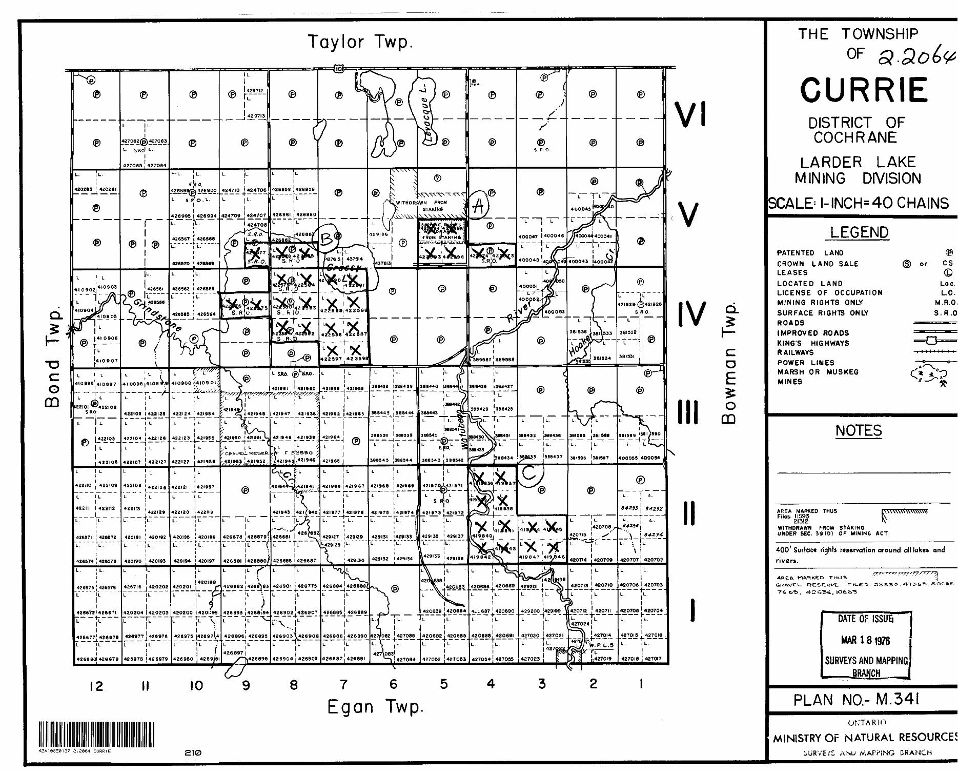
S. LOCATION AND ACCESS . :' v;';.
The individual properties ara with/ir* f lye milne of one
another and, as a group, are situated about 32 milaa east of down-'' : '^V ' . - "''' ". . - ' ' ' ' '" '-'
toun Timmins. The accow,panyinB plan i show a the relative location
of the individual claim gtoupa and their Bccaae,' '- -4 ,' ' : .' -' '"-. ' "' ' ' .
The four individual groups of claims ara daacribad aa' ' ' ', ' ' ^
follows:
Group A - Conaistiny of 6 unpatsnted claiaa in Lots i* and 5,:' ' s; V ---
Concession U, Currie Tounahip, the claims -are numbered LU22S93 to
Lt422596 inclusive and L k 21573 to L42257** InclaSiva. A gravel road
along the boundary of Lota ^ and 5, one and a half miles tputft of•: - ' . - - ' . ' - 1 ' . ,- . ., - ' ' '""VV- ..' '
highway 101, providaa acoesa to Qroup A.

f f ~ 2 -,,*v - -j .- V -
'* S-.'J x,.
Group B - In Lota 7V"B, and 9, CoritfB8a^n''|^an^*^:Curri8
Township, 19 unpatanted claims form Group Bj they lira
Li*22575 to LU22591 inclusiva, MZZSBi'*nd Lii259a. A gravel road
alony the boundary of Lota B and 9, two milsa south of highway
101, provides access to Group B.
C - Twelve claims numbered LU19B36 to U* 1981*7 inclusive,i ,
in Lots 3 end **, Concesaion II, Currie Touinahip, form Sroup C.
Situated 5 miles aouth of highway 101, tha property la two milaa
south of a gravel road along the boundary of Lots 4 and 5.
Group D - In Bond Township1 , this group of 6 unpatented claims
includes PM9S16 to PM9B1B incluilvB, P4l9S20, ^19821 and Pi* 19626.
Situated in Lot 1, Concession I and II, Group O in 5 miles aouth
of highway 101. ' ;
Although rock BxpOBursa in the area have bean examined
by prospectors, there ere -no records of any prevlOua detailed
exploratory work on the claim groups , ;T ,
Map No, t*Dh by H. C. Laird, published by the Ontario
Department of Mines in 1931, provldliB Ihe aaat datailed data of
the geology and topography of Bond i anjtl - Gurri*' TounahipS. Aero-
moynetlc maps 29U and 297 by the f edaral govsrniBanfe praaants ad
ditional information. Tha srea is part Of a regional study by
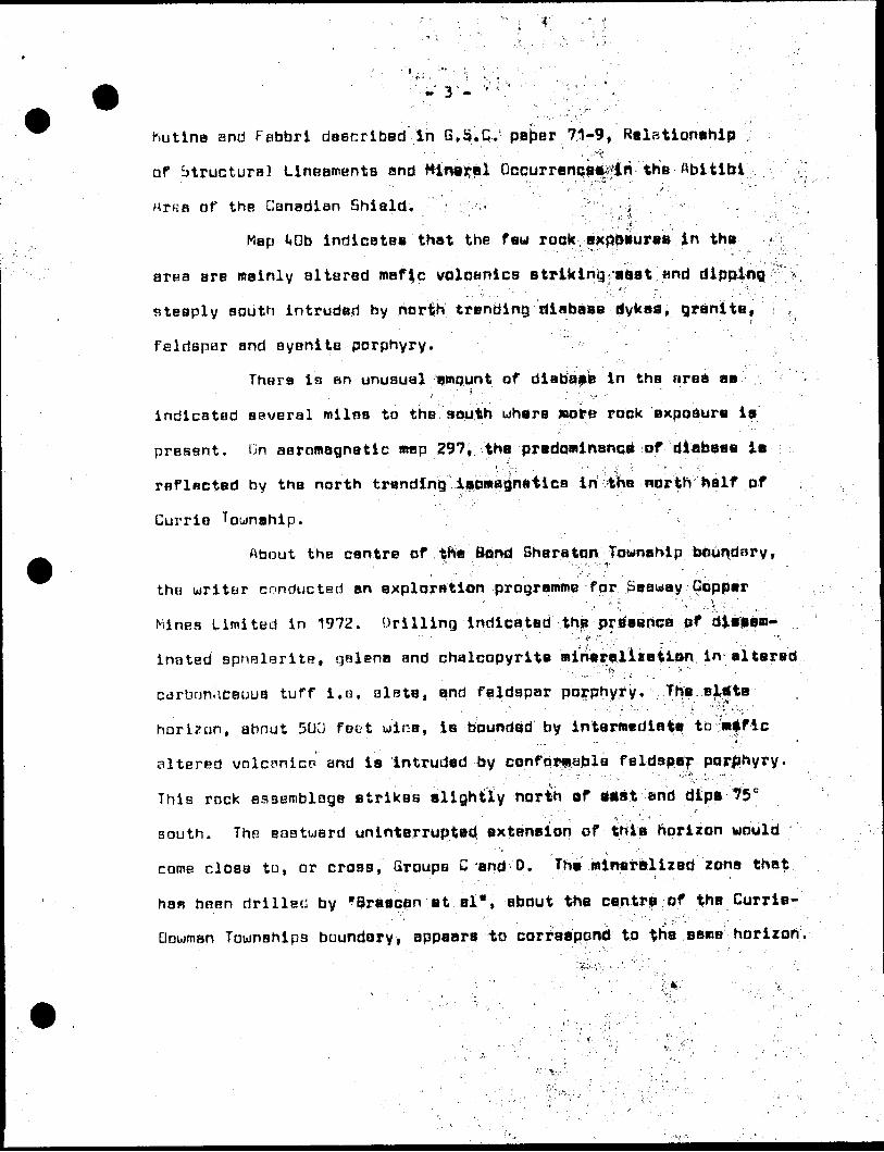
hutina and Fabbri described In B*St C- paper 71-9, Relationship" : i.'"*' ' '
of btructural Lineaments and MintjrBl Occurrences^ the Abitibi' ' -. - f '"" -. . ' ." - " . --
Arfia of the Canadian Shiald. : ',. ' ;,j ;
Map i*Db indicates that the f au rock 8XpbBur88 in the
arna are mainly altered mafic volcanics striking'gast and dipping-- *--~ -- ' '",.
steeply south intruded by north trending diabase dykes, granite,
felrispur and syenite porphyry.
Thers is an unusual amqunt of diabapfe in the urea aa' ' ' ^ ' ' ' : '
indicated several milne to the south where nope rock exposure is
presant. Qn aeromagnetic map 297, the predominance of diabase ia
reflacted by the north trending laoiwBQneticB in-the worth half of
Currie
ftbout the centre of t"8 fiend Sheraton Townshipi "' -' "-'.'-. '-.- I- ; '
! ' '- '' i" ' -' "' '
the uiriter conducted an exploration programme for Seaway Copper
Mines limited in 1972. Drilling indicated the presence of diseeoi-" '-', c.-;-' ' s , ' ' ' -',
inated sphBlsrite, gelena and chalcopyrite minerBlizetion in altered
carbrjn.5ceuu8 tuff i.e. alate, and feldspar porphyry. The. eltfte.'. .* . ' '.'"' \ ' - . .^'jT
horizon, about 5QCJ fact wide, ie bounded by intermediate to mikfic
altered vnlciinice and ie intruded by confoi?fi,able feldaper poriihyry.
This rock assemblage strikes alightly north of Mftt'-and dtps 75 13
south. The BBStuard uninterrupted extension of this horizon would
come close to, or cross, Groups C -end D. Tht mineralized zona that
ham bRBn drilled by "Braacan et al", about the centre of the Currie-•. ' -v. ;. ' ".' ' : ~' ' ; '
Touinships boundary, appears to correspond to the seme horizon.

-k - . - ' ,- .
Paralleling the north tranding diabase jiykaa, a major
fault extending north from Gowganda crosses the area betuaBn
Brassy and MGDSB Lakes. AB indicated on regional maps mi nqr laft-
hand displacement has qccurrad along this fault. The seat trending
Porcupina-DBBtor fault a feu miles to ths north of this claim groups' if. . p . " '' i * ' - \ '
is the other major fault in the aria. . ;; , .
M.\GNLTIC SUi.'V/r.Y HISULTS
Plans at a scali.of ons inch to four hiihdredj feat show
the magnetic survey resulta on the four groups of clairas. ThB
instruiwent and survey wethpd are described in tha 4pppndlx. To
BliminatB the prBaence of negative magnetic valuBiH an Groupa C and
D, it UJBS necessary to add 1500 gammgs to the mBtiaurements on
Group C and 700 gammas to ttiii measurements on SrdUp 0.' ' ' -' .. ?~ \' ' . ' , ' ; ' '' '" ' - •
Group A: ' - :' '- - ' ,. v . .^- , : ..; -
Magnetic background on the property ia in the ZOtl to '3DC(f
gamma ronya and the iaamagnBticB trand north, yeak noith trBndifig
linear enomalies along the wist boundary artd near tha centre of
Lot b a ttnin peak values of about 500 flamwas. Thaae faaturaa ara4 i - : - ' ' ' . - ' " •""' ;" ~ . ''.' ' * "K
thought to repreeent diabaaa dykas, ^ : , * ,' r
The a raa of magnetic fbackf round la interpreted to raprB*
eant east trending felaic to intarwodiatB volcanica.
Graup 0: 'v.., . . --i -- - - - '- ;*1.v'-" ' !
ThB major trend of the iBatoaonsjlsifciB on thia proparty la
north with the magnetic background in the 100 to 250 gamma rang**i; - ' f r"* , - . ,- ,{"V:" t ''j-"-' *fi . :-.i -"^. ..-t/' ' ~',' -:
The trend of the iBom^grtBtJis it-fi rffiajetitin ijf;in|affB\tic d iabase: . . :,.i - : j A*'" ]:'- 4 . '-V. '. . ,, !'V . ,. V i ,, ,i\ ", : - '-. 4, ''..^ t,: ' ' - '
-J,
on the property. 4 l * a . .

T'5 - -: -•- vy -. . "'i--* .:-'^-jf- Y'-"'. : - '
Five generally north trendingmagnetic diabase dykes,
termed U, w, X, Y and ^, ara identified on tha Magnetic plan.
The presence of tha moat westerly dyke, termed V, ia questionable
becausR of tha relatively poor magnetic o?efinit;iiWv
The diabase probably i*Urudas felsic to intermediate:
volcanic rock which strikes easterly. '
Croup C: - ' '. :,
A magnetic background in the 100 to **QQ gamma range is
apparent on this claim group with the dominant trend bf the
isomagnBtics being easterly.. The broad range of magnetic values
and complex magnetic pattern 'presents sowa difficulty in Identi**
fying rock units. T ,
Diabase dykes, however, termed X, Y and 2, trending
north, are interpreted from the linear magnetic features and
geology shown on map **Qb. , - ,
The easterly trending 700 gamma isomagnetic seems to mark
a contact between rock typss. The area below 700. gammaa may repre-
aent intcrmediats volcanics or granitoid intruaiyfS, epeclfically,
syenite porphyry. That area flbove 700 gawmas ai^||fttaining peHkB -,.
of over ^000 gammas is interpreted tlj be largely undeillSin by '
altered mafic: volcanics, termed hornblende schist on map i*Qb.
Vertical OR hpri*ontal die^l^cremant fflltmg ttie pre-existing
diabase; filled faults' ia suggested by the"complex magnetic pattern.
There is insufficient dpta, ho^e^ff, ,t^ Inttrpr'et magnitude or ;•"'•^
direction of movemgnt}. , --; ;. " i.**. ' - ;'-- V!.'"'' ; ? V'-,,. :--' 3- ; ; ' V . ' "''

Group D:
The magnetic background On the property Ttsngea from ^00
to BOO gammas. The most dominant trend of thdiUilPwagnetics it
northerly; less pronounced but well defined la an easterly trend.
Dirbase dykes account for the magnetic BnomallaB oriented
northuards. These ara designated '*'V V and ^ "ani-.th*accompanying
plan. Dykea x and Y tend ;ta merge In the vicinity ^kitte 12 NprtN;
The easterly trend of the iaomagnetiCB 4f pctountad for\ V ' '"'J''" . * -'J 1 -. ' " r' : - ' ' ' ''" '
by the older Precambrian rock assemblage. A half Wila to the east
altered volcanic rocks ara indicated to strike eaet und dip Btaaply
south according to Map Mo. ^Ob. A contact between rocks of high
magnetic ausceptibility to-the south end louer mmgnetic BUBcapti-
bility to the north approximately coincides viith tine 28 North.
The area north of Line 28-Worth way be underlain by faldapar por
phyry or alternatively altered intermediate volcanicB. Hock expo
sure suggests thnt the area of .relativaly higher magnetic values,
to the south of Line 28 North, is underlain by altered intermediate
to mafic volcanics.. J.,he-pjiBrly, defined rdir*.ctiDp f f the iBomagne-
tics to the south' sUgges-t'aX:.thB -r6iclfo"''d!ipr stilltttV ,!" f*--''''^'.'' ; " : /r-. ' :'
Offset magnetic T|0tur^3 jbetkftien diabflyBe dykes X and Y- - \ - :.- ^ ..;,' *' .'' '' , .-:-i-' t , rJk 9.K-,Ai':," - ' ' '-.' '- . . i ; ....
indicBtea th, t dyke ,Y f ill*,a/eultn/^th- la|ft-handBd diaplacement
in the order of 12UD feet. '-i

.~ 7 ,-
i:LECTRI-MMUNLTIi: iiUHV/EY RESULTS AMD
Plans at a scale bf ona inch-to foiir huflfjratf 1*1
the electromagnetic survey results on the four groupjt Of claims.
The instrument and aurvay matnod ara daacribad in tha flppfrtdl)*A ,
Apparently because of conductive ovarburdan, tfia inatru*
went could not be calibrated lo zero per cani W?tha* 4n-phi|ji*;
control. It UIBB, tharefora, rtecaaaary to eubtract 10 units fro?*
the readings to achieve an average zero par ^B,nl:l8V8l for thf
in-phase fneauurBmsntB. ,
Group A; "- ,^v- 'V^'v';,' ,. ' :- ' "' , ; '- -.,.''-' -
Conductor A - Trending nprthatly abovit tHs tyantra of Lot IJiHHiia
diecontinuous zone lacks good definition.: the uaak conductivity,
if located in rock, is likely, cauaed by tha wet nxldi?ad contacta
of a nonmagnaUe diabeac dyke. , Aitaindtlw^ly^ phji {scj|jn|uctivity way
be caused by a b reak, in the conriuc^iv^ pvf*,l|ur.J^n **hara tha diabaaar" M ' ' : t . - * ' - i,-, i ' *- T- - . a -.'-j ' ' : •-i y|- i'-v"'-1* j ' ' -' .
fonriB a relative topograplfio
Conductor S ~ Trending north fallaui'rig 'ti^^Vaa^i'i'.tHif dlBoontinUQua.- , ' .-;r ' . .. -" -1^;:*".,,^;,;' . "••^•,;-^' i '. -' '" ' - - "' '
zone ia marked by ita diaunlforroity,. fha f^rwliicifclylly la attri- ^
buted to a combinatipn of powa* and tal^phona lina ;intarf8rBnca.. ,, ,. ; . : ." v- .^ ^ .( x... ,., .;:-,y |
LocBtion C - Tha poaitivB ii^-Rhaaa and .oilt^of-'philiB maaBuramanta————————" , ' \ '::''' ' " • ;-"- "' 'V '- ' ' - ''"''.t ' '. . ' f t:.'-'
at the bieat (2nd of L i na 2+35 South are apatially related to pone r
and tBlephono lines and alparallal uira fanes.- " i -i 'ri* . r , . " ' '" r - ,,\ '."-' ' J '
. . i- fl . ---r '. ' . . t,.'. w.. - . , ' i . -- ' ' r;
, " . - : , . -; * '.Group B: '; : ..^T-;,^,'. , ;,, ^^^;//-: ^ -
There uare nu conductive zonaa detectad on this claira

-, - - '- - . . - ,group of particular significance. Large deflections of the gut- '
1 ' ' ."'.-i ' ' , i 1***
of-phaae component along the south andre of ^tiraafyjiaka; way be C,- - -' - ' ' -- - . -. '- ' ' ' : ''- 1''' v -* - 4 tt* - ' : ' '"
attributed to a break in the Conductive overburden tiauBiid by more
resistant diabase dykes fprmirifc eubsurface
Group ...i; i . , ' . ' '"- . v: ., . - .' ; - ' .- -:--:.. : • :^ ; :vAv^.':;.:'--"" : : '/''' ^
A number of ueak| ganeraily ahort and diacontlnMoua ,
conductive zones arn present on this c laim group lifiBcribBd as i
folloua: . , ;" ' ' ' ' -' '^ ;-;\. . ; . -- ' .. - :-- - ' ; - ,
Conductor A - This anomaly in the central nort^weat aector pf tWo *
claim group is marked 'by , the., ^ disjjAiCfi^Wiliy If ' .ln4riWi [to '" ' '
phase profiles. Unly the out-pf-phaBq^prOjfi^pdiaplays uniformity
from line to line. Wo-sviftisnca'of softttoctitfity'ttae apparent Ot* I
renurvoying the conductor ijeilVia,/tfijiWfcPWar vertical loop unit.
The uBHk conductivity en detected by the horizdrttel loop is Attri
buted to old rivur channels Ini the conductive overburden. . 'H
Conductor b' - This short cpntjiictof on i.ina i* Cast uaa alao chack|i4X |f
with the Mci j har vertical loop. , A i*iet{ pafajLlil conductive ion* ^1 ?
about 50 feet south, aa ahowp on the accompanying plan, uaa out** , * L
lined. A shear zone possibly uith diaaaminatad aulphides mey :'
represent the conductivity/.]'"; ; t " ' "^ "' -
Conductor C - Three different Ibcat^ris along tiiafa Q ttnti k Cast C ;
are designtitnri C, These locations approximately'corraapond to the
crntscts of a poatulatecl diabaaa .tfvkf" tiiandlna .ridfth. jiTha condun- ;;••. ' "f ' . ' - ' " , : . . .. ;: ' ' ' - ' ::' ' ' - .' '- 4". -. ' ]-
tivity iQ attributed to tho wet oxidized contacts of thf diabase.

- . - . , , ,
L oca t i on D - There is insufficient date sveilatele to interpret
thB cause of the positive in-phase measurements'rit thia location.
Conductor E - This ona line conductor le - loifeiSao^jiBar the' south..-.- - 1 ; A ' ' ' '' '' ' ' *
end of Line 16 test. Although tht conductor corriiafJondB to tha
axin nf a magnetic high, the short length and proximity to the ,
river suggests that the conductivity if tfluBffd-l|y'.:lh*te^f"-riyar ' v, ,/' , ' .^'•',- '.., .' • :r'\-^\ * ^ .. .; .:-.S. "f ''" J*-. ' ' ' ' - ;^-'
channel cutting the conductive overburden.
Conductor F - Thia diacont;ihU(^i8*ltilinit of a^doctivity extends *
from Line 16 East to 4S fast. 't^fe|i|^t*l,ilea'''cif5^1r|*^hB8B^;4nd out* i*-.':-.v*':''
of-phase measurementa indies ttfffiipf^conductiv^ty^^
that the cunductivity ia caused Jjy shearing ^n iiNf^ ;isltBJ?8d waf ic
volcanics which have been cut by north trending diabase dykes.
Conduo|ora G and H - ThesB are on* iina features ipn iUIfiea 42 East
and 3? Last respectively. Conductor G may repreBgnt a shear zona
along the altered mafle volcanic contact. There ia. insufficient
data to poatulato the tiWuse of aonductor H. - , ' ^ VI ^
Group D: ' ; - ":;' ' "--: . ,"V . -' .,,'''-" '
Only ana conductor, daaignotad A, is shown oh the plan.
This weak north trending feature likely rwpresfihts tha contacta iif
a postulated diabase dyke.
Considerably .yar'jLatitin. of the out-of-phaaa prbfil^'a^'lifrii-'
noted. These anumelous conditions forHtha moat paTt coincide With
postulated diBbsse dykes. At these locations, it ia likely that
the conduct i vti overburden ia much shallouejr beeaus'e of the roerft
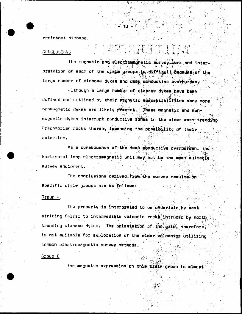
resiatant diabase.
The magnatlGj3nfi?lapti'o*Pflr'8ti: urVB.fbrk ,and 'inter-' ' - , i-...* -i " ' .'-' -l ? ^v' ;. ' ^----i ' x**..?. l;.,'.''" : :. .
pretotion on each of ..the qj^jin groupBjte ,{i4Cf^full 6eoei|ll|*of the' -- ; i-.';- :s- ^i^-1 *''-^.^-*;-;^^^--. 1 . ,.;.large numher of diabase dykea -and .deiefi conduct i ve •ovttyfeMrder*^, i; ^,
Although a large number of diabaSB dyWis have been•' ' ,tvv ;- ;'' ' "•'••* '. . .-' ^'^-'.;., ;. - . '; : . defined and outlined by their viaghs'tic -ai^lBeptiijifljtle'e many wore
•. '*^,-- '' . '' f -~ , -- ' " * " ' "' ' ' "' v nonmognatlc dykes are likely -pftitatni-. ; |Jie8B wagnetic antf lion-.'•••V'''.'': -"":'jf,i ;{ ?. -- .•••••- ' " ; . •-'••. ' '.': f .' magnetic dykes interrupt conductive z&Waa in thi plder' *aat
Precambrian rocks thereby lesegning the pOBaibiiity of their''.'•• : ',:' ' ' ' J i - ' vS r f** .' :. ', .. .' ' ' '' •"''.•., *
detection. ' -\ ,,i,X - Li :'\*v " ' : - ^ - - '.'" . . ; . : . .-^^ *
Aa a cunaequenca of the deejsi ^onductiye ovBrbutijan, the r-'- •"•;"', ,". --vi^Vy"' - 1 ' .•^•••'f v' •"^vv horiznntel loop elactroBBgnati^ unit .way no^ ;fcp the *dat "auitabl* '
survey aquipmRnt. ' '?~ s- ' , '. ' " ^' . ,;' •' : ' J ' ' ' '- ' '\': fi'f,' . . ' 'V * '.
Tht; concluaiona derived f Fpm tha aurvay reaultiiori
apecific claim yroupa are aa fallows: ( ,
Orpup A ' : ..' ' ' \ i .-.•,. ' ':--:\ ' ,;: '; ; • '"' :
The property la Interpreted to be unberliin by easti ' •" ' "' ' : . ' ' * " ' ' ' " ' " ' ' '
striking felsic to Intermediate volcanic rock* /intruded tjy north t
trending diabaso dykaa. The q^ientatiort of ^ne'ai'tii^ thersfore,' ' *. ." w '''"t- : ' ' ' V
i a not aui table for exploration of the ^Ide^ vplfianitjs utilizing
common electromagnetic survey msthods. :[t ^t ;
Group B.
The magnBtic expreaaion on thl*; le elmoet

. - , .. . . , . * ' ,
reflcKtsd by north'.trending d jLatia||i..-^|*B which'-at*-' - .
interpreteii to cut B i* s t striking felslq to irtt*rrt*diotB volcanics,i. t " , -' ' - - ' |)4 .V ' ' \ ,, ^ ' ';..; • •^•- - , ,;.,,,The lack of conductive zones on the^ (iropierlty w**j 4b*
attributed to the deep conductive overburden cond i titans, l|f simply
the lack of conductive mineralization. - ,; : ; :
Group C ' , . -. ' '••'^•i - . . : -, .', ;- '; : ' - ., ,v
This property ia interpreted to bewlindsrlaln by ^ast
trendinrj altBreri mafic volcanics represented t?y broad tBagnetic
highs intruded by generally confqrwBblB feldspar porphyry and
ayenita intrusivGo. North trending diatjase dykes intrude tha
volcHnic-granitoid intrusive assemblage.
Limited vertical loqip, survey uork to chttck' conductdra
W and li indicHtc most nf the eonductive zones on the pyo0erty arsr
probably rc;lBted to fsatures of noneconowic luportancB Including
diabase dyke contocte and old river channela in the conductive
overburden. Some conductive zones, namely F and S, merit further
attention.
Group .P -
The metjnetic survey indicates th.at the property ia
underlain by altered mafic volcanicB l ri. conforrottliia contact with
granitoid intrusivns or alter||d interiBBdiate volcanicB whJ,i|H
strike Rest end clip eouth. Thie asBBmblBQa la intruded by north
trending diabase dykes. " i-'•l '..'' '•''•' . ' ' -
A grid uith north oriented picket Unas is moat suitable
for geophysical survey work, pprticulariy elactfiiinsQnetlc wethdd*.
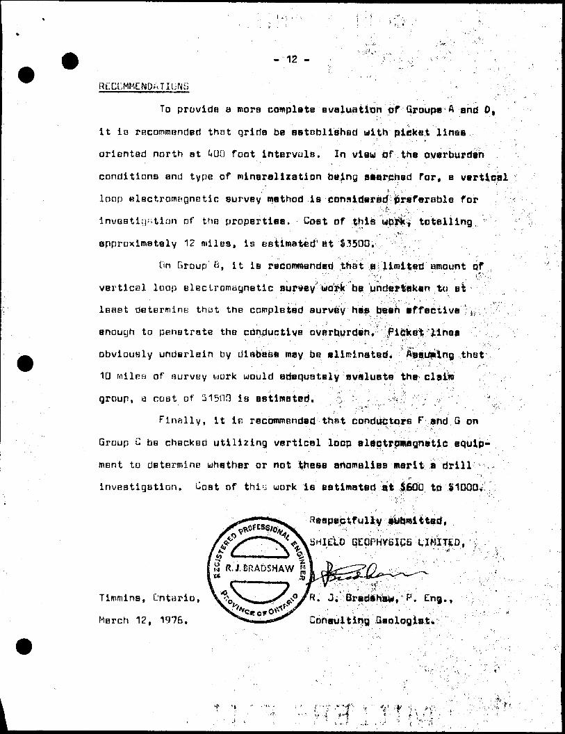
-12 -
Rf.CCMMENDMTIUNS
To provide a more complete evaluation of Qroupe A and O,
it is rncommendBd that qriria ba aatBbliahed with picket linas
orientad north nt UUO foot intervals. In view cf.tha overburden
conditions and type of mineralization being aaarchsd for, a vertical' . i' . .':'
loop ulsctromeignetic survey method is considered preferable for :.'. i- " ' '' . -
investigation of the propertiea. Cost of ^his wpirkV totalling
approximately 12 miles, is eatimated' at 03500. ,
Dn Group Q, it is recommended that a liroiteti amount of
vertical loop electromBgnetic survey work bt uhdajplakan to elk
least determinK thut the completed aurvay has tjBftn iff active : S !i;, .
enough to penetrate tho conductive overburden*' ".'.FijSke'lf linaa
obviously underlain by diabase may be aliminatad. Asauping that
10 milfsa of survey uork would atiaquBtaly avaluata tha claiis ,
group, a cost of S150Q is as'timatad. . ' "o- -" .•'-•:, -.. 'V^^- "v-/ .^'" "-.'- ' ' J -v.
Finally, it IE rBcowmended that conductors F and B on: f '' - . - , i -' ' f-' '-
Group C be checked utilizing vertical loop electromagnetic equip
ment to determine whether or not these anomalies merit a drill ,
investigation. Cost of thin work is eatiwated a:t I60D to 81000*:. :
^eapectfully auhmittad,
SHIELD GEOPHyeips XJMJTED, :' ' . ' - - . -. . . ,.
Timmins, Ontario,
March 12, 1976.
R. J; BrBdsKa*, F. Eng. f
Consulting Geologists

A F f'' S M O.I X
i -.' .. ;f r ' ' ' '
KLTMrJD AMD IMRVCY DATA
LlectromaQnctic Survey .
Any alternating magnetic field ulii.'induC8 en
cal eddy current in the medium thirouoX uhichflho SMSflftetic field
passes. If a source of an alternating magnetic field ia locattd
near a conductive body anomalously strong vddy torrents WilJ. he1 . , - I - . ~ ' : - ' t; ' '
induced in the deposit due to ita high electrical conductivity.
t-lectrical currents induced in the Cft|fHiuiBil^ 1-^cjly;',WHi';''.'pr.ailuo*^il
secondary magnetic field proportional -tlHtha .intii'ty']: Q' curran t''
A receiver coil tuned to the frequancy of
ting device will pick up both the directly transmitted
eddy current signal. . v .-•-. : .•-^-,., Jsj::. V -'.\ . •• :.'}-'...'-. '
The electromagnetic unit uoed in thi^ ayrvey la a
y/HEtf. This horizontal loop ayatem constati* of a recBiver and , .
transmitter connected by a reference cable with a capability of
operating at 6QG and 2**00 ops. " - "
The in-phase and out-of-phasa coraponanta^of the iacondary
field from ti conductor, enargizad by the priw^yy fitid fro^ tha
transmitter, mill vary aa-the Bp,iJ ayitBm paaaea over the conductor.
The equipment i3 calibrated to compare the in^phace end out-of-
phase Field at the receiver witH tbs in-phaaa fia^d at that point
in the absence of a conductor. Tfta measurements nira raad dira,ctlf 4
off the dials a f; a percentagej of vtha^prij^bryvfilill i\ the receiver.
The in-phnse and oiitMJf-phfisB anoRialies avftr a glvsn' ' '*: \ ' * 'V \ :'" i - '"'-'i' . " •'.,.,'" . - , - "•"'•' .

conductor when profiled will have the" same atjapa 8lthdugh';theii*
relative magnitudes uill depend upon ifchis alza and conductivity
of the conductor and ths frequency •i*ojtoyjiisi *
In this survey, e 30(3 foot cable arjej a ^frequaticy of'••#\\ ,. J' ; ' , " * ' , -'."
600 cps. were used. -' V
.' ..' . -' .: 1 .•••-•-.:-- i'' .. .i' :?.: , Magnetometer Bur ve y :.\'-fv ': '' v f l:/ .-.• i-"- - .^..v, .•; -.. b . ,. i"' . ' ''.'-^: -':'^'"''^: ' -:
A ijharpe H.F.-1 fluxga'ta. magna tome tar, model miwiber- ;' - ' ' ' ::', ' ' .- ' * ' , y'~ ;'-'''
. ' ' ' ' - ' ',: " '"', ' ' ' '.' ; ; ' ' - ; ,, ' ;- .'^t 1 ' .321, ujaa used in the magnetic survey. This ''Itiatrupant waaaurBB•;-.v- ;'j . ' ~'' " . v;-rn--- •.•••;Ji " : ' v '"' : \ '-' ;the vertlGBl component of the ieHh'a mBgnetiC f!itW tn Q8BimB8 kl "•••-. "' ' "'"- : -' "- . ' :'-^~ "; - / :'' : '-.- Basa stations for determining ttt| rtognetic diu^a^; :0j*iati0rtestahliBhed nt convenient locatij&ne on base lines or tia linea 'aa
shown on the acccmpanying plans. Magnetic readings mere taken at 50 foot intervals, alnng the cross lihaa.
l-.: , . ' - ;i ; '' - ' . • : :' •••'^'•:"^'ri'

GKOPHYSICAL GKOL( TECHNICAL D;
42AI0SE0137 2.2064 CURRIE 900
TO BE ATTACHED AS AN APPENDIX TO TECHNICAL REPORTi-ACTS SHOWN HERE NEED NOT HE REPEATED IN REPORT
TECHNICAL REPORT MUST CONTAIN INTERPRETATION, CONCLUSIONS ETC.
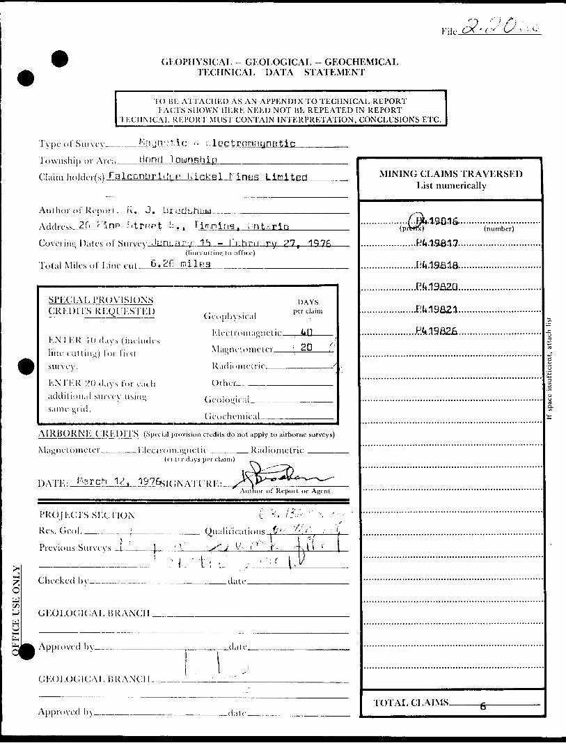
Type of Survey___Magnetic 8* Electromagnetic Township or Are;. Currie; Touinahip_________Claim holder(s) Falconbridge Nickel Mines Limited
Author o C Report R, J. Bradshauj___^ ——— A fid rcss 26 P ine. Sjki S.. Timmins, OntarioCovering Dates of Survy January 15 - February 15. 1976.
(lincLUttin^ lo office)
Total Miles of Line cut___A * B * C s 35.5 milea_______
Sl'KClAL PROVISIONS CRKDITS RKQUKSTKl)
KNTKR -K) days (includes line cutting) i or first survey.
KNTKR 20 days for each additional survey iisint; same iind.
Cieoplu'sical
l''.leetroinanetie.
DAYSper claim
\2D i
Radiometric
-Other -^^^
(ieolo"ical.
(ieochemieal.
AiRBORNl'. C RKDl IS (Special provision credits do not apply to airborne surveys)
Magnet o mete r ____Klectroma'jnetic . Radiometric(enter clays per claim)
1) An.; : Jterch 12, 1976 sif ;\ ATI IRK: iAuthor of Report or Agent
PROJKCrsSKCllON
Res. Geol. ________
Previous Surveys ___
Onalif if::
(r St. '-•3---.-f.
"' - . ( /''- t
XO
Checked bv_____ .date
GKOI.OCilCAL HRANCII.
Approved by___.______———
GKOLOC;K:AI, BRANCH_____.
Approved by—.
MINING CLAIMS TRAVERSED List numerically
.....SEE..SCHEpL)LE............(prefix) (number)
TOTAL CLAIMS-

Show instrument technical data in each space for type of survey submitted or indicate "not applicable"
GEOPHYSICAL TECHNICAL DATA
GROUND SURVEYSMagnetic - 3760
Number of Stations———!???_______________________Number of Readings EM " 1 70DStation interval
Line spacing_________nDDM^———————.—..^——-——————.^^—^——^^^—..^^—^—-——^—^—-—————.Profile scale or Contour intervals 1" ^ 20X EM profile seals; 1 DD gammas - magnRtin nnntnnr
(specify for each type of survey) Interval
MAGNETIC
Instrument____ Scintrex M.F.-1 fluxgate magnetometer_____- _____________ Accuracy - Scale constant__* or - 10 gammas____________.^______^_____^__^^______Diurnal correction method, check of base station at no greater than one hour intervals Base station location_____along base line at **00' intervala from LO_^^____^____^_____
ELECTROMAGNETIC
Instrument________McPhar VHEM serial no. 33-7M33Co.lconfumralion horizontal
Coil separation_____3UD^————— Accuracv_________-t- or - 1X
Method: Q Fixed transmitter CH Shoot back S] Inline CH Parallel lineFrequency___________6DO cps.______________________________________________
(specify V.L.F. station)Parameters measured____in-phase and out-of-phase components in per cant_________ GRAVITY
Instrument_______________.____^-^——-——^.——.^————^^...^^-——-.^—^—...—.^^^..—.^-^^..—.^—.——Scale constant ——Corrections made.
Base station value and location.
Elevation accuracy___________________ INDUCED J'OLAKl/.A'l ION RESISTIVITY
Instrument________________________Time domain______________________________ Frequency domain. Frequency___________________________________ Range -——.—^^——. P o w e r ________________________________________________Electrode array—— Electrode spacing. Type of electrode .

—
File. 'ts O (-GEOPHYSICAL GEOLOGICAL - GEOCHEMICAL
TECHNICAL DATA STATEMENT
TO HK ATI ACHED AS A N APPENDIX TO TECHNICAL REPORTI ACTS SHOWN HERE NEED NOT BE REPEATED IN REPORT
TECHNICAL REPORT MUST CONTAIN INTERPRETATION, CONCLUSIONS ETC.
.J:lyuUl'l.in i. i-IoctrnninynoticType of Survey__
Township or Air,i__tiond Township
Claim h olfli-r(s)Talconbri(lyp L'ickel Mi inns L imited
Au l kor ol Report_EL. -A^AddressJLCL. 11 np,iitHRPtJ;AJ .. Umnins, iCovering Dates ol Survey January 15 - February 27, 1976
(liiiccutting t o office)
Tola! M iles ol Line cut 6.2
SI'KCIAM'ROVISIOXS CRKD11S RKQUKS'l'Kl)
KNTKR 10 days (iiu-kuli-s line rutting) lor lil si survey.
KXTKR 20 days lor radi additional survey same grid.
DAYS
Geophysical
Electromagnetic—.
\l:i(i;ncl nincl fi- ' 20 : :
Radiometric —————————— '
C) l her _______________
(icocheniical
AIRBORNE CREDITS (Special provision credits do not apply to airborne surveys)
Magnetometer
Author of Report or Agent
PROJECTS SKCTION
Res. Geol.
Previous Survey;
.j/ . 'X -————!———______^- Qu;ilir!r:ii!nns .P'^ - '-. ' V
,,J__, ,r .^^:,^jy i/', l
5O
Checked by—-—. .date.
*^
lGKOlX)C;iCAL BRANCH.
Approved by-
Gl'X)l,0(;iCAI,15RANCII.
-date.
- ;
Approved l)y- -date.
MINING CLAIMS TRAVERSED List numerically
.190.16-
TOTAL CLAIMS.

Show instrument technical data in each space for type of survey submitted or indicate "not applicable"
GEOPHYSICAL TECHNICAL DATA
GRUUXILSURVKYS.^ Magnntic - 660
Number of Stations________^^____________________Number of Readings_ Station interval_________ ion'
Line spacing ________ _____ 4 L "- 1 ___________ ——————————————————————————————————————————— Profile scale or Contour intervals 1 " a 20* ^ profile scale; 1UO gammas - magnetic nnntnur in
(specify for each type of survey) tOPX/El
MAG.N'LTIC
Instrument __ _________ Lidntrex K.F.-1 fluxgate magnetometer -.——.—^—-^..,^.^.^^— Accuracy - Scale constant ____ * or - 1 0 qammaa _______________________________________ Diurnal correction method nhock of tiasn stations at no nreater than one hour intervals Base station location ______ alnn-j biine linn at **CJC1 ' intervals from LO -—————————^
KLF.c:rROMA(i.\'LHc:Instrument ____________ Mc^har UHL'M serial nn 33-7403 -^-^———-—^———-———————-Coil configuration _________ harJ7nntal ____________________________________________ Coil separation ____________ 300 _____________________________________________________Accuracy _______________ -f or -
Method: LTJ Fixed transmitter CH Shoot back [S Inline CI! Parallel line Frequency_______________()t.iiJ OPS.———-^----^—---^^^^——-^^-———.^^^—-^———.^^——————
{specify V.L.F. station)Parameters measured jn-phasB and nut-of-phaae campnnenta i n per cent_________ GRAVITY
Instrumenl^^
Scale constant.
Corrections made.
Base station value and location —-
Elevation accuracy____——^^-^-———^——L\DUC:LD I'OLARI/.AUON RKSISMVITYInstrument_____________,_________
Time domain________________________________ Frequency domain. Frequency___________________________________ Range.,-—^-^—-—. Povver_____________________-__________________________Electrode array—^.
Electrode spacing—
Type of electrode —

TAYLOR TWPHwy. 101
BOND TWP
D
CURRIE TWP
B
V.JS-
x
PROPERTY LOCATION PLAN
FALCONBRIDGE NICKEL MINES LTD.
SCALE-. l inch ^ l mile

BOND TOWNSHIPONTARIO
MINISTRj RSURVEYS AND MAPPING B
MAR 181976
SURVEYS AND MAPPING IRANCH.
SOURCESANCH
PORCUPINE MINING DIVISION
DISTRICT OF COCHRANE M.33ISCALE 40 CHAINS TO ONE INCH
STOCK TWR
o:
uJ
Do
8 7 6 '5 SHERATON TWR
p
42A13SE0137 2.2064 CURRIE 200f 9.
PATENTED LANDS . . . . . . . ©CROWN LAND SALES . ....©LOCATED LANDS ....,... .L o^LICF.N5E OF OCCUPATION.. L.O.L
Taylor Twp.
427062fe) 427063
SRO1 L. l
424710 " 42470642689WR* 4Z6900
"- S. P WITHDRAWN FROM l STAKING
424709 ! 424707
424708426995 l 426994
400047 l 400046
437615 l 437614 400043 14000
421929 (P)42I928
422597 422596
L L
4I0896' 4 |0897 410900 MI09OI vK- - - -."! — — ™- — 'J4* t'j'jjJS-
L
41 0696 |4I08 7.9
—— r---/-
122101 '^422102 SRO 422124 i 42I9S4 421947 i 421938 421962 421963
388938 1368539
L. i L.
381585 .581588421950 l 421951
/til. REISER47*953 1.421952
368*33 I3B8437 400055 40005*/42I94SL421940 388943 388542
422121 1421997-l —~ —
t L
421968 j 421967
rL421977 l 421976
429127 1-429129
L 429I28 ! L
429131 I4Z9I33 -— --L : L.TL
ll
426688 1426667420190 420193 420194 i 420197 420714 1420709•H
L.
420713 ' 420710 — ~ —-f- — — — — L.
42690t i 426775
L iL
426884 426888~" ~~ 420686 420689•*co (ID -r t ut' •^cvcui
420204 420203 420639'420684 l i C
420712 I 4207114^^687^420690
L. l L.
429200 '429199420200 4201199 426B85J 426^89^ LT — L~~"
426975 (42697^4
~ "li I f
426980 i 4269/6
4269T7 426976 426896 426895 426886,426890 420688420691**vwt i •feoyi o
426680)426679 426978 426979 426904 l 426905 426887,426891 427052 427053 427054 427055
7 6
Egan Twp
2.2054 CURRIE 310
Q.
c oEo
OD
THE TOWNSHIPOF
CURRIEDISTRICT OF COCHRANE
LARDER LAKE MINING DIVISION
SCALE- 1- INCH" 40 CHAINS
LEGENDPATENTED LAND
CROWN LAND SALE LEASESLOCATED LANDLICENSE OF OCCUPATIONMINING RIGHTS ONLYSURFACE RIGHTS ONLYROADSIMPROVED ROADSKING'S HIGHWAYSRAILWAYSPOWER LIMESMARSH OR MUSKEGMINES
l t t l H l
NOTES
MARKED THUS Files; 11593
21312WITHDRAWN FROM STAKING UNDER SEC. 3 9(0) OF MINING ACT
IA
400' Surface rights reservation around all lakes and
rivers.
FT?-/ 7 f/ f '
C.?) 106 fe^
DATE OF ISSUE
MAR 181976
SURVEYS AND MAPPING
PLAN NO.- M.34!ONTARIO
MINISTRY OF N ATURAL RESOURCES^URVcTi'C AINU MAPPING BRANCH

•o o o
-J rr, -J
24 NV* "* V\ y V\ IE "*T T T 7 7 T i
* ^
O•— o O o
mj f^J^-^-J^-^'C1 ^ 'C1 C — a
o -"~
20 N -~-I-J T 7 T E^L-^^1*"1?O^o ^r^\*"''r 7' * r-V," v' -
J -l ^*vJ-Ji|^C*A^ 1^'iC^rJ iC*Vtv* w J rv\Avi SAP* - ^ N
16 N
rl l
12 N
8 N
4 N
rj M J w t: j ^ o *" ~~^ r z *fi\9* ** ^ - t w w s jj^i VC ^p0 0 ^ i/^"^""0""^ — :'^~V t - i * f * 0 *~ * 3
' ' A V ,-4 . '
n^ m m r* J -*———. T --. T r——sr""-
1^ 5 *^jC^ r*X^* .J vi V. *n O K. J "V, rft f*-* ^U| *V,f l - .STT.T^AT.. vT.7.7v T^s— sj/* ...^ jr^
I *' IV
"'1 /S l -' t 1l/ '*......-.-...-'-'-*' 'l
t''^
......--/l\
l
-*- vi^-*Nir: 1*...!-^vft 9- wv- v- ™—J" ' ' ~ T - ~T. T* "~
;i\ s\ i
road2+35 S
power l ine* ?s
l l "-i* '' l\
la i^^ T T r r
\ B
fcAA^-^^ifi O^-^^^*" "^^'Sy'w)^ 6J *J Vi f^ ^T^^" " "^ T *****'i ,-^**^^ 0 Q -4.1— Q *^i^***'A^X^'^O Q t^ -*^ O ^ O *Jl
vx LOT 5 /\ f\ CONC./
,'— — ' \ . /' i /' l, C,ONC7/l f f ""~— S V v "" "^.' \ i' ' 'X* \ t
*^ *H? *T * "*|w " ~~-*- 0o0ft O~-0[)9 ft~™^^^"5 -OO^OOO*
^•y\^\L LOT 41 IV 1 *' *s "", -— " — "^
O
LEGEND
Measurement station along picket line
In-phase component reading (0Xo)
Out - of - phase component reading (Vo)
In-phase component profile - l" - 200Xo
Out-of-phase component profile - l" =
Conductive zone
Claim post
v v
O)
oCL
GROUP A ELECTROMAGNETIC SURVEY
on the property of
FALCONBRIDGE NICKEL MINES LTD.CURRIE TOWNSHIR ONTARIO
BY
SHIELD G EOPHYSICS LIMITED
INSTRUMENT: McPhor VHEM
FREQUENCY : 600 cps
COIL SEPARATION: 300 feet
SCALE400 800 1200
FEETFEBRUARY 1976
42A10SEB137 2 .2064 CURRIE

Base Line
rood
"^" Je
"3 ? V ^ i' a.
\
\ \• la .0
't- \-7 - o-
-7 0
r f ?ris'^ ' M
} I!,
,' | " ! or-N
—j j 49 * u-^ : \1 r , i;-'5
*-1
yy
f i 'l l? ,i ^X P
^
n-12 y f
^ "-'li j (
,, o*.,3 *.
i i "i -'vt 1 t
f' \ - f" J-1 * 0-/S ;
' ! v ! /" 0 + -/U
-,is ' O J--II - n4 -IJ -
1 1 '
\
o
o
\
"-(1 0
j 3 ' 0-.2. ,
-'3 j
t a
^"II 1 O" 1
•-(l i t.v
-ij '. u
-IS V o
1 C- i -Ij1
l *H}l
,' s-if-IP '
. 0-14--M ^
O "-I if
-is-If
t o *( f
-Jfc
"t-) 1/
-f3
24W 20W
LOT
-'3
-'-T"
). ±I2W
0 -f*
..-T
O
i
t"'-ff
o -IS
8W
a -to
ti *
4W
yOT-I 1/
o- .15
oy 3-I-'IL
w*-ye
ort
-/t
o'-15
-IS
is
-2
-iO H5
iS
-is
-
4-14
^t^is
\zo*-l S
o--/S
o--i f
f--IS
o--|f
0*1.5
,L
1.1- r
l
/s
• Hs
," 0-15
l (\ :fj o,..,j,
-a
^
I
OT-IV
o -/y
-i5
-'f
-^
"'*
-17
-it
-/f
j o -is
- Jr^\ -;}".^.i-^.L-a- 4iE
fS
-/f
l toHT
0
J o.-ij
-IfT
i-*
power line
8E
; J -H
-If
-IS
-IS
-/s-(5
^5
o -i
- -is
0-/S
; o'-rt
2 "3
ol-lj
-/t
-,l J.,
•, 4-s
^•-13
?
I2E
I.. -
LOT 8
- ' l'
rt
o -'li,
-li
GRASSY
'"''-S
-7
T'1*
-?
..1 o/-,,
*-iy-
0+-S
-'J
Ot-l
; - 'T -a i
,( -itrii
-H -/L
,' 0--/6
t i
-s
7\ /-.3
^ of/3
to r'\-|*
70---/J
Oi-lf
sp^ . o-t-jy y w.
'-.1 1 o
\'•-^ i -ii
-/f l o
16 E1 Sf Jo
1•-it i oL l 0.r |^j i O
;20E-1] j o
y i
-II j'
i "* /' y•-.r f
IHI lL \\(J i p
'l !-/i -^ 1
V J
\- -If o
1C "'1 "If l!
-rt o
, -14 ' ~\
1-II ' O
1-lo ^ o
\t
-|^ O
-li ^1f''* ,! r\
-h i ^)1
-fZ' \ L?
t \
•-ii i 0ii1
" f ^ o
l i•J3 l i-
-/5 ; oi-It f Ci
i-,i ; 0 ,
-'0 ' ~ 1
\24E.11 - a
V
-li - 01 j1 l-14 i i.
V I\ l
*1} * t
\4 1•t" r
M 5 0X
/^ V o
j
-li ,'
-If ( J
-W o
\ •'S ) o
,, y. .^ o * -i ji
-j c j oJ^i? Oi v
'i1 3j"'3
-IS f o i-if /* ol-/^/l s ' ',
L-'I.-t--.^ .x ?1.'9 -*- -^ .-^...oifz-..
2^E \32E-If -( or-Po \ O"-q
. \.1 \
-ft f o --Ji J 0*-fl
' ' I
-1,3 (- o --a s ;. i*
•'
-li J o J - to ! 1 4 -i.
X \•-13 i o " ~7 -s o
x v
-IS , o '-ti ") c-
^\\
Y } .y-i? - 1 -Vi j, ; il
L ''-If "/'t ; 1\
-q
-7
•*
..,j; ' 1-/' i-i? i f-i \ y
' ' 1 -' /1-rt t 4 -.f l- 1-1 i, i•-li
i-
\ 0 .-,^1 V1 l- -i" li-
"("
iJ'-li
.Y,
-a
-it
7L
-"i
-T
-a
r(3. - li-
! \,-i
, -7 -ICJ r/
0--IZ
o ;-)i.
0 •-li'
o- -li
LMftC
O - 1 !, ! -1-1-) . rt -C - . -- — ~—
-1
-^ ;U l ./.
•S \ o\
1^ l ^
I
o -rt ," -i|^ 7 o•* . . f\ ,l. (2 f -1. , ^
1 ' i ~*f i i \\ Ot -'i ^' o l -13 i u
X Oi- - (r \ 0 J- 1 j \ 0
\ \
0 1 |l
-s, j^ i•-S ;
t
-5 1 oi o
^
-if-
-y-if-' cJ~^~
-9 -v -M -/p \ - :-fV
-IT, ^ of -t ti
0 + -IJ N -lin- ^ Ut- 1 ,' ^^-1*.l/ 7
o ^s j--S
- ltu\
-;y \-1.-IU i-
1 1 L" fc^ ^r/ :^7 !\; ot-ji* . t'u- o* ' T T "*
; . -1--K.f o*-J \ - i 1*1 1 0
; V\
o 4^5 \ -V-
11
H. i 0
l ^? /"f f'
\l *^ i o f, i 2-^^^^^ '
i O^TV**. ^ p r ^l a -^ ^"
i 1 /'; i:\ - i-' -i*J-s - x - ii
^~Tj**"*^ \ - t
U \ o\ \
1
TitJls ^-^..^1 f
10--I? J- ( i 13 \ Q
; \' 0 4-'i y -|-Uj 5 ,' oii o
J ~'J; Mf
— i . 1 \
40 E
1
r/S i -
Lrt i o
,, 1 *-If 1 0
* ' iif 10'
i i
;' i i D i f '
44 E0 |-rt j -r
(/ i* i
t\ O 1t i
t; - 1 -ii *
-/f ; -l,'
-13 1 -f
,
-'3 ( 0ic i . .",
4&E•O o
IS
1 Lf \ 1 t
-/o -x - 1\\
-'3 /' -
r/^
j-Ij -v o E-iy
A
-If -^ -1 tV)V
-is ; o l-ii1 l1 \
M ^U-^U-L^THT/
1 * Q J^-if ;*iiij ; o*-W '-
f-15 J ~-*
l /'
li : o -'5
/ :- (jt '.^ o-,j
T S ] 0,
,s rr , 1
T o
-'3 ;' 0i-O \ oi ari 1/ 1-1
1
' 52E
"f**
-'i
-j y
^
-i*t ; -i-Hffi-if -,
-IS c* -'"f i
ii-li ' 01
t 1
.-/3 -1 i '4 Joff'i3 \ ~ i -
r *
/' 't
' O '^\
V
1
J o\.
oti "l! 0
1
i ?1 1
'l ftr*
i oi
i oi
i O J11i! o.jiii\i( i
*' a *
ii i
\ l
i
1•(4 ; o
\\
-15 - Q11
-l 1^ ' - 1 T *'4 . ot
Ji
1
-'3 \ -\f-IJ i oi
-14 l. ,i-f.
l,J11
•'3 ; -i * '} \ o j i j 'i
-(3 ,! 0'/
-li ; -i ''
-B ^ 0'i
-'3 \ - i-y
j
-rt /' -i
-•s *. oL iri S ; D
;-rt ; 0
-rt o
•i? i ;^ '
t \-H | Q1
-12- *- -i
|-'2- ; -,
*\ -,\
•IS ; o 1ii
~!S ; o '
-'3 ^ o-
-'S ; -i-i
-rt i -i-
"'T O 1
t-fif o
N ' o1
'l\ ' 0r-13 o
-fi (Oi
- 1 1 l o\•rt J o
'
13 ; o..J. l ,, ".r li v- ,'
-if o,
-li j oi
-13 | ol
-'3 \ 0'i\
-fi - oii-if ,- o
^
•-(J yii
-li ; o\
-13 u
-i? o
•'5 i' o ^ r
''Z. 0
-'X. ' o\\ "l
-'3 l-.
-12. ; 0
-" \ -'
\-li- i O 1
i^
,,
" ' 3 i O
-15 j -1 1
-'3 ; *\
-;4 \ i'
1
-uJ-13
-if
-li
-'i
-fc
-rt
-U
-iii
-13
-i^t
-B
-'3
-rt
-rt
-13
i ,ri-'3
*'5
-io
L-* 1*
- ^
LOT 7
*" ^* ^ 1
i j1 f
1 l\ \
1 B
,' \\ 1
* 1\ l' *
1t
'^ ~*^
r*'
•^^
\ i
1
^
ii i
ii t
r X1
\\
\
;coNc. iv\ii
.(
r\\iii iiiJ
i\\iii
iiii i\
\i
ii
i ii
\1i f1
i it
iii
ti-
s/\\ \
\ \ \ii!
LEGEND
Measurement station along picket line
In-phase component reading {"/o)
•-B Out - of - phase component reading ("/o)
K In-phase component profile - l" - 20*Vo
Out -of - phase component profile - l" a 20 0Xo
~ — ~ Conductive zone
O Claim post
INSTRUMENT: McPhar VHEH
FREQUENCY : 6OO cps
COIL SEPARATION: 300 fee
42MCSE0137 2.2064 CURRIEE30
GROUP B
ELECTROMAGNETIC SURVEYON THE PROPERTY OF
FALCONBRIDGE NICKEL MINES LTD.CURRIE TOWNSHIP ONTARIO
BYSHIELD GEOPHYSICS LIMITED
1200
FEET
FEBRUARY 1976

•T
M -17
O
V' yaf KX /*~~~^1 ': 0.x^ \.'/p )•^ ;
- T5^^*^ -' a."^ f' '*-t- i C?* s vC \l Ito
'
s ,'' \, i
; i ^i
J ;j H/i M^i A
' v-v1 C
;/*j- ^20 e wJ Ni\
? \* ^Ifr ^'of '
l ;" -ii - i
6 \ -J
-,i-15 ,.-'-J ,/-'-7 -'
" ? "
•44 ' oi
-tf y "
-, /" o"7 ;•* i-t ;** *^ ^B
'l* ""*^,-,, V,..
-l? ?1
-li 't"5 !• 19 O-IS-J "^ OJ
5 X ,•/l ' l-1} \ ' !"j "' 'i ! \•IS \ o*,
~" ***\l -*? 24 E /*•t*- i \-t . i v ix' -.t f -i-li l "A
" " s.
-lo ^ "ft
y oi 'V ,.*
-'Ji"l-17"rL 0It
-O
'7
't
-17
-'7
't?
-n }/
''i {\-w i
i
-i? 4^ -jsM-Zi o yis
-1 J.,4f ( I ] n
~" j i
- ( 7 \ ~, ! n
i 0-17
i r-if
""
OH?
l SG
', o -o
O
o -i?
O t -t?
o V' t\-l t-17
V'7"
t''6
Vi-i?"
32 Er1 T"
fi-(f -l?to
/•H?
-;5
36 E 4OE 44 Ey -H
-/t-l*-li
48 E
4
\,1 77; o i -i
-(i
-'3
-H-.lt
A"! O' -2*
--
-*t
w f'J
r r
-2
-15
LEGEND
Measurement station along picket line
In-pnase component reading (0Xo)
Out - of - phase component reading CVb)
In-phose component profile - l " r 200Xo
Out-of-phase component profile - l" -
Conductive z one
Claim post
INSTRUMENT: McPhar VHEM FREQUENCY : 600 cps COIL SEPARATION: 300 feet
42A10SEC137 2 .2064 CURRIE
GROUP C ELECTROMAGNETIC SURVEY
on the property of
FALCONBRIDGE NICKEL MINES LTD.CURRIE TOWNSHIP ONTARIO
BY
SHIELD GEOPHYSICS LIMITED
SCALE 400 600 1200
FEETFEBRUARY 1976
240

BOND TWP CURRIE TWP
LEGEND
Measurement station along picket line
In-phase component reading ("/o)
Out-of-phase component reading (0Xo)
In-phase component profile - l" r 200Xo
Out-of-phase component profile - l" * 200Xo
Conductive zone
Claim post
INSTRUMENT: McPhar VHEM
FREQUENCY : 600 cps
COIL SEPARATION: 300 feet42AI0SE0I3?
GROUP D ELECTROMAGNETIC SURVEY
on the property of
FALCONBRIDGE NICKEL MINES LTD
BOND TOWNSHIP, O NTARIO
BY
SHIELD GEOPHYSICS UVIT f- ;-
SCALEo h--L. .
FEBRUARYCURRIE
350

?vnO D i B " " .2. ** G f.s fffr * S SU5 A ? 5yff ^
o 0 *"llliA a oi/i^cy, OvioOutO'^in^iinv.o/n^HID M 'J '^Ss'-fi^'isirn.I "J.K'J'f*-'^ 1", *3- *^/" .J./* *-?*iNN NjJpiMNNrtJi *l N r'rt^'l ^ N *!"/* "T^f^
power H neLOT 4
LEGEND
Measurement station along picket line
Relative value of the vertical component of the earth's magnetic field In gammas
O)
oQ.
if o*Magnetic contour
iMagnetic depression
GROUP A MAGNETOMETER SURVEY
on the property of
FALCONBRIDGE NICKEL MINES LTD.
CURRIE TOWNSHIR ONTARIO
BY
SHIELD GEOPHYSICS LIMITED
INSTRUMENT; Sharpe M.F. - l fluxgate
Contour Interval: 100 gamma intervals
SCALEO 400 800 1200"J
FEETFEBRUARY 1976
42A10SE0137 2.2064 CURRIE 260

BaseLine
LOT LOT 8
LEGEND
Measurement station along picket line
Relative value of the vertical component of the earth's magnetic field In gammas
Magnetic contour
Magnetic depression
INSTRUMENT: Sharpe M.F. - l fluxgate magnetometer
gamma intervals
GROUP B
MAGNETOMETER SURVEYON THE PROPERTY OF
FALCONBRIDGE NICKEL MINES LTD.CURRIE TOWNSHIP ONTARIO
BY
SHIELD GEOPHYSICS LIMITEDBase station location SCALE
O Claim post1200
(976
42AI0SE0137 2.2864 CURRIE

z o(/) (fiLU OZoo
•Mo
LEGEND
Measurement station along picket line
Relative value of the vertical component of
the earth's magnetic field in gammas
Magnetic contour
Magnetic depression
INSTRUMENT.- Sharpe MF.-l fluxgate magnetometer
Contour Interval: IOO gammas up to 1000 gammas
500 gammas up to 3000 gammas
IOOO gammas over 3000 gammas
GROUP C MAGNETOMETER SURVEY
on the property of
FALCONBRIDGE NICKEL MINES LTD.
CURRIE TOWNSHIR ONTARIO
BY
SHIELD GEOPHYSICS LIMITED
SCALEO 400 8OO
FEETf K
42A10SE0137 2 .2064 CURRIE

40 N
36 N
32N
CURRIE TWF?
LEGEND
Measurement station along picket line
Relative value of the vertical component of
the earth's magnetic f ield i n gammas
f ~2 Magnetic contour
Magnetic depression
INSTRUMENT: Sharpe M.R-l fluxgate magnetometer
Contour Interval: 100 gammas up to 1000 gammas
500 gammas up fo 3000 gammas
Base station location
GROUP D
MAGNETOMETER SURVEYon the property of
FALCONBRIDGE NICKEL M INES LTD
BOND TOWNSHIP, ONTARIO
-\*-**\^—^^
BY
SHIELD GEOPHYSICS LIMITED
SCALE4OO 800 I20O
FEET1976