mark scheme for the june 2004 question papers … levels/geography (9696...mark scheme for the june...
TRANSCRIPT
UNIVERSITY OF CAMBRIDGE INTERNATIONAL EXAMINATIONS
GCE Advanced Subsidiary and Advanced Level
MARK SCHEME for the June 2004 question papers
9696 GEOGRAPHY
9696/01 Paper 1 (Core Geography), maximum raw mark 100
9696/02 Paper 2 (Physical Geography), maximum raw mark 50
9696/03 Paper 3 (Human Options), maximum raw mark 50
These mark schemes are published as an aid to teachers and students, to indicate the requirements of the examination. They show the basis on which Examiners were initially instructed to award marks. They do not indicate the details of the discussions that took place at an Examiners’ meeting before marking began. Any substantial changes to the mark scheme that arose from these discussions will be recorded in the published Report on the Examination. All Examiners are instructed that alternative correct answers and unexpected approaches in candidates’ scripts must be given marks that fairly reflect the relevant knowledge and skills demonstrated. Mark schemes must be read in conjunction with the question papers and the Report on the
Examination.
• CIE will not enter into discussion or correspondence in connection with these mark schemes. CIE is publishing the mark schemes for the June 2004 question papers for most IGCSE and GCE Advanced Level syllabuses.
www.gceguide.com

Grade thresholds taken for Syllabus 9696 (Geography) in the June 2004 examination.
minimum mark required for grade: maximum mark
available A B E
Component 1 100 61 57 39
Component 2 50 31 28 20
Component 3 50 33 30 21
The thresholds (minimum marks) for Grades C and D are normally set by dividing the mark range between the B and the E thresholds into three. For example, if the difference between the B and the E threshold is 24 marks, the C threshold is set 8 marks below the B threshold and the D threshold is set another 8 marks down. If dividing the interval by three results in a fraction of a mark, then the threshold is normally rounded down.
June 2004
GCE A AND AS LEVEL
MARK SCHEME
MAXIMUM MARK: 100
SYLLABUS/COMPONENT: 9696/01
GEOGRAPHY Paper 1 (Core Geography)
Page 1 Mark Scheme Syllabus Paper
GEOGRAPHY – JUNE 2004 9696 1
© University of Cambridge International Examinations 2004
Section A
Hydrology and Fluvial Geomorphology 1 Study the survey map of the Victoria Falls area (1:50 000). (a) Using the map, identify and describe two different landforms found in the valley of the river Zambezi. (4) Candidates could identify: - The precipitous main Victoria Falls running east – west and extending for about 2
kms. The Zambezi gorge zig-zaging below the falls and marked by precipitous sides. The broad channel up to 2kms wide with islands (braided) developed above the
falls. Allow 1 mark for identification and 1 mark for description. Any two for 4 marks (b) Briefly explain how each of the two landforms you have identified has been
formed. (6)
Most will explain the general development of water falls or gorges in terms of fluvial erosion over hard rocks with resultant plunge pools, steep sides of gorges due to uplift. Braiding will be seen due to changes in discharge. Few will see the importance of the headward retreat of the falls along faults to produce both the gorge and current falls. If they do, reward with full marks. Otherwise work on the basis of 3 marks for each landform explanation.
Page 2 Mark Scheme Syllabus Paper
GEOGRAPHY – JUNE 2004 9696 1
© University of Cambridge International Examinations 2004
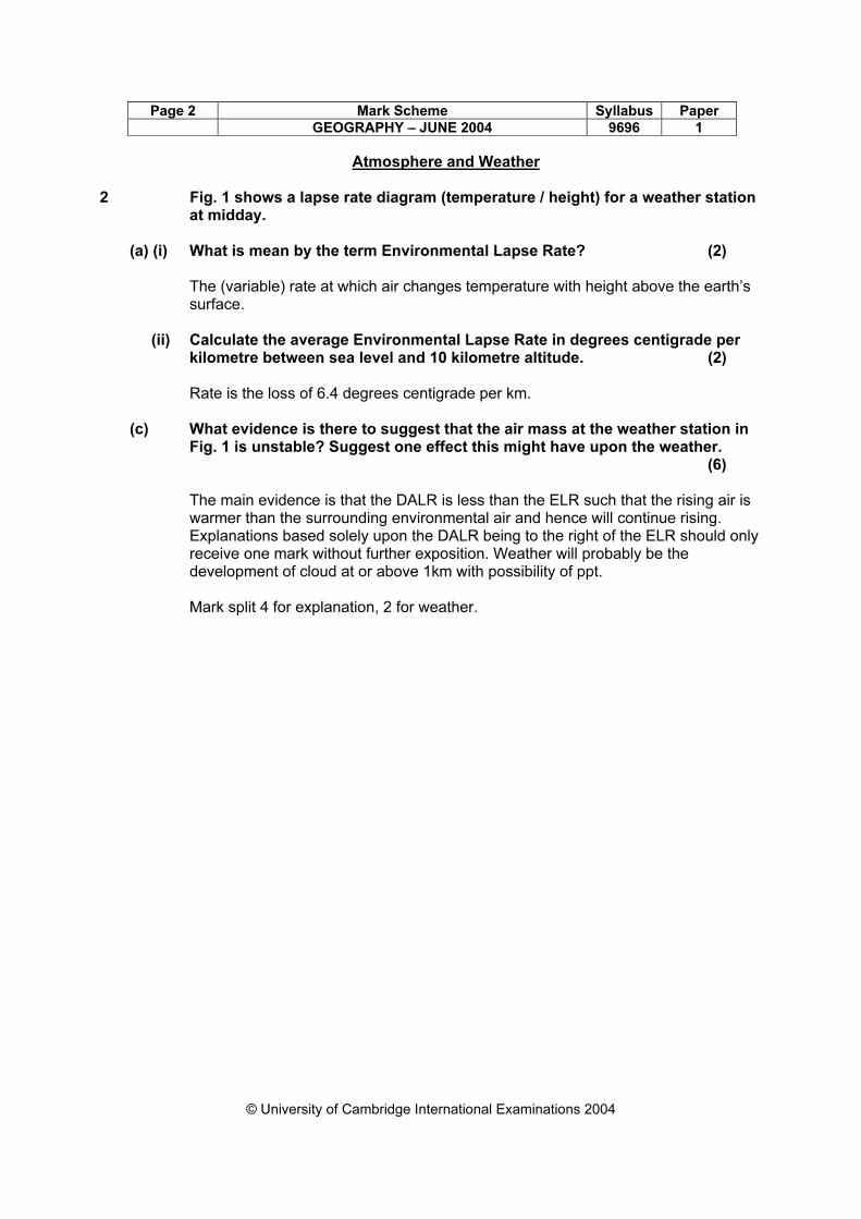
Atmosphere and Weather
2 Fig. 1 shows a lapse rate diagram (temperature / height) for a weather station at midday.
(a) (i) What is mean by the term Environmental Lapse Rate? (2) The (variable) rate at which air changes temperature with height above the earth’s
surface. (ii) Calculate the average Environmental Lapse Rate in degrees centigrade per
kilometre between sea level and 10 kilometre altitude. (2) Rate is the loss of 6.4 degrees centigrade per km.
(c) What evidence is there to suggest that the air mass at the weather station in
Fig. 1 is unstable? Suggest one effect this might have upon the weather. (6) The main evidence is that the DALR is less than the ELR such that the rising air is
warmer than the surrounding environmental air and hence will continue rising. Explanations based solely upon the DALR being to the right of the ELR should only receive one mark without further exposition. Weather will probably be the development of cloud at or above 1km with possibility of ppt.
Mark split 4 for explanation, 2 for weather.
Page 3 Mark Scheme Syllabus Paper
GEOGRAPHY – JUNE 2004 9696 1
© University of Cambridge International Examinations 2004
Rocks and Weathering
3 Fig. 2 shows the pattern of the Mid-Atlantic Ridge. (a) Describe the main features of the course of the Mid-Atlantic Ridge. (4) The Mid-Atlantic ridge is a great submarine mountain chain that curves north-south
along the centre of the Atlantic/ roughly mid-way between continental land masses to E and W of Atlantic. Composed of volcanic lava, it varies in width and height. High volcanic peaks appear above the ocean surface in the Azores, Ascension Island and Tristan da Cunha. It is very irregular with offsets related to transform faults.
Any four points for the marks. (b) Explain how the Mid-Atlantic Ridge has developed. (6) The Mid-Atlantic ridge is part of a system of major fractures in the earth’s crust,
representing a zone of crustal spreading or divergent plate margins. Here, crustal matter is created by the upwelling of lava creating the mountain chains (or ridge) with often attendant rifting. The upwelling is linked to convection currents within the earth’s mantle. Some candidates may well use a diagram to show divergent plate margins and attendant features (e.g. rising magma through ridge and magnetic striping). (The latter is evidence, NOT explanation of development.)
Page 4 Mark Scheme Syllabus Paper
GEOGRAPHY – JUNE 2004 9696 1
© University of Cambridge International Examinations 2004
Population Change / Settlement Dynamics
4 Fig. 3 shows the world’s largest cities in 2000 and their predicted growth by 2015.
(a) (i) Name the two cities in Fig. 3 where the increase in total population is
expected to be the greatest between 2000 and 2015. (2) Lagos (1) – 10.9 millions; Bombay (Mumbai) (1) – 9.3 millions (ii) Compare the growth of New York with the growth of Delhi, according to this
prediction. (3) New York 16.6 to 17.6, Delhi 11.7 to 17.6: some data support is needed. Start at
different figures (1) but reach the same figure (1) either the difference, New York 1 million, Delhi massive 5.9 million / nearly 6 or the
recognition that New York is growing slowly but Delhi very fast (1). (b) How may the large population increase expected in many cities be
explained? (5) By the combination of high rates of natural increase and of rural-urban migration. Credit NIR 3/2 and rural-urban migration 2/3, using age structure/population
momentum as the discriminator to achieve full marks, wherever it occurs.
Page 5 Mark Scheme Syllabus Paper
GEOGRAPHY – JUNE 2004 9696 1
© University of Cambridge International Examinations 2004
5 Study the survey map of the Victoria Falls area (1:50000). (a) Draw a simple labelled sketch map of the communications of the town of
Livingstone, Zambia. (5) A full answer covers road, rail and air. Mark on impression but expect the inclusion
of all roads “Wide, Tarred”, marking the railway station and including the airport to be possible indicators of quality.
(b) What evidence of tourism in and around the town of Victoria Falls, Zimbabwe,
does the map provide? (5) This should be accessible to those who have not (yet?) studied tourism for
9696/03. Note that although it is a settlement question it extends into the surrounding area. Grid references are not needed and are unlikely but may be used to locate features.
Credit evidence: Acoomodation: Hotels, Motel, Chalets, Caravan Park Physical Feautres: Lake, Falls , Cataracts, Gorge, “views” etc, National Parks Services, facilities Golf course, Pistol Range, Casino, and attractions Crocodille Farm, Game Park, other? Reserve (1) for each of the three elements, but mark on merit. Maximum of 3 marks for a list without narrative account.
Page 6 Mark Scheme Syllabus Paper
GEOGRAPHY – JUNE 2004 9696 1
© University of Cambridge International Examinations 2004
Section B: The Physical Core
Hydrology and Fluvial Geomorphology 6 (a) (i) Define the terms river discharge and river velocity. (4) River discharge is the volume of water passing a point in a given unit of time. Some may express it as an equation by which it is calculated i.e. Q =
AV (should be extended for the marks) (2 marks). River velocity is the speed of the flow measure by a point (current mater) or over a
set distance and time. (2 marks) (ii) Identify and describe one factor that can affect the velocity of a river. (3) Velocity is a function of channel slope and hydraulic radius. Either is acceptable.
Although some simple statements should be made as to how this affects V. Some may express this as channel roughness (Manning flow equation).
(b) Using examples, explain what is meant by inputs and outputs within a
drainage basin system. (8) Inputs are in the form of precipitation which can occur in a number of forms (rain,
snow etc) and at different times, intensities and frequencies throughout the year. Some may suggest glacial melt which, I suppose, is acceptable. Outputs are in terms of channel flow, transpiration and evaporation which should be described. Possible to use a diagram to show these but some explanation is required.
(c) How can changes in land use affect flows and stores in a drainage basin?
(10)
Changes in land use can affect the balance between interception, infiltration, run off and subsurface flows thus producing changes in lag time and fluctuations in channel discharge.
Candidates will probably:
L3. Good answers will balance increases in run off with land use changes that induce greater interception and infiltration. These will have a comprehensive coverage of different flows (8-10)
L2 Reasonable answers will develop interception, infiltration and sub surface
flows. (5-7)
L1 Weak answers will only refer to urbanisation and or disafforestation in terms of increasing run off. (0-4)
Page 7 Mark Scheme Syllabus Paper
GEOGRAPHY – JUNE 2004 9696 1
© University of Cambridge International Examinations 2004
Atmosphere and Weather 7. (a) (i) With reference to the earth's atmosphere, what is meant by the terms
incoming solar radiation and terrestrial (earth) radiation? (4)
Solar radiation is the energy derived from the sun received on the outer edge of the earth's atmosphere in the form of shortwave radiation. Terrestrial radiation is produced when the shortwave (solar) radiation received at the earths surface is absorbed and re-radiated as longwave radiation.
(ii) Describe one method by which heat is retained in the earth's atmosphere.
(3)
Most longwave radiation is absorbed by water vapour, water droplets in clouds or by carbon dioxide which is in turn returned to the ground forming a second source of heating. Hence the greenhouse effect (any one will be enough for the marks).
(b) Using diagrams, explain the operation of land and sea breezes (winds). (8)
Land and sea breezes are generated by the differing heating properties (thermal capacity) of land and sea. Land surfaces warm quickly during the day leading to rising air which ascends and cools. Air is drawn in from the sea creating an onshore breeze. At night the situation is reversed as the sea is relatively warmer. Simple diagrams showing the cellular nature of the two systems. Low pressure system overland at daytime, reversed at night. Could be expressed seasonally.
(c) Describe and explain three ways in which the climate of urban areas differs
from the climate of surrounding rural areas. (10)
The prime difference is the urban heat island effect whereby the greater absorption capacity of buildings leads to a storing and slower release of heat creating higher night time temperatures. In turn this can induce greater convection which, together with increased hygroscopic nuclei, can bring about greater ppt.. Snow, however, is less frequent due to higher temps. Wind speeds can be reduced by frictional drag although increased between tall buildings. Run off is more rapid and evapotranspiration rates lower leading to less humidity. Fogs have a lower incidence although smogs may occur due to photochemical and particulate pollution. Orographic effects over tall buildings are not acceptable.
Candidates will probably:
L3. Good answers will realise that much is generated by the urban heat island and will provide good explanation of the differences. (8-10)
L2 Moderate answers will identify differences but will not give in depth explanation
(5-7) L1 Weaker answers will be vague in terns of differences (hotter/cooler,
wetter/dryer windier etc) but will provide little by way of explanation. (0-4)
Page 8 Mark Scheme Syllabus Paper
GEOGRAPHY – JUNE 2004 9696 1
© University of Cambridge International Examinations 2004
Rocks and Weathering 8. (a) (i) Define the weathering process of either hydrolysis or carbonation. (4)
Hydrolysis is a complex chemical process that affects minerals in igneous and metamorphic rocks. Water is required. It is active in weathering feldspar in granite whereby material is removed in solution leaving residual clays. (4)
Carbonation is particularly associated with limestone whereby calcium carbonate is changed to calcium bicarbonate which can be removed in solution by rainwater containing carbon dioxide (carbonic acid). The bicarbonate is then removed in solution. (4)
(ii) State the circumstances under which freeze thaw occurs. (3)
Freeze -thaw occurs in rocks which are jointed, have cracks of bedding planes that allow the ingress of water. The climate must allow temperatures to fluctuate below and above freezing.
(b) Explain what factors other than climate can affect the type and rate of
chemical and physical weathering. (8)
The factors are largely connected with geology, viz rock strength and hardness, chemical composition, texture, rock joints and bedding planes. Many will not distinguish these as separate influences but run them together in a general account. For full marks there must be some indication of how these factors affect type and rate of weathering. Some may include vegetation/animals which we will allow although in sensu strictu this is climate dependant.
(c) Explain how climate and vegetation can affect the form of slopes. (10)
Climate influences the rate and type of weathering which will in turn influence The thickness of the slope regolith. It also affects slope transportational processes including rainwash and mass movements. Vegetation will through its root system stabilise slopes hence slope steepness can be maintained under dense forest cover. When vegetation is sparse transport and run off will be greater. (8 -10) (5-7) (1-4).
Candidates will probably:
L3. Good answers may point to differences in slope shape in arid and semi arid areas compared with those of humid areas. (8-10)
L2 Moderate answers will be able to describe the general effects but not to
identify much impact on shape. (5-7) L1 Weaker answers will identify only a few influences often with simplistic and
often erroneous assumptions (e.g. wet = active processes and hence steep) Vegetation = protection hence gentle) (0-4)
Page 9 Mark Scheme Syllabus Paper
GEOGRAPHY – JUNE 2004 9696 1
© University of Cambridge International Examinations 2004
Section C: The Human Core
Population Change 9 (a) Using examples, describe the different types of population movements
covered by the term international migration. (7)
International migration covers movements of more than one year's duration that cross international boundaries (as such tourism, business trips etc are excluded).
International migrations differ in several ways, e.g. types of movement: voluntary and forced distances covered: between Caribbean and European neighbours or intercontinental numbers involved: individuals, families, mass movements eg refugees, slave trade time scale: for a year or two (intending to return) to a lifetime (emigration) legality: legal and illegal movements
Whilst difference can be approached in a number of ways, the attempt to sort or systematise the response and the detail of its examples may be indicators of quality.
(b) Fig. 4 shows the states where legal Mexican immigrants to the USA
lived in 1997.
Suggest reasons for,
(i) the dominance of California and Texas in the numbers of immigrants received, (4)
relates to pull factors such as family and friends, knowledge and information, nearness to Mexico, similarity of climate, availability of employment, recruitment, migrants' positive perception, tolerant attitudes etc.
Credit single reasons 1 and developed reasons 2 so that a full answer consists of at least two reasons. Show in text (ii) the low numbers, (0-99), of Mexican immigrants in some states. (4)
Look to credit more than "the opposite" of (i). The recognition of obstacles such as distance/language/skills mismatch or of the difficulty of being one of the first and the few in a possibly prejudiced community is highly creditable. Show in text
Page 10 Mark Scheme Syllabus Paper
GEOGRAPHY – JUNE 2004 9696 1
© University of Cambridge International Examinations 2004
(c) Many immigrants to the USA from Mexico are young males. Assess the possible effects of this movement on the communities from which the migrants come. (10)
The effects covered are most likely to be social and economic, but political and environmental observations may have a legitimate place. Effects may be immediate or longer term; negative and positive.
Candidates will probably:
L3 Produce a convincing answer with a strong assessment element which
recognises a number of possible effects, positive and negative, in the source communities. (8-10)
L2 Develop a partial answer which shows a sound grasp of some effects but
which is limited in expression and/or in assessment. Answers which are wholly negative (or positive) rnax.6. (5-7)
L1 Present a basic, superficial or fragmentary response which is descriptive
in character, rather than being an assessment. (0-4)
Page 11 Mark Scheme Syllabus Paper
GEOGRAPHY – JUNE 2004 9696 1
© University of Cambridge International Examinations 2004
Population change / Settlement dynamics 10 (a) Give the meaning of the terms counterurbanisation and re-urbanisation.
(7)
counterurbanisation is, decentralisation/outward movement from cities/conurbations (1) of population/people (1) to small towns and villages or rural areas (1) physically separate/beyond the city margins (1)
(if suburbanisation is given in error, allow 1 for its outward aspect only). re-urbanisation is,
inward movement/reverse flow/a movement back to the city (1) to, or near to, city centres (1) at a later stage in the urbanisation process (1)
(b) Explain why re-urbanisation is occurring in many cities in MEDCs. (8)
This may be approached via push and pull factors or the negative externalities experienced in rural, urban fringe or suburban life in the 21s' century and the newly perceived positive externalities of inner urban living.
Recognition of the contribution of urban regeneration eg the conversion of warehouses to lofts or apartments and the characteristic migrant profile of young professionals is highly creditable on what is a newly-introduced element in the syllabus. Answers may include planning policy and the redevelopment of the core.
A full answer considers both ends of the equation. For one aspect only max.5.
(c) Evaluate the environmental impact of counterurbanisation on rural areas.
Support your answer with examples you have studied. (10)
It is anticipated that answers will be negative about environmental impact as no other impacts eg social are required on this occasion. Indicators of quality are likely to be expression (not just "bad" everything), the detail of observation (eg car exhaust fumes not simply pollution) and the quality of the examples (not just "eg New York"). Instances of counterurbanisation may be from MEDCs and/or LEDCs as within the Caribbean, for instance, it is an increasing phenomenon.
Candidates will probably:
L3 Develop a conceptually robust and clearly evaluative answer, which is
disciplined in its focus on counterurbanisation's environmental impact and supported well by examples. (8-10)
L2 Produce a sound answer which recognises a number of environmental
impacts of counterurbanisation. Limited evaluation and/or quality of the example(s) chosen. (5-7)
L 1 Make an answer which is basic or flawed in one or more ways:
unrobust conceptually, lacking exemplar support; descriptive or generally discursive of impacts not focussed on the environmental. (0-4)
Page 12 Mark Scheme Syllabus Paper
GEOGRAPHY – JUNE 2004 9696 1
© University of Cambridge International Examinations 2004
Settlement dynamics 11 (a) Using examples, give the meaning of the terms low order goods and
services and high order goods and services. (7)
low order goods and services are obtained frequently or on a daily basis (1) and are ordinary items/cost small amounts (1) an example of a good eg bread (1) and/or of a service eg post box (1)
high order goods and services are high value or expensive items (allow luxuries) (1) which people are prepared to travel greater distances to obtain (1) an example of a good eg furniture (1) and/or of a service eg hospital (1)
(b) Describe where you would expect to find low order goods sold within a
large urban area, giving reasons for your answer. (8) low order goods are provided at a number of types of locations within large
urban areas, and better answers should recognise the complexity. There are a number of ways of approaching this , but an understanding of range, threshold and bid-rent is fundamental to an effective answer. Possible urban locations include,
- within residential areas at local shops/stalls/convenience stores (customer threshold, range of goods, access, low rents, etc) reserve 4
- at locations of opportunity eg by hawkers and vendors, at bus and rail stations or petrol filling stations - in more central areas of higher bid rent alongside more valuable goods of higher threshold/range eg within a supermarket, department store, mall
- other
Page 13 Mark Scheme Syllabus Paper
GEOGRAPHY – JUNE 2004 9696 1
© University of Cambridge International Examinations 2004
(c) Discuss the reasons why in some cities high order goods are now supplied from locations other than the city centre. Support your answer with examples you have studied. (10)
Candidates should make reference be in the context of the growing negatives of central locations for consumers and retailers eg congestion, parking problems, lack of retail space and the positives of other locations eg nodal, peripheral, suburban etc. Accept retail supply centres that are peripherally located.
The response could be enhanced by the awareness of contemporary retailing provision e.g. malls, outlets and retail estates and shopping behaviours such as growing dependence on the car, leisure shopping, increased demand for comparison goods and the growth in consumer affluence. Direct sales and e-shopping may be referred to by the most aware candidates.
There could be some unusual but valid home country content to the responses.
Candidates will probably:
L3 Develop a sustained discussion building up the interaction of reasons for
choosing alternatives over central retail locations, in the context of trends both in retailing and in shopping behaviour. Whilst comprehensive answers are not required, content, expression and exemplar support are good. (8-10)
L2 Offer a sound discussion of some aspects of changes in location, retailing and
shopping but offer limited explanation and/or examples to support their work. (5-7) L1 Provide an answer which is basic or fragmentary, either through lack of time or
knowledge and understanding of the realities of contemporary locational trends. Responses based on misconceptions about high order goods are likely to remain in this level. (0-4)
June 2004
GCE A LEVEL
MARK SCHEME
MAXIMUM MARK: 50
SYLLABUS/COMPONENT: 9696/02
GEOGRAPHY Paper 2 (Advanced Physical Options)
Page 1 Mark Scheme Syllabus Paper
GEOGRAPHY – JUNE 2004 9696 2
© University of Cambridge International Examinations 2004
GEOGRAPHY ADVANCED PHYSICAL OPTIONS
Tropical Environments. 1. (a) What its meant by the term Inter Tropical Convergence Zone (ITCZ) ? Explain
how the movement of the ITCZ can affect the weather experienced in the tropics. (10)
The inter tropical convergence zone lies more or less parallel to the equator but moves N and S with the seasonal passage of the thermal equator. It is a broad zonal trough of low pressure where convergence of air masses takes place. It marks the confluence of the Trade winds which blow towards the equator and hence the meeting place of northern and southern Tropical Maritime airmasses. The convergence can result in convectional uplift, cooling and hence precipitation The movement of the ITCZ is thus of great importance in bringing rain to parts of the Tropics (eg Zimbabwe). Better answers (8-10) may develop the contrasting humidity of air masses in some areas of convergence ( eg W Africa, S.Asia) allowing the development of frontal conditions. Occasionally these may break away and develop as tropical storms.
(b) Using examples, describe the differences between climax and plagioclimax
vegetation in the tropics. How are these differences brought about ? (15)
Level 3 Climax vegetation described as the outcome of a prisere whereby it has become adapted to environmental conditions ie humid tropics tropical rainforest or semi humid savanna being most likely. Stable vegetation that owes its main characteristics to human activities (plagiosere) forms a plagioclimax. Thus contrast can be drawn between climax TRF and secondary forest ( after slash and burn) or between wooded and grassland savanna. Reasonable descriptions of the contrasting strucure and type of vegetation and how human activities have brought about the differences.
(12 - 15) Level 2 More simple contrast between TRF (climax) and Savanna (plagioclimax). An awareness of the type and structural differences in the vegetation and the means by which this is achieved ( soil deterioration, nutrient flows etc) consequent upon clearance activities, use of fire etc. ( 7 -11)
Level 1 Largely seen as an opportunity to write about the impact of human activities on tropical vegetation. Little attention will be paid to climax or plagioclimax. Rainforest clearance could be matched by human activities in the savanna, although there is no necessity to cover both types. Little contrast, however, in terms of vegetation descriptions of climax, plagioclimax. (0 - 6)
Page 2 Mark Scheme Syllabus Paper
GEOGRAPHY – JUNE 2004 9696 2
© University of Cambridge International Examinations 2004
2. (a) Fig 1 shows the location of two soil types found along a soil catena in the tropical savanna.
Briefly describe the characteristics of soils A and B and suggest how each is related to its position on the slope. (10)
A is an oxisol which has a clayey or loamy texture and a low base exchange capacity. It is often characterised by extreme weathering of its minerals to form free oxides and kaolins . May be described as latosols — heavily leached and infertile. B are vertisols with high base exchange capacity and weakly developed horizination. High clay content gives rise to, vertical swelling , shrinking and cracking. Generally form in grasslands with marked dry season. Position on slope is reflected by water movement through soil (ie leaching at slope top) Accumulation and water supply and clay material at foot of slope.
(b) Outline the main weathering processes that occur in the humid tropics. Giving examples, describe how these processes contribute to the formation of landforms. (15)
Level 3 The main weathering processes will be identified as chemical due to the high temperatures and ample water supply. These will be outlined in terms of hydrolysis, carbonation , oxidiisation etc . Only outlines are required The contribution will be expressed by the role of deep chemical weathering along the basal surface of weathering leading to the development of inselbergs, tors etc in crystalline rocks. The influence of jointing, stripping etc will be acknowledged as well as thermal fracture etc once landforms are exposed. Alternatively candidates may develop carbonation in the context of tropical karst. (12 – 15)
Level 2 Rather a list of weathering processes with little to distinguish the more significant. These will be only partly related to landforms with etchplanation or karst to the fore. The connection between say inselbergs and weathering will be more implicit than explicit. A reasonable coverage 1howeverwill be evident. (7 -11) Level 1 Seen as an opportunity to develop landforms ( inselbergs etc) and /or caverns, stalagtites etc of limestone areas with but passing reference to weathering processes. Alternatively weathering will be described with little or no reference to landforms. (0 -6)
Page 3 Mark Scheme Syllabus Paper
GEOGRAPHY – JUNE 2004 9696 2
© University of Cambridge International Examinations 2004
Coastal Environments 3. (a) How can changes in sea level affect the formation and continued existence of
coral reefs and atolls? (10)
Coral is sensitive to heat and light it is also sensitive to changes in sea level as reefs cannot survive long periods of subareal exposure. Falls in sea level can lead to the death of coral and to the emergence of the reef above high water forming low lying land such as keys. The islands become colonized by vegetation. To a certain extent reefs can contend with sea level rise leading to the growth of thick reefs (Darwins model). However rapid rise consequent upon global warming may result in inundation and destruction.
(b) With reference to coastal environments, explain the term sustainable management. To what extent has sustainable management been achieved in a coastal area you have studied? (15)
Level 3 Sustainable management will be defined along the lines of encouraging improvement of coasts but within the capacity of the supporting physical systems ie minimising environmental degeneration. In coastal terms this can mean the preservation both of the coastal environment and its exploitation. Thus protection schemes that have severe knock on effects are of limited usefulness. Similarly ado nothing approach may also have repercussions for the long term coastal environment ( loss of fishing, tourism landforms etc). These aspects can be illustrated by reference to a particular case study or more disparate examples. (12 - 15) Level 2 More outline definition along lines of management that restricts level of harm to coasts. The exemplification will largely be along the lines of actions taken to protect or conserve coasts rather than management per se. Even so there will be some evidence of evaluation as well as exemplification. (7- 11)
Level 1 Human activities in coastal areas. Hard engineering to protect coastal environs. The attempts made to shore up cliffs (e.g. Barton), to provide sea walls, groynes etc. Little related to any concept of sustainability. (0 - 6)
Page 4 Mark Scheme Syllabus Paper
GEOGRAPHY – JUNE 2004 9696 2
© University of Cambridge International Examinations 2004
4. (a) Fig.2 shows some stores and transfers of sediment in a coastal zone.
Show how the stores and transfers of sediment have contributed to the formation 'of beaches. (10)
The stores mainly represent the source of sediment for beaches. Thus cliff erosion provides material as does material from rivers and estuaries. The sea bed also acts as a source. Much of this is transported to beaches by Long shore drift and tidal currents. The form of beaches will reflect three type of material as well as the location of the area of deposition. The diagram also shows some loss of material from beaches, by wind to dunes and wave erosion and offshore currents to the sea bed
(b) Using examples, explain how wave action and geology can influence the rate of coastal erosion. (15)
Level 3 Wave action allows processes of erosion to occur in high energy environments. Thus hydraulic action abrasion etc will attack active cliff areas producing a range of landforms - cliff profiles, marine platforms, stumps .stacks, caves etc. Ultimately this can produce headland erosion. Also wave action ( destructive waves) can remove material from beaches. The rate at which this occurs will be a balance between these actions and the resistance of the coastal materials ( geology).Contrast between unconsolidated materials and granite etc. Examples can be cited of relatively rapid erosion as against coastal stability. (12 -15)
Level 2 A rather straightforward account of the processes of marine erosion and of the impact under different geological regimes. Examples will be cited to demonstrate the operation of the processes although little reference will be made to rates of erosion . The account will probably be organised by either process or example. A reasonable range of processes and coastal features will be addressed. (7 - 11)
Level 1 Stray examples of coastal erosion leading to coastal landforms such as arches, stacks and stumps. These will be generalised with only vague references to either processes or to geology. (0 - 6)
Page 5 Mark Scheme Syllabus Paper
GEOGRAPHY – JUNE 2004 9696 2
© University of Cambridge International Examinations 2004
Hazardous Environments 5. (a Explain the circumstances under which sudden mass movement can (i) occur
and (ii) become hazardous. (10)
Hazardous mass movements are brought about by sudden and massive slope failure This can occur where slopes have become oversteepened by natural or human actions or triggered by earthquakes. Rock avalanches can occur generating great speeds and engulfing towns. Slope instability can be brought about through the addition of excess water leading to high pore water pressure generating great instability ( Aberfan). Many will concentrate on snow and rock avalanches but for the best marks should have some awareness of other mass movements and when they become hazardous ( ie proximity of human settlement)
(b) Using ,an example or examples, describe attempts that have been made to develop sustainable management strategies within hazardous environments.
(15)
Level 3 The opportunity to develop a case study or series of examples of attempts to create a sustainable strategy At this level candidates should pay attention to both the sustainability and the strategy to produce some evaluation of the actions taken. Hence they might query both the effectiveness and sustainability of Japans earthquake actions or of California. Some awareness will be shown of the physical conditions pertaining. (12-15)
Level 2 More an account of actual actions undertaken to predict or minimise effects ( risks) of one or more natural hazards. Sustainability will probably be defined as effectiveness and little attention , if any , will be given to the strategy. The example(s) will be reasonably developed although rather longer on description (earthquake proof buildings etc) than on any evaluation. ( 7 -11)
Level 1 A very limited account of some preventative or ameliorative measures. These will be poorly linked to type of hazard and will display little appreciation of the nature or likely occurrence of the hazard. ( 0 -6)
Page 6 Mark Scheme Syllabus Paper
GEOGRAPHY – JUNE 2004 9696 2
© University of Cambridge International Examinations 2004
6. (a) Fig.3 shows volcanic and seismic events associated with the eruption of Mount Pinutabo in 1991.
Describe the type and nature of the volcanic eruption and show how government action was linked to volcanic events. (10)
The type of eruption was that of an explosive volcano which are the most hazardous. This results in ash cloud eruptions accompanied by pyroclastic flows. These travel with great speed and can asphyxiate and kill populations very quickly (vide Pompei) The frequency and intensity of these can be followed through in the table. This can then be used as the triggers for the monitoring of the activities that took place and how these were translated into actions that saved lives by inducing evacuation prior to the most dangerous events.
(b)(i) Explain the causes of volcanic activity.
(ii)To what extent have attempts to predict and limit the hazardous effects of volcanic activity been successful ? (15)
Level 3 Vulcanicity will be explained in terms of its association with divergent and convergent plate margins. The existence of hot spots will also be explained as a rising plume of magma punching a hole through the crust ( eg Hawaii). They are hazardous where the nature of the volcanic ejecta is particularly violent and fatal ( lava, tephra, gas). Gentle effusive types of eruption ( eg Hawaii) pose less threat although lava flows can destroy farmland , buildings etc. They are most hazardous close to population centres) Prediction Observatories; tilt meters , seismic surveys analysis of gases etc can provide sufficient warning for evacuation but are largely limited to MEDCs (12 – 15)
Level 2 An awareness of the association with plate margins and such things as the Pacific ring of fire.Probably some diagrams to illustrate a plate margin or margins with upwelling of magma shown. An indication of different types of volcano and of hazard risk. Prediction will be limited to probably example ie Mount St Helens, Pinatubo etc. Merely repeating material from diagram not to receive much credit. (7—11)
Level 1 Causes limited to vague association with plate margins, but poorly explained. Prediction and other activities will be restricted to evacuation when threat emerges (lava, ash clouds) and will be couched in terms of Mt St Helens or St Vincent. (0—6)
Page 7 Mark Scheme Syllabus Paper
GEOGRAPHY – JUNE 2004 9696 2
© University of Cambridge International Examinations 2004
Hot arid and semi — arid environments 7. (a) Describe the methods by which wind transports sediment in deserts. Explain
the formation of desert sand dunes. (10)
Wind can transport very fine grains in suspension during dust storms, but more commonly rolls grains along the surface or allows a hopping process ( saltation ) Generally movement is restricted to areas close to the surface. Hot environments have large accumulations of wind blown sand but. this may have been transported by water Wind reworks these deposits into different dune forms — whalebacks, barchans and seifs. Diagrams can be effectively employed here.
(b) Using examples show how human activities in hot arid or semi arid areas have been affected by environmental conditions. (15)
Level 3 Focused correctly on the environmental impact upon human activities. Mainly induced varying degrees of aridity leading to harsh conditions and lack of cultivation. Hence nomadism, herding, clustering at water supplies and the influence of such things as exotic rivers . Attempts at exploitation are hindered by salinization high evaporation rates and great distances,. Some may suggest the spread of desert in the Sahel has impacted upon human activities even if those activities are partly to blame. (12 -15)
Level 2 More focus on human activities than upon environmental limitations , constraints etc. These latter will however be recognised. May well be uses of case study or of examples of attempted development or of the Sahel. The impact of the environment upon these activities may well come more as an afterthought. (7 -11)
Level 1 Human activities in deserts. Probably desertification or of attempts to irrigate etc. Mostly an example with little acknowledgement of the role of aridity, soils climate, terrain etc. ( 0-6)
Page 8 Mark Scheme Syllabus Paper
GEOGRAPHY – JUNE 2004 9696 2
© University of Cambridge International Examinations 2004
8. (a) Fig. 4 shows some evidence that the Sahara Desert experienced a wetter climate in the past.
Describe and explain the different types of evidence for past changes in climate. (10) There is a mixture of human and physical evidence here which should be described and developed.. In the time available only limited expansion can be expected. Candidates should be able to suggest wetter conditions c6000BP allowed cultivation , hunting, human occupation in Savanna like conditions (seasonally humid) which would not be possible today. Similarly the developed water course systems (wadis) of the Hoggar, Tassili and Tibesi mountains suggest far more rainfall to bring about such erosive activity. This is confirmed by the greater size of Mega Chad.
(b) Describe and account for the characteristics of the soils and vegetation that are
found in hot arid areas. (15)
Level 3 Soils in desert areas are termed aridisols and are generally infertile, alkaline and saline. They are characterised by accumulations of mineral salts at or near the surface due to capillarity. Due to levels of toxicity and lack of vegetation they are prone to soil erosion. Vegetation responds to aridity through developing xerophytic qualities ( reduction in leaf surface, spines and thorns, hard glossy surfaces, waxy secretions, thick bark, bulbous stems, deep roots) These can be illustrated by reference to different desert plants. (12 -15)
Level 2 Desert soils seen as responding to aridity in that they are unstructured and characterised by upward movement of water and n minerals due to evaporation from the surface. Vegetation is xerophytic and illustrated by a few examples eg cactus etc. Little reference to any variation or any particularly apposite exemplification.
( 7 -11) Level 1 Soils will be seen as arid and probably of a sandy texture. For a pass there should be some indication, albeit slight , of soil process. Similarly with vegetation ie some indication of adaptation to arid circumstance and not just vague references to cacti.
(0—6)
June 2004
GCE A LEVEL
MARK SCHEME
MAXIMUM MARK: 50
SYLLABUS/COMPONENT: 9696/03
GEOGRAPHY Paper 3 (Advanced Human Options)
Page 1 Mark Scheme Syllabus Paper
GEOGRAPHY – JUNE 2004 9696 3
© University of Cambridge International Examinations 2004
Production, Location and Change
9 (a) (i) Give the meaning of the term agricultural productivity. State two ways in which agricultural productivity may be expressed.
agricultural productivity is how efficiently output is produced from input 1 (how productive agriculture is 0 and how much is produced 0)
classically it is measured per unit area (e.g. hectare) 1 and per unit labour (eg per worker or man-hour) 1 (or per unit capital) 3
(ii) Give the meaning of the term extensive agriculture. Using examples,
outline two ways in which extensive agriculture may be intensified.
extensive agriculture is where,
comparatively small amounts of agricultural output 1 are obtained from a large area of land 1 or large scale and inputs (per unit land) are low 1 3
Likely examples are extensive wheat production; nomadic pastoralism; ranching; shifting cultivation (and hill sheep farming?). Please do not accept the plantation system (which is confused, being intensive but involving large units of land).
Credit 2 each of two ways in which one or more of these systems may be intensified. Candidates need to demonstrate understanding of the concept of intensification and simple knowledge of at least one system. 4 (b) To what extent have farmers' attitudes limited the success of attempts to intensify agricultural production in a country you have studied?
Farmers' negative attitudes eg traditionalism, conservatism, resistance to change, suspicion, fear, unwillingness etc with their social, economic and cultural foundations are frequently included in assessments of agricultural change. As such candidates should have something to say.
However, it is acceptable to make a variety of suitable answers on to what extent, as farmers' attitudes to intensification may be positive. Candidates may argue, for instance, that increased literacy and education, the role of agricultural extension, the demonstration effect, the prospect of increased income or government pressure/propaganda were highly influential in changing farmers' attitudes to facilitate agricultural innovation.
The ability to deal with farmers as a diverse group with different interests and attitudes may be an indicator of answer quality.
10
Page 2 Mark Scheme Syllabus Paper
GEOGRAPHY – JUNE 2004 9696 3
© University of Cambridge International Examinations 2004
Candidates will probably:
L3 Structure their response as an assessment, basing it on detailed knowledge of agricultural intensification in the country chosen. Show good understanding of farmers' attitudes both negative and positive A balanced and well-organised attempt. [12-15]
L2 Make a reasonable response, which, whilst showing sound understanding of intensification in the country chosen, has limited awareness of the role of farmers' attitudes and/or other factors and which remains partial in the assessment it offers. [7-11]
L1 Produce an answer which is descriptive rather than evaluative in basic
character and which has little or no country detail. Comments on success may be superficial or absent. Fragmentary and general responses remain within Level 1. [0-6]
10 (a) Fig. 5 shows the results of a survey which asked companies in a region of a
MEDC to identify that region's strengths and weaknesses as a location for industry. The region surveyed is known for heavy manufacturing, especially metal industries.
(i) State what the survey suggested were the three main weaknesses of
locating an industry in the region at the time.
image of region, availability of grants, education credit all three, in any order 1
(ii) Explain briefly the significance in industrial location decision-making of one of the weaknesses you identified in (i).
image is powerful, perception and reality are not the same, addresses add prestige to a business location etc
grants help with relocation costs, set up costs and the profitability of the initial years classically; may help to offset losses from leaving existing location or to tip a marginal decision etc
education may be a location factor for labour availability/skills; for training schemes locally and, probably most importantly, for the children of employees.
For the weakness selected, credit 1 single points and 2 a developed or illustrated point. 3
Page 3 Mark Scheme Syllabus Paper
GEOGRAPHY – JUNE 2004 9696 3
© University of Cambridge International Examinations 2004
(iii) Outline what the survey suggested were the strengths of the region's communications, using information from Fig. 5.
Firms mentioning communications by; road 55%; air 48%; rail 42%; and telecommunications (may be a discriminator) 35%. Credit 1 each means.
Also credit one or more further valid observations, 2
e.g. five of the twelve strengths are communications (two of the top four) accessibility of sites 44% 'location' itself has a definite communications element to it road, rail and air also appear as perceived weaknesses 6
(b) Explain why an industry might choose to locate on an industrial estate.
It is possible to answer this at a number of levels of knowledge and understanding. The term industrial estate may be interpreted classically or permissively to include EPZs and science/technology parks.
At base there should be an appreciation of the locational advantages of industrial estates for manufacturing and related service industry and of the availability of industrial estate locations from governments and private commercial concerns.
Some candidates may recognise one or more of the following as a context for change : that "old" industrial locations eg in CBDs, inner city areas or near raw materials are now no longer/less viable; that governments are intervening more in industrial location decision-making; that secondary industry is becoming lighter/more footloose; that industrial estates are good places for related service industry and from which to trade; functional linkages may exist, there be room for expansion etc.
Answer quality may be determined by the conceptual quality of this context and by the range and detail of the examples offered in support.
Candidates will probably:
L3 Offer a confident and wide-ranging explanation, showing good knowledge of industrial estates and good understanding of at least two aspects of the wider contemporary locational context. Exemplar material is varied and quite detailed. [12-15]
L2 Have satisfactory knowledge of this topic and•some suitable examples
but provide an explanation which, whilst largely sound, is not developed in breadth or detail and which may make limited reference to the contemporary context of industrial location decision-making. [7-11]
L1 Show limited understanding of the industrial estate as a location for industry and little conceptual grasp of changes in industrial location. General and descriptive answers remain in Level 1 as do the fragmentary. [0-6]
Page 4 Mark Scheme Syllabus Paper
GEOGRAPHY – JUNE 2004 9696 3
© University of Cambridge International Examinations 2004
Environmental Management 11 (a) Figs 6A, 6B and 6C show oil production, oil consumption and oil reserves
by world region in 1999.
(i) Using Figs 6A and 6B, name one region which produces more oil than it consumes and one region which consumes more oil than it produces.
Middle East or CIS and Eastern Europe 1
North America, Western Europe or Asia and Australia 1 2
(ii) Describe the main features of the distribution of oil reserves shown in Fig. 6C. the dominance of the Middle East (64.5%) reserve 1 the sizeable reserves within Latin America reserve 1 for other features eg limited reserves of main consumers or for development 1 or 2
for data support 1 or 2 5 max
(iii) Describe two potential negative environmental impacts associated with the oil industry.
Credit any two valid impacts eg oil spillages on land; leaks from storage; marine oil slicks in tanker disasters; consequential damage to coastlines and fish stocks; tank cleaning errors; loss of scenic land to oil wells and nodding donkeys etc. Allow catastrophic events eg damage from oil installations targeted in Iraq. Examples are creditable if impact clear. From production ? transport not use
Credit single points 1 and developed points 2 3 max 10
Page 5 Mark Scheme Syllabus Paper
GEOGRAPHY – JUNE 2004 9696 3
© University of Cambridge International Examinations 2004
(b) Many LEDCs have a low level of energy consumption from all sources. How may this be explained? Support your answer with examples.
The question has broadened from oil to energy in general. It should also be seen that LEDCs covers a broad spectrum of countries with different levels of energy demand and supply and that within them consumption varies by area eg urban/rural, by income and by source, eg fuelwood, notably.
Candidates will probably:
L3 Develop a confident and mature explanation which shows a breadth of perspective (economic sectors and/or dimensions) and the interplay of a variety of explanatory factors. Support this with exemplar material from LEDCs showing some appreciation of the countries' diversity. [12-15]
L2 Make a sound and useful attempt at explaining the low energy consumption of LEDCs but one which remains partial or restrictive either in the reasons it offers, or in the examples it uses, or both, perhaps failing to differentiate much/at all between LEDCs. [7-11]
L1 Make one or more explanatory comments but lack the knowledge of actual countries or the understanding of what energy consumption involves to develop this much. Basic and fragmentary responses remain within L1. [0-6]
Total: 25
Page 6 Mark Scheme Syllabus Paper
GEOGRAPHY – JUNE 2004 9696 3
© University of Cambridge International Examinations 2004
12 (i) Explain the meaning of the term land pollution.
pollution is contamination 1 of the terrestrial environment, earth or land surface 1 by people disposing of waste or by waste or substances or materials 1
'in the wrong place, at the wrong time, in the wrong amounts and in the wrong chemical or physical form' (Small and Witherick). 3
(ii) Describe two ways in which land pollution occurs.
Credit 2 each of two instances of action and materials, e.g. dumping of spoil from mining; fly-tipping of domestic rubbish; littering
the streets with newspaper, cigarette ends, drinks cans, food wrappings. 4
(iii) In 1997, Sweden, a MEDC, banned the burial of waste in favour of 'safer, more efficient and environmentally-friendly methods'. Suggest two such alternatives to burying waste.
More demanding. Burning/combustion/incineration is one alternative, others are from the "recover, reuse, recycle" trio: e.g. recovering usable materials such as textiles; composting green matter; recycling paper. Credit 1/2 or 2/1. Do not credit dumping at sea as it is cannot be seen as environmentally-friendly or safer. 3
10
(b) To what extent is the availability of finance the key to upgrading one degraded environment you have studied?
Candidates should have studied at least two degraded environments, one rural, one urban. As such, the possibilities are wide-ranging. In most it is likely that candidates will argue that whilst finance is significant there are other important factors to consider such as the role of governments and individuals; presence/absence of will etc. It is also clearly legitimate to be dismissive of finance and to develop other factor(s).
Candidates will probably:
L3 Develop an assured assessment, and make convincing use of a detailed
example of a degraded environment. Make a perceptive analysis of the role of finance and of at least one significant other factor. [12-15]
L2 Show reasonable awareness of the role of finance but have limited knowledge
of the chosen environment, restricted understanding of other factors operative or limited skills in assessment. May produce a response which is coherent and quite sound but quite general. [7-11]
L1 Make an answer which may not appreciate finance; be descriptive or simply
underdeveloped, making a few simple points or broad statements. Demonstrate a narrow knowledge base and a limited approach. [0-6]
Total: 25
Page 7 Mark Scheme Syllabus Paper
GEOGRAPHY – JUNE 2004 9696 3
© University of Cambridge International Examinations 2004
Global interdependence
13 (a) Fig. 7 shows North America's trade in 1995. Using the figure,
(i) A identify the country or world region which was North America's main trading partner, Latin America and the Caribbean 1
B identify the country or world region to which North America exported more goods by value than it imported.
Australia 1 2
(ii) Suggest what types of products North America may have imported from Africa.
Classically, these may be primary products/raw materials eg fruit, cocoa, fish, minerals; processed products eg dried fruit, tinned fish, refined minerals; and some manufactures possibly, but needs care.
Credit single points 1 developed or exemplified points 2 3
(iii) Describe and explain how distance may have influenced the trading pattern shown.
There is limited evidence of a distance decay: positively Latin America and the Caribbean is nearest and the main partner, negatively Europe and Asia are both quite distant yet trade strongly. Distance means time and money and affects profit margins, relationships and response times.
For description 3/2, for explanation 2/3. 5
(b) Outline the trading strategy of one country you have studied and evaluate its success.
Clearly much depends on the country studied, and, in the case of the Caribbean, the restricted nature of potential trade for many islands. Whilst such strategies as primary processing or import substitution are possible, any strategy is valid, including entering into or re-negotiating trade agreements etc.
Candidates will probably:
L3 Develop an effective response based in detailed knowledge of the trading strategy of the chosen country and evaluate its success well. Whilst a fully balanced answer is not required, it should cover imports and exports and identify areas both of (comparative) success and failure. [12-15]
L2 Make an answer which goes some way to outlining and evaluating the country's trading strategy but which may lack coherence or detail in the description and/or understanding or depth in the evaluation offered. For an answer which only deals with exports (or imports) max.10. [7-11]
L1 Offer a few basic observations about the country's trade, with little or no sense of its strategic aspects and/or little or no evaluation of its success. General and fragmentary answers remain in LI. [0-6]
Total: 25
Page 8 Mark Scheme Syllabus Paper
GEOGRAPHY – JUNE 2004 9696 3
© University of Cambridge International Examinations 2004
14 (a) Fig. 8 shows a Tourist Code leaflet given to students doing geography fieldwork in the High Atlas mountains of Morocco, a LEDC in North Africa.
Describe some of the positive and the negative impacts of international tourism on the societies of tourist destinations.
Straight from the syllabus, this should be straightforward. Indicators of quality may be the detail of the examples used and the development of the positive. The resource is a stimulus: weaker candidates may simply rewrite its negatives.
Potential positives include investment in education and health care through revenues; raised income and living standards through employment; new language acquisition; skills training; empowerment of women etc.
Likely negatives include cultural erosion; behavioural changes; disruption to family and community life; loss of traditions and traditional values; growth in "drifters", crime and prostitution etc.
Credit positive 4/6 and negative 6/4 as complete balance is not expected. 10
(b) To what extent is it true that the environmental impacts of international tourism are rarely positive?
Unfortunately for the places concerned, it is largely true and most candidates will concentrate on the negatives. There are, however, identifiable positives e.g. the controlled development of resorts; landscaping/tree planting; conservation of urban heritage sites; investment in environmental protection through tourism revenues; making something attractive from marginal landscapes etc.
Candidates will probably:
L3 Structure their whole response as an assessment, having both the
language and the skills to do so. Have detailed knowledge of tourism's impacts in at least two different environments and show perceptive understanding of both its positive and its negative outcomes. [12-15]
L2 Make a sound but not fully developed attempt at the question, in which
either the assessment offered or the environments considered - or both - remain limited. For an answer on one environment only or which is unable to identify any example of a positive environmental impact max.10.
[7-10]
L1 Provide a response which is at best basic in quality and which may have make little or no assessment. Lack the overall perspective needed to answer the question at more than rudimentary level and/or lack suitable exemplar content. [0-6]
Total: 25
Page 9 Mark Scheme Syllabus Paper
GEOGRAPHY – JUNE 2004 9696 3
© University of Cambridge International Examinations 2004
Economic transition
15 Fig. 9 shows the number of countries in different world regions where average income per person was lower or higher in the period 1990-95 than it had been before.
(a) (i) Describe the main features of the global pattern shown in Fig. 9.
Suggest credit the better off 1: increased income in Asia or in MEDCs the worse off 1: e.g. all Eastern Europe and CIS worse off others mixed 1 e.g. 22/12 split for LA and Caribbean or 35/8 for SSA for use of data to illustrate observations 2
(ii) What are the limitations of using income per person as a measure
of inequality?
For the limitations credit single ideas 1 and developed ideas 2 in combination. e.g. difficult to measure in full e.g. the informal sector is ignored
may be distorted to political ends by governments population figure is influential and its accuracy may be in question average ignores social inequality, elites, urban/rural inequalities etc ignores poverty line, purchasing power and other economic issues
does not measure social inequality as in a composite such as HDI 5 10
(b) How may the drop in income per person in the majority of countries in Fig. 9,
be explained? Use examples to support your explanation.
An opportunity to appeal to globalisation and to a combination of other potent forces in a number of dimensions: economic (e.g. recession, debt, failure of development plans); social (e.g. population growth); political (e.g. corruption, war); environmental (e.g. catastrophe).
Clearly no candidate can be expected to produce a comprehensive answer to such a 'big picture' topic in the time available and under examination conditions.
Candidates will probably:
L3 Produce an answer which shows good appreciation of globalisation, some detailed knowledge of local conditions and perceptive understanding of the operation and interaction of other factors in at least two dimensions (economic, social, political, environmental). [12-15]
L2 Develop a response which is sound and acceptable but which remains limited
either in the explanation offered or in the examples used or both. [7-11]
L1 Struggle to identify suitable threads for an explanation, misunderstand or misinterpret the question or the resource, at least in part. Offer one or two ideas that have potential but which remain basic and undeveloped.
[0-6] Total: 25
5
Page 10 Mark Scheme Syllabus Paper
GEOGRAPHY – JUNE 2004 9696 3
© University of Cambridge International Examinations 2004
16 (a) (i) Give the meaning of the term initial advantage in regional development. Explain the action of initial advantage(s).
definition needs to cover initial e.g. to begin with/before development 1 and advantage e.g. favourable circumstance; superior opportunity 1 They include a mineral resource, a defensive site, a natural harbour, soils with good agricultural potential or these in combination and have the attraction to 'pull' and trigger development at this/these location(s) over others. Examples may be used as a vehicle for explanation. 3 5
(ii) Give the meaning of the term spread effects. Explain the action of spread effects in regional development.
spread effects transfer and extend economic growth in a country, classically from core to periphery. They involve transfers of capital, population, goods and resources between the two. Spread effects are beneficial to the periphery as growth in the core literally "spreads" or trickles down. They may result from negative externalities or diseconomies of scale experienced in the core or from policies of decentralisation. Examples may assist the explanation. 5
(b) For one country you have studied, outline some of the difficulties the government faced in balancing development between core and periphery. Assess the extent to which these difficulties have been overcome.
The 'difficulties faced' and 'evaluating the attempted solutions' form part of the management of development section of the syllabus. Clearly the nature of the difficulties will depend on the country chosen (Venezuela? Brazil? Italy? Other?).
Candidates will probably:
L3 Be well-prepared for this topic and develop a mature and assured
response, outlining two or more difficulties faced in their chosen country and supporting this with detailed exemplar material. Show good conceptual understanding of the process of regional development and offer a strong assessment of which have and have not been overcome, perhaps suggesting why this is the case. [12-15]
L2 Present an answer which goes some way to dealing with both elements of
the question (outline/assess) but which remains partial in one or both of them and which may be unbalanced. Show some knowledge of difficulties and understanding of some aspects of regional development. The assessment may be superficial and/or not integrated with the answer.
[7-11]
L1 Have only a basic grasp of the subject matter conceptually and lack detailed knowledge of the chosen country. Make a response which is general and descriptive, containing little or none of the requisite assessment or lack the time to respond suitably. [0-6]
Total: 25