markov chain update. gis coastline rasterize coastline in matlab
Post on 20-Dec-2015
227 views
TRANSCRIPT
Markov Chain Update
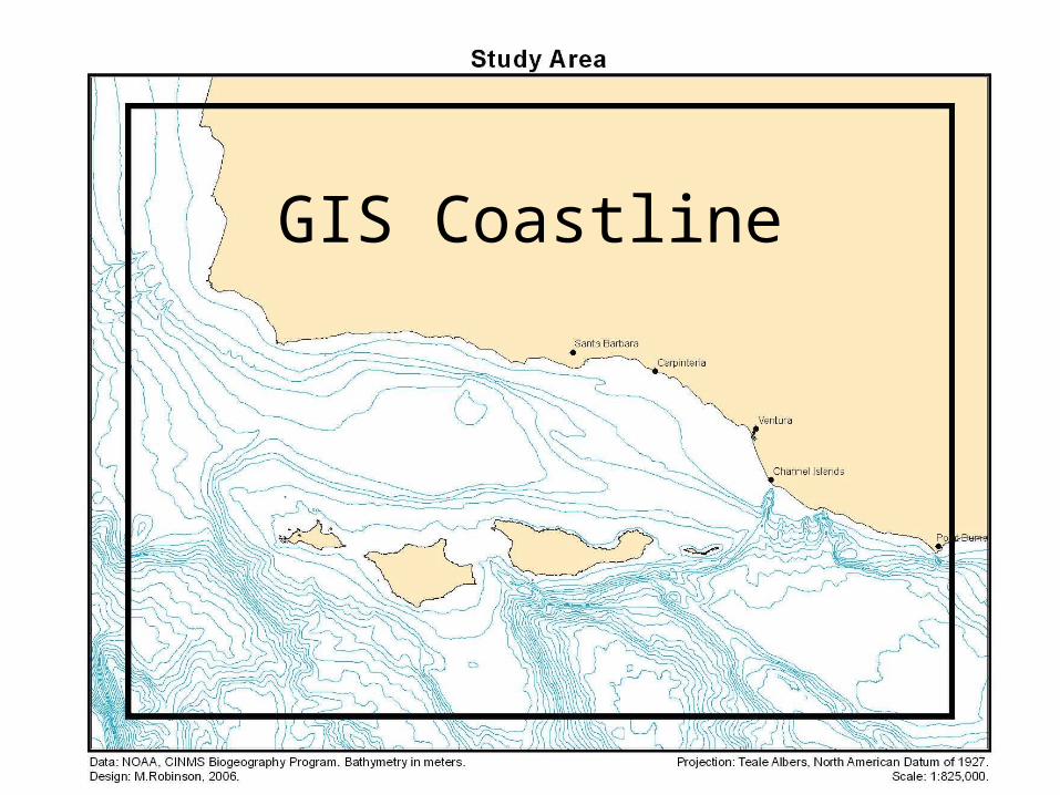
GIS Coastline
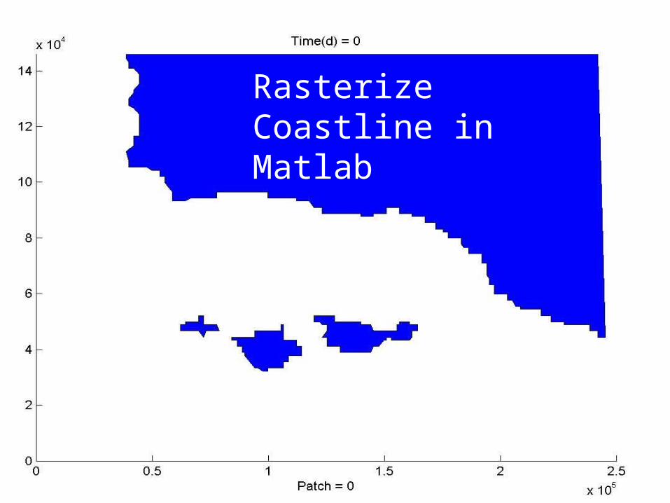
Rasterize Coastline in Matlab
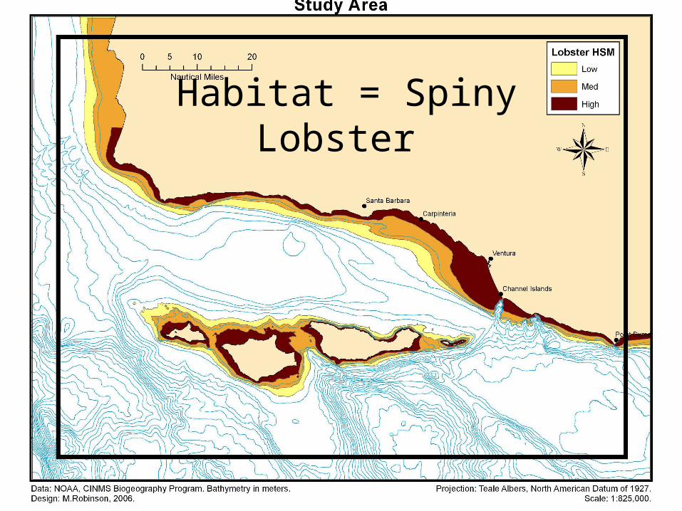
Habitat = Spiny Lobster
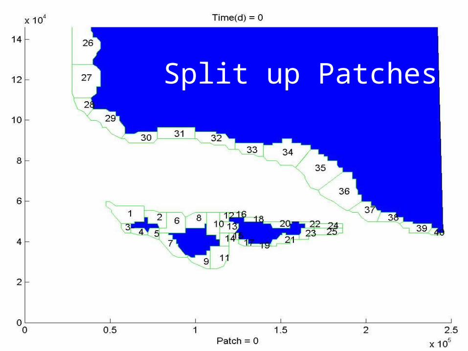
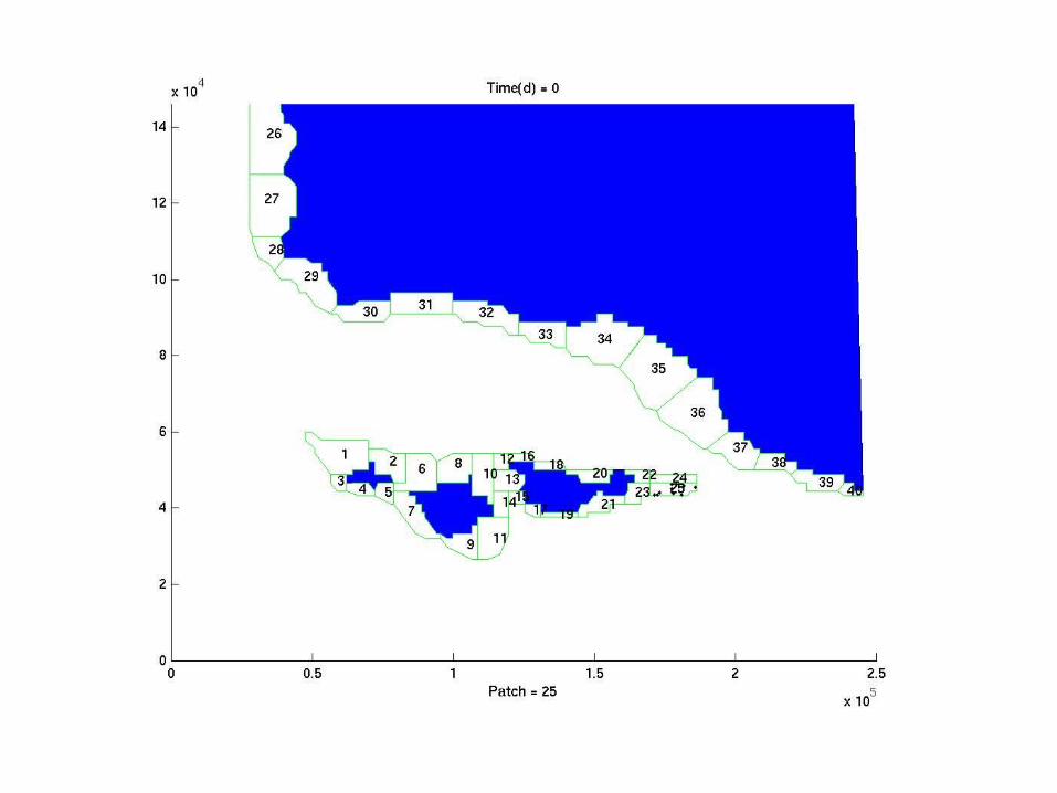
Split up Patches
What we have:
A rasterized coastline based on a real GIS map
Patches that are based on the suitable habitat for Spiny Lobster geometric/flow structures (e.g. the north side of an island will be a different patch to the south side)
• Now – setup a Markov particle tracking simulation with a spatially explicit flow field (provided by Michael, from Sea Surface Height measurements)…
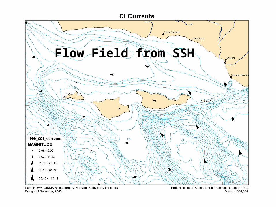
Flow Field from SSH


Velocitym/s
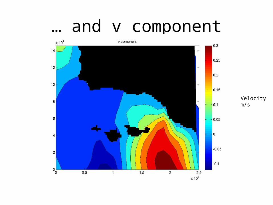
… and v component
Velocitym/s
Lots of fiddling to get Markov script to ‘sample’ u and v
velocities from the flow field
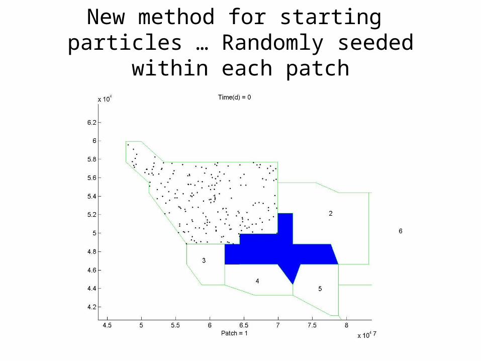
New method for starting particles … Randomly seeded within each
patch
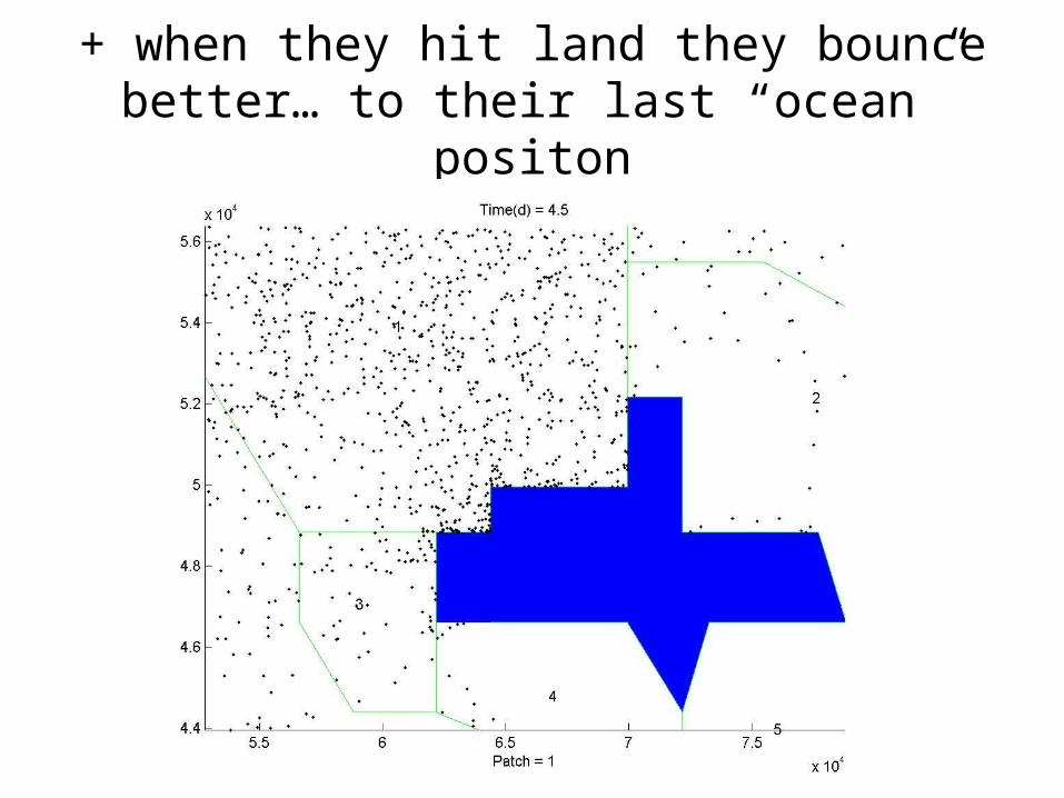
+ when they hit land they bounce better… to their last “ocean” positon
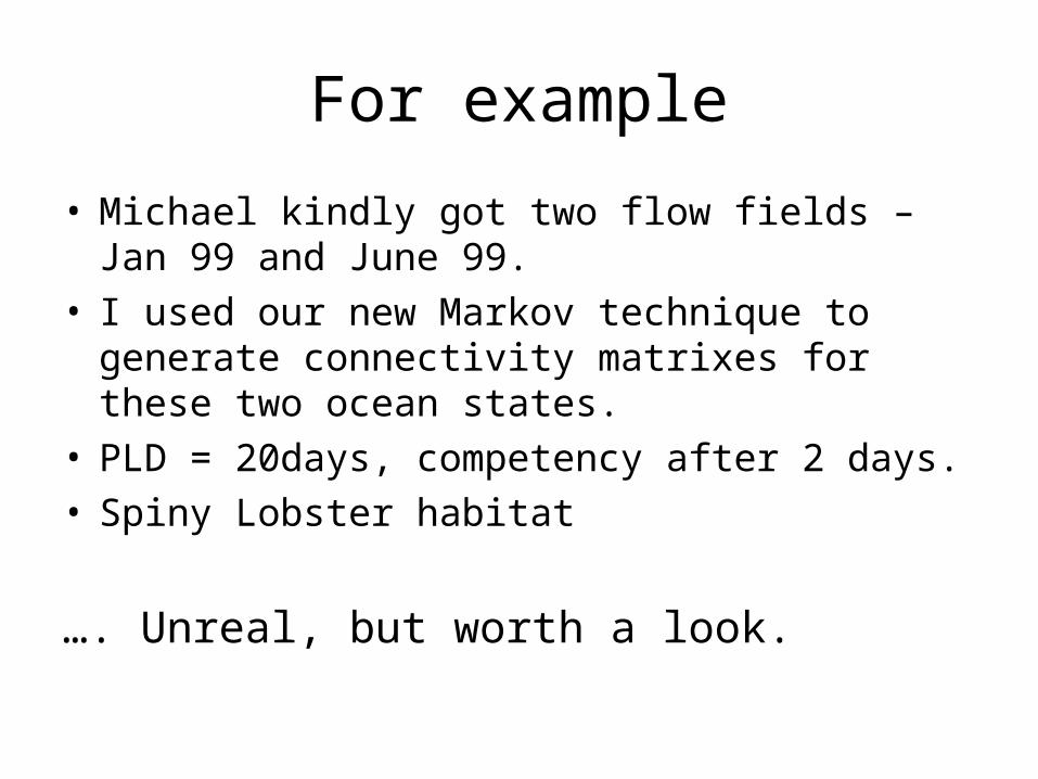
For example
• Michael kindly got two flow fields – Jan 99 and June 99.
• I used our new Markov technique to generate connectivity matrixes for these two ocean states.
• PLD = 20days, competency after 2 days.• Spiny Lobster habitat
…. Unreal, but worth a look.
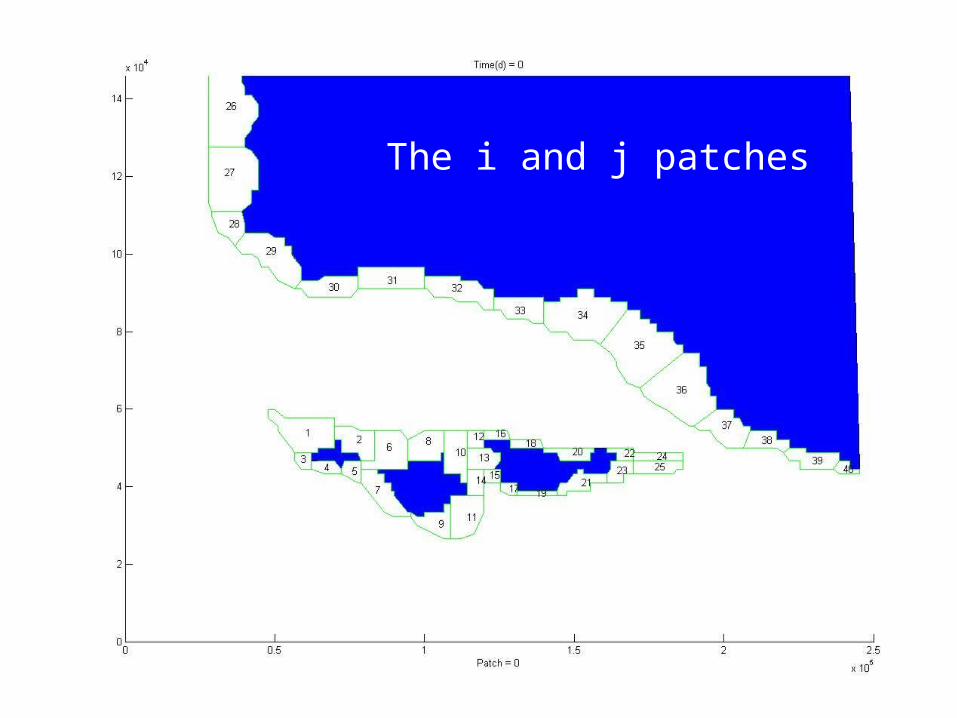
The i and j patches
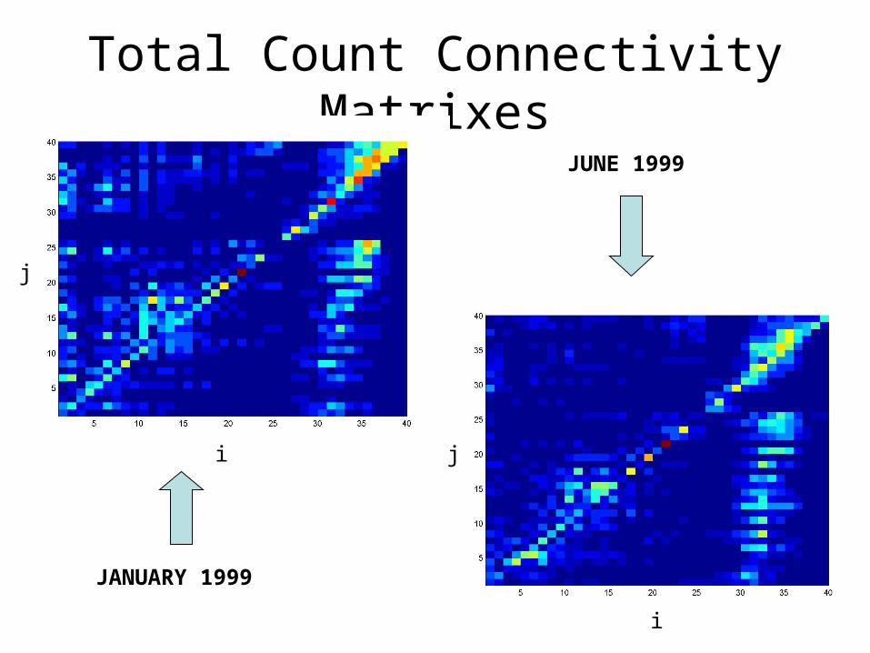
Total Count Connectivity Matrixes
JANUARY 1999
JUNE 1999
j
j
i
i
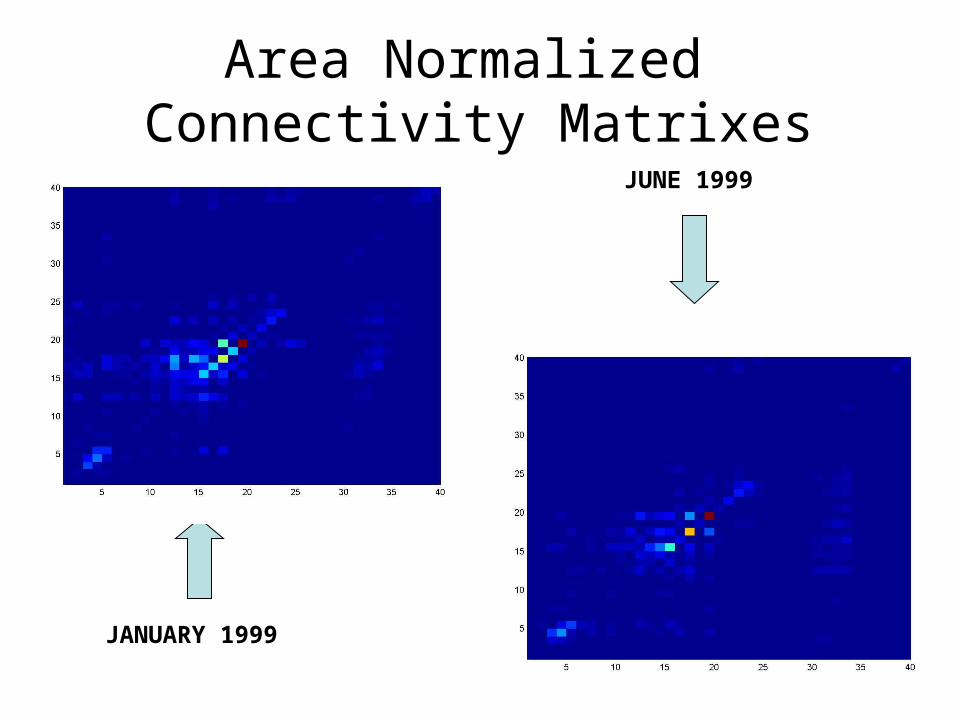
Area Normalized Connectivity Matrixes
JANUARY 1999
JUNE 1999
• So getting there, we now need better flow fields and biological parameters to proceed.
• Game over