mdl xml requirements - the coverpagesxml.coverpages.org/dwml-design.doc · web viewelement and...
TRANSCRIPT
Digital Weather Markup LanguageSpecification
(Version 1.0)
1. Overview: This document defines the Digital Weather Markup Language (DWML). DWML is a new XML language which is being developed to initially support the exchange of the National Weather Service’s (NWS) National Digital Forecast Database (NDFD) data. However, the specification is being written with enough flexibility to accommodate other environmental science applications. Appendix E provides a definition of DWML types based on restrictions appropriate to NDFD data. Other sets of restrictions similar to those in Appendix E need to be established for other specific implementations.
1.1. DWML Requirements: This specification attempts to include requirements in the MDL NDFD XML Requirements document (Appendix A). The matrix in Appendix B indicates which design feature satisfies which requirement.
1.2. DWML Structure: The tree diagrams in Appendix C provide a graphical representation of how DWML elements and attributes relate to each other. These relationships in concert with the DWML type definitions in Appendix E form the basis for language validation.
1.3. Sample Document: In addition to providing a definition of the elements and their attributes, this specification provides sample DWML documents in Appendix D for the three experimental products proposed in the NDFD XML Requirements document. Appendix D also includes the application of DWML elements to a Model Output Statistics (MOS) bulletin. The MOS bulletin example is a non-NDFD example and so it does not conform to the NDFD type definitions. The MOS bulletin example is provided merely to illustrate the flexibility of DWLM to handle other data sources.
2. DWML Data Element Nomenclature: This specification uses the following approach to describing elements:
2.1. Element and attribute names are all lower case.
2.2. Element and attribute names use a hyphen (“-“) to separate multiple word names so as to improve readability (ex. <creation-date>). Attribute and element names avoid the use of abbreviations to enhance readability.
2.3. Within this document, child elements are nested in a sub-paragraph under their parents.
2.4. Attributes are also nested but do not have the angle brackets (“<>”) and are italicized.
2.5. The element’s and attribute’s type is provided in braces (“{}”). For more information on each type refer to Appendix E.
File: document.doc Last Updated: August 12, 2003 Page: 1
2.6. If the element can occur zero or more times, an asterisk (“*”) is placed after its name. See specification 5.2.1.5 for an example.
2.7. If the element occurs zero or one times, a question mark (“?”) follows its name. See specification 4.1.3 for an example.
2.8. If the element must appear at least once, a plus sign (“+”) trails its name. See specification 5.2.1 for an example.
2.9. Element names without a special trailing character must occur exactly once. Specification 3.1 provides an example of an element that is required exactly once.
2.10. Each DWML specification references the requirement that it is designed to meet. The requirement is positioned at the end of the specification and contained in parentheses. For example, specification 3.1 satisfies requirement 4.2.
2.11. The order of element descriptions in the paragraphs below is not significant. Any required ordering of elements is specified in the tree diagrams found in Appendix C and type definitions in Appendix E.
3. Framwork Elements:
3.1. <dwml> {dw:dwmlType}: The root element for DWML (R4.2).
3.1.1. version {xsd:string}: Indicates which version of DWML the instance contains (R2.1.3).
3.1.2. <head> {dw:headType}: Contains the metadata for the DWML instance. See section 4 for elements found in the <head> element (R4.2).
3.1.3. <data> {dw:dataType}: Contains the environmental data. See section 5 for child elements of the <data> element (R4.2 and R2.2).
4. DWML Metadata Elements: DWML metadata provides information about the DWML product and the data it contains. These elements are children of the <head> element.
4.1. <product> {dw:productType}: Holds meta information about the product.
4.1.1. concise-name {dw:concise-nameType}: A name or code that describes this product. The concise-nameType will have a list of names that is extensible to support secondary developer additions. Sample values include “glance”, “digital-tabular”, “digital-zone” (Derived From R2.1.1).
4.1.2. operational-mode {xsd:operational-modeType}: Defines the status of the product. Applications can review the content of this element to determine if they should perform further processing. Sample values include “test”, “developmental”, “experimental”, and “official” product. (R2.1.4)
File: document.doc Last Updated: August 12, 2003 Page: 2
4.1.2.1. Test Product: Indicates that this is an instance of an existing DWML product that contains some change being evaluated by a DWML development team. Users will typically not process this product (R2.1.4.1).
4.1.2.2. Developmental Product: A new product that is not yet ready for public evaluation or use (R2.1.4.2).
4.1.2.3. Experimental Product: Product is available for testing and evaluation for a specified, limited time period for the explicit purpose of obtaining customer feedback. (R2.1.4.3).
4.1.2.4. Official Product: Identifies an instance of an established DWML product. This DWML instance is part of the approved product suite available from the NWS (R2.1.4.4).
4.1.3. <title> {xsd:string} [?]: Provides a concise summarization of what this DWML product contains (R2.1.1).
4.1.4. <field> {dw:fieldType}: Specifies the general area within the environmental sciences that the data contained in the DWML instance is from. Example values include “meteorological”, “hydrological”, “oceanographical”, “land surface”, and “space” (R2.1.5).
4.1.5. <category> {dw:categoryType} [?]: Defines the specific category that the product belongs to. Example values include “observation”, “forecast”, “analysis”, and “statistic” (R2.1.6).
4.1.6. <creation-date> {xsd:creation-dateType}: The date and time that the product was prepared (R2.1.2).
4.1.6.1. refresh-frequency {xsd:duration}: Used by the production center to help users know how often to return for updated data. In the case of the NDFD, the data is updated on an as needed basis. As a result the frequency provided may not always ensure users update as soon as new data is available. The frequency will also not guarantee that that when updates are done that the retrieved data is new. Still, the suggested refresh frequency will help well mannered users know what the provider believes is a reasonable time between repeated accesses of the system (R2.1.14).
4.2. <source> {dw:sourceType} [?]: Holds information about the product’s source and links to credit and disclaimer information.
4.2.1. <more-information> {xsd:anyURI}: A link to the web page of the forecast’s source or a more complete forecast (R2.1.13).
4.2.2. <production-center> {xsd:production-centerType} [?]: Production Center identifies which organization creates the product (R2.1.7).
File: document.doc Last Updated: August 12, 2003 Page: 3
4.2.2.1. <sub-center> {xsd:string} [?]: The part of the production center that prepared the product (R2.1.8).
4.2.3. <disclaimer> {xsd:anyURI} [?]: The URL containing a disclaimer regarding the data (R2.1.9).
4.2.4. <credit> {xsd:anyURI} [?]: The URL used to credit the source of the data (R2.1.10).
4.2.5. <credit-logo> {xsd:anyURI} [?]: The image link used with the credit URL to acknowledge the data source (R.2.11).
4.2.6. <feedback> {xsd:anyURI} [?]: A URL to a web page used to provide the production center comments on the product (R2.1.12).
5. DWML Data Elements: These elements hold the environmental data. They are children of the <data> element.(R2.2).
5.1. <location> {dw:locationType} [+]: Defines the location for the data contained in the element <data>. The element must contain exactly one of its child elements (R2.2.2).
5.1.1. <location-key> {dw:location-keyType} [?]: If more than one location is represented in the data element, the location-key element is used to relate the location to its corresponding parameters (R2.2.2).
5.1.2. <point>: SEE SECTION 6.1.
5.1.2.1. summarization: SEE SECTION 6.3.
5.1.3. <city> {dw:cityType} [?]: Contains the city name for which the data is valid (R2.2.2).
5.1.3.1. state {dw:stateType}: The two digit abbreviation for the state that the city resides in (R2.2.2).
5.1.3.2. summarization: SEE SECTION 6.3.
5.1.4. <nws-zone> {dw:nws-zoneType} [?]: Contains the National Weather Service forecast zone name for which the data is valid (R2.2.2).
5.1.4.1. state {dw:stateType}: Defines the two letter state ID (R2.2.2).
5.1.4.2. summarization: SEE SECTION 6.3.
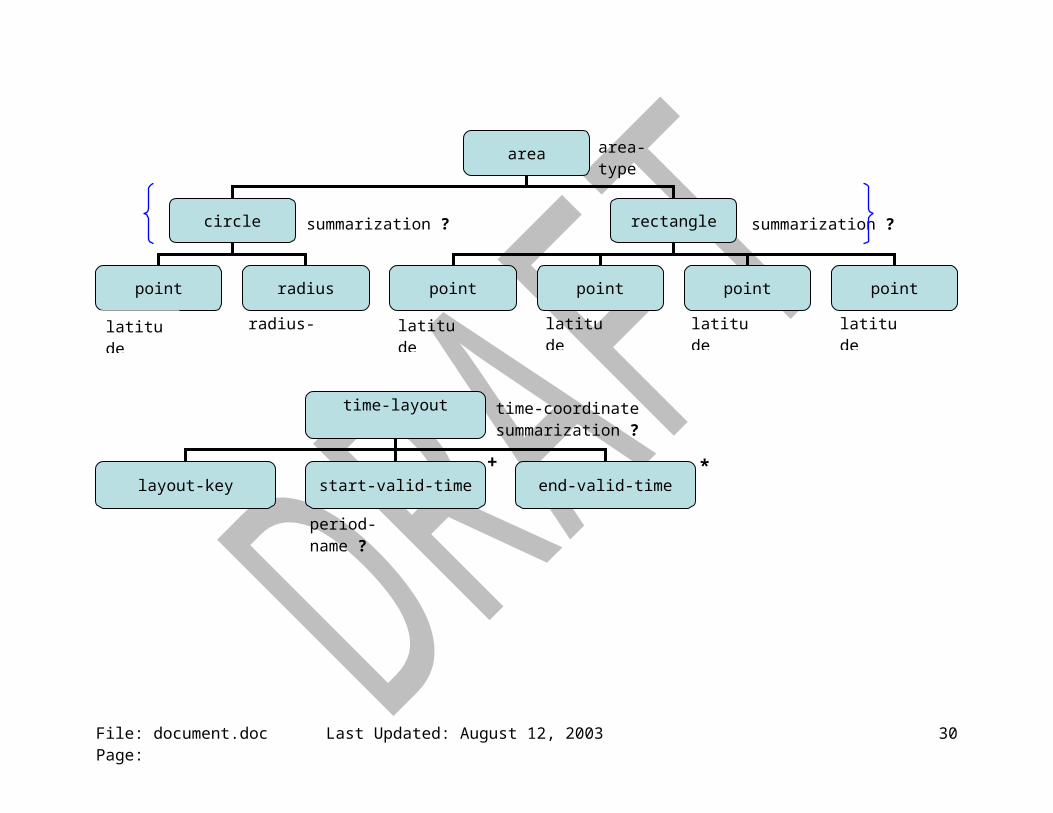
5.1.5. <area> {dw:areaType} [?]: A geometrical shape may be used to define which grid points the data represents. The element must contain exactly one of its child elements (Derived from R2.2.1.5).
File: document.doc Last Updated: August 12, 2003 Page: 4
5.1.5.1. area-type {dw:area-typeType}: Defines the aerial shape being used. Permissible values include “circle” and “rectangle” (Derived from R2.2.1.5).
5.1.5.2. <circle> {dw:circleType} [?]: A circular area about a grid point. The area can contain any number of grid points which are summarized.
5.1.5.2.1. <point>: SEE SECTION 6.1.
5.1.5.2.2. <radius> {dw:radiusType}: The distance from the center point of the circle to edge of the circular area (Derived from R2.2.1.5).
5.1.5.2.2.1. radius-units {dw:radius-unitsType): The units of the radius measurement. Example values include “statute miles” and “kilometers” (Derived from R2.2.1.5).
5.1.5.2.3. summarization: SEE SECTION 6.3.
5.1.5.3. <rectangle> {dw:rectangleType} [?]: A rectangular area which is defined by four latitude and longitude pairs. The area can contain any number of grid points which are summarized.
5.1.5.3.1. <point> SEE SECTION 6.1
5.1.5.3.2. <point> SEE SECTION 6.1
5.1.5.3.3. <point> SEE SECTION 6.1
5.1.5.3.4. <point> SEE SECTION 6.1
5.1.5.3.5. summarization: SEE SECTION 6.3.
5.1.6. <height> {dw:heightType} [?]: This is the data point’s distance above/below some datum. If this element is not present, it is assumed that the data values are surface based (R2.2.2.3.1).
5.1.6.1. datum {dw:datumType}: This is the reference for the height measurement. Example values include “surface” and “mean sea level” (R2.2.2.3.1.1).
5.1.6.2. height-units {dw:unitsType}: The units of measure used for the height value. Example values include “feet” and “meters” (R2.2.2.3.1.2).
5.1.7. <level> {dw:levelType} [?]: The data may be valid at some specific level. For example, within model data, a value may apply to a sigma level (R2.2.2.3.2).
5.1.7.1. vertical-coordinate: SEE SECTION 6.2.
File: document.doc Last Updated: August 12, 2003 Page: 5
5.1.8. <layer> {dw:layerType} [?]: The data may be valid for some specific layer. For example, within model data, a value may be valid through a sigma layer (R2.2.2.3.3).
5.1.8.1. vertical-coordinate: SEE SECTION 6.2.
5.2. <time-layout> {dw:time-layoutType } [+]: Contains the start and stop valid times and any associated period names for the data. Since different environmental parameters have different time schemes (valid at different interval and available for different lengths of time into the future), there will be one <time-layout> element for each of these unique temporal configurations. Each data parameter will reference exactly one of these time layouts (R2.2.3).
5.2.1. time-coordinate {dw:time-coordinateType}: The time coordinate can be either “local time” or “UTC” (R2.2.3.3).
5.2.2. summarization: SEE SECTION 6.3 (R2.2.1.6).
5.2.3. <layout-key> {dw:layout-keyType}: The key (k-p24h-n7-1) used to associated this time layout with a particular parameter element (R2.2.3). The key is derived using the following convention:
5.2.3.1. “k” stands for key.
5.2.3.2. “p24h” implies a data period length of 24 hours.
5.2.3.3. “n7” means that the number of data times is 7.
5.2.3.4. “1” is a sequential number used to keep the layout keys unique.
The key should not be parsed to derive the period. This is because, the period length changes for some data type after day 3 and so period length implied by the key name only applies to the early times.
5.2.4. <start-valid-time> {dw:start-valid-timeType} [+]: The start time of the period of time for which the data is valid (R2.2.3.1).
5.2.4.1.1. period-name {xsd:string} [?]: Contains the name associated with this time interval (ex. TODAY) (R2.2.3.4).
5.2.5. <end-valid-time> {xsd:dateTime} [*]: The end time of the period of time for which the data is valid. The absence of this attribute indicates that the element is valid at a specific time (R2.2.3.2).
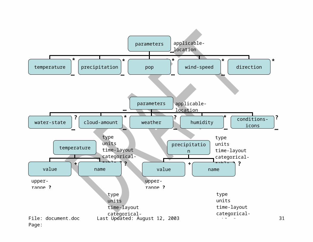
5.3. <parameters> {dw:parametersType} [+]: Holds the environmental data (R2.2.1).
File: document.doc Last Updated: August 12, 2003 Page: 6

5.3.1. applicable-location {dw:applicable-locationType} [?]: If more than one location is represented in the data element, the applicable-location attribute is used to relate the location to a particular list of parameters (R2.2.1).
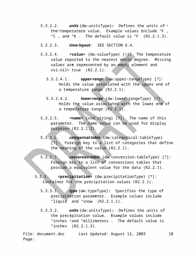
5.3.2. <temperature> {dw:temperatureType} [*]: Container for temperature data (R2.2.1).
5.3.2.1. type {dw:typeType}: Specifies the type of temperature. Example values include “maximum”, “minimum”, “temperature”, “dew point”, “heat index”, “wind chill” (R2.2.1.1).
5.3.2.2. units {dw:unitsType}: Defines the units of the temperature value. Example values include “F”, “C”, and “K”. The default value is “F” (R2.2.1.3).
5.3.2.3. time-layout: SEE SECTION 6.4.
5.3.2.4. <value> {dw:valueType} [+]: The temperature value reported to the nearest whole degree. Missing values are represented by an empty element and xsi:nil=”true” (R2.2.1).
5.3.2.4.1. upper-range {dw:upper-rangeType} [?]: Holds the value associated with the upper end of a temperature range (R2.2.1).
5.3.2.4.2. lower-range {dw:lower-rangeType} [?]: Holds the value associated with the lower end of a temperature range (R2.2.1).
5.3.2.5. <name> {xsd:string} [?]: The name of this parameter. The name value can be used for display purposes (R2.2.1.2).
5.3.2.6. categorical-table {dw:categorical-tableType} [?]: Foreign key to a list of categories that define the meaning of the value (R2.2.1).
5.3.2.7. conversion-table {dw:conversion-tableType} [?]: Foreign key to a list of conversions tables that provide a equivalent value for the data (R2.2.1).
5.3.3. <precipitation> {dw:precipitationType} [*]: Container for the precipitation values (R2.2.1).
5.3.3.1. type {dw:typeType}: Specifies the type of precipitation parameter. Example values include “liquid” and “snow” (R2.2.1.1).
5.3.3.2. units {dw:unitsType}: Defines the units of the precipitation value. Example values include “inches” and “millimeters”. The default value is “inches” (R2.2.1.3).
5.3.3.3. time-layout: SEE SECTION 6.4.
File: document.doc Last Updated: August 12, 2003 Page: 7
5.3.3.4. <value> {dw:valueType} [+]: The precipitation type parameter’s value to the nearest integer value. Missing values are represented by an empty element and xsi:nil=”true” (R2.2.1).
5.3.3.4.1. upper-range {dw:upper-rangeType} [?]: Holds the value associated with the upper end of a precipitation range (R2.2.1).
5.3.3.4.2. lower-range {dw:lower-rangeType} [?]: Holds the value associated with the lower end of a precipitation range (R2.2.1).
5.3.3.5. <name> {xsd:string} [?]: The name of this parameter. The name value can be used for display purposes (R2.2.1.2).
5.3.3.6. categorical-table {dw:categorical-tableType} [?]: Foreign key to a list of categories that define the meaning of the value (R2.2.1).
5.3.3.7. conversion-table {dw:conversion-tableType} [?]: Foreign key to a list of conversions tables that provide a equivalent value for the data (R2.2.1).
5.3.4. <probability-of-precipitation> {dw:probability-of-precipitationType} [*]: Container for the probability of precipitation (POP) values (R2.2.1).
5.3.4.1. type {dw:typeType}: Specifies the type of POP parameter. Example values include “12 hour” and “floating”. Default value is “12 hour” (R2.2.1.1).
5.3.4.2. units {dw:unitsType}: Defines the units of the POP value. Example values include “percent” (R2.2.1.3).
5.3.4.3. time-layout: SEE SECTION 6.4.
5.3.4.4. <value> {dw:valueType} [+]: The POP value to the nearest integer value. Missing values are represented by an empty element and xsi:nil=”true” (R2.2.1).
5.3.4.4.1. upper-range {dw:upper-rangeType} [?]: Holds the value associated with the upper end of a POP range (R2.2.1).
5.3.4.4.2. lower-range {dw:lower-rangeType} [?]: Holds the value associated with the lower end of a POP range (R2.2.1).
5.3.4.5. <name> {xsd:string} [?]: The name of this parameter. The name value can be used for display purposes (R2.2.1.2).
5.3.4.6. categorical-table {dw:categorical-tableType} [?]: Foreign key to a list of categories that define the meaning of the value (R2.2.1).
5.3.4.7. conversion-table {dw:conversion-tableType} [?]: Foreign key to a list of conversions tables that provide a equivalent value for the data (R2.2.1).
File: document.doc Last Updated: August 12, 2003 Page: 8
5.3.5. <wind-speed>: {dw:wind-speedType} [*]: Container for the wind speed values (R2.2.1).
5.3.5.1. type {dw:typeType}: Specifies the type of wind speed parameter. Example values include “sustained” and “gust” (R2.2.1.1).
5.3.5.2. units {dw:unitsType}: Defines the units of the wind speed values. Example values include “knots” and “meters per second”. The default value is “knots” (R2.2.1.3).
5.3.5.3. time-layout: SEE SECTION 6.4.
5.3.5.4. <value> {dw:valueType} [+]: The wind speed value reported to the nearest integer. Missing values are represented by an empty element and xsi:nil=”true” (R2.2.1).
5.3.5.4.1. upper-range {dw:upper-rangeType} [?]: Holds the value associated with the upper end of a wind speed range (R2.2.1).
5.3.5.4.2. lower-range {dw:lower-rangeType} [?]: Holds the value associated with the lower end of a wind speed range (R2.2.1).
5.3.5.5. <name> {xsd:string} [?]: The name of this parameter. The name value can be used for display purposes (R2.2.1.2).
5.3.5.6. categorical-table {dw:categorical-tableType} [?]: Foreign key to a list of categories that define the meaning of the value (R2.2.1).
5.3.5.7. conversion-table {dw:conversion-tableType} [?]: Foreign key to a list of conversions tables that provide a equivalent value for the data (R2.2.1).
5.3.6. <direction>: {dw:directionType} [?]: Container for the direction values (R2.2.1).
5.3.6.1. type {dw:typeType}: Specifies the type of wind direction. Example values include “wind” and “swell”. The default value is “wind” (R2.2.1.1).
5.3.6.2. units {dw:unitsType}: Defines the units of the wind direction values. Example values include “degrees true” (R2.2.1.3).
5.3.6.3. time-layout {dw:time-layoutType}: SEE SECTION 6.4.
5.3.6.4. <value> {dw:valueType} [+]: The wind direction value reported to the nearest integer. Missing values are represented by an empty element and xsi:nil=”true” (R2.2.1).
5.3.6.4.1. upper-range {dw:upper-rangeType} [?]: Holds the value associated with the upper end of a wind direction range (R2.2.1).
File: document.doc Last Updated: August 12, 2003 Page: 9
5.3.6.4.2. lower-range {dw:lower-rangeType} [?]: Holds the value associated with the lower end of a wind direction range (R2.2.1).
5.3.6.5. <name> {xsd:string} [?]: The name of this parameter. The name value can be used for display purposes (R2.2.1.2).
5.3.6.6. categorical-table {dw:categorical-tableType} [?]: Foreign key to a list of categories that define the meaning of the value (R2.2.1).
5.3.6.7. conversion-table {dw:conversion-tableType} [?]: Foreign key to a list of conversions tables that provide a equivalent value for the data (R2.2.1).
5.3.7. <cloud-amount>: {dw:cloud-amountType} [*]: Container for the cloud amount values (R2.2.1).
5.3.7.1. type {dw:typeType}: The type of cloud amount values. Example values include “total” and “layered” (R2.2.1.1).
5.3.7.2. units {dw:unitsType}: Defines the units of the cloud amount values. Example values include “percent” and “8ths”. The default value is “percent” (R2.2.1.3).
5.3.7.3. time-layout {dw:time-layoutType}: SEE SECTION 6.4.
5.3.7.4. <value> {dw:valueType} [+]: The cloud cover value reported to the nearest integer. Missing values are represented by an empty element and xsi:nil=”true” (R2.2.1).
5.3.7.4.1. upper-range {dw:upper-rangeType} [?]: Holds the value associated with the upper end of a range of cloud amount (R2.2.1).
5.3.7.4.2. lower-range {dw:lower-rangeType} [?]: Holds the value associated with the lower end of a range of cloud amount (R2.2.1).
5.3.7.5. <name> {xsd:string} [?]: The name of this parameter. The name value can be used for display purposes (R2.2.1.2).
5.3.7.6. <cloud-layer> {dw:layerType} [?]: The layer containing the cloud amount. Example values include “high”, “middle”, and “low”. This element is not present when the type attribute is set to “total” (Derived from R2.2.1).
5.3.7.7. categorical-table {dw:categorical-tableType} [?]: Foreign key to a list of categories that define the meaning of the value (R2.2.1).
5.3.7.8. conversion-table {dw:conversion-tableType} [?]: Foreign key to a list of conversions tables that provide a equivalent value for the data (R2.2.1).
5.3.8. <weather>: {dw:weatherType} [?]: Container for the weather values (R2.2.1).
File: document.doc Last Updated: August 12, 2003 Page: 10

5.3.8.1. time-layout {dw:time-layoutType}: SEE SECTION 6.4.
5.3.8.2. <weather-conditions> {weather-conditionsType} [+]: Container for up to three weather values that are used to describe the weather conditions at a given time. Missing values are represented by an empty element and xsi:nil=”true” (R2.2.1).
5.3.8.2.1. <value> {dw:valueType} [* (max of 5)]: The sensible weather. Missing values are represented by an empty element and xsi:nil=”true” (R2.2.1).
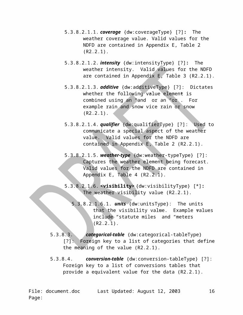
5.3.8.2.1.1. coverage {dw:coverageType} [?]: The weather coverage value. Valid values for the NDFD are contained in Appendix E, Table 2 (R2.2.1).
5.3.8.2.1.2. intensity {dw:intensityType} [?]: The weather intensity. Valid values for the NDFD are contained in Appendix E, Table 3 (R2.2.1).
5.3.8.2.1.3. additive {dw:additiveType} [?]: Dictates whether the following value element is combined using an “and” or an “or”. For example rain and snow vice rain or snow (R2.2.1).
5.3.8.2.1.4. qualifier {dw:qualifierType} [?]: Used to communicate a special aspect of the weather value. Valid values for the NDFD are contained in Appendix E, Table 2 (R2.2.1).
5.3.8.2.1.5. weather-type {dw:weather-typeType} [?]: Captures the weather element being forecast. Valid values for the NDFD are contained in Appendix E, Table 4 (R2.2.1).
5.3.8.2.1.6. <visibility> {dw:visibilityType} [*]: The weather visibility value (R2.2.1).
5.3.8.2.1.6.1. units {dw:unitsType}: The units that the visibility value. Example values include “statute miles” and “meters” (R2.2.1).
5.3.8.3. categorical-table {dw:categorical-tableType} [?]: Foreign key to a list of categories that define the meaning of the value (R2.2.1).
5.3.8.4. conversion-table {dw:conversion-tableType} [?]: Foreign key to a list of conversions tables that provide a equivalent value for the data (R2.2.1).
5.3.8.5. weather-summary {xsd:string} [?]: Short phrase (~2 words) used to summarize the weather conditions for that time. Example phrases include “partly cloudy” and “scattered thunderstorms” (R2.2.1).
5.3.9. <humidity> {dw:humidityType} [?]: Container for humidity values (R2.2.1).
File: document.doc Last Updated: August 12, 2003 Page: 11
5.3.9.1. type {dw:typeType}: Specifies the type of humidity. Example values include “relative” and “specific” (R2.2.1.1).
5.3.9.2. units {dw:unitsType}: Defines the units of the humidity values. Example values include “percent” and “kilogram/kilogram” (R2.2.1.3).
5.3.9.3. time-layout {dw:time-layoutType}: SEE SECTION 6.4.
5.3.9.4. <value> {dw:valueType} [+]: The humidity value reported to the nearest integer. Missing values are represented by an empty element and xsi:nil=”true” (R2.2.1).
5.3.9.4.1. upper-range {dw:upper-rangeType} [?]: Holds the value associated with the upper end of a relative humidity range (R2.2.1).
5.3.9.4.2. lower-range {dw:lower-rangeType} [?]: Holds the value associated with the lower end of a relative humidity range (R2.2.1).
5.3.9.5. <name> {xsd:string} [?]: The name of this parameter. The name value can be used for display purposes (R2.2.1.2).
5.3.9.6. categorical-table {dw:categorical-tableType} [?]: Foreign key to a list of categories that define the meaning of the value (R2.2.1).
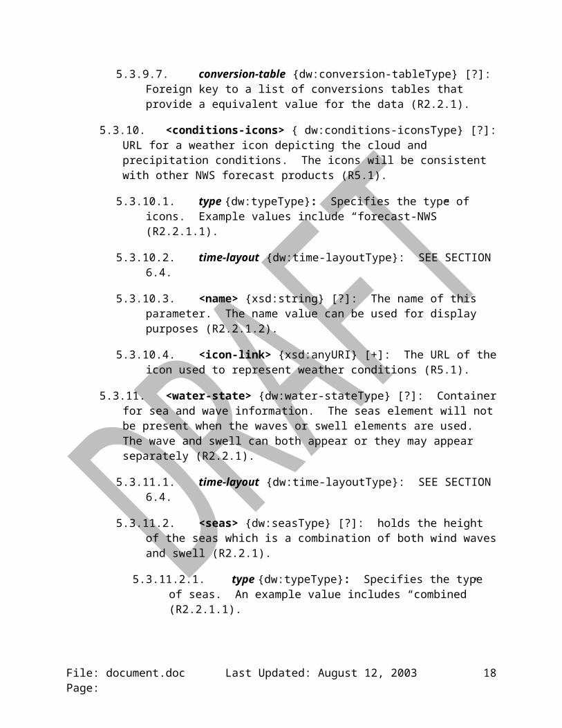
5.3.9.7. conversion-table {dw:conversion-tableType} [?]: Foreign key to a list of conversions tables that provide a equivalent value for the data (R2.2.1).
5.3.10. <conditions-icons> { dw:conditions-iconsType} [?]: URL for a weather icon depicting the cloud and precipitation conditions. The icons will be consistent with other NWS forecast products (R5.1).
5.3.10.1. type {dw:typeType}: Specifies the type of icons. Example values include “forecast-NWS” (R2.2.1.1).
5.3.10.2. time-layout {dw:time-layoutType}: SEE SECTION 6.4.
5.3.10.3. <name> {xsd:string} [?]: The name of this parameter. The name value can be used for display purposes (R2.2.1.2).
5.3.10.4. <icon-link> {xsd:anyURI} [+]: The URL of the icon used to represent weather conditions (R5.1).
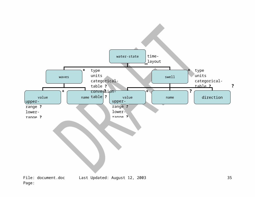
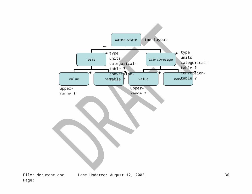
5.3.11. <water-state> {dw:water-stateType} [?]: Container for sea and wave information. The seas element will not be present when the waves or swell elements are used. The wave and swell can both appear or they may appear separately (R2.2.1).
5.3.11.1. time-layout {dw:time-layoutType}: SEE SECTION 6.4.
File: document.doc Last Updated: August 12, 2003 Page: 12
5.3.11.2. <seas> {dw:seasType} [?]: holds the height of the seas which is a combination of both wind waves and swell (R2.2.1).
5.3.11.2.1. type {dw:typeType}: Specifies the type of seas. An example value includes “combined” (R2.2.1.1).
5.3.11.2.2. units {dw:unitsType}: Defines the units of the seas values. Example values include “feet” and “meters” (R2.2.1.3).
5.3.11.2.3. <value> {dw:valueType} [+]: The seas value reported to the nearest integer. Missing values are represented by an empty element and xsi:nil=”true” (R2.2.1).
5.3.11.2.3.1. upper-range {dw:upper-rangeType} [?]: Holds the value associated with the upper end of a seas range (R2.2.1).
5.3.11.2.3.2. lower-range {dw:lower-rangeType} [?]: Holds the value associated with the lower end of a seas range (R2.2.1).
5.3.11.2.4. <name> {xsd:string} [?]: The name of this parameter. The name value can be used for display purposes (R2.2.1.2).
5.3.11.3. <waves> {dw:wavesType} [?]: holds the height of waves generated by the local wind blowing (R2.2.1).
5.3.11.3.1. type {dw:typeType}: Specifies the type of waves. An example value includes “wind” or “significant” (R2.2.1.1).
5.3.11.3.2. units {dw:unitsType}: Defines the units of the wave values. Example values include “feet” and “meters” (R2.2.1.3).
5.3.11.3.3. <value> {dw:valueType} [+]: The wave value reported to the nearest integer. Missing values are represented by an empty element and xsi:nil=”true” (R2.2.1).
5.3.11.3.3.1. upper-range {dw:upper-rangeType} [?]: Holds the value associated with the upper end of a wave range (R2.2.1).
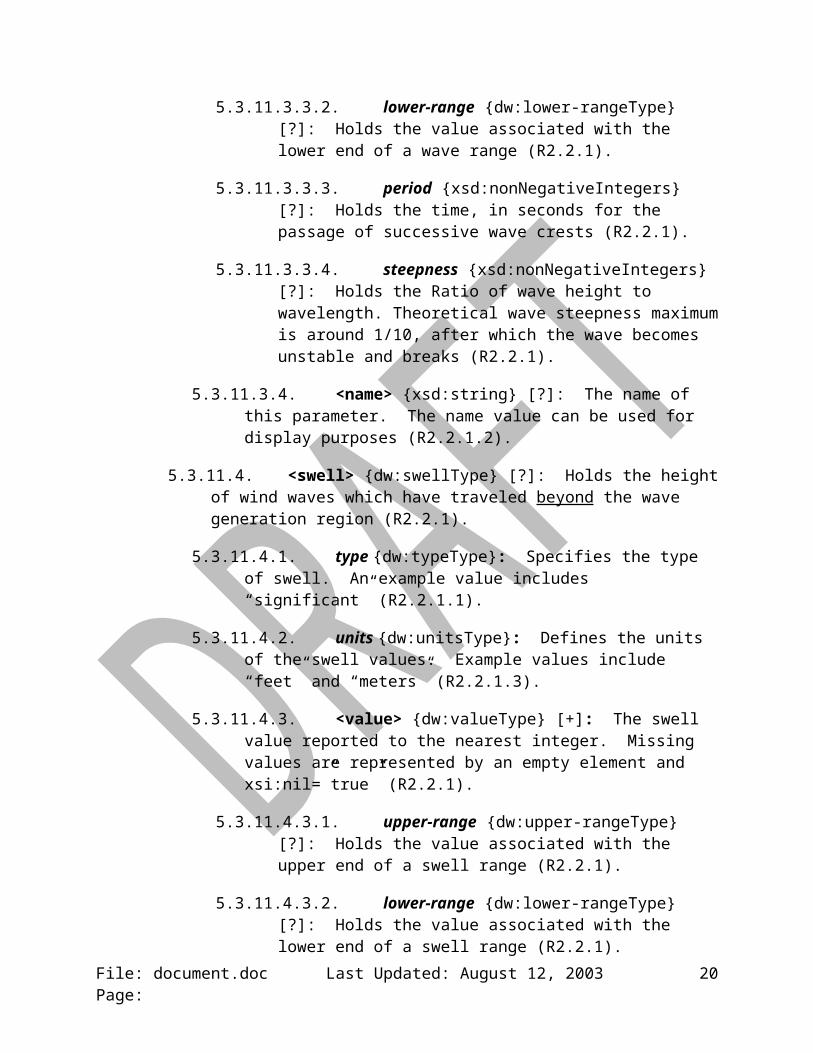
5.3.11.3.3.2. lower-range {dw:lower-rangeType} [?]: Holds the value associated with the lower end of a wave range (R2.2.1).
5.3.11.3.3.3. period {xsd:nonNegativeIntegers} [?]: Holds the time, in seconds for the passage of successive wave crests (R2.2.1).
5.3.11.3.3.4. steepness {xsd:nonNegativeIntegers} [?]: Holds the Ratio of wave height to wavelength. Theoretical wave steepness maximum is around 1/10, after which the wave becomes unstable and breaks (R2.2.1).
File: document.doc Last Updated: August 12, 2003 Page: 13
5.3.11.3.4. <name> {xsd:string} [?]: The name of this parameter. The name value can be used for display purposes (R2.2.1.2).
5.3.11.4. <swell> {dw:swellType} [?]: Holds the height of wind waves which have traveled beyond the wave generation region (R2.2.1).
5.3.11.4.1. type {dw:typeType}: Specifies the type of swell. An example value includes “significant” (R2.2.1.1).
5.3.11.4.2. units {dw:unitsType}: Defines the units of the swell values. Example values include “feet” and “meters” (R2.2.1.3).
5.3.11.4.3. <value> {dw:valueType} [+]: The swell value reported to the nearest integer. Missing values are represented by an empty element and xsi:nil=”true” (R2.2.1).
5.3.11.4.3.1. upper-range {dw:upper-rangeType} [?]: Holds the value associated with the upper end of a swell range (R2.2.1).
5.3.11.4.3.2. lower-range {dw:lower-rangeType} [?]: Holds the value associated with the lower end of a swell range (R2.2.1).
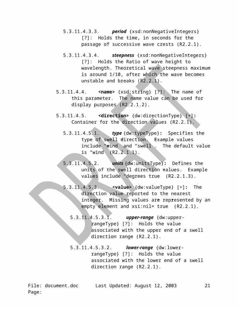
5.3.11.4.3.3. period {xsd:nonNegativeIntegers} [?]: Holds the time, in seconds for the passage of successive wave crests (R2.2.1).
5.3.11.4.3.4. steepness {xsd:nonNegativeIntegers} [?]: Holds the Ratio of wave height to wavelength. Theoretical wave steepness maximum is around 1/10, after which the wave becomes unstable and breaks (R2.2.1).
5.3.11.4.4. <name> {xsd:string} [?]: The name of this parameter. The name value can be used for display purposes (R2.2.1.2).
5.3.11.4.5. <direction> {dw:directionType} [+]: Container for the direction values (R2.2.1).
5.3.11.4.5.1. type {dw:typeType}: Specifies the type of swell direction. Example values include “wind” and “swell”. The default value is “wind” (R2.2.1.1).
5.3.11.4.5.2. units {dw:unitsType}: Defines the units of the swell direction values. Example values include “degrees true” (R2.2.1.3).
5.3.11.4.5.3. <value> {dw:valueType} [+]: The direction value reported to the nearest integer. Missing values are represented by an empty element and xsi:nil=”true” (R2.2.1).
File: document.doc Last Updated: August 12, 2003 Page: 14

5.3.11.4.5.3.1. upper-range {dw:upper-rangeType} [?]: Holds the value associated with the upper end of a swell direction range (R2.2.1).
5.3.11.4.5.3.2. lower-range {dw:lower-rangeType} [?]: Holds the value associated with the lower end of a swell direction range (R2.2.1).
5.3.11.4.5.4. <name> {xsd:string} [?]: The name of this parameter. The name value can be used for display purposes (R2.2.1.2).
5.3.11.5. ice-coverage {dw:ice-coverageType} [?]: holds the amount of ice on the water body (R2.2.1).
5.3.11.5.1. type {dw:typeType}: Specifies the type of ice coverage. An example value includes “total” (R2.2.1.1).
5.3.11.5.2. units {dw:unitsType}: Defines the units of the ice cverage values. Example values include “percent” (R2.2.1.3).
5.3.11.5.3. <value> {dw:valueType} [+]: The ice coverage value reported to the nearest integer. Missing values are represented by an empty element and xsi:nil=”true” (R2.2.1).
5.3.11.5.3.1. upper-range {dw:upper-rangeType} [?]: Holds the value associated with the upper end of a ice coverage range (R2.2.1).
5.3.11.5.3.2. lower-range {dw:lower-rangeType} [?]: Holds the value associated with the lower end of a ice coverage range (R2.2.1).
5.3.11.5.4. <name> {xsd:string} [?]: The name of this parameter. The name value can be used for display purposes (R2.2.1.2).
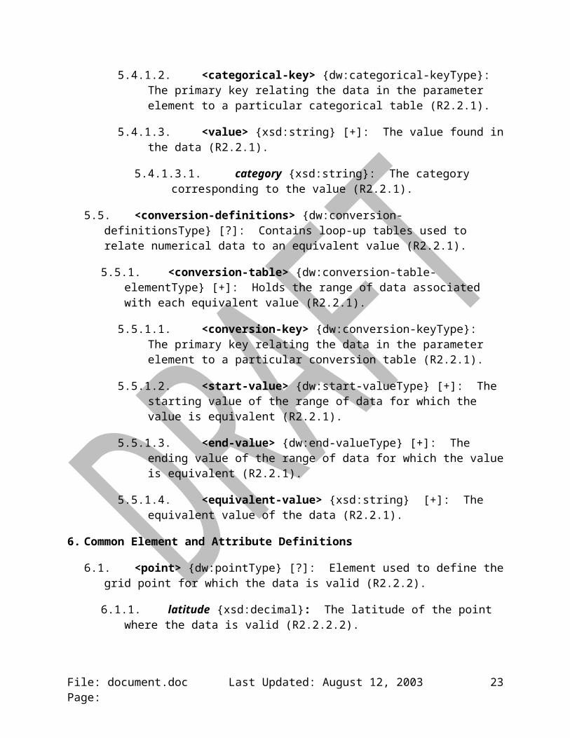
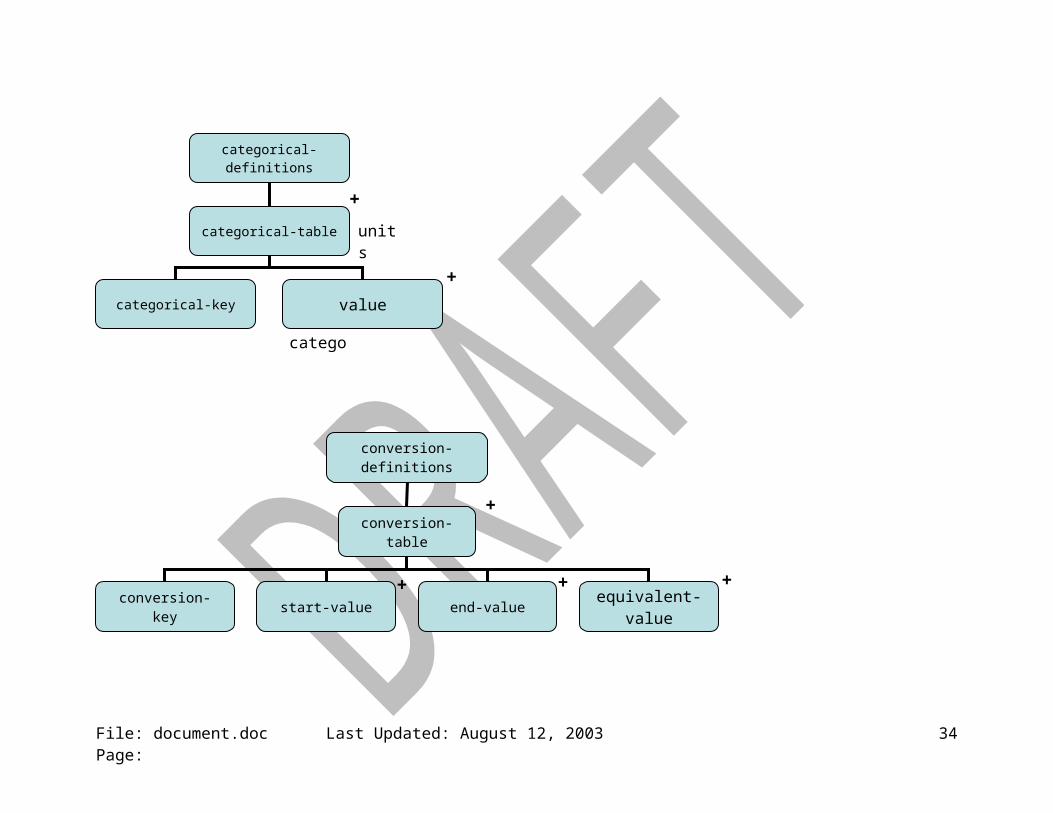
5.4. <categorical-definitions> {dw:categorical-definitionsType} [?]: Contains the definitions of categories found in parameter value elements (R2.2.1).
5.4.1. <categorical-table> {dw:categorical-table-elementType} [+]: Contains the categorical data (R2.2.1).
5.4.1.1. units {dw:unitsType}: The units of the data in the categories (R2.2.1).
5.4.1.2. <categorical-key> {dw:categorical-keyType}: The primary key relating the data in the parameter element to a particular categorical table (R2.2.1).
5.4.1.3. <value> {xsd:string} [+]: The value found in the data (R2.2.1).
5.4.1.3.1. category {xsd:string}: The category corresponding to the value (R2.2.1).
File: document.doc Last Updated: August 12, 2003 Page: 15
5.5. <conversion-definitions> {dw:conversion-definitionsType} [?]: Contains loop-up tables used to relate numerical data to an equivalent value (R2.2.1).
5.5.1. <conversion-table> {dw:conversion-table-elementType} [+]: Holds the range of data associated with each equivalent value (R2.2.1).
5.5.1.1. <conversion-key> {dw:conversion-keyType}: The primary key relating the data in the parameter element to a particular conversion table (R2.2.1).
5.5.1.2. <start-value> {dw:start-valueType} [+]: The starting value of the range of data for which the value is equivalent (R2.2.1).
5.5.1.3. <end-value> {dw:end-valueType} [+]: The ending value of the range of data for which the value is equivalent (R2.2.1).
5.5.1.4. <equivalent-value> {xsd:string} [+]: The equivalent value of the data (R2.2.1).
6. Common Element and Attribute Definitions
6.1. <point> {dw:pointType} [?]: Element used to define the grid point for which the data is valid (R2.2.2).
6.1.1. latitude {xsd:decimal}: The latitude of the point where the data is valid (R2.2.2.2).
6.1.2. longitude {xsd:decimal}: The latitude of the point where the data is valid (R2.2.2.2).
6.2. vertical-coordinate: {xsd:string}: The type of coordinates that defines the data’s vertical position (R2.2.2.3).
6.3. summarization {dw:summarizationType} [?]: Collections of grid point values may be summarized into a single value. Example summarization types include “none”, “mean”, “median”, “mode”, “maximum”, “minimum”, or “forecast-NWS”. A value of “none” indicates that the values are valid at a single grid point or time (R2.2.1.5).
6.4. time-layout {dw:time-layoutType}: Defines the key to the appropriate valid times and any relevant period name information (R2.2.3).
7. XML Considerations
7.1. Namespace: DWML will use the namespace http://www.nws.noaa.gov/mdl/ndfd/dwml.
7.2. Schema: DWML will use XML Schema to perform validity checking.
7.3. Character Set: DWML will use UTF-8 encoding.
File: document.doc Last Updated: August 12, 2003 Page: 16

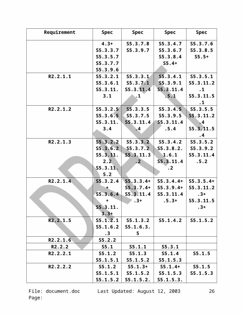
Appendix B: Requirements Correlation Matrix
Requirement Spec Spec Spec Spec
R2.1 S3.1.2 S4.1 S4.2R2.1.1 S4.1.1 S4.1.3R2.1.2 S4.1.6R2.1.3 S3.1.1R2.1.4 S4.1.2
R2.1.4.1 S4.1.2.1R2.1.4.2 S4.1.2.2R2.1.4.3 S4.1.2.3R2.1.4.4 S4.1.2.4R2.1.5 S4.1.4R2.1.6 S4.1.6R2.1.7 S4.2.2R2.1.8 S4.2.2.1R2.1.9 S4.2.3R2.1.10 S4.2.4R2.1.11 S4.2.5R2.1.12 S4.2.6R2.1.13 S4.2.1R2.1.14 S4.1.6.1
R2.2 S3.1.3S5.3.4S5.3.8
S5.3.11.2S5.3.11.4.5
S5.3S5.3.5S5.3.9
S5.3.11.3S5.3.8.2
S5.3.2S5.3.6S5.3.10
S5.3.11.4
S5.3.3S5.3.7S5.3.11
S5.3.11.5
R2.2.1 S5.3.2.4+S5.3.6.4+S5.3.9.4+
S5.3.11.4.3+S5.3.3.7S5.3.5.7S5.3.7.7S5.3.9.6
S5.3.3.4+S5.3.7.4+S5.3.10.2
S5.3.11.4.5.3+S5.3.4.6S5.3.6.6S5.3.7.8S5.3.9.7
S5.3.4.4+S5.3.8.2.1+S5.3.11.2.3+S5.3.11.5.3+
S5.3.4.7S5.3.6.7S5.3.8.4S5.4+
S5.3.5.4+S5.3.8.2.1.6S5.3.11.3.3+
S5.3.3.6S5.3.5.6S5.3.7.6S5.3.8.5S5.5+
R2.2.1.1 S5.3.2.1S5.3.6.1
S5.3.11.3.1
S5.3.3.1S5.3.7.1
S5.3.11.4.1
S5.3.4.1S5.3.9.1
S5.3.11.4.5.1
S5.3.5.1S5.3.11.2.1S5.3.11.5.1
R2.2.1.2 S5.3.2.5S5.3.6.5
S5.3.11.3.4
S5.3.3.5S5.3.7.5
S5.3.11.4.4
S5.3.4.5S5.3.9.5
S5.3.11.4.5.4
S5.3.5.5S5.3.11.2.4S5.3.11.5.4
R2.2.1.3 S5.3.2.2 S5.3.3.2 S5.3.4.2 S5.3.5.2
File: document.doc Last Updated: August 12, 2003 Page: 17
Requirement Spec Spec Spec Spec
S5.3.6.2S5.3.11.2.2S5.3.11.5.2
S5.3.7.2S5.3.11.3.2
S5.3.8.2.1.6.1S5.3.11.4.2
S5.3.9.2S5.3.11.4.5.2
R2.2.1.4 S5.3.2.4+S5.3.6.4+
S5.3.11.3.3+
S5.3.3.4+S5.3.7.4+
S5.3.11.4.3+
S5.3.4.4+S5.3.9.4+
S5.3.11.4.5.3+
S5.3.5.4+S5.3.11.2.3+S5.3.11.5.3+
R2.2.1.5 S5.1.2.1S5.1.6.2.3
S5.1.3.2S5.1.6.3.5
S5.1.4.2 S5.1.5.2
R2.2.1.6 S5.2.2R2.2.2 S5.1 S5.1.1 S5.3.1
R2.2.2.1 S5.1.2S5.1.5.1
S5.1.3S5.1.5.2
S5.1.4S5.1.5.3
S5.1.5
R2.2.2.2 S5.1.2S5.1.5.1
S5.1.5.2.1
S5.1.3+S5.1.5.2
S5.1.5.2.2+
S5.1.4+S5.1.5.3
S5.1.5.3.1 – S5.1.5.3.4
S5.1.5S5.1.5.3
R2.2.2.3 S5.1.6.1 S5.1.7.1 S5.1.8.1R2.2.2.3.1 S5.1.6
R2.2.2.3.1.1 S5.1.6.1R2.2.2.3.1.2 S5.1.6.2R2.2.2.3.2 S5.1.7R2.2.2.3.3 S5.1.8
R2.2.3 S5.2S5.3.4.3S5.3.8.1
S5.2.3 – S5.2.5
S5.3.5.3S5.3.9.3
S5.3.2.3S5.3.6.3S5.3.10.1
S5.3.3.3S5.3.7.3S5.3.11.1
R2.2.3.1 S5.2.4R2.2.3.2 S5.2.5R2.2.3.3 S5.2.1R2.2.3.4 S5.2.4.1
R3.1 ALLR3.2 S7.2R3.3 S7.3R4.1 ALL `R4.2 ALLR5.1 Appendix
DR5.2 Appendix
DR5.3 Appendix
D
File: document.doc Last Updated: August 12, 2003 Page: 18

Appendix C: Data Model
File: document.doc Last Updated: August 12, 2003 Page:
dwml
head data
version head
product source
product
title field category
concise-nameoperational-mode
??creation-date
?
source
more-information production-center disclaimer credit credit-logo feedback
sub-center
? ? ? ?
?
… … … …
?
more follows = … zero or one = ? zero or more = * one or more = + choose one = { }
?
refresh-frequency
19
File: document.doc Last Updated: August 12, 2003 Page:
data
location time-layout parameters+ +
location
location-key point city nws-zone area height level layer
area
circle rectangle
point radius point point point point
area-type
summarization ? summarization ?
latitudelongitude summarization ?
statesummarization ?
statesummarization ?
datumheight-units
vertical-coordinatevertical-coordinate
latitudelongitude
radius-units latitudelongitude
latitudelongitude
latitudelongitude
latitudelongitude
… … …
…
+
20
File: document.doc Last Updated: August 12, 2003 Page:
time-layout
+layout-key start-valid-time end-valid-time
parameters
temperature precipitation pop wind-speed
…* * *
direction*
applicable-location
parameters
water-state cloud-amount weather humidity conditions-icons? * ? *
…applicable-location
… … … …
… … … … …
*
?
*
time-coordinatesummarization ?
period-name ?
21

File: document.doc Last Updated: August 12, 2003 Page:
temperature
value name+
precipitation
value name+
probability-of-precipitation
value name+
wind-speed
value name+
direction
value name
+
conditions-icons
icon-link name
typeunitstime-layoutcategorical-table ?conversion-table ?
typeunitstime-layout categorical-table ?conversion-table ?
typeunitstime-layout categorical-table ?conversion-table ?
typeunitstime-layout categorical-table ?conversion-table ?
? ?
? ?
?
typeunitstime-layout categorical-table ?conversion-table ?
typetime-layout
upper-range ?lower-range ?
upper-range ?lower-range ?
upper-range ?lower-range ?
upper-range ?lower-range ?
upper-range ?lower-range ?
22
File: document.doc Last Updated: August 12, 2003 Page:
cloud-amount
value name cloud-layer+ ?
humidity
value name+
weather
weather-conditions
value
+
*visibility
+ (max of 5)
units
upper-range ?lower-range ?
typeunitstime-layout categorical-table ?conversion-table ?
?
?
upper-range ?lower-range ?
typeunitstime-layout categorical-table ?conversion-table ?
time-layout categorical-table ?conversion-table ?weather-summary ?
coverageintensityadditiveweather-typequalifier
23
File: document.doc Last Updated: August 12, 2003 Page:
categorical-definitions
categorical-table
categorical-key
+
value
units
conversion-definitions
conversion-table
conversion-key start-value end-value equivalent-value
+
++
category
+
+
24

File: document.doc Last Updated: August 12, 2003 Page:
water-state
waves swell
value name value name
typeunitscategorical-table ?conversion-table ?
typeunitscategorical-table ?conversion-table ?
…* *
+ +? ?
time-layout
direction
water-state
seas ice-coverage
value name value name
typeunitscategorical-table ?conversion-table ?
typeunitscategorical-table ?conversion-table ?
…
* *
+ +?
time-layout
?
upper-range ?lower-range ?period ?steepness ?
upper-range ?lower-range ?period ?steepness ?
upper-range ?lower-range ?
upper-range ?lower-range ?
?
25
Appendix D: Product Samples
Forecast at a Glance: The current experimental grid point forecast (on-line example) contains the high or low temperature, the sky condition, and a weather icon. Figure 1 shows an example of the experimental forecast product.
This Afternoon
Tonight Saturday Saturday Night
Sunday Sunday Night
Monday
Partly Cloudy
Hi 74 F
Partly Cloudy
Lo 58 F
Mostly Cloudy
Hi 79 F
Mostly Clear
Lo 55 F
Partly Cloudy
Hi 81 F
Partly Cloudy
Lo 59 F
Partly Cloudy
Hi 77 F
Figure 1. Forecast at a Glance
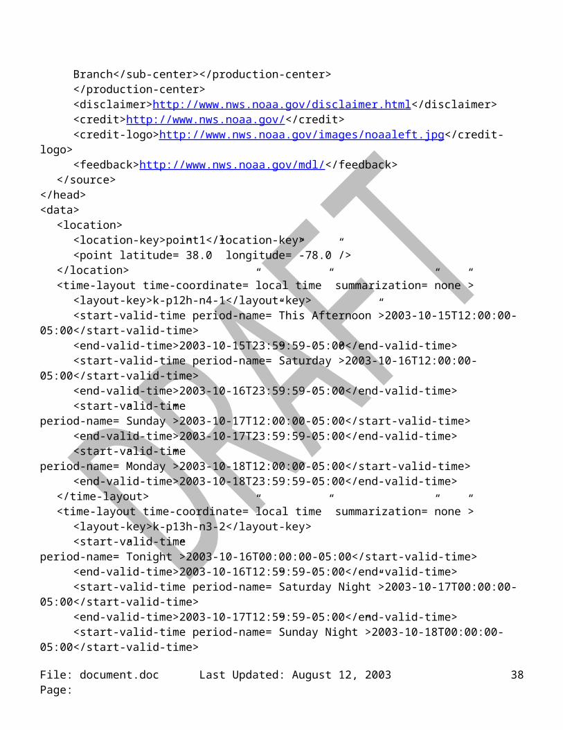
<dwml version=”1.0”><head>
<product concise-name=”glance” operational-mode=”experimental”><title>NWS Forecast at a Glance</product-title><field>meteorological</field><category>forecast</category></<creation-date refresh-frequency=”P1H”> 2003-10-22T15:30:03Z</creation-date>
</product><source>
<more-information>http://www.crh.noaa.gov/ifps/MapClick.php</more-information><production-center>Meteorological Development Laboratory, <sub-center>Statistical Modeling Branch</sub-center></production-center></production-center><disclaimer>http://www.nws.noaa.gov/disclaimer.html</disclaimer><credit>http://www.nws.noaa.gov/</credit><credit-logo>http://www.nws.noaa.gov/images/noaaleft.jpg</credit-logo><feedback>http://www.nws.noaa.gov/mdl/</feedback>
</source></head><data>
<location>
File: document.doc Last Updated: August 12, 2003 Page: 26
<location-key>point1</location-key><point latitude=”38.0” longitude=”-78.0”/>
</location><time-layout time-coordinate=”local time” summarization=”none”>
<layout-key>k-p12h-n4-1</layout-key><start-valid-time period-name=”This Afternoon”>2003-10-15T12:00:00-05:00</start-valid-time><end-valid-time>2003-10-15T23:59:59-05:00</end-valid-time><start-valid-time period-name=”Saturday”>2003-10-16T12:00:00-05:00</start-valid-time><end-valid-time>2003-10-16T23:59:59-05:00</end-valid-time><start-valid-time period-name=”Sunday”>2003-10-17T12:00:00-05:00</start-valid-time><end-valid-time>2003-10-17T23:59:59-05:00</end-valid-time><start-valid-time period-name=”Monday”>2003-10-18T12:00:00-05:00</start-valid-time><end-valid-time>2003-10-18T23:59:59-05:00</end-valid-time>
</time-layout><time-layout time-coordinate=”local time” summarization=”none”>
<layout-key>k-p13h-n3-2</layout-key><start-valid-time period-name=”Tonight”>2003-10-16T00:00:00-05:00</start-valid-time><end-valid-time>2003-10-16T12:59:59-05:00</end-valid-time><start-valid-time period-name=”Saturday Night”>2003-10-17T00:00:00-05:00</start-valid-time><end-valid-time>2003-10-17T12:59:59-05:00</end-valid-time><start-valid-time period-name=”Sunday Night”>2003-10-18T00:00:00-05:00</start-valid-time><end-valid-time>2003-10-18T12:59:59-05:00</end-valid-time>
</time-layout><time-layout time-coordinate=”local time” summarization=”mean”>
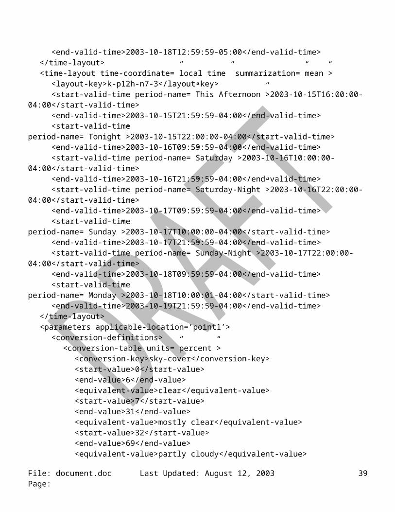
<layout-key>k-p12h-n7-3</layout-key><start-valid-time period-name=”This Afternoon”>2003-10-15T16:00:00-04:00</start-valid-time><end-valid-time>2003-10-15T21:59:59-04:00</end-valid-time><start-valid-time period-name=”Tonight”>2003-10-15T22:00:00-04:00</start-valid-time><end-valid-time>2003-10-16T09:59:59-04:00</end-valid-time><start-valid-time period-name=”Saturday”>2003-10-16T10:00:00-04:00</start-valid-time><end-valid-time>2003-10-16T21:59:59-04:00</end-valid-time><start-valid-time period-name=”Saturday-Night”>2003-10-16T22:00:00-04:00</start-valid-time><end-valid-time>2003-10-17T09:59:59-04:00</end-valid-time><start-valid-time period-name=”Sunday”>2003-10-17T10:00:00-04:00</start-valid-time><end-valid-time>2003-10-17T21:59:59-04:00</end-valid-time><start-valid-time period-name=”Sunday-Night”>2003-10-17T22:00:00-04:00</start-valid-time><end-valid-time>2003-10-18T09:59:59-04:00</end-valid-time><start-valid-time period-name=”Monday”>2003-10-18T10:00:01-04:00</start-valid-time><end-valid-time>2003-10-19T21:59:59-04:00</end-valid-time>
</time-layout><parameters applicable-location=’point1’>
<conversion-definitions><conversion-table units=”percent”>
<conversion-key>sky-cover</conversion-key><start-value>0</start-value><end-value>6</end-value>
File: document.doc Last Updated: August 12, 2003 Page: 27

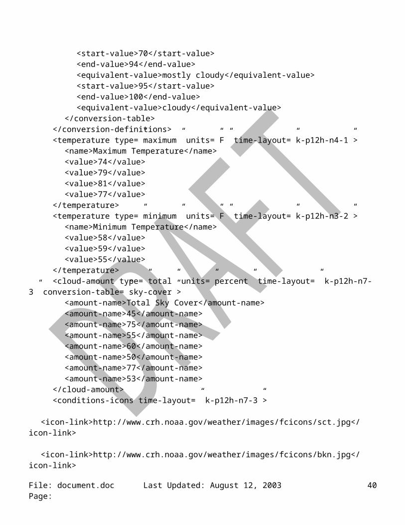
<equivalent-value>clear</equivalent-value><start-value>7</start-value><end-value>31</end-value><equivalent-value>mostly clear</equivalent-value><start-value>32</start-value><end-value>69</end-value><equivalent-value>partly cloudy</equivalent-value><start-value>70</start-value><end-value>94</end-value><equivalent-value>mostly cloudy</equivalent-value><start-value>95</start-value><end-value>100</end-value><equivalent-value>cloudy</equivalent-value>
</conversion-table></conversion-definitions><temperature type=”maximum” units=”F” time-layout=”k-p12h-n4-1”>
<name>Maximum Temperature</name><value>74</value><value>79</value><value>81</value><value>77</value>
</temperature><temperature type=”minimum” units=”F” time-layout=”k-p12h-n3-2”>
<name>Minimum Temperature</name><value>58</value><value>59</value><value>55</value>
</temperature><cloud-amount type=”total” units=”percent” time-layout=” k-p12h-n7-3” conversion-table=”sky-
cover”><amount-name>Total Sky Cover</amount-name><amount-name>45</amount-name><amount-name>75</amount-name><amount-name>55</amount-name><amount-name>60</amount-name><amount-name>50</amount-name><amount-name>77</amount-name><amount-name>53</amount-name>
</cloud-amount><conditions-icons time-layout=” k-p12h-n7-3”>
<icon-link>http://www.crh.noaa.gov/weather/images/fcicons/sct.jpg</icon-link><icon-link>http://www.crh.noaa.gov/weather/images/fcicons/bkn.jpg</icon-link><icon-link>http://www.crh.noaa.gov/weather/images/fcicons/sct.jpg</icon-link><icon-link>http://www.crh.noaa.gov/weather/images/fcicons/nsct.jpg</icon-link><icon-link>http://www.crh.noaa.gov/weather/images/fcicons/sct.jpg</icon-link><icon-link>http://www.crh.noaa.gov/weather/images/fcicons/nbkn.jpg</icon-link>
File: document.doc Last Updated: August 12, 2003 Page: 28

<icon-link>http://www.crh.noaa.gov/weather/images/fcicons/sct.jpg</icon-link></conditions-icons>
</parameters></data></dwml>
File: document.doc Last Updated: August 12, 2003 Page: 29
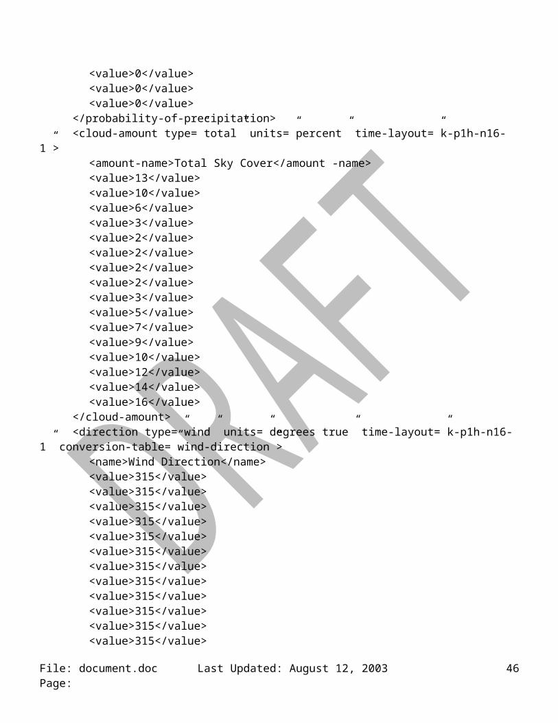
Digital Tabular Forecast: The current experimental forecast (on-line example) contains hourly values for temperature, dew point temperature, probability of precipitation, wind direction and speed, sky cover, as well as precipitation type information. Figure 2 shows an example of this experimental forecast product.
Figure 2. Digital/Tabular Forecast
<dwml version=”1.0”><head>
<product concise-name=” digital-tabular” operational-mode=”experimental”><title>NWS Forecast at a Glance</product-title><field>meteorological</field><category>forecast</category><creation-date refresh-frequency=”P1H”> 2003-10-22T15:30:03Z</creation-date>
</product><source>
<more-information>http://www.crh.noaa.gov/ifps/MapClick.php</more-information><production-center>Meteorological Development Laboratory, <sub-center>Statistical Modeling Branch</sub-center></production-center></production-center><disclaimer>http://www.nws.noaa.gov/disclaimer.html</disclaimer><credit>http://www.nws.noaa.gov/</credit><credit-logo>http://www.nws.noaa.gov/images/noaaleft.jpg</credit-logo><feedback>http://www.nws.noaa.gov/mdl/</feedback>
</source></head><data>
<location><location-key>point1</location-key>
File: document.doc Last Updated: August 12, 2003 Page: 30
<point latitude=”38.0” longitude=”-78.0”/></location><time-layout time-coordinate=”UTC” summarization=”none”>
<layout-key>k-p1h-n16-1</layout-key><start-valid-time>2003-09-16T20:00:00Z</start-valid-time><start-valid-time>2003-09-16T21:00:00Z</start-valid-time><start-valid-time>2003-09-16T22:00:00Z</start-valid-time><start-valid-time>2003-09-16T23:00:00Z</start-valid-time><start-valid-time>2003-09-16T00:00:00Z</start-valid-time><start-valid-time>2003-09-16T01:00:00Z</start-valid-time><start-valid-time>2003-09-16T02:00:00Z</start-valid-time><start-valid-time>2003-09-16T03:00:00Z</start-valid-time><start-valid-time>2003-09-16T04:00:00Z</start-valid-time><start-valid-time>2003-09-16T05:00:00Z</start-valid-time><start-valid-time>2003-09-16T06:00:00Z</start-valid-time><start-valid-time>2003-09-16T07:00:00Z</start-valid-time><start-valid-time>2003-09-16T08:00:00Z</start-valid-time><start-valid-time>2003-09-16T09:00:00Z</start-valid-time><start-valid-time>2003-09-16T10:00:00Z</start-valid-time><start-valid-time>2003-09-16T11:00:00Z</start-valid-time>
</time-layout><parameters applicable-location=’point1’>
<conversion-definitions><conversion-table>
<conversion-key>wind-direction</conversion-key><start-value>23</start-value><end-value>67</end-value><equivalent-value>NE</equivalent-value><start-value>68</start-value><end-value>112</end-value><equivalent-value>E</equivalent-value><start-value>113</start-value><end-value>157</end-value><equivalent-value>SE</equivalent-value><start-value>158</start-value><end-value>202</end-value><equivalent-value>SE</equivalent-value><start-value>203</start-value><end-value>247</end-value><equivalent-value>SW</equivalent-value><start-value>248</start-value><end-value>292</end-value><equivalent-value>W</equivalent-value><start-value>293</start-value><end-value>337</end-value><equivalent-value>NW</equivalent-value>
File: document.doc Last Updated: August 12, 2003 Page: 31

<start-value>338</start-value><end-value>22</end-value><equivalent-value>N</equivalent-value>
</conversion-table></conversion-definitions><temperature type=”temperature” units=”F” time-layout=”k-p1h-n16-1”>
<name>Hourly Temperatures</name><value>79</value><value>79</value><value>78</value><value>75</value><value>72</value><value>70</value><value>67</value><value>65</value><value>62</value><value>59</value><value>58</value><value>58</value><value>57</value><value>57</value><value>56</value><value>56</value>
</temperature><temperature type=”dew point” units=”F” time-layout=”k-p1h-n16-1”>
<name>Hourly Dewpoint Temperatures</name><value>52</value><value>51</value><value>50</value><value>50</value><value>49</value><value>48</value><value>48</value><value>47</value><value>46</value><value>46</value><value>46</value><value>46</value><value>46</value><value>47</value><value>48</value><value>48</value>
</temperature><probability-of-precipitation type=”12 hour” units=”percent” time-layout=”k-p1h-n16-1”>
<name>12 Hour Probability of Precipitation</name><value>0</value>
File: document.doc Last Updated: August 12, 2003 Page: 32

<value>0</value><value>0</value><value>0</value><value>0</value><value>0</value><value>0</value><value>0</value><value>0</value><value>0</value><value>0</value><value>0</value><value>0</value><value>0</value><value>0</value><value>0</value>
</probability-of-precipitation><cloud-amount type=”total” units=”percent” time-layout=”k-p1h-n16-1”>
<amount-name>Total Sky Cover</amount -name><value>13</value><value>10</value><value>6</value><value>3</value><value>2</value><value>2</value><value>2</value><value>2</value><value>3</value><value>5</value><value>7</value><value>9</value><value>10</value><value>12</value><value>14</value><value>16</value>
</cloud-amount><direction type=”wind” units=”degrees true” time-layout=”k-p1h-n16-1” conversion-table=”wind-
direction”><name>Wind Direction</name><value>315</value><value>315</value><value>315</value><value>315</value><value>315</value><value>315</value><value>315</value><value>315</value>
File: document.doc Last Updated: August 12, 2003 Page: 33
<value>315</value><value>315</value><value>315</value><value>315</value><value>315</value><value>315</value><value>315</value><value>315</value>
</direction><wind-speed type=”sustained” units=”knots” time-layout=”k-p1h-n16-1”>
<name>Sustained Wind Speed</name><value>8</value><value>8</value><value>8</value><value>6</value><value>3</value><value>2</value><value>2</value><value>2</value><value>3</value><value>5</value><value>5</value><value>6</value><value>6</value><value>6</value><value>6</value><value>6</value>
</wind-speed><wind-speed type=”gust” units=”knots” time-layout=”k-p1h-n16-1”>
<name>Wind SpeedGusts</name><value xsi:nil=”true”/><value xsi:nil=”true”/><value xsi:nil=”true”/><value xsi:nil=”true”/><value xsi:nil=”true”/><value xsi:nil=”true”/><value xsi:nil=”true”/><value>5</value><value xsi:nil=”true”/><value xsi:nil=”true”/><value xsi:nil=”true”/><value xsi:nil=”true”/><value xsi:nil=”true”/><value xsi:nil=”true”/><value xsi:nil=”true”/><value xsi:nil=”true”/>
File: document.doc Last Updated: August 12, 2003 Page: 34
</wind-speed><weather time-layout=”k-p1h-n16-1”>
<weather-conditions xsi:nil=”true”/><weather-conditions xsi:nil=”true”/><weather-conditions xsi:nil=”true”/><weather-conditions xsi:nil=”true”/><weather-conditions xsi:nil=”true”/><weather-conditions xsi:nil=”true”/><weather-conditions xsi:nil=”true”/><weather-conditions xsi:nil=”true”/><weather-conditions xsi:nil=”true”/><weather-conditions xsi:nil=”true”/><weather-conditions xsi:nil=”true”/><weather-conditions xsi:nil=”true”/><weather-conditions xsi:nil=”true”/><weather-conditions xsi:nil=”true”/><weather-conditions xsi:nil=”true”/><weather-conditions xsi:nil=”true”/>
</weather></parameters>
</data></dwml>
File: document.doc Last Updated: August 12, 2003 Page: 35
Digital Zone Forecast: This product is similar to the Forecast at a Glance in that it uses 12 hour forecast periods to summarize the NDFD data. The digital zone forecast is like the Digital Tabular Forecast in terms of its use of an extensive number of weather elements. Figure 3 shows an example product.
This Afternoon
Tonight Saturday Saturday Night
Sunday Sunday Night
Sky Cover 30 percent 25 percent 20 percent 35 percent 60 percent 65 percent
High/Low 74 F 58 F 79 F 55 F 81 F 59 F
Wind Direction
NW NW SW SW SW SE
Wind Speed 5 -10 5 -10 5 -10 5 -10 10 - 15 5 -10
Probability-of-
precipitation
0 0 0 0 40 60
Weather Type
None None None None Thunderstorms Showers
Figure 3. Digital Zone Forecast
<dwml version=”1.0”><head>
<product concise-name=”digital-zone” operational-mode=”experimental”><creation-date refresh-frequency=”P1H”> 2003-10-22T15:30:03Z</creation-date>
</product><source>
<more-information>http://www.crh.noaa.gov/ifps/MapClick.php</more-information></source>
</head><data>
<location><location-key>point1</location-key><point latitude=”38.0” longitude=”-78.0”/>
</location><time-layout time-coordinate=”UTC” summarization=”none”>
<layout-key>k-p12h-n3-1</layout-key><start-valid-time period-name=”This Afternoon”>2003-10-15T12:00:00Z</start-valid-time>
File: document.doc Last Updated: August 12, 2003 Page: 36

<end-valid-time>2003-10-16T23:59:59Z</end-valid-time><start-valid-time period-name=”Saturday”>2003-10-16T12:00:00Z</start-valid-time><end-valid-time>2003-10-17T23:59:59Z</end-valid-time><start-valid-time period-name=”Sunday”>2003-10-17T12:00:00Z</start-valid-time><end-valid-time>2003-10-18T23:59:59Z</end-valid-time>
</time-layout><time-layout time-coordinate=”local-time” summarization=”none”>
<layout-key>k-p12h-n3-2</layout-key><start-valid-time period-name=”Tonight”>2003-10-16T00:00:00Z</start-valid-time><end-valid-time>2003-10-16T11:59:59Z</end-valid-time><start-valid-time period-name=”Saturday Night”> 2003-10-17T00:00:00Z</start-valid-time><end-valid-time>2003-10-17T11:59:59Z </end-valid-time><start-valid-time period-name=”Sunday Night”> 2003-10-18T00:00:00Z</start-valid-time><end-valid-time>2003-10-18T11:59:59Z </end-valid-time>
</time-layout><parameters applicable-location=’point1’>
<conversion-definitions><conversion-table>
<conversion-key>wind-direction</conversion-key><start-value>23</start-value><end-value>67</end-value><equivalent-value>NE</equivalent-value><start-value>68</start-value><end-value>112</end-value><equivalent-value>E</equivalent-value><start-value>113</start-value><end-value>157</end-value><equivalent-value>SE</equivalent-value><start-value>158</start-value><end-value>202</end-value><equivalent-value>SE</equivalent-value><start-value>203</start-value><end-value>247</end-value><equivalent-value>SW</equivalent-value><start-value>248</start-value><end-value>292</end-value><equivalent-value>W</equivalent-value><start-value>293</start-value><end-value>337</end-value><equivalent-value>NW</equivalent-value><start-value>338</start-value><end-value>22</end-value><equivalent-value>N</equivalent-value>
</conversion-table></conversion-definitions><temperature type=”maximum” units=”F” time-layout=”k-p12h-n3-1”>
File: document.doc Last Updated: August 12, 2003 Page: 37
<value>74</value><value>79</value><value>81</value>
</temperature><temperature type=”minimum” units=”F” time-layout=”k-p12h-n3-2”>
<value>58</value><value>55</value><value>59</value>
</temperature><cloud-amount type=”total” units=”percent” time-layout=”k-p12h-n3-1”>
<name>Total Sky Cover</ name><value>30</value><value>20</value><value>60</value>
</cloud-amount><cloud-amount type=”total” units=”percent” time-layout=”k-p12h-n3-2”>
<name>Total Sky Cover</ name><value>25</value><value>35</value><value>65</value>
</cloud-amount><direction type=”wind” units=”degrees true” time-layout=”k-p12h-n3-1” conversion-table=”wind-
direction”><value>315</value><value>225</value><value>225</value>
</direction><direction type=”wind” units=”degrees true” time-layout=”k-p12h-n3-2” conversion-table=”wind-
direction”><value>315</value><value>135</value><value>225</value>
</direction><wind-speed type=”sustained” units=”knots” time-layout=”k-p12h-n3-1”>
<value lower-range=”5” upper-range=”10”>6</value><value lower-range=”5” upper-range=”10”>8</value><value lower-range=”10” upper-range=”15”>12</value>
</wind-speed><wind-speed type=”sustained” units=”knots” time-layout=”k-p12h-n3-2”>
<value lower-range=”5” upper-range=”10”>6</value><value lower-range=”5” upper-range=”10”>8</value><value lower-range=”5” upper-range=”10”>7</value>
</wind-speed><probability-of-precipitation type=”12-hour” units=”percent” time-layout=”k-p12h-n3-1”>
<value>0</value><value>0</value>
File: document.doc Last Updated: August 12, 2003 Page: 38
<value>40</value></probability-of-precipitation><probability-of-precipitation type=”12-hour” units=”percent” time-layout=”k-p12h-n3-2”>
<value>0</value><value>0</value><value>60</value>
</probability-of-precipitation><weather time-layout=” k-p12h-n3-1”>
<weather-conditions xsi:nil=”true” /><weather-conditions xsi:nil=”true” /><weather-conditions>
<value coverage=”scattered” intensity=”moderate” weather-type=”thunderstorms” qualifier=”none” />
</weather-conditions></weather><weather time-layout=” k-p12h-n3-2”>
<weather-conditions xsi:nil=”true” /><weather-conditions xsi:nil=”true” /><weather-conditions>
<value coverage=”chance” intensity=”light” weather-type=”showers” qualifier=”none” /></weather-conditions>
</weather></parameters>
<data><dwml>
File: document.doc Last Updated: August 12, 2003 Page: 39
Model Output Statistics Bulletin: This is not an NDFD product. Rather, it is an operational text bulletin produced by the Meteorological Development Laboratory. Figure 4 shows a sample bulletin.
KAKQ AVN MOS GUIDANCE 10/24/2003 1200 UTC DT /OCT 24/OCT 25 /OCT 26 /OCT 27 HR 18 21 00 03 06 09 12 15 18 21 00 03 06 09 12 15 18 21 00 06 12 N/X 38 62 57 70 59 TMP 57 57 44 41 40 40 41 55 60 60 56 58 60 60 60 65 68 67 63 64 64 DPT 27 29 36 35 35 36 39 46 49 52 54 57 59 59 59 61 61 61 60 59 60 CLD CL CL CL CL CL CL CL BK BK BK BK BK BK OV OV OV OV OV OV OV OV WDR 36 00 00 00 00 00 00 19 21 00 00 20 21 21 21 21 22 22 22 18 23 WSP 02 00 00 00 00 00 00 05 05 00 00 02 02 03 03 06 05 02 03 04 06 P06 0 0 0 3 2 11 20 32 35 20 57 P12 0 10 22 59 60 Q06 0 0 0 0 0 0 0 0 0 0 2 Q12 0 0 0 1 2 T06 0/24 0/19 0/ 0 0/27 0/19 2/19 3/ 0 2/30 6/25 18/ 1 T12 0/29 0/27 2/32 5/30 18/40 POZ 0 0 0 0 0 0 0 0 0 0 0 0 0 0 0 0 0 0 0 0 0 POS 0 0 0 0 0 0 0 0 0 0 0 0 0 0 0 0 0 0 0 0 0 TYP R R R R R R R R R R R R R R R R R R R R R CIG 7 7 7 7 7 7 7 7 5 5 5 7 5 5 4 4 4 5 5 4 3 VIS 7 7 7 7 7 7 7 7 7 7 7 7 6 3 2 6 7 7 7 1 4 OBV N N N N N N N N N N N N BR FG BR HZ N N N FG BR
Figure 4: Sample Model Output Statistics Bulletin.
<dwml version=”1.0”><head>
<product concise-name=” digital-tabular” operational-mode=”experimental”><title>NWS Forecast at a Glance</product-title><field>meteorological</field><category>forecast</category><creation-date refresh-frequency=”P1H”> 2003-10-24T10:30:03Z</creation-date>
</product><source>
<more-information>http://www.nws.noaa.gov/mdl/synop/products.shtml</more-information><production-center>Meteorological Development Laboratory, <sub-center>Statistical Modeling Branch</sub-center></production-center><disclaimer>http://www.nws.noaa.gov/disclaimer.html</disclaimer><credit>http://www.nws.noaa.gov/</credit><credit-logo>http://www.nws.noaa.gov/images/noaaleft.jpg</credit-logo><feedback>http://www.nws.noaa.gov/mdl/</feedback>
</source></head><data>
<location><location-key>point1</location-key><point latitude=”36.9872” longitude=”-77.0011”/>
File: document.doc Last Updated: August 12, 2003 Page: 40
</location><time-layout time-coordinate=”local-time” summarization=”none”>
<layout-key>k-p12h-n2-1</layout-key><start-valid-time>2003-10-25T12:00:00-05:00</start-valid-time><end-valid-time>2003-10-25T23:59:59-05:00</end-valid-time><start-valid-time>2003-10-26T12:00:00-05:00</start-valid-time><end-valid-time>2003-10-26T23:59:59-05:00</end-valid-time>
</time-layout><time-layout time-coordinate=”local time” summarization=”none”>
<layout-key>k-p13h-n3-2</layout-key><start-valid-time>2003-10-25T00:00:00-05:00</start-valid-time><end-valid-time>2003-10-25T12:59:59-05:00</end-valid-time><start-valid-time>2003-10-26T00:00:00-05:00</start-valid-time><end-valid-time>2003-10-26T12:59:59-05:00</end-valid-time><start-valid-time>2003-10-27T00:00:00-05:00</start-valid-time><end-valid-time>2003-10-27T12:59:59-05:00</end-valid-time>
</time-layout><time-layout time-coordinate=”UTC” summarization=”none”>
<layout-key>k-p3h-n21-3</layout-key><start-valid-time>2003-10-24T18:00:00Z</start-valid-time><start-valid-time>2003-10-24T21:00:00Z</start-valid-time><start-valid-time>2003-10-25T00:00:00Z</start-valid-time><start-valid-time>2003-10-25T03:00:00Z</start-valid-time><start-valid-time>2003-10-25T06:00:00Z</start-valid-time><start-valid-time>2003-10-25T09:00:00Z</start-valid-time><start-valid-time>2003-10-25T12:00:00Z</start-valid-time><start-valid-time>2003-10-25T15:00:00Z</start-valid-time><start-valid-time>2003-10-25T18:00:00Z</start-valid-time><start-valid-time>2003-10-25T21:00:00Z</start-valid-time><start-valid-time>2003-10-26T00:00:00Z</start-valid-time><start-valid-time>2003-10-26T03:00:00Z</start-valid-time><start-valid-time>2003-10-26T06:00:00Z</start-valid-time><start-valid-time>2003-10-26T09:00:00Z</start-valid-time><start-valid-time>2003-10-26T12:00:00Z</start-valid-time><start-valid-time>2003-10-26T15:00:00Z</start-valid-time><start-valid-time>2003-10-26T18:00:00Z</start-valid-time><start-valid-time>2003-10-26T21:00:00Z</start-valid-time><start-valid-time>2003-10-27T00:00:00Z</start-valid-time><start-valid-time>2003-10-27T06:00:00Z</start-valid-time><start-valid-time>2003-10-27T12:00:00Z</start-valid-time>
</time-layout><time-layout time-coordinate=”UTC” summarization=”none”>
<layout-key>k-p6h-n11-4</layout-key><start-valid-time>2003-10-24T18:00:01Z</start-valid-time><end-valid-time>2003-10-25T00:00:00Z</end-valid-time><start-valid-time>2003-10-25T00:00:01Z</start-valid-time>
File: document.doc Last Updated: August 12, 2003 Page: 41

<end-valid-time>2003-10-25T06:00:00Z</end-valid-time><start-valid-time>2003-10-25T06:00:01Z</start-valid-time><end-valid-time>2003-10-25T12:00:00Z</end-valid-time><start-valid-time>2003-10-25T12:00:01Z</start-valid-time><end-valid-time>2003-10-25T18:00:00Z</end-valid-time><start-valid-time>2003-10-25T18:00:01Z</start-valid-time><end-valid-time>2003-10-26T00:00:00Z</end-valid-time><start-valid-time>2003-10-26T00:00:01Z</start-valid-time><end-valid-time>2003-10-26T06:00:00Z</end-valid-time><start-valid-time>2003-10-26T06:00:01Z</start-valid-time><end-valid-time>2003-10-26T12:00:00Z</end-valid-time><start-valid-time>2003-10-26T12:00:01Z</start-valid-time><end-valid-time>2003-10-26T18:00:00Z</end-valid-time><start-valid-time>2003-10-26T18:00:01Z</start-valid-time><end-valid-time>2003-10-27T00:00:00Z</end-valid-time><start-valid-time>2003-10-27T00:00:01Z</start-valid-time><end-valid-time>2003-10-27T06:00:00Z</end-valid-time><start-valid-time>2003-10-27T06:00:01Z</start-valid-time><end-valid-time>2003-10-27T12:00:00Z</end-valid-time>
</time-layout><time-layout time-coordinate=”UTC” summarization=”none”>
<layout-key>k-p12h-n5-5</layout-key><start-valid-time>2003-10-25T00:00:01Z</start-valid-time><end-valid-time>2003-10-25T12:00:00Z</end-valid-time><start-valid-time>2003-10-25T12:00:01Z</start-valid-time><end-valid-time>2003-10-26T00:00:00Z</end-valid-time><start-valid-time>2003-10-26T00:00:01Z</start-valid-time><end-valid-time>2003-10-26T12:00:00Z</end-valid-time><start-valid-time>2003-10-26T12:00:01Z</start-valid-time><end-valid-time>2003-10-27T00:00:00Z</end-valid-time><start-valid-time>2003-10-27T00:00:01Z</start-valid-time><end-valid-time>2003-10-27T12:00:00Z</end-valid-time>
</time-layout><time-layout time-coordinate=”UTC” summarization=”none”>
<layout-key>k-p6h-n10-6</layout-key><start-valid-time>2003-10-24T18:00:01Z</start-valid-time><end-valid-time>2003-10-25T00:00:00Z</end-valid-time><start-valid-time>2003-10-25T00:00:01Z</start-valid-time><end-valid-time>2003-10-25T06:00:00Z</end-valid-time><start-valid-time>2003-10-25T06:00:01Z</start-valid-time><end-valid-time>2003-10-25T12:00:00Z</end-valid-time><start-valid-time>2003-10-25T12:00:01Z</start-valid-time><end-valid-time>2003-10-25T18:00:00Z</end-valid-time><start-valid-time>2003-10-25T18:00:01Z</start-valid-time><end-valid-time>2003-10-26T00:00:00Z</end-valid-time><start-valid-time>2003-10-26T00:00:01Z</start-valid-time>
File: document.doc Last Updated: August 12, 2003 Page: 42
<end-valid-time>2003-10-26T06:00:00Z</end-valid-time><start-valid-time>2003-10-26T06:00:01Z</start-valid-time><end-valid-time>2003-10-26T12:00:00Z</end-valid-time><start-valid-time>2003-10-26T12:00:01Z</start-valid-time><end-valid-time>2003-10-26T18:00:00Z</end-valid-time><start-valid-time>2003-10-26T18:00:01Z</start-valid-time><end-valid-time>2003-10-27T00:00:00Z</end-valid-time><start-valid-time>2003-10-27T00:00:01Z</start-valid-time><end-valid-time>2003-10-27T06:00:00Z</end-valid-time>
</time-layout><time-layout time-coordinate=”UTC” summarization=”none”>
<layout-key>k-p12h-n5-7</layout-key><start-valid-time>2003-10-24T18:00:01Z</start-valid-time><end-valid-time>2003-10-25T06:00:00Z</end-valid-time><start-valid-time>2003-10-25T06:00:01Z</start-valid-time><end-valid-time>2003-10-25T18:00:00Z</end-valid-time><start-valid-time>2003-10-25T18:00:01Z</start-valid-time><end-valid-time>2003-10-26T06:00:00Z</end-valid-time><start-valid-time>2003-10-26T06:00:01Z</start-valid-time><end-valid-time>2003-10-26T18:00:00Z</end-valid-time><start-valid-time>2003-10-26T18:00:01Z</start-valid-time><end-valid-time>2003-10-27T06:00:00Z</end-valid-time>
</time-layout><parameters applicable-location=’point1’>
<categorical-definitions><categorical-table units=”inches”>
<categorical-key>QPF-categories</categorical-key><value category=”no precipitation”>0</value><value category=”0.01 to 0.09”>1</value><value category=”0.10 to 0.24”>2</value><value category=”0.25 to 0.49”>3</value><value category=”0.50 to 0.99”>4</value><value category=”1.00 to 1.99”>5</value><value category=”2.00 inches or greater”>6</value>
</categorical-table><categorical-table units=”miles”>
<categorical-key>visibility-categories</categorical-key><value category=”less than or equal to 1/4”>1</value><value category=”1/4 to 1/2”>2</value><value category=”1/2 to 1”>3</value><value category=”1 to 3”>4</value><value category=”3 to 5”>5</value><value category=”6”>6</value><value category=”greater than 6”>7</value>
</categorical-table><categorical-table units=”feet”>
File: document.doc Last Updated: August 12, 2003 Page: 43
<categorical-key>ceiling-categories</categorical-key><value category=”less than 200”>1</value><value category=”200 to 400”>2</value><value category=”500 to 900”>3</value><value category=”1000 to 3000”>4</value><value category=”3100 to 6500”>5</value><value category=”6600 to 12000”>6</value><value category=”greater than 12000”>7</value>
</categorical-table></categorical-definitions><conversion-definitions>
<conversion-table><conversion-key>sky-cover</conversion-key><start-value>0</start-value><end-value>0</end-value><equivalent-value>CL</equivalent-value><start-value>3</start-value><end-value>4</end-value><equivalent-value>SC</equivalent-value><start-value>5</start-value><end-value>7</end-value><equivalent-value>BK</equivalent-value><start-value>8</start-value><end-value>8</end-value><equivalent-value>OV</equivalent-value>
</conversion-table></conversion-definitions><temperature type=”maximum” units=”F” time-layout=”k-p12h-n2-1”>
<name>Maximum Temperature</name><value>62</value><value>70</value>
</temperature><temperature type=”minimum” units=”F” time-layout=”k-p12h-n3-2”>
<name>Minimum Temperature</name><value>38</value><value>57</value><value>59</value>
</temperature><temperature type=”temperature” units=”F” time-layout=”k-p12h-n21-3”>
<name>3 Hourly Temperature</name><value>57</value><value>57</value><value>44</value><value>41</value><value>40</value><value>40</value>
File: document.doc Last Updated: August 12, 2003 Page: 44
<value>41</value><value>55</value><value>60</value><value>60</value><value>56</value><value>58</value><value>60</value><value>60</value><value>60</value><value>65</value><value>68</value><value>67</value><value>63</value><value>64</value><value>64</value>
</temperature><temperature type=”dew point” units=”F” time-layout=”k-p12h-n21-3”>
<name>3 Hourly Dew Point Temperature</name><value>27</value><value>29</value><value>36</value><value>35</value><value>35</value><value>36</value><value>39</value><value>46</value><value>49</value><value>52</value><value>54</value><value>57</value><value>59</value><value>59</value><value>59</value><value>61</value><value>61</value><value>61</value><value>60</value><value>59</value><value>60</value>
</temperature><cloud-amount type=”total” units=”8ths” time-layout=”k-p3h-n21-3” conversion-table=”sky-
cover”><name>Total Sky Amount</name><value>0</value><value>0</value><value>0</value>
File: document.doc Last Updated: August 12, 2003 Page: 45
<value>0</value><value>0</value><value>0</value><value>0</value><value>6</value><value>6</value><value>6</value><value>6</value><value>6</value><value>6</value><value>8</value><value>8</value><value>8</value><value>8</value><value>8</value><value>8</value><value>8</value><value>8</value>
</cloud-amount><direction type=”wind” units=”degrees true” time-layout=”k-p3h-n21-3”>
<name>10 Meter Wind Direction</name><value>360</value><value>0</value><value>0</value><value>0</value><value>0</value><value>0</value><value>0</value><value>190</value><value>210</value><value>0</value><value>0</value><value>200</value><value>210</value><value>210</value><value>210</value><value>210</value><value>220</value><value>220</value><value>220</value><value>180</value><value>230</value>
</direction><wind-speed type=”sustained” units=”knots” time-layout=”k-p3h-n21-3”>
<name>10 Meter Wind Speed</name><value>2</value>
File: document.doc Last Updated: August 12, 2003 Page: 46
<value>0</value><value>0</value><value>0</value><value>0</value><value>0</value><value>0</value><value>5</value><value>5</value><value>0</value><value>0</value><value>2</value><value>2</value><value>3</value><value>3</value><value>6</value><value>5</value><value>2</value><value>3</value><value>4</value><value>6</value>
</wind-speed><probability-of-precipitation type=”6 hour” units=”percent” time-layout=”k-p6h-n11-4”>
<name>6 Hour Probability of Precipitation</name><value>0</value><value>0</value><value>0</value><value>3</value><value>2</value><value>11</value><value>20</value><value>32</value><value>35</value><value>20</value><value>57</value>
</probability-of-precipitation><probability-of-precipitation type=”12 hour” units=”percent” time-layout=” k-p12h-n5-5”>
<name>12 Hour Probability of Precipitation</name><value>0</value><value>10</value><value>22</value><value>59</value><value>60</value>
</probability-of-precipitation><precipitation type=”6 hour” time-layout=”k-p6h-n11-4” categorical-table=”QPF-categories”>
<name>6 Hour Precipitation</name><value>0</value>
File: document.doc Last Updated: August 12, 2003 Page: 47

<value>0</value><value>0</value><value>0</value><value>0</value><value>0</value><value>0</value><value>0</value><value>0</value><value>0</value><value>2</value>
</precipitation><precipitation type=”12 hour” time-layout=” k-p12h-n5-5” categorical-table=”QPF-categories”>
<name>12 Hour Precipitation</name><value>0</value><value>0</value><value>0</value><value>1</value><value>2</value>
</precipitation><probability-of-precipitation type=”6 hour thunderstorm” units=”percent” time-layout=”k-p6h-n10-
6”><name>6 Hour Probability of Thunderstorms</name><value>0</value><value>0</value><value>0</value><value>0</value><value>0</value><value>2</value><value>3</value><value>2</value><value>6</value><value>18</value>
</probability-of-precipitation><probability-of-precipitation type=”12 hour thunderstorm” units=”percent” time-layout=” k-p12h-n5-
7”><name>12 Hour Probability of Thunderstorms</name><value>0</value><value>0</value><value>2</value><value>5</value><value>18</value>
</probability-of-precipitation><probability-of-precipitation type=”6 hour severe thunderstorm” units=”percent” time-layout=”k-
p6h-n10-6”><name>6 Hour Conditional Probability of Severe Thunderstorms</name><value>24</value>
File: document.doc Last Updated: August 12, 2003 Page: 48

<value>19</value><value>0</value><value>27</value><value>19</value><value>19</value><value>0</value><value>30</value><value>25</value><value>1</value>
</probability-of-precipitation><probability-of-precipitation type=”12 hour severe thunderstorm” units=”percent” time-layout=” k-
p12h-n5-7”><name>12 Hour Conditional Probability of Severe Thunderstorms</name><value>29</value><value>27</value><value>32</value><value>30</value><value>40</value>
</probability-of-precipitation><probability-of-precipitation type=”freezing” units=”percent” time-layout=”k-p3h-n21-3”>
<name>3 Hour Probability of Freezing Precipitation</name><value>0</value><value>0</value><value>0</value><value>0</value><value>0</value><value>0</value><value>0</value><value>0</value><value>0</value><value>0</value><value>0</value><value>0</value><value>0</value><value>0</value><value>0</value><value>0</value><value>0</value><value>0</value><value>0</value><value>0</value><value>0</value>
</probability-of-precipitation><probability-of-precipitation type=”snow” units=”percent” time-layout=”k-p3h-n21-3”>
<name>3 Hour Probability of Snow</name><value>0</value>
File: document.doc Last Updated: August 12, 2003 Page: 49
<value>0</value><value>0</value><value>0</value><value>0</value><value>0</value><value>0</value><value>0</value><value>0</value><value>0</value><value>0</value><value>0</value><value>0</value><value>0</value><value>0</value><value>0</value><value>0</value><value>0</value><value>0</value><value>0</value><value>0</value>
</probability-of-precipitation><weather time-layout=”k-p3h-n21-3” categorical-table=”visibility-categories”>
<weather-conditions><value weather-type=”rain” /><value xsd:nil=”true” />
</weather-conditions><visibility>7</visibility><weather-conditions>
<value weather-type=”rain”> <visibility>7</visibility>
</value><value xsd:nil=”true” />
</weather-conditions><weather-conditions>
<value weather-type=”rain”> <visibility>7</visibility>
</value><value xsd:nil=”true” />
</weather-conditions><weather-conditions>
<value> <visibility>7</visibility>
</value><value xsd:nil=”true” />
</weather-conditions><weather-conditions>
File: document.doc Last Updated: August 12, 2003 Page: 50

<value weather-type=”rain”> <visibility>7</visibility>
</value><value xsd:nil=”true” />
</weather-conditions><weather-conditions>
<value weather-type=”rain”> <visibility>7</visibility>
</value><value xsd:nil=”true” />
</weather-conditions><weather-conditions>
<value weather-type=”rain”> <visibility>7</visibility>
</value><value xsd:nil=”true” />
</weather-conditions><weather-conditions>
<value weather-type=”rain”> <visibility>7</visibility>
</value><value xsd:nil=”true” />
</weather-conditions><weather-conditions>
<value weather-type=”rain”> <visibility>7</visibility>
</value><value xsd:nil=”true” />
</weather-conditions><weather-conditions>
<value weather-type=”rain”> <visibility>7</visibility>
</value><value xsd:nil=”true” />
</weather-conditions><weather-conditions>
<value weather-type=”rain”> <visibility>7</visibility>
</value><value xsd:nil=”true” />
</weather-conditions><weather-conditions>
<value weather-type=”rain”> <visibility>7</visibility>
</value><value xsd:nil=”true” />
File: document.doc Last Updated: August 12, 2003 Page: 51
</weather-conditions><weather-conditions>
<value weather-type=”rain”> <visibility>6</visibility>
</value><value weather-type=”haze” />
</weather-conditions><weather-conditions>
<value weather-type=”rain” /><value weather-type=”fog”>
<visibility>3</visibility> </value>
</weather-conditions><weather-conditions>
<value weather-type=”rain”> <visibility>2</visibility>
</value><value weather-type=”haze” />
</weather-conditions><weather-conditions>
<value weather-type=”rain”> <visibility>6</visibility>
</value><value weather-type=”haze” />
</weather-conditions><weather-conditions>
<value weather-type=”rain”> <visibility>7</visibility>
</value><value>none</value>
</weather-conditions><weather-conditions>
<value weather-type=”rain”> <visibility>7</visibility>
</value><value>none</value>
</weather-conditions><weather-conditions>
<value weather-type=”rain”> <visibility>7</visibility>
</value><value>none</value>
</weather-conditions><weather-conditions>
<value weather-type=”rain”></value>
File: document.doc Last Updated: August 12, 2003 Page: 52
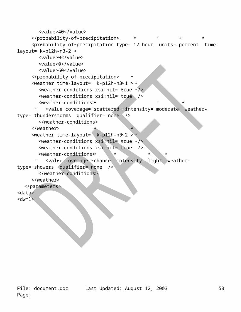
<value weather-type=”fog” /></weather-conditions><visibility>1</visibility><weather-conditions>
<value weather-type=”rain”> <visibility>4</visibility>
</value><value weather-type=”haze” />
</weather-conditions></weather><cloud-amount type=”ceiling” units=”none” time-layout=”k-p3h-n21-3” categorical-table=”ceiling-
categories”><name>celing</name><value>7</value><value>7</value><value>7</value><value>7</value><value>7</value><value>7</value><value>7</value><value>7</value><value>5</value><value>5</value><value>5</value><value>7</value><value>5</value><value>5</value><value>4</value><value>4</value><value>4</value><value>5</value><value>5</value><value>4</value><value>3</value>
</cloud-amount></parameters>
</data></dwml>
File: document.doc Last Updated: August 12, 2003 Page: 53
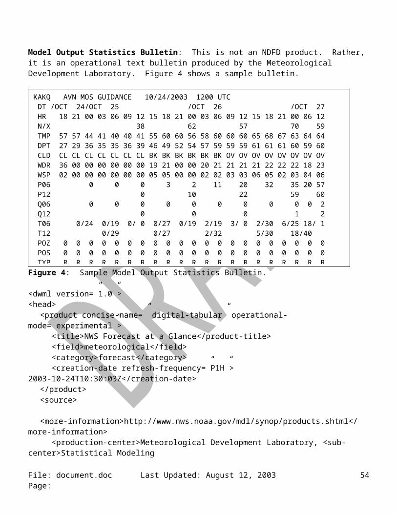
File: document.doc Last Updated: August 12, 2003 Page: 54

Appendix E: Type Definitions
dwmlType (scope = global, element only)attribute = version, type = string, default = “1.0”sequence
element = head, type = headType, min = 1, max = 1element = data, type = dataType, min = 1, max = 1
headType (scope = global, element only)sequence
element = product, type productType, min = 1, max = 1element = source, type sourceType, min = 0, max = 1
productType (scope = global, element only)attribute = concise-name, type = concise-nameType, use = requiredattribute = operational-mode, type = operational-modeType, use = requiredanyOrder
element = title, type = string, min = 0, max = 1element = field, type = fieldType, , min = 0, max = 1element = category, type = categoryType, min = 0, max = 1element = creation-date, type = creation-dateType, , min = 1, max = 1
fieldType (scope = local, base = string)enumeration
“meteorological”
categoryType (scope = local, base = string)enumeration
“forecastl”
concise-nameType (scope = local, base = string)enumeration
“time-series” “glance” “tabular-digital” “digital-zone”
operational-modeType (scope = local, base = string)enumeration
“test” “developmental” “experimental” “official”
creation-dateType (scope = local, text only with base = dateTime)attribute = refresh-frequency, type = duration, use = required
sourceType (scope = local, element only)anyOrder
element = more-information, type = anyURI, min = 1, max = 1
File: document.doc Last Updated: August 12, 2003 Page: 55
element = production-center, type = production-centerType, min = 0, max = 1element = disclaimer, type = anyURI, min = 0, max = 1element = credit, type = anyURI, min = 0, max = 1element = credit-logo, type = anyURI, min = 0, max = 1element = feedback, type = anyURI, min = 0, max = 1
production-centerType (scope = local, mixed text and element)element = sub-center, type = string, min = 0, max = 1
dataType (scope = local, element only)sequence
element = location, type = locationType, min = 1, max = unboundedelement = time-layout, type = time-layoutType, min = 1, max = unboundedelement = parameters, type = parametersType, min = 1, max = unbounded
locationType (scope = local, element only)element = location-key, type = string, min = 1, max = unboundedchoice
element = point, type = pointType, min = 0, max = 1element = city, type = cityType, min = 0, max = 1element = nws-zone, type = nws-zoneType, min = 0, max = 1element = area, type = areaType, min = 0, max = 1
choiceelement = height, type = heightType, min = 0, max = 1element = level, type = levelType, min = 0, max = 1element = layer, type = layerType, min = 0, max = 1
location-keyType (scope = local to data element, text only with base = string)must be unique
pointType (scope = location element, element only)attribute = summarization, type = summarizationType, use = optionalattribute = latitude, type = decimal, use = requiredattribute = longitude, type = decimal, use = required
cityType (scope = local, text only with base = string)attribute = state, type = stateType, use = requiredattribute = summarization, type = summarizationType, use = optional
stateType (scope = location element, base = string)pattern
[A-Z][A-Z] (only two digits allowed)
nws-zoneType (scope = local, text only with base = string)attribute = state, type = stateType, use = requiredattribute = summarization, type = summarizationType, use = optional
File: document.doc Last Updated: August 12, 2003 Page: 56
summariztionType (scope = data element, base = string)enumeration
“mean” “medium” “mode” “maximum” “minimum” “NWS-daily” “none”
areaType (scope = local, element only)attribute = area-type, type = area-typeType, use = requiredchoice
element = circle, type = circleType, min = 0, max = 1element = rectangle, type = rectangleType, min = 0, max = 1
area-typeType (scope = local, base = string)enumeration
“circle” “rectangle”
circleType (scope = local, element only)attribute = summarization, type = summarizationType, use = optionalelement = point, type = pointType, min = 1, max = 1element = radius, type = radiusType, min = 1, max = 1
radiusType (scope = local, base = decimal)attribute = radius-units, type=radius-unitsType, use = required
radius-unitsType (scope = local, base = string)enumeration
“statute miles” “kilometers”
rectangleType (scope = local, element only)attribute = summarization, type = summarizationType, use = optionalelement = point, type = pointType, min = 4, max = 4
heightType (scope = local, base = decimal)attribute = datum, type = datumType, use = requiredattribute = height-units, type = height-unitsType, use = required
datumType (scope = local, base = string)enumeration
“surface” “mean sea level”
height-unitsType (scope = local, base = string)enumeration
“feet” “meters”
levelType (scope = local, base = nonNegativeInteger)attribute = vertical-coordinate, type = string, use = optional
File: document.doc Last Updated: August 12, 2003 Page: 57
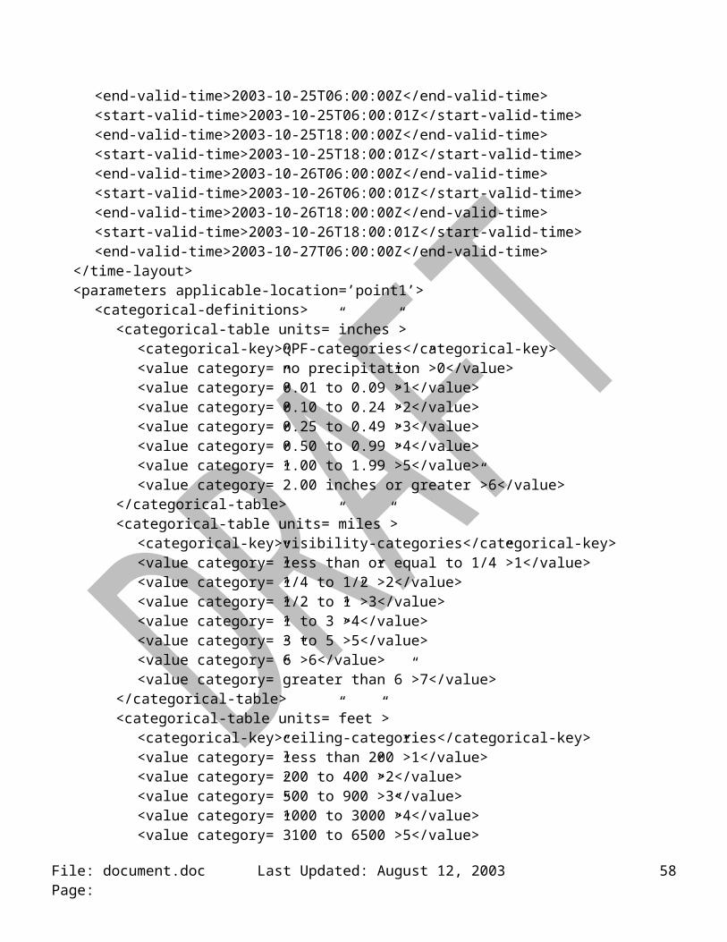
layerType (scope = local, base = nonNegativeInteger)attribute = vertical-coordinate, type = vertical-coordinateType, use = optional
time-layoutType (scope = local, element only)attribute = time-coordinate, type = time-coordinateType, use = requiredattribute = summarization; type = summarizationType, use = optionalsequence
element = layout-key, type = layout-keyType, min = 1, max = unboundedsequence
element = start-valid-time, type = start-valid-timeType, min = 1, max = unboundedelement = end-valid-time, type = dateTime, min = 0, max = unbounded
time-coordinateType (scope = local, base = string)enumeration
“local time” “UTC”
layout-keyType (scope = local, base = string)pattern
k-p\d+[h|d|m|y]-n\d+-\d+ (something like k-p12h-n10-1)must be unique
start-valid-timeType (scope = local, base = dateTime)attribute = period-name, type = string, use = optional
parametersType (scope = local, element only)attribute = applicable-location, type = string, use = requiredanyOrder
element = temperature, type = temperatureType, min = 0, max = unboundedelement = precipitation, type = precipitationType, min = 0, max = unboundedelement = probability-of-precipitation, type = probability-of-precipitationType,
min = 0, max = unboundedelement = wind-speed, type = wind-speedType, min = 0, max = unboundedelement = direction, type = directionType, min = 0, max = unboundedelement = cloud-amount, type = cloud-amountType, min = 0, max = unboundedelement = weather, type = weatherType, min = 0, max = unboundedelement = humidity, type = humidityType, min = 0, max = unboundedelement = conditions-icon, type = conditions-iconType, min = 0, max = unboundedelement = water-state, type = conditions-iconType, min = 0, max = unbounded
temperatureType (scope = local, element only)attribute = type, type = typeType, use = requiredattribute = units, type = string, fixed = “F”attribute = time-layout, type = time-layoutType, use = requiredattribute = categorical-table, type = string, use = optionalattribute = conversion-table, type = string, use = optionalsequence
File: document.doc Last Updated: August 12, 2003 Page: 58
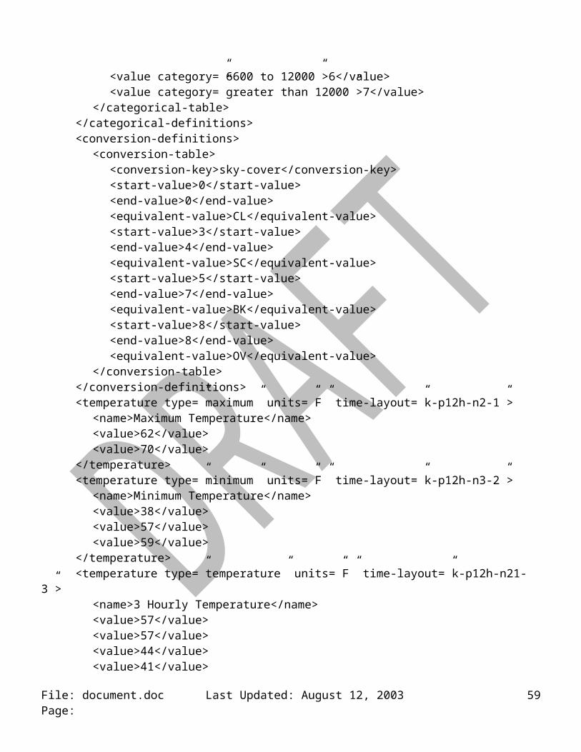
element = name, type = string, min = 0, max = 1element = value, type = valueType, min = 1, max = unbounded, nillable
typeType (scope = local, base = string)enumeration
“maximum” “minimum” “hourly” “dew point” “heat index” “wind chill” “apparent” “monthly anomalies” “seasonal anomalies” “8-14 day anomalies”
time-layoutType (scope = element parameters, base = string)pattern
k-p\d+[h|d|m|y]-n\d+-\d+ (something like k-p12h-n10-1)must match one layout-key element content
valueType (scope = local, base = integer)attribute = upper-range, type = upper-rangeType, use = optionalattribute = lower-range, type = lower-rangeType, use = optionalminInclusive = -459
upper-rangeType (scope = local, base = integer)minInclusive = -459
lower-rangeType (scope = local, base = integer)minInclusive = -459
precipitationType (scope = local, element only)attribute = type, type = typeType, use = requiredattribute = units, type = string, fixed = “inches”attribute = time-layout, type = time-layoutType, use = requiredattribute = categorical-table, type = string, use = optionalattribute = conversion-table, type = string, use = optionalsequence
element = name, type = string, min = 0, max = 1element = value, type = valueType, min = 1, max = unbounded, nillable
typeType (scope = local, base = string)enumeration
“liquid” “snow” “8-14 day anomalies” “monthly anomalies” “seasonal anomalies”
valueType (scope = local, base = nonNegativeInteger)attribute = upper-range, type = nonNegativeInteger, use = optionalattribute = lower-range, type = nonNegativeInteger, use = optional
probability-of-precipitationType (scope = local, element only)attribute = type, type = typeType, default = “12 hour”attribute = units, type = string, fixed = “percent”attribute = time-layout, type = time-layoutType, use = required
File: document.doc Last Updated: August 12, 2003 Page: 59
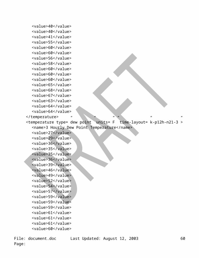
attribute = categorical-table, type = string, use = optionalattribute = conversion-table, type = string, use = optionalsequence
element = name, type = string, min = 0, max = 1element = value, type = valueType, min = 1, max = unbounded, nillable
typeType (scope = local, base = string)enumeration
“12 hour” “floating”
valueType (scope = local, base = nonNegativeInteger)attribute = upper-range, type = upper-rangeType, use = optionalattribute = lower-range, type = lower-rangeType, use = optionalmaxInclusive = 100
upper-rangeType (scope = local, base = nonNegativeInteger)maxInclusive = 100
lower-rangeType (scope = local, base = nonNegativeInteger)maxInclusive = 100
wind-speedType (scope = local, element only)attribute = type, type = typeType, default = “sustained”attribute = units, type = string, fixed = “knots”attribute = time-layout, type = time-layoutType, use = requiredattribute = categorical-table, type = string, use = optionalattribute = conversion-table, type = string, use = optionalsequence
element = name, type = string, min = 0, max = 1element = value, type = valueType, min = 1, max = unbounded, nillable
typeType (scope = local, base = string)enumeration
“sustained” “gust” “transport”
valueType (scope = local, base = nonNegativeInteger)attribute = upper-range, type = nonNegativeInteger, use = optionalattribute = lower-range, type = nonNegativeInteger, use = optional
directionType (scope = local to parameters element, element only)attribute = type, type = typeType, default = “wind”attribute = units, type = string, fixed = “degrees true”attribute = time-layout, type = time-layoutType, use = requiredattribute = categorical-table, type = string, use = optionalattribute = conversion-table, type = string, use = optionalsequence
File: document.doc Last Updated: August 12, 2003 Page: 60
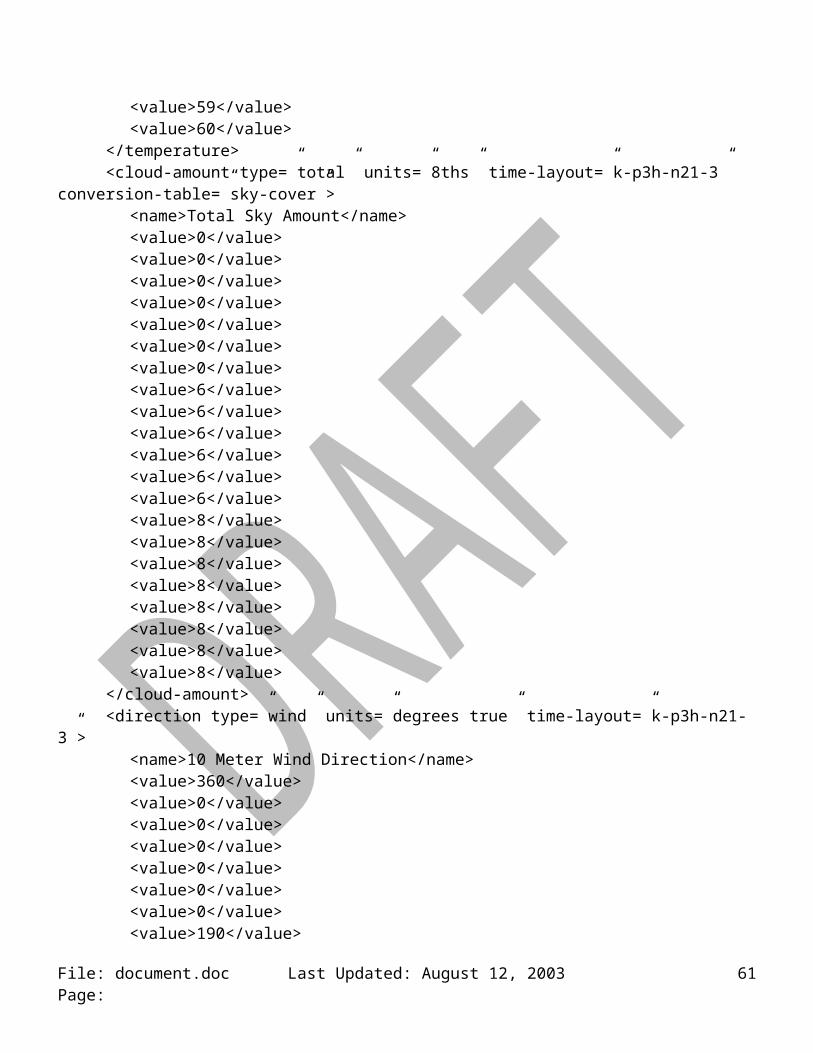
element = name, type = string, min = 0, max = 1element = value, type = valueType, min = 1, max = unbounded, nillable
typeType (scope = local, base = string)enumeration
“wind” “swell”
valueType (scope = local, base = nonNegativeInteger)maxInclusive = 360
cloud-amountType (scope = local, element only)attribute = type, type = string, fixed = “total”attribute = units, type = string, fixed = “percent”attribute = time-layout, type = time-layoutType, use = requiredattribute = categorical-table, type = string, use = optionalattribute = conversion-table, type = string, use = optionalsequence
element = name, type = string, min = 0, max = 1sequence
element = layer, type = layerType, min = 0, max = 0element = value, type = valueType, min = 1, max = unbounded, nillable
NOTE: conversion-table values for sky cover can be found in Table 1.
valueType (scope = local, base = nonNegativeInteger)attribute = upper-range, type = upper-rangeType, use = optionalattribute = lower-range, type = lower-rangeType, use = optionalmaxInclusive = 100
upper-rangeType (scope = local, base = nonNegativeInteger)maxInclusive = 100
lower-rangeType (scope = local, base = nonNegativeInteger)maxInclusive = 100
weatherType (scope = local, element only)attribute = time-layout, type = time-layoutType, use = requiredelement = weather-conditions, type = weather-conditionsType, min = 1, max = unbounded, nillable
weather-conditionsType (scope = local, element only)element = value, type = valueType, min = 1, max = unbounded, nillableattribute = categorical-table, type = string, use = optionalattribute = conversion-table, type = string, use = optionalattribute = weather-summary, type = string, use = optional
valueType (scope = local, elements only)
File: document.doc Last Updated: August 12, 2003 Page: 61
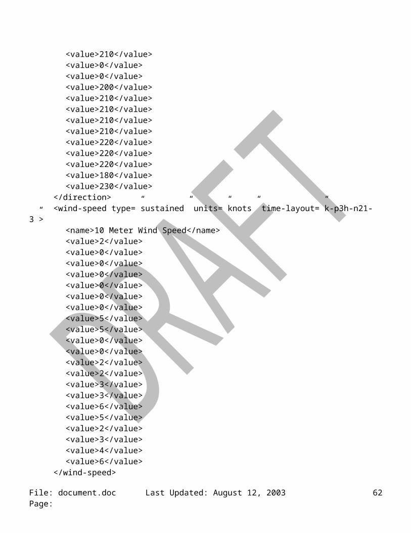
attribute = coverage, type = coverageType, use = optionalattribute = intensity, type = intensityType, use = optionalattribute = additive, type = additiveType, use = optionalattribute = weather-type, type = weather-typeType, use = optionalattribute = qualifier, type = qualifierType, use = optionalelement = visibility, type = visibilityType, min = 0, max = 1, nillable
coverageType (scope = local, base = string)enumeration
See Table 2 for valid values
intensityType (scope = local, base = string)enumeration
See Table 3 for valid values
additiveType (scope = local, base = string)enumeration
“and” “or”
visibilityType (scope = local, base = string)attribute = visibility-units, type = visibility-unitsType, default = “statute miles”enumeration
See Table 5 for valid values
visibility-unitsType (scope = local, base = string)Enumeration
“statute miles” “nautical miles”
qualifierType (scope = local, base = string)enumeration
See Table 4, column 2 for valid values
weather-typeType (scope = local, base = string)enumeration
See Table 4, column 1 for valid values
humidityType (scope = local, element only)attribute = type, type = typeType, default = “relative”attribute = units, type = string, fixed = “percent”attribute = time-layout, type = time-layoutType, use = requiredattribute = categorical-table, type = string, use = optionalattribute = conversion-table, type = string, use = optionalsequence
element = name, type = string, min = 0, max = 1element = value, type = valueType, min = 1, max = unbounded, nillable
File: document.doc Last Updated: August 12, 2003 Page: 62
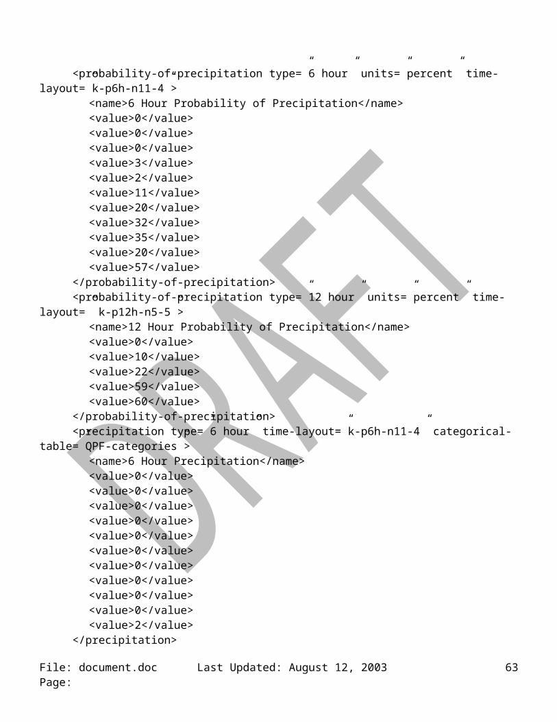
typeType (scope = local, base = string)enumeration
“relative” “max relative” “min relative”
valueType (scope = local, base = nonNegativeInteger)attribute = upper-range, type = upper-rangeType, use = optionalattribute = lower-range, type = lower-rangeType, use = optionalmaxInclusive = 100
upper-rangeType (scope = local, base = nonNegativeInteger)maxInclusive = 100
lower-rangeType (scope = local, base = nonNegativeInteger)maxInclusive = 100
conditions-iconType (scope = local, element only)attribute = type, type = typeType, default = “forecast-NWS”attribute = time-layout, type = time-layoutType, use = requiredsequence
element = name, type = string, min = 0, max = 1element = icon-link, type = anyURI, min = 1, max = unbounded
typeType (scope = local, base = string)enumeration
“forecast-NWS”
categorical-definitions (scope = local to parameter element, element only)element = categorical-table, type = categorical-tableType, min = 1, max = unbounded
categorical-table-elementType (scope = local, element only)attribute = units, type = string, use = requiredelement = categorical-key, type = key, min = 1, max = 1element = value, type = valueType, min = 1, max = unbounded
valueType (scope = local, text only)attribute = category, type = string, use = required
conversion-definitions (scope = local to parameter element, element only)element = categorical-table, type = categorical-tableType, min = 1, max = unbounded
conversion-table-elementType (scope = local, element only)attribute = units, type = string, use = requiredsequence
element = conversion-key, type = key, min = 1, max = 1sequence
element = start-value, type = anyType, min = 1, max = unbounded
File: document.doc Last Updated: August 12, 2003 Page: 63

element = start-value, type = anyType, min = 1, max = unboundedelement = equivalence-value, type = string, min = 1, max = unbounded
water-state (scope = local, element only)attribute = time-layout, type = time-layoutType, use = requiredchoice
sequenceelement = waves, type = wavesType, min = 0, max = unboundedelement = swell, type = swellType, min = 0, max = unbounded
element = seas, type = seasType, min = 0, max = unboundedelement = ice-coverage, type = ice-coverageType, min = 0, max = unbounded
waveType ( scope = local, element only)attribute = type, type = string, default = “wind”attribute = units, type = string, fixed = “feet”attribute = categorical-table, type = string, use = optionalattribute = conversion-table, type = string, use = optionalattribute = period, type = nonNegativeInteger, use = optionalattribute = steepness, type = nonNegativeInteger, use = optionalsequence
element = name, type = string, min = 0, max = 1element = value, type = nonNegativeInteger, min = 1, max = unbounded, nillable
swellType (scope = local, element only)attribute = type, type = string, default = “none”attribute = units, type = string, fixed = “feet”attribute = categorical-table, type = string, use = optionalattribute = conversion-table, type = string, use = optionalattribute = period, type = nonNegativeInteger, use = optionalattribute = steepness, type = nonNegativeInteger, use = optionalsequence
element = name, type = string, min = 0, max = 1sequence
element = value, type = nonNegativeInteger, min = 1, max = unbounded, nillableelement = direction, type = directionType, min = 0, max = unbounded, nillable
seasType (scope = local, element only)attribute = type, type = string, default = “combined”attribute = units, type = string, fixed = “feet”attribute = categorical-table, type = string, use = optionalattribute = conversion-table, type = string, use = optionalsequence
element = name, type = string, min = 0, max = 1element = value, type = nonNegativeInteger, min = 1, max = unbounded, nillable
ice-coverageType (scope = local, element only)
File: document.doc Last Updated: August 12, 2003 Page: 64
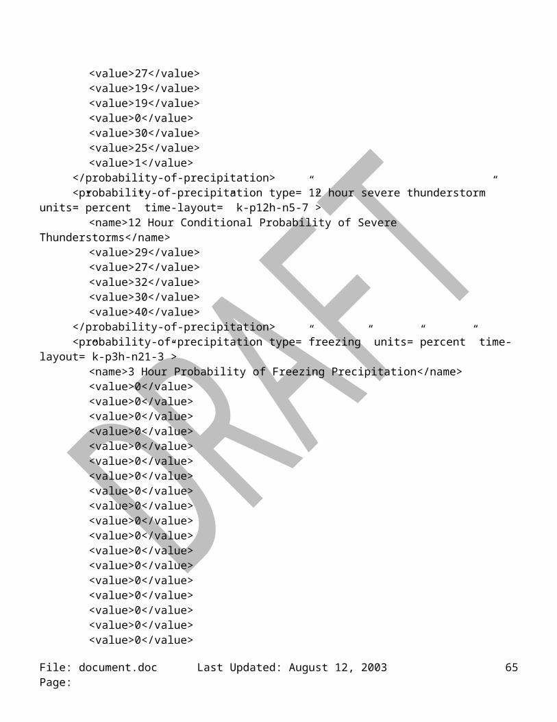
attribute = type, type = string, default = “total”attribute = units, type = string, fixed = “percent”attribute = categorical-table, type = string, use = optionalattribute = conversion-table, type = string, use = optionalsequence
element = name, type = string, min = 0, max = 1element = value, type = nonNegativeInteger, min = 1, max = unbounded, nillable
Total Sky Cover Values(<value>)
Text Equivalent(equivalent-value)
Sky Cover 6percent clear
6percent < Sky Cover 31percent mostly clear
31percent < Sky Cover 69percent partly cloudy
69percent < Sky Cover 94percent mostly cloudy
94percent < Sky Cover 100percent cloudy
Table 1: Sky Cover to Text Conversion (Source: NWSI 10-503).
Coverage Values(weather-coverage)
slight chance occasional scattered areas
chance definitely numerous widespread
likely isolated patchy none
Table 2: Valid Values for Weather Coverage Attribute.
Intensity Values(weather-intensity)
very light
light
moderate
File: document.doc Last Updated: August 12, 2003 Page: 65

heavy
none
Table 3: Valid Values for Weather Intensity.
Weather Values(<value>)
Weather Attributes(weather-qualifier))
freezing drizzle frequent lightning
freezing rain heavy rain
snow shower small hail
blowing snow outlying areas
blowing dust gusty winds
rain shower damaging winds
ice pellets large hail
frost on bridges and overpasses
rain
hail
snow
smoke
thunderstorm
drizzle
fog
Table 4: Valid Weather Values.
Visibility Values(<visibility>)
0 1 ½ 5
¼ 2 6
File: document.doc Last Updated: August 12, 2003 Page: 66

½ 2 ½ 6+
¾ 3 none
1 4
Table 5: Valid Visibility Values.
File: document.doc Last Updated: August 12, 2003 Page: 67
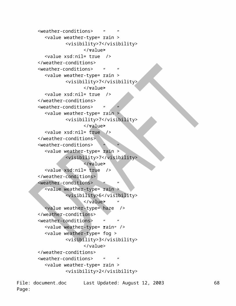
Appendix F: References
1. The National Digital Forecast Database Development web site (http://onestop.noaa3.awips.noaa.gov/ndfd/index.html)
2. National Weather Service Instruction 10-506 (DRAFT), Digital Data Products/Services Specification (http://www.nws.noaa.gov/ost/ifps_sst/10-506.pdf)
3. National Weather Service Instruction 10-503, Public Weather Services (http://www.nws.noaa.gov/directives/010/pd01005003a.pdf)
4. National Weather Service Instruction 10-310, Marine and Coastal Weather Service Program (http://www.nws.noaa.gov/directives/010/pd01003010c.pdf)
5. FM 92-XII GRIB General Regularly-distributed Information in Binary Form (http://www.nws.noaa.gov/tdl/iwt/grib2/frameset_grib2.htm)
6. Description of the AVN MAV MOS Alphanumeric Message (http://www.nws.noaa.gov/mdl/synop/mavcard.htm)
7. Definitions of AVN MOS Weather Elements (http://www.nws.noaa.gov/mdl/synop/avnacronym.htm)
File: document.doc Last Updated: August 12, 2003 Page: 68