meeting announcement madison area … announcement madison area transportation planning board a...
TRANSCRIPT

MEETING ANNOUNCEMENT Madison Area Transportation Planning Board
A Metropolitan Planning Organization (MPO)
September 3, 2014
City-County Building 210 MLK Jr. Blvd, Room 354
6:30 p.m.
AGENDA 1. Roll Call
2. Approval of August 6, 2014 Meeting Minutes
3. Communications
4. Public Comment (for items not on MPO Agenda)
5. Public Hearing on Draft 2015-2019 Transportation Improvement Program (TIP) for the Madison Metropolitan
Area & Dane County
Note: Action on the 2015-2019 TIP by the MPO is anticipated Wednesday, October 1 at 6:30 p.m. in Room A-B
of the Madison Water Utility Building, 119 E. Olin Avenue. Written comments on the TIP are invited through
Friday, September 19, and should be sent to the MPO offices at 121 S. Pinckney St., Suite 400, Madison, WI
53703 or e-mailed to [email protected].
6. Election of Officers
7. Resolution TPB No. 93 Approving Amendment #6 to the 2014-2018 Transportation Improvement Program for
the Madison Area & Dane County USH 51/Stoughton Rd. (CTH BB/Cottage Grove Rd. SB Bridge), Bridge Replacement [Revised cost]
CTH AB/Buckeye Rd. (Yahara River Bridge), Bridge Replacement [Different federal funding source]
Old CTH PB (Badger Mill Creek Bridges in City and Town of Verona) [Projects separated, different sponsors]
8. Resolution TPB No. 94 Amending the Program Management and Recipient Coordination Plan for the Section
5310 (Enhanced Mobility of Seniors and Individuals with Disabilities) Program for the Madison Urbanized Area
9. Appointment to the Stoughton Road (USH 51) Study Policy Advisory Committee
10. Appointments to the MPO Citizen Advisory Committee
11. Brief Update on the Bicycle Transportation Plan
12. Discussion Regarding MPO Board Meeting Minutes
13. Status Report by Madison Area TPB Members on Studies and Plans Involving the TPB:
USH 51/Stoughton Road (USH 12/18 to IH 39/90/94) Corridor EIS Study
USH 51 (McFarland to Stoughton) Corridor EIS Study
Beltline (USH 14 to CTH N) Corridor EIS Study
Interstate 39/90/94 (Madison to Wisconsin Dells) Corridor EIS Study
City of Madison Sustainable Transportation Master Plan
14. Discussion of Future Work Items:
Public Participation Plan Update
2015-2019 Transportation Improvement Program
2015 MPO Work Program and Budget
Section 5310 Program Application Cycle for CY 2015 Projects
Metro Transit On-Board Survey
Roadway Functional Classification Update

Revisions to STP Urban Project Scoring Criteria
Regional ITS Strategic Plan
Bicycle Transportation Plan Update
Bicycle Wayfinding Plan
15. Announcements and Schedule of Future Meetings
16. Adjournment
Next MPO Meeting:
Wednesday, October 1 at 6:30 p.m.
Madison Water Utility Building, 119 E. Olin Ave., Room A-B
If you need an interpreter, materials in alternate formats, or other accommodations to access this meeting,
contact the Planning & Development Dept. at (608) 266-4635 or TTY/TEXTNET (866) 704-2318.
Please do so at least 48 hours prior to the meeting so that proper arrangements can be made.

DRAFT
1
Madison Area Transportation Planning Board (an MPO)
August 6, 2014 Meeting Minutes
______________________________________________________________________________
1. Roll Call
Members present: Ken Golden, Jeff Gust, Chuck Kamp, Steve King, Paul Lawrence, Al Matano, Ed
Minihan, Mark Opitz (arrived during item #5), Chris Schmidt, Robin Schmidt (left after item #5)
Members absent: David Ahrens, Mark Clear, Jerry Mandli
MPO Staff present: Bill Schaefer, Mike Cechvala
Others present in an official capacity: Joe Conduah (WisDOT SW Region), Michael Hoelker (WisDOT SW
Region), Rich Kedzior (TranSmart Technologies), Steve Steinhoff (CARPC)
2. Approval of July 2, 2014 Meeting Minutes
Moved by King, seconded by Lawrence, to approve the July 2, 2014 meeting minutes. Motion carried.
3. Communications
Letter from WisDOT approving amendment #5 to the 2014-2018 TIP.
Email from Schaefer to Mark Hazelbaker, Dane County Towns Association Attorney, in response to
question about updating the Dane County Land Use & Transportation Plan. Schaefer explained the
MPO’s responsibilities with respect to the regional transportation plan, coordination efforts with CARPC
on population and employment forecasts, and how the MPO addresses land use in the absence of an
updated regional land use plan. Golden provided an update on the dispute between the commission and
county over CARPC’s 2015 budget. The commission is asking for a large increase in funding, some of
which would go towards updating the land use plan.
Letter from Schaefer supporting Metro Transit’s application for funding of Metro buses and vans for
YWCA through the Ladders of Opportunity initiative, a new Federal Transit Administration funding
program. Schaefer noted that STP Urban funds would not be needed for the YWCA JobRide program
should Metro Transit be awarded the grant. Kamp said the grant was for $8 million and noted that letters
of support were also received from Madison Mayor Soglin, Epic Systems, and others. Schaefer explained
that there was insufficient time to get approval of the Board for the letter since applications were due on
August 4. The board endorsed the letter via a voice vote. Board members discussed the best protocol for
dealing with such situations in the future.
Press Release from WisDOT announcing the Transportation Alternatives Program projects that were
awarded funding. Dane County received additional funding for the additional boardwalk improvements
needed for the Lower Yahara River Trail and the City of Madison received funding for the extension of
the Capital City Trail to Interstate 39/90. Gust provided an update on the project, indicating the
environmental document had been signed which would allow real estate to be acquired. That needed to be
done by October so the county doesn’t lose its previously approved funding.
4. Public Comment (for items not on MPO Agenda)
None
5. Presentation on WisDOT Southwest Region Park-and-Ride (PNR) System Study
Schaefer explained that WisDOT SW Region staff had been working with its consultant, TranSmart
Technologies, on a Park-and Ride System Study for the region which covers 16 counties. They have
completed most of their analysis and are at the stage of developing recommendations. He introduced the
WisDOT staff and consultants. Conduah opened the presentation and provided background information

DRAFT
2
relating to the study. He said WisDOT will consult the report recommendations when roadway construction
projects are being designed to determine if there is a need for a park-and-ride facility. The two primary goals
for WisDOT’s park-and-ride program are to reduce traffic on state highways and provide cost-effective travel
options. Generally, facilities are constructed in conjunction with a state highway improvement. Local
maintenance and patrol agreements are needed before a facility will be built.
Kedzior from TranSmart continued the presentation. He said WisDOT SW Region had been building more
and improving existing park-and-ride facilities over the past ten years with 11 lots now in Dane and Jefferson
counties and one in La Crosse County. Most existing lots serve the Madison region. Kedzior noted that the
Dutch Mill facility functions as a regional lot with many users being intercity bus passengers. He summarized
the study objectives. The first was to identify potential general lot locations and create a model to evaluate
those locations. He provided some information on the model and said it was a tool to help determine that a
general location would be successful. In response to a question from Golden, he said the model was not great
at determining the needed capacity for a lot. Other factors, particularly nearby vanpool routes, needed to be
considered. The second most important study objective was to improve coordination amongst the WisDOT
regions and to improve coordination between WisDOT and local officials. Kedzior explained the data
collection effort which included a review of relevant plans, traffic data, Census LEHD data, a vanpool survey,
an employer survey, and a 72-hour video recording counts at seven lots in the region. The video was useful
for determining peak usage times. Epic was among the employers that provided employee zip code locations.
About 15% of Epic employees live in the 53704 zip code area. There were also seven meetings held with
local officials and staff.
There was discussion about informal park-and-ride locations on private property and even on the sides of
roads. The possibility of working with DNR on lots near state trails was also discussed. Kedzior showed a
map of evaluated locations. He explained the evaluation model was cost-based. He said that the team was now
working to prioritize the locations and develop other recommendations.
Golden commented on the need to coordinate this study with the Beltline study. One of the strategies
discussed with the Beltline study was creating PNR lots to get people out of their cars before they get to the
Beltline and he said it looked like there may be some additional opportunities for that such as on Mineral
Point Road. Kedzior said some additional locations were being investigated around the Beltline. In response
to a question from Gust, Kedzior said most of the PNR locations identified were adjacent to state highways,
but not all. Hoelker commented on the issue of whether the lots should be further out oriented to carpooling or
closer in oriented to transit or more likely a combination of the two. He said those details would be further
addressed as part of the Beltline study. Kedzior said that from the vanpool study he thought locations in east
and southeast Dane County, Jefferson County, and Rock County would help the Beltline the most. Kedzior
then highlighted some of the preliminary policy concepts such as encouraging development of local PNR
systems.
Royce Williams, Madison, registered to speak. He commented on the uniqueness and heavy use of the Dutch
Mill lot due to the intercity bus passengers which won’t show up in the model being used. Williams said the
people parking should be paying for maintenance of the lot, not the bus companies. Charging people for long-
term parking would be better than restricting how long people can park there. Gust noted WisDOT offered to
separate the lots and set up a system for charging, but the City of Madison didn’t want to do that at this time.
Schaefer mentioned that Kedzior had shared information about vanpool programs in other states and
deficiencies in the Wisconsin program. For example, because DOA runs the program as a benefit for state
employees one of the vanpool participants must be a state employee. That and other restrictions have limited
program growth. He said he hoped a recommendation for WisDOT to start a supplemental vanpool program
might come out of this study. The cost of the vehicles is paid for through passenger fees so it is low cost.
6. 2014-2016 Memorandum of Understanding Regarding the Capital Region Sustainable Communities
Consortium
Schaefer provided some background information on the consortium, which was formed when the Capital Area
Regional Planning Commission (CARPC) led a group effort to obtain a Sustainable Communities grant. The

DRAFT
3
grant has funded numerous projects, including the Bus Rapid Transit Study and complementary Transit-
Oriented Development (TOD) Market Study. The grant has ended. The purpose of the memorandum of
understanding (MOU) is to facilitate keeping the work going without any dedicated funding. It made sense for
CARPC to continue to play a lead role. He introduced Steve Steinhoff with CARPC staff who was invited to
provide more information on the consortium activities and the MOU.
Steinhoff said a major part of the work was development of a consortium, a public-private collaboration, to
organize and work together to address regional economic, environmental, and social challenges related to
sustainability. The underlying premise is that these types of regional challenges require multi-sector and
cross-silo approaches. The focus going forward is to try to apply the best practices of “collective impact”
strategies to tackle the challenges and identify measurements to track progress. He said CARPC planned to
continue a basic level of backbone support for the consortium. He reviewed the steps that were taken to
develop a broad vision, identify goals, and then five core challenges. Golden suggested broadening the goal of
establishing high capacity transit to developing a regional transit system. Steinhoff said there was more
language to the goal, which referenced a multi-modal transportation system, and that these were just the
priorities, not everything. He then reviewed the other goals, including meeting the growing demand for
walkable, mixed-use centers, and example metrics to measure progress. The idea is to use indicators to
establish targets and then identify activities and actions needed to make progress towards the target. A
possible initiative is to promote active living places and set a goal for the percentage of households living in
these identified areas.
Steinhoff reviewed the proposed structure for consortium going forward, including a policy team supported
by a staff team and then work groups addressing the different challenges through mutually agreed reinforcing
activities, communication, and backbone support. The policy team, which would be new, is seen as critical to
getting more involvement from policy makers. It has thus far mainly been a staff effort.
Schaefer reviewed the draft completed MOU wherein the primary goals interests were identified and the level
of participation. It was proposed the MPO have representation on both the policy and staff teans as well as
work groups as appropriate.
Moved by King, seconded by C. Schmidt, to approve signing the MOU. Motion carried.
7. Election of Officers
Moved by Opitz, seconded by Kamp, to postpone this item until the next meeting. Motion carried.
8. Review of Final Draft Scoring and Priority Listing of Candidate Projects for STP Urban Funding for
2015-2019
Schaefer reviewed the two minor changes in the scoring and priority listings: a minor correction in the cost of
the MPO Rideshare program and a minor change in the score of the Pleasant View Road project. That project
is not programmed at this time. Schaefer reminded the board that the addition of the new transit projects and
other revisions in cost and timing of projects was subject to issues being worked out with WisDOT. WisDOT
was in the process of finalizing guidance on the STP Urban and Transportation Alternatives programs. A
work group had been set up to provide input on the guidance.
9. Release of Draft 2015-2019 Transportation Improvement Program (TIP) for the Madison Metropolitan
Area & Dane County for Public Review and Comment
Moved by Opitz, seconded by Kamp, to release for public review and comment the draft 2015-2019
Transportation Improvement Program (TIP). Motion carried.
10. Resolution TPB No. 91 Approving the Madison Area TPB Title VI Non-Discrimination
Program/Limited English Proficiency Plan
Schaefer provided some background on the plan. All recipients of federal funding are required to comply with
Title VI of the Civil Rights Act and related laws and regulations. This included direct recipients of funding
DRAFT
4
like Metro Transit and sub-recipients such as MPOs, which get their federal funding through state DOTs. The
purpose is to ensure there is no discrimination on the basis of race, color, or national origin under programs
that receive federal funding. In the past the MPO has relied on the City of Madison’s program for compliance,
but due to some new recent guidance published with some specific requirements related to MPOs, it was
decided the MPO should adopt its own Title VI program. The MPO will still rely on the city for resources and
support. The program document outlines all of the things the MPO does or will do to comply with Title VI.
This includes requirements related to notice to the public, complaint procedures, language assistance services,
and other items such as how the MPO ensures that minority populations are considered in the planning
process. This includes efforts to involve them in the planning process and ensure there are no disproportionate
impacts as a result of MPO plans and TIPs. Schaefer said the draft document was sent to WisDOT for
comment and MPO staff received one comment related to publishing the public notice and complaint
procedures in other languages, which will be addressed in the final document.
Moved by Kamp, seconded by Minihan to approve Resolution No. 91 approving the Madison Area TPB Title
VI Non-Discrimination Program/Limited English Proficiency Plan. Motion carried.
11. Resolution TPB No. 92 Approving Agreement Providing for the Provision of Services by the MPO to
Dane County for Completion of a County Bicycle Wayfinding Plan
Schaefer explained that Dane County Parks has funding to prepare a bicycle wayfinding plan to ensure
consistency in wayfinding and destination signage across jurisdictions and some funding to begin to
implement that plan. The county asked the MPO to provide project management services to oversee
development of the plan. The MPO agreed to do so for a minimal fee to cover some of the MPO’s local match
funding. After discussions between the city and county attorneys, it was determined that a purchase of service
agreement was needed. This requires resolutions by the MPO and city. This resolution approves the city as
the MPO’s fiscal agent entering in an agreement with Dane County to provide these services.
Moved by Kamp, seconded by Opitz, to approve Resolution No. 92, an agreement providing for the provision
of services by the MPO to Dane County for completion of a County Bicycle Wayfinding Plan. Motion
carried.
12. Status Report by Madison Area TPB Members on Other Projects Involving the TPB
Schaefer reported on the Stoughton Road study. An East Washington area redevelopment study was getting
underway to address the impact of the project on businesses in that intersection area and plan for future
redevelopment. He said WisDOT had decided move forward on the draft EIS with the traffic forecasts they
have now and update the forecast with the new lower population and employment forecasts for the final EIS.
A meeting with City of Madison staff and local officials was scheduled to review WisDOT responses to some
comments the city submitted. WisDOT will be setting up another round of meetings with the study policy
advisory committee. Schaefer said the MPO may need to appoint a representative to the committee.
13. Discussion of Future Work Items
Schaefer said the MPO was overseeing a Section 5310 program application cycle, which is being coordinated
with WisDOT. Applications are due August 15. The contract with the consultant for the regional ITS plan
was signed and that project will be started soon.
14. Announcements and Schedule of Future Meetings
Schaefer said the process of filling the vacant cities and villages appointment to the board was underway.
The next meeting will be held Wednesday, September 3, 2014 at 6:30 p.m. at the City-County Building, 210
MLK Jr. Blvd., Room 354.
15. Adjournment
Moved by King, seconded by C. Schmidt to adjourn. Motion carried. The meeting adjourned at 8:27 PM.

1 WisDOT Response to City of Madison – Mayor Letter 08/11/14
(1) Address recent declines in vehicle miles of travel (VMT) within the U.S. and the Dane County region, and possible future reductions in VMT growth. Discuss how these trends affect future traffic projections in the corridor and how they may affect the design of the project.
WisDOT is constantly studying trends to understand how they may affect future travel within our project corridors. While it is true VMT growth has leveled off over the last decade for both the U.S. and Wisconsin, those large scale trends don’t necessarily apply to specific corridors. WisDOT’s policy is to evaluate location-specific volumes, socioeconomic data, and trends to produce forecasts for project corridors, guided by the context of the larger trends. While WisDOT does acknowledge the larger trends (statewide stabilization of VMT), it is the local trend (increasing average daily travel) that is most valuable.
Data from the Madison MPO indicates that volumes at most locations on Stoughton Road were higher in 2012 than in 2005 or 2006. In Dane County, VMT in 2012 was the highest on record, exceeding the previous peak recorded in 2006. Even if VMT per capita continues to decline further, Madison and Dane County are projected to continue to add population and employment, which in turn drive transportation demand. There are several areas adjacent to and within the Stoughton Road corridor, primarily on the north end, that are planned for future development. Much of the southern end of the corridor has been built out, however there several areas planned for infill and redevelopment as reflected in the City of Madison plans. This will add to traffic volumes on the corridor.
The forecasts used for the USH 51 Stoughton Road study were prepared using the Madison MPO’s travel demand model, made available in early 2013. The model does incorporate the planned future development and redevelopment reflected in the City of Madison’s long-term plans. The daily growth predicted by the model was applied to hourly turning movements (as counted/measured in the field), which in turn have been used in the development of the alternatives. The process capped the allowable growth rate applied to the hourly volumes to limit the total growth applied throughout the corridor. The reason for this approach is that daily traffic growth on Stoughton Road will always be greater than the growth that occurs during peak periods because the roadway nears capacity during those peak times.
The Madison MPO is currently in the process of updating the Dane County travel demand model with the latest census and socioeconomic data. Once the model has been updated (expected summer of 2014) the study team will use the forecasted volumes from the updated model to evaluate the study alternatives to determine what, if any, design changes could potentially be made. One thing to note is that WisDOT typically designs a roadway for projected traffic volumes for 20 years into the future from the date of construction. Due to the large scope of potential Stoughton Road projects and the associated costs and impacts, it is prudent to consider designing beyond the typical 20 year design timeframe in this case to avoid larger impacts and costs in the future.
(2) Identify and address the impacts on businesses throughout the project corridor. Identify the tax base implications of businesses that are eliminated or relocated.
Improvements to safety and operational efficiency are expected for all modes of travel. These improvements have the potential to ultimately improve access to Stoughton Road area businesses. Businesses that rely on trucks for delivery and shipping will benefit from improved access to and from Stoughton Road. Improved bicycle and pedestrian connectivity throughout the corridor (both parallel and crossing Stoughton Road) will benefit businesses as well.
2 WisDOT Response to City of Madison – Mayor Letter 08/11/14
Direct visibility from Stoughton Road to adjacent businesses will be reduced in the area of new grade separated crossings and interchanges. The potential for reduced visibility could result in adverse effects on retention or redevelopment of certain businesses.
Closing, realigning, or limiting turning movements at some existing intersections could result in inconvenience to businesses, but this is not expected to cause substantial adverse effects. The conversion of the existing two-way frontage roads to one-way frontage roads between Pflaum Road and Buckeye Road will affect access to businesses in that area. At the request of the City of Madison, WisDOT is proposing two additional crossings of Stoughton Road between Pflaum Road and Buckeye Road as well as additional on/off ramps in the area to provide increased access to businesses in the area.
Due to the scope of improvements needed to address the safety and operational issues along the corridor and the relatively close proximity of development, it is estimated that between 76 and 93 businesses could be potential relocations (80 for the WisDOT recommended alternative). Over 80% of these potential relocations occur in the Pflaum/Buckeye and East Washington Avenue areas. Some relocations are due to direct impacts from a wider roadway footprint, while others have to do with removal of access because of the close proximity to the proposed interchange.
A Conceptual Stage Relocation Plan (CSRP) is being completed for the study corridor. The availability of comparable replacement business property is analyzed as part of the CSRP. Based on CSRP analysis, currently there is more than an adequate supply of available commercial properties in the East Madison and Eastern Dane County area to meet the needs of the businesses that potentially could be relocated, regardless of the alternative selected.
It should be noted, in several locations where businesses are potentially impacted, excess land is expected to be available for redevelopment. This includes the Pflaum/Buckeye and East Washington Avenue areas. Many of the potentially impacted businesses may be able to relocate in the same area, possibly even the same parcel. To that end, WisDOT is partnering with the City of Madison on a redevelopment study in the East Washington Avenue area. The redevelopment study includes all 4 quadrants of the existing intersection and extends along the East side of Stoughton Road to Kinsman Boulevard. Under the scope of the study, the City of Madison will be responsible for the redevelopment plan for the impacted areas based off of the WisDOT preferred alternative, and WisDOT will provide functional local road connections that are compatible with the redevelopment plan. Outreach and input from affected business owners will play a large role in the plan for how the area redevelops. Results of the study will be included in the Stoughton Road environmental document.
While no official redevelopment study has been funded for impacted areas along the corridor outside of the East Washington Avenue area, WisDOT will work closely with the City and affected business owners in those areas to provide acceptable local road connections for remaining businesses and find suitable sites for relocated businesses.
The tax base implications of the businesses that potentially may be eliminated or relocated due to the roadway project are difficult to measure at this time. Businesses may choose to relocate in a different area for reasons that are not directly tied to the roadway construction. Other businesses may choose to remain located within the Stoughton Road corridor based on improved roadway safety, mobility, and bicycle/pedestrian facilities. The improved roadway may increase the potential for areas that are
3 WisDOT Response to City of Madison – Mayor Letter 08/11/14
currently vacant or underutilized to be redeveloped. Remnant parcels may be incorporated with business parcels that remain to provide areas for expansion or enhancement of existing businesses. Many of the commercial buildings that are directly impacted by the construction are nearing the end of their useful life and may need significant improvement to remain viable.
WisDOT believes providing a safer and more efficient roadway with improved access and bicycle and pedestrian facilities should help attract businesses and promote long-term economic development and growth in the area. It is anticipated that changes in land use/redevelopment will occur in some areas and long-term land values may ultimately increase as a result.
(3) Identify and address the potential impacts of depressing the roadway (as recommended in the Buckeye/Pflaum area), including impacts on businesses in the area. Provide examples of other depressed roadways in the U.S. (similar to the recommended alternative), and describe the impacts and benefits experienced by adjacent/area businesses over time after construction of the depressed roadway. What specific actions will be taken to mitigate the potential negative impacts on businesses in this area (particularly pertaining to business visibility and wayfinding)? The primary benefit for businesses adjacent to the depressed freeway section of the corridor will be a safer and more efficient roadway system for customers accessing the businesses. In general, the more efficiently a driver can get to a business and the safer they feel traveling there, the more likely they are to frequent it. While the existing two-way frontage roads are converted to one-way frontage roads in the recommended alternative, access to businesses will be enhanced by the additional crossings of Stoughton Road at Helgesen Drive and Allis Avenue and the additional on/off ramps in the area. In addition, the recommended alternative in this area greatly improves bicycle and pedestrian accommodations with multi-use paths alongside the frontage roads, and improved and/or new bike/ped crossings at Pflaum Road, Helgesen Drive, Allis Avenue, and Buckeye Road. With the depressed Stoughton Road through traffic removed from these crossings, more time can be given to the bicyclists and pedestrians crossing Stoughton Road. These improved facilities will likely benefit businesses in the area as well.
However, the recommended alternative in the Pflaum/Buckeye area does require a number of potential business and residential relocations. As described in Question #2, the Conceptual Stage Relocation Plan (CSRP) completed for the study has shown that there is an adequate supply of commercial properties available in the East Madison and Eastern Dane County area to meet the needs of the businesses that could be potentially relocated from any of the alternatives. WisDOT will work with the City of Madison and business owners to find suitable relocation sites for displaced businesses and will also work with residential property owners and tenants to find appropriate replacement housing. It should be noted that the recommended alternative has the lowest number of total relocations (commercial and residential) of all the alternatives in this area. Another impact of a depressed roadway is the potential loss of business visibility from the area of the depressed roadway. With Stoughton Road lowered between 20 – 25 feet, businesses will not be directly visible to the through traffic below. The loss of direct visibility will likely have the largest impact on drive-by businesses, such as gas stations and fast-food restaurants. WisDOT continues to investigate signing options for the Pflaum-Buckeye area as well as the corridor, however there are strict federal rules for advertising signs allowed in DOT right-of-way. Blue informational signs are a possibility for gas/food/lodging businesses, however signing for other types of businesses is restricted. WisDOT will
4 WisDOT Response to City of Madison – Mayor Letter 08/11/14
continue to investigate the possibility of providing additional guide signage to alert drivers that they are approaching the Pflaum/Buckeye area. WisDOT will also work with the City of Madison to discuss other possible options to raise driver awareness of the businesses in the Stoughton Road area. Under the recommended alternative, the existing two-way frontage roads between Pflaum and Buckeye would be converted to one-way frontage roads. Keeping the two-way frontage roads was investigated; however the two-way frontage roads require a larger roadway footprint, particularly at the intersections. A larger roadway footprint would require additional right-of-way and would have a greater impact on the existing area businesses.
A common concern with depressed roadways is cross connectivity. In order to address this issue, additional crossings of Stoughton Road have been added at Helgesen Drive and Allis Avenue. The new crossings will accommodate vehicles, bicycles, and pedestrians. In addition, on and off ramps have been added on either side of Helgesen Drive to provide additional access to/ from Stoughton Road to the businesses located on the frontage roads.
There are several metropolitan areas with depressed roadway sections – Chicago, Minneapolis, Des Moines, Dubuque, Louisville, and others. Very few studies are available that measure the impacts businesses by a depressed roadway following construction. Based on the limited studies available, impacts to business are likely to be variable depending on timing, economic conditions, zoning, and land use. They state that the impact to business visibility is a detriment. However, studies state that businesses that remain see an increase in value over the long term, provided they have sufficient access from the main roadway.
(4) Discuss the pros and cons of depressed roadways vs. parkway/boulevard facilities, in particular how this area might be affected by both types of facility design.
For the purposes of this question and subsequent questions, it is assumed that a boulevard facility will keep existing intersections as at-grade and the speed limit would be lowered to 35 – 40 mph, similar to East Washington Avenue. It is further assumed that a parkway facility would be similar to the WisDOT recommended alternative, including the depressed roadway in the Buckeye/Pflaum area, however the posted speed would be lower (40 – 45 mph) and a grass median would be constructed throughout the corridor. The minimum width for a grass median for a 45 mph posted speed is 30-feet. In order for trees to be placed within the median, FHWA has indicated that barrier would be required adjacent to the inside shoulder in each travel direction. For speeds lower than 45 mph the median could potentially be narrowed to 14-feet in areas where there are predominantly left-turning movements and few cross traffic vehicles, however due to the side road traffic volumes on Stoughton Road throughout the corridor, a 30-foot median would be more appropriate. Trees are allowed to be planted in the median for posted speeds 40 mph or lower as long as lateral clearance requirements are met. Forecasting the net impact of these different corridor types is difficult and complex. The following points discuss pros and cons for each type of facility in the Buckeye/Pflaum area: Safety A perceived pro for a boulevard concept could be that the speed limit through the area would be lower which could help to lower overall and injury crash rates. However, there is no concrete evidence that

5 WisDOT Response to City of Madison – Mayor Letter 08/11/14
lowering the speed limit would reduce crashes in the area, and the case could be made that overall crash rates may increase due to higher variability in speeds and driver frustration due to increased travel times. In addition, a boulevard concept does not adequately address intersection safety. With the boulevard concept, existing intersections with the highest overall and injury crash rates (Buckeye and Pflaum Roads) remain as at-grade intersections. As previously stated, the Buckeye Road and Pflaum Road intersections currently have some of the highest intersection crash rates along the corridor. The majority of these crashes are rear-end crashes that occur within 200 feet of the intersections, indicating that these crashes occur because drivers react differently to the signalized control at the intersection. Some drivers choose to stop when the signal turns yellow while others speed up to get through the signal. The WisDOT recommended alternative addresses this issue by lowering Stoughton Road in the area and eliminating the at-grade intersections. The recommended alternative also addresses the safety issue related to the close proximity of the frontage roads to the US 51/Buckeye and US 51/Pflaum intersections. A parkway concept would similarly improve intersection safety. The primary safety concern related to a parkway concept is getting drivers to comply with a reduced (45 mph or lower) posted speed and the safety issues that would likely result from a higher variability in the speed drivers are traveling. A higher variability in speed on a roadway typically results in more tailgating, weaving, as well as difficulty in judging speeds for merging vehicles.
From a bicycle/pedestrian perspective, the grade separations provided in the WisDOT recommended alternative would eliminate conflicts between Stoughton Road through traffic and bicyclists and pedestrians, allowing more time for bicycle and pedestrian users to cross Stoughton Road. With a boulevard concept, the large signalized intersections would require longer multi-stage pedestrian crossings than what currently exists today. It is possible that grade-separated crossings could be provided with a boulevard concept to address this, however it would lead to additional impacts, costs, and maintenance requirements. Traffic Operations With a boulevard concept additional travel lanes will be required to meet an acceptable level of service (reduce overall congestion in the area) compared to the no-build. Despite the additional travel lanes, travel delay would be greatest with a boulevard concept, as compared to the parkway concept or the WisDOT recommended alternative. Stoughton Road vehicles would be controlled by signals rather than the free-flow movement provided with a parkway concept or the WisDOT recommended alternative. Increased travel times will likely cause some drivers to look for alternate routes and divert onto local neighborhood streets to avoid delays on Stoughton Road. A primary need outlined at the beginning of the study was to reduce the diversion of Stoughton Road traffic onto neighborhood streets. With the WisDOT recommended alternative or the parkway concept the elimination of several of the most congested at-grade signals will reduce congestion and decrease travel times, particularly on Stoughton Road, which will reduce the traffic diversion that currently occurs onto neighborhood streets. Reduced congestion and improved travel times have the potential to help move goods and services more efficiently which can improve economic vitality in the area.

6 WisDOT Response to City of Madison – Mayor Letter 08/11/14
Environmental Impacts The primary impacts for the WisDOT recommended alternative in the Pflaum/Buckeye area have been identified and described in detail in Question #3. They include business and residential relocations, loss of visibility for businesses, and the conversion of the existing two-way frontage roads into one-way frontage roads. Impacts from a parkway would be similar because the grade separations and cross-section would be similar. In the Pflaum/Buckeye area a boulevard concept would look similar to Alternative A, with 4 travel lanes in each direction (8 total through travel lanes) on Stoughton Road, at-grade intersections, and frontage roads. The concept would maintain business visibility as well as the keep the two-way frontage roads. However with Alternative A, the frontage road intersections east and west of Stoughton Road would be shifted away from Stoughton Road to increase intersection spacing and improve safety. A boulevard concept will need similar accommodations for the frontage roads, leading to several additional business and residential relocations and greater right-of-way impacts than the recommended alternative. It is anticipated that traffic noise impacts would be less with the WisDOT recommended alternative or a parkway concept because Stoughton Road would be lowered approximately 20 – 25 feet through the area. These concepts also provide a free-flow movement on Stoughton Road through the area which reduces the noise typically related to vehicles braking and accelerating at traffic signals. It is possible that some environmental and health conditions may be negatively affected by converting Stoughton Road to a boulevard due to higher relative congestion, queuing, and the additional braking and accelerating that result for cars, buses, and trucks; as compared to the parkway concept or the WisDOT recommended alternative. Costs The estimated cost for construction and real estate in the Pflaum/Buckeye area for the WisDOT recommended alternative is $85 million ($2013). The parkway concept would have similar costs because the grade separations and roadway cross-section would be similar. However, the raised median associated with the parkway would likely increase costs by approximately $500,000 per mile installed ($2013) over the WisDOT recommended alternative (27-foot single run median barrier).
For comparison purposes it is assumed that the boulevard concept would be similar in cross-section to Alternative A. The estimated cost of Alternative A in the Pflaum/Buckeye area is $55 million ($2013).
(5) Address the feasibility, pros and cons of lowering the speed limit on Stoughton Road to 35 mph and 45 mph under a variety of potential roadway cross-sections, and what the impacts of that action might be at different locations in Madison throughout the corridor.
Speed limits do not typically have a significant effect on operations and should not affect the overall design of the alternatives. Regardless of the posted speed, most drivers tend to drive at the speed they feel most comfortable driving based on the characteristics of the roadway. With the possible exception of the horizontal curve on Stoughton Road at East Washington Avenue and the design through the diverging diamond interchanges at the Beltline and WIS 30, the physical characteristics of the WisDOT recommended alternative for the Stoughton Road corridor are not that of a lower speed roadway. In

7 WisDOT Response to City of Madison – Mayor Letter 08/11/14
order to accommodate 2040 traffic volumes a minimum of three travel lanes are proposed in each direction for the majority of the corridor with 10 foot inside and outside shoulders. In addition, the profile for the majority of the corridor provides adequate sight distance for higher design speeds. The wide cross section and good vertical sight distance will promote a higher travelling speed on the corridor. Some measures typically used to reduce the speed on roadways include narrowing the travels lanes, reducing the shoulder width to provide a more confined feel, and adding additional traffic signals. Stoughton Road is an alternate route for the interstate, as well as a National Highway System Route, and has a high percentage of large trucks due to the industrial areas located along the corridor; therefore, reducing lane widths is not an acceptable option regardless of the cross section or the posted speed. As for reducing the inside and outside shoulder widths, FHWA has indicated that a minimum 10 foot shoulder would be required for refuge of disabled vehicles, regardless of the cross-section or posted speed. With a boulevard concept additional signals could be located along the corridor; however this would negatively impact safety and operations (as discussed in Question #4), resulting in a concept that does not meet the purpose and need of the study. As mentioned in Question# 4, a main safety concern with a lower posted speed on Stoughton Road is that there would likely be a higher variability in driver speeds due to poor compliance with the lower posted speeds. This would increase tailgating, weaving and the difficulty judging mainline vehicle speeds for merging vehicles or disabled vehicles stopped or slowed along the roadway shoulder. Stoughton Road is known as a roadway where drivers exceed the posted speed limit of 55 mph in many areas, so it is anticipated that a 35-45 mph posted speed would have poor compliance, especially with a free-flow movement through much of the corridor.
The Lake Parkway in Milwaukee is an example of poor driver compliance with posted speed limits. Originally intended as a lower speed urban roadway, the speed limit was raised to 50 mph in August 2013 based on poor compliance for the 40 mph posted speed. The roadway is now posted as a high-speed urban roadway, yet does not meet those design standards. In the WisDOT recommended alternative, at-grade signalized intersections remain on US 51 at Voges Road/Terminal Drive, the US 12/18 Beltline ramp terminals, Broadway, the WIS 30 ramp terminals, and Lexington/Commercial Avenue. Alternatives that provide a free-flow movement on Stoughton Road through these areas were investigated and it was determined that at this time any additional benefits to safety and operations they may provide are outweighed by the additional costs and impacts.
The Voges Road/Terminal Drive intersection does not currently have any significant safety issues and it is not anticipated that any will arise in the future. Operationally there are currently minor issues that can be addressed while keeping the intersection at-grade. Due to the close proximity of the Voges Road/Terminal Drive intersection to the US 12/18 Beltline interchange any potential interchange at Voges Road would require elevating Stoughton Road over the Beltline.
At the Beltline, the diverging diamond interchange (DDI) will address safety by reducing queue lengths and significantly reducing the number of conflict points through the interchange. Operationally, the DDI in combination with the Echelon interchange at the Broadway intersection will provide acceptable mobility for several years. Due to the close proximity of the Broadway intersection to the US 12/18
8 WisDOT Response to City of Madison – Mayor Letter 08/11/14
Beltline interchange any potential interchange at Broadway would require elevating Stoughton Road over the Beltline.
The free-flow alternative through this area was dismissed from the study because of the additional costs and impacts to the Beltline and the environmental resources in the area. The alternative required estimating what the long-term fix for the Beltline would be in the area in order to match the free-flow ramps in. The Madison Beltline PEL study (and subsequent environmental document) will explore potential long term solutions to this area. The long term solution identified in the Madison Beltline Study will not be identified until after the Stoughton Road study is completed.
At WIS 30, the DDI will address safety and operational issues by reducing queue lengths as well as the number of conflict points through the interchange. The Lexington/Commercial Avenue intersection has not been identified as having significant safety or operational issues and it is not anticipated that issues will arise in the future. The free-flow alternative through this area would require additional commercial and residential relocations and significantly increase construction costs.
(6) Identify and address the pros and cons of replacing Stoughton Rd. with a boulevard type roadway - including one with a parallel local street frontage road with parking and one with the creation of a grid urban street system running east to west along a boulevard at this location.
The benefits of replacing Stoughton Road with a boulevard-type facility as described above include increased visibility for businesses (over the parkway concept or the WisDOT recommended alternative) in the Pflaum/Buckeye area, the visual aesthetics of the corridor could be enhanced by a landscaped median with a more urban feel, and a connected frontage road or grid system could keep some local traffic off of Stoughton Road and enhance mobility.
Many of the cons of replacing Stoughton Road with a boulevard in the Buckeye/Pflaum area that have been stated in Question #4 apply to the entire corridor. They include not fully addressing corridor safety particularly at intersections, increased queuing and travel delay (as compared to the recommended alternative and parkway concepts), and increased impacts due to a wider roadway footprint.
In addition, in the locations where interchanges are proposed for the WisDOT recommended alternative (Broadway, Pflaum, Buckeye, East Washington), the side road volumes are generally higher than the side road volumes for at-grade intersections on the East Washington Avenue corridor.
For example, according to City of Madison 2011 traffic maps, East Washington Avenue carried up to about 59,000 vpd west of Stoughton Road. South of WIS 30 Stoughton Road carried up to about 54,000 vpd. These comparable volumes suggest that a Stoughton Road boulevard concept would need a minimum cross-section similar to East Washington Avenue (6-lanes with current traffic). Modeling of 2040 forecasted conditions indicates that where these two boulevards would meet at-grade at the Stoughton Road/East Washington Avenue intersection, significant expansion would be needed (eight through lanes with some triple left-turn lanes) to meet federal criteria for acceptable traffic operations. Even with this massive at-grade intersection, traffic modeling has indicated heavy delays, queuing, and congestion would still be experienced.
The construction of a parallel local street with parking adjacent to Stoughton Road would require additional right-of-way beyond the impacts associated with the boulevard alone, which would impact businesses adjacent to the corridor, likely resulting in several additional relocations in the

9 WisDOT Response to City of Madison – Mayor Letter 08/11/14
Pflaum/Buckeye and East Washington Avenue areas (beyond the impacts associated with the boulevard concept). In addition, the parallel route would need to have adequate intersection spacing from the at-grade intersections on Stoughton Road at major side streets (i.e. bulb-outs) which would further increase impacts in these areas and require several additional relocations. If the parallel route was located farther away from the corridor it would be located on existing neighborhood streets. Additional right-of-way would likely be required from residences in the area and traffic volumes would significantly increase on lower volume local streets, changing the dynamic of the area neighborhoods.
For the grid system option described above, the Madison metropolitan area does not have a traditional grid street network, particularly east of Stoughton Road. The corridor does have acceptable perpendicular routes (Milwaukee Street, Cottage Grove Road, Buckeye Road, Pflaum Road, Broadway), however there is no good north-south route that parallels Stoughton Road within close proximity. For example, East Washington Avenue benefits from two nearby parallel arterial corridors: The Johnson Street and Gorham Street one-way pair system about 1,200-feet to the west; and Williamson Street about 1,400 feet to the east. Stoughton Road does not have similar nearby, higher mobility parallel routes. Monona Drive / Fair Oaks Avenue are about 3,000 to 5,000 feet west of Stoughton Road. I-39/90 is about 6,000 to 8,000 feet east of Stoughton Road and is not a suitable relief route due to the limited number of interchanges that provide access. In order to provide higher mobility parallel routes within close proximity, the roadways would end up going through residential areas potentially causing greater impacts than the impacts described for the frontage road option above.
Finally, Stoughton Road is an important freight corridor that serves some of the last remaining light and heavy industrial areas in the City of Madison. For comparison, within a 1.5-mile radius of each roadway, Stoughton Road has approximately 4 times as many manufacturing and industrial businesses as East Washington Avenue. There are several trucking companies concentrated along the Stoughton Road corridor as well. A boulevard facility is not as beneficial for these types of businesses because of the start/stopping that occurs at signals. The larger trucks can also have a greater impact on travel delay and congestion.
Q7 - With great detail describe the bicycle and pedestrian facilities you are designing into the recommended project alternative, and discuss how bicycle and pedestrian mobility is enhanced or negatively impacted by them.
The corridor study team has coordinated extensively with the municipalities and bicycle/pedestrian advocacy organizations to develop the proposed bicycle and pedestrian enhancements. Bicycle Focus Group Workshops were held in this phase and previous phases of the study. Two bicycle and pedestrian focus group meetings were held to review the bicycle and pedestrian facility improvements included in the recommended alternative; one on December 17, 2013, and another on January 14, 2014. These meetings were attended by staff from the study team, WisDOT, and the cities of Madison, Monona, Fitchburg, and Middleton; the Madison Area MPO; Dane County; various villages impacted by the project; and citizen advocates.
Mobility along Stoughton Road for bicyclists and pedestrians will be significantly improved when compared to the current facilities and conditions. With the recommended alternative there are only a few locations where bicyclists and pedestrians will be directed to nearby neighborhood streets to continue north and south along the corridor. This occurs between Cottage Grove Road and Milwaukee Street and again between Lexington Avenue and East Washington Avenue. Within these segments,

10 WisDOT Response to City of Madison – Mayor Letter 08/11/14
sidewalks and some bicycle lanes will be present. The rest of the corridor – from Terminal Drive to Cottage Grove Road and East Washington Avenue to CTH CV - will have a separated path on one side, and in several locations, a path on both sides. In several other locations, bicycle lanes will be provided along frontage roads in addition to the path. As a result of these improvements collectively, north-south mobility within the corridor will be significantly enhanced.
All 14 existing crossings for bicyclists of Stoughton Road within the City of Madison will continue to exist for their use, with one exception – Pierstorff Street (in Alternative C only). All of these street crossings will either continue to have bicycle lanes or bicycle lanes will be added. Additionally, nearly all of these crossings will have sidewalks where they can be reasonably connected to the existing sidewalk system.
In addition to the existing crossings, six new crossings are recommended. These will be new bicycle and pedestrian overpasses. Another two at-grade crossings north of East Washington Avenue will be converted to grade separated crossings with bicycle lanes and sidewalks to cross under Stoughton Road. The new crossings were discussed at the Bicycle Focus Group meetings and will be strategically placed throughout the corridor and increase, by almost 60%, the number of crossings for bicyclists and pedestrians. The new crossings will provide a higher quality crossing than commonly found along the existing corridor. The result will be a significant increase in bicycle and pedestrian access for east-west mobility across Stoughton Road, and an improvement in overall mobility for the eastside of Madison.
A detailed description of the proposed bicycle and pedestrian improvements for the WisDOT recommended alternative are listed below by section.
Terminal Drive/Voges Road Intersection and US 12/18 Beltline Interchange
• Provide bicycle and pedestrian facilities on Terminal Drive/Voges Road, local roads, and frontage roads.
• Provide bicycle and pedestrian connection through the Beltline Diverging Diamond Interchange (DDI) from the existing, off-road, multi-modal transportation path at South Dutch Mill Road to Broadway.
These proposed improvements enhance mobility along Stoughton Road through the area and provide improved access through the Beltline interchange. The US 12/18 Beltline study Beltline study will investigate the need and feasibility of a grade-separated bicycle and pedestrian crossing east of the interchange to connect South Dutch Mill Road with Collins Court.
Broadway Intersection
• Provide bicycle/pedestrian facilities on Broadway within the study-impacted area. • Provide off-road, multi-modal transportation path along the east side of Stoughton Road from
Broadway north to the frontage road. On-road accommodations on the frontage road provide connection to Pflaum Road.
• Provide on-street bicycle accommodations and sidewalk on the South Broadway Service Road within the study-impacted area.
These proposed improvements will improve access across Stoughton Road and improve mobility along Broadway. The multi-modal transportation path and parallel route (frontage road) facilities will improve mobility along Stoughton Road in the area.

11 WisDOT Response to City of Madison – Mayor Letter 08/11/14
Pflaum Road and Buckeye Road Intersections
• Provide bike/pedestrian facilities on roadway structures crossing Stoughton Road – Helgesen Drive and Allis Avenue.
• Provide bicycle/pedestrian facilities on Pflaum Road, Buckeye Road and frontage roads within the study-impacted area.
• Provide bicycle/pedestrian only structure across Stoughton Road at Tompkins Drive. • Provide multimodal transportation path adjacent to frontage roads between Pflaum Road and
Buckeye Road.
The Tompkins Drive bicycle pedestrian only-overpass and grade separated crossings at Pflaum Road, Helgesen Drive, Allis Avenue, and Buckeye Road will improve access across Stoughton Road. On-road facilities and multi-modal transportation paths along the corridor will increase mobility along and across Stoughton Road in the area. These improvements will address crossing Stoughton Road at the Buckeye Road intersection, which the City of Madison has indicated is a primary concern for bicyclists in the city. Cottage Grove Road and Milwaukee Street
• Provide Capital City Trail crossing of Cottage Grove Road and Stoughton Road underneath structures.
• Reconstruct Portland Parkway overpass to current standards. • Provide off-road, multi-modal; transportation path connection from Milwaukee Street to WIS 30
on east and west side of Stoughton Road.
The proposed improvements will maintain access in the Cottage Grove Road and Milwaukee Street areas and improve mobility along Stoughton Road and access between Milwaukee Street and WIS 30.
WIS 30 Interchange and Lexington/Commercial Avenue
• Provide connection through DDI at WIS 30. • Provide bicycle and pedestrian overpass of Stoughton Road south of the WIS 30 interchange. • Provide bicycle and pedestrian overpass of WIS 30 at Ziegler Road. • Provide off-road, multi-modal transportation path connection from WIS 30 to
Lexington/Commercial Avenue on east and west side of Stoughton Road. • Provide bicycle and pedestrian facilities and crossings on Lexington/Commercial Avenue and at
intersection. • Provide bicycle and pedestrian path connection to planned City of Madison Starkweather East
Branch Path. • Provide bicycle and pedestrian connection from Lexington/Commercial Avenue to Larson Court
east of Stoughton Road.
There is currently no bicycle or pedestrian accommodations through the WIS 30 interchange so the accommodations through the DDI will greatly improve access and mobility in the area. The proposed overpass of US 51 south of WIS 30 and the crossing of WIS 30 at Ziegler Road will facilitate a connection from the Marshview Bike Path to paths extending east of the City of Madison to the City of Sun Prairie. The multi-modal paths, intersection accommodations and connection to Larson Court will also increase access and mobility along Stoughton Road in the area.
12 WisDOT Response to City of Madison – Mayor Letter 08/11/14
East Washington Avenue, Anderson Street, and Kinsman Boulevard Intersections
• Provide bicycle and pedestrian facilities on East Washington Avenue, Anderson Street, Kinsman Boulevard, frontage roads, and local road connections within the study-impacted area.
• Provide bicycle and pedestrian crossings of Stoughton Road on East Washington Avenue, Anderson Street, and Kinsman Boulevard roadway structures.
• Provide bicycle and pedestrian overpass structure across East Washington Avenue, east of Stoughton Road.
• Provide off-road, multi-modal transportation path from East Washington Avenue to Kinsman Boulevard east and west of Stoughton Road.
The proposed improvements will improve access and mobility along Stoughton Road throughout the area. The grade separation at East Washington Avenue will allow bicycles and pedestrians to cross without conflicting with roadway traffic. The plans for this intersection may change as the City of Madison and WisDOT complete the redevelopment study for the area.
Pierstorff Street, Rieder Road, Amelia Earhart Drive, Hanson Road, Hoepker Road, Acker Road and County CV/Anderson Road Intersections
• Provide off-road, multi-modal transportation path from Pierstorff Street to Anderson Road, east of Stoughton Road.
• Provide bicycle/pedestrian structure across I-39/90/94 at Anderson Road. • Provide bicycle and pedestrian facilities on all crossing routes, frontage roads, and local road
connections within the study-impacted area. • Provide bicycle/pedestrian accommodations on roadway structure crossing Stoughton Road at
County CV.
The multi-modal path will improve mobility along Stoughton Road within the corridor and provide access to a number of streets (and subdivisions) currently not served by a path or sidewalk. The proposed bicycle and pedestrian crossing of I-39/90/94 at Anderson Road will provide access across a major barrier (I-39) and to the preferred long-term entrance to Token Creek Park.
The Recommended Alternative identifies locations for bicycle and pedestrian facilities improvements. Parallel roadways near Stoughton Road with on-street bicycle accommodations and sidewalks are being utilized to provide a continuous route through the corridor. All crossing routes, local connections and frontage roads proposed by the Build Alternatives include sidewalk and on street accommodations for bicycles. These proposed improvements will greatly enhance bicycle and pedestrian mobility in the Stoughton Road corridor and provide connections to other pedestrian and bicycle facilities serving Madison’s east side.
13 WisDOT Response to City of Madison – Mayor Letter 08/11/14
Q8 - Describe the pros and cons of the public transit alternatives that are being evaluated in the project, and specifically discuss the possibility of construction dedicated transit facilities as part of the roadway design.
WisDOT does not believe there are any cons to public transit alternatives when used in the correct location and capacity. The study team has coordinated since the beginning of the 2nd phase of the study (2004) with WisDOT, the Madison Area MPO, and Metro Transit to discuss transit enhancements and improvement options. The corridor has not been identified by the MPO or Metro Transit as a high need. They have repeatedly stated that the majority of ridership is not looking for north-south movement through the corridor, instead riders want to efficiently cross the corridor and get to the downtown area of the city, which has a much greater population/employment density and transit ridership.
Future traffic projections for the Stoughton Road Corridor study included proposed commuter rail and express bus service envisioned in Transport 2020, a study of transportation improvement alternatives for the Dane County and Greater Madison Metropolitan Area. Under the Transport 2020 “Minimal Operable System” scenario, daily transit ridership in the Greater Madison area is projected to increase by 28% by year 2020 (11,000 trips per day). This increase is approximately 4 million trips per year. For the purposes of the study, it was anticipated that the entire increase would be put to the bus system. The increased transit usage, as estimated by Transport 2020, are focused mainly in the downtown area and do not significantly affect mobility in the Stoughton Road Corridor. Even with expanded Park and Ride facilities, discounted bus passes and RIDESHARE programs, the rate of increase of vehicle trips in the Stoughton Road Corridor is not expected to decrease traffic volumes to the point where the road improvement alternatives would significantly change.
Constructing dedicated transit facilities (i.e. dedicated lanes or a bus rapid transit (BRT) route) has been discussed. A BRT study was completed in May 2013 by the Capital Region Sustainable Communities Initiative and the Stoughton Road corridor was not identified as a route of need. The study determined that the proposed BRT line would only travel on the Stoughton Road corridor between East Washington Avenue and Anderson Street.
While transit improvements are not considered as a ‘stand-alone’ solution for the Stoughton Road corridor, the study team has and will continue to evaluate proposed future transit improvements in the study alternatives. The study alternatives do not preclude transit improvements should the need arise in the future.
(9) Discuss the pros and cons of utilizing different pavement treatments throughout the corridor, in terms of potential noise impacts and maintenance requirements.
Pavement-type (Portland Cement or asphaltic concrete) selection is based on safety, longevity and cost. A detailed analysis is performed during final design to determine the pavement type with the greatest life cycle cost (taking into account the safety, longevity, and costs). Noise characteristics have already been taken into account in WisDOT’s selection of pavement texture. WisDOT has determined that longitudinal tining provides the friction needed for safety and is the quietest Portland Cement concrete texture. The standard WisDOT asphaltic concrete pavement-type would be used if asphaltic concrete is selected for this project. WisDOT is not able to use some of the quieter asphaltic concrete pavement used in warmer climates because of freeze/thaw issues.
TPB (MPO) Agenda Cover Sheet Item No. 7 September 3, 2014
Re:
Resolution TPB No. 93 Approving Amendment #6 to the 2014-2018 Transportation Improvement Program (TIP) for the Madison Metropolitan Area & Dane County
Staff Comments on Item: One more TIP amendment is required to change the cost/funding and/or funding source of four bridge replacement projects. One is the southbound bridge on Stoughton Road (USH 51) at Cottage Grove Road. Another the CTH AB (Buckeye Rd.) bridge over the Yahara River. The other two are bridges on Old CTH PB in the Verona area. The two bridge projects, which are very close together, are being separated out as different projects because one is in the City of Verona and the other in the Town of Verona. The projects are consistent with the MPO’s regional transportation plan and the amendment will not affect the timing of any other programmed projects in the TIP.
Materials Presented on Item: 1. Resolution TPB No. 93 Approving Amendment #6 to the 2014-2018 TIP (including
attachments)
Staff Recommendation/Rationale: Staff recommends approval.
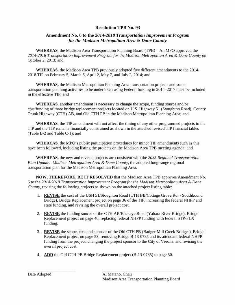
Resolution TPB No. 93 Amendment No. 6 to the 2014-2018 Transportation Improvement Program
for the Madison Metropolitan Area & Dane County WHEREAS, the Madison Area Transportation Planning Board (TPB) – An MPO approved the 2014-2018 Transportation Improvement Program for the Madison Metropolitan Area & Dane County on October 2, 2013; and
WHEREAS, the Madison Area TPB previously adopted five different amendments to the 2014-2018 TIP on February 5, March 5, April 2, May 7, and July 2, 2014; and
WHEREAS, the Madison Metropolitan Planning Area transportation projects and some transportation planning activities to be undertaken using Federal funding in 2014–2017 must be included in the effective TIP; and
WHEREAS, another amendment is necessary to change the scope, funding source and/or cost/funding of three bridge replacement projects located on U.S. Highway 51 (Stoughton Road), County Trunk Highway (CTH) AB, and Old CTH PB in the Madison Metropolitan Planning Area; and
WHEREAS, the TIP amendment will not affect the timing of any other programmed projects in the TIP and the TIP remains financially constrained as shown in the attached revised TIP financial tables (Table B-2 and Table C-1); and
WHEREAS, the MPO’s public participation procedures for minor TIP amendments such as this have been followed, including listing the projects on the Madison Area TPB meeting agenda; and WHEREAS, the new and revised projects are consistent with the 2035 Regional Transportation Plan Update: Madison Metropolitan Area & Dane County, the adopted long-range regional transportation plan for the Madison Metropolitan Planning Area. NOW, THEREFORE, BE IT RESOLVED that the Madison Area TPB approves Amendment No. 6 to the 2014-2018 Transportation Improvement Program for the Madison Metropolitan Area & Dane County, revising the following projects as shown on the attached project listing table:
1. REVISE the cost of the USH 51/Stoughton Road (CTH BB/Cottage Grove Rd. - Southbound Bridge), Bridge Replacement project on page 36 of the TIP, increasing the federal NHPP and state funding, and revising the overall project cost.
2. REVISE the funding source of the CTH AB/Buckeye Road (Yahara River Bridge), Bridge
Replacement project on page 40, replacing federal NHPP funding with federal STP-FLX funding.
3. REVISE the scope, cost and sponsor of the Old CTH PB (Badger Mill Creek Bridges), Bridge Replacement project on page 53, removing Bridge B-13-0785 and its attendant federal NHPP funding from the project, changing the project sponsor to the City of Verona, and revising the overall project cost.
4. ADD the Old CTH PB Bridge Replacement project (B-13-0785) to page 50.
_______________________ ______________________________________ Date Adopted Al Matano, Chair Madison Area Transportation Planning Board

Fed State Local Total Fed State Local Total Fed State Local Total Fed State Local Total Fed State Local Total
WISDOT USH 51 (STOUGHTON RD) CTH BB (Cottage Grove Rd) PE Continuing 5411-02-04, -74, -75 Southbound Bridge (B-13-210) UTIL 390 390 Design $ obligated in 2009.
* Bridge Replacement CONST 9,314 2,329 83 11,726 Continuing Const. funding to be obligated in 2014.
111-08-027 TOTAL 9,314 2,329 473 12,116 Construction in 2015.NHPP M
DANE CTH AB (BUCKEYE RD.)COUNTY Yahara River Bridge PE 122 31 153 Continuing Continuing 5841-00-00
Bridge replacement ROW Design $ to be obligated in 2014.* (B-13-0075) CONST 1,125 1,125 Seeking federal funding for
(in Town of Dunn) construction. Federal funding for 111-14-021 TOTAL 122 31 153 1,125 1,125 construction not programmed.
FLX DC DC
TOWN CITY OLD CTH PBOF VERONA Badger Mill Creek Bridges (B-13-0784) and PE 52 14 66 Continuing 5796-0010-00, -70 (B-13-0784)
B-13-0785) ROW Design $ obligated in 2012. 2014.* Replacement of two bridges CONST 326 81 407
(111-11-043) 5796-00-03, -73 (B-13-0785)111-14-022 TOTAL 52 14 66 326 81 407 Design $ to be obligated in 2014.
NHPP V NHPP V
TOWN OF OLD CTH PBVERONA Badger Mill Creek Bridge (B-13-0785) PE 66 16 82 Continuing 5796-00-03, -73
NEW Replace Bridge ROW Design $ obligated in 2014.* CONST 414 104 518
111-14-023 TOTAL 66 16 82 414 104 518NHPP TV NHPP TV
STREET/ROADWAY PROJECTSMADISON METROPOLITAN AREA
PROJECT LISTINGS FOR AMENDMENT NO. 6 TO THE 2015-2019 TRANSPORTATION IMPROVEMENT PROGRAM
Jan-Dec 2015 Jan-Dec 2016 Jan-Dec 2017 Jan-Dec 2018Primary Jurisdiction/
Project SponsorProject Description
(Cost in $000s)
Cost/ Type
Jan-Dec 2014Comments

Revised 9/3/2014Amendment No. 6
B-2
Agency ProgramNational Highway Performance Program 54,292 6,868 15,340 13,177 7,721 54,292 6,868 15,340 13,177 7,721
Bridge Replacement and Rehabilitation 835 1,000 1,132 0 0 835 1,000 1,132 0 0
Surface Transportation Program Madison Urban Area 3,217 5,509 8,688 7,146 6,952 6,163 9,378 10,270 7,998 7,268
Surface Transportation Program Flexible 7,728 0 0 190 5,058 7,728 0 0 190 5,058
Surface Transportation Program Enhancements/Alternatives** 1,910 3,296 0 0 0 1,910 3,296 unknown unknown unknown
Highway Safety Improvement Program 4,794 2,198 207 0 2,358 4,794 2,198 207 0 2,358
Section 5307 Urbanized Area Formula Program 6,938 6,816 7,026 6,447 7,317 6,938 6,816 7,026 6,447 7,317
Sec. 5339 Bus & Bus Facilties 0 816 841 866 892 0 816 841 866 892
Sec. 5337 State of Good Repair 0 519 534 550 567 0 519 534 550 567
Section 5314 NRP & Section 5339 Alt. Analysis Program** 1,747 164 0 0 0 1,747 164 0 0 892
Section 5316 JARC Program 57 0 0 0 0 57 0 0 0 0
Section 5310 Enhanced Mobility of Seniors & Persons w/ Disabilities 248 0 0 0 0 263 unknown unknown unknown unknown
* Fifth year of funding (2018) is informational only.** Carryover funding. For others, excludes carryover funding from previous year grants.
Note:
Federal Transit Administration
All state roadway projects using applicable funding sources (e.g., NHPP, STP State Flexible, BR) are programmed through 2018. Local BR and STP Rural projects are programmed through 2014. HSIP (other than annual small HES program) projects are programmed through 2015. SRTS projects are carryover from 2013. Local Enhancement/TA projects are programmed through 2014. Local STP Urban (Madison Urban Area) projects are programmed through 2018. Transit funding is not yet programmed and is based on needs and anticipated future funding levels (See also Table C-4 Metro Transit System Projected Expenses and Revenues on page C-8). Programmed transit funding for 2014 excludes carryover projects for which the Federal funding is already obligated (except for the Alternatives Analysis and TIGER funding).
2014 2015 2016 2017 2018*Federal Highway Administration
2014 2015 2016 2017 2018*
Table B-2Summary of Federal Funds Programmed ($000s) and Those Available in the Madison Metropolitan Planning Area
2014-2018 Transportation Improvement Program
Funding Source Programmed Expenditures Estimated Available Funding

Attachment C Revised 9/3/2014Amendment No. 6
C-1
Projected Expenses ($000s)
2014 2015 2016 2017 20182014-2018
Period TotalState and FederalHighway Construction, Maintenance, etc. 113,867 16,181 40,484 55,598 20,642 246,771STP Urban (Madison Urban Area) 3,217 5,647 9,128 7,695 7,674 33,361STP TE/TA and STP Rural 1,910 6,679 - - - 8,589Other State 2,327 825 231 237 243 3,863Subtotal 121,321 29,331 49,843 63,530 28,559 292,584
Dane County & CommunitiesStreet Operations and Maintenance 52,134 53,437 54,773 56,143 57,546 274,033Street Construction 45,098 46,225 47,381 48,566 49,780 237,050Street-Related Facilities 10,564 10,828 11,099 11,376 11,661 55,528Subtotal 107,796 110,491 113,253 116,085 118,987 566,611
Metro TransitCapital Expenses 16,568 16,982 17,407 17,842 18,288 87,087Operating Expenses 48,996 50,221 51,476 52,763 54,082 257,539Subtotal 67,400 67,203 68,883 70,605 72,370 344,626
Total Projected Expenses 296,517 207,025 231,979 250,220 219,916 1,203,821, Projected Revenues ($000s)2
State and FederalHighway Construction, Maintenance, etc. 58,784 60,254 61,760 63,304 64,887 308,988STP Urban (Madison Urban Area) 6,163 6,592 6,741 6,909 7,082 33,487STP TE, STP Rural & SRTS 3,324 3,407 3,492 3,580 3,669 17,472Other State 8,789 9,009 9,234 9,465 9,701 46,198Subtotal 77,060 79,261 81,227 83,258 85,339 406,145
Dane County & CommunitiesStreet Operations and Maintenance 52,134 53,437 54,773 56,143 57,546 274,033Street Construction 45,098 46,225 47,381 48,566 49,780 237,050Street-Related Facilities 10,564 10,828 11,099 11,376 11,661 55,528Subtotal 107,796 110,491 113,253 116,085 118,987 566,611
Metro TransitCapital Expenses 16,568 16,982 17,407 17,842 18,288 87,087Operating Expenses 48,996 50,221 51,476 52,763 54,082 257,539Subtotal 65,564 67,203 68,883 70,605 72,370 344,626
Total Projected Revenues 250,420 256,955 263,363 269,947 276,696 1,317,3821 Roadway and transit inflation rate @ 2.5% per year applied to both expenses and revenues. 2 State and Federal highway and Metro Transit revenue estimates based upon spending levels from 2007-2011 (adjusted for inflation to 2014 dollars) with annual averages estimated and then projected for eaching funding source. Local revenues assumed to continue at annual averages expended in the past (adjusted for inflation). 3 Highway construction, maintenance expenses excludes projects (e.g., I-39/90 expansion) that are mostly outside Dane County and for which fiscal constraint is being handled at the state level.
Table C-1Projected Expenses and Revenues of Transportation Projects in the Madison Metropolitan Planning Area
in Year of Expenditure Dollars1
2014-2018
TPB (MPO) Agenda Cover Sheet Item No. 8 September 3, 2014
Re: Resolution TPB No. 94 Amending the Program Management and Recipient Coordination Plan for the Section 5310 (Enhanced Mobility of Seniors and Individuals with Disabilities) Program for the Madison Urbanized Area
Staff Comments on Item: MAP-21 combined two previous Federal Transit Administration (FTA) programs to create the Enhanced Mobility of Seniors and Individuals with Disabilities Program (Section 5310). MPOs for large urban areas such as Madison now receive a special allocation of funding. A Program Management Plan (PMP) is required, which identifies the policies and procedures for administering the Section 5310 program. The MPO approved the PMP in February. It outlines the division of responsibilities between Metro and the MPO. Metro is the designated recipient (DR) of the funds, but the MPO prioritizes and selects the projects for funding. Metro Transit’s DR responsibilities include applying to FTA for the program grants and handling all aspects of grant administration, including reporting to the FTA.
Among other things, the PMP includes the project selection criteria and process. For 2014, it was decided to continue the ongoing Dane County and Metro Transit projects and not conduct a competitive process due to timing issues with the transition to local administration of the new program and the lack of interest by other eligible recipients. For 2015, a competitive process is being used. WisDOT worked with the MPOs to create a coordinated application process with one uniform application that was due August 15. The PMP needs to be amended to include the project selection criteria and process.
Section 4 of the PMP includes the project selection criteria and process. The criteria were developed in coordination with WisDOT. They include: (1) Demonstration of Need and Project Benefits (30 points); (2) Promotes the Development of a Coordinated Network (40 points); and (3) Budget/Financial and Technical Capacity (30 points). An appeals process was added in Section 4 to comply with FTA guidance. Applicants are notified of the project funding recommendations. Any appeals are sent to MPO staff one week prior to the MPO board meeting where the “program of projects” is approved. The appeals are included in the board meeting materials and the board has the final say on the projects to be funded.
An evaluation panel consisting of MPO and WisDOT staff and a member of the MPO Citizen Advisory Committee who is knowledgeable about specialized transportation will score the projects. MPO staff will propose the projects to be funded and review and seek approval of the project funding recommendations from the board in October as part of the action on the TIP.
A few other administrative type changes to the PMP are proposed in Section 1 (Introduction) and Section 2 (Summary of 5310 Program) to reflect that planned activities have taken place and recently taken actions are now standard. In general, “Eligible Recipients” was changed to “Potential Recipients” to reflect that eligibility requirements may change over time. Several other minor editorial changes were made.
See the link below to the complete revised PMP document showing the proposed changes: http://www.madisonareampo.org/planning/documents/Program_Management_Plan-Draft2014Update-Changes.pdf
Materials Presented on Item: 1. Resolution TPB No. 94 Amending the Program Management and Recipient Coordination Plan
2. Table of Contents for the Plan and Draft Revised Section 4 - Project Selection Criteria and Process

Staff Recommendation/Rationale: Staff recommends approval.

Resolution TPB No. 94
Amending the Program Management and Recipient Coordination Plan for the Madison Urbanized Area’s Section 5310 Enhanced Mobility of Seniors and Individuals with Disabilities Program
WHEREAS, the Madison Area Transportation Planning Board (TPB) – An MPO adopted Resolution
TPB No. 84 on November 13, 2013, supporting designation of the City of Madison – Metro Transit as the recipient for federal Section 5310 Enhanced Mobility of Seniors and Individuals with Disabilities Program funds with the Madison Area TPB responsible for preparing a Program Management Plan (PMP) in coordination with Metro Transit, prioritizing and selecting projects for Section 5310 program funding, and preparing the annual Program of Projects (POP) as part of the Transportation Improvement Program process; and
WHEREAS, Governor Walker designated the City of Madison – Metro Transit as the recipient of
Section 5310 Program funds for the Madison Urbanized Area via letter to the Federal Transit Administration (FTA) on December 9, 2013; and
WHEREAS, a Program Management Plan that describes policies and procedures for administering
the Section 5310 program in the Madison area, including the division of responsibilities between Metro Transit and the Madison Area Transportation Planning Board – an MPO, is required to be on file with the Federal Transit Administration; and
WHEREAS, the Madison Area TPB adopted Resolution TPB No. 85 on February 5, 2014 approving
the Program Management and Recipient Coordination Plan for the Madison Urbanized Area’s Section 5310 Program; and
WHEREAS, for 2015 and future years a competitive process will now be used to select the projects
for funding under the Section 5310 program; and WHEREAS, the Program Management Plan needs to be amended to reflect the project selection
criteria and process, including the appeal process as required by FTA, as well as other minor editorial updates to the plan:
NOW, THEREFORE BE IT RESOLVED that the Madison Area Transportation Planning Board –
an MPO approves an amendment to the Program Management and Recipient Coordination Plan for the Madison Urban Area’s Section 5310 Enhanced Mobility of Seniors and Individuals with Disabilities Program, revising Section 4 to reflect the new project selection process and criteria and make other minor editorial changes to other sections of the document. Date Adopted Al Matano, Chair, Madison Area Transportation Planning Board

Table of Contents
1. Introduction ............................................................................................................................................................1 2. Summary of the Section 5310 Enhanced Mobility Program ..................................................................................3 3. Roles and Responsibilities ......................................................................................................................................6 4. Project Selection Criteria and Process ....................................................................................................................8 5. Private Sector Participation ................................................................................................................................. 12 6. Civil Rights............................................................................................................................................................ 13 7. Maintenance ........................................................................................................................................................ 16 8. Section 5310 Program Management ................................................................................................................... 17 9. Project Monitoring and Reporting....................................................................................................................... 19 10. Other Provisions ................................................................................................................................................ 21 Appendix A – Recipient Designation Letter ............................................................................................................. 23 Appendix B – MPO Board Resolution ...................................................................................................................... 24 Appendix C – References ......................................................................................................................................... 25 Appendix D – Index of Program Management Plan Requirements ........................................................................ 26 Appendix E – Acronyms and Abbreviations............................................................................................................. 26

Program Management and Recipient Coordination Plan 8
4. Project Selection Criteria and Process Project Planning and Coordination Medium-range planning for Section 5310 program projects is included in the five-year Coordinated Public Transit – Human Services Transportation Plan for Dane County, completed by the MPO. This planning process is conducted within the framework of the MPO’s long range transportation plan (currently the Regional Transportation Plan Update 2035) and the Transit Development Plan for the Madison Urban Area. A competitive process is used to select and prioritize projects for Section 5310 program funding the Madison urban area. The MPO will solicit project applications from eligible subrecipients. Project Application Process The application process will be led by the MPO. Specific tasks, deadlines, and meeting dates will be identified in the materials that are distributed to eligible subrecipients as appropriate. • MPO staff informs eligible subrecipients of upcoming application cycle.
- MPO staff will inform some or all eligible subrecipients on its potential subrecipient list based on transportation needs and whether or not a competitive process is used.
• Eligible subrecipients notify MPO staff of intention to apply.
• MPO staff distributes application materials to interested eligible subrecipients.
• Completed applications are due to MPO staff.
• MPO staff assembles an evaluation panel with objective individuals who do not represent any of the applicants, that scores the applications.
• MPO staff prepares a draft POP based on the scores, funding available, and requirements of the Section 5310 program.
• MPO staff distributes letters to applicants informing them of whether or not they are included in the draft POP. Appeals are due to the MPO staff contact one week prior to the scheduled adoption of the POP.
• MPO board approves the POP with any changes as part of approval of the TIP or a TIP amendment.
• Applicants work with Metro Transit to develop project agreements.
• Metro Transit applies to the FTA for funding for the projects on behalf of the subrecipients.
Project application materials are developed by WisDOT. MPO staff have the option of using these application materials as they are or developing alternative application materials to distribute. The benefit of using application materials developed by WisDOT is that applicants that do not immediately know whether they should apply for state-managed Section 5310 funds or MPO-managed Section 5310 funds can fill out one standard application. Applicants that are approved for vehicle capital funds should contact Metro Transit as soon as possible to begin the procurement process. Applicants that are approved for operating funds should contact Metro Transit as soon as possible to develop project agreements.
Program Management and Recipient Coordination Plan 9
Project Selection Criteria The projects that receive funds through the Madison Urbanized Area’s Section 5310 program are selected by the MPO based on published criteria. The evaluation criteria used by the evaluation panel to score project applications are as follows: 1. Demonstration of Need and Project Benefits (30 points)
• The project meets the eligibility requirements of the Section 5310 program. • The application describes how the existing project or has been or the proposed project will be effective
at meeting the transportation needs of seniors and people with disabilities. • The project requires ongoing capital or operating assistance to maintain the current level of service. • The application describes the demographics that the project will serve. • The project overcomes a barrier to transportation and/or meets an unmet need. • The project serves an appropriate number of individuals or trips given the project budget. • Information includes specific examples or data.
2. Promotes the Development of a Coordinated Network (40 points)
• The project is consistent with the plan principles and funding priorities in the 2013 Coordinated Public Transit – Human Services Transportation Plan for Dane County.
• The project benefits correspond with the needs assessment in the 2013 Coordinated Public Transit – Human Services Transportation Plan for Dane County.
• The application identifies other transportation systems available and how the project complements them rather than duplicating them.
• The application identifies steps that will be taken to ensure a coordinated effort with other local agencies, including human service agencies, meal and shopping sites, employers, etc.
• The application identifies project partners and shows how the project will utilize resources to the maximum extent.
3. Budget/Financial and Technical Capacity (30 points)
• The project is a cost effective use of funds. • The project has a reasonable level of administrative costs. • The application identifies local match sources that are backed up with by budgets, support letters, and
other documentation. • The project sponsor has experience delivering similar projects. • The project sponsor has the capacity to meet the reporting and project management functions of the
Section 5310 program.

Program Management and Recipient Coordination Plan 10
Once scored, projects will be selected by the MPO for inclusion in the POP based on their scores and the extent to which they fulfill the general funding priorities and address specific service needs identified in the coordinated public transit – human services transportation plan, including: 1. Maintain existing service levels of viable operations
Priority #1 supports existing transportation services and projects that:
• Have shown to be effective in meeting transportation needs of seniors, people with disabilities • Require ongoing capital and operating assistance to maintain the current level of service • Continue to demonstrate effective transportation operations within the county’s coordinated network
2. Respond to growth within existing services by allowing for measured increases where demand shows an unmet need within the current limits of the service
Priority #2 supports existing and new services and projects that:
• Require capital and operating assistance to meet growing demand for the service(s) within present boundaries
• Are able to improve efficiency and functionality by building on existing infrastructure • Allow for growth, but not automatically add new service without a careful evaluation of transportation
needs across populations and jurisdictions
3. Respond to emerging community needs by taking action on opportunities to coordinate and expand service, creating new partnerships and reacting to newly identified transportation needs and gaps
Priority #3 supports projects that:
• Are under development and bring new resources • Address identified transportation needs and gaps and/or focus on underserved seniors and people with
disabilities • Improve the efficiency and effectiveness of the overall system • Provide an added benefit to the transportation services network and riders • Are innovative in their approach in reaching out to new users
Additionally, the MPO will select and prioritize projects based on their ability to satisfy the Section 5310 Program Goals and Objectives described in Section 2: independence, accessibility, efficiency, and resourcefulness.

Program Management and Recipient Coordination Plan 11
Annual Program of Projects Development, Appeal, Approval, and Amendment Process The MPO is responsible for developing and amending the Program of Projects (POP) since it has the responsibility for selecting the projects and prepares the five-year Transportation Improvement Program (TIP). The POP must be consistent with the TIP and the federal share cannot exceed the allocation of Section 5310 program funds; however, it may include projects that do not yet have completed and accepted project applications. The requirements for the POP include: • Identification of each subrecipient, including whether they are governmental authorities, private non-profit
agencies, or Indian tribal governments or tribal transit agencies
• A description of each project
• The total project cost and the federal share
• Whether each project is a capital or an operating expense and whether or not it meets the requirements for a “traditional Section 5310 capital” project
MPO staff develops a draft POP after project applications are reviewed and scored by the evaluation panel. The draft POP and a description of any projects not selected for funding are presented to the project’s advisory committee (Technical Coordinating Committee). MPO staff distributes letters to each applicant with the draft POP, informing them whether or not their project is included. Applicants may appeal the decision of MPO staff to include or not include any project in the draft POP. Applicants must submit their appeal in writing by one calendar week prior to the scheduled adoption of the POP. Appeals must be submitted to the MPO staff contact, who will be identified in the notice and is listed on page 22. Any appeals will be included in the meeting packet for the MPO board. The MPO board will make the final decision on which projects are included in the POP. Following review and a recommendation by the MPO advisory committees, the MPO Policy Board may approve the project recommendations (with or without modifications), or direct staff to develop alternative proposals. The approved POP is then forwarded to Metro Transit, which forwards it to the FTA and carries it out. Amendments to the POP are conducted as needed using the same process.
TPB (MPO) Agenda Cover Sheet Item No. 9 September 3, 2014
Re:
Appointment to the Stoughton Road (USH 51) Study Policy Advisory Committee
Staff Comments on Item: WisDOT SW Region is activating its Policy Advisory Committee again for the ongoing Stoughton Road (USH 51) EIS Study from just south of the Beltline to Interstate 39/90/94. The revised study timeframe is to have a Draft EIS document completed by the end of the year with a public hearing in early 2015. Changes would be made based on comments received and updated traffic forecasts and a Final EIS would be published in the fall of 2015 and a record of decision towards the end of the year. The MPO Board is among the stakeholders identified to have a representative on the Policy Advisory Committee (PAC). Ken Dahl was appointed to serve on the committee back in 2012. Because he is no longer on the board, another person needs to be appointed to serve on the PAC.
Materials Presented on Item: None
Staff Recommendation/Rationale: N/A
TPB (MPO) Agenda Cover Sheet Item No. 10 September 3, 2014
Re:
Appointments to the MPO Citizen Advisory Committee
Staff Comments on Item: Some members of the MPO Citizen Advisory Committee (CAC) have recently resigned, including Delora Newton with the Madison Area Chamber of Commerce and Emmet Fisher, who was a CSA farmer in Mt. Horeb. Five prospective new members have been recruited to try to fill some gaps, including non-City of Madison citizens and persons representing minority and low-income population groups. If all were appointed, the total committee size would increase from 7 to 12. The MPO’s Rules call for a maximum of 15 members. Three of the candidate appointees are local elected officials – Steve Arnold from the City of Fitchburg, Dave Wallace from the Village of Cottage Grove, and Susan Springman from the Village of Waunakee. Mr. Arnold has been very active on transportation issues, particularly transit and bicycle transportation, in Fitchburg. Mr. Wallace is an engineer with WisDOT. Ms. Springman is a project manager for the Mullins Group, a real estate development and management company. Another candidate manages programs for adolescents at Centro Hispano. The final candidate is a student at UW-Madison who has been active on campus transportation issues. Staff is still looking for one or two possible additional members. Staff would be interested in any ideas board members have for committee members.
Materials Presented on Item: 1. List of existing and prospective new MPO Citizen Advisory Committee members (with candidate
new members underlined)
Staff Recommendation/Rationale: Staff recommends appointment of the new members.

DRAFT
Last updated 9/3/14
Madison Area Transportation Planning Board – An MPO Citizen Advisory Committee
Name
Affiliation(s) Steve Arnold
City of Fitchburg Alder, 4th District
Jessica Canela
Centro Hispano of Dane County
Ronn Ferrell
Dane Co. Supervisor, 15th District
Cristel Gjerde
League of Women Voters
Meg Healy
UW-Madison Student
Greg Hull
Realtor; City of Madison Resident
John Rider
Sierra Club – Four Lakes Group
Gary Rylander
Traffic Engineering Consultant; Member, City of Middleton Public Works Committee
Susan Springman
Village of Waunakee Board Trustee; Mullins Group
Tom Stoebig
Former Dane Co. Supervisor, 17th District; AARP-Wisconsin
Dave Wallace
Village of Cottage Grove Board Trustee, Engineer for WisDOT
Royce Williams
ProRail; Madison Area Bus Advocates