merthyr tydfil walkdownloads.bbc.co.uk/tv/weatherman-walking/walks/merthyr.pdf · this is a...
TRANSCRIPT
EndStart
1
2
3
4
5
6
7
8
Weatherman Walking Merthyr Tydfi l Walk
bbc.co.uk/weathermanwalking © 2013
1
N
S
W E
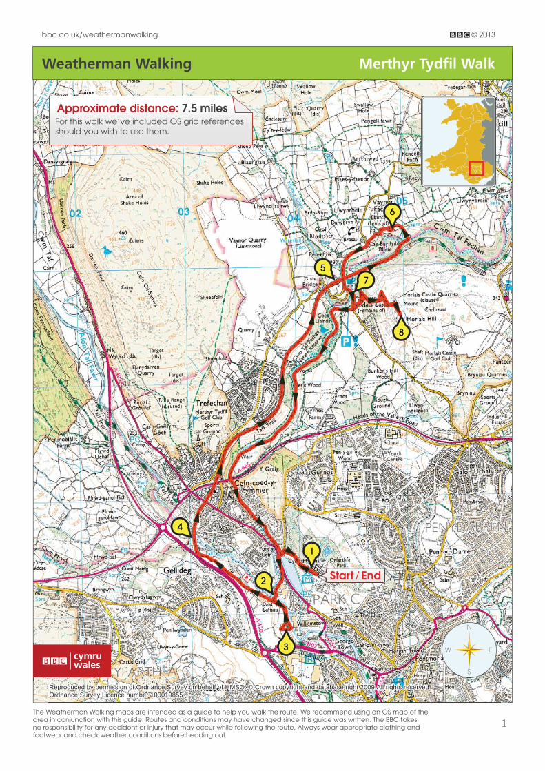
Approximate distance: 7.5 milesFor this walk we’ve included OS grid references should you wish to use them.
Reproduced by permission of Ordnance Survey on behalf of HMSO. © Crown copyright and database right 2009.All rights reserved. Ordnance Survey Licence number 100019855
The Weatherman Walking maps are intended as a guide to help you walk the route. We recommend using an OS map of the area in conjunction with this guide. Routes and conditions may have changed since this guide was written. The BBC takes no responsibility for any accident or injury that may occur while following the route. Always wear appropriate clothing and footwear and check weather conditions before heading out.

Weatherman Walking Merthyr Tydfi l Walk
bbc.co.uk/weathermanwalking © 2013
2
Turn left out of the Cyfarthfa park gates and down to the main road. Go straight across and then left down a lane which leads through an industrial estate. Bear right along the road past the industrial units then turn right along a narrow track which leads to the old Pont y Cafnau cast iron bridge.
Start: Cyfarthfa Castle (free car parking at the castle and also by entrance gates)Starting ref: SO 041 073Distance: About 7.5 milesGrade: Easy/Moderate Walk time : Allow 3.25 hours
This is a fascinating walk through both town and country, packed full of history with a few surprises
thrown in for good measure. Walking in the footsteps of iron workers and their wealthy masters, our
route starts from Cyfarthfa Castle and heads down over the river Taff to the site of the old Cyfarthfa
ironworks before heading up the Taff Trail along a green corridor out of town. Calling in at Vaynor
Church, the route then loops back to climb to the summit of Morlais Hill, site of a ruined Norman
castle, before returning down along the banks of the delightful cascading Taf Fechan river, and
back to the start.
Directions
Starting from the castle, with the lake on your left hand side, head out of the park in a north westerly direction.
Cyfarthfa castle car park - start of the walk.
Cyfarthfa Castle (SO 041 073)
Built in the early 1800s this grand abode was the family home of the Crawshays – iron masters who made their fortunes when Merthyr Tydfi l’s iron boom was at its height. Today it houses a fascinating museum and it’s well worth spending some time there before setting off on your walk. Outside the castle are a number of old cannons from the early 1800’s, the time of the Napoleonic Wars. Cyfarthfa ironworks was as a leading producer of weapons for the wars and they were considered so important to the success of the Royal Navy that Admiral Lord Nelson himself visited here during a tour of the country.
1

Weatherman Walking Merthyr Tydfi l Walk
bbc.co.uk/weathermanwalking © 2013
3
Pont y Cafnau bridge
Pont y Cafnau iron bridge (SO 073 071)
Pont y Cafnau is the world’s oldest surviving cast-iron bridge. The name, which means Bridge of Troughs, refers not to the tramway it carried over the river, but to a 600 foot aqueduct it supported overhead. The aqueduct had two troughs that carried water into the ironworks, which in turn drove a 50 foot waterwheel to provide power for the iron-making process. Water power was later replaced by steam.
2
Cross over the bridge and walk up a short rise to the tarmac-surfaced Taff Trail. The route now takes a brief detour for a few hundred metres down the Taff Trail beside the river to reach an open area of reclaimed land and an information board on the right of the path which tells the story of the Cyfarthfa ironworks.
The site of the old Cyfarthfa ironworks
Approaching the remains of the old blast furnaces
Site of the old Cyfarthfa ironworks(SO 038 068)
This open area of reclaimed land is all that remains of the once mighty Cyfarthfa ironworks.
Cyfarthfa was the largest of four main ironworks in Merthyr where iron was smelted in blast furnaces 24 hours a day fuelling the boom of the industrial revolution. At the far side of the waste ground is a high brick retaining-wall with six arches - the remains of six blast furnaces where the iron was smelted. This would have been a very hot and dangerous place to be standing two hundred years ago.
3
Retrace your steps up the Taff Trail, passing Pont y Cafnau on the right, up towards the Cefn Coed viaduct. The Taff Trail is a 55 mile walking and cycle path that runs all the way from Cardiff to Brecon. As the trail gains height, the views open up back towards Cyfarthfa, over Merthyr, andup to the Brecon Beacons ahead. Here and there the trail is signposted as Sustrans National Cycle Route 8. Do not follow Route 46 which turns right just before the viaduct.
Views back towards Cyfarthfa Castle from the Taff Trail

Weatherman Walking Merthyr Tydfi l Walk
bbc.co.uk/weathermanwalking © 2013
4
The curved shape of the viaduct and its 15 arches
Cefn Coed viaduct (SO 030 076)
Built in 1866, the Cefn Coed viaduct used to carry the Brecon and Merthyr railway over the river Taff which fl ows 115 feet below. With 15 arches, it’s a rare example of a curved viaduct – apparently built to curve around Crawshay’s land. The line was closed to passengers in 1961 but goods services continued to run until 1966.
4
Cross over the viaduct, carry on past two blocks of fl ats and the Station Hotel on the left and follow a ‘Route 8’ sign on a telegraph pole, bearing right along a pavement with red painted railings on the right.
Cross the oft en busy main road carefully and carry on along Old Drill Hall Road opposite, and on towards the church at the end of the street. Walk through the narrow alleyway immediately to the left of the church which leads on to another section of the old railway line which provides a wide and gently-rising tarmac trail out of town. The valley down on the right is the Taf Fechan Nature Reserve.
Crossing the Cefn Coed viaduct
Approaching Pontsarn along the Taff Trail
The Brecon and Merthyr Railway (SO 0325 0817)
This old railway line found a way through the Brecon Beacons above Pontsticill through the 600 metre-long Torpantau tunnel. Rising steeply for more than three miles to a height of more than 1300 feet above sea level it was once the highest railway tunnel in Britain. However, owing to the number of accidents caused by the very steep gradient along parts of the line, the Brecon and Merthyr became known as the Breakneck and Murder Railway.
5
Continue along the easy-going tarmac trail for a mile or so through peaceful countryside to reach an old platform on the right. This is the old Pontsarn station platform.

Weatherman Walking Merthyr Tydfi l Walk
bbc.co.uk/weathermanwalking © 2013
5
Pontsarn station in its heyday with day-trippers on the platform
Photograph courtesy of Alan George
Pontsarn station (SO 043 098)
Now deserted, it’s diffi cult to imagine this station in its heyday in the 1870’s when 20 trains would have stopped here every day bringing parties of sightseers and Sunday School outings for day-trips in the countryside. Despite being only a few miles from the centre of Merthyr, the area around Pontsarn is still a peaceful haven with woodland and riverside walks. The station was closed in 1963.
6
Keeping to the Taff Trail continue under a road bridge, which will be crossed later on our route, and walk over the Pontsarn viaduct. Then about 400 metres from the end of the viaduct take a sharp left turn off the tarmac trail, opposite green painted metal benches, and drop down a narrow and sometimes muddy footpath which leads diagonally down to a footbridge over the Taf Fechan river.
PLEASE NOTE: There may be a temporary sign on the bridge advising walkers not to proceed, ‘in the interest of public safety’. However this refers to the riverside path that leads underneath Pontsarn viaduct which is in need of repair in places, therefore our route is safe.
So, having crossed the footbridge over the river, continue straight up a short but steep grassy bank and then bear left to a stile which leads into the large garden of a private house. This is a public right of way so continue inside the perimeter fence and out through a wooden entrance gate to the property.
St Gwynno’s church is on the left .
Pontsarn viaduct pre 1963
Photograph courtesy of Alan George

Weatherman Walking Merthyr Tydfi l Walk
bbc.co.uk/weathermanwalking © 2013
6
St Gwynno’s church with Crawshay’s tombstone inside the railings
St Gwynno’s church and Crawshay tombstone (SO 049 103)
St Gwynno’s church, more widely known as Vaynor Church, was built by Robert Thompson Crawshay to replace the dilapidated old 13th Century Norman church. The ruins of that church can be seen a short distance along the track from the site of the present one. Around the back of the churchyard, enclosed in iron railings, is a massive tombstone, a great slab of Radyr sandstone said to weigh 10 tons. This is the grave of Robert Thompson Crawshay, third in the line of Crawshay ironmasters. The stone is inscribed with the words ‘Robert Thompson Crawshay, Died May 10th 1879, aged 62’ and the epitaph reads, ‘God Forgive Me’. Placed into the gable end wall on the far side of the church is the headstone of local parishioner Catherine Morgan who lived to the age of a hundred and six. Born in 1688 not only did she live to a grand old age, she remarkably lived through the reigns of seven monarchs.
7
Turn left out of the churchyard down a narrow lane which leads to a footbridge over a stream. The ruins of the original Norman church can be seen over on the left . Follow the footpath through a thin woodland and along beside the perimeter fence of a fi eld which leads to a minor road.
Turn left and, keeping close to the side along this short section of narrow and sometimes busy country road, continue downhill and over a road bridge. Old Pontsarn station and viaduct that you will have crossed earlier can be seen below the bridge. Pass the ruined Pontsarn Inn and aft er 50 metres turn left down steep and, at times, rather slippery steps down to the narrow country road which leads over the very narrow Pontsarn road bridge.
Taf Fechan river just above Pontsarn road bridge
Blue Pool (SO 045 097)
Pontsarn bridge spans the rushing Taf Fechan river which cascades down a very picturesque narrow gorge into what’s known as the Blue Pool. It’s a beautiful spot though the pool may not look very blue unless it’s a sparkling sunny day. There are places to view the tumbling river safely off the road both upstream and downstream of the bridge.
8

Weatherman Walking Merthyr Tydfi l Walk
bbc.co.uk/weathermanwalking © 2013
7
Cross the bridge and continue uphill along the road. Turn left on the corner opposite an entrance to the Taf Fechan Nature Reserve and go through a narrow metal gate into the fi eld. Bear left diagonally up through the fi eld. On reaching another level path continue left for 15 metres before turning steeply up to the right continuing up a rocky path through low trees.
At the gate which leads into the fi eld and path up Morlais Hill
The path emerges onto a fl at grassy track, an old tramway track from the quarry nearby. Cross directly over the track and, keeping a safe distance from the unfenced cliff edge, climb steeply up an indistinct path to the right of the quarry and up through sparse low trees. Emerging onto open hillside above the quarry, bear right and head for the summit of Morlais Hill.
The steep path beside the quarry
The route leads straight onto the ruined ramparts of Morlais Castle which would have surrounded the castle enclosure. Continue across the enclosure and climb up the last few feet to the highest point which is in fact the roof of a vaulted crypt.
Arriving on the ruined ramparts of Morlais Castle
Weatherman Walking Merthyr Tydfi l Walk
bbc.co.uk/weathermanwalking © 2013
8
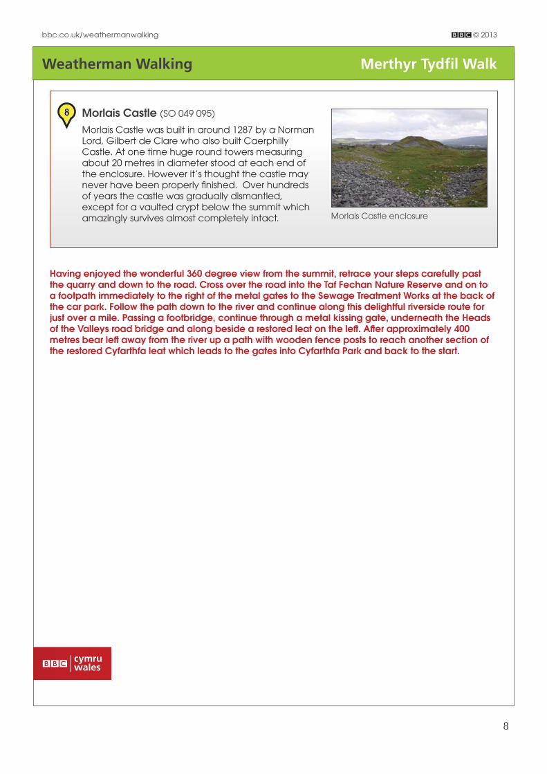
Castle enclosure
8 Morlais Castle (SO 049 095)
Morlais Castle was built in around 1287 by a Norman Lord, Gilbert de Clare who also built Caerphilly Castle. At one time huge round towers measuring about 20 metres in diameter stood at each end of the enclosure. However it’s thought the castle may never have been properly fi nished. Over hundreds of years the castle was gradually dismantled, except for a vaulted crypt below the summit which amazingly survives almost completely intact. Morlais
Having enjoyed the wonderful 360 degree view from the summit, retrace your steps carefully past the quarry and down to the road. Cross over the road into the Taf Fechan Nature Reserve and on to a footpath immediately to the right of the metal gates to the Sewage Treatment Works at the back of the car park. Follow the path down to the river and continue along this delightful riverside route for just over a mile. Passing a footbridge, continue through a metal kissing gate, underneath the Heads of the Valleys road bridge and along beside a restored leat on the left . Aft er approximately 400 metres bear left away from the river up a path with wooden fence posts to reach another section of the restored Cyfarthfa leat which leads to the gates into Cyfarthfa Park and back to the start.