mi transportation plan (slrp) technical report, land use
TRANSCRIPT

MDOT State Long‐Range Transportation Plan Land Use Technical Report
Table of Contents Chapter 1 Purpose and Introduction 1
11 Land Use and Transportation Policy Connection 1 12 Overview of Technical Report 1
Chapter 2 Historic Land Use Development Patterns 2 21 Early Civilization Patterns and Transportation 2
211 Waterways Great Lakes ‐ Passenger and Freight 2 212 Railroads ndash Passenger and Freight 3 213 Highways ndash Automobile Transit Freight 5 214 Air Telecommuting 7 215 Impact of Transportation Development on US Urban Areas 7
Chapter 3 Land Use ‐ Transportation Relationship 9 31 Statewide Trends 9 32 Regional Trends 13 33 Urban Activity Center Trends 13
Chapter 4 Transportation Land Use Planning Integration Issues and Considerations 14 41 Demographic and Socioeconomic Shifts and Dynamics 14
411 Aging Population 15 412 Income Dynamics 15 413 Diversification of Immigration 15 414 Growth in Number of Households Smaller Household Size 16
42 Economic and Employment Changes 16 421 Manufacturing 16 422 Agriculture and Extractive Industries 17 423 Tourism 17
43 Inter‐governmental Relations 17 431 Relationship of Home Rule and Local Planning Authority 17 432 Interagency Coordination 18
44 Residential Location Patterns 18 441 Location Choices 18 442 ResidencePlace of Employment Dynamics 19
45 Activity Centers 20 451 Definitions 20 452 Impact on Transportation and Land Use Patterns 22
46 Michigan Land Use and Leadership Council 22 461 Land Use Council Recommendations 23
Chapter 5 Land Use and Transportation Practices from Other States 24 51 Examples 24
511 Planning Activities 24 512 Public Involvement 25 513 GIS and Technical Analysis 25
_____________________________________________________________________________________ Page i
MDOT State Long‐Range Transportation Plan Land Use Technical Report
514 Project Prioritization and Funding 26 515 Design Guidelines and Standards 26
52 Lessons Learned Potential Transferability to Michigan 27 Chapter 6 Findings and Conclusions 28
61 Coordination 28 611 Interagency (horizontal) 29 612 Inter‐governmental (horizontal and vertical) 29
62 Stakeholders 31 621 Transportation 31 622 Land Use 32
63 Transportation Implications 33 631 Highway Use 33 632 Transit Intercity BusRail Passenger 33 633 Rail Commercial Truck 33 634 Air 33
64 Options for Incorporating Policies and Investments that Support Integrated Planning into MI Transportation Plan 34
Chapter 7 Integration Concepts 34 71 Travel Segments Sensitive to Land Use 35
711 City Residents 35 712 Transit Dependent People 35 713 Elderly Travelers 35 714 Children and Young People 35 715 Low‐ Income Travelers 35 716 Ex‐Urban and Regional Commuters 36 717 Freight Carriers (Including Mail and Contract Carriers) and Their ManufacturingService Industry Clients (Shippers) 36 718 Immigrant and Non‐English Speaking Populations 36 719 Service Businesses 36 7110 Real Estate Developers and Private Land Interests 36 7111 Retail Vendors 37 7112 Tourist and Recreational Travelers 37
72 Performance Barriers and Opportunities 37 721 Performance Barriers 37 722 Opportunities 39 723 Integrating Land Use 40
_____________________________________________________________________________________ Page ii
MDOT State Long‐Range Transportation Plan Land Use Technical Report
List of Tables Table 1 Classes of Land Use 1980 and Projections to 2040 12 Table 2 Criteria and Thresholds Used To Identify Activity Centers 21 List of Figures Figure 1 Michigan Railroad Map 1876 4 Figure 2 Built Land Area in Michigan 1980 10 Figure 3 Built Land Area in Michigan 2020 Projected 11 Appendices Appendix A Transportation Planning and Land Use Tools A‐1
_____________________________________________________________________________________ Page iii
MDOT State Long‐Range Transportation Plan Land Use Technical Report
Executive Summary This Land Use Technical Report prepared as part of the MI Transportation Plan provides an overview and discussion of Michigan land use trends and issues It addresses Michiganrsquos historical development patterns current and developing problems and opportunities and how land use issues affect and integrate with the transportation system It presents best practices and examples of land use tools applied by other state DOTs that may be applicable to and complement those that the Michigan Department of Transportation (MDOT) may already be doing
The report suggests that in addition to the need for coordination evaluation of transportation problems requires focusing on land use and access in addition to mobility and safety By physically moving people and services closer together more transportation modal options could be feasible In‐fill housing live‐where‐you‐work programs brownfield redevelopment and developing shopping schools and other service‐oriented facilities within walking and bicycling distance can all reduce transportation demand particularly demand for single‐occupant vehicular travel Examples of land use and transportation practices from other states are presented to provide MDOT with information and ideas that can supplement and enhance integrated planning efforts already underway in Michigan
_____________________________________________________________________________________ Page iv
MDOT State Long‐Range Transportation Plan Land Use Technical Report
Chapter 1 Purpose and Introduction
This Land Use Technical Report is one of 17 technical reports prepared as background and support for MI Transportation Plan This report provides an overview and discussion of Michigan land use trends and issues It addresses Michiganrsquos historical development patterns and how land use issues affect and integrate with the transportation system It presents best practices and examples of land use tools applied by other state DOTs that may be applicable to Michigan
11 Land Use and Transportation Policy Connection The Michigan Department of Transportation (MDOT) recognizes that land use patterns affect transportation choices and transportation opportunities impact land use decisions This report discusses and provides examples of how land use and transportation policy are connected and that transportation decisions affect land use It identifies ways that Michigan and MDOT can adapt its policies and programs and develop and implement tools to impact land use decisions and help achieve the goals of MI Transportation Plan
12 Overview of Technical Report This report includes seven chapters Data used in the preparation of this report and some of the discussion relative to impacts and implications presented in this report came from a number of the other reports prepared for MI Transportation Plan Two of these include the Socioeconomic Technical Report and MPORPA Technical Report Chapter 2 Historic Land Use Development Patterns provides a historical perspective of the relationship between transportation and land use patterns Chapter 3 Land Use‐Transportation Relationship presents an overview of Michiganrsquos land use trends and their relationship to transportation Chapter 4 TransportationLand Use Planning Integration Issues and Considerations discusses the issues and implications of Michiganrsquos demographic socioeconomic employment inter‐governmental and residential pattern changes to transportation and land use Chapter 5 Land Use and Transportation Practices from Other States summarizes 30 tools methods strategies and procedures along with implementation examples that state DOTs and MPOs use to integrate transportation planning and land use It also presents examples of some of the notable programs and approaches used that are potentially transferable to Michigan Appendix A presents a complete listing of the tools and examples from the Federal Highway Administration (FHWA) Web site Chapter 6 Findings and Conclusions discusses land use and transportation coordination implications and options for incorporating policies and investments that support integrated planning into MI Transportation Plan Finally Chapter 7 Integration discusses land use and transportation integration issues
_____________________________________________________________________________________ Page 1
MDOT State Long‐Range Transportation Plan Land Use Technical Report
Chapter 2 Historic Land Use Development Patterns
Michiganrsquos land development locations and patterns reflect the historical availability of and technological advances in transportation Historically people traveled first by foot then water and animal‐power then rail trolley bicycle automobiles and finally by air The extent of use and popularity of each of these modes is a function of several factors and forces Some of these include the availability of infrastructure supporting the mode the safety and ease of travel the ability to access the mode and to have the mode get them to their desired destination the time needed to travel on the mode to reach the desired destination and the cost to travel on the mode In turn factors such as the availability and cost for each of these modes and the freedom of choice provided by the mode has had a synergistic relationship to land development patterns in Michigan
21 Early Civilization Patterns and Transportation Michiganrsquos first settlements were the Indian villages of the Ojibwa Ottawa and Potawatomi Native Americans Travel was by foot horseback or on one of Michiganrsquos waterways Native American trails followed the lakeshores streambeds and the flat terrain between the hills and generations of these people laid out villages along the lakes or trails
The first Europeans to enter the area were the French and French‐Canadians in the early 1600s and 1700s followed by the British in the 1700s During the early 1600s French explorers and settlers located their early settlements along the Great Lakes so that people and goods could be shipped in and out
As more settlers came missions and forts were located along the lakes In 1668 the first mission was established at Sault Ste Marie Detroit was founded as Fort Pontchartrain in 1701 In 1715 the French established Fort Michilimackinac at the Straits of Mackinac By 1779 nearly 3000 settlers were living in the Detroit area By 1810 the population of the Michigan Territory was 4762 including 32 slaves (most of whom were Native Americans) Over time the forts missions and settlements were connected with trails and evolved into roadways and population centers many of which still exist today
211 Waterways Great Lakes - Passenger and Freight As early as the late 1600s sailing ships navigated the Great Lakes History records the Griffon as the first sailing vessel on the Great Lakes In 1679 it was lost in a storm on Lake Michigan In 1818 the first steamboat Walk‐in‐the‐Water arrived in Detroit
In 1820 the population of the Michigan Territory was 8096 with Detroit Mackinac and Sault Ste Marie as the largest towns All were located on Great Lake shores From 1812 to 1825 development was slow However with the opening of the Erie Canal in 1825 a flood of immigrants from New York and New England began arriving In 1836 shipbuilding became important along rivers and lakeshores During seven months of navigation 200000 people passed through Detroitrsquos port During the 1840s copper and iron ore were discovered in the
_____________________________________________________________________________________ Page 2
MDOT State Long‐Range Transportation Plan Land Use Technical Report
Upper Peninsula and transportation by water was the primary method of transporting materials to markets The combination of natural resources employment and transportation fueled immigration to Michigan The statersquos population which stood at 8096 in 1820 was nearly 400000 by 1837
On June 22 1855 a ship canal at Sault Ste Marie opened and the passage of the steamer Illinois through the locks marked the opening of unobstructed shipping between Lakes Superior and Huron Ships no longer needed to stop and portage their cargo around the rapids of the St Maryrsquos River which drops 12 feet from Lake Superior to Lake Huron This mile‐long canal and its 350‐foot locks provided new impetus to Michiganrsquos mining industry In 1888 Michiganrsquos lumber boom peaked with shipments of 43 billion board feet Iron ore shipments from Escanaba also reached 11 million tons The majority of the population lived along these lakeshore and river‐based communities and land developed along with the population and near the natural resources that were extracted
212 Railroads ndash Passenger and Freight In the 1800s railroads opened the West to the Eastern US Fast‐growing urban centers began to develop around railroad transportation hubs throughout the country In 1833 the first horse‐powered railroad reached Adrian Michigan from Toledo In 1836 the first steam locomotive in Michigan was put into operation as the first railroad west of New York State Growth and land development in Michigan began to shift away from the lake and river shores to along the rail lines Still land development patterns were concentrated within a dayrsquos walk or horsersquos ride to a railroad river or lakeshore
Through the latter half of the 19th Century rail began to replace water as a primary means of transportation for people and goods In 1855 the Detroit amp Milwaukee Railroad completed their line connecting Detroit and Grand Haven in 1859 the Grand Trunk Railroad opened from Detroit to Port Huron In January 1877 Winfield Scott Gerrish opened the 71‐mile Lake George and Muskegon River Railroad and moved 20 million board feet of logs to the Muskegon River In 1870 Michiganrsquos population was approaching 11 million By 1882 32 logging railroads operated in the state These railroads allowed year‐round logging and attracted immigrants from around the world In 1881 railroad ferry service connected the Upper and Lower Peninsulas In 1891 a railroad tunnel linked Port Huron Michigan and Ontario under the St Clair River As rail expanded throughout the state land development patterns in Michigan increasingly focused around rail lines Rail expansion also opened up Michiganrsquos interior for the growth of agriculture in the state
By 1905 there were 1776 railroad depots in Michigan In 1909 railroad mileage in Michigan reached its peak with 9059 miles in operation Cities and towns grew and developed around rail lines and depots and offered jobs and safe reliable and inexpensive transportation for Michiganrsquos growing population and commodities Although roads connected the early urban centers until the mid‐1900s and the development of the automobile and the modern highway system most people lived where they worked inside the urban core an area typically less than three miles in radius
_____________________________________________________________________________________ Page 3
MDOT State Long‐Range Transportation Plan Land Use Technical Report
Figure 1 shows the location of early rail lines and the location of early towns and cities
Figure 1 Michigan Railroad Map 1876
During the 20th century the automobile and trucks replaced rail and water as the travel mode of choice for Michiganrsquos people and goods Today only about 4000 miles of active rail freight lines and three Amtrak passenger rail routes remain in Michigan Changes in land development patterns followed the changes in mode of choice
_____________________________________________________________________________________ Page 4
MDOT State Long‐Range Transportation Plan Land Use Technical Report
213 Highways ndash Automobile Transit Freight Early trails carved out by Native Americans and traveled by them for generations became the skeleton of both Michiganrsquos early pioneer roadways and its current highway system As early as 1822 public stagecoaches were documented as following these trails In 1824 the US Congress appropriated $10000 to survey the Great Sauk Trail (now US‐12) between Detroit and Chicago By 1836 daily stagecoaches carrying mail and passenger were running from Detroit to Sandusky OH Chicago and central Michigan
In 1896 the first gasoline powered automobiles were test driven in Michigan In 1899 Olds Motor Works in Detroit erected the first US factory to manufacture automobiles In 1904 Buick Motor Company began manufacturing in Flint In 1908 Ford Motor Company introduced the Model T and by 1914 78 percent of the nationrsquos automobiles were produced in Michigan People in Michigan and throughout the US embraced the convenience flexibility and freedom that the automobile provided
As use of roadways grew government began to accept responsibility for the roadways In 1905 Michigan organized the State Department of Highways In 1909 the worldrsquos first mile of concrete road was laid in Detroit In 1925 Michigan introduced the first state gasoline tax of two cents per gallon By 1942 the automobile was so popular in Michigan that a four lane divided expressway was built in only 11 months to carry workers to the Ford Motor Company By 1950 Michiganrsquos population had grown to 6371766 In addition as a sign of how the automobile was becoming the travel mode of choice the National Defense and Interstate Highway System (Interstate System) received US Congressional approval in 1956 Michigan was the first state to complete a border‐to‐border interstate with the completion of Interstate 94 (I‐94) in 1960 The last four miles of I‐69 were completed in 1992 bringing Michiganrsquos Interstate System to 1241 miles In 1955 Michigan also built the nationrsquos first freeway‐to‐freeway interchange
2131 Public Transit
Public transit was by horsecar in Michigan until the introduction of the electric trolley in the 1890ʹs All cities of any size had street railways including some small ones Most trolley lines were private firms given franchises by city governments Some lines were purchased by city governments most notably Detroitʹs A network of rural electric interurbans flourished briefly across southern Michigan between 1910 and 1930 providing a low‐cost alternative to steam railroads until rendered unprofitable by autos and highways
The trolley permitted the first wave of suburban home ownership and simultaneously permitted assembling hundreds of thousands of workers for the factories of the automobile age The industrialization of Michigan would not have been possible without the trolley car and its associated pattern of land use with routes every few blocks lined with apartments and retail and dense residential neighborhoods in between
The streetcar remained dominant until the 1920ʹs when families began to own automobiles in large numbers impelling an even larger wave of suburbanization and home purchase
_____________________________________________________________________________________ Page 5
MDOT State Long‐Range Transportation Plan Land Use Technical Report
Public transitʹs share of person trips began a steep steady decline that continues to the present Street railways were abandoned in all Michigan cities beginning in the 1930ʹs owing to the cost of track and overhead maintenance inflexibility of routes and competition with automobiles for road space Michiganʹs last streetcar was replaced by buses in Detroit in 1956
Many urban bus lines were operated by private firms but all became unprofitable and were abandoned by the early 1970ʹs Several Michigan cities were without public transit until state and federal subsidies were begun after 1972
Today Michigan has a widespread program of public transit (bus) service providers across the state The statersquos 79 local public transit systems 40 specialized service providers and their subcontractors are the backbone of this network All 83 Michigan counties are served by one or both of these services with over 866 million passenger trips in 2004 The 20 urban systems are usually grouped in the following way the three systems that serve the Greater Detroit Urbanized Area are similar in size and scope (and belong to the same federal funding program) the 16 systems that serve Michiganrsquos other urbanized areas are all funded by the same federal program and are usually grouped together and the 71 non‐urban (or rural) transit systems in Michigan of which 12 also operate in urban areas
Urban fixed‐route systems play a critical role in Michiganrsquos economy by enabling workforce participation for transit‐dependent segments as well as increasing accessibility to jobs and markets for households with limited auto availability While auto ownership per household has increased workforce commuting remains an important trip purpose and a critical function of urban fixed‐route systems Integration of transit will increasingly entail services to ex‐urban areas and areas spanning county or other jurisdictional boundaries Providing transit services for this changing market is an ongoing challenge as current land use development patterns continue to make traveler origin and destination points increasingly dispersed a situation that undermines the ability to plan and operate a useful and cost‐effective public transit network
2132 Freight Movement As Michiganrsquos highway system grew the ability to move freight and goods efficiently throughout the state also grew Today Michigan closely mirrors the national modal split profile with 705 percent of its freight tonnage moving by truck which equates to 860 percent by value Trucking accounted for nearly 474 million tons of commodity movements in out within and through Michigan in 2003 with an estimated value exceeding $1 trillion The heavy dependence of the US economy upon the trucking industry has also contributed to increasing congestion on state and national highways Major interstates I‐75 and I‐94 have the greatest truck volumes I‐75 between Detroit and Toledo Ohio carries an average of 16000 trucks a day I‐275I‐96 near Livonia and Novi carries over 15000 and I‐94 near Benton Harbor averages over 14000 per day
As freight and goods volumes and trucking in particular have grown so have freight service providersrsquo need for reliable and fast access to important transportation corridors
_____________________________________________________________________________________ Page 6
MDOT State Long‐Range Transportation Plan Land Use Technical Report
For freight system users and operators to reach suppliers and consumer markets efficient access to transportation options and freight facilities (eg warehouses distribution centers rail terminals intermodal yards air cargo ramps and other facilities) is most important and frequently dictates where and how they seek to locate Therefore the safety and efficiency of localized roadway connections to intermodal facilities as well as to warehouses and major distribution centers is critical to ensuring an integrated system that functions to support freight efficiencies
214 Air Telecommuting Air travel is also a part of Michiganrsquos transportation history Aviation technology also is part of Michiganrsquos future potential economic growth In 1922 airline service was instituted between Detroit and Cleveland In 1928 the first all metal dirigible was constructed for the Navy by Detroit manufacturers and successfully flown at Grosse Ile Airport Today Michigan has 236 public‐use airports Michiganrsquos 18 commercial airports handle more than 40 million passenger enplanements per year Because the cost to fly for both people and goods is higher than to travel by automobile or other modes air services are located in populated areas Air travel is the mode of choice if the destination is far and if the time or the time reliability is important Airports are typically located on an urban fringe because of the noise they generate and their need for air space and for aircraft operations Over time development often closes in on airports Land use and transportation patterns surrounding airports are typically driven by the need to provide or improve roadway transit or rail service to an airport
Telecommuting is one of the newest modes of travel ndash or non‐travel While the option and opportunities to work from home exist the number of people making this choice has remained small for decades Telecommuting can however affect land use patterns since where people can live and where they work does not need to be close or even within the same state According to the US Census only 25 percent of Michigan workers worked at home in 1990 and only 28 percent worked at home in 2000 As the Internet continues to evolve as the price of gasoline rises and as congestion worsens people may choose to telecommute rather than change the locations of their homes and other life‐style choices
215 Impact of Transportation Development on US Urban Areas During the 1800s and early 1900s technological innovations poured forth many with profound impacts on urban form of Americarsquos cities Railroad tracks were driven into the heart of the city Internal rail transportation systems greatly expanded the radius of urban settlement horsecars beginning in the 1830s cable cars in the 1870s and electric trolleys in the 1880s The industrial city still focused on the city center which contained both the central business district defined by large office buildings and substantial numbers of factory and warehouse structures Both trolleys and railroad systems converged on the center of the city which boasted the premier entertainment and shopping establishments The working class lived in crowded districts close to the city center near their place of employment
During the Industrial Revolution of the 1800s the increasing crowding pollution and disease of the central city produced a growing desire to escape to a healthier environment in the _____________________________________________________________________________________ Page 7
MDOT State Long‐Range Transportation Plan Land Use Technical Report
suburbs The upper classes had always been able to retreat to homes in the countryside and beginning in the 1830s commuter railroads enabled the upper middle class to commute into the city center Horsecar lines were built in many cities between the 1830s and 1880s allowing the middle class to move out from the central cities into more spacious suburbs Finally beginning in the 1890s electric trolleys and rapid transit lines proliferated providing cheap urban transportation for the majority of the population and enabling the beginning of migration to the suburbs
The immediate post‐World War II years also spawned the baby boom generation born between 1946 and 1964 the largest generation in US history Freeway building after World War II opened up even larger areas of suburban land and tracthouse suburbia exploded immediately in tandem with the baby boom The 1950s and 1960s were decades of record home building with family‐raising housing production continually moving toward the regional periphery as inlying core counties became fully developed Various additional dynamics came into play that further encouraged residential and business growth in the ex‐urban rural areas increasing income low gasoline prices racial tension improved suburban infrastructure and amenities state and federal subsidies for sewers roads and commercial development and a general desire of many people to leave the older crowded urban cores to live and work in the relatively open space and privacy offered in suburbia
As the 1970s commenced the baby boom itself began to enter the housing market in full force The first generation born and raised in suburbia overwhelmingly chose to live where they came of age Apartment condominium and town house development emerged as the baby boom formed households and the urbanization of the suburbs commenced in full force A new more complex suburban reality replaced the older suburban ideal
In the 1980s the baby boom started to reproduce itself resulting in a very potent baby boom echo (the cohort born between 1977 and 1995) The ldquostroller peoplerdquo once again invaded the suburbs as the baby boom drove another era of single‐family home production Then in the post‐recession 1990s the baby boom reached middle age yielding a burst of ldquoMcMansionrdquo building as the ldquostarter castlerdquo became a visible symbol of the baby boomrsquos affluence and peak‐earning‐power years Maturing baby boom households now in the child‐rearing stage of the life cycle dominated the housing market Trade‐up family‐raising shelter was in great demand and a huge web of trade‐up markets emerged Sprawl arrived in full force and in full size As this trend continues to play out in Michigan the rate at which the statersquos open land is being converted to residential and commercial use outstrips the rate at which the stateʹs population is increasing by about eight to one1
_____________________________________________________________________________________ Page 8
1 Discussion of post‐WWII development patterns excerpted from Hughes J and Seneca J The Beginning of the End of Sprawl Issue Paper 21 Edward J Blounstein School of Planning and Public Policy Rutgers University May 2004 and Ellis C ldquoHistory Of Cities And City Planningrdquo (wwwartnet~hopkinsDonsimcitymanualhistoryhtml)
MDOT State Long‐Range Transportation Plan Land Use Technical Report
Chapter 3 Land Use - Transportation Relationship
Michigan has nearly 37 million acres of land and 10 million inhabitants On any globe or from any orbiting spaceship Michiganrsquos place on Earth is obvious The Great Lakes vividly outline the state Within its borders exist major industries magnificent forests beautiful farms residences and recreational areas The last time (1978) state land was comprehensively inventoried and classified 37 percent of the state was upland forestland 29 percent was agricultural 17 percent was wetlandlowland forest and 6 percent was in urban uses (Smyth 1995) Other smaller categories of use accounted for the balance
31 Statewide Trends Michigan development patterns have been similar to those in much of the country Land development began by concentrating near water then rail lines and most recently around highways Like much of the US with increasing personal wealth and the increasing modal shift to the automobile in the mid to late 1900s notable land use changes have taken place in Michigan Most notable is the spreading urbanization This resulted both from rural residents moving closer to the cities for job opportunities and from people moving to suburbs from parts of the older urban core
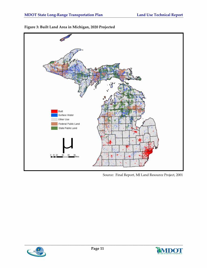
According to the 2001 Michigan Land Resource Project study as shown in Figures 2 and 3 if current land use patterns continue between 15 and 2 million more acres of land area will be urbanized in 2020 This is a 63ndash87 percent increase over 1990 levels and is as much land as served 92 million residents in 1978 (MSPO September 1995 Demographics) The 2001 Michigan Land Resource Project study also projected that if current land use patterns continue by 2040 Michiganrsquos built or developed areas will increase by 178 percent (PSC 2001) That would mean that 17 percent of Michigan would be developed compared to the present 9 percent
_____________________________________________________________________________________ Page 9
MDOT State Long‐Range Transportation Plan Land Use Technical Report
_____________________________________________________________________________________ Page 10
Figure 2 Built Land Area in Michigan 1980
Source Final Report MI Land Resource Project 2001
MDOT State Long‐Range Transportation Plan Land Use Technical Report
Figure 3 Built Land Area in Michigan 2020 Projected
Source Final Report MI Land Resource Project 2001
_____________________________________________________________________________________ Page 11
MDOT State Long‐Range Transportation Plan Land Use Technical Report
Some of the most significant effects will be felt in the land resourcendashbased industries and older urban areas Table 1 shows land use classifications with actual acreage for 1980 and projections to 2040
Table 1 Classes of Land Use 1980 and Projections to 2040
Class of land use 1980 (millions of
acres)
Percent of Total
2040 (millions of
acres)
Percent of Total
Change (millions of
acres)
Agriculture 11 304 91 251 ‐19 Built 23 64 64 176 41 Private forestland 182 503 169 466 ‐13 Other vegetation 29 80 22 61 ‐07 Wetland 18 50 17 47 ‐02
Source Public Sector Consultants Michigan Land Resource Project November 2001
As these trends continue Michiganrsquos population density is falling Michiganrsquos average population density was 38 persons per acre in the early 1980s and dropped to 28 persons per acre by the late 1990s (Norris and Soule 2003)
In 2001 the Michigan Land Resource Project also explored the future of Michiganʹs land‐based industries if present development trends continue The conversion of agricultural land and other vegetative land to developed land has implications for land‐based industries such as agriculture mining forestry and natural resource‐based recreation and tourism which collectively account for approximately 30 percent of Michiganʹs total economy In the next 40 years if the current development rate continues Michigan will have 25 percent less orchard land 15 percent less farmland and 8 percent less forestland The stateʹs destination resorts particularly those in northern Lower Michigan find themselves competing with encroaching development along the travel corridors that lead to them (tourism experts find that part of the attraction of a destination resort is enjoying the aesthetics of ʺgetting thereʺ)
These development patterns have been made possible by the availability and affordability of personal automobiles and a very good and extensive highway system As the population moved outward and densities decreased the desire for a personal automobile increased and providing public transportation alternatives became more challenging Following the population the sources and destinations for commodities has also shifted with the development patterns to locations along the highways
There are many costs associated with Michiganrsquos growth patterns agricultural land and open space are developed traffic congestion increases and new public infrastructure is built on the urban fringe Urban core areas often have existing infrastructure (especially the road network) that still requires maintenance even when their population declines The resultant lower tax base from which to fund this maintenance work is particularly challenging for older urban core areas Furthermore the localized nature of planning in the state with land use decisions fragmented across over 1400 local units of governments contributes to unbalanced land use _____________________________________________________________________________________ Page 12
MDOT State Long‐Range Transportation Plan Land Use Technical Report
decisions This arrangement makes it very difficult to implement coherent policies in areas with regional implications such as housing transportation or environmental protection
32 Regional Trends Land use change in Michigan is an increasingly important issue confronting a range of stakeholders and policy‐makers at all levels of government The sprawl issue as discussed above is often seen as having positive economic growth and development benefits In metropolitan areas however it is also related to negative impacts of poverty and social equity while in rural areas it involves the irretrievable loss of farms rural livelihoods and open space This problem has been referred to as the ldquoInside‐Outside Gamerdquo in reference to the two features of sprawl loss of livable central cities and increased landscape and political fragmentation in the suburban and rural fringe
While rural areas on the urban fringe give way to residential and commercial development urban centers experience declining employment opportunities Less moderate‐income housing becomes available resulting in an increased concentration of poverty in the center cities Characterized by low‐density development the spatial construction of sprawl also leads to increased travel distances and more time spent on the road getting to and from the work place retail centers and recreation In addition the ever‐expanding beltway surrounding the central city results in increased expenditures for roads and other infrastructure development
This general problem is often referred to as decentralization in which many local government authorities assume a larger role than that of central metropolitan governments and where at least at present there are few or no regional or statewide governance structures to manage and mitigate the pace location and impact of sprawl While not yet widely seen in Michigan in other parts of the country this has resulted in a metropolitan region with many independent ldquoboomburbsrdquo with their own planning governments disconnected from each other and the region
33 Urban Activity Center Trends Disinvested urban cores frequently have numerous properties on which there are dilapidated andor abandoned structures andor environmental contamination from past uses These are referred to as brownfields (abandoned idle or under‐used industrial and commercial facilities where expansion or redevelopment is complicated by real or perceived environmental contamination) Such properties cannot be reused until they are cleaned up which may be very costly Despite this obstacle in the 1990s Michigan became a national model in brownfield redevelopment and by June 2000 33 municipalities had attributed $18 billion in private investment and more than 8000 new jobs to brownfield redevelopment
Urban core areas also frequently contain many properties that the owners simply have abandoned but they cannot be cleaned up sold or reused until the cities can obtain clear title to them Until the last few years tax reversion the process by which such property reverts to public ownership was lengthy and cumbersome which stymied local redevelopment because
_____________________________________________________________________________________ Page 13
MDOT State Long‐Range Transportation Plan Land Use Technical Report
of long delays in giving new investors clear title to abandoned properties Public Act 134 of 1999 streamlined tax reversion making it easier for local units of government to claim abandoned properties and encourage private investors to redevelop them As of May 2001 4000 Michigan properties had been reused In addition Public Act 258 of 2003 created the State of Michigan Land Bank Fast Track Authority to help return blighted tax reverted properties to productive and economically viable use The Authority works to return parcels to community tax rolls initiates innovative revitalization programs with non‐profit and other organizations and collaborates on projects with county and municipal governments PA 258 also enabled the creation of county and local land bank fast track authorities several of which have been created in the statersquos urban areas
Chapter 4 Transportation Land Use Planning Integration Issues and Considerations
The relationships between land use and transportation are complex and synergistic This chapter discusses the issues and implications of Michiganrsquos demographic socioeconomic employment inter‐governmental and residential pattern changes to transportation and land use The primary data sources for this Chapter were MI Transportation Plan Socioeconomic Technical Report and the US Census 2000 (The reader is reminded that the Socioeconomic Technical Report discusses transportation issues relative to demographic changes This report focuses on Land Use issues and does not attempt to re‐state the socioeconomic discussion)
41 Demographic and Socioeconomic Shifts and Dynamics From 1998 to 2005 Michigan grew in population by only 04 percent annually The population is expected to continue this slow growth an estimated 12 percent total between 2005 and 2030 Forecasts show that people age 65 and older will comprise over 20 percent of Michiganrsquos population by 2030 Studies predict that seniors will remain in the labor force longer and retire in‐place (in their own suburban homes) or relocate within Michigan
Michigan lost over 570000 people during the 1980s due to net out‐migration Much of this out‐migration was workforce age population This loss was offset by in‐migration from international populations It is expected that by 2030 the 25‐65 age group will shrink from 55 to 47 percent of the population and the under 25 population will shrink from 35 to 32 percent
Michigan continues to diversify culturally and ethnically According to the US Census Bureau Michiganrsquos Caucasian population (all ethnicities) which was 823 percent in 1990 declined to 785 percent in 2005 In addition international immigrant growth in Michigan has increased from approximately 100000 in the 1980s to 171000 in 2000 and is expected to grow to over 195000 by 2020
During the last 15 years personal income in Michigan has kept pace with national trends However even with this being the case the percentage of persons at or below the poverty level
_____________________________________________________________________________________ Page 14
MDOT State Long‐Range Transportation Plan Land Use Technical Report
has increased For example the US Census reports that the number of people living in poverty in Michigan grew from 97 percent in 1994 to 114 percent in 2003
411 Aging Population The most pronounced socioeconomic change in Michigan is expected to be the increase in aging and retired populations While many seniors are expected to remain in their current homes (retire‐in‐place) it is also expected that retirement and adult living communitiesdevelopments will grow Throughout the US there appears to be a trend with urban areas being redeveloped with condominiums that are attracting empty‐nesters The American Association of Retired Persons (AARP) has conducted transportation studies showing that seniors and retirees still prefer to travel by private automobile and continue to drive the same number of miles only at off‐peak times This may result in a re‐densification of the urban core and establishment of more compact housing that while auto dependent may be more efficiently served by public transit and similar services
412 Income Dynamics While more Michigan residents and families are living in or below poverty more are also living with increased wealth In Michigan as in many parts of the US the size of the middle‐class is shrinking During the last century increased wealth has often given families the option of moving further outside the city thus contributing to suburban and exurban sprawl development patterns This trend in turn has facilitated a deterioration of what are often called the ldquofirst‐ring suburbsrdquo
413 Diversification of Immigration The recent growth in immigration does not represent the Eastern European patterns of the early 1900s Instead Michigan particularly in the Detroit area has been most recently receiving immigrants from Asia Middle East and North America These groups have a higher degree of socioeconomic diversity than did immigrants in the early and mid 20th Century This diversity drives different settlement patterns For example Asians tend to immigrate mainly to Oakland County but there are sizeable populations in Macomb Wayne and Washtenaw counties as well The main influence on their settlement pattern is socioeconomic status Asian groups with higher income and education (Asian Indian Chinese and Japanese) are found in suburban cities like Troy Bloomfield Hills and Farmington Hills Groups with limited financial means (Hmong Bangladeshi and Pakistani) have a very different pattern Because of their smaller numbers limited financial means and the housing market of southeastern Michigan these groups primarily settle in older suburbs like Hamtramck and Warren or central cities like Detroit and Pontiac Group size influences the settlement patterns of Middle Eastern immigrants as well The largest groups immigrating to southeast Michigan include persons
_____________________________________________________________________________________ Page 15
MDOT State Long‐Range Transportation Plan Land Use Technical Report
from Iraq Lebanon and Yemen For the most part many of these immigrants settle in Dearborn which has the largest concentration of Arab immigrants in the United States2
414 Growth in Number of Households Smaller Household Size Household growth has been 15 times faster than population growth From 2005 to 2030 the number of households is expected to grow by 19 percent This trend has continued from the 1970s when the household size was 33 persons to todayrsquos average household of 26 people This growth is outpacing population growth because of the increasing number of singlendashperson households smaller family sizes and more elderly or seniors living alone The land use implication of this is more a growth in the absolute number of housing units than a change in pattern
42 Economic and Employment Changes Significant changes have occurred in Michiganrsquos employment over recent decades In 1970 manufacturing was the dominant sector with 30 percent of the jobs Today it represents less than 20 percent of Michiganrsquos jobs and is expected to decline to less than 15 percent by 2030 Between 2000 and 2005 Michigan lost 218000 manufacturing jobs Detroit alone lost 100000 manufacturing jobs in the last five years Employment gains in high‐wage advanced service industries were not large enough to offset the loss of manufacturing jobs
421 Manufacturing During the last decade employment growth has been slow and projected to remain slow High‐paying manufacturing jobs have left the state only to be replaced by service jobs Most jobs are in the southern portion of the Lower Peninsula primarily in Flint Saginaw Detroit Grand Rapids Lansing Ann Arbor and Kalamazoo Metro areas In terms of land use implications many jobs have shifted to outside the urban areas to the suburban ring communities It is anticipated that as the labor force shifts and ages employers will relocate to localized labor pools further extending sprawling development patterns and continuing to decrease job opportunities in the urban core where people could reach their jobs via public transit The decrease in manufacturing may also mean fewer trucks and trains that are Michigan‐originated or ‐destined and more that are passing through Through traffic tends to be concentrated on the southern portion of the Lower Peninsula primarily in Flint Saginaw Detroit Grand Rapids Lansing Ann Arbor and Kalamazoo Metro areas Increases in through traffic will place capacity demands on corridors serving these urban areas
_____________________________________________________________________________________ Page 16
2Booza J ldquoRecent Immigration Trends in Southeast Michiganrdquo Profitwise News and Views June 2004 Federal Reserve Bank of Chicago wwwchicagofedorgcommunity_development06_2004_pnv_recent_immigration_trends_in_michigancfm
MDOT State Long‐Range Transportation Plan Land Use Technical Report
422 Agriculture and Extractive Industries Farming mining forest and fishing employment declined or were flat between 1980 and 2005 with most employment growth during that period occurring in retail construction services government and wholesale This trend is expected to continue to 2030 The land use and transportation impact of this includes people moving away from rural areas to be closer to jobs in suburban service areas and the fact that service jobs require more travel for people to serve each other This may result in more automobile‐dependent travel
423 Tourism One of the biggest growth industries in Michigan is tourism These jobs are both in the rural parts of the state including the Upper Peninsula and in the casinos and urban areas Among the positive aspects of tourist industry growth is that maintaining aesthetics and the quality of the environment is important to maintaining the industry Land use patterns will most likely be designed to create a positive visual environment One potentially negative transportation issue is that tourists may prefer to travel at a relatively slow pace to enjoy the scenery while local residents and freight haulers are usually seeking to travel quickly The speed differential may create transportation safety problems on roadways in tourist areas
43 Inter-governmental Relations Transportation issues are demanding an increasingly prominent place on local agendas Whether it is on potholes or laying out roadways in a subdivision local officials are spending more time making sure people and goods can move safely and efficiently Pressure is growing and funds are limited
431 Relationship of Home Rule and Local Planning Authority Michigan is a home rule state with more than 1800 units of local government (counties cities villages and townships) having legal authority to engage in land use planning andor zoning To date over 1400 units of government have secured this authority At the same time MDOT has over 9700 miles of state highways with these passing through all but 259 units of government While local land use decisions often affect the Michigan transportation system MDOT has no role in land use decision‐making and often reacting to land use policies and plan implemented at the local level
The body of state statutes known commonly as the ldquoplanning and zoning enabling lawsrdquo sets the rules for local land development decisions in Michigan These statutes which date to 1921 in the case of cities and villages and 1945 for townships and counties have changed little over the years They enable but do not require local governments to plan and zone They allow local units of government to (1) plan when where and how development of land should occur and (2) set standards in such matters as how buildings shall be designed and how specific areas (zones) shall be used (commercial residential and so on)
_____________________________________________________________________________________ Page 17
MDOT State Long‐Range Transportation Plan Land Use Technical Report
Land use planning may occur within cities villages townships andor counties but the state provides little guidance or demand for uniformity Furthermore there is little coordination between units of government Only 24 of the 83 counties have countywide zoning ordinances Conflicts often arise between neighboring jurisdictions In addition certain public buildings (eg corrections foster care and education facilities) do not necessarily need to fully comply with local zoning regulations
432 Interagency Coordination Although MDOT uses land use inputs from MPOs in travel demand modeling and works with the 14 Planning Regions to collect data and communicate in rural areas of the state there remain hundreds of non‐municipal public entities that make land use decisions not bound by local planning and zoning These include school districts (597) intermediate school districts (59) community colleges (29) state universities (13) tribal governments (11) and uncounted federal state and local agencies and authorities In addition the 2002 amendments to Michiganrsquos planning statutes encourage neighboring governmental units to cooperate with one another during land use planning processes but few of these other entities are included A decision by local governments or special districts to extend sewer and water lines continues to spread development into new areas A decision to locate new schools in the rural areas reduces the ability or probability for students to walk or bicycle safely to school Each of these land use decisions results in a demand for new or improved roadways or highways In this and other ways Michigan is behind many states in addressing land use challenges More than a dozen states have passed comprehensive growth management laws and many more have adopted significant smart‐growth initiatives
44 Residential Location Patterns From 1980 to 2005 the northern Lower Peninsula the Grand Rapids area and portions of southeastern Michigan have grown up to 50 percent over the 25‐year period For 2005 to 2030 the Grand Rapids area the northwestern portion of the Lower Peninsula Keweenaw County in the Upper Peninsula and the suburban counties (especially Livingston) in southeastern Michigan are expected to grow at 25 percent or higher All other areas of the state will have 25‐year combined growth rate of less than 25 percent
According to the Final Report from the Michigan Land Use Leadership Council Chapter 2 from 1990 to 2000 population in 13 representative Michigan cities fell by 43 percent All 13 cities experienced out‐migration
441 Location Choices
4411 Rural Small Town Preferences
According to land use reports prepared for the Michigan Leadership Council Michigan residents prefer living in rural areas and small towns a choice resulting in urban sprawl and increased dependence on the personal automobile Increasingly the land use dialogue has
_____________________________________________________________________________________ Page 18
MDOT State Long‐Range Transportation Plan Land Use Technical Report
turned to an examination of the causal role public policy plays in shaping land use decisions and patterns The current preference of Michigan citizens for new homes on large country lots is an expression of personal choice but choice depends on available options and cost To some extent these choices are driven by public policy at all levels of government (federal state and local) Examples of these public policies include
bull Zoning land for single‐family use at one unit per acre or greater and land divisions in 10‐acre parcels results in very low‐density scattered land use patterns that over time contribute to a reduction in the economic viability of farms and forests
bull The process for clearing a title in urban areas is so cumbersome and lengthy that it discourages redevelopment and land assembly efforts in urban areas
bull Government spending patterns can encourage the use of greenfields over brownfields
4412 Retirement
It is anticipated that as the senior population in Michigan grows additional senior or adult communities or assisted living centers will be developed This type of development will most likely be more compact and could be designed to be transit‐friendly or self‐contained and include grocery banking and similar service facilities These developments could be designed to provide residents mobility through walking trails or accommodate small electric vehicles such as golf carts within them
4413 Vacation or Second Home
According to the US Census Michigan gained over 57000 vacation or second homes between 1970 and 2000 (from 178000 to over 235000) growth that complements the rise in tourism However the transportation impacts may mean more people driving their personal vehicles longer distances to commute to their second homes on the weekends
442 ResidencePlace of Employment Dynamics As stated earlier the relationship between workplace and residence and transportation is best described as synergistic and spiraling
4421 Change in Work Location
Beginning in the late 1960s and continuing today as skilled workers and their families moved out of the center cities to the suburbs they were followed by the companies that employed them As urban beltlines began to emerge service research technology businesses warehousing and light manufacturing seeking expansion space also moved outside the urban core to sites that were easy to access by automobile and trucks
4422 Change in Vocation
As stated earlier in this report Michiganrsquos economy has transitioned over the years It had its origins in mining and forestry and agricultural products and then was one of the major
_____________________________________________________________________________________ Page 19
MDOT State Long‐Range Transportation Plan Land Use Technical Report
manufacturing centers of the world most recently it is moving to a service‐based economy with jobs focusing on tourism retail trade technology and health care As discussed in Chapter 2 Historic Land Use Development Patterns each of these three demand different land use patterns and are based on different modes With changes in the types of jobs available people were required to change vocations leave Michigan andor move to be close to a job in order to remain employed Remaining employed may also have required changing the mode of transportation used to access the available jobs
4423 Employee Preference
Many service businesses were attracted to the suburbs following employeesrsquo residential preference of the suburbs Restaurants dry cleaners grocery stores and shopping malls also moved out to be near peoplersquos homes Many service businesses developed along highways or in suburban clusters that are only accessible by a private automobile This land use development pattern further reinforced the need for infrastructure to support the private automobile
4424 Travel Characteristics
Despite efforts to encourage carpooling and transit use more Michigan residents in 2000 drove to work alone than did in 1990 (from 815 percent to 83 percent) Similarly fewer people used alternative modes such as a bus bicycle or walking (55 percent in 1990 vs 42 percent in 2000)
In line with the rest of the nation it is taking longer for Michigan residents to get from home to work In 1990 71 percent of the population took less than 30 minutes to get to work However the 2000 US census showed that only 67 percent could travel to work in less than 30 minutes
45 Activity Centers The Corridors and International Borders Report prepared as supporting documentation to MI Transportation Plan identified Michigan Activity Centers Activity centers play a key role in Michiganrsquos economy they are locations with concentrations of jobs transportation infrastructure and service facilities As Michiganrsquos economy shifted from rural to urban and suburban and from agriculture to manufacturing to a primarily service‐based economy these activity centers have become the current center for economic activity and the potential growth areas for the state
451 Definitions Activity Centers are defined as Geographic locations with concentrations of people jobs educational and health service facilities tourist attractions or other similar economic‐based facilities or services International border crossings are included within some activity centers
_____________________________________________________________________________________ Page 20
MDOT State Long‐Range Transportation Plan Land Use Technical Report
MDOT identified activity centers based on quantitative criteria and an analytical process as explained in the Corridors and International Borders Report Details on criteria and thresholds used to identify activity centers are referenced in Table 2 below
Table 2 Criteria and Thresholds Used To Identify Activity Centers
Activity Center Criteria Measure Threshold Data Source and Year Urban Urban AreasUrban Clusters in Michigan
Population Greater than 5000 Persons
US Census Urbanized AreaCluster 2005
Nearest Urban Center outside Michigan
Population Greater than 200000 Persons (Transportation Management Area (TMA))
US Census Urbanized AreaCluster 2005
Commercial
General Economic Activity Total Employment
Greater than 2500 Employees
MDOT TAZ
Retail Activity Retail Employment
Greater than 1000 Employees
MDOT TAZ
Tourism Hotel Capacity Hotel Units 100 or More Units MDOT Annual Lodging Use Tax revenue
Tour Tax Annual Tax Value $50000 or more
MDOT
Gaming Gaming Centers
Major Gaming Centers were identified as a characteristic of an Activity Center
MDOT 2005
State Park State Park Location
None MDOT
Number of Visitors Person Trips Annual Personal Trip Total Greater or Equal 1000000
MSU Tourism Data 2004
Length of Stay Person Days Annual Personal Trip Total Greater or Equal 3000000
MSU Tourism Data 2004
EducationTechnology Center Postsecondary Education Centers
Type of Postsecondary
Community Collages and Universities
US Department of EducationMichigan Department of Education 2005
Smart Zones Technology Centers
All Smart Zones MDOT 2006
Life Sciences Facilities Hospital Local
Employment Greater than 500 Employees
MDOT 2005
_____________________________________________________________________________________ Page 21
MDOT State Long‐Range Transportation Plan Land Use Technical Report
Correctional Facilities Prisons Prison Facility
Locations Major Correctional Facilities were identified as a Characteristic of an Activity Center
MDOT 2005
Passenger Facilities Air Passenger Passenger
Enplanement All Airports with Passenger Enplanement
MDOT TMS 2005
Amtrak Passenger Station
All Active Passenger Stations
MDOT TMS 2005
Intercity Bus Station Passenger Stations
All Active Intercity Passenger Bus Stations
MDOT TMS 2005
Car Pool Parking Capacity
Greater Than 100 Parking Spaces
MDOT TMS 2005
Freight Facilities Air Cargo Ports Cargo
Deplanement All Air Ports with Cargo Deplanement
MDOT TMS 2005
Marine Ports Cargo Tonnage All Cargo Ports Receiving or Shipping Tons of Goods
MDOT TMS 2005
International Border Crossing Passenger and Freight Passenger and
Freight All International Border Crossing with Passenger and Freight Activities
MDOT 2005
452 Impact on Transportation and Land Use Patterns Many of Michiganrsquos activity centers provide a unique service or support specialized industry Some are tourist hubs technology centers and health care facility centers while others are university‐focused People and goods move between these centers to take advantage of their unique services For example an activity center may provide specialized medical facilities or educational institutions Multi‐modal transportation corridors connect Michiganrsquos people and goods between activity centers Major urban activity centers that may offer several types of services and support a variety of employment may also be served by several modes of transportation As has been discussed earlier in this report the greater the concentration or density of people and jobs the greater the potential for more transportation modes to be available and efficient
46 Michigan Land Use and Leadership Council In 2003 the bipartisan Michigan Land Use Leadership Council convened by Governor Granholm with the support of the leaders of the MI Senate and House determined that it was important to articulate a vision and land use goals for Michigan and to recognize the legal
_____________________________________________________________________________________ Page 22
MDOT State Long‐Range Transportation Plan Land Use Technical Report
framework and the key assumptions underlying its adopted vision and goals The council established three fundamental goals
bull Economic prosperity
bull Stewardship of the environment cultural and natural resources and
bull Equitable distribution of benefits to all residents
It emphasized that these three goals are interdependent and require government leadership in guiding public and private land use decisions and policies that reflect the importance of balancing the goals in achieving sustainability The councilrsquos August 15 2003 report lists 10 smart growth tenets used to develop many of the its recommendations The council highlighted and discussed two major components of the statersquos legal framework (1) private property rights and (2) the concept of home rule and acknowledged their importance in its deliberations The councilrsquos report also lists key assumptions and constraints including the budgetary implications of its recommendations
461 Land Use Council Recommendations Based upon background materials the survey results and public comment the council organized issues into four broad categories within which it developed guiding principles and recommended actions to address specific issues These four categories are reflected in the chapters of the final report and include
bull Urban Revitalization
bull Land ResourcendashBased Industries
bull Planning and Development Regulation and
bull Infrastructure and Community Services
The council avoided radical recommendations and divisive issues Neither recommendations nor regulations were advanced to support state or regional land use planning impact fees for growth area or mention of educational equity youth development or school choice The council also recognized and concluded that land use actions remain market driven and when the economy is in trouble local officials are willing to sacrifice good land use practices for some improvement in the tax base or to create some jobs Despite these collaborative efforts and the spirit of compromise exhibited by the council throughout its deliberations a few contentious issues could not be resolved to everyonersquos satisfaction Following the last meeting each council member was given the opportunity to reserve his or her support or object to specific recommendations adopted by a majority of the council Reservations or objections of individual council members on specific recommendations are noted following each recommendation
A summary or paraphrasing of the specific recommendations could undermine the carefully constructed language crafted and adopted by the council and contained in the final report In general terms the councilrsquos recommendations address broad thematic areas that focus on ways in which government policies and decisions in cooperation with the private sector can provide
_____________________________________________________________________________________ Page 23
MDOT State Long‐Range Transportation Plan Land Use Technical Report
leadership on and a balanced approach to issues of common concern Consistent with the councilrsquos stated vision and goals the recommendations focus on incentives and assistance rather than mandates to encourage private sector cooperation in addressing identified concerns Similarly the recommendations of the council provide new tools alternative planning approaches technical assistance and resources for local government to reduce sprawl and encourage inter‐governmental and interagency cooperation in planning for infrastructure and services that serve large geographic areas
Chapter 5 Land Use and Transportation Practices from Other States
In recent years Michigan has developed and applied a variety of tools and strategies for more effectively integrating land use and transportation planning including an Access Management Handbook a Transportation Economic Development Program Context Sensitive Solutions environmental mapping and Bicycle and Pedestrian Programs This chapter presents a summary of some of the notable programs and approaches used across the nation that are potentially transferable to Michigan as it seeks to expand and strengthen its in‐state efforts This summary is derived from an FHWA‐prepared listing and description of 30 tools methods strategies and procedures along with implementation examples that state DOTs and MPOs use to integrate transportation planning and land use Appendix A presents a complete listing of the tools and examples from the FHWA Web site (httpwwwfhwadotgovplanninglandusetoolscfm) Case studies and other references and links are also available on this site at httpwwwfhwadotgovplanninglanduseindexhtm
51 Examples FHWA categorized five types of programs methods or strategies that state DOTs and MPOs use to integrate transportation and land use These categories include planning activities public involvement GIS and technical analysis project prioritization and funding and design guidelines and standards One of the most comprehensive examples and approaches using the five types of programs to address the integration of land use principles with transportation and economic development is the New York State ldquoQuality Communities Clearinghouserdquo program Almost every type of state‐sponsored program or service is incorporated or addressed by this program Details on the New York State program may be found at httpwwwqualitycommunitiesorgindexsap
511 Planning Activities This program category includes considering land use issues while conducting transportation planning for corridors interchanges and statewide or MPO comprehensive plans It includes education and outreach on principles and concepts such as transit‐oriented design overlay districts or other zoning changes that may facilitate increased transit efficiencies While MDOT
_____________________________________________________________________________________ Page 24
MDOT State Long‐Range Transportation Plan Land Use Technical Report
has developed a variety of planning tools guidelines and programs that mirror many of these it can be valuable to consider what other states and jurisdictions have done as MDOTrsquos efforts evolve and grow
Some notable examples include
bull Guidebooks and model zoning ordinances Idaho DOT and Wisconsin DOT have published transportation planning guidebooks aimed at helping local staff integrate transportation planning with land use planning Vermont Agency of Transportation working with the Vermont Department of Housing and Community Affairs jointly developed modal zoning guidelines to help local governments incorporate access management principles into their zoning and to help direct development away from interchanges The Burlington Vermont MPO Florida DOT and Maryland DOT developed guidelines to help planners and developers with transit‐oriented design concepts
bull Grants and funding Illinois DOT provided $15 million over five years to help local governments develop plans that integrate transportation and land use Colorado DOT together with and through their state Heritage Planning Grant Awards program collaborates with local governments on transportation planning
bull Environmental Florida and Ohio DOTs instituted processes to identify environmental and land use concerns early in the project development process Colorado and Washington state DOTs use their EIS process to identify and incorporate environmental issues and land use concerns into project development
512 Public Involvement This program category includes developing community outreach tools to raise the level of awareness about the connection between land use and transportation It includes sponsoring or participating in visioning workshops and charrettes (collaborative sessions in which urban plannersdesigners consult with stakeholders developers municipal officials and local residents to come up with joint solutions to urban planning issues) that develop future land use scenarios which include the design of transportation‐ and transit‐oriented facilities Most notable examples are MPO‐sponsored or initiated events in which the state DOTs participate
513 GIS and Technical Analysis This program category includes using one of several GIS‐based software packages and models to create and explore various land use scenarios that also address transportation facilities It also includes GIS mapping of transportation environmental historical land use and other features that can be accessed and used during the transportation and land use planning processes Notable examples include
bull Software Programs CommunityViz MetroQuest Paint the TownPaint the Region PLACE3S Smart Growth Index Idaho DOT used MetroQuest in a scenario‐based
_____________________________________________________________________________________ Page 25
MDOT State Long‐Range Transportation Plan Land Use Technical Report
planning process to create a statewide transportation vision Over 750 transportation partners participated in the two‐year process
bull GIS and Environmental Mapping State DOTs throughout the US have worked with other state agencies to produce GIS base maps of transportation and other relevant environmental and land use features These resources are used by state DOTs in the project development and planning processes and by local governments during comprehensive land use planning
514 Project Prioritization and Funding This program category includes state DOTs and other agencies providing incentives to jurisdictions who adopt policies and implement projects that incorporate or support desired transportation development principles Some policies and principles include concepts such as enhancing walkability pedestrian friendliness and transit‐oriented site design This category also includes adopting project selection criteria that consider regional or local land use plans or smart growth criteria It includes funding for local transportation capital improvements such as pedestrian facilities It includes state DOTs providing technical assistance and outreach to promote good transportation and land use integration Notable examples include
bull Financial Assistance Massachusetts Executive Office of Transportation provides financial assistance to public agencies for pedestrian and bicycle facilities as well as housing and parking projects in mixed‐use developments located near transit stations
bull Priority Funding Project Section Criteria Maryland state agencies including the department of transportation established priority funding areas to focus economic development and state projects to specific areas of the state The Denver and Seattle MPOs provide priority points to projects that support specific criteria or are located in specific areas such as infill and mixed‐use development projects that support access management
bull Fiscal or Regulatory Incentives New Jersey DOT Oregon DOT and Utah DOT give priority to projects by expediting permits and streamlining regulation for communities that support various land use and transportation planning programs or policies Some favored priority programs and policies include using context‐sensitive design adopting balanced street design growth management and access management measures Utah DOT works with other state agencies to provide certification to communities that participate in this program
515 Design Guidelines and Standards This program category includes DOTs developing publishing and sometimes providing training on transportation and land use design standards and guidelines Common guidelines include Context‐Sensitive Design and Context‐Sensitive Solutions (CSDCSS) roadway design guidelines bicycle and pedestrian facility design standards model zoning ordinances transit‐oriented design guidance access management guidelines This category also includes programs to address situations when a state highway serves as a downtown main street State _____________________________________________________________________________________ Page 26
MDOT State Long‐Range Transportation Plan Land Use Technical Report
DOTs have worked out programs to transfer these roadways to others that may better meet the state design standards This will allow downtowns to achieve development goals and the DOT to achieve design standards for the roadway Some examples include
bull CDSCSS California Minnesota New Jersey New York State and Vermont transportation agencies have all published Context‐Sensitive Solutions policies or programs and most provide workshops and training in CDSCSS
bull Bicycle and Pedestrian FHWA National Highway Institute (NHI) Florida DOT and Washington DOT all have published bicycle and pedestrian standards design manuals and training
52 Lessons Learned Potential Transferability to Michigan Comments and concerns from participants in MI Transportation Plan public meetings and the findings conclusions and recommendations from Governor Granholmrsquos Michigan Land Use Leadership Council demonstrate that there is both a strong interest and desire to better integrate transportation and land use MDOT has already begun to implement processes and tools to achieve better transportation‐land use coordination The list below highlights some of the tools MDOT is employing as well as others it might enhance to better understand the relationships and improve their integration
bull Coordination with other state agencies and local public agencies including the MPOs MDOT works very closely with the 15 Michigan MPOs in the development of their annual unified work program development of their transportation model long‐range plan and Transportation Improvement Program (TIP) MDOT also funds the 14 State Planning amp Development Regions to collect transportation data and serve as coordinators for various transportation efforts
bull Promote Education Having knowledgeable decision‐makers at the local level goes a long way toward implementing positive land use decisions However there are barriers to educating local elected and appointed planning officials including access to availability of and the cost of training Efforts such as Michigan State Universityrsquos Citizen Planner Program and the Michigan Association of Planningrsquos Training for Officials both of which provide planning and zoning training to local officials are valuable endeavors
bull Outreach MDOTrsquos Regional Planning staff could expand efforts to work with local agencies during their visioning and planning processes
bull Sharing Data Like many DOTs MDOT can continue to enhance and share its GIS‐based data with local land use agencies and MDOT environmental programming staff This would facilitate identifying and incorporating transportation and land use issues during planning and project development processes
_____________________________________________________________________________________ Page 27
MDOT State Long‐Range Transportation Plan Land Use Technical Report
bull Process Enhancements MDOT could revisit its project development and planning processes to better identify and incorporate land use issues and concerns early in the planning and National Environmental Policy Act (NEPA) processes
bull Guidance Documents MDOT has guidance documents for access management and context sensitive solutions transportation enhancement and transportation economic development MDOT uses AASHTO documents for non‐motorized and pedestrian
Chapter 6 Findings and Conclusions
As has been stated throughout this report transportation and land use have a complex and synergistic relationship Changes in transportation technology and availability provide opportunities as well as positive and negative changes to land use patterns Changes in land use patterns result in changing demands for transportation facilities and services With the rising costs for transportation infrastructure limited funding for system expansion and lack of formal or regulatory coordination between those who make land use decisions and those who make transportation decisions the problems and issues with each is intensifying
In addition to the need for coordination evaluation of transportation problems requires focusing on land use and access in addition to mobility and safety By physically moving people and services closer together more transportation modal options could be feasible In‐fill housing live‐where‐you‐work programs brownfield redevelopment and developing shopping schools and other service‐oriented facilities within walking and bicycling distance can all reduce transportation demand particularly demand for single‐occupant vehicular travel
The examples presented in Chapter 5 Land Use and Transportation Practices from Other States provide other information and ideas that MDOT may want to consider By developing land use educational programs and incentives and offering free technical advice to local land use decision‐makers transportation costs may be reduced One potential program to address these issues may be to work with local governments and the County Road Commissions on a statewide initiative for TSMTDM (transportation system management transportation demand management) As discussed in the MI Transportation Plan Corridors and International Borders Report this initiative would include education incentives and assistance for local governments to adopt TDMTSM programs
61 Coordination The issue of lack of interagency and inter‐governmental coordination in relation to land use has been recognized for years Several initiatives including Governor Granholmsrsquo Land Use Leadership Council which began in 2002 have cited and evaluated the need for greater cooperation and coordinated land use decision‐making A decade earlier in 1992 the state conducted the Michigan Relative Risk Analysis Project asking state scientists policy‐makers and business and environmental leaders to identify and rank the risk of environmental problems in the state The absence of coordinated land use planning and the degradation of _____________________________________________________________________________________ Page 28
MDOT State Long‐Range Transportation Plan Land Use Technical Report
urban environments were cited as among the states top six most pressing environmental issues In addition such studies as the Fiscal Impact of Alternative Land Development Patterns in Michigan (Southeast Michigan Council of Governments 1997) show that the costs of public services and infrastructure in low‐density development (single homes on large land parcels) areas outstrip the tax revenue that such development generates
611 Interagency (horizontal) As discussed home rule is often cited as one of the reasons for the lack of land use coordination More than 1800 units of local government have legal authority to engage in land use planning andor zoning in Michigan Land use planning occurs within cities villages townships andor counties The federal law that applies within MPO areas requires coordination among local agencies on transportation planning Outside of these areas there is little planning coordination between parallel units of government While the 2002 amendments to Michiganrsquos planning statutes encourage neighboring governmental units to communicate with one another during land use planning processes this coordination is essentially voluntary as there is no coordinated planning requirement in Michiganrsquos planning laws This lack of horizontal coordination across jurisdictions or between various state agencies encourages a checkerboard pattern of development across the state
612 Inter-governmental (horizontal and vertical) There is also a lack of vertical coordination between local state and federal governmental entities In addition to local governments hundreds of other public entities make land use decisions that are not bound by local planning and zoning including school districts (597) intermediate school districts (59) community colleges (29) state universities (13) tribal governments (11) and uncounted federal state and local agencies and authorities The 2002 amendment to Michiganrsquos planning statutes does not facilitate or encourage coordination with these other entities Many of the issues and inconsistencies between state and local government land use planning and transportation can be attributed to one factor the lack of integrated and coordinated land use decisions Some of the more specific general implications of land use decision‐making in Michigan consist of the following
bull Too many decision bodies There are thousands of independent entities involved in land use decision‐making in Michigan all with different planning and zoning approaches and procedures This current structure makes achieving inter‐governmental coordination difficult
bull Some laws require planning but no coordination Plans or studies are often required before regulations can be made or projects can be implemented but rarely are these plans and studies required to be coordinated with the community master plan prepared by the local planning commission
bull Laws are many and outdated The age and number of laws involved in the present land use decision‐making framework are viewed as an impediment to improving the quality and coordination of local land use decisions Not only is the sheer volume of laws
_____________________________________________________________________________________ Page 29
MDOT State Long‐Range Transportation Plan Land Use Technical Report
daunting but the laws also lack contemporary planning and development tools that are available in other parts of the country
bull Lack of common structure to existing laws The current statutory structure evolved incrementally and therefore lacks focus and a common structural form The result is a series of uncoordinated independent laws with no clearly stated goal or set of common principles upon which the laws are based
bull Structure sometimes works at cross‐purposes The basic structural elements of the current land use decision‐making process sometimes work at cross‐purposes that is they are in disagreement with each other For example home rulelocal control emphasizes independence not interdependence Local officials are not concerned about satisfying constituencies outside their voting districts and therefore do not take actions in support of broader public interests
bull Gaps in roles and responsibilities There are obvious gaps in the roles and responsibilities of the key players involved in land use decision‐making
_ There is no statewide land use agenda that would enable regional governments or planning and development regions to exercise authority over local governments to ensure more coordinated planning
_ There is no apparent quality control process to determine the validity of required studies plans or regulations before and after implementation
_ Studies and plans are not required to be current and there is no process to ensure conventionality even if an enforcement provision was in place
_ There is no systematic obligation for intergovernmental cooperation
_ There is no periodic or systematic evaluation of the overall effectiveness of local planning economic development or environmental protection
_ Accountability for the effects of land use decisions on abutting jurisdictions is weak especially on issues of greater‐than‐local concern
_ Many land uses with significant impacts are not addressed in current legislation and
_ There is no mandatory training for elected decision‐makers for many special commissions or boards or for planning commission or zoning administrators
It is easy to conclude that the current structure with no common model too many decision bodies and virtually no requirements for coordination could not possibly work In this context it is intriguing that land use decisions are made as well as they are as often as they are It is clear that local land use decisions are dependent on an understanding of the intricacies of and inter‐relationships within the current structure The fact that the current system operates at all
_____________________________________________________________________________________ Page 30
MDOT State Long‐Range Transportation Plan Land Use Technical Report
can be credited to local decision‐makers and developers who invest a great deal of effort into coordinating decisions between communities and agencies at all levels of government
62 Stakeholders Michigan transportation and land use stakeholders and decision‐makers are often the same individuals or agencies The transportationland use coordination challenge is that the individuals and agencies have different responsibilities and levels of authority over transportation and land use decisions
621 Transportation Transportation stakeholders include the DOT FHWA Federal Transit Administration (FTA) MPOs regional councils transit agencies rail and air service providers freight haulers and shippers businesses industries local governments environmental justice populations and all other transportation system users Through this and other reports the role and responsibilities of each of these groups has been discussed While some state and federal guidance and recommendations for coordination exist nothing is required This voluntary system of coordination has had limited success in providing coordination between transportation and land use decision‐making
Michiganrsquos MPOs and regional councils are agencies and transportation stakeholders whose role and purpose is to encourage transportation and land use stakeholders to cooperate A regional council is a public organization encompassing a multi‐jurisdictional regional community It is founded on sustained by and directly tied to local governments through local andor state government laws agreements or other actions Through communication planning policy‐making coordination advocacy and technical assistance the regional council serves the local governments and citizens in the region by dealing with issues and needs which cross city town county and in some instances state boundaries Regional councils serve a region or sub‐state district which consists of a group of neighboring local communities whose residents are joined as a unit economically socially and geographically
Regional councils have grown into pro‐active multi‐functional full‐service regional organizations prepared to enable regional communities and their leaders and citizens to compete globally and thrive locally They can
bull Provide regional forums bringing community leaders and citizens together to address common needs that span jurisdictional boundaries
bull Provide skilled experienced staff to conduct regional strategic planning processes develop practical strategies for addressing tough common challenges and guide them into implementation
bull Provide technical assistance information and administrative services that expand the capabilities of individual local governments and groups and
_____________________________________________________________________________________ Page 31
MDOT State Long‐Range Transportation Plan Land Use Technical Report
bull Administer federal state and local programs that can be more economically and effectively delivered at the regional level
Just as regional councils bring local governments together to meet regional needs they also join with each other at the state and national levels to address the tough issues they have in common land use balanced growth quality of life environmental safety aging infrastructure and economic challenges Michiganrsquos 14 regional councils include
bull The Western Michigan Shoreline Regional Development Commission (WMSRDC)
bull The Northwest Michigan Council of Governments (NWMCOG)
bull The Southwest Michigan Commission (SWMC)
bull The Northeast Michigan Council of Governments (NEMCOG)
bull The Southeast Michigan Council of Governments (SEMCOG)
bull The East Central Michigan Planning and Development Regional Commission (ECMPDRC)
bull The West Michigan Regional Planning Commission (WMRPC)
bull The Region 2 Planning Commission (R2PC)
bull The Eastern Upper Peninsula Regional Planning and Development Commission (EUPRPDC)
bull The Grand Valley Metropolitan Council (GVMC)
bull The Central Upper Peninsula Planning and Development Regional Commission (CUPPAD)
bull The Western Upper Peninsula Planning and Development Region (WUPPDR)
bull The South Central Regional Planning Council (SCRPC) and
bull The Tri‐County Regional Planning Commission (TCRPC)
Developing a cooperative land use planning framework that encourages considering the regional consequences of local decisions is an essential aspect of a regional cooperation agenda When coupled with a regional approach to providing services local governments are finding real savings and making more efficient use of public investments Combined or shared services leveraged purchasing power and joint equipment and facilities agreements can free capital for other financial needs
622 Land Use Stakeholders for land use are the same individuals and agencies as transportation stakeholders In Michigan as discussed land use decision‐makers are primarily local governments For coordinated land use transportation goals and decision‐making to be a reality local governments must play a significant role Leadership for this can feasibly come from MDOT working through and with the MPOs and regional councils as well as the Michigan Association
_____________________________________________________________________________________ Page 32
MDOT State Long‐Range Transportation Plan Land Use Technical Report
of Regions the County Road Association the Michigan Association of Counties the Michigan Municipal League and the Michigan Townships Association A successful program would focus on educating and having the buy‐in support and cooperation of the 1800 Michigan local governments As discussed coordinated land usetransportation programs would need education incentives and implementation components in addition to strong leadership
63 Transportation Implications Current trends and changes in land use patterns are affecting the economic feasibility of providing alternative transportation modal services as well as the access structural conditions and mobility of transportation facilities For example unless businesses are located along rail lines it is unlikely that they will use rail transportation if homes and jobs are not located in a dense enough development pattern it is unlikely that they can economically be served by transit or by walking if land use development grows rapidly congestion will grow quickly It is possible to build 2000 homes within a couple of years but it may take 10 to 15 years to build a highway to serve the new growth generated by the 2000 homes
631 Highway Use As use of the automobile and truck increasingly become the mode of choice people businesses and industry are relocating in a sprawling land use pattern This pattern continues to put pressure on Michiganrsquos highways by increasing congestion and wear‐and‐tear on the roadways
632 Transit Intercity BusRail Passenger As Michiganrsquos land development becomes less dense the ability to be served by transit intercity bus or passenger rail becomes less economical Most people today are willing to walk far less than a mile (and often only a quarter of a mile) to reach these types of transportation services With homes and businesses spread out unless there is a parking lot nearby stations and stops can only be located in a limited number of convenient locations
633 Rail Commercial Truck Use of commercial trucks became the prominent mode of transporting freight and commodities in part because of the changes in land use patterns but more because of the changes in the way businesses began to operate in the 1980s Businesses moved to save money by reducing or eliminating inventories and demanding ldquojust‐in‐timerdquo delivery of products and materials Rail could not compete in guaranteeing on‐time delivery and trucking companies with the completion of the interstate system could Railroads reduced service and removed unprofitable lines Commercial trucking replaced rail as the primary mode carrying the highest value of freight
634 Air Land use patterns and air transportation are not as closely linked as the other modes Air freight is typically limited to high‐value low‐weight time‐sensitive commodities that are
_____________________________________________________________________________________ Page 33
MDOT State Long‐Range Transportation Plan Land Use Technical Report
transferred to air cargo planes by truck Major passenger airports are located throughout the state with the largest closest to urban populations Passengers travel typically by automobile to airports distance to the airport is not a major issue since the passenger air travel is typically limited to longer distance trips
64 Options for Incorporating Policies and Investments that Support Integrated Planning into MI Transportation Plan
Many land use advocates have suggested that residential development policies and plans should at least consider clustered residential areas This approach would provide outdoor open space and a density of housing that can be easily serviced by public transit It would also begin eliminating the linear development that sometimes accompanies urban sprawl Another option proposed in urban and metropolitan areas is mixed‐use development by which residential space exists above or adjacent to commercial development This could mean that every shopping outlet such as for food andor pharmaceutical needs could be housed in the same structure as dwellings Such a configuration would eliminate the need to drive a vehicle to the grocery store drug store or bank thereby reducing an individualrsquos dependency on the automobile for access to essentials of life
There are other land use development tools that have been proposed but require legislative action andor local initiative Some of these are
bull Transfer of Development Rights
bull DevelopmentInfrastructure Concurrency Requirements
bull General Service Districts or Urban Growth Boundaries
bull Official Maps
bull Intergovernmental Development Agreements
bull Inter‐jurisdictional Growth Management and
bull Regional Impact Coordination
Chapter 7 Integration Concepts
Particular segments of Michiganrsquos transportation system users have special sensitivity to the land use‐transportation relationship Similarly particular types of economic activities may be supported or hindered by the compatibility between transportation needs and land use patterns
Integration of land use considerations in transportation planning decisions may remove performance barriers at the system level by locating users closer to activities and by making different mixes of transportation alternatives viable for users
_____________________________________________________________________________________ Page 34
MDOT State Long‐Range Transportation Plan Land Use Technical Report
71 Travel Segments Sensitive to Land Use Key segments with special sensitivity to land use planning in Michigan include
711 City Residents The Travel Characteristics Technical Report of the MI Transportation Plan finds the levels of walking and transit are highest among city residents The density of land use and the co‐location of residential commercial and non‐commercial places of business is a major factor enabling city residents to access activities by various modes with minimal travel time and cost Michiganrsquos cities are locations where land use decisions are most likely to involve choices that may create barriers or remove opportunities for system users to access activities through transportation system components
712 Transit Dependent People The extent and frequency of transit service depends on ridership per revenue‐mile For this reason transit services can efficiently support more trips destinations and users in areas with greater density and with uses concentrated at locations that can be easily served by transit routes For transit dependent people land use decisions conducive to greater transit coverage and frequency translates into more accessible destinations and greater access to the workforce and consumer markets
713 Elderly Travelers The Socioeconomic Technical Report of MI Transportation Plan indicates the growing cohort of Michiganrsquos system users that are above the age of 65 Section 411 of this Land Use Technical Report suggests that this may result in a re‐densification of the urban core and establishment of more compact housing Such patterns even if populated by auto‐dependent residents may be efficiently served by public transit and pedestrian alternatives
714 Children and Young People The Travel Characteristics Technical Report of MI Transportation Plan indicates that children and young people make a large number of Michiganrsquos pedestrian trips For this reason the density and walkability of communities is an important factor for the safety and scope of opportunities for children and young people to access activities in Michigan
715 Low- Income Travelers The Travel Characteristics Report of MI Transportation Plan shows that low‐income households tend to have lower rates of automobile ownership and depend more on ridesharing transit and walking to access activities For these reasons the density and availability of lower income housing with pedestrian and transit access to work markets and other activities is of special importance to this segment
_____________________________________________________________________________________ Page 35
MDOT State Long‐Range Transportation Plan Land Use Technical Report
716 Ex-Urban and Regional Commuters The growth in ex‐urban communities on the perimeters of Michiganrsquos cities is often associated with a lower density of development This often translates into longer roadway trips connecting users to activities affecting vehicle miles of travel and duration of travel for ex‐urban commuters The proliferation of ex‐urban lower density land uses also makes transit and pedestrian alternatives less feasible concentrating transportation needs on private automobile roadway travel
717 Freight Carriers (Including Mail and Contract Carriers) and Their ManufacturingService Industry Clients (Shippers)
The efficiency of freight system operations can be improved when supply chain partners are co‐located within a manufacturing or industrial district This reduces the likelihood of incident‐induced delay as well as the mileage of freight travel Freight carriers are dependent on land use decisions as a determinant of the distance and routing of shipments In a similar way mail and contract carriers can achieve greater reliability and efficiency when major service establishments shipping large volumes of mail and contract traffic are concentrated in commercial districts reducing the distance between destinations
718 Immigrant and Non-English Speaking Populations Section 413 of this Land Use Technical Report addresses the growth in Michiganrsquos ethnic and cultural diversity When ethnic communities are spatially concentrated in particular neighborhoods cultural preferences regarding modes travel patterns and values will require decisions about how to incorporate different system components in these areas
719 Service Businesses The Socioeconomic Technical Report of MI Transportation Plan indicates the growth of the service sector of Michiganrsquos economy In the service industry location in proximity to the workforce as well as other service establishments that provide markets and inputs is a key success factor Proximity to residential areas can also be an important factor for service establishments selling to final demand The density and connectivity among service establishments and households can determine the degree to which the transportation system represents a barrier or an economic opportunity for different types of service establishments
7110 Real Estate Developers and Private Land Interests Real Estate Developers and Private Land Interests use the transportation system quality and availability as a key decision factor in the site selection process Measures such as drive‐time analysis accessibility of principal arterials and intermodal facilities figure prominently in decisions regarding investments that may bring jobs residents and other amenities to Michiganrsquos communities
_____________________________________________________________________________________ Page 36
MDOT State Long‐Range Transportation Plan Land Use Technical Report
7111 Retail Vendors Location relative to markets is known to be a key success factor in the retail industry Accessibility of both workers and markets is made easier when retail uses are collocated relative to suppliers and final demand Retailers (and some service providers) are sensitive in two ways the traffic is necessary yet at a certain volume the movements created by traffic accessing an establishment can be a deterrent to patronage of that establishment whether by automobile bicycle or walking When density supports pedestrian and transit access between retailers retail workforce retail suppliers and final demand potential barriers to retail industry performance can be reduced and opportunities for economic vitality can be created
7112 Tourist and Recreational Travelers Section 423 of this Land Use Technical Report points out the growth of the tourism industry in Michigan In areas with a strong economic base in tourism the aesthetic quality of the environment makes land suitability for tourists sensitive to the transportation infrastructure Tourists are a segment that may involve multiple modes and transportation system components because (1) cycling and walking are often common tourist activities (2) tourists unfamiliar with the host area may use transit as an easy way to access destinations and (3) tourists may arrive in the destination city by air rail or intercity service For this reason land uses supporting the tourist industry require complex decisions about the availability and arrangement of transportation system components in a tourist area
72 Performance Barriers and Opportunities ldquoPerformance barriersrdquo are conditions on the transportation system that make it more difficult more expensive or impossible for an activity to take place In the economic impact element of MI Transportation Plan performance barriers are represented as costs of doing business however they also include barriers to households and individuals In the Conditions and Performance Technical Report of MI Transportation Plan performance barriers are described by performance measures ldquoOpportunitiesrdquo are conditions on the transportation system that make it easier less expensive or possible for an activity to take place that may not otherwise occur In the economic impact element of MI Transportation Plan opportunities are represented as amenities however they also include opportunities for households or individuals in addition to businesses For the purposes of this report opportunities are understood as special ways in which system performance may stimulate users to engage in more or better activities
721 Performance Barriers
7211 Limited Transit Schedules and Long Transfer Times
The feasibility of transit routesschedules is directly related to the density of development along the route and vice‐versa A greater density of transit‐dependent households and activities will support more frequent transit services and more comprehensive route systems which in turn support more development that caters to transit users By contrast
_____________________________________________________________________________________ Page 37
MDOT State Long‐Range Transportation Plan Land Use Technical Report
a lack of density or concentration of transit users and activities makes it difficult for transit to serve as a viable mode for many travelers
7212 Jurisdictional Boundaries
The problem of jurisdictional boundaries has been described throughout this report Jurisdictional boundaries regarding land use decisions can result in uses and activities in one jurisdiction that are incompatible with transportation alternatives available in the jurisdiction providing the market for the activity For example one jurisdiction may support a high‐density shopping development which attracts shopping trips from surrounding jurisdictions If the surrounding jurisdictions are unable to provide the roadway or transit capacity to support the shopping trips a capacity deficiency may result This problem is further exacerbated by jurisdictional boundaries that make it difficult for coordinated regional transit systems and routes to connect users in one jurisdiction with activities in another jurisdiction
7213 Declining Quality of Life Due to Natural Environments
It should be understood that the impact of transportation infrastructure and services on the surrounding land is an aspect of system performance For example if a roadway creates noise pollution or aesthetic problems in a tourist or recreational area those industries dependent on the tourism and recreation may suffer due to the aesthetics and environmental performance of the transportation system If transportation infrastructure creates environmental or aesthetic problems for surrounding land uses the property on the land and the viability of activities on the land suffer
7214 Land Uses Incompatible with Pedestrian and Bicycle Needs
The issue of density is described throughout this report as a key determinant of the feasibility of bicycle and pedestrian travel According to the Travel Characteristics Technical Report of MI Transportation Plan walking is the next most frequently used mode of travel after the automobile If land uses lack sufficient density and a sufficient mix of origins and destinations for pedestrian trips distance and connectivity can become insurmountable performance barriers for such travel It should also be noted that if land uses do not support connections between bicycle and pedestrian facilities and other modes a system performance barrier could arise An example of this would be a walkable neighborhood completely surrounded by uses through which the pedestrian cannot walk to get to a transit stop
7215 Congestion and Bottlenecks
Roadway congestion and bottlenecks affect the accessibility of land making areas once suitable for a particular use less attractive locations For example a thriving retail center on a principal arterial roadway may become a less attractive and viable destination if the arterial becomes congested with traffic supporting more development along the corridor When this happens the land use planning that supported the center becomes outdated and
_____________________________________________________________________________________ Page 38
MDOT State Long‐Range Transportation Plan Land Use Technical Report
either the roadway capacity must be improved or the land use must be changed (or both) Coordinated solutions such as access management and orderly development are common tactics for treating or preventing this type of performance barrier
722 Opportunities
7221 Role for Businesses in Developing and Providing Transit
A structure for collaboration between transit providers and businesses employing large numbers of transit users or serving consumer markets comprised of transit users may trigger both workforce and market participation through better transit service Such collaboration may involve location decisions and land use management changes at the local level When such collaboration may occur it is possible that the results could stimulate economic activity by making jobs and markets more available to workers and consumers enhancing land values and improving the accessibility of Michiganrsquos workforce to businesses
7222 Context Sensitive Solutions
Context sensitive solutions (CSS) can significantly enhance the value of transportation infrastructure by customizing the infrastructure or service to its natural and human environment Context sensitive solutions vary depending on the nature of the transportation infrastructure or service and the surrounding environment However by enhancing the way in which projects are developed it is possible that CSS can trigger economic activities by making them more accessible to users or by protecting their overall value For example if a restaurant serves meals on an urban sidewalk and the roadway adjacent to the restaurant needs improvement there may be an opportunity for a context sensitive solution A design may be offered with provides greater separation between the sidewalk and the traffic enhancing not only traffic safety but also the quality and value of the food service at the restaurant
7223 Co-location of Intermodal Freight Hubs with Shippers
Research in freight systems planning has explored the concept of Freight Villages and other transportation oriented manufacturing land developments In Freight Villages and related developments manufacturers with direct supply chain relationships are located on adjacent properties greatly minimizing their dependence on the statersquos transportation infrastructure When these collocated supply chain partners are arranged in close proximity to an intermodal freight facility (such as a major seaport or air cargo facility) there can be significant reductions in commercial VMT as well as the associated pavement deterioration capacity and safety costs associated with short and medium haul shipments An added advantage for shippers is improved reliability safety and timeliness of shipments and overall reductions in transport costs
_____________________________________________________________________________________ Page 39
MDOT State Long‐Range Transportation Plan Land Use Technical Report
723 Integrating Land Use Integrating land use into Michiganrsquos long‐range planning entails consistently identifying those situations where collaboration between land use authorities and other stakeholders may complement improvements to highway bicyclepedestrian freight transit and safety oriented projects When these situations are identified decisions should be made to maximize the safety efficiency and sustainability with which users access key activities in Michiganrsquos economy
Jurisdictional boundaries create incentive problems with different land use and transportation planning entities often making decisions under different priorities in different policy environments Offering and articulating appropriate incentives in terms of the removal of performance barriers and the realization of opportunities is a key success factor for MDOTrsquos contribution to land use and transportation planning in Michigan
_____________________________________________________________________________________ Page 40
MDOT State Long‐Range Transportation Plan Land Use Technical Report
Appendix A Transportation Planning and Land Use Tools
(Remainder of this page intentionally left blank)
_____________________________________________________________________________________ Page A‐1
MDOT State Long‐Range Transportation Plan Land Use Technical Report
Appendix A presents a listing of the land use planning tools and examples used by states and MPOs to integrate transportation and land use The information below is copied directly from the FHWA Web site httpwwwfhwadotgovplanninglandusetoolscfm
Tools are organized in the following topic areas
Planning Activities
bull Corridor Planning
bull Interchange Area Planning
bull Linking Planning and NEPA
bull Planning for Transit‐Oriented Development
bull Regional Agency Support for Local Planning
bull Regional Visioning and Scenario Planning
bull State DOT Support for Comprehensive Planning
bull Subareaneighborhood Planning and
bull Tier 1 EIS for Transportation Corridors
Public Involvement
bull Community Outreach Tools
bull Community Visioning Workshops and Charrettes
bull Land Use Scenario Development and
bull VisualizationSimulation Techniques
GIS amp Technical Analysis
bull CommunityViz
bull CorPlan
bull GIS Environmental MappingAnalysis
bull MetroQuest
bull Paint the TownPaint the Region
bull PLACE3S
bull Rural Traffic Shed Model
bull Smart Growth Index and
bull Space SyntaxPed‐GriD
Project Prioritization amp Funding
bull Funding for Streetscape Urban Design and Multi‐modal Improvements
_____________________________________________________________________________________ Page A‐2
MDOT State Long‐Range Transportation Plan Land Use Technical Report
bull Project Screening and Selection Criteria
bull State Fiscal and Regulatory Incentives and
bull Transit Corridor and Station Area Development Programs
Design Guidelines amp Standards
bull Access Management
bull Context‐Sensitive DesignSolutions
bull Local and Regional Road Design Guidelines
bull Model Zoning and Subdivision Ordinances
bull Pedestrian and Bicycle Facilities Design GuidelinesPrograms and
bull Road Swaps and Transfers
Planning Activities
Corridor Planning State DOTs MPOs cities and counties develop transportation corridor plans that consider land use as well as transportation issues Some state agencies have developed handbooks for corridor planning as an aid to district staff and consultants when conducting planning studies
Interchange Area Planning Agencies at various levels have developed andor implemented land use plans and zoning overlay ordinances to guide land development around freeway interchanges Interchanges become magnets for development but unplanned development and unmanaged access can quickly lead to a breakdown of traffic conditions near the interchange affecting both safety and capacity State agencies and nonprofits have sponsored the development and adoption of model codes and regulations for interchange areas while regional agencies and local jurisdictions have sponsored the development of interchange area plans that address access local circulation land uses site design buffers and landscaping
Linking Planning and NEPA Transportation planning agencies are increasingly expanding the scope of their statewide regional and corridor planning efforts to address NEPA issues including land use impacts at an early stage Methods include Collecting and using regional data on environmental conditions in the long‐range transportation planning process evaluating combined transportation and land use scenarios involving Federal and state resource agencies in long‐range transportation planning conducting Tier 1 environmental analysis for transportation corridors and recommending projects and policies in statewide and corridor plans that are designed to reduce environmental impacts
Planning for Transit‐Oriented Development Transit agencies MPOs and local jurisdictions have led planning processes focusing on existing or planned transit station areas andor corridors These processes may involve education and outreach on TOD principles and concepts station area conceptual planning market assessment detailed station area plans
_____________________________________________________________________________________ Page A‐3
MDOT State Long‐Range Transportation Plan Land Use Technical Report
development and adoption of overlay districts or other zoning changes to facilitate transit‐supportive development and application of other tools and incentives
Regional Agency Support for Local Planning MPOs Regional Planning Commissions (RPCs) and Councils of Government (COGs) have provided technical andor financial assistance for local comprehensive planning andor small‐area planning activities that link transportation and land use Financial support has been provided from Federal sources including Surface Transportation Program (STP) and Planning (PL) funds as well as from funds appropriated by state legislatures
Regional Visioning and Scenario Planning MPOs and nonprofitcommunity groups have led public processes to develop a transportation and land use vision for a region or multi‐jurisdictional corridor and to evaluate future transportation and land use scenarios The results of this process are typically implemented through the next updates of the Long‐Range Transportation Plan and Transportation Improvement Program and through additional actions to encourage land use changes at the local level
State DOT Support for Comprehensive Planning State DOTs have provided assistance for integrating transportation considerations into local comprehensive planning and land use considerations into statewide transportation planning Activities have included the development of agency policies on considering land use in transportation planning training for state DOT staff and consultants and provision of technical and financial assistance for local governments
Sub areaneighborhood Planning Local agencies have developed plans for a sub area that include both multi‐modal transportation and land use strategies to address issues such as traffic circulation parking transit service and pedestrian and bicycle access Planning sub areas have included central cities activity centers and neighborhoods Plans are implemented through capital improvements changes to zoning and other strategies
Tier 1 EIS for Transportation Corridors A Tier 1 Environmental Impact Statement (EIS) is a broad environmental impact statement (eg for a general transportation corridor) that is prepared prior to a subsequent statement or environmental assessment on a more specific action (such as a specific highway alignment) The use of a tiered EIS approach to transportation corridor studies can assist in streamlining project development by addressing large‐scale issues up front (such as growth‐related impacts) and then incorporating these issues by reference into a second‐tier EIS dealing with specific projects and alignments
Corridor Planning
Scale of Application Corridorsub area planning
Possible Implementing Agencies State DOT CityCounty MPORPC
Examples
_____________________________________________________________________________________ Page A‐4
MDOT State Long‐Range Transportation Plan Land Use Technical Report
bull Idaho DOT
The Idaho Corridor Planning Guidebook helps ITD Division of Transportation Planning staff in cooperation with local governments develop long‐range plans for transportation corridors The long‐range planning process described in this guidebook is intended to integrate transportation planning with land‐use planning and to coordinate local and state transportation planning efforts
bull Illinois DOT
Illinois (Statewide) This program administered by the Illinois DOT provides $15 million over 5 years to help local governments develop plans that integrate transportation and land usedevelopment decision‐making See Illinois Tomorrow Corridor Planning Grants Case Study
bull Kentucky DOT
The Kentucky Transportation Cabinet (KYTC) developed the Bluegrass Corridor Planning Management Handbook which describes a comprehensive approach to corridor planning that addresses land use issues as well The handbook outlines a six‐step process for conducting a corridor planning study including getting organized knowing the corridor developing choices selecting a preferred choice implementation and sustaining the vision The handbookʹs principles have been applied in cities such as Bowling Green where an overlay district was adopted in conjunction with a planned arterial road realignment Contact Brent Sweger KYTC (502‐564‐7686)
bull New Jersey DOT
As part of its Future in Transportation (FIT) program New Jersey DOT is working with communities to integrate land use and transportation issues into corridor‐level planning The DOT‐funded studies are addressing issues such as circulation systems access management and zoning as well as multi‐modal transportation improvements On the Route 31 corridor through Raritan Township and Flemington Borough this study approach is resulting in a smart growth alternative to a previously proposed bypass consisting of local road network improvements that can be built sooner at lower cost and with fewer environmental impacts The NJ Office of Smart Growth has awarded a grant to Raritan Township to revise its master plan to accommodate the proposed roadway system Contact Gary Toth New Jersey DOT (609‐530‐5262)
bull Utah DOT
The Utah DOT (UDOT) worked to integrate land use planning into the study of the 40‐mile Mountain View Corridor (MVC) on the outskirts of the Salt Lake City region UDOT engaged Envision Utah a non‐profit organization that led a regional visioning effort to lead a land use scenario planning process as part of the environmental analysis process for the MVC The scenario planning process brought together communities to discuss future land use alternatives and how land use planning can support different
_____________________________________________________________________________________ Page A‐5
MDOT State Long‐Range Transportation Plan Land Use Technical Report
transportation options for the corridor Contact Teri Newell Utah DOT (801‐975‐4807) or Peter Donner Envision Utah (801‐538‐1529)
bull Cities of Broomfield Lafayette and Louisville and Boulder County (Colorado) In Denverrsquos northwest suburbs four communities came together in the 1990s to preserve open space while addressing common mobility needs The communities established a nonprofit authority to construct a toll road as a link in Denverrsquos circumferential highway system while at the same time implementing strong land protection measures to ensure that the road would not simply become another conduit for suburban sprawl Through inter‐governmental agreements and funding from anticipated toll revenues the communities designated and acquired 2400 acres near the alignment to preserve as open space The communities also revised zoning to focus development in two areas near planned interchanges Contact Charles Ozaki City and County of Broomfield (303‐438‐6300) Ron Stewart Boulder County (303‐678‐6278)
Other References
bull The Transportation Research Board Access Management Web site contains references on corridor planning and corridor preservation
bull The Vermont Corridor Management Handbook (Vermont Agency of Transportation 2005) was developed to provide a technical resource for state and regional agency planners and their consultants who are undertaking the development of a transportation corridor management plan
Interchange Area Planning
Scale of Application Corridorsub area planning
Possible Implementing Agencies CityCounty MPORPC State DOT
Examples
bull Georgia Department of Community Affairs (other state agency)
The Georgia Department of Community Affairs has developed a model code for Interchange Area Development as part of a set of model codes for communities that provide an alternative to traditional zoning regulations The code addresses highway access buffers and setbacks architecture lighting and signage The code was adopted from an interchange model overlay zoning ordinance prepared by the Clearwater Conservancy for communities in Centre County Pennsylvania
bull Charlotte (North Carolina) MPO
The Mecklenburg‐Union MPO sponsored an interchange analysis as a framework to guide land use and transportation improvements at interchanges along the I‐485 outer loop freeway in Charlotte North Carolina At the time the study was undertaken approximately one‐third of the freeway was completed with the other two‐thirds in various stages of planning design or construction The I‐485 Interchange Analysis made recommendations to help ensure that future interchanges would function effectively and
_____________________________________________________________________________________ Page A‐6
MDOT State Long‐Range Transportation Plan Land Use Technical Report
that the area around those interchanges would develop in accordance with the community vision Recommendations included eliminating one interchange and delaying construction of some others changing the design of some interchanges constructing roundabouts improving access management and connectivity realigning and improving roads near the interchanges improving conditions for bicyclists and pedestrians changing adopted land use plans and completing more detailed area plans for some interchanges Since the completion of the analysis many of these recommendations have been implemented resulting in a transportation facility that will better serve existing and future development Contact Garet Johnson Charlotte‐Mecklenburg Planning Commission (704‐336‐8364)
bull Clearwater Conservancy (nonprofit) and local governments in Centre County Pennsylvania As part of planning for Interstate 99 (I‐99) in central Pennsylvania the ClearWater Conservancy a nonprofit organization worked with local governments to conduct corridor planning and create and adopt an interchange overlay district ordinance The overlay district has been adopted to some extent by governments within four of six planning districts in the I‐99 corridor The ordinance aims to maintain the land around the Interstate 99 as natural woodland preserving the identity of townships rather than encouraging the development of strip malls The ordinance applies for a quarter mile from the center of each laneʹs right of way Contact the Clearwater Conservancy (814‐237‐0400)
bull Oregon Department of Transportation
The Oregon Department of Transportation (ODOT) creates Interchange Area Management Plans (IAMP) for every major newly constructed interchange The IAMPs are created to reduce potential conflicts that can result from increased development around interchanges by ensuring that growth and development can occur without overloading the capacity of the new infrastructure ODOT develops the IAMPs in collaboration with residents property owners community stakeholders and local government officials The plans must be adopted by local governments and the Oregon Transportation Commission before a Final Tier 2 Design Environmental Impact Statement will be published
bull Vermont Department of Community Affairs (other state agency)
The Vermont Department of Housing and Community Affairs in coordination with the Vermont Agency of Transportation (VTrans) and other state agencies has led the development of a state interchange planning policy to manage growth around freeway interchanges The intent is to craft guidelines for towns to consider to direct growth away from interchanges The VTrans access management program coordinator is the liaison to this program and access management principles have been incorporated into the planning policy Policy development has included pilot projects including an interchange plan in Randolph that resulted in recommended zoning changes Contact Allan Wright VTrans (802‐828‐2485)
_____________________________________________________________________________________ Page A‐7
MDOT State Long‐Range Transportation Plan Land Use Technical Report
Other References
bull Center for Urban Transportation Research Land Development and Access Management Strategies for Florida Interchange Areas Prepared for Florida Department of Transportation 2000 Available from the Transportation Research Board Access Management Web site
Linking Planning and NEPA
Scale of Application Stateregional planning corridorsub area planning
Possible Implementing Agencies State DOT MPO other state agency
Examples
bull Florida DOT
Florida DOTrsquos (FDOT) Efficient Transportation Decision‐Making Process (ETDM) consists of both a process and a GIS tool to bring environmental considerations into the early stages of the statewide transportation planning and project development processes The ETDM process provides a link between land use transportation and environmental resource planning through early and continuous involvement of planning consultation and regulatory and resource agencies An interagency team reviews projects in the early stages of both the planning and project programming processes An interactive GIS database assists the team in identifying the potential direct indirect and cumulative impacts of projects Information about projects screened through the ETDM process is available to the public on the ETDM public access web site FDOT is collecting performance measures to assess the effectiveness of the process Contact Larry Barfield FDOT (850‐414‐5260)
bull Fort Collins (Colorado) MPO
With the support of FHWA FTA EPA and the Colorado DOT the North Front Range MPO (NFRMPO) undertook a pilot project to increase consideration of environmental impacts and resource agency involvement early in the transportation planning process Known as Strategic Transportation Environmental and Planning Process for Urbanizing Places (STEP UP) the project included a model planning process with early and continuous resource agency involvement and guidelines for environmental review and prioritization of transportation projects development of a GIS‐based tool for identifying environmental impacts of projects and a cumulative effects assessment for the regional transportation plan Contact Suzette Thieman NRFMPO (970‐416‐2257) See also STEP UP Phase 1 Report (Colorado DOT 2005)
bull Milwaukee (Wisconsin) MPO
The Southeastern Wisconsin Regional Planning Commission (SEWRPC) is the MPO as well as the areawide comprehensive physical infrastructure planning agency for the seven‐county Southeastern Wisconsin Region The Commissionʹs planning addresses transportation land use water resources parks and open space farmland preservation
_____________________________________________________________________________________ Page A‐8
MDOT State Long‐Range Transportation Plan Land Use Technical Report
and environmentalnatural habitat areas The Commissionʹs transportation planning is based upon a regional land use plan and links to NEPA by using the Commissionʹs extensive database on land use and environmental resources The transportation plan was created with consideration of land use objectives as well as secondary and cumulative impacts of plan alternatives A key aspect of the process is the involvement of Federal resource agencies to identify critical issues from a regional perspective and to assist in developing transportation and land use projects and policies SEWRPC expects this involvement to result in streamlined project delivery Contact Ken Yunker or David Jolicoeur SEWRPC (262‐547‐6721) See also Presentation at the 2005 Association of Metropolitan Planning Organizations (AMPO) Annual Conference
bull North Carolina state agencies including DOT
The Ecosystem Enhancement Program (EEP) a compensatory mitigation system was established in 2003 by the North Carolina Department of Environment and Natural Resources (NCDENR) in partnership with the North Carolina DOT (NCDOT) and the United States Army Corps of Engineers to speed project development and delivery while protecting the environment Rather than focusing on individual highway project impacts the EEP concept operates programmatically using watershed plans and considering cumulative impacts associated with a given watershed The program funds highway project mitigation activities such as stream and wetlands protection and restoration at other locations within the same watershed and in advance of the actual project work Funding is provided from Federal and state transportation sources through the statewide transportation improvement program (STIP) As of late 2005 EEP is on schedule to meet NCDOTrsquos mitigation needs in all watersheds Contact Bill Gilmore NCDENR (919‐715‐1412)
bull City of St George (Utah)
As part of a planning and environmental assessment process for the proposed Southern Connector highway the City of St George Utah used ecological data and a GIS visualization and community indicators model to evaluate alternative growth plans for the area near the highway The result was a plan that will reduce environmental impacts and transportation demands related to highway‐supported growth See Full project description under ldquoCommunityVizrdquo
Other References
bull FHWA and FTA have published program guidance on ʺLinking the Transportation Planning and NEPA Processesʺ and have conducted peer exchanges and offer facilitated workshops on the topic Summary reports are available for peer exchanges held in Baltimore North Carolina and Pittsburgh
bull The National Highway Institute offers a course entitled ldquoLinking Planning and NEPA Towards Streamlined Decision Makingrdquo (FHWA‐NHI‐151041) The course is offered both as a three‐day course and as a four‐hour executive session
_____________________________________________________________________________________ Page A‐9
MDOT State Long‐Range Transportation Plan Land Use Technical Report
Planning for Transit‐Oriented Development
Scale of Application Site planning and development
Possible Implementing Agencies State DOT MPORPC CityCounty Transit Agency
Examples
bull Columbus MPO and transit agency (Ohio)
The Mid‐Ohio Regional Planning Commission (MORPC) and the Central Ohio Transit Authority (COTA) jointly led a public process to create development concepts for three potential transit‐oriented development (TOD) sites urban developed suburban and developing suburban The purpose of the process was to advance transit‐supportive land use planning practice in the Columbus region in advance of a planned light‐rail transit system Contact Chris Gawronski MORPC (614‐233‐4166) (Reference Transit‐Oriented Development Regional Demonstration Project Prepared for MORPC by ACP ‐ Visioning amp Planning Ltd July 2002)
bull Burlington (Vermont) RPC
The Chittenden County Regional Planning Commission (CCRPC) in Burlington Vermont published a Transit‐Oriented Design Manual in 2002 The guidelines are intended to show how the development community and municipalities can include transit users in the market it expects to serve with large or small‐scale real estate development projects They also are intended to show planners and designers what elements may be included in their plans to create transit‐oriented design The manual is appropriate for smaller communities that wish to design for transit Contact Ian MacDougall CCRPC (802‐658‐3004)
bull Florida DOT
The Florida DOT (FDOT) has developed a variety of tools and undertaken efforts to promote transit‐oriented design in bus as well as rail corridors throughout the state FDOTrsquos Transit Office produced a report entitled Accessing Transit that includes a discussion of design principles to support transit access as well as a CD‐ROM of TOD resource materials Two staff persons within the Transit Office support TOD activities and planning In addition FDOTrsquos District 5 office in Fort Lauderdale has funded charrettes transportation corridor studies and neighborhood plans that address land use issues including TOD and transit‐supportive design Contact Amy Datz FDOT Transit Office (850‐414‐4239) or Jeff Weidner FDOT District 5 (954‐777‐4670)
bull Maryland DOT
The Maryland DOT (MDOT) has supported TOD through various efforts including sponsoring station area planning pilot studies soliciting TOD proposals for surplus state property in station areas and basing alignment and station location decisions to maximize TOD and economic development opportunities To develop a plan for the West Hyattsville on Washingtonrsquos Metrorail system the agency brought together the full
_____________________________________________________________________________________ Page A‐10
MDOT State Long‐Range Transportation Plan Land Use Technical Report
range of stakeholders who need to be involved in implementing the plan (including local elected officials planning and zoning staff and commissions resource and public works agency staff landowners neighbors and others) to ensure that commitments to implementing the plan are solidified and carried out Contact Don Halligan MDOT (410‐865‐1294)
bull Raleigh‐Durham transit agency (North Carolina)
The Triangle Transit Authority (TTA) in Raleigh‐Durham North Carolina led TOD planning efforts in support of the first fixed‐guideway transit system for the region a diesel multiple unit system linking Raleigh Durham and Chapel Hill TTA selected station locations in part based on future growth potential and undertook station area planning activities to assess available sites and market demand In conjunction with construction of the system TTA has selected a Master Developer team that will manage the development process for rail station sites that have been identified as consistent with TTArsquos goals for TOD Contact Juanita Shearer‐Swink TTA (919‐485‐7412)
bull Seattle (Washington) MPO
The Transit Station Communities Project led by the Puget Sound Regional Council (PSRC) in Seattle Washington has supported the development of station area plans for commuter rail stations serving smaller town centers between Seattle and Tacoma The MPO used Transportation Community and System Preservation Program (TCSP) funds to provide technical assistance to local governments and especially to help address particularly difficult issues such as parking management Involvement of the MPO not only provided planning capacity to local jurisdictions with little experience developing small‐area plans it also raised the visibility of these planning activities providing them with an incentive to do a thorough job of planning Contact Ben Bakkenta PSRC (206‐464‐5372)
Other References
bull Cambridge Systematics Inc The Role of State Departments of Transportation in Transit‐Oriented Development Prepared for NCHRP Project 25‐25 Task 20 2006
bull Cervero Robert et al Transit‐Oriented Development in the United States Experiences Challenges and Prospects Transit Cooperative Research Program (TCRP) Report 102 2004 This report discusses issues related to development adjacent to transit including institutional issues impacts and benefits implementation strategies and urban design
bull Dunphy Robert Deborah Myerson and Michael Pawlukiewicz Ten Principles for Successful Development around Transit Prepared for Urban Land Institute 2003 This non‐technical handbook describes keys to achieving TOD from a developermarket perspective
bull Lefaver Scott et al Construction of Transit‐Based Developments Mineta Transportation Institute report 01‐05 September 2001 This report reviews policies and legislative
_____________________________________________________________________________________ Page A‐11
MDOT State Long‐Range Transportation Plan Land Use Technical Report
programs that can be adopted at all levels of government to encourage transit‐based development
Regional Agency Support for Local Planning
Scale of Application Stateregional planning local comprehensive planning site planning and development
Possible Implementing Agencies MPORPC
Examples
bull Wilmington (Delaware) MPO
The Wilmington Area Planning Council (WILMAPCO) has funded local agencies to make changes to comprehensive plans to include ʺmobility‐friendly street design standardsʺ as an option for developers in new development Alternative design standards have been adopted in Cecil County Middletown and Chesapeake City Contact Heather Dunigan WILMAPCO (302‐737‐6205)
bull Atlanta (Georgia) MPO
The Atlanta Regional Commissionʹs (ARC) Livable Centers Initiative provides planning grants for communities located in existing activity centers to develop plans that enhance livability and mobility Using Federal transportation funds the program has provided $1 million annually in planning grants since 2000 and the regionʹs long‐range transportation plan allocates $350 million to implement projects identified in plans Planning efforts funded by the program are beginning to result in mixed‐use town centers and transit‐oriented development projects in cities such as Douglasville Chamblee and Duluth Contact Dan Reuter ARC (404‐463‐3305)
bull Albany (New York) MPO
The Capital District Transportation Committee (CDTC) initiated its Community and Transportation Linkage Planning Program in 2000 to help integrate land use and transportation decisions The program provides CDTC staff or private consultant support to local community planning initiatives CDTC has committed approximately $100000 annually in staff time and $300000 annually in consultant resources ‐ approximately 25 percent of its planning work program ‐ to undertake collaborative jointly‐funded local land use and transportation planning studies Forty‐one such studies in 25 municipalities have been undertaken through 2005 The studies are helping to implement key policies of the New Visions regional transportation plan through local adoption of land use plans highway and transit designs zoning ordinances driveway standards pedestrian and bicycle accommodation and other activities The program has proven very successful in engaging the MPO with land use planning issues and generating project candidates for CDTCrsquos transportation improvement program A regional roundtable of municipal planners (with mandatory participation of Linkage study municipalities) meets quarterly to allow communities to
_____________________________________________________________________________________ Page A‐12
MDOT State Long‐Range Transportation Plan Land Use Technical Report
build upon each otherrsquos experiences Contact Sandra Misiewicz CDTC (518‐458‐2161) See the Albany NY Case Study
bull Berkeley‐Charleston‐Dorchester (South Carolina) COG
The Berkeley‐Charleston‐Dorchester (South Carolina) COG the MPO for the region assists local and county governments with comprehensive plan updates and zoning ordinances The COGʹs role in providing planning assistance has allowed it to work with local jurisdictions to incorporate ʺsmart growthʺ recommendations from a regional growth options study into local plans and zoning Related COG activities to implement the Growth Options study recommendations include updating the long‐range transportation plan to address urban and facility design encouraging a ldquocomplete streetsrdquo approach to facility design that accommodates all modes conducting focus groups on multi‐jurisdictional land use connectivity and transportation coordination at a sub regional level partnering with public health schools and bicycle and pedestrian organizations to promote bicycling and walking and partnering with the development community to find ways to address the ldquohow tordquo get to the vision for the region Contact Dan Hatley or Haila Maze BCDCOG (843‐529‐0400)
Regional Visioning and Scenario Planning
Scale of Application Stateregional planning corridorsub area planning
Possible Implementing Agencies MPORPC CityCounty Other (State planning agency nonprofit)
Examples
bull Binghamton (New York) MPO
Faced with the challenge of a slowly declining and aging population the Binghamton Metropolitan Transportation Study (BMTS) decided with its 2004 update of the long‐range transportation plan to undertake a scenario planning process to address transportation land use and economic development issues simultaneously with the objective of linking transportation to regional revitalization An extensive public involvement process was undertaken to determine community goals design principles and growth scenarios Scenarios included ldquooutwardrdquo and ldquoinwardrdquo development under ldquotrendrdquo and ldquogrowthrdquo conditions Study leaders and the public came to a consensus to focus on revitalization and redeveloping the urban core communities The long‐range transportation plan (titled Transportation Tomorrow 2030 ‐ Placemaking for Prosperity and adopted in 2005) is reflecting that consensus by focusing transportation investment in the urban core Contact Steven Gayle BMTS (607‐778‐2443)
bull Grand Rapids (Michigan) MPO
Beginning in the early 1990s The Grand Valley Metropolitan Council (GVMC) led the development of ʺBlueprintʺ principles and has since worked to implement these principles through a collaborative process with a series of sub‐regional groups Seven
_____________________________________________________________________________________ Page A‐13
MDOT State Long‐Range Transportation Plan Land Use Technical Report
groups were formed around common geography and planning issues The process included both local charrettes to plan identified ʺlivable areasʺ in these sub regions as well as broader planning techniques to address the unique regional qualities of each area Since 2000 the MPO has annually given out awards recognizing projects and programs ndash such as the City of Grand Rapids Master Plan the West Michigan Sustainable Business Forum and a number of development projects ndash consistent with Blueprint principles Contact Andy Bowman GVMC (617‐776‐7611)
bull City of Charlotte (North Carolina)
In 1994 the Charlotte City Council and Mecklenburg Board of County Commissioners adopted the Centers and Corridors Plan for land use and transportation in the region The plan focuses on increasing in‐fill and redevelopment along the corridors and in the center of the city for compact mixed‐use pedestrian‐friendly development near transit station areas The City County and Charlotte‐Mecklenburg MPO have worked to implement this plan through actions such as adopting a regional transit plan to support the land use plan making investments in light rail and busway transit conducting station area planning to promote development in station areas and adopting alternative street design standards See also Federal Highway Administration Domestic Scan Tour II Land Use and Transportation Planning Coordination (November 2003)
bull Lansing (Michigan) MPO
With the support of a fiscal year (FY) 1999 grant through FHWArsquos Transportation and Community and System Preservation (TCSP) Pilot Program the Tri‐County Regional Planning Commission (TCRPC) the MPO for the Lansing region led an extensive public and stakeholder outreach process to develop a growth vision for the region which was adopted in 2003 TCRPC then established a committee to oversee implementation efforts which have included adopting changes to local plans and zoning (such as downzoning of rural areas) incorporating plan principles into the long‐range transportation plan and screening candidate transportation improvement program projects against land use criteria Contact Paul Hamilton TCRPC (517‐393‐0342)
bull Seattle (Washington) MPO
In 1990 the Puget Sound Regional Council (PSRC) adopted VISION 2020 a transportation and land use vision for the region VISION 2020 called for focusing growth in 21 urban centers and 8 manufacturingindustrial centers The urban centers were to include concentrations of population and employment in mixed‐use walkable environments connected by high‐capacity transit service VISION 2020 has been implemented through local plan development voluntary regional review of plans for consistency MPO‐led outreach and demonstration programs policies in the long‐range transportation plan and capital projects in the transportation improvement program PSRC also has evaluated the extent to which development is occurring consistent with VISION 2020 and is undertaking an extensive process (scheduled for completion in
_____________________________________________________________________________________ Page A‐14
MDOT State Long‐Range Transportation Plan Land Use Technical Report
2007) to update the vision for the year 2040 Contact Ben Bakkenta PSRC (206‐464‐5372)
Other References
Visioning efforts have been undertaken in numerous other areas throughout the country The Denver MPO led one such effort in the early 1990s Efforts that are more recent have been undertaken by MPOs in areas such as Charlottesville Virginia Lansing Michigan and Los Angeles California and by non‐profit groups in Concord New Hampshire and Salt Lake City Utah See
bull Denver Regional Council of Governments Metro Vision 2020
bull Federal Highway Administration TCSP Programʹs Case Study 13 Implementing a Regional Vision (2004) Provides descriptions of projects in Charlottesville Concord Lansing and Salt Lake City
bull Surface Transportation Policy Project ʺRegional Visioning Projects in California and Nationwiderdquo Contains links to 9 projects in California and an additional 14 in other States
bull Southern California Association of Governments Compass Southern California
bull University of Utah and Federal Highway Administration Scenario Planning Digital Library Contains over 80 plans and analysis reports from various scenario‐planning processes
Some additional regional and community visioning activities as well as tools and methods to support visioning processes are described under ʺpublic involvementʺ and ʺGIS and technical analysisrdquo [LinkTo Respective Tool sections]
State DOT Support for Comprehensive Planning
Scale of Application Statewide planning corridorsub area planning local comprehensive planning
Possible Implementing Agencies State DOT
Examples
bull Colorado DOT
The state of Coloradoʹs Moving Forward Initiative allows Colorado Department of Transportation (CDOT) to collaborate with local governments on transportation planning In addition the state awards Heritage Planning Grants which allow local communities submitting joint applications to address regional issues such as the environment development regional transportation and energy use
bull Idaho DOT
Idaho DOT has published a guide entitled Transportation in Your Local Comprehensive Plan a Guide for Local Government Officials This document is designed to help
_____________________________________________________________________________________ Page A‐15
MDOT State Long‐Range Transportation Plan Land Use Technical Report
planning and zoning commission members and local elected officials in Idaho prepare the transportation component of their comprehensive plan It is divided into five chapters each focusing on one of five basic tasks in the planning process 1) getting organized in transportation planning 2) collecting data and analyzing information 3) developing transportation policies 4) developing implementation strategies and 5) coordinating with other plan components
bull Indiana DOT
The Indiana DOT (INDOT) will be providing grants in 2006 and 2007 for local jurisdictions in rural southwest Indiana to support land use and economic development planning in advance of the proposed new I‐69 freeway linking Indianapolis to Evansville Contact Steve Smith Manager INDOT Long Range Transportation Planning Section (317‐232‐5646)
bull Wisconsin DOT
The Wisconsin DOT (WisDOT) has provided internal guidance and training for its headquarters and district staff on participation in local comprehensive planning activities (WisDOT Transportation and land use) WisDOT also has developed guidance for local jurisdictions on considering local and statewide transportation issues in their comprehensive planning activities As a result district engineers and planners are working closely with local jurisdictions to coordinate the departmentʹs corridor planning activities with local land use planning and to provide input into local comprehensive plans that affect important state travel corridors Contact Tanace Matthiesen WisDOT Bureau of Equity and Environmental Services (608‐264‐8716)
Other References
bull Land Use and Economic Development in Statewide Transportation Planning 1999 (PDF Only) Prepared by the Center for Urban Transportation Studies University of Wisconsin‐Milwaukee in cooperation with the Wisconsin Department of Transportation for the FHWA (1999) This report provides an overview of state DOT activities related to land use planning in six categories land usetransportation planning state land use planning capabilities educationtechnical assistance access management land use controls and economic development
Sub areaNeighborhood Planning
Scale of Application Corridorsub area planning
Possible Implementing Agencies CityCounty
Examples
bull City and County of Denver (Colorado) and the Stapleton Development Foundation (nonprofit) The Stapleton Development Plan adopted in 1995 establishes a vision of the reuse of the 4700‐acre former Stapleton Airport site in Denver Colorado The plan creates a
_____________________________________________________________________________________ Page A‐16
MDOT State Long‐Range Transportation Plan Land Use Technical Report
network of urban villages employment centers and open space and extends adjacent arterial and local street block patterns onto the site The street grid pedestrian‐oriented design mix of uses and continuous bikeway system support travel by alternative modes and will reduce vehicle traffic on adjacent arterials Construction began in 2001 and will continue over a 15 to 20 year period See also Federal Highway Administration Domestic Scan Tour I Land Use and Transportation Coordination
bull City and County of Honolulu (Hawaii)
The Waikiki Livable Community Project was a livability and mobility study that examined the relationship of the Waikikirsquos street network and transportation environment to Waikikirsquos residents stakeholders businesses tourists and employees The project emphasized an extensive public involvement and outreach effort that led to the formulation of a ldquoPedestrian Firstrdquo policy to enhance and improve the pedestrian environment while maintaining essential transportation access and services in Waikiki A unique aspect of the study was the development of ldquostreet visionsrdquo for the three main arterial street corridors and connecting local street network that traverse Waikiki The ldquovisionsrdquo for the street network revolve around ldquovision statementsrdquo that articulate the desirable character enhancements and improvements for the street system in Waikiki Contact Brian Suzuki City and County of Honolulu (808‐527‐6880) See also ldquoWaikiki Livable Community Project Livability and Mobility Reportrdquo (City and County of Honolulu 2003)
bull City of Portland (Oregon)
The City of Portlandʹs Central City Transportation Management Plan is a policy based on the theme ʺgrowth with livabilityʺ which aims for concentrated growth within the Central City area The plan is a multi‐modal transportation policy that targets transportation improvements to support the cityʹs land use objectives including promoting mixed‐use and higher‐density development in the center city in order to minimize regional vehicle travel Policies and actions in the plan address parking management transit service pedestrian and bicycle improvements and traffic circulation improvements
Tier 1 EIS for Transportation Corridors
Scale of Application Stateregional planning corridorsub area planning
Possible Implementing Agencies State DOT CityCounty Transit Agency
Examples
bull Riverside County (California)
Riverside County Transportation Commission (RCTC) has undertaken a ʺTier 1ʺ EIS process to preserve and plan for major transportation corridors in conjunction with county‐wide habitat and land development planning Through the Community and Environmental Transportation Acceptability Process (CETAP) the county is using GIS
_____________________________________________________________________________________ Page A‐17
MDOT State Long‐Range Transportation Plan Land Use Technical Report
data on high‐priority conservation areas identified through a parallel multi‐species habitat planning effort to select transportation corridors that reduce ecological impacts by avoiding sensitive areas or minimizing fragmentation of these areas The county‐wide planning process also includes the development of land use planning alternatives to support the transportation corridors In 2004 a Record of Decision was issued on a Tier 1 EIREIS for a northsouth transportation corridor Contact Cathy Bechtel RCTC (951‐787‐7141)
bull Colorado DOT
The Colorado DOT (CDOT) has undertaken a Programmatic EIS to identify solutions for the I‐70 Mountain Corridor between Denver and Glenwood Springs The PEIS examined the indirect impacts of alternatives including land use and development patterns and the resulting impact on various environmental indicators Contact Cecilia Joy CDOT (303‐757‐9112)
bull Washington State DOT
The I‐405 Corridor Program is a partnership among communities elected officials agencies and advocacy groups to define a 20‐year transportation vision for the 30‐mile I‐405 corridor in east suburban Seattle Led by the Washington State DOT (WSDOT) the program undertook a streamlined EIS approach to reach consensus on a $7 billion transportation package to address mobility and access needs Obtaining input from permitting agencies at an early stage allowed for timely decision‐making and generated ʺbuy‐inʺ for a multi‐modal mix of solutions with broad‐based support The solution package has ʺsmart growthʺ principles at its core and includes $95 million for land use strategies The I‐405 Corridor Program was incorporated into the Metropolitan Transportation Plan in 2002 Contact Michael Cummings WSDOT (206‐464‐6223) See the Seattle WA I‐405 Corridor Program Case Study
Public Involvement
Community Outreach Tools State regional and local agencies have developed educationaloutreach tools to raise the level of awareness about the connection between land use and transportation and how different options support each other These tools have been used in regional and local comprehensive planning and visioning efforts
Community Visioning Workshops and Charrettes Communities as well as state and regional transportation organizations are increasingly applying workshop or charrette approaches to community planning that provide a more intensive hands‐on public involvement experience than traditional methods such as public hearings or surveys A workshop or series of workshops may be held in which members of the public work together to identify community objectives desired outcomes specific problem areas and solutions to problems A charrette is an intensive multi‐day series of creative sessions in which a team concentrates on specific design problems with citizens and presents solutions Workshops and charrettes have been successfully applied to develop plans covering transportation land use and other issues for
_____________________________________________________________________________________ Page A‐18
MDOT State Long‐Range Transportation Plan Land Use Technical Report
communities specific neighborhoods transportation corridors and transit‐oriented development sites
Land Use Scenario Development State and regional agencies and non‐profit groups have used workshop settings to tap the knowledge of local officials staff and the general public to develop future land use scenarios for a region corridor or community The scenarios are developed using ʺchipsʺ representing units of development that are allocated to different areas on a base map of the community Increasingly GIS tools are being adopted to for this process in addition to or to replace the use of ʺhard copyʺ maps and chips
VisualizationSimulation Techniques such as visual preference surveys and computer‐based design simulation have been applied to help citizens understand how different transportation andor development alternatives will look These techniques have been applied both in land use planning and in the design of transportation facilities
Community Outreach Tools
Scale of Application Stateregional planning local comprehensive planning site planning and development
Possible Implementing Agencies MPORPC CityCounty
Examples
bull Hartford (Connecticut) MPO
The Capitol Region Council of Governments (CRCOG) in Hartford developed and distributed a Livable Communities Toolkit describing practical approaches to regional and local development The subsection Tools for Towns covers eight development topics from agriculture preservation to rethinking zoning The toolkit was developed to support an education and outreach project on regional growth issues which also included a public opinion survey visual preference survey workshops and focused planning work in an urban neighborhood and a semi‐rural town CRCOG has received feedback from several people throughout the state who are using the guide Contact Linda Osten CRCOG (860‐522‐2217)
bull Kansas City (Missouri) MPO
The Mid‐America Regional Councilʹs (MARC) Creating Quality Places guidebook includes case studies and tools illustrating development practices that support improved livability and reduced vehicle‐travel To support MARCʹs Smart Choices project over 1900 CDs containing the guidebook were distributed to local government officials developers and builders engineers and architects civic leaders and others in the Kansas City region The guidebook is also available on the Internet MARC also produced a Small Cities Toolkit to assist smaller communities in considering solutions to development issues and has formed a First Suburbs Coalition involving 19 post‐World War II cities to focus on residential reinvestment commercial development and infrastructure maintenance and improvement MARC has worked with homebuilders
_____________________________________________________________________________________ Page A‐19
MDOT State Long‐Range Transportation Plan Land Use Technical Report
and remodeling industry associations in these efforts and notes that its outreach work has influenced redevelopment projects in several first tier suburbs including Raytown and Gladstone Contact Marlene Nagel MARC (816‐474‐4240) or Dean Katerndahl MARC (816‐474‐4240) regarding First Suburbs work
bull Dover (New Hampshire) RPC
The Strafford Regional Planning Commission in Dover NH published a briefing titled ʺHow to Link Land Use and Transportation Planningrdquo The briefing provides an overview of land use‐transportation relationships and describes basic techniques such as nodal development walkable communities access management master planning sitesubdivision review and driveway placement The briefing has been distributed to over 2000 elected officials planning board members conservation commissions and other interested persons in the region The SRPC reports receiving considerable positive feedback on the briefing and that it is serving as a background for local governments to address issues such as access management along state route 11 Contact Cynthia Copeland SRPC Executive Director (603‐742‐2523)
Community Visioning Workshops and Charrettes
Scale of Application Corridorsub area planning transportation project development local comprehensive planning
Possible Implementing Agencies State DOT CityCounty MPORPC Transit Agency
Examples
bull Hartford (Connecticut) MPO and Town of Suffield
As one component of a regional growth project the Capitol Region Council of Governments (CRCOG) worked with the rural town of Suffield to conduct a community‐visioning workshop At this three‐hour workshop attended by elected officials town staff and citizens participants were divided into small groups given base maps of the town and asked to draw on the maps and make recommendations Following the workshop project consultants synthesized the results of the workshops into a set of recommendations for the town The town has since implemented a number of these recommendations For more information see the Suffield CT Charrette‐based Planning Case Study
bull Treasure Coast (Florida) RPC
The Treasure Coast Regional Planning Council (TCRPC)ʹs Urban Design Studio provides assistance to its member communities to address land use and transportation planning issues The studio has sponsored a series of planning charrettes for the communities of Indian River St Lucie Martin and Palm Beach More recently TCRPC has worked with other regional planning councils to host charrettes in Dade Broward Flagler and Polk counties Each charrette lasts seven to ten days during which time residents landowners staff elected officials and other participating agencies work with a team of
_____________________________________________________________________________________ Page A‐20
MDOT State Long‐Range Transportation Plan Land Use Technical Report
designers to produce a master plan for the revitalization and growth of their community A steering committee is created by the local government in advance of the charrette An informational brochure is available on the TCRPC web site Contact TCRPC Urban Design Studio Marcela Camblor (772‐221‐4060) or Michael Busha TCRPC Director (772‐221‐4060)
bull Teton County (Wyoming)
To address transportation and land use issues in the rural community of Wilson Wyoming Teton County led a weeklong community charrette that considered roadway design alternatives pedestrian and bicycle access future land use designations and maintaining housing affordability The charrette included a mix of public presentations small‐group discussions workshops and meetings with business owners In an iterative process the planning team presented concepts to the public obtained feedback and refined and developed the concepts The results of the charrette included a Corridor Plan for Highway 22 a Community Plan encompassing all of Wilson and a Mixed‐Use Village Plan for the center of Wilson Nearly 130 people participated Contact Paula Stevens Teton County (307‐733‐3959)
Other References
bull Ames Steven C ed (2001) Guide to Community Visioning American Planning Association Planners Press Chicago IL
bull The National Charrette Institute is a nonprofit educational institution that helps communities achieve transformation through collaborative planning processes NCI offers a ʺCharrette Start‐Up Kitʺ that provides an introduction to charrette techniques
Land Use Scenario Development
Scale of Application Stateregional planning
Possible Implementing Agencies MPORPC CityCounty Other (nonprofit)
Examples
bull Sacramento (California) MPO
As part of the Sacramento Blueprint regional visioning project interactive GIS‐based tools were used at workshops to help people test alternative development scenarios and their impacts At a series of neighborhood workshops organized by the Sacramento Area Council of Governments (SACOG) participants were shown a base case land use map and asked to modify the zoning as they saw fit Scenarios developed at a neighborhood level were then aggregated to the county level and used in county‐wide workshops For more information see the SACOG website at httpwwwsacogorgmtpindexcfm
_____________________________________________________________________________________ Page A‐21
MDOT State Long‐Range Transportation Plan Land Use Technical Report
bull City of Fort Worth (Texas)
A transit corridors project led by the City of Fort Worth focused on identifying opportunities for transit‐supportive development in 10 ʺurban villagesʺ along five significant transit corridors A series of public meetings and workshops were held with local property owners neighborhood association leaders and other interested parties At one set of workshops participants were given a set of game pieces corresponding to different types of land use (eg mixed‐use rail station landscaping) along with a price tag This exercise helped participants think about development concepts that would support transit and urban design objectives while recognizing budget constraints Contact Dana Burghdoff City of Fort Worth (817‐392‐8018)
bull Envision Utah (nonprofit)
The non‐profit Envision Utah used an allocation workshop approach both to develop a regional Quality Growth Scenario and to help create community plans The Nebo Community Vision project provides one example On a workshop map participants first identified all lands worthy of inclusion in a green space system They were then asked to place the projected 2020 population increase within their communityʹs boundary or annexation declaration Development was placed by means of ʺchipsʺ placeholders representing a constant acreage with a population that varied by development type Development types range from ʺruralʺ to ʺconservation subdivisionʺ to ʺmain streetrdquo Quality Growth Scenario principles are beginning to be reflected in projects such as Daybreak a 4100‐acre master‐planned community situated adjacent to a proposed light rail station and featuring an extensive network of parks and open space water‐saving and energy‐efficient building and site design and a mixed‐use walkable development plan Contact Peter Donner Envision Utah (801‐538‐1529)
VisualizationSimulation Techniques
Scale of Application Stateregional planning corridorsub area planning transportation project development site planning and development
Possible Implementing Agencies State DOT MPO CityCounty Transit Agency
Examples
bull Cuba La Cueva New Mexico
The Federal Lands Highway (FLH) Division uses visualization techniques to incorporate context‐sensitive solutions into their projects The Cuba La Cueva project involved a road re‐alignment and a proposed bridge through a scenic valley The FLH designer utilized a series of software programs (Microstation 3D Studio Max and Photoshop) to render the proposed bridge The simulated photos allowed FLH officials to accept a design concept that would be minimally intrusive to the surrounding scenic area Contact Tom Puto FHWA (303‐716‐2087)
_____________________________________________________________________________________ Page A‐22
MDOT State Long‐Range Transportation Plan Land Use Technical Report
bull Hartford (Connecticut) MPO and Town of Suffield
As one component of a regional growth project the Capitol Region Council of Governments (CRCOG) worked with the rural town of Suffield to conduct a Visual Preference Survey The survey was instrumental in leading the town to adopt changes to plans and zoning to preserve rural areas and allow mixed‐use development in town and village centers and to undertake pedestrian and streetscape improvements to the townʹs Main Street For more information see the Suffield CT Charrette‐based Planning Case Study
bull City of Lakewood Colorado
The City of Lakewood used 3‐D visualization tools to visualize two future transportation‐oriented developments planned in conjunction with the Denver Regional Transit Districtrsquos proposed West Corridor light rail transit project The visualization includes movies as well as still images illustrating proposed station designs alternatives for the build‐out of surrounding neighborhoods and design treatments for adjacent roadways The visualization was used to support neighborhood‐based station area planning activities and the evaluation of alternative build‐out scenarios Contact Roger Wadnal City of Lakewood (303‐987‐7519)
bull University of Kentucky
The Kentucky Transportation Center has applied a technique known as Casewise Visual Evaluation (CAVE) to allow people to express their design preferences regarding a roadway or transportation‐oriented development CAVE can capture preferences for various combinations of design features and also can be applied in as little as a one‐hour public meeting It has been applied to rural highway corridor design in central Kentucky and to urban light rail transit system in Louisville Contact Ted Grossardt University of Kentucky Transportation Center (859‐243‐0971)
bull Olympia (Washington) MPO
The Thurston Regional Planning Council (TRPC) overlayed aerial photos onto topographic relief maps to create ʺflyoverʺ images of development patterns The images are stitched together in a movie that illustrates different patterns of development The flyover images were used in region‐wide policy‐maker forums to bring elected officials together to discuss transportation and land use issues from a regional perspective One outcome of the forum was the Vision Reality Task Force project which took a closer look at how the visions and policies in the regionrsquos comprehensive plans compare to actual existing conditions To continue this project TRPC is initiating a process to discuss how the regionrsquos growth trends fit into and are impacted by larger trends originating in the Seattle area and how to better manage these pressures TRPC reports that the flyover tool was useful in helping policy‐makers understand the significance of their everyday decisions more fully appreciate the transportation‐land use connection and support the work of the Vision Reality Task Force Contact Thera Black TRPC (360‐956‐7575)
_____________________________________________________________________________________ Page A‐23
MDOT State Long‐Range Transportation Plan Land Use Technical Report
Other References
bull See also the tools described under ldquoGIS and Technical Analysisrdquo many of which can be used for visualization and simulation
GIS and Technical Analysis
CommunityViz CommunityViz is a tailored GIS software package allows users to create and manipulate a virtual representation of a town and explore different land use scenarios
CorPlan CorPlan is a GIS and spreadsheet‐based model to assist in creating alternative regional development scenarios as input to a travel demand model CorPlan estimates regional land development potential using prototypical ʺcommunity elementsʺ as building blocks Each element represents a quarter‐mile diameter area and is illustrated by a photograph and plan diagram that conveys its visual characteristics Each element also has a unique set of socioeconomic and land use characteristics Elements are manually assigned to different areas and then corresponding data are aggregated using GIS and used as input to the travel demand model
GIS Environmental MappingAnalysis State regional and local agencies as well as non‐profit organizations have undertaken database development mapping and analysis of land use community and environmental features using geographic information systems (GIS) These databases and analysis tools have been used to assist in transportation facility routing and planning that minimizes land use community and environmental impacts
MetroQuest MetroQuest is a regional scenario planninganalysis tool developed in Canada MetroQuest allows agency staff and workshop participants to create regional transportation and land use scenarios on the fly see scenarios evolve over time evaluate key tradeoffs examine scenarios in detail and compare scenarios side by side Underlying MetroQuest is a model linking demographics land use transportation the macroeconomy infrastructure air quality water and energy
Paint the TownPaint the Region Paint the TownPaint the Region is a GIS‐based tool used to develop demographic forecasts at a municipal and regional level Similar land uses are grouped into ʺpaint palettesʺ representing different land use types and densities Using a laptop computer and stylus driven monitor users apply the paint palettes to parcels or land use polygons within their community The software calculates total population households and jobs based on an allocation A version of the model is available with three‐dimensional representation capabilities
PLACE3S The PLACE3S model (Planning for Community Energy Environmental and Economic Sustainability) is a GIS‐based analytical tool to support community land use and transportation planning Using parcel or polygon level information on existing andor future land use the model calculates a range of community indicators including vehicle‐travel return on investment housing type mix land consumption energy consumption and other environmental impacts I‐PLACE3s is a variation which can be run over the Internet PLACE3S software is in the public domain
_____________________________________________________________________________________ Page A‐24
MDOT State Long‐Range Transportation Plan Land Use Technical Report
Rural Traffic Shed Model The rural traffic shed model is a method for allocating development permits based on the capacity of the roadway system It is most applicable where there is a general flow of traffic towards an urban center The method requires dividing a rural area into ʺtraffic shedsʺ based on land served by various collectors and arterials Trip generation rates associated with various land uses are applied to estimate traffic volumes and compare future volumes to roadway capacity with a given amount of development The method includes a market‐based system for phasing development concurrent with roadway improvements
Smart Growth Index Smart Growth Index is a sketch‐planning transportation land use and community impact model The model utilizes parcel or polygon level land use data along with street centerlines and transit routes Users define an analysis area select indicators to be measured assemble GIS data prepare and evaluate a baseline scenario prepare and evaluate alternative scenarios and compare the scenarios In addition to computing indicators a forecasting module allows future land use patterns to be forecast based on transportation network accessibility measures
Space SyntaxPed‐GRiD Space Syntax and Ped‐GRiD (Pedestrian Geographic Resources Information Database) are GIS‐based modeling techniques to identify urban locations that have a potential to increase pedestrian use based on location of pedestrian‐oriented land uses and other facilities The methods use available or readily obtainable data including census data street networks major trip generators and pedestrian count samples to predict pedestrian volumes throughout a city
CommunityViz
Scale of Application Stateregional planning site planning and development
Possible Implementing Agencies MPORPC CityCounty
Examples
bull Fort Collins (Colorado) MPO
The North Front Range Transportation and Air Quality Planning Council (NFRTampAQPC) is using CommunityViz to develop and compare alternative future land use scenarios and their impacts on the transportation system Starting with baseline land use and environmental data for area communities CommunityViz is being used in consultation with local officials to allocate forecast development The model is being used as part of the ʺEnvision the North Front Rangeʺ project and will be used to inform the next long‐range transportation plan update Contact Cliff Davidson NFRTampAQPC (970‐416‐2257)
bull Randolph (Vermont) RPC and Town of Randolph
The Two Rivers‐Ottauquechee Regional Commission and the Town of Randolph used the CommunityViz model including its SiteBuilder 3‐D visualization software component to examine development options for a freeway interchange The design and placement of a welcome center and a park‐and‐ride facility were examined by a steering
_____________________________________________________________________________________ Page A‐25
MDOT State Long‐Range Transportation Plan Land Use Technical Report
committee of local stakeholders and the results presented to the Randolph public The committee and TRORC are working to implement the preferred interchange scenario by revising zoning developing an access management plan for the state road traversing the interchange working with the Vermont DOT to design and build a park‐and‐ride facility and developing land conservation strategies for parcels with sensitive viewsheds Contact TRORC (802‐457‐3188)
bull City of Longmont (Colorado)
The City of Longmont used CommunityViz software to help plan the St Vrain Greenway pedestrian path connecting the city with a newly developed community and district park located on the edge of the city Use of the CommunityViz software helped the Master Plan Committee conduct a comprehensive analysis of the social economic and environmental sensitivities Citizens and stakeholders were able to compare alternatives through predictive models The effort resulted in the plan for a 65‐mile greenway corridor that was widely supported by neighbors and the community Contact Paula Fitzgerald City of Longmont (303‐651‐8448)
bull City of St George (Utah)
The City of St George faced with tremendous growth used the CommunityViz software to compare the outcomes of a current growth plan against an alternative that included ldquosmart growthrdquo concepts The software was particularly useful for comparing the impacts that each scenario would have on public service costs energy costs walkability and vehicle miles traveled in addition to many other measures The technology allowed the project team to work interactively during meetings so that members could see the impacts of decisions instantly and three dimensionally The CommunityViz software illustrated to the community of St George that increasing the density of residential areas would create a transit‐friendly area that would support a bus system and reduce travel time and expenses for residents
Other References
bull CommunityViz software
CorPlan
Scale of Application Stateregional planning
Possible Implementing Agencies MPORPC CityCounty
Examples
bull Binghamton (New York) MPO
The Binghamton Metropolitan Transportation Study (BMTS) used CorPlan as part of a regional visioning and scenario planning process See Full project description under ldquoRegional Visioning and Scenario Planningrdquo [Link To Previous project reference]
_____________________________________________________________________________________ Page A‐26
MDOT State Long‐Range Transportation Plan Land Use Technical Report
bull Charlottesville (Virginia) MPO
The Thomas Jefferson District Planning Commission (TJPDC) used CorPlan to develop and model alternative regional land use scenarios as part of the Eastern Planning Initiative a public visioning process Three growth concepts were created through public workshops core nodal and dispersed The results were modeled to show differences in transportation and other impacts for each alternative Contact Harrison Rue TJPDC (434‐979‐7310) See also FHWA Land Use and Transportation Modeling Tools ‐ CorPlan Model TCSP Case Study 5
Other References
CorPlan Model ‐Contact Chris Sinclair Renaissance Planning Group 407‐487‐0061
GIS Environmental MappingAnalysis
Scale of Application Stateregional planning corridorsub area planning transportation project development local comprehensive planning
Possible Implementing Agencies State DOT MPORPC CityCount Transit Agency Other (nonprofit)
Examples
bull Tucson (Arizona) MPO
Through its Regional Remote Sensing project the Pima Association of Governments (PAG) has collected high‐resolution digital imagery for use in transportation and land use planning by regional and local agencies Since 1998 the region has invested $36 million collecting high‐resolution imagery with sub‐meter accuracy The data are being used in transportation corridor studies preliminary roadway design hydrology and watershed analysis floodplain mapping land use planning zoning code enforcement and other applications in the public and private sectors The data are maintained by PAG on a web‐based Regional Data Center Contact Andrew Gunning PAG (520‐792‐1093) See the Tucson AZ Orthophoto Case Study
bull Riverside County (California)
GIS has helped Riverside County use data on high‐priority conservation areas identified through a multi‐species habitat planning effort to select transportation corridors that reduce ecological impacts by avoiding sensitive areas or minimizing fragmentation of these areas The process has made use of a comprehensive biological and physical database that includes information on vegetation species occurrences wetlands topography soils and aerial photography Outcomes of the project have included adoption of an updated general plan and a Multi‐Species Habitat Conservation Plan which will lead to the protection of 153000 acres Contact Cathy Bechtel RCTC (951‐787‐7141)
_____________________________________________________________________________________ Page A‐27
MDOT State Long‐Range Transportation Plan Land Use Technical Report
bull Conservation Research Institute McHenry County (Illinois)
Stakeholders in suburban McHenry County used GIS to help develop a sustainable transportation and land use plan for a developing arterial road corridor Environmental GIS data were used to map suitable ecological habitat for five indicator species A build‐out analysis was performed based on planned densities and land uses GIS was then used to create alternative land use plans and identify transportation facility alignments that would minimize impacts on these ecologically‐sensitive areas With the support of the US Environmental Protection Agency and local jurisdictions representative codes and ordinances are being developed to support the conservation approach recommended in the study Contact David Yocca Conservation Design Forum (630‐559‐2002) See also Room for Growth Room for Open Space (Conservation Research Institute 2002)
Other References
bull Federal Highway Administration Case Studies in GIS These case studies include examples of the use of GIS for environmental analysis in the selection of roadway alignments in North Carolina and San Diego California
bull Federal Highway Administration GIS in Transportation web site This web site features numerous examples of the use of GIS in transportation planning and project development including use of GIS to consider land use and environmental factors
bull Shenandoah Mountain Geographics Inc (2003) The Use of Imagery in Transportation Planning A Guidebook Washington DC Published with technical support from the US Department of Transportation this guidebook presents key concepts in remote sensing offers examples of the use of imagery in activities supporting transportation planning and provides information about integrating the imagery and the derived products from geographic information systems
MetroQuest
Scale of Application Stateregional planning local comprehensive planning
Possible Implementing Agencies State DOT MPORPC CityCounty
Examples
bull Idaho Transportation Department
The Idaho Transportation Department (ITD) used MetroQuest in a two‐year scenario‐based planning process to support the creation of a statewide transportation vision Idahorsquos Transportation Future Getting There Together was a process that engaged more than 750 people between 2002 and 2004 MetroQuest was used in a three‐day workshop to create and visualize scenarios and evaluate the results using a suite of performance measures The result of the process was a comprehensive Vision Statement for the movement of people materials products and information based on statewide
_____________________________________________________________________________________ Page A‐28
MDOT State Long‐Range Transportation Plan Land Use Technical Report
transportation system partnersrsquo values and priorities Contact Matthew Moore ITD (208‐334‐8201)
bull Municipality of Whistler (British Columbia)
The Resort Municipality of Whistler used MetroQuest to support the development of a Comprehensive Sustainability Plan The tool was applied in a highly participatory and collaborative process to consider alternative development scenarios for the city The preferred scenario became the official plan for the municipality and implementation is now underway The plan includes recommended actions for transportation as well as 15 other strategy categories Contact Mike Vance Resort Municipality of Whistler (614‐935‐8118)
Other References
bull MetroQuest software ndash Contact Dave Biggs Envision Sustainability Tools (604‐225‐2010)
bull Presentation at the 2005 Association of Metropolitan Planning Organizations (AMPO) Annual Conference
Paint the TownPaint the Region
Scale of Application Stateregional planning local comprehensive planning
Possible Implementing Agencies MPORPC CityCounty
Examples
bull Chicago (Illinois) MPO
The Northeastern Illinois Planning Commission (NIPC) used Paint the Town in the Chicago area to develop demographic forecasts for 277 municipalities Meetings lasting between one‐half hour and four hours each were held with municipal elected officials and staff to identify areas where development was expected by 2030 and what type of development was expected During the meetings plans were reworked or alternative scenarios created based on estimate of total population households and jobs from the current scenario and a comparison to established forecasts for the community Contact Jack Pfingston NIPC (312‐454‐0400)
bull Kansas City (Missouri) MPO
The Mid‐America Regional Council (MARC) is using the Paint the Town tool to develop long‐range land use forecasts for use in transportation planning To support this effort the agency assembled parcel‐level existing land use data from counties and cities in the region and worked with local governments to aggregate their land use plans into a consistent planned land use map Due to the fact that cities in the region plan for ultimate build‐out while the long‐range transportation plan requires forecasts for a definite horizon year some method of staging the forecast of development was required MARC applied a development suitability score to each vacant parcel throughout the
_____________________________________________________________________________________ Page A‐29
MDOT State Long‐Range Transportation Plan Land Use Technical Report
town Potential growth was allocated to parcels and this information was added to the Paint the Town tool As of 2005 the agency is completing a baseline forecast In 2006 MARC will use Paint the Town in conjunction with post‐processing tools to examine the public infrastructure cost implications of alternative regional growth scenarios to inform the development of the next long‐range transportation plan Contact Frank Lenk MARC (816‐474‐4240)
Other References
bull Paint the Town software ‐ Contact Eliot Allen Criterion EngineersPlanners (503‐224‐8606)
PLACE3S
The PLACE3S model (Planning for Community Energy Environmental and Economic Sustainability) is a GIS‐based analytical tool to support community land use and transportation planning Using parcel or polygon level information on existing andor future land use the model calculates a range of community indicators including vehicle‐travel return on investment housing type mix land consumption energy consumption and other environmental impacts I‐PLACE3s is a variation which can be run over the Internet PLACE3S software is in the public domain
Scale of Application Stateregional planning corridorsub area planning
Possible Implementing Agencies MPORPC CityCounty
Examples
bull Sacramento (California) MPO
The Sacramento Area Council of Governments (SACOG) used I‐PLACE3s in conjunction with a regional land use model and travel demand model enhancements to provide real‐time feedback in public workshops on the effects of different land use options on transportation open space and other conditions The model was used to support the Sacramento Blueprint regional planning and visioning project For more information see the Sacramento CA Blueprint Sacramento case study
bull City of San Diego (California)
Community stakeholders used PLACE3S to assess the impacts of alternative zoning and redevelopment plans for the Mid‐City neighborhood in San Diego A unique feature of the application was an economic impact model which shows the viability of new development on each parcel in the study area given existing zoning constraints development costs and market conditions Contact Nancy Hanson California Energy Commission (916‐654‐3948) See also TCSP Case Study 6
Other References
bull PLACE3S homepage (California Energy Commission)
_____________________________________________________________________________________ Page A‐30
MDOT State Long‐Range Transportation Plan Land Use Technical Report
Rural Traffic Shed Model
Scale of Application Local comprehensive planning
Possible Implementing Agencies MPORPC CityCounty
Examples
bull Little Rock (Arkansas) MPO
Using a similar approach to that taken in Williamson County Tennessee a Rural Traffic Shed Model was developed by METROPLAN the MPO for Little Rock and applied on a pilot basis to the rural portions of Pulaski and Saline Counties A set of sample regulations was developed for each county consistent with the traffic‐shed analysis Contact Richard Magee METROPLAN Director of Planning (501‐372‐3300)
bull Williamson County (Tennessee)
A traffic shed‐based approach is being used as a regulatory tool in Williamson County to allocate development capacity using a market‐based approach The approach has allowed the county to achieve a high rate of growth while generally maintaining its rural character outside the fringes of urban areas The approach has also generally kept traffic volumes in balance with the capacity of county roadways See also Kendig Lane (1999) Traffic Sheds Rural Highway Capacity and Growth Management Planners Advisory Service Report 485 American Planning Association Chicago IL Tocknell Steven (2002) Traffic Sheds in Williamson County Tennessee Presented at the 2002 American Planning Association National Planning Conference Chicago IL
Smart Growth Index
Scale of Application Stateregional planning corridorsub area planning local comprehensive planning site planning and development
Possible Implementing Agencies MPORPC CityCounty Transit Agency
Examples
bull Wilmington (Delaware) MPO
The Wilmington Area Planning Commission (WILMAPCO) used SGI to evaluate alternative brownfield redevelopment scenarios and a TOD development A ʺbase conditionʺ focused on a vacant property targeted by the city and state for future economic development activity while alternative scenarios tested a variety of options at each site including high‐density residential intense commercial and industrial SGI is also being applied in ʺforecastʺ mode to model the impacts of the long‐range transportation plan Contact Dan Blevins WILMAPCO (302‐737‐6205 ext 21)
bull Charleston (South Carolina) MPO
The Berkeley‐Charleston‐Dorchester Council of Governments used SGI to project future growth patterns for this three‐county area based on current policies and planned infrastructure improvements The council then examined the environmental quality and
_____________________________________________________________________________________ Page A‐31
MDOT State Long‐Range Transportation Plan Land Use Technical Report
transportation capacity impacts of each scenario The information is being used to aid regional discussions concerning growth patterns Contact Haila Maze or Dan Hatley BCDCOG (843‐529‐0400)
bull San Antonio (Texas) transit agency and City of San Antonio
San Antonio planning groups worked with a broad coalition of stakeholders to analyze future development opportunities in the Broadway corridor SGI was used to analyze the impacts of a new development plan focusing on mixed‐use reuse and transit‐oriented development and compared these impacts to existing conditions and conditions expected under existing plans Contact Manjiri Akalkotkar VIA Transit (210‐362‐2092)
bull Burlington (Vermont) MPO
The Chittenden County MPO (CCMPO) used an adaptation of SGI to create a land use decision support system A ʺsnapshotʺ module uses a set of indicators to benchmark existing conditions evaluate alternative courses of action and monitor change over time A ʺforecastʺ module predicts the location of future housing and employment based on transportation accessibility and local land use policies The CCMPO is disseminating the Snapshot software to other planning entities and local municipalities to support their planning efforts and to help them better understand the relationship between transportation and land use Contact David Roberts CCMPO (802‐660‐4071)
Other References
bull Smart Growth Index model (US Environmental Protection Agency) Contact Eric Sprague (202‐566‐2861)
Space SyntaxPed‐GRiD
Scale of Application Stateregional planning corridorsub area planning
Possible Implementing Agencies MPORPC CityCounty
Examples
bull City of Oakland (California)
The City of Oakland applied Space Syntax methods to identify locations with a high pedestrian demand and a low supply of facilities based on locations of population and employment trip generators and pedestrian facilities The maps also showed locations of pedestrianvehicle collisions The city also solicited community input to identify areas avoided by pedestrians The results were used to help the city develop the Oakland Pedestrian Master Plan adopted in November 2002 Contact Zach Wald City of Oakland (510‐238‐7013) Oakland CA Pedestrian Plan
bull Southern California MPO
The Southern California Association of Governments (SCAG) used a GIS application known as Ped‐GRiD based on Space Syntax principles to develop a non‐motorized
_____________________________________________________________________________________ Page A‐32
MDOT State Long‐Range Transportation Plan Land Use Technical Report
transportation plan that established a regional framework of locations with the best potential for pedestrian activities Planners analyzed the locations of pedestrian‐oriented land uses bicycle and multi‐modal transportation nodes and bicycle and pedestrian routes and used this information to determine where to allocate funds for improvements Contact Joe Carreras SCAG Department of Planning and Policy (213‐236‐1856)
Other References
bull Local Government Commission ʺGeographic Information Systems A Tool for Improving Community Livabilityʺ
bull Raford Noah and David R Ragland (August 2003) ʺSpace Syntax An Innovative Pedestrian Volume Modeling Tool for Pedestrian Safetyʺ UC Berkeley Traffic Safety Center paper UCB‐TSC‐RR‐2003‐11
bull Space Syntax has been more widely applied in Europe
Project Prioritization and Funding
State Fiscal and Regulatory Incentives State agencies have provided incentives including prioritization of capital funds and regulatory streamlining expedited permitting for jurisdictions adopting policies and implementing projects that support ʺsmart growthʺ or other development principles such as enhancing walkability pedestrian friendliness and transit‐oriented site design in urban neighborhoods Examples of participating state agencies include departments of transportation housing economic development community development and environmental protection
Project Screening and Selection Criteria MPOs have adopted transportation project selection criteria for the long‐range transportation plan (LRTP) or transportation improvement program (TIP) that consider ʺsmart growthʺ criteria consistency with a state or regional land use plan or vision andor other land use objectivescriteria
Funding for Streetscape Urban Design and Multi‐modal Improvements State and regional agencies have used Federal transportation funds and other state and local sources to implement state capital improvements and fund local capital improvements that enhance walkability pedestrian friendliness and transit‐oriented site design in urban neighborhoods In many cases the funds are provided as ʺimplementationʺ grants to communities that have already undertaken state or regionally funded planning activities for a specific area
Transit Corridor and Station Area Development Programs State DOTs MPOs transit agencies and cities have provided technical assistance financial assistance and outreach to promote transit‐supportive development in transit station areas and corridors These comprehensive station area development programs have been aimed at addressing all of the various barriers to achieving transit supportive development in existing or planned station areas
_____________________________________________________________________________________ Page A‐33
MDOT State Long‐Range Transportation Plan Land Use Technical Report
Funding for Streetscape Urban Design and Multi‐modal Improvements
Scale of Application Stateregional planning transportation project development site planning and development
Possible Implementing Agencies State DOT MPORPC CityCounty Transit Agency
Examples
bull San Francisco (California) MPO
Since 1998 the Metropolitan Transportation Commissionʹs (MTC) Transportation for Livable Communities program has provided planning and capital improvement grants for town centers public transit hubs key streets and other improvements designed to foster community vitality The Housing Incentive Program provides additional funding for streetscape pedestrian bicycle and other infrastructure improvements for communities building housing within 13 mile of rapid transit stations Between 1998 and 2003 the programs funded $22 million in planning grants and over $54 million in capital grants and housing incentives Funding has come from Federal sources including STP CMAQ and Transportation Enhancements as well as from the State Transportation Development Act Contact Evelyn Baker MTC (510‐464‐7753)
bull Minneapolis‐St Paul (Minnesota) MPO
The Livable Communities Grant Program established by the Minnesota legislature in 1995 has provided grants to communities in the Minneapolis‐St Paul metropolitan area to develop plans and implement mixed‐use walkable neighborhoods brownfields cleanup and affordable housing projects Administered by the Metropolitan Council the program has provided over $128 million in funding and is expected to leverage over $3 billion in private investment Contact Jan Gustafson Metropolitan Council (651‐602‐1384)
bull New Jersey Transit
The Transit‐Friendly Planning Assistance Program provides technical assistance to willing communities through on‐call consultants with expertise in transportation planning urban design market analysis economic development downtown revitalization and community outreach The program has resulted in the creation of several consensus‐based transit supportive land use ldquovision plansrdquo communities are using to guide development at and around surrounding existing or proposed transit facilities Contact Vivian Baker New Jersey Transit (973‐491‐7822)
bull Dallas (Texas) MPO
Through the Land Use‐Transportation Joint Venture Program the North Central Texas Council of Governments (NCTCOG) provided $41 million in STP and CMAQ funds between 2002 and 2004 for 19 transportation improvements (such as pedestrian and bicycle improvements) supporting transit‐oriented developments mixed‐use urban developments and infill developments Federal funds were matched with local private
_____________________________________________________________________________________ Page A‐34
MDOT State Long‐Range Transportation Plan Land Use Technical Report
sector funds localcity funds tax increment financing district funds and right‐of‐way land donations Due to the success of the first call for projects NCTCOG issued a second $40 million Sustainable Development call in October 2005 In addition to transportation infrastructure improvements funds are available for land banking and local sustainable development planning programs NCTCOG reports that as a result of the first call for projects and in anticipation of the second call many local governments have updated or changed their zoning to include classifications that will allow mixed‐use sustainable development projects to be built by right In addition NCTCOG is ldquotradingrdquo local for federal dollars to streamline and quicken implementation of small infrastructure projects that support development Contact Alicia Hopkins NCTCOG (817‐608‐2380)
bull Massachusetts Executive Office of Transportation
The 2004 Massachusettsrsquo Transportation Bond Bill directed the Office for Commonwealth Development (OCD) to create a Transit‐Oriented Development Infrastructure and Housing Support Program to be administered through the Executive Office of Transportation (EOT) The program is providing $30 million in financial assistance to public agencies for pedestrian improvements bicycle facilities housing projects and parking facilities in mixed‐use developments located within one‐quarter mile of a transit station EOT is collaborating with the Department of Housing and Economic Development (DHED) on implementing the housing component of this program To ensure that projects support TOD principles OCD in consultation with EOT and DHED established specific evaluation criteria for each of the four project types Contact Jane Healey OCD (617‐573‐1388)
Project ScreeningSelection Criteria
Scale of Application Stateregional planning
Possible Implementing Agencies State DOT MPORPC
Examples
bull Denver (Colorado) MPO
The Denver Regional Council of Governmentsʹ (DRCOG) selection criteria for local projects in the 2005‐2010 TIP include up to 16 points (out of 100) for various specified local actions supporting the regional Metro Vision Points are awarded for a variety of criteria including signing the regional Mile High Compact protecting open space approving infill and mixed use development plans adopting zoning changes completing major streetscape projects and building multi‐family housing
bull Wilmington (Delaware) MPO
In the late 1990s the Wilmington Area Planning Commission (WILMAPCO) designated ʺTransportation Investment Areasʺ in the Wilmington region including Center Community Development and Rural areas The agency has used these areas in the
_____________________________________________________________________________________ Page A‐35
MDOT State Long‐Range Transportation Plan Land Use Technical Report
screening of projects for the LRTP to ensure that projects are appropriate to their respective area WILMAPCO reports that a primary application of the policy has been to identify urban centers in which pedestrian and bicycle facilities should be included along with roadway improvements Contact Heather Dunigan Principal Planner (302‐737‐6205)
bull Maryland State agencies including DOT
Since the late 1990s the state of Maryland has used priority‐funding areas to set criteria for state investments including transportation investments by the Maryland Department of Transportation (MDOT) Priority Funding Areas are locations where the state and local governments want to target their efforts to encourage and support economic development and new growth The criteria have led to the removal of bypass projects from MDOTʹs capital funding program multi‐modal improvements in urban areas and the use of access control as a tool for locating development Contact Don Halligan MDOT Transportation amp Land Use Planning (410‐865‐1294)
bull Seattle (Washington) MPO
The Puget Sound Regional Councilʹs (PSRC) 2002 Regional TIP Policy Framework includes project selection criteria for consistency with Vision 2020 a regional transportation and land use vision adopted in 1990 and updated in 1995 Candidate TIP projects receive points for supporting designated urban centers manufacturingindustrial centers and connecting corridors with specific criteria including circulationcontinuity urban environment mobilityaccessibility benefit to the center and sustainability See Puget Sound Regional Council ʺRegional Project Evaluation Criteriaʺ
State Fiscal and Regulatory Incentives
Scale of Application Stateregional planning corridorsub area planning transportation project development local comprehensive planning site planning and development
Possible Implementing Agencies State DOT other (State agency)
Examples
bull New Jersey DOT
The New Jersey DOT (NJDOT) as part of its Future in Transportation (FIT) Program is prioritizing investment in communities that work with NJDOT and other state agencies on land use planning issues NJDOT is providing support for planning studies in these communities (such as corridor studies) that address transportation and land use in tandem and will give priority to projects in these communities NJDOTʹs overall FIT program also includes context‐sensitive design network connectivity policies balanced street design guidelines and an emphasis on community involvement Contact Gary Toth NJDOT (609‐530‐5262)
_____________________________________________________________________________________ Page A‐36
MDOT State Long‐Range Transportation Plan Land Use Technical Report
bull Oregon State agencies including Oregon DOT
The state of Oregon has developed an Integrated Investment Strategy to ensure that programs at five state agencies support growth management objectives and are consistent A Community Solutions Team provides quick‐response technical assistance to communities that have a transportation‐related land use issue for example working with a major employer to stay downtown instead of moving to a greenfields location For more information see the Oregon (Statewide) Community Solutions Team case study
bull Utah State agencies including Utah DOT
Under the Governorʹs Quality Growth Communities Program four state agencies in Utah including the Utah DOT (UDOT) are offering planning assistance and funding priority to jurisdictions that enact ʺsmart growthʺ measures Cities towns counties special districts transit authorities and other service providers are eligible for the program To be eligible entities must apply for designation as a ʺQuality Growth Communityʺ or a ʺQuality Growth Service Providerrdquo To become certified a community must be engaged in an enhanced community planning process including working closely with neighboring communities on areas of common concern This program was initiated in January 2004 Contact John Bennett Governorʹs Office of Planning and Budget (801‐538‐1027)
Transit Corridor and Station Area Development Programs
Scale of Application Site planning and development
Possible Implementing Agencies State DOT MPORPC CityCounty Transit Agency
Examples
bull San Francisco (California) transit agency
In 2002 the Bay Area Rapid Transit Authority (BART) adopted a new system expansion planning process and criteria that emphasize cost‐effectiveness ridership generation multi‐modal access transit‐oriented development local partnerships and the use of appropriate transit technologies As part of the process localities are encouraged to prepare a Ridership Development Plan that puts in place transit‐supportive plans zoning infrastructure and services Application of the new process has led to transit‐supportive plans and zoning changes in several local jurisdictions Jurisdictions not prepared to make the land use changes needed for a high project rating are encouraged to consider lower‐cost transit alternatives Contact Ellen Smith BART (510‐287‐4758)
bull Dallas‐Fort Worth (Texas) transit agency
The Dallas Area Rapid Transitʹs (DART) transit station Economic Development Program has helped stimulate high‐density development around light rail transit stations The program is targeted primarily at the development community and its objective is to leverage transit‐oriented development by providing information on available sites and
_____________________________________________________________________________________ Page A‐37
MDOT State Long‐Range Transportation Plan Land Use Technical Report
financial incentives for developers Fact sheets include a detailed station area profile of each of the stations along DARTʹs existing light rail lines and along planned future extensions DART also organized Economic Development Summits at which members of the development community and the planning community could to share experiences insights and perspectives on developing projects near transit Through 2005 approximately $33 billion in new investment has occurred near DART stations Contact Cheri Bush DART (214‐749‐2568)
bull City of Fort Worth (Texas)
The City of Fort Worth has undertaken the development of community‐based plans fiscal incentives and public investment to target growth to 10 ʺurban villagesʺ along bus transit corridors In each village the city undertook a community‐based charrette process to gain consensus among local stakeholders about appropriate types of development The city is offering fiscal incentives to cover financing gaps for innovative projects that are potentially profitable but which lenders may not have enough confidence to finance To date approximately $10 million in public‐sector investment in infrastructure improvements and development incentives has leveraged $112 million in private development that is now in the permitting or planning stages The city has required developers applying for building permits and financial incentives to meet specific design criteria As a result proposed projects are pedestrian‐oriented mixed‐use and higher‐density urban infill Contact Dana Burghdoff City of Fort Worth (817‐392‐8018)
bull Florida DOT
Florida DOTrsquos (FDOT) District 5 office (Fort Lauderdale) has sponsored TOD planning and joint development activities to support new commuter rail in the region a proposed light rail system and other corridors and areas with high levels of transit service The office has issued requests for proposals (RFPs) for large underutilized park‐and‐ride lots with the intention of redeveloping them with high‐density mixed‐use development and structured parking For example FDOT is working with a community developer at one station to construct seven‐story apartments with 20 percent affordable units a high school police annex and commercial and retail space Contact Jeff Weidner FDOT District 5 (954‐777‐4670)
Design Guidelines and Standards
Context‐Sensitive DesignSolutions Context‐Sensitive Design and Context‐Sensitive Solutions (CSDCSS) are a planning approach for transportation projects and facility design oriented toward meeting the needs of users the community served and the natural environment CSDCSS policies and practices can support local land use plans by ensuring that transportation facilities are compatible with a particular community land use pattern and urban or rural environment
_____________________________________________________________________________________ Page A‐38
MDOT State Long‐Range Transportation Plan Land Use Technical Report
Local Road Design Guidelines Guidelines or standards developed for local streets that permit or specify widths street geometry utility placement and provision of bicycle and pedestrian facilities that promote walkable human‐scaled communities Through the Regional Transportation Plan MPOs can work with member jurisdictions and state agencies to establish road network and facility design policies that support regional and local land use objectives and to fund projects consistent with these design policies
Access Management State and local agencies have worked to control access to properties along major roadways to improve traffic flow and safety Access management principles include restricting uncontrolled driveway access onto major arterials restricting left turns providing internal connectivity among properties and providing adequate ʺthroat depthʺ on connecting streets to avoid traffic conflicts Different levels of access management can be applied based on street classifications andor area land use designations to ensure that the principles applied are both consistent with the function of the transportation facility and respect the character of the land uses and neighborhood served
Road Swaps and Transfers When a state highway also serves as the main street of a traditional downtown state agency design requirements or needs related to through traffic movement may conflict with local economic development objectives that require calming traffic and creating a more pedestrian‐friendly environment Rather than expanding capacity on downtown arterials state and local agencies have worked to identify alternative through routes for traffic and in some cases have transferred or swapped jurisdiction to allow both local and state objectives to be achieved
Pedestrian and Bicycle Facilities Design GuidelinesPrograms State DOTs and MPOs have provided assistance to county and city governments to develop and implement pedestrian and bicycle facility improvement plans This assistance may include guidance on land use and site design to support pedestrian bicycle and transit access
Model Zoning and Subdivision Ordinances State agencies MPOs professional groups and nonprofits have created model ordinances for transit‐oriented development traditional neighborhood development or other growth patterns that improve transportation‐land use integration These ordinances are designed to be modified and adopted by local jurisdictions that may not have the resources to research and write their own ordinance from scratch
Access Management
Scale of Application Corridorsub area planning transportation project development site planning and development
Possible Implementing Agencies State DOT CityCounty
Examples
bull Martin County (Florida)
Martin County Floridaʹs Roadway Design Ordinance (no 561) includes a section on access management addressing the access classification of the roadway and related
_____________________________________________________________________________________ Page A‐39
MDOT State Long‐Range Transportation Plan Land Use Technical Report
intersection spacing standards corner clearance access among properties driveway spacing and design and overlay zones The ordinance also includes sections on mobility and connectivity with the intent of discouraging the use of local streets for cut‐through traffic while maintaining the overall connectivity of the roadway system for vehicle traffic bicyclists and pedestrians
bull Vermont AOT
The Vermont Agency of Transportation (VTrans) first published its Access Management Program Guidelines in 1999 In 2004 and 2005 VTrans updated these guidelines undertook a significant outreach program and developed a comprehensive web site as a result the agency notes significant interest from developers consultants and municipalities (including an average of 22 visitors and 94 hits a day to the web site) The guidelines establish a six‐level access classification system and associated standards in order to ensure consistency in the access permitting process for the State Highway System Standards cover criteria for granting direct accesses and for allowing right and left turns spacing of accesses that are or may become signalized and separation of opposing traffic movements Criteria for granting access permits include consistency with state land use goals state agency plans and regional and local land use plans Contact Craig Keller VTrans (802‐828‐2485) or Kim Murray VTrans (802‐828‐2629)
Other References
bull The Transportation Research Boardʹs Access Management web site contains numerous resources on access management including an introduction to access management principles guides and handbooks research on benefits and impacts and model codes and ordinances developed by state and local agencies
bull National Cooperative Highway Research Program (NCHRP) Report 548 A Guidebook for Including Access Management in Transportation Planning offers guidance for implementing access management through the transportation planning process
Context‐Sensitive DesignSolutions
Scale of Application Transportation project development
Possible Implementing Agencies State DOT CityCounty
Examples
bull California Department of Transportation
The California Department of Transportationrsquos (Caltrans) Context‐Sensitive Solutions (CSS) Program includes a $25 million task order contract to provide on‐call support services to support community outreach statewide and encourage early public participation As of 2004 49 task orders have been funded supporting planning and public involvement activities throughout the state These have included studies on land use such as the San Joaquin Growth Response Study in which Caltrans is assisting the Fresno metropolitan area with the development of a process and tools to link planning
_____________________________________________________________________________________ Page A‐40
MDOT State Long‐Range Transportation Plan Land Use Technical Report
for transportation land use the environment and the economy Also in the San Joaquin Valley Caltrans developed the Route 99 Corridor Enhancement Master Plan to strengthen community identity unify freeway improvements and develop design concepts that tie communities through the valley together and foster a valley‐wide identity Other CSS implementation activities have included adoption of official agency policy statewide training for Caltrans and local agency staff a highway design manual philosophy statement a project development procedures manual philosophy statement a stakeholder involvement communication handbook for project managers several best practices public participation guides a booklet on livability concepts for design and operations of main streets and CSS project case studies Contact Carolyn Dudley Caltrans (916‐654‐5505)
bull Minnesota DOT
The Minnesota DOT (MnDOT) has adopted a policy on CSD and has sponsored one‐day workshop for engineers managers planners landscape architects and other local government professionals who are involved in transportation project development The Workshop Participant Manual includes case studies
bull New Jersey DOT
The New Jersey DOT (NJDOT) formally incorporated CSD into its procedures in 1999 and since then has conducted a series of statewide trainings in context‐sensitive design reaching over 600 DOT staff local agency staff and consultants The trainings address community place‐making engineering and liability issues consensus‐building and community participation and conflict resolution and negotiation Contact Dick Dunn NJDOT Chief of Design (609‐530‐2733)
bull New York State DOT
The New York State DOT (NYSDOT) has implemented CSS since 1999 through an implementation plan engineering instructions and providing other tools and training The department gives annual awards for exemplary projects and highlights these projects on its web site Nearly 40 projects from each region of the state have been highlighted since the award program began in 2000
bull Vermont AOT
In 1997 the Vermont Agency of Transportation (VTrans) adopted a set of revised state highway design standards The standards were designed to be flexible and to allow and encourage creative methods to minimize impacts on scenic historic archaeological environmental and other important resources Contextual and situational issues for each project are identified early in the design process before geometric values are selected VTrans is applying the flexibility in its standards to reduce the community impacts of improvements to National Highway System roads through small towns such as Danville and Brandon A key to Vermontʹs success in implementing these standards
_____________________________________________________________________________________ Page A‐41
MDOT State Long‐Range Transportation Plan Land Use Technical Report
was their adoption into law by the state Contact Bob Shattuck VTrans Chief of Design (802‐828‐2664)
Other References
bull Maryland State Highway Administration (revised 2003) When Main Street is a State Highway Blending Beauty Function and Identity This document discusses not only design principles but also a community‐based planning and project development process to integrate land use transportation and economic development The Main Street process has been applied in over 120 roadway projects
bull Many other states have adopted or are in the process of adopting CSDCSS policies and practices The FHWA CSDCSS Web site provides general information on the subject
bull The National Transit Institute offers a three‐day course for transportation professionals and others entitled Context‐Sensitive Solutions in a Multi‐Modal Environment
Local Road Design Guidelines
Scale of Application Stateregional planning corridorsub area planning transportation project development local comprehensive planning site planning and development
Possible Implementing Agencies State DOT MPORPC CityCounty
Examples
bull City of Denver (Colorado)
In Denver a new street classification system considers multiple modes and surrounding land uses Multi‐modal streets are zoned as residential streets main streets mixed‐use streets commercial streets industrial streets landmark streets and one‐way couplets For more information see the [link to new file Denver CO Street Classification System] case study
bull Delaware DOT and Wilmington MPO
Through its ʺMobility‐Friendly Design Standardsʺ program the Wilmington Area Planning Commission (WILMAPCO) has funded changes to local street design standards in comprehensive plans to allow the creation of more walkable and transit‐friendly communities Alternative design standards have been adopted in Cecil County Middletown and Chesapeake City that can be applied at the developerʹs option Contact Heather Dunigan WILMAPCO (302‐737‐6205)
bull City of Charlotte (North Carolina)
Charlotte has revised its Urban Street Design Guidelines to support new development and redevelopment goals for the city The guidelines apply to new construction or reconstruction of major streets as well as local streets Major street typologies include Main Street Avenue Boulevard and Parkway reflecting various levels of automobile vs pedestrian design priority The guidelines allow the city to design streets appropriate to different types of neighborhoods including traditional downtowns
_____________________________________________________________________________________ Page A‐42
MDOT State Long‐Range Transportation Plan Land Use Technical Report
transit‐oriented developments urban residential and mixed‐use and suburban areas The guidelines are already being applied in locations such as existing and proposed transit stations along the South Corridor light rail corridor Contact Norm Steinman City of Charlotte Division Manager (704‐336‐3939) or Tracy Newsome City of Charlotte Transportation Planner (704‐353‐0778)
bull North Carolina DOT
In 2000 the North Carolina Department of Transportation (NCDOT) developed Traditional Neighborhood Development Street Design Guidelines (PDF only) These guidelines are intended as a tool for NCDOT personnel for reviewing proposed Traditional Neighborhood Developments (TNDs) They are intended to supersede the departmentʹs existing standards for subdivision roads for these types of developments The guidelines include review criteria for NCDOT district engineers that address not only the design of the roadway itself but also street network connectivity pedestrian accommodations interface with state highways and the orientation of buildings Contact Steve Varnedoe Chief Engineer NCDOT (919‐733‐7621)
bull Portland (Oregon) MPO
Portland Metroʹs 2000 Regional Transportation Plan and 2004 Update includes street spacing standards that support the Region 2040 Growth Concept adopted in 1995 The standards rely on provision of a well‐connected local street network to support regional growth and land use objectives of ensuring that centers and neighborhoods are walkable and pedestrian‐friendly The plan also includes design guidelines for arterial and collector streets to improve access and safety for pedestrians bicyclists and transit users A hierarchy of streets is defined including throughways boulevards streets and roads with different modal and functional service objectives and typical cross‐sections are provided for each type of street Metrorsquos Livable Streets Program has produced three handbooks that provide additional guidance for implementing these regional policies All the handbooks include detailed illustrations and photographs of street designs that successfully integrate streets with nearby land uses to enhance safety and promote community livability One handbook addresses innovative storm water management strategies Contact Kim Ellis Metro (503‐797‐1617) See also Metrorsquos Street Design Web Site
bull Charlottesville (Virginia) RPC
The Thomas Jefferson District Planning Commission (TJPDC) with support from the Virginia DOT has developed a ʺDesign Manual for Small Townsrdquo The manual is intended for small towns and city neighborhoods coping with traffic problems such as congestion pedestrian and bicycle safety speeding traffic through truck traffic street noise and inadequate parking It is written in a problem‐solution format and includes land use as well as engineering and design solutions TJPDC reports that the manual has become a standard document in small communitiesrsquo plans and that its ldquoproblem‐
_____________________________________________________________________________________ Page A‐43
MDOT State Long‐Range Transportation Plan Land Use Technical Report
solutionrdquo format has been especially useful Contact Bill Wanner TJPDC (434‐979‐7310)
Other References
bull Neighborhood Street Design Guidelines An ITE Proposed Recommended Practice Institute of Transportation Engineers 2003 This document provides guidance in the overall layout and design of transportation elements for new neighborhood developments where neighborhoods can comprise both residential and mixed residentialcommercial subdivision development
bull Burden Daniel Street Design Guidelines for Healthy Neighborhoods Local Government Commission 1999 This 52‐page guidebook helps communities implement designs for streets that are safe efficient and aesthetically pleasing for both people and cars
bull Portland Metro (2003) Creating Livable Streets Street Design Guidelines for 2040 This handbook describes general guidelines to consider when designing new streets or upgrading existing streets in any community The handbook also includes detailed illustrations and photographs of street designs that successfully integrate streets with nearby land uses to enhance safety and promote community livability
Model Ordinances
Scale of Application Local comprehensive planning site planning and development
Possible Implementing Agencies MPORPC State Other (nonprofit)
Examples
bull Nonprofits in Californiaʹs San Joaquin Valley
In Californiaʹs San Joaquin Valley the Growth Alternatives Alliance ‐ a unique partnership of local governments the building industry business alliances farming organizations and non‐profit groups ‐ and the Local Government Commission developed a set of model Smart Growth Zoning Codes and introduced numerous San Joaquin Valley communities to these codes Jurisdictions are taking action to incorporate the principles of these codes into their own plans and regulations For example the city of Fresno has completed their general plan update and has budgeted for the revision of their zoning ordinance in 2004 The City of Lemoore has placed all unentitled land under Planned Unit Development (PUD) zoning subject to traditional neighborhood development guidelines Contact Josh Meyer Local Government Commission (916‐448‐1198) or Dave Mitchell San Joaquin Valley Air Pollution Control District (559‐230‐5807)
bull Columbus (Ohio) MPO
The Mid‐Ohio Regional Planning Commission (MORPC) developed a model transit‐oriented development zoning overlay district ordinance for local jurisdictions The model ordinance is intended as a starting point that communities can modify to reflect local priorities The model ordinance identifies permitted and restricted uses minimum
_____________________________________________________________________________________ Page A‐44
MDOT State Long‐Range Transportation Plan Land Use Technical Report
and maximum densities parking requirements and standards for building placement design and orientation Contact Chris Gawronski MORPC (614‐233‐4166)
Other References
bull Growing Smart Legislative Guidebook Model Statutes for Planning and the Management of Change American Planning Association Chicago IL 2002 This guidebook is a compilation of model policies regulations and tools to implement Smart Growth practices from throughout the United States
bull Smart Growth Zoning Codes A Resource Guide Local Government Commission Based on research of more than 150 smart growth zoning codes from across the nation this guidebook helps planners design a zoning code that encourages the construction of walkable mixed use neighborhoods and the revitalization of existing places
bull Morris Marya ed (1997) Creating Transit‐Supportive Land Use Regulations This collection of codes standards and designs addresses topics including transit and pedestrian‐friendly site design parking mixed‐use development densities and incentives Planners Advisory Service Report 468 American Planning Association Chicago IL
Pedestrian and Bicycle Facilities Design GuidelinesPrograms
Scale of Application Stateregional planning corridorsub area planning transportation project development site planning and development
Possible Implementing Agencies State DOT MPO CityCounty
Examples
bull City of Chicago
The City of Chicagorsquos Bike Lane Design Guide describes design guidelines for bicycle lanes and pavement markings appropriate for different types of streets and neighborhood contexts The city is working to apply these design guidelines on streets throughout the city as part of the implementation of its overall bicycle program The guide is being updated in 2006 to reflect current standards as well as new‐shared lane pavement markings Contact Ben Gomberg City of Chicago (312‐744‐8093)
bull Florida DOT
Florida DOTʹs publication ʺWalkable Communities Twelve Steps for an Effective Programʺ summarizes key planning zoning engineering and development strategies that can make communities more walkable The document addresses walkway networks pedestrian crossings access management auto‐ and parking‐restricted zones and walkable scale land use planning Contact Dwight Kingsbury FDOT (850‐245‐1500)
_____________________________________________________________________________________ Page A‐45
MDOT State Long‐Range Transportation Plan Land Use Technical Report
bull Provo‐Orem (Utah) MPO
The Mountainland Association of Governments (MAG) in Orem Utah has developed a primer on trail building that is intended to help interested groups navigate through the complex process of developing a non‐motorized trail system The primer includes a sample city non‐motorized trail plan including standards for trail construction maintenance and signage that can be adopted by a community The MPO also has hired a full‐time planner to work on bicycle and pedestrian issues The planner assists the MPOʹs member governments in developing bicycle and pedestrian plans as well as implementing improvements as a matter of course when undertaking new road building widening and rehabilitation projects MAG reports that state and local DOTs are now becoming more aware of and increasingly planning for bicycle and pedestrian needs Contact Jim Price (801‐229‐3800)
bull Washington State DOT
The Washington State DOT (WSDOT) developed a Pedestrian Facilities Guidebook that provides guidance for state and local staff on designing facilities for pedestrians The guidebook includes a chapter on site design to support pedestrian travel Contact Paula Reeves WSDOT (360‐705‐7258)
Other References
bull The Pedestrian and Bicycle Information Center contains numerous references on planning techniques including land use strategies to accommodate bicycle and pedestrian travel
bull The National Center for Bicycling and Walking includes bicycle and pedestrian facility guidelines and other resources
Road Swaps and Transfers
Scale of Application Corridorsub area planning transportation project development
Possible Implementing Agencies State DOT CityCounty
Examples
bull City of Beacon Falls (Connecticut) and Connecticut DOT
As a key component in a downtown redevelopment plan the Town of Beacon Falls Connecticut is taking ownership of its Main Street from the Connecticut DOT (ConnDOT) The transfer of ownership will allow the town to make improvements that the state cannot such as to install park benches and trees along the right‐of‐way in conjunction with the reconstruction and narrowing Main Street from four lanes to two lanes This reduction in the number of lanes is possible because a freeway bypass of the town was completed in 1983 greatly reducing traffic through the town Contact Cathryn Faraci ConnDOT Transportation Planner (860‐594‐2160) or James Woodward Citizens for Tomorrowʹs Downtown (203‐729‐7409)
_____________________________________________________________________________________ Page A‐46
MDOT State Long‐Range Transportation Plan Land Use Technical Report
bull City of Delray Beach (Florida) and Florida DOT
The City of Delray Beach has demonstrated its commitment to revitalization by simultaneously slowing traffic in key corridors and restoring aging and abandoned buildings within the heart of its downtown In the early 1980s the Florida DOT (FDOT) proposed the creation of a hurricane evacuation route on Atlantic Avenue which would have resulted in a major highway running through the downtown Delray Beach planning staff worked with FDOT to find an alternative to FDOTʹs proposal and the city agreed to create a downtown bypass system by using two local streets that run parallel to Atlantic Avenue The city also agreed to assume all maintenance responsibilities for Atlantic Avenue Under the control of the city the six‐block stretch of Atlantic Avenue has been transformed into a pedestrian‐friendly corridor lined with vibrant outdoor cafes shops and other smaller‐scale businesses See FHWA Land Use and Transportation Planning Coordination Domestic Scan Tour II November 3‐7 2003 (PDF 276KB)
bull City of Chattanooga (Tennessee) and Tennessee DOT
In the mid 1980s the City of Chattanooga made a commitment to reconnect its downtown to the Tennessee River as the keystone of its revitalization efforts A crucial element of the cityʹs plans has been the reconfiguration of the 72 mile four lane limited‐access Riverfront Parkway that separates downtown from the river The parkway is being reduced from four lanes to two lanes to slow traffic making it more pedestrian friendly and increasing accessibility to the waterfront The city worked with the Tennessee DOT to identify an alternate state route that bypasses downtown Chattanooga and connects to I‐70 and can be used by freight carriers and other through traffic See FHWA Land Use and Transportation Planning Coordination Domestic Scan Tour II November 3-7 2003 (PDF 276KB)
_____________________________________________________________________________________ Page A‐47
- Chapter 1 Purpose and Introduction
-
- 11 Land Use and Transportation Policy Connection
- 12 Overview of Technical Report
- Chapter 2 Historic Land Use Development Patterns
-
- 21 Early Civilization Patterns and Transportation
-
- 211 Waterways Great Lakes - Passenger and Freight
- 212 Railroads ndash Passenger and Freight
- 213 Highways ndash Automobile Transit Freight
-
- 2131 Public Transit
- 2132 Freight Movement
-
- 214 Air Telecommuting
- 215 Impact of Transportation Development on US Urban Areas
-
- Chapter 3 Land Use - Transportation Relationship
-
- 31 Statewide Trends
- 32 Regional Trends
- 33 Urban Activity Center Trends
-
- Chapter 4 Transportation Land Use Planning Integration Issues and Considerations
-
- 41 Demographic and Socioeconomic Shifts and Dynamics
-
- 411 Aging Population
- 412 Income Dynamics
- 413 Diversification of Immigration
- 414 Growth in Number of Households Smaller Household Size
-
- 42 Economic and Employment Changes
-
- 421 Manufacturing
- 422 Agriculture and Extractive Industries
- 423 Tourism
-
- 43 Inter-governmental Relations
-
- 431 Relationship of Home Rule and Local Planning Authority
- 432 Interagency Coordination
-
- 44 Residential Location Patterns
-
- 441 Location Choices
-
- 4411 Rural Small Town Preferences
- 4412 Retirement
- 4413 Vacation or Second Home
-
- 442 ResidencePlace of Employment Dynamics
-
- 4421 Change in Work Location
- 4422 Change in Vocation
- 4423 Employee Preference
- 4424 Travel Characteristics
-
- 45 Activity Centers
-
- 451 Definitions
- 452 Impact on Transportation and Land Use Patterns
-
- 46 Michigan Land Use and Leadership Council
-
- 461 Land Use Council Recommendations
-
- Chapter 5 Land Use and Transportation Practices from Other States
-
- 51 Examples
-
- 511 Planning Activities
- 512 Public Involvement
- 513 GIS and Technical Analysis
- 514 Project Prioritization and Funding
- 515 Design Guidelines and Standards
-
- 52 Lessons Learned Potential Transferability to Michigan
-
- Chapter 6 Findings and Conclusions
-
- 61 Coordination
-
- 611 Interagency (horizontal)
- 612 Inter-governmental (horizontal and vertical)
-
- 62 Stakeholders
-
- 621 Transportation
- 622 Land Use
-
- 63 Transportation Implications
-
- 631 Highway Use
- 632 Transit Intercity BusRail Passenger
- 633 Rail Commercial Truck
- 634 Air
-
- 64 Options for Incorporating Policies and Investments that Support Integrated Planning into MI Transportation Plan
-
- Chapter 7 Integration Concepts
-
- 71 Travel Segments Sensitive to Land Use
-
- 711 City Residents
- 712 Transit Dependent People
- 713 Elderly Travelers
- 714 Children and Young People
- 715 Low- Income Travelers
- 716 Ex-Urban and Regional Commuters
- 717 Freight Carriers (Including Mail and Contract Carriers) and Their ManufacturingService Industry Clients (Shippers)
- 718 Immigrant and Non-English Speaking Populations
- 719 Service Businesses
- 7110 Real Estate Developers and Private Land Interests
- 7111 Retail Vendors
- 7112 Tourist and Recreational Travelers
-
- 72 Performance Barriers and Opportunities
-
- 721 Performance Barriers
-
- 7211 Limited Transit Schedules and Long Transfer Times
- 7212 Jurisdictional Boundaries
- 7213 Declining Quality of Life Due to Natural Environments
- 7214 Land Uses Incompatible with Pedestrian and Bicycle Needs
- 7215 Congestion and Bottlenecks
-
- 722 Opportunities
-
- 7221 Role for Businesses in Developing and Providing Transit
- 7222 Context Sensitive Solutions
- 7223 Co-location of Intermodal Freight Hubs with Shippers
-
- 723 Integrating Land Use
-
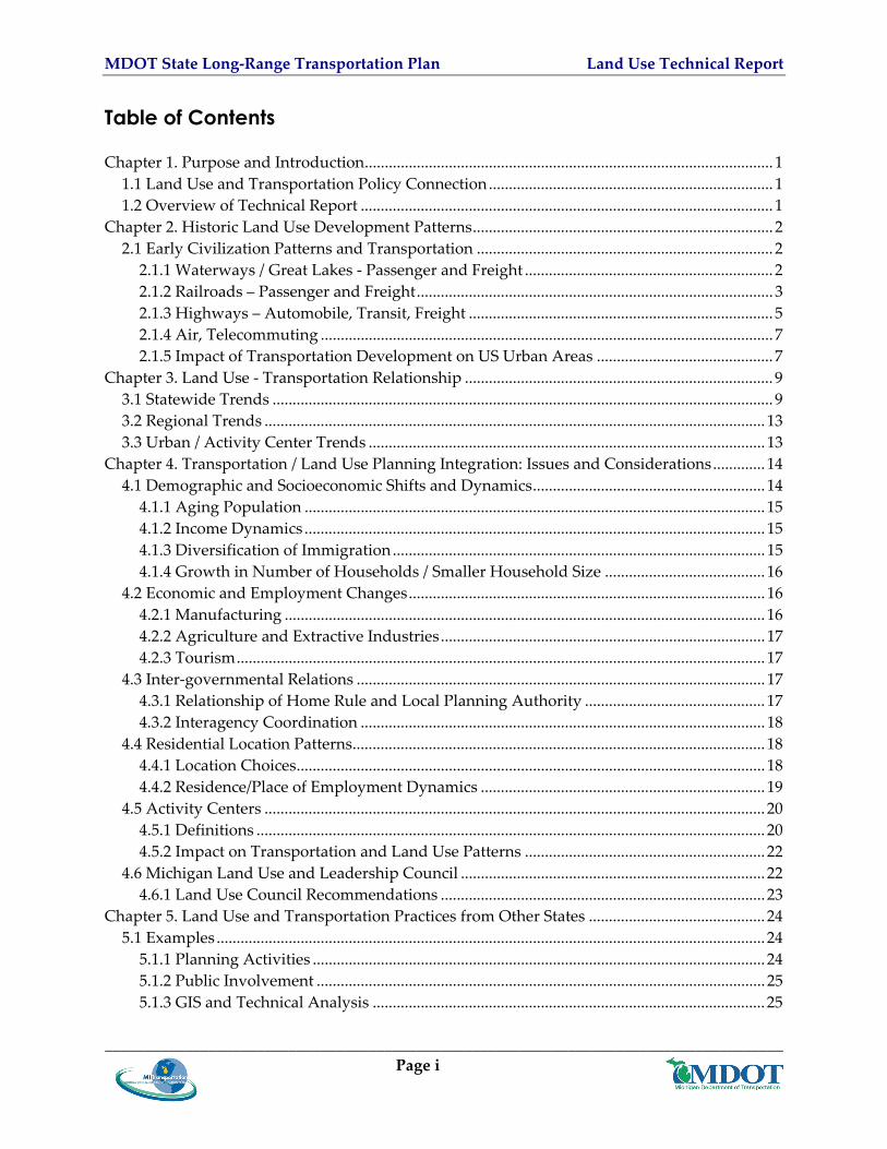
MDOT State Long‐Range Transportation Plan Land Use Technical Report
514 Project Prioritization and Funding 26 515 Design Guidelines and Standards 26
52 Lessons Learned Potential Transferability to Michigan 27 Chapter 6 Findings and Conclusions 28
61 Coordination 28 611 Interagency (horizontal) 29 612 Inter‐governmental (horizontal and vertical) 29
62 Stakeholders 31 621 Transportation 31 622 Land Use 32
63 Transportation Implications 33 631 Highway Use 33 632 Transit Intercity BusRail Passenger 33 633 Rail Commercial Truck 33 634 Air 33
64 Options for Incorporating Policies and Investments that Support Integrated Planning into MI Transportation Plan 34
Chapter 7 Integration Concepts 34 71 Travel Segments Sensitive to Land Use 35
711 City Residents 35 712 Transit Dependent People 35 713 Elderly Travelers 35 714 Children and Young People 35 715 Low‐ Income Travelers 35 716 Ex‐Urban and Regional Commuters 36 717 Freight Carriers (Including Mail and Contract Carriers) and Their ManufacturingService Industry Clients (Shippers) 36 718 Immigrant and Non‐English Speaking Populations 36 719 Service Businesses 36 7110 Real Estate Developers and Private Land Interests 36 7111 Retail Vendors 37 7112 Tourist and Recreational Travelers 37
72 Performance Barriers and Opportunities 37 721 Performance Barriers 37 722 Opportunities 39 723 Integrating Land Use 40
_____________________________________________________________________________________ Page ii
MDOT State Long‐Range Transportation Plan Land Use Technical Report
List of Tables Table 1 Classes of Land Use 1980 and Projections to 2040 12 Table 2 Criteria and Thresholds Used To Identify Activity Centers 21 List of Figures Figure 1 Michigan Railroad Map 1876 4 Figure 2 Built Land Area in Michigan 1980 10 Figure 3 Built Land Area in Michigan 2020 Projected 11 Appendices Appendix A Transportation Planning and Land Use Tools A‐1
_____________________________________________________________________________________ Page iii
MDOT State Long‐Range Transportation Plan Land Use Technical Report
Executive Summary This Land Use Technical Report prepared as part of the MI Transportation Plan provides an overview and discussion of Michigan land use trends and issues It addresses Michiganrsquos historical development patterns current and developing problems and opportunities and how land use issues affect and integrate with the transportation system It presents best practices and examples of land use tools applied by other state DOTs that may be applicable to and complement those that the Michigan Department of Transportation (MDOT) may already be doing
The report suggests that in addition to the need for coordination evaluation of transportation problems requires focusing on land use and access in addition to mobility and safety By physically moving people and services closer together more transportation modal options could be feasible In‐fill housing live‐where‐you‐work programs brownfield redevelopment and developing shopping schools and other service‐oriented facilities within walking and bicycling distance can all reduce transportation demand particularly demand for single‐occupant vehicular travel Examples of land use and transportation practices from other states are presented to provide MDOT with information and ideas that can supplement and enhance integrated planning efforts already underway in Michigan
_____________________________________________________________________________________ Page iv
MDOT State Long‐Range Transportation Plan Land Use Technical Report
Chapter 1 Purpose and Introduction
This Land Use Technical Report is one of 17 technical reports prepared as background and support for MI Transportation Plan This report provides an overview and discussion of Michigan land use trends and issues It addresses Michiganrsquos historical development patterns and how land use issues affect and integrate with the transportation system It presents best practices and examples of land use tools applied by other state DOTs that may be applicable to Michigan
11 Land Use and Transportation Policy Connection The Michigan Department of Transportation (MDOT) recognizes that land use patterns affect transportation choices and transportation opportunities impact land use decisions This report discusses and provides examples of how land use and transportation policy are connected and that transportation decisions affect land use It identifies ways that Michigan and MDOT can adapt its policies and programs and develop and implement tools to impact land use decisions and help achieve the goals of MI Transportation Plan
12 Overview of Technical Report This report includes seven chapters Data used in the preparation of this report and some of the discussion relative to impacts and implications presented in this report came from a number of the other reports prepared for MI Transportation Plan Two of these include the Socioeconomic Technical Report and MPORPA Technical Report Chapter 2 Historic Land Use Development Patterns provides a historical perspective of the relationship between transportation and land use patterns Chapter 3 Land Use‐Transportation Relationship presents an overview of Michiganrsquos land use trends and their relationship to transportation Chapter 4 TransportationLand Use Planning Integration Issues and Considerations discusses the issues and implications of Michiganrsquos demographic socioeconomic employment inter‐governmental and residential pattern changes to transportation and land use Chapter 5 Land Use and Transportation Practices from Other States summarizes 30 tools methods strategies and procedures along with implementation examples that state DOTs and MPOs use to integrate transportation planning and land use It also presents examples of some of the notable programs and approaches used that are potentially transferable to Michigan Appendix A presents a complete listing of the tools and examples from the Federal Highway Administration (FHWA) Web site Chapter 6 Findings and Conclusions discusses land use and transportation coordination implications and options for incorporating policies and investments that support integrated planning into MI Transportation Plan Finally Chapter 7 Integration discusses land use and transportation integration issues
_____________________________________________________________________________________ Page 1
MDOT State Long‐Range Transportation Plan Land Use Technical Report
Chapter 2 Historic Land Use Development Patterns
Michiganrsquos land development locations and patterns reflect the historical availability of and technological advances in transportation Historically people traveled first by foot then water and animal‐power then rail trolley bicycle automobiles and finally by air The extent of use and popularity of each of these modes is a function of several factors and forces Some of these include the availability of infrastructure supporting the mode the safety and ease of travel the ability to access the mode and to have the mode get them to their desired destination the time needed to travel on the mode to reach the desired destination and the cost to travel on the mode In turn factors such as the availability and cost for each of these modes and the freedom of choice provided by the mode has had a synergistic relationship to land development patterns in Michigan
21 Early Civilization Patterns and Transportation Michiganrsquos first settlements were the Indian villages of the Ojibwa Ottawa and Potawatomi Native Americans Travel was by foot horseback or on one of Michiganrsquos waterways Native American trails followed the lakeshores streambeds and the flat terrain between the hills and generations of these people laid out villages along the lakes or trails
The first Europeans to enter the area were the French and French‐Canadians in the early 1600s and 1700s followed by the British in the 1700s During the early 1600s French explorers and settlers located their early settlements along the Great Lakes so that people and goods could be shipped in and out
As more settlers came missions and forts were located along the lakes In 1668 the first mission was established at Sault Ste Marie Detroit was founded as Fort Pontchartrain in 1701 In 1715 the French established Fort Michilimackinac at the Straits of Mackinac By 1779 nearly 3000 settlers were living in the Detroit area By 1810 the population of the Michigan Territory was 4762 including 32 slaves (most of whom were Native Americans) Over time the forts missions and settlements were connected with trails and evolved into roadways and population centers many of which still exist today
211 Waterways Great Lakes - Passenger and Freight As early as the late 1600s sailing ships navigated the Great Lakes History records the Griffon as the first sailing vessel on the Great Lakes In 1679 it was lost in a storm on Lake Michigan In 1818 the first steamboat Walk‐in‐the‐Water arrived in Detroit
In 1820 the population of the Michigan Territory was 8096 with Detroit Mackinac and Sault Ste Marie as the largest towns All were located on Great Lake shores From 1812 to 1825 development was slow However with the opening of the Erie Canal in 1825 a flood of immigrants from New York and New England began arriving In 1836 shipbuilding became important along rivers and lakeshores During seven months of navigation 200000 people passed through Detroitrsquos port During the 1840s copper and iron ore were discovered in the
_____________________________________________________________________________________ Page 2
MDOT State Long‐Range Transportation Plan Land Use Technical Report
Upper Peninsula and transportation by water was the primary method of transporting materials to markets The combination of natural resources employment and transportation fueled immigration to Michigan The statersquos population which stood at 8096 in 1820 was nearly 400000 by 1837
On June 22 1855 a ship canal at Sault Ste Marie opened and the passage of the steamer Illinois through the locks marked the opening of unobstructed shipping between Lakes Superior and Huron Ships no longer needed to stop and portage their cargo around the rapids of the St Maryrsquos River which drops 12 feet from Lake Superior to Lake Huron This mile‐long canal and its 350‐foot locks provided new impetus to Michiganrsquos mining industry In 1888 Michiganrsquos lumber boom peaked with shipments of 43 billion board feet Iron ore shipments from Escanaba also reached 11 million tons The majority of the population lived along these lakeshore and river‐based communities and land developed along with the population and near the natural resources that were extracted
212 Railroads ndash Passenger and Freight In the 1800s railroads opened the West to the Eastern US Fast‐growing urban centers began to develop around railroad transportation hubs throughout the country In 1833 the first horse‐powered railroad reached Adrian Michigan from Toledo In 1836 the first steam locomotive in Michigan was put into operation as the first railroad west of New York State Growth and land development in Michigan began to shift away from the lake and river shores to along the rail lines Still land development patterns were concentrated within a dayrsquos walk or horsersquos ride to a railroad river or lakeshore
Through the latter half of the 19th Century rail began to replace water as a primary means of transportation for people and goods In 1855 the Detroit amp Milwaukee Railroad completed their line connecting Detroit and Grand Haven in 1859 the Grand Trunk Railroad opened from Detroit to Port Huron In January 1877 Winfield Scott Gerrish opened the 71‐mile Lake George and Muskegon River Railroad and moved 20 million board feet of logs to the Muskegon River In 1870 Michiganrsquos population was approaching 11 million By 1882 32 logging railroads operated in the state These railroads allowed year‐round logging and attracted immigrants from around the world In 1881 railroad ferry service connected the Upper and Lower Peninsulas In 1891 a railroad tunnel linked Port Huron Michigan and Ontario under the St Clair River As rail expanded throughout the state land development patterns in Michigan increasingly focused around rail lines Rail expansion also opened up Michiganrsquos interior for the growth of agriculture in the state
By 1905 there were 1776 railroad depots in Michigan In 1909 railroad mileage in Michigan reached its peak with 9059 miles in operation Cities and towns grew and developed around rail lines and depots and offered jobs and safe reliable and inexpensive transportation for Michiganrsquos growing population and commodities Although roads connected the early urban centers until the mid‐1900s and the development of the automobile and the modern highway system most people lived where they worked inside the urban core an area typically less than three miles in radius
_____________________________________________________________________________________ Page 3
MDOT State Long‐Range Transportation Plan Land Use Technical Report
Figure 1 shows the location of early rail lines and the location of early towns and cities
Figure 1 Michigan Railroad Map 1876
During the 20th century the automobile and trucks replaced rail and water as the travel mode of choice for Michiganrsquos people and goods Today only about 4000 miles of active rail freight lines and three Amtrak passenger rail routes remain in Michigan Changes in land development patterns followed the changes in mode of choice
_____________________________________________________________________________________ Page 4
MDOT State Long‐Range Transportation Plan Land Use Technical Report
213 Highways ndash Automobile Transit Freight Early trails carved out by Native Americans and traveled by them for generations became the skeleton of both Michiganrsquos early pioneer roadways and its current highway system As early as 1822 public stagecoaches were documented as following these trails In 1824 the US Congress appropriated $10000 to survey the Great Sauk Trail (now US‐12) between Detroit and Chicago By 1836 daily stagecoaches carrying mail and passenger were running from Detroit to Sandusky OH Chicago and central Michigan
In 1896 the first gasoline powered automobiles were test driven in Michigan In 1899 Olds Motor Works in Detroit erected the first US factory to manufacture automobiles In 1904 Buick Motor Company began manufacturing in Flint In 1908 Ford Motor Company introduced the Model T and by 1914 78 percent of the nationrsquos automobiles were produced in Michigan People in Michigan and throughout the US embraced the convenience flexibility and freedom that the automobile provided
As use of roadways grew government began to accept responsibility for the roadways In 1905 Michigan organized the State Department of Highways In 1909 the worldrsquos first mile of concrete road was laid in Detroit In 1925 Michigan introduced the first state gasoline tax of two cents per gallon By 1942 the automobile was so popular in Michigan that a four lane divided expressway was built in only 11 months to carry workers to the Ford Motor Company By 1950 Michiganrsquos population had grown to 6371766 In addition as a sign of how the automobile was becoming the travel mode of choice the National Defense and Interstate Highway System (Interstate System) received US Congressional approval in 1956 Michigan was the first state to complete a border‐to‐border interstate with the completion of Interstate 94 (I‐94) in 1960 The last four miles of I‐69 were completed in 1992 bringing Michiganrsquos Interstate System to 1241 miles In 1955 Michigan also built the nationrsquos first freeway‐to‐freeway interchange
2131 Public Transit
Public transit was by horsecar in Michigan until the introduction of the electric trolley in the 1890ʹs All cities of any size had street railways including some small ones Most trolley lines were private firms given franchises by city governments Some lines were purchased by city governments most notably Detroitʹs A network of rural electric interurbans flourished briefly across southern Michigan between 1910 and 1930 providing a low‐cost alternative to steam railroads until rendered unprofitable by autos and highways
The trolley permitted the first wave of suburban home ownership and simultaneously permitted assembling hundreds of thousands of workers for the factories of the automobile age The industrialization of Michigan would not have been possible without the trolley car and its associated pattern of land use with routes every few blocks lined with apartments and retail and dense residential neighborhoods in between
The streetcar remained dominant until the 1920ʹs when families began to own automobiles in large numbers impelling an even larger wave of suburbanization and home purchase
_____________________________________________________________________________________ Page 5
MDOT State Long‐Range Transportation Plan Land Use Technical Report
Public transitʹs share of person trips began a steep steady decline that continues to the present Street railways were abandoned in all Michigan cities beginning in the 1930ʹs owing to the cost of track and overhead maintenance inflexibility of routes and competition with automobiles for road space Michiganʹs last streetcar was replaced by buses in Detroit in 1956
Many urban bus lines were operated by private firms but all became unprofitable and were abandoned by the early 1970ʹs Several Michigan cities were without public transit until state and federal subsidies were begun after 1972
Today Michigan has a widespread program of public transit (bus) service providers across the state The statersquos 79 local public transit systems 40 specialized service providers and their subcontractors are the backbone of this network All 83 Michigan counties are served by one or both of these services with over 866 million passenger trips in 2004 The 20 urban systems are usually grouped in the following way the three systems that serve the Greater Detroit Urbanized Area are similar in size and scope (and belong to the same federal funding program) the 16 systems that serve Michiganrsquos other urbanized areas are all funded by the same federal program and are usually grouped together and the 71 non‐urban (or rural) transit systems in Michigan of which 12 also operate in urban areas
Urban fixed‐route systems play a critical role in Michiganrsquos economy by enabling workforce participation for transit‐dependent segments as well as increasing accessibility to jobs and markets for households with limited auto availability While auto ownership per household has increased workforce commuting remains an important trip purpose and a critical function of urban fixed‐route systems Integration of transit will increasingly entail services to ex‐urban areas and areas spanning county or other jurisdictional boundaries Providing transit services for this changing market is an ongoing challenge as current land use development patterns continue to make traveler origin and destination points increasingly dispersed a situation that undermines the ability to plan and operate a useful and cost‐effective public transit network
2132 Freight Movement As Michiganrsquos highway system grew the ability to move freight and goods efficiently throughout the state also grew Today Michigan closely mirrors the national modal split profile with 705 percent of its freight tonnage moving by truck which equates to 860 percent by value Trucking accounted for nearly 474 million tons of commodity movements in out within and through Michigan in 2003 with an estimated value exceeding $1 trillion The heavy dependence of the US economy upon the trucking industry has also contributed to increasing congestion on state and national highways Major interstates I‐75 and I‐94 have the greatest truck volumes I‐75 between Detroit and Toledo Ohio carries an average of 16000 trucks a day I‐275I‐96 near Livonia and Novi carries over 15000 and I‐94 near Benton Harbor averages over 14000 per day
As freight and goods volumes and trucking in particular have grown so have freight service providersrsquo need for reliable and fast access to important transportation corridors
_____________________________________________________________________________________ Page 6
MDOT State Long‐Range Transportation Plan Land Use Technical Report
For freight system users and operators to reach suppliers and consumer markets efficient access to transportation options and freight facilities (eg warehouses distribution centers rail terminals intermodal yards air cargo ramps and other facilities) is most important and frequently dictates where and how they seek to locate Therefore the safety and efficiency of localized roadway connections to intermodal facilities as well as to warehouses and major distribution centers is critical to ensuring an integrated system that functions to support freight efficiencies
214 Air Telecommuting Air travel is also a part of Michiganrsquos transportation history Aviation technology also is part of Michiganrsquos future potential economic growth In 1922 airline service was instituted between Detroit and Cleveland In 1928 the first all metal dirigible was constructed for the Navy by Detroit manufacturers and successfully flown at Grosse Ile Airport Today Michigan has 236 public‐use airports Michiganrsquos 18 commercial airports handle more than 40 million passenger enplanements per year Because the cost to fly for both people and goods is higher than to travel by automobile or other modes air services are located in populated areas Air travel is the mode of choice if the destination is far and if the time or the time reliability is important Airports are typically located on an urban fringe because of the noise they generate and their need for air space and for aircraft operations Over time development often closes in on airports Land use and transportation patterns surrounding airports are typically driven by the need to provide or improve roadway transit or rail service to an airport
Telecommuting is one of the newest modes of travel ndash or non‐travel While the option and opportunities to work from home exist the number of people making this choice has remained small for decades Telecommuting can however affect land use patterns since where people can live and where they work does not need to be close or even within the same state According to the US Census only 25 percent of Michigan workers worked at home in 1990 and only 28 percent worked at home in 2000 As the Internet continues to evolve as the price of gasoline rises and as congestion worsens people may choose to telecommute rather than change the locations of their homes and other life‐style choices
215 Impact of Transportation Development on US Urban Areas During the 1800s and early 1900s technological innovations poured forth many with profound impacts on urban form of Americarsquos cities Railroad tracks were driven into the heart of the city Internal rail transportation systems greatly expanded the radius of urban settlement horsecars beginning in the 1830s cable cars in the 1870s and electric trolleys in the 1880s The industrial city still focused on the city center which contained both the central business district defined by large office buildings and substantial numbers of factory and warehouse structures Both trolleys and railroad systems converged on the center of the city which boasted the premier entertainment and shopping establishments The working class lived in crowded districts close to the city center near their place of employment
During the Industrial Revolution of the 1800s the increasing crowding pollution and disease of the central city produced a growing desire to escape to a healthier environment in the _____________________________________________________________________________________ Page 7
MDOT State Long‐Range Transportation Plan Land Use Technical Report
suburbs The upper classes had always been able to retreat to homes in the countryside and beginning in the 1830s commuter railroads enabled the upper middle class to commute into the city center Horsecar lines were built in many cities between the 1830s and 1880s allowing the middle class to move out from the central cities into more spacious suburbs Finally beginning in the 1890s electric trolleys and rapid transit lines proliferated providing cheap urban transportation for the majority of the population and enabling the beginning of migration to the suburbs
The immediate post‐World War II years also spawned the baby boom generation born between 1946 and 1964 the largest generation in US history Freeway building after World War II opened up even larger areas of suburban land and tracthouse suburbia exploded immediately in tandem with the baby boom The 1950s and 1960s were decades of record home building with family‐raising housing production continually moving toward the regional periphery as inlying core counties became fully developed Various additional dynamics came into play that further encouraged residential and business growth in the ex‐urban rural areas increasing income low gasoline prices racial tension improved suburban infrastructure and amenities state and federal subsidies for sewers roads and commercial development and a general desire of many people to leave the older crowded urban cores to live and work in the relatively open space and privacy offered in suburbia
As the 1970s commenced the baby boom itself began to enter the housing market in full force The first generation born and raised in suburbia overwhelmingly chose to live where they came of age Apartment condominium and town house development emerged as the baby boom formed households and the urbanization of the suburbs commenced in full force A new more complex suburban reality replaced the older suburban ideal
In the 1980s the baby boom started to reproduce itself resulting in a very potent baby boom echo (the cohort born between 1977 and 1995) The ldquostroller peoplerdquo once again invaded the suburbs as the baby boom drove another era of single‐family home production Then in the post‐recession 1990s the baby boom reached middle age yielding a burst of ldquoMcMansionrdquo building as the ldquostarter castlerdquo became a visible symbol of the baby boomrsquos affluence and peak‐earning‐power years Maturing baby boom households now in the child‐rearing stage of the life cycle dominated the housing market Trade‐up family‐raising shelter was in great demand and a huge web of trade‐up markets emerged Sprawl arrived in full force and in full size As this trend continues to play out in Michigan the rate at which the statersquos open land is being converted to residential and commercial use outstrips the rate at which the stateʹs population is increasing by about eight to one1
_____________________________________________________________________________________ Page 8
1 Discussion of post‐WWII development patterns excerpted from Hughes J and Seneca J The Beginning of the End of Sprawl Issue Paper 21 Edward J Blounstein School of Planning and Public Policy Rutgers University May 2004 and Ellis C ldquoHistory Of Cities And City Planningrdquo (wwwartnet~hopkinsDonsimcitymanualhistoryhtml)
MDOT State Long‐Range Transportation Plan Land Use Technical Report
Chapter 3 Land Use - Transportation Relationship
Michigan has nearly 37 million acres of land and 10 million inhabitants On any globe or from any orbiting spaceship Michiganrsquos place on Earth is obvious The Great Lakes vividly outline the state Within its borders exist major industries magnificent forests beautiful farms residences and recreational areas The last time (1978) state land was comprehensively inventoried and classified 37 percent of the state was upland forestland 29 percent was agricultural 17 percent was wetlandlowland forest and 6 percent was in urban uses (Smyth 1995) Other smaller categories of use accounted for the balance
31 Statewide Trends Michigan development patterns have been similar to those in much of the country Land development began by concentrating near water then rail lines and most recently around highways Like much of the US with increasing personal wealth and the increasing modal shift to the automobile in the mid to late 1900s notable land use changes have taken place in Michigan Most notable is the spreading urbanization This resulted both from rural residents moving closer to the cities for job opportunities and from people moving to suburbs from parts of the older urban core
According to the 2001 Michigan Land Resource Project study as shown in Figures 2 and 3 if current land use patterns continue between 15 and 2 million more acres of land area will be urbanized in 2020 This is a 63ndash87 percent increase over 1990 levels and is as much land as served 92 million residents in 1978 (MSPO September 1995 Demographics) The 2001 Michigan Land Resource Project study also projected that if current land use patterns continue by 2040 Michiganrsquos built or developed areas will increase by 178 percent (PSC 2001) That would mean that 17 percent of Michigan would be developed compared to the present 9 percent
_____________________________________________________________________________________ Page 9
MDOT State Long‐Range Transportation Plan Land Use Technical Report
_____________________________________________________________________________________ Page 10
Figure 2 Built Land Area in Michigan 1980
Source Final Report MI Land Resource Project 2001
MDOT State Long‐Range Transportation Plan Land Use Technical Report
Figure 3 Built Land Area in Michigan 2020 Projected
Source Final Report MI Land Resource Project 2001
_____________________________________________________________________________________ Page 11
MDOT State Long‐Range Transportation Plan Land Use Technical Report
Some of the most significant effects will be felt in the land resourcendashbased industries and older urban areas Table 1 shows land use classifications with actual acreage for 1980 and projections to 2040
Table 1 Classes of Land Use 1980 and Projections to 2040
Class of land use 1980 (millions of
acres)
Percent of Total
2040 (millions of
acres)
Percent of Total
Change (millions of
acres)
Agriculture 11 304 91 251 ‐19 Built 23 64 64 176 41 Private forestland 182 503 169 466 ‐13 Other vegetation 29 80 22 61 ‐07 Wetland 18 50 17 47 ‐02
Source Public Sector Consultants Michigan Land Resource Project November 2001
As these trends continue Michiganrsquos population density is falling Michiganrsquos average population density was 38 persons per acre in the early 1980s and dropped to 28 persons per acre by the late 1990s (Norris and Soule 2003)
In 2001 the Michigan Land Resource Project also explored the future of Michiganʹs land‐based industries if present development trends continue The conversion of agricultural land and other vegetative land to developed land has implications for land‐based industries such as agriculture mining forestry and natural resource‐based recreation and tourism which collectively account for approximately 30 percent of Michiganʹs total economy In the next 40 years if the current development rate continues Michigan will have 25 percent less orchard land 15 percent less farmland and 8 percent less forestland The stateʹs destination resorts particularly those in northern Lower Michigan find themselves competing with encroaching development along the travel corridors that lead to them (tourism experts find that part of the attraction of a destination resort is enjoying the aesthetics of ʺgetting thereʺ)
These development patterns have been made possible by the availability and affordability of personal automobiles and a very good and extensive highway system As the population moved outward and densities decreased the desire for a personal automobile increased and providing public transportation alternatives became more challenging Following the population the sources and destinations for commodities has also shifted with the development patterns to locations along the highways
There are many costs associated with Michiganrsquos growth patterns agricultural land and open space are developed traffic congestion increases and new public infrastructure is built on the urban fringe Urban core areas often have existing infrastructure (especially the road network) that still requires maintenance even when their population declines The resultant lower tax base from which to fund this maintenance work is particularly challenging for older urban core areas Furthermore the localized nature of planning in the state with land use decisions fragmented across over 1400 local units of governments contributes to unbalanced land use _____________________________________________________________________________________ Page 12
MDOT State Long‐Range Transportation Plan Land Use Technical Report
decisions This arrangement makes it very difficult to implement coherent policies in areas with regional implications such as housing transportation or environmental protection
32 Regional Trends Land use change in Michigan is an increasingly important issue confronting a range of stakeholders and policy‐makers at all levels of government The sprawl issue as discussed above is often seen as having positive economic growth and development benefits In metropolitan areas however it is also related to negative impacts of poverty and social equity while in rural areas it involves the irretrievable loss of farms rural livelihoods and open space This problem has been referred to as the ldquoInside‐Outside Gamerdquo in reference to the two features of sprawl loss of livable central cities and increased landscape and political fragmentation in the suburban and rural fringe
While rural areas on the urban fringe give way to residential and commercial development urban centers experience declining employment opportunities Less moderate‐income housing becomes available resulting in an increased concentration of poverty in the center cities Characterized by low‐density development the spatial construction of sprawl also leads to increased travel distances and more time spent on the road getting to and from the work place retail centers and recreation In addition the ever‐expanding beltway surrounding the central city results in increased expenditures for roads and other infrastructure development
This general problem is often referred to as decentralization in which many local government authorities assume a larger role than that of central metropolitan governments and where at least at present there are few or no regional or statewide governance structures to manage and mitigate the pace location and impact of sprawl While not yet widely seen in Michigan in other parts of the country this has resulted in a metropolitan region with many independent ldquoboomburbsrdquo with their own planning governments disconnected from each other and the region
33 Urban Activity Center Trends Disinvested urban cores frequently have numerous properties on which there are dilapidated andor abandoned structures andor environmental contamination from past uses These are referred to as brownfields (abandoned idle or under‐used industrial and commercial facilities where expansion or redevelopment is complicated by real or perceived environmental contamination) Such properties cannot be reused until they are cleaned up which may be very costly Despite this obstacle in the 1990s Michigan became a national model in brownfield redevelopment and by June 2000 33 municipalities had attributed $18 billion in private investment and more than 8000 new jobs to brownfield redevelopment
Urban core areas also frequently contain many properties that the owners simply have abandoned but they cannot be cleaned up sold or reused until the cities can obtain clear title to them Until the last few years tax reversion the process by which such property reverts to public ownership was lengthy and cumbersome which stymied local redevelopment because
_____________________________________________________________________________________ Page 13
MDOT State Long‐Range Transportation Plan Land Use Technical Report
of long delays in giving new investors clear title to abandoned properties Public Act 134 of 1999 streamlined tax reversion making it easier for local units of government to claim abandoned properties and encourage private investors to redevelop them As of May 2001 4000 Michigan properties had been reused In addition Public Act 258 of 2003 created the State of Michigan Land Bank Fast Track Authority to help return blighted tax reverted properties to productive and economically viable use The Authority works to return parcels to community tax rolls initiates innovative revitalization programs with non‐profit and other organizations and collaborates on projects with county and municipal governments PA 258 also enabled the creation of county and local land bank fast track authorities several of which have been created in the statersquos urban areas
Chapter 4 Transportation Land Use Planning Integration Issues and Considerations
The relationships between land use and transportation are complex and synergistic This chapter discusses the issues and implications of Michiganrsquos demographic socioeconomic employment inter‐governmental and residential pattern changes to transportation and land use The primary data sources for this Chapter were MI Transportation Plan Socioeconomic Technical Report and the US Census 2000 (The reader is reminded that the Socioeconomic Technical Report discusses transportation issues relative to demographic changes This report focuses on Land Use issues and does not attempt to re‐state the socioeconomic discussion)
41 Demographic and Socioeconomic Shifts and Dynamics From 1998 to 2005 Michigan grew in population by only 04 percent annually The population is expected to continue this slow growth an estimated 12 percent total between 2005 and 2030 Forecasts show that people age 65 and older will comprise over 20 percent of Michiganrsquos population by 2030 Studies predict that seniors will remain in the labor force longer and retire in‐place (in their own suburban homes) or relocate within Michigan
Michigan lost over 570000 people during the 1980s due to net out‐migration Much of this out‐migration was workforce age population This loss was offset by in‐migration from international populations It is expected that by 2030 the 25‐65 age group will shrink from 55 to 47 percent of the population and the under 25 population will shrink from 35 to 32 percent
Michigan continues to diversify culturally and ethnically According to the US Census Bureau Michiganrsquos Caucasian population (all ethnicities) which was 823 percent in 1990 declined to 785 percent in 2005 In addition international immigrant growth in Michigan has increased from approximately 100000 in the 1980s to 171000 in 2000 and is expected to grow to over 195000 by 2020
During the last 15 years personal income in Michigan has kept pace with national trends However even with this being the case the percentage of persons at or below the poverty level
_____________________________________________________________________________________ Page 14
MDOT State Long‐Range Transportation Plan Land Use Technical Report
has increased For example the US Census reports that the number of people living in poverty in Michigan grew from 97 percent in 1994 to 114 percent in 2003
411 Aging Population The most pronounced socioeconomic change in Michigan is expected to be the increase in aging and retired populations While many seniors are expected to remain in their current homes (retire‐in‐place) it is also expected that retirement and adult living communitiesdevelopments will grow Throughout the US there appears to be a trend with urban areas being redeveloped with condominiums that are attracting empty‐nesters The American Association of Retired Persons (AARP) has conducted transportation studies showing that seniors and retirees still prefer to travel by private automobile and continue to drive the same number of miles only at off‐peak times This may result in a re‐densification of the urban core and establishment of more compact housing that while auto dependent may be more efficiently served by public transit and similar services
412 Income Dynamics While more Michigan residents and families are living in or below poverty more are also living with increased wealth In Michigan as in many parts of the US the size of the middle‐class is shrinking During the last century increased wealth has often given families the option of moving further outside the city thus contributing to suburban and exurban sprawl development patterns This trend in turn has facilitated a deterioration of what are often called the ldquofirst‐ring suburbsrdquo
413 Diversification of Immigration The recent growth in immigration does not represent the Eastern European patterns of the early 1900s Instead Michigan particularly in the Detroit area has been most recently receiving immigrants from Asia Middle East and North America These groups have a higher degree of socioeconomic diversity than did immigrants in the early and mid 20th Century This diversity drives different settlement patterns For example Asians tend to immigrate mainly to Oakland County but there are sizeable populations in Macomb Wayne and Washtenaw counties as well The main influence on their settlement pattern is socioeconomic status Asian groups with higher income and education (Asian Indian Chinese and Japanese) are found in suburban cities like Troy Bloomfield Hills and Farmington Hills Groups with limited financial means (Hmong Bangladeshi and Pakistani) have a very different pattern Because of their smaller numbers limited financial means and the housing market of southeastern Michigan these groups primarily settle in older suburbs like Hamtramck and Warren or central cities like Detroit and Pontiac Group size influences the settlement patterns of Middle Eastern immigrants as well The largest groups immigrating to southeast Michigan include persons
_____________________________________________________________________________________ Page 15
MDOT State Long‐Range Transportation Plan Land Use Technical Report
from Iraq Lebanon and Yemen For the most part many of these immigrants settle in Dearborn which has the largest concentration of Arab immigrants in the United States2
414 Growth in Number of Households Smaller Household Size Household growth has been 15 times faster than population growth From 2005 to 2030 the number of households is expected to grow by 19 percent This trend has continued from the 1970s when the household size was 33 persons to todayrsquos average household of 26 people This growth is outpacing population growth because of the increasing number of singlendashperson households smaller family sizes and more elderly or seniors living alone The land use implication of this is more a growth in the absolute number of housing units than a change in pattern
42 Economic and Employment Changes Significant changes have occurred in Michiganrsquos employment over recent decades In 1970 manufacturing was the dominant sector with 30 percent of the jobs Today it represents less than 20 percent of Michiganrsquos jobs and is expected to decline to less than 15 percent by 2030 Between 2000 and 2005 Michigan lost 218000 manufacturing jobs Detroit alone lost 100000 manufacturing jobs in the last five years Employment gains in high‐wage advanced service industries were not large enough to offset the loss of manufacturing jobs
421 Manufacturing During the last decade employment growth has been slow and projected to remain slow High‐paying manufacturing jobs have left the state only to be replaced by service jobs Most jobs are in the southern portion of the Lower Peninsula primarily in Flint Saginaw Detroit Grand Rapids Lansing Ann Arbor and Kalamazoo Metro areas In terms of land use implications many jobs have shifted to outside the urban areas to the suburban ring communities It is anticipated that as the labor force shifts and ages employers will relocate to localized labor pools further extending sprawling development patterns and continuing to decrease job opportunities in the urban core where people could reach their jobs via public transit The decrease in manufacturing may also mean fewer trucks and trains that are Michigan‐originated or ‐destined and more that are passing through Through traffic tends to be concentrated on the southern portion of the Lower Peninsula primarily in Flint Saginaw Detroit Grand Rapids Lansing Ann Arbor and Kalamazoo Metro areas Increases in through traffic will place capacity demands on corridors serving these urban areas
_____________________________________________________________________________________ Page 16
2Booza J ldquoRecent Immigration Trends in Southeast Michiganrdquo Profitwise News and Views June 2004 Federal Reserve Bank of Chicago wwwchicagofedorgcommunity_development06_2004_pnv_recent_immigration_trends_in_michigancfm
MDOT State Long‐Range Transportation Plan Land Use Technical Report
422 Agriculture and Extractive Industries Farming mining forest and fishing employment declined or were flat between 1980 and 2005 with most employment growth during that period occurring in retail construction services government and wholesale This trend is expected to continue to 2030 The land use and transportation impact of this includes people moving away from rural areas to be closer to jobs in suburban service areas and the fact that service jobs require more travel for people to serve each other This may result in more automobile‐dependent travel
423 Tourism One of the biggest growth industries in Michigan is tourism These jobs are both in the rural parts of the state including the Upper Peninsula and in the casinos and urban areas Among the positive aspects of tourist industry growth is that maintaining aesthetics and the quality of the environment is important to maintaining the industry Land use patterns will most likely be designed to create a positive visual environment One potentially negative transportation issue is that tourists may prefer to travel at a relatively slow pace to enjoy the scenery while local residents and freight haulers are usually seeking to travel quickly The speed differential may create transportation safety problems on roadways in tourist areas
43 Inter-governmental Relations Transportation issues are demanding an increasingly prominent place on local agendas Whether it is on potholes or laying out roadways in a subdivision local officials are spending more time making sure people and goods can move safely and efficiently Pressure is growing and funds are limited
431 Relationship of Home Rule and Local Planning Authority Michigan is a home rule state with more than 1800 units of local government (counties cities villages and townships) having legal authority to engage in land use planning andor zoning To date over 1400 units of government have secured this authority At the same time MDOT has over 9700 miles of state highways with these passing through all but 259 units of government While local land use decisions often affect the Michigan transportation system MDOT has no role in land use decision‐making and often reacting to land use policies and plan implemented at the local level
The body of state statutes known commonly as the ldquoplanning and zoning enabling lawsrdquo sets the rules for local land development decisions in Michigan These statutes which date to 1921 in the case of cities and villages and 1945 for townships and counties have changed little over the years They enable but do not require local governments to plan and zone They allow local units of government to (1) plan when where and how development of land should occur and (2) set standards in such matters as how buildings shall be designed and how specific areas (zones) shall be used (commercial residential and so on)
_____________________________________________________________________________________ Page 17
MDOT State Long‐Range Transportation Plan Land Use Technical Report
Land use planning may occur within cities villages townships andor counties but the state provides little guidance or demand for uniformity Furthermore there is little coordination between units of government Only 24 of the 83 counties have countywide zoning ordinances Conflicts often arise between neighboring jurisdictions In addition certain public buildings (eg corrections foster care and education facilities) do not necessarily need to fully comply with local zoning regulations
432 Interagency Coordination Although MDOT uses land use inputs from MPOs in travel demand modeling and works with the 14 Planning Regions to collect data and communicate in rural areas of the state there remain hundreds of non‐municipal public entities that make land use decisions not bound by local planning and zoning These include school districts (597) intermediate school districts (59) community colleges (29) state universities (13) tribal governments (11) and uncounted federal state and local agencies and authorities In addition the 2002 amendments to Michiganrsquos planning statutes encourage neighboring governmental units to cooperate with one another during land use planning processes but few of these other entities are included A decision by local governments or special districts to extend sewer and water lines continues to spread development into new areas A decision to locate new schools in the rural areas reduces the ability or probability for students to walk or bicycle safely to school Each of these land use decisions results in a demand for new or improved roadways or highways In this and other ways Michigan is behind many states in addressing land use challenges More than a dozen states have passed comprehensive growth management laws and many more have adopted significant smart‐growth initiatives
44 Residential Location Patterns From 1980 to 2005 the northern Lower Peninsula the Grand Rapids area and portions of southeastern Michigan have grown up to 50 percent over the 25‐year period For 2005 to 2030 the Grand Rapids area the northwestern portion of the Lower Peninsula Keweenaw County in the Upper Peninsula and the suburban counties (especially Livingston) in southeastern Michigan are expected to grow at 25 percent or higher All other areas of the state will have 25‐year combined growth rate of less than 25 percent
According to the Final Report from the Michigan Land Use Leadership Council Chapter 2 from 1990 to 2000 population in 13 representative Michigan cities fell by 43 percent All 13 cities experienced out‐migration
441 Location Choices
4411 Rural Small Town Preferences
According to land use reports prepared for the Michigan Leadership Council Michigan residents prefer living in rural areas and small towns a choice resulting in urban sprawl and increased dependence on the personal automobile Increasingly the land use dialogue has
_____________________________________________________________________________________ Page 18
MDOT State Long‐Range Transportation Plan Land Use Technical Report
turned to an examination of the causal role public policy plays in shaping land use decisions and patterns The current preference of Michigan citizens for new homes on large country lots is an expression of personal choice but choice depends on available options and cost To some extent these choices are driven by public policy at all levels of government (federal state and local) Examples of these public policies include
bull Zoning land for single‐family use at one unit per acre or greater and land divisions in 10‐acre parcels results in very low‐density scattered land use patterns that over time contribute to a reduction in the economic viability of farms and forests
bull The process for clearing a title in urban areas is so cumbersome and lengthy that it discourages redevelopment and land assembly efforts in urban areas
bull Government spending patterns can encourage the use of greenfields over brownfields
4412 Retirement
It is anticipated that as the senior population in Michigan grows additional senior or adult communities or assisted living centers will be developed This type of development will most likely be more compact and could be designed to be transit‐friendly or self‐contained and include grocery banking and similar service facilities These developments could be designed to provide residents mobility through walking trails or accommodate small electric vehicles such as golf carts within them
4413 Vacation or Second Home
According to the US Census Michigan gained over 57000 vacation or second homes between 1970 and 2000 (from 178000 to over 235000) growth that complements the rise in tourism However the transportation impacts may mean more people driving their personal vehicles longer distances to commute to their second homes on the weekends
442 ResidencePlace of Employment Dynamics As stated earlier the relationship between workplace and residence and transportation is best described as synergistic and spiraling
4421 Change in Work Location
Beginning in the late 1960s and continuing today as skilled workers and their families moved out of the center cities to the suburbs they were followed by the companies that employed them As urban beltlines began to emerge service research technology businesses warehousing and light manufacturing seeking expansion space also moved outside the urban core to sites that were easy to access by automobile and trucks
4422 Change in Vocation
As stated earlier in this report Michiganrsquos economy has transitioned over the years It had its origins in mining and forestry and agricultural products and then was one of the major
_____________________________________________________________________________________ Page 19
MDOT State Long‐Range Transportation Plan Land Use Technical Report
manufacturing centers of the world most recently it is moving to a service‐based economy with jobs focusing on tourism retail trade technology and health care As discussed in Chapter 2 Historic Land Use Development Patterns each of these three demand different land use patterns and are based on different modes With changes in the types of jobs available people were required to change vocations leave Michigan andor move to be close to a job in order to remain employed Remaining employed may also have required changing the mode of transportation used to access the available jobs
4423 Employee Preference
Many service businesses were attracted to the suburbs following employeesrsquo residential preference of the suburbs Restaurants dry cleaners grocery stores and shopping malls also moved out to be near peoplersquos homes Many service businesses developed along highways or in suburban clusters that are only accessible by a private automobile This land use development pattern further reinforced the need for infrastructure to support the private automobile
4424 Travel Characteristics
Despite efforts to encourage carpooling and transit use more Michigan residents in 2000 drove to work alone than did in 1990 (from 815 percent to 83 percent) Similarly fewer people used alternative modes such as a bus bicycle or walking (55 percent in 1990 vs 42 percent in 2000)
In line with the rest of the nation it is taking longer for Michigan residents to get from home to work In 1990 71 percent of the population took less than 30 minutes to get to work However the 2000 US census showed that only 67 percent could travel to work in less than 30 minutes
45 Activity Centers The Corridors and International Borders Report prepared as supporting documentation to MI Transportation Plan identified Michigan Activity Centers Activity centers play a key role in Michiganrsquos economy they are locations with concentrations of jobs transportation infrastructure and service facilities As Michiganrsquos economy shifted from rural to urban and suburban and from agriculture to manufacturing to a primarily service‐based economy these activity centers have become the current center for economic activity and the potential growth areas for the state
451 Definitions Activity Centers are defined as Geographic locations with concentrations of people jobs educational and health service facilities tourist attractions or other similar economic‐based facilities or services International border crossings are included within some activity centers
_____________________________________________________________________________________ Page 20
MDOT State Long‐Range Transportation Plan Land Use Technical Report
MDOT identified activity centers based on quantitative criteria and an analytical process as explained in the Corridors and International Borders Report Details on criteria and thresholds used to identify activity centers are referenced in Table 2 below
Table 2 Criteria and Thresholds Used To Identify Activity Centers
Activity Center Criteria Measure Threshold Data Source and Year Urban Urban AreasUrban Clusters in Michigan
Population Greater than 5000 Persons
US Census Urbanized AreaCluster 2005
Nearest Urban Center outside Michigan
Population Greater than 200000 Persons (Transportation Management Area (TMA))
US Census Urbanized AreaCluster 2005
Commercial
General Economic Activity Total Employment
Greater than 2500 Employees
MDOT TAZ
Retail Activity Retail Employment
Greater than 1000 Employees
MDOT TAZ
Tourism Hotel Capacity Hotel Units 100 or More Units MDOT Annual Lodging Use Tax revenue
Tour Tax Annual Tax Value $50000 or more
MDOT
Gaming Gaming Centers
Major Gaming Centers were identified as a characteristic of an Activity Center
MDOT 2005
State Park State Park Location
None MDOT
Number of Visitors Person Trips Annual Personal Trip Total Greater or Equal 1000000
MSU Tourism Data 2004
Length of Stay Person Days Annual Personal Trip Total Greater or Equal 3000000
MSU Tourism Data 2004
EducationTechnology Center Postsecondary Education Centers
Type of Postsecondary
Community Collages and Universities
US Department of EducationMichigan Department of Education 2005
Smart Zones Technology Centers
All Smart Zones MDOT 2006
Life Sciences Facilities Hospital Local
Employment Greater than 500 Employees
MDOT 2005
_____________________________________________________________________________________ Page 21
MDOT State Long‐Range Transportation Plan Land Use Technical Report
Correctional Facilities Prisons Prison Facility
Locations Major Correctional Facilities were identified as a Characteristic of an Activity Center
MDOT 2005
Passenger Facilities Air Passenger Passenger
Enplanement All Airports with Passenger Enplanement
MDOT TMS 2005
Amtrak Passenger Station
All Active Passenger Stations
MDOT TMS 2005
Intercity Bus Station Passenger Stations
All Active Intercity Passenger Bus Stations
MDOT TMS 2005
Car Pool Parking Capacity
Greater Than 100 Parking Spaces
MDOT TMS 2005
Freight Facilities Air Cargo Ports Cargo
Deplanement All Air Ports with Cargo Deplanement
MDOT TMS 2005
Marine Ports Cargo Tonnage All Cargo Ports Receiving or Shipping Tons of Goods
MDOT TMS 2005
International Border Crossing Passenger and Freight Passenger and
Freight All International Border Crossing with Passenger and Freight Activities
MDOT 2005
452 Impact on Transportation and Land Use Patterns Many of Michiganrsquos activity centers provide a unique service or support specialized industry Some are tourist hubs technology centers and health care facility centers while others are university‐focused People and goods move between these centers to take advantage of their unique services For example an activity center may provide specialized medical facilities or educational institutions Multi‐modal transportation corridors connect Michiganrsquos people and goods between activity centers Major urban activity centers that may offer several types of services and support a variety of employment may also be served by several modes of transportation As has been discussed earlier in this report the greater the concentration or density of people and jobs the greater the potential for more transportation modes to be available and efficient
46 Michigan Land Use and Leadership Council In 2003 the bipartisan Michigan Land Use Leadership Council convened by Governor Granholm with the support of the leaders of the MI Senate and House determined that it was important to articulate a vision and land use goals for Michigan and to recognize the legal
_____________________________________________________________________________________ Page 22
MDOT State Long‐Range Transportation Plan Land Use Technical Report
framework and the key assumptions underlying its adopted vision and goals The council established three fundamental goals
bull Economic prosperity
bull Stewardship of the environment cultural and natural resources and
bull Equitable distribution of benefits to all residents
It emphasized that these three goals are interdependent and require government leadership in guiding public and private land use decisions and policies that reflect the importance of balancing the goals in achieving sustainability The councilrsquos August 15 2003 report lists 10 smart growth tenets used to develop many of the its recommendations The council highlighted and discussed two major components of the statersquos legal framework (1) private property rights and (2) the concept of home rule and acknowledged their importance in its deliberations The councilrsquos report also lists key assumptions and constraints including the budgetary implications of its recommendations
461 Land Use Council Recommendations Based upon background materials the survey results and public comment the council organized issues into four broad categories within which it developed guiding principles and recommended actions to address specific issues These four categories are reflected in the chapters of the final report and include
bull Urban Revitalization
bull Land ResourcendashBased Industries
bull Planning and Development Regulation and
bull Infrastructure and Community Services
The council avoided radical recommendations and divisive issues Neither recommendations nor regulations were advanced to support state or regional land use planning impact fees for growth area or mention of educational equity youth development or school choice The council also recognized and concluded that land use actions remain market driven and when the economy is in trouble local officials are willing to sacrifice good land use practices for some improvement in the tax base or to create some jobs Despite these collaborative efforts and the spirit of compromise exhibited by the council throughout its deliberations a few contentious issues could not be resolved to everyonersquos satisfaction Following the last meeting each council member was given the opportunity to reserve his or her support or object to specific recommendations adopted by a majority of the council Reservations or objections of individual council members on specific recommendations are noted following each recommendation
A summary or paraphrasing of the specific recommendations could undermine the carefully constructed language crafted and adopted by the council and contained in the final report In general terms the councilrsquos recommendations address broad thematic areas that focus on ways in which government policies and decisions in cooperation with the private sector can provide
_____________________________________________________________________________________ Page 23
MDOT State Long‐Range Transportation Plan Land Use Technical Report
leadership on and a balanced approach to issues of common concern Consistent with the councilrsquos stated vision and goals the recommendations focus on incentives and assistance rather than mandates to encourage private sector cooperation in addressing identified concerns Similarly the recommendations of the council provide new tools alternative planning approaches technical assistance and resources for local government to reduce sprawl and encourage inter‐governmental and interagency cooperation in planning for infrastructure and services that serve large geographic areas
Chapter 5 Land Use and Transportation Practices from Other States
In recent years Michigan has developed and applied a variety of tools and strategies for more effectively integrating land use and transportation planning including an Access Management Handbook a Transportation Economic Development Program Context Sensitive Solutions environmental mapping and Bicycle and Pedestrian Programs This chapter presents a summary of some of the notable programs and approaches used across the nation that are potentially transferable to Michigan as it seeks to expand and strengthen its in‐state efforts This summary is derived from an FHWA‐prepared listing and description of 30 tools methods strategies and procedures along with implementation examples that state DOTs and MPOs use to integrate transportation planning and land use Appendix A presents a complete listing of the tools and examples from the FHWA Web site (httpwwwfhwadotgovplanninglandusetoolscfm) Case studies and other references and links are also available on this site at httpwwwfhwadotgovplanninglanduseindexhtm
51 Examples FHWA categorized five types of programs methods or strategies that state DOTs and MPOs use to integrate transportation and land use These categories include planning activities public involvement GIS and technical analysis project prioritization and funding and design guidelines and standards One of the most comprehensive examples and approaches using the five types of programs to address the integration of land use principles with transportation and economic development is the New York State ldquoQuality Communities Clearinghouserdquo program Almost every type of state‐sponsored program or service is incorporated or addressed by this program Details on the New York State program may be found at httpwwwqualitycommunitiesorgindexsap
511 Planning Activities This program category includes considering land use issues while conducting transportation planning for corridors interchanges and statewide or MPO comprehensive plans It includes education and outreach on principles and concepts such as transit‐oriented design overlay districts or other zoning changes that may facilitate increased transit efficiencies While MDOT
_____________________________________________________________________________________ Page 24
MDOT State Long‐Range Transportation Plan Land Use Technical Report
has developed a variety of planning tools guidelines and programs that mirror many of these it can be valuable to consider what other states and jurisdictions have done as MDOTrsquos efforts evolve and grow
Some notable examples include
bull Guidebooks and model zoning ordinances Idaho DOT and Wisconsin DOT have published transportation planning guidebooks aimed at helping local staff integrate transportation planning with land use planning Vermont Agency of Transportation working with the Vermont Department of Housing and Community Affairs jointly developed modal zoning guidelines to help local governments incorporate access management principles into their zoning and to help direct development away from interchanges The Burlington Vermont MPO Florida DOT and Maryland DOT developed guidelines to help planners and developers with transit‐oriented design concepts
bull Grants and funding Illinois DOT provided $15 million over five years to help local governments develop plans that integrate transportation and land use Colorado DOT together with and through their state Heritage Planning Grant Awards program collaborates with local governments on transportation planning
bull Environmental Florida and Ohio DOTs instituted processes to identify environmental and land use concerns early in the project development process Colorado and Washington state DOTs use their EIS process to identify and incorporate environmental issues and land use concerns into project development
512 Public Involvement This program category includes developing community outreach tools to raise the level of awareness about the connection between land use and transportation It includes sponsoring or participating in visioning workshops and charrettes (collaborative sessions in which urban plannersdesigners consult with stakeholders developers municipal officials and local residents to come up with joint solutions to urban planning issues) that develop future land use scenarios which include the design of transportation‐ and transit‐oriented facilities Most notable examples are MPO‐sponsored or initiated events in which the state DOTs participate
513 GIS and Technical Analysis This program category includes using one of several GIS‐based software packages and models to create and explore various land use scenarios that also address transportation facilities It also includes GIS mapping of transportation environmental historical land use and other features that can be accessed and used during the transportation and land use planning processes Notable examples include
bull Software Programs CommunityViz MetroQuest Paint the TownPaint the Region PLACE3S Smart Growth Index Idaho DOT used MetroQuest in a scenario‐based
_____________________________________________________________________________________ Page 25
MDOT State Long‐Range Transportation Plan Land Use Technical Report
planning process to create a statewide transportation vision Over 750 transportation partners participated in the two‐year process
bull GIS and Environmental Mapping State DOTs throughout the US have worked with other state agencies to produce GIS base maps of transportation and other relevant environmental and land use features These resources are used by state DOTs in the project development and planning processes and by local governments during comprehensive land use planning
514 Project Prioritization and Funding This program category includes state DOTs and other agencies providing incentives to jurisdictions who adopt policies and implement projects that incorporate or support desired transportation development principles Some policies and principles include concepts such as enhancing walkability pedestrian friendliness and transit‐oriented site design This category also includes adopting project selection criteria that consider regional or local land use plans or smart growth criteria It includes funding for local transportation capital improvements such as pedestrian facilities It includes state DOTs providing technical assistance and outreach to promote good transportation and land use integration Notable examples include
bull Financial Assistance Massachusetts Executive Office of Transportation provides financial assistance to public agencies for pedestrian and bicycle facilities as well as housing and parking projects in mixed‐use developments located near transit stations
bull Priority Funding Project Section Criteria Maryland state agencies including the department of transportation established priority funding areas to focus economic development and state projects to specific areas of the state The Denver and Seattle MPOs provide priority points to projects that support specific criteria or are located in specific areas such as infill and mixed‐use development projects that support access management
bull Fiscal or Regulatory Incentives New Jersey DOT Oregon DOT and Utah DOT give priority to projects by expediting permits and streamlining regulation for communities that support various land use and transportation planning programs or policies Some favored priority programs and policies include using context‐sensitive design adopting balanced street design growth management and access management measures Utah DOT works with other state agencies to provide certification to communities that participate in this program
515 Design Guidelines and Standards This program category includes DOTs developing publishing and sometimes providing training on transportation and land use design standards and guidelines Common guidelines include Context‐Sensitive Design and Context‐Sensitive Solutions (CSDCSS) roadway design guidelines bicycle and pedestrian facility design standards model zoning ordinances transit‐oriented design guidance access management guidelines This category also includes programs to address situations when a state highway serves as a downtown main street State _____________________________________________________________________________________ Page 26
MDOT State Long‐Range Transportation Plan Land Use Technical Report
DOTs have worked out programs to transfer these roadways to others that may better meet the state design standards This will allow downtowns to achieve development goals and the DOT to achieve design standards for the roadway Some examples include
bull CDSCSS California Minnesota New Jersey New York State and Vermont transportation agencies have all published Context‐Sensitive Solutions policies or programs and most provide workshops and training in CDSCSS
bull Bicycle and Pedestrian FHWA National Highway Institute (NHI) Florida DOT and Washington DOT all have published bicycle and pedestrian standards design manuals and training
52 Lessons Learned Potential Transferability to Michigan Comments and concerns from participants in MI Transportation Plan public meetings and the findings conclusions and recommendations from Governor Granholmrsquos Michigan Land Use Leadership Council demonstrate that there is both a strong interest and desire to better integrate transportation and land use MDOT has already begun to implement processes and tools to achieve better transportation‐land use coordination The list below highlights some of the tools MDOT is employing as well as others it might enhance to better understand the relationships and improve their integration
bull Coordination with other state agencies and local public agencies including the MPOs MDOT works very closely with the 15 Michigan MPOs in the development of their annual unified work program development of their transportation model long‐range plan and Transportation Improvement Program (TIP) MDOT also funds the 14 State Planning amp Development Regions to collect transportation data and serve as coordinators for various transportation efforts
bull Promote Education Having knowledgeable decision‐makers at the local level goes a long way toward implementing positive land use decisions However there are barriers to educating local elected and appointed planning officials including access to availability of and the cost of training Efforts such as Michigan State Universityrsquos Citizen Planner Program and the Michigan Association of Planningrsquos Training for Officials both of which provide planning and zoning training to local officials are valuable endeavors
bull Outreach MDOTrsquos Regional Planning staff could expand efforts to work with local agencies during their visioning and planning processes
bull Sharing Data Like many DOTs MDOT can continue to enhance and share its GIS‐based data with local land use agencies and MDOT environmental programming staff This would facilitate identifying and incorporating transportation and land use issues during planning and project development processes
_____________________________________________________________________________________ Page 27
MDOT State Long‐Range Transportation Plan Land Use Technical Report
bull Process Enhancements MDOT could revisit its project development and planning processes to better identify and incorporate land use issues and concerns early in the planning and National Environmental Policy Act (NEPA) processes
bull Guidance Documents MDOT has guidance documents for access management and context sensitive solutions transportation enhancement and transportation economic development MDOT uses AASHTO documents for non‐motorized and pedestrian
Chapter 6 Findings and Conclusions
As has been stated throughout this report transportation and land use have a complex and synergistic relationship Changes in transportation technology and availability provide opportunities as well as positive and negative changes to land use patterns Changes in land use patterns result in changing demands for transportation facilities and services With the rising costs for transportation infrastructure limited funding for system expansion and lack of formal or regulatory coordination between those who make land use decisions and those who make transportation decisions the problems and issues with each is intensifying
In addition to the need for coordination evaluation of transportation problems requires focusing on land use and access in addition to mobility and safety By physically moving people and services closer together more transportation modal options could be feasible In‐fill housing live‐where‐you‐work programs brownfield redevelopment and developing shopping schools and other service‐oriented facilities within walking and bicycling distance can all reduce transportation demand particularly demand for single‐occupant vehicular travel
The examples presented in Chapter 5 Land Use and Transportation Practices from Other States provide other information and ideas that MDOT may want to consider By developing land use educational programs and incentives and offering free technical advice to local land use decision‐makers transportation costs may be reduced One potential program to address these issues may be to work with local governments and the County Road Commissions on a statewide initiative for TSMTDM (transportation system management transportation demand management) As discussed in the MI Transportation Plan Corridors and International Borders Report this initiative would include education incentives and assistance for local governments to adopt TDMTSM programs
61 Coordination The issue of lack of interagency and inter‐governmental coordination in relation to land use has been recognized for years Several initiatives including Governor Granholmsrsquo Land Use Leadership Council which began in 2002 have cited and evaluated the need for greater cooperation and coordinated land use decision‐making A decade earlier in 1992 the state conducted the Michigan Relative Risk Analysis Project asking state scientists policy‐makers and business and environmental leaders to identify and rank the risk of environmental problems in the state The absence of coordinated land use planning and the degradation of _____________________________________________________________________________________ Page 28
MDOT State Long‐Range Transportation Plan Land Use Technical Report
urban environments were cited as among the states top six most pressing environmental issues In addition such studies as the Fiscal Impact of Alternative Land Development Patterns in Michigan (Southeast Michigan Council of Governments 1997) show that the costs of public services and infrastructure in low‐density development (single homes on large land parcels) areas outstrip the tax revenue that such development generates
611 Interagency (horizontal) As discussed home rule is often cited as one of the reasons for the lack of land use coordination More than 1800 units of local government have legal authority to engage in land use planning andor zoning in Michigan Land use planning occurs within cities villages townships andor counties The federal law that applies within MPO areas requires coordination among local agencies on transportation planning Outside of these areas there is little planning coordination between parallel units of government While the 2002 amendments to Michiganrsquos planning statutes encourage neighboring governmental units to communicate with one another during land use planning processes this coordination is essentially voluntary as there is no coordinated planning requirement in Michiganrsquos planning laws This lack of horizontal coordination across jurisdictions or between various state agencies encourages a checkerboard pattern of development across the state
612 Inter-governmental (horizontal and vertical) There is also a lack of vertical coordination between local state and federal governmental entities In addition to local governments hundreds of other public entities make land use decisions that are not bound by local planning and zoning including school districts (597) intermediate school districts (59) community colleges (29) state universities (13) tribal governments (11) and uncounted federal state and local agencies and authorities The 2002 amendment to Michiganrsquos planning statutes does not facilitate or encourage coordination with these other entities Many of the issues and inconsistencies between state and local government land use planning and transportation can be attributed to one factor the lack of integrated and coordinated land use decisions Some of the more specific general implications of land use decision‐making in Michigan consist of the following
bull Too many decision bodies There are thousands of independent entities involved in land use decision‐making in Michigan all with different planning and zoning approaches and procedures This current structure makes achieving inter‐governmental coordination difficult
bull Some laws require planning but no coordination Plans or studies are often required before regulations can be made or projects can be implemented but rarely are these plans and studies required to be coordinated with the community master plan prepared by the local planning commission
bull Laws are many and outdated The age and number of laws involved in the present land use decision‐making framework are viewed as an impediment to improving the quality and coordination of local land use decisions Not only is the sheer volume of laws
_____________________________________________________________________________________ Page 29
MDOT State Long‐Range Transportation Plan Land Use Technical Report
daunting but the laws also lack contemporary planning and development tools that are available in other parts of the country
bull Lack of common structure to existing laws The current statutory structure evolved incrementally and therefore lacks focus and a common structural form The result is a series of uncoordinated independent laws with no clearly stated goal or set of common principles upon which the laws are based
bull Structure sometimes works at cross‐purposes The basic structural elements of the current land use decision‐making process sometimes work at cross‐purposes that is they are in disagreement with each other For example home rulelocal control emphasizes independence not interdependence Local officials are not concerned about satisfying constituencies outside their voting districts and therefore do not take actions in support of broader public interests
bull Gaps in roles and responsibilities There are obvious gaps in the roles and responsibilities of the key players involved in land use decision‐making
_ There is no statewide land use agenda that would enable regional governments or planning and development regions to exercise authority over local governments to ensure more coordinated planning
_ There is no apparent quality control process to determine the validity of required studies plans or regulations before and after implementation
_ Studies and plans are not required to be current and there is no process to ensure conventionality even if an enforcement provision was in place
_ There is no systematic obligation for intergovernmental cooperation
_ There is no periodic or systematic evaluation of the overall effectiveness of local planning economic development or environmental protection
_ Accountability for the effects of land use decisions on abutting jurisdictions is weak especially on issues of greater‐than‐local concern
_ Many land uses with significant impacts are not addressed in current legislation and
_ There is no mandatory training for elected decision‐makers for many special commissions or boards or for planning commission or zoning administrators
It is easy to conclude that the current structure with no common model too many decision bodies and virtually no requirements for coordination could not possibly work In this context it is intriguing that land use decisions are made as well as they are as often as they are It is clear that local land use decisions are dependent on an understanding of the intricacies of and inter‐relationships within the current structure The fact that the current system operates at all
_____________________________________________________________________________________ Page 30
MDOT State Long‐Range Transportation Plan Land Use Technical Report
can be credited to local decision‐makers and developers who invest a great deal of effort into coordinating decisions between communities and agencies at all levels of government
62 Stakeholders Michigan transportation and land use stakeholders and decision‐makers are often the same individuals or agencies The transportationland use coordination challenge is that the individuals and agencies have different responsibilities and levels of authority over transportation and land use decisions
621 Transportation Transportation stakeholders include the DOT FHWA Federal Transit Administration (FTA) MPOs regional councils transit agencies rail and air service providers freight haulers and shippers businesses industries local governments environmental justice populations and all other transportation system users Through this and other reports the role and responsibilities of each of these groups has been discussed While some state and federal guidance and recommendations for coordination exist nothing is required This voluntary system of coordination has had limited success in providing coordination between transportation and land use decision‐making
Michiganrsquos MPOs and regional councils are agencies and transportation stakeholders whose role and purpose is to encourage transportation and land use stakeholders to cooperate A regional council is a public organization encompassing a multi‐jurisdictional regional community It is founded on sustained by and directly tied to local governments through local andor state government laws agreements or other actions Through communication planning policy‐making coordination advocacy and technical assistance the regional council serves the local governments and citizens in the region by dealing with issues and needs which cross city town county and in some instances state boundaries Regional councils serve a region or sub‐state district which consists of a group of neighboring local communities whose residents are joined as a unit economically socially and geographically
Regional councils have grown into pro‐active multi‐functional full‐service regional organizations prepared to enable regional communities and their leaders and citizens to compete globally and thrive locally They can
bull Provide regional forums bringing community leaders and citizens together to address common needs that span jurisdictional boundaries
bull Provide skilled experienced staff to conduct regional strategic planning processes develop practical strategies for addressing tough common challenges and guide them into implementation
bull Provide technical assistance information and administrative services that expand the capabilities of individual local governments and groups and
_____________________________________________________________________________________ Page 31
MDOT State Long‐Range Transportation Plan Land Use Technical Report
bull Administer federal state and local programs that can be more economically and effectively delivered at the regional level
Just as regional councils bring local governments together to meet regional needs they also join with each other at the state and national levels to address the tough issues they have in common land use balanced growth quality of life environmental safety aging infrastructure and economic challenges Michiganrsquos 14 regional councils include
bull The Western Michigan Shoreline Regional Development Commission (WMSRDC)
bull The Northwest Michigan Council of Governments (NWMCOG)
bull The Southwest Michigan Commission (SWMC)
bull The Northeast Michigan Council of Governments (NEMCOG)
bull The Southeast Michigan Council of Governments (SEMCOG)
bull The East Central Michigan Planning and Development Regional Commission (ECMPDRC)
bull The West Michigan Regional Planning Commission (WMRPC)
bull The Region 2 Planning Commission (R2PC)
bull The Eastern Upper Peninsula Regional Planning and Development Commission (EUPRPDC)
bull The Grand Valley Metropolitan Council (GVMC)
bull The Central Upper Peninsula Planning and Development Regional Commission (CUPPAD)
bull The Western Upper Peninsula Planning and Development Region (WUPPDR)
bull The South Central Regional Planning Council (SCRPC) and
bull The Tri‐County Regional Planning Commission (TCRPC)
Developing a cooperative land use planning framework that encourages considering the regional consequences of local decisions is an essential aspect of a regional cooperation agenda When coupled with a regional approach to providing services local governments are finding real savings and making more efficient use of public investments Combined or shared services leveraged purchasing power and joint equipment and facilities agreements can free capital for other financial needs
622 Land Use Stakeholders for land use are the same individuals and agencies as transportation stakeholders In Michigan as discussed land use decision‐makers are primarily local governments For coordinated land use transportation goals and decision‐making to be a reality local governments must play a significant role Leadership for this can feasibly come from MDOT working through and with the MPOs and regional councils as well as the Michigan Association
_____________________________________________________________________________________ Page 32
MDOT State Long‐Range Transportation Plan Land Use Technical Report
of Regions the County Road Association the Michigan Association of Counties the Michigan Municipal League and the Michigan Townships Association A successful program would focus on educating and having the buy‐in support and cooperation of the 1800 Michigan local governments As discussed coordinated land usetransportation programs would need education incentives and implementation components in addition to strong leadership
63 Transportation Implications Current trends and changes in land use patterns are affecting the economic feasibility of providing alternative transportation modal services as well as the access structural conditions and mobility of transportation facilities For example unless businesses are located along rail lines it is unlikely that they will use rail transportation if homes and jobs are not located in a dense enough development pattern it is unlikely that they can economically be served by transit or by walking if land use development grows rapidly congestion will grow quickly It is possible to build 2000 homes within a couple of years but it may take 10 to 15 years to build a highway to serve the new growth generated by the 2000 homes
631 Highway Use As use of the automobile and truck increasingly become the mode of choice people businesses and industry are relocating in a sprawling land use pattern This pattern continues to put pressure on Michiganrsquos highways by increasing congestion and wear‐and‐tear on the roadways
632 Transit Intercity BusRail Passenger As Michiganrsquos land development becomes less dense the ability to be served by transit intercity bus or passenger rail becomes less economical Most people today are willing to walk far less than a mile (and often only a quarter of a mile) to reach these types of transportation services With homes and businesses spread out unless there is a parking lot nearby stations and stops can only be located in a limited number of convenient locations
633 Rail Commercial Truck Use of commercial trucks became the prominent mode of transporting freight and commodities in part because of the changes in land use patterns but more because of the changes in the way businesses began to operate in the 1980s Businesses moved to save money by reducing or eliminating inventories and demanding ldquojust‐in‐timerdquo delivery of products and materials Rail could not compete in guaranteeing on‐time delivery and trucking companies with the completion of the interstate system could Railroads reduced service and removed unprofitable lines Commercial trucking replaced rail as the primary mode carrying the highest value of freight
634 Air Land use patterns and air transportation are not as closely linked as the other modes Air freight is typically limited to high‐value low‐weight time‐sensitive commodities that are
_____________________________________________________________________________________ Page 33
MDOT State Long‐Range Transportation Plan Land Use Technical Report
transferred to air cargo planes by truck Major passenger airports are located throughout the state with the largest closest to urban populations Passengers travel typically by automobile to airports distance to the airport is not a major issue since the passenger air travel is typically limited to longer distance trips
64 Options for Incorporating Policies and Investments that Support Integrated Planning into MI Transportation Plan
Many land use advocates have suggested that residential development policies and plans should at least consider clustered residential areas This approach would provide outdoor open space and a density of housing that can be easily serviced by public transit It would also begin eliminating the linear development that sometimes accompanies urban sprawl Another option proposed in urban and metropolitan areas is mixed‐use development by which residential space exists above or adjacent to commercial development This could mean that every shopping outlet such as for food andor pharmaceutical needs could be housed in the same structure as dwellings Such a configuration would eliminate the need to drive a vehicle to the grocery store drug store or bank thereby reducing an individualrsquos dependency on the automobile for access to essentials of life
There are other land use development tools that have been proposed but require legislative action andor local initiative Some of these are
bull Transfer of Development Rights
bull DevelopmentInfrastructure Concurrency Requirements
bull General Service Districts or Urban Growth Boundaries
bull Official Maps
bull Intergovernmental Development Agreements
bull Inter‐jurisdictional Growth Management and
bull Regional Impact Coordination
Chapter 7 Integration Concepts
Particular segments of Michiganrsquos transportation system users have special sensitivity to the land use‐transportation relationship Similarly particular types of economic activities may be supported or hindered by the compatibility between transportation needs and land use patterns
Integration of land use considerations in transportation planning decisions may remove performance barriers at the system level by locating users closer to activities and by making different mixes of transportation alternatives viable for users
_____________________________________________________________________________________ Page 34
MDOT State Long‐Range Transportation Plan Land Use Technical Report
71 Travel Segments Sensitive to Land Use Key segments with special sensitivity to land use planning in Michigan include
711 City Residents The Travel Characteristics Technical Report of the MI Transportation Plan finds the levels of walking and transit are highest among city residents The density of land use and the co‐location of residential commercial and non‐commercial places of business is a major factor enabling city residents to access activities by various modes with minimal travel time and cost Michiganrsquos cities are locations where land use decisions are most likely to involve choices that may create barriers or remove opportunities for system users to access activities through transportation system components
712 Transit Dependent People The extent and frequency of transit service depends on ridership per revenue‐mile For this reason transit services can efficiently support more trips destinations and users in areas with greater density and with uses concentrated at locations that can be easily served by transit routes For transit dependent people land use decisions conducive to greater transit coverage and frequency translates into more accessible destinations and greater access to the workforce and consumer markets
713 Elderly Travelers The Socioeconomic Technical Report of MI Transportation Plan indicates the growing cohort of Michiganrsquos system users that are above the age of 65 Section 411 of this Land Use Technical Report suggests that this may result in a re‐densification of the urban core and establishment of more compact housing Such patterns even if populated by auto‐dependent residents may be efficiently served by public transit and pedestrian alternatives
714 Children and Young People The Travel Characteristics Technical Report of MI Transportation Plan indicates that children and young people make a large number of Michiganrsquos pedestrian trips For this reason the density and walkability of communities is an important factor for the safety and scope of opportunities for children and young people to access activities in Michigan
715 Low- Income Travelers The Travel Characteristics Report of MI Transportation Plan shows that low‐income households tend to have lower rates of automobile ownership and depend more on ridesharing transit and walking to access activities For these reasons the density and availability of lower income housing with pedestrian and transit access to work markets and other activities is of special importance to this segment
_____________________________________________________________________________________ Page 35
MDOT State Long‐Range Transportation Plan Land Use Technical Report
716 Ex-Urban and Regional Commuters The growth in ex‐urban communities on the perimeters of Michiganrsquos cities is often associated with a lower density of development This often translates into longer roadway trips connecting users to activities affecting vehicle miles of travel and duration of travel for ex‐urban commuters The proliferation of ex‐urban lower density land uses also makes transit and pedestrian alternatives less feasible concentrating transportation needs on private automobile roadway travel
717 Freight Carriers (Including Mail and Contract Carriers) and Their ManufacturingService Industry Clients (Shippers)
The efficiency of freight system operations can be improved when supply chain partners are co‐located within a manufacturing or industrial district This reduces the likelihood of incident‐induced delay as well as the mileage of freight travel Freight carriers are dependent on land use decisions as a determinant of the distance and routing of shipments In a similar way mail and contract carriers can achieve greater reliability and efficiency when major service establishments shipping large volumes of mail and contract traffic are concentrated in commercial districts reducing the distance between destinations
718 Immigrant and Non-English Speaking Populations Section 413 of this Land Use Technical Report addresses the growth in Michiganrsquos ethnic and cultural diversity When ethnic communities are spatially concentrated in particular neighborhoods cultural preferences regarding modes travel patterns and values will require decisions about how to incorporate different system components in these areas
719 Service Businesses The Socioeconomic Technical Report of MI Transportation Plan indicates the growth of the service sector of Michiganrsquos economy In the service industry location in proximity to the workforce as well as other service establishments that provide markets and inputs is a key success factor Proximity to residential areas can also be an important factor for service establishments selling to final demand The density and connectivity among service establishments and households can determine the degree to which the transportation system represents a barrier or an economic opportunity for different types of service establishments
7110 Real Estate Developers and Private Land Interests Real Estate Developers and Private Land Interests use the transportation system quality and availability as a key decision factor in the site selection process Measures such as drive‐time analysis accessibility of principal arterials and intermodal facilities figure prominently in decisions regarding investments that may bring jobs residents and other amenities to Michiganrsquos communities
_____________________________________________________________________________________ Page 36
MDOT State Long‐Range Transportation Plan Land Use Technical Report
7111 Retail Vendors Location relative to markets is known to be a key success factor in the retail industry Accessibility of both workers and markets is made easier when retail uses are collocated relative to suppliers and final demand Retailers (and some service providers) are sensitive in two ways the traffic is necessary yet at a certain volume the movements created by traffic accessing an establishment can be a deterrent to patronage of that establishment whether by automobile bicycle or walking When density supports pedestrian and transit access between retailers retail workforce retail suppliers and final demand potential barriers to retail industry performance can be reduced and opportunities for economic vitality can be created
7112 Tourist and Recreational Travelers Section 423 of this Land Use Technical Report points out the growth of the tourism industry in Michigan In areas with a strong economic base in tourism the aesthetic quality of the environment makes land suitability for tourists sensitive to the transportation infrastructure Tourists are a segment that may involve multiple modes and transportation system components because (1) cycling and walking are often common tourist activities (2) tourists unfamiliar with the host area may use transit as an easy way to access destinations and (3) tourists may arrive in the destination city by air rail or intercity service For this reason land uses supporting the tourist industry require complex decisions about the availability and arrangement of transportation system components in a tourist area
72 Performance Barriers and Opportunities ldquoPerformance barriersrdquo are conditions on the transportation system that make it more difficult more expensive or impossible for an activity to take place In the economic impact element of MI Transportation Plan performance barriers are represented as costs of doing business however they also include barriers to households and individuals In the Conditions and Performance Technical Report of MI Transportation Plan performance barriers are described by performance measures ldquoOpportunitiesrdquo are conditions on the transportation system that make it easier less expensive or possible for an activity to take place that may not otherwise occur In the economic impact element of MI Transportation Plan opportunities are represented as amenities however they also include opportunities for households or individuals in addition to businesses For the purposes of this report opportunities are understood as special ways in which system performance may stimulate users to engage in more or better activities
721 Performance Barriers
7211 Limited Transit Schedules and Long Transfer Times
The feasibility of transit routesschedules is directly related to the density of development along the route and vice‐versa A greater density of transit‐dependent households and activities will support more frequent transit services and more comprehensive route systems which in turn support more development that caters to transit users By contrast
_____________________________________________________________________________________ Page 37
MDOT State Long‐Range Transportation Plan Land Use Technical Report
a lack of density or concentration of transit users and activities makes it difficult for transit to serve as a viable mode for many travelers
7212 Jurisdictional Boundaries
The problem of jurisdictional boundaries has been described throughout this report Jurisdictional boundaries regarding land use decisions can result in uses and activities in one jurisdiction that are incompatible with transportation alternatives available in the jurisdiction providing the market for the activity For example one jurisdiction may support a high‐density shopping development which attracts shopping trips from surrounding jurisdictions If the surrounding jurisdictions are unable to provide the roadway or transit capacity to support the shopping trips a capacity deficiency may result This problem is further exacerbated by jurisdictional boundaries that make it difficult for coordinated regional transit systems and routes to connect users in one jurisdiction with activities in another jurisdiction
7213 Declining Quality of Life Due to Natural Environments
It should be understood that the impact of transportation infrastructure and services on the surrounding land is an aspect of system performance For example if a roadway creates noise pollution or aesthetic problems in a tourist or recreational area those industries dependent on the tourism and recreation may suffer due to the aesthetics and environmental performance of the transportation system If transportation infrastructure creates environmental or aesthetic problems for surrounding land uses the property on the land and the viability of activities on the land suffer
7214 Land Uses Incompatible with Pedestrian and Bicycle Needs
The issue of density is described throughout this report as a key determinant of the feasibility of bicycle and pedestrian travel According to the Travel Characteristics Technical Report of MI Transportation Plan walking is the next most frequently used mode of travel after the automobile If land uses lack sufficient density and a sufficient mix of origins and destinations for pedestrian trips distance and connectivity can become insurmountable performance barriers for such travel It should also be noted that if land uses do not support connections between bicycle and pedestrian facilities and other modes a system performance barrier could arise An example of this would be a walkable neighborhood completely surrounded by uses through which the pedestrian cannot walk to get to a transit stop
7215 Congestion and Bottlenecks
Roadway congestion and bottlenecks affect the accessibility of land making areas once suitable for a particular use less attractive locations For example a thriving retail center on a principal arterial roadway may become a less attractive and viable destination if the arterial becomes congested with traffic supporting more development along the corridor When this happens the land use planning that supported the center becomes outdated and
_____________________________________________________________________________________ Page 38
MDOT State Long‐Range Transportation Plan Land Use Technical Report
either the roadway capacity must be improved or the land use must be changed (or both) Coordinated solutions such as access management and orderly development are common tactics for treating or preventing this type of performance barrier
722 Opportunities
7221 Role for Businesses in Developing and Providing Transit
A structure for collaboration between transit providers and businesses employing large numbers of transit users or serving consumer markets comprised of transit users may trigger both workforce and market participation through better transit service Such collaboration may involve location decisions and land use management changes at the local level When such collaboration may occur it is possible that the results could stimulate economic activity by making jobs and markets more available to workers and consumers enhancing land values and improving the accessibility of Michiganrsquos workforce to businesses
7222 Context Sensitive Solutions
Context sensitive solutions (CSS) can significantly enhance the value of transportation infrastructure by customizing the infrastructure or service to its natural and human environment Context sensitive solutions vary depending on the nature of the transportation infrastructure or service and the surrounding environment However by enhancing the way in which projects are developed it is possible that CSS can trigger economic activities by making them more accessible to users or by protecting their overall value For example if a restaurant serves meals on an urban sidewalk and the roadway adjacent to the restaurant needs improvement there may be an opportunity for a context sensitive solution A design may be offered with provides greater separation between the sidewalk and the traffic enhancing not only traffic safety but also the quality and value of the food service at the restaurant
7223 Co-location of Intermodal Freight Hubs with Shippers
Research in freight systems planning has explored the concept of Freight Villages and other transportation oriented manufacturing land developments In Freight Villages and related developments manufacturers with direct supply chain relationships are located on adjacent properties greatly minimizing their dependence on the statersquos transportation infrastructure When these collocated supply chain partners are arranged in close proximity to an intermodal freight facility (such as a major seaport or air cargo facility) there can be significant reductions in commercial VMT as well as the associated pavement deterioration capacity and safety costs associated with short and medium haul shipments An added advantage for shippers is improved reliability safety and timeliness of shipments and overall reductions in transport costs
_____________________________________________________________________________________ Page 39
MDOT State Long‐Range Transportation Plan Land Use Technical Report
723 Integrating Land Use Integrating land use into Michiganrsquos long‐range planning entails consistently identifying those situations where collaboration between land use authorities and other stakeholders may complement improvements to highway bicyclepedestrian freight transit and safety oriented projects When these situations are identified decisions should be made to maximize the safety efficiency and sustainability with which users access key activities in Michiganrsquos economy
Jurisdictional boundaries create incentive problems with different land use and transportation planning entities often making decisions under different priorities in different policy environments Offering and articulating appropriate incentives in terms of the removal of performance barriers and the realization of opportunities is a key success factor for MDOTrsquos contribution to land use and transportation planning in Michigan
_____________________________________________________________________________________ Page 40
MDOT State Long‐Range Transportation Plan Land Use Technical Report
Appendix A Transportation Planning and Land Use Tools
(Remainder of this page intentionally left blank)
_____________________________________________________________________________________ Page A‐1
MDOT State Long‐Range Transportation Plan Land Use Technical Report
Appendix A presents a listing of the land use planning tools and examples used by states and MPOs to integrate transportation and land use The information below is copied directly from the FHWA Web site httpwwwfhwadotgovplanninglandusetoolscfm
Tools are organized in the following topic areas
Planning Activities
bull Corridor Planning
bull Interchange Area Planning
bull Linking Planning and NEPA
bull Planning for Transit‐Oriented Development
bull Regional Agency Support for Local Planning
bull Regional Visioning and Scenario Planning
bull State DOT Support for Comprehensive Planning
bull Subareaneighborhood Planning and
bull Tier 1 EIS for Transportation Corridors
Public Involvement
bull Community Outreach Tools
bull Community Visioning Workshops and Charrettes
bull Land Use Scenario Development and
bull VisualizationSimulation Techniques
GIS amp Technical Analysis
bull CommunityViz
bull CorPlan
bull GIS Environmental MappingAnalysis
bull MetroQuest
bull Paint the TownPaint the Region
bull PLACE3S
bull Rural Traffic Shed Model
bull Smart Growth Index and
bull Space SyntaxPed‐GriD
Project Prioritization amp Funding
bull Funding for Streetscape Urban Design and Multi‐modal Improvements
_____________________________________________________________________________________ Page A‐2
MDOT State Long‐Range Transportation Plan Land Use Technical Report
bull Project Screening and Selection Criteria
bull State Fiscal and Regulatory Incentives and
bull Transit Corridor and Station Area Development Programs
Design Guidelines amp Standards
bull Access Management
bull Context‐Sensitive DesignSolutions
bull Local and Regional Road Design Guidelines
bull Model Zoning and Subdivision Ordinances
bull Pedestrian and Bicycle Facilities Design GuidelinesPrograms and
bull Road Swaps and Transfers
Planning Activities
Corridor Planning State DOTs MPOs cities and counties develop transportation corridor plans that consider land use as well as transportation issues Some state agencies have developed handbooks for corridor planning as an aid to district staff and consultants when conducting planning studies
Interchange Area Planning Agencies at various levels have developed andor implemented land use plans and zoning overlay ordinances to guide land development around freeway interchanges Interchanges become magnets for development but unplanned development and unmanaged access can quickly lead to a breakdown of traffic conditions near the interchange affecting both safety and capacity State agencies and nonprofits have sponsored the development and adoption of model codes and regulations for interchange areas while regional agencies and local jurisdictions have sponsored the development of interchange area plans that address access local circulation land uses site design buffers and landscaping
Linking Planning and NEPA Transportation planning agencies are increasingly expanding the scope of their statewide regional and corridor planning efforts to address NEPA issues including land use impacts at an early stage Methods include Collecting and using regional data on environmental conditions in the long‐range transportation planning process evaluating combined transportation and land use scenarios involving Federal and state resource agencies in long‐range transportation planning conducting Tier 1 environmental analysis for transportation corridors and recommending projects and policies in statewide and corridor plans that are designed to reduce environmental impacts
Planning for Transit‐Oriented Development Transit agencies MPOs and local jurisdictions have led planning processes focusing on existing or planned transit station areas andor corridors These processes may involve education and outreach on TOD principles and concepts station area conceptual planning market assessment detailed station area plans
_____________________________________________________________________________________ Page A‐3
MDOT State Long‐Range Transportation Plan Land Use Technical Report
development and adoption of overlay districts or other zoning changes to facilitate transit‐supportive development and application of other tools and incentives
Regional Agency Support for Local Planning MPOs Regional Planning Commissions (RPCs) and Councils of Government (COGs) have provided technical andor financial assistance for local comprehensive planning andor small‐area planning activities that link transportation and land use Financial support has been provided from Federal sources including Surface Transportation Program (STP) and Planning (PL) funds as well as from funds appropriated by state legislatures
Regional Visioning and Scenario Planning MPOs and nonprofitcommunity groups have led public processes to develop a transportation and land use vision for a region or multi‐jurisdictional corridor and to evaluate future transportation and land use scenarios The results of this process are typically implemented through the next updates of the Long‐Range Transportation Plan and Transportation Improvement Program and through additional actions to encourage land use changes at the local level
State DOT Support for Comprehensive Planning State DOTs have provided assistance for integrating transportation considerations into local comprehensive planning and land use considerations into statewide transportation planning Activities have included the development of agency policies on considering land use in transportation planning training for state DOT staff and consultants and provision of technical and financial assistance for local governments
Sub areaneighborhood Planning Local agencies have developed plans for a sub area that include both multi‐modal transportation and land use strategies to address issues such as traffic circulation parking transit service and pedestrian and bicycle access Planning sub areas have included central cities activity centers and neighborhoods Plans are implemented through capital improvements changes to zoning and other strategies
Tier 1 EIS for Transportation Corridors A Tier 1 Environmental Impact Statement (EIS) is a broad environmental impact statement (eg for a general transportation corridor) that is prepared prior to a subsequent statement or environmental assessment on a more specific action (such as a specific highway alignment) The use of a tiered EIS approach to transportation corridor studies can assist in streamlining project development by addressing large‐scale issues up front (such as growth‐related impacts) and then incorporating these issues by reference into a second‐tier EIS dealing with specific projects and alignments
Corridor Planning
Scale of Application Corridorsub area planning
Possible Implementing Agencies State DOT CityCounty MPORPC
Examples
_____________________________________________________________________________________ Page A‐4
MDOT State Long‐Range Transportation Plan Land Use Technical Report
bull Idaho DOT
The Idaho Corridor Planning Guidebook helps ITD Division of Transportation Planning staff in cooperation with local governments develop long‐range plans for transportation corridors The long‐range planning process described in this guidebook is intended to integrate transportation planning with land‐use planning and to coordinate local and state transportation planning efforts
bull Illinois DOT
Illinois (Statewide) This program administered by the Illinois DOT provides $15 million over 5 years to help local governments develop plans that integrate transportation and land usedevelopment decision‐making See Illinois Tomorrow Corridor Planning Grants Case Study
bull Kentucky DOT
The Kentucky Transportation Cabinet (KYTC) developed the Bluegrass Corridor Planning Management Handbook which describes a comprehensive approach to corridor planning that addresses land use issues as well The handbook outlines a six‐step process for conducting a corridor planning study including getting organized knowing the corridor developing choices selecting a preferred choice implementation and sustaining the vision The handbookʹs principles have been applied in cities such as Bowling Green where an overlay district was adopted in conjunction with a planned arterial road realignment Contact Brent Sweger KYTC (502‐564‐7686)
bull New Jersey DOT
As part of its Future in Transportation (FIT) program New Jersey DOT is working with communities to integrate land use and transportation issues into corridor‐level planning The DOT‐funded studies are addressing issues such as circulation systems access management and zoning as well as multi‐modal transportation improvements On the Route 31 corridor through Raritan Township and Flemington Borough this study approach is resulting in a smart growth alternative to a previously proposed bypass consisting of local road network improvements that can be built sooner at lower cost and with fewer environmental impacts The NJ Office of Smart Growth has awarded a grant to Raritan Township to revise its master plan to accommodate the proposed roadway system Contact Gary Toth New Jersey DOT (609‐530‐5262)
bull Utah DOT
The Utah DOT (UDOT) worked to integrate land use planning into the study of the 40‐mile Mountain View Corridor (MVC) on the outskirts of the Salt Lake City region UDOT engaged Envision Utah a non‐profit organization that led a regional visioning effort to lead a land use scenario planning process as part of the environmental analysis process for the MVC The scenario planning process brought together communities to discuss future land use alternatives and how land use planning can support different
_____________________________________________________________________________________ Page A‐5
MDOT State Long‐Range Transportation Plan Land Use Technical Report
transportation options for the corridor Contact Teri Newell Utah DOT (801‐975‐4807) or Peter Donner Envision Utah (801‐538‐1529)
bull Cities of Broomfield Lafayette and Louisville and Boulder County (Colorado) In Denverrsquos northwest suburbs four communities came together in the 1990s to preserve open space while addressing common mobility needs The communities established a nonprofit authority to construct a toll road as a link in Denverrsquos circumferential highway system while at the same time implementing strong land protection measures to ensure that the road would not simply become another conduit for suburban sprawl Through inter‐governmental agreements and funding from anticipated toll revenues the communities designated and acquired 2400 acres near the alignment to preserve as open space The communities also revised zoning to focus development in two areas near planned interchanges Contact Charles Ozaki City and County of Broomfield (303‐438‐6300) Ron Stewart Boulder County (303‐678‐6278)
Other References
bull The Transportation Research Board Access Management Web site contains references on corridor planning and corridor preservation
bull The Vermont Corridor Management Handbook (Vermont Agency of Transportation 2005) was developed to provide a technical resource for state and regional agency planners and their consultants who are undertaking the development of a transportation corridor management plan
Interchange Area Planning
Scale of Application Corridorsub area planning
Possible Implementing Agencies CityCounty MPORPC State DOT
Examples
bull Georgia Department of Community Affairs (other state agency)
The Georgia Department of Community Affairs has developed a model code for Interchange Area Development as part of a set of model codes for communities that provide an alternative to traditional zoning regulations The code addresses highway access buffers and setbacks architecture lighting and signage The code was adopted from an interchange model overlay zoning ordinance prepared by the Clearwater Conservancy for communities in Centre County Pennsylvania
bull Charlotte (North Carolina) MPO
The Mecklenburg‐Union MPO sponsored an interchange analysis as a framework to guide land use and transportation improvements at interchanges along the I‐485 outer loop freeway in Charlotte North Carolina At the time the study was undertaken approximately one‐third of the freeway was completed with the other two‐thirds in various stages of planning design or construction The I‐485 Interchange Analysis made recommendations to help ensure that future interchanges would function effectively and
_____________________________________________________________________________________ Page A‐6
MDOT State Long‐Range Transportation Plan Land Use Technical Report
that the area around those interchanges would develop in accordance with the community vision Recommendations included eliminating one interchange and delaying construction of some others changing the design of some interchanges constructing roundabouts improving access management and connectivity realigning and improving roads near the interchanges improving conditions for bicyclists and pedestrians changing adopted land use plans and completing more detailed area plans for some interchanges Since the completion of the analysis many of these recommendations have been implemented resulting in a transportation facility that will better serve existing and future development Contact Garet Johnson Charlotte‐Mecklenburg Planning Commission (704‐336‐8364)
bull Clearwater Conservancy (nonprofit) and local governments in Centre County Pennsylvania As part of planning for Interstate 99 (I‐99) in central Pennsylvania the ClearWater Conservancy a nonprofit organization worked with local governments to conduct corridor planning and create and adopt an interchange overlay district ordinance The overlay district has been adopted to some extent by governments within four of six planning districts in the I‐99 corridor The ordinance aims to maintain the land around the Interstate 99 as natural woodland preserving the identity of townships rather than encouraging the development of strip malls The ordinance applies for a quarter mile from the center of each laneʹs right of way Contact the Clearwater Conservancy (814‐237‐0400)
bull Oregon Department of Transportation
The Oregon Department of Transportation (ODOT) creates Interchange Area Management Plans (IAMP) for every major newly constructed interchange The IAMPs are created to reduce potential conflicts that can result from increased development around interchanges by ensuring that growth and development can occur without overloading the capacity of the new infrastructure ODOT develops the IAMPs in collaboration with residents property owners community stakeholders and local government officials The plans must be adopted by local governments and the Oregon Transportation Commission before a Final Tier 2 Design Environmental Impact Statement will be published
bull Vermont Department of Community Affairs (other state agency)
The Vermont Department of Housing and Community Affairs in coordination with the Vermont Agency of Transportation (VTrans) and other state agencies has led the development of a state interchange planning policy to manage growth around freeway interchanges The intent is to craft guidelines for towns to consider to direct growth away from interchanges The VTrans access management program coordinator is the liaison to this program and access management principles have been incorporated into the planning policy Policy development has included pilot projects including an interchange plan in Randolph that resulted in recommended zoning changes Contact Allan Wright VTrans (802‐828‐2485)
_____________________________________________________________________________________ Page A‐7
MDOT State Long‐Range Transportation Plan Land Use Technical Report
Other References
bull Center for Urban Transportation Research Land Development and Access Management Strategies for Florida Interchange Areas Prepared for Florida Department of Transportation 2000 Available from the Transportation Research Board Access Management Web site
Linking Planning and NEPA
Scale of Application Stateregional planning corridorsub area planning
Possible Implementing Agencies State DOT MPO other state agency
Examples
bull Florida DOT
Florida DOTrsquos (FDOT) Efficient Transportation Decision‐Making Process (ETDM) consists of both a process and a GIS tool to bring environmental considerations into the early stages of the statewide transportation planning and project development processes The ETDM process provides a link between land use transportation and environmental resource planning through early and continuous involvement of planning consultation and regulatory and resource agencies An interagency team reviews projects in the early stages of both the planning and project programming processes An interactive GIS database assists the team in identifying the potential direct indirect and cumulative impacts of projects Information about projects screened through the ETDM process is available to the public on the ETDM public access web site FDOT is collecting performance measures to assess the effectiveness of the process Contact Larry Barfield FDOT (850‐414‐5260)
bull Fort Collins (Colorado) MPO
With the support of FHWA FTA EPA and the Colorado DOT the North Front Range MPO (NFRMPO) undertook a pilot project to increase consideration of environmental impacts and resource agency involvement early in the transportation planning process Known as Strategic Transportation Environmental and Planning Process for Urbanizing Places (STEP UP) the project included a model planning process with early and continuous resource agency involvement and guidelines for environmental review and prioritization of transportation projects development of a GIS‐based tool for identifying environmental impacts of projects and a cumulative effects assessment for the regional transportation plan Contact Suzette Thieman NRFMPO (970‐416‐2257) See also STEP UP Phase 1 Report (Colorado DOT 2005)
bull Milwaukee (Wisconsin) MPO
The Southeastern Wisconsin Regional Planning Commission (SEWRPC) is the MPO as well as the areawide comprehensive physical infrastructure planning agency for the seven‐county Southeastern Wisconsin Region The Commissionʹs planning addresses transportation land use water resources parks and open space farmland preservation
_____________________________________________________________________________________ Page A‐8
MDOT State Long‐Range Transportation Plan Land Use Technical Report
and environmentalnatural habitat areas The Commissionʹs transportation planning is based upon a regional land use plan and links to NEPA by using the Commissionʹs extensive database on land use and environmental resources The transportation plan was created with consideration of land use objectives as well as secondary and cumulative impacts of plan alternatives A key aspect of the process is the involvement of Federal resource agencies to identify critical issues from a regional perspective and to assist in developing transportation and land use projects and policies SEWRPC expects this involvement to result in streamlined project delivery Contact Ken Yunker or David Jolicoeur SEWRPC (262‐547‐6721) See also Presentation at the 2005 Association of Metropolitan Planning Organizations (AMPO) Annual Conference
bull North Carolina state agencies including DOT
The Ecosystem Enhancement Program (EEP) a compensatory mitigation system was established in 2003 by the North Carolina Department of Environment and Natural Resources (NCDENR) in partnership with the North Carolina DOT (NCDOT) and the United States Army Corps of Engineers to speed project development and delivery while protecting the environment Rather than focusing on individual highway project impacts the EEP concept operates programmatically using watershed plans and considering cumulative impacts associated with a given watershed The program funds highway project mitigation activities such as stream and wetlands protection and restoration at other locations within the same watershed and in advance of the actual project work Funding is provided from Federal and state transportation sources through the statewide transportation improvement program (STIP) As of late 2005 EEP is on schedule to meet NCDOTrsquos mitigation needs in all watersheds Contact Bill Gilmore NCDENR (919‐715‐1412)
bull City of St George (Utah)
As part of a planning and environmental assessment process for the proposed Southern Connector highway the City of St George Utah used ecological data and a GIS visualization and community indicators model to evaluate alternative growth plans for the area near the highway The result was a plan that will reduce environmental impacts and transportation demands related to highway‐supported growth See Full project description under ldquoCommunityVizrdquo
Other References
bull FHWA and FTA have published program guidance on ʺLinking the Transportation Planning and NEPA Processesʺ and have conducted peer exchanges and offer facilitated workshops on the topic Summary reports are available for peer exchanges held in Baltimore North Carolina and Pittsburgh
bull The National Highway Institute offers a course entitled ldquoLinking Planning and NEPA Towards Streamlined Decision Makingrdquo (FHWA‐NHI‐151041) The course is offered both as a three‐day course and as a four‐hour executive session
_____________________________________________________________________________________ Page A‐9
MDOT State Long‐Range Transportation Plan Land Use Technical Report
Planning for Transit‐Oriented Development
Scale of Application Site planning and development
Possible Implementing Agencies State DOT MPORPC CityCounty Transit Agency
Examples
bull Columbus MPO and transit agency (Ohio)
The Mid‐Ohio Regional Planning Commission (MORPC) and the Central Ohio Transit Authority (COTA) jointly led a public process to create development concepts for three potential transit‐oriented development (TOD) sites urban developed suburban and developing suburban The purpose of the process was to advance transit‐supportive land use planning practice in the Columbus region in advance of a planned light‐rail transit system Contact Chris Gawronski MORPC (614‐233‐4166) (Reference Transit‐Oriented Development Regional Demonstration Project Prepared for MORPC by ACP ‐ Visioning amp Planning Ltd July 2002)
bull Burlington (Vermont) RPC
The Chittenden County Regional Planning Commission (CCRPC) in Burlington Vermont published a Transit‐Oriented Design Manual in 2002 The guidelines are intended to show how the development community and municipalities can include transit users in the market it expects to serve with large or small‐scale real estate development projects They also are intended to show planners and designers what elements may be included in their plans to create transit‐oriented design The manual is appropriate for smaller communities that wish to design for transit Contact Ian MacDougall CCRPC (802‐658‐3004)
bull Florida DOT
The Florida DOT (FDOT) has developed a variety of tools and undertaken efforts to promote transit‐oriented design in bus as well as rail corridors throughout the state FDOTrsquos Transit Office produced a report entitled Accessing Transit that includes a discussion of design principles to support transit access as well as a CD‐ROM of TOD resource materials Two staff persons within the Transit Office support TOD activities and planning In addition FDOTrsquos District 5 office in Fort Lauderdale has funded charrettes transportation corridor studies and neighborhood plans that address land use issues including TOD and transit‐supportive design Contact Amy Datz FDOT Transit Office (850‐414‐4239) or Jeff Weidner FDOT District 5 (954‐777‐4670)
bull Maryland DOT
The Maryland DOT (MDOT) has supported TOD through various efforts including sponsoring station area planning pilot studies soliciting TOD proposals for surplus state property in station areas and basing alignment and station location decisions to maximize TOD and economic development opportunities To develop a plan for the West Hyattsville on Washingtonrsquos Metrorail system the agency brought together the full
_____________________________________________________________________________________ Page A‐10
MDOT State Long‐Range Transportation Plan Land Use Technical Report
range of stakeholders who need to be involved in implementing the plan (including local elected officials planning and zoning staff and commissions resource and public works agency staff landowners neighbors and others) to ensure that commitments to implementing the plan are solidified and carried out Contact Don Halligan MDOT (410‐865‐1294)
bull Raleigh‐Durham transit agency (North Carolina)
The Triangle Transit Authority (TTA) in Raleigh‐Durham North Carolina led TOD planning efforts in support of the first fixed‐guideway transit system for the region a diesel multiple unit system linking Raleigh Durham and Chapel Hill TTA selected station locations in part based on future growth potential and undertook station area planning activities to assess available sites and market demand In conjunction with construction of the system TTA has selected a Master Developer team that will manage the development process for rail station sites that have been identified as consistent with TTArsquos goals for TOD Contact Juanita Shearer‐Swink TTA (919‐485‐7412)
bull Seattle (Washington) MPO
The Transit Station Communities Project led by the Puget Sound Regional Council (PSRC) in Seattle Washington has supported the development of station area plans for commuter rail stations serving smaller town centers between Seattle and Tacoma The MPO used Transportation Community and System Preservation Program (TCSP) funds to provide technical assistance to local governments and especially to help address particularly difficult issues such as parking management Involvement of the MPO not only provided planning capacity to local jurisdictions with little experience developing small‐area plans it also raised the visibility of these planning activities providing them with an incentive to do a thorough job of planning Contact Ben Bakkenta PSRC (206‐464‐5372)
Other References
bull Cambridge Systematics Inc The Role of State Departments of Transportation in Transit‐Oriented Development Prepared for NCHRP Project 25‐25 Task 20 2006
bull Cervero Robert et al Transit‐Oriented Development in the United States Experiences Challenges and Prospects Transit Cooperative Research Program (TCRP) Report 102 2004 This report discusses issues related to development adjacent to transit including institutional issues impacts and benefits implementation strategies and urban design
bull Dunphy Robert Deborah Myerson and Michael Pawlukiewicz Ten Principles for Successful Development around Transit Prepared for Urban Land Institute 2003 This non‐technical handbook describes keys to achieving TOD from a developermarket perspective
bull Lefaver Scott et al Construction of Transit‐Based Developments Mineta Transportation Institute report 01‐05 September 2001 This report reviews policies and legislative
_____________________________________________________________________________________ Page A‐11
MDOT State Long‐Range Transportation Plan Land Use Technical Report
programs that can be adopted at all levels of government to encourage transit‐based development
Regional Agency Support for Local Planning
Scale of Application Stateregional planning local comprehensive planning site planning and development
Possible Implementing Agencies MPORPC
Examples
bull Wilmington (Delaware) MPO
The Wilmington Area Planning Council (WILMAPCO) has funded local agencies to make changes to comprehensive plans to include ʺmobility‐friendly street design standardsʺ as an option for developers in new development Alternative design standards have been adopted in Cecil County Middletown and Chesapeake City Contact Heather Dunigan WILMAPCO (302‐737‐6205)
bull Atlanta (Georgia) MPO
The Atlanta Regional Commissionʹs (ARC) Livable Centers Initiative provides planning grants for communities located in existing activity centers to develop plans that enhance livability and mobility Using Federal transportation funds the program has provided $1 million annually in planning grants since 2000 and the regionʹs long‐range transportation plan allocates $350 million to implement projects identified in plans Planning efforts funded by the program are beginning to result in mixed‐use town centers and transit‐oriented development projects in cities such as Douglasville Chamblee and Duluth Contact Dan Reuter ARC (404‐463‐3305)
bull Albany (New York) MPO
The Capital District Transportation Committee (CDTC) initiated its Community and Transportation Linkage Planning Program in 2000 to help integrate land use and transportation decisions The program provides CDTC staff or private consultant support to local community planning initiatives CDTC has committed approximately $100000 annually in staff time and $300000 annually in consultant resources ‐ approximately 25 percent of its planning work program ‐ to undertake collaborative jointly‐funded local land use and transportation planning studies Forty‐one such studies in 25 municipalities have been undertaken through 2005 The studies are helping to implement key policies of the New Visions regional transportation plan through local adoption of land use plans highway and transit designs zoning ordinances driveway standards pedestrian and bicycle accommodation and other activities The program has proven very successful in engaging the MPO with land use planning issues and generating project candidates for CDTCrsquos transportation improvement program A regional roundtable of municipal planners (with mandatory participation of Linkage study municipalities) meets quarterly to allow communities to
_____________________________________________________________________________________ Page A‐12
MDOT State Long‐Range Transportation Plan Land Use Technical Report
build upon each otherrsquos experiences Contact Sandra Misiewicz CDTC (518‐458‐2161) See the Albany NY Case Study
bull Berkeley‐Charleston‐Dorchester (South Carolina) COG
The Berkeley‐Charleston‐Dorchester (South Carolina) COG the MPO for the region assists local and county governments with comprehensive plan updates and zoning ordinances The COGʹs role in providing planning assistance has allowed it to work with local jurisdictions to incorporate ʺsmart growthʺ recommendations from a regional growth options study into local plans and zoning Related COG activities to implement the Growth Options study recommendations include updating the long‐range transportation plan to address urban and facility design encouraging a ldquocomplete streetsrdquo approach to facility design that accommodates all modes conducting focus groups on multi‐jurisdictional land use connectivity and transportation coordination at a sub regional level partnering with public health schools and bicycle and pedestrian organizations to promote bicycling and walking and partnering with the development community to find ways to address the ldquohow tordquo get to the vision for the region Contact Dan Hatley or Haila Maze BCDCOG (843‐529‐0400)
Regional Visioning and Scenario Planning
Scale of Application Stateregional planning corridorsub area planning
Possible Implementing Agencies MPORPC CityCounty Other (State planning agency nonprofit)
Examples
bull Binghamton (New York) MPO
Faced with the challenge of a slowly declining and aging population the Binghamton Metropolitan Transportation Study (BMTS) decided with its 2004 update of the long‐range transportation plan to undertake a scenario planning process to address transportation land use and economic development issues simultaneously with the objective of linking transportation to regional revitalization An extensive public involvement process was undertaken to determine community goals design principles and growth scenarios Scenarios included ldquooutwardrdquo and ldquoinwardrdquo development under ldquotrendrdquo and ldquogrowthrdquo conditions Study leaders and the public came to a consensus to focus on revitalization and redeveloping the urban core communities The long‐range transportation plan (titled Transportation Tomorrow 2030 ‐ Placemaking for Prosperity and adopted in 2005) is reflecting that consensus by focusing transportation investment in the urban core Contact Steven Gayle BMTS (607‐778‐2443)
bull Grand Rapids (Michigan) MPO
Beginning in the early 1990s The Grand Valley Metropolitan Council (GVMC) led the development of ʺBlueprintʺ principles and has since worked to implement these principles through a collaborative process with a series of sub‐regional groups Seven
_____________________________________________________________________________________ Page A‐13
MDOT State Long‐Range Transportation Plan Land Use Technical Report
groups were formed around common geography and planning issues The process included both local charrettes to plan identified ʺlivable areasʺ in these sub regions as well as broader planning techniques to address the unique regional qualities of each area Since 2000 the MPO has annually given out awards recognizing projects and programs ndash such as the City of Grand Rapids Master Plan the West Michigan Sustainable Business Forum and a number of development projects ndash consistent with Blueprint principles Contact Andy Bowman GVMC (617‐776‐7611)
bull City of Charlotte (North Carolina)
In 1994 the Charlotte City Council and Mecklenburg Board of County Commissioners adopted the Centers and Corridors Plan for land use and transportation in the region The plan focuses on increasing in‐fill and redevelopment along the corridors and in the center of the city for compact mixed‐use pedestrian‐friendly development near transit station areas The City County and Charlotte‐Mecklenburg MPO have worked to implement this plan through actions such as adopting a regional transit plan to support the land use plan making investments in light rail and busway transit conducting station area planning to promote development in station areas and adopting alternative street design standards See also Federal Highway Administration Domestic Scan Tour II Land Use and Transportation Planning Coordination (November 2003)
bull Lansing (Michigan) MPO
With the support of a fiscal year (FY) 1999 grant through FHWArsquos Transportation and Community and System Preservation (TCSP) Pilot Program the Tri‐County Regional Planning Commission (TCRPC) the MPO for the Lansing region led an extensive public and stakeholder outreach process to develop a growth vision for the region which was adopted in 2003 TCRPC then established a committee to oversee implementation efforts which have included adopting changes to local plans and zoning (such as downzoning of rural areas) incorporating plan principles into the long‐range transportation plan and screening candidate transportation improvement program projects against land use criteria Contact Paul Hamilton TCRPC (517‐393‐0342)
bull Seattle (Washington) MPO
In 1990 the Puget Sound Regional Council (PSRC) adopted VISION 2020 a transportation and land use vision for the region VISION 2020 called for focusing growth in 21 urban centers and 8 manufacturingindustrial centers The urban centers were to include concentrations of population and employment in mixed‐use walkable environments connected by high‐capacity transit service VISION 2020 has been implemented through local plan development voluntary regional review of plans for consistency MPO‐led outreach and demonstration programs policies in the long‐range transportation plan and capital projects in the transportation improvement program PSRC also has evaluated the extent to which development is occurring consistent with VISION 2020 and is undertaking an extensive process (scheduled for completion in
_____________________________________________________________________________________ Page A‐14
MDOT State Long‐Range Transportation Plan Land Use Technical Report
2007) to update the vision for the year 2040 Contact Ben Bakkenta PSRC (206‐464‐5372)
Other References
Visioning efforts have been undertaken in numerous other areas throughout the country The Denver MPO led one such effort in the early 1990s Efforts that are more recent have been undertaken by MPOs in areas such as Charlottesville Virginia Lansing Michigan and Los Angeles California and by non‐profit groups in Concord New Hampshire and Salt Lake City Utah See
bull Denver Regional Council of Governments Metro Vision 2020
bull Federal Highway Administration TCSP Programʹs Case Study 13 Implementing a Regional Vision (2004) Provides descriptions of projects in Charlottesville Concord Lansing and Salt Lake City
bull Surface Transportation Policy Project ʺRegional Visioning Projects in California and Nationwiderdquo Contains links to 9 projects in California and an additional 14 in other States
bull Southern California Association of Governments Compass Southern California
bull University of Utah and Federal Highway Administration Scenario Planning Digital Library Contains over 80 plans and analysis reports from various scenario‐planning processes
Some additional regional and community visioning activities as well as tools and methods to support visioning processes are described under ʺpublic involvementʺ and ʺGIS and technical analysisrdquo [LinkTo Respective Tool sections]
State DOT Support for Comprehensive Planning
Scale of Application Statewide planning corridorsub area planning local comprehensive planning
Possible Implementing Agencies State DOT
Examples
bull Colorado DOT
The state of Coloradoʹs Moving Forward Initiative allows Colorado Department of Transportation (CDOT) to collaborate with local governments on transportation planning In addition the state awards Heritage Planning Grants which allow local communities submitting joint applications to address regional issues such as the environment development regional transportation and energy use
bull Idaho DOT
Idaho DOT has published a guide entitled Transportation in Your Local Comprehensive Plan a Guide for Local Government Officials This document is designed to help
_____________________________________________________________________________________ Page A‐15
MDOT State Long‐Range Transportation Plan Land Use Technical Report
planning and zoning commission members and local elected officials in Idaho prepare the transportation component of their comprehensive plan It is divided into five chapters each focusing on one of five basic tasks in the planning process 1) getting organized in transportation planning 2) collecting data and analyzing information 3) developing transportation policies 4) developing implementation strategies and 5) coordinating with other plan components
bull Indiana DOT
The Indiana DOT (INDOT) will be providing grants in 2006 and 2007 for local jurisdictions in rural southwest Indiana to support land use and economic development planning in advance of the proposed new I‐69 freeway linking Indianapolis to Evansville Contact Steve Smith Manager INDOT Long Range Transportation Planning Section (317‐232‐5646)
bull Wisconsin DOT
The Wisconsin DOT (WisDOT) has provided internal guidance and training for its headquarters and district staff on participation in local comprehensive planning activities (WisDOT Transportation and land use) WisDOT also has developed guidance for local jurisdictions on considering local and statewide transportation issues in their comprehensive planning activities As a result district engineers and planners are working closely with local jurisdictions to coordinate the departmentʹs corridor planning activities with local land use planning and to provide input into local comprehensive plans that affect important state travel corridors Contact Tanace Matthiesen WisDOT Bureau of Equity and Environmental Services (608‐264‐8716)
Other References
bull Land Use and Economic Development in Statewide Transportation Planning 1999 (PDF Only) Prepared by the Center for Urban Transportation Studies University of Wisconsin‐Milwaukee in cooperation with the Wisconsin Department of Transportation for the FHWA (1999) This report provides an overview of state DOT activities related to land use planning in six categories land usetransportation planning state land use planning capabilities educationtechnical assistance access management land use controls and economic development
Sub areaNeighborhood Planning
Scale of Application Corridorsub area planning
Possible Implementing Agencies CityCounty
Examples
bull City and County of Denver (Colorado) and the Stapleton Development Foundation (nonprofit) The Stapleton Development Plan adopted in 1995 establishes a vision of the reuse of the 4700‐acre former Stapleton Airport site in Denver Colorado The plan creates a
_____________________________________________________________________________________ Page A‐16
MDOT State Long‐Range Transportation Plan Land Use Technical Report
network of urban villages employment centers and open space and extends adjacent arterial and local street block patterns onto the site The street grid pedestrian‐oriented design mix of uses and continuous bikeway system support travel by alternative modes and will reduce vehicle traffic on adjacent arterials Construction began in 2001 and will continue over a 15 to 20 year period See also Federal Highway Administration Domestic Scan Tour I Land Use and Transportation Coordination
bull City and County of Honolulu (Hawaii)
The Waikiki Livable Community Project was a livability and mobility study that examined the relationship of the Waikikirsquos street network and transportation environment to Waikikirsquos residents stakeholders businesses tourists and employees The project emphasized an extensive public involvement and outreach effort that led to the formulation of a ldquoPedestrian Firstrdquo policy to enhance and improve the pedestrian environment while maintaining essential transportation access and services in Waikiki A unique aspect of the study was the development of ldquostreet visionsrdquo for the three main arterial street corridors and connecting local street network that traverse Waikiki The ldquovisionsrdquo for the street network revolve around ldquovision statementsrdquo that articulate the desirable character enhancements and improvements for the street system in Waikiki Contact Brian Suzuki City and County of Honolulu (808‐527‐6880) See also ldquoWaikiki Livable Community Project Livability and Mobility Reportrdquo (City and County of Honolulu 2003)
bull City of Portland (Oregon)
The City of Portlandʹs Central City Transportation Management Plan is a policy based on the theme ʺgrowth with livabilityʺ which aims for concentrated growth within the Central City area The plan is a multi‐modal transportation policy that targets transportation improvements to support the cityʹs land use objectives including promoting mixed‐use and higher‐density development in the center city in order to minimize regional vehicle travel Policies and actions in the plan address parking management transit service pedestrian and bicycle improvements and traffic circulation improvements
Tier 1 EIS for Transportation Corridors
Scale of Application Stateregional planning corridorsub area planning
Possible Implementing Agencies State DOT CityCounty Transit Agency
Examples
bull Riverside County (California)
Riverside County Transportation Commission (RCTC) has undertaken a ʺTier 1ʺ EIS process to preserve and plan for major transportation corridors in conjunction with county‐wide habitat and land development planning Through the Community and Environmental Transportation Acceptability Process (CETAP) the county is using GIS
_____________________________________________________________________________________ Page A‐17
MDOT State Long‐Range Transportation Plan Land Use Technical Report
data on high‐priority conservation areas identified through a parallel multi‐species habitat planning effort to select transportation corridors that reduce ecological impacts by avoiding sensitive areas or minimizing fragmentation of these areas The county‐wide planning process also includes the development of land use planning alternatives to support the transportation corridors In 2004 a Record of Decision was issued on a Tier 1 EIREIS for a northsouth transportation corridor Contact Cathy Bechtel RCTC (951‐787‐7141)
bull Colorado DOT
The Colorado DOT (CDOT) has undertaken a Programmatic EIS to identify solutions for the I‐70 Mountain Corridor between Denver and Glenwood Springs The PEIS examined the indirect impacts of alternatives including land use and development patterns and the resulting impact on various environmental indicators Contact Cecilia Joy CDOT (303‐757‐9112)
bull Washington State DOT
The I‐405 Corridor Program is a partnership among communities elected officials agencies and advocacy groups to define a 20‐year transportation vision for the 30‐mile I‐405 corridor in east suburban Seattle Led by the Washington State DOT (WSDOT) the program undertook a streamlined EIS approach to reach consensus on a $7 billion transportation package to address mobility and access needs Obtaining input from permitting agencies at an early stage allowed for timely decision‐making and generated ʺbuy‐inʺ for a multi‐modal mix of solutions with broad‐based support The solution package has ʺsmart growthʺ principles at its core and includes $95 million for land use strategies The I‐405 Corridor Program was incorporated into the Metropolitan Transportation Plan in 2002 Contact Michael Cummings WSDOT (206‐464‐6223) See the Seattle WA I‐405 Corridor Program Case Study
Public Involvement
Community Outreach Tools State regional and local agencies have developed educationaloutreach tools to raise the level of awareness about the connection between land use and transportation and how different options support each other These tools have been used in regional and local comprehensive planning and visioning efforts
Community Visioning Workshops and Charrettes Communities as well as state and regional transportation organizations are increasingly applying workshop or charrette approaches to community planning that provide a more intensive hands‐on public involvement experience than traditional methods such as public hearings or surveys A workshop or series of workshops may be held in which members of the public work together to identify community objectives desired outcomes specific problem areas and solutions to problems A charrette is an intensive multi‐day series of creative sessions in which a team concentrates on specific design problems with citizens and presents solutions Workshops and charrettes have been successfully applied to develop plans covering transportation land use and other issues for
_____________________________________________________________________________________ Page A‐18
MDOT State Long‐Range Transportation Plan Land Use Technical Report
communities specific neighborhoods transportation corridors and transit‐oriented development sites
Land Use Scenario Development State and regional agencies and non‐profit groups have used workshop settings to tap the knowledge of local officials staff and the general public to develop future land use scenarios for a region corridor or community The scenarios are developed using ʺchipsʺ representing units of development that are allocated to different areas on a base map of the community Increasingly GIS tools are being adopted to for this process in addition to or to replace the use of ʺhard copyʺ maps and chips
VisualizationSimulation Techniques such as visual preference surveys and computer‐based design simulation have been applied to help citizens understand how different transportation andor development alternatives will look These techniques have been applied both in land use planning and in the design of transportation facilities
Community Outreach Tools
Scale of Application Stateregional planning local comprehensive planning site planning and development
Possible Implementing Agencies MPORPC CityCounty
Examples
bull Hartford (Connecticut) MPO
The Capitol Region Council of Governments (CRCOG) in Hartford developed and distributed a Livable Communities Toolkit describing practical approaches to regional and local development The subsection Tools for Towns covers eight development topics from agriculture preservation to rethinking zoning The toolkit was developed to support an education and outreach project on regional growth issues which also included a public opinion survey visual preference survey workshops and focused planning work in an urban neighborhood and a semi‐rural town CRCOG has received feedback from several people throughout the state who are using the guide Contact Linda Osten CRCOG (860‐522‐2217)
bull Kansas City (Missouri) MPO
The Mid‐America Regional Councilʹs (MARC) Creating Quality Places guidebook includes case studies and tools illustrating development practices that support improved livability and reduced vehicle‐travel To support MARCʹs Smart Choices project over 1900 CDs containing the guidebook were distributed to local government officials developers and builders engineers and architects civic leaders and others in the Kansas City region The guidebook is also available on the Internet MARC also produced a Small Cities Toolkit to assist smaller communities in considering solutions to development issues and has formed a First Suburbs Coalition involving 19 post‐World War II cities to focus on residential reinvestment commercial development and infrastructure maintenance and improvement MARC has worked with homebuilders
_____________________________________________________________________________________ Page A‐19
MDOT State Long‐Range Transportation Plan Land Use Technical Report
and remodeling industry associations in these efforts and notes that its outreach work has influenced redevelopment projects in several first tier suburbs including Raytown and Gladstone Contact Marlene Nagel MARC (816‐474‐4240) or Dean Katerndahl MARC (816‐474‐4240) regarding First Suburbs work
bull Dover (New Hampshire) RPC
The Strafford Regional Planning Commission in Dover NH published a briefing titled ʺHow to Link Land Use and Transportation Planningrdquo The briefing provides an overview of land use‐transportation relationships and describes basic techniques such as nodal development walkable communities access management master planning sitesubdivision review and driveway placement The briefing has been distributed to over 2000 elected officials planning board members conservation commissions and other interested persons in the region The SRPC reports receiving considerable positive feedback on the briefing and that it is serving as a background for local governments to address issues such as access management along state route 11 Contact Cynthia Copeland SRPC Executive Director (603‐742‐2523)
Community Visioning Workshops and Charrettes
Scale of Application Corridorsub area planning transportation project development local comprehensive planning
Possible Implementing Agencies State DOT CityCounty MPORPC Transit Agency
Examples
bull Hartford (Connecticut) MPO and Town of Suffield
As one component of a regional growth project the Capitol Region Council of Governments (CRCOG) worked with the rural town of Suffield to conduct a community‐visioning workshop At this three‐hour workshop attended by elected officials town staff and citizens participants were divided into small groups given base maps of the town and asked to draw on the maps and make recommendations Following the workshop project consultants synthesized the results of the workshops into a set of recommendations for the town The town has since implemented a number of these recommendations For more information see the Suffield CT Charrette‐based Planning Case Study
bull Treasure Coast (Florida) RPC
The Treasure Coast Regional Planning Council (TCRPC)ʹs Urban Design Studio provides assistance to its member communities to address land use and transportation planning issues The studio has sponsored a series of planning charrettes for the communities of Indian River St Lucie Martin and Palm Beach More recently TCRPC has worked with other regional planning councils to host charrettes in Dade Broward Flagler and Polk counties Each charrette lasts seven to ten days during which time residents landowners staff elected officials and other participating agencies work with a team of
_____________________________________________________________________________________ Page A‐20
MDOT State Long‐Range Transportation Plan Land Use Technical Report
designers to produce a master plan for the revitalization and growth of their community A steering committee is created by the local government in advance of the charrette An informational brochure is available on the TCRPC web site Contact TCRPC Urban Design Studio Marcela Camblor (772‐221‐4060) or Michael Busha TCRPC Director (772‐221‐4060)
bull Teton County (Wyoming)
To address transportation and land use issues in the rural community of Wilson Wyoming Teton County led a weeklong community charrette that considered roadway design alternatives pedestrian and bicycle access future land use designations and maintaining housing affordability The charrette included a mix of public presentations small‐group discussions workshops and meetings with business owners In an iterative process the planning team presented concepts to the public obtained feedback and refined and developed the concepts The results of the charrette included a Corridor Plan for Highway 22 a Community Plan encompassing all of Wilson and a Mixed‐Use Village Plan for the center of Wilson Nearly 130 people participated Contact Paula Stevens Teton County (307‐733‐3959)
Other References
bull Ames Steven C ed (2001) Guide to Community Visioning American Planning Association Planners Press Chicago IL
bull The National Charrette Institute is a nonprofit educational institution that helps communities achieve transformation through collaborative planning processes NCI offers a ʺCharrette Start‐Up Kitʺ that provides an introduction to charrette techniques
Land Use Scenario Development
Scale of Application Stateregional planning
Possible Implementing Agencies MPORPC CityCounty Other (nonprofit)
Examples
bull Sacramento (California) MPO
As part of the Sacramento Blueprint regional visioning project interactive GIS‐based tools were used at workshops to help people test alternative development scenarios and their impacts At a series of neighborhood workshops organized by the Sacramento Area Council of Governments (SACOG) participants were shown a base case land use map and asked to modify the zoning as they saw fit Scenarios developed at a neighborhood level were then aggregated to the county level and used in county‐wide workshops For more information see the SACOG website at httpwwwsacogorgmtpindexcfm
_____________________________________________________________________________________ Page A‐21
MDOT State Long‐Range Transportation Plan Land Use Technical Report
bull City of Fort Worth (Texas)
A transit corridors project led by the City of Fort Worth focused on identifying opportunities for transit‐supportive development in 10 ʺurban villagesʺ along five significant transit corridors A series of public meetings and workshops were held with local property owners neighborhood association leaders and other interested parties At one set of workshops participants were given a set of game pieces corresponding to different types of land use (eg mixed‐use rail station landscaping) along with a price tag This exercise helped participants think about development concepts that would support transit and urban design objectives while recognizing budget constraints Contact Dana Burghdoff City of Fort Worth (817‐392‐8018)
bull Envision Utah (nonprofit)
The non‐profit Envision Utah used an allocation workshop approach both to develop a regional Quality Growth Scenario and to help create community plans The Nebo Community Vision project provides one example On a workshop map participants first identified all lands worthy of inclusion in a green space system They were then asked to place the projected 2020 population increase within their communityʹs boundary or annexation declaration Development was placed by means of ʺchipsʺ placeholders representing a constant acreage with a population that varied by development type Development types range from ʺruralʺ to ʺconservation subdivisionʺ to ʺmain streetrdquo Quality Growth Scenario principles are beginning to be reflected in projects such as Daybreak a 4100‐acre master‐planned community situated adjacent to a proposed light rail station and featuring an extensive network of parks and open space water‐saving and energy‐efficient building and site design and a mixed‐use walkable development plan Contact Peter Donner Envision Utah (801‐538‐1529)
VisualizationSimulation Techniques
Scale of Application Stateregional planning corridorsub area planning transportation project development site planning and development
Possible Implementing Agencies State DOT MPO CityCounty Transit Agency
Examples
bull Cuba La Cueva New Mexico
The Federal Lands Highway (FLH) Division uses visualization techniques to incorporate context‐sensitive solutions into their projects The Cuba La Cueva project involved a road re‐alignment and a proposed bridge through a scenic valley The FLH designer utilized a series of software programs (Microstation 3D Studio Max and Photoshop) to render the proposed bridge The simulated photos allowed FLH officials to accept a design concept that would be minimally intrusive to the surrounding scenic area Contact Tom Puto FHWA (303‐716‐2087)
_____________________________________________________________________________________ Page A‐22
MDOT State Long‐Range Transportation Plan Land Use Technical Report
bull Hartford (Connecticut) MPO and Town of Suffield
As one component of a regional growth project the Capitol Region Council of Governments (CRCOG) worked with the rural town of Suffield to conduct a Visual Preference Survey The survey was instrumental in leading the town to adopt changes to plans and zoning to preserve rural areas and allow mixed‐use development in town and village centers and to undertake pedestrian and streetscape improvements to the townʹs Main Street For more information see the Suffield CT Charrette‐based Planning Case Study
bull City of Lakewood Colorado
The City of Lakewood used 3‐D visualization tools to visualize two future transportation‐oriented developments planned in conjunction with the Denver Regional Transit Districtrsquos proposed West Corridor light rail transit project The visualization includes movies as well as still images illustrating proposed station designs alternatives for the build‐out of surrounding neighborhoods and design treatments for adjacent roadways The visualization was used to support neighborhood‐based station area planning activities and the evaluation of alternative build‐out scenarios Contact Roger Wadnal City of Lakewood (303‐987‐7519)
bull University of Kentucky
The Kentucky Transportation Center has applied a technique known as Casewise Visual Evaluation (CAVE) to allow people to express their design preferences regarding a roadway or transportation‐oriented development CAVE can capture preferences for various combinations of design features and also can be applied in as little as a one‐hour public meeting It has been applied to rural highway corridor design in central Kentucky and to urban light rail transit system in Louisville Contact Ted Grossardt University of Kentucky Transportation Center (859‐243‐0971)
bull Olympia (Washington) MPO
The Thurston Regional Planning Council (TRPC) overlayed aerial photos onto topographic relief maps to create ʺflyoverʺ images of development patterns The images are stitched together in a movie that illustrates different patterns of development The flyover images were used in region‐wide policy‐maker forums to bring elected officials together to discuss transportation and land use issues from a regional perspective One outcome of the forum was the Vision Reality Task Force project which took a closer look at how the visions and policies in the regionrsquos comprehensive plans compare to actual existing conditions To continue this project TRPC is initiating a process to discuss how the regionrsquos growth trends fit into and are impacted by larger trends originating in the Seattle area and how to better manage these pressures TRPC reports that the flyover tool was useful in helping policy‐makers understand the significance of their everyday decisions more fully appreciate the transportation‐land use connection and support the work of the Vision Reality Task Force Contact Thera Black TRPC (360‐956‐7575)
_____________________________________________________________________________________ Page A‐23
MDOT State Long‐Range Transportation Plan Land Use Technical Report
Other References
bull See also the tools described under ldquoGIS and Technical Analysisrdquo many of which can be used for visualization and simulation
GIS and Technical Analysis
CommunityViz CommunityViz is a tailored GIS software package allows users to create and manipulate a virtual representation of a town and explore different land use scenarios
CorPlan CorPlan is a GIS and spreadsheet‐based model to assist in creating alternative regional development scenarios as input to a travel demand model CorPlan estimates regional land development potential using prototypical ʺcommunity elementsʺ as building blocks Each element represents a quarter‐mile diameter area and is illustrated by a photograph and plan diagram that conveys its visual characteristics Each element also has a unique set of socioeconomic and land use characteristics Elements are manually assigned to different areas and then corresponding data are aggregated using GIS and used as input to the travel demand model
GIS Environmental MappingAnalysis State regional and local agencies as well as non‐profit organizations have undertaken database development mapping and analysis of land use community and environmental features using geographic information systems (GIS) These databases and analysis tools have been used to assist in transportation facility routing and planning that minimizes land use community and environmental impacts
MetroQuest MetroQuest is a regional scenario planninganalysis tool developed in Canada MetroQuest allows agency staff and workshop participants to create regional transportation and land use scenarios on the fly see scenarios evolve over time evaluate key tradeoffs examine scenarios in detail and compare scenarios side by side Underlying MetroQuest is a model linking demographics land use transportation the macroeconomy infrastructure air quality water and energy
Paint the TownPaint the Region Paint the TownPaint the Region is a GIS‐based tool used to develop demographic forecasts at a municipal and regional level Similar land uses are grouped into ʺpaint palettesʺ representing different land use types and densities Using a laptop computer and stylus driven monitor users apply the paint palettes to parcels or land use polygons within their community The software calculates total population households and jobs based on an allocation A version of the model is available with three‐dimensional representation capabilities
PLACE3S The PLACE3S model (Planning for Community Energy Environmental and Economic Sustainability) is a GIS‐based analytical tool to support community land use and transportation planning Using parcel or polygon level information on existing andor future land use the model calculates a range of community indicators including vehicle‐travel return on investment housing type mix land consumption energy consumption and other environmental impacts I‐PLACE3s is a variation which can be run over the Internet PLACE3S software is in the public domain
_____________________________________________________________________________________ Page A‐24
MDOT State Long‐Range Transportation Plan Land Use Technical Report
Rural Traffic Shed Model The rural traffic shed model is a method for allocating development permits based on the capacity of the roadway system It is most applicable where there is a general flow of traffic towards an urban center The method requires dividing a rural area into ʺtraffic shedsʺ based on land served by various collectors and arterials Trip generation rates associated with various land uses are applied to estimate traffic volumes and compare future volumes to roadway capacity with a given amount of development The method includes a market‐based system for phasing development concurrent with roadway improvements
Smart Growth Index Smart Growth Index is a sketch‐planning transportation land use and community impact model The model utilizes parcel or polygon level land use data along with street centerlines and transit routes Users define an analysis area select indicators to be measured assemble GIS data prepare and evaluate a baseline scenario prepare and evaluate alternative scenarios and compare the scenarios In addition to computing indicators a forecasting module allows future land use patterns to be forecast based on transportation network accessibility measures
Space SyntaxPed‐GRiD Space Syntax and Ped‐GRiD (Pedestrian Geographic Resources Information Database) are GIS‐based modeling techniques to identify urban locations that have a potential to increase pedestrian use based on location of pedestrian‐oriented land uses and other facilities The methods use available or readily obtainable data including census data street networks major trip generators and pedestrian count samples to predict pedestrian volumes throughout a city
CommunityViz
Scale of Application Stateregional planning site planning and development
Possible Implementing Agencies MPORPC CityCounty
Examples
bull Fort Collins (Colorado) MPO
The North Front Range Transportation and Air Quality Planning Council (NFRTampAQPC) is using CommunityViz to develop and compare alternative future land use scenarios and their impacts on the transportation system Starting with baseline land use and environmental data for area communities CommunityViz is being used in consultation with local officials to allocate forecast development The model is being used as part of the ʺEnvision the North Front Rangeʺ project and will be used to inform the next long‐range transportation plan update Contact Cliff Davidson NFRTampAQPC (970‐416‐2257)
bull Randolph (Vermont) RPC and Town of Randolph
The Two Rivers‐Ottauquechee Regional Commission and the Town of Randolph used the CommunityViz model including its SiteBuilder 3‐D visualization software component to examine development options for a freeway interchange The design and placement of a welcome center and a park‐and‐ride facility were examined by a steering
_____________________________________________________________________________________ Page A‐25
MDOT State Long‐Range Transportation Plan Land Use Technical Report
committee of local stakeholders and the results presented to the Randolph public The committee and TRORC are working to implement the preferred interchange scenario by revising zoning developing an access management plan for the state road traversing the interchange working with the Vermont DOT to design and build a park‐and‐ride facility and developing land conservation strategies for parcels with sensitive viewsheds Contact TRORC (802‐457‐3188)
bull City of Longmont (Colorado)
The City of Longmont used CommunityViz software to help plan the St Vrain Greenway pedestrian path connecting the city with a newly developed community and district park located on the edge of the city Use of the CommunityViz software helped the Master Plan Committee conduct a comprehensive analysis of the social economic and environmental sensitivities Citizens and stakeholders were able to compare alternatives through predictive models The effort resulted in the plan for a 65‐mile greenway corridor that was widely supported by neighbors and the community Contact Paula Fitzgerald City of Longmont (303‐651‐8448)
bull City of St George (Utah)
The City of St George faced with tremendous growth used the CommunityViz software to compare the outcomes of a current growth plan against an alternative that included ldquosmart growthrdquo concepts The software was particularly useful for comparing the impacts that each scenario would have on public service costs energy costs walkability and vehicle miles traveled in addition to many other measures The technology allowed the project team to work interactively during meetings so that members could see the impacts of decisions instantly and three dimensionally The CommunityViz software illustrated to the community of St George that increasing the density of residential areas would create a transit‐friendly area that would support a bus system and reduce travel time and expenses for residents
Other References
bull CommunityViz software
CorPlan
Scale of Application Stateregional planning
Possible Implementing Agencies MPORPC CityCounty
Examples
bull Binghamton (New York) MPO
The Binghamton Metropolitan Transportation Study (BMTS) used CorPlan as part of a regional visioning and scenario planning process See Full project description under ldquoRegional Visioning and Scenario Planningrdquo [Link To Previous project reference]
_____________________________________________________________________________________ Page A‐26
MDOT State Long‐Range Transportation Plan Land Use Technical Report
bull Charlottesville (Virginia) MPO
The Thomas Jefferson District Planning Commission (TJPDC) used CorPlan to develop and model alternative regional land use scenarios as part of the Eastern Planning Initiative a public visioning process Three growth concepts were created through public workshops core nodal and dispersed The results were modeled to show differences in transportation and other impacts for each alternative Contact Harrison Rue TJPDC (434‐979‐7310) See also FHWA Land Use and Transportation Modeling Tools ‐ CorPlan Model TCSP Case Study 5
Other References
CorPlan Model ‐Contact Chris Sinclair Renaissance Planning Group 407‐487‐0061
GIS Environmental MappingAnalysis
Scale of Application Stateregional planning corridorsub area planning transportation project development local comprehensive planning
Possible Implementing Agencies State DOT MPORPC CityCount Transit Agency Other (nonprofit)
Examples
bull Tucson (Arizona) MPO
Through its Regional Remote Sensing project the Pima Association of Governments (PAG) has collected high‐resolution digital imagery for use in transportation and land use planning by regional and local agencies Since 1998 the region has invested $36 million collecting high‐resolution imagery with sub‐meter accuracy The data are being used in transportation corridor studies preliminary roadway design hydrology and watershed analysis floodplain mapping land use planning zoning code enforcement and other applications in the public and private sectors The data are maintained by PAG on a web‐based Regional Data Center Contact Andrew Gunning PAG (520‐792‐1093) See the Tucson AZ Orthophoto Case Study
bull Riverside County (California)
GIS has helped Riverside County use data on high‐priority conservation areas identified through a multi‐species habitat planning effort to select transportation corridors that reduce ecological impacts by avoiding sensitive areas or minimizing fragmentation of these areas The process has made use of a comprehensive biological and physical database that includes information on vegetation species occurrences wetlands topography soils and aerial photography Outcomes of the project have included adoption of an updated general plan and a Multi‐Species Habitat Conservation Plan which will lead to the protection of 153000 acres Contact Cathy Bechtel RCTC (951‐787‐7141)
_____________________________________________________________________________________ Page A‐27
MDOT State Long‐Range Transportation Plan Land Use Technical Report
bull Conservation Research Institute McHenry County (Illinois)
Stakeholders in suburban McHenry County used GIS to help develop a sustainable transportation and land use plan for a developing arterial road corridor Environmental GIS data were used to map suitable ecological habitat for five indicator species A build‐out analysis was performed based on planned densities and land uses GIS was then used to create alternative land use plans and identify transportation facility alignments that would minimize impacts on these ecologically‐sensitive areas With the support of the US Environmental Protection Agency and local jurisdictions representative codes and ordinances are being developed to support the conservation approach recommended in the study Contact David Yocca Conservation Design Forum (630‐559‐2002) See also Room for Growth Room for Open Space (Conservation Research Institute 2002)
Other References
bull Federal Highway Administration Case Studies in GIS These case studies include examples of the use of GIS for environmental analysis in the selection of roadway alignments in North Carolina and San Diego California
bull Federal Highway Administration GIS in Transportation web site This web site features numerous examples of the use of GIS in transportation planning and project development including use of GIS to consider land use and environmental factors
bull Shenandoah Mountain Geographics Inc (2003) The Use of Imagery in Transportation Planning A Guidebook Washington DC Published with technical support from the US Department of Transportation this guidebook presents key concepts in remote sensing offers examples of the use of imagery in activities supporting transportation planning and provides information about integrating the imagery and the derived products from geographic information systems
MetroQuest
Scale of Application Stateregional planning local comprehensive planning
Possible Implementing Agencies State DOT MPORPC CityCounty
Examples
bull Idaho Transportation Department
The Idaho Transportation Department (ITD) used MetroQuest in a two‐year scenario‐based planning process to support the creation of a statewide transportation vision Idahorsquos Transportation Future Getting There Together was a process that engaged more than 750 people between 2002 and 2004 MetroQuest was used in a three‐day workshop to create and visualize scenarios and evaluate the results using a suite of performance measures The result of the process was a comprehensive Vision Statement for the movement of people materials products and information based on statewide
_____________________________________________________________________________________ Page A‐28
MDOT State Long‐Range Transportation Plan Land Use Technical Report
transportation system partnersrsquo values and priorities Contact Matthew Moore ITD (208‐334‐8201)
bull Municipality of Whistler (British Columbia)
The Resort Municipality of Whistler used MetroQuest to support the development of a Comprehensive Sustainability Plan The tool was applied in a highly participatory and collaborative process to consider alternative development scenarios for the city The preferred scenario became the official plan for the municipality and implementation is now underway The plan includes recommended actions for transportation as well as 15 other strategy categories Contact Mike Vance Resort Municipality of Whistler (614‐935‐8118)
Other References
bull MetroQuest software ndash Contact Dave Biggs Envision Sustainability Tools (604‐225‐2010)
bull Presentation at the 2005 Association of Metropolitan Planning Organizations (AMPO) Annual Conference
Paint the TownPaint the Region
Scale of Application Stateregional planning local comprehensive planning
Possible Implementing Agencies MPORPC CityCounty
Examples
bull Chicago (Illinois) MPO
The Northeastern Illinois Planning Commission (NIPC) used Paint the Town in the Chicago area to develop demographic forecasts for 277 municipalities Meetings lasting between one‐half hour and four hours each were held with municipal elected officials and staff to identify areas where development was expected by 2030 and what type of development was expected During the meetings plans were reworked or alternative scenarios created based on estimate of total population households and jobs from the current scenario and a comparison to established forecasts for the community Contact Jack Pfingston NIPC (312‐454‐0400)
bull Kansas City (Missouri) MPO
The Mid‐America Regional Council (MARC) is using the Paint the Town tool to develop long‐range land use forecasts for use in transportation planning To support this effort the agency assembled parcel‐level existing land use data from counties and cities in the region and worked with local governments to aggregate their land use plans into a consistent planned land use map Due to the fact that cities in the region plan for ultimate build‐out while the long‐range transportation plan requires forecasts for a definite horizon year some method of staging the forecast of development was required MARC applied a development suitability score to each vacant parcel throughout the
_____________________________________________________________________________________ Page A‐29
MDOT State Long‐Range Transportation Plan Land Use Technical Report
town Potential growth was allocated to parcels and this information was added to the Paint the Town tool As of 2005 the agency is completing a baseline forecast In 2006 MARC will use Paint the Town in conjunction with post‐processing tools to examine the public infrastructure cost implications of alternative regional growth scenarios to inform the development of the next long‐range transportation plan Contact Frank Lenk MARC (816‐474‐4240)
Other References
bull Paint the Town software ‐ Contact Eliot Allen Criterion EngineersPlanners (503‐224‐8606)
PLACE3S
The PLACE3S model (Planning for Community Energy Environmental and Economic Sustainability) is a GIS‐based analytical tool to support community land use and transportation planning Using parcel or polygon level information on existing andor future land use the model calculates a range of community indicators including vehicle‐travel return on investment housing type mix land consumption energy consumption and other environmental impacts I‐PLACE3s is a variation which can be run over the Internet PLACE3S software is in the public domain
Scale of Application Stateregional planning corridorsub area planning
Possible Implementing Agencies MPORPC CityCounty
Examples
bull Sacramento (California) MPO
The Sacramento Area Council of Governments (SACOG) used I‐PLACE3s in conjunction with a regional land use model and travel demand model enhancements to provide real‐time feedback in public workshops on the effects of different land use options on transportation open space and other conditions The model was used to support the Sacramento Blueprint regional planning and visioning project For more information see the Sacramento CA Blueprint Sacramento case study
bull City of San Diego (California)
Community stakeholders used PLACE3S to assess the impacts of alternative zoning and redevelopment plans for the Mid‐City neighborhood in San Diego A unique feature of the application was an economic impact model which shows the viability of new development on each parcel in the study area given existing zoning constraints development costs and market conditions Contact Nancy Hanson California Energy Commission (916‐654‐3948) See also TCSP Case Study 6
Other References
bull PLACE3S homepage (California Energy Commission)
_____________________________________________________________________________________ Page A‐30
MDOT State Long‐Range Transportation Plan Land Use Technical Report
Rural Traffic Shed Model
Scale of Application Local comprehensive planning
Possible Implementing Agencies MPORPC CityCounty
Examples
bull Little Rock (Arkansas) MPO
Using a similar approach to that taken in Williamson County Tennessee a Rural Traffic Shed Model was developed by METROPLAN the MPO for Little Rock and applied on a pilot basis to the rural portions of Pulaski and Saline Counties A set of sample regulations was developed for each county consistent with the traffic‐shed analysis Contact Richard Magee METROPLAN Director of Planning (501‐372‐3300)
bull Williamson County (Tennessee)
A traffic shed‐based approach is being used as a regulatory tool in Williamson County to allocate development capacity using a market‐based approach The approach has allowed the county to achieve a high rate of growth while generally maintaining its rural character outside the fringes of urban areas The approach has also generally kept traffic volumes in balance with the capacity of county roadways See also Kendig Lane (1999) Traffic Sheds Rural Highway Capacity and Growth Management Planners Advisory Service Report 485 American Planning Association Chicago IL Tocknell Steven (2002) Traffic Sheds in Williamson County Tennessee Presented at the 2002 American Planning Association National Planning Conference Chicago IL
Smart Growth Index
Scale of Application Stateregional planning corridorsub area planning local comprehensive planning site planning and development
Possible Implementing Agencies MPORPC CityCounty Transit Agency
Examples
bull Wilmington (Delaware) MPO
The Wilmington Area Planning Commission (WILMAPCO) used SGI to evaluate alternative brownfield redevelopment scenarios and a TOD development A ʺbase conditionʺ focused on a vacant property targeted by the city and state for future economic development activity while alternative scenarios tested a variety of options at each site including high‐density residential intense commercial and industrial SGI is also being applied in ʺforecastʺ mode to model the impacts of the long‐range transportation plan Contact Dan Blevins WILMAPCO (302‐737‐6205 ext 21)
bull Charleston (South Carolina) MPO
The Berkeley‐Charleston‐Dorchester Council of Governments used SGI to project future growth patterns for this three‐county area based on current policies and planned infrastructure improvements The council then examined the environmental quality and
_____________________________________________________________________________________ Page A‐31
MDOT State Long‐Range Transportation Plan Land Use Technical Report
transportation capacity impacts of each scenario The information is being used to aid regional discussions concerning growth patterns Contact Haila Maze or Dan Hatley BCDCOG (843‐529‐0400)
bull San Antonio (Texas) transit agency and City of San Antonio
San Antonio planning groups worked with a broad coalition of stakeholders to analyze future development opportunities in the Broadway corridor SGI was used to analyze the impacts of a new development plan focusing on mixed‐use reuse and transit‐oriented development and compared these impacts to existing conditions and conditions expected under existing plans Contact Manjiri Akalkotkar VIA Transit (210‐362‐2092)
bull Burlington (Vermont) MPO
The Chittenden County MPO (CCMPO) used an adaptation of SGI to create a land use decision support system A ʺsnapshotʺ module uses a set of indicators to benchmark existing conditions evaluate alternative courses of action and monitor change over time A ʺforecastʺ module predicts the location of future housing and employment based on transportation accessibility and local land use policies The CCMPO is disseminating the Snapshot software to other planning entities and local municipalities to support their planning efforts and to help them better understand the relationship between transportation and land use Contact David Roberts CCMPO (802‐660‐4071)
Other References
bull Smart Growth Index model (US Environmental Protection Agency) Contact Eric Sprague (202‐566‐2861)
Space SyntaxPed‐GRiD
Scale of Application Stateregional planning corridorsub area planning
Possible Implementing Agencies MPORPC CityCounty
Examples
bull City of Oakland (California)
The City of Oakland applied Space Syntax methods to identify locations with a high pedestrian demand and a low supply of facilities based on locations of population and employment trip generators and pedestrian facilities The maps also showed locations of pedestrianvehicle collisions The city also solicited community input to identify areas avoided by pedestrians The results were used to help the city develop the Oakland Pedestrian Master Plan adopted in November 2002 Contact Zach Wald City of Oakland (510‐238‐7013) Oakland CA Pedestrian Plan
bull Southern California MPO
The Southern California Association of Governments (SCAG) used a GIS application known as Ped‐GRiD based on Space Syntax principles to develop a non‐motorized
_____________________________________________________________________________________ Page A‐32
MDOT State Long‐Range Transportation Plan Land Use Technical Report
transportation plan that established a regional framework of locations with the best potential for pedestrian activities Planners analyzed the locations of pedestrian‐oriented land uses bicycle and multi‐modal transportation nodes and bicycle and pedestrian routes and used this information to determine where to allocate funds for improvements Contact Joe Carreras SCAG Department of Planning and Policy (213‐236‐1856)
Other References
bull Local Government Commission ʺGeographic Information Systems A Tool for Improving Community Livabilityʺ
bull Raford Noah and David R Ragland (August 2003) ʺSpace Syntax An Innovative Pedestrian Volume Modeling Tool for Pedestrian Safetyʺ UC Berkeley Traffic Safety Center paper UCB‐TSC‐RR‐2003‐11
bull Space Syntax has been more widely applied in Europe
Project Prioritization and Funding
State Fiscal and Regulatory Incentives State agencies have provided incentives including prioritization of capital funds and regulatory streamlining expedited permitting for jurisdictions adopting policies and implementing projects that support ʺsmart growthʺ or other development principles such as enhancing walkability pedestrian friendliness and transit‐oriented site design in urban neighborhoods Examples of participating state agencies include departments of transportation housing economic development community development and environmental protection
Project Screening and Selection Criteria MPOs have adopted transportation project selection criteria for the long‐range transportation plan (LRTP) or transportation improvement program (TIP) that consider ʺsmart growthʺ criteria consistency with a state or regional land use plan or vision andor other land use objectivescriteria
Funding for Streetscape Urban Design and Multi‐modal Improvements State and regional agencies have used Federal transportation funds and other state and local sources to implement state capital improvements and fund local capital improvements that enhance walkability pedestrian friendliness and transit‐oriented site design in urban neighborhoods In many cases the funds are provided as ʺimplementationʺ grants to communities that have already undertaken state or regionally funded planning activities for a specific area
Transit Corridor and Station Area Development Programs State DOTs MPOs transit agencies and cities have provided technical assistance financial assistance and outreach to promote transit‐supportive development in transit station areas and corridors These comprehensive station area development programs have been aimed at addressing all of the various barriers to achieving transit supportive development in existing or planned station areas
_____________________________________________________________________________________ Page A‐33
MDOT State Long‐Range Transportation Plan Land Use Technical Report
Funding for Streetscape Urban Design and Multi‐modal Improvements
Scale of Application Stateregional planning transportation project development site planning and development
Possible Implementing Agencies State DOT MPORPC CityCounty Transit Agency
Examples
bull San Francisco (California) MPO
Since 1998 the Metropolitan Transportation Commissionʹs (MTC) Transportation for Livable Communities program has provided planning and capital improvement grants for town centers public transit hubs key streets and other improvements designed to foster community vitality The Housing Incentive Program provides additional funding for streetscape pedestrian bicycle and other infrastructure improvements for communities building housing within 13 mile of rapid transit stations Between 1998 and 2003 the programs funded $22 million in planning grants and over $54 million in capital grants and housing incentives Funding has come from Federal sources including STP CMAQ and Transportation Enhancements as well as from the State Transportation Development Act Contact Evelyn Baker MTC (510‐464‐7753)
bull Minneapolis‐St Paul (Minnesota) MPO
The Livable Communities Grant Program established by the Minnesota legislature in 1995 has provided grants to communities in the Minneapolis‐St Paul metropolitan area to develop plans and implement mixed‐use walkable neighborhoods brownfields cleanup and affordable housing projects Administered by the Metropolitan Council the program has provided over $128 million in funding and is expected to leverage over $3 billion in private investment Contact Jan Gustafson Metropolitan Council (651‐602‐1384)
bull New Jersey Transit
The Transit‐Friendly Planning Assistance Program provides technical assistance to willing communities through on‐call consultants with expertise in transportation planning urban design market analysis economic development downtown revitalization and community outreach The program has resulted in the creation of several consensus‐based transit supportive land use ldquovision plansrdquo communities are using to guide development at and around surrounding existing or proposed transit facilities Contact Vivian Baker New Jersey Transit (973‐491‐7822)
bull Dallas (Texas) MPO
Through the Land Use‐Transportation Joint Venture Program the North Central Texas Council of Governments (NCTCOG) provided $41 million in STP and CMAQ funds between 2002 and 2004 for 19 transportation improvements (such as pedestrian and bicycle improvements) supporting transit‐oriented developments mixed‐use urban developments and infill developments Federal funds were matched with local private
_____________________________________________________________________________________ Page A‐34
MDOT State Long‐Range Transportation Plan Land Use Technical Report
sector funds localcity funds tax increment financing district funds and right‐of‐way land donations Due to the success of the first call for projects NCTCOG issued a second $40 million Sustainable Development call in October 2005 In addition to transportation infrastructure improvements funds are available for land banking and local sustainable development planning programs NCTCOG reports that as a result of the first call for projects and in anticipation of the second call many local governments have updated or changed their zoning to include classifications that will allow mixed‐use sustainable development projects to be built by right In addition NCTCOG is ldquotradingrdquo local for federal dollars to streamline and quicken implementation of small infrastructure projects that support development Contact Alicia Hopkins NCTCOG (817‐608‐2380)
bull Massachusetts Executive Office of Transportation
The 2004 Massachusettsrsquo Transportation Bond Bill directed the Office for Commonwealth Development (OCD) to create a Transit‐Oriented Development Infrastructure and Housing Support Program to be administered through the Executive Office of Transportation (EOT) The program is providing $30 million in financial assistance to public agencies for pedestrian improvements bicycle facilities housing projects and parking facilities in mixed‐use developments located within one‐quarter mile of a transit station EOT is collaborating with the Department of Housing and Economic Development (DHED) on implementing the housing component of this program To ensure that projects support TOD principles OCD in consultation with EOT and DHED established specific evaluation criteria for each of the four project types Contact Jane Healey OCD (617‐573‐1388)
Project ScreeningSelection Criteria
Scale of Application Stateregional planning
Possible Implementing Agencies State DOT MPORPC
Examples
bull Denver (Colorado) MPO
The Denver Regional Council of Governmentsʹ (DRCOG) selection criteria for local projects in the 2005‐2010 TIP include up to 16 points (out of 100) for various specified local actions supporting the regional Metro Vision Points are awarded for a variety of criteria including signing the regional Mile High Compact protecting open space approving infill and mixed use development plans adopting zoning changes completing major streetscape projects and building multi‐family housing
bull Wilmington (Delaware) MPO
In the late 1990s the Wilmington Area Planning Commission (WILMAPCO) designated ʺTransportation Investment Areasʺ in the Wilmington region including Center Community Development and Rural areas The agency has used these areas in the
_____________________________________________________________________________________ Page A‐35
MDOT State Long‐Range Transportation Plan Land Use Technical Report
screening of projects for the LRTP to ensure that projects are appropriate to their respective area WILMAPCO reports that a primary application of the policy has been to identify urban centers in which pedestrian and bicycle facilities should be included along with roadway improvements Contact Heather Dunigan Principal Planner (302‐737‐6205)
bull Maryland State agencies including DOT
Since the late 1990s the state of Maryland has used priority‐funding areas to set criteria for state investments including transportation investments by the Maryland Department of Transportation (MDOT) Priority Funding Areas are locations where the state and local governments want to target their efforts to encourage and support economic development and new growth The criteria have led to the removal of bypass projects from MDOTʹs capital funding program multi‐modal improvements in urban areas and the use of access control as a tool for locating development Contact Don Halligan MDOT Transportation amp Land Use Planning (410‐865‐1294)
bull Seattle (Washington) MPO
The Puget Sound Regional Councilʹs (PSRC) 2002 Regional TIP Policy Framework includes project selection criteria for consistency with Vision 2020 a regional transportation and land use vision adopted in 1990 and updated in 1995 Candidate TIP projects receive points for supporting designated urban centers manufacturingindustrial centers and connecting corridors with specific criteria including circulationcontinuity urban environment mobilityaccessibility benefit to the center and sustainability See Puget Sound Regional Council ʺRegional Project Evaluation Criteriaʺ
State Fiscal and Regulatory Incentives
Scale of Application Stateregional planning corridorsub area planning transportation project development local comprehensive planning site planning and development
Possible Implementing Agencies State DOT other (State agency)
Examples
bull New Jersey DOT
The New Jersey DOT (NJDOT) as part of its Future in Transportation (FIT) Program is prioritizing investment in communities that work with NJDOT and other state agencies on land use planning issues NJDOT is providing support for planning studies in these communities (such as corridor studies) that address transportation and land use in tandem and will give priority to projects in these communities NJDOTʹs overall FIT program also includes context‐sensitive design network connectivity policies balanced street design guidelines and an emphasis on community involvement Contact Gary Toth NJDOT (609‐530‐5262)
_____________________________________________________________________________________ Page A‐36
MDOT State Long‐Range Transportation Plan Land Use Technical Report
bull Oregon State agencies including Oregon DOT
The state of Oregon has developed an Integrated Investment Strategy to ensure that programs at five state agencies support growth management objectives and are consistent A Community Solutions Team provides quick‐response technical assistance to communities that have a transportation‐related land use issue for example working with a major employer to stay downtown instead of moving to a greenfields location For more information see the Oregon (Statewide) Community Solutions Team case study
bull Utah State agencies including Utah DOT
Under the Governorʹs Quality Growth Communities Program four state agencies in Utah including the Utah DOT (UDOT) are offering planning assistance and funding priority to jurisdictions that enact ʺsmart growthʺ measures Cities towns counties special districts transit authorities and other service providers are eligible for the program To be eligible entities must apply for designation as a ʺQuality Growth Communityʺ or a ʺQuality Growth Service Providerrdquo To become certified a community must be engaged in an enhanced community planning process including working closely with neighboring communities on areas of common concern This program was initiated in January 2004 Contact John Bennett Governorʹs Office of Planning and Budget (801‐538‐1027)
Transit Corridor and Station Area Development Programs
Scale of Application Site planning and development
Possible Implementing Agencies State DOT MPORPC CityCounty Transit Agency
Examples
bull San Francisco (California) transit agency
In 2002 the Bay Area Rapid Transit Authority (BART) adopted a new system expansion planning process and criteria that emphasize cost‐effectiveness ridership generation multi‐modal access transit‐oriented development local partnerships and the use of appropriate transit technologies As part of the process localities are encouraged to prepare a Ridership Development Plan that puts in place transit‐supportive plans zoning infrastructure and services Application of the new process has led to transit‐supportive plans and zoning changes in several local jurisdictions Jurisdictions not prepared to make the land use changes needed for a high project rating are encouraged to consider lower‐cost transit alternatives Contact Ellen Smith BART (510‐287‐4758)
bull Dallas‐Fort Worth (Texas) transit agency
The Dallas Area Rapid Transitʹs (DART) transit station Economic Development Program has helped stimulate high‐density development around light rail transit stations The program is targeted primarily at the development community and its objective is to leverage transit‐oriented development by providing information on available sites and
_____________________________________________________________________________________ Page A‐37
MDOT State Long‐Range Transportation Plan Land Use Technical Report
financial incentives for developers Fact sheets include a detailed station area profile of each of the stations along DARTʹs existing light rail lines and along planned future extensions DART also organized Economic Development Summits at which members of the development community and the planning community could to share experiences insights and perspectives on developing projects near transit Through 2005 approximately $33 billion in new investment has occurred near DART stations Contact Cheri Bush DART (214‐749‐2568)
bull City of Fort Worth (Texas)
The City of Fort Worth has undertaken the development of community‐based plans fiscal incentives and public investment to target growth to 10 ʺurban villagesʺ along bus transit corridors In each village the city undertook a community‐based charrette process to gain consensus among local stakeholders about appropriate types of development The city is offering fiscal incentives to cover financing gaps for innovative projects that are potentially profitable but which lenders may not have enough confidence to finance To date approximately $10 million in public‐sector investment in infrastructure improvements and development incentives has leveraged $112 million in private development that is now in the permitting or planning stages The city has required developers applying for building permits and financial incentives to meet specific design criteria As a result proposed projects are pedestrian‐oriented mixed‐use and higher‐density urban infill Contact Dana Burghdoff City of Fort Worth (817‐392‐8018)
bull Florida DOT
Florida DOTrsquos (FDOT) District 5 office (Fort Lauderdale) has sponsored TOD planning and joint development activities to support new commuter rail in the region a proposed light rail system and other corridors and areas with high levels of transit service The office has issued requests for proposals (RFPs) for large underutilized park‐and‐ride lots with the intention of redeveloping them with high‐density mixed‐use development and structured parking For example FDOT is working with a community developer at one station to construct seven‐story apartments with 20 percent affordable units a high school police annex and commercial and retail space Contact Jeff Weidner FDOT District 5 (954‐777‐4670)
Design Guidelines and Standards
Context‐Sensitive DesignSolutions Context‐Sensitive Design and Context‐Sensitive Solutions (CSDCSS) are a planning approach for transportation projects and facility design oriented toward meeting the needs of users the community served and the natural environment CSDCSS policies and practices can support local land use plans by ensuring that transportation facilities are compatible with a particular community land use pattern and urban or rural environment
_____________________________________________________________________________________ Page A‐38
MDOT State Long‐Range Transportation Plan Land Use Technical Report
Local Road Design Guidelines Guidelines or standards developed for local streets that permit or specify widths street geometry utility placement and provision of bicycle and pedestrian facilities that promote walkable human‐scaled communities Through the Regional Transportation Plan MPOs can work with member jurisdictions and state agencies to establish road network and facility design policies that support regional and local land use objectives and to fund projects consistent with these design policies
Access Management State and local agencies have worked to control access to properties along major roadways to improve traffic flow and safety Access management principles include restricting uncontrolled driveway access onto major arterials restricting left turns providing internal connectivity among properties and providing adequate ʺthroat depthʺ on connecting streets to avoid traffic conflicts Different levels of access management can be applied based on street classifications andor area land use designations to ensure that the principles applied are both consistent with the function of the transportation facility and respect the character of the land uses and neighborhood served
Road Swaps and Transfers When a state highway also serves as the main street of a traditional downtown state agency design requirements or needs related to through traffic movement may conflict with local economic development objectives that require calming traffic and creating a more pedestrian‐friendly environment Rather than expanding capacity on downtown arterials state and local agencies have worked to identify alternative through routes for traffic and in some cases have transferred or swapped jurisdiction to allow both local and state objectives to be achieved
Pedestrian and Bicycle Facilities Design GuidelinesPrograms State DOTs and MPOs have provided assistance to county and city governments to develop and implement pedestrian and bicycle facility improvement plans This assistance may include guidance on land use and site design to support pedestrian bicycle and transit access
Model Zoning and Subdivision Ordinances State agencies MPOs professional groups and nonprofits have created model ordinances for transit‐oriented development traditional neighborhood development or other growth patterns that improve transportation‐land use integration These ordinances are designed to be modified and adopted by local jurisdictions that may not have the resources to research and write their own ordinance from scratch
Access Management
Scale of Application Corridorsub area planning transportation project development site planning and development
Possible Implementing Agencies State DOT CityCounty
Examples
bull Martin County (Florida)
Martin County Floridaʹs Roadway Design Ordinance (no 561) includes a section on access management addressing the access classification of the roadway and related
_____________________________________________________________________________________ Page A‐39
MDOT State Long‐Range Transportation Plan Land Use Technical Report
intersection spacing standards corner clearance access among properties driveway spacing and design and overlay zones The ordinance also includes sections on mobility and connectivity with the intent of discouraging the use of local streets for cut‐through traffic while maintaining the overall connectivity of the roadway system for vehicle traffic bicyclists and pedestrians
bull Vermont AOT
The Vermont Agency of Transportation (VTrans) first published its Access Management Program Guidelines in 1999 In 2004 and 2005 VTrans updated these guidelines undertook a significant outreach program and developed a comprehensive web site as a result the agency notes significant interest from developers consultants and municipalities (including an average of 22 visitors and 94 hits a day to the web site) The guidelines establish a six‐level access classification system and associated standards in order to ensure consistency in the access permitting process for the State Highway System Standards cover criteria for granting direct accesses and for allowing right and left turns spacing of accesses that are or may become signalized and separation of opposing traffic movements Criteria for granting access permits include consistency with state land use goals state agency plans and regional and local land use plans Contact Craig Keller VTrans (802‐828‐2485) or Kim Murray VTrans (802‐828‐2629)
Other References
bull The Transportation Research Boardʹs Access Management web site contains numerous resources on access management including an introduction to access management principles guides and handbooks research on benefits and impacts and model codes and ordinances developed by state and local agencies
bull National Cooperative Highway Research Program (NCHRP) Report 548 A Guidebook for Including Access Management in Transportation Planning offers guidance for implementing access management through the transportation planning process
Context‐Sensitive DesignSolutions
Scale of Application Transportation project development
Possible Implementing Agencies State DOT CityCounty
Examples
bull California Department of Transportation
The California Department of Transportationrsquos (Caltrans) Context‐Sensitive Solutions (CSS) Program includes a $25 million task order contract to provide on‐call support services to support community outreach statewide and encourage early public participation As of 2004 49 task orders have been funded supporting planning and public involvement activities throughout the state These have included studies on land use such as the San Joaquin Growth Response Study in which Caltrans is assisting the Fresno metropolitan area with the development of a process and tools to link planning
_____________________________________________________________________________________ Page A‐40
MDOT State Long‐Range Transportation Plan Land Use Technical Report
for transportation land use the environment and the economy Also in the San Joaquin Valley Caltrans developed the Route 99 Corridor Enhancement Master Plan to strengthen community identity unify freeway improvements and develop design concepts that tie communities through the valley together and foster a valley‐wide identity Other CSS implementation activities have included adoption of official agency policy statewide training for Caltrans and local agency staff a highway design manual philosophy statement a project development procedures manual philosophy statement a stakeholder involvement communication handbook for project managers several best practices public participation guides a booklet on livability concepts for design and operations of main streets and CSS project case studies Contact Carolyn Dudley Caltrans (916‐654‐5505)
bull Minnesota DOT
The Minnesota DOT (MnDOT) has adopted a policy on CSD and has sponsored one‐day workshop for engineers managers planners landscape architects and other local government professionals who are involved in transportation project development The Workshop Participant Manual includes case studies
bull New Jersey DOT
The New Jersey DOT (NJDOT) formally incorporated CSD into its procedures in 1999 and since then has conducted a series of statewide trainings in context‐sensitive design reaching over 600 DOT staff local agency staff and consultants The trainings address community place‐making engineering and liability issues consensus‐building and community participation and conflict resolution and negotiation Contact Dick Dunn NJDOT Chief of Design (609‐530‐2733)
bull New York State DOT
The New York State DOT (NYSDOT) has implemented CSS since 1999 through an implementation plan engineering instructions and providing other tools and training The department gives annual awards for exemplary projects and highlights these projects on its web site Nearly 40 projects from each region of the state have been highlighted since the award program began in 2000
bull Vermont AOT
In 1997 the Vermont Agency of Transportation (VTrans) adopted a set of revised state highway design standards The standards were designed to be flexible and to allow and encourage creative methods to minimize impacts on scenic historic archaeological environmental and other important resources Contextual and situational issues for each project are identified early in the design process before geometric values are selected VTrans is applying the flexibility in its standards to reduce the community impacts of improvements to National Highway System roads through small towns such as Danville and Brandon A key to Vermontʹs success in implementing these standards
_____________________________________________________________________________________ Page A‐41
MDOT State Long‐Range Transportation Plan Land Use Technical Report
was their adoption into law by the state Contact Bob Shattuck VTrans Chief of Design (802‐828‐2664)
Other References
bull Maryland State Highway Administration (revised 2003) When Main Street is a State Highway Blending Beauty Function and Identity This document discusses not only design principles but also a community‐based planning and project development process to integrate land use transportation and economic development The Main Street process has been applied in over 120 roadway projects
bull Many other states have adopted or are in the process of adopting CSDCSS policies and practices The FHWA CSDCSS Web site provides general information on the subject
bull The National Transit Institute offers a three‐day course for transportation professionals and others entitled Context‐Sensitive Solutions in a Multi‐Modal Environment
Local Road Design Guidelines
Scale of Application Stateregional planning corridorsub area planning transportation project development local comprehensive planning site planning and development
Possible Implementing Agencies State DOT MPORPC CityCounty
Examples
bull City of Denver (Colorado)
In Denver a new street classification system considers multiple modes and surrounding land uses Multi‐modal streets are zoned as residential streets main streets mixed‐use streets commercial streets industrial streets landmark streets and one‐way couplets For more information see the [link to new file Denver CO Street Classification System] case study
bull Delaware DOT and Wilmington MPO
Through its ʺMobility‐Friendly Design Standardsʺ program the Wilmington Area Planning Commission (WILMAPCO) has funded changes to local street design standards in comprehensive plans to allow the creation of more walkable and transit‐friendly communities Alternative design standards have been adopted in Cecil County Middletown and Chesapeake City that can be applied at the developerʹs option Contact Heather Dunigan WILMAPCO (302‐737‐6205)
bull City of Charlotte (North Carolina)
Charlotte has revised its Urban Street Design Guidelines to support new development and redevelopment goals for the city The guidelines apply to new construction or reconstruction of major streets as well as local streets Major street typologies include Main Street Avenue Boulevard and Parkway reflecting various levels of automobile vs pedestrian design priority The guidelines allow the city to design streets appropriate to different types of neighborhoods including traditional downtowns
_____________________________________________________________________________________ Page A‐42
MDOT State Long‐Range Transportation Plan Land Use Technical Report
transit‐oriented developments urban residential and mixed‐use and suburban areas The guidelines are already being applied in locations such as existing and proposed transit stations along the South Corridor light rail corridor Contact Norm Steinman City of Charlotte Division Manager (704‐336‐3939) or Tracy Newsome City of Charlotte Transportation Planner (704‐353‐0778)
bull North Carolina DOT
In 2000 the North Carolina Department of Transportation (NCDOT) developed Traditional Neighborhood Development Street Design Guidelines (PDF only) These guidelines are intended as a tool for NCDOT personnel for reviewing proposed Traditional Neighborhood Developments (TNDs) They are intended to supersede the departmentʹs existing standards for subdivision roads for these types of developments The guidelines include review criteria for NCDOT district engineers that address not only the design of the roadway itself but also street network connectivity pedestrian accommodations interface with state highways and the orientation of buildings Contact Steve Varnedoe Chief Engineer NCDOT (919‐733‐7621)
bull Portland (Oregon) MPO
Portland Metroʹs 2000 Regional Transportation Plan and 2004 Update includes street spacing standards that support the Region 2040 Growth Concept adopted in 1995 The standards rely on provision of a well‐connected local street network to support regional growth and land use objectives of ensuring that centers and neighborhoods are walkable and pedestrian‐friendly The plan also includes design guidelines for arterial and collector streets to improve access and safety for pedestrians bicyclists and transit users A hierarchy of streets is defined including throughways boulevards streets and roads with different modal and functional service objectives and typical cross‐sections are provided for each type of street Metrorsquos Livable Streets Program has produced three handbooks that provide additional guidance for implementing these regional policies All the handbooks include detailed illustrations and photographs of street designs that successfully integrate streets with nearby land uses to enhance safety and promote community livability One handbook addresses innovative storm water management strategies Contact Kim Ellis Metro (503‐797‐1617) See also Metrorsquos Street Design Web Site
bull Charlottesville (Virginia) RPC
The Thomas Jefferson District Planning Commission (TJPDC) with support from the Virginia DOT has developed a ʺDesign Manual for Small Townsrdquo The manual is intended for small towns and city neighborhoods coping with traffic problems such as congestion pedestrian and bicycle safety speeding traffic through truck traffic street noise and inadequate parking It is written in a problem‐solution format and includes land use as well as engineering and design solutions TJPDC reports that the manual has become a standard document in small communitiesrsquo plans and that its ldquoproblem‐
_____________________________________________________________________________________ Page A‐43
MDOT State Long‐Range Transportation Plan Land Use Technical Report
solutionrdquo format has been especially useful Contact Bill Wanner TJPDC (434‐979‐7310)
Other References
bull Neighborhood Street Design Guidelines An ITE Proposed Recommended Practice Institute of Transportation Engineers 2003 This document provides guidance in the overall layout and design of transportation elements for new neighborhood developments where neighborhoods can comprise both residential and mixed residentialcommercial subdivision development
bull Burden Daniel Street Design Guidelines for Healthy Neighborhoods Local Government Commission 1999 This 52‐page guidebook helps communities implement designs for streets that are safe efficient and aesthetically pleasing for both people and cars
bull Portland Metro (2003) Creating Livable Streets Street Design Guidelines for 2040 This handbook describes general guidelines to consider when designing new streets or upgrading existing streets in any community The handbook also includes detailed illustrations and photographs of street designs that successfully integrate streets with nearby land uses to enhance safety and promote community livability
Model Ordinances
Scale of Application Local comprehensive planning site planning and development
Possible Implementing Agencies MPORPC State Other (nonprofit)
Examples
bull Nonprofits in Californiaʹs San Joaquin Valley
In Californiaʹs San Joaquin Valley the Growth Alternatives Alliance ‐ a unique partnership of local governments the building industry business alliances farming organizations and non‐profit groups ‐ and the Local Government Commission developed a set of model Smart Growth Zoning Codes and introduced numerous San Joaquin Valley communities to these codes Jurisdictions are taking action to incorporate the principles of these codes into their own plans and regulations For example the city of Fresno has completed their general plan update and has budgeted for the revision of their zoning ordinance in 2004 The City of Lemoore has placed all unentitled land under Planned Unit Development (PUD) zoning subject to traditional neighborhood development guidelines Contact Josh Meyer Local Government Commission (916‐448‐1198) or Dave Mitchell San Joaquin Valley Air Pollution Control District (559‐230‐5807)
bull Columbus (Ohio) MPO
The Mid‐Ohio Regional Planning Commission (MORPC) developed a model transit‐oriented development zoning overlay district ordinance for local jurisdictions The model ordinance is intended as a starting point that communities can modify to reflect local priorities The model ordinance identifies permitted and restricted uses minimum
_____________________________________________________________________________________ Page A‐44
MDOT State Long‐Range Transportation Plan Land Use Technical Report
and maximum densities parking requirements and standards for building placement design and orientation Contact Chris Gawronski MORPC (614‐233‐4166)
Other References
bull Growing Smart Legislative Guidebook Model Statutes for Planning and the Management of Change American Planning Association Chicago IL 2002 This guidebook is a compilation of model policies regulations and tools to implement Smart Growth practices from throughout the United States
bull Smart Growth Zoning Codes A Resource Guide Local Government Commission Based on research of more than 150 smart growth zoning codes from across the nation this guidebook helps planners design a zoning code that encourages the construction of walkable mixed use neighborhoods and the revitalization of existing places
bull Morris Marya ed (1997) Creating Transit‐Supportive Land Use Regulations This collection of codes standards and designs addresses topics including transit and pedestrian‐friendly site design parking mixed‐use development densities and incentives Planners Advisory Service Report 468 American Planning Association Chicago IL
Pedestrian and Bicycle Facilities Design GuidelinesPrograms
Scale of Application Stateregional planning corridorsub area planning transportation project development site planning and development
Possible Implementing Agencies State DOT MPO CityCounty
Examples
bull City of Chicago
The City of Chicagorsquos Bike Lane Design Guide describes design guidelines for bicycle lanes and pavement markings appropriate for different types of streets and neighborhood contexts The city is working to apply these design guidelines on streets throughout the city as part of the implementation of its overall bicycle program The guide is being updated in 2006 to reflect current standards as well as new‐shared lane pavement markings Contact Ben Gomberg City of Chicago (312‐744‐8093)
bull Florida DOT
Florida DOTʹs publication ʺWalkable Communities Twelve Steps for an Effective Programʺ summarizes key planning zoning engineering and development strategies that can make communities more walkable The document addresses walkway networks pedestrian crossings access management auto‐ and parking‐restricted zones and walkable scale land use planning Contact Dwight Kingsbury FDOT (850‐245‐1500)
_____________________________________________________________________________________ Page A‐45
MDOT State Long‐Range Transportation Plan Land Use Technical Report
bull Provo‐Orem (Utah) MPO
The Mountainland Association of Governments (MAG) in Orem Utah has developed a primer on trail building that is intended to help interested groups navigate through the complex process of developing a non‐motorized trail system The primer includes a sample city non‐motorized trail plan including standards for trail construction maintenance and signage that can be adopted by a community The MPO also has hired a full‐time planner to work on bicycle and pedestrian issues The planner assists the MPOʹs member governments in developing bicycle and pedestrian plans as well as implementing improvements as a matter of course when undertaking new road building widening and rehabilitation projects MAG reports that state and local DOTs are now becoming more aware of and increasingly planning for bicycle and pedestrian needs Contact Jim Price (801‐229‐3800)
bull Washington State DOT
The Washington State DOT (WSDOT) developed a Pedestrian Facilities Guidebook that provides guidance for state and local staff on designing facilities for pedestrians The guidebook includes a chapter on site design to support pedestrian travel Contact Paula Reeves WSDOT (360‐705‐7258)
Other References
bull The Pedestrian and Bicycle Information Center contains numerous references on planning techniques including land use strategies to accommodate bicycle and pedestrian travel
bull The National Center for Bicycling and Walking includes bicycle and pedestrian facility guidelines and other resources
Road Swaps and Transfers
Scale of Application Corridorsub area planning transportation project development
Possible Implementing Agencies State DOT CityCounty
Examples
bull City of Beacon Falls (Connecticut) and Connecticut DOT
As a key component in a downtown redevelopment plan the Town of Beacon Falls Connecticut is taking ownership of its Main Street from the Connecticut DOT (ConnDOT) The transfer of ownership will allow the town to make improvements that the state cannot such as to install park benches and trees along the right‐of‐way in conjunction with the reconstruction and narrowing Main Street from four lanes to two lanes This reduction in the number of lanes is possible because a freeway bypass of the town was completed in 1983 greatly reducing traffic through the town Contact Cathryn Faraci ConnDOT Transportation Planner (860‐594‐2160) or James Woodward Citizens for Tomorrowʹs Downtown (203‐729‐7409)
_____________________________________________________________________________________ Page A‐46
MDOT State Long‐Range Transportation Plan Land Use Technical Report
bull City of Delray Beach (Florida) and Florida DOT
The City of Delray Beach has demonstrated its commitment to revitalization by simultaneously slowing traffic in key corridors and restoring aging and abandoned buildings within the heart of its downtown In the early 1980s the Florida DOT (FDOT) proposed the creation of a hurricane evacuation route on Atlantic Avenue which would have resulted in a major highway running through the downtown Delray Beach planning staff worked with FDOT to find an alternative to FDOTʹs proposal and the city agreed to create a downtown bypass system by using two local streets that run parallel to Atlantic Avenue The city also agreed to assume all maintenance responsibilities for Atlantic Avenue Under the control of the city the six‐block stretch of Atlantic Avenue has been transformed into a pedestrian‐friendly corridor lined with vibrant outdoor cafes shops and other smaller‐scale businesses See FHWA Land Use and Transportation Planning Coordination Domestic Scan Tour II November 3‐7 2003 (PDF 276KB)
bull City of Chattanooga (Tennessee) and Tennessee DOT
In the mid 1980s the City of Chattanooga made a commitment to reconnect its downtown to the Tennessee River as the keystone of its revitalization efforts A crucial element of the cityʹs plans has been the reconfiguration of the 72 mile four lane limited‐access Riverfront Parkway that separates downtown from the river The parkway is being reduced from four lanes to two lanes to slow traffic making it more pedestrian friendly and increasing accessibility to the waterfront The city worked with the Tennessee DOT to identify an alternate state route that bypasses downtown Chattanooga and connects to I‐70 and can be used by freight carriers and other through traffic See FHWA Land Use and Transportation Planning Coordination Domestic Scan Tour II November 3-7 2003 (PDF 276KB)
_____________________________________________________________________________________ Page A‐47
- Chapter 1 Purpose and Introduction
-
- 11 Land Use and Transportation Policy Connection
- 12 Overview of Technical Report
- Chapter 2 Historic Land Use Development Patterns
-
- 21 Early Civilization Patterns and Transportation
-
- 211 Waterways Great Lakes - Passenger and Freight
- 212 Railroads ndash Passenger and Freight
- 213 Highways ndash Automobile Transit Freight
-
- 2131 Public Transit
- 2132 Freight Movement
-
- 214 Air Telecommuting
- 215 Impact of Transportation Development on US Urban Areas
-
- Chapter 3 Land Use - Transportation Relationship
-
- 31 Statewide Trends
- 32 Regional Trends
- 33 Urban Activity Center Trends
-
- Chapter 4 Transportation Land Use Planning Integration Issues and Considerations
-
- 41 Demographic and Socioeconomic Shifts and Dynamics
-
- 411 Aging Population
- 412 Income Dynamics
- 413 Diversification of Immigration
- 414 Growth in Number of Households Smaller Household Size
-
- 42 Economic and Employment Changes
-
- 421 Manufacturing
- 422 Agriculture and Extractive Industries
- 423 Tourism
-
- 43 Inter-governmental Relations
-
- 431 Relationship of Home Rule and Local Planning Authority
- 432 Interagency Coordination
-
- 44 Residential Location Patterns
-
- 441 Location Choices
-
- 4411 Rural Small Town Preferences
- 4412 Retirement
- 4413 Vacation or Second Home
-
- 442 ResidencePlace of Employment Dynamics
-
- 4421 Change in Work Location
- 4422 Change in Vocation
- 4423 Employee Preference
- 4424 Travel Characteristics
-
- 45 Activity Centers
-
- 451 Definitions
- 452 Impact on Transportation and Land Use Patterns
-
- 46 Michigan Land Use and Leadership Council
-
- 461 Land Use Council Recommendations
-
- Chapter 5 Land Use and Transportation Practices from Other States
-
- 51 Examples
-
- 511 Planning Activities
- 512 Public Involvement
- 513 GIS and Technical Analysis
- 514 Project Prioritization and Funding
- 515 Design Guidelines and Standards
-
- 52 Lessons Learned Potential Transferability to Michigan
-
- Chapter 6 Findings and Conclusions
-
- 61 Coordination
-
- 611 Interagency (horizontal)
- 612 Inter-governmental (horizontal and vertical)
-
- 62 Stakeholders
-
- 621 Transportation
- 622 Land Use
-
- 63 Transportation Implications
-
- 631 Highway Use
- 632 Transit Intercity BusRail Passenger
- 633 Rail Commercial Truck
- 634 Air
-
- 64 Options for Incorporating Policies and Investments that Support Integrated Planning into MI Transportation Plan
-
- Chapter 7 Integration Concepts
-
- 71 Travel Segments Sensitive to Land Use
-
- 711 City Residents
- 712 Transit Dependent People
- 713 Elderly Travelers
- 714 Children and Young People
- 715 Low- Income Travelers
- 716 Ex-Urban and Regional Commuters
- 717 Freight Carriers (Including Mail and Contract Carriers) and Their ManufacturingService Industry Clients (Shippers)
- 718 Immigrant and Non-English Speaking Populations
- 719 Service Businesses
- 7110 Real Estate Developers and Private Land Interests
- 7111 Retail Vendors
- 7112 Tourist and Recreational Travelers
-
- 72 Performance Barriers and Opportunities
-
- 721 Performance Barriers
-
- 7211 Limited Transit Schedules and Long Transfer Times
- 7212 Jurisdictional Boundaries
- 7213 Declining Quality of Life Due to Natural Environments
- 7214 Land Uses Incompatible with Pedestrian and Bicycle Needs
- 7215 Congestion and Bottlenecks
-
- 722 Opportunities
-
- 7221 Role for Businesses in Developing and Providing Transit
- 7222 Context Sensitive Solutions
- 7223 Co-location of Intermodal Freight Hubs with Shippers
-
- 723 Integrating Land Use
-
MDOT State Long‐Range Transportation Plan Land Use Technical Report
List of Tables Table 1 Classes of Land Use 1980 and Projections to 2040 12 Table 2 Criteria and Thresholds Used To Identify Activity Centers 21 List of Figures Figure 1 Michigan Railroad Map 1876 4 Figure 2 Built Land Area in Michigan 1980 10 Figure 3 Built Land Area in Michigan 2020 Projected 11 Appendices Appendix A Transportation Planning and Land Use Tools A‐1
_____________________________________________________________________________________ Page iii
MDOT State Long‐Range Transportation Plan Land Use Technical Report
Executive Summary This Land Use Technical Report prepared as part of the MI Transportation Plan provides an overview and discussion of Michigan land use trends and issues It addresses Michiganrsquos historical development patterns current and developing problems and opportunities and how land use issues affect and integrate with the transportation system It presents best practices and examples of land use tools applied by other state DOTs that may be applicable to and complement those that the Michigan Department of Transportation (MDOT) may already be doing
The report suggests that in addition to the need for coordination evaluation of transportation problems requires focusing on land use and access in addition to mobility and safety By physically moving people and services closer together more transportation modal options could be feasible In‐fill housing live‐where‐you‐work programs brownfield redevelopment and developing shopping schools and other service‐oriented facilities within walking and bicycling distance can all reduce transportation demand particularly demand for single‐occupant vehicular travel Examples of land use and transportation practices from other states are presented to provide MDOT with information and ideas that can supplement and enhance integrated planning efforts already underway in Michigan
_____________________________________________________________________________________ Page iv
MDOT State Long‐Range Transportation Plan Land Use Technical Report
Chapter 1 Purpose and Introduction
This Land Use Technical Report is one of 17 technical reports prepared as background and support for MI Transportation Plan This report provides an overview and discussion of Michigan land use trends and issues It addresses Michiganrsquos historical development patterns and how land use issues affect and integrate with the transportation system It presents best practices and examples of land use tools applied by other state DOTs that may be applicable to Michigan
11 Land Use and Transportation Policy Connection The Michigan Department of Transportation (MDOT) recognizes that land use patterns affect transportation choices and transportation opportunities impact land use decisions This report discusses and provides examples of how land use and transportation policy are connected and that transportation decisions affect land use It identifies ways that Michigan and MDOT can adapt its policies and programs and develop and implement tools to impact land use decisions and help achieve the goals of MI Transportation Plan
12 Overview of Technical Report This report includes seven chapters Data used in the preparation of this report and some of the discussion relative to impacts and implications presented in this report came from a number of the other reports prepared for MI Transportation Plan Two of these include the Socioeconomic Technical Report and MPORPA Technical Report Chapter 2 Historic Land Use Development Patterns provides a historical perspective of the relationship between transportation and land use patterns Chapter 3 Land Use‐Transportation Relationship presents an overview of Michiganrsquos land use trends and their relationship to transportation Chapter 4 TransportationLand Use Planning Integration Issues and Considerations discusses the issues and implications of Michiganrsquos demographic socioeconomic employment inter‐governmental and residential pattern changes to transportation and land use Chapter 5 Land Use and Transportation Practices from Other States summarizes 30 tools methods strategies and procedures along with implementation examples that state DOTs and MPOs use to integrate transportation planning and land use It also presents examples of some of the notable programs and approaches used that are potentially transferable to Michigan Appendix A presents a complete listing of the tools and examples from the Federal Highway Administration (FHWA) Web site Chapter 6 Findings and Conclusions discusses land use and transportation coordination implications and options for incorporating policies and investments that support integrated planning into MI Transportation Plan Finally Chapter 7 Integration discusses land use and transportation integration issues
_____________________________________________________________________________________ Page 1
MDOT State Long‐Range Transportation Plan Land Use Technical Report
Chapter 2 Historic Land Use Development Patterns
Michiganrsquos land development locations and patterns reflect the historical availability of and technological advances in transportation Historically people traveled first by foot then water and animal‐power then rail trolley bicycle automobiles and finally by air The extent of use and popularity of each of these modes is a function of several factors and forces Some of these include the availability of infrastructure supporting the mode the safety and ease of travel the ability to access the mode and to have the mode get them to their desired destination the time needed to travel on the mode to reach the desired destination and the cost to travel on the mode In turn factors such as the availability and cost for each of these modes and the freedom of choice provided by the mode has had a synergistic relationship to land development patterns in Michigan
21 Early Civilization Patterns and Transportation Michiganrsquos first settlements were the Indian villages of the Ojibwa Ottawa and Potawatomi Native Americans Travel was by foot horseback or on one of Michiganrsquos waterways Native American trails followed the lakeshores streambeds and the flat terrain between the hills and generations of these people laid out villages along the lakes or trails
The first Europeans to enter the area were the French and French‐Canadians in the early 1600s and 1700s followed by the British in the 1700s During the early 1600s French explorers and settlers located their early settlements along the Great Lakes so that people and goods could be shipped in and out
As more settlers came missions and forts were located along the lakes In 1668 the first mission was established at Sault Ste Marie Detroit was founded as Fort Pontchartrain in 1701 In 1715 the French established Fort Michilimackinac at the Straits of Mackinac By 1779 nearly 3000 settlers were living in the Detroit area By 1810 the population of the Michigan Territory was 4762 including 32 slaves (most of whom were Native Americans) Over time the forts missions and settlements were connected with trails and evolved into roadways and population centers many of which still exist today
211 Waterways Great Lakes - Passenger and Freight As early as the late 1600s sailing ships navigated the Great Lakes History records the Griffon as the first sailing vessel on the Great Lakes In 1679 it was lost in a storm on Lake Michigan In 1818 the first steamboat Walk‐in‐the‐Water arrived in Detroit
In 1820 the population of the Michigan Territory was 8096 with Detroit Mackinac and Sault Ste Marie as the largest towns All were located on Great Lake shores From 1812 to 1825 development was slow However with the opening of the Erie Canal in 1825 a flood of immigrants from New York and New England began arriving In 1836 shipbuilding became important along rivers and lakeshores During seven months of navigation 200000 people passed through Detroitrsquos port During the 1840s copper and iron ore were discovered in the
_____________________________________________________________________________________ Page 2
MDOT State Long‐Range Transportation Plan Land Use Technical Report
Upper Peninsula and transportation by water was the primary method of transporting materials to markets The combination of natural resources employment and transportation fueled immigration to Michigan The statersquos population which stood at 8096 in 1820 was nearly 400000 by 1837
On June 22 1855 a ship canal at Sault Ste Marie opened and the passage of the steamer Illinois through the locks marked the opening of unobstructed shipping between Lakes Superior and Huron Ships no longer needed to stop and portage their cargo around the rapids of the St Maryrsquos River which drops 12 feet from Lake Superior to Lake Huron This mile‐long canal and its 350‐foot locks provided new impetus to Michiganrsquos mining industry In 1888 Michiganrsquos lumber boom peaked with shipments of 43 billion board feet Iron ore shipments from Escanaba also reached 11 million tons The majority of the population lived along these lakeshore and river‐based communities and land developed along with the population and near the natural resources that were extracted
212 Railroads ndash Passenger and Freight In the 1800s railroads opened the West to the Eastern US Fast‐growing urban centers began to develop around railroad transportation hubs throughout the country In 1833 the first horse‐powered railroad reached Adrian Michigan from Toledo In 1836 the first steam locomotive in Michigan was put into operation as the first railroad west of New York State Growth and land development in Michigan began to shift away from the lake and river shores to along the rail lines Still land development patterns were concentrated within a dayrsquos walk or horsersquos ride to a railroad river or lakeshore
Through the latter half of the 19th Century rail began to replace water as a primary means of transportation for people and goods In 1855 the Detroit amp Milwaukee Railroad completed their line connecting Detroit and Grand Haven in 1859 the Grand Trunk Railroad opened from Detroit to Port Huron In January 1877 Winfield Scott Gerrish opened the 71‐mile Lake George and Muskegon River Railroad and moved 20 million board feet of logs to the Muskegon River In 1870 Michiganrsquos population was approaching 11 million By 1882 32 logging railroads operated in the state These railroads allowed year‐round logging and attracted immigrants from around the world In 1881 railroad ferry service connected the Upper and Lower Peninsulas In 1891 a railroad tunnel linked Port Huron Michigan and Ontario under the St Clair River As rail expanded throughout the state land development patterns in Michigan increasingly focused around rail lines Rail expansion also opened up Michiganrsquos interior for the growth of agriculture in the state
By 1905 there were 1776 railroad depots in Michigan In 1909 railroad mileage in Michigan reached its peak with 9059 miles in operation Cities and towns grew and developed around rail lines and depots and offered jobs and safe reliable and inexpensive transportation for Michiganrsquos growing population and commodities Although roads connected the early urban centers until the mid‐1900s and the development of the automobile and the modern highway system most people lived where they worked inside the urban core an area typically less than three miles in radius
_____________________________________________________________________________________ Page 3
MDOT State Long‐Range Transportation Plan Land Use Technical Report
Figure 1 shows the location of early rail lines and the location of early towns and cities
Figure 1 Michigan Railroad Map 1876
During the 20th century the automobile and trucks replaced rail and water as the travel mode of choice for Michiganrsquos people and goods Today only about 4000 miles of active rail freight lines and three Amtrak passenger rail routes remain in Michigan Changes in land development patterns followed the changes in mode of choice
_____________________________________________________________________________________ Page 4
MDOT State Long‐Range Transportation Plan Land Use Technical Report
213 Highways ndash Automobile Transit Freight Early trails carved out by Native Americans and traveled by them for generations became the skeleton of both Michiganrsquos early pioneer roadways and its current highway system As early as 1822 public stagecoaches were documented as following these trails In 1824 the US Congress appropriated $10000 to survey the Great Sauk Trail (now US‐12) between Detroit and Chicago By 1836 daily stagecoaches carrying mail and passenger were running from Detroit to Sandusky OH Chicago and central Michigan
In 1896 the first gasoline powered automobiles were test driven in Michigan In 1899 Olds Motor Works in Detroit erected the first US factory to manufacture automobiles In 1904 Buick Motor Company began manufacturing in Flint In 1908 Ford Motor Company introduced the Model T and by 1914 78 percent of the nationrsquos automobiles were produced in Michigan People in Michigan and throughout the US embraced the convenience flexibility and freedom that the automobile provided
As use of roadways grew government began to accept responsibility for the roadways In 1905 Michigan organized the State Department of Highways In 1909 the worldrsquos first mile of concrete road was laid in Detroit In 1925 Michigan introduced the first state gasoline tax of two cents per gallon By 1942 the automobile was so popular in Michigan that a four lane divided expressway was built in only 11 months to carry workers to the Ford Motor Company By 1950 Michiganrsquos population had grown to 6371766 In addition as a sign of how the automobile was becoming the travel mode of choice the National Defense and Interstate Highway System (Interstate System) received US Congressional approval in 1956 Michigan was the first state to complete a border‐to‐border interstate with the completion of Interstate 94 (I‐94) in 1960 The last four miles of I‐69 were completed in 1992 bringing Michiganrsquos Interstate System to 1241 miles In 1955 Michigan also built the nationrsquos first freeway‐to‐freeway interchange
2131 Public Transit
Public transit was by horsecar in Michigan until the introduction of the electric trolley in the 1890ʹs All cities of any size had street railways including some small ones Most trolley lines were private firms given franchises by city governments Some lines were purchased by city governments most notably Detroitʹs A network of rural electric interurbans flourished briefly across southern Michigan between 1910 and 1930 providing a low‐cost alternative to steam railroads until rendered unprofitable by autos and highways
The trolley permitted the first wave of suburban home ownership and simultaneously permitted assembling hundreds of thousands of workers for the factories of the automobile age The industrialization of Michigan would not have been possible without the trolley car and its associated pattern of land use with routes every few blocks lined with apartments and retail and dense residential neighborhoods in between
The streetcar remained dominant until the 1920ʹs when families began to own automobiles in large numbers impelling an even larger wave of suburbanization and home purchase
_____________________________________________________________________________________ Page 5
MDOT State Long‐Range Transportation Plan Land Use Technical Report
Public transitʹs share of person trips began a steep steady decline that continues to the present Street railways were abandoned in all Michigan cities beginning in the 1930ʹs owing to the cost of track and overhead maintenance inflexibility of routes and competition with automobiles for road space Michiganʹs last streetcar was replaced by buses in Detroit in 1956
Many urban bus lines were operated by private firms but all became unprofitable and were abandoned by the early 1970ʹs Several Michigan cities were without public transit until state and federal subsidies were begun after 1972
Today Michigan has a widespread program of public transit (bus) service providers across the state The statersquos 79 local public transit systems 40 specialized service providers and their subcontractors are the backbone of this network All 83 Michigan counties are served by one or both of these services with over 866 million passenger trips in 2004 The 20 urban systems are usually grouped in the following way the three systems that serve the Greater Detroit Urbanized Area are similar in size and scope (and belong to the same federal funding program) the 16 systems that serve Michiganrsquos other urbanized areas are all funded by the same federal program and are usually grouped together and the 71 non‐urban (or rural) transit systems in Michigan of which 12 also operate in urban areas
Urban fixed‐route systems play a critical role in Michiganrsquos economy by enabling workforce participation for transit‐dependent segments as well as increasing accessibility to jobs and markets for households with limited auto availability While auto ownership per household has increased workforce commuting remains an important trip purpose and a critical function of urban fixed‐route systems Integration of transit will increasingly entail services to ex‐urban areas and areas spanning county or other jurisdictional boundaries Providing transit services for this changing market is an ongoing challenge as current land use development patterns continue to make traveler origin and destination points increasingly dispersed a situation that undermines the ability to plan and operate a useful and cost‐effective public transit network
2132 Freight Movement As Michiganrsquos highway system grew the ability to move freight and goods efficiently throughout the state also grew Today Michigan closely mirrors the national modal split profile with 705 percent of its freight tonnage moving by truck which equates to 860 percent by value Trucking accounted for nearly 474 million tons of commodity movements in out within and through Michigan in 2003 with an estimated value exceeding $1 trillion The heavy dependence of the US economy upon the trucking industry has also contributed to increasing congestion on state and national highways Major interstates I‐75 and I‐94 have the greatest truck volumes I‐75 between Detroit and Toledo Ohio carries an average of 16000 trucks a day I‐275I‐96 near Livonia and Novi carries over 15000 and I‐94 near Benton Harbor averages over 14000 per day
As freight and goods volumes and trucking in particular have grown so have freight service providersrsquo need for reliable and fast access to important transportation corridors
_____________________________________________________________________________________ Page 6
MDOT State Long‐Range Transportation Plan Land Use Technical Report
For freight system users and operators to reach suppliers and consumer markets efficient access to transportation options and freight facilities (eg warehouses distribution centers rail terminals intermodal yards air cargo ramps and other facilities) is most important and frequently dictates where and how they seek to locate Therefore the safety and efficiency of localized roadway connections to intermodal facilities as well as to warehouses and major distribution centers is critical to ensuring an integrated system that functions to support freight efficiencies
214 Air Telecommuting Air travel is also a part of Michiganrsquos transportation history Aviation technology also is part of Michiganrsquos future potential economic growth In 1922 airline service was instituted between Detroit and Cleveland In 1928 the first all metal dirigible was constructed for the Navy by Detroit manufacturers and successfully flown at Grosse Ile Airport Today Michigan has 236 public‐use airports Michiganrsquos 18 commercial airports handle more than 40 million passenger enplanements per year Because the cost to fly for both people and goods is higher than to travel by automobile or other modes air services are located in populated areas Air travel is the mode of choice if the destination is far and if the time or the time reliability is important Airports are typically located on an urban fringe because of the noise they generate and their need for air space and for aircraft operations Over time development often closes in on airports Land use and transportation patterns surrounding airports are typically driven by the need to provide or improve roadway transit or rail service to an airport
Telecommuting is one of the newest modes of travel ndash or non‐travel While the option and opportunities to work from home exist the number of people making this choice has remained small for decades Telecommuting can however affect land use patterns since where people can live and where they work does not need to be close or even within the same state According to the US Census only 25 percent of Michigan workers worked at home in 1990 and only 28 percent worked at home in 2000 As the Internet continues to evolve as the price of gasoline rises and as congestion worsens people may choose to telecommute rather than change the locations of their homes and other life‐style choices
215 Impact of Transportation Development on US Urban Areas During the 1800s and early 1900s technological innovations poured forth many with profound impacts on urban form of Americarsquos cities Railroad tracks were driven into the heart of the city Internal rail transportation systems greatly expanded the radius of urban settlement horsecars beginning in the 1830s cable cars in the 1870s and electric trolleys in the 1880s The industrial city still focused on the city center which contained both the central business district defined by large office buildings and substantial numbers of factory and warehouse structures Both trolleys and railroad systems converged on the center of the city which boasted the premier entertainment and shopping establishments The working class lived in crowded districts close to the city center near their place of employment
During the Industrial Revolution of the 1800s the increasing crowding pollution and disease of the central city produced a growing desire to escape to a healthier environment in the _____________________________________________________________________________________ Page 7
MDOT State Long‐Range Transportation Plan Land Use Technical Report
suburbs The upper classes had always been able to retreat to homes in the countryside and beginning in the 1830s commuter railroads enabled the upper middle class to commute into the city center Horsecar lines were built in many cities between the 1830s and 1880s allowing the middle class to move out from the central cities into more spacious suburbs Finally beginning in the 1890s electric trolleys and rapid transit lines proliferated providing cheap urban transportation for the majority of the population and enabling the beginning of migration to the suburbs
The immediate post‐World War II years also spawned the baby boom generation born between 1946 and 1964 the largest generation in US history Freeway building after World War II opened up even larger areas of suburban land and tracthouse suburbia exploded immediately in tandem with the baby boom The 1950s and 1960s were decades of record home building with family‐raising housing production continually moving toward the regional periphery as inlying core counties became fully developed Various additional dynamics came into play that further encouraged residential and business growth in the ex‐urban rural areas increasing income low gasoline prices racial tension improved suburban infrastructure and amenities state and federal subsidies for sewers roads and commercial development and a general desire of many people to leave the older crowded urban cores to live and work in the relatively open space and privacy offered in suburbia
As the 1970s commenced the baby boom itself began to enter the housing market in full force The first generation born and raised in suburbia overwhelmingly chose to live where they came of age Apartment condominium and town house development emerged as the baby boom formed households and the urbanization of the suburbs commenced in full force A new more complex suburban reality replaced the older suburban ideal
In the 1980s the baby boom started to reproduce itself resulting in a very potent baby boom echo (the cohort born between 1977 and 1995) The ldquostroller peoplerdquo once again invaded the suburbs as the baby boom drove another era of single‐family home production Then in the post‐recession 1990s the baby boom reached middle age yielding a burst of ldquoMcMansionrdquo building as the ldquostarter castlerdquo became a visible symbol of the baby boomrsquos affluence and peak‐earning‐power years Maturing baby boom households now in the child‐rearing stage of the life cycle dominated the housing market Trade‐up family‐raising shelter was in great demand and a huge web of trade‐up markets emerged Sprawl arrived in full force and in full size As this trend continues to play out in Michigan the rate at which the statersquos open land is being converted to residential and commercial use outstrips the rate at which the stateʹs population is increasing by about eight to one1
_____________________________________________________________________________________ Page 8
1 Discussion of post‐WWII development patterns excerpted from Hughes J and Seneca J The Beginning of the End of Sprawl Issue Paper 21 Edward J Blounstein School of Planning and Public Policy Rutgers University May 2004 and Ellis C ldquoHistory Of Cities And City Planningrdquo (wwwartnet~hopkinsDonsimcitymanualhistoryhtml)
MDOT State Long‐Range Transportation Plan Land Use Technical Report
Chapter 3 Land Use - Transportation Relationship
Michigan has nearly 37 million acres of land and 10 million inhabitants On any globe or from any orbiting spaceship Michiganrsquos place on Earth is obvious The Great Lakes vividly outline the state Within its borders exist major industries magnificent forests beautiful farms residences and recreational areas The last time (1978) state land was comprehensively inventoried and classified 37 percent of the state was upland forestland 29 percent was agricultural 17 percent was wetlandlowland forest and 6 percent was in urban uses (Smyth 1995) Other smaller categories of use accounted for the balance
31 Statewide Trends Michigan development patterns have been similar to those in much of the country Land development began by concentrating near water then rail lines and most recently around highways Like much of the US with increasing personal wealth and the increasing modal shift to the automobile in the mid to late 1900s notable land use changes have taken place in Michigan Most notable is the spreading urbanization This resulted both from rural residents moving closer to the cities for job opportunities and from people moving to suburbs from parts of the older urban core
According to the 2001 Michigan Land Resource Project study as shown in Figures 2 and 3 if current land use patterns continue between 15 and 2 million more acres of land area will be urbanized in 2020 This is a 63ndash87 percent increase over 1990 levels and is as much land as served 92 million residents in 1978 (MSPO September 1995 Demographics) The 2001 Michigan Land Resource Project study also projected that if current land use patterns continue by 2040 Michiganrsquos built or developed areas will increase by 178 percent (PSC 2001) That would mean that 17 percent of Michigan would be developed compared to the present 9 percent
_____________________________________________________________________________________ Page 9
MDOT State Long‐Range Transportation Plan Land Use Technical Report
_____________________________________________________________________________________ Page 10
Figure 2 Built Land Area in Michigan 1980
Source Final Report MI Land Resource Project 2001
MDOT State Long‐Range Transportation Plan Land Use Technical Report
Figure 3 Built Land Area in Michigan 2020 Projected
Source Final Report MI Land Resource Project 2001
_____________________________________________________________________________________ Page 11
MDOT State Long‐Range Transportation Plan Land Use Technical Report
Some of the most significant effects will be felt in the land resourcendashbased industries and older urban areas Table 1 shows land use classifications with actual acreage for 1980 and projections to 2040
Table 1 Classes of Land Use 1980 and Projections to 2040
Class of land use 1980 (millions of
acres)
Percent of Total
2040 (millions of
acres)
Percent of Total
Change (millions of
acres)
Agriculture 11 304 91 251 ‐19 Built 23 64 64 176 41 Private forestland 182 503 169 466 ‐13 Other vegetation 29 80 22 61 ‐07 Wetland 18 50 17 47 ‐02
Source Public Sector Consultants Michigan Land Resource Project November 2001
As these trends continue Michiganrsquos population density is falling Michiganrsquos average population density was 38 persons per acre in the early 1980s and dropped to 28 persons per acre by the late 1990s (Norris and Soule 2003)
In 2001 the Michigan Land Resource Project also explored the future of Michiganʹs land‐based industries if present development trends continue The conversion of agricultural land and other vegetative land to developed land has implications for land‐based industries such as agriculture mining forestry and natural resource‐based recreation and tourism which collectively account for approximately 30 percent of Michiganʹs total economy In the next 40 years if the current development rate continues Michigan will have 25 percent less orchard land 15 percent less farmland and 8 percent less forestland The stateʹs destination resorts particularly those in northern Lower Michigan find themselves competing with encroaching development along the travel corridors that lead to them (tourism experts find that part of the attraction of a destination resort is enjoying the aesthetics of ʺgetting thereʺ)
These development patterns have been made possible by the availability and affordability of personal automobiles and a very good and extensive highway system As the population moved outward and densities decreased the desire for a personal automobile increased and providing public transportation alternatives became more challenging Following the population the sources and destinations for commodities has also shifted with the development patterns to locations along the highways
There are many costs associated with Michiganrsquos growth patterns agricultural land and open space are developed traffic congestion increases and new public infrastructure is built on the urban fringe Urban core areas often have existing infrastructure (especially the road network) that still requires maintenance even when their population declines The resultant lower tax base from which to fund this maintenance work is particularly challenging for older urban core areas Furthermore the localized nature of planning in the state with land use decisions fragmented across over 1400 local units of governments contributes to unbalanced land use _____________________________________________________________________________________ Page 12
MDOT State Long‐Range Transportation Plan Land Use Technical Report
decisions This arrangement makes it very difficult to implement coherent policies in areas with regional implications such as housing transportation or environmental protection
32 Regional Trends Land use change in Michigan is an increasingly important issue confronting a range of stakeholders and policy‐makers at all levels of government The sprawl issue as discussed above is often seen as having positive economic growth and development benefits In metropolitan areas however it is also related to negative impacts of poverty and social equity while in rural areas it involves the irretrievable loss of farms rural livelihoods and open space This problem has been referred to as the ldquoInside‐Outside Gamerdquo in reference to the two features of sprawl loss of livable central cities and increased landscape and political fragmentation in the suburban and rural fringe
While rural areas on the urban fringe give way to residential and commercial development urban centers experience declining employment opportunities Less moderate‐income housing becomes available resulting in an increased concentration of poverty in the center cities Characterized by low‐density development the spatial construction of sprawl also leads to increased travel distances and more time spent on the road getting to and from the work place retail centers and recreation In addition the ever‐expanding beltway surrounding the central city results in increased expenditures for roads and other infrastructure development
This general problem is often referred to as decentralization in which many local government authorities assume a larger role than that of central metropolitan governments and where at least at present there are few or no regional or statewide governance structures to manage and mitigate the pace location and impact of sprawl While not yet widely seen in Michigan in other parts of the country this has resulted in a metropolitan region with many independent ldquoboomburbsrdquo with their own planning governments disconnected from each other and the region
33 Urban Activity Center Trends Disinvested urban cores frequently have numerous properties on which there are dilapidated andor abandoned structures andor environmental contamination from past uses These are referred to as brownfields (abandoned idle or under‐used industrial and commercial facilities where expansion or redevelopment is complicated by real or perceived environmental contamination) Such properties cannot be reused until they are cleaned up which may be very costly Despite this obstacle in the 1990s Michigan became a national model in brownfield redevelopment and by June 2000 33 municipalities had attributed $18 billion in private investment and more than 8000 new jobs to brownfield redevelopment
Urban core areas also frequently contain many properties that the owners simply have abandoned but they cannot be cleaned up sold or reused until the cities can obtain clear title to them Until the last few years tax reversion the process by which such property reverts to public ownership was lengthy and cumbersome which stymied local redevelopment because
_____________________________________________________________________________________ Page 13
MDOT State Long‐Range Transportation Plan Land Use Technical Report
of long delays in giving new investors clear title to abandoned properties Public Act 134 of 1999 streamlined tax reversion making it easier for local units of government to claim abandoned properties and encourage private investors to redevelop them As of May 2001 4000 Michigan properties had been reused In addition Public Act 258 of 2003 created the State of Michigan Land Bank Fast Track Authority to help return blighted tax reverted properties to productive and economically viable use The Authority works to return parcels to community tax rolls initiates innovative revitalization programs with non‐profit and other organizations and collaborates on projects with county and municipal governments PA 258 also enabled the creation of county and local land bank fast track authorities several of which have been created in the statersquos urban areas
Chapter 4 Transportation Land Use Planning Integration Issues and Considerations
The relationships between land use and transportation are complex and synergistic This chapter discusses the issues and implications of Michiganrsquos demographic socioeconomic employment inter‐governmental and residential pattern changes to transportation and land use The primary data sources for this Chapter were MI Transportation Plan Socioeconomic Technical Report and the US Census 2000 (The reader is reminded that the Socioeconomic Technical Report discusses transportation issues relative to demographic changes This report focuses on Land Use issues and does not attempt to re‐state the socioeconomic discussion)
41 Demographic and Socioeconomic Shifts and Dynamics From 1998 to 2005 Michigan grew in population by only 04 percent annually The population is expected to continue this slow growth an estimated 12 percent total between 2005 and 2030 Forecasts show that people age 65 and older will comprise over 20 percent of Michiganrsquos population by 2030 Studies predict that seniors will remain in the labor force longer and retire in‐place (in their own suburban homes) or relocate within Michigan
Michigan lost over 570000 people during the 1980s due to net out‐migration Much of this out‐migration was workforce age population This loss was offset by in‐migration from international populations It is expected that by 2030 the 25‐65 age group will shrink from 55 to 47 percent of the population and the under 25 population will shrink from 35 to 32 percent
Michigan continues to diversify culturally and ethnically According to the US Census Bureau Michiganrsquos Caucasian population (all ethnicities) which was 823 percent in 1990 declined to 785 percent in 2005 In addition international immigrant growth in Michigan has increased from approximately 100000 in the 1980s to 171000 in 2000 and is expected to grow to over 195000 by 2020
During the last 15 years personal income in Michigan has kept pace with national trends However even with this being the case the percentage of persons at or below the poverty level
_____________________________________________________________________________________ Page 14
MDOT State Long‐Range Transportation Plan Land Use Technical Report
has increased For example the US Census reports that the number of people living in poverty in Michigan grew from 97 percent in 1994 to 114 percent in 2003
411 Aging Population The most pronounced socioeconomic change in Michigan is expected to be the increase in aging and retired populations While many seniors are expected to remain in their current homes (retire‐in‐place) it is also expected that retirement and adult living communitiesdevelopments will grow Throughout the US there appears to be a trend with urban areas being redeveloped with condominiums that are attracting empty‐nesters The American Association of Retired Persons (AARP) has conducted transportation studies showing that seniors and retirees still prefer to travel by private automobile and continue to drive the same number of miles only at off‐peak times This may result in a re‐densification of the urban core and establishment of more compact housing that while auto dependent may be more efficiently served by public transit and similar services
412 Income Dynamics While more Michigan residents and families are living in or below poverty more are also living with increased wealth In Michigan as in many parts of the US the size of the middle‐class is shrinking During the last century increased wealth has often given families the option of moving further outside the city thus contributing to suburban and exurban sprawl development patterns This trend in turn has facilitated a deterioration of what are often called the ldquofirst‐ring suburbsrdquo
413 Diversification of Immigration The recent growth in immigration does not represent the Eastern European patterns of the early 1900s Instead Michigan particularly in the Detroit area has been most recently receiving immigrants from Asia Middle East and North America These groups have a higher degree of socioeconomic diversity than did immigrants in the early and mid 20th Century This diversity drives different settlement patterns For example Asians tend to immigrate mainly to Oakland County but there are sizeable populations in Macomb Wayne and Washtenaw counties as well The main influence on their settlement pattern is socioeconomic status Asian groups with higher income and education (Asian Indian Chinese and Japanese) are found in suburban cities like Troy Bloomfield Hills and Farmington Hills Groups with limited financial means (Hmong Bangladeshi and Pakistani) have a very different pattern Because of their smaller numbers limited financial means and the housing market of southeastern Michigan these groups primarily settle in older suburbs like Hamtramck and Warren or central cities like Detroit and Pontiac Group size influences the settlement patterns of Middle Eastern immigrants as well The largest groups immigrating to southeast Michigan include persons
_____________________________________________________________________________________ Page 15
MDOT State Long‐Range Transportation Plan Land Use Technical Report
from Iraq Lebanon and Yemen For the most part many of these immigrants settle in Dearborn which has the largest concentration of Arab immigrants in the United States2
414 Growth in Number of Households Smaller Household Size Household growth has been 15 times faster than population growth From 2005 to 2030 the number of households is expected to grow by 19 percent This trend has continued from the 1970s when the household size was 33 persons to todayrsquos average household of 26 people This growth is outpacing population growth because of the increasing number of singlendashperson households smaller family sizes and more elderly or seniors living alone The land use implication of this is more a growth in the absolute number of housing units than a change in pattern
42 Economic and Employment Changes Significant changes have occurred in Michiganrsquos employment over recent decades In 1970 manufacturing was the dominant sector with 30 percent of the jobs Today it represents less than 20 percent of Michiganrsquos jobs and is expected to decline to less than 15 percent by 2030 Between 2000 and 2005 Michigan lost 218000 manufacturing jobs Detroit alone lost 100000 manufacturing jobs in the last five years Employment gains in high‐wage advanced service industries were not large enough to offset the loss of manufacturing jobs
421 Manufacturing During the last decade employment growth has been slow and projected to remain slow High‐paying manufacturing jobs have left the state only to be replaced by service jobs Most jobs are in the southern portion of the Lower Peninsula primarily in Flint Saginaw Detroit Grand Rapids Lansing Ann Arbor and Kalamazoo Metro areas In terms of land use implications many jobs have shifted to outside the urban areas to the suburban ring communities It is anticipated that as the labor force shifts and ages employers will relocate to localized labor pools further extending sprawling development patterns and continuing to decrease job opportunities in the urban core where people could reach their jobs via public transit The decrease in manufacturing may also mean fewer trucks and trains that are Michigan‐originated or ‐destined and more that are passing through Through traffic tends to be concentrated on the southern portion of the Lower Peninsula primarily in Flint Saginaw Detroit Grand Rapids Lansing Ann Arbor and Kalamazoo Metro areas Increases in through traffic will place capacity demands on corridors serving these urban areas
_____________________________________________________________________________________ Page 16
2Booza J ldquoRecent Immigration Trends in Southeast Michiganrdquo Profitwise News and Views June 2004 Federal Reserve Bank of Chicago wwwchicagofedorgcommunity_development06_2004_pnv_recent_immigration_trends_in_michigancfm
MDOT State Long‐Range Transportation Plan Land Use Technical Report
422 Agriculture and Extractive Industries Farming mining forest and fishing employment declined or were flat between 1980 and 2005 with most employment growth during that period occurring in retail construction services government and wholesale This trend is expected to continue to 2030 The land use and transportation impact of this includes people moving away from rural areas to be closer to jobs in suburban service areas and the fact that service jobs require more travel for people to serve each other This may result in more automobile‐dependent travel
423 Tourism One of the biggest growth industries in Michigan is tourism These jobs are both in the rural parts of the state including the Upper Peninsula and in the casinos and urban areas Among the positive aspects of tourist industry growth is that maintaining aesthetics and the quality of the environment is important to maintaining the industry Land use patterns will most likely be designed to create a positive visual environment One potentially negative transportation issue is that tourists may prefer to travel at a relatively slow pace to enjoy the scenery while local residents and freight haulers are usually seeking to travel quickly The speed differential may create transportation safety problems on roadways in tourist areas
43 Inter-governmental Relations Transportation issues are demanding an increasingly prominent place on local agendas Whether it is on potholes or laying out roadways in a subdivision local officials are spending more time making sure people and goods can move safely and efficiently Pressure is growing and funds are limited
431 Relationship of Home Rule and Local Planning Authority Michigan is a home rule state with more than 1800 units of local government (counties cities villages and townships) having legal authority to engage in land use planning andor zoning To date over 1400 units of government have secured this authority At the same time MDOT has over 9700 miles of state highways with these passing through all but 259 units of government While local land use decisions often affect the Michigan transportation system MDOT has no role in land use decision‐making and often reacting to land use policies and plan implemented at the local level
The body of state statutes known commonly as the ldquoplanning and zoning enabling lawsrdquo sets the rules for local land development decisions in Michigan These statutes which date to 1921 in the case of cities and villages and 1945 for townships and counties have changed little over the years They enable but do not require local governments to plan and zone They allow local units of government to (1) plan when where and how development of land should occur and (2) set standards in such matters as how buildings shall be designed and how specific areas (zones) shall be used (commercial residential and so on)
_____________________________________________________________________________________ Page 17
MDOT State Long‐Range Transportation Plan Land Use Technical Report
Land use planning may occur within cities villages townships andor counties but the state provides little guidance or demand for uniformity Furthermore there is little coordination between units of government Only 24 of the 83 counties have countywide zoning ordinances Conflicts often arise between neighboring jurisdictions In addition certain public buildings (eg corrections foster care and education facilities) do not necessarily need to fully comply with local zoning regulations
432 Interagency Coordination Although MDOT uses land use inputs from MPOs in travel demand modeling and works with the 14 Planning Regions to collect data and communicate in rural areas of the state there remain hundreds of non‐municipal public entities that make land use decisions not bound by local planning and zoning These include school districts (597) intermediate school districts (59) community colleges (29) state universities (13) tribal governments (11) and uncounted federal state and local agencies and authorities In addition the 2002 amendments to Michiganrsquos planning statutes encourage neighboring governmental units to cooperate with one another during land use planning processes but few of these other entities are included A decision by local governments or special districts to extend sewer and water lines continues to spread development into new areas A decision to locate new schools in the rural areas reduces the ability or probability for students to walk or bicycle safely to school Each of these land use decisions results in a demand for new or improved roadways or highways In this and other ways Michigan is behind many states in addressing land use challenges More than a dozen states have passed comprehensive growth management laws and many more have adopted significant smart‐growth initiatives
44 Residential Location Patterns From 1980 to 2005 the northern Lower Peninsula the Grand Rapids area and portions of southeastern Michigan have grown up to 50 percent over the 25‐year period For 2005 to 2030 the Grand Rapids area the northwestern portion of the Lower Peninsula Keweenaw County in the Upper Peninsula and the suburban counties (especially Livingston) in southeastern Michigan are expected to grow at 25 percent or higher All other areas of the state will have 25‐year combined growth rate of less than 25 percent
According to the Final Report from the Michigan Land Use Leadership Council Chapter 2 from 1990 to 2000 population in 13 representative Michigan cities fell by 43 percent All 13 cities experienced out‐migration
441 Location Choices
4411 Rural Small Town Preferences
According to land use reports prepared for the Michigan Leadership Council Michigan residents prefer living in rural areas and small towns a choice resulting in urban sprawl and increased dependence on the personal automobile Increasingly the land use dialogue has
_____________________________________________________________________________________ Page 18
MDOT State Long‐Range Transportation Plan Land Use Technical Report
turned to an examination of the causal role public policy plays in shaping land use decisions and patterns The current preference of Michigan citizens for new homes on large country lots is an expression of personal choice but choice depends on available options and cost To some extent these choices are driven by public policy at all levels of government (federal state and local) Examples of these public policies include
bull Zoning land for single‐family use at one unit per acre or greater and land divisions in 10‐acre parcels results in very low‐density scattered land use patterns that over time contribute to a reduction in the economic viability of farms and forests
bull The process for clearing a title in urban areas is so cumbersome and lengthy that it discourages redevelopment and land assembly efforts in urban areas
bull Government spending patterns can encourage the use of greenfields over brownfields
4412 Retirement
It is anticipated that as the senior population in Michigan grows additional senior or adult communities or assisted living centers will be developed This type of development will most likely be more compact and could be designed to be transit‐friendly or self‐contained and include grocery banking and similar service facilities These developments could be designed to provide residents mobility through walking trails or accommodate small electric vehicles such as golf carts within them
4413 Vacation or Second Home
According to the US Census Michigan gained over 57000 vacation or second homes between 1970 and 2000 (from 178000 to over 235000) growth that complements the rise in tourism However the transportation impacts may mean more people driving their personal vehicles longer distances to commute to their second homes on the weekends
442 ResidencePlace of Employment Dynamics As stated earlier the relationship between workplace and residence and transportation is best described as synergistic and spiraling
4421 Change in Work Location
Beginning in the late 1960s and continuing today as skilled workers and their families moved out of the center cities to the suburbs they were followed by the companies that employed them As urban beltlines began to emerge service research technology businesses warehousing and light manufacturing seeking expansion space also moved outside the urban core to sites that were easy to access by automobile and trucks
4422 Change in Vocation
As stated earlier in this report Michiganrsquos economy has transitioned over the years It had its origins in mining and forestry and agricultural products and then was one of the major
_____________________________________________________________________________________ Page 19
MDOT State Long‐Range Transportation Plan Land Use Technical Report
manufacturing centers of the world most recently it is moving to a service‐based economy with jobs focusing on tourism retail trade technology and health care As discussed in Chapter 2 Historic Land Use Development Patterns each of these three demand different land use patterns and are based on different modes With changes in the types of jobs available people were required to change vocations leave Michigan andor move to be close to a job in order to remain employed Remaining employed may also have required changing the mode of transportation used to access the available jobs
4423 Employee Preference
Many service businesses were attracted to the suburbs following employeesrsquo residential preference of the suburbs Restaurants dry cleaners grocery stores and shopping malls also moved out to be near peoplersquos homes Many service businesses developed along highways or in suburban clusters that are only accessible by a private automobile This land use development pattern further reinforced the need for infrastructure to support the private automobile
4424 Travel Characteristics
Despite efforts to encourage carpooling and transit use more Michigan residents in 2000 drove to work alone than did in 1990 (from 815 percent to 83 percent) Similarly fewer people used alternative modes such as a bus bicycle or walking (55 percent in 1990 vs 42 percent in 2000)
In line with the rest of the nation it is taking longer for Michigan residents to get from home to work In 1990 71 percent of the population took less than 30 minutes to get to work However the 2000 US census showed that only 67 percent could travel to work in less than 30 minutes
45 Activity Centers The Corridors and International Borders Report prepared as supporting documentation to MI Transportation Plan identified Michigan Activity Centers Activity centers play a key role in Michiganrsquos economy they are locations with concentrations of jobs transportation infrastructure and service facilities As Michiganrsquos economy shifted from rural to urban and suburban and from agriculture to manufacturing to a primarily service‐based economy these activity centers have become the current center for economic activity and the potential growth areas for the state
451 Definitions Activity Centers are defined as Geographic locations with concentrations of people jobs educational and health service facilities tourist attractions or other similar economic‐based facilities or services International border crossings are included within some activity centers
_____________________________________________________________________________________ Page 20
MDOT State Long‐Range Transportation Plan Land Use Technical Report
MDOT identified activity centers based on quantitative criteria and an analytical process as explained in the Corridors and International Borders Report Details on criteria and thresholds used to identify activity centers are referenced in Table 2 below
Table 2 Criteria and Thresholds Used To Identify Activity Centers
Activity Center Criteria Measure Threshold Data Source and Year Urban Urban AreasUrban Clusters in Michigan
Population Greater than 5000 Persons
US Census Urbanized AreaCluster 2005
Nearest Urban Center outside Michigan
Population Greater than 200000 Persons (Transportation Management Area (TMA))
US Census Urbanized AreaCluster 2005
Commercial
General Economic Activity Total Employment
Greater than 2500 Employees
MDOT TAZ
Retail Activity Retail Employment
Greater than 1000 Employees
MDOT TAZ
Tourism Hotel Capacity Hotel Units 100 or More Units MDOT Annual Lodging Use Tax revenue
Tour Tax Annual Tax Value $50000 or more
MDOT
Gaming Gaming Centers
Major Gaming Centers were identified as a characteristic of an Activity Center
MDOT 2005
State Park State Park Location
None MDOT
Number of Visitors Person Trips Annual Personal Trip Total Greater or Equal 1000000
MSU Tourism Data 2004
Length of Stay Person Days Annual Personal Trip Total Greater or Equal 3000000
MSU Tourism Data 2004
EducationTechnology Center Postsecondary Education Centers
Type of Postsecondary
Community Collages and Universities
US Department of EducationMichigan Department of Education 2005
Smart Zones Technology Centers
All Smart Zones MDOT 2006
Life Sciences Facilities Hospital Local
Employment Greater than 500 Employees
MDOT 2005
_____________________________________________________________________________________ Page 21
MDOT State Long‐Range Transportation Plan Land Use Technical Report
Correctional Facilities Prisons Prison Facility
Locations Major Correctional Facilities were identified as a Characteristic of an Activity Center
MDOT 2005
Passenger Facilities Air Passenger Passenger
Enplanement All Airports with Passenger Enplanement
MDOT TMS 2005
Amtrak Passenger Station
All Active Passenger Stations
MDOT TMS 2005
Intercity Bus Station Passenger Stations
All Active Intercity Passenger Bus Stations
MDOT TMS 2005
Car Pool Parking Capacity
Greater Than 100 Parking Spaces
MDOT TMS 2005
Freight Facilities Air Cargo Ports Cargo
Deplanement All Air Ports with Cargo Deplanement
MDOT TMS 2005
Marine Ports Cargo Tonnage All Cargo Ports Receiving or Shipping Tons of Goods
MDOT TMS 2005
International Border Crossing Passenger and Freight Passenger and
Freight All International Border Crossing with Passenger and Freight Activities
MDOT 2005
452 Impact on Transportation and Land Use Patterns Many of Michiganrsquos activity centers provide a unique service or support specialized industry Some are tourist hubs technology centers and health care facility centers while others are university‐focused People and goods move between these centers to take advantage of their unique services For example an activity center may provide specialized medical facilities or educational institutions Multi‐modal transportation corridors connect Michiganrsquos people and goods between activity centers Major urban activity centers that may offer several types of services and support a variety of employment may also be served by several modes of transportation As has been discussed earlier in this report the greater the concentration or density of people and jobs the greater the potential for more transportation modes to be available and efficient
46 Michigan Land Use and Leadership Council In 2003 the bipartisan Michigan Land Use Leadership Council convened by Governor Granholm with the support of the leaders of the MI Senate and House determined that it was important to articulate a vision and land use goals for Michigan and to recognize the legal
_____________________________________________________________________________________ Page 22
MDOT State Long‐Range Transportation Plan Land Use Technical Report
framework and the key assumptions underlying its adopted vision and goals The council established three fundamental goals
bull Economic prosperity
bull Stewardship of the environment cultural and natural resources and
bull Equitable distribution of benefits to all residents
It emphasized that these three goals are interdependent and require government leadership in guiding public and private land use decisions and policies that reflect the importance of balancing the goals in achieving sustainability The councilrsquos August 15 2003 report lists 10 smart growth tenets used to develop many of the its recommendations The council highlighted and discussed two major components of the statersquos legal framework (1) private property rights and (2) the concept of home rule and acknowledged their importance in its deliberations The councilrsquos report also lists key assumptions and constraints including the budgetary implications of its recommendations
461 Land Use Council Recommendations Based upon background materials the survey results and public comment the council organized issues into four broad categories within which it developed guiding principles and recommended actions to address specific issues These four categories are reflected in the chapters of the final report and include
bull Urban Revitalization
bull Land ResourcendashBased Industries
bull Planning and Development Regulation and
bull Infrastructure and Community Services
The council avoided radical recommendations and divisive issues Neither recommendations nor regulations were advanced to support state or regional land use planning impact fees for growth area or mention of educational equity youth development or school choice The council also recognized and concluded that land use actions remain market driven and when the economy is in trouble local officials are willing to sacrifice good land use practices for some improvement in the tax base or to create some jobs Despite these collaborative efforts and the spirit of compromise exhibited by the council throughout its deliberations a few contentious issues could not be resolved to everyonersquos satisfaction Following the last meeting each council member was given the opportunity to reserve his or her support or object to specific recommendations adopted by a majority of the council Reservations or objections of individual council members on specific recommendations are noted following each recommendation
A summary or paraphrasing of the specific recommendations could undermine the carefully constructed language crafted and adopted by the council and contained in the final report In general terms the councilrsquos recommendations address broad thematic areas that focus on ways in which government policies and decisions in cooperation with the private sector can provide
_____________________________________________________________________________________ Page 23
MDOT State Long‐Range Transportation Plan Land Use Technical Report
leadership on and a balanced approach to issues of common concern Consistent with the councilrsquos stated vision and goals the recommendations focus on incentives and assistance rather than mandates to encourage private sector cooperation in addressing identified concerns Similarly the recommendations of the council provide new tools alternative planning approaches technical assistance and resources for local government to reduce sprawl and encourage inter‐governmental and interagency cooperation in planning for infrastructure and services that serve large geographic areas
Chapter 5 Land Use and Transportation Practices from Other States
In recent years Michigan has developed and applied a variety of tools and strategies for more effectively integrating land use and transportation planning including an Access Management Handbook a Transportation Economic Development Program Context Sensitive Solutions environmental mapping and Bicycle and Pedestrian Programs This chapter presents a summary of some of the notable programs and approaches used across the nation that are potentially transferable to Michigan as it seeks to expand and strengthen its in‐state efforts This summary is derived from an FHWA‐prepared listing and description of 30 tools methods strategies and procedures along with implementation examples that state DOTs and MPOs use to integrate transportation planning and land use Appendix A presents a complete listing of the tools and examples from the FHWA Web site (httpwwwfhwadotgovplanninglandusetoolscfm) Case studies and other references and links are also available on this site at httpwwwfhwadotgovplanninglanduseindexhtm
51 Examples FHWA categorized five types of programs methods or strategies that state DOTs and MPOs use to integrate transportation and land use These categories include planning activities public involvement GIS and technical analysis project prioritization and funding and design guidelines and standards One of the most comprehensive examples and approaches using the five types of programs to address the integration of land use principles with transportation and economic development is the New York State ldquoQuality Communities Clearinghouserdquo program Almost every type of state‐sponsored program or service is incorporated or addressed by this program Details on the New York State program may be found at httpwwwqualitycommunitiesorgindexsap
511 Planning Activities This program category includes considering land use issues while conducting transportation planning for corridors interchanges and statewide or MPO comprehensive plans It includes education and outreach on principles and concepts such as transit‐oriented design overlay districts or other zoning changes that may facilitate increased transit efficiencies While MDOT
_____________________________________________________________________________________ Page 24
MDOT State Long‐Range Transportation Plan Land Use Technical Report
has developed a variety of planning tools guidelines and programs that mirror many of these it can be valuable to consider what other states and jurisdictions have done as MDOTrsquos efforts evolve and grow
Some notable examples include
bull Guidebooks and model zoning ordinances Idaho DOT and Wisconsin DOT have published transportation planning guidebooks aimed at helping local staff integrate transportation planning with land use planning Vermont Agency of Transportation working with the Vermont Department of Housing and Community Affairs jointly developed modal zoning guidelines to help local governments incorporate access management principles into their zoning and to help direct development away from interchanges The Burlington Vermont MPO Florida DOT and Maryland DOT developed guidelines to help planners and developers with transit‐oriented design concepts
bull Grants and funding Illinois DOT provided $15 million over five years to help local governments develop plans that integrate transportation and land use Colorado DOT together with and through their state Heritage Planning Grant Awards program collaborates with local governments on transportation planning
bull Environmental Florida and Ohio DOTs instituted processes to identify environmental and land use concerns early in the project development process Colorado and Washington state DOTs use their EIS process to identify and incorporate environmental issues and land use concerns into project development
512 Public Involvement This program category includes developing community outreach tools to raise the level of awareness about the connection between land use and transportation It includes sponsoring or participating in visioning workshops and charrettes (collaborative sessions in which urban plannersdesigners consult with stakeholders developers municipal officials and local residents to come up with joint solutions to urban planning issues) that develop future land use scenarios which include the design of transportation‐ and transit‐oriented facilities Most notable examples are MPO‐sponsored or initiated events in which the state DOTs participate
513 GIS and Technical Analysis This program category includes using one of several GIS‐based software packages and models to create and explore various land use scenarios that also address transportation facilities It also includes GIS mapping of transportation environmental historical land use and other features that can be accessed and used during the transportation and land use planning processes Notable examples include
bull Software Programs CommunityViz MetroQuest Paint the TownPaint the Region PLACE3S Smart Growth Index Idaho DOT used MetroQuest in a scenario‐based
_____________________________________________________________________________________ Page 25
MDOT State Long‐Range Transportation Plan Land Use Technical Report
planning process to create a statewide transportation vision Over 750 transportation partners participated in the two‐year process
bull GIS and Environmental Mapping State DOTs throughout the US have worked with other state agencies to produce GIS base maps of transportation and other relevant environmental and land use features These resources are used by state DOTs in the project development and planning processes and by local governments during comprehensive land use planning
514 Project Prioritization and Funding This program category includes state DOTs and other agencies providing incentives to jurisdictions who adopt policies and implement projects that incorporate or support desired transportation development principles Some policies and principles include concepts such as enhancing walkability pedestrian friendliness and transit‐oriented site design This category also includes adopting project selection criteria that consider regional or local land use plans or smart growth criteria It includes funding for local transportation capital improvements such as pedestrian facilities It includes state DOTs providing technical assistance and outreach to promote good transportation and land use integration Notable examples include
bull Financial Assistance Massachusetts Executive Office of Transportation provides financial assistance to public agencies for pedestrian and bicycle facilities as well as housing and parking projects in mixed‐use developments located near transit stations
bull Priority Funding Project Section Criteria Maryland state agencies including the department of transportation established priority funding areas to focus economic development and state projects to specific areas of the state The Denver and Seattle MPOs provide priority points to projects that support specific criteria or are located in specific areas such as infill and mixed‐use development projects that support access management
bull Fiscal or Regulatory Incentives New Jersey DOT Oregon DOT and Utah DOT give priority to projects by expediting permits and streamlining regulation for communities that support various land use and transportation planning programs or policies Some favored priority programs and policies include using context‐sensitive design adopting balanced street design growth management and access management measures Utah DOT works with other state agencies to provide certification to communities that participate in this program
515 Design Guidelines and Standards This program category includes DOTs developing publishing and sometimes providing training on transportation and land use design standards and guidelines Common guidelines include Context‐Sensitive Design and Context‐Sensitive Solutions (CSDCSS) roadway design guidelines bicycle and pedestrian facility design standards model zoning ordinances transit‐oriented design guidance access management guidelines This category also includes programs to address situations when a state highway serves as a downtown main street State _____________________________________________________________________________________ Page 26
MDOT State Long‐Range Transportation Plan Land Use Technical Report
DOTs have worked out programs to transfer these roadways to others that may better meet the state design standards This will allow downtowns to achieve development goals and the DOT to achieve design standards for the roadway Some examples include
bull CDSCSS California Minnesota New Jersey New York State and Vermont transportation agencies have all published Context‐Sensitive Solutions policies or programs and most provide workshops and training in CDSCSS
bull Bicycle and Pedestrian FHWA National Highway Institute (NHI) Florida DOT and Washington DOT all have published bicycle and pedestrian standards design manuals and training
52 Lessons Learned Potential Transferability to Michigan Comments and concerns from participants in MI Transportation Plan public meetings and the findings conclusions and recommendations from Governor Granholmrsquos Michigan Land Use Leadership Council demonstrate that there is both a strong interest and desire to better integrate transportation and land use MDOT has already begun to implement processes and tools to achieve better transportation‐land use coordination The list below highlights some of the tools MDOT is employing as well as others it might enhance to better understand the relationships and improve their integration
bull Coordination with other state agencies and local public agencies including the MPOs MDOT works very closely with the 15 Michigan MPOs in the development of their annual unified work program development of their transportation model long‐range plan and Transportation Improvement Program (TIP) MDOT also funds the 14 State Planning amp Development Regions to collect transportation data and serve as coordinators for various transportation efforts
bull Promote Education Having knowledgeable decision‐makers at the local level goes a long way toward implementing positive land use decisions However there are barriers to educating local elected and appointed planning officials including access to availability of and the cost of training Efforts such as Michigan State Universityrsquos Citizen Planner Program and the Michigan Association of Planningrsquos Training for Officials both of which provide planning and zoning training to local officials are valuable endeavors
bull Outreach MDOTrsquos Regional Planning staff could expand efforts to work with local agencies during their visioning and planning processes
bull Sharing Data Like many DOTs MDOT can continue to enhance and share its GIS‐based data with local land use agencies and MDOT environmental programming staff This would facilitate identifying and incorporating transportation and land use issues during planning and project development processes
_____________________________________________________________________________________ Page 27
MDOT State Long‐Range Transportation Plan Land Use Technical Report
bull Process Enhancements MDOT could revisit its project development and planning processes to better identify and incorporate land use issues and concerns early in the planning and National Environmental Policy Act (NEPA) processes
bull Guidance Documents MDOT has guidance documents for access management and context sensitive solutions transportation enhancement and transportation economic development MDOT uses AASHTO documents for non‐motorized and pedestrian
Chapter 6 Findings and Conclusions
As has been stated throughout this report transportation and land use have a complex and synergistic relationship Changes in transportation technology and availability provide opportunities as well as positive and negative changes to land use patterns Changes in land use patterns result in changing demands for transportation facilities and services With the rising costs for transportation infrastructure limited funding for system expansion and lack of formal or regulatory coordination between those who make land use decisions and those who make transportation decisions the problems and issues with each is intensifying
In addition to the need for coordination evaluation of transportation problems requires focusing on land use and access in addition to mobility and safety By physically moving people and services closer together more transportation modal options could be feasible In‐fill housing live‐where‐you‐work programs brownfield redevelopment and developing shopping schools and other service‐oriented facilities within walking and bicycling distance can all reduce transportation demand particularly demand for single‐occupant vehicular travel
The examples presented in Chapter 5 Land Use and Transportation Practices from Other States provide other information and ideas that MDOT may want to consider By developing land use educational programs and incentives and offering free technical advice to local land use decision‐makers transportation costs may be reduced One potential program to address these issues may be to work with local governments and the County Road Commissions on a statewide initiative for TSMTDM (transportation system management transportation demand management) As discussed in the MI Transportation Plan Corridors and International Borders Report this initiative would include education incentives and assistance for local governments to adopt TDMTSM programs
61 Coordination The issue of lack of interagency and inter‐governmental coordination in relation to land use has been recognized for years Several initiatives including Governor Granholmsrsquo Land Use Leadership Council which began in 2002 have cited and evaluated the need for greater cooperation and coordinated land use decision‐making A decade earlier in 1992 the state conducted the Michigan Relative Risk Analysis Project asking state scientists policy‐makers and business and environmental leaders to identify and rank the risk of environmental problems in the state The absence of coordinated land use planning and the degradation of _____________________________________________________________________________________ Page 28
MDOT State Long‐Range Transportation Plan Land Use Technical Report
urban environments were cited as among the states top six most pressing environmental issues In addition such studies as the Fiscal Impact of Alternative Land Development Patterns in Michigan (Southeast Michigan Council of Governments 1997) show that the costs of public services and infrastructure in low‐density development (single homes on large land parcels) areas outstrip the tax revenue that such development generates
611 Interagency (horizontal) As discussed home rule is often cited as one of the reasons for the lack of land use coordination More than 1800 units of local government have legal authority to engage in land use planning andor zoning in Michigan Land use planning occurs within cities villages townships andor counties The federal law that applies within MPO areas requires coordination among local agencies on transportation planning Outside of these areas there is little planning coordination between parallel units of government While the 2002 amendments to Michiganrsquos planning statutes encourage neighboring governmental units to communicate with one another during land use planning processes this coordination is essentially voluntary as there is no coordinated planning requirement in Michiganrsquos planning laws This lack of horizontal coordination across jurisdictions or between various state agencies encourages a checkerboard pattern of development across the state
612 Inter-governmental (horizontal and vertical) There is also a lack of vertical coordination between local state and federal governmental entities In addition to local governments hundreds of other public entities make land use decisions that are not bound by local planning and zoning including school districts (597) intermediate school districts (59) community colleges (29) state universities (13) tribal governments (11) and uncounted federal state and local agencies and authorities The 2002 amendment to Michiganrsquos planning statutes does not facilitate or encourage coordination with these other entities Many of the issues and inconsistencies between state and local government land use planning and transportation can be attributed to one factor the lack of integrated and coordinated land use decisions Some of the more specific general implications of land use decision‐making in Michigan consist of the following
bull Too many decision bodies There are thousands of independent entities involved in land use decision‐making in Michigan all with different planning and zoning approaches and procedures This current structure makes achieving inter‐governmental coordination difficult
bull Some laws require planning but no coordination Plans or studies are often required before regulations can be made or projects can be implemented but rarely are these plans and studies required to be coordinated with the community master plan prepared by the local planning commission
bull Laws are many and outdated The age and number of laws involved in the present land use decision‐making framework are viewed as an impediment to improving the quality and coordination of local land use decisions Not only is the sheer volume of laws
_____________________________________________________________________________________ Page 29
MDOT State Long‐Range Transportation Plan Land Use Technical Report
daunting but the laws also lack contemporary planning and development tools that are available in other parts of the country
bull Lack of common structure to existing laws The current statutory structure evolved incrementally and therefore lacks focus and a common structural form The result is a series of uncoordinated independent laws with no clearly stated goal or set of common principles upon which the laws are based
bull Structure sometimes works at cross‐purposes The basic structural elements of the current land use decision‐making process sometimes work at cross‐purposes that is they are in disagreement with each other For example home rulelocal control emphasizes independence not interdependence Local officials are not concerned about satisfying constituencies outside their voting districts and therefore do not take actions in support of broader public interests
bull Gaps in roles and responsibilities There are obvious gaps in the roles and responsibilities of the key players involved in land use decision‐making
_ There is no statewide land use agenda that would enable regional governments or planning and development regions to exercise authority over local governments to ensure more coordinated planning
_ There is no apparent quality control process to determine the validity of required studies plans or regulations before and after implementation
_ Studies and plans are not required to be current and there is no process to ensure conventionality even if an enforcement provision was in place
_ There is no systematic obligation for intergovernmental cooperation
_ There is no periodic or systematic evaluation of the overall effectiveness of local planning economic development or environmental protection
_ Accountability for the effects of land use decisions on abutting jurisdictions is weak especially on issues of greater‐than‐local concern
_ Many land uses with significant impacts are not addressed in current legislation and
_ There is no mandatory training for elected decision‐makers for many special commissions or boards or for planning commission or zoning administrators
It is easy to conclude that the current structure with no common model too many decision bodies and virtually no requirements for coordination could not possibly work In this context it is intriguing that land use decisions are made as well as they are as often as they are It is clear that local land use decisions are dependent on an understanding of the intricacies of and inter‐relationships within the current structure The fact that the current system operates at all
_____________________________________________________________________________________ Page 30
MDOT State Long‐Range Transportation Plan Land Use Technical Report
can be credited to local decision‐makers and developers who invest a great deal of effort into coordinating decisions between communities and agencies at all levels of government
62 Stakeholders Michigan transportation and land use stakeholders and decision‐makers are often the same individuals or agencies The transportationland use coordination challenge is that the individuals and agencies have different responsibilities and levels of authority over transportation and land use decisions
621 Transportation Transportation stakeholders include the DOT FHWA Federal Transit Administration (FTA) MPOs regional councils transit agencies rail and air service providers freight haulers and shippers businesses industries local governments environmental justice populations and all other transportation system users Through this and other reports the role and responsibilities of each of these groups has been discussed While some state and federal guidance and recommendations for coordination exist nothing is required This voluntary system of coordination has had limited success in providing coordination between transportation and land use decision‐making
Michiganrsquos MPOs and regional councils are agencies and transportation stakeholders whose role and purpose is to encourage transportation and land use stakeholders to cooperate A regional council is a public organization encompassing a multi‐jurisdictional regional community It is founded on sustained by and directly tied to local governments through local andor state government laws agreements or other actions Through communication planning policy‐making coordination advocacy and technical assistance the regional council serves the local governments and citizens in the region by dealing with issues and needs which cross city town county and in some instances state boundaries Regional councils serve a region or sub‐state district which consists of a group of neighboring local communities whose residents are joined as a unit economically socially and geographically
Regional councils have grown into pro‐active multi‐functional full‐service regional organizations prepared to enable regional communities and their leaders and citizens to compete globally and thrive locally They can
bull Provide regional forums bringing community leaders and citizens together to address common needs that span jurisdictional boundaries
bull Provide skilled experienced staff to conduct regional strategic planning processes develop practical strategies for addressing tough common challenges and guide them into implementation
bull Provide technical assistance information and administrative services that expand the capabilities of individual local governments and groups and
_____________________________________________________________________________________ Page 31
MDOT State Long‐Range Transportation Plan Land Use Technical Report
bull Administer federal state and local programs that can be more economically and effectively delivered at the regional level
Just as regional councils bring local governments together to meet regional needs they also join with each other at the state and national levels to address the tough issues they have in common land use balanced growth quality of life environmental safety aging infrastructure and economic challenges Michiganrsquos 14 regional councils include
bull The Western Michigan Shoreline Regional Development Commission (WMSRDC)
bull The Northwest Michigan Council of Governments (NWMCOG)
bull The Southwest Michigan Commission (SWMC)
bull The Northeast Michigan Council of Governments (NEMCOG)
bull The Southeast Michigan Council of Governments (SEMCOG)
bull The East Central Michigan Planning and Development Regional Commission (ECMPDRC)
bull The West Michigan Regional Planning Commission (WMRPC)
bull The Region 2 Planning Commission (R2PC)
bull The Eastern Upper Peninsula Regional Planning and Development Commission (EUPRPDC)
bull The Grand Valley Metropolitan Council (GVMC)
bull The Central Upper Peninsula Planning and Development Regional Commission (CUPPAD)
bull The Western Upper Peninsula Planning and Development Region (WUPPDR)
bull The South Central Regional Planning Council (SCRPC) and
bull The Tri‐County Regional Planning Commission (TCRPC)
Developing a cooperative land use planning framework that encourages considering the regional consequences of local decisions is an essential aspect of a regional cooperation agenda When coupled with a regional approach to providing services local governments are finding real savings and making more efficient use of public investments Combined or shared services leveraged purchasing power and joint equipment and facilities agreements can free capital for other financial needs
622 Land Use Stakeholders for land use are the same individuals and agencies as transportation stakeholders In Michigan as discussed land use decision‐makers are primarily local governments For coordinated land use transportation goals and decision‐making to be a reality local governments must play a significant role Leadership for this can feasibly come from MDOT working through and with the MPOs and regional councils as well as the Michigan Association
_____________________________________________________________________________________ Page 32
MDOT State Long‐Range Transportation Plan Land Use Technical Report
of Regions the County Road Association the Michigan Association of Counties the Michigan Municipal League and the Michigan Townships Association A successful program would focus on educating and having the buy‐in support and cooperation of the 1800 Michigan local governments As discussed coordinated land usetransportation programs would need education incentives and implementation components in addition to strong leadership
63 Transportation Implications Current trends and changes in land use patterns are affecting the economic feasibility of providing alternative transportation modal services as well as the access structural conditions and mobility of transportation facilities For example unless businesses are located along rail lines it is unlikely that they will use rail transportation if homes and jobs are not located in a dense enough development pattern it is unlikely that they can economically be served by transit or by walking if land use development grows rapidly congestion will grow quickly It is possible to build 2000 homes within a couple of years but it may take 10 to 15 years to build a highway to serve the new growth generated by the 2000 homes
631 Highway Use As use of the automobile and truck increasingly become the mode of choice people businesses and industry are relocating in a sprawling land use pattern This pattern continues to put pressure on Michiganrsquos highways by increasing congestion and wear‐and‐tear on the roadways
632 Transit Intercity BusRail Passenger As Michiganrsquos land development becomes less dense the ability to be served by transit intercity bus or passenger rail becomes less economical Most people today are willing to walk far less than a mile (and often only a quarter of a mile) to reach these types of transportation services With homes and businesses spread out unless there is a parking lot nearby stations and stops can only be located in a limited number of convenient locations
633 Rail Commercial Truck Use of commercial trucks became the prominent mode of transporting freight and commodities in part because of the changes in land use patterns but more because of the changes in the way businesses began to operate in the 1980s Businesses moved to save money by reducing or eliminating inventories and demanding ldquojust‐in‐timerdquo delivery of products and materials Rail could not compete in guaranteeing on‐time delivery and trucking companies with the completion of the interstate system could Railroads reduced service and removed unprofitable lines Commercial trucking replaced rail as the primary mode carrying the highest value of freight
634 Air Land use patterns and air transportation are not as closely linked as the other modes Air freight is typically limited to high‐value low‐weight time‐sensitive commodities that are
_____________________________________________________________________________________ Page 33
MDOT State Long‐Range Transportation Plan Land Use Technical Report
transferred to air cargo planes by truck Major passenger airports are located throughout the state with the largest closest to urban populations Passengers travel typically by automobile to airports distance to the airport is not a major issue since the passenger air travel is typically limited to longer distance trips
64 Options for Incorporating Policies and Investments that Support Integrated Planning into MI Transportation Plan
Many land use advocates have suggested that residential development policies and plans should at least consider clustered residential areas This approach would provide outdoor open space and a density of housing that can be easily serviced by public transit It would also begin eliminating the linear development that sometimes accompanies urban sprawl Another option proposed in urban and metropolitan areas is mixed‐use development by which residential space exists above or adjacent to commercial development This could mean that every shopping outlet such as for food andor pharmaceutical needs could be housed in the same structure as dwellings Such a configuration would eliminate the need to drive a vehicle to the grocery store drug store or bank thereby reducing an individualrsquos dependency on the automobile for access to essentials of life
There are other land use development tools that have been proposed but require legislative action andor local initiative Some of these are
bull Transfer of Development Rights
bull DevelopmentInfrastructure Concurrency Requirements
bull General Service Districts or Urban Growth Boundaries
bull Official Maps
bull Intergovernmental Development Agreements
bull Inter‐jurisdictional Growth Management and
bull Regional Impact Coordination
Chapter 7 Integration Concepts
Particular segments of Michiganrsquos transportation system users have special sensitivity to the land use‐transportation relationship Similarly particular types of economic activities may be supported or hindered by the compatibility between transportation needs and land use patterns
Integration of land use considerations in transportation planning decisions may remove performance barriers at the system level by locating users closer to activities and by making different mixes of transportation alternatives viable for users
_____________________________________________________________________________________ Page 34
MDOT State Long‐Range Transportation Plan Land Use Technical Report
71 Travel Segments Sensitive to Land Use Key segments with special sensitivity to land use planning in Michigan include
711 City Residents The Travel Characteristics Technical Report of the MI Transportation Plan finds the levels of walking and transit are highest among city residents The density of land use and the co‐location of residential commercial and non‐commercial places of business is a major factor enabling city residents to access activities by various modes with minimal travel time and cost Michiganrsquos cities are locations where land use decisions are most likely to involve choices that may create barriers or remove opportunities for system users to access activities through transportation system components
712 Transit Dependent People The extent and frequency of transit service depends on ridership per revenue‐mile For this reason transit services can efficiently support more trips destinations and users in areas with greater density and with uses concentrated at locations that can be easily served by transit routes For transit dependent people land use decisions conducive to greater transit coverage and frequency translates into more accessible destinations and greater access to the workforce and consumer markets
713 Elderly Travelers The Socioeconomic Technical Report of MI Transportation Plan indicates the growing cohort of Michiganrsquos system users that are above the age of 65 Section 411 of this Land Use Technical Report suggests that this may result in a re‐densification of the urban core and establishment of more compact housing Such patterns even if populated by auto‐dependent residents may be efficiently served by public transit and pedestrian alternatives
714 Children and Young People The Travel Characteristics Technical Report of MI Transportation Plan indicates that children and young people make a large number of Michiganrsquos pedestrian trips For this reason the density and walkability of communities is an important factor for the safety and scope of opportunities for children and young people to access activities in Michigan
715 Low- Income Travelers The Travel Characteristics Report of MI Transportation Plan shows that low‐income households tend to have lower rates of automobile ownership and depend more on ridesharing transit and walking to access activities For these reasons the density and availability of lower income housing with pedestrian and transit access to work markets and other activities is of special importance to this segment
_____________________________________________________________________________________ Page 35
MDOT State Long‐Range Transportation Plan Land Use Technical Report
716 Ex-Urban and Regional Commuters The growth in ex‐urban communities on the perimeters of Michiganrsquos cities is often associated with a lower density of development This often translates into longer roadway trips connecting users to activities affecting vehicle miles of travel and duration of travel for ex‐urban commuters The proliferation of ex‐urban lower density land uses also makes transit and pedestrian alternatives less feasible concentrating transportation needs on private automobile roadway travel
717 Freight Carriers (Including Mail and Contract Carriers) and Their ManufacturingService Industry Clients (Shippers)
The efficiency of freight system operations can be improved when supply chain partners are co‐located within a manufacturing or industrial district This reduces the likelihood of incident‐induced delay as well as the mileage of freight travel Freight carriers are dependent on land use decisions as a determinant of the distance and routing of shipments In a similar way mail and contract carriers can achieve greater reliability and efficiency when major service establishments shipping large volumes of mail and contract traffic are concentrated in commercial districts reducing the distance between destinations
718 Immigrant and Non-English Speaking Populations Section 413 of this Land Use Technical Report addresses the growth in Michiganrsquos ethnic and cultural diversity When ethnic communities are spatially concentrated in particular neighborhoods cultural preferences regarding modes travel patterns and values will require decisions about how to incorporate different system components in these areas
719 Service Businesses The Socioeconomic Technical Report of MI Transportation Plan indicates the growth of the service sector of Michiganrsquos economy In the service industry location in proximity to the workforce as well as other service establishments that provide markets and inputs is a key success factor Proximity to residential areas can also be an important factor for service establishments selling to final demand The density and connectivity among service establishments and households can determine the degree to which the transportation system represents a barrier or an economic opportunity for different types of service establishments
7110 Real Estate Developers and Private Land Interests Real Estate Developers and Private Land Interests use the transportation system quality and availability as a key decision factor in the site selection process Measures such as drive‐time analysis accessibility of principal arterials and intermodal facilities figure prominently in decisions regarding investments that may bring jobs residents and other amenities to Michiganrsquos communities
_____________________________________________________________________________________ Page 36
MDOT State Long‐Range Transportation Plan Land Use Technical Report
7111 Retail Vendors Location relative to markets is known to be a key success factor in the retail industry Accessibility of both workers and markets is made easier when retail uses are collocated relative to suppliers and final demand Retailers (and some service providers) are sensitive in two ways the traffic is necessary yet at a certain volume the movements created by traffic accessing an establishment can be a deterrent to patronage of that establishment whether by automobile bicycle or walking When density supports pedestrian and transit access between retailers retail workforce retail suppliers and final demand potential barriers to retail industry performance can be reduced and opportunities for economic vitality can be created
7112 Tourist and Recreational Travelers Section 423 of this Land Use Technical Report points out the growth of the tourism industry in Michigan In areas with a strong economic base in tourism the aesthetic quality of the environment makes land suitability for tourists sensitive to the transportation infrastructure Tourists are a segment that may involve multiple modes and transportation system components because (1) cycling and walking are often common tourist activities (2) tourists unfamiliar with the host area may use transit as an easy way to access destinations and (3) tourists may arrive in the destination city by air rail or intercity service For this reason land uses supporting the tourist industry require complex decisions about the availability and arrangement of transportation system components in a tourist area
72 Performance Barriers and Opportunities ldquoPerformance barriersrdquo are conditions on the transportation system that make it more difficult more expensive or impossible for an activity to take place In the economic impact element of MI Transportation Plan performance barriers are represented as costs of doing business however they also include barriers to households and individuals In the Conditions and Performance Technical Report of MI Transportation Plan performance barriers are described by performance measures ldquoOpportunitiesrdquo are conditions on the transportation system that make it easier less expensive or possible for an activity to take place that may not otherwise occur In the economic impact element of MI Transportation Plan opportunities are represented as amenities however they also include opportunities for households or individuals in addition to businesses For the purposes of this report opportunities are understood as special ways in which system performance may stimulate users to engage in more or better activities
721 Performance Barriers
7211 Limited Transit Schedules and Long Transfer Times
The feasibility of transit routesschedules is directly related to the density of development along the route and vice‐versa A greater density of transit‐dependent households and activities will support more frequent transit services and more comprehensive route systems which in turn support more development that caters to transit users By contrast
_____________________________________________________________________________________ Page 37
MDOT State Long‐Range Transportation Plan Land Use Technical Report
a lack of density or concentration of transit users and activities makes it difficult for transit to serve as a viable mode for many travelers
7212 Jurisdictional Boundaries
The problem of jurisdictional boundaries has been described throughout this report Jurisdictional boundaries regarding land use decisions can result in uses and activities in one jurisdiction that are incompatible with transportation alternatives available in the jurisdiction providing the market for the activity For example one jurisdiction may support a high‐density shopping development which attracts shopping trips from surrounding jurisdictions If the surrounding jurisdictions are unable to provide the roadway or transit capacity to support the shopping trips a capacity deficiency may result This problem is further exacerbated by jurisdictional boundaries that make it difficult for coordinated regional transit systems and routes to connect users in one jurisdiction with activities in another jurisdiction
7213 Declining Quality of Life Due to Natural Environments
It should be understood that the impact of transportation infrastructure and services on the surrounding land is an aspect of system performance For example if a roadway creates noise pollution or aesthetic problems in a tourist or recreational area those industries dependent on the tourism and recreation may suffer due to the aesthetics and environmental performance of the transportation system If transportation infrastructure creates environmental or aesthetic problems for surrounding land uses the property on the land and the viability of activities on the land suffer
7214 Land Uses Incompatible with Pedestrian and Bicycle Needs
The issue of density is described throughout this report as a key determinant of the feasibility of bicycle and pedestrian travel According to the Travel Characteristics Technical Report of MI Transportation Plan walking is the next most frequently used mode of travel after the automobile If land uses lack sufficient density and a sufficient mix of origins and destinations for pedestrian trips distance and connectivity can become insurmountable performance barriers for such travel It should also be noted that if land uses do not support connections between bicycle and pedestrian facilities and other modes a system performance barrier could arise An example of this would be a walkable neighborhood completely surrounded by uses through which the pedestrian cannot walk to get to a transit stop
7215 Congestion and Bottlenecks
Roadway congestion and bottlenecks affect the accessibility of land making areas once suitable for a particular use less attractive locations For example a thriving retail center on a principal arterial roadway may become a less attractive and viable destination if the arterial becomes congested with traffic supporting more development along the corridor When this happens the land use planning that supported the center becomes outdated and
_____________________________________________________________________________________ Page 38
MDOT State Long‐Range Transportation Plan Land Use Technical Report
either the roadway capacity must be improved or the land use must be changed (or both) Coordinated solutions such as access management and orderly development are common tactics for treating or preventing this type of performance barrier
722 Opportunities
7221 Role for Businesses in Developing and Providing Transit
A structure for collaboration between transit providers and businesses employing large numbers of transit users or serving consumer markets comprised of transit users may trigger both workforce and market participation through better transit service Such collaboration may involve location decisions and land use management changes at the local level When such collaboration may occur it is possible that the results could stimulate economic activity by making jobs and markets more available to workers and consumers enhancing land values and improving the accessibility of Michiganrsquos workforce to businesses
7222 Context Sensitive Solutions
Context sensitive solutions (CSS) can significantly enhance the value of transportation infrastructure by customizing the infrastructure or service to its natural and human environment Context sensitive solutions vary depending on the nature of the transportation infrastructure or service and the surrounding environment However by enhancing the way in which projects are developed it is possible that CSS can trigger economic activities by making them more accessible to users or by protecting their overall value For example if a restaurant serves meals on an urban sidewalk and the roadway adjacent to the restaurant needs improvement there may be an opportunity for a context sensitive solution A design may be offered with provides greater separation between the sidewalk and the traffic enhancing not only traffic safety but also the quality and value of the food service at the restaurant
7223 Co-location of Intermodal Freight Hubs with Shippers
Research in freight systems planning has explored the concept of Freight Villages and other transportation oriented manufacturing land developments In Freight Villages and related developments manufacturers with direct supply chain relationships are located on adjacent properties greatly minimizing their dependence on the statersquos transportation infrastructure When these collocated supply chain partners are arranged in close proximity to an intermodal freight facility (such as a major seaport or air cargo facility) there can be significant reductions in commercial VMT as well as the associated pavement deterioration capacity and safety costs associated with short and medium haul shipments An added advantage for shippers is improved reliability safety and timeliness of shipments and overall reductions in transport costs
_____________________________________________________________________________________ Page 39
MDOT State Long‐Range Transportation Plan Land Use Technical Report
723 Integrating Land Use Integrating land use into Michiganrsquos long‐range planning entails consistently identifying those situations where collaboration between land use authorities and other stakeholders may complement improvements to highway bicyclepedestrian freight transit and safety oriented projects When these situations are identified decisions should be made to maximize the safety efficiency and sustainability with which users access key activities in Michiganrsquos economy
Jurisdictional boundaries create incentive problems with different land use and transportation planning entities often making decisions under different priorities in different policy environments Offering and articulating appropriate incentives in terms of the removal of performance barriers and the realization of opportunities is a key success factor for MDOTrsquos contribution to land use and transportation planning in Michigan
_____________________________________________________________________________________ Page 40
MDOT State Long‐Range Transportation Plan Land Use Technical Report
Appendix A Transportation Planning and Land Use Tools
(Remainder of this page intentionally left blank)
_____________________________________________________________________________________ Page A‐1
MDOT State Long‐Range Transportation Plan Land Use Technical Report
Appendix A presents a listing of the land use planning tools and examples used by states and MPOs to integrate transportation and land use The information below is copied directly from the FHWA Web site httpwwwfhwadotgovplanninglandusetoolscfm
Tools are organized in the following topic areas
Planning Activities
bull Corridor Planning
bull Interchange Area Planning
bull Linking Planning and NEPA
bull Planning for Transit‐Oriented Development
bull Regional Agency Support for Local Planning
bull Regional Visioning and Scenario Planning
bull State DOT Support for Comprehensive Planning
bull Subareaneighborhood Planning and
bull Tier 1 EIS for Transportation Corridors
Public Involvement
bull Community Outreach Tools
bull Community Visioning Workshops and Charrettes
bull Land Use Scenario Development and
bull VisualizationSimulation Techniques
GIS amp Technical Analysis
bull CommunityViz
bull CorPlan
bull GIS Environmental MappingAnalysis
bull MetroQuest
bull Paint the TownPaint the Region
bull PLACE3S
bull Rural Traffic Shed Model
bull Smart Growth Index and
bull Space SyntaxPed‐GriD
Project Prioritization amp Funding
bull Funding for Streetscape Urban Design and Multi‐modal Improvements
_____________________________________________________________________________________ Page A‐2
MDOT State Long‐Range Transportation Plan Land Use Technical Report
bull Project Screening and Selection Criteria
bull State Fiscal and Regulatory Incentives and
bull Transit Corridor and Station Area Development Programs
Design Guidelines amp Standards
bull Access Management
bull Context‐Sensitive DesignSolutions
bull Local and Regional Road Design Guidelines
bull Model Zoning and Subdivision Ordinances
bull Pedestrian and Bicycle Facilities Design GuidelinesPrograms and
bull Road Swaps and Transfers
Planning Activities
Corridor Planning State DOTs MPOs cities and counties develop transportation corridor plans that consider land use as well as transportation issues Some state agencies have developed handbooks for corridor planning as an aid to district staff and consultants when conducting planning studies
Interchange Area Planning Agencies at various levels have developed andor implemented land use plans and zoning overlay ordinances to guide land development around freeway interchanges Interchanges become magnets for development but unplanned development and unmanaged access can quickly lead to a breakdown of traffic conditions near the interchange affecting both safety and capacity State agencies and nonprofits have sponsored the development and adoption of model codes and regulations for interchange areas while regional agencies and local jurisdictions have sponsored the development of interchange area plans that address access local circulation land uses site design buffers and landscaping
Linking Planning and NEPA Transportation planning agencies are increasingly expanding the scope of their statewide regional and corridor planning efforts to address NEPA issues including land use impacts at an early stage Methods include Collecting and using regional data on environmental conditions in the long‐range transportation planning process evaluating combined transportation and land use scenarios involving Federal and state resource agencies in long‐range transportation planning conducting Tier 1 environmental analysis for transportation corridors and recommending projects and policies in statewide and corridor plans that are designed to reduce environmental impacts
Planning for Transit‐Oriented Development Transit agencies MPOs and local jurisdictions have led planning processes focusing on existing or planned transit station areas andor corridors These processes may involve education and outreach on TOD principles and concepts station area conceptual planning market assessment detailed station area plans
_____________________________________________________________________________________ Page A‐3
MDOT State Long‐Range Transportation Plan Land Use Technical Report
development and adoption of overlay districts or other zoning changes to facilitate transit‐supportive development and application of other tools and incentives
Regional Agency Support for Local Planning MPOs Regional Planning Commissions (RPCs) and Councils of Government (COGs) have provided technical andor financial assistance for local comprehensive planning andor small‐area planning activities that link transportation and land use Financial support has been provided from Federal sources including Surface Transportation Program (STP) and Planning (PL) funds as well as from funds appropriated by state legislatures
Regional Visioning and Scenario Planning MPOs and nonprofitcommunity groups have led public processes to develop a transportation and land use vision for a region or multi‐jurisdictional corridor and to evaluate future transportation and land use scenarios The results of this process are typically implemented through the next updates of the Long‐Range Transportation Plan and Transportation Improvement Program and through additional actions to encourage land use changes at the local level
State DOT Support for Comprehensive Planning State DOTs have provided assistance for integrating transportation considerations into local comprehensive planning and land use considerations into statewide transportation planning Activities have included the development of agency policies on considering land use in transportation planning training for state DOT staff and consultants and provision of technical and financial assistance for local governments
Sub areaneighborhood Planning Local agencies have developed plans for a sub area that include both multi‐modal transportation and land use strategies to address issues such as traffic circulation parking transit service and pedestrian and bicycle access Planning sub areas have included central cities activity centers and neighborhoods Plans are implemented through capital improvements changes to zoning and other strategies
Tier 1 EIS for Transportation Corridors A Tier 1 Environmental Impact Statement (EIS) is a broad environmental impact statement (eg for a general transportation corridor) that is prepared prior to a subsequent statement or environmental assessment on a more specific action (such as a specific highway alignment) The use of a tiered EIS approach to transportation corridor studies can assist in streamlining project development by addressing large‐scale issues up front (such as growth‐related impacts) and then incorporating these issues by reference into a second‐tier EIS dealing with specific projects and alignments
Corridor Planning
Scale of Application Corridorsub area planning
Possible Implementing Agencies State DOT CityCounty MPORPC
Examples
_____________________________________________________________________________________ Page A‐4
MDOT State Long‐Range Transportation Plan Land Use Technical Report
bull Idaho DOT
The Idaho Corridor Planning Guidebook helps ITD Division of Transportation Planning staff in cooperation with local governments develop long‐range plans for transportation corridors The long‐range planning process described in this guidebook is intended to integrate transportation planning with land‐use planning and to coordinate local and state transportation planning efforts
bull Illinois DOT
Illinois (Statewide) This program administered by the Illinois DOT provides $15 million over 5 years to help local governments develop plans that integrate transportation and land usedevelopment decision‐making See Illinois Tomorrow Corridor Planning Grants Case Study
bull Kentucky DOT
The Kentucky Transportation Cabinet (KYTC) developed the Bluegrass Corridor Planning Management Handbook which describes a comprehensive approach to corridor planning that addresses land use issues as well The handbook outlines a six‐step process for conducting a corridor planning study including getting organized knowing the corridor developing choices selecting a preferred choice implementation and sustaining the vision The handbookʹs principles have been applied in cities such as Bowling Green where an overlay district was adopted in conjunction with a planned arterial road realignment Contact Brent Sweger KYTC (502‐564‐7686)
bull New Jersey DOT
As part of its Future in Transportation (FIT) program New Jersey DOT is working with communities to integrate land use and transportation issues into corridor‐level planning The DOT‐funded studies are addressing issues such as circulation systems access management and zoning as well as multi‐modal transportation improvements On the Route 31 corridor through Raritan Township and Flemington Borough this study approach is resulting in a smart growth alternative to a previously proposed bypass consisting of local road network improvements that can be built sooner at lower cost and with fewer environmental impacts The NJ Office of Smart Growth has awarded a grant to Raritan Township to revise its master plan to accommodate the proposed roadway system Contact Gary Toth New Jersey DOT (609‐530‐5262)
bull Utah DOT
The Utah DOT (UDOT) worked to integrate land use planning into the study of the 40‐mile Mountain View Corridor (MVC) on the outskirts of the Salt Lake City region UDOT engaged Envision Utah a non‐profit organization that led a regional visioning effort to lead a land use scenario planning process as part of the environmental analysis process for the MVC The scenario planning process brought together communities to discuss future land use alternatives and how land use planning can support different
_____________________________________________________________________________________ Page A‐5
MDOT State Long‐Range Transportation Plan Land Use Technical Report
transportation options for the corridor Contact Teri Newell Utah DOT (801‐975‐4807) or Peter Donner Envision Utah (801‐538‐1529)
bull Cities of Broomfield Lafayette and Louisville and Boulder County (Colorado) In Denverrsquos northwest suburbs four communities came together in the 1990s to preserve open space while addressing common mobility needs The communities established a nonprofit authority to construct a toll road as a link in Denverrsquos circumferential highway system while at the same time implementing strong land protection measures to ensure that the road would not simply become another conduit for suburban sprawl Through inter‐governmental agreements and funding from anticipated toll revenues the communities designated and acquired 2400 acres near the alignment to preserve as open space The communities also revised zoning to focus development in two areas near planned interchanges Contact Charles Ozaki City and County of Broomfield (303‐438‐6300) Ron Stewart Boulder County (303‐678‐6278)
Other References
bull The Transportation Research Board Access Management Web site contains references on corridor planning and corridor preservation
bull The Vermont Corridor Management Handbook (Vermont Agency of Transportation 2005) was developed to provide a technical resource for state and regional agency planners and their consultants who are undertaking the development of a transportation corridor management plan
Interchange Area Planning
Scale of Application Corridorsub area planning
Possible Implementing Agencies CityCounty MPORPC State DOT
Examples
bull Georgia Department of Community Affairs (other state agency)
The Georgia Department of Community Affairs has developed a model code for Interchange Area Development as part of a set of model codes for communities that provide an alternative to traditional zoning regulations The code addresses highway access buffers and setbacks architecture lighting and signage The code was adopted from an interchange model overlay zoning ordinance prepared by the Clearwater Conservancy for communities in Centre County Pennsylvania
bull Charlotte (North Carolina) MPO
The Mecklenburg‐Union MPO sponsored an interchange analysis as a framework to guide land use and transportation improvements at interchanges along the I‐485 outer loop freeway in Charlotte North Carolina At the time the study was undertaken approximately one‐third of the freeway was completed with the other two‐thirds in various stages of planning design or construction The I‐485 Interchange Analysis made recommendations to help ensure that future interchanges would function effectively and
_____________________________________________________________________________________ Page A‐6
MDOT State Long‐Range Transportation Plan Land Use Technical Report
that the area around those interchanges would develop in accordance with the community vision Recommendations included eliminating one interchange and delaying construction of some others changing the design of some interchanges constructing roundabouts improving access management and connectivity realigning and improving roads near the interchanges improving conditions for bicyclists and pedestrians changing adopted land use plans and completing more detailed area plans for some interchanges Since the completion of the analysis many of these recommendations have been implemented resulting in a transportation facility that will better serve existing and future development Contact Garet Johnson Charlotte‐Mecklenburg Planning Commission (704‐336‐8364)
bull Clearwater Conservancy (nonprofit) and local governments in Centre County Pennsylvania As part of planning for Interstate 99 (I‐99) in central Pennsylvania the ClearWater Conservancy a nonprofit organization worked with local governments to conduct corridor planning and create and adopt an interchange overlay district ordinance The overlay district has been adopted to some extent by governments within four of six planning districts in the I‐99 corridor The ordinance aims to maintain the land around the Interstate 99 as natural woodland preserving the identity of townships rather than encouraging the development of strip malls The ordinance applies for a quarter mile from the center of each laneʹs right of way Contact the Clearwater Conservancy (814‐237‐0400)
bull Oregon Department of Transportation
The Oregon Department of Transportation (ODOT) creates Interchange Area Management Plans (IAMP) for every major newly constructed interchange The IAMPs are created to reduce potential conflicts that can result from increased development around interchanges by ensuring that growth and development can occur without overloading the capacity of the new infrastructure ODOT develops the IAMPs in collaboration with residents property owners community stakeholders and local government officials The plans must be adopted by local governments and the Oregon Transportation Commission before a Final Tier 2 Design Environmental Impact Statement will be published
bull Vermont Department of Community Affairs (other state agency)
The Vermont Department of Housing and Community Affairs in coordination with the Vermont Agency of Transportation (VTrans) and other state agencies has led the development of a state interchange planning policy to manage growth around freeway interchanges The intent is to craft guidelines for towns to consider to direct growth away from interchanges The VTrans access management program coordinator is the liaison to this program and access management principles have been incorporated into the planning policy Policy development has included pilot projects including an interchange plan in Randolph that resulted in recommended zoning changes Contact Allan Wright VTrans (802‐828‐2485)
_____________________________________________________________________________________ Page A‐7
MDOT State Long‐Range Transportation Plan Land Use Technical Report
Other References
bull Center for Urban Transportation Research Land Development and Access Management Strategies for Florida Interchange Areas Prepared for Florida Department of Transportation 2000 Available from the Transportation Research Board Access Management Web site
Linking Planning and NEPA
Scale of Application Stateregional planning corridorsub area planning
Possible Implementing Agencies State DOT MPO other state agency
Examples
bull Florida DOT
Florida DOTrsquos (FDOT) Efficient Transportation Decision‐Making Process (ETDM) consists of both a process and a GIS tool to bring environmental considerations into the early stages of the statewide transportation planning and project development processes The ETDM process provides a link between land use transportation and environmental resource planning through early and continuous involvement of planning consultation and regulatory and resource agencies An interagency team reviews projects in the early stages of both the planning and project programming processes An interactive GIS database assists the team in identifying the potential direct indirect and cumulative impacts of projects Information about projects screened through the ETDM process is available to the public on the ETDM public access web site FDOT is collecting performance measures to assess the effectiveness of the process Contact Larry Barfield FDOT (850‐414‐5260)
bull Fort Collins (Colorado) MPO
With the support of FHWA FTA EPA and the Colorado DOT the North Front Range MPO (NFRMPO) undertook a pilot project to increase consideration of environmental impacts and resource agency involvement early in the transportation planning process Known as Strategic Transportation Environmental and Planning Process for Urbanizing Places (STEP UP) the project included a model planning process with early and continuous resource agency involvement and guidelines for environmental review and prioritization of transportation projects development of a GIS‐based tool for identifying environmental impacts of projects and a cumulative effects assessment for the regional transportation plan Contact Suzette Thieman NRFMPO (970‐416‐2257) See also STEP UP Phase 1 Report (Colorado DOT 2005)
bull Milwaukee (Wisconsin) MPO
The Southeastern Wisconsin Regional Planning Commission (SEWRPC) is the MPO as well as the areawide comprehensive physical infrastructure planning agency for the seven‐county Southeastern Wisconsin Region The Commissionʹs planning addresses transportation land use water resources parks and open space farmland preservation
_____________________________________________________________________________________ Page A‐8
MDOT State Long‐Range Transportation Plan Land Use Technical Report
and environmentalnatural habitat areas The Commissionʹs transportation planning is based upon a regional land use plan and links to NEPA by using the Commissionʹs extensive database on land use and environmental resources The transportation plan was created with consideration of land use objectives as well as secondary and cumulative impacts of plan alternatives A key aspect of the process is the involvement of Federal resource agencies to identify critical issues from a regional perspective and to assist in developing transportation and land use projects and policies SEWRPC expects this involvement to result in streamlined project delivery Contact Ken Yunker or David Jolicoeur SEWRPC (262‐547‐6721) See also Presentation at the 2005 Association of Metropolitan Planning Organizations (AMPO) Annual Conference
bull North Carolina state agencies including DOT
The Ecosystem Enhancement Program (EEP) a compensatory mitigation system was established in 2003 by the North Carolina Department of Environment and Natural Resources (NCDENR) in partnership with the North Carolina DOT (NCDOT) and the United States Army Corps of Engineers to speed project development and delivery while protecting the environment Rather than focusing on individual highway project impacts the EEP concept operates programmatically using watershed plans and considering cumulative impacts associated with a given watershed The program funds highway project mitigation activities such as stream and wetlands protection and restoration at other locations within the same watershed and in advance of the actual project work Funding is provided from Federal and state transportation sources through the statewide transportation improvement program (STIP) As of late 2005 EEP is on schedule to meet NCDOTrsquos mitigation needs in all watersheds Contact Bill Gilmore NCDENR (919‐715‐1412)
bull City of St George (Utah)
As part of a planning and environmental assessment process for the proposed Southern Connector highway the City of St George Utah used ecological data and a GIS visualization and community indicators model to evaluate alternative growth plans for the area near the highway The result was a plan that will reduce environmental impacts and transportation demands related to highway‐supported growth See Full project description under ldquoCommunityVizrdquo
Other References
bull FHWA and FTA have published program guidance on ʺLinking the Transportation Planning and NEPA Processesʺ and have conducted peer exchanges and offer facilitated workshops on the topic Summary reports are available for peer exchanges held in Baltimore North Carolina and Pittsburgh
bull The National Highway Institute offers a course entitled ldquoLinking Planning and NEPA Towards Streamlined Decision Makingrdquo (FHWA‐NHI‐151041) The course is offered both as a three‐day course and as a four‐hour executive session
_____________________________________________________________________________________ Page A‐9
MDOT State Long‐Range Transportation Plan Land Use Technical Report
Planning for Transit‐Oriented Development
Scale of Application Site planning and development
Possible Implementing Agencies State DOT MPORPC CityCounty Transit Agency
Examples
bull Columbus MPO and transit agency (Ohio)
The Mid‐Ohio Regional Planning Commission (MORPC) and the Central Ohio Transit Authority (COTA) jointly led a public process to create development concepts for three potential transit‐oriented development (TOD) sites urban developed suburban and developing suburban The purpose of the process was to advance transit‐supportive land use planning practice in the Columbus region in advance of a planned light‐rail transit system Contact Chris Gawronski MORPC (614‐233‐4166) (Reference Transit‐Oriented Development Regional Demonstration Project Prepared for MORPC by ACP ‐ Visioning amp Planning Ltd July 2002)
bull Burlington (Vermont) RPC
The Chittenden County Regional Planning Commission (CCRPC) in Burlington Vermont published a Transit‐Oriented Design Manual in 2002 The guidelines are intended to show how the development community and municipalities can include transit users in the market it expects to serve with large or small‐scale real estate development projects They also are intended to show planners and designers what elements may be included in their plans to create transit‐oriented design The manual is appropriate for smaller communities that wish to design for transit Contact Ian MacDougall CCRPC (802‐658‐3004)
bull Florida DOT
The Florida DOT (FDOT) has developed a variety of tools and undertaken efforts to promote transit‐oriented design in bus as well as rail corridors throughout the state FDOTrsquos Transit Office produced a report entitled Accessing Transit that includes a discussion of design principles to support transit access as well as a CD‐ROM of TOD resource materials Two staff persons within the Transit Office support TOD activities and planning In addition FDOTrsquos District 5 office in Fort Lauderdale has funded charrettes transportation corridor studies and neighborhood plans that address land use issues including TOD and transit‐supportive design Contact Amy Datz FDOT Transit Office (850‐414‐4239) or Jeff Weidner FDOT District 5 (954‐777‐4670)
bull Maryland DOT
The Maryland DOT (MDOT) has supported TOD through various efforts including sponsoring station area planning pilot studies soliciting TOD proposals for surplus state property in station areas and basing alignment and station location decisions to maximize TOD and economic development opportunities To develop a plan for the West Hyattsville on Washingtonrsquos Metrorail system the agency brought together the full
_____________________________________________________________________________________ Page A‐10
MDOT State Long‐Range Transportation Plan Land Use Technical Report
range of stakeholders who need to be involved in implementing the plan (including local elected officials planning and zoning staff and commissions resource and public works agency staff landowners neighbors and others) to ensure that commitments to implementing the plan are solidified and carried out Contact Don Halligan MDOT (410‐865‐1294)
bull Raleigh‐Durham transit agency (North Carolina)
The Triangle Transit Authority (TTA) in Raleigh‐Durham North Carolina led TOD planning efforts in support of the first fixed‐guideway transit system for the region a diesel multiple unit system linking Raleigh Durham and Chapel Hill TTA selected station locations in part based on future growth potential and undertook station area planning activities to assess available sites and market demand In conjunction with construction of the system TTA has selected a Master Developer team that will manage the development process for rail station sites that have been identified as consistent with TTArsquos goals for TOD Contact Juanita Shearer‐Swink TTA (919‐485‐7412)
bull Seattle (Washington) MPO
The Transit Station Communities Project led by the Puget Sound Regional Council (PSRC) in Seattle Washington has supported the development of station area plans for commuter rail stations serving smaller town centers between Seattle and Tacoma The MPO used Transportation Community and System Preservation Program (TCSP) funds to provide technical assistance to local governments and especially to help address particularly difficult issues such as parking management Involvement of the MPO not only provided planning capacity to local jurisdictions with little experience developing small‐area plans it also raised the visibility of these planning activities providing them with an incentive to do a thorough job of planning Contact Ben Bakkenta PSRC (206‐464‐5372)
Other References
bull Cambridge Systematics Inc The Role of State Departments of Transportation in Transit‐Oriented Development Prepared for NCHRP Project 25‐25 Task 20 2006
bull Cervero Robert et al Transit‐Oriented Development in the United States Experiences Challenges and Prospects Transit Cooperative Research Program (TCRP) Report 102 2004 This report discusses issues related to development adjacent to transit including institutional issues impacts and benefits implementation strategies and urban design
bull Dunphy Robert Deborah Myerson and Michael Pawlukiewicz Ten Principles for Successful Development around Transit Prepared for Urban Land Institute 2003 This non‐technical handbook describes keys to achieving TOD from a developermarket perspective
bull Lefaver Scott et al Construction of Transit‐Based Developments Mineta Transportation Institute report 01‐05 September 2001 This report reviews policies and legislative
_____________________________________________________________________________________ Page A‐11
MDOT State Long‐Range Transportation Plan Land Use Technical Report
programs that can be adopted at all levels of government to encourage transit‐based development
Regional Agency Support for Local Planning
Scale of Application Stateregional planning local comprehensive planning site planning and development
Possible Implementing Agencies MPORPC
Examples
bull Wilmington (Delaware) MPO
The Wilmington Area Planning Council (WILMAPCO) has funded local agencies to make changes to comprehensive plans to include ʺmobility‐friendly street design standardsʺ as an option for developers in new development Alternative design standards have been adopted in Cecil County Middletown and Chesapeake City Contact Heather Dunigan WILMAPCO (302‐737‐6205)
bull Atlanta (Georgia) MPO
The Atlanta Regional Commissionʹs (ARC) Livable Centers Initiative provides planning grants for communities located in existing activity centers to develop plans that enhance livability and mobility Using Federal transportation funds the program has provided $1 million annually in planning grants since 2000 and the regionʹs long‐range transportation plan allocates $350 million to implement projects identified in plans Planning efforts funded by the program are beginning to result in mixed‐use town centers and transit‐oriented development projects in cities such as Douglasville Chamblee and Duluth Contact Dan Reuter ARC (404‐463‐3305)
bull Albany (New York) MPO
The Capital District Transportation Committee (CDTC) initiated its Community and Transportation Linkage Planning Program in 2000 to help integrate land use and transportation decisions The program provides CDTC staff or private consultant support to local community planning initiatives CDTC has committed approximately $100000 annually in staff time and $300000 annually in consultant resources ‐ approximately 25 percent of its planning work program ‐ to undertake collaborative jointly‐funded local land use and transportation planning studies Forty‐one such studies in 25 municipalities have been undertaken through 2005 The studies are helping to implement key policies of the New Visions regional transportation plan through local adoption of land use plans highway and transit designs zoning ordinances driveway standards pedestrian and bicycle accommodation and other activities The program has proven very successful in engaging the MPO with land use planning issues and generating project candidates for CDTCrsquos transportation improvement program A regional roundtable of municipal planners (with mandatory participation of Linkage study municipalities) meets quarterly to allow communities to
_____________________________________________________________________________________ Page A‐12
MDOT State Long‐Range Transportation Plan Land Use Technical Report
build upon each otherrsquos experiences Contact Sandra Misiewicz CDTC (518‐458‐2161) See the Albany NY Case Study
bull Berkeley‐Charleston‐Dorchester (South Carolina) COG
The Berkeley‐Charleston‐Dorchester (South Carolina) COG the MPO for the region assists local and county governments with comprehensive plan updates and zoning ordinances The COGʹs role in providing planning assistance has allowed it to work with local jurisdictions to incorporate ʺsmart growthʺ recommendations from a regional growth options study into local plans and zoning Related COG activities to implement the Growth Options study recommendations include updating the long‐range transportation plan to address urban and facility design encouraging a ldquocomplete streetsrdquo approach to facility design that accommodates all modes conducting focus groups on multi‐jurisdictional land use connectivity and transportation coordination at a sub regional level partnering with public health schools and bicycle and pedestrian organizations to promote bicycling and walking and partnering with the development community to find ways to address the ldquohow tordquo get to the vision for the region Contact Dan Hatley or Haila Maze BCDCOG (843‐529‐0400)
Regional Visioning and Scenario Planning
Scale of Application Stateregional planning corridorsub area planning
Possible Implementing Agencies MPORPC CityCounty Other (State planning agency nonprofit)
Examples
bull Binghamton (New York) MPO
Faced with the challenge of a slowly declining and aging population the Binghamton Metropolitan Transportation Study (BMTS) decided with its 2004 update of the long‐range transportation plan to undertake a scenario planning process to address transportation land use and economic development issues simultaneously with the objective of linking transportation to regional revitalization An extensive public involvement process was undertaken to determine community goals design principles and growth scenarios Scenarios included ldquooutwardrdquo and ldquoinwardrdquo development under ldquotrendrdquo and ldquogrowthrdquo conditions Study leaders and the public came to a consensus to focus on revitalization and redeveloping the urban core communities The long‐range transportation plan (titled Transportation Tomorrow 2030 ‐ Placemaking for Prosperity and adopted in 2005) is reflecting that consensus by focusing transportation investment in the urban core Contact Steven Gayle BMTS (607‐778‐2443)
bull Grand Rapids (Michigan) MPO
Beginning in the early 1990s The Grand Valley Metropolitan Council (GVMC) led the development of ʺBlueprintʺ principles and has since worked to implement these principles through a collaborative process with a series of sub‐regional groups Seven
_____________________________________________________________________________________ Page A‐13
MDOT State Long‐Range Transportation Plan Land Use Technical Report
groups were formed around common geography and planning issues The process included both local charrettes to plan identified ʺlivable areasʺ in these sub regions as well as broader planning techniques to address the unique regional qualities of each area Since 2000 the MPO has annually given out awards recognizing projects and programs ndash such as the City of Grand Rapids Master Plan the West Michigan Sustainable Business Forum and a number of development projects ndash consistent with Blueprint principles Contact Andy Bowman GVMC (617‐776‐7611)
bull City of Charlotte (North Carolina)
In 1994 the Charlotte City Council and Mecklenburg Board of County Commissioners adopted the Centers and Corridors Plan for land use and transportation in the region The plan focuses on increasing in‐fill and redevelopment along the corridors and in the center of the city for compact mixed‐use pedestrian‐friendly development near transit station areas The City County and Charlotte‐Mecklenburg MPO have worked to implement this plan through actions such as adopting a regional transit plan to support the land use plan making investments in light rail and busway transit conducting station area planning to promote development in station areas and adopting alternative street design standards See also Federal Highway Administration Domestic Scan Tour II Land Use and Transportation Planning Coordination (November 2003)
bull Lansing (Michigan) MPO
With the support of a fiscal year (FY) 1999 grant through FHWArsquos Transportation and Community and System Preservation (TCSP) Pilot Program the Tri‐County Regional Planning Commission (TCRPC) the MPO for the Lansing region led an extensive public and stakeholder outreach process to develop a growth vision for the region which was adopted in 2003 TCRPC then established a committee to oversee implementation efforts which have included adopting changes to local plans and zoning (such as downzoning of rural areas) incorporating plan principles into the long‐range transportation plan and screening candidate transportation improvement program projects against land use criteria Contact Paul Hamilton TCRPC (517‐393‐0342)
bull Seattle (Washington) MPO
In 1990 the Puget Sound Regional Council (PSRC) adopted VISION 2020 a transportation and land use vision for the region VISION 2020 called for focusing growth in 21 urban centers and 8 manufacturingindustrial centers The urban centers were to include concentrations of population and employment in mixed‐use walkable environments connected by high‐capacity transit service VISION 2020 has been implemented through local plan development voluntary regional review of plans for consistency MPO‐led outreach and demonstration programs policies in the long‐range transportation plan and capital projects in the transportation improvement program PSRC also has evaluated the extent to which development is occurring consistent with VISION 2020 and is undertaking an extensive process (scheduled for completion in
_____________________________________________________________________________________ Page A‐14
MDOT State Long‐Range Transportation Plan Land Use Technical Report
2007) to update the vision for the year 2040 Contact Ben Bakkenta PSRC (206‐464‐5372)
Other References
Visioning efforts have been undertaken in numerous other areas throughout the country The Denver MPO led one such effort in the early 1990s Efforts that are more recent have been undertaken by MPOs in areas such as Charlottesville Virginia Lansing Michigan and Los Angeles California and by non‐profit groups in Concord New Hampshire and Salt Lake City Utah See
bull Denver Regional Council of Governments Metro Vision 2020
bull Federal Highway Administration TCSP Programʹs Case Study 13 Implementing a Regional Vision (2004) Provides descriptions of projects in Charlottesville Concord Lansing and Salt Lake City
bull Surface Transportation Policy Project ʺRegional Visioning Projects in California and Nationwiderdquo Contains links to 9 projects in California and an additional 14 in other States
bull Southern California Association of Governments Compass Southern California
bull University of Utah and Federal Highway Administration Scenario Planning Digital Library Contains over 80 plans and analysis reports from various scenario‐planning processes
Some additional regional and community visioning activities as well as tools and methods to support visioning processes are described under ʺpublic involvementʺ and ʺGIS and technical analysisrdquo [LinkTo Respective Tool sections]
State DOT Support for Comprehensive Planning
Scale of Application Statewide planning corridorsub area planning local comprehensive planning
Possible Implementing Agencies State DOT
Examples
bull Colorado DOT
The state of Coloradoʹs Moving Forward Initiative allows Colorado Department of Transportation (CDOT) to collaborate with local governments on transportation planning In addition the state awards Heritage Planning Grants which allow local communities submitting joint applications to address regional issues such as the environment development regional transportation and energy use
bull Idaho DOT
Idaho DOT has published a guide entitled Transportation in Your Local Comprehensive Plan a Guide for Local Government Officials This document is designed to help
_____________________________________________________________________________________ Page A‐15
MDOT State Long‐Range Transportation Plan Land Use Technical Report
planning and zoning commission members and local elected officials in Idaho prepare the transportation component of their comprehensive plan It is divided into five chapters each focusing on one of five basic tasks in the planning process 1) getting organized in transportation planning 2) collecting data and analyzing information 3) developing transportation policies 4) developing implementation strategies and 5) coordinating with other plan components
bull Indiana DOT
The Indiana DOT (INDOT) will be providing grants in 2006 and 2007 for local jurisdictions in rural southwest Indiana to support land use and economic development planning in advance of the proposed new I‐69 freeway linking Indianapolis to Evansville Contact Steve Smith Manager INDOT Long Range Transportation Planning Section (317‐232‐5646)
bull Wisconsin DOT
The Wisconsin DOT (WisDOT) has provided internal guidance and training for its headquarters and district staff on participation in local comprehensive planning activities (WisDOT Transportation and land use) WisDOT also has developed guidance for local jurisdictions on considering local and statewide transportation issues in their comprehensive planning activities As a result district engineers and planners are working closely with local jurisdictions to coordinate the departmentʹs corridor planning activities with local land use planning and to provide input into local comprehensive plans that affect important state travel corridors Contact Tanace Matthiesen WisDOT Bureau of Equity and Environmental Services (608‐264‐8716)
Other References
bull Land Use and Economic Development in Statewide Transportation Planning 1999 (PDF Only) Prepared by the Center for Urban Transportation Studies University of Wisconsin‐Milwaukee in cooperation with the Wisconsin Department of Transportation for the FHWA (1999) This report provides an overview of state DOT activities related to land use planning in six categories land usetransportation planning state land use planning capabilities educationtechnical assistance access management land use controls and economic development
Sub areaNeighborhood Planning
Scale of Application Corridorsub area planning
Possible Implementing Agencies CityCounty
Examples
bull City and County of Denver (Colorado) and the Stapleton Development Foundation (nonprofit) The Stapleton Development Plan adopted in 1995 establishes a vision of the reuse of the 4700‐acre former Stapleton Airport site in Denver Colorado The plan creates a
_____________________________________________________________________________________ Page A‐16
MDOT State Long‐Range Transportation Plan Land Use Technical Report
network of urban villages employment centers and open space and extends adjacent arterial and local street block patterns onto the site The street grid pedestrian‐oriented design mix of uses and continuous bikeway system support travel by alternative modes and will reduce vehicle traffic on adjacent arterials Construction began in 2001 and will continue over a 15 to 20 year period See also Federal Highway Administration Domestic Scan Tour I Land Use and Transportation Coordination
bull City and County of Honolulu (Hawaii)
The Waikiki Livable Community Project was a livability and mobility study that examined the relationship of the Waikikirsquos street network and transportation environment to Waikikirsquos residents stakeholders businesses tourists and employees The project emphasized an extensive public involvement and outreach effort that led to the formulation of a ldquoPedestrian Firstrdquo policy to enhance and improve the pedestrian environment while maintaining essential transportation access and services in Waikiki A unique aspect of the study was the development of ldquostreet visionsrdquo for the three main arterial street corridors and connecting local street network that traverse Waikiki The ldquovisionsrdquo for the street network revolve around ldquovision statementsrdquo that articulate the desirable character enhancements and improvements for the street system in Waikiki Contact Brian Suzuki City and County of Honolulu (808‐527‐6880) See also ldquoWaikiki Livable Community Project Livability and Mobility Reportrdquo (City and County of Honolulu 2003)
bull City of Portland (Oregon)
The City of Portlandʹs Central City Transportation Management Plan is a policy based on the theme ʺgrowth with livabilityʺ which aims for concentrated growth within the Central City area The plan is a multi‐modal transportation policy that targets transportation improvements to support the cityʹs land use objectives including promoting mixed‐use and higher‐density development in the center city in order to minimize regional vehicle travel Policies and actions in the plan address parking management transit service pedestrian and bicycle improvements and traffic circulation improvements
Tier 1 EIS for Transportation Corridors
Scale of Application Stateregional planning corridorsub area planning
Possible Implementing Agencies State DOT CityCounty Transit Agency
Examples
bull Riverside County (California)
Riverside County Transportation Commission (RCTC) has undertaken a ʺTier 1ʺ EIS process to preserve and plan for major transportation corridors in conjunction with county‐wide habitat and land development planning Through the Community and Environmental Transportation Acceptability Process (CETAP) the county is using GIS
_____________________________________________________________________________________ Page A‐17
MDOT State Long‐Range Transportation Plan Land Use Technical Report
data on high‐priority conservation areas identified through a parallel multi‐species habitat planning effort to select transportation corridors that reduce ecological impacts by avoiding sensitive areas or minimizing fragmentation of these areas The county‐wide planning process also includes the development of land use planning alternatives to support the transportation corridors In 2004 a Record of Decision was issued on a Tier 1 EIREIS for a northsouth transportation corridor Contact Cathy Bechtel RCTC (951‐787‐7141)
bull Colorado DOT
The Colorado DOT (CDOT) has undertaken a Programmatic EIS to identify solutions for the I‐70 Mountain Corridor between Denver and Glenwood Springs The PEIS examined the indirect impacts of alternatives including land use and development patterns and the resulting impact on various environmental indicators Contact Cecilia Joy CDOT (303‐757‐9112)
bull Washington State DOT
The I‐405 Corridor Program is a partnership among communities elected officials agencies and advocacy groups to define a 20‐year transportation vision for the 30‐mile I‐405 corridor in east suburban Seattle Led by the Washington State DOT (WSDOT) the program undertook a streamlined EIS approach to reach consensus on a $7 billion transportation package to address mobility and access needs Obtaining input from permitting agencies at an early stage allowed for timely decision‐making and generated ʺbuy‐inʺ for a multi‐modal mix of solutions with broad‐based support The solution package has ʺsmart growthʺ principles at its core and includes $95 million for land use strategies The I‐405 Corridor Program was incorporated into the Metropolitan Transportation Plan in 2002 Contact Michael Cummings WSDOT (206‐464‐6223) See the Seattle WA I‐405 Corridor Program Case Study
Public Involvement
Community Outreach Tools State regional and local agencies have developed educationaloutreach tools to raise the level of awareness about the connection between land use and transportation and how different options support each other These tools have been used in regional and local comprehensive planning and visioning efforts
Community Visioning Workshops and Charrettes Communities as well as state and regional transportation organizations are increasingly applying workshop or charrette approaches to community planning that provide a more intensive hands‐on public involvement experience than traditional methods such as public hearings or surveys A workshop or series of workshops may be held in which members of the public work together to identify community objectives desired outcomes specific problem areas and solutions to problems A charrette is an intensive multi‐day series of creative sessions in which a team concentrates on specific design problems with citizens and presents solutions Workshops and charrettes have been successfully applied to develop plans covering transportation land use and other issues for
_____________________________________________________________________________________ Page A‐18
MDOT State Long‐Range Transportation Plan Land Use Technical Report
communities specific neighborhoods transportation corridors and transit‐oriented development sites
Land Use Scenario Development State and regional agencies and non‐profit groups have used workshop settings to tap the knowledge of local officials staff and the general public to develop future land use scenarios for a region corridor or community The scenarios are developed using ʺchipsʺ representing units of development that are allocated to different areas on a base map of the community Increasingly GIS tools are being adopted to for this process in addition to or to replace the use of ʺhard copyʺ maps and chips
VisualizationSimulation Techniques such as visual preference surveys and computer‐based design simulation have been applied to help citizens understand how different transportation andor development alternatives will look These techniques have been applied both in land use planning and in the design of transportation facilities
Community Outreach Tools
Scale of Application Stateregional planning local comprehensive planning site planning and development
Possible Implementing Agencies MPORPC CityCounty
Examples
bull Hartford (Connecticut) MPO
The Capitol Region Council of Governments (CRCOG) in Hartford developed and distributed a Livable Communities Toolkit describing practical approaches to regional and local development The subsection Tools for Towns covers eight development topics from agriculture preservation to rethinking zoning The toolkit was developed to support an education and outreach project on regional growth issues which also included a public opinion survey visual preference survey workshops and focused planning work in an urban neighborhood and a semi‐rural town CRCOG has received feedback from several people throughout the state who are using the guide Contact Linda Osten CRCOG (860‐522‐2217)
bull Kansas City (Missouri) MPO
The Mid‐America Regional Councilʹs (MARC) Creating Quality Places guidebook includes case studies and tools illustrating development practices that support improved livability and reduced vehicle‐travel To support MARCʹs Smart Choices project over 1900 CDs containing the guidebook were distributed to local government officials developers and builders engineers and architects civic leaders and others in the Kansas City region The guidebook is also available on the Internet MARC also produced a Small Cities Toolkit to assist smaller communities in considering solutions to development issues and has formed a First Suburbs Coalition involving 19 post‐World War II cities to focus on residential reinvestment commercial development and infrastructure maintenance and improvement MARC has worked with homebuilders
_____________________________________________________________________________________ Page A‐19
MDOT State Long‐Range Transportation Plan Land Use Technical Report
and remodeling industry associations in these efforts and notes that its outreach work has influenced redevelopment projects in several first tier suburbs including Raytown and Gladstone Contact Marlene Nagel MARC (816‐474‐4240) or Dean Katerndahl MARC (816‐474‐4240) regarding First Suburbs work
bull Dover (New Hampshire) RPC
The Strafford Regional Planning Commission in Dover NH published a briefing titled ʺHow to Link Land Use and Transportation Planningrdquo The briefing provides an overview of land use‐transportation relationships and describes basic techniques such as nodal development walkable communities access management master planning sitesubdivision review and driveway placement The briefing has been distributed to over 2000 elected officials planning board members conservation commissions and other interested persons in the region The SRPC reports receiving considerable positive feedback on the briefing and that it is serving as a background for local governments to address issues such as access management along state route 11 Contact Cynthia Copeland SRPC Executive Director (603‐742‐2523)
Community Visioning Workshops and Charrettes
Scale of Application Corridorsub area planning transportation project development local comprehensive planning
Possible Implementing Agencies State DOT CityCounty MPORPC Transit Agency
Examples
bull Hartford (Connecticut) MPO and Town of Suffield
As one component of a regional growth project the Capitol Region Council of Governments (CRCOG) worked with the rural town of Suffield to conduct a community‐visioning workshop At this three‐hour workshop attended by elected officials town staff and citizens participants were divided into small groups given base maps of the town and asked to draw on the maps and make recommendations Following the workshop project consultants synthesized the results of the workshops into a set of recommendations for the town The town has since implemented a number of these recommendations For more information see the Suffield CT Charrette‐based Planning Case Study
bull Treasure Coast (Florida) RPC
The Treasure Coast Regional Planning Council (TCRPC)ʹs Urban Design Studio provides assistance to its member communities to address land use and transportation planning issues The studio has sponsored a series of planning charrettes for the communities of Indian River St Lucie Martin and Palm Beach More recently TCRPC has worked with other regional planning councils to host charrettes in Dade Broward Flagler and Polk counties Each charrette lasts seven to ten days during which time residents landowners staff elected officials and other participating agencies work with a team of
_____________________________________________________________________________________ Page A‐20
MDOT State Long‐Range Transportation Plan Land Use Technical Report
designers to produce a master plan for the revitalization and growth of their community A steering committee is created by the local government in advance of the charrette An informational brochure is available on the TCRPC web site Contact TCRPC Urban Design Studio Marcela Camblor (772‐221‐4060) or Michael Busha TCRPC Director (772‐221‐4060)
bull Teton County (Wyoming)
To address transportation and land use issues in the rural community of Wilson Wyoming Teton County led a weeklong community charrette that considered roadway design alternatives pedestrian and bicycle access future land use designations and maintaining housing affordability The charrette included a mix of public presentations small‐group discussions workshops and meetings with business owners In an iterative process the planning team presented concepts to the public obtained feedback and refined and developed the concepts The results of the charrette included a Corridor Plan for Highway 22 a Community Plan encompassing all of Wilson and a Mixed‐Use Village Plan for the center of Wilson Nearly 130 people participated Contact Paula Stevens Teton County (307‐733‐3959)
Other References
bull Ames Steven C ed (2001) Guide to Community Visioning American Planning Association Planners Press Chicago IL
bull The National Charrette Institute is a nonprofit educational institution that helps communities achieve transformation through collaborative planning processes NCI offers a ʺCharrette Start‐Up Kitʺ that provides an introduction to charrette techniques
Land Use Scenario Development
Scale of Application Stateregional planning
Possible Implementing Agencies MPORPC CityCounty Other (nonprofit)
Examples
bull Sacramento (California) MPO
As part of the Sacramento Blueprint regional visioning project interactive GIS‐based tools were used at workshops to help people test alternative development scenarios and their impacts At a series of neighborhood workshops organized by the Sacramento Area Council of Governments (SACOG) participants were shown a base case land use map and asked to modify the zoning as they saw fit Scenarios developed at a neighborhood level were then aggregated to the county level and used in county‐wide workshops For more information see the SACOG website at httpwwwsacogorgmtpindexcfm
_____________________________________________________________________________________ Page A‐21
MDOT State Long‐Range Transportation Plan Land Use Technical Report
bull City of Fort Worth (Texas)
A transit corridors project led by the City of Fort Worth focused on identifying opportunities for transit‐supportive development in 10 ʺurban villagesʺ along five significant transit corridors A series of public meetings and workshops were held with local property owners neighborhood association leaders and other interested parties At one set of workshops participants were given a set of game pieces corresponding to different types of land use (eg mixed‐use rail station landscaping) along with a price tag This exercise helped participants think about development concepts that would support transit and urban design objectives while recognizing budget constraints Contact Dana Burghdoff City of Fort Worth (817‐392‐8018)
bull Envision Utah (nonprofit)
The non‐profit Envision Utah used an allocation workshop approach both to develop a regional Quality Growth Scenario and to help create community plans The Nebo Community Vision project provides one example On a workshop map participants first identified all lands worthy of inclusion in a green space system They were then asked to place the projected 2020 population increase within their communityʹs boundary or annexation declaration Development was placed by means of ʺchipsʺ placeholders representing a constant acreage with a population that varied by development type Development types range from ʺruralʺ to ʺconservation subdivisionʺ to ʺmain streetrdquo Quality Growth Scenario principles are beginning to be reflected in projects such as Daybreak a 4100‐acre master‐planned community situated adjacent to a proposed light rail station and featuring an extensive network of parks and open space water‐saving and energy‐efficient building and site design and a mixed‐use walkable development plan Contact Peter Donner Envision Utah (801‐538‐1529)
VisualizationSimulation Techniques
Scale of Application Stateregional planning corridorsub area planning transportation project development site planning and development
Possible Implementing Agencies State DOT MPO CityCounty Transit Agency
Examples
bull Cuba La Cueva New Mexico
The Federal Lands Highway (FLH) Division uses visualization techniques to incorporate context‐sensitive solutions into their projects The Cuba La Cueva project involved a road re‐alignment and a proposed bridge through a scenic valley The FLH designer utilized a series of software programs (Microstation 3D Studio Max and Photoshop) to render the proposed bridge The simulated photos allowed FLH officials to accept a design concept that would be minimally intrusive to the surrounding scenic area Contact Tom Puto FHWA (303‐716‐2087)
_____________________________________________________________________________________ Page A‐22
MDOT State Long‐Range Transportation Plan Land Use Technical Report
bull Hartford (Connecticut) MPO and Town of Suffield
As one component of a regional growth project the Capitol Region Council of Governments (CRCOG) worked with the rural town of Suffield to conduct a Visual Preference Survey The survey was instrumental in leading the town to adopt changes to plans and zoning to preserve rural areas and allow mixed‐use development in town and village centers and to undertake pedestrian and streetscape improvements to the townʹs Main Street For more information see the Suffield CT Charrette‐based Planning Case Study
bull City of Lakewood Colorado
The City of Lakewood used 3‐D visualization tools to visualize two future transportation‐oriented developments planned in conjunction with the Denver Regional Transit Districtrsquos proposed West Corridor light rail transit project The visualization includes movies as well as still images illustrating proposed station designs alternatives for the build‐out of surrounding neighborhoods and design treatments for adjacent roadways The visualization was used to support neighborhood‐based station area planning activities and the evaluation of alternative build‐out scenarios Contact Roger Wadnal City of Lakewood (303‐987‐7519)
bull University of Kentucky
The Kentucky Transportation Center has applied a technique known as Casewise Visual Evaluation (CAVE) to allow people to express their design preferences regarding a roadway or transportation‐oriented development CAVE can capture preferences for various combinations of design features and also can be applied in as little as a one‐hour public meeting It has been applied to rural highway corridor design in central Kentucky and to urban light rail transit system in Louisville Contact Ted Grossardt University of Kentucky Transportation Center (859‐243‐0971)
bull Olympia (Washington) MPO
The Thurston Regional Planning Council (TRPC) overlayed aerial photos onto topographic relief maps to create ʺflyoverʺ images of development patterns The images are stitched together in a movie that illustrates different patterns of development The flyover images were used in region‐wide policy‐maker forums to bring elected officials together to discuss transportation and land use issues from a regional perspective One outcome of the forum was the Vision Reality Task Force project which took a closer look at how the visions and policies in the regionrsquos comprehensive plans compare to actual existing conditions To continue this project TRPC is initiating a process to discuss how the regionrsquos growth trends fit into and are impacted by larger trends originating in the Seattle area and how to better manage these pressures TRPC reports that the flyover tool was useful in helping policy‐makers understand the significance of their everyday decisions more fully appreciate the transportation‐land use connection and support the work of the Vision Reality Task Force Contact Thera Black TRPC (360‐956‐7575)
_____________________________________________________________________________________ Page A‐23
MDOT State Long‐Range Transportation Plan Land Use Technical Report
Other References
bull See also the tools described under ldquoGIS and Technical Analysisrdquo many of which can be used for visualization and simulation
GIS and Technical Analysis
CommunityViz CommunityViz is a tailored GIS software package allows users to create and manipulate a virtual representation of a town and explore different land use scenarios
CorPlan CorPlan is a GIS and spreadsheet‐based model to assist in creating alternative regional development scenarios as input to a travel demand model CorPlan estimates regional land development potential using prototypical ʺcommunity elementsʺ as building blocks Each element represents a quarter‐mile diameter area and is illustrated by a photograph and plan diagram that conveys its visual characteristics Each element also has a unique set of socioeconomic and land use characteristics Elements are manually assigned to different areas and then corresponding data are aggregated using GIS and used as input to the travel demand model
GIS Environmental MappingAnalysis State regional and local agencies as well as non‐profit organizations have undertaken database development mapping and analysis of land use community and environmental features using geographic information systems (GIS) These databases and analysis tools have been used to assist in transportation facility routing and planning that minimizes land use community and environmental impacts
MetroQuest MetroQuest is a regional scenario planninganalysis tool developed in Canada MetroQuest allows agency staff and workshop participants to create regional transportation and land use scenarios on the fly see scenarios evolve over time evaluate key tradeoffs examine scenarios in detail and compare scenarios side by side Underlying MetroQuest is a model linking demographics land use transportation the macroeconomy infrastructure air quality water and energy
Paint the TownPaint the Region Paint the TownPaint the Region is a GIS‐based tool used to develop demographic forecasts at a municipal and regional level Similar land uses are grouped into ʺpaint palettesʺ representing different land use types and densities Using a laptop computer and stylus driven monitor users apply the paint palettes to parcels or land use polygons within their community The software calculates total population households and jobs based on an allocation A version of the model is available with three‐dimensional representation capabilities
PLACE3S The PLACE3S model (Planning for Community Energy Environmental and Economic Sustainability) is a GIS‐based analytical tool to support community land use and transportation planning Using parcel or polygon level information on existing andor future land use the model calculates a range of community indicators including vehicle‐travel return on investment housing type mix land consumption energy consumption and other environmental impacts I‐PLACE3s is a variation which can be run over the Internet PLACE3S software is in the public domain
_____________________________________________________________________________________ Page A‐24
MDOT State Long‐Range Transportation Plan Land Use Technical Report
Rural Traffic Shed Model The rural traffic shed model is a method for allocating development permits based on the capacity of the roadway system It is most applicable where there is a general flow of traffic towards an urban center The method requires dividing a rural area into ʺtraffic shedsʺ based on land served by various collectors and arterials Trip generation rates associated with various land uses are applied to estimate traffic volumes and compare future volumes to roadway capacity with a given amount of development The method includes a market‐based system for phasing development concurrent with roadway improvements
Smart Growth Index Smart Growth Index is a sketch‐planning transportation land use and community impact model The model utilizes parcel or polygon level land use data along with street centerlines and transit routes Users define an analysis area select indicators to be measured assemble GIS data prepare and evaluate a baseline scenario prepare and evaluate alternative scenarios and compare the scenarios In addition to computing indicators a forecasting module allows future land use patterns to be forecast based on transportation network accessibility measures
Space SyntaxPed‐GRiD Space Syntax and Ped‐GRiD (Pedestrian Geographic Resources Information Database) are GIS‐based modeling techniques to identify urban locations that have a potential to increase pedestrian use based on location of pedestrian‐oriented land uses and other facilities The methods use available or readily obtainable data including census data street networks major trip generators and pedestrian count samples to predict pedestrian volumes throughout a city
CommunityViz
Scale of Application Stateregional planning site planning and development
Possible Implementing Agencies MPORPC CityCounty
Examples
bull Fort Collins (Colorado) MPO
The North Front Range Transportation and Air Quality Planning Council (NFRTampAQPC) is using CommunityViz to develop and compare alternative future land use scenarios and their impacts on the transportation system Starting with baseline land use and environmental data for area communities CommunityViz is being used in consultation with local officials to allocate forecast development The model is being used as part of the ʺEnvision the North Front Rangeʺ project and will be used to inform the next long‐range transportation plan update Contact Cliff Davidson NFRTampAQPC (970‐416‐2257)
bull Randolph (Vermont) RPC and Town of Randolph
The Two Rivers‐Ottauquechee Regional Commission and the Town of Randolph used the CommunityViz model including its SiteBuilder 3‐D visualization software component to examine development options for a freeway interchange The design and placement of a welcome center and a park‐and‐ride facility were examined by a steering
_____________________________________________________________________________________ Page A‐25
MDOT State Long‐Range Transportation Plan Land Use Technical Report
committee of local stakeholders and the results presented to the Randolph public The committee and TRORC are working to implement the preferred interchange scenario by revising zoning developing an access management plan for the state road traversing the interchange working with the Vermont DOT to design and build a park‐and‐ride facility and developing land conservation strategies for parcels with sensitive viewsheds Contact TRORC (802‐457‐3188)
bull City of Longmont (Colorado)
The City of Longmont used CommunityViz software to help plan the St Vrain Greenway pedestrian path connecting the city with a newly developed community and district park located on the edge of the city Use of the CommunityViz software helped the Master Plan Committee conduct a comprehensive analysis of the social economic and environmental sensitivities Citizens and stakeholders were able to compare alternatives through predictive models The effort resulted in the plan for a 65‐mile greenway corridor that was widely supported by neighbors and the community Contact Paula Fitzgerald City of Longmont (303‐651‐8448)
bull City of St George (Utah)
The City of St George faced with tremendous growth used the CommunityViz software to compare the outcomes of a current growth plan against an alternative that included ldquosmart growthrdquo concepts The software was particularly useful for comparing the impacts that each scenario would have on public service costs energy costs walkability and vehicle miles traveled in addition to many other measures The technology allowed the project team to work interactively during meetings so that members could see the impacts of decisions instantly and three dimensionally The CommunityViz software illustrated to the community of St George that increasing the density of residential areas would create a transit‐friendly area that would support a bus system and reduce travel time and expenses for residents
Other References
bull CommunityViz software
CorPlan
Scale of Application Stateregional planning
Possible Implementing Agencies MPORPC CityCounty
Examples
bull Binghamton (New York) MPO
The Binghamton Metropolitan Transportation Study (BMTS) used CorPlan as part of a regional visioning and scenario planning process See Full project description under ldquoRegional Visioning and Scenario Planningrdquo [Link To Previous project reference]
_____________________________________________________________________________________ Page A‐26
MDOT State Long‐Range Transportation Plan Land Use Technical Report
bull Charlottesville (Virginia) MPO
The Thomas Jefferson District Planning Commission (TJPDC) used CorPlan to develop and model alternative regional land use scenarios as part of the Eastern Planning Initiative a public visioning process Three growth concepts were created through public workshops core nodal and dispersed The results were modeled to show differences in transportation and other impacts for each alternative Contact Harrison Rue TJPDC (434‐979‐7310) See also FHWA Land Use and Transportation Modeling Tools ‐ CorPlan Model TCSP Case Study 5
Other References
CorPlan Model ‐Contact Chris Sinclair Renaissance Planning Group 407‐487‐0061
GIS Environmental MappingAnalysis
Scale of Application Stateregional planning corridorsub area planning transportation project development local comprehensive planning
Possible Implementing Agencies State DOT MPORPC CityCount Transit Agency Other (nonprofit)
Examples
bull Tucson (Arizona) MPO
Through its Regional Remote Sensing project the Pima Association of Governments (PAG) has collected high‐resolution digital imagery for use in transportation and land use planning by regional and local agencies Since 1998 the region has invested $36 million collecting high‐resolution imagery with sub‐meter accuracy The data are being used in transportation corridor studies preliminary roadway design hydrology and watershed analysis floodplain mapping land use planning zoning code enforcement and other applications in the public and private sectors The data are maintained by PAG on a web‐based Regional Data Center Contact Andrew Gunning PAG (520‐792‐1093) See the Tucson AZ Orthophoto Case Study
bull Riverside County (California)
GIS has helped Riverside County use data on high‐priority conservation areas identified through a multi‐species habitat planning effort to select transportation corridors that reduce ecological impacts by avoiding sensitive areas or minimizing fragmentation of these areas The process has made use of a comprehensive biological and physical database that includes information on vegetation species occurrences wetlands topography soils and aerial photography Outcomes of the project have included adoption of an updated general plan and a Multi‐Species Habitat Conservation Plan which will lead to the protection of 153000 acres Contact Cathy Bechtel RCTC (951‐787‐7141)
_____________________________________________________________________________________ Page A‐27
MDOT State Long‐Range Transportation Plan Land Use Technical Report
bull Conservation Research Institute McHenry County (Illinois)
Stakeholders in suburban McHenry County used GIS to help develop a sustainable transportation and land use plan for a developing arterial road corridor Environmental GIS data were used to map suitable ecological habitat for five indicator species A build‐out analysis was performed based on planned densities and land uses GIS was then used to create alternative land use plans and identify transportation facility alignments that would minimize impacts on these ecologically‐sensitive areas With the support of the US Environmental Protection Agency and local jurisdictions representative codes and ordinances are being developed to support the conservation approach recommended in the study Contact David Yocca Conservation Design Forum (630‐559‐2002) See also Room for Growth Room for Open Space (Conservation Research Institute 2002)
Other References
bull Federal Highway Administration Case Studies in GIS These case studies include examples of the use of GIS for environmental analysis in the selection of roadway alignments in North Carolina and San Diego California
bull Federal Highway Administration GIS in Transportation web site This web site features numerous examples of the use of GIS in transportation planning and project development including use of GIS to consider land use and environmental factors
bull Shenandoah Mountain Geographics Inc (2003) The Use of Imagery in Transportation Planning A Guidebook Washington DC Published with technical support from the US Department of Transportation this guidebook presents key concepts in remote sensing offers examples of the use of imagery in activities supporting transportation planning and provides information about integrating the imagery and the derived products from geographic information systems
MetroQuest
Scale of Application Stateregional planning local comprehensive planning
Possible Implementing Agencies State DOT MPORPC CityCounty
Examples
bull Idaho Transportation Department
The Idaho Transportation Department (ITD) used MetroQuest in a two‐year scenario‐based planning process to support the creation of a statewide transportation vision Idahorsquos Transportation Future Getting There Together was a process that engaged more than 750 people between 2002 and 2004 MetroQuest was used in a three‐day workshop to create and visualize scenarios and evaluate the results using a suite of performance measures The result of the process was a comprehensive Vision Statement for the movement of people materials products and information based on statewide
_____________________________________________________________________________________ Page A‐28
MDOT State Long‐Range Transportation Plan Land Use Technical Report
transportation system partnersrsquo values and priorities Contact Matthew Moore ITD (208‐334‐8201)
bull Municipality of Whistler (British Columbia)
The Resort Municipality of Whistler used MetroQuest to support the development of a Comprehensive Sustainability Plan The tool was applied in a highly participatory and collaborative process to consider alternative development scenarios for the city The preferred scenario became the official plan for the municipality and implementation is now underway The plan includes recommended actions for transportation as well as 15 other strategy categories Contact Mike Vance Resort Municipality of Whistler (614‐935‐8118)
Other References
bull MetroQuest software ndash Contact Dave Biggs Envision Sustainability Tools (604‐225‐2010)
bull Presentation at the 2005 Association of Metropolitan Planning Organizations (AMPO) Annual Conference
Paint the TownPaint the Region
Scale of Application Stateregional planning local comprehensive planning
Possible Implementing Agencies MPORPC CityCounty
Examples
bull Chicago (Illinois) MPO
The Northeastern Illinois Planning Commission (NIPC) used Paint the Town in the Chicago area to develop demographic forecasts for 277 municipalities Meetings lasting between one‐half hour and four hours each were held with municipal elected officials and staff to identify areas where development was expected by 2030 and what type of development was expected During the meetings plans were reworked or alternative scenarios created based on estimate of total population households and jobs from the current scenario and a comparison to established forecasts for the community Contact Jack Pfingston NIPC (312‐454‐0400)
bull Kansas City (Missouri) MPO
The Mid‐America Regional Council (MARC) is using the Paint the Town tool to develop long‐range land use forecasts for use in transportation planning To support this effort the agency assembled parcel‐level existing land use data from counties and cities in the region and worked with local governments to aggregate their land use plans into a consistent planned land use map Due to the fact that cities in the region plan for ultimate build‐out while the long‐range transportation plan requires forecasts for a definite horizon year some method of staging the forecast of development was required MARC applied a development suitability score to each vacant parcel throughout the
_____________________________________________________________________________________ Page A‐29
MDOT State Long‐Range Transportation Plan Land Use Technical Report
town Potential growth was allocated to parcels and this information was added to the Paint the Town tool As of 2005 the agency is completing a baseline forecast In 2006 MARC will use Paint the Town in conjunction with post‐processing tools to examine the public infrastructure cost implications of alternative regional growth scenarios to inform the development of the next long‐range transportation plan Contact Frank Lenk MARC (816‐474‐4240)
Other References
bull Paint the Town software ‐ Contact Eliot Allen Criterion EngineersPlanners (503‐224‐8606)
PLACE3S
The PLACE3S model (Planning for Community Energy Environmental and Economic Sustainability) is a GIS‐based analytical tool to support community land use and transportation planning Using parcel or polygon level information on existing andor future land use the model calculates a range of community indicators including vehicle‐travel return on investment housing type mix land consumption energy consumption and other environmental impacts I‐PLACE3s is a variation which can be run over the Internet PLACE3S software is in the public domain
Scale of Application Stateregional planning corridorsub area planning
Possible Implementing Agencies MPORPC CityCounty
Examples
bull Sacramento (California) MPO
The Sacramento Area Council of Governments (SACOG) used I‐PLACE3s in conjunction with a regional land use model and travel demand model enhancements to provide real‐time feedback in public workshops on the effects of different land use options on transportation open space and other conditions The model was used to support the Sacramento Blueprint regional planning and visioning project For more information see the Sacramento CA Blueprint Sacramento case study
bull City of San Diego (California)
Community stakeholders used PLACE3S to assess the impacts of alternative zoning and redevelopment plans for the Mid‐City neighborhood in San Diego A unique feature of the application was an economic impact model which shows the viability of new development on each parcel in the study area given existing zoning constraints development costs and market conditions Contact Nancy Hanson California Energy Commission (916‐654‐3948) See also TCSP Case Study 6
Other References
bull PLACE3S homepage (California Energy Commission)
_____________________________________________________________________________________ Page A‐30
MDOT State Long‐Range Transportation Plan Land Use Technical Report
Rural Traffic Shed Model
Scale of Application Local comprehensive planning
Possible Implementing Agencies MPORPC CityCounty
Examples
bull Little Rock (Arkansas) MPO
Using a similar approach to that taken in Williamson County Tennessee a Rural Traffic Shed Model was developed by METROPLAN the MPO for Little Rock and applied on a pilot basis to the rural portions of Pulaski and Saline Counties A set of sample regulations was developed for each county consistent with the traffic‐shed analysis Contact Richard Magee METROPLAN Director of Planning (501‐372‐3300)
bull Williamson County (Tennessee)
A traffic shed‐based approach is being used as a regulatory tool in Williamson County to allocate development capacity using a market‐based approach The approach has allowed the county to achieve a high rate of growth while generally maintaining its rural character outside the fringes of urban areas The approach has also generally kept traffic volumes in balance with the capacity of county roadways See also Kendig Lane (1999) Traffic Sheds Rural Highway Capacity and Growth Management Planners Advisory Service Report 485 American Planning Association Chicago IL Tocknell Steven (2002) Traffic Sheds in Williamson County Tennessee Presented at the 2002 American Planning Association National Planning Conference Chicago IL
Smart Growth Index
Scale of Application Stateregional planning corridorsub area planning local comprehensive planning site planning and development
Possible Implementing Agencies MPORPC CityCounty Transit Agency
Examples
bull Wilmington (Delaware) MPO
The Wilmington Area Planning Commission (WILMAPCO) used SGI to evaluate alternative brownfield redevelopment scenarios and a TOD development A ʺbase conditionʺ focused on a vacant property targeted by the city and state for future economic development activity while alternative scenarios tested a variety of options at each site including high‐density residential intense commercial and industrial SGI is also being applied in ʺforecastʺ mode to model the impacts of the long‐range transportation plan Contact Dan Blevins WILMAPCO (302‐737‐6205 ext 21)
bull Charleston (South Carolina) MPO
The Berkeley‐Charleston‐Dorchester Council of Governments used SGI to project future growth patterns for this three‐county area based on current policies and planned infrastructure improvements The council then examined the environmental quality and
_____________________________________________________________________________________ Page A‐31
MDOT State Long‐Range Transportation Plan Land Use Technical Report
transportation capacity impacts of each scenario The information is being used to aid regional discussions concerning growth patterns Contact Haila Maze or Dan Hatley BCDCOG (843‐529‐0400)
bull San Antonio (Texas) transit agency and City of San Antonio
San Antonio planning groups worked with a broad coalition of stakeholders to analyze future development opportunities in the Broadway corridor SGI was used to analyze the impacts of a new development plan focusing on mixed‐use reuse and transit‐oriented development and compared these impacts to existing conditions and conditions expected under existing plans Contact Manjiri Akalkotkar VIA Transit (210‐362‐2092)
bull Burlington (Vermont) MPO
The Chittenden County MPO (CCMPO) used an adaptation of SGI to create a land use decision support system A ʺsnapshotʺ module uses a set of indicators to benchmark existing conditions evaluate alternative courses of action and monitor change over time A ʺforecastʺ module predicts the location of future housing and employment based on transportation accessibility and local land use policies The CCMPO is disseminating the Snapshot software to other planning entities and local municipalities to support their planning efforts and to help them better understand the relationship between transportation and land use Contact David Roberts CCMPO (802‐660‐4071)
Other References
bull Smart Growth Index model (US Environmental Protection Agency) Contact Eric Sprague (202‐566‐2861)
Space SyntaxPed‐GRiD
Scale of Application Stateregional planning corridorsub area planning
Possible Implementing Agencies MPORPC CityCounty
Examples
bull City of Oakland (California)
The City of Oakland applied Space Syntax methods to identify locations with a high pedestrian demand and a low supply of facilities based on locations of population and employment trip generators and pedestrian facilities The maps also showed locations of pedestrianvehicle collisions The city also solicited community input to identify areas avoided by pedestrians The results were used to help the city develop the Oakland Pedestrian Master Plan adopted in November 2002 Contact Zach Wald City of Oakland (510‐238‐7013) Oakland CA Pedestrian Plan
bull Southern California MPO
The Southern California Association of Governments (SCAG) used a GIS application known as Ped‐GRiD based on Space Syntax principles to develop a non‐motorized
_____________________________________________________________________________________ Page A‐32
MDOT State Long‐Range Transportation Plan Land Use Technical Report
transportation plan that established a regional framework of locations with the best potential for pedestrian activities Planners analyzed the locations of pedestrian‐oriented land uses bicycle and multi‐modal transportation nodes and bicycle and pedestrian routes and used this information to determine where to allocate funds for improvements Contact Joe Carreras SCAG Department of Planning and Policy (213‐236‐1856)
Other References
bull Local Government Commission ʺGeographic Information Systems A Tool for Improving Community Livabilityʺ
bull Raford Noah and David R Ragland (August 2003) ʺSpace Syntax An Innovative Pedestrian Volume Modeling Tool for Pedestrian Safetyʺ UC Berkeley Traffic Safety Center paper UCB‐TSC‐RR‐2003‐11
bull Space Syntax has been more widely applied in Europe
Project Prioritization and Funding
State Fiscal and Regulatory Incentives State agencies have provided incentives including prioritization of capital funds and regulatory streamlining expedited permitting for jurisdictions adopting policies and implementing projects that support ʺsmart growthʺ or other development principles such as enhancing walkability pedestrian friendliness and transit‐oriented site design in urban neighborhoods Examples of participating state agencies include departments of transportation housing economic development community development and environmental protection
Project Screening and Selection Criteria MPOs have adopted transportation project selection criteria for the long‐range transportation plan (LRTP) or transportation improvement program (TIP) that consider ʺsmart growthʺ criteria consistency with a state or regional land use plan or vision andor other land use objectivescriteria
Funding for Streetscape Urban Design and Multi‐modal Improvements State and regional agencies have used Federal transportation funds and other state and local sources to implement state capital improvements and fund local capital improvements that enhance walkability pedestrian friendliness and transit‐oriented site design in urban neighborhoods In many cases the funds are provided as ʺimplementationʺ grants to communities that have already undertaken state or regionally funded planning activities for a specific area
Transit Corridor and Station Area Development Programs State DOTs MPOs transit agencies and cities have provided technical assistance financial assistance and outreach to promote transit‐supportive development in transit station areas and corridors These comprehensive station area development programs have been aimed at addressing all of the various barriers to achieving transit supportive development in existing or planned station areas
_____________________________________________________________________________________ Page A‐33
MDOT State Long‐Range Transportation Plan Land Use Technical Report
Funding for Streetscape Urban Design and Multi‐modal Improvements
Scale of Application Stateregional planning transportation project development site planning and development
Possible Implementing Agencies State DOT MPORPC CityCounty Transit Agency
Examples
bull San Francisco (California) MPO
Since 1998 the Metropolitan Transportation Commissionʹs (MTC) Transportation for Livable Communities program has provided planning and capital improvement grants for town centers public transit hubs key streets and other improvements designed to foster community vitality The Housing Incentive Program provides additional funding for streetscape pedestrian bicycle and other infrastructure improvements for communities building housing within 13 mile of rapid transit stations Between 1998 and 2003 the programs funded $22 million in planning grants and over $54 million in capital grants and housing incentives Funding has come from Federal sources including STP CMAQ and Transportation Enhancements as well as from the State Transportation Development Act Contact Evelyn Baker MTC (510‐464‐7753)
bull Minneapolis‐St Paul (Minnesota) MPO
The Livable Communities Grant Program established by the Minnesota legislature in 1995 has provided grants to communities in the Minneapolis‐St Paul metropolitan area to develop plans and implement mixed‐use walkable neighborhoods brownfields cleanup and affordable housing projects Administered by the Metropolitan Council the program has provided over $128 million in funding and is expected to leverage over $3 billion in private investment Contact Jan Gustafson Metropolitan Council (651‐602‐1384)
bull New Jersey Transit
The Transit‐Friendly Planning Assistance Program provides technical assistance to willing communities through on‐call consultants with expertise in transportation planning urban design market analysis economic development downtown revitalization and community outreach The program has resulted in the creation of several consensus‐based transit supportive land use ldquovision plansrdquo communities are using to guide development at and around surrounding existing or proposed transit facilities Contact Vivian Baker New Jersey Transit (973‐491‐7822)
bull Dallas (Texas) MPO
Through the Land Use‐Transportation Joint Venture Program the North Central Texas Council of Governments (NCTCOG) provided $41 million in STP and CMAQ funds between 2002 and 2004 for 19 transportation improvements (such as pedestrian and bicycle improvements) supporting transit‐oriented developments mixed‐use urban developments and infill developments Federal funds were matched with local private
_____________________________________________________________________________________ Page A‐34
MDOT State Long‐Range Transportation Plan Land Use Technical Report
sector funds localcity funds tax increment financing district funds and right‐of‐way land donations Due to the success of the first call for projects NCTCOG issued a second $40 million Sustainable Development call in October 2005 In addition to transportation infrastructure improvements funds are available for land banking and local sustainable development planning programs NCTCOG reports that as a result of the first call for projects and in anticipation of the second call many local governments have updated or changed their zoning to include classifications that will allow mixed‐use sustainable development projects to be built by right In addition NCTCOG is ldquotradingrdquo local for federal dollars to streamline and quicken implementation of small infrastructure projects that support development Contact Alicia Hopkins NCTCOG (817‐608‐2380)
bull Massachusetts Executive Office of Transportation
The 2004 Massachusettsrsquo Transportation Bond Bill directed the Office for Commonwealth Development (OCD) to create a Transit‐Oriented Development Infrastructure and Housing Support Program to be administered through the Executive Office of Transportation (EOT) The program is providing $30 million in financial assistance to public agencies for pedestrian improvements bicycle facilities housing projects and parking facilities in mixed‐use developments located within one‐quarter mile of a transit station EOT is collaborating with the Department of Housing and Economic Development (DHED) on implementing the housing component of this program To ensure that projects support TOD principles OCD in consultation with EOT and DHED established specific evaluation criteria for each of the four project types Contact Jane Healey OCD (617‐573‐1388)
Project ScreeningSelection Criteria
Scale of Application Stateregional planning
Possible Implementing Agencies State DOT MPORPC
Examples
bull Denver (Colorado) MPO
The Denver Regional Council of Governmentsʹ (DRCOG) selection criteria for local projects in the 2005‐2010 TIP include up to 16 points (out of 100) for various specified local actions supporting the regional Metro Vision Points are awarded for a variety of criteria including signing the regional Mile High Compact protecting open space approving infill and mixed use development plans adopting zoning changes completing major streetscape projects and building multi‐family housing
bull Wilmington (Delaware) MPO
In the late 1990s the Wilmington Area Planning Commission (WILMAPCO) designated ʺTransportation Investment Areasʺ in the Wilmington region including Center Community Development and Rural areas The agency has used these areas in the
_____________________________________________________________________________________ Page A‐35
MDOT State Long‐Range Transportation Plan Land Use Technical Report
screening of projects for the LRTP to ensure that projects are appropriate to their respective area WILMAPCO reports that a primary application of the policy has been to identify urban centers in which pedestrian and bicycle facilities should be included along with roadway improvements Contact Heather Dunigan Principal Planner (302‐737‐6205)
bull Maryland State agencies including DOT
Since the late 1990s the state of Maryland has used priority‐funding areas to set criteria for state investments including transportation investments by the Maryland Department of Transportation (MDOT) Priority Funding Areas are locations where the state and local governments want to target their efforts to encourage and support economic development and new growth The criteria have led to the removal of bypass projects from MDOTʹs capital funding program multi‐modal improvements in urban areas and the use of access control as a tool for locating development Contact Don Halligan MDOT Transportation amp Land Use Planning (410‐865‐1294)
bull Seattle (Washington) MPO
The Puget Sound Regional Councilʹs (PSRC) 2002 Regional TIP Policy Framework includes project selection criteria for consistency with Vision 2020 a regional transportation and land use vision adopted in 1990 and updated in 1995 Candidate TIP projects receive points for supporting designated urban centers manufacturingindustrial centers and connecting corridors with specific criteria including circulationcontinuity urban environment mobilityaccessibility benefit to the center and sustainability See Puget Sound Regional Council ʺRegional Project Evaluation Criteriaʺ
State Fiscal and Regulatory Incentives
Scale of Application Stateregional planning corridorsub area planning transportation project development local comprehensive planning site planning and development
Possible Implementing Agencies State DOT other (State agency)
Examples
bull New Jersey DOT
The New Jersey DOT (NJDOT) as part of its Future in Transportation (FIT) Program is prioritizing investment in communities that work with NJDOT and other state agencies on land use planning issues NJDOT is providing support for planning studies in these communities (such as corridor studies) that address transportation and land use in tandem and will give priority to projects in these communities NJDOTʹs overall FIT program also includes context‐sensitive design network connectivity policies balanced street design guidelines and an emphasis on community involvement Contact Gary Toth NJDOT (609‐530‐5262)
_____________________________________________________________________________________ Page A‐36
MDOT State Long‐Range Transportation Plan Land Use Technical Report
bull Oregon State agencies including Oregon DOT
The state of Oregon has developed an Integrated Investment Strategy to ensure that programs at five state agencies support growth management objectives and are consistent A Community Solutions Team provides quick‐response technical assistance to communities that have a transportation‐related land use issue for example working with a major employer to stay downtown instead of moving to a greenfields location For more information see the Oregon (Statewide) Community Solutions Team case study
bull Utah State agencies including Utah DOT
Under the Governorʹs Quality Growth Communities Program four state agencies in Utah including the Utah DOT (UDOT) are offering planning assistance and funding priority to jurisdictions that enact ʺsmart growthʺ measures Cities towns counties special districts transit authorities and other service providers are eligible for the program To be eligible entities must apply for designation as a ʺQuality Growth Communityʺ or a ʺQuality Growth Service Providerrdquo To become certified a community must be engaged in an enhanced community planning process including working closely with neighboring communities on areas of common concern This program was initiated in January 2004 Contact John Bennett Governorʹs Office of Planning and Budget (801‐538‐1027)
Transit Corridor and Station Area Development Programs
Scale of Application Site planning and development
Possible Implementing Agencies State DOT MPORPC CityCounty Transit Agency
Examples
bull San Francisco (California) transit agency
In 2002 the Bay Area Rapid Transit Authority (BART) adopted a new system expansion planning process and criteria that emphasize cost‐effectiveness ridership generation multi‐modal access transit‐oriented development local partnerships and the use of appropriate transit technologies As part of the process localities are encouraged to prepare a Ridership Development Plan that puts in place transit‐supportive plans zoning infrastructure and services Application of the new process has led to transit‐supportive plans and zoning changes in several local jurisdictions Jurisdictions not prepared to make the land use changes needed for a high project rating are encouraged to consider lower‐cost transit alternatives Contact Ellen Smith BART (510‐287‐4758)
bull Dallas‐Fort Worth (Texas) transit agency
The Dallas Area Rapid Transitʹs (DART) transit station Economic Development Program has helped stimulate high‐density development around light rail transit stations The program is targeted primarily at the development community and its objective is to leverage transit‐oriented development by providing information on available sites and
_____________________________________________________________________________________ Page A‐37
MDOT State Long‐Range Transportation Plan Land Use Technical Report
financial incentives for developers Fact sheets include a detailed station area profile of each of the stations along DARTʹs existing light rail lines and along planned future extensions DART also organized Economic Development Summits at which members of the development community and the planning community could to share experiences insights and perspectives on developing projects near transit Through 2005 approximately $33 billion in new investment has occurred near DART stations Contact Cheri Bush DART (214‐749‐2568)
bull City of Fort Worth (Texas)
The City of Fort Worth has undertaken the development of community‐based plans fiscal incentives and public investment to target growth to 10 ʺurban villagesʺ along bus transit corridors In each village the city undertook a community‐based charrette process to gain consensus among local stakeholders about appropriate types of development The city is offering fiscal incentives to cover financing gaps for innovative projects that are potentially profitable but which lenders may not have enough confidence to finance To date approximately $10 million in public‐sector investment in infrastructure improvements and development incentives has leveraged $112 million in private development that is now in the permitting or planning stages The city has required developers applying for building permits and financial incentives to meet specific design criteria As a result proposed projects are pedestrian‐oriented mixed‐use and higher‐density urban infill Contact Dana Burghdoff City of Fort Worth (817‐392‐8018)
bull Florida DOT
Florida DOTrsquos (FDOT) District 5 office (Fort Lauderdale) has sponsored TOD planning and joint development activities to support new commuter rail in the region a proposed light rail system and other corridors and areas with high levels of transit service The office has issued requests for proposals (RFPs) for large underutilized park‐and‐ride lots with the intention of redeveloping them with high‐density mixed‐use development and structured parking For example FDOT is working with a community developer at one station to construct seven‐story apartments with 20 percent affordable units a high school police annex and commercial and retail space Contact Jeff Weidner FDOT District 5 (954‐777‐4670)
Design Guidelines and Standards
Context‐Sensitive DesignSolutions Context‐Sensitive Design and Context‐Sensitive Solutions (CSDCSS) are a planning approach for transportation projects and facility design oriented toward meeting the needs of users the community served and the natural environment CSDCSS policies and practices can support local land use plans by ensuring that transportation facilities are compatible with a particular community land use pattern and urban or rural environment
_____________________________________________________________________________________ Page A‐38
MDOT State Long‐Range Transportation Plan Land Use Technical Report
Local Road Design Guidelines Guidelines or standards developed for local streets that permit or specify widths street geometry utility placement and provision of bicycle and pedestrian facilities that promote walkable human‐scaled communities Through the Regional Transportation Plan MPOs can work with member jurisdictions and state agencies to establish road network and facility design policies that support regional and local land use objectives and to fund projects consistent with these design policies
Access Management State and local agencies have worked to control access to properties along major roadways to improve traffic flow and safety Access management principles include restricting uncontrolled driveway access onto major arterials restricting left turns providing internal connectivity among properties and providing adequate ʺthroat depthʺ on connecting streets to avoid traffic conflicts Different levels of access management can be applied based on street classifications andor area land use designations to ensure that the principles applied are both consistent with the function of the transportation facility and respect the character of the land uses and neighborhood served
Road Swaps and Transfers When a state highway also serves as the main street of a traditional downtown state agency design requirements or needs related to through traffic movement may conflict with local economic development objectives that require calming traffic and creating a more pedestrian‐friendly environment Rather than expanding capacity on downtown arterials state and local agencies have worked to identify alternative through routes for traffic and in some cases have transferred or swapped jurisdiction to allow both local and state objectives to be achieved
Pedestrian and Bicycle Facilities Design GuidelinesPrograms State DOTs and MPOs have provided assistance to county and city governments to develop and implement pedestrian and bicycle facility improvement plans This assistance may include guidance on land use and site design to support pedestrian bicycle and transit access
Model Zoning and Subdivision Ordinances State agencies MPOs professional groups and nonprofits have created model ordinances for transit‐oriented development traditional neighborhood development or other growth patterns that improve transportation‐land use integration These ordinances are designed to be modified and adopted by local jurisdictions that may not have the resources to research and write their own ordinance from scratch
Access Management
Scale of Application Corridorsub area planning transportation project development site planning and development
Possible Implementing Agencies State DOT CityCounty
Examples
bull Martin County (Florida)
Martin County Floridaʹs Roadway Design Ordinance (no 561) includes a section on access management addressing the access classification of the roadway and related
_____________________________________________________________________________________ Page A‐39
MDOT State Long‐Range Transportation Plan Land Use Technical Report
intersection spacing standards corner clearance access among properties driveway spacing and design and overlay zones The ordinance also includes sections on mobility and connectivity with the intent of discouraging the use of local streets for cut‐through traffic while maintaining the overall connectivity of the roadway system for vehicle traffic bicyclists and pedestrians
bull Vermont AOT
The Vermont Agency of Transportation (VTrans) first published its Access Management Program Guidelines in 1999 In 2004 and 2005 VTrans updated these guidelines undertook a significant outreach program and developed a comprehensive web site as a result the agency notes significant interest from developers consultants and municipalities (including an average of 22 visitors and 94 hits a day to the web site) The guidelines establish a six‐level access classification system and associated standards in order to ensure consistency in the access permitting process for the State Highway System Standards cover criteria for granting direct accesses and for allowing right and left turns spacing of accesses that are or may become signalized and separation of opposing traffic movements Criteria for granting access permits include consistency with state land use goals state agency plans and regional and local land use plans Contact Craig Keller VTrans (802‐828‐2485) or Kim Murray VTrans (802‐828‐2629)
Other References
bull The Transportation Research Boardʹs Access Management web site contains numerous resources on access management including an introduction to access management principles guides and handbooks research on benefits and impacts and model codes and ordinances developed by state and local agencies
bull National Cooperative Highway Research Program (NCHRP) Report 548 A Guidebook for Including Access Management in Transportation Planning offers guidance for implementing access management through the transportation planning process
Context‐Sensitive DesignSolutions
Scale of Application Transportation project development
Possible Implementing Agencies State DOT CityCounty
Examples
bull California Department of Transportation
The California Department of Transportationrsquos (Caltrans) Context‐Sensitive Solutions (CSS) Program includes a $25 million task order contract to provide on‐call support services to support community outreach statewide and encourage early public participation As of 2004 49 task orders have been funded supporting planning and public involvement activities throughout the state These have included studies on land use such as the San Joaquin Growth Response Study in which Caltrans is assisting the Fresno metropolitan area with the development of a process and tools to link planning
_____________________________________________________________________________________ Page A‐40
MDOT State Long‐Range Transportation Plan Land Use Technical Report
for transportation land use the environment and the economy Also in the San Joaquin Valley Caltrans developed the Route 99 Corridor Enhancement Master Plan to strengthen community identity unify freeway improvements and develop design concepts that tie communities through the valley together and foster a valley‐wide identity Other CSS implementation activities have included adoption of official agency policy statewide training for Caltrans and local agency staff a highway design manual philosophy statement a project development procedures manual philosophy statement a stakeholder involvement communication handbook for project managers several best practices public participation guides a booklet on livability concepts for design and operations of main streets and CSS project case studies Contact Carolyn Dudley Caltrans (916‐654‐5505)
bull Minnesota DOT
The Minnesota DOT (MnDOT) has adopted a policy on CSD and has sponsored one‐day workshop for engineers managers planners landscape architects and other local government professionals who are involved in transportation project development The Workshop Participant Manual includes case studies
bull New Jersey DOT
The New Jersey DOT (NJDOT) formally incorporated CSD into its procedures in 1999 and since then has conducted a series of statewide trainings in context‐sensitive design reaching over 600 DOT staff local agency staff and consultants The trainings address community place‐making engineering and liability issues consensus‐building and community participation and conflict resolution and negotiation Contact Dick Dunn NJDOT Chief of Design (609‐530‐2733)
bull New York State DOT
The New York State DOT (NYSDOT) has implemented CSS since 1999 through an implementation plan engineering instructions and providing other tools and training The department gives annual awards for exemplary projects and highlights these projects on its web site Nearly 40 projects from each region of the state have been highlighted since the award program began in 2000
bull Vermont AOT
In 1997 the Vermont Agency of Transportation (VTrans) adopted a set of revised state highway design standards The standards were designed to be flexible and to allow and encourage creative methods to minimize impacts on scenic historic archaeological environmental and other important resources Contextual and situational issues for each project are identified early in the design process before geometric values are selected VTrans is applying the flexibility in its standards to reduce the community impacts of improvements to National Highway System roads through small towns such as Danville and Brandon A key to Vermontʹs success in implementing these standards
_____________________________________________________________________________________ Page A‐41
MDOT State Long‐Range Transportation Plan Land Use Technical Report
was their adoption into law by the state Contact Bob Shattuck VTrans Chief of Design (802‐828‐2664)
Other References
bull Maryland State Highway Administration (revised 2003) When Main Street is a State Highway Blending Beauty Function and Identity This document discusses not only design principles but also a community‐based planning and project development process to integrate land use transportation and economic development The Main Street process has been applied in over 120 roadway projects
bull Many other states have adopted or are in the process of adopting CSDCSS policies and practices The FHWA CSDCSS Web site provides general information on the subject
bull The National Transit Institute offers a three‐day course for transportation professionals and others entitled Context‐Sensitive Solutions in a Multi‐Modal Environment
Local Road Design Guidelines
Scale of Application Stateregional planning corridorsub area planning transportation project development local comprehensive planning site planning and development
Possible Implementing Agencies State DOT MPORPC CityCounty
Examples
bull City of Denver (Colorado)
In Denver a new street classification system considers multiple modes and surrounding land uses Multi‐modal streets are zoned as residential streets main streets mixed‐use streets commercial streets industrial streets landmark streets and one‐way couplets For more information see the [link to new file Denver CO Street Classification System] case study
bull Delaware DOT and Wilmington MPO
Through its ʺMobility‐Friendly Design Standardsʺ program the Wilmington Area Planning Commission (WILMAPCO) has funded changes to local street design standards in comprehensive plans to allow the creation of more walkable and transit‐friendly communities Alternative design standards have been adopted in Cecil County Middletown and Chesapeake City that can be applied at the developerʹs option Contact Heather Dunigan WILMAPCO (302‐737‐6205)
bull City of Charlotte (North Carolina)
Charlotte has revised its Urban Street Design Guidelines to support new development and redevelopment goals for the city The guidelines apply to new construction or reconstruction of major streets as well as local streets Major street typologies include Main Street Avenue Boulevard and Parkway reflecting various levels of automobile vs pedestrian design priority The guidelines allow the city to design streets appropriate to different types of neighborhoods including traditional downtowns
_____________________________________________________________________________________ Page A‐42
MDOT State Long‐Range Transportation Plan Land Use Technical Report
transit‐oriented developments urban residential and mixed‐use and suburban areas The guidelines are already being applied in locations such as existing and proposed transit stations along the South Corridor light rail corridor Contact Norm Steinman City of Charlotte Division Manager (704‐336‐3939) or Tracy Newsome City of Charlotte Transportation Planner (704‐353‐0778)
bull North Carolina DOT
In 2000 the North Carolina Department of Transportation (NCDOT) developed Traditional Neighborhood Development Street Design Guidelines (PDF only) These guidelines are intended as a tool for NCDOT personnel for reviewing proposed Traditional Neighborhood Developments (TNDs) They are intended to supersede the departmentʹs existing standards for subdivision roads for these types of developments The guidelines include review criteria for NCDOT district engineers that address not only the design of the roadway itself but also street network connectivity pedestrian accommodations interface with state highways and the orientation of buildings Contact Steve Varnedoe Chief Engineer NCDOT (919‐733‐7621)
bull Portland (Oregon) MPO
Portland Metroʹs 2000 Regional Transportation Plan and 2004 Update includes street spacing standards that support the Region 2040 Growth Concept adopted in 1995 The standards rely on provision of a well‐connected local street network to support regional growth and land use objectives of ensuring that centers and neighborhoods are walkable and pedestrian‐friendly The plan also includes design guidelines for arterial and collector streets to improve access and safety for pedestrians bicyclists and transit users A hierarchy of streets is defined including throughways boulevards streets and roads with different modal and functional service objectives and typical cross‐sections are provided for each type of street Metrorsquos Livable Streets Program has produced three handbooks that provide additional guidance for implementing these regional policies All the handbooks include detailed illustrations and photographs of street designs that successfully integrate streets with nearby land uses to enhance safety and promote community livability One handbook addresses innovative storm water management strategies Contact Kim Ellis Metro (503‐797‐1617) See also Metrorsquos Street Design Web Site
bull Charlottesville (Virginia) RPC
The Thomas Jefferson District Planning Commission (TJPDC) with support from the Virginia DOT has developed a ʺDesign Manual for Small Townsrdquo The manual is intended for small towns and city neighborhoods coping with traffic problems such as congestion pedestrian and bicycle safety speeding traffic through truck traffic street noise and inadequate parking It is written in a problem‐solution format and includes land use as well as engineering and design solutions TJPDC reports that the manual has become a standard document in small communitiesrsquo plans and that its ldquoproblem‐
_____________________________________________________________________________________ Page A‐43
MDOT State Long‐Range Transportation Plan Land Use Technical Report
solutionrdquo format has been especially useful Contact Bill Wanner TJPDC (434‐979‐7310)
Other References
bull Neighborhood Street Design Guidelines An ITE Proposed Recommended Practice Institute of Transportation Engineers 2003 This document provides guidance in the overall layout and design of transportation elements for new neighborhood developments where neighborhoods can comprise both residential and mixed residentialcommercial subdivision development
bull Burden Daniel Street Design Guidelines for Healthy Neighborhoods Local Government Commission 1999 This 52‐page guidebook helps communities implement designs for streets that are safe efficient and aesthetically pleasing for both people and cars
bull Portland Metro (2003) Creating Livable Streets Street Design Guidelines for 2040 This handbook describes general guidelines to consider when designing new streets or upgrading existing streets in any community The handbook also includes detailed illustrations and photographs of street designs that successfully integrate streets with nearby land uses to enhance safety and promote community livability
Model Ordinances
Scale of Application Local comprehensive planning site planning and development
Possible Implementing Agencies MPORPC State Other (nonprofit)
Examples
bull Nonprofits in Californiaʹs San Joaquin Valley
In Californiaʹs San Joaquin Valley the Growth Alternatives Alliance ‐ a unique partnership of local governments the building industry business alliances farming organizations and non‐profit groups ‐ and the Local Government Commission developed a set of model Smart Growth Zoning Codes and introduced numerous San Joaquin Valley communities to these codes Jurisdictions are taking action to incorporate the principles of these codes into their own plans and regulations For example the city of Fresno has completed their general plan update and has budgeted for the revision of their zoning ordinance in 2004 The City of Lemoore has placed all unentitled land under Planned Unit Development (PUD) zoning subject to traditional neighborhood development guidelines Contact Josh Meyer Local Government Commission (916‐448‐1198) or Dave Mitchell San Joaquin Valley Air Pollution Control District (559‐230‐5807)
bull Columbus (Ohio) MPO
The Mid‐Ohio Regional Planning Commission (MORPC) developed a model transit‐oriented development zoning overlay district ordinance for local jurisdictions The model ordinance is intended as a starting point that communities can modify to reflect local priorities The model ordinance identifies permitted and restricted uses minimum
_____________________________________________________________________________________ Page A‐44
MDOT State Long‐Range Transportation Plan Land Use Technical Report
and maximum densities parking requirements and standards for building placement design and orientation Contact Chris Gawronski MORPC (614‐233‐4166)
Other References
bull Growing Smart Legislative Guidebook Model Statutes for Planning and the Management of Change American Planning Association Chicago IL 2002 This guidebook is a compilation of model policies regulations and tools to implement Smart Growth practices from throughout the United States
bull Smart Growth Zoning Codes A Resource Guide Local Government Commission Based on research of more than 150 smart growth zoning codes from across the nation this guidebook helps planners design a zoning code that encourages the construction of walkable mixed use neighborhoods and the revitalization of existing places
bull Morris Marya ed (1997) Creating Transit‐Supportive Land Use Regulations This collection of codes standards and designs addresses topics including transit and pedestrian‐friendly site design parking mixed‐use development densities and incentives Planners Advisory Service Report 468 American Planning Association Chicago IL
Pedestrian and Bicycle Facilities Design GuidelinesPrograms
Scale of Application Stateregional planning corridorsub area planning transportation project development site planning and development
Possible Implementing Agencies State DOT MPO CityCounty
Examples
bull City of Chicago
The City of Chicagorsquos Bike Lane Design Guide describes design guidelines for bicycle lanes and pavement markings appropriate for different types of streets and neighborhood contexts The city is working to apply these design guidelines on streets throughout the city as part of the implementation of its overall bicycle program The guide is being updated in 2006 to reflect current standards as well as new‐shared lane pavement markings Contact Ben Gomberg City of Chicago (312‐744‐8093)
bull Florida DOT
Florida DOTʹs publication ʺWalkable Communities Twelve Steps for an Effective Programʺ summarizes key planning zoning engineering and development strategies that can make communities more walkable The document addresses walkway networks pedestrian crossings access management auto‐ and parking‐restricted zones and walkable scale land use planning Contact Dwight Kingsbury FDOT (850‐245‐1500)
_____________________________________________________________________________________ Page A‐45
MDOT State Long‐Range Transportation Plan Land Use Technical Report
bull Provo‐Orem (Utah) MPO
The Mountainland Association of Governments (MAG) in Orem Utah has developed a primer on trail building that is intended to help interested groups navigate through the complex process of developing a non‐motorized trail system The primer includes a sample city non‐motorized trail plan including standards for trail construction maintenance and signage that can be adopted by a community The MPO also has hired a full‐time planner to work on bicycle and pedestrian issues The planner assists the MPOʹs member governments in developing bicycle and pedestrian plans as well as implementing improvements as a matter of course when undertaking new road building widening and rehabilitation projects MAG reports that state and local DOTs are now becoming more aware of and increasingly planning for bicycle and pedestrian needs Contact Jim Price (801‐229‐3800)
bull Washington State DOT
The Washington State DOT (WSDOT) developed a Pedestrian Facilities Guidebook that provides guidance for state and local staff on designing facilities for pedestrians The guidebook includes a chapter on site design to support pedestrian travel Contact Paula Reeves WSDOT (360‐705‐7258)
Other References
bull The Pedestrian and Bicycle Information Center contains numerous references on planning techniques including land use strategies to accommodate bicycle and pedestrian travel
bull The National Center for Bicycling and Walking includes bicycle and pedestrian facility guidelines and other resources
Road Swaps and Transfers
Scale of Application Corridorsub area planning transportation project development
Possible Implementing Agencies State DOT CityCounty
Examples
bull City of Beacon Falls (Connecticut) and Connecticut DOT
As a key component in a downtown redevelopment plan the Town of Beacon Falls Connecticut is taking ownership of its Main Street from the Connecticut DOT (ConnDOT) The transfer of ownership will allow the town to make improvements that the state cannot such as to install park benches and trees along the right‐of‐way in conjunction with the reconstruction and narrowing Main Street from four lanes to two lanes This reduction in the number of lanes is possible because a freeway bypass of the town was completed in 1983 greatly reducing traffic through the town Contact Cathryn Faraci ConnDOT Transportation Planner (860‐594‐2160) or James Woodward Citizens for Tomorrowʹs Downtown (203‐729‐7409)
_____________________________________________________________________________________ Page A‐46
MDOT State Long‐Range Transportation Plan Land Use Technical Report
bull City of Delray Beach (Florida) and Florida DOT
The City of Delray Beach has demonstrated its commitment to revitalization by simultaneously slowing traffic in key corridors and restoring aging and abandoned buildings within the heart of its downtown In the early 1980s the Florida DOT (FDOT) proposed the creation of a hurricane evacuation route on Atlantic Avenue which would have resulted in a major highway running through the downtown Delray Beach planning staff worked with FDOT to find an alternative to FDOTʹs proposal and the city agreed to create a downtown bypass system by using two local streets that run parallel to Atlantic Avenue The city also agreed to assume all maintenance responsibilities for Atlantic Avenue Under the control of the city the six‐block stretch of Atlantic Avenue has been transformed into a pedestrian‐friendly corridor lined with vibrant outdoor cafes shops and other smaller‐scale businesses See FHWA Land Use and Transportation Planning Coordination Domestic Scan Tour II November 3‐7 2003 (PDF 276KB)
bull City of Chattanooga (Tennessee) and Tennessee DOT
In the mid 1980s the City of Chattanooga made a commitment to reconnect its downtown to the Tennessee River as the keystone of its revitalization efforts A crucial element of the cityʹs plans has been the reconfiguration of the 72 mile four lane limited‐access Riverfront Parkway that separates downtown from the river The parkway is being reduced from four lanes to two lanes to slow traffic making it more pedestrian friendly and increasing accessibility to the waterfront The city worked with the Tennessee DOT to identify an alternate state route that bypasses downtown Chattanooga and connects to I‐70 and can be used by freight carriers and other through traffic See FHWA Land Use and Transportation Planning Coordination Domestic Scan Tour II November 3-7 2003 (PDF 276KB)
_____________________________________________________________________________________ Page A‐47
- Chapter 1 Purpose and Introduction
-
- 11 Land Use and Transportation Policy Connection
- 12 Overview of Technical Report
- Chapter 2 Historic Land Use Development Patterns
-
- 21 Early Civilization Patterns and Transportation
-
- 211 Waterways Great Lakes - Passenger and Freight
- 212 Railroads ndash Passenger and Freight
- 213 Highways ndash Automobile Transit Freight
-
- 2131 Public Transit
- 2132 Freight Movement
-
- 214 Air Telecommuting
- 215 Impact of Transportation Development on US Urban Areas
-
- Chapter 3 Land Use - Transportation Relationship
-
- 31 Statewide Trends
- 32 Regional Trends
- 33 Urban Activity Center Trends
-
- Chapter 4 Transportation Land Use Planning Integration Issues and Considerations
-
- 41 Demographic and Socioeconomic Shifts and Dynamics
-
- 411 Aging Population
- 412 Income Dynamics
- 413 Diversification of Immigration
- 414 Growth in Number of Households Smaller Household Size
-
- 42 Economic and Employment Changes
-
- 421 Manufacturing
- 422 Agriculture and Extractive Industries
- 423 Tourism
-
- 43 Inter-governmental Relations
-
- 431 Relationship of Home Rule and Local Planning Authority
- 432 Interagency Coordination
-
- 44 Residential Location Patterns
-
- 441 Location Choices
-
- 4411 Rural Small Town Preferences
- 4412 Retirement
- 4413 Vacation or Second Home
-
- 442 ResidencePlace of Employment Dynamics
-
- 4421 Change in Work Location
- 4422 Change in Vocation
- 4423 Employee Preference
- 4424 Travel Characteristics
-
- 45 Activity Centers
-
- 451 Definitions
- 452 Impact on Transportation and Land Use Patterns
-
- 46 Michigan Land Use and Leadership Council
-
- 461 Land Use Council Recommendations
-
- Chapter 5 Land Use and Transportation Practices from Other States
-
- 51 Examples
-
- 511 Planning Activities
- 512 Public Involvement
- 513 GIS and Technical Analysis
- 514 Project Prioritization and Funding
- 515 Design Guidelines and Standards
-
- 52 Lessons Learned Potential Transferability to Michigan
-
- Chapter 6 Findings and Conclusions
-
- 61 Coordination
-
- 611 Interagency (horizontal)
- 612 Inter-governmental (horizontal and vertical)
-
- 62 Stakeholders
-
- 621 Transportation
- 622 Land Use
-
- 63 Transportation Implications
-
- 631 Highway Use
- 632 Transit Intercity BusRail Passenger
- 633 Rail Commercial Truck
- 634 Air
-
- 64 Options for Incorporating Policies and Investments that Support Integrated Planning into MI Transportation Plan
-
- Chapter 7 Integration Concepts
-
- 71 Travel Segments Sensitive to Land Use
-
- 711 City Residents
- 712 Transit Dependent People
- 713 Elderly Travelers
- 714 Children and Young People
- 715 Low- Income Travelers
- 716 Ex-Urban and Regional Commuters
- 717 Freight Carriers (Including Mail and Contract Carriers) and Their ManufacturingService Industry Clients (Shippers)
- 718 Immigrant and Non-English Speaking Populations
- 719 Service Businesses
- 7110 Real Estate Developers and Private Land Interests
- 7111 Retail Vendors
- 7112 Tourist and Recreational Travelers
-
- 72 Performance Barriers and Opportunities
-
- 721 Performance Barriers
-
- 7211 Limited Transit Schedules and Long Transfer Times
- 7212 Jurisdictional Boundaries
- 7213 Declining Quality of Life Due to Natural Environments
- 7214 Land Uses Incompatible with Pedestrian and Bicycle Needs
- 7215 Congestion and Bottlenecks
-
- 722 Opportunities
-
- 7221 Role for Businesses in Developing and Providing Transit
- 7222 Context Sensitive Solutions
- 7223 Co-location of Intermodal Freight Hubs with Shippers
-
- 723 Integrating Land Use
-

MDOT State Long‐Range Transportation Plan Land Use Technical Report
Chapter 1 Purpose and Introduction
This Land Use Technical Report is one of 17 technical reports prepared as background and support for MI Transportation Plan This report provides an overview and discussion of Michigan land use trends and issues It addresses Michiganrsquos historical development patterns and how land use issues affect and integrate with the transportation system It presents best practices and examples of land use tools applied by other state DOTs that may be applicable to Michigan
11 Land Use and Transportation Policy Connection The Michigan Department of Transportation (MDOT) recognizes that land use patterns affect transportation choices and transportation opportunities impact land use decisions This report discusses and provides examples of how land use and transportation policy are connected and that transportation decisions affect land use It identifies ways that Michigan and MDOT can adapt its policies and programs and develop and implement tools to impact land use decisions and help achieve the goals of MI Transportation Plan
12 Overview of Technical Report This report includes seven chapters Data used in the preparation of this report and some of the discussion relative to impacts and implications presented in this report came from a number of the other reports prepared for MI Transportation Plan Two of these include the Socioeconomic Technical Report and MPORPA Technical Report Chapter 2 Historic Land Use Development Patterns provides a historical perspective of the relationship between transportation and land use patterns Chapter 3 Land Use‐Transportation Relationship presents an overview of Michiganrsquos land use trends and their relationship to transportation Chapter 4 TransportationLand Use Planning Integration Issues and Considerations discusses the issues and implications of Michiganrsquos demographic socioeconomic employment inter‐governmental and residential pattern changes to transportation and land use Chapter 5 Land Use and Transportation Practices from Other States summarizes 30 tools methods strategies and procedures along with implementation examples that state DOTs and MPOs use to integrate transportation planning and land use It also presents examples of some of the notable programs and approaches used that are potentially transferable to Michigan Appendix A presents a complete listing of the tools and examples from the Federal Highway Administration (FHWA) Web site Chapter 6 Findings and Conclusions discusses land use and transportation coordination implications and options for incorporating policies and investments that support integrated planning into MI Transportation Plan Finally Chapter 7 Integration discusses land use and transportation integration issues
_____________________________________________________________________________________ Page 1
MDOT State Long‐Range Transportation Plan Land Use Technical Report
Chapter 2 Historic Land Use Development Patterns
Michiganrsquos land development locations and patterns reflect the historical availability of and technological advances in transportation Historically people traveled first by foot then water and animal‐power then rail trolley bicycle automobiles and finally by air The extent of use and popularity of each of these modes is a function of several factors and forces Some of these include the availability of infrastructure supporting the mode the safety and ease of travel the ability to access the mode and to have the mode get them to their desired destination the time needed to travel on the mode to reach the desired destination and the cost to travel on the mode In turn factors such as the availability and cost for each of these modes and the freedom of choice provided by the mode has had a synergistic relationship to land development patterns in Michigan
21 Early Civilization Patterns and Transportation Michiganrsquos first settlements were the Indian villages of the Ojibwa Ottawa and Potawatomi Native Americans Travel was by foot horseback or on one of Michiganrsquos waterways Native American trails followed the lakeshores streambeds and the flat terrain between the hills and generations of these people laid out villages along the lakes or trails
The first Europeans to enter the area were the French and French‐Canadians in the early 1600s and 1700s followed by the British in the 1700s During the early 1600s French explorers and settlers located their early settlements along the Great Lakes so that people and goods could be shipped in and out
As more settlers came missions and forts were located along the lakes In 1668 the first mission was established at Sault Ste Marie Detroit was founded as Fort Pontchartrain in 1701 In 1715 the French established Fort Michilimackinac at the Straits of Mackinac By 1779 nearly 3000 settlers were living in the Detroit area By 1810 the population of the Michigan Territory was 4762 including 32 slaves (most of whom were Native Americans) Over time the forts missions and settlements were connected with trails and evolved into roadways and population centers many of which still exist today
211 Waterways Great Lakes - Passenger and Freight As early as the late 1600s sailing ships navigated the Great Lakes History records the Griffon as the first sailing vessel on the Great Lakes In 1679 it was lost in a storm on Lake Michigan In 1818 the first steamboat Walk‐in‐the‐Water arrived in Detroit
In 1820 the population of the Michigan Territory was 8096 with Detroit Mackinac and Sault Ste Marie as the largest towns All were located on Great Lake shores From 1812 to 1825 development was slow However with the opening of the Erie Canal in 1825 a flood of immigrants from New York and New England began arriving In 1836 shipbuilding became important along rivers and lakeshores During seven months of navigation 200000 people passed through Detroitrsquos port During the 1840s copper and iron ore were discovered in the
_____________________________________________________________________________________ Page 2
MDOT State Long‐Range Transportation Plan Land Use Technical Report
Upper Peninsula and transportation by water was the primary method of transporting materials to markets The combination of natural resources employment and transportation fueled immigration to Michigan The statersquos population which stood at 8096 in 1820 was nearly 400000 by 1837
On June 22 1855 a ship canal at Sault Ste Marie opened and the passage of the steamer Illinois through the locks marked the opening of unobstructed shipping between Lakes Superior and Huron Ships no longer needed to stop and portage their cargo around the rapids of the St Maryrsquos River which drops 12 feet from Lake Superior to Lake Huron This mile‐long canal and its 350‐foot locks provided new impetus to Michiganrsquos mining industry In 1888 Michiganrsquos lumber boom peaked with shipments of 43 billion board feet Iron ore shipments from Escanaba also reached 11 million tons The majority of the population lived along these lakeshore and river‐based communities and land developed along with the population and near the natural resources that were extracted
212 Railroads ndash Passenger and Freight In the 1800s railroads opened the West to the Eastern US Fast‐growing urban centers began to develop around railroad transportation hubs throughout the country In 1833 the first horse‐powered railroad reached Adrian Michigan from Toledo In 1836 the first steam locomotive in Michigan was put into operation as the first railroad west of New York State Growth and land development in Michigan began to shift away from the lake and river shores to along the rail lines Still land development patterns were concentrated within a dayrsquos walk or horsersquos ride to a railroad river or lakeshore
Through the latter half of the 19th Century rail began to replace water as a primary means of transportation for people and goods In 1855 the Detroit amp Milwaukee Railroad completed their line connecting Detroit and Grand Haven in 1859 the Grand Trunk Railroad opened from Detroit to Port Huron In January 1877 Winfield Scott Gerrish opened the 71‐mile Lake George and Muskegon River Railroad and moved 20 million board feet of logs to the Muskegon River In 1870 Michiganrsquos population was approaching 11 million By 1882 32 logging railroads operated in the state These railroads allowed year‐round logging and attracted immigrants from around the world In 1881 railroad ferry service connected the Upper and Lower Peninsulas In 1891 a railroad tunnel linked Port Huron Michigan and Ontario under the St Clair River As rail expanded throughout the state land development patterns in Michigan increasingly focused around rail lines Rail expansion also opened up Michiganrsquos interior for the growth of agriculture in the state
By 1905 there were 1776 railroad depots in Michigan In 1909 railroad mileage in Michigan reached its peak with 9059 miles in operation Cities and towns grew and developed around rail lines and depots and offered jobs and safe reliable and inexpensive transportation for Michiganrsquos growing population and commodities Although roads connected the early urban centers until the mid‐1900s and the development of the automobile and the modern highway system most people lived where they worked inside the urban core an area typically less than three miles in radius
_____________________________________________________________________________________ Page 3
MDOT State Long‐Range Transportation Plan Land Use Technical Report
Figure 1 shows the location of early rail lines and the location of early towns and cities
Figure 1 Michigan Railroad Map 1876
During the 20th century the automobile and trucks replaced rail and water as the travel mode of choice for Michiganrsquos people and goods Today only about 4000 miles of active rail freight lines and three Amtrak passenger rail routes remain in Michigan Changes in land development patterns followed the changes in mode of choice
_____________________________________________________________________________________ Page 4
MDOT State Long‐Range Transportation Plan Land Use Technical Report
213 Highways ndash Automobile Transit Freight Early trails carved out by Native Americans and traveled by them for generations became the skeleton of both Michiganrsquos early pioneer roadways and its current highway system As early as 1822 public stagecoaches were documented as following these trails In 1824 the US Congress appropriated $10000 to survey the Great Sauk Trail (now US‐12) between Detroit and Chicago By 1836 daily stagecoaches carrying mail and passenger were running from Detroit to Sandusky OH Chicago and central Michigan
In 1896 the first gasoline powered automobiles were test driven in Michigan In 1899 Olds Motor Works in Detroit erected the first US factory to manufacture automobiles In 1904 Buick Motor Company began manufacturing in Flint In 1908 Ford Motor Company introduced the Model T and by 1914 78 percent of the nationrsquos automobiles were produced in Michigan People in Michigan and throughout the US embraced the convenience flexibility and freedom that the automobile provided
As use of roadways grew government began to accept responsibility for the roadways In 1905 Michigan organized the State Department of Highways In 1909 the worldrsquos first mile of concrete road was laid in Detroit In 1925 Michigan introduced the first state gasoline tax of two cents per gallon By 1942 the automobile was so popular in Michigan that a four lane divided expressway was built in only 11 months to carry workers to the Ford Motor Company By 1950 Michiganrsquos population had grown to 6371766 In addition as a sign of how the automobile was becoming the travel mode of choice the National Defense and Interstate Highway System (Interstate System) received US Congressional approval in 1956 Michigan was the first state to complete a border‐to‐border interstate with the completion of Interstate 94 (I‐94) in 1960 The last four miles of I‐69 were completed in 1992 bringing Michiganrsquos Interstate System to 1241 miles In 1955 Michigan also built the nationrsquos first freeway‐to‐freeway interchange
2131 Public Transit
Public transit was by horsecar in Michigan until the introduction of the electric trolley in the 1890ʹs All cities of any size had street railways including some small ones Most trolley lines were private firms given franchises by city governments Some lines were purchased by city governments most notably Detroitʹs A network of rural electric interurbans flourished briefly across southern Michigan between 1910 and 1930 providing a low‐cost alternative to steam railroads until rendered unprofitable by autos and highways
The trolley permitted the first wave of suburban home ownership and simultaneously permitted assembling hundreds of thousands of workers for the factories of the automobile age The industrialization of Michigan would not have been possible without the trolley car and its associated pattern of land use with routes every few blocks lined with apartments and retail and dense residential neighborhoods in between
The streetcar remained dominant until the 1920ʹs when families began to own automobiles in large numbers impelling an even larger wave of suburbanization and home purchase
_____________________________________________________________________________________ Page 5
MDOT State Long‐Range Transportation Plan Land Use Technical Report
Public transitʹs share of person trips began a steep steady decline that continues to the present Street railways were abandoned in all Michigan cities beginning in the 1930ʹs owing to the cost of track and overhead maintenance inflexibility of routes and competition with automobiles for road space Michiganʹs last streetcar was replaced by buses in Detroit in 1956
Many urban bus lines were operated by private firms but all became unprofitable and were abandoned by the early 1970ʹs Several Michigan cities were without public transit until state and federal subsidies were begun after 1972
Today Michigan has a widespread program of public transit (bus) service providers across the state The statersquos 79 local public transit systems 40 specialized service providers and their subcontractors are the backbone of this network All 83 Michigan counties are served by one or both of these services with over 866 million passenger trips in 2004 The 20 urban systems are usually grouped in the following way the three systems that serve the Greater Detroit Urbanized Area are similar in size and scope (and belong to the same federal funding program) the 16 systems that serve Michiganrsquos other urbanized areas are all funded by the same federal program and are usually grouped together and the 71 non‐urban (or rural) transit systems in Michigan of which 12 also operate in urban areas
Urban fixed‐route systems play a critical role in Michiganrsquos economy by enabling workforce participation for transit‐dependent segments as well as increasing accessibility to jobs and markets for households with limited auto availability While auto ownership per household has increased workforce commuting remains an important trip purpose and a critical function of urban fixed‐route systems Integration of transit will increasingly entail services to ex‐urban areas and areas spanning county or other jurisdictional boundaries Providing transit services for this changing market is an ongoing challenge as current land use development patterns continue to make traveler origin and destination points increasingly dispersed a situation that undermines the ability to plan and operate a useful and cost‐effective public transit network
2132 Freight Movement As Michiganrsquos highway system grew the ability to move freight and goods efficiently throughout the state also grew Today Michigan closely mirrors the national modal split profile with 705 percent of its freight tonnage moving by truck which equates to 860 percent by value Trucking accounted for nearly 474 million tons of commodity movements in out within and through Michigan in 2003 with an estimated value exceeding $1 trillion The heavy dependence of the US economy upon the trucking industry has also contributed to increasing congestion on state and national highways Major interstates I‐75 and I‐94 have the greatest truck volumes I‐75 between Detroit and Toledo Ohio carries an average of 16000 trucks a day I‐275I‐96 near Livonia and Novi carries over 15000 and I‐94 near Benton Harbor averages over 14000 per day
As freight and goods volumes and trucking in particular have grown so have freight service providersrsquo need for reliable and fast access to important transportation corridors
_____________________________________________________________________________________ Page 6
MDOT State Long‐Range Transportation Plan Land Use Technical Report
For freight system users and operators to reach suppliers and consumer markets efficient access to transportation options and freight facilities (eg warehouses distribution centers rail terminals intermodal yards air cargo ramps and other facilities) is most important and frequently dictates where and how they seek to locate Therefore the safety and efficiency of localized roadway connections to intermodal facilities as well as to warehouses and major distribution centers is critical to ensuring an integrated system that functions to support freight efficiencies
214 Air Telecommuting Air travel is also a part of Michiganrsquos transportation history Aviation technology also is part of Michiganrsquos future potential economic growth In 1922 airline service was instituted between Detroit and Cleveland In 1928 the first all metal dirigible was constructed for the Navy by Detroit manufacturers and successfully flown at Grosse Ile Airport Today Michigan has 236 public‐use airports Michiganrsquos 18 commercial airports handle more than 40 million passenger enplanements per year Because the cost to fly for both people and goods is higher than to travel by automobile or other modes air services are located in populated areas Air travel is the mode of choice if the destination is far and if the time or the time reliability is important Airports are typically located on an urban fringe because of the noise they generate and their need for air space and for aircraft operations Over time development often closes in on airports Land use and transportation patterns surrounding airports are typically driven by the need to provide or improve roadway transit or rail service to an airport
Telecommuting is one of the newest modes of travel ndash or non‐travel While the option and opportunities to work from home exist the number of people making this choice has remained small for decades Telecommuting can however affect land use patterns since where people can live and where they work does not need to be close or even within the same state According to the US Census only 25 percent of Michigan workers worked at home in 1990 and only 28 percent worked at home in 2000 As the Internet continues to evolve as the price of gasoline rises and as congestion worsens people may choose to telecommute rather than change the locations of their homes and other life‐style choices
215 Impact of Transportation Development on US Urban Areas During the 1800s and early 1900s technological innovations poured forth many with profound impacts on urban form of Americarsquos cities Railroad tracks were driven into the heart of the city Internal rail transportation systems greatly expanded the radius of urban settlement horsecars beginning in the 1830s cable cars in the 1870s and electric trolleys in the 1880s The industrial city still focused on the city center which contained both the central business district defined by large office buildings and substantial numbers of factory and warehouse structures Both trolleys and railroad systems converged on the center of the city which boasted the premier entertainment and shopping establishments The working class lived in crowded districts close to the city center near their place of employment
During the Industrial Revolution of the 1800s the increasing crowding pollution and disease of the central city produced a growing desire to escape to a healthier environment in the _____________________________________________________________________________________ Page 7
MDOT State Long‐Range Transportation Plan Land Use Technical Report
suburbs The upper classes had always been able to retreat to homes in the countryside and beginning in the 1830s commuter railroads enabled the upper middle class to commute into the city center Horsecar lines were built in many cities between the 1830s and 1880s allowing the middle class to move out from the central cities into more spacious suburbs Finally beginning in the 1890s electric trolleys and rapid transit lines proliferated providing cheap urban transportation for the majority of the population and enabling the beginning of migration to the suburbs
The immediate post‐World War II years also spawned the baby boom generation born between 1946 and 1964 the largest generation in US history Freeway building after World War II opened up even larger areas of suburban land and tracthouse suburbia exploded immediately in tandem with the baby boom The 1950s and 1960s were decades of record home building with family‐raising housing production continually moving toward the regional periphery as inlying core counties became fully developed Various additional dynamics came into play that further encouraged residential and business growth in the ex‐urban rural areas increasing income low gasoline prices racial tension improved suburban infrastructure and amenities state and federal subsidies for sewers roads and commercial development and a general desire of many people to leave the older crowded urban cores to live and work in the relatively open space and privacy offered in suburbia
As the 1970s commenced the baby boom itself began to enter the housing market in full force The first generation born and raised in suburbia overwhelmingly chose to live where they came of age Apartment condominium and town house development emerged as the baby boom formed households and the urbanization of the suburbs commenced in full force A new more complex suburban reality replaced the older suburban ideal
In the 1980s the baby boom started to reproduce itself resulting in a very potent baby boom echo (the cohort born between 1977 and 1995) The ldquostroller peoplerdquo once again invaded the suburbs as the baby boom drove another era of single‐family home production Then in the post‐recession 1990s the baby boom reached middle age yielding a burst of ldquoMcMansionrdquo building as the ldquostarter castlerdquo became a visible symbol of the baby boomrsquos affluence and peak‐earning‐power years Maturing baby boom households now in the child‐rearing stage of the life cycle dominated the housing market Trade‐up family‐raising shelter was in great demand and a huge web of trade‐up markets emerged Sprawl arrived in full force and in full size As this trend continues to play out in Michigan the rate at which the statersquos open land is being converted to residential and commercial use outstrips the rate at which the stateʹs population is increasing by about eight to one1
_____________________________________________________________________________________ Page 8
1 Discussion of post‐WWII development patterns excerpted from Hughes J and Seneca J The Beginning of the End of Sprawl Issue Paper 21 Edward J Blounstein School of Planning and Public Policy Rutgers University May 2004 and Ellis C ldquoHistory Of Cities And City Planningrdquo (wwwartnet~hopkinsDonsimcitymanualhistoryhtml)
MDOT State Long‐Range Transportation Plan Land Use Technical Report
Chapter 3 Land Use - Transportation Relationship
Michigan has nearly 37 million acres of land and 10 million inhabitants On any globe or from any orbiting spaceship Michiganrsquos place on Earth is obvious The Great Lakes vividly outline the state Within its borders exist major industries magnificent forests beautiful farms residences and recreational areas The last time (1978) state land was comprehensively inventoried and classified 37 percent of the state was upland forestland 29 percent was agricultural 17 percent was wetlandlowland forest and 6 percent was in urban uses (Smyth 1995) Other smaller categories of use accounted for the balance
31 Statewide Trends Michigan development patterns have been similar to those in much of the country Land development began by concentrating near water then rail lines and most recently around highways Like much of the US with increasing personal wealth and the increasing modal shift to the automobile in the mid to late 1900s notable land use changes have taken place in Michigan Most notable is the spreading urbanization This resulted both from rural residents moving closer to the cities for job opportunities and from people moving to suburbs from parts of the older urban core
According to the 2001 Michigan Land Resource Project study as shown in Figures 2 and 3 if current land use patterns continue between 15 and 2 million more acres of land area will be urbanized in 2020 This is a 63ndash87 percent increase over 1990 levels and is as much land as served 92 million residents in 1978 (MSPO September 1995 Demographics) The 2001 Michigan Land Resource Project study also projected that if current land use patterns continue by 2040 Michiganrsquos built or developed areas will increase by 178 percent (PSC 2001) That would mean that 17 percent of Michigan would be developed compared to the present 9 percent
_____________________________________________________________________________________ Page 9
MDOT State Long‐Range Transportation Plan Land Use Technical Report
_____________________________________________________________________________________ Page 10
Figure 2 Built Land Area in Michigan 1980
Source Final Report MI Land Resource Project 2001
MDOT State Long‐Range Transportation Plan Land Use Technical Report
Figure 3 Built Land Area in Michigan 2020 Projected
Source Final Report MI Land Resource Project 2001
_____________________________________________________________________________________ Page 11
MDOT State Long‐Range Transportation Plan Land Use Technical Report
Some of the most significant effects will be felt in the land resourcendashbased industries and older urban areas Table 1 shows land use classifications with actual acreage for 1980 and projections to 2040
Table 1 Classes of Land Use 1980 and Projections to 2040
Class of land use 1980 (millions of
acres)
Percent of Total
2040 (millions of
acres)
Percent of Total
Change (millions of
acres)
Agriculture 11 304 91 251 ‐19 Built 23 64 64 176 41 Private forestland 182 503 169 466 ‐13 Other vegetation 29 80 22 61 ‐07 Wetland 18 50 17 47 ‐02
Source Public Sector Consultants Michigan Land Resource Project November 2001
As these trends continue Michiganrsquos population density is falling Michiganrsquos average population density was 38 persons per acre in the early 1980s and dropped to 28 persons per acre by the late 1990s (Norris and Soule 2003)
In 2001 the Michigan Land Resource Project also explored the future of Michiganʹs land‐based industries if present development trends continue The conversion of agricultural land and other vegetative land to developed land has implications for land‐based industries such as agriculture mining forestry and natural resource‐based recreation and tourism which collectively account for approximately 30 percent of Michiganʹs total economy In the next 40 years if the current development rate continues Michigan will have 25 percent less orchard land 15 percent less farmland and 8 percent less forestland The stateʹs destination resorts particularly those in northern Lower Michigan find themselves competing with encroaching development along the travel corridors that lead to them (tourism experts find that part of the attraction of a destination resort is enjoying the aesthetics of ʺgetting thereʺ)
These development patterns have been made possible by the availability and affordability of personal automobiles and a very good and extensive highway system As the population moved outward and densities decreased the desire for a personal automobile increased and providing public transportation alternatives became more challenging Following the population the sources and destinations for commodities has also shifted with the development patterns to locations along the highways
There are many costs associated with Michiganrsquos growth patterns agricultural land and open space are developed traffic congestion increases and new public infrastructure is built on the urban fringe Urban core areas often have existing infrastructure (especially the road network) that still requires maintenance even when their population declines The resultant lower tax base from which to fund this maintenance work is particularly challenging for older urban core areas Furthermore the localized nature of planning in the state with land use decisions fragmented across over 1400 local units of governments contributes to unbalanced land use _____________________________________________________________________________________ Page 12
MDOT State Long‐Range Transportation Plan Land Use Technical Report
decisions This arrangement makes it very difficult to implement coherent policies in areas with regional implications such as housing transportation or environmental protection
32 Regional Trends Land use change in Michigan is an increasingly important issue confronting a range of stakeholders and policy‐makers at all levels of government The sprawl issue as discussed above is often seen as having positive economic growth and development benefits In metropolitan areas however it is also related to negative impacts of poverty and social equity while in rural areas it involves the irretrievable loss of farms rural livelihoods and open space This problem has been referred to as the ldquoInside‐Outside Gamerdquo in reference to the two features of sprawl loss of livable central cities and increased landscape and political fragmentation in the suburban and rural fringe
While rural areas on the urban fringe give way to residential and commercial development urban centers experience declining employment opportunities Less moderate‐income housing becomes available resulting in an increased concentration of poverty in the center cities Characterized by low‐density development the spatial construction of sprawl also leads to increased travel distances and more time spent on the road getting to and from the work place retail centers and recreation In addition the ever‐expanding beltway surrounding the central city results in increased expenditures for roads and other infrastructure development
This general problem is often referred to as decentralization in which many local government authorities assume a larger role than that of central metropolitan governments and where at least at present there are few or no regional or statewide governance structures to manage and mitigate the pace location and impact of sprawl While not yet widely seen in Michigan in other parts of the country this has resulted in a metropolitan region with many independent ldquoboomburbsrdquo with their own planning governments disconnected from each other and the region
33 Urban Activity Center Trends Disinvested urban cores frequently have numerous properties on which there are dilapidated andor abandoned structures andor environmental contamination from past uses These are referred to as brownfields (abandoned idle or under‐used industrial and commercial facilities where expansion or redevelopment is complicated by real or perceived environmental contamination) Such properties cannot be reused until they are cleaned up which may be very costly Despite this obstacle in the 1990s Michigan became a national model in brownfield redevelopment and by June 2000 33 municipalities had attributed $18 billion in private investment and more than 8000 new jobs to brownfield redevelopment
Urban core areas also frequently contain many properties that the owners simply have abandoned but they cannot be cleaned up sold or reused until the cities can obtain clear title to them Until the last few years tax reversion the process by which such property reverts to public ownership was lengthy and cumbersome which stymied local redevelopment because
_____________________________________________________________________________________ Page 13
MDOT State Long‐Range Transportation Plan Land Use Technical Report
of long delays in giving new investors clear title to abandoned properties Public Act 134 of 1999 streamlined tax reversion making it easier for local units of government to claim abandoned properties and encourage private investors to redevelop them As of May 2001 4000 Michigan properties had been reused In addition Public Act 258 of 2003 created the State of Michigan Land Bank Fast Track Authority to help return blighted tax reverted properties to productive and economically viable use The Authority works to return parcels to community tax rolls initiates innovative revitalization programs with non‐profit and other organizations and collaborates on projects with county and municipal governments PA 258 also enabled the creation of county and local land bank fast track authorities several of which have been created in the statersquos urban areas
Chapter 4 Transportation Land Use Planning Integration Issues and Considerations
The relationships between land use and transportation are complex and synergistic This chapter discusses the issues and implications of Michiganrsquos demographic socioeconomic employment inter‐governmental and residential pattern changes to transportation and land use The primary data sources for this Chapter were MI Transportation Plan Socioeconomic Technical Report and the US Census 2000 (The reader is reminded that the Socioeconomic Technical Report discusses transportation issues relative to demographic changes This report focuses on Land Use issues and does not attempt to re‐state the socioeconomic discussion)
41 Demographic and Socioeconomic Shifts and Dynamics From 1998 to 2005 Michigan grew in population by only 04 percent annually The population is expected to continue this slow growth an estimated 12 percent total between 2005 and 2030 Forecasts show that people age 65 and older will comprise over 20 percent of Michiganrsquos population by 2030 Studies predict that seniors will remain in the labor force longer and retire in‐place (in their own suburban homes) or relocate within Michigan
Michigan lost over 570000 people during the 1980s due to net out‐migration Much of this out‐migration was workforce age population This loss was offset by in‐migration from international populations It is expected that by 2030 the 25‐65 age group will shrink from 55 to 47 percent of the population and the under 25 population will shrink from 35 to 32 percent
Michigan continues to diversify culturally and ethnically According to the US Census Bureau Michiganrsquos Caucasian population (all ethnicities) which was 823 percent in 1990 declined to 785 percent in 2005 In addition international immigrant growth in Michigan has increased from approximately 100000 in the 1980s to 171000 in 2000 and is expected to grow to over 195000 by 2020
During the last 15 years personal income in Michigan has kept pace with national trends However even with this being the case the percentage of persons at or below the poverty level
_____________________________________________________________________________________ Page 14
MDOT State Long‐Range Transportation Plan Land Use Technical Report
has increased For example the US Census reports that the number of people living in poverty in Michigan grew from 97 percent in 1994 to 114 percent in 2003
411 Aging Population The most pronounced socioeconomic change in Michigan is expected to be the increase in aging and retired populations While many seniors are expected to remain in their current homes (retire‐in‐place) it is also expected that retirement and adult living communitiesdevelopments will grow Throughout the US there appears to be a trend with urban areas being redeveloped with condominiums that are attracting empty‐nesters The American Association of Retired Persons (AARP) has conducted transportation studies showing that seniors and retirees still prefer to travel by private automobile and continue to drive the same number of miles only at off‐peak times This may result in a re‐densification of the urban core and establishment of more compact housing that while auto dependent may be more efficiently served by public transit and similar services
412 Income Dynamics While more Michigan residents and families are living in or below poverty more are also living with increased wealth In Michigan as in many parts of the US the size of the middle‐class is shrinking During the last century increased wealth has often given families the option of moving further outside the city thus contributing to suburban and exurban sprawl development patterns This trend in turn has facilitated a deterioration of what are often called the ldquofirst‐ring suburbsrdquo
413 Diversification of Immigration The recent growth in immigration does not represent the Eastern European patterns of the early 1900s Instead Michigan particularly in the Detroit area has been most recently receiving immigrants from Asia Middle East and North America These groups have a higher degree of socioeconomic diversity than did immigrants in the early and mid 20th Century This diversity drives different settlement patterns For example Asians tend to immigrate mainly to Oakland County but there are sizeable populations in Macomb Wayne and Washtenaw counties as well The main influence on their settlement pattern is socioeconomic status Asian groups with higher income and education (Asian Indian Chinese and Japanese) are found in suburban cities like Troy Bloomfield Hills and Farmington Hills Groups with limited financial means (Hmong Bangladeshi and Pakistani) have a very different pattern Because of their smaller numbers limited financial means and the housing market of southeastern Michigan these groups primarily settle in older suburbs like Hamtramck and Warren or central cities like Detroit and Pontiac Group size influences the settlement patterns of Middle Eastern immigrants as well The largest groups immigrating to southeast Michigan include persons
_____________________________________________________________________________________ Page 15
MDOT State Long‐Range Transportation Plan Land Use Technical Report
from Iraq Lebanon and Yemen For the most part many of these immigrants settle in Dearborn which has the largest concentration of Arab immigrants in the United States2
414 Growth in Number of Households Smaller Household Size Household growth has been 15 times faster than population growth From 2005 to 2030 the number of households is expected to grow by 19 percent This trend has continued from the 1970s when the household size was 33 persons to todayrsquos average household of 26 people This growth is outpacing population growth because of the increasing number of singlendashperson households smaller family sizes and more elderly or seniors living alone The land use implication of this is more a growth in the absolute number of housing units than a change in pattern
42 Economic and Employment Changes Significant changes have occurred in Michiganrsquos employment over recent decades In 1970 manufacturing was the dominant sector with 30 percent of the jobs Today it represents less than 20 percent of Michiganrsquos jobs and is expected to decline to less than 15 percent by 2030 Between 2000 and 2005 Michigan lost 218000 manufacturing jobs Detroit alone lost 100000 manufacturing jobs in the last five years Employment gains in high‐wage advanced service industries were not large enough to offset the loss of manufacturing jobs
421 Manufacturing During the last decade employment growth has been slow and projected to remain slow High‐paying manufacturing jobs have left the state only to be replaced by service jobs Most jobs are in the southern portion of the Lower Peninsula primarily in Flint Saginaw Detroit Grand Rapids Lansing Ann Arbor and Kalamazoo Metro areas In terms of land use implications many jobs have shifted to outside the urban areas to the suburban ring communities It is anticipated that as the labor force shifts and ages employers will relocate to localized labor pools further extending sprawling development patterns and continuing to decrease job opportunities in the urban core where people could reach their jobs via public transit The decrease in manufacturing may also mean fewer trucks and trains that are Michigan‐originated or ‐destined and more that are passing through Through traffic tends to be concentrated on the southern portion of the Lower Peninsula primarily in Flint Saginaw Detroit Grand Rapids Lansing Ann Arbor and Kalamazoo Metro areas Increases in through traffic will place capacity demands on corridors serving these urban areas
_____________________________________________________________________________________ Page 16
2Booza J ldquoRecent Immigration Trends in Southeast Michiganrdquo Profitwise News and Views June 2004 Federal Reserve Bank of Chicago wwwchicagofedorgcommunity_development06_2004_pnv_recent_immigration_trends_in_michigancfm
MDOT State Long‐Range Transportation Plan Land Use Technical Report
422 Agriculture and Extractive Industries Farming mining forest and fishing employment declined or were flat between 1980 and 2005 with most employment growth during that period occurring in retail construction services government and wholesale This trend is expected to continue to 2030 The land use and transportation impact of this includes people moving away from rural areas to be closer to jobs in suburban service areas and the fact that service jobs require more travel for people to serve each other This may result in more automobile‐dependent travel
423 Tourism One of the biggest growth industries in Michigan is tourism These jobs are both in the rural parts of the state including the Upper Peninsula and in the casinos and urban areas Among the positive aspects of tourist industry growth is that maintaining aesthetics and the quality of the environment is important to maintaining the industry Land use patterns will most likely be designed to create a positive visual environment One potentially negative transportation issue is that tourists may prefer to travel at a relatively slow pace to enjoy the scenery while local residents and freight haulers are usually seeking to travel quickly The speed differential may create transportation safety problems on roadways in tourist areas
43 Inter-governmental Relations Transportation issues are demanding an increasingly prominent place on local agendas Whether it is on potholes or laying out roadways in a subdivision local officials are spending more time making sure people and goods can move safely and efficiently Pressure is growing and funds are limited
431 Relationship of Home Rule and Local Planning Authority Michigan is a home rule state with more than 1800 units of local government (counties cities villages and townships) having legal authority to engage in land use planning andor zoning To date over 1400 units of government have secured this authority At the same time MDOT has over 9700 miles of state highways with these passing through all but 259 units of government While local land use decisions often affect the Michigan transportation system MDOT has no role in land use decision‐making and often reacting to land use policies and plan implemented at the local level
The body of state statutes known commonly as the ldquoplanning and zoning enabling lawsrdquo sets the rules for local land development decisions in Michigan These statutes which date to 1921 in the case of cities and villages and 1945 for townships and counties have changed little over the years They enable but do not require local governments to plan and zone They allow local units of government to (1) plan when where and how development of land should occur and (2) set standards in such matters as how buildings shall be designed and how specific areas (zones) shall be used (commercial residential and so on)
_____________________________________________________________________________________ Page 17
MDOT State Long‐Range Transportation Plan Land Use Technical Report
Land use planning may occur within cities villages townships andor counties but the state provides little guidance or demand for uniformity Furthermore there is little coordination between units of government Only 24 of the 83 counties have countywide zoning ordinances Conflicts often arise between neighboring jurisdictions In addition certain public buildings (eg corrections foster care and education facilities) do not necessarily need to fully comply with local zoning regulations
432 Interagency Coordination Although MDOT uses land use inputs from MPOs in travel demand modeling and works with the 14 Planning Regions to collect data and communicate in rural areas of the state there remain hundreds of non‐municipal public entities that make land use decisions not bound by local planning and zoning These include school districts (597) intermediate school districts (59) community colleges (29) state universities (13) tribal governments (11) and uncounted federal state and local agencies and authorities In addition the 2002 amendments to Michiganrsquos planning statutes encourage neighboring governmental units to cooperate with one another during land use planning processes but few of these other entities are included A decision by local governments or special districts to extend sewer and water lines continues to spread development into new areas A decision to locate new schools in the rural areas reduces the ability or probability for students to walk or bicycle safely to school Each of these land use decisions results in a demand for new or improved roadways or highways In this and other ways Michigan is behind many states in addressing land use challenges More than a dozen states have passed comprehensive growth management laws and many more have adopted significant smart‐growth initiatives
44 Residential Location Patterns From 1980 to 2005 the northern Lower Peninsula the Grand Rapids area and portions of southeastern Michigan have grown up to 50 percent over the 25‐year period For 2005 to 2030 the Grand Rapids area the northwestern portion of the Lower Peninsula Keweenaw County in the Upper Peninsula and the suburban counties (especially Livingston) in southeastern Michigan are expected to grow at 25 percent or higher All other areas of the state will have 25‐year combined growth rate of less than 25 percent
According to the Final Report from the Michigan Land Use Leadership Council Chapter 2 from 1990 to 2000 population in 13 representative Michigan cities fell by 43 percent All 13 cities experienced out‐migration
441 Location Choices
4411 Rural Small Town Preferences
According to land use reports prepared for the Michigan Leadership Council Michigan residents prefer living in rural areas and small towns a choice resulting in urban sprawl and increased dependence on the personal automobile Increasingly the land use dialogue has
_____________________________________________________________________________________ Page 18
MDOT State Long‐Range Transportation Plan Land Use Technical Report
turned to an examination of the causal role public policy plays in shaping land use decisions and patterns The current preference of Michigan citizens for new homes on large country lots is an expression of personal choice but choice depends on available options and cost To some extent these choices are driven by public policy at all levels of government (federal state and local) Examples of these public policies include
bull Zoning land for single‐family use at one unit per acre or greater and land divisions in 10‐acre parcels results in very low‐density scattered land use patterns that over time contribute to a reduction in the economic viability of farms and forests
bull The process for clearing a title in urban areas is so cumbersome and lengthy that it discourages redevelopment and land assembly efforts in urban areas
bull Government spending patterns can encourage the use of greenfields over brownfields
4412 Retirement
It is anticipated that as the senior population in Michigan grows additional senior or adult communities or assisted living centers will be developed This type of development will most likely be more compact and could be designed to be transit‐friendly or self‐contained and include grocery banking and similar service facilities These developments could be designed to provide residents mobility through walking trails or accommodate small electric vehicles such as golf carts within them
4413 Vacation or Second Home
According to the US Census Michigan gained over 57000 vacation or second homes between 1970 and 2000 (from 178000 to over 235000) growth that complements the rise in tourism However the transportation impacts may mean more people driving their personal vehicles longer distances to commute to their second homes on the weekends
442 ResidencePlace of Employment Dynamics As stated earlier the relationship between workplace and residence and transportation is best described as synergistic and spiraling
4421 Change in Work Location
Beginning in the late 1960s and continuing today as skilled workers and their families moved out of the center cities to the suburbs they were followed by the companies that employed them As urban beltlines began to emerge service research technology businesses warehousing and light manufacturing seeking expansion space also moved outside the urban core to sites that were easy to access by automobile and trucks
4422 Change in Vocation
As stated earlier in this report Michiganrsquos economy has transitioned over the years It had its origins in mining and forestry and agricultural products and then was one of the major
_____________________________________________________________________________________ Page 19
MDOT State Long‐Range Transportation Plan Land Use Technical Report
manufacturing centers of the world most recently it is moving to a service‐based economy with jobs focusing on tourism retail trade technology and health care As discussed in Chapter 2 Historic Land Use Development Patterns each of these three demand different land use patterns and are based on different modes With changes in the types of jobs available people were required to change vocations leave Michigan andor move to be close to a job in order to remain employed Remaining employed may also have required changing the mode of transportation used to access the available jobs
4423 Employee Preference
Many service businesses were attracted to the suburbs following employeesrsquo residential preference of the suburbs Restaurants dry cleaners grocery stores and shopping malls also moved out to be near peoplersquos homes Many service businesses developed along highways or in suburban clusters that are only accessible by a private automobile This land use development pattern further reinforced the need for infrastructure to support the private automobile
4424 Travel Characteristics
Despite efforts to encourage carpooling and transit use more Michigan residents in 2000 drove to work alone than did in 1990 (from 815 percent to 83 percent) Similarly fewer people used alternative modes such as a bus bicycle or walking (55 percent in 1990 vs 42 percent in 2000)
In line with the rest of the nation it is taking longer for Michigan residents to get from home to work In 1990 71 percent of the population took less than 30 minutes to get to work However the 2000 US census showed that only 67 percent could travel to work in less than 30 minutes
45 Activity Centers The Corridors and International Borders Report prepared as supporting documentation to MI Transportation Plan identified Michigan Activity Centers Activity centers play a key role in Michiganrsquos economy they are locations with concentrations of jobs transportation infrastructure and service facilities As Michiganrsquos economy shifted from rural to urban and suburban and from agriculture to manufacturing to a primarily service‐based economy these activity centers have become the current center for economic activity and the potential growth areas for the state
451 Definitions Activity Centers are defined as Geographic locations with concentrations of people jobs educational and health service facilities tourist attractions or other similar economic‐based facilities or services International border crossings are included within some activity centers
_____________________________________________________________________________________ Page 20
MDOT State Long‐Range Transportation Plan Land Use Technical Report
MDOT identified activity centers based on quantitative criteria and an analytical process as explained in the Corridors and International Borders Report Details on criteria and thresholds used to identify activity centers are referenced in Table 2 below
Table 2 Criteria and Thresholds Used To Identify Activity Centers
Activity Center Criteria Measure Threshold Data Source and Year Urban Urban AreasUrban Clusters in Michigan
Population Greater than 5000 Persons
US Census Urbanized AreaCluster 2005
Nearest Urban Center outside Michigan
Population Greater than 200000 Persons (Transportation Management Area (TMA))
US Census Urbanized AreaCluster 2005
Commercial
General Economic Activity Total Employment
Greater than 2500 Employees
MDOT TAZ
Retail Activity Retail Employment
Greater than 1000 Employees
MDOT TAZ
Tourism Hotel Capacity Hotel Units 100 or More Units MDOT Annual Lodging Use Tax revenue
Tour Tax Annual Tax Value $50000 or more
MDOT
Gaming Gaming Centers
Major Gaming Centers were identified as a characteristic of an Activity Center
MDOT 2005
State Park State Park Location
None MDOT
Number of Visitors Person Trips Annual Personal Trip Total Greater or Equal 1000000
MSU Tourism Data 2004
Length of Stay Person Days Annual Personal Trip Total Greater or Equal 3000000
MSU Tourism Data 2004
EducationTechnology Center Postsecondary Education Centers
Type of Postsecondary
Community Collages and Universities
US Department of EducationMichigan Department of Education 2005
Smart Zones Technology Centers
All Smart Zones MDOT 2006
Life Sciences Facilities Hospital Local
Employment Greater than 500 Employees
MDOT 2005
_____________________________________________________________________________________ Page 21
MDOT State Long‐Range Transportation Plan Land Use Technical Report
Correctional Facilities Prisons Prison Facility
Locations Major Correctional Facilities were identified as a Characteristic of an Activity Center
MDOT 2005
Passenger Facilities Air Passenger Passenger
Enplanement All Airports with Passenger Enplanement
MDOT TMS 2005
Amtrak Passenger Station
All Active Passenger Stations
MDOT TMS 2005
Intercity Bus Station Passenger Stations
All Active Intercity Passenger Bus Stations
MDOT TMS 2005
Car Pool Parking Capacity
Greater Than 100 Parking Spaces
MDOT TMS 2005
Freight Facilities Air Cargo Ports Cargo
Deplanement All Air Ports with Cargo Deplanement
MDOT TMS 2005
Marine Ports Cargo Tonnage All Cargo Ports Receiving or Shipping Tons of Goods
MDOT TMS 2005
International Border Crossing Passenger and Freight Passenger and
Freight All International Border Crossing with Passenger and Freight Activities
MDOT 2005
452 Impact on Transportation and Land Use Patterns Many of Michiganrsquos activity centers provide a unique service or support specialized industry Some are tourist hubs technology centers and health care facility centers while others are university‐focused People and goods move between these centers to take advantage of their unique services For example an activity center may provide specialized medical facilities or educational institutions Multi‐modal transportation corridors connect Michiganrsquos people and goods between activity centers Major urban activity centers that may offer several types of services and support a variety of employment may also be served by several modes of transportation As has been discussed earlier in this report the greater the concentration or density of people and jobs the greater the potential for more transportation modes to be available and efficient
46 Michigan Land Use and Leadership Council In 2003 the bipartisan Michigan Land Use Leadership Council convened by Governor Granholm with the support of the leaders of the MI Senate and House determined that it was important to articulate a vision and land use goals for Michigan and to recognize the legal
_____________________________________________________________________________________ Page 22
MDOT State Long‐Range Transportation Plan Land Use Technical Report
framework and the key assumptions underlying its adopted vision and goals The council established three fundamental goals
bull Economic prosperity
bull Stewardship of the environment cultural and natural resources and
bull Equitable distribution of benefits to all residents
It emphasized that these three goals are interdependent and require government leadership in guiding public and private land use decisions and policies that reflect the importance of balancing the goals in achieving sustainability The councilrsquos August 15 2003 report lists 10 smart growth tenets used to develop many of the its recommendations The council highlighted and discussed two major components of the statersquos legal framework (1) private property rights and (2) the concept of home rule and acknowledged their importance in its deliberations The councilrsquos report also lists key assumptions and constraints including the budgetary implications of its recommendations
461 Land Use Council Recommendations Based upon background materials the survey results and public comment the council organized issues into four broad categories within which it developed guiding principles and recommended actions to address specific issues These four categories are reflected in the chapters of the final report and include
bull Urban Revitalization
bull Land ResourcendashBased Industries
bull Planning and Development Regulation and
bull Infrastructure and Community Services
The council avoided radical recommendations and divisive issues Neither recommendations nor regulations were advanced to support state or regional land use planning impact fees for growth area or mention of educational equity youth development or school choice The council also recognized and concluded that land use actions remain market driven and when the economy is in trouble local officials are willing to sacrifice good land use practices for some improvement in the tax base or to create some jobs Despite these collaborative efforts and the spirit of compromise exhibited by the council throughout its deliberations a few contentious issues could not be resolved to everyonersquos satisfaction Following the last meeting each council member was given the opportunity to reserve his or her support or object to specific recommendations adopted by a majority of the council Reservations or objections of individual council members on specific recommendations are noted following each recommendation
A summary or paraphrasing of the specific recommendations could undermine the carefully constructed language crafted and adopted by the council and contained in the final report In general terms the councilrsquos recommendations address broad thematic areas that focus on ways in which government policies and decisions in cooperation with the private sector can provide
_____________________________________________________________________________________ Page 23
MDOT State Long‐Range Transportation Plan Land Use Technical Report
leadership on and a balanced approach to issues of common concern Consistent with the councilrsquos stated vision and goals the recommendations focus on incentives and assistance rather than mandates to encourage private sector cooperation in addressing identified concerns Similarly the recommendations of the council provide new tools alternative planning approaches technical assistance and resources for local government to reduce sprawl and encourage inter‐governmental and interagency cooperation in planning for infrastructure and services that serve large geographic areas
Chapter 5 Land Use and Transportation Practices from Other States
In recent years Michigan has developed and applied a variety of tools and strategies for more effectively integrating land use and transportation planning including an Access Management Handbook a Transportation Economic Development Program Context Sensitive Solutions environmental mapping and Bicycle and Pedestrian Programs This chapter presents a summary of some of the notable programs and approaches used across the nation that are potentially transferable to Michigan as it seeks to expand and strengthen its in‐state efforts This summary is derived from an FHWA‐prepared listing and description of 30 tools methods strategies and procedures along with implementation examples that state DOTs and MPOs use to integrate transportation planning and land use Appendix A presents a complete listing of the tools and examples from the FHWA Web site (httpwwwfhwadotgovplanninglandusetoolscfm) Case studies and other references and links are also available on this site at httpwwwfhwadotgovplanninglanduseindexhtm
51 Examples FHWA categorized five types of programs methods or strategies that state DOTs and MPOs use to integrate transportation and land use These categories include planning activities public involvement GIS and technical analysis project prioritization and funding and design guidelines and standards One of the most comprehensive examples and approaches using the five types of programs to address the integration of land use principles with transportation and economic development is the New York State ldquoQuality Communities Clearinghouserdquo program Almost every type of state‐sponsored program or service is incorporated or addressed by this program Details on the New York State program may be found at httpwwwqualitycommunitiesorgindexsap
511 Planning Activities This program category includes considering land use issues while conducting transportation planning for corridors interchanges and statewide or MPO comprehensive plans It includes education and outreach on principles and concepts such as transit‐oriented design overlay districts or other zoning changes that may facilitate increased transit efficiencies While MDOT
_____________________________________________________________________________________ Page 24
MDOT State Long‐Range Transportation Plan Land Use Technical Report
has developed a variety of planning tools guidelines and programs that mirror many of these it can be valuable to consider what other states and jurisdictions have done as MDOTrsquos efforts evolve and grow
Some notable examples include
bull Guidebooks and model zoning ordinances Idaho DOT and Wisconsin DOT have published transportation planning guidebooks aimed at helping local staff integrate transportation planning with land use planning Vermont Agency of Transportation working with the Vermont Department of Housing and Community Affairs jointly developed modal zoning guidelines to help local governments incorporate access management principles into their zoning and to help direct development away from interchanges The Burlington Vermont MPO Florida DOT and Maryland DOT developed guidelines to help planners and developers with transit‐oriented design concepts
bull Grants and funding Illinois DOT provided $15 million over five years to help local governments develop plans that integrate transportation and land use Colorado DOT together with and through their state Heritage Planning Grant Awards program collaborates with local governments on transportation planning
bull Environmental Florida and Ohio DOTs instituted processes to identify environmental and land use concerns early in the project development process Colorado and Washington state DOTs use their EIS process to identify and incorporate environmental issues and land use concerns into project development
512 Public Involvement This program category includes developing community outreach tools to raise the level of awareness about the connection between land use and transportation It includes sponsoring or participating in visioning workshops and charrettes (collaborative sessions in which urban plannersdesigners consult with stakeholders developers municipal officials and local residents to come up with joint solutions to urban planning issues) that develop future land use scenarios which include the design of transportation‐ and transit‐oriented facilities Most notable examples are MPO‐sponsored or initiated events in which the state DOTs participate
513 GIS and Technical Analysis This program category includes using one of several GIS‐based software packages and models to create and explore various land use scenarios that also address transportation facilities It also includes GIS mapping of transportation environmental historical land use and other features that can be accessed and used during the transportation and land use planning processes Notable examples include
bull Software Programs CommunityViz MetroQuest Paint the TownPaint the Region PLACE3S Smart Growth Index Idaho DOT used MetroQuest in a scenario‐based
_____________________________________________________________________________________ Page 25
MDOT State Long‐Range Transportation Plan Land Use Technical Report
planning process to create a statewide transportation vision Over 750 transportation partners participated in the two‐year process
bull GIS and Environmental Mapping State DOTs throughout the US have worked with other state agencies to produce GIS base maps of transportation and other relevant environmental and land use features These resources are used by state DOTs in the project development and planning processes and by local governments during comprehensive land use planning
514 Project Prioritization and Funding This program category includes state DOTs and other agencies providing incentives to jurisdictions who adopt policies and implement projects that incorporate or support desired transportation development principles Some policies and principles include concepts such as enhancing walkability pedestrian friendliness and transit‐oriented site design This category also includes adopting project selection criteria that consider regional or local land use plans or smart growth criteria It includes funding for local transportation capital improvements such as pedestrian facilities It includes state DOTs providing technical assistance and outreach to promote good transportation and land use integration Notable examples include
bull Financial Assistance Massachusetts Executive Office of Transportation provides financial assistance to public agencies for pedestrian and bicycle facilities as well as housing and parking projects in mixed‐use developments located near transit stations
bull Priority Funding Project Section Criteria Maryland state agencies including the department of transportation established priority funding areas to focus economic development and state projects to specific areas of the state The Denver and Seattle MPOs provide priority points to projects that support specific criteria or are located in specific areas such as infill and mixed‐use development projects that support access management
bull Fiscal or Regulatory Incentives New Jersey DOT Oregon DOT and Utah DOT give priority to projects by expediting permits and streamlining regulation for communities that support various land use and transportation planning programs or policies Some favored priority programs and policies include using context‐sensitive design adopting balanced street design growth management and access management measures Utah DOT works with other state agencies to provide certification to communities that participate in this program
515 Design Guidelines and Standards This program category includes DOTs developing publishing and sometimes providing training on transportation and land use design standards and guidelines Common guidelines include Context‐Sensitive Design and Context‐Sensitive Solutions (CSDCSS) roadway design guidelines bicycle and pedestrian facility design standards model zoning ordinances transit‐oriented design guidance access management guidelines This category also includes programs to address situations when a state highway serves as a downtown main street State _____________________________________________________________________________________ Page 26
MDOT State Long‐Range Transportation Plan Land Use Technical Report
DOTs have worked out programs to transfer these roadways to others that may better meet the state design standards This will allow downtowns to achieve development goals and the DOT to achieve design standards for the roadway Some examples include
bull CDSCSS California Minnesota New Jersey New York State and Vermont transportation agencies have all published Context‐Sensitive Solutions policies or programs and most provide workshops and training in CDSCSS
bull Bicycle and Pedestrian FHWA National Highway Institute (NHI) Florida DOT and Washington DOT all have published bicycle and pedestrian standards design manuals and training
52 Lessons Learned Potential Transferability to Michigan Comments and concerns from participants in MI Transportation Plan public meetings and the findings conclusions and recommendations from Governor Granholmrsquos Michigan Land Use Leadership Council demonstrate that there is both a strong interest and desire to better integrate transportation and land use MDOT has already begun to implement processes and tools to achieve better transportation‐land use coordination The list below highlights some of the tools MDOT is employing as well as others it might enhance to better understand the relationships and improve their integration
bull Coordination with other state agencies and local public agencies including the MPOs MDOT works very closely with the 15 Michigan MPOs in the development of their annual unified work program development of their transportation model long‐range plan and Transportation Improvement Program (TIP) MDOT also funds the 14 State Planning amp Development Regions to collect transportation data and serve as coordinators for various transportation efforts
bull Promote Education Having knowledgeable decision‐makers at the local level goes a long way toward implementing positive land use decisions However there are barriers to educating local elected and appointed planning officials including access to availability of and the cost of training Efforts such as Michigan State Universityrsquos Citizen Planner Program and the Michigan Association of Planningrsquos Training for Officials both of which provide planning and zoning training to local officials are valuable endeavors
bull Outreach MDOTrsquos Regional Planning staff could expand efforts to work with local agencies during their visioning and planning processes
bull Sharing Data Like many DOTs MDOT can continue to enhance and share its GIS‐based data with local land use agencies and MDOT environmental programming staff This would facilitate identifying and incorporating transportation and land use issues during planning and project development processes
_____________________________________________________________________________________ Page 27
MDOT State Long‐Range Transportation Plan Land Use Technical Report
bull Process Enhancements MDOT could revisit its project development and planning processes to better identify and incorporate land use issues and concerns early in the planning and National Environmental Policy Act (NEPA) processes
bull Guidance Documents MDOT has guidance documents for access management and context sensitive solutions transportation enhancement and transportation economic development MDOT uses AASHTO documents for non‐motorized and pedestrian
Chapter 6 Findings and Conclusions
As has been stated throughout this report transportation and land use have a complex and synergistic relationship Changes in transportation technology and availability provide opportunities as well as positive and negative changes to land use patterns Changes in land use patterns result in changing demands for transportation facilities and services With the rising costs for transportation infrastructure limited funding for system expansion and lack of formal or regulatory coordination between those who make land use decisions and those who make transportation decisions the problems and issues with each is intensifying
In addition to the need for coordination evaluation of transportation problems requires focusing on land use and access in addition to mobility and safety By physically moving people and services closer together more transportation modal options could be feasible In‐fill housing live‐where‐you‐work programs brownfield redevelopment and developing shopping schools and other service‐oriented facilities within walking and bicycling distance can all reduce transportation demand particularly demand for single‐occupant vehicular travel
The examples presented in Chapter 5 Land Use and Transportation Practices from Other States provide other information and ideas that MDOT may want to consider By developing land use educational programs and incentives and offering free technical advice to local land use decision‐makers transportation costs may be reduced One potential program to address these issues may be to work with local governments and the County Road Commissions on a statewide initiative for TSMTDM (transportation system management transportation demand management) As discussed in the MI Transportation Plan Corridors and International Borders Report this initiative would include education incentives and assistance for local governments to adopt TDMTSM programs
61 Coordination The issue of lack of interagency and inter‐governmental coordination in relation to land use has been recognized for years Several initiatives including Governor Granholmsrsquo Land Use Leadership Council which began in 2002 have cited and evaluated the need for greater cooperation and coordinated land use decision‐making A decade earlier in 1992 the state conducted the Michigan Relative Risk Analysis Project asking state scientists policy‐makers and business and environmental leaders to identify and rank the risk of environmental problems in the state The absence of coordinated land use planning and the degradation of _____________________________________________________________________________________ Page 28
MDOT State Long‐Range Transportation Plan Land Use Technical Report
urban environments were cited as among the states top six most pressing environmental issues In addition such studies as the Fiscal Impact of Alternative Land Development Patterns in Michigan (Southeast Michigan Council of Governments 1997) show that the costs of public services and infrastructure in low‐density development (single homes on large land parcels) areas outstrip the tax revenue that such development generates
611 Interagency (horizontal) As discussed home rule is often cited as one of the reasons for the lack of land use coordination More than 1800 units of local government have legal authority to engage in land use planning andor zoning in Michigan Land use planning occurs within cities villages townships andor counties The federal law that applies within MPO areas requires coordination among local agencies on transportation planning Outside of these areas there is little planning coordination between parallel units of government While the 2002 amendments to Michiganrsquos planning statutes encourage neighboring governmental units to communicate with one another during land use planning processes this coordination is essentially voluntary as there is no coordinated planning requirement in Michiganrsquos planning laws This lack of horizontal coordination across jurisdictions or between various state agencies encourages a checkerboard pattern of development across the state
612 Inter-governmental (horizontal and vertical) There is also a lack of vertical coordination between local state and federal governmental entities In addition to local governments hundreds of other public entities make land use decisions that are not bound by local planning and zoning including school districts (597) intermediate school districts (59) community colleges (29) state universities (13) tribal governments (11) and uncounted federal state and local agencies and authorities The 2002 amendment to Michiganrsquos planning statutes does not facilitate or encourage coordination with these other entities Many of the issues and inconsistencies between state and local government land use planning and transportation can be attributed to one factor the lack of integrated and coordinated land use decisions Some of the more specific general implications of land use decision‐making in Michigan consist of the following
bull Too many decision bodies There are thousands of independent entities involved in land use decision‐making in Michigan all with different planning and zoning approaches and procedures This current structure makes achieving inter‐governmental coordination difficult
bull Some laws require planning but no coordination Plans or studies are often required before regulations can be made or projects can be implemented but rarely are these plans and studies required to be coordinated with the community master plan prepared by the local planning commission
bull Laws are many and outdated The age and number of laws involved in the present land use decision‐making framework are viewed as an impediment to improving the quality and coordination of local land use decisions Not only is the sheer volume of laws
_____________________________________________________________________________________ Page 29
MDOT State Long‐Range Transportation Plan Land Use Technical Report
daunting but the laws also lack contemporary planning and development tools that are available in other parts of the country
bull Lack of common structure to existing laws The current statutory structure evolved incrementally and therefore lacks focus and a common structural form The result is a series of uncoordinated independent laws with no clearly stated goal or set of common principles upon which the laws are based
bull Structure sometimes works at cross‐purposes The basic structural elements of the current land use decision‐making process sometimes work at cross‐purposes that is they are in disagreement with each other For example home rulelocal control emphasizes independence not interdependence Local officials are not concerned about satisfying constituencies outside their voting districts and therefore do not take actions in support of broader public interests
bull Gaps in roles and responsibilities There are obvious gaps in the roles and responsibilities of the key players involved in land use decision‐making
_ There is no statewide land use agenda that would enable regional governments or planning and development regions to exercise authority over local governments to ensure more coordinated planning
_ There is no apparent quality control process to determine the validity of required studies plans or regulations before and after implementation
_ Studies and plans are not required to be current and there is no process to ensure conventionality even if an enforcement provision was in place
_ There is no systematic obligation for intergovernmental cooperation
_ There is no periodic or systematic evaluation of the overall effectiveness of local planning economic development or environmental protection
_ Accountability for the effects of land use decisions on abutting jurisdictions is weak especially on issues of greater‐than‐local concern
_ Many land uses with significant impacts are not addressed in current legislation and
_ There is no mandatory training for elected decision‐makers for many special commissions or boards or for planning commission or zoning administrators
It is easy to conclude that the current structure with no common model too many decision bodies and virtually no requirements for coordination could not possibly work In this context it is intriguing that land use decisions are made as well as they are as often as they are It is clear that local land use decisions are dependent on an understanding of the intricacies of and inter‐relationships within the current structure The fact that the current system operates at all
_____________________________________________________________________________________ Page 30
MDOT State Long‐Range Transportation Plan Land Use Technical Report
can be credited to local decision‐makers and developers who invest a great deal of effort into coordinating decisions between communities and agencies at all levels of government
62 Stakeholders Michigan transportation and land use stakeholders and decision‐makers are often the same individuals or agencies The transportationland use coordination challenge is that the individuals and agencies have different responsibilities and levels of authority over transportation and land use decisions
621 Transportation Transportation stakeholders include the DOT FHWA Federal Transit Administration (FTA) MPOs regional councils transit agencies rail and air service providers freight haulers and shippers businesses industries local governments environmental justice populations and all other transportation system users Through this and other reports the role and responsibilities of each of these groups has been discussed While some state and federal guidance and recommendations for coordination exist nothing is required This voluntary system of coordination has had limited success in providing coordination between transportation and land use decision‐making
Michiganrsquos MPOs and regional councils are agencies and transportation stakeholders whose role and purpose is to encourage transportation and land use stakeholders to cooperate A regional council is a public organization encompassing a multi‐jurisdictional regional community It is founded on sustained by and directly tied to local governments through local andor state government laws agreements or other actions Through communication planning policy‐making coordination advocacy and technical assistance the regional council serves the local governments and citizens in the region by dealing with issues and needs which cross city town county and in some instances state boundaries Regional councils serve a region or sub‐state district which consists of a group of neighboring local communities whose residents are joined as a unit economically socially and geographically
Regional councils have grown into pro‐active multi‐functional full‐service regional organizations prepared to enable regional communities and their leaders and citizens to compete globally and thrive locally They can
bull Provide regional forums bringing community leaders and citizens together to address common needs that span jurisdictional boundaries
bull Provide skilled experienced staff to conduct regional strategic planning processes develop practical strategies for addressing tough common challenges and guide them into implementation
bull Provide technical assistance information and administrative services that expand the capabilities of individual local governments and groups and
_____________________________________________________________________________________ Page 31
MDOT State Long‐Range Transportation Plan Land Use Technical Report
bull Administer federal state and local programs that can be more economically and effectively delivered at the regional level
Just as regional councils bring local governments together to meet regional needs they also join with each other at the state and national levels to address the tough issues they have in common land use balanced growth quality of life environmental safety aging infrastructure and economic challenges Michiganrsquos 14 regional councils include
bull The Western Michigan Shoreline Regional Development Commission (WMSRDC)
bull The Northwest Michigan Council of Governments (NWMCOG)
bull The Southwest Michigan Commission (SWMC)
bull The Northeast Michigan Council of Governments (NEMCOG)
bull The Southeast Michigan Council of Governments (SEMCOG)
bull The East Central Michigan Planning and Development Regional Commission (ECMPDRC)
bull The West Michigan Regional Planning Commission (WMRPC)
bull The Region 2 Planning Commission (R2PC)
bull The Eastern Upper Peninsula Regional Planning and Development Commission (EUPRPDC)
bull The Grand Valley Metropolitan Council (GVMC)
bull The Central Upper Peninsula Planning and Development Regional Commission (CUPPAD)
bull The Western Upper Peninsula Planning and Development Region (WUPPDR)
bull The South Central Regional Planning Council (SCRPC) and
bull The Tri‐County Regional Planning Commission (TCRPC)
Developing a cooperative land use planning framework that encourages considering the regional consequences of local decisions is an essential aspect of a regional cooperation agenda When coupled with a regional approach to providing services local governments are finding real savings and making more efficient use of public investments Combined or shared services leveraged purchasing power and joint equipment and facilities agreements can free capital for other financial needs
622 Land Use Stakeholders for land use are the same individuals and agencies as transportation stakeholders In Michigan as discussed land use decision‐makers are primarily local governments For coordinated land use transportation goals and decision‐making to be a reality local governments must play a significant role Leadership for this can feasibly come from MDOT working through and with the MPOs and regional councils as well as the Michigan Association
_____________________________________________________________________________________ Page 32
MDOT State Long‐Range Transportation Plan Land Use Technical Report
of Regions the County Road Association the Michigan Association of Counties the Michigan Municipal League and the Michigan Townships Association A successful program would focus on educating and having the buy‐in support and cooperation of the 1800 Michigan local governments As discussed coordinated land usetransportation programs would need education incentives and implementation components in addition to strong leadership
63 Transportation Implications Current trends and changes in land use patterns are affecting the economic feasibility of providing alternative transportation modal services as well as the access structural conditions and mobility of transportation facilities For example unless businesses are located along rail lines it is unlikely that they will use rail transportation if homes and jobs are not located in a dense enough development pattern it is unlikely that they can economically be served by transit or by walking if land use development grows rapidly congestion will grow quickly It is possible to build 2000 homes within a couple of years but it may take 10 to 15 years to build a highway to serve the new growth generated by the 2000 homes
631 Highway Use As use of the automobile and truck increasingly become the mode of choice people businesses and industry are relocating in a sprawling land use pattern This pattern continues to put pressure on Michiganrsquos highways by increasing congestion and wear‐and‐tear on the roadways
632 Transit Intercity BusRail Passenger As Michiganrsquos land development becomes less dense the ability to be served by transit intercity bus or passenger rail becomes less economical Most people today are willing to walk far less than a mile (and often only a quarter of a mile) to reach these types of transportation services With homes and businesses spread out unless there is a parking lot nearby stations and stops can only be located in a limited number of convenient locations
633 Rail Commercial Truck Use of commercial trucks became the prominent mode of transporting freight and commodities in part because of the changes in land use patterns but more because of the changes in the way businesses began to operate in the 1980s Businesses moved to save money by reducing or eliminating inventories and demanding ldquojust‐in‐timerdquo delivery of products and materials Rail could not compete in guaranteeing on‐time delivery and trucking companies with the completion of the interstate system could Railroads reduced service and removed unprofitable lines Commercial trucking replaced rail as the primary mode carrying the highest value of freight
634 Air Land use patterns and air transportation are not as closely linked as the other modes Air freight is typically limited to high‐value low‐weight time‐sensitive commodities that are
_____________________________________________________________________________________ Page 33
MDOT State Long‐Range Transportation Plan Land Use Technical Report
transferred to air cargo planes by truck Major passenger airports are located throughout the state with the largest closest to urban populations Passengers travel typically by automobile to airports distance to the airport is not a major issue since the passenger air travel is typically limited to longer distance trips
64 Options for Incorporating Policies and Investments that Support Integrated Planning into MI Transportation Plan
Many land use advocates have suggested that residential development policies and plans should at least consider clustered residential areas This approach would provide outdoor open space and a density of housing that can be easily serviced by public transit It would also begin eliminating the linear development that sometimes accompanies urban sprawl Another option proposed in urban and metropolitan areas is mixed‐use development by which residential space exists above or adjacent to commercial development This could mean that every shopping outlet such as for food andor pharmaceutical needs could be housed in the same structure as dwellings Such a configuration would eliminate the need to drive a vehicle to the grocery store drug store or bank thereby reducing an individualrsquos dependency on the automobile for access to essentials of life
There are other land use development tools that have been proposed but require legislative action andor local initiative Some of these are
bull Transfer of Development Rights
bull DevelopmentInfrastructure Concurrency Requirements
bull General Service Districts or Urban Growth Boundaries
bull Official Maps
bull Intergovernmental Development Agreements
bull Inter‐jurisdictional Growth Management and
bull Regional Impact Coordination
Chapter 7 Integration Concepts
Particular segments of Michiganrsquos transportation system users have special sensitivity to the land use‐transportation relationship Similarly particular types of economic activities may be supported or hindered by the compatibility between transportation needs and land use patterns
Integration of land use considerations in transportation planning decisions may remove performance barriers at the system level by locating users closer to activities and by making different mixes of transportation alternatives viable for users
_____________________________________________________________________________________ Page 34
MDOT State Long‐Range Transportation Plan Land Use Technical Report
71 Travel Segments Sensitive to Land Use Key segments with special sensitivity to land use planning in Michigan include
711 City Residents The Travel Characteristics Technical Report of the MI Transportation Plan finds the levels of walking and transit are highest among city residents The density of land use and the co‐location of residential commercial and non‐commercial places of business is a major factor enabling city residents to access activities by various modes with minimal travel time and cost Michiganrsquos cities are locations where land use decisions are most likely to involve choices that may create barriers or remove opportunities for system users to access activities through transportation system components
712 Transit Dependent People The extent and frequency of transit service depends on ridership per revenue‐mile For this reason transit services can efficiently support more trips destinations and users in areas with greater density and with uses concentrated at locations that can be easily served by transit routes For transit dependent people land use decisions conducive to greater transit coverage and frequency translates into more accessible destinations and greater access to the workforce and consumer markets
713 Elderly Travelers The Socioeconomic Technical Report of MI Transportation Plan indicates the growing cohort of Michiganrsquos system users that are above the age of 65 Section 411 of this Land Use Technical Report suggests that this may result in a re‐densification of the urban core and establishment of more compact housing Such patterns even if populated by auto‐dependent residents may be efficiently served by public transit and pedestrian alternatives
714 Children and Young People The Travel Characteristics Technical Report of MI Transportation Plan indicates that children and young people make a large number of Michiganrsquos pedestrian trips For this reason the density and walkability of communities is an important factor for the safety and scope of opportunities for children and young people to access activities in Michigan
715 Low- Income Travelers The Travel Characteristics Report of MI Transportation Plan shows that low‐income households tend to have lower rates of automobile ownership and depend more on ridesharing transit and walking to access activities For these reasons the density and availability of lower income housing with pedestrian and transit access to work markets and other activities is of special importance to this segment
_____________________________________________________________________________________ Page 35
MDOT State Long‐Range Transportation Plan Land Use Technical Report
716 Ex-Urban and Regional Commuters The growth in ex‐urban communities on the perimeters of Michiganrsquos cities is often associated with a lower density of development This often translates into longer roadway trips connecting users to activities affecting vehicle miles of travel and duration of travel for ex‐urban commuters The proliferation of ex‐urban lower density land uses also makes transit and pedestrian alternatives less feasible concentrating transportation needs on private automobile roadway travel
717 Freight Carriers (Including Mail and Contract Carriers) and Their ManufacturingService Industry Clients (Shippers)
The efficiency of freight system operations can be improved when supply chain partners are co‐located within a manufacturing or industrial district This reduces the likelihood of incident‐induced delay as well as the mileage of freight travel Freight carriers are dependent on land use decisions as a determinant of the distance and routing of shipments In a similar way mail and contract carriers can achieve greater reliability and efficiency when major service establishments shipping large volumes of mail and contract traffic are concentrated in commercial districts reducing the distance between destinations
718 Immigrant and Non-English Speaking Populations Section 413 of this Land Use Technical Report addresses the growth in Michiganrsquos ethnic and cultural diversity When ethnic communities are spatially concentrated in particular neighborhoods cultural preferences regarding modes travel patterns and values will require decisions about how to incorporate different system components in these areas
719 Service Businesses The Socioeconomic Technical Report of MI Transportation Plan indicates the growth of the service sector of Michiganrsquos economy In the service industry location in proximity to the workforce as well as other service establishments that provide markets and inputs is a key success factor Proximity to residential areas can also be an important factor for service establishments selling to final demand The density and connectivity among service establishments and households can determine the degree to which the transportation system represents a barrier or an economic opportunity for different types of service establishments
7110 Real Estate Developers and Private Land Interests Real Estate Developers and Private Land Interests use the transportation system quality and availability as a key decision factor in the site selection process Measures such as drive‐time analysis accessibility of principal arterials and intermodal facilities figure prominently in decisions regarding investments that may bring jobs residents and other amenities to Michiganrsquos communities
_____________________________________________________________________________________ Page 36
MDOT State Long‐Range Transportation Plan Land Use Technical Report
7111 Retail Vendors Location relative to markets is known to be a key success factor in the retail industry Accessibility of both workers and markets is made easier when retail uses are collocated relative to suppliers and final demand Retailers (and some service providers) are sensitive in two ways the traffic is necessary yet at a certain volume the movements created by traffic accessing an establishment can be a deterrent to patronage of that establishment whether by automobile bicycle or walking When density supports pedestrian and transit access between retailers retail workforce retail suppliers and final demand potential barriers to retail industry performance can be reduced and opportunities for economic vitality can be created
7112 Tourist and Recreational Travelers Section 423 of this Land Use Technical Report points out the growth of the tourism industry in Michigan In areas with a strong economic base in tourism the aesthetic quality of the environment makes land suitability for tourists sensitive to the transportation infrastructure Tourists are a segment that may involve multiple modes and transportation system components because (1) cycling and walking are often common tourist activities (2) tourists unfamiliar with the host area may use transit as an easy way to access destinations and (3) tourists may arrive in the destination city by air rail or intercity service For this reason land uses supporting the tourist industry require complex decisions about the availability and arrangement of transportation system components in a tourist area
72 Performance Barriers and Opportunities ldquoPerformance barriersrdquo are conditions on the transportation system that make it more difficult more expensive or impossible for an activity to take place In the economic impact element of MI Transportation Plan performance barriers are represented as costs of doing business however they also include barriers to households and individuals In the Conditions and Performance Technical Report of MI Transportation Plan performance barriers are described by performance measures ldquoOpportunitiesrdquo are conditions on the transportation system that make it easier less expensive or possible for an activity to take place that may not otherwise occur In the economic impact element of MI Transportation Plan opportunities are represented as amenities however they also include opportunities for households or individuals in addition to businesses For the purposes of this report opportunities are understood as special ways in which system performance may stimulate users to engage in more or better activities
721 Performance Barriers
7211 Limited Transit Schedules and Long Transfer Times
The feasibility of transit routesschedules is directly related to the density of development along the route and vice‐versa A greater density of transit‐dependent households and activities will support more frequent transit services and more comprehensive route systems which in turn support more development that caters to transit users By contrast
_____________________________________________________________________________________ Page 37
MDOT State Long‐Range Transportation Plan Land Use Technical Report
a lack of density or concentration of transit users and activities makes it difficult for transit to serve as a viable mode for many travelers
7212 Jurisdictional Boundaries
The problem of jurisdictional boundaries has been described throughout this report Jurisdictional boundaries regarding land use decisions can result in uses and activities in one jurisdiction that are incompatible with transportation alternatives available in the jurisdiction providing the market for the activity For example one jurisdiction may support a high‐density shopping development which attracts shopping trips from surrounding jurisdictions If the surrounding jurisdictions are unable to provide the roadway or transit capacity to support the shopping trips a capacity deficiency may result This problem is further exacerbated by jurisdictional boundaries that make it difficult for coordinated regional transit systems and routes to connect users in one jurisdiction with activities in another jurisdiction
7213 Declining Quality of Life Due to Natural Environments
It should be understood that the impact of transportation infrastructure and services on the surrounding land is an aspect of system performance For example if a roadway creates noise pollution or aesthetic problems in a tourist or recreational area those industries dependent on the tourism and recreation may suffer due to the aesthetics and environmental performance of the transportation system If transportation infrastructure creates environmental or aesthetic problems for surrounding land uses the property on the land and the viability of activities on the land suffer
7214 Land Uses Incompatible with Pedestrian and Bicycle Needs
The issue of density is described throughout this report as a key determinant of the feasibility of bicycle and pedestrian travel According to the Travel Characteristics Technical Report of MI Transportation Plan walking is the next most frequently used mode of travel after the automobile If land uses lack sufficient density and a sufficient mix of origins and destinations for pedestrian trips distance and connectivity can become insurmountable performance barriers for such travel It should also be noted that if land uses do not support connections between bicycle and pedestrian facilities and other modes a system performance barrier could arise An example of this would be a walkable neighborhood completely surrounded by uses through which the pedestrian cannot walk to get to a transit stop
7215 Congestion and Bottlenecks
Roadway congestion and bottlenecks affect the accessibility of land making areas once suitable for a particular use less attractive locations For example a thriving retail center on a principal arterial roadway may become a less attractive and viable destination if the arterial becomes congested with traffic supporting more development along the corridor When this happens the land use planning that supported the center becomes outdated and
_____________________________________________________________________________________ Page 38
MDOT State Long‐Range Transportation Plan Land Use Technical Report
either the roadway capacity must be improved or the land use must be changed (or both) Coordinated solutions such as access management and orderly development are common tactics for treating or preventing this type of performance barrier
722 Opportunities
7221 Role for Businesses in Developing and Providing Transit
A structure for collaboration between transit providers and businesses employing large numbers of transit users or serving consumer markets comprised of transit users may trigger both workforce and market participation through better transit service Such collaboration may involve location decisions and land use management changes at the local level When such collaboration may occur it is possible that the results could stimulate economic activity by making jobs and markets more available to workers and consumers enhancing land values and improving the accessibility of Michiganrsquos workforce to businesses
7222 Context Sensitive Solutions
Context sensitive solutions (CSS) can significantly enhance the value of transportation infrastructure by customizing the infrastructure or service to its natural and human environment Context sensitive solutions vary depending on the nature of the transportation infrastructure or service and the surrounding environment However by enhancing the way in which projects are developed it is possible that CSS can trigger economic activities by making them more accessible to users or by protecting their overall value For example if a restaurant serves meals on an urban sidewalk and the roadway adjacent to the restaurant needs improvement there may be an opportunity for a context sensitive solution A design may be offered with provides greater separation between the sidewalk and the traffic enhancing not only traffic safety but also the quality and value of the food service at the restaurant
7223 Co-location of Intermodal Freight Hubs with Shippers
Research in freight systems planning has explored the concept of Freight Villages and other transportation oriented manufacturing land developments In Freight Villages and related developments manufacturers with direct supply chain relationships are located on adjacent properties greatly minimizing their dependence on the statersquos transportation infrastructure When these collocated supply chain partners are arranged in close proximity to an intermodal freight facility (such as a major seaport or air cargo facility) there can be significant reductions in commercial VMT as well as the associated pavement deterioration capacity and safety costs associated with short and medium haul shipments An added advantage for shippers is improved reliability safety and timeliness of shipments and overall reductions in transport costs
_____________________________________________________________________________________ Page 39
MDOT State Long‐Range Transportation Plan Land Use Technical Report
723 Integrating Land Use Integrating land use into Michiganrsquos long‐range planning entails consistently identifying those situations where collaboration between land use authorities and other stakeholders may complement improvements to highway bicyclepedestrian freight transit and safety oriented projects When these situations are identified decisions should be made to maximize the safety efficiency and sustainability with which users access key activities in Michiganrsquos economy
Jurisdictional boundaries create incentive problems with different land use and transportation planning entities often making decisions under different priorities in different policy environments Offering and articulating appropriate incentives in terms of the removal of performance barriers and the realization of opportunities is a key success factor for MDOTrsquos contribution to land use and transportation planning in Michigan
_____________________________________________________________________________________ Page 40
MDOT State Long‐Range Transportation Plan Land Use Technical Report
Appendix A Transportation Planning and Land Use Tools
(Remainder of this page intentionally left blank)
_____________________________________________________________________________________ Page A‐1
MDOT State Long‐Range Transportation Plan Land Use Technical Report
Appendix A presents a listing of the land use planning tools and examples used by states and MPOs to integrate transportation and land use The information below is copied directly from the FHWA Web site httpwwwfhwadotgovplanninglandusetoolscfm
Tools are organized in the following topic areas
Planning Activities
bull Corridor Planning
bull Interchange Area Planning
bull Linking Planning and NEPA
bull Planning for Transit‐Oriented Development
bull Regional Agency Support for Local Planning
bull Regional Visioning and Scenario Planning
bull State DOT Support for Comprehensive Planning
bull Subareaneighborhood Planning and
bull Tier 1 EIS for Transportation Corridors
Public Involvement
bull Community Outreach Tools
bull Community Visioning Workshops and Charrettes
bull Land Use Scenario Development and
bull VisualizationSimulation Techniques
GIS amp Technical Analysis
bull CommunityViz
bull CorPlan
bull GIS Environmental MappingAnalysis
bull MetroQuest
bull Paint the TownPaint the Region
bull PLACE3S
bull Rural Traffic Shed Model
bull Smart Growth Index and
bull Space SyntaxPed‐GriD
Project Prioritization amp Funding
bull Funding for Streetscape Urban Design and Multi‐modal Improvements
_____________________________________________________________________________________ Page A‐2
MDOT State Long‐Range Transportation Plan Land Use Technical Report
bull Project Screening and Selection Criteria
bull State Fiscal and Regulatory Incentives and
bull Transit Corridor and Station Area Development Programs
Design Guidelines amp Standards
bull Access Management
bull Context‐Sensitive DesignSolutions
bull Local and Regional Road Design Guidelines
bull Model Zoning and Subdivision Ordinances
bull Pedestrian and Bicycle Facilities Design GuidelinesPrograms and
bull Road Swaps and Transfers
Planning Activities
Corridor Planning State DOTs MPOs cities and counties develop transportation corridor plans that consider land use as well as transportation issues Some state agencies have developed handbooks for corridor planning as an aid to district staff and consultants when conducting planning studies
Interchange Area Planning Agencies at various levels have developed andor implemented land use plans and zoning overlay ordinances to guide land development around freeway interchanges Interchanges become magnets for development but unplanned development and unmanaged access can quickly lead to a breakdown of traffic conditions near the interchange affecting both safety and capacity State agencies and nonprofits have sponsored the development and adoption of model codes and regulations for interchange areas while regional agencies and local jurisdictions have sponsored the development of interchange area plans that address access local circulation land uses site design buffers and landscaping
Linking Planning and NEPA Transportation planning agencies are increasingly expanding the scope of their statewide regional and corridor planning efforts to address NEPA issues including land use impacts at an early stage Methods include Collecting and using regional data on environmental conditions in the long‐range transportation planning process evaluating combined transportation and land use scenarios involving Federal and state resource agencies in long‐range transportation planning conducting Tier 1 environmental analysis for transportation corridors and recommending projects and policies in statewide and corridor plans that are designed to reduce environmental impacts
Planning for Transit‐Oriented Development Transit agencies MPOs and local jurisdictions have led planning processes focusing on existing or planned transit station areas andor corridors These processes may involve education and outreach on TOD principles and concepts station area conceptual planning market assessment detailed station area plans
_____________________________________________________________________________________ Page A‐3
MDOT State Long‐Range Transportation Plan Land Use Technical Report
development and adoption of overlay districts or other zoning changes to facilitate transit‐supportive development and application of other tools and incentives
Regional Agency Support for Local Planning MPOs Regional Planning Commissions (RPCs) and Councils of Government (COGs) have provided technical andor financial assistance for local comprehensive planning andor small‐area planning activities that link transportation and land use Financial support has been provided from Federal sources including Surface Transportation Program (STP) and Planning (PL) funds as well as from funds appropriated by state legislatures
Regional Visioning and Scenario Planning MPOs and nonprofitcommunity groups have led public processes to develop a transportation and land use vision for a region or multi‐jurisdictional corridor and to evaluate future transportation and land use scenarios The results of this process are typically implemented through the next updates of the Long‐Range Transportation Plan and Transportation Improvement Program and through additional actions to encourage land use changes at the local level
State DOT Support for Comprehensive Planning State DOTs have provided assistance for integrating transportation considerations into local comprehensive planning and land use considerations into statewide transportation planning Activities have included the development of agency policies on considering land use in transportation planning training for state DOT staff and consultants and provision of technical and financial assistance for local governments
Sub areaneighborhood Planning Local agencies have developed plans for a sub area that include both multi‐modal transportation and land use strategies to address issues such as traffic circulation parking transit service and pedestrian and bicycle access Planning sub areas have included central cities activity centers and neighborhoods Plans are implemented through capital improvements changes to zoning and other strategies
Tier 1 EIS for Transportation Corridors A Tier 1 Environmental Impact Statement (EIS) is a broad environmental impact statement (eg for a general transportation corridor) that is prepared prior to a subsequent statement or environmental assessment on a more specific action (such as a specific highway alignment) The use of a tiered EIS approach to transportation corridor studies can assist in streamlining project development by addressing large‐scale issues up front (such as growth‐related impacts) and then incorporating these issues by reference into a second‐tier EIS dealing with specific projects and alignments
Corridor Planning
Scale of Application Corridorsub area planning
Possible Implementing Agencies State DOT CityCounty MPORPC
Examples
_____________________________________________________________________________________ Page A‐4
MDOT State Long‐Range Transportation Plan Land Use Technical Report
bull Idaho DOT
The Idaho Corridor Planning Guidebook helps ITD Division of Transportation Planning staff in cooperation with local governments develop long‐range plans for transportation corridors The long‐range planning process described in this guidebook is intended to integrate transportation planning with land‐use planning and to coordinate local and state transportation planning efforts
bull Illinois DOT
Illinois (Statewide) This program administered by the Illinois DOT provides $15 million over 5 years to help local governments develop plans that integrate transportation and land usedevelopment decision‐making See Illinois Tomorrow Corridor Planning Grants Case Study
bull Kentucky DOT
The Kentucky Transportation Cabinet (KYTC) developed the Bluegrass Corridor Planning Management Handbook which describes a comprehensive approach to corridor planning that addresses land use issues as well The handbook outlines a six‐step process for conducting a corridor planning study including getting organized knowing the corridor developing choices selecting a preferred choice implementation and sustaining the vision The handbookʹs principles have been applied in cities such as Bowling Green where an overlay district was adopted in conjunction with a planned arterial road realignment Contact Brent Sweger KYTC (502‐564‐7686)
bull New Jersey DOT
As part of its Future in Transportation (FIT) program New Jersey DOT is working with communities to integrate land use and transportation issues into corridor‐level planning The DOT‐funded studies are addressing issues such as circulation systems access management and zoning as well as multi‐modal transportation improvements On the Route 31 corridor through Raritan Township and Flemington Borough this study approach is resulting in a smart growth alternative to a previously proposed bypass consisting of local road network improvements that can be built sooner at lower cost and with fewer environmental impacts The NJ Office of Smart Growth has awarded a grant to Raritan Township to revise its master plan to accommodate the proposed roadway system Contact Gary Toth New Jersey DOT (609‐530‐5262)
bull Utah DOT
The Utah DOT (UDOT) worked to integrate land use planning into the study of the 40‐mile Mountain View Corridor (MVC) on the outskirts of the Salt Lake City region UDOT engaged Envision Utah a non‐profit organization that led a regional visioning effort to lead a land use scenario planning process as part of the environmental analysis process for the MVC The scenario planning process brought together communities to discuss future land use alternatives and how land use planning can support different
_____________________________________________________________________________________ Page A‐5
MDOT State Long‐Range Transportation Plan Land Use Technical Report
transportation options for the corridor Contact Teri Newell Utah DOT (801‐975‐4807) or Peter Donner Envision Utah (801‐538‐1529)
bull Cities of Broomfield Lafayette and Louisville and Boulder County (Colorado) In Denverrsquos northwest suburbs four communities came together in the 1990s to preserve open space while addressing common mobility needs The communities established a nonprofit authority to construct a toll road as a link in Denverrsquos circumferential highway system while at the same time implementing strong land protection measures to ensure that the road would not simply become another conduit for suburban sprawl Through inter‐governmental agreements and funding from anticipated toll revenues the communities designated and acquired 2400 acres near the alignment to preserve as open space The communities also revised zoning to focus development in two areas near planned interchanges Contact Charles Ozaki City and County of Broomfield (303‐438‐6300) Ron Stewart Boulder County (303‐678‐6278)
Other References
bull The Transportation Research Board Access Management Web site contains references on corridor planning and corridor preservation
bull The Vermont Corridor Management Handbook (Vermont Agency of Transportation 2005) was developed to provide a technical resource for state and regional agency planners and their consultants who are undertaking the development of a transportation corridor management plan
Interchange Area Planning
Scale of Application Corridorsub area planning
Possible Implementing Agencies CityCounty MPORPC State DOT
Examples
bull Georgia Department of Community Affairs (other state agency)
The Georgia Department of Community Affairs has developed a model code for Interchange Area Development as part of a set of model codes for communities that provide an alternative to traditional zoning regulations The code addresses highway access buffers and setbacks architecture lighting and signage The code was adopted from an interchange model overlay zoning ordinance prepared by the Clearwater Conservancy for communities in Centre County Pennsylvania
bull Charlotte (North Carolina) MPO
The Mecklenburg‐Union MPO sponsored an interchange analysis as a framework to guide land use and transportation improvements at interchanges along the I‐485 outer loop freeway in Charlotte North Carolina At the time the study was undertaken approximately one‐third of the freeway was completed with the other two‐thirds in various stages of planning design or construction The I‐485 Interchange Analysis made recommendations to help ensure that future interchanges would function effectively and
_____________________________________________________________________________________ Page A‐6
MDOT State Long‐Range Transportation Plan Land Use Technical Report
that the area around those interchanges would develop in accordance with the community vision Recommendations included eliminating one interchange and delaying construction of some others changing the design of some interchanges constructing roundabouts improving access management and connectivity realigning and improving roads near the interchanges improving conditions for bicyclists and pedestrians changing adopted land use plans and completing more detailed area plans for some interchanges Since the completion of the analysis many of these recommendations have been implemented resulting in a transportation facility that will better serve existing and future development Contact Garet Johnson Charlotte‐Mecklenburg Planning Commission (704‐336‐8364)
bull Clearwater Conservancy (nonprofit) and local governments in Centre County Pennsylvania As part of planning for Interstate 99 (I‐99) in central Pennsylvania the ClearWater Conservancy a nonprofit organization worked with local governments to conduct corridor planning and create and adopt an interchange overlay district ordinance The overlay district has been adopted to some extent by governments within four of six planning districts in the I‐99 corridor The ordinance aims to maintain the land around the Interstate 99 as natural woodland preserving the identity of townships rather than encouraging the development of strip malls The ordinance applies for a quarter mile from the center of each laneʹs right of way Contact the Clearwater Conservancy (814‐237‐0400)
bull Oregon Department of Transportation
The Oregon Department of Transportation (ODOT) creates Interchange Area Management Plans (IAMP) for every major newly constructed interchange The IAMPs are created to reduce potential conflicts that can result from increased development around interchanges by ensuring that growth and development can occur without overloading the capacity of the new infrastructure ODOT develops the IAMPs in collaboration with residents property owners community stakeholders and local government officials The plans must be adopted by local governments and the Oregon Transportation Commission before a Final Tier 2 Design Environmental Impact Statement will be published
bull Vermont Department of Community Affairs (other state agency)
The Vermont Department of Housing and Community Affairs in coordination with the Vermont Agency of Transportation (VTrans) and other state agencies has led the development of a state interchange planning policy to manage growth around freeway interchanges The intent is to craft guidelines for towns to consider to direct growth away from interchanges The VTrans access management program coordinator is the liaison to this program and access management principles have been incorporated into the planning policy Policy development has included pilot projects including an interchange plan in Randolph that resulted in recommended zoning changes Contact Allan Wright VTrans (802‐828‐2485)
_____________________________________________________________________________________ Page A‐7
MDOT State Long‐Range Transportation Plan Land Use Technical Report
Other References
bull Center for Urban Transportation Research Land Development and Access Management Strategies for Florida Interchange Areas Prepared for Florida Department of Transportation 2000 Available from the Transportation Research Board Access Management Web site
Linking Planning and NEPA
Scale of Application Stateregional planning corridorsub area planning
Possible Implementing Agencies State DOT MPO other state agency
Examples
bull Florida DOT
Florida DOTrsquos (FDOT) Efficient Transportation Decision‐Making Process (ETDM) consists of both a process and a GIS tool to bring environmental considerations into the early stages of the statewide transportation planning and project development processes The ETDM process provides a link between land use transportation and environmental resource planning through early and continuous involvement of planning consultation and regulatory and resource agencies An interagency team reviews projects in the early stages of both the planning and project programming processes An interactive GIS database assists the team in identifying the potential direct indirect and cumulative impacts of projects Information about projects screened through the ETDM process is available to the public on the ETDM public access web site FDOT is collecting performance measures to assess the effectiveness of the process Contact Larry Barfield FDOT (850‐414‐5260)
bull Fort Collins (Colorado) MPO
With the support of FHWA FTA EPA and the Colorado DOT the North Front Range MPO (NFRMPO) undertook a pilot project to increase consideration of environmental impacts and resource agency involvement early in the transportation planning process Known as Strategic Transportation Environmental and Planning Process for Urbanizing Places (STEP UP) the project included a model planning process with early and continuous resource agency involvement and guidelines for environmental review and prioritization of transportation projects development of a GIS‐based tool for identifying environmental impacts of projects and a cumulative effects assessment for the regional transportation plan Contact Suzette Thieman NRFMPO (970‐416‐2257) See also STEP UP Phase 1 Report (Colorado DOT 2005)
bull Milwaukee (Wisconsin) MPO
The Southeastern Wisconsin Regional Planning Commission (SEWRPC) is the MPO as well as the areawide comprehensive physical infrastructure planning agency for the seven‐county Southeastern Wisconsin Region The Commissionʹs planning addresses transportation land use water resources parks and open space farmland preservation
_____________________________________________________________________________________ Page A‐8
MDOT State Long‐Range Transportation Plan Land Use Technical Report
and environmentalnatural habitat areas The Commissionʹs transportation planning is based upon a regional land use plan and links to NEPA by using the Commissionʹs extensive database on land use and environmental resources The transportation plan was created with consideration of land use objectives as well as secondary and cumulative impacts of plan alternatives A key aspect of the process is the involvement of Federal resource agencies to identify critical issues from a regional perspective and to assist in developing transportation and land use projects and policies SEWRPC expects this involvement to result in streamlined project delivery Contact Ken Yunker or David Jolicoeur SEWRPC (262‐547‐6721) See also Presentation at the 2005 Association of Metropolitan Planning Organizations (AMPO) Annual Conference
bull North Carolina state agencies including DOT
The Ecosystem Enhancement Program (EEP) a compensatory mitigation system was established in 2003 by the North Carolina Department of Environment and Natural Resources (NCDENR) in partnership with the North Carolina DOT (NCDOT) and the United States Army Corps of Engineers to speed project development and delivery while protecting the environment Rather than focusing on individual highway project impacts the EEP concept operates programmatically using watershed plans and considering cumulative impacts associated with a given watershed The program funds highway project mitigation activities such as stream and wetlands protection and restoration at other locations within the same watershed and in advance of the actual project work Funding is provided from Federal and state transportation sources through the statewide transportation improvement program (STIP) As of late 2005 EEP is on schedule to meet NCDOTrsquos mitigation needs in all watersheds Contact Bill Gilmore NCDENR (919‐715‐1412)
bull City of St George (Utah)
As part of a planning and environmental assessment process for the proposed Southern Connector highway the City of St George Utah used ecological data and a GIS visualization and community indicators model to evaluate alternative growth plans for the area near the highway The result was a plan that will reduce environmental impacts and transportation demands related to highway‐supported growth See Full project description under ldquoCommunityVizrdquo
Other References
bull FHWA and FTA have published program guidance on ʺLinking the Transportation Planning and NEPA Processesʺ and have conducted peer exchanges and offer facilitated workshops on the topic Summary reports are available for peer exchanges held in Baltimore North Carolina and Pittsburgh
bull The National Highway Institute offers a course entitled ldquoLinking Planning and NEPA Towards Streamlined Decision Makingrdquo (FHWA‐NHI‐151041) The course is offered both as a three‐day course and as a four‐hour executive session
_____________________________________________________________________________________ Page A‐9
MDOT State Long‐Range Transportation Plan Land Use Technical Report
Planning for Transit‐Oriented Development
Scale of Application Site planning and development
Possible Implementing Agencies State DOT MPORPC CityCounty Transit Agency
Examples
bull Columbus MPO and transit agency (Ohio)
The Mid‐Ohio Regional Planning Commission (MORPC) and the Central Ohio Transit Authority (COTA) jointly led a public process to create development concepts for three potential transit‐oriented development (TOD) sites urban developed suburban and developing suburban The purpose of the process was to advance transit‐supportive land use planning practice in the Columbus region in advance of a planned light‐rail transit system Contact Chris Gawronski MORPC (614‐233‐4166) (Reference Transit‐Oriented Development Regional Demonstration Project Prepared for MORPC by ACP ‐ Visioning amp Planning Ltd July 2002)
bull Burlington (Vermont) RPC
The Chittenden County Regional Planning Commission (CCRPC) in Burlington Vermont published a Transit‐Oriented Design Manual in 2002 The guidelines are intended to show how the development community and municipalities can include transit users in the market it expects to serve with large or small‐scale real estate development projects They also are intended to show planners and designers what elements may be included in their plans to create transit‐oriented design The manual is appropriate for smaller communities that wish to design for transit Contact Ian MacDougall CCRPC (802‐658‐3004)
bull Florida DOT
The Florida DOT (FDOT) has developed a variety of tools and undertaken efforts to promote transit‐oriented design in bus as well as rail corridors throughout the state FDOTrsquos Transit Office produced a report entitled Accessing Transit that includes a discussion of design principles to support transit access as well as a CD‐ROM of TOD resource materials Two staff persons within the Transit Office support TOD activities and planning In addition FDOTrsquos District 5 office in Fort Lauderdale has funded charrettes transportation corridor studies and neighborhood plans that address land use issues including TOD and transit‐supportive design Contact Amy Datz FDOT Transit Office (850‐414‐4239) or Jeff Weidner FDOT District 5 (954‐777‐4670)
bull Maryland DOT
The Maryland DOT (MDOT) has supported TOD through various efforts including sponsoring station area planning pilot studies soliciting TOD proposals for surplus state property in station areas and basing alignment and station location decisions to maximize TOD and economic development opportunities To develop a plan for the West Hyattsville on Washingtonrsquos Metrorail system the agency brought together the full
_____________________________________________________________________________________ Page A‐10
MDOT State Long‐Range Transportation Plan Land Use Technical Report
range of stakeholders who need to be involved in implementing the plan (including local elected officials planning and zoning staff and commissions resource and public works agency staff landowners neighbors and others) to ensure that commitments to implementing the plan are solidified and carried out Contact Don Halligan MDOT (410‐865‐1294)
bull Raleigh‐Durham transit agency (North Carolina)
The Triangle Transit Authority (TTA) in Raleigh‐Durham North Carolina led TOD planning efforts in support of the first fixed‐guideway transit system for the region a diesel multiple unit system linking Raleigh Durham and Chapel Hill TTA selected station locations in part based on future growth potential and undertook station area planning activities to assess available sites and market demand In conjunction with construction of the system TTA has selected a Master Developer team that will manage the development process for rail station sites that have been identified as consistent with TTArsquos goals for TOD Contact Juanita Shearer‐Swink TTA (919‐485‐7412)
bull Seattle (Washington) MPO
The Transit Station Communities Project led by the Puget Sound Regional Council (PSRC) in Seattle Washington has supported the development of station area plans for commuter rail stations serving smaller town centers between Seattle and Tacoma The MPO used Transportation Community and System Preservation Program (TCSP) funds to provide technical assistance to local governments and especially to help address particularly difficult issues such as parking management Involvement of the MPO not only provided planning capacity to local jurisdictions with little experience developing small‐area plans it also raised the visibility of these planning activities providing them with an incentive to do a thorough job of planning Contact Ben Bakkenta PSRC (206‐464‐5372)
Other References
bull Cambridge Systematics Inc The Role of State Departments of Transportation in Transit‐Oriented Development Prepared for NCHRP Project 25‐25 Task 20 2006
bull Cervero Robert et al Transit‐Oriented Development in the United States Experiences Challenges and Prospects Transit Cooperative Research Program (TCRP) Report 102 2004 This report discusses issues related to development adjacent to transit including institutional issues impacts and benefits implementation strategies and urban design
bull Dunphy Robert Deborah Myerson and Michael Pawlukiewicz Ten Principles for Successful Development around Transit Prepared for Urban Land Institute 2003 This non‐technical handbook describes keys to achieving TOD from a developermarket perspective
bull Lefaver Scott et al Construction of Transit‐Based Developments Mineta Transportation Institute report 01‐05 September 2001 This report reviews policies and legislative
_____________________________________________________________________________________ Page A‐11
MDOT State Long‐Range Transportation Plan Land Use Technical Report
programs that can be adopted at all levels of government to encourage transit‐based development
Regional Agency Support for Local Planning
Scale of Application Stateregional planning local comprehensive planning site planning and development
Possible Implementing Agencies MPORPC
Examples
bull Wilmington (Delaware) MPO
The Wilmington Area Planning Council (WILMAPCO) has funded local agencies to make changes to comprehensive plans to include ʺmobility‐friendly street design standardsʺ as an option for developers in new development Alternative design standards have been adopted in Cecil County Middletown and Chesapeake City Contact Heather Dunigan WILMAPCO (302‐737‐6205)
bull Atlanta (Georgia) MPO
The Atlanta Regional Commissionʹs (ARC) Livable Centers Initiative provides planning grants for communities located in existing activity centers to develop plans that enhance livability and mobility Using Federal transportation funds the program has provided $1 million annually in planning grants since 2000 and the regionʹs long‐range transportation plan allocates $350 million to implement projects identified in plans Planning efforts funded by the program are beginning to result in mixed‐use town centers and transit‐oriented development projects in cities such as Douglasville Chamblee and Duluth Contact Dan Reuter ARC (404‐463‐3305)
bull Albany (New York) MPO
The Capital District Transportation Committee (CDTC) initiated its Community and Transportation Linkage Planning Program in 2000 to help integrate land use and transportation decisions The program provides CDTC staff or private consultant support to local community planning initiatives CDTC has committed approximately $100000 annually in staff time and $300000 annually in consultant resources ‐ approximately 25 percent of its planning work program ‐ to undertake collaborative jointly‐funded local land use and transportation planning studies Forty‐one such studies in 25 municipalities have been undertaken through 2005 The studies are helping to implement key policies of the New Visions regional transportation plan through local adoption of land use plans highway and transit designs zoning ordinances driveway standards pedestrian and bicycle accommodation and other activities The program has proven very successful in engaging the MPO with land use planning issues and generating project candidates for CDTCrsquos transportation improvement program A regional roundtable of municipal planners (with mandatory participation of Linkage study municipalities) meets quarterly to allow communities to
_____________________________________________________________________________________ Page A‐12
MDOT State Long‐Range Transportation Plan Land Use Technical Report
build upon each otherrsquos experiences Contact Sandra Misiewicz CDTC (518‐458‐2161) See the Albany NY Case Study
bull Berkeley‐Charleston‐Dorchester (South Carolina) COG
The Berkeley‐Charleston‐Dorchester (South Carolina) COG the MPO for the region assists local and county governments with comprehensive plan updates and zoning ordinances The COGʹs role in providing planning assistance has allowed it to work with local jurisdictions to incorporate ʺsmart growthʺ recommendations from a regional growth options study into local plans and zoning Related COG activities to implement the Growth Options study recommendations include updating the long‐range transportation plan to address urban and facility design encouraging a ldquocomplete streetsrdquo approach to facility design that accommodates all modes conducting focus groups on multi‐jurisdictional land use connectivity and transportation coordination at a sub regional level partnering with public health schools and bicycle and pedestrian organizations to promote bicycling and walking and partnering with the development community to find ways to address the ldquohow tordquo get to the vision for the region Contact Dan Hatley or Haila Maze BCDCOG (843‐529‐0400)
Regional Visioning and Scenario Planning
Scale of Application Stateregional planning corridorsub area planning
Possible Implementing Agencies MPORPC CityCounty Other (State planning agency nonprofit)
Examples
bull Binghamton (New York) MPO
Faced with the challenge of a slowly declining and aging population the Binghamton Metropolitan Transportation Study (BMTS) decided with its 2004 update of the long‐range transportation plan to undertake a scenario planning process to address transportation land use and economic development issues simultaneously with the objective of linking transportation to regional revitalization An extensive public involvement process was undertaken to determine community goals design principles and growth scenarios Scenarios included ldquooutwardrdquo and ldquoinwardrdquo development under ldquotrendrdquo and ldquogrowthrdquo conditions Study leaders and the public came to a consensus to focus on revitalization and redeveloping the urban core communities The long‐range transportation plan (titled Transportation Tomorrow 2030 ‐ Placemaking for Prosperity and adopted in 2005) is reflecting that consensus by focusing transportation investment in the urban core Contact Steven Gayle BMTS (607‐778‐2443)
bull Grand Rapids (Michigan) MPO
Beginning in the early 1990s The Grand Valley Metropolitan Council (GVMC) led the development of ʺBlueprintʺ principles and has since worked to implement these principles through a collaborative process with a series of sub‐regional groups Seven
_____________________________________________________________________________________ Page A‐13
MDOT State Long‐Range Transportation Plan Land Use Technical Report
groups were formed around common geography and planning issues The process included both local charrettes to plan identified ʺlivable areasʺ in these sub regions as well as broader planning techniques to address the unique regional qualities of each area Since 2000 the MPO has annually given out awards recognizing projects and programs ndash such as the City of Grand Rapids Master Plan the West Michigan Sustainable Business Forum and a number of development projects ndash consistent with Blueprint principles Contact Andy Bowman GVMC (617‐776‐7611)
bull City of Charlotte (North Carolina)
In 1994 the Charlotte City Council and Mecklenburg Board of County Commissioners adopted the Centers and Corridors Plan for land use and transportation in the region The plan focuses on increasing in‐fill and redevelopment along the corridors and in the center of the city for compact mixed‐use pedestrian‐friendly development near transit station areas The City County and Charlotte‐Mecklenburg MPO have worked to implement this plan through actions such as adopting a regional transit plan to support the land use plan making investments in light rail and busway transit conducting station area planning to promote development in station areas and adopting alternative street design standards See also Federal Highway Administration Domestic Scan Tour II Land Use and Transportation Planning Coordination (November 2003)
bull Lansing (Michigan) MPO
With the support of a fiscal year (FY) 1999 grant through FHWArsquos Transportation and Community and System Preservation (TCSP) Pilot Program the Tri‐County Regional Planning Commission (TCRPC) the MPO for the Lansing region led an extensive public and stakeholder outreach process to develop a growth vision for the region which was adopted in 2003 TCRPC then established a committee to oversee implementation efforts which have included adopting changes to local plans and zoning (such as downzoning of rural areas) incorporating plan principles into the long‐range transportation plan and screening candidate transportation improvement program projects against land use criteria Contact Paul Hamilton TCRPC (517‐393‐0342)
bull Seattle (Washington) MPO
In 1990 the Puget Sound Regional Council (PSRC) adopted VISION 2020 a transportation and land use vision for the region VISION 2020 called for focusing growth in 21 urban centers and 8 manufacturingindustrial centers The urban centers were to include concentrations of population and employment in mixed‐use walkable environments connected by high‐capacity transit service VISION 2020 has been implemented through local plan development voluntary regional review of plans for consistency MPO‐led outreach and demonstration programs policies in the long‐range transportation plan and capital projects in the transportation improvement program PSRC also has evaluated the extent to which development is occurring consistent with VISION 2020 and is undertaking an extensive process (scheduled for completion in
_____________________________________________________________________________________ Page A‐14
MDOT State Long‐Range Transportation Plan Land Use Technical Report
2007) to update the vision for the year 2040 Contact Ben Bakkenta PSRC (206‐464‐5372)
Other References
Visioning efforts have been undertaken in numerous other areas throughout the country The Denver MPO led one such effort in the early 1990s Efforts that are more recent have been undertaken by MPOs in areas such as Charlottesville Virginia Lansing Michigan and Los Angeles California and by non‐profit groups in Concord New Hampshire and Salt Lake City Utah See
bull Denver Regional Council of Governments Metro Vision 2020
bull Federal Highway Administration TCSP Programʹs Case Study 13 Implementing a Regional Vision (2004) Provides descriptions of projects in Charlottesville Concord Lansing and Salt Lake City
bull Surface Transportation Policy Project ʺRegional Visioning Projects in California and Nationwiderdquo Contains links to 9 projects in California and an additional 14 in other States
bull Southern California Association of Governments Compass Southern California
bull University of Utah and Federal Highway Administration Scenario Planning Digital Library Contains over 80 plans and analysis reports from various scenario‐planning processes
Some additional regional and community visioning activities as well as tools and methods to support visioning processes are described under ʺpublic involvementʺ and ʺGIS and technical analysisrdquo [LinkTo Respective Tool sections]
State DOT Support for Comprehensive Planning
Scale of Application Statewide planning corridorsub area planning local comprehensive planning
Possible Implementing Agencies State DOT
Examples
bull Colorado DOT
The state of Coloradoʹs Moving Forward Initiative allows Colorado Department of Transportation (CDOT) to collaborate with local governments on transportation planning In addition the state awards Heritage Planning Grants which allow local communities submitting joint applications to address regional issues such as the environment development regional transportation and energy use
bull Idaho DOT
Idaho DOT has published a guide entitled Transportation in Your Local Comprehensive Plan a Guide for Local Government Officials This document is designed to help
_____________________________________________________________________________________ Page A‐15
MDOT State Long‐Range Transportation Plan Land Use Technical Report
planning and zoning commission members and local elected officials in Idaho prepare the transportation component of their comprehensive plan It is divided into five chapters each focusing on one of five basic tasks in the planning process 1) getting organized in transportation planning 2) collecting data and analyzing information 3) developing transportation policies 4) developing implementation strategies and 5) coordinating with other plan components
bull Indiana DOT
The Indiana DOT (INDOT) will be providing grants in 2006 and 2007 for local jurisdictions in rural southwest Indiana to support land use and economic development planning in advance of the proposed new I‐69 freeway linking Indianapolis to Evansville Contact Steve Smith Manager INDOT Long Range Transportation Planning Section (317‐232‐5646)
bull Wisconsin DOT
The Wisconsin DOT (WisDOT) has provided internal guidance and training for its headquarters and district staff on participation in local comprehensive planning activities (WisDOT Transportation and land use) WisDOT also has developed guidance for local jurisdictions on considering local and statewide transportation issues in their comprehensive planning activities As a result district engineers and planners are working closely with local jurisdictions to coordinate the departmentʹs corridor planning activities with local land use planning and to provide input into local comprehensive plans that affect important state travel corridors Contact Tanace Matthiesen WisDOT Bureau of Equity and Environmental Services (608‐264‐8716)
Other References
bull Land Use and Economic Development in Statewide Transportation Planning 1999 (PDF Only) Prepared by the Center for Urban Transportation Studies University of Wisconsin‐Milwaukee in cooperation with the Wisconsin Department of Transportation for the FHWA (1999) This report provides an overview of state DOT activities related to land use planning in six categories land usetransportation planning state land use planning capabilities educationtechnical assistance access management land use controls and economic development
Sub areaNeighborhood Planning
Scale of Application Corridorsub area planning
Possible Implementing Agencies CityCounty
Examples
bull City and County of Denver (Colorado) and the Stapleton Development Foundation (nonprofit) The Stapleton Development Plan adopted in 1995 establishes a vision of the reuse of the 4700‐acre former Stapleton Airport site in Denver Colorado The plan creates a
_____________________________________________________________________________________ Page A‐16
MDOT State Long‐Range Transportation Plan Land Use Technical Report
network of urban villages employment centers and open space and extends adjacent arterial and local street block patterns onto the site The street grid pedestrian‐oriented design mix of uses and continuous bikeway system support travel by alternative modes and will reduce vehicle traffic on adjacent arterials Construction began in 2001 and will continue over a 15 to 20 year period See also Federal Highway Administration Domestic Scan Tour I Land Use and Transportation Coordination
bull City and County of Honolulu (Hawaii)
The Waikiki Livable Community Project was a livability and mobility study that examined the relationship of the Waikikirsquos street network and transportation environment to Waikikirsquos residents stakeholders businesses tourists and employees The project emphasized an extensive public involvement and outreach effort that led to the formulation of a ldquoPedestrian Firstrdquo policy to enhance and improve the pedestrian environment while maintaining essential transportation access and services in Waikiki A unique aspect of the study was the development of ldquostreet visionsrdquo for the three main arterial street corridors and connecting local street network that traverse Waikiki The ldquovisionsrdquo for the street network revolve around ldquovision statementsrdquo that articulate the desirable character enhancements and improvements for the street system in Waikiki Contact Brian Suzuki City and County of Honolulu (808‐527‐6880) See also ldquoWaikiki Livable Community Project Livability and Mobility Reportrdquo (City and County of Honolulu 2003)
bull City of Portland (Oregon)
The City of Portlandʹs Central City Transportation Management Plan is a policy based on the theme ʺgrowth with livabilityʺ which aims for concentrated growth within the Central City area The plan is a multi‐modal transportation policy that targets transportation improvements to support the cityʹs land use objectives including promoting mixed‐use and higher‐density development in the center city in order to minimize regional vehicle travel Policies and actions in the plan address parking management transit service pedestrian and bicycle improvements and traffic circulation improvements
Tier 1 EIS for Transportation Corridors
Scale of Application Stateregional planning corridorsub area planning
Possible Implementing Agencies State DOT CityCounty Transit Agency
Examples
bull Riverside County (California)
Riverside County Transportation Commission (RCTC) has undertaken a ʺTier 1ʺ EIS process to preserve and plan for major transportation corridors in conjunction with county‐wide habitat and land development planning Through the Community and Environmental Transportation Acceptability Process (CETAP) the county is using GIS
_____________________________________________________________________________________ Page A‐17
MDOT State Long‐Range Transportation Plan Land Use Technical Report
data on high‐priority conservation areas identified through a parallel multi‐species habitat planning effort to select transportation corridors that reduce ecological impacts by avoiding sensitive areas or minimizing fragmentation of these areas The county‐wide planning process also includes the development of land use planning alternatives to support the transportation corridors In 2004 a Record of Decision was issued on a Tier 1 EIREIS for a northsouth transportation corridor Contact Cathy Bechtel RCTC (951‐787‐7141)
bull Colorado DOT
The Colorado DOT (CDOT) has undertaken a Programmatic EIS to identify solutions for the I‐70 Mountain Corridor between Denver and Glenwood Springs The PEIS examined the indirect impacts of alternatives including land use and development patterns and the resulting impact on various environmental indicators Contact Cecilia Joy CDOT (303‐757‐9112)
bull Washington State DOT
The I‐405 Corridor Program is a partnership among communities elected officials agencies and advocacy groups to define a 20‐year transportation vision for the 30‐mile I‐405 corridor in east suburban Seattle Led by the Washington State DOT (WSDOT) the program undertook a streamlined EIS approach to reach consensus on a $7 billion transportation package to address mobility and access needs Obtaining input from permitting agencies at an early stage allowed for timely decision‐making and generated ʺbuy‐inʺ for a multi‐modal mix of solutions with broad‐based support The solution package has ʺsmart growthʺ principles at its core and includes $95 million for land use strategies The I‐405 Corridor Program was incorporated into the Metropolitan Transportation Plan in 2002 Contact Michael Cummings WSDOT (206‐464‐6223) See the Seattle WA I‐405 Corridor Program Case Study
Public Involvement
Community Outreach Tools State regional and local agencies have developed educationaloutreach tools to raise the level of awareness about the connection between land use and transportation and how different options support each other These tools have been used in regional and local comprehensive planning and visioning efforts
Community Visioning Workshops and Charrettes Communities as well as state and regional transportation organizations are increasingly applying workshop or charrette approaches to community planning that provide a more intensive hands‐on public involvement experience than traditional methods such as public hearings or surveys A workshop or series of workshops may be held in which members of the public work together to identify community objectives desired outcomes specific problem areas and solutions to problems A charrette is an intensive multi‐day series of creative sessions in which a team concentrates on specific design problems with citizens and presents solutions Workshops and charrettes have been successfully applied to develop plans covering transportation land use and other issues for
_____________________________________________________________________________________ Page A‐18
MDOT State Long‐Range Transportation Plan Land Use Technical Report
communities specific neighborhoods transportation corridors and transit‐oriented development sites
Land Use Scenario Development State and regional agencies and non‐profit groups have used workshop settings to tap the knowledge of local officials staff and the general public to develop future land use scenarios for a region corridor or community The scenarios are developed using ʺchipsʺ representing units of development that are allocated to different areas on a base map of the community Increasingly GIS tools are being adopted to for this process in addition to or to replace the use of ʺhard copyʺ maps and chips
VisualizationSimulation Techniques such as visual preference surveys and computer‐based design simulation have been applied to help citizens understand how different transportation andor development alternatives will look These techniques have been applied both in land use planning and in the design of transportation facilities
Community Outreach Tools
Scale of Application Stateregional planning local comprehensive planning site planning and development
Possible Implementing Agencies MPORPC CityCounty
Examples
bull Hartford (Connecticut) MPO
The Capitol Region Council of Governments (CRCOG) in Hartford developed and distributed a Livable Communities Toolkit describing practical approaches to regional and local development The subsection Tools for Towns covers eight development topics from agriculture preservation to rethinking zoning The toolkit was developed to support an education and outreach project on regional growth issues which also included a public opinion survey visual preference survey workshops and focused planning work in an urban neighborhood and a semi‐rural town CRCOG has received feedback from several people throughout the state who are using the guide Contact Linda Osten CRCOG (860‐522‐2217)
bull Kansas City (Missouri) MPO
The Mid‐America Regional Councilʹs (MARC) Creating Quality Places guidebook includes case studies and tools illustrating development practices that support improved livability and reduced vehicle‐travel To support MARCʹs Smart Choices project over 1900 CDs containing the guidebook were distributed to local government officials developers and builders engineers and architects civic leaders and others in the Kansas City region The guidebook is also available on the Internet MARC also produced a Small Cities Toolkit to assist smaller communities in considering solutions to development issues and has formed a First Suburbs Coalition involving 19 post‐World War II cities to focus on residential reinvestment commercial development and infrastructure maintenance and improvement MARC has worked with homebuilders
_____________________________________________________________________________________ Page A‐19
MDOT State Long‐Range Transportation Plan Land Use Technical Report
and remodeling industry associations in these efforts and notes that its outreach work has influenced redevelopment projects in several first tier suburbs including Raytown and Gladstone Contact Marlene Nagel MARC (816‐474‐4240) or Dean Katerndahl MARC (816‐474‐4240) regarding First Suburbs work
bull Dover (New Hampshire) RPC
The Strafford Regional Planning Commission in Dover NH published a briefing titled ʺHow to Link Land Use and Transportation Planningrdquo The briefing provides an overview of land use‐transportation relationships and describes basic techniques such as nodal development walkable communities access management master planning sitesubdivision review and driveway placement The briefing has been distributed to over 2000 elected officials planning board members conservation commissions and other interested persons in the region The SRPC reports receiving considerable positive feedback on the briefing and that it is serving as a background for local governments to address issues such as access management along state route 11 Contact Cynthia Copeland SRPC Executive Director (603‐742‐2523)
Community Visioning Workshops and Charrettes
Scale of Application Corridorsub area planning transportation project development local comprehensive planning
Possible Implementing Agencies State DOT CityCounty MPORPC Transit Agency
Examples
bull Hartford (Connecticut) MPO and Town of Suffield
As one component of a regional growth project the Capitol Region Council of Governments (CRCOG) worked with the rural town of Suffield to conduct a community‐visioning workshop At this three‐hour workshop attended by elected officials town staff and citizens participants were divided into small groups given base maps of the town and asked to draw on the maps and make recommendations Following the workshop project consultants synthesized the results of the workshops into a set of recommendations for the town The town has since implemented a number of these recommendations For more information see the Suffield CT Charrette‐based Planning Case Study
bull Treasure Coast (Florida) RPC
The Treasure Coast Regional Planning Council (TCRPC)ʹs Urban Design Studio provides assistance to its member communities to address land use and transportation planning issues The studio has sponsored a series of planning charrettes for the communities of Indian River St Lucie Martin and Palm Beach More recently TCRPC has worked with other regional planning councils to host charrettes in Dade Broward Flagler and Polk counties Each charrette lasts seven to ten days during which time residents landowners staff elected officials and other participating agencies work with a team of
_____________________________________________________________________________________ Page A‐20
MDOT State Long‐Range Transportation Plan Land Use Technical Report
designers to produce a master plan for the revitalization and growth of their community A steering committee is created by the local government in advance of the charrette An informational brochure is available on the TCRPC web site Contact TCRPC Urban Design Studio Marcela Camblor (772‐221‐4060) or Michael Busha TCRPC Director (772‐221‐4060)
bull Teton County (Wyoming)
To address transportation and land use issues in the rural community of Wilson Wyoming Teton County led a weeklong community charrette that considered roadway design alternatives pedestrian and bicycle access future land use designations and maintaining housing affordability The charrette included a mix of public presentations small‐group discussions workshops and meetings with business owners In an iterative process the planning team presented concepts to the public obtained feedback and refined and developed the concepts The results of the charrette included a Corridor Plan for Highway 22 a Community Plan encompassing all of Wilson and a Mixed‐Use Village Plan for the center of Wilson Nearly 130 people participated Contact Paula Stevens Teton County (307‐733‐3959)
Other References
bull Ames Steven C ed (2001) Guide to Community Visioning American Planning Association Planners Press Chicago IL
bull The National Charrette Institute is a nonprofit educational institution that helps communities achieve transformation through collaborative planning processes NCI offers a ʺCharrette Start‐Up Kitʺ that provides an introduction to charrette techniques
Land Use Scenario Development
Scale of Application Stateregional planning
Possible Implementing Agencies MPORPC CityCounty Other (nonprofit)
Examples
bull Sacramento (California) MPO
As part of the Sacramento Blueprint regional visioning project interactive GIS‐based tools were used at workshops to help people test alternative development scenarios and their impacts At a series of neighborhood workshops organized by the Sacramento Area Council of Governments (SACOG) participants were shown a base case land use map and asked to modify the zoning as they saw fit Scenarios developed at a neighborhood level were then aggregated to the county level and used in county‐wide workshops For more information see the SACOG website at httpwwwsacogorgmtpindexcfm
_____________________________________________________________________________________ Page A‐21
MDOT State Long‐Range Transportation Plan Land Use Technical Report
bull City of Fort Worth (Texas)
A transit corridors project led by the City of Fort Worth focused on identifying opportunities for transit‐supportive development in 10 ʺurban villagesʺ along five significant transit corridors A series of public meetings and workshops were held with local property owners neighborhood association leaders and other interested parties At one set of workshops participants were given a set of game pieces corresponding to different types of land use (eg mixed‐use rail station landscaping) along with a price tag This exercise helped participants think about development concepts that would support transit and urban design objectives while recognizing budget constraints Contact Dana Burghdoff City of Fort Worth (817‐392‐8018)
bull Envision Utah (nonprofit)
The non‐profit Envision Utah used an allocation workshop approach both to develop a regional Quality Growth Scenario and to help create community plans The Nebo Community Vision project provides one example On a workshop map participants first identified all lands worthy of inclusion in a green space system They were then asked to place the projected 2020 population increase within their communityʹs boundary or annexation declaration Development was placed by means of ʺchipsʺ placeholders representing a constant acreage with a population that varied by development type Development types range from ʺruralʺ to ʺconservation subdivisionʺ to ʺmain streetrdquo Quality Growth Scenario principles are beginning to be reflected in projects such as Daybreak a 4100‐acre master‐planned community situated adjacent to a proposed light rail station and featuring an extensive network of parks and open space water‐saving and energy‐efficient building and site design and a mixed‐use walkable development plan Contact Peter Donner Envision Utah (801‐538‐1529)
VisualizationSimulation Techniques
Scale of Application Stateregional planning corridorsub area planning transportation project development site planning and development
Possible Implementing Agencies State DOT MPO CityCounty Transit Agency
Examples
bull Cuba La Cueva New Mexico
The Federal Lands Highway (FLH) Division uses visualization techniques to incorporate context‐sensitive solutions into their projects The Cuba La Cueva project involved a road re‐alignment and a proposed bridge through a scenic valley The FLH designer utilized a series of software programs (Microstation 3D Studio Max and Photoshop) to render the proposed bridge The simulated photos allowed FLH officials to accept a design concept that would be minimally intrusive to the surrounding scenic area Contact Tom Puto FHWA (303‐716‐2087)
_____________________________________________________________________________________ Page A‐22
MDOT State Long‐Range Transportation Plan Land Use Technical Report
bull Hartford (Connecticut) MPO and Town of Suffield
As one component of a regional growth project the Capitol Region Council of Governments (CRCOG) worked with the rural town of Suffield to conduct a Visual Preference Survey The survey was instrumental in leading the town to adopt changes to plans and zoning to preserve rural areas and allow mixed‐use development in town and village centers and to undertake pedestrian and streetscape improvements to the townʹs Main Street For more information see the Suffield CT Charrette‐based Planning Case Study
bull City of Lakewood Colorado
The City of Lakewood used 3‐D visualization tools to visualize two future transportation‐oriented developments planned in conjunction with the Denver Regional Transit Districtrsquos proposed West Corridor light rail transit project The visualization includes movies as well as still images illustrating proposed station designs alternatives for the build‐out of surrounding neighborhoods and design treatments for adjacent roadways The visualization was used to support neighborhood‐based station area planning activities and the evaluation of alternative build‐out scenarios Contact Roger Wadnal City of Lakewood (303‐987‐7519)
bull University of Kentucky
The Kentucky Transportation Center has applied a technique known as Casewise Visual Evaluation (CAVE) to allow people to express their design preferences regarding a roadway or transportation‐oriented development CAVE can capture preferences for various combinations of design features and also can be applied in as little as a one‐hour public meeting It has been applied to rural highway corridor design in central Kentucky and to urban light rail transit system in Louisville Contact Ted Grossardt University of Kentucky Transportation Center (859‐243‐0971)
bull Olympia (Washington) MPO
The Thurston Regional Planning Council (TRPC) overlayed aerial photos onto topographic relief maps to create ʺflyoverʺ images of development patterns The images are stitched together in a movie that illustrates different patterns of development The flyover images were used in region‐wide policy‐maker forums to bring elected officials together to discuss transportation and land use issues from a regional perspective One outcome of the forum was the Vision Reality Task Force project which took a closer look at how the visions and policies in the regionrsquos comprehensive plans compare to actual existing conditions To continue this project TRPC is initiating a process to discuss how the regionrsquos growth trends fit into and are impacted by larger trends originating in the Seattle area and how to better manage these pressures TRPC reports that the flyover tool was useful in helping policy‐makers understand the significance of their everyday decisions more fully appreciate the transportation‐land use connection and support the work of the Vision Reality Task Force Contact Thera Black TRPC (360‐956‐7575)
_____________________________________________________________________________________ Page A‐23
MDOT State Long‐Range Transportation Plan Land Use Technical Report
Other References
bull See also the tools described under ldquoGIS and Technical Analysisrdquo many of which can be used for visualization and simulation
GIS and Technical Analysis
CommunityViz CommunityViz is a tailored GIS software package allows users to create and manipulate a virtual representation of a town and explore different land use scenarios
CorPlan CorPlan is a GIS and spreadsheet‐based model to assist in creating alternative regional development scenarios as input to a travel demand model CorPlan estimates regional land development potential using prototypical ʺcommunity elementsʺ as building blocks Each element represents a quarter‐mile diameter area and is illustrated by a photograph and plan diagram that conveys its visual characteristics Each element also has a unique set of socioeconomic and land use characteristics Elements are manually assigned to different areas and then corresponding data are aggregated using GIS and used as input to the travel demand model
GIS Environmental MappingAnalysis State regional and local agencies as well as non‐profit organizations have undertaken database development mapping and analysis of land use community and environmental features using geographic information systems (GIS) These databases and analysis tools have been used to assist in transportation facility routing and planning that minimizes land use community and environmental impacts
MetroQuest MetroQuest is a regional scenario planninganalysis tool developed in Canada MetroQuest allows agency staff and workshop participants to create regional transportation and land use scenarios on the fly see scenarios evolve over time evaluate key tradeoffs examine scenarios in detail and compare scenarios side by side Underlying MetroQuest is a model linking demographics land use transportation the macroeconomy infrastructure air quality water and energy
Paint the TownPaint the Region Paint the TownPaint the Region is a GIS‐based tool used to develop demographic forecasts at a municipal and regional level Similar land uses are grouped into ʺpaint palettesʺ representing different land use types and densities Using a laptop computer and stylus driven monitor users apply the paint palettes to parcels or land use polygons within their community The software calculates total population households and jobs based on an allocation A version of the model is available with three‐dimensional representation capabilities
PLACE3S The PLACE3S model (Planning for Community Energy Environmental and Economic Sustainability) is a GIS‐based analytical tool to support community land use and transportation planning Using parcel or polygon level information on existing andor future land use the model calculates a range of community indicators including vehicle‐travel return on investment housing type mix land consumption energy consumption and other environmental impacts I‐PLACE3s is a variation which can be run over the Internet PLACE3S software is in the public domain
_____________________________________________________________________________________ Page A‐24
MDOT State Long‐Range Transportation Plan Land Use Technical Report
Rural Traffic Shed Model The rural traffic shed model is a method for allocating development permits based on the capacity of the roadway system It is most applicable where there is a general flow of traffic towards an urban center The method requires dividing a rural area into ʺtraffic shedsʺ based on land served by various collectors and arterials Trip generation rates associated with various land uses are applied to estimate traffic volumes and compare future volumes to roadway capacity with a given amount of development The method includes a market‐based system for phasing development concurrent with roadway improvements
Smart Growth Index Smart Growth Index is a sketch‐planning transportation land use and community impact model The model utilizes parcel or polygon level land use data along with street centerlines and transit routes Users define an analysis area select indicators to be measured assemble GIS data prepare and evaluate a baseline scenario prepare and evaluate alternative scenarios and compare the scenarios In addition to computing indicators a forecasting module allows future land use patterns to be forecast based on transportation network accessibility measures
Space SyntaxPed‐GRiD Space Syntax and Ped‐GRiD (Pedestrian Geographic Resources Information Database) are GIS‐based modeling techniques to identify urban locations that have a potential to increase pedestrian use based on location of pedestrian‐oriented land uses and other facilities The methods use available or readily obtainable data including census data street networks major trip generators and pedestrian count samples to predict pedestrian volumes throughout a city
CommunityViz
Scale of Application Stateregional planning site planning and development
Possible Implementing Agencies MPORPC CityCounty
Examples
bull Fort Collins (Colorado) MPO
The North Front Range Transportation and Air Quality Planning Council (NFRTampAQPC) is using CommunityViz to develop and compare alternative future land use scenarios and their impacts on the transportation system Starting with baseline land use and environmental data for area communities CommunityViz is being used in consultation with local officials to allocate forecast development The model is being used as part of the ʺEnvision the North Front Rangeʺ project and will be used to inform the next long‐range transportation plan update Contact Cliff Davidson NFRTampAQPC (970‐416‐2257)
bull Randolph (Vermont) RPC and Town of Randolph
The Two Rivers‐Ottauquechee Regional Commission and the Town of Randolph used the CommunityViz model including its SiteBuilder 3‐D visualization software component to examine development options for a freeway interchange The design and placement of a welcome center and a park‐and‐ride facility were examined by a steering
_____________________________________________________________________________________ Page A‐25
MDOT State Long‐Range Transportation Plan Land Use Technical Report
committee of local stakeholders and the results presented to the Randolph public The committee and TRORC are working to implement the preferred interchange scenario by revising zoning developing an access management plan for the state road traversing the interchange working with the Vermont DOT to design and build a park‐and‐ride facility and developing land conservation strategies for parcels with sensitive viewsheds Contact TRORC (802‐457‐3188)
bull City of Longmont (Colorado)
The City of Longmont used CommunityViz software to help plan the St Vrain Greenway pedestrian path connecting the city with a newly developed community and district park located on the edge of the city Use of the CommunityViz software helped the Master Plan Committee conduct a comprehensive analysis of the social economic and environmental sensitivities Citizens and stakeholders were able to compare alternatives through predictive models The effort resulted in the plan for a 65‐mile greenway corridor that was widely supported by neighbors and the community Contact Paula Fitzgerald City of Longmont (303‐651‐8448)
bull City of St George (Utah)
The City of St George faced with tremendous growth used the CommunityViz software to compare the outcomes of a current growth plan against an alternative that included ldquosmart growthrdquo concepts The software was particularly useful for comparing the impacts that each scenario would have on public service costs energy costs walkability and vehicle miles traveled in addition to many other measures The technology allowed the project team to work interactively during meetings so that members could see the impacts of decisions instantly and three dimensionally The CommunityViz software illustrated to the community of St George that increasing the density of residential areas would create a transit‐friendly area that would support a bus system and reduce travel time and expenses for residents
Other References
bull CommunityViz software
CorPlan
Scale of Application Stateregional planning
Possible Implementing Agencies MPORPC CityCounty
Examples
bull Binghamton (New York) MPO
The Binghamton Metropolitan Transportation Study (BMTS) used CorPlan as part of a regional visioning and scenario planning process See Full project description under ldquoRegional Visioning and Scenario Planningrdquo [Link To Previous project reference]
_____________________________________________________________________________________ Page A‐26
MDOT State Long‐Range Transportation Plan Land Use Technical Report
bull Charlottesville (Virginia) MPO
The Thomas Jefferson District Planning Commission (TJPDC) used CorPlan to develop and model alternative regional land use scenarios as part of the Eastern Planning Initiative a public visioning process Three growth concepts were created through public workshops core nodal and dispersed The results were modeled to show differences in transportation and other impacts for each alternative Contact Harrison Rue TJPDC (434‐979‐7310) See also FHWA Land Use and Transportation Modeling Tools ‐ CorPlan Model TCSP Case Study 5
Other References
CorPlan Model ‐Contact Chris Sinclair Renaissance Planning Group 407‐487‐0061
GIS Environmental MappingAnalysis
Scale of Application Stateregional planning corridorsub area planning transportation project development local comprehensive planning
Possible Implementing Agencies State DOT MPORPC CityCount Transit Agency Other (nonprofit)
Examples
bull Tucson (Arizona) MPO
Through its Regional Remote Sensing project the Pima Association of Governments (PAG) has collected high‐resolution digital imagery for use in transportation and land use planning by regional and local agencies Since 1998 the region has invested $36 million collecting high‐resolution imagery with sub‐meter accuracy The data are being used in transportation corridor studies preliminary roadway design hydrology and watershed analysis floodplain mapping land use planning zoning code enforcement and other applications in the public and private sectors The data are maintained by PAG on a web‐based Regional Data Center Contact Andrew Gunning PAG (520‐792‐1093) See the Tucson AZ Orthophoto Case Study
bull Riverside County (California)
GIS has helped Riverside County use data on high‐priority conservation areas identified through a multi‐species habitat planning effort to select transportation corridors that reduce ecological impacts by avoiding sensitive areas or minimizing fragmentation of these areas The process has made use of a comprehensive biological and physical database that includes information on vegetation species occurrences wetlands topography soils and aerial photography Outcomes of the project have included adoption of an updated general plan and a Multi‐Species Habitat Conservation Plan which will lead to the protection of 153000 acres Contact Cathy Bechtel RCTC (951‐787‐7141)
_____________________________________________________________________________________ Page A‐27
MDOT State Long‐Range Transportation Plan Land Use Technical Report
bull Conservation Research Institute McHenry County (Illinois)
Stakeholders in suburban McHenry County used GIS to help develop a sustainable transportation and land use plan for a developing arterial road corridor Environmental GIS data were used to map suitable ecological habitat for five indicator species A build‐out analysis was performed based on planned densities and land uses GIS was then used to create alternative land use plans and identify transportation facility alignments that would minimize impacts on these ecologically‐sensitive areas With the support of the US Environmental Protection Agency and local jurisdictions representative codes and ordinances are being developed to support the conservation approach recommended in the study Contact David Yocca Conservation Design Forum (630‐559‐2002) See also Room for Growth Room for Open Space (Conservation Research Institute 2002)
Other References
bull Federal Highway Administration Case Studies in GIS These case studies include examples of the use of GIS for environmental analysis in the selection of roadway alignments in North Carolina and San Diego California
bull Federal Highway Administration GIS in Transportation web site This web site features numerous examples of the use of GIS in transportation planning and project development including use of GIS to consider land use and environmental factors
bull Shenandoah Mountain Geographics Inc (2003) The Use of Imagery in Transportation Planning A Guidebook Washington DC Published with technical support from the US Department of Transportation this guidebook presents key concepts in remote sensing offers examples of the use of imagery in activities supporting transportation planning and provides information about integrating the imagery and the derived products from geographic information systems
MetroQuest
Scale of Application Stateregional planning local comprehensive planning
Possible Implementing Agencies State DOT MPORPC CityCounty
Examples
bull Idaho Transportation Department
The Idaho Transportation Department (ITD) used MetroQuest in a two‐year scenario‐based planning process to support the creation of a statewide transportation vision Idahorsquos Transportation Future Getting There Together was a process that engaged more than 750 people between 2002 and 2004 MetroQuest was used in a three‐day workshop to create and visualize scenarios and evaluate the results using a suite of performance measures The result of the process was a comprehensive Vision Statement for the movement of people materials products and information based on statewide
_____________________________________________________________________________________ Page A‐28
MDOT State Long‐Range Transportation Plan Land Use Technical Report
transportation system partnersrsquo values and priorities Contact Matthew Moore ITD (208‐334‐8201)
bull Municipality of Whistler (British Columbia)
The Resort Municipality of Whistler used MetroQuest to support the development of a Comprehensive Sustainability Plan The tool was applied in a highly participatory and collaborative process to consider alternative development scenarios for the city The preferred scenario became the official plan for the municipality and implementation is now underway The plan includes recommended actions for transportation as well as 15 other strategy categories Contact Mike Vance Resort Municipality of Whistler (614‐935‐8118)
Other References
bull MetroQuest software ndash Contact Dave Biggs Envision Sustainability Tools (604‐225‐2010)
bull Presentation at the 2005 Association of Metropolitan Planning Organizations (AMPO) Annual Conference
Paint the TownPaint the Region
Scale of Application Stateregional planning local comprehensive planning
Possible Implementing Agencies MPORPC CityCounty
Examples
bull Chicago (Illinois) MPO
The Northeastern Illinois Planning Commission (NIPC) used Paint the Town in the Chicago area to develop demographic forecasts for 277 municipalities Meetings lasting between one‐half hour and four hours each were held with municipal elected officials and staff to identify areas where development was expected by 2030 and what type of development was expected During the meetings plans were reworked or alternative scenarios created based on estimate of total population households and jobs from the current scenario and a comparison to established forecasts for the community Contact Jack Pfingston NIPC (312‐454‐0400)
bull Kansas City (Missouri) MPO
The Mid‐America Regional Council (MARC) is using the Paint the Town tool to develop long‐range land use forecasts for use in transportation planning To support this effort the agency assembled parcel‐level existing land use data from counties and cities in the region and worked with local governments to aggregate their land use plans into a consistent planned land use map Due to the fact that cities in the region plan for ultimate build‐out while the long‐range transportation plan requires forecasts for a definite horizon year some method of staging the forecast of development was required MARC applied a development suitability score to each vacant parcel throughout the
_____________________________________________________________________________________ Page A‐29
MDOT State Long‐Range Transportation Plan Land Use Technical Report
town Potential growth was allocated to parcels and this information was added to the Paint the Town tool As of 2005 the agency is completing a baseline forecast In 2006 MARC will use Paint the Town in conjunction with post‐processing tools to examine the public infrastructure cost implications of alternative regional growth scenarios to inform the development of the next long‐range transportation plan Contact Frank Lenk MARC (816‐474‐4240)
Other References
bull Paint the Town software ‐ Contact Eliot Allen Criterion EngineersPlanners (503‐224‐8606)
PLACE3S
The PLACE3S model (Planning for Community Energy Environmental and Economic Sustainability) is a GIS‐based analytical tool to support community land use and transportation planning Using parcel or polygon level information on existing andor future land use the model calculates a range of community indicators including vehicle‐travel return on investment housing type mix land consumption energy consumption and other environmental impacts I‐PLACE3s is a variation which can be run over the Internet PLACE3S software is in the public domain
Scale of Application Stateregional planning corridorsub area planning
Possible Implementing Agencies MPORPC CityCounty
Examples
bull Sacramento (California) MPO
The Sacramento Area Council of Governments (SACOG) used I‐PLACE3s in conjunction with a regional land use model and travel demand model enhancements to provide real‐time feedback in public workshops on the effects of different land use options on transportation open space and other conditions The model was used to support the Sacramento Blueprint regional planning and visioning project For more information see the Sacramento CA Blueprint Sacramento case study
bull City of San Diego (California)
Community stakeholders used PLACE3S to assess the impacts of alternative zoning and redevelopment plans for the Mid‐City neighborhood in San Diego A unique feature of the application was an economic impact model which shows the viability of new development on each parcel in the study area given existing zoning constraints development costs and market conditions Contact Nancy Hanson California Energy Commission (916‐654‐3948) See also TCSP Case Study 6
Other References
bull PLACE3S homepage (California Energy Commission)
_____________________________________________________________________________________ Page A‐30
MDOT State Long‐Range Transportation Plan Land Use Technical Report
Rural Traffic Shed Model
Scale of Application Local comprehensive planning
Possible Implementing Agencies MPORPC CityCounty
Examples
bull Little Rock (Arkansas) MPO
Using a similar approach to that taken in Williamson County Tennessee a Rural Traffic Shed Model was developed by METROPLAN the MPO for Little Rock and applied on a pilot basis to the rural portions of Pulaski and Saline Counties A set of sample regulations was developed for each county consistent with the traffic‐shed analysis Contact Richard Magee METROPLAN Director of Planning (501‐372‐3300)
bull Williamson County (Tennessee)
A traffic shed‐based approach is being used as a regulatory tool in Williamson County to allocate development capacity using a market‐based approach The approach has allowed the county to achieve a high rate of growth while generally maintaining its rural character outside the fringes of urban areas The approach has also generally kept traffic volumes in balance with the capacity of county roadways See also Kendig Lane (1999) Traffic Sheds Rural Highway Capacity and Growth Management Planners Advisory Service Report 485 American Planning Association Chicago IL Tocknell Steven (2002) Traffic Sheds in Williamson County Tennessee Presented at the 2002 American Planning Association National Planning Conference Chicago IL
Smart Growth Index
Scale of Application Stateregional planning corridorsub area planning local comprehensive planning site planning and development
Possible Implementing Agencies MPORPC CityCounty Transit Agency
Examples
bull Wilmington (Delaware) MPO
The Wilmington Area Planning Commission (WILMAPCO) used SGI to evaluate alternative brownfield redevelopment scenarios and a TOD development A ʺbase conditionʺ focused on a vacant property targeted by the city and state for future economic development activity while alternative scenarios tested a variety of options at each site including high‐density residential intense commercial and industrial SGI is also being applied in ʺforecastʺ mode to model the impacts of the long‐range transportation plan Contact Dan Blevins WILMAPCO (302‐737‐6205 ext 21)
bull Charleston (South Carolina) MPO
The Berkeley‐Charleston‐Dorchester Council of Governments used SGI to project future growth patterns for this three‐county area based on current policies and planned infrastructure improvements The council then examined the environmental quality and
_____________________________________________________________________________________ Page A‐31
MDOT State Long‐Range Transportation Plan Land Use Technical Report
transportation capacity impacts of each scenario The information is being used to aid regional discussions concerning growth patterns Contact Haila Maze or Dan Hatley BCDCOG (843‐529‐0400)
bull San Antonio (Texas) transit agency and City of San Antonio
San Antonio planning groups worked with a broad coalition of stakeholders to analyze future development opportunities in the Broadway corridor SGI was used to analyze the impacts of a new development plan focusing on mixed‐use reuse and transit‐oriented development and compared these impacts to existing conditions and conditions expected under existing plans Contact Manjiri Akalkotkar VIA Transit (210‐362‐2092)
bull Burlington (Vermont) MPO
The Chittenden County MPO (CCMPO) used an adaptation of SGI to create a land use decision support system A ʺsnapshotʺ module uses a set of indicators to benchmark existing conditions evaluate alternative courses of action and monitor change over time A ʺforecastʺ module predicts the location of future housing and employment based on transportation accessibility and local land use policies The CCMPO is disseminating the Snapshot software to other planning entities and local municipalities to support their planning efforts and to help them better understand the relationship between transportation and land use Contact David Roberts CCMPO (802‐660‐4071)
Other References
bull Smart Growth Index model (US Environmental Protection Agency) Contact Eric Sprague (202‐566‐2861)
Space SyntaxPed‐GRiD
Scale of Application Stateregional planning corridorsub area planning
Possible Implementing Agencies MPORPC CityCounty
Examples
bull City of Oakland (California)
The City of Oakland applied Space Syntax methods to identify locations with a high pedestrian demand and a low supply of facilities based on locations of population and employment trip generators and pedestrian facilities The maps also showed locations of pedestrianvehicle collisions The city also solicited community input to identify areas avoided by pedestrians The results were used to help the city develop the Oakland Pedestrian Master Plan adopted in November 2002 Contact Zach Wald City of Oakland (510‐238‐7013) Oakland CA Pedestrian Plan
bull Southern California MPO
The Southern California Association of Governments (SCAG) used a GIS application known as Ped‐GRiD based on Space Syntax principles to develop a non‐motorized
_____________________________________________________________________________________ Page A‐32
MDOT State Long‐Range Transportation Plan Land Use Technical Report
transportation plan that established a regional framework of locations with the best potential for pedestrian activities Planners analyzed the locations of pedestrian‐oriented land uses bicycle and multi‐modal transportation nodes and bicycle and pedestrian routes and used this information to determine where to allocate funds for improvements Contact Joe Carreras SCAG Department of Planning and Policy (213‐236‐1856)
Other References
bull Local Government Commission ʺGeographic Information Systems A Tool for Improving Community Livabilityʺ
bull Raford Noah and David R Ragland (August 2003) ʺSpace Syntax An Innovative Pedestrian Volume Modeling Tool for Pedestrian Safetyʺ UC Berkeley Traffic Safety Center paper UCB‐TSC‐RR‐2003‐11
bull Space Syntax has been more widely applied in Europe
Project Prioritization and Funding
State Fiscal and Regulatory Incentives State agencies have provided incentives including prioritization of capital funds and regulatory streamlining expedited permitting for jurisdictions adopting policies and implementing projects that support ʺsmart growthʺ or other development principles such as enhancing walkability pedestrian friendliness and transit‐oriented site design in urban neighborhoods Examples of participating state agencies include departments of transportation housing economic development community development and environmental protection
Project Screening and Selection Criteria MPOs have adopted transportation project selection criteria for the long‐range transportation plan (LRTP) or transportation improvement program (TIP) that consider ʺsmart growthʺ criteria consistency with a state or regional land use plan or vision andor other land use objectivescriteria
Funding for Streetscape Urban Design and Multi‐modal Improvements State and regional agencies have used Federal transportation funds and other state and local sources to implement state capital improvements and fund local capital improvements that enhance walkability pedestrian friendliness and transit‐oriented site design in urban neighborhoods In many cases the funds are provided as ʺimplementationʺ grants to communities that have already undertaken state or regionally funded planning activities for a specific area
Transit Corridor and Station Area Development Programs State DOTs MPOs transit agencies and cities have provided technical assistance financial assistance and outreach to promote transit‐supportive development in transit station areas and corridors These comprehensive station area development programs have been aimed at addressing all of the various barriers to achieving transit supportive development in existing or planned station areas
_____________________________________________________________________________________ Page A‐33
MDOT State Long‐Range Transportation Plan Land Use Technical Report
Funding for Streetscape Urban Design and Multi‐modal Improvements
Scale of Application Stateregional planning transportation project development site planning and development
Possible Implementing Agencies State DOT MPORPC CityCounty Transit Agency
Examples
bull San Francisco (California) MPO
Since 1998 the Metropolitan Transportation Commissionʹs (MTC) Transportation for Livable Communities program has provided planning and capital improvement grants for town centers public transit hubs key streets and other improvements designed to foster community vitality The Housing Incentive Program provides additional funding for streetscape pedestrian bicycle and other infrastructure improvements for communities building housing within 13 mile of rapid transit stations Between 1998 and 2003 the programs funded $22 million in planning grants and over $54 million in capital grants and housing incentives Funding has come from Federal sources including STP CMAQ and Transportation Enhancements as well as from the State Transportation Development Act Contact Evelyn Baker MTC (510‐464‐7753)
bull Minneapolis‐St Paul (Minnesota) MPO
The Livable Communities Grant Program established by the Minnesota legislature in 1995 has provided grants to communities in the Minneapolis‐St Paul metropolitan area to develop plans and implement mixed‐use walkable neighborhoods brownfields cleanup and affordable housing projects Administered by the Metropolitan Council the program has provided over $128 million in funding and is expected to leverage over $3 billion in private investment Contact Jan Gustafson Metropolitan Council (651‐602‐1384)
bull New Jersey Transit
The Transit‐Friendly Planning Assistance Program provides technical assistance to willing communities through on‐call consultants with expertise in transportation planning urban design market analysis economic development downtown revitalization and community outreach The program has resulted in the creation of several consensus‐based transit supportive land use ldquovision plansrdquo communities are using to guide development at and around surrounding existing or proposed transit facilities Contact Vivian Baker New Jersey Transit (973‐491‐7822)
bull Dallas (Texas) MPO
Through the Land Use‐Transportation Joint Venture Program the North Central Texas Council of Governments (NCTCOG) provided $41 million in STP and CMAQ funds between 2002 and 2004 for 19 transportation improvements (such as pedestrian and bicycle improvements) supporting transit‐oriented developments mixed‐use urban developments and infill developments Federal funds were matched with local private
_____________________________________________________________________________________ Page A‐34
MDOT State Long‐Range Transportation Plan Land Use Technical Report
sector funds localcity funds tax increment financing district funds and right‐of‐way land donations Due to the success of the first call for projects NCTCOG issued a second $40 million Sustainable Development call in October 2005 In addition to transportation infrastructure improvements funds are available for land banking and local sustainable development planning programs NCTCOG reports that as a result of the first call for projects and in anticipation of the second call many local governments have updated or changed their zoning to include classifications that will allow mixed‐use sustainable development projects to be built by right In addition NCTCOG is ldquotradingrdquo local for federal dollars to streamline and quicken implementation of small infrastructure projects that support development Contact Alicia Hopkins NCTCOG (817‐608‐2380)
bull Massachusetts Executive Office of Transportation
The 2004 Massachusettsrsquo Transportation Bond Bill directed the Office for Commonwealth Development (OCD) to create a Transit‐Oriented Development Infrastructure and Housing Support Program to be administered through the Executive Office of Transportation (EOT) The program is providing $30 million in financial assistance to public agencies for pedestrian improvements bicycle facilities housing projects and parking facilities in mixed‐use developments located within one‐quarter mile of a transit station EOT is collaborating with the Department of Housing and Economic Development (DHED) on implementing the housing component of this program To ensure that projects support TOD principles OCD in consultation with EOT and DHED established specific evaluation criteria for each of the four project types Contact Jane Healey OCD (617‐573‐1388)
Project ScreeningSelection Criteria
Scale of Application Stateregional planning
Possible Implementing Agencies State DOT MPORPC
Examples
bull Denver (Colorado) MPO
The Denver Regional Council of Governmentsʹ (DRCOG) selection criteria for local projects in the 2005‐2010 TIP include up to 16 points (out of 100) for various specified local actions supporting the regional Metro Vision Points are awarded for a variety of criteria including signing the regional Mile High Compact protecting open space approving infill and mixed use development plans adopting zoning changes completing major streetscape projects and building multi‐family housing
bull Wilmington (Delaware) MPO
In the late 1990s the Wilmington Area Planning Commission (WILMAPCO) designated ʺTransportation Investment Areasʺ in the Wilmington region including Center Community Development and Rural areas The agency has used these areas in the
_____________________________________________________________________________________ Page A‐35
MDOT State Long‐Range Transportation Plan Land Use Technical Report
screening of projects for the LRTP to ensure that projects are appropriate to their respective area WILMAPCO reports that a primary application of the policy has been to identify urban centers in which pedestrian and bicycle facilities should be included along with roadway improvements Contact Heather Dunigan Principal Planner (302‐737‐6205)
bull Maryland State agencies including DOT
Since the late 1990s the state of Maryland has used priority‐funding areas to set criteria for state investments including transportation investments by the Maryland Department of Transportation (MDOT) Priority Funding Areas are locations where the state and local governments want to target their efforts to encourage and support economic development and new growth The criteria have led to the removal of bypass projects from MDOTʹs capital funding program multi‐modal improvements in urban areas and the use of access control as a tool for locating development Contact Don Halligan MDOT Transportation amp Land Use Planning (410‐865‐1294)
bull Seattle (Washington) MPO
The Puget Sound Regional Councilʹs (PSRC) 2002 Regional TIP Policy Framework includes project selection criteria for consistency with Vision 2020 a regional transportation and land use vision adopted in 1990 and updated in 1995 Candidate TIP projects receive points for supporting designated urban centers manufacturingindustrial centers and connecting corridors with specific criteria including circulationcontinuity urban environment mobilityaccessibility benefit to the center and sustainability See Puget Sound Regional Council ʺRegional Project Evaluation Criteriaʺ
State Fiscal and Regulatory Incentives
Scale of Application Stateregional planning corridorsub area planning transportation project development local comprehensive planning site planning and development
Possible Implementing Agencies State DOT other (State agency)
Examples
bull New Jersey DOT
The New Jersey DOT (NJDOT) as part of its Future in Transportation (FIT) Program is prioritizing investment in communities that work with NJDOT and other state agencies on land use planning issues NJDOT is providing support for planning studies in these communities (such as corridor studies) that address transportation and land use in tandem and will give priority to projects in these communities NJDOTʹs overall FIT program also includes context‐sensitive design network connectivity policies balanced street design guidelines and an emphasis on community involvement Contact Gary Toth NJDOT (609‐530‐5262)
_____________________________________________________________________________________ Page A‐36
MDOT State Long‐Range Transportation Plan Land Use Technical Report
bull Oregon State agencies including Oregon DOT
The state of Oregon has developed an Integrated Investment Strategy to ensure that programs at five state agencies support growth management objectives and are consistent A Community Solutions Team provides quick‐response technical assistance to communities that have a transportation‐related land use issue for example working with a major employer to stay downtown instead of moving to a greenfields location For more information see the Oregon (Statewide) Community Solutions Team case study
bull Utah State agencies including Utah DOT
Under the Governorʹs Quality Growth Communities Program four state agencies in Utah including the Utah DOT (UDOT) are offering planning assistance and funding priority to jurisdictions that enact ʺsmart growthʺ measures Cities towns counties special districts transit authorities and other service providers are eligible for the program To be eligible entities must apply for designation as a ʺQuality Growth Communityʺ or a ʺQuality Growth Service Providerrdquo To become certified a community must be engaged in an enhanced community planning process including working closely with neighboring communities on areas of common concern This program was initiated in January 2004 Contact John Bennett Governorʹs Office of Planning and Budget (801‐538‐1027)
Transit Corridor and Station Area Development Programs
Scale of Application Site planning and development
Possible Implementing Agencies State DOT MPORPC CityCounty Transit Agency
Examples
bull San Francisco (California) transit agency
In 2002 the Bay Area Rapid Transit Authority (BART) adopted a new system expansion planning process and criteria that emphasize cost‐effectiveness ridership generation multi‐modal access transit‐oriented development local partnerships and the use of appropriate transit technologies As part of the process localities are encouraged to prepare a Ridership Development Plan that puts in place transit‐supportive plans zoning infrastructure and services Application of the new process has led to transit‐supportive plans and zoning changes in several local jurisdictions Jurisdictions not prepared to make the land use changes needed for a high project rating are encouraged to consider lower‐cost transit alternatives Contact Ellen Smith BART (510‐287‐4758)
bull Dallas‐Fort Worth (Texas) transit agency
The Dallas Area Rapid Transitʹs (DART) transit station Economic Development Program has helped stimulate high‐density development around light rail transit stations The program is targeted primarily at the development community and its objective is to leverage transit‐oriented development by providing information on available sites and
_____________________________________________________________________________________ Page A‐37
MDOT State Long‐Range Transportation Plan Land Use Technical Report
financial incentives for developers Fact sheets include a detailed station area profile of each of the stations along DARTʹs existing light rail lines and along planned future extensions DART also organized Economic Development Summits at which members of the development community and the planning community could to share experiences insights and perspectives on developing projects near transit Through 2005 approximately $33 billion in new investment has occurred near DART stations Contact Cheri Bush DART (214‐749‐2568)
bull City of Fort Worth (Texas)
The City of Fort Worth has undertaken the development of community‐based plans fiscal incentives and public investment to target growth to 10 ʺurban villagesʺ along bus transit corridors In each village the city undertook a community‐based charrette process to gain consensus among local stakeholders about appropriate types of development The city is offering fiscal incentives to cover financing gaps for innovative projects that are potentially profitable but which lenders may not have enough confidence to finance To date approximately $10 million in public‐sector investment in infrastructure improvements and development incentives has leveraged $112 million in private development that is now in the permitting or planning stages The city has required developers applying for building permits and financial incentives to meet specific design criteria As a result proposed projects are pedestrian‐oriented mixed‐use and higher‐density urban infill Contact Dana Burghdoff City of Fort Worth (817‐392‐8018)
bull Florida DOT
Florida DOTrsquos (FDOT) District 5 office (Fort Lauderdale) has sponsored TOD planning and joint development activities to support new commuter rail in the region a proposed light rail system and other corridors and areas with high levels of transit service The office has issued requests for proposals (RFPs) for large underutilized park‐and‐ride lots with the intention of redeveloping them with high‐density mixed‐use development and structured parking For example FDOT is working with a community developer at one station to construct seven‐story apartments with 20 percent affordable units a high school police annex and commercial and retail space Contact Jeff Weidner FDOT District 5 (954‐777‐4670)
Design Guidelines and Standards
Context‐Sensitive DesignSolutions Context‐Sensitive Design and Context‐Sensitive Solutions (CSDCSS) are a planning approach for transportation projects and facility design oriented toward meeting the needs of users the community served and the natural environment CSDCSS policies and practices can support local land use plans by ensuring that transportation facilities are compatible with a particular community land use pattern and urban or rural environment
_____________________________________________________________________________________ Page A‐38
MDOT State Long‐Range Transportation Plan Land Use Technical Report
Local Road Design Guidelines Guidelines or standards developed for local streets that permit or specify widths street geometry utility placement and provision of bicycle and pedestrian facilities that promote walkable human‐scaled communities Through the Regional Transportation Plan MPOs can work with member jurisdictions and state agencies to establish road network and facility design policies that support regional and local land use objectives and to fund projects consistent with these design policies
Access Management State and local agencies have worked to control access to properties along major roadways to improve traffic flow and safety Access management principles include restricting uncontrolled driveway access onto major arterials restricting left turns providing internal connectivity among properties and providing adequate ʺthroat depthʺ on connecting streets to avoid traffic conflicts Different levels of access management can be applied based on street classifications andor area land use designations to ensure that the principles applied are both consistent with the function of the transportation facility and respect the character of the land uses and neighborhood served
Road Swaps and Transfers When a state highway also serves as the main street of a traditional downtown state agency design requirements or needs related to through traffic movement may conflict with local economic development objectives that require calming traffic and creating a more pedestrian‐friendly environment Rather than expanding capacity on downtown arterials state and local agencies have worked to identify alternative through routes for traffic and in some cases have transferred or swapped jurisdiction to allow both local and state objectives to be achieved
Pedestrian and Bicycle Facilities Design GuidelinesPrograms State DOTs and MPOs have provided assistance to county and city governments to develop and implement pedestrian and bicycle facility improvement plans This assistance may include guidance on land use and site design to support pedestrian bicycle and transit access
Model Zoning and Subdivision Ordinances State agencies MPOs professional groups and nonprofits have created model ordinances for transit‐oriented development traditional neighborhood development or other growth patterns that improve transportation‐land use integration These ordinances are designed to be modified and adopted by local jurisdictions that may not have the resources to research and write their own ordinance from scratch
Access Management
Scale of Application Corridorsub area planning transportation project development site planning and development
Possible Implementing Agencies State DOT CityCounty
Examples
bull Martin County (Florida)
Martin County Floridaʹs Roadway Design Ordinance (no 561) includes a section on access management addressing the access classification of the roadway and related
_____________________________________________________________________________________ Page A‐39
MDOT State Long‐Range Transportation Plan Land Use Technical Report
intersection spacing standards corner clearance access among properties driveway spacing and design and overlay zones The ordinance also includes sections on mobility and connectivity with the intent of discouraging the use of local streets for cut‐through traffic while maintaining the overall connectivity of the roadway system for vehicle traffic bicyclists and pedestrians
bull Vermont AOT
The Vermont Agency of Transportation (VTrans) first published its Access Management Program Guidelines in 1999 In 2004 and 2005 VTrans updated these guidelines undertook a significant outreach program and developed a comprehensive web site as a result the agency notes significant interest from developers consultants and municipalities (including an average of 22 visitors and 94 hits a day to the web site) The guidelines establish a six‐level access classification system and associated standards in order to ensure consistency in the access permitting process for the State Highway System Standards cover criteria for granting direct accesses and for allowing right and left turns spacing of accesses that are or may become signalized and separation of opposing traffic movements Criteria for granting access permits include consistency with state land use goals state agency plans and regional and local land use plans Contact Craig Keller VTrans (802‐828‐2485) or Kim Murray VTrans (802‐828‐2629)
Other References
bull The Transportation Research Boardʹs Access Management web site contains numerous resources on access management including an introduction to access management principles guides and handbooks research on benefits and impacts and model codes and ordinances developed by state and local agencies
bull National Cooperative Highway Research Program (NCHRP) Report 548 A Guidebook for Including Access Management in Transportation Planning offers guidance for implementing access management through the transportation planning process
Context‐Sensitive DesignSolutions
Scale of Application Transportation project development
Possible Implementing Agencies State DOT CityCounty
Examples
bull California Department of Transportation
The California Department of Transportationrsquos (Caltrans) Context‐Sensitive Solutions (CSS) Program includes a $25 million task order contract to provide on‐call support services to support community outreach statewide and encourage early public participation As of 2004 49 task orders have been funded supporting planning and public involvement activities throughout the state These have included studies on land use such as the San Joaquin Growth Response Study in which Caltrans is assisting the Fresno metropolitan area with the development of a process and tools to link planning
_____________________________________________________________________________________ Page A‐40
MDOT State Long‐Range Transportation Plan Land Use Technical Report
for transportation land use the environment and the economy Also in the San Joaquin Valley Caltrans developed the Route 99 Corridor Enhancement Master Plan to strengthen community identity unify freeway improvements and develop design concepts that tie communities through the valley together and foster a valley‐wide identity Other CSS implementation activities have included adoption of official agency policy statewide training for Caltrans and local agency staff a highway design manual philosophy statement a project development procedures manual philosophy statement a stakeholder involvement communication handbook for project managers several best practices public participation guides a booklet on livability concepts for design and operations of main streets and CSS project case studies Contact Carolyn Dudley Caltrans (916‐654‐5505)
bull Minnesota DOT
The Minnesota DOT (MnDOT) has adopted a policy on CSD and has sponsored one‐day workshop for engineers managers planners landscape architects and other local government professionals who are involved in transportation project development The Workshop Participant Manual includes case studies
bull New Jersey DOT
The New Jersey DOT (NJDOT) formally incorporated CSD into its procedures in 1999 and since then has conducted a series of statewide trainings in context‐sensitive design reaching over 600 DOT staff local agency staff and consultants The trainings address community place‐making engineering and liability issues consensus‐building and community participation and conflict resolution and negotiation Contact Dick Dunn NJDOT Chief of Design (609‐530‐2733)
bull New York State DOT
The New York State DOT (NYSDOT) has implemented CSS since 1999 through an implementation plan engineering instructions and providing other tools and training The department gives annual awards for exemplary projects and highlights these projects on its web site Nearly 40 projects from each region of the state have been highlighted since the award program began in 2000
bull Vermont AOT
In 1997 the Vermont Agency of Transportation (VTrans) adopted a set of revised state highway design standards The standards were designed to be flexible and to allow and encourage creative methods to minimize impacts on scenic historic archaeological environmental and other important resources Contextual and situational issues for each project are identified early in the design process before geometric values are selected VTrans is applying the flexibility in its standards to reduce the community impacts of improvements to National Highway System roads through small towns such as Danville and Brandon A key to Vermontʹs success in implementing these standards
_____________________________________________________________________________________ Page A‐41
MDOT State Long‐Range Transportation Plan Land Use Technical Report
was their adoption into law by the state Contact Bob Shattuck VTrans Chief of Design (802‐828‐2664)
Other References
bull Maryland State Highway Administration (revised 2003) When Main Street is a State Highway Blending Beauty Function and Identity This document discusses not only design principles but also a community‐based planning and project development process to integrate land use transportation and economic development The Main Street process has been applied in over 120 roadway projects
bull Many other states have adopted or are in the process of adopting CSDCSS policies and practices The FHWA CSDCSS Web site provides general information on the subject
bull The National Transit Institute offers a three‐day course for transportation professionals and others entitled Context‐Sensitive Solutions in a Multi‐Modal Environment
Local Road Design Guidelines
Scale of Application Stateregional planning corridorsub area planning transportation project development local comprehensive planning site planning and development
Possible Implementing Agencies State DOT MPORPC CityCounty
Examples
bull City of Denver (Colorado)
In Denver a new street classification system considers multiple modes and surrounding land uses Multi‐modal streets are zoned as residential streets main streets mixed‐use streets commercial streets industrial streets landmark streets and one‐way couplets For more information see the [link to new file Denver CO Street Classification System] case study
bull Delaware DOT and Wilmington MPO
Through its ʺMobility‐Friendly Design Standardsʺ program the Wilmington Area Planning Commission (WILMAPCO) has funded changes to local street design standards in comprehensive plans to allow the creation of more walkable and transit‐friendly communities Alternative design standards have been adopted in Cecil County Middletown and Chesapeake City that can be applied at the developerʹs option Contact Heather Dunigan WILMAPCO (302‐737‐6205)
bull City of Charlotte (North Carolina)
Charlotte has revised its Urban Street Design Guidelines to support new development and redevelopment goals for the city The guidelines apply to new construction or reconstruction of major streets as well as local streets Major street typologies include Main Street Avenue Boulevard and Parkway reflecting various levels of automobile vs pedestrian design priority The guidelines allow the city to design streets appropriate to different types of neighborhoods including traditional downtowns
_____________________________________________________________________________________ Page A‐42
MDOT State Long‐Range Transportation Plan Land Use Technical Report
transit‐oriented developments urban residential and mixed‐use and suburban areas The guidelines are already being applied in locations such as existing and proposed transit stations along the South Corridor light rail corridor Contact Norm Steinman City of Charlotte Division Manager (704‐336‐3939) or Tracy Newsome City of Charlotte Transportation Planner (704‐353‐0778)
bull North Carolina DOT
In 2000 the North Carolina Department of Transportation (NCDOT) developed Traditional Neighborhood Development Street Design Guidelines (PDF only) These guidelines are intended as a tool for NCDOT personnel for reviewing proposed Traditional Neighborhood Developments (TNDs) They are intended to supersede the departmentʹs existing standards for subdivision roads for these types of developments The guidelines include review criteria for NCDOT district engineers that address not only the design of the roadway itself but also street network connectivity pedestrian accommodations interface with state highways and the orientation of buildings Contact Steve Varnedoe Chief Engineer NCDOT (919‐733‐7621)
bull Portland (Oregon) MPO
Portland Metroʹs 2000 Regional Transportation Plan and 2004 Update includes street spacing standards that support the Region 2040 Growth Concept adopted in 1995 The standards rely on provision of a well‐connected local street network to support regional growth and land use objectives of ensuring that centers and neighborhoods are walkable and pedestrian‐friendly The plan also includes design guidelines for arterial and collector streets to improve access and safety for pedestrians bicyclists and transit users A hierarchy of streets is defined including throughways boulevards streets and roads with different modal and functional service objectives and typical cross‐sections are provided for each type of street Metrorsquos Livable Streets Program has produced three handbooks that provide additional guidance for implementing these regional policies All the handbooks include detailed illustrations and photographs of street designs that successfully integrate streets with nearby land uses to enhance safety and promote community livability One handbook addresses innovative storm water management strategies Contact Kim Ellis Metro (503‐797‐1617) See also Metrorsquos Street Design Web Site
bull Charlottesville (Virginia) RPC
The Thomas Jefferson District Planning Commission (TJPDC) with support from the Virginia DOT has developed a ʺDesign Manual for Small Townsrdquo The manual is intended for small towns and city neighborhoods coping with traffic problems such as congestion pedestrian and bicycle safety speeding traffic through truck traffic street noise and inadequate parking It is written in a problem‐solution format and includes land use as well as engineering and design solutions TJPDC reports that the manual has become a standard document in small communitiesrsquo plans and that its ldquoproblem‐
_____________________________________________________________________________________ Page A‐43
MDOT State Long‐Range Transportation Plan Land Use Technical Report
solutionrdquo format has been especially useful Contact Bill Wanner TJPDC (434‐979‐7310)
Other References
bull Neighborhood Street Design Guidelines An ITE Proposed Recommended Practice Institute of Transportation Engineers 2003 This document provides guidance in the overall layout and design of transportation elements for new neighborhood developments where neighborhoods can comprise both residential and mixed residentialcommercial subdivision development
bull Burden Daniel Street Design Guidelines for Healthy Neighborhoods Local Government Commission 1999 This 52‐page guidebook helps communities implement designs for streets that are safe efficient and aesthetically pleasing for both people and cars
bull Portland Metro (2003) Creating Livable Streets Street Design Guidelines for 2040 This handbook describes general guidelines to consider when designing new streets or upgrading existing streets in any community The handbook also includes detailed illustrations and photographs of street designs that successfully integrate streets with nearby land uses to enhance safety and promote community livability
Model Ordinances
Scale of Application Local comprehensive planning site planning and development
Possible Implementing Agencies MPORPC State Other (nonprofit)
Examples
bull Nonprofits in Californiaʹs San Joaquin Valley
In Californiaʹs San Joaquin Valley the Growth Alternatives Alliance ‐ a unique partnership of local governments the building industry business alliances farming organizations and non‐profit groups ‐ and the Local Government Commission developed a set of model Smart Growth Zoning Codes and introduced numerous San Joaquin Valley communities to these codes Jurisdictions are taking action to incorporate the principles of these codes into their own plans and regulations For example the city of Fresno has completed their general plan update and has budgeted for the revision of their zoning ordinance in 2004 The City of Lemoore has placed all unentitled land under Planned Unit Development (PUD) zoning subject to traditional neighborhood development guidelines Contact Josh Meyer Local Government Commission (916‐448‐1198) or Dave Mitchell San Joaquin Valley Air Pollution Control District (559‐230‐5807)
bull Columbus (Ohio) MPO
The Mid‐Ohio Regional Planning Commission (MORPC) developed a model transit‐oriented development zoning overlay district ordinance for local jurisdictions The model ordinance is intended as a starting point that communities can modify to reflect local priorities The model ordinance identifies permitted and restricted uses minimum
_____________________________________________________________________________________ Page A‐44
MDOT State Long‐Range Transportation Plan Land Use Technical Report
and maximum densities parking requirements and standards for building placement design and orientation Contact Chris Gawronski MORPC (614‐233‐4166)
Other References
bull Growing Smart Legislative Guidebook Model Statutes for Planning and the Management of Change American Planning Association Chicago IL 2002 This guidebook is a compilation of model policies regulations and tools to implement Smart Growth practices from throughout the United States
bull Smart Growth Zoning Codes A Resource Guide Local Government Commission Based on research of more than 150 smart growth zoning codes from across the nation this guidebook helps planners design a zoning code that encourages the construction of walkable mixed use neighborhoods and the revitalization of existing places
bull Morris Marya ed (1997) Creating Transit‐Supportive Land Use Regulations This collection of codes standards and designs addresses topics including transit and pedestrian‐friendly site design parking mixed‐use development densities and incentives Planners Advisory Service Report 468 American Planning Association Chicago IL
Pedestrian and Bicycle Facilities Design GuidelinesPrograms
Scale of Application Stateregional planning corridorsub area planning transportation project development site planning and development
Possible Implementing Agencies State DOT MPO CityCounty
Examples
bull City of Chicago
The City of Chicagorsquos Bike Lane Design Guide describes design guidelines for bicycle lanes and pavement markings appropriate for different types of streets and neighborhood contexts The city is working to apply these design guidelines on streets throughout the city as part of the implementation of its overall bicycle program The guide is being updated in 2006 to reflect current standards as well as new‐shared lane pavement markings Contact Ben Gomberg City of Chicago (312‐744‐8093)
bull Florida DOT
Florida DOTʹs publication ʺWalkable Communities Twelve Steps for an Effective Programʺ summarizes key planning zoning engineering and development strategies that can make communities more walkable The document addresses walkway networks pedestrian crossings access management auto‐ and parking‐restricted zones and walkable scale land use planning Contact Dwight Kingsbury FDOT (850‐245‐1500)
_____________________________________________________________________________________ Page A‐45
MDOT State Long‐Range Transportation Plan Land Use Technical Report
bull Provo‐Orem (Utah) MPO
The Mountainland Association of Governments (MAG) in Orem Utah has developed a primer on trail building that is intended to help interested groups navigate through the complex process of developing a non‐motorized trail system The primer includes a sample city non‐motorized trail plan including standards for trail construction maintenance and signage that can be adopted by a community The MPO also has hired a full‐time planner to work on bicycle and pedestrian issues The planner assists the MPOʹs member governments in developing bicycle and pedestrian plans as well as implementing improvements as a matter of course when undertaking new road building widening and rehabilitation projects MAG reports that state and local DOTs are now becoming more aware of and increasingly planning for bicycle and pedestrian needs Contact Jim Price (801‐229‐3800)
bull Washington State DOT
The Washington State DOT (WSDOT) developed a Pedestrian Facilities Guidebook that provides guidance for state and local staff on designing facilities for pedestrians The guidebook includes a chapter on site design to support pedestrian travel Contact Paula Reeves WSDOT (360‐705‐7258)
Other References
bull The Pedestrian and Bicycle Information Center contains numerous references on planning techniques including land use strategies to accommodate bicycle and pedestrian travel
bull The National Center for Bicycling and Walking includes bicycle and pedestrian facility guidelines and other resources
Road Swaps and Transfers
Scale of Application Corridorsub area planning transportation project development
Possible Implementing Agencies State DOT CityCounty
Examples
bull City of Beacon Falls (Connecticut) and Connecticut DOT
As a key component in a downtown redevelopment plan the Town of Beacon Falls Connecticut is taking ownership of its Main Street from the Connecticut DOT (ConnDOT) The transfer of ownership will allow the town to make improvements that the state cannot such as to install park benches and trees along the right‐of‐way in conjunction with the reconstruction and narrowing Main Street from four lanes to two lanes This reduction in the number of lanes is possible because a freeway bypass of the town was completed in 1983 greatly reducing traffic through the town Contact Cathryn Faraci ConnDOT Transportation Planner (860‐594‐2160) or James Woodward Citizens for Tomorrowʹs Downtown (203‐729‐7409)
_____________________________________________________________________________________ Page A‐46
MDOT State Long‐Range Transportation Plan Land Use Technical Report
bull City of Delray Beach (Florida) and Florida DOT
The City of Delray Beach has demonstrated its commitment to revitalization by simultaneously slowing traffic in key corridors and restoring aging and abandoned buildings within the heart of its downtown In the early 1980s the Florida DOT (FDOT) proposed the creation of a hurricane evacuation route on Atlantic Avenue which would have resulted in a major highway running through the downtown Delray Beach planning staff worked with FDOT to find an alternative to FDOTʹs proposal and the city agreed to create a downtown bypass system by using two local streets that run parallel to Atlantic Avenue The city also agreed to assume all maintenance responsibilities for Atlantic Avenue Under the control of the city the six‐block stretch of Atlantic Avenue has been transformed into a pedestrian‐friendly corridor lined with vibrant outdoor cafes shops and other smaller‐scale businesses See FHWA Land Use and Transportation Planning Coordination Domestic Scan Tour II November 3‐7 2003 (PDF 276KB)
bull City of Chattanooga (Tennessee) and Tennessee DOT
In the mid 1980s the City of Chattanooga made a commitment to reconnect its downtown to the Tennessee River as the keystone of its revitalization efforts A crucial element of the cityʹs plans has been the reconfiguration of the 72 mile four lane limited‐access Riverfront Parkway that separates downtown from the river The parkway is being reduced from four lanes to two lanes to slow traffic making it more pedestrian friendly and increasing accessibility to the waterfront The city worked with the Tennessee DOT to identify an alternate state route that bypasses downtown Chattanooga and connects to I‐70 and can be used by freight carriers and other through traffic See FHWA Land Use and Transportation Planning Coordination Domestic Scan Tour II November 3-7 2003 (PDF 276KB)
_____________________________________________________________________________________ Page A‐47
- Chapter 1 Purpose and Introduction
-
- 11 Land Use and Transportation Policy Connection
- 12 Overview of Technical Report
- Chapter 2 Historic Land Use Development Patterns
-
- 21 Early Civilization Patterns and Transportation
-
- 211 Waterways Great Lakes - Passenger and Freight
- 212 Railroads ndash Passenger and Freight
- 213 Highways ndash Automobile Transit Freight
-
- 2131 Public Transit
- 2132 Freight Movement
-
- 214 Air Telecommuting
- 215 Impact of Transportation Development on US Urban Areas
-
- Chapter 3 Land Use - Transportation Relationship
-
- 31 Statewide Trends
- 32 Regional Trends
- 33 Urban Activity Center Trends
-
- Chapter 4 Transportation Land Use Planning Integration Issues and Considerations
-
- 41 Demographic and Socioeconomic Shifts and Dynamics
-
- 411 Aging Population
- 412 Income Dynamics
- 413 Diversification of Immigration
- 414 Growth in Number of Households Smaller Household Size
-
- 42 Economic and Employment Changes
-
- 421 Manufacturing
- 422 Agriculture and Extractive Industries
- 423 Tourism
-
- 43 Inter-governmental Relations
-
- 431 Relationship of Home Rule and Local Planning Authority
- 432 Interagency Coordination
-
- 44 Residential Location Patterns
-
- 441 Location Choices
-
- 4411 Rural Small Town Preferences
- 4412 Retirement
- 4413 Vacation or Second Home
-
- 442 ResidencePlace of Employment Dynamics
-
- 4421 Change in Work Location
- 4422 Change in Vocation
- 4423 Employee Preference
- 4424 Travel Characteristics
-
- 45 Activity Centers
-
- 451 Definitions
- 452 Impact on Transportation and Land Use Patterns
-
- 46 Michigan Land Use and Leadership Council
-
- 461 Land Use Council Recommendations
-
- Chapter 5 Land Use and Transportation Practices from Other States
-
- 51 Examples
-
- 511 Planning Activities
- 512 Public Involvement
- 513 GIS and Technical Analysis
- 514 Project Prioritization and Funding
- 515 Design Guidelines and Standards
-
- 52 Lessons Learned Potential Transferability to Michigan
-
- Chapter 6 Findings and Conclusions
-
- 61 Coordination
-
- 611 Interagency (horizontal)
- 612 Inter-governmental (horizontal and vertical)
-
- 62 Stakeholders
-
- 621 Transportation
- 622 Land Use
-
- 63 Transportation Implications
-
- 631 Highway Use
- 632 Transit Intercity BusRail Passenger
- 633 Rail Commercial Truck
- 634 Air
-
- 64 Options for Incorporating Policies and Investments that Support Integrated Planning into MI Transportation Plan
-
- Chapter 7 Integration Concepts
-
- 71 Travel Segments Sensitive to Land Use
-
- 711 City Residents
- 712 Transit Dependent People
- 713 Elderly Travelers
- 714 Children and Young People
- 715 Low- Income Travelers
- 716 Ex-Urban and Regional Commuters
- 717 Freight Carriers (Including Mail and Contract Carriers) and Their ManufacturingService Industry Clients (Shippers)
- 718 Immigrant and Non-English Speaking Populations
- 719 Service Businesses
- 7110 Real Estate Developers and Private Land Interests
- 7111 Retail Vendors
- 7112 Tourist and Recreational Travelers
-
- 72 Performance Barriers and Opportunities
-
- 721 Performance Barriers
-
- 7211 Limited Transit Schedules and Long Transfer Times
- 7212 Jurisdictional Boundaries
- 7213 Declining Quality of Life Due to Natural Environments
- 7214 Land Uses Incompatible with Pedestrian and Bicycle Needs
- 7215 Congestion and Bottlenecks
-
- 722 Opportunities
-
- 7221 Role for Businesses in Developing and Providing Transit
- 7222 Context Sensitive Solutions
- 7223 Co-location of Intermodal Freight Hubs with Shippers
-
- 723 Integrating Land Use
-
MDOT State Long‐Range Transportation Plan Land Use Technical Report
Chapter 2 Historic Land Use Development Patterns
Michiganrsquos land development locations and patterns reflect the historical availability of and technological advances in transportation Historically people traveled first by foot then water and animal‐power then rail trolley bicycle automobiles and finally by air The extent of use and popularity of each of these modes is a function of several factors and forces Some of these include the availability of infrastructure supporting the mode the safety and ease of travel the ability to access the mode and to have the mode get them to their desired destination the time needed to travel on the mode to reach the desired destination and the cost to travel on the mode In turn factors such as the availability and cost for each of these modes and the freedom of choice provided by the mode has had a synergistic relationship to land development patterns in Michigan
21 Early Civilization Patterns and Transportation Michiganrsquos first settlements were the Indian villages of the Ojibwa Ottawa and Potawatomi Native Americans Travel was by foot horseback or on one of Michiganrsquos waterways Native American trails followed the lakeshores streambeds and the flat terrain between the hills and generations of these people laid out villages along the lakes or trails
The first Europeans to enter the area were the French and French‐Canadians in the early 1600s and 1700s followed by the British in the 1700s During the early 1600s French explorers and settlers located their early settlements along the Great Lakes so that people and goods could be shipped in and out
As more settlers came missions and forts were located along the lakes In 1668 the first mission was established at Sault Ste Marie Detroit was founded as Fort Pontchartrain in 1701 In 1715 the French established Fort Michilimackinac at the Straits of Mackinac By 1779 nearly 3000 settlers were living in the Detroit area By 1810 the population of the Michigan Territory was 4762 including 32 slaves (most of whom were Native Americans) Over time the forts missions and settlements were connected with trails and evolved into roadways and population centers many of which still exist today
211 Waterways Great Lakes - Passenger and Freight As early as the late 1600s sailing ships navigated the Great Lakes History records the Griffon as the first sailing vessel on the Great Lakes In 1679 it was lost in a storm on Lake Michigan In 1818 the first steamboat Walk‐in‐the‐Water arrived in Detroit
In 1820 the population of the Michigan Territory was 8096 with Detroit Mackinac and Sault Ste Marie as the largest towns All were located on Great Lake shores From 1812 to 1825 development was slow However with the opening of the Erie Canal in 1825 a flood of immigrants from New York and New England began arriving In 1836 shipbuilding became important along rivers and lakeshores During seven months of navigation 200000 people passed through Detroitrsquos port During the 1840s copper and iron ore were discovered in the
_____________________________________________________________________________________ Page 2
MDOT State Long‐Range Transportation Plan Land Use Technical Report
Upper Peninsula and transportation by water was the primary method of transporting materials to markets The combination of natural resources employment and transportation fueled immigration to Michigan The statersquos population which stood at 8096 in 1820 was nearly 400000 by 1837
On June 22 1855 a ship canal at Sault Ste Marie opened and the passage of the steamer Illinois through the locks marked the opening of unobstructed shipping between Lakes Superior and Huron Ships no longer needed to stop and portage their cargo around the rapids of the St Maryrsquos River which drops 12 feet from Lake Superior to Lake Huron This mile‐long canal and its 350‐foot locks provided new impetus to Michiganrsquos mining industry In 1888 Michiganrsquos lumber boom peaked with shipments of 43 billion board feet Iron ore shipments from Escanaba also reached 11 million tons The majority of the population lived along these lakeshore and river‐based communities and land developed along with the population and near the natural resources that were extracted
212 Railroads ndash Passenger and Freight In the 1800s railroads opened the West to the Eastern US Fast‐growing urban centers began to develop around railroad transportation hubs throughout the country In 1833 the first horse‐powered railroad reached Adrian Michigan from Toledo In 1836 the first steam locomotive in Michigan was put into operation as the first railroad west of New York State Growth and land development in Michigan began to shift away from the lake and river shores to along the rail lines Still land development patterns were concentrated within a dayrsquos walk or horsersquos ride to a railroad river or lakeshore
Through the latter half of the 19th Century rail began to replace water as a primary means of transportation for people and goods In 1855 the Detroit amp Milwaukee Railroad completed their line connecting Detroit and Grand Haven in 1859 the Grand Trunk Railroad opened from Detroit to Port Huron In January 1877 Winfield Scott Gerrish opened the 71‐mile Lake George and Muskegon River Railroad and moved 20 million board feet of logs to the Muskegon River In 1870 Michiganrsquos population was approaching 11 million By 1882 32 logging railroads operated in the state These railroads allowed year‐round logging and attracted immigrants from around the world In 1881 railroad ferry service connected the Upper and Lower Peninsulas In 1891 a railroad tunnel linked Port Huron Michigan and Ontario under the St Clair River As rail expanded throughout the state land development patterns in Michigan increasingly focused around rail lines Rail expansion also opened up Michiganrsquos interior for the growth of agriculture in the state
By 1905 there were 1776 railroad depots in Michigan In 1909 railroad mileage in Michigan reached its peak with 9059 miles in operation Cities and towns grew and developed around rail lines and depots and offered jobs and safe reliable and inexpensive transportation for Michiganrsquos growing population and commodities Although roads connected the early urban centers until the mid‐1900s and the development of the automobile and the modern highway system most people lived where they worked inside the urban core an area typically less than three miles in radius
_____________________________________________________________________________________ Page 3
MDOT State Long‐Range Transportation Plan Land Use Technical Report
Figure 1 shows the location of early rail lines and the location of early towns and cities
Figure 1 Michigan Railroad Map 1876
During the 20th century the automobile and trucks replaced rail and water as the travel mode of choice for Michiganrsquos people and goods Today only about 4000 miles of active rail freight lines and three Amtrak passenger rail routes remain in Michigan Changes in land development patterns followed the changes in mode of choice
_____________________________________________________________________________________ Page 4
MDOT State Long‐Range Transportation Plan Land Use Technical Report
213 Highways ndash Automobile Transit Freight Early trails carved out by Native Americans and traveled by them for generations became the skeleton of both Michiganrsquos early pioneer roadways and its current highway system As early as 1822 public stagecoaches were documented as following these trails In 1824 the US Congress appropriated $10000 to survey the Great Sauk Trail (now US‐12) between Detroit and Chicago By 1836 daily stagecoaches carrying mail and passenger were running from Detroit to Sandusky OH Chicago and central Michigan
In 1896 the first gasoline powered automobiles were test driven in Michigan In 1899 Olds Motor Works in Detroit erected the first US factory to manufacture automobiles In 1904 Buick Motor Company began manufacturing in Flint In 1908 Ford Motor Company introduced the Model T and by 1914 78 percent of the nationrsquos automobiles were produced in Michigan People in Michigan and throughout the US embraced the convenience flexibility and freedom that the automobile provided
As use of roadways grew government began to accept responsibility for the roadways In 1905 Michigan organized the State Department of Highways In 1909 the worldrsquos first mile of concrete road was laid in Detroit In 1925 Michigan introduced the first state gasoline tax of two cents per gallon By 1942 the automobile was so popular in Michigan that a four lane divided expressway was built in only 11 months to carry workers to the Ford Motor Company By 1950 Michiganrsquos population had grown to 6371766 In addition as a sign of how the automobile was becoming the travel mode of choice the National Defense and Interstate Highway System (Interstate System) received US Congressional approval in 1956 Michigan was the first state to complete a border‐to‐border interstate with the completion of Interstate 94 (I‐94) in 1960 The last four miles of I‐69 were completed in 1992 bringing Michiganrsquos Interstate System to 1241 miles In 1955 Michigan also built the nationrsquos first freeway‐to‐freeway interchange
2131 Public Transit
Public transit was by horsecar in Michigan until the introduction of the electric trolley in the 1890ʹs All cities of any size had street railways including some small ones Most trolley lines were private firms given franchises by city governments Some lines were purchased by city governments most notably Detroitʹs A network of rural electric interurbans flourished briefly across southern Michigan between 1910 and 1930 providing a low‐cost alternative to steam railroads until rendered unprofitable by autos and highways
The trolley permitted the first wave of suburban home ownership and simultaneously permitted assembling hundreds of thousands of workers for the factories of the automobile age The industrialization of Michigan would not have been possible without the trolley car and its associated pattern of land use with routes every few blocks lined with apartments and retail and dense residential neighborhoods in between
The streetcar remained dominant until the 1920ʹs when families began to own automobiles in large numbers impelling an even larger wave of suburbanization and home purchase
_____________________________________________________________________________________ Page 5
MDOT State Long‐Range Transportation Plan Land Use Technical Report
Public transitʹs share of person trips began a steep steady decline that continues to the present Street railways were abandoned in all Michigan cities beginning in the 1930ʹs owing to the cost of track and overhead maintenance inflexibility of routes and competition with automobiles for road space Michiganʹs last streetcar was replaced by buses in Detroit in 1956
Many urban bus lines were operated by private firms but all became unprofitable and were abandoned by the early 1970ʹs Several Michigan cities were without public transit until state and federal subsidies were begun after 1972
Today Michigan has a widespread program of public transit (bus) service providers across the state The statersquos 79 local public transit systems 40 specialized service providers and their subcontractors are the backbone of this network All 83 Michigan counties are served by one or both of these services with over 866 million passenger trips in 2004 The 20 urban systems are usually grouped in the following way the three systems that serve the Greater Detroit Urbanized Area are similar in size and scope (and belong to the same federal funding program) the 16 systems that serve Michiganrsquos other urbanized areas are all funded by the same federal program and are usually grouped together and the 71 non‐urban (or rural) transit systems in Michigan of which 12 also operate in urban areas
Urban fixed‐route systems play a critical role in Michiganrsquos economy by enabling workforce participation for transit‐dependent segments as well as increasing accessibility to jobs and markets for households with limited auto availability While auto ownership per household has increased workforce commuting remains an important trip purpose and a critical function of urban fixed‐route systems Integration of transit will increasingly entail services to ex‐urban areas and areas spanning county or other jurisdictional boundaries Providing transit services for this changing market is an ongoing challenge as current land use development patterns continue to make traveler origin and destination points increasingly dispersed a situation that undermines the ability to plan and operate a useful and cost‐effective public transit network
2132 Freight Movement As Michiganrsquos highway system grew the ability to move freight and goods efficiently throughout the state also grew Today Michigan closely mirrors the national modal split profile with 705 percent of its freight tonnage moving by truck which equates to 860 percent by value Trucking accounted for nearly 474 million tons of commodity movements in out within and through Michigan in 2003 with an estimated value exceeding $1 trillion The heavy dependence of the US economy upon the trucking industry has also contributed to increasing congestion on state and national highways Major interstates I‐75 and I‐94 have the greatest truck volumes I‐75 between Detroit and Toledo Ohio carries an average of 16000 trucks a day I‐275I‐96 near Livonia and Novi carries over 15000 and I‐94 near Benton Harbor averages over 14000 per day
As freight and goods volumes and trucking in particular have grown so have freight service providersrsquo need for reliable and fast access to important transportation corridors
_____________________________________________________________________________________ Page 6
MDOT State Long‐Range Transportation Plan Land Use Technical Report
For freight system users and operators to reach suppliers and consumer markets efficient access to transportation options and freight facilities (eg warehouses distribution centers rail terminals intermodal yards air cargo ramps and other facilities) is most important and frequently dictates where and how they seek to locate Therefore the safety and efficiency of localized roadway connections to intermodal facilities as well as to warehouses and major distribution centers is critical to ensuring an integrated system that functions to support freight efficiencies
214 Air Telecommuting Air travel is also a part of Michiganrsquos transportation history Aviation technology also is part of Michiganrsquos future potential economic growth In 1922 airline service was instituted between Detroit and Cleveland In 1928 the first all metal dirigible was constructed for the Navy by Detroit manufacturers and successfully flown at Grosse Ile Airport Today Michigan has 236 public‐use airports Michiganrsquos 18 commercial airports handle more than 40 million passenger enplanements per year Because the cost to fly for both people and goods is higher than to travel by automobile or other modes air services are located in populated areas Air travel is the mode of choice if the destination is far and if the time or the time reliability is important Airports are typically located on an urban fringe because of the noise they generate and their need for air space and for aircraft operations Over time development often closes in on airports Land use and transportation patterns surrounding airports are typically driven by the need to provide or improve roadway transit or rail service to an airport
Telecommuting is one of the newest modes of travel ndash or non‐travel While the option and opportunities to work from home exist the number of people making this choice has remained small for decades Telecommuting can however affect land use patterns since where people can live and where they work does not need to be close or even within the same state According to the US Census only 25 percent of Michigan workers worked at home in 1990 and only 28 percent worked at home in 2000 As the Internet continues to evolve as the price of gasoline rises and as congestion worsens people may choose to telecommute rather than change the locations of their homes and other life‐style choices
215 Impact of Transportation Development on US Urban Areas During the 1800s and early 1900s technological innovations poured forth many with profound impacts on urban form of Americarsquos cities Railroad tracks were driven into the heart of the city Internal rail transportation systems greatly expanded the radius of urban settlement horsecars beginning in the 1830s cable cars in the 1870s and electric trolleys in the 1880s The industrial city still focused on the city center which contained both the central business district defined by large office buildings and substantial numbers of factory and warehouse structures Both trolleys and railroad systems converged on the center of the city which boasted the premier entertainment and shopping establishments The working class lived in crowded districts close to the city center near their place of employment
During the Industrial Revolution of the 1800s the increasing crowding pollution and disease of the central city produced a growing desire to escape to a healthier environment in the _____________________________________________________________________________________ Page 7
MDOT State Long‐Range Transportation Plan Land Use Technical Report
suburbs The upper classes had always been able to retreat to homes in the countryside and beginning in the 1830s commuter railroads enabled the upper middle class to commute into the city center Horsecar lines were built in many cities between the 1830s and 1880s allowing the middle class to move out from the central cities into more spacious suburbs Finally beginning in the 1890s electric trolleys and rapid transit lines proliferated providing cheap urban transportation for the majority of the population and enabling the beginning of migration to the suburbs
The immediate post‐World War II years also spawned the baby boom generation born between 1946 and 1964 the largest generation in US history Freeway building after World War II opened up even larger areas of suburban land and tracthouse suburbia exploded immediately in tandem with the baby boom The 1950s and 1960s were decades of record home building with family‐raising housing production continually moving toward the regional periphery as inlying core counties became fully developed Various additional dynamics came into play that further encouraged residential and business growth in the ex‐urban rural areas increasing income low gasoline prices racial tension improved suburban infrastructure and amenities state and federal subsidies for sewers roads and commercial development and a general desire of many people to leave the older crowded urban cores to live and work in the relatively open space and privacy offered in suburbia
As the 1970s commenced the baby boom itself began to enter the housing market in full force The first generation born and raised in suburbia overwhelmingly chose to live where they came of age Apartment condominium and town house development emerged as the baby boom formed households and the urbanization of the suburbs commenced in full force A new more complex suburban reality replaced the older suburban ideal
In the 1980s the baby boom started to reproduce itself resulting in a very potent baby boom echo (the cohort born between 1977 and 1995) The ldquostroller peoplerdquo once again invaded the suburbs as the baby boom drove another era of single‐family home production Then in the post‐recession 1990s the baby boom reached middle age yielding a burst of ldquoMcMansionrdquo building as the ldquostarter castlerdquo became a visible symbol of the baby boomrsquos affluence and peak‐earning‐power years Maturing baby boom households now in the child‐rearing stage of the life cycle dominated the housing market Trade‐up family‐raising shelter was in great demand and a huge web of trade‐up markets emerged Sprawl arrived in full force and in full size As this trend continues to play out in Michigan the rate at which the statersquos open land is being converted to residential and commercial use outstrips the rate at which the stateʹs population is increasing by about eight to one1
_____________________________________________________________________________________ Page 8
1 Discussion of post‐WWII development patterns excerpted from Hughes J and Seneca J The Beginning of the End of Sprawl Issue Paper 21 Edward J Blounstein School of Planning and Public Policy Rutgers University May 2004 and Ellis C ldquoHistory Of Cities And City Planningrdquo (wwwartnet~hopkinsDonsimcitymanualhistoryhtml)
MDOT State Long‐Range Transportation Plan Land Use Technical Report
Chapter 3 Land Use - Transportation Relationship
Michigan has nearly 37 million acres of land and 10 million inhabitants On any globe or from any orbiting spaceship Michiganrsquos place on Earth is obvious The Great Lakes vividly outline the state Within its borders exist major industries magnificent forests beautiful farms residences and recreational areas The last time (1978) state land was comprehensively inventoried and classified 37 percent of the state was upland forestland 29 percent was agricultural 17 percent was wetlandlowland forest and 6 percent was in urban uses (Smyth 1995) Other smaller categories of use accounted for the balance
31 Statewide Trends Michigan development patterns have been similar to those in much of the country Land development began by concentrating near water then rail lines and most recently around highways Like much of the US with increasing personal wealth and the increasing modal shift to the automobile in the mid to late 1900s notable land use changes have taken place in Michigan Most notable is the spreading urbanization This resulted both from rural residents moving closer to the cities for job opportunities and from people moving to suburbs from parts of the older urban core
According to the 2001 Michigan Land Resource Project study as shown in Figures 2 and 3 if current land use patterns continue between 15 and 2 million more acres of land area will be urbanized in 2020 This is a 63ndash87 percent increase over 1990 levels and is as much land as served 92 million residents in 1978 (MSPO September 1995 Demographics) The 2001 Michigan Land Resource Project study also projected that if current land use patterns continue by 2040 Michiganrsquos built or developed areas will increase by 178 percent (PSC 2001) That would mean that 17 percent of Michigan would be developed compared to the present 9 percent
_____________________________________________________________________________________ Page 9
MDOT State Long‐Range Transportation Plan Land Use Technical Report
_____________________________________________________________________________________ Page 10
Figure 2 Built Land Area in Michigan 1980
Source Final Report MI Land Resource Project 2001
MDOT State Long‐Range Transportation Plan Land Use Technical Report
Figure 3 Built Land Area in Michigan 2020 Projected
Source Final Report MI Land Resource Project 2001
_____________________________________________________________________________________ Page 11
MDOT State Long‐Range Transportation Plan Land Use Technical Report
Some of the most significant effects will be felt in the land resourcendashbased industries and older urban areas Table 1 shows land use classifications with actual acreage for 1980 and projections to 2040
Table 1 Classes of Land Use 1980 and Projections to 2040
Class of land use 1980 (millions of
acres)
Percent of Total
2040 (millions of
acres)
Percent of Total
Change (millions of
acres)
Agriculture 11 304 91 251 ‐19 Built 23 64 64 176 41 Private forestland 182 503 169 466 ‐13 Other vegetation 29 80 22 61 ‐07 Wetland 18 50 17 47 ‐02
Source Public Sector Consultants Michigan Land Resource Project November 2001
As these trends continue Michiganrsquos population density is falling Michiganrsquos average population density was 38 persons per acre in the early 1980s and dropped to 28 persons per acre by the late 1990s (Norris and Soule 2003)
In 2001 the Michigan Land Resource Project also explored the future of Michiganʹs land‐based industries if present development trends continue The conversion of agricultural land and other vegetative land to developed land has implications for land‐based industries such as agriculture mining forestry and natural resource‐based recreation and tourism which collectively account for approximately 30 percent of Michiganʹs total economy In the next 40 years if the current development rate continues Michigan will have 25 percent less orchard land 15 percent less farmland and 8 percent less forestland The stateʹs destination resorts particularly those in northern Lower Michigan find themselves competing with encroaching development along the travel corridors that lead to them (tourism experts find that part of the attraction of a destination resort is enjoying the aesthetics of ʺgetting thereʺ)
These development patterns have been made possible by the availability and affordability of personal automobiles and a very good and extensive highway system As the population moved outward and densities decreased the desire for a personal automobile increased and providing public transportation alternatives became more challenging Following the population the sources and destinations for commodities has also shifted with the development patterns to locations along the highways
There are many costs associated with Michiganrsquos growth patterns agricultural land and open space are developed traffic congestion increases and new public infrastructure is built on the urban fringe Urban core areas often have existing infrastructure (especially the road network) that still requires maintenance even when their population declines The resultant lower tax base from which to fund this maintenance work is particularly challenging for older urban core areas Furthermore the localized nature of planning in the state with land use decisions fragmented across over 1400 local units of governments contributes to unbalanced land use _____________________________________________________________________________________ Page 12
MDOT State Long‐Range Transportation Plan Land Use Technical Report
decisions This arrangement makes it very difficult to implement coherent policies in areas with regional implications such as housing transportation or environmental protection
32 Regional Trends Land use change in Michigan is an increasingly important issue confronting a range of stakeholders and policy‐makers at all levels of government The sprawl issue as discussed above is often seen as having positive economic growth and development benefits In metropolitan areas however it is also related to negative impacts of poverty and social equity while in rural areas it involves the irretrievable loss of farms rural livelihoods and open space This problem has been referred to as the ldquoInside‐Outside Gamerdquo in reference to the two features of sprawl loss of livable central cities and increased landscape and political fragmentation in the suburban and rural fringe
While rural areas on the urban fringe give way to residential and commercial development urban centers experience declining employment opportunities Less moderate‐income housing becomes available resulting in an increased concentration of poverty in the center cities Characterized by low‐density development the spatial construction of sprawl also leads to increased travel distances and more time spent on the road getting to and from the work place retail centers and recreation In addition the ever‐expanding beltway surrounding the central city results in increased expenditures for roads and other infrastructure development
This general problem is often referred to as decentralization in which many local government authorities assume a larger role than that of central metropolitan governments and where at least at present there are few or no regional or statewide governance structures to manage and mitigate the pace location and impact of sprawl While not yet widely seen in Michigan in other parts of the country this has resulted in a metropolitan region with many independent ldquoboomburbsrdquo with their own planning governments disconnected from each other and the region
33 Urban Activity Center Trends Disinvested urban cores frequently have numerous properties on which there are dilapidated andor abandoned structures andor environmental contamination from past uses These are referred to as brownfields (abandoned idle or under‐used industrial and commercial facilities where expansion or redevelopment is complicated by real or perceived environmental contamination) Such properties cannot be reused until they are cleaned up which may be very costly Despite this obstacle in the 1990s Michigan became a national model in brownfield redevelopment and by June 2000 33 municipalities had attributed $18 billion in private investment and more than 8000 new jobs to brownfield redevelopment
Urban core areas also frequently contain many properties that the owners simply have abandoned but they cannot be cleaned up sold or reused until the cities can obtain clear title to them Until the last few years tax reversion the process by which such property reverts to public ownership was lengthy and cumbersome which stymied local redevelopment because
_____________________________________________________________________________________ Page 13
MDOT State Long‐Range Transportation Plan Land Use Technical Report
of long delays in giving new investors clear title to abandoned properties Public Act 134 of 1999 streamlined tax reversion making it easier for local units of government to claim abandoned properties and encourage private investors to redevelop them As of May 2001 4000 Michigan properties had been reused In addition Public Act 258 of 2003 created the State of Michigan Land Bank Fast Track Authority to help return blighted tax reverted properties to productive and economically viable use The Authority works to return parcels to community tax rolls initiates innovative revitalization programs with non‐profit and other organizations and collaborates on projects with county and municipal governments PA 258 also enabled the creation of county and local land bank fast track authorities several of which have been created in the statersquos urban areas
Chapter 4 Transportation Land Use Planning Integration Issues and Considerations
The relationships between land use and transportation are complex and synergistic This chapter discusses the issues and implications of Michiganrsquos demographic socioeconomic employment inter‐governmental and residential pattern changes to transportation and land use The primary data sources for this Chapter were MI Transportation Plan Socioeconomic Technical Report and the US Census 2000 (The reader is reminded that the Socioeconomic Technical Report discusses transportation issues relative to demographic changes This report focuses on Land Use issues and does not attempt to re‐state the socioeconomic discussion)
41 Demographic and Socioeconomic Shifts and Dynamics From 1998 to 2005 Michigan grew in population by only 04 percent annually The population is expected to continue this slow growth an estimated 12 percent total between 2005 and 2030 Forecasts show that people age 65 and older will comprise over 20 percent of Michiganrsquos population by 2030 Studies predict that seniors will remain in the labor force longer and retire in‐place (in their own suburban homes) or relocate within Michigan
Michigan lost over 570000 people during the 1980s due to net out‐migration Much of this out‐migration was workforce age population This loss was offset by in‐migration from international populations It is expected that by 2030 the 25‐65 age group will shrink from 55 to 47 percent of the population and the under 25 population will shrink from 35 to 32 percent
Michigan continues to diversify culturally and ethnically According to the US Census Bureau Michiganrsquos Caucasian population (all ethnicities) which was 823 percent in 1990 declined to 785 percent in 2005 In addition international immigrant growth in Michigan has increased from approximately 100000 in the 1980s to 171000 in 2000 and is expected to grow to over 195000 by 2020
During the last 15 years personal income in Michigan has kept pace with national trends However even with this being the case the percentage of persons at or below the poverty level
_____________________________________________________________________________________ Page 14
MDOT State Long‐Range Transportation Plan Land Use Technical Report
has increased For example the US Census reports that the number of people living in poverty in Michigan grew from 97 percent in 1994 to 114 percent in 2003
411 Aging Population The most pronounced socioeconomic change in Michigan is expected to be the increase in aging and retired populations While many seniors are expected to remain in their current homes (retire‐in‐place) it is also expected that retirement and adult living communitiesdevelopments will grow Throughout the US there appears to be a trend with urban areas being redeveloped with condominiums that are attracting empty‐nesters The American Association of Retired Persons (AARP) has conducted transportation studies showing that seniors and retirees still prefer to travel by private automobile and continue to drive the same number of miles only at off‐peak times This may result in a re‐densification of the urban core and establishment of more compact housing that while auto dependent may be more efficiently served by public transit and similar services
412 Income Dynamics While more Michigan residents and families are living in or below poverty more are also living with increased wealth In Michigan as in many parts of the US the size of the middle‐class is shrinking During the last century increased wealth has often given families the option of moving further outside the city thus contributing to suburban and exurban sprawl development patterns This trend in turn has facilitated a deterioration of what are often called the ldquofirst‐ring suburbsrdquo
413 Diversification of Immigration The recent growth in immigration does not represent the Eastern European patterns of the early 1900s Instead Michigan particularly in the Detroit area has been most recently receiving immigrants from Asia Middle East and North America These groups have a higher degree of socioeconomic diversity than did immigrants in the early and mid 20th Century This diversity drives different settlement patterns For example Asians tend to immigrate mainly to Oakland County but there are sizeable populations in Macomb Wayne and Washtenaw counties as well The main influence on their settlement pattern is socioeconomic status Asian groups with higher income and education (Asian Indian Chinese and Japanese) are found in suburban cities like Troy Bloomfield Hills and Farmington Hills Groups with limited financial means (Hmong Bangladeshi and Pakistani) have a very different pattern Because of their smaller numbers limited financial means and the housing market of southeastern Michigan these groups primarily settle in older suburbs like Hamtramck and Warren or central cities like Detroit and Pontiac Group size influences the settlement patterns of Middle Eastern immigrants as well The largest groups immigrating to southeast Michigan include persons
_____________________________________________________________________________________ Page 15
MDOT State Long‐Range Transportation Plan Land Use Technical Report
from Iraq Lebanon and Yemen For the most part many of these immigrants settle in Dearborn which has the largest concentration of Arab immigrants in the United States2
414 Growth in Number of Households Smaller Household Size Household growth has been 15 times faster than population growth From 2005 to 2030 the number of households is expected to grow by 19 percent This trend has continued from the 1970s when the household size was 33 persons to todayrsquos average household of 26 people This growth is outpacing population growth because of the increasing number of singlendashperson households smaller family sizes and more elderly or seniors living alone The land use implication of this is more a growth in the absolute number of housing units than a change in pattern
42 Economic and Employment Changes Significant changes have occurred in Michiganrsquos employment over recent decades In 1970 manufacturing was the dominant sector with 30 percent of the jobs Today it represents less than 20 percent of Michiganrsquos jobs and is expected to decline to less than 15 percent by 2030 Between 2000 and 2005 Michigan lost 218000 manufacturing jobs Detroit alone lost 100000 manufacturing jobs in the last five years Employment gains in high‐wage advanced service industries were not large enough to offset the loss of manufacturing jobs
421 Manufacturing During the last decade employment growth has been slow and projected to remain slow High‐paying manufacturing jobs have left the state only to be replaced by service jobs Most jobs are in the southern portion of the Lower Peninsula primarily in Flint Saginaw Detroit Grand Rapids Lansing Ann Arbor and Kalamazoo Metro areas In terms of land use implications many jobs have shifted to outside the urban areas to the suburban ring communities It is anticipated that as the labor force shifts and ages employers will relocate to localized labor pools further extending sprawling development patterns and continuing to decrease job opportunities in the urban core where people could reach their jobs via public transit The decrease in manufacturing may also mean fewer trucks and trains that are Michigan‐originated or ‐destined and more that are passing through Through traffic tends to be concentrated on the southern portion of the Lower Peninsula primarily in Flint Saginaw Detroit Grand Rapids Lansing Ann Arbor and Kalamazoo Metro areas Increases in through traffic will place capacity demands on corridors serving these urban areas
_____________________________________________________________________________________ Page 16
2Booza J ldquoRecent Immigration Trends in Southeast Michiganrdquo Profitwise News and Views June 2004 Federal Reserve Bank of Chicago wwwchicagofedorgcommunity_development06_2004_pnv_recent_immigration_trends_in_michigancfm
MDOT State Long‐Range Transportation Plan Land Use Technical Report
422 Agriculture and Extractive Industries Farming mining forest and fishing employment declined or were flat between 1980 and 2005 with most employment growth during that period occurring in retail construction services government and wholesale This trend is expected to continue to 2030 The land use and transportation impact of this includes people moving away from rural areas to be closer to jobs in suburban service areas and the fact that service jobs require more travel for people to serve each other This may result in more automobile‐dependent travel
423 Tourism One of the biggest growth industries in Michigan is tourism These jobs are both in the rural parts of the state including the Upper Peninsula and in the casinos and urban areas Among the positive aspects of tourist industry growth is that maintaining aesthetics and the quality of the environment is important to maintaining the industry Land use patterns will most likely be designed to create a positive visual environment One potentially negative transportation issue is that tourists may prefer to travel at a relatively slow pace to enjoy the scenery while local residents and freight haulers are usually seeking to travel quickly The speed differential may create transportation safety problems on roadways in tourist areas
43 Inter-governmental Relations Transportation issues are demanding an increasingly prominent place on local agendas Whether it is on potholes or laying out roadways in a subdivision local officials are spending more time making sure people and goods can move safely and efficiently Pressure is growing and funds are limited
431 Relationship of Home Rule and Local Planning Authority Michigan is a home rule state with more than 1800 units of local government (counties cities villages and townships) having legal authority to engage in land use planning andor zoning To date over 1400 units of government have secured this authority At the same time MDOT has over 9700 miles of state highways with these passing through all but 259 units of government While local land use decisions often affect the Michigan transportation system MDOT has no role in land use decision‐making and often reacting to land use policies and plan implemented at the local level
The body of state statutes known commonly as the ldquoplanning and zoning enabling lawsrdquo sets the rules for local land development decisions in Michigan These statutes which date to 1921 in the case of cities and villages and 1945 for townships and counties have changed little over the years They enable but do not require local governments to plan and zone They allow local units of government to (1) plan when where and how development of land should occur and (2) set standards in such matters as how buildings shall be designed and how specific areas (zones) shall be used (commercial residential and so on)
_____________________________________________________________________________________ Page 17
MDOT State Long‐Range Transportation Plan Land Use Technical Report
Land use planning may occur within cities villages townships andor counties but the state provides little guidance or demand for uniformity Furthermore there is little coordination between units of government Only 24 of the 83 counties have countywide zoning ordinances Conflicts often arise between neighboring jurisdictions In addition certain public buildings (eg corrections foster care and education facilities) do not necessarily need to fully comply with local zoning regulations
432 Interagency Coordination Although MDOT uses land use inputs from MPOs in travel demand modeling and works with the 14 Planning Regions to collect data and communicate in rural areas of the state there remain hundreds of non‐municipal public entities that make land use decisions not bound by local planning and zoning These include school districts (597) intermediate school districts (59) community colleges (29) state universities (13) tribal governments (11) and uncounted federal state and local agencies and authorities In addition the 2002 amendments to Michiganrsquos planning statutes encourage neighboring governmental units to cooperate with one another during land use planning processes but few of these other entities are included A decision by local governments or special districts to extend sewer and water lines continues to spread development into new areas A decision to locate new schools in the rural areas reduces the ability or probability for students to walk or bicycle safely to school Each of these land use decisions results in a demand for new or improved roadways or highways In this and other ways Michigan is behind many states in addressing land use challenges More than a dozen states have passed comprehensive growth management laws and many more have adopted significant smart‐growth initiatives
44 Residential Location Patterns From 1980 to 2005 the northern Lower Peninsula the Grand Rapids area and portions of southeastern Michigan have grown up to 50 percent over the 25‐year period For 2005 to 2030 the Grand Rapids area the northwestern portion of the Lower Peninsula Keweenaw County in the Upper Peninsula and the suburban counties (especially Livingston) in southeastern Michigan are expected to grow at 25 percent or higher All other areas of the state will have 25‐year combined growth rate of less than 25 percent
According to the Final Report from the Michigan Land Use Leadership Council Chapter 2 from 1990 to 2000 population in 13 representative Michigan cities fell by 43 percent All 13 cities experienced out‐migration
441 Location Choices
4411 Rural Small Town Preferences
According to land use reports prepared for the Michigan Leadership Council Michigan residents prefer living in rural areas and small towns a choice resulting in urban sprawl and increased dependence on the personal automobile Increasingly the land use dialogue has
_____________________________________________________________________________________ Page 18
MDOT State Long‐Range Transportation Plan Land Use Technical Report
turned to an examination of the causal role public policy plays in shaping land use decisions and patterns The current preference of Michigan citizens for new homes on large country lots is an expression of personal choice but choice depends on available options and cost To some extent these choices are driven by public policy at all levels of government (federal state and local) Examples of these public policies include
bull Zoning land for single‐family use at one unit per acre or greater and land divisions in 10‐acre parcels results in very low‐density scattered land use patterns that over time contribute to a reduction in the economic viability of farms and forests
bull The process for clearing a title in urban areas is so cumbersome and lengthy that it discourages redevelopment and land assembly efforts in urban areas
bull Government spending patterns can encourage the use of greenfields over brownfields
4412 Retirement
It is anticipated that as the senior population in Michigan grows additional senior or adult communities or assisted living centers will be developed This type of development will most likely be more compact and could be designed to be transit‐friendly or self‐contained and include grocery banking and similar service facilities These developments could be designed to provide residents mobility through walking trails or accommodate small electric vehicles such as golf carts within them
4413 Vacation or Second Home
According to the US Census Michigan gained over 57000 vacation or second homes between 1970 and 2000 (from 178000 to over 235000) growth that complements the rise in tourism However the transportation impacts may mean more people driving their personal vehicles longer distances to commute to their second homes on the weekends
442 ResidencePlace of Employment Dynamics As stated earlier the relationship between workplace and residence and transportation is best described as synergistic and spiraling
4421 Change in Work Location
Beginning in the late 1960s and continuing today as skilled workers and their families moved out of the center cities to the suburbs they were followed by the companies that employed them As urban beltlines began to emerge service research technology businesses warehousing and light manufacturing seeking expansion space also moved outside the urban core to sites that were easy to access by automobile and trucks
4422 Change in Vocation
As stated earlier in this report Michiganrsquos economy has transitioned over the years It had its origins in mining and forestry and agricultural products and then was one of the major
_____________________________________________________________________________________ Page 19
MDOT State Long‐Range Transportation Plan Land Use Technical Report
manufacturing centers of the world most recently it is moving to a service‐based economy with jobs focusing on tourism retail trade technology and health care As discussed in Chapter 2 Historic Land Use Development Patterns each of these three demand different land use patterns and are based on different modes With changes in the types of jobs available people were required to change vocations leave Michigan andor move to be close to a job in order to remain employed Remaining employed may also have required changing the mode of transportation used to access the available jobs
4423 Employee Preference
Many service businesses were attracted to the suburbs following employeesrsquo residential preference of the suburbs Restaurants dry cleaners grocery stores and shopping malls also moved out to be near peoplersquos homes Many service businesses developed along highways or in suburban clusters that are only accessible by a private automobile This land use development pattern further reinforced the need for infrastructure to support the private automobile
4424 Travel Characteristics
Despite efforts to encourage carpooling and transit use more Michigan residents in 2000 drove to work alone than did in 1990 (from 815 percent to 83 percent) Similarly fewer people used alternative modes such as a bus bicycle or walking (55 percent in 1990 vs 42 percent in 2000)
In line with the rest of the nation it is taking longer for Michigan residents to get from home to work In 1990 71 percent of the population took less than 30 minutes to get to work However the 2000 US census showed that only 67 percent could travel to work in less than 30 minutes
45 Activity Centers The Corridors and International Borders Report prepared as supporting documentation to MI Transportation Plan identified Michigan Activity Centers Activity centers play a key role in Michiganrsquos economy they are locations with concentrations of jobs transportation infrastructure and service facilities As Michiganrsquos economy shifted from rural to urban and suburban and from agriculture to manufacturing to a primarily service‐based economy these activity centers have become the current center for economic activity and the potential growth areas for the state
451 Definitions Activity Centers are defined as Geographic locations with concentrations of people jobs educational and health service facilities tourist attractions or other similar economic‐based facilities or services International border crossings are included within some activity centers
_____________________________________________________________________________________ Page 20
MDOT State Long‐Range Transportation Plan Land Use Technical Report
MDOT identified activity centers based on quantitative criteria and an analytical process as explained in the Corridors and International Borders Report Details on criteria and thresholds used to identify activity centers are referenced in Table 2 below
Table 2 Criteria and Thresholds Used To Identify Activity Centers
Activity Center Criteria Measure Threshold Data Source and Year Urban Urban AreasUrban Clusters in Michigan
Population Greater than 5000 Persons
US Census Urbanized AreaCluster 2005
Nearest Urban Center outside Michigan
Population Greater than 200000 Persons (Transportation Management Area (TMA))
US Census Urbanized AreaCluster 2005
Commercial
General Economic Activity Total Employment
Greater than 2500 Employees
MDOT TAZ
Retail Activity Retail Employment
Greater than 1000 Employees
MDOT TAZ
Tourism Hotel Capacity Hotel Units 100 or More Units MDOT Annual Lodging Use Tax revenue
Tour Tax Annual Tax Value $50000 or more
MDOT
Gaming Gaming Centers
Major Gaming Centers were identified as a characteristic of an Activity Center
MDOT 2005
State Park State Park Location
None MDOT
Number of Visitors Person Trips Annual Personal Trip Total Greater or Equal 1000000
MSU Tourism Data 2004
Length of Stay Person Days Annual Personal Trip Total Greater or Equal 3000000
MSU Tourism Data 2004
EducationTechnology Center Postsecondary Education Centers
Type of Postsecondary
Community Collages and Universities
US Department of EducationMichigan Department of Education 2005
Smart Zones Technology Centers
All Smart Zones MDOT 2006
Life Sciences Facilities Hospital Local
Employment Greater than 500 Employees
MDOT 2005
_____________________________________________________________________________________ Page 21
MDOT State Long‐Range Transportation Plan Land Use Technical Report
Correctional Facilities Prisons Prison Facility
Locations Major Correctional Facilities were identified as a Characteristic of an Activity Center
MDOT 2005
Passenger Facilities Air Passenger Passenger
Enplanement All Airports with Passenger Enplanement
MDOT TMS 2005
Amtrak Passenger Station
All Active Passenger Stations
MDOT TMS 2005
Intercity Bus Station Passenger Stations
All Active Intercity Passenger Bus Stations
MDOT TMS 2005
Car Pool Parking Capacity
Greater Than 100 Parking Spaces
MDOT TMS 2005
Freight Facilities Air Cargo Ports Cargo
Deplanement All Air Ports with Cargo Deplanement
MDOT TMS 2005
Marine Ports Cargo Tonnage All Cargo Ports Receiving or Shipping Tons of Goods
MDOT TMS 2005
International Border Crossing Passenger and Freight Passenger and
Freight All International Border Crossing with Passenger and Freight Activities
MDOT 2005
452 Impact on Transportation and Land Use Patterns Many of Michiganrsquos activity centers provide a unique service or support specialized industry Some are tourist hubs technology centers and health care facility centers while others are university‐focused People and goods move between these centers to take advantage of their unique services For example an activity center may provide specialized medical facilities or educational institutions Multi‐modal transportation corridors connect Michiganrsquos people and goods between activity centers Major urban activity centers that may offer several types of services and support a variety of employment may also be served by several modes of transportation As has been discussed earlier in this report the greater the concentration or density of people and jobs the greater the potential for more transportation modes to be available and efficient
46 Michigan Land Use and Leadership Council In 2003 the bipartisan Michigan Land Use Leadership Council convened by Governor Granholm with the support of the leaders of the MI Senate and House determined that it was important to articulate a vision and land use goals for Michigan and to recognize the legal
_____________________________________________________________________________________ Page 22
MDOT State Long‐Range Transportation Plan Land Use Technical Report
framework and the key assumptions underlying its adopted vision and goals The council established three fundamental goals
bull Economic prosperity
bull Stewardship of the environment cultural and natural resources and
bull Equitable distribution of benefits to all residents
It emphasized that these three goals are interdependent and require government leadership in guiding public and private land use decisions and policies that reflect the importance of balancing the goals in achieving sustainability The councilrsquos August 15 2003 report lists 10 smart growth tenets used to develop many of the its recommendations The council highlighted and discussed two major components of the statersquos legal framework (1) private property rights and (2) the concept of home rule and acknowledged their importance in its deliberations The councilrsquos report also lists key assumptions and constraints including the budgetary implications of its recommendations
461 Land Use Council Recommendations Based upon background materials the survey results and public comment the council organized issues into four broad categories within which it developed guiding principles and recommended actions to address specific issues These four categories are reflected in the chapters of the final report and include
bull Urban Revitalization
bull Land ResourcendashBased Industries
bull Planning and Development Regulation and
bull Infrastructure and Community Services
The council avoided radical recommendations and divisive issues Neither recommendations nor regulations were advanced to support state or regional land use planning impact fees for growth area or mention of educational equity youth development or school choice The council also recognized and concluded that land use actions remain market driven and when the economy is in trouble local officials are willing to sacrifice good land use practices for some improvement in the tax base or to create some jobs Despite these collaborative efforts and the spirit of compromise exhibited by the council throughout its deliberations a few contentious issues could not be resolved to everyonersquos satisfaction Following the last meeting each council member was given the opportunity to reserve his or her support or object to specific recommendations adopted by a majority of the council Reservations or objections of individual council members on specific recommendations are noted following each recommendation
A summary or paraphrasing of the specific recommendations could undermine the carefully constructed language crafted and adopted by the council and contained in the final report In general terms the councilrsquos recommendations address broad thematic areas that focus on ways in which government policies and decisions in cooperation with the private sector can provide
_____________________________________________________________________________________ Page 23
MDOT State Long‐Range Transportation Plan Land Use Technical Report
leadership on and a balanced approach to issues of common concern Consistent with the councilrsquos stated vision and goals the recommendations focus on incentives and assistance rather than mandates to encourage private sector cooperation in addressing identified concerns Similarly the recommendations of the council provide new tools alternative planning approaches technical assistance and resources for local government to reduce sprawl and encourage inter‐governmental and interagency cooperation in planning for infrastructure and services that serve large geographic areas
Chapter 5 Land Use and Transportation Practices from Other States
In recent years Michigan has developed and applied a variety of tools and strategies for more effectively integrating land use and transportation planning including an Access Management Handbook a Transportation Economic Development Program Context Sensitive Solutions environmental mapping and Bicycle and Pedestrian Programs This chapter presents a summary of some of the notable programs and approaches used across the nation that are potentially transferable to Michigan as it seeks to expand and strengthen its in‐state efforts This summary is derived from an FHWA‐prepared listing and description of 30 tools methods strategies and procedures along with implementation examples that state DOTs and MPOs use to integrate transportation planning and land use Appendix A presents a complete listing of the tools and examples from the FHWA Web site (httpwwwfhwadotgovplanninglandusetoolscfm) Case studies and other references and links are also available on this site at httpwwwfhwadotgovplanninglanduseindexhtm
51 Examples FHWA categorized five types of programs methods or strategies that state DOTs and MPOs use to integrate transportation and land use These categories include planning activities public involvement GIS and technical analysis project prioritization and funding and design guidelines and standards One of the most comprehensive examples and approaches using the five types of programs to address the integration of land use principles with transportation and economic development is the New York State ldquoQuality Communities Clearinghouserdquo program Almost every type of state‐sponsored program or service is incorporated or addressed by this program Details on the New York State program may be found at httpwwwqualitycommunitiesorgindexsap
511 Planning Activities This program category includes considering land use issues while conducting transportation planning for corridors interchanges and statewide or MPO comprehensive plans It includes education and outreach on principles and concepts such as transit‐oriented design overlay districts or other zoning changes that may facilitate increased transit efficiencies While MDOT
_____________________________________________________________________________________ Page 24
MDOT State Long‐Range Transportation Plan Land Use Technical Report
has developed a variety of planning tools guidelines and programs that mirror many of these it can be valuable to consider what other states and jurisdictions have done as MDOTrsquos efforts evolve and grow
Some notable examples include
bull Guidebooks and model zoning ordinances Idaho DOT and Wisconsin DOT have published transportation planning guidebooks aimed at helping local staff integrate transportation planning with land use planning Vermont Agency of Transportation working with the Vermont Department of Housing and Community Affairs jointly developed modal zoning guidelines to help local governments incorporate access management principles into their zoning and to help direct development away from interchanges The Burlington Vermont MPO Florida DOT and Maryland DOT developed guidelines to help planners and developers with transit‐oriented design concepts
bull Grants and funding Illinois DOT provided $15 million over five years to help local governments develop plans that integrate transportation and land use Colorado DOT together with and through their state Heritage Planning Grant Awards program collaborates with local governments on transportation planning
bull Environmental Florida and Ohio DOTs instituted processes to identify environmental and land use concerns early in the project development process Colorado and Washington state DOTs use their EIS process to identify and incorporate environmental issues and land use concerns into project development
512 Public Involvement This program category includes developing community outreach tools to raise the level of awareness about the connection between land use and transportation It includes sponsoring or participating in visioning workshops and charrettes (collaborative sessions in which urban plannersdesigners consult with stakeholders developers municipal officials and local residents to come up with joint solutions to urban planning issues) that develop future land use scenarios which include the design of transportation‐ and transit‐oriented facilities Most notable examples are MPO‐sponsored or initiated events in which the state DOTs participate
513 GIS and Technical Analysis This program category includes using one of several GIS‐based software packages and models to create and explore various land use scenarios that also address transportation facilities It also includes GIS mapping of transportation environmental historical land use and other features that can be accessed and used during the transportation and land use planning processes Notable examples include
bull Software Programs CommunityViz MetroQuest Paint the TownPaint the Region PLACE3S Smart Growth Index Idaho DOT used MetroQuest in a scenario‐based
_____________________________________________________________________________________ Page 25
MDOT State Long‐Range Transportation Plan Land Use Technical Report
planning process to create a statewide transportation vision Over 750 transportation partners participated in the two‐year process
bull GIS and Environmental Mapping State DOTs throughout the US have worked with other state agencies to produce GIS base maps of transportation and other relevant environmental and land use features These resources are used by state DOTs in the project development and planning processes and by local governments during comprehensive land use planning
514 Project Prioritization and Funding This program category includes state DOTs and other agencies providing incentives to jurisdictions who adopt policies and implement projects that incorporate or support desired transportation development principles Some policies and principles include concepts such as enhancing walkability pedestrian friendliness and transit‐oriented site design This category also includes adopting project selection criteria that consider regional or local land use plans or smart growth criteria It includes funding for local transportation capital improvements such as pedestrian facilities It includes state DOTs providing technical assistance and outreach to promote good transportation and land use integration Notable examples include
bull Financial Assistance Massachusetts Executive Office of Transportation provides financial assistance to public agencies for pedestrian and bicycle facilities as well as housing and parking projects in mixed‐use developments located near transit stations
bull Priority Funding Project Section Criteria Maryland state agencies including the department of transportation established priority funding areas to focus economic development and state projects to specific areas of the state The Denver and Seattle MPOs provide priority points to projects that support specific criteria or are located in specific areas such as infill and mixed‐use development projects that support access management
bull Fiscal or Regulatory Incentives New Jersey DOT Oregon DOT and Utah DOT give priority to projects by expediting permits and streamlining regulation for communities that support various land use and transportation planning programs or policies Some favored priority programs and policies include using context‐sensitive design adopting balanced street design growth management and access management measures Utah DOT works with other state agencies to provide certification to communities that participate in this program
515 Design Guidelines and Standards This program category includes DOTs developing publishing and sometimes providing training on transportation and land use design standards and guidelines Common guidelines include Context‐Sensitive Design and Context‐Sensitive Solutions (CSDCSS) roadway design guidelines bicycle and pedestrian facility design standards model zoning ordinances transit‐oriented design guidance access management guidelines This category also includes programs to address situations when a state highway serves as a downtown main street State _____________________________________________________________________________________ Page 26
MDOT State Long‐Range Transportation Plan Land Use Technical Report
DOTs have worked out programs to transfer these roadways to others that may better meet the state design standards This will allow downtowns to achieve development goals and the DOT to achieve design standards for the roadway Some examples include
bull CDSCSS California Minnesota New Jersey New York State and Vermont transportation agencies have all published Context‐Sensitive Solutions policies or programs and most provide workshops and training in CDSCSS
bull Bicycle and Pedestrian FHWA National Highway Institute (NHI) Florida DOT and Washington DOT all have published bicycle and pedestrian standards design manuals and training
52 Lessons Learned Potential Transferability to Michigan Comments and concerns from participants in MI Transportation Plan public meetings and the findings conclusions and recommendations from Governor Granholmrsquos Michigan Land Use Leadership Council demonstrate that there is both a strong interest and desire to better integrate transportation and land use MDOT has already begun to implement processes and tools to achieve better transportation‐land use coordination The list below highlights some of the tools MDOT is employing as well as others it might enhance to better understand the relationships and improve their integration
bull Coordination with other state agencies and local public agencies including the MPOs MDOT works very closely with the 15 Michigan MPOs in the development of their annual unified work program development of their transportation model long‐range plan and Transportation Improvement Program (TIP) MDOT also funds the 14 State Planning amp Development Regions to collect transportation data and serve as coordinators for various transportation efforts
bull Promote Education Having knowledgeable decision‐makers at the local level goes a long way toward implementing positive land use decisions However there are barriers to educating local elected and appointed planning officials including access to availability of and the cost of training Efforts such as Michigan State Universityrsquos Citizen Planner Program and the Michigan Association of Planningrsquos Training for Officials both of which provide planning and zoning training to local officials are valuable endeavors
bull Outreach MDOTrsquos Regional Planning staff could expand efforts to work with local agencies during their visioning and planning processes
bull Sharing Data Like many DOTs MDOT can continue to enhance and share its GIS‐based data with local land use agencies and MDOT environmental programming staff This would facilitate identifying and incorporating transportation and land use issues during planning and project development processes
_____________________________________________________________________________________ Page 27
MDOT State Long‐Range Transportation Plan Land Use Technical Report
bull Process Enhancements MDOT could revisit its project development and planning processes to better identify and incorporate land use issues and concerns early in the planning and National Environmental Policy Act (NEPA) processes
bull Guidance Documents MDOT has guidance documents for access management and context sensitive solutions transportation enhancement and transportation economic development MDOT uses AASHTO documents for non‐motorized and pedestrian
Chapter 6 Findings and Conclusions
As has been stated throughout this report transportation and land use have a complex and synergistic relationship Changes in transportation technology and availability provide opportunities as well as positive and negative changes to land use patterns Changes in land use patterns result in changing demands for transportation facilities and services With the rising costs for transportation infrastructure limited funding for system expansion and lack of formal or regulatory coordination between those who make land use decisions and those who make transportation decisions the problems and issues with each is intensifying
In addition to the need for coordination evaluation of transportation problems requires focusing on land use and access in addition to mobility and safety By physically moving people and services closer together more transportation modal options could be feasible In‐fill housing live‐where‐you‐work programs brownfield redevelopment and developing shopping schools and other service‐oriented facilities within walking and bicycling distance can all reduce transportation demand particularly demand for single‐occupant vehicular travel
The examples presented in Chapter 5 Land Use and Transportation Practices from Other States provide other information and ideas that MDOT may want to consider By developing land use educational programs and incentives and offering free technical advice to local land use decision‐makers transportation costs may be reduced One potential program to address these issues may be to work with local governments and the County Road Commissions on a statewide initiative for TSMTDM (transportation system management transportation demand management) As discussed in the MI Transportation Plan Corridors and International Borders Report this initiative would include education incentives and assistance for local governments to adopt TDMTSM programs
61 Coordination The issue of lack of interagency and inter‐governmental coordination in relation to land use has been recognized for years Several initiatives including Governor Granholmsrsquo Land Use Leadership Council which began in 2002 have cited and evaluated the need for greater cooperation and coordinated land use decision‐making A decade earlier in 1992 the state conducted the Michigan Relative Risk Analysis Project asking state scientists policy‐makers and business and environmental leaders to identify and rank the risk of environmental problems in the state The absence of coordinated land use planning and the degradation of _____________________________________________________________________________________ Page 28
MDOT State Long‐Range Transportation Plan Land Use Technical Report
urban environments were cited as among the states top six most pressing environmental issues In addition such studies as the Fiscal Impact of Alternative Land Development Patterns in Michigan (Southeast Michigan Council of Governments 1997) show that the costs of public services and infrastructure in low‐density development (single homes on large land parcels) areas outstrip the tax revenue that such development generates
611 Interagency (horizontal) As discussed home rule is often cited as one of the reasons for the lack of land use coordination More than 1800 units of local government have legal authority to engage in land use planning andor zoning in Michigan Land use planning occurs within cities villages townships andor counties The federal law that applies within MPO areas requires coordination among local agencies on transportation planning Outside of these areas there is little planning coordination between parallel units of government While the 2002 amendments to Michiganrsquos planning statutes encourage neighboring governmental units to communicate with one another during land use planning processes this coordination is essentially voluntary as there is no coordinated planning requirement in Michiganrsquos planning laws This lack of horizontal coordination across jurisdictions or between various state agencies encourages a checkerboard pattern of development across the state
612 Inter-governmental (horizontal and vertical) There is also a lack of vertical coordination between local state and federal governmental entities In addition to local governments hundreds of other public entities make land use decisions that are not bound by local planning and zoning including school districts (597) intermediate school districts (59) community colleges (29) state universities (13) tribal governments (11) and uncounted federal state and local agencies and authorities The 2002 amendment to Michiganrsquos planning statutes does not facilitate or encourage coordination with these other entities Many of the issues and inconsistencies between state and local government land use planning and transportation can be attributed to one factor the lack of integrated and coordinated land use decisions Some of the more specific general implications of land use decision‐making in Michigan consist of the following
bull Too many decision bodies There are thousands of independent entities involved in land use decision‐making in Michigan all with different planning and zoning approaches and procedures This current structure makes achieving inter‐governmental coordination difficult
bull Some laws require planning but no coordination Plans or studies are often required before regulations can be made or projects can be implemented but rarely are these plans and studies required to be coordinated with the community master plan prepared by the local planning commission
bull Laws are many and outdated The age and number of laws involved in the present land use decision‐making framework are viewed as an impediment to improving the quality and coordination of local land use decisions Not only is the sheer volume of laws
_____________________________________________________________________________________ Page 29
MDOT State Long‐Range Transportation Plan Land Use Technical Report
daunting but the laws also lack contemporary planning and development tools that are available in other parts of the country
bull Lack of common structure to existing laws The current statutory structure evolved incrementally and therefore lacks focus and a common structural form The result is a series of uncoordinated independent laws with no clearly stated goal or set of common principles upon which the laws are based
bull Structure sometimes works at cross‐purposes The basic structural elements of the current land use decision‐making process sometimes work at cross‐purposes that is they are in disagreement with each other For example home rulelocal control emphasizes independence not interdependence Local officials are not concerned about satisfying constituencies outside their voting districts and therefore do not take actions in support of broader public interests
bull Gaps in roles and responsibilities There are obvious gaps in the roles and responsibilities of the key players involved in land use decision‐making
_ There is no statewide land use agenda that would enable regional governments or planning and development regions to exercise authority over local governments to ensure more coordinated planning
_ There is no apparent quality control process to determine the validity of required studies plans or regulations before and after implementation
_ Studies and plans are not required to be current and there is no process to ensure conventionality even if an enforcement provision was in place
_ There is no systematic obligation for intergovernmental cooperation
_ There is no periodic or systematic evaluation of the overall effectiveness of local planning economic development or environmental protection
_ Accountability for the effects of land use decisions on abutting jurisdictions is weak especially on issues of greater‐than‐local concern
_ Many land uses with significant impacts are not addressed in current legislation and
_ There is no mandatory training for elected decision‐makers for many special commissions or boards or for planning commission or zoning administrators
It is easy to conclude that the current structure with no common model too many decision bodies and virtually no requirements for coordination could not possibly work In this context it is intriguing that land use decisions are made as well as they are as often as they are It is clear that local land use decisions are dependent on an understanding of the intricacies of and inter‐relationships within the current structure The fact that the current system operates at all
_____________________________________________________________________________________ Page 30
MDOT State Long‐Range Transportation Plan Land Use Technical Report
can be credited to local decision‐makers and developers who invest a great deal of effort into coordinating decisions between communities and agencies at all levels of government
62 Stakeholders Michigan transportation and land use stakeholders and decision‐makers are often the same individuals or agencies The transportationland use coordination challenge is that the individuals and agencies have different responsibilities and levels of authority over transportation and land use decisions
621 Transportation Transportation stakeholders include the DOT FHWA Federal Transit Administration (FTA) MPOs regional councils transit agencies rail and air service providers freight haulers and shippers businesses industries local governments environmental justice populations and all other transportation system users Through this and other reports the role and responsibilities of each of these groups has been discussed While some state and federal guidance and recommendations for coordination exist nothing is required This voluntary system of coordination has had limited success in providing coordination between transportation and land use decision‐making
Michiganrsquos MPOs and regional councils are agencies and transportation stakeholders whose role and purpose is to encourage transportation and land use stakeholders to cooperate A regional council is a public organization encompassing a multi‐jurisdictional regional community It is founded on sustained by and directly tied to local governments through local andor state government laws agreements or other actions Through communication planning policy‐making coordination advocacy and technical assistance the regional council serves the local governments and citizens in the region by dealing with issues and needs which cross city town county and in some instances state boundaries Regional councils serve a region or sub‐state district which consists of a group of neighboring local communities whose residents are joined as a unit economically socially and geographically
Regional councils have grown into pro‐active multi‐functional full‐service regional organizations prepared to enable regional communities and their leaders and citizens to compete globally and thrive locally They can
bull Provide regional forums bringing community leaders and citizens together to address common needs that span jurisdictional boundaries
bull Provide skilled experienced staff to conduct regional strategic planning processes develop practical strategies for addressing tough common challenges and guide them into implementation
bull Provide technical assistance information and administrative services that expand the capabilities of individual local governments and groups and
_____________________________________________________________________________________ Page 31
MDOT State Long‐Range Transportation Plan Land Use Technical Report
bull Administer federal state and local programs that can be more economically and effectively delivered at the regional level
Just as regional councils bring local governments together to meet regional needs they also join with each other at the state and national levels to address the tough issues they have in common land use balanced growth quality of life environmental safety aging infrastructure and economic challenges Michiganrsquos 14 regional councils include
bull The Western Michigan Shoreline Regional Development Commission (WMSRDC)
bull The Northwest Michigan Council of Governments (NWMCOG)
bull The Southwest Michigan Commission (SWMC)
bull The Northeast Michigan Council of Governments (NEMCOG)
bull The Southeast Michigan Council of Governments (SEMCOG)
bull The East Central Michigan Planning and Development Regional Commission (ECMPDRC)
bull The West Michigan Regional Planning Commission (WMRPC)
bull The Region 2 Planning Commission (R2PC)
bull The Eastern Upper Peninsula Regional Planning and Development Commission (EUPRPDC)
bull The Grand Valley Metropolitan Council (GVMC)
bull The Central Upper Peninsula Planning and Development Regional Commission (CUPPAD)
bull The Western Upper Peninsula Planning and Development Region (WUPPDR)
bull The South Central Regional Planning Council (SCRPC) and
bull The Tri‐County Regional Planning Commission (TCRPC)
Developing a cooperative land use planning framework that encourages considering the regional consequences of local decisions is an essential aspect of a regional cooperation agenda When coupled with a regional approach to providing services local governments are finding real savings and making more efficient use of public investments Combined or shared services leveraged purchasing power and joint equipment and facilities agreements can free capital for other financial needs
622 Land Use Stakeholders for land use are the same individuals and agencies as transportation stakeholders In Michigan as discussed land use decision‐makers are primarily local governments For coordinated land use transportation goals and decision‐making to be a reality local governments must play a significant role Leadership for this can feasibly come from MDOT working through and with the MPOs and regional councils as well as the Michigan Association
_____________________________________________________________________________________ Page 32
MDOT State Long‐Range Transportation Plan Land Use Technical Report
of Regions the County Road Association the Michigan Association of Counties the Michigan Municipal League and the Michigan Townships Association A successful program would focus on educating and having the buy‐in support and cooperation of the 1800 Michigan local governments As discussed coordinated land usetransportation programs would need education incentives and implementation components in addition to strong leadership
63 Transportation Implications Current trends and changes in land use patterns are affecting the economic feasibility of providing alternative transportation modal services as well as the access structural conditions and mobility of transportation facilities For example unless businesses are located along rail lines it is unlikely that they will use rail transportation if homes and jobs are not located in a dense enough development pattern it is unlikely that they can economically be served by transit or by walking if land use development grows rapidly congestion will grow quickly It is possible to build 2000 homes within a couple of years but it may take 10 to 15 years to build a highway to serve the new growth generated by the 2000 homes
631 Highway Use As use of the automobile and truck increasingly become the mode of choice people businesses and industry are relocating in a sprawling land use pattern This pattern continues to put pressure on Michiganrsquos highways by increasing congestion and wear‐and‐tear on the roadways
632 Transit Intercity BusRail Passenger As Michiganrsquos land development becomes less dense the ability to be served by transit intercity bus or passenger rail becomes less economical Most people today are willing to walk far less than a mile (and often only a quarter of a mile) to reach these types of transportation services With homes and businesses spread out unless there is a parking lot nearby stations and stops can only be located in a limited number of convenient locations
633 Rail Commercial Truck Use of commercial trucks became the prominent mode of transporting freight and commodities in part because of the changes in land use patterns but more because of the changes in the way businesses began to operate in the 1980s Businesses moved to save money by reducing or eliminating inventories and demanding ldquojust‐in‐timerdquo delivery of products and materials Rail could not compete in guaranteeing on‐time delivery and trucking companies with the completion of the interstate system could Railroads reduced service and removed unprofitable lines Commercial trucking replaced rail as the primary mode carrying the highest value of freight
634 Air Land use patterns and air transportation are not as closely linked as the other modes Air freight is typically limited to high‐value low‐weight time‐sensitive commodities that are
_____________________________________________________________________________________ Page 33
MDOT State Long‐Range Transportation Plan Land Use Technical Report
transferred to air cargo planes by truck Major passenger airports are located throughout the state with the largest closest to urban populations Passengers travel typically by automobile to airports distance to the airport is not a major issue since the passenger air travel is typically limited to longer distance trips
64 Options for Incorporating Policies and Investments that Support Integrated Planning into MI Transportation Plan
Many land use advocates have suggested that residential development policies and plans should at least consider clustered residential areas This approach would provide outdoor open space and a density of housing that can be easily serviced by public transit It would also begin eliminating the linear development that sometimes accompanies urban sprawl Another option proposed in urban and metropolitan areas is mixed‐use development by which residential space exists above or adjacent to commercial development This could mean that every shopping outlet such as for food andor pharmaceutical needs could be housed in the same structure as dwellings Such a configuration would eliminate the need to drive a vehicle to the grocery store drug store or bank thereby reducing an individualrsquos dependency on the automobile for access to essentials of life
There are other land use development tools that have been proposed but require legislative action andor local initiative Some of these are
bull Transfer of Development Rights
bull DevelopmentInfrastructure Concurrency Requirements
bull General Service Districts or Urban Growth Boundaries
bull Official Maps
bull Intergovernmental Development Agreements
bull Inter‐jurisdictional Growth Management and
bull Regional Impact Coordination
Chapter 7 Integration Concepts
Particular segments of Michiganrsquos transportation system users have special sensitivity to the land use‐transportation relationship Similarly particular types of economic activities may be supported or hindered by the compatibility between transportation needs and land use patterns
Integration of land use considerations in transportation planning decisions may remove performance barriers at the system level by locating users closer to activities and by making different mixes of transportation alternatives viable for users
_____________________________________________________________________________________ Page 34
MDOT State Long‐Range Transportation Plan Land Use Technical Report
71 Travel Segments Sensitive to Land Use Key segments with special sensitivity to land use planning in Michigan include
711 City Residents The Travel Characteristics Technical Report of the MI Transportation Plan finds the levels of walking and transit are highest among city residents The density of land use and the co‐location of residential commercial and non‐commercial places of business is a major factor enabling city residents to access activities by various modes with minimal travel time and cost Michiganrsquos cities are locations where land use decisions are most likely to involve choices that may create barriers or remove opportunities for system users to access activities through transportation system components
712 Transit Dependent People The extent and frequency of transit service depends on ridership per revenue‐mile For this reason transit services can efficiently support more trips destinations and users in areas with greater density and with uses concentrated at locations that can be easily served by transit routes For transit dependent people land use decisions conducive to greater transit coverage and frequency translates into more accessible destinations and greater access to the workforce and consumer markets
713 Elderly Travelers The Socioeconomic Technical Report of MI Transportation Plan indicates the growing cohort of Michiganrsquos system users that are above the age of 65 Section 411 of this Land Use Technical Report suggests that this may result in a re‐densification of the urban core and establishment of more compact housing Such patterns even if populated by auto‐dependent residents may be efficiently served by public transit and pedestrian alternatives
714 Children and Young People The Travel Characteristics Technical Report of MI Transportation Plan indicates that children and young people make a large number of Michiganrsquos pedestrian trips For this reason the density and walkability of communities is an important factor for the safety and scope of opportunities for children and young people to access activities in Michigan
715 Low- Income Travelers The Travel Characteristics Report of MI Transportation Plan shows that low‐income households tend to have lower rates of automobile ownership and depend more on ridesharing transit and walking to access activities For these reasons the density and availability of lower income housing with pedestrian and transit access to work markets and other activities is of special importance to this segment
_____________________________________________________________________________________ Page 35
MDOT State Long‐Range Transportation Plan Land Use Technical Report
716 Ex-Urban and Regional Commuters The growth in ex‐urban communities on the perimeters of Michiganrsquos cities is often associated with a lower density of development This often translates into longer roadway trips connecting users to activities affecting vehicle miles of travel and duration of travel for ex‐urban commuters The proliferation of ex‐urban lower density land uses also makes transit and pedestrian alternatives less feasible concentrating transportation needs on private automobile roadway travel
717 Freight Carriers (Including Mail and Contract Carriers) and Their ManufacturingService Industry Clients (Shippers)
The efficiency of freight system operations can be improved when supply chain partners are co‐located within a manufacturing or industrial district This reduces the likelihood of incident‐induced delay as well as the mileage of freight travel Freight carriers are dependent on land use decisions as a determinant of the distance and routing of shipments In a similar way mail and contract carriers can achieve greater reliability and efficiency when major service establishments shipping large volumes of mail and contract traffic are concentrated in commercial districts reducing the distance between destinations
718 Immigrant and Non-English Speaking Populations Section 413 of this Land Use Technical Report addresses the growth in Michiganrsquos ethnic and cultural diversity When ethnic communities are spatially concentrated in particular neighborhoods cultural preferences regarding modes travel patterns and values will require decisions about how to incorporate different system components in these areas
719 Service Businesses The Socioeconomic Technical Report of MI Transportation Plan indicates the growth of the service sector of Michiganrsquos economy In the service industry location in proximity to the workforce as well as other service establishments that provide markets and inputs is a key success factor Proximity to residential areas can also be an important factor for service establishments selling to final demand The density and connectivity among service establishments and households can determine the degree to which the transportation system represents a barrier or an economic opportunity for different types of service establishments
7110 Real Estate Developers and Private Land Interests Real Estate Developers and Private Land Interests use the transportation system quality and availability as a key decision factor in the site selection process Measures such as drive‐time analysis accessibility of principal arterials and intermodal facilities figure prominently in decisions regarding investments that may bring jobs residents and other amenities to Michiganrsquos communities
_____________________________________________________________________________________ Page 36
MDOT State Long‐Range Transportation Plan Land Use Technical Report
7111 Retail Vendors Location relative to markets is known to be a key success factor in the retail industry Accessibility of both workers and markets is made easier when retail uses are collocated relative to suppliers and final demand Retailers (and some service providers) are sensitive in two ways the traffic is necessary yet at a certain volume the movements created by traffic accessing an establishment can be a deterrent to patronage of that establishment whether by automobile bicycle or walking When density supports pedestrian and transit access between retailers retail workforce retail suppliers and final demand potential barriers to retail industry performance can be reduced and opportunities for economic vitality can be created
7112 Tourist and Recreational Travelers Section 423 of this Land Use Technical Report points out the growth of the tourism industry in Michigan In areas with a strong economic base in tourism the aesthetic quality of the environment makes land suitability for tourists sensitive to the transportation infrastructure Tourists are a segment that may involve multiple modes and transportation system components because (1) cycling and walking are often common tourist activities (2) tourists unfamiliar with the host area may use transit as an easy way to access destinations and (3) tourists may arrive in the destination city by air rail or intercity service For this reason land uses supporting the tourist industry require complex decisions about the availability and arrangement of transportation system components in a tourist area
72 Performance Barriers and Opportunities ldquoPerformance barriersrdquo are conditions on the transportation system that make it more difficult more expensive or impossible for an activity to take place In the economic impact element of MI Transportation Plan performance barriers are represented as costs of doing business however they also include barriers to households and individuals In the Conditions and Performance Technical Report of MI Transportation Plan performance barriers are described by performance measures ldquoOpportunitiesrdquo are conditions on the transportation system that make it easier less expensive or possible for an activity to take place that may not otherwise occur In the economic impact element of MI Transportation Plan opportunities are represented as amenities however they also include opportunities for households or individuals in addition to businesses For the purposes of this report opportunities are understood as special ways in which system performance may stimulate users to engage in more or better activities
721 Performance Barriers
7211 Limited Transit Schedules and Long Transfer Times
The feasibility of transit routesschedules is directly related to the density of development along the route and vice‐versa A greater density of transit‐dependent households and activities will support more frequent transit services and more comprehensive route systems which in turn support more development that caters to transit users By contrast
_____________________________________________________________________________________ Page 37
MDOT State Long‐Range Transportation Plan Land Use Technical Report
a lack of density or concentration of transit users and activities makes it difficult for transit to serve as a viable mode for many travelers
7212 Jurisdictional Boundaries
The problem of jurisdictional boundaries has been described throughout this report Jurisdictional boundaries regarding land use decisions can result in uses and activities in one jurisdiction that are incompatible with transportation alternatives available in the jurisdiction providing the market for the activity For example one jurisdiction may support a high‐density shopping development which attracts shopping trips from surrounding jurisdictions If the surrounding jurisdictions are unable to provide the roadway or transit capacity to support the shopping trips a capacity deficiency may result This problem is further exacerbated by jurisdictional boundaries that make it difficult for coordinated regional transit systems and routes to connect users in one jurisdiction with activities in another jurisdiction
7213 Declining Quality of Life Due to Natural Environments
It should be understood that the impact of transportation infrastructure and services on the surrounding land is an aspect of system performance For example if a roadway creates noise pollution or aesthetic problems in a tourist or recreational area those industries dependent on the tourism and recreation may suffer due to the aesthetics and environmental performance of the transportation system If transportation infrastructure creates environmental or aesthetic problems for surrounding land uses the property on the land and the viability of activities on the land suffer
7214 Land Uses Incompatible with Pedestrian and Bicycle Needs
The issue of density is described throughout this report as a key determinant of the feasibility of bicycle and pedestrian travel According to the Travel Characteristics Technical Report of MI Transportation Plan walking is the next most frequently used mode of travel after the automobile If land uses lack sufficient density and a sufficient mix of origins and destinations for pedestrian trips distance and connectivity can become insurmountable performance barriers for such travel It should also be noted that if land uses do not support connections between bicycle and pedestrian facilities and other modes a system performance barrier could arise An example of this would be a walkable neighborhood completely surrounded by uses through which the pedestrian cannot walk to get to a transit stop
7215 Congestion and Bottlenecks
Roadway congestion and bottlenecks affect the accessibility of land making areas once suitable for a particular use less attractive locations For example a thriving retail center on a principal arterial roadway may become a less attractive and viable destination if the arterial becomes congested with traffic supporting more development along the corridor When this happens the land use planning that supported the center becomes outdated and
_____________________________________________________________________________________ Page 38
MDOT State Long‐Range Transportation Plan Land Use Technical Report
either the roadway capacity must be improved or the land use must be changed (or both) Coordinated solutions such as access management and orderly development are common tactics for treating or preventing this type of performance barrier
722 Opportunities
7221 Role for Businesses in Developing and Providing Transit
A structure for collaboration between transit providers and businesses employing large numbers of transit users or serving consumer markets comprised of transit users may trigger both workforce and market participation through better transit service Such collaboration may involve location decisions and land use management changes at the local level When such collaboration may occur it is possible that the results could stimulate economic activity by making jobs and markets more available to workers and consumers enhancing land values and improving the accessibility of Michiganrsquos workforce to businesses
7222 Context Sensitive Solutions
Context sensitive solutions (CSS) can significantly enhance the value of transportation infrastructure by customizing the infrastructure or service to its natural and human environment Context sensitive solutions vary depending on the nature of the transportation infrastructure or service and the surrounding environment However by enhancing the way in which projects are developed it is possible that CSS can trigger economic activities by making them more accessible to users or by protecting their overall value For example if a restaurant serves meals on an urban sidewalk and the roadway adjacent to the restaurant needs improvement there may be an opportunity for a context sensitive solution A design may be offered with provides greater separation between the sidewalk and the traffic enhancing not only traffic safety but also the quality and value of the food service at the restaurant
7223 Co-location of Intermodal Freight Hubs with Shippers
Research in freight systems planning has explored the concept of Freight Villages and other transportation oriented manufacturing land developments In Freight Villages and related developments manufacturers with direct supply chain relationships are located on adjacent properties greatly minimizing their dependence on the statersquos transportation infrastructure When these collocated supply chain partners are arranged in close proximity to an intermodal freight facility (such as a major seaport or air cargo facility) there can be significant reductions in commercial VMT as well as the associated pavement deterioration capacity and safety costs associated with short and medium haul shipments An added advantage for shippers is improved reliability safety and timeliness of shipments and overall reductions in transport costs
_____________________________________________________________________________________ Page 39
MDOT State Long‐Range Transportation Plan Land Use Technical Report
723 Integrating Land Use Integrating land use into Michiganrsquos long‐range planning entails consistently identifying those situations where collaboration between land use authorities and other stakeholders may complement improvements to highway bicyclepedestrian freight transit and safety oriented projects When these situations are identified decisions should be made to maximize the safety efficiency and sustainability with which users access key activities in Michiganrsquos economy
Jurisdictional boundaries create incentive problems with different land use and transportation planning entities often making decisions under different priorities in different policy environments Offering and articulating appropriate incentives in terms of the removal of performance barriers and the realization of opportunities is a key success factor for MDOTrsquos contribution to land use and transportation planning in Michigan
_____________________________________________________________________________________ Page 40
MDOT State Long‐Range Transportation Plan Land Use Technical Report
Appendix A Transportation Planning and Land Use Tools
(Remainder of this page intentionally left blank)
_____________________________________________________________________________________ Page A‐1
MDOT State Long‐Range Transportation Plan Land Use Technical Report
Appendix A presents a listing of the land use planning tools and examples used by states and MPOs to integrate transportation and land use The information below is copied directly from the FHWA Web site httpwwwfhwadotgovplanninglandusetoolscfm
Tools are organized in the following topic areas
Planning Activities
bull Corridor Planning
bull Interchange Area Planning
bull Linking Planning and NEPA
bull Planning for Transit‐Oriented Development
bull Regional Agency Support for Local Planning
bull Regional Visioning and Scenario Planning
bull State DOT Support for Comprehensive Planning
bull Subareaneighborhood Planning and
bull Tier 1 EIS for Transportation Corridors
Public Involvement
bull Community Outreach Tools
bull Community Visioning Workshops and Charrettes
bull Land Use Scenario Development and
bull VisualizationSimulation Techniques
GIS amp Technical Analysis
bull CommunityViz
bull CorPlan
bull GIS Environmental MappingAnalysis
bull MetroQuest
bull Paint the TownPaint the Region
bull PLACE3S
bull Rural Traffic Shed Model
bull Smart Growth Index and
bull Space SyntaxPed‐GriD
Project Prioritization amp Funding
bull Funding for Streetscape Urban Design and Multi‐modal Improvements
_____________________________________________________________________________________ Page A‐2
MDOT State Long‐Range Transportation Plan Land Use Technical Report
bull Project Screening and Selection Criteria
bull State Fiscal and Regulatory Incentives and
bull Transit Corridor and Station Area Development Programs
Design Guidelines amp Standards
bull Access Management
bull Context‐Sensitive DesignSolutions
bull Local and Regional Road Design Guidelines
bull Model Zoning and Subdivision Ordinances
bull Pedestrian and Bicycle Facilities Design GuidelinesPrograms and
bull Road Swaps and Transfers
Planning Activities
Corridor Planning State DOTs MPOs cities and counties develop transportation corridor plans that consider land use as well as transportation issues Some state agencies have developed handbooks for corridor planning as an aid to district staff and consultants when conducting planning studies
Interchange Area Planning Agencies at various levels have developed andor implemented land use plans and zoning overlay ordinances to guide land development around freeway interchanges Interchanges become magnets for development but unplanned development and unmanaged access can quickly lead to a breakdown of traffic conditions near the interchange affecting both safety and capacity State agencies and nonprofits have sponsored the development and adoption of model codes and regulations for interchange areas while regional agencies and local jurisdictions have sponsored the development of interchange area plans that address access local circulation land uses site design buffers and landscaping
Linking Planning and NEPA Transportation planning agencies are increasingly expanding the scope of their statewide regional and corridor planning efforts to address NEPA issues including land use impacts at an early stage Methods include Collecting and using regional data on environmental conditions in the long‐range transportation planning process evaluating combined transportation and land use scenarios involving Federal and state resource agencies in long‐range transportation planning conducting Tier 1 environmental analysis for transportation corridors and recommending projects and policies in statewide and corridor plans that are designed to reduce environmental impacts
Planning for Transit‐Oriented Development Transit agencies MPOs and local jurisdictions have led planning processes focusing on existing or planned transit station areas andor corridors These processes may involve education and outreach on TOD principles and concepts station area conceptual planning market assessment detailed station area plans
_____________________________________________________________________________________ Page A‐3
MDOT State Long‐Range Transportation Plan Land Use Technical Report
development and adoption of overlay districts or other zoning changes to facilitate transit‐supportive development and application of other tools and incentives
Regional Agency Support for Local Planning MPOs Regional Planning Commissions (RPCs) and Councils of Government (COGs) have provided technical andor financial assistance for local comprehensive planning andor small‐area planning activities that link transportation and land use Financial support has been provided from Federal sources including Surface Transportation Program (STP) and Planning (PL) funds as well as from funds appropriated by state legislatures
Regional Visioning and Scenario Planning MPOs and nonprofitcommunity groups have led public processes to develop a transportation and land use vision for a region or multi‐jurisdictional corridor and to evaluate future transportation and land use scenarios The results of this process are typically implemented through the next updates of the Long‐Range Transportation Plan and Transportation Improvement Program and through additional actions to encourage land use changes at the local level
State DOT Support for Comprehensive Planning State DOTs have provided assistance for integrating transportation considerations into local comprehensive planning and land use considerations into statewide transportation planning Activities have included the development of agency policies on considering land use in transportation planning training for state DOT staff and consultants and provision of technical and financial assistance for local governments
Sub areaneighborhood Planning Local agencies have developed plans for a sub area that include both multi‐modal transportation and land use strategies to address issues such as traffic circulation parking transit service and pedestrian and bicycle access Planning sub areas have included central cities activity centers and neighborhoods Plans are implemented through capital improvements changes to zoning and other strategies
Tier 1 EIS for Transportation Corridors A Tier 1 Environmental Impact Statement (EIS) is a broad environmental impact statement (eg for a general transportation corridor) that is prepared prior to a subsequent statement or environmental assessment on a more specific action (such as a specific highway alignment) The use of a tiered EIS approach to transportation corridor studies can assist in streamlining project development by addressing large‐scale issues up front (such as growth‐related impacts) and then incorporating these issues by reference into a second‐tier EIS dealing with specific projects and alignments
Corridor Planning
Scale of Application Corridorsub area planning
Possible Implementing Agencies State DOT CityCounty MPORPC
Examples
_____________________________________________________________________________________ Page A‐4
MDOT State Long‐Range Transportation Plan Land Use Technical Report
bull Idaho DOT
The Idaho Corridor Planning Guidebook helps ITD Division of Transportation Planning staff in cooperation with local governments develop long‐range plans for transportation corridors The long‐range planning process described in this guidebook is intended to integrate transportation planning with land‐use planning and to coordinate local and state transportation planning efforts
bull Illinois DOT
Illinois (Statewide) This program administered by the Illinois DOT provides $15 million over 5 years to help local governments develop plans that integrate transportation and land usedevelopment decision‐making See Illinois Tomorrow Corridor Planning Grants Case Study
bull Kentucky DOT
The Kentucky Transportation Cabinet (KYTC) developed the Bluegrass Corridor Planning Management Handbook which describes a comprehensive approach to corridor planning that addresses land use issues as well The handbook outlines a six‐step process for conducting a corridor planning study including getting organized knowing the corridor developing choices selecting a preferred choice implementation and sustaining the vision The handbookʹs principles have been applied in cities such as Bowling Green where an overlay district was adopted in conjunction with a planned arterial road realignment Contact Brent Sweger KYTC (502‐564‐7686)
bull New Jersey DOT
As part of its Future in Transportation (FIT) program New Jersey DOT is working with communities to integrate land use and transportation issues into corridor‐level planning The DOT‐funded studies are addressing issues such as circulation systems access management and zoning as well as multi‐modal transportation improvements On the Route 31 corridor through Raritan Township and Flemington Borough this study approach is resulting in a smart growth alternative to a previously proposed bypass consisting of local road network improvements that can be built sooner at lower cost and with fewer environmental impacts The NJ Office of Smart Growth has awarded a grant to Raritan Township to revise its master plan to accommodate the proposed roadway system Contact Gary Toth New Jersey DOT (609‐530‐5262)
bull Utah DOT
The Utah DOT (UDOT) worked to integrate land use planning into the study of the 40‐mile Mountain View Corridor (MVC) on the outskirts of the Salt Lake City region UDOT engaged Envision Utah a non‐profit organization that led a regional visioning effort to lead a land use scenario planning process as part of the environmental analysis process for the MVC The scenario planning process brought together communities to discuss future land use alternatives and how land use planning can support different
_____________________________________________________________________________________ Page A‐5
MDOT State Long‐Range Transportation Plan Land Use Technical Report
transportation options for the corridor Contact Teri Newell Utah DOT (801‐975‐4807) or Peter Donner Envision Utah (801‐538‐1529)
bull Cities of Broomfield Lafayette and Louisville and Boulder County (Colorado) In Denverrsquos northwest suburbs four communities came together in the 1990s to preserve open space while addressing common mobility needs The communities established a nonprofit authority to construct a toll road as a link in Denverrsquos circumferential highway system while at the same time implementing strong land protection measures to ensure that the road would not simply become another conduit for suburban sprawl Through inter‐governmental agreements and funding from anticipated toll revenues the communities designated and acquired 2400 acres near the alignment to preserve as open space The communities also revised zoning to focus development in two areas near planned interchanges Contact Charles Ozaki City and County of Broomfield (303‐438‐6300) Ron Stewart Boulder County (303‐678‐6278)
Other References
bull The Transportation Research Board Access Management Web site contains references on corridor planning and corridor preservation
bull The Vermont Corridor Management Handbook (Vermont Agency of Transportation 2005) was developed to provide a technical resource for state and regional agency planners and their consultants who are undertaking the development of a transportation corridor management plan
Interchange Area Planning
Scale of Application Corridorsub area planning
Possible Implementing Agencies CityCounty MPORPC State DOT
Examples
bull Georgia Department of Community Affairs (other state agency)
The Georgia Department of Community Affairs has developed a model code for Interchange Area Development as part of a set of model codes for communities that provide an alternative to traditional zoning regulations The code addresses highway access buffers and setbacks architecture lighting and signage The code was adopted from an interchange model overlay zoning ordinance prepared by the Clearwater Conservancy for communities in Centre County Pennsylvania
bull Charlotte (North Carolina) MPO
The Mecklenburg‐Union MPO sponsored an interchange analysis as a framework to guide land use and transportation improvements at interchanges along the I‐485 outer loop freeway in Charlotte North Carolina At the time the study was undertaken approximately one‐third of the freeway was completed with the other two‐thirds in various stages of planning design or construction The I‐485 Interchange Analysis made recommendations to help ensure that future interchanges would function effectively and
_____________________________________________________________________________________ Page A‐6
MDOT State Long‐Range Transportation Plan Land Use Technical Report
that the area around those interchanges would develop in accordance with the community vision Recommendations included eliminating one interchange and delaying construction of some others changing the design of some interchanges constructing roundabouts improving access management and connectivity realigning and improving roads near the interchanges improving conditions for bicyclists and pedestrians changing adopted land use plans and completing more detailed area plans for some interchanges Since the completion of the analysis many of these recommendations have been implemented resulting in a transportation facility that will better serve existing and future development Contact Garet Johnson Charlotte‐Mecklenburg Planning Commission (704‐336‐8364)
bull Clearwater Conservancy (nonprofit) and local governments in Centre County Pennsylvania As part of planning for Interstate 99 (I‐99) in central Pennsylvania the ClearWater Conservancy a nonprofit organization worked with local governments to conduct corridor planning and create and adopt an interchange overlay district ordinance The overlay district has been adopted to some extent by governments within four of six planning districts in the I‐99 corridor The ordinance aims to maintain the land around the Interstate 99 as natural woodland preserving the identity of townships rather than encouraging the development of strip malls The ordinance applies for a quarter mile from the center of each laneʹs right of way Contact the Clearwater Conservancy (814‐237‐0400)
bull Oregon Department of Transportation
The Oregon Department of Transportation (ODOT) creates Interchange Area Management Plans (IAMP) for every major newly constructed interchange The IAMPs are created to reduce potential conflicts that can result from increased development around interchanges by ensuring that growth and development can occur without overloading the capacity of the new infrastructure ODOT develops the IAMPs in collaboration with residents property owners community stakeholders and local government officials The plans must be adopted by local governments and the Oregon Transportation Commission before a Final Tier 2 Design Environmental Impact Statement will be published
bull Vermont Department of Community Affairs (other state agency)
The Vermont Department of Housing and Community Affairs in coordination with the Vermont Agency of Transportation (VTrans) and other state agencies has led the development of a state interchange planning policy to manage growth around freeway interchanges The intent is to craft guidelines for towns to consider to direct growth away from interchanges The VTrans access management program coordinator is the liaison to this program and access management principles have been incorporated into the planning policy Policy development has included pilot projects including an interchange plan in Randolph that resulted in recommended zoning changes Contact Allan Wright VTrans (802‐828‐2485)
_____________________________________________________________________________________ Page A‐7
MDOT State Long‐Range Transportation Plan Land Use Technical Report
Other References
bull Center for Urban Transportation Research Land Development and Access Management Strategies for Florida Interchange Areas Prepared for Florida Department of Transportation 2000 Available from the Transportation Research Board Access Management Web site
Linking Planning and NEPA
Scale of Application Stateregional planning corridorsub area planning
Possible Implementing Agencies State DOT MPO other state agency
Examples
bull Florida DOT
Florida DOTrsquos (FDOT) Efficient Transportation Decision‐Making Process (ETDM) consists of both a process and a GIS tool to bring environmental considerations into the early stages of the statewide transportation planning and project development processes The ETDM process provides a link between land use transportation and environmental resource planning through early and continuous involvement of planning consultation and regulatory and resource agencies An interagency team reviews projects in the early stages of both the planning and project programming processes An interactive GIS database assists the team in identifying the potential direct indirect and cumulative impacts of projects Information about projects screened through the ETDM process is available to the public on the ETDM public access web site FDOT is collecting performance measures to assess the effectiveness of the process Contact Larry Barfield FDOT (850‐414‐5260)
bull Fort Collins (Colorado) MPO
With the support of FHWA FTA EPA and the Colorado DOT the North Front Range MPO (NFRMPO) undertook a pilot project to increase consideration of environmental impacts and resource agency involvement early in the transportation planning process Known as Strategic Transportation Environmental and Planning Process for Urbanizing Places (STEP UP) the project included a model planning process with early and continuous resource agency involvement and guidelines for environmental review and prioritization of transportation projects development of a GIS‐based tool for identifying environmental impacts of projects and a cumulative effects assessment for the regional transportation plan Contact Suzette Thieman NRFMPO (970‐416‐2257) See also STEP UP Phase 1 Report (Colorado DOT 2005)
bull Milwaukee (Wisconsin) MPO
The Southeastern Wisconsin Regional Planning Commission (SEWRPC) is the MPO as well as the areawide comprehensive physical infrastructure planning agency for the seven‐county Southeastern Wisconsin Region The Commissionʹs planning addresses transportation land use water resources parks and open space farmland preservation
_____________________________________________________________________________________ Page A‐8
MDOT State Long‐Range Transportation Plan Land Use Technical Report
and environmentalnatural habitat areas The Commissionʹs transportation planning is based upon a regional land use plan and links to NEPA by using the Commissionʹs extensive database on land use and environmental resources The transportation plan was created with consideration of land use objectives as well as secondary and cumulative impacts of plan alternatives A key aspect of the process is the involvement of Federal resource agencies to identify critical issues from a regional perspective and to assist in developing transportation and land use projects and policies SEWRPC expects this involvement to result in streamlined project delivery Contact Ken Yunker or David Jolicoeur SEWRPC (262‐547‐6721) See also Presentation at the 2005 Association of Metropolitan Planning Organizations (AMPO) Annual Conference
bull North Carolina state agencies including DOT
The Ecosystem Enhancement Program (EEP) a compensatory mitigation system was established in 2003 by the North Carolina Department of Environment and Natural Resources (NCDENR) in partnership with the North Carolina DOT (NCDOT) and the United States Army Corps of Engineers to speed project development and delivery while protecting the environment Rather than focusing on individual highway project impacts the EEP concept operates programmatically using watershed plans and considering cumulative impacts associated with a given watershed The program funds highway project mitigation activities such as stream and wetlands protection and restoration at other locations within the same watershed and in advance of the actual project work Funding is provided from Federal and state transportation sources through the statewide transportation improvement program (STIP) As of late 2005 EEP is on schedule to meet NCDOTrsquos mitigation needs in all watersheds Contact Bill Gilmore NCDENR (919‐715‐1412)
bull City of St George (Utah)
As part of a planning and environmental assessment process for the proposed Southern Connector highway the City of St George Utah used ecological data and a GIS visualization and community indicators model to evaluate alternative growth plans for the area near the highway The result was a plan that will reduce environmental impacts and transportation demands related to highway‐supported growth See Full project description under ldquoCommunityVizrdquo
Other References
bull FHWA and FTA have published program guidance on ʺLinking the Transportation Planning and NEPA Processesʺ and have conducted peer exchanges and offer facilitated workshops on the topic Summary reports are available for peer exchanges held in Baltimore North Carolina and Pittsburgh
bull The National Highway Institute offers a course entitled ldquoLinking Planning and NEPA Towards Streamlined Decision Makingrdquo (FHWA‐NHI‐151041) The course is offered both as a three‐day course and as a four‐hour executive session
_____________________________________________________________________________________ Page A‐9
MDOT State Long‐Range Transportation Plan Land Use Technical Report
Planning for Transit‐Oriented Development
Scale of Application Site planning and development
Possible Implementing Agencies State DOT MPORPC CityCounty Transit Agency
Examples
bull Columbus MPO and transit agency (Ohio)
The Mid‐Ohio Regional Planning Commission (MORPC) and the Central Ohio Transit Authority (COTA) jointly led a public process to create development concepts for three potential transit‐oriented development (TOD) sites urban developed suburban and developing suburban The purpose of the process was to advance transit‐supportive land use planning practice in the Columbus region in advance of a planned light‐rail transit system Contact Chris Gawronski MORPC (614‐233‐4166) (Reference Transit‐Oriented Development Regional Demonstration Project Prepared for MORPC by ACP ‐ Visioning amp Planning Ltd July 2002)
bull Burlington (Vermont) RPC
The Chittenden County Regional Planning Commission (CCRPC) in Burlington Vermont published a Transit‐Oriented Design Manual in 2002 The guidelines are intended to show how the development community and municipalities can include transit users in the market it expects to serve with large or small‐scale real estate development projects They also are intended to show planners and designers what elements may be included in their plans to create transit‐oriented design The manual is appropriate for smaller communities that wish to design for transit Contact Ian MacDougall CCRPC (802‐658‐3004)
bull Florida DOT
The Florida DOT (FDOT) has developed a variety of tools and undertaken efforts to promote transit‐oriented design in bus as well as rail corridors throughout the state FDOTrsquos Transit Office produced a report entitled Accessing Transit that includes a discussion of design principles to support transit access as well as a CD‐ROM of TOD resource materials Two staff persons within the Transit Office support TOD activities and planning In addition FDOTrsquos District 5 office in Fort Lauderdale has funded charrettes transportation corridor studies and neighborhood plans that address land use issues including TOD and transit‐supportive design Contact Amy Datz FDOT Transit Office (850‐414‐4239) or Jeff Weidner FDOT District 5 (954‐777‐4670)
bull Maryland DOT
The Maryland DOT (MDOT) has supported TOD through various efforts including sponsoring station area planning pilot studies soliciting TOD proposals for surplus state property in station areas and basing alignment and station location decisions to maximize TOD and economic development opportunities To develop a plan for the West Hyattsville on Washingtonrsquos Metrorail system the agency brought together the full
_____________________________________________________________________________________ Page A‐10
MDOT State Long‐Range Transportation Plan Land Use Technical Report
range of stakeholders who need to be involved in implementing the plan (including local elected officials planning and zoning staff and commissions resource and public works agency staff landowners neighbors and others) to ensure that commitments to implementing the plan are solidified and carried out Contact Don Halligan MDOT (410‐865‐1294)
bull Raleigh‐Durham transit agency (North Carolina)
The Triangle Transit Authority (TTA) in Raleigh‐Durham North Carolina led TOD planning efforts in support of the first fixed‐guideway transit system for the region a diesel multiple unit system linking Raleigh Durham and Chapel Hill TTA selected station locations in part based on future growth potential and undertook station area planning activities to assess available sites and market demand In conjunction with construction of the system TTA has selected a Master Developer team that will manage the development process for rail station sites that have been identified as consistent with TTArsquos goals for TOD Contact Juanita Shearer‐Swink TTA (919‐485‐7412)
bull Seattle (Washington) MPO
The Transit Station Communities Project led by the Puget Sound Regional Council (PSRC) in Seattle Washington has supported the development of station area plans for commuter rail stations serving smaller town centers between Seattle and Tacoma The MPO used Transportation Community and System Preservation Program (TCSP) funds to provide technical assistance to local governments and especially to help address particularly difficult issues such as parking management Involvement of the MPO not only provided planning capacity to local jurisdictions with little experience developing small‐area plans it also raised the visibility of these planning activities providing them with an incentive to do a thorough job of planning Contact Ben Bakkenta PSRC (206‐464‐5372)
Other References
bull Cambridge Systematics Inc The Role of State Departments of Transportation in Transit‐Oriented Development Prepared for NCHRP Project 25‐25 Task 20 2006
bull Cervero Robert et al Transit‐Oriented Development in the United States Experiences Challenges and Prospects Transit Cooperative Research Program (TCRP) Report 102 2004 This report discusses issues related to development adjacent to transit including institutional issues impacts and benefits implementation strategies and urban design
bull Dunphy Robert Deborah Myerson and Michael Pawlukiewicz Ten Principles for Successful Development around Transit Prepared for Urban Land Institute 2003 This non‐technical handbook describes keys to achieving TOD from a developermarket perspective
bull Lefaver Scott et al Construction of Transit‐Based Developments Mineta Transportation Institute report 01‐05 September 2001 This report reviews policies and legislative
_____________________________________________________________________________________ Page A‐11
MDOT State Long‐Range Transportation Plan Land Use Technical Report
programs that can be adopted at all levels of government to encourage transit‐based development
Regional Agency Support for Local Planning
Scale of Application Stateregional planning local comprehensive planning site planning and development
Possible Implementing Agencies MPORPC
Examples
bull Wilmington (Delaware) MPO
The Wilmington Area Planning Council (WILMAPCO) has funded local agencies to make changes to comprehensive plans to include ʺmobility‐friendly street design standardsʺ as an option for developers in new development Alternative design standards have been adopted in Cecil County Middletown and Chesapeake City Contact Heather Dunigan WILMAPCO (302‐737‐6205)
bull Atlanta (Georgia) MPO
The Atlanta Regional Commissionʹs (ARC) Livable Centers Initiative provides planning grants for communities located in existing activity centers to develop plans that enhance livability and mobility Using Federal transportation funds the program has provided $1 million annually in planning grants since 2000 and the regionʹs long‐range transportation plan allocates $350 million to implement projects identified in plans Planning efforts funded by the program are beginning to result in mixed‐use town centers and transit‐oriented development projects in cities such as Douglasville Chamblee and Duluth Contact Dan Reuter ARC (404‐463‐3305)
bull Albany (New York) MPO
The Capital District Transportation Committee (CDTC) initiated its Community and Transportation Linkage Planning Program in 2000 to help integrate land use and transportation decisions The program provides CDTC staff or private consultant support to local community planning initiatives CDTC has committed approximately $100000 annually in staff time and $300000 annually in consultant resources ‐ approximately 25 percent of its planning work program ‐ to undertake collaborative jointly‐funded local land use and transportation planning studies Forty‐one such studies in 25 municipalities have been undertaken through 2005 The studies are helping to implement key policies of the New Visions regional transportation plan through local adoption of land use plans highway and transit designs zoning ordinances driveway standards pedestrian and bicycle accommodation and other activities The program has proven very successful in engaging the MPO with land use planning issues and generating project candidates for CDTCrsquos transportation improvement program A regional roundtable of municipal planners (with mandatory participation of Linkage study municipalities) meets quarterly to allow communities to
_____________________________________________________________________________________ Page A‐12
MDOT State Long‐Range Transportation Plan Land Use Technical Report
build upon each otherrsquos experiences Contact Sandra Misiewicz CDTC (518‐458‐2161) See the Albany NY Case Study
bull Berkeley‐Charleston‐Dorchester (South Carolina) COG
The Berkeley‐Charleston‐Dorchester (South Carolina) COG the MPO for the region assists local and county governments with comprehensive plan updates and zoning ordinances The COGʹs role in providing planning assistance has allowed it to work with local jurisdictions to incorporate ʺsmart growthʺ recommendations from a regional growth options study into local plans and zoning Related COG activities to implement the Growth Options study recommendations include updating the long‐range transportation plan to address urban and facility design encouraging a ldquocomplete streetsrdquo approach to facility design that accommodates all modes conducting focus groups on multi‐jurisdictional land use connectivity and transportation coordination at a sub regional level partnering with public health schools and bicycle and pedestrian organizations to promote bicycling and walking and partnering with the development community to find ways to address the ldquohow tordquo get to the vision for the region Contact Dan Hatley or Haila Maze BCDCOG (843‐529‐0400)
Regional Visioning and Scenario Planning
Scale of Application Stateregional planning corridorsub area planning
Possible Implementing Agencies MPORPC CityCounty Other (State planning agency nonprofit)
Examples
bull Binghamton (New York) MPO
Faced with the challenge of a slowly declining and aging population the Binghamton Metropolitan Transportation Study (BMTS) decided with its 2004 update of the long‐range transportation plan to undertake a scenario planning process to address transportation land use and economic development issues simultaneously with the objective of linking transportation to regional revitalization An extensive public involvement process was undertaken to determine community goals design principles and growth scenarios Scenarios included ldquooutwardrdquo and ldquoinwardrdquo development under ldquotrendrdquo and ldquogrowthrdquo conditions Study leaders and the public came to a consensus to focus on revitalization and redeveloping the urban core communities The long‐range transportation plan (titled Transportation Tomorrow 2030 ‐ Placemaking for Prosperity and adopted in 2005) is reflecting that consensus by focusing transportation investment in the urban core Contact Steven Gayle BMTS (607‐778‐2443)
bull Grand Rapids (Michigan) MPO
Beginning in the early 1990s The Grand Valley Metropolitan Council (GVMC) led the development of ʺBlueprintʺ principles and has since worked to implement these principles through a collaborative process with a series of sub‐regional groups Seven
_____________________________________________________________________________________ Page A‐13
MDOT State Long‐Range Transportation Plan Land Use Technical Report
groups were formed around common geography and planning issues The process included both local charrettes to plan identified ʺlivable areasʺ in these sub regions as well as broader planning techniques to address the unique regional qualities of each area Since 2000 the MPO has annually given out awards recognizing projects and programs ndash such as the City of Grand Rapids Master Plan the West Michigan Sustainable Business Forum and a number of development projects ndash consistent with Blueprint principles Contact Andy Bowman GVMC (617‐776‐7611)
bull City of Charlotte (North Carolina)
In 1994 the Charlotte City Council and Mecklenburg Board of County Commissioners adopted the Centers and Corridors Plan for land use and transportation in the region The plan focuses on increasing in‐fill and redevelopment along the corridors and in the center of the city for compact mixed‐use pedestrian‐friendly development near transit station areas The City County and Charlotte‐Mecklenburg MPO have worked to implement this plan through actions such as adopting a regional transit plan to support the land use plan making investments in light rail and busway transit conducting station area planning to promote development in station areas and adopting alternative street design standards See also Federal Highway Administration Domestic Scan Tour II Land Use and Transportation Planning Coordination (November 2003)
bull Lansing (Michigan) MPO
With the support of a fiscal year (FY) 1999 grant through FHWArsquos Transportation and Community and System Preservation (TCSP) Pilot Program the Tri‐County Regional Planning Commission (TCRPC) the MPO for the Lansing region led an extensive public and stakeholder outreach process to develop a growth vision for the region which was adopted in 2003 TCRPC then established a committee to oversee implementation efforts which have included adopting changes to local plans and zoning (such as downzoning of rural areas) incorporating plan principles into the long‐range transportation plan and screening candidate transportation improvement program projects against land use criteria Contact Paul Hamilton TCRPC (517‐393‐0342)
bull Seattle (Washington) MPO
In 1990 the Puget Sound Regional Council (PSRC) adopted VISION 2020 a transportation and land use vision for the region VISION 2020 called for focusing growth in 21 urban centers and 8 manufacturingindustrial centers The urban centers were to include concentrations of population and employment in mixed‐use walkable environments connected by high‐capacity transit service VISION 2020 has been implemented through local plan development voluntary regional review of plans for consistency MPO‐led outreach and demonstration programs policies in the long‐range transportation plan and capital projects in the transportation improvement program PSRC also has evaluated the extent to which development is occurring consistent with VISION 2020 and is undertaking an extensive process (scheduled for completion in
_____________________________________________________________________________________ Page A‐14
MDOT State Long‐Range Transportation Plan Land Use Technical Report
2007) to update the vision for the year 2040 Contact Ben Bakkenta PSRC (206‐464‐5372)
Other References
Visioning efforts have been undertaken in numerous other areas throughout the country The Denver MPO led one such effort in the early 1990s Efforts that are more recent have been undertaken by MPOs in areas such as Charlottesville Virginia Lansing Michigan and Los Angeles California and by non‐profit groups in Concord New Hampshire and Salt Lake City Utah See
bull Denver Regional Council of Governments Metro Vision 2020
bull Federal Highway Administration TCSP Programʹs Case Study 13 Implementing a Regional Vision (2004) Provides descriptions of projects in Charlottesville Concord Lansing and Salt Lake City
bull Surface Transportation Policy Project ʺRegional Visioning Projects in California and Nationwiderdquo Contains links to 9 projects in California and an additional 14 in other States
bull Southern California Association of Governments Compass Southern California
bull University of Utah and Federal Highway Administration Scenario Planning Digital Library Contains over 80 plans and analysis reports from various scenario‐planning processes
Some additional regional and community visioning activities as well as tools and methods to support visioning processes are described under ʺpublic involvementʺ and ʺGIS and technical analysisrdquo [LinkTo Respective Tool sections]
State DOT Support for Comprehensive Planning
Scale of Application Statewide planning corridorsub area planning local comprehensive planning
Possible Implementing Agencies State DOT
Examples
bull Colorado DOT
The state of Coloradoʹs Moving Forward Initiative allows Colorado Department of Transportation (CDOT) to collaborate with local governments on transportation planning In addition the state awards Heritage Planning Grants which allow local communities submitting joint applications to address regional issues such as the environment development regional transportation and energy use
bull Idaho DOT
Idaho DOT has published a guide entitled Transportation in Your Local Comprehensive Plan a Guide for Local Government Officials This document is designed to help
_____________________________________________________________________________________ Page A‐15
MDOT State Long‐Range Transportation Plan Land Use Technical Report
planning and zoning commission members and local elected officials in Idaho prepare the transportation component of their comprehensive plan It is divided into five chapters each focusing on one of five basic tasks in the planning process 1) getting organized in transportation planning 2) collecting data and analyzing information 3) developing transportation policies 4) developing implementation strategies and 5) coordinating with other plan components
bull Indiana DOT
The Indiana DOT (INDOT) will be providing grants in 2006 and 2007 for local jurisdictions in rural southwest Indiana to support land use and economic development planning in advance of the proposed new I‐69 freeway linking Indianapolis to Evansville Contact Steve Smith Manager INDOT Long Range Transportation Planning Section (317‐232‐5646)
bull Wisconsin DOT
The Wisconsin DOT (WisDOT) has provided internal guidance and training for its headquarters and district staff on participation in local comprehensive planning activities (WisDOT Transportation and land use) WisDOT also has developed guidance for local jurisdictions on considering local and statewide transportation issues in their comprehensive planning activities As a result district engineers and planners are working closely with local jurisdictions to coordinate the departmentʹs corridor planning activities with local land use planning and to provide input into local comprehensive plans that affect important state travel corridors Contact Tanace Matthiesen WisDOT Bureau of Equity and Environmental Services (608‐264‐8716)
Other References
bull Land Use and Economic Development in Statewide Transportation Planning 1999 (PDF Only) Prepared by the Center for Urban Transportation Studies University of Wisconsin‐Milwaukee in cooperation with the Wisconsin Department of Transportation for the FHWA (1999) This report provides an overview of state DOT activities related to land use planning in six categories land usetransportation planning state land use planning capabilities educationtechnical assistance access management land use controls and economic development
Sub areaNeighborhood Planning
Scale of Application Corridorsub area planning
Possible Implementing Agencies CityCounty
Examples
bull City and County of Denver (Colorado) and the Stapleton Development Foundation (nonprofit) The Stapleton Development Plan adopted in 1995 establishes a vision of the reuse of the 4700‐acre former Stapleton Airport site in Denver Colorado The plan creates a
_____________________________________________________________________________________ Page A‐16
MDOT State Long‐Range Transportation Plan Land Use Technical Report
network of urban villages employment centers and open space and extends adjacent arterial and local street block patterns onto the site The street grid pedestrian‐oriented design mix of uses and continuous bikeway system support travel by alternative modes and will reduce vehicle traffic on adjacent arterials Construction began in 2001 and will continue over a 15 to 20 year period See also Federal Highway Administration Domestic Scan Tour I Land Use and Transportation Coordination
bull City and County of Honolulu (Hawaii)
The Waikiki Livable Community Project was a livability and mobility study that examined the relationship of the Waikikirsquos street network and transportation environment to Waikikirsquos residents stakeholders businesses tourists and employees The project emphasized an extensive public involvement and outreach effort that led to the formulation of a ldquoPedestrian Firstrdquo policy to enhance and improve the pedestrian environment while maintaining essential transportation access and services in Waikiki A unique aspect of the study was the development of ldquostreet visionsrdquo for the three main arterial street corridors and connecting local street network that traverse Waikiki The ldquovisionsrdquo for the street network revolve around ldquovision statementsrdquo that articulate the desirable character enhancements and improvements for the street system in Waikiki Contact Brian Suzuki City and County of Honolulu (808‐527‐6880) See also ldquoWaikiki Livable Community Project Livability and Mobility Reportrdquo (City and County of Honolulu 2003)
bull City of Portland (Oregon)
The City of Portlandʹs Central City Transportation Management Plan is a policy based on the theme ʺgrowth with livabilityʺ which aims for concentrated growth within the Central City area The plan is a multi‐modal transportation policy that targets transportation improvements to support the cityʹs land use objectives including promoting mixed‐use and higher‐density development in the center city in order to minimize regional vehicle travel Policies and actions in the plan address parking management transit service pedestrian and bicycle improvements and traffic circulation improvements
Tier 1 EIS for Transportation Corridors
Scale of Application Stateregional planning corridorsub area planning
Possible Implementing Agencies State DOT CityCounty Transit Agency
Examples
bull Riverside County (California)
Riverside County Transportation Commission (RCTC) has undertaken a ʺTier 1ʺ EIS process to preserve and plan for major transportation corridors in conjunction with county‐wide habitat and land development planning Through the Community and Environmental Transportation Acceptability Process (CETAP) the county is using GIS
_____________________________________________________________________________________ Page A‐17
MDOT State Long‐Range Transportation Plan Land Use Technical Report
data on high‐priority conservation areas identified through a parallel multi‐species habitat planning effort to select transportation corridors that reduce ecological impacts by avoiding sensitive areas or minimizing fragmentation of these areas The county‐wide planning process also includes the development of land use planning alternatives to support the transportation corridors In 2004 a Record of Decision was issued on a Tier 1 EIREIS for a northsouth transportation corridor Contact Cathy Bechtel RCTC (951‐787‐7141)
bull Colorado DOT
The Colorado DOT (CDOT) has undertaken a Programmatic EIS to identify solutions for the I‐70 Mountain Corridor between Denver and Glenwood Springs The PEIS examined the indirect impacts of alternatives including land use and development patterns and the resulting impact on various environmental indicators Contact Cecilia Joy CDOT (303‐757‐9112)
bull Washington State DOT
The I‐405 Corridor Program is a partnership among communities elected officials agencies and advocacy groups to define a 20‐year transportation vision for the 30‐mile I‐405 corridor in east suburban Seattle Led by the Washington State DOT (WSDOT) the program undertook a streamlined EIS approach to reach consensus on a $7 billion transportation package to address mobility and access needs Obtaining input from permitting agencies at an early stage allowed for timely decision‐making and generated ʺbuy‐inʺ for a multi‐modal mix of solutions with broad‐based support The solution package has ʺsmart growthʺ principles at its core and includes $95 million for land use strategies The I‐405 Corridor Program was incorporated into the Metropolitan Transportation Plan in 2002 Contact Michael Cummings WSDOT (206‐464‐6223) See the Seattle WA I‐405 Corridor Program Case Study
Public Involvement
Community Outreach Tools State regional and local agencies have developed educationaloutreach tools to raise the level of awareness about the connection between land use and transportation and how different options support each other These tools have been used in regional and local comprehensive planning and visioning efforts
Community Visioning Workshops and Charrettes Communities as well as state and regional transportation organizations are increasingly applying workshop or charrette approaches to community planning that provide a more intensive hands‐on public involvement experience than traditional methods such as public hearings or surveys A workshop or series of workshops may be held in which members of the public work together to identify community objectives desired outcomes specific problem areas and solutions to problems A charrette is an intensive multi‐day series of creative sessions in which a team concentrates on specific design problems with citizens and presents solutions Workshops and charrettes have been successfully applied to develop plans covering transportation land use and other issues for
_____________________________________________________________________________________ Page A‐18
MDOT State Long‐Range Transportation Plan Land Use Technical Report
communities specific neighborhoods transportation corridors and transit‐oriented development sites
Land Use Scenario Development State and regional agencies and non‐profit groups have used workshop settings to tap the knowledge of local officials staff and the general public to develop future land use scenarios for a region corridor or community The scenarios are developed using ʺchipsʺ representing units of development that are allocated to different areas on a base map of the community Increasingly GIS tools are being adopted to for this process in addition to or to replace the use of ʺhard copyʺ maps and chips
VisualizationSimulation Techniques such as visual preference surveys and computer‐based design simulation have been applied to help citizens understand how different transportation andor development alternatives will look These techniques have been applied both in land use planning and in the design of transportation facilities
Community Outreach Tools
Scale of Application Stateregional planning local comprehensive planning site planning and development
Possible Implementing Agencies MPORPC CityCounty
Examples
bull Hartford (Connecticut) MPO
The Capitol Region Council of Governments (CRCOG) in Hartford developed and distributed a Livable Communities Toolkit describing practical approaches to regional and local development The subsection Tools for Towns covers eight development topics from agriculture preservation to rethinking zoning The toolkit was developed to support an education and outreach project on regional growth issues which also included a public opinion survey visual preference survey workshops and focused planning work in an urban neighborhood and a semi‐rural town CRCOG has received feedback from several people throughout the state who are using the guide Contact Linda Osten CRCOG (860‐522‐2217)
bull Kansas City (Missouri) MPO
The Mid‐America Regional Councilʹs (MARC) Creating Quality Places guidebook includes case studies and tools illustrating development practices that support improved livability and reduced vehicle‐travel To support MARCʹs Smart Choices project over 1900 CDs containing the guidebook were distributed to local government officials developers and builders engineers and architects civic leaders and others in the Kansas City region The guidebook is also available on the Internet MARC also produced a Small Cities Toolkit to assist smaller communities in considering solutions to development issues and has formed a First Suburbs Coalition involving 19 post‐World War II cities to focus on residential reinvestment commercial development and infrastructure maintenance and improvement MARC has worked with homebuilders
_____________________________________________________________________________________ Page A‐19
MDOT State Long‐Range Transportation Plan Land Use Technical Report
and remodeling industry associations in these efforts and notes that its outreach work has influenced redevelopment projects in several first tier suburbs including Raytown and Gladstone Contact Marlene Nagel MARC (816‐474‐4240) or Dean Katerndahl MARC (816‐474‐4240) regarding First Suburbs work
bull Dover (New Hampshire) RPC
The Strafford Regional Planning Commission in Dover NH published a briefing titled ʺHow to Link Land Use and Transportation Planningrdquo The briefing provides an overview of land use‐transportation relationships and describes basic techniques such as nodal development walkable communities access management master planning sitesubdivision review and driveway placement The briefing has been distributed to over 2000 elected officials planning board members conservation commissions and other interested persons in the region The SRPC reports receiving considerable positive feedback on the briefing and that it is serving as a background for local governments to address issues such as access management along state route 11 Contact Cynthia Copeland SRPC Executive Director (603‐742‐2523)
Community Visioning Workshops and Charrettes
Scale of Application Corridorsub area planning transportation project development local comprehensive planning
Possible Implementing Agencies State DOT CityCounty MPORPC Transit Agency
Examples
bull Hartford (Connecticut) MPO and Town of Suffield
As one component of a regional growth project the Capitol Region Council of Governments (CRCOG) worked with the rural town of Suffield to conduct a community‐visioning workshop At this three‐hour workshop attended by elected officials town staff and citizens participants were divided into small groups given base maps of the town and asked to draw on the maps and make recommendations Following the workshop project consultants synthesized the results of the workshops into a set of recommendations for the town The town has since implemented a number of these recommendations For more information see the Suffield CT Charrette‐based Planning Case Study
bull Treasure Coast (Florida) RPC
The Treasure Coast Regional Planning Council (TCRPC)ʹs Urban Design Studio provides assistance to its member communities to address land use and transportation planning issues The studio has sponsored a series of planning charrettes for the communities of Indian River St Lucie Martin and Palm Beach More recently TCRPC has worked with other regional planning councils to host charrettes in Dade Broward Flagler and Polk counties Each charrette lasts seven to ten days during which time residents landowners staff elected officials and other participating agencies work with a team of
_____________________________________________________________________________________ Page A‐20
MDOT State Long‐Range Transportation Plan Land Use Technical Report
designers to produce a master plan for the revitalization and growth of their community A steering committee is created by the local government in advance of the charrette An informational brochure is available on the TCRPC web site Contact TCRPC Urban Design Studio Marcela Camblor (772‐221‐4060) or Michael Busha TCRPC Director (772‐221‐4060)
bull Teton County (Wyoming)
To address transportation and land use issues in the rural community of Wilson Wyoming Teton County led a weeklong community charrette that considered roadway design alternatives pedestrian and bicycle access future land use designations and maintaining housing affordability The charrette included a mix of public presentations small‐group discussions workshops and meetings with business owners In an iterative process the planning team presented concepts to the public obtained feedback and refined and developed the concepts The results of the charrette included a Corridor Plan for Highway 22 a Community Plan encompassing all of Wilson and a Mixed‐Use Village Plan for the center of Wilson Nearly 130 people participated Contact Paula Stevens Teton County (307‐733‐3959)
Other References
bull Ames Steven C ed (2001) Guide to Community Visioning American Planning Association Planners Press Chicago IL
bull The National Charrette Institute is a nonprofit educational institution that helps communities achieve transformation through collaborative planning processes NCI offers a ʺCharrette Start‐Up Kitʺ that provides an introduction to charrette techniques
Land Use Scenario Development
Scale of Application Stateregional planning
Possible Implementing Agencies MPORPC CityCounty Other (nonprofit)
Examples
bull Sacramento (California) MPO
As part of the Sacramento Blueprint regional visioning project interactive GIS‐based tools were used at workshops to help people test alternative development scenarios and their impacts At a series of neighborhood workshops organized by the Sacramento Area Council of Governments (SACOG) participants were shown a base case land use map and asked to modify the zoning as they saw fit Scenarios developed at a neighborhood level were then aggregated to the county level and used in county‐wide workshops For more information see the SACOG website at httpwwwsacogorgmtpindexcfm
_____________________________________________________________________________________ Page A‐21
MDOT State Long‐Range Transportation Plan Land Use Technical Report
bull City of Fort Worth (Texas)
A transit corridors project led by the City of Fort Worth focused on identifying opportunities for transit‐supportive development in 10 ʺurban villagesʺ along five significant transit corridors A series of public meetings and workshops were held with local property owners neighborhood association leaders and other interested parties At one set of workshops participants were given a set of game pieces corresponding to different types of land use (eg mixed‐use rail station landscaping) along with a price tag This exercise helped participants think about development concepts that would support transit and urban design objectives while recognizing budget constraints Contact Dana Burghdoff City of Fort Worth (817‐392‐8018)
bull Envision Utah (nonprofit)
The non‐profit Envision Utah used an allocation workshop approach both to develop a regional Quality Growth Scenario and to help create community plans The Nebo Community Vision project provides one example On a workshop map participants first identified all lands worthy of inclusion in a green space system They were then asked to place the projected 2020 population increase within their communityʹs boundary or annexation declaration Development was placed by means of ʺchipsʺ placeholders representing a constant acreage with a population that varied by development type Development types range from ʺruralʺ to ʺconservation subdivisionʺ to ʺmain streetrdquo Quality Growth Scenario principles are beginning to be reflected in projects such as Daybreak a 4100‐acre master‐planned community situated adjacent to a proposed light rail station and featuring an extensive network of parks and open space water‐saving and energy‐efficient building and site design and a mixed‐use walkable development plan Contact Peter Donner Envision Utah (801‐538‐1529)
VisualizationSimulation Techniques
Scale of Application Stateregional planning corridorsub area planning transportation project development site planning and development
Possible Implementing Agencies State DOT MPO CityCounty Transit Agency
Examples
bull Cuba La Cueva New Mexico
The Federal Lands Highway (FLH) Division uses visualization techniques to incorporate context‐sensitive solutions into their projects The Cuba La Cueva project involved a road re‐alignment and a proposed bridge through a scenic valley The FLH designer utilized a series of software programs (Microstation 3D Studio Max and Photoshop) to render the proposed bridge The simulated photos allowed FLH officials to accept a design concept that would be minimally intrusive to the surrounding scenic area Contact Tom Puto FHWA (303‐716‐2087)
_____________________________________________________________________________________ Page A‐22
MDOT State Long‐Range Transportation Plan Land Use Technical Report
bull Hartford (Connecticut) MPO and Town of Suffield
As one component of a regional growth project the Capitol Region Council of Governments (CRCOG) worked with the rural town of Suffield to conduct a Visual Preference Survey The survey was instrumental in leading the town to adopt changes to plans and zoning to preserve rural areas and allow mixed‐use development in town and village centers and to undertake pedestrian and streetscape improvements to the townʹs Main Street For more information see the Suffield CT Charrette‐based Planning Case Study
bull City of Lakewood Colorado
The City of Lakewood used 3‐D visualization tools to visualize two future transportation‐oriented developments planned in conjunction with the Denver Regional Transit Districtrsquos proposed West Corridor light rail transit project The visualization includes movies as well as still images illustrating proposed station designs alternatives for the build‐out of surrounding neighborhoods and design treatments for adjacent roadways The visualization was used to support neighborhood‐based station area planning activities and the evaluation of alternative build‐out scenarios Contact Roger Wadnal City of Lakewood (303‐987‐7519)
bull University of Kentucky
The Kentucky Transportation Center has applied a technique known as Casewise Visual Evaluation (CAVE) to allow people to express their design preferences regarding a roadway or transportation‐oriented development CAVE can capture preferences for various combinations of design features and also can be applied in as little as a one‐hour public meeting It has been applied to rural highway corridor design in central Kentucky and to urban light rail transit system in Louisville Contact Ted Grossardt University of Kentucky Transportation Center (859‐243‐0971)
bull Olympia (Washington) MPO
The Thurston Regional Planning Council (TRPC) overlayed aerial photos onto topographic relief maps to create ʺflyoverʺ images of development patterns The images are stitched together in a movie that illustrates different patterns of development The flyover images were used in region‐wide policy‐maker forums to bring elected officials together to discuss transportation and land use issues from a regional perspective One outcome of the forum was the Vision Reality Task Force project which took a closer look at how the visions and policies in the regionrsquos comprehensive plans compare to actual existing conditions To continue this project TRPC is initiating a process to discuss how the regionrsquos growth trends fit into and are impacted by larger trends originating in the Seattle area and how to better manage these pressures TRPC reports that the flyover tool was useful in helping policy‐makers understand the significance of their everyday decisions more fully appreciate the transportation‐land use connection and support the work of the Vision Reality Task Force Contact Thera Black TRPC (360‐956‐7575)
_____________________________________________________________________________________ Page A‐23
MDOT State Long‐Range Transportation Plan Land Use Technical Report
Other References
bull See also the tools described under ldquoGIS and Technical Analysisrdquo many of which can be used for visualization and simulation
GIS and Technical Analysis
CommunityViz CommunityViz is a tailored GIS software package allows users to create and manipulate a virtual representation of a town and explore different land use scenarios
CorPlan CorPlan is a GIS and spreadsheet‐based model to assist in creating alternative regional development scenarios as input to a travel demand model CorPlan estimates regional land development potential using prototypical ʺcommunity elementsʺ as building blocks Each element represents a quarter‐mile diameter area and is illustrated by a photograph and plan diagram that conveys its visual characteristics Each element also has a unique set of socioeconomic and land use characteristics Elements are manually assigned to different areas and then corresponding data are aggregated using GIS and used as input to the travel demand model
GIS Environmental MappingAnalysis State regional and local agencies as well as non‐profit organizations have undertaken database development mapping and analysis of land use community and environmental features using geographic information systems (GIS) These databases and analysis tools have been used to assist in transportation facility routing and planning that minimizes land use community and environmental impacts
MetroQuest MetroQuest is a regional scenario planninganalysis tool developed in Canada MetroQuest allows agency staff and workshop participants to create regional transportation and land use scenarios on the fly see scenarios evolve over time evaluate key tradeoffs examine scenarios in detail and compare scenarios side by side Underlying MetroQuest is a model linking demographics land use transportation the macroeconomy infrastructure air quality water and energy
Paint the TownPaint the Region Paint the TownPaint the Region is a GIS‐based tool used to develop demographic forecasts at a municipal and regional level Similar land uses are grouped into ʺpaint palettesʺ representing different land use types and densities Using a laptop computer and stylus driven monitor users apply the paint palettes to parcels or land use polygons within their community The software calculates total population households and jobs based on an allocation A version of the model is available with three‐dimensional representation capabilities
PLACE3S The PLACE3S model (Planning for Community Energy Environmental and Economic Sustainability) is a GIS‐based analytical tool to support community land use and transportation planning Using parcel or polygon level information on existing andor future land use the model calculates a range of community indicators including vehicle‐travel return on investment housing type mix land consumption energy consumption and other environmental impacts I‐PLACE3s is a variation which can be run over the Internet PLACE3S software is in the public domain
_____________________________________________________________________________________ Page A‐24
MDOT State Long‐Range Transportation Plan Land Use Technical Report
Rural Traffic Shed Model The rural traffic shed model is a method for allocating development permits based on the capacity of the roadway system It is most applicable where there is a general flow of traffic towards an urban center The method requires dividing a rural area into ʺtraffic shedsʺ based on land served by various collectors and arterials Trip generation rates associated with various land uses are applied to estimate traffic volumes and compare future volumes to roadway capacity with a given amount of development The method includes a market‐based system for phasing development concurrent with roadway improvements
Smart Growth Index Smart Growth Index is a sketch‐planning transportation land use and community impact model The model utilizes parcel or polygon level land use data along with street centerlines and transit routes Users define an analysis area select indicators to be measured assemble GIS data prepare and evaluate a baseline scenario prepare and evaluate alternative scenarios and compare the scenarios In addition to computing indicators a forecasting module allows future land use patterns to be forecast based on transportation network accessibility measures
Space SyntaxPed‐GRiD Space Syntax and Ped‐GRiD (Pedestrian Geographic Resources Information Database) are GIS‐based modeling techniques to identify urban locations that have a potential to increase pedestrian use based on location of pedestrian‐oriented land uses and other facilities The methods use available or readily obtainable data including census data street networks major trip generators and pedestrian count samples to predict pedestrian volumes throughout a city
CommunityViz
Scale of Application Stateregional planning site planning and development
Possible Implementing Agencies MPORPC CityCounty
Examples
bull Fort Collins (Colorado) MPO
The North Front Range Transportation and Air Quality Planning Council (NFRTampAQPC) is using CommunityViz to develop and compare alternative future land use scenarios and their impacts on the transportation system Starting with baseline land use and environmental data for area communities CommunityViz is being used in consultation with local officials to allocate forecast development The model is being used as part of the ʺEnvision the North Front Rangeʺ project and will be used to inform the next long‐range transportation plan update Contact Cliff Davidson NFRTampAQPC (970‐416‐2257)
bull Randolph (Vermont) RPC and Town of Randolph
The Two Rivers‐Ottauquechee Regional Commission and the Town of Randolph used the CommunityViz model including its SiteBuilder 3‐D visualization software component to examine development options for a freeway interchange The design and placement of a welcome center and a park‐and‐ride facility were examined by a steering
_____________________________________________________________________________________ Page A‐25
MDOT State Long‐Range Transportation Plan Land Use Technical Report
committee of local stakeholders and the results presented to the Randolph public The committee and TRORC are working to implement the preferred interchange scenario by revising zoning developing an access management plan for the state road traversing the interchange working with the Vermont DOT to design and build a park‐and‐ride facility and developing land conservation strategies for parcels with sensitive viewsheds Contact TRORC (802‐457‐3188)
bull City of Longmont (Colorado)
The City of Longmont used CommunityViz software to help plan the St Vrain Greenway pedestrian path connecting the city with a newly developed community and district park located on the edge of the city Use of the CommunityViz software helped the Master Plan Committee conduct a comprehensive analysis of the social economic and environmental sensitivities Citizens and stakeholders were able to compare alternatives through predictive models The effort resulted in the plan for a 65‐mile greenway corridor that was widely supported by neighbors and the community Contact Paula Fitzgerald City of Longmont (303‐651‐8448)
bull City of St George (Utah)
The City of St George faced with tremendous growth used the CommunityViz software to compare the outcomes of a current growth plan against an alternative that included ldquosmart growthrdquo concepts The software was particularly useful for comparing the impacts that each scenario would have on public service costs energy costs walkability and vehicle miles traveled in addition to many other measures The technology allowed the project team to work interactively during meetings so that members could see the impacts of decisions instantly and three dimensionally The CommunityViz software illustrated to the community of St George that increasing the density of residential areas would create a transit‐friendly area that would support a bus system and reduce travel time and expenses for residents
Other References
bull CommunityViz software
CorPlan
Scale of Application Stateregional planning
Possible Implementing Agencies MPORPC CityCounty
Examples
bull Binghamton (New York) MPO
The Binghamton Metropolitan Transportation Study (BMTS) used CorPlan as part of a regional visioning and scenario planning process See Full project description under ldquoRegional Visioning and Scenario Planningrdquo [Link To Previous project reference]
_____________________________________________________________________________________ Page A‐26
MDOT State Long‐Range Transportation Plan Land Use Technical Report
bull Charlottesville (Virginia) MPO
The Thomas Jefferson District Planning Commission (TJPDC) used CorPlan to develop and model alternative regional land use scenarios as part of the Eastern Planning Initiative a public visioning process Three growth concepts were created through public workshops core nodal and dispersed The results were modeled to show differences in transportation and other impacts for each alternative Contact Harrison Rue TJPDC (434‐979‐7310) See also FHWA Land Use and Transportation Modeling Tools ‐ CorPlan Model TCSP Case Study 5
Other References
CorPlan Model ‐Contact Chris Sinclair Renaissance Planning Group 407‐487‐0061
GIS Environmental MappingAnalysis
Scale of Application Stateregional planning corridorsub area planning transportation project development local comprehensive planning
Possible Implementing Agencies State DOT MPORPC CityCount Transit Agency Other (nonprofit)
Examples
bull Tucson (Arizona) MPO
Through its Regional Remote Sensing project the Pima Association of Governments (PAG) has collected high‐resolution digital imagery for use in transportation and land use planning by regional and local agencies Since 1998 the region has invested $36 million collecting high‐resolution imagery with sub‐meter accuracy The data are being used in transportation corridor studies preliminary roadway design hydrology and watershed analysis floodplain mapping land use planning zoning code enforcement and other applications in the public and private sectors The data are maintained by PAG on a web‐based Regional Data Center Contact Andrew Gunning PAG (520‐792‐1093) See the Tucson AZ Orthophoto Case Study
bull Riverside County (California)
GIS has helped Riverside County use data on high‐priority conservation areas identified through a multi‐species habitat planning effort to select transportation corridors that reduce ecological impacts by avoiding sensitive areas or minimizing fragmentation of these areas The process has made use of a comprehensive biological and physical database that includes information on vegetation species occurrences wetlands topography soils and aerial photography Outcomes of the project have included adoption of an updated general plan and a Multi‐Species Habitat Conservation Plan which will lead to the protection of 153000 acres Contact Cathy Bechtel RCTC (951‐787‐7141)
_____________________________________________________________________________________ Page A‐27
MDOT State Long‐Range Transportation Plan Land Use Technical Report
bull Conservation Research Institute McHenry County (Illinois)
Stakeholders in suburban McHenry County used GIS to help develop a sustainable transportation and land use plan for a developing arterial road corridor Environmental GIS data were used to map suitable ecological habitat for five indicator species A build‐out analysis was performed based on planned densities and land uses GIS was then used to create alternative land use plans and identify transportation facility alignments that would minimize impacts on these ecologically‐sensitive areas With the support of the US Environmental Protection Agency and local jurisdictions representative codes and ordinances are being developed to support the conservation approach recommended in the study Contact David Yocca Conservation Design Forum (630‐559‐2002) See also Room for Growth Room for Open Space (Conservation Research Institute 2002)
Other References
bull Federal Highway Administration Case Studies in GIS These case studies include examples of the use of GIS for environmental analysis in the selection of roadway alignments in North Carolina and San Diego California
bull Federal Highway Administration GIS in Transportation web site This web site features numerous examples of the use of GIS in transportation planning and project development including use of GIS to consider land use and environmental factors
bull Shenandoah Mountain Geographics Inc (2003) The Use of Imagery in Transportation Planning A Guidebook Washington DC Published with technical support from the US Department of Transportation this guidebook presents key concepts in remote sensing offers examples of the use of imagery in activities supporting transportation planning and provides information about integrating the imagery and the derived products from geographic information systems
MetroQuest
Scale of Application Stateregional planning local comprehensive planning
Possible Implementing Agencies State DOT MPORPC CityCounty
Examples
bull Idaho Transportation Department
The Idaho Transportation Department (ITD) used MetroQuest in a two‐year scenario‐based planning process to support the creation of a statewide transportation vision Idahorsquos Transportation Future Getting There Together was a process that engaged more than 750 people between 2002 and 2004 MetroQuest was used in a three‐day workshop to create and visualize scenarios and evaluate the results using a suite of performance measures The result of the process was a comprehensive Vision Statement for the movement of people materials products and information based on statewide
_____________________________________________________________________________________ Page A‐28
MDOT State Long‐Range Transportation Plan Land Use Technical Report
transportation system partnersrsquo values and priorities Contact Matthew Moore ITD (208‐334‐8201)
bull Municipality of Whistler (British Columbia)
The Resort Municipality of Whistler used MetroQuest to support the development of a Comprehensive Sustainability Plan The tool was applied in a highly participatory and collaborative process to consider alternative development scenarios for the city The preferred scenario became the official plan for the municipality and implementation is now underway The plan includes recommended actions for transportation as well as 15 other strategy categories Contact Mike Vance Resort Municipality of Whistler (614‐935‐8118)
Other References
bull MetroQuest software ndash Contact Dave Biggs Envision Sustainability Tools (604‐225‐2010)
bull Presentation at the 2005 Association of Metropolitan Planning Organizations (AMPO) Annual Conference
Paint the TownPaint the Region
Scale of Application Stateregional planning local comprehensive planning
Possible Implementing Agencies MPORPC CityCounty
Examples
bull Chicago (Illinois) MPO
The Northeastern Illinois Planning Commission (NIPC) used Paint the Town in the Chicago area to develop demographic forecasts for 277 municipalities Meetings lasting between one‐half hour and four hours each were held with municipal elected officials and staff to identify areas where development was expected by 2030 and what type of development was expected During the meetings plans were reworked or alternative scenarios created based on estimate of total population households and jobs from the current scenario and a comparison to established forecasts for the community Contact Jack Pfingston NIPC (312‐454‐0400)
bull Kansas City (Missouri) MPO
The Mid‐America Regional Council (MARC) is using the Paint the Town tool to develop long‐range land use forecasts for use in transportation planning To support this effort the agency assembled parcel‐level existing land use data from counties and cities in the region and worked with local governments to aggregate their land use plans into a consistent planned land use map Due to the fact that cities in the region plan for ultimate build‐out while the long‐range transportation plan requires forecasts for a definite horizon year some method of staging the forecast of development was required MARC applied a development suitability score to each vacant parcel throughout the
_____________________________________________________________________________________ Page A‐29
MDOT State Long‐Range Transportation Plan Land Use Technical Report
town Potential growth was allocated to parcels and this information was added to the Paint the Town tool As of 2005 the agency is completing a baseline forecast In 2006 MARC will use Paint the Town in conjunction with post‐processing tools to examine the public infrastructure cost implications of alternative regional growth scenarios to inform the development of the next long‐range transportation plan Contact Frank Lenk MARC (816‐474‐4240)
Other References
bull Paint the Town software ‐ Contact Eliot Allen Criterion EngineersPlanners (503‐224‐8606)
PLACE3S
The PLACE3S model (Planning for Community Energy Environmental and Economic Sustainability) is a GIS‐based analytical tool to support community land use and transportation planning Using parcel or polygon level information on existing andor future land use the model calculates a range of community indicators including vehicle‐travel return on investment housing type mix land consumption energy consumption and other environmental impacts I‐PLACE3s is a variation which can be run over the Internet PLACE3S software is in the public domain
Scale of Application Stateregional planning corridorsub area planning
Possible Implementing Agencies MPORPC CityCounty
Examples
bull Sacramento (California) MPO
The Sacramento Area Council of Governments (SACOG) used I‐PLACE3s in conjunction with a regional land use model and travel demand model enhancements to provide real‐time feedback in public workshops on the effects of different land use options on transportation open space and other conditions The model was used to support the Sacramento Blueprint regional planning and visioning project For more information see the Sacramento CA Blueprint Sacramento case study
bull City of San Diego (California)
Community stakeholders used PLACE3S to assess the impacts of alternative zoning and redevelopment plans for the Mid‐City neighborhood in San Diego A unique feature of the application was an economic impact model which shows the viability of new development on each parcel in the study area given existing zoning constraints development costs and market conditions Contact Nancy Hanson California Energy Commission (916‐654‐3948) See also TCSP Case Study 6
Other References
bull PLACE3S homepage (California Energy Commission)
_____________________________________________________________________________________ Page A‐30
MDOT State Long‐Range Transportation Plan Land Use Technical Report
Rural Traffic Shed Model
Scale of Application Local comprehensive planning
Possible Implementing Agencies MPORPC CityCounty
Examples
bull Little Rock (Arkansas) MPO
Using a similar approach to that taken in Williamson County Tennessee a Rural Traffic Shed Model was developed by METROPLAN the MPO for Little Rock and applied on a pilot basis to the rural portions of Pulaski and Saline Counties A set of sample regulations was developed for each county consistent with the traffic‐shed analysis Contact Richard Magee METROPLAN Director of Planning (501‐372‐3300)
bull Williamson County (Tennessee)
A traffic shed‐based approach is being used as a regulatory tool in Williamson County to allocate development capacity using a market‐based approach The approach has allowed the county to achieve a high rate of growth while generally maintaining its rural character outside the fringes of urban areas The approach has also generally kept traffic volumes in balance with the capacity of county roadways See also Kendig Lane (1999) Traffic Sheds Rural Highway Capacity and Growth Management Planners Advisory Service Report 485 American Planning Association Chicago IL Tocknell Steven (2002) Traffic Sheds in Williamson County Tennessee Presented at the 2002 American Planning Association National Planning Conference Chicago IL
Smart Growth Index
Scale of Application Stateregional planning corridorsub area planning local comprehensive planning site planning and development
Possible Implementing Agencies MPORPC CityCounty Transit Agency
Examples
bull Wilmington (Delaware) MPO
The Wilmington Area Planning Commission (WILMAPCO) used SGI to evaluate alternative brownfield redevelopment scenarios and a TOD development A ʺbase conditionʺ focused on a vacant property targeted by the city and state for future economic development activity while alternative scenarios tested a variety of options at each site including high‐density residential intense commercial and industrial SGI is also being applied in ʺforecastʺ mode to model the impacts of the long‐range transportation plan Contact Dan Blevins WILMAPCO (302‐737‐6205 ext 21)
bull Charleston (South Carolina) MPO
The Berkeley‐Charleston‐Dorchester Council of Governments used SGI to project future growth patterns for this three‐county area based on current policies and planned infrastructure improvements The council then examined the environmental quality and
_____________________________________________________________________________________ Page A‐31
MDOT State Long‐Range Transportation Plan Land Use Technical Report
transportation capacity impacts of each scenario The information is being used to aid regional discussions concerning growth patterns Contact Haila Maze or Dan Hatley BCDCOG (843‐529‐0400)
bull San Antonio (Texas) transit agency and City of San Antonio
San Antonio planning groups worked with a broad coalition of stakeholders to analyze future development opportunities in the Broadway corridor SGI was used to analyze the impacts of a new development plan focusing on mixed‐use reuse and transit‐oriented development and compared these impacts to existing conditions and conditions expected under existing plans Contact Manjiri Akalkotkar VIA Transit (210‐362‐2092)
bull Burlington (Vermont) MPO
The Chittenden County MPO (CCMPO) used an adaptation of SGI to create a land use decision support system A ʺsnapshotʺ module uses a set of indicators to benchmark existing conditions evaluate alternative courses of action and monitor change over time A ʺforecastʺ module predicts the location of future housing and employment based on transportation accessibility and local land use policies The CCMPO is disseminating the Snapshot software to other planning entities and local municipalities to support their planning efforts and to help them better understand the relationship between transportation and land use Contact David Roberts CCMPO (802‐660‐4071)
Other References
bull Smart Growth Index model (US Environmental Protection Agency) Contact Eric Sprague (202‐566‐2861)
Space SyntaxPed‐GRiD
Scale of Application Stateregional planning corridorsub area planning
Possible Implementing Agencies MPORPC CityCounty
Examples
bull City of Oakland (California)
The City of Oakland applied Space Syntax methods to identify locations with a high pedestrian demand and a low supply of facilities based on locations of population and employment trip generators and pedestrian facilities The maps also showed locations of pedestrianvehicle collisions The city also solicited community input to identify areas avoided by pedestrians The results were used to help the city develop the Oakland Pedestrian Master Plan adopted in November 2002 Contact Zach Wald City of Oakland (510‐238‐7013) Oakland CA Pedestrian Plan
bull Southern California MPO
The Southern California Association of Governments (SCAG) used a GIS application known as Ped‐GRiD based on Space Syntax principles to develop a non‐motorized
_____________________________________________________________________________________ Page A‐32
MDOT State Long‐Range Transportation Plan Land Use Technical Report
transportation plan that established a regional framework of locations with the best potential for pedestrian activities Planners analyzed the locations of pedestrian‐oriented land uses bicycle and multi‐modal transportation nodes and bicycle and pedestrian routes and used this information to determine where to allocate funds for improvements Contact Joe Carreras SCAG Department of Planning and Policy (213‐236‐1856)
Other References
bull Local Government Commission ʺGeographic Information Systems A Tool for Improving Community Livabilityʺ
bull Raford Noah and David R Ragland (August 2003) ʺSpace Syntax An Innovative Pedestrian Volume Modeling Tool for Pedestrian Safetyʺ UC Berkeley Traffic Safety Center paper UCB‐TSC‐RR‐2003‐11
bull Space Syntax has been more widely applied in Europe
Project Prioritization and Funding
State Fiscal and Regulatory Incentives State agencies have provided incentives including prioritization of capital funds and regulatory streamlining expedited permitting for jurisdictions adopting policies and implementing projects that support ʺsmart growthʺ or other development principles such as enhancing walkability pedestrian friendliness and transit‐oriented site design in urban neighborhoods Examples of participating state agencies include departments of transportation housing economic development community development and environmental protection
Project Screening and Selection Criteria MPOs have adopted transportation project selection criteria for the long‐range transportation plan (LRTP) or transportation improvement program (TIP) that consider ʺsmart growthʺ criteria consistency with a state or regional land use plan or vision andor other land use objectivescriteria
Funding for Streetscape Urban Design and Multi‐modal Improvements State and regional agencies have used Federal transportation funds and other state and local sources to implement state capital improvements and fund local capital improvements that enhance walkability pedestrian friendliness and transit‐oriented site design in urban neighborhoods In many cases the funds are provided as ʺimplementationʺ grants to communities that have already undertaken state or regionally funded planning activities for a specific area
Transit Corridor and Station Area Development Programs State DOTs MPOs transit agencies and cities have provided technical assistance financial assistance and outreach to promote transit‐supportive development in transit station areas and corridors These comprehensive station area development programs have been aimed at addressing all of the various barriers to achieving transit supportive development in existing or planned station areas
_____________________________________________________________________________________ Page A‐33
MDOT State Long‐Range Transportation Plan Land Use Technical Report
Funding for Streetscape Urban Design and Multi‐modal Improvements
Scale of Application Stateregional planning transportation project development site planning and development
Possible Implementing Agencies State DOT MPORPC CityCounty Transit Agency
Examples
bull San Francisco (California) MPO
Since 1998 the Metropolitan Transportation Commissionʹs (MTC) Transportation for Livable Communities program has provided planning and capital improvement grants for town centers public transit hubs key streets and other improvements designed to foster community vitality The Housing Incentive Program provides additional funding for streetscape pedestrian bicycle and other infrastructure improvements for communities building housing within 13 mile of rapid transit stations Between 1998 and 2003 the programs funded $22 million in planning grants and over $54 million in capital grants and housing incentives Funding has come from Federal sources including STP CMAQ and Transportation Enhancements as well as from the State Transportation Development Act Contact Evelyn Baker MTC (510‐464‐7753)
bull Minneapolis‐St Paul (Minnesota) MPO
The Livable Communities Grant Program established by the Minnesota legislature in 1995 has provided grants to communities in the Minneapolis‐St Paul metropolitan area to develop plans and implement mixed‐use walkable neighborhoods brownfields cleanup and affordable housing projects Administered by the Metropolitan Council the program has provided over $128 million in funding and is expected to leverage over $3 billion in private investment Contact Jan Gustafson Metropolitan Council (651‐602‐1384)
bull New Jersey Transit
The Transit‐Friendly Planning Assistance Program provides technical assistance to willing communities through on‐call consultants with expertise in transportation planning urban design market analysis economic development downtown revitalization and community outreach The program has resulted in the creation of several consensus‐based transit supportive land use ldquovision plansrdquo communities are using to guide development at and around surrounding existing or proposed transit facilities Contact Vivian Baker New Jersey Transit (973‐491‐7822)
bull Dallas (Texas) MPO
Through the Land Use‐Transportation Joint Venture Program the North Central Texas Council of Governments (NCTCOG) provided $41 million in STP and CMAQ funds between 2002 and 2004 for 19 transportation improvements (such as pedestrian and bicycle improvements) supporting transit‐oriented developments mixed‐use urban developments and infill developments Federal funds were matched with local private
_____________________________________________________________________________________ Page A‐34
MDOT State Long‐Range Transportation Plan Land Use Technical Report
sector funds localcity funds tax increment financing district funds and right‐of‐way land donations Due to the success of the first call for projects NCTCOG issued a second $40 million Sustainable Development call in October 2005 In addition to transportation infrastructure improvements funds are available for land banking and local sustainable development planning programs NCTCOG reports that as a result of the first call for projects and in anticipation of the second call many local governments have updated or changed their zoning to include classifications that will allow mixed‐use sustainable development projects to be built by right In addition NCTCOG is ldquotradingrdquo local for federal dollars to streamline and quicken implementation of small infrastructure projects that support development Contact Alicia Hopkins NCTCOG (817‐608‐2380)
bull Massachusetts Executive Office of Transportation
The 2004 Massachusettsrsquo Transportation Bond Bill directed the Office for Commonwealth Development (OCD) to create a Transit‐Oriented Development Infrastructure and Housing Support Program to be administered through the Executive Office of Transportation (EOT) The program is providing $30 million in financial assistance to public agencies for pedestrian improvements bicycle facilities housing projects and parking facilities in mixed‐use developments located within one‐quarter mile of a transit station EOT is collaborating with the Department of Housing and Economic Development (DHED) on implementing the housing component of this program To ensure that projects support TOD principles OCD in consultation with EOT and DHED established specific evaluation criteria for each of the four project types Contact Jane Healey OCD (617‐573‐1388)
Project ScreeningSelection Criteria
Scale of Application Stateregional planning
Possible Implementing Agencies State DOT MPORPC
Examples
bull Denver (Colorado) MPO
The Denver Regional Council of Governmentsʹ (DRCOG) selection criteria for local projects in the 2005‐2010 TIP include up to 16 points (out of 100) for various specified local actions supporting the regional Metro Vision Points are awarded for a variety of criteria including signing the regional Mile High Compact protecting open space approving infill and mixed use development plans adopting zoning changes completing major streetscape projects and building multi‐family housing
bull Wilmington (Delaware) MPO
In the late 1990s the Wilmington Area Planning Commission (WILMAPCO) designated ʺTransportation Investment Areasʺ in the Wilmington region including Center Community Development and Rural areas The agency has used these areas in the
_____________________________________________________________________________________ Page A‐35
MDOT State Long‐Range Transportation Plan Land Use Technical Report
screening of projects for the LRTP to ensure that projects are appropriate to their respective area WILMAPCO reports that a primary application of the policy has been to identify urban centers in which pedestrian and bicycle facilities should be included along with roadway improvements Contact Heather Dunigan Principal Planner (302‐737‐6205)
bull Maryland State agencies including DOT
Since the late 1990s the state of Maryland has used priority‐funding areas to set criteria for state investments including transportation investments by the Maryland Department of Transportation (MDOT) Priority Funding Areas are locations where the state and local governments want to target their efforts to encourage and support economic development and new growth The criteria have led to the removal of bypass projects from MDOTʹs capital funding program multi‐modal improvements in urban areas and the use of access control as a tool for locating development Contact Don Halligan MDOT Transportation amp Land Use Planning (410‐865‐1294)
bull Seattle (Washington) MPO
The Puget Sound Regional Councilʹs (PSRC) 2002 Regional TIP Policy Framework includes project selection criteria for consistency with Vision 2020 a regional transportation and land use vision adopted in 1990 and updated in 1995 Candidate TIP projects receive points for supporting designated urban centers manufacturingindustrial centers and connecting corridors with specific criteria including circulationcontinuity urban environment mobilityaccessibility benefit to the center and sustainability See Puget Sound Regional Council ʺRegional Project Evaluation Criteriaʺ
State Fiscal and Regulatory Incentives
Scale of Application Stateregional planning corridorsub area planning transportation project development local comprehensive planning site planning and development
Possible Implementing Agencies State DOT other (State agency)
Examples
bull New Jersey DOT
The New Jersey DOT (NJDOT) as part of its Future in Transportation (FIT) Program is prioritizing investment in communities that work with NJDOT and other state agencies on land use planning issues NJDOT is providing support for planning studies in these communities (such as corridor studies) that address transportation and land use in tandem and will give priority to projects in these communities NJDOTʹs overall FIT program also includes context‐sensitive design network connectivity policies balanced street design guidelines and an emphasis on community involvement Contact Gary Toth NJDOT (609‐530‐5262)
_____________________________________________________________________________________ Page A‐36
MDOT State Long‐Range Transportation Plan Land Use Technical Report
bull Oregon State agencies including Oregon DOT
The state of Oregon has developed an Integrated Investment Strategy to ensure that programs at five state agencies support growth management objectives and are consistent A Community Solutions Team provides quick‐response technical assistance to communities that have a transportation‐related land use issue for example working with a major employer to stay downtown instead of moving to a greenfields location For more information see the Oregon (Statewide) Community Solutions Team case study
bull Utah State agencies including Utah DOT
Under the Governorʹs Quality Growth Communities Program four state agencies in Utah including the Utah DOT (UDOT) are offering planning assistance and funding priority to jurisdictions that enact ʺsmart growthʺ measures Cities towns counties special districts transit authorities and other service providers are eligible for the program To be eligible entities must apply for designation as a ʺQuality Growth Communityʺ or a ʺQuality Growth Service Providerrdquo To become certified a community must be engaged in an enhanced community planning process including working closely with neighboring communities on areas of common concern This program was initiated in January 2004 Contact John Bennett Governorʹs Office of Planning and Budget (801‐538‐1027)
Transit Corridor and Station Area Development Programs
Scale of Application Site planning and development
Possible Implementing Agencies State DOT MPORPC CityCounty Transit Agency
Examples
bull San Francisco (California) transit agency
In 2002 the Bay Area Rapid Transit Authority (BART) adopted a new system expansion planning process and criteria that emphasize cost‐effectiveness ridership generation multi‐modal access transit‐oriented development local partnerships and the use of appropriate transit technologies As part of the process localities are encouraged to prepare a Ridership Development Plan that puts in place transit‐supportive plans zoning infrastructure and services Application of the new process has led to transit‐supportive plans and zoning changes in several local jurisdictions Jurisdictions not prepared to make the land use changes needed for a high project rating are encouraged to consider lower‐cost transit alternatives Contact Ellen Smith BART (510‐287‐4758)
bull Dallas‐Fort Worth (Texas) transit agency
The Dallas Area Rapid Transitʹs (DART) transit station Economic Development Program has helped stimulate high‐density development around light rail transit stations The program is targeted primarily at the development community and its objective is to leverage transit‐oriented development by providing information on available sites and
_____________________________________________________________________________________ Page A‐37
MDOT State Long‐Range Transportation Plan Land Use Technical Report
financial incentives for developers Fact sheets include a detailed station area profile of each of the stations along DARTʹs existing light rail lines and along planned future extensions DART also organized Economic Development Summits at which members of the development community and the planning community could to share experiences insights and perspectives on developing projects near transit Through 2005 approximately $33 billion in new investment has occurred near DART stations Contact Cheri Bush DART (214‐749‐2568)
bull City of Fort Worth (Texas)
The City of Fort Worth has undertaken the development of community‐based plans fiscal incentives and public investment to target growth to 10 ʺurban villagesʺ along bus transit corridors In each village the city undertook a community‐based charrette process to gain consensus among local stakeholders about appropriate types of development The city is offering fiscal incentives to cover financing gaps for innovative projects that are potentially profitable but which lenders may not have enough confidence to finance To date approximately $10 million in public‐sector investment in infrastructure improvements and development incentives has leveraged $112 million in private development that is now in the permitting or planning stages The city has required developers applying for building permits and financial incentives to meet specific design criteria As a result proposed projects are pedestrian‐oriented mixed‐use and higher‐density urban infill Contact Dana Burghdoff City of Fort Worth (817‐392‐8018)
bull Florida DOT
Florida DOTrsquos (FDOT) District 5 office (Fort Lauderdale) has sponsored TOD planning and joint development activities to support new commuter rail in the region a proposed light rail system and other corridors and areas with high levels of transit service The office has issued requests for proposals (RFPs) for large underutilized park‐and‐ride lots with the intention of redeveloping them with high‐density mixed‐use development and structured parking For example FDOT is working with a community developer at one station to construct seven‐story apartments with 20 percent affordable units a high school police annex and commercial and retail space Contact Jeff Weidner FDOT District 5 (954‐777‐4670)
Design Guidelines and Standards
Context‐Sensitive DesignSolutions Context‐Sensitive Design and Context‐Sensitive Solutions (CSDCSS) are a planning approach for transportation projects and facility design oriented toward meeting the needs of users the community served and the natural environment CSDCSS policies and practices can support local land use plans by ensuring that transportation facilities are compatible with a particular community land use pattern and urban or rural environment
_____________________________________________________________________________________ Page A‐38
MDOT State Long‐Range Transportation Plan Land Use Technical Report
Local Road Design Guidelines Guidelines or standards developed for local streets that permit or specify widths street geometry utility placement and provision of bicycle and pedestrian facilities that promote walkable human‐scaled communities Through the Regional Transportation Plan MPOs can work with member jurisdictions and state agencies to establish road network and facility design policies that support regional and local land use objectives and to fund projects consistent with these design policies
Access Management State and local agencies have worked to control access to properties along major roadways to improve traffic flow and safety Access management principles include restricting uncontrolled driveway access onto major arterials restricting left turns providing internal connectivity among properties and providing adequate ʺthroat depthʺ on connecting streets to avoid traffic conflicts Different levels of access management can be applied based on street classifications andor area land use designations to ensure that the principles applied are both consistent with the function of the transportation facility and respect the character of the land uses and neighborhood served
Road Swaps and Transfers When a state highway also serves as the main street of a traditional downtown state agency design requirements or needs related to through traffic movement may conflict with local economic development objectives that require calming traffic and creating a more pedestrian‐friendly environment Rather than expanding capacity on downtown arterials state and local agencies have worked to identify alternative through routes for traffic and in some cases have transferred or swapped jurisdiction to allow both local and state objectives to be achieved
Pedestrian and Bicycle Facilities Design GuidelinesPrograms State DOTs and MPOs have provided assistance to county and city governments to develop and implement pedestrian and bicycle facility improvement plans This assistance may include guidance on land use and site design to support pedestrian bicycle and transit access
Model Zoning and Subdivision Ordinances State agencies MPOs professional groups and nonprofits have created model ordinances for transit‐oriented development traditional neighborhood development or other growth patterns that improve transportation‐land use integration These ordinances are designed to be modified and adopted by local jurisdictions that may not have the resources to research and write their own ordinance from scratch
Access Management
Scale of Application Corridorsub area planning transportation project development site planning and development
Possible Implementing Agencies State DOT CityCounty
Examples
bull Martin County (Florida)
Martin County Floridaʹs Roadway Design Ordinance (no 561) includes a section on access management addressing the access classification of the roadway and related
_____________________________________________________________________________________ Page A‐39
MDOT State Long‐Range Transportation Plan Land Use Technical Report
intersection spacing standards corner clearance access among properties driveway spacing and design and overlay zones The ordinance also includes sections on mobility and connectivity with the intent of discouraging the use of local streets for cut‐through traffic while maintaining the overall connectivity of the roadway system for vehicle traffic bicyclists and pedestrians
bull Vermont AOT
The Vermont Agency of Transportation (VTrans) first published its Access Management Program Guidelines in 1999 In 2004 and 2005 VTrans updated these guidelines undertook a significant outreach program and developed a comprehensive web site as a result the agency notes significant interest from developers consultants and municipalities (including an average of 22 visitors and 94 hits a day to the web site) The guidelines establish a six‐level access classification system and associated standards in order to ensure consistency in the access permitting process for the State Highway System Standards cover criteria for granting direct accesses and for allowing right and left turns spacing of accesses that are or may become signalized and separation of opposing traffic movements Criteria for granting access permits include consistency with state land use goals state agency plans and regional and local land use plans Contact Craig Keller VTrans (802‐828‐2485) or Kim Murray VTrans (802‐828‐2629)
Other References
bull The Transportation Research Boardʹs Access Management web site contains numerous resources on access management including an introduction to access management principles guides and handbooks research on benefits and impacts and model codes and ordinances developed by state and local agencies
bull National Cooperative Highway Research Program (NCHRP) Report 548 A Guidebook for Including Access Management in Transportation Planning offers guidance for implementing access management through the transportation planning process
Context‐Sensitive DesignSolutions
Scale of Application Transportation project development
Possible Implementing Agencies State DOT CityCounty
Examples
bull California Department of Transportation
The California Department of Transportationrsquos (Caltrans) Context‐Sensitive Solutions (CSS) Program includes a $25 million task order contract to provide on‐call support services to support community outreach statewide and encourage early public participation As of 2004 49 task orders have been funded supporting planning and public involvement activities throughout the state These have included studies on land use such as the San Joaquin Growth Response Study in which Caltrans is assisting the Fresno metropolitan area with the development of a process and tools to link planning
_____________________________________________________________________________________ Page A‐40
MDOT State Long‐Range Transportation Plan Land Use Technical Report
for transportation land use the environment and the economy Also in the San Joaquin Valley Caltrans developed the Route 99 Corridor Enhancement Master Plan to strengthen community identity unify freeway improvements and develop design concepts that tie communities through the valley together and foster a valley‐wide identity Other CSS implementation activities have included adoption of official agency policy statewide training for Caltrans and local agency staff a highway design manual philosophy statement a project development procedures manual philosophy statement a stakeholder involvement communication handbook for project managers several best practices public participation guides a booklet on livability concepts for design and operations of main streets and CSS project case studies Contact Carolyn Dudley Caltrans (916‐654‐5505)
bull Minnesota DOT
The Minnesota DOT (MnDOT) has adopted a policy on CSD and has sponsored one‐day workshop for engineers managers planners landscape architects and other local government professionals who are involved in transportation project development The Workshop Participant Manual includes case studies
bull New Jersey DOT
The New Jersey DOT (NJDOT) formally incorporated CSD into its procedures in 1999 and since then has conducted a series of statewide trainings in context‐sensitive design reaching over 600 DOT staff local agency staff and consultants The trainings address community place‐making engineering and liability issues consensus‐building and community participation and conflict resolution and negotiation Contact Dick Dunn NJDOT Chief of Design (609‐530‐2733)
bull New York State DOT
The New York State DOT (NYSDOT) has implemented CSS since 1999 through an implementation plan engineering instructions and providing other tools and training The department gives annual awards for exemplary projects and highlights these projects on its web site Nearly 40 projects from each region of the state have been highlighted since the award program began in 2000
bull Vermont AOT
In 1997 the Vermont Agency of Transportation (VTrans) adopted a set of revised state highway design standards The standards were designed to be flexible and to allow and encourage creative methods to minimize impacts on scenic historic archaeological environmental and other important resources Contextual and situational issues for each project are identified early in the design process before geometric values are selected VTrans is applying the flexibility in its standards to reduce the community impacts of improvements to National Highway System roads through small towns such as Danville and Brandon A key to Vermontʹs success in implementing these standards
_____________________________________________________________________________________ Page A‐41
MDOT State Long‐Range Transportation Plan Land Use Technical Report
was their adoption into law by the state Contact Bob Shattuck VTrans Chief of Design (802‐828‐2664)
Other References
bull Maryland State Highway Administration (revised 2003) When Main Street is a State Highway Blending Beauty Function and Identity This document discusses not only design principles but also a community‐based planning and project development process to integrate land use transportation and economic development The Main Street process has been applied in over 120 roadway projects
bull Many other states have adopted or are in the process of adopting CSDCSS policies and practices The FHWA CSDCSS Web site provides general information on the subject
bull The National Transit Institute offers a three‐day course for transportation professionals and others entitled Context‐Sensitive Solutions in a Multi‐Modal Environment
Local Road Design Guidelines
Scale of Application Stateregional planning corridorsub area planning transportation project development local comprehensive planning site planning and development
Possible Implementing Agencies State DOT MPORPC CityCounty
Examples
bull City of Denver (Colorado)
In Denver a new street classification system considers multiple modes and surrounding land uses Multi‐modal streets are zoned as residential streets main streets mixed‐use streets commercial streets industrial streets landmark streets and one‐way couplets For more information see the [link to new file Denver CO Street Classification System] case study
bull Delaware DOT and Wilmington MPO
Through its ʺMobility‐Friendly Design Standardsʺ program the Wilmington Area Planning Commission (WILMAPCO) has funded changes to local street design standards in comprehensive plans to allow the creation of more walkable and transit‐friendly communities Alternative design standards have been adopted in Cecil County Middletown and Chesapeake City that can be applied at the developerʹs option Contact Heather Dunigan WILMAPCO (302‐737‐6205)
bull City of Charlotte (North Carolina)
Charlotte has revised its Urban Street Design Guidelines to support new development and redevelopment goals for the city The guidelines apply to new construction or reconstruction of major streets as well as local streets Major street typologies include Main Street Avenue Boulevard and Parkway reflecting various levels of automobile vs pedestrian design priority The guidelines allow the city to design streets appropriate to different types of neighborhoods including traditional downtowns
_____________________________________________________________________________________ Page A‐42
MDOT State Long‐Range Transportation Plan Land Use Technical Report
transit‐oriented developments urban residential and mixed‐use and suburban areas The guidelines are already being applied in locations such as existing and proposed transit stations along the South Corridor light rail corridor Contact Norm Steinman City of Charlotte Division Manager (704‐336‐3939) or Tracy Newsome City of Charlotte Transportation Planner (704‐353‐0778)
bull North Carolina DOT
In 2000 the North Carolina Department of Transportation (NCDOT) developed Traditional Neighborhood Development Street Design Guidelines (PDF only) These guidelines are intended as a tool for NCDOT personnel for reviewing proposed Traditional Neighborhood Developments (TNDs) They are intended to supersede the departmentʹs existing standards for subdivision roads for these types of developments The guidelines include review criteria for NCDOT district engineers that address not only the design of the roadway itself but also street network connectivity pedestrian accommodations interface with state highways and the orientation of buildings Contact Steve Varnedoe Chief Engineer NCDOT (919‐733‐7621)
bull Portland (Oregon) MPO
Portland Metroʹs 2000 Regional Transportation Plan and 2004 Update includes street spacing standards that support the Region 2040 Growth Concept adopted in 1995 The standards rely on provision of a well‐connected local street network to support regional growth and land use objectives of ensuring that centers and neighborhoods are walkable and pedestrian‐friendly The plan also includes design guidelines for arterial and collector streets to improve access and safety for pedestrians bicyclists and transit users A hierarchy of streets is defined including throughways boulevards streets and roads with different modal and functional service objectives and typical cross‐sections are provided for each type of street Metrorsquos Livable Streets Program has produced three handbooks that provide additional guidance for implementing these regional policies All the handbooks include detailed illustrations and photographs of street designs that successfully integrate streets with nearby land uses to enhance safety and promote community livability One handbook addresses innovative storm water management strategies Contact Kim Ellis Metro (503‐797‐1617) See also Metrorsquos Street Design Web Site
bull Charlottesville (Virginia) RPC
The Thomas Jefferson District Planning Commission (TJPDC) with support from the Virginia DOT has developed a ʺDesign Manual for Small Townsrdquo The manual is intended for small towns and city neighborhoods coping with traffic problems such as congestion pedestrian and bicycle safety speeding traffic through truck traffic street noise and inadequate parking It is written in a problem‐solution format and includes land use as well as engineering and design solutions TJPDC reports that the manual has become a standard document in small communitiesrsquo plans and that its ldquoproblem‐
_____________________________________________________________________________________ Page A‐43
MDOT State Long‐Range Transportation Plan Land Use Technical Report
solutionrdquo format has been especially useful Contact Bill Wanner TJPDC (434‐979‐7310)
Other References
bull Neighborhood Street Design Guidelines An ITE Proposed Recommended Practice Institute of Transportation Engineers 2003 This document provides guidance in the overall layout and design of transportation elements for new neighborhood developments where neighborhoods can comprise both residential and mixed residentialcommercial subdivision development
bull Burden Daniel Street Design Guidelines for Healthy Neighborhoods Local Government Commission 1999 This 52‐page guidebook helps communities implement designs for streets that are safe efficient and aesthetically pleasing for both people and cars
bull Portland Metro (2003) Creating Livable Streets Street Design Guidelines for 2040 This handbook describes general guidelines to consider when designing new streets or upgrading existing streets in any community The handbook also includes detailed illustrations and photographs of street designs that successfully integrate streets with nearby land uses to enhance safety and promote community livability
Model Ordinances
Scale of Application Local comprehensive planning site planning and development
Possible Implementing Agencies MPORPC State Other (nonprofit)
Examples
bull Nonprofits in Californiaʹs San Joaquin Valley
In Californiaʹs San Joaquin Valley the Growth Alternatives Alliance ‐ a unique partnership of local governments the building industry business alliances farming organizations and non‐profit groups ‐ and the Local Government Commission developed a set of model Smart Growth Zoning Codes and introduced numerous San Joaquin Valley communities to these codes Jurisdictions are taking action to incorporate the principles of these codes into their own plans and regulations For example the city of Fresno has completed their general plan update and has budgeted for the revision of their zoning ordinance in 2004 The City of Lemoore has placed all unentitled land under Planned Unit Development (PUD) zoning subject to traditional neighborhood development guidelines Contact Josh Meyer Local Government Commission (916‐448‐1198) or Dave Mitchell San Joaquin Valley Air Pollution Control District (559‐230‐5807)
bull Columbus (Ohio) MPO
The Mid‐Ohio Regional Planning Commission (MORPC) developed a model transit‐oriented development zoning overlay district ordinance for local jurisdictions The model ordinance is intended as a starting point that communities can modify to reflect local priorities The model ordinance identifies permitted and restricted uses minimum
_____________________________________________________________________________________ Page A‐44
MDOT State Long‐Range Transportation Plan Land Use Technical Report
and maximum densities parking requirements and standards for building placement design and orientation Contact Chris Gawronski MORPC (614‐233‐4166)
Other References
bull Growing Smart Legislative Guidebook Model Statutes for Planning and the Management of Change American Planning Association Chicago IL 2002 This guidebook is a compilation of model policies regulations and tools to implement Smart Growth practices from throughout the United States
bull Smart Growth Zoning Codes A Resource Guide Local Government Commission Based on research of more than 150 smart growth zoning codes from across the nation this guidebook helps planners design a zoning code that encourages the construction of walkable mixed use neighborhoods and the revitalization of existing places
bull Morris Marya ed (1997) Creating Transit‐Supportive Land Use Regulations This collection of codes standards and designs addresses topics including transit and pedestrian‐friendly site design parking mixed‐use development densities and incentives Planners Advisory Service Report 468 American Planning Association Chicago IL
Pedestrian and Bicycle Facilities Design GuidelinesPrograms
Scale of Application Stateregional planning corridorsub area planning transportation project development site planning and development
Possible Implementing Agencies State DOT MPO CityCounty
Examples
bull City of Chicago
The City of Chicagorsquos Bike Lane Design Guide describes design guidelines for bicycle lanes and pavement markings appropriate for different types of streets and neighborhood contexts The city is working to apply these design guidelines on streets throughout the city as part of the implementation of its overall bicycle program The guide is being updated in 2006 to reflect current standards as well as new‐shared lane pavement markings Contact Ben Gomberg City of Chicago (312‐744‐8093)
bull Florida DOT
Florida DOTʹs publication ʺWalkable Communities Twelve Steps for an Effective Programʺ summarizes key planning zoning engineering and development strategies that can make communities more walkable The document addresses walkway networks pedestrian crossings access management auto‐ and parking‐restricted zones and walkable scale land use planning Contact Dwight Kingsbury FDOT (850‐245‐1500)
_____________________________________________________________________________________ Page A‐45
MDOT State Long‐Range Transportation Plan Land Use Technical Report
bull Provo‐Orem (Utah) MPO
The Mountainland Association of Governments (MAG) in Orem Utah has developed a primer on trail building that is intended to help interested groups navigate through the complex process of developing a non‐motorized trail system The primer includes a sample city non‐motorized trail plan including standards for trail construction maintenance and signage that can be adopted by a community The MPO also has hired a full‐time planner to work on bicycle and pedestrian issues The planner assists the MPOʹs member governments in developing bicycle and pedestrian plans as well as implementing improvements as a matter of course when undertaking new road building widening and rehabilitation projects MAG reports that state and local DOTs are now becoming more aware of and increasingly planning for bicycle and pedestrian needs Contact Jim Price (801‐229‐3800)
bull Washington State DOT
The Washington State DOT (WSDOT) developed a Pedestrian Facilities Guidebook that provides guidance for state and local staff on designing facilities for pedestrians The guidebook includes a chapter on site design to support pedestrian travel Contact Paula Reeves WSDOT (360‐705‐7258)
Other References
bull The Pedestrian and Bicycle Information Center contains numerous references on planning techniques including land use strategies to accommodate bicycle and pedestrian travel
bull The National Center for Bicycling and Walking includes bicycle and pedestrian facility guidelines and other resources
Road Swaps and Transfers
Scale of Application Corridorsub area planning transportation project development
Possible Implementing Agencies State DOT CityCounty
Examples
bull City of Beacon Falls (Connecticut) and Connecticut DOT
As a key component in a downtown redevelopment plan the Town of Beacon Falls Connecticut is taking ownership of its Main Street from the Connecticut DOT (ConnDOT) The transfer of ownership will allow the town to make improvements that the state cannot such as to install park benches and trees along the right‐of‐way in conjunction with the reconstruction and narrowing Main Street from four lanes to two lanes This reduction in the number of lanes is possible because a freeway bypass of the town was completed in 1983 greatly reducing traffic through the town Contact Cathryn Faraci ConnDOT Transportation Planner (860‐594‐2160) or James Woodward Citizens for Tomorrowʹs Downtown (203‐729‐7409)
_____________________________________________________________________________________ Page A‐46
MDOT State Long‐Range Transportation Plan Land Use Technical Report
bull City of Delray Beach (Florida) and Florida DOT
The City of Delray Beach has demonstrated its commitment to revitalization by simultaneously slowing traffic in key corridors and restoring aging and abandoned buildings within the heart of its downtown In the early 1980s the Florida DOT (FDOT) proposed the creation of a hurricane evacuation route on Atlantic Avenue which would have resulted in a major highway running through the downtown Delray Beach planning staff worked with FDOT to find an alternative to FDOTʹs proposal and the city agreed to create a downtown bypass system by using two local streets that run parallel to Atlantic Avenue The city also agreed to assume all maintenance responsibilities for Atlantic Avenue Under the control of the city the six‐block stretch of Atlantic Avenue has been transformed into a pedestrian‐friendly corridor lined with vibrant outdoor cafes shops and other smaller‐scale businesses See FHWA Land Use and Transportation Planning Coordination Domestic Scan Tour II November 3‐7 2003 (PDF 276KB)
bull City of Chattanooga (Tennessee) and Tennessee DOT
In the mid 1980s the City of Chattanooga made a commitment to reconnect its downtown to the Tennessee River as the keystone of its revitalization efforts A crucial element of the cityʹs plans has been the reconfiguration of the 72 mile four lane limited‐access Riverfront Parkway that separates downtown from the river The parkway is being reduced from four lanes to two lanes to slow traffic making it more pedestrian friendly and increasing accessibility to the waterfront The city worked with the Tennessee DOT to identify an alternate state route that bypasses downtown Chattanooga and connects to I‐70 and can be used by freight carriers and other through traffic See FHWA Land Use and Transportation Planning Coordination Domestic Scan Tour II November 3-7 2003 (PDF 276KB)
_____________________________________________________________________________________ Page A‐47
- Chapter 1 Purpose and Introduction
-
- 11 Land Use and Transportation Policy Connection
- 12 Overview of Technical Report
- Chapter 2 Historic Land Use Development Patterns
-
- 21 Early Civilization Patterns and Transportation
-
- 211 Waterways Great Lakes - Passenger and Freight
- 212 Railroads ndash Passenger and Freight
- 213 Highways ndash Automobile Transit Freight
-
- 2131 Public Transit
- 2132 Freight Movement
-
- 214 Air Telecommuting
- 215 Impact of Transportation Development on US Urban Areas
-
- Chapter 3 Land Use - Transportation Relationship
-
- 31 Statewide Trends
- 32 Regional Trends
- 33 Urban Activity Center Trends
-
- Chapter 4 Transportation Land Use Planning Integration Issues and Considerations
-
- 41 Demographic and Socioeconomic Shifts and Dynamics
-
- 411 Aging Population
- 412 Income Dynamics
- 413 Diversification of Immigration
- 414 Growth in Number of Households Smaller Household Size
-
- 42 Economic and Employment Changes
-
- 421 Manufacturing
- 422 Agriculture and Extractive Industries
- 423 Tourism
-
- 43 Inter-governmental Relations
-
- 431 Relationship of Home Rule and Local Planning Authority
- 432 Interagency Coordination
-
- 44 Residential Location Patterns
-
- 441 Location Choices
-
- 4411 Rural Small Town Preferences
- 4412 Retirement
- 4413 Vacation or Second Home
-
- 442 ResidencePlace of Employment Dynamics
-
- 4421 Change in Work Location
- 4422 Change in Vocation
- 4423 Employee Preference
- 4424 Travel Characteristics
-
- 45 Activity Centers
-
- 451 Definitions
- 452 Impact on Transportation and Land Use Patterns
-
- 46 Michigan Land Use and Leadership Council
-
- 461 Land Use Council Recommendations
-
- Chapter 5 Land Use and Transportation Practices from Other States
-
- 51 Examples
-
- 511 Planning Activities
- 512 Public Involvement
- 513 GIS and Technical Analysis
- 514 Project Prioritization and Funding
- 515 Design Guidelines and Standards
-
- 52 Lessons Learned Potential Transferability to Michigan
-
- Chapter 6 Findings and Conclusions
-
- 61 Coordination
-
- 611 Interagency (horizontal)
- 612 Inter-governmental (horizontal and vertical)
-
- 62 Stakeholders
-
- 621 Transportation
- 622 Land Use
-
- 63 Transportation Implications
-
- 631 Highway Use
- 632 Transit Intercity BusRail Passenger
- 633 Rail Commercial Truck
- 634 Air
-
- 64 Options for Incorporating Policies and Investments that Support Integrated Planning into MI Transportation Plan
-
- Chapter 7 Integration Concepts
-
- 71 Travel Segments Sensitive to Land Use
-
- 711 City Residents
- 712 Transit Dependent People
- 713 Elderly Travelers
- 714 Children and Young People
- 715 Low- Income Travelers
- 716 Ex-Urban and Regional Commuters
- 717 Freight Carriers (Including Mail and Contract Carriers) and Their ManufacturingService Industry Clients (Shippers)
- 718 Immigrant and Non-English Speaking Populations
- 719 Service Businesses
- 7110 Real Estate Developers and Private Land Interests
- 7111 Retail Vendors
- 7112 Tourist and Recreational Travelers
-
- 72 Performance Barriers and Opportunities
-
- 721 Performance Barriers
-
- 7211 Limited Transit Schedules and Long Transfer Times
- 7212 Jurisdictional Boundaries
- 7213 Declining Quality of Life Due to Natural Environments
- 7214 Land Uses Incompatible with Pedestrian and Bicycle Needs
- 7215 Congestion and Bottlenecks
-
- 722 Opportunities
-
- 7221 Role for Businesses in Developing and Providing Transit
- 7222 Context Sensitive Solutions
- 7223 Co-location of Intermodal Freight Hubs with Shippers
-
- 723 Integrating Land Use
-

MDOT State Long‐Range Transportation Plan Land Use Technical Report
Figure 1 shows the location of early rail lines and the location of early towns and cities
Figure 1 Michigan Railroad Map 1876
During the 20th century the automobile and trucks replaced rail and water as the travel mode of choice for Michiganrsquos people and goods Today only about 4000 miles of active rail freight lines and three Amtrak passenger rail routes remain in Michigan Changes in land development patterns followed the changes in mode of choice
_____________________________________________________________________________________ Page 4
MDOT State Long‐Range Transportation Plan Land Use Technical Report
213 Highways ndash Automobile Transit Freight Early trails carved out by Native Americans and traveled by them for generations became the skeleton of both Michiganrsquos early pioneer roadways and its current highway system As early as 1822 public stagecoaches were documented as following these trails In 1824 the US Congress appropriated $10000 to survey the Great Sauk Trail (now US‐12) between Detroit and Chicago By 1836 daily stagecoaches carrying mail and passenger were running from Detroit to Sandusky OH Chicago and central Michigan
In 1896 the first gasoline powered automobiles were test driven in Michigan In 1899 Olds Motor Works in Detroit erected the first US factory to manufacture automobiles In 1904 Buick Motor Company began manufacturing in Flint In 1908 Ford Motor Company introduced the Model T and by 1914 78 percent of the nationrsquos automobiles were produced in Michigan People in Michigan and throughout the US embraced the convenience flexibility and freedom that the automobile provided
As use of roadways grew government began to accept responsibility for the roadways In 1905 Michigan organized the State Department of Highways In 1909 the worldrsquos first mile of concrete road was laid in Detroit In 1925 Michigan introduced the first state gasoline tax of two cents per gallon By 1942 the automobile was so popular in Michigan that a four lane divided expressway was built in only 11 months to carry workers to the Ford Motor Company By 1950 Michiganrsquos population had grown to 6371766 In addition as a sign of how the automobile was becoming the travel mode of choice the National Defense and Interstate Highway System (Interstate System) received US Congressional approval in 1956 Michigan was the first state to complete a border‐to‐border interstate with the completion of Interstate 94 (I‐94) in 1960 The last four miles of I‐69 were completed in 1992 bringing Michiganrsquos Interstate System to 1241 miles In 1955 Michigan also built the nationrsquos first freeway‐to‐freeway interchange
2131 Public Transit
Public transit was by horsecar in Michigan until the introduction of the electric trolley in the 1890ʹs All cities of any size had street railways including some small ones Most trolley lines were private firms given franchises by city governments Some lines were purchased by city governments most notably Detroitʹs A network of rural electric interurbans flourished briefly across southern Michigan between 1910 and 1930 providing a low‐cost alternative to steam railroads until rendered unprofitable by autos and highways
The trolley permitted the first wave of suburban home ownership and simultaneously permitted assembling hundreds of thousands of workers for the factories of the automobile age The industrialization of Michigan would not have been possible without the trolley car and its associated pattern of land use with routes every few blocks lined with apartments and retail and dense residential neighborhoods in between
The streetcar remained dominant until the 1920ʹs when families began to own automobiles in large numbers impelling an even larger wave of suburbanization and home purchase
_____________________________________________________________________________________ Page 5
MDOT State Long‐Range Transportation Plan Land Use Technical Report
Public transitʹs share of person trips began a steep steady decline that continues to the present Street railways were abandoned in all Michigan cities beginning in the 1930ʹs owing to the cost of track and overhead maintenance inflexibility of routes and competition with automobiles for road space Michiganʹs last streetcar was replaced by buses in Detroit in 1956
Many urban bus lines were operated by private firms but all became unprofitable and were abandoned by the early 1970ʹs Several Michigan cities were without public transit until state and federal subsidies were begun after 1972
Today Michigan has a widespread program of public transit (bus) service providers across the state The statersquos 79 local public transit systems 40 specialized service providers and their subcontractors are the backbone of this network All 83 Michigan counties are served by one or both of these services with over 866 million passenger trips in 2004 The 20 urban systems are usually grouped in the following way the three systems that serve the Greater Detroit Urbanized Area are similar in size and scope (and belong to the same federal funding program) the 16 systems that serve Michiganrsquos other urbanized areas are all funded by the same federal program and are usually grouped together and the 71 non‐urban (or rural) transit systems in Michigan of which 12 also operate in urban areas
Urban fixed‐route systems play a critical role in Michiganrsquos economy by enabling workforce participation for transit‐dependent segments as well as increasing accessibility to jobs and markets for households with limited auto availability While auto ownership per household has increased workforce commuting remains an important trip purpose and a critical function of urban fixed‐route systems Integration of transit will increasingly entail services to ex‐urban areas and areas spanning county or other jurisdictional boundaries Providing transit services for this changing market is an ongoing challenge as current land use development patterns continue to make traveler origin and destination points increasingly dispersed a situation that undermines the ability to plan and operate a useful and cost‐effective public transit network
2132 Freight Movement As Michiganrsquos highway system grew the ability to move freight and goods efficiently throughout the state also grew Today Michigan closely mirrors the national modal split profile with 705 percent of its freight tonnage moving by truck which equates to 860 percent by value Trucking accounted for nearly 474 million tons of commodity movements in out within and through Michigan in 2003 with an estimated value exceeding $1 trillion The heavy dependence of the US economy upon the trucking industry has also contributed to increasing congestion on state and national highways Major interstates I‐75 and I‐94 have the greatest truck volumes I‐75 between Detroit and Toledo Ohio carries an average of 16000 trucks a day I‐275I‐96 near Livonia and Novi carries over 15000 and I‐94 near Benton Harbor averages over 14000 per day
As freight and goods volumes and trucking in particular have grown so have freight service providersrsquo need for reliable and fast access to important transportation corridors
_____________________________________________________________________________________ Page 6
MDOT State Long‐Range Transportation Plan Land Use Technical Report
For freight system users and operators to reach suppliers and consumer markets efficient access to transportation options and freight facilities (eg warehouses distribution centers rail terminals intermodal yards air cargo ramps and other facilities) is most important and frequently dictates where and how they seek to locate Therefore the safety and efficiency of localized roadway connections to intermodal facilities as well as to warehouses and major distribution centers is critical to ensuring an integrated system that functions to support freight efficiencies
214 Air Telecommuting Air travel is also a part of Michiganrsquos transportation history Aviation technology also is part of Michiganrsquos future potential economic growth In 1922 airline service was instituted between Detroit and Cleveland In 1928 the first all metal dirigible was constructed for the Navy by Detroit manufacturers and successfully flown at Grosse Ile Airport Today Michigan has 236 public‐use airports Michiganrsquos 18 commercial airports handle more than 40 million passenger enplanements per year Because the cost to fly for both people and goods is higher than to travel by automobile or other modes air services are located in populated areas Air travel is the mode of choice if the destination is far and if the time or the time reliability is important Airports are typically located on an urban fringe because of the noise they generate and their need for air space and for aircraft operations Over time development often closes in on airports Land use and transportation patterns surrounding airports are typically driven by the need to provide or improve roadway transit or rail service to an airport
Telecommuting is one of the newest modes of travel ndash or non‐travel While the option and opportunities to work from home exist the number of people making this choice has remained small for decades Telecommuting can however affect land use patterns since where people can live and where they work does not need to be close or even within the same state According to the US Census only 25 percent of Michigan workers worked at home in 1990 and only 28 percent worked at home in 2000 As the Internet continues to evolve as the price of gasoline rises and as congestion worsens people may choose to telecommute rather than change the locations of their homes and other life‐style choices
215 Impact of Transportation Development on US Urban Areas During the 1800s and early 1900s technological innovations poured forth many with profound impacts on urban form of Americarsquos cities Railroad tracks were driven into the heart of the city Internal rail transportation systems greatly expanded the radius of urban settlement horsecars beginning in the 1830s cable cars in the 1870s and electric trolleys in the 1880s The industrial city still focused on the city center which contained both the central business district defined by large office buildings and substantial numbers of factory and warehouse structures Both trolleys and railroad systems converged on the center of the city which boasted the premier entertainment and shopping establishments The working class lived in crowded districts close to the city center near their place of employment
During the Industrial Revolution of the 1800s the increasing crowding pollution and disease of the central city produced a growing desire to escape to a healthier environment in the _____________________________________________________________________________________ Page 7
MDOT State Long‐Range Transportation Plan Land Use Technical Report
suburbs The upper classes had always been able to retreat to homes in the countryside and beginning in the 1830s commuter railroads enabled the upper middle class to commute into the city center Horsecar lines were built in many cities between the 1830s and 1880s allowing the middle class to move out from the central cities into more spacious suburbs Finally beginning in the 1890s electric trolleys and rapid transit lines proliferated providing cheap urban transportation for the majority of the population and enabling the beginning of migration to the suburbs
The immediate post‐World War II years also spawned the baby boom generation born between 1946 and 1964 the largest generation in US history Freeway building after World War II opened up even larger areas of suburban land and tracthouse suburbia exploded immediately in tandem with the baby boom The 1950s and 1960s were decades of record home building with family‐raising housing production continually moving toward the regional periphery as inlying core counties became fully developed Various additional dynamics came into play that further encouraged residential and business growth in the ex‐urban rural areas increasing income low gasoline prices racial tension improved suburban infrastructure and amenities state and federal subsidies for sewers roads and commercial development and a general desire of many people to leave the older crowded urban cores to live and work in the relatively open space and privacy offered in suburbia
As the 1970s commenced the baby boom itself began to enter the housing market in full force The first generation born and raised in suburbia overwhelmingly chose to live where they came of age Apartment condominium and town house development emerged as the baby boom formed households and the urbanization of the suburbs commenced in full force A new more complex suburban reality replaced the older suburban ideal
In the 1980s the baby boom started to reproduce itself resulting in a very potent baby boom echo (the cohort born between 1977 and 1995) The ldquostroller peoplerdquo once again invaded the suburbs as the baby boom drove another era of single‐family home production Then in the post‐recession 1990s the baby boom reached middle age yielding a burst of ldquoMcMansionrdquo building as the ldquostarter castlerdquo became a visible symbol of the baby boomrsquos affluence and peak‐earning‐power years Maturing baby boom households now in the child‐rearing stage of the life cycle dominated the housing market Trade‐up family‐raising shelter was in great demand and a huge web of trade‐up markets emerged Sprawl arrived in full force and in full size As this trend continues to play out in Michigan the rate at which the statersquos open land is being converted to residential and commercial use outstrips the rate at which the stateʹs population is increasing by about eight to one1
_____________________________________________________________________________________ Page 8
1 Discussion of post‐WWII development patterns excerpted from Hughes J and Seneca J The Beginning of the End of Sprawl Issue Paper 21 Edward J Blounstein School of Planning and Public Policy Rutgers University May 2004 and Ellis C ldquoHistory Of Cities And City Planningrdquo (wwwartnet~hopkinsDonsimcitymanualhistoryhtml)
MDOT State Long‐Range Transportation Plan Land Use Technical Report
Chapter 3 Land Use - Transportation Relationship
Michigan has nearly 37 million acres of land and 10 million inhabitants On any globe or from any orbiting spaceship Michiganrsquos place on Earth is obvious The Great Lakes vividly outline the state Within its borders exist major industries magnificent forests beautiful farms residences and recreational areas The last time (1978) state land was comprehensively inventoried and classified 37 percent of the state was upland forestland 29 percent was agricultural 17 percent was wetlandlowland forest and 6 percent was in urban uses (Smyth 1995) Other smaller categories of use accounted for the balance
31 Statewide Trends Michigan development patterns have been similar to those in much of the country Land development began by concentrating near water then rail lines and most recently around highways Like much of the US with increasing personal wealth and the increasing modal shift to the automobile in the mid to late 1900s notable land use changes have taken place in Michigan Most notable is the spreading urbanization This resulted both from rural residents moving closer to the cities for job opportunities and from people moving to suburbs from parts of the older urban core
According to the 2001 Michigan Land Resource Project study as shown in Figures 2 and 3 if current land use patterns continue between 15 and 2 million more acres of land area will be urbanized in 2020 This is a 63ndash87 percent increase over 1990 levels and is as much land as served 92 million residents in 1978 (MSPO September 1995 Demographics) The 2001 Michigan Land Resource Project study also projected that if current land use patterns continue by 2040 Michiganrsquos built or developed areas will increase by 178 percent (PSC 2001) That would mean that 17 percent of Michigan would be developed compared to the present 9 percent
_____________________________________________________________________________________ Page 9
MDOT State Long‐Range Transportation Plan Land Use Technical Report
_____________________________________________________________________________________ Page 10
Figure 2 Built Land Area in Michigan 1980
Source Final Report MI Land Resource Project 2001
MDOT State Long‐Range Transportation Plan Land Use Technical Report
Figure 3 Built Land Area in Michigan 2020 Projected
Source Final Report MI Land Resource Project 2001
_____________________________________________________________________________________ Page 11
MDOT State Long‐Range Transportation Plan Land Use Technical Report
Some of the most significant effects will be felt in the land resourcendashbased industries and older urban areas Table 1 shows land use classifications with actual acreage for 1980 and projections to 2040
Table 1 Classes of Land Use 1980 and Projections to 2040
Class of land use 1980 (millions of
acres)
Percent of Total
2040 (millions of
acres)
Percent of Total
Change (millions of
acres)
Agriculture 11 304 91 251 ‐19 Built 23 64 64 176 41 Private forestland 182 503 169 466 ‐13 Other vegetation 29 80 22 61 ‐07 Wetland 18 50 17 47 ‐02
Source Public Sector Consultants Michigan Land Resource Project November 2001
As these trends continue Michiganrsquos population density is falling Michiganrsquos average population density was 38 persons per acre in the early 1980s and dropped to 28 persons per acre by the late 1990s (Norris and Soule 2003)
In 2001 the Michigan Land Resource Project also explored the future of Michiganʹs land‐based industries if present development trends continue The conversion of agricultural land and other vegetative land to developed land has implications for land‐based industries such as agriculture mining forestry and natural resource‐based recreation and tourism which collectively account for approximately 30 percent of Michiganʹs total economy In the next 40 years if the current development rate continues Michigan will have 25 percent less orchard land 15 percent less farmland and 8 percent less forestland The stateʹs destination resorts particularly those in northern Lower Michigan find themselves competing with encroaching development along the travel corridors that lead to them (tourism experts find that part of the attraction of a destination resort is enjoying the aesthetics of ʺgetting thereʺ)
These development patterns have been made possible by the availability and affordability of personal automobiles and a very good and extensive highway system As the population moved outward and densities decreased the desire for a personal automobile increased and providing public transportation alternatives became more challenging Following the population the sources and destinations for commodities has also shifted with the development patterns to locations along the highways
There are many costs associated with Michiganrsquos growth patterns agricultural land and open space are developed traffic congestion increases and new public infrastructure is built on the urban fringe Urban core areas often have existing infrastructure (especially the road network) that still requires maintenance even when their population declines The resultant lower tax base from which to fund this maintenance work is particularly challenging for older urban core areas Furthermore the localized nature of planning in the state with land use decisions fragmented across over 1400 local units of governments contributes to unbalanced land use _____________________________________________________________________________________ Page 12
MDOT State Long‐Range Transportation Plan Land Use Technical Report
decisions This arrangement makes it very difficult to implement coherent policies in areas with regional implications such as housing transportation or environmental protection
32 Regional Trends Land use change in Michigan is an increasingly important issue confronting a range of stakeholders and policy‐makers at all levels of government The sprawl issue as discussed above is often seen as having positive economic growth and development benefits In metropolitan areas however it is also related to negative impacts of poverty and social equity while in rural areas it involves the irretrievable loss of farms rural livelihoods and open space This problem has been referred to as the ldquoInside‐Outside Gamerdquo in reference to the two features of sprawl loss of livable central cities and increased landscape and political fragmentation in the suburban and rural fringe
While rural areas on the urban fringe give way to residential and commercial development urban centers experience declining employment opportunities Less moderate‐income housing becomes available resulting in an increased concentration of poverty in the center cities Characterized by low‐density development the spatial construction of sprawl also leads to increased travel distances and more time spent on the road getting to and from the work place retail centers and recreation In addition the ever‐expanding beltway surrounding the central city results in increased expenditures for roads and other infrastructure development
This general problem is often referred to as decentralization in which many local government authorities assume a larger role than that of central metropolitan governments and where at least at present there are few or no regional or statewide governance structures to manage and mitigate the pace location and impact of sprawl While not yet widely seen in Michigan in other parts of the country this has resulted in a metropolitan region with many independent ldquoboomburbsrdquo with their own planning governments disconnected from each other and the region
33 Urban Activity Center Trends Disinvested urban cores frequently have numerous properties on which there are dilapidated andor abandoned structures andor environmental contamination from past uses These are referred to as brownfields (abandoned idle or under‐used industrial and commercial facilities where expansion or redevelopment is complicated by real or perceived environmental contamination) Such properties cannot be reused until they are cleaned up which may be very costly Despite this obstacle in the 1990s Michigan became a national model in brownfield redevelopment and by June 2000 33 municipalities had attributed $18 billion in private investment and more than 8000 new jobs to brownfield redevelopment
Urban core areas also frequently contain many properties that the owners simply have abandoned but they cannot be cleaned up sold or reused until the cities can obtain clear title to them Until the last few years tax reversion the process by which such property reverts to public ownership was lengthy and cumbersome which stymied local redevelopment because
_____________________________________________________________________________________ Page 13
MDOT State Long‐Range Transportation Plan Land Use Technical Report
of long delays in giving new investors clear title to abandoned properties Public Act 134 of 1999 streamlined tax reversion making it easier for local units of government to claim abandoned properties and encourage private investors to redevelop them As of May 2001 4000 Michigan properties had been reused In addition Public Act 258 of 2003 created the State of Michigan Land Bank Fast Track Authority to help return blighted tax reverted properties to productive and economically viable use The Authority works to return parcels to community tax rolls initiates innovative revitalization programs with non‐profit and other organizations and collaborates on projects with county and municipal governments PA 258 also enabled the creation of county and local land bank fast track authorities several of which have been created in the statersquos urban areas
Chapter 4 Transportation Land Use Planning Integration Issues and Considerations
The relationships between land use and transportation are complex and synergistic This chapter discusses the issues and implications of Michiganrsquos demographic socioeconomic employment inter‐governmental and residential pattern changes to transportation and land use The primary data sources for this Chapter were MI Transportation Plan Socioeconomic Technical Report and the US Census 2000 (The reader is reminded that the Socioeconomic Technical Report discusses transportation issues relative to demographic changes This report focuses on Land Use issues and does not attempt to re‐state the socioeconomic discussion)
41 Demographic and Socioeconomic Shifts and Dynamics From 1998 to 2005 Michigan grew in population by only 04 percent annually The population is expected to continue this slow growth an estimated 12 percent total between 2005 and 2030 Forecasts show that people age 65 and older will comprise over 20 percent of Michiganrsquos population by 2030 Studies predict that seniors will remain in the labor force longer and retire in‐place (in their own suburban homes) or relocate within Michigan
Michigan lost over 570000 people during the 1980s due to net out‐migration Much of this out‐migration was workforce age population This loss was offset by in‐migration from international populations It is expected that by 2030 the 25‐65 age group will shrink from 55 to 47 percent of the population and the under 25 population will shrink from 35 to 32 percent
Michigan continues to diversify culturally and ethnically According to the US Census Bureau Michiganrsquos Caucasian population (all ethnicities) which was 823 percent in 1990 declined to 785 percent in 2005 In addition international immigrant growth in Michigan has increased from approximately 100000 in the 1980s to 171000 in 2000 and is expected to grow to over 195000 by 2020
During the last 15 years personal income in Michigan has kept pace with national trends However even with this being the case the percentage of persons at or below the poverty level
_____________________________________________________________________________________ Page 14
MDOT State Long‐Range Transportation Plan Land Use Technical Report
has increased For example the US Census reports that the number of people living in poverty in Michigan grew from 97 percent in 1994 to 114 percent in 2003
411 Aging Population The most pronounced socioeconomic change in Michigan is expected to be the increase in aging and retired populations While many seniors are expected to remain in their current homes (retire‐in‐place) it is also expected that retirement and adult living communitiesdevelopments will grow Throughout the US there appears to be a trend with urban areas being redeveloped with condominiums that are attracting empty‐nesters The American Association of Retired Persons (AARP) has conducted transportation studies showing that seniors and retirees still prefer to travel by private automobile and continue to drive the same number of miles only at off‐peak times This may result in a re‐densification of the urban core and establishment of more compact housing that while auto dependent may be more efficiently served by public transit and similar services
412 Income Dynamics While more Michigan residents and families are living in or below poverty more are also living with increased wealth In Michigan as in many parts of the US the size of the middle‐class is shrinking During the last century increased wealth has often given families the option of moving further outside the city thus contributing to suburban and exurban sprawl development patterns This trend in turn has facilitated a deterioration of what are often called the ldquofirst‐ring suburbsrdquo
413 Diversification of Immigration The recent growth in immigration does not represent the Eastern European patterns of the early 1900s Instead Michigan particularly in the Detroit area has been most recently receiving immigrants from Asia Middle East and North America These groups have a higher degree of socioeconomic diversity than did immigrants in the early and mid 20th Century This diversity drives different settlement patterns For example Asians tend to immigrate mainly to Oakland County but there are sizeable populations in Macomb Wayne and Washtenaw counties as well The main influence on their settlement pattern is socioeconomic status Asian groups with higher income and education (Asian Indian Chinese and Japanese) are found in suburban cities like Troy Bloomfield Hills and Farmington Hills Groups with limited financial means (Hmong Bangladeshi and Pakistani) have a very different pattern Because of their smaller numbers limited financial means and the housing market of southeastern Michigan these groups primarily settle in older suburbs like Hamtramck and Warren or central cities like Detroit and Pontiac Group size influences the settlement patterns of Middle Eastern immigrants as well The largest groups immigrating to southeast Michigan include persons
_____________________________________________________________________________________ Page 15
MDOT State Long‐Range Transportation Plan Land Use Technical Report
from Iraq Lebanon and Yemen For the most part many of these immigrants settle in Dearborn which has the largest concentration of Arab immigrants in the United States2
414 Growth in Number of Households Smaller Household Size Household growth has been 15 times faster than population growth From 2005 to 2030 the number of households is expected to grow by 19 percent This trend has continued from the 1970s when the household size was 33 persons to todayrsquos average household of 26 people This growth is outpacing population growth because of the increasing number of singlendashperson households smaller family sizes and more elderly or seniors living alone The land use implication of this is more a growth in the absolute number of housing units than a change in pattern
42 Economic and Employment Changes Significant changes have occurred in Michiganrsquos employment over recent decades In 1970 manufacturing was the dominant sector with 30 percent of the jobs Today it represents less than 20 percent of Michiganrsquos jobs and is expected to decline to less than 15 percent by 2030 Between 2000 and 2005 Michigan lost 218000 manufacturing jobs Detroit alone lost 100000 manufacturing jobs in the last five years Employment gains in high‐wage advanced service industries were not large enough to offset the loss of manufacturing jobs
421 Manufacturing During the last decade employment growth has been slow and projected to remain slow High‐paying manufacturing jobs have left the state only to be replaced by service jobs Most jobs are in the southern portion of the Lower Peninsula primarily in Flint Saginaw Detroit Grand Rapids Lansing Ann Arbor and Kalamazoo Metro areas In terms of land use implications many jobs have shifted to outside the urban areas to the suburban ring communities It is anticipated that as the labor force shifts and ages employers will relocate to localized labor pools further extending sprawling development patterns and continuing to decrease job opportunities in the urban core where people could reach their jobs via public transit The decrease in manufacturing may also mean fewer trucks and trains that are Michigan‐originated or ‐destined and more that are passing through Through traffic tends to be concentrated on the southern portion of the Lower Peninsula primarily in Flint Saginaw Detroit Grand Rapids Lansing Ann Arbor and Kalamazoo Metro areas Increases in through traffic will place capacity demands on corridors serving these urban areas
_____________________________________________________________________________________ Page 16
2Booza J ldquoRecent Immigration Trends in Southeast Michiganrdquo Profitwise News and Views June 2004 Federal Reserve Bank of Chicago wwwchicagofedorgcommunity_development06_2004_pnv_recent_immigration_trends_in_michigancfm
MDOT State Long‐Range Transportation Plan Land Use Technical Report
422 Agriculture and Extractive Industries Farming mining forest and fishing employment declined or were flat between 1980 and 2005 with most employment growth during that period occurring in retail construction services government and wholesale This trend is expected to continue to 2030 The land use and transportation impact of this includes people moving away from rural areas to be closer to jobs in suburban service areas and the fact that service jobs require more travel for people to serve each other This may result in more automobile‐dependent travel
423 Tourism One of the biggest growth industries in Michigan is tourism These jobs are both in the rural parts of the state including the Upper Peninsula and in the casinos and urban areas Among the positive aspects of tourist industry growth is that maintaining aesthetics and the quality of the environment is important to maintaining the industry Land use patterns will most likely be designed to create a positive visual environment One potentially negative transportation issue is that tourists may prefer to travel at a relatively slow pace to enjoy the scenery while local residents and freight haulers are usually seeking to travel quickly The speed differential may create transportation safety problems on roadways in tourist areas
43 Inter-governmental Relations Transportation issues are demanding an increasingly prominent place on local agendas Whether it is on potholes or laying out roadways in a subdivision local officials are spending more time making sure people and goods can move safely and efficiently Pressure is growing and funds are limited
431 Relationship of Home Rule and Local Planning Authority Michigan is a home rule state with more than 1800 units of local government (counties cities villages and townships) having legal authority to engage in land use planning andor zoning To date over 1400 units of government have secured this authority At the same time MDOT has over 9700 miles of state highways with these passing through all but 259 units of government While local land use decisions often affect the Michigan transportation system MDOT has no role in land use decision‐making and often reacting to land use policies and plan implemented at the local level
The body of state statutes known commonly as the ldquoplanning and zoning enabling lawsrdquo sets the rules for local land development decisions in Michigan These statutes which date to 1921 in the case of cities and villages and 1945 for townships and counties have changed little over the years They enable but do not require local governments to plan and zone They allow local units of government to (1) plan when where and how development of land should occur and (2) set standards in such matters as how buildings shall be designed and how specific areas (zones) shall be used (commercial residential and so on)
_____________________________________________________________________________________ Page 17
MDOT State Long‐Range Transportation Plan Land Use Technical Report
Land use planning may occur within cities villages townships andor counties but the state provides little guidance or demand for uniformity Furthermore there is little coordination between units of government Only 24 of the 83 counties have countywide zoning ordinances Conflicts often arise between neighboring jurisdictions In addition certain public buildings (eg corrections foster care and education facilities) do not necessarily need to fully comply with local zoning regulations
432 Interagency Coordination Although MDOT uses land use inputs from MPOs in travel demand modeling and works with the 14 Planning Regions to collect data and communicate in rural areas of the state there remain hundreds of non‐municipal public entities that make land use decisions not bound by local planning and zoning These include school districts (597) intermediate school districts (59) community colleges (29) state universities (13) tribal governments (11) and uncounted federal state and local agencies and authorities In addition the 2002 amendments to Michiganrsquos planning statutes encourage neighboring governmental units to cooperate with one another during land use planning processes but few of these other entities are included A decision by local governments or special districts to extend sewer and water lines continues to spread development into new areas A decision to locate new schools in the rural areas reduces the ability or probability for students to walk or bicycle safely to school Each of these land use decisions results in a demand for new or improved roadways or highways In this and other ways Michigan is behind many states in addressing land use challenges More than a dozen states have passed comprehensive growth management laws and many more have adopted significant smart‐growth initiatives
44 Residential Location Patterns From 1980 to 2005 the northern Lower Peninsula the Grand Rapids area and portions of southeastern Michigan have grown up to 50 percent over the 25‐year period For 2005 to 2030 the Grand Rapids area the northwestern portion of the Lower Peninsula Keweenaw County in the Upper Peninsula and the suburban counties (especially Livingston) in southeastern Michigan are expected to grow at 25 percent or higher All other areas of the state will have 25‐year combined growth rate of less than 25 percent
According to the Final Report from the Michigan Land Use Leadership Council Chapter 2 from 1990 to 2000 population in 13 representative Michigan cities fell by 43 percent All 13 cities experienced out‐migration
441 Location Choices
4411 Rural Small Town Preferences
According to land use reports prepared for the Michigan Leadership Council Michigan residents prefer living in rural areas and small towns a choice resulting in urban sprawl and increased dependence on the personal automobile Increasingly the land use dialogue has
_____________________________________________________________________________________ Page 18
MDOT State Long‐Range Transportation Plan Land Use Technical Report
turned to an examination of the causal role public policy plays in shaping land use decisions and patterns The current preference of Michigan citizens for new homes on large country lots is an expression of personal choice but choice depends on available options and cost To some extent these choices are driven by public policy at all levels of government (federal state and local) Examples of these public policies include
bull Zoning land for single‐family use at one unit per acre or greater and land divisions in 10‐acre parcels results in very low‐density scattered land use patterns that over time contribute to a reduction in the economic viability of farms and forests
bull The process for clearing a title in urban areas is so cumbersome and lengthy that it discourages redevelopment and land assembly efforts in urban areas
bull Government spending patterns can encourage the use of greenfields over brownfields
4412 Retirement
It is anticipated that as the senior population in Michigan grows additional senior or adult communities or assisted living centers will be developed This type of development will most likely be more compact and could be designed to be transit‐friendly or self‐contained and include grocery banking and similar service facilities These developments could be designed to provide residents mobility through walking trails or accommodate small electric vehicles such as golf carts within them
4413 Vacation or Second Home
According to the US Census Michigan gained over 57000 vacation or second homes between 1970 and 2000 (from 178000 to over 235000) growth that complements the rise in tourism However the transportation impacts may mean more people driving their personal vehicles longer distances to commute to their second homes on the weekends
442 ResidencePlace of Employment Dynamics As stated earlier the relationship between workplace and residence and transportation is best described as synergistic and spiraling
4421 Change in Work Location
Beginning in the late 1960s and continuing today as skilled workers and their families moved out of the center cities to the suburbs they were followed by the companies that employed them As urban beltlines began to emerge service research technology businesses warehousing and light manufacturing seeking expansion space also moved outside the urban core to sites that were easy to access by automobile and trucks
4422 Change in Vocation
As stated earlier in this report Michiganrsquos economy has transitioned over the years It had its origins in mining and forestry and agricultural products and then was one of the major
_____________________________________________________________________________________ Page 19
MDOT State Long‐Range Transportation Plan Land Use Technical Report
manufacturing centers of the world most recently it is moving to a service‐based economy with jobs focusing on tourism retail trade technology and health care As discussed in Chapter 2 Historic Land Use Development Patterns each of these three demand different land use patterns and are based on different modes With changes in the types of jobs available people were required to change vocations leave Michigan andor move to be close to a job in order to remain employed Remaining employed may also have required changing the mode of transportation used to access the available jobs
4423 Employee Preference
Many service businesses were attracted to the suburbs following employeesrsquo residential preference of the suburbs Restaurants dry cleaners grocery stores and shopping malls also moved out to be near peoplersquos homes Many service businesses developed along highways or in suburban clusters that are only accessible by a private automobile This land use development pattern further reinforced the need for infrastructure to support the private automobile
4424 Travel Characteristics
Despite efforts to encourage carpooling and transit use more Michigan residents in 2000 drove to work alone than did in 1990 (from 815 percent to 83 percent) Similarly fewer people used alternative modes such as a bus bicycle or walking (55 percent in 1990 vs 42 percent in 2000)
In line with the rest of the nation it is taking longer for Michigan residents to get from home to work In 1990 71 percent of the population took less than 30 minutes to get to work However the 2000 US census showed that only 67 percent could travel to work in less than 30 minutes
45 Activity Centers The Corridors and International Borders Report prepared as supporting documentation to MI Transportation Plan identified Michigan Activity Centers Activity centers play a key role in Michiganrsquos economy they are locations with concentrations of jobs transportation infrastructure and service facilities As Michiganrsquos economy shifted from rural to urban and suburban and from agriculture to manufacturing to a primarily service‐based economy these activity centers have become the current center for economic activity and the potential growth areas for the state
451 Definitions Activity Centers are defined as Geographic locations with concentrations of people jobs educational and health service facilities tourist attractions or other similar economic‐based facilities or services International border crossings are included within some activity centers
_____________________________________________________________________________________ Page 20
MDOT State Long‐Range Transportation Plan Land Use Technical Report
MDOT identified activity centers based on quantitative criteria and an analytical process as explained in the Corridors and International Borders Report Details on criteria and thresholds used to identify activity centers are referenced in Table 2 below
Table 2 Criteria and Thresholds Used To Identify Activity Centers
Activity Center Criteria Measure Threshold Data Source and Year Urban Urban AreasUrban Clusters in Michigan
Population Greater than 5000 Persons
US Census Urbanized AreaCluster 2005
Nearest Urban Center outside Michigan
Population Greater than 200000 Persons (Transportation Management Area (TMA))
US Census Urbanized AreaCluster 2005
Commercial
General Economic Activity Total Employment
Greater than 2500 Employees
MDOT TAZ
Retail Activity Retail Employment
Greater than 1000 Employees
MDOT TAZ
Tourism Hotel Capacity Hotel Units 100 or More Units MDOT Annual Lodging Use Tax revenue
Tour Tax Annual Tax Value $50000 or more
MDOT
Gaming Gaming Centers
Major Gaming Centers were identified as a characteristic of an Activity Center
MDOT 2005
State Park State Park Location
None MDOT
Number of Visitors Person Trips Annual Personal Trip Total Greater or Equal 1000000
MSU Tourism Data 2004
Length of Stay Person Days Annual Personal Trip Total Greater or Equal 3000000
MSU Tourism Data 2004
EducationTechnology Center Postsecondary Education Centers
Type of Postsecondary
Community Collages and Universities
US Department of EducationMichigan Department of Education 2005
Smart Zones Technology Centers
All Smart Zones MDOT 2006
Life Sciences Facilities Hospital Local
Employment Greater than 500 Employees
MDOT 2005
_____________________________________________________________________________________ Page 21
MDOT State Long‐Range Transportation Plan Land Use Technical Report
Correctional Facilities Prisons Prison Facility
Locations Major Correctional Facilities were identified as a Characteristic of an Activity Center
MDOT 2005
Passenger Facilities Air Passenger Passenger
Enplanement All Airports with Passenger Enplanement
MDOT TMS 2005
Amtrak Passenger Station
All Active Passenger Stations
MDOT TMS 2005
Intercity Bus Station Passenger Stations
All Active Intercity Passenger Bus Stations
MDOT TMS 2005
Car Pool Parking Capacity
Greater Than 100 Parking Spaces
MDOT TMS 2005
Freight Facilities Air Cargo Ports Cargo
Deplanement All Air Ports with Cargo Deplanement
MDOT TMS 2005
Marine Ports Cargo Tonnage All Cargo Ports Receiving or Shipping Tons of Goods
MDOT TMS 2005
International Border Crossing Passenger and Freight Passenger and
Freight All International Border Crossing with Passenger and Freight Activities
MDOT 2005
452 Impact on Transportation and Land Use Patterns Many of Michiganrsquos activity centers provide a unique service or support specialized industry Some are tourist hubs technology centers and health care facility centers while others are university‐focused People and goods move between these centers to take advantage of their unique services For example an activity center may provide specialized medical facilities or educational institutions Multi‐modal transportation corridors connect Michiganrsquos people and goods between activity centers Major urban activity centers that may offer several types of services and support a variety of employment may also be served by several modes of transportation As has been discussed earlier in this report the greater the concentration or density of people and jobs the greater the potential for more transportation modes to be available and efficient
46 Michigan Land Use and Leadership Council In 2003 the bipartisan Michigan Land Use Leadership Council convened by Governor Granholm with the support of the leaders of the MI Senate and House determined that it was important to articulate a vision and land use goals for Michigan and to recognize the legal
_____________________________________________________________________________________ Page 22
MDOT State Long‐Range Transportation Plan Land Use Technical Report
framework and the key assumptions underlying its adopted vision and goals The council established three fundamental goals
bull Economic prosperity
bull Stewardship of the environment cultural and natural resources and
bull Equitable distribution of benefits to all residents
It emphasized that these three goals are interdependent and require government leadership in guiding public and private land use decisions and policies that reflect the importance of balancing the goals in achieving sustainability The councilrsquos August 15 2003 report lists 10 smart growth tenets used to develop many of the its recommendations The council highlighted and discussed two major components of the statersquos legal framework (1) private property rights and (2) the concept of home rule and acknowledged their importance in its deliberations The councilrsquos report also lists key assumptions and constraints including the budgetary implications of its recommendations
461 Land Use Council Recommendations Based upon background materials the survey results and public comment the council organized issues into four broad categories within which it developed guiding principles and recommended actions to address specific issues These four categories are reflected in the chapters of the final report and include
bull Urban Revitalization
bull Land ResourcendashBased Industries
bull Planning and Development Regulation and
bull Infrastructure and Community Services
The council avoided radical recommendations and divisive issues Neither recommendations nor regulations were advanced to support state or regional land use planning impact fees for growth area or mention of educational equity youth development or school choice The council also recognized and concluded that land use actions remain market driven and when the economy is in trouble local officials are willing to sacrifice good land use practices for some improvement in the tax base or to create some jobs Despite these collaborative efforts and the spirit of compromise exhibited by the council throughout its deliberations a few contentious issues could not be resolved to everyonersquos satisfaction Following the last meeting each council member was given the opportunity to reserve his or her support or object to specific recommendations adopted by a majority of the council Reservations or objections of individual council members on specific recommendations are noted following each recommendation
A summary or paraphrasing of the specific recommendations could undermine the carefully constructed language crafted and adopted by the council and contained in the final report In general terms the councilrsquos recommendations address broad thematic areas that focus on ways in which government policies and decisions in cooperation with the private sector can provide
_____________________________________________________________________________________ Page 23
MDOT State Long‐Range Transportation Plan Land Use Technical Report
leadership on and a balanced approach to issues of common concern Consistent with the councilrsquos stated vision and goals the recommendations focus on incentives and assistance rather than mandates to encourage private sector cooperation in addressing identified concerns Similarly the recommendations of the council provide new tools alternative planning approaches technical assistance and resources for local government to reduce sprawl and encourage inter‐governmental and interagency cooperation in planning for infrastructure and services that serve large geographic areas
Chapter 5 Land Use and Transportation Practices from Other States
In recent years Michigan has developed and applied a variety of tools and strategies for more effectively integrating land use and transportation planning including an Access Management Handbook a Transportation Economic Development Program Context Sensitive Solutions environmental mapping and Bicycle and Pedestrian Programs This chapter presents a summary of some of the notable programs and approaches used across the nation that are potentially transferable to Michigan as it seeks to expand and strengthen its in‐state efforts This summary is derived from an FHWA‐prepared listing and description of 30 tools methods strategies and procedures along with implementation examples that state DOTs and MPOs use to integrate transportation planning and land use Appendix A presents a complete listing of the tools and examples from the FHWA Web site (httpwwwfhwadotgovplanninglandusetoolscfm) Case studies and other references and links are also available on this site at httpwwwfhwadotgovplanninglanduseindexhtm
51 Examples FHWA categorized five types of programs methods or strategies that state DOTs and MPOs use to integrate transportation and land use These categories include planning activities public involvement GIS and technical analysis project prioritization and funding and design guidelines and standards One of the most comprehensive examples and approaches using the five types of programs to address the integration of land use principles with transportation and economic development is the New York State ldquoQuality Communities Clearinghouserdquo program Almost every type of state‐sponsored program or service is incorporated or addressed by this program Details on the New York State program may be found at httpwwwqualitycommunitiesorgindexsap
511 Planning Activities This program category includes considering land use issues while conducting transportation planning for corridors interchanges and statewide or MPO comprehensive plans It includes education and outreach on principles and concepts such as transit‐oriented design overlay districts or other zoning changes that may facilitate increased transit efficiencies While MDOT
_____________________________________________________________________________________ Page 24
MDOT State Long‐Range Transportation Plan Land Use Technical Report
has developed a variety of planning tools guidelines and programs that mirror many of these it can be valuable to consider what other states and jurisdictions have done as MDOTrsquos efforts evolve and grow
Some notable examples include
bull Guidebooks and model zoning ordinances Idaho DOT and Wisconsin DOT have published transportation planning guidebooks aimed at helping local staff integrate transportation planning with land use planning Vermont Agency of Transportation working with the Vermont Department of Housing and Community Affairs jointly developed modal zoning guidelines to help local governments incorporate access management principles into their zoning and to help direct development away from interchanges The Burlington Vermont MPO Florida DOT and Maryland DOT developed guidelines to help planners and developers with transit‐oriented design concepts
bull Grants and funding Illinois DOT provided $15 million over five years to help local governments develop plans that integrate transportation and land use Colorado DOT together with and through their state Heritage Planning Grant Awards program collaborates with local governments on transportation planning
bull Environmental Florida and Ohio DOTs instituted processes to identify environmental and land use concerns early in the project development process Colorado and Washington state DOTs use their EIS process to identify and incorporate environmental issues and land use concerns into project development
512 Public Involvement This program category includes developing community outreach tools to raise the level of awareness about the connection between land use and transportation It includes sponsoring or participating in visioning workshops and charrettes (collaborative sessions in which urban plannersdesigners consult with stakeholders developers municipal officials and local residents to come up with joint solutions to urban planning issues) that develop future land use scenarios which include the design of transportation‐ and transit‐oriented facilities Most notable examples are MPO‐sponsored or initiated events in which the state DOTs participate
513 GIS and Technical Analysis This program category includes using one of several GIS‐based software packages and models to create and explore various land use scenarios that also address transportation facilities It also includes GIS mapping of transportation environmental historical land use and other features that can be accessed and used during the transportation and land use planning processes Notable examples include
bull Software Programs CommunityViz MetroQuest Paint the TownPaint the Region PLACE3S Smart Growth Index Idaho DOT used MetroQuest in a scenario‐based
_____________________________________________________________________________________ Page 25
MDOT State Long‐Range Transportation Plan Land Use Technical Report
planning process to create a statewide transportation vision Over 750 transportation partners participated in the two‐year process
bull GIS and Environmental Mapping State DOTs throughout the US have worked with other state agencies to produce GIS base maps of transportation and other relevant environmental and land use features These resources are used by state DOTs in the project development and planning processes and by local governments during comprehensive land use planning
514 Project Prioritization and Funding This program category includes state DOTs and other agencies providing incentives to jurisdictions who adopt policies and implement projects that incorporate or support desired transportation development principles Some policies and principles include concepts such as enhancing walkability pedestrian friendliness and transit‐oriented site design This category also includes adopting project selection criteria that consider regional or local land use plans or smart growth criteria It includes funding for local transportation capital improvements such as pedestrian facilities It includes state DOTs providing technical assistance and outreach to promote good transportation and land use integration Notable examples include
bull Financial Assistance Massachusetts Executive Office of Transportation provides financial assistance to public agencies for pedestrian and bicycle facilities as well as housing and parking projects in mixed‐use developments located near transit stations
bull Priority Funding Project Section Criteria Maryland state agencies including the department of transportation established priority funding areas to focus economic development and state projects to specific areas of the state The Denver and Seattle MPOs provide priority points to projects that support specific criteria or are located in specific areas such as infill and mixed‐use development projects that support access management
bull Fiscal or Regulatory Incentives New Jersey DOT Oregon DOT and Utah DOT give priority to projects by expediting permits and streamlining regulation for communities that support various land use and transportation planning programs or policies Some favored priority programs and policies include using context‐sensitive design adopting balanced street design growth management and access management measures Utah DOT works with other state agencies to provide certification to communities that participate in this program
515 Design Guidelines and Standards This program category includes DOTs developing publishing and sometimes providing training on transportation and land use design standards and guidelines Common guidelines include Context‐Sensitive Design and Context‐Sensitive Solutions (CSDCSS) roadway design guidelines bicycle and pedestrian facility design standards model zoning ordinances transit‐oriented design guidance access management guidelines This category also includes programs to address situations when a state highway serves as a downtown main street State _____________________________________________________________________________________ Page 26
MDOT State Long‐Range Transportation Plan Land Use Technical Report
DOTs have worked out programs to transfer these roadways to others that may better meet the state design standards This will allow downtowns to achieve development goals and the DOT to achieve design standards for the roadway Some examples include
bull CDSCSS California Minnesota New Jersey New York State and Vermont transportation agencies have all published Context‐Sensitive Solutions policies or programs and most provide workshops and training in CDSCSS
bull Bicycle and Pedestrian FHWA National Highway Institute (NHI) Florida DOT and Washington DOT all have published bicycle and pedestrian standards design manuals and training
52 Lessons Learned Potential Transferability to Michigan Comments and concerns from participants in MI Transportation Plan public meetings and the findings conclusions and recommendations from Governor Granholmrsquos Michigan Land Use Leadership Council demonstrate that there is both a strong interest and desire to better integrate transportation and land use MDOT has already begun to implement processes and tools to achieve better transportation‐land use coordination The list below highlights some of the tools MDOT is employing as well as others it might enhance to better understand the relationships and improve their integration
bull Coordination with other state agencies and local public agencies including the MPOs MDOT works very closely with the 15 Michigan MPOs in the development of their annual unified work program development of their transportation model long‐range plan and Transportation Improvement Program (TIP) MDOT also funds the 14 State Planning amp Development Regions to collect transportation data and serve as coordinators for various transportation efforts
bull Promote Education Having knowledgeable decision‐makers at the local level goes a long way toward implementing positive land use decisions However there are barriers to educating local elected and appointed planning officials including access to availability of and the cost of training Efforts such as Michigan State Universityrsquos Citizen Planner Program and the Michigan Association of Planningrsquos Training for Officials both of which provide planning and zoning training to local officials are valuable endeavors
bull Outreach MDOTrsquos Regional Planning staff could expand efforts to work with local agencies during their visioning and planning processes
bull Sharing Data Like many DOTs MDOT can continue to enhance and share its GIS‐based data with local land use agencies and MDOT environmental programming staff This would facilitate identifying and incorporating transportation and land use issues during planning and project development processes
_____________________________________________________________________________________ Page 27
MDOT State Long‐Range Transportation Plan Land Use Technical Report
bull Process Enhancements MDOT could revisit its project development and planning processes to better identify and incorporate land use issues and concerns early in the planning and National Environmental Policy Act (NEPA) processes
bull Guidance Documents MDOT has guidance documents for access management and context sensitive solutions transportation enhancement and transportation economic development MDOT uses AASHTO documents for non‐motorized and pedestrian
Chapter 6 Findings and Conclusions
As has been stated throughout this report transportation and land use have a complex and synergistic relationship Changes in transportation technology and availability provide opportunities as well as positive and negative changes to land use patterns Changes in land use patterns result in changing demands for transportation facilities and services With the rising costs for transportation infrastructure limited funding for system expansion and lack of formal or regulatory coordination between those who make land use decisions and those who make transportation decisions the problems and issues with each is intensifying
In addition to the need for coordination evaluation of transportation problems requires focusing on land use and access in addition to mobility and safety By physically moving people and services closer together more transportation modal options could be feasible In‐fill housing live‐where‐you‐work programs brownfield redevelopment and developing shopping schools and other service‐oriented facilities within walking and bicycling distance can all reduce transportation demand particularly demand for single‐occupant vehicular travel
The examples presented in Chapter 5 Land Use and Transportation Practices from Other States provide other information and ideas that MDOT may want to consider By developing land use educational programs and incentives and offering free technical advice to local land use decision‐makers transportation costs may be reduced One potential program to address these issues may be to work with local governments and the County Road Commissions on a statewide initiative for TSMTDM (transportation system management transportation demand management) As discussed in the MI Transportation Plan Corridors and International Borders Report this initiative would include education incentives and assistance for local governments to adopt TDMTSM programs
61 Coordination The issue of lack of interagency and inter‐governmental coordination in relation to land use has been recognized for years Several initiatives including Governor Granholmsrsquo Land Use Leadership Council which began in 2002 have cited and evaluated the need for greater cooperation and coordinated land use decision‐making A decade earlier in 1992 the state conducted the Michigan Relative Risk Analysis Project asking state scientists policy‐makers and business and environmental leaders to identify and rank the risk of environmental problems in the state The absence of coordinated land use planning and the degradation of _____________________________________________________________________________________ Page 28
MDOT State Long‐Range Transportation Plan Land Use Technical Report
urban environments were cited as among the states top six most pressing environmental issues In addition such studies as the Fiscal Impact of Alternative Land Development Patterns in Michigan (Southeast Michigan Council of Governments 1997) show that the costs of public services and infrastructure in low‐density development (single homes on large land parcels) areas outstrip the tax revenue that such development generates
611 Interagency (horizontal) As discussed home rule is often cited as one of the reasons for the lack of land use coordination More than 1800 units of local government have legal authority to engage in land use planning andor zoning in Michigan Land use planning occurs within cities villages townships andor counties The federal law that applies within MPO areas requires coordination among local agencies on transportation planning Outside of these areas there is little planning coordination between parallel units of government While the 2002 amendments to Michiganrsquos planning statutes encourage neighboring governmental units to communicate with one another during land use planning processes this coordination is essentially voluntary as there is no coordinated planning requirement in Michiganrsquos planning laws This lack of horizontal coordination across jurisdictions or between various state agencies encourages a checkerboard pattern of development across the state
612 Inter-governmental (horizontal and vertical) There is also a lack of vertical coordination between local state and federal governmental entities In addition to local governments hundreds of other public entities make land use decisions that are not bound by local planning and zoning including school districts (597) intermediate school districts (59) community colleges (29) state universities (13) tribal governments (11) and uncounted federal state and local agencies and authorities The 2002 amendment to Michiganrsquos planning statutes does not facilitate or encourage coordination with these other entities Many of the issues and inconsistencies between state and local government land use planning and transportation can be attributed to one factor the lack of integrated and coordinated land use decisions Some of the more specific general implications of land use decision‐making in Michigan consist of the following
bull Too many decision bodies There are thousands of independent entities involved in land use decision‐making in Michigan all with different planning and zoning approaches and procedures This current structure makes achieving inter‐governmental coordination difficult
bull Some laws require planning but no coordination Plans or studies are often required before regulations can be made or projects can be implemented but rarely are these plans and studies required to be coordinated with the community master plan prepared by the local planning commission
bull Laws are many and outdated The age and number of laws involved in the present land use decision‐making framework are viewed as an impediment to improving the quality and coordination of local land use decisions Not only is the sheer volume of laws
_____________________________________________________________________________________ Page 29
MDOT State Long‐Range Transportation Plan Land Use Technical Report
daunting but the laws also lack contemporary planning and development tools that are available in other parts of the country
bull Lack of common structure to existing laws The current statutory structure evolved incrementally and therefore lacks focus and a common structural form The result is a series of uncoordinated independent laws with no clearly stated goal or set of common principles upon which the laws are based
bull Structure sometimes works at cross‐purposes The basic structural elements of the current land use decision‐making process sometimes work at cross‐purposes that is they are in disagreement with each other For example home rulelocal control emphasizes independence not interdependence Local officials are not concerned about satisfying constituencies outside their voting districts and therefore do not take actions in support of broader public interests
bull Gaps in roles and responsibilities There are obvious gaps in the roles and responsibilities of the key players involved in land use decision‐making
_ There is no statewide land use agenda that would enable regional governments or planning and development regions to exercise authority over local governments to ensure more coordinated planning
_ There is no apparent quality control process to determine the validity of required studies plans or regulations before and after implementation
_ Studies and plans are not required to be current and there is no process to ensure conventionality even if an enforcement provision was in place
_ There is no systematic obligation for intergovernmental cooperation
_ There is no periodic or systematic evaluation of the overall effectiveness of local planning economic development or environmental protection
_ Accountability for the effects of land use decisions on abutting jurisdictions is weak especially on issues of greater‐than‐local concern
_ Many land uses with significant impacts are not addressed in current legislation and
_ There is no mandatory training for elected decision‐makers for many special commissions or boards or for planning commission or zoning administrators
It is easy to conclude that the current structure with no common model too many decision bodies and virtually no requirements for coordination could not possibly work In this context it is intriguing that land use decisions are made as well as they are as often as they are It is clear that local land use decisions are dependent on an understanding of the intricacies of and inter‐relationships within the current structure The fact that the current system operates at all
_____________________________________________________________________________________ Page 30
MDOT State Long‐Range Transportation Plan Land Use Technical Report
can be credited to local decision‐makers and developers who invest a great deal of effort into coordinating decisions between communities and agencies at all levels of government
62 Stakeholders Michigan transportation and land use stakeholders and decision‐makers are often the same individuals or agencies The transportationland use coordination challenge is that the individuals and agencies have different responsibilities and levels of authority over transportation and land use decisions
621 Transportation Transportation stakeholders include the DOT FHWA Federal Transit Administration (FTA) MPOs regional councils transit agencies rail and air service providers freight haulers and shippers businesses industries local governments environmental justice populations and all other transportation system users Through this and other reports the role and responsibilities of each of these groups has been discussed While some state and federal guidance and recommendations for coordination exist nothing is required This voluntary system of coordination has had limited success in providing coordination between transportation and land use decision‐making
Michiganrsquos MPOs and regional councils are agencies and transportation stakeholders whose role and purpose is to encourage transportation and land use stakeholders to cooperate A regional council is a public organization encompassing a multi‐jurisdictional regional community It is founded on sustained by and directly tied to local governments through local andor state government laws agreements or other actions Through communication planning policy‐making coordination advocacy and technical assistance the regional council serves the local governments and citizens in the region by dealing with issues and needs which cross city town county and in some instances state boundaries Regional councils serve a region or sub‐state district which consists of a group of neighboring local communities whose residents are joined as a unit economically socially and geographically
Regional councils have grown into pro‐active multi‐functional full‐service regional organizations prepared to enable regional communities and their leaders and citizens to compete globally and thrive locally They can
bull Provide regional forums bringing community leaders and citizens together to address common needs that span jurisdictional boundaries
bull Provide skilled experienced staff to conduct regional strategic planning processes develop practical strategies for addressing tough common challenges and guide them into implementation
bull Provide technical assistance information and administrative services that expand the capabilities of individual local governments and groups and
_____________________________________________________________________________________ Page 31
MDOT State Long‐Range Transportation Plan Land Use Technical Report
bull Administer federal state and local programs that can be more economically and effectively delivered at the regional level
Just as regional councils bring local governments together to meet regional needs they also join with each other at the state and national levels to address the tough issues they have in common land use balanced growth quality of life environmental safety aging infrastructure and economic challenges Michiganrsquos 14 regional councils include
bull The Western Michigan Shoreline Regional Development Commission (WMSRDC)
bull The Northwest Michigan Council of Governments (NWMCOG)
bull The Southwest Michigan Commission (SWMC)
bull The Northeast Michigan Council of Governments (NEMCOG)
bull The Southeast Michigan Council of Governments (SEMCOG)
bull The East Central Michigan Planning and Development Regional Commission (ECMPDRC)
bull The West Michigan Regional Planning Commission (WMRPC)
bull The Region 2 Planning Commission (R2PC)
bull The Eastern Upper Peninsula Regional Planning and Development Commission (EUPRPDC)
bull The Grand Valley Metropolitan Council (GVMC)
bull The Central Upper Peninsula Planning and Development Regional Commission (CUPPAD)
bull The Western Upper Peninsula Planning and Development Region (WUPPDR)
bull The South Central Regional Planning Council (SCRPC) and
bull The Tri‐County Regional Planning Commission (TCRPC)
Developing a cooperative land use planning framework that encourages considering the regional consequences of local decisions is an essential aspect of a regional cooperation agenda When coupled with a regional approach to providing services local governments are finding real savings and making more efficient use of public investments Combined or shared services leveraged purchasing power and joint equipment and facilities agreements can free capital for other financial needs
622 Land Use Stakeholders for land use are the same individuals and agencies as transportation stakeholders In Michigan as discussed land use decision‐makers are primarily local governments For coordinated land use transportation goals and decision‐making to be a reality local governments must play a significant role Leadership for this can feasibly come from MDOT working through and with the MPOs and regional councils as well as the Michigan Association
_____________________________________________________________________________________ Page 32
MDOT State Long‐Range Transportation Plan Land Use Technical Report
of Regions the County Road Association the Michigan Association of Counties the Michigan Municipal League and the Michigan Townships Association A successful program would focus on educating and having the buy‐in support and cooperation of the 1800 Michigan local governments As discussed coordinated land usetransportation programs would need education incentives and implementation components in addition to strong leadership
63 Transportation Implications Current trends and changes in land use patterns are affecting the economic feasibility of providing alternative transportation modal services as well as the access structural conditions and mobility of transportation facilities For example unless businesses are located along rail lines it is unlikely that they will use rail transportation if homes and jobs are not located in a dense enough development pattern it is unlikely that they can economically be served by transit or by walking if land use development grows rapidly congestion will grow quickly It is possible to build 2000 homes within a couple of years but it may take 10 to 15 years to build a highway to serve the new growth generated by the 2000 homes
631 Highway Use As use of the automobile and truck increasingly become the mode of choice people businesses and industry are relocating in a sprawling land use pattern This pattern continues to put pressure on Michiganrsquos highways by increasing congestion and wear‐and‐tear on the roadways
632 Transit Intercity BusRail Passenger As Michiganrsquos land development becomes less dense the ability to be served by transit intercity bus or passenger rail becomes less economical Most people today are willing to walk far less than a mile (and often only a quarter of a mile) to reach these types of transportation services With homes and businesses spread out unless there is a parking lot nearby stations and stops can only be located in a limited number of convenient locations
633 Rail Commercial Truck Use of commercial trucks became the prominent mode of transporting freight and commodities in part because of the changes in land use patterns but more because of the changes in the way businesses began to operate in the 1980s Businesses moved to save money by reducing or eliminating inventories and demanding ldquojust‐in‐timerdquo delivery of products and materials Rail could not compete in guaranteeing on‐time delivery and trucking companies with the completion of the interstate system could Railroads reduced service and removed unprofitable lines Commercial trucking replaced rail as the primary mode carrying the highest value of freight
634 Air Land use patterns and air transportation are not as closely linked as the other modes Air freight is typically limited to high‐value low‐weight time‐sensitive commodities that are
_____________________________________________________________________________________ Page 33
MDOT State Long‐Range Transportation Plan Land Use Technical Report
transferred to air cargo planes by truck Major passenger airports are located throughout the state with the largest closest to urban populations Passengers travel typically by automobile to airports distance to the airport is not a major issue since the passenger air travel is typically limited to longer distance trips
64 Options for Incorporating Policies and Investments that Support Integrated Planning into MI Transportation Plan
Many land use advocates have suggested that residential development policies and plans should at least consider clustered residential areas This approach would provide outdoor open space and a density of housing that can be easily serviced by public transit It would also begin eliminating the linear development that sometimes accompanies urban sprawl Another option proposed in urban and metropolitan areas is mixed‐use development by which residential space exists above or adjacent to commercial development This could mean that every shopping outlet such as for food andor pharmaceutical needs could be housed in the same structure as dwellings Such a configuration would eliminate the need to drive a vehicle to the grocery store drug store or bank thereby reducing an individualrsquos dependency on the automobile for access to essentials of life
There are other land use development tools that have been proposed but require legislative action andor local initiative Some of these are
bull Transfer of Development Rights
bull DevelopmentInfrastructure Concurrency Requirements
bull General Service Districts or Urban Growth Boundaries
bull Official Maps
bull Intergovernmental Development Agreements
bull Inter‐jurisdictional Growth Management and
bull Regional Impact Coordination
Chapter 7 Integration Concepts
Particular segments of Michiganrsquos transportation system users have special sensitivity to the land use‐transportation relationship Similarly particular types of economic activities may be supported or hindered by the compatibility between transportation needs and land use patterns
Integration of land use considerations in transportation planning decisions may remove performance barriers at the system level by locating users closer to activities and by making different mixes of transportation alternatives viable for users
_____________________________________________________________________________________ Page 34
MDOT State Long‐Range Transportation Plan Land Use Technical Report
71 Travel Segments Sensitive to Land Use Key segments with special sensitivity to land use planning in Michigan include
711 City Residents The Travel Characteristics Technical Report of the MI Transportation Plan finds the levels of walking and transit are highest among city residents The density of land use and the co‐location of residential commercial and non‐commercial places of business is a major factor enabling city residents to access activities by various modes with minimal travel time and cost Michiganrsquos cities are locations where land use decisions are most likely to involve choices that may create barriers or remove opportunities for system users to access activities through transportation system components
712 Transit Dependent People The extent and frequency of transit service depends on ridership per revenue‐mile For this reason transit services can efficiently support more trips destinations and users in areas with greater density and with uses concentrated at locations that can be easily served by transit routes For transit dependent people land use decisions conducive to greater transit coverage and frequency translates into more accessible destinations and greater access to the workforce and consumer markets
713 Elderly Travelers The Socioeconomic Technical Report of MI Transportation Plan indicates the growing cohort of Michiganrsquos system users that are above the age of 65 Section 411 of this Land Use Technical Report suggests that this may result in a re‐densification of the urban core and establishment of more compact housing Such patterns even if populated by auto‐dependent residents may be efficiently served by public transit and pedestrian alternatives
714 Children and Young People The Travel Characteristics Technical Report of MI Transportation Plan indicates that children and young people make a large number of Michiganrsquos pedestrian trips For this reason the density and walkability of communities is an important factor for the safety and scope of opportunities for children and young people to access activities in Michigan
715 Low- Income Travelers The Travel Characteristics Report of MI Transportation Plan shows that low‐income households tend to have lower rates of automobile ownership and depend more on ridesharing transit and walking to access activities For these reasons the density and availability of lower income housing with pedestrian and transit access to work markets and other activities is of special importance to this segment
_____________________________________________________________________________________ Page 35
MDOT State Long‐Range Transportation Plan Land Use Technical Report
716 Ex-Urban and Regional Commuters The growth in ex‐urban communities on the perimeters of Michiganrsquos cities is often associated with a lower density of development This often translates into longer roadway trips connecting users to activities affecting vehicle miles of travel and duration of travel for ex‐urban commuters The proliferation of ex‐urban lower density land uses also makes transit and pedestrian alternatives less feasible concentrating transportation needs on private automobile roadway travel
717 Freight Carriers (Including Mail and Contract Carriers) and Their ManufacturingService Industry Clients (Shippers)
The efficiency of freight system operations can be improved when supply chain partners are co‐located within a manufacturing or industrial district This reduces the likelihood of incident‐induced delay as well as the mileage of freight travel Freight carriers are dependent on land use decisions as a determinant of the distance and routing of shipments In a similar way mail and contract carriers can achieve greater reliability and efficiency when major service establishments shipping large volumes of mail and contract traffic are concentrated in commercial districts reducing the distance between destinations
718 Immigrant and Non-English Speaking Populations Section 413 of this Land Use Technical Report addresses the growth in Michiganrsquos ethnic and cultural diversity When ethnic communities are spatially concentrated in particular neighborhoods cultural preferences regarding modes travel patterns and values will require decisions about how to incorporate different system components in these areas
719 Service Businesses The Socioeconomic Technical Report of MI Transportation Plan indicates the growth of the service sector of Michiganrsquos economy In the service industry location in proximity to the workforce as well as other service establishments that provide markets and inputs is a key success factor Proximity to residential areas can also be an important factor for service establishments selling to final demand The density and connectivity among service establishments and households can determine the degree to which the transportation system represents a barrier or an economic opportunity for different types of service establishments
7110 Real Estate Developers and Private Land Interests Real Estate Developers and Private Land Interests use the transportation system quality and availability as a key decision factor in the site selection process Measures such as drive‐time analysis accessibility of principal arterials and intermodal facilities figure prominently in decisions regarding investments that may bring jobs residents and other amenities to Michiganrsquos communities
_____________________________________________________________________________________ Page 36
MDOT State Long‐Range Transportation Plan Land Use Technical Report
7111 Retail Vendors Location relative to markets is known to be a key success factor in the retail industry Accessibility of both workers and markets is made easier when retail uses are collocated relative to suppliers and final demand Retailers (and some service providers) are sensitive in two ways the traffic is necessary yet at a certain volume the movements created by traffic accessing an establishment can be a deterrent to patronage of that establishment whether by automobile bicycle or walking When density supports pedestrian and transit access between retailers retail workforce retail suppliers and final demand potential barriers to retail industry performance can be reduced and opportunities for economic vitality can be created
7112 Tourist and Recreational Travelers Section 423 of this Land Use Technical Report points out the growth of the tourism industry in Michigan In areas with a strong economic base in tourism the aesthetic quality of the environment makes land suitability for tourists sensitive to the transportation infrastructure Tourists are a segment that may involve multiple modes and transportation system components because (1) cycling and walking are often common tourist activities (2) tourists unfamiliar with the host area may use transit as an easy way to access destinations and (3) tourists may arrive in the destination city by air rail or intercity service For this reason land uses supporting the tourist industry require complex decisions about the availability and arrangement of transportation system components in a tourist area
72 Performance Barriers and Opportunities ldquoPerformance barriersrdquo are conditions on the transportation system that make it more difficult more expensive or impossible for an activity to take place In the economic impact element of MI Transportation Plan performance barriers are represented as costs of doing business however they also include barriers to households and individuals In the Conditions and Performance Technical Report of MI Transportation Plan performance barriers are described by performance measures ldquoOpportunitiesrdquo are conditions on the transportation system that make it easier less expensive or possible for an activity to take place that may not otherwise occur In the economic impact element of MI Transportation Plan opportunities are represented as amenities however they also include opportunities for households or individuals in addition to businesses For the purposes of this report opportunities are understood as special ways in which system performance may stimulate users to engage in more or better activities
721 Performance Barriers
7211 Limited Transit Schedules and Long Transfer Times
The feasibility of transit routesschedules is directly related to the density of development along the route and vice‐versa A greater density of transit‐dependent households and activities will support more frequent transit services and more comprehensive route systems which in turn support more development that caters to transit users By contrast
_____________________________________________________________________________________ Page 37
MDOT State Long‐Range Transportation Plan Land Use Technical Report
a lack of density or concentration of transit users and activities makes it difficult for transit to serve as a viable mode for many travelers
7212 Jurisdictional Boundaries
The problem of jurisdictional boundaries has been described throughout this report Jurisdictional boundaries regarding land use decisions can result in uses and activities in one jurisdiction that are incompatible with transportation alternatives available in the jurisdiction providing the market for the activity For example one jurisdiction may support a high‐density shopping development which attracts shopping trips from surrounding jurisdictions If the surrounding jurisdictions are unable to provide the roadway or transit capacity to support the shopping trips a capacity deficiency may result This problem is further exacerbated by jurisdictional boundaries that make it difficult for coordinated regional transit systems and routes to connect users in one jurisdiction with activities in another jurisdiction
7213 Declining Quality of Life Due to Natural Environments
It should be understood that the impact of transportation infrastructure and services on the surrounding land is an aspect of system performance For example if a roadway creates noise pollution or aesthetic problems in a tourist or recreational area those industries dependent on the tourism and recreation may suffer due to the aesthetics and environmental performance of the transportation system If transportation infrastructure creates environmental or aesthetic problems for surrounding land uses the property on the land and the viability of activities on the land suffer
7214 Land Uses Incompatible with Pedestrian and Bicycle Needs
The issue of density is described throughout this report as a key determinant of the feasibility of bicycle and pedestrian travel According to the Travel Characteristics Technical Report of MI Transportation Plan walking is the next most frequently used mode of travel after the automobile If land uses lack sufficient density and a sufficient mix of origins and destinations for pedestrian trips distance and connectivity can become insurmountable performance barriers for such travel It should also be noted that if land uses do not support connections between bicycle and pedestrian facilities and other modes a system performance barrier could arise An example of this would be a walkable neighborhood completely surrounded by uses through which the pedestrian cannot walk to get to a transit stop
7215 Congestion and Bottlenecks
Roadway congestion and bottlenecks affect the accessibility of land making areas once suitable for a particular use less attractive locations For example a thriving retail center on a principal arterial roadway may become a less attractive and viable destination if the arterial becomes congested with traffic supporting more development along the corridor When this happens the land use planning that supported the center becomes outdated and
_____________________________________________________________________________________ Page 38
MDOT State Long‐Range Transportation Plan Land Use Technical Report
either the roadway capacity must be improved or the land use must be changed (or both) Coordinated solutions such as access management and orderly development are common tactics for treating or preventing this type of performance barrier
722 Opportunities
7221 Role for Businesses in Developing and Providing Transit
A structure for collaboration between transit providers and businesses employing large numbers of transit users or serving consumer markets comprised of transit users may trigger both workforce and market participation through better transit service Such collaboration may involve location decisions and land use management changes at the local level When such collaboration may occur it is possible that the results could stimulate economic activity by making jobs and markets more available to workers and consumers enhancing land values and improving the accessibility of Michiganrsquos workforce to businesses
7222 Context Sensitive Solutions
Context sensitive solutions (CSS) can significantly enhance the value of transportation infrastructure by customizing the infrastructure or service to its natural and human environment Context sensitive solutions vary depending on the nature of the transportation infrastructure or service and the surrounding environment However by enhancing the way in which projects are developed it is possible that CSS can trigger economic activities by making them more accessible to users or by protecting their overall value For example if a restaurant serves meals on an urban sidewalk and the roadway adjacent to the restaurant needs improvement there may be an opportunity for a context sensitive solution A design may be offered with provides greater separation between the sidewalk and the traffic enhancing not only traffic safety but also the quality and value of the food service at the restaurant
7223 Co-location of Intermodal Freight Hubs with Shippers
Research in freight systems planning has explored the concept of Freight Villages and other transportation oriented manufacturing land developments In Freight Villages and related developments manufacturers with direct supply chain relationships are located on adjacent properties greatly minimizing their dependence on the statersquos transportation infrastructure When these collocated supply chain partners are arranged in close proximity to an intermodal freight facility (such as a major seaport or air cargo facility) there can be significant reductions in commercial VMT as well as the associated pavement deterioration capacity and safety costs associated with short and medium haul shipments An added advantage for shippers is improved reliability safety and timeliness of shipments and overall reductions in transport costs
_____________________________________________________________________________________ Page 39
MDOT State Long‐Range Transportation Plan Land Use Technical Report
723 Integrating Land Use Integrating land use into Michiganrsquos long‐range planning entails consistently identifying those situations where collaboration between land use authorities and other stakeholders may complement improvements to highway bicyclepedestrian freight transit and safety oriented projects When these situations are identified decisions should be made to maximize the safety efficiency and sustainability with which users access key activities in Michiganrsquos economy
Jurisdictional boundaries create incentive problems with different land use and transportation planning entities often making decisions under different priorities in different policy environments Offering and articulating appropriate incentives in terms of the removal of performance barriers and the realization of opportunities is a key success factor for MDOTrsquos contribution to land use and transportation planning in Michigan
_____________________________________________________________________________________ Page 40
MDOT State Long‐Range Transportation Plan Land Use Technical Report
Appendix A Transportation Planning and Land Use Tools
(Remainder of this page intentionally left blank)
_____________________________________________________________________________________ Page A‐1
MDOT State Long‐Range Transportation Plan Land Use Technical Report
Appendix A presents a listing of the land use planning tools and examples used by states and MPOs to integrate transportation and land use The information below is copied directly from the FHWA Web site httpwwwfhwadotgovplanninglandusetoolscfm
Tools are organized in the following topic areas
Planning Activities
bull Corridor Planning
bull Interchange Area Planning
bull Linking Planning and NEPA
bull Planning for Transit‐Oriented Development
bull Regional Agency Support for Local Planning
bull Regional Visioning and Scenario Planning
bull State DOT Support for Comprehensive Planning
bull Subareaneighborhood Planning and
bull Tier 1 EIS for Transportation Corridors
Public Involvement
bull Community Outreach Tools
bull Community Visioning Workshops and Charrettes
bull Land Use Scenario Development and
bull VisualizationSimulation Techniques
GIS amp Technical Analysis
bull CommunityViz
bull CorPlan
bull GIS Environmental MappingAnalysis
bull MetroQuest
bull Paint the TownPaint the Region
bull PLACE3S
bull Rural Traffic Shed Model
bull Smart Growth Index and
bull Space SyntaxPed‐GriD
Project Prioritization amp Funding
bull Funding for Streetscape Urban Design and Multi‐modal Improvements
_____________________________________________________________________________________ Page A‐2
MDOT State Long‐Range Transportation Plan Land Use Technical Report
bull Project Screening and Selection Criteria
bull State Fiscal and Regulatory Incentives and
bull Transit Corridor and Station Area Development Programs
Design Guidelines amp Standards
bull Access Management
bull Context‐Sensitive DesignSolutions
bull Local and Regional Road Design Guidelines
bull Model Zoning and Subdivision Ordinances
bull Pedestrian and Bicycle Facilities Design GuidelinesPrograms and
bull Road Swaps and Transfers
Planning Activities
Corridor Planning State DOTs MPOs cities and counties develop transportation corridor plans that consider land use as well as transportation issues Some state agencies have developed handbooks for corridor planning as an aid to district staff and consultants when conducting planning studies
Interchange Area Planning Agencies at various levels have developed andor implemented land use plans and zoning overlay ordinances to guide land development around freeway interchanges Interchanges become magnets for development but unplanned development and unmanaged access can quickly lead to a breakdown of traffic conditions near the interchange affecting both safety and capacity State agencies and nonprofits have sponsored the development and adoption of model codes and regulations for interchange areas while regional agencies and local jurisdictions have sponsored the development of interchange area plans that address access local circulation land uses site design buffers and landscaping
Linking Planning and NEPA Transportation planning agencies are increasingly expanding the scope of their statewide regional and corridor planning efforts to address NEPA issues including land use impacts at an early stage Methods include Collecting and using regional data on environmental conditions in the long‐range transportation planning process evaluating combined transportation and land use scenarios involving Federal and state resource agencies in long‐range transportation planning conducting Tier 1 environmental analysis for transportation corridors and recommending projects and policies in statewide and corridor plans that are designed to reduce environmental impacts
Planning for Transit‐Oriented Development Transit agencies MPOs and local jurisdictions have led planning processes focusing on existing or planned transit station areas andor corridors These processes may involve education and outreach on TOD principles and concepts station area conceptual planning market assessment detailed station area plans
_____________________________________________________________________________________ Page A‐3
MDOT State Long‐Range Transportation Plan Land Use Technical Report
development and adoption of overlay districts or other zoning changes to facilitate transit‐supportive development and application of other tools and incentives
Regional Agency Support for Local Planning MPOs Regional Planning Commissions (RPCs) and Councils of Government (COGs) have provided technical andor financial assistance for local comprehensive planning andor small‐area planning activities that link transportation and land use Financial support has been provided from Federal sources including Surface Transportation Program (STP) and Planning (PL) funds as well as from funds appropriated by state legislatures
Regional Visioning and Scenario Planning MPOs and nonprofitcommunity groups have led public processes to develop a transportation and land use vision for a region or multi‐jurisdictional corridor and to evaluate future transportation and land use scenarios The results of this process are typically implemented through the next updates of the Long‐Range Transportation Plan and Transportation Improvement Program and through additional actions to encourage land use changes at the local level
State DOT Support for Comprehensive Planning State DOTs have provided assistance for integrating transportation considerations into local comprehensive planning and land use considerations into statewide transportation planning Activities have included the development of agency policies on considering land use in transportation planning training for state DOT staff and consultants and provision of technical and financial assistance for local governments
Sub areaneighborhood Planning Local agencies have developed plans for a sub area that include both multi‐modal transportation and land use strategies to address issues such as traffic circulation parking transit service and pedestrian and bicycle access Planning sub areas have included central cities activity centers and neighborhoods Plans are implemented through capital improvements changes to zoning and other strategies
Tier 1 EIS for Transportation Corridors A Tier 1 Environmental Impact Statement (EIS) is a broad environmental impact statement (eg for a general transportation corridor) that is prepared prior to a subsequent statement or environmental assessment on a more specific action (such as a specific highway alignment) The use of a tiered EIS approach to transportation corridor studies can assist in streamlining project development by addressing large‐scale issues up front (such as growth‐related impacts) and then incorporating these issues by reference into a second‐tier EIS dealing with specific projects and alignments
Corridor Planning
Scale of Application Corridorsub area planning
Possible Implementing Agencies State DOT CityCounty MPORPC
Examples
_____________________________________________________________________________________ Page A‐4
MDOT State Long‐Range Transportation Plan Land Use Technical Report
bull Idaho DOT
The Idaho Corridor Planning Guidebook helps ITD Division of Transportation Planning staff in cooperation with local governments develop long‐range plans for transportation corridors The long‐range planning process described in this guidebook is intended to integrate transportation planning with land‐use planning and to coordinate local and state transportation planning efforts
bull Illinois DOT
Illinois (Statewide) This program administered by the Illinois DOT provides $15 million over 5 years to help local governments develop plans that integrate transportation and land usedevelopment decision‐making See Illinois Tomorrow Corridor Planning Grants Case Study
bull Kentucky DOT
The Kentucky Transportation Cabinet (KYTC) developed the Bluegrass Corridor Planning Management Handbook which describes a comprehensive approach to corridor planning that addresses land use issues as well The handbook outlines a six‐step process for conducting a corridor planning study including getting organized knowing the corridor developing choices selecting a preferred choice implementation and sustaining the vision The handbookʹs principles have been applied in cities such as Bowling Green where an overlay district was adopted in conjunction with a planned arterial road realignment Contact Brent Sweger KYTC (502‐564‐7686)
bull New Jersey DOT
As part of its Future in Transportation (FIT) program New Jersey DOT is working with communities to integrate land use and transportation issues into corridor‐level planning The DOT‐funded studies are addressing issues such as circulation systems access management and zoning as well as multi‐modal transportation improvements On the Route 31 corridor through Raritan Township and Flemington Borough this study approach is resulting in a smart growth alternative to a previously proposed bypass consisting of local road network improvements that can be built sooner at lower cost and with fewer environmental impacts The NJ Office of Smart Growth has awarded a grant to Raritan Township to revise its master plan to accommodate the proposed roadway system Contact Gary Toth New Jersey DOT (609‐530‐5262)
bull Utah DOT
The Utah DOT (UDOT) worked to integrate land use planning into the study of the 40‐mile Mountain View Corridor (MVC) on the outskirts of the Salt Lake City region UDOT engaged Envision Utah a non‐profit organization that led a regional visioning effort to lead a land use scenario planning process as part of the environmental analysis process for the MVC The scenario planning process brought together communities to discuss future land use alternatives and how land use planning can support different
_____________________________________________________________________________________ Page A‐5
MDOT State Long‐Range Transportation Plan Land Use Technical Report
transportation options for the corridor Contact Teri Newell Utah DOT (801‐975‐4807) or Peter Donner Envision Utah (801‐538‐1529)
bull Cities of Broomfield Lafayette and Louisville and Boulder County (Colorado) In Denverrsquos northwest suburbs four communities came together in the 1990s to preserve open space while addressing common mobility needs The communities established a nonprofit authority to construct a toll road as a link in Denverrsquos circumferential highway system while at the same time implementing strong land protection measures to ensure that the road would not simply become another conduit for suburban sprawl Through inter‐governmental agreements and funding from anticipated toll revenues the communities designated and acquired 2400 acres near the alignment to preserve as open space The communities also revised zoning to focus development in two areas near planned interchanges Contact Charles Ozaki City and County of Broomfield (303‐438‐6300) Ron Stewart Boulder County (303‐678‐6278)
Other References
bull The Transportation Research Board Access Management Web site contains references on corridor planning and corridor preservation
bull The Vermont Corridor Management Handbook (Vermont Agency of Transportation 2005) was developed to provide a technical resource for state and regional agency planners and their consultants who are undertaking the development of a transportation corridor management plan
Interchange Area Planning
Scale of Application Corridorsub area planning
Possible Implementing Agencies CityCounty MPORPC State DOT
Examples
bull Georgia Department of Community Affairs (other state agency)
The Georgia Department of Community Affairs has developed a model code for Interchange Area Development as part of a set of model codes for communities that provide an alternative to traditional zoning regulations The code addresses highway access buffers and setbacks architecture lighting and signage The code was adopted from an interchange model overlay zoning ordinance prepared by the Clearwater Conservancy for communities in Centre County Pennsylvania
bull Charlotte (North Carolina) MPO
The Mecklenburg‐Union MPO sponsored an interchange analysis as a framework to guide land use and transportation improvements at interchanges along the I‐485 outer loop freeway in Charlotte North Carolina At the time the study was undertaken approximately one‐third of the freeway was completed with the other two‐thirds in various stages of planning design or construction The I‐485 Interchange Analysis made recommendations to help ensure that future interchanges would function effectively and
_____________________________________________________________________________________ Page A‐6
MDOT State Long‐Range Transportation Plan Land Use Technical Report
that the area around those interchanges would develop in accordance with the community vision Recommendations included eliminating one interchange and delaying construction of some others changing the design of some interchanges constructing roundabouts improving access management and connectivity realigning and improving roads near the interchanges improving conditions for bicyclists and pedestrians changing adopted land use plans and completing more detailed area plans for some interchanges Since the completion of the analysis many of these recommendations have been implemented resulting in a transportation facility that will better serve existing and future development Contact Garet Johnson Charlotte‐Mecklenburg Planning Commission (704‐336‐8364)
bull Clearwater Conservancy (nonprofit) and local governments in Centre County Pennsylvania As part of planning for Interstate 99 (I‐99) in central Pennsylvania the ClearWater Conservancy a nonprofit organization worked with local governments to conduct corridor planning and create and adopt an interchange overlay district ordinance The overlay district has been adopted to some extent by governments within four of six planning districts in the I‐99 corridor The ordinance aims to maintain the land around the Interstate 99 as natural woodland preserving the identity of townships rather than encouraging the development of strip malls The ordinance applies for a quarter mile from the center of each laneʹs right of way Contact the Clearwater Conservancy (814‐237‐0400)
bull Oregon Department of Transportation
The Oregon Department of Transportation (ODOT) creates Interchange Area Management Plans (IAMP) for every major newly constructed interchange The IAMPs are created to reduce potential conflicts that can result from increased development around interchanges by ensuring that growth and development can occur without overloading the capacity of the new infrastructure ODOT develops the IAMPs in collaboration with residents property owners community stakeholders and local government officials The plans must be adopted by local governments and the Oregon Transportation Commission before a Final Tier 2 Design Environmental Impact Statement will be published
bull Vermont Department of Community Affairs (other state agency)
The Vermont Department of Housing and Community Affairs in coordination with the Vermont Agency of Transportation (VTrans) and other state agencies has led the development of a state interchange planning policy to manage growth around freeway interchanges The intent is to craft guidelines for towns to consider to direct growth away from interchanges The VTrans access management program coordinator is the liaison to this program and access management principles have been incorporated into the planning policy Policy development has included pilot projects including an interchange plan in Randolph that resulted in recommended zoning changes Contact Allan Wright VTrans (802‐828‐2485)
_____________________________________________________________________________________ Page A‐7
MDOT State Long‐Range Transportation Plan Land Use Technical Report
Other References
bull Center for Urban Transportation Research Land Development and Access Management Strategies for Florida Interchange Areas Prepared for Florida Department of Transportation 2000 Available from the Transportation Research Board Access Management Web site
Linking Planning and NEPA
Scale of Application Stateregional planning corridorsub area planning
Possible Implementing Agencies State DOT MPO other state agency
Examples
bull Florida DOT
Florida DOTrsquos (FDOT) Efficient Transportation Decision‐Making Process (ETDM) consists of both a process and a GIS tool to bring environmental considerations into the early stages of the statewide transportation planning and project development processes The ETDM process provides a link between land use transportation and environmental resource planning through early and continuous involvement of planning consultation and regulatory and resource agencies An interagency team reviews projects in the early stages of both the planning and project programming processes An interactive GIS database assists the team in identifying the potential direct indirect and cumulative impacts of projects Information about projects screened through the ETDM process is available to the public on the ETDM public access web site FDOT is collecting performance measures to assess the effectiveness of the process Contact Larry Barfield FDOT (850‐414‐5260)
bull Fort Collins (Colorado) MPO
With the support of FHWA FTA EPA and the Colorado DOT the North Front Range MPO (NFRMPO) undertook a pilot project to increase consideration of environmental impacts and resource agency involvement early in the transportation planning process Known as Strategic Transportation Environmental and Planning Process for Urbanizing Places (STEP UP) the project included a model planning process with early and continuous resource agency involvement and guidelines for environmental review and prioritization of transportation projects development of a GIS‐based tool for identifying environmental impacts of projects and a cumulative effects assessment for the regional transportation plan Contact Suzette Thieman NRFMPO (970‐416‐2257) See also STEP UP Phase 1 Report (Colorado DOT 2005)
bull Milwaukee (Wisconsin) MPO
The Southeastern Wisconsin Regional Planning Commission (SEWRPC) is the MPO as well as the areawide comprehensive physical infrastructure planning agency for the seven‐county Southeastern Wisconsin Region The Commissionʹs planning addresses transportation land use water resources parks and open space farmland preservation
_____________________________________________________________________________________ Page A‐8
MDOT State Long‐Range Transportation Plan Land Use Technical Report
and environmentalnatural habitat areas The Commissionʹs transportation planning is based upon a regional land use plan and links to NEPA by using the Commissionʹs extensive database on land use and environmental resources The transportation plan was created with consideration of land use objectives as well as secondary and cumulative impacts of plan alternatives A key aspect of the process is the involvement of Federal resource agencies to identify critical issues from a regional perspective and to assist in developing transportation and land use projects and policies SEWRPC expects this involvement to result in streamlined project delivery Contact Ken Yunker or David Jolicoeur SEWRPC (262‐547‐6721) See also Presentation at the 2005 Association of Metropolitan Planning Organizations (AMPO) Annual Conference
bull North Carolina state agencies including DOT
The Ecosystem Enhancement Program (EEP) a compensatory mitigation system was established in 2003 by the North Carolina Department of Environment and Natural Resources (NCDENR) in partnership with the North Carolina DOT (NCDOT) and the United States Army Corps of Engineers to speed project development and delivery while protecting the environment Rather than focusing on individual highway project impacts the EEP concept operates programmatically using watershed plans and considering cumulative impacts associated with a given watershed The program funds highway project mitigation activities such as stream and wetlands protection and restoration at other locations within the same watershed and in advance of the actual project work Funding is provided from Federal and state transportation sources through the statewide transportation improvement program (STIP) As of late 2005 EEP is on schedule to meet NCDOTrsquos mitigation needs in all watersheds Contact Bill Gilmore NCDENR (919‐715‐1412)
bull City of St George (Utah)
As part of a planning and environmental assessment process for the proposed Southern Connector highway the City of St George Utah used ecological data and a GIS visualization and community indicators model to evaluate alternative growth plans for the area near the highway The result was a plan that will reduce environmental impacts and transportation demands related to highway‐supported growth See Full project description under ldquoCommunityVizrdquo
Other References
bull FHWA and FTA have published program guidance on ʺLinking the Transportation Planning and NEPA Processesʺ and have conducted peer exchanges and offer facilitated workshops on the topic Summary reports are available for peer exchanges held in Baltimore North Carolina and Pittsburgh
bull The National Highway Institute offers a course entitled ldquoLinking Planning and NEPA Towards Streamlined Decision Makingrdquo (FHWA‐NHI‐151041) The course is offered both as a three‐day course and as a four‐hour executive session
_____________________________________________________________________________________ Page A‐9
MDOT State Long‐Range Transportation Plan Land Use Technical Report
Planning for Transit‐Oriented Development
Scale of Application Site planning and development
Possible Implementing Agencies State DOT MPORPC CityCounty Transit Agency
Examples
bull Columbus MPO and transit agency (Ohio)
The Mid‐Ohio Regional Planning Commission (MORPC) and the Central Ohio Transit Authority (COTA) jointly led a public process to create development concepts for three potential transit‐oriented development (TOD) sites urban developed suburban and developing suburban The purpose of the process was to advance transit‐supportive land use planning practice in the Columbus region in advance of a planned light‐rail transit system Contact Chris Gawronski MORPC (614‐233‐4166) (Reference Transit‐Oriented Development Regional Demonstration Project Prepared for MORPC by ACP ‐ Visioning amp Planning Ltd July 2002)
bull Burlington (Vermont) RPC
The Chittenden County Regional Planning Commission (CCRPC) in Burlington Vermont published a Transit‐Oriented Design Manual in 2002 The guidelines are intended to show how the development community and municipalities can include transit users in the market it expects to serve with large or small‐scale real estate development projects They also are intended to show planners and designers what elements may be included in their plans to create transit‐oriented design The manual is appropriate for smaller communities that wish to design for transit Contact Ian MacDougall CCRPC (802‐658‐3004)
bull Florida DOT
The Florida DOT (FDOT) has developed a variety of tools and undertaken efforts to promote transit‐oriented design in bus as well as rail corridors throughout the state FDOTrsquos Transit Office produced a report entitled Accessing Transit that includes a discussion of design principles to support transit access as well as a CD‐ROM of TOD resource materials Two staff persons within the Transit Office support TOD activities and planning In addition FDOTrsquos District 5 office in Fort Lauderdale has funded charrettes transportation corridor studies and neighborhood plans that address land use issues including TOD and transit‐supportive design Contact Amy Datz FDOT Transit Office (850‐414‐4239) or Jeff Weidner FDOT District 5 (954‐777‐4670)
bull Maryland DOT
The Maryland DOT (MDOT) has supported TOD through various efforts including sponsoring station area planning pilot studies soliciting TOD proposals for surplus state property in station areas and basing alignment and station location decisions to maximize TOD and economic development opportunities To develop a plan for the West Hyattsville on Washingtonrsquos Metrorail system the agency brought together the full
_____________________________________________________________________________________ Page A‐10
MDOT State Long‐Range Transportation Plan Land Use Technical Report
range of stakeholders who need to be involved in implementing the plan (including local elected officials planning and zoning staff and commissions resource and public works agency staff landowners neighbors and others) to ensure that commitments to implementing the plan are solidified and carried out Contact Don Halligan MDOT (410‐865‐1294)
bull Raleigh‐Durham transit agency (North Carolina)
The Triangle Transit Authority (TTA) in Raleigh‐Durham North Carolina led TOD planning efforts in support of the first fixed‐guideway transit system for the region a diesel multiple unit system linking Raleigh Durham and Chapel Hill TTA selected station locations in part based on future growth potential and undertook station area planning activities to assess available sites and market demand In conjunction with construction of the system TTA has selected a Master Developer team that will manage the development process for rail station sites that have been identified as consistent with TTArsquos goals for TOD Contact Juanita Shearer‐Swink TTA (919‐485‐7412)
bull Seattle (Washington) MPO
The Transit Station Communities Project led by the Puget Sound Regional Council (PSRC) in Seattle Washington has supported the development of station area plans for commuter rail stations serving smaller town centers between Seattle and Tacoma The MPO used Transportation Community and System Preservation Program (TCSP) funds to provide technical assistance to local governments and especially to help address particularly difficult issues such as parking management Involvement of the MPO not only provided planning capacity to local jurisdictions with little experience developing small‐area plans it also raised the visibility of these planning activities providing them with an incentive to do a thorough job of planning Contact Ben Bakkenta PSRC (206‐464‐5372)
Other References
bull Cambridge Systematics Inc The Role of State Departments of Transportation in Transit‐Oriented Development Prepared for NCHRP Project 25‐25 Task 20 2006
bull Cervero Robert et al Transit‐Oriented Development in the United States Experiences Challenges and Prospects Transit Cooperative Research Program (TCRP) Report 102 2004 This report discusses issues related to development adjacent to transit including institutional issues impacts and benefits implementation strategies and urban design
bull Dunphy Robert Deborah Myerson and Michael Pawlukiewicz Ten Principles for Successful Development around Transit Prepared for Urban Land Institute 2003 This non‐technical handbook describes keys to achieving TOD from a developermarket perspective
bull Lefaver Scott et al Construction of Transit‐Based Developments Mineta Transportation Institute report 01‐05 September 2001 This report reviews policies and legislative
_____________________________________________________________________________________ Page A‐11
MDOT State Long‐Range Transportation Plan Land Use Technical Report
programs that can be adopted at all levels of government to encourage transit‐based development
Regional Agency Support for Local Planning
Scale of Application Stateregional planning local comprehensive planning site planning and development
Possible Implementing Agencies MPORPC
Examples
bull Wilmington (Delaware) MPO
The Wilmington Area Planning Council (WILMAPCO) has funded local agencies to make changes to comprehensive plans to include ʺmobility‐friendly street design standardsʺ as an option for developers in new development Alternative design standards have been adopted in Cecil County Middletown and Chesapeake City Contact Heather Dunigan WILMAPCO (302‐737‐6205)
bull Atlanta (Georgia) MPO
The Atlanta Regional Commissionʹs (ARC) Livable Centers Initiative provides planning grants for communities located in existing activity centers to develop plans that enhance livability and mobility Using Federal transportation funds the program has provided $1 million annually in planning grants since 2000 and the regionʹs long‐range transportation plan allocates $350 million to implement projects identified in plans Planning efforts funded by the program are beginning to result in mixed‐use town centers and transit‐oriented development projects in cities such as Douglasville Chamblee and Duluth Contact Dan Reuter ARC (404‐463‐3305)
bull Albany (New York) MPO
The Capital District Transportation Committee (CDTC) initiated its Community and Transportation Linkage Planning Program in 2000 to help integrate land use and transportation decisions The program provides CDTC staff or private consultant support to local community planning initiatives CDTC has committed approximately $100000 annually in staff time and $300000 annually in consultant resources ‐ approximately 25 percent of its planning work program ‐ to undertake collaborative jointly‐funded local land use and transportation planning studies Forty‐one such studies in 25 municipalities have been undertaken through 2005 The studies are helping to implement key policies of the New Visions regional transportation plan through local adoption of land use plans highway and transit designs zoning ordinances driveway standards pedestrian and bicycle accommodation and other activities The program has proven very successful in engaging the MPO with land use planning issues and generating project candidates for CDTCrsquos transportation improvement program A regional roundtable of municipal planners (with mandatory participation of Linkage study municipalities) meets quarterly to allow communities to
_____________________________________________________________________________________ Page A‐12
MDOT State Long‐Range Transportation Plan Land Use Technical Report
build upon each otherrsquos experiences Contact Sandra Misiewicz CDTC (518‐458‐2161) See the Albany NY Case Study
bull Berkeley‐Charleston‐Dorchester (South Carolina) COG
The Berkeley‐Charleston‐Dorchester (South Carolina) COG the MPO for the region assists local and county governments with comprehensive plan updates and zoning ordinances The COGʹs role in providing planning assistance has allowed it to work with local jurisdictions to incorporate ʺsmart growthʺ recommendations from a regional growth options study into local plans and zoning Related COG activities to implement the Growth Options study recommendations include updating the long‐range transportation plan to address urban and facility design encouraging a ldquocomplete streetsrdquo approach to facility design that accommodates all modes conducting focus groups on multi‐jurisdictional land use connectivity and transportation coordination at a sub regional level partnering with public health schools and bicycle and pedestrian organizations to promote bicycling and walking and partnering with the development community to find ways to address the ldquohow tordquo get to the vision for the region Contact Dan Hatley or Haila Maze BCDCOG (843‐529‐0400)
Regional Visioning and Scenario Planning
Scale of Application Stateregional planning corridorsub area planning
Possible Implementing Agencies MPORPC CityCounty Other (State planning agency nonprofit)
Examples
bull Binghamton (New York) MPO
Faced with the challenge of a slowly declining and aging population the Binghamton Metropolitan Transportation Study (BMTS) decided with its 2004 update of the long‐range transportation plan to undertake a scenario planning process to address transportation land use and economic development issues simultaneously with the objective of linking transportation to regional revitalization An extensive public involvement process was undertaken to determine community goals design principles and growth scenarios Scenarios included ldquooutwardrdquo and ldquoinwardrdquo development under ldquotrendrdquo and ldquogrowthrdquo conditions Study leaders and the public came to a consensus to focus on revitalization and redeveloping the urban core communities The long‐range transportation plan (titled Transportation Tomorrow 2030 ‐ Placemaking for Prosperity and adopted in 2005) is reflecting that consensus by focusing transportation investment in the urban core Contact Steven Gayle BMTS (607‐778‐2443)
bull Grand Rapids (Michigan) MPO
Beginning in the early 1990s The Grand Valley Metropolitan Council (GVMC) led the development of ʺBlueprintʺ principles and has since worked to implement these principles through a collaborative process with a series of sub‐regional groups Seven
_____________________________________________________________________________________ Page A‐13
MDOT State Long‐Range Transportation Plan Land Use Technical Report
groups were formed around common geography and planning issues The process included both local charrettes to plan identified ʺlivable areasʺ in these sub regions as well as broader planning techniques to address the unique regional qualities of each area Since 2000 the MPO has annually given out awards recognizing projects and programs ndash such as the City of Grand Rapids Master Plan the West Michigan Sustainable Business Forum and a number of development projects ndash consistent with Blueprint principles Contact Andy Bowman GVMC (617‐776‐7611)
bull City of Charlotte (North Carolina)
In 1994 the Charlotte City Council and Mecklenburg Board of County Commissioners adopted the Centers and Corridors Plan for land use and transportation in the region The plan focuses on increasing in‐fill and redevelopment along the corridors and in the center of the city for compact mixed‐use pedestrian‐friendly development near transit station areas The City County and Charlotte‐Mecklenburg MPO have worked to implement this plan through actions such as adopting a regional transit plan to support the land use plan making investments in light rail and busway transit conducting station area planning to promote development in station areas and adopting alternative street design standards See also Federal Highway Administration Domestic Scan Tour II Land Use and Transportation Planning Coordination (November 2003)
bull Lansing (Michigan) MPO
With the support of a fiscal year (FY) 1999 grant through FHWArsquos Transportation and Community and System Preservation (TCSP) Pilot Program the Tri‐County Regional Planning Commission (TCRPC) the MPO for the Lansing region led an extensive public and stakeholder outreach process to develop a growth vision for the region which was adopted in 2003 TCRPC then established a committee to oversee implementation efforts which have included adopting changes to local plans and zoning (such as downzoning of rural areas) incorporating plan principles into the long‐range transportation plan and screening candidate transportation improvement program projects against land use criteria Contact Paul Hamilton TCRPC (517‐393‐0342)
bull Seattle (Washington) MPO
In 1990 the Puget Sound Regional Council (PSRC) adopted VISION 2020 a transportation and land use vision for the region VISION 2020 called for focusing growth in 21 urban centers and 8 manufacturingindustrial centers The urban centers were to include concentrations of population and employment in mixed‐use walkable environments connected by high‐capacity transit service VISION 2020 has been implemented through local plan development voluntary regional review of plans for consistency MPO‐led outreach and demonstration programs policies in the long‐range transportation plan and capital projects in the transportation improvement program PSRC also has evaluated the extent to which development is occurring consistent with VISION 2020 and is undertaking an extensive process (scheduled for completion in
_____________________________________________________________________________________ Page A‐14
MDOT State Long‐Range Transportation Plan Land Use Technical Report
2007) to update the vision for the year 2040 Contact Ben Bakkenta PSRC (206‐464‐5372)
Other References
Visioning efforts have been undertaken in numerous other areas throughout the country The Denver MPO led one such effort in the early 1990s Efforts that are more recent have been undertaken by MPOs in areas such as Charlottesville Virginia Lansing Michigan and Los Angeles California and by non‐profit groups in Concord New Hampshire and Salt Lake City Utah See
bull Denver Regional Council of Governments Metro Vision 2020
bull Federal Highway Administration TCSP Programʹs Case Study 13 Implementing a Regional Vision (2004) Provides descriptions of projects in Charlottesville Concord Lansing and Salt Lake City
bull Surface Transportation Policy Project ʺRegional Visioning Projects in California and Nationwiderdquo Contains links to 9 projects in California and an additional 14 in other States
bull Southern California Association of Governments Compass Southern California
bull University of Utah and Federal Highway Administration Scenario Planning Digital Library Contains over 80 plans and analysis reports from various scenario‐planning processes
Some additional regional and community visioning activities as well as tools and methods to support visioning processes are described under ʺpublic involvementʺ and ʺGIS and technical analysisrdquo [LinkTo Respective Tool sections]
State DOT Support for Comprehensive Planning
Scale of Application Statewide planning corridorsub area planning local comprehensive planning
Possible Implementing Agencies State DOT
Examples
bull Colorado DOT
The state of Coloradoʹs Moving Forward Initiative allows Colorado Department of Transportation (CDOT) to collaborate with local governments on transportation planning In addition the state awards Heritage Planning Grants which allow local communities submitting joint applications to address regional issues such as the environment development regional transportation and energy use
bull Idaho DOT
Idaho DOT has published a guide entitled Transportation in Your Local Comprehensive Plan a Guide for Local Government Officials This document is designed to help
_____________________________________________________________________________________ Page A‐15
MDOT State Long‐Range Transportation Plan Land Use Technical Report
planning and zoning commission members and local elected officials in Idaho prepare the transportation component of their comprehensive plan It is divided into five chapters each focusing on one of five basic tasks in the planning process 1) getting organized in transportation planning 2) collecting data and analyzing information 3) developing transportation policies 4) developing implementation strategies and 5) coordinating with other plan components
bull Indiana DOT
The Indiana DOT (INDOT) will be providing grants in 2006 and 2007 for local jurisdictions in rural southwest Indiana to support land use and economic development planning in advance of the proposed new I‐69 freeway linking Indianapolis to Evansville Contact Steve Smith Manager INDOT Long Range Transportation Planning Section (317‐232‐5646)
bull Wisconsin DOT
The Wisconsin DOT (WisDOT) has provided internal guidance and training for its headquarters and district staff on participation in local comprehensive planning activities (WisDOT Transportation and land use) WisDOT also has developed guidance for local jurisdictions on considering local and statewide transportation issues in their comprehensive planning activities As a result district engineers and planners are working closely with local jurisdictions to coordinate the departmentʹs corridor planning activities with local land use planning and to provide input into local comprehensive plans that affect important state travel corridors Contact Tanace Matthiesen WisDOT Bureau of Equity and Environmental Services (608‐264‐8716)
Other References
bull Land Use and Economic Development in Statewide Transportation Planning 1999 (PDF Only) Prepared by the Center for Urban Transportation Studies University of Wisconsin‐Milwaukee in cooperation with the Wisconsin Department of Transportation for the FHWA (1999) This report provides an overview of state DOT activities related to land use planning in six categories land usetransportation planning state land use planning capabilities educationtechnical assistance access management land use controls and economic development
Sub areaNeighborhood Planning
Scale of Application Corridorsub area planning
Possible Implementing Agencies CityCounty
Examples
bull City and County of Denver (Colorado) and the Stapleton Development Foundation (nonprofit) The Stapleton Development Plan adopted in 1995 establishes a vision of the reuse of the 4700‐acre former Stapleton Airport site in Denver Colorado The plan creates a
_____________________________________________________________________________________ Page A‐16
MDOT State Long‐Range Transportation Plan Land Use Technical Report
network of urban villages employment centers and open space and extends adjacent arterial and local street block patterns onto the site The street grid pedestrian‐oriented design mix of uses and continuous bikeway system support travel by alternative modes and will reduce vehicle traffic on adjacent arterials Construction began in 2001 and will continue over a 15 to 20 year period See also Federal Highway Administration Domestic Scan Tour I Land Use and Transportation Coordination
bull City and County of Honolulu (Hawaii)
The Waikiki Livable Community Project was a livability and mobility study that examined the relationship of the Waikikirsquos street network and transportation environment to Waikikirsquos residents stakeholders businesses tourists and employees The project emphasized an extensive public involvement and outreach effort that led to the formulation of a ldquoPedestrian Firstrdquo policy to enhance and improve the pedestrian environment while maintaining essential transportation access and services in Waikiki A unique aspect of the study was the development of ldquostreet visionsrdquo for the three main arterial street corridors and connecting local street network that traverse Waikiki The ldquovisionsrdquo for the street network revolve around ldquovision statementsrdquo that articulate the desirable character enhancements and improvements for the street system in Waikiki Contact Brian Suzuki City and County of Honolulu (808‐527‐6880) See also ldquoWaikiki Livable Community Project Livability and Mobility Reportrdquo (City and County of Honolulu 2003)
bull City of Portland (Oregon)
The City of Portlandʹs Central City Transportation Management Plan is a policy based on the theme ʺgrowth with livabilityʺ which aims for concentrated growth within the Central City area The plan is a multi‐modal transportation policy that targets transportation improvements to support the cityʹs land use objectives including promoting mixed‐use and higher‐density development in the center city in order to minimize regional vehicle travel Policies and actions in the plan address parking management transit service pedestrian and bicycle improvements and traffic circulation improvements
Tier 1 EIS for Transportation Corridors
Scale of Application Stateregional planning corridorsub area planning
Possible Implementing Agencies State DOT CityCounty Transit Agency
Examples
bull Riverside County (California)
Riverside County Transportation Commission (RCTC) has undertaken a ʺTier 1ʺ EIS process to preserve and plan for major transportation corridors in conjunction with county‐wide habitat and land development planning Through the Community and Environmental Transportation Acceptability Process (CETAP) the county is using GIS
_____________________________________________________________________________________ Page A‐17
MDOT State Long‐Range Transportation Plan Land Use Technical Report
data on high‐priority conservation areas identified through a parallel multi‐species habitat planning effort to select transportation corridors that reduce ecological impacts by avoiding sensitive areas or minimizing fragmentation of these areas The county‐wide planning process also includes the development of land use planning alternatives to support the transportation corridors In 2004 a Record of Decision was issued on a Tier 1 EIREIS for a northsouth transportation corridor Contact Cathy Bechtel RCTC (951‐787‐7141)
bull Colorado DOT
The Colorado DOT (CDOT) has undertaken a Programmatic EIS to identify solutions for the I‐70 Mountain Corridor between Denver and Glenwood Springs The PEIS examined the indirect impacts of alternatives including land use and development patterns and the resulting impact on various environmental indicators Contact Cecilia Joy CDOT (303‐757‐9112)
bull Washington State DOT
The I‐405 Corridor Program is a partnership among communities elected officials agencies and advocacy groups to define a 20‐year transportation vision for the 30‐mile I‐405 corridor in east suburban Seattle Led by the Washington State DOT (WSDOT) the program undertook a streamlined EIS approach to reach consensus on a $7 billion transportation package to address mobility and access needs Obtaining input from permitting agencies at an early stage allowed for timely decision‐making and generated ʺbuy‐inʺ for a multi‐modal mix of solutions with broad‐based support The solution package has ʺsmart growthʺ principles at its core and includes $95 million for land use strategies The I‐405 Corridor Program was incorporated into the Metropolitan Transportation Plan in 2002 Contact Michael Cummings WSDOT (206‐464‐6223) See the Seattle WA I‐405 Corridor Program Case Study
Public Involvement
Community Outreach Tools State regional and local agencies have developed educationaloutreach tools to raise the level of awareness about the connection between land use and transportation and how different options support each other These tools have been used in regional and local comprehensive planning and visioning efforts
Community Visioning Workshops and Charrettes Communities as well as state and regional transportation organizations are increasingly applying workshop or charrette approaches to community planning that provide a more intensive hands‐on public involvement experience than traditional methods such as public hearings or surveys A workshop or series of workshops may be held in which members of the public work together to identify community objectives desired outcomes specific problem areas and solutions to problems A charrette is an intensive multi‐day series of creative sessions in which a team concentrates on specific design problems with citizens and presents solutions Workshops and charrettes have been successfully applied to develop plans covering transportation land use and other issues for
_____________________________________________________________________________________ Page A‐18
MDOT State Long‐Range Transportation Plan Land Use Technical Report
communities specific neighborhoods transportation corridors and transit‐oriented development sites
Land Use Scenario Development State and regional agencies and non‐profit groups have used workshop settings to tap the knowledge of local officials staff and the general public to develop future land use scenarios for a region corridor or community The scenarios are developed using ʺchipsʺ representing units of development that are allocated to different areas on a base map of the community Increasingly GIS tools are being adopted to for this process in addition to or to replace the use of ʺhard copyʺ maps and chips
VisualizationSimulation Techniques such as visual preference surveys and computer‐based design simulation have been applied to help citizens understand how different transportation andor development alternatives will look These techniques have been applied both in land use planning and in the design of transportation facilities
Community Outreach Tools
Scale of Application Stateregional planning local comprehensive planning site planning and development
Possible Implementing Agencies MPORPC CityCounty
Examples
bull Hartford (Connecticut) MPO
The Capitol Region Council of Governments (CRCOG) in Hartford developed and distributed a Livable Communities Toolkit describing practical approaches to regional and local development The subsection Tools for Towns covers eight development topics from agriculture preservation to rethinking zoning The toolkit was developed to support an education and outreach project on regional growth issues which also included a public opinion survey visual preference survey workshops and focused planning work in an urban neighborhood and a semi‐rural town CRCOG has received feedback from several people throughout the state who are using the guide Contact Linda Osten CRCOG (860‐522‐2217)
bull Kansas City (Missouri) MPO
The Mid‐America Regional Councilʹs (MARC) Creating Quality Places guidebook includes case studies and tools illustrating development practices that support improved livability and reduced vehicle‐travel To support MARCʹs Smart Choices project over 1900 CDs containing the guidebook were distributed to local government officials developers and builders engineers and architects civic leaders and others in the Kansas City region The guidebook is also available on the Internet MARC also produced a Small Cities Toolkit to assist smaller communities in considering solutions to development issues and has formed a First Suburbs Coalition involving 19 post‐World War II cities to focus on residential reinvestment commercial development and infrastructure maintenance and improvement MARC has worked with homebuilders
_____________________________________________________________________________________ Page A‐19
MDOT State Long‐Range Transportation Plan Land Use Technical Report
and remodeling industry associations in these efforts and notes that its outreach work has influenced redevelopment projects in several first tier suburbs including Raytown and Gladstone Contact Marlene Nagel MARC (816‐474‐4240) or Dean Katerndahl MARC (816‐474‐4240) regarding First Suburbs work
bull Dover (New Hampshire) RPC
The Strafford Regional Planning Commission in Dover NH published a briefing titled ʺHow to Link Land Use and Transportation Planningrdquo The briefing provides an overview of land use‐transportation relationships and describes basic techniques such as nodal development walkable communities access management master planning sitesubdivision review and driveway placement The briefing has been distributed to over 2000 elected officials planning board members conservation commissions and other interested persons in the region The SRPC reports receiving considerable positive feedback on the briefing and that it is serving as a background for local governments to address issues such as access management along state route 11 Contact Cynthia Copeland SRPC Executive Director (603‐742‐2523)
Community Visioning Workshops and Charrettes
Scale of Application Corridorsub area planning transportation project development local comprehensive planning
Possible Implementing Agencies State DOT CityCounty MPORPC Transit Agency
Examples
bull Hartford (Connecticut) MPO and Town of Suffield
As one component of a regional growth project the Capitol Region Council of Governments (CRCOG) worked with the rural town of Suffield to conduct a community‐visioning workshop At this three‐hour workshop attended by elected officials town staff and citizens participants were divided into small groups given base maps of the town and asked to draw on the maps and make recommendations Following the workshop project consultants synthesized the results of the workshops into a set of recommendations for the town The town has since implemented a number of these recommendations For more information see the Suffield CT Charrette‐based Planning Case Study
bull Treasure Coast (Florida) RPC
The Treasure Coast Regional Planning Council (TCRPC)ʹs Urban Design Studio provides assistance to its member communities to address land use and transportation planning issues The studio has sponsored a series of planning charrettes for the communities of Indian River St Lucie Martin and Palm Beach More recently TCRPC has worked with other regional planning councils to host charrettes in Dade Broward Flagler and Polk counties Each charrette lasts seven to ten days during which time residents landowners staff elected officials and other participating agencies work with a team of
_____________________________________________________________________________________ Page A‐20
MDOT State Long‐Range Transportation Plan Land Use Technical Report
designers to produce a master plan for the revitalization and growth of their community A steering committee is created by the local government in advance of the charrette An informational brochure is available on the TCRPC web site Contact TCRPC Urban Design Studio Marcela Camblor (772‐221‐4060) or Michael Busha TCRPC Director (772‐221‐4060)
bull Teton County (Wyoming)
To address transportation and land use issues in the rural community of Wilson Wyoming Teton County led a weeklong community charrette that considered roadway design alternatives pedestrian and bicycle access future land use designations and maintaining housing affordability The charrette included a mix of public presentations small‐group discussions workshops and meetings with business owners In an iterative process the planning team presented concepts to the public obtained feedback and refined and developed the concepts The results of the charrette included a Corridor Plan for Highway 22 a Community Plan encompassing all of Wilson and a Mixed‐Use Village Plan for the center of Wilson Nearly 130 people participated Contact Paula Stevens Teton County (307‐733‐3959)
Other References
bull Ames Steven C ed (2001) Guide to Community Visioning American Planning Association Planners Press Chicago IL
bull The National Charrette Institute is a nonprofit educational institution that helps communities achieve transformation through collaborative planning processes NCI offers a ʺCharrette Start‐Up Kitʺ that provides an introduction to charrette techniques
Land Use Scenario Development
Scale of Application Stateregional planning
Possible Implementing Agencies MPORPC CityCounty Other (nonprofit)
Examples
bull Sacramento (California) MPO
As part of the Sacramento Blueprint regional visioning project interactive GIS‐based tools were used at workshops to help people test alternative development scenarios and their impacts At a series of neighborhood workshops organized by the Sacramento Area Council of Governments (SACOG) participants were shown a base case land use map and asked to modify the zoning as they saw fit Scenarios developed at a neighborhood level were then aggregated to the county level and used in county‐wide workshops For more information see the SACOG website at httpwwwsacogorgmtpindexcfm
_____________________________________________________________________________________ Page A‐21
MDOT State Long‐Range Transportation Plan Land Use Technical Report
bull City of Fort Worth (Texas)
A transit corridors project led by the City of Fort Worth focused on identifying opportunities for transit‐supportive development in 10 ʺurban villagesʺ along five significant transit corridors A series of public meetings and workshops were held with local property owners neighborhood association leaders and other interested parties At one set of workshops participants were given a set of game pieces corresponding to different types of land use (eg mixed‐use rail station landscaping) along with a price tag This exercise helped participants think about development concepts that would support transit and urban design objectives while recognizing budget constraints Contact Dana Burghdoff City of Fort Worth (817‐392‐8018)
bull Envision Utah (nonprofit)
The non‐profit Envision Utah used an allocation workshop approach both to develop a regional Quality Growth Scenario and to help create community plans The Nebo Community Vision project provides one example On a workshop map participants first identified all lands worthy of inclusion in a green space system They were then asked to place the projected 2020 population increase within their communityʹs boundary or annexation declaration Development was placed by means of ʺchipsʺ placeholders representing a constant acreage with a population that varied by development type Development types range from ʺruralʺ to ʺconservation subdivisionʺ to ʺmain streetrdquo Quality Growth Scenario principles are beginning to be reflected in projects such as Daybreak a 4100‐acre master‐planned community situated adjacent to a proposed light rail station and featuring an extensive network of parks and open space water‐saving and energy‐efficient building and site design and a mixed‐use walkable development plan Contact Peter Donner Envision Utah (801‐538‐1529)
VisualizationSimulation Techniques
Scale of Application Stateregional planning corridorsub area planning transportation project development site planning and development
Possible Implementing Agencies State DOT MPO CityCounty Transit Agency
Examples
bull Cuba La Cueva New Mexico
The Federal Lands Highway (FLH) Division uses visualization techniques to incorporate context‐sensitive solutions into their projects The Cuba La Cueva project involved a road re‐alignment and a proposed bridge through a scenic valley The FLH designer utilized a series of software programs (Microstation 3D Studio Max and Photoshop) to render the proposed bridge The simulated photos allowed FLH officials to accept a design concept that would be minimally intrusive to the surrounding scenic area Contact Tom Puto FHWA (303‐716‐2087)
_____________________________________________________________________________________ Page A‐22
MDOT State Long‐Range Transportation Plan Land Use Technical Report
bull Hartford (Connecticut) MPO and Town of Suffield
As one component of a regional growth project the Capitol Region Council of Governments (CRCOG) worked with the rural town of Suffield to conduct a Visual Preference Survey The survey was instrumental in leading the town to adopt changes to plans and zoning to preserve rural areas and allow mixed‐use development in town and village centers and to undertake pedestrian and streetscape improvements to the townʹs Main Street For more information see the Suffield CT Charrette‐based Planning Case Study
bull City of Lakewood Colorado
The City of Lakewood used 3‐D visualization tools to visualize two future transportation‐oriented developments planned in conjunction with the Denver Regional Transit Districtrsquos proposed West Corridor light rail transit project The visualization includes movies as well as still images illustrating proposed station designs alternatives for the build‐out of surrounding neighborhoods and design treatments for adjacent roadways The visualization was used to support neighborhood‐based station area planning activities and the evaluation of alternative build‐out scenarios Contact Roger Wadnal City of Lakewood (303‐987‐7519)
bull University of Kentucky
The Kentucky Transportation Center has applied a technique known as Casewise Visual Evaluation (CAVE) to allow people to express their design preferences regarding a roadway or transportation‐oriented development CAVE can capture preferences for various combinations of design features and also can be applied in as little as a one‐hour public meeting It has been applied to rural highway corridor design in central Kentucky and to urban light rail transit system in Louisville Contact Ted Grossardt University of Kentucky Transportation Center (859‐243‐0971)
bull Olympia (Washington) MPO
The Thurston Regional Planning Council (TRPC) overlayed aerial photos onto topographic relief maps to create ʺflyoverʺ images of development patterns The images are stitched together in a movie that illustrates different patterns of development The flyover images were used in region‐wide policy‐maker forums to bring elected officials together to discuss transportation and land use issues from a regional perspective One outcome of the forum was the Vision Reality Task Force project which took a closer look at how the visions and policies in the regionrsquos comprehensive plans compare to actual existing conditions To continue this project TRPC is initiating a process to discuss how the regionrsquos growth trends fit into and are impacted by larger trends originating in the Seattle area and how to better manage these pressures TRPC reports that the flyover tool was useful in helping policy‐makers understand the significance of their everyday decisions more fully appreciate the transportation‐land use connection and support the work of the Vision Reality Task Force Contact Thera Black TRPC (360‐956‐7575)
_____________________________________________________________________________________ Page A‐23
MDOT State Long‐Range Transportation Plan Land Use Technical Report
Other References
bull See also the tools described under ldquoGIS and Technical Analysisrdquo many of which can be used for visualization and simulation
GIS and Technical Analysis
CommunityViz CommunityViz is a tailored GIS software package allows users to create and manipulate a virtual representation of a town and explore different land use scenarios
CorPlan CorPlan is a GIS and spreadsheet‐based model to assist in creating alternative regional development scenarios as input to a travel demand model CorPlan estimates regional land development potential using prototypical ʺcommunity elementsʺ as building blocks Each element represents a quarter‐mile diameter area and is illustrated by a photograph and plan diagram that conveys its visual characteristics Each element also has a unique set of socioeconomic and land use characteristics Elements are manually assigned to different areas and then corresponding data are aggregated using GIS and used as input to the travel demand model
GIS Environmental MappingAnalysis State regional and local agencies as well as non‐profit organizations have undertaken database development mapping and analysis of land use community and environmental features using geographic information systems (GIS) These databases and analysis tools have been used to assist in transportation facility routing and planning that minimizes land use community and environmental impacts
MetroQuest MetroQuest is a regional scenario planninganalysis tool developed in Canada MetroQuest allows agency staff and workshop participants to create regional transportation and land use scenarios on the fly see scenarios evolve over time evaluate key tradeoffs examine scenarios in detail and compare scenarios side by side Underlying MetroQuest is a model linking demographics land use transportation the macroeconomy infrastructure air quality water and energy
Paint the TownPaint the Region Paint the TownPaint the Region is a GIS‐based tool used to develop demographic forecasts at a municipal and regional level Similar land uses are grouped into ʺpaint palettesʺ representing different land use types and densities Using a laptop computer and stylus driven monitor users apply the paint palettes to parcels or land use polygons within their community The software calculates total population households and jobs based on an allocation A version of the model is available with three‐dimensional representation capabilities
PLACE3S The PLACE3S model (Planning for Community Energy Environmental and Economic Sustainability) is a GIS‐based analytical tool to support community land use and transportation planning Using parcel or polygon level information on existing andor future land use the model calculates a range of community indicators including vehicle‐travel return on investment housing type mix land consumption energy consumption and other environmental impacts I‐PLACE3s is a variation which can be run over the Internet PLACE3S software is in the public domain
_____________________________________________________________________________________ Page A‐24
MDOT State Long‐Range Transportation Plan Land Use Technical Report
Rural Traffic Shed Model The rural traffic shed model is a method for allocating development permits based on the capacity of the roadway system It is most applicable where there is a general flow of traffic towards an urban center The method requires dividing a rural area into ʺtraffic shedsʺ based on land served by various collectors and arterials Trip generation rates associated with various land uses are applied to estimate traffic volumes and compare future volumes to roadway capacity with a given amount of development The method includes a market‐based system for phasing development concurrent with roadway improvements
Smart Growth Index Smart Growth Index is a sketch‐planning transportation land use and community impact model The model utilizes parcel or polygon level land use data along with street centerlines and transit routes Users define an analysis area select indicators to be measured assemble GIS data prepare and evaluate a baseline scenario prepare and evaluate alternative scenarios and compare the scenarios In addition to computing indicators a forecasting module allows future land use patterns to be forecast based on transportation network accessibility measures
Space SyntaxPed‐GRiD Space Syntax and Ped‐GRiD (Pedestrian Geographic Resources Information Database) are GIS‐based modeling techniques to identify urban locations that have a potential to increase pedestrian use based on location of pedestrian‐oriented land uses and other facilities The methods use available or readily obtainable data including census data street networks major trip generators and pedestrian count samples to predict pedestrian volumes throughout a city
CommunityViz
Scale of Application Stateregional planning site planning and development
Possible Implementing Agencies MPORPC CityCounty
Examples
bull Fort Collins (Colorado) MPO
The North Front Range Transportation and Air Quality Planning Council (NFRTampAQPC) is using CommunityViz to develop and compare alternative future land use scenarios and their impacts on the transportation system Starting with baseline land use and environmental data for area communities CommunityViz is being used in consultation with local officials to allocate forecast development The model is being used as part of the ʺEnvision the North Front Rangeʺ project and will be used to inform the next long‐range transportation plan update Contact Cliff Davidson NFRTampAQPC (970‐416‐2257)
bull Randolph (Vermont) RPC and Town of Randolph
The Two Rivers‐Ottauquechee Regional Commission and the Town of Randolph used the CommunityViz model including its SiteBuilder 3‐D visualization software component to examine development options for a freeway interchange The design and placement of a welcome center and a park‐and‐ride facility were examined by a steering
_____________________________________________________________________________________ Page A‐25
MDOT State Long‐Range Transportation Plan Land Use Technical Report
committee of local stakeholders and the results presented to the Randolph public The committee and TRORC are working to implement the preferred interchange scenario by revising zoning developing an access management plan for the state road traversing the interchange working with the Vermont DOT to design and build a park‐and‐ride facility and developing land conservation strategies for parcels with sensitive viewsheds Contact TRORC (802‐457‐3188)
bull City of Longmont (Colorado)
The City of Longmont used CommunityViz software to help plan the St Vrain Greenway pedestrian path connecting the city with a newly developed community and district park located on the edge of the city Use of the CommunityViz software helped the Master Plan Committee conduct a comprehensive analysis of the social economic and environmental sensitivities Citizens and stakeholders were able to compare alternatives through predictive models The effort resulted in the plan for a 65‐mile greenway corridor that was widely supported by neighbors and the community Contact Paula Fitzgerald City of Longmont (303‐651‐8448)
bull City of St George (Utah)
The City of St George faced with tremendous growth used the CommunityViz software to compare the outcomes of a current growth plan against an alternative that included ldquosmart growthrdquo concepts The software was particularly useful for comparing the impacts that each scenario would have on public service costs energy costs walkability and vehicle miles traveled in addition to many other measures The technology allowed the project team to work interactively during meetings so that members could see the impacts of decisions instantly and three dimensionally The CommunityViz software illustrated to the community of St George that increasing the density of residential areas would create a transit‐friendly area that would support a bus system and reduce travel time and expenses for residents
Other References
bull CommunityViz software
CorPlan
Scale of Application Stateregional planning
Possible Implementing Agencies MPORPC CityCounty
Examples
bull Binghamton (New York) MPO
The Binghamton Metropolitan Transportation Study (BMTS) used CorPlan as part of a regional visioning and scenario planning process See Full project description under ldquoRegional Visioning and Scenario Planningrdquo [Link To Previous project reference]
_____________________________________________________________________________________ Page A‐26
MDOT State Long‐Range Transportation Plan Land Use Technical Report
bull Charlottesville (Virginia) MPO
The Thomas Jefferson District Planning Commission (TJPDC) used CorPlan to develop and model alternative regional land use scenarios as part of the Eastern Planning Initiative a public visioning process Three growth concepts were created through public workshops core nodal and dispersed The results were modeled to show differences in transportation and other impacts for each alternative Contact Harrison Rue TJPDC (434‐979‐7310) See also FHWA Land Use and Transportation Modeling Tools ‐ CorPlan Model TCSP Case Study 5
Other References
CorPlan Model ‐Contact Chris Sinclair Renaissance Planning Group 407‐487‐0061
GIS Environmental MappingAnalysis
Scale of Application Stateregional planning corridorsub area planning transportation project development local comprehensive planning
Possible Implementing Agencies State DOT MPORPC CityCount Transit Agency Other (nonprofit)
Examples
bull Tucson (Arizona) MPO
Through its Regional Remote Sensing project the Pima Association of Governments (PAG) has collected high‐resolution digital imagery for use in transportation and land use planning by regional and local agencies Since 1998 the region has invested $36 million collecting high‐resolution imagery with sub‐meter accuracy The data are being used in transportation corridor studies preliminary roadway design hydrology and watershed analysis floodplain mapping land use planning zoning code enforcement and other applications in the public and private sectors The data are maintained by PAG on a web‐based Regional Data Center Contact Andrew Gunning PAG (520‐792‐1093) See the Tucson AZ Orthophoto Case Study
bull Riverside County (California)
GIS has helped Riverside County use data on high‐priority conservation areas identified through a multi‐species habitat planning effort to select transportation corridors that reduce ecological impacts by avoiding sensitive areas or minimizing fragmentation of these areas The process has made use of a comprehensive biological and physical database that includes information on vegetation species occurrences wetlands topography soils and aerial photography Outcomes of the project have included adoption of an updated general plan and a Multi‐Species Habitat Conservation Plan which will lead to the protection of 153000 acres Contact Cathy Bechtel RCTC (951‐787‐7141)
_____________________________________________________________________________________ Page A‐27
MDOT State Long‐Range Transportation Plan Land Use Technical Report
bull Conservation Research Institute McHenry County (Illinois)
Stakeholders in suburban McHenry County used GIS to help develop a sustainable transportation and land use plan for a developing arterial road corridor Environmental GIS data were used to map suitable ecological habitat for five indicator species A build‐out analysis was performed based on planned densities and land uses GIS was then used to create alternative land use plans and identify transportation facility alignments that would minimize impacts on these ecologically‐sensitive areas With the support of the US Environmental Protection Agency and local jurisdictions representative codes and ordinances are being developed to support the conservation approach recommended in the study Contact David Yocca Conservation Design Forum (630‐559‐2002) See also Room for Growth Room for Open Space (Conservation Research Institute 2002)
Other References
bull Federal Highway Administration Case Studies in GIS These case studies include examples of the use of GIS for environmental analysis in the selection of roadway alignments in North Carolina and San Diego California
bull Federal Highway Administration GIS in Transportation web site This web site features numerous examples of the use of GIS in transportation planning and project development including use of GIS to consider land use and environmental factors
bull Shenandoah Mountain Geographics Inc (2003) The Use of Imagery in Transportation Planning A Guidebook Washington DC Published with technical support from the US Department of Transportation this guidebook presents key concepts in remote sensing offers examples of the use of imagery in activities supporting transportation planning and provides information about integrating the imagery and the derived products from geographic information systems
MetroQuest
Scale of Application Stateregional planning local comprehensive planning
Possible Implementing Agencies State DOT MPORPC CityCounty
Examples
bull Idaho Transportation Department
The Idaho Transportation Department (ITD) used MetroQuest in a two‐year scenario‐based planning process to support the creation of a statewide transportation vision Idahorsquos Transportation Future Getting There Together was a process that engaged more than 750 people between 2002 and 2004 MetroQuest was used in a three‐day workshop to create and visualize scenarios and evaluate the results using a suite of performance measures The result of the process was a comprehensive Vision Statement for the movement of people materials products and information based on statewide
_____________________________________________________________________________________ Page A‐28
MDOT State Long‐Range Transportation Plan Land Use Technical Report
transportation system partnersrsquo values and priorities Contact Matthew Moore ITD (208‐334‐8201)
bull Municipality of Whistler (British Columbia)
The Resort Municipality of Whistler used MetroQuest to support the development of a Comprehensive Sustainability Plan The tool was applied in a highly participatory and collaborative process to consider alternative development scenarios for the city The preferred scenario became the official plan for the municipality and implementation is now underway The plan includes recommended actions for transportation as well as 15 other strategy categories Contact Mike Vance Resort Municipality of Whistler (614‐935‐8118)
Other References
bull MetroQuest software ndash Contact Dave Biggs Envision Sustainability Tools (604‐225‐2010)
bull Presentation at the 2005 Association of Metropolitan Planning Organizations (AMPO) Annual Conference
Paint the TownPaint the Region
Scale of Application Stateregional planning local comprehensive planning
Possible Implementing Agencies MPORPC CityCounty
Examples
bull Chicago (Illinois) MPO
The Northeastern Illinois Planning Commission (NIPC) used Paint the Town in the Chicago area to develop demographic forecasts for 277 municipalities Meetings lasting between one‐half hour and four hours each were held with municipal elected officials and staff to identify areas where development was expected by 2030 and what type of development was expected During the meetings plans were reworked or alternative scenarios created based on estimate of total population households and jobs from the current scenario and a comparison to established forecasts for the community Contact Jack Pfingston NIPC (312‐454‐0400)
bull Kansas City (Missouri) MPO
The Mid‐America Regional Council (MARC) is using the Paint the Town tool to develop long‐range land use forecasts for use in transportation planning To support this effort the agency assembled parcel‐level existing land use data from counties and cities in the region and worked with local governments to aggregate their land use plans into a consistent planned land use map Due to the fact that cities in the region plan for ultimate build‐out while the long‐range transportation plan requires forecasts for a definite horizon year some method of staging the forecast of development was required MARC applied a development suitability score to each vacant parcel throughout the
_____________________________________________________________________________________ Page A‐29
MDOT State Long‐Range Transportation Plan Land Use Technical Report
town Potential growth was allocated to parcels and this information was added to the Paint the Town tool As of 2005 the agency is completing a baseline forecast In 2006 MARC will use Paint the Town in conjunction with post‐processing tools to examine the public infrastructure cost implications of alternative regional growth scenarios to inform the development of the next long‐range transportation plan Contact Frank Lenk MARC (816‐474‐4240)
Other References
bull Paint the Town software ‐ Contact Eliot Allen Criterion EngineersPlanners (503‐224‐8606)
PLACE3S
The PLACE3S model (Planning for Community Energy Environmental and Economic Sustainability) is a GIS‐based analytical tool to support community land use and transportation planning Using parcel or polygon level information on existing andor future land use the model calculates a range of community indicators including vehicle‐travel return on investment housing type mix land consumption energy consumption and other environmental impacts I‐PLACE3s is a variation which can be run over the Internet PLACE3S software is in the public domain
Scale of Application Stateregional planning corridorsub area planning
Possible Implementing Agencies MPORPC CityCounty
Examples
bull Sacramento (California) MPO
The Sacramento Area Council of Governments (SACOG) used I‐PLACE3s in conjunction with a regional land use model and travel demand model enhancements to provide real‐time feedback in public workshops on the effects of different land use options on transportation open space and other conditions The model was used to support the Sacramento Blueprint regional planning and visioning project For more information see the Sacramento CA Blueprint Sacramento case study
bull City of San Diego (California)
Community stakeholders used PLACE3S to assess the impacts of alternative zoning and redevelopment plans for the Mid‐City neighborhood in San Diego A unique feature of the application was an economic impact model which shows the viability of new development on each parcel in the study area given existing zoning constraints development costs and market conditions Contact Nancy Hanson California Energy Commission (916‐654‐3948) See also TCSP Case Study 6
Other References
bull PLACE3S homepage (California Energy Commission)
_____________________________________________________________________________________ Page A‐30
MDOT State Long‐Range Transportation Plan Land Use Technical Report
Rural Traffic Shed Model
Scale of Application Local comprehensive planning
Possible Implementing Agencies MPORPC CityCounty
Examples
bull Little Rock (Arkansas) MPO
Using a similar approach to that taken in Williamson County Tennessee a Rural Traffic Shed Model was developed by METROPLAN the MPO for Little Rock and applied on a pilot basis to the rural portions of Pulaski and Saline Counties A set of sample regulations was developed for each county consistent with the traffic‐shed analysis Contact Richard Magee METROPLAN Director of Planning (501‐372‐3300)
bull Williamson County (Tennessee)
A traffic shed‐based approach is being used as a regulatory tool in Williamson County to allocate development capacity using a market‐based approach The approach has allowed the county to achieve a high rate of growth while generally maintaining its rural character outside the fringes of urban areas The approach has also generally kept traffic volumes in balance with the capacity of county roadways See also Kendig Lane (1999) Traffic Sheds Rural Highway Capacity and Growth Management Planners Advisory Service Report 485 American Planning Association Chicago IL Tocknell Steven (2002) Traffic Sheds in Williamson County Tennessee Presented at the 2002 American Planning Association National Planning Conference Chicago IL
Smart Growth Index
Scale of Application Stateregional planning corridorsub area planning local comprehensive planning site planning and development
Possible Implementing Agencies MPORPC CityCounty Transit Agency
Examples
bull Wilmington (Delaware) MPO
The Wilmington Area Planning Commission (WILMAPCO) used SGI to evaluate alternative brownfield redevelopment scenarios and a TOD development A ʺbase conditionʺ focused on a vacant property targeted by the city and state for future economic development activity while alternative scenarios tested a variety of options at each site including high‐density residential intense commercial and industrial SGI is also being applied in ʺforecastʺ mode to model the impacts of the long‐range transportation plan Contact Dan Blevins WILMAPCO (302‐737‐6205 ext 21)
bull Charleston (South Carolina) MPO
The Berkeley‐Charleston‐Dorchester Council of Governments used SGI to project future growth patterns for this three‐county area based on current policies and planned infrastructure improvements The council then examined the environmental quality and
_____________________________________________________________________________________ Page A‐31
MDOT State Long‐Range Transportation Plan Land Use Technical Report
transportation capacity impacts of each scenario The information is being used to aid regional discussions concerning growth patterns Contact Haila Maze or Dan Hatley BCDCOG (843‐529‐0400)
bull San Antonio (Texas) transit agency and City of San Antonio
San Antonio planning groups worked with a broad coalition of stakeholders to analyze future development opportunities in the Broadway corridor SGI was used to analyze the impacts of a new development plan focusing on mixed‐use reuse and transit‐oriented development and compared these impacts to existing conditions and conditions expected under existing plans Contact Manjiri Akalkotkar VIA Transit (210‐362‐2092)
bull Burlington (Vermont) MPO
The Chittenden County MPO (CCMPO) used an adaptation of SGI to create a land use decision support system A ʺsnapshotʺ module uses a set of indicators to benchmark existing conditions evaluate alternative courses of action and monitor change over time A ʺforecastʺ module predicts the location of future housing and employment based on transportation accessibility and local land use policies The CCMPO is disseminating the Snapshot software to other planning entities and local municipalities to support their planning efforts and to help them better understand the relationship between transportation and land use Contact David Roberts CCMPO (802‐660‐4071)
Other References
bull Smart Growth Index model (US Environmental Protection Agency) Contact Eric Sprague (202‐566‐2861)
Space SyntaxPed‐GRiD
Scale of Application Stateregional planning corridorsub area planning
Possible Implementing Agencies MPORPC CityCounty
Examples
bull City of Oakland (California)
The City of Oakland applied Space Syntax methods to identify locations with a high pedestrian demand and a low supply of facilities based on locations of population and employment trip generators and pedestrian facilities The maps also showed locations of pedestrianvehicle collisions The city also solicited community input to identify areas avoided by pedestrians The results were used to help the city develop the Oakland Pedestrian Master Plan adopted in November 2002 Contact Zach Wald City of Oakland (510‐238‐7013) Oakland CA Pedestrian Plan
bull Southern California MPO
The Southern California Association of Governments (SCAG) used a GIS application known as Ped‐GRiD based on Space Syntax principles to develop a non‐motorized
_____________________________________________________________________________________ Page A‐32
MDOT State Long‐Range Transportation Plan Land Use Technical Report
transportation plan that established a regional framework of locations with the best potential for pedestrian activities Planners analyzed the locations of pedestrian‐oriented land uses bicycle and multi‐modal transportation nodes and bicycle and pedestrian routes and used this information to determine where to allocate funds for improvements Contact Joe Carreras SCAG Department of Planning and Policy (213‐236‐1856)
Other References
bull Local Government Commission ʺGeographic Information Systems A Tool for Improving Community Livabilityʺ
bull Raford Noah and David R Ragland (August 2003) ʺSpace Syntax An Innovative Pedestrian Volume Modeling Tool for Pedestrian Safetyʺ UC Berkeley Traffic Safety Center paper UCB‐TSC‐RR‐2003‐11
bull Space Syntax has been more widely applied in Europe
Project Prioritization and Funding
State Fiscal and Regulatory Incentives State agencies have provided incentives including prioritization of capital funds and regulatory streamlining expedited permitting for jurisdictions adopting policies and implementing projects that support ʺsmart growthʺ or other development principles such as enhancing walkability pedestrian friendliness and transit‐oriented site design in urban neighborhoods Examples of participating state agencies include departments of transportation housing economic development community development and environmental protection
Project Screening and Selection Criteria MPOs have adopted transportation project selection criteria for the long‐range transportation plan (LRTP) or transportation improvement program (TIP) that consider ʺsmart growthʺ criteria consistency with a state or regional land use plan or vision andor other land use objectivescriteria
Funding for Streetscape Urban Design and Multi‐modal Improvements State and regional agencies have used Federal transportation funds and other state and local sources to implement state capital improvements and fund local capital improvements that enhance walkability pedestrian friendliness and transit‐oriented site design in urban neighborhoods In many cases the funds are provided as ʺimplementationʺ grants to communities that have already undertaken state or regionally funded planning activities for a specific area
Transit Corridor and Station Area Development Programs State DOTs MPOs transit agencies and cities have provided technical assistance financial assistance and outreach to promote transit‐supportive development in transit station areas and corridors These comprehensive station area development programs have been aimed at addressing all of the various barriers to achieving transit supportive development in existing or planned station areas
_____________________________________________________________________________________ Page A‐33
MDOT State Long‐Range Transportation Plan Land Use Technical Report
Funding for Streetscape Urban Design and Multi‐modal Improvements
Scale of Application Stateregional planning transportation project development site planning and development
Possible Implementing Agencies State DOT MPORPC CityCounty Transit Agency
Examples
bull San Francisco (California) MPO
Since 1998 the Metropolitan Transportation Commissionʹs (MTC) Transportation for Livable Communities program has provided planning and capital improvement grants for town centers public transit hubs key streets and other improvements designed to foster community vitality The Housing Incentive Program provides additional funding for streetscape pedestrian bicycle and other infrastructure improvements for communities building housing within 13 mile of rapid transit stations Between 1998 and 2003 the programs funded $22 million in planning grants and over $54 million in capital grants and housing incentives Funding has come from Federal sources including STP CMAQ and Transportation Enhancements as well as from the State Transportation Development Act Contact Evelyn Baker MTC (510‐464‐7753)
bull Minneapolis‐St Paul (Minnesota) MPO
The Livable Communities Grant Program established by the Minnesota legislature in 1995 has provided grants to communities in the Minneapolis‐St Paul metropolitan area to develop plans and implement mixed‐use walkable neighborhoods brownfields cleanup and affordable housing projects Administered by the Metropolitan Council the program has provided over $128 million in funding and is expected to leverage over $3 billion in private investment Contact Jan Gustafson Metropolitan Council (651‐602‐1384)
bull New Jersey Transit
The Transit‐Friendly Planning Assistance Program provides technical assistance to willing communities through on‐call consultants with expertise in transportation planning urban design market analysis economic development downtown revitalization and community outreach The program has resulted in the creation of several consensus‐based transit supportive land use ldquovision plansrdquo communities are using to guide development at and around surrounding existing or proposed transit facilities Contact Vivian Baker New Jersey Transit (973‐491‐7822)
bull Dallas (Texas) MPO
Through the Land Use‐Transportation Joint Venture Program the North Central Texas Council of Governments (NCTCOG) provided $41 million in STP and CMAQ funds between 2002 and 2004 for 19 transportation improvements (such as pedestrian and bicycle improvements) supporting transit‐oriented developments mixed‐use urban developments and infill developments Federal funds were matched with local private
_____________________________________________________________________________________ Page A‐34
MDOT State Long‐Range Transportation Plan Land Use Technical Report
sector funds localcity funds tax increment financing district funds and right‐of‐way land donations Due to the success of the first call for projects NCTCOG issued a second $40 million Sustainable Development call in October 2005 In addition to transportation infrastructure improvements funds are available for land banking and local sustainable development planning programs NCTCOG reports that as a result of the first call for projects and in anticipation of the second call many local governments have updated or changed their zoning to include classifications that will allow mixed‐use sustainable development projects to be built by right In addition NCTCOG is ldquotradingrdquo local for federal dollars to streamline and quicken implementation of small infrastructure projects that support development Contact Alicia Hopkins NCTCOG (817‐608‐2380)
bull Massachusetts Executive Office of Transportation
The 2004 Massachusettsrsquo Transportation Bond Bill directed the Office for Commonwealth Development (OCD) to create a Transit‐Oriented Development Infrastructure and Housing Support Program to be administered through the Executive Office of Transportation (EOT) The program is providing $30 million in financial assistance to public agencies for pedestrian improvements bicycle facilities housing projects and parking facilities in mixed‐use developments located within one‐quarter mile of a transit station EOT is collaborating with the Department of Housing and Economic Development (DHED) on implementing the housing component of this program To ensure that projects support TOD principles OCD in consultation with EOT and DHED established specific evaluation criteria for each of the four project types Contact Jane Healey OCD (617‐573‐1388)
Project ScreeningSelection Criteria
Scale of Application Stateregional planning
Possible Implementing Agencies State DOT MPORPC
Examples
bull Denver (Colorado) MPO
The Denver Regional Council of Governmentsʹ (DRCOG) selection criteria for local projects in the 2005‐2010 TIP include up to 16 points (out of 100) for various specified local actions supporting the regional Metro Vision Points are awarded for a variety of criteria including signing the regional Mile High Compact protecting open space approving infill and mixed use development plans adopting zoning changes completing major streetscape projects and building multi‐family housing
bull Wilmington (Delaware) MPO
In the late 1990s the Wilmington Area Planning Commission (WILMAPCO) designated ʺTransportation Investment Areasʺ in the Wilmington region including Center Community Development and Rural areas The agency has used these areas in the
_____________________________________________________________________________________ Page A‐35
MDOT State Long‐Range Transportation Plan Land Use Technical Report
screening of projects for the LRTP to ensure that projects are appropriate to their respective area WILMAPCO reports that a primary application of the policy has been to identify urban centers in which pedestrian and bicycle facilities should be included along with roadway improvements Contact Heather Dunigan Principal Planner (302‐737‐6205)
bull Maryland State agencies including DOT
Since the late 1990s the state of Maryland has used priority‐funding areas to set criteria for state investments including transportation investments by the Maryland Department of Transportation (MDOT) Priority Funding Areas are locations where the state and local governments want to target their efforts to encourage and support economic development and new growth The criteria have led to the removal of bypass projects from MDOTʹs capital funding program multi‐modal improvements in urban areas and the use of access control as a tool for locating development Contact Don Halligan MDOT Transportation amp Land Use Planning (410‐865‐1294)
bull Seattle (Washington) MPO
The Puget Sound Regional Councilʹs (PSRC) 2002 Regional TIP Policy Framework includes project selection criteria for consistency with Vision 2020 a regional transportation and land use vision adopted in 1990 and updated in 1995 Candidate TIP projects receive points for supporting designated urban centers manufacturingindustrial centers and connecting corridors with specific criteria including circulationcontinuity urban environment mobilityaccessibility benefit to the center and sustainability See Puget Sound Regional Council ʺRegional Project Evaluation Criteriaʺ
State Fiscal and Regulatory Incentives
Scale of Application Stateregional planning corridorsub area planning transportation project development local comprehensive planning site planning and development
Possible Implementing Agencies State DOT other (State agency)
Examples
bull New Jersey DOT
The New Jersey DOT (NJDOT) as part of its Future in Transportation (FIT) Program is prioritizing investment in communities that work with NJDOT and other state agencies on land use planning issues NJDOT is providing support for planning studies in these communities (such as corridor studies) that address transportation and land use in tandem and will give priority to projects in these communities NJDOTʹs overall FIT program also includes context‐sensitive design network connectivity policies balanced street design guidelines and an emphasis on community involvement Contact Gary Toth NJDOT (609‐530‐5262)
_____________________________________________________________________________________ Page A‐36
MDOT State Long‐Range Transportation Plan Land Use Technical Report
bull Oregon State agencies including Oregon DOT
The state of Oregon has developed an Integrated Investment Strategy to ensure that programs at five state agencies support growth management objectives and are consistent A Community Solutions Team provides quick‐response technical assistance to communities that have a transportation‐related land use issue for example working with a major employer to stay downtown instead of moving to a greenfields location For more information see the Oregon (Statewide) Community Solutions Team case study
bull Utah State agencies including Utah DOT
Under the Governorʹs Quality Growth Communities Program four state agencies in Utah including the Utah DOT (UDOT) are offering planning assistance and funding priority to jurisdictions that enact ʺsmart growthʺ measures Cities towns counties special districts transit authorities and other service providers are eligible for the program To be eligible entities must apply for designation as a ʺQuality Growth Communityʺ or a ʺQuality Growth Service Providerrdquo To become certified a community must be engaged in an enhanced community planning process including working closely with neighboring communities on areas of common concern This program was initiated in January 2004 Contact John Bennett Governorʹs Office of Planning and Budget (801‐538‐1027)
Transit Corridor and Station Area Development Programs
Scale of Application Site planning and development
Possible Implementing Agencies State DOT MPORPC CityCounty Transit Agency
Examples
bull San Francisco (California) transit agency
In 2002 the Bay Area Rapid Transit Authority (BART) adopted a new system expansion planning process and criteria that emphasize cost‐effectiveness ridership generation multi‐modal access transit‐oriented development local partnerships and the use of appropriate transit technologies As part of the process localities are encouraged to prepare a Ridership Development Plan that puts in place transit‐supportive plans zoning infrastructure and services Application of the new process has led to transit‐supportive plans and zoning changes in several local jurisdictions Jurisdictions not prepared to make the land use changes needed for a high project rating are encouraged to consider lower‐cost transit alternatives Contact Ellen Smith BART (510‐287‐4758)
bull Dallas‐Fort Worth (Texas) transit agency
The Dallas Area Rapid Transitʹs (DART) transit station Economic Development Program has helped stimulate high‐density development around light rail transit stations The program is targeted primarily at the development community and its objective is to leverage transit‐oriented development by providing information on available sites and
_____________________________________________________________________________________ Page A‐37
MDOT State Long‐Range Transportation Plan Land Use Technical Report
financial incentives for developers Fact sheets include a detailed station area profile of each of the stations along DARTʹs existing light rail lines and along planned future extensions DART also organized Economic Development Summits at which members of the development community and the planning community could to share experiences insights and perspectives on developing projects near transit Through 2005 approximately $33 billion in new investment has occurred near DART stations Contact Cheri Bush DART (214‐749‐2568)
bull City of Fort Worth (Texas)
The City of Fort Worth has undertaken the development of community‐based plans fiscal incentives and public investment to target growth to 10 ʺurban villagesʺ along bus transit corridors In each village the city undertook a community‐based charrette process to gain consensus among local stakeholders about appropriate types of development The city is offering fiscal incentives to cover financing gaps for innovative projects that are potentially profitable but which lenders may not have enough confidence to finance To date approximately $10 million in public‐sector investment in infrastructure improvements and development incentives has leveraged $112 million in private development that is now in the permitting or planning stages The city has required developers applying for building permits and financial incentives to meet specific design criteria As a result proposed projects are pedestrian‐oriented mixed‐use and higher‐density urban infill Contact Dana Burghdoff City of Fort Worth (817‐392‐8018)
bull Florida DOT
Florida DOTrsquos (FDOT) District 5 office (Fort Lauderdale) has sponsored TOD planning and joint development activities to support new commuter rail in the region a proposed light rail system and other corridors and areas with high levels of transit service The office has issued requests for proposals (RFPs) for large underutilized park‐and‐ride lots with the intention of redeveloping them with high‐density mixed‐use development and structured parking For example FDOT is working with a community developer at one station to construct seven‐story apartments with 20 percent affordable units a high school police annex and commercial and retail space Contact Jeff Weidner FDOT District 5 (954‐777‐4670)
Design Guidelines and Standards
Context‐Sensitive DesignSolutions Context‐Sensitive Design and Context‐Sensitive Solutions (CSDCSS) are a planning approach for transportation projects and facility design oriented toward meeting the needs of users the community served and the natural environment CSDCSS policies and practices can support local land use plans by ensuring that transportation facilities are compatible with a particular community land use pattern and urban or rural environment
_____________________________________________________________________________________ Page A‐38
MDOT State Long‐Range Transportation Plan Land Use Technical Report
Local Road Design Guidelines Guidelines or standards developed for local streets that permit or specify widths street geometry utility placement and provision of bicycle and pedestrian facilities that promote walkable human‐scaled communities Through the Regional Transportation Plan MPOs can work with member jurisdictions and state agencies to establish road network and facility design policies that support regional and local land use objectives and to fund projects consistent with these design policies
Access Management State and local agencies have worked to control access to properties along major roadways to improve traffic flow and safety Access management principles include restricting uncontrolled driveway access onto major arterials restricting left turns providing internal connectivity among properties and providing adequate ʺthroat depthʺ on connecting streets to avoid traffic conflicts Different levels of access management can be applied based on street classifications andor area land use designations to ensure that the principles applied are both consistent with the function of the transportation facility and respect the character of the land uses and neighborhood served
Road Swaps and Transfers When a state highway also serves as the main street of a traditional downtown state agency design requirements or needs related to through traffic movement may conflict with local economic development objectives that require calming traffic and creating a more pedestrian‐friendly environment Rather than expanding capacity on downtown arterials state and local agencies have worked to identify alternative through routes for traffic and in some cases have transferred or swapped jurisdiction to allow both local and state objectives to be achieved
Pedestrian and Bicycle Facilities Design GuidelinesPrograms State DOTs and MPOs have provided assistance to county and city governments to develop and implement pedestrian and bicycle facility improvement plans This assistance may include guidance on land use and site design to support pedestrian bicycle and transit access
Model Zoning and Subdivision Ordinances State agencies MPOs professional groups and nonprofits have created model ordinances for transit‐oriented development traditional neighborhood development or other growth patterns that improve transportation‐land use integration These ordinances are designed to be modified and adopted by local jurisdictions that may not have the resources to research and write their own ordinance from scratch
Access Management
Scale of Application Corridorsub area planning transportation project development site planning and development
Possible Implementing Agencies State DOT CityCounty
Examples
bull Martin County (Florida)
Martin County Floridaʹs Roadway Design Ordinance (no 561) includes a section on access management addressing the access classification of the roadway and related
_____________________________________________________________________________________ Page A‐39
MDOT State Long‐Range Transportation Plan Land Use Technical Report
intersection spacing standards corner clearance access among properties driveway spacing and design and overlay zones The ordinance also includes sections on mobility and connectivity with the intent of discouraging the use of local streets for cut‐through traffic while maintaining the overall connectivity of the roadway system for vehicle traffic bicyclists and pedestrians
bull Vermont AOT
The Vermont Agency of Transportation (VTrans) first published its Access Management Program Guidelines in 1999 In 2004 and 2005 VTrans updated these guidelines undertook a significant outreach program and developed a comprehensive web site as a result the agency notes significant interest from developers consultants and municipalities (including an average of 22 visitors and 94 hits a day to the web site) The guidelines establish a six‐level access classification system and associated standards in order to ensure consistency in the access permitting process for the State Highway System Standards cover criteria for granting direct accesses and for allowing right and left turns spacing of accesses that are or may become signalized and separation of opposing traffic movements Criteria for granting access permits include consistency with state land use goals state agency plans and regional and local land use plans Contact Craig Keller VTrans (802‐828‐2485) or Kim Murray VTrans (802‐828‐2629)
Other References
bull The Transportation Research Boardʹs Access Management web site contains numerous resources on access management including an introduction to access management principles guides and handbooks research on benefits and impacts and model codes and ordinances developed by state and local agencies
bull National Cooperative Highway Research Program (NCHRP) Report 548 A Guidebook for Including Access Management in Transportation Planning offers guidance for implementing access management through the transportation planning process
Context‐Sensitive DesignSolutions
Scale of Application Transportation project development
Possible Implementing Agencies State DOT CityCounty
Examples
bull California Department of Transportation
The California Department of Transportationrsquos (Caltrans) Context‐Sensitive Solutions (CSS) Program includes a $25 million task order contract to provide on‐call support services to support community outreach statewide and encourage early public participation As of 2004 49 task orders have been funded supporting planning and public involvement activities throughout the state These have included studies on land use such as the San Joaquin Growth Response Study in which Caltrans is assisting the Fresno metropolitan area with the development of a process and tools to link planning
_____________________________________________________________________________________ Page A‐40
MDOT State Long‐Range Transportation Plan Land Use Technical Report
for transportation land use the environment and the economy Also in the San Joaquin Valley Caltrans developed the Route 99 Corridor Enhancement Master Plan to strengthen community identity unify freeway improvements and develop design concepts that tie communities through the valley together and foster a valley‐wide identity Other CSS implementation activities have included adoption of official agency policy statewide training for Caltrans and local agency staff a highway design manual philosophy statement a project development procedures manual philosophy statement a stakeholder involvement communication handbook for project managers several best practices public participation guides a booklet on livability concepts for design and operations of main streets and CSS project case studies Contact Carolyn Dudley Caltrans (916‐654‐5505)
bull Minnesota DOT
The Minnesota DOT (MnDOT) has adopted a policy on CSD and has sponsored one‐day workshop for engineers managers planners landscape architects and other local government professionals who are involved in transportation project development The Workshop Participant Manual includes case studies
bull New Jersey DOT
The New Jersey DOT (NJDOT) formally incorporated CSD into its procedures in 1999 and since then has conducted a series of statewide trainings in context‐sensitive design reaching over 600 DOT staff local agency staff and consultants The trainings address community place‐making engineering and liability issues consensus‐building and community participation and conflict resolution and negotiation Contact Dick Dunn NJDOT Chief of Design (609‐530‐2733)
bull New York State DOT
The New York State DOT (NYSDOT) has implemented CSS since 1999 through an implementation plan engineering instructions and providing other tools and training The department gives annual awards for exemplary projects and highlights these projects on its web site Nearly 40 projects from each region of the state have been highlighted since the award program began in 2000
bull Vermont AOT
In 1997 the Vermont Agency of Transportation (VTrans) adopted a set of revised state highway design standards The standards were designed to be flexible and to allow and encourage creative methods to minimize impacts on scenic historic archaeological environmental and other important resources Contextual and situational issues for each project are identified early in the design process before geometric values are selected VTrans is applying the flexibility in its standards to reduce the community impacts of improvements to National Highway System roads through small towns such as Danville and Brandon A key to Vermontʹs success in implementing these standards
_____________________________________________________________________________________ Page A‐41
MDOT State Long‐Range Transportation Plan Land Use Technical Report
was their adoption into law by the state Contact Bob Shattuck VTrans Chief of Design (802‐828‐2664)
Other References
bull Maryland State Highway Administration (revised 2003) When Main Street is a State Highway Blending Beauty Function and Identity This document discusses not only design principles but also a community‐based planning and project development process to integrate land use transportation and economic development The Main Street process has been applied in over 120 roadway projects
bull Many other states have adopted or are in the process of adopting CSDCSS policies and practices The FHWA CSDCSS Web site provides general information on the subject
bull The National Transit Institute offers a three‐day course for transportation professionals and others entitled Context‐Sensitive Solutions in a Multi‐Modal Environment
Local Road Design Guidelines
Scale of Application Stateregional planning corridorsub area planning transportation project development local comprehensive planning site planning and development
Possible Implementing Agencies State DOT MPORPC CityCounty
Examples
bull City of Denver (Colorado)
In Denver a new street classification system considers multiple modes and surrounding land uses Multi‐modal streets are zoned as residential streets main streets mixed‐use streets commercial streets industrial streets landmark streets and one‐way couplets For more information see the [link to new file Denver CO Street Classification System] case study
bull Delaware DOT and Wilmington MPO
Through its ʺMobility‐Friendly Design Standardsʺ program the Wilmington Area Planning Commission (WILMAPCO) has funded changes to local street design standards in comprehensive plans to allow the creation of more walkable and transit‐friendly communities Alternative design standards have been adopted in Cecil County Middletown and Chesapeake City that can be applied at the developerʹs option Contact Heather Dunigan WILMAPCO (302‐737‐6205)
bull City of Charlotte (North Carolina)
Charlotte has revised its Urban Street Design Guidelines to support new development and redevelopment goals for the city The guidelines apply to new construction or reconstruction of major streets as well as local streets Major street typologies include Main Street Avenue Boulevard and Parkway reflecting various levels of automobile vs pedestrian design priority The guidelines allow the city to design streets appropriate to different types of neighborhoods including traditional downtowns
_____________________________________________________________________________________ Page A‐42
MDOT State Long‐Range Transportation Plan Land Use Technical Report
transit‐oriented developments urban residential and mixed‐use and suburban areas The guidelines are already being applied in locations such as existing and proposed transit stations along the South Corridor light rail corridor Contact Norm Steinman City of Charlotte Division Manager (704‐336‐3939) or Tracy Newsome City of Charlotte Transportation Planner (704‐353‐0778)
bull North Carolina DOT
In 2000 the North Carolina Department of Transportation (NCDOT) developed Traditional Neighborhood Development Street Design Guidelines (PDF only) These guidelines are intended as a tool for NCDOT personnel for reviewing proposed Traditional Neighborhood Developments (TNDs) They are intended to supersede the departmentʹs existing standards for subdivision roads for these types of developments The guidelines include review criteria for NCDOT district engineers that address not only the design of the roadway itself but also street network connectivity pedestrian accommodations interface with state highways and the orientation of buildings Contact Steve Varnedoe Chief Engineer NCDOT (919‐733‐7621)
bull Portland (Oregon) MPO
Portland Metroʹs 2000 Regional Transportation Plan and 2004 Update includes street spacing standards that support the Region 2040 Growth Concept adopted in 1995 The standards rely on provision of a well‐connected local street network to support regional growth and land use objectives of ensuring that centers and neighborhoods are walkable and pedestrian‐friendly The plan also includes design guidelines for arterial and collector streets to improve access and safety for pedestrians bicyclists and transit users A hierarchy of streets is defined including throughways boulevards streets and roads with different modal and functional service objectives and typical cross‐sections are provided for each type of street Metrorsquos Livable Streets Program has produced three handbooks that provide additional guidance for implementing these regional policies All the handbooks include detailed illustrations and photographs of street designs that successfully integrate streets with nearby land uses to enhance safety and promote community livability One handbook addresses innovative storm water management strategies Contact Kim Ellis Metro (503‐797‐1617) See also Metrorsquos Street Design Web Site
bull Charlottesville (Virginia) RPC
The Thomas Jefferson District Planning Commission (TJPDC) with support from the Virginia DOT has developed a ʺDesign Manual for Small Townsrdquo The manual is intended for small towns and city neighborhoods coping with traffic problems such as congestion pedestrian and bicycle safety speeding traffic through truck traffic street noise and inadequate parking It is written in a problem‐solution format and includes land use as well as engineering and design solutions TJPDC reports that the manual has become a standard document in small communitiesrsquo plans and that its ldquoproblem‐
_____________________________________________________________________________________ Page A‐43
MDOT State Long‐Range Transportation Plan Land Use Technical Report
solutionrdquo format has been especially useful Contact Bill Wanner TJPDC (434‐979‐7310)
Other References
bull Neighborhood Street Design Guidelines An ITE Proposed Recommended Practice Institute of Transportation Engineers 2003 This document provides guidance in the overall layout and design of transportation elements for new neighborhood developments where neighborhoods can comprise both residential and mixed residentialcommercial subdivision development
bull Burden Daniel Street Design Guidelines for Healthy Neighborhoods Local Government Commission 1999 This 52‐page guidebook helps communities implement designs for streets that are safe efficient and aesthetically pleasing for both people and cars
bull Portland Metro (2003) Creating Livable Streets Street Design Guidelines for 2040 This handbook describes general guidelines to consider when designing new streets or upgrading existing streets in any community The handbook also includes detailed illustrations and photographs of street designs that successfully integrate streets with nearby land uses to enhance safety and promote community livability
Model Ordinances
Scale of Application Local comprehensive planning site planning and development
Possible Implementing Agencies MPORPC State Other (nonprofit)
Examples
bull Nonprofits in Californiaʹs San Joaquin Valley
In Californiaʹs San Joaquin Valley the Growth Alternatives Alliance ‐ a unique partnership of local governments the building industry business alliances farming organizations and non‐profit groups ‐ and the Local Government Commission developed a set of model Smart Growth Zoning Codes and introduced numerous San Joaquin Valley communities to these codes Jurisdictions are taking action to incorporate the principles of these codes into their own plans and regulations For example the city of Fresno has completed their general plan update and has budgeted for the revision of their zoning ordinance in 2004 The City of Lemoore has placed all unentitled land under Planned Unit Development (PUD) zoning subject to traditional neighborhood development guidelines Contact Josh Meyer Local Government Commission (916‐448‐1198) or Dave Mitchell San Joaquin Valley Air Pollution Control District (559‐230‐5807)
bull Columbus (Ohio) MPO
The Mid‐Ohio Regional Planning Commission (MORPC) developed a model transit‐oriented development zoning overlay district ordinance for local jurisdictions The model ordinance is intended as a starting point that communities can modify to reflect local priorities The model ordinance identifies permitted and restricted uses minimum
_____________________________________________________________________________________ Page A‐44
MDOT State Long‐Range Transportation Plan Land Use Technical Report
and maximum densities parking requirements and standards for building placement design and orientation Contact Chris Gawronski MORPC (614‐233‐4166)
Other References
bull Growing Smart Legislative Guidebook Model Statutes for Planning and the Management of Change American Planning Association Chicago IL 2002 This guidebook is a compilation of model policies regulations and tools to implement Smart Growth practices from throughout the United States
bull Smart Growth Zoning Codes A Resource Guide Local Government Commission Based on research of more than 150 smart growth zoning codes from across the nation this guidebook helps planners design a zoning code that encourages the construction of walkable mixed use neighborhoods and the revitalization of existing places
bull Morris Marya ed (1997) Creating Transit‐Supportive Land Use Regulations This collection of codes standards and designs addresses topics including transit and pedestrian‐friendly site design parking mixed‐use development densities and incentives Planners Advisory Service Report 468 American Planning Association Chicago IL
Pedestrian and Bicycle Facilities Design GuidelinesPrograms
Scale of Application Stateregional planning corridorsub area planning transportation project development site planning and development
Possible Implementing Agencies State DOT MPO CityCounty
Examples
bull City of Chicago
The City of Chicagorsquos Bike Lane Design Guide describes design guidelines for bicycle lanes and pavement markings appropriate for different types of streets and neighborhood contexts The city is working to apply these design guidelines on streets throughout the city as part of the implementation of its overall bicycle program The guide is being updated in 2006 to reflect current standards as well as new‐shared lane pavement markings Contact Ben Gomberg City of Chicago (312‐744‐8093)
bull Florida DOT
Florida DOTʹs publication ʺWalkable Communities Twelve Steps for an Effective Programʺ summarizes key planning zoning engineering and development strategies that can make communities more walkable The document addresses walkway networks pedestrian crossings access management auto‐ and parking‐restricted zones and walkable scale land use planning Contact Dwight Kingsbury FDOT (850‐245‐1500)
_____________________________________________________________________________________ Page A‐45
MDOT State Long‐Range Transportation Plan Land Use Technical Report
bull Provo‐Orem (Utah) MPO
The Mountainland Association of Governments (MAG) in Orem Utah has developed a primer on trail building that is intended to help interested groups navigate through the complex process of developing a non‐motorized trail system The primer includes a sample city non‐motorized trail plan including standards for trail construction maintenance and signage that can be adopted by a community The MPO also has hired a full‐time planner to work on bicycle and pedestrian issues The planner assists the MPOʹs member governments in developing bicycle and pedestrian plans as well as implementing improvements as a matter of course when undertaking new road building widening and rehabilitation projects MAG reports that state and local DOTs are now becoming more aware of and increasingly planning for bicycle and pedestrian needs Contact Jim Price (801‐229‐3800)
bull Washington State DOT
The Washington State DOT (WSDOT) developed a Pedestrian Facilities Guidebook that provides guidance for state and local staff on designing facilities for pedestrians The guidebook includes a chapter on site design to support pedestrian travel Contact Paula Reeves WSDOT (360‐705‐7258)
Other References
bull The Pedestrian and Bicycle Information Center contains numerous references on planning techniques including land use strategies to accommodate bicycle and pedestrian travel
bull The National Center for Bicycling and Walking includes bicycle and pedestrian facility guidelines and other resources
Road Swaps and Transfers
Scale of Application Corridorsub area planning transportation project development
Possible Implementing Agencies State DOT CityCounty
Examples
bull City of Beacon Falls (Connecticut) and Connecticut DOT
As a key component in a downtown redevelopment plan the Town of Beacon Falls Connecticut is taking ownership of its Main Street from the Connecticut DOT (ConnDOT) The transfer of ownership will allow the town to make improvements that the state cannot such as to install park benches and trees along the right‐of‐way in conjunction with the reconstruction and narrowing Main Street from four lanes to two lanes This reduction in the number of lanes is possible because a freeway bypass of the town was completed in 1983 greatly reducing traffic through the town Contact Cathryn Faraci ConnDOT Transportation Planner (860‐594‐2160) or James Woodward Citizens for Tomorrowʹs Downtown (203‐729‐7409)
_____________________________________________________________________________________ Page A‐46
MDOT State Long‐Range Transportation Plan Land Use Technical Report
bull City of Delray Beach (Florida) and Florida DOT
The City of Delray Beach has demonstrated its commitment to revitalization by simultaneously slowing traffic in key corridors and restoring aging and abandoned buildings within the heart of its downtown In the early 1980s the Florida DOT (FDOT) proposed the creation of a hurricane evacuation route on Atlantic Avenue which would have resulted in a major highway running through the downtown Delray Beach planning staff worked with FDOT to find an alternative to FDOTʹs proposal and the city agreed to create a downtown bypass system by using two local streets that run parallel to Atlantic Avenue The city also agreed to assume all maintenance responsibilities for Atlantic Avenue Under the control of the city the six‐block stretch of Atlantic Avenue has been transformed into a pedestrian‐friendly corridor lined with vibrant outdoor cafes shops and other smaller‐scale businesses See FHWA Land Use and Transportation Planning Coordination Domestic Scan Tour II November 3‐7 2003 (PDF 276KB)
bull City of Chattanooga (Tennessee) and Tennessee DOT
In the mid 1980s the City of Chattanooga made a commitment to reconnect its downtown to the Tennessee River as the keystone of its revitalization efforts A crucial element of the cityʹs plans has been the reconfiguration of the 72 mile four lane limited‐access Riverfront Parkway that separates downtown from the river The parkway is being reduced from four lanes to two lanes to slow traffic making it more pedestrian friendly and increasing accessibility to the waterfront The city worked with the Tennessee DOT to identify an alternate state route that bypasses downtown Chattanooga and connects to I‐70 and can be used by freight carriers and other through traffic See FHWA Land Use and Transportation Planning Coordination Domestic Scan Tour II November 3-7 2003 (PDF 276KB)
_____________________________________________________________________________________ Page A‐47
- Chapter 1 Purpose and Introduction
-
- 11 Land Use and Transportation Policy Connection
- 12 Overview of Technical Report
- Chapter 2 Historic Land Use Development Patterns
-
- 21 Early Civilization Patterns and Transportation
-
- 211 Waterways Great Lakes - Passenger and Freight
- 212 Railroads ndash Passenger and Freight
- 213 Highways ndash Automobile Transit Freight
-
- 2131 Public Transit
- 2132 Freight Movement
-
- 214 Air Telecommuting
- 215 Impact of Transportation Development on US Urban Areas
-
- Chapter 3 Land Use - Transportation Relationship
-
- 31 Statewide Trends
- 32 Regional Trends
- 33 Urban Activity Center Trends
-
- Chapter 4 Transportation Land Use Planning Integration Issues and Considerations
-
- 41 Demographic and Socioeconomic Shifts and Dynamics
-
- 411 Aging Population
- 412 Income Dynamics
- 413 Diversification of Immigration
- 414 Growth in Number of Households Smaller Household Size
-
- 42 Economic and Employment Changes
-
- 421 Manufacturing
- 422 Agriculture and Extractive Industries
- 423 Tourism
-
- 43 Inter-governmental Relations
-
- 431 Relationship of Home Rule and Local Planning Authority
- 432 Interagency Coordination
-
- 44 Residential Location Patterns
-
- 441 Location Choices
-
- 4411 Rural Small Town Preferences
- 4412 Retirement
- 4413 Vacation or Second Home
-
- 442 ResidencePlace of Employment Dynamics
-
- 4421 Change in Work Location
- 4422 Change in Vocation
- 4423 Employee Preference
- 4424 Travel Characteristics
-
- 45 Activity Centers
-
- 451 Definitions
- 452 Impact on Transportation and Land Use Patterns
-
- 46 Michigan Land Use and Leadership Council
-
- 461 Land Use Council Recommendations
-
- Chapter 5 Land Use and Transportation Practices from Other States
-
- 51 Examples
-
- 511 Planning Activities
- 512 Public Involvement
- 513 GIS and Technical Analysis
- 514 Project Prioritization and Funding
- 515 Design Guidelines and Standards
-
- 52 Lessons Learned Potential Transferability to Michigan
-
- Chapter 6 Findings and Conclusions
-
- 61 Coordination
-
- 611 Interagency (horizontal)
- 612 Inter-governmental (horizontal and vertical)
-
- 62 Stakeholders
-
- 621 Transportation
- 622 Land Use
-
- 63 Transportation Implications
-
- 631 Highway Use
- 632 Transit Intercity BusRail Passenger
- 633 Rail Commercial Truck
- 634 Air
-
- 64 Options for Incorporating Policies and Investments that Support Integrated Planning into MI Transportation Plan
-
- Chapter 7 Integration Concepts
-
- 71 Travel Segments Sensitive to Land Use
-
- 711 City Residents
- 712 Transit Dependent People
- 713 Elderly Travelers
- 714 Children and Young People
- 715 Low- Income Travelers
- 716 Ex-Urban and Regional Commuters
- 717 Freight Carriers (Including Mail and Contract Carriers) and Their ManufacturingService Industry Clients (Shippers)
- 718 Immigrant and Non-English Speaking Populations
- 719 Service Businesses
- 7110 Real Estate Developers and Private Land Interests
- 7111 Retail Vendors
- 7112 Tourist and Recreational Travelers
-
- 72 Performance Barriers and Opportunities
-
- 721 Performance Barriers
-
- 7211 Limited Transit Schedules and Long Transfer Times
- 7212 Jurisdictional Boundaries
- 7213 Declining Quality of Life Due to Natural Environments
- 7214 Land Uses Incompatible with Pedestrian and Bicycle Needs
- 7215 Congestion and Bottlenecks
-
- 722 Opportunities
-
- 7221 Role for Businesses in Developing and Providing Transit
- 7222 Context Sensitive Solutions
- 7223 Co-location of Intermodal Freight Hubs with Shippers
-
- 723 Integrating Land Use
-