minnesota geospatial information office a program area of mn.it services january 28, 2015 statewide...
TRANSCRIPT

Minnesota Geospatial Information OfficeA Program Area of MN.IT Services
January 28, 2015
Statewide Geospatial Advisory Committee

Minnesota Geospatial Information OfficeA Program Area of MN.IT Services
AGENDA
• Call to order and introductions• Approval of Sept. 24 meeting minutes• General fund proposal update• Next Generation 9-1-1 project• Parcel, centerlines, address points interim collect• Data sharing initiatives update • Break – Networking• Archiving issues• FSA NAIP 2015• Higher education GIS training/courses survey results• Discussion of enterprise services needed• MnGeo priority efforts updates • Adjourn

Minnesota Geospatial Information OfficeA Program Area of MN.IT Services
Introductions

Minnesota Geospatial Information OfficeA Program Area of MN.IT Services
Nancy Rader, MnGeo
Approval of September 24 minutes

Minnesota Geospatial Information OfficeA Program Area of MN.IT Services
Dan Ross, MnGeo
General fund update and discussion…

Minnesota Geospatial Information OfficeA Program Area of MN.IT Services
Key Points to the Proposal No longer a Recorders Fee request
MN Geospatial Commons as a focal point for delivery and collaboration
Proposal identifies key items to pursue
Focuses on aggregation, standardization and statewide
Publicly available – data and services
This Council will guide investments
Focus on ongoing programs – not one-time projects

Minnesota Geospatial Information OfficeA Program Area of MN.IT Services
Request status…
Not in the Governor’s budget…
What does that mean?• It will not be included for review at the legislature
this year• We will try again next year• Pursuing funding from other sources

Minnesota Geospatial Information OfficeA Program Area of MN.IT Services
Discussion: Where do go from here?
Identified items in the support documents for the request…• Parcels• Addresses• Centerlines• Next Generation 9-1-1 data layers• Aerial Imagery• LiDAR• Hydrography

Minnesota Geospatial Information OfficeA Program Area of MN.IT Services
John Hoshal and Adam Iten, MnGeo
Next Generation 9-1-1 project

GIS Data in Legacy 9-1-1 Environment
End Office
MSC
VoIP E9-1-1
Service Providers
Wireline
Wireless
VoIP
Call OriginatingNetworks PSAPs
SR
9-1-1 Service Provider Network
SRDBALI
TN Records, MSAG, Error Mgmt, ALI, SRDB
Data Management
Subscribers
TDM
Data Management
Subscriber
GIS

GIS Data in NG9-1-1
End Office
MSC
VoIP E9-1-1
Service Providers
Wireline
Wireless
VoIP
Call Originating Networks-------------
Access Network Providers
PSAPs
IP PSAP
ESInet
Subscribers
ECRF
ERDB
LVF
Data ManagementLocation and Subscriber Information
GIS, Policy Rules
Data Management
LIS
GIS
GIS
GIS
VDB

Minnesota Geospatial Information OfficeA Program Area of MN.IT Services
The NG9-1-1 GIS Project
• DPS is the lead agency, providing overall coordination and oversight of the NG 9-1-1 program.
• MnGeo will take on the principal role of coordinating the aggregation, development, standardization, quality assurance and maintenance of geospatial data needed for NG9-1-1.
• Actively engage PSAPs, federal, tribal, state, regional and local jurisdictions in Minnesota in the collection, aggregation and maintenance of geospatial data required for NG9-1-1.
• Identify “core” NG9-1-1 geospatial data that may be available from federal, tribal, state, regional and local jurisdictions in Minnesota.
• Define a common data model and successfully transition collected data to the defined schema.

Minnesota Geospatial Information OfficeA Program Area of MN.IT Services
The NG9-1-1 GIS Project
• Validate local data against statewide datasets and report findings back to local governments.
• Identify and determine resources necessary for a repeatable process for gathering, aggregating, standardizing, and storing the data for the State of Minnesota.
• Identify areas of the State where geospatial data and accuracy can be improved and identify funding to accomplish these improvements.
• Make statewide geospatial data available to stakeholders and provision data to NG9-1-1 services.

Possible Geospatial Data Flow

GIS Data for NG9-1-1
Required– Street Centerlines– Address Points– Parcels– Emergency Service Boundaries
• Fire• Law• Medical• PSAP
– Community Boundaries– Authoritative Boundaries
Recommended– Water Features– Railroads– Trails– Driveways– Mile Markers– Common Places
• Schools• Churches• Hospitals• Businesses• Landmarks
– Cell Towers– AVL– Weather– Traffic– Camera Feeds– Imagery– 3D Landscape and Buildings– Premise Info

Minnesota Geospatial Information OfficeA Program Area of MN.IT Services
GIS in NG9-1-1
Who’s involved?– Government: Tribal, City, County, Regional, State, National
• DPS, MnGeo, DOT, DNR• MESB, MetroGIS• City and County GIS Departments• PSAP Managers• Call takers, Dispatchers, and Responders• MSAG Coordinators• Addressing, Planning and Zoning, Assessor’s Office• Schools, Colleges, and Universities
– Vendors and Contractors

Minnesota Geospatial Information OfficeA Program Area of MN.IT Services
Current Project Tasks
• Project Plan
• 9-1-1 GIS Survey
• Outreach to PSAPs and GIS sources
• 9-1-1 GIS Standards
• NG9-1-1 GIS Committee

Minnesota Geospatial Information OfficeA Program Area of MN.IT Services
Adam Iten, Project Manager
651-201-7559
John Hoshal
651-201-2482
Thank you!

Minnesota Geospatial Information OfficeA Program Area of MN.IT Services
Jim Krumrie, MnGeo
Parcel, centerline, address points interim collect update

Minnesota Geospatial Information OfficeA Program Area of MN.IT Services
87 counties• 50 counties contacted• Data collected from 24
3 cities
1 Indian Reservation
Status of County Data Collection(as of 1/26/2015)

Minnesota Geospatial Information OfficeA Program Area of MN.IT Services
Schedule
Milestones Target Date
Collect all available data May 2015
Standardize the three layers Oct2015
Aggregate the three layers into single statewide datasets (likely to have gaps)
Jan 2016

Minnesota Geospatial Information OfficeA Program Area of MN.IT Services
Issues, Concerns and Risks
Limited resources available to work on this
Although most counties seem to have at least Parcels...– Many partners are reluctant to share especially with the public
(i.e. require data release agreements)– Data content and quality varies between counties (and sometimes
within counties)– Many partners do not respond quickly to the requests therefore
requiring the need to contact multiple times
No established standards for data (although…)– Draft standard being discussed

Minnesota Geospatial Information OfficeA Program Area of MN.IT Services
MnGeo’s Proposal for Future Parcel Data Collection
Leverage Department of Revenue’s new property records system
– To be implemented in September 2016 and then updated quarterly
– Contains most attributes requested by Minnesota Parcels and Land Records Committee (more may be added after 2016)
– Data already standardized
MnGeo would collect parcel boundaries and join with PRISM-supplied attributes

Minnesota Geospatial Information OfficeA Program Area of MN.IT Services
Dan Ross/Geoff Maas
Data sharing Initiatives

Free + Open Data: Recent Developments
Clay CountyAdopted a ‘free and open’ resolution (Oct 28, 2014)
Washington CountyAdopted a ‘free and open’ resolution (Nov 18, 2014)
Stearns CountyPublished their data on their website (Dec 2014)
Sherburne County‘Zeroed out’ their fees for GIS Data (Jan 1, 2015)
Borchert Map Library Staff(University of Minnesota)Volunteered to track county by county data availability

Minnesota Geospatial Information OfficeA Program Area of MN.IT Services


Minnesota Geospatial Information OfficeA Program Area of MN.IT Services
• Goal – single agreement with partners
• Approach• MnGeo makes agreement, obtains and
aggregates• Publishes, shares as needed
• GeoCommons?, GDRS, Service
• MN.IT makes agreements with individual agencies
• Why is that needed?
Data Sharing Agreements

Minnesota Geospatial Information OfficeA Program Area of MN.IT Services
+
30 minutes…

Minnesota Geospatial Information OfficeA Program Area of MN.IT Services
Ryan Mattke John R. Borchert Map LibraryUniversity of Minnesota
Archiving Minnesota Geospatial Data
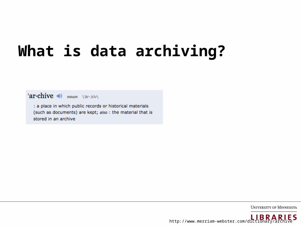
What is data archiving?
http://www.merriam-webster.com/dictionary/archive


Historical (“Old”) Data
● Parcels ● Survey Info (plats, monuments, and benchmarks)● Aerial Imagery● Utilities● Permits (right-of-way, ordinance, utility, etc.)● Construction Plans/As-Builts● Easements, Openings, Vacations, CINU● Maps (street, parks, natural resources, transit, etc.)● Field Books and/or notes

Why archive? Why now?● Historical versions are useful to:
o Researcherso Plannerso Historianso Genealogistso Surveyorso The curious resident
● Open Data Initiatives
● Minnesota Geospatial Commonso GDRS node (coming soon)
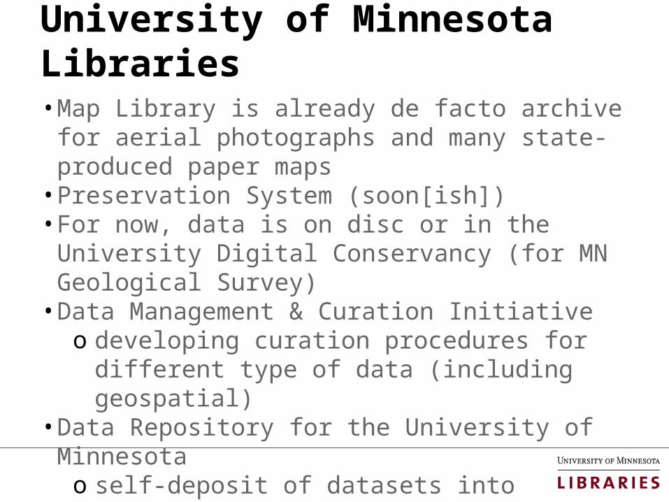
University of Minnesota Libraries• Map Library is already de facto archive for aerial
photographs and many state-produced paper maps• Preservation System (soon[ish])• For now, data is on disc or in the University Digital
Conservancy (for MN Geological Survey)• Data Management & Curation Initiative
o developing curation procedures for different type of data (including geospatial)
• Data Repository for the University of Minnesotao self-deposit of datasets into repository that
enables reuse, citation, and fulfills grant requirements

Minnesota State Archivist
Had a conversation with Shawn Roundso State Archivist has a handful of geospatial data
sets, but does not generally collect datao Since most/all geospatial data created by
government agencies in MN is not directly related to the business of government, it would be out of scope for archiving with the State Archivist
o As long as MnGeo and other major players are involved in the conversation, the State Archivist is fine with any decisions made

Geospatial Data Archiving in Minnesota
Possible analogy:o Minnesota Digital Library & Geospatial Commons
MDL aggregates, and facilitates access to, digital objects from 155 participating historical societies, special archives, libraries and other organizations.
o Once objects are in one place, archiving and preservation is that much easier
o http://mndigital.org

Geospatial Data Archiving in Minnesota
Question:
What is the level of interest in the concept of a centralized/aggregated service model?

Geospatial Data Archiving in Minnesota
Question:
Is the University of Minnesota the appropriate location for this kind of work?

Geospatial Data Archiving in Minnesota
Question:
Data curation and retentionWho decides what is kept? How is that decision made?Funding?Legal issues?

Minnesota Geospatial Information OfficeA Program Area of MN.IT Services
Jeff Bloomquist, Farm Service Agency, USDA
FSA NAIP 2015 update


Minnesota Geospatial Information OfficeA Program Area of MN.IT Services
Ben Richason, St. Cloud State University
Higher education GIS training/courses survey results


COURSE CATEGORIES
1) MAPS & CARTOGRAPHY
2) SURVEYING / GPS
3) REMOTE SENSING & PHOTOGRAMMETRY
4) GEOGRAPHIC INFORMATION SCIENCE
5) SPATIAL ANALYSIS


Map
Use
/Inte
rpre
tation
Intro to
Cartogra
phy
Interm
ediate / A
dvance
d Carto
graphy
Intern
et Map
ping
Visualiz
ation / D
esign
Cartogra
phy an
d GIS
Topica
l0
1
2
3
4
5
6
7
8
9
Maps & CartographyMnSCU Totals

Map
Use
/Inte
rpre
tation
Intro to
Cartogra
phy
Interm
ediate / A
dvance
d Carto
graphy
Intern
et Map
ping
Visualiz
ation / D
esign
Cartogra
phy an
d GIS
Topica
l0
1
2
3
4
5
6
Maps & CartographyMnSCU – 4 Yr vs. 2 Yr
4 Yr
2 Yr

Maps & CartographyU of M Totals
Map Use/
Interpret
ation
Intro to
Cartogra
phy
Intermed
iate /
Advanced
Cart
ography
Internet
Mapping
Visuali
zation / D
esign
Cartogra
phy an
d GIS
Topica
l0
1
2
3
4
5
6
7
8

Map
Use
/Inte
rpre
tation
Intro to
Cartogra
phy
Interm
ediate / A
dvance
d Carto
graphy
Intern
et Map
ping
Visualiz
ation / D
esign
Cartogra
phy an
d GIS
Topica
l0
1
2
3
4
5
6Maps & Cartography
U of M - Twin Cities vs. Regional
Twin Cities
Regional

Maps & CartographyPrivate Colleges & Univ. - Totals
0
1
2
3
4
5
6
7
8

Intro to Remote Sensing Advanced / Applied Remote Sensing Intro to Image Processing0
2
4
6
8
10
12
Remote SensingMnSCU Totals

Intro to Remote Sensing Advanced / Applied Remote Sensing Intro to Image Processing0
1
2
3
4
5
6
7
8
Remote SensingMnSCU – 4 Yr vs. 2 Yr
4 Yr
2 Yr

Intro to Remote Sensing Advanced / Applied Remote Sensing Intro to Image Processing0
1
2
3
4
5
6
7
8
9
10
Remote SensingU of M Totals

Intro to Remote Sensing Advanced / Applied Remote Sensing Intro to Image Processing0
1
2
3
4
5
6
7
8
9
10
Remote SensingU of M - Twin Cities vs. Regional
Twin Cities
Regional

Intro to Remote Sensing Advanced / Applied Remote Sensing Intro to Image Processing0
1
2
3
4
5
6
7
8
9
10
Remote SensingPrivate Colleges & Univ. - Totals


Intro to Surveying
Intro to Land Surveying
Intermediate / Advanced Surveying
Geodesy Intro to GPS Field Mapping abd GPS
GPS and GIS Precision Agriculture
Other0
1
2
3
4
5
6
7
8
9
10
SURVEYING / GPSMnSCU Totals

Intro to Surveying
Intro to Land Surveying
Intermediate / Advanced Surveying
Geodesy Intro to GPS Field Mapping and GPS
GPS and GIS Precision Agriculture
Other0
1
2
3
4
5
6
7
8
SURVEYING / GPSMnSCU – 4 Yr vs. 2 Yr
4 Yr
2 Yr

Intro to Survey-ing
Intro to Land Surveying
Intermediate / Advanced Surveying
Geodesy Intro to GPS Field Mapping abd GPS
GPS and GIS Precision Agriculture
Other0
1
2
3
4
5
6
7
8
9
SURVEYING / GPSU of M Totals

Intro to Surveying
Intro to Land Surveying
Intermediate / Advanced Surveying
Geodesy Intro to GPS Field Mapping abd GPS
GPS and GIS Precision Agriculture
Other0
1
2
3
4
5
6
7
8
9
SURVEYING / GPSU of M – TWIN CITIES vs. REGIONAL
Twin Cities
Regional

Intro to
Surveying
Intro to
Land Surveying
Intermediate / A
dvanced Surveying
Geodesy
Intro to
GPS
Field M
apping abd GPS
GPS and GIS
Precision Agric
ulture
Other
0123456789
SURVEYING / GPSPRIVATE COLLEGES & UNIV.


Intro to
GIS
Interm
ediate GIS
Advance
d GIS
Intern
et / O
nline GIS
Modeling
Database
s (Deve
lopment / Desig
n)
Topica
l / Applie
d
Progra
mming / Custo
mization
Software
GIS an
d RS
Applications
Project
Manag
ement / Pro
fessional
Develop
Projects
/ Prac
ticum
Seminar
0
2
4
6
8
10
12
14
16
GEOGRAPHIC INFORMATION SCIENCEMnSCU Totals

Intro to
GIS
Interm
ediate GIS
Advance
d GIS
Intern
et / O
nline GIS
Modeling
Database
s (Deve
lopment / Desig
n)
Topica
l / Applie
d
Progra
mming / Custo
mization
Software
GIS an
d RS
Applications
Project
Manag
ement / Pro
fessional
Develop
Projects
/ Prac
ticum
Seminar
0
2
4
6
8
10
12
14
GEOGRAPHIC INFORMATION SCIENCEMnSCU – 4 Yr vs. 2 Yr
4 Yr
2 Yr

Intro to
GIS
Interm
ediate GIS
Advance
d GIS
Intern
et / O
nline GIS
Modeling
Database
s (Deve
lopment / Desig
n)
Topica
l / Applie
d
Progra
mming / Custo
mization
Software
GIS an
d RS
Applications
Project
Manag
ement / Pro
fessional
Develop
Projects
/ Prac
ticum
Seminar
0
2
4
6
8
10
12
14
GEOGRAPHIC INFORMATION SCIENCEU of M Totals

Intro to
GIS
Interm
ediate GIS
Advance
d GIS
Intern
et / O
nline GIS
Modeling
Database
s (Deve
lopment / Desig
n)
Topica
l / Applie
d
Progra
mming / Custo
mization
Software
GIS an
d RS
Applications
Project
Manag
ement / Pro
fessional
Develop
Projects
/ Prac
ticum
Seminar
0
2
4
6
8
10
12
14
GEOGRAPHIC INFORMATION SCIENCEU of M – TWIN CITIES vs. REGIONAL
Twin Cities
Regional

Intro to
GIS
Interm
ediate GIS
Advance
d GIS
Intern
et / O
nline GIS
Modeling
Database
s (Deve
lopment / Desig
n)
Topica
l / Applie
d
Progra
mming / Custo
mization
Software
GIS an
d RS
Applications
Project
Manag
ement / Pro
fessional
Develop
Projects
/ Prac
ticum
Seminar
0
2
4
6
8
10
12
14
GEOGRAPHIC INFORMATION SCIENCEPRIVATE COLLEGES & UNIV.


Intro to Spatial Analysis Advanced Spatial Analysis Spatial Statistics Topical0
0.5
1
1.5
2
2.5
3
3.5
SPATIAL ANALYSISMnSCU Totals

Intro to Spatial Analysis Advanced Spatial Analysis Spatial Statistics Topical0
0.5
1
1.5
2
2.5
3
3.5
SPATIAL ANALYSISMnSCU – 4 Yr vs. 2 Yr
4 Yr
2 Yr

Intro to Spatial Analysis Advanced Spatial Analysis Spatial Statistics Topical0
0.5
1
1.5
2
2.5
3
SPATIAL ANALYSISU of M Totals

Intro to Spatial Analysis Advanced Spatial Analysis Spatial Statistics Topical0
0.5
1
1.5
2
2.5
3
SPATIAL ANALYSISU of M – TWIN CITIES vs. REGIONAL
Twin Cities
Regional

Intro to Spatial Analysis Advanced Spatial Analysis Spatial Statistics Topical0
0.5
1
1.5
2
2.5
3
SPATIAL ANALYSISPRIVATE COLLEGES & UNIV.

120; 56%56; 26%
37; 17%
U of M MnSCU
Private
TOTAL CLASSES

Geography
Geology
Geoscience
s
Geointellig
ence GIS
Biology
Fore
st Reso
urces
Natural
Resource
s
Nat Res T
ech
Agricu
lture
Envir
omental St
udies
Envir
omental Sc
iences /
Tech
Civil E
ngineerin
g
Civil E
ng / La
nd Surve
y
Landsca
pe Arch
Infrastr
ucture
Sys E
ng
Public Affair
s0
10
20
30
40
50
60
70
80
90
100
ALL COURSES
DEPARTMENTS and PROGRAMS WHERE GEOSPATIAL COURSES ARE TAUGHT

Minnesota Geospatial Information OfficeA Program Area of MN.IT Services
Dan Ross, MnGeo
Discussion of enterprise services that are needed

Minnesota Geospatial Information OfficeA Program Area of MN.IT Services
Examples of Enterprise Services
Existing• MN Geospatial Commons• Imagery• Geocoding• MnTopo
Under consideration• USPS verification• Web map services• Shared Code Repository

Minnesota Geospatial Information OfficeA Program Area of MN.IT Services
Discussion
What enterprise services are needed by the Geospatial Community?
Example – coordinate statewide data for the Census Bureau?

Minnesota Geospatial Information OfficeA Program Area of MN.IT Services
Dan Ross, MnGeo
MnGeo priority efforts and updates

Minnesota Geospatial Information OfficeA Program Area of MN.IT Services
• Developed as part of NG9-1-1• Shaping the project now• Collaboration with DPS, State
Patrol, MnDOT, local partners• Aligned with Street
Centerlines• Will begin moving forward this
spring
Statewide Addresses

Minnesota Geospatial Information OfficeA Program Area of MN.IT Services
Spring Aerial Imagery Project 2009-2014
• SAIP– 6-year project– 4-band & stereo imagery– 0.5-meter resolution– Funded: ENRTF at $1.1-million– Purpose: Update National Wetland Inventory– Strategy: individual, annual contracts
• Partnerships Offered– To counties, tribes, federal agencies– 22 partnerships developed– Most bought up from 0.5-meter to 1-foot– Over an area representing 33% of MN– Total project budget increase: ~$1-million

Minnesota Geospatial Information OfficeA Program Area of MN.IT Services
Spring Aerial Imagery Project 2009-2014
Roles– DNR: Primary customer, funding
source, ID technical specs– MnGeo: project/contract mgmt;
liaison with partners; imagery QC– MnDOT: Tech specialists;
positional accuracy assessment– Counties, Tribes, Feds: partners
engaged through JPAs and POs; involvement varied
Future– Project ending in first quarter 2015– Interest in continuing partnership
program, but no dedicated state $$– State would dedicate resources to
develop and execute a new contract

Minnesota Geospatial Information OfficeA Program Area of MN.IT Services
Identify specifications for a set of products and/or services
Pre-approve a number of qualified vendors
Contract in force for multiple yearsWhen products are desired, they are pooled and a work
order is preparedVendor responses evaluated; best value selectedAs new needs arise, new work orders can be issued
over the life of the contractFor this contract, the primary product would be imagery:
4-band; Resolution from 3- or 4-inch to ½-meter
Master Services Contract (MSC)

Minnesota Geospatial Information OfficeA Program Area of MN.IT Services
Met Council is in the process of securing funding1-foot imagery7-county Metro
2016 Imagery
If an MSC is in place, there is an opportunity for partners to buy up
Additional partnerships would increase leverage, decrease costs

Minnesota Geospatial Information OfficeA Program Area of MN.IT Services
2016 Imagery Plans
Interest in Cost Share Opportunity
14 Counties RespondedImagery Plans Yes: 4 metro 3
collar Maybe: 1 2 No/Doubtful 2 2
Cost Share Interest Yes: 6 metro 6
collar No: 1 1

Minnesota Geospatial Information OfficeA Program Area of MN.IT Services
2016 Imagery Plans and Cost Share Interest
Imagery Survey
Additional Responses
Primary resolution: 6-inch Spring, leaf-off Other related products to
consider: Stereo Elevation data from stereo Planimetrics

Minnesota Geospatial Information OfficeA Program Area of MN.IT Services
Drainage Records Modernization
Project Goal: Develop a GIS database template along with data standards and a web-based data portal for Minnesota’s public drainage system records.
Project Status: A project plan has been written and a Service Authorization (SA) between the Board of Water and Soil Resources (BWSR) and MnGeo has been written but not yet executed.
Project Funding: $230,000

Minnesota Geospatial Information OfficeA Program Area of MN.IT Services
Statewide Parcels• Align with Revenue efforts• Exchange Guideline - shared • Regional Collaborations - happening • MnGeo to do parcel collect 2014-15
• Will obtain, aggregate, standardize, make available to state agencies

• Build a place that users see as the place of choice to go to find, evaluate, access and follow (stay connected with) the best data to meet their needs…
• Create a place that publishers want to put their geospatial resources for others to discover...
The experiment…

• Migration of all significant state geospatial resources currently provided in the Data Deli, Minnesota Geographic Data Clearinghouse, DataFinder and other independent state agencies taking place
• Published resources accessible through the Commons has reached nearly 200
• Participation of remaining state agencies and external partners will be pursued beginning in March 2015
Status

Statewide Centerline Initiative
Delay…..• Set up - MnGeo instance of Esri Roads and
Highways for the partners• Conflation of non-state data• Align with Metro counties GIS Centerlines, Next
Generation 9-1-1 efforts
To develop, test, refine, publish and perpetuate a single state- wide roadway dataset that meets the needs of a diverse user community…

Minnesota Geospatial Information OfficeA Program Area of MN.IT Services
Adjourn…
See you next meeting, April 1 (no fooling!)