mp 8.6 jeffreytown tunnel 575 concrete straight … 8.6 jeffreytown tunnel 575’ concrete straight...
TRANSCRIPT
MP 8.6 Jeffreytown Tunnel 575’ Concrete Straight Bore
Mile 8.2 Trail MP 7.2
Bored 1926
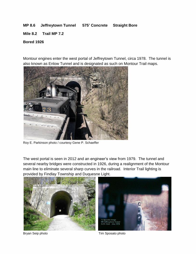
Montour engines enter the west portal of Jeffreytown Tunnel, circa 1978. The tunnel is
also known as Enlow Tunnel and is designated as such on Montour Trail maps.
Roy E. Parkinson photo / courtesy Gene P. Schaeffer
The west portal is seen in 2012 and an engineer’s view from 1979. The tunnel and
several nearby bridges were constructed in 1926, during a realignment of the Montour
main line to eliminate several sharp curves in the railroad. Interior Trail lighting is
provided by Findlay Township and Duquesne Light.
Bryan Seip photo Tim Sposato photo

Topo map shows the tunnel at left of center. The tunnel and other realignments eliminated several sharp curves on the original main line.
Courtesy Bob Ciminel / USGS
Topo map from 1905 shows the original railroad line following Montour Run around the hillside with several sharp curves in the main line. The land north (above) Montour Run, including the rocky hillside where the tunnel was bored, originally was granted to Robert McMin in 1784. The land to the south of the creek was granted to Samuel & Thomas Jeffery in 1785. The area marked as McMinn later became known as Jeffreytown.
Courtesy Bob Ciminel / USGS

Aerial view from 1938 shows the tunnel at upper left. Faint traces of the original right-of-way can be seen, with sharp curves around hillside at left and also along Montour Run at upper right. Realigned railroad (current Montour Trail) runs from top left to bottom right.
Courtesy Penn Pilot
Satellite view shows the current Trail from bottom left to lower right, with the tunnel at
center. Cliff Mine Road runs across the bottom of frame, with Main Street/McClaren
Road from lower left to top center. The Enlow 5-points intersection is at bottom left
corner. Enlow at left and Jeffreytown to the right give the tunnel its two different names.
Google Images
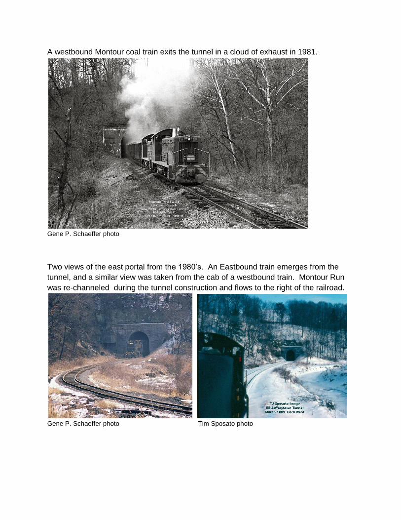
A westbound Montour coal train exits the tunnel in a cloud of exhaust in 1981.
Gene P. Schaeffer photo
Two views of the east portal from the 1980’s. An Eastbound train emerges from the
tunnel, and a similar view was taken from the cab of a westbound train. Montour Run
was re-channeled during the tunnel construction and flows to the right of the railroad.
Gene P. Schaeffer photo Tim Sposato photo

Valuation Plan shows the straight bore of the tunnel. Dashed lines curving at upper and lower right indicate the original right-of-way as it followed Montour Run around the hillside. North is at left of diagram. Clearance diagram indicates dimensions of the tunnel bore.
Courtesy Greg Corcoran Courtesy Tim Sposato
Compiled by Montour Railroad Historical Society members