national register of historic places …€¦ · national register of historic places ... (national...
TRANSCRIPT
NPS Form 10-900 OMB Approval No. 1024-0018 (Rev. Aug. 2002) (Expires Jan. 2005)
United States Department of the Interior National Park Service
NATIONAL REGISTER OF HISTORIC PLACES REGISTRATION FORM
This form is for use in nominating or requesting determinations for individual properties and districts. See instructions in How to Complete the National Register of Historic Places Registration Form (National Register Bulletin 16A). Complete each item by marking "x" in the appropriate box or by entering the information requested. If any item does not apply to the property being documented, enter "N/A" for "not applicable." For functions, architectural classification, materials, and areas of significance, enter only categories and subcategories from the instructions. Place additional entries and narrative items on continuation sheets (NPS Form 10-900a). Use a typewriter, word processor, or computer, to complete all items.
1. Name of Property
historic name: Morgan-Case Homestead
other name/site number: John Case Homestead; Puyear Ranch; 24GN0195
2. Location
street & number: N/A not for publication: n/a
city/town: Philipsburg vicinity: X
state: Montana code: MT county: Granite code: 39 zip code: 59858
3. State/Federal Agency Certification
As the designated authority under the National Historic Preservation Act of 1986, as amended, I hereby certify that this X nomination request for determination of eligibility meets the documentation standards for registering properties in the National Register of Historic Places and meets the procedural and professional requirements set forth in 36 CFR Part 60. In my opinion, the property X meets does not meet the National Register Criteria. I recommend that this property be considered significant nationally statewide X locally. ( See continuation sheet for additional comments.)
________________________________/Regional Archaeologist & Deputy FPO _________________ Signature of certifying official/Title Date US Department of Agriculture, Forest Service
State or Federal agency or bureau
In my opinion, the property ____ meets _____ does not meet the National Register criteria. _______________________________________________________________________ ______________________ Signature of commenting or other official Date Montana State Historic Preservation Office State or Federal agency and bureau
4. National Park Service Certification
I, hereby certify that this property is: Signature of the Keeper Date of Action
______ entered in the National Register ______ see continuation sheet
______ determined eligible for the National Register ______ see continuation sheet
______ determined not eligible for the National Register ______ see continuation sheet
______ removed from the National Register ______ see continuation sheet
______ other (explain)
Morgan-Case Homestead Granite County, Montana
Name of Property County and State
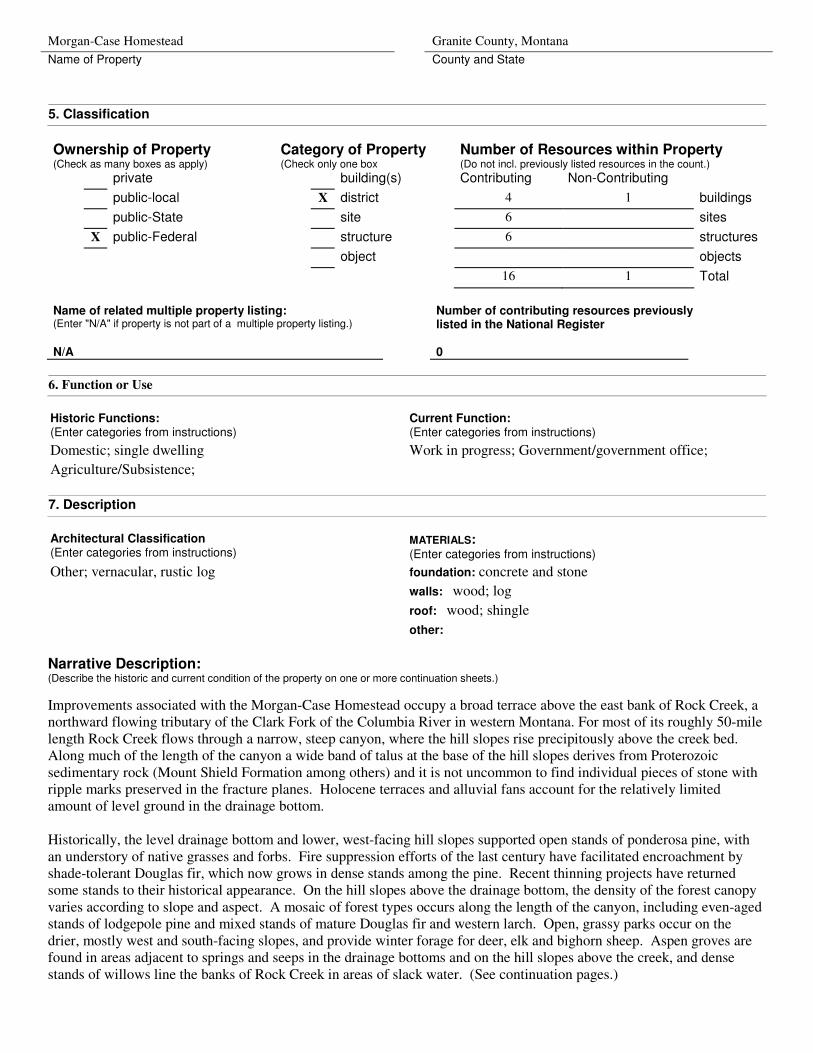
5. Classification
Ownership of Property (Check as many boxes as apply)
Category of Property (Check only one box
Number of Resources within Property (Do not incl. previously listed resources in the count.)
private building(s) Contributing Non-Contributing
public-local X district 4 1 buildings
public-State site 6 sites
X public-Federal structure 6 structures
object objects
16 1 Total
Name of related multiple property listing: (Enter "N/A" if property is not part of a multiple property listing.)
Number of contributing resources previously listed in the National Register
N/A 0
6. Function or Use
Historic Functions: (Enter categories from instructions)
Domestic; single dwelling
Agriculture/Subsistence;
Current Function: (Enter categories from instructions)
Work in progress; Government/government office;
7. Description
Architectural Classification (Enter categories from instructions)
MATERIALS: (Enter categories from instructions)
foundation: concrete and stone
walls: wood; log
roof: wood; shingle
Other; vernacular, rustic log
other:
Narrative Description: (Describe the historic and current condition of the property on one or more continuation sheets.)
Improvements associated with the Morgan-Case Homestead occupy a broad terrace above the east bank of Rock Creek, a northward flowing tributary of the Clark Fork of the Columbia River in western Montana. For most of its roughly 50-mile length Rock Creek flows through a narrow, steep canyon, where the hill slopes rise precipitously above the creek bed. Along much of the length of the canyon a wide band of talus at the base of the hill slopes derives from Proterozoic sedimentary rock (Mount Shield Formation among others) and it is not uncommon to find individual pieces of stone with ripple marks preserved in the fracture planes. Holocene terraces and alluvial fans account for the relatively limited amount of level ground in the drainage bottom.
Historically, the level drainage bottom and lower, west-facing hill slopes supported open stands of ponderosa pine, with an understory of native grasses and forbs. Fire suppression efforts of the last century have facilitated encroachment by shade-tolerant Douglas fir, which now grows in dense stands among the pine. Recent thinning projects have returned some stands to their historical appearance. On the hill slopes above the drainage bottom, the density of the forest canopy varies according to slope and aspect. A mosaic of forest types occurs along the length of the canyon, including even-aged stands of lodgepole pine and mixed stands of mature Douglas fir and western larch. Open, grassy parks occur on the drier, mostly west and south-facing slopes, and provide winter forage for deer, elk and bighorn sheep. Aspen groves are found in areas adjacent to springs and seeps in the drainage bottoms and on the hill slopes above the creek, and dense stands of willows line the banks of Rock Creek in areas of slack water. (See continuation pages.)
Morgan-Case Homestead Granite County, Montana
Name of Property County and State
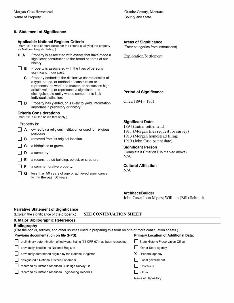
8. Statement of Significance
Narrative Statement of Significance
(Explain the significance of the property.) SEE CONTINUATION SHEET
9. Major Bibliographic References
Bibliography (Cite the books, articles, and other sources used in preparing this form on one or more continuation sheets.)
Previous documentation on file (NPS): Primary Location of Additional Data:
preliminary determination of individual listing (36 CFR 67) has been requested. State Historic Preservation Office
previously listed in the National Register Other State agency
previously determined eligible by the National Register X Federal agency
designated a National Historic Landmark Local government
recorded by Historic American Buildings Survey # University
recorded by Historic American Engineering Record # Other
Name of Repository:
Applicable National Register Criteria (Mark "x" in one or more boxes for the criteria qualifying the property for National Register listing.)
X A Property is associated with events that have made a significant contribution to the broad patterns of our history.
B Property is associated with the lives of persons significant in our past.
C Property embodies the distinctive characteristics of a type, period, or method of construction or represents the work of a master, or possesses high artistic values, or represents a significant and distinguishable entity whose components lack individual distinction.
D Property has yielded, or is likely to yield, information important in prehistory or history.
Criteria Considerations (Mark "x" in all the boxes that apply.)
Property is:
A owned by a religious institution or used for religious purposes.
B removed from its original location.
C a birthplace or grave.
D a cemetery.
E a reconstructed building, object, or structure.
F a commemorative property.
G less than 50 years of age or achieved significance within the past 50 years.
Areas of Significance
(Enter categories from instructions)
Exploration/Settlement
Period of Significance
Circa 1894 – 1951
Significant Dates
1894 (Initial settlement) 1911 (Morgan files request for survey) 1913 (Morgan homestead filing) 1919 (John Case patent date)
Significant Person
(Complete if Criterion B is marked above)
N/A
Cultural Affiliation
N/A
Architect/Builder
John Case; John Myers; William (Bill) Schmidt
Morgan-Case Homestead Granite County, Montana
Name of Property County and State
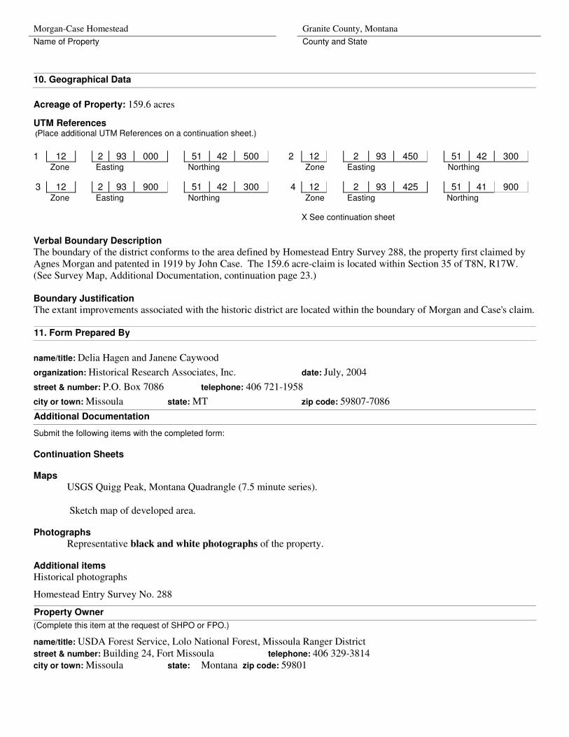
10. Geographical Data
Acreage of Property: 159.6 acres
UTM References (Place additional UTM References on a continuation sheet.)
1 12 2 93 000 51 42 500 2 12 2 93 450 51 42 300
Zone
Easting
Northing
Zone
Easting
Northing
3 12 2 93 900 51 42 300 4 12 2 93 425 51 41 900 Zone
Easting
Northing
Zone
Easting
Northing
X See continuation sheet
Verbal Boundary Description
The boundary of the district conforms to the area defined by Homestead Entry Survey 288, the property first claimed by Agnes Morgan and patented in 1919 by John Case. The 159.6 acre-claim is located within Section 35 of T8N, R17W. (See Survey Map, Additional Documentation, continuation page 23.) Boundary Justification
The extant improvements associated with the historic district are located within the boundary of Morgan and Case's claim.
11. Form Prepared By
name/title: Delia Hagen and Janene Caywood
organization: Historical Research Associates, Inc. date: July, 2004
street & number: P.O. Box 7086 telephone: 406 721-1958
city or town: Missoula state: MT zip code: 59807-7086
Additional Documentation
Submit the following items with the completed form:
Continuation Sheets Maps
USGS Quigg Peak, Montana Quadrangle (7.5 minute series). Sketch map of developed area. Photographs
Representative black and white photographs of the property. Additional items
Historical photographs
Homestead Entry Survey No. 288
Property Owner
(Complete this item at the request of SHPO or FPO.)
name/title: USDA Forest Service, Lolo National Forest, Missoula Ranger District street & number: Building 24, Fort Missoula telephone: 406 329-3814
city or town: Missoula state: Montana zip code: 59801

NPS Form 10-900-a OMB Approval No. 1024-0018 (8-86)
United States Department of the Interior National Park Service
NATIONAL REGISTER OF HISTORIC PLACES Continuation Sheet
Section Number 7 Page 1 Morgan-Case Homestead, Granite County, Montana
Section 7, continued Prehistoric and historic settlements are generally limited to the level terraces and small alluvial fans at the mouth of tributary streams. Some stable landforms contain evidence of repeated prehistoric occupations capped by historic-era development.1 Small, subsistence homesteads occur in a mostly continuous chain along the length of the drainage – wherever sufficient level ground occurred to support fields of native hay and small gardens. The Morgan-Case Homestead represents one such subsistence homestead, established in the early 1890s and occupied until the mid-1940s. Besides its extant buildings and structures, the Morgan-Case Homestead contains a variety of cultural landscape features that also contribute to its eligibility. For this reason, the following detailed narrative description of the Morgan-Case Homestead is presented within the context of the cultural landscape characteristics that are specifically relevant to the property. These include: "natural systems and features," "spatial organization," "land use," "buildings and structures,"
"circulation," "constructed water features," and "vegetation".
Natural Systems and Features At the Morgan-Case Homestead, building and land use patterns are defined in large part by a response to the area's natural systems and features, principally the natural topography and the location of the Rock Creek channel. The boundary of the Morgan-Case Homestead claim was drawn to incorporate the maximum extent of the level land bounded by these two natural systems; the claim boundary followed the base of the steep slope of the ridge known as the "Big Hogback," and Rock Creek formed the western and part of the southern boundary. Roughly 10 acres of the claim extends up the hill slope above the level ground – specifically to provide pasture for the claimants' livestock.
All three owners of the property during the historic period made full use of the natural resources available to them. Agnes (Annie) Morgan and Joseph Case, the original residents of the claim, diverted the water from a spring to water their vegetable garden and for domestic use. They also took advantage of the high groundwater in the adjacent grassy terraces to grow and harvest hay. Although Case limited the tilled acreage to a two-acre garden, he improved the productivity of native grasses by the simple expedient of sowing the area with timothy and clover. They used timber from the surrounding hill slopes to construct their buildings, which were all of whole-log construction. This tradition of use continued with the next two owners of the ranch, Myers and Schmidt, both of whom expanded upon the Morgan-Case infrastructure. Myers built additional whole-log buildings with timber harvested from the area, and also integrated locally available stone into the construction of a garage. Myers expanded the irrigation systems within the property, appropriating water from Rock Creek to irrigate an expanded hay field. As far as can be determined, both the Myers and the Schmidts continued to use water from a local spring for domestic purposes. The Schmidt family built two frame buildings with lumber milled from ponderosa pine cut on site, and also made use of locally available stone for landscaping projects around the house. Summary: The large-scale natural systems and features that influenced selection of the homestead site and subsequent development within it have changed little since the end of the historical period. The steep hill slopes that rise above the homestead claim and the Rock Creek channel, restored to its original location in 1999, provide strong edge definition to the historic district, contribute to its integrity of setting, and to the overall eligibility of the property.
1 At the Morgan-Case Homestead previous archaeological investigations failed to yield evidence of buried archaeological deposits. However, several culturally modified ponderosa pine trees, i.e., trees stripped of their cambium layer, are scattered throughout the site.
NPS Form 10-900-a OMB Approval No. 1024-0018 (8-86)
United States Department of the Interior National Park Service
NATIONAL REGISTER OF HISTORIC PLACES Continuation Sheet
Section Number 7 Page 2 Morgan-Case Homestead, Granite County, Montana
Spatial Organization and Land Use
The organization of improvements within the homestead claim reflects a small-scale diversified agricultural operation, with little manipulation of, but certainly a response to, the natural systems of the area. Important features affecting the organization of improvements within the site include the grade and elevation of the natural land surface relative to the Rock Creek channel, native vegetation and site hydrology. With the exception of irrigation ditches, all of the permanent improvements associated with the claim are clustered on the uppermost terrace, amidst a stand of mature ponderosa pine and near a spring emanating from the base of the Big Hogback ridge. This roughly 10-acre developed area provided some protection from Rock Creek floodwaters, but also segregated the permanent buildings from the remainder of the roughly 159-acre homestead claim, which was suitable for use as improved pasture or for cultivation, requiring little improvement other than the clearing of small trees and brush. Organization within the developed area itself reflects segregation of uses, with domestic facilities (house, bunkhouse, root cellar, woodshed, garage and sauna) spatially separated from those dedicated to managing and sheltering livestock and agricultural machinery (barn, machine shed and corral). The former were located in close proximity to the Rock Creek Road, which provides access to the site, while the latter occurred at the edge of the terrace near the pastures and fields, and downstream from the source of the domestic water supply. The bunkhouse, set slightly apart from the main dwelling, assured occupants of both buildings some degree of privacy. Summary: The historical pattern of spatial organization within the district remains evident on the landscape and contributes to the significance and eligibility of the historic district. In spite of the fact that some of the historic-era buildings have been removed through natural or cultural processes, the organization of the core developed area remains intact, as does the pattern of fields and pastures surrounding the developed area. Individual, contributing landscape features directly associated with land use include a former pasture located adjacent to the barn, and the irrigated fields located on the lower terraces. For purposes of the nomination resource count, each is counted as a contributing site.
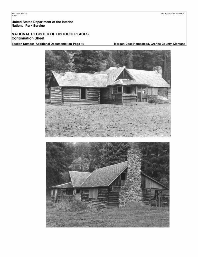
Buildings and Structures The collection of buildings at the Morgan-Case Homestead collectively reflect the vernacular architecture that is typical of many homestead and ranch properties established in rural areas. As stated previously all of these permanent improvements are located within the developed area, towards the east edge of the claim. Common architectural elements include the use of locally available materials (log and stone), and simple plans and engineering systems. The individual skill of the builder is written in details, such as the type of corner joinery and log treatment, or in the character of the stonework. Extant historical buildings include the original homestead dwelling, a bunkhouse, a semi-subterranean storage building, and a garage. A modern storage shed is also present. A barn, a combination blacksmith shop/woodshed, a sauna, and a machine shed and are all represented by ruins or foundation remains. One other structure, a pole corral with an attached loading chute, is also located on site. Dwelling: The homestead dwelling consists of three separate components constructed in at least two distinct periods. All three components are of log construction and were originally built on mortared stone foundations. The building has an irregular plan, the result of various additions to the original building. The complex cross-gabled roof, as well as the front and rear porches, is covered with a newly applied wood-shingle roof with 6-inch cedar ridge finish. The central component of the dwelling is believed to represent the original house built by Joseph Case prior to 1918. It has a rectangular plan, with a front-gabled roof. The wall logs of this component are hewn on two sides and joined at the
NPS Form 10-900-a OMB Approval No. 1024-0018 (8-86)
United States Department of the Interior National Park Service
NATIONAL REGISTER OF HISTORIC PLACES Continuation Sheet
Section Number 7 Page 3 Morgan-Case Homestead, Granite County, Montana
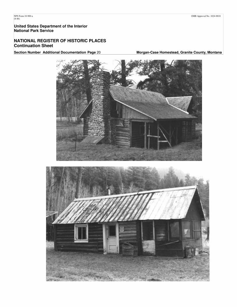
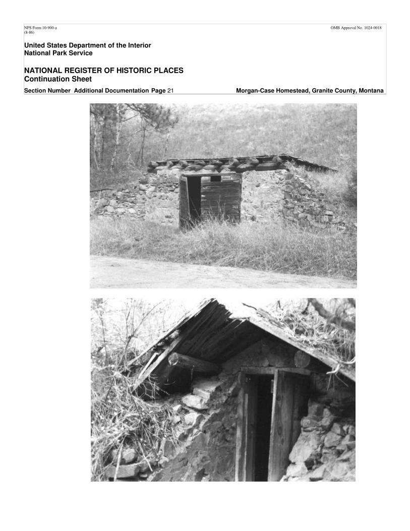
corners with square notches. The walls are daubed with a sand and lime mixture and capped with cement. The gable ends are finished with vertical boards and battens. The top of an interior brick chimney extends from the northwest slope of the roof. An enclosed wood-frame porch with a half-hipped roof covers most of the southwest (stream side) elevation. The bottom half of the porch is finished with wood shingles painted green. The upper portion was screened. Fenestration in this component includes a window and door opening on the southwest elevation (sheltered by the porch) and a two-over-two, double-hung window centered within the northeast wall. During the Morgan-Case tenure, the southwest elevation would have been considered the front of the building. The north component of the dwelling is also of log construction – connected to the central component by an intersecting gable roof that covers both the north building and a frame vestibule in the space between the two. The wall logs are joined at the corners with steeple notches on the lower half, while the upper portions of the walls feature square notches. The north gable end is covered with wood shingles. An internal brick chimney projects from the northwest slope of the roof. The east and west walls each have a single one-over-one-light, double-hung window centered within the elevation. The frame vestibule has a similar window in the northeast elevation. The date of this component has not been firmly documented. The third and most recent component of the dwelling is attached to the south elevation of the original Morgan-Case house, built by John Myers soon after he purchased the property in 1924. It is also of log construction and has a gabled roof that intersects with the roof of the original building. The walls are made with full logs, joined at the corners with square notches, spiked in place. The northeast side has a full-length shed-roofed porch. The lower part of the porch walls are enclosed with horizontal planks, while the upper part is screened. This porch shelters an entry offset to the north end of the wall. Two window-openings, which once contained four-light fixed windows, are located south of the entry. A massive, external chimney constructed of river cobbles dominates the south (side) elevation. Some of the chimney stones have been squared or cut to fit. Three-light fixed windows are located high on the wall on either side of the exterior chimney. Four-light windows, one fixed and one casement, are located in the gable end, one on either side of the chimney. The gable end is covered with wood shingles. The southwest elevation contains two large window-openings, each of which contains an eight-light fixed window. Bunkhouse: The bunkhouse is located southwest of the ranch dwelling. Built by Joseph Case prior to 1918, this single-story, side-gabled log building has a simple rectangular plan extended by an enclosed wood-framed porch. A concrete foundation supports the log bearing walls. The full logs are joined with steeple notches covered with corner boards. Walls are chinked with poles and daubed with a sand/lime mixture covered with concrete. Corrugated metal placed over rolled asphalt roofing covers the steep gabled roof. Rolled asphalt has also been applied to the gable ends. Roof features are limited to a galvanized metal ridge finish with globe ends. The lower half of the porch is enclosed with horizontal board-and-batten siding; the upper half is screened. The building's two doors are both on the northwest side – one opens into the main component of the bunkhouse while a wood and screen door opens into the porch. Windows include a two-light fixed window on the northwest elevation and a large single-light fixed sash window on the southeast elevation. A stovepipe protrudes from the northeast gable end. Root cellar: A storage building or root cellar is located on the hill slope above the homestead dwelling; it may represent the remains of the 'underground storage' building described by Joseph Case in 1918. The storage building was constructed into a cavity excavated into the hill slope. The interior walls are made with mortared stone, accessible via a frame vestibule with a board and batten door. The vestibule has a gable roof with log purlins and is covered with boards. Garage: A garage built by John Myers, who owned the property between 1924 and 1943, is located on the east side of the Rock Creek Road, slightly north of the dwelling. This one-story masonry building is bermed into the hillside. It has a rectangular floor plan. The random-coursed walls have cement mortar. The southwest elevation contains a double side-
NPS Form 10-900-a OMB Approval No. 1024-0018 (8-86)
United States Department of the Interior National Park Service
NATIONAL REGISTER OF HISTORIC PLACES Continuation Sheet
Section Number 7 Page 4 Morgan-Case Homestead, Granite County, Montana
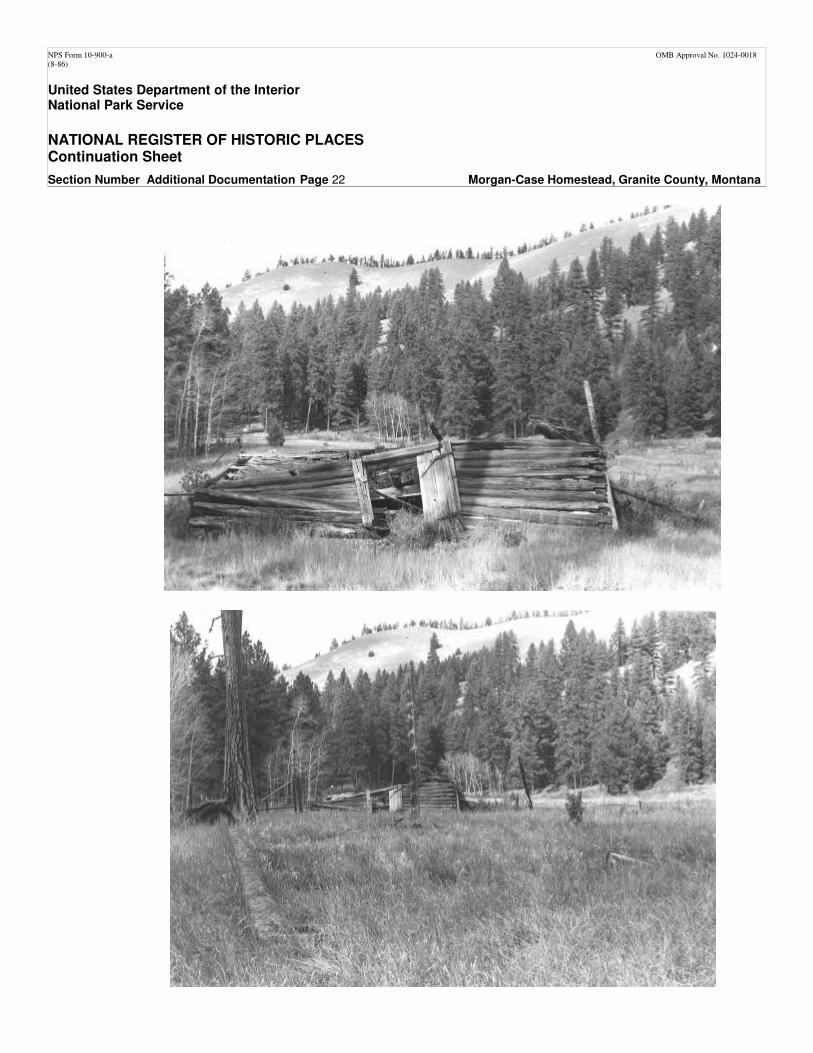
hinged garage door made with horizontal planks. Stone retaining walls extend at a diagonal from the corners of the southwest elevation. The shed roof of the garage has log and board rafters and is covered with corrugated metal. Modern shed: A crudely constructed wood-frame shed stands east of the bunkhouse, divided from the former by one of two irrigation ditches that traverse the upper terrace. Constructed sometime after 1951, this square, single-story building has a shed roof covered with corrugated metal. The foundation of the shed is not visible. Horizontal wood planks cover the walls, though missing boards have left some upper portions of the walls open. Shed features are limited to a four-panel wood door on the southwest elevation of the building. Barn ruins: The collapsed remains of a barn are located about 500 feet southwest from the dwelling. A review of historical photographs indicates that the barn was a 1.5-story log bearing building with a rectangular floor plan and a gambrel roof. It was built on a stone and concrete foundation wall. Walls were constructed of full, un-peeled, pine logs joined with square notches, chinked with poles, and daubed with cement mortar. The wood-frame gambrel ends were covered with wide vertical boards, and the roof itself was covered with wood shingles. A board-and-batten door was located on the northwest elevation of the barn. The southeast gambrel end was open, while the main floor of the south elevation featured a wide doorway. The interior of the barn was divided in half, with one side left open and used as a feeding area and the other half divided into four stalls. A post and pole corral enclosed an area off of the barn's northwest elevation. Blacksmith shop/woodshed foundation: A rectangular concrete foundation wall is located northwest of the dwelling, on the north side of the interior access road. Bill Schmidt built this multipurpose building soon after buying the property in 1943.
Sauna remains: The remains of the sauna are located adjacent to the west side of the blacksmith shop/woodshed foundation. These consist of a concrete foundation wall and a paved concrete floor, with the remains of a stone fireplace in its northeast corner. Bill Schmidt built the sauna in the mid-1940s, after completing the blacksmith shop/woodshed. Machine shed foundation: A large, rectangular foundation wall, which once supported a metal machine shed built by Bill Schmidt in the late 1940s, is located roughly 100 feet south of the barn, on the south side of the interior access road.
Pole corral: The partially collapsed remains of a pole corral with an attached loading chute is located on the lower terrace, at the extreme southern end of the developed area. The corral is roughly circular, with gates at the north and south sides of the circle. The date of the corral has not been documented. Summary: Although some of the historical buildings have been removed through natural or cultural processes, the collection of remaining buildings and structures continues to reflect the vernacular character of the improvements built at the site. The extant buildings and the pole corral possess all seven aspects of integrity, and the ruins of the barn and the foundation remains of the blacksmith shop/woodshed, the sauna and the machine shed, serve as place markers of former activity areas. For purposes of the nomination resource count, these resources are categorized as follows: Contributing Buildings Dwelling Bunkhouse Root cellar Garage Noncontributing Building Modern shed
NPS Form 10-900-a OMB Approval No. 1024-0018 (8-86)
United States Department of the Interior National Park Service
NATIONAL REGISTER OF HISTORIC PLACES Continuation Sheet
Section Number 7 Page 5 Morgan-Case Homestead, Granite County, Montana
Contributing Sites Barn ruins
Blacksmith shop/woodshed foundation Sauna remains Machine shed foundation Contributing Structure Pole corral Circulation and Access As stated above, access to the site is via the main Rock Creek Road, a narrow, one-lane road with turnouts that runs the length of the Rock Creek drainage. In the vicinity of the Morgan-Case Homestead, the road is constructed at the base of the Big Hogback, and adjacent to the homestead dwelling. Although the road is currently owned and maintained by the Forest Service, John Myers, the second owner of the property, built the section of the Rock Creek Road that runs through the homestead claim, selecting the uppermost of three alignments being considered by the Forest Service. From the Rock Creek Road there is one vehicular access point into the developed area. This dirt, two-track road branches at a right angle from the Rock Creek Road. It extends southwest along the north side of the homestead dwelling, past the south side of the foundations of the blacksmith shop/wood shed and the sauna, and another 500 feet farther to the southeast elevation of the barn and over the bank of the upper terrace to the fields below. This road has few engineering features, i.e., is has no constructed grade or formal surfacing, and appears to have simply developed through use. The exceptions are the points where the road crosses the two irrigation ditches that run through the developed area. At these crossings, culverts, fashioned of old water heaters, allowed vehicles to pass over the ditches. Historically, occupants of the site parked vehicles inside the garage, as well as in the vicinity of the blacksmith shop/woodshed and in the area between the barn and machine shed at the edge of the terrace. Vehicles also accessed the vicinity of the bunkhouse, where a third culvert provided a crossing of the irrigation ditch. Formal pedestrian paths were limited to a stone walkway constructed by the Schmidt family in the early 1940s. This two-tiered path leads from the east entrance of the dwelling to a gate in a yard fence that ran parallel to the Rock Creek Road. Although the fence and gate are no longer present, most of the stone path, built with tabular blocks of locally available talus, remains in place. Summary: With a few notable exceptions, the vehicular and pedestrian circulation systems that characterized the historical period retain integrity and contribute to the eligibility of the historic district. Specifically, the Rock Creek Road retains integrity in terms of its width and alignment relative to other homestead improvements. This resource, which is maintained by the Forest Service, is in good condition. The interior access road retains integrity for the most part, with the exception that the improvised culverts, which provided crossings of the irrigation ditches, have been removed. In addition, restricting vehicular access to the site has resulted in native vegetation encroaching on the two-track. The native stone pedestrian path retains integrity, although some of the stones have been removed in order to conduct preservation maintenance on the homestead dwelling. These will be replaced after the rehabilitation of the dwelling is complete. For purposes of the nomination resource count, the Rock Creek Road, the internal access road and the stone path are counted as three contributing structures.
NPS Form 10-900-a OMB Approval No. 1024-0018 (8-86)
United States Department of the Interior National Park Service
NATIONAL REGISTER OF HISTORIC PLACES Continuation Sheet
Section Number 7 & 8 Page 6 Morgan-Case Homestead, Granite County, Montana
Constructed Water Features
The historic district contains at least three constructed water features – all irrigation ditches that formerly diverted water from Rock Creek. (Construction of all three is attributed to John Myers, owner of the property between 1924 and 1943.) Two of the ditches transect the developed area on the upper terrace, while a third runs across the lower terrace. The ditches are between three and four feet across and roughly one foot deep. They are no longer connected to their head gates and lack of use has resulted in some infill of the ditches. Summary: Although the irrigation ditches have been abandoned for some time, they remain visible on the landscape. They contribute to our understanding of the agricultural operations associated with the district and are counted as three contributing structures. Vegetation
In addition to the native vegetation that characterizes the site area, the remains of a few ornamental plantings are located in the vicinity of the dwelling. Most of the landscape plantings are attributed to the Schmidt family, who lived at the site between 1943 and 1951. These plantings include junipers and spruce trees and one remnant lilac in the yard on the northeast side of the dwelling. In addition, a row of lilacs along most of the length of the south component of the dwelling represents historical landscape plantings. Summary: The ornamental plant materials that remain at the site appear to date to the historical period. Although they cannot be formally counted as resources in the nomination, they contribute to the historical scene and to the cultural landscape integrity of the district. Section 8: Narrative Statement of Significance
Summary Statement: The Morgan-Case Homestead is eligible for listing in the National Register of Historic Places, at the local level of significance under Criterion A, for its associative and representative value as an excellent example of the small subsistence homesteads established in the intermountain valleys of western Montana. Often taking advantage of the exact letter of the homestead legislation, claimants carved the boundaries of their homesteads from the limited amount of cultivable, i.e., tillable land available in the drainage bottoms. The yields from such homestead properties may have met minimum subsistence requirements, but rarely sufficient surplus to generate cash for other necessities of life. Consequently, after making the requisite improvements to secure their patents, landowners "worked out" for cash wages, diversified their own infrastructure to provide specialized agricultural products, or used their land base to provide other types of services, such as accommodations and meals for people working or recreating near their lands. Extant infrastructure remaining at the Morgan-Case Homestead reflects the diversified character that is typical of forest homesteads. The period of significance identified for the district covers the period between initial settlement of the site in the mid-1890s through 1951. This period covers the tenure of three owners: Annie Morgan and Joseph Case who resided at the site between 1894 and 1924; John and Olga Myers, who owned the property between 1924 and 1943; and, Bill Schmidt, who occupied the site between 1943 and 1951. All three families lived at the site and were actively involved in its operation. This pattern ended with the purchase of the property by the Puyears in 1951. They resided at the property for only a few years, made few improvements to the place, and finally abandoned the property to a caretaker in the mid-1950s.
NPS Form 10-900-a OMB Approval No. 1024-0018 (8-86)
United States Department of the Interior National Park Service
NATIONAL REGISTER OF HISTORIC PLACES Continuation Sheet
Section Number 8 Page 7 Morgan-Case Homestead, Granite County, Montana
Historic-era settlement of the Rock Creek Drainage
As the American Civil War raged in the East, fortune-seekers lucky enough to avoid the conflict set their sights on Idaho Territory, as Montana was known from 1863 to 1864. Until the early 1860s, the region remained relatively unsettled by non-Indians, whose presence in Montana prior to the Civil War era was limited primarily to military, missionary and fur-trading endeavors. The Indian tribes who had long inhabited the region retained control over most of their homeland. But as the lust for gold drew prospectors into unmined drainages throughout the Rockies, the mountain valleys of western Montana began to swell with new arrivals. By the fall of 1863 the new towns of Bannack and Virginia City, located some 80 miles southeast of the Rock Creek area, teemed with thousands of miners and the businesses that served them. From these mining centers prospectors fanned out in every direction in search of their own lucrative strikes. Other newcomers set their sights on the agricultural opportunities suggested by the well-watered valley floors (Montana State Engineer's Office 1953: 6-7). Some of these recent arrivals headed north and west toward present day Granite County. Among the first of them was Joe Henderson, who prospected in the area in 1864 and discovered a rich gold deposit in what was thereafter known as Henderson Gulch, about 20 miles northeast of Rock Creek. Over the next decade the surrounding valleys drew an ever-increasing number of miners, and towns developed quickly around the lodes they uncovered. These early supply settlements included Philipsburg, which would become the commercial center for much of the county, including upper Rock Creek. Named after miner Philip Deisheimer in 1865, the town soon served not only the consumer needs of miners but also the marketing needs of a fledgling agricultural sector as well. In 1872, prospectors located the primary lode in the region, Granite Mountain, and in short order the area boasted such illustrious-sounding population centers as Reynolds City, Princeton, and New Chicago. Farmers quickly filled the valleys around the young towns, intent on supplying miners with precious and pricey fresh vegetables and meats (Montana State Engineer's Office 1959:7-8). As did the larger drainages throughout the region, Stone Creek (as Rock Creek was called into the late 1890s) drew settlers hoping to exploit both the mineral and agricultural possibilities of the valley. From the earliest days, Rock Creek settlers found it necessary to cobble together a living out of a variety of pursuits. Peter Waldbock, who homesteaded at the mouth of Rock Creek in the early 1870s, was typical, taking "work wherever he could find it" when he was not working his own land (Olson 1990:55). While the first Rock Creek settlers concentrated at the northern and southern ends of the 50-mile-long valley, near the Clark Fork River and Philipsburg, respectively, later arrivals moved deeper into the drainage, as the 1880s boom of Philipsburg silver mining swelled the demand for farm products. Philipsburg's increased need for fresh foodstuffs prompted the construction of a road that ran from the town to the head of Rock Creek and then on to the Burnt Fork Creek in Ravalli County. Rock Creek farmers continued to transport goods over the eastern section of this "Bitterroot Direct" road after the western section was abandoned with the end of the silver boom (Montana State Engineer's Office 1959:8). The arrival of the Northern Pacific Railroad at the mouth of Rock Creek in the early 1880s connected the drainage with more distant markets for its diverse products, and made homesteading in the valley more viable. Homesteaders continued the economic pattern established by the earliest arrivals, scratching out a living by cultivating gardens, raising an array of livestock on private and public lands, growing hay, engaging in limited logging to supply the many small sawmills in the area, trapping furs and hides, hunting wild game and gathering berries, mining, and supplementing all of their efforts with wage labor when they could find it (Olson 1990:2, 46-48). While an increasing number of residents tried their hand at small-scale, diversified farming and ranching, others mined for gold "in every nook and cranny on Rock Creek" (Olson 1990:186). Among those who hoped to make a living, if not a fortune, from the mountain ores were the 400 people who flocked to the new town of Quigley in 1896. Located about 9
NPS Form 10-900-a OMB Approval No. 1024-0018 (8-86)
United States Department of the Interior National Park Service
NATIONAL REGISTER OF HISTORIC PLACES Continuation Sheet
Section Number 8 Page 8 Morgan-Case Homestead, Granite County, Montana
miles south of the Clark Fork River, where Brewster Creek flows into Rock Creek, Quigley boomed and busted in less than a year, as the town's future evaporated with the realization that the promising assay results were based on salted ore samples. Though it failed to result in a lasting town, the Quigley episode brought people into Rock Creek who stayed, and it served to establish the drainage as a community in its own right (Olson 1990:93-126, 184). By the 1890s, the region itself had grown enough to warrant its own local government. State legislators created Granite County in March of 1893 and named Philipsburg the county seat (Montana State Engineer's Office 1959:7). At the turn of the century Rock Creek was emerging not only as a settled community with families, farms, and schools, but also as a recreational destination for those who lived elsewhere. The valley provided prime habitat for prize cutthroat and bull trout, deer, moose, elk and predators. Recreational enthusiasts built a clubhouse at the north end of the valley. During several different periods the Bonita Club, as the organization was called, owned land along the creek (Olson 1990:71, 151). Residents took advantage of their valley's recreational appeal by building small cabins and renting them to visiting hunters and fishermen (Olson 1990:146,166). Management of natural resources was itself a distinct facet of the economic and social life of the Rock Creek community. Establishment of the Missoula Forest Reserve in 1906, including the lands surrounding Rock Crock, brought the reserved lands under the authority of the newly established U.S. Forest Service.2 Forest Service stations and their employees became a permanent fixture within the valley community. Also in 1906, Congress passed the Forest Homestead Act, which authorized but did not require the opening of the Forest Reserves to settlement. Although the earlier 1891 "Forest Reserve" Act, which gave the president authority to establish forest reserves, and the 1897 Act, which created provisions for administering the reserves through the establishment of the Forest Service, acknowledged claims made prior to the creation of individual reserves, western interests clamored for a system that would allow new filings on "agricultural lands" located inside reserve boundaries. The 1906 Act authorized settlement of agricultural, i.e., "tillable" lands within the boundaries of forest reserves. Initially, the Forest Service responded by recommending the opening of lands only in response to specific applications. It was not until 1912 that a rider attached to an appropriations bill directed the Secretary of Agriculture to classify and segregate lands within the boundaries of the forests that could be open to settlement under the homestead legislation. After 1906, Forest Service employees, charged with ensuring the validity of a claimant's testimony, scrutinized most of the homestead entries filed in the Rock Creek drainage. As the twentieth century progressed, Rock Creek's development continued in much the same manner as previously. Local residents raised gardens and stock and earned money by exploiting the land around them as well as by working in nearby towns. Farmers used small-scale irrigation systems to maximize the productivity of the limited cultivable areas. The few remaining unclaimed parcels in the valley filled in as families fled the drought and farm depression that descended on eastern Montana in the late 'teens and '20s (Olson 1990:81,75). Rumrunners and bootleggers turned the valley's rugged isolated character into an asset, taking advantage of its inaccessibility to ply their trade during Prohibition. Illegal distilling was apparently so common in the drainage that one area earned the name "Whiskey Flats" (Olson 1990:68). Construction of the current Rock Creek road in the mid-1920s eased passage through the drainage, especially in the vicinity of the Hogbacks, which theretofore has been practically impassable to cars (Olson 1990:42). The new road must have been a boon to recreators and the residents who provided
2 In the Receipts Act of March 4, 1907, the name "forest reserves" was changed to "national forests"; thus, the Missoula Forest Reserve became known as the Missoula National Forest. The area surrounding Rock Creek was included in the Bonita Ranger District. In 1931 Missoula National Forest lands were divided between the Deer Lodge and Lolo National Forests, with lands surrounding the Morgan-Case Homestead managed by the Lolo.
NPS Form 10-900-a OMB Approval No. 1024-0018 (8-86)
United States Department of the Interior National Park Service
NATIONAL REGISTER OF HISTORIC PLACES Continuation Sheet
Section Number 8 Page 9 Morgan-Case Homestead, Granite County, Montana
service to them, for by the 1920s Rock Creek was well known for successful "commercial fishing" (Olson 1990:151). The new road also facilitated the management of public lands in the central part of the drainage. The Forest Service had for some years wanted to establish a stronger presence near the Hogbacks, and in the early 1920s appropriated the use of a cabin in the vicinity and converted it for use as a summer administrative site – Rock Creek Guard Station.3 As a result, the mid-1920s road improvements came at the behest of and with the help of the federal government. The Great Depression of the 1930s reinforced existing patterns throughout the drainage, as families made do by diversifying their economic endeavors. While Rock Creek residents had a long history of seasonal work for the government fighting forest fires and assisting on occasional building projects, publicly funded work took on new importance during the Depression. Forest Service rangers "directed the WPA and ERA programs and used the funds to improve Rock Creek Road and develop camping sites up to the Hogbacks" (Olson 1990:26-27). Many of the public workers were based out of the ERA camp on Cinnamon Creek (Olson 1990:212). While many rural locales suffered tremendous out-migration during the Depression, Rock Creek experienced the opposite: the 1930s were "Rock Creek's greatest development years" (Olson 1990:26). Despite the influx of newcomers, Rock Creek residents earned a living as always, supplementing their meager agricultural earnings with government bounties on mountain lions and wages won by fighting the forest fires that flared in the mid-1930s (Olson 1990:137-138). The relative affluence of the 1940s reinforced the role of recreation in the valley. In an effort to boost elk herds in the popular hunting area, the Forest Service imported some 45 head of Yellowstone Park elk during the decade (Olson 1990:153). In 1948 Lee Elliot, a long-time resident, decided to build a lodge "to accommodate not only sportsmen but also travelers along Montana's two-lane east-west highway." Constructed at the confluence of Rock Creek and the Clark Fork River, the lodge was completed in the spring of 1950 (Olson 1990:33-37). Shortly thereafter the northern and southern ends of the drainage were electrified (Olson 1990:43, 172). By 1950 Granite County boasted 2,773 citizens (Montana State Engineer's Office 1959:9). Morgan-Case Homestead Development 1880s to 1970s
The first occupant of record of the Morgan-Case Homestead Historic District was Annie (Agnes) Morgan, an African-American woman who, at age 44, came to Montana as a cook for General Custer in 1876. Morgan left Custer's service sometime before the battle of the Little Bighorn and made her way to Philipsburg. While there, she was hired by Granite County Attorney Durfee to "take a liquor-loving uncle who drank too much to a cabin on Rock Creek and care for him." Located on an abandoned fox farm in the vicinity of her eventual claim, the two-room cabin became Morgan's home after Durfee's uncle moved on (Olson 1990). Joseph "Fisher Jack" Case met Annie Morgan in 1894. According to local history accounts, Morgan encountered Case by the banks of Rock Creek, where he lay stricken with typhoid fever. Morgan nursed Case, a Civil War veteran originally from New Jersey, and upon regaining his health he stayed on to fence her claim as payment for her services.4 Formerly a teamster for various Philipsburg mines and for a "Government Survey Party," Case had been making a living by catching fish on Rock Creek and selling them in Granite and was known to locals as "Fisher Jack." In the course of Case's convalescence the two apparently developed a mutual affection, for after Case completed the fence he moved in permanently and the couple lived together until Morgan's death twenty years later (Olson 1990). In the words of the
3 The cabin was part of the improvements relinquished by a private claimant, whose application for a homestead patent had been denied by the Forest Service. 4 In the 1920 US census Case listed his place of birth as New Jersey. Notes from Joseph Case's forest homestead case file indicate that at the time Case first came to the area, Annie Morgan was actually living in a cabin "10 chains" or 660 feet south of her homestead claim.
NPS Form 10-900-a OMB Approval No. 1024-0018 (8-86)
United States Department of the Interior National Park Service
NATIONAL REGISTER OF HISTORIC PLACES Continuation Sheet
Section Number 8 Page 10 Morgan-Case Homestead, Granite County, Montana
Forest Service district ranger who examined Case's homestead claim, in 1894 Case " . . . formed a partnership with . . . Morgan, by which he was to improve the claim, and receive an undivided half interest in the claim" (Nichols 1918a). The couple supplemented Case's war pension by selling strawberries and vegetables along Rock Creek and in Philipsburg, and by raising a few cows, goats and chickens. They fed their livestock on hay harvested from the field adjacent to their residence. They also took advantage of Rock Creek's recreational appeal, earning extra income by providing campsites and a bunkhouse for hunters, fishermen, and other outdoor enthusiasts (Olson 1990). An undated advertisement pamphlet for the Flint Creek mining area described the Morgan-Case property "at the Hogback" as follows:
Hundreds of camping parties enjoy annually at least a few days' outing at the hogback and numerous tents may be seen pitched beneath the lofty pines throughout the summer. It is the most picturesque camping ground in all Montana and there is no better trout fishing anywhere. Many persons of note have spent a night in the "bunkhouse" . . . while enjoying the hospitality of Fisher Jack and Aunt Annie.
For nearly two decades Morgan and Case lived on the property without obtaining a patent to the land. In 1911, however, Morgan filed an application for listing of her claim with the Forest Service, and, in 1913, filed a Homestead Entry (No. 04562) in the District Land office in Missoula. In September of 1914, Ralph Buckner, a Forest Service surveyor and draftsman, spent the better part of two weeks completing a metes and bounds survey of Morgan's claim. The work was made more complicated by the need to survey in the centerline of a wagon road right-of-way, which was exempted from the claim. The resulting Homestead Entry Survey 288 included two tracts: Tract A, with 76.74 acres and Tract B with 82.3 acres – the two tracts separated by the wagon road right-of-way. Buckner's field notes indicated that the improvements on site at the time of the survey included a 14' x 24' log residence and a 14' x 19' log bunkhouse. In addition to these, Buckner plotted two chicken houses on the survey plat; all four buildings were located in the east end of the claim (See additional documentation). The application for a homestead survey and the patenting process was cut short by Morgan's death in 1914. Morgan's will was also left unfinished and, despite her expressed wish that her home be left to her common-law husband, Joseph Case, ownership of the homestead remained in question. Shortly thereafter, in October of 1915, Case filed his own claim on the land he had shared with Morgan, requesting he be issued a patent on the 159.04 acres composing Homestead Entry Survey No. 288 (Parker 1918). Case was advised by officials that although he had been living with Morgan " . . . as man and wife . . . for over twenty years . . . he had no legal right to the place" (Nichols 1918a). Changing his tactics, Case filed a protest against Morgan's claim. Case's claim was governed by a new three-year homestead law, which had more stringent cultivation requirements than the old five-year law, and the minimal plowing undertaken by Case at that point impeded the resolution of his claim. After several years of negotiations, Case finally received a patent to the land in July of 1919, at the age of 74 (Rodman 1937; Granite County Deeds Records Book 20 p. 504). The Bonita District ranger in charge of examining Case's claim, concluded that "It is positively known that Joseph Case has lived continuously on the claim since establishing his residence there in 1894" and that "The claim has every appearance of a permanant (sic) home" (Nichols 1918a). At the time of Case's patent, improvements on the property included a 14' x 20' log house, a 16' x 20' log bunkhouse,5 a log stable (14' x 14'), a log chicken house (14' x 14'), an underground cellar (10' x 14'), one quarter mile of irrigation ditch,
5 The "residence" described by Buckner in 1914 is likely the same building as the "house" described by Nichols in 1918. This building remains on site as the middle component of the current residence. The bunkhouse, also noted in both the 1914 and the 1918 documents, is also extant. A collapsed root cellar still visible on the hill slope above the current residence may be the "underground cellar" listed as an improvement in 1918.

NPS Form 10-900-a OMB Approval No. 1024-0018 (8-86)
United States Department of the Interior National Park Service
NATIONAL REGISTER OF HISTORIC PLACES Continuation Sheet
Section Number 8 Page 11 Morgan-Case Homestead, Granite County, Montana
and one mile of four-pole fence, which enclosed about 100 acres (Nichols 1918a; Nichols 1918b). Case reported to Ranger Nichols that he had built all of the improvements himself, although long before he made application for the claim. Case cut hay from a 34-acre field that he "dragged with a spring-tooth harrow and planted to timothy and clover. . .." This improvement of the native grasses, coupled with adequate sub-irrigation from groundwater, had resulted in the production of "good crops of hay for the past 15 years" at times as much as 35 tons in a good season. Though the hay field was not actually plowed, Case cultivated, fenced and irrigated a two-acre garden, where he raised "all of the more hardy vegetables" (Nichols 1918a). The garden was reportedly located northwest of the main house (Howard 1979) and irrigated with water from a large spring near the house, which also supplied water for domestic purposes. Small bunches of willows, scattered yellow pine and fir, and a variety of grasses grew on the remaining land, which provided summer pasture for the three horses Case used for harvesting hay, cultivating his garden, and transportation (Nichols 1918a). As he and Morgan had done since they settled there, Case also grazed cattle on national forest land near his homestead during the summer. Case continued to occupy the homestead claim until 1924, when he sold it to John W. Myers and his wife Olga for $3,200. (Granite County Deeds Records Book 30 p. 20) Myers "had been in and around" the area since the 1890s, when he and a partner filed a mining claim in the vicinity (Myers 1940; Olson 1990). Despite lingering uncertainty about the location of a road the Forest Service planned to build, Myers began improving his newly acquired property. At the suggestion of the Forest Service, instead of building a new home (which might shortly be threatened by the road) Myers expanded the existing Case/Morgan dwelling (Myers 1940), by constructing "a large addition to the front of it, complete with a stone fireplace and a walk-in pantry" (Olson 1990). The couple reportedly operated a still during Prohibition, and built a series of hiding places into the dwelling to conceal their wares. The income provided from the moonshine "allowed Jack to indulge his love of automobiles. He had an Auburn touring car and built a rock and log garage into the side of the hill to house it" (Olson 1990). In April of 1927, John Myers filed a claim to a 63-acre parcel adjoining the southern boundary of the original Morgan-Case Homestead survey (Siria 1932). At the time, Myers and his wife lived in the buildings on the land they purchased from Case. In an attempt to fulfill the residency requirements of the homestead regulations, Myers built a cabin a short distance from his existing home but actually within the boundary of the new claim (Homestead Entry Survey No. 1240; see additional documentation), and began sleeping and eating there periodically (Anonymous1938). By 1932, when the Forest Service was investigating Myers' claim, improvements on the southern section included a 14X20-foot one-room log cabin with a shingled roof, a 12 x 14-foot log cabin, an outhouse, an abandoned, collapsed cellar, and about two miles of four-wire fence that surrounded the entire acreage.6 A mile-long irrigation ditch channeled water out of Rock Creek for irrigating both the original ranch and the newly claimed southern parcel. In addition to the crops grown on the Case/Morgan parcel, Myers cultivated 20 acres of alsack and timothy on the southern section, which consistently produced some 40 tons of hay. Myers also cleared eight acres of brush and timber for use as pasture. In the summer of 1929 Myers expanded his land base further by purchasing a 158-acre homestead tract north of the Morgan-Case claim (Rodman 1937). That tract, Homestead Entry Survey No. 560, encompassed the intersection of Hogback and Rock Creeks, and contained a cabin and outbuildings now owned by the Forest Service and known as Hogback Cabin.
6 Neither the cabins nor the outhouse are extant. The cabins are reported to have been removed in the early 1940s. The outhouse was extant until about the early 1950s but is no longer present (W.P. Schmidt Personal Communication 2000).
NPS Form 10-900-a OMB Approval No. 1024-0018 (8-86)
United States Department of the Interior National Park Service
NATIONAL REGISTER OF HISTORIC PLACES Continuation Sheet
Section Number 8 Page 12 Morgan-Case Homestead, Granite County, Montana
By 1937, the Myers Ranch complex consisted of "a complete set of ranch buildings, including a good dwelling, barn, garage, and other out-buildings . . ." (Siria 1937).7 Myers also built a road "following the upper survey" of the three surveys under consideration by the Forest Service. In 1938 the Forest Service installed culverts on Myers' road and began maintaining it, and in 1940 Myers officially granted the United States a 60-foot right-of-way for Rock Creek Road No. 102 (Myers 1940; Granite County Deeds Records Roll 9 p. 572).
Using his own crops and pastureland and grazing cattle under a national forest permit during the summer, Myers raised a variety of livestock. In the early 1930s his holdings included 50 head of cattle, 10 horses, four sheep, and 100 "fowl" (presumably chickens). By 1937 Myers' ranch animals consisted of 96 cattle, 6 horses, 12 sheep, 40 fowl, and 40 turkeys (Siria 1932) He also cut timber from the property, and manufactured it into lumber "at a small saw mill that was at one time located on the [original Morgan-Case Ranch acreage]." Myers used about half of the lumber he milled on his own property, and sold the remainder to local settlers (Siria 1932). As had Case and Morgan before him, Myers grazed cattle under permit on Forest Service land during the summer until about 1936, when, in Myers' words, "the Forest Service [took] the range that this ranch [had] used for 40 years in the summer away from [him], to make room for fishermen" (Myers 1940).
Perhaps in an effort to compensate for the loss of his grazing permit, Myers made an unsuccessful attempt to have 10 to 15 acres of land on the west side of Rock Creek added to homestead No. 1240. The land, on which Myers had been cutting hay, would have "squared up" his irregularly shaped claim. The Forest Service declined Myers' request, explaining in internal correspondence that the additional land ". . . has some recreational and game range value and is not practical as a part of his agricultural unit. As it now stands Mr. Myers has adopted a distinctly belligerent attitude towards fishermen in the vicinity of his holdings and for this reason alone we should not allow him to tie up both sides of the creek" (Myrick 1940; Myers 1940).
Despite their farming and improvements, the questions raised by the Myers residency on the Case/Morgan parcel impeded John Myers' patent on the 1927 claim (Siria 1937). He finally received a patent to his 63-acre claim on November 28, 1941 – 14 years after his initial filing (Granite County Deeds Records Book 30 p. 244). John and Olga Myers occupied their ranch until late in 1943, when they sold the entire property to Bill Schmidt, a plumber from Anaconda.
Schmidt made many changes to the property. Soon after he bought the place he enlarged the windows in the west wall of Meyers' addition to the house, replacing the narrow six-light windows with larger eight-paned windows. In quick succession he built a combination blacksmith shop and woodshed and a sauna north and west of the ranch house, on the north side of the interior access road. He also added a metal machine shed southeast of the barn, where he kept his tractors and other implements (Granite County Deeds Records Book 30 p. 571; Howard 1979; W. P. Schmidt Personal Communication 2000).
The wood-frame blacksmith shop/woodshed was the first in new building constructed by Schmidt, possibly as early as 1944. The rectangular northeast-southwest oriented building had a shed-roof and was enclosed with milled boards. The south wall was left open, allowing easy access to the woodpile in the west half of the building. A pedestrian door in the northeast elevation was the shed's only other feature. Sometime after its completion, a new roof of corrugated metal over poles was added to the shed (Schmidt Family Ranch Photo Album 1943-1969).
After building the blacksmith shop/woodshed, Schmidt built a sauna. The rectangular, wood-frame sauna was covered by horizontally placed boards and had a side-gabled roof. Sauna features included two pedestrian doors and a six-light
7 The barn noted by Ranger Siria in 1937 was likely constructed by Myers, and is believed to be the collapsed barn still present on site. The location of the log stable built by Joseph Case has not been determined.
NPS Form 10-900-a OMB Approval No. 1024-0018 (8-86)
United States Department of the Interior National Park Service
NATIONAL REGISTER OF HISTORIC PLACES Continuation Sheet
Section Number 8 Page 13 Morgan-Case Homestead, Granite County, Montana
window on the southeast elevation, an exterior wood staircase leading to a second floor door and a six-light main floor window on the southwest elevation, a one-over-one double-hung sash window in the northeast gable end and a two-light window on the main floor of the northeast elevation. The sauna replaced a front-gabled log building that stood in the same spot when Schmidt bought the property (Schmidt Family Ranch Photo Album 1943-1969). Schmidt also constructed fences, which separated domestic and agricultural spaces on the property. The new fencing completely enclosed an area surrounding the dwelling, creating front and rear yards. In the front yard on the northeast side of the building, Schmidt built a stone pathway between the porch and the Rock Creek Road, as well as a series of retaining walls and drainage swales – apparently to channel water away from the house. Schmidt also planted junipers and spruce trees in the front yard, and lilac bushes in the rear yard (Schmidt Family Ranch Photo Album 1943-1969). A patch of orange oriental poppies, formerly located near the chimney on the southeast corner of the dwelling, may have been planted during the Schmidts' tenure. Other ranch improvements undertaken during Schmidt's ownership included expanding the irrigation system and re-channeling a stretch of Rock Creek in an attempt to prevent flooding of ranch lands (W.P. Schmidt Personal Communication 2000). The ranch remained in the Schmidt family for seven years, when they sold all of the property, except 2½ acres on the hillside southeast of the house (a portion of H.E.S. No. 1240) to Frank L. and Sarah Margaret Puyear in 1951 (Granite County Deeds Records Book 38 p. 121). The Puyears resided on the site for only a few years, during which time they logged timber and raised hay. They moved away from the property around 1956 but continued to own the ranch for nearly 25 years. In their absence, they rented the bunkhouse to Hans G. Schieffle (or Scheiffele) and leased pasture to Ed Borenson (Schieffle Personal Communication 2000). Schieffle "rebuilt the old cabin [bunkhouse], developed a spring, brought electricity to the cabin, and repaired fences" (Olson 1990). In addition, the Puyears granted two easements through the ranch; one in 1965 to the United States Forest Service for a 50-foot road and trail right-of-way (for the Wyman Gulch Trail), and the second in 1968 to the Montana Power Company for a 30-foot utility easement. The sauna and the blacksmith shed burned sometime in the 1960s (Hans Schieffle Personal Communication 2000). Other changes to the property during the Puyears' tenure included replacement of the wood shingles on the residence roof with rolled asphalt roofing, removal of the original chicken coop and construction of the smaller shed-roof structure that still stands (Schmidt Family Ranch Photo Album 1943-1969). In 1979 the Puyears sold the ranch in its entirety (including all three homestead entry surveys except the 2.49 acres retained by the Schmidts) to the United States (Granite County Deeds Records Roll 9 p. 572). The Forest Service purchased the ranch principally for its recreational values, but did record the Morgan-Case buildings as a historic site (24GN195). In 1991, the homestead residence was determined eligible for listing under criteria A and C through a consensus determination of eligibility with the Montana State Historic Preservation Office as part of an evaluation of various historical buildings owned by Region 1 of the US Forest Service. In 1999 the Missoula Ranger District of the Lolo National Forest began to rehabilitate the property for use as an administrative site during the summer months and as a unit of the Forest's cabin rental program for the remainder of the year. All building and site design work has been and will be conducted according to the Secretary of the Interior's Standards for Rehabilitation and under the guidance and direction of the Region 1 Historic Preservation Team.
NPS Form 10-900-a OMB Approval No. 1024-0018 (8-86)
United States Department of the Interior National Park Service
NATIONAL REGISTER OF HISTORIC PLACES Continuation Sheet
Section Number 9 Page 14 Morgan-Case Homestead, Granite County, Montana
Section 9. Major Bibliographic References
Anonymous
1938 Letter to Mr. Corbally, Register, U.S. Land Office, January 19. John Myers H.E. Case File, Lands Division, Lolo National Forest, Missoula, MT.
Granite County Deeds Records, Granite County Courthouse, Philipsburg, MT.
Howard, Elaine 1979 Unpublished field notes from Puyear Ranch inventory with Capehart and Mcleod, July 27.
Meyer, D.H. 1999 The Boom, The Ghosts, and the Importance of Memory. Unpublished Master's Thesis, University of
Montana.
Montana State Engineer's Office 1959 Granite County Water Resources Survey. State Engineer's Office, Helena, MT.
Myers, Charles M. 1940 Personal Correspondence with Thos. F. Corbally, January 6.
Myrick, E.H. (Forest Supervisor) 1940 Letter to Regional Forester, Missoula, MT, re: ADJUSTMENTS—Lolo, Myers, J. W., May 8. John
Myers H.E. Case File, Land Division, Lolo National Forest, Missoula, MT.
Nichols, Leroy (District Ranger) 1918a Claims Report, dated February 18. Joseph Case H.E. Case File, Lands Division, Lolo National Forest,
Missoula, MT.
1918b Letter to Mr. Parker, Forest Supervisor, re: Claims—Missoula, Case, Joseph, January 29. Joseph Case H.E. Case File, Lands Division, Lolo National Forest, Missoula, MT.
Olson, Darlene 1990 Up the Creek: History of Early Settlers on Rock Creek, Bonita & Quigley, Valley Publishing, Clinton,
MT.
Parker, Rutledge (Forest Supervisor) 1918 Letter to Lewis Nichols re: Claims, Missoula, Case, Joseph, February 2. Joseph Case H.E. Case File,
Lands Division, Lolo National Forest, Missoula, MT.
Rodman, E.E. 1937 "Memorandum For Henry H. Gurley, November 9, 1937." John Myers H.E. Case File, Lands Division,
Lolo National Forest, Missoula, MT.
Schmidt, William P. 2000 Personal Communication with Delia Hagen, July 14. Schmidt is the nephew of Bill G. Schmidt (after
whom he is named), who owned the property from 1944-1951, and spent his childhood at the ranch.
Siria, Carl H. 1932 "Report on Homestead Claim: Application to Submit Final Proof," June. John Myers H.E. Case File,
Lands Division, Lolo National Forest, Missoula, MT.
Siria, Carl H. 1937 Deposition re: H.E.S. 1240, L-Adjustments Files, December 6. John Myers H.E. Case File, Lands
Division, Lolo National Forest, Missoula, MT.
NPS Form 10-900-a OMB Approval No. 1024-0018 (8-86)
United States Department of the Interior National Park Service
NATIONAL REGISTER OF HISTORIC PLACES Continuation Sheet
Section Number 10 Page 15 Morgan-Case Homestead, Granite County, Montana
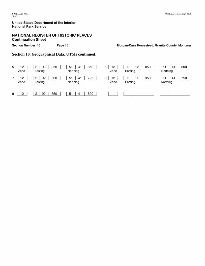
Section 10. Geographical Data, UTMs continued:
5 12 2 93 050 51 41 850 6 12 2 93 050 51 41 800
Zone
Easting
Northing
Zone
Easting
Northing
7 12 2 92 600 51 41 725 8 12 2 92 350 51 41 750 Zone
Easting
Northing
Zone
Easting
Northing
9 12 2 92 350 51 41 800
NPS Form 10-900-a OMB Approval No. 1024-0018 (8-86)
United States Department of the Interior National Park Service
NATIONAL REGISTER OF HISTORIC PLACES Continuation Sheet
Section Number 10 Page 16 Morgan-Case Homestead, Granite County, Montana
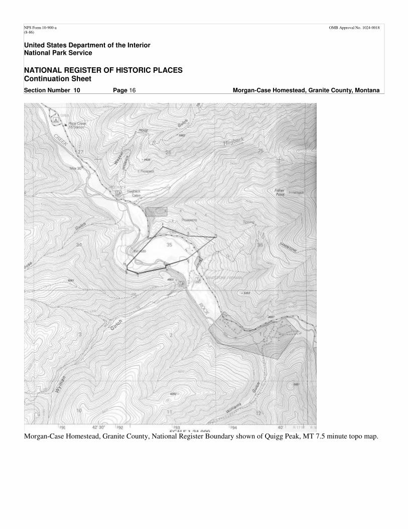
Morgan-Case Homestead, Granite County, National Register Boundary shown of Quigg Peak, MT 7.5 minute topo map.
NPS Form 10-900-a OMB Approval No. 1024-0018 (8-86)
United States Department of the Interior National Park Service
NATIONAL REGISTER OF HISTORIC PLACES Continuation Sheet
Section Number Additional Documentation Page 17 Morgan-Case Homestead, Granite County, Montana
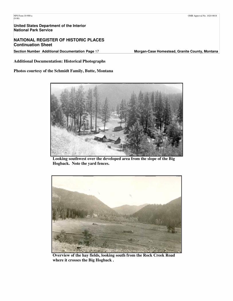
Additional Documentation: Historical Photographs
Photos courtesy of the Schmidt Family, Butte, Montana
Looking southwest over the developed area from the slope of the Big
Hogback. Note the yard fences.
Overview of the hay fields, looking south from the Rock Creek Road
where it crosses the Big Hogback .
NPS Form 10-900-a OMB Approval No. 1024-0018 (8-86)
United States Department of the Interior National Park Service
NATIONAL REGISTER OF HISTORIC PLACES Continuation Sheet
Section Number Additional Documentation Page 18 Morgan-Case Homestead, Granite County, Montana
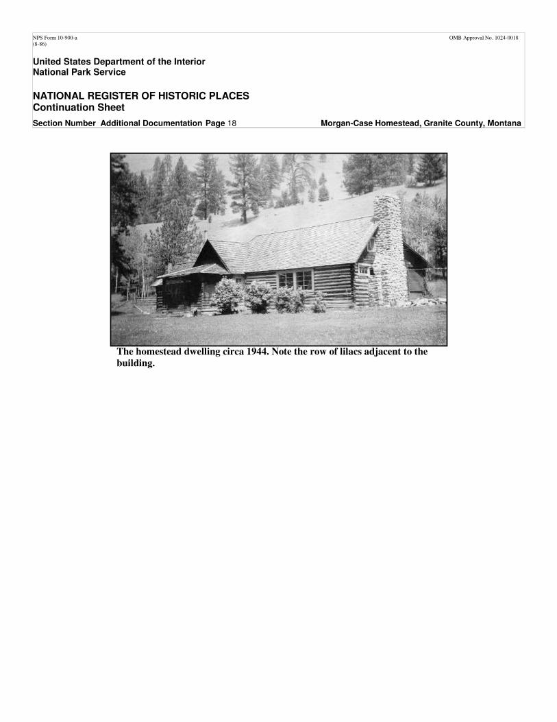
The homestead dwelling circa 1944. Note the row of lilacs adjacent to the
building.
NPS Form 10-900-a OMB Approval No. 1024-0018 (8-86)
United States Department of the Interior National Park Service
NATIONAL REGISTER OF HISTORIC PLACES Continuation Sheet
Section Number Additional Documentation Page 19 Morgan-Case Homestead, Granite County, Montana
NPS Form 10-900-a OMB Approval No. 1024-0018 (8-86)
United States Department of the Interior National Park Service
NATIONAL REGISTER OF HISTORIC PLACES Continuation Sheet
Section Number Additional Documentation Page 20 Morgan-Case Homestead, Granite County, Montana
NPS Form 10-900-a OMB Approval No. 1024-0018 (8-86)
United States Department of the Interior National Park Service
NATIONAL REGISTER OF HISTORIC PLACES Continuation Sheet
Section Number Additional Documentation Page 21 Morgan-Case Homestead, Granite County, Montana
NPS Form 10-900-a OMB Approval No. 1024-0018 (8-86)
United States Department of the Interior National Park Service
NATIONAL REGISTER OF HISTORIC PLACES Continuation Sheet
Section Number Additional Documentation Page 22 Morgan-Case Homestead, Granite County, Montana
NPS Form 10-900-a OMB Approval No. 1024-0018 (8-86)
United States Department of the Interior National Park Service
NATIONAL REGISTER OF HISTORIC PLACES Continuation Sheet
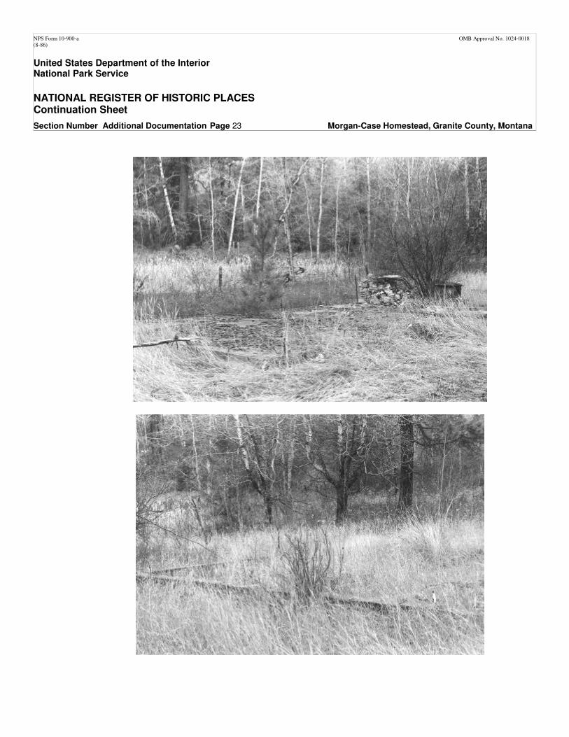
Section Number Additional Documentation Page 23 Morgan-Case Homestead, Granite County, Montana
NPS Form 10-900-a OMB Approval No. 1024-0018 (8-86)
United States Department of the Interior National Park Service
NATIONAL REGISTER OF HISTORIC PLACES Continuation Sheet
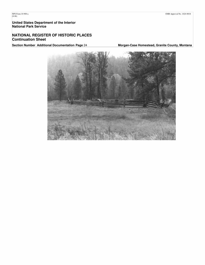
Section Number Additional Documentation Page 24 Morgan-Case Homestead, Granite County, Montana