national register of historic places registr … · national register of historic places registr...
TRANSCRIPT

1NPS Form 10-900
United States Department of the Interior National Park Service
OMI
NATIONAL REGISTER OF HISTORIC PLACES REGISTR VHPI/TORUf. II
This form is for use in nominating or requesting determination* of eligibility for individual propertiea or districts.National Register Forms (National Register Bulletin 16). Complete each item by marking "x" in the appropriate b> K or by enlHem does not apply to the property being documented, enter "N/A" for 'not applicable". For functions, styles,categories and mbcategories listed in the instructions. For additional space use continuation sheets (Form I0-900a). Type all entries. Use letter quality printers in 12pitch. Use only 25 % or greater cotton content bond paper.
DIVISION
1. Name of Property
historic name; Mantle's Caveother names/site number; 5MF1
2. Location
street S number; Dinosaur National Monument city, town; Dinosaur____________________
( } not for publication (XXI vicinity_________
state; CO code; CO county; Moffat code;081 zip code;81610
3. Classification
Ownership of Property
( ) private
( ) public-local
( ) public-State
(X) public-Federal
Category of Property
( ) building(s)
( ) district
(X) site
( ) structure
( ) object
Name of Related Multiple Property listing:
No. of Resources within Property Contributing Noncontributing
buildings
sites
35
37
structures
objects
Total
No. of contributing resources previously listed in the National Register 0_________

State/Federal Aaencv Certification
As the designated authority under the National Historic Preservation Act of 1966, as amended, I hereby certify that this (x) nomination ( ) request for determination of eligibility meets the documentation standards for registering properties in the National Register of Historic Places and meets the procedural and professional requirements set forth in 36 CFR Part 60. In my opinion, the property (x) meets ( ) does not meet the National Register criteria.
( ) See continuation sheet
Signature* of certifying official Date
I C* K*A/tr i^L"^/-ij i\( i f Lr1ral aState or Federal agency and bureau J
In my opinion, the property ( ) meets ( ) does not meet the National RegisterLa. _ f x ( ) See continuation sheet
Iftffe of Commenting or Other Official Date
_____Historic Preservation Office__________________________________State or Federal Agency and Bureau
5. National Park Service Certification_______________________________
I, hereby, certify that this property is:
(I/) entered in the National Register.( ) See continuation sheet _
( ) determined eligible for the National Register;( ) See continuation sheet _
/ &-/i> -;
( ) determined not eligible for the National Register.
{ ) removed from the National Register.
( ) other (explain): _______________
Signature of the Keeper Date

6. Functions or Use
Historic Functions Current Functions(enter categories from instructions) (enter categories from instructions)
Agriculture/Subsistence — Storage Recreation and Culture___________Domestic — Secondary Structure_____ ______________________________
7. Description
Architectural Classification Materials(enter categories from instructions) (enter categories from instructions)
foundations ____________________ Aboriginal_________._____________ walls Earth____________________
Stone - sandstone roof ______________ other _______________
Describe present and historic physical appearance.
(XX) See continuation sheet

8. Statement of SignificanceCertifying official has considered the significance of this property inrelation to other properties: ( ) nationally (X) statewide ( )locallyApplicable National Register Criteria ( ) A ( ) B ( ) C (X) DCriteria Considerations (Exceptions) ()A()B()C()D()E()F()G
Areas of Significance(enter categories from instructions) Period of Significance SignificantDatesArchaeology - Prehistoric_____ Formative__________ A.D. 400-1300
Cultural Affiliation Fremont__________
Significant Person Architect/BuilderN/A___________________________ N/A__________________
State significance of property, and justify criteria, criteria considerations, and areas and periods of significance noted above.
(XX) See continuation sheet
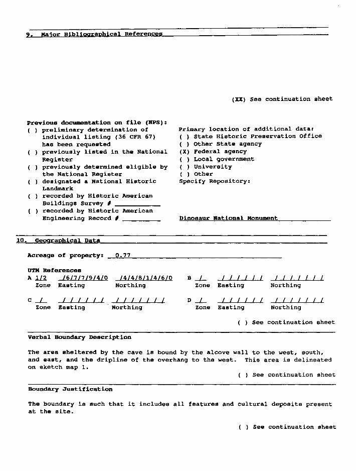
9. Maior Bibliographical Referencea
(XX) See continuation sheet
Previous documentation on file (NFS): ( ) preliminary determination of
individual listing (36 CFR 67)has been requested
( ) previously listed in the NationalRegister
( ) previously determined eligible bythe National Register
( ) designated a National HistoricLandmark
( ) recorded by Historic AmericanBuildings Survey # _________
( ) recorded by Historic AmericanEngineering Record # ________
Primary location of additional data:( ) State Historic Preservation Office( ) Other State agency(X) Federal agency( ) Local government( ) University( ) OtherSpecify Repository:
Dinosaur Rational Monument
10. Geographical Data
Acreage of property: 0.77
0TH ReferencesA 1/2 /6/7/7/9/4/0 /4/4/8/1/4/6/0
Zone Easting Northing
c / I I I I I IZone Easting
I I I I I I I Northing
B / I I I I I IZone Easting
D / I I I I I IZone Easting
Northing
Northing
( ) See continuation sheet
Verbal Boundary Description
The area sheltered by the cave is bound by the alcove wall to the west, south, and east, and the dripline of the overhang to the west. This area is delineated on sketch map 1.
( ) See continuation sheet
Boundary Justification
The boundary is such that it includes all features and cultural deposits present at the site.
( ) See continuation sheet

11. Form Prepared By
Name/Title: Jonathon C. Horn and Alan D. Reed/Principal Investigators______Betty LeFree, Staff Archeologist, & Adrienne Anderson, Regional Archeologist, Rocky Mountain Region, National Park Service
Organization: Alpine Archaeological Consultants. Inc. Date: 09-01-1989______
Street & Number: P. O. Box 521_________________ Telephone: (3031 249-6761
City or Town: Montrose_______________________ State: CO Zip Code: 81402

NFS Form 10-900a
United States Department of the Interior National Park Service
NATIONAL REGISTER OF HISTORIC PLACES CON
Section number Page
413
flNUA
DIVISION
Mantle's Cave, 5MFI, ia located in the southweTownship 6 North, Range 102 West, in Moffat County, Colorado, approximately 14 Km (9 miles) west of the Utah border. It is a north-facing alcove situated 450 m (1476 ft.) south of the Yampa River, a major tributary to the Green River. In the vicinity of the site, the Yampa River is deeply entrenched, being approximately 137 m (450 ft.) lower than the top of a large structural bench immediately south of Mantle's Cave. The bench generally parallels the river and is about 1.6 km (1 mile) wide near the site. Mantle's Cave is situated just below the rim of this bench, south of the river, in the Permian and Pennsylvanian-aged Weber sandstone.
The canyon bottom is comparatively wide in the vicinity of the site and has been given the name Castle Park. While portions of Castle Park are now cultivated, much remains covered by big sagebrush. Cliff Canyon, in which site 5MF1 is located, is a narrow, steep-sided box canyon. The canyon floor is heavily forested with boxelder and chokecherry trees. The bench above the site is in a pinyon and juniper woodland with sagebrush parks.
Access to the site is by way of either the Yampa River or the Yampa Bench Road, a dirt road that passes less than 100 m (328 ft.) from the top of the alcove. This road runs east from the Dinosaur National Monument's paved Harpers Corner road, and provides access to Echo Park and ultimately Elk Springs, Colorado. The site is not easily accessible from the road, however, as a cliff must first be negotiated.
Mantle's Cave measures 100 m east to west and extends approximately 40 m from the back of the alcove to the dripline. Approximately 3140sq. m are encompassed within the site area. The ceiling is quite high, and the floor is basin-shaped and mostly gently sloping. The floor's configuration is largely due to the presence of a large talus cone at the front of the alcove. This feature is steeply sloping and rises 7 m above the central portion of the alcove floor. The alcove floor, except for the extreme western end, consists of unconsolidated, yellowish sandy soil and sandstone rocks of various sizes which have fallen from the alcove ceiling. No artifacts and very little charcoal and ash are visible on the floor surface, but burned and unburned animal bones and a few unburned corncobs are scattered about. At least six dune-like excavation backdirt piles and several rock piles left from archaeological excavations are present within the alcove. The backdirt piles are made more prominent because adjacent excavation units have not been backfilled.
In the western end of the alcove, surface soils are composed of consolidated brown silts. A large remnant of this silty soil forms a pedestal against the nearby vertical alcove wall, towering a maximum of 3.4 m above the surrounding alcove floor. The soil pedestal is dry, but adjacent to the east is a small erosional channel, formed by water running down the alcove wall. It appears that the sediments forming the silt pedestal were deposited by water behind a slab of rock, no longer present, where they became consolidated.

NFS Form 10-900a OMB No. 1024-0018
United States Department of the Interior ~ National Park Service
NATIONAL REGISTER OF HISTORIC PLACES CONTINUATION SHEET
Section number 7 Page 1
Mantle's Cave, 5MFI, is located in the southwest quarter of Section 18, Township 6 North, Range 102 West, in Moffat County, Colorado, approximately 14 km (9 miles) west of the Utah border. It is a north-facing alcove situated 450 m (1476 ft.) south of the Yampa River, a major tributary to the Green River. In the vicinity of the site, the Yampa River is deeply entrenched, being approximately 137 m (450 ft.) lower than the top of a large structural bench immediately south of Mantle's Cave. The bench generally parallels the river and is about 1.6 km (1 mile) wide near the site. Mantle's Cave is situated just below the rim of this bench, south of the river, in the Permian and Pennsylvanian-aged Weber sandstone.
The canyon bottom is comparatively wide in the vicinity of the site and has been given the name Castle Park. While portions of Castle Park are now cultivated, much remains covered by big sagebrush. Cliff Canyon, in which site 5MF1 is located, is a narrow, steep-sided box canyon. The canyon floor is heavily forested with boxelder and chokecherry trees. The bench above the site is in a pinyon and juniper woodland with sagebrush parks.
Access to the site is by way of either the Yampa River or the Yampa Bench Road, a dirt road that passes less than 100 m (328 ft.) from the top of the alcove. This road runs east from the Dinosaur National Monument's paved Harpers Corner road, and provides access to Echo Park and ultimately Elk Springs, Colorado. The site is not easily accessible from the road, however, as a cliff must first be negotiated.
Mantle's Cave measures 100 m east to west and extends approximately 40 m from the back of the alcove to the dripline. Approximately 3140sg. m are encompassed within the site area. The ceiling is quite high, and the floor is basin-shaped and mostly gently sloping. The floor's configuration is largely due to the presence of a large talus cone at the front of the alcove. This feature is steeply sloping and rises 7 m above the central portion of the alcove floor. The alcove floor, except for the extreme western end, consists of unconsolidated, yellowish sandy soil and sandstone rocks of various sizes which have fallen from the alcove ceiling. No artifacts and very little charcoal and ash are visible on the floor surface, but burned and unburned animal bones and a few unburned corncobs are scattered about. At least six dune-like excavation backdirt piles and several rock piles left from archaeological excavations are present within the alcove. The backdirt piles are made more prominent because adjacent excavation units have not been backfilled.
In the western end of the alcove, surface soils are composed of consolidated brown silts. A large remnant of this silty soil forms a pedestal against the nearby vertical alcove wall, towering a maximum of 3.4 m above the surrounding alcove floor. The soil pedestal is dry, but adjacent to the east is a small erosional channel, formed by water running down the alcove wall. It appears that the sediments forming the silt pedestal were deposited by water behind a slab of rock, no longer present, where they became consolidated.

Form 10-900a OMB No. 1024-0018
United States Department of the Interior National Park Service
NATIONAL REGISTER OF HISTORIC PLACES CONTINUATION SHEET
Section number 7 Page 2
Mantle's Cave is reportedly the largest rockshelter in the Castle Park area (Scoggin 1941b:5) and has long had numerous visible prehistoric features. These attributes have attracted many individuals to investigate the site. According to Burgh and Scoggin (1948), Mr. and Mrs. Charles Mantle, of the nearby Mantle Ranch in Castle Park, were the first to discover the site some time prior to 1921. Mrs. Mantle reportedly excavated portions of the site (Brown 1937). In 1933, the Penrose-Taylor Expedition, a joint venture by Colorado College and the Fountain Valley School, explored the Yampa Canyon for prehistoric ruins and visited Mantle's Cave (Brown 1937). The site was designated "Cave One," and four "sites," designated A, B, C, and D, were defined therein. Site A was described as a cluster of four rock-lined cists abutting sandstone boulders in the central part of the alcove. These are still visible as Features 37-40. Site B was made up of two granaries thought to represent Features 27 and 28. Sites C and D were thought to represent possible "house sites." Site C, a large mound east of Site A, was trenched to a depth of over 1 m. Only one buried flake was found (Brown 1937). Site D, a depression southwest of Site A, was investigated via two test pits. Several sherds of undecorated pottery were found (Brown 1937). Basketry, buckskins, corn, and squash were recovered by the Penrose-Taylor Expedition in the alcove deposits (Burgh and Scoggin 1948). In 1939, two individuals found a basket in the Mantle's Cave containing fishhooks, snares, and netting (Burgh and Scoggin 1948).
The University of Colorado Museum conducted extensive excavations at Mantle's Cave in 1939 and 1940. The project, directed by Charles Scoggin, excavated approxi mately 530 sq. m or roughly 17% of the site area (Map 3). The excavations incorpo rated all visible features and focused upon the cist cluster in the western end of the site, the area near the alcove wall in the central portion of the site, and low- lying areas in the central and eastern portion of the site. Additionally, several excavation units were scattered about other areas of the site. Most of the excava tion units were contiguous, however, and were oriented in relation to a grid system comprised of 5-foot units. Reference points for the grid system are still visible, painted on the back of the alcove wall.
The excavators discovered that most of the cave site deposits were shallow, generally between 15 and 38 cm deep (Burgh and Scoggin 1948). Deeper soils, some charcoal-stained, were found in two exploratory units, but these failed to yield clear evidence of age or origin (Burgh and Scoggin 1948). The University of Colorado Museum excavators found little remaining in the storage features. General cist fill included such items as cedar bark, loose corn kernels, corn husks, a burden basket, basketry fragments, matting, a buckskin pouch, two untanned buckskin strips with the dewclaws attached, and pieces of feathers. A one-inch deep layer of dried and pulverized insects was found in Feature 23, a basket fragment came from Feature 35, three buckskin "sandals" were found in Feature 36, and charred corncobs were recovered in the vicinity of Features 37-40 (Scoggin 1939-40).
The most significant discoveries were made elsewhere in the cave deposits, generally in shallow holes probably representing temporary caches. Artifacts included lithic flakes, a cache of chipped stone blades, several projectile points, chert drill, scrapers, pottery, manos or rubbing stones, a mano, a sandstone metate or paint palette, a bone projectile point, bone awls, a hafted bone awl, other J^fr

Form 10-900a OMB No. 1024-0018
United States Department of the Interior National Park Service
NATIONAL REGISTER OF HISTORIC PLACES CONTINUATION SHEET
Section number 7 Page 3
modified bone items and tools, bison bone, rodent bones, a small bundle of bone, bone and juniper berry beads, pinyon nuts, ears of corn, corn kernels, corn husks, a black bean, squash or gourd rinds, pumpkin shell, wild grass seeds, fruit seeds, a quid of pine resin, basketry fragments, matting of "cane," a grass mat, a cedar bark mat, a willow pole mat, cordage, cedar bark rope, cordage game snare, a hide pouch, buckskin, moccasins, human hair, gaming pieces, slate dice, digging sticks, a rye grass medicine bag, a grass-lined twine bag, a cedar bark robe, part of a reed cradle, arrow shaft fragments, a wood fire drill fragment, fishhooks, yellow and red ocher, a talon from a large bird, feathers, porcupine quills, a rodent tail brush, rabbit . fur cloth, a deer antler gouge, and a sheep horn wrench. The most spectacular find was a ceremonial bag containing a feathered headdress, a "butterfly" pendant, slate beads, a quartzite blade, feather bundles, grass twine, a buckskin thong, an obsidian flake, a corn kernel, a bean, and several unidentified objects (Scoggin 1939-40).
Analysis of the Mantle's Cave materials was interrupted by World War II. Charles Scoggin was unfortunately killed in the war effort. In 1947 and 1948, Robert Burgh of the University of Colorado Museum returned to the site for limited test excavations. A test pit was dug in the center of the cave to explore lower levels of occupation. It revealed only noncultural sand and silt deposits. A unit in the eastern portion of the cave revealed a storage pit and mano 38 cm below the 1940 level of excavation. The storage pit and mano were determined to be similar to Fremont varieties (Burgh 1948).
Fifty-four prehistoric cultural features have been documented in Mantle's Cave (Map 1). Of this number, 36 are still visible, the others having been destroyed or covered over by sandy soils. All but one of the features can be classified as stor age cists. The cists are scattered throughout the alcove, except for the eastern end, where none occur. A very high concentration is present in the small pedestal of consolidated silt at the western extreme of the site (Map 2). Over 30 cists were uncovered in this 20 m2 area. Only 26 can be discerned today. The one prehistoric cultural feature which is not a storage cist is a small rock art panel located near the east end of the cave. While the features are an integral part of the site, the cave itself and the area around the features are considered as one contributing element. (Table 1 indicates the contributing and non-contributing elements at the site.)

NFS Form 10-900a 0MB No. 1024-0018
United States Department of the Interior National Park Service
NATIONAL REGISTER OF HISTORIC PLACES CONTINUATION SHEET
Section number Page
Table 1. Contributing and Non-Contributing Site ElementsAll features are storage cist, except RA-2, a prehistoric rock are panel, and
historic inscriptions.
NPS
Feature No.
12345678910111213141516171819202122232425262728293234353637M-l Upright
Contributing Non-Contributing
XXXXXXXXXXXXXXXXXXXXXXXXXXXXXXXXXX
sand stone slabs XRA-1 Historic inscription RA-2 Prehistoric rock art RA-3 Faint lines/cultural RA-4 Historic inscription RA-5 Historic inscription RA-6 Historic inscription
X X X X

Form 10-900a OMB No. 1024-0018
United States Department of the Interior National Park Service
NATIONAL REGISTER OF HISTORIC PLACES CONTINUATION SHEET
Section number 7 Page 5
The cists can be classified into two general types: subfloor earthen cists and rock-lined cists. The earthen cists are quite common, comprising all of the cists in the cluster at the site's western extreme and an unknown number in the main alcove (see Scoggin 1941a). At present, no earthen cists are visible in the main alcove. Earthen cists were constructed by digging into consolidated soils with a digging stick to form straight-sided to slightly bell-shaped pits. Digging stick marks are still evident in the walls of some cists in the western cluster. The earthen cists are variable in size, ranging from approximately 20 cm to 70 cm in diameter and from a few centimeters to 90 cm in depth. Some earthen cists have light reddish-brown (Munsell 5YR6/4) mud coping around the rim, presumably to permit a snug fit for stone cist covers. The mud coping contrasts dramatically with the consolidated brown silty soil into which the cists were excavated. Some of the cist walls were once plastered with this reddish—brown mud (Burgh and Scoggin 1948), but no plaster remains.
The rock-lined cists in the main site area are constructed of both coursed masonry and vertical sandstone slabs. Some are built on or adjacent to large sandstone boulders, while others are excavated into the unconsolidated sandy soils. All of the coursed masonry cists and most of the vertical slab cists have liberal amounts of light reddish-brown mud mortar between the stones, probably to make the features relatively rodent-proof. Many of the masonry cists constrict at the top to facilitate covering. Excavation revealed that the mud coping around the rims of some of the masonry cists often had basket impressions on the interiors, indicating that inverted baskets served as covers. The central portions of these baskets, the bottom portion, were evidently removed, so that access into the cist was via a small hole that could be covered by a light stone (Scoggin 1941a). One very large masonry cist, situated on a flat boulder (Feature 28), was associated with a removable cover consisting of a stick lattice covered by reddish-brown mortar (Brown 1937).
Archaeological materials recovered by previous researchers suggest that the components associated with the cists represent a Fremont culture occupation. Considerable quantities of corn were found during the excavations along with other cultigens, indicating a Formative Stage lifeway. The upper 10 cm of soil yielded a small number of undecorated grayware ceramics which appear to represent Fremont varieties. Fremont components are well-documented in other areas within Dinosaur National Monument (e.g., Breternitz 1970).
The Fremont appear to have utilized Mantle's Cave primarily for storage. Habitation structures and prepared hearths are absent, and charcoal and ash is not abundant (Scoggin 1941b). Debitage, a common constituent of habitation sites, is not present on the surface of the cave and was found only occasionally during the excavations (Scoggin 1939-40). Only one flake is mentioned in excavation reports (Brown 1937). No midden is present (Scoggin 1941b). As mentioned, few ceramic sherds have been recovered. That intensive, long-term habitation evidently did not occur during the Fremont occupation may be a result of the site's northern exposure. At an elevation of 1636 m (5365 ft.), the site is quite cool, even during the summer months. There is no season when sunlight reaches the main portion of the alcove.

Form 10-900a OMB No. 1024-0018
United States Department of the Interior National Park Service
NATIONAL REGISTER OF HISTORIC PLACES CONTINUATION SHEET
Section number 7 Page 6
In addition to the site's Fremont component, there are hints of a deeply buried, older component. While cave deposits average only approximately 38 cm in depth (Scoggin 1941), deep excavations in the western portion of the main alcove revealed a. charcoal-stained lens with burned animal bone approximately 61 cm below the base of a surficial cist. No artifacts were found in this level. Investigation of this stratum was not extensive, however, because of the large quantity of overburden (Burgh and Scoggin 1948).
Features 1 Through 26
Features 1 through 26 are presently visible and are located in the silt deposits at the western end of the site. The silt is consolidated, permitting the construction of earthern cists. Features 1, 8, 9, 10, 11, and 15 were stabilized in 1989.
Feature 1
Feature 1 is the most westerly of all site features. Its location is especially notable because it is situated atop a silt pedestal 3.4 m above the alcove floor. It is constructed by simple excavation of the consolidated soil and has a wattle and daub cope around the rim. The cope extends around 4/5 of the rim diameter. The cist is 25 cm deep and has very little fill remaining. At the rim, the cist measures 27 cm by 22 cm with a maximum inside diameter of 36 cm.
Feature 2
Feature 2 is located 1.5 m southeast of Feature 1 at the base of the pedestal on which Feature 1 is built. It is roughly 2 m lower in elevation. Feature 2 is a simple earthen pit with slightly flaring sides. At the rim, it measures 30 cm in diameter. Maximum inside diameter is 52 cm. The feature is 45 cm deep, with approximately 5 cm of unconsolidated sandy fill. No coping is present. The upper portion of the feature has eroded with major damage occurring in the southeast quarter where the wall has been reduced to the cist floor level. This damage is the result of site visitors using the edge of the cist as a step to provide access to the eye-catching Feature 1.
Feature 3
Feature 3 is located approximately 0.6 m south of Feature 2. The earthen cist is irregular in shape, possibly due to deterioration caused by pedestrian traffic. An entrenched trail measuring 30 cm wide and 30 cm deep extends downslope of the feature. The cist measures 80 cm by about 1 m and is about 70 cm in depth, including approximately 10 cm of sandy fill. No coping is present.
Feature 4
Feature 4 is situated northeast of Feature 3, not far from Feature 1, on the edge of the silt pedestal. The earthen cist measures approximately 53 cm in diameter and is 45 cm deep, with an additional 9 cm of sandy fill below that.

Form 10-900a OMB No. 1024-0018
United States Department of the Interior National Park Service
NATIONAL REGISTER OF HISTORIC PLACES CONTINUATION SHEET
Section number 7 Page 7
While no coping is present around the rim, chunks of reddish-brown mud can be observed in the feature fill, suggesting that it once was coped. In two places, light gray clay has been used to plug holes in the cist wall.
Feature 5
Feature 5 is bisected by a small trail that cuts through the northern portion of the cist cluster. Dimensions are difficult to ascertain because of previous damage, but it ia estimated to have once measured 80 cm in diameter. Maximum depth is 60 cm. Like most of the other ciats in this cluster, it contains relatively little fill. No coping is present.
Feature 6
Feature 6 is a large and generally well-preserved earthen cist located in the central portion of the cist cluster. At the top, the cist measures 75 cm by 70 cm. Halls flare slightly in profile. The cist is approximately 90 cm deep and has an additional 10 cm of soil in the bottom. The northeast wall haa been broken down by foot traffic to within 20 cm of the top of the cist fill, resulting in a gap about 45 cm wide.
Feature 7
Feature 7 is located approximately 70 cm southwest of Feature 6. It is 45 cm in diameter and 20 cm deep, with an additional 6 cm of loose soil in the bottom. The earthen walls of the feature are slightly bell-ahaped. The fill of the cist contains numerous fragments of reddish-brown wattle and daub coping, but none remains in original context.
Feature 8
Feature 8 is located in the midst of the cist group adjacent to the southwest of Feature 7. It measures 30 cm in diameter and is 10 cm deep with an additional 5 cm of loose soil in the bottom. It has straight walla in which digging stick impressions are still in evidence. Two fragments of reddish-brown coping are present in the fill, but it could not be determined whether these are associated with this feature or an adjacent feature.
Feature 9
Feature 9 is located in the northern portion of the cist complex, 1.55 m from the alcove wall. The earthen cist is "D"-shaped, somewhat flattened on the western side. It measures 31 cm by 26 cm at the top and flares out to approximately 44 cm in diameter in the interior. The feature is 50 cm deep with an additional 5 to 10 cm of sandy fill in the bottom. Coping extends around approximately 1/5 of the rim, located on the northeast side. This may represent all of the coping ever incorporated into the feature. Digging stick impressions are evident in the cist wall.

Form 10-900a OMB No. 1024-0018
United States Department of the Interior National Park Service
_ _ __ __._.,_IUATION SHEET
Section number 7 Page 8
Feature 10
Feature 10, located in the central portion of the cist cluster, is an earthen cist with a 36 cm rim diameter. The cist interior flares slightly to a diameter of 41 cm. The feature is 45 cm deep and has an additional 5 cm of loose soil and reddish-brown mud in the bottom. The feature's rim is partially lined with reddishbrown mud. One segment of coping on the southwest edge measures 13 cm in length and another on the eastern edge measures 26 cm in length. These segments combine to encircle approximately 1/5 of the rim's diameter. A sandstone rock is located adjacent to the top of the cist and may represent a cist cover.
Feature 11
Feature 11 is an earthen cist located in the central portion of the cist cluster. It measures 43 cm in diameter and is 40 cm deep. An additional 3 cm to 5 cm of fill cover the cist floor. Digging stick impressions are evident in the walls. A segment of coping, 13-cm-long, is present that serves both Features 11 and 15.
Feature 12
Feature 12 is located northwest of Feature 11, approximately 80 cm from the alcove wall. It is quite small, measuring 21 cm by 17 cm at the top. The feature is 37 cm deep and has an additional 7 cm of loose soil in the bottom. Digging stick impressions are visible in the cist wall. Except for a chunk of reddish-brown mud in the fill, no coping is evident.
Feature 13
Feature 13 abuts the alcove wall. The "D"-shaped earthen cist measures 33 cm along its long axis and is presently 13 cm deep. It is filled with 5 cm of sandy soil. No coping is present, though there are a few chunks of coping material in the feature's fill.
Feature 14
Feature 14 is located east of Feature 13 near the alcove wall. It measures approximately 65 cm in diameter and is 37 cm deep with an additional 6 cm of loose fill in the bottom. No coping is evident on the rim, but several large chunks are present in the cist fill.

Form 10-900a OMB No. 1024-0018
United States Department of the Interior National Park Service
NATIONAL REGISTER OF HISTORIC PLACES CONTINUATION SHEET
Section number 7 Page 9
Feature 15
Feature 15 is located in the midst of the cist cluster, just east of Feature 14. The earthen cist La 26 cm in diameter at the top, expanding to 38 cm in diameter in the interior. It measures 43 cm deep and has 3 cm of soil accumulation on the cist floor. Three segments of reddish-brown mud coping are present along the rim, covering approximately 2/3 of the diameter. Only one section of coping, about 15 cm in length, is missing.
Feature 16
Feature 16 is located adjacent to the east of Feature 15. The earthen cist is not coped. It measures 51 cm by 45 cm and is 19 cm deep. Approximately 3 cm of fill is on the cist floor. Digging stick impressions are evident in one wall.
Feature 17
Feature 17 is an earthen cist measuring 45 cm by 55 cm. It is adjacent to Feature 18 and the wall between the two features has collapsed. The cist is 26 cm deep with an additional 6 cm of fill in the bottom. No coping is evident.
Feature 18
Feature 18 is located adjacent to and east of Feature 17 near the trail that skirts around the cist cluster. It measures 28 cm in diameter and is 26 cm deep. Probing indicates that it is filled with approximately 16 cm of loose, sandy soil. No evidence of coping was noted.
Feature 19
Feature 19 is located adjacent to the trail in the central portion of the cist cluster. Use of the trail has broken down the northeastern wall, resulting in par tial obliteration of the feature. The cist probably measures about 70 cm in diame ter. The distance between the top of the intact wall and the top of the cist fill is 35 cm. Probing indicates that the bottom of the cist contains 19 cm of fill. No coping is evident.
Feature 2O
Feature 20 is located in the southern portion of the cist cluster, south of Feature 17. The earthen cist measures 50 cm in diameter and is 45 cm deep. An additional 17 cm of fill covers the cist floor. Cist walls are slightly bell- shaped. No evidence of coping was observed.
Feature 21
Feature 21, an earthen cist, is located west of Feature 20 in the southern portion of the cist cluster. It measures 39 cm in diameter and is 20 cm deep with an additional 6 cm of fill in the bottom. Approximately 20 cm of the northern wall is broken down between it and Feature 22. No coping is evident.

Form 10-900a OMB No. 1024-0018
United States Department of the Interior National Park Service
NATIONAL REGISTER OF HISTORIC PLACES CONTINUATION SHEET
Section number 7 Page 10
Feature 22
Feature 22 is northwest of Feature 21, within 1 m of the alcove wall. The earthen cist measures 40 cm in diameter and is 35 cm deep with an additional 5 cm of sandy fill in the bottom. No coping is present.
Feature 23
Feature 23 is adjacent to the alcove wall in the southern portion of the cist cluster. The earthen cist is "D"-shaped, with the alcove wall forming the flat side. The feature measures 45 cm by 23 cm. Soil fill measures approximately 16 cm with wall height to the top of the fill only 3 cm. The cist has not been impacted by pedestrians because of its proximity to the alcove wall.
Feature 24
Feature 24, situated in the southern portion of the earthen cist cluster, measures 40 cm in diameter around the rim. The feature is somewhat bell-shaped with a maximum interior diameter of 55 cm. From the top of the cist to the top of the cist fill, measures 30 cm. Probing indicated the presence of about 10 cm of sandy fill in the bottom of the cist. A 25-cm-wide section of the eastern (downslope) wall has collapsed due to foot traffic. More deeply buried portions of this wall may still be intact, however. No evidence of coping was observed.
Feature 25
Feature 25 is located along the alcove wall in the southern portion of the cist cluster. The earthen storage pit is oblong in shape and measures 40 cm by 25 cm. The cist is presently almost completely filled with sediments. Probing suggests that the feature's floor is buried beneath 15 cm of fill.
Feature 26
Feature 26 is located along the alcove wall at the southern end of the earthen cist cluster. Only the northwestern wall of the cist remains, due to impacts of foot traffic. The feature probably measured about 45 cm in diameter at the top and was about 40 cm deep.
Features 27 Through 40
Features 27 through 40 are all located in the main alcove area. All are rocklined cists, visible as either definite cultural features or rubble from deteriorated features. The unconsolidated soil in this portion of the site has obliterated many earthen cists. Features 27, 32, 35, 36, 37, 38, and 40 required stabilization work to varying degrees in 1989.

Form 10-900a OMB No. 1024-0018
United States Department of the Interior National Park Service
NATIONAL REGISTER OF HISTORIC PLACES CONTINUATION SHEET
Section number 7 Page 11
Feature 27
Feature 27 is a masonry storage cist located near the alcove wall near the University of Colorado's grid reference point "F." Only the western half of the cist remains. It originally may have measured approximately 50 cm in diameter. The remaining wall stands six courses high, the lower portion of which is covered with sediment for support. The wall is simple (i.e. one stone's thickness) and averages 14 cm wide. Stones are small and unshaped and are held together by liberal amounts of reddish-brown mortar.
Feature 28
Feature 28 is located on top of a huge sandstone boulder near the alcove wall near the University of Colorado's grid reference point "J." The feature measures 1.14 by 1.18 m on the interior. It consists of a simple, circular masonry wall that averages 20 cm in width. Sandstone building blocks are unshaped and are held together by copious amounts of reddish-brown mortar.
At its highest point the wall is 50 cm high and comprises four courses. While only a single course remains at the south end, the feature is in excellent condition. Fragments of a wattle and daub cist cover were excavated here, but no evidence remains.
Feature 29
This slab-lined cist is situated in a small crawl-space in the back of the alcove south of the "J" reference point painted on the alcove wall. Feature 29 measures 40 cm by 60 cm and is presently 35 cm deep. Depth of fill could not be determined. The cist is composed of five unmortared sandstone slabs.
Feature 30
Feature 30, as indicated on a map of excavations (Burgh and Scoggin 1948:23), is located against the alcove wall near the grid reference point "T." It presently consists of nine sandstone cobbles and boulders scattered about a small sandstone ledge in a 1.3 by 0.65 m area. No patterning of rock is evident and no mortar is present. The feature appears to have been destroyed.
Feature 31
Feature 31, as indicated by Burgh and Scoggin (1948:23), is located about 75 cm from the alcove wall out from the "T" grid reference point. It consists of eight sandstone boulders grouped on and between two large sandstone boulders. No mortar is present and no patterning of rock can be discerned. The feature appears to have been destroyed.

Form 10-900a OMB No. 1024-0018
United States Department of the Interior National Park Service
NATIONAL REGISTER OF HISTORIC PLACES CONTINUATION SHEET
Section number 7 Page 12
Feature 32
Feature 32 is located several meters from the alcove wall outward from the grid designator "T." It consists of a mortarless slab-lined cist, rectangular in shape, measuring 53 cm by 50 cm. All but the western side are made up of single, vertical sandstone slabs. The western side has been broken down and contains only one original rock. The vertical slabs protrude a maximum of 20 cm above the alcove floor and 30 cm above the cist fill.
Feature 33
Feature 33 was determined to be noncultural.
Feature 34
Feature 34 located by Burgh and Scoggin (1948:23) several meters outward from the grid reference point "V." It presently consists of three fallen sandstone slabs and a chunk of reddish-brown mortar. The size or shape of the feature could not be determined. The feature has apparently been destroyed.
Feature 35
Feature 35 is a rock-lined cist located at the base of the large talus cone near the front of the alcove. It shares a common wall with Feature 36, located adjacent to the northwest. Feature 35 is composed of vertical sandstone elabs and coursed masonry. Vertical sandstone slabs form the base of the feature. These are overlapped by smaller slabs mortared into place forming a conical- shaped feature. Presently, only a maximum of three courses remain. The cist is 65 cm in diameter and 40 cm deep with an additional 7 cm of loose sandy soil in the bottom. Probing the cist fill suggests a slab bottom.
Feature 36
Feature 36 is located adjacent to the north of Feature 35. It is constructed in the same fashion as Feature 35, with vertical sandstone slabs forming the base of the cist walls onto which smaller sandstone blocks are set. The cist measures 80 cm in diameter and is filled with approximately 20 to 30 cm of fill.
Feature 37
Feature 37 is located in the eastern portion of the alcove in a cluster of four cists adjacent to two large sandstone boulders. Feature 37 is the southernmost of the cists in this cluster. It consists of vertical sandstone slabs mortared together and incorporates two naturally occurring boulders as walls. The cist measures 70 cm by 80 cm and is a maximum of 47 cm deep.

Form 10-900a OMB No. 1024-0018
United States Department of the Interior National Park Service
NATIONAL REGISTER OF HISTORIC PLACES CONTINUATION SHEET
Section number 7 Page 13
Feature 38
Feature 38, a rock-lined cist, is located on the opposite side of a large boulder from Feature 37. It is constructed of coursed sandstone and mortar and incorporates three naturally occurring boulders. The eastern side consists of long (12 by 55 cm) rocks stacked in three courses and liberally mortared with reddish-brown mud. The wall spans the boulders and stands 32 cm above the cist fill. On the north side of the cist, a long rock has been mortared onto the side of a boulder, providing support for the placement of a cist cover. The feature is narrower at the top than in the middle.
Feature 39
Feature 39 is 1.1 m west of Feature 38 on the other side of a large boulder. It is a slab-lined cist measuring 65 cm in diameter. From the top of the slabs to the fill measures 30 cm. The feature's north half is composed of naturally occurring boulders, one vertical sandstone slab, and two coursed and mortared rocks. The courses are set inward slightly with the upper course angled to reduce the rim diameter. The southern half of the feature has collapsed.
Feature 40
Feature 40 is located at the northern end of the cluster of four cists. It incorporates a large boulder as its eastern wall. The remaining walls are constructed entirely of large vertical sandstone slabs. The slabs extend approximately 40 cm above the alcove floor.
Features 41 Through 45
Features 41 through 45 were located around the perimeter of the cluster of earthen cists in the western end of the site. While indicated on an excavation site map (Burgh and Scoggin 1948:23), they are no longer visible.
Features 46 Through 53
These feature designations refer to earthen and possibly rock-lined cists excavated in the main alcove area by the University of Colorado that are no longer evident on the ground surface.
Feature M-l
Feature M-l is an easily visible and rather large arrangement of rock that fails to appear on Burgh and Scoggin's (1948:23) thorough site map. It consists of four large upright sandstone slabs measuring 75 cm by 65 cm. The tallest slab is 70 cm high. No floor is discernible and no mortar is present (Figure 3-31). The feature may be one of the features initially investigated by Mrs. Mantle.
Form 10-900a OMB No. 1024-0018
United States Department of the Interior National Park Service
NATIONAL REGISTER OF HISTORIC PLACES CONTINUATION SHEET
Section number 7 Page 14
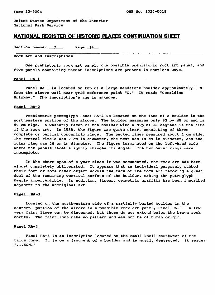
Rock Art and Inscriptions
One prehistoric rock art panel, one possible prehistoric rock art panel, and five panels containing recent inscriptions are present in Mantle's Cave.
Panel RA-1
Panel RA-1 is located on top of a large sandstone boulder approximately 1 m from the alcove wall near grid reference point "6." It reads "Geraldine Brickey." The inscription's age is unknown.
Panel RA-2
Prehistoric petroglyph Panel RA-2 ia located on the face of a boulder in the northeastern portion of the alcove. The boulder measures only 83 by 80 cm and is 49 cm high. A westerly facet of the boulder with a dip of 38 degrees is the site of the rock art. In 1988, the figure was quite clear, consisting of three complete or partial concentric rings. The pecked lines measured about 1 cm wide. The central circle was 7 cm in diameter, the next was 18 cm in diameter, and the outer ring was 26 cm in diameter. The figure terminated on the left-hand side where the panels facet slightly changes its angle. The two outer rings were incomplete.
In the short span of a year since it was documented, the rock art has been almost completely obliterated. It appears that an individual purposely rubbed their foot or some other object across the face of the rock art removing a great deal of the remaining cortical surface of the boulder, making the petroglyph nearly imperceptible. In addition, linear, geometric graffiti has been inscribed adjacent to the aboriginal art.
Panel RA-3
Located on the northwestern side of a partially buried boulder in the eastern portion of the alcove is a possible rock art panel, Panel RA-3. A few very faint lines can be discerned, but these do not extend below the brown rock cortex. The faintlines make no pattern and may not be of human origin.
Panel RA-4
Panel RA-4 is an inscription located on the small knoll southwest of the talus cone. It ia on a fragment of a boulder and is mostly destroyed. It reads: "...SON."

Form 10-900a OMB No. 1024-0018
United States Department of the Interior National Park Service
NATIONAL REGISTER OF HISTORIC PLACES CONTINUATION ___
Section number 7 Page 15
Panel RA-5
Panel RA-5 is an inscription located on top of a boulder about 2.4 m northeast of Feature 28. It reads: "T. VANN," "1945," and "IIVH." Other unintelligible marks are also present.
Panel RA-6
On the alcove wall between grid reference points Z and 1A, about 1.6 m high, is the inscription "KELLY." About 60 cm below, the name "Katie" can be read.
Grid Reference Points
In 1940, the University of Colorado Museum established a grid system to guide archaeological excavation of the site. Reference points for the grid system were painted on the back of the alcove wall with black paint. The letters are upper case and are about 3 cm high. Beneath some letters are painted arrows pointing downward.

Form 10-900a OMB No. 1024-0018
United States Department of the Interior National Park Service
NATIONAL REGISTER OF HISTORIC PLACES CONTINUATION SHEET
Section number 8 Page 1
State significance of property, and justify criteria, criteria considerations, and areas and periods of significance noted above.
Mantle's Cave is significant because it embodies the distinctive characteris tics of a particular Fremont culture site type and because it has yielded information important to prehistory. Mantle's Cave is an excellent example of a sheltered Fremont storage site. The alcove in which the site is located is among the largest in the region. Situated across the floor of the alcove are numerous masonry and earthen storage features that have been exposed by archaeological excavation and preserved by the natural shelter. Few other Fremont sites contain the quantity and diversity of visible cultural features; indeed, there are few other comparable sites in the region. In an overview and regional research design for northwest Colorado, Grady (1984) notes that less than 2% of the sites recorded in the region are attributable to the Fremont culture and one-tenth of these can be classified as Fremont rockshelters. Of these, Mantle's Cave is the finest example.
Archaeological data recovered at Mantle's Cave have made significant contribu tions to the understanding of the Fremont culture. Sites with dry deposits where perishable artifacts are preserved are uncommon in northern Colorado and Utah and Mantle's Cave yielded a wide variety of perishable artifacts. Because of the excel lent state of artifact preservation and the fact that the site was among the first professionally excavated in the region, many of the artifacts recovered from the site, especially those of perishable nature, have been used to define certain classes of Fremont material culture. When the site was extensively excavated in 1939-40, the Fremont culture concept was in a developmental stage. Although the Fremont culture was originally defined and identified as distinctive from the Anasazi culture in 1931 on the basis of investigations conduction in southeastern Utah (Morss 1931), investigators of the time were intent on defining a regional "Basketmaker" tradition. Investigations in Nine Mile Canyon east of Price, Utah in the late 1930s (Gillin 1955) and in Castle Park at Mantle's Cave in 1939-40 and 1947-48 (Burgh and Scoggin 1948) resulted in the identification of Formative stage "Basketmaker" components, but these were attributed to Puebloan groups rather than the Fremont. By the 1960s, however, it was recognized that Formative stage components in the region were representative of the Fremont. In a major synthesis of the Fremont culture, Gunnerson (1969:16) recognized the archaeological work conducted in Castle Park and at Mantle's Cave as a major contribution to the body of data on the Fremont. Although Gunnerson (1969) pointed out that some of the artifacts recovered at Mantle's Cave were found in the contexts where cultural affiliation could not be confidently ascertained and suggested the possibility that some items might represent later Shoshonean artifacts, he nonetheless used certain artifacts from the site in his description of Fremont material culture. Gunnerson (1969) especially focused upon the perishable artifacts from the site. Mantle's Cave artifact classes discussed by Gunnerson (1969) as characteristic of Fremont material culture included cordage, moccasins, rabbit-skin robes, and feather cloth. Other researchers have focused upon the corn recovered at Mantle's Cave (e.g. Anderson 1948; Galinat and Gunnerson 1969).

Form 10-900a OMB No. 1024-0018
United States Department of the Interior National Park Service
NATIONAL REGISTER OF HISTORIC PLACES CONTINUATION SHEET
Section number 8 Page 2
One of the most spectacular perishable ornaments ever recovered from archaeological contexts on the Colorado Plateau was found at Mantle's Cave. The item, a f licker-feather-and-ermine headdress, inspired an article by Gordon W. Hewes in American Antiquity (Hewes 1952). Hewes compared the Mantle's Cave headdress to aboriginal flicker-quill headdresses from California and the Great Basin.
Truesdale (1993) had radiocarbon dates completed for the ermine portion of the headdress that dated 882 ± 60 yrs B.P., sample AA7823. The leather thong in the headdress provided a date of 1000 ± 52 yrs. B.P., sample AA7824. The samples were processed at the National Science Foundation, Arizona Accelerator Mass Spectrometry (AMS) Facility, University of Arizona, Tucson.
Artifacts recovered from Mantle's Cave have shaped current conceptions of Fremont perishable material culture. The artifacts have great potential for contributing additional important data in the future. Because Mantle's Cave was excavated prior to the advent of radiocarbon dating, some archaeologists have noted problems in ascribing cultural affiliation to some of the site's artifacts. Modern technology can probably provide solutions. Should precise dating of the perishable artifacts be deemed necessary, small samples of the items themselves could be utilized for accelerated radiocarbon dating using the AMS technique. This should permit determination of whether specific artifacts are associated with Formative or Protohistoric occupations.
Mantle's Cave has yielded and, in the future, may provide additional valuable scientific information. It is an outstanding representation of a relatively rare site type. Since its excavation, Mantle's Cave has been of great value for public interpretation. It has been actively interpreted by the Park Service with signs since Burgh and Scoggin's excavations in the 1940s. A new series of signs are planned to be installed in the near future. Indeed, it is one of the most heavily visited sites in Dinosaur National Monument.

Form 10-900a OMB No. 1024-0018
United States Department of the Interior National Park Service
NATIONAL REGISTER OF HISTORIC PLACES CONTINUATION SHEET
Section number 9 Page 1
Burgh, Robert F.1948 University of Colorado Museum. Dinosaur National Monument Expedition.
1948. MB. on file Dinosaur National Monument.
Burgh, Robert F. and Charles F. Scoggin1948 The Archaeology of Castle Park, Dinosaur National Monument. University
of Colorado Studies. Series in Anthropology No. 2. Boulder.
Galinat, Walton C. and James H. Gunnerson1969 Fremont Maize. In: The Fremont Culture by James H. Gunnerson, pp. 198-
200. Papers of the Peabodv Museum. Vol. 59. No. 2. Cambridge.
Gillin, John1955 Archaeological Investigations in Nine Mile Canyons A Re-Publication.
University of Utah Anthropological Papers. No. 21. Salt Lake City.
Gunnerson, James H.1969 The Fremont Culture. Papers of the Peabody Museum Vol. 59. No.2.
Cambridge.
Grady, James1984 Northwest Colorado Prehistoric Context. State Historical Society of
Colorado. Denver.
Hewes, Gordon, W.1952 California Flicker-Quill Headbands in Light of an Ancient Colorado Cave
Specimen. American Antiquity. 18(2)t!47-154.
Horn Jonathon C. and Alan D. Reed1989 Structural Stabilization of Mantel's Cave (5MF1). Dinosaur National
Monument. Moffat County. Colorado. Ms. on file at Dinosaur National Monument.
Morss, Noel M.1931 The Ancient Culture of the Fremont River in Utah: Report on the
Exploration under the Claflin-Emerson Fund, 1928-29. Papers of the Peabodv Museum of American Archaeology and Ethnology, Vol. 12. No.3. Cambridge.
Reed, Alan D.1988 A Stabilization Assessment of Mantel'8 Cave. Site 5MF1. Dinosaur National
Monument. Colorado. Ms. on file at Dinosaur National Monument.

Form 10-900a OMB No. 1024-0018
United States Department of the Interior National Park Service
NATIONAL REGISTER OF HISTORIC PLACES CONTINUATION SHEET
Section number 9 Page 2
Scoggin, Charles1939- Data Sheets of Excavation in Castle Park and Vicinity. Typed and 1940 handwritten catalogue sheets on file at the University of Colorado Museum.
Boulder.
1941a Letter to Raymond Gregg, Rocky Mountain National Park. On file at Dinosaur National Monument.
1941b Preliminary Report of the Archaeological Field Work of the University of Colorado Museum in Yampa Canyon. 1939-40. Ms. on file at Dinosaur National Monument.
Truesdale, James A.1993 Radiocarbon Age for the Flicker-Feather-Headdress from Mantel's Cave (5MF1),
Dinosaur National Monument, Utah-Colorado, Rocky Mountain Regional Office, National Park Service. In press, Southwestern Lore. Boulder.

5MF1MANTLE'S CAVE
Planview of Mantle's Cave, showing the distribution of site features.

NA
l I ZJMETERS
FEATURE
The distribution of earthen cists at the western end of the site.

p 5"
5MF1MANTLE'S CAVE
lt ' i EXCAVATED AREAU-LLJ
.''"'; SACK DIRT PILE
ft EXCAVATION HOCK PILE
Map shewing the distribution o of Colorado Museum's excavatl;
-' excavation features associated with t"= University ;-. project (after Burgh and Scoggin 1948:^3).

Form 10-900a OMB No. 1024-0018
United States Department of the Interior National Park Service
NATIONAL REGISTER OF HISTORIC PLACES CONTINUATION SHEET
Section number Photographs Page 1
List of Photographs The following information is the same for all of the photographs:
1) Property Name: Mantle's Cave/5MFl
2) Location: Dinosaur National Monument, Colorado
3) Photographer: Jonathon C. Horn
5) Negatives on file at: Dinosaur National Monument, Dinosaur, Colorado
Photograph No. 1;
4) Date: 6/88
6) Description: Overview of Mantle's Cave looking south.
Photograph No. 2t
4) Date: 8/89
6) Description: View of interior of Mantle's Cave looking west from thepoint where the visitor's trail enters the alcove.
Photograph No. 3;
4) Date: 8/89
6) Description: Central portion of Mantle's Cave looking west. Cluster offour cists (Features 37-40) built against rocks in foreground.
Photograph No. 4
4) Date: 8/89
6) Description: West-central portion of Mantle's Cave looking west.
Photograph No. 5;
4) Date: 8/89
6) Description: Central portion of Mantle's Cave looking east.
Photograph No. 6
4) Date: 8/89
6) Description: Cluster of 26 earthen cists at west end of alcove, lookingwest.

Form 10-900a OMB No. 1024-0018
United States Department of the Interior National Park Service
NATIONAL REGISTER OF HISTORIC PLACES CONTINUATION SHEET
Section number Photographs Page 2
Photograph No. 7;
4) Date: 8/89
6) Description! Typical earthen cist in western cist cluster. Feature 10looking southwest.
Photograph No. 8
4) Date: 8/89
6) Description: Earthen cist, Feature 1, on consolidated silt pedestalin western cist cluster, looking northwest.
Photograph No. 9t
4) Date: 8/89
6) Description: Coursed masonry cist, Feature 27, looking southeast.
Photograph No. 10;
4) Date: 8/89
6) Description: Coursed masonry cist, Feature 28, built on top of largeslab of roof fall, looking southwest.
Photograph No. 11i
4) Date: 6/88
6) Description: Slab-lined cist, Feature 29, located in a small chamber inthe back of the alcove, looking southwest.
Photograph No. 12:
4) Date: 8/89
6) Description: Slab-lined cist. Feature 32, looking northeast.
Photograph No. 13;
4) Date: 8/89
6) Description: Slab-lined cist, Feature 35, looking east.

Form 10-900a OMB No. 1024-0018
United States Department of the Interior National Park Service
NATIONAL REGISTER OF HISTORIC PLACES CONTINUATION SHEET
Section number Photographs Page 3
Photograph No. 14:
4) Date: 8/89
6) Description: Slab-lined cist, Feature 36, looking south.
Photograph No. 15;
4) Date: 8/89
6) Description: Slab-lined cist, Feature 37, looking northeast.
Photograph No. 16;
4) Date: 8/89
6) Description: Slab-lined cist. Feature 38, looking west.
Photograph No. 17;
4) Date: 6/88
6) Description: Slab-lined cist, Feature 39, looking east.
Photograph No. 18;
4) Date: 8/89
6) Description: Slab-lined cist, Feature 40, looking northwest.
Photograph No. 19;
4) Date: 8/89
6) Description: Rock Art panel at entrance to cave (RA-2),looking southeast.