network infrastructure performance monitoring … monitoring and prediction of satellite navigation...
TRANSCRIPT

The Monitoring and Prediction of Satellite Navigation Service
Centralised Service 7-3Network Infrastructure Performance Monitoring and Analysis Service
EUROCONTROL
“Satellite navigation has already changed the landscape of air navigation services over the last decade. With new constellations coming up, it will revolutionise it!
The EUROCONTROL initiative to establish a “centralised monitoring of satellite navigation services” can contribute to an extensive use of combined satellite constellations in the aviation domain, as their performances will be monitored on a European scale.
I shall follow with interest the progress of this initiative, as it is one of the potential driver for a wide-spread use of our European systems - EGNOS and Galileo.”
Lowri EvansDirector General of the Directorate-General for Internal Market, Industry, Entrepreneurship and SME, European Commission
››
CENTRALISED SERVICES = A COST-EFFICIENT SOLUTION
A centralised service (CS) is a support service for an air navigation service (ANS) or ATM function exercised at pan-European and central network level for the purpose of harmonisation and cost-efficiency, avoiding multiplication of investment. It leads to reduced infrastructure costs, thereby helping EU ANSPs and Member States to come closer towards achieving EU cost-efficiency performance targets. A CS will also support the other key performance targets, such as capacity, safety and the environment. The beneficiaries of a CS are therefore the Member States, the airspace users, ANSPs, airport operators and the military.
CS7-3 BENEFITSSolution to common needsCS7-3 will provide aircraft operators with a unique means to comply with the regulations, recommending the verification of the GPS RAIM availability before flight execution.
CS7-3 will provide an independent monitoring of the performance of GNSS core constellations in Europe and will help the approval of new GNSS core constellations for operation in Europe.
CS7-3 will provide a means to be compliant with ICAO SARPS recommending GNSS data recording to support investigation of incidents.
HarmonisationCS7-3 will provide a unique system enabling harmonised processes and criteria to be applied across Europe.
Cost efficiencyThe use of a common infrastructure to predict the GPS RAIM availability in Europe as well as measuring the actual performance of the GNSS core constellations will alleviate the cost that would otherwise be necessary if all States deployed their own systems.
TABLE OF CONTENTS
Background 3
Scope of CS7-3 4
Components of the CS7-3 Service 5
Roles and Responsibilities 6
Timeline 6-7
Governance 6
Training on Centralised Services 7
Glossary 7
3
BACKGROUND
Navigation relies on space-based infrastructureThe ICAO PBN concept consists of three components: the navigation application, the navigation specification and the navigation infrastructure.
Unlike 50 years ago, the navigation infrastructure is now both ground and space-based. The space-based navigation infrastructure is known as Global Navigation Satellite System (GNSS). The GNSS includes core constellations and augmentation systems.
GNSS: a multi-constellation systemGNSS is essential to the introduction of PBN. Positioning and timing information provided by GNSS is used to support many CNS systems and applications (e.g. ADS-B). With the objective of mitigating the growing dependency on GPS and getting the best from GNSS-based applications, the EUROCONTROL policy on GNSS and the European ATM Master Plan set a vision based on GNSS multi-frequency and multi-constellation (like GPS, GLONASS and the future Galileo and BeiDou).
Need for RAIM availability prediction
Some applications rely on systems monitoring the integrity of the position solution using redundant information. This can be done by the receiver itself and is known as Receiver Autonomous Integrity Monitoring (RAIM).
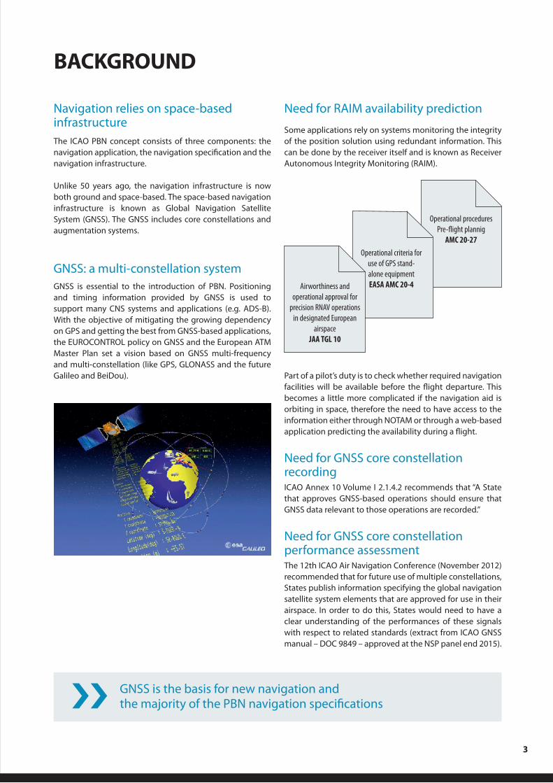
Operational procedures Pre-flight plannig
AMC 20-27
Operational criteria for use of GPS stand- alone equipmentEASA AMC 20-4Airworthiness and
operational approval for precision RNAV operations
in designated European airspace
JAA TGL 10
GNSS is the basis for new navigation and the majority of the PBN navigation specifications››
Part of a pilot’s duty is to check whether required navigation facilities will be available before the flight departure. This becomes a little more complicated if the navigation aid is orbiting in space, therefore the need to have access to the information either through NOTAM or through a web-based application predicting the availability during a flight.
Need for GNSS core constellation recordingICAO Annex 10 Volume I 2.1.4.2 recommends that “A State that approves GNSS-based operations should ensure that GNSS data relevant to those operations are recorded.”
Need for GNSS core constellation performance assessment The 12th ICAO Air Navigation Conference (November 2012) recommended that for future use of multiple constellations, States publish information specifying the global navigation satellite system elements that are approved for use in their airspace. In order to do this, States would need to have a clear understanding of the performances of these signals with respect to related standards (extract from ICAO GNSS manual – DOC 9849 – approved at the NSP panel end 2015).

4
SCOPE OF CS7-3
The scope of CS7-3, the Monitoring and Prediction of Satellite Navigation (SAT-NAV) Network Infrastructure Performance Monitoring and Analysis Service (NIPS), is:
n To provide airspace users with a tool to predict the GPS RAIM availability before operation in European airspace, and to generate NOTAM proposals when asked by local authorities.
n To monitor the performance of the GNSS satellite core constellations used to provide air navigation service in the EUROCONTROL Member States’ area:
- Function 1: the monitoring of the performance of signals of approved constellations (currently GPS L1).
- Function 2: collection of statistical data on technical elements to support decisions for operational approvals in Europe based on new GNSS signals and/or constellations (such as GPS L5, GLONASS, BeiDou and Galileo).
n To perform legal recording of core constellation data signal to support post-incident/accident investigations.
CS7-3 will provide an off-line monitoring (performance not available in real time) of existing and new signals of GPS, GLONASS, Galileo with a possible extension to BeiDou. This will allow verifying the performance of core constellations that are used by RAIM algorithms of the GNSS receivers to meet the integrity levels defined by ICAO. This will also support safety assurance provided by ANSPs and supervised by competent authorities.
CS7-3 GPS RAIM availability tool will be accessible for all airspace users
CS7-3 = a solution to cover the ICAO GNSS Manual (DOC 9849) – new section 7.8
n GNSS performance (off-line activity)
n GNSS recording
CS7-3 is a European solution for the monitoring and recording data of Global navigation satellite systems to help States in their approval of GNSS operation in their airspace
››

5
COMPONENTS OF THE CS7-3 SERVICE
CS7-3 will use two different tools to support the service.
A GPS RAIM availability tool accessible to aircraft operators through the web
The GPS RAIM Availability Prediction will provide one function per type of operation:
n The “en-route” function for B-RNAV routes (RNAV 5).
n The “terminal” function for TMA where GPS-based P-RNAV procedures are published (RNAV 1).
n The “approach” function for airports where RNP APCH to LNAV minima procedures are published.
In addition, the system will be able to generate NOTAM proposals to States that have registered to the service.
GNSS performance assessment is a periodic off-line activity to verify that the signal in space (SIS) conforms to the relevant Annex 10 standards (ICAO DOC 9849 Dec 2015)
GNSS RAIM Prediction
Web Server Database - Calculation Server
Upload NANU & Almanacs
files
NAVCEN Website
AIMSL / AFTN
Txt files
Upload Airports and Waypoints
European AIS Database
CS5
HTTP
Export NOTAM
Proposal
GPS RAIM Prediction
A European GNSS monitoring componentThis system will collect data from different existing networks of GNSS receivers complemented with some additional receivers as necessary to ensure optimal coverage.
The system will automatically calculate the performance of the different GNSS core constellations as described in the ICAO documents.
The results will be accessible to ANSPs, EASA and national authorities through a web application
and detected anomalies will be manually investigated by GNSS expert.
››
6
ROLES AND RESPONSIBILITIES
GOVERNANCE
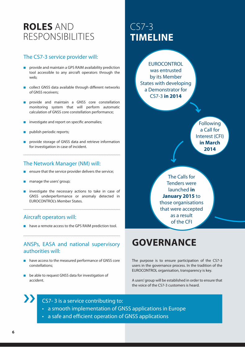
CS7-3 TIMELINE
The CS7-3 service provider will:
n provide and maintain a GPS RAIM availability prediction tool accessible to any aircraft operators through the web;
n collect GNSS data available through different networks of GNSS receivers;
n provide and maintain a GNSS core constellation monitoring system that will perform automatic calculation of GNSS core constellation performance;
n investigate and report on specific anomalies;
n publish periodic reports;
n provide storage of GNSS data and retrieve information for investigation in case of incident.
The Network Manager (NM) will:n ensure that the service provider delivers the service;
n manage the users’ group;
n investigate the necessary actions to take in case of GNSS underperformance or anomaly detected in EUROCONTROL’s Member States.
Aircraft operators will:
n have a remote access to the GPS RAIM prediction tool.
ANSPs, EASA and national supervisory authorities will:
n have access to the measured performance of GNSS core constellations;
n be able to request GNSS data for investigation of accident.
The purpose is to ensure participation of the CS7-3 users in the governance process. In the tradition of the EUROCONTROL organisation, transparency is key.
A users’ group will be established in order to ensure that the voice of the CS7-3 customers is heard.
CS7- 3 is a service contributing to:• a smooth implementation of GNSS applications in Europe• a safe and efficient operation of GNSS applications
››
EUROCONTROL was entrusted by its Member
States with developing a Demonstrator for
CS7-3 in 2014
Following a Call for
Interest (CFI) in March
2014
The Calls for Tenders were launched in
January 2015 to those organisations that were accepted
as a result of the CFI

7
TRAINING ON CENTRALISED SERVICES
CS7-3 TIMELINE
A training course on Centralised Services is offered by the Institute of Air Navigation Services (IANS), our Training Centre in Luxembourg.
The course describes the overall concept of Centralised Services, its business model, governance and management. This course is designed for anyone who is looking to gain a deep understanding of the Centralised Services approach.More info on the ‘Discover Centralised Services’ course is available in the EUROCONTROL training zone:http://trainingzone.eurocontrol.int
GLOSSARYAPCH Approach
AMC Acceptable Means of Compliance
ANSP Air Navigation Service Provider
BeiDou Chinese satellite navigation system
B-RNAV Basic Area Navigation
CS5 European ATM Information Management Service (EAIMS)
ICAO International Civil Aviation Organization
EASA European Aviation Safety Agency
Galileo European Satellite Positioning Constellation
GLONASS Global Navigation Satellite System (Russian)
GNSS Global Navigation Satellite System
GPS Global Positioning System
GSA European GNSS Agency
LNAV Lateral Navigation
NANU Notice Advisory to NAVSTAR Users
NAVCEN Navigation Centre (U.S. Coast Guard)
NIPS Network Infrastructure Performance Monitoring and Analysis Service
NOTAM Notice to Airmen
NSP Navigation Systems Panel
PBN Performance Based Navigation
P-RNAV Precision Area Navigation
RAIM Receiver autonomous integrity monitoring
RNAV Area Navigation
RNP Required Navigation Performance
SARPS Standards and Recommended Practices
EUROCONTROL will select
the consortium to develop the Demonstrator by mid-2016
The contractor will develop a Demonstrator over a period of 12 months
The CS7-3 will provide the service
for a periode of six years
GO/NO-GO for service

© EUROCONTROL June 2016
EUROCONTROL is a pan-European, civil-military, intergovernmental organisation for the airspace of its Member States – Albania, Armenia, Austria, Belgium, Bosnia and Herzegovina, Bulgaria, Croatia, Cyprus, Czech Republic, Denmark, Estonia, Finland, France, Georgia, Germany, Greece, Hungary, Ireland, Italy, Latvia, Lithuania, Luxembourg, Malta, Moldova, Monaco, Montenegro, Netherlands, Norway, Poland, Portugal, Romania, Serbia, Slovakia, Slovenia, Spain, Sweden, Switzerland, the former Yugoslav Republic of Macedonia, Turkey, Ukraine, the United Kingdom of Great Britain and Northern Ireland.
EUROCONTROL
For more information on CS7-3, please contact: