new orleans and coastal louisiana: a review on sustainability … · new orleans and coastal...
TRANSCRIPT

New Orleans and Coastal Louisiana: A Review on Sustainability and
Vulnerability
13 March 2007Cityscope, MIT
Douglas J. Meffert, D. Env., MBAEugenie Schwartz Professor for River & Coastal StudiesDeputy Director, Tulane/Xavier Center for Bioenvironmental ResearchCo-Chair Sustainability Subcommittee, Bring New Orleans Back Commission
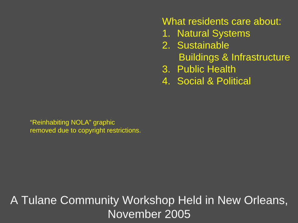
A Tulane Community Workshop Held in New Orleans, November 2005
What residents care about:1. Natural Systems2. Sustainable
Buildings & Infrastructure3. Public Health4. Social & Political
“Reinhabiting NOLA” graphic removed due to copyright restrictions.
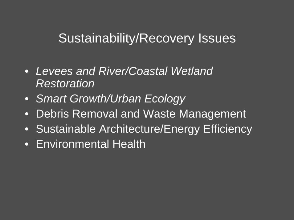
Sustainability/Recovery Issues
• Levees and River/Coastal Wetland Restoration
• Smart Growth/Urban Ecology• Debris Removal and Waste Management• Sustainable Architecture/Energy Efficiency• Environmental Health

NORTH DAKOTA
MONTANA
SOUTH DAKOTA
NEBRASKAIOWA
WYOMINGIDAHO
UTAH
SALT LAKE CITY
ALBUQUERQUE
HELENA
COLORADO
ARIZONA
NEW MEXICO
TEXAS
DALLASSHREVEPORT
LOUISIANANEW ORLEANS
GULF OF MEXICO
FLORIDA
ATLANTICOCEAN
JACKSONVILLE
CHARLESTONGEORGIAALABAMAJACKSON
VICKSBURG
GREENVILLE
BATON ROUGE
ARKANSASOKLAHOMA
KANSAS
MISSOURI
ILLINOIS
OHIOPA
LAKE ERIE
WEST VIRGINIA
INDIANA
MICHIGAN
LAKE H
URON
WISCONSIN
LAKE SUPERIOR
DETROIT
RALEIGHCAIRO
KANSAS CITY
ST. PAULMINNEAPOLIS
BISMARCK
TORONTO
NLAK
E M
ICH
IGA
N
MINNESOTA
SOUTHCAROLINA
NORTHCAROLINA
VIRGINIKENTUCKY
TENNESSEE
MISSISSIPPI
ATLANTA
HOUSTON
MISSISSIPPIRIVER SYSTEM
MEXICO
C A D AAN
CINCINNATI
Figure by MIT OCW.
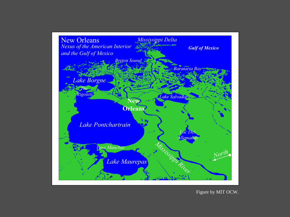
North
Breton Sound
New OrleansNexus of the American Interiorand the Gulf of Mexico
Lake BorgneThe
Rigolets
Lake Pontchartrain
Pass Manchac
Lake Maurepas
Mississippi River
NewOrleans
Gulf of MexicoMississippi Delta
Lake Salvador
Lac DesAllemands
Barataria Bay
Figure by MIT OCW.

Composite Recent Deltas
20 20 40 Miles0
1. Sale-Cypremort Delta5000-4500 years ago
5. Lafourche Delta1500-700 years ago
3. Teche Delta3500-2500 years ago
6. Plaquemines Delta1200-500 years ago
2. Cocodrie Delta4500-3500 years ago
Louisiana Mississippi
Mississippi River4. St. Bernard Delta2600-1500 years ago
7. Balize Delta500 years ago to present
Atchafalaya Bay
Lafayette
BatonRouge
Houma
Terrebonne Bay
Gulf of Mexico
Barataria Bay
Breton Sound
ChandeleurSound
Gulfport/Biloxi
New Orleans
N
S
EW
Figure by MIT OCW.

1849

The Great Mississippi River Flood of 1927
Removed due to copyright restrictions: photograph of people evacuating flooded region, and front cover image of Rising Tide: The Great Mississippi Flood of 1927 and How it Changed America, by John Barry.

Lower Mississippi River Modern DeltaWhat satellites and sonar tell us
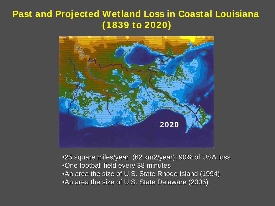
1839187019932020
Past and Projected Wetland Loss in Coastal Louisiana(1839 to 2020)
••25 square miles/year (62 km2/year); 90% of USA loss25 square miles/year (62 km2/year); 90% of USA loss••One football field every 38 minutesOne football field every 38 minutes••An area the size of U.S. State Rhode Island (1994)An area the size of U.S. State Rhode Island (1994)••An area the size of U.S. State Delaware (2006)An area the size of U.S. State Delaware (2006)

source: USGS
predicted land loss 1932-2050
Past and future coastal wetland loss in Louisiana

Louisiana’s Coastal Wetland Functional Economic Values
• Valued at more than $100 billion (insured up to $170 billion)
• More fishery landings than any other coterminous state ($750 million/year)
• 21% of U.S. natural gas supply (oil & gas $30 billion/year)
• Protection for 25% of U.S. exported commodities ($30 billion/year)
• Agricultural value of $30 billion/year• Largest U.S. fur harvest…not worth much these days

Figure by MIT OCW.
Figure by MIT OCW.
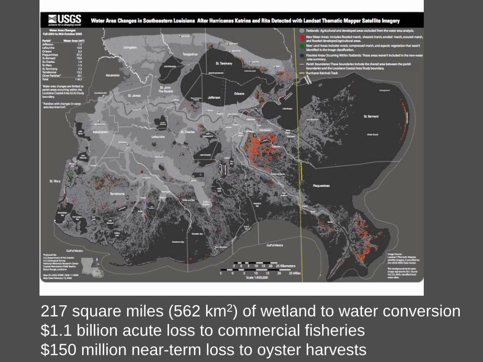
217 square miles (562 km2) of wetland to water conversion$1.1 billion acute loss to commercial fisheries$150 million near-term loss to oyster harvests

Funnel Effect
Photograph of rushing stormwaters removed due to copyright restrictions.

17th Street
London StreetN & S
Inner Harbor Navigation Canal: France Street N&S
Inner Harbor Navigation
Canal: 9th Ward
ICWW Air Products
ICWW
BienvenueGate/MRGO
TidalGate/MRGO
PipelineCanal/MRGO
Three Separate Bowls
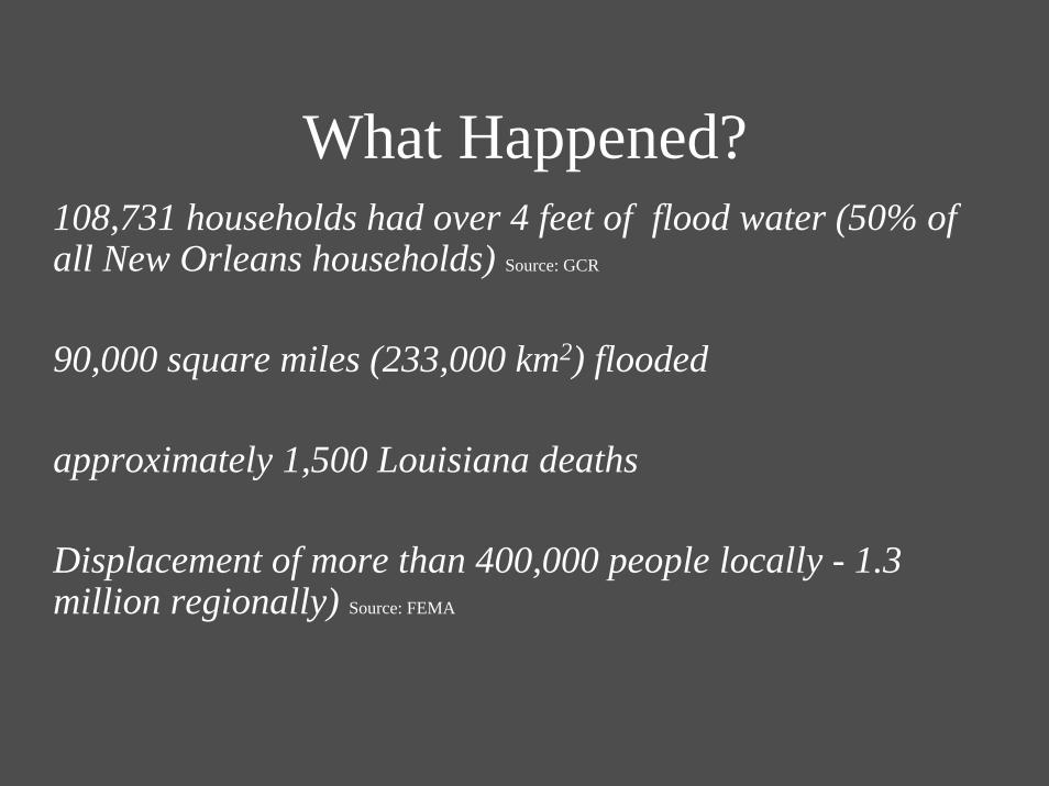
What Happened?108,731 households had over 4 feet of flood water (50% of all New Orleans households) Source: GCR
90,000 square miles (233,000 km2) flooded
approximately 1,500 Louisiana deaths
Displacement of more than 400,000 people locally - 1.3 million regionally) Source: FEMA

A Model of Disaster Recovery Activity (from Vale and Campanella 2005, redrawn from Reconstruction Following Disaster)
Disaster EventMinimal
Cop
ing
Act
ivity
Maximal
Ceased or Changed Return and Function Return at Predisaster Levelsor Greater Improved and Developed
Sample Indicators: Completion of Search and Rescue
End of Emergency Shelteror Feeding
Clearing Rubble from MainArteries
Rubble Cleared
Return of Refugees
Restoration of Major Urban Services
Attain Predisaster Levelof Capital Stock
and Activities
Completion of MajorConstruction Projects
Time in Weeks Following Disaster
.5 1 2 43 5 10 20 30 40 50 100 200 300 400 500
Normal Activities:
Capital Stock:
Periods: Emergency
Damaged or Destroyed Patched
Restoration Reconstruction I Reconstruction II
Rebuilt (Replacement)Major Construction
(Commemoration, Betterment,Development)
Figure by MIT OCW.
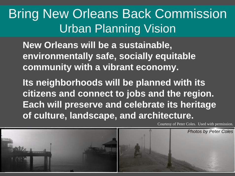
Bring New Orleans Back CommissionUrban Planning Vision
New Orleans will be a sustainable, environmentally safe, socially equitable community with a vibrant economy.Its neighborhoods will be planned with its citizens and connect to jobs and the region. Each will preserve and celebrate its heritage of culture, landscape, and architecture.
Photos by Peter Coles
Courtesy of Peter Coles. Used with permission.
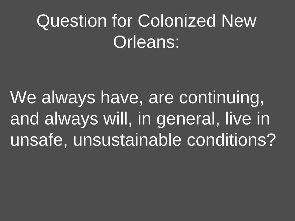
Question for Colonized New Orleans:
We always have, are continuing, and always will, in general, live in unsafe, unsustainable conditions?
Numbers on thismap coincide with
diagram below300 feet deep or shallower
ChandeleurIslands
Mouth of theMississippi River
Venice
Grand Isle
RacelandLarose
Lafitte
Luling
Pointe a laHache
GretnaChalmette
LaPlaceKenner
NewOrleans
Mandeville
SlidellLA. MISS.Lake
Maurepas Lake Pontchartrain
Lake BorgneChandeleurSound
Breton Sound
Gulf ofMexico
Gulf of
Mexico
BaratariaBay
TimbalierBay
LakeSalvador
1
1
23
4
5
6
7
8
910
11
90
90
1012
10
55
10
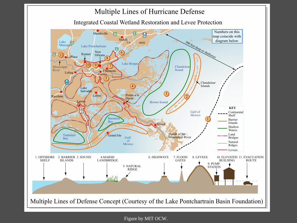
1. OFFSHORESHELF
2. BARRIERISLANDS
3. SOUND 4.MARSHLANDBRIDGE
5. NATURAL RIDGE
6. HIGHWAYS 7. FLOODGATES
8. LEVEES
9. PUMP STATION
10. ELEVATEDBUILDING
11. EVACUATIONROUTE
Multiple Lines of Defense Concept (Courtesy of the Lake Pontchartrain Basin Foundation)
KEYContinentalShelfBarrierIslandsShallowWatersLandBridgesNaturalRidgesLevees
MississippiRiver
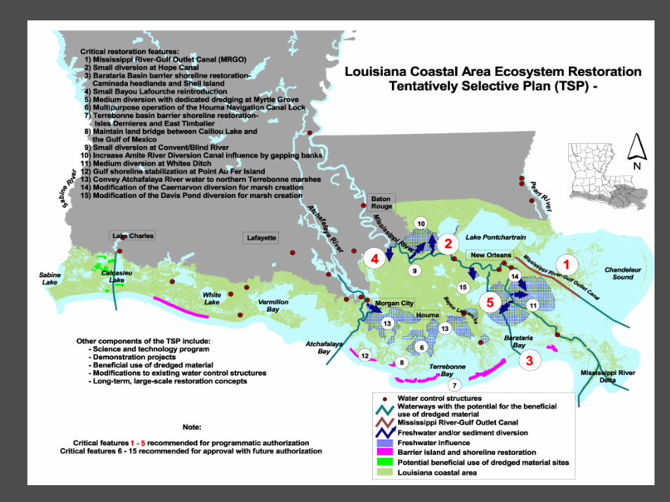
Multiple Lines of Hurricane DefenseIntegrated Coastal Wetland Restoration and Levee Protection
Figure by MIT OCW.
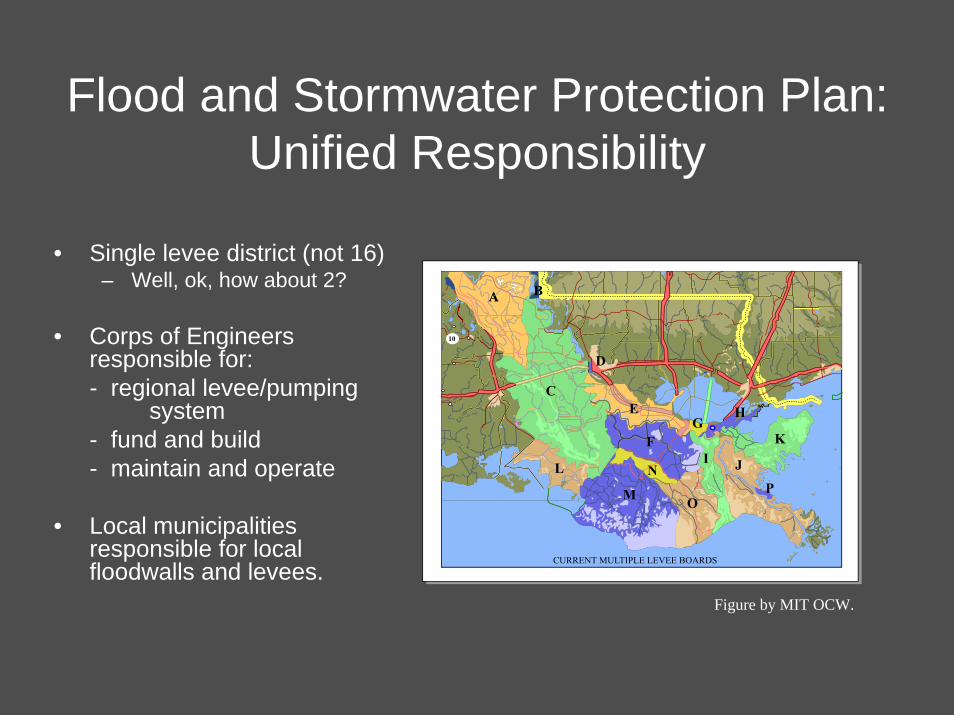
Flood and Stormwater Protection Plan:Unified Responsibility
• Single levee district (not 16)– Well, ok, how about 2?
• Corps of Engineers responsible for:- regional levee/pumping
system- fund and build - maintain and operate
• Local municipalities responsible for local floodwalls and levees.
Figure by MIT OCW.
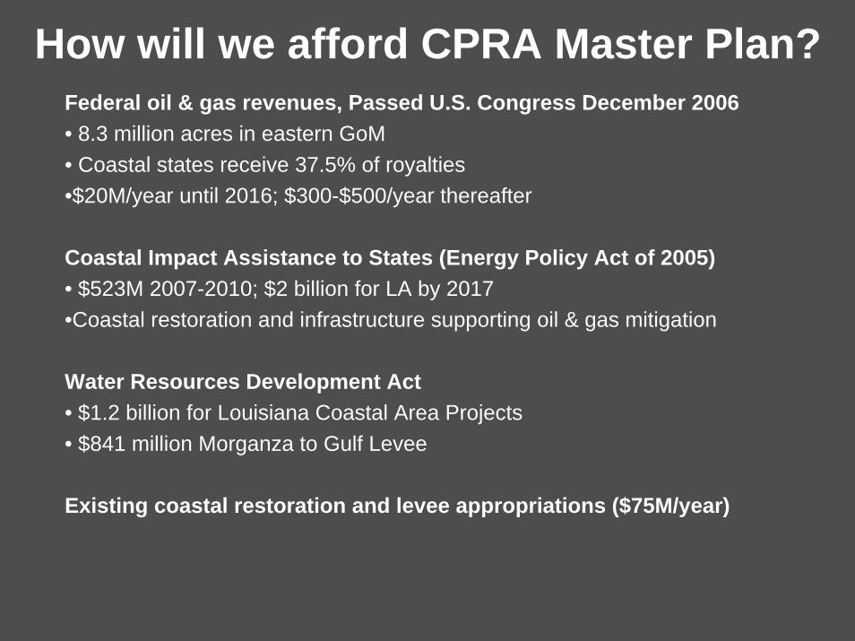
How will we afford CPRA Master Plan?Federal oil & gas revenues, Passed U.S. Congress December 2006• 8.3 million acres in eastern GoM• Coastal states receive 37.5% of royalties•$20M/year until 2016; $300-$500/year thereafter
Coastal Impact Assistance to States (Energy Policy Act of 2005)• $523M 2007-2010; $2 billion for LA by 2017•Coastal restoration and infrastructure supporting oil & gas mitigation
Water Resources Development Act• $1.2 billion for Louisiana Coastal Area Projects• $841 million Morganza to Gulf Levee
Existing coastal restoration and levee appropriations ($75M/year)
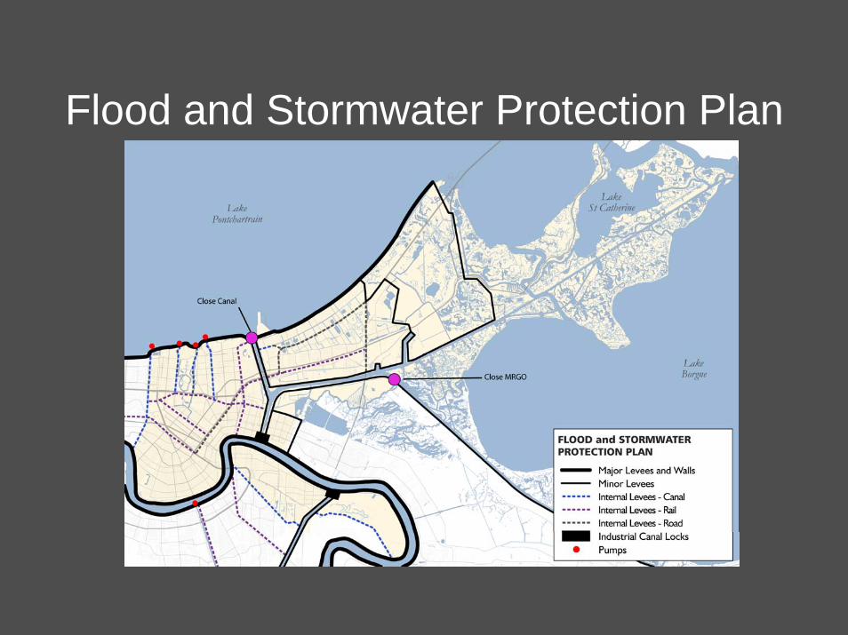
Flood and Stormwater Protection Plan

BNOB Parks & Open Space Plan“Greenspace” - the new “four-letter word”

What is New Orleans’ Population?(Lack of affordable housing is biggest constraint)
Estimates of population in New Orleans:1960: 627,523 (peak)August 2005 (pre-K): 437,186 (1,292,774 metro)October 2005: 70,000 (90k daytime)January 2006: 140,000June 2006: 171,000 - 210,000August 2006: 235,000 (1,065,000 metro)Fall 2008: 250,000 est. (more? less?)Sources: RAND Corporation, GCR, U.S. Postal Service, U.S. Census Bureau
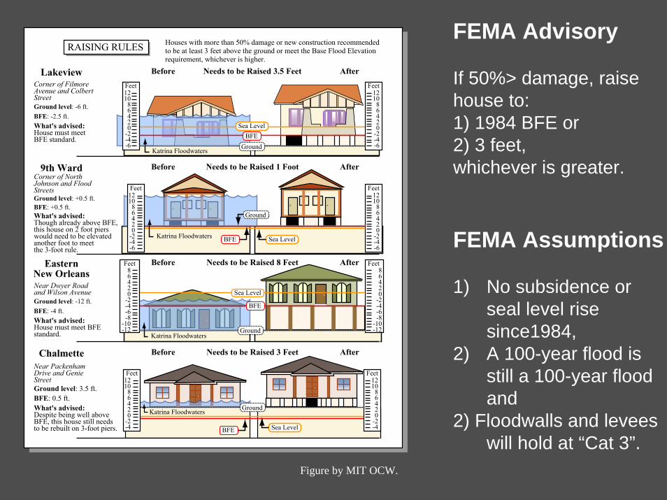
FEMA Advisory
If 50%> damage, raise house to:1) 1984 BFE or2) 3 feet,whichever is greater.
FEMA Assumption
1) No subsidence or seal level rise since1984,
2) A 100-year flood is still a 100-year flood and
2) Floodwalls and leveeswill hold at “Cat 3”.
s
Figure by MIT OCW.
121086420
-2-4-6
Feet
Katrina Floodwaters
Katrina Floodwaters
121086420
-2-4-6
Feet121086420
-2-4-6
Feet
Sea Level
Sea LevelBFE
AfterNeeds to be Raised 3.5 FeetBefore
AfterNeeds to be Raised 1 FootBefore
AfterNeeds to be Raised 8 FeetBefore
AfterNeeds to be Raised 3 FeetBefore
Lakeview
Ground
BFE
-12-10
86420
-2-4-6-8
Feet
Sea Level
BFE
-12-10
86420
-2-4-6-8
Feet
Katrina Floodwaters
121086420
-2-4
Feet
BFE
Ground
RAISING RULES Houses with more than 50% damage or new construction recommendedto be at least 3 feet above the ground or meet the Base Flood Elevationrequirement, whichever is higher.
Corner of FilmoreAvenue and ColbertStreetGround level: -6 ft.BFE: -2.5 ft.What's advised:House must meetBFE standard.
9th WardCorner of NorthJohnson and FloodStreetsGround level: +0.5 ft.BFE: +0.5 ft.What's advised:Though already above BFE,this house on 2 foot pierswould need to be elevatedanother foot to meetthe 3-foot rule.
EasternNew OrleansNear Dwyer Roadand Wilson AvenueGround level: -12 ft.BFE: -4 ft.What's advised:House must meet BFE standard.
ChalmetteNear PackenhamDrive and GenieStreetGround level: 3.5 ft.BFE: 0.5 ft.What's advised:Despite being well aboveBFE, this house still needsto be rebuilt on 3-foot piers. Sea Level
Katrina Floodwaters
Ground
121086420
-2-4-6
Feet
121086420
-2-4
Feet
Ground

Encourage Neighborhoods to Live With WaterLower 9th Ward Bayou Bienvenue Restoration Project
• Historic Habitat & Ecological Services
• Park for Recreation, Research, & Education
• Capture Rain & Stormwater Runoff and Protection
• Water Treatment for Sewerage & Water Board
• Community-driven partnership of agencies, universities, and non-profits
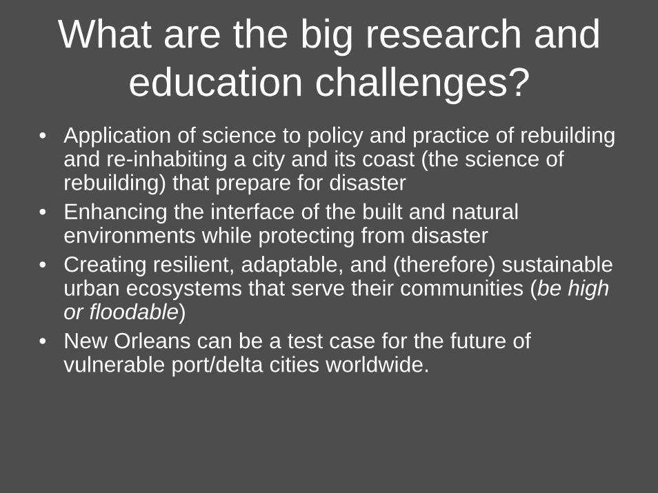
What are the big research and education challenges?
• Application of science to policy and practice of rebuilding and re-inhabiting a city and its coast (the science of rebuilding) that prepare for disaster
• Enhancing the interface of the built and natural environments while protecting from disaster
• Creating resilient, adaptable, and (therefore) sustainable urban ecosystems that serve their communities (be high or floodable)
• New Orleans can be a test case for the future of vulnerable port/delta cities worldwide.
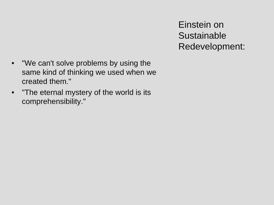
• "We can't solve problems by using the same kind of thinking we used when we created them."
• "The eternal mystery of the world is its comprehensibility."
Einstein on Sustainable Redevelopment:

• 25 million cubic yards of “green waste”• 280,000 tons of steel so far (1.5 NYC World
Trade Centers Towers)• > 100 million cubic yards of
construction/demolition waste (22 Superdomes)
Photograph of a large debris pile removed due to copyright restrictions.
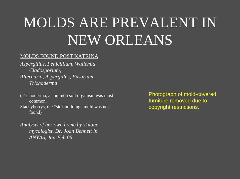
MOLDS ARE PREVALENT IN NEW ORLEANS
MOLDS FOUND POST KATRINAAspergillus, Penicillium, Wallemia,
Cladosporium,Alternaria, Aspergillus, Fusarium,
Trichoderma
(Trichoderma, a common soil organism was most common.
Stachybotrys, the “sick building” mold was not found)
Analysis of her own home by Tulane mycologist, Dr. Joan Bennett in ANYAS, Jan-Feb 06
Photograph of mold-covered furniture removed due to copyright restrictions.