ongoing sewer assessment and rehabilitation program
TRANSCRIPT

Ongoing Sewer Assessment and Rehabilitation Program
DeKalb County Department of Watershed Management (DWM)
JULY 2015

i
CONTENTS
CONTENTS ............................................................................................................................ i
ACRONYMS ......................................................................................................................... iv
1 INTRODUCTION..................................................................................................... 1
1.1 OVERVIEW .................................................................................................... 1
1.2 DESCRIPTION OF THE DEKALB COUNTY WCTS ............................... 2
1.3 SUMMARY OF THE COUNTY’S SEWER ASSESSMENT AND REHABILITATION EFFORTS OVER THE LAST FIVE YEARS ............ 3
1.4 SUMMARY OF THE COUNTY’S PASARP AND ITS RELATIONSHIP TO THE OSARP ............................................................................................ 4
1.4.1 Summary of the PASARP ............................................................... 4
1.4.2 Relationship between the PASARP and the OSARP .................. 4
2 IDENTIFICATION, DELINEATION, AND PRIORITIZATION OF AREAS AND SEWER SEGMENTS FOR ASSESSMENT AND/OR REHABILITATION .................................................................................................. 5
2.1 BACKGROUND INFORMATION ............................................................. 5
2.2 PROGRAMS, DATA SOURCES, AND INFORMATION SOURCES THAT WILL BE USED IN IDENTIFICATION, DELINEATION, AND PRIORITIZATION OF AREAS ................................................................... 6
2.2.1 Nature and Extent of Customer Complaints ............................... 6
2.2.2 Flow and Rainfall Monitoring Data .............................................. 7
2.2.3 Hydraulic Modeling Data ............................................................... 7
2.2.4 Location, Cause, Frequency, and Volume of SSO’s .................... 8
2.2.5 Rehabilitation Measures Ongoing Pursuant to the CERP .......... 9
2.2.6 Data Obtained from the FOG Management Program ................ 9
2.2.7 Data Obtained from the MMS Program ..................................... 10
2.2.8 Results from Lift Station Inspections .......................................... 10
2.2.9 Preliminary Sewer Assessment Data .......................................... 11
2.2.10 Results from Engineering Studies ............................................... 11
2.2.11 Data obtained from Personnel Knowledgeable of the County’s WCTS Including Field Crew Word Orders ................................ 12

DEKALB COUNTY DWM ONGOING SEWER ASSESSMENT AND REHABILITATION PROGRAM
JULY 2015
ii
2.2.12 Standard Industry Practices as Documented in Industry Manuals, Engineering Textbooks, EPA Publications, and Lessons Learned ............................................................................. 12
2.2.13 Professional Judgment and Experience ...................................... 12
2.3 PROCEDURES FOR IDENTIFYING, DELINEATING, AND PRIORITIZING AREAS AND SEWER SEGMENTS FOR ASSESSMENT AND/OR REHABILITATION ....................................... 13
3 SPECIFICATIONS AND GUIDELINES FOR VARIOUS EVALUATIVE WCTS CONDITION ASSESSMENT TOOLS AND PROGRAMS .............. 16
3.1 OVERVIEW OF WCTS EVALUATIVE TOOLS AND PROGRAMS AND THEIR APPLICABILITY TO THE OSARP ................................... 16
4 PROCEDURES FOR IDENTIFYING, PRIORITIZING, AND IMPLEMENTING REHABILITATION PROJECTS ........................................ 20
4.1 IDENTIFICATION AND PRIORITIZATION OF REHABILITATION PROJECTS .................................................................................................... 21
5 PROCEDURES AND SPECIFICATIONS FOR ESTABLISHING THE TYPES OF REHABILITATION TECHNIQUES ............................................... 22
5.1 CURED-IN-PLACE LINER ........................................................................ 22
5.2 PIPE BURSTING ......................................................................................... 23
5.3 MANHOLE LINING .................................................................................. 24
5.3.1 Cured-in-Place Liners .................................................................... 24
5.3.2 Cementitious Coatings .................................................................. 24
5.3.3 Mechanical Seals, Inserts, and Liners .......................................... 25
5.3.4 Polymer Modified Coatings ......................................................... 25
5.4 MANHOLE REPLACEMENT ................................................................... 25
5.5 MANHOLE HEIGHT ADJUSTMENT ..................................................... 25
5.6 MANHOLE FRAME AND COVER REPLACEMENT .......................... 26
5.7 MANHOLE FRAME SEALING ................................................................ 26
5.8 OPEN CUT PIPE REPLACEMENT METHOD ....................................... 27
5.9 POINT REPAIRS ......................................................................................... 27
5.10 SERVICE LATERAL REHABILITATION ............................................... 27
6 PROCEDURES FOR INVENTORYING COMPLETED REHABILITATION PROJECTS INCLUDING, REHABILITATION TECHNIQUES ................... 28
7 PROCEDURES FOR COORDINATING REHABILITATION WORK PERFORMED INTO THE MANAGEMENT MAINTENANCE SYSTEM (MMS) PROGRAM ................................................................................................ 30
8 KEY PERFORMANCE INDICATORS (KPIs) ................................................... 34
DEKALB COUNTY DWM ONGOING SEWER ASSESSMENT AND REHABILITATION PROGRAM
JULY 2015
iii
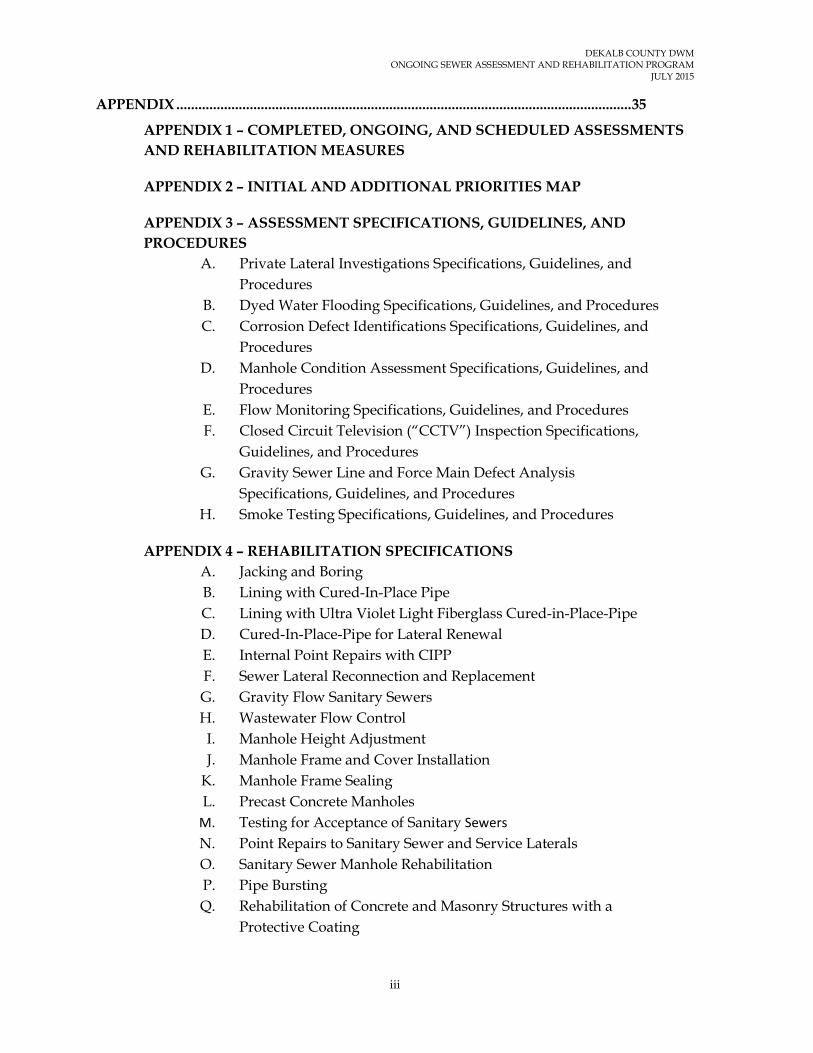
APPENDIX ............................................................................................................................ 35
APPENDIX 1 – COMPLETED, ONGOING, AND SCHEDULED ASSESSMENTS AND REHABILITATION MEASURES
APPENDIX 2 – INITIAL AND ADDITIONAL PRIORITIES MAP
APPENDIX 3 – ASSESSMENT SPECIFICATIONS, GUIDELINES, AND PROCEDURES
A. Private Lateral Investigations Specifications, Guidelines, and Procedures
B. Dyed Water Flooding Specifications, Guidelines, and Procedures C. Corrosion Defect Identifications Specifications, Guidelines, and
Procedures D. Manhole Condition Assessment Specifications, Guidelines, and
Procedures E. Flow Monitoring Specifications, Guidelines, and Procedures F. Closed Circuit Television (“CCTV”) Inspection Specifications,
Guidelines, and Procedures G. Gravity Sewer Line and Force Main Defect Analysis
Specifications, Guidelines, and Procedures H. Smoke Testing Specifications, Guidelines, and Procedures
APPENDIX 4 – REHABILITATION SPECIFICATIONS A. Jacking and Boring B. Lining with Cured-In-Place Pipe C. Lining with Ultra Violet Light Fiberglass Cured-in-Place-Pipe D. Cured-In-Place-Pipe for Lateral Renewal E. Internal Point Repairs with CIPP F. Sewer Lateral Reconnection and Replacement G. Gravity Flow Sanitary Sewers H. Wastewater Flow Control I. Manhole Height Adjustment J. Manhole Frame and Cover Installation
K. Manhole Frame Sealing L. Precast Concrete Manholes
M. Testing for Acceptance of Sanitary Sewers N. Point Repairs to Sanitary Sewer and Service Laterals O. Sanitary Sewer Manhole Rehabilitation P. Pipe Bursting Q. Rehabilitation of Concrete and Masonry Structures with a
Protective Coating

DEKALB COUNTY DWM ONGOING SEWER ASSESSMENT AND REHABILITATION PROGRAM
JULY 2015
iv
ACRONYMS
ASCE American Society of Civil Engineers
AWTF Advanced Wastewater Treatment Facility
CCTV Closed Circuit Television
CERP Contingency and Emergency Response Plan
CIPP Cured in Place Pipe Lining
C&M DeKalb County Department of Watershed Management Construction and Maintenance Division
CMMS Computerized Maintenance Management System
CMOM Capacity, Management, Operations, and Maintenance
DWM DeKalb County Department of Watershed Management
FOG Fats, Oil, and Grease
FSE Food Service Establishment
EPA U.S. Environmental Protection Agency
EPD Georgia Environmental Protection Division
GAWP Georgia Association of Water Professionals
GIS Geographical Information System
GWEF Georgia Water Environment Federation
I/I Infiltration/Inflow
KPI Key Performance Indicators
MACP Manhole Assessment and Certification Program
NPDES National Pollutant Discharge Elimination System
NACWA National Association of Clean Water Agencies
NASSCO National Association of Sewer Service Companies
O&M Operation and Maintenance
OSARP Ongoing Sewer Assessment and Rehabilitation Program
PACP Pipeline Assessment and Certification Program
PASARP Priority Areas Sewer Assessment and Rehabilitation Program
RDI/I Rainfall Dependent Infiltration/Inflow

DEKALB COUNTY DWM ONGOING SEWER ASSESSMENT AND REHABILITATION PROGRAM
JULY 2015
v
ROW Rights-of Way
SSES Sewer System Evaluation Survey
SOP Standard Operating Procedures
SSO Sanitary Sewer Overflow
WCTS Wastewater Collection and Transmission System

1
1 INTRODUCTION
1.1 Overview This Ongoing Sewer Assessment and Rehabilitation Program (OSARP) has been prepared in accordance with the requirements of Section VI.B(x).38 of the Consent Decree - DeKalb County, Civil Action File No. 1:10-CV-4039-WSD. Section VI.B(x).38 of the Consent Decree requires the County to submit the OSARP to the U.S. Environmental Protection Agency (EPA) and the Georgia Environmental Protection Division (EPD), for review and comment, within two (2) years of the Date of Entry of the Consent Decree. The Consent Decree was entered on December 20, 2011.
The main purpose of the OSARP is to ensure continuous assessment and rehabilitation of the County’s Wastewater Collection and Transmission System (WCTS). The OSARP will govern assessment and rehabilitation of those areas outside the Priority Areas while the Consent Decree is in effect, and will continue to exist after the Consent Decree expires. It will enable the County to continuously and proactively identify, delineate, and prioritize areas or sewer segments within the WCTS for condition assessment and rehabilitation, as appropriate, starting with areas not being addressed under the Priority Areas Assessment and Rehabilitation Program (PASARP). The implementation of the OSARP will take into consideration data obtained through other ongoing County programs and operations including the Capacity, Management, Operations, and Maintenance (CMOM) programs, information obtained from customers and the general public, the assessment and rehabilitation work performed under the PASARP, knowledge and experience of County personnel knowledgeable of the County’s WCTS, and professional judgment.
This document contains the following key elements in compliance with the requirements of Section VI.B(x).38 of the Consent Decree:
• Summary of the County’s sewer assessment and rehabilitation efforts over the last five (5) years.
• Summary of the County’s Priority Areas Sewer Assessment and Rehabilitation Program (PASARP) and its relationship to the OSARP.
• Procedures for identifying, delineating, and prioritizing areas or sewer segments
within the WCTS for assessment and/or rehabilitation.
• Specifications and guidelines for various evaluative WCTS condition assessment tools and programs.
• Procedures and specifications for establishing the types of rehabilitation methods the County uses following condition assessment.
• Procedures for identifying, prioritizing, and implementing rehabilitation projects
under the OSARP to address excessive infiltration and inflow (I/I) and other conditions causing, or are likely to cause, sanitary sewer overflows (SSOs).

DEKALB COUNTY DWM ONGOING SEWER ASSESSMENT AND REHABILITATION PROGRAM
JULY 2015
2
• Process for inventorying all completed WCTS rehabilitation projects under the OSARP.
• Procedures for tracking and inventorying completed rehabilitation measures completed under the OSARP, including rehabilitation techniques.
• Procedures for coordinating rehabilitation work performed under the OSARP into the Management Maintenance System (MMS) Program.
• Key performance indicators for measuring the effectiveness of completed rehabilitation measures to reduce SSOs and address capacity limitations within the WCTS
1.2 Description of the DeKalb County WCTS The DeKalb County WCTS (defined to include all pipes, lift stations, force mains, gravity sewer lines, manholes and other appurtenances) consists of an estimated 2,600 miles of sewers, 66 lift stations, and an estimated 61,500 manholes. The County is divided into three (3) sewer basins (Intergovernmental, Snapfinger, and Pole Bridge) containing a total of thirty-five (35) sewersheds, two (2) of which do not currently contain any sewers. The following are summary descriptions of the three (3) sewer basins:
• Inter-Governmental Basin: The Intergovernmental Basin is divided into the following nine (9) sewersheds: Ball Mill Creek, Camp Creek, Lucky Shoals Creek, Marsh Creek, Northeast Creek, Nancy Creek, North Fork Creek, South Fork Creek, and Peavine Creek. This basin contains an estimated 1,136 miles of sanitary sewers and an estimated 25,800 manholes.
The approximately thirty-six (36) million gallons per day (MGD) of wastewater generated within the Intergovernmental Basin is collected, transmitted, and treated at the City of Atlanta R. M. Clayton Water Reclamation Facility under an intergovernmental agreement with the City of Atlanta. Sewers located within the City of Atlanta, through which wastewater from the Intergovernmental Basin flows, are owned and maintained by the City of Atlanta under the above-mentioned intergovernmental agreement with the City of Atlanta.
• Snapfinger Basin: This basin is divided into the following fifteen (15) sewersheds: Barbashela Creek, Blue Creek, Cobb Fowler Creek, Conley Creek, Constitution Area, Corn Creek, Doolittle Creek, Indian Creek, Intrenchment Creek, Lower Snapfinger Creek, Shoal Creek, South River, Sugar Creek, Upper Snapfinger Creek, and Upper Stone Mountain. This basin contains an estimated 1,098 miles of sanitary sewers and an estimated 25,100 manholes.
There are two (2) areas served by septic tanks only in the Snapfinger Basin. These areas include approximately one-third (⅓) of the Cobb Fowler Creek sewershed and the entire Upper Stone Mountain sewershed.
• Pole Bridge Basin: The Pole Bridge Basin is divided into the following eleven (11) sewersheds: Crooked Creek, Honey Creek, Johnson Creek, Lower Crooked Creek, Lower Stone Mountain, Pine Mountain Creek, Plunket Creek, Polebridge Creek,

DEKALB COUNTY DWM ONGOING SEWER ASSESSMENT AND REHABILITATION PROGRAM
JULY 2015
3
Swift Creek, Upper Crooked Creek, and Yellow River. This basin includes an estimated 398 miles of sanitary sewers and an estimated 10,600 manholes.
It should be noted that the length of sewers and the number of manholes in each basin, sewershed, and the County’s WCTS as a whole, changes continuously due to the addition of new sewers within new developments, realignment of existing sewers to advance efficiency or to accommodate construction and repair of other infrastructure, and the abandonment of sewers within abandoned developments.
1.3 Summary of the County’s Sewer Assessment and Rehabilitation Efforts over the Last Five Years Outside the Priority Areas
As part of the County’s daily operations, the County identifies areas and sewer segments for assessment and rehabilitation to improve WCTS performance, increase collection and conveyance capacity, and eliminate excessive I/I. The work associated with the County’s sewer assessment and rehabilitation efforts is performed either by in-house personnel or contracted out to various contractors engaged by the County on an annual basis. See Appendix 1 for a listing of previous, ongoing, and scheduled assessment and rehabilitation projects both inside and outside of the Priority Areas. The selection of areas and sewer segments for assessment and/or rehabilitation has previously been based on several factors including the following:
• Results of engineering studies periodically commissioned to assess the performance of selected areas or sewer segments.
• Data obtained from the County’s System-Wide Flow and Rainfall Monitoring Program.
• Locations, frequencies, volumes, and causes of SSOs. • Customer complaints. • Data obtained from the County’s Fats, Oils, and Grease (FOG) program. • Data obtained from the County’s Lift Stations Inspections and Maintenance
Program. • Data obtained from personnel involved in routine maintenance of the WCTS.
The projects identified in Appendix 1 are not exhaustive. The list is provided to illustrate examples of projects the County has implemented or is in the process of implementing.

DEKALB COUNTY DWM ONGOING SEWER ASSESSMENT AND REHABILITATION PROGRAM
JULY 2015
4
1.4 Summary of the County’s PASARP and its Relationship to the OSARP
1.4.1 Summary of the PASARP
On March 26, 2013, EPA approved the County’s PASARP. The PASARP was prepared by the County pursuant to the requirements of Section VI.B(x).35 of the Consent Decree. The PASARP focuses on a subset of the WCTS potentially needing more urgent attention, hence the term “Priority Areas”.
The Priority Areas identified in the PASARP consist of Initial Priority Areas and Additional Priority Areas. The Initial Priority Areas were included in Appendix B of the Consent Decree. They consist of areas determined by the County, at the time the Consent Decree was negotiated, as meeting the following criteria: (1) having sewers that are estimated to be older than fifty (50) years; (2) with calculated “R-Values” greater than three percent; and (3) areas and/or sewer segments determined by the County, through its ongoing sewer system maintenance program, as needing additional assessment and/or prioritized rehabilitation. The Additional Priority Areas were identified, delineated, and prioritized based on the criteria listed in Subparagraph 35(d) of Section VI.(x) of the Consent Decree as described in the PASARP approved by the EPA. The locations of both the Initial and the Additional Priority Areas (collectively; “Priority Areas”) are shown in Appendix C of the PASARP and are also included in Appendix 2 of this document for ease of reference. The process used to identify, delineate, and prioritize the Additional Priority Areas is described in a report titled: “DeKalb County Department of Watershed Management Wastewater Collection and Transmission System (WCTS) Additional Priority Areas Identification, Delineation, and Prioritization Process”. This report is included in Appendix B of the PASARP.
1.4.2 Relationship between the PASARP and the OSARP
As indicated in Section 1.4.1 above, the PASARP focuses on a subset of the WCTS potentially needing more urgent attention, hence the term, “Priority Areas”. Consistent with the requirements of Section VI.B(x).38 of the Consent Decree, this document consolidates and formalizes key aspects of the County’s ongoing sewer assessment and rehabilitation practices into a formal OSARP to establish a formalized continuous assessment and rehabilitation process for the County’s WCTS. During the Consent Decree period, the OSARP will focus on areas outside the Priority Areas. Following the implementation of the PASARP, and after the Consent Decree period, the areas currently designated as Initial and Additional Priority Areas will eventually be considered for assessment and rehabilitation, as appropriate, under the OSARP. The OSARP is intended to be a permanent program that the County will continuously implement.

5
2 IDENTIFICATION, DELINEATION, AND PRIORITIZATION OF AREAS AND SEWER SEGMENTS FOR ASSESSMENT AND, WHERE NEEDED, REHABILITATION
2.1 Background Information The experience gained by WCTS assessment and rehabilitation experts, over the last several decades, has shown that the process of identifying, delineating, and prioritizing areas and sewer segments for assessment and rehabilitation is a relatively complex one. It requires the availability of tremendous amounts of data (e.g. age, location, size, construction materials, condition, and performance of various WCTS components), expertise in the application of WCTS data analytical tools, and professional judgment. However, various sewer utilities throughout the world have consistently been developing best and effective WCTS assessment and rehabilitation practices as technology evolves, as experience is gained, and as more effective assessment and rehabilitation tools are developed. Over the last several years, the County has advanced significantly in its knowledge of its WCTS and in its approach to sewer assessment and rehabilitation.
As indicated in Section 1 above, the purpose of the OSARP is to ensure continuous assessment and rehabilitation of the County’s WCTS (during and after the expiration of the Consent Decree) by proactively identifying, delineating, and prioritizing areas or sewer segments within the WCTS for condition assessment and/or rehabilitation.
Section 2.2 below presents summaries of the programs, data sources, and information sources on which the County will rely to identify, delineate, and prioritize areas and sewer segments for assessment and rehabilitation under the OSARP. It should be noted that some of the programs, data sources, and information sources are still being developed under the various CMOM Programs required by the Consent Decree. The County will use its best efforts to incorporate data and information from various CMOM programs as the CMOM Programs are developed and fully implemented. It should be noted further that the programs, data sources, and information sources are not exhaustive. Other programs, data sources, and information sources may be identified and incorporated into the process as various CMOM Programs are fully developed and implemented, as new information and data become available, as existing technologies evolve, and as new technologies are developed. Section 2.3 below provides procedures for identifying, delineating and prioritizing areas and sewer segments for assessment and, as appropriate, rehabilitation.

DEKALB COUNTY DWM ONGOING SEWER ASSESSMENT AND REHABILITATION PROGRAM
JULY 2015
6
2.2 Programs, Data Sources, and Information Sources that will be used in Identification, Delineation, and Prioritization of Areas
The following is a list of the programs, data sources, and information sources on which the County will rely and will initially incorporate into the process of identifying, delineating, and prioritizing areas and sewer segments for assessment and rehabilitation under the OSARP:
• Nature and Extent of Service Requests (service requests includes multiple request for corrective actions and actual customer complaints).
• Flow and Rainfall Monitoring Data.
• Hydraulic Modeling Data.
• Location, Cause, Frequency, and Volume of SSOs.
• Rehabilitation Measures Ongoing Pursuant to the CERP.
• Data Obtained from the FOG Management Program.
• Data Obtained from the MMS Program.
• Results from Lift Station Inspections.
• Preliminary Sewer Assessment Data.
• Results from Engineering Studies.
• Data obtained from Personnel Knowledgeable of the County’s WCTS Including Field Crew Work Orders.
• Standard Industry Practices as Documented in Industry Manuals, Engineering Textbooks, EPA Publications, and Lessons Learned.
• Professional Judgment and Experience.
The following sections provide summary descriptions of each of these programs, data source, and information sources and their usefulness to the process of identifying, delineating, and prioritizing areas and sewer segments for assessment and, as appropriate, rehabilitation under the OSARP.
2.2.1 Nature and Extent of Customer Issues
Customer calls related to sewer problems, such as backups, spills, and pipe breaks are among the most important sources of information regarding problems in the WCTS. These

DEKALB COUNTY DWM ONGOING SEWER ASSESSMENT AND REHABILITATION PROGRAM
JULY 2015
7
calls are directed to the DWM dispatch center where a service request is created. Field crews are then dispatched to perform an assessment of the problem associated with the customer issue. The information obtained through customer related service requests and associated assessments will assist in the decisions regarding the identification, delineation, and prioritization of areas and sewer segments for assessment and rehabilitation.
2.2.2 Flow and Rainfall Monitoring Data
The County maintains rain gauges and permanent and temporary flow monitors at strategically selected locations throughout the WCTS. The data obtained from rain gauges and flow monitors are used as follows:
i. to estimate the presence and volume of rainfall dependent and groundwater induced I/I;
ii. to determine the volume of wastewater flowing at various locations throughout the WCTS;
iii. to identify wastewater flow anomalies at various locations throughout the WCTS;
iv. to assess the adequacy of the collection and transmission systems at various locations throughout the WCTS;
v. to develop, calibrate, and maintain the hydraulic model;
vi. to evaluate the presence and correlations of rainfall and flow monitoring data with other CMOM programs, such as the FOG Program; and
vii. to guide the County in its proactive WCTS maintenance program.
The rainfall and flow monitoring data will help guide the County in identifying areas and sewer segments that may be experiencing capacity limitations, to make projections regarding when a sewer segment may run out of capacity, and to estimate the presence and volume of rainfall dependent I/I. This information will be used in identifying areas and sewer segments for assessment under the OSARP.
2.2.3 Hydraulic Modeling Data
The County is in the process of developing three hydraulic models (the Models) for the County’s three (3) sewer basins (Intergovernmental, Snapfinger, and Pole Bridge). The three sewer basins contain a total of thirty-five (35) sewersheds, two (2) of which do not currently contain any sewers. The three sewer basin models are being developed as separate models representing each of the thirty-three sewersheds constituting the County’s WCTS. Once the basin Models are fully developed, the County will use them to obtain information regarding the hydraulic conditions of various components of the WCTS including - hydraulic profiles for various sewer segments, wet and dry weather flow conditions, peaking factors, and pressure and volumes of flow in force mains.
The data obtained from the Models will, among other uses:

DEKALB COUNTY DWM ONGOING SEWER ASSESSMENT AND REHABILITATION PROGRAM
JULY 2015
8
• Enhance the County’s Capacity Assurance Program including monitoring wastewater flow volumes, velocities, and profiles at any point throughout the WCTS; identifying sewer segments, sewer appurtenances, lift stations, and treatment facilities needing expansion to accommodate prevailing and projected future flows; and determining whether the section that would convey a new connection would be adequate to convey prevailing and anticipated additional flows to the associated treatment facility.
• Aid in the identification of areas, sewer segments, and lift stations needing proactive maintenance to minimize or completely eliminate the likelihood of a SSO.
• Aid in the identification and prioritization of areas and sewer segments for additional assessment to address capacity limitations.
• Estimate the used and available capacities of various sewer segments within various sewershed in the WCTS.
• Determine the presence and estimating the volume of rainfall dependent and groundwater induced I/I.
• Establish the hydraulic response of individual sewer segments, sewersheds, or basins to the introduction of additional flows, such as flows from new development and I/I.
• Aid in the selection of the most effective WCTS condition assessment tools for various areas or sewer segments.
• Aid in the identification and prioritization of rehabilitation measures.
• Facilitate the determination of the effectiveness of implemented rehabilitation measures.
Data obtained from the Hydraulic Models will be used in the process for identifying, delineating, and prioritizing areas and sewer segments for assessment and, as appropriate, rehabilitation under the OSARP.
2.2.4 Location, Cause, Frequency, and Volume of SSO’s
Wastewater collection and transmission systems are designed to provide adequate capacity to collect and convey wastewater to wastewater treatment facilities. The occurrence of a SSO may indicate the presence of one or more conditions that increases the amount of wastewater flowing in an area or sewer segment. Such conditions may include: defective sewers allowing the entry of groundwater and/or rainwater into the pipes, manholes, or other WCTS components; and the introduction of stormwater into the sanitary sewer through illicit connections. The presence of an obstruction in one or more sewer segments, such as accumulation of FOG and/or sediments, root intrusion, or foreign materials introduced into the sewer through vandalism, equipment malfunction; and the presence of
DEKALB COUNTY DWM ONGOING SEWER ASSESSMENT AND REHABILITATION PROGRAM
JULY 2015
9
sewers that do not have sufficient capacity to collect or convey wastewater from the areas they are designed to serve.
The County maintains electronic and hard copy data on the locations, causes, and volumes of SSOs occurring throughout the WCTS. The County uses and will continue to use SSO data in identifying, delineating, and prioritizing areas and sewer segments for assessment and rehabilitation, with areas experiencing relatively high numbers and volumes of SSOs at relatively high frequencies receiving higher priorities.
2.2.5 Rehabilitation Measures Ongoing Pursuant to the CERP
As indicated in the CERP approved by the EPA on January 10, 2013, the County responds expeditiously to SSOs occurring within the County’s WCTS. Following the initial response, the County dispatches personnel to perform an inspection of the right-of-ways and manholes within a reasonable distance upgradient and downgradient of the location of the SSO (minimum one-eighth mile) to determine the extent of the problem. The County has also instituted methods and procedures for assessing and mitigating, where feasible, the potential likelihood of the cause of a SSO occurring elsewhere within the County’s WCTS.
Some of the conditions causing SSOs are repaired immediately following their discovery and others are scheduled for repair at a later date. To fully optimize assessments and repairs triggered under the CERP, that data will be taken into account to help guide the County in identifying and delineating areas and sewer segments for assessment or, as appropriate, rehabilitation under the OSARP. Areas and sewer segments determined to be susceptible to SSOs will receive relatively higher priority.
2.2.6 Data Obtained from the FOG Management Program The majority of SSOs in the County are related to the accumulation of FOG in sewers with diameters of eight- (8) inch to twelve- (12) inch. Eight- (8) inch to twelve- (12) inch sewers make up approximately eighty- (80) percent of the wastewater collection system in the County. The FOG Management Program involves identifying unpermitted new and existing FSEs, performing FOG interceptor pre- and post-installation inspections, issuing FOG Permits to qualifying FSEs, and performing periodic inspections of FSEs to ensure compliance with the FOG Management Program. In addition, the FOG Management Program includes a public education component which focuses on educating residential customers on the importance of keeping FOG out of the WCTS. In the past, residential customers were encouraged (via flyers) to place all cooking oils and grease into containers, and dispose with the trash (solid waste) – for collection and disposal at the County landfill twice a week. The County currently uses a multi-media approach (personal, print, email, radio/TV media, etc.) to educate the public regarding the consequences of disposing of FOG in the WCTS and about alternative FOG disposal methods.
Under the FOG Program, the County tracks the occurrence of SSOs by location, cause(s), volume, and receiving waters. Once each month, the County reviews SSO records to determine, among other purposes, whether or not, there exist correlations between SSO caused by FOG blockages and the locations and densities of multi-family residential complexes upstream of the SSOs. As a first step, the County has coordinated with selected Apartment Owners Associations for a multi-location pilot program aimed at assessing the

DEKALB COUNTY DWM ONGOING SEWER ASSESSMENT AND REHABILITATION PROGRAM
JULY 2015
10
existence of direct collections between FOG from apartment complexes and SSOs caused by FOG blockages. This is a public/private partnership, based on the following parameters:
• Voluntary program – not mandated or required.
• No additional fees (cost) to our customers.
• Direct recycling of residential grease.
• Tracking of the location and quantities of grease collected.
Other information that may be obtained or observed by FOG Management Program personnel may include code violations, missing or broken cleanout covers, areas susceptible to relatively high occurrences of FOG-related SSOs, and exposed defective sewers or sewer appurtenances. When identifying, delineating, and prioritizing areas or sewer segments for assessment and/or rehabilitation under the OSARP, observations made and information obtained by FOG Management Program personnel will be used appropriately.
2.2.7 Data Obtained from the MMS Program The County’s MMS Program is designed to facilitate effective management, operations, and maintenance of the County’s WCTS. It consists of computer software systems at various levels of development; computerized electronic data at various levels of integration and user interfaces; computerized, wireless telephone, and analog telephone communication systems; electronic and written WCTS inspection and testing procedures; electronic and written WCTS operations, practices, and procedures; electronic and written technical specifications for each lift station; electronic and written preventive and corrective maintenance schedules, practices, and procedures, including procedures for generating and tracking service requests and work orders; descriptions of the County resources dedicated to the operations, maintenance, and management of the WCTS; an inventory management system; and key performance indicators (KPI’s) for tracking and measuring the performance of the WCTS.
The MMS Program provides the County with the most comprehensive WCTS data that is relatively easy to retrieve for sharing, analysis, interpretation, and querying. WCTS location, condition, and performance data coupled with human intelligence will be instrumental in identifying, delineating, and prioritizing areas and sewer segments for assessment and/or rehabilitation.
2.2.8 Results from Lift Station Inspections Lift station inspections are performed under the County’s Lift Station Operations and Maintenance Program. The purpose of the Lift Station Operations and Maintenance Program is to provide for continuous, uninterrupted transmission of wastewater to the County’s wastewater treatment plants with a goal of achieving zero SSOs and reducing reactive and emergency operations and maintenance through the use of planned and predictive operations and maintenance.
Lift station inspections are performed daily, weekly, monthly, or at other predetermined time intervals based on the size of the lift station and the type of equipment. Although the inspections performed at lift stations are directed toward ensuring that the components of a lift station are in good working order, lift station performance data and observations made during inspections do, in certain instances, provide information about the condition or

DEKALB COUNTY DWM ONGOING SEWER ASSESSMENT AND REHABILITATION PROGRAM
JULY 2015
11
performance of the collection system upgradient of a lift station and the force main leaving the lift station. The following are examples of performance data items and observations that may provide information about the collection system upgradient of a lift station and/or the force main downgradient of a lift station:
• Accumulation of large amounts of debris in the wet well: accumulation of large amounts of debris may be an indication of vandalism or openings/breaks of the collection system upgradient of the lift station. Breaks at stream crossings, for example, can allow large amounts of debris to enter the collection system.
• Accumulation of FOG in the wet well: Accumulation of large amounts of FOG in the wet well may be an indication of the presence of unpermitted FSEs, residential multifamily dwellings that do not capture or collect kitchen oil and grease, or the illegal introduction of FOG at a manhole upgradient of a lift station.
• Wet well level and pump run times: Relatively high wet well levels and long pump times may be an indication of restrictions within the force main leaving the lift station (such as those caused by corrosion) or increases in wastewater flows that may be caused by growth in development, illicit connections, and/or excessive I/I.
The County will review and analyze lift station performance data and observations made during lift station inspections to determine the need for assessing the collection system upgradient of the lift station or the force main leaving the station. Lift station performance data and observations made during inspections will also be considered in the identification, delineation, and prioritization of areas and sewer segments for assessment and, where appropriate, rehabilitation.
2.2.9 Preliminary Sewer Assessment Data In addition to the WCTS assessment work performed by County personnel on a continuous basis, the County maintains annual contracts with companies specializing in sewer assessment work including flow and rainfall monitoring, smoke testing, dyed-water testing, closed circuit television inspections, manhole condition assessments, etc. The County maintains the WCTS assessment data. Of all the data available for use in determining the need to perform additional assessment and/or rehabilitation, preliminary assessment data provides the most accurate current condition of the components of the WCTS assessed and also provides some of the most valuable data regarding the condition of the components immediately upgradient and, to an extent, immediately downgradient of the components assessed.
In determining the need for additional assessment and/or rehabilitation of WCTS components already assessed as well as the need to assess and/or rehabilitate components ugradient and downgradient of the components assessed, the County will review and perform some level of analysis of available preliminary sewer assessment data. The results of the County’s review and analysis will be used as a guide during the identification, delineation, and prioritization of areas or sewer segments under the OSARP.
2.2.10 Results from Engineering Studies The County maintains annual contracts with outside consultants to provide planning, research, design, and program management and construction management services on a

DEKALB COUNTY DWM ONGOING SEWER ASSESSMENT AND REHABILITATION PROGRAM
JULY 2015
12
task order basis. Based on data obtained from the various County CMOM Programs, the County occasionally determines that an engineering study is needed to gather additional information on an area or sewer segment. The results of commissioned engineering studies are documented in a report. Some of the engineering studies have triggered the need for additional assessment, design, and repair/replacement/rehabilitation of sections or components of the area covered by the engineering study. The County plans to continue performing engineering studies in its efforts to improve the performance of its WCTS. Results of engineering studies will undoubtedly be used to guide the County in the identification, delineation, and prioritization of areas and sewer segments for assessment and/or rehabilitation under the OSARP.
2.2.11 Data obtained from Personnel Knowledgeable of the County’s WCTS Including Field Crew Work Orders
The County’s WCTS field maintenance crews respond to service requests and work orders created as a result of customer complaints and other sources of information. While fulfilling their daily duties of maintaining, repairing, replacing, and rehabilitating components of the County’s WCTS, the field maintenance crews gather tremendous amounts of information on the conditions of the WCTS. Other personnel with knowledge of the WCTS include professionals involved in managing the field crews, sewer mapping professionals, and personnel involved in designing and construction of sewer system infrastructure. The County will incorporate the input of personnel knowledgeable of the County’s WCTS in the identification, delineation, and prioritization of areas and sewer segments for assessment and/or rehabilitation under the OSARP.
2.2.12 Standard Industry Practices as Documented in Industry Manuals, Engineering Textbooks, EPA Publications, and Lessons Learned
As indicated in the PASARP, the sewer system assessment and rehabilitation processes have advanced tremendously over the last twenty (20) years. Numerous sewer assessment and rehabilitation programs have been implemented throughout the world with various degrees of success. In addition to the readily available information regarding sewer systems assessment and rehabilitation programs, various entities, including the EPA, have published several documents regarding effective sewer system assessment and rehabilitation techniques. Data and information documented in industry manuals, engineering textbooks, EPA publications, and lessons learned from other successful sewer assessment and rehabilitation programs will be used by the County as a guide during the identification, delineation, and prioritization of areas and sewer segments for assessment and/or rehabilitation under the OSARP.
2.2.13 Professional Judgment and Experience Professional judgment can be defined as: The process of forming an opinion by discerning and comparing various alternatives. Sound professional judgment is characterized by, and conforms to, established technical, industry, and ethical standards and requires specialized knowledge and experience in the relevant professional field. During the identification, delineation, and prioritization of areas and sewer segments for assessment and/or

DEKALB COUNTY DWM ONGOING SEWER ASSESSMENT AND REHABILITATION PROGRAM
JULY 2015
13
rehabilitation under the OSARP, the County will apply individual and collective sound professional judgment.
2.3 Procedures for Identifying, Delineating, and Prioritizing Areas and Sewer Segments for Assessment and/or Rehabilitation
During the development of the PASARP approved by the EPA on March 26, 2013, the County divided its WCTS into 171 Ranking Areas for evaluation, ranking, and prioritization. The 171 Ranking Areas were selected because they were deemed to be of appropriate size, had readily identifiable boundaries in the County’s GIS, and available relevant data could reasonably be associated with specific Ranking Areas for analysis. Following the identification and delineation of the 171 Ranking Areas, the County ranked the Ranking Areas within each of the three sewer basins that constitute the County’s WCTS, as described in Section 2.2.2 of the PASARP. As described in the PASARP, a Knee of the Curve analysis was performed to aid the County in identifying the Additional Priority Areas for assessment and/or rehabilitation. The Initial Priority Areas identified in the Consent Decree and the Additional Priority Areas identified as described in the PASARP are collectively termed “Priority Areas”.
Since the ranks for various Ranking Areas (both within and outside the Priority Areas) have already been established based on the criteria established in the Consent Decree and the data available during the development of the PASARP, the County will consider the rankings for the Ranking Areas outside the Priority Areas as baseline rankings and use them as a guide during the identification, delineation, and prioritization of areas and sewer segments for assessment and/or rehabilitation under the OSARP. The County will also re-assess the Ranking Areas outside the priority areas as appropriate, based on system evaluations and conditions to confirm the ranking status of each non-priority area. The County recognizes that Ranked Areas addressed under the PASARP will be re-ranked as part of the re-ranking process. The expectation is that once an area is addressed under the PASARP, it will be re-ranked as appropriate under the OSARP. The County will then update the ranks for the Ranking Areas using data obtained from the programs, data sources, and information sources summarized above.
As indicated previously in this document, the main purpose of the OSARP is to ensure continuous assessment and rehabilitation of the County’s WCTS (during and after the expiration of the Consent Decree) by proactively identifying, delineating, and prioritizing areas or sewer segments within the WCTS for condition assessment and/or rehabilitation. The implementation of the OSARP will, therefore, continue in perpetuity. The County recognizes that in order for the OSARP to be successful in meeting its intended purpose, it must be incorporated into the County’s overall capital improvement program (CIP) planning process. The following paragraph describes how the OSARP will be incorporated into the County’s CIP planning process.
During the development of the CIP, the County will review the rankings established during the development of the PASARP, or most current updates, and then identify the number of top ranked Ranking Areas (and hence the length of sewers and number of

DEKALB COUNTY DWM ONGOING SEWER ASSESSMENT AND REHABILITATION PROGRAM
JULY 2015
14
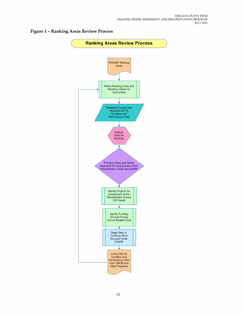
manholes), outside the Priority Areas, that would reasonably be assessed and/or rehabilitated, cost effectively, during each CIP year, and the CIP duration as a whole. The County will then enter the estimated annual and total costs for assessing and/or rehabilitating the identified Ranking Areas into the rate model as part of the process for determining the water and sewer rates. The determination of the Ranking Areas (length of sewers and number of manholes) to be assessed and/or rehabilitated, during a specific year or during the entire duration of the CIP, may follow an iterative process until the County determines that the water and sewer rates for a specified period are fair, reasonable, equitable, and affordable. The CIP may identify specific Ranking Areas, portions of Ranking Areas, and/or sewer segments for assessment and/or rehabilitation during each CIP year. As is customary during the implementation of a water and wastewater CIP, the areas and/or sewer segments identified in the CIP, for assessment and/or rehabilitation under the OSARP, may be modified from time to time based on several factors including the data obtained from other ongoing programs. In addition, the process used to update the rankings for various Ranking Areas may be modified or changed as new information and data becomes available, as existing technologies evolve, and as new technologies are developed. For instance, risk components such as Consequence of Failure and Likelihood of Failure are being applied through the InfoMaster software to help confirm PASARP priority updates. Risk, being widely accepted as a basis for decision making and prioritization, will likely be applied more to OSARP ranking areas as well. Figure 1 shows the current Ranking Areas Review Process.
DEKALB COUNTY DWM ONGOING SEWER ASSESSMENT AND REHABILITATION PROGRAM
JULY 2015
15
Figure 1 – Ranking Areas Review Process
16
3 SPECIFICATIONS AND GUIDELINES FOR VARIOUS EVALUATIVE WCTS CONDITION ASSESSMENT TOOLS AND PROGRAMS
Condition assessment of the County’s WCTS utilizes the same set of evaluative tools whether performed under the PASARP or the OSARP. Summaries of the evaluative tools are included in Section 3 of the PASARP. The specifications, guidelines, and procedures for the evaluative tools the County utilizes are included in Appendices D through K of the PASARP. The same summary descriptions as well as the specifications, guidelines, and procedures for the evaluative tools the County uses are included in this document for ease of reference. The following is a list of the evaluative tools:
• Private Lateral Investigations Specifications, Guidelines, and Procedures (Appendix 3A).
• Dyed Water Flooding Specifications, Guidelines, and Procedures (Appendix 3B).
• Corrosion Defect Identifications Specifications, Guidelines, and Procedures (Appendix 3C).
• Manhole Condition Assessment Specifications, Guidelines, and Procedures (Appendix 3D).
• Flow Monitoring. Guidelines Specifications, Guidelines, and Procedures (Appendix 3E).
• Closed Circuit Television (CCTV) Inspection Specifications, Guidelines, and Procedures (Appendix 3F).
• Gravity Sewer Line and Force Main Defect Analysis Specifications, Guidelines, and Procedures (Appendix 3G).
• Smoke Testing Specifications, Guidelines, and Procedures (Appendix 3H).
3.1 Overview of WCTS Evaluative Tools and Programs and their Applicability to the OSARP
As indicated in the PASARP, the WCTS infrastructure degrades with time based on several factors including age, pipe material, soundness of original construction, concentrations of wastewater constituents, type and duration of external loading, and types of surrounding soils. WCTS degradation can affect the structural integrity and/or hydraulic performance of the infrastructure. The level of degradation is determined by using several of the above-listed evaluative tools to determine the current condition compared with the design or

DEKALB COUNTY DWM ONGOING SEWER ASSESSMENT AND REHABILITATION PROGRAM
JULY 2015
17
expected level or performance. The assessment of the WCTS under the OSARP will be performed in a manner so as to provide the information needed to identify and to prioritize rehabilitation measures based on consequence and likelihood of failure (risk) and cost effectiveness. The following are summary descriptions of the evaluative tools and programs that will be used to assess areas and sewer segments under the OSARP.
• Private Lateral Investigations: Private laterals can be inspected using a combination of technologies, the selection of which depends on site conditions and access. Access onto private property to confirm or gather defect data is a voluntary program and requires the property owner’s permission in DeKalb County.
• Dyed Water Flooding: Dyed water testing is used in conjunction with smoke testing and CCTV to determine whether or not a smoke exit point is directly or indirectly connected to the sewer system. Dyed water testing is also used to investigate building sewer system connectivity.
• Corrosion Defect Identification: For gravity sewers, the simplest method to identify corrosion is by direct visual observation or CCTV inspection. For force mains, direct and indirect technologies may or may not be easy to apply depending on the force main’s access. Combinations or tiered (levels of equipment and/or access to force mains) technologies are usually employed.
• Manhole Condition Assessment: Manhole condition assessment technologies are primarily by visual or camera imaging and can be performed from the surface or by physical entry depending on the desired level of precision of the collected data.
• Flow Monitoring: Flow monitoring is used to measure hydraulic performance. It helps identify areas of the system with excessive I/I. It is also used to determine the effectiveness of rehabilitation measures.
• CCTV: CCTV is used to provide a visual assessment of the interior of a manhole or pipe asset. The visual assessment is converted to a condition score. The asset is sometimes cleaned in advance of the inspection to provide a clearer structural image.
• Gravity Sewer Line & Force Main Defect Analysis: Gravity sewer and force main sewer (as well as other infrastructure assets) defects are given a code and score that, when aggregated, produce an asset condition score. When sewer line and force main defect data is properly linked to software and hardware applications, the analysis can enable subsequent selection and prioritization of rehabilitation measures.
• Smoke Testing: Smoke testing is used to identify potential locations of defects allowing the entry of I/I and, therefore, to prioritize CCTV Inspection and other assessment activities. Smoke testing is effective on both public and private property (laterals) and can locate cross connections or other illicit connections such as roof drains and yard drains.

DEKALB COUNTY DWM ONGOING SEWER ASSESSMENT AND REHABILITATION PROGRAM
JULY 2015
18
Some combination of these evaluative tools and programs may be utilized simultaneously based on the specific circumstances in the field. The most efficient progression and combination of evaluative tools and programs will be used to assess areas and sewer segments under the OSARP. Detailed specifications, guidelines, and procedures for these assessment tools and programs are included in Appendices 3A through 3H. It should be noted that the specifications, guidelines, and procedures included in Appendices 3 and 4 are subject to change based on advancement in technology, effectiveness, and site specific conditions. Figure 2 shows the Specifications Update Process where the Specification Review Committee, made up of County personnel and contractors as appropriate, meet to decide if a requested revision will be processed. Whenever revisions are made to the specifications, guidelines, and procedures, the revision date will be identified on the electronic and hard copy versions. Previous versions will also be maintained in a separate file.

DEKALB COUNTY DWM ONGOING SEWER ASSESSMENT AND REHABILITATION PROGRAM
JULY 2015
19
Figure 2 – Specifications Update Process

DEKALB COUNTY DWM ONGOING SEWER ASSESSMENT AND REHABILITATION PROGRAM
JULY 2015
20
4 PROCEDURES FOR IDENTIFYING, PRIORITIZING, AND IMPLEMENTING REHABILITATION PROJECTS
This section describes the procedures the County will use to identify, prioritize, and implement rehabilitation projects under the OSARP to address excessive I/I and other conditions causing, or likely to cause SSOs. Some of these procedures are currently being utilized effectively under the PASARP.
Conditions associated with the occurrence of SSOs can generally be grouped into three (3) major categories: (1) capacity limitations, (2) structural defects, and (3) maintenance problems. The criteria presented in this section will be used to identify and prioritize rehabilitation measures to address capacity limitations and structural defects that are determined to cause, or are determined to have the potential of causing, SSOs within the areas and sewer segments rehabilitated under the OSARP. Although some of the rehabilitation measures may address maintenance problems that are causing or have the potential to cause SSOs, the County believes that CMOM programs, such as the FOG Management Program and the sewer cleaning program will more effectively address maintenance problems that are causing or have the potential to cause SSOs. In general, the County will identify and prioritize rehabilitation measures under the OSARP based on the following criteria:
• Locations, types, number, and magnitudes of defects.
• Likelihood and consequence of affected WCTS component failure (risk).
• Constructability assessment.
• Hydraulic Modeling analysis.
• Cost effectiveness and documented performance.
• The frequencies and volumes of SSOs with specific emphasis on those caused by capacity limitations and structural defects.
• Professional judgment of County personnel knowledgeable of the performance and maintenance requirements of the WCTS.
• SSO potential to impact human health and the environment.

DEKALB COUNTY DWM ONGOING SEWER ASSESSMENT AND REHABILITATION PROGRAM
JULY 2015
21
4.1 Identification and Prioritization of Rehabilitation Projects
The process of identifying rehabilitation measures for a specific area or sewer segment will be initiated following the completion of the condition assessment within that area or sewer segment or portions thereof. As indicated in the guidelines for the various condition assessment techniques, the data obtained during sewer system condition assessment will be documented and archived in formats compatible with the County’s mapping and work order systems. This approach will promote intelligent interface of various condition assessment data and the sewer system locational data (GIS). The condition assessment data will effectively become an attribute of the sewer system assets for which rehabilitation measures will be identified and prioritized. This will ensure reasonable data accuracy by eliminating multiple data entries, facilitate data analysis, and reduce duplication of effort; and therefore, advance cost effectiveness in data analysis, identification and prioritization of rehabilitation measures, and rehabilitation measures design and construction processes.
The Gravity Line and Force Main Defect Analysis Guidelines included in Appendix 3G of this document summarizes the process the County will use to analyze the defects identified during the sewer system condition assessment. Consistent with the Priority Areas approach to prioritizing rehabilitation measures, certain defects will be scheduled for rehabilitation immediately upon their discovery during the sewer system condition assessment. Such defects will include those that pose immediate or foreseeable danger to human health and welfare and those determined to be contributing to the occurrence or reoccurrence of SSOs, based on their severity. The determination as to whether a defect should be scheduled for rehabilitation will be made based on professional judgment and experience.
As discussed in the DeKalb County System-Wide Hydraulic Model Program document the County is implementing a phased model development strategy for the three hydrological sewer basins; Snapfinger, Pole Bridge, and Intergovernmental. A key result of implementing this strategy is that it will better meet the intent of both the PASARP and OSARP Programs. For instance, the County will be able to build the sewer network and assess it more quickly in order to identify the sewer segments with capacity concerns in both PASARP and OSARP service areas since the modeled sewers will include both service areas. When sewer segments in the OSARP service areas are inspected primarily in response to complaints, to SSOs, or for other preventative reasons concurrent with the PASARP condition assessment implementation then any sewer segment with observed significant sewer structural and infiltration/inflow deficiencies will be compared with the modeling results. Similar to the PASARP process sewer segments will only be considered for rehabilitation or replacement design after the segments are compared with the hydraulic modeling results. The quicker integration of capacity and structural information also means the County can advance system improvements using the protocols presented in the modeling program’s System Capacity Assessment and Capacity Assurance.

22
5 PROCEDURES AND SPECIFICATIONS FOR ESTABLISHING THE TYPES OF REHABILITATION TECHNIQUES
This section describes the procedures and specifications the County will use to establish the types of rehabilitation methods that will be performed under the OSARP. One or more of the types of rehabilitation measures listed below will be utilized by the County. The listed rehabilitation measures have been tested and implemented extensively and effectively throughout the world and their applicability, effectiveness, and durability are well documented.
• Cured-in-place pipe liner.
• Pipe bursting.
• Manhole lining.
• Manhole replacement.
• Manhole height adjustment.
• Manhole ring and cover replacement.
• Manhole frame sealing.
• Open cut pipe replacement method.
• Point repairs.
• Manhole raising.
• Manhole ring and cover replacement.
• Service lateral rehabilitation.
The following paragraphs summarize each of the rehabilitation measures listed above and their applicability. Installation procedures and specifications for the rehabilitation measures are included in Appendix 4.
5.1 Cured-In-Place Pipe Liner Cured-in-place liner pipe is formed by inserting a resin-impregnated felt tube into a defective sewer pipe and curing it by recirculating any medium. After the liner pipe is installed and cured, a remote-controlled cutting device is used with a closed circuit TV camera to reopen service connections. The cured-in-place liner pipe method is best suited for sewer segments with multiple defects along the pipe segment such as pipe breaks, offset joints, sags, root intrusion, and cracked pipes; but where the structural integrity of the pipe and pipe alignment are not significantly compromised as to prohibit sufficient correction or

DEKALB COUNTY DWM ONGOING SEWER ASSESSMENT AND REHABILITATION PROGRAM
JULY 2015
23
enhancement by the installation of a cured in place liner. The cured-in-place liner pipe method is probably one of the oldest and most effective methods for wastewater collection system rehabilitation. It has been used successfully throughout the world for many years. Some of the advantages of the cured-in-place liner pipe method include the following:
• No excavation is needed to accomplish the installation of a cured-in-place liner pipe. The resin-impregnated felt tube is inserted through existing manholes and service connections are reinstated remotely.
• The cured-in-place liner pipe method can be used to correct almost all sewer line defects. The flexibility of the resin-impregnated felt tube allows it to navigated through defective sewers realigning offset joints, filling missing sewer sections, and re-sealing cracked sewer pipes.
• The cured-in-place liner pipe realizes high reductions of I/I due to its ability to hold tightly to the host pipe and to form a good seal at pipe joints.
• Unlike deform/reform and fold and formed liner pipes, the cured-in-place liner pipe bonds well with manhole rehabilitation products and hence reduces significant amounts of I/I at manhole connections.
• Can be done when open cut rehabilitation is not practicable.
Some of the disadvantages of cured-in-place liner pipe method include the following:
• For the same diameter pipe, the cured-in-place liner pipe method is more expensive than other sanitary sewer collection system rehabilitation methods, (except pipe bursting).
• Curing the resin-impregnated felt tube can be difficult for relatively long sewer segments, sewers with relatively large diameters, and when there exists an underground spring adjacent to the sewer pipe segment being rehabilitated.
• Correcting defective installations of a cured-in-place liner pipe can be very time consuming and cost prohibitive. Sometimes the sewer segment has to be excavated and replaced.
5.2 Pipe Bursting The pipe bursting method involves breaking a pipe and inserting another pipe of equal or greater diameter. During installation, a cone-shaped tool is pushed or pulled through the inside of the pipe to be replaced. In the process, the cone-shaped tool breaks the existing pipe and forces the broken fragments into the surrounding ground. The cone-shaped tool tows the new pipe behind it, simultaneously installing it in place as it bursts the old pipe. The bursting tool has a slightly larger outside diameter than the new pipe and it has a diameter greater than the inside diameter of the old pipe. Service connections are reinstated through excavation and reconnection using a variety of methods including mechanical

DEKALB COUNTY DWM ONGOING SEWER ASSESSMENT AND REHABILITATION PROGRAM
JULY 2015
24
saddles and "Tees". The pipe bursting method is best suited for areas where the size of an existing sewer pipe is too small to handle current or anticipated wastewater flows. The pipe bursting method has been used successfully throughout the world for many years.
Some of the advantages of the pipe bursting method include the following:
• The pipe bursting method can be used to install a pipe with a larger diameter than an existing pipe resulting in an increase in capacity to handle increases in wastewater flow.
• The pipe bursting method can be used to install sewer pipes of different construction materials including polyethylene and ductile iron.
• Can cure some alignment and pipe deformation problems.
The disadvantages of the pipe bursting method include the following:
• It requires the excavation of entry and exit pits.
• For the same diameter pipe, the pipe bursting method is more expensive than cured-in-place liner pipe.
• Service connections are reinstated by excavation and reconnection.
5.3 Manhole Lining Several techniques are used to rehabilitate defective manholes. Some of the most common techniques include spraying the inside surface of a defective manhole using urethane resin, epoxy, or cementitious materials; installing a cured-in-place epoxy resin liner; and installing a fiber grass insert. The following are summary descriptions of some of the most common manhole rehabilitation techniques:
5.3.1 Cured-in-Place Manhole Liners
Cured-in-place manhole liners work best in locations where there is a potential for infiltration that cannot be addressed in an effective amount of time. It is also a good option when increasing the structural integrity of the manhole is important. Cured-in-place liners provide a good monolithic surface that prevents water from entering the structure.
Cementitious Coatings
Cementitious coatings are typically used in manholes with varying degrees of concrete deterioration (0.5-inch to 2-inches). They can be spray applied, pumped and troweled, or spin cast. They are appropriate for rehabilitating manholes where bypass pumping or flow control is limited and in manholes with damp surfaces. They typically require minimal surface preparation beyond high pressure and/or detergent cleaning. Additives, such as

DEKALB COUNTY DWM ONGOING SEWER ASSESSMENT AND REHABILITATION PROGRAM
JULY 2015
25
calcium aluminate can provide pH buffering properties and reduce the rate of concrete degradation in the presence of sewer gases. In addition, some additives, such as fiberglass flakes help protect against corrosion and increase structural integrity. Cementitious coatings with close to 100% calcium aluminate have resulted in superior performance due to their pH buffering properties.
Mechanical Seals, Inserts, and Liners
Mechanical seals, inserts, and liners are typically made of PVC, fiberglass, or HDPE. They are typically grouted in place after installation by applying mortar to ½ inch thickness and physically pushing the liner onto the surface. The mortar moves into the existing annular space and acts as the mechanism to lock the liner into place, providing the desired level of adhesion. They are a good option for larger diameter manholes. They provide a physical barrier against corrosion, and do provide long-term manhole structural integrity and I/I control.
Polymer Modified Coatings
Polymer Modified Coatings can be spray applied, trowel applied or spin cast. They are a good option for odd shaped structures and in manholes where the atmosphere can be controlled. A benefit to using 100% solids polymer modified coatings is that they do not require a super-smooth surface for good adhesion. Some polymer modified coatings can be applied up to 250 mils, reducing the concern about pinholes in the coating, due to voids in the concrete, which can occur with thinner film coatings. These coatings can get into nooks and crannies, especially when spray applied. Spray application allows for better coverage, as the gun can be set to account for the different types of angles that may exist in the manhole.
Polymer modified coatings require environmental controls and stringent surface preparation. Full-time inspection is also recommended. Most coatings of this type are moisture and temperature sensitive and can pinhole on concrete if the environment is not properly controlled.
5.4 Manhole Replacement This rehabilitation method involves either a full or partial replacement of manholes with severe structural defects, manholes requiring improvements in flow configurations, and manholes whose diameters need to be increased to handle large diameter pipes.
5.5 Manhole Height Adjustment Manhole height adjustment involves lowering or raising the top of manholes so that the manhole covers are flush with the surrounding ground surface or pavement. Manholes protruding above the surrounding ground surface or pavement not only pose a safety hazard but are susceptible to damage from objects moving above the manhole (especially vehicles). However, if the manhole is in a wooded area away from public access, the

DEKALB COUNTY DWM ONGOING SEWER ASSESSMENT AND REHABILITATION PROGRAM
JULY 2015
26
manhole height is determined based on the standards. In all situations, the minimum height is controlled by the hydraulic gradient line. When manhole covers are below the surrounding ground surface or pavement, surface water drainage (especially stormwater runoff) concentrates above the manhole cover and flows into the manhole relatively easily through perforated manhole covers and around the edge of the cover to the sewer (inflow). They also pose a safety hazard to the public.
Manhole lowering involves excavating the area around the manhole and lowering the top of the manhole by either removing some of the bricks from the cone and setting the remaining part of the cone with brick and mortar or by cutting a section of the riser and reattaching the cone section with mortar. Manhole raising involves excavating the area around the manhole and adding a sufficient height of brick (typically a maximum of 12 inches) with mortar or removing the cone, adding a section of the riser, and reattaching the cone with mortar.
5.6 Manhole Frame and Cover Replacement Defective manhole frames and covers and missing covers can contribute significant amounts of inflow into the sewer depending on their location, elevation relative to the ground surface, and the amount of surface water runoff and/or drainage in the surrounding area. In manhole rehabilitation practices, manhole frames and covers are typically replaced if they are damaged, or missing in the case of covers; when they are discovered to be above or below the street grade; and/or when it is discovered that they are allowing significant amounts of stormwater runoff and/or drainage to enter the sewer system. Some entities have been able to achieve significant inflow reductions through “Find and Fix “contracts where outside contractors are retained to investigate and replace manhole frames and covers that are found defective, or missing in the case of manholes; or observed to be allowing significant amounts of inflow into the sewer system.
Manhole frame and cover replacement involves excavating a small pit around the manhole, replacing the frame and cover, and then backfilling the excavated pit to grade. If a manhole cover is missing, excessively loose or tight in the frame, rocks, wobbles, or otherwise moves in its frame, the frame and cover is removed and replaced.
5.7 Manhole Frame Sealing Manhole seals are designed to prevent leakage of water into the manhole through the frame joint area and the area above the manhole cone including all extensions to the chimney area. Extensions include lifting rings, brick, and/or block material that may have been used to achieve grade.
Manhole frame seals may be internal or external and are installed to cover the entire chimney area. The frame seal are typically installed in accordance with the manufacturer’s instructions and may consist of a flexible rubber sleeve, interlocking extensions, stainless steel expansion bands, or flexible urethane resins.
Manhole inserts are also available that seal manholes from I/I.

DEKALB COUNTY DWM ONGOING SEWER ASSESSMENT AND REHABILITATION PROGRAM
JULY 2015
27
5.8 Open Cut Pipe Replacement Method The open cut pipe replacement method is used to replace sewers with severe structural defects especially when other rehabilitation methods are determined to be significantly less cost effective and where disruption of the general public affairs is deemed nonexistent or insignificant. This method is also used to replace smaller pipes with larger pipe to handle anticipated flows.
An advantage is the opportunity to relocate or re-route the line.
5.9 Point Repairs Point repairs involve the replacement or repair of relatively short lengths of pipe, typically up to fifteen (15) feet, of pipe sections where isolated line failure has occurred due to settlement, corrosion, crushing, or separation of joints. Point repairs may be performed anywhere along a manhole to manhole pipe segment, at manhole connections including manhole replacements, and on service laterals. The attached specifications distinguishes between internal and external point repairs.
5.10 Service Lateral Rehabilitation Because of their sheer numbers, variety of potential construction, age, potential for illicit connections, and the relative inability of government agencies to provide routine maintenance due to ownership issues, service laterals can contribute significant amounts of I/I into a WCTS. In most cases, government agencies have only been able to assess and/or rehabilitate the publically-owned section of service laterals and to enforce observed/reported plumbing code violations.
In the recent past, the wastewater industry has developed evaluative tools to aid in the assessment and identification of the locations of conditions, within service laterals, contributing, or having the potential to contribute, to the entry of I/I into the WCTS. As service lateral assessment tools have continued to evolve, the wastewater industry has made service lateral assessment a part of broader WCTS assessment programs.
Over the past 20 years, various service lateral rehabilitation methods have been implemented with varying degrees of success. These methods include cured in place liners, sealing/repair of the service lateral-sewer main connection, installation of cleanouts, disconnection of illicit connections, and replacement of service laterals using the open-trench method.

28
6 PROCEDURES FOR INVENTORYING COMPLETED REHABILITATION PROJECTS INCLUDING, REHABILITATION TECHNIQUES
The County intends to incorporate the inventory and tracking of all its WCTS installation, maintenance, and rehabilitation work in its asset management program. Until the asset management program is fully developed and implemented, the County will utilize several methods to inventory and track work completed under the OSARP. Initially, the County will inventory and track work performed under the OSARP; however, for sewer segments where GIS mapping is completed before rehabilitation work, work completed under the OSARP will also be recorded in the County’s GIS. The following asset rehabilitation projects will be tracked under the OSARP:
• Sewer gravity pipe rehabilitation (to be tracked in linear feet, geographical location and/or address, pipe diameter, and type of rehabilitation measure).
• Force mains and air release valves rehabilitation (to be tracked in linear feet, geographical location and/or address, force main diameter, and type of rehabilitation measure).
• Manhole rehabilitation [to be tracked by manhole identification number (ID), date started/date completed, type of manhole rehabilitation, and location].
• Lift station replacement and rehabilitation projects (to be tracked by the asset, type and geographical location of the lift station, and type of rehabilitation measure).
Service requests and work orders will be tracked in the Oracle Utilities Work and Asset Management (WAM) system. Data from the work order system that is related to or considered a rehabilitation project will be summarized and submitted to the County’s Department of Watershed Management personnel for entry and recording in the County’s information management system. When rehabilitation projects completed by outside contractors are inspected and approved by the County, data associated with specific projects will be provided by the County project manager to the County’s personnel for recording and input into the ESRI ArcGIS database, where feasible. The approach summarized above will allow for the tracking and inventorying of completed rehabilitation measures under the OSARP for the purpose of updating work on system assets and establishing a graphical representation of completed rehabilitation measures before the County’s asset management program is fully developed and implemented. Once the County’s asset management program is fully developed and implemented, the County

DEKALB COUNTY DWM ONGOING SEWER ASSESSMENT AND REHABILITATION PROGRAM
JULY 2015
29
will inventory and track all work completed under the OSARP and other County programs through the asset management program.

30
7 PROCEDURES FOR COORDINATING REHABILITATION WORK PERFORMED INTO THE MANAGEMENT MAINTENANCE SYSTEM (MMS) PROGRAM
The MMS will play a critical role for tracking and coordinating the County’s WCTS management, operation, and maintenance programs. By its nature and function, the MMS program is dynamic in that it requires continuous updates and improvements as WCTS data changes and new and improved management, operations, and maintenance procedures evolve. As the MMS becomes fully functional, it will contain the WCTS location, condition, management, operations, maintenance, and performance data; purchase order processing and documentation data; and the relevant personnel data. With the OSARP providing a means for continuously assessing and rehabilitating the WCTS assets during and after the completion of the work under the PASARP, it is critical that the assessment and rehabilitation work performed under the OSARP be coordinated with the work performed under the other Consent Decree programs, including the PASARP and other County water and wastewater management, operations, and maintenance programs.
As described in Section 6.0 of this document, the County will continue to utilize various databases including Microsoft Excel Spreadsheets to inventory and track all rehabilitation work performed on assets where GIS mapping is not completed. Various databases including Microsoft Excel Spreadsheets and the ESRI ArcGIS database are used for sewer assets that are already mapped in the County’s GIS. In addition, the County will continue to utilize the Oracle Utilities Work and Asset Management (WAM) system to manage and track work completed by County personnel through service requests and work orders. The County plans to fully integrate the Oracle Utilities Work and Asset Management (WAM) system and the ESRI ArcGIS to facilitate seamless data entry and data retrieval from both systems. During the systems integration process, the County will establish data modification hierarchies to ensure data accuracy and integrity. The combination of inventory and tracking methods described in Section 6.0, coupled with the Oracle WAM and ESRI ArcGIS systems integration, will promote the establishment of a comprehensive approach for not only inventorying and tracking asset management work throughout the County but also providing the County a means to coordinate work performed under the County’s various programs.
As discussed in the preceding sections of this document, the County will utilize various sources of data and professional judgment to select areas and sewer segments for assessment and/or rehabilitation under the OSARP. In addition to the sewer system assessment and rehabilitation work performed under the OSARP, the County will also be performing assessment, inspections, maintenance, and rehabilitation of its WCTS under the other programs developed by the County and approved by the EPA under the Consent

DEKALB COUNTY DWM ONGOING SEWER ASSESSMENT AND REHABILITATION PROGRAM
JULY 2015
31
Decree. The County will be performing assessment, inspection, and maintenance/rehabilitation of manholes and sewer segments under the PASARP. It is essential that the work performed under the various Consent Decree programs be sufficiently coordinated to avoid duplication of efforts; to promote orderly tracking and inventorying of assessment and rehabilitation work; to optimize the effectiveness of the County’s capacity, management, operations, and maintenance (CMOM) programs; to advance the establishment and maintenance of an effective asset management program; and to optimize the utilization of rate payer resources while providing a superior level of customer service.
As part of the County’s asset management program, the MMS will provide a tool for coordinating the WCTS assessment, inspection, and maintenance/rehabilitation efforts under the various Consent Decree Programs including the OSARP. This section presents how the County will use the MMS, as a tool within the County’s asset management program, to coordinate the work performed under the OSARP as well as how the work performed under the OSARP will be coordinated with the work performed under other County other programs.
To the extent feasible and reasonably practical, the County will electronically track, coordinate, and inventory the assessment and rehabilitation of its WCTS under the various programs as well as acquisitions and additions to the WCTS. Whenever it is not feasible or reasonably practical to electronically accomplish this effort, the County will maintain hard copy data and maps of the work under various programs within its document control program in a reasonably retrievable form and enter it into its electronic databases when feasible and reasonably practical. The following paragraphs presents the procedures and processes the County will use to track, coordinate, and inventory the assessment and rehabilitation work performed under the OSARP into the MMS. Paper documents will be kept for backup and for details such as laterals etc.
7.1 Assessment Data Gathering, Management, and Coordination
During WCTS assessment data gathering, the County will document specific WCTS assessment data (CCTV, manhole condition assessment, dyed-water testing, smoke testing, corrosion defects identification, etc.) in a National Association of Sewer Service Companies (NASSCO) Pipeline Assessment and Certification Program (PACP) and Manhole Assessment and Certification Program (MACP)-certified comprehensive data collection and management software (such as GRANITE XP) with an ESRI GIS Module that allows the import of ESRI asset data and the export of sewer assessment data in formats compatible with other County software. Documenting WCTS assessment data in a NASSCO-certified software will standardize data gathering efforts; enable the County to retrieve the data with relative ease for evaluation and analysis; aid in the selection of rehabilitation measures; aid in the planning and implementation of proactive and predictive maintenance activities; aid in the establishment of management, operations, and maintenance budgets and resource allocation; avoid duplication of efforts in data analysis; and facilitate the coordination of various programs within sewersheds, basins, and the entire WCTS within the MMS.

DEKALB COUNTY DWM ONGOING SEWER ASSESSMENT AND REHABILITATION PROGRAM
JULY 2015
32
Once the WCTS assessment data is gathered and documented in NASSCO-certified software, it will then be integrated as appropriate into the County’s Oracle WAM,ESRI ArcGIS systems, and hydraulic models to allow electronic data retrieval, viewing, and analysis. The WCTS assessment data will essentially become an attribute of the associated WCTS asset whereby the locations of the various WCTS defects and observed conditions will be readily retrievable from the County’s GIS and/or hydraulic model and mapped as needed to facilitate evaluation and analysis. Electronic interface of WCTS assessment data and the County’s Oracle WAM and ESRI ArcGIS will facilitate coordination between the observed condition and the performance of the associated WCTS asset. For example, the County will be able to co-relate observed SSOs, under the CERP, with the types and locations of defects located in the immediate vicinities of the SSOs and be able to determine the potential for comparable SSOs in other locations within the WCTS where similar defects/conditions are observed. Similarly, the County will be able to co-relate the observed wastewater flow conditions within various sewer segments, as observed from flow and rainfall monitoring data and the hydraulic model, with the types of defects/conditions in the immediate vicinities of various sewer segments. More importantly, electronic WCTS assessment data will eliminate duplication of effort in data entry, retrieval, observation, and analysis; support the implementation of the County’s CMOM programs; enable the County to efficiently retrieve historical maintenance data for specific WCTS assets; enable the County to map the locations of defects, service connections, and/or sewer system appurtenances electronically in GIS; view the condition of defects and service connections by clicking to specific defects/service connections within a video stream; and facilitate the selection of rehabilitation measures to correct specific defects, multiple defects, and or conditions.
7.2 WCTS Maintenance and Rehabilitation Data
In instances where the assets are already mapped, the County will utilize both Microsoft Excel Spreadsheets and the ESRI ArcGIS database to inventory and track all rehabilitation work performed. In those areas where mapping is not yet complete, the County will track rehabilitation work using Microsoft Excel Spreadsheets. In addition, the County will utilize the Oracle WAM system to manage and track work completed by County personnel through service requests and work orders. Some of the historical WCTS rehabilitation data has already been entered into the ESRI ArcGIS database. For WCTS assets where available historical rehabilitation and other attribute data is available and has been entered into ESRI ArcGIS, the County is able to retrieve and to create maps showing the locations of various WCTS assets and the historical data associated with those assets (date of construction, material of construction, size of asset, date rehabilitated, method of rehabilitation, etc.) As GPS mapping is completed within various sewersheds (under the Sewer Mapping Program), the County will enter completed rehabilitation data and available attribute data into the ESRI ArcGIS database. When GPS mapping and entry of available WCTS attribute data is completed for all sewersheds within the County’s WCTS, the County will be able to retrieve WCTS locational and attribute data in GIS for the entire County, including assessment and rehabilitation data for evaluation and analysis.
As indicated previously in this section, The County plans to fully integrate the Oracle Utilities Work and Asset Management (WAM) system,the ESRI ArcGIS, and the hydraulic models to facilitate seamless data entry and data retrieval from both systems. During the

DEKALB COUNTY DWM ONGOING SEWER ASSESSMENT AND REHABILITATION PROGRAM
JULY 2015
33
systems integration process, the County will establish data modification hierarchies to ensure data accuracy and integrity. The integration of the Oracle WAM system and ArcGIS will facilitate intelligent asset management including the ability to efficiently transition from reactive to predictive maintenance management. In addition, the County will significantly improve the level of customer service and more accurately establish WCTS capital improvement programs as well as management, operation, and maintenance budgets.

34
8 KEY PERFORMANCE INDICATORS (KPIs)
Table 8-1 presents the KPIs selected by the County to assess the effectiveness of rehabilitation projects completed under the OSARP. Data associated with these KPIs will be gathered before, during, and after rehabilitation measures are completed. It should be noted that other factors will undoubtedly affect the parameters used to establish the KPIs. In its assessment of the effectiveness of various rehabilitation measures, the County will make reasonable efforts to identify associations between the parameters identified and the rehabilitation measures implemented within a selected period of time and area.
Table 8-1 Key Performance Indicators
KPI Formula Desired Result
Data Interval
SSO per 100 miles of sewers
(# SSOs / total miles of sewers) x 100
Monitor for progress
Annual
SSO per 100 miles of sewers per year per inch of rain
(# SSOs / total sewer miles /estimated total rainfall in inches) x 100
Monitor (not expected to change significantly)
Annual
Total volume of spills per 100 miles of sewers
(Estimated total volume of spills / total miles rehabilitated) x 100
Monitor for progress
Annual
Total volume of spills per 100 mile per inch of rain within areas and sewer segments
(Estimated total volume of spills /total miles/estimated total rainfall in inches) x 100
Monitor (not expected to change significantly)
Annual
# of dry weather SSOs
Total # of dry weather SSOs Monitor for progress
Annual

35
APPENDICES

36
APPENDIX 1
COMPLETED, ONGOING, AND SCHEDULED ASSESSMENTS AND REHABILITATION MEASURES

37
APPENDIX 2
INITIAL AND ADDITIONAL PRIORITY AREAS MAP

38
APPENDIX 3
ASSESSMENT SPECIFICATIONS, GUIDELINES, AND PROCEDURES
A. Private Lateral Investigations Specifications, Guidelines, and Procedures
B. Dyed Water Flooding Specifications, Guidelines, and Procedures
C. Corrosion Defect Identifications Specifications, Guidelines, and Procedures
D. Manhole Condition Assessment Specifications, Guidelines, and Procedures
E. Flow Monitoring Specifications, Guidelines, and Procedures
F. Closed Circuit Television (“CCTV”) Inspection Specifications, Guidelines, and Procedures
G. Gravity Sewer Line and Force Main Defect Analysis Specifications, Guidelines, and Procedures
H. Smoke Testing Specifications, Guidelines, and Procedures
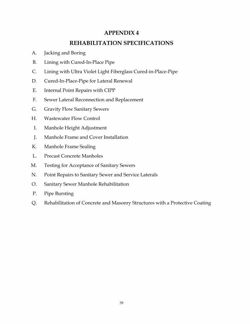
39
APPENDIX 4
REHABILITATION SPECIFICATIONS A. Jacking and Boring
B. Lining with Cured-In-Place Pipe
C. Lining with Ultra Violet Light Fiberglass Cured-in-Place-Pipe
D. Cured-In-Place-Pipe for Lateral Renewal
E. Internal Point Repairs with CIPP
F. Sewer Lateral Reconnection and Replacement
G. Gravity Flow Sanitary Sewers
H. Wastewater Flow Control
I. Manhole Height Adjustment
J. Manhole Frame and Cover Installation
K. Manhole Frame Sealing
L. Precast Concrete Manholes
M. Testing for Acceptance of Sanitary Sewers
N. Point Repairs to Sanitary Sewer and Service Laterals
O. Sanitary Sewer Manhole Rehabilitation
P. Pipe Bursting
Q. Rehabilitation of Concrete and Masonry Structures with a Protective Coating

40

Page 1 of 3
Consent Decree Priority Area
NumberNew Priority Area Number Project Name Project Description Total Quantity
Quantity Inside Priority Area
Quantity Outside Priority Area Date Started Completion Date
1 I-IG1 Dunwoody Lane Petition Sewer Gravity Sewer Installation 1,300 LF 1,300 LF 0 1/5/2013 8/5/2013Nancy Creek - Winters Chapel Rd. Sewer Cleaning & CCTV 21,447.2 LF 2,200 LF 19,247.2 LF 11/12/2008 7/6/2009
Manhole Assessment by Sewer Mapping Contract Manhole Assessment 29 MHs 29 MHs 0 2013 2013
Winters ChapelSewer Cleaning, CCTV, Cured-in-Place Liner
Rehabilitation 3583 LF 2,000 LF 1,583 LF 8/1/2010 10/29/2010Manhole Assessment by Sewer Mapping Contract Manhole Assessment 49 MHs 49 MHs 0 2013 2013
Oakcliff-Pleasantdale Road Sewer Cleaning & CCTV 3,262.8 LF 300 LF 2,962.8 LF 3/20/2012 4/17/2012Interstate 85 and Oakcliff Industrial Ct. Sewer Replacement and Relocation 5,000 LF 5,000 LF 0 2014 2018***
London Drive Pipe Bursting Rehabilitation 273 LF 273 LF 0 8/29/2011 9/21/2011Manhole Assessment Manhole Assessment 429 MHs 429 MHs 0 2008 2012
Munday Drive - Burk Drive Sewer Point Repair 1 Point Repair 1 Point Repair 0 10/22/2012 10/24/2012Munday Drive - Hood Avenue Sewer Point Repair 1 Point Repair 1 Point Repair 0 10/15/2012 10/18/2012
Munday Drive Sewer Cleaning & CCTV 10,673 LF 10,673 LF 0 2/1/2012 2/29/2012Johnson Ferry Sewer Cleaning & CCTV 14,741.4 LF 14741.4 LF 0 5/2/2011 2014
Buford HighwaySewer Cleaning, CCTV, Cured-in-Place Liner
Rehabilitation 16,118 LF 15,137 LF 981 LF 12/1/2007 3/17/2009Manhole Assessment Manhole Assessment 283 MHs 283 MHs 0 2008 2012
Buford Highway Sewer Point Repair 8 Point Repair 8 Point Repair 0 12/1/2007 3/17/20099 I-IG9, A-IG5 Drew Valley Phase 1 Pipe Bursting Rehabilitation 2,512 LF 2,512 LF 0 1/21/2008 6/13/2008
Alderbrook RdSewer Cleaning, CCTV, Cured-in-Place Liner
Rehabilitation 3,288 LF 3,288 LF 0 6/18/2010 10/30/2010Manhole Assessment Manhole Assessment 453 MHs 453 MHs 0 2008 2012
Manhole Assessment by Sewer Mapping Contract Manhole Assessment 335 MHs 335 MHs 0 2013 2013
10,12, 23 I-IG13, I-IG16, I-IG17 Southfork Peachtree Creek Basin Improvements Engineering Study 1,543,180 LF 422,704 LF 1,120,476 LF 10/1/2012 9/1/2013
12 I-IG17 Manhole Assessment by Sewer Mapping Contract Manhole Assessment 301 MHs 301 MHs 0 2013 2013I-IG19 Northern Avenue Sewer Cleaning & CCTV 8,565.3 LF 3,300 LF 5,265.3 LF 12/2/2008 1/9/2009I-SF1 Manhole Assessment Manhole Assessment 237 MHs 237 MHs 0 2008 2012A-SF3 Indian Creek Manhole Rehabilitation Manhole Rehabilitation 1 MH 1 MH 0 8/21/2013 8/21/2013I-SF1 Farnham Court Sewer Cleaning & CCTV 10,460.4 LF 10,460.4 LF 0 11/26/2012 5/6/2013
Columbia Drive Lift Station Project 1 Lift Station 1 Lift Station 0 2012 2016***Manhole Assessment Manhole Assessment 3,275 MHs 3,275 MHs 0 2008 2012
Cobb Fowler Basin Manhole Rehabilitation 42 MHs 42 MHs 0 5/23/2012 12/15/201215 A-SF2 Farnham Court - Richard Road Sewer Point Repair 1 Point Repair 1 Point Repair 0 4/15/2013 4/16/201315 A-SF2 Farnham Court - Weston Drive Sewer Point Repair 1 Point Repair 1 Point Repair 0 4/1/2013 4/2/201315 A-SF2 Farnham Court - Cobb Branch Drive Sewer Point Repair 1 Point Repair 1 Point Repair 0 5/1/2013 5/2/201315 A-SF2 Tiffany Place Sewer Cleaning & CCTV 63,567.3 LF 63,567.3 LF 0 5/12/2008 6/27/2008
15 & 20 I-SF2, I-SF3 Cobb Fowler and Shoal Creek Sewer Cleaning & CCTV 45,059.5 LF 45059.5 LF 0 6/10/2011 8/30/2011Manhole Assessment Manhole Assessment 91 MHs 91 MHs 0 2008 2012
Chamblee Tucker Road Sewer Point Repair 1 Point Repair 1 Point Repair 0 6/1/2009 6/3/2009Sewer Cleaning & CCTV 65,052.11 LF 15,916 LF 49,136.11 LF 4/13/2009 7/17/2009
Sewer Cleaning, CCTV, Cured-in-Place Liner Rehabilitation 13,359 LF 13,359 LF 0 7/30/2012 1/31/2013
Pipe Bursting Rehabilitation and Pipe Replacement 3724.1 LF 3,724.1 LF 0 3/1/2012 9/30/201218 I-IG12 Manhole Assessment Manhole Assessment 129 MHs 129 MHs 0 2008 2012
Manhole Assessment Manhole Assessment 395 MHs 395 MHs 0 2008 2012Braircliff Road Sewer Cleaning & CCTV 12,260.9 LF 12260.9 LF 0 3/1/2011 7/6/2011
Manhole Assessment Manhole Assessment 2,630 MHs 2,630 MHs 0 2008 2012Miriam Lane Creek Crossing Replacement 14 LF 14 LF 0 10/6/2009 10/6/2009Miriam Lane Sewer Cleaning & CCTV 19,430.5 LF 19430.5 LF 0 9/22/2011 12/13/2011
Miriam Lane - Welika Drive Location 1 Sewer Point Repair 1 Point Repair 1 Point Repair 0 6/18/2012 6/20/2012Miriam Lane - Welika Drive Location 2 Sewer Point Repair 1 Point Repair 1 Point Repair 0 11/7/2012 11/30/2012
Shoal Creek Basin Manhole Rehabilitation Manhole Rehabilitation 42 MHs 42 MHs 0 3/25/2013 6/30/2013Manhole Assessment Manhole Assessment 60 MHs 60 MHs 0 2008 2012
Indian Creek Manhole Rehabilitation Manhole Rehabilitation 5 MH 5 MH 0 8/20/2013 9/5/2013Manhole Assessment by Sewer Mapping Contract Manhole Assessment 1,094 MHs 1,094 MHs 0 2013 2013
Hannah Lane Sewer Cleaning, CCTV, Cured-in-Place Liner Rehabilitation 214 LF 214 LF 0 5/6/2008 5/6/2008
Presidential Parkway Pipe Bursting Rehabilitation 1,901 LF 900 LF 1,001 LF 3/12/2008 9/20/2008Aztec Rd. Phase II Pipe Bursting Rehabilitation 984 LF 984 LF 0 5/5/2008 9/15/2008
NA A-IG3 Will Ross Court Sewer Relocation 400 LF 400 LF 0 4/30/2013 5/15/2013Manhole Assessment Manhole Assessment 170 MHs 170 MHs 0 2008 2012
Fala Place Sewer Extention- New Home Construction 170 LF & 1-MH 170 LF & 1-MH 0 2/11/2013 3/1/2013Manhole Assessment Manhole Assessment 2,161 MHs 2,161 MHs 0 2008 2012
Drew Valley (Briar Wood Pool) Pipe Bursting Rehabilitation 240 LF 240 LF 0 4/12/2012 5/14/2012
Skyland DriveSewer Cleaning, CCTV, Cured-in-Place Liner
Rehabilitation 700 LF 700 LF 0 11/26/2012 3/31/2013Briarwood Recreation Center Gravity Sewer Installation 212 Lf & 2-MHs 212 Lf & 2-MHs 0 12/10/2012 1/28/2013
NA A-IG5, A-IG6 Caladium DriveSewer Cleaning, CCTV, Cured-in-Place Liner
Rehabilitation 600 LF 600 LF 0 2014 2014NA A-IG6 Manhole Assessment by Sewer Mapping Contract Manhole Assessment 535 MHs 535 MHs 0 2013 2013
Manhole Assessment Manhole Assessment 299 MHs 299 MHs 0 2008 2012
23 I-IG13
10 I-IG16
3 I-IG2
5 I-IG5
14
I-SF422
A-IG5NA
NA A-IG4
NA A-IG2
COMPLETED, ONGOING, AND SCHEDULED ASSESSMENTS AND REHABILITATION MEASURES CATEGORIZED BY THE INITIAL AND ADDITIONAL PRIORITY AREAS
15
PROJECTS WITHIN INITIAL PRIORITY AREAS* (PARTIAL OR FULL)
I-IG8
19 I-IG14
6 I-IG6
I-IG12
9
Embry Circle
I-SF2
I-IG10
20 I-SF3
17
PROJECTS WITHIN ADDITIONAL PRIORITY AREAS* (PARTIAL OR FULL)
NA A-SF3

Page 2 of 3
Consent Decree Priority Area
NumberNew Priority Area Number Project Name Project Description Total Quantity
Quantity Inside Priority Area
Quantity Outside Priority Area Date Started Completion Date
COMPLETED, ONGOING, AND SCHEDULED ASSESSMENTS AND REHABILITATION MEASURES CATEGORIZED BY THE INITIAL AND ADDITIONAL PRIORITY AREAS
O C S O S* ( O )Kensington Road Sewer Cleaning & CCTV 731.1 LF 731.1 LF 0 2/4/2013 3/5/2013NA A-SF4 Rowland Rd (Aerial Creek Crossing) Sewer Point Repair 1 Point Repair 1 Point Repair 0 2/1/2010 2/1/2010NA A-SF6 Manhole Assessment Manhole Assessment 145 MHs 145 MHs 0 2008 2012NA A-SF7 Manhole Assessment Manhole Assessment 25 MHs 25 MHs 0 2008 2012NA A-SF8 Manhole Assessment Manhole Assessment 38 MHs 38 MHs 0 2008 2012NA A-SF9 Manhole Assessment Manhole Assessment 21 MHs 21 MHs 0 2008 2012NA A-SF10 Manhole Assessment Manhole Assessment 71 MHs 71 MHs 0 2008 2012NA A-PB1 Upper Crooked Creek Manhole Rehabilitation Manhole Rehabilitation 3 MHs 3 MHs 0 8/8/2013 9/5/2013NA A-PB2 Manhole Assessment Manhole Assessment 3 MHs 3 MHs 0 2008 2012NA A-PB3 Manhole Assessment Manhole Assessment 21 MHs 21 MHs 0 2008 2012
Lithonia I Pump stationConstuction of the new pump station. Demolition of
existing Lithonia I & II pump stations 1 Pump Station 1 Pump Station 0 2013 2014Manhole Assessment Manhole Assessment 31 MHs 31 MHs 0 2008 2012
Stonecrest Sanitary Sewer and Force Mains Sewer ReplacementGravity: 15,400 LF Force
Main: 5,900 LFGravity: 15,400 LF Force
Main: 5,900 LF 0 2013 2015
Lower Crooked Creek Pump Station and Pipeline Improvements
2,200 LF of 36-inch gravity sewer and 6,600 LF of 30-inch
force main. 6,600 LF 2,200 LF 2/9/2012 2014NA A-PB5 Manhole Assessment Manhole Assessment 207 MHs 207 MHs 0 2008 2012
Manhole Assessment Manhole Assessment 9 MHs 9 MHs 0 2008 2012Fairington** Lift Station Project 1 Lift Station 1 Lift Station 0 2012 2015***
NA A-PB6, A-PB7 Polebridge Creek Manhole Rehabilitation Manhole Rehabilitation 9 MHs 9 MHs 0 8/19/2013 8/22/2013
NA NA Lehaven Lift Station Project 1 Lift Station 0 1 Lift Station 2011 2011NA NA Hammer Mill 2 Lift Station Project 1 Lift Station 0 1 Lift Station 2009 2009NA NA Mountain Industrial Lift Station Project 1 Lift Station 0 1 Lift Station 2011 2015***
NA NA Perimeter Park Lift Station Project 1 Lift Station 0 1 Lift Station 2013 2015***NA NA Royal Atlanta 1 Lift Station Project 1 Lift Station 0 1 Lift Station 2013 2015***NA NA Pepperwood Lift Station Project 1 Lift Station 0 1 Lift Station 2013 2015***NA NA Scarborough Lift Station Project 1 Lift Station 0 1 Lift Station 2013 2015***NA NA Hammer Mill 3 Lift Station Project 1 Lift Station 0 1 Lift Station 2013 2015***NA NA Roman Court Phase 2 Sewer Cleaning & CCTV 32,921.6 LF 0 32,921.6 LF 10/8/2012 2014NA NA Roman Court Phase 1 Sewer Cleaning & CCTV 35,887.9 LF 0 35,887.9 LF 4/2/2012 6/27/2012NA NA Superior Avenue Sewer Replacement and Relocation 1,875 LF 0 1,875 LF 3/4/2013 2014NA NA Snapfinger Wood Drive Sewer Cleaning & CCTV 3,067.2 LF 0 3,067.2 LF 5/20/2013 5/28/2013NA NA Peachtree Industrial Boulevard Sewer Cleaning & CCTV 40,128 LF 0 40,128 LF 8/1/2013 2014NA NA D'Youville Trace Road (Nancy Creek) Creek Crossing Replacement 60 LF 0 60 LF 2/5/2013 5/15/2013
NA NA Peachtree Industrial Boulevard Emergency Point Repair Sewer Point Repair 1 Point Repair 0 1 Point Repair 10/14/2013 10/15/2013NA NA Jolly Avenue Sewer Cleaning & CCTV 25,159.1 LF 0 25,159.1 LF 11/19/2012 4/23/2013NA NA Jolly Avenue- Location 1 Sewer Point Repair 1 Point Repair 0 1 Point Repair 8/1/2013 8/2/2013NA NA Jolly Avenue- Location 2 Sewer Point Repair 1 Point Repair 0 1 Point Repair 9/9/2013 9/10/2013NA NA Heritage Height Sewer Crossing Engineering Study 1,200 LF (Preliminary) 0 1,200 LF 2013 2013NA NA Heritage Height Sewer Crossing Gravity Sewer Installation 1,200 LF (Preliminary) 0 1,200 LF 12/1/2013 2018***NA NA Heritage Heights Gravity Sewer Installation 750.4 LF 0 750.4 LF 1/5/2009 4/24/2009NA NA Great Oaks Drive Sewer Extention- Septic Tank Failure 180 LF & 1-MH 0 180 LF & 1-MH 10/3/2012 10/19/2012
NA NA Mountain Industiral Lift Station and Force MainForce main installation by horizontal directional
drilling 2,900 LF 0 2,900 LF 2014 2015***NA NA Sagewood Circle Sewer Cleaning & CCTV 6,910 LF, 4 MH raising 0 6,910 LF 9/12/2012 11/1/2012NA NA Sagewood Circle Sewer Point Repair 1 Point Repair 0 1 Point Repair 11/1/2012 11/30/2012NA NA Oakcliff-Pleasantdale Road Sewer Point Repair 5 Point Repairs 0 5 Point Repairs 6/22/2012 7/31/2012NA NA Asbury Drive (Emory University) Sewer Cleaning & CCTV 1531.6 LF 0 1,531.6 LF 1/25/2012 3/8/2012NA NA Asbury Drive (Emory University) Sewer Replacement 200 LF 0 200 LF 7/6/2012 8/20/2012NA NA McLynn Avenue Pipe Bursting Rehabilitation 242 LF 0 242 LF 1/19/2012 3/6/2012NA NA Dorby Close Sewer Replacement and Relocation 238 LF 0 238 LF 11/3/2011 2/10/2012NA NA Mabry Road Sewer Cleaning & CCTV 17,311.4 LF 0 17,311.4 LF 7/20/2011 11/14/2011NA NA Manhole Assessment by Sewer Mapping Contract Manhole Assessment 6,042 MHs 0 6,042 MHs 2013 2013NA NA Manhole Assessment Manhole Assessment 10,017 MHs 0 10,017 MHs 2008 2012
NA NA Chelsea CircleSewer Cleaning, CCTV, Cured-in-Place Liner
Rehabilitation 12,150 LF 0 12,150 LF 12/17/2009 7/30/2010
NA NA Chamblee - Dunwoody Sewer Cleaning, CCTV, Cured-in-Place Liner
Rehabilitation 20,635 LF 0 20,635 LF 11/30/2009 7/30/2010
NA NA Mc Lynn AvenueSewer Cleaning, CCTV, Cured-in-Place Liner
Rehabilitation 5,375 LF 0 5,375 LF 2/28/2010 6/30/2010
NA NA Parker AvenueSewer Cleaning, CCTV, Cured-in-Place Liner
Rehabilitation 1,727 LF 0 1,727 LF 6/1/2010 6/30/2010
NA NA River RoadSewer Cleaning, CCTV, Cured-in-Place Liner
Rehabilitation 7,849 LF 0 7,849 LF 3/4/2010 6/28/2010NA NA Chelsea Circle (Point Repairs) Sewer Point Repair 1 Point Repair 0 1 Point Repair 1/22/2010 1/25/2010NA NA Chelsea Circle (Dyson Dr. Point Repair) Sewer Point Repair 1 Point Repair 0 1 Point Repair 3/1/2010 3/1/2010NA NA Chelsea Circle (Heaton Park Point Repair 1) Sewer Point Repair 1 Point Repair 0 1 Point Repair 2/22/2010 2/22/2010NA NA Chelsea Circle (Heaton Park Point Repair 2) Sewer Point Repair 1 Point Repair 0 1 Point Repair 2/24/2010 2/24/2010NA NA Chelsea Circle (Dyson Dr. Point Repair 2) Sewer Point Repair 1 Point Repair 0 1 Point Repair 3/2/2010 3/8/2010
A-PB6NA
A-PB4NA
PROJECTS OUTSIDE INITIAL AND ADDITIONAL PRIORITY AREAS
NA A-SF3

Page 3 of 3
Consent Decree Priority Area
NumberNew Priority Area Number Project Name Project Description Total Quantity
Quantity Inside Priority Area
Quantity Outside Priority Area Date Started Completion Date
COMPLETED, ONGOING, AND SCHEDULED ASSESSMENTS AND REHABILITATION MEASURES CATEGORIZED BY THE INITIAL AND ADDITIONAL PRIORITY AREAS
O C S O S* ( O )NA NA Panola Rd. Sewer Cleaning & CCTV 52,322.5 LF 0 52,322.5 LF 1/12/2009 7/10/2009NA NA Panola Rd. (Emergency Repair) Sewer Point Repair 1 Point Repair 0 1 Point Repair 7/6/2009 7/10/2009NA NA W. Nancy Creek Dr. & Chamblee - Dunwoody Rd. Sewer Cleaning & CCTV 62,440.57 LF 0 62,440.6 LF 1/20/2009 10/14/2009NA NA Keheley Dr. Sewer Cleaning & CCTV 6990.7 LF 0 6,990.7 LF 6/16/2009 6/26/2009NA NA Mahonia Pl. Sewer Cleaning & CCTV 18,570.3 LF 0 18,570.3 LF 8/5/2009 11/16/2009NA NA Dickie Dr. (Emory University Emergency Repair) Pipe Bursting Rehabilitation 75 LF 0 75 LF 9/3/2009 9/11/2009
NA NA Gresham AvenueSewer Cleaning, CCTV, Cured-in-Place Liner
Rehabilitation 1,613 LF 0 1,613 LF 7/22/2009 10/16/2009NA NA Gresham Avenue Sewer Relocation 1,262 LF 0 1,262 LF 6/15/2009 10/16/2009NA NA Gresham Avenue (Emergency Repair) Sewer Point Repair 1 Point Repair 0 1 Point Repair 8/20/2009 8/30/2009NA NA Gresham Avenue Sewer Cleaning & CCTV 41,342.8 LF 0 41,342.8 LF 6/2/2008 7/3/2008NA NA Scott Boulevard (Phase II) Gravity Sewer Installation 1,906.2 LF 0 1,906.2 LF 10/6/2008 7/16/2009NA NA Scott Boulevard Sewer Cleaning & CCTV 15,615.8 LF 0 15,615.8 LF 7/7/2008 8/6/2008NA NA Scott Boulevard Phase I Pipe Bursting Rehabilitation 4,070 LF 0 4,070 LF 2008 4/23/2008NA NA Archwood Dr. (Emergency Repair) Sewer Point Repair 1 Point Repair 0 1 Point Repair 8/17/2009 9/11/2009
NA NA John Carrol Dr. Easement Sewer Cleaning, CCTV, Cured-in-Place Liner
Rehabilitation 1,977 LF 0 1,977 LF 4/21/2008 7/30/2008
NA NA Riverview Lane Sewer Cleaning, CCTV, Cured-in-Place Liner Rehabilitation 3,716 LF 0 3,716 LF 6/30/2008 10/3/2008
NA NA Corn Creek Sewer Cleaning & CCTV 8,767.7 LF 0 8,767.7 LF 6/23/2008 6/30/2008NA NA W. Nancy Creek Dr. Sewer Cleaning & CCTV 78,342.81 LF 0 78,342.81 LF 10/13/2008 10/14/2009NA NA I-20 Project Pipe Bursting Rehabilitation 500 LF 0 500 LF 8/25/2008 1/15/2009NA NA Park Circle Pipe Bursting Rehabilitation 1,352 LF 0 1,352 LF 7/24/2008 9/17/2008
NA = Not ApplicableLF = Linear FeetMH = Manhole*Refer to Priority Areas Sewer Assessment and Rehabilitation Program (PASARP)**This station is being eliminated and connected to gravity system. ***Date revised.