priority areas sewer assessment and rehabilitation … key performance indicators ... sop standard...
TRANSCRIPT
Priority Areas Sewer Assessment and Rehabilitation Program
DeKalb County Department of Watershed Management (DWM)
JULY 2015

DEKALB COUNTY DEPARTMENT OF WATERSIDE MANAGEMENT
PASARP JULY 2015
i
CONTENTS
CONTENTS ................................................................................................................................................ i
ACRONYMS ............................................................................................................................................ iii
1 INTRODUCTION ........................................................................................................................ 1
1.1 Overview .......................................................................................................................... 1
1.2 Description of the DeKalb County WCTS ................................................................... 2
1.3 WCTS Condition and Context of the PASARP ........................................................... 3
2 PRIORITY AREAS IDENTIFICATION, DELINEATION, AND PRIORITIZATION ....................................................................................................................... 5
2.1 Initial Priority Areas Identification .............................................................................. 5
2.2 Additional Priority Areas Identification, Delineation, and Prioritization .............. 7
2.2.1 Description of the Criteria Used to Identify, Delineate, and Prioritize Additional Priority Areas ................................................................ 7
2.2.2 Additional Priority Areas Identification, Delineation, and Prioritization Process ....................................................................................... 10
3 SPECIFICATIONS, GUIDELINES, AND PROCEDURES FOR EVALUATIVE TOOLS AND PROGRAMS ....................................................................................................... 15
3.1 Overview of WCTS Evaluative Tools and Programs and their Applicability to the PASARP ...................................................................................... 15
4 CRITERIA FOR IDENTIFYING AND PRIORITIZING REHABILITATION MEASURES ................................................................................................................................. 18
4.1 Identification and Prioritization of Rehabilitation Measures ................................. 18
4.2 Procedures for Tracking and Inventorying Completed Rehabilitation Measures ........................................................................................................................ 20
4.3 Key Performance Indicators (KPIs) for Determining the Effectiveness of Completed Rehabilitation Measures within Priority Areas .................................... 21
5 SCHEDULE FOR COMPLETING REHABILITATION MEASURES WITHIN THE INITIAL AND ADDITIONAL PRIORITY AREAS ............................................................... 22
5.1 Priority Areas Assessment and Rehabilitation Master Schedule ........................... 22
5.2 Project Schedules ........................................................................................................... 23
5.3 General Schedule .......................................................................................................... 23

DEKALB COUNTY DEPARTMENT OF WATERSIDE MANAGEMENT
PASARP JULY 2015
ii
Appendices
A. Initial Priority Areas Map.
B. Additional Priority Areas Identification, Delineation, and Prioritization Process.
C. Additional Priority Areas Map.
D. Private Lateral Investigations Specifications, Guidelines, and Procedures.
E. Dyed Water Flooding Specifications, Guidelines, and Procedures.
F. Corrosion Defect Identifications Specifications, Guidelines, and Procedures.
G. Manhole Condition Assessment Specifications, Guidelines, and Procedures.
H. Flow Monitoring Specifications, Guidelines, and Procedures.
I. Closed Circuit Television (“CCTV”) Inspection Specifications, Guidelines, and Procedures.
J. Gravity Sewer Line and Force Main Defect Analysis Specifications, Guidelines, and Procedures.
K. Smoke Testing Specifications, Guidelines, and Procedures.
L. Scheduled Assessment and Rehabilitation Measures within the Initial and Additional Priority Areas.
M. General Schedule for Completing Additional Assessment and/or Prioritized Rehabilitation Measures within the Initial and Additional Priority Areas.
LIST OF TABLES
Table 2-1 . List of Priority Areas ................................................................................................... 6
Table 2-2 . Weights Assigned to Various Criteria .................................................................... 12
Table 2-3 . List of Additional Priority Areas ............................................................................. 14
Table 4-1 . Initial and Additional Priority Areas KPIs ............................................................ 21

DEKALB COUNTY DEPARTMENT OF WATERSIDE MANAGEMENT
PASARP JULY 2015
iii
ACRONYMS
ASCE American Society of Civil Engineers
AWTF Advanced Wastewater Treatment Facility
CCTV Closed Circuit Television
CERP Contingency and Emergency Response Plan
CIPP Cured in Place Pipe Lining
C&M DeKalb County Department of Watershed Management Construction and Maintenance Division
CMMS Computerized Maintenance Management System
CMOM Capacity, Management, Operations, and Maintenance
DWM DeKalb County Department of Watershed Management
FOG Fats, Oil, and Grease
EPA U.S. Environmental Protection Agency
EPD Georgia Environmental Protection Division
GAWP Georgia Association of Water Professionals
GIS Geographical Information System
GWEF Georgia Water Environment Federation
I/I Infiltration/Inflow
KPI Key Performance Indicators
MACP Manhole Assessment and Certification Program
NPDES National Pollutant Discharge Elimination System
NACWA National Association of Clean Water Agencies
NASSCO National Association of Sewer Service Companies
O&M Operation and Maintenance
OSARP Ongoing Sewer Assessment and Rehabilitation Program
PACP Pipeline Assessment and Certification Program
PASARP Priority Areas Sewer Assessment and Rehabilitation Program
RDI/I Rainfall Dependent Infiltration/Inflow

DEKALB COUNTY DEPARTMENT OF WATERSIDE MANAGEMENT
PASARP JULY 2015
iv
ROW Rights-of Way
SSES Sewer System Evaluation Survey
SOP Standard Operating Procedures
SSOS Sanitary Sewer Overflows
WCTS Wastewater Collection and Transmission System

1
1 INTRODUCTION
1.1 Overview
This Priority Areas Sewer Assessment and Rehabilitation Program (PASARP) has been prepared in accordance with the requirements of Section VI.B(x).35 of the Consent Decree -DeKalb County, Civil Action File No. 1:10-CV-4039-WSD. Section VI.B(x).35 of the Consent Decree requires the County to submit the PASARP to the U.S. Environmental Protection Agency (EPA) and the Georgia Environmental Protection Division (EPD), for review and comment, within one (1) year of the Date of Entry of the Consent Decree. The Consent Decree was entered on December 20, 2011.
The main purpose of the PASARP is to provide for the identification, delineation, assessment, prioritization, and rehabilitation of Priority Areas (both Initial Priority Areas and Additional Priority Areas as explained in the Consent Decree) within the DeKalb County Wastewater Collection and Transmission System (WCTS). The Initial and Additional Priority Areas total approximately 776 miles of sewers (approximately 29.5 % of the WCTS). In implementing the PASARP, the County will undertake certain condition, structural, and hydraulic assessments within the Priority Areas, and identify, prioritize, and complete appropriate rehabilitation measures within those areas. As part of the implementation process, the County will track and inventory rehabilitation measures completed within the Priority Areas and determine the effectiveness of those measures, using selected key performance indicators (KPIs). The County will complete implementation of the PASARP within eight and one-half (8½) years from the Date of Entry of the Consent Decree. The County has hired an outside contractor experienced in managing the implementation of Consent Decree sewer system improvement programs to assist it in the implementation of the PASARP in the capacity of a Program Manager.
This document contains the following key elements in compliance with the requirements of Section VI.B(x).35 of the Consent Decree:
List and map of the Initial Priority Areas identified in the Consent Decree.
Schedule for completing sewer assessment and for identifying, prioritizing, and completing rehabilitation projects within the Initial Priority Areas.
List and map of Additional Priority Areas identified after the Date of Entry of the Consent Decree, including an explanation of how the County identified, delineated, and prioritized the Additional Priority Areas.
Specifications, guidelines, and procedures, as appropriate, for the following evaluative tools and programs that will be used during the assessment of the Initial and Additional Priority Areas:
Private Lateral Investigations.
Dyed Water Flooding.

DEKALB COUNTY DEPARTMENT OF WATERSIDE MANAGEMENT
PASARP JULY 2015
2
Corrosion Defect Identifications.
Manhole Condition Assessment.
Flow Monitoring.
Closed Circuit Television (“CCTV”) Inspection.
Gravity Sewer Line and Force Main Defect Analysis.
Smoke Testing.
Criteria for identifying and prioritizing rehabilitation measures to be implemented within the Priority Areas.
Procedures for tracking and inventorying completed rehabilitation measures completed within the Priority Areas, including key performance indicators (KPIs).
List of currently scheduled rehabilitation measures within the Priority Areas.
1.2 Description of the DeKalb County WCTS
The DeKalb County WCTS (defined to include all pipes, lift stations, force mains, gravity sewer lines, manholes and other appurtenances) consists of an estimated 2,600 miles of sewers, 66 lift stations, and an estimated 61,500 manholes. The County is divided into three (3) sewer basins (Intergovernmental, Snapfinger, and Pole Bridge) containing a total of thirty-five (35) sewersheds, two (2) of which do not currently contain any sewers. The following are summary descriptions of the three (3) sewer basins:
Inter-Governmental Basin: The Intergovernmental Basin is divided into the following nine (9) sewersheds: Ball Mill Creek, Camp Creek, Lucky Shoals Creek, Marsh Creek, Northeast Creek, Nancy Creek, North Fork Creek, South Fork Creek, and Peavine Creek. This basin contains an estimated 1,136 miles of sanitary sewers and an estimated 25,800 manholes.
The approximately thirty-six (36) million gallons per day (MGD) of wastewater generated within the Intergovernmental Basin is collected, transmitted, and treated at the City of Atlanta R. M. Clayton Water Reclamation Facility under an intergovernmental agreement with the City of Atlanta. Sewers located within the City of Atlanta, through which wastewater from the Intergovernmental Basin flows, are owned and maintained by the City of Atlanta under the above-mentioned intergovernmental agreement with the City of Atlanta.
Snapfinger Basin: This basin is divided into the following fifteen (15) sewersheds: Barbashela Creek, Blue Creek, Cobb Fowler Creek, Conley Creek, Constitution Area, Corn Creek, Doolittle Creek, Indian Creek, Intrenchment Creek, Lower Snapfinger Creek, Shoal Creek, South River, Sugar Creek, Upper Snapfinger Creek, and Upper Stone Mountain. This basin contains an estimated 1,098 miles of sanitary sewers and an estimated 25,100 manholes.

DEKALB COUNTY DEPARTMENT OF WATERSIDE MANAGEMENT
PASARP JULY 2015
3
There are two (2) areas served by septic tanks only in the Snapfinger Basin. These areas include approximately one-third (⅓) of the Cobb Fowler Creek sewershed and the entire Upper Stone Mountain sewershed.
Pole Bridge Basin: The Pole Bridge Basin is divided into the following eleven (11) sewersheds: Crooked Creek, Honey Creek, Johnson Creek, Lower Crooked Creek, Lower Stone Mountain, Pine Mountain Creek, Plunket Creek, Polebridge Creek, Swift Creek, Upper Crooked Creek, and Yellow River. This basin includes an estimated 398 miles of sanitary sewer and an estimated 10,600 manholes.
1.3 WCTS Condition and Context of the PASARP
In order to promote effective operation and longevity of its WCTS, the County maintains an assortment of equipment and a diverse group of personnel to perform both proactive and reactive maintenance work twenty-four (24) hours per day. In addition to its inventory of equipment and personnel resources, the County has developed and continues to improve and implement Capacity, Management, Operations, and Maintenance (CMOM) programs countywide. Specifically, and as a part of its Consent Decree obligations, the County is implementing the following CMOM programs:
Contingency and Emergency Response Plan.
Fats, Oils, and Grease Management Program.
Sewer Mapping Program.
Maintenance Management Systems Program.
Collection and Transmission System Training Program.
System-Wide Flow and Rainfall Monitoring Program.
System-Wide Hydraulic Model.
Financial Analysis Program.
Infrastructure Acquisitions Program.
In addition to the above programs, and also separate from the PASARP, the County is required to implement an Ongoing Sewer Assessment and Rehabilitation Program (”OSARP”) that will ensure continuous assessment and rehabilitation of the County’s WCTS. The OSARP will begin its focus on areas outside the Initial and Additional Priority Areas. However, this program is intended to be maintained on a permanent basis by the County. In effect, the entire WCTS will be continuously assessed and rehabilitated.
The PASARP focuses on a subset of the WTCS, the areas potentially needing more urgent attention, hence the term Priority Areas. As noted, these Priority Areas are estimated to be about 30.2% of the WCTS based on the updated Priority Area boundary delineation surveys required by the Consent Decree. Because of the relatively young age of the County’s WCTS (84% of the WCTS is less than 50 years old), the extent of the County’s ongoing proactive and reactive maintenance program, and the CMOM Programs, the County’s WCTS is in

DEKALB COUNTY DEPARTMENT OF WATERSIDE MANAGEMENT
PASARP JULY 2015
4
relatively good condition. For instance, for the last several years, the County has been assessing the condition of its manholes (Manhole Condition Assessment) and ranking observed manhole structural defects using the assessment contractor’s own list of defect codes... The PASARP manhole condition assessments now require the assessment contractor’s defect coding to be based on the National Association of Sewer Service Companies (NASSCO) Manhole Assessment and Certification Program (MACP) and a NASSCO compliant standard exchange database with the coding results to be submitted to the County. Based on the results of the Manhole Condition Assessment performed to date, more than ninety percent (90%) had no structural defects. Similarly, in 2010, the County evaluated a representative portion of its WCTS for Excessive infiltration and inflow (I/I) and found that the average “R-Value” for all the meters analyzed was approximately 1.7%; indicating that the County’s WCTS experiences a relatively insignificant amount of I/I during periods of wet weather. Nonetheless, the CMOM Programs, the PASARP, and the OSARP, while individually addressing different aspects of the WCTS, will together ensure the long-term viability of the WCTS and eliminate SSOs.

DEKALB COUNTY DEPARTMENT OF WATERSIDE MANAGEMENT
PASARP JULY 2015
5
2 PRIORITY AREAS IDENTIFICATION, DELINEATION, AND PRIORITIZATION
2.1 Initial Priority Areas Identification
As part of the Consent Decree, the County identified twenty-three (23) Initial Priority Areas within its WCTS for further assessment and rehabilitation. The Initial Priority Areas consists of areas determined by the County as having sewers that are estimated to be older than fifty (50) years; areas with calculated “R-Values” greater than three (3) percent; and areas determined by the County, through its ongoing sewer system maintenance program, as needing additional assessment and/or prioritized rehabilitation. The Initial Priority Areas constitute approximately 463 miles of sewers, which is approximately eighteen percent (18%) of the County’s WCTS. Table 2-1 presents a list of the Initial Priority Areas including summary descriptions of each numbered Initial Priority Area, estimated length of each Initial Priority Area, and the name of the basin where each Initial Priority Area is located. Appendix A presents a map showing the locations of each numbered Initial Priority Area. It should be noted that a new numbering system for the Priority Areas has been adopted by the County. The first letter in the Priority Areas numbers identifies whether the Priority Area is an Initial Priority Area (I) or an Additional Priority Area (A). The second two letters identifies the sewer basin where the Priority Area is located (IG for the Intergovernmental Basin, SF for the Snapfinger Basin, and PB for the Pole Bridge)

DEKALB COUNTY DEPARTMENT OF WATERSIDE MANAGEMENT
PASARP JULY 2015
6
Table 2-1 List of Initial Priority Areas
Consent Decree
Number New
Priority Area Length of
Number Area Description Sewers
( LF )
INTER-GOVERNMENTAL BASIN
2 I-IG1 Winters Chapel Rd at Homeland Drive 7,387
3 I-IG2 Carver Circle 12,401
1 I-IG3 Ashford Dunwoody-Nancy Creek 16,399
4 I-IG4 North Peachtree-North Shallowford 20,104
5 I-IG5 Oakcliff Road 23,232
6 I-IG6 City of Chamblee 144,915
16 I-IG7 Embry Circle Pipe Bursting 6,713
17 I-IG8 Embry Circle Relining 15,916
7 I-IG9 Windsor Parkway 22,557
9 I-IG10 Drew Valley Road subdivisions 52,231
8 I-IG11 Skyland Road 3,712
18 I-IG12 Henderson Mill Rd 83,783
23 I-IG13 Area contributing to TSFORK 5 monitor 188,775
19 I-IG14 Briarcliff Rd 90,215
11 I-IG15 Lavista - Oak Grove area 39,197
10 I-IG16 Lavista Rd-Clairmont Rd-Houston Mill Rd 176,260
12 I-IG17 North DeKalb Mall area 57,669
13 I-IG18 Scott Blvd-Clairmont Rd 37,969
14 I-IG19 Old Rockbridge Rd-Avondale (partial) 19,698
SUBTOTAL: 1,019,133
SNAPFINGER BASIN
I-SF1 Old Rockbridge Rd-Avondale (partial) 46,897
15 I-SF2 Cobb Fowler Basin 733,145
20 I-SF3 Shoal Creek Basin 608,920
22 I-SF4 Covington Hwy at Kensington Rd 12,203
SUBTOTAL: 1,401,165
POLE BRIDGE BASIN
21 I-PB1 Lithonia Industrial Pkwy 22,773
SUBTOTAL: 22,773

DEKALB COUNTY DEPARTMENT OF WATERSIDE MANAGEMENT
PASARP JULY 2015
7
2.2 Additional Priority Areas Identification, Delineation, and Prioritization
Subparagraphs 35(b) and 35(c) of Section VI.B(x) of the Consent Decree requires the County to identify Additional Priority Areas within the County’s WCTS for further assessment and rehabilitation and to provide an explanation of how the Additional Priority Areas were identified, delineated, and prioritized. Subparagraph 35(d) of Section VI.B.(x) of the Consent Decree lists the criteria for identifying, delineating, and prioritizing the Additional Priority Areas. Section 2.2.1 of this document provides summary descriptions of the criteria used to identify, delineate, and prioritize Additional Priority Areas. Section 2.2.2 provides a summary of the process followed during the identification, delineation, and prioritization of the Additional Priority Areas. The details regarding the Additional Priority Areas identification, delineation, and prioritization process, including how the criteria were applied, are included in a report titled “DeKalb County Department of Watershed Management Wastewater Collection and Transmission System (WCTS) Additional Priority Areas Identification, Delineation, and Prioritization Process”, which is included in Appendix B of this document. The Additional Priority Areas constitute approximately 313 miles of sewers, which is approximately 12% of the County’s WCTS.
2.2.1 Description of the Criteria Used to Identify, Delineate, and Prioritize Additional Priority Areas
The following are summary descriptions of the criteria used to identify, delineate, and prioritize Additional Priority Areas:
Relative Age of the WCTS Infrastructure: Three (3) age categories were identified and delineated in the County’s GIS: (1) sewers installed prior to and including the year 1960, sewers installed between the time period of 1961 through 1984, and sewers installed after 1984.
Generally, the condition of sewers deteriorates with time. The rate and extent of sewer degradation is dependent upon several factors including age, pipe material, soundness of original construction, concentration of wastewater constituents, type and duration of external loading, and types of surrounding soils. During the identification, delineation, and prioritization of Additional Priority Areas, the County made the reasonable assumption that sewers constructed before 1960 have passed half their usable life and are probably in need of inspection to determine if they are in need of rehabilitation; sewers constructed during the time period of 1961 through 1984 would not be expected to have undergone significant deterioration and, for the most part, may not need any rehabilitation but may need assessment to determine their condition; and sewers constructed after 1984 are structurally sound and should not need any rehabilitation based on age alone.
Estimated Rainfall Dependent Infiltration/Inflow (“RDI/I”) Into the System: RDI/I is
defined as the portion of I/I that is directly influenced by the intensity and duration of a storm event. Two indicators of RDI/I include the peaking factor and the “R-

DEKALB COUNTY DEPARTMENT OF WATERSIDE MANAGEMENT
PASARP JULY 2015
8
Value”. The peaking factor is the ratio of the maximum flow to the average flow for a selected period of time (hour or day). The “R-Value” is defined as the fraction (generally expressed as a percentage) of rainfall entering a sewer system as RDI/I. Extraneous water enters the sewer system in direct response to rainfall through storm drains and other sources such as defective manhole and sewers.
Both the peaking factors and R-Values are important in evaluating the quantity and type of RDI/I. For example, whereas relatively high peaking factors and “R-Values” may indicate a significant inflow problem, relatively low peaking factors and high “R-Values” may suggest a significant infiltration problem.
Proactive and Reactive Maintenance Records, Including Results from Lift Station Inspections: The County regularly performs both proactive and reactive maintenance throughout its WCTS. Records of proactive and reactive maintenance are maintained in the County’s work order system. Sanitary sewer service calls are tracked and recorded by the date, time, address, cause, and action taken for each incident within the WCTS. The most common sanitary sewer complaint codes logged by the County's Construction and Maintenance Division (C&M) are recorded in the following categories: manhole/pipe clean or inspect, vacuum, root cut, and SSOs. The frequency and type of maintenance activity performed on a sewer, or a sewer appurtenance is a good indicator of the overall condition of a sewer.
SSO Records: The County tracks and monitors all reported spills that occur within the County's WCTS. Each spill is classified as either a structural-related defect spill or a service-related spill. Structural-related defect spills include cracked and broken sewers, offset joints, and root intrusion. Service-related spills primarily occur because of solidified fats, oils, and grease (FOG) or debris blockages. Less common service-related spills occur when equipment fails or the sanitary sewer system is vandalized. Structural-related defect spills provide a good indication of the overall condition of a sewer.
Known Structural Defects Including Known Manholes Defects: Over the last several years, the County has been performing Manhole Condition Assessment to identify the types and locations of manhole defects. The County has also been performing targeted sewer line condition assessment, either proactively or reactively, using various sewer system assessment tools including smoke testing and CCTV. In addition, the County performs routine lift stations inspections as part of its lift stations proactive maintenance program. As part of these programs, the County maintains an inventory of the types and locations of known manhole and pipe defects and utilizes this information to schedule and to implement manhole and pipe rehabilitation work either internally or through annual contracts. Known sewer system structural defects provide the most accurate information on the condition of a sewer system.
Relative Risk that SSOs are Likely to Reach Surface Waters: Discharges of untreated wastewater into surface waters pose a risk to human health and the environment. Wastewater can either enter surface waters directly from overflowing manholes and/or defective sewers, and/or through stormwater outfalls when overflowing

DEKALB COUNTY DEPARTMENT OF WATERSIDE MANAGEMENT
PASARP JULY 2015
9
manholes and/or defective sewers discharge into a storm drainage structure that conveys the wastewater into the receiving stream. The closer a sanitary sewer is to a surface water body (e.g. interceptor sewers and sewer stream crossings), the greater the relative potential for wastewater overflows to enter the water body that is in close proximity to the sanitary sewer. The County maintains GIS shapefiles of its WCTS and shapefiles of water bodies within the County. In evaluating this criterion, the County made the reasonable assumption that there exists a direct correlation between the sum of the length of streams and the perimeters of water bodies within a Ranking Area and the potential risk associated with spills in that Ranking Area.
Relative Risk that SSOs are Likely to Present Public Health and Welfare Concerns Based on Proximity and Access to Population Centers and Water Bodies: SSOs can occur in close proximity to public places such as streams, parks, schools, and buildings. The County maintains shapefiles of its WCTS as well as shapefiles of public places. In evaluating this criterion, the County made the reasonable assumption that the greater the density of public places, the greater the potential for SSOs to present public health and welfare concerns.
Information Obtained from Maintenance Personnel Knowledgeable of the Conditions of the WCTS Based on Actual Experience and Historic Investigations: The County’s computerized maintenance management system (CMMS) is used to track customer/public complaints, to create work orders, and to track corrective actions associated with sewer problems. In addition to the computerized records, the County’s personnel have first-hand individual and collective knowledge of the condition of the WCTS. This first-hand knowledge provides a good indication of the condition of various segments of the WCTS.
Standard Industry Practices as Documented in Industry Manuals, Engineering Textbooks, EPA Publications, and Lessons Learned: The sewer system assessment and rehabilitation processes have advanced tremendously over the last twenty (20) years. Numerous sewer assessment and rehabilitation programs have been implemented throughout the world with various degrees of success. In addition to the readily available information regarding sewer systems assessment and rehabilitation programs, various entities, including the EPA, have published several documents regarding effective sewer system assessment and rehabilitation techniques. This information provided the County with a wealth of knowledge regarding how to identify, delineate, and prioritize the Additional Priority Areas including how to assign weights and scores to various criteria.
Professional Judgment: Professional judgment can be defined as: The process of forming an opinion by discerning and comparing various alternatives. Sound professional judgment is characterized by, and conforms to, established technical, industry, and ethical standards and requires specialized knowledge and experience in the relevant professional field. The science of applying technical criteria, especially in determining the relative weights and relative scores to assign to various criteria and criteria categories (respectively) requires the superior ability to

DEKALB COUNTY DEPARTMENT OF WATERSIDE MANAGEMENT
PASARP JULY 2015
10
recognize the relative potential for various criteria to advance the goals and objectives of a sewer system assessment and rehabilitation program. During the identification, delineation, and prioritization of Additional Priority Areas, the County thoughtfully and realistically applied individual and collective professional judgment. Although professional judgment is sometimes difficult to quantify or explain, the professional industry has realized that, in the majority of cases, the results of professional judgment, when applied correctly supersedes those obtained through the application of technical facts and technology alone. This is indeed the case in the field of sewer system assessment and rehabilitation.
2.2.2 Additional Priority Areas Identification, Delineation, and Prioritization Process
As indicated previously in this document, the details regarding the Additional Priority Areas identification, delineation, and prioritization process are included in a report titled “DeKalb County Department of Watershed Management Wastewater Collection and Transmission System (WCTS) Additional Priority Areas Identification, Delineation, and Prioritization Process”, which is included in Appendix B of this document.
During the early stages of the Additional Priority Areas identification, delineation, and prioritization process, the County determined that it would be prudent to rank and to prioritize the Additional Priority Areas on a sewer basin by sewer basin basis, whereby each of the County’s three (3) sewer basins would be treated as a separate sewer system. This approach allowed the leveraging of each basin’s unique characteristics, took into account the data that was available for each of the sewer basins, advanced the potential to protect impaired [303(d)] streams throughout the County, and ensured the advancement environmental justice concerns within the County. The differentiating characteristics for each basin include the following:
• The three basins are hydraulically independent of each other and discharge to different wastewater treatment plants.
• Manhole condition assessment data was not available for the Inter-Governmental Basin, but was available for most of the manholes within the Snapfinger and the Pole Bridge basins.
• The Snapfinger Basin has some of the oldest pipes in the system. Root intrusion issues are more prevalent as a result of the presence of mature trees. Moreover, development within this basin has been individually planned and implemented over a period of time, rather than being developed using a master plan. As a result, some of the sewers within this basin do not flow as smoothly as sewer systems that follow a master plan.
The following is a summary of the Additional Priority Areas identification, delineation, and prioritization process:

DEKALB COUNTY DEPARTMENT OF WATERSIDE MANAGEMENT
PASARP JULY 2015
11
Data Gathering: The initial phase of this process involved gathering available relevant data that support the criteria used to identify, delineate, and prioritize the Additional Priority Areas. Whenever possible, data were gathered in electronic format but when electronic data were not available, hard copy data were gathered. Gathered data were cataloged and archived in formats deemed most efficient for evaluation and analysis.
Delineation of Ranking Areas: Following data gathering, the County divided its entire WCTS into 171 areas for evaluation, ranking, and prioritization. These areas were designated as “Ranking Areas” for purposes of this project. The areas were delineated based on the sewer pipe networks flowing to the corresponding downstream flow meters. The 171 Ranking Areas were selected because they were deemed to be of appropriate size; have readily identifiable boundaries; and data are available to support the application of the technical criteria selected for identifying, delineating, and prioritizing Additional Priority Areas.
Identification of Criteria Data Categories: During the review and analysis of available data, it was determined that some of the technical criteria were supported by two (2) types of data categories and that the application of criteria having two (2) available data categories required consideration of the two (2) available data categories supporting such criteria. The criteria having two (2) types of supporting data categories included (1) Estimated Rainfall Dependent Infiltration/Inflow (RDI/I) into the System, where both the Peaking Factors and the “R-Values” are available; (2) Proactive and Reactive Maintenance Records, including results from lift station inspections, where both proactive and reactive maintenance data are available; (3) SSO Records, where both structural-related defect spills and service–related spills are available; and (4) Known Structural Defects Including Known Manholes Defects, where both manhole structural-related defects and manhole service-related defects are available.
Assigned Weights to Various Criteria: In order to facilitate the application of the technical criteria to the Ranking Areas, weights were assigned to the various technical criteria based on their professionally perceived potential to advance the objectives of the Consent Decree. In assigning weights to various technical criteria, the County made the reasonable assumption that the available data supporting the universal set of the technical criteria, included in the Consent Decree and summarized above; coupled with professional judgment, are sufficient to predict the need and indeed the priority of the rehabilitation of various Ranking Areas within each sewer basin. Therefore, the total of all the weights assigned to the technical criteria was made to equal 100%. The spread among the weights assigned to various technical criteria was made sufficiently large to enable the mathematical discrimination between possible outcomes. A three-tier approach was used to divide the criteria into low, medium, and high, with weights of 5%, 10%, and 15%, respectively. The weights assigned to various criteria are shown in Table 2-2 below.

DEKALB COUNTY DEPARTMENT OF WATERSIDE MANAGEMENT
PASARP JULY 2015
12
Table 2-2: Weights Assigned to Various Criteria
Criteria Percentage
Weight
Relative Age of WCTS 15%
Estimated RDI/I into System: Peaking Factor 5%
Estimated RDI/I into System: R-Value 5%
Proactive Maintenance 10%
Reactive Maintenance 15%
Structural-Related Defect Spills 15%
Service-Related Defect Spills 5%
Known Structural Defects: Manhole Structural-Related Defects
15%
Known Structural Defects: Manhole Service-Related Defects
5%
Relative Risk that SSOs Reach Surface Waters 5%
Relative Risk that SSOs Present Public Health and Welfare Concerns
5%
Developed Three (3) Raw Data Spreadsheets, One for Each of the Three (3) Sewer Basins, Showing the Available Raw Data for Each Ranking Area: To facilitate the ranking process, three (3) Excel raw data spreadsheets were developed (one for each sewer basin). Each of the three (3) spreadsheets included the names of the sewersheds within the basin, the Ranking Areas within the basin, the ranking criteria, and the available data for each Ranking Area. To ensure that data was independent of the length of sewers in the Ranking Areas, some of the raw data were divided by the lengths of sewers within the associated Ranking Area, as appropriate. Following the data entry, three (3) data scoring spreadsheets were developed, one for each sewer basin. The data scoring spreadsheets were developed by assigning scores to each data item in the raw data spreadsheets. In order to compare data equally across various criteria, scores assigned to various data items were normalized on a scale of 1 to 10 with the highest score in each column receiving a score of 10. All other scores were adjusted linearly on a scale of 1 to 10. For example, if the largest value was 30, it was assigned a score of 10; a value of 15 in the same category was assigned a score of 5.

DEKALB COUNTY DEPARTMENT OF WATERSIDE MANAGEMENT
PASARP JULY 2015
13
Developed Ranking Areas Prioritization Matrices: Following the development of the raw data spreadsheets and the normalization of data within each criteria data categories, three Ranking Areas Prioritization Matrices were developed (one for each sewer basin in the County’s WCTS). The Ranking Areas Prioritization Matrices were developed by multiplying the scores in each criterion category by the weight assigned to the corresponding criterion to obtain the Weighted Scores. In cases where categories of data were missing within a basin, (for example, manhole condition assessment data was not available for the Intergovernmental Basin), the weight associated with that criterion was redistributed to the other criteria. The Weighted Scores for each Ranking Area were then summed up to obtain the Total Weighted Score. The Ranking Areas within each sewer basin were then ranked in order of priority based on the Total Weighted Scores, with the Ranking Area having the highest Total Weighted Score obtaining a rank of 1.
Performed a “Knee of the Curve” Analysis on Prioritization Results: Following the ranking of the Ranking Areas within each sewer basin, as explained above, a “Knee of the Curve” analysis was performed. The “Knee of the Curve” analysis is a mathematical tool that is used in several applications to determine the point at which performance improvements start to level off as a function of one or more tunable parameters. The “Knee of a Curve” is mathematically the point on a curve with maximum curvature. In cost benefit analysis, the “Knee of the Curve” is the point on the curve beyond which the relative effort to increase some tunable parameter is not cost effective.
The “Knee of the Curve” was performed to aid the County in determining the number of Ranking Areas, and hence the length and percentage of sewers within each sewer basin, where additional assessment and/or the implementation of rehabilitation measures would realize the optimum benefits cost effectively. In deciding to use the “Knee of the Curve” analysis, the County made the reasonable assumption that the assessment and/or the implementation of rehabilitation measures will be directed towards the elimination of Non-FOG Spills and that there exists a correlation between Non-FOG Spills and the length of sewers in each Ranking Area.
Identified Additional Ranking Areas for Further Assessment and Rehabilitation: Following the “Knee of the Curve” analysis, the Ranking Areas below the point of greatest curvature (Knee of the Curve) were selected for further assessment and/or prioritized rehabilitation. Some overlap was found to exist between the areas selected through the “Knee of the Curve” analysis and the Initial Priority Areas. The areas outside the Initial Priority Areas but within the areas selected for further assessment and/or rehabilitation, through the “Knee of the Curve” analysis, were identified as the Additional Priority Areas. Table 2–3 Presents a list with estimated lengths of the Additional Priority Areas selected for further assessment and/or prioritized rehabilitation. Appendix C presents two maps. The first one shows the locations of the Additional Priority Areas. The second shows the combined Initial Priority Areas and the Additional Priority Areas.

DEKALB COUNTY DEPARTMENT OF WATERSIDE MANAGEMENT
PASARP JULY 2015
14

DEKALB COUNTY DEPARTMENT OF WATERSIDE MANAGEMENT
PASARP JULY 2015
15
TABLE 2-3 List of Additional Priority Areas
Priority Area Length of
Number Area Description Sewers ( LF )
INTER-GOVERNMENTAL BASIN
A-IG1 Ranking Area MARSH-FUL (Marsh Creek) 56,651
A-IG2 Ranking Area TAZTEC5 (Aztec) 41,324
A-IG3 Ranking Area TNANCY2 (Nancy Creek) 50,937
A-IG4 Ranking Area TNANCY5 (Nancy Creek) 57,976
A-IG5 Ranking Area TNFORK1 (North Fork Peachtree Creek) 527,354
A-IG6 Ranking Area TSFORK4 (South Fork Peachtree Creek) 46,778
A-IG7 Ranking Area TSFORK3 (South Fork Peachtree Creek) 31,582
SUBTOTAL: 812,602
SNAPFINGER BASIN
A-SF1 Ranking Area TUSF14 (Upper Snapfinger Creek) 58,415
A-SF2 Ranking Area BAR5 (Barbashela Creek) 60,730
A-SF3 Ranking Area IND1 (Indian Creek) 46,221
A-SF4 Ranking Area USF4 (Upper Snapfinger Creek) 11,531
A-SF5 Ranking Area USF2 (Upper Snapfinger Creek) 75,491
A-SF6 Ranking Area ITMC-ATL (Intrenchment Creek) 41,344
A-SF7 Ranking Area TDOL5 (Doolittle Creek) 28,390
A-SF8 Ranking Area TDOL6 (Doolittle Creek) 46,241
A-SF9 Ranking Area SUG5 (Sugar Creek) 22,461
A-SF10 Ranking Area CON-CLAY (Conley Creek) 17,005
SUBTOTAL: 407,829
POLE BRIDGE BASIN
A-PB1 Ranking Area UCKC2 (Upper Crooked Creek) 146,424
A-PB2 Ranking Area LCKC1 (Lower Crooked Creek) 59,278
A-PB3 Ranking Area TJSC1 (Johnson Creek) 41,156
A-PB4 Ranking Area THON4 (Honey Creek) 37,563
A-PB5 Ranking Area PINEM2 (Pine Mountain) 46,939
A-PB6 Ranking Area PB1 (Pole Bridge Creek) 90,167
A-PB7 Ranking Area PBPLNT1 (Pole Bridge Wastewater
Treatment Plant) 11,450
SUBTOTAL: 432,977

DEKALB COUNTY DEPARTMENT OF WATERSIDE MANAGEMENT
PASARP JULY 2015
16
3 SPECIFICATIONS, GUIDELINES, AND PROCEDURES FOR EVALUATIVE TOOLS AND PROGRAMS
The following evaluative tools and programs, identified in the Consent Decree Section VI.B(x).35, will be used during the implementation of the PASARP:
Private Lateral Investigations Specifications, Guidelines, and Procedures (Appendix D).
Dyed Water Flooding Specifications, Guidelines, and Procedures (Appendix E).
Corrosion Defect Identifications Specifications, Guidelines, and Procedures (Appendix F).
Manhole Condition Assessment Specifications, Guidelines, and Procedures (Appendix G).
Flow Monitoring. Guidelines Specifications, Guidelines, and Procedures (Appendix H).
Closed Circuit Television (“CCTV”) Inspection Specifications, Guidelines, and Procedures (Appendix I).
Gravity Sewer Line and Force Main Defect Analysis Specifications, Guidelines, and Procedures (Appendix J).
Smoke Testing Specifications, Guidelines, and Procedures (Appendix K).
3.1 Overview of WCTS Evaluative Tools and Programs and their Applicability to the PASARP
As indicated in Section 2 of this document, the WCTS infrastructure degrades with time based on several factors including age, pipe material, soundness of original construction, concentrations of wastewater constituents, type and duration of external loading, and types of surrounding soils. WCTS degradation can affect the structural integrity and/or hydraulic performance of the infrastructure. The level of degradation is determined by using several of the above-listed evaluative tools to determine the current condition and/or performance compared with the design or expected level or performance. The assessment of the Priority Areas will be performed in a manner so as to provide the information needed to identify and to prioritize rehabilitation measures based on consequence and likelihood of failure (risk) and cost effectiveness. The following are summary descriptions of the evaluative tools and programs that will be used to assess the Initial and Additional Priority Areas.
DEKALB COUNTY DEPARTMENT OF WATERSIDE MANAGEMENT
PASARP JULY 2015
17
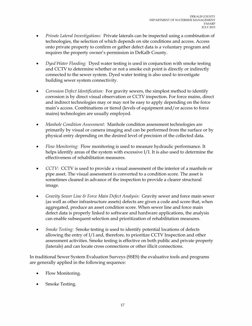
Private Lateral Investigations: Private laterals can be inspected using a combination of technologies, the selection of which depends on site conditions and access. Access onto private property to confirm or gather defect data is a voluntary program and requires the property owner’s permission in DeKalb County.
Dyed Water Flooding: Dyed water testing is used in conjunction with smoke testing and CCTV to determine whether or not a smoke exit point is directly or indirectly connected to the sewer system. Dyed water testing is also used to investigate building sewer system connectivity.
Corrosion Defect Identification: For gravity sewers, the simplest method to identify corrosion is by direct visual observation or CCTV inspection. For force mains, direct and indirect technologies may or may not be easy to apply depending on the force main’s access. Combinations or tiered (levels of equipment and/or access to force mains) technologies are usually employed.
Manhole Condition Assessment: Manhole condition assessment technologies are primarily by visual or camera imaging and can be performed from the surface or by physical entry depending on the desired level of precision of the collected data.
Flow Monitoring: Flow monitoring is used to measure hydraulic performance. It helps identify areas of the system with excessive I/I. It is also used to determine the effectiveness of rehabilitation measures.
CCTV: CCTV is used to provide a visual assessment of the interior of a manhole or pipe asset. The visual assessment is converted to a condition score. The asset is sometimes cleaned in advance of the inspection to provide a clearer structural image.
Gravity Sewer Line & Force Main Defect Analysis: Gravity sewer and force main sewer (as well as other infrastructure assets) defects are given a code and score that, when aggregated, produce an asset condition score. When sewer line and force main defect data is properly linked to software and hardware applications, the analysis can enable subsequent selection and prioritization of rehabilitation measures.
Smoke Testing: Smoke testing is used to identify potential locations of defects allowing the entry of I/I and, therefore, to prioritize CCTV Inspection and other assessment activities. Smoke testing is effective on both public and private property (laterals) and can locate cross connections or other illicit connections.
In traditional Sewer System Evaluation Surveys (SSES) the evaluative tools and programs are generally applied in the following sequence:
Flow Monitoring.
Smoke Testing.

DEKALB COUNTY DEPARTMENT OF WATERSIDE MANAGEMENT
PASARP JULY 2015
18
Dyed Water Testing.
Manhole Condition Assessment.
Closed circuit Television Inspection (CCTV).
Private Lateral Investigation.
Corrosion Defect Identification.
Gravity Sewer Line and Force Main Defect Analysis.
Some combination of these evaluative tools and programs are utilized simultaneously based on the system size and needs. The most efficient combination of evaluative tools and programs will be used to assess the Initial and Additional Priority Areas. The selection of the most effective tools and programs, or combinations thereof, will ultimately be made on a case by case basis, based on Priority Area specific conditions and data available at the time additional assessment is performed. Detailed specifications, guidelines, and procedures for these assessment tools and programs are included in Appendices D through K. It should be noted that the specifications, guidelines, and procedures included in Appendices D through K are subject to change based on advancement in technology, effectiveness, and site specific conditions. The County has used the detailed specifications, guidelines, and procedures included in Appendices D through K as guides to help facilitate development of contract documents for assessment and rehabilitation implementation. The County used the information in the Appendices to develop condition assessment “master” specifications to comply with the County’s Purchasing and Contracting Departments formats for entering into legal agreements between the County and the contractor. As specific PASARP condition assessment contract documents were prepared the technical specifications were updated, as necessary, to include enhancements to the specifications, such as allowing high resolution digital CCTV side scanning cameras to conduct CCTV inspections. The County will update its master specifications as frequently as necessary and continue to utilize the same or modified contract documents that effectively produce the desired assessment performance and reflect current practices. Whenever revisions are made to the specifications, guidelines, and procedures, the revision date will be identified on the electronic and hard copy versions. Previous versions will also be maintained.

DEKALB COUNTY DEPARTMENT OF WATERSIDE MANAGEMENT
PASARP JULY 2015
19
4 CRITERIA FOR IDENTIFYING AND PRIORITIZING REHABILITATION MEASURES
This section presents the criteria that the County will use to identify and prioritize rehabilitation measures that will be implemented in the Initial and Additional Priority Areas. Conditions associated with the occurrence of SSOs can generally be grouped into three (3) major categories: (1) capacity limitations, (2) structural defects, and (3) maintenance problems. The criteria presented in this document will be used to identify and prioritize rehabilitation measures that predominantly address capacity limitations and structural defects that are causing, or have the potential to cause, SSOs within and/or down gradient of the Initial and Additional Priority Areas. Although some of the rehabilitation measures may address maintenance problems that are causing or have the potential to cause SSOs, the County believes that CMOM Programs will more effectively address maintenance problems that are causing or have the potential to cause SSOs. In general, the County will identify and prioritize rehabilitation measures within the Priority Areas based on the following criteria:
Likelihood and consequence of failure (risk).
Hydraulic Modeling Analysis.
Cost effectiveness analysis (to be performed on the whole or parts of each Priority Area).
The frequencies and volumes of Non-FOG sanitary sewer overflows (SSOs) with specific emphases on those caused by capacity limitations and structural defects.
Professional judgment of County personnel knowledgeable of the performance and maintenance requirements of the WCTS.
SSO potential to impact human health and the environment.
It should be noted that some assessment and/or rehabilitation work has already been completed within some of the Initial and Additional Priority Areas. Therefore, the extent to which various Priority Areas will be assessed and/or rehabilitated will vary from Priority Area to Priority Area depending on the level of previous assessment and the effectiveness of completed rehabilitation measures.
4.1 Identification and Prioritization of Rehabilitation Measures
The process of identifying rehabilitation measures for a specific Priority Area will be initiated following the completion of the condition assessment within that Priority Area (or

DEKALB COUNTY DEPARTMENT OF WATERSIDE MANAGEMENT
PASARP JULY 2015
20
a portion thereof). As indicated in the guidelines for the various condition assessment techniques, the data obtained during sewer system condition assessment will be documented and archived in formats compatible with the County’s mapping and work order systems. This approach will promote intelligent interface of various condition assessment data and the sewer system locational data (GIS). The condition assessment data will effectively become an attribute of the sewer system assets for which rehabilitation measures will be identified and prioritized. This will ensure reasonable data accuracy by eliminating multiple data entries, facilitate data analysis, and reduce duplication of effort; and therefore, advance cost effectiveness in data analysis, identification and prioritization of rehabilitation measures, and rehabilitation measures design and construction processes.
The Gravity Line and Force Main Defect Analysis Guidelines included in Appendix J of this document summarizes the process the County may use to analyze the defects identified during the sewer system condition assessment phase of the PASARP. Certain defects will be scheduled for rehabilitation immediately upon their discovery during the sewer system condition assessment. Such defects will include those that pose immediate or foreseeable danger to human health and welfare and those determined to be contributing to the occurrence of SSO, based on their severity. The determination as to whether a defect should be scheduled for rehabilitation will be made based on professional judgment and experience.
As discussed in the DeKalb County System-Wide Hydraulic Model Program document the County is implementing a phased model development strategy for the three hydrological sewer basins; Snapfinger, Pole Bridge, and Intergovernmental. A key result of implementing this strategy is that it will better meet the intent of the PASARP Program. The County will be able to build the sewer network and assess it more quickly in order to identify the sewer segments with capacity concerns and expeditiously integrate them with segments with observed significant sewer structural and infiltration/inflow deficiencies. This approach is appropriate since the County’s data published herein indicates the County does not have a serious system-wide capacity issue. The quicker integration of capacity and structural information also means the County can advance the system improvements using the protocols presented in the modeling program’s System Capacity Assessment and Capacity Assurance. Sewer segments identified with significant structural or infiltration/ inflow defects from the condition assessment activities will only be considered for rehabilitation or replacement design after the segments are compared with the hydraulic modeling results. The condition assessment data and analysis decision logic will consider costs, risk components, and applicable rehabilitation technology alternatives using assessment and rehabilitation software as much as practical in order to process the large amounts of data that will be generated. One or more of the types of rehabilitation measures listed below will be utilized by the County. The listed rehabilitation measures have been tested and implemented extensively and effectively throughout the world and their applicability, effectiveness, and durability are well documented.
Cured-in-place liner.
Pipe bursting.

DEKALB COUNTY DEPARTMENT OF WATERSIDE MANAGEMENT
PASARP JULY 2015
21
Manhole lining.
Manhole replacement.
Open cut pipe replacement method.
Point repairs.
Manhole raising.
Manhole ring and cover replacement.
Service lateral rehabilitation.
Installation of cleanouts.
Disconnection of unauthorized connections.
The most cost effective combination or rehabilitation measures will be selected for implementation.
4.2 Procedures for Tracking and Inventorying Completed Rehabilitation Measures
The procedures discussed in this section will be used to track and inventory the rehabilitation measures completed as part of the PASARP. Ongoing and completed rehabilitation projects will be tracked and inventoried. The following asset rehabilitation projects will be tracked during the implementation of the PASARP:
Sewer gravity pipe rehabilitation (to be tracked in linear feet and type of rehabilitation project).
Force mains and air release valves rehabilitation (based on the type of rehabilitation measure).
Manhole rehabilitation (to be tracked by manhole identification number (ID), date started/date completed, type of manhole rehabilitation, and location).
Lift station replacement and rehabilitation projects (to be based on the type of rehabilitation).
Once a rehabilitation project is completed, information regarding the project will be provided by the project manager to Geographic Information System (GIS) personnel for input into the ESRI ArcGIS database. This will allow for the tracking and inventorying of completed rehabilitation measures for the purpose of updating work on system assets and establishing a graphical representation of completed rehabilitation measures.
The County’s work order system will be used for work activities performed in the field such as reactive maintenance and system repairs. A project will be defined as a collection of work orders assigned to a project number to track the cost and work involved. Service requests and work orders will be tracked in the Oracle Utilities Work and Asset Management

DEKALB COUNTY DEPARTMENT OF WATERSIDE MANAGEMENT
PASARP JULY 2015
22
(WAM) system. Data from the work order system that is related to or considered a rehabilitation type project will be summarized and submitted to the County’s Department of Watershed Management personnel for entry and recording in the County’s information management system.
4.3 Key Performance Indicators (KPIs) for Determining the Effectiveness of Completed Rehabilitation Measures within Priority Areas
Table 4-1 presents the KPIs selected by the County to determine the effectiveness of completed rehabilitation measures. Consistent with the Consent Decree, these KPIs will focus on the Priority Areas. Data associated with these KPIs will be collected between, during, and after rehabilitation measures are implemented.
TABLE 4-1 Initial and Additional Priority Areas KPIs
KPI Formula Desired
Result Data
Interval SSOs per 100 miles of WCTS within the Priority Areas per year
(# SSOs in all the Priority Areas/ WCTS total miles within the Priority Areas) x 100
5% reduction per year beginning in 2014
Annual
SSOs per 100 miles of WCTS within the Priority Areas per year per inch of rain within the Priority Areas
(# SSOs in all the Priority Areas/ WCTS total miles within the Priority Areas / estimated total rainfall in inches per year) x 100
Monitor Annual
Total volume of spills per 100 miles of WCTS within the Priority Areas
(Estimated total volume of spills within the Priority Areas/ WCTS total miles within the Priority Areas) x 100
5% reduction per year beginning in 2014
Annual
Total volume of spills per 100 miles per inch of rain within the Priority Areas
(Estimated total volume of spills within the Priority Areas/WCTS total miles within the Priority Areas/estimated total rainfall in inches per year) x 100
Monitor Annual
# of dry weather SSOs within the Priority Areas
Total # of dry weather SSOs within the Priority Areas
10% reduction per year beginning in 2014
Annual
DEKALB COUNTY DEPARTMENT OF WATERSIDE MANAGEMENT
PASARP JULY 2015
23
5 SCHEDULE FOR COMPLETING REHABILITATION MEASURES WITHIN THE INITIAL AND ADDITIONAL PRIORITY AREAS
The Consent Decree requires that the PASARP include the following information: (1) currently scheduled rehabilitation measures within the Initial and Additional Priority Areas; (2) schedules for completing any remaining sewer assessments and for identifying, prioritizing, and completing rehabilitation projects within the Initial Priority Areas; and (3) provide for the identification, delineation, assessment, and rehabilitation of all the Initial and Additional Priority Areas within eight and one-half (8½)years from the Date of Entry of the Consent Decree. Appendix L presents the scheduled (i.e., completed, ongoing, and scheduled) assessment and rehabilitation measures within the Initial and Additional Priority Areas using best available information. Some of these measures were completed during and since the Consent Decree negotiations, but some are not yet completed.
Appendix M presents a General Schedule for Completing Additional Assessment and/or Prioritized Rehabilitation Measures within the Initial and Additional Priority Areas. The General Schedule presented in Appendix M includes the time frames within which the County anticipates to complete the major tasks associated with the assessment and completion of prioritized rehabilitation measures within the Initial and Additional Priority Areas. Following the EPA/EPD approval of the PASARP, the County will develop a Priority Areas Assessment and Rehabilitation Master Schedule as discussed in Section 5.1 below. As rehabilitation measures are identified and prioritized within the Initial and Additional Priority Areas, Project Schedules will be developed for specific assessment and rehabilitation projects as discussed in Section 5.2 below. The County has hired an outside contractor experienced in managing the implementation of Consent Decree sewer system improvement programs to assist it in the implementation of the PASARP in the capacity of a Program Manager.
5.1 Priority Areas Assessment and Rehabilitation Master Schedule
The Priority Areas Assessment and Rehabilitation Master Schedule will be developed using commercially available software selected by the County. The Master Schedule will include the beginning and ending dates for anticipated major tasks and subtasks that the County will undertake during the assessment and rehabilitation of the Initial and Additional Priority Areas. The Master Schedule will be developed in such a manner so as to enable progress planning, progress reporting, and the identification of schedule variances for major tasks as the assessment and rehabilitation of the Initial and Additional Priority Areas progresses. The Master Schedule will be updated monthly to reflect work completed, work in progress, schedule variances, and any other changes encountered during the previous

DEKALB COUNTY DEPARTMENT OF WATERSIDE MANAGEMENT
PASARP JULY 2015
24
month. It should be noted that, as is the case with projects of this nature, intermediate task and subtask start and finish dates may change with time, but the Consent Decree deadline will stay the same.
5.2 Project Schedules
As specific assessment and rehabilitation projects are identified, the County will prepare project schedules. Project schedules will be developed using commercially available software selected by the County. The project schedules will be compatible with the Master Schedule to facilitate effective reporting of assessment and/or rehabilitation activities and to ensure accurate updates of the Master Schedule. The Project Schedules will include specific start and completion dates for specific projects by task and subtask and the critical path for the project. As indicated in Section 4 of this document, some of the defects identified during the assessment of the Initial and Additional Priority Areas will be scheduled for rehabilitation immediately upon their discovery. Such defects will include those that pose immediate or foreseeable danger to human health and welfare and those determined to be contributing to the occurrence of SSO, based on their severity. The County does not intend to develop schedules for the completion of projects associated with the rehabilitation of defects scheduled for rehabilitation immediately following their discovery. However, the work completed under such projects will be included in the subsequent update of the Master Schedule.
5.3 General Schedule
The time frame within which the additional assessment will be completed is shown in the General Schedule included in Appendix M and as updated in subsequent Master Schedules or compliance reports.
The following are summary descriptions of the activities identified in the General Schedule for Completing the Assessment and Rehabilitation Measures within the Initial and Additional Priority Areas:
Assessment of Priority Areas:
Establish the Physical Boundaries of the Priority Areas: This task will involve reviewing the GIS maps in the field and establishing the physical boundaries of the Initial and Additional Priority Areas. A reconnaissance of the Priority Areas boundaries will be performed to accomplish this effort. The establishment of physical boundaries will involve identifying physical land marks, road intersections, building addresses, manhole numbers, and other readily identifiable permanent physical features around the perimeter of each Priority Area. If any variances between the GIS maps and ground conditions are observed, the GIS maps will be revised to reconcile the variances. The physical boundaries, once established, will guide field personnel in ensuring that the assessment and rehabilitation work covers all sewers within the Priority Areas.

DEKALB COUNTY DEPARTMENT OF WATERSIDE MANAGEMENT
PASARP JULY 2015
25
Determine Optimization of Flow Monitors and Rain Gauges as Needed: As indicated in the Flow Monitoring Specifications, Guidelines, and Procedures included in Appendix H of this document, additional flow and rainfall monitoring data, beyond that obtained through the System-Wide Flow and Rainfall Monitoring Program, may be needed to characterize flows (including I/I), to prioritize other assessment activities, and to assess the effectiveness of rehabilitation measures completed within the Initial and Additional Priority Areas. During the early stages of the assessment phase, the County will review the System-Wide Flow and Rainfall Monitoring Program to determine the need and locations of additional flow monitors and/or rain gauges. The determination regarding the need and locations of additional flow monitors and/or rain gauges, beyond those available through the System-Wide Flow and Rainfall Monitoring Program, will be accomplished on a Priority Area by Priority Area basis.
Relocate or Install Additional Flow Monitors and Rain Gauges as Needed: This task will involve the relocation of existing flow monitors and/or rain gauges or the installation of additional flow monitors and/or rain gauges in the field as determined at the initial stages of the assessment phase.
Perform the Assessment of Priority Areas: This task will involve the completion of additional assessment of the Initial and Additional Priority Areas utilizing the evaluative tools and programs discussed in Section 3 of this document. It is anticipated that this task will start several months before rehabilitation starts and be completed at least one (1) year ahead of the completion of rehabilitation activities.
Analyze Assessment Data and Identify and Prioritize Rehabilitation Measures: This task will involve the analysis of condition assessment data and the identification and prioritization of rehabilitation measures to be implemented within the Priority Areas.
Implement Rehabilitation Measures:
Rehabilitate Severe Defects: As indicated in Section 4 of this document, severe defects will be scheduled for rehabilitation immediately upon their discovery during the sewer system condition assessment. Such defects will include those that pose immediate or foreseeable danger to human health and welfare and those determined to be contributing to the occurrence of SSO, based on their severity. The determination as to whether a defect should be scheduled for rehabilitation will be made based on professional judgment and experience. This task will continue throughout the implementation of the PASARP.
Complete Scheduled Rehabilitation Measures: This task will involve the completion of currently scheduled rehabilitation measures within the Initial and Additional Priority Areas. The County anticipates bundling up one or more rehabilitation measures into individual rehabilitation projects to be completed either by County personnel or private contractors. The size and
DEKALB COUNTY DEPARTMENT OF WATERSIDE MANAGEMENT
PASARP JULY 2015
26
scope of various rehabilitation projects will be determined on a case by case basis.
Implement Prioritized Rehabilitation Measures: This task will involve the completion of prioritized rehabilitation measures within the Initial and Additional Priority Areas. The County anticipates bundling up one or more rehabilitation measures into individual rehabilitation projects to be completed either by County personnel or private contractors. The size and scope of various rehabilitation projects will be determined on a case by case basis. This task is expected to continue throughout the implementation of the PASARP.
Track and Inventory Completed Rehabilitation Measures: This task will involve tracking and inventorying the effectiveness of completed rehabilitation measures as discussed in Section 4 of this document. This activity is expected to start at the beginning of the implementation of the PASARP and continue throughout the PASARP implementation period.

* Revised Date Page 1
Consent Decree Priority Area Number
New Priority Area Number Project Name Project Description Total Quantity Quantity in Priority Area Date Started Completion Date
2 I-IG1 Nancy Creek - Winters Chapel Rd. Cleaning & CCTV 21447.2 LF 2200 LF 11/12/08 07/06/09Cleaning & CCTV 3583 LF 2000 LF 8/1/10 10/29/10
Cured-in-Place Liner Rehabilitation 3583 LF 2000 LF 8/1/10 10/29/10Manhole Assessment Manhole Assessment 103 MHs 103 MHs 2009 2011
Oakcliff-Pleasantdale Road Cleaning & CCTV 3262.8 LF 300 LF 3/20/2012 4/17/2012London Drive Cleaning, CCTV, Pipe Bursting Rehabilitation 273 LF 273 LF 8/29/2011 9/21/2011
Manhole Assessment Manhole Assessment 430 MHs 430 MHs 2009 2011Munday Drive Cleaning & CCTV 10673.3 LF 10673.3 LF 2/1/2012 2/29/2012
Munday Drive - Burk Drive Sewer Point Repair 353 LF 353 LF 10/22/2012 10/24/2012Munday Drive - Hood Avenue Sewer Point Repair 316 LF 316 LF 10/15/2012 10/18/2012
Munday Drive Cleaning & CCTV 10673 LF 10673 LF 2/1/2012 2/29/2012Johnson Ferry Cleaning & CCTV 14471.4 LF 14471.4 LF 5/2/2011 12/31/2013
8 I-IG11 Manhole Assessment Manhole Assessment 21 MHs 21 MHs 2009 2011CCTV, Cured-in-Place Liner Rehabilitation 16118 LF 15137 LF 12/01/07 03/17/09
Manhole Assessment 283 MHs 283 MHs 2009 2011Sewer Point Repair 1 Point Repair 1 Point Repair 12/01/07 03/17/09
Alderbrook RdRelining, CCTV & Cleaning of Lower Snapfinger
Basin 1490 LF 1490 LF 10/30/2010 6/1/2012Manhole Assessment Manhole Rehabilitation 449 MHs 449 MHs 2009 2011
10,12, 23I-IG13, I-IG16, I-
IG17Southfork Peachtree Creek Basin
Improvements Engineering Study 1543180 LF 422704 LF 10/1/2012 6/30/201311 I-IG15 Manhole Assessment Manhole Assessment 122 MHs 122 MHs 2009 2011
Manhole Assessment 237 MHs 237 MHs 2009 2011Cleaning & CCTV 8565.3 LF 3300 LF 12/02/08 01/09/09
I-SF1 Farnham Court Cleaning & CCTV 21000 LF 21000 LF 11/26/2012 2013Columbia Drive Lift Station Rehabilitation 1 Lift Station 1 Lift Station 2012 2016*
Manhole Rehabilitation 27 MHs 27 MHs 5/23/2012 10/5/2012Manhole Rehabilitation 15 MHs 15 MHs 10/29/2012 12/15/2012
15 & 20 I-SF2, I-SF3 Cobb Fowler and Shoal Creek Cleaning & CCTV 45059.5 LF 45059.5 LF 6/10/2011 8/30/2011Manhole Assessment Manhole Assessment 90 MHs 90 MHs 2009 2011
Chamblee Tucker Road Sewer Point Repair 122 LF 122 LF 06/01/09 06/03/09Cleaning & CCTV 65052.11 LF 15916 LF 04/13/09 07/17/09
Cleaning, pre CIPP CCTV inspection 12000.2 LF 12000.2 LF 6/12/2012 7/20/2012
Cleaning, CCTV, Cured-in-Place Liner Rehabilitation 12000.2 LF 12000.2 LF 7/30/2012 201218 I-IG12 Manhole Assessment Manhole Assessment 130 MHs 130 MHs 2009 2011
Manhole Assessment Manhole Assessment 395 MHs 395 MHs 2009 2011Braircliff Road Cleaning & CCTV 12260.9 LF 12260.9 LF 3/1/2011 7/6/2011
Manhole Assessment Manhole Assessment 12 MHs 12 MHs 2009 2011Miriam Lane Creek Crossing Repair 14 LF 14 LF 10/06/09 10/06/09Miriam Lane Cleaning & CCTV 19430.5 LF 19430.5 LF 9/22/2011 12/13/2011
Miriam Lane - Welika Drive Location 1 Sewer Point Repair 74 LF 74 LF 6/18/2012 6/20/2012Miriam Lane - Welika Drive Location 2 Sewer Point Repair 35 LF 35 LF 11/7/2012 11/30/2012
Shoal Creek Basin Manhole Rehabilitation Manhole Rehabilitation 40 MHs 40 MHs 2013 201321 I-PB1 Manhole Assessment Manhole Assessment 1 MH 1 MH 2009 201122 I-SF4 Manhole Assessment Manhole Assessment 60 MHs 60 MHs 2009 2011NA A-IG2 Manhole Assessment Manhole Assessment 169 MHs 169 MHs 2009 2011NA A-IG3 Will Ross Court Sanitary Sewer Re-routing 400 LF 400 LF 2013 2015
I-IG5
6 I-IG6
9
Embry Circle
I-SF2
I-IG19
17 I-IG8
19 I-IG14
20 I-SF3
PASARP APPENDIX L - COMPLETED, ONGOING, AND SCHEDULED ASSESSMENTS AND REHABILITATION MEASURES WITHIN THE INITIAL AND ADDITIONAL PRIORITY AREAS
I-IG1610
15
Northern Ave.
Winters Chapel
Cobb Fowler Basin
14
3 I-IG2
5
Buford Highway I-IG10

* Revised Date Page 2
Consent Decree Priority Area Number
New Priority Area Number Project Name Project Description Total Quantity Quantity in Priority Area Date Started Completion Date
Manhole Assessment Manhole Assessment 1824 MHs 1824 MHs 2009 2011Drew Valley (Briar Wood Pool) Pipe Bursting Rehabilitation 240 LF 240 LF 4/12/2012 5/14/2012
Caladium Drive Cured-in-Place Liner Rehabilitation 600 LF 600 LF 1/1/2013 3/31/2012Cured-in-Place Liner Rehabilitation 700 LF 700 LF 11/26/2012 3/31/2013
Relining, CCTV & Cleaning 700 LF 700 LF 11/26/2012 3/31/2013NA A-IG6 Caladium Drive Relining, CCTV & Cleaning 600 LF 600 LF 2013 2015NA A-SF3 Manhole Assessment Manhole Assessment 240 MHs 240 MHs 2009 2011NA A-SF4 Rowland Rd (Aerial Creek Crossing) Sewer Point Repair 1 Point Repair 1 Point Repair 2/1/2010 2/1/2010NA A-SF9 Manhole Assessment Manhole Assessment 14 MHs 14 MHs 2009 2011NA A-PB3 Manhole Assessment Manhole Assessment 17 MHs 17 MHs 2009 2011
Lithonia I Pump stationConstuction of the new pump station. Demolition of
existing Lithonia I & II pump stations 1 Lift Station 1 Lift Station 2013 2016*Manhole Assessment Manhole Assessment 23 MHs 23 MHs 2009 2011
Stonecrest Sanitary Sewer and Force Mains Pipeline ReplacementGravity: 15,400 LF Force Main:
5,900 LFGravity: 15,400 LF Force Main:
5,900 LF 2013 2015NA A-PB5 Manhole Assessment Manhole Assessment 70 MHs 70 MHs 2009 2011
Manhole Assessment Manhole Assessment 4 MHs 4 MHs 2009 2011Fairington Future Lift Station Project 1 Lift Station 1 Lift Station 2012 2015*A-PB6NA
NA A-PB4
PASARP APPENDIX L - COMPLETED, ONGOING, AND SCHEDULED ASSESSMENTS AND REHABILITATION MEASURES WITHIN THE INITIAL AND ADDITIONAL PRIORITY AREAS - CONT'D
A-IG5NA Skyland Drive