panhandle great florida birding and wildlife trail guidebook
DESCRIPTION
The new Panhandle Florida Birding and Wildlife Trail guidebook features 78 top birding and wildlife viewing destinations in 16 counties. This full-color, 60-page guide includes butterfly viewing information for the first time, plus GPS coordinates, street addresses and much more.TRANSCRIPT

wwwfloridabirdingtrailcom
Great Florida Birdingand Wildlife Trail
Panhandle Section
2
How to Use this GuideWe hope this guide will help you quickly and easily identify Panhandle Section birding and wildlife viewing sites of interest to you Sites have met criteria ensuring they are good for birding and are able to withstand birder use Maps show ldquoclustersrdquo of 1 to 10 sites within an hourrsquos drive of one another The map above shows the locations of these clusters the letter in each box corresponds to the map for that cluster Descriptions and directions for sites accompany each cluster map You may want to use the maps in this guide along with a more detailed map book such as a DeLorme Florida Atlas and Gazetteer
Map Key(see page 3 for City Locator)
A Perdido Cluster
B Migrantrsquos Rest Cluster
C Blackwater Cluster
D Choctawhatchee Cluster
E Dogwood Cluster
F Kentucky Warbler Cluster
G Indigo Bunting Cluster
H Cape Cluster
I Pitcher Plant amp Peregrine Cluster
J Bluffs Cluster
K Talquin Cluster
L White-breasted Nuthatch Cluster
M Mississippi Kite Cluster
LegendNot a primary Trail site but ldquoWorth A Visitrdquo if yoursquore already in the area
Some viewing is barrier-free
Sites good for beginners
Sites best for those with ability to ID bird calls
Restroom available
Entrance fee required
Tours educational signage andor nature center on site
Seasonal hunting on site
Access by appointment only
Site can be birded by car
Site can be birded by boat
Site can be birded by foot
Site can be birded by bicycle
Site can be birded by horseback
Site is good for a single sought-after species
Camping available
Site has good butterfly viewing
Best months for each site will be shaded
Best time of day for birding morning evening both morning and evening and all day
Recommended length of visit quick stop a few hours all day
3
How were these sites selected Each of the sites in this guide was originally chosen for its birdwatching characteristics accessibility and ability to withstand birder use This is not to say there arenrsquot other places to watch birds from traditional sites that have opened since this printing to nontraditional sites such as landfills that did not meet the Trailrsquos criteria In other words keep your eyes peeled Some of the best birding opportunities are fleeting and spontaneous You never know what you may find
Gateways Gateway sites provide more extensive Trail-related resources have loaner optics available on-site and act as hubs of regional birding information The Panhandle Section has two gateways Big Lagoon State Park (site 1) in Pensacola and St Marks National Wildlife Refuge (site 72) near St Marks The West Florida Section has two gateways Paynes Prairie Preserve State Park (Gainesville) and Fort De Soto Park (St Petersburg) Three gateways were selected for the East Florida Section Fort Clinch State Park (Fernandina Beach) Merritt Island National Wildlife Refuge (Titusville) and Tenoroc Fish Management Area (Lakeland) Lastly the South Florida Section has two gateways Corkscrew Swamp Sanctuary (Naples)
City Locator
City Map City Map
Apalachicola I Laguna Beach G
Bristol J Marianna F
Carrabelle Beach I Mexico Beach H
Chattahoochee J Milton C
Chipley F Panama City G
Crawfordville M Pensacola B
Crestview C Port St Joe H
De Funiak Springs E Quincy K
Destin D Sopchoppy M
Grayton Beach D St Marks M
Gulf Beach A Sumatra I
Gulf Breeze B Tallahassee L
and Loxahatchee National Wildlife Refuge (Boynton Beach) Each of these sites has staff on hand to answer questions about the Birding and Wildlife Trail kiosks with information about the Trail structure and visitor centers offering information about birding classes and events occurring across the state Hop on the Birding and Wildlife Trail at a Gateway and get off to a flying start
Trail Tips Loaner optics are available free of charge at all Gateways as well as at additional sites as marked in the site descriptions
When birding and wildlife viewing
Take sunscreen a hat water and bug spray
Make reservations in advance for ldquoby-appointment onlyrdquo sites
Check seasonality of the site are you visiting at the right time of year
Wildlife Watching Vocabulary Some words used in this guide are specific to birders and wildlife viewers Bone up on the following lingo so yoursquoll blend in at your next birding dinner party
Bayhead forested wetland (swamp) usually dominated by evergreen trees and shrubs
Birding by ear the ability to identify birds by their song or call
Ecotone the interface between two habitat types
Fallout the sudden appearance of large numbers of migratory birds usually songbirds as a result of a storm or cold front
Forage to look for food
Kettle a dense group of birds circling in a warm-air thermal to gain altitude (typically raptors in migration)
Overwintering describes any bird that spends the winter in Florida but breeds elsewhere
Peeps slang for any number of small shorebirds that forage in mixed flocks
Scoping scanning with a spotting scope
Stoop to plunge dramatically in flight as Peregrine Falcons do when hunting
Stopover a location where birds rest and feed before continuing on their migration
Wrackline the line of seaweed and flotsam at the high tide line on beaches
n
n
n
Getting started
Perdido Cluster
Osprey
Ken C
orregan
4
5
Perdido Cluster
Welcome to the Panhandle Florida Birding and Wildlife Trail
The Panhandle Section of the Great Florida Birding and Wildlife Trail (GFBWT) spans 16 counties from the Perdido River in Escambia County on the Alabama border to the Aucilla River in Jefferson County The Panhandle is Floridarsquos least populated region and it includes some of the statersquos most spectacular scenery from upland hardwoods and slope forests with dramatic bluffs and deep ravines to stately longleaf pines vast salt marshes winding rivers and pristine white sand beaches Whether you explore by foot car bicycle kayak or horseback amazing birding and wildlife adventures await you
The Panhandle offers species such as Mississippi Kite White-breasted Nuthatch and Swainsonrsquos Warbler as well as western vagrants like Calliope Hummingbird Western Tanager and Groove-billed Ani The Apalachicola National Forest harbors the largest population of endangered Red-cockaded Woodpeckers in the US Winter brings a host of northern birds that are difficult to find elsewhere in Florida including American Black Duck Red-breasted Nuthatch Brown Creeper Rusty Blackbird Dark-eyed Junco and Fox Sparrow
Road signs bearing the Great Florida Birding Trailrsquos Swallow-tailed Kite logo were installed in 2008-2009 and will help guide you to each sitersquos main entrance While the Birding Trail largely served the interest of birders in the past new butterfly and other wildlife viewing information has been included in this guide for the first time Our programrsquos new name the Great Florida Birding and Wildlife Trail (GFBWT) reflects this Butterflies can be observed year round in Florida although summer and fall months are regarded as the most exciting Also new to this guidebook are GPS coordinates street addresses (where known) county and nearest city information and DeLorme Florida Atlas amp Gazetteer page numbers for each location Another navigational aid birders will find useful is the trip-planning tool on the Birding and Wildlife Trailrsquos website (wwwfloridabirdingtrailcom) which uses Googletrade Maps GPS coordinates in this guidebook correspond to those used by Googletrade Earth and Googletrade Maps Page numbers match the 1997-2006 versions of the DeLorme Florida Atlas amp Gazetteer
Map A Perdido Cluster
Big Lagoon State Park Gateway
County Escambia Nearest city Pensacola
Physical address 12301 Gulf Beach Hwy Pensacola 32507
Coordinates 30321628deg N -87403734deg W
Gazetteer page 42 Size 732 acres
An ideal gateway for the Birding and Wildlife Trail This site nicely represents the diversity of Panhandle habitats all in the boundaries
of a single park The bayfront offers sandy expanses for wintering Black-bellied Plovers Dunlin and Least Sandpipers and winter ducks like Lesser Scaup Redhead Bufflehead and Red-breasted Mergansers can be seen diving in the bay from the East Beach tower Common Loons call on foggy mornings in early spring (an uncommon occurrence in peninsular Florida) and a diversity of gulls and terns feed in area waters Migrants like Yellow-billed Cuckoos arriving off the Gulf make landfall in the spring and feed on insects in hammocks in the campground and along the Yaupon and Long Pond Trails Long Pond Trail skirts some freshwater wetlands then stretches into the Cookie Trail leading along the north edge of the lagoon onto a scrubby point peppered with pines favored by Yellow-bellied Sapsuckers Northern Flickers and Brown-headed Nuthatches Check with staff for information on birding and wildlife events going on in the Panhandle binoculars are also available for loan from the ranger station
Directions Due west of Pensacola drive south on SR 173Blue Angel Pkwy and turn right (west) on SR 292Sorrento Rd After 27 mi turn left (south) on CR 293Bauer Rd the entrance to the park is at the end of CR 293
Open year round 8 AM to sundown (850) 492-1595 wwwfloridastateparksorgbiglagoon
J F M A M J J A S O N D
see ldquoGatewaysrdquo on page 3 for more information
2 Gulf Islands National Seashore Perdido Key Area
County Escambia Nearest city Pensacola
Physical address Johnson Beach Rd Pensacola 32507
Coordinates 30298946deg N -87417659deg W
Gazetteer page 42 Size 1041 acres
This property encompasses the eastern tip of Perdido Key at the mouth of Pensacola Bay with miles of undeveloped beach To begin turn left (north) 025 mile past the fee booth and park at the end of the road A 05-mile loop with a boardwalk nature trail begins here which can be good in spring for Neotropical songbirds such as Swainsonrsquos Thrushes Pine Warblers and Eastern Towhees call from the pinewoods while the boardwalk winds through marsh good for Clapper Rails and Spotted Sandpipers at muddy edges Return to the main park road which runs eastward for another 2 miles Beach (south side) and lagoon (north side) accesses along the road allow looks at Northern Gannets October through March and a diversity of gulls terns and various shorebirds year-round Least Terns and Snowy Plovers nest in the protected areas on the north side of the road and elsewhere so be careful not to disturb them Small coves on Big Lagoon shelter ducks and Common Loons from the winter wind offering good close views Extended hours are available (ask about Night Owl permits) and primitive camping is allowed (with permit) on the east end of the key
1
Perdido Cluster
6
7
Perdido Cluster
Directions Due west of Pensacola drive south on SR 173Blue Angel Pkwy and turn right (west) on SR 292Sorrento Rd After approx 65 mi turn left (east) on Johnson Beach Rd the entrance pay station is 05 mi ahead past Johnson Beach
Open year round 8 AM to sunset (850) 934-2600 wwwnpsgovguis
J F M A M J J A S O N D
3 Naval Air Station Pensacola Trout Point Nature Trail
County Escambia Nearest city Pensacola
Physical address S Blue Angel PkwyRadford Blvd Pensacola 32507
Coordinates 30333322deg N -87338438deg W
Gazetteer page 42 Size 40+ acres
The pleasant Trout Point Nature Trail follows a boardwalk for 05 miles through the interdune area providing the unique vantage of sandy shoreline on one side and freshwater marsh and open water on the other Wading birds like night-herons and Snowy Egrets work the marshes while the beachfront attracts shorebirds terns and gulls Pines along the waterfront trail are worth checking for feeding songbirds and Brown-headed Nuthatches This nature trail is part of Pensacola Naval Air Station and occasional noise from aircraft should be expected At the entrance security gate tell the security officer you are visiting Trout Point Nature Trail Heightened security levels may limit access so call ahead for information
Directions Due west of Pensacola drive south on SR 173Blue Angel Pkwy to the west gate of Pensacola Naval Air Station Continue straight through the gate on Radford Blvd Turn right at the trail entrance (05 mi from security gate) Continue on the unpaved road for 025 mi to the trailhead and parking
Open 6 AM to 30 min before sunset (850) 452-3100
wwwdodpiforgchecklistsnapfhtm
J F M A M J J A S O N D
4 Tarkiln Bayou Preserve State Park
County Escambia Nearest city Pensacola
Physical address CR 293Bauer Rd Pensacola 32506
Coordinates 30372923deg N -87402335deg W
Gazetteer page 42 Size 4197 acres
From the parking lot hike the trail west through flatwoods listening for the ldquosqueaky toyrdquo call of Brown-headed Nuthatches the wavering trills of Pine Warblers and the harsh squawking sounds of Yellow-breasted Chats For a shorter hike veer left at the fork The paved trail leads to a boardwalk through a titi forest (listen for breeding White-eyed Vireos) which emerges on the sheltered bayou Scan the reeds for rails and waders For a longer hike veer right at the fork following the trail along the bayoursquos far side past a rare pitcher plant bog to the end on Perdido Bay Across the street from the parking lot upland sandhill habitats host Common Ground-Doves year-round and Common Nighthawks on late springsummer evenings Bring water year-round and expect mosquitoes in warmer months
Directions West of Pensacola drive south on SR 173Blue Angel Pkwy and turn right (west) on 292Sorrento Rd After 27 mi turn right (north) on CR 293Bauer Rd the entrance is 22 mi on the left
Open year round 8 AM to sundown (850) 492-1595 wwwfloridastateparksorgtarkilnbayou
J F M A M J J A S O N D
5 ECUA Bayou Marcus Wetlands
County Escambia Nearest city BellviewPensacola
Physical address 3050 Fayal Dr Pensacola 32526 (main) Alekai Dr Pensacola 32526 (Alekai Dr entrance)
Coordinates 30436991deg N -87325980deg W (main entrance) 30444484deg N -87332614deg W (Alekai Dr entrance)
Gazetteer page 42 Size 1100 acres
From the parking lot this functioning wastewater treatment facility has nearly 8000 feet of boardwalk through the titi-lined wetlands created by the plantrsquos treated wastewater discharge As you enter the boardwalk the first large pond on the left hosts wintering Blue-winged Teal Hooded Merganser Bufflehead and Common Goldeneye to name a few Swamp Song and White-throated Sparrows exploit the weedy edges and Brown-headed Nuthatches and Pine Warblers call from the adjacent pinewoods The odd Groove-billed Ani sighting keeps interest in this site high Please be considerate as this is a fully functional utilities plant birder access is at the managementrsquos discretion Recent site improvements include four shade stops on the boardwalk trail surface improvements publication racks bird checklist and interpretive signs
Migrantrsquos Rest Cluster
Gulf Breeze
Pensacola Beach
Pensacola
Avalon Beach
East Bay
Escambia Bay
Pensacola Bay
Santa Rosa Sound
Gulf of Mexico
17th A v e
Ch a se St
Bayfron
tPkw
y
Shoreline Dr
Pensacola
Beach Rd
(toll)
Garcon Point Bridge
(toll)
Fort Pickens Rd
G a r c
o n P
o i n t R
d U n
i v e rs
ity P
kwy
Campus Dr
12 13
Avalo
n Blvd
Nine Mile Rd
Pensacola RegionalAirport
98
191
290
291
289
29
90
90 90A
98
399
281
281
281
399
10
110
6
7 8
9
10 11
12
13
13
N
0 1
Miles
2
Birding Trail Site
B
To Alabama
To Milton To
Crestview
ESCAMBIA CO
SANTA ROSA CO
26
17
22
8
9
PerdidoMigrantrsquos Rest Clusters
Directions From the intersection of SR 173Blue Angel Pkwy and CR 298Lillian Hwy go north on Blue Angel Pkwy for 11 mi to the ECUA sign at Fayal Dr Turn left (west) and drive to the entrance gate Park and enter through the fence to access the boardwalk A second entrance on Alekai Dr (formerly Ramsey Beach Rd) is now handicapped accessible To access this entrance go back to Blue Angel Pkwy and turn left (north) After 03 mi turn left (west) onto Alekai Dr and go 04 mi
Open daily 7 AM to 6 PM (850) 458-1658 (850) 455-3337 wwwdepstatefluswaterwastewaterdomwetbayouhtm
J F M A M J J A S O N D
7
J F M A M J J A S O N D
J F M A M J J A S O N D
Map B Migrantrsquos Rest Cluster
6 University of West Florida
Edward Ball Nature Trail County Escambia Nearest city Pensacola
Physical address 11000 University Pkwy Pensacola 32514
Coordinates 30550723deg N -87221716deg W
Gazetteer page 26 Size 15 acres
The Edward Ball Nature Trail includes a short boardwalk through a nice ravine and swamp with Prothonotary Warbler-laden cypress trees above and wading egrets below Songbirds like Northern Parulas Summer Tanagers and Great Crested Flycatchers frequent the area and migration in spring and fall can yield some interesting visiting species Swallow-tailed Kites may be seen overhead in spring and summer The slope is steep and the boardwalk shows its age so donrsquot get so distracted by the birds that you forget to watch your step
Directions From US 90ANine Mile Rd north of Pensacola turn north on University Pkwy At the end of University Pkwy turn left (west) onto Campus Dr Take the 4th left then another immediate left into Parking Lot G Park and walk behind the Science Building (Bldg 13) to the trail entrance Campus maps and MANDATORY PARKING PASSES can be obtained at the Information Center (1st right after turning onto Campus Dr)
Open daily dawn to dusk (850) 857-6417 wwwuwfedu
Wayside Park and Pensacola Visitor
Information Center County Escambia Nearest city Pensacola
Physical address 1401 E Gregory St Pensacola 32502
Coordinates 30417865deg N -87193398deg W
Gazetteer page 42 Size 30 acres
Worth a quick stop to view gulls and terns the waterfront fishing bridge and offshore breakwater all host a variety of ages of Herring Ring-billed and Laughing Gulls Forsterrsquos and Royal Terns and more Common Loons feed very close to shore and sport nearly complete breeding plumage in FebruaryMarch before they return north Bring your spotting scope to check the bay for wintering ducks and Horned Grebes
Directions From I-10 north of Pensacola take exit 12 for I-110 and head south Take exit 1B for Chase St and head east Continue east on Chase St until it ends at US 98Bayfront Pkwy and take a left (east) Drive approx 03 mi and turn left (northeast) on N 17th Ave After 300 ft turn right (southeast) on E Gregory St Parking is 350 ft ahead
Open 24 hrsday (850) 434-1234 wwwvisitpensacolacom
8 Project GreenShores
County Escambia Nearest city Pensacola
Physical address Bayfront Pkwy Pensacola 32502
Coordinates 30417634deg N -87194486deg W
Gazetteer page 42 Size 15 acres
Project GreenShores is a restoration project undertaken by a suite of advocates and agencies Located across from the Pensacola Visitor Center along Bayfront Pkwy the project is systematically establishing an emergent marsh and oyster reef along the waterfront The area has historically been good for birds like Osprey Brown Pelican and Royal Tern but as the salt marsh grasses take root the birds are responding Yellow-crowned Night-Heron Semipalmated Plover Black-necked Stilt and more ply the flats and shoreline Park and walk the waterfront to the west along the bay shore restoration efforts continue past the Missing Childrenrsquos Memorial on Hawkshaw Lagoon (across from Veterans Park) to Bartram Park Look for Loggerhead Shrike on the far southern end of the property just before the bridge
Migrantrsquos Rest Cluster
J F M A M J J A S O N D
9
J F M A M J J A S O N D
J F M A M J J A S O N D
11
Directions From I-10 north of Pensacola take exit 12 for I-110 and head south Take exit 1B for Chase St and head east Continue east on Chase St until it ends at US 98Bayfront Pkwy and turn left (east) The site and parking are approx 03 mi on the right 100 ft past the intersection with N 17th Ave and 025 mi before the Pensacola Bay Bridge
Open daily dawn to dusk (850) 436-5652 wwwdepstateflusnorthwestEcosyssectiongreenshoreshtm
Shoreline Park South
County Santa Rosa Nearest city Gulf Breeze
Physical address 800 Shoreline Dr Gulf Breeze 32561
Coordinates 30354244deg N -87177670deg W
Gazetteer page 42 Size 100 acres
Shoreline Park South is a small sound-side park in Gulf Breeze which lies between Fort Pickens and the mainland as the bird flies This ensures itrsquos on the direct path of migrants coming in off the Gulf in spring In winter bird the waterfront for grebes and loons (occasional Pacific and Red-throated in years when vagrant birds are prevalent) Wintering ducks like Lesser Scaup Bufflehead and even occasional Common Goldeneye can be viewed from the pier Nearer the entrance bird the loop trails through oak hammock excellent for resident Pine Warblers Carolina Chickadees and Pileated Woodpeckers as well as migrant Black-throated Blue and Worm-eating Warblers Swainsonrsquos Thrushes Orchard Orioles and more This site is busy on warm weather weekends Recent amenities include a boardwalk nature trail waterfront boardwalk picnic shelters and restrooms Many park features are handicapped accessible A viewing deck with seats provides good elevation for scoping winter waterbirds
Directions From US 98 in Gulf Breeze turn west on Shoreline Dr (just west of Pensacola Beach Rdtoll bridge) Go 01 mi to the first intersection and turn left (southwest) to stay on Shoreline Dr The entrance is located 07 mi on the left (south) side of the road
Open 24 hoursday (850) 934-5140 wwwgulfbreezerecreationcentercom
1Gulf Islands National Seashore Fort Pickens Area
County Escambia Nearest city Pensacola Beach
Physical address 1400 Fort Pickens Rd Pensacola Beach 32561
Coordinates 30325672deg N -87181354deg W
Gazetteer page 42 Size 1742 acres
This migratory hotspot is not to be missed in spring as tired migrants make landfall after long overwater flights Batteries Langdon and Worth are both good stops for migrants closely check flowering oaks Please respect closed areas protecting nesting birds the beach here is prime for breeding Snowy Plovers and Least Terns spring through fall Black Terns are ubiquitous in summer and early fall By far the fort and surrounding trails offer this sitersquos most exciting birding In open areas surrounding the fortifications watch for sentinel flycatchers on any minor promontory Gray Kingbirds breed here and Scissor-tailed Flycatchers are occasional in winter The trails on the fortrsquos bayside can be extraordinary for migrant songbirds like Tennessee Cape May and Magnolia Warblers and more Morning is not necessarily the best time to see these birds long-term sighting logs from dedicated local birders indicate these migrants can make landfall in early afternoon Fallouts are exaggerated by early afternoon rain showers that ground migrants as soon as they reach land Migrating raptors cruise the duneline in October and April Loaner optics and field guides are available Fort Pickens Road is prone to storm-related closures check road condition at website below prior to departure
Directions From Pensacola take US 98 east approx 45 mi to the south side of Gulf Breeze Take SR 399Pensacola Beach Rd (toll bridge) south across Santa Rosa Sound to Pensacola Beach Turn right (southwest) at Fort Pickens Rd and head west for 25 mi to the entrance
Fort Pickens Area open 7 AM to 10 PM (850) 934-2600 Historic Fort Pickens open 8 AM to sunset wwwnpsgovguis
0
Pensacola Beach Gulf Pier
County Escambia Nearest city Pensacola Beach
Physical address 41 Fort Pickens Rd Pensacola Beach 32561
Coordinates 30332175deg N -87142344deg W
Gazetteer page 43 Size 025 miles
With binoculars alone this site offers a fare of gulls and terns comparable to other area beach sites However with a spotting scope and a little blustery weather this 025-mile pier can be a seawatcherrsquos dream offering a stable site away from the beach to scan out over the sea More common sightings are wintering
10
11
Migrantrsquos Rest Cluster
Common Loons and plunging gannets October through March However in periods of stormy weather in the Gulf of Mexico tantalizing seabirds like Bridled and Sooty Terns and Sooty Shearwaters have been spotted from this location Respect severe weather but certainly donrsquot let a little rain discourage you This site is primarily a fishing pier but welcomes birders too
Directions From Pensacola take US 98SR 30Gulf Breeze Pkwy south across the Pensacola Bay Bridge to the south side of Gulf Breeze Take SR 399Pensacola Beach Rd (toll bridge) south across Santa Rosa Sound to Pensacola Beach Turn right (southwest) at Fort Pickens Rd and go 01 mi to the first entrance on the left (south) side of the road (look for a large parking lot with a ldquobeach ballrdquo water tower)
Open 24 hoursday (850) 934-7200 wwwfishpensacolabeachpiercom
J F M A M J J A S O N D
J F M A M J J A S O N D
J F M A M J J A S O N D
12 Gulf Islands National Seashore Naval Live Oaks Area
County Santa Rosa Nearest city Gulf Breeze
Physical address 1801 Gulf Breeze Pkwy Gulf Breeze 32563
Coordinates 30364997deg N -87131275deg W
Gazetteer page 42 and 43 Size Size 1378 acres
This visitor center and park HQ for the national seashore spans the spit of land separating Santa Rosa Sound to the south from Pensacola Bay to the north From the sound-side shoreline south of the visitor center parking scope for Common Goldeneye Lesser Scaup and other wintering ducks As always in migration check the live oaks for which this area was named Black-and-white Warblers pick through resurrection fern on the sides of oaks in winter and Brown Creepers are occasionally found scaling the trees
Directions From Pensacola take US 98SR 30Gulf Breeze Pkwy south across the Pensacola Bay Bridge to Gulf Breeze Stay on US 98 East past the intersection with SR 399 the visitor center and headquarters are 18 mi ahead on the right (south) side of the road
Open 8 AM to sunset (850) 934-2600 wwwnpsgovguis
13 Garcon Point Water Management Area Garcon Point Trail
County Santa Rosa Nearest city MiltonGulf Breeze
Physical address SR 281CR191 Milton 32583
Coordinates 30470726deg N -87084151deg W (north entrance) 30459271deg N -87092904deg W (south entrance)
Gazetteer page 43 Size 3235 acres
Gorgeous wet prairie occupies much of this preserve with slightly elevated patches of longleaf pine-wiregrass community breaking the otherwise unobstructed horizon A habitat of extremes this landscape burns frequently and absorbs lots of rainfall trails may occasionally hold water so immersible shoes are recommended Biting flies and ticks are quite unpleasant from April to October but the sheer beauty of this site makes it a must-see from November to March Wet prairie sparrows like Henslowrsquos and LeContersquos occasionally winter here and Cooperrsquos Hawks cruise the prairie for prey like Eastern Towhees and Loggerhead Shrikes Yellow Rails have been found here in winter Pine Warblers call from the tree line and rare pitcher plants crowd the trail (stay on the trail to protect these Panhandle specialties) From the south entrance access the 17-mile loop trail through scrubby oaks and past an ephemeral wetland From the north trailhead the North Spur Trail runs 12 miles south to join the loop trail on its north border See the Florida Trail Associationrsquos website for additional information Access to and from Pensacola Beach via SR 821 requires toll and may result in delays during peak travel times
Directions From I-10 south of Milton take exit 22 for SR 281Avalon Blvd and head south After 4 mi this road will merge with CR 191 Garcon Point Rd Drive approx 07 mi past the intersection with CR 191 the north trailhead is on the left (east) side of the road The south trailhead is 1 mi farther also on the left (east) side of the road If coming from the south on SR 281 the southern entrance is located 025 mi north of the bridgersquos toll booth
Open dawn to dusk (850) 484-5125 (850) 539-5999 wwwnwfwmdstateflusrecreationyellowriverhtml wwwfloridatrailorgHikesfloridapanhandleGarconPointhtml
Migrantrsquos Rest Cluster D
avid Moynahan FW
C
Horseshoe Crabs
12
13
Blackwater Cluster
14
J F M A M J J A S O N D
15
J F M A M J J A S O N D
16 Blackwater Fisheries Center
Map C Blackwater Cluster
Blackwater River State Forest Hutton Unit
County Santa Rosa Nearest city Holt
Physical address Deaton Bridge Rd Milton 32583
Coordinates 30685874deg N -86876366deg W
Gazetteer page 27 Size 7629 acres
This site adjacent to Blackwater River State Park is worth a quick stop to listen for Bachmanrsquos Sparrow in spring and summer ndash if they are singing yoursquoll likely hear them from the parking lot The available habitat is turkey oakpine uplands common throughout the Panhandle and not as productive for birding as other habitats may be Still in springtime a quick peek can never hurt Less than 1 mile from the entrance on H9 Road (across from Boundary Line Rd) you should encounter species such as Red-headed Woodpecker Brown-headed Nuthatch Eastern Bluebird and Great Crested Flycatcher Gates are open to general vehicular traffic from May 1 to October 1 gates will be closed in hunting season (hunters check in through a different gate) If the gate on Deaton Bridge Rd is locked you may use the parking lot next to the gate and walk in Additional entrances are located at Pond Road off US 90 and at the intersection of Deaton Bridge Rd and Indian Ford Rd Take care driving on area clay roads ndash they can be slippery when wet The Florida National Scenic Trail winds through the site and is open to hikers year round A WMA map is available from the FWC website Seasonal hunting takes place at this GFBWT site please see page 55 for information on dates regulations and more
Directions From Milton take US 90 east for approx 95 mi to Harold Turn left (north) on Deaton Bridge Rd and drive 18 mi the entrance and parking area are on the left (west) side of the road directly across from Boundary Line Rd From I-10 eastbound take exit 31 for SR 87 and head north to US 90 Turn right (east) on US 90 and follow it for 58 mi to Deaton Bridge Rd From I-10 westbound take exit 45 for Log Lake Rd and go north to US 90 Turn left (west) and follow US 90 for 87 mi to Deaton Bridge Rd
Open dawn to dusk (850) 957-6140 wwwfl-dofcomstate_forestsblackwater_riverhtml MyFWCcomviewingrecreationwmascooperativeblackwater
Blackwater River State Park
County Santa Rosa Nearest city Holt
Physical address 7720 Deaton Bridge Rd Holt 32564
Coordinates 30711943deg N -86879987deg W
Gazetteer page 27 Size 635 acres
This site is a popular swimming canoeing and picnicking area in warm weather but offers nice access to floodplain hiking trails good for Yellow-billed Cuckoos and Hairy Woodpeckers in late spring and summer Broad-winged Red-tailed and Red-shouldered Hawks are common and Wood Thrushes and Prothonotary Warblers breed here Brown-headed Nuthatches squeak from pines in the uplands these delightful acrobats are a joy to watch The brief campground trail and the 09-mile Chain of Lakes Nature Trail are best for birding The trails can be wet at times of high water so wear shoes you donrsquot mind getting muddy Loaner optics and field guides are available
Directions From Milton take US 90 east for approx 95 mi to Harold Turn left (north) on Deaton Bridge Rd and drive 39 mi the entrance is on the right (east) side Additional parking areas (fee required) are located at either end of the bridge Access the Chain of Lakes Nature Trail at the south end of the bridge From I-10 eastbound take exit 31 for SR 87 and head north to US 90SR 10 Turn right (east) on US 90 and follow it for 58 mi to Deaton Bridge Rd From I-10 westbound take exit 45 for Log Lake Rd and go north to US 90 Turn left (west) and go 87 mi to Deaton Bridge Rd
Open year round 8 AM to sundown (850) 983-5363 wwwfloridastateparksorgblackwaterriver
County Santa Rosa Nearest city Holt
Physical address 8384 Fish Hatchery Rd Holt 32564
Coordinates 30729556deg N -86802542deg W
Gazetteer page 27 Size 590 acres
Nestled in the Blackwater River State Forestrsquos uplands this fish hatchery is an oasis of wading birds and shorebirds Stop at the entrance kiosk to check the sightings log and to pick up a checklist Walk the dikes between the aquaculture ponds looking for winter
14
Blackwater Cluster
waterfowl such as Ring-necked Ducks Blue-winged Teal and Wilsonrsquos Snipe at the muddy edges Wintering shorebirds include both yellowlegs Spotted Solitary and Pectoral Sandpipers and Semipalmated Plovers Forsterrsquos Terns Purple Martins and Northern Rough-winged Swallows skim over the ponds Northern Bobwhites and Wild Turkeys are common in the adjacent forest and wooded fields Ask at the office if yoursquod like a facility tour and also if hunting or prescribed fire would prohibit your birding in the woods of the state forestrsquos Carr Unit to the northeast Bachmanrsquos Sparrows sing here in spring and Henslowrsquos Sparrows occasionally overwinter
Directions From I-10 eastbound take exit 31 for SR 87 and head north to US 90SR 10 Turn right (east) and drive 139 mi to Cooper Ln outside of Holt Turn left (north) and go 01 mi to Johns Rd Turn left (west) and follow Johns RdBryant Bridge Rd (name change) for 3 mi The entrance is on the right (northeast) side of the road From
I-10 westbound take exit 45 for Log Lake Rd and go north to US 90SR 10 Turn left (west) and drive 05 mi Turn right (north) on Cooper Ln After 01 mi turn left on Johns RdBryant Bridge Rd The entrance is 3 mi ahead on the right
Open 730 AM to 4 PM MonndashFri weekends by appointment only (requires at least 2 weeks advance notice) (850) 957-6177
MyFWCcomviewingrecreationwmascooperativeblackwater
J F M A M J J A S O N D
Milton
CrestviewBaker
Harold
Holt
Munson
Blackwater River
Blackwater River
Shoal River
Johns Rd
Johns Rd
Bryant Bridge Rd
Buddy Hardy Rd
Live Oak Church Rd
N Karick Rd
Karick Lake Lower Rd
Ferd
on
Blvd
Bob Pitts Rd
Indian Ford Rd
Pond Rd
Cooper Ln Log Lake Rd
Boundary Line Rd
Deato
n
Br
idge R
d
Coldwater H o rs e Trail
Whiting Field Naval
Air Station
90
191
191
87
87
178
4
87
189
188
4
4
4
2
85
87A 90
56
45
3110
10
N
0 1 2 3 4
Miles
Birding Trail Site
To De FuniakSprings
To De FuniakSprings
To Pensacola
SAN
TA R
OSA
CO
O
KA
LOO
SA C
O
SAN
TA R
OSA
CO
O
KA
LOO
SA C
O
14
15
19
20
21
Thre
eN
otch
Rd
17
C
15
Blackwater Cluster
17 Naval Air Station Whiting Field Clear Creek Nature Trail
County Santa Rosa Nearest city Milton
Physical address Langley St Milton 32570
Coordinates 30707410deg N -87032045deg W
Gazetteer page 27 Size 80+ acres
As it descends through mixed pine-oak uplands this interesting 15-mile round-trip trail leads to a creek and associated wetland Listen for Red-breasted Nuthatches in fall in the uplands and Hermit Thrushes overwintering At the water Common Yellowthroats scold from brushy tangles and wading birds like Little Blue Herons and Least Bitterns are possible among the pitcher plants visible from the boardwalk This is part of a functioning military Naval Air Station and occasional noise from aircraft is to be expected Access may be limited during times of elevated homeland security levels so call in advance
Directions From Milton head north on SR 87 following signs to NAS Whiting Field Turn right (east) on CR 87ALangley St and explain at the security gate that you would like to visit Clear Creek Nature Trail Once through the gate follow NAS Whiting Field Dr to the trailhead parking area
Open dawn to dusk (850) 623-7602 wwwdodpiforgchecklistsnaswfhtm
J F M A M J J A S O N D
J F M A M J J A S O N D
J F M A M J J A S O N D
20
Blackwater River State Forest
Three Notch Rd (Hardy Rd to Coldwater Horse Trail)
County Santa Rosa Nearest city Milton
Physical address Three Notch Rd Milton 32570
Coordinates 30800828deg N -86950923deg W (south end) 30832354deg N -86942892deg W (north end)
Gazetteer page 27 Size 5 miles
This 5-mile stretch of Three Notch Rd offers easy safe roadside pulloffs with Red-cockaded Woodpecker (RCW) cavity trees ringed with white paint visible from the road RCWs are most easily seen in breeding season in the mornings when they emerge from their nest cavities to ferry food back to their waiting young Frequent prescribed fire keeps this habitat healthy so obey signs closing the area for this necessary management event Use caution on area clay roads which can be slippery when wet Also check trails north of Coldwater Horse Trail for RCWs if desired along the east and west sides of Three Notch Rd Seasonal hunting takes place at this GFBWT site please see page 55 for information on dates regulations and more
Directions From Milton take CR 191Munson Hwy north approx 14 mi to Buddy Hardy Rd Turn left (west) on Buddy Hardy Rd drive 07
18
mi and turn right (north) onto Three Notch Rd Drive towards the intersection with Coldwater Horse Trail pull off on shoulder as desired Trails criss-cross the area along Three Notch Rd and Coldwater Horse Trail from Coldwater Creek to Juniper Creek (south of SR 4 and west of CR 191) Coldwater Horse Trail leads eastward back to CR 191
Open dawn to dusk (850) 957-6140 wwwfl-dofcomstate_forestsblackwater_riverhtml
19 Blackwater River State Forest Bear Lake Loop Trail
County Santa Rosa Nearest city Baker
Physical address Bear Lake Rd Milton 32570
Coordinates 30855008deg N -86838233deg W
Gazetteer page 27 Size 200 acres
From the camping area hike the 4-mile trail that rings the lake watching for migrants like Ovenbirds and Swallow-tailed Kites in springtime Red-shouldered Hawks echo across the lake and Pied-billed Grebes dive hunting for fish Nearby uplands can be good for Chuck-willrsquos-widows and Wild Turkeys Take water and expect biting insects in warm weather The lake is popular with anglers in spring and fall There is no hunting on the trail or in the vicinity of the lake
Directions From Milton take CR 191Munson Hwy north to SR 4 in Munson Turn right (east) on SR 4 and proceed 20 mi to the entrance at Bear Lake Rd Turn left (north) the parking area is 06 mi ahead
Open dawn to dusk (850) 957-6140 wwwfl-dofcomstate_forestsblackwater_riverhtml
Blackwater River State Forest Karick Lake
County Okaloosa Nearest city Baker
Physical address N Karick Rd and Karick Lake Lower Rd Crestview 32531
Coordinates 30905009deg N -86656031deg W (upper entrance) 30894311deg N -86660076deg W (lower entrance)
Gazetteer page 28 Size 38 miles
Check these recreation areas for Bachmanrsquos Sparrows calling in the sandhills ducks and wading birds like Green Herons visible from
16
BlackwaterChoctawhatchee Clusters
the north access pier and songbirds like Yellow-throated Warblers and Red-eyed Vireos in the hardwoods around the lake A 38-mile loop trail circles around the lake traveling along sandhills gallberry midslopes and hardwood bottoms Pay attention to ecotones particularly those edges with hardwoods These can be good for migrants that prefer this habitat over drier sandhills Directions From Milton take CR 191Munson Hwy north to SR 4 in Munson and turn right (east) Follow SR 4 to its intersection with SR 189 in Baker and turn left (north) The south access (Karick Lake Lower Rd) is 8 mi ahead on the right The north access (N Karick Rd) is 08 mi farther north Open dawn to dusk (850) 957-6140 wwwfl -dofcomstate_forestsblackwater_riverhtml
J F M A M J J A S O N D
21Shoal River Wayside Par
(Bill Duggan Jr Park)
k
County Okaloosa Nearest city Crestview
Physical address 5999 SR 85 Crestview 32536
Coordinates 30698772deg N -86570501deg W
Gazetteer page 28 Size 55 acres
Freeport
Niceville
Valparaiso
Destin
GraytonBeach
Eglin Air Force Base
Choctawhatchee Bay
Choctawhatchee River
Gulf of Mexico
RockyBayou
Gulf of Mexico
Chat Holly Rd
John Sims Pkwy
Emerald Coast Pkwy
331
331
20
83
83A20
282
393
98
293
30
397
85
85285123
190
30
98
98
98
23
24
25
2726
28
N
0 1
Miles
2
Birding Trail Site
To PanamaCity
To Ft WaltonBeach
To DeFuniakSprings
D
Mad
iso
n St
W C
oll
ege
Blvd
OK
AL
OO
SA
CO
O
KA
LO
OS
A C
O
WA
LTO
N C
OW
ALT
ON
CO
O
KA
LO
OS
A C
O
WA
LTO
N C
O
30A83
283
30A
395
(toll)
17
J F M A M J J A S O N D
J F M A M J J A S O N D
23
J F M A M J J A S O N D
24
22
BlackwaterChoctawhatchee Clusters
Shoal River Wayside Park is worth a quick check for wading birds at the river and songbirds in the adjacent floodplain forest In this part of the Panhandle floodplain corridors along rivers like this create migrant highways through arid turkey oak and sand pine uplands Check the tree line and understory especially in spring migration for songbirds like Prairie Warblers and well camouflaged Veeries
Directions From I-10 south of Crestview take exit 56 for SR 85 Ferdon Blvd Go south for 18 mi Turn left (east) at Live Oak Church Rd and go 01 mi Turn right (southwest) and continue on Live Oak Church Rd for 01 mi Turn left (south) into the park
Open dawn to dusk (850) 689-5084 (850) 689-5772 wwwcookaloosaflus
Map D Choctawhatchee Cluster
Turkey Creek Park
County Okaloosa Nearest city Niceville
Physical address 340 John Sims Pkwy West Niceville 32578
Coordinates 30523676deg N -86497348deg W (main entrance) 30532812deg N -86502494deg W (Turkey Creek extension)
Gazetteer page 28 Size 075-mile boardwalk
Walk the scenic 075-mile boardwalk along tannic Turkey Creek through a river forest of titi maple cypress and bay Watch for Green Herons stalking minnows on low hanging branches over the water and Anhingas swimming in the creek Mississippi Kites are common in summer and songbirds like White-eyed Vireos breed here In warm weather visit on weekdays and early in the morning this is a popular swimming access and the revelry of swimmers riding inner tubes downstream can be disruptive to birding (albeit tempting to partake in) The boardwalk is ADA accessible but the city also provides rides on electric carts for the mobility impaired between 730 and 1100 AM on the first Wednesday of each month A second entrance for the North Turkey Creek Extension is located on W College Blvd which has a 900-ft boardwalk and a canoekayak launch
Directions From intersection of SR 20John Sims Pkwy East and SR 285N Partin Dr in Niceville drive west on SR 20 for 10 mi to Evans St Turn right (north) the park entrance is immediately on your left From the intersection of SR 190Valparaiso Pkwy and SR 397 John Sims Pkwy in Valparaiso go north on John Sims Pkwy for 13 mi across the bridge to Evans St Turn left (north) and immediately left again into the parking lot To access the new extension head east from the park on SR 20 to SR 85 Turn left (north) and go 09 mi to W College Blvd Turn left (west) and drive 06 mi past the hospital to the entrance on the left (south) side of the road
Open 630 AM to dark Tues - Sun North Turkey Creek Extension opens at 8 AM (850) 729-4062 wwwnicevilleorgturkeyhtml
Fred Gannon Rocky Bayou State Park
County Okaloosa Nearest city Niceville
Physical address 4281 SR 20 Niceville 32578
Gazetteer page 28 and 44 Size 346 acres
Coordinates 30495944deg N -86432791deg W
This waterfront park is located on Rocky Bayou in Choctawhatchee Bay Of its three trails Red Cedar and Rocky Bayou are more interesting for birds than Sand Pine Trail Walk the trails for migrants like Cedar Waxwings and Indigo Buntings check the trees in the campground area too The waterfront can offer vantages of diving ducks in winter Ospreys overhead and Spotted Sandpipers on rocky edges in winter The local Audubon chapter offers bird walks early on Friday mornings ndash call in advance for details Loaner optics and field guides are available
Directions From the intersection of SR 285 and SR 20 in Niceville drive approx 40 mi east on SR 20John Sims Pkwy The entrance to the park is on the left (north) side after crossing Rocky Bayou Bridge
Open year round 8 AM to sundown (850) 833-9144 wwwfloridastateparksorgrockybayou
Henderson Beach State Park
County Okaloosa Nearest city Destin
Physical address 17000 Emerald Coast Pkwy Destin 32541
Coordinates 30386928deg N -86447520deg W
Gazetteer page 44 Size 221 acres
Henderson Beach State Park offers nice beachfront for specialties like Snowy Plovers Least Terns American Oystercatchers and more Take care not to disturb beach-nesting birds which are often cryptic and blend easily with the sand they nest upon A nature trail by the beach access points winds through a small coastal hammock in a stretch of coastline where little of this important habitat remains Watch for migrant songbirds here in spring and raptors making landfall or following the duneline in April and October The campground has some nice trees worth checking as access allows ask for permission at the entrance gate and be considerate of campers This site gets busy in warm weather Loaner optics and field guides are available
Choctawhatchee Cluster
J F M A M J J A S O N D
J F M A M J J A S O N D
26
J F M A M J J A S O N D
Directions From the intersection of SR 293Danny Wuerffel Way (toll bridge) and US 98SR 30Emerald Coast Pkwy east of Destin drive 15 mi west on US 98 to the park entrance on the left (south) side of the highway
Open year round 8 AM to sundown (850) 837-7550 wwwfloridastateparksorghendersonbeach
25 Topsail Hill Preserve State Park
County Walton Nearest city Sandestin
Physical address 7525 W County Hwy 30A Santa Rosa Beach 32459
Coordinates 30371282deg N -86272744deg W (main entrance) 30375556deg N -86299507deg W (Topsail Rd entrance)
Gazetteer page 45 Size 1643 acres
Topsail Hill Preserve State Park offers inland trails through coastal scrub and past rare coastal dune (freshwater) lakes The 25-mile Morris Lake Trail is slightly more productive than the Campbell Lake Trail although either will yield Eastern Bluebirds Eastern Kingbirds Red-headed Woodpeckers and Brown-headed Nuthatches to name a few Check the beachfront for gulls and Sandwich Least and Royal Terns Snowy Plovers nest here and shorebirds ply the shoals near the outfall for Morris Lake at the Gulf Scope the surf for Common Loons Horned Grebes and Northern Gannets winter through spring The beach is heavily visited in warm weather so plan accordingly Educational programs are offered call for details
Directions From the intersection of SR 293Danny Wuerffel Way (toll bridge) and US 98SR 30Emerald Coast Pkwy east of Destin drive 85 mi east on US 98 and turn right (southeast) on CR 30A the entrance is approx 02 mi on the right (west) side of the road A second entrance is located on Topsail Rd at US 98 14 mi west of the intersection with CR 30A Use this entrance for direct access to the Morris Lake and Campbell Lake Trails (call ahead as entrance may be closed if road is flooded)
Open year round 8 AM to sundown (850) 267-8330 wwwfloridastateparksorgtopsailhill
Grayton Beach State Park
County Walton Nearest city Point Washington
Physical address 357 Main Park Rd Santa Rosa Beach 32459
Coordinates 30334117deg N -86158050deg W
Gazetteer page 45 Size 2227 acres
Grayton Beach State Park is very popular with beachgoers in warm weather but in cooler months is worth checking On the north side of CR 30A the 42-mile Grayton Beach Hike and Bike Trail runs through pine flatwoods and along the north end of Western Lake (a brackish coastal dune lake) which can be good for wading birds Bald Eagle Barred Owl Brown-headed Nuthatch Pied-billed Grebe and more For longer hikes the Lake Loop Trail connects to Point Washington State Forestrsquos (site 27) extensive trail system Donrsquot miss the 1-mile interpretive Grayton Beach Nature Trail which begins at the beach parking area As it winds through sand dunes and under a sand live oak canopy look for Savannah Sparrow Eastern Towhee and Orange-crowned Warbler an additional loop also runs through pine flatwoods (listen for Eastern Bluebird) and along the southern end of Western Lake (check for Common Loon in winter) The beachfront offers plovers terns and gulls (Bonapartersquos in winter) and plunging gannets out to sea October through March As with all coastal sites watch for raptors cruising the beachfront and migrants arriving off the Gulf in spring Loaner optics and field guides are available
Directions From the intersection of US 98 and US 331 east of Destin drive east approx 15 mi and then turn right (south) on CR 283 Follow CR 283 for 17 mi to CR 30A and turn left (east) the entrance is on the right (south) side after 05 mi
Open year round 8 AM to sundown (850) 267-8300 wwwfloridastateparksorggraytonbeach
27 Point Washington State Forest
County Walton Nearest city Point Washington
Physical address S CR 395 Santa Rosa Beach 32459
Coordinates 30342148deg N -86131466deg W
Gazetteer page 45 Size 15131 acres
Point Washington State Forest offers 3- 5- and 10-mile hiking loops through longleaf pine flatwoods coastal scrub and sandhills Bachmanrsquos Sparrows are very likely to be heard singing in spring in areas of wiregrass and palmetto in the southern half of the 3-mile loop The eastern boundary of this loop crosses the west arm of Peach Creek where you can listen for songbirds and watch for Red-shouldered Hawks Cooperrsquos Hawks occasion the flatwoods and Eastern Towhees and Common Yellowthroats are abundant Trail system connects to Grayton Beach State Park (site 26) for
18
19
De Funiak Springs
331
9090
280A
183
183
81
10
183
280
83
181
181A
81
331
10
ToMarianna
To Freeport
ToCrestview
N
0 1
Miles
2
29
E85
96
Birding Trail Site
Rest Area
WA
LTO
N C
O
WA
LTO
N C
O
HO
LMES
CO
H
OLM
ES C
O
WA
LTO
N C
O
HO
LMES
CO
Directions From the intersection of US 331SR 83 and SR 20 in Freeport the entrance is 16 mi west on the south side of SR 20 (past Tucker Town Rd)
Open dawn to dusk (850) 835-2822 wwwfreeportfl oridagov
J F M A M J J A S O N D
Map EDogwood Cluster
29 Ponce de Leon Springs State Park
County Holmes Nearest city Ponce de Leon
Physical address 2860 Ponce de Leon Springs Rd Ponce de Leon 32455
Coordinates 30722979deg N -85930385deg W
Gazetteer page 30 Size 420 acres
Worth checking in migration this sitersquos real strength is wintering birds especially those at the southernmost limit of their range Birds like Brown Creeper and Golden-crowned Kinglet are possible at this site your chances improve with your ability to identify birds by sound Hike both short trails ndash Spring Run and Sandy Creek ndash stopping to
extended birding adventures Seasonal hunting takes place at this GFBWT site please see page 55 for information on dates regulations and more
Directions From the intersection of US 98 and US 331 east of Destin drive east approx 30 mi and turn right (south) on CR 395 Trailhead parking is 11 mi on the left (east) side of the road
Open dawn to dusk (850) 267-8325 wwwfl -dofcomstate_forestspoint_washingtonhtml
J F M A M J J A S O N D
28 Harry A Laird Sr City Park
County Walton Nearest city Freeport
Physical address SR 20 E Freeport 32439
Coordinates 30501614deg N -86145701deg W
Gazetteer page 29 and 45 Size 13 acres
This small wayside park has a brief boardwalk along a creek lined with hardwoods The area is worth checking in migration only for songbirds like waterthrushes and Worm-eating and Hooded Warblers Weekend afternoons can be busy with picnickers and playground visitors but weekdays are left for you and the birds
ChoctawhatcheeDogwood Clusters
DogwoodKentucky Warbler Clusters
listen carefully in the shady hardwood forest This park can be busy with swimmers in warm weather so weekday and early morning birding may prove the most rewarding
Directions From I-10 east of De Funiak Springs take exit 96 and head north on SR 81 for 10 mi Turn right (east) onto US 90SR 10 after 02 mi then turn right (south) again onto CR 181A the entrance is 05 mi on the right (west) side of the road
Open year round 8 AM to sundown (850) 836-4281 wwwfloridastateparksorgponcedeleonsprings
J F M A M J J A S O N D
30
J F M A M J J A S O N D
J F M A M J J A S O N D
Map F Kentucky Warbler Cluster
Falling Waters State Park
County Washington Nearest city Chipley
Physical address 1130 State Park Rd Chipley 32428
Coordinates 30731352deg N -85529023deg W
Gazetteer page 31 Size 173 acres
Falling Waters State Park makes for a nice hour-long hike exploring the sinkholes waterfalls lake and surrounding uplands via the Wiregrass and Sinkhole trails Watch for Red-headed Woodpeckers in the uplands and migrant songbirds like Gray-cheeked Thrushes in the leafy understory of dogwood and azalea beneath the magnolia and white oaks As always when in this part of northwest Florida northern species like Dark-eyed Juncos are possible in winter Check for ducks and waders at the lake edge Scan the butterfly garden for resident and migratory butterflies
Directions From I-10 east of De Funiak Springs take exit 120 and head south on SR 77 After 08 mi turn left (east) onto CR 77A State Park Rd the entrance is 17 mi ahead (road dead ends into park)
Open year round 8 AM to sundown (850) 638-6130 wwwfloridastateparksorgfallingwaters
31
32
Florida Caverns State Park
County Jackson Nearest city Marianna
Physical address 3345 Caverns Rd Marianna 32446
Coordinates 30808352deg N -85212422deg W
Gazetteer page 32 Size 1279 acres
Florida Caverns State Park has some of the best-preserved uplands in northwest Florida as well as mixed-hardwood swamps lining the drainage basin of the Chipola River Known for northern species like Red-breasted Nuthatches (in pine forest) and Winter Wrens this site is ideal for birding with miles of remote trails Access both the Fish Hatchery Loop Trails and the Pine Island Loop Trails from the Blue Hole Swimming Area Keep in mind that the Management Trail (part of the Pine Island system) runs north into the Upper Chipola Wildlife Management Area where hunting seasons will be in effect Cave tours are available at regular intervals and fill quickly An onsite canoe concession allows you to access the Upper Chipola River Water Management Area (site 32) Butterflying is best here in late summer and early fall Check near the visitor center for the Silvery Checkerspot which in Florida occurs only in Jackson County The picnic areas and roadsides have a diversity of swallowtails and sulphurs
Directions From US 90SR 10 in Marianna head north on SR 166 CR 167Jefferson St (becomes Caverns Rd) the entrance is 27 mi on the left (west) side of the road
Open year round 8 AM to sundown (850) 482-9598 wwwfloridastateparksorgfloridacaverns
Upper Chipola River Water Management Area
County Jackson Nearest city Marianna
Physical address 3345 Caverns Rd Marianna 32446
Bumpnose RdChristoff Ferry Lndg Marianna 32446
Caverns Rd at Chipola River bridge Marianna 32446
Coordinates 30808352deg N -85212422deg W (park entrance)
30850068deg N -85259576deg W (Christoff Ferry Landing)
30792445deg N -85222941deg W (bridge)
Gazetteer page 32 Size 7377 acres
For the more intrepid explorer this rustic river is kept clear enough of obstructions to make a nice day of paddling and birding Launch from Florida Caverns State Park (site 31) and paddle upriver toward Christoff Ferry Landing on the Upper Chipola River Water Management Area where the river forks at the confluence with Waddells Mill Creek When yoursquore done paddling float back watching for brilliant Prothonotary Warblers and Limpkins lurking along the shore Take water and a map and allow enough time to return before the park closes at dusk Christoff Ferry Landing on Bumpnose Rd is
20
21
CR 77A (State
Park Rd)
Cav
erns
Rd
Marianna
Chipley
77
273
77
277
71276A
73
73
71
90
231
231
167
164
276
167
162
169
277
276
164
195
276 276
10
75
75
90 10
10 10
HO
LMES
CO
30
31
N
0 1
Miles
2
F
To DeFuniak Springs
To Panama City
To Alabama
To Tallahassee
120 130 136
142
Jeffe
rson
St
32B
32A
Bumpnose Rd
WA
SHIN
GTO
N C
O
JAC
KSO
N C
O
WA
SHIN
GTO
N C
O
JAC
KSO
N C
O 133
Chipola River
Pen
nsyl
vani
aA
ve
Birding Trail Site Rest Area
166
Kentucky Warbler Cluster
Danny Bales
Kentucky Warbler
Kentucky WarblerIndigo Bunting Clusters
J F M A M J J A S O N D
33
J F M A M J J A S O N D
34
J F M A M J J A S O N D
35
another launch site but because of its secluded location the state park is a better choice You may also launch from the south end of the Chipola River bridge on SR 166CR 167Caverns Rd Seasonal hunting takes place at this GFBWT site please see page 55 for information on dates regulations and more
Directions The boat launch site is within Florida Caverns State Park from US 90 in Marianna head north on SR 166CR 167Jefferson St (becomes Caverns Rd) the entrance is approx 27 mi on the left (west) side of the road Paddle upriver toward Christoff Ferry Landing (B) To reach Christoff Ferry Landing from Marianna head west on US 90 to Pennsylvania Ave Turn right (north) and drive 52 mi (name soon changes to Bumpnose Rd) Turn right (east) the launch site is 03 mi ahead
Open dawn to dusk (850) 482-9522 (850) 539-5999 wwwnwfwmdstateflusrecreationchipolariverhtm
Map G Indigo Bunting Cluster
Pitts Spring Recreation Area
County Bay Nearest city Youngstown
Physical address Econfina Creek Landing Youngstown 32466
Coordinates 30431468deg N -85545768deg W
Gazetteer page 47 Size 10 acres
This site is part of the 41000-acre Econfina Creek Water Management Area As a popular swimming hole Pitts Spring can be busy on warm afternoons but in early mornings or on colder days it offers a nice access to slopefloodplain forest popular with songbirds like Wood Thrushes and Kentucky Warblers The entrance gate to the small parking area is open daily April through September and on weekends and holidays October through March However interested users are welcome to park outside the gate and enter on foot to enjoy the trails in the immediate area of the spring Opposite the spring is a launch point to canoe Econfina Creek Nearby canoe concessionaires can offer advice on routes and creek conditions like many Panhandle creeks the Econfina can be fast flowing and challenging with occasional obstructions that may require portages
Directions From US 231 in Fountain (northeast of Panama City) drive 20 mi south and turn right (west) on SR 20 the entrance is approx 82 mi ahead on the right (north) side of the highway at Econfina Creek Landing From Panama City head northeast on US 231SR 75 to CR 2301Blue Springs Rd Turn left (north) and go 130 mi to SR 20 Turn left (west) and go 07 mi Turn right (north) immediately past the bridge onto Econfina Creek Landing
Open 9 AM to 7 PM daily Apr-Sept weekends and holidays only OctshyMar (850) 539-5999 wwwnwfwmdstateflus
Pine Log State Forest
County Bay Nearest city Ebro
Physical address 5583 Longleaf Rd Ebro 32437
Coordinates 30423912deg N -85881046deg W
Gazetteer page 46 Size 6911 acres
Although there are 13 miles of hiking trails at this state forest the most rewarding birding at this site is via the Campground Loop and Dutch Tiemann Trails accessed from the camping area The former is marked with red blazes and hugs the cypress margin of a lake for approx 2 miles Watch for nesting Pileated Woodpeckers and Prothonotary Warblers as well as ducks on the lake in winter The Dutch Tiemann Trail is 6 miles long and stretches south through pinewoods good for Great Crested Flycatchers and Great Horned Owls down to Pine Log Creek and back north to the campground Take water and sunscreen bugs may be prohibitive in warm weather Seasonal hunting takes place at this GFBWT site please see page 55 for information on dates regulations and more
Directions From the intersection of US 98 and and SR 79 west of Panama City drive north on SR 79 for 141 mi Turn left (west) on Environmental Rd approx 10 mi before Ebro After 03 mi make the first right (go north) on Long Leaf Rd and enter the Sand Pine Recreation Area Park at the campground
Open dawn to dusk (850) 535-2888 wwwfl-dofcomstate_forestspine_loghtml
Camp Helen State Park
County Bay Nearest city Inlet Beach Laguna Beach
Physical address 23937 Panama City Beach Pkwy Panama City Beach 32413
Coordinates 30275428deg N -85990431deg W
Gazetteer page 46 Size 183 acres
Two miles of loop trails are available at this park The main trail starts at the Rainbow Cottages runs south across a footbridge then loops through a coastal live oak hammock and dune system A path from the looprsquos south end leads to beachfront where Black Terns are
22
23
Laguna BeachLynn Haven
Panama City Beach Panama City
Parker
Ebro
Tyndall Air Force Base
Econ
fina
Cree
k
Intracoastal Waterway
Gulf of Mexico
Environmental Rd
Lake Dr
Hilltop Ln
Hathaway Bridge
Beck Ave
10th St
Beach Dr
23rd St
11th St
19th St
Fran
kfor
d Av
e
BaldwinRd
77
77
388
79
792081
7998
98
2230
22ABUS
98
231
77
20
20
390
389
391
388
75
231
30
ALT
98
2301
2321
2302
2315
390
39
392
3031
WASHINGTON CO BAY CO
WA
LTO
N C
O 34
33
39
38
36
37
35
To Fountain
To PortSt Joe
To Freeport
To Destin
N
0 1
Miles
2
Birding Trail SiteG
Lake PowellWest Bay
StAndrew
Bay
Indigo Bunting Cluster
Indigo Bunting Cluster
J F M A M J J A S O N D
36
J F M A M J J A S O N D
37
J F M A M J J A S O N D
38
possible in summer Black-bellied and Piping Plovers in winter Least Terns and Snowy Plovers have nested in the park A spur trail runs from the looprsquos east side to Lake Powell one of the largest coastal dune lakes in Florida Coastal dune lakes are rare and in the US occur only on the Gulf Coast Salt and freshwater mixing at this inlet offers productive feeding for terns year-round and wintering ducks like Redheads
Directions The entrance is on the south side of US 98 70 mi west of SR 79N Arnold Rd on the west side of the Phillips Inlet bridge
Open year round 8 AM to sundown (850) 233-5059 wwwfloridastateparksorgcamphelen
St Andrews State Park
County Bay Nearest city Panama City Beach
Physical address 4607 State Park Ln Panama City 32408
Coordinates 30135113deg N -85742506deg W
Gazetteer page 46 Size 1169 acres
Scan the Gulf from the end of the fishing pier on the peninsularsquos south (Gulf) side for Brown Pelicans Least Terns and gulls in warmer months and gannets plunging near the shore in winter At the peninsularsquos east end beaches north of the jetty fishing area are productive for shorebirds like Snowy Plovers and Willets Black Skimmers occasionally loaf here Gator Lake hosts a heron rookery in spring (Great Blue Herons Great and Snowy Egrets) Check the Buttonbush Marsh Overlook adjacent to the boat parking for Least Bitterns and Wood Ducks Pine flatwoods throughout are home to Brown Thrashers Loggerhead Shrikes and Eastern Towhees
Directions In Panama City take US 98 west across the Hathaway Bridge to CR 3031Thomas Dr and turn left (south) Follow CR 3031 to its end at the intersection with CR 39 and CR 392 Bear left (straight) onto CR 39State Park Ln the site entrance is ahead
Open year round 8 AM to sundown (850) 233-5140 wwwfloridastateparksorgstandrews
St Andrews Bird Trail Oaks By the Bay Park
County Bay Nearest city Panama City
Physical address 2701 W 10th St Panama City 32401
Coordinates 30167245deg N -85701504deg W
Gazetteer page 46 Size 5 acres
Particularly rewarding for beginners this small marina is worth a quick stop if yoursquore in the area The waterfront boardwalk (west-facing) has a series of educational signs on the arearsquos more common birds like Double-crested Cormorants Brown Pelicans herons and egrets The boardwalk ends at Oaks By the Bay Park to the south where oaks can be attractive for warblers in April and October A dune walkover here provides access to the beachfront for chance encounters with shorebirds like yellowlegs and Dunlin as well as terns diving ducks and loons on the bay in winter
Directions From US 98 in Panama City head south on Beck Ave to its intersection with 10th St Park your vehicle at Oaks By The Bay Park (directly across 10th St from this intersection) or turn right (west) on 10th St and park at St Andrews Marina
Open daily dawn to dusk (850) 872-7208 wwwhistoricstandrewscombusiness-district wwwpcgovorg
Lynn Haven Sports Complex and Nature Trail
County Bay Nearest city Lynn Haven
Physical address 2201 Recreation Dr Panama City 32405
Coordinates 30229328deg N -85615548deg W
Gazetteer page 47 Size 60 acres
This complex of ball fields yields more birds than you might think due in large part to the adjacent lake and nature trail On the lake on the east side of the complex check for wintering ducks like Ring-necked and Lesser Scaup a Rossrsquos Goose has wintered here recently Next follow the trail east of the lake along the boardwalk through a small bayhead Some large trees in this mature wetland hammock make for interesting flocks of migrants in October and April Brushy areas north of the lake and on the west and south perimeters of the complex may be good for wintering sparrows Loaner optics and field guides are available
Directions From the intersection of CR 390 and US 231SR 75 in Lynn Haven drive west on CR 390 for 22 mi to Hilltop Ln Turn left (south) at the end of Hilltop Ln turn left (east) onto Recreation Dr Park at the lake on the east side of the complex
24
25
Larry Lynch
Wilsonrsquos Plover
Open 24 hoursday (850) 271-5547 wwwcityoflynnhavencomleisuresportscomplexhtm
J F M A M J J A S O N D
39 Parker Environmental Exploratorium Park
County Bay Nearest city Panama City
Physical address 4700 Lake Dr Panama City 32404
Coordinates 30134811deg N -85606771deg W
Gazetteer page 47 Size 5 acres
This delightful little town park offers a waterfront pier with views of Ospreys Yellow-crowned Night-Herons Purple Martins and Least
Indigo Bunting Cluster
Terns among others Walk the parkrsquos brief trail for more common woodland species such as Carolina Wrens White-throated Sparrows Chimney Swifts and Great Crested Flycatchers A butterfly garden on site is worth checking for occasional Ruby-throated Hummingbirds as well as butterflies like buckeyes and Gulf Fritillaries
Directions From the intersection of US 98 and SR 22 east of Panama City drive south on US 98 for 125 mi to Lake Dr and turn right (west) The parking lot at Martin Lake is 09 mi ahead
Open dawn to dusk (850) 871-4104 wwwdcastateflusfctparks
Indigo Bunting Cluster
J F M A M J J A S O N D
Cape Cluster
Danny B
ales
40
J F M A M J J A S O N D
41
J F M A M J J A S O N D
42 St Vincent National Wildlife Refuge
Baltimore Oriole
Map H Cape Cluster
St Joseph Bay State Buffer Preserve Deal Tract
County Gulf Nearest city Port Saint Joe
Physical address Cape San Blas RdCR 30E Port Saint Joe 32456
Coordinates 29683711deg N -85367049deg W
Gazetteer page 59 Size 200 acres
Located on the bay side of St Joseph Peninsula this parcel offers a casual hike through sand pine scrub to a fork in the trail To the right follow the trail to a large tower and dock overlooking St Joseph Bay where you can scope for ducks on the bay shorebirds along the edges and raptors migrating in October To the left at the fork the trail leads to a hardwood hammock with potential for spring songbird migrants like Hooded Warblers Remember migrants in this part of the state can make landfall after 11 AM so donrsquot abandon a site too early Biting insects can be fierce and the trails offer little shade bring insect repellent and drinking water
Directions From Port St Joe take US 98US 319SR 30 east (head south) approx 2 mi Turn right (south) on SR 30A drive 67 mi and turn right (west) on SR 30ECape San Blas Rd the entrance and parking are 41 mi on the right (east) side of the road
Open dawn to dusk (850) 229-1787 wwwdepstatefluscoastalsites
St Joseph Peninsula State Park
County Gulf Nearest city Port Saint Joe
Physical address 8899 Cape San Blas Rd Port Saint Joe 32456
Coordinates 29745276deg N -85395412deg W
Gazetteer page 59 Size 2716 acres
Because of its peninsular shape and position sheltering a large stretch of coastline from the Gulf this property is a remarkable migratory hotspot for raptors songbirds and even butterflies and dragonflies in fall Hike the spring beaches for Snowy and Piping Plovers (with caution not to disturb them) watch for gannets plunging offshore in fall and winter and loons cormorants and ducks wintering in the surf and bay Check the interior of the peninsula for songbird migrants like Black-throated Blue and Chestnut-sided Warblers making landfall in April Raptors like Broad-winged Hawks and Swallow-tailed Kites start arriving off the Gulf in late Feb and March Canoe concessionaires are available outside the park Permits are available for after-hours access camping is allowed by reservation Loaner optics and field guides are available
Directions From Port St Joe take US 98US 319SR 30 east (head south) approx 2 mi Turn right (south) on SR 30A drive 67 mi and turn right (west) on SR 30E the entrance is 85 mi ahead
Open 8 AM to sundown (850) 227-1327 wwwfloridastateparksorgstjoseph
County Franklin Nearest city Port Saint Joe
Physical address Indian Pass RdCR 30B Port Saint Joe 32456
Coordinates 29683374deg N -85222347deg W
Gazetteer page 60 Size 12358 acres
This extremely rustic refuge is under-birded in large part because it takes some effort to access it Cross Indian Pass either by the private ferry or with your own boat This barrier island is very large prepare to hike the extensive sand roads or bring a bike Be sure to pick up a map at the refuge office in Apalachicola at the Indian Pass boat ramp or download one online and donrsquot forget water and bug spray Never fear though your hard work will be repaid Seaside Sparrows populate the salt marsh on the east side of the island Interior wetlands host Least Bitterns and ducks fodder for Peregrine Falcons and other raptors in migration American Oystercatchers and a variety of plovers nest on the beach (please respect areas closed for their protection) and the islandrsquos hammocks are a haven for returning songbird migrants in March and April Three- to four-day hunts in fall and winter close the island to other uses please see page 55 for information on dates regulations and more
26
27
Cape Cluster
Port St Joe
HowardCreek
MexicoBeach
Gulf of Mexico
St Joseph Bay
Apalac
hicola
Bay
St Vincent Sound
Murphy Rd O
ld Millville Rd
Whit
e Ci
ty R
d
98
98
98
71
387
30
30E 30
30
71
30A
386387
381
41
40
42
43
N
0 1
Miles
2
Birding Trail Site
BAY CO
GULF CO
FRA
NK
LIN
CO
St Vincent Island
To Apalachicola
To Panama City
H
30B
Lake Wimlico
CapePitcher Plant amp Peregrine Clusters
J F M A M J J A S O N D
J F M A M J J A S O N D
44
J F M A M J J A S O N D
Directions From Airport Rd in Apalachicola take US 98US 319 SR 30 west for 53 mi and turn left on CR 30 at the fork Drive 98 mi and turn left (south) on CR 30BIndian Pass Rd in Indian Pass Follow the road east for 29 mi to the ferry site at the end of the road
Open dawn to dusk (850) 653-8808 wwwfwsgovsaintvincent
43 Apalachicola River Wildlife and Environmental Area Old Agricultural Fields
County Gulf Nearest city Wewahitchka Port Saint Joe
Physical address S Murphy Rd Wewahitchka 32465
Coordinates 29890676deg N -85069347deg W
Gazetteer page 60 Size 2150 acres
This part of the Wildlife and Environmental Area lies on the riverrsquos west side and includes roughly 1100 acres of old agricultural fields mown and planted for hunting deer turkey and quail The same management techniques that benefit these species also make the area prime for sparrows including the usual Swamp Song and Savannah plus the less common White-throated White-crowned Field Vesper and Grasshopper among others Mississippi and Swallow-tailed Kites feast on insects above the fields in summer Southeastern American Kestrels Cooperrsquos Hawks and Red-tailed Hawks hunt here year round The best plan of attack get a map at the office on the way in and drive Tram Boggy Branch Bean Field Palmetto and Indian Roads Feel free to park on the roadside and walk the fields for sparrows Ephemeral wetlands throughout the area are worth checking for wintering waterfowl also A recreation guide for the ARWEA is available ndash call (850) 488-8755 or order one at MyFWCcom Seasonal hunting takes place at this GFBWT site please see page 55 for information on dates regulations and more
Directions From US 98US 319SR 30 in Port St Joe take SR 71 north for 93 mi and turn right (east) on CR 387Doc Whitfield Rd Drive 82 mi and turn right (south) on Murphy Rd in Howard Creek the FWC office (06 mi ahead on the lefteast side of the road) can provide maps of area roads
Open dawn to dusk (850) 827-2934 MyFWCcomviewingrecreationwmasleadapalachicola-river
Map I Pitcher Plant amp Peregrine Cluster
St George Island State Park
County Franklin Nearest city St George Island
Physical address 1900 E Gulf Beach Dr St George Island 32328
Coordinates 29684697deg N -84795493deg W
Gazetteer page 61 Size 2023 acres
St George Island State Park is regularly rated one of Floridarsquos most beautiful beaches but what all the beachgoers donrsquot realize is that it has spectacular birdwatching too Bonapartersquos Gulls are reliable from winter to spring Snowy Plovers and American Oystercatchers nest here and Gull-billed Terns cruise the beach in summer Northern Gannets dive for fish offshore October through April and spring migrants like Swallow-tailed Kites Common Nighthawks and Green Herons can be seen arriving off the ocean in March and April The sandhill trail from the camping area and the oaks surrounding the youth camp are both excellent spots for migrant songbirds like Blue Grosbeaks and Scarlet Tanagers in April Therersquos something to see year-round but birding is best and beach visitor numbers are lowest October through April
Directions From US 98US 319SR 30 in Eastpoint take SR 300 Island Drive south for 56 mi across the bridge to St George Island Turn left (east) on CR 300Gulf Beach Dr the park entrance is 43 mi ahead
Open year round 8 AM to sundown (850) 927-2111 wwwfloridastateparksorgstgeorgeisland
45 Apalachicola National Estuarine Research Reserve Unit 4
County Franklin Nearest city St George Island
Physical address E 6th St St George Island 32328
Coordinates 29670753deg N -84851869deg W
Gazetteer page 60 Size 75 acres
This small preserve on the sound side of St George Island is a nice companion to the larger more well-known migrant fallout site at St George Island State Park (site 44) Unmarked trails leading off from the parking area at the end of 6th St wind through a coastal pine forest and give vantages of the sound and shoreline Watch for shore- and seabirds like Royal Terns American Oystercatchers and Laughing Gulls as well as migrants moving through Common Nighthawks Scarlet Tanagers Baltimore Orioles and Swallow-tailed Kites all pass
28
29
Sumatra
Eastpoint
CarrabelleBeach
Apalachicola
FortGadsden
Gulf of Mexico
St George Sound
Tatersquos Hell Swamp
Tatersquos Hell State Forest
Apalachicola National Forest
Apalachicola Bay
Apal
achi
cola
Riv
er
Pine Ave
6th St
Bloody Bluff Rd
TowerRd
Brickyard
RdF R 129
WrightLake Rd
FR 101
Fort Gadsden Rd
SW 8th St
Gulf Beach Dr
FR 180
FR
123
65
98
98
65
65
319
30
65
655
37922
LIBERTY COFRANKLIN COGULF CO
4544
48
46
46
47
49
50
52
53
54
N
0 1
Miles
2
Birding Trail Site
To Bristol
To PortSt Joe
To Carrabelle
I
San
d B
each
Rd
Deep Creek Rd
Tow
er R
d
FR 22
51
New
Riv
er
John
Alle
n R
d
300
300
Pitcher Plant amp Peregrine Cluster
Pitcher Plant amp Peregrine Cluster
through coastal areas like these as they arrive off the Gulf each spring Come prepared with insect repellent and drinking water
Directions From US 98US 319SR 30 in Eastpoint take SR 300 Island Drive south for 56 mi across bridge to St George Island Turn left (east) on CR 300Gulf Beach Dr and go 08 mi to 6th St Turn left (north) and go 02 mi to the end Look for a gravel road and small gazebo at the site entrance
Open dawn to dusk (850) 670-4783 nerrsnoaagov wwwdepstatefluscoastalsitesapalachicola
J F M A M J J A S O N D
Tatersquos Hell State Forest 46 High Bluff Coastal Hiking Trail
County Franklin Nearest city CarrabelleEastpoint
Physical address 2381 W US 98 Carrabelle 32322 (east entrance) 2985 W US 98 Eastpoint 32328 (west entrance)
Coordinates 29808446deg N -84728881deg W (east entrance) 29788651deg N -84766344deg W (west entrance)
Gazetteer page 61 Size 4 miles
Catch a glimpse of the vast 202437-acre Tatersquos Hell State Forest on this scenic trail From either parking area on US 98 a nature trail leads 4 miles through sand pine scrub good for Brown-headed Nuthatches Red-bellied Woodpeckers and Eastern Towhees year-round Listen for Yellow-breasted Chats and Orchard Orioles singing in springsummer In migration Summer and Scarlet Tanagers can be found in the pines Bald Eagles have nested northeast of the eastern parking area so watch for flyovers A nice spot for a hike worth checking in migration Florida Black Bears live within the forest look for tracks and other signs along the trail Seasonal hunting takes place at this GFBWT site please see page 55 for information on dates regulations and more
Directions From the intersection of CR 67 and US 98US 319SR 30 in Carabelle (east end of bridge) drive west on US 98 for 47 mi the trailhead entrance and eastern parking area are on the right (north) side of the road The eastern parking area is 32 mi west of the intersection of US 98 and Gulf Beach Rd in Carrabelle Beach The western trailheadparking area is 27 mi further west (south) From Eastpoint travel east on US 98 the western entrance is 46 mi east of the intersection with SR 65
Open dawn to dusk (850) 697-3734 wwwfl-dofcomstate_foreststates_hellhtml
J F M A M J J A S O N D
Apalachicola River Wildlife and 47 Environmental Area Cash Bayou
County Franklin Nearest city Eastpoint
Physical address SR 65 Eastpoint 32328
Coordinates 29819334deg N -84850006deg W
Gazetteer page 61 Size 100 acres
If yoursquore traveling between Sumatra and Eastpoint itrsquos worth taking a moment to pull off at the edge of Cash Bayou to take in the scenery scan for waterbirds like Bald Eagles and American Bitterns and check the brief trails for songbirds Better yet launch your canoe or kayak from this landing and bird the bayou by boat A recreation guide for the ARWEA is available ndash call (850) 488-8755 or order one at MyFWCcom Seasonal hunting takes place at this GFBWT site please see page 55 for information on dates regulations and more
Directions From US 98US 319SR 30 in Eastpoint drive east to SR 65 Turn left (north) and go 46 mi Though not well-marked you may park on the left (southwest) side of SR 65 just before the bridge
Open dawn to dusk (850) 827-2934 MyFWCcomviewingrecreationwmasleadapalachicola-river
J F M A M J J A S O N D
Apalachicola River Wildlife and 48 Environmental Area Sand Beach Tower
and Area Roads County Franklin Nearest city Eastpoint
Physical address Sand Beach Rd Eastpoint 32328
Coordinates 29784001deg N -84910698deg W
Gazetteer page 60 Size 12000 acres
Sand Beach Rd ends at a canoekayak launch pier and viewing tower in a nice hammock where Yellow-throated Warblers and White-breasted Nuthatches are possible Scan the reeds for waders like Little Blue Herons and from the tower scope East Bay for loons grebes and wintering ducks Ospreys and Bald Eagles nest in the area and both Mississippi and Swallow-tailed Kites are likely in summer here in the Apalachicola River basin The area roads can be interesting birding and butterflying for intrepid explorers particularly Tank Island Rd and Butcher Pen Landing In spring (good) or fall (best) check the flower patches along these roads particularly at low wet spots for marsh skippers such as Broad-winged Dion Palatka and Twin-spot Shallow streams across the road (low water crossings) have firm limestone bottoms and are not an obstacle to 2WD vehicles except during very high water These are a hydrologically sensitive alternative to culverts Seasonal hunting takes place at this GFBWT site please see page 55 for information on dates regulations and more
30
31
Pitcher Plant amp Peregrine Cluster
J F M A M J J A S O N D
49
J F M A M J J A S O N D
50
J F M A M J J A S O N D
51
Directions From US 98US 319SR 30 east of Eastpoint drive north on SR 65 for 86 mi Turn left (south) on Sand Beach Rd to enter the site An informational kiosk containing maps of area roads is located on the right (west) side of the road The viewing tower is located 28 mi down Sand Beach Rd
Open dawn to dusk (850) 827-2934 MyFWCcomviewingrecreationwmasleadapalachicola-river
Tatersquos Hell State Forest Deep Creek Tract
County Franklin Nearest city Eastpoint
Physical address Tower Rd and Deep Creek Rd Eastpoint 32328
Coordinates 29840886deg N -84903438deg W
Gazetteer page 60 Size 2 miles
Two miles of dirt roads along the Deep Creek Tract give you quick easy access to a wet prairie in the Apalachicola River basin Insect-eating pitcher plants line the ditches around this prairie which measures several hundred acres Watching for other recreational users bird Tower Rd by foot or from your car as well as the first 075 miles of Deep Creek Rd which divides the prairie in two Watch for typical overwintering wetland sparrows like skulky LeContersquos Grasshopper and Henslowrsquos as well as more common Swamp and Song Sparrows Swallow-tailed Kites use the cypress domes from March to August wading birds like Snowy Egrets and Little Blue Herons are most concentrated from March to June In winter ducks use the prairiersquos interior and American Bitterns may be seen along the edge Bald Eagles hawks and woodpeckers occur year-round By summer the sun is punishing and bugs are fierce hence the state forestrsquos name Seasonal hunting takes place at this GFBWT site please see page 55 for information on dates regulations and more
Directions From US 98US 319SR 30 east of Eastpoint drive north on SR 65 for 73 mi and turn right (north) on Tower Rd After 11 mi bear right (north) at the fork the site is along the left (west) side of Tower Rd and south side of Deep Creek Rd
Open dawn to dusk (850) 697-3734 wwwfl-dofcomstate_foreststates_hellhtml MyFWCcomviewingrecreationwmascooperativetates-hell
Apalachicola River Wildlife and Environmental Area Bloody Bluff Tract
County Franklin Nearest city Sumatra
Physical address Bloody Bluff Rd Eastpoint 32328
Coordinates 29869528deg N -84975057deg W
Gazetteer page 60 Size 4800 acres
Along the drive down Bloody Bluff Rd watch the edges for sparrows including Chipping Swamp and Song and listen in spring for Bachmanrsquos Sparrows The loop trail at the boat ramp at the end of the road can be good for songbirds like Yellow-throated Warblers and Blue-headed Vireos and Swallow-tailed and Mississippi Kites frequent the river run Most roads in this area can be interesting for birding (Creek Rd and Old County Rd have been productive for sparrows in the past) and several species of rare plants occur on the area This site is very rustic and there are some low water crossings on the dirt roads but these washes are hard bottomed (and accordingly passable in 2WD except in times of very high water) Seasonal hunting takes place at this GFBWT site please see page 55 for information on dates regulations and more
Directions From US 98US 319SR 30 east of Eastpoint drive north on SR 65 for 142 mi Turn left (west) on Bloody Bluff Rd to enter the site
Open dawn to dusk (850) 827-2934 MyFWCcomviewingrecreationwmasleadapalachicola-river
Apalachicola National Forest Fort Gadsden Historical Site
County Franklin Nearest city Sumatra
Physical address Fort Gadsden Rd Sumatra 32328
Coordinates 29940532deg N -85007360deg W
Gazetteer page 60
This site of a British fort dating back to the War of 1812 is slowly returning to the nature it was eked out of centuries ago Fortifications and historical signage are surrounded by the Apalachicola National Forestrsquos flatwoods on one side good for Common Yellowthroats and the occasional Bachmanrsquos Sparrow on the other side the shoreline at the broad brown Apalachicola River is lined with hardwoods and cypress home to singing Northern Parulas and Prothonotary Warblers Hike the flatwoods trail from the parking area and walk the waterfront in migration Breeding raptors like Red-shouldered Hawks and Mississippi Kites are raucous in springsummer Longleaf pines used by Red-cockaded Woodpeckers as cavity trees are ringed with white paint
J F M A M J J A S O N D
Open 24 hoursday (850) 643-2282 wwwfsfedusr8floridaapalachicola
Pitcher Plant amp Peregrine Cluster
Directions From the intersection of SR 65 and 8th StCR 22 in Sumatra travel south on SR 65 for 4 mi Turn right (west) on FR 129Brickyard Rd and follow for 21 mi Turn left (south) on Fort Gadsden Rd and continue for 07 mi to the site entrance
Open 8 AM to 8 PM (850) 643-2282 wwwfsfedusr8floridaapalachicola
J F M A M J J A S O N D
5 Apalachicola National Forest Wright Lake
County Franklin Nearest city Sumatra
Physical address NF 101Wright Lake Rd Bristol 32321
Coordinates 30000129deg N -85001991deg W
Gazetteer page 48 and 60
Two trails at this site a 025-mile trail around the lake and a 5-mile one traverse stretches of basin swamp and longleaf pine-wiregrass community Plants and animals in the latter community type have come to depend on frequent fire that keeps the understory low and open stimulating pine seeds to germinate and wiregrass to flower Since natural fire is feared by people itrsquos been suppressed in much of Florida allowing many remaining examples of this community to become overgrown and unsuitable for the animals that are uncompromisingly dependent on it Here in the national forest prescribed fire is used to keep pinewoods healthy making it one of the best places to see Red-cockaded Woodpeckers (RCWs) and Bachmanrsquos Sparrows Spring mornings are best for spotting both when sparrow males are singing ldquohere kitty-kitty-kitty-kittyrdquo on their territories and RCWs are busy coming and going from their nest cavities carrying food to their young Seasonal hunting takes place at this GFBWT site along the 5-mile trail please see page 55 for information on dates regulations and more
Directions From the intersection of SR 65 and 8th StCR 22 in Sumatra travel south on SR 65 for 19 mi to FR 101Wright Lake Rd Turn right (west) and follow FR 101Wright Lake Rd for 16 mi to the site
53 Apalachicola National Forest County Road 22 Pond
County Liberty Nearest city Sumatra
Physical address SW 8th StCR 22 Bristol 32321
Coordinates 30022150deg N -84955450deg W
Gazetteer page 48
While there are Red-cockaded Woodpecker (RCW) cavity trees ringed with white paint visible throughout the 571000-acre national forest this site offers the opportunity to park and hike to view the birds on foot without danger from passing traffic From the small parking area hike south to the small lake where ducks like Lesser Scaup may be found occasionally in winter The west side of the lake is a good foraging and nesting area for the woodpeckers Around the cavity entrances yoursquoll notice sap running from holes drilled by the woodpeckers this is thought to deter snakes from raiding the nests Please take care not to approach the cavity trees too closely these birds are protected by law and harassment is not tolerated Patient observers will easily see RCWs on spring mornings as they emerge and then begin bringing food to chicks in the cavity early evenings are good too Please stay on the trails to avoid trampling some of the sensitive and rare plants that occur in this area Seasonal hunting takes place at this GFBWT site please see page 55 for information on dates regulations and more
Directions From SR 20 just west of Bristol take SR 12 south for 214 mi to SR 65 in Wilma Go south on SR 65 for 100 mi to Sumatra and turn left (east) on SW 8th StCR 22 Go 14 mi down this wide unpaved road (also known as FR 22) A narrow woods road to the site is on the right (south) side Park on SW 8th StCR 22FR 22 and walk the woods road to the pond
Open dawn to dusk (850) 643-2282 wwwfsfedusr8floridaapalachicola
2
Apalachicola National Forest Post Office Bay Forest Road 123 Northeast
County Liberty Nearest city Sumatra
Physical address Forest Roads 123 and 180 Bristol 32321
Coordinates 30089149deg N -85042806deg W
Gazetteer page 48 Size 66 miles
This 66-mile spectacular scenic drive passes through wet savannas and longleaf pine forest in some of the best condition yoursquoll find anywhere in the southeast Watch for carnivorous plants including four species of pitcher plants growing in roadside wetlands Stop at roadside pulloffs to explore looking for breeding Red-cockaded Woodpeckers Bachmanrsquos Sparrows and Swainsonrsquos Warblers Winter can be good for rarer sparrows like Henslowrsquos and LeContersquos in the soggy flatwoods and savannas Butterfly viewing is good all year but best in fall When the blazing stars
J F M A M J J A S O N D
32
54
33
Pitcher Plant amp PeregrineBluffs Clusters
(Liatris) are blooming along CR 379 or the forest roads visitors may find impressive numbers and a wide diversity of species Special butterflies that occur here include Wild Indigo Duskywing Florida Dusted Skipper and Berryrsquos Skipper Take care not to trample delicate plant life by walking off trails Seasonal hunting takes place at this GFBWT site please see page 55 for information on dates regulations and more
Directions From the intersection of SR 65 and SW 8th StCR 22 in Sumatra travel north on SR 65 for 06 mi Turn left (west) onto CR 379 The best access point for FR 123 is 59 mi ahead on the right (east) side of the road This road can be driven as a loop with stops to view RCW clusters and savannas drive FR 123 for 33 mi until it ends at FR 180 Turn left (west) and travel FR 180 for another 33 mi FR 180 will return you to CR 379 15 mi further north of your starting point
Open dawn to dusk (850) 643-2282 wwwfsfedusr8floridaapalachicola
J F M A M J J A S O N D
Map J Bluffs Cluster
Apalachicola Bluffs and Ravines Preserve 55 Garden of Eden Trail County Liberty Nearest city Bristol
Physical address Garden of Eden Rd Bristol 32321
Coordinates 30451730deg N -84968490deg W
Gazetteer page 48 Size 6295 acres
At 135 feet above the Apalachicola River Alum Bluff is the largest geological exposure in Florida In fact the topography of this site feels nothing like what most people expect from Florida Hike the steep 375-mile trail through longleaf pine sandhills upland mixed hardwoods along the tops of steephead ravines down into slope forests across shallow streams and out to the bluff Listen for Wood Thrushes Hooded Warblers Barred Owls and Broad-winged Hawks along the way Butterfly viewing is good in spring and fall In the dry sandhills expect Southern Dogface Cloudless Sulphur and other pierids (whites and yellows) plus various duskywings including Sleepy and Juvenalrsquos in spring Also check for Dotted Skipper in the ravines search for Spring and Summer Azures and Carolina Satyr Not for the faint of heart this hike will make you earn the spectacular views of the Apalachicola River but theyrsquore well worth the effort Watch your footing and definitely bring water While therersquos no hunting on this property The Nature Conservancy encourages visitors to wear bright colors in season for safety
Directions From SR 20 in Bristol take SR 12 north for 14 mi Turn left (west) at Garden of Eden Rd (look for ldquoApalachicola Bluff-Garden of Edenrdquo sign)
Open dawn to dusk (850) 643-2756 wwwnatureorg
J F M A M J J A S O N D
56 Torreya State Park
County Liberty Nearest city Bristol
Physical address 2576 NW Torreya Park Rd Bristol 32321
Coordinates 30558707deg N -84949714deg W
Gazetteer page 32 Size 2650 acres
This park is named after the Torreya tree the worldrsquos rarest evergreen which only grows on bluffs on the eastern side of the Apalachicola River Still in decline this tree is the subject of much study and can be seen here alongside wonderful vantages of the Apalachicola River and interesting birds The most productive birding spots are the areas of the trail around Stone Bridge down by the river northwest of the historic home and on the trails to Rock Bluff Primitive Campground As in much of extreme north Florida
Jaret Daniels
Red-banded Hairstreak
Bluffs Cluster
Lake Seminole
Apala
chicol
a Rive
r
Chattahoochee
Blountstown
Bristol
Sneads
Greensboro
Hosford
Juniper
69
97
12
20 65
20
71
20
90
90
269
268
270
1641
270A
271
286
280
275
275
69A
69
274
69
67
12
274
270
270
12
268
270
71
8
8
10
10
12
286
270
10
10
GADSDEN COLIBERTY CO
57
58
56
55
N
0 1
Miles
2 J
To Marianna
To Tallahassee
To Bainbridge GA
GEORGIA
174
166
162 Flat Creek Rd
158
152
Legi
on R
d
Torreya State Park Rd
To Apalachicola
Riv
erRd
JACKSON COCALHOUN COJACKSON COCALHOUN CO
Birding Trail Site Rest Area
Garden of Eden Rd
1641
1641
34
35
Bluffs Cluster
watch for northern birds like Winter Wren Louisiana Waterthrush Golden-crowned Kinglet and Brown Creeper Brown-headed Nuthatch and Bachmanrsquos Sparrow are possible in the sandhills and the high canopies along the river can be good for Yellow-throated Vireo in spring Birding by ear skills are very useful here Spring and fall are ideal times for butterfly enthusiasts to visit This park is one of the most reliable spots in Florida for Mourning Cloak (early spring) May is good for seeing Banded Kingrsquos and Striped Hairstreaks a fall day can produce more than a dozen skipper species The park features more than 17 miles of hiking trails and numerous camping options
Directions From I-10 west of Quincy take exit 174 for SR 12 and go toward Greensboro Stay on SR 12 through Greensboro and continue (approx 14 mi total from I-10) until the intersection with CR 1641 Turn right (north) on CR 1641 and continue left (northwest) at the fork with CR 270 Bear right (northwest) at the next fork with CR 270 Bear right at the next fork (CR 1641 becomes Torreya State Park Rd) and follow the signs to the park entrance Note some maps show CR 1641 as CR 271
Open year round 8 AM to sundown (850) 643-2674 wwwfloridastateparksorgtorreya
57 Three Rivers State Park
County Jackson Nearest city Sneads
Physical address 7908 Three Rivers Park Rd Sneads 32460
Coordinates 30739096deg N -84936161deg W
Gazetteer page 32 Size 667 acres
Pine and hardwood uplands with big old trees characterize this park on the south shore of Lake Seminole This lake is actually a reservoir created at the confluence of the Flint and Chattahoochee Rivers where they form the Apalachicolamdashthe opposite shoreline lies in Georgia Bird the Lakeside Trail which begins near the campground as well as the Half Dry Creek Trail by the picnic area Habitat and location are good for Kentucky Warbler and Louisiana Waterthrush in springsummer Otherwise wintering birds characteristic of the area including Red-breasted Nuthatch and Golden-crowned Kinglet are rare but possible in cooler months In winter also scope the lake from two birding blindsmdashyou never know what wintering waterfowl you may find A Yellow-billed Loon wintered on a reservoir south of Atlanta in 2003-04 Who knows what else is out there simply waiting for birders to find it Loaner optics and field guides are available at the entrance station
Directions From I-10 take exit 158 for CR 286 Head north for 52 mi to US 90SR 10 in Sneads Turn left (west) and go 04 mi Turn right (north) on CR 271River Rd and drive 21 mi Turn right (east) at Three Rivers Park Rd The entrance is just ahead
Open year round 8 AM to sundown (850) 482-9006 wwwfloridastateparksorgthreerivers
J F M A M J J A S O N D
Road signs guide visitors to each destination in the Panhandle Section of the Great Florida Birding and Wildlife Trail
C
W
Fresi
k K
raM
J F M A M J J A S O N D
BluffsTalquin Clusters
58 Sneads Park
County Jackson Nearest city Sneads
Physical address Legion Rd Sneads 32460
Coordinates 30727696deg N -84906788deg W
Gazetteer page 32 Size 64 acres
This small waterfront park on Lake Seminole is worth a stop if yoursquore in the area to scope the open water for wintering ducks like Redheads Canvasbacks Lesser Scaup Ring-necked Ducks Bufflehead American Wigeon and more Thousands of American Coots are often visible on the lake in winter scan for Horned Grebes and Common Loons as well Up for exploring The park includes a boat ramp for access to the lake Fields along the right (east) side of Legion Rd north of the baseball diamonds may have wintering geese such as Canada Snow Greater White-fronted and Rossrsquos Check the roadside wires for American Kestrels Western Kingbirds (rare) have also been sighted here
Directions From I-10 take exit 158 for CR 286 Head north for 52 mi to US 90SR 10 in Sneads Turn right (east) and go 09 mi Turn left (north) on Legion Rd and drive 15 mi to the parking area on the lake
Open dawn to dusk (850) 593-6636
J F M A M J J A S O N D
Map K Talquin Cluster
Joe Budd Wildlife Management Area 59 at Lake Talquin State Forest County Gadsden Nearest city Midway
Physical address Office Rd and Peters Rd Midway 32343
Coordinates 30509365deg N -84538308deg W (office) 30492610deg N -84503975deg W (Peters Rd at Cattle Gap Rd)
Gazetteer page 33 and 49 Size 11039 acres
An extensive system of side roads closed to vehicles is open to exploration via foot bicycle and equestrian traffic and will yield wintering mixed flocks of warblers Wild Turkeys in the open fields and Northern Bobwhites in the pinewoods After turning on Office Rd a large open pasture and dove field on both sides of the road are good birding for wintering sparrows Mourning Doves Eastern Meadowlarks and American Kestrels and also serve some years as a display ground for courting American Woodcocks at dawn and dusk Mississippi and Swallow-tailed Kites feed over pastures in spring summer Check edges of fields and woodlands for Blue Grosbeaks in summer as well At the end of Office Rd a dike trail runs 07 miles
one-way past sloughs good for warblers and Wood Ducks Wood Storks are sometimes present at the Joe Budd Aquatic Education Center on Budd Pond off Cattle Gap Rd The trail at the end of Plantation Rd offers a vantage of Lake Talquin similar to High Bluffrsquos (site 60) Seasonal hunting takes place at this GFBWT site please see page 55 for information on dates regulations and more The area is closed to other uses on hunt days A WMA map is available from the website below
Directions From I-10 west of Tallahassee take exit 192 onto US 90SR 10 and head northwest After 20 mi turn left (southwest) towards Midway onto CR 268MLK Blvd Continue west for 6 mi on CR 268MLK Blvd (changes to Highbridge Rd) and turn left (south) on Office Rd to reach WMA headquarters Other WMA roads can be accessed via Peters Rd (See directions for site 60 veer right onto Cattle Gap Rd to access Joe Budd WMA)
Open dawn to dusk closed on hunt days (850) 627-1773 MyFWCcomviewingrecreationwmasleadjoe-budd
J F M A M J J A S O N D
Lake Talquin State Forest 60 High Bluff Recreation Area County Gadsden Nearest city Midway
Physical address High Bluff Landing Rd Midway 32343
Coordinates 30461752deg N -84497412deg W
Gazetteer page 49 and 50 Size 2 acres
Scan the lake from the fishing pier looking for waders along the shoreline and in offshore trees as well as wintering ducks on the open water like Green-winged Teal and Lesser Scaup Better yet explore the lake from the water Songbirds like Black-throated Blue Warblers and Northern and Louisiana Waterthrushes use the hardwoods lining the lakersquos edge in migration Seasonal hunting takes place at this GFBWT site please see page 55 for information on dates regulations and more
Directions From I-10 west of Tallahassee take exit 192 for US 90SR 10 and head northwest After 20 mi turn left (southwest) towards Midway onto CR 268MLK Blvd Go 24 mi on CR 268 MLK Blvd to Peters Rd and turn left (west) Drive 11 mi and turn left (south) onto High Bluff Landing Rd which dead ends at the site after 26 mi
Open dawn to dusk (850) 488-1871 wwwfl-dofcomstate_forestslake_talquinhtml
J F M A M J J A S O N D
36
37
Talquin Cluster
Danny Bales
An eloquent songster the Wood Thrush is a breeding bird of the Panhandle and extreme North Florida It feeds mainly on insects
Lake Talquin State Forest 61 Bear Creek Educational Forest County Gadsden Nearest city Quincy
Physical address 8125 Pat Thomas Pkwy Quincy 32351
Coordinates 30478155deg N -84626724deg W
Gazetteer page 49 Size 492 acres
The entrance trail to this site is a paved interpretive trail which then connects to the 25-mile Ravine Trail and the 30-mile Bear Creek Trail The former hugs the creek ravine and its hardwood forest is good for migrants like Wood Thrushes and Veeries The pine flatwoods of the longer Bear Creek Trail are good for Northern Bobwhites and Wild Turkeys Take water and insect repellent and pick up a map at the entrance kiosk This site offers something for people of all birding skill and mobility levels Butterfly viewing here is best in spring Check flowering trees especially along the Ravine Trail for gossamer-wing butterflies such as Henryrsquos Elfin Banded Hairstreak and Spring and Summer Azures
Directions From I-10 south of Quincy take exit 181 for SR 267 Pat Thomas Pkwy Drive south for 43 mi and cross CR 65B the entrance is 04 mi further south on the left (east) side of the road
Open dawn to dusk (850) 488-1871 wwwfl-dofcomstate_forestslake_talquinhtml
Jaret Daniels
The Eastern Tiger Swallowtail is a large familiar butterfly found throughout most of Florida Males are yellow but females can be either black or yellow The caterpillars feed on trees such as red maple wild cherry sweetbay and tulip tree Look for adults feeding on thistle ironweed and milkweed in meadows parks and roadsides
J F M A M J J A S O N D
CO
Talquin Cluster
Lake Talquin
Office Rd
Peters Rd
Plan
tation
Rd
Blountstown Hwy
Quincy
Wetumpka
Midway
Fort Braden
20
65
267
267
267 65
12
90
90
375
65B 65B
268 161
270
270
20
267
8
8
10
65C
10
10
60
62
61
59
N
0 1
Mile s
2
Birding Trail Site K
To Tallahassee
To Tallahassee
To Marianna
To Havana
To Georgia
HighBlu
ff Lan
dingR
d
Highbridge Rd
Coes Landing Rd
B l o x h a m C u t o f f R d
268
181
174
192
GADSDEN COGADSDEN CO
LEON CO
LEON CO
LIB
ERTY
LIB
ERTY
CO
Cattle Gap Rd
38
39
Talquin Cluster Jaret D
aniels D
anny Bales
Northern Bobwhite
40
TalquinWhite-breasted Nuthatch Clusters
Lake
Jackson
Old
Bai
nbrid
ge R
d
Faulk
Dr
Millers
Landing Rd
N M
erid
ian
Rd Maclay Rd
Killarney Way
Raymond Diehl Rd
Vassar Rd
Tennessee StMahan Dr
Buck Lake Rd
Pedrick Rd
Center
ville R
d
Mag
nolia
Dr
6th Ave
7th Ave
Thom
asvi
lle R
d
Cap
ital C
ircle
N Monroe St
Tallahassee
Bradfordville
20
31927
319
27
90
0345
0342
155
151
0361
263
0347
61 9010
61
20
61
63
10
371
363
1568
8
8 10 10
69
68
67B
67A6663
64
65
L
To Thomasville GA
To LakeCity
ToCrawfordville
To Quincy192
196
194
203
199
209
N
0 1
Miles
2
GA
DS
DE
N C
O
LEO
N C
O
Sham
rock St
Crowder
Rd
Birding Trail Site
Rest Area
62Lake Talquin State Forest Fort Braden Trails
County Leon Nearest city Tallahassee
Physical address SR 20Blountstown Hwy Tallahassee 32310
Coordinates 30438199deg N -84495804deg W
Gazetteer page 49 and 50 Size 1242 acres
This site offers extensive hiking trails that are blazed in orange (compared to horse trails in pink or yellow) Pick up a map at the entrance and bring water One of the best trail choices is the Center Loop hike north from the parking area and stay right at every split on the orange-blazed trail to make a 2-mile loop back to the parking area The trail will take you through open areas and xeric oak uplands good for Wild Turkeys and White-eyed Vireos then reach bluffs overlooking Lake Talquin It follows the lake edge for nearly a mile before circling back through the uplands Watch overhead
for raptors and scan the lake for wintering ducks and wading birds Weedy and brushy areas have wintering sparrows including Chipping Song and White-throated
Directions From the intersection of SR 263Capital Circle and SR 20Blountstown Hwy in Tallahassee take SR 20 west for 87 mi the trailhead parking area is on the right (north) side of the road
Open dawn to dusk (850) 488-1871 wwwfl -dofcomstate_forestslake_talquinhtml
J F M A M J J A S O N D
J F M A M J J A S O N D
41
63
64
White-breasted Nuthatch Cluster
Map L White-breasted Nuthatch Cluster
J Lee Vause Park
County Leon Nearest city Tallahassee
Physical address 6024 Old Bainbridge Rd Tallahassee 32303
Coordinates 30537105deg N -84361323deg W
Gazetteer page 34 Size 26 acres
This small park has a well-developed center but down by the lake its sunny woody edges are a haven for birds like Orange-crowned Warblers and the occasional Yellow-breasted Chat A boardwalk and pier provide a view of Lake Jackson where you can look for a diversity of wading birds like Wood Storks as well as wintering ducks and coots Donrsquot forget flyovers by Ospreys and Bald Eagles as well as breeding Red-shouldered Red-tailed and Broad-winged Hawks in spring and summer
Directions From I-10 in Tallahassee take exit 199 for US 27N Monroe St Drive north for 46 mi and turn right (north) on CR 0361 Old Bainbridge Rd the park is 03 mi ahead on the right (east) side of the road
Open dawn to dusk (850) 606-1470 wwwleoncountyflgovparkspark_indexasp
Faulk Drive Landing
County Leon Nearest city Tallahassee
Physical address Faulk Dr Tallahassee 32303
Coordinates 30522392deg N -84322033deg W
Gazetteer page 34 Size 02 acres
Another access to Lake Jackson this one is a little more rustic and your tires (not to mention your feet) may get muddy at times of higher water Itrsquos best to park back from the landing and walk in watching fence posts and small oaks for flycatchers and warblers At the landing scan for egrets herons White Ibises and waterfowl Black-bellied Whistling-Ducks have turned up here as have Roseate Spoonbills The grassy area to the south of the landing may have Common Ground-Doves Eastern Bluebirds and Common Yellowthroats plus sparrows (such as Swamp and Savannah) in winter Launch a canoe or kayak here to explore Lake Jackson in more detail Worth a stop if yoursquore in the area Seasonal hunting takes place at this GFBWT site please see page 55 for information on dates regulations and more
Directions From I-10 in Tallahassee take exit 199 for US 27N Monroe St Drive north for 27 mi and turn right (northeast) on Faulk Dr the site is 14 mi ahead at the end of the road
Open dawn to dusk (850) 606-1470 wwwleoncountyflgovparkspark_indexasp
J F M A M J J A S O N D
65 Crowder Landing
County Leon Nearest city Tallahassee
Physical address Crowder Rd Tallahassee 32303
Coordinates 30507436deg N -84313444deg W
Gazetteer page 34 Size 06 acres
This small boat landing warrants a quick stop if yoursquore in the area because it provides another vantage of Lake Jackson Wintering ducks and coots are plentiful on the lake in winter as are wading birds like Snowy Egrets and Little Blue Herons Sandhill Cranes appear on occasion and in 2002 a Hudsonian Godwit was discovered here Lake Jackson is known for its tendency to disappear down a sinkhole in its middle at times of low water to birders itrsquos known for less common flycatchers (Vermillion for example) and songbirds in migration When itrsquos hot itrsquos hot When itrsquos nothellip
Directions From I-10 in Tallahassee take exit 199 for US 27N Monroe St Drive north for 17 mi and turn right (east) on Crowder Rd Follow Crowder Rd for 12 mi as it bends north then east the site is at the end on the lake
Open dawn to dusk (850) 606-1470 wwwleoncountyflgovparkspark_indexasp
J F M A M J J A S O N D
66 Elinor Klapp-Phipps Park
County Leon Nearest city Tallahassee
Physical address Miller Landing Rd Tallahassee 32312
Coordinates 30536493deg N -84280792deg W
Gazetteer page 34 Size 670 acres
Elinor Klapp-Phipps Park on Lake Jackson has areas of longleaf pine restoration but its real asset is the beautiful deciduous slope forest following the trickle of small streams down to the big lake Eastern Bluebirds Indigo Buntings and Wild Turkeys use open grassy areas along the powerline entrance and horse trailer entrance As the trails dive into the hammock start watching and listening for migrants like Wood and Gray-cheeked Thrushes and Blackburnian Warblers
J F M A M J J A S O N D
67
White-breasted Nuthatch Cluster
Reinhard Geisler
White-breasted Nuthatch
Down by the large bat house on Lake Victoria at stop 17 scope for Anhingas Tricolored Herons and Ospreys Black-bellied Whistling-Ducks have bred here recently The Lake Jackson area is known for unusual sightings like occasional wintering Western Tanagers so bird with an open mind Butterfly viewing is also quite good at this park spring through fall Unlike many sites mid-summer has an impressive variety of butterfly species look for spread-winged skippers including Silver-spotted Golden-banded Hoary Edge and Southern Cloudywing along the woodland trails and in the open meadows Trails at this park are extensive and winding Pick up a trail map and butterfly checklist at the entrance (or download them from the website below) and pay attention to your chosen route
Directions From I-10 in Tallahassee take exit 203 for US 319SR 61Thomasville Rd Drive north for 09 mi and turn left (west) on Maclay Rd Follow Maclay Rd for 22 mi to its end and turn right (north) on N Meridian Rd Drive 10 mi and turn left (west) on Millerrsquos Landing Rd the park entrance is 02 mi ahead on the left (south) side of the road
Open dawn to dusk (850) 891-3866 (850) 891-3975 wwwtalgovcomparksparksphippscfm
Alfred B Maclay Gardens State Park
County Leon Nearest city Tallahassee
Physical address 3540 Thomasville Rd Tallahassee 32309
Coordinates 30534672deg N -84277454deg W (Lake Overstreet) 30513532deg N -84247467deg W (main entrance)
Gazetteer page 34 Size 1179 acres
More widely known for its manicured gardens this park also offers native habitat that is better for birdwatching Try the brief trails along the lake at the Lake Hall Recreation Area for wintering Orange-crowned Warblers and Blue-headed Vireos A few Dark-eyed Juncos make an appearance here in winter Brown Creepers and Winter Wrens may also be present Check the lakes for wintering ducks and then for drinking Purple Martins beginning in February For a longer hike hit the Lake Overstreet multi-use trails (5 miles worth) off Meridian Road These are more rustic so be sure to pick up a map and bring water Birds like Red-headed Woodpeckers Brown-headed and White-breasted Nuthatches Great Horned Owls and Chuck-willsshywidows can all be found here The recreation area and gardens have wheelchair access
Directions (A) Lake Overstreet Trailhead From the intersection of Meridian and Maclay roads drive north on Meridian 09 mi turn left (west) and enter the parking lot for Forest Meadows Park amp Athletic Center the trailhead is directly across the street on the east side of Meridian (B) Main entrance From I-10 in Tallahassee take exit 203 for US 319SR 61Thomasville Rd Drive north for 09 mi and turn left (west) on Maclay Rd The park entrance is 02 mi on the right (north) side of the road
42
43
White-breasted Nuthatch Cluster
Open year round 8 AM to sundown (850) 487-4556 wwwfloridastateparksorgmaclaygardens
J F M A M J J A S O N D
68 A J Henry Park
County Leon Nearest city Tallahassee
Physical address 3000 A J Henry Park Dr Tallahassee 32309
Coordinates 30507040deg N -84217947deg W (north entrance) 30503435deg N -84218606deg W (south entrance)
Gazetteer page 34 and 50 Size 72 acres
A J Henry Park is a small city property with some nice topography and habitats including hardwood forest-covered slopes which descend down to a lake Accordingly this park attracts fallouts of migrants like Veery Ovenbird and Magnolia Warbler among others Raptors like Mississippi Kite and Broad-winged Hawk hunt for prey here in late spring and summer and Blue-winged Teal Ring-necked Duck and the occasional Redhead or Common Goldeneye can be found on the lake in winter The area surrounding the lake and the lower (north) parking area offer the most productive birding Extensive trails at the upper (south) parking area are appealing but the thicker understory can make it hard to spot birds frustrating those who donrsquot know bird calls and songs
Directions From I-10 in Tallahassee take exit 203 for US 319SR 61Thomasville Rd Drive north for 09 mi to Killarney Way and turn right (southeast) There are two approaches to the site off of this road For the south entrance proceed east on Killarney Way and turn right (south) onto Raymond Diehl Rd then turn left (east) on Vassar Rd Take Vassar Rd to its end and turn right (south) on Whitney Dr The park is 150 yds on the left (east) side of the road For the north entrance follow Killarney Way to the end and turn right (southeast) on Shamrock St After 03 mi turn right (south) on Gardenview Way and right (southwest) again after 03 mi onto A J Henry Park Dr The entrance is 02 mi ahead
Open 8 AM to dusk (850) 891-3866 wwwtalgovcomparksparksajhenrycfm
David M
oynahan
Common Goldeneye
Danny Bales
Rusty Blackbird
J F M A M J J A S O N D
White-breasted Nuthatch Mississippi Kite Clusters
69 J R Alford Greenway
County Leon Nearest city Tallahassee
Physical address 2500 S Pedrick Rd Tallahassee 32317
Coordinates 30444486deg N -84175759deg W
Gazetteer page 50 Size 874 acres
This greenway is a collection of old pastures and woodlands now used for passive recreation Seventeen miles of multi-use trails invite many hours of exploration From the parking area follow the trail due east across the first pasture (watch for Purple Martins and Eastern Bluebirds around the gourds and nest boxes) and veer either way at the fork to continue through a series of open fields Watch overhead for Red-tailed Hawks mixed flocks of wintering Palm Warblers and White-throated Sparrows flit in the weedy edges Pastures are managed for a mosaic of early succession habitats wintering Grasshopper Sparrows skulk in the grass (when itrsquos left high) as do Eastern Meadowlarks American Kestrels Eastern Phoebes and Loggerhead Shrikes stand lookout on snags and Wood Storks and Double-crested Cormorants can be seen flying overhead to Lake Lafayette at sunset From the parking lot another trail leads to the south and winds east through hardwoods good for Red-shouldered and Cooperrsquos Hawks Download a map and pay attention to your route Trails can be confusing at times a GPS unit is quite useful here Consider biking this property to cover more ground
Directions From the intersection of US 319Capital Circle and US 90 Tennessee StMahan Dr in Tallahassee drive 07 mi east on US 90 and turn right (east) on Buck Lake Rd After 20 mi turn right (south) onto Pedrick Rd the entrance and parking are 16 mi ahead at the end of the road
Open dawn to dusk (850) 606-1470 wwwleoncountyflgovparksgreenwaysasp
J F M A M J J A S O N D
Jaret Daniels
J F M A M J J A S O N D
Map M Mississippi Kite Cluster
70 Apalachicola National Forest Leon Sinks Geological Area
County Leon Nearest city Woodville
Physical address US 319Crawfordville Hwy Tallahassee 32305
Coordinates 30306785deg N -84345082deg W
Gazetteer page 50 Size 640 acres
This recreation area in the east portion of the Apalachicola National Forest is different from the lower longleaf savannah habitats of the
tracts closer to the river Here higher sandhills of pine and turkey oak are broken by erosion in the underlying limestone causing deep dramatic crystal blue sinkholes which are rimmed with hardwoods Upon entering the hiking trail turn left at the T-junction for the shorter trail (17 miles) and return on the short-cut (05 mile) through a tupelo swamp Listen for Barred Owls Northern Parulas and Prothonotary Warblers near the wetlands and watch for Blue-headed Vireos and Carolina Chickadees in the pinewoods By turning right at the T-junction yoursquoll choose the longer 25-mile loop past a series of large sinkholes Watch for Wild Turkeys Hermit Thrushes and White-eyed Vireos in the sandhills as well as songbirds like Yellow-billed Cuckoos in hardwoods sloping into the sinks In spring wild azaleas along the Gum Swamp Trail attract many swallowtail butterflies Little Wood-Satyr and Red-spotted Purple can occur in any wooded stretch Near the sinkholes look for Golden-banded Skippers Bring water and sunscreen
Directions From the intersection of US 319SR 263Capital Circle SW and US 319SR 369SR 61Crawfordville Rd in Tallahassee drive south on Crawfordville Rd for 58 mi the site is on the right (west) side of the road
Open year round 8 AM to 8 PM (850) 926-3561 wwwfsfedusr8floridaapalachicola
One of the most famous and recognizable butterflies in North America the Monarch undertakes an extensive migration each fall to hibernation sites in California and Mexico Large numbers gather on the Gulf Coast in October at locations like St Marks National Wildlife Refuge in Wakulla County A festival held at the refuge each year coincides with the Monarchrsquos migration Milkweeds are important plants for both caterpillars and adults
44
45
Mississippi Kite Cluster
StMarks
Newport
Wakulla
Medart
ShellPoint
Crawfordville
Sopchoppy
Woodville
Panacea
ApalachicolaNationalForest
St M
arks
Rive
r
Wakulla River
ApalacheeBay
Gulf of Mexico
Ochlockonee Bay
OchlockoneeRiver Rd
Sheldon St
ParkAve
OtterLake Rd
Lighthouse
Rd
Bottoms
Rd
Wak
ulla
Spr
ings
Rd
Woo
dvill
e H
wy
Bald
Poi
nt
Rd
Cra
wfo
rdvi
lle H
wy
98
98
98
319
61
267
267
363
363
372
369
374
375
267
61
365
356
356
356
319
98 30
61
30
367A
30
319365
368
365
365
367
367
59
365
372
375
372A372A
370
22
98
2192
2195
2204
WAKULLA CO
FRANKLIN CO
LEON CO
WAKULLA CO
70
71
73
72
7475
76
77
78
N
0 1
Miles
2
Birding Trail Site
ToPerry
ToApalachicola
ToTallahassee
M
Bloxham Cutoff Rd
Rose St
Sopchoppy Hwy
Alligator Dr
Sopc
hopp
y H
wy
Mississippi Kite Cluster R
einhard Geisler
Mississippi Kite
46
47
71
J F M A M J J A S O N D
J F M A M J J A S O N D
72 see ldquoGatewaysrdquo on page 3 for more information
73
Mississippi Kite Cluster
Edward Ball Wakulla Springs State Park
County Wakulla Nearest city Wakulla Springs
Physical address 550 Wakulla Park Dr Wakulla Springs 32327
Coordinates 30243337deg N -84310614deg W
Gazetteer page 50 Size 6055 acres
Hiking trails throughout this park provide access to floodplain forest good for Summer Tanagers and Ovenbirds in migration and Great Crested Flycatchers and Northern Parulas in summer The primary attraction however is the access to Wakullarsquos first magnitude spring From the pier look for Anhingas Common Moorhens Pied-billed Grebes and wintering American Wigeons as well as roosting Black Vultures in the cypress Better yet take one of the parkrsquos river cruises to get excellent views of the aforementioned plus Least Bitterns Yellow-crowned Night-Herons Barred Owls and White Ibises Alligators Suwannee River Cooters and mullet are commonly seen manatees are sometimes found in the river and spring as well In years past this park was known for Limpkins but today they are almost never seen here However the park staff is reintroducing native apple snails the Limpkinrsquos main prey item to entice Limpkins to return The spectacular 1930s-era lodge has roosting Chimney Swifts in summer Butterfly viewing is best here in late spring and fall Many swallowtail and hairstreak species are seen on flowering trees and shrubs in spring Texan Crescents and Appalachian Browns are regularly seen on the hiking trails north of the Wakulla River The park hosts an extensive wildlife and birding festival each spring
Directions From the intersection of SR 263Capital Circle SW and US 319SR 369SR 61Crawfordville Rd in Tallahassee drive south on Crawfordville Rd for 21 mi Take a slight left to stay on SR 61 Wakulla Springs Rd and go 74 mi Turn left (east) on SR 267Bloxham Cutoff Rd the site is 01 mi ahead on the right (south) side of the road
Open year round 8 AM to sundown (850) 926-0700 wwwfloridastateparksorgwakullasprings
St Marks National Wildlife Refuge St Marks Unit (Headquarters) Gateway
County WakullaJefferson Nearest city St Marks
Physical address 1255 Lighthouse Rd Crawfordville 32327
Coordinates 30156008deg N -84150652deg W
Gazetteer page 50 and 51 Size 29529 acres
Spanning four counties and with more than 300 recorded bird species the 68000-acre St Marks NWR is a must-see The St Marks Unit includes refuge headquarters and the historic St Marks Lighthouse itrsquos also the unit most popular with birders and wildlife
viewers for good reason Stop briefly at the visitor center for a map and to check the sightings log A pond and trail here can be good for White-throated Sparrows Pileated Woodpeckers Belted Kingfishers Eastern Phoebes and more but other trails are more rewarding From north to south along the main road the helicopter pad accessed from the primitive hiking trails is good for wintering sparrows such as Henslowrsquos East River Pool can be good for waterfowl in winter Stoney Bayou Pool and the Mounds Pools hold shovelers coots and the spectrum of wading birds in winter and the trail around Mounds Pool 3 is particularly good for Northern Pintails and Snow Geese in winter Stoney Bayou Pool 2 and Mounds Pool 3 are also good places to look for American Black Ducks The Headquarters Pond viewing platform offers the occasional Sora and Purple Gallinule as well as wintering teal and year-round waders The Mounds Trail around Tower Pond is very good for migrant songbirds like Yellow-billed Cuckoos and Indigo Buntings as well as Brown-headed Nuthatches in the pines and ducks and shorebirds in the pond At the roadrsquos terminus at the lighthouse look for common wintering waterfowl plus Redheads Canvasbacks Nelsonrsquos Sparrows shorebirds and more Scaup Bufflehead Horned Grebes and Common and Red-throated Loons winter in the Gulf and Least Bitterns Seaside Sparrows shorebirds and Clapper Rails breed in the marshes Oystercatchers pelicans and gulls loaf on pilings and offshore oyster bars Butterfly viewing is best here in fall especially September and October Monarch butterflies congregate here along Apalachee Bay on their fall migration to Mexico a Monarch festival is held each October to celebrate this phenomenon Hundreds of Monarchs may be seen on a mid-October day Along Lighthouse Dr keep your eyes open for Gulf Fritillaries and Long-tailed Skippers plus American Alligators Bobcats Northern River Otters and Florida Black Bears Though you may not see one just yet a Whooping Crane reintroduction project began in 2009 Bring water food sun protection and bug spray
Directions From the intersection of US 98SR 30 and SR 363 Woodville Hwy north of the town of St Marks drive east on US 98 approx 25 mi and turn right (south) on CR 59Lighthouse Rd just east of the St Marks River Bridge The refuge entrance is 30 mi ahead the visitor center is 06 mi farther south on the right
Open dawn to dusk (850) 925-6121 wwwfwsgovsaintmarks
Shell Point Beach Park
County Wakulla Nearest city Crawfordville
Physical address Beaty Taff Dr Crawfordville 32327
Coordinates 30058004deg N -84290519deg W
Gazetteer page 50
This Wakulla County park is worth a quick stop for a picnic lunch and a look for shorebirds The parking area offers an easy vantage of
Mississippi Kite Cluster
J F M A M J J A S O N D
J F M A M J J A S O N D
75
J F M A M J J A S O N D
loafing shorebirds in fall-winter-spring such as Short-billed Dowitchers Dunlin Willets Marbled Godwits Black Skimmers and more Keep an eye peeled for the occasional migrating Peregrine Falcon watching the shorebirds even more closely than you Summer is busy with swimmingboating visitors Shorebirds are more diverse and plentiful in cool weather months
Directions From the intersection of US 98SR 30 and SR 363 Woodville Hwy north of St Marks drive west on US 98 approx 80 mi and turn left (south) on CR 365Spring Creek Hwy Turn left after 20 mi onto CR 367Shell Point Rd Continue approx 5 mi on CR 367 (do not take CR 367A at the fork) and turn left (southeast) on Beaty Taff Dr Go 02 mi to the parking area on the right (south) side of the road
Open dawn to dusk (850) 926-7227 wwwwcprdcom
74 Bottoms Road Boat Ramp
County Wakulla Nearest city Panacea
Physical address Bottoms Rd Panacea 32346
Coordinates 30016052deg N -84368326deg W
Gazetteer page 50
Bottoms Road extends out through salt marsh to a county-owned boat launch on the Gulf Along the way watch and listen for Clapper Rails Virginia Rails (winter) and wading birds in the marsh plus Northern Harriers cruising the flats in winter The marsh is also a good place to look for Nelsonrsquos Sparrow (winter) and Seaside Sparrow (year-round) From the shoulder along the road scope the offshore sandbars for loafing terns gulls and shorebirds The large dirt pull-off on the east side of the road (05 miles north of the boat ramp) is private property The marsh is locally known for occasional Short-eared Owl sightings in winter so watch for these daytime hunters gliding low over the marsh like Northern Harriers or perched on low posts amidst the rushes From the boat ramp scan the waters for ducks and scoters
Directions From the intersection of US 98SR 30 and SR 363 Woodville Hwy north of the town of St Marks drive west on US 98 for 166 mi and turn left (east) on CR 372ABottoms Rd just before the town of Panacea Park along the shoulder (where safe) and at the boat ramp (26 mi ahead) at the end of the road
Open dawn to dusk
St Marks National Wildlife Refuge Otter Lake Recreation Area
County Wakulla Nearest city Panacea
Physical address Otter Lake Rd Panacea 32346
Coordinates 30026031deg N -84416565deg W
Gazetteer page 50 Size 11387 acres
Though not as famous as the St Marks Unit St Marks NWRrsquos Panacea Unit offers good birding too Make a quick trip to the picnic area and boat launch at the end to check the cypress for Prothonotary Warblers and occasional wading birds or choose to hike one of the longer trails the south Piney Ridge Trail loop (5 miles) or the north Otter Lake Trail loop (9 miles) The latter runs through pinewoods interrupted by occasional bayheads and wetlands Watch for Red-headed and Red-cockaded Woodpeckers Wild Turkeys and Northern Bobwhites At dusk check the boat launch for Wood Storks egrets and both vultures coming to roost Ospreys nest in the area Swallow-tailed Kites can be seen soaring overhead in spring and summer There is some hunting along the hiking trails so check the trailhead signs before entering and carry water and sunscreen with you See page 55 for more information
Directions From the intersection of US 98SR 30 and SR 363 Woodville Hwy north of the town of St Marks drive west on US 98 for 175 mi and turn right (west) on CR 372AOtter Lake Rd The site is at the west end of Otter Lake Rd
Open dawn to dusk (850) 925-6121 wwwfwsgovsaintmarks
76 Bald Point State Park
County Franklin Nearest city Alligator Point
Physical address Bald Point Rd Alligator Point 32346
Coordinates 29937605deg N -84337327deg W (main entrance) 29914581deg N -84336804deg W (Sunrise Beach access)
Gazetteer page 61 inset Size 4859 acres
Located on the south side of Ochlockonee Bay this state park offers great birding and wildlife viewing Its geography and location provide a prime vantage of the raptor migration in October as Peregrine Falcons Northern Harriers and others cruise down the beach Overwintering shorebirds like Black-bellied Plovers and Dunlin use the beach and estuary and when horseshoe crabs are spawning (which can be impressive) large numbers of shorebirds gather to feast on the crabsrsquo eggs A few sea turtles also nest here in summer In spring migratory songbirds like Black-throated Green Warblers and Indigo Buntings make landfall in the parkrsquos hammocks live oaks surrounding the upper parking area can be quite good Year-round listen for raucous Clapper Rails and Marsh Wrens from the observation boardwalk which overlooks pristine marshes near the upper parking lot Groove-billed Anis are rare winter visitors An extensive hiking trail network begins 16 miles south of the main entrance gate on the west side of the road across from the Sunrise
48
49
Beach access (no fee) These foot trails wind through mesic wet and scrubby flatwoods (home to Brown-headed Nuthatches) and around freshwater marshes swamps and ponds which have wading birds and ducks when water levels are favorable The park is also a staging point for Monarch butterflies on their fall trans-Gulf migration Large numbers of several other species concentrate here in fall as well including Gulf Fritillary Common Buckeye Long-tailed Skipper and Ocola Skipper In early spring Eastern Pygmy Blues can be abundant in the salt marsh Ceraunus Blues can be common in fall Guided tours are available for groups call 2 weeks in advance Fishing and sunbathing are popular in nice weather
Directions From Panacea drive west (head south) on US 98SR 30 for 7 mi and turn left (southeast) on CR 370Alligator Dr Drive 38 mi and turn left (east) on Bald Point Rd the main entrance gate is 28 mi ahead Sunrise Beach and trailhead access are 12 mi north of the intersection with Alligator Dr
Open year round 8 AM to sundown (850) 349-9146 wwwfloridastateparksorgbaldpoint
J F M A M J J A S O N D
77 Ochlockonee River State Park
County Wakulla Nearest city Sopchoppy
Physical address 429 State Park Rd Sopchoppy 32358
Coordinates 29998902deg N -84485259deg W
Gazetteer page 50 and 61 inset Size 543 acres
Upon entering this state park ask at the gate for the locations of active Red-cockaded Woodpecker (RCWs) cavities or recent sightings Head to the parking area at the end of the road and in the
Mississippi Kite Cluster
anny Bales
Blair W
itherington
Snowy Plover
northeastern corner take the ldquoScenic Driverdquo loop road which you may drive bike or walk Watch and listen for RCWs Pine Warblers Eastern Towhees and Common Yellowthroats You may also hike the Pine Flatwoods Trail which originates at the same parking lot This park is well-known for its ldquosnow whiterdquo Eastern Gray Squirrels (no they are not albinos) If you choose to launch a canoe here ask at the gate about water levels and clearance Prothonotary Warblers and Wood Storks may be seen along the river as well as skulking Green Herons Limpkins and Least Bitterns in the brushy margins For early morning access consider camping overnight and enjoy the sounds of Chuckwills-widows and Eastern Screech-Owls after dark
Directions From the intersection of Rose St and US 319SR 377 Sopchoppy Hwy in Sopchoppy head south on Sopchoppy Hwy for 44 mi Turn left (east) on Ochlockonee River Rd the entrance is 12 mi ahead
Open year round 8 AM to sundown (850) 962-2771 w Dwwfloridastateparksorgochlockoneeriver
shy
J F M A M J J A S O N D
County Wakulla Nearest city Sopchoppy
Physical address 252 Park Ave Sopchoppy 32358
Coordinates 30050507deg N -84498079deg W
Gazetteer page 49 and 50 Size 50 acres
If yoursquore in the area itrsquos worth stopping by briefly to visit this small city park on the Sopchoppy River Check the boardwalk and waterfront for night-herons and Prothonotary Warblers and hike the short trail to the left side of the property upon entering In the thicker hardwoods of the hiking trail yoursquoll find migrants like Yellow-billed Cuckoos in spring as well as Mississippi and Swallow-tailed Kites circling overhead in warmer months This site can be a busy boat launch in warm weather Consider launching a canoe from this spot to explore the Sopchoppy River more extensively
Directions From the intersection of Rose St and US 319SR 377 Sopchoppy Hwy in Sopchoppy head south on Sopchoppy Hwy for 04 mi Turn right (west) on Sheldon St and go 04 mi Turn left (south) on Park Ave and drive 05 mi The entrance is on the right (west) side of the road
Open dawn to dusk (850) 962-4611 (850) 962-5486
78 Myron B Hodge City Park
J F M A M J J A S O N D
Mississippi Kite Cluster
Named for its fast darting flight the Whirlabout is a common ldquograss skipperrdquo that occurs in the Panhandle and peninsula most of the year Host plants for the caterpillar include a variety of grasses Shepherdrsquos needle and lantana provide nectar for adults
Danny Bales
50
51
_________________________________________________________________
Mark Kiser FW
C
Birders and wildlife watchers contribute more than $3 billion to Floridarsquos economy each year
About this guide This Trail guide along with guides for the East West and South Trail Sections can be downloaded from the Great Florida Birding and Wildlife Trail website at wwwfloridabirdingtrailcom Additional copies of all four Trail guides may be ordered from the website or by using the form on this page As information for a particular site may change after Trail guides are printed please check the website before heading out on your trip for the most up-to-date information Please report any errors to GFBTMyFWCcom Thanks
Cut
alo
ng d
otte
d lin
e
Mail-in response slip
Birder and wildlife viewer ID Mail-in response form
Name___________________________________________________________
Street __________________________________________________________
City _____________________________________________________________
State _____________ County _____________________________________
Zip______________________ Country _____________________________
E-mail___________________________________________________________
Home phone ____________________________________________________
Work phone _____________________________________________________
Request for information
_____Add my name to your mailing list
_____Send mailings electronically
_____Send a bird checklist ndash also available online
_____Send a Birding and Wildlife Trail sponsorship packet
_____Send a Birding and Wildlife Trail brochure
_____Send a Birding and Wildlife Trail Guide ndash also available online
East ________ West ________ South_______ Panhandle _______
_____Send ldquoBirdwatching Basicsrdquo ndash also available online
Other ___________________________________________________________
wwwfloridabirdingtrailcom
The Great Florida Birding and Wildlife Trail is a program of the Florida Fish and Wildlife Conservation Commission
_____________________________________________________
_____________________________________________________
_____________________________________________________
_____________________________________________________
_____________________________________________________
_____________________________________________________
Cut
alo
ng d
otte
d lin
e
Rate the Trail Mail-in response form
Your country state and county of origin ______________
Where did you hear about the Trail__________________
What is your goal in using the Trail (eg finding a specific species of bird seeing a diversity of birds and wildlife or simply enjoying the outdoors) _____________
How long have you had this guide___________________
How many sites have you visited____________________
Which site was the best Why ______________________
Which site was worst Why ________________________
How many days have you spent birding or wildlife viewing in the last month ______________________________
How long was your last trip on the Birding and Wildlife Trail _______________________________________________
How much money did you spend on lodging food and gas on the above trip $_____________________________
Will you recommend the Trail to friends _____________
Please detach and mail us your valued response to the GFBWT address on page 53 Thank you
St Vincent National Wildlife Refuge
Myron B Hodge City Park
Mark and Selena Kiser
Mark Kiser FW
C
52
Birding and wildlife viewing ethics Donrsquot you hate it when the doorbell or telephone rings just as you settle down to dinner or a nap While mere nuisances to us disruptions in feeding and nesting routines can spell disaster for birds and other wildlife especially the cumulative effect of frequent disruptions a common occurrence at busy sites When a nesting bird is forced to fly it may leave eggs or young exposed to temperature extremes or predators A migratory bird may be exhausted and hungry from a long flight ndash it needs to rest and eat With care and common sense we can all help protect the wildlife we love to watch
Consider these points n Stay back from concentrations of nesting or loafing
waterbirds ndash a spotting scope may be a better choice than binoculars
n Walk around groups of birds on the beach rather than forcing them to fly
n Sit or crouch so that you appear smaller Keep movements slow and steady rather than fast or sporadic
n If viewing from your car stay inside as much as possible It acts as a viewing ldquoblindrdquo and the birds are less likely to fly if they donrsquot recognize you as human
n Stay on roads trails and paths to minimize habitat disturbance
n Do you occasionally use recordings to attract birds If so remember not to overuse them or to try to attract rare or protected species Also do not use them during the nesting season Be aware that some locations prohibit the use of recordings
n For more information please see the American Birding Associationrsquos Code of Ethics at
wwwabaorgaboutethicshtml FWCrsquos viewing ethics at MyFWCcomviewingadventures and the Nature Photographerrsquos Network ethics page at wwwnaturephotographersnetethicshtml
Birding and wildlife viewing resources There are many more resources for birding and wildlife viewing in Florida Before your trip check the Internet for area rare bird alert hotlines and statewide birding listservs to get an idea of whatrsquos being seen If yoursquore staying in an area for a longer visit check local book and nature stores for area guides published by local Audubon chapters or birders The Great Florida Birding and Wildlife Trail guidebooks and the trip-planning tool at wwwfloridabirdingtrailcom are just a taste of the
information available to plan your ultimate Florida birding and wildlife viewing vacation
For more informationhellip
Or to be added to the mailing list for the Great Florida Birding and Wildlife Trailrsquos newsletter Kite Tales fill in the response form (including your name and address on page 51) and mail to
Great Florida Birding and Wildlife Trail (or GFBWT) 620 South Meridian Street Tallahassee FL 32399-1600
or visit the Birding and Wildlife Trailrsquos website at wwwfloridabirdingtrailcom
The Kite Tales newsletter includes news about the Trail and Trail-related events across the state Information also is available regarding Trail sponsorship site nominations for upcoming Trail sections tips for better birding and the economic impact of this flourishing pastime Take part in the continued development of this great resource for birders and wildlife watchers of all skill levels while enjoying and ensuring continued concern for the conservation of Floridarsquos fabulous avian and wildlife treasures
Birders and wildlife viewers Flex your economic muscles Florida communities have long made land use choices to attract traditional tourists and their dollars Birding and wildlife viewing are big business in Florida too but communities will only recognize that if wersquore visible Your visibility and economic impact can encourage wildlife conservation
Some ways you can make yourself more visible n Wear bird and wildlife t-shirts n Take your binoculars into the restaurant with you n Ask local residents in restaurants hotels gas
stations etc about where good birding and wildlife viewing locations might be in their area
n Leave birder calling cards whenever you spend money helping vendors make the connection between healthy wildlands and healthy economies (cards may be downloaded from wwwfloridabirdingtrailcom)
n Put a birding bumper sticker or window decal on your car or business It speaks for itself so you donrsquot have to
Conserve wildlife by watching wildlife Itrsquos more than a hobby itrsquos a legacy
53
For the birds The Great Florida Birding and Wildlife Trail helps everyone enjoy and conserve Floridarsquos wildlife and wildlife habitat A donation to the Wildlife Foundation of Florida helps us expand and enhance the Birding and Wildlife Trail experience With your support we can continue to protect Floridarsquos natural resources for future generations to enjoy
mail your check to
Wildlife Foundation of Florida Attn GFBWT PO Box 6181 Tallahassee FL 32314-6181
Note Please write GFBWT in the memo section of your check
Support the Birding and Wildlife Trail with your purchase of official GFBWT merchandise We offer several T-shirt designs a stylish baseball cap a bumper sticker and a vinyl cling sticker Proudly wearing birding apparel and displaying birding stickers on your vehicle help communities recognize you as a wildlife watcher and conservationist and sale proceeds benefit the Birding and Wildlife Trail program Order yours today at wwwfloridabirdingtrailcom
If you would like to make a donation please
54
Sharing Floridarsquos public lands during hunting season
Floridarsquos residents and visitors are fortunate to have an abundance of public and private lands open for wildlife viewing and other outdoor recreation Seasonal hunting takes place on many of these public lands that are part of the Great Florida Birding and Wildlife Trail Some of these lands - wildlife management areas and wildlife refuges ndash were acquired and are managed with revenue generated from the sale of hunting licenses and taxes on various types of sporting goods Birders and hunters can and do share these lands as well as a love for the outdoors and conservation
Some Birding and Wildlife Trail sites are closed during hunting seasons Other sites allow multiple activities including birding and hiking to take place during hunts If the site you plan to visit has a hunting icon in this guidebook please visit the FWCrsquos website at MyFWC comhunting or MyFWCcomviewingrecreation to find information on hunting seasons dates times of day area closures regulations WMA maps and more In the words of Pete Dunne legendary birder author (and hunter too) ldquoawareness of your statersquos (and sitersquos) hunting regulations and what game is and is not in season will help you make better decisions in the fieldrdquo Trip planning is important ndash do your homework prior to arriving at your destination Birders need not stay home nor avoid all huntable lands during hunting season However when venturing outdoors during hunting season wear blaze orange for visibility and safety
Birders and hunters in Florida have access to the largest wildlife management area (WMA) system in the United States with nearly 6 million acres of lands established as WMAs or Wildlife and Environmental Areas (WEAs) On the majority of these lands the FWC is a cooperating manager working in conjunction with other government agencies and private landowners to conserve wildlife and provide quality outdoor experiences for the public The FWC is the landowner or ldquoleadrdquo managing agency for nearly 50 WMAs and WEAs totaling millions of acres On these lands the FWC is responsible for land stewardship wildlife conservation and a wide range of recreation
activities including birding hunting fishing and wildlife viewing The FWCrsquos Office of Recreation Services where the Great Florida Birding and Wildlife Trail program is administered also develops public access amenities on these lead WMAs
Mark Kiser FW
C
Photographers birders and other wildlife viewers enjoy quality outdoor experiences on Floridarsquos wildlife management areas
55
Meaghan M
anning
The lavishly-plumaged Purple Gallinule breeds in the Florida Panhandle and peninsula and may be found throughout the peninsula in winter This colorful railrsquos enormous yellow feet are well-suited for walking on floating vegetation as it searches for seeds fruits and aquatic invertebrates
This guide is a product of the Florida Fish and Wildlife Conservation Commissionrsquos Office of Recreation Services
Special Thanks We thank each of the site managersowners donors partners and cooperators who have been instrumental in developing the Great Florida Birding and Wildlife Trail Sally and Dean Jue and David Harder provided additional assistance with butterfly viewing information for this guide
Credits New trail developmenttext by Mark Kiser Selena Kiser Jerrie Lindsey and Anne Glick Florida Fish and Wildlife Conservation Commission Original trail developmenttext by Julie Wraithmell Michael Welch and Adam Kent Maps by Creative Force Inc Graphic design editing and layout by Lizabeth West and Ann Marie Tavares Florida Fish and Wildlife Conservation Commission
56
________________________________________________________________________________________________________________________________
________________________________________________________________________________________________________________________________
________________________________________________________________________________________________________________________________
________________________________________________________________________________________________________________________________
________________________________________________________________________________________________________________________________
________________________________________________________________________________________________________________________________
________________________________________________________________________________________________________________________________
________________________________________________________________________________________________________________________________
________________________________________________________________________________________________________________________________
________________________________________________________________________________________________________________________________
________________________________________________________________________________________________________________________________
________________________________________________________________________________________________________________________________
________________________________________________________________________________________________________________________________
________________________________________________________________________________________________________________________________
________________________________________________________________________________________________________________________________
________________________________________________________________________________________________________________________________
________________________________________________________________________________________________________________________________
________________________________________________________________________________________________________________________________
________________________________________________________________________________________________________________________________
Field Notes D
avid Moynahan FW
C
Pitcher plants Apalachicola National Forest Post Office Bay
57
________________________________________________________________________________________________________________________________
________________________________________________________________________________________________________________________________
________________________________________________________________________________________________________________________________
________________________________________________________________________________________________________________________________
________________________________________________________________________________________________________________________________
________________________________________________________________________________________________________________________________
________________________________________________________________________________________________________________________________
________________________________________________________________________________________________________________________________
________________________________________________________________________________________________________________________________
________________________________________________________________________________________________________________________________
________________________________________________________________________________________________________________________________
________________________________________________________________________________________________________________________________
________________________________________________________________________________________________________________________________
________________________________________________________________________________________________________________________________
________________________________________________________________________________________________________________________________
________________________________________________________________________________________________________________________________
________________________________________________________________________________________________________________________________
________________________________________________________________________________________________________________________________
________________________________________________________________________________________________________________________________
Field Notes D
avid Moynahan FW
C
Least Terns Gulf Islands National Seashore
58
2
How to Use this GuideWe hope this guide will help you quickly and easily identify Panhandle Section birding and wildlife viewing sites of interest to you Sites have met criteria ensuring they are good for birding and are able to withstand birder use Maps show ldquoclustersrdquo of 1 to 10 sites within an hourrsquos drive of one another The map above shows the locations of these clusters the letter in each box corresponds to the map for that cluster Descriptions and directions for sites accompany each cluster map You may want to use the maps in this guide along with a more detailed map book such as a DeLorme Florida Atlas and Gazetteer
Map Key(see page 3 for City Locator)
A Perdido Cluster H Cape Cluster
B Migrantrsquos Rest Cluster I Pitcher Plant amp Peregrine Cluster
C Blackwater Cluster J Bluffs Cluster
D Choctawhatchee Cluster K Talquin Cluster
E Dogwood Cluster L White-breasted Nuthatch Cluster
F Kentucky Warbler Cluster M Mississippi Kite Cluster
LegendNot a primary Trail site but ldquoWorth A Visitrdquo if yoursquore already in the area
Some viewing is barrier-free
Sites good for beginners
Sites best for those with ability to ID bird calls
Restroom available
Entrance fee required
Tours educational signage andor nature center on site
Seasonal hunting on site
Access by appointment only
Site can be birded by car
Site can be birded by boat
Site can be birded by foot
Site can be birded by bicycle
Site can be birded by horseback
Site is good for a single sought-after species
Camping available
Site has good butterfly viewing
Best months for each site will be shaded
Best time of day for birding morning evening both morning and evening and all day
Recommended length of visit quick stop a few hours all day
Danny Bales
American Black Duck
Danny Bales
Swainsonrsquos Warbler
resi Kan
lee S
nd akra
M
Apalachicola Bluffs and Ravines Preserve
59
printed on recycled paper 32011
The Great Florida Birding and Wildlife Trail is a project of the Florida Fish and Wildlife Conservation Commission
Marbled G
odwit by Joan M
iller
Many thanks to our generous sponsors
Gulf Powerwwwgulfpowercom
National Fish and Wildlife Foundationwwwnfwforg
Cover photo Brown-headed Nuthatch by Danny Bales
wwwfloridabirdingtrailcom
In partnership with
Florida Park Service Florida Department of Transportation
US Fish and Wildlife US Department ofService Transportation Federal
Hiighway Administration
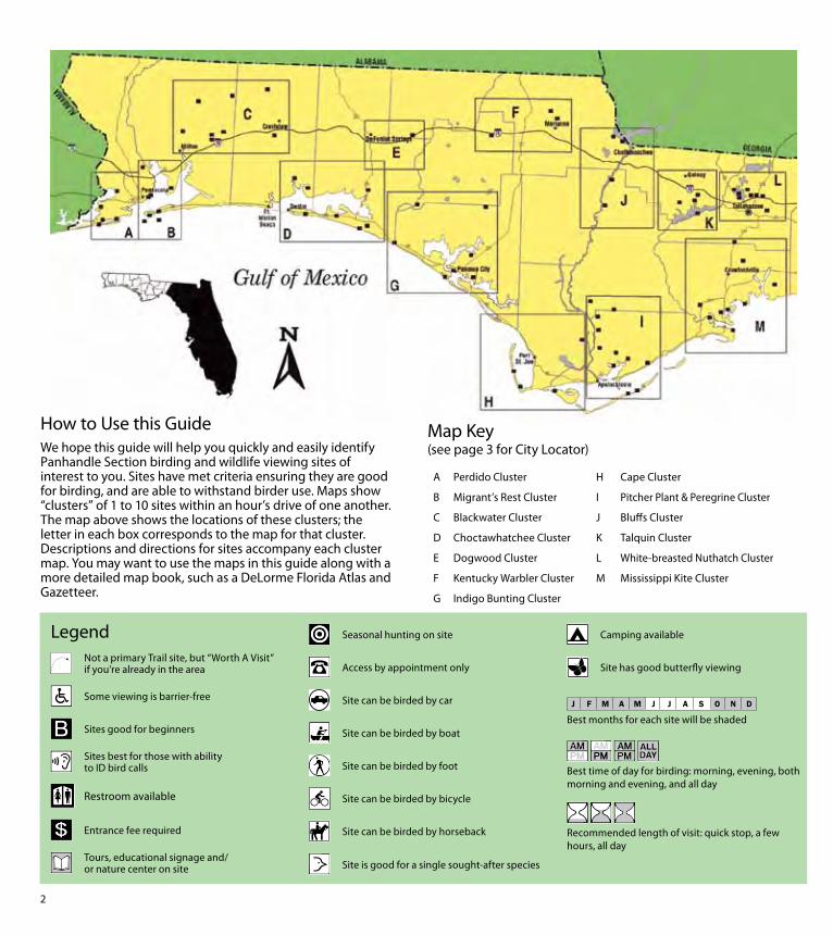
2
How to Use this GuideWe hope this guide will help you quickly and easily identify Panhandle Section birding and wildlife viewing sites of interest to you Sites have met criteria ensuring they are good for birding and are able to withstand birder use Maps show ldquoclustersrdquo of 1 to 10 sites within an hourrsquos drive of one another The map above shows the locations of these clusters the letter in each box corresponds to the map for that cluster Descriptions and directions for sites accompany each cluster map You may want to use the maps in this guide along with a more detailed map book such as a DeLorme Florida Atlas and Gazetteer
Map Key(see page 3 for City Locator)
A Perdido Cluster
B Migrantrsquos Rest Cluster
C Blackwater Cluster
D Choctawhatchee Cluster
E Dogwood Cluster
F Kentucky Warbler Cluster
G Indigo Bunting Cluster
H Cape Cluster
I Pitcher Plant amp Peregrine Cluster
J Bluffs Cluster
K Talquin Cluster
L White-breasted Nuthatch Cluster
M Mississippi Kite Cluster
LegendNot a primary Trail site but ldquoWorth A Visitrdquo if yoursquore already in the area
Some viewing is barrier-free
Sites good for beginners
Sites best for those with ability to ID bird calls
Restroom available
Entrance fee required
Tours educational signage andor nature center on site
Seasonal hunting on site
Access by appointment only
Site can be birded by car
Site can be birded by boat
Site can be birded by foot
Site can be birded by bicycle
Site can be birded by horseback
Site is good for a single sought-after species
Camping available
Site has good butterfly viewing
Best months for each site will be shaded
Best time of day for birding morning evening both morning and evening and all day
Recommended length of visit quick stop a few hours all day
3
How were these sites selected Each of the sites in this guide was originally chosen for its birdwatching characteristics accessibility and ability to withstand birder use This is not to say there arenrsquot other places to watch birds from traditional sites that have opened since this printing to nontraditional sites such as landfills that did not meet the Trailrsquos criteria In other words keep your eyes peeled Some of the best birding opportunities are fleeting and spontaneous You never know what you may find
Gateways Gateway sites provide more extensive Trail-related resources have loaner optics available on-site and act as hubs of regional birding information The Panhandle Section has two gateways Big Lagoon State Park (site 1) in Pensacola and St Marks National Wildlife Refuge (site 72) near St Marks The West Florida Section has two gateways Paynes Prairie Preserve State Park (Gainesville) and Fort De Soto Park (St Petersburg) Three gateways were selected for the East Florida Section Fort Clinch State Park (Fernandina Beach) Merritt Island National Wildlife Refuge (Titusville) and Tenoroc Fish Management Area (Lakeland) Lastly the South Florida Section has two gateways Corkscrew Swamp Sanctuary (Naples)
City Locator
City Map City Map
Apalachicola I Laguna Beach G
Bristol J Marianna F
Carrabelle Beach I Mexico Beach H
Chattahoochee J Milton C
Chipley F Panama City G
Crawfordville M Pensacola B
Crestview C Port St Joe H
De Funiak Springs E Quincy K
Destin D Sopchoppy M
Grayton Beach D St Marks M
Gulf Beach A Sumatra I
Gulf Breeze B Tallahassee L
and Loxahatchee National Wildlife Refuge (Boynton Beach) Each of these sites has staff on hand to answer questions about the Birding and Wildlife Trail kiosks with information about the Trail structure and visitor centers offering information about birding classes and events occurring across the state Hop on the Birding and Wildlife Trail at a Gateway and get off to a flying start
Trail Tips Loaner optics are available free of charge at all Gateways as well as at additional sites as marked in the site descriptions
When birding and wildlife viewing
Take sunscreen a hat water and bug spray
Make reservations in advance for ldquoby-appointment onlyrdquo sites
Check seasonality of the site are you visiting at the right time of year
Wildlife Watching Vocabulary Some words used in this guide are specific to birders and wildlife viewers Bone up on the following lingo so yoursquoll blend in at your next birding dinner party
Bayhead forested wetland (swamp) usually dominated by evergreen trees and shrubs
Birding by ear the ability to identify birds by their song or call
Ecotone the interface between two habitat types
Fallout the sudden appearance of large numbers of migratory birds usually songbirds as a result of a storm or cold front
Forage to look for food
Kettle a dense group of birds circling in a warm-air thermal to gain altitude (typically raptors in migration)
Overwintering describes any bird that spends the winter in Florida but breeds elsewhere
Peeps slang for any number of small shorebirds that forage in mixed flocks
Scoping scanning with a spotting scope
Stoop to plunge dramatically in flight as Peregrine Falcons do when hunting
Stopover a location where birds rest and feed before continuing on their migration
Wrackline the line of seaweed and flotsam at the high tide line on beaches
n
n
n
Getting started
Perdido Cluster
Osprey
Ken C
orregan
4
5
Perdido Cluster
Welcome to the Panhandle Florida Birding and Wildlife Trail
The Panhandle Section of the Great Florida Birding and Wildlife Trail (GFBWT) spans 16 counties from the Perdido River in Escambia County on the Alabama border to the Aucilla River in Jefferson County The Panhandle is Floridarsquos least populated region and it includes some of the statersquos most spectacular scenery from upland hardwoods and slope forests with dramatic bluffs and deep ravines to stately longleaf pines vast salt marshes winding rivers and pristine white sand beaches Whether you explore by foot car bicycle kayak or horseback amazing birding and wildlife adventures await you
The Panhandle offers species such as Mississippi Kite White-breasted Nuthatch and Swainsonrsquos Warbler as well as western vagrants like Calliope Hummingbird Western Tanager and Groove-billed Ani The Apalachicola National Forest harbors the largest population of endangered Red-cockaded Woodpeckers in the US Winter brings a host of northern birds that are difficult to find elsewhere in Florida including American Black Duck Red-breasted Nuthatch Brown Creeper Rusty Blackbird Dark-eyed Junco and Fox Sparrow
Road signs bearing the Great Florida Birding Trailrsquos Swallow-tailed Kite logo were installed in 2008-2009 and will help guide you to each sitersquos main entrance While the Birding Trail largely served the interest of birders in the past new butterfly and other wildlife viewing information has been included in this guide for the first time Our programrsquos new name the Great Florida Birding and Wildlife Trail (GFBWT) reflects this Butterflies can be observed year round in Florida although summer and fall months are regarded as the most exciting Also new to this guidebook are GPS coordinates street addresses (where known) county and nearest city information and DeLorme Florida Atlas amp Gazetteer page numbers for each location Another navigational aid birders will find useful is the trip-planning tool on the Birding and Wildlife Trailrsquos website (wwwfloridabirdingtrailcom) which uses Googletrade Maps GPS coordinates in this guidebook correspond to those used by Googletrade Earth and Googletrade Maps Page numbers match the 1997-2006 versions of the DeLorme Florida Atlas amp Gazetteer
Map A Perdido Cluster
Big Lagoon State Park Gateway
County Escambia Nearest city Pensacola
Physical address 12301 Gulf Beach Hwy Pensacola 32507
Coordinates 30321628deg N -87403734deg W
Gazetteer page 42 Size 732 acres
An ideal gateway for the Birding and Wildlife Trail This site nicely represents the diversity of Panhandle habitats all in the boundaries
of a single park The bayfront offers sandy expanses for wintering Black-bellied Plovers Dunlin and Least Sandpipers and winter ducks like Lesser Scaup Redhead Bufflehead and Red-breasted Mergansers can be seen diving in the bay from the East Beach tower Common Loons call on foggy mornings in early spring (an uncommon occurrence in peninsular Florida) and a diversity of gulls and terns feed in area waters Migrants like Yellow-billed Cuckoos arriving off the Gulf make landfall in the spring and feed on insects in hammocks in the campground and along the Yaupon and Long Pond Trails Long Pond Trail skirts some freshwater wetlands then stretches into the Cookie Trail leading along the north edge of the lagoon onto a scrubby point peppered with pines favored by Yellow-bellied Sapsuckers Northern Flickers and Brown-headed Nuthatches Check with staff for information on birding and wildlife events going on in the Panhandle binoculars are also available for loan from the ranger station
Directions Due west of Pensacola drive south on SR 173Blue Angel Pkwy and turn right (west) on SR 292Sorrento Rd After 27 mi turn left (south) on CR 293Bauer Rd the entrance to the park is at the end of CR 293
Open year round 8 AM to sundown (850) 492-1595 wwwfloridastateparksorgbiglagoon
J F M A M J J A S O N D
see ldquoGatewaysrdquo on page 3 for more information
2 Gulf Islands National Seashore Perdido Key Area
County Escambia Nearest city Pensacola
Physical address Johnson Beach Rd Pensacola 32507
Coordinates 30298946deg N -87417659deg W
Gazetteer page 42 Size 1041 acres
This property encompasses the eastern tip of Perdido Key at the mouth of Pensacola Bay with miles of undeveloped beach To begin turn left (north) 025 mile past the fee booth and park at the end of the road A 05-mile loop with a boardwalk nature trail begins here which can be good in spring for Neotropical songbirds such as Swainsonrsquos Thrushes Pine Warblers and Eastern Towhees call from the pinewoods while the boardwalk winds through marsh good for Clapper Rails and Spotted Sandpipers at muddy edges Return to the main park road which runs eastward for another 2 miles Beach (south side) and lagoon (north side) accesses along the road allow looks at Northern Gannets October through March and a diversity of gulls terns and various shorebirds year-round Least Terns and Snowy Plovers nest in the protected areas on the north side of the road and elsewhere so be careful not to disturb them Small coves on Big Lagoon shelter ducks and Common Loons from the winter wind offering good close views Extended hours are available (ask about Night Owl permits) and primitive camping is allowed (with permit) on the east end of the key
1
Perdido Cluster
6
7
Perdido Cluster
Directions Due west of Pensacola drive south on SR 173Blue Angel Pkwy and turn right (west) on SR 292Sorrento Rd After approx 65 mi turn left (east) on Johnson Beach Rd the entrance pay station is 05 mi ahead past Johnson Beach
Open year round 8 AM to sunset (850) 934-2600 wwwnpsgovguis
J F M A M J J A S O N D
3 Naval Air Station Pensacola Trout Point Nature Trail
County Escambia Nearest city Pensacola
Physical address S Blue Angel PkwyRadford Blvd Pensacola 32507
Coordinates 30333322deg N -87338438deg W
Gazetteer page 42 Size 40+ acres
The pleasant Trout Point Nature Trail follows a boardwalk for 05 miles through the interdune area providing the unique vantage of sandy shoreline on one side and freshwater marsh and open water on the other Wading birds like night-herons and Snowy Egrets work the marshes while the beachfront attracts shorebirds terns and gulls Pines along the waterfront trail are worth checking for feeding songbirds and Brown-headed Nuthatches This nature trail is part of Pensacola Naval Air Station and occasional noise from aircraft should be expected At the entrance security gate tell the security officer you are visiting Trout Point Nature Trail Heightened security levels may limit access so call ahead for information
Directions Due west of Pensacola drive south on SR 173Blue Angel Pkwy to the west gate of Pensacola Naval Air Station Continue straight through the gate on Radford Blvd Turn right at the trail entrance (05 mi from security gate) Continue on the unpaved road for 025 mi to the trailhead and parking
Open 6 AM to 30 min before sunset (850) 452-3100
wwwdodpiforgchecklistsnapfhtm
J F M A M J J A S O N D
4 Tarkiln Bayou Preserve State Park
County Escambia Nearest city Pensacola
Physical address CR 293Bauer Rd Pensacola 32506
Coordinates 30372923deg N -87402335deg W
Gazetteer page 42 Size 4197 acres
From the parking lot hike the trail west through flatwoods listening for the ldquosqueaky toyrdquo call of Brown-headed Nuthatches the wavering trills of Pine Warblers and the harsh squawking sounds of Yellow-breasted Chats For a shorter hike veer left at the fork The paved trail leads to a boardwalk through a titi forest (listen for breeding White-eyed Vireos) which emerges on the sheltered bayou Scan the reeds for rails and waders For a longer hike veer right at the fork following the trail along the bayoursquos far side past a rare pitcher plant bog to the end on Perdido Bay Across the street from the parking lot upland sandhill habitats host Common Ground-Doves year-round and Common Nighthawks on late springsummer evenings Bring water year-round and expect mosquitoes in warmer months
Directions West of Pensacola drive south on SR 173Blue Angel Pkwy and turn right (west) on 292Sorrento Rd After 27 mi turn right (north) on CR 293Bauer Rd the entrance is 22 mi on the left
Open year round 8 AM to sundown (850) 492-1595 wwwfloridastateparksorgtarkilnbayou
J F M A M J J A S O N D
5 ECUA Bayou Marcus Wetlands
County Escambia Nearest city BellviewPensacola
Physical address 3050 Fayal Dr Pensacola 32526 (main) Alekai Dr Pensacola 32526 (Alekai Dr entrance)
Coordinates 30436991deg N -87325980deg W (main entrance) 30444484deg N -87332614deg W (Alekai Dr entrance)
Gazetteer page 42 Size 1100 acres
From the parking lot this functioning wastewater treatment facility has nearly 8000 feet of boardwalk through the titi-lined wetlands created by the plantrsquos treated wastewater discharge As you enter the boardwalk the first large pond on the left hosts wintering Blue-winged Teal Hooded Merganser Bufflehead and Common Goldeneye to name a few Swamp Song and White-throated Sparrows exploit the weedy edges and Brown-headed Nuthatches and Pine Warblers call from the adjacent pinewoods The odd Groove-billed Ani sighting keeps interest in this site high Please be considerate as this is a fully functional utilities plant birder access is at the managementrsquos discretion Recent site improvements include four shade stops on the boardwalk trail surface improvements publication racks bird checklist and interpretive signs
Migrantrsquos Rest Cluster
Gulf Breeze
Pensacola Beach
Pensacola
Avalon Beach
East Bay
Escambia Bay
Pensacola Bay
Santa Rosa Sound
Gulf of Mexico
17th A v e
Ch a se St
Bayfron
tPkw
y
Shoreline Dr
Pensacola
Beach Rd
(toll)
Garcon Point Bridge
(toll)
Fort Pickens Rd
G a r c
o n P
o i n t R
d U n
i v e rs
ity P
kwy
Campus Dr
12 13
Avalo
n Blvd
Nine Mile Rd
Pensacola RegionalAirport
98
191
290
291
289
29
90
90 90A
98
399
281
281
281
399
10
110
6
7 8
9
10 11
12
13
13
N
0 1
Miles
2
Birding Trail Site
B
To Alabama
To Milton To
Crestview
ESCAMBIA CO
SANTA ROSA CO
26
17
22
8
9
PerdidoMigrantrsquos Rest Clusters
Directions From the intersection of SR 173Blue Angel Pkwy and CR 298Lillian Hwy go north on Blue Angel Pkwy for 11 mi to the ECUA sign at Fayal Dr Turn left (west) and drive to the entrance gate Park and enter through the fence to access the boardwalk A second entrance on Alekai Dr (formerly Ramsey Beach Rd) is now handicapped accessible To access this entrance go back to Blue Angel Pkwy and turn left (north) After 03 mi turn left (west) onto Alekai Dr and go 04 mi
Open daily 7 AM to 6 PM (850) 458-1658 (850) 455-3337 wwwdepstatefluswaterwastewaterdomwetbayouhtm
J F M A M J J A S O N D
7
J F M A M J J A S O N D
J F M A M J J A S O N D
Map B Migrantrsquos Rest Cluster
6 University of West Florida
Edward Ball Nature Trail County Escambia Nearest city Pensacola
Physical address 11000 University Pkwy Pensacola 32514
Coordinates 30550723deg N -87221716deg W
Gazetteer page 26 Size 15 acres
The Edward Ball Nature Trail includes a short boardwalk through a nice ravine and swamp with Prothonotary Warbler-laden cypress trees above and wading egrets below Songbirds like Northern Parulas Summer Tanagers and Great Crested Flycatchers frequent the area and migration in spring and fall can yield some interesting visiting species Swallow-tailed Kites may be seen overhead in spring and summer The slope is steep and the boardwalk shows its age so donrsquot get so distracted by the birds that you forget to watch your step
Directions From US 90ANine Mile Rd north of Pensacola turn north on University Pkwy At the end of University Pkwy turn left (west) onto Campus Dr Take the 4th left then another immediate left into Parking Lot G Park and walk behind the Science Building (Bldg 13) to the trail entrance Campus maps and MANDATORY PARKING PASSES can be obtained at the Information Center (1st right after turning onto Campus Dr)
Open daily dawn to dusk (850) 857-6417 wwwuwfedu
Wayside Park and Pensacola Visitor
Information Center County Escambia Nearest city Pensacola
Physical address 1401 E Gregory St Pensacola 32502
Coordinates 30417865deg N -87193398deg W
Gazetteer page 42 Size 30 acres
Worth a quick stop to view gulls and terns the waterfront fishing bridge and offshore breakwater all host a variety of ages of Herring Ring-billed and Laughing Gulls Forsterrsquos and Royal Terns and more Common Loons feed very close to shore and sport nearly complete breeding plumage in FebruaryMarch before they return north Bring your spotting scope to check the bay for wintering ducks and Horned Grebes
Directions From I-10 north of Pensacola take exit 12 for I-110 and head south Take exit 1B for Chase St and head east Continue east on Chase St until it ends at US 98Bayfront Pkwy and take a left (east) Drive approx 03 mi and turn left (northeast) on N 17th Ave After 300 ft turn right (southeast) on E Gregory St Parking is 350 ft ahead
Open 24 hrsday (850) 434-1234 wwwvisitpensacolacom
8 Project GreenShores
County Escambia Nearest city Pensacola
Physical address Bayfront Pkwy Pensacola 32502
Coordinates 30417634deg N -87194486deg W
Gazetteer page 42 Size 15 acres
Project GreenShores is a restoration project undertaken by a suite of advocates and agencies Located across from the Pensacola Visitor Center along Bayfront Pkwy the project is systematically establishing an emergent marsh and oyster reef along the waterfront The area has historically been good for birds like Osprey Brown Pelican and Royal Tern but as the salt marsh grasses take root the birds are responding Yellow-crowned Night-Heron Semipalmated Plover Black-necked Stilt and more ply the flats and shoreline Park and walk the waterfront to the west along the bay shore restoration efforts continue past the Missing Childrenrsquos Memorial on Hawkshaw Lagoon (across from Veterans Park) to Bartram Park Look for Loggerhead Shrike on the far southern end of the property just before the bridge
Migrantrsquos Rest Cluster
J F M A M J J A S O N D
9
J F M A M J J A S O N D
J F M A M J J A S O N D
11
Directions From I-10 north of Pensacola take exit 12 for I-110 and head south Take exit 1B for Chase St and head east Continue east on Chase St until it ends at US 98Bayfront Pkwy and turn left (east) The site and parking are approx 03 mi on the right 100 ft past the intersection with N 17th Ave and 025 mi before the Pensacola Bay Bridge
Open daily dawn to dusk (850) 436-5652 wwwdepstateflusnorthwestEcosyssectiongreenshoreshtm
Shoreline Park South
County Santa Rosa Nearest city Gulf Breeze
Physical address 800 Shoreline Dr Gulf Breeze 32561
Coordinates 30354244deg N -87177670deg W
Gazetteer page 42 Size 100 acres
Shoreline Park South is a small sound-side park in Gulf Breeze which lies between Fort Pickens and the mainland as the bird flies This ensures itrsquos on the direct path of migrants coming in off the Gulf in spring In winter bird the waterfront for grebes and loons (occasional Pacific and Red-throated in years when vagrant birds are prevalent) Wintering ducks like Lesser Scaup Bufflehead and even occasional Common Goldeneye can be viewed from the pier Nearer the entrance bird the loop trails through oak hammock excellent for resident Pine Warblers Carolina Chickadees and Pileated Woodpeckers as well as migrant Black-throated Blue and Worm-eating Warblers Swainsonrsquos Thrushes Orchard Orioles and more This site is busy on warm weather weekends Recent amenities include a boardwalk nature trail waterfront boardwalk picnic shelters and restrooms Many park features are handicapped accessible A viewing deck with seats provides good elevation for scoping winter waterbirds
Directions From US 98 in Gulf Breeze turn west on Shoreline Dr (just west of Pensacola Beach Rdtoll bridge) Go 01 mi to the first intersection and turn left (southwest) to stay on Shoreline Dr The entrance is located 07 mi on the left (south) side of the road
Open 24 hoursday (850) 934-5140 wwwgulfbreezerecreationcentercom
1Gulf Islands National Seashore Fort Pickens Area
County Escambia Nearest city Pensacola Beach
Physical address 1400 Fort Pickens Rd Pensacola Beach 32561
Coordinates 30325672deg N -87181354deg W
Gazetteer page 42 Size 1742 acres
This migratory hotspot is not to be missed in spring as tired migrants make landfall after long overwater flights Batteries Langdon and Worth are both good stops for migrants closely check flowering oaks Please respect closed areas protecting nesting birds the beach here is prime for breeding Snowy Plovers and Least Terns spring through fall Black Terns are ubiquitous in summer and early fall By far the fort and surrounding trails offer this sitersquos most exciting birding In open areas surrounding the fortifications watch for sentinel flycatchers on any minor promontory Gray Kingbirds breed here and Scissor-tailed Flycatchers are occasional in winter The trails on the fortrsquos bayside can be extraordinary for migrant songbirds like Tennessee Cape May and Magnolia Warblers and more Morning is not necessarily the best time to see these birds long-term sighting logs from dedicated local birders indicate these migrants can make landfall in early afternoon Fallouts are exaggerated by early afternoon rain showers that ground migrants as soon as they reach land Migrating raptors cruise the duneline in October and April Loaner optics and field guides are available Fort Pickens Road is prone to storm-related closures check road condition at website below prior to departure
Directions From Pensacola take US 98 east approx 45 mi to the south side of Gulf Breeze Take SR 399Pensacola Beach Rd (toll bridge) south across Santa Rosa Sound to Pensacola Beach Turn right (southwest) at Fort Pickens Rd and head west for 25 mi to the entrance
Fort Pickens Area open 7 AM to 10 PM (850) 934-2600 Historic Fort Pickens open 8 AM to sunset wwwnpsgovguis
0
Pensacola Beach Gulf Pier
County Escambia Nearest city Pensacola Beach
Physical address 41 Fort Pickens Rd Pensacola Beach 32561
Coordinates 30332175deg N -87142344deg W
Gazetteer page 43 Size 025 miles
With binoculars alone this site offers a fare of gulls and terns comparable to other area beach sites However with a spotting scope and a little blustery weather this 025-mile pier can be a seawatcherrsquos dream offering a stable site away from the beach to scan out over the sea More common sightings are wintering
10
11
Migrantrsquos Rest Cluster
Common Loons and plunging gannets October through March However in periods of stormy weather in the Gulf of Mexico tantalizing seabirds like Bridled and Sooty Terns and Sooty Shearwaters have been spotted from this location Respect severe weather but certainly donrsquot let a little rain discourage you This site is primarily a fishing pier but welcomes birders too
Directions From Pensacola take US 98SR 30Gulf Breeze Pkwy south across the Pensacola Bay Bridge to the south side of Gulf Breeze Take SR 399Pensacola Beach Rd (toll bridge) south across Santa Rosa Sound to Pensacola Beach Turn right (southwest) at Fort Pickens Rd and go 01 mi to the first entrance on the left (south) side of the road (look for a large parking lot with a ldquobeach ballrdquo water tower)
Open 24 hoursday (850) 934-7200 wwwfishpensacolabeachpiercom
J F M A M J J A S O N D
J F M A M J J A S O N D
J F M A M J J A S O N D
12 Gulf Islands National Seashore Naval Live Oaks Area
County Santa Rosa Nearest city Gulf Breeze
Physical address 1801 Gulf Breeze Pkwy Gulf Breeze 32563
Coordinates 30364997deg N -87131275deg W
Gazetteer page 42 and 43 Size Size 1378 acres
This visitor center and park HQ for the national seashore spans the spit of land separating Santa Rosa Sound to the south from Pensacola Bay to the north From the sound-side shoreline south of the visitor center parking scope for Common Goldeneye Lesser Scaup and other wintering ducks As always in migration check the live oaks for which this area was named Black-and-white Warblers pick through resurrection fern on the sides of oaks in winter and Brown Creepers are occasionally found scaling the trees
Directions From Pensacola take US 98SR 30Gulf Breeze Pkwy south across the Pensacola Bay Bridge to Gulf Breeze Stay on US 98 East past the intersection with SR 399 the visitor center and headquarters are 18 mi ahead on the right (south) side of the road
Open 8 AM to sunset (850) 934-2600 wwwnpsgovguis
13 Garcon Point Water Management Area Garcon Point Trail
County Santa Rosa Nearest city MiltonGulf Breeze
Physical address SR 281CR191 Milton 32583
Coordinates 30470726deg N -87084151deg W (north entrance) 30459271deg N -87092904deg W (south entrance)
Gazetteer page 43 Size 3235 acres
Gorgeous wet prairie occupies much of this preserve with slightly elevated patches of longleaf pine-wiregrass community breaking the otherwise unobstructed horizon A habitat of extremes this landscape burns frequently and absorbs lots of rainfall trails may occasionally hold water so immersible shoes are recommended Biting flies and ticks are quite unpleasant from April to October but the sheer beauty of this site makes it a must-see from November to March Wet prairie sparrows like Henslowrsquos and LeContersquos occasionally winter here and Cooperrsquos Hawks cruise the prairie for prey like Eastern Towhees and Loggerhead Shrikes Yellow Rails have been found here in winter Pine Warblers call from the tree line and rare pitcher plants crowd the trail (stay on the trail to protect these Panhandle specialties) From the south entrance access the 17-mile loop trail through scrubby oaks and past an ephemeral wetland From the north trailhead the North Spur Trail runs 12 miles south to join the loop trail on its north border See the Florida Trail Associationrsquos website for additional information Access to and from Pensacola Beach via SR 821 requires toll and may result in delays during peak travel times
Directions From I-10 south of Milton take exit 22 for SR 281Avalon Blvd and head south After 4 mi this road will merge with CR 191 Garcon Point Rd Drive approx 07 mi past the intersection with CR 191 the north trailhead is on the left (east) side of the road The south trailhead is 1 mi farther also on the left (east) side of the road If coming from the south on SR 281 the southern entrance is located 025 mi north of the bridgersquos toll booth
Open dawn to dusk (850) 484-5125 (850) 539-5999 wwwnwfwmdstateflusrecreationyellowriverhtml wwwfloridatrailorgHikesfloridapanhandleGarconPointhtml
Migrantrsquos Rest Cluster D
avid Moynahan FW
C
Horseshoe Crabs
12
13
Blackwater Cluster
14
J F M A M J J A S O N D
15
J F M A M J J A S O N D
16 Blackwater Fisheries Center
Map C Blackwater Cluster
Blackwater River State Forest Hutton Unit
County Santa Rosa Nearest city Holt
Physical address Deaton Bridge Rd Milton 32583
Coordinates 30685874deg N -86876366deg W
Gazetteer page 27 Size 7629 acres
This site adjacent to Blackwater River State Park is worth a quick stop to listen for Bachmanrsquos Sparrow in spring and summer ndash if they are singing yoursquoll likely hear them from the parking lot The available habitat is turkey oakpine uplands common throughout the Panhandle and not as productive for birding as other habitats may be Still in springtime a quick peek can never hurt Less than 1 mile from the entrance on H9 Road (across from Boundary Line Rd) you should encounter species such as Red-headed Woodpecker Brown-headed Nuthatch Eastern Bluebird and Great Crested Flycatcher Gates are open to general vehicular traffic from May 1 to October 1 gates will be closed in hunting season (hunters check in through a different gate) If the gate on Deaton Bridge Rd is locked you may use the parking lot next to the gate and walk in Additional entrances are located at Pond Road off US 90 and at the intersection of Deaton Bridge Rd and Indian Ford Rd Take care driving on area clay roads ndash they can be slippery when wet The Florida National Scenic Trail winds through the site and is open to hikers year round A WMA map is available from the FWC website Seasonal hunting takes place at this GFBWT site please see page 55 for information on dates regulations and more
Directions From Milton take US 90 east for approx 95 mi to Harold Turn left (north) on Deaton Bridge Rd and drive 18 mi the entrance and parking area are on the left (west) side of the road directly across from Boundary Line Rd From I-10 eastbound take exit 31 for SR 87 and head north to US 90 Turn right (east) on US 90 and follow it for 58 mi to Deaton Bridge Rd From I-10 westbound take exit 45 for Log Lake Rd and go north to US 90 Turn left (west) and follow US 90 for 87 mi to Deaton Bridge Rd
Open dawn to dusk (850) 957-6140 wwwfl-dofcomstate_forestsblackwater_riverhtml MyFWCcomviewingrecreationwmascooperativeblackwater
Blackwater River State Park
County Santa Rosa Nearest city Holt
Physical address 7720 Deaton Bridge Rd Holt 32564
Coordinates 30711943deg N -86879987deg W
Gazetteer page 27 Size 635 acres
This site is a popular swimming canoeing and picnicking area in warm weather but offers nice access to floodplain hiking trails good for Yellow-billed Cuckoos and Hairy Woodpeckers in late spring and summer Broad-winged Red-tailed and Red-shouldered Hawks are common and Wood Thrushes and Prothonotary Warblers breed here Brown-headed Nuthatches squeak from pines in the uplands these delightful acrobats are a joy to watch The brief campground trail and the 09-mile Chain of Lakes Nature Trail are best for birding The trails can be wet at times of high water so wear shoes you donrsquot mind getting muddy Loaner optics and field guides are available
Directions From Milton take US 90 east for approx 95 mi to Harold Turn left (north) on Deaton Bridge Rd and drive 39 mi the entrance is on the right (east) side Additional parking areas (fee required) are located at either end of the bridge Access the Chain of Lakes Nature Trail at the south end of the bridge From I-10 eastbound take exit 31 for SR 87 and head north to US 90SR 10 Turn right (east) on US 90 and follow it for 58 mi to Deaton Bridge Rd From I-10 westbound take exit 45 for Log Lake Rd and go north to US 90 Turn left (west) and go 87 mi to Deaton Bridge Rd
Open year round 8 AM to sundown (850) 983-5363 wwwfloridastateparksorgblackwaterriver
County Santa Rosa Nearest city Holt
Physical address 8384 Fish Hatchery Rd Holt 32564
Coordinates 30729556deg N -86802542deg W
Gazetteer page 27 Size 590 acres
Nestled in the Blackwater River State Forestrsquos uplands this fish hatchery is an oasis of wading birds and shorebirds Stop at the entrance kiosk to check the sightings log and to pick up a checklist Walk the dikes between the aquaculture ponds looking for winter
14
Blackwater Cluster
waterfowl such as Ring-necked Ducks Blue-winged Teal and Wilsonrsquos Snipe at the muddy edges Wintering shorebirds include both yellowlegs Spotted Solitary and Pectoral Sandpipers and Semipalmated Plovers Forsterrsquos Terns Purple Martins and Northern Rough-winged Swallows skim over the ponds Northern Bobwhites and Wild Turkeys are common in the adjacent forest and wooded fields Ask at the office if yoursquod like a facility tour and also if hunting or prescribed fire would prohibit your birding in the woods of the state forestrsquos Carr Unit to the northeast Bachmanrsquos Sparrows sing here in spring and Henslowrsquos Sparrows occasionally overwinter
Directions From I-10 eastbound take exit 31 for SR 87 and head north to US 90SR 10 Turn right (east) and drive 139 mi to Cooper Ln outside of Holt Turn left (north) and go 01 mi to Johns Rd Turn left (west) and follow Johns RdBryant Bridge Rd (name change) for 3 mi The entrance is on the right (northeast) side of the road From
I-10 westbound take exit 45 for Log Lake Rd and go north to US 90SR 10 Turn left (west) and drive 05 mi Turn right (north) on Cooper Ln After 01 mi turn left on Johns RdBryant Bridge Rd The entrance is 3 mi ahead on the right
Open 730 AM to 4 PM MonndashFri weekends by appointment only (requires at least 2 weeks advance notice) (850) 957-6177
MyFWCcomviewingrecreationwmascooperativeblackwater
J F M A M J J A S O N D
Milton
CrestviewBaker
Harold
Holt
Munson
Blackwater River
Blackwater River
Shoal River
Johns Rd
Johns Rd
Bryant Bridge Rd
Buddy Hardy Rd
Live Oak Church Rd
N Karick Rd
Karick Lake Lower Rd
Ferd
on
Blvd
Bob Pitts Rd
Indian Ford Rd
Pond Rd
Cooper Ln Log Lake Rd
Boundary Line Rd
Deato
n
Br
idge R
d
Coldwater H o rs e Trail
Whiting Field Naval
Air Station
90
191
191
87
87
178
4
87
189
188
4
4
4
2
85
87A 90
56
45
3110
10
N
0 1 2 3 4
Miles
Birding Trail Site
To De FuniakSprings
To De FuniakSprings
To Pensacola
SAN
TA R
OSA
CO
O
KA
LOO
SA C
O
SAN
TA R
OSA
CO
O
KA
LOO
SA C
O
14
15
19
20
21
Thre
eN
otch
Rd
17
C
15
Blackwater Cluster
17 Naval Air Station Whiting Field Clear Creek Nature Trail
County Santa Rosa Nearest city Milton
Physical address Langley St Milton 32570
Coordinates 30707410deg N -87032045deg W
Gazetteer page 27 Size 80+ acres
As it descends through mixed pine-oak uplands this interesting 15-mile round-trip trail leads to a creek and associated wetland Listen for Red-breasted Nuthatches in fall in the uplands and Hermit Thrushes overwintering At the water Common Yellowthroats scold from brushy tangles and wading birds like Little Blue Herons and Least Bitterns are possible among the pitcher plants visible from the boardwalk This is part of a functioning military Naval Air Station and occasional noise from aircraft is to be expected Access may be limited during times of elevated homeland security levels so call in advance
Directions From Milton head north on SR 87 following signs to NAS Whiting Field Turn right (east) on CR 87ALangley St and explain at the security gate that you would like to visit Clear Creek Nature Trail Once through the gate follow NAS Whiting Field Dr to the trailhead parking area
Open dawn to dusk (850) 623-7602 wwwdodpiforgchecklistsnaswfhtm
J F M A M J J A S O N D
J F M A M J J A S O N D
J F M A M J J A S O N D
20
Blackwater River State Forest
Three Notch Rd (Hardy Rd to Coldwater Horse Trail)
County Santa Rosa Nearest city Milton
Physical address Three Notch Rd Milton 32570
Coordinates 30800828deg N -86950923deg W (south end) 30832354deg N -86942892deg W (north end)
Gazetteer page 27 Size 5 miles
This 5-mile stretch of Three Notch Rd offers easy safe roadside pulloffs with Red-cockaded Woodpecker (RCW) cavity trees ringed with white paint visible from the road RCWs are most easily seen in breeding season in the mornings when they emerge from their nest cavities to ferry food back to their waiting young Frequent prescribed fire keeps this habitat healthy so obey signs closing the area for this necessary management event Use caution on area clay roads which can be slippery when wet Also check trails north of Coldwater Horse Trail for RCWs if desired along the east and west sides of Three Notch Rd Seasonal hunting takes place at this GFBWT site please see page 55 for information on dates regulations and more
Directions From Milton take CR 191Munson Hwy north approx 14 mi to Buddy Hardy Rd Turn left (west) on Buddy Hardy Rd drive 07
18
mi and turn right (north) onto Three Notch Rd Drive towards the intersection with Coldwater Horse Trail pull off on shoulder as desired Trails criss-cross the area along Three Notch Rd and Coldwater Horse Trail from Coldwater Creek to Juniper Creek (south of SR 4 and west of CR 191) Coldwater Horse Trail leads eastward back to CR 191
Open dawn to dusk (850) 957-6140 wwwfl-dofcomstate_forestsblackwater_riverhtml
19 Blackwater River State Forest Bear Lake Loop Trail
County Santa Rosa Nearest city Baker
Physical address Bear Lake Rd Milton 32570
Coordinates 30855008deg N -86838233deg W
Gazetteer page 27 Size 200 acres
From the camping area hike the 4-mile trail that rings the lake watching for migrants like Ovenbirds and Swallow-tailed Kites in springtime Red-shouldered Hawks echo across the lake and Pied-billed Grebes dive hunting for fish Nearby uplands can be good for Chuck-willrsquos-widows and Wild Turkeys Take water and expect biting insects in warm weather The lake is popular with anglers in spring and fall There is no hunting on the trail or in the vicinity of the lake
Directions From Milton take CR 191Munson Hwy north to SR 4 in Munson Turn right (east) on SR 4 and proceed 20 mi to the entrance at Bear Lake Rd Turn left (north) the parking area is 06 mi ahead
Open dawn to dusk (850) 957-6140 wwwfl-dofcomstate_forestsblackwater_riverhtml
Blackwater River State Forest Karick Lake
County Okaloosa Nearest city Baker
Physical address N Karick Rd and Karick Lake Lower Rd Crestview 32531
Coordinates 30905009deg N -86656031deg W (upper entrance) 30894311deg N -86660076deg W (lower entrance)
Gazetteer page 28 Size 38 miles
Check these recreation areas for Bachmanrsquos Sparrows calling in the sandhills ducks and wading birds like Green Herons visible from
16
BlackwaterChoctawhatchee Clusters
the north access pier and songbirds like Yellow-throated Warblers and Red-eyed Vireos in the hardwoods around the lake A 38-mile loop trail circles around the lake traveling along sandhills gallberry midslopes and hardwood bottoms Pay attention to ecotones particularly those edges with hardwoods These can be good for migrants that prefer this habitat over drier sandhills Directions From Milton take CR 191Munson Hwy north to SR 4 in Munson and turn right (east) Follow SR 4 to its intersection with SR 189 in Baker and turn left (north) The south access (Karick Lake Lower Rd) is 8 mi ahead on the right The north access (N Karick Rd) is 08 mi farther north Open dawn to dusk (850) 957-6140 wwwfl -dofcomstate_forestsblackwater_riverhtml
J F M A M J J A S O N D
21Shoal River Wayside Par
(Bill Duggan Jr Park)
k
County Okaloosa Nearest city Crestview
Physical address 5999 SR 85 Crestview 32536
Coordinates 30698772deg N -86570501deg W
Gazetteer page 28 Size 55 acres
Freeport
Niceville
Valparaiso
Destin
GraytonBeach
Eglin Air Force Base
Choctawhatchee Bay
Choctawhatchee River
Gulf of Mexico
RockyBayou
Gulf of Mexico
Chat Holly Rd
John Sims Pkwy
Emerald Coast Pkwy
331
331
20
83
83A20
282
393
98
293
30
397
85
85285123
190
30
98
98
98
23
24
25
2726
28
N
0 1
Miles
2
Birding Trail Site
To PanamaCity
To Ft WaltonBeach
To DeFuniakSprings
D
Mad
iso
n St
W C
oll
ege
Blvd
OK
AL
OO
SA
CO
O
KA
LO
OS
A C
O
WA
LTO
N C
OW
ALT
ON
CO
O
KA
LO
OS
A C
O
WA
LTO
N C
O
30A83
283
30A
395
(toll)
17
J F M A M J J A S O N D
J F M A M J J A S O N D
23
J F M A M J J A S O N D
24
22
BlackwaterChoctawhatchee Clusters
Shoal River Wayside Park is worth a quick check for wading birds at the river and songbirds in the adjacent floodplain forest In this part of the Panhandle floodplain corridors along rivers like this create migrant highways through arid turkey oak and sand pine uplands Check the tree line and understory especially in spring migration for songbirds like Prairie Warblers and well camouflaged Veeries
Directions From I-10 south of Crestview take exit 56 for SR 85 Ferdon Blvd Go south for 18 mi Turn left (east) at Live Oak Church Rd and go 01 mi Turn right (southwest) and continue on Live Oak Church Rd for 01 mi Turn left (south) into the park
Open dawn to dusk (850) 689-5084 (850) 689-5772 wwwcookaloosaflus
Map D Choctawhatchee Cluster
Turkey Creek Park
County Okaloosa Nearest city Niceville
Physical address 340 John Sims Pkwy West Niceville 32578
Coordinates 30523676deg N -86497348deg W (main entrance) 30532812deg N -86502494deg W (Turkey Creek extension)
Gazetteer page 28 Size 075-mile boardwalk
Walk the scenic 075-mile boardwalk along tannic Turkey Creek through a river forest of titi maple cypress and bay Watch for Green Herons stalking minnows on low hanging branches over the water and Anhingas swimming in the creek Mississippi Kites are common in summer and songbirds like White-eyed Vireos breed here In warm weather visit on weekdays and early in the morning this is a popular swimming access and the revelry of swimmers riding inner tubes downstream can be disruptive to birding (albeit tempting to partake in) The boardwalk is ADA accessible but the city also provides rides on electric carts for the mobility impaired between 730 and 1100 AM on the first Wednesday of each month A second entrance for the North Turkey Creek Extension is located on W College Blvd which has a 900-ft boardwalk and a canoekayak launch
Directions From intersection of SR 20John Sims Pkwy East and SR 285N Partin Dr in Niceville drive west on SR 20 for 10 mi to Evans St Turn right (north) the park entrance is immediately on your left From the intersection of SR 190Valparaiso Pkwy and SR 397 John Sims Pkwy in Valparaiso go north on John Sims Pkwy for 13 mi across the bridge to Evans St Turn left (north) and immediately left again into the parking lot To access the new extension head east from the park on SR 20 to SR 85 Turn left (north) and go 09 mi to W College Blvd Turn left (west) and drive 06 mi past the hospital to the entrance on the left (south) side of the road
Open 630 AM to dark Tues - Sun North Turkey Creek Extension opens at 8 AM (850) 729-4062 wwwnicevilleorgturkeyhtml
Fred Gannon Rocky Bayou State Park
County Okaloosa Nearest city Niceville
Physical address 4281 SR 20 Niceville 32578
Gazetteer page 28 and 44 Size 346 acres
Coordinates 30495944deg N -86432791deg W
This waterfront park is located on Rocky Bayou in Choctawhatchee Bay Of its three trails Red Cedar and Rocky Bayou are more interesting for birds than Sand Pine Trail Walk the trails for migrants like Cedar Waxwings and Indigo Buntings check the trees in the campground area too The waterfront can offer vantages of diving ducks in winter Ospreys overhead and Spotted Sandpipers on rocky edges in winter The local Audubon chapter offers bird walks early on Friday mornings ndash call in advance for details Loaner optics and field guides are available
Directions From the intersection of SR 285 and SR 20 in Niceville drive approx 40 mi east on SR 20John Sims Pkwy The entrance to the park is on the left (north) side after crossing Rocky Bayou Bridge
Open year round 8 AM to sundown (850) 833-9144 wwwfloridastateparksorgrockybayou
Henderson Beach State Park
County Okaloosa Nearest city Destin
Physical address 17000 Emerald Coast Pkwy Destin 32541
Coordinates 30386928deg N -86447520deg W
Gazetteer page 44 Size 221 acres
Henderson Beach State Park offers nice beachfront for specialties like Snowy Plovers Least Terns American Oystercatchers and more Take care not to disturb beach-nesting birds which are often cryptic and blend easily with the sand they nest upon A nature trail by the beach access points winds through a small coastal hammock in a stretch of coastline where little of this important habitat remains Watch for migrant songbirds here in spring and raptors making landfall or following the duneline in April and October The campground has some nice trees worth checking as access allows ask for permission at the entrance gate and be considerate of campers This site gets busy in warm weather Loaner optics and field guides are available
Choctawhatchee Cluster
J F M A M J J A S O N D
J F M A M J J A S O N D
26
J F M A M J J A S O N D
Directions From the intersection of SR 293Danny Wuerffel Way (toll bridge) and US 98SR 30Emerald Coast Pkwy east of Destin drive 15 mi west on US 98 to the park entrance on the left (south) side of the highway
Open year round 8 AM to sundown (850) 837-7550 wwwfloridastateparksorghendersonbeach
25 Topsail Hill Preserve State Park
County Walton Nearest city Sandestin
Physical address 7525 W County Hwy 30A Santa Rosa Beach 32459
Coordinates 30371282deg N -86272744deg W (main entrance) 30375556deg N -86299507deg W (Topsail Rd entrance)
Gazetteer page 45 Size 1643 acres
Topsail Hill Preserve State Park offers inland trails through coastal scrub and past rare coastal dune (freshwater) lakes The 25-mile Morris Lake Trail is slightly more productive than the Campbell Lake Trail although either will yield Eastern Bluebirds Eastern Kingbirds Red-headed Woodpeckers and Brown-headed Nuthatches to name a few Check the beachfront for gulls and Sandwich Least and Royal Terns Snowy Plovers nest here and shorebirds ply the shoals near the outfall for Morris Lake at the Gulf Scope the surf for Common Loons Horned Grebes and Northern Gannets winter through spring The beach is heavily visited in warm weather so plan accordingly Educational programs are offered call for details
Directions From the intersection of SR 293Danny Wuerffel Way (toll bridge) and US 98SR 30Emerald Coast Pkwy east of Destin drive 85 mi east on US 98 and turn right (southeast) on CR 30A the entrance is approx 02 mi on the right (west) side of the road A second entrance is located on Topsail Rd at US 98 14 mi west of the intersection with CR 30A Use this entrance for direct access to the Morris Lake and Campbell Lake Trails (call ahead as entrance may be closed if road is flooded)
Open year round 8 AM to sundown (850) 267-8330 wwwfloridastateparksorgtopsailhill
Grayton Beach State Park
County Walton Nearest city Point Washington
Physical address 357 Main Park Rd Santa Rosa Beach 32459
Coordinates 30334117deg N -86158050deg W
Gazetteer page 45 Size 2227 acres
Grayton Beach State Park is very popular with beachgoers in warm weather but in cooler months is worth checking On the north side of CR 30A the 42-mile Grayton Beach Hike and Bike Trail runs through pine flatwoods and along the north end of Western Lake (a brackish coastal dune lake) which can be good for wading birds Bald Eagle Barred Owl Brown-headed Nuthatch Pied-billed Grebe and more For longer hikes the Lake Loop Trail connects to Point Washington State Forestrsquos (site 27) extensive trail system Donrsquot miss the 1-mile interpretive Grayton Beach Nature Trail which begins at the beach parking area As it winds through sand dunes and under a sand live oak canopy look for Savannah Sparrow Eastern Towhee and Orange-crowned Warbler an additional loop also runs through pine flatwoods (listen for Eastern Bluebird) and along the southern end of Western Lake (check for Common Loon in winter) The beachfront offers plovers terns and gulls (Bonapartersquos in winter) and plunging gannets out to sea October through March As with all coastal sites watch for raptors cruising the beachfront and migrants arriving off the Gulf in spring Loaner optics and field guides are available
Directions From the intersection of US 98 and US 331 east of Destin drive east approx 15 mi and then turn right (south) on CR 283 Follow CR 283 for 17 mi to CR 30A and turn left (east) the entrance is on the right (south) side after 05 mi
Open year round 8 AM to sundown (850) 267-8300 wwwfloridastateparksorggraytonbeach
27 Point Washington State Forest
County Walton Nearest city Point Washington
Physical address S CR 395 Santa Rosa Beach 32459
Coordinates 30342148deg N -86131466deg W
Gazetteer page 45 Size 15131 acres
Point Washington State Forest offers 3- 5- and 10-mile hiking loops through longleaf pine flatwoods coastal scrub and sandhills Bachmanrsquos Sparrows are very likely to be heard singing in spring in areas of wiregrass and palmetto in the southern half of the 3-mile loop The eastern boundary of this loop crosses the west arm of Peach Creek where you can listen for songbirds and watch for Red-shouldered Hawks Cooperrsquos Hawks occasion the flatwoods and Eastern Towhees and Common Yellowthroats are abundant Trail system connects to Grayton Beach State Park (site 26) for
18
19
De Funiak Springs
331
9090
280A
183
183
81
10
183
280
83
181
181A
81
331
10
ToMarianna
To Freeport
ToCrestview
N
0 1
Miles
2
29
E85
96
Birding Trail Site
Rest Area
WA
LTO
N C
O
WA
LTO
N C
O
HO
LMES
CO
H
OLM
ES C
O
WA
LTO
N C
O
HO
LMES
CO
Directions From the intersection of US 331SR 83 and SR 20 in Freeport the entrance is 16 mi west on the south side of SR 20 (past Tucker Town Rd)
Open dawn to dusk (850) 835-2822 wwwfreeportfl oridagov
J F M A M J J A S O N D
Map EDogwood Cluster
29 Ponce de Leon Springs State Park
County Holmes Nearest city Ponce de Leon
Physical address 2860 Ponce de Leon Springs Rd Ponce de Leon 32455
Coordinates 30722979deg N -85930385deg W
Gazetteer page 30 Size 420 acres
Worth checking in migration this sitersquos real strength is wintering birds especially those at the southernmost limit of their range Birds like Brown Creeper and Golden-crowned Kinglet are possible at this site your chances improve with your ability to identify birds by sound Hike both short trails ndash Spring Run and Sandy Creek ndash stopping to
extended birding adventures Seasonal hunting takes place at this GFBWT site please see page 55 for information on dates regulations and more
Directions From the intersection of US 98 and US 331 east of Destin drive east approx 30 mi and turn right (south) on CR 395 Trailhead parking is 11 mi on the left (east) side of the road
Open dawn to dusk (850) 267-8325 wwwfl -dofcomstate_forestspoint_washingtonhtml
J F M A M J J A S O N D
28 Harry A Laird Sr City Park
County Walton Nearest city Freeport
Physical address SR 20 E Freeport 32439
Coordinates 30501614deg N -86145701deg W
Gazetteer page 29 and 45 Size 13 acres
This small wayside park has a brief boardwalk along a creek lined with hardwoods The area is worth checking in migration only for songbirds like waterthrushes and Worm-eating and Hooded Warblers Weekend afternoons can be busy with picnickers and playground visitors but weekdays are left for you and the birds
ChoctawhatcheeDogwood Clusters
DogwoodKentucky Warbler Clusters
listen carefully in the shady hardwood forest This park can be busy with swimmers in warm weather so weekday and early morning birding may prove the most rewarding
Directions From I-10 east of De Funiak Springs take exit 96 and head north on SR 81 for 10 mi Turn right (east) onto US 90SR 10 after 02 mi then turn right (south) again onto CR 181A the entrance is 05 mi on the right (west) side of the road
Open year round 8 AM to sundown (850) 836-4281 wwwfloridastateparksorgponcedeleonsprings
J F M A M J J A S O N D
30
J F M A M J J A S O N D
J F M A M J J A S O N D
Map F Kentucky Warbler Cluster
Falling Waters State Park
County Washington Nearest city Chipley
Physical address 1130 State Park Rd Chipley 32428
Coordinates 30731352deg N -85529023deg W
Gazetteer page 31 Size 173 acres
Falling Waters State Park makes for a nice hour-long hike exploring the sinkholes waterfalls lake and surrounding uplands via the Wiregrass and Sinkhole trails Watch for Red-headed Woodpeckers in the uplands and migrant songbirds like Gray-cheeked Thrushes in the leafy understory of dogwood and azalea beneath the magnolia and white oaks As always when in this part of northwest Florida northern species like Dark-eyed Juncos are possible in winter Check for ducks and waders at the lake edge Scan the butterfly garden for resident and migratory butterflies
Directions From I-10 east of De Funiak Springs take exit 120 and head south on SR 77 After 08 mi turn left (east) onto CR 77A State Park Rd the entrance is 17 mi ahead (road dead ends into park)
Open year round 8 AM to sundown (850) 638-6130 wwwfloridastateparksorgfallingwaters
31
32
Florida Caverns State Park
County Jackson Nearest city Marianna
Physical address 3345 Caverns Rd Marianna 32446
Coordinates 30808352deg N -85212422deg W
Gazetteer page 32 Size 1279 acres
Florida Caverns State Park has some of the best-preserved uplands in northwest Florida as well as mixed-hardwood swamps lining the drainage basin of the Chipola River Known for northern species like Red-breasted Nuthatches (in pine forest) and Winter Wrens this site is ideal for birding with miles of remote trails Access both the Fish Hatchery Loop Trails and the Pine Island Loop Trails from the Blue Hole Swimming Area Keep in mind that the Management Trail (part of the Pine Island system) runs north into the Upper Chipola Wildlife Management Area where hunting seasons will be in effect Cave tours are available at regular intervals and fill quickly An onsite canoe concession allows you to access the Upper Chipola River Water Management Area (site 32) Butterflying is best here in late summer and early fall Check near the visitor center for the Silvery Checkerspot which in Florida occurs only in Jackson County The picnic areas and roadsides have a diversity of swallowtails and sulphurs
Directions From US 90SR 10 in Marianna head north on SR 166 CR 167Jefferson St (becomes Caverns Rd) the entrance is 27 mi on the left (west) side of the road
Open year round 8 AM to sundown (850) 482-9598 wwwfloridastateparksorgfloridacaverns
Upper Chipola River Water Management Area
County Jackson Nearest city Marianna
Physical address 3345 Caverns Rd Marianna 32446
Bumpnose RdChristoff Ferry Lndg Marianna 32446
Caverns Rd at Chipola River bridge Marianna 32446
Coordinates 30808352deg N -85212422deg W (park entrance)
30850068deg N -85259576deg W (Christoff Ferry Landing)
30792445deg N -85222941deg W (bridge)
Gazetteer page 32 Size 7377 acres
For the more intrepid explorer this rustic river is kept clear enough of obstructions to make a nice day of paddling and birding Launch from Florida Caverns State Park (site 31) and paddle upriver toward Christoff Ferry Landing on the Upper Chipola River Water Management Area where the river forks at the confluence with Waddells Mill Creek When yoursquore done paddling float back watching for brilliant Prothonotary Warblers and Limpkins lurking along the shore Take water and a map and allow enough time to return before the park closes at dusk Christoff Ferry Landing on Bumpnose Rd is
20
21
CR 77A (State
Park Rd)
Cav
erns
Rd
Marianna
Chipley
77
273
77
277
71276A
73
73
71
90
231
231
167
164
276
167
162
169
277
276
164
195
276 276
10
75
75
90 10
10 10
HO
LMES
CO
30
31
N
0 1
Miles
2
F
To DeFuniak Springs
To Panama City
To Alabama
To Tallahassee
120 130 136
142
Jeffe
rson
St
32B
32A
Bumpnose Rd
WA
SHIN
GTO
N C
O
JAC
KSO
N C
O
WA
SHIN
GTO
N C
O
JAC
KSO
N C
O 133
Chipola River
Pen
nsyl
vani
aA
ve
Birding Trail Site Rest Area
166
Kentucky Warbler Cluster
Danny Bales
Kentucky Warbler
Kentucky WarblerIndigo Bunting Clusters
J F M A M J J A S O N D
33
J F M A M J J A S O N D
34
J F M A M J J A S O N D
35
another launch site but because of its secluded location the state park is a better choice You may also launch from the south end of the Chipola River bridge on SR 166CR 167Caverns Rd Seasonal hunting takes place at this GFBWT site please see page 55 for information on dates regulations and more
Directions The boat launch site is within Florida Caverns State Park from US 90 in Marianna head north on SR 166CR 167Jefferson St (becomes Caverns Rd) the entrance is approx 27 mi on the left (west) side of the road Paddle upriver toward Christoff Ferry Landing (B) To reach Christoff Ferry Landing from Marianna head west on US 90 to Pennsylvania Ave Turn right (north) and drive 52 mi (name soon changes to Bumpnose Rd) Turn right (east) the launch site is 03 mi ahead
Open dawn to dusk (850) 482-9522 (850) 539-5999 wwwnwfwmdstateflusrecreationchipolariverhtm
Map G Indigo Bunting Cluster
Pitts Spring Recreation Area
County Bay Nearest city Youngstown
Physical address Econfina Creek Landing Youngstown 32466
Coordinates 30431468deg N -85545768deg W
Gazetteer page 47 Size 10 acres
This site is part of the 41000-acre Econfina Creek Water Management Area As a popular swimming hole Pitts Spring can be busy on warm afternoons but in early mornings or on colder days it offers a nice access to slopefloodplain forest popular with songbirds like Wood Thrushes and Kentucky Warblers The entrance gate to the small parking area is open daily April through September and on weekends and holidays October through March However interested users are welcome to park outside the gate and enter on foot to enjoy the trails in the immediate area of the spring Opposite the spring is a launch point to canoe Econfina Creek Nearby canoe concessionaires can offer advice on routes and creek conditions like many Panhandle creeks the Econfina can be fast flowing and challenging with occasional obstructions that may require portages
Directions From US 231 in Fountain (northeast of Panama City) drive 20 mi south and turn right (west) on SR 20 the entrance is approx 82 mi ahead on the right (north) side of the highway at Econfina Creek Landing From Panama City head northeast on US 231SR 75 to CR 2301Blue Springs Rd Turn left (north) and go 130 mi to SR 20 Turn left (west) and go 07 mi Turn right (north) immediately past the bridge onto Econfina Creek Landing
Open 9 AM to 7 PM daily Apr-Sept weekends and holidays only OctshyMar (850) 539-5999 wwwnwfwmdstateflus
Pine Log State Forest
County Bay Nearest city Ebro
Physical address 5583 Longleaf Rd Ebro 32437
Coordinates 30423912deg N -85881046deg W
Gazetteer page 46 Size 6911 acres
Although there are 13 miles of hiking trails at this state forest the most rewarding birding at this site is via the Campground Loop and Dutch Tiemann Trails accessed from the camping area The former is marked with red blazes and hugs the cypress margin of a lake for approx 2 miles Watch for nesting Pileated Woodpeckers and Prothonotary Warblers as well as ducks on the lake in winter The Dutch Tiemann Trail is 6 miles long and stretches south through pinewoods good for Great Crested Flycatchers and Great Horned Owls down to Pine Log Creek and back north to the campground Take water and sunscreen bugs may be prohibitive in warm weather Seasonal hunting takes place at this GFBWT site please see page 55 for information on dates regulations and more
Directions From the intersection of US 98 and and SR 79 west of Panama City drive north on SR 79 for 141 mi Turn left (west) on Environmental Rd approx 10 mi before Ebro After 03 mi make the first right (go north) on Long Leaf Rd and enter the Sand Pine Recreation Area Park at the campground
Open dawn to dusk (850) 535-2888 wwwfl-dofcomstate_forestspine_loghtml
Camp Helen State Park
County Bay Nearest city Inlet Beach Laguna Beach
Physical address 23937 Panama City Beach Pkwy Panama City Beach 32413
Coordinates 30275428deg N -85990431deg W
Gazetteer page 46 Size 183 acres
Two miles of loop trails are available at this park The main trail starts at the Rainbow Cottages runs south across a footbridge then loops through a coastal live oak hammock and dune system A path from the looprsquos south end leads to beachfront where Black Terns are
22
23
Laguna BeachLynn Haven
Panama City Beach Panama City
Parker
Ebro
Tyndall Air Force Base
Econ
fina
Cree
k
Intracoastal Waterway
Gulf of Mexico
Environmental Rd
Lake Dr
Hilltop Ln
Hathaway Bridge
Beck Ave
10th St
Beach Dr
23rd St
11th St
19th St
Fran
kfor
d Av
e
BaldwinRd
77
77
388
79
792081
7998
98
2230
22ABUS
98
231
77
20
20
390
389
391
388
75
231
30
ALT
98
2301
2321
2302
2315
390
39
392
3031
WASHINGTON CO BAY CO
WA
LTO
N C
O 34
33
39
38
36
37
35
To Fountain
To PortSt Joe
To Freeport
To Destin
N
0 1
Miles
2
Birding Trail SiteG
Lake PowellWest Bay
StAndrew
Bay
Indigo Bunting Cluster
Indigo Bunting Cluster
J F M A M J J A S O N D
36
J F M A M J J A S O N D
37
J F M A M J J A S O N D
38
possible in summer Black-bellied and Piping Plovers in winter Least Terns and Snowy Plovers have nested in the park A spur trail runs from the looprsquos east side to Lake Powell one of the largest coastal dune lakes in Florida Coastal dune lakes are rare and in the US occur only on the Gulf Coast Salt and freshwater mixing at this inlet offers productive feeding for terns year-round and wintering ducks like Redheads
Directions The entrance is on the south side of US 98 70 mi west of SR 79N Arnold Rd on the west side of the Phillips Inlet bridge
Open year round 8 AM to sundown (850) 233-5059 wwwfloridastateparksorgcamphelen
St Andrews State Park
County Bay Nearest city Panama City Beach
Physical address 4607 State Park Ln Panama City 32408
Coordinates 30135113deg N -85742506deg W
Gazetteer page 46 Size 1169 acres
Scan the Gulf from the end of the fishing pier on the peninsularsquos south (Gulf) side for Brown Pelicans Least Terns and gulls in warmer months and gannets plunging near the shore in winter At the peninsularsquos east end beaches north of the jetty fishing area are productive for shorebirds like Snowy Plovers and Willets Black Skimmers occasionally loaf here Gator Lake hosts a heron rookery in spring (Great Blue Herons Great and Snowy Egrets) Check the Buttonbush Marsh Overlook adjacent to the boat parking for Least Bitterns and Wood Ducks Pine flatwoods throughout are home to Brown Thrashers Loggerhead Shrikes and Eastern Towhees
Directions In Panama City take US 98 west across the Hathaway Bridge to CR 3031Thomas Dr and turn left (south) Follow CR 3031 to its end at the intersection with CR 39 and CR 392 Bear left (straight) onto CR 39State Park Ln the site entrance is ahead
Open year round 8 AM to sundown (850) 233-5140 wwwfloridastateparksorgstandrews
St Andrews Bird Trail Oaks By the Bay Park
County Bay Nearest city Panama City
Physical address 2701 W 10th St Panama City 32401
Coordinates 30167245deg N -85701504deg W
Gazetteer page 46 Size 5 acres
Particularly rewarding for beginners this small marina is worth a quick stop if yoursquore in the area The waterfront boardwalk (west-facing) has a series of educational signs on the arearsquos more common birds like Double-crested Cormorants Brown Pelicans herons and egrets The boardwalk ends at Oaks By the Bay Park to the south where oaks can be attractive for warblers in April and October A dune walkover here provides access to the beachfront for chance encounters with shorebirds like yellowlegs and Dunlin as well as terns diving ducks and loons on the bay in winter
Directions From US 98 in Panama City head south on Beck Ave to its intersection with 10th St Park your vehicle at Oaks By The Bay Park (directly across 10th St from this intersection) or turn right (west) on 10th St and park at St Andrews Marina
Open daily dawn to dusk (850) 872-7208 wwwhistoricstandrewscombusiness-district wwwpcgovorg
Lynn Haven Sports Complex and Nature Trail
County Bay Nearest city Lynn Haven
Physical address 2201 Recreation Dr Panama City 32405
Coordinates 30229328deg N -85615548deg W
Gazetteer page 47 Size 60 acres
This complex of ball fields yields more birds than you might think due in large part to the adjacent lake and nature trail On the lake on the east side of the complex check for wintering ducks like Ring-necked and Lesser Scaup a Rossrsquos Goose has wintered here recently Next follow the trail east of the lake along the boardwalk through a small bayhead Some large trees in this mature wetland hammock make for interesting flocks of migrants in October and April Brushy areas north of the lake and on the west and south perimeters of the complex may be good for wintering sparrows Loaner optics and field guides are available
Directions From the intersection of CR 390 and US 231SR 75 in Lynn Haven drive west on CR 390 for 22 mi to Hilltop Ln Turn left (south) at the end of Hilltop Ln turn left (east) onto Recreation Dr Park at the lake on the east side of the complex
24
25
Larry Lynch
Wilsonrsquos Plover
Open 24 hoursday (850) 271-5547 wwwcityoflynnhavencomleisuresportscomplexhtm
J F M A M J J A S O N D
39 Parker Environmental Exploratorium Park
County Bay Nearest city Panama City
Physical address 4700 Lake Dr Panama City 32404
Coordinates 30134811deg N -85606771deg W
Gazetteer page 47 Size 5 acres
This delightful little town park offers a waterfront pier with views of Ospreys Yellow-crowned Night-Herons Purple Martins and Least
Indigo Bunting Cluster
Terns among others Walk the parkrsquos brief trail for more common woodland species such as Carolina Wrens White-throated Sparrows Chimney Swifts and Great Crested Flycatchers A butterfly garden on site is worth checking for occasional Ruby-throated Hummingbirds as well as butterflies like buckeyes and Gulf Fritillaries
Directions From the intersection of US 98 and SR 22 east of Panama City drive south on US 98 for 125 mi to Lake Dr and turn right (west) The parking lot at Martin Lake is 09 mi ahead
Open dawn to dusk (850) 871-4104 wwwdcastateflusfctparks
Indigo Bunting Cluster
J F M A M J J A S O N D
Cape Cluster
Danny B
ales
40
J F M A M J J A S O N D
41
J F M A M J J A S O N D
42 St Vincent National Wildlife Refuge
Baltimore Oriole
Map H Cape Cluster
St Joseph Bay State Buffer Preserve Deal Tract
County Gulf Nearest city Port Saint Joe
Physical address Cape San Blas RdCR 30E Port Saint Joe 32456
Coordinates 29683711deg N -85367049deg W
Gazetteer page 59 Size 200 acres
Located on the bay side of St Joseph Peninsula this parcel offers a casual hike through sand pine scrub to a fork in the trail To the right follow the trail to a large tower and dock overlooking St Joseph Bay where you can scope for ducks on the bay shorebirds along the edges and raptors migrating in October To the left at the fork the trail leads to a hardwood hammock with potential for spring songbird migrants like Hooded Warblers Remember migrants in this part of the state can make landfall after 11 AM so donrsquot abandon a site too early Biting insects can be fierce and the trails offer little shade bring insect repellent and drinking water
Directions From Port St Joe take US 98US 319SR 30 east (head south) approx 2 mi Turn right (south) on SR 30A drive 67 mi and turn right (west) on SR 30ECape San Blas Rd the entrance and parking are 41 mi on the right (east) side of the road
Open dawn to dusk (850) 229-1787 wwwdepstatefluscoastalsites
St Joseph Peninsula State Park
County Gulf Nearest city Port Saint Joe
Physical address 8899 Cape San Blas Rd Port Saint Joe 32456
Coordinates 29745276deg N -85395412deg W
Gazetteer page 59 Size 2716 acres
Because of its peninsular shape and position sheltering a large stretch of coastline from the Gulf this property is a remarkable migratory hotspot for raptors songbirds and even butterflies and dragonflies in fall Hike the spring beaches for Snowy and Piping Plovers (with caution not to disturb them) watch for gannets plunging offshore in fall and winter and loons cormorants and ducks wintering in the surf and bay Check the interior of the peninsula for songbird migrants like Black-throated Blue and Chestnut-sided Warblers making landfall in April Raptors like Broad-winged Hawks and Swallow-tailed Kites start arriving off the Gulf in late Feb and March Canoe concessionaires are available outside the park Permits are available for after-hours access camping is allowed by reservation Loaner optics and field guides are available
Directions From Port St Joe take US 98US 319SR 30 east (head south) approx 2 mi Turn right (south) on SR 30A drive 67 mi and turn right (west) on SR 30E the entrance is 85 mi ahead
Open 8 AM to sundown (850) 227-1327 wwwfloridastateparksorgstjoseph
County Franklin Nearest city Port Saint Joe
Physical address Indian Pass RdCR 30B Port Saint Joe 32456
Coordinates 29683374deg N -85222347deg W
Gazetteer page 60 Size 12358 acres
This extremely rustic refuge is under-birded in large part because it takes some effort to access it Cross Indian Pass either by the private ferry or with your own boat This barrier island is very large prepare to hike the extensive sand roads or bring a bike Be sure to pick up a map at the refuge office in Apalachicola at the Indian Pass boat ramp or download one online and donrsquot forget water and bug spray Never fear though your hard work will be repaid Seaside Sparrows populate the salt marsh on the east side of the island Interior wetlands host Least Bitterns and ducks fodder for Peregrine Falcons and other raptors in migration American Oystercatchers and a variety of plovers nest on the beach (please respect areas closed for their protection) and the islandrsquos hammocks are a haven for returning songbird migrants in March and April Three- to four-day hunts in fall and winter close the island to other uses please see page 55 for information on dates regulations and more
26
27
Cape Cluster
Port St Joe
HowardCreek
MexicoBeach
Gulf of Mexico
St Joseph Bay
Apalac
hicola
Bay
St Vincent Sound
Murphy Rd O
ld Millville Rd
Whit
e Ci
ty R
d
98
98
98
71
387
30
30E 30
30
71
30A
386387
381
41
40
42
43
N
0 1
Miles
2
Birding Trail Site
BAY CO
GULF CO
FRA
NK
LIN
CO
St Vincent Island
To Apalachicola
To Panama City
H
30B
Lake Wimlico
CapePitcher Plant amp Peregrine Clusters
J F M A M J J A S O N D
J F M A M J J A S O N D
44
J F M A M J J A S O N D
Directions From Airport Rd in Apalachicola take US 98US 319 SR 30 west for 53 mi and turn left on CR 30 at the fork Drive 98 mi and turn left (south) on CR 30BIndian Pass Rd in Indian Pass Follow the road east for 29 mi to the ferry site at the end of the road
Open dawn to dusk (850) 653-8808 wwwfwsgovsaintvincent
43 Apalachicola River Wildlife and Environmental Area Old Agricultural Fields
County Gulf Nearest city Wewahitchka Port Saint Joe
Physical address S Murphy Rd Wewahitchka 32465
Coordinates 29890676deg N -85069347deg W
Gazetteer page 60 Size 2150 acres
This part of the Wildlife and Environmental Area lies on the riverrsquos west side and includes roughly 1100 acres of old agricultural fields mown and planted for hunting deer turkey and quail The same management techniques that benefit these species also make the area prime for sparrows including the usual Swamp Song and Savannah plus the less common White-throated White-crowned Field Vesper and Grasshopper among others Mississippi and Swallow-tailed Kites feast on insects above the fields in summer Southeastern American Kestrels Cooperrsquos Hawks and Red-tailed Hawks hunt here year round The best plan of attack get a map at the office on the way in and drive Tram Boggy Branch Bean Field Palmetto and Indian Roads Feel free to park on the roadside and walk the fields for sparrows Ephemeral wetlands throughout the area are worth checking for wintering waterfowl also A recreation guide for the ARWEA is available ndash call (850) 488-8755 or order one at MyFWCcom Seasonal hunting takes place at this GFBWT site please see page 55 for information on dates regulations and more
Directions From US 98US 319SR 30 in Port St Joe take SR 71 north for 93 mi and turn right (east) on CR 387Doc Whitfield Rd Drive 82 mi and turn right (south) on Murphy Rd in Howard Creek the FWC office (06 mi ahead on the lefteast side of the road) can provide maps of area roads
Open dawn to dusk (850) 827-2934 MyFWCcomviewingrecreationwmasleadapalachicola-river
Map I Pitcher Plant amp Peregrine Cluster
St George Island State Park
County Franklin Nearest city St George Island
Physical address 1900 E Gulf Beach Dr St George Island 32328
Coordinates 29684697deg N -84795493deg W
Gazetteer page 61 Size 2023 acres
St George Island State Park is regularly rated one of Floridarsquos most beautiful beaches but what all the beachgoers donrsquot realize is that it has spectacular birdwatching too Bonapartersquos Gulls are reliable from winter to spring Snowy Plovers and American Oystercatchers nest here and Gull-billed Terns cruise the beach in summer Northern Gannets dive for fish offshore October through April and spring migrants like Swallow-tailed Kites Common Nighthawks and Green Herons can be seen arriving off the ocean in March and April The sandhill trail from the camping area and the oaks surrounding the youth camp are both excellent spots for migrant songbirds like Blue Grosbeaks and Scarlet Tanagers in April Therersquos something to see year-round but birding is best and beach visitor numbers are lowest October through April
Directions From US 98US 319SR 30 in Eastpoint take SR 300 Island Drive south for 56 mi across the bridge to St George Island Turn left (east) on CR 300Gulf Beach Dr the park entrance is 43 mi ahead
Open year round 8 AM to sundown (850) 927-2111 wwwfloridastateparksorgstgeorgeisland
45 Apalachicola National Estuarine Research Reserve Unit 4
County Franklin Nearest city St George Island
Physical address E 6th St St George Island 32328
Coordinates 29670753deg N -84851869deg W
Gazetteer page 60 Size 75 acres
This small preserve on the sound side of St George Island is a nice companion to the larger more well-known migrant fallout site at St George Island State Park (site 44) Unmarked trails leading off from the parking area at the end of 6th St wind through a coastal pine forest and give vantages of the sound and shoreline Watch for shore- and seabirds like Royal Terns American Oystercatchers and Laughing Gulls as well as migrants moving through Common Nighthawks Scarlet Tanagers Baltimore Orioles and Swallow-tailed Kites all pass
28
29
Sumatra
Eastpoint
CarrabelleBeach
Apalachicola
FortGadsden
Gulf of Mexico
St George Sound
Tatersquos Hell Swamp
Tatersquos Hell State Forest
Apalachicola National Forest
Apalachicola Bay
Apal
achi
cola
Riv
er
Pine Ave
6th St
Bloody Bluff Rd
TowerRd
Brickyard
RdF R 129
WrightLake Rd
FR 101
Fort Gadsden Rd
SW 8th St
Gulf Beach Dr
FR 180
FR
123
65
98
98
65
65
319
30
65
655
37922
LIBERTY COFRANKLIN COGULF CO
4544
48
46
46
47
49
50
52
53
54
N
0 1
Miles
2
Birding Trail Site
To Bristol
To PortSt Joe
To Carrabelle
I
San
d B
each
Rd
Deep Creek Rd
Tow
er R
d
FR 22
51
New
Riv
er
John
Alle
n R
d
300
300
Pitcher Plant amp Peregrine Cluster
Pitcher Plant amp Peregrine Cluster
through coastal areas like these as they arrive off the Gulf each spring Come prepared with insect repellent and drinking water
Directions From US 98US 319SR 30 in Eastpoint take SR 300 Island Drive south for 56 mi across bridge to St George Island Turn left (east) on CR 300Gulf Beach Dr and go 08 mi to 6th St Turn left (north) and go 02 mi to the end Look for a gravel road and small gazebo at the site entrance
Open dawn to dusk (850) 670-4783 nerrsnoaagov wwwdepstatefluscoastalsitesapalachicola
J F M A M J J A S O N D
Tatersquos Hell State Forest 46 High Bluff Coastal Hiking Trail
County Franklin Nearest city CarrabelleEastpoint
Physical address 2381 W US 98 Carrabelle 32322 (east entrance) 2985 W US 98 Eastpoint 32328 (west entrance)
Coordinates 29808446deg N -84728881deg W (east entrance) 29788651deg N -84766344deg W (west entrance)
Gazetteer page 61 Size 4 miles
Catch a glimpse of the vast 202437-acre Tatersquos Hell State Forest on this scenic trail From either parking area on US 98 a nature trail leads 4 miles through sand pine scrub good for Brown-headed Nuthatches Red-bellied Woodpeckers and Eastern Towhees year-round Listen for Yellow-breasted Chats and Orchard Orioles singing in springsummer In migration Summer and Scarlet Tanagers can be found in the pines Bald Eagles have nested northeast of the eastern parking area so watch for flyovers A nice spot for a hike worth checking in migration Florida Black Bears live within the forest look for tracks and other signs along the trail Seasonal hunting takes place at this GFBWT site please see page 55 for information on dates regulations and more
Directions From the intersection of CR 67 and US 98US 319SR 30 in Carabelle (east end of bridge) drive west on US 98 for 47 mi the trailhead entrance and eastern parking area are on the right (north) side of the road The eastern parking area is 32 mi west of the intersection of US 98 and Gulf Beach Rd in Carrabelle Beach The western trailheadparking area is 27 mi further west (south) From Eastpoint travel east on US 98 the western entrance is 46 mi east of the intersection with SR 65
Open dawn to dusk (850) 697-3734 wwwfl-dofcomstate_foreststates_hellhtml
J F M A M J J A S O N D
Apalachicola River Wildlife and 47 Environmental Area Cash Bayou
County Franklin Nearest city Eastpoint
Physical address SR 65 Eastpoint 32328
Coordinates 29819334deg N -84850006deg W
Gazetteer page 61 Size 100 acres
If yoursquore traveling between Sumatra and Eastpoint itrsquos worth taking a moment to pull off at the edge of Cash Bayou to take in the scenery scan for waterbirds like Bald Eagles and American Bitterns and check the brief trails for songbirds Better yet launch your canoe or kayak from this landing and bird the bayou by boat A recreation guide for the ARWEA is available ndash call (850) 488-8755 or order one at MyFWCcom Seasonal hunting takes place at this GFBWT site please see page 55 for information on dates regulations and more
Directions From US 98US 319SR 30 in Eastpoint drive east to SR 65 Turn left (north) and go 46 mi Though not well-marked you may park on the left (southwest) side of SR 65 just before the bridge
Open dawn to dusk (850) 827-2934 MyFWCcomviewingrecreationwmasleadapalachicola-river
J F M A M J J A S O N D
Apalachicola River Wildlife and 48 Environmental Area Sand Beach Tower
and Area Roads County Franklin Nearest city Eastpoint
Physical address Sand Beach Rd Eastpoint 32328
Coordinates 29784001deg N -84910698deg W
Gazetteer page 60 Size 12000 acres
Sand Beach Rd ends at a canoekayak launch pier and viewing tower in a nice hammock where Yellow-throated Warblers and White-breasted Nuthatches are possible Scan the reeds for waders like Little Blue Herons and from the tower scope East Bay for loons grebes and wintering ducks Ospreys and Bald Eagles nest in the area and both Mississippi and Swallow-tailed Kites are likely in summer here in the Apalachicola River basin The area roads can be interesting birding and butterflying for intrepid explorers particularly Tank Island Rd and Butcher Pen Landing In spring (good) or fall (best) check the flower patches along these roads particularly at low wet spots for marsh skippers such as Broad-winged Dion Palatka and Twin-spot Shallow streams across the road (low water crossings) have firm limestone bottoms and are not an obstacle to 2WD vehicles except during very high water These are a hydrologically sensitive alternative to culverts Seasonal hunting takes place at this GFBWT site please see page 55 for information on dates regulations and more
30
31
Pitcher Plant amp Peregrine Cluster
J F M A M J J A S O N D
49
J F M A M J J A S O N D
50
J F M A M J J A S O N D
51
Directions From US 98US 319SR 30 east of Eastpoint drive north on SR 65 for 86 mi Turn left (south) on Sand Beach Rd to enter the site An informational kiosk containing maps of area roads is located on the right (west) side of the road The viewing tower is located 28 mi down Sand Beach Rd
Open dawn to dusk (850) 827-2934 MyFWCcomviewingrecreationwmasleadapalachicola-river
Tatersquos Hell State Forest Deep Creek Tract
County Franklin Nearest city Eastpoint
Physical address Tower Rd and Deep Creek Rd Eastpoint 32328
Coordinates 29840886deg N -84903438deg W
Gazetteer page 60 Size 2 miles
Two miles of dirt roads along the Deep Creek Tract give you quick easy access to a wet prairie in the Apalachicola River basin Insect-eating pitcher plants line the ditches around this prairie which measures several hundred acres Watching for other recreational users bird Tower Rd by foot or from your car as well as the first 075 miles of Deep Creek Rd which divides the prairie in two Watch for typical overwintering wetland sparrows like skulky LeContersquos Grasshopper and Henslowrsquos as well as more common Swamp and Song Sparrows Swallow-tailed Kites use the cypress domes from March to August wading birds like Snowy Egrets and Little Blue Herons are most concentrated from March to June In winter ducks use the prairiersquos interior and American Bitterns may be seen along the edge Bald Eagles hawks and woodpeckers occur year-round By summer the sun is punishing and bugs are fierce hence the state forestrsquos name Seasonal hunting takes place at this GFBWT site please see page 55 for information on dates regulations and more
Directions From US 98US 319SR 30 east of Eastpoint drive north on SR 65 for 73 mi and turn right (north) on Tower Rd After 11 mi bear right (north) at the fork the site is along the left (west) side of Tower Rd and south side of Deep Creek Rd
Open dawn to dusk (850) 697-3734 wwwfl-dofcomstate_foreststates_hellhtml MyFWCcomviewingrecreationwmascooperativetates-hell
Apalachicola River Wildlife and Environmental Area Bloody Bluff Tract
County Franklin Nearest city Sumatra
Physical address Bloody Bluff Rd Eastpoint 32328
Coordinates 29869528deg N -84975057deg W
Gazetteer page 60 Size 4800 acres
Along the drive down Bloody Bluff Rd watch the edges for sparrows including Chipping Swamp and Song and listen in spring for Bachmanrsquos Sparrows The loop trail at the boat ramp at the end of the road can be good for songbirds like Yellow-throated Warblers and Blue-headed Vireos and Swallow-tailed and Mississippi Kites frequent the river run Most roads in this area can be interesting for birding (Creek Rd and Old County Rd have been productive for sparrows in the past) and several species of rare plants occur on the area This site is very rustic and there are some low water crossings on the dirt roads but these washes are hard bottomed (and accordingly passable in 2WD except in times of very high water) Seasonal hunting takes place at this GFBWT site please see page 55 for information on dates regulations and more
Directions From US 98US 319SR 30 east of Eastpoint drive north on SR 65 for 142 mi Turn left (west) on Bloody Bluff Rd to enter the site
Open dawn to dusk (850) 827-2934 MyFWCcomviewingrecreationwmasleadapalachicola-river
Apalachicola National Forest Fort Gadsden Historical Site
County Franklin Nearest city Sumatra
Physical address Fort Gadsden Rd Sumatra 32328
Coordinates 29940532deg N -85007360deg W
Gazetteer page 60
This site of a British fort dating back to the War of 1812 is slowly returning to the nature it was eked out of centuries ago Fortifications and historical signage are surrounded by the Apalachicola National Forestrsquos flatwoods on one side good for Common Yellowthroats and the occasional Bachmanrsquos Sparrow on the other side the shoreline at the broad brown Apalachicola River is lined with hardwoods and cypress home to singing Northern Parulas and Prothonotary Warblers Hike the flatwoods trail from the parking area and walk the waterfront in migration Breeding raptors like Red-shouldered Hawks and Mississippi Kites are raucous in springsummer Longleaf pines used by Red-cockaded Woodpeckers as cavity trees are ringed with white paint
J F M A M J J A S O N D
Open 24 hoursday (850) 643-2282 wwwfsfedusr8floridaapalachicola
Pitcher Plant amp Peregrine Cluster
Directions From the intersection of SR 65 and 8th StCR 22 in Sumatra travel south on SR 65 for 4 mi Turn right (west) on FR 129Brickyard Rd and follow for 21 mi Turn left (south) on Fort Gadsden Rd and continue for 07 mi to the site entrance
Open 8 AM to 8 PM (850) 643-2282 wwwfsfedusr8floridaapalachicola
J F M A M J J A S O N D
5 Apalachicola National Forest Wright Lake
County Franklin Nearest city Sumatra
Physical address NF 101Wright Lake Rd Bristol 32321
Coordinates 30000129deg N -85001991deg W
Gazetteer page 48 and 60
Two trails at this site a 025-mile trail around the lake and a 5-mile one traverse stretches of basin swamp and longleaf pine-wiregrass community Plants and animals in the latter community type have come to depend on frequent fire that keeps the understory low and open stimulating pine seeds to germinate and wiregrass to flower Since natural fire is feared by people itrsquos been suppressed in much of Florida allowing many remaining examples of this community to become overgrown and unsuitable for the animals that are uncompromisingly dependent on it Here in the national forest prescribed fire is used to keep pinewoods healthy making it one of the best places to see Red-cockaded Woodpeckers (RCWs) and Bachmanrsquos Sparrows Spring mornings are best for spotting both when sparrow males are singing ldquohere kitty-kitty-kitty-kittyrdquo on their territories and RCWs are busy coming and going from their nest cavities carrying food to their young Seasonal hunting takes place at this GFBWT site along the 5-mile trail please see page 55 for information on dates regulations and more
Directions From the intersection of SR 65 and 8th StCR 22 in Sumatra travel south on SR 65 for 19 mi to FR 101Wright Lake Rd Turn right (west) and follow FR 101Wright Lake Rd for 16 mi to the site
53 Apalachicola National Forest County Road 22 Pond
County Liberty Nearest city Sumatra
Physical address SW 8th StCR 22 Bristol 32321
Coordinates 30022150deg N -84955450deg W
Gazetteer page 48
While there are Red-cockaded Woodpecker (RCW) cavity trees ringed with white paint visible throughout the 571000-acre national forest this site offers the opportunity to park and hike to view the birds on foot without danger from passing traffic From the small parking area hike south to the small lake where ducks like Lesser Scaup may be found occasionally in winter The west side of the lake is a good foraging and nesting area for the woodpeckers Around the cavity entrances yoursquoll notice sap running from holes drilled by the woodpeckers this is thought to deter snakes from raiding the nests Please take care not to approach the cavity trees too closely these birds are protected by law and harassment is not tolerated Patient observers will easily see RCWs on spring mornings as they emerge and then begin bringing food to chicks in the cavity early evenings are good too Please stay on the trails to avoid trampling some of the sensitive and rare plants that occur in this area Seasonal hunting takes place at this GFBWT site please see page 55 for information on dates regulations and more
Directions From SR 20 just west of Bristol take SR 12 south for 214 mi to SR 65 in Wilma Go south on SR 65 for 100 mi to Sumatra and turn left (east) on SW 8th StCR 22 Go 14 mi down this wide unpaved road (also known as FR 22) A narrow woods road to the site is on the right (south) side Park on SW 8th StCR 22FR 22 and walk the woods road to the pond
Open dawn to dusk (850) 643-2282 wwwfsfedusr8floridaapalachicola
2
Apalachicola National Forest Post Office Bay Forest Road 123 Northeast
County Liberty Nearest city Sumatra
Physical address Forest Roads 123 and 180 Bristol 32321
Coordinates 30089149deg N -85042806deg W
Gazetteer page 48 Size 66 miles
This 66-mile spectacular scenic drive passes through wet savannas and longleaf pine forest in some of the best condition yoursquoll find anywhere in the southeast Watch for carnivorous plants including four species of pitcher plants growing in roadside wetlands Stop at roadside pulloffs to explore looking for breeding Red-cockaded Woodpeckers Bachmanrsquos Sparrows and Swainsonrsquos Warblers Winter can be good for rarer sparrows like Henslowrsquos and LeContersquos in the soggy flatwoods and savannas Butterfly viewing is good all year but best in fall When the blazing stars
J F M A M J J A S O N D
32
54
33
Pitcher Plant amp PeregrineBluffs Clusters
(Liatris) are blooming along CR 379 or the forest roads visitors may find impressive numbers and a wide diversity of species Special butterflies that occur here include Wild Indigo Duskywing Florida Dusted Skipper and Berryrsquos Skipper Take care not to trample delicate plant life by walking off trails Seasonal hunting takes place at this GFBWT site please see page 55 for information on dates regulations and more
Directions From the intersection of SR 65 and SW 8th StCR 22 in Sumatra travel north on SR 65 for 06 mi Turn left (west) onto CR 379 The best access point for FR 123 is 59 mi ahead on the right (east) side of the road This road can be driven as a loop with stops to view RCW clusters and savannas drive FR 123 for 33 mi until it ends at FR 180 Turn left (west) and travel FR 180 for another 33 mi FR 180 will return you to CR 379 15 mi further north of your starting point
Open dawn to dusk (850) 643-2282 wwwfsfedusr8floridaapalachicola
J F M A M J J A S O N D
Map J Bluffs Cluster
Apalachicola Bluffs and Ravines Preserve 55 Garden of Eden Trail County Liberty Nearest city Bristol
Physical address Garden of Eden Rd Bristol 32321
Coordinates 30451730deg N -84968490deg W
Gazetteer page 48 Size 6295 acres
At 135 feet above the Apalachicola River Alum Bluff is the largest geological exposure in Florida In fact the topography of this site feels nothing like what most people expect from Florida Hike the steep 375-mile trail through longleaf pine sandhills upland mixed hardwoods along the tops of steephead ravines down into slope forests across shallow streams and out to the bluff Listen for Wood Thrushes Hooded Warblers Barred Owls and Broad-winged Hawks along the way Butterfly viewing is good in spring and fall In the dry sandhills expect Southern Dogface Cloudless Sulphur and other pierids (whites and yellows) plus various duskywings including Sleepy and Juvenalrsquos in spring Also check for Dotted Skipper in the ravines search for Spring and Summer Azures and Carolina Satyr Not for the faint of heart this hike will make you earn the spectacular views of the Apalachicola River but theyrsquore well worth the effort Watch your footing and definitely bring water While therersquos no hunting on this property The Nature Conservancy encourages visitors to wear bright colors in season for safety
Directions From SR 20 in Bristol take SR 12 north for 14 mi Turn left (west) at Garden of Eden Rd (look for ldquoApalachicola Bluff-Garden of Edenrdquo sign)
Open dawn to dusk (850) 643-2756 wwwnatureorg
J F M A M J J A S O N D
56 Torreya State Park
County Liberty Nearest city Bristol
Physical address 2576 NW Torreya Park Rd Bristol 32321
Coordinates 30558707deg N -84949714deg W
Gazetteer page 32 Size 2650 acres
This park is named after the Torreya tree the worldrsquos rarest evergreen which only grows on bluffs on the eastern side of the Apalachicola River Still in decline this tree is the subject of much study and can be seen here alongside wonderful vantages of the Apalachicola River and interesting birds The most productive birding spots are the areas of the trail around Stone Bridge down by the river northwest of the historic home and on the trails to Rock Bluff Primitive Campground As in much of extreme north Florida
Jaret Daniels
Red-banded Hairstreak
Bluffs Cluster
Lake Seminole
Apala
chicol
a Rive
r
Chattahoochee
Blountstown
Bristol
Sneads
Greensboro
Hosford
Juniper
69
97
12
20 65
20
71
20
90
90
269
268
270
1641
270A
271
286
280
275
275
69A
69
274
69
67
12
274
270
270
12
268
270
71
8
8
10
10
12
286
270
10
10
GADSDEN COLIBERTY CO
57
58
56
55
N
0 1
Miles
2 J
To Marianna
To Tallahassee
To Bainbridge GA
GEORGIA
174
166
162 Flat Creek Rd
158
152
Legi
on R
d
Torreya State Park Rd
To Apalachicola
Riv
erRd
JACKSON COCALHOUN COJACKSON COCALHOUN CO
Birding Trail Site Rest Area
Garden of Eden Rd
1641
1641
34
35
Bluffs Cluster
watch for northern birds like Winter Wren Louisiana Waterthrush Golden-crowned Kinglet and Brown Creeper Brown-headed Nuthatch and Bachmanrsquos Sparrow are possible in the sandhills and the high canopies along the river can be good for Yellow-throated Vireo in spring Birding by ear skills are very useful here Spring and fall are ideal times for butterfly enthusiasts to visit This park is one of the most reliable spots in Florida for Mourning Cloak (early spring) May is good for seeing Banded Kingrsquos and Striped Hairstreaks a fall day can produce more than a dozen skipper species The park features more than 17 miles of hiking trails and numerous camping options
Directions From I-10 west of Quincy take exit 174 for SR 12 and go toward Greensboro Stay on SR 12 through Greensboro and continue (approx 14 mi total from I-10) until the intersection with CR 1641 Turn right (north) on CR 1641 and continue left (northwest) at the fork with CR 270 Bear right (northwest) at the next fork with CR 270 Bear right at the next fork (CR 1641 becomes Torreya State Park Rd) and follow the signs to the park entrance Note some maps show CR 1641 as CR 271
Open year round 8 AM to sundown (850) 643-2674 wwwfloridastateparksorgtorreya
57 Three Rivers State Park
County Jackson Nearest city Sneads
Physical address 7908 Three Rivers Park Rd Sneads 32460
Coordinates 30739096deg N -84936161deg W
Gazetteer page 32 Size 667 acres
Pine and hardwood uplands with big old trees characterize this park on the south shore of Lake Seminole This lake is actually a reservoir created at the confluence of the Flint and Chattahoochee Rivers where they form the Apalachicolamdashthe opposite shoreline lies in Georgia Bird the Lakeside Trail which begins near the campground as well as the Half Dry Creek Trail by the picnic area Habitat and location are good for Kentucky Warbler and Louisiana Waterthrush in springsummer Otherwise wintering birds characteristic of the area including Red-breasted Nuthatch and Golden-crowned Kinglet are rare but possible in cooler months In winter also scope the lake from two birding blindsmdashyou never know what wintering waterfowl you may find A Yellow-billed Loon wintered on a reservoir south of Atlanta in 2003-04 Who knows what else is out there simply waiting for birders to find it Loaner optics and field guides are available at the entrance station
Directions From I-10 take exit 158 for CR 286 Head north for 52 mi to US 90SR 10 in Sneads Turn left (west) and go 04 mi Turn right (north) on CR 271River Rd and drive 21 mi Turn right (east) at Three Rivers Park Rd The entrance is just ahead
Open year round 8 AM to sundown (850) 482-9006 wwwfloridastateparksorgthreerivers
J F M A M J J A S O N D
Road signs guide visitors to each destination in the Panhandle Section of the Great Florida Birding and Wildlife Trail
C
W
Fresi
k K
raM
J F M A M J J A S O N D
BluffsTalquin Clusters
58 Sneads Park
County Jackson Nearest city Sneads
Physical address Legion Rd Sneads 32460
Coordinates 30727696deg N -84906788deg W
Gazetteer page 32 Size 64 acres
This small waterfront park on Lake Seminole is worth a stop if yoursquore in the area to scope the open water for wintering ducks like Redheads Canvasbacks Lesser Scaup Ring-necked Ducks Bufflehead American Wigeon and more Thousands of American Coots are often visible on the lake in winter scan for Horned Grebes and Common Loons as well Up for exploring The park includes a boat ramp for access to the lake Fields along the right (east) side of Legion Rd north of the baseball diamonds may have wintering geese such as Canada Snow Greater White-fronted and Rossrsquos Check the roadside wires for American Kestrels Western Kingbirds (rare) have also been sighted here
Directions From I-10 take exit 158 for CR 286 Head north for 52 mi to US 90SR 10 in Sneads Turn right (east) and go 09 mi Turn left (north) on Legion Rd and drive 15 mi to the parking area on the lake
Open dawn to dusk (850) 593-6636
J F M A M J J A S O N D
Map K Talquin Cluster
Joe Budd Wildlife Management Area 59 at Lake Talquin State Forest County Gadsden Nearest city Midway
Physical address Office Rd and Peters Rd Midway 32343
Coordinates 30509365deg N -84538308deg W (office) 30492610deg N -84503975deg W (Peters Rd at Cattle Gap Rd)
Gazetteer page 33 and 49 Size 11039 acres
An extensive system of side roads closed to vehicles is open to exploration via foot bicycle and equestrian traffic and will yield wintering mixed flocks of warblers Wild Turkeys in the open fields and Northern Bobwhites in the pinewoods After turning on Office Rd a large open pasture and dove field on both sides of the road are good birding for wintering sparrows Mourning Doves Eastern Meadowlarks and American Kestrels and also serve some years as a display ground for courting American Woodcocks at dawn and dusk Mississippi and Swallow-tailed Kites feed over pastures in spring summer Check edges of fields and woodlands for Blue Grosbeaks in summer as well At the end of Office Rd a dike trail runs 07 miles
one-way past sloughs good for warblers and Wood Ducks Wood Storks are sometimes present at the Joe Budd Aquatic Education Center on Budd Pond off Cattle Gap Rd The trail at the end of Plantation Rd offers a vantage of Lake Talquin similar to High Bluffrsquos (site 60) Seasonal hunting takes place at this GFBWT site please see page 55 for information on dates regulations and more The area is closed to other uses on hunt days A WMA map is available from the website below
Directions From I-10 west of Tallahassee take exit 192 onto US 90SR 10 and head northwest After 20 mi turn left (southwest) towards Midway onto CR 268MLK Blvd Continue west for 6 mi on CR 268MLK Blvd (changes to Highbridge Rd) and turn left (south) on Office Rd to reach WMA headquarters Other WMA roads can be accessed via Peters Rd (See directions for site 60 veer right onto Cattle Gap Rd to access Joe Budd WMA)
Open dawn to dusk closed on hunt days (850) 627-1773 MyFWCcomviewingrecreationwmasleadjoe-budd
J F M A M J J A S O N D
Lake Talquin State Forest 60 High Bluff Recreation Area County Gadsden Nearest city Midway
Physical address High Bluff Landing Rd Midway 32343
Coordinates 30461752deg N -84497412deg W
Gazetteer page 49 and 50 Size 2 acres
Scan the lake from the fishing pier looking for waders along the shoreline and in offshore trees as well as wintering ducks on the open water like Green-winged Teal and Lesser Scaup Better yet explore the lake from the water Songbirds like Black-throated Blue Warblers and Northern and Louisiana Waterthrushes use the hardwoods lining the lakersquos edge in migration Seasonal hunting takes place at this GFBWT site please see page 55 for information on dates regulations and more
Directions From I-10 west of Tallahassee take exit 192 for US 90SR 10 and head northwest After 20 mi turn left (southwest) towards Midway onto CR 268MLK Blvd Go 24 mi on CR 268 MLK Blvd to Peters Rd and turn left (west) Drive 11 mi and turn left (south) onto High Bluff Landing Rd which dead ends at the site after 26 mi
Open dawn to dusk (850) 488-1871 wwwfl-dofcomstate_forestslake_talquinhtml
J F M A M J J A S O N D
36
37
Talquin Cluster
Danny Bales
An eloquent songster the Wood Thrush is a breeding bird of the Panhandle and extreme North Florida It feeds mainly on insects
Lake Talquin State Forest 61 Bear Creek Educational Forest County Gadsden Nearest city Quincy
Physical address 8125 Pat Thomas Pkwy Quincy 32351
Coordinates 30478155deg N -84626724deg W
Gazetteer page 49 Size 492 acres
The entrance trail to this site is a paved interpretive trail which then connects to the 25-mile Ravine Trail and the 30-mile Bear Creek Trail The former hugs the creek ravine and its hardwood forest is good for migrants like Wood Thrushes and Veeries The pine flatwoods of the longer Bear Creek Trail are good for Northern Bobwhites and Wild Turkeys Take water and insect repellent and pick up a map at the entrance kiosk This site offers something for people of all birding skill and mobility levels Butterfly viewing here is best in spring Check flowering trees especially along the Ravine Trail for gossamer-wing butterflies such as Henryrsquos Elfin Banded Hairstreak and Spring and Summer Azures
Directions From I-10 south of Quincy take exit 181 for SR 267 Pat Thomas Pkwy Drive south for 43 mi and cross CR 65B the entrance is 04 mi further south on the left (east) side of the road
Open dawn to dusk (850) 488-1871 wwwfl-dofcomstate_forestslake_talquinhtml
Jaret Daniels
The Eastern Tiger Swallowtail is a large familiar butterfly found throughout most of Florida Males are yellow but females can be either black or yellow The caterpillars feed on trees such as red maple wild cherry sweetbay and tulip tree Look for adults feeding on thistle ironweed and milkweed in meadows parks and roadsides
J F M A M J J A S O N D
CO
Talquin Cluster
Lake Talquin
Office Rd
Peters Rd
Plan
tation
Rd
Blountstown Hwy
Quincy
Wetumpka
Midway
Fort Braden
20
65
267
267
267 65
12
90
90
375
65B 65B
268 161
270
270
20
267
8
8
10
65C
10
10
60
62
61
59
N
0 1
Mile s
2
Birding Trail Site K
To Tallahassee
To Tallahassee
To Marianna
To Havana
To Georgia
HighBlu
ff Lan
dingR
d
Highbridge Rd
Coes Landing Rd
B l o x h a m C u t o f f R d
268
181
174
192
GADSDEN COGADSDEN CO
LEON CO
LEON CO
LIB
ERTY
LIB
ERTY
CO
Cattle Gap Rd
38
39
Talquin Cluster Jaret D
aniels D
anny Bales
Northern Bobwhite
40
TalquinWhite-breasted Nuthatch Clusters
Lake
Jackson
Old
Bai
nbrid
ge R
d
Faulk
Dr
Millers
Landing Rd
N M
erid
ian
Rd Maclay Rd
Killarney Way
Raymond Diehl Rd
Vassar Rd
Tennessee StMahan Dr
Buck Lake Rd
Pedrick Rd
Center
ville R
d
Mag
nolia
Dr
6th Ave
7th Ave
Thom
asvi
lle R
d
Cap
ital C
ircle
N Monroe St
Tallahassee
Bradfordville
20
31927
319
27
90
0345
0342
155
151
0361
263
0347
61 9010
61
20
61
63
10
371
363
1568
8
8 10 10
69
68
67B
67A6663
64
65
L
To Thomasville GA
To LakeCity
ToCrawfordville
To Quincy192
196
194
203
199
209
N
0 1
Miles
2
GA
DS
DE
N C
O
LEO
N C
O
Sham
rock St
Crowder
Rd
Birding Trail Site
Rest Area
62Lake Talquin State Forest Fort Braden Trails
County Leon Nearest city Tallahassee
Physical address SR 20Blountstown Hwy Tallahassee 32310
Coordinates 30438199deg N -84495804deg W
Gazetteer page 49 and 50 Size 1242 acres
This site offers extensive hiking trails that are blazed in orange (compared to horse trails in pink or yellow) Pick up a map at the entrance and bring water One of the best trail choices is the Center Loop hike north from the parking area and stay right at every split on the orange-blazed trail to make a 2-mile loop back to the parking area The trail will take you through open areas and xeric oak uplands good for Wild Turkeys and White-eyed Vireos then reach bluffs overlooking Lake Talquin It follows the lake edge for nearly a mile before circling back through the uplands Watch overhead
for raptors and scan the lake for wintering ducks and wading birds Weedy and brushy areas have wintering sparrows including Chipping Song and White-throated
Directions From the intersection of SR 263Capital Circle and SR 20Blountstown Hwy in Tallahassee take SR 20 west for 87 mi the trailhead parking area is on the right (north) side of the road
Open dawn to dusk (850) 488-1871 wwwfl -dofcomstate_forestslake_talquinhtml
J F M A M J J A S O N D
J F M A M J J A S O N D
41
63
64
White-breasted Nuthatch Cluster
Map L White-breasted Nuthatch Cluster
J Lee Vause Park
County Leon Nearest city Tallahassee
Physical address 6024 Old Bainbridge Rd Tallahassee 32303
Coordinates 30537105deg N -84361323deg W
Gazetteer page 34 Size 26 acres
This small park has a well-developed center but down by the lake its sunny woody edges are a haven for birds like Orange-crowned Warblers and the occasional Yellow-breasted Chat A boardwalk and pier provide a view of Lake Jackson where you can look for a diversity of wading birds like Wood Storks as well as wintering ducks and coots Donrsquot forget flyovers by Ospreys and Bald Eagles as well as breeding Red-shouldered Red-tailed and Broad-winged Hawks in spring and summer
Directions From I-10 in Tallahassee take exit 199 for US 27N Monroe St Drive north for 46 mi and turn right (north) on CR 0361 Old Bainbridge Rd the park is 03 mi ahead on the right (east) side of the road
Open dawn to dusk (850) 606-1470 wwwleoncountyflgovparkspark_indexasp
Faulk Drive Landing
County Leon Nearest city Tallahassee
Physical address Faulk Dr Tallahassee 32303
Coordinates 30522392deg N -84322033deg W
Gazetteer page 34 Size 02 acres
Another access to Lake Jackson this one is a little more rustic and your tires (not to mention your feet) may get muddy at times of higher water Itrsquos best to park back from the landing and walk in watching fence posts and small oaks for flycatchers and warblers At the landing scan for egrets herons White Ibises and waterfowl Black-bellied Whistling-Ducks have turned up here as have Roseate Spoonbills The grassy area to the south of the landing may have Common Ground-Doves Eastern Bluebirds and Common Yellowthroats plus sparrows (such as Swamp and Savannah) in winter Launch a canoe or kayak here to explore Lake Jackson in more detail Worth a stop if yoursquore in the area Seasonal hunting takes place at this GFBWT site please see page 55 for information on dates regulations and more
Directions From I-10 in Tallahassee take exit 199 for US 27N Monroe St Drive north for 27 mi and turn right (northeast) on Faulk Dr the site is 14 mi ahead at the end of the road
Open dawn to dusk (850) 606-1470 wwwleoncountyflgovparkspark_indexasp
J F M A M J J A S O N D
65 Crowder Landing
County Leon Nearest city Tallahassee
Physical address Crowder Rd Tallahassee 32303
Coordinates 30507436deg N -84313444deg W
Gazetteer page 34 Size 06 acres
This small boat landing warrants a quick stop if yoursquore in the area because it provides another vantage of Lake Jackson Wintering ducks and coots are plentiful on the lake in winter as are wading birds like Snowy Egrets and Little Blue Herons Sandhill Cranes appear on occasion and in 2002 a Hudsonian Godwit was discovered here Lake Jackson is known for its tendency to disappear down a sinkhole in its middle at times of low water to birders itrsquos known for less common flycatchers (Vermillion for example) and songbirds in migration When itrsquos hot itrsquos hot When itrsquos nothellip
Directions From I-10 in Tallahassee take exit 199 for US 27N Monroe St Drive north for 17 mi and turn right (east) on Crowder Rd Follow Crowder Rd for 12 mi as it bends north then east the site is at the end on the lake
Open dawn to dusk (850) 606-1470 wwwleoncountyflgovparkspark_indexasp
J F M A M J J A S O N D
66 Elinor Klapp-Phipps Park
County Leon Nearest city Tallahassee
Physical address Miller Landing Rd Tallahassee 32312
Coordinates 30536493deg N -84280792deg W
Gazetteer page 34 Size 670 acres
Elinor Klapp-Phipps Park on Lake Jackson has areas of longleaf pine restoration but its real asset is the beautiful deciduous slope forest following the trickle of small streams down to the big lake Eastern Bluebirds Indigo Buntings and Wild Turkeys use open grassy areas along the powerline entrance and horse trailer entrance As the trails dive into the hammock start watching and listening for migrants like Wood and Gray-cheeked Thrushes and Blackburnian Warblers
J F M A M J J A S O N D
67
White-breasted Nuthatch Cluster
Reinhard Geisler
White-breasted Nuthatch
Down by the large bat house on Lake Victoria at stop 17 scope for Anhingas Tricolored Herons and Ospreys Black-bellied Whistling-Ducks have bred here recently The Lake Jackson area is known for unusual sightings like occasional wintering Western Tanagers so bird with an open mind Butterfly viewing is also quite good at this park spring through fall Unlike many sites mid-summer has an impressive variety of butterfly species look for spread-winged skippers including Silver-spotted Golden-banded Hoary Edge and Southern Cloudywing along the woodland trails and in the open meadows Trails at this park are extensive and winding Pick up a trail map and butterfly checklist at the entrance (or download them from the website below) and pay attention to your chosen route
Directions From I-10 in Tallahassee take exit 203 for US 319SR 61Thomasville Rd Drive north for 09 mi and turn left (west) on Maclay Rd Follow Maclay Rd for 22 mi to its end and turn right (north) on N Meridian Rd Drive 10 mi and turn left (west) on Millerrsquos Landing Rd the park entrance is 02 mi ahead on the left (south) side of the road
Open dawn to dusk (850) 891-3866 (850) 891-3975 wwwtalgovcomparksparksphippscfm
Alfred B Maclay Gardens State Park
County Leon Nearest city Tallahassee
Physical address 3540 Thomasville Rd Tallahassee 32309
Coordinates 30534672deg N -84277454deg W (Lake Overstreet) 30513532deg N -84247467deg W (main entrance)
Gazetteer page 34 Size 1179 acres
More widely known for its manicured gardens this park also offers native habitat that is better for birdwatching Try the brief trails along the lake at the Lake Hall Recreation Area for wintering Orange-crowned Warblers and Blue-headed Vireos A few Dark-eyed Juncos make an appearance here in winter Brown Creepers and Winter Wrens may also be present Check the lakes for wintering ducks and then for drinking Purple Martins beginning in February For a longer hike hit the Lake Overstreet multi-use trails (5 miles worth) off Meridian Road These are more rustic so be sure to pick up a map and bring water Birds like Red-headed Woodpeckers Brown-headed and White-breasted Nuthatches Great Horned Owls and Chuck-willsshywidows can all be found here The recreation area and gardens have wheelchair access
Directions (A) Lake Overstreet Trailhead From the intersection of Meridian and Maclay roads drive north on Meridian 09 mi turn left (west) and enter the parking lot for Forest Meadows Park amp Athletic Center the trailhead is directly across the street on the east side of Meridian (B) Main entrance From I-10 in Tallahassee take exit 203 for US 319SR 61Thomasville Rd Drive north for 09 mi and turn left (west) on Maclay Rd The park entrance is 02 mi on the right (north) side of the road
42
43
White-breasted Nuthatch Cluster
Open year round 8 AM to sundown (850) 487-4556 wwwfloridastateparksorgmaclaygardens
J F M A M J J A S O N D
68 A J Henry Park
County Leon Nearest city Tallahassee
Physical address 3000 A J Henry Park Dr Tallahassee 32309
Coordinates 30507040deg N -84217947deg W (north entrance) 30503435deg N -84218606deg W (south entrance)
Gazetteer page 34 and 50 Size 72 acres
A J Henry Park is a small city property with some nice topography and habitats including hardwood forest-covered slopes which descend down to a lake Accordingly this park attracts fallouts of migrants like Veery Ovenbird and Magnolia Warbler among others Raptors like Mississippi Kite and Broad-winged Hawk hunt for prey here in late spring and summer and Blue-winged Teal Ring-necked Duck and the occasional Redhead or Common Goldeneye can be found on the lake in winter The area surrounding the lake and the lower (north) parking area offer the most productive birding Extensive trails at the upper (south) parking area are appealing but the thicker understory can make it hard to spot birds frustrating those who donrsquot know bird calls and songs
Directions From I-10 in Tallahassee take exit 203 for US 319SR 61Thomasville Rd Drive north for 09 mi to Killarney Way and turn right (southeast) There are two approaches to the site off of this road For the south entrance proceed east on Killarney Way and turn right (south) onto Raymond Diehl Rd then turn left (east) on Vassar Rd Take Vassar Rd to its end and turn right (south) on Whitney Dr The park is 150 yds on the left (east) side of the road For the north entrance follow Killarney Way to the end and turn right (southeast) on Shamrock St After 03 mi turn right (south) on Gardenview Way and right (southwest) again after 03 mi onto A J Henry Park Dr The entrance is 02 mi ahead
Open 8 AM to dusk (850) 891-3866 wwwtalgovcomparksparksajhenrycfm
David M
oynahan
Common Goldeneye
Danny Bales
Rusty Blackbird
J F M A M J J A S O N D
White-breasted Nuthatch Mississippi Kite Clusters
69 J R Alford Greenway
County Leon Nearest city Tallahassee
Physical address 2500 S Pedrick Rd Tallahassee 32317
Coordinates 30444486deg N -84175759deg W
Gazetteer page 50 Size 874 acres
This greenway is a collection of old pastures and woodlands now used for passive recreation Seventeen miles of multi-use trails invite many hours of exploration From the parking area follow the trail due east across the first pasture (watch for Purple Martins and Eastern Bluebirds around the gourds and nest boxes) and veer either way at the fork to continue through a series of open fields Watch overhead for Red-tailed Hawks mixed flocks of wintering Palm Warblers and White-throated Sparrows flit in the weedy edges Pastures are managed for a mosaic of early succession habitats wintering Grasshopper Sparrows skulk in the grass (when itrsquos left high) as do Eastern Meadowlarks American Kestrels Eastern Phoebes and Loggerhead Shrikes stand lookout on snags and Wood Storks and Double-crested Cormorants can be seen flying overhead to Lake Lafayette at sunset From the parking lot another trail leads to the south and winds east through hardwoods good for Red-shouldered and Cooperrsquos Hawks Download a map and pay attention to your route Trails can be confusing at times a GPS unit is quite useful here Consider biking this property to cover more ground
Directions From the intersection of US 319Capital Circle and US 90 Tennessee StMahan Dr in Tallahassee drive 07 mi east on US 90 and turn right (east) on Buck Lake Rd After 20 mi turn right (south) onto Pedrick Rd the entrance and parking are 16 mi ahead at the end of the road
Open dawn to dusk (850) 606-1470 wwwleoncountyflgovparksgreenwaysasp
J F M A M J J A S O N D
Jaret Daniels
J F M A M J J A S O N D
Map M Mississippi Kite Cluster
70 Apalachicola National Forest Leon Sinks Geological Area
County Leon Nearest city Woodville
Physical address US 319Crawfordville Hwy Tallahassee 32305
Coordinates 30306785deg N -84345082deg W
Gazetteer page 50 Size 640 acres
This recreation area in the east portion of the Apalachicola National Forest is different from the lower longleaf savannah habitats of the
tracts closer to the river Here higher sandhills of pine and turkey oak are broken by erosion in the underlying limestone causing deep dramatic crystal blue sinkholes which are rimmed with hardwoods Upon entering the hiking trail turn left at the T-junction for the shorter trail (17 miles) and return on the short-cut (05 mile) through a tupelo swamp Listen for Barred Owls Northern Parulas and Prothonotary Warblers near the wetlands and watch for Blue-headed Vireos and Carolina Chickadees in the pinewoods By turning right at the T-junction yoursquoll choose the longer 25-mile loop past a series of large sinkholes Watch for Wild Turkeys Hermit Thrushes and White-eyed Vireos in the sandhills as well as songbirds like Yellow-billed Cuckoos in hardwoods sloping into the sinks In spring wild azaleas along the Gum Swamp Trail attract many swallowtail butterflies Little Wood-Satyr and Red-spotted Purple can occur in any wooded stretch Near the sinkholes look for Golden-banded Skippers Bring water and sunscreen
Directions From the intersection of US 319SR 263Capital Circle SW and US 319SR 369SR 61Crawfordville Rd in Tallahassee drive south on Crawfordville Rd for 58 mi the site is on the right (west) side of the road
Open year round 8 AM to 8 PM (850) 926-3561 wwwfsfedusr8floridaapalachicola
One of the most famous and recognizable butterflies in North America the Monarch undertakes an extensive migration each fall to hibernation sites in California and Mexico Large numbers gather on the Gulf Coast in October at locations like St Marks National Wildlife Refuge in Wakulla County A festival held at the refuge each year coincides with the Monarchrsquos migration Milkweeds are important plants for both caterpillars and adults
44
45
Mississippi Kite Cluster
StMarks
Newport
Wakulla
Medart
ShellPoint
Crawfordville
Sopchoppy
Woodville
Panacea
ApalachicolaNationalForest
St M
arks
Rive
r
Wakulla River
ApalacheeBay
Gulf of Mexico
Ochlockonee Bay
OchlockoneeRiver Rd
Sheldon St
ParkAve
OtterLake Rd
Lighthouse
Rd
Bottoms
Rd
Wak
ulla
Spr
ings
Rd
Woo
dvill
e H
wy
Bald
Poi
nt
Rd
Cra
wfo
rdvi
lle H
wy
98
98
98
319
61
267
267
363
363
372
369
374
375
267
61
365
356
356
356
319
98 30
61
30
367A
30
319365
368
365
365
367
367
59
365
372
375
372A372A
370
22
98
2192
2195
2204
WAKULLA CO
FRANKLIN CO
LEON CO
WAKULLA CO
70
71
73
72
7475
76
77
78
N
0 1
Miles
2
Birding Trail Site
ToPerry
ToApalachicola
ToTallahassee
M
Bloxham Cutoff Rd
Rose St
Sopchoppy Hwy
Alligator Dr
Sopc
hopp
y H
wy
Mississippi Kite Cluster R
einhard Geisler
Mississippi Kite
46
47
71
J F M A M J J A S O N D
J F M A M J J A S O N D
72 see ldquoGatewaysrdquo on page 3 for more information
73
Mississippi Kite Cluster
Edward Ball Wakulla Springs State Park
County Wakulla Nearest city Wakulla Springs
Physical address 550 Wakulla Park Dr Wakulla Springs 32327
Coordinates 30243337deg N -84310614deg W
Gazetteer page 50 Size 6055 acres
Hiking trails throughout this park provide access to floodplain forest good for Summer Tanagers and Ovenbirds in migration and Great Crested Flycatchers and Northern Parulas in summer The primary attraction however is the access to Wakullarsquos first magnitude spring From the pier look for Anhingas Common Moorhens Pied-billed Grebes and wintering American Wigeons as well as roosting Black Vultures in the cypress Better yet take one of the parkrsquos river cruises to get excellent views of the aforementioned plus Least Bitterns Yellow-crowned Night-Herons Barred Owls and White Ibises Alligators Suwannee River Cooters and mullet are commonly seen manatees are sometimes found in the river and spring as well In years past this park was known for Limpkins but today they are almost never seen here However the park staff is reintroducing native apple snails the Limpkinrsquos main prey item to entice Limpkins to return The spectacular 1930s-era lodge has roosting Chimney Swifts in summer Butterfly viewing is best here in late spring and fall Many swallowtail and hairstreak species are seen on flowering trees and shrubs in spring Texan Crescents and Appalachian Browns are regularly seen on the hiking trails north of the Wakulla River The park hosts an extensive wildlife and birding festival each spring
Directions From the intersection of SR 263Capital Circle SW and US 319SR 369SR 61Crawfordville Rd in Tallahassee drive south on Crawfordville Rd for 21 mi Take a slight left to stay on SR 61 Wakulla Springs Rd and go 74 mi Turn left (east) on SR 267Bloxham Cutoff Rd the site is 01 mi ahead on the right (south) side of the road
Open year round 8 AM to sundown (850) 926-0700 wwwfloridastateparksorgwakullasprings
St Marks National Wildlife Refuge St Marks Unit (Headquarters) Gateway
County WakullaJefferson Nearest city St Marks
Physical address 1255 Lighthouse Rd Crawfordville 32327
Coordinates 30156008deg N -84150652deg W
Gazetteer page 50 and 51 Size 29529 acres
Spanning four counties and with more than 300 recorded bird species the 68000-acre St Marks NWR is a must-see The St Marks Unit includes refuge headquarters and the historic St Marks Lighthouse itrsquos also the unit most popular with birders and wildlife
viewers for good reason Stop briefly at the visitor center for a map and to check the sightings log A pond and trail here can be good for White-throated Sparrows Pileated Woodpeckers Belted Kingfishers Eastern Phoebes and more but other trails are more rewarding From north to south along the main road the helicopter pad accessed from the primitive hiking trails is good for wintering sparrows such as Henslowrsquos East River Pool can be good for waterfowl in winter Stoney Bayou Pool and the Mounds Pools hold shovelers coots and the spectrum of wading birds in winter and the trail around Mounds Pool 3 is particularly good for Northern Pintails and Snow Geese in winter Stoney Bayou Pool 2 and Mounds Pool 3 are also good places to look for American Black Ducks The Headquarters Pond viewing platform offers the occasional Sora and Purple Gallinule as well as wintering teal and year-round waders The Mounds Trail around Tower Pond is very good for migrant songbirds like Yellow-billed Cuckoos and Indigo Buntings as well as Brown-headed Nuthatches in the pines and ducks and shorebirds in the pond At the roadrsquos terminus at the lighthouse look for common wintering waterfowl plus Redheads Canvasbacks Nelsonrsquos Sparrows shorebirds and more Scaup Bufflehead Horned Grebes and Common and Red-throated Loons winter in the Gulf and Least Bitterns Seaside Sparrows shorebirds and Clapper Rails breed in the marshes Oystercatchers pelicans and gulls loaf on pilings and offshore oyster bars Butterfly viewing is best here in fall especially September and October Monarch butterflies congregate here along Apalachee Bay on their fall migration to Mexico a Monarch festival is held each October to celebrate this phenomenon Hundreds of Monarchs may be seen on a mid-October day Along Lighthouse Dr keep your eyes open for Gulf Fritillaries and Long-tailed Skippers plus American Alligators Bobcats Northern River Otters and Florida Black Bears Though you may not see one just yet a Whooping Crane reintroduction project began in 2009 Bring water food sun protection and bug spray
Directions From the intersection of US 98SR 30 and SR 363 Woodville Hwy north of the town of St Marks drive east on US 98 approx 25 mi and turn right (south) on CR 59Lighthouse Rd just east of the St Marks River Bridge The refuge entrance is 30 mi ahead the visitor center is 06 mi farther south on the right
Open dawn to dusk (850) 925-6121 wwwfwsgovsaintmarks
Shell Point Beach Park
County Wakulla Nearest city Crawfordville
Physical address Beaty Taff Dr Crawfordville 32327
Coordinates 30058004deg N -84290519deg W
Gazetteer page 50
This Wakulla County park is worth a quick stop for a picnic lunch and a look for shorebirds The parking area offers an easy vantage of
Mississippi Kite Cluster
J F M A M J J A S O N D
J F M A M J J A S O N D
75
J F M A M J J A S O N D
loafing shorebirds in fall-winter-spring such as Short-billed Dowitchers Dunlin Willets Marbled Godwits Black Skimmers and more Keep an eye peeled for the occasional migrating Peregrine Falcon watching the shorebirds even more closely than you Summer is busy with swimmingboating visitors Shorebirds are more diverse and plentiful in cool weather months
Directions From the intersection of US 98SR 30 and SR 363 Woodville Hwy north of St Marks drive west on US 98 approx 80 mi and turn left (south) on CR 365Spring Creek Hwy Turn left after 20 mi onto CR 367Shell Point Rd Continue approx 5 mi on CR 367 (do not take CR 367A at the fork) and turn left (southeast) on Beaty Taff Dr Go 02 mi to the parking area on the right (south) side of the road
Open dawn to dusk (850) 926-7227 wwwwcprdcom
74 Bottoms Road Boat Ramp
County Wakulla Nearest city Panacea
Physical address Bottoms Rd Panacea 32346
Coordinates 30016052deg N -84368326deg W
Gazetteer page 50
Bottoms Road extends out through salt marsh to a county-owned boat launch on the Gulf Along the way watch and listen for Clapper Rails Virginia Rails (winter) and wading birds in the marsh plus Northern Harriers cruising the flats in winter The marsh is also a good place to look for Nelsonrsquos Sparrow (winter) and Seaside Sparrow (year-round) From the shoulder along the road scope the offshore sandbars for loafing terns gulls and shorebirds The large dirt pull-off on the east side of the road (05 miles north of the boat ramp) is private property The marsh is locally known for occasional Short-eared Owl sightings in winter so watch for these daytime hunters gliding low over the marsh like Northern Harriers or perched on low posts amidst the rushes From the boat ramp scan the waters for ducks and scoters
Directions From the intersection of US 98SR 30 and SR 363 Woodville Hwy north of the town of St Marks drive west on US 98 for 166 mi and turn left (east) on CR 372ABottoms Rd just before the town of Panacea Park along the shoulder (where safe) and at the boat ramp (26 mi ahead) at the end of the road
Open dawn to dusk
St Marks National Wildlife Refuge Otter Lake Recreation Area
County Wakulla Nearest city Panacea
Physical address Otter Lake Rd Panacea 32346
Coordinates 30026031deg N -84416565deg W
Gazetteer page 50 Size 11387 acres
Though not as famous as the St Marks Unit St Marks NWRrsquos Panacea Unit offers good birding too Make a quick trip to the picnic area and boat launch at the end to check the cypress for Prothonotary Warblers and occasional wading birds or choose to hike one of the longer trails the south Piney Ridge Trail loop (5 miles) or the north Otter Lake Trail loop (9 miles) The latter runs through pinewoods interrupted by occasional bayheads and wetlands Watch for Red-headed and Red-cockaded Woodpeckers Wild Turkeys and Northern Bobwhites At dusk check the boat launch for Wood Storks egrets and both vultures coming to roost Ospreys nest in the area Swallow-tailed Kites can be seen soaring overhead in spring and summer There is some hunting along the hiking trails so check the trailhead signs before entering and carry water and sunscreen with you See page 55 for more information
Directions From the intersection of US 98SR 30 and SR 363 Woodville Hwy north of the town of St Marks drive west on US 98 for 175 mi and turn right (west) on CR 372AOtter Lake Rd The site is at the west end of Otter Lake Rd
Open dawn to dusk (850) 925-6121 wwwfwsgovsaintmarks
76 Bald Point State Park
County Franklin Nearest city Alligator Point
Physical address Bald Point Rd Alligator Point 32346
Coordinates 29937605deg N -84337327deg W (main entrance) 29914581deg N -84336804deg W (Sunrise Beach access)
Gazetteer page 61 inset Size 4859 acres
Located on the south side of Ochlockonee Bay this state park offers great birding and wildlife viewing Its geography and location provide a prime vantage of the raptor migration in October as Peregrine Falcons Northern Harriers and others cruise down the beach Overwintering shorebirds like Black-bellied Plovers and Dunlin use the beach and estuary and when horseshoe crabs are spawning (which can be impressive) large numbers of shorebirds gather to feast on the crabsrsquo eggs A few sea turtles also nest here in summer In spring migratory songbirds like Black-throated Green Warblers and Indigo Buntings make landfall in the parkrsquos hammocks live oaks surrounding the upper parking area can be quite good Year-round listen for raucous Clapper Rails and Marsh Wrens from the observation boardwalk which overlooks pristine marshes near the upper parking lot Groove-billed Anis are rare winter visitors An extensive hiking trail network begins 16 miles south of the main entrance gate on the west side of the road across from the Sunrise
48
49
Beach access (no fee) These foot trails wind through mesic wet and scrubby flatwoods (home to Brown-headed Nuthatches) and around freshwater marshes swamps and ponds which have wading birds and ducks when water levels are favorable The park is also a staging point for Monarch butterflies on their fall trans-Gulf migration Large numbers of several other species concentrate here in fall as well including Gulf Fritillary Common Buckeye Long-tailed Skipper and Ocola Skipper In early spring Eastern Pygmy Blues can be abundant in the salt marsh Ceraunus Blues can be common in fall Guided tours are available for groups call 2 weeks in advance Fishing and sunbathing are popular in nice weather
Directions From Panacea drive west (head south) on US 98SR 30 for 7 mi and turn left (southeast) on CR 370Alligator Dr Drive 38 mi and turn left (east) on Bald Point Rd the main entrance gate is 28 mi ahead Sunrise Beach and trailhead access are 12 mi north of the intersection with Alligator Dr
Open year round 8 AM to sundown (850) 349-9146 wwwfloridastateparksorgbaldpoint
J F M A M J J A S O N D
77 Ochlockonee River State Park
County Wakulla Nearest city Sopchoppy
Physical address 429 State Park Rd Sopchoppy 32358
Coordinates 29998902deg N -84485259deg W
Gazetteer page 50 and 61 inset Size 543 acres
Upon entering this state park ask at the gate for the locations of active Red-cockaded Woodpecker (RCWs) cavities or recent sightings Head to the parking area at the end of the road and in the
Mississippi Kite Cluster
anny Bales
Blair W
itherington
Snowy Plover
northeastern corner take the ldquoScenic Driverdquo loop road which you may drive bike or walk Watch and listen for RCWs Pine Warblers Eastern Towhees and Common Yellowthroats You may also hike the Pine Flatwoods Trail which originates at the same parking lot This park is well-known for its ldquosnow whiterdquo Eastern Gray Squirrels (no they are not albinos) If you choose to launch a canoe here ask at the gate about water levels and clearance Prothonotary Warblers and Wood Storks may be seen along the river as well as skulking Green Herons Limpkins and Least Bitterns in the brushy margins For early morning access consider camping overnight and enjoy the sounds of Chuckwills-widows and Eastern Screech-Owls after dark
Directions From the intersection of Rose St and US 319SR 377 Sopchoppy Hwy in Sopchoppy head south on Sopchoppy Hwy for 44 mi Turn left (east) on Ochlockonee River Rd the entrance is 12 mi ahead
Open year round 8 AM to sundown (850) 962-2771 w Dwwfloridastateparksorgochlockoneeriver
shy
J F M A M J J A S O N D
County Wakulla Nearest city Sopchoppy
Physical address 252 Park Ave Sopchoppy 32358
Coordinates 30050507deg N -84498079deg W
Gazetteer page 49 and 50 Size 50 acres
If yoursquore in the area itrsquos worth stopping by briefly to visit this small city park on the Sopchoppy River Check the boardwalk and waterfront for night-herons and Prothonotary Warblers and hike the short trail to the left side of the property upon entering In the thicker hardwoods of the hiking trail yoursquoll find migrants like Yellow-billed Cuckoos in spring as well as Mississippi and Swallow-tailed Kites circling overhead in warmer months This site can be a busy boat launch in warm weather Consider launching a canoe from this spot to explore the Sopchoppy River more extensively
Directions From the intersection of Rose St and US 319SR 377 Sopchoppy Hwy in Sopchoppy head south on Sopchoppy Hwy for 04 mi Turn right (west) on Sheldon St and go 04 mi Turn left (south) on Park Ave and drive 05 mi The entrance is on the right (west) side of the road
Open dawn to dusk (850) 962-4611 (850) 962-5486
78 Myron B Hodge City Park
J F M A M J J A S O N D
Mississippi Kite Cluster
Named for its fast darting flight the Whirlabout is a common ldquograss skipperrdquo that occurs in the Panhandle and peninsula most of the year Host plants for the caterpillar include a variety of grasses Shepherdrsquos needle and lantana provide nectar for adults
Danny Bales
50
51
_________________________________________________________________
Mark Kiser FW
C
Birders and wildlife watchers contribute more than $3 billion to Floridarsquos economy each year
About this guide This Trail guide along with guides for the East West and South Trail Sections can be downloaded from the Great Florida Birding and Wildlife Trail website at wwwfloridabirdingtrailcom Additional copies of all four Trail guides may be ordered from the website or by using the form on this page As information for a particular site may change after Trail guides are printed please check the website before heading out on your trip for the most up-to-date information Please report any errors to GFBTMyFWCcom Thanks
Cut
alo
ng d
otte
d lin
e
Mail-in response slip
Birder and wildlife viewer ID Mail-in response form
Name___________________________________________________________
Street __________________________________________________________
City _____________________________________________________________
State _____________ County _____________________________________
Zip______________________ Country _____________________________
E-mail___________________________________________________________
Home phone ____________________________________________________
Work phone _____________________________________________________
Request for information
_____Add my name to your mailing list
_____Send mailings electronically
_____Send a bird checklist ndash also available online
_____Send a Birding and Wildlife Trail sponsorship packet
_____Send a Birding and Wildlife Trail brochure
_____Send a Birding and Wildlife Trail Guide ndash also available online
East ________ West ________ South_______ Panhandle _______
_____Send ldquoBirdwatching Basicsrdquo ndash also available online
Other ___________________________________________________________
wwwfloridabirdingtrailcom
The Great Florida Birding and Wildlife Trail is a program of the Florida Fish and Wildlife Conservation Commission
_____________________________________________________
_____________________________________________________
_____________________________________________________
_____________________________________________________
_____________________________________________________
_____________________________________________________
Cut
alo
ng d
otte
d lin
e
Rate the Trail Mail-in response form
Your country state and county of origin ______________
Where did you hear about the Trail__________________
What is your goal in using the Trail (eg finding a specific species of bird seeing a diversity of birds and wildlife or simply enjoying the outdoors) _____________
How long have you had this guide___________________
How many sites have you visited____________________
Which site was the best Why ______________________
Which site was worst Why ________________________
How many days have you spent birding or wildlife viewing in the last month ______________________________
How long was your last trip on the Birding and Wildlife Trail _______________________________________________
How much money did you spend on lodging food and gas on the above trip $_____________________________
Will you recommend the Trail to friends _____________
Please detach and mail us your valued response to the GFBWT address on page 53 Thank you
St Vincent National Wildlife Refuge
Myron B Hodge City Park
Mark and Selena Kiser
Mark Kiser FW
C
52
Birding and wildlife viewing ethics Donrsquot you hate it when the doorbell or telephone rings just as you settle down to dinner or a nap While mere nuisances to us disruptions in feeding and nesting routines can spell disaster for birds and other wildlife especially the cumulative effect of frequent disruptions a common occurrence at busy sites When a nesting bird is forced to fly it may leave eggs or young exposed to temperature extremes or predators A migratory bird may be exhausted and hungry from a long flight ndash it needs to rest and eat With care and common sense we can all help protect the wildlife we love to watch
Consider these points n Stay back from concentrations of nesting or loafing
waterbirds ndash a spotting scope may be a better choice than binoculars
n Walk around groups of birds on the beach rather than forcing them to fly
n Sit or crouch so that you appear smaller Keep movements slow and steady rather than fast or sporadic
n If viewing from your car stay inside as much as possible It acts as a viewing ldquoblindrdquo and the birds are less likely to fly if they donrsquot recognize you as human
n Stay on roads trails and paths to minimize habitat disturbance
n Do you occasionally use recordings to attract birds If so remember not to overuse them or to try to attract rare or protected species Also do not use them during the nesting season Be aware that some locations prohibit the use of recordings
n For more information please see the American Birding Associationrsquos Code of Ethics at
wwwabaorgaboutethicshtml FWCrsquos viewing ethics at MyFWCcomviewingadventures and the Nature Photographerrsquos Network ethics page at wwwnaturephotographersnetethicshtml
Birding and wildlife viewing resources There are many more resources for birding and wildlife viewing in Florida Before your trip check the Internet for area rare bird alert hotlines and statewide birding listservs to get an idea of whatrsquos being seen If yoursquore staying in an area for a longer visit check local book and nature stores for area guides published by local Audubon chapters or birders The Great Florida Birding and Wildlife Trail guidebooks and the trip-planning tool at wwwfloridabirdingtrailcom are just a taste of the
information available to plan your ultimate Florida birding and wildlife viewing vacation
For more informationhellip
Or to be added to the mailing list for the Great Florida Birding and Wildlife Trailrsquos newsletter Kite Tales fill in the response form (including your name and address on page 51) and mail to
Great Florida Birding and Wildlife Trail (or GFBWT) 620 South Meridian Street Tallahassee FL 32399-1600
or visit the Birding and Wildlife Trailrsquos website at wwwfloridabirdingtrailcom
The Kite Tales newsletter includes news about the Trail and Trail-related events across the state Information also is available regarding Trail sponsorship site nominations for upcoming Trail sections tips for better birding and the economic impact of this flourishing pastime Take part in the continued development of this great resource for birders and wildlife watchers of all skill levels while enjoying and ensuring continued concern for the conservation of Floridarsquos fabulous avian and wildlife treasures
Birders and wildlife viewers Flex your economic muscles Florida communities have long made land use choices to attract traditional tourists and their dollars Birding and wildlife viewing are big business in Florida too but communities will only recognize that if wersquore visible Your visibility and economic impact can encourage wildlife conservation
Some ways you can make yourself more visible n Wear bird and wildlife t-shirts n Take your binoculars into the restaurant with you n Ask local residents in restaurants hotels gas
stations etc about where good birding and wildlife viewing locations might be in their area
n Leave birder calling cards whenever you spend money helping vendors make the connection between healthy wildlands and healthy economies (cards may be downloaded from wwwfloridabirdingtrailcom)
n Put a birding bumper sticker or window decal on your car or business It speaks for itself so you donrsquot have to
Conserve wildlife by watching wildlife Itrsquos more than a hobby itrsquos a legacy
53
For the birds The Great Florida Birding and Wildlife Trail helps everyone enjoy and conserve Floridarsquos wildlife and wildlife habitat A donation to the Wildlife Foundation of Florida helps us expand and enhance the Birding and Wildlife Trail experience With your support we can continue to protect Floridarsquos natural resources for future generations to enjoy
mail your check to
Wildlife Foundation of Florida Attn GFBWT PO Box 6181 Tallahassee FL 32314-6181
Note Please write GFBWT in the memo section of your check
Support the Birding and Wildlife Trail with your purchase of official GFBWT merchandise We offer several T-shirt designs a stylish baseball cap a bumper sticker and a vinyl cling sticker Proudly wearing birding apparel and displaying birding stickers on your vehicle help communities recognize you as a wildlife watcher and conservationist and sale proceeds benefit the Birding and Wildlife Trail program Order yours today at wwwfloridabirdingtrailcom
If you would like to make a donation please
54
Sharing Floridarsquos public lands during hunting season
Floridarsquos residents and visitors are fortunate to have an abundance of public and private lands open for wildlife viewing and other outdoor recreation Seasonal hunting takes place on many of these public lands that are part of the Great Florida Birding and Wildlife Trail Some of these lands - wildlife management areas and wildlife refuges ndash were acquired and are managed with revenue generated from the sale of hunting licenses and taxes on various types of sporting goods Birders and hunters can and do share these lands as well as a love for the outdoors and conservation
Some Birding and Wildlife Trail sites are closed during hunting seasons Other sites allow multiple activities including birding and hiking to take place during hunts If the site you plan to visit has a hunting icon in this guidebook please visit the FWCrsquos website at MyFWC comhunting or MyFWCcomviewingrecreation to find information on hunting seasons dates times of day area closures regulations WMA maps and more In the words of Pete Dunne legendary birder author (and hunter too) ldquoawareness of your statersquos (and sitersquos) hunting regulations and what game is and is not in season will help you make better decisions in the fieldrdquo Trip planning is important ndash do your homework prior to arriving at your destination Birders need not stay home nor avoid all huntable lands during hunting season However when venturing outdoors during hunting season wear blaze orange for visibility and safety
Birders and hunters in Florida have access to the largest wildlife management area (WMA) system in the United States with nearly 6 million acres of lands established as WMAs or Wildlife and Environmental Areas (WEAs) On the majority of these lands the FWC is a cooperating manager working in conjunction with other government agencies and private landowners to conserve wildlife and provide quality outdoor experiences for the public The FWC is the landowner or ldquoleadrdquo managing agency for nearly 50 WMAs and WEAs totaling millions of acres On these lands the FWC is responsible for land stewardship wildlife conservation and a wide range of recreation
activities including birding hunting fishing and wildlife viewing The FWCrsquos Office of Recreation Services where the Great Florida Birding and Wildlife Trail program is administered also develops public access amenities on these lead WMAs
Mark Kiser FW
C
Photographers birders and other wildlife viewers enjoy quality outdoor experiences on Floridarsquos wildlife management areas
55
Meaghan M
anning
The lavishly-plumaged Purple Gallinule breeds in the Florida Panhandle and peninsula and may be found throughout the peninsula in winter This colorful railrsquos enormous yellow feet are well-suited for walking on floating vegetation as it searches for seeds fruits and aquatic invertebrates
This guide is a product of the Florida Fish and Wildlife Conservation Commissionrsquos Office of Recreation Services
Special Thanks We thank each of the site managersowners donors partners and cooperators who have been instrumental in developing the Great Florida Birding and Wildlife Trail Sally and Dean Jue and David Harder provided additional assistance with butterfly viewing information for this guide
Credits New trail developmenttext by Mark Kiser Selena Kiser Jerrie Lindsey and Anne Glick Florida Fish and Wildlife Conservation Commission Original trail developmenttext by Julie Wraithmell Michael Welch and Adam Kent Maps by Creative Force Inc Graphic design editing and layout by Lizabeth West and Ann Marie Tavares Florida Fish and Wildlife Conservation Commission
56
________________________________________________________________________________________________________________________________
________________________________________________________________________________________________________________________________
________________________________________________________________________________________________________________________________
________________________________________________________________________________________________________________________________
________________________________________________________________________________________________________________________________
________________________________________________________________________________________________________________________________
________________________________________________________________________________________________________________________________
________________________________________________________________________________________________________________________________
________________________________________________________________________________________________________________________________
________________________________________________________________________________________________________________________________
________________________________________________________________________________________________________________________________
________________________________________________________________________________________________________________________________
________________________________________________________________________________________________________________________________
________________________________________________________________________________________________________________________________
________________________________________________________________________________________________________________________________
________________________________________________________________________________________________________________________________
________________________________________________________________________________________________________________________________
________________________________________________________________________________________________________________________________
________________________________________________________________________________________________________________________________
Field Notes D
avid Moynahan FW
C
Pitcher plants Apalachicola National Forest Post Office Bay
57
________________________________________________________________________________________________________________________________
________________________________________________________________________________________________________________________________
________________________________________________________________________________________________________________________________
________________________________________________________________________________________________________________________________
________________________________________________________________________________________________________________________________
________________________________________________________________________________________________________________________________
________________________________________________________________________________________________________________________________
________________________________________________________________________________________________________________________________
________________________________________________________________________________________________________________________________
________________________________________________________________________________________________________________________________
________________________________________________________________________________________________________________________________
________________________________________________________________________________________________________________________________
________________________________________________________________________________________________________________________________
________________________________________________________________________________________________________________________________
________________________________________________________________________________________________________________________________
________________________________________________________________________________________________________________________________
________________________________________________________________________________________________________________________________
________________________________________________________________________________________________________________________________
________________________________________________________________________________________________________________________________
Field Notes D
avid Moynahan FW
C
Least Terns Gulf Islands National Seashore
58
2
How to Use this GuideWe hope this guide will help you quickly and easily identify Panhandle Section birding and wildlife viewing sites of interest to you Sites have met criteria ensuring they are good for birding and are able to withstand birder use Maps show ldquoclustersrdquo of 1 to 10 sites within an hourrsquos drive of one another The map above shows the locations of these clusters the letter in each box corresponds to the map for that cluster Descriptions and directions for sites accompany each cluster map You may want to use the maps in this guide along with a more detailed map book such as a DeLorme Florida Atlas and Gazetteer
Map Key(see page 3 for City Locator)
A Perdido Cluster H Cape Cluster
B Migrantrsquos Rest Cluster I Pitcher Plant amp Peregrine Cluster
C Blackwater Cluster J Bluffs Cluster
D Choctawhatchee Cluster K Talquin Cluster
E Dogwood Cluster L White-breasted Nuthatch Cluster
F Kentucky Warbler Cluster M Mississippi Kite Cluster
LegendNot a primary Trail site but ldquoWorth A Visitrdquo if yoursquore already in the area
Some viewing is barrier-free
Sites good for beginners
Sites best for those with ability to ID bird calls
Restroom available
Entrance fee required
Tours educational signage andor nature center on site
Seasonal hunting on site
Access by appointment only
Site can be birded by car
Site can be birded by boat
Site can be birded by foot
Site can be birded by bicycle
Site can be birded by horseback
Site is good for a single sought-after species
Camping available
Site has good butterfly viewing
Best months for each site will be shaded
Best time of day for birding morning evening both morning and evening and all day
Recommended length of visit quick stop a few hours all day
Danny Bales
American Black Duck
Danny Bales
Swainsonrsquos Warbler
resi Kan
lee S
nd akra
M
Apalachicola Bluffs and Ravines Preserve
59
printed on recycled paper 32011
The Great Florida Birding and Wildlife Trail is a project of the Florida Fish and Wildlife Conservation Commission
Marbled G
odwit by Joan M
iller
Many thanks to our generous sponsors
Gulf Powerwwwgulfpowercom
National Fish and Wildlife Foundationwwwnfwforg
Cover photo Brown-headed Nuthatch by Danny Bales
wwwfloridabirdingtrailcom
In partnership with
Florida Park Service Florida Department of Transportation
US Fish and Wildlife US Department ofService Transportation Federal
Hiighway Administration
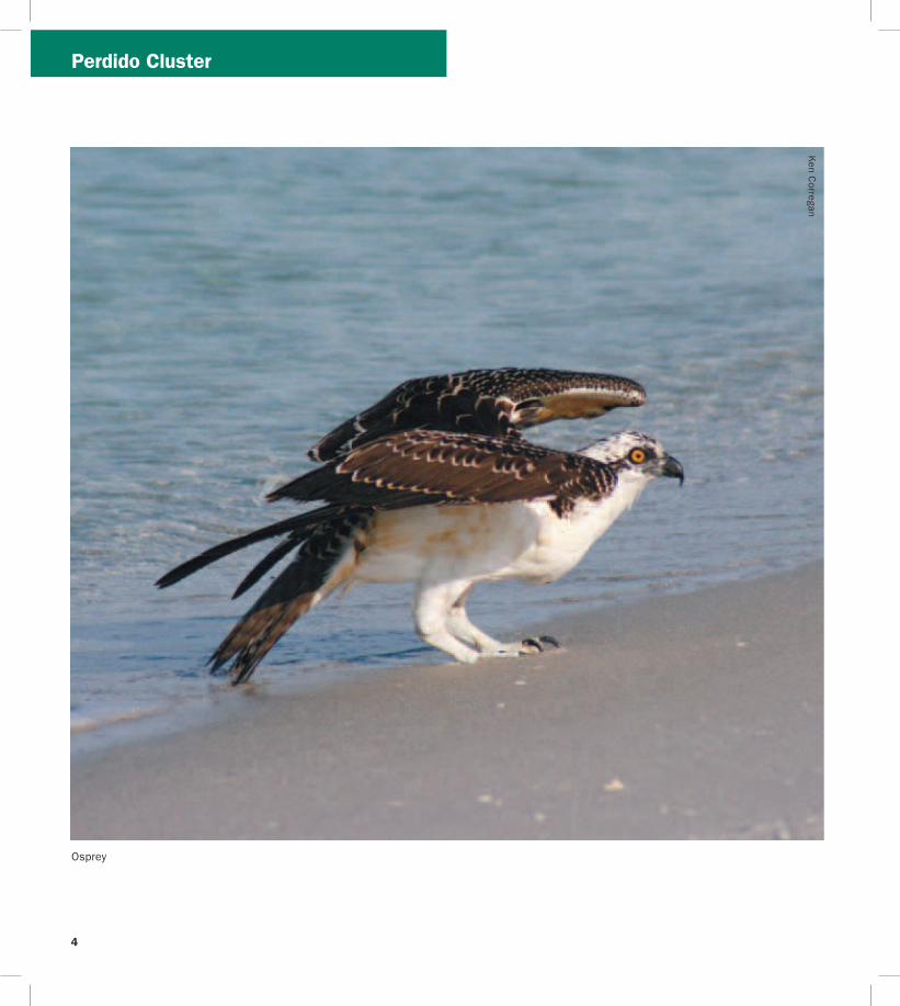
Perdido Cluster
Osprey
Ken C
orregan
4
5
Perdido Cluster
Welcome to the Panhandle Florida Birding and Wildlife Trail
The Panhandle Section of the Great Florida Birding and Wildlife Trail (GFBWT) spans 16 counties from the Perdido River in Escambia County on the Alabama border to the Aucilla River in Jefferson County The Panhandle is Floridarsquos least populated region and it includes some of the statersquos most spectacular scenery from upland hardwoods and slope forests with dramatic bluffs and deep ravines to stately longleaf pines vast salt marshes winding rivers and pristine white sand beaches Whether you explore by foot car bicycle kayak or horseback amazing birding and wildlife adventures await you
The Panhandle offers species such as Mississippi Kite White-breasted Nuthatch and Swainsonrsquos Warbler as well as western vagrants like Calliope Hummingbird Western Tanager and Groove-billed Ani The Apalachicola National Forest harbors the largest population of endangered Red-cockaded Woodpeckers in the US Winter brings a host of northern birds that are difficult to find elsewhere in Florida including American Black Duck Red-breasted Nuthatch Brown Creeper Rusty Blackbird Dark-eyed Junco and Fox Sparrow
Road signs bearing the Great Florida Birding Trailrsquos Swallow-tailed Kite logo were installed in 2008-2009 and will help guide you to each sitersquos main entrance While the Birding Trail largely served the interest of birders in the past new butterfly and other wildlife viewing information has been included in this guide for the first time Our programrsquos new name the Great Florida Birding and Wildlife Trail (GFBWT) reflects this Butterflies can be observed year round in Florida although summer and fall months are regarded as the most exciting Also new to this guidebook are GPS coordinates street addresses (where known) county and nearest city information and DeLorme Florida Atlas amp Gazetteer page numbers for each location Another navigational aid birders will find useful is the trip-planning tool on the Birding and Wildlife Trailrsquos website (wwwfloridabirdingtrailcom) which uses Googletrade Maps GPS coordinates in this guidebook correspond to those used by Googletrade Earth and Googletrade Maps Page numbers match the 1997-2006 versions of the DeLorme Florida Atlas amp Gazetteer
Map A Perdido Cluster
Big Lagoon State Park Gateway
County Escambia Nearest city Pensacola
Physical address 12301 Gulf Beach Hwy Pensacola 32507
Coordinates 30321628deg N -87403734deg W
Gazetteer page 42 Size 732 acres
An ideal gateway for the Birding and Wildlife Trail This site nicely represents the diversity of Panhandle habitats all in the boundaries
of a single park The bayfront offers sandy expanses for wintering Black-bellied Plovers Dunlin and Least Sandpipers and winter ducks like Lesser Scaup Redhead Bufflehead and Red-breasted Mergansers can be seen diving in the bay from the East Beach tower Common Loons call on foggy mornings in early spring (an uncommon occurrence in peninsular Florida) and a diversity of gulls and terns feed in area waters Migrants like Yellow-billed Cuckoos arriving off the Gulf make landfall in the spring and feed on insects in hammocks in the campground and along the Yaupon and Long Pond Trails Long Pond Trail skirts some freshwater wetlands then stretches into the Cookie Trail leading along the north edge of the lagoon onto a scrubby point peppered with pines favored by Yellow-bellied Sapsuckers Northern Flickers and Brown-headed Nuthatches Check with staff for information on birding and wildlife events going on in the Panhandle binoculars are also available for loan from the ranger station
Directions Due west of Pensacola drive south on SR 173Blue Angel Pkwy and turn right (west) on SR 292Sorrento Rd After 27 mi turn left (south) on CR 293Bauer Rd the entrance to the park is at the end of CR 293
Open year round 8 AM to sundown (850) 492-1595 wwwfloridastateparksorgbiglagoon
J F M A M J J A S O N D
see ldquoGatewaysrdquo on page 3 for more information
2 Gulf Islands National Seashore Perdido Key Area
County Escambia Nearest city Pensacola
Physical address Johnson Beach Rd Pensacola 32507
Coordinates 30298946deg N -87417659deg W
Gazetteer page 42 Size 1041 acres
This property encompasses the eastern tip of Perdido Key at the mouth of Pensacola Bay with miles of undeveloped beach To begin turn left (north) 025 mile past the fee booth and park at the end of the road A 05-mile loop with a boardwalk nature trail begins here which can be good in spring for Neotropical songbirds such as Swainsonrsquos Thrushes Pine Warblers and Eastern Towhees call from the pinewoods while the boardwalk winds through marsh good for Clapper Rails and Spotted Sandpipers at muddy edges Return to the main park road which runs eastward for another 2 miles Beach (south side) and lagoon (north side) accesses along the road allow looks at Northern Gannets October through March and a diversity of gulls terns and various shorebirds year-round Least Terns and Snowy Plovers nest in the protected areas on the north side of the road and elsewhere so be careful not to disturb them Small coves on Big Lagoon shelter ducks and Common Loons from the winter wind offering good close views Extended hours are available (ask about Night Owl permits) and primitive camping is allowed (with permit) on the east end of the key
1
Perdido Cluster
6
7
Perdido Cluster
Directions Due west of Pensacola drive south on SR 173Blue Angel Pkwy and turn right (west) on SR 292Sorrento Rd After approx 65 mi turn left (east) on Johnson Beach Rd the entrance pay station is 05 mi ahead past Johnson Beach
Open year round 8 AM to sunset (850) 934-2600 wwwnpsgovguis
J F M A M J J A S O N D
3 Naval Air Station Pensacola Trout Point Nature Trail
County Escambia Nearest city Pensacola
Physical address S Blue Angel PkwyRadford Blvd Pensacola 32507
Coordinates 30333322deg N -87338438deg W
Gazetteer page 42 Size 40+ acres
The pleasant Trout Point Nature Trail follows a boardwalk for 05 miles through the interdune area providing the unique vantage of sandy shoreline on one side and freshwater marsh and open water on the other Wading birds like night-herons and Snowy Egrets work the marshes while the beachfront attracts shorebirds terns and gulls Pines along the waterfront trail are worth checking for feeding songbirds and Brown-headed Nuthatches This nature trail is part of Pensacola Naval Air Station and occasional noise from aircraft should be expected At the entrance security gate tell the security officer you are visiting Trout Point Nature Trail Heightened security levels may limit access so call ahead for information
Directions Due west of Pensacola drive south on SR 173Blue Angel Pkwy to the west gate of Pensacola Naval Air Station Continue straight through the gate on Radford Blvd Turn right at the trail entrance (05 mi from security gate) Continue on the unpaved road for 025 mi to the trailhead and parking
Open 6 AM to 30 min before sunset (850) 452-3100
wwwdodpiforgchecklistsnapfhtm
J F M A M J J A S O N D
4 Tarkiln Bayou Preserve State Park
County Escambia Nearest city Pensacola
Physical address CR 293Bauer Rd Pensacola 32506
Coordinates 30372923deg N -87402335deg W
Gazetteer page 42 Size 4197 acres
From the parking lot hike the trail west through flatwoods listening for the ldquosqueaky toyrdquo call of Brown-headed Nuthatches the wavering trills of Pine Warblers and the harsh squawking sounds of Yellow-breasted Chats For a shorter hike veer left at the fork The paved trail leads to a boardwalk through a titi forest (listen for breeding White-eyed Vireos) which emerges on the sheltered bayou Scan the reeds for rails and waders For a longer hike veer right at the fork following the trail along the bayoursquos far side past a rare pitcher plant bog to the end on Perdido Bay Across the street from the parking lot upland sandhill habitats host Common Ground-Doves year-round and Common Nighthawks on late springsummer evenings Bring water year-round and expect mosquitoes in warmer months
Directions West of Pensacola drive south on SR 173Blue Angel Pkwy and turn right (west) on 292Sorrento Rd After 27 mi turn right (north) on CR 293Bauer Rd the entrance is 22 mi on the left
Open year round 8 AM to sundown (850) 492-1595 wwwfloridastateparksorgtarkilnbayou
J F M A M J J A S O N D
5 ECUA Bayou Marcus Wetlands
County Escambia Nearest city BellviewPensacola
Physical address 3050 Fayal Dr Pensacola 32526 (main) Alekai Dr Pensacola 32526 (Alekai Dr entrance)
Coordinates 30436991deg N -87325980deg W (main entrance) 30444484deg N -87332614deg W (Alekai Dr entrance)
Gazetteer page 42 Size 1100 acres
From the parking lot this functioning wastewater treatment facility has nearly 8000 feet of boardwalk through the titi-lined wetlands created by the plantrsquos treated wastewater discharge As you enter the boardwalk the first large pond on the left hosts wintering Blue-winged Teal Hooded Merganser Bufflehead and Common Goldeneye to name a few Swamp Song and White-throated Sparrows exploit the weedy edges and Brown-headed Nuthatches and Pine Warblers call from the adjacent pinewoods The odd Groove-billed Ani sighting keeps interest in this site high Please be considerate as this is a fully functional utilities plant birder access is at the managementrsquos discretion Recent site improvements include four shade stops on the boardwalk trail surface improvements publication racks bird checklist and interpretive signs
Migrantrsquos Rest Cluster
Gulf Breeze
Pensacola Beach
Pensacola
Avalon Beach
East Bay
Escambia Bay
Pensacola Bay
Santa Rosa Sound
Gulf of Mexico
17th A v e
Ch a se St
Bayfron
tPkw
y
Shoreline Dr
Pensacola
Beach Rd
(toll)
Garcon Point Bridge
(toll)
Fort Pickens Rd
G a r c
o n P
o i n t R
d U n
i v e rs
ity P
kwy
Campus Dr
12 13
Avalo
n Blvd
Nine Mile Rd
Pensacola RegionalAirport
98
191
290
291
289
29
90
90 90A
98
399
281
281
281
399
10
110
6
7 8
9
10 11
12
13
13
N
0 1
Miles
2
Birding Trail Site
B
To Alabama
To Milton To
Crestview
ESCAMBIA CO
SANTA ROSA CO
26
17
22
8
9
PerdidoMigrantrsquos Rest Clusters
Directions From the intersection of SR 173Blue Angel Pkwy and CR 298Lillian Hwy go north on Blue Angel Pkwy for 11 mi to the ECUA sign at Fayal Dr Turn left (west) and drive to the entrance gate Park and enter through the fence to access the boardwalk A second entrance on Alekai Dr (formerly Ramsey Beach Rd) is now handicapped accessible To access this entrance go back to Blue Angel Pkwy and turn left (north) After 03 mi turn left (west) onto Alekai Dr and go 04 mi
Open daily 7 AM to 6 PM (850) 458-1658 (850) 455-3337 wwwdepstatefluswaterwastewaterdomwetbayouhtm
J F M A M J J A S O N D
7
J F M A M J J A S O N D
J F M A M J J A S O N D
Map B Migrantrsquos Rest Cluster
6 University of West Florida
Edward Ball Nature Trail County Escambia Nearest city Pensacola
Physical address 11000 University Pkwy Pensacola 32514
Coordinates 30550723deg N -87221716deg W
Gazetteer page 26 Size 15 acres
The Edward Ball Nature Trail includes a short boardwalk through a nice ravine and swamp with Prothonotary Warbler-laden cypress trees above and wading egrets below Songbirds like Northern Parulas Summer Tanagers and Great Crested Flycatchers frequent the area and migration in spring and fall can yield some interesting visiting species Swallow-tailed Kites may be seen overhead in spring and summer The slope is steep and the boardwalk shows its age so donrsquot get so distracted by the birds that you forget to watch your step
Directions From US 90ANine Mile Rd north of Pensacola turn north on University Pkwy At the end of University Pkwy turn left (west) onto Campus Dr Take the 4th left then another immediate left into Parking Lot G Park and walk behind the Science Building (Bldg 13) to the trail entrance Campus maps and MANDATORY PARKING PASSES can be obtained at the Information Center (1st right after turning onto Campus Dr)
Open daily dawn to dusk (850) 857-6417 wwwuwfedu
Wayside Park and Pensacola Visitor
Information Center County Escambia Nearest city Pensacola
Physical address 1401 E Gregory St Pensacola 32502
Coordinates 30417865deg N -87193398deg W
Gazetteer page 42 Size 30 acres
Worth a quick stop to view gulls and terns the waterfront fishing bridge and offshore breakwater all host a variety of ages of Herring Ring-billed and Laughing Gulls Forsterrsquos and Royal Terns and more Common Loons feed very close to shore and sport nearly complete breeding plumage in FebruaryMarch before they return north Bring your spotting scope to check the bay for wintering ducks and Horned Grebes
Directions From I-10 north of Pensacola take exit 12 for I-110 and head south Take exit 1B for Chase St and head east Continue east on Chase St until it ends at US 98Bayfront Pkwy and take a left (east) Drive approx 03 mi and turn left (northeast) on N 17th Ave After 300 ft turn right (southeast) on E Gregory St Parking is 350 ft ahead
Open 24 hrsday (850) 434-1234 wwwvisitpensacolacom
8 Project GreenShores
County Escambia Nearest city Pensacola
Physical address Bayfront Pkwy Pensacola 32502
Coordinates 30417634deg N -87194486deg W
Gazetteer page 42 Size 15 acres
Project GreenShores is a restoration project undertaken by a suite of advocates and agencies Located across from the Pensacola Visitor Center along Bayfront Pkwy the project is systematically establishing an emergent marsh and oyster reef along the waterfront The area has historically been good for birds like Osprey Brown Pelican and Royal Tern but as the salt marsh grasses take root the birds are responding Yellow-crowned Night-Heron Semipalmated Plover Black-necked Stilt and more ply the flats and shoreline Park and walk the waterfront to the west along the bay shore restoration efforts continue past the Missing Childrenrsquos Memorial on Hawkshaw Lagoon (across from Veterans Park) to Bartram Park Look for Loggerhead Shrike on the far southern end of the property just before the bridge
Migrantrsquos Rest Cluster
J F M A M J J A S O N D
9
J F M A M J J A S O N D
J F M A M J J A S O N D
11
Directions From I-10 north of Pensacola take exit 12 for I-110 and head south Take exit 1B for Chase St and head east Continue east on Chase St until it ends at US 98Bayfront Pkwy and turn left (east) The site and parking are approx 03 mi on the right 100 ft past the intersection with N 17th Ave and 025 mi before the Pensacola Bay Bridge
Open daily dawn to dusk (850) 436-5652 wwwdepstateflusnorthwestEcosyssectiongreenshoreshtm
Shoreline Park South
County Santa Rosa Nearest city Gulf Breeze
Physical address 800 Shoreline Dr Gulf Breeze 32561
Coordinates 30354244deg N -87177670deg W
Gazetteer page 42 Size 100 acres
Shoreline Park South is a small sound-side park in Gulf Breeze which lies between Fort Pickens and the mainland as the bird flies This ensures itrsquos on the direct path of migrants coming in off the Gulf in spring In winter bird the waterfront for grebes and loons (occasional Pacific and Red-throated in years when vagrant birds are prevalent) Wintering ducks like Lesser Scaup Bufflehead and even occasional Common Goldeneye can be viewed from the pier Nearer the entrance bird the loop trails through oak hammock excellent for resident Pine Warblers Carolina Chickadees and Pileated Woodpeckers as well as migrant Black-throated Blue and Worm-eating Warblers Swainsonrsquos Thrushes Orchard Orioles and more This site is busy on warm weather weekends Recent amenities include a boardwalk nature trail waterfront boardwalk picnic shelters and restrooms Many park features are handicapped accessible A viewing deck with seats provides good elevation for scoping winter waterbirds
Directions From US 98 in Gulf Breeze turn west on Shoreline Dr (just west of Pensacola Beach Rdtoll bridge) Go 01 mi to the first intersection and turn left (southwest) to stay on Shoreline Dr The entrance is located 07 mi on the left (south) side of the road
Open 24 hoursday (850) 934-5140 wwwgulfbreezerecreationcentercom
1Gulf Islands National Seashore Fort Pickens Area
County Escambia Nearest city Pensacola Beach
Physical address 1400 Fort Pickens Rd Pensacola Beach 32561
Coordinates 30325672deg N -87181354deg W
Gazetteer page 42 Size 1742 acres
This migratory hotspot is not to be missed in spring as tired migrants make landfall after long overwater flights Batteries Langdon and Worth are both good stops for migrants closely check flowering oaks Please respect closed areas protecting nesting birds the beach here is prime for breeding Snowy Plovers and Least Terns spring through fall Black Terns are ubiquitous in summer and early fall By far the fort and surrounding trails offer this sitersquos most exciting birding In open areas surrounding the fortifications watch for sentinel flycatchers on any minor promontory Gray Kingbirds breed here and Scissor-tailed Flycatchers are occasional in winter The trails on the fortrsquos bayside can be extraordinary for migrant songbirds like Tennessee Cape May and Magnolia Warblers and more Morning is not necessarily the best time to see these birds long-term sighting logs from dedicated local birders indicate these migrants can make landfall in early afternoon Fallouts are exaggerated by early afternoon rain showers that ground migrants as soon as they reach land Migrating raptors cruise the duneline in October and April Loaner optics and field guides are available Fort Pickens Road is prone to storm-related closures check road condition at website below prior to departure
Directions From Pensacola take US 98 east approx 45 mi to the south side of Gulf Breeze Take SR 399Pensacola Beach Rd (toll bridge) south across Santa Rosa Sound to Pensacola Beach Turn right (southwest) at Fort Pickens Rd and head west for 25 mi to the entrance
Fort Pickens Area open 7 AM to 10 PM (850) 934-2600 Historic Fort Pickens open 8 AM to sunset wwwnpsgovguis
0
Pensacola Beach Gulf Pier
County Escambia Nearest city Pensacola Beach
Physical address 41 Fort Pickens Rd Pensacola Beach 32561
Coordinates 30332175deg N -87142344deg W
Gazetteer page 43 Size 025 miles
With binoculars alone this site offers a fare of gulls and terns comparable to other area beach sites However with a spotting scope and a little blustery weather this 025-mile pier can be a seawatcherrsquos dream offering a stable site away from the beach to scan out over the sea More common sightings are wintering
10
11
Migrantrsquos Rest Cluster
Common Loons and plunging gannets October through March However in periods of stormy weather in the Gulf of Mexico tantalizing seabirds like Bridled and Sooty Terns and Sooty Shearwaters have been spotted from this location Respect severe weather but certainly donrsquot let a little rain discourage you This site is primarily a fishing pier but welcomes birders too
Directions From Pensacola take US 98SR 30Gulf Breeze Pkwy south across the Pensacola Bay Bridge to the south side of Gulf Breeze Take SR 399Pensacola Beach Rd (toll bridge) south across Santa Rosa Sound to Pensacola Beach Turn right (southwest) at Fort Pickens Rd and go 01 mi to the first entrance on the left (south) side of the road (look for a large parking lot with a ldquobeach ballrdquo water tower)
Open 24 hoursday (850) 934-7200 wwwfishpensacolabeachpiercom
J F M A M J J A S O N D
J F M A M J J A S O N D
J F M A M J J A S O N D
12 Gulf Islands National Seashore Naval Live Oaks Area
County Santa Rosa Nearest city Gulf Breeze
Physical address 1801 Gulf Breeze Pkwy Gulf Breeze 32563
Coordinates 30364997deg N -87131275deg W
Gazetteer page 42 and 43 Size Size 1378 acres
This visitor center and park HQ for the national seashore spans the spit of land separating Santa Rosa Sound to the south from Pensacola Bay to the north From the sound-side shoreline south of the visitor center parking scope for Common Goldeneye Lesser Scaup and other wintering ducks As always in migration check the live oaks for which this area was named Black-and-white Warblers pick through resurrection fern on the sides of oaks in winter and Brown Creepers are occasionally found scaling the trees
Directions From Pensacola take US 98SR 30Gulf Breeze Pkwy south across the Pensacola Bay Bridge to Gulf Breeze Stay on US 98 East past the intersection with SR 399 the visitor center and headquarters are 18 mi ahead on the right (south) side of the road
Open 8 AM to sunset (850) 934-2600 wwwnpsgovguis
13 Garcon Point Water Management Area Garcon Point Trail
County Santa Rosa Nearest city MiltonGulf Breeze
Physical address SR 281CR191 Milton 32583
Coordinates 30470726deg N -87084151deg W (north entrance) 30459271deg N -87092904deg W (south entrance)
Gazetteer page 43 Size 3235 acres
Gorgeous wet prairie occupies much of this preserve with slightly elevated patches of longleaf pine-wiregrass community breaking the otherwise unobstructed horizon A habitat of extremes this landscape burns frequently and absorbs lots of rainfall trails may occasionally hold water so immersible shoes are recommended Biting flies and ticks are quite unpleasant from April to October but the sheer beauty of this site makes it a must-see from November to March Wet prairie sparrows like Henslowrsquos and LeContersquos occasionally winter here and Cooperrsquos Hawks cruise the prairie for prey like Eastern Towhees and Loggerhead Shrikes Yellow Rails have been found here in winter Pine Warblers call from the tree line and rare pitcher plants crowd the trail (stay on the trail to protect these Panhandle specialties) From the south entrance access the 17-mile loop trail through scrubby oaks and past an ephemeral wetland From the north trailhead the North Spur Trail runs 12 miles south to join the loop trail on its north border See the Florida Trail Associationrsquos website for additional information Access to and from Pensacola Beach via SR 821 requires toll and may result in delays during peak travel times
Directions From I-10 south of Milton take exit 22 for SR 281Avalon Blvd and head south After 4 mi this road will merge with CR 191 Garcon Point Rd Drive approx 07 mi past the intersection with CR 191 the north trailhead is on the left (east) side of the road The south trailhead is 1 mi farther also on the left (east) side of the road If coming from the south on SR 281 the southern entrance is located 025 mi north of the bridgersquos toll booth
Open dawn to dusk (850) 484-5125 (850) 539-5999 wwwnwfwmdstateflusrecreationyellowriverhtml wwwfloridatrailorgHikesfloridapanhandleGarconPointhtml
Migrantrsquos Rest Cluster D
avid Moynahan FW
C
Horseshoe Crabs
12
13
Blackwater Cluster
14
J F M A M J J A S O N D
15
J F M A M J J A S O N D
16 Blackwater Fisheries Center
Map C Blackwater Cluster
Blackwater River State Forest Hutton Unit
County Santa Rosa Nearest city Holt
Physical address Deaton Bridge Rd Milton 32583
Coordinates 30685874deg N -86876366deg W
Gazetteer page 27 Size 7629 acres
This site adjacent to Blackwater River State Park is worth a quick stop to listen for Bachmanrsquos Sparrow in spring and summer ndash if they are singing yoursquoll likely hear them from the parking lot The available habitat is turkey oakpine uplands common throughout the Panhandle and not as productive for birding as other habitats may be Still in springtime a quick peek can never hurt Less than 1 mile from the entrance on H9 Road (across from Boundary Line Rd) you should encounter species such as Red-headed Woodpecker Brown-headed Nuthatch Eastern Bluebird and Great Crested Flycatcher Gates are open to general vehicular traffic from May 1 to October 1 gates will be closed in hunting season (hunters check in through a different gate) If the gate on Deaton Bridge Rd is locked you may use the parking lot next to the gate and walk in Additional entrances are located at Pond Road off US 90 and at the intersection of Deaton Bridge Rd and Indian Ford Rd Take care driving on area clay roads ndash they can be slippery when wet The Florida National Scenic Trail winds through the site and is open to hikers year round A WMA map is available from the FWC website Seasonal hunting takes place at this GFBWT site please see page 55 for information on dates regulations and more
Directions From Milton take US 90 east for approx 95 mi to Harold Turn left (north) on Deaton Bridge Rd and drive 18 mi the entrance and parking area are on the left (west) side of the road directly across from Boundary Line Rd From I-10 eastbound take exit 31 for SR 87 and head north to US 90 Turn right (east) on US 90 and follow it for 58 mi to Deaton Bridge Rd From I-10 westbound take exit 45 for Log Lake Rd and go north to US 90 Turn left (west) and follow US 90 for 87 mi to Deaton Bridge Rd
Open dawn to dusk (850) 957-6140 wwwfl-dofcomstate_forestsblackwater_riverhtml MyFWCcomviewingrecreationwmascooperativeblackwater
Blackwater River State Park
County Santa Rosa Nearest city Holt
Physical address 7720 Deaton Bridge Rd Holt 32564
Coordinates 30711943deg N -86879987deg W
Gazetteer page 27 Size 635 acres
This site is a popular swimming canoeing and picnicking area in warm weather but offers nice access to floodplain hiking trails good for Yellow-billed Cuckoos and Hairy Woodpeckers in late spring and summer Broad-winged Red-tailed and Red-shouldered Hawks are common and Wood Thrushes and Prothonotary Warblers breed here Brown-headed Nuthatches squeak from pines in the uplands these delightful acrobats are a joy to watch The brief campground trail and the 09-mile Chain of Lakes Nature Trail are best for birding The trails can be wet at times of high water so wear shoes you donrsquot mind getting muddy Loaner optics and field guides are available
Directions From Milton take US 90 east for approx 95 mi to Harold Turn left (north) on Deaton Bridge Rd and drive 39 mi the entrance is on the right (east) side Additional parking areas (fee required) are located at either end of the bridge Access the Chain of Lakes Nature Trail at the south end of the bridge From I-10 eastbound take exit 31 for SR 87 and head north to US 90SR 10 Turn right (east) on US 90 and follow it for 58 mi to Deaton Bridge Rd From I-10 westbound take exit 45 for Log Lake Rd and go north to US 90 Turn left (west) and go 87 mi to Deaton Bridge Rd
Open year round 8 AM to sundown (850) 983-5363 wwwfloridastateparksorgblackwaterriver
County Santa Rosa Nearest city Holt
Physical address 8384 Fish Hatchery Rd Holt 32564
Coordinates 30729556deg N -86802542deg W
Gazetteer page 27 Size 590 acres
Nestled in the Blackwater River State Forestrsquos uplands this fish hatchery is an oasis of wading birds and shorebirds Stop at the entrance kiosk to check the sightings log and to pick up a checklist Walk the dikes between the aquaculture ponds looking for winter
14
Blackwater Cluster
waterfowl such as Ring-necked Ducks Blue-winged Teal and Wilsonrsquos Snipe at the muddy edges Wintering shorebirds include both yellowlegs Spotted Solitary and Pectoral Sandpipers and Semipalmated Plovers Forsterrsquos Terns Purple Martins and Northern Rough-winged Swallows skim over the ponds Northern Bobwhites and Wild Turkeys are common in the adjacent forest and wooded fields Ask at the office if yoursquod like a facility tour and also if hunting or prescribed fire would prohibit your birding in the woods of the state forestrsquos Carr Unit to the northeast Bachmanrsquos Sparrows sing here in spring and Henslowrsquos Sparrows occasionally overwinter
Directions From I-10 eastbound take exit 31 for SR 87 and head north to US 90SR 10 Turn right (east) and drive 139 mi to Cooper Ln outside of Holt Turn left (north) and go 01 mi to Johns Rd Turn left (west) and follow Johns RdBryant Bridge Rd (name change) for 3 mi The entrance is on the right (northeast) side of the road From
I-10 westbound take exit 45 for Log Lake Rd and go north to US 90SR 10 Turn left (west) and drive 05 mi Turn right (north) on Cooper Ln After 01 mi turn left on Johns RdBryant Bridge Rd The entrance is 3 mi ahead on the right
Open 730 AM to 4 PM MonndashFri weekends by appointment only (requires at least 2 weeks advance notice) (850) 957-6177
MyFWCcomviewingrecreationwmascooperativeblackwater
J F M A M J J A S O N D
Milton
CrestviewBaker
Harold
Holt
Munson
Blackwater River
Blackwater River
Shoal River
Johns Rd
Johns Rd
Bryant Bridge Rd
Buddy Hardy Rd
Live Oak Church Rd
N Karick Rd
Karick Lake Lower Rd
Ferd
on
Blvd
Bob Pitts Rd
Indian Ford Rd
Pond Rd
Cooper Ln Log Lake Rd
Boundary Line Rd
Deato
n
Br
idge R
d
Coldwater H o rs e Trail
Whiting Field Naval
Air Station
90
191
191
87
87
178
4
87
189
188
4
4
4
2
85
87A 90
56
45
3110
10
N
0 1 2 3 4
Miles
Birding Trail Site
To De FuniakSprings
To De FuniakSprings
To Pensacola
SAN
TA R
OSA
CO
O
KA
LOO
SA C
O
SAN
TA R
OSA
CO
O
KA
LOO
SA C
O
14
15
19
20
21
Thre
eN
otch
Rd
17
C
15
Blackwater Cluster
17 Naval Air Station Whiting Field Clear Creek Nature Trail
County Santa Rosa Nearest city Milton
Physical address Langley St Milton 32570
Coordinates 30707410deg N -87032045deg W
Gazetteer page 27 Size 80+ acres
As it descends through mixed pine-oak uplands this interesting 15-mile round-trip trail leads to a creek and associated wetland Listen for Red-breasted Nuthatches in fall in the uplands and Hermit Thrushes overwintering At the water Common Yellowthroats scold from brushy tangles and wading birds like Little Blue Herons and Least Bitterns are possible among the pitcher plants visible from the boardwalk This is part of a functioning military Naval Air Station and occasional noise from aircraft is to be expected Access may be limited during times of elevated homeland security levels so call in advance
Directions From Milton head north on SR 87 following signs to NAS Whiting Field Turn right (east) on CR 87ALangley St and explain at the security gate that you would like to visit Clear Creek Nature Trail Once through the gate follow NAS Whiting Field Dr to the trailhead parking area
Open dawn to dusk (850) 623-7602 wwwdodpiforgchecklistsnaswfhtm
J F M A M J J A S O N D
J F M A M J J A S O N D
J F M A M J J A S O N D
20
Blackwater River State Forest
Three Notch Rd (Hardy Rd to Coldwater Horse Trail)
County Santa Rosa Nearest city Milton
Physical address Three Notch Rd Milton 32570
Coordinates 30800828deg N -86950923deg W (south end) 30832354deg N -86942892deg W (north end)
Gazetteer page 27 Size 5 miles
This 5-mile stretch of Three Notch Rd offers easy safe roadside pulloffs with Red-cockaded Woodpecker (RCW) cavity trees ringed with white paint visible from the road RCWs are most easily seen in breeding season in the mornings when they emerge from their nest cavities to ferry food back to their waiting young Frequent prescribed fire keeps this habitat healthy so obey signs closing the area for this necessary management event Use caution on area clay roads which can be slippery when wet Also check trails north of Coldwater Horse Trail for RCWs if desired along the east and west sides of Three Notch Rd Seasonal hunting takes place at this GFBWT site please see page 55 for information on dates regulations and more
Directions From Milton take CR 191Munson Hwy north approx 14 mi to Buddy Hardy Rd Turn left (west) on Buddy Hardy Rd drive 07
18
mi and turn right (north) onto Three Notch Rd Drive towards the intersection with Coldwater Horse Trail pull off on shoulder as desired Trails criss-cross the area along Three Notch Rd and Coldwater Horse Trail from Coldwater Creek to Juniper Creek (south of SR 4 and west of CR 191) Coldwater Horse Trail leads eastward back to CR 191
Open dawn to dusk (850) 957-6140 wwwfl-dofcomstate_forestsblackwater_riverhtml
19 Blackwater River State Forest Bear Lake Loop Trail
County Santa Rosa Nearest city Baker
Physical address Bear Lake Rd Milton 32570
Coordinates 30855008deg N -86838233deg W
Gazetteer page 27 Size 200 acres
From the camping area hike the 4-mile trail that rings the lake watching for migrants like Ovenbirds and Swallow-tailed Kites in springtime Red-shouldered Hawks echo across the lake and Pied-billed Grebes dive hunting for fish Nearby uplands can be good for Chuck-willrsquos-widows and Wild Turkeys Take water and expect biting insects in warm weather The lake is popular with anglers in spring and fall There is no hunting on the trail or in the vicinity of the lake
Directions From Milton take CR 191Munson Hwy north to SR 4 in Munson Turn right (east) on SR 4 and proceed 20 mi to the entrance at Bear Lake Rd Turn left (north) the parking area is 06 mi ahead
Open dawn to dusk (850) 957-6140 wwwfl-dofcomstate_forestsblackwater_riverhtml
Blackwater River State Forest Karick Lake
County Okaloosa Nearest city Baker
Physical address N Karick Rd and Karick Lake Lower Rd Crestview 32531
Coordinates 30905009deg N -86656031deg W (upper entrance) 30894311deg N -86660076deg W (lower entrance)
Gazetteer page 28 Size 38 miles
Check these recreation areas for Bachmanrsquos Sparrows calling in the sandhills ducks and wading birds like Green Herons visible from
16
BlackwaterChoctawhatchee Clusters
the north access pier and songbirds like Yellow-throated Warblers and Red-eyed Vireos in the hardwoods around the lake A 38-mile loop trail circles around the lake traveling along sandhills gallberry midslopes and hardwood bottoms Pay attention to ecotones particularly those edges with hardwoods These can be good for migrants that prefer this habitat over drier sandhills Directions From Milton take CR 191Munson Hwy north to SR 4 in Munson and turn right (east) Follow SR 4 to its intersection with SR 189 in Baker and turn left (north) The south access (Karick Lake Lower Rd) is 8 mi ahead on the right The north access (N Karick Rd) is 08 mi farther north Open dawn to dusk (850) 957-6140 wwwfl -dofcomstate_forestsblackwater_riverhtml
J F M A M J J A S O N D
21Shoal River Wayside Par
(Bill Duggan Jr Park)
k
County Okaloosa Nearest city Crestview
Physical address 5999 SR 85 Crestview 32536
Coordinates 30698772deg N -86570501deg W
Gazetteer page 28 Size 55 acres
Freeport
Niceville
Valparaiso
Destin
GraytonBeach
Eglin Air Force Base
Choctawhatchee Bay
Choctawhatchee River
Gulf of Mexico
RockyBayou
Gulf of Mexico
Chat Holly Rd
John Sims Pkwy
Emerald Coast Pkwy
331
331
20
83
83A20
282
393
98
293
30
397
85
85285123
190
30
98
98
98
23
24
25
2726
28
N
0 1
Miles
2
Birding Trail Site
To PanamaCity
To Ft WaltonBeach
To DeFuniakSprings
D
Mad
iso
n St
W C
oll
ege
Blvd
OK
AL
OO
SA
CO
O
KA
LO
OS
A C
O
WA
LTO
N C
OW
ALT
ON
CO
O
KA
LO
OS
A C
O
WA
LTO
N C
O
30A83
283
30A
395
(toll)
17
J F M A M J J A S O N D
J F M A M J J A S O N D
23
J F M A M J J A S O N D
24
22
BlackwaterChoctawhatchee Clusters
Shoal River Wayside Park is worth a quick check for wading birds at the river and songbirds in the adjacent floodplain forest In this part of the Panhandle floodplain corridors along rivers like this create migrant highways through arid turkey oak and sand pine uplands Check the tree line and understory especially in spring migration for songbirds like Prairie Warblers and well camouflaged Veeries
Directions From I-10 south of Crestview take exit 56 for SR 85 Ferdon Blvd Go south for 18 mi Turn left (east) at Live Oak Church Rd and go 01 mi Turn right (southwest) and continue on Live Oak Church Rd for 01 mi Turn left (south) into the park
Open dawn to dusk (850) 689-5084 (850) 689-5772 wwwcookaloosaflus
Map D Choctawhatchee Cluster
Turkey Creek Park
County Okaloosa Nearest city Niceville
Physical address 340 John Sims Pkwy West Niceville 32578
Coordinates 30523676deg N -86497348deg W (main entrance) 30532812deg N -86502494deg W (Turkey Creek extension)
Gazetteer page 28 Size 075-mile boardwalk
Walk the scenic 075-mile boardwalk along tannic Turkey Creek through a river forest of titi maple cypress and bay Watch for Green Herons stalking minnows on low hanging branches over the water and Anhingas swimming in the creek Mississippi Kites are common in summer and songbirds like White-eyed Vireos breed here In warm weather visit on weekdays and early in the morning this is a popular swimming access and the revelry of swimmers riding inner tubes downstream can be disruptive to birding (albeit tempting to partake in) The boardwalk is ADA accessible but the city also provides rides on electric carts for the mobility impaired between 730 and 1100 AM on the first Wednesday of each month A second entrance for the North Turkey Creek Extension is located on W College Blvd which has a 900-ft boardwalk and a canoekayak launch
Directions From intersection of SR 20John Sims Pkwy East and SR 285N Partin Dr in Niceville drive west on SR 20 for 10 mi to Evans St Turn right (north) the park entrance is immediately on your left From the intersection of SR 190Valparaiso Pkwy and SR 397 John Sims Pkwy in Valparaiso go north on John Sims Pkwy for 13 mi across the bridge to Evans St Turn left (north) and immediately left again into the parking lot To access the new extension head east from the park on SR 20 to SR 85 Turn left (north) and go 09 mi to W College Blvd Turn left (west) and drive 06 mi past the hospital to the entrance on the left (south) side of the road
Open 630 AM to dark Tues - Sun North Turkey Creek Extension opens at 8 AM (850) 729-4062 wwwnicevilleorgturkeyhtml
Fred Gannon Rocky Bayou State Park
County Okaloosa Nearest city Niceville
Physical address 4281 SR 20 Niceville 32578
Gazetteer page 28 and 44 Size 346 acres
Coordinates 30495944deg N -86432791deg W
This waterfront park is located on Rocky Bayou in Choctawhatchee Bay Of its three trails Red Cedar and Rocky Bayou are more interesting for birds than Sand Pine Trail Walk the trails for migrants like Cedar Waxwings and Indigo Buntings check the trees in the campground area too The waterfront can offer vantages of diving ducks in winter Ospreys overhead and Spotted Sandpipers on rocky edges in winter The local Audubon chapter offers bird walks early on Friday mornings ndash call in advance for details Loaner optics and field guides are available
Directions From the intersection of SR 285 and SR 20 in Niceville drive approx 40 mi east on SR 20John Sims Pkwy The entrance to the park is on the left (north) side after crossing Rocky Bayou Bridge
Open year round 8 AM to sundown (850) 833-9144 wwwfloridastateparksorgrockybayou
Henderson Beach State Park
County Okaloosa Nearest city Destin
Physical address 17000 Emerald Coast Pkwy Destin 32541
Coordinates 30386928deg N -86447520deg W
Gazetteer page 44 Size 221 acres
Henderson Beach State Park offers nice beachfront for specialties like Snowy Plovers Least Terns American Oystercatchers and more Take care not to disturb beach-nesting birds which are often cryptic and blend easily with the sand they nest upon A nature trail by the beach access points winds through a small coastal hammock in a stretch of coastline where little of this important habitat remains Watch for migrant songbirds here in spring and raptors making landfall or following the duneline in April and October The campground has some nice trees worth checking as access allows ask for permission at the entrance gate and be considerate of campers This site gets busy in warm weather Loaner optics and field guides are available
Choctawhatchee Cluster
J F M A M J J A S O N D
J F M A M J J A S O N D
26
J F M A M J J A S O N D
Directions From the intersection of SR 293Danny Wuerffel Way (toll bridge) and US 98SR 30Emerald Coast Pkwy east of Destin drive 15 mi west on US 98 to the park entrance on the left (south) side of the highway
Open year round 8 AM to sundown (850) 837-7550 wwwfloridastateparksorghendersonbeach
25 Topsail Hill Preserve State Park
County Walton Nearest city Sandestin
Physical address 7525 W County Hwy 30A Santa Rosa Beach 32459
Coordinates 30371282deg N -86272744deg W (main entrance) 30375556deg N -86299507deg W (Topsail Rd entrance)
Gazetteer page 45 Size 1643 acres
Topsail Hill Preserve State Park offers inland trails through coastal scrub and past rare coastal dune (freshwater) lakes The 25-mile Morris Lake Trail is slightly more productive than the Campbell Lake Trail although either will yield Eastern Bluebirds Eastern Kingbirds Red-headed Woodpeckers and Brown-headed Nuthatches to name a few Check the beachfront for gulls and Sandwich Least and Royal Terns Snowy Plovers nest here and shorebirds ply the shoals near the outfall for Morris Lake at the Gulf Scope the surf for Common Loons Horned Grebes and Northern Gannets winter through spring The beach is heavily visited in warm weather so plan accordingly Educational programs are offered call for details
Directions From the intersection of SR 293Danny Wuerffel Way (toll bridge) and US 98SR 30Emerald Coast Pkwy east of Destin drive 85 mi east on US 98 and turn right (southeast) on CR 30A the entrance is approx 02 mi on the right (west) side of the road A second entrance is located on Topsail Rd at US 98 14 mi west of the intersection with CR 30A Use this entrance for direct access to the Morris Lake and Campbell Lake Trails (call ahead as entrance may be closed if road is flooded)
Open year round 8 AM to sundown (850) 267-8330 wwwfloridastateparksorgtopsailhill
Grayton Beach State Park
County Walton Nearest city Point Washington
Physical address 357 Main Park Rd Santa Rosa Beach 32459
Coordinates 30334117deg N -86158050deg W
Gazetteer page 45 Size 2227 acres
Grayton Beach State Park is very popular with beachgoers in warm weather but in cooler months is worth checking On the north side of CR 30A the 42-mile Grayton Beach Hike and Bike Trail runs through pine flatwoods and along the north end of Western Lake (a brackish coastal dune lake) which can be good for wading birds Bald Eagle Barred Owl Brown-headed Nuthatch Pied-billed Grebe and more For longer hikes the Lake Loop Trail connects to Point Washington State Forestrsquos (site 27) extensive trail system Donrsquot miss the 1-mile interpretive Grayton Beach Nature Trail which begins at the beach parking area As it winds through sand dunes and under a sand live oak canopy look for Savannah Sparrow Eastern Towhee and Orange-crowned Warbler an additional loop also runs through pine flatwoods (listen for Eastern Bluebird) and along the southern end of Western Lake (check for Common Loon in winter) The beachfront offers plovers terns and gulls (Bonapartersquos in winter) and plunging gannets out to sea October through March As with all coastal sites watch for raptors cruising the beachfront and migrants arriving off the Gulf in spring Loaner optics and field guides are available
Directions From the intersection of US 98 and US 331 east of Destin drive east approx 15 mi and then turn right (south) on CR 283 Follow CR 283 for 17 mi to CR 30A and turn left (east) the entrance is on the right (south) side after 05 mi
Open year round 8 AM to sundown (850) 267-8300 wwwfloridastateparksorggraytonbeach
27 Point Washington State Forest
County Walton Nearest city Point Washington
Physical address S CR 395 Santa Rosa Beach 32459
Coordinates 30342148deg N -86131466deg W
Gazetteer page 45 Size 15131 acres
Point Washington State Forest offers 3- 5- and 10-mile hiking loops through longleaf pine flatwoods coastal scrub and sandhills Bachmanrsquos Sparrows are very likely to be heard singing in spring in areas of wiregrass and palmetto in the southern half of the 3-mile loop The eastern boundary of this loop crosses the west arm of Peach Creek where you can listen for songbirds and watch for Red-shouldered Hawks Cooperrsquos Hawks occasion the flatwoods and Eastern Towhees and Common Yellowthroats are abundant Trail system connects to Grayton Beach State Park (site 26) for
18
19
De Funiak Springs
331
9090
280A
183
183
81
10
183
280
83
181
181A
81
331
10
ToMarianna
To Freeport
ToCrestview
N
0 1
Miles
2
29
E85
96
Birding Trail Site
Rest Area
WA
LTO
N C
O
WA
LTO
N C
O
HO
LMES
CO
H
OLM
ES C
O
WA
LTO
N C
O
HO
LMES
CO
Directions From the intersection of US 331SR 83 and SR 20 in Freeport the entrance is 16 mi west on the south side of SR 20 (past Tucker Town Rd)
Open dawn to dusk (850) 835-2822 wwwfreeportfl oridagov
J F M A M J J A S O N D
Map EDogwood Cluster
29 Ponce de Leon Springs State Park
County Holmes Nearest city Ponce de Leon
Physical address 2860 Ponce de Leon Springs Rd Ponce de Leon 32455
Coordinates 30722979deg N -85930385deg W
Gazetteer page 30 Size 420 acres
Worth checking in migration this sitersquos real strength is wintering birds especially those at the southernmost limit of their range Birds like Brown Creeper and Golden-crowned Kinglet are possible at this site your chances improve with your ability to identify birds by sound Hike both short trails ndash Spring Run and Sandy Creek ndash stopping to
extended birding adventures Seasonal hunting takes place at this GFBWT site please see page 55 for information on dates regulations and more
Directions From the intersection of US 98 and US 331 east of Destin drive east approx 30 mi and turn right (south) on CR 395 Trailhead parking is 11 mi on the left (east) side of the road
Open dawn to dusk (850) 267-8325 wwwfl -dofcomstate_forestspoint_washingtonhtml
J F M A M J J A S O N D
28 Harry A Laird Sr City Park
County Walton Nearest city Freeport
Physical address SR 20 E Freeport 32439
Coordinates 30501614deg N -86145701deg W
Gazetteer page 29 and 45 Size 13 acres
This small wayside park has a brief boardwalk along a creek lined with hardwoods The area is worth checking in migration only for songbirds like waterthrushes and Worm-eating and Hooded Warblers Weekend afternoons can be busy with picnickers and playground visitors but weekdays are left for you and the birds
ChoctawhatcheeDogwood Clusters
DogwoodKentucky Warbler Clusters
listen carefully in the shady hardwood forest This park can be busy with swimmers in warm weather so weekday and early morning birding may prove the most rewarding
Directions From I-10 east of De Funiak Springs take exit 96 and head north on SR 81 for 10 mi Turn right (east) onto US 90SR 10 after 02 mi then turn right (south) again onto CR 181A the entrance is 05 mi on the right (west) side of the road
Open year round 8 AM to sundown (850) 836-4281 wwwfloridastateparksorgponcedeleonsprings
J F M A M J J A S O N D
30
J F M A M J J A S O N D
J F M A M J J A S O N D
Map F Kentucky Warbler Cluster
Falling Waters State Park
County Washington Nearest city Chipley
Physical address 1130 State Park Rd Chipley 32428
Coordinates 30731352deg N -85529023deg W
Gazetteer page 31 Size 173 acres
Falling Waters State Park makes for a nice hour-long hike exploring the sinkholes waterfalls lake and surrounding uplands via the Wiregrass and Sinkhole trails Watch for Red-headed Woodpeckers in the uplands and migrant songbirds like Gray-cheeked Thrushes in the leafy understory of dogwood and azalea beneath the magnolia and white oaks As always when in this part of northwest Florida northern species like Dark-eyed Juncos are possible in winter Check for ducks and waders at the lake edge Scan the butterfly garden for resident and migratory butterflies
Directions From I-10 east of De Funiak Springs take exit 120 and head south on SR 77 After 08 mi turn left (east) onto CR 77A State Park Rd the entrance is 17 mi ahead (road dead ends into park)
Open year round 8 AM to sundown (850) 638-6130 wwwfloridastateparksorgfallingwaters
31
32
Florida Caverns State Park
County Jackson Nearest city Marianna
Physical address 3345 Caverns Rd Marianna 32446
Coordinates 30808352deg N -85212422deg W
Gazetteer page 32 Size 1279 acres
Florida Caverns State Park has some of the best-preserved uplands in northwest Florida as well as mixed-hardwood swamps lining the drainage basin of the Chipola River Known for northern species like Red-breasted Nuthatches (in pine forest) and Winter Wrens this site is ideal for birding with miles of remote trails Access both the Fish Hatchery Loop Trails and the Pine Island Loop Trails from the Blue Hole Swimming Area Keep in mind that the Management Trail (part of the Pine Island system) runs north into the Upper Chipola Wildlife Management Area where hunting seasons will be in effect Cave tours are available at regular intervals and fill quickly An onsite canoe concession allows you to access the Upper Chipola River Water Management Area (site 32) Butterflying is best here in late summer and early fall Check near the visitor center for the Silvery Checkerspot which in Florida occurs only in Jackson County The picnic areas and roadsides have a diversity of swallowtails and sulphurs
Directions From US 90SR 10 in Marianna head north on SR 166 CR 167Jefferson St (becomes Caverns Rd) the entrance is 27 mi on the left (west) side of the road
Open year round 8 AM to sundown (850) 482-9598 wwwfloridastateparksorgfloridacaverns
Upper Chipola River Water Management Area
County Jackson Nearest city Marianna
Physical address 3345 Caverns Rd Marianna 32446
Bumpnose RdChristoff Ferry Lndg Marianna 32446
Caverns Rd at Chipola River bridge Marianna 32446
Coordinates 30808352deg N -85212422deg W (park entrance)
30850068deg N -85259576deg W (Christoff Ferry Landing)
30792445deg N -85222941deg W (bridge)
Gazetteer page 32 Size 7377 acres
For the more intrepid explorer this rustic river is kept clear enough of obstructions to make a nice day of paddling and birding Launch from Florida Caverns State Park (site 31) and paddle upriver toward Christoff Ferry Landing on the Upper Chipola River Water Management Area where the river forks at the confluence with Waddells Mill Creek When yoursquore done paddling float back watching for brilliant Prothonotary Warblers and Limpkins lurking along the shore Take water and a map and allow enough time to return before the park closes at dusk Christoff Ferry Landing on Bumpnose Rd is
20
21
CR 77A (State
Park Rd)
Cav
erns
Rd
Marianna
Chipley
77
273
77
277
71276A
73
73
71
90
231
231
167
164
276
167
162
169
277
276
164
195
276 276
10
75
75
90 10
10 10
HO
LMES
CO
30
31
N
0 1
Miles
2
F
To DeFuniak Springs
To Panama City
To Alabama
To Tallahassee
120 130 136
142
Jeffe
rson
St
32B
32A
Bumpnose Rd
WA
SHIN
GTO
N C
O
JAC
KSO
N C
O
WA
SHIN
GTO
N C
O
JAC
KSO
N C
O 133
Chipola River
Pen
nsyl
vani
aA
ve
Birding Trail Site Rest Area
166
Kentucky Warbler Cluster
Danny Bales
Kentucky Warbler
Kentucky WarblerIndigo Bunting Clusters
J F M A M J J A S O N D
33
J F M A M J J A S O N D
34
J F M A M J J A S O N D
35
another launch site but because of its secluded location the state park is a better choice You may also launch from the south end of the Chipola River bridge on SR 166CR 167Caverns Rd Seasonal hunting takes place at this GFBWT site please see page 55 for information on dates regulations and more
Directions The boat launch site is within Florida Caverns State Park from US 90 in Marianna head north on SR 166CR 167Jefferson St (becomes Caverns Rd) the entrance is approx 27 mi on the left (west) side of the road Paddle upriver toward Christoff Ferry Landing (B) To reach Christoff Ferry Landing from Marianna head west on US 90 to Pennsylvania Ave Turn right (north) and drive 52 mi (name soon changes to Bumpnose Rd) Turn right (east) the launch site is 03 mi ahead
Open dawn to dusk (850) 482-9522 (850) 539-5999 wwwnwfwmdstateflusrecreationchipolariverhtm
Map G Indigo Bunting Cluster
Pitts Spring Recreation Area
County Bay Nearest city Youngstown
Physical address Econfina Creek Landing Youngstown 32466
Coordinates 30431468deg N -85545768deg W
Gazetteer page 47 Size 10 acres
This site is part of the 41000-acre Econfina Creek Water Management Area As a popular swimming hole Pitts Spring can be busy on warm afternoons but in early mornings or on colder days it offers a nice access to slopefloodplain forest popular with songbirds like Wood Thrushes and Kentucky Warblers The entrance gate to the small parking area is open daily April through September and on weekends and holidays October through March However interested users are welcome to park outside the gate and enter on foot to enjoy the trails in the immediate area of the spring Opposite the spring is a launch point to canoe Econfina Creek Nearby canoe concessionaires can offer advice on routes and creek conditions like many Panhandle creeks the Econfina can be fast flowing and challenging with occasional obstructions that may require portages
Directions From US 231 in Fountain (northeast of Panama City) drive 20 mi south and turn right (west) on SR 20 the entrance is approx 82 mi ahead on the right (north) side of the highway at Econfina Creek Landing From Panama City head northeast on US 231SR 75 to CR 2301Blue Springs Rd Turn left (north) and go 130 mi to SR 20 Turn left (west) and go 07 mi Turn right (north) immediately past the bridge onto Econfina Creek Landing
Open 9 AM to 7 PM daily Apr-Sept weekends and holidays only OctshyMar (850) 539-5999 wwwnwfwmdstateflus
Pine Log State Forest
County Bay Nearest city Ebro
Physical address 5583 Longleaf Rd Ebro 32437
Coordinates 30423912deg N -85881046deg W
Gazetteer page 46 Size 6911 acres
Although there are 13 miles of hiking trails at this state forest the most rewarding birding at this site is via the Campground Loop and Dutch Tiemann Trails accessed from the camping area The former is marked with red blazes and hugs the cypress margin of a lake for approx 2 miles Watch for nesting Pileated Woodpeckers and Prothonotary Warblers as well as ducks on the lake in winter The Dutch Tiemann Trail is 6 miles long and stretches south through pinewoods good for Great Crested Flycatchers and Great Horned Owls down to Pine Log Creek and back north to the campground Take water and sunscreen bugs may be prohibitive in warm weather Seasonal hunting takes place at this GFBWT site please see page 55 for information on dates regulations and more
Directions From the intersection of US 98 and and SR 79 west of Panama City drive north on SR 79 for 141 mi Turn left (west) on Environmental Rd approx 10 mi before Ebro After 03 mi make the first right (go north) on Long Leaf Rd and enter the Sand Pine Recreation Area Park at the campground
Open dawn to dusk (850) 535-2888 wwwfl-dofcomstate_forestspine_loghtml
Camp Helen State Park
County Bay Nearest city Inlet Beach Laguna Beach
Physical address 23937 Panama City Beach Pkwy Panama City Beach 32413
Coordinates 30275428deg N -85990431deg W
Gazetteer page 46 Size 183 acres
Two miles of loop trails are available at this park The main trail starts at the Rainbow Cottages runs south across a footbridge then loops through a coastal live oak hammock and dune system A path from the looprsquos south end leads to beachfront where Black Terns are
22
23
Laguna BeachLynn Haven
Panama City Beach Panama City
Parker
Ebro
Tyndall Air Force Base
Econ
fina
Cree
k
Intracoastal Waterway
Gulf of Mexico
Environmental Rd
Lake Dr
Hilltop Ln
Hathaway Bridge
Beck Ave
10th St
Beach Dr
23rd St
11th St
19th St
Fran
kfor
d Av
e
BaldwinRd
77
77
388
79
792081
7998
98
2230
22ABUS
98
231
77
20
20
390
389
391
388
75
231
30
ALT
98
2301
2321
2302
2315
390
39
392
3031
WASHINGTON CO BAY CO
WA
LTO
N C
O 34
33
39
38
36
37
35
To Fountain
To PortSt Joe
To Freeport
To Destin
N
0 1
Miles
2
Birding Trail SiteG
Lake PowellWest Bay
StAndrew
Bay
Indigo Bunting Cluster
Indigo Bunting Cluster
J F M A M J J A S O N D
36
J F M A M J J A S O N D
37
J F M A M J J A S O N D
38
possible in summer Black-bellied and Piping Plovers in winter Least Terns and Snowy Plovers have nested in the park A spur trail runs from the looprsquos east side to Lake Powell one of the largest coastal dune lakes in Florida Coastal dune lakes are rare and in the US occur only on the Gulf Coast Salt and freshwater mixing at this inlet offers productive feeding for terns year-round and wintering ducks like Redheads
Directions The entrance is on the south side of US 98 70 mi west of SR 79N Arnold Rd on the west side of the Phillips Inlet bridge
Open year round 8 AM to sundown (850) 233-5059 wwwfloridastateparksorgcamphelen
St Andrews State Park
County Bay Nearest city Panama City Beach
Physical address 4607 State Park Ln Panama City 32408
Coordinates 30135113deg N -85742506deg W
Gazetteer page 46 Size 1169 acres
Scan the Gulf from the end of the fishing pier on the peninsularsquos south (Gulf) side for Brown Pelicans Least Terns and gulls in warmer months and gannets plunging near the shore in winter At the peninsularsquos east end beaches north of the jetty fishing area are productive for shorebirds like Snowy Plovers and Willets Black Skimmers occasionally loaf here Gator Lake hosts a heron rookery in spring (Great Blue Herons Great and Snowy Egrets) Check the Buttonbush Marsh Overlook adjacent to the boat parking for Least Bitterns and Wood Ducks Pine flatwoods throughout are home to Brown Thrashers Loggerhead Shrikes and Eastern Towhees
Directions In Panama City take US 98 west across the Hathaway Bridge to CR 3031Thomas Dr and turn left (south) Follow CR 3031 to its end at the intersection with CR 39 and CR 392 Bear left (straight) onto CR 39State Park Ln the site entrance is ahead
Open year round 8 AM to sundown (850) 233-5140 wwwfloridastateparksorgstandrews
St Andrews Bird Trail Oaks By the Bay Park
County Bay Nearest city Panama City
Physical address 2701 W 10th St Panama City 32401
Coordinates 30167245deg N -85701504deg W
Gazetteer page 46 Size 5 acres
Particularly rewarding for beginners this small marina is worth a quick stop if yoursquore in the area The waterfront boardwalk (west-facing) has a series of educational signs on the arearsquos more common birds like Double-crested Cormorants Brown Pelicans herons and egrets The boardwalk ends at Oaks By the Bay Park to the south where oaks can be attractive for warblers in April and October A dune walkover here provides access to the beachfront for chance encounters with shorebirds like yellowlegs and Dunlin as well as terns diving ducks and loons on the bay in winter
Directions From US 98 in Panama City head south on Beck Ave to its intersection with 10th St Park your vehicle at Oaks By The Bay Park (directly across 10th St from this intersection) or turn right (west) on 10th St and park at St Andrews Marina
Open daily dawn to dusk (850) 872-7208 wwwhistoricstandrewscombusiness-district wwwpcgovorg
Lynn Haven Sports Complex and Nature Trail
County Bay Nearest city Lynn Haven
Physical address 2201 Recreation Dr Panama City 32405
Coordinates 30229328deg N -85615548deg W
Gazetteer page 47 Size 60 acres
This complex of ball fields yields more birds than you might think due in large part to the adjacent lake and nature trail On the lake on the east side of the complex check for wintering ducks like Ring-necked and Lesser Scaup a Rossrsquos Goose has wintered here recently Next follow the trail east of the lake along the boardwalk through a small bayhead Some large trees in this mature wetland hammock make for interesting flocks of migrants in October and April Brushy areas north of the lake and on the west and south perimeters of the complex may be good for wintering sparrows Loaner optics and field guides are available
Directions From the intersection of CR 390 and US 231SR 75 in Lynn Haven drive west on CR 390 for 22 mi to Hilltop Ln Turn left (south) at the end of Hilltop Ln turn left (east) onto Recreation Dr Park at the lake on the east side of the complex
24
25
Larry Lynch
Wilsonrsquos Plover
Open 24 hoursday (850) 271-5547 wwwcityoflynnhavencomleisuresportscomplexhtm
J F M A M J J A S O N D
39 Parker Environmental Exploratorium Park
County Bay Nearest city Panama City
Physical address 4700 Lake Dr Panama City 32404
Coordinates 30134811deg N -85606771deg W
Gazetteer page 47 Size 5 acres
This delightful little town park offers a waterfront pier with views of Ospreys Yellow-crowned Night-Herons Purple Martins and Least
Indigo Bunting Cluster
Terns among others Walk the parkrsquos brief trail for more common woodland species such as Carolina Wrens White-throated Sparrows Chimney Swifts and Great Crested Flycatchers A butterfly garden on site is worth checking for occasional Ruby-throated Hummingbirds as well as butterflies like buckeyes and Gulf Fritillaries
Directions From the intersection of US 98 and SR 22 east of Panama City drive south on US 98 for 125 mi to Lake Dr and turn right (west) The parking lot at Martin Lake is 09 mi ahead
Open dawn to dusk (850) 871-4104 wwwdcastateflusfctparks
Indigo Bunting Cluster
J F M A M J J A S O N D
Cape Cluster
Danny B
ales
40
J F M A M J J A S O N D
41
J F M A M J J A S O N D
42 St Vincent National Wildlife Refuge
Baltimore Oriole
Map H Cape Cluster
St Joseph Bay State Buffer Preserve Deal Tract
County Gulf Nearest city Port Saint Joe
Physical address Cape San Blas RdCR 30E Port Saint Joe 32456
Coordinates 29683711deg N -85367049deg W
Gazetteer page 59 Size 200 acres
Located on the bay side of St Joseph Peninsula this parcel offers a casual hike through sand pine scrub to a fork in the trail To the right follow the trail to a large tower and dock overlooking St Joseph Bay where you can scope for ducks on the bay shorebirds along the edges and raptors migrating in October To the left at the fork the trail leads to a hardwood hammock with potential for spring songbird migrants like Hooded Warblers Remember migrants in this part of the state can make landfall after 11 AM so donrsquot abandon a site too early Biting insects can be fierce and the trails offer little shade bring insect repellent and drinking water
Directions From Port St Joe take US 98US 319SR 30 east (head south) approx 2 mi Turn right (south) on SR 30A drive 67 mi and turn right (west) on SR 30ECape San Blas Rd the entrance and parking are 41 mi on the right (east) side of the road
Open dawn to dusk (850) 229-1787 wwwdepstatefluscoastalsites
St Joseph Peninsula State Park
County Gulf Nearest city Port Saint Joe
Physical address 8899 Cape San Blas Rd Port Saint Joe 32456
Coordinates 29745276deg N -85395412deg W
Gazetteer page 59 Size 2716 acres
Because of its peninsular shape and position sheltering a large stretch of coastline from the Gulf this property is a remarkable migratory hotspot for raptors songbirds and even butterflies and dragonflies in fall Hike the spring beaches for Snowy and Piping Plovers (with caution not to disturb them) watch for gannets plunging offshore in fall and winter and loons cormorants and ducks wintering in the surf and bay Check the interior of the peninsula for songbird migrants like Black-throated Blue and Chestnut-sided Warblers making landfall in April Raptors like Broad-winged Hawks and Swallow-tailed Kites start arriving off the Gulf in late Feb and March Canoe concessionaires are available outside the park Permits are available for after-hours access camping is allowed by reservation Loaner optics and field guides are available
Directions From Port St Joe take US 98US 319SR 30 east (head south) approx 2 mi Turn right (south) on SR 30A drive 67 mi and turn right (west) on SR 30E the entrance is 85 mi ahead
Open 8 AM to sundown (850) 227-1327 wwwfloridastateparksorgstjoseph
County Franklin Nearest city Port Saint Joe
Physical address Indian Pass RdCR 30B Port Saint Joe 32456
Coordinates 29683374deg N -85222347deg W
Gazetteer page 60 Size 12358 acres
This extremely rustic refuge is under-birded in large part because it takes some effort to access it Cross Indian Pass either by the private ferry or with your own boat This barrier island is very large prepare to hike the extensive sand roads or bring a bike Be sure to pick up a map at the refuge office in Apalachicola at the Indian Pass boat ramp or download one online and donrsquot forget water and bug spray Never fear though your hard work will be repaid Seaside Sparrows populate the salt marsh on the east side of the island Interior wetlands host Least Bitterns and ducks fodder for Peregrine Falcons and other raptors in migration American Oystercatchers and a variety of plovers nest on the beach (please respect areas closed for their protection) and the islandrsquos hammocks are a haven for returning songbird migrants in March and April Three- to four-day hunts in fall and winter close the island to other uses please see page 55 for information on dates regulations and more
26
27
Cape Cluster
Port St Joe
HowardCreek
MexicoBeach
Gulf of Mexico
St Joseph Bay
Apalac
hicola
Bay
St Vincent Sound
Murphy Rd O
ld Millville Rd
Whit
e Ci
ty R
d
98
98
98
71
387
30
30E 30
30
71
30A
386387
381
41
40
42
43
N
0 1
Miles
2
Birding Trail Site
BAY CO
GULF CO
FRA
NK
LIN
CO
St Vincent Island
To Apalachicola
To Panama City
H
30B
Lake Wimlico
CapePitcher Plant amp Peregrine Clusters
J F M A M J J A S O N D
J F M A M J J A S O N D
44
J F M A M J J A S O N D
Directions From Airport Rd in Apalachicola take US 98US 319 SR 30 west for 53 mi and turn left on CR 30 at the fork Drive 98 mi and turn left (south) on CR 30BIndian Pass Rd in Indian Pass Follow the road east for 29 mi to the ferry site at the end of the road
Open dawn to dusk (850) 653-8808 wwwfwsgovsaintvincent
43 Apalachicola River Wildlife and Environmental Area Old Agricultural Fields
County Gulf Nearest city Wewahitchka Port Saint Joe
Physical address S Murphy Rd Wewahitchka 32465
Coordinates 29890676deg N -85069347deg W
Gazetteer page 60 Size 2150 acres
This part of the Wildlife and Environmental Area lies on the riverrsquos west side and includes roughly 1100 acres of old agricultural fields mown and planted for hunting deer turkey and quail The same management techniques that benefit these species also make the area prime for sparrows including the usual Swamp Song and Savannah plus the less common White-throated White-crowned Field Vesper and Grasshopper among others Mississippi and Swallow-tailed Kites feast on insects above the fields in summer Southeastern American Kestrels Cooperrsquos Hawks and Red-tailed Hawks hunt here year round The best plan of attack get a map at the office on the way in and drive Tram Boggy Branch Bean Field Palmetto and Indian Roads Feel free to park on the roadside and walk the fields for sparrows Ephemeral wetlands throughout the area are worth checking for wintering waterfowl also A recreation guide for the ARWEA is available ndash call (850) 488-8755 or order one at MyFWCcom Seasonal hunting takes place at this GFBWT site please see page 55 for information on dates regulations and more
Directions From US 98US 319SR 30 in Port St Joe take SR 71 north for 93 mi and turn right (east) on CR 387Doc Whitfield Rd Drive 82 mi and turn right (south) on Murphy Rd in Howard Creek the FWC office (06 mi ahead on the lefteast side of the road) can provide maps of area roads
Open dawn to dusk (850) 827-2934 MyFWCcomviewingrecreationwmasleadapalachicola-river
Map I Pitcher Plant amp Peregrine Cluster
St George Island State Park
County Franklin Nearest city St George Island
Physical address 1900 E Gulf Beach Dr St George Island 32328
Coordinates 29684697deg N -84795493deg W
Gazetteer page 61 Size 2023 acres
St George Island State Park is regularly rated one of Floridarsquos most beautiful beaches but what all the beachgoers donrsquot realize is that it has spectacular birdwatching too Bonapartersquos Gulls are reliable from winter to spring Snowy Plovers and American Oystercatchers nest here and Gull-billed Terns cruise the beach in summer Northern Gannets dive for fish offshore October through April and spring migrants like Swallow-tailed Kites Common Nighthawks and Green Herons can be seen arriving off the ocean in March and April The sandhill trail from the camping area and the oaks surrounding the youth camp are both excellent spots for migrant songbirds like Blue Grosbeaks and Scarlet Tanagers in April Therersquos something to see year-round but birding is best and beach visitor numbers are lowest October through April
Directions From US 98US 319SR 30 in Eastpoint take SR 300 Island Drive south for 56 mi across the bridge to St George Island Turn left (east) on CR 300Gulf Beach Dr the park entrance is 43 mi ahead
Open year round 8 AM to sundown (850) 927-2111 wwwfloridastateparksorgstgeorgeisland
45 Apalachicola National Estuarine Research Reserve Unit 4
County Franklin Nearest city St George Island
Physical address E 6th St St George Island 32328
Coordinates 29670753deg N -84851869deg W
Gazetteer page 60 Size 75 acres
This small preserve on the sound side of St George Island is a nice companion to the larger more well-known migrant fallout site at St George Island State Park (site 44) Unmarked trails leading off from the parking area at the end of 6th St wind through a coastal pine forest and give vantages of the sound and shoreline Watch for shore- and seabirds like Royal Terns American Oystercatchers and Laughing Gulls as well as migrants moving through Common Nighthawks Scarlet Tanagers Baltimore Orioles and Swallow-tailed Kites all pass
28
29
Sumatra
Eastpoint
CarrabelleBeach
Apalachicola
FortGadsden
Gulf of Mexico
St George Sound
Tatersquos Hell Swamp
Tatersquos Hell State Forest
Apalachicola National Forest
Apalachicola Bay
Apal
achi
cola
Riv
er
Pine Ave
6th St
Bloody Bluff Rd
TowerRd
Brickyard
RdF R 129
WrightLake Rd
FR 101
Fort Gadsden Rd
SW 8th St
Gulf Beach Dr
FR 180
FR
123
65
98
98
65
65
319
30
65
655
37922
LIBERTY COFRANKLIN COGULF CO
4544
48
46
46
47
49
50
52
53
54
N
0 1
Miles
2
Birding Trail Site
To Bristol
To PortSt Joe
To Carrabelle
I
San
d B
each
Rd
Deep Creek Rd
Tow
er R
d
FR 22
51
New
Riv
er
John
Alle
n R
d
300
300
Pitcher Plant amp Peregrine Cluster
Pitcher Plant amp Peregrine Cluster
through coastal areas like these as they arrive off the Gulf each spring Come prepared with insect repellent and drinking water
Directions From US 98US 319SR 30 in Eastpoint take SR 300 Island Drive south for 56 mi across bridge to St George Island Turn left (east) on CR 300Gulf Beach Dr and go 08 mi to 6th St Turn left (north) and go 02 mi to the end Look for a gravel road and small gazebo at the site entrance
Open dawn to dusk (850) 670-4783 nerrsnoaagov wwwdepstatefluscoastalsitesapalachicola
J F M A M J J A S O N D
Tatersquos Hell State Forest 46 High Bluff Coastal Hiking Trail
County Franklin Nearest city CarrabelleEastpoint
Physical address 2381 W US 98 Carrabelle 32322 (east entrance) 2985 W US 98 Eastpoint 32328 (west entrance)
Coordinates 29808446deg N -84728881deg W (east entrance) 29788651deg N -84766344deg W (west entrance)
Gazetteer page 61 Size 4 miles
Catch a glimpse of the vast 202437-acre Tatersquos Hell State Forest on this scenic trail From either parking area on US 98 a nature trail leads 4 miles through sand pine scrub good for Brown-headed Nuthatches Red-bellied Woodpeckers and Eastern Towhees year-round Listen for Yellow-breasted Chats and Orchard Orioles singing in springsummer In migration Summer and Scarlet Tanagers can be found in the pines Bald Eagles have nested northeast of the eastern parking area so watch for flyovers A nice spot for a hike worth checking in migration Florida Black Bears live within the forest look for tracks and other signs along the trail Seasonal hunting takes place at this GFBWT site please see page 55 for information on dates regulations and more
Directions From the intersection of CR 67 and US 98US 319SR 30 in Carabelle (east end of bridge) drive west on US 98 for 47 mi the trailhead entrance and eastern parking area are on the right (north) side of the road The eastern parking area is 32 mi west of the intersection of US 98 and Gulf Beach Rd in Carrabelle Beach The western trailheadparking area is 27 mi further west (south) From Eastpoint travel east on US 98 the western entrance is 46 mi east of the intersection with SR 65
Open dawn to dusk (850) 697-3734 wwwfl-dofcomstate_foreststates_hellhtml
J F M A M J J A S O N D
Apalachicola River Wildlife and 47 Environmental Area Cash Bayou
County Franklin Nearest city Eastpoint
Physical address SR 65 Eastpoint 32328
Coordinates 29819334deg N -84850006deg W
Gazetteer page 61 Size 100 acres
If yoursquore traveling between Sumatra and Eastpoint itrsquos worth taking a moment to pull off at the edge of Cash Bayou to take in the scenery scan for waterbirds like Bald Eagles and American Bitterns and check the brief trails for songbirds Better yet launch your canoe or kayak from this landing and bird the bayou by boat A recreation guide for the ARWEA is available ndash call (850) 488-8755 or order one at MyFWCcom Seasonal hunting takes place at this GFBWT site please see page 55 for information on dates regulations and more
Directions From US 98US 319SR 30 in Eastpoint drive east to SR 65 Turn left (north) and go 46 mi Though not well-marked you may park on the left (southwest) side of SR 65 just before the bridge
Open dawn to dusk (850) 827-2934 MyFWCcomviewingrecreationwmasleadapalachicola-river
J F M A M J J A S O N D
Apalachicola River Wildlife and 48 Environmental Area Sand Beach Tower
and Area Roads County Franklin Nearest city Eastpoint
Physical address Sand Beach Rd Eastpoint 32328
Coordinates 29784001deg N -84910698deg W
Gazetteer page 60 Size 12000 acres
Sand Beach Rd ends at a canoekayak launch pier and viewing tower in a nice hammock where Yellow-throated Warblers and White-breasted Nuthatches are possible Scan the reeds for waders like Little Blue Herons and from the tower scope East Bay for loons grebes and wintering ducks Ospreys and Bald Eagles nest in the area and both Mississippi and Swallow-tailed Kites are likely in summer here in the Apalachicola River basin The area roads can be interesting birding and butterflying for intrepid explorers particularly Tank Island Rd and Butcher Pen Landing In spring (good) or fall (best) check the flower patches along these roads particularly at low wet spots for marsh skippers such as Broad-winged Dion Palatka and Twin-spot Shallow streams across the road (low water crossings) have firm limestone bottoms and are not an obstacle to 2WD vehicles except during very high water These are a hydrologically sensitive alternative to culverts Seasonal hunting takes place at this GFBWT site please see page 55 for information on dates regulations and more
30
31
Pitcher Plant amp Peregrine Cluster
J F M A M J J A S O N D
49
J F M A M J J A S O N D
50
J F M A M J J A S O N D
51
Directions From US 98US 319SR 30 east of Eastpoint drive north on SR 65 for 86 mi Turn left (south) on Sand Beach Rd to enter the site An informational kiosk containing maps of area roads is located on the right (west) side of the road The viewing tower is located 28 mi down Sand Beach Rd
Open dawn to dusk (850) 827-2934 MyFWCcomviewingrecreationwmasleadapalachicola-river
Tatersquos Hell State Forest Deep Creek Tract
County Franklin Nearest city Eastpoint
Physical address Tower Rd and Deep Creek Rd Eastpoint 32328
Coordinates 29840886deg N -84903438deg W
Gazetteer page 60 Size 2 miles
Two miles of dirt roads along the Deep Creek Tract give you quick easy access to a wet prairie in the Apalachicola River basin Insect-eating pitcher plants line the ditches around this prairie which measures several hundred acres Watching for other recreational users bird Tower Rd by foot or from your car as well as the first 075 miles of Deep Creek Rd which divides the prairie in two Watch for typical overwintering wetland sparrows like skulky LeContersquos Grasshopper and Henslowrsquos as well as more common Swamp and Song Sparrows Swallow-tailed Kites use the cypress domes from March to August wading birds like Snowy Egrets and Little Blue Herons are most concentrated from March to June In winter ducks use the prairiersquos interior and American Bitterns may be seen along the edge Bald Eagles hawks and woodpeckers occur year-round By summer the sun is punishing and bugs are fierce hence the state forestrsquos name Seasonal hunting takes place at this GFBWT site please see page 55 for information on dates regulations and more
Directions From US 98US 319SR 30 east of Eastpoint drive north on SR 65 for 73 mi and turn right (north) on Tower Rd After 11 mi bear right (north) at the fork the site is along the left (west) side of Tower Rd and south side of Deep Creek Rd
Open dawn to dusk (850) 697-3734 wwwfl-dofcomstate_foreststates_hellhtml MyFWCcomviewingrecreationwmascooperativetates-hell
Apalachicola River Wildlife and Environmental Area Bloody Bluff Tract
County Franklin Nearest city Sumatra
Physical address Bloody Bluff Rd Eastpoint 32328
Coordinates 29869528deg N -84975057deg W
Gazetteer page 60 Size 4800 acres
Along the drive down Bloody Bluff Rd watch the edges for sparrows including Chipping Swamp and Song and listen in spring for Bachmanrsquos Sparrows The loop trail at the boat ramp at the end of the road can be good for songbirds like Yellow-throated Warblers and Blue-headed Vireos and Swallow-tailed and Mississippi Kites frequent the river run Most roads in this area can be interesting for birding (Creek Rd and Old County Rd have been productive for sparrows in the past) and several species of rare plants occur on the area This site is very rustic and there are some low water crossings on the dirt roads but these washes are hard bottomed (and accordingly passable in 2WD except in times of very high water) Seasonal hunting takes place at this GFBWT site please see page 55 for information on dates regulations and more
Directions From US 98US 319SR 30 east of Eastpoint drive north on SR 65 for 142 mi Turn left (west) on Bloody Bluff Rd to enter the site
Open dawn to dusk (850) 827-2934 MyFWCcomviewingrecreationwmasleadapalachicola-river
Apalachicola National Forest Fort Gadsden Historical Site
County Franklin Nearest city Sumatra
Physical address Fort Gadsden Rd Sumatra 32328
Coordinates 29940532deg N -85007360deg W
Gazetteer page 60
This site of a British fort dating back to the War of 1812 is slowly returning to the nature it was eked out of centuries ago Fortifications and historical signage are surrounded by the Apalachicola National Forestrsquos flatwoods on one side good for Common Yellowthroats and the occasional Bachmanrsquos Sparrow on the other side the shoreline at the broad brown Apalachicola River is lined with hardwoods and cypress home to singing Northern Parulas and Prothonotary Warblers Hike the flatwoods trail from the parking area and walk the waterfront in migration Breeding raptors like Red-shouldered Hawks and Mississippi Kites are raucous in springsummer Longleaf pines used by Red-cockaded Woodpeckers as cavity trees are ringed with white paint
J F M A M J J A S O N D
Open 24 hoursday (850) 643-2282 wwwfsfedusr8floridaapalachicola
Pitcher Plant amp Peregrine Cluster
Directions From the intersection of SR 65 and 8th StCR 22 in Sumatra travel south on SR 65 for 4 mi Turn right (west) on FR 129Brickyard Rd and follow for 21 mi Turn left (south) on Fort Gadsden Rd and continue for 07 mi to the site entrance
Open 8 AM to 8 PM (850) 643-2282 wwwfsfedusr8floridaapalachicola
J F M A M J J A S O N D
5 Apalachicola National Forest Wright Lake
County Franklin Nearest city Sumatra
Physical address NF 101Wright Lake Rd Bristol 32321
Coordinates 30000129deg N -85001991deg W
Gazetteer page 48 and 60
Two trails at this site a 025-mile trail around the lake and a 5-mile one traverse stretches of basin swamp and longleaf pine-wiregrass community Plants and animals in the latter community type have come to depend on frequent fire that keeps the understory low and open stimulating pine seeds to germinate and wiregrass to flower Since natural fire is feared by people itrsquos been suppressed in much of Florida allowing many remaining examples of this community to become overgrown and unsuitable for the animals that are uncompromisingly dependent on it Here in the national forest prescribed fire is used to keep pinewoods healthy making it one of the best places to see Red-cockaded Woodpeckers (RCWs) and Bachmanrsquos Sparrows Spring mornings are best for spotting both when sparrow males are singing ldquohere kitty-kitty-kitty-kittyrdquo on their territories and RCWs are busy coming and going from their nest cavities carrying food to their young Seasonal hunting takes place at this GFBWT site along the 5-mile trail please see page 55 for information on dates regulations and more
Directions From the intersection of SR 65 and 8th StCR 22 in Sumatra travel south on SR 65 for 19 mi to FR 101Wright Lake Rd Turn right (west) and follow FR 101Wright Lake Rd for 16 mi to the site
53 Apalachicola National Forest County Road 22 Pond
County Liberty Nearest city Sumatra
Physical address SW 8th StCR 22 Bristol 32321
Coordinates 30022150deg N -84955450deg W
Gazetteer page 48
While there are Red-cockaded Woodpecker (RCW) cavity trees ringed with white paint visible throughout the 571000-acre national forest this site offers the opportunity to park and hike to view the birds on foot without danger from passing traffic From the small parking area hike south to the small lake where ducks like Lesser Scaup may be found occasionally in winter The west side of the lake is a good foraging and nesting area for the woodpeckers Around the cavity entrances yoursquoll notice sap running from holes drilled by the woodpeckers this is thought to deter snakes from raiding the nests Please take care not to approach the cavity trees too closely these birds are protected by law and harassment is not tolerated Patient observers will easily see RCWs on spring mornings as they emerge and then begin bringing food to chicks in the cavity early evenings are good too Please stay on the trails to avoid trampling some of the sensitive and rare plants that occur in this area Seasonal hunting takes place at this GFBWT site please see page 55 for information on dates regulations and more
Directions From SR 20 just west of Bristol take SR 12 south for 214 mi to SR 65 in Wilma Go south on SR 65 for 100 mi to Sumatra and turn left (east) on SW 8th StCR 22 Go 14 mi down this wide unpaved road (also known as FR 22) A narrow woods road to the site is on the right (south) side Park on SW 8th StCR 22FR 22 and walk the woods road to the pond
Open dawn to dusk (850) 643-2282 wwwfsfedusr8floridaapalachicola
2
Apalachicola National Forest Post Office Bay Forest Road 123 Northeast
County Liberty Nearest city Sumatra
Physical address Forest Roads 123 and 180 Bristol 32321
Coordinates 30089149deg N -85042806deg W
Gazetteer page 48 Size 66 miles
This 66-mile spectacular scenic drive passes through wet savannas and longleaf pine forest in some of the best condition yoursquoll find anywhere in the southeast Watch for carnivorous plants including four species of pitcher plants growing in roadside wetlands Stop at roadside pulloffs to explore looking for breeding Red-cockaded Woodpeckers Bachmanrsquos Sparrows and Swainsonrsquos Warblers Winter can be good for rarer sparrows like Henslowrsquos and LeContersquos in the soggy flatwoods and savannas Butterfly viewing is good all year but best in fall When the blazing stars
J F M A M J J A S O N D
32
54
33
Pitcher Plant amp PeregrineBluffs Clusters
(Liatris) are blooming along CR 379 or the forest roads visitors may find impressive numbers and a wide diversity of species Special butterflies that occur here include Wild Indigo Duskywing Florida Dusted Skipper and Berryrsquos Skipper Take care not to trample delicate plant life by walking off trails Seasonal hunting takes place at this GFBWT site please see page 55 for information on dates regulations and more
Directions From the intersection of SR 65 and SW 8th StCR 22 in Sumatra travel north on SR 65 for 06 mi Turn left (west) onto CR 379 The best access point for FR 123 is 59 mi ahead on the right (east) side of the road This road can be driven as a loop with stops to view RCW clusters and savannas drive FR 123 for 33 mi until it ends at FR 180 Turn left (west) and travel FR 180 for another 33 mi FR 180 will return you to CR 379 15 mi further north of your starting point
Open dawn to dusk (850) 643-2282 wwwfsfedusr8floridaapalachicola
J F M A M J J A S O N D
Map J Bluffs Cluster
Apalachicola Bluffs and Ravines Preserve 55 Garden of Eden Trail County Liberty Nearest city Bristol
Physical address Garden of Eden Rd Bristol 32321
Coordinates 30451730deg N -84968490deg W
Gazetteer page 48 Size 6295 acres
At 135 feet above the Apalachicola River Alum Bluff is the largest geological exposure in Florida In fact the topography of this site feels nothing like what most people expect from Florida Hike the steep 375-mile trail through longleaf pine sandhills upland mixed hardwoods along the tops of steephead ravines down into slope forests across shallow streams and out to the bluff Listen for Wood Thrushes Hooded Warblers Barred Owls and Broad-winged Hawks along the way Butterfly viewing is good in spring and fall In the dry sandhills expect Southern Dogface Cloudless Sulphur and other pierids (whites and yellows) plus various duskywings including Sleepy and Juvenalrsquos in spring Also check for Dotted Skipper in the ravines search for Spring and Summer Azures and Carolina Satyr Not for the faint of heart this hike will make you earn the spectacular views of the Apalachicola River but theyrsquore well worth the effort Watch your footing and definitely bring water While therersquos no hunting on this property The Nature Conservancy encourages visitors to wear bright colors in season for safety
Directions From SR 20 in Bristol take SR 12 north for 14 mi Turn left (west) at Garden of Eden Rd (look for ldquoApalachicola Bluff-Garden of Edenrdquo sign)
Open dawn to dusk (850) 643-2756 wwwnatureorg
J F M A M J J A S O N D
56 Torreya State Park
County Liberty Nearest city Bristol
Physical address 2576 NW Torreya Park Rd Bristol 32321
Coordinates 30558707deg N -84949714deg W
Gazetteer page 32 Size 2650 acres
This park is named after the Torreya tree the worldrsquos rarest evergreen which only grows on bluffs on the eastern side of the Apalachicola River Still in decline this tree is the subject of much study and can be seen here alongside wonderful vantages of the Apalachicola River and interesting birds The most productive birding spots are the areas of the trail around Stone Bridge down by the river northwest of the historic home and on the trails to Rock Bluff Primitive Campground As in much of extreme north Florida
Jaret Daniels
Red-banded Hairstreak
Bluffs Cluster
Lake Seminole
Apala
chicol
a Rive
r
Chattahoochee
Blountstown
Bristol
Sneads
Greensboro
Hosford
Juniper
69
97
12
20 65
20
71
20
90
90
269
268
270
1641
270A
271
286
280
275
275
69A
69
274
69
67
12
274
270
270
12
268
270
71
8
8
10
10
12
286
270
10
10
GADSDEN COLIBERTY CO
57
58
56
55
N
0 1
Miles
2 J
To Marianna
To Tallahassee
To Bainbridge GA
GEORGIA
174
166
162 Flat Creek Rd
158
152
Legi
on R
d
Torreya State Park Rd
To Apalachicola
Riv
erRd
JACKSON COCALHOUN COJACKSON COCALHOUN CO
Birding Trail Site Rest Area
Garden of Eden Rd
1641
1641
34
35
Bluffs Cluster
watch for northern birds like Winter Wren Louisiana Waterthrush Golden-crowned Kinglet and Brown Creeper Brown-headed Nuthatch and Bachmanrsquos Sparrow are possible in the sandhills and the high canopies along the river can be good for Yellow-throated Vireo in spring Birding by ear skills are very useful here Spring and fall are ideal times for butterfly enthusiasts to visit This park is one of the most reliable spots in Florida for Mourning Cloak (early spring) May is good for seeing Banded Kingrsquos and Striped Hairstreaks a fall day can produce more than a dozen skipper species The park features more than 17 miles of hiking trails and numerous camping options
Directions From I-10 west of Quincy take exit 174 for SR 12 and go toward Greensboro Stay on SR 12 through Greensboro and continue (approx 14 mi total from I-10) until the intersection with CR 1641 Turn right (north) on CR 1641 and continue left (northwest) at the fork with CR 270 Bear right (northwest) at the next fork with CR 270 Bear right at the next fork (CR 1641 becomes Torreya State Park Rd) and follow the signs to the park entrance Note some maps show CR 1641 as CR 271
Open year round 8 AM to sundown (850) 643-2674 wwwfloridastateparksorgtorreya
57 Three Rivers State Park
County Jackson Nearest city Sneads
Physical address 7908 Three Rivers Park Rd Sneads 32460
Coordinates 30739096deg N -84936161deg W
Gazetteer page 32 Size 667 acres
Pine and hardwood uplands with big old trees characterize this park on the south shore of Lake Seminole This lake is actually a reservoir created at the confluence of the Flint and Chattahoochee Rivers where they form the Apalachicolamdashthe opposite shoreline lies in Georgia Bird the Lakeside Trail which begins near the campground as well as the Half Dry Creek Trail by the picnic area Habitat and location are good for Kentucky Warbler and Louisiana Waterthrush in springsummer Otherwise wintering birds characteristic of the area including Red-breasted Nuthatch and Golden-crowned Kinglet are rare but possible in cooler months In winter also scope the lake from two birding blindsmdashyou never know what wintering waterfowl you may find A Yellow-billed Loon wintered on a reservoir south of Atlanta in 2003-04 Who knows what else is out there simply waiting for birders to find it Loaner optics and field guides are available at the entrance station
Directions From I-10 take exit 158 for CR 286 Head north for 52 mi to US 90SR 10 in Sneads Turn left (west) and go 04 mi Turn right (north) on CR 271River Rd and drive 21 mi Turn right (east) at Three Rivers Park Rd The entrance is just ahead
Open year round 8 AM to sundown (850) 482-9006 wwwfloridastateparksorgthreerivers
J F M A M J J A S O N D
Road signs guide visitors to each destination in the Panhandle Section of the Great Florida Birding and Wildlife Trail
C
W
Fresi
k K
raM
J F M A M J J A S O N D
BluffsTalquin Clusters
58 Sneads Park
County Jackson Nearest city Sneads
Physical address Legion Rd Sneads 32460
Coordinates 30727696deg N -84906788deg W
Gazetteer page 32 Size 64 acres
This small waterfront park on Lake Seminole is worth a stop if yoursquore in the area to scope the open water for wintering ducks like Redheads Canvasbacks Lesser Scaup Ring-necked Ducks Bufflehead American Wigeon and more Thousands of American Coots are often visible on the lake in winter scan for Horned Grebes and Common Loons as well Up for exploring The park includes a boat ramp for access to the lake Fields along the right (east) side of Legion Rd north of the baseball diamonds may have wintering geese such as Canada Snow Greater White-fronted and Rossrsquos Check the roadside wires for American Kestrels Western Kingbirds (rare) have also been sighted here
Directions From I-10 take exit 158 for CR 286 Head north for 52 mi to US 90SR 10 in Sneads Turn right (east) and go 09 mi Turn left (north) on Legion Rd and drive 15 mi to the parking area on the lake
Open dawn to dusk (850) 593-6636
J F M A M J J A S O N D
Map K Talquin Cluster
Joe Budd Wildlife Management Area 59 at Lake Talquin State Forest County Gadsden Nearest city Midway
Physical address Office Rd and Peters Rd Midway 32343
Coordinates 30509365deg N -84538308deg W (office) 30492610deg N -84503975deg W (Peters Rd at Cattle Gap Rd)
Gazetteer page 33 and 49 Size 11039 acres
An extensive system of side roads closed to vehicles is open to exploration via foot bicycle and equestrian traffic and will yield wintering mixed flocks of warblers Wild Turkeys in the open fields and Northern Bobwhites in the pinewoods After turning on Office Rd a large open pasture and dove field on both sides of the road are good birding for wintering sparrows Mourning Doves Eastern Meadowlarks and American Kestrels and also serve some years as a display ground for courting American Woodcocks at dawn and dusk Mississippi and Swallow-tailed Kites feed over pastures in spring summer Check edges of fields and woodlands for Blue Grosbeaks in summer as well At the end of Office Rd a dike trail runs 07 miles
one-way past sloughs good for warblers and Wood Ducks Wood Storks are sometimes present at the Joe Budd Aquatic Education Center on Budd Pond off Cattle Gap Rd The trail at the end of Plantation Rd offers a vantage of Lake Talquin similar to High Bluffrsquos (site 60) Seasonal hunting takes place at this GFBWT site please see page 55 for information on dates regulations and more The area is closed to other uses on hunt days A WMA map is available from the website below
Directions From I-10 west of Tallahassee take exit 192 onto US 90SR 10 and head northwest After 20 mi turn left (southwest) towards Midway onto CR 268MLK Blvd Continue west for 6 mi on CR 268MLK Blvd (changes to Highbridge Rd) and turn left (south) on Office Rd to reach WMA headquarters Other WMA roads can be accessed via Peters Rd (See directions for site 60 veer right onto Cattle Gap Rd to access Joe Budd WMA)
Open dawn to dusk closed on hunt days (850) 627-1773 MyFWCcomviewingrecreationwmasleadjoe-budd
J F M A M J J A S O N D
Lake Talquin State Forest 60 High Bluff Recreation Area County Gadsden Nearest city Midway
Physical address High Bluff Landing Rd Midway 32343
Coordinates 30461752deg N -84497412deg W
Gazetteer page 49 and 50 Size 2 acres
Scan the lake from the fishing pier looking for waders along the shoreline and in offshore trees as well as wintering ducks on the open water like Green-winged Teal and Lesser Scaup Better yet explore the lake from the water Songbirds like Black-throated Blue Warblers and Northern and Louisiana Waterthrushes use the hardwoods lining the lakersquos edge in migration Seasonal hunting takes place at this GFBWT site please see page 55 for information on dates regulations and more
Directions From I-10 west of Tallahassee take exit 192 for US 90SR 10 and head northwest After 20 mi turn left (southwest) towards Midway onto CR 268MLK Blvd Go 24 mi on CR 268 MLK Blvd to Peters Rd and turn left (west) Drive 11 mi and turn left (south) onto High Bluff Landing Rd which dead ends at the site after 26 mi
Open dawn to dusk (850) 488-1871 wwwfl-dofcomstate_forestslake_talquinhtml
J F M A M J J A S O N D
36
37
Talquin Cluster
Danny Bales
An eloquent songster the Wood Thrush is a breeding bird of the Panhandle and extreme North Florida It feeds mainly on insects
Lake Talquin State Forest 61 Bear Creek Educational Forest County Gadsden Nearest city Quincy
Physical address 8125 Pat Thomas Pkwy Quincy 32351
Coordinates 30478155deg N -84626724deg W
Gazetteer page 49 Size 492 acres
The entrance trail to this site is a paved interpretive trail which then connects to the 25-mile Ravine Trail and the 30-mile Bear Creek Trail The former hugs the creek ravine and its hardwood forest is good for migrants like Wood Thrushes and Veeries The pine flatwoods of the longer Bear Creek Trail are good for Northern Bobwhites and Wild Turkeys Take water and insect repellent and pick up a map at the entrance kiosk This site offers something for people of all birding skill and mobility levels Butterfly viewing here is best in spring Check flowering trees especially along the Ravine Trail for gossamer-wing butterflies such as Henryrsquos Elfin Banded Hairstreak and Spring and Summer Azures
Directions From I-10 south of Quincy take exit 181 for SR 267 Pat Thomas Pkwy Drive south for 43 mi and cross CR 65B the entrance is 04 mi further south on the left (east) side of the road
Open dawn to dusk (850) 488-1871 wwwfl-dofcomstate_forestslake_talquinhtml
Jaret Daniels
The Eastern Tiger Swallowtail is a large familiar butterfly found throughout most of Florida Males are yellow but females can be either black or yellow The caterpillars feed on trees such as red maple wild cherry sweetbay and tulip tree Look for adults feeding on thistle ironweed and milkweed in meadows parks and roadsides
J F M A M J J A S O N D
CO
Talquin Cluster
Lake Talquin
Office Rd
Peters Rd
Plan
tation
Rd
Blountstown Hwy
Quincy
Wetumpka
Midway
Fort Braden
20
65
267
267
267 65
12
90
90
375
65B 65B
268 161
270
270
20
267
8
8
10
65C
10
10
60
62
61
59
N
0 1
Mile s
2
Birding Trail Site K
To Tallahassee
To Tallahassee
To Marianna
To Havana
To Georgia
HighBlu
ff Lan
dingR
d
Highbridge Rd
Coes Landing Rd
B l o x h a m C u t o f f R d
268
181
174
192
GADSDEN COGADSDEN CO
LEON CO
LEON CO
LIB
ERTY
LIB
ERTY
CO
Cattle Gap Rd
38
39
Talquin Cluster Jaret D
aniels D
anny Bales
Northern Bobwhite
40
TalquinWhite-breasted Nuthatch Clusters
Lake
Jackson
Old
Bai
nbrid
ge R
d
Faulk
Dr
Millers
Landing Rd
N M
erid
ian
Rd Maclay Rd
Killarney Way
Raymond Diehl Rd
Vassar Rd
Tennessee StMahan Dr
Buck Lake Rd
Pedrick Rd
Center
ville R
d
Mag
nolia
Dr
6th Ave
7th Ave
Thom
asvi
lle R
d
Cap
ital C
ircle
N Monroe St
Tallahassee
Bradfordville
20
31927
319
27
90
0345
0342
155
151
0361
263
0347
61 9010
61
20
61
63
10
371
363
1568
8
8 10 10
69
68
67B
67A6663
64
65
L
To Thomasville GA
To LakeCity
ToCrawfordville
To Quincy192
196
194
203
199
209
N
0 1
Miles
2
GA
DS
DE
N C
O
LEO
N C
O
Sham
rock St
Crowder
Rd
Birding Trail Site
Rest Area
62Lake Talquin State Forest Fort Braden Trails
County Leon Nearest city Tallahassee
Physical address SR 20Blountstown Hwy Tallahassee 32310
Coordinates 30438199deg N -84495804deg W
Gazetteer page 49 and 50 Size 1242 acres
This site offers extensive hiking trails that are blazed in orange (compared to horse trails in pink or yellow) Pick up a map at the entrance and bring water One of the best trail choices is the Center Loop hike north from the parking area and stay right at every split on the orange-blazed trail to make a 2-mile loop back to the parking area The trail will take you through open areas and xeric oak uplands good for Wild Turkeys and White-eyed Vireos then reach bluffs overlooking Lake Talquin It follows the lake edge for nearly a mile before circling back through the uplands Watch overhead
for raptors and scan the lake for wintering ducks and wading birds Weedy and brushy areas have wintering sparrows including Chipping Song and White-throated
Directions From the intersection of SR 263Capital Circle and SR 20Blountstown Hwy in Tallahassee take SR 20 west for 87 mi the trailhead parking area is on the right (north) side of the road
Open dawn to dusk (850) 488-1871 wwwfl -dofcomstate_forestslake_talquinhtml
J F M A M J J A S O N D
J F M A M J J A S O N D
41
63
64
White-breasted Nuthatch Cluster
Map L White-breasted Nuthatch Cluster
J Lee Vause Park
County Leon Nearest city Tallahassee
Physical address 6024 Old Bainbridge Rd Tallahassee 32303
Coordinates 30537105deg N -84361323deg W
Gazetteer page 34 Size 26 acres
This small park has a well-developed center but down by the lake its sunny woody edges are a haven for birds like Orange-crowned Warblers and the occasional Yellow-breasted Chat A boardwalk and pier provide a view of Lake Jackson where you can look for a diversity of wading birds like Wood Storks as well as wintering ducks and coots Donrsquot forget flyovers by Ospreys and Bald Eagles as well as breeding Red-shouldered Red-tailed and Broad-winged Hawks in spring and summer
Directions From I-10 in Tallahassee take exit 199 for US 27N Monroe St Drive north for 46 mi and turn right (north) on CR 0361 Old Bainbridge Rd the park is 03 mi ahead on the right (east) side of the road
Open dawn to dusk (850) 606-1470 wwwleoncountyflgovparkspark_indexasp
Faulk Drive Landing
County Leon Nearest city Tallahassee
Physical address Faulk Dr Tallahassee 32303
Coordinates 30522392deg N -84322033deg W
Gazetteer page 34 Size 02 acres
Another access to Lake Jackson this one is a little more rustic and your tires (not to mention your feet) may get muddy at times of higher water Itrsquos best to park back from the landing and walk in watching fence posts and small oaks for flycatchers and warblers At the landing scan for egrets herons White Ibises and waterfowl Black-bellied Whistling-Ducks have turned up here as have Roseate Spoonbills The grassy area to the south of the landing may have Common Ground-Doves Eastern Bluebirds and Common Yellowthroats plus sparrows (such as Swamp and Savannah) in winter Launch a canoe or kayak here to explore Lake Jackson in more detail Worth a stop if yoursquore in the area Seasonal hunting takes place at this GFBWT site please see page 55 for information on dates regulations and more
Directions From I-10 in Tallahassee take exit 199 for US 27N Monroe St Drive north for 27 mi and turn right (northeast) on Faulk Dr the site is 14 mi ahead at the end of the road
Open dawn to dusk (850) 606-1470 wwwleoncountyflgovparkspark_indexasp
J F M A M J J A S O N D
65 Crowder Landing
County Leon Nearest city Tallahassee
Physical address Crowder Rd Tallahassee 32303
Coordinates 30507436deg N -84313444deg W
Gazetteer page 34 Size 06 acres
This small boat landing warrants a quick stop if yoursquore in the area because it provides another vantage of Lake Jackson Wintering ducks and coots are plentiful on the lake in winter as are wading birds like Snowy Egrets and Little Blue Herons Sandhill Cranes appear on occasion and in 2002 a Hudsonian Godwit was discovered here Lake Jackson is known for its tendency to disappear down a sinkhole in its middle at times of low water to birders itrsquos known for less common flycatchers (Vermillion for example) and songbirds in migration When itrsquos hot itrsquos hot When itrsquos nothellip
Directions From I-10 in Tallahassee take exit 199 for US 27N Monroe St Drive north for 17 mi and turn right (east) on Crowder Rd Follow Crowder Rd for 12 mi as it bends north then east the site is at the end on the lake
Open dawn to dusk (850) 606-1470 wwwleoncountyflgovparkspark_indexasp
J F M A M J J A S O N D
66 Elinor Klapp-Phipps Park
County Leon Nearest city Tallahassee
Physical address Miller Landing Rd Tallahassee 32312
Coordinates 30536493deg N -84280792deg W
Gazetteer page 34 Size 670 acres
Elinor Klapp-Phipps Park on Lake Jackson has areas of longleaf pine restoration but its real asset is the beautiful deciduous slope forest following the trickle of small streams down to the big lake Eastern Bluebirds Indigo Buntings and Wild Turkeys use open grassy areas along the powerline entrance and horse trailer entrance As the trails dive into the hammock start watching and listening for migrants like Wood and Gray-cheeked Thrushes and Blackburnian Warblers
J F M A M J J A S O N D
67
White-breasted Nuthatch Cluster
Reinhard Geisler
White-breasted Nuthatch
Down by the large bat house on Lake Victoria at stop 17 scope for Anhingas Tricolored Herons and Ospreys Black-bellied Whistling-Ducks have bred here recently The Lake Jackson area is known for unusual sightings like occasional wintering Western Tanagers so bird with an open mind Butterfly viewing is also quite good at this park spring through fall Unlike many sites mid-summer has an impressive variety of butterfly species look for spread-winged skippers including Silver-spotted Golden-banded Hoary Edge and Southern Cloudywing along the woodland trails and in the open meadows Trails at this park are extensive and winding Pick up a trail map and butterfly checklist at the entrance (or download them from the website below) and pay attention to your chosen route
Directions From I-10 in Tallahassee take exit 203 for US 319SR 61Thomasville Rd Drive north for 09 mi and turn left (west) on Maclay Rd Follow Maclay Rd for 22 mi to its end and turn right (north) on N Meridian Rd Drive 10 mi and turn left (west) on Millerrsquos Landing Rd the park entrance is 02 mi ahead on the left (south) side of the road
Open dawn to dusk (850) 891-3866 (850) 891-3975 wwwtalgovcomparksparksphippscfm
Alfred B Maclay Gardens State Park
County Leon Nearest city Tallahassee
Physical address 3540 Thomasville Rd Tallahassee 32309
Coordinates 30534672deg N -84277454deg W (Lake Overstreet) 30513532deg N -84247467deg W (main entrance)
Gazetteer page 34 Size 1179 acres
More widely known for its manicured gardens this park also offers native habitat that is better for birdwatching Try the brief trails along the lake at the Lake Hall Recreation Area for wintering Orange-crowned Warblers and Blue-headed Vireos A few Dark-eyed Juncos make an appearance here in winter Brown Creepers and Winter Wrens may also be present Check the lakes for wintering ducks and then for drinking Purple Martins beginning in February For a longer hike hit the Lake Overstreet multi-use trails (5 miles worth) off Meridian Road These are more rustic so be sure to pick up a map and bring water Birds like Red-headed Woodpeckers Brown-headed and White-breasted Nuthatches Great Horned Owls and Chuck-willsshywidows can all be found here The recreation area and gardens have wheelchair access
Directions (A) Lake Overstreet Trailhead From the intersection of Meridian and Maclay roads drive north on Meridian 09 mi turn left (west) and enter the parking lot for Forest Meadows Park amp Athletic Center the trailhead is directly across the street on the east side of Meridian (B) Main entrance From I-10 in Tallahassee take exit 203 for US 319SR 61Thomasville Rd Drive north for 09 mi and turn left (west) on Maclay Rd The park entrance is 02 mi on the right (north) side of the road
42
43
White-breasted Nuthatch Cluster
Open year round 8 AM to sundown (850) 487-4556 wwwfloridastateparksorgmaclaygardens
J F M A M J J A S O N D
68 A J Henry Park
County Leon Nearest city Tallahassee
Physical address 3000 A J Henry Park Dr Tallahassee 32309
Coordinates 30507040deg N -84217947deg W (north entrance) 30503435deg N -84218606deg W (south entrance)
Gazetteer page 34 and 50 Size 72 acres
A J Henry Park is a small city property with some nice topography and habitats including hardwood forest-covered slopes which descend down to a lake Accordingly this park attracts fallouts of migrants like Veery Ovenbird and Magnolia Warbler among others Raptors like Mississippi Kite and Broad-winged Hawk hunt for prey here in late spring and summer and Blue-winged Teal Ring-necked Duck and the occasional Redhead or Common Goldeneye can be found on the lake in winter The area surrounding the lake and the lower (north) parking area offer the most productive birding Extensive trails at the upper (south) parking area are appealing but the thicker understory can make it hard to spot birds frustrating those who donrsquot know bird calls and songs
Directions From I-10 in Tallahassee take exit 203 for US 319SR 61Thomasville Rd Drive north for 09 mi to Killarney Way and turn right (southeast) There are two approaches to the site off of this road For the south entrance proceed east on Killarney Way and turn right (south) onto Raymond Diehl Rd then turn left (east) on Vassar Rd Take Vassar Rd to its end and turn right (south) on Whitney Dr The park is 150 yds on the left (east) side of the road For the north entrance follow Killarney Way to the end and turn right (southeast) on Shamrock St After 03 mi turn right (south) on Gardenview Way and right (southwest) again after 03 mi onto A J Henry Park Dr The entrance is 02 mi ahead
Open 8 AM to dusk (850) 891-3866 wwwtalgovcomparksparksajhenrycfm
David M
oynahan
Common Goldeneye
Danny Bales
Rusty Blackbird
J F M A M J J A S O N D
White-breasted Nuthatch Mississippi Kite Clusters
69 J R Alford Greenway
County Leon Nearest city Tallahassee
Physical address 2500 S Pedrick Rd Tallahassee 32317
Coordinates 30444486deg N -84175759deg W
Gazetteer page 50 Size 874 acres
This greenway is a collection of old pastures and woodlands now used for passive recreation Seventeen miles of multi-use trails invite many hours of exploration From the parking area follow the trail due east across the first pasture (watch for Purple Martins and Eastern Bluebirds around the gourds and nest boxes) and veer either way at the fork to continue through a series of open fields Watch overhead for Red-tailed Hawks mixed flocks of wintering Palm Warblers and White-throated Sparrows flit in the weedy edges Pastures are managed for a mosaic of early succession habitats wintering Grasshopper Sparrows skulk in the grass (when itrsquos left high) as do Eastern Meadowlarks American Kestrels Eastern Phoebes and Loggerhead Shrikes stand lookout on snags and Wood Storks and Double-crested Cormorants can be seen flying overhead to Lake Lafayette at sunset From the parking lot another trail leads to the south and winds east through hardwoods good for Red-shouldered and Cooperrsquos Hawks Download a map and pay attention to your route Trails can be confusing at times a GPS unit is quite useful here Consider biking this property to cover more ground
Directions From the intersection of US 319Capital Circle and US 90 Tennessee StMahan Dr in Tallahassee drive 07 mi east on US 90 and turn right (east) on Buck Lake Rd After 20 mi turn right (south) onto Pedrick Rd the entrance and parking are 16 mi ahead at the end of the road
Open dawn to dusk (850) 606-1470 wwwleoncountyflgovparksgreenwaysasp
J F M A M J J A S O N D
Jaret Daniels
J F M A M J J A S O N D
Map M Mississippi Kite Cluster
70 Apalachicola National Forest Leon Sinks Geological Area
County Leon Nearest city Woodville
Physical address US 319Crawfordville Hwy Tallahassee 32305
Coordinates 30306785deg N -84345082deg W
Gazetteer page 50 Size 640 acres
This recreation area in the east portion of the Apalachicola National Forest is different from the lower longleaf savannah habitats of the
tracts closer to the river Here higher sandhills of pine and turkey oak are broken by erosion in the underlying limestone causing deep dramatic crystal blue sinkholes which are rimmed with hardwoods Upon entering the hiking trail turn left at the T-junction for the shorter trail (17 miles) and return on the short-cut (05 mile) through a tupelo swamp Listen for Barred Owls Northern Parulas and Prothonotary Warblers near the wetlands and watch for Blue-headed Vireos and Carolina Chickadees in the pinewoods By turning right at the T-junction yoursquoll choose the longer 25-mile loop past a series of large sinkholes Watch for Wild Turkeys Hermit Thrushes and White-eyed Vireos in the sandhills as well as songbirds like Yellow-billed Cuckoos in hardwoods sloping into the sinks In spring wild azaleas along the Gum Swamp Trail attract many swallowtail butterflies Little Wood-Satyr and Red-spotted Purple can occur in any wooded stretch Near the sinkholes look for Golden-banded Skippers Bring water and sunscreen
Directions From the intersection of US 319SR 263Capital Circle SW and US 319SR 369SR 61Crawfordville Rd in Tallahassee drive south on Crawfordville Rd for 58 mi the site is on the right (west) side of the road
Open year round 8 AM to 8 PM (850) 926-3561 wwwfsfedusr8floridaapalachicola
One of the most famous and recognizable butterflies in North America the Monarch undertakes an extensive migration each fall to hibernation sites in California and Mexico Large numbers gather on the Gulf Coast in October at locations like St Marks National Wildlife Refuge in Wakulla County A festival held at the refuge each year coincides with the Monarchrsquos migration Milkweeds are important plants for both caterpillars and adults
44
45
Mississippi Kite Cluster
StMarks
Newport
Wakulla
Medart
ShellPoint
Crawfordville
Sopchoppy
Woodville
Panacea
ApalachicolaNationalForest
St M
arks
Rive
r
Wakulla River
ApalacheeBay
Gulf of Mexico
Ochlockonee Bay
OchlockoneeRiver Rd
Sheldon St
ParkAve
OtterLake Rd
Lighthouse
Rd
Bottoms
Rd
Wak
ulla
Spr
ings
Rd
Woo
dvill
e H
wy
Bald
Poi
nt
Rd
Cra
wfo
rdvi
lle H
wy
98
98
98
319
61
267
267
363
363
372
369
374
375
267
61
365
356
356
356
319
98 30
61
30
367A
30
319365
368
365
365
367
367
59
365
372
375
372A372A
370
22
98
2192
2195
2204
WAKULLA CO
FRANKLIN CO
LEON CO
WAKULLA CO
70
71
73
72
7475
76
77
78
N
0 1
Miles
2
Birding Trail Site
ToPerry
ToApalachicola
ToTallahassee
M
Bloxham Cutoff Rd
Rose St
Sopchoppy Hwy
Alligator Dr
Sopc
hopp
y H
wy
Mississippi Kite Cluster R
einhard Geisler
Mississippi Kite
46
47
71
J F M A M J J A S O N D
J F M A M J J A S O N D
72 see ldquoGatewaysrdquo on page 3 for more information
73
Mississippi Kite Cluster
Edward Ball Wakulla Springs State Park
County Wakulla Nearest city Wakulla Springs
Physical address 550 Wakulla Park Dr Wakulla Springs 32327
Coordinates 30243337deg N -84310614deg W
Gazetteer page 50 Size 6055 acres
Hiking trails throughout this park provide access to floodplain forest good for Summer Tanagers and Ovenbirds in migration and Great Crested Flycatchers and Northern Parulas in summer The primary attraction however is the access to Wakullarsquos first magnitude spring From the pier look for Anhingas Common Moorhens Pied-billed Grebes and wintering American Wigeons as well as roosting Black Vultures in the cypress Better yet take one of the parkrsquos river cruises to get excellent views of the aforementioned plus Least Bitterns Yellow-crowned Night-Herons Barred Owls and White Ibises Alligators Suwannee River Cooters and mullet are commonly seen manatees are sometimes found in the river and spring as well In years past this park was known for Limpkins but today they are almost never seen here However the park staff is reintroducing native apple snails the Limpkinrsquos main prey item to entice Limpkins to return The spectacular 1930s-era lodge has roosting Chimney Swifts in summer Butterfly viewing is best here in late spring and fall Many swallowtail and hairstreak species are seen on flowering trees and shrubs in spring Texan Crescents and Appalachian Browns are regularly seen on the hiking trails north of the Wakulla River The park hosts an extensive wildlife and birding festival each spring
Directions From the intersection of SR 263Capital Circle SW and US 319SR 369SR 61Crawfordville Rd in Tallahassee drive south on Crawfordville Rd for 21 mi Take a slight left to stay on SR 61 Wakulla Springs Rd and go 74 mi Turn left (east) on SR 267Bloxham Cutoff Rd the site is 01 mi ahead on the right (south) side of the road
Open year round 8 AM to sundown (850) 926-0700 wwwfloridastateparksorgwakullasprings
St Marks National Wildlife Refuge St Marks Unit (Headquarters) Gateway
County WakullaJefferson Nearest city St Marks
Physical address 1255 Lighthouse Rd Crawfordville 32327
Coordinates 30156008deg N -84150652deg W
Gazetteer page 50 and 51 Size 29529 acres
Spanning four counties and with more than 300 recorded bird species the 68000-acre St Marks NWR is a must-see The St Marks Unit includes refuge headquarters and the historic St Marks Lighthouse itrsquos also the unit most popular with birders and wildlife
viewers for good reason Stop briefly at the visitor center for a map and to check the sightings log A pond and trail here can be good for White-throated Sparrows Pileated Woodpeckers Belted Kingfishers Eastern Phoebes and more but other trails are more rewarding From north to south along the main road the helicopter pad accessed from the primitive hiking trails is good for wintering sparrows such as Henslowrsquos East River Pool can be good for waterfowl in winter Stoney Bayou Pool and the Mounds Pools hold shovelers coots and the spectrum of wading birds in winter and the trail around Mounds Pool 3 is particularly good for Northern Pintails and Snow Geese in winter Stoney Bayou Pool 2 and Mounds Pool 3 are also good places to look for American Black Ducks The Headquarters Pond viewing platform offers the occasional Sora and Purple Gallinule as well as wintering teal and year-round waders The Mounds Trail around Tower Pond is very good for migrant songbirds like Yellow-billed Cuckoos and Indigo Buntings as well as Brown-headed Nuthatches in the pines and ducks and shorebirds in the pond At the roadrsquos terminus at the lighthouse look for common wintering waterfowl plus Redheads Canvasbacks Nelsonrsquos Sparrows shorebirds and more Scaup Bufflehead Horned Grebes and Common and Red-throated Loons winter in the Gulf and Least Bitterns Seaside Sparrows shorebirds and Clapper Rails breed in the marshes Oystercatchers pelicans and gulls loaf on pilings and offshore oyster bars Butterfly viewing is best here in fall especially September and October Monarch butterflies congregate here along Apalachee Bay on their fall migration to Mexico a Monarch festival is held each October to celebrate this phenomenon Hundreds of Monarchs may be seen on a mid-October day Along Lighthouse Dr keep your eyes open for Gulf Fritillaries and Long-tailed Skippers plus American Alligators Bobcats Northern River Otters and Florida Black Bears Though you may not see one just yet a Whooping Crane reintroduction project began in 2009 Bring water food sun protection and bug spray
Directions From the intersection of US 98SR 30 and SR 363 Woodville Hwy north of the town of St Marks drive east on US 98 approx 25 mi and turn right (south) on CR 59Lighthouse Rd just east of the St Marks River Bridge The refuge entrance is 30 mi ahead the visitor center is 06 mi farther south on the right
Open dawn to dusk (850) 925-6121 wwwfwsgovsaintmarks
Shell Point Beach Park
County Wakulla Nearest city Crawfordville
Physical address Beaty Taff Dr Crawfordville 32327
Coordinates 30058004deg N -84290519deg W
Gazetteer page 50
This Wakulla County park is worth a quick stop for a picnic lunch and a look for shorebirds The parking area offers an easy vantage of
Mississippi Kite Cluster
J F M A M J J A S O N D
J F M A M J J A S O N D
75
J F M A M J J A S O N D
loafing shorebirds in fall-winter-spring such as Short-billed Dowitchers Dunlin Willets Marbled Godwits Black Skimmers and more Keep an eye peeled for the occasional migrating Peregrine Falcon watching the shorebirds even more closely than you Summer is busy with swimmingboating visitors Shorebirds are more diverse and plentiful in cool weather months
Directions From the intersection of US 98SR 30 and SR 363 Woodville Hwy north of St Marks drive west on US 98 approx 80 mi and turn left (south) on CR 365Spring Creek Hwy Turn left after 20 mi onto CR 367Shell Point Rd Continue approx 5 mi on CR 367 (do not take CR 367A at the fork) and turn left (southeast) on Beaty Taff Dr Go 02 mi to the parking area on the right (south) side of the road
Open dawn to dusk (850) 926-7227 wwwwcprdcom
74 Bottoms Road Boat Ramp
County Wakulla Nearest city Panacea
Physical address Bottoms Rd Panacea 32346
Coordinates 30016052deg N -84368326deg W
Gazetteer page 50
Bottoms Road extends out through salt marsh to a county-owned boat launch on the Gulf Along the way watch and listen for Clapper Rails Virginia Rails (winter) and wading birds in the marsh plus Northern Harriers cruising the flats in winter The marsh is also a good place to look for Nelsonrsquos Sparrow (winter) and Seaside Sparrow (year-round) From the shoulder along the road scope the offshore sandbars for loafing terns gulls and shorebirds The large dirt pull-off on the east side of the road (05 miles north of the boat ramp) is private property The marsh is locally known for occasional Short-eared Owl sightings in winter so watch for these daytime hunters gliding low over the marsh like Northern Harriers or perched on low posts amidst the rushes From the boat ramp scan the waters for ducks and scoters
Directions From the intersection of US 98SR 30 and SR 363 Woodville Hwy north of the town of St Marks drive west on US 98 for 166 mi and turn left (east) on CR 372ABottoms Rd just before the town of Panacea Park along the shoulder (where safe) and at the boat ramp (26 mi ahead) at the end of the road
Open dawn to dusk
St Marks National Wildlife Refuge Otter Lake Recreation Area
County Wakulla Nearest city Panacea
Physical address Otter Lake Rd Panacea 32346
Coordinates 30026031deg N -84416565deg W
Gazetteer page 50 Size 11387 acres
Though not as famous as the St Marks Unit St Marks NWRrsquos Panacea Unit offers good birding too Make a quick trip to the picnic area and boat launch at the end to check the cypress for Prothonotary Warblers and occasional wading birds or choose to hike one of the longer trails the south Piney Ridge Trail loop (5 miles) or the north Otter Lake Trail loop (9 miles) The latter runs through pinewoods interrupted by occasional bayheads and wetlands Watch for Red-headed and Red-cockaded Woodpeckers Wild Turkeys and Northern Bobwhites At dusk check the boat launch for Wood Storks egrets and both vultures coming to roost Ospreys nest in the area Swallow-tailed Kites can be seen soaring overhead in spring and summer There is some hunting along the hiking trails so check the trailhead signs before entering and carry water and sunscreen with you See page 55 for more information
Directions From the intersection of US 98SR 30 and SR 363 Woodville Hwy north of the town of St Marks drive west on US 98 for 175 mi and turn right (west) on CR 372AOtter Lake Rd The site is at the west end of Otter Lake Rd
Open dawn to dusk (850) 925-6121 wwwfwsgovsaintmarks
76 Bald Point State Park
County Franklin Nearest city Alligator Point
Physical address Bald Point Rd Alligator Point 32346
Coordinates 29937605deg N -84337327deg W (main entrance) 29914581deg N -84336804deg W (Sunrise Beach access)
Gazetteer page 61 inset Size 4859 acres
Located on the south side of Ochlockonee Bay this state park offers great birding and wildlife viewing Its geography and location provide a prime vantage of the raptor migration in October as Peregrine Falcons Northern Harriers and others cruise down the beach Overwintering shorebirds like Black-bellied Plovers and Dunlin use the beach and estuary and when horseshoe crabs are spawning (which can be impressive) large numbers of shorebirds gather to feast on the crabsrsquo eggs A few sea turtles also nest here in summer In spring migratory songbirds like Black-throated Green Warblers and Indigo Buntings make landfall in the parkrsquos hammocks live oaks surrounding the upper parking area can be quite good Year-round listen for raucous Clapper Rails and Marsh Wrens from the observation boardwalk which overlooks pristine marshes near the upper parking lot Groove-billed Anis are rare winter visitors An extensive hiking trail network begins 16 miles south of the main entrance gate on the west side of the road across from the Sunrise
48
49
Beach access (no fee) These foot trails wind through mesic wet and scrubby flatwoods (home to Brown-headed Nuthatches) and around freshwater marshes swamps and ponds which have wading birds and ducks when water levels are favorable The park is also a staging point for Monarch butterflies on their fall trans-Gulf migration Large numbers of several other species concentrate here in fall as well including Gulf Fritillary Common Buckeye Long-tailed Skipper and Ocola Skipper In early spring Eastern Pygmy Blues can be abundant in the salt marsh Ceraunus Blues can be common in fall Guided tours are available for groups call 2 weeks in advance Fishing and sunbathing are popular in nice weather
Directions From Panacea drive west (head south) on US 98SR 30 for 7 mi and turn left (southeast) on CR 370Alligator Dr Drive 38 mi and turn left (east) on Bald Point Rd the main entrance gate is 28 mi ahead Sunrise Beach and trailhead access are 12 mi north of the intersection with Alligator Dr
Open year round 8 AM to sundown (850) 349-9146 wwwfloridastateparksorgbaldpoint
J F M A M J J A S O N D
77 Ochlockonee River State Park
County Wakulla Nearest city Sopchoppy
Physical address 429 State Park Rd Sopchoppy 32358
Coordinates 29998902deg N -84485259deg W
Gazetteer page 50 and 61 inset Size 543 acres
Upon entering this state park ask at the gate for the locations of active Red-cockaded Woodpecker (RCWs) cavities or recent sightings Head to the parking area at the end of the road and in the
Mississippi Kite Cluster
anny Bales
Blair W
itherington
Snowy Plover
northeastern corner take the ldquoScenic Driverdquo loop road which you may drive bike or walk Watch and listen for RCWs Pine Warblers Eastern Towhees and Common Yellowthroats You may also hike the Pine Flatwoods Trail which originates at the same parking lot This park is well-known for its ldquosnow whiterdquo Eastern Gray Squirrels (no they are not albinos) If you choose to launch a canoe here ask at the gate about water levels and clearance Prothonotary Warblers and Wood Storks may be seen along the river as well as skulking Green Herons Limpkins and Least Bitterns in the brushy margins For early morning access consider camping overnight and enjoy the sounds of Chuckwills-widows and Eastern Screech-Owls after dark
Directions From the intersection of Rose St and US 319SR 377 Sopchoppy Hwy in Sopchoppy head south on Sopchoppy Hwy for 44 mi Turn left (east) on Ochlockonee River Rd the entrance is 12 mi ahead
Open year round 8 AM to sundown (850) 962-2771 w Dwwfloridastateparksorgochlockoneeriver
shy
J F M A M J J A S O N D
County Wakulla Nearest city Sopchoppy
Physical address 252 Park Ave Sopchoppy 32358
Coordinates 30050507deg N -84498079deg W
Gazetteer page 49 and 50 Size 50 acres
If yoursquore in the area itrsquos worth stopping by briefly to visit this small city park on the Sopchoppy River Check the boardwalk and waterfront for night-herons and Prothonotary Warblers and hike the short trail to the left side of the property upon entering In the thicker hardwoods of the hiking trail yoursquoll find migrants like Yellow-billed Cuckoos in spring as well as Mississippi and Swallow-tailed Kites circling overhead in warmer months This site can be a busy boat launch in warm weather Consider launching a canoe from this spot to explore the Sopchoppy River more extensively
Directions From the intersection of Rose St and US 319SR 377 Sopchoppy Hwy in Sopchoppy head south on Sopchoppy Hwy for 04 mi Turn right (west) on Sheldon St and go 04 mi Turn left (south) on Park Ave and drive 05 mi The entrance is on the right (west) side of the road
Open dawn to dusk (850) 962-4611 (850) 962-5486
78 Myron B Hodge City Park
J F M A M J J A S O N D
Mississippi Kite Cluster
Named for its fast darting flight the Whirlabout is a common ldquograss skipperrdquo that occurs in the Panhandle and peninsula most of the year Host plants for the caterpillar include a variety of grasses Shepherdrsquos needle and lantana provide nectar for adults
Danny Bales
50
51
_________________________________________________________________
Mark Kiser FW
C
Birders and wildlife watchers contribute more than $3 billion to Floridarsquos economy each year
About this guide This Trail guide along with guides for the East West and South Trail Sections can be downloaded from the Great Florida Birding and Wildlife Trail website at wwwfloridabirdingtrailcom Additional copies of all four Trail guides may be ordered from the website or by using the form on this page As information for a particular site may change after Trail guides are printed please check the website before heading out on your trip for the most up-to-date information Please report any errors to GFBTMyFWCcom Thanks
Cut
alo
ng d
otte
d lin
e
Mail-in response slip
Birder and wildlife viewer ID Mail-in response form
Name___________________________________________________________
Street __________________________________________________________
City _____________________________________________________________
State _____________ County _____________________________________
Zip______________________ Country _____________________________
E-mail___________________________________________________________
Home phone ____________________________________________________
Work phone _____________________________________________________
Request for information
_____Add my name to your mailing list
_____Send mailings electronically
_____Send a bird checklist ndash also available online
_____Send a Birding and Wildlife Trail sponsorship packet
_____Send a Birding and Wildlife Trail brochure
_____Send a Birding and Wildlife Trail Guide ndash also available online
East ________ West ________ South_______ Panhandle _______
_____Send ldquoBirdwatching Basicsrdquo ndash also available online
Other ___________________________________________________________
wwwfloridabirdingtrailcom
The Great Florida Birding and Wildlife Trail is a program of the Florida Fish and Wildlife Conservation Commission
_____________________________________________________
_____________________________________________________
_____________________________________________________
_____________________________________________________
_____________________________________________________
_____________________________________________________
Cut
alo
ng d
otte
d lin
e
Rate the Trail Mail-in response form
Your country state and county of origin ______________
Where did you hear about the Trail__________________
What is your goal in using the Trail (eg finding a specific species of bird seeing a diversity of birds and wildlife or simply enjoying the outdoors) _____________
How long have you had this guide___________________
How many sites have you visited____________________
Which site was the best Why ______________________
Which site was worst Why ________________________
How many days have you spent birding or wildlife viewing in the last month ______________________________
How long was your last trip on the Birding and Wildlife Trail _______________________________________________
How much money did you spend on lodging food and gas on the above trip $_____________________________
Will you recommend the Trail to friends _____________
Please detach and mail us your valued response to the GFBWT address on page 53 Thank you
St Vincent National Wildlife Refuge
Myron B Hodge City Park
Mark and Selena Kiser
Mark Kiser FW
C
52
Birding and wildlife viewing ethics Donrsquot you hate it when the doorbell or telephone rings just as you settle down to dinner or a nap While mere nuisances to us disruptions in feeding and nesting routines can spell disaster for birds and other wildlife especially the cumulative effect of frequent disruptions a common occurrence at busy sites When a nesting bird is forced to fly it may leave eggs or young exposed to temperature extremes or predators A migratory bird may be exhausted and hungry from a long flight ndash it needs to rest and eat With care and common sense we can all help protect the wildlife we love to watch
Consider these points n Stay back from concentrations of nesting or loafing
waterbirds ndash a spotting scope may be a better choice than binoculars
n Walk around groups of birds on the beach rather than forcing them to fly
n Sit or crouch so that you appear smaller Keep movements slow and steady rather than fast or sporadic
n If viewing from your car stay inside as much as possible It acts as a viewing ldquoblindrdquo and the birds are less likely to fly if they donrsquot recognize you as human
n Stay on roads trails and paths to minimize habitat disturbance
n Do you occasionally use recordings to attract birds If so remember not to overuse them or to try to attract rare or protected species Also do not use them during the nesting season Be aware that some locations prohibit the use of recordings
n For more information please see the American Birding Associationrsquos Code of Ethics at
wwwabaorgaboutethicshtml FWCrsquos viewing ethics at MyFWCcomviewingadventures and the Nature Photographerrsquos Network ethics page at wwwnaturephotographersnetethicshtml
Birding and wildlife viewing resources There are many more resources for birding and wildlife viewing in Florida Before your trip check the Internet for area rare bird alert hotlines and statewide birding listservs to get an idea of whatrsquos being seen If yoursquore staying in an area for a longer visit check local book and nature stores for area guides published by local Audubon chapters or birders The Great Florida Birding and Wildlife Trail guidebooks and the trip-planning tool at wwwfloridabirdingtrailcom are just a taste of the
information available to plan your ultimate Florida birding and wildlife viewing vacation
For more informationhellip
Or to be added to the mailing list for the Great Florida Birding and Wildlife Trailrsquos newsletter Kite Tales fill in the response form (including your name and address on page 51) and mail to
Great Florida Birding and Wildlife Trail (or GFBWT) 620 South Meridian Street Tallahassee FL 32399-1600
or visit the Birding and Wildlife Trailrsquos website at wwwfloridabirdingtrailcom
The Kite Tales newsletter includes news about the Trail and Trail-related events across the state Information also is available regarding Trail sponsorship site nominations for upcoming Trail sections tips for better birding and the economic impact of this flourishing pastime Take part in the continued development of this great resource for birders and wildlife watchers of all skill levels while enjoying and ensuring continued concern for the conservation of Floridarsquos fabulous avian and wildlife treasures
Birders and wildlife viewers Flex your economic muscles Florida communities have long made land use choices to attract traditional tourists and their dollars Birding and wildlife viewing are big business in Florida too but communities will only recognize that if wersquore visible Your visibility and economic impact can encourage wildlife conservation
Some ways you can make yourself more visible n Wear bird and wildlife t-shirts n Take your binoculars into the restaurant with you n Ask local residents in restaurants hotels gas
stations etc about where good birding and wildlife viewing locations might be in their area
n Leave birder calling cards whenever you spend money helping vendors make the connection between healthy wildlands and healthy economies (cards may be downloaded from wwwfloridabirdingtrailcom)
n Put a birding bumper sticker or window decal on your car or business It speaks for itself so you donrsquot have to
Conserve wildlife by watching wildlife Itrsquos more than a hobby itrsquos a legacy
53
For the birds The Great Florida Birding and Wildlife Trail helps everyone enjoy and conserve Floridarsquos wildlife and wildlife habitat A donation to the Wildlife Foundation of Florida helps us expand and enhance the Birding and Wildlife Trail experience With your support we can continue to protect Floridarsquos natural resources for future generations to enjoy
mail your check to
Wildlife Foundation of Florida Attn GFBWT PO Box 6181 Tallahassee FL 32314-6181
Note Please write GFBWT in the memo section of your check
Support the Birding and Wildlife Trail with your purchase of official GFBWT merchandise We offer several T-shirt designs a stylish baseball cap a bumper sticker and a vinyl cling sticker Proudly wearing birding apparel and displaying birding stickers on your vehicle help communities recognize you as a wildlife watcher and conservationist and sale proceeds benefit the Birding and Wildlife Trail program Order yours today at wwwfloridabirdingtrailcom
If you would like to make a donation please
54
Sharing Floridarsquos public lands during hunting season
Floridarsquos residents and visitors are fortunate to have an abundance of public and private lands open for wildlife viewing and other outdoor recreation Seasonal hunting takes place on many of these public lands that are part of the Great Florida Birding and Wildlife Trail Some of these lands - wildlife management areas and wildlife refuges ndash were acquired and are managed with revenue generated from the sale of hunting licenses and taxes on various types of sporting goods Birders and hunters can and do share these lands as well as a love for the outdoors and conservation
Some Birding and Wildlife Trail sites are closed during hunting seasons Other sites allow multiple activities including birding and hiking to take place during hunts If the site you plan to visit has a hunting icon in this guidebook please visit the FWCrsquos website at MyFWC comhunting or MyFWCcomviewingrecreation to find information on hunting seasons dates times of day area closures regulations WMA maps and more In the words of Pete Dunne legendary birder author (and hunter too) ldquoawareness of your statersquos (and sitersquos) hunting regulations and what game is and is not in season will help you make better decisions in the fieldrdquo Trip planning is important ndash do your homework prior to arriving at your destination Birders need not stay home nor avoid all huntable lands during hunting season However when venturing outdoors during hunting season wear blaze orange for visibility and safety
Birders and hunters in Florida have access to the largest wildlife management area (WMA) system in the United States with nearly 6 million acres of lands established as WMAs or Wildlife and Environmental Areas (WEAs) On the majority of these lands the FWC is a cooperating manager working in conjunction with other government agencies and private landowners to conserve wildlife and provide quality outdoor experiences for the public The FWC is the landowner or ldquoleadrdquo managing agency for nearly 50 WMAs and WEAs totaling millions of acres On these lands the FWC is responsible for land stewardship wildlife conservation and a wide range of recreation
activities including birding hunting fishing and wildlife viewing The FWCrsquos Office of Recreation Services where the Great Florida Birding and Wildlife Trail program is administered also develops public access amenities on these lead WMAs
Mark Kiser FW
C
Photographers birders and other wildlife viewers enjoy quality outdoor experiences on Floridarsquos wildlife management areas
55
Meaghan M
anning
The lavishly-plumaged Purple Gallinule breeds in the Florida Panhandle and peninsula and may be found throughout the peninsula in winter This colorful railrsquos enormous yellow feet are well-suited for walking on floating vegetation as it searches for seeds fruits and aquatic invertebrates
This guide is a product of the Florida Fish and Wildlife Conservation Commissionrsquos Office of Recreation Services
Special Thanks We thank each of the site managersowners donors partners and cooperators who have been instrumental in developing the Great Florida Birding and Wildlife Trail Sally and Dean Jue and David Harder provided additional assistance with butterfly viewing information for this guide
Credits New trail developmenttext by Mark Kiser Selena Kiser Jerrie Lindsey and Anne Glick Florida Fish and Wildlife Conservation Commission Original trail developmenttext by Julie Wraithmell Michael Welch and Adam Kent Maps by Creative Force Inc Graphic design editing and layout by Lizabeth West and Ann Marie Tavares Florida Fish and Wildlife Conservation Commission
56
________________________________________________________________________________________________________________________________
________________________________________________________________________________________________________________________________
________________________________________________________________________________________________________________________________
________________________________________________________________________________________________________________________________
________________________________________________________________________________________________________________________________
________________________________________________________________________________________________________________________________
________________________________________________________________________________________________________________________________
________________________________________________________________________________________________________________________________
________________________________________________________________________________________________________________________________
________________________________________________________________________________________________________________________________
________________________________________________________________________________________________________________________________
________________________________________________________________________________________________________________________________
________________________________________________________________________________________________________________________________
________________________________________________________________________________________________________________________________
________________________________________________________________________________________________________________________________
________________________________________________________________________________________________________________________________
________________________________________________________________________________________________________________________________
________________________________________________________________________________________________________________________________
________________________________________________________________________________________________________________________________
Field Notes D
avid Moynahan FW
C
Pitcher plants Apalachicola National Forest Post Office Bay
57
________________________________________________________________________________________________________________________________
________________________________________________________________________________________________________________________________
________________________________________________________________________________________________________________________________
________________________________________________________________________________________________________________________________
________________________________________________________________________________________________________________________________
________________________________________________________________________________________________________________________________
________________________________________________________________________________________________________________________________
________________________________________________________________________________________________________________________________
________________________________________________________________________________________________________________________________
________________________________________________________________________________________________________________________________
________________________________________________________________________________________________________________________________
________________________________________________________________________________________________________________________________
________________________________________________________________________________________________________________________________
________________________________________________________________________________________________________________________________
________________________________________________________________________________________________________________________________
________________________________________________________________________________________________________________________________
________________________________________________________________________________________________________________________________
________________________________________________________________________________________________________________________________
________________________________________________________________________________________________________________________________
Field Notes D
avid Moynahan FW
C
Least Terns Gulf Islands National Seashore
58
2
How to Use this GuideWe hope this guide will help you quickly and easily identify Panhandle Section birding and wildlife viewing sites of interest to you Sites have met criteria ensuring they are good for birding and are able to withstand birder use Maps show ldquoclustersrdquo of 1 to 10 sites within an hourrsquos drive of one another The map above shows the locations of these clusters the letter in each box corresponds to the map for that cluster Descriptions and directions for sites accompany each cluster map You may want to use the maps in this guide along with a more detailed map book such as a DeLorme Florida Atlas and Gazetteer
Map Key(see page 3 for City Locator)
A Perdido Cluster H Cape Cluster
B Migrantrsquos Rest Cluster I Pitcher Plant amp Peregrine Cluster
C Blackwater Cluster J Bluffs Cluster
D Choctawhatchee Cluster K Talquin Cluster
E Dogwood Cluster L White-breasted Nuthatch Cluster
F Kentucky Warbler Cluster M Mississippi Kite Cluster
LegendNot a primary Trail site but ldquoWorth A Visitrdquo if yoursquore already in the area
Some viewing is barrier-free
Sites good for beginners
Sites best for those with ability to ID bird calls
Restroom available
Entrance fee required
Tours educational signage andor nature center on site
Seasonal hunting on site
Access by appointment only
Site can be birded by car
Site can be birded by boat
Site can be birded by foot
Site can be birded by bicycle
Site can be birded by horseback
Site is good for a single sought-after species
Camping available
Site has good butterfly viewing
Best months for each site will be shaded
Best time of day for birding morning evening both morning and evening and all day
Recommended length of visit quick stop a few hours all day
Danny Bales
American Black Duck
Danny Bales
Swainsonrsquos Warbler
resi Kan
lee S
nd akra
M
Apalachicola Bluffs and Ravines Preserve
59
printed on recycled paper 32011
The Great Florida Birding and Wildlife Trail is a project of the Florida Fish and Wildlife Conservation Commission
Marbled G
odwit by Joan M
iller
Many thanks to our generous sponsors
Gulf Powerwwwgulfpowercom
National Fish and Wildlife Foundationwwwnfwforg
Cover photo Brown-headed Nuthatch by Danny Bales
wwwfloridabirdingtrailcom
In partnership with
Florida Park Service Florida Department of Transportation
US Fish and Wildlife US Department ofService Transportation Federal
Hiighway Administration
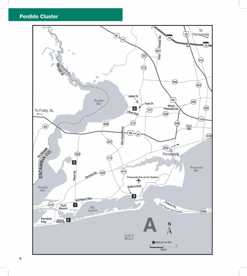
Perdido Cluster
6
7
Perdido Cluster
Directions Due west of Pensacola drive south on SR 173Blue Angel Pkwy and turn right (west) on SR 292Sorrento Rd After approx 65 mi turn left (east) on Johnson Beach Rd the entrance pay station is 05 mi ahead past Johnson Beach
Open year round 8 AM to sunset (850) 934-2600 wwwnpsgovguis
J F M A M J J A S O N D
3 Naval Air Station Pensacola Trout Point Nature Trail
County Escambia Nearest city Pensacola
Physical address S Blue Angel PkwyRadford Blvd Pensacola 32507
Coordinates 30333322deg N -87338438deg W
Gazetteer page 42 Size 40+ acres
The pleasant Trout Point Nature Trail follows a boardwalk for 05 miles through the interdune area providing the unique vantage of sandy shoreline on one side and freshwater marsh and open water on the other Wading birds like night-herons and Snowy Egrets work the marshes while the beachfront attracts shorebirds terns and gulls Pines along the waterfront trail are worth checking for feeding songbirds and Brown-headed Nuthatches This nature trail is part of Pensacola Naval Air Station and occasional noise from aircraft should be expected At the entrance security gate tell the security officer you are visiting Trout Point Nature Trail Heightened security levels may limit access so call ahead for information
Directions Due west of Pensacola drive south on SR 173Blue Angel Pkwy to the west gate of Pensacola Naval Air Station Continue straight through the gate on Radford Blvd Turn right at the trail entrance (05 mi from security gate) Continue on the unpaved road for 025 mi to the trailhead and parking
Open 6 AM to 30 min before sunset (850) 452-3100
wwwdodpiforgchecklistsnapfhtm
J F M A M J J A S O N D
4 Tarkiln Bayou Preserve State Park
County Escambia Nearest city Pensacola
Physical address CR 293Bauer Rd Pensacola 32506
Coordinates 30372923deg N -87402335deg W
Gazetteer page 42 Size 4197 acres
From the parking lot hike the trail west through flatwoods listening for the ldquosqueaky toyrdquo call of Brown-headed Nuthatches the wavering trills of Pine Warblers and the harsh squawking sounds of Yellow-breasted Chats For a shorter hike veer left at the fork The paved trail leads to a boardwalk through a titi forest (listen for breeding White-eyed Vireos) which emerges on the sheltered bayou Scan the reeds for rails and waders For a longer hike veer right at the fork following the trail along the bayoursquos far side past a rare pitcher plant bog to the end on Perdido Bay Across the street from the parking lot upland sandhill habitats host Common Ground-Doves year-round and Common Nighthawks on late springsummer evenings Bring water year-round and expect mosquitoes in warmer months
Directions West of Pensacola drive south on SR 173Blue Angel Pkwy and turn right (west) on 292Sorrento Rd After 27 mi turn right (north) on CR 293Bauer Rd the entrance is 22 mi on the left
Open year round 8 AM to sundown (850) 492-1595 wwwfloridastateparksorgtarkilnbayou
J F M A M J J A S O N D
5 ECUA Bayou Marcus Wetlands
County Escambia Nearest city BellviewPensacola
Physical address 3050 Fayal Dr Pensacola 32526 (main) Alekai Dr Pensacola 32526 (Alekai Dr entrance)
Coordinates 30436991deg N -87325980deg W (main entrance) 30444484deg N -87332614deg W (Alekai Dr entrance)
Gazetteer page 42 Size 1100 acres
From the parking lot this functioning wastewater treatment facility has nearly 8000 feet of boardwalk through the titi-lined wetlands created by the plantrsquos treated wastewater discharge As you enter the boardwalk the first large pond on the left hosts wintering Blue-winged Teal Hooded Merganser Bufflehead and Common Goldeneye to name a few Swamp Song and White-throated Sparrows exploit the weedy edges and Brown-headed Nuthatches and Pine Warblers call from the adjacent pinewoods The odd Groove-billed Ani sighting keeps interest in this site high Please be considerate as this is a fully functional utilities plant birder access is at the managementrsquos discretion Recent site improvements include four shade stops on the boardwalk trail surface improvements publication racks bird checklist and interpretive signs
Migrantrsquos Rest Cluster
Gulf Breeze
Pensacola Beach
Pensacola
Avalon Beach
East Bay
Escambia Bay
Pensacola Bay
Santa Rosa Sound
Gulf of Mexico
17th A v e
Ch a se St
Bayfron
tPkw
y
Shoreline Dr
Pensacola
Beach Rd
(toll)
Garcon Point Bridge
(toll)
Fort Pickens Rd
G a r c
o n P
o i n t R
d U n
i v e rs
ity P
kwy
Campus Dr
12 13
Avalo
n Blvd
Nine Mile Rd
Pensacola RegionalAirport
98
191
290
291
289
29
90
90 90A
98
399
281
281
281
399
10
110
6
7 8
9
10 11
12
13
13
N
0 1
Miles
2
Birding Trail Site
B
To Alabama
To Milton To
Crestview
ESCAMBIA CO
SANTA ROSA CO
26
17
22
8
9
PerdidoMigrantrsquos Rest Clusters
Directions From the intersection of SR 173Blue Angel Pkwy and CR 298Lillian Hwy go north on Blue Angel Pkwy for 11 mi to the ECUA sign at Fayal Dr Turn left (west) and drive to the entrance gate Park and enter through the fence to access the boardwalk A second entrance on Alekai Dr (formerly Ramsey Beach Rd) is now handicapped accessible To access this entrance go back to Blue Angel Pkwy and turn left (north) After 03 mi turn left (west) onto Alekai Dr and go 04 mi
Open daily 7 AM to 6 PM (850) 458-1658 (850) 455-3337 wwwdepstatefluswaterwastewaterdomwetbayouhtm
J F M A M J J A S O N D
7
J F M A M J J A S O N D
J F M A M J J A S O N D
Map B Migrantrsquos Rest Cluster
6 University of West Florida
Edward Ball Nature Trail County Escambia Nearest city Pensacola
Physical address 11000 University Pkwy Pensacola 32514
Coordinates 30550723deg N -87221716deg W
Gazetteer page 26 Size 15 acres
The Edward Ball Nature Trail includes a short boardwalk through a nice ravine and swamp with Prothonotary Warbler-laden cypress trees above and wading egrets below Songbirds like Northern Parulas Summer Tanagers and Great Crested Flycatchers frequent the area and migration in spring and fall can yield some interesting visiting species Swallow-tailed Kites may be seen overhead in spring and summer The slope is steep and the boardwalk shows its age so donrsquot get so distracted by the birds that you forget to watch your step
Directions From US 90ANine Mile Rd north of Pensacola turn north on University Pkwy At the end of University Pkwy turn left (west) onto Campus Dr Take the 4th left then another immediate left into Parking Lot G Park and walk behind the Science Building (Bldg 13) to the trail entrance Campus maps and MANDATORY PARKING PASSES can be obtained at the Information Center (1st right after turning onto Campus Dr)
Open daily dawn to dusk (850) 857-6417 wwwuwfedu
Wayside Park and Pensacola Visitor
Information Center County Escambia Nearest city Pensacola
Physical address 1401 E Gregory St Pensacola 32502
Coordinates 30417865deg N -87193398deg W
Gazetteer page 42 Size 30 acres
Worth a quick stop to view gulls and terns the waterfront fishing bridge and offshore breakwater all host a variety of ages of Herring Ring-billed and Laughing Gulls Forsterrsquos and Royal Terns and more Common Loons feed very close to shore and sport nearly complete breeding plumage in FebruaryMarch before they return north Bring your spotting scope to check the bay for wintering ducks and Horned Grebes
Directions From I-10 north of Pensacola take exit 12 for I-110 and head south Take exit 1B for Chase St and head east Continue east on Chase St until it ends at US 98Bayfront Pkwy and take a left (east) Drive approx 03 mi and turn left (northeast) on N 17th Ave After 300 ft turn right (southeast) on E Gregory St Parking is 350 ft ahead
Open 24 hrsday (850) 434-1234 wwwvisitpensacolacom
8 Project GreenShores
County Escambia Nearest city Pensacola
Physical address Bayfront Pkwy Pensacola 32502
Coordinates 30417634deg N -87194486deg W
Gazetteer page 42 Size 15 acres
Project GreenShores is a restoration project undertaken by a suite of advocates and agencies Located across from the Pensacola Visitor Center along Bayfront Pkwy the project is systematically establishing an emergent marsh and oyster reef along the waterfront The area has historically been good for birds like Osprey Brown Pelican and Royal Tern but as the salt marsh grasses take root the birds are responding Yellow-crowned Night-Heron Semipalmated Plover Black-necked Stilt and more ply the flats and shoreline Park and walk the waterfront to the west along the bay shore restoration efforts continue past the Missing Childrenrsquos Memorial on Hawkshaw Lagoon (across from Veterans Park) to Bartram Park Look for Loggerhead Shrike on the far southern end of the property just before the bridge
Migrantrsquos Rest Cluster
J F M A M J J A S O N D
9
J F M A M J J A S O N D
J F M A M J J A S O N D
11
Directions From I-10 north of Pensacola take exit 12 for I-110 and head south Take exit 1B for Chase St and head east Continue east on Chase St until it ends at US 98Bayfront Pkwy and turn left (east) The site and parking are approx 03 mi on the right 100 ft past the intersection with N 17th Ave and 025 mi before the Pensacola Bay Bridge
Open daily dawn to dusk (850) 436-5652 wwwdepstateflusnorthwestEcosyssectiongreenshoreshtm
Shoreline Park South
County Santa Rosa Nearest city Gulf Breeze
Physical address 800 Shoreline Dr Gulf Breeze 32561
Coordinates 30354244deg N -87177670deg W
Gazetteer page 42 Size 100 acres
Shoreline Park South is a small sound-side park in Gulf Breeze which lies between Fort Pickens and the mainland as the bird flies This ensures itrsquos on the direct path of migrants coming in off the Gulf in spring In winter bird the waterfront for grebes and loons (occasional Pacific and Red-throated in years when vagrant birds are prevalent) Wintering ducks like Lesser Scaup Bufflehead and even occasional Common Goldeneye can be viewed from the pier Nearer the entrance bird the loop trails through oak hammock excellent for resident Pine Warblers Carolina Chickadees and Pileated Woodpeckers as well as migrant Black-throated Blue and Worm-eating Warblers Swainsonrsquos Thrushes Orchard Orioles and more This site is busy on warm weather weekends Recent amenities include a boardwalk nature trail waterfront boardwalk picnic shelters and restrooms Many park features are handicapped accessible A viewing deck with seats provides good elevation for scoping winter waterbirds
Directions From US 98 in Gulf Breeze turn west on Shoreline Dr (just west of Pensacola Beach Rdtoll bridge) Go 01 mi to the first intersection and turn left (southwest) to stay on Shoreline Dr The entrance is located 07 mi on the left (south) side of the road
Open 24 hoursday (850) 934-5140 wwwgulfbreezerecreationcentercom
1Gulf Islands National Seashore Fort Pickens Area
County Escambia Nearest city Pensacola Beach
Physical address 1400 Fort Pickens Rd Pensacola Beach 32561
Coordinates 30325672deg N -87181354deg W
Gazetteer page 42 Size 1742 acres
This migratory hotspot is not to be missed in spring as tired migrants make landfall after long overwater flights Batteries Langdon and Worth are both good stops for migrants closely check flowering oaks Please respect closed areas protecting nesting birds the beach here is prime for breeding Snowy Plovers and Least Terns spring through fall Black Terns are ubiquitous in summer and early fall By far the fort and surrounding trails offer this sitersquos most exciting birding In open areas surrounding the fortifications watch for sentinel flycatchers on any minor promontory Gray Kingbirds breed here and Scissor-tailed Flycatchers are occasional in winter The trails on the fortrsquos bayside can be extraordinary for migrant songbirds like Tennessee Cape May and Magnolia Warblers and more Morning is not necessarily the best time to see these birds long-term sighting logs from dedicated local birders indicate these migrants can make landfall in early afternoon Fallouts are exaggerated by early afternoon rain showers that ground migrants as soon as they reach land Migrating raptors cruise the duneline in October and April Loaner optics and field guides are available Fort Pickens Road is prone to storm-related closures check road condition at website below prior to departure
Directions From Pensacola take US 98 east approx 45 mi to the south side of Gulf Breeze Take SR 399Pensacola Beach Rd (toll bridge) south across Santa Rosa Sound to Pensacola Beach Turn right (southwest) at Fort Pickens Rd and head west for 25 mi to the entrance
Fort Pickens Area open 7 AM to 10 PM (850) 934-2600 Historic Fort Pickens open 8 AM to sunset wwwnpsgovguis
0
Pensacola Beach Gulf Pier
County Escambia Nearest city Pensacola Beach
Physical address 41 Fort Pickens Rd Pensacola Beach 32561
Coordinates 30332175deg N -87142344deg W
Gazetteer page 43 Size 025 miles
With binoculars alone this site offers a fare of gulls and terns comparable to other area beach sites However with a spotting scope and a little blustery weather this 025-mile pier can be a seawatcherrsquos dream offering a stable site away from the beach to scan out over the sea More common sightings are wintering
10
11
Migrantrsquos Rest Cluster
Common Loons and plunging gannets October through March However in periods of stormy weather in the Gulf of Mexico tantalizing seabirds like Bridled and Sooty Terns and Sooty Shearwaters have been spotted from this location Respect severe weather but certainly donrsquot let a little rain discourage you This site is primarily a fishing pier but welcomes birders too
Directions From Pensacola take US 98SR 30Gulf Breeze Pkwy south across the Pensacola Bay Bridge to the south side of Gulf Breeze Take SR 399Pensacola Beach Rd (toll bridge) south across Santa Rosa Sound to Pensacola Beach Turn right (southwest) at Fort Pickens Rd and go 01 mi to the first entrance on the left (south) side of the road (look for a large parking lot with a ldquobeach ballrdquo water tower)
Open 24 hoursday (850) 934-7200 wwwfishpensacolabeachpiercom
J F M A M J J A S O N D
J F M A M J J A S O N D
J F M A M J J A S O N D
12 Gulf Islands National Seashore Naval Live Oaks Area
County Santa Rosa Nearest city Gulf Breeze
Physical address 1801 Gulf Breeze Pkwy Gulf Breeze 32563
Coordinates 30364997deg N -87131275deg W
Gazetteer page 42 and 43 Size Size 1378 acres
This visitor center and park HQ for the national seashore spans the spit of land separating Santa Rosa Sound to the south from Pensacola Bay to the north From the sound-side shoreline south of the visitor center parking scope for Common Goldeneye Lesser Scaup and other wintering ducks As always in migration check the live oaks for which this area was named Black-and-white Warblers pick through resurrection fern on the sides of oaks in winter and Brown Creepers are occasionally found scaling the trees
Directions From Pensacola take US 98SR 30Gulf Breeze Pkwy south across the Pensacola Bay Bridge to Gulf Breeze Stay on US 98 East past the intersection with SR 399 the visitor center and headquarters are 18 mi ahead on the right (south) side of the road
Open 8 AM to sunset (850) 934-2600 wwwnpsgovguis
13 Garcon Point Water Management Area Garcon Point Trail
County Santa Rosa Nearest city MiltonGulf Breeze
Physical address SR 281CR191 Milton 32583
Coordinates 30470726deg N -87084151deg W (north entrance) 30459271deg N -87092904deg W (south entrance)
Gazetteer page 43 Size 3235 acres
Gorgeous wet prairie occupies much of this preserve with slightly elevated patches of longleaf pine-wiregrass community breaking the otherwise unobstructed horizon A habitat of extremes this landscape burns frequently and absorbs lots of rainfall trails may occasionally hold water so immersible shoes are recommended Biting flies and ticks are quite unpleasant from April to October but the sheer beauty of this site makes it a must-see from November to March Wet prairie sparrows like Henslowrsquos and LeContersquos occasionally winter here and Cooperrsquos Hawks cruise the prairie for prey like Eastern Towhees and Loggerhead Shrikes Yellow Rails have been found here in winter Pine Warblers call from the tree line and rare pitcher plants crowd the trail (stay on the trail to protect these Panhandle specialties) From the south entrance access the 17-mile loop trail through scrubby oaks and past an ephemeral wetland From the north trailhead the North Spur Trail runs 12 miles south to join the loop trail on its north border See the Florida Trail Associationrsquos website for additional information Access to and from Pensacola Beach via SR 821 requires toll and may result in delays during peak travel times
Directions From I-10 south of Milton take exit 22 for SR 281Avalon Blvd and head south After 4 mi this road will merge with CR 191 Garcon Point Rd Drive approx 07 mi past the intersection with CR 191 the north trailhead is on the left (east) side of the road The south trailhead is 1 mi farther also on the left (east) side of the road If coming from the south on SR 281 the southern entrance is located 025 mi north of the bridgersquos toll booth
Open dawn to dusk (850) 484-5125 (850) 539-5999 wwwnwfwmdstateflusrecreationyellowriverhtml wwwfloridatrailorgHikesfloridapanhandleGarconPointhtml
Migrantrsquos Rest Cluster D
avid Moynahan FW
C
Horseshoe Crabs
12
13
Blackwater Cluster
14
J F M A M J J A S O N D
15
J F M A M J J A S O N D
16 Blackwater Fisheries Center
Map C Blackwater Cluster
Blackwater River State Forest Hutton Unit
County Santa Rosa Nearest city Holt
Physical address Deaton Bridge Rd Milton 32583
Coordinates 30685874deg N -86876366deg W
Gazetteer page 27 Size 7629 acres
This site adjacent to Blackwater River State Park is worth a quick stop to listen for Bachmanrsquos Sparrow in spring and summer ndash if they are singing yoursquoll likely hear them from the parking lot The available habitat is turkey oakpine uplands common throughout the Panhandle and not as productive for birding as other habitats may be Still in springtime a quick peek can never hurt Less than 1 mile from the entrance on H9 Road (across from Boundary Line Rd) you should encounter species such as Red-headed Woodpecker Brown-headed Nuthatch Eastern Bluebird and Great Crested Flycatcher Gates are open to general vehicular traffic from May 1 to October 1 gates will be closed in hunting season (hunters check in through a different gate) If the gate on Deaton Bridge Rd is locked you may use the parking lot next to the gate and walk in Additional entrances are located at Pond Road off US 90 and at the intersection of Deaton Bridge Rd and Indian Ford Rd Take care driving on area clay roads ndash they can be slippery when wet The Florida National Scenic Trail winds through the site and is open to hikers year round A WMA map is available from the FWC website Seasonal hunting takes place at this GFBWT site please see page 55 for information on dates regulations and more
Directions From Milton take US 90 east for approx 95 mi to Harold Turn left (north) on Deaton Bridge Rd and drive 18 mi the entrance and parking area are on the left (west) side of the road directly across from Boundary Line Rd From I-10 eastbound take exit 31 for SR 87 and head north to US 90 Turn right (east) on US 90 and follow it for 58 mi to Deaton Bridge Rd From I-10 westbound take exit 45 for Log Lake Rd and go north to US 90 Turn left (west) and follow US 90 for 87 mi to Deaton Bridge Rd
Open dawn to dusk (850) 957-6140 wwwfl-dofcomstate_forestsblackwater_riverhtml MyFWCcomviewingrecreationwmascooperativeblackwater
Blackwater River State Park
County Santa Rosa Nearest city Holt
Physical address 7720 Deaton Bridge Rd Holt 32564
Coordinates 30711943deg N -86879987deg W
Gazetteer page 27 Size 635 acres
This site is a popular swimming canoeing and picnicking area in warm weather but offers nice access to floodplain hiking trails good for Yellow-billed Cuckoos and Hairy Woodpeckers in late spring and summer Broad-winged Red-tailed and Red-shouldered Hawks are common and Wood Thrushes and Prothonotary Warblers breed here Brown-headed Nuthatches squeak from pines in the uplands these delightful acrobats are a joy to watch The brief campground trail and the 09-mile Chain of Lakes Nature Trail are best for birding The trails can be wet at times of high water so wear shoes you donrsquot mind getting muddy Loaner optics and field guides are available
Directions From Milton take US 90 east for approx 95 mi to Harold Turn left (north) on Deaton Bridge Rd and drive 39 mi the entrance is on the right (east) side Additional parking areas (fee required) are located at either end of the bridge Access the Chain of Lakes Nature Trail at the south end of the bridge From I-10 eastbound take exit 31 for SR 87 and head north to US 90SR 10 Turn right (east) on US 90 and follow it for 58 mi to Deaton Bridge Rd From I-10 westbound take exit 45 for Log Lake Rd and go north to US 90 Turn left (west) and go 87 mi to Deaton Bridge Rd
Open year round 8 AM to sundown (850) 983-5363 wwwfloridastateparksorgblackwaterriver
County Santa Rosa Nearest city Holt
Physical address 8384 Fish Hatchery Rd Holt 32564
Coordinates 30729556deg N -86802542deg W
Gazetteer page 27 Size 590 acres
Nestled in the Blackwater River State Forestrsquos uplands this fish hatchery is an oasis of wading birds and shorebirds Stop at the entrance kiosk to check the sightings log and to pick up a checklist Walk the dikes between the aquaculture ponds looking for winter
14
Blackwater Cluster
waterfowl such as Ring-necked Ducks Blue-winged Teal and Wilsonrsquos Snipe at the muddy edges Wintering shorebirds include both yellowlegs Spotted Solitary and Pectoral Sandpipers and Semipalmated Plovers Forsterrsquos Terns Purple Martins and Northern Rough-winged Swallows skim over the ponds Northern Bobwhites and Wild Turkeys are common in the adjacent forest and wooded fields Ask at the office if yoursquod like a facility tour and also if hunting or prescribed fire would prohibit your birding in the woods of the state forestrsquos Carr Unit to the northeast Bachmanrsquos Sparrows sing here in spring and Henslowrsquos Sparrows occasionally overwinter
Directions From I-10 eastbound take exit 31 for SR 87 and head north to US 90SR 10 Turn right (east) and drive 139 mi to Cooper Ln outside of Holt Turn left (north) and go 01 mi to Johns Rd Turn left (west) and follow Johns RdBryant Bridge Rd (name change) for 3 mi The entrance is on the right (northeast) side of the road From
I-10 westbound take exit 45 for Log Lake Rd and go north to US 90SR 10 Turn left (west) and drive 05 mi Turn right (north) on Cooper Ln After 01 mi turn left on Johns RdBryant Bridge Rd The entrance is 3 mi ahead on the right
Open 730 AM to 4 PM MonndashFri weekends by appointment only (requires at least 2 weeks advance notice) (850) 957-6177
MyFWCcomviewingrecreationwmascooperativeblackwater
J F M A M J J A S O N D
Milton
CrestviewBaker
Harold
Holt
Munson
Blackwater River
Blackwater River
Shoal River
Johns Rd
Johns Rd
Bryant Bridge Rd
Buddy Hardy Rd
Live Oak Church Rd
N Karick Rd
Karick Lake Lower Rd
Ferd
on
Blvd
Bob Pitts Rd
Indian Ford Rd
Pond Rd
Cooper Ln Log Lake Rd
Boundary Line Rd
Deato
n
Br
idge R
d
Coldwater H o rs e Trail
Whiting Field Naval
Air Station
90
191
191
87
87
178
4
87
189
188
4
4
4
2
85
87A 90
56
45
3110
10
N
0 1 2 3 4
Miles
Birding Trail Site
To De FuniakSprings
To De FuniakSprings
To Pensacola
SAN
TA R
OSA
CO
O
KA
LOO
SA C
O
SAN
TA R
OSA
CO
O
KA
LOO
SA C
O
14
15
19
20
21
Thre
eN
otch
Rd
17
C
15
Blackwater Cluster
17 Naval Air Station Whiting Field Clear Creek Nature Trail
County Santa Rosa Nearest city Milton
Physical address Langley St Milton 32570
Coordinates 30707410deg N -87032045deg W
Gazetteer page 27 Size 80+ acres
As it descends through mixed pine-oak uplands this interesting 15-mile round-trip trail leads to a creek and associated wetland Listen for Red-breasted Nuthatches in fall in the uplands and Hermit Thrushes overwintering At the water Common Yellowthroats scold from brushy tangles and wading birds like Little Blue Herons and Least Bitterns are possible among the pitcher plants visible from the boardwalk This is part of a functioning military Naval Air Station and occasional noise from aircraft is to be expected Access may be limited during times of elevated homeland security levels so call in advance
Directions From Milton head north on SR 87 following signs to NAS Whiting Field Turn right (east) on CR 87ALangley St and explain at the security gate that you would like to visit Clear Creek Nature Trail Once through the gate follow NAS Whiting Field Dr to the trailhead parking area
Open dawn to dusk (850) 623-7602 wwwdodpiforgchecklistsnaswfhtm
J F M A M J J A S O N D
J F M A M J J A S O N D
J F M A M J J A S O N D
20
Blackwater River State Forest
Three Notch Rd (Hardy Rd to Coldwater Horse Trail)
County Santa Rosa Nearest city Milton
Physical address Three Notch Rd Milton 32570
Coordinates 30800828deg N -86950923deg W (south end) 30832354deg N -86942892deg W (north end)
Gazetteer page 27 Size 5 miles
This 5-mile stretch of Three Notch Rd offers easy safe roadside pulloffs with Red-cockaded Woodpecker (RCW) cavity trees ringed with white paint visible from the road RCWs are most easily seen in breeding season in the mornings when they emerge from their nest cavities to ferry food back to their waiting young Frequent prescribed fire keeps this habitat healthy so obey signs closing the area for this necessary management event Use caution on area clay roads which can be slippery when wet Also check trails north of Coldwater Horse Trail for RCWs if desired along the east and west sides of Three Notch Rd Seasonal hunting takes place at this GFBWT site please see page 55 for information on dates regulations and more
Directions From Milton take CR 191Munson Hwy north approx 14 mi to Buddy Hardy Rd Turn left (west) on Buddy Hardy Rd drive 07
18
mi and turn right (north) onto Three Notch Rd Drive towards the intersection with Coldwater Horse Trail pull off on shoulder as desired Trails criss-cross the area along Three Notch Rd and Coldwater Horse Trail from Coldwater Creek to Juniper Creek (south of SR 4 and west of CR 191) Coldwater Horse Trail leads eastward back to CR 191
Open dawn to dusk (850) 957-6140 wwwfl-dofcomstate_forestsblackwater_riverhtml
19 Blackwater River State Forest Bear Lake Loop Trail
County Santa Rosa Nearest city Baker
Physical address Bear Lake Rd Milton 32570
Coordinates 30855008deg N -86838233deg W
Gazetteer page 27 Size 200 acres
From the camping area hike the 4-mile trail that rings the lake watching for migrants like Ovenbirds and Swallow-tailed Kites in springtime Red-shouldered Hawks echo across the lake and Pied-billed Grebes dive hunting for fish Nearby uplands can be good for Chuck-willrsquos-widows and Wild Turkeys Take water and expect biting insects in warm weather The lake is popular with anglers in spring and fall There is no hunting on the trail or in the vicinity of the lake
Directions From Milton take CR 191Munson Hwy north to SR 4 in Munson Turn right (east) on SR 4 and proceed 20 mi to the entrance at Bear Lake Rd Turn left (north) the parking area is 06 mi ahead
Open dawn to dusk (850) 957-6140 wwwfl-dofcomstate_forestsblackwater_riverhtml
Blackwater River State Forest Karick Lake
County Okaloosa Nearest city Baker
Physical address N Karick Rd and Karick Lake Lower Rd Crestview 32531
Coordinates 30905009deg N -86656031deg W (upper entrance) 30894311deg N -86660076deg W (lower entrance)
Gazetteer page 28 Size 38 miles
Check these recreation areas for Bachmanrsquos Sparrows calling in the sandhills ducks and wading birds like Green Herons visible from
16
BlackwaterChoctawhatchee Clusters
the north access pier and songbirds like Yellow-throated Warblers and Red-eyed Vireos in the hardwoods around the lake A 38-mile loop trail circles around the lake traveling along sandhills gallberry midslopes and hardwood bottoms Pay attention to ecotones particularly those edges with hardwoods These can be good for migrants that prefer this habitat over drier sandhills Directions From Milton take CR 191Munson Hwy north to SR 4 in Munson and turn right (east) Follow SR 4 to its intersection with SR 189 in Baker and turn left (north) The south access (Karick Lake Lower Rd) is 8 mi ahead on the right The north access (N Karick Rd) is 08 mi farther north Open dawn to dusk (850) 957-6140 wwwfl -dofcomstate_forestsblackwater_riverhtml
J F M A M J J A S O N D
21Shoal River Wayside Par
(Bill Duggan Jr Park)
k
County Okaloosa Nearest city Crestview
Physical address 5999 SR 85 Crestview 32536
Coordinates 30698772deg N -86570501deg W
Gazetteer page 28 Size 55 acres
Freeport
Niceville
Valparaiso
Destin
GraytonBeach
Eglin Air Force Base
Choctawhatchee Bay
Choctawhatchee River
Gulf of Mexico
RockyBayou
Gulf of Mexico
Chat Holly Rd
John Sims Pkwy
Emerald Coast Pkwy
331
331
20
83
83A20
282
393
98
293
30
397
85
85285123
190
30
98
98
98
23
24
25
2726
28
N
0 1
Miles
2
Birding Trail Site
To PanamaCity
To Ft WaltonBeach
To DeFuniakSprings
D
Mad
iso
n St
W C
oll
ege
Blvd
OK
AL
OO
SA
CO
O
KA
LO
OS
A C
O
WA
LTO
N C
OW
ALT
ON
CO
O
KA
LO
OS
A C
O
WA
LTO
N C
O
30A83
283
30A
395
(toll)
17
J F M A M J J A S O N D
J F M A M J J A S O N D
23
J F M A M J J A S O N D
24
22
BlackwaterChoctawhatchee Clusters
Shoal River Wayside Park is worth a quick check for wading birds at the river and songbirds in the adjacent floodplain forest In this part of the Panhandle floodplain corridors along rivers like this create migrant highways through arid turkey oak and sand pine uplands Check the tree line and understory especially in spring migration for songbirds like Prairie Warblers and well camouflaged Veeries
Directions From I-10 south of Crestview take exit 56 for SR 85 Ferdon Blvd Go south for 18 mi Turn left (east) at Live Oak Church Rd and go 01 mi Turn right (southwest) and continue on Live Oak Church Rd for 01 mi Turn left (south) into the park
Open dawn to dusk (850) 689-5084 (850) 689-5772 wwwcookaloosaflus
Map D Choctawhatchee Cluster
Turkey Creek Park
County Okaloosa Nearest city Niceville
Physical address 340 John Sims Pkwy West Niceville 32578
Coordinates 30523676deg N -86497348deg W (main entrance) 30532812deg N -86502494deg W (Turkey Creek extension)
Gazetteer page 28 Size 075-mile boardwalk
Walk the scenic 075-mile boardwalk along tannic Turkey Creek through a river forest of titi maple cypress and bay Watch for Green Herons stalking minnows on low hanging branches over the water and Anhingas swimming in the creek Mississippi Kites are common in summer and songbirds like White-eyed Vireos breed here In warm weather visit on weekdays and early in the morning this is a popular swimming access and the revelry of swimmers riding inner tubes downstream can be disruptive to birding (albeit tempting to partake in) The boardwalk is ADA accessible but the city also provides rides on electric carts for the mobility impaired between 730 and 1100 AM on the first Wednesday of each month A second entrance for the North Turkey Creek Extension is located on W College Blvd which has a 900-ft boardwalk and a canoekayak launch
Directions From intersection of SR 20John Sims Pkwy East and SR 285N Partin Dr in Niceville drive west on SR 20 for 10 mi to Evans St Turn right (north) the park entrance is immediately on your left From the intersection of SR 190Valparaiso Pkwy and SR 397 John Sims Pkwy in Valparaiso go north on John Sims Pkwy for 13 mi across the bridge to Evans St Turn left (north) and immediately left again into the parking lot To access the new extension head east from the park on SR 20 to SR 85 Turn left (north) and go 09 mi to W College Blvd Turn left (west) and drive 06 mi past the hospital to the entrance on the left (south) side of the road
Open 630 AM to dark Tues - Sun North Turkey Creek Extension opens at 8 AM (850) 729-4062 wwwnicevilleorgturkeyhtml
Fred Gannon Rocky Bayou State Park
County Okaloosa Nearest city Niceville
Physical address 4281 SR 20 Niceville 32578
Gazetteer page 28 and 44 Size 346 acres
Coordinates 30495944deg N -86432791deg W
This waterfront park is located on Rocky Bayou in Choctawhatchee Bay Of its three trails Red Cedar and Rocky Bayou are more interesting for birds than Sand Pine Trail Walk the trails for migrants like Cedar Waxwings and Indigo Buntings check the trees in the campground area too The waterfront can offer vantages of diving ducks in winter Ospreys overhead and Spotted Sandpipers on rocky edges in winter The local Audubon chapter offers bird walks early on Friday mornings ndash call in advance for details Loaner optics and field guides are available
Directions From the intersection of SR 285 and SR 20 in Niceville drive approx 40 mi east on SR 20John Sims Pkwy The entrance to the park is on the left (north) side after crossing Rocky Bayou Bridge
Open year round 8 AM to sundown (850) 833-9144 wwwfloridastateparksorgrockybayou
Henderson Beach State Park
County Okaloosa Nearest city Destin
Physical address 17000 Emerald Coast Pkwy Destin 32541
Coordinates 30386928deg N -86447520deg W
Gazetteer page 44 Size 221 acres
Henderson Beach State Park offers nice beachfront for specialties like Snowy Plovers Least Terns American Oystercatchers and more Take care not to disturb beach-nesting birds which are often cryptic and blend easily with the sand they nest upon A nature trail by the beach access points winds through a small coastal hammock in a stretch of coastline where little of this important habitat remains Watch for migrant songbirds here in spring and raptors making landfall or following the duneline in April and October The campground has some nice trees worth checking as access allows ask for permission at the entrance gate and be considerate of campers This site gets busy in warm weather Loaner optics and field guides are available
Choctawhatchee Cluster
J F M A M J J A S O N D
J F M A M J J A S O N D
26
J F M A M J J A S O N D
Directions From the intersection of SR 293Danny Wuerffel Way (toll bridge) and US 98SR 30Emerald Coast Pkwy east of Destin drive 15 mi west on US 98 to the park entrance on the left (south) side of the highway
Open year round 8 AM to sundown (850) 837-7550 wwwfloridastateparksorghendersonbeach
25 Topsail Hill Preserve State Park
County Walton Nearest city Sandestin
Physical address 7525 W County Hwy 30A Santa Rosa Beach 32459
Coordinates 30371282deg N -86272744deg W (main entrance) 30375556deg N -86299507deg W (Topsail Rd entrance)
Gazetteer page 45 Size 1643 acres
Topsail Hill Preserve State Park offers inland trails through coastal scrub and past rare coastal dune (freshwater) lakes The 25-mile Morris Lake Trail is slightly more productive than the Campbell Lake Trail although either will yield Eastern Bluebirds Eastern Kingbirds Red-headed Woodpeckers and Brown-headed Nuthatches to name a few Check the beachfront for gulls and Sandwich Least and Royal Terns Snowy Plovers nest here and shorebirds ply the shoals near the outfall for Morris Lake at the Gulf Scope the surf for Common Loons Horned Grebes and Northern Gannets winter through spring The beach is heavily visited in warm weather so plan accordingly Educational programs are offered call for details
Directions From the intersection of SR 293Danny Wuerffel Way (toll bridge) and US 98SR 30Emerald Coast Pkwy east of Destin drive 85 mi east on US 98 and turn right (southeast) on CR 30A the entrance is approx 02 mi on the right (west) side of the road A second entrance is located on Topsail Rd at US 98 14 mi west of the intersection with CR 30A Use this entrance for direct access to the Morris Lake and Campbell Lake Trails (call ahead as entrance may be closed if road is flooded)
Open year round 8 AM to sundown (850) 267-8330 wwwfloridastateparksorgtopsailhill
Grayton Beach State Park
County Walton Nearest city Point Washington
Physical address 357 Main Park Rd Santa Rosa Beach 32459
Coordinates 30334117deg N -86158050deg W
Gazetteer page 45 Size 2227 acres
Grayton Beach State Park is very popular with beachgoers in warm weather but in cooler months is worth checking On the north side of CR 30A the 42-mile Grayton Beach Hike and Bike Trail runs through pine flatwoods and along the north end of Western Lake (a brackish coastal dune lake) which can be good for wading birds Bald Eagle Barred Owl Brown-headed Nuthatch Pied-billed Grebe and more For longer hikes the Lake Loop Trail connects to Point Washington State Forestrsquos (site 27) extensive trail system Donrsquot miss the 1-mile interpretive Grayton Beach Nature Trail which begins at the beach parking area As it winds through sand dunes and under a sand live oak canopy look for Savannah Sparrow Eastern Towhee and Orange-crowned Warbler an additional loop also runs through pine flatwoods (listen for Eastern Bluebird) and along the southern end of Western Lake (check for Common Loon in winter) The beachfront offers plovers terns and gulls (Bonapartersquos in winter) and plunging gannets out to sea October through March As with all coastal sites watch for raptors cruising the beachfront and migrants arriving off the Gulf in spring Loaner optics and field guides are available
Directions From the intersection of US 98 and US 331 east of Destin drive east approx 15 mi and then turn right (south) on CR 283 Follow CR 283 for 17 mi to CR 30A and turn left (east) the entrance is on the right (south) side after 05 mi
Open year round 8 AM to sundown (850) 267-8300 wwwfloridastateparksorggraytonbeach
27 Point Washington State Forest
County Walton Nearest city Point Washington
Physical address S CR 395 Santa Rosa Beach 32459
Coordinates 30342148deg N -86131466deg W
Gazetteer page 45 Size 15131 acres
Point Washington State Forest offers 3- 5- and 10-mile hiking loops through longleaf pine flatwoods coastal scrub and sandhills Bachmanrsquos Sparrows are very likely to be heard singing in spring in areas of wiregrass and palmetto in the southern half of the 3-mile loop The eastern boundary of this loop crosses the west arm of Peach Creek where you can listen for songbirds and watch for Red-shouldered Hawks Cooperrsquos Hawks occasion the flatwoods and Eastern Towhees and Common Yellowthroats are abundant Trail system connects to Grayton Beach State Park (site 26) for
18
19
De Funiak Springs
331
9090
280A
183
183
81
10
183
280
83
181
181A
81
331
10
ToMarianna
To Freeport
ToCrestview
N
0 1
Miles
2
29
E85
96
Birding Trail Site
Rest Area
WA
LTO
N C
O
WA
LTO
N C
O
HO
LMES
CO
H
OLM
ES C
O
WA
LTO
N C
O
HO
LMES
CO
Directions From the intersection of US 331SR 83 and SR 20 in Freeport the entrance is 16 mi west on the south side of SR 20 (past Tucker Town Rd)
Open dawn to dusk (850) 835-2822 wwwfreeportfl oridagov
J F M A M J J A S O N D
Map EDogwood Cluster
29 Ponce de Leon Springs State Park
County Holmes Nearest city Ponce de Leon
Physical address 2860 Ponce de Leon Springs Rd Ponce de Leon 32455
Coordinates 30722979deg N -85930385deg W
Gazetteer page 30 Size 420 acres
Worth checking in migration this sitersquos real strength is wintering birds especially those at the southernmost limit of their range Birds like Brown Creeper and Golden-crowned Kinglet are possible at this site your chances improve with your ability to identify birds by sound Hike both short trails ndash Spring Run and Sandy Creek ndash stopping to
extended birding adventures Seasonal hunting takes place at this GFBWT site please see page 55 for information on dates regulations and more
Directions From the intersection of US 98 and US 331 east of Destin drive east approx 30 mi and turn right (south) on CR 395 Trailhead parking is 11 mi on the left (east) side of the road
Open dawn to dusk (850) 267-8325 wwwfl -dofcomstate_forestspoint_washingtonhtml
J F M A M J J A S O N D
28 Harry A Laird Sr City Park
County Walton Nearest city Freeport
Physical address SR 20 E Freeport 32439
Coordinates 30501614deg N -86145701deg W
Gazetteer page 29 and 45 Size 13 acres
This small wayside park has a brief boardwalk along a creek lined with hardwoods The area is worth checking in migration only for songbirds like waterthrushes and Worm-eating and Hooded Warblers Weekend afternoons can be busy with picnickers and playground visitors but weekdays are left for you and the birds
ChoctawhatcheeDogwood Clusters
DogwoodKentucky Warbler Clusters
listen carefully in the shady hardwood forest This park can be busy with swimmers in warm weather so weekday and early morning birding may prove the most rewarding
Directions From I-10 east of De Funiak Springs take exit 96 and head north on SR 81 for 10 mi Turn right (east) onto US 90SR 10 after 02 mi then turn right (south) again onto CR 181A the entrance is 05 mi on the right (west) side of the road
Open year round 8 AM to sundown (850) 836-4281 wwwfloridastateparksorgponcedeleonsprings
J F M A M J J A S O N D
30
J F M A M J J A S O N D
J F M A M J J A S O N D
Map F Kentucky Warbler Cluster
Falling Waters State Park
County Washington Nearest city Chipley
Physical address 1130 State Park Rd Chipley 32428
Coordinates 30731352deg N -85529023deg W
Gazetteer page 31 Size 173 acres
Falling Waters State Park makes for a nice hour-long hike exploring the sinkholes waterfalls lake and surrounding uplands via the Wiregrass and Sinkhole trails Watch for Red-headed Woodpeckers in the uplands and migrant songbirds like Gray-cheeked Thrushes in the leafy understory of dogwood and azalea beneath the magnolia and white oaks As always when in this part of northwest Florida northern species like Dark-eyed Juncos are possible in winter Check for ducks and waders at the lake edge Scan the butterfly garden for resident and migratory butterflies
Directions From I-10 east of De Funiak Springs take exit 120 and head south on SR 77 After 08 mi turn left (east) onto CR 77A State Park Rd the entrance is 17 mi ahead (road dead ends into park)
Open year round 8 AM to sundown (850) 638-6130 wwwfloridastateparksorgfallingwaters
31
32
Florida Caverns State Park
County Jackson Nearest city Marianna
Physical address 3345 Caverns Rd Marianna 32446
Coordinates 30808352deg N -85212422deg W
Gazetteer page 32 Size 1279 acres
Florida Caverns State Park has some of the best-preserved uplands in northwest Florida as well as mixed-hardwood swamps lining the drainage basin of the Chipola River Known for northern species like Red-breasted Nuthatches (in pine forest) and Winter Wrens this site is ideal for birding with miles of remote trails Access both the Fish Hatchery Loop Trails and the Pine Island Loop Trails from the Blue Hole Swimming Area Keep in mind that the Management Trail (part of the Pine Island system) runs north into the Upper Chipola Wildlife Management Area where hunting seasons will be in effect Cave tours are available at regular intervals and fill quickly An onsite canoe concession allows you to access the Upper Chipola River Water Management Area (site 32) Butterflying is best here in late summer and early fall Check near the visitor center for the Silvery Checkerspot which in Florida occurs only in Jackson County The picnic areas and roadsides have a diversity of swallowtails and sulphurs
Directions From US 90SR 10 in Marianna head north on SR 166 CR 167Jefferson St (becomes Caverns Rd) the entrance is 27 mi on the left (west) side of the road
Open year round 8 AM to sundown (850) 482-9598 wwwfloridastateparksorgfloridacaverns
Upper Chipola River Water Management Area
County Jackson Nearest city Marianna
Physical address 3345 Caverns Rd Marianna 32446
Bumpnose RdChristoff Ferry Lndg Marianna 32446
Caverns Rd at Chipola River bridge Marianna 32446
Coordinates 30808352deg N -85212422deg W (park entrance)
30850068deg N -85259576deg W (Christoff Ferry Landing)
30792445deg N -85222941deg W (bridge)
Gazetteer page 32 Size 7377 acres
For the more intrepid explorer this rustic river is kept clear enough of obstructions to make a nice day of paddling and birding Launch from Florida Caverns State Park (site 31) and paddle upriver toward Christoff Ferry Landing on the Upper Chipola River Water Management Area where the river forks at the confluence with Waddells Mill Creek When yoursquore done paddling float back watching for brilliant Prothonotary Warblers and Limpkins lurking along the shore Take water and a map and allow enough time to return before the park closes at dusk Christoff Ferry Landing on Bumpnose Rd is
20
21
CR 77A (State
Park Rd)
Cav
erns
Rd
Marianna
Chipley
77
273
77
277
71276A
73
73
71
90
231
231
167
164
276
167
162
169
277
276
164
195
276 276
10
75
75
90 10
10 10
HO
LMES
CO
30
31
N
0 1
Miles
2
F
To DeFuniak Springs
To Panama City
To Alabama
To Tallahassee
120 130 136
142
Jeffe
rson
St
32B
32A
Bumpnose Rd
WA
SHIN
GTO
N C
O
JAC
KSO
N C
O
WA
SHIN
GTO
N C
O
JAC
KSO
N C
O 133
Chipola River
Pen
nsyl
vani
aA
ve
Birding Trail Site Rest Area
166
Kentucky Warbler Cluster
Danny Bales
Kentucky Warbler
Kentucky WarblerIndigo Bunting Clusters
J F M A M J J A S O N D
33
J F M A M J J A S O N D
34
J F M A M J J A S O N D
35
another launch site but because of its secluded location the state park is a better choice You may also launch from the south end of the Chipola River bridge on SR 166CR 167Caverns Rd Seasonal hunting takes place at this GFBWT site please see page 55 for information on dates regulations and more
Directions The boat launch site is within Florida Caverns State Park from US 90 in Marianna head north on SR 166CR 167Jefferson St (becomes Caverns Rd) the entrance is approx 27 mi on the left (west) side of the road Paddle upriver toward Christoff Ferry Landing (B) To reach Christoff Ferry Landing from Marianna head west on US 90 to Pennsylvania Ave Turn right (north) and drive 52 mi (name soon changes to Bumpnose Rd) Turn right (east) the launch site is 03 mi ahead
Open dawn to dusk (850) 482-9522 (850) 539-5999 wwwnwfwmdstateflusrecreationchipolariverhtm
Map G Indigo Bunting Cluster
Pitts Spring Recreation Area
County Bay Nearest city Youngstown
Physical address Econfina Creek Landing Youngstown 32466
Coordinates 30431468deg N -85545768deg W
Gazetteer page 47 Size 10 acres
This site is part of the 41000-acre Econfina Creek Water Management Area As a popular swimming hole Pitts Spring can be busy on warm afternoons but in early mornings or on colder days it offers a nice access to slopefloodplain forest popular with songbirds like Wood Thrushes and Kentucky Warblers The entrance gate to the small parking area is open daily April through September and on weekends and holidays October through March However interested users are welcome to park outside the gate and enter on foot to enjoy the trails in the immediate area of the spring Opposite the spring is a launch point to canoe Econfina Creek Nearby canoe concessionaires can offer advice on routes and creek conditions like many Panhandle creeks the Econfina can be fast flowing and challenging with occasional obstructions that may require portages
Directions From US 231 in Fountain (northeast of Panama City) drive 20 mi south and turn right (west) on SR 20 the entrance is approx 82 mi ahead on the right (north) side of the highway at Econfina Creek Landing From Panama City head northeast on US 231SR 75 to CR 2301Blue Springs Rd Turn left (north) and go 130 mi to SR 20 Turn left (west) and go 07 mi Turn right (north) immediately past the bridge onto Econfina Creek Landing
Open 9 AM to 7 PM daily Apr-Sept weekends and holidays only OctshyMar (850) 539-5999 wwwnwfwmdstateflus
Pine Log State Forest
County Bay Nearest city Ebro
Physical address 5583 Longleaf Rd Ebro 32437
Coordinates 30423912deg N -85881046deg W
Gazetteer page 46 Size 6911 acres
Although there are 13 miles of hiking trails at this state forest the most rewarding birding at this site is via the Campground Loop and Dutch Tiemann Trails accessed from the camping area The former is marked with red blazes and hugs the cypress margin of a lake for approx 2 miles Watch for nesting Pileated Woodpeckers and Prothonotary Warblers as well as ducks on the lake in winter The Dutch Tiemann Trail is 6 miles long and stretches south through pinewoods good for Great Crested Flycatchers and Great Horned Owls down to Pine Log Creek and back north to the campground Take water and sunscreen bugs may be prohibitive in warm weather Seasonal hunting takes place at this GFBWT site please see page 55 for information on dates regulations and more
Directions From the intersection of US 98 and and SR 79 west of Panama City drive north on SR 79 for 141 mi Turn left (west) on Environmental Rd approx 10 mi before Ebro After 03 mi make the first right (go north) on Long Leaf Rd and enter the Sand Pine Recreation Area Park at the campground
Open dawn to dusk (850) 535-2888 wwwfl-dofcomstate_forestspine_loghtml
Camp Helen State Park
County Bay Nearest city Inlet Beach Laguna Beach
Physical address 23937 Panama City Beach Pkwy Panama City Beach 32413
Coordinates 30275428deg N -85990431deg W
Gazetteer page 46 Size 183 acres
Two miles of loop trails are available at this park The main trail starts at the Rainbow Cottages runs south across a footbridge then loops through a coastal live oak hammock and dune system A path from the looprsquos south end leads to beachfront where Black Terns are
22
23
Laguna BeachLynn Haven
Panama City Beach Panama City
Parker
Ebro
Tyndall Air Force Base
Econ
fina
Cree
k
Intracoastal Waterway
Gulf of Mexico
Environmental Rd
Lake Dr
Hilltop Ln
Hathaway Bridge
Beck Ave
10th St
Beach Dr
23rd St
11th St
19th St
Fran
kfor
d Av
e
BaldwinRd
77
77
388
79
792081
7998
98
2230
22ABUS
98
231
77
20
20
390
389
391
388
75
231
30
ALT
98
2301
2321
2302
2315
390
39
392
3031
WASHINGTON CO BAY CO
WA
LTO
N C
O 34
33
39
38
36
37
35
To Fountain
To PortSt Joe
To Freeport
To Destin
N
0 1
Miles
2
Birding Trail SiteG
Lake PowellWest Bay
StAndrew
Bay
Indigo Bunting Cluster
Indigo Bunting Cluster
J F M A M J J A S O N D
36
J F M A M J J A S O N D
37
J F M A M J J A S O N D
38
possible in summer Black-bellied and Piping Plovers in winter Least Terns and Snowy Plovers have nested in the park A spur trail runs from the looprsquos east side to Lake Powell one of the largest coastal dune lakes in Florida Coastal dune lakes are rare and in the US occur only on the Gulf Coast Salt and freshwater mixing at this inlet offers productive feeding for terns year-round and wintering ducks like Redheads
Directions The entrance is on the south side of US 98 70 mi west of SR 79N Arnold Rd on the west side of the Phillips Inlet bridge
Open year round 8 AM to sundown (850) 233-5059 wwwfloridastateparksorgcamphelen
St Andrews State Park
County Bay Nearest city Panama City Beach
Physical address 4607 State Park Ln Panama City 32408
Coordinates 30135113deg N -85742506deg W
Gazetteer page 46 Size 1169 acres
Scan the Gulf from the end of the fishing pier on the peninsularsquos south (Gulf) side for Brown Pelicans Least Terns and gulls in warmer months and gannets plunging near the shore in winter At the peninsularsquos east end beaches north of the jetty fishing area are productive for shorebirds like Snowy Plovers and Willets Black Skimmers occasionally loaf here Gator Lake hosts a heron rookery in spring (Great Blue Herons Great and Snowy Egrets) Check the Buttonbush Marsh Overlook adjacent to the boat parking for Least Bitterns and Wood Ducks Pine flatwoods throughout are home to Brown Thrashers Loggerhead Shrikes and Eastern Towhees
Directions In Panama City take US 98 west across the Hathaway Bridge to CR 3031Thomas Dr and turn left (south) Follow CR 3031 to its end at the intersection with CR 39 and CR 392 Bear left (straight) onto CR 39State Park Ln the site entrance is ahead
Open year round 8 AM to sundown (850) 233-5140 wwwfloridastateparksorgstandrews
St Andrews Bird Trail Oaks By the Bay Park
County Bay Nearest city Panama City
Physical address 2701 W 10th St Panama City 32401
Coordinates 30167245deg N -85701504deg W
Gazetteer page 46 Size 5 acres
Particularly rewarding for beginners this small marina is worth a quick stop if yoursquore in the area The waterfront boardwalk (west-facing) has a series of educational signs on the arearsquos more common birds like Double-crested Cormorants Brown Pelicans herons and egrets The boardwalk ends at Oaks By the Bay Park to the south where oaks can be attractive for warblers in April and October A dune walkover here provides access to the beachfront for chance encounters with shorebirds like yellowlegs and Dunlin as well as terns diving ducks and loons on the bay in winter
Directions From US 98 in Panama City head south on Beck Ave to its intersection with 10th St Park your vehicle at Oaks By The Bay Park (directly across 10th St from this intersection) or turn right (west) on 10th St and park at St Andrews Marina
Open daily dawn to dusk (850) 872-7208 wwwhistoricstandrewscombusiness-district wwwpcgovorg
Lynn Haven Sports Complex and Nature Trail
County Bay Nearest city Lynn Haven
Physical address 2201 Recreation Dr Panama City 32405
Coordinates 30229328deg N -85615548deg W
Gazetteer page 47 Size 60 acres
This complex of ball fields yields more birds than you might think due in large part to the adjacent lake and nature trail On the lake on the east side of the complex check for wintering ducks like Ring-necked and Lesser Scaup a Rossrsquos Goose has wintered here recently Next follow the trail east of the lake along the boardwalk through a small bayhead Some large trees in this mature wetland hammock make for interesting flocks of migrants in October and April Brushy areas north of the lake and on the west and south perimeters of the complex may be good for wintering sparrows Loaner optics and field guides are available
Directions From the intersection of CR 390 and US 231SR 75 in Lynn Haven drive west on CR 390 for 22 mi to Hilltop Ln Turn left (south) at the end of Hilltop Ln turn left (east) onto Recreation Dr Park at the lake on the east side of the complex
24
25
Larry Lynch
Wilsonrsquos Plover
Open 24 hoursday (850) 271-5547 wwwcityoflynnhavencomleisuresportscomplexhtm
J F M A M J J A S O N D
39 Parker Environmental Exploratorium Park
County Bay Nearest city Panama City
Physical address 4700 Lake Dr Panama City 32404
Coordinates 30134811deg N -85606771deg W
Gazetteer page 47 Size 5 acres
This delightful little town park offers a waterfront pier with views of Ospreys Yellow-crowned Night-Herons Purple Martins and Least
Indigo Bunting Cluster
Terns among others Walk the parkrsquos brief trail for more common woodland species such as Carolina Wrens White-throated Sparrows Chimney Swifts and Great Crested Flycatchers A butterfly garden on site is worth checking for occasional Ruby-throated Hummingbirds as well as butterflies like buckeyes and Gulf Fritillaries
Directions From the intersection of US 98 and SR 22 east of Panama City drive south on US 98 for 125 mi to Lake Dr and turn right (west) The parking lot at Martin Lake is 09 mi ahead
Open dawn to dusk (850) 871-4104 wwwdcastateflusfctparks
Indigo Bunting Cluster
J F M A M J J A S O N D
Cape Cluster
Danny B
ales
40
J F M A M J J A S O N D
41
J F M A M J J A S O N D
42 St Vincent National Wildlife Refuge
Baltimore Oriole
Map H Cape Cluster
St Joseph Bay State Buffer Preserve Deal Tract
County Gulf Nearest city Port Saint Joe
Physical address Cape San Blas RdCR 30E Port Saint Joe 32456
Coordinates 29683711deg N -85367049deg W
Gazetteer page 59 Size 200 acres
Located on the bay side of St Joseph Peninsula this parcel offers a casual hike through sand pine scrub to a fork in the trail To the right follow the trail to a large tower and dock overlooking St Joseph Bay where you can scope for ducks on the bay shorebirds along the edges and raptors migrating in October To the left at the fork the trail leads to a hardwood hammock with potential for spring songbird migrants like Hooded Warblers Remember migrants in this part of the state can make landfall after 11 AM so donrsquot abandon a site too early Biting insects can be fierce and the trails offer little shade bring insect repellent and drinking water
Directions From Port St Joe take US 98US 319SR 30 east (head south) approx 2 mi Turn right (south) on SR 30A drive 67 mi and turn right (west) on SR 30ECape San Blas Rd the entrance and parking are 41 mi on the right (east) side of the road
Open dawn to dusk (850) 229-1787 wwwdepstatefluscoastalsites
St Joseph Peninsula State Park
County Gulf Nearest city Port Saint Joe
Physical address 8899 Cape San Blas Rd Port Saint Joe 32456
Coordinates 29745276deg N -85395412deg W
Gazetteer page 59 Size 2716 acres
Because of its peninsular shape and position sheltering a large stretch of coastline from the Gulf this property is a remarkable migratory hotspot for raptors songbirds and even butterflies and dragonflies in fall Hike the spring beaches for Snowy and Piping Plovers (with caution not to disturb them) watch for gannets plunging offshore in fall and winter and loons cormorants and ducks wintering in the surf and bay Check the interior of the peninsula for songbird migrants like Black-throated Blue and Chestnut-sided Warblers making landfall in April Raptors like Broad-winged Hawks and Swallow-tailed Kites start arriving off the Gulf in late Feb and March Canoe concessionaires are available outside the park Permits are available for after-hours access camping is allowed by reservation Loaner optics and field guides are available
Directions From Port St Joe take US 98US 319SR 30 east (head south) approx 2 mi Turn right (south) on SR 30A drive 67 mi and turn right (west) on SR 30E the entrance is 85 mi ahead
Open 8 AM to sundown (850) 227-1327 wwwfloridastateparksorgstjoseph
County Franklin Nearest city Port Saint Joe
Physical address Indian Pass RdCR 30B Port Saint Joe 32456
Coordinates 29683374deg N -85222347deg W
Gazetteer page 60 Size 12358 acres
This extremely rustic refuge is under-birded in large part because it takes some effort to access it Cross Indian Pass either by the private ferry or with your own boat This barrier island is very large prepare to hike the extensive sand roads or bring a bike Be sure to pick up a map at the refuge office in Apalachicola at the Indian Pass boat ramp or download one online and donrsquot forget water and bug spray Never fear though your hard work will be repaid Seaside Sparrows populate the salt marsh on the east side of the island Interior wetlands host Least Bitterns and ducks fodder for Peregrine Falcons and other raptors in migration American Oystercatchers and a variety of plovers nest on the beach (please respect areas closed for their protection) and the islandrsquos hammocks are a haven for returning songbird migrants in March and April Three- to four-day hunts in fall and winter close the island to other uses please see page 55 for information on dates regulations and more
26
27
Cape Cluster
Port St Joe
HowardCreek
MexicoBeach
Gulf of Mexico
St Joseph Bay
Apalac
hicola
Bay
St Vincent Sound
Murphy Rd O
ld Millville Rd
Whit
e Ci
ty R
d
98
98
98
71
387
30
30E 30
30
71
30A
386387
381
41
40
42
43
N
0 1
Miles
2
Birding Trail Site
BAY CO
GULF CO
FRA
NK
LIN
CO
St Vincent Island
To Apalachicola
To Panama City
H
30B
Lake Wimlico
CapePitcher Plant amp Peregrine Clusters
J F M A M J J A S O N D
J F M A M J J A S O N D
44
J F M A M J J A S O N D
Directions From Airport Rd in Apalachicola take US 98US 319 SR 30 west for 53 mi and turn left on CR 30 at the fork Drive 98 mi and turn left (south) on CR 30BIndian Pass Rd in Indian Pass Follow the road east for 29 mi to the ferry site at the end of the road
Open dawn to dusk (850) 653-8808 wwwfwsgovsaintvincent
43 Apalachicola River Wildlife and Environmental Area Old Agricultural Fields
County Gulf Nearest city Wewahitchka Port Saint Joe
Physical address S Murphy Rd Wewahitchka 32465
Coordinates 29890676deg N -85069347deg W
Gazetteer page 60 Size 2150 acres
This part of the Wildlife and Environmental Area lies on the riverrsquos west side and includes roughly 1100 acres of old agricultural fields mown and planted for hunting deer turkey and quail The same management techniques that benefit these species also make the area prime for sparrows including the usual Swamp Song and Savannah plus the less common White-throated White-crowned Field Vesper and Grasshopper among others Mississippi and Swallow-tailed Kites feast on insects above the fields in summer Southeastern American Kestrels Cooperrsquos Hawks and Red-tailed Hawks hunt here year round The best plan of attack get a map at the office on the way in and drive Tram Boggy Branch Bean Field Palmetto and Indian Roads Feel free to park on the roadside and walk the fields for sparrows Ephemeral wetlands throughout the area are worth checking for wintering waterfowl also A recreation guide for the ARWEA is available ndash call (850) 488-8755 or order one at MyFWCcom Seasonal hunting takes place at this GFBWT site please see page 55 for information on dates regulations and more
Directions From US 98US 319SR 30 in Port St Joe take SR 71 north for 93 mi and turn right (east) on CR 387Doc Whitfield Rd Drive 82 mi and turn right (south) on Murphy Rd in Howard Creek the FWC office (06 mi ahead on the lefteast side of the road) can provide maps of area roads
Open dawn to dusk (850) 827-2934 MyFWCcomviewingrecreationwmasleadapalachicola-river
Map I Pitcher Plant amp Peregrine Cluster
St George Island State Park
County Franklin Nearest city St George Island
Physical address 1900 E Gulf Beach Dr St George Island 32328
Coordinates 29684697deg N -84795493deg W
Gazetteer page 61 Size 2023 acres
St George Island State Park is regularly rated one of Floridarsquos most beautiful beaches but what all the beachgoers donrsquot realize is that it has spectacular birdwatching too Bonapartersquos Gulls are reliable from winter to spring Snowy Plovers and American Oystercatchers nest here and Gull-billed Terns cruise the beach in summer Northern Gannets dive for fish offshore October through April and spring migrants like Swallow-tailed Kites Common Nighthawks and Green Herons can be seen arriving off the ocean in March and April The sandhill trail from the camping area and the oaks surrounding the youth camp are both excellent spots for migrant songbirds like Blue Grosbeaks and Scarlet Tanagers in April Therersquos something to see year-round but birding is best and beach visitor numbers are lowest October through April
Directions From US 98US 319SR 30 in Eastpoint take SR 300 Island Drive south for 56 mi across the bridge to St George Island Turn left (east) on CR 300Gulf Beach Dr the park entrance is 43 mi ahead
Open year round 8 AM to sundown (850) 927-2111 wwwfloridastateparksorgstgeorgeisland
45 Apalachicola National Estuarine Research Reserve Unit 4
County Franklin Nearest city St George Island
Physical address E 6th St St George Island 32328
Coordinates 29670753deg N -84851869deg W
Gazetteer page 60 Size 75 acres
This small preserve on the sound side of St George Island is a nice companion to the larger more well-known migrant fallout site at St George Island State Park (site 44) Unmarked trails leading off from the parking area at the end of 6th St wind through a coastal pine forest and give vantages of the sound and shoreline Watch for shore- and seabirds like Royal Terns American Oystercatchers and Laughing Gulls as well as migrants moving through Common Nighthawks Scarlet Tanagers Baltimore Orioles and Swallow-tailed Kites all pass
28
29
Sumatra
Eastpoint
CarrabelleBeach
Apalachicola
FortGadsden
Gulf of Mexico
St George Sound
Tatersquos Hell Swamp
Tatersquos Hell State Forest
Apalachicola National Forest
Apalachicola Bay
Apal
achi
cola
Riv
er
Pine Ave
6th St
Bloody Bluff Rd
TowerRd
Brickyard
RdF R 129
WrightLake Rd
FR 101
Fort Gadsden Rd
SW 8th St
Gulf Beach Dr
FR 180
FR
123
65
98
98
65
65
319
30
65
655
37922
LIBERTY COFRANKLIN COGULF CO
4544
48
46
46
47
49
50
52
53
54
N
0 1
Miles
2
Birding Trail Site
To Bristol
To PortSt Joe
To Carrabelle
I
San
d B
each
Rd
Deep Creek Rd
Tow
er R
d
FR 22
51
New
Riv
er
John
Alle
n R
d
300
300
Pitcher Plant amp Peregrine Cluster
Pitcher Plant amp Peregrine Cluster
through coastal areas like these as they arrive off the Gulf each spring Come prepared with insect repellent and drinking water
Directions From US 98US 319SR 30 in Eastpoint take SR 300 Island Drive south for 56 mi across bridge to St George Island Turn left (east) on CR 300Gulf Beach Dr and go 08 mi to 6th St Turn left (north) and go 02 mi to the end Look for a gravel road and small gazebo at the site entrance
Open dawn to dusk (850) 670-4783 nerrsnoaagov wwwdepstatefluscoastalsitesapalachicola
J F M A M J J A S O N D
Tatersquos Hell State Forest 46 High Bluff Coastal Hiking Trail
County Franklin Nearest city CarrabelleEastpoint
Physical address 2381 W US 98 Carrabelle 32322 (east entrance) 2985 W US 98 Eastpoint 32328 (west entrance)
Coordinates 29808446deg N -84728881deg W (east entrance) 29788651deg N -84766344deg W (west entrance)
Gazetteer page 61 Size 4 miles
Catch a glimpse of the vast 202437-acre Tatersquos Hell State Forest on this scenic trail From either parking area on US 98 a nature trail leads 4 miles through sand pine scrub good for Brown-headed Nuthatches Red-bellied Woodpeckers and Eastern Towhees year-round Listen for Yellow-breasted Chats and Orchard Orioles singing in springsummer In migration Summer and Scarlet Tanagers can be found in the pines Bald Eagles have nested northeast of the eastern parking area so watch for flyovers A nice spot for a hike worth checking in migration Florida Black Bears live within the forest look for tracks and other signs along the trail Seasonal hunting takes place at this GFBWT site please see page 55 for information on dates regulations and more
Directions From the intersection of CR 67 and US 98US 319SR 30 in Carabelle (east end of bridge) drive west on US 98 for 47 mi the trailhead entrance and eastern parking area are on the right (north) side of the road The eastern parking area is 32 mi west of the intersection of US 98 and Gulf Beach Rd in Carrabelle Beach The western trailheadparking area is 27 mi further west (south) From Eastpoint travel east on US 98 the western entrance is 46 mi east of the intersection with SR 65
Open dawn to dusk (850) 697-3734 wwwfl-dofcomstate_foreststates_hellhtml
J F M A M J J A S O N D
Apalachicola River Wildlife and 47 Environmental Area Cash Bayou
County Franklin Nearest city Eastpoint
Physical address SR 65 Eastpoint 32328
Coordinates 29819334deg N -84850006deg W
Gazetteer page 61 Size 100 acres
If yoursquore traveling between Sumatra and Eastpoint itrsquos worth taking a moment to pull off at the edge of Cash Bayou to take in the scenery scan for waterbirds like Bald Eagles and American Bitterns and check the brief trails for songbirds Better yet launch your canoe or kayak from this landing and bird the bayou by boat A recreation guide for the ARWEA is available ndash call (850) 488-8755 or order one at MyFWCcom Seasonal hunting takes place at this GFBWT site please see page 55 for information on dates regulations and more
Directions From US 98US 319SR 30 in Eastpoint drive east to SR 65 Turn left (north) and go 46 mi Though not well-marked you may park on the left (southwest) side of SR 65 just before the bridge
Open dawn to dusk (850) 827-2934 MyFWCcomviewingrecreationwmasleadapalachicola-river
J F M A M J J A S O N D
Apalachicola River Wildlife and 48 Environmental Area Sand Beach Tower
and Area Roads County Franklin Nearest city Eastpoint
Physical address Sand Beach Rd Eastpoint 32328
Coordinates 29784001deg N -84910698deg W
Gazetteer page 60 Size 12000 acres
Sand Beach Rd ends at a canoekayak launch pier and viewing tower in a nice hammock where Yellow-throated Warblers and White-breasted Nuthatches are possible Scan the reeds for waders like Little Blue Herons and from the tower scope East Bay for loons grebes and wintering ducks Ospreys and Bald Eagles nest in the area and both Mississippi and Swallow-tailed Kites are likely in summer here in the Apalachicola River basin The area roads can be interesting birding and butterflying for intrepid explorers particularly Tank Island Rd and Butcher Pen Landing In spring (good) or fall (best) check the flower patches along these roads particularly at low wet spots for marsh skippers such as Broad-winged Dion Palatka and Twin-spot Shallow streams across the road (low water crossings) have firm limestone bottoms and are not an obstacle to 2WD vehicles except during very high water These are a hydrologically sensitive alternative to culverts Seasonal hunting takes place at this GFBWT site please see page 55 for information on dates regulations and more
30
31
Pitcher Plant amp Peregrine Cluster
J F M A M J J A S O N D
49
J F M A M J J A S O N D
50
J F M A M J J A S O N D
51
Directions From US 98US 319SR 30 east of Eastpoint drive north on SR 65 for 86 mi Turn left (south) on Sand Beach Rd to enter the site An informational kiosk containing maps of area roads is located on the right (west) side of the road The viewing tower is located 28 mi down Sand Beach Rd
Open dawn to dusk (850) 827-2934 MyFWCcomviewingrecreationwmasleadapalachicola-river
Tatersquos Hell State Forest Deep Creek Tract
County Franklin Nearest city Eastpoint
Physical address Tower Rd and Deep Creek Rd Eastpoint 32328
Coordinates 29840886deg N -84903438deg W
Gazetteer page 60 Size 2 miles
Two miles of dirt roads along the Deep Creek Tract give you quick easy access to a wet prairie in the Apalachicola River basin Insect-eating pitcher plants line the ditches around this prairie which measures several hundred acres Watching for other recreational users bird Tower Rd by foot or from your car as well as the first 075 miles of Deep Creek Rd which divides the prairie in two Watch for typical overwintering wetland sparrows like skulky LeContersquos Grasshopper and Henslowrsquos as well as more common Swamp and Song Sparrows Swallow-tailed Kites use the cypress domes from March to August wading birds like Snowy Egrets and Little Blue Herons are most concentrated from March to June In winter ducks use the prairiersquos interior and American Bitterns may be seen along the edge Bald Eagles hawks and woodpeckers occur year-round By summer the sun is punishing and bugs are fierce hence the state forestrsquos name Seasonal hunting takes place at this GFBWT site please see page 55 for information on dates regulations and more
Directions From US 98US 319SR 30 east of Eastpoint drive north on SR 65 for 73 mi and turn right (north) on Tower Rd After 11 mi bear right (north) at the fork the site is along the left (west) side of Tower Rd and south side of Deep Creek Rd
Open dawn to dusk (850) 697-3734 wwwfl-dofcomstate_foreststates_hellhtml MyFWCcomviewingrecreationwmascooperativetates-hell
Apalachicola River Wildlife and Environmental Area Bloody Bluff Tract
County Franklin Nearest city Sumatra
Physical address Bloody Bluff Rd Eastpoint 32328
Coordinates 29869528deg N -84975057deg W
Gazetteer page 60 Size 4800 acres
Along the drive down Bloody Bluff Rd watch the edges for sparrows including Chipping Swamp and Song and listen in spring for Bachmanrsquos Sparrows The loop trail at the boat ramp at the end of the road can be good for songbirds like Yellow-throated Warblers and Blue-headed Vireos and Swallow-tailed and Mississippi Kites frequent the river run Most roads in this area can be interesting for birding (Creek Rd and Old County Rd have been productive for sparrows in the past) and several species of rare plants occur on the area This site is very rustic and there are some low water crossings on the dirt roads but these washes are hard bottomed (and accordingly passable in 2WD except in times of very high water) Seasonal hunting takes place at this GFBWT site please see page 55 for information on dates regulations and more
Directions From US 98US 319SR 30 east of Eastpoint drive north on SR 65 for 142 mi Turn left (west) on Bloody Bluff Rd to enter the site
Open dawn to dusk (850) 827-2934 MyFWCcomviewingrecreationwmasleadapalachicola-river
Apalachicola National Forest Fort Gadsden Historical Site
County Franklin Nearest city Sumatra
Physical address Fort Gadsden Rd Sumatra 32328
Coordinates 29940532deg N -85007360deg W
Gazetteer page 60
This site of a British fort dating back to the War of 1812 is slowly returning to the nature it was eked out of centuries ago Fortifications and historical signage are surrounded by the Apalachicola National Forestrsquos flatwoods on one side good for Common Yellowthroats and the occasional Bachmanrsquos Sparrow on the other side the shoreline at the broad brown Apalachicola River is lined with hardwoods and cypress home to singing Northern Parulas and Prothonotary Warblers Hike the flatwoods trail from the parking area and walk the waterfront in migration Breeding raptors like Red-shouldered Hawks and Mississippi Kites are raucous in springsummer Longleaf pines used by Red-cockaded Woodpeckers as cavity trees are ringed with white paint
J F M A M J J A S O N D
Open 24 hoursday (850) 643-2282 wwwfsfedusr8floridaapalachicola
Pitcher Plant amp Peregrine Cluster
Directions From the intersection of SR 65 and 8th StCR 22 in Sumatra travel south on SR 65 for 4 mi Turn right (west) on FR 129Brickyard Rd and follow for 21 mi Turn left (south) on Fort Gadsden Rd and continue for 07 mi to the site entrance
Open 8 AM to 8 PM (850) 643-2282 wwwfsfedusr8floridaapalachicola
J F M A M J J A S O N D
5 Apalachicola National Forest Wright Lake
County Franklin Nearest city Sumatra
Physical address NF 101Wright Lake Rd Bristol 32321
Coordinates 30000129deg N -85001991deg W
Gazetteer page 48 and 60
Two trails at this site a 025-mile trail around the lake and a 5-mile one traverse stretches of basin swamp and longleaf pine-wiregrass community Plants and animals in the latter community type have come to depend on frequent fire that keeps the understory low and open stimulating pine seeds to germinate and wiregrass to flower Since natural fire is feared by people itrsquos been suppressed in much of Florida allowing many remaining examples of this community to become overgrown and unsuitable for the animals that are uncompromisingly dependent on it Here in the national forest prescribed fire is used to keep pinewoods healthy making it one of the best places to see Red-cockaded Woodpeckers (RCWs) and Bachmanrsquos Sparrows Spring mornings are best for spotting both when sparrow males are singing ldquohere kitty-kitty-kitty-kittyrdquo on their territories and RCWs are busy coming and going from their nest cavities carrying food to their young Seasonal hunting takes place at this GFBWT site along the 5-mile trail please see page 55 for information on dates regulations and more
Directions From the intersection of SR 65 and 8th StCR 22 in Sumatra travel south on SR 65 for 19 mi to FR 101Wright Lake Rd Turn right (west) and follow FR 101Wright Lake Rd for 16 mi to the site
53 Apalachicola National Forest County Road 22 Pond
County Liberty Nearest city Sumatra
Physical address SW 8th StCR 22 Bristol 32321
Coordinates 30022150deg N -84955450deg W
Gazetteer page 48
While there are Red-cockaded Woodpecker (RCW) cavity trees ringed with white paint visible throughout the 571000-acre national forest this site offers the opportunity to park and hike to view the birds on foot without danger from passing traffic From the small parking area hike south to the small lake where ducks like Lesser Scaup may be found occasionally in winter The west side of the lake is a good foraging and nesting area for the woodpeckers Around the cavity entrances yoursquoll notice sap running from holes drilled by the woodpeckers this is thought to deter snakes from raiding the nests Please take care not to approach the cavity trees too closely these birds are protected by law and harassment is not tolerated Patient observers will easily see RCWs on spring mornings as they emerge and then begin bringing food to chicks in the cavity early evenings are good too Please stay on the trails to avoid trampling some of the sensitive and rare plants that occur in this area Seasonal hunting takes place at this GFBWT site please see page 55 for information on dates regulations and more
Directions From SR 20 just west of Bristol take SR 12 south for 214 mi to SR 65 in Wilma Go south on SR 65 for 100 mi to Sumatra and turn left (east) on SW 8th StCR 22 Go 14 mi down this wide unpaved road (also known as FR 22) A narrow woods road to the site is on the right (south) side Park on SW 8th StCR 22FR 22 and walk the woods road to the pond
Open dawn to dusk (850) 643-2282 wwwfsfedusr8floridaapalachicola
2
Apalachicola National Forest Post Office Bay Forest Road 123 Northeast
County Liberty Nearest city Sumatra
Physical address Forest Roads 123 and 180 Bristol 32321
Coordinates 30089149deg N -85042806deg W
Gazetteer page 48 Size 66 miles
This 66-mile spectacular scenic drive passes through wet savannas and longleaf pine forest in some of the best condition yoursquoll find anywhere in the southeast Watch for carnivorous plants including four species of pitcher plants growing in roadside wetlands Stop at roadside pulloffs to explore looking for breeding Red-cockaded Woodpeckers Bachmanrsquos Sparrows and Swainsonrsquos Warblers Winter can be good for rarer sparrows like Henslowrsquos and LeContersquos in the soggy flatwoods and savannas Butterfly viewing is good all year but best in fall When the blazing stars
J F M A M J J A S O N D
32
54
33
Pitcher Plant amp PeregrineBluffs Clusters
(Liatris) are blooming along CR 379 or the forest roads visitors may find impressive numbers and a wide diversity of species Special butterflies that occur here include Wild Indigo Duskywing Florida Dusted Skipper and Berryrsquos Skipper Take care not to trample delicate plant life by walking off trails Seasonal hunting takes place at this GFBWT site please see page 55 for information on dates regulations and more
Directions From the intersection of SR 65 and SW 8th StCR 22 in Sumatra travel north on SR 65 for 06 mi Turn left (west) onto CR 379 The best access point for FR 123 is 59 mi ahead on the right (east) side of the road This road can be driven as a loop with stops to view RCW clusters and savannas drive FR 123 for 33 mi until it ends at FR 180 Turn left (west) and travel FR 180 for another 33 mi FR 180 will return you to CR 379 15 mi further north of your starting point
Open dawn to dusk (850) 643-2282 wwwfsfedusr8floridaapalachicola
J F M A M J J A S O N D
Map J Bluffs Cluster
Apalachicola Bluffs and Ravines Preserve 55 Garden of Eden Trail County Liberty Nearest city Bristol
Physical address Garden of Eden Rd Bristol 32321
Coordinates 30451730deg N -84968490deg W
Gazetteer page 48 Size 6295 acres
At 135 feet above the Apalachicola River Alum Bluff is the largest geological exposure in Florida In fact the topography of this site feels nothing like what most people expect from Florida Hike the steep 375-mile trail through longleaf pine sandhills upland mixed hardwoods along the tops of steephead ravines down into slope forests across shallow streams and out to the bluff Listen for Wood Thrushes Hooded Warblers Barred Owls and Broad-winged Hawks along the way Butterfly viewing is good in spring and fall In the dry sandhills expect Southern Dogface Cloudless Sulphur and other pierids (whites and yellows) plus various duskywings including Sleepy and Juvenalrsquos in spring Also check for Dotted Skipper in the ravines search for Spring and Summer Azures and Carolina Satyr Not for the faint of heart this hike will make you earn the spectacular views of the Apalachicola River but theyrsquore well worth the effort Watch your footing and definitely bring water While therersquos no hunting on this property The Nature Conservancy encourages visitors to wear bright colors in season for safety
Directions From SR 20 in Bristol take SR 12 north for 14 mi Turn left (west) at Garden of Eden Rd (look for ldquoApalachicola Bluff-Garden of Edenrdquo sign)
Open dawn to dusk (850) 643-2756 wwwnatureorg
J F M A M J J A S O N D
56 Torreya State Park
County Liberty Nearest city Bristol
Physical address 2576 NW Torreya Park Rd Bristol 32321
Coordinates 30558707deg N -84949714deg W
Gazetteer page 32 Size 2650 acres
This park is named after the Torreya tree the worldrsquos rarest evergreen which only grows on bluffs on the eastern side of the Apalachicola River Still in decline this tree is the subject of much study and can be seen here alongside wonderful vantages of the Apalachicola River and interesting birds The most productive birding spots are the areas of the trail around Stone Bridge down by the river northwest of the historic home and on the trails to Rock Bluff Primitive Campground As in much of extreme north Florida
Jaret Daniels
Red-banded Hairstreak
Bluffs Cluster
Lake Seminole
Apala
chicol
a Rive
r
Chattahoochee
Blountstown
Bristol
Sneads
Greensboro
Hosford
Juniper
69
97
12
20 65
20
71
20
90
90
269
268
270
1641
270A
271
286
280
275
275
69A
69
274
69
67
12
274
270
270
12
268
270
71
8
8
10
10
12
286
270
10
10
GADSDEN COLIBERTY CO
57
58
56
55
N
0 1
Miles
2 J
To Marianna
To Tallahassee
To Bainbridge GA
GEORGIA
174
166
162 Flat Creek Rd
158
152
Legi
on R
d
Torreya State Park Rd
To Apalachicola
Riv
erRd
JACKSON COCALHOUN COJACKSON COCALHOUN CO
Birding Trail Site Rest Area
Garden of Eden Rd
1641
1641
34
35
Bluffs Cluster
watch for northern birds like Winter Wren Louisiana Waterthrush Golden-crowned Kinglet and Brown Creeper Brown-headed Nuthatch and Bachmanrsquos Sparrow are possible in the sandhills and the high canopies along the river can be good for Yellow-throated Vireo in spring Birding by ear skills are very useful here Spring and fall are ideal times for butterfly enthusiasts to visit This park is one of the most reliable spots in Florida for Mourning Cloak (early spring) May is good for seeing Banded Kingrsquos and Striped Hairstreaks a fall day can produce more than a dozen skipper species The park features more than 17 miles of hiking trails and numerous camping options
Directions From I-10 west of Quincy take exit 174 for SR 12 and go toward Greensboro Stay on SR 12 through Greensboro and continue (approx 14 mi total from I-10) until the intersection with CR 1641 Turn right (north) on CR 1641 and continue left (northwest) at the fork with CR 270 Bear right (northwest) at the next fork with CR 270 Bear right at the next fork (CR 1641 becomes Torreya State Park Rd) and follow the signs to the park entrance Note some maps show CR 1641 as CR 271
Open year round 8 AM to sundown (850) 643-2674 wwwfloridastateparksorgtorreya
57 Three Rivers State Park
County Jackson Nearest city Sneads
Physical address 7908 Three Rivers Park Rd Sneads 32460
Coordinates 30739096deg N -84936161deg W
Gazetteer page 32 Size 667 acres
Pine and hardwood uplands with big old trees characterize this park on the south shore of Lake Seminole This lake is actually a reservoir created at the confluence of the Flint and Chattahoochee Rivers where they form the Apalachicolamdashthe opposite shoreline lies in Georgia Bird the Lakeside Trail which begins near the campground as well as the Half Dry Creek Trail by the picnic area Habitat and location are good for Kentucky Warbler and Louisiana Waterthrush in springsummer Otherwise wintering birds characteristic of the area including Red-breasted Nuthatch and Golden-crowned Kinglet are rare but possible in cooler months In winter also scope the lake from two birding blindsmdashyou never know what wintering waterfowl you may find A Yellow-billed Loon wintered on a reservoir south of Atlanta in 2003-04 Who knows what else is out there simply waiting for birders to find it Loaner optics and field guides are available at the entrance station
Directions From I-10 take exit 158 for CR 286 Head north for 52 mi to US 90SR 10 in Sneads Turn left (west) and go 04 mi Turn right (north) on CR 271River Rd and drive 21 mi Turn right (east) at Three Rivers Park Rd The entrance is just ahead
Open year round 8 AM to sundown (850) 482-9006 wwwfloridastateparksorgthreerivers
J F M A M J J A S O N D
Road signs guide visitors to each destination in the Panhandle Section of the Great Florida Birding and Wildlife Trail
C
W
Fresi
k K
raM
J F M A M J J A S O N D
BluffsTalquin Clusters
58 Sneads Park
County Jackson Nearest city Sneads
Physical address Legion Rd Sneads 32460
Coordinates 30727696deg N -84906788deg W
Gazetteer page 32 Size 64 acres
This small waterfront park on Lake Seminole is worth a stop if yoursquore in the area to scope the open water for wintering ducks like Redheads Canvasbacks Lesser Scaup Ring-necked Ducks Bufflehead American Wigeon and more Thousands of American Coots are often visible on the lake in winter scan for Horned Grebes and Common Loons as well Up for exploring The park includes a boat ramp for access to the lake Fields along the right (east) side of Legion Rd north of the baseball diamonds may have wintering geese such as Canada Snow Greater White-fronted and Rossrsquos Check the roadside wires for American Kestrels Western Kingbirds (rare) have also been sighted here
Directions From I-10 take exit 158 for CR 286 Head north for 52 mi to US 90SR 10 in Sneads Turn right (east) and go 09 mi Turn left (north) on Legion Rd and drive 15 mi to the parking area on the lake
Open dawn to dusk (850) 593-6636
J F M A M J J A S O N D
Map K Talquin Cluster
Joe Budd Wildlife Management Area 59 at Lake Talquin State Forest County Gadsden Nearest city Midway
Physical address Office Rd and Peters Rd Midway 32343
Coordinates 30509365deg N -84538308deg W (office) 30492610deg N -84503975deg W (Peters Rd at Cattle Gap Rd)
Gazetteer page 33 and 49 Size 11039 acres
An extensive system of side roads closed to vehicles is open to exploration via foot bicycle and equestrian traffic and will yield wintering mixed flocks of warblers Wild Turkeys in the open fields and Northern Bobwhites in the pinewoods After turning on Office Rd a large open pasture and dove field on both sides of the road are good birding for wintering sparrows Mourning Doves Eastern Meadowlarks and American Kestrels and also serve some years as a display ground for courting American Woodcocks at dawn and dusk Mississippi and Swallow-tailed Kites feed over pastures in spring summer Check edges of fields and woodlands for Blue Grosbeaks in summer as well At the end of Office Rd a dike trail runs 07 miles
one-way past sloughs good for warblers and Wood Ducks Wood Storks are sometimes present at the Joe Budd Aquatic Education Center on Budd Pond off Cattle Gap Rd The trail at the end of Plantation Rd offers a vantage of Lake Talquin similar to High Bluffrsquos (site 60) Seasonal hunting takes place at this GFBWT site please see page 55 for information on dates regulations and more The area is closed to other uses on hunt days A WMA map is available from the website below
Directions From I-10 west of Tallahassee take exit 192 onto US 90SR 10 and head northwest After 20 mi turn left (southwest) towards Midway onto CR 268MLK Blvd Continue west for 6 mi on CR 268MLK Blvd (changes to Highbridge Rd) and turn left (south) on Office Rd to reach WMA headquarters Other WMA roads can be accessed via Peters Rd (See directions for site 60 veer right onto Cattle Gap Rd to access Joe Budd WMA)
Open dawn to dusk closed on hunt days (850) 627-1773 MyFWCcomviewingrecreationwmasleadjoe-budd
J F M A M J J A S O N D
Lake Talquin State Forest 60 High Bluff Recreation Area County Gadsden Nearest city Midway
Physical address High Bluff Landing Rd Midway 32343
Coordinates 30461752deg N -84497412deg W
Gazetteer page 49 and 50 Size 2 acres
Scan the lake from the fishing pier looking for waders along the shoreline and in offshore trees as well as wintering ducks on the open water like Green-winged Teal and Lesser Scaup Better yet explore the lake from the water Songbirds like Black-throated Blue Warblers and Northern and Louisiana Waterthrushes use the hardwoods lining the lakersquos edge in migration Seasonal hunting takes place at this GFBWT site please see page 55 for information on dates regulations and more
Directions From I-10 west of Tallahassee take exit 192 for US 90SR 10 and head northwest After 20 mi turn left (southwest) towards Midway onto CR 268MLK Blvd Go 24 mi on CR 268 MLK Blvd to Peters Rd and turn left (west) Drive 11 mi and turn left (south) onto High Bluff Landing Rd which dead ends at the site after 26 mi
Open dawn to dusk (850) 488-1871 wwwfl-dofcomstate_forestslake_talquinhtml
J F M A M J J A S O N D
36
37
Talquin Cluster
Danny Bales
An eloquent songster the Wood Thrush is a breeding bird of the Panhandle and extreme North Florida It feeds mainly on insects
Lake Talquin State Forest 61 Bear Creek Educational Forest County Gadsden Nearest city Quincy
Physical address 8125 Pat Thomas Pkwy Quincy 32351
Coordinates 30478155deg N -84626724deg W
Gazetteer page 49 Size 492 acres
The entrance trail to this site is a paved interpretive trail which then connects to the 25-mile Ravine Trail and the 30-mile Bear Creek Trail The former hugs the creek ravine and its hardwood forest is good for migrants like Wood Thrushes and Veeries The pine flatwoods of the longer Bear Creek Trail are good for Northern Bobwhites and Wild Turkeys Take water and insect repellent and pick up a map at the entrance kiosk This site offers something for people of all birding skill and mobility levels Butterfly viewing here is best in spring Check flowering trees especially along the Ravine Trail for gossamer-wing butterflies such as Henryrsquos Elfin Banded Hairstreak and Spring and Summer Azures
Directions From I-10 south of Quincy take exit 181 for SR 267 Pat Thomas Pkwy Drive south for 43 mi and cross CR 65B the entrance is 04 mi further south on the left (east) side of the road
Open dawn to dusk (850) 488-1871 wwwfl-dofcomstate_forestslake_talquinhtml
Jaret Daniels
The Eastern Tiger Swallowtail is a large familiar butterfly found throughout most of Florida Males are yellow but females can be either black or yellow The caterpillars feed on trees such as red maple wild cherry sweetbay and tulip tree Look for adults feeding on thistle ironweed and milkweed in meadows parks and roadsides
J F M A M J J A S O N D
CO
Talquin Cluster
Lake Talquin
Office Rd
Peters Rd
Plan
tation
Rd
Blountstown Hwy
Quincy
Wetumpka
Midway
Fort Braden
20
65
267
267
267 65
12
90
90
375
65B 65B
268 161
270
270
20
267
8
8
10
65C
10
10
60
62
61
59
N
0 1
Mile s
2
Birding Trail Site K
To Tallahassee
To Tallahassee
To Marianna
To Havana
To Georgia
HighBlu
ff Lan
dingR
d
Highbridge Rd
Coes Landing Rd
B l o x h a m C u t o f f R d
268
181
174
192
GADSDEN COGADSDEN CO
LEON CO
LEON CO
LIB
ERTY
LIB
ERTY
CO
Cattle Gap Rd
38
39
Talquin Cluster Jaret D
aniels D
anny Bales
Northern Bobwhite
40
TalquinWhite-breasted Nuthatch Clusters
Lake
Jackson
Old
Bai
nbrid
ge R
d
Faulk
Dr
Millers
Landing Rd
N M
erid
ian
Rd Maclay Rd
Killarney Way
Raymond Diehl Rd
Vassar Rd
Tennessee StMahan Dr
Buck Lake Rd
Pedrick Rd
Center
ville R
d
Mag
nolia
Dr
6th Ave
7th Ave
Thom
asvi
lle R
d
Cap
ital C
ircle
N Monroe St
Tallahassee
Bradfordville
20
31927
319
27
90
0345
0342
155
151
0361
263
0347
61 9010
61
20
61
63
10
371
363
1568
8
8 10 10
69
68
67B
67A6663
64
65
L
To Thomasville GA
To LakeCity
ToCrawfordville
To Quincy192
196
194
203
199
209
N
0 1
Miles
2
GA
DS
DE
N C
O
LEO
N C
O
Sham
rock St
Crowder
Rd
Birding Trail Site
Rest Area
62Lake Talquin State Forest Fort Braden Trails
County Leon Nearest city Tallahassee
Physical address SR 20Blountstown Hwy Tallahassee 32310
Coordinates 30438199deg N -84495804deg W
Gazetteer page 49 and 50 Size 1242 acres
This site offers extensive hiking trails that are blazed in orange (compared to horse trails in pink or yellow) Pick up a map at the entrance and bring water One of the best trail choices is the Center Loop hike north from the parking area and stay right at every split on the orange-blazed trail to make a 2-mile loop back to the parking area The trail will take you through open areas and xeric oak uplands good for Wild Turkeys and White-eyed Vireos then reach bluffs overlooking Lake Talquin It follows the lake edge for nearly a mile before circling back through the uplands Watch overhead
for raptors and scan the lake for wintering ducks and wading birds Weedy and brushy areas have wintering sparrows including Chipping Song and White-throated
Directions From the intersection of SR 263Capital Circle and SR 20Blountstown Hwy in Tallahassee take SR 20 west for 87 mi the trailhead parking area is on the right (north) side of the road
Open dawn to dusk (850) 488-1871 wwwfl -dofcomstate_forestslake_talquinhtml
J F M A M J J A S O N D
J F M A M J J A S O N D
41
63
64
White-breasted Nuthatch Cluster
Map L White-breasted Nuthatch Cluster
J Lee Vause Park
County Leon Nearest city Tallahassee
Physical address 6024 Old Bainbridge Rd Tallahassee 32303
Coordinates 30537105deg N -84361323deg W
Gazetteer page 34 Size 26 acres
This small park has a well-developed center but down by the lake its sunny woody edges are a haven for birds like Orange-crowned Warblers and the occasional Yellow-breasted Chat A boardwalk and pier provide a view of Lake Jackson where you can look for a diversity of wading birds like Wood Storks as well as wintering ducks and coots Donrsquot forget flyovers by Ospreys and Bald Eagles as well as breeding Red-shouldered Red-tailed and Broad-winged Hawks in spring and summer
Directions From I-10 in Tallahassee take exit 199 for US 27N Monroe St Drive north for 46 mi and turn right (north) on CR 0361 Old Bainbridge Rd the park is 03 mi ahead on the right (east) side of the road
Open dawn to dusk (850) 606-1470 wwwleoncountyflgovparkspark_indexasp
Faulk Drive Landing
County Leon Nearest city Tallahassee
Physical address Faulk Dr Tallahassee 32303
Coordinates 30522392deg N -84322033deg W
Gazetteer page 34 Size 02 acres
Another access to Lake Jackson this one is a little more rustic and your tires (not to mention your feet) may get muddy at times of higher water Itrsquos best to park back from the landing and walk in watching fence posts and small oaks for flycatchers and warblers At the landing scan for egrets herons White Ibises and waterfowl Black-bellied Whistling-Ducks have turned up here as have Roseate Spoonbills The grassy area to the south of the landing may have Common Ground-Doves Eastern Bluebirds and Common Yellowthroats plus sparrows (such as Swamp and Savannah) in winter Launch a canoe or kayak here to explore Lake Jackson in more detail Worth a stop if yoursquore in the area Seasonal hunting takes place at this GFBWT site please see page 55 for information on dates regulations and more
Directions From I-10 in Tallahassee take exit 199 for US 27N Monroe St Drive north for 27 mi and turn right (northeast) on Faulk Dr the site is 14 mi ahead at the end of the road
Open dawn to dusk (850) 606-1470 wwwleoncountyflgovparkspark_indexasp
J F M A M J J A S O N D
65 Crowder Landing
County Leon Nearest city Tallahassee
Physical address Crowder Rd Tallahassee 32303
Coordinates 30507436deg N -84313444deg W
Gazetteer page 34 Size 06 acres
This small boat landing warrants a quick stop if yoursquore in the area because it provides another vantage of Lake Jackson Wintering ducks and coots are plentiful on the lake in winter as are wading birds like Snowy Egrets and Little Blue Herons Sandhill Cranes appear on occasion and in 2002 a Hudsonian Godwit was discovered here Lake Jackson is known for its tendency to disappear down a sinkhole in its middle at times of low water to birders itrsquos known for less common flycatchers (Vermillion for example) and songbirds in migration When itrsquos hot itrsquos hot When itrsquos nothellip
Directions From I-10 in Tallahassee take exit 199 for US 27N Monroe St Drive north for 17 mi and turn right (east) on Crowder Rd Follow Crowder Rd for 12 mi as it bends north then east the site is at the end on the lake
Open dawn to dusk (850) 606-1470 wwwleoncountyflgovparkspark_indexasp
J F M A M J J A S O N D
66 Elinor Klapp-Phipps Park
County Leon Nearest city Tallahassee
Physical address Miller Landing Rd Tallahassee 32312
Coordinates 30536493deg N -84280792deg W
Gazetteer page 34 Size 670 acres
Elinor Klapp-Phipps Park on Lake Jackson has areas of longleaf pine restoration but its real asset is the beautiful deciduous slope forest following the trickle of small streams down to the big lake Eastern Bluebirds Indigo Buntings and Wild Turkeys use open grassy areas along the powerline entrance and horse trailer entrance As the trails dive into the hammock start watching and listening for migrants like Wood and Gray-cheeked Thrushes and Blackburnian Warblers
J F M A M J J A S O N D
67
White-breasted Nuthatch Cluster
Reinhard Geisler
White-breasted Nuthatch
Down by the large bat house on Lake Victoria at stop 17 scope for Anhingas Tricolored Herons and Ospreys Black-bellied Whistling-Ducks have bred here recently The Lake Jackson area is known for unusual sightings like occasional wintering Western Tanagers so bird with an open mind Butterfly viewing is also quite good at this park spring through fall Unlike many sites mid-summer has an impressive variety of butterfly species look for spread-winged skippers including Silver-spotted Golden-banded Hoary Edge and Southern Cloudywing along the woodland trails and in the open meadows Trails at this park are extensive and winding Pick up a trail map and butterfly checklist at the entrance (or download them from the website below) and pay attention to your chosen route
Directions From I-10 in Tallahassee take exit 203 for US 319SR 61Thomasville Rd Drive north for 09 mi and turn left (west) on Maclay Rd Follow Maclay Rd for 22 mi to its end and turn right (north) on N Meridian Rd Drive 10 mi and turn left (west) on Millerrsquos Landing Rd the park entrance is 02 mi ahead on the left (south) side of the road
Open dawn to dusk (850) 891-3866 (850) 891-3975 wwwtalgovcomparksparksphippscfm
Alfred B Maclay Gardens State Park
County Leon Nearest city Tallahassee
Physical address 3540 Thomasville Rd Tallahassee 32309
Coordinates 30534672deg N -84277454deg W (Lake Overstreet) 30513532deg N -84247467deg W (main entrance)
Gazetteer page 34 Size 1179 acres
More widely known for its manicured gardens this park also offers native habitat that is better for birdwatching Try the brief trails along the lake at the Lake Hall Recreation Area for wintering Orange-crowned Warblers and Blue-headed Vireos A few Dark-eyed Juncos make an appearance here in winter Brown Creepers and Winter Wrens may also be present Check the lakes for wintering ducks and then for drinking Purple Martins beginning in February For a longer hike hit the Lake Overstreet multi-use trails (5 miles worth) off Meridian Road These are more rustic so be sure to pick up a map and bring water Birds like Red-headed Woodpeckers Brown-headed and White-breasted Nuthatches Great Horned Owls and Chuck-willsshywidows can all be found here The recreation area and gardens have wheelchair access
Directions (A) Lake Overstreet Trailhead From the intersection of Meridian and Maclay roads drive north on Meridian 09 mi turn left (west) and enter the parking lot for Forest Meadows Park amp Athletic Center the trailhead is directly across the street on the east side of Meridian (B) Main entrance From I-10 in Tallahassee take exit 203 for US 319SR 61Thomasville Rd Drive north for 09 mi and turn left (west) on Maclay Rd The park entrance is 02 mi on the right (north) side of the road
42
43
White-breasted Nuthatch Cluster
Open year round 8 AM to sundown (850) 487-4556 wwwfloridastateparksorgmaclaygardens
J F M A M J J A S O N D
68 A J Henry Park
County Leon Nearest city Tallahassee
Physical address 3000 A J Henry Park Dr Tallahassee 32309
Coordinates 30507040deg N -84217947deg W (north entrance) 30503435deg N -84218606deg W (south entrance)
Gazetteer page 34 and 50 Size 72 acres
A J Henry Park is a small city property with some nice topography and habitats including hardwood forest-covered slopes which descend down to a lake Accordingly this park attracts fallouts of migrants like Veery Ovenbird and Magnolia Warbler among others Raptors like Mississippi Kite and Broad-winged Hawk hunt for prey here in late spring and summer and Blue-winged Teal Ring-necked Duck and the occasional Redhead or Common Goldeneye can be found on the lake in winter The area surrounding the lake and the lower (north) parking area offer the most productive birding Extensive trails at the upper (south) parking area are appealing but the thicker understory can make it hard to spot birds frustrating those who donrsquot know bird calls and songs
Directions From I-10 in Tallahassee take exit 203 for US 319SR 61Thomasville Rd Drive north for 09 mi to Killarney Way and turn right (southeast) There are two approaches to the site off of this road For the south entrance proceed east on Killarney Way and turn right (south) onto Raymond Diehl Rd then turn left (east) on Vassar Rd Take Vassar Rd to its end and turn right (south) on Whitney Dr The park is 150 yds on the left (east) side of the road For the north entrance follow Killarney Way to the end and turn right (southeast) on Shamrock St After 03 mi turn right (south) on Gardenview Way and right (southwest) again after 03 mi onto A J Henry Park Dr The entrance is 02 mi ahead
Open 8 AM to dusk (850) 891-3866 wwwtalgovcomparksparksajhenrycfm
David M
oynahan
Common Goldeneye
Danny Bales
Rusty Blackbird
J F M A M J J A S O N D
White-breasted Nuthatch Mississippi Kite Clusters
69 J R Alford Greenway
County Leon Nearest city Tallahassee
Physical address 2500 S Pedrick Rd Tallahassee 32317
Coordinates 30444486deg N -84175759deg W
Gazetteer page 50 Size 874 acres
This greenway is a collection of old pastures and woodlands now used for passive recreation Seventeen miles of multi-use trails invite many hours of exploration From the parking area follow the trail due east across the first pasture (watch for Purple Martins and Eastern Bluebirds around the gourds and nest boxes) and veer either way at the fork to continue through a series of open fields Watch overhead for Red-tailed Hawks mixed flocks of wintering Palm Warblers and White-throated Sparrows flit in the weedy edges Pastures are managed for a mosaic of early succession habitats wintering Grasshopper Sparrows skulk in the grass (when itrsquos left high) as do Eastern Meadowlarks American Kestrels Eastern Phoebes and Loggerhead Shrikes stand lookout on snags and Wood Storks and Double-crested Cormorants can be seen flying overhead to Lake Lafayette at sunset From the parking lot another trail leads to the south and winds east through hardwoods good for Red-shouldered and Cooperrsquos Hawks Download a map and pay attention to your route Trails can be confusing at times a GPS unit is quite useful here Consider biking this property to cover more ground
Directions From the intersection of US 319Capital Circle and US 90 Tennessee StMahan Dr in Tallahassee drive 07 mi east on US 90 and turn right (east) on Buck Lake Rd After 20 mi turn right (south) onto Pedrick Rd the entrance and parking are 16 mi ahead at the end of the road
Open dawn to dusk (850) 606-1470 wwwleoncountyflgovparksgreenwaysasp
J F M A M J J A S O N D
Jaret Daniels
J F M A M J J A S O N D
Map M Mississippi Kite Cluster
70 Apalachicola National Forest Leon Sinks Geological Area
County Leon Nearest city Woodville
Physical address US 319Crawfordville Hwy Tallahassee 32305
Coordinates 30306785deg N -84345082deg W
Gazetteer page 50 Size 640 acres
This recreation area in the east portion of the Apalachicola National Forest is different from the lower longleaf savannah habitats of the
tracts closer to the river Here higher sandhills of pine and turkey oak are broken by erosion in the underlying limestone causing deep dramatic crystal blue sinkholes which are rimmed with hardwoods Upon entering the hiking trail turn left at the T-junction for the shorter trail (17 miles) and return on the short-cut (05 mile) through a tupelo swamp Listen for Barred Owls Northern Parulas and Prothonotary Warblers near the wetlands and watch for Blue-headed Vireos and Carolina Chickadees in the pinewoods By turning right at the T-junction yoursquoll choose the longer 25-mile loop past a series of large sinkholes Watch for Wild Turkeys Hermit Thrushes and White-eyed Vireos in the sandhills as well as songbirds like Yellow-billed Cuckoos in hardwoods sloping into the sinks In spring wild azaleas along the Gum Swamp Trail attract many swallowtail butterflies Little Wood-Satyr and Red-spotted Purple can occur in any wooded stretch Near the sinkholes look for Golden-banded Skippers Bring water and sunscreen
Directions From the intersection of US 319SR 263Capital Circle SW and US 319SR 369SR 61Crawfordville Rd in Tallahassee drive south on Crawfordville Rd for 58 mi the site is on the right (west) side of the road
Open year round 8 AM to 8 PM (850) 926-3561 wwwfsfedusr8floridaapalachicola
One of the most famous and recognizable butterflies in North America the Monarch undertakes an extensive migration each fall to hibernation sites in California and Mexico Large numbers gather on the Gulf Coast in October at locations like St Marks National Wildlife Refuge in Wakulla County A festival held at the refuge each year coincides with the Monarchrsquos migration Milkweeds are important plants for both caterpillars and adults
44
45
Mississippi Kite Cluster
StMarks
Newport
Wakulla
Medart
ShellPoint
Crawfordville
Sopchoppy
Woodville
Panacea
ApalachicolaNationalForest
St M
arks
Rive
r
Wakulla River
ApalacheeBay
Gulf of Mexico
Ochlockonee Bay
OchlockoneeRiver Rd
Sheldon St
ParkAve
OtterLake Rd
Lighthouse
Rd
Bottoms
Rd
Wak
ulla
Spr
ings
Rd
Woo
dvill
e H
wy
Bald
Poi
nt
Rd
Cra
wfo
rdvi
lle H
wy
98
98
98
319
61
267
267
363
363
372
369
374
375
267
61
365
356
356
356
319
98 30
61
30
367A
30
319365
368
365
365
367
367
59
365
372
375
372A372A
370
22
98
2192
2195
2204
WAKULLA CO
FRANKLIN CO
LEON CO
WAKULLA CO
70
71
73
72
7475
76
77
78
N
0 1
Miles
2
Birding Trail Site
ToPerry
ToApalachicola
ToTallahassee
M
Bloxham Cutoff Rd
Rose St
Sopchoppy Hwy
Alligator Dr
Sopc
hopp
y H
wy
Mississippi Kite Cluster R
einhard Geisler
Mississippi Kite
46
47
71
J F M A M J J A S O N D
J F M A M J J A S O N D
72 see ldquoGatewaysrdquo on page 3 for more information
73
Mississippi Kite Cluster
Edward Ball Wakulla Springs State Park
County Wakulla Nearest city Wakulla Springs
Physical address 550 Wakulla Park Dr Wakulla Springs 32327
Coordinates 30243337deg N -84310614deg W
Gazetteer page 50 Size 6055 acres
Hiking trails throughout this park provide access to floodplain forest good for Summer Tanagers and Ovenbirds in migration and Great Crested Flycatchers and Northern Parulas in summer The primary attraction however is the access to Wakullarsquos first magnitude spring From the pier look for Anhingas Common Moorhens Pied-billed Grebes and wintering American Wigeons as well as roosting Black Vultures in the cypress Better yet take one of the parkrsquos river cruises to get excellent views of the aforementioned plus Least Bitterns Yellow-crowned Night-Herons Barred Owls and White Ibises Alligators Suwannee River Cooters and mullet are commonly seen manatees are sometimes found in the river and spring as well In years past this park was known for Limpkins but today they are almost never seen here However the park staff is reintroducing native apple snails the Limpkinrsquos main prey item to entice Limpkins to return The spectacular 1930s-era lodge has roosting Chimney Swifts in summer Butterfly viewing is best here in late spring and fall Many swallowtail and hairstreak species are seen on flowering trees and shrubs in spring Texan Crescents and Appalachian Browns are regularly seen on the hiking trails north of the Wakulla River The park hosts an extensive wildlife and birding festival each spring
Directions From the intersection of SR 263Capital Circle SW and US 319SR 369SR 61Crawfordville Rd in Tallahassee drive south on Crawfordville Rd for 21 mi Take a slight left to stay on SR 61 Wakulla Springs Rd and go 74 mi Turn left (east) on SR 267Bloxham Cutoff Rd the site is 01 mi ahead on the right (south) side of the road
Open year round 8 AM to sundown (850) 926-0700 wwwfloridastateparksorgwakullasprings
St Marks National Wildlife Refuge St Marks Unit (Headquarters) Gateway
County WakullaJefferson Nearest city St Marks
Physical address 1255 Lighthouse Rd Crawfordville 32327
Coordinates 30156008deg N -84150652deg W
Gazetteer page 50 and 51 Size 29529 acres
Spanning four counties and with more than 300 recorded bird species the 68000-acre St Marks NWR is a must-see The St Marks Unit includes refuge headquarters and the historic St Marks Lighthouse itrsquos also the unit most popular with birders and wildlife
viewers for good reason Stop briefly at the visitor center for a map and to check the sightings log A pond and trail here can be good for White-throated Sparrows Pileated Woodpeckers Belted Kingfishers Eastern Phoebes and more but other trails are more rewarding From north to south along the main road the helicopter pad accessed from the primitive hiking trails is good for wintering sparrows such as Henslowrsquos East River Pool can be good for waterfowl in winter Stoney Bayou Pool and the Mounds Pools hold shovelers coots and the spectrum of wading birds in winter and the trail around Mounds Pool 3 is particularly good for Northern Pintails and Snow Geese in winter Stoney Bayou Pool 2 and Mounds Pool 3 are also good places to look for American Black Ducks The Headquarters Pond viewing platform offers the occasional Sora and Purple Gallinule as well as wintering teal and year-round waders The Mounds Trail around Tower Pond is very good for migrant songbirds like Yellow-billed Cuckoos and Indigo Buntings as well as Brown-headed Nuthatches in the pines and ducks and shorebirds in the pond At the roadrsquos terminus at the lighthouse look for common wintering waterfowl plus Redheads Canvasbacks Nelsonrsquos Sparrows shorebirds and more Scaup Bufflehead Horned Grebes and Common and Red-throated Loons winter in the Gulf and Least Bitterns Seaside Sparrows shorebirds and Clapper Rails breed in the marshes Oystercatchers pelicans and gulls loaf on pilings and offshore oyster bars Butterfly viewing is best here in fall especially September and October Monarch butterflies congregate here along Apalachee Bay on their fall migration to Mexico a Monarch festival is held each October to celebrate this phenomenon Hundreds of Monarchs may be seen on a mid-October day Along Lighthouse Dr keep your eyes open for Gulf Fritillaries and Long-tailed Skippers plus American Alligators Bobcats Northern River Otters and Florida Black Bears Though you may not see one just yet a Whooping Crane reintroduction project began in 2009 Bring water food sun protection and bug spray
Directions From the intersection of US 98SR 30 and SR 363 Woodville Hwy north of the town of St Marks drive east on US 98 approx 25 mi and turn right (south) on CR 59Lighthouse Rd just east of the St Marks River Bridge The refuge entrance is 30 mi ahead the visitor center is 06 mi farther south on the right
Open dawn to dusk (850) 925-6121 wwwfwsgovsaintmarks
Shell Point Beach Park
County Wakulla Nearest city Crawfordville
Physical address Beaty Taff Dr Crawfordville 32327
Coordinates 30058004deg N -84290519deg W
Gazetteer page 50
This Wakulla County park is worth a quick stop for a picnic lunch and a look for shorebirds The parking area offers an easy vantage of
Mississippi Kite Cluster
J F M A M J J A S O N D
J F M A M J J A S O N D
75
J F M A M J J A S O N D
loafing shorebirds in fall-winter-spring such as Short-billed Dowitchers Dunlin Willets Marbled Godwits Black Skimmers and more Keep an eye peeled for the occasional migrating Peregrine Falcon watching the shorebirds even more closely than you Summer is busy with swimmingboating visitors Shorebirds are more diverse and plentiful in cool weather months
Directions From the intersection of US 98SR 30 and SR 363 Woodville Hwy north of St Marks drive west on US 98 approx 80 mi and turn left (south) on CR 365Spring Creek Hwy Turn left after 20 mi onto CR 367Shell Point Rd Continue approx 5 mi on CR 367 (do not take CR 367A at the fork) and turn left (southeast) on Beaty Taff Dr Go 02 mi to the parking area on the right (south) side of the road
Open dawn to dusk (850) 926-7227 wwwwcprdcom
74 Bottoms Road Boat Ramp
County Wakulla Nearest city Panacea
Physical address Bottoms Rd Panacea 32346
Coordinates 30016052deg N -84368326deg W
Gazetteer page 50
Bottoms Road extends out through salt marsh to a county-owned boat launch on the Gulf Along the way watch and listen for Clapper Rails Virginia Rails (winter) and wading birds in the marsh plus Northern Harriers cruising the flats in winter The marsh is also a good place to look for Nelsonrsquos Sparrow (winter) and Seaside Sparrow (year-round) From the shoulder along the road scope the offshore sandbars for loafing terns gulls and shorebirds The large dirt pull-off on the east side of the road (05 miles north of the boat ramp) is private property The marsh is locally known for occasional Short-eared Owl sightings in winter so watch for these daytime hunters gliding low over the marsh like Northern Harriers or perched on low posts amidst the rushes From the boat ramp scan the waters for ducks and scoters
Directions From the intersection of US 98SR 30 and SR 363 Woodville Hwy north of the town of St Marks drive west on US 98 for 166 mi and turn left (east) on CR 372ABottoms Rd just before the town of Panacea Park along the shoulder (where safe) and at the boat ramp (26 mi ahead) at the end of the road
Open dawn to dusk
St Marks National Wildlife Refuge Otter Lake Recreation Area
County Wakulla Nearest city Panacea
Physical address Otter Lake Rd Panacea 32346
Coordinates 30026031deg N -84416565deg W
Gazetteer page 50 Size 11387 acres
Though not as famous as the St Marks Unit St Marks NWRrsquos Panacea Unit offers good birding too Make a quick trip to the picnic area and boat launch at the end to check the cypress for Prothonotary Warblers and occasional wading birds or choose to hike one of the longer trails the south Piney Ridge Trail loop (5 miles) or the north Otter Lake Trail loop (9 miles) The latter runs through pinewoods interrupted by occasional bayheads and wetlands Watch for Red-headed and Red-cockaded Woodpeckers Wild Turkeys and Northern Bobwhites At dusk check the boat launch for Wood Storks egrets and both vultures coming to roost Ospreys nest in the area Swallow-tailed Kites can be seen soaring overhead in spring and summer There is some hunting along the hiking trails so check the trailhead signs before entering and carry water and sunscreen with you See page 55 for more information
Directions From the intersection of US 98SR 30 and SR 363 Woodville Hwy north of the town of St Marks drive west on US 98 for 175 mi and turn right (west) on CR 372AOtter Lake Rd The site is at the west end of Otter Lake Rd
Open dawn to dusk (850) 925-6121 wwwfwsgovsaintmarks
76 Bald Point State Park
County Franklin Nearest city Alligator Point
Physical address Bald Point Rd Alligator Point 32346
Coordinates 29937605deg N -84337327deg W (main entrance) 29914581deg N -84336804deg W (Sunrise Beach access)
Gazetteer page 61 inset Size 4859 acres
Located on the south side of Ochlockonee Bay this state park offers great birding and wildlife viewing Its geography and location provide a prime vantage of the raptor migration in October as Peregrine Falcons Northern Harriers and others cruise down the beach Overwintering shorebirds like Black-bellied Plovers and Dunlin use the beach and estuary and when horseshoe crabs are spawning (which can be impressive) large numbers of shorebirds gather to feast on the crabsrsquo eggs A few sea turtles also nest here in summer In spring migratory songbirds like Black-throated Green Warblers and Indigo Buntings make landfall in the parkrsquos hammocks live oaks surrounding the upper parking area can be quite good Year-round listen for raucous Clapper Rails and Marsh Wrens from the observation boardwalk which overlooks pristine marshes near the upper parking lot Groove-billed Anis are rare winter visitors An extensive hiking trail network begins 16 miles south of the main entrance gate on the west side of the road across from the Sunrise
48
49
Beach access (no fee) These foot trails wind through mesic wet and scrubby flatwoods (home to Brown-headed Nuthatches) and around freshwater marshes swamps and ponds which have wading birds and ducks when water levels are favorable The park is also a staging point for Monarch butterflies on their fall trans-Gulf migration Large numbers of several other species concentrate here in fall as well including Gulf Fritillary Common Buckeye Long-tailed Skipper and Ocola Skipper In early spring Eastern Pygmy Blues can be abundant in the salt marsh Ceraunus Blues can be common in fall Guided tours are available for groups call 2 weeks in advance Fishing and sunbathing are popular in nice weather
Directions From Panacea drive west (head south) on US 98SR 30 for 7 mi and turn left (southeast) on CR 370Alligator Dr Drive 38 mi and turn left (east) on Bald Point Rd the main entrance gate is 28 mi ahead Sunrise Beach and trailhead access are 12 mi north of the intersection with Alligator Dr
Open year round 8 AM to sundown (850) 349-9146 wwwfloridastateparksorgbaldpoint
J F M A M J J A S O N D
77 Ochlockonee River State Park
County Wakulla Nearest city Sopchoppy
Physical address 429 State Park Rd Sopchoppy 32358
Coordinates 29998902deg N -84485259deg W
Gazetteer page 50 and 61 inset Size 543 acres
Upon entering this state park ask at the gate for the locations of active Red-cockaded Woodpecker (RCWs) cavities or recent sightings Head to the parking area at the end of the road and in the
Mississippi Kite Cluster
anny Bales
Blair W
itherington
Snowy Plover
northeastern corner take the ldquoScenic Driverdquo loop road which you may drive bike or walk Watch and listen for RCWs Pine Warblers Eastern Towhees and Common Yellowthroats You may also hike the Pine Flatwoods Trail which originates at the same parking lot This park is well-known for its ldquosnow whiterdquo Eastern Gray Squirrels (no they are not albinos) If you choose to launch a canoe here ask at the gate about water levels and clearance Prothonotary Warblers and Wood Storks may be seen along the river as well as skulking Green Herons Limpkins and Least Bitterns in the brushy margins For early morning access consider camping overnight and enjoy the sounds of Chuckwills-widows and Eastern Screech-Owls after dark
Directions From the intersection of Rose St and US 319SR 377 Sopchoppy Hwy in Sopchoppy head south on Sopchoppy Hwy for 44 mi Turn left (east) on Ochlockonee River Rd the entrance is 12 mi ahead
Open year round 8 AM to sundown (850) 962-2771 w Dwwfloridastateparksorgochlockoneeriver
shy
J F M A M J J A S O N D
County Wakulla Nearest city Sopchoppy
Physical address 252 Park Ave Sopchoppy 32358
Coordinates 30050507deg N -84498079deg W
Gazetteer page 49 and 50 Size 50 acres
If yoursquore in the area itrsquos worth stopping by briefly to visit this small city park on the Sopchoppy River Check the boardwalk and waterfront for night-herons and Prothonotary Warblers and hike the short trail to the left side of the property upon entering In the thicker hardwoods of the hiking trail yoursquoll find migrants like Yellow-billed Cuckoos in spring as well as Mississippi and Swallow-tailed Kites circling overhead in warmer months This site can be a busy boat launch in warm weather Consider launching a canoe from this spot to explore the Sopchoppy River more extensively
Directions From the intersection of Rose St and US 319SR 377 Sopchoppy Hwy in Sopchoppy head south on Sopchoppy Hwy for 04 mi Turn right (west) on Sheldon St and go 04 mi Turn left (south) on Park Ave and drive 05 mi The entrance is on the right (west) side of the road
Open dawn to dusk (850) 962-4611 (850) 962-5486
78 Myron B Hodge City Park
J F M A M J J A S O N D
Mississippi Kite Cluster
Named for its fast darting flight the Whirlabout is a common ldquograss skipperrdquo that occurs in the Panhandle and peninsula most of the year Host plants for the caterpillar include a variety of grasses Shepherdrsquos needle and lantana provide nectar for adults
Danny Bales
50
51
_________________________________________________________________
Mark Kiser FW
C
Birders and wildlife watchers contribute more than $3 billion to Floridarsquos economy each year
About this guide This Trail guide along with guides for the East West and South Trail Sections can be downloaded from the Great Florida Birding and Wildlife Trail website at wwwfloridabirdingtrailcom Additional copies of all four Trail guides may be ordered from the website or by using the form on this page As information for a particular site may change after Trail guides are printed please check the website before heading out on your trip for the most up-to-date information Please report any errors to GFBTMyFWCcom Thanks
Cut
alo
ng d
otte
d lin
e
Mail-in response slip
Birder and wildlife viewer ID Mail-in response form
Name___________________________________________________________
Street __________________________________________________________
City _____________________________________________________________
State _____________ County _____________________________________
Zip______________________ Country _____________________________
E-mail___________________________________________________________
Home phone ____________________________________________________
Work phone _____________________________________________________
Request for information
_____Add my name to your mailing list
_____Send mailings electronically
_____Send a bird checklist ndash also available online
_____Send a Birding and Wildlife Trail sponsorship packet
_____Send a Birding and Wildlife Trail brochure
_____Send a Birding and Wildlife Trail Guide ndash also available online
East ________ West ________ South_______ Panhandle _______
_____Send ldquoBirdwatching Basicsrdquo ndash also available online
Other ___________________________________________________________
wwwfloridabirdingtrailcom
The Great Florida Birding and Wildlife Trail is a program of the Florida Fish and Wildlife Conservation Commission
_____________________________________________________
_____________________________________________________
_____________________________________________________
_____________________________________________________
_____________________________________________________
_____________________________________________________
Cut
alo
ng d
otte
d lin
e
Rate the Trail Mail-in response form
Your country state and county of origin ______________
Where did you hear about the Trail__________________
What is your goal in using the Trail (eg finding a specific species of bird seeing a diversity of birds and wildlife or simply enjoying the outdoors) _____________
How long have you had this guide___________________
How many sites have you visited____________________
Which site was the best Why ______________________
Which site was worst Why ________________________
How many days have you spent birding or wildlife viewing in the last month ______________________________
How long was your last trip on the Birding and Wildlife Trail _______________________________________________
How much money did you spend on lodging food and gas on the above trip $_____________________________
Will you recommend the Trail to friends _____________
Please detach and mail us your valued response to the GFBWT address on page 53 Thank you
St Vincent National Wildlife Refuge
Myron B Hodge City Park
Mark and Selena Kiser
Mark Kiser FW
C
52
Birding and wildlife viewing ethics Donrsquot you hate it when the doorbell or telephone rings just as you settle down to dinner or a nap While mere nuisances to us disruptions in feeding and nesting routines can spell disaster for birds and other wildlife especially the cumulative effect of frequent disruptions a common occurrence at busy sites When a nesting bird is forced to fly it may leave eggs or young exposed to temperature extremes or predators A migratory bird may be exhausted and hungry from a long flight ndash it needs to rest and eat With care and common sense we can all help protect the wildlife we love to watch
Consider these points n Stay back from concentrations of nesting or loafing
waterbirds ndash a spotting scope may be a better choice than binoculars
n Walk around groups of birds on the beach rather than forcing them to fly
n Sit or crouch so that you appear smaller Keep movements slow and steady rather than fast or sporadic
n If viewing from your car stay inside as much as possible It acts as a viewing ldquoblindrdquo and the birds are less likely to fly if they donrsquot recognize you as human
n Stay on roads trails and paths to minimize habitat disturbance
n Do you occasionally use recordings to attract birds If so remember not to overuse them or to try to attract rare or protected species Also do not use them during the nesting season Be aware that some locations prohibit the use of recordings
n For more information please see the American Birding Associationrsquos Code of Ethics at
wwwabaorgaboutethicshtml FWCrsquos viewing ethics at MyFWCcomviewingadventures and the Nature Photographerrsquos Network ethics page at wwwnaturephotographersnetethicshtml
Birding and wildlife viewing resources There are many more resources for birding and wildlife viewing in Florida Before your trip check the Internet for area rare bird alert hotlines and statewide birding listservs to get an idea of whatrsquos being seen If yoursquore staying in an area for a longer visit check local book and nature stores for area guides published by local Audubon chapters or birders The Great Florida Birding and Wildlife Trail guidebooks and the trip-planning tool at wwwfloridabirdingtrailcom are just a taste of the
information available to plan your ultimate Florida birding and wildlife viewing vacation
For more informationhellip
Or to be added to the mailing list for the Great Florida Birding and Wildlife Trailrsquos newsletter Kite Tales fill in the response form (including your name and address on page 51) and mail to
Great Florida Birding and Wildlife Trail (or GFBWT) 620 South Meridian Street Tallahassee FL 32399-1600
or visit the Birding and Wildlife Trailrsquos website at wwwfloridabirdingtrailcom
The Kite Tales newsletter includes news about the Trail and Trail-related events across the state Information also is available regarding Trail sponsorship site nominations for upcoming Trail sections tips for better birding and the economic impact of this flourishing pastime Take part in the continued development of this great resource for birders and wildlife watchers of all skill levels while enjoying and ensuring continued concern for the conservation of Floridarsquos fabulous avian and wildlife treasures
Birders and wildlife viewers Flex your economic muscles Florida communities have long made land use choices to attract traditional tourists and their dollars Birding and wildlife viewing are big business in Florida too but communities will only recognize that if wersquore visible Your visibility and economic impact can encourage wildlife conservation
Some ways you can make yourself more visible n Wear bird and wildlife t-shirts n Take your binoculars into the restaurant with you n Ask local residents in restaurants hotels gas
stations etc about where good birding and wildlife viewing locations might be in their area
n Leave birder calling cards whenever you spend money helping vendors make the connection between healthy wildlands and healthy economies (cards may be downloaded from wwwfloridabirdingtrailcom)
n Put a birding bumper sticker or window decal on your car or business It speaks for itself so you donrsquot have to
Conserve wildlife by watching wildlife Itrsquos more than a hobby itrsquos a legacy
53
For the birds The Great Florida Birding and Wildlife Trail helps everyone enjoy and conserve Floridarsquos wildlife and wildlife habitat A donation to the Wildlife Foundation of Florida helps us expand and enhance the Birding and Wildlife Trail experience With your support we can continue to protect Floridarsquos natural resources for future generations to enjoy
mail your check to
Wildlife Foundation of Florida Attn GFBWT PO Box 6181 Tallahassee FL 32314-6181
Note Please write GFBWT in the memo section of your check
Support the Birding and Wildlife Trail with your purchase of official GFBWT merchandise We offer several T-shirt designs a stylish baseball cap a bumper sticker and a vinyl cling sticker Proudly wearing birding apparel and displaying birding stickers on your vehicle help communities recognize you as a wildlife watcher and conservationist and sale proceeds benefit the Birding and Wildlife Trail program Order yours today at wwwfloridabirdingtrailcom
If you would like to make a donation please
54
Sharing Floridarsquos public lands during hunting season
Floridarsquos residents and visitors are fortunate to have an abundance of public and private lands open for wildlife viewing and other outdoor recreation Seasonal hunting takes place on many of these public lands that are part of the Great Florida Birding and Wildlife Trail Some of these lands - wildlife management areas and wildlife refuges ndash were acquired and are managed with revenue generated from the sale of hunting licenses and taxes on various types of sporting goods Birders and hunters can and do share these lands as well as a love for the outdoors and conservation
Some Birding and Wildlife Trail sites are closed during hunting seasons Other sites allow multiple activities including birding and hiking to take place during hunts If the site you plan to visit has a hunting icon in this guidebook please visit the FWCrsquos website at MyFWC comhunting or MyFWCcomviewingrecreation to find information on hunting seasons dates times of day area closures regulations WMA maps and more In the words of Pete Dunne legendary birder author (and hunter too) ldquoawareness of your statersquos (and sitersquos) hunting regulations and what game is and is not in season will help you make better decisions in the fieldrdquo Trip planning is important ndash do your homework prior to arriving at your destination Birders need not stay home nor avoid all huntable lands during hunting season However when venturing outdoors during hunting season wear blaze orange for visibility and safety
Birders and hunters in Florida have access to the largest wildlife management area (WMA) system in the United States with nearly 6 million acres of lands established as WMAs or Wildlife and Environmental Areas (WEAs) On the majority of these lands the FWC is a cooperating manager working in conjunction with other government agencies and private landowners to conserve wildlife and provide quality outdoor experiences for the public The FWC is the landowner or ldquoleadrdquo managing agency for nearly 50 WMAs and WEAs totaling millions of acres On these lands the FWC is responsible for land stewardship wildlife conservation and a wide range of recreation
activities including birding hunting fishing and wildlife viewing The FWCrsquos Office of Recreation Services where the Great Florida Birding and Wildlife Trail program is administered also develops public access amenities on these lead WMAs
Mark Kiser FW
C
Photographers birders and other wildlife viewers enjoy quality outdoor experiences on Floridarsquos wildlife management areas
55
Meaghan M
anning
The lavishly-plumaged Purple Gallinule breeds in the Florida Panhandle and peninsula and may be found throughout the peninsula in winter This colorful railrsquos enormous yellow feet are well-suited for walking on floating vegetation as it searches for seeds fruits and aquatic invertebrates
This guide is a product of the Florida Fish and Wildlife Conservation Commissionrsquos Office of Recreation Services
Special Thanks We thank each of the site managersowners donors partners and cooperators who have been instrumental in developing the Great Florida Birding and Wildlife Trail Sally and Dean Jue and David Harder provided additional assistance with butterfly viewing information for this guide
Credits New trail developmenttext by Mark Kiser Selena Kiser Jerrie Lindsey and Anne Glick Florida Fish and Wildlife Conservation Commission Original trail developmenttext by Julie Wraithmell Michael Welch and Adam Kent Maps by Creative Force Inc Graphic design editing and layout by Lizabeth West and Ann Marie Tavares Florida Fish and Wildlife Conservation Commission
56
________________________________________________________________________________________________________________________________
________________________________________________________________________________________________________________________________
________________________________________________________________________________________________________________________________
________________________________________________________________________________________________________________________________
________________________________________________________________________________________________________________________________
________________________________________________________________________________________________________________________________
________________________________________________________________________________________________________________________________
________________________________________________________________________________________________________________________________
________________________________________________________________________________________________________________________________
________________________________________________________________________________________________________________________________
________________________________________________________________________________________________________________________________
________________________________________________________________________________________________________________________________
________________________________________________________________________________________________________________________________
________________________________________________________________________________________________________________________________
________________________________________________________________________________________________________________________________
________________________________________________________________________________________________________________________________
________________________________________________________________________________________________________________________________
________________________________________________________________________________________________________________________________
________________________________________________________________________________________________________________________________
Field Notes D
avid Moynahan FW
C
Pitcher plants Apalachicola National Forest Post Office Bay
57
________________________________________________________________________________________________________________________________
________________________________________________________________________________________________________________________________
________________________________________________________________________________________________________________________________
________________________________________________________________________________________________________________________________
________________________________________________________________________________________________________________________________
________________________________________________________________________________________________________________________________
________________________________________________________________________________________________________________________________
________________________________________________________________________________________________________________________________
________________________________________________________________________________________________________________________________
________________________________________________________________________________________________________________________________
________________________________________________________________________________________________________________________________
________________________________________________________________________________________________________________________________
________________________________________________________________________________________________________________________________
________________________________________________________________________________________________________________________________
________________________________________________________________________________________________________________________________
________________________________________________________________________________________________________________________________
________________________________________________________________________________________________________________________________
________________________________________________________________________________________________________________________________
________________________________________________________________________________________________________________________________
Field Notes D
avid Moynahan FW
C
Least Terns Gulf Islands National Seashore
58
2
How to Use this GuideWe hope this guide will help you quickly and easily identify Panhandle Section birding and wildlife viewing sites of interest to you Sites have met criteria ensuring they are good for birding and are able to withstand birder use Maps show ldquoclustersrdquo of 1 to 10 sites within an hourrsquos drive of one another The map above shows the locations of these clusters the letter in each box corresponds to the map for that cluster Descriptions and directions for sites accompany each cluster map You may want to use the maps in this guide along with a more detailed map book such as a DeLorme Florida Atlas and Gazetteer
Map Key(see page 3 for City Locator)
A Perdido Cluster H Cape Cluster
B Migrantrsquos Rest Cluster I Pitcher Plant amp Peregrine Cluster
C Blackwater Cluster J Bluffs Cluster
D Choctawhatchee Cluster K Talquin Cluster
E Dogwood Cluster L White-breasted Nuthatch Cluster
F Kentucky Warbler Cluster M Mississippi Kite Cluster
LegendNot a primary Trail site but ldquoWorth A Visitrdquo if yoursquore already in the area
Some viewing is barrier-free
Sites good for beginners
Sites best for those with ability to ID bird calls
Restroom available
Entrance fee required
Tours educational signage andor nature center on site
Seasonal hunting on site
Access by appointment only
Site can be birded by car
Site can be birded by boat
Site can be birded by foot
Site can be birded by bicycle
Site can be birded by horseback
Site is good for a single sought-after species
Camping available
Site has good butterfly viewing
Best months for each site will be shaded
Best time of day for birding morning evening both morning and evening and all day
Recommended length of visit quick stop a few hours all day
Danny Bales
American Black Duck
Danny Bales
Swainsonrsquos Warbler
resi Kan
lee S
nd akra
M
Apalachicola Bluffs and Ravines Preserve
59
printed on recycled paper 32011
The Great Florida Birding and Wildlife Trail is a project of the Florida Fish and Wildlife Conservation Commission
Marbled G
odwit by Joan M
iller
Many thanks to our generous sponsors
Gulf Powerwwwgulfpowercom
National Fish and Wildlife Foundationwwwnfwforg
Cover photo Brown-headed Nuthatch by Danny Bales
wwwfloridabirdingtrailcom
In partnership with
Florida Park Service Florida Department of Transportation
US Fish and Wildlife US Department ofService Transportation Federal
Hiighway Administration
7
Perdido Cluster
Directions Due west of Pensacola drive south on SR 173Blue Angel Pkwy and turn right (west) on SR 292Sorrento Rd After approx 65 mi turn left (east) on Johnson Beach Rd the entrance pay station is 05 mi ahead past Johnson Beach
Open year round 8 AM to sunset (850) 934-2600 wwwnpsgovguis
J F M A M J J A S O N D
3 Naval Air Station Pensacola Trout Point Nature Trail
County Escambia Nearest city Pensacola
Physical address S Blue Angel PkwyRadford Blvd Pensacola 32507
Coordinates 30333322deg N -87338438deg W
Gazetteer page 42 Size 40+ acres
The pleasant Trout Point Nature Trail follows a boardwalk for 05 miles through the interdune area providing the unique vantage of sandy shoreline on one side and freshwater marsh and open water on the other Wading birds like night-herons and Snowy Egrets work the marshes while the beachfront attracts shorebirds terns and gulls Pines along the waterfront trail are worth checking for feeding songbirds and Brown-headed Nuthatches This nature trail is part of Pensacola Naval Air Station and occasional noise from aircraft should be expected At the entrance security gate tell the security officer you are visiting Trout Point Nature Trail Heightened security levels may limit access so call ahead for information
Directions Due west of Pensacola drive south on SR 173Blue Angel Pkwy to the west gate of Pensacola Naval Air Station Continue straight through the gate on Radford Blvd Turn right at the trail entrance (05 mi from security gate) Continue on the unpaved road for 025 mi to the trailhead and parking
Open 6 AM to 30 min before sunset (850) 452-3100
wwwdodpiforgchecklistsnapfhtm
J F M A M J J A S O N D
4 Tarkiln Bayou Preserve State Park
County Escambia Nearest city Pensacola
Physical address CR 293Bauer Rd Pensacola 32506
Coordinates 30372923deg N -87402335deg W
Gazetteer page 42 Size 4197 acres
From the parking lot hike the trail west through flatwoods listening for the ldquosqueaky toyrdquo call of Brown-headed Nuthatches the wavering trills of Pine Warblers and the harsh squawking sounds of Yellow-breasted Chats For a shorter hike veer left at the fork The paved trail leads to a boardwalk through a titi forest (listen for breeding White-eyed Vireos) which emerges on the sheltered bayou Scan the reeds for rails and waders For a longer hike veer right at the fork following the trail along the bayoursquos far side past a rare pitcher plant bog to the end on Perdido Bay Across the street from the parking lot upland sandhill habitats host Common Ground-Doves year-round and Common Nighthawks on late springsummer evenings Bring water year-round and expect mosquitoes in warmer months
Directions West of Pensacola drive south on SR 173Blue Angel Pkwy and turn right (west) on 292Sorrento Rd After 27 mi turn right (north) on CR 293Bauer Rd the entrance is 22 mi on the left
Open year round 8 AM to sundown (850) 492-1595 wwwfloridastateparksorgtarkilnbayou
J F M A M J J A S O N D
5 ECUA Bayou Marcus Wetlands
County Escambia Nearest city BellviewPensacola
Physical address 3050 Fayal Dr Pensacola 32526 (main) Alekai Dr Pensacola 32526 (Alekai Dr entrance)
Coordinates 30436991deg N -87325980deg W (main entrance) 30444484deg N -87332614deg W (Alekai Dr entrance)
Gazetteer page 42 Size 1100 acres
From the parking lot this functioning wastewater treatment facility has nearly 8000 feet of boardwalk through the titi-lined wetlands created by the plantrsquos treated wastewater discharge As you enter the boardwalk the first large pond on the left hosts wintering Blue-winged Teal Hooded Merganser Bufflehead and Common Goldeneye to name a few Swamp Song and White-throated Sparrows exploit the weedy edges and Brown-headed Nuthatches and Pine Warblers call from the adjacent pinewoods The odd Groove-billed Ani sighting keeps interest in this site high Please be considerate as this is a fully functional utilities plant birder access is at the managementrsquos discretion Recent site improvements include four shade stops on the boardwalk trail surface improvements publication racks bird checklist and interpretive signs
Migrantrsquos Rest Cluster
Gulf Breeze
Pensacola Beach
Pensacola
Avalon Beach
East Bay
Escambia Bay
Pensacola Bay
Santa Rosa Sound
Gulf of Mexico
17th A v e
Ch a se St
Bayfron
tPkw
y
Shoreline Dr
Pensacola
Beach Rd
(toll)
Garcon Point Bridge
(toll)
Fort Pickens Rd
G a r c
o n P
o i n t R
d U n
i v e rs
ity P
kwy
Campus Dr
12 13
Avalo
n Blvd
Nine Mile Rd
Pensacola RegionalAirport
98
191
290
291
289
29
90
90 90A
98
399
281
281
281
399
10
110
6
7 8
9
10 11
12
13
13
N
0 1
Miles
2
Birding Trail Site
B
To Alabama
To Milton To
Crestview
ESCAMBIA CO
SANTA ROSA CO
26
17
22
8
9
PerdidoMigrantrsquos Rest Clusters
Directions From the intersection of SR 173Blue Angel Pkwy and CR 298Lillian Hwy go north on Blue Angel Pkwy for 11 mi to the ECUA sign at Fayal Dr Turn left (west) and drive to the entrance gate Park and enter through the fence to access the boardwalk A second entrance on Alekai Dr (formerly Ramsey Beach Rd) is now handicapped accessible To access this entrance go back to Blue Angel Pkwy and turn left (north) After 03 mi turn left (west) onto Alekai Dr and go 04 mi
Open daily 7 AM to 6 PM (850) 458-1658 (850) 455-3337 wwwdepstatefluswaterwastewaterdomwetbayouhtm
J F M A M J J A S O N D
7
J F M A M J J A S O N D
J F M A M J J A S O N D
Map B Migrantrsquos Rest Cluster
6 University of West Florida
Edward Ball Nature Trail County Escambia Nearest city Pensacola
Physical address 11000 University Pkwy Pensacola 32514
Coordinates 30550723deg N -87221716deg W
Gazetteer page 26 Size 15 acres
The Edward Ball Nature Trail includes a short boardwalk through a nice ravine and swamp with Prothonotary Warbler-laden cypress trees above and wading egrets below Songbirds like Northern Parulas Summer Tanagers and Great Crested Flycatchers frequent the area and migration in spring and fall can yield some interesting visiting species Swallow-tailed Kites may be seen overhead in spring and summer The slope is steep and the boardwalk shows its age so donrsquot get so distracted by the birds that you forget to watch your step
Directions From US 90ANine Mile Rd north of Pensacola turn north on University Pkwy At the end of University Pkwy turn left (west) onto Campus Dr Take the 4th left then another immediate left into Parking Lot G Park and walk behind the Science Building (Bldg 13) to the trail entrance Campus maps and MANDATORY PARKING PASSES can be obtained at the Information Center (1st right after turning onto Campus Dr)
Open daily dawn to dusk (850) 857-6417 wwwuwfedu
Wayside Park and Pensacola Visitor
Information Center County Escambia Nearest city Pensacola
Physical address 1401 E Gregory St Pensacola 32502
Coordinates 30417865deg N -87193398deg W
Gazetteer page 42 Size 30 acres
Worth a quick stop to view gulls and terns the waterfront fishing bridge and offshore breakwater all host a variety of ages of Herring Ring-billed and Laughing Gulls Forsterrsquos and Royal Terns and more Common Loons feed very close to shore and sport nearly complete breeding plumage in FebruaryMarch before they return north Bring your spotting scope to check the bay for wintering ducks and Horned Grebes
Directions From I-10 north of Pensacola take exit 12 for I-110 and head south Take exit 1B for Chase St and head east Continue east on Chase St until it ends at US 98Bayfront Pkwy and take a left (east) Drive approx 03 mi and turn left (northeast) on N 17th Ave After 300 ft turn right (southeast) on E Gregory St Parking is 350 ft ahead
Open 24 hrsday (850) 434-1234 wwwvisitpensacolacom
8 Project GreenShores
County Escambia Nearest city Pensacola
Physical address Bayfront Pkwy Pensacola 32502
Coordinates 30417634deg N -87194486deg W
Gazetteer page 42 Size 15 acres
Project GreenShores is a restoration project undertaken by a suite of advocates and agencies Located across from the Pensacola Visitor Center along Bayfront Pkwy the project is systematically establishing an emergent marsh and oyster reef along the waterfront The area has historically been good for birds like Osprey Brown Pelican and Royal Tern but as the salt marsh grasses take root the birds are responding Yellow-crowned Night-Heron Semipalmated Plover Black-necked Stilt and more ply the flats and shoreline Park and walk the waterfront to the west along the bay shore restoration efforts continue past the Missing Childrenrsquos Memorial on Hawkshaw Lagoon (across from Veterans Park) to Bartram Park Look for Loggerhead Shrike on the far southern end of the property just before the bridge
Migrantrsquos Rest Cluster
J F M A M J J A S O N D
9
J F M A M J J A S O N D
J F M A M J J A S O N D
11
Directions From I-10 north of Pensacola take exit 12 for I-110 and head south Take exit 1B for Chase St and head east Continue east on Chase St until it ends at US 98Bayfront Pkwy and turn left (east) The site and parking are approx 03 mi on the right 100 ft past the intersection with N 17th Ave and 025 mi before the Pensacola Bay Bridge
Open daily dawn to dusk (850) 436-5652 wwwdepstateflusnorthwestEcosyssectiongreenshoreshtm
Shoreline Park South
County Santa Rosa Nearest city Gulf Breeze
Physical address 800 Shoreline Dr Gulf Breeze 32561
Coordinates 30354244deg N -87177670deg W
Gazetteer page 42 Size 100 acres
Shoreline Park South is a small sound-side park in Gulf Breeze which lies between Fort Pickens and the mainland as the bird flies This ensures itrsquos on the direct path of migrants coming in off the Gulf in spring In winter bird the waterfront for grebes and loons (occasional Pacific and Red-throated in years when vagrant birds are prevalent) Wintering ducks like Lesser Scaup Bufflehead and even occasional Common Goldeneye can be viewed from the pier Nearer the entrance bird the loop trails through oak hammock excellent for resident Pine Warblers Carolina Chickadees and Pileated Woodpeckers as well as migrant Black-throated Blue and Worm-eating Warblers Swainsonrsquos Thrushes Orchard Orioles and more This site is busy on warm weather weekends Recent amenities include a boardwalk nature trail waterfront boardwalk picnic shelters and restrooms Many park features are handicapped accessible A viewing deck with seats provides good elevation for scoping winter waterbirds
Directions From US 98 in Gulf Breeze turn west on Shoreline Dr (just west of Pensacola Beach Rdtoll bridge) Go 01 mi to the first intersection and turn left (southwest) to stay on Shoreline Dr The entrance is located 07 mi on the left (south) side of the road
Open 24 hoursday (850) 934-5140 wwwgulfbreezerecreationcentercom
1Gulf Islands National Seashore Fort Pickens Area
County Escambia Nearest city Pensacola Beach
Physical address 1400 Fort Pickens Rd Pensacola Beach 32561
Coordinates 30325672deg N -87181354deg W
Gazetteer page 42 Size 1742 acres
This migratory hotspot is not to be missed in spring as tired migrants make landfall after long overwater flights Batteries Langdon and Worth are both good stops for migrants closely check flowering oaks Please respect closed areas protecting nesting birds the beach here is prime for breeding Snowy Plovers and Least Terns spring through fall Black Terns are ubiquitous in summer and early fall By far the fort and surrounding trails offer this sitersquos most exciting birding In open areas surrounding the fortifications watch for sentinel flycatchers on any minor promontory Gray Kingbirds breed here and Scissor-tailed Flycatchers are occasional in winter The trails on the fortrsquos bayside can be extraordinary for migrant songbirds like Tennessee Cape May and Magnolia Warblers and more Morning is not necessarily the best time to see these birds long-term sighting logs from dedicated local birders indicate these migrants can make landfall in early afternoon Fallouts are exaggerated by early afternoon rain showers that ground migrants as soon as they reach land Migrating raptors cruise the duneline in October and April Loaner optics and field guides are available Fort Pickens Road is prone to storm-related closures check road condition at website below prior to departure
Directions From Pensacola take US 98 east approx 45 mi to the south side of Gulf Breeze Take SR 399Pensacola Beach Rd (toll bridge) south across Santa Rosa Sound to Pensacola Beach Turn right (southwest) at Fort Pickens Rd and head west for 25 mi to the entrance
Fort Pickens Area open 7 AM to 10 PM (850) 934-2600 Historic Fort Pickens open 8 AM to sunset wwwnpsgovguis
0
Pensacola Beach Gulf Pier
County Escambia Nearest city Pensacola Beach
Physical address 41 Fort Pickens Rd Pensacola Beach 32561
Coordinates 30332175deg N -87142344deg W
Gazetteer page 43 Size 025 miles
With binoculars alone this site offers a fare of gulls and terns comparable to other area beach sites However with a spotting scope and a little blustery weather this 025-mile pier can be a seawatcherrsquos dream offering a stable site away from the beach to scan out over the sea More common sightings are wintering
10
11
Migrantrsquos Rest Cluster
Common Loons and plunging gannets October through March However in periods of stormy weather in the Gulf of Mexico tantalizing seabirds like Bridled and Sooty Terns and Sooty Shearwaters have been spotted from this location Respect severe weather but certainly donrsquot let a little rain discourage you This site is primarily a fishing pier but welcomes birders too
Directions From Pensacola take US 98SR 30Gulf Breeze Pkwy south across the Pensacola Bay Bridge to the south side of Gulf Breeze Take SR 399Pensacola Beach Rd (toll bridge) south across Santa Rosa Sound to Pensacola Beach Turn right (southwest) at Fort Pickens Rd and go 01 mi to the first entrance on the left (south) side of the road (look for a large parking lot with a ldquobeach ballrdquo water tower)
Open 24 hoursday (850) 934-7200 wwwfishpensacolabeachpiercom
J F M A M J J A S O N D
J F M A M J J A S O N D
J F M A M J J A S O N D
12 Gulf Islands National Seashore Naval Live Oaks Area
County Santa Rosa Nearest city Gulf Breeze
Physical address 1801 Gulf Breeze Pkwy Gulf Breeze 32563
Coordinates 30364997deg N -87131275deg W
Gazetteer page 42 and 43 Size Size 1378 acres
This visitor center and park HQ for the national seashore spans the spit of land separating Santa Rosa Sound to the south from Pensacola Bay to the north From the sound-side shoreline south of the visitor center parking scope for Common Goldeneye Lesser Scaup and other wintering ducks As always in migration check the live oaks for which this area was named Black-and-white Warblers pick through resurrection fern on the sides of oaks in winter and Brown Creepers are occasionally found scaling the trees
Directions From Pensacola take US 98SR 30Gulf Breeze Pkwy south across the Pensacola Bay Bridge to Gulf Breeze Stay on US 98 East past the intersection with SR 399 the visitor center and headquarters are 18 mi ahead on the right (south) side of the road
Open 8 AM to sunset (850) 934-2600 wwwnpsgovguis
13 Garcon Point Water Management Area Garcon Point Trail
County Santa Rosa Nearest city MiltonGulf Breeze
Physical address SR 281CR191 Milton 32583
Coordinates 30470726deg N -87084151deg W (north entrance) 30459271deg N -87092904deg W (south entrance)
Gazetteer page 43 Size 3235 acres
Gorgeous wet prairie occupies much of this preserve with slightly elevated patches of longleaf pine-wiregrass community breaking the otherwise unobstructed horizon A habitat of extremes this landscape burns frequently and absorbs lots of rainfall trails may occasionally hold water so immersible shoes are recommended Biting flies and ticks are quite unpleasant from April to October but the sheer beauty of this site makes it a must-see from November to March Wet prairie sparrows like Henslowrsquos and LeContersquos occasionally winter here and Cooperrsquos Hawks cruise the prairie for prey like Eastern Towhees and Loggerhead Shrikes Yellow Rails have been found here in winter Pine Warblers call from the tree line and rare pitcher plants crowd the trail (stay on the trail to protect these Panhandle specialties) From the south entrance access the 17-mile loop trail through scrubby oaks and past an ephemeral wetland From the north trailhead the North Spur Trail runs 12 miles south to join the loop trail on its north border See the Florida Trail Associationrsquos website for additional information Access to and from Pensacola Beach via SR 821 requires toll and may result in delays during peak travel times
Directions From I-10 south of Milton take exit 22 for SR 281Avalon Blvd and head south After 4 mi this road will merge with CR 191 Garcon Point Rd Drive approx 07 mi past the intersection with CR 191 the north trailhead is on the left (east) side of the road The south trailhead is 1 mi farther also on the left (east) side of the road If coming from the south on SR 281 the southern entrance is located 025 mi north of the bridgersquos toll booth
Open dawn to dusk (850) 484-5125 (850) 539-5999 wwwnwfwmdstateflusrecreationyellowriverhtml wwwfloridatrailorgHikesfloridapanhandleGarconPointhtml
Migrantrsquos Rest Cluster D
avid Moynahan FW
C
Horseshoe Crabs
12
13
Blackwater Cluster
14
J F M A M J J A S O N D
15
J F M A M J J A S O N D
16 Blackwater Fisheries Center
Map C Blackwater Cluster
Blackwater River State Forest Hutton Unit
County Santa Rosa Nearest city Holt
Physical address Deaton Bridge Rd Milton 32583
Coordinates 30685874deg N -86876366deg W
Gazetteer page 27 Size 7629 acres
This site adjacent to Blackwater River State Park is worth a quick stop to listen for Bachmanrsquos Sparrow in spring and summer ndash if they are singing yoursquoll likely hear them from the parking lot The available habitat is turkey oakpine uplands common throughout the Panhandle and not as productive for birding as other habitats may be Still in springtime a quick peek can never hurt Less than 1 mile from the entrance on H9 Road (across from Boundary Line Rd) you should encounter species such as Red-headed Woodpecker Brown-headed Nuthatch Eastern Bluebird and Great Crested Flycatcher Gates are open to general vehicular traffic from May 1 to October 1 gates will be closed in hunting season (hunters check in through a different gate) If the gate on Deaton Bridge Rd is locked you may use the parking lot next to the gate and walk in Additional entrances are located at Pond Road off US 90 and at the intersection of Deaton Bridge Rd and Indian Ford Rd Take care driving on area clay roads ndash they can be slippery when wet The Florida National Scenic Trail winds through the site and is open to hikers year round A WMA map is available from the FWC website Seasonal hunting takes place at this GFBWT site please see page 55 for information on dates regulations and more
Directions From Milton take US 90 east for approx 95 mi to Harold Turn left (north) on Deaton Bridge Rd and drive 18 mi the entrance and parking area are on the left (west) side of the road directly across from Boundary Line Rd From I-10 eastbound take exit 31 for SR 87 and head north to US 90 Turn right (east) on US 90 and follow it for 58 mi to Deaton Bridge Rd From I-10 westbound take exit 45 for Log Lake Rd and go north to US 90 Turn left (west) and follow US 90 for 87 mi to Deaton Bridge Rd
Open dawn to dusk (850) 957-6140 wwwfl-dofcomstate_forestsblackwater_riverhtml MyFWCcomviewingrecreationwmascooperativeblackwater
Blackwater River State Park
County Santa Rosa Nearest city Holt
Physical address 7720 Deaton Bridge Rd Holt 32564
Coordinates 30711943deg N -86879987deg W
Gazetteer page 27 Size 635 acres
This site is a popular swimming canoeing and picnicking area in warm weather but offers nice access to floodplain hiking trails good for Yellow-billed Cuckoos and Hairy Woodpeckers in late spring and summer Broad-winged Red-tailed and Red-shouldered Hawks are common and Wood Thrushes and Prothonotary Warblers breed here Brown-headed Nuthatches squeak from pines in the uplands these delightful acrobats are a joy to watch The brief campground trail and the 09-mile Chain of Lakes Nature Trail are best for birding The trails can be wet at times of high water so wear shoes you donrsquot mind getting muddy Loaner optics and field guides are available
Directions From Milton take US 90 east for approx 95 mi to Harold Turn left (north) on Deaton Bridge Rd and drive 39 mi the entrance is on the right (east) side Additional parking areas (fee required) are located at either end of the bridge Access the Chain of Lakes Nature Trail at the south end of the bridge From I-10 eastbound take exit 31 for SR 87 and head north to US 90SR 10 Turn right (east) on US 90 and follow it for 58 mi to Deaton Bridge Rd From I-10 westbound take exit 45 for Log Lake Rd and go north to US 90 Turn left (west) and go 87 mi to Deaton Bridge Rd
Open year round 8 AM to sundown (850) 983-5363 wwwfloridastateparksorgblackwaterriver
County Santa Rosa Nearest city Holt
Physical address 8384 Fish Hatchery Rd Holt 32564
Coordinates 30729556deg N -86802542deg W
Gazetteer page 27 Size 590 acres
Nestled in the Blackwater River State Forestrsquos uplands this fish hatchery is an oasis of wading birds and shorebirds Stop at the entrance kiosk to check the sightings log and to pick up a checklist Walk the dikes between the aquaculture ponds looking for winter
14
Blackwater Cluster
waterfowl such as Ring-necked Ducks Blue-winged Teal and Wilsonrsquos Snipe at the muddy edges Wintering shorebirds include both yellowlegs Spotted Solitary and Pectoral Sandpipers and Semipalmated Plovers Forsterrsquos Terns Purple Martins and Northern Rough-winged Swallows skim over the ponds Northern Bobwhites and Wild Turkeys are common in the adjacent forest and wooded fields Ask at the office if yoursquod like a facility tour and also if hunting or prescribed fire would prohibit your birding in the woods of the state forestrsquos Carr Unit to the northeast Bachmanrsquos Sparrows sing here in spring and Henslowrsquos Sparrows occasionally overwinter
Directions From I-10 eastbound take exit 31 for SR 87 and head north to US 90SR 10 Turn right (east) and drive 139 mi to Cooper Ln outside of Holt Turn left (north) and go 01 mi to Johns Rd Turn left (west) and follow Johns RdBryant Bridge Rd (name change) for 3 mi The entrance is on the right (northeast) side of the road From
I-10 westbound take exit 45 for Log Lake Rd and go north to US 90SR 10 Turn left (west) and drive 05 mi Turn right (north) on Cooper Ln After 01 mi turn left on Johns RdBryant Bridge Rd The entrance is 3 mi ahead on the right
Open 730 AM to 4 PM MonndashFri weekends by appointment only (requires at least 2 weeks advance notice) (850) 957-6177
MyFWCcomviewingrecreationwmascooperativeblackwater
J F M A M J J A S O N D
Milton
CrestviewBaker
Harold
Holt
Munson
Blackwater River
Blackwater River
Shoal River
Johns Rd
Johns Rd
Bryant Bridge Rd
Buddy Hardy Rd
Live Oak Church Rd
N Karick Rd
Karick Lake Lower Rd
Ferd
on
Blvd
Bob Pitts Rd
Indian Ford Rd
Pond Rd
Cooper Ln Log Lake Rd
Boundary Line Rd
Deato
n
Br
idge R
d
Coldwater H o rs e Trail
Whiting Field Naval
Air Station
90
191
191
87
87
178
4
87
189
188
4
4
4
2
85
87A 90
56
45
3110
10
N
0 1 2 3 4
Miles
Birding Trail Site
To De FuniakSprings
To De FuniakSprings
To Pensacola
SAN
TA R
OSA
CO
O
KA
LOO
SA C
O
SAN
TA R
OSA
CO
O
KA
LOO
SA C
O
14
15
19
20
21
Thre
eN
otch
Rd
17
C
15
Blackwater Cluster
17 Naval Air Station Whiting Field Clear Creek Nature Trail
County Santa Rosa Nearest city Milton
Physical address Langley St Milton 32570
Coordinates 30707410deg N -87032045deg W
Gazetteer page 27 Size 80+ acres
As it descends through mixed pine-oak uplands this interesting 15-mile round-trip trail leads to a creek and associated wetland Listen for Red-breasted Nuthatches in fall in the uplands and Hermit Thrushes overwintering At the water Common Yellowthroats scold from brushy tangles and wading birds like Little Blue Herons and Least Bitterns are possible among the pitcher plants visible from the boardwalk This is part of a functioning military Naval Air Station and occasional noise from aircraft is to be expected Access may be limited during times of elevated homeland security levels so call in advance
Directions From Milton head north on SR 87 following signs to NAS Whiting Field Turn right (east) on CR 87ALangley St and explain at the security gate that you would like to visit Clear Creek Nature Trail Once through the gate follow NAS Whiting Field Dr to the trailhead parking area
Open dawn to dusk (850) 623-7602 wwwdodpiforgchecklistsnaswfhtm
J F M A M J J A S O N D
J F M A M J J A S O N D
J F M A M J J A S O N D
20
Blackwater River State Forest
Three Notch Rd (Hardy Rd to Coldwater Horse Trail)
County Santa Rosa Nearest city Milton
Physical address Three Notch Rd Milton 32570
Coordinates 30800828deg N -86950923deg W (south end) 30832354deg N -86942892deg W (north end)
Gazetteer page 27 Size 5 miles
This 5-mile stretch of Three Notch Rd offers easy safe roadside pulloffs with Red-cockaded Woodpecker (RCW) cavity trees ringed with white paint visible from the road RCWs are most easily seen in breeding season in the mornings when they emerge from their nest cavities to ferry food back to their waiting young Frequent prescribed fire keeps this habitat healthy so obey signs closing the area for this necessary management event Use caution on area clay roads which can be slippery when wet Also check trails north of Coldwater Horse Trail for RCWs if desired along the east and west sides of Three Notch Rd Seasonal hunting takes place at this GFBWT site please see page 55 for information on dates regulations and more
Directions From Milton take CR 191Munson Hwy north approx 14 mi to Buddy Hardy Rd Turn left (west) on Buddy Hardy Rd drive 07
18
mi and turn right (north) onto Three Notch Rd Drive towards the intersection with Coldwater Horse Trail pull off on shoulder as desired Trails criss-cross the area along Three Notch Rd and Coldwater Horse Trail from Coldwater Creek to Juniper Creek (south of SR 4 and west of CR 191) Coldwater Horse Trail leads eastward back to CR 191
Open dawn to dusk (850) 957-6140 wwwfl-dofcomstate_forestsblackwater_riverhtml
19 Blackwater River State Forest Bear Lake Loop Trail
County Santa Rosa Nearest city Baker
Physical address Bear Lake Rd Milton 32570
Coordinates 30855008deg N -86838233deg W
Gazetteer page 27 Size 200 acres
From the camping area hike the 4-mile trail that rings the lake watching for migrants like Ovenbirds and Swallow-tailed Kites in springtime Red-shouldered Hawks echo across the lake and Pied-billed Grebes dive hunting for fish Nearby uplands can be good for Chuck-willrsquos-widows and Wild Turkeys Take water and expect biting insects in warm weather The lake is popular with anglers in spring and fall There is no hunting on the trail or in the vicinity of the lake
Directions From Milton take CR 191Munson Hwy north to SR 4 in Munson Turn right (east) on SR 4 and proceed 20 mi to the entrance at Bear Lake Rd Turn left (north) the parking area is 06 mi ahead
Open dawn to dusk (850) 957-6140 wwwfl-dofcomstate_forestsblackwater_riverhtml
Blackwater River State Forest Karick Lake
County Okaloosa Nearest city Baker
Physical address N Karick Rd and Karick Lake Lower Rd Crestview 32531
Coordinates 30905009deg N -86656031deg W (upper entrance) 30894311deg N -86660076deg W (lower entrance)
Gazetteer page 28 Size 38 miles
Check these recreation areas for Bachmanrsquos Sparrows calling in the sandhills ducks and wading birds like Green Herons visible from
16
BlackwaterChoctawhatchee Clusters
the north access pier and songbirds like Yellow-throated Warblers and Red-eyed Vireos in the hardwoods around the lake A 38-mile loop trail circles around the lake traveling along sandhills gallberry midslopes and hardwood bottoms Pay attention to ecotones particularly those edges with hardwoods These can be good for migrants that prefer this habitat over drier sandhills Directions From Milton take CR 191Munson Hwy north to SR 4 in Munson and turn right (east) Follow SR 4 to its intersection with SR 189 in Baker and turn left (north) The south access (Karick Lake Lower Rd) is 8 mi ahead on the right The north access (N Karick Rd) is 08 mi farther north Open dawn to dusk (850) 957-6140 wwwfl -dofcomstate_forestsblackwater_riverhtml
J F M A M J J A S O N D
21Shoal River Wayside Par
(Bill Duggan Jr Park)
k
County Okaloosa Nearest city Crestview
Physical address 5999 SR 85 Crestview 32536
Coordinates 30698772deg N -86570501deg W
Gazetteer page 28 Size 55 acres
Freeport
Niceville
Valparaiso
Destin
GraytonBeach
Eglin Air Force Base
Choctawhatchee Bay
Choctawhatchee River
Gulf of Mexico
RockyBayou
Gulf of Mexico
Chat Holly Rd
John Sims Pkwy
Emerald Coast Pkwy
331
331
20
83
83A20
282
393
98
293
30
397
85
85285123
190
30
98
98
98
23
24
25
2726
28
N
0 1
Miles
2
Birding Trail Site
To PanamaCity
To Ft WaltonBeach
To DeFuniakSprings
D
Mad
iso
n St
W C
oll
ege
Blvd
OK
AL
OO
SA
CO
O
KA
LO
OS
A C
O
WA
LTO
N C
OW
ALT
ON
CO
O
KA
LO
OS
A C
O
WA
LTO
N C
O
30A83
283
30A
395
(toll)
17
J F M A M J J A S O N D
J F M A M J J A S O N D
23
J F M A M J J A S O N D
24
22
BlackwaterChoctawhatchee Clusters
Shoal River Wayside Park is worth a quick check for wading birds at the river and songbirds in the adjacent floodplain forest In this part of the Panhandle floodplain corridors along rivers like this create migrant highways through arid turkey oak and sand pine uplands Check the tree line and understory especially in spring migration for songbirds like Prairie Warblers and well camouflaged Veeries
Directions From I-10 south of Crestview take exit 56 for SR 85 Ferdon Blvd Go south for 18 mi Turn left (east) at Live Oak Church Rd and go 01 mi Turn right (southwest) and continue on Live Oak Church Rd for 01 mi Turn left (south) into the park
Open dawn to dusk (850) 689-5084 (850) 689-5772 wwwcookaloosaflus
Map D Choctawhatchee Cluster
Turkey Creek Park
County Okaloosa Nearest city Niceville
Physical address 340 John Sims Pkwy West Niceville 32578
Coordinates 30523676deg N -86497348deg W (main entrance) 30532812deg N -86502494deg W (Turkey Creek extension)
Gazetteer page 28 Size 075-mile boardwalk
Walk the scenic 075-mile boardwalk along tannic Turkey Creek through a river forest of titi maple cypress and bay Watch for Green Herons stalking minnows on low hanging branches over the water and Anhingas swimming in the creek Mississippi Kites are common in summer and songbirds like White-eyed Vireos breed here In warm weather visit on weekdays and early in the morning this is a popular swimming access and the revelry of swimmers riding inner tubes downstream can be disruptive to birding (albeit tempting to partake in) The boardwalk is ADA accessible but the city also provides rides on electric carts for the mobility impaired between 730 and 1100 AM on the first Wednesday of each month A second entrance for the North Turkey Creek Extension is located on W College Blvd which has a 900-ft boardwalk and a canoekayak launch
Directions From intersection of SR 20John Sims Pkwy East and SR 285N Partin Dr in Niceville drive west on SR 20 for 10 mi to Evans St Turn right (north) the park entrance is immediately on your left From the intersection of SR 190Valparaiso Pkwy and SR 397 John Sims Pkwy in Valparaiso go north on John Sims Pkwy for 13 mi across the bridge to Evans St Turn left (north) and immediately left again into the parking lot To access the new extension head east from the park on SR 20 to SR 85 Turn left (north) and go 09 mi to W College Blvd Turn left (west) and drive 06 mi past the hospital to the entrance on the left (south) side of the road
Open 630 AM to dark Tues - Sun North Turkey Creek Extension opens at 8 AM (850) 729-4062 wwwnicevilleorgturkeyhtml
Fred Gannon Rocky Bayou State Park
County Okaloosa Nearest city Niceville
Physical address 4281 SR 20 Niceville 32578
Gazetteer page 28 and 44 Size 346 acres
Coordinates 30495944deg N -86432791deg W
This waterfront park is located on Rocky Bayou in Choctawhatchee Bay Of its three trails Red Cedar and Rocky Bayou are more interesting for birds than Sand Pine Trail Walk the trails for migrants like Cedar Waxwings and Indigo Buntings check the trees in the campground area too The waterfront can offer vantages of diving ducks in winter Ospreys overhead and Spotted Sandpipers on rocky edges in winter The local Audubon chapter offers bird walks early on Friday mornings ndash call in advance for details Loaner optics and field guides are available
Directions From the intersection of SR 285 and SR 20 in Niceville drive approx 40 mi east on SR 20John Sims Pkwy The entrance to the park is on the left (north) side after crossing Rocky Bayou Bridge
Open year round 8 AM to sundown (850) 833-9144 wwwfloridastateparksorgrockybayou
Henderson Beach State Park
County Okaloosa Nearest city Destin
Physical address 17000 Emerald Coast Pkwy Destin 32541
Coordinates 30386928deg N -86447520deg W
Gazetteer page 44 Size 221 acres
Henderson Beach State Park offers nice beachfront for specialties like Snowy Plovers Least Terns American Oystercatchers and more Take care not to disturb beach-nesting birds which are often cryptic and blend easily with the sand they nest upon A nature trail by the beach access points winds through a small coastal hammock in a stretch of coastline where little of this important habitat remains Watch for migrant songbirds here in spring and raptors making landfall or following the duneline in April and October The campground has some nice trees worth checking as access allows ask for permission at the entrance gate and be considerate of campers This site gets busy in warm weather Loaner optics and field guides are available
Choctawhatchee Cluster
J F M A M J J A S O N D
J F M A M J J A S O N D
26
J F M A M J J A S O N D
Directions From the intersection of SR 293Danny Wuerffel Way (toll bridge) and US 98SR 30Emerald Coast Pkwy east of Destin drive 15 mi west on US 98 to the park entrance on the left (south) side of the highway
Open year round 8 AM to sundown (850) 837-7550 wwwfloridastateparksorghendersonbeach
25 Topsail Hill Preserve State Park
County Walton Nearest city Sandestin
Physical address 7525 W County Hwy 30A Santa Rosa Beach 32459
Coordinates 30371282deg N -86272744deg W (main entrance) 30375556deg N -86299507deg W (Topsail Rd entrance)
Gazetteer page 45 Size 1643 acres
Topsail Hill Preserve State Park offers inland trails through coastal scrub and past rare coastal dune (freshwater) lakes The 25-mile Morris Lake Trail is slightly more productive than the Campbell Lake Trail although either will yield Eastern Bluebirds Eastern Kingbirds Red-headed Woodpeckers and Brown-headed Nuthatches to name a few Check the beachfront for gulls and Sandwich Least and Royal Terns Snowy Plovers nest here and shorebirds ply the shoals near the outfall for Morris Lake at the Gulf Scope the surf for Common Loons Horned Grebes and Northern Gannets winter through spring The beach is heavily visited in warm weather so plan accordingly Educational programs are offered call for details
Directions From the intersection of SR 293Danny Wuerffel Way (toll bridge) and US 98SR 30Emerald Coast Pkwy east of Destin drive 85 mi east on US 98 and turn right (southeast) on CR 30A the entrance is approx 02 mi on the right (west) side of the road A second entrance is located on Topsail Rd at US 98 14 mi west of the intersection with CR 30A Use this entrance for direct access to the Morris Lake and Campbell Lake Trails (call ahead as entrance may be closed if road is flooded)
Open year round 8 AM to sundown (850) 267-8330 wwwfloridastateparksorgtopsailhill
Grayton Beach State Park
County Walton Nearest city Point Washington
Physical address 357 Main Park Rd Santa Rosa Beach 32459
Coordinates 30334117deg N -86158050deg W
Gazetteer page 45 Size 2227 acres
Grayton Beach State Park is very popular with beachgoers in warm weather but in cooler months is worth checking On the north side of CR 30A the 42-mile Grayton Beach Hike and Bike Trail runs through pine flatwoods and along the north end of Western Lake (a brackish coastal dune lake) which can be good for wading birds Bald Eagle Barred Owl Brown-headed Nuthatch Pied-billed Grebe and more For longer hikes the Lake Loop Trail connects to Point Washington State Forestrsquos (site 27) extensive trail system Donrsquot miss the 1-mile interpretive Grayton Beach Nature Trail which begins at the beach parking area As it winds through sand dunes and under a sand live oak canopy look for Savannah Sparrow Eastern Towhee and Orange-crowned Warbler an additional loop also runs through pine flatwoods (listen for Eastern Bluebird) and along the southern end of Western Lake (check for Common Loon in winter) The beachfront offers plovers terns and gulls (Bonapartersquos in winter) and plunging gannets out to sea October through March As with all coastal sites watch for raptors cruising the beachfront and migrants arriving off the Gulf in spring Loaner optics and field guides are available
Directions From the intersection of US 98 and US 331 east of Destin drive east approx 15 mi and then turn right (south) on CR 283 Follow CR 283 for 17 mi to CR 30A and turn left (east) the entrance is on the right (south) side after 05 mi
Open year round 8 AM to sundown (850) 267-8300 wwwfloridastateparksorggraytonbeach
27 Point Washington State Forest
County Walton Nearest city Point Washington
Physical address S CR 395 Santa Rosa Beach 32459
Coordinates 30342148deg N -86131466deg W
Gazetteer page 45 Size 15131 acres
Point Washington State Forest offers 3- 5- and 10-mile hiking loops through longleaf pine flatwoods coastal scrub and sandhills Bachmanrsquos Sparrows are very likely to be heard singing in spring in areas of wiregrass and palmetto in the southern half of the 3-mile loop The eastern boundary of this loop crosses the west arm of Peach Creek where you can listen for songbirds and watch for Red-shouldered Hawks Cooperrsquos Hawks occasion the flatwoods and Eastern Towhees and Common Yellowthroats are abundant Trail system connects to Grayton Beach State Park (site 26) for
18
19
De Funiak Springs
331
9090
280A
183
183
81
10
183
280
83
181
181A
81
331
10
ToMarianna
To Freeport
ToCrestview
N
0 1
Miles
2
29
E85
96
Birding Trail Site
Rest Area
WA
LTO
N C
O
WA
LTO
N C
O
HO
LMES
CO
H
OLM
ES C
O
WA
LTO
N C
O
HO
LMES
CO
Directions From the intersection of US 331SR 83 and SR 20 in Freeport the entrance is 16 mi west on the south side of SR 20 (past Tucker Town Rd)
Open dawn to dusk (850) 835-2822 wwwfreeportfl oridagov
J F M A M J J A S O N D
Map EDogwood Cluster
29 Ponce de Leon Springs State Park
County Holmes Nearest city Ponce de Leon
Physical address 2860 Ponce de Leon Springs Rd Ponce de Leon 32455
Coordinates 30722979deg N -85930385deg W
Gazetteer page 30 Size 420 acres
Worth checking in migration this sitersquos real strength is wintering birds especially those at the southernmost limit of their range Birds like Brown Creeper and Golden-crowned Kinglet are possible at this site your chances improve with your ability to identify birds by sound Hike both short trails ndash Spring Run and Sandy Creek ndash stopping to
extended birding adventures Seasonal hunting takes place at this GFBWT site please see page 55 for information on dates regulations and more
Directions From the intersection of US 98 and US 331 east of Destin drive east approx 30 mi and turn right (south) on CR 395 Trailhead parking is 11 mi on the left (east) side of the road
Open dawn to dusk (850) 267-8325 wwwfl -dofcomstate_forestspoint_washingtonhtml
J F M A M J J A S O N D
28 Harry A Laird Sr City Park
County Walton Nearest city Freeport
Physical address SR 20 E Freeport 32439
Coordinates 30501614deg N -86145701deg W
Gazetteer page 29 and 45 Size 13 acres
This small wayside park has a brief boardwalk along a creek lined with hardwoods The area is worth checking in migration only for songbirds like waterthrushes and Worm-eating and Hooded Warblers Weekend afternoons can be busy with picnickers and playground visitors but weekdays are left for you and the birds
ChoctawhatcheeDogwood Clusters
DogwoodKentucky Warbler Clusters
listen carefully in the shady hardwood forest This park can be busy with swimmers in warm weather so weekday and early morning birding may prove the most rewarding
Directions From I-10 east of De Funiak Springs take exit 96 and head north on SR 81 for 10 mi Turn right (east) onto US 90SR 10 after 02 mi then turn right (south) again onto CR 181A the entrance is 05 mi on the right (west) side of the road
Open year round 8 AM to sundown (850) 836-4281 wwwfloridastateparksorgponcedeleonsprings
J F M A M J J A S O N D
30
J F M A M J J A S O N D
J F M A M J J A S O N D
Map F Kentucky Warbler Cluster
Falling Waters State Park
County Washington Nearest city Chipley
Physical address 1130 State Park Rd Chipley 32428
Coordinates 30731352deg N -85529023deg W
Gazetteer page 31 Size 173 acres
Falling Waters State Park makes for a nice hour-long hike exploring the sinkholes waterfalls lake and surrounding uplands via the Wiregrass and Sinkhole trails Watch for Red-headed Woodpeckers in the uplands and migrant songbirds like Gray-cheeked Thrushes in the leafy understory of dogwood and azalea beneath the magnolia and white oaks As always when in this part of northwest Florida northern species like Dark-eyed Juncos are possible in winter Check for ducks and waders at the lake edge Scan the butterfly garden for resident and migratory butterflies
Directions From I-10 east of De Funiak Springs take exit 120 and head south on SR 77 After 08 mi turn left (east) onto CR 77A State Park Rd the entrance is 17 mi ahead (road dead ends into park)
Open year round 8 AM to sundown (850) 638-6130 wwwfloridastateparksorgfallingwaters
31
32
Florida Caverns State Park
County Jackson Nearest city Marianna
Physical address 3345 Caverns Rd Marianna 32446
Coordinates 30808352deg N -85212422deg W
Gazetteer page 32 Size 1279 acres
Florida Caverns State Park has some of the best-preserved uplands in northwest Florida as well as mixed-hardwood swamps lining the drainage basin of the Chipola River Known for northern species like Red-breasted Nuthatches (in pine forest) and Winter Wrens this site is ideal for birding with miles of remote trails Access both the Fish Hatchery Loop Trails and the Pine Island Loop Trails from the Blue Hole Swimming Area Keep in mind that the Management Trail (part of the Pine Island system) runs north into the Upper Chipola Wildlife Management Area where hunting seasons will be in effect Cave tours are available at regular intervals and fill quickly An onsite canoe concession allows you to access the Upper Chipola River Water Management Area (site 32) Butterflying is best here in late summer and early fall Check near the visitor center for the Silvery Checkerspot which in Florida occurs only in Jackson County The picnic areas and roadsides have a diversity of swallowtails and sulphurs
Directions From US 90SR 10 in Marianna head north on SR 166 CR 167Jefferson St (becomes Caverns Rd) the entrance is 27 mi on the left (west) side of the road
Open year round 8 AM to sundown (850) 482-9598 wwwfloridastateparksorgfloridacaverns
Upper Chipola River Water Management Area
County Jackson Nearest city Marianna
Physical address 3345 Caverns Rd Marianna 32446
Bumpnose RdChristoff Ferry Lndg Marianna 32446
Caverns Rd at Chipola River bridge Marianna 32446
Coordinates 30808352deg N -85212422deg W (park entrance)
30850068deg N -85259576deg W (Christoff Ferry Landing)
30792445deg N -85222941deg W (bridge)
Gazetteer page 32 Size 7377 acres
For the more intrepid explorer this rustic river is kept clear enough of obstructions to make a nice day of paddling and birding Launch from Florida Caverns State Park (site 31) and paddle upriver toward Christoff Ferry Landing on the Upper Chipola River Water Management Area where the river forks at the confluence with Waddells Mill Creek When yoursquore done paddling float back watching for brilliant Prothonotary Warblers and Limpkins lurking along the shore Take water and a map and allow enough time to return before the park closes at dusk Christoff Ferry Landing on Bumpnose Rd is
20
21
CR 77A (State
Park Rd)
Cav
erns
Rd
Marianna
Chipley
77
273
77
277
71276A
73
73
71
90
231
231
167
164
276
167
162
169
277
276
164
195
276 276
10
75
75
90 10
10 10
HO
LMES
CO
30
31
N
0 1
Miles
2
F
To DeFuniak Springs
To Panama City
To Alabama
To Tallahassee
120 130 136
142
Jeffe
rson
St
32B
32A
Bumpnose Rd
WA
SHIN
GTO
N C
O
JAC
KSO
N C
O
WA
SHIN
GTO
N C
O
JAC
KSO
N C
O 133
Chipola River
Pen
nsyl
vani
aA
ve
Birding Trail Site Rest Area
166
Kentucky Warbler Cluster
Danny Bales
Kentucky Warbler
Kentucky WarblerIndigo Bunting Clusters
J F M A M J J A S O N D
33
J F M A M J J A S O N D
34
J F M A M J J A S O N D
35
another launch site but because of its secluded location the state park is a better choice You may also launch from the south end of the Chipola River bridge on SR 166CR 167Caverns Rd Seasonal hunting takes place at this GFBWT site please see page 55 for information on dates regulations and more
Directions The boat launch site is within Florida Caverns State Park from US 90 in Marianna head north on SR 166CR 167Jefferson St (becomes Caverns Rd) the entrance is approx 27 mi on the left (west) side of the road Paddle upriver toward Christoff Ferry Landing (B) To reach Christoff Ferry Landing from Marianna head west on US 90 to Pennsylvania Ave Turn right (north) and drive 52 mi (name soon changes to Bumpnose Rd) Turn right (east) the launch site is 03 mi ahead
Open dawn to dusk (850) 482-9522 (850) 539-5999 wwwnwfwmdstateflusrecreationchipolariverhtm
Map G Indigo Bunting Cluster
Pitts Spring Recreation Area
County Bay Nearest city Youngstown
Physical address Econfina Creek Landing Youngstown 32466
Coordinates 30431468deg N -85545768deg W
Gazetteer page 47 Size 10 acres
This site is part of the 41000-acre Econfina Creek Water Management Area As a popular swimming hole Pitts Spring can be busy on warm afternoons but in early mornings or on colder days it offers a nice access to slopefloodplain forest popular with songbirds like Wood Thrushes and Kentucky Warblers The entrance gate to the small parking area is open daily April through September and on weekends and holidays October through March However interested users are welcome to park outside the gate and enter on foot to enjoy the trails in the immediate area of the spring Opposite the spring is a launch point to canoe Econfina Creek Nearby canoe concessionaires can offer advice on routes and creek conditions like many Panhandle creeks the Econfina can be fast flowing and challenging with occasional obstructions that may require portages
Directions From US 231 in Fountain (northeast of Panama City) drive 20 mi south and turn right (west) on SR 20 the entrance is approx 82 mi ahead on the right (north) side of the highway at Econfina Creek Landing From Panama City head northeast on US 231SR 75 to CR 2301Blue Springs Rd Turn left (north) and go 130 mi to SR 20 Turn left (west) and go 07 mi Turn right (north) immediately past the bridge onto Econfina Creek Landing
Open 9 AM to 7 PM daily Apr-Sept weekends and holidays only OctshyMar (850) 539-5999 wwwnwfwmdstateflus
Pine Log State Forest
County Bay Nearest city Ebro
Physical address 5583 Longleaf Rd Ebro 32437
Coordinates 30423912deg N -85881046deg W
Gazetteer page 46 Size 6911 acres
Although there are 13 miles of hiking trails at this state forest the most rewarding birding at this site is via the Campground Loop and Dutch Tiemann Trails accessed from the camping area The former is marked with red blazes and hugs the cypress margin of a lake for approx 2 miles Watch for nesting Pileated Woodpeckers and Prothonotary Warblers as well as ducks on the lake in winter The Dutch Tiemann Trail is 6 miles long and stretches south through pinewoods good for Great Crested Flycatchers and Great Horned Owls down to Pine Log Creek and back north to the campground Take water and sunscreen bugs may be prohibitive in warm weather Seasonal hunting takes place at this GFBWT site please see page 55 for information on dates regulations and more
Directions From the intersection of US 98 and and SR 79 west of Panama City drive north on SR 79 for 141 mi Turn left (west) on Environmental Rd approx 10 mi before Ebro After 03 mi make the first right (go north) on Long Leaf Rd and enter the Sand Pine Recreation Area Park at the campground
Open dawn to dusk (850) 535-2888 wwwfl-dofcomstate_forestspine_loghtml
Camp Helen State Park
County Bay Nearest city Inlet Beach Laguna Beach
Physical address 23937 Panama City Beach Pkwy Panama City Beach 32413
Coordinates 30275428deg N -85990431deg W
Gazetteer page 46 Size 183 acres
Two miles of loop trails are available at this park The main trail starts at the Rainbow Cottages runs south across a footbridge then loops through a coastal live oak hammock and dune system A path from the looprsquos south end leads to beachfront where Black Terns are
22
23
Laguna BeachLynn Haven
Panama City Beach Panama City
Parker
Ebro
Tyndall Air Force Base
Econ
fina
Cree
k
Intracoastal Waterway
Gulf of Mexico
Environmental Rd
Lake Dr
Hilltop Ln
Hathaway Bridge
Beck Ave
10th St
Beach Dr
23rd St
11th St
19th St
Fran
kfor
d Av
e
BaldwinRd
77
77
388
79
792081
7998
98
2230
22ABUS
98
231
77
20
20
390
389
391
388
75
231
30
ALT
98
2301
2321
2302
2315
390
39
392
3031
WASHINGTON CO BAY CO
WA
LTO
N C
O 34
33
39
38
36
37
35
To Fountain
To PortSt Joe
To Freeport
To Destin
N
0 1
Miles
2
Birding Trail SiteG
Lake PowellWest Bay
StAndrew
Bay
Indigo Bunting Cluster
Indigo Bunting Cluster
J F M A M J J A S O N D
36
J F M A M J J A S O N D
37
J F M A M J J A S O N D
38
possible in summer Black-bellied and Piping Plovers in winter Least Terns and Snowy Plovers have nested in the park A spur trail runs from the looprsquos east side to Lake Powell one of the largest coastal dune lakes in Florida Coastal dune lakes are rare and in the US occur only on the Gulf Coast Salt and freshwater mixing at this inlet offers productive feeding for terns year-round and wintering ducks like Redheads
Directions The entrance is on the south side of US 98 70 mi west of SR 79N Arnold Rd on the west side of the Phillips Inlet bridge
Open year round 8 AM to sundown (850) 233-5059 wwwfloridastateparksorgcamphelen
St Andrews State Park
County Bay Nearest city Panama City Beach
Physical address 4607 State Park Ln Panama City 32408
Coordinates 30135113deg N -85742506deg W
Gazetteer page 46 Size 1169 acres
Scan the Gulf from the end of the fishing pier on the peninsularsquos south (Gulf) side for Brown Pelicans Least Terns and gulls in warmer months and gannets plunging near the shore in winter At the peninsularsquos east end beaches north of the jetty fishing area are productive for shorebirds like Snowy Plovers and Willets Black Skimmers occasionally loaf here Gator Lake hosts a heron rookery in spring (Great Blue Herons Great and Snowy Egrets) Check the Buttonbush Marsh Overlook adjacent to the boat parking for Least Bitterns and Wood Ducks Pine flatwoods throughout are home to Brown Thrashers Loggerhead Shrikes and Eastern Towhees
Directions In Panama City take US 98 west across the Hathaway Bridge to CR 3031Thomas Dr and turn left (south) Follow CR 3031 to its end at the intersection with CR 39 and CR 392 Bear left (straight) onto CR 39State Park Ln the site entrance is ahead
Open year round 8 AM to sundown (850) 233-5140 wwwfloridastateparksorgstandrews
St Andrews Bird Trail Oaks By the Bay Park
County Bay Nearest city Panama City
Physical address 2701 W 10th St Panama City 32401
Coordinates 30167245deg N -85701504deg W
Gazetteer page 46 Size 5 acres
Particularly rewarding for beginners this small marina is worth a quick stop if yoursquore in the area The waterfront boardwalk (west-facing) has a series of educational signs on the arearsquos more common birds like Double-crested Cormorants Brown Pelicans herons and egrets The boardwalk ends at Oaks By the Bay Park to the south where oaks can be attractive for warblers in April and October A dune walkover here provides access to the beachfront for chance encounters with shorebirds like yellowlegs and Dunlin as well as terns diving ducks and loons on the bay in winter
Directions From US 98 in Panama City head south on Beck Ave to its intersection with 10th St Park your vehicle at Oaks By The Bay Park (directly across 10th St from this intersection) or turn right (west) on 10th St and park at St Andrews Marina
Open daily dawn to dusk (850) 872-7208 wwwhistoricstandrewscombusiness-district wwwpcgovorg
Lynn Haven Sports Complex and Nature Trail
County Bay Nearest city Lynn Haven
Physical address 2201 Recreation Dr Panama City 32405
Coordinates 30229328deg N -85615548deg W
Gazetteer page 47 Size 60 acres
This complex of ball fields yields more birds than you might think due in large part to the adjacent lake and nature trail On the lake on the east side of the complex check for wintering ducks like Ring-necked and Lesser Scaup a Rossrsquos Goose has wintered here recently Next follow the trail east of the lake along the boardwalk through a small bayhead Some large trees in this mature wetland hammock make for interesting flocks of migrants in October and April Brushy areas north of the lake and on the west and south perimeters of the complex may be good for wintering sparrows Loaner optics and field guides are available
Directions From the intersection of CR 390 and US 231SR 75 in Lynn Haven drive west on CR 390 for 22 mi to Hilltop Ln Turn left (south) at the end of Hilltop Ln turn left (east) onto Recreation Dr Park at the lake on the east side of the complex
24
25
Larry Lynch
Wilsonrsquos Plover
Open 24 hoursday (850) 271-5547 wwwcityoflynnhavencomleisuresportscomplexhtm
J F M A M J J A S O N D
39 Parker Environmental Exploratorium Park
County Bay Nearest city Panama City
Physical address 4700 Lake Dr Panama City 32404
Coordinates 30134811deg N -85606771deg W
Gazetteer page 47 Size 5 acres
This delightful little town park offers a waterfront pier with views of Ospreys Yellow-crowned Night-Herons Purple Martins and Least
Indigo Bunting Cluster
Terns among others Walk the parkrsquos brief trail for more common woodland species such as Carolina Wrens White-throated Sparrows Chimney Swifts and Great Crested Flycatchers A butterfly garden on site is worth checking for occasional Ruby-throated Hummingbirds as well as butterflies like buckeyes and Gulf Fritillaries
Directions From the intersection of US 98 and SR 22 east of Panama City drive south on US 98 for 125 mi to Lake Dr and turn right (west) The parking lot at Martin Lake is 09 mi ahead
Open dawn to dusk (850) 871-4104 wwwdcastateflusfctparks
Indigo Bunting Cluster
J F M A M J J A S O N D
Cape Cluster
Danny B
ales
40
J F M A M J J A S O N D
41
J F M A M J J A S O N D
42 St Vincent National Wildlife Refuge
Baltimore Oriole
Map H Cape Cluster
St Joseph Bay State Buffer Preserve Deal Tract
County Gulf Nearest city Port Saint Joe
Physical address Cape San Blas RdCR 30E Port Saint Joe 32456
Coordinates 29683711deg N -85367049deg W
Gazetteer page 59 Size 200 acres
Located on the bay side of St Joseph Peninsula this parcel offers a casual hike through sand pine scrub to a fork in the trail To the right follow the trail to a large tower and dock overlooking St Joseph Bay where you can scope for ducks on the bay shorebirds along the edges and raptors migrating in October To the left at the fork the trail leads to a hardwood hammock with potential for spring songbird migrants like Hooded Warblers Remember migrants in this part of the state can make landfall after 11 AM so donrsquot abandon a site too early Biting insects can be fierce and the trails offer little shade bring insect repellent and drinking water
Directions From Port St Joe take US 98US 319SR 30 east (head south) approx 2 mi Turn right (south) on SR 30A drive 67 mi and turn right (west) on SR 30ECape San Blas Rd the entrance and parking are 41 mi on the right (east) side of the road
Open dawn to dusk (850) 229-1787 wwwdepstatefluscoastalsites
St Joseph Peninsula State Park
County Gulf Nearest city Port Saint Joe
Physical address 8899 Cape San Blas Rd Port Saint Joe 32456
Coordinates 29745276deg N -85395412deg W
Gazetteer page 59 Size 2716 acres
Because of its peninsular shape and position sheltering a large stretch of coastline from the Gulf this property is a remarkable migratory hotspot for raptors songbirds and even butterflies and dragonflies in fall Hike the spring beaches for Snowy and Piping Plovers (with caution not to disturb them) watch for gannets plunging offshore in fall and winter and loons cormorants and ducks wintering in the surf and bay Check the interior of the peninsula for songbird migrants like Black-throated Blue and Chestnut-sided Warblers making landfall in April Raptors like Broad-winged Hawks and Swallow-tailed Kites start arriving off the Gulf in late Feb and March Canoe concessionaires are available outside the park Permits are available for after-hours access camping is allowed by reservation Loaner optics and field guides are available
Directions From Port St Joe take US 98US 319SR 30 east (head south) approx 2 mi Turn right (south) on SR 30A drive 67 mi and turn right (west) on SR 30E the entrance is 85 mi ahead
Open 8 AM to sundown (850) 227-1327 wwwfloridastateparksorgstjoseph
County Franklin Nearest city Port Saint Joe
Physical address Indian Pass RdCR 30B Port Saint Joe 32456
Coordinates 29683374deg N -85222347deg W
Gazetteer page 60 Size 12358 acres
This extremely rustic refuge is under-birded in large part because it takes some effort to access it Cross Indian Pass either by the private ferry or with your own boat This barrier island is very large prepare to hike the extensive sand roads or bring a bike Be sure to pick up a map at the refuge office in Apalachicola at the Indian Pass boat ramp or download one online and donrsquot forget water and bug spray Never fear though your hard work will be repaid Seaside Sparrows populate the salt marsh on the east side of the island Interior wetlands host Least Bitterns and ducks fodder for Peregrine Falcons and other raptors in migration American Oystercatchers and a variety of plovers nest on the beach (please respect areas closed for their protection) and the islandrsquos hammocks are a haven for returning songbird migrants in March and April Three- to four-day hunts in fall and winter close the island to other uses please see page 55 for information on dates regulations and more
26
27
Cape Cluster
Port St Joe
HowardCreek
MexicoBeach
Gulf of Mexico
St Joseph Bay
Apalac
hicola
Bay
St Vincent Sound
Murphy Rd O
ld Millville Rd
Whit
e Ci
ty R
d
98
98
98
71
387
30
30E 30
30
71
30A
386387
381
41
40
42
43
N
0 1
Miles
2
Birding Trail Site
BAY CO
GULF CO
FRA
NK
LIN
CO
St Vincent Island
To Apalachicola
To Panama City
H
30B
Lake Wimlico
CapePitcher Plant amp Peregrine Clusters
J F M A M J J A S O N D
J F M A M J J A S O N D
44
J F M A M J J A S O N D
Directions From Airport Rd in Apalachicola take US 98US 319 SR 30 west for 53 mi and turn left on CR 30 at the fork Drive 98 mi and turn left (south) on CR 30BIndian Pass Rd in Indian Pass Follow the road east for 29 mi to the ferry site at the end of the road
Open dawn to dusk (850) 653-8808 wwwfwsgovsaintvincent
43 Apalachicola River Wildlife and Environmental Area Old Agricultural Fields
County Gulf Nearest city Wewahitchka Port Saint Joe
Physical address S Murphy Rd Wewahitchka 32465
Coordinates 29890676deg N -85069347deg W
Gazetteer page 60 Size 2150 acres
This part of the Wildlife and Environmental Area lies on the riverrsquos west side and includes roughly 1100 acres of old agricultural fields mown and planted for hunting deer turkey and quail The same management techniques that benefit these species also make the area prime for sparrows including the usual Swamp Song and Savannah plus the less common White-throated White-crowned Field Vesper and Grasshopper among others Mississippi and Swallow-tailed Kites feast on insects above the fields in summer Southeastern American Kestrels Cooperrsquos Hawks and Red-tailed Hawks hunt here year round The best plan of attack get a map at the office on the way in and drive Tram Boggy Branch Bean Field Palmetto and Indian Roads Feel free to park on the roadside and walk the fields for sparrows Ephemeral wetlands throughout the area are worth checking for wintering waterfowl also A recreation guide for the ARWEA is available ndash call (850) 488-8755 or order one at MyFWCcom Seasonal hunting takes place at this GFBWT site please see page 55 for information on dates regulations and more
Directions From US 98US 319SR 30 in Port St Joe take SR 71 north for 93 mi and turn right (east) on CR 387Doc Whitfield Rd Drive 82 mi and turn right (south) on Murphy Rd in Howard Creek the FWC office (06 mi ahead on the lefteast side of the road) can provide maps of area roads
Open dawn to dusk (850) 827-2934 MyFWCcomviewingrecreationwmasleadapalachicola-river
Map I Pitcher Plant amp Peregrine Cluster
St George Island State Park
County Franklin Nearest city St George Island
Physical address 1900 E Gulf Beach Dr St George Island 32328
Coordinates 29684697deg N -84795493deg W
Gazetteer page 61 Size 2023 acres
St George Island State Park is regularly rated one of Floridarsquos most beautiful beaches but what all the beachgoers donrsquot realize is that it has spectacular birdwatching too Bonapartersquos Gulls are reliable from winter to spring Snowy Plovers and American Oystercatchers nest here and Gull-billed Terns cruise the beach in summer Northern Gannets dive for fish offshore October through April and spring migrants like Swallow-tailed Kites Common Nighthawks and Green Herons can be seen arriving off the ocean in March and April The sandhill trail from the camping area and the oaks surrounding the youth camp are both excellent spots for migrant songbirds like Blue Grosbeaks and Scarlet Tanagers in April Therersquos something to see year-round but birding is best and beach visitor numbers are lowest October through April
Directions From US 98US 319SR 30 in Eastpoint take SR 300 Island Drive south for 56 mi across the bridge to St George Island Turn left (east) on CR 300Gulf Beach Dr the park entrance is 43 mi ahead
Open year round 8 AM to sundown (850) 927-2111 wwwfloridastateparksorgstgeorgeisland
45 Apalachicola National Estuarine Research Reserve Unit 4
County Franklin Nearest city St George Island
Physical address E 6th St St George Island 32328
Coordinates 29670753deg N -84851869deg W
Gazetteer page 60 Size 75 acres
This small preserve on the sound side of St George Island is a nice companion to the larger more well-known migrant fallout site at St George Island State Park (site 44) Unmarked trails leading off from the parking area at the end of 6th St wind through a coastal pine forest and give vantages of the sound and shoreline Watch for shore- and seabirds like Royal Terns American Oystercatchers and Laughing Gulls as well as migrants moving through Common Nighthawks Scarlet Tanagers Baltimore Orioles and Swallow-tailed Kites all pass
28
29
Sumatra
Eastpoint
CarrabelleBeach
Apalachicola
FortGadsden
Gulf of Mexico
St George Sound
Tatersquos Hell Swamp
Tatersquos Hell State Forest
Apalachicola National Forest
Apalachicola Bay
Apal
achi
cola
Riv
er
Pine Ave
6th St
Bloody Bluff Rd
TowerRd
Brickyard
RdF R 129
WrightLake Rd
FR 101
Fort Gadsden Rd
SW 8th St
Gulf Beach Dr
FR 180
FR
123
65
98
98
65
65
319
30
65
655
37922
LIBERTY COFRANKLIN COGULF CO
4544
48
46
46
47
49
50
52
53
54
N
0 1
Miles
2
Birding Trail Site
To Bristol
To PortSt Joe
To Carrabelle
I
San
d B
each
Rd
Deep Creek Rd
Tow
er R
d
FR 22
51
New
Riv
er
John
Alle
n R
d
300
300
Pitcher Plant amp Peregrine Cluster
Pitcher Plant amp Peregrine Cluster
through coastal areas like these as they arrive off the Gulf each spring Come prepared with insect repellent and drinking water
Directions From US 98US 319SR 30 in Eastpoint take SR 300 Island Drive south for 56 mi across bridge to St George Island Turn left (east) on CR 300Gulf Beach Dr and go 08 mi to 6th St Turn left (north) and go 02 mi to the end Look for a gravel road and small gazebo at the site entrance
Open dawn to dusk (850) 670-4783 nerrsnoaagov wwwdepstatefluscoastalsitesapalachicola
J F M A M J J A S O N D
Tatersquos Hell State Forest 46 High Bluff Coastal Hiking Trail
County Franklin Nearest city CarrabelleEastpoint
Physical address 2381 W US 98 Carrabelle 32322 (east entrance) 2985 W US 98 Eastpoint 32328 (west entrance)
Coordinates 29808446deg N -84728881deg W (east entrance) 29788651deg N -84766344deg W (west entrance)
Gazetteer page 61 Size 4 miles
Catch a glimpse of the vast 202437-acre Tatersquos Hell State Forest on this scenic trail From either parking area on US 98 a nature trail leads 4 miles through sand pine scrub good for Brown-headed Nuthatches Red-bellied Woodpeckers and Eastern Towhees year-round Listen for Yellow-breasted Chats and Orchard Orioles singing in springsummer In migration Summer and Scarlet Tanagers can be found in the pines Bald Eagles have nested northeast of the eastern parking area so watch for flyovers A nice spot for a hike worth checking in migration Florida Black Bears live within the forest look for tracks and other signs along the trail Seasonal hunting takes place at this GFBWT site please see page 55 for information on dates regulations and more
Directions From the intersection of CR 67 and US 98US 319SR 30 in Carabelle (east end of bridge) drive west on US 98 for 47 mi the trailhead entrance and eastern parking area are on the right (north) side of the road The eastern parking area is 32 mi west of the intersection of US 98 and Gulf Beach Rd in Carrabelle Beach The western trailheadparking area is 27 mi further west (south) From Eastpoint travel east on US 98 the western entrance is 46 mi east of the intersection with SR 65
Open dawn to dusk (850) 697-3734 wwwfl-dofcomstate_foreststates_hellhtml
J F M A M J J A S O N D
Apalachicola River Wildlife and 47 Environmental Area Cash Bayou
County Franklin Nearest city Eastpoint
Physical address SR 65 Eastpoint 32328
Coordinates 29819334deg N -84850006deg W
Gazetteer page 61 Size 100 acres
If yoursquore traveling between Sumatra and Eastpoint itrsquos worth taking a moment to pull off at the edge of Cash Bayou to take in the scenery scan for waterbirds like Bald Eagles and American Bitterns and check the brief trails for songbirds Better yet launch your canoe or kayak from this landing and bird the bayou by boat A recreation guide for the ARWEA is available ndash call (850) 488-8755 or order one at MyFWCcom Seasonal hunting takes place at this GFBWT site please see page 55 for information on dates regulations and more
Directions From US 98US 319SR 30 in Eastpoint drive east to SR 65 Turn left (north) and go 46 mi Though not well-marked you may park on the left (southwest) side of SR 65 just before the bridge
Open dawn to dusk (850) 827-2934 MyFWCcomviewingrecreationwmasleadapalachicola-river
J F M A M J J A S O N D
Apalachicola River Wildlife and 48 Environmental Area Sand Beach Tower
and Area Roads County Franklin Nearest city Eastpoint
Physical address Sand Beach Rd Eastpoint 32328
Coordinates 29784001deg N -84910698deg W
Gazetteer page 60 Size 12000 acres
Sand Beach Rd ends at a canoekayak launch pier and viewing tower in a nice hammock where Yellow-throated Warblers and White-breasted Nuthatches are possible Scan the reeds for waders like Little Blue Herons and from the tower scope East Bay for loons grebes and wintering ducks Ospreys and Bald Eagles nest in the area and both Mississippi and Swallow-tailed Kites are likely in summer here in the Apalachicola River basin The area roads can be interesting birding and butterflying for intrepid explorers particularly Tank Island Rd and Butcher Pen Landing In spring (good) or fall (best) check the flower patches along these roads particularly at low wet spots for marsh skippers such as Broad-winged Dion Palatka and Twin-spot Shallow streams across the road (low water crossings) have firm limestone bottoms and are not an obstacle to 2WD vehicles except during very high water These are a hydrologically sensitive alternative to culverts Seasonal hunting takes place at this GFBWT site please see page 55 for information on dates regulations and more
30
31
Pitcher Plant amp Peregrine Cluster
J F M A M J J A S O N D
49
J F M A M J J A S O N D
50
J F M A M J J A S O N D
51
Directions From US 98US 319SR 30 east of Eastpoint drive north on SR 65 for 86 mi Turn left (south) on Sand Beach Rd to enter the site An informational kiosk containing maps of area roads is located on the right (west) side of the road The viewing tower is located 28 mi down Sand Beach Rd
Open dawn to dusk (850) 827-2934 MyFWCcomviewingrecreationwmasleadapalachicola-river
Tatersquos Hell State Forest Deep Creek Tract
County Franklin Nearest city Eastpoint
Physical address Tower Rd and Deep Creek Rd Eastpoint 32328
Coordinates 29840886deg N -84903438deg W
Gazetteer page 60 Size 2 miles
Two miles of dirt roads along the Deep Creek Tract give you quick easy access to a wet prairie in the Apalachicola River basin Insect-eating pitcher plants line the ditches around this prairie which measures several hundred acres Watching for other recreational users bird Tower Rd by foot or from your car as well as the first 075 miles of Deep Creek Rd which divides the prairie in two Watch for typical overwintering wetland sparrows like skulky LeContersquos Grasshopper and Henslowrsquos as well as more common Swamp and Song Sparrows Swallow-tailed Kites use the cypress domes from March to August wading birds like Snowy Egrets and Little Blue Herons are most concentrated from March to June In winter ducks use the prairiersquos interior and American Bitterns may be seen along the edge Bald Eagles hawks and woodpeckers occur year-round By summer the sun is punishing and bugs are fierce hence the state forestrsquos name Seasonal hunting takes place at this GFBWT site please see page 55 for information on dates regulations and more
Directions From US 98US 319SR 30 east of Eastpoint drive north on SR 65 for 73 mi and turn right (north) on Tower Rd After 11 mi bear right (north) at the fork the site is along the left (west) side of Tower Rd and south side of Deep Creek Rd
Open dawn to dusk (850) 697-3734 wwwfl-dofcomstate_foreststates_hellhtml MyFWCcomviewingrecreationwmascooperativetates-hell
Apalachicola River Wildlife and Environmental Area Bloody Bluff Tract
County Franklin Nearest city Sumatra
Physical address Bloody Bluff Rd Eastpoint 32328
Coordinates 29869528deg N -84975057deg W
Gazetteer page 60 Size 4800 acres
Along the drive down Bloody Bluff Rd watch the edges for sparrows including Chipping Swamp and Song and listen in spring for Bachmanrsquos Sparrows The loop trail at the boat ramp at the end of the road can be good for songbirds like Yellow-throated Warblers and Blue-headed Vireos and Swallow-tailed and Mississippi Kites frequent the river run Most roads in this area can be interesting for birding (Creek Rd and Old County Rd have been productive for sparrows in the past) and several species of rare plants occur on the area This site is very rustic and there are some low water crossings on the dirt roads but these washes are hard bottomed (and accordingly passable in 2WD except in times of very high water) Seasonal hunting takes place at this GFBWT site please see page 55 for information on dates regulations and more
Directions From US 98US 319SR 30 east of Eastpoint drive north on SR 65 for 142 mi Turn left (west) on Bloody Bluff Rd to enter the site
Open dawn to dusk (850) 827-2934 MyFWCcomviewingrecreationwmasleadapalachicola-river
Apalachicola National Forest Fort Gadsden Historical Site
County Franklin Nearest city Sumatra
Physical address Fort Gadsden Rd Sumatra 32328
Coordinates 29940532deg N -85007360deg W
Gazetteer page 60
This site of a British fort dating back to the War of 1812 is slowly returning to the nature it was eked out of centuries ago Fortifications and historical signage are surrounded by the Apalachicola National Forestrsquos flatwoods on one side good for Common Yellowthroats and the occasional Bachmanrsquos Sparrow on the other side the shoreline at the broad brown Apalachicola River is lined with hardwoods and cypress home to singing Northern Parulas and Prothonotary Warblers Hike the flatwoods trail from the parking area and walk the waterfront in migration Breeding raptors like Red-shouldered Hawks and Mississippi Kites are raucous in springsummer Longleaf pines used by Red-cockaded Woodpeckers as cavity trees are ringed with white paint
J F M A M J J A S O N D
Open 24 hoursday (850) 643-2282 wwwfsfedusr8floridaapalachicola
Pitcher Plant amp Peregrine Cluster
Directions From the intersection of SR 65 and 8th StCR 22 in Sumatra travel south on SR 65 for 4 mi Turn right (west) on FR 129Brickyard Rd and follow for 21 mi Turn left (south) on Fort Gadsden Rd and continue for 07 mi to the site entrance
Open 8 AM to 8 PM (850) 643-2282 wwwfsfedusr8floridaapalachicola
J F M A M J J A S O N D
5 Apalachicola National Forest Wright Lake
County Franklin Nearest city Sumatra
Physical address NF 101Wright Lake Rd Bristol 32321
Coordinates 30000129deg N -85001991deg W
Gazetteer page 48 and 60
Two trails at this site a 025-mile trail around the lake and a 5-mile one traverse stretches of basin swamp and longleaf pine-wiregrass community Plants and animals in the latter community type have come to depend on frequent fire that keeps the understory low and open stimulating pine seeds to germinate and wiregrass to flower Since natural fire is feared by people itrsquos been suppressed in much of Florida allowing many remaining examples of this community to become overgrown and unsuitable for the animals that are uncompromisingly dependent on it Here in the national forest prescribed fire is used to keep pinewoods healthy making it one of the best places to see Red-cockaded Woodpeckers (RCWs) and Bachmanrsquos Sparrows Spring mornings are best for spotting both when sparrow males are singing ldquohere kitty-kitty-kitty-kittyrdquo on their territories and RCWs are busy coming and going from their nest cavities carrying food to their young Seasonal hunting takes place at this GFBWT site along the 5-mile trail please see page 55 for information on dates regulations and more
Directions From the intersection of SR 65 and 8th StCR 22 in Sumatra travel south on SR 65 for 19 mi to FR 101Wright Lake Rd Turn right (west) and follow FR 101Wright Lake Rd for 16 mi to the site
53 Apalachicola National Forest County Road 22 Pond
County Liberty Nearest city Sumatra
Physical address SW 8th StCR 22 Bristol 32321
Coordinates 30022150deg N -84955450deg W
Gazetteer page 48
While there are Red-cockaded Woodpecker (RCW) cavity trees ringed with white paint visible throughout the 571000-acre national forest this site offers the opportunity to park and hike to view the birds on foot without danger from passing traffic From the small parking area hike south to the small lake where ducks like Lesser Scaup may be found occasionally in winter The west side of the lake is a good foraging and nesting area for the woodpeckers Around the cavity entrances yoursquoll notice sap running from holes drilled by the woodpeckers this is thought to deter snakes from raiding the nests Please take care not to approach the cavity trees too closely these birds are protected by law and harassment is not tolerated Patient observers will easily see RCWs on spring mornings as they emerge and then begin bringing food to chicks in the cavity early evenings are good too Please stay on the trails to avoid trampling some of the sensitive and rare plants that occur in this area Seasonal hunting takes place at this GFBWT site please see page 55 for information on dates regulations and more
Directions From SR 20 just west of Bristol take SR 12 south for 214 mi to SR 65 in Wilma Go south on SR 65 for 100 mi to Sumatra and turn left (east) on SW 8th StCR 22 Go 14 mi down this wide unpaved road (also known as FR 22) A narrow woods road to the site is on the right (south) side Park on SW 8th StCR 22FR 22 and walk the woods road to the pond
Open dawn to dusk (850) 643-2282 wwwfsfedusr8floridaapalachicola
2
Apalachicola National Forest Post Office Bay Forest Road 123 Northeast
County Liberty Nearest city Sumatra
Physical address Forest Roads 123 and 180 Bristol 32321
Coordinates 30089149deg N -85042806deg W
Gazetteer page 48 Size 66 miles
This 66-mile spectacular scenic drive passes through wet savannas and longleaf pine forest in some of the best condition yoursquoll find anywhere in the southeast Watch for carnivorous plants including four species of pitcher plants growing in roadside wetlands Stop at roadside pulloffs to explore looking for breeding Red-cockaded Woodpeckers Bachmanrsquos Sparrows and Swainsonrsquos Warblers Winter can be good for rarer sparrows like Henslowrsquos and LeContersquos in the soggy flatwoods and savannas Butterfly viewing is good all year but best in fall When the blazing stars
J F M A M J J A S O N D
32
54
33
Pitcher Plant amp PeregrineBluffs Clusters
(Liatris) are blooming along CR 379 or the forest roads visitors may find impressive numbers and a wide diversity of species Special butterflies that occur here include Wild Indigo Duskywing Florida Dusted Skipper and Berryrsquos Skipper Take care not to trample delicate plant life by walking off trails Seasonal hunting takes place at this GFBWT site please see page 55 for information on dates regulations and more
Directions From the intersection of SR 65 and SW 8th StCR 22 in Sumatra travel north on SR 65 for 06 mi Turn left (west) onto CR 379 The best access point for FR 123 is 59 mi ahead on the right (east) side of the road This road can be driven as a loop with stops to view RCW clusters and savannas drive FR 123 for 33 mi until it ends at FR 180 Turn left (west) and travel FR 180 for another 33 mi FR 180 will return you to CR 379 15 mi further north of your starting point
Open dawn to dusk (850) 643-2282 wwwfsfedusr8floridaapalachicola
J F M A M J J A S O N D
Map J Bluffs Cluster
Apalachicola Bluffs and Ravines Preserve 55 Garden of Eden Trail County Liberty Nearest city Bristol
Physical address Garden of Eden Rd Bristol 32321
Coordinates 30451730deg N -84968490deg W
Gazetteer page 48 Size 6295 acres
At 135 feet above the Apalachicola River Alum Bluff is the largest geological exposure in Florida In fact the topography of this site feels nothing like what most people expect from Florida Hike the steep 375-mile trail through longleaf pine sandhills upland mixed hardwoods along the tops of steephead ravines down into slope forests across shallow streams and out to the bluff Listen for Wood Thrushes Hooded Warblers Barred Owls and Broad-winged Hawks along the way Butterfly viewing is good in spring and fall In the dry sandhills expect Southern Dogface Cloudless Sulphur and other pierids (whites and yellows) plus various duskywings including Sleepy and Juvenalrsquos in spring Also check for Dotted Skipper in the ravines search for Spring and Summer Azures and Carolina Satyr Not for the faint of heart this hike will make you earn the spectacular views of the Apalachicola River but theyrsquore well worth the effort Watch your footing and definitely bring water While therersquos no hunting on this property The Nature Conservancy encourages visitors to wear bright colors in season for safety
Directions From SR 20 in Bristol take SR 12 north for 14 mi Turn left (west) at Garden of Eden Rd (look for ldquoApalachicola Bluff-Garden of Edenrdquo sign)
Open dawn to dusk (850) 643-2756 wwwnatureorg
J F M A M J J A S O N D
56 Torreya State Park
County Liberty Nearest city Bristol
Physical address 2576 NW Torreya Park Rd Bristol 32321
Coordinates 30558707deg N -84949714deg W
Gazetteer page 32 Size 2650 acres
This park is named after the Torreya tree the worldrsquos rarest evergreen which only grows on bluffs on the eastern side of the Apalachicola River Still in decline this tree is the subject of much study and can be seen here alongside wonderful vantages of the Apalachicola River and interesting birds The most productive birding spots are the areas of the trail around Stone Bridge down by the river northwest of the historic home and on the trails to Rock Bluff Primitive Campground As in much of extreme north Florida
Jaret Daniels
Red-banded Hairstreak
Bluffs Cluster
Lake Seminole
Apala
chicol
a Rive
r
Chattahoochee
Blountstown
Bristol
Sneads
Greensboro
Hosford
Juniper
69
97
12
20 65
20
71
20
90
90
269
268
270
1641
270A
271
286
280
275
275
69A
69
274
69
67
12
274
270
270
12
268
270
71
8
8
10
10
12
286
270
10
10
GADSDEN COLIBERTY CO
57
58
56
55
N
0 1
Miles
2 J
To Marianna
To Tallahassee
To Bainbridge GA
GEORGIA
174
166
162 Flat Creek Rd
158
152
Legi
on R
d
Torreya State Park Rd
To Apalachicola
Riv
erRd
JACKSON COCALHOUN COJACKSON COCALHOUN CO
Birding Trail Site Rest Area
Garden of Eden Rd
1641
1641
34
35
Bluffs Cluster
watch for northern birds like Winter Wren Louisiana Waterthrush Golden-crowned Kinglet and Brown Creeper Brown-headed Nuthatch and Bachmanrsquos Sparrow are possible in the sandhills and the high canopies along the river can be good for Yellow-throated Vireo in spring Birding by ear skills are very useful here Spring and fall are ideal times for butterfly enthusiasts to visit This park is one of the most reliable spots in Florida for Mourning Cloak (early spring) May is good for seeing Banded Kingrsquos and Striped Hairstreaks a fall day can produce more than a dozen skipper species The park features more than 17 miles of hiking trails and numerous camping options
Directions From I-10 west of Quincy take exit 174 for SR 12 and go toward Greensboro Stay on SR 12 through Greensboro and continue (approx 14 mi total from I-10) until the intersection with CR 1641 Turn right (north) on CR 1641 and continue left (northwest) at the fork with CR 270 Bear right (northwest) at the next fork with CR 270 Bear right at the next fork (CR 1641 becomes Torreya State Park Rd) and follow the signs to the park entrance Note some maps show CR 1641 as CR 271
Open year round 8 AM to sundown (850) 643-2674 wwwfloridastateparksorgtorreya
57 Three Rivers State Park
County Jackson Nearest city Sneads
Physical address 7908 Three Rivers Park Rd Sneads 32460
Coordinates 30739096deg N -84936161deg W
Gazetteer page 32 Size 667 acres
Pine and hardwood uplands with big old trees characterize this park on the south shore of Lake Seminole This lake is actually a reservoir created at the confluence of the Flint and Chattahoochee Rivers where they form the Apalachicolamdashthe opposite shoreline lies in Georgia Bird the Lakeside Trail which begins near the campground as well as the Half Dry Creek Trail by the picnic area Habitat and location are good for Kentucky Warbler and Louisiana Waterthrush in springsummer Otherwise wintering birds characteristic of the area including Red-breasted Nuthatch and Golden-crowned Kinglet are rare but possible in cooler months In winter also scope the lake from two birding blindsmdashyou never know what wintering waterfowl you may find A Yellow-billed Loon wintered on a reservoir south of Atlanta in 2003-04 Who knows what else is out there simply waiting for birders to find it Loaner optics and field guides are available at the entrance station
Directions From I-10 take exit 158 for CR 286 Head north for 52 mi to US 90SR 10 in Sneads Turn left (west) and go 04 mi Turn right (north) on CR 271River Rd and drive 21 mi Turn right (east) at Three Rivers Park Rd The entrance is just ahead
Open year round 8 AM to sundown (850) 482-9006 wwwfloridastateparksorgthreerivers
J F M A M J J A S O N D
Road signs guide visitors to each destination in the Panhandle Section of the Great Florida Birding and Wildlife Trail
C
W
Fresi
k K
raM
J F M A M J J A S O N D
BluffsTalquin Clusters
58 Sneads Park
County Jackson Nearest city Sneads
Physical address Legion Rd Sneads 32460
Coordinates 30727696deg N -84906788deg W
Gazetteer page 32 Size 64 acres
This small waterfront park on Lake Seminole is worth a stop if yoursquore in the area to scope the open water for wintering ducks like Redheads Canvasbacks Lesser Scaup Ring-necked Ducks Bufflehead American Wigeon and more Thousands of American Coots are often visible on the lake in winter scan for Horned Grebes and Common Loons as well Up for exploring The park includes a boat ramp for access to the lake Fields along the right (east) side of Legion Rd north of the baseball diamonds may have wintering geese such as Canada Snow Greater White-fronted and Rossrsquos Check the roadside wires for American Kestrels Western Kingbirds (rare) have also been sighted here
Directions From I-10 take exit 158 for CR 286 Head north for 52 mi to US 90SR 10 in Sneads Turn right (east) and go 09 mi Turn left (north) on Legion Rd and drive 15 mi to the parking area on the lake
Open dawn to dusk (850) 593-6636
J F M A M J J A S O N D
Map K Talquin Cluster
Joe Budd Wildlife Management Area 59 at Lake Talquin State Forest County Gadsden Nearest city Midway
Physical address Office Rd and Peters Rd Midway 32343
Coordinates 30509365deg N -84538308deg W (office) 30492610deg N -84503975deg W (Peters Rd at Cattle Gap Rd)
Gazetteer page 33 and 49 Size 11039 acres
An extensive system of side roads closed to vehicles is open to exploration via foot bicycle and equestrian traffic and will yield wintering mixed flocks of warblers Wild Turkeys in the open fields and Northern Bobwhites in the pinewoods After turning on Office Rd a large open pasture and dove field on both sides of the road are good birding for wintering sparrows Mourning Doves Eastern Meadowlarks and American Kestrels and also serve some years as a display ground for courting American Woodcocks at dawn and dusk Mississippi and Swallow-tailed Kites feed over pastures in spring summer Check edges of fields and woodlands for Blue Grosbeaks in summer as well At the end of Office Rd a dike trail runs 07 miles
one-way past sloughs good for warblers and Wood Ducks Wood Storks are sometimes present at the Joe Budd Aquatic Education Center on Budd Pond off Cattle Gap Rd The trail at the end of Plantation Rd offers a vantage of Lake Talquin similar to High Bluffrsquos (site 60) Seasonal hunting takes place at this GFBWT site please see page 55 for information on dates regulations and more The area is closed to other uses on hunt days A WMA map is available from the website below
Directions From I-10 west of Tallahassee take exit 192 onto US 90SR 10 and head northwest After 20 mi turn left (southwest) towards Midway onto CR 268MLK Blvd Continue west for 6 mi on CR 268MLK Blvd (changes to Highbridge Rd) and turn left (south) on Office Rd to reach WMA headquarters Other WMA roads can be accessed via Peters Rd (See directions for site 60 veer right onto Cattle Gap Rd to access Joe Budd WMA)
Open dawn to dusk closed on hunt days (850) 627-1773 MyFWCcomviewingrecreationwmasleadjoe-budd
J F M A M J J A S O N D
Lake Talquin State Forest 60 High Bluff Recreation Area County Gadsden Nearest city Midway
Physical address High Bluff Landing Rd Midway 32343
Coordinates 30461752deg N -84497412deg W
Gazetteer page 49 and 50 Size 2 acres
Scan the lake from the fishing pier looking for waders along the shoreline and in offshore trees as well as wintering ducks on the open water like Green-winged Teal and Lesser Scaup Better yet explore the lake from the water Songbirds like Black-throated Blue Warblers and Northern and Louisiana Waterthrushes use the hardwoods lining the lakersquos edge in migration Seasonal hunting takes place at this GFBWT site please see page 55 for information on dates regulations and more
Directions From I-10 west of Tallahassee take exit 192 for US 90SR 10 and head northwest After 20 mi turn left (southwest) towards Midway onto CR 268MLK Blvd Go 24 mi on CR 268 MLK Blvd to Peters Rd and turn left (west) Drive 11 mi and turn left (south) onto High Bluff Landing Rd which dead ends at the site after 26 mi
Open dawn to dusk (850) 488-1871 wwwfl-dofcomstate_forestslake_talquinhtml
J F M A M J J A S O N D
36
37
Talquin Cluster
Danny Bales
An eloquent songster the Wood Thrush is a breeding bird of the Panhandle and extreme North Florida It feeds mainly on insects
Lake Talquin State Forest 61 Bear Creek Educational Forest County Gadsden Nearest city Quincy
Physical address 8125 Pat Thomas Pkwy Quincy 32351
Coordinates 30478155deg N -84626724deg W
Gazetteer page 49 Size 492 acres
The entrance trail to this site is a paved interpretive trail which then connects to the 25-mile Ravine Trail and the 30-mile Bear Creek Trail The former hugs the creek ravine and its hardwood forest is good for migrants like Wood Thrushes and Veeries The pine flatwoods of the longer Bear Creek Trail are good for Northern Bobwhites and Wild Turkeys Take water and insect repellent and pick up a map at the entrance kiosk This site offers something for people of all birding skill and mobility levels Butterfly viewing here is best in spring Check flowering trees especially along the Ravine Trail for gossamer-wing butterflies such as Henryrsquos Elfin Banded Hairstreak and Spring and Summer Azures
Directions From I-10 south of Quincy take exit 181 for SR 267 Pat Thomas Pkwy Drive south for 43 mi and cross CR 65B the entrance is 04 mi further south on the left (east) side of the road
Open dawn to dusk (850) 488-1871 wwwfl-dofcomstate_forestslake_talquinhtml
Jaret Daniels
The Eastern Tiger Swallowtail is a large familiar butterfly found throughout most of Florida Males are yellow but females can be either black or yellow The caterpillars feed on trees such as red maple wild cherry sweetbay and tulip tree Look for adults feeding on thistle ironweed and milkweed in meadows parks and roadsides
J F M A M J J A S O N D
CO
Talquin Cluster
Lake Talquin
Office Rd
Peters Rd
Plan
tation
Rd
Blountstown Hwy
Quincy
Wetumpka
Midway
Fort Braden
20
65
267
267
267 65
12
90
90
375
65B 65B
268 161
270
270
20
267
8
8
10
65C
10
10
60
62
61
59
N
0 1
Mile s
2
Birding Trail Site K
To Tallahassee
To Tallahassee
To Marianna
To Havana
To Georgia
HighBlu
ff Lan
dingR
d
Highbridge Rd
Coes Landing Rd
B l o x h a m C u t o f f R d
268
181
174
192
GADSDEN COGADSDEN CO
LEON CO
LEON CO
LIB
ERTY
LIB
ERTY
CO
Cattle Gap Rd
38
39
Talquin Cluster Jaret D
aniels D
anny Bales
Northern Bobwhite
40
TalquinWhite-breasted Nuthatch Clusters
Lake
Jackson
Old
Bai
nbrid
ge R
d
Faulk
Dr
Millers
Landing Rd
N M
erid
ian
Rd Maclay Rd
Killarney Way
Raymond Diehl Rd
Vassar Rd
Tennessee StMahan Dr
Buck Lake Rd
Pedrick Rd
Center
ville R
d
Mag
nolia
Dr
6th Ave
7th Ave
Thom
asvi
lle R
d
Cap
ital C
ircle
N Monroe St
Tallahassee
Bradfordville
20
31927
319
27
90
0345
0342
155
151
0361
263
0347
61 9010
61
20
61
63
10
371
363
1568
8
8 10 10
69
68
67B
67A6663
64
65
L
To Thomasville GA
To LakeCity
ToCrawfordville
To Quincy192
196
194
203
199
209
N
0 1
Miles
2
GA
DS
DE
N C
O
LEO
N C
O
Sham
rock St
Crowder
Rd
Birding Trail Site
Rest Area
62Lake Talquin State Forest Fort Braden Trails
County Leon Nearest city Tallahassee
Physical address SR 20Blountstown Hwy Tallahassee 32310
Coordinates 30438199deg N -84495804deg W
Gazetteer page 49 and 50 Size 1242 acres
This site offers extensive hiking trails that are blazed in orange (compared to horse trails in pink or yellow) Pick up a map at the entrance and bring water One of the best trail choices is the Center Loop hike north from the parking area and stay right at every split on the orange-blazed trail to make a 2-mile loop back to the parking area The trail will take you through open areas and xeric oak uplands good for Wild Turkeys and White-eyed Vireos then reach bluffs overlooking Lake Talquin It follows the lake edge for nearly a mile before circling back through the uplands Watch overhead
for raptors and scan the lake for wintering ducks and wading birds Weedy and brushy areas have wintering sparrows including Chipping Song and White-throated
Directions From the intersection of SR 263Capital Circle and SR 20Blountstown Hwy in Tallahassee take SR 20 west for 87 mi the trailhead parking area is on the right (north) side of the road
Open dawn to dusk (850) 488-1871 wwwfl -dofcomstate_forestslake_talquinhtml
J F M A M J J A S O N D
J F M A M J J A S O N D
41
63
64
White-breasted Nuthatch Cluster
Map L White-breasted Nuthatch Cluster
J Lee Vause Park
County Leon Nearest city Tallahassee
Physical address 6024 Old Bainbridge Rd Tallahassee 32303
Coordinates 30537105deg N -84361323deg W
Gazetteer page 34 Size 26 acres
This small park has a well-developed center but down by the lake its sunny woody edges are a haven for birds like Orange-crowned Warblers and the occasional Yellow-breasted Chat A boardwalk and pier provide a view of Lake Jackson where you can look for a diversity of wading birds like Wood Storks as well as wintering ducks and coots Donrsquot forget flyovers by Ospreys and Bald Eagles as well as breeding Red-shouldered Red-tailed and Broad-winged Hawks in spring and summer
Directions From I-10 in Tallahassee take exit 199 for US 27N Monroe St Drive north for 46 mi and turn right (north) on CR 0361 Old Bainbridge Rd the park is 03 mi ahead on the right (east) side of the road
Open dawn to dusk (850) 606-1470 wwwleoncountyflgovparkspark_indexasp
Faulk Drive Landing
County Leon Nearest city Tallahassee
Physical address Faulk Dr Tallahassee 32303
Coordinates 30522392deg N -84322033deg W
Gazetteer page 34 Size 02 acres
Another access to Lake Jackson this one is a little more rustic and your tires (not to mention your feet) may get muddy at times of higher water Itrsquos best to park back from the landing and walk in watching fence posts and small oaks for flycatchers and warblers At the landing scan for egrets herons White Ibises and waterfowl Black-bellied Whistling-Ducks have turned up here as have Roseate Spoonbills The grassy area to the south of the landing may have Common Ground-Doves Eastern Bluebirds and Common Yellowthroats plus sparrows (such as Swamp and Savannah) in winter Launch a canoe or kayak here to explore Lake Jackson in more detail Worth a stop if yoursquore in the area Seasonal hunting takes place at this GFBWT site please see page 55 for information on dates regulations and more
Directions From I-10 in Tallahassee take exit 199 for US 27N Monroe St Drive north for 27 mi and turn right (northeast) on Faulk Dr the site is 14 mi ahead at the end of the road
Open dawn to dusk (850) 606-1470 wwwleoncountyflgovparkspark_indexasp
J F M A M J J A S O N D
65 Crowder Landing
County Leon Nearest city Tallahassee
Physical address Crowder Rd Tallahassee 32303
Coordinates 30507436deg N -84313444deg W
Gazetteer page 34 Size 06 acres
This small boat landing warrants a quick stop if yoursquore in the area because it provides another vantage of Lake Jackson Wintering ducks and coots are plentiful on the lake in winter as are wading birds like Snowy Egrets and Little Blue Herons Sandhill Cranes appear on occasion and in 2002 a Hudsonian Godwit was discovered here Lake Jackson is known for its tendency to disappear down a sinkhole in its middle at times of low water to birders itrsquos known for less common flycatchers (Vermillion for example) and songbirds in migration When itrsquos hot itrsquos hot When itrsquos nothellip
Directions From I-10 in Tallahassee take exit 199 for US 27N Monroe St Drive north for 17 mi and turn right (east) on Crowder Rd Follow Crowder Rd for 12 mi as it bends north then east the site is at the end on the lake
Open dawn to dusk (850) 606-1470 wwwleoncountyflgovparkspark_indexasp
J F M A M J J A S O N D
66 Elinor Klapp-Phipps Park
County Leon Nearest city Tallahassee
Physical address Miller Landing Rd Tallahassee 32312
Coordinates 30536493deg N -84280792deg W
Gazetteer page 34 Size 670 acres
Elinor Klapp-Phipps Park on Lake Jackson has areas of longleaf pine restoration but its real asset is the beautiful deciduous slope forest following the trickle of small streams down to the big lake Eastern Bluebirds Indigo Buntings and Wild Turkeys use open grassy areas along the powerline entrance and horse trailer entrance As the trails dive into the hammock start watching and listening for migrants like Wood and Gray-cheeked Thrushes and Blackburnian Warblers
J F M A M J J A S O N D
67
White-breasted Nuthatch Cluster
Reinhard Geisler
White-breasted Nuthatch
Down by the large bat house on Lake Victoria at stop 17 scope for Anhingas Tricolored Herons and Ospreys Black-bellied Whistling-Ducks have bred here recently The Lake Jackson area is known for unusual sightings like occasional wintering Western Tanagers so bird with an open mind Butterfly viewing is also quite good at this park spring through fall Unlike many sites mid-summer has an impressive variety of butterfly species look for spread-winged skippers including Silver-spotted Golden-banded Hoary Edge and Southern Cloudywing along the woodland trails and in the open meadows Trails at this park are extensive and winding Pick up a trail map and butterfly checklist at the entrance (or download them from the website below) and pay attention to your chosen route
Directions From I-10 in Tallahassee take exit 203 for US 319SR 61Thomasville Rd Drive north for 09 mi and turn left (west) on Maclay Rd Follow Maclay Rd for 22 mi to its end and turn right (north) on N Meridian Rd Drive 10 mi and turn left (west) on Millerrsquos Landing Rd the park entrance is 02 mi ahead on the left (south) side of the road
Open dawn to dusk (850) 891-3866 (850) 891-3975 wwwtalgovcomparksparksphippscfm
Alfred B Maclay Gardens State Park
County Leon Nearest city Tallahassee
Physical address 3540 Thomasville Rd Tallahassee 32309
Coordinates 30534672deg N -84277454deg W (Lake Overstreet) 30513532deg N -84247467deg W (main entrance)
Gazetteer page 34 Size 1179 acres
More widely known for its manicured gardens this park also offers native habitat that is better for birdwatching Try the brief trails along the lake at the Lake Hall Recreation Area for wintering Orange-crowned Warblers and Blue-headed Vireos A few Dark-eyed Juncos make an appearance here in winter Brown Creepers and Winter Wrens may also be present Check the lakes for wintering ducks and then for drinking Purple Martins beginning in February For a longer hike hit the Lake Overstreet multi-use trails (5 miles worth) off Meridian Road These are more rustic so be sure to pick up a map and bring water Birds like Red-headed Woodpeckers Brown-headed and White-breasted Nuthatches Great Horned Owls and Chuck-willsshywidows can all be found here The recreation area and gardens have wheelchair access
Directions (A) Lake Overstreet Trailhead From the intersection of Meridian and Maclay roads drive north on Meridian 09 mi turn left (west) and enter the parking lot for Forest Meadows Park amp Athletic Center the trailhead is directly across the street on the east side of Meridian (B) Main entrance From I-10 in Tallahassee take exit 203 for US 319SR 61Thomasville Rd Drive north for 09 mi and turn left (west) on Maclay Rd The park entrance is 02 mi on the right (north) side of the road
42
43
White-breasted Nuthatch Cluster
Open year round 8 AM to sundown (850) 487-4556 wwwfloridastateparksorgmaclaygardens
J F M A M J J A S O N D
68 A J Henry Park
County Leon Nearest city Tallahassee
Physical address 3000 A J Henry Park Dr Tallahassee 32309
Coordinates 30507040deg N -84217947deg W (north entrance) 30503435deg N -84218606deg W (south entrance)
Gazetteer page 34 and 50 Size 72 acres
A J Henry Park is a small city property with some nice topography and habitats including hardwood forest-covered slopes which descend down to a lake Accordingly this park attracts fallouts of migrants like Veery Ovenbird and Magnolia Warbler among others Raptors like Mississippi Kite and Broad-winged Hawk hunt for prey here in late spring and summer and Blue-winged Teal Ring-necked Duck and the occasional Redhead or Common Goldeneye can be found on the lake in winter The area surrounding the lake and the lower (north) parking area offer the most productive birding Extensive trails at the upper (south) parking area are appealing but the thicker understory can make it hard to spot birds frustrating those who donrsquot know bird calls and songs
Directions From I-10 in Tallahassee take exit 203 for US 319SR 61Thomasville Rd Drive north for 09 mi to Killarney Way and turn right (southeast) There are two approaches to the site off of this road For the south entrance proceed east on Killarney Way and turn right (south) onto Raymond Diehl Rd then turn left (east) on Vassar Rd Take Vassar Rd to its end and turn right (south) on Whitney Dr The park is 150 yds on the left (east) side of the road For the north entrance follow Killarney Way to the end and turn right (southeast) on Shamrock St After 03 mi turn right (south) on Gardenview Way and right (southwest) again after 03 mi onto A J Henry Park Dr The entrance is 02 mi ahead
Open 8 AM to dusk (850) 891-3866 wwwtalgovcomparksparksajhenrycfm
David M
oynahan
Common Goldeneye
Danny Bales
Rusty Blackbird
J F M A M J J A S O N D
White-breasted Nuthatch Mississippi Kite Clusters
69 J R Alford Greenway
County Leon Nearest city Tallahassee
Physical address 2500 S Pedrick Rd Tallahassee 32317
Coordinates 30444486deg N -84175759deg W
Gazetteer page 50 Size 874 acres
This greenway is a collection of old pastures and woodlands now used for passive recreation Seventeen miles of multi-use trails invite many hours of exploration From the parking area follow the trail due east across the first pasture (watch for Purple Martins and Eastern Bluebirds around the gourds and nest boxes) and veer either way at the fork to continue through a series of open fields Watch overhead for Red-tailed Hawks mixed flocks of wintering Palm Warblers and White-throated Sparrows flit in the weedy edges Pastures are managed for a mosaic of early succession habitats wintering Grasshopper Sparrows skulk in the grass (when itrsquos left high) as do Eastern Meadowlarks American Kestrels Eastern Phoebes and Loggerhead Shrikes stand lookout on snags and Wood Storks and Double-crested Cormorants can be seen flying overhead to Lake Lafayette at sunset From the parking lot another trail leads to the south and winds east through hardwoods good for Red-shouldered and Cooperrsquos Hawks Download a map and pay attention to your route Trails can be confusing at times a GPS unit is quite useful here Consider biking this property to cover more ground
Directions From the intersection of US 319Capital Circle and US 90 Tennessee StMahan Dr in Tallahassee drive 07 mi east on US 90 and turn right (east) on Buck Lake Rd After 20 mi turn right (south) onto Pedrick Rd the entrance and parking are 16 mi ahead at the end of the road
Open dawn to dusk (850) 606-1470 wwwleoncountyflgovparksgreenwaysasp
J F M A M J J A S O N D
Jaret Daniels
J F M A M J J A S O N D
Map M Mississippi Kite Cluster
70 Apalachicola National Forest Leon Sinks Geological Area
County Leon Nearest city Woodville
Physical address US 319Crawfordville Hwy Tallahassee 32305
Coordinates 30306785deg N -84345082deg W
Gazetteer page 50 Size 640 acres
This recreation area in the east portion of the Apalachicola National Forest is different from the lower longleaf savannah habitats of the
tracts closer to the river Here higher sandhills of pine and turkey oak are broken by erosion in the underlying limestone causing deep dramatic crystal blue sinkholes which are rimmed with hardwoods Upon entering the hiking trail turn left at the T-junction for the shorter trail (17 miles) and return on the short-cut (05 mile) through a tupelo swamp Listen for Barred Owls Northern Parulas and Prothonotary Warblers near the wetlands and watch for Blue-headed Vireos and Carolina Chickadees in the pinewoods By turning right at the T-junction yoursquoll choose the longer 25-mile loop past a series of large sinkholes Watch for Wild Turkeys Hermit Thrushes and White-eyed Vireos in the sandhills as well as songbirds like Yellow-billed Cuckoos in hardwoods sloping into the sinks In spring wild azaleas along the Gum Swamp Trail attract many swallowtail butterflies Little Wood-Satyr and Red-spotted Purple can occur in any wooded stretch Near the sinkholes look for Golden-banded Skippers Bring water and sunscreen
Directions From the intersection of US 319SR 263Capital Circle SW and US 319SR 369SR 61Crawfordville Rd in Tallahassee drive south on Crawfordville Rd for 58 mi the site is on the right (west) side of the road
Open year round 8 AM to 8 PM (850) 926-3561 wwwfsfedusr8floridaapalachicola
One of the most famous and recognizable butterflies in North America the Monarch undertakes an extensive migration each fall to hibernation sites in California and Mexico Large numbers gather on the Gulf Coast in October at locations like St Marks National Wildlife Refuge in Wakulla County A festival held at the refuge each year coincides with the Monarchrsquos migration Milkweeds are important plants for both caterpillars and adults
44
45
Mississippi Kite Cluster
StMarks
Newport
Wakulla
Medart
ShellPoint
Crawfordville
Sopchoppy
Woodville
Panacea
ApalachicolaNationalForest
St M
arks
Rive
r
Wakulla River
ApalacheeBay
Gulf of Mexico
Ochlockonee Bay
OchlockoneeRiver Rd
Sheldon St
ParkAve
OtterLake Rd
Lighthouse
Rd
Bottoms
Rd
Wak
ulla
Spr
ings
Rd
Woo
dvill
e H
wy
Bald
Poi
nt
Rd
Cra
wfo
rdvi
lle H
wy
98
98
98
319
61
267
267
363
363
372
369
374
375
267
61
365
356
356
356
319
98 30
61
30
367A
30
319365
368
365
365
367
367
59
365
372
375
372A372A
370
22
98
2192
2195
2204
WAKULLA CO
FRANKLIN CO
LEON CO
WAKULLA CO
70
71
73
72
7475
76
77
78
N
0 1
Miles
2
Birding Trail Site
ToPerry
ToApalachicola
ToTallahassee
M
Bloxham Cutoff Rd
Rose St
Sopchoppy Hwy
Alligator Dr
Sopc
hopp
y H
wy
Mississippi Kite Cluster R
einhard Geisler
Mississippi Kite
46
47
71
J F M A M J J A S O N D
J F M A M J J A S O N D
72 see ldquoGatewaysrdquo on page 3 for more information
73
Mississippi Kite Cluster
Edward Ball Wakulla Springs State Park
County Wakulla Nearest city Wakulla Springs
Physical address 550 Wakulla Park Dr Wakulla Springs 32327
Coordinates 30243337deg N -84310614deg W
Gazetteer page 50 Size 6055 acres
Hiking trails throughout this park provide access to floodplain forest good for Summer Tanagers and Ovenbirds in migration and Great Crested Flycatchers and Northern Parulas in summer The primary attraction however is the access to Wakullarsquos first magnitude spring From the pier look for Anhingas Common Moorhens Pied-billed Grebes and wintering American Wigeons as well as roosting Black Vultures in the cypress Better yet take one of the parkrsquos river cruises to get excellent views of the aforementioned plus Least Bitterns Yellow-crowned Night-Herons Barred Owls and White Ibises Alligators Suwannee River Cooters and mullet are commonly seen manatees are sometimes found in the river and spring as well In years past this park was known for Limpkins but today they are almost never seen here However the park staff is reintroducing native apple snails the Limpkinrsquos main prey item to entice Limpkins to return The spectacular 1930s-era lodge has roosting Chimney Swifts in summer Butterfly viewing is best here in late spring and fall Many swallowtail and hairstreak species are seen on flowering trees and shrubs in spring Texan Crescents and Appalachian Browns are regularly seen on the hiking trails north of the Wakulla River The park hosts an extensive wildlife and birding festival each spring
Directions From the intersection of SR 263Capital Circle SW and US 319SR 369SR 61Crawfordville Rd in Tallahassee drive south on Crawfordville Rd for 21 mi Take a slight left to stay on SR 61 Wakulla Springs Rd and go 74 mi Turn left (east) on SR 267Bloxham Cutoff Rd the site is 01 mi ahead on the right (south) side of the road
Open year round 8 AM to sundown (850) 926-0700 wwwfloridastateparksorgwakullasprings
St Marks National Wildlife Refuge St Marks Unit (Headquarters) Gateway
County WakullaJefferson Nearest city St Marks
Physical address 1255 Lighthouse Rd Crawfordville 32327
Coordinates 30156008deg N -84150652deg W
Gazetteer page 50 and 51 Size 29529 acres
Spanning four counties and with more than 300 recorded bird species the 68000-acre St Marks NWR is a must-see The St Marks Unit includes refuge headquarters and the historic St Marks Lighthouse itrsquos also the unit most popular with birders and wildlife
viewers for good reason Stop briefly at the visitor center for a map and to check the sightings log A pond and trail here can be good for White-throated Sparrows Pileated Woodpeckers Belted Kingfishers Eastern Phoebes and more but other trails are more rewarding From north to south along the main road the helicopter pad accessed from the primitive hiking trails is good for wintering sparrows such as Henslowrsquos East River Pool can be good for waterfowl in winter Stoney Bayou Pool and the Mounds Pools hold shovelers coots and the spectrum of wading birds in winter and the trail around Mounds Pool 3 is particularly good for Northern Pintails and Snow Geese in winter Stoney Bayou Pool 2 and Mounds Pool 3 are also good places to look for American Black Ducks The Headquarters Pond viewing platform offers the occasional Sora and Purple Gallinule as well as wintering teal and year-round waders The Mounds Trail around Tower Pond is very good for migrant songbirds like Yellow-billed Cuckoos and Indigo Buntings as well as Brown-headed Nuthatches in the pines and ducks and shorebirds in the pond At the roadrsquos terminus at the lighthouse look for common wintering waterfowl plus Redheads Canvasbacks Nelsonrsquos Sparrows shorebirds and more Scaup Bufflehead Horned Grebes and Common and Red-throated Loons winter in the Gulf and Least Bitterns Seaside Sparrows shorebirds and Clapper Rails breed in the marshes Oystercatchers pelicans and gulls loaf on pilings and offshore oyster bars Butterfly viewing is best here in fall especially September and October Monarch butterflies congregate here along Apalachee Bay on their fall migration to Mexico a Monarch festival is held each October to celebrate this phenomenon Hundreds of Monarchs may be seen on a mid-October day Along Lighthouse Dr keep your eyes open for Gulf Fritillaries and Long-tailed Skippers plus American Alligators Bobcats Northern River Otters and Florida Black Bears Though you may not see one just yet a Whooping Crane reintroduction project began in 2009 Bring water food sun protection and bug spray
Directions From the intersection of US 98SR 30 and SR 363 Woodville Hwy north of the town of St Marks drive east on US 98 approx 25 mi and turn right (south) on CR 59Lighthouse Rd just east of the St Marks River Bridge The refuge entrance is 30 mi ahead the visitor center is 06 mi farther south on the right
Open dawn to dusk (850) 925-6121 wwwfwsgovsaintmarks
Shell Point Beach Park
County Wakulla Nearest city Crawfordville
Physical address Beaty Taff Dr Crawfordville 32327
Coordinates 30058004deg N -84290519deg W
Gazetteer page 50
This Wakulla County park is worth a quick stop for a picnic lunch and a look for shorebirds The parking area offers an easy vantage of
Mississippi Kite Cluster
J F M A M J J A S O N D
J F M A M J J A S O N D
75
J F M A M J J A S O N D
loafing shorebirds in fall-winter-spring such as Short-billed Dowitchers Dunlin Willets Marbled Godwits Black Skimmers and more Keep an eye peeled for the occasional migrating Peregrine Falcon watching the shorebirds even more closely than you Summer is busy with swimmingboating visitors Shorebirds are more diverse and plentiful in cool weather months
Directions From the intersection of US 98SR 30 and SR 363 Woodville Hwy north of St Marks drive west on US 98 approx 80 mi and turn left (south) on CR 365Spring Creek Hwy Turn left after 20 mi onto CR 367Shell Point Rd Continue approx 5 mi on CR 367 (do not take CR 367A at the fork) and turn left (southeast) on Beaty Taff Dr Go 02 mi to the parking area on the right (south) side of the road
Open dawn to dusk (850) 926-7227 wwwwcprdcom
74 Bottoms Road Boat Ramp
County Wakulla Nearest city Panacea
Physical address Bottoms Rd Panacea 32346
Coordinates 30016052deg N -84368326deg W
Gazetteer page 50
Bottoms Road extends out through salt marsh to a county-owned boat launch on the Gulf Along the way watch and listen for Clapper Rails Virginia Rails (winter) and wading birds in the marsh plus Northern Harriers cruising the flats in winter The marsh is also a good place to look for Nelsonrsquos Sparrow (winter) and Seaside Sparrow (year-round) From the shoulder along the road scope the offshore sandbars for loafing terns gulls and shorebirds The large dirt pull-off on the east side of the road (05 miles north of the boat ramp) is private property The marsh is locally known for occasional Short-eared Owl sightings in winter so watch for these daytime hunters gliding low over the marsh like Northern Harriers or perched on low posts amidst the rushes From the boat ramp scan the waters for ducks and scoters
Directions From the intersection of US 98SR 30 and SR 363 Woodville Hwy north of the town of St Marks drive west on US 98 for 166 mi and turn left (east) on CR 372ABottoms Rd just before the town of Panacea Park along the shoulder (where safe) and at the boat ramp (26 mi ahead) at the end of the road
Open dawn to dusk
St Marks National Wildlife Refuge Otter Lake Recreation Area
County Wakulla Nearest city Panacea
Physical address Otter Lake Rd Panacea 32346
Coordinates 30026031deg N -84416565deg W
Gazetteer page 50 Size 11387 acres
Though not as famous as the St Marks Unit St Marks NWRrsquos Panacea Unit offers good birding too Make a quick trip to the picnic area and boat launch at the end to check the cypress for Prothonotary Warblers and occasional wading birds or choose to hike one of the longer trails the south Piney Ridge Trail loop (5 miles) or the north Otter Lake Trail loop (9 miles) The latter runs through pinewoods interrupted by occasional bayheads and wetlands Watch for Red-headed and Red-cockaded Woodpeckers Wild Turkeys and Northern Bobwhites At dusk check the boat launch for Wood Storks egrets and both vultures coming to roost Ospreys nest in the area Swallow-tailed Kites can be seen soaring overhead in spring and summer There is some hunting along the hiking trails so check the trailhead signs before entering and carry water and sunscreen with you See page 55 for more information
Directions From the intersection of US 98SR 30 and SR 363 Woodville Hwy north of the town of St Marks drive west on US 98 for 175 mi and turn right (west) on CR 372AOtter Lake Rd The site is at the west end of Otter Lake Rd
Open dawn to dusk (850) 925-6121 wwwfwsgovsaintmarks
76 Bald Point State Park
County Franklin Nearest city Alligator Point
Physical address Bald Point Rd Alligator Point 32346
Coordinates 29937605deg N -84337327deg W (main entrance) 29914581deg N -84336804deg W (Sunrise Beach access)
Gazetteer page 61 inset Size 4859 acres
Located on the south side of Ochlockonee Bay this state park offers great birding and wildlife viewing Its geography and location provide a prime vantage of the raptor migration in October as Peregrine Falcons Northern Harriers and others cruise down the beach Overwintering shorebirds like Black-bellied Plovers and Dunlin use the beach and estuary and when horseshoe crabs are spawning (which can be impressive) large numbers of shorebirds gather to feast on the crabsrsquo eggs A few sea turtles also nest here in summer In spring migratory songbirds like Black-throated Green Warblers and Indigo Buntings make landfall in the parkrsquos hammocks live oaks surrounding the upper parking area can be quite good Year-round listen for raucous Clapper Rails and Marsh Wrens from the observation boardwalk which overlooks pristine marshes near the upper parking lot Groove-billed Anis are rare winter visitors An extensive hiking trail network begins 16 miles south of the main entrance gate on the west side of the road across from the Sunrise
48
49
Beach access (no fee) These foot trails wind through mesic wet and scrubby flatwoods (home to Brown-headed Nuthatches) and around freshwater marshes swamps and ponds which have wading birds and ducks when water levels are favorable The park is also a staging point for Monarch butterflies on their fall trans-Gulf migration Large numbers of several other species concentrate here in fall as well including Gulf Fritillary Common Buckeye Long-tailed Skipper and Ocola Skipper In early spring Eastern Pygmy Blues can be abundant in the salt marsh Ceraunus Blues can be common in fall Guided tours are available for groups call 2 weeks in advance Fishing and sunbathing are popular in nice weather
Directions From Panacea drive west (head south) on US 98SR 30 for 7 mi and turn left (southeast) on CR 370Alligator Dr Drive 38 mi and turn left (east) on Bald Point Rd the main entrance gate is 28 mi ahead Sunrise Beach and trailhead access are 12 mi north of the intersection with Alligator Dr
Open year round 8 AM to sundown (850) 349-9146 wwwfloridastateparksorgbaldpoint
J F M A M J J A S O N D
77 Ochlockonee River State Park
County Wakulla Nearest city Sopchoppy
Physical address 429 State Park Rd Sopchoppy 32358
Coordinates 29998902deg N -84485259deg W
Gazetteer page 50 and 61 inset Size 543 acres
Upon entering this state park ask at the gate for the locations of active Red-cockaded Woodpecker (RCWs) cavities or recent sightings Head to the parking area at the end of the road and in the
Mississippi Kite Cluster
anny Bales
Blair W
itherington
Snowy Plover
northeastern corner take the ldquoScenic Driverdquo loop road which you may drive bike or walk Watch and listen for RCWs Pine Warblers Eastern Towhees and Common Yellowthroats You may also hike the Pine Flatwoods Trail which originates at the same parking lot This park is well-known for its ldquosnow whiterdquo Eastern Gray Squirrels (no they are not albinos) If you choose to launch a canoe here ask at the gate about water levels and clearance Prothonotary Warblers and Wood Storks may be seen along the river as well as skulking Green Herons Limpkins and Least Bitterns in the brushy margins For early morning access consider camping overnight and enjoy the sounds of Chuckwills-widows and Eastern Screech-Owls after dark
Directions From the intersection of Rose St and US 319SR 377 Sopchoppy Hwy in Sopchoppy head south on Sopchoppy Hwy for 44 mi Turn left (east) on Ochlockonee River Rd the entrance is 12 mi ahead
Open year round 8 AM to sundown (850) 962-2771 w Dwwfloridastateparksorgochlockoneeriver
shy
J F M A M J J A S O N D
County Wakulla Nearest city Sopchoppy
Physical address 252 Park Ave Sopchoppy 32358
Coordinates 30050507deg N -84498079deg W
Gazetteer page 49 and 50 Size 50 acres
If yoursquore in the area itrsquos worth stopping by briefly to visit this small city park on the Sopchoppy River Check the boardwalk and waterfront for night-herons and Prothonotary Warblers and hike the short trail to the left side of the property upon entering In the thicker hardwoods of the hiking trail yoursquoll find migrants like Yellow-billed Cuckoos in spring as well as Mississippi and Swallow-tailed Kites circling overhead in warmer months This site can be a busy boat launch in warm weather Consider launching a canoe from this spot to explore the Sopchoppy River more extensively
Directions From the intersection of Rose St and US 319SR 377 Sopchoppy Hwy in Sopchoppy head south on Sopchoppy Hwy for 04 mi Turn right (west) on Sheldon St and go 04 mi Turn left (south) on Park Ave and drive 05 mi The entrance is on the right (west) side of the road
Open dawn to dusk (850) 962-4611 (850) 962-5486
78 Myron B Hodge City Park
J F M A M J J A S O N D
Mississippi Kite Cluster
Named for its fast darting flight the Whirlabout is a common ldquograss skipperrdquo that occurs in the Panhandle and peninsula most of the year Host plants for the caterpillar include a variety of grasses Shepherdrsquos needle and lantana provide nectar for adults
Danny Bales
50
51
_________________________________________________________________
Mark Kiser FW
C
Birders and wildlife watchers contribute more than $3 billion to Floridarsquos economy each year
About this guide This Trail guide along with guides for the East West and South Trail Sections can be downloaded from the Great Florida Birding and Wildlife Trail website at wwwfloridabirdingtrailcom Additional copies of all four Trail guides may be ordered from the website or by using the form on this page As information for a particular site may change after Trail guides are printed please check the website before heading out on your trip for the most up-to-date information Please report any errors to GFBTMyFWCcom Thanks
Cut
alo
ng d
otte
d lin
e
Mail-in response slip
Birder and wildlife viewer ID Mail-in response form
Name___________________________________________________________
Street __________________________________________________________
City _____________________________________________________________
State _____________ County _____________________________________
Zip______________________ Country _____________________________
E-mail___________________________________________________________
Home phone ____________________________________________________
Work phone _____________________________________________________
Request for information
_____Add my name to your mailing list
_____Send mailings electronically
_____Send a bird checklist ndash also available online
_____Send a Birding and Wildlife Trail sponsorship packet
_____Send a Birding and Wildlife Trail brochure
_____Send a Birding and Wildlife Trail Guide ndash also available online
East ________ West ________ South_______ Panhandle _______
_____Send ldquoBirdwatching Basicsrdquo ndash also available online
Other ___________________________________________________________
wwwfloridabirdingtrailcom
The Great Florida Birding and Wildlife Trail is a program of the Florida Fish and Wildlife Conservation Commission
_____________________________________________________
_____________________________________________________
_____________________________________________________
_____________________________________________________
_____________________________________________________
_____________________________________________________
Cut
alo
ng d
otte
d lin
e
Rate the Trail Mail-in response form
Your country state and county of origin ______________
Where did you hear about the Trail__________________
What is your goal in using the Trail (eg finding a specific species of bird seeing a diversity of birds and wildlife or simply enjoying the outdoors) _____________
How long have you had this guide___________________
How many sites have you visited____________________
Which site was the best Why ______________________
Which site was worst Why ________________________
How many days have you spent birding or wildlife viewing in the last month ______________________________
How long was your last trip on the Birding and Wildlife Trail _______________________________________________
How much money did you spend on lodging food and gas on the above trip $_____________________________
Will you recommend the Trail to friends _____________
Please detach and mail us your valued response to the GFBWT address on page 53 Thank you
St Vincent National Wildlife Refuge
Myron B Hodge City Park
Mark and Selena Kiser
Mark Kiser FW
C
52
Birding and wildlife viewing ethics Donrsquot you hate it when the doorbell or telephone rings just as you settle down to dinner or a nap While mere nuisances to us disruptions in feeding and nesting routines can spell disaster for birds and other wildlife especially the cumulative effect of frequent disruptions a common occurrence at busy sites When a nesting bird is forced to fly it may leave eggs or young exposed to temperature extremes or predators A migratory bird may be exhausted and hungry from a long flight ndash it needs to rest and eat With care and common sense we can all help protect the wildlife we love to watch
Consider these points n Stay back from concentrations of nesting or loafing
waterbirds ndash a spotting scope may be a better choice than binoculars
n Walk around groups of birds on the beach rather than forcing them to fly
n Sit or crouch so that you appear smaller Keep movements slow and steady rather than fast or sporadic
n If viewing from your car stay inside as much as possible It acts as a viewing ldquoblindrdquo and the birds are less likely to fly if they donrsquot recognize you as human
n Stay on roads trails and paths to minimize habitat disturbance
n Do you occasionally use recordings to attract birds If so remember not to overuse them or to try to attract rare or protected species Also do not use them during the nesting season Be aware that some locations prohibit the use of recordings
n For more information please see the American Birding Associationrsquos Code of Ethics at
wwwabaorgaboutethicshtml FWCrsquos viewing ethics at MyFWCcomviewingadventures and the Nature Photographerrsquos Network ethics page at wwwnaturephotographersnetethicshtml
Birding and wildlife viewing resources There are many more resources for birding and wildlife viewing in Florida Before your trip check the Internet for area rare bird alert hotlines and statewide birding listservs to get an idea of whatrsquos being seen If yoursquore staying in an area for a longer visit check local book and nature stores for area guides published by local Audubon chapters or birders The Great Florida Birding and Wildlife Trail guidebooks and the trip-planning tool at wwwfloridabirdingtrailcom are just a taste of the
information available to plan your ultimate Florida birding and wildlife viewing vacation
For more informationhellip
Or to be added to the mailing list for the Great Florida Birding and Wildlife Trailrsquos newsletter Kite Tales fill in the response form (including your name and address on page 51) and mail to
Great Florida Birding and Wildlife Trail (or GFBWT) 620 South Meridian Street Tallahassee FL 32399-1600
or visit the Birding and Wildlife Trailrsquos website at wwwfloridabirdingtrailcom
The Kite Tales newsletter includes news about the Trail and Trail-related events across the state Information also is available regarding Trail sponsorship site nominations for upcoming Trail sections tips for better birding and the economic impact of this flourishing pastime Take part in the continued development of this great resource for birders and wildlife watchers of all skill levels while enjoying and ensuring continued concern for the conservation of Floridarsquos fabulous avian and wildlife treasures
Birders and wildlife viewers Flex your economic muscles Florida communities have long made land use choices to attract traditional tourists and their dollars Birding and wildlife viewing are big business in Florida too but communities will only recognize that if wersquore visible Your visibility and economic impact can encourage wildlife conservation
Some ways you can make yourself more visible n Wear bird and wildlife t-shirts n Take your binoculars into the restaurant with you n Ask local residents in restaurants hotels gas
stations etc about where good birding and wildlife viewing locations might be in their area
n Leave birder calling cards whenever you spend money helping vendors make the connection between healthy wildlands and healthy economies (cards may be downloaded from wwwfloridabirdingtrailcom)
n Put a birding bumper sticker or window decal on your car or business It speaks for itself so you donrsquot have to
Conserve wildlife by watching wildlife Itrsquos more than a hobby itrsquos a legacy
53
For the birds The Great Florida Birding and Wildlife Trail helps everyone enjoy and conserve Floridarsquos wildlife and wildlife habitat A donation to the Wildlife Foundation of Florida helps us expand and enhance the Birding and Wildlife Trail experience With your support we can continue to protect Floridarsquos natural resources for future generations to enjoy
mail your check to
Wildlife Foundation of Florida Attn GFBWT PO Box 6181 Tallahassee FL 32314-6181
Note Please write GFBWT in the memo section of your check
Support the Birding and Wildlife Trail with your purchase of official GFBWT merchandise We offer several T-shirt designs a stylish baseball cap a bumper sticker and a vinyl cling sticker Proudly wearing birding apparel and displaying birding stickers on your vehicle help communities recognize you as a wildlife watcher and conservationist and sale proceeds benefit the Birding and Wildlife Trail program Order yours today at wwwfloridabirdingtrailcom
If you would like to make a donation please
54
Sharing Floridarsquos public lands during hunting season
Floridarsquos residents and visitors are fortunate to have an abundance of public and private lands open for wildlife viewing and other outdoor recreation Seasonal hunting takes place on many of these public lands that are part of the Great Florida Birding and Wildlife Trail Some of these lands - wildlife management areas and wildlife refuges ndash were acquired and are managed with revenue generated from the sale of hunting licenses and taxes on various types of sporting goods Birders and hunters can and do share these lands as well as a love for the outdoors and conservation
Some Birding and Wildlife Trail sites are closed during hunting seasons Other sites allow multiple activities including birding and hiking to take place during hunts If the site you plan to visit has a hunting icon in this guidebook please visit the FWCrsquos website at MyFWC comhunting or MyFWCcomviewingrecreation to find information on hunting seasons dates times of day area closures regulations WMA maps and more In the words of Pete Dunne legendary birder author (and hunter too) ldquoawareness of your statersquos (and sitersquos) hunting regulations and what game is and is not in season will help you make better decisions in the fieldrdquo Trip planning is important ndash do your homework prior to arriving at your destination Birders need not stay home nor avoid all huntable lands during hunting season However when venturing outdoors during hunting season wear blaze orange for visibility and safety
Birders and hunters in Florida have access to the largest wildlife management area (WMA) system in the United States with nearly 6 million acres of lands established as WMAs or Wildlife and Environmental Areas (WEAs) On the majority of these lands the FWC is a cooperating manager working in conjunction with other government agencies and private landowners to conserve wildlife and provide quality outdoor experiences for the public The FWC is the landowner or ldquoleadrdquo managing agency for nearly 50 WMAs and WEAs totaling millions of acres On these lands the FWC is responsible for land stewardship wildlife conservation and a wide range of recreation
activities including birding hunting fishing and wildlife viewing The FWCrsquos Office of Recreation Services where the Great Florida Birding and Wildlife Trail program is administered also develops public access amenities on these lead WMAs
Mark Kiser FW
C
Photographers birders and other wildlife viewers enjoy quality outdoor experiences on Floridarsquos wildlife management areas
55
Meaghan M
anning
The lavishly-plumaged Purple Gallinule breeds in the Florida Panhandle and peninsula and may be found throughout the peninsula in winter This colorful railrsquos enormous yellow feet are well-suited for walking on floating vegetation as it searches for seeds fruits and aquatic invertebrates
This guide is a product of the Florida Fish and Wildlife Conservation Commissionrsquos Office of Recreation Services
Special Thanks We thank each of the site managersowners donors partners and cooperators who have been instrumental in developing the Great Florida Birding and Wildlife Trail Sally and Dean Jue and David Harder provided additional assistance with butterfly viewing information for this guide
Credits New trail developmenttext by Mark Kiser Selena Kiser Jerrie Lindsey and Anne Glick Florida Fish and Wildlife Conservation Commission Original trail developmenttext by Julie Wraithmell Michael Welch and Adam Kent Maps by Creative Force Inc Graphic design editing and layout by Lizabeth West and Ann Marie Tavares Florida Fish and Wildlife Conservation Commission
56
________________________________________________________________________________________________________________________________
________________________________________________________________________________________________________________________________
________________________________________________________________________________________________________________________________
________________________________________________________________________________________________________________________________
________________________________________________________________________________________________________________________________
________________________________________________________________________________________________________________________________
________________________________________________________________________________________________________________________________
________________________________________________________________________________________________________________________________
________________________________________________________________________________________________________________________________
________________________________________________________________________________________________________________________________
________________________________________________________________________________________________________________________________
________________________________________________________________________________________________________________________________
________________________________________________________________________________________________________________________________
________________________________________________________________________________________________________________________________
________________________________________________________________________________________________________________________________
________________________________________________________________________________________________________________________________
________________________________________________________________________________________________________________________________
________________________________________________________________________________________________________________________________
________________________________________________________________________________________________________________________________
Field Notes D
avid Moynahan FW
C
Pitcher plants Apalachicola National Forest Post Office Bay
57
________________________________________________________________________________________________________________________________
________________________________________________________________________________________________________________________________
________________________________________________________________________________________________________________________________
________________________________________________________________________________________________________________________________
________________________________________________________________________________________________________________________________
________________________________________________________________________________________________________________________________
________________________________________________________________________________________________________________________________
________________________________________________________________________________________________________________________________
________________________________________________________________________________________________________________________________
________________________________________________________________________________________________________________________________
________________________________________________________________________________________________________________________________
________________________________________________________________________________________________________________________________
________________________________________________________________________________________________________________________________
________________________________________________________________________________________________________________________________
________________________________________________________________________________________________________________________________
________________________________________________________________________________________________________________________________
________________________________________________________________________________________________________________________________
________________________________________________________________________________________________________________________________
________________________________________________________________________________________________________________________________
Field Notes D
avid Moynahan FW
C
Least Terns Gulf Islands National Seashore
58
2
How to Use this GuideWe hope this guide will help you quickly and easily identify Panhandle Section birding and wildlife viewing sites of interest to you Sites have met criteria ensuring they are good for birding and are able to withstand birder use Maps show ldquoclustersrdquo of 1 to 10 sites within an hourrsquos drive of one another The map above shows the locations of these clusters the letter in each box corresponds to the map for that cluster Descriptions and directions for sites accompany each cluster map You may want to use the maps in this guide along with a more detailed map book such as a DeLorme Florida Atlas and Gazetteer
Map Key(see page 3 for City Locator)
A Perdido Cluster H Cape Cluster
B Migrantrsquos Rest Cluster I Pitcher Plant amp Peregrine Cluster
C Blackwater Cluster J Bluffs Cluster
D Choctawhatchee Cluster K Talquin Cluster
E Dogwood Cluster L White-breasted Nuthatch Cluster
F Kentucky Warbler Cluster M Mississippi Kite Cluster
LegendNot a primary Trail site but ldquoWorth A Visitrdquo if yoursquore already in the area
Some viewing is barrier-free
Sites good for beginners
Sites best for those with ability to ID bird calls
Restroom available
Entrance fee required
Tours educational signage andor nature center on site
Seasonal hunting on site
Access by appointment only
Site can be birded by car
Site can be birded by boat
Site can be birded by foot
Site can be birded by bicycle
Site can be birded by horseback
Site is good for a single sought-after species
Camping available
Site has good butterfly viewing
Best months for each site will be shaded
Best time of day for birding morning evening both morning and evening and all day
Recommended length of visit quick stop a few hours all day
Danny Bales
American Black Duck
Danny Bales
Swainsonrsquos Warbler
resi Kan
lee S
nd akra
M
Apalachicola Bluffs and Ravines Preserve
59
printed on recycled paper 32011
The Great Florida Birding and Wildlife Trail is a project of the Florida Fish and Wildlife Conservation Commission
Marbled G
odwit by Joan M
iller
Many thanks to our generous sponsors
Gulf Powerwwwgulfpowercom
National Fish and Wildlife Foundationwwwnfwforg
Cover photo Brown-headed Nuthatch by Danny Bales
wwwfloridabirdingtrailcom
In partnership with
Florida Park Service Florida Department of Transportation
US Fish and Wildlife US Department ofService Transportation Federal
Hiighway Administration

Migrantrsquos Rest Cluster
Gulf Breeze
Pensacola Beach
Pensacola
Avalon Beach
East Bay
Escambia Bay
Pensacola Bay
Santa Rosa Sound
Gulf of Mexico
17th A v e
Ch a se St
Bayfron
tPkw
y
Shoreline Dr
Pensacola
Beach Rd
(toll)
Garcon Point Bridge
(toll)
Fort Pickens Rd
G a r c
o n P
o i n t R
d U n
i v e rs
ity P
kwy
Campus Dr
12 13
Avalo
n Blvd
Nine Mile Rd
Pensacola RegionalAirport
98
191
290
291
289
29
90
90 90A
98
399
281
281
281
399
10
110
6
7 8
9
10 11
12
13
13
N
0 1
Miles
2
Birding Trail Site
B
To Alabama
To Milton To
Crestview
ESCAMBIA CO
SANTA ROSA CO
26
17
22
8
9
PerdidoMigrantrsquos Rest Clusters
Directions From the intersection of SR 173Blue Angel Pkwy and CR 298Lillian Hwy go north on Blue Angel Pkwy for 11 mi to the ECUA sign at Fayal Dr Turn left (west) and drive to the entrance gate Park and enter through the fence to access the boardwalk A second entrance on Alekai Dr (formerly Ramsey Beach Rd) is now handicapped accessible To access this entrance go back to Blue Angel Pkwy and turn left (north) After 03 mi turn left (west) onto Alekai Dr and go 04 mi
Open daily 7 AM to 6 PM (850) 458-1658 (850) 455-3337 wwwdepstatefluswaterwastewaterdomwetbayouhtm
J F M A M J J A S O N D
7
J F M A M J J A S O N D
J F M A M J J A S O N D
Map B Migrantrsquos Rest Cluster
6 University of West Florida
Edward Ball Nature Trail County Escambia Nearest city Pensacola
Physical address 11000 University Pkwy Pensacola 32514
Coordinates 30550723deg N -87221716deg W
Gazetteer page 26 Size 15 acres
The Edward Ball Nature Trail includes a short boardwalk through a nice ravine and swamp with Prothonotary Warbler-laden cypress trees above and wading egrets below Songbirds like Northern Parulas Summer Tanagers and Great Crested Flycatchers frequent the area and migration in spring and fall can yield some interesting visiting species Swallow-tailed Kites may be seen overhead in spring and summer The slope is steep and the boardwalk shows its age so donrsquot get so distracted by the birds that you forget to watch your step
Directions From US 90ANine Mile Rd north of Pensacola turn north on University Pkwy At the end of University Pkwy turn left (west) onto Campus Dr Take the 4th left then another immediate left into Parking Lot G Park and walk behind the Science Building (Bldg 13) to the trail entrance Campus maps and MANDATORY PARKING PASSES can be obtained at the Information Center (1st right after turning onto Campus Dr)
Open daily dawn to dusk (850) 857-6417 wwwuwfedu
Wayside Park and Pensacola Visitor
Information Center County Escambia Nearest city Pensacola
Physical address 1401 E Gregory St Pensacola 32502
Coordinates 30417865deg N -87193398deg W
Gazetteer page 42 Size 30 acres
Worth a quick stop to view gulls and terns the waterfront fishing bridge and offshore breakwater all host a variety of ages of Herring Ring-billed and Laughing Gulls Forsterrsquos and Royal Terns and more Common Loons feed very close to shore and sport nearly complete breeding plumage in FebruaryMarch before they return north Bring your spotting scope to check the bay for wintering ducks and Horned Grebes
Directions From I-10 north of Pensacola take exit 12 for I-110 and head south Take exit 1B for Chase St and head east Continue east on Chase St until it ends at US 98Bayfront Pkwy and take a left (east) Drive approx 03 mi and turn left (northeast) on N 17th Ave After 300 ft turn right (southeast) on E Gregory St Parking is 350 ft ahead
Open 24 hrsday (850) 434-1234 wwwvisitpensacolacom
8 Project GreenShores
County Escambia Nearest city Pensacola
Physical address Bayfront Pkwy Pensacola 32502
Coordinates 30417634deg N -87194486deg W
Gazetteer page 42 Size 15 acres
Project GreenShores is a restoration project undertaken by a suite of advocates and agencies Located across from the Pensacola Visitor Center along Bayfront Pkwy the project is systematically establishing an emergent marsh and oyster reef along the waterfront The area has historically been good for birds like Osprey Brown Pelican and Royal Tern but as the salt marsh grasses take root the birds are responding Yellow-crowned Night-Heron Semipalmated Plover Black-necked Stilt and more ply the flats and shoreline Park and walk the waterfront to the west along the bay shore restoration efforts continue past the Missing Childrenrsquos Memorial on Hawkshaw Lagoon (across from Veterans Park) to Bartram Park Look for Loggerhead Shrike on the far southern end of the property just before the bridge
Migrantrsquos Rest Cluster
J F M A M J J A S O N D
9
J F M A M J J A S O N D
J F M A M J J A S O N D
11
Directions From I-10 north of Pensacola take exit 12 for I-110 and head south Take exit 1B for Chase St and head east Continue east on Chase St until it ends at US 98Bayfront Pkwy and turn left (east) The site and parking are approx 03 mi on the right 100 ft past the intersection with N 17th Ave and 025 mi before the Pensacola Bay Bridge
Open daily dawn to dusk (850) 436-5652 wwwdepstateflusnorthwestEcosyssectiongreenshoreshtm
Shoreline Park South
County Santa Rosa Nearest city Gulf Breeze
Physical address 800 Shoreline Dr Gulf Breeze 32561
Coordinates 30354244deg N -87177670deg W
Gazetteer page 42 Size 100 acres
Shoreline Park South is a small sound-side park in Gulf Breeze which lies between Fort Pickens and the mainland as the bird flies This ensures itrsquos on the direct path of migrants coming in off the Gulf in spring In winter bird the waterfront for grebes and loons (occasional Pacific and Red-throated in years when vagrant birds are prevalent) Wintering ducks like Lesser Scaup Bufflehead and even occasional Common Goldeneye can be viewed from the pier Nearer the entrance bird the loop trails through oak hammock excellent for resident Pine Warblers Carolina Chickadees and Pileated Woodpeckers as well as migrant Black-throated Blue and Worm-eating Warblers Swainsonrsquos Thrushes Orchard Orioles and more This site is busy on warm weather weekends Recent amenities include a boardwalk nature trail waterfront boardwalk picnic shelters and restrooms Many park features are handicapped accessible A viewing deck with seats provides good elevation for scoping winter waterbirds
Directions From US 98 in Gulf Breeze turn west on Shoreline Dr (just west of Pensacola Beach Rdtoll bridge) Go 01 mi to the first intersection and turn left (southwest) to stay on Shoreline Dr The entrance is located 07 mi on the left (south) side of the road
Open 24 hoursday (850) 934-5140 wwwgulfbreezerecreationcentercom
1Gulf Islands National Seashore Fort Pickens Area
County Escambia Nearest city Pensacola Beach
Physical address 1400 Fort Pickens Rd Pensacola Beach 32561
Coordinates 30325672deg N -87181354deg W
Gazetteer page 42 Size 1742 acres
This migratory hotspot is not to be missed in spring as tired migrants make landfall after long overwater flights Batteries Langdon and Worth are both good stops for migrants closely check flowering oaks Please respect closed areas protecting nesting birds the beach here is prime for breeding Snowy Plovers and Least Terns spring through fall Black Terns are ubiquitous in summer and early fall By far the fort and surrounding trails offer this sitersquos most exciting birding In open areas surrounding the fortifications watch for sentinel flycatchers on any minor promontory Gray Kingbirds breed here and Scissor-tailed Flycatchers are occasional in winter The trails on the fortrsquos bayside can be extraordinary for migrant songbirds like Tennessee Cape May and Magnolia Warblers and more Morning is not necessarily the best time to see these birds long-term sighting logs from dedicated local birders indicate these migrants can make landfall in early afternoon Fallouts are exaggerated by early afternoon rain showers that ground migrants as soon as they reach land Migrating raptors cruise the duneline in October and April Loaner optics and field guides are available Fort Pickens Road is prone to storm-related closures check road condition at website below prior to departure
Directions From Pensacola take US 98 east approx 45 mi to the south side of Gulf Breeze Take SR 399Pensacola Beach Rd (toll bridge) south across Santa Rosa Sound to Pensacola Beach Turn right (southwest) at Fort Pickens Rd and head west for 25 mi to the entrance
Fort Pickens Area open 7 AM to 10 PM (850) 934-2600 Historic Fort Pickens open 8 AM to sunset wwwnpsgovguis
0
Pensacola Beach Gulf Pier
County Escambia Nearest city Pensacola Beach
Physical address 41 Fort Pickens Rd Pensacola Beach 32561
Coordinates 30332175deg N -87142344deg W
Gazetteer page 43 Size 025 miles
With binoculars alone this site offers a fare of gulls and terns comparable to other area beach sites However with a spotting scope and a little blustery weather this 025-mile pier can be a seawatcherrsquos dream offering a stable site away from the beach to scan out over the sea More common sightings are wintering
10
11
Migrantrsquos Rest Cluster
Common Loons and plunging gannets October through March However in periods of stormy weather in the Gulf of Mexico tantalizing seabirds like Bridled and Sooty Terns and Sooty Shearwaters have been spotted from this location Respect severe weather but certainly donrsquot let a little rain discourage you This site is primarily a fishing pier but welcomes birders too
Directions From Pensacola take US 98SR 30Gulf Breeze Pkwy south across the Pensacola Bay Bridge to the south side of Gulf Breeze Take SR 399Pensacola Beach Rd (toll bridge) south across Santa Rosa Sound to Pensacola Beach Turn right (southwest) at Fort Pickens Rd and go 01 mi to the first entrance on the left (south) side of the road (look for a large parking lot with a ldquobeach ballrdquo water tower)
Open 24 hoursday (850) 934-7200 wwwfishpensacolabeachpiercom
J F M A M J J A S O N D
J F M A M J J A S O N D
J F M A M J J A S O N D
12 Gulf Islands National Seashore Naval Live Oaks Area
County Santa Rosa Nearest city Gulf Breeze
Physical address 1801 Gulf Breeze Pkwy Gulf Breeze 32563
Coordinates 30364997deg N -87131275deg W
Gazetteer page 42 and 43 Size Size 1378 acres
This visitor center and park HQ for the national seashore spans the spit of land separating Santa Rosa Sound to the south from Pensacola Bay to the north From the sound-side shoreline south of the visitor center parking scope for Common Goldeneye Lesser Scaup and other wintering ducks As always in migration check the live oaks for which this area was named Black-and-white Warblers pick through resurrection fern on the sides of oaks in winter and Brown Creepers are occasionally found scaling the trees
Directions From Pensacola take US 98SR 30Gulf Breeze Pkwy south across the Pensacola Bay Bridge to Gulf Breeze Stay on US 98 East past the intersection with SR 399 the visitor center and headquarters are 18 mi ahead on the right (south) side of the road
Open 8 AM to sunset (850) 934-2600 wwwnpsgovguis
13 Garcon Point Water Management Area Garcon Point Trail
County Santa Rosa Nearest city MiltonGulf Breeze
Physical address SR 281CR191 Milton 32583
Coordinates 30470726deg N -87084151deg W (north entrance) 30459271deg N -87092904deg W (south entrance)
Gazetteer page 43 Size 3235 acres
Gorgeous wet prairie occupies much of this preserve with slightly elevated patches of longleaf pine-wiregrass community breaking the otherwise unobstructed horizon A habitat of extremes this landscape burns frequently and absorbs lots of rainfall trails may occasionally hold water so immersible shoes are recommended Biting flies and ticks are quite unpleasant from April to October but the sheer beauty of this site makes it a must-see from November to March Wet prairie sparrows like Henslowrsquos and LeContersquos occasionally winter here and Cooperrsquos Hawks cruise the prairie for prey like Eastern Towhees and Loggerhead Shrikes Yellow Rails have been found here in winter Pine Warblers call from the tree line and rare pitcher plants crowd the trail (stay on the trail to protect these Panhandle specialties) From the south entrance access the 17-mile loop trail through scrubby oaks and past an ephemeral wetland From the north trailhead the North Spur Trail runs 12 miles south to join the loop trail on its north border See the Florida Trail Associationrsquos website for additional information Access to and from Pensacola Beach via SR 821 requires toll and may result in delays during peak travel times
Directions From I-10 south of Milton take exit 22 for SR 281Avalon Blvd and head south After 4 mi this road will merge with CR 191 Garcon Point Rd Drive approx 07 mi past the intersection with CR 191 the north trailhead is on the left (east) side of the road The south trailhead is 1 mi farther also on the left (east) side of the road If coming from the south on SR 281 the southern entrance is located 025 mi north of the bridgersquos toll booth
Open dawn to dusk (850) 484-5125 (850) 539-5999 wwwnwfwmdstateflusrecreationyellowriverhtml wwwfloridatrailorgHikesfloridapanhandleGarconPointhtml
Migrantrsquos Rest Cluster D
avid Moynahan FW
C
Horseshoe Crabs
12
13
Blackwater Cluster
14
J F M A M J J A S O N D
15
J F M A M J J A S O N D
16 Blackwater Fisheries Center
Map C Blackwater Cluster
Blackwater River State Forest Hutton Unit
County Santa Rosa Nearest city Holt
Physical address Deaton Bridge Rd Milton 32583
Coordinates 30685874deg N -86876366deg W
Gazetteer page 27 Size 7629 acres
This site adjacent to Blackwater River State Park is worth a quick stop to listen for Bachmanrsquos Sparrow in spring and summer ndash if they are singing yoursquoll likely hear them from the parking lot The available habitat is turkey oakpine uplands common throughout the Panhandle and not as productive for birding as other habitats may be Still in springtime a quick peek can never hurt Less than 1 mile from the entrance on H9 Road (across from Boundary Line Rd) you should encounter species such as Red-headed Woodpecker Brown-headed Nuthatch Eastern Bluebird and Great Crested Flycatcher Gates are open to general vehicular traffic from May 1 to October 1 gates will be closed in hunting season (hunters check in through a different gate) If the gate on Deaton Bridge Rd is locked you may use the parking lot next to the gate and walk in Additional entrances are located at Pond Road off US 90 and at the intersection of Deaton Bridge Rd and Indian Ford Rd Take care driving on area clay roads ndash they can be slippery when wet The Florida National Scenic Trail winds through the site and is open to hikers year round A WMA map is available from the FWC website Seasonal hunting takes place at this GFBWT site please see page 55 for information on dates regulations and more
Directions From Milton take US 90 east for approx 95 mi to Harold Turn left (north) on Deaton Bridge Rd and drive 18 mi the entrance and parking area are on the left (west) side of the road directly across from Boundary Line Rd From I-10 eastbound take exit 31 for SR 87 and head north to US 90 Turn right (east) on US 90 and follow it for 58 mi to Deaton Bridge Rd From I-10 westbound take exit 45 for Log Lake Rd and go north to US 90 Turn left (west) and follow US 90 for 87 mi to Deaton Bridge Rd
Open dawn to dusk (850) 957-6140 wwwfl-dofcomstate_forestsblackwater_riverhtml MyFWCcomviewingrecreationwmascooperativeblackwater
Blackwater River State Park
County Santa Rosa Nearest city Holt
Physical address 7720 Deaton Bridge Rd Holt 32564
Coordinates 30711943deg N -86879987deg W
Gazetteer page 27 Size 635 acres
This site is a popular swimming canoeing and picnicking area in warm weather but offers nice access to floodplain hiking trails good for Yellow-billed Cuckoos and Hairy Woodpeckers in late spring and summer Broad-winged Red-tailed and Red-shouldered Hawks are common and Wood Thrushes and Prothonotary Warblers breed here Brown-headed Nuthatches squeak from pines in the uplands these delightful acrobats are a joy to watch The brief campground trail and the 09-mile Chain of Lakes Nature Trail are best for birding The trails can be wet at times of high water so wear shoes you donrsquot mind getting muddy Loaner optics and field guides are available
Directions From Milton take US 90 east for approx 95 mi to Harold Turn left (north) on Deaton Bridge Rd and drive 39 mi the entrance is on the right (east) side Additional parking areas (fee required) are located at either end of the bridge Access the Chain of Lakes Nature Trail at the south end of the bridge From I-10 eastbound take exit 31 for SR 87 and head north to US 90SR 10 Turn right (east) on US 90 and follow it for 58 mi to Deaton Bridge Rd From I-10 westbound take exit 45 for Log Lake Rd and go north to US 90 Turn left (west) and go 87 mi to Deaton Bridge Rd
Open year round 8 AM to sundown (850) 983-5363 wwwfloridastateparksorgblackwaterriver
County Santa Rosa Nearest city Holt
Physical address 8384 Fish Hatchery Rd Holt 32564
Coordinates 30729556deg N -86802542deg W
Gazetteer page 27 Size 590 acres
Nestled in the Blackwater River State Forestrsquos uplands this fish hatchery is an oasis of wading birds and shorebirds Stop at the entrance kiosk to check the sightings log and to pick up a checklist Walk the dikes between the aquaculture ponds looking for winter
14
Blackwater Cluster
waterfowl such as Ring-necked Ducks Blue-winged Teal and Wilsonrsquos Snipe at the muddy edges Wintering shorebirds include both yellowlegs Spotted Solitary and Pectoral Sandpipers and Semipalmated Plovers Forsterrsquos Terns Purple Martins and Northern Rough-winged Swallows skim over the ponds Northern Bobwhites and Wild Turkeys are common in the adjacent forest and wooded fields Ask at the office if yoursquod like a facility tour and also if hunting or prescribed fire would prohibit your birding in the woods of the state forestrsquos Carr Unit to the northeast Bachmanrsquos Sparrows sing here in spring and Henslowrsquos Sparrows occasionally overwinter
Directions From I-10 eastbound take exit 31 for SR 87 and head north to US 90SR 10 Turn right (east) and drive 139 mi to Cooper Ln outside of Holt Turn left (north) and go 01 mi to Johns Rd Turn left (west) and follow Johns RdBryant Bridge Rd (name change) for 3 mi The entrance is on the right (northeast) side of the road From
I-10 westbound take exit 45 for Log Lake Rd and go north to US 90SR 10 Turn left (west) and drive 05 mi Turn right (north) on Cooper Ln After 01 mi turn left on Johns RdBryant Bridge Rd The entrance is 3 mi ahead on the right
Open 730 AM to 4 PM MonndashFri weekends by appointment only (requires at least 2 weeks advance notice) (850) 957-6177
MyFWCcomviewingrecreationwmascooperativeblackwater
J F M A M J J A S O N D
Milton
CrestviewBaker
Harold
Holt
Munson
Blackwater River
Blackwater River
Shoal River
Johns Rd
Johns Rd
Bryant Bridge Rd
Buddy Hardy Rd
Live Oak Church Rd
N Karick Rd
Karick Lake Lower Rd
Ferd
on
Blvd
Bob Pitts Rd
Indian Ford Rd
Pond Rd
Cooper Ln Log Lake Rd
Boundary Line Rd
Deato
n
Br
idge R
d
Coldwater H o rs e Trail
Whiting Field Naval
Air Station
90
191
191
87
87
178
4
87
189
188
4
4
4
2
85
87A 90
56
45
3110
10
N
0 1 2 3 4
Miles
Birding Trail Site
To De FuniakSprings
To De FuniakSprings
To Pensacola
SAN
TA R
OSA
CO
O
KA
LOO
SA C
O
SAN
TA R
OSA
CO
O
KA
LOO
SA C
O
14
15
19
20
21
Thre
eN
otch
Rd
17
C
15
Blackwater Cluster
17 Naval Air Station Whiting Field Clear Creek Nature Trail
County Santa Rosa Nearest city Milton
Physical address Langley St Milton 32570
Coordinates 30707410deg N -87032045deg W
Gazetteer page 27 Size 80+ acres
As it descends through mixed pine-oak uplands this interesting 15-mile round-trip trail leads to a creek and associated wetland Listen for Red-breasted Nuthatches in fall in the uplands and Hermit Thrushes overwintering At the water Common Yellowthroats scold from brushy tangles and wading birds like Little Blue Herons and Least Bitterns are possible among the pitcher plants visible from the boardwalk This is part of a functioning military Naval Air Station and occasional noise from aircraft is to be expected Access may be limited during times of elevated homeland security levels so call in advance
Directions From Milton head north on SR 87 following signs to NAS Whiting Field Turn right (east) on CR 87ALangley St and explain at the security gate that you would like to visit Clear Creek Nature Trail Once through the gate follow NAS Whiting Field Dr to the trailhead parking area
Open dawn to dusk (850) 623-7602 wwwdodpiforgchecklistsnaswfhtm
J F M A M J J A S O N D
J F M A M J J A S O N D
J F M A M J J A S O N D
20
Blackwater River State Forest
Three Notch Rd (Hardy Rd to Coldwater Horse Trail)
County Santa Rosa Nearest city Milton
Physical address Three Notch Rd Milton 32570
Coordinates 30800828deg N -86950923deg W (south end) 30832354deg N -86942892deg W (north end)
Gazetteer page 27 Size 5 miles
This 5-mile stretch of Three Notch Rd offers easy safe roadside pulloffs with Red-cockaded Woodpecker (RCW) cavity trees ringed with white paint visible from the road RCWs are most easily seen in breeding season in the mornings when they emerge from their nest cavities to ferry food back to their waiting young Frequent prescribed fire keeps this habitat healthy so obey signs closing the area for this necessary management event Use caution on area clay roads which can be slippery when wet Also check trails north of Coldwater Horse Trail for RCWs if desired along the east and west sides of Three Notch Rd Seasonal hunting takes place at this GFBWT site please see page 55 for information on dates regulations and more
Directions From Milton take CR 191Munson Hwy north approx 14 mi to Buddy Hardy Rd Turn left (west) on Buddy Hardy Rd drive 07
18
mi and turn right (north) onto Three Notch Rd Drive towards the intersection with Coldwater Horse Trail pull off on shoulder as desired Trails criss-cross the area along Three Notch Rd and Coldwater Horse Trail from Coldwater Creek to Juniper Creek (south of SR 4 and west of CR 191) Coldwater Horse Trail leads eastward back to CR 191
Open dawn to dusk (850) 957-6140 wwwfl-dofcomstate_forestsblackwater_riverhtml
19 Blackwater River State Forest Bear Lake Loop Trail
County Santa Rosa Nearest city Baker
Physical address Bear Lake Rd Milton 32570
Coordinates 30855008deg N -86838233deg W
Gazetteer page 27 Size 200 acres
From the camping area hike the 4-mile trail that rings the lake watching for migrants like Ovenbirds and Swallow-tailed Kites in springtime Red-shouldered Hawks echo across the lake and Pied-billed Grebes dive hunting for fish Nearby uplands can be good for Chuck-willrsquos-widows and Wild Turkeys Take water and expect biting insects in warm weather The lake is popular with anglers in spring and fall There is no hunting on the trail or in the vicinity of the lake
Directions From Milton take CR 191Munson Hwy north to SR 4 in Munson Turn right (east) on SR 4 and proceed 20 mi to the entrance at Bear Lake Rd Turn left (north) the parking area is 06 mi ahead
Open dawn to dusk (850) 957-6140 wwwfl-dofcomstate_forestsblackwater_riverhtml
Blackwater River State Forest Karick Lake
County Okaloosa Nearest city Baker
Physical address N Karick Rd and Karick Lake Lower Rd Crestview 32531
Coordinates 30905009deg N -86656031deg W (upper entrance) 30894311deg N -86660076deg W (lower entrance)
Gazetteer page 28 Size 38 miles
Check these recreation areas for Bachmanrsquos Sparrows calling in the sandhills ducks and wading birds like Green Herons visible from
16
BlackwaterChoctawhatchee Clusters
the north access pier and songbirds like Yellow-throated Warblers and Red-eyed Vireos in the hardwoods around the lake A 38-mile loop trail circles around the lake traveling along sandhills gallberry midslopes and hardwood bottoms Pay attention to ecotones particularly those edges with hardwoods These can be good for migrants that prefer this habitat over drier sandhills Directions From Milton take CR 191Munson Hwy north to SR 4 in Munson and turn right (east) Follow SR 4 to its intersection with SR 189 in Baker and turn left (north) The south access (Karick Lake Lower Rd) is 8 mi ahead on the right The north access (N Karick Rd) is 08 mi farther north Open dawn to dusk (850) 957-6140 wwwfl -dofcomstate_forestsblackwater_riverhtml
J F M A M J J A S O N D
21Shoal River Wayside Par
(Bill Duggan Jr Park)
k
County Okaloosa Nearest city Crestview
Physical address 5999 SR 85 Crestview 32536
Coordinates 30698772deg N -86570501deg W
Gazetteer page 28 Size 55 acres
Freeport
Niceville
Valparaiso
Destin
GraytonBeach
Eglin Air Force Base
Choctawhatchee Bay
Choctawhatchee River
Gulf of Mexico
RockyBayou
Gulf of Mexico
Chat Holly Rd
John Sims Pkwy
Emerald Coast Pkwy
331
331
20
83
83A20
282
393
98
293
30
397
85
85285123
190
30
98
98
98
23
24
25
2726
28
N
0 1
Miles
2
Birding Trail Site
To PanamaCity
To Ft WaltonBeach
To DeFuniakSprings
D
Mad
iso
n St
W C
oll
ege
Blvd
OK
AL
OO
SA
CO
O
KA
LO
OS
A C
O
WA
LTO
N C
OW
ALT
ON
CO
O
KA
LO
OS
A C
O
WA
LTO
N C
O
30A83
283
30A
395
(toll)
17
J F M A M J J A S O N D
J F M A M J J A S O N D
23
J F M A M J J A S O N D
24
22
BlackwaterChoctawhatchee Clusters
Shoal River Wayside Park is worth a quick check for wading birds at the river and songbirds in the adjacent floodplain forest In this part of the Panhandle floodplain corridors along rivers like this create migrant highways through arid turkey oak and sand pine uplands Check the tree line and understory especially in spring migration for songbirds like Prairie Warblers and well camouflaged Veeries
Directions From I-10 south of Crestview take exit 56 for SR 85 Ferdon Blvd Go south for 18 mi Turn left (east) at Live Oak Church Rd and go 01 mi Turn right (southwest) and continue on Live Oak Church Rd for 01 mi Turn left (south) into the park
Open dawn to dusk (850) 689-5084 (850) 689-5772 wwwcookaloosaflus
Map D Choctawhatchee Cluster
Turkey Creek Park
County Okaloosa Nearest city Niceville
Physical address 340 John Sims Pkwy West Niceville 32578
Coordinates 30523676deg N -86497348deg W (main entrance) 30532812deg N -86502494deg W (Turkey Creek extension)
Gazetteer page 28 Size 075-mile boardwalk
Walk the scenic 075-mile boardwalk along tannic Turkey Creek through a river forest of titi maple cypress and bay Watch for Green Herons stalking minnows on low hanging branches over the water and Anhingas swimming in the creek Mississippi Kites are common in summer and songbirds like White-eyed Vireos breed here In warm weather visit on weekdays and early in the morning this is a popular swimming access and the revelry of swimmers riding inner tubes downstream can be disruptive to birding (albeit tempting to partake in) The boardwalk is ADA accessible but the city also provides rides on electric carts for the mobility impaired between 730 and 1100 AM on the first Wednesday of each month A second entrance for the North Turkey Creek Extension is located on W College Blvd which has a 900-ft boardwalk and a canoekayak launch
Directions From intersection of SR 20John Sims Pkwy East and SR 285N Partin Dr in Niceville drive west on SR 20 for 10 mi to Evans St Turn right (north) the park entrance is immediately on your left From the intersection of SR 190Valparaiso Pkwy and SR 397 John Sims Pkwy in Valparaiso go north on John Sims Pkwy for 13 mi across the bridge to Evans St Turn left (north) and immediately left again into the parking lot To access the new extension head east from the park on SR 20 to SR 85 Turn left (north) and go 09 mi to W College Blvd Turn left (west) and drive 06 mi past the hospital to the entrance on the left (south) side of the road
Open 630 AM to dark Tues - Sun North Turkey Creek Extension opens at 8 AM (850) 729-4062 wwwnicevilleorgturkeyhtml
Fred Gannon Rocky Bayou State Park
County Okaloosa Nearest city Niceville
Physical address 4281 SR 20 Niceville 32578
Gazetteer page 28 and 44 Size 346 acres
Coordinates 30495944deg N -86432791deg W
This waterfront park is located on Rocky Bayou in Choctawhatchee Bay Of its three trails Red Cedar and Rocky Bayou are more interesting for birds than Sand Pine Trail Walk the trails for migrants like Cedar Waxwings and Indigo Buntings check the trees in the campground area too The waterfront can offer vantages of diving ducks in winter Ospreys overhead and Spotted Sandpipers on rocky edges in winter The local Audubon chapter offers bird walks early on Friday mornings ndash call in advance for details Loaner optics and field guides are available
Directions From the intersection of SR 285 and SR 20 in Niceville drive approx 40 mi east on SR 20John Sims Pkwy The entrance to the park is on the left (north) side after crossing Rocky Bayou Bridge
Open year round 8 AM to sundown (850) 833-9144 wwwfloridastateparksorgrockybayou
Henderson Beach State Park
County Okaloosa Nearest city Destin
Physical address 17000 Emerald Coast Pkwy Destin 32541
Coordinates 30386928deg N -86447520deg W
Gazetteer page 44 Size 221 acres
Henderson Beach State Park offers nice beachfront for specialties like Snowy Plovers Least Terns American Oystercatchers and more Take care not to disturb beach-nesting birds which are often cryptic and blend easily with the sand they nest upon A nature trail by the beach access points winds through a small coastal hammock in a stretch of coastline where little of this important habitat remains Watch for migrant songbirds here in spring and raptors making landfall or following the duneline in April and October The campground has some nice trees worth checking as access allows ask for permission at the entrance gate and be considerate of campers This site gets busy in warm weather Loaner optics and field guides are available
Choctawhatchee Cluster
J F M A M J J A S O N D
J F M A M J J A S O N D
26
J F M A M J J A S O N D
Directions From the intersection of SR 293Danny Wuerffel Way (toll bridge) and US 98SR 30Emerald Coast Pkwy east of Destin drive 15 mi west on US 98 to the park entrance on the left (south) side of the highway
Open year round 8 AM to sundown (850) 837-7550 wwwfloridastateparksorghendersonbeach
25 Topsail Hill Preserve State Park
County Walton Nearest city Sandestin
Physical address 7525 W County Hwy 30A Santa Rosa Beach 32459
Coordinates 30371282deg N -86272744deg W (main entrance) 30375556deg N -86299507deg W (Topsail Rd entrance)
Gazetteer page 45 Size 1643 acres
Topsail Hill Preserve State Park offers inland trails through coastal scrub and past rare coastal dune (freshwater) lakes The 25-mile Morris Lake Trail is slightly more productive than the Campbell Lake Trail although either will yield Eastern Bluebirds Eastern Kingbirds Red-headed Woodpeckers and Brown-headed Nuthatches to name a few Check the beachfront for gulls and Sandwich Least and Royal Terns Snowy Plovers nest here and shorebirds ply the shoals near the outfall for Morris Lake at the Gulf Scope the surf for Common Loons Horned Grebes and Northern Gannets winter through spring The beach is heavily visited in warm weather so plan accordingly Educational programs are offered call for details
Directions From the intersection of SR 293Danny Wuerffel Way (toll bridge) and US 98SR 30Emerald Coast Pkwy east of Destin drive 85 mi east on US 98 and turn right (southeast) on CR 30A the entrance is approx 02 mi on the right (west) side of the road A second entrance is located on Topsail Rd at US 98 14 mi west of the intersection with CR 30A Use this entrance for direct access to the Morris Lake and Campbell Lake Trails (call ahead as entrance may be closed if road is flooded)
Open year round 8 AM to sundown (850) 267-8330 wwwfloridastateparksorgtopsailhill
Grayton Beach State Park
County Walton Nearest city Point Washington
Physical address 357 Main Park Rd Santa Rosa Beach 32459
Coordinates 30334117deg N -86158050deg W
Gazetteer page 45 Size 2227 acres
Grayton Beach State Park is very popular with beachgoers in warm weather but in cooler months is worth checking On the north side of CR 30A the 42-mile Grayton Beach Hike and Bike Trail runs through pine flatwoods and along the north end of Western Lake (a brackish coastal dune lake) which can be good for wading birds Bald Eagle Barred Owl Brown-headed Nuthatch Pied-billed Grebe and more For longer hikes the Lake Loop Trail connects to Point Washington State Forestrsquos (site 27) extensive trail system Donrsquot miss the 1-mile interpretive Grayton Beach Nature Trail which begins at the beach parking area As it winds through sand dunes and under a sand live oak canopy look for Savannah Sparrow Eastern Towhee and Orange-crowned Warbler an additional loop also runs through pine flatwoods (listen for Eastern Bluebird) and along the southern end of Western Lake (check for Common Loon in winter) The beachfront offers plovers terns and gulls (Bonapartersquos in winter) and plunging gannets out to sea October through March As with all coastal sites watch for raptors cruising the beachfront and migrants arriving off the Gulf in spring Loaner optics and field guides are available
Directions From the intersection of US 98 and US 331 east of Destin drive east approx 15 mi and then turn right (south) on CR 283 Follow CR 283 for 17 mi to CR 30A and turn left (east) the entrance is on the right (south) side after 05 mi
Open year round 8 AM to sundown (850) 267-8300 wwwfloridastateparksorggraytonbeach
27 Point Washington State Forest
County Walton Nearest city Point Washington
Physical address S CR 395 Santa Rosa Beach 32459
Coordinates 30342148deg N -86131466deg W
Gazetteer page 45 Size 15131 acres
Point Washington State Forest offers 3- 5- and 10-mile hiking loops through longleaf pine flatwoods coastal scrub and sandhills Bachmanrsquos Sparrows are very likely to be heard singing in spring in areas of wiregrass and palmetto in the southern half of the 3-mile loop The eastern boundary of this loop crosses the west arm of Peach Creek where you can listen for songbirds and watch for Red-shouldered Hawks Cooperrsquos Hawks occasion the flatwoods and Eastern Towhees and Common Yellowthroats are abundant Trail system connects to Grayton Beach State Park (site 26) for
18
19
De Funiak Springs
331
9090
280A
183
183
81
10
183
280
83
181
181A
81
331
10
ToMarianna
To Freeport
ToCrestview
N
0 1
Miles
2
29
E85
96
Birding Trail Site
Rest Area
WA
LTO
N C
O
WA
LTO
N C
O
HO
LMES
CO
H
OLM
ES C
O
WA
LTO
N C
O
HO
LMES
CO
Directions From the intersection of US 331SR 83 and SR 20 in Freeport the entrance is 16 mi west on the south side of SR 20 (past Tucker Town Rd)
Open dawn to dusk (850) 835-2822 wwwfreeportfl oridagov
J F M A M J J A S O N D
Map EDogwood Cluster
29 Ponce de Leon Springs State Park
County Holmes Nearest city Ponce de Leon
Physical address 2860 Ponce de Leon Springs Rd Ponce de Leon 32455
Coordinates 30722979deg N -85930385deg W
Gazetteer page 30 Size 420 acres
Worth checking in migration this sitersquos real strength is wintering birds especially those at the southernmost limit of their range Birds like Brown Creeper and Golden-crowned Kinglet are possible at this site your chances improve with your ability to identify birds by sound Hike both short trails ndash Spring Run and Sandy Creek ndash stopping to
extended birding adventures Seasonal hunting takes place at this GFBWT site please see page 55 for information on dates regulations and more
Directions From the intersection of US 98 and US 331 east of Destin drive east approx 30 mi and turn right (south) on CR 395 Trailhead parking is 11 mi on the left (east) side of the road
Open dawn to dusk (850) 267-8325 wwwfl -dofcomstate_forestspoint_washingtonhtml
J F M A M J J A S O N D
28 Harry A Laird Sr City Park
County Walton Nearest city Freeport
Physical address SR 20 E Freeport 32439
Coordinates 30501614deg N -86145701deg W
Gazetteer page 29 and 45 Size 13 acres
This small wayside park has a brief boardwalk along a creek lined with hardwoods The area is worth checking in migration only for songbirds like waterthrushes and Worm-eating and Hooded Warblers Weekend afternoons can be busy with picnickers and playground visitors but weekdays are left for you and the birds
ChoctawhatcheeDogwood Clusters
DogwoodKentucky Warbler Clusters
listen carefully in the shady hardwood forest This park can be busy with swimmers in warm weather so weekday and early morning birding may prove the most rewarding
Directions From I-10 east of De Funiak Springs take exit 96 and head north on SR 81 for 10 mi Turn right (east) onto US 90SR 10 after 02 mi then turn right (south) again onto CR 181A the entrance is 05 mi on the right (west) side of the road
Open year round 8 AM to sundown (850) 836-4281 wwwfloridastateparksorgponcedeleonsprings
J F M A M J J A S O N D
30
J F M A M J J A S O N D
J F M A M J J A S O N D
Map F Kentucky Warbler Cluster
Falling Waters State Park
County Washington Nearest city Chipley
Physical address 1130 State Park Rd Chipley 32428
Coordinates 30731352deg N -85529023deg W
Gazetteer page 31 Size 173 acres
Falling Waters State Park makes for a nice hour-long hike exploring the sinkholes waterfalls lake and surrounding uplands via the Wiregrass and Sinkhole trails Watch for Red-headed Woodpeckers in the uplands and migrant songbirds like Gray-cheeked Thrushes in the leafy understory of dogwood and azalea beneath the magnolia and white oaks As always when in this part of northwest Florida northern species like Dark-eyed Juncos are possible in winter Check for ducks and waders at the lake edge Scan the butterfly garden for resident and migratory butterflies
Directions From I-10 east of De Funiak Springs take exit 120 and head south on SR 77 After 08 mi turn left (east) onto CR 77A State Park Rd the entrance is 17 mi ahead (road dead ends into park)
Open year round 8 AM to sundown (850) 638-6130 wwwfloridastateparksorgfallingwaters
31
32
Florida Caverns State Park
County Jackson Nearest city Marianna
Physical address 3345 Caverns Rd Marianna 32446
Coordinates 30808352deg N -85212422deg W
Gazetteer page 32 Size 1279 acres
Florida Caverns State Park has some of the best-preserved uplands in northwest Florida as well as mixed-hardwood swamps lining the drainage basin of the Chipola River Known for northern species like Red-breasted Nuthatches (in pine forest) and Winter Wrens this site is ideal for birding with miles of remote trails Access both the Fish Hatchery Loop Trails and the Pine Island Loop Trails from the Blue Hole Swimming Area Keep in mind that the Management Trail (part of the Pine Island system) runs north into the Upper Chipola Wildlife Management Area where hunting seasons will be in effect Cave tours are available at regular intervals and fill quickly An onsite canoe concession allows you to access the Upper Chipola River Water Management Area (site 32) Butterflying is best here in late summer and early fall Check near the visitor center for the Silvery Checkerspot which in Florida occurs only in Jackson County The picnic areas and roadsides have a diversity of swallowtails and sulphurs
Directions From US 90SR 10 in Marianna head north on SR 166 CR 167Jefferson St (becomes Caverns Rd) the entrance is 27 mi on the left (west) side of the road
Open year round 8 AM to sundown (850) 482-9598 wwwfloridastateparksorgfloridacaverns
Upper Chipola River Water Management Area
County Jackson Nearest city Marianna
Physical address 3345 Caverns Rd Marianna 32446
Bumpnose RdChristoff Ferry Lndg Marianna 32446
Caverns Rd at Chipola River bridge Marianna 32446
Coordinates 30808352deg N -85212422deg W (park entrance)
30850068deg N -85259576deg W (Christoff Ferry Landing)
30792445deg N -85222941deg W (bridge)
Gazetteer page 32 Size 7377 acres
For the more intrepid explorer this rustic river is kept clear enough of obstructions to make a nice day of paddling and birding Launch from Florida Caverns State Park (site 31) and paddle upriver toward Christoff Ferry Landing on the Upper Chipola River Water Management Area where the river forks at the confluence with Waddells Mill Creek When yoursquore done paddling float back watching for brilliant Prothonotary Warblers and Limpkins lurking along the shore Take water and a map and allow enough time to return before the park closes at dusk Christoff Ferry Landing on Bumpnose Rd is
20
21
CR 77A (State
Park Rd)
Cav
erns
Rd
Marianna
Chipley
77
273
77
277
71276A
73
73
71
90
231
231
167
164
276
167
162
169
277
276
164
195
276 276
10
75
75
90 10
10 10
HO
LMES
CO
30
31
N
0 1
Miles
2
F
To DeFuniak Springs
To Panama City
To Alabama
To Tallahassee
120 130 136
142
Jeffe
rson
St
32B
32A
Bumpnose Rd
WA
SHIN
GTO
N C
O
JAC
KSO
N C
O
WA
SHIN
GTO
N C
O
JAC
KSO
N C
O 133
Chipola River
Pen
nsyl
vani
aA
ve
Birding Trail Site Rest Area
166
Kentucky Warbler Cluster
Danny Bales
Kentucky Warbler
Kentucky WarblerIndigo Bunting Clusters
J F M A M J J A S O N D
33
J F M A M J J A S O N D
34
J F M A M J J A S O N D
35
another launch site but because of its secluded location the state park is a better choice You may also launch from the south end of the Chipola River bridge on SR 166CR 167Caverns Rd Seasonal hunting takes place at this GFBWT site please see page 55 for information on dates regulations and more
Directions The boat launch site is within Florida Caverns State Park from US 90 in Marianna head north on SR 166CR 167Jefferson St (becomes Caverns Rd) the entrance is approx 27 mi on the left (west) side of the road Paddle upriver toward Christoff Ferry Landing (B) To reach Christoff Ferry Landing from Marianna head west on US 90 to Pennsylvania Ave Turn right (north) and drive 52 mi (name soon changes to Bumpnose Rd) Turn right (east) the launch site is 03 mi ahead
Open dawn to dusk (850) 482-9522 (850) 539-5999 wwwnwfwmdstateflusrecreationchipolariverhtm
Map G Indigo Bunting Cluster
Pitts Spring Recreation Area
County Bay Nearest city Youngstown
Physical address Econfina Creek Landing Youngstown 32466
Coordinates 30431468deg N -85545768deg W
Gazetteer page 47 Size 10 acres
This site is part of the 41000-acre Econfina Creek Water Management Area As a popular swimming hole Pitts Spring can be busy on warm afternoons but in early mornings or on colder days it offers a nice access to slopefloodplain forest popular with songbirds like Wood Thrushes and Kentucky Warblers The entrance gate to the small parking area is open daily April through September and on weekends and holidays October through March However interested users are welcome to park outside the gate and enter on foot to enjoy the trails in the immediate area of the spring Opposite the spring is a launch point to canoe Econfina Creek Nearby canoe concessionaires can offer advice on routes and creek conditions like many Panhandle creeks the Econfina can be fast flowing and challenging with occasional obstructions that may require portages
Directions From US 231 in Fountain (northeast of Panama City) drive 20 mi south and turn right (west) on SR 20 the entrance is approx 82 mi ahead on the right (north) side of the highway at Econfina Creek Landing From Panama City head northeast on US 231SR 75 to CR 2301Blue Springs Rd Turn left (north) and go 130 mi to SR 20 Turn left (west) and go 07 mi Turn right (north) immediately past the bridge onto Econfina Creek Landing
Open 9 AM to 7 PM daily Apr-Sept weekends and holidays only OctshyMar (850) 539-5999 wwwnwfwmdstateflus
Pine Log State Forest
County Bay Nearest city Ebro
Physical address 5583 Longleaf Rd Ebro 32437
Coordinates 30423912deg N -85881046deg W
Gazetteer page 46 Size 6911 acres
Although there are 13 miles of hiking trails at this state forest the most rewarding birding at this site is via the Campground Loop and Dutch Tiemann Trails accessed from the camping area The former is marked with red blazes and hugs the cypress margin of a lake for approx 2 miles Watch for nesting Pileated Woodpeckers and Prothonotary Warblers as well as ducks on the lake in winter The Dutch Tiemann Trail is 6 miles long and stretches south through pinewoods good for Great Crested Flycatchers and Great Horned Owls down to Pine Log Creek and back north to the campground Take water and sunscreen bugs may be prohibitive in warm weather Seasonal hunting takes place at this GFBWT site please see page 55 for information on dates regulations and more
Directions From the intersection of US 98 and and SR 79 west of Panama City drive north on SR 79 for 141 mi Turn left (west) on Environmental Rd approx 10 mi before Ebro After 03 mi make the first right (go north) on Long Leaf Rd and enter the Sand Pine Recreation Area Park at the campground
Open dawn to dusk (850) 535-2888 wwwfl-dofcomstate_forestspine_loghtml
Camp Helen State Park
County Bay Nearest city Inlet Beach Laguna Beach
Physical address 23937 Panama City Beach Pkwy Panama City Beach 32413
Coordinates 30275428deg N -85990431deg W
Gazetteer page 46 Size 183 acres
Two miles of loop trails are available at this park The main trail starts at the Rainbow Cottages runs south across a footbridge then loops through a coastal live oak hammock and dune system A path from the looprsquos south end leads to beachfront where Black Terns are
22
23
Laguna BeachLynn Haven
Panama City Beach Panama City
Parker
Ebro
Tyndall Air Force Base
Econ
fina
Cree
k
Intracoastal Waterway
Gulf of Mexico
Environmental Rd
Lake Dr
Hilltop Ln
Hathaway Bridge
Beck Ave
10th St
Beach Dr
23rd St
11th St
19th St
Fran
kfor
d Av
e
BaldwinRd
77
77
388
79
792081
7998
98
2230
22ABUS
98
231
77
20
20
390
389
391
388
75
231
30
ALT
98
2301
2321
2302
2315
390
39
392
3031
WASHINGTON CO BAY CO
WA
LTO
N C
O 34
33
39
38
36
37
35
To Fountain
To PortSt Joe
To Freeport
To Destin
N
0 1
Miles
2
Birding Trail SiteG
Lake PowellWest Bay
StAndrew
Bay
Indigo Bunting Cluster
Indigo Bunting Cluster
J F M A M J J A S O N D
36
J F M A M J J A S O N D
37
J F M A M J J A S O N D
38
possible in summer Black-bellied and Piping Plovers in winter Least Terns and Snowy Plovers have nested in the park A spur trail runs from the looprsquos east side to Lake Powell one of the largest coastal dune lakes in Florida Coastal dune lakes are rare and in the US occur only on the Gulf Coast Salt and freshwater mixing at this inlet offers productive feeding for terns year-round and wintering ducks like Redheads
Directions The entrance is on the south side of US 98 70 mi west of SR 79N Arnold Rd on the west side of the Phillips Inlet bridge
Open year round 8 AM to sundown (850) 233-5059 wwwfloridastateparksorgcamphelen
St Andrews State Park
County Bay Nearest city Panama City Beach
Physical address 4607 State Park Ln Panama City 32408
Coordinates 30135113deg N -85742506deg W
Gazetteer page 46 Size 1169 acres
Scan the Gulf from the end of the fishing pier on the peninsularsquos south (Gulf) side for Brown Pelicans Least Terns and gulls in warmer months and gannets plunging near the shore in winter At the peninsularsquos east end beaches north of the jetty fishing area are productive for shorebirds like Snowy Plovers and Willets Black Skimmers occasionally loaf here Gator Lake hosts a heron rookery in spring (Great Blue Herons Great and Snowy Egrets) Check the Buttonbush Marsh Overlook adjacent to the boat parking for Least Bitterns and Wood Ducks Pine flatwoods throughout are home to Brown Thrashers Loggerhead Shrikes and Eastern Towhees
Directions In Panama City take US 98 west across the Hathaway Bridge to CR 3031Thomas Dr and turn left (south) Follow CR 3031 to its end at the intersection with CR 39 and CR 392 Bear left (straight) onto CR 39State Park Ln the site entrance is ahead
Open year round 8 AM to sundown (850) 233-5140 wwwfloridastateparksorgstandrews
St Andrews Bird Trail Oaks By the Bay Park
County Bay Nearest city Panama City
Physical address 2701 W 10th St Panama City 32401
Coordinates 30167245deg N -85701504deg W
Gazetteer page 46 Size 5 acres
Particularly rewarding for beginners this small marina is worth a quick stop if yoursquore in the area The waterfront boardwalk (west-facing) has a series of educational signs on the arearsquos more common birds like Double-crested Cormorants Brown Pelicans herons and egrets The boardwalk ends at Oaks By the Bay Park to the south where oaks can be attractive for warblers in April and October A dune walkover here provides access to the beachfront for chance encounters with shorebirds like yellowlegs and Dunlin as well as terns diving ducks and loons on the bay in winter
Directions From US 98 in Panama City head south on Beck Ave to its intersection with 10th St Park your vehicle at Oaks By The Bay Park (directly across 10th St from this intersection) or turn right (west) on 10th St and park at St Andrews Marina
Open daily dawn to dusk (850) 872-7208 wwwhistoricstandrewscombusiness-district wwwpcgovorg
Lynn Haven Sports Complex and Nature Trail
County Bay Nearest city Lynn Haven
Physical address 2201 Recreation Dr Panama City 32405
Coordinates 30229328deg N -85615548deg W
Gazetteer page 47 Size 60 acres
This complex of ball fields yields more birds than you might think due in large part to the adjacent lake and nature trail On the lake on the east side of the complex check for wintering ducks like Ring-necked and Lesser Scaup a Rossrsquos Goose has wintered here recently Next follow the trail east of the lake along the boardwalk through a small bayhead Some large trees in this mature wetland hammock make for interesting flocks of migrants in October and April Brushy areas north of the lake and on the west and south perimeters of the complex may be good for wintering sparrows Loaner optics and field guides are available
Directions From the intersection of CR 390 and US 231SR 75 in Lynn Haven drive west on CR 390 for 22 mi to Hilltop Ln Turn left (south) at the end of Hilltop Ln turn left (east) onto Recreation Dr Park at the lake on the east side of the complex
24
25
Larry Lynch
Wilsonrsquos Plover
Open 24 hoursday (850) 271-5547 wwwcityoflynnhavencomleisuresportscomplexhtm
J F M A M J J A S O N D
39 Parker Environmental Exploratorium Park
County Bay Nearest city Panama City
Physical address 4700 Lake Dr Panama City 32404
Coordinates 30134811deg N -85606771deg W
Gazetteer page 47 Size 5 acres
This delightful little town park offers a waterfront pier with views of Ospreys Yellow-crowned Night-Herons Purple Martins and Least
Indigo Bunting Cluster
Terns among others Walk the parkrsquos brief trail for more common woodland species such as Carolina Wrens White-throated Sparrows Chimney Swifts and Great Crested Flycatchers A butterfly garden on site is worth checking for occasional Ruby-throated Hummingbirds as well as butterflies like buckeyes and Gulf Fritillaries
Directions From the intersection of US 98 and SR 22 east of Panama City drive south on US 98 for 125 mi to Lake Dr and turn right (west) The parking lot at Martin Lake is 09 mi ahead
Open dawn to dusk (850) 871-4104 wwwdcastateflusfctparks
Indigo Bunting Cluster
J F M A M J J A S O N D
Cape Cluster
Danny B
ales
40
J F M A M J J A S O N D
41
J F M A M J J A S O N D
42 St Vincent National Wildlife Refuge
Baltimore Oriole
Map H Cape Cluster
St Joseph Bay State Buffer Preserve Deal Tract
County Gulf Nearest city Port Saint Joe
Physical address Cape San Blas RdCR 30E Port Saint Joe 32456
Coordinates 29683711deg N -85367049deg W
Gazetteer page 59 Size 200 acres
Located on the bay side of St Joseph Peninsula this parcel offers a casual hike through sand pine scrub to a fork in the trail To the right follow the trail to a large tower and dock overlooking St Joseph Bay where you can scope for ducks on the bay shorebirds along the edges and raptors migrating in October To the left at the fork the trail leads to a hardwood hammock with potential for spring songbird migrants like Hooded Warblers Remember migrants in this part of the state can make landfall after 11 AM so donrsquot abandon a site too early Biting insects can be fierce and the trails offer little shade bring insect repellent and drinking water
Directions From Port St Joe take US 98US 319SR 30 east (head south) approx 2 mi Turn right (south) on SR 30A drive 67 mi and turn right (west) on SR 30ECape San Blas Rd the entrance and parking are 41 mi on the right (east) side of the road
Open dawn to dusk (850) 229-1787 wwwdepstatefluscoastalsites
St Joseph Peninsula State Park
County Gulf Nearest city Port Saint Joe
Physical address 8899 Cape San Blas Rd Port Saint Joe 32456
Coordinates 29745276deg N -85395412deg W
Gazetteer page 59 Size 2716 acres
Because of its peninsular shape and position sheltering a large stretch of coastline from the Gulf this property is a remarkable migratory hotspot for raptors songbirds and even butterflies and dragonflies in fall Hike the spring beaches for Snowy and Piping Plovers (with caution not to disturb them) watch for gannets plunging offshore in fall and winter and loons cormorants and ducks wintering in the surf and bay Check the interior of the peninsula for songbird migrants like Black-throated Blue and Chestnut-sided Warblers making landfall in April Raptors like Broad-winged Hawks and Swallow-tailed Kites start arriving off the Gulf in late Feb and March Canoe concessionaires are available outside the park Permits are available for after-hours access camping is allowed by reservation Loaner optics and field guides are available
Directions From Port St Joe take US 98US 319SR 30 east (head south) approx 2 mi Turn right (south) on SR 30A drive 67 mi and turn right (west) on SR 30E the entrance is 85 mi ahead
Open 8 AM to sundown (850) 227-1327 wwwfloridastateparksorgstjoseph
County Franklin Nearest city Port Saint Joe
Physical address Indian Pass RdCR 30B Port Saint Joe 32456
Coordinates 29683374deg N -85222347deg W
Gazetteer page 60 Size 12358 acres
This extremely rustic refuge is under-birded in large part because it takes some effort to access it Cross Indian Pass either by the private ferry or with your own boat This barrier island is very large prepare to hike the extensive sand roads or bring a bike Be sure to pick up a map at the refuge office in Apalachicola at the Indian Pass boat ramp or download one online and donrsquot forget water and bug spray Never fear though your hard work will be repaid Seaside Sparrows populate the salt marsh on the east side of the island Interior wetlands host Least Bitterns and ducks fodder for Peregrine Falcons and other raptors in migration American Oystercatchers and a variety of plovers nest on the beach (please respect areas closed for their protection) and the islandrsquos hammocks are a haven for returning songbird migrants in March and April Three- to four-day hunts in fall and winter close the island to other uses please see page 55 for information on dates regulations and more
26
27
Cape Cluster
Port St Joe
HowardCreek
MexicoBeach
Gulf of Mexico
St Joseph Bay
Apalac
hicola
Bay
St Vincent Sound
Murphy Rd O
ld Millville Rd
Whit
e Ci
ty R
d
98
98
98
71
387
30
30E 30
30
71
30A
386387
381
41
40
42
43
N
0 1
Miles
2
Birding Trail Site
BAY CO
GULF CO
FRA
NK
LIN
CO
St Vincent Island
To Apalachicola
To Panama City
H
30B
Lake Wimlico
CapePitcher Plant amp Peregrine Clusters
J F M A M J J A S O N D
J F M A M J J A S O N D
44
J F M A M J J A S O N D
Directions From Airport Rd in Apalachicola take US 98US 319 SR 30 west for 53 mi and turn left on CR 30 at the fork Drive 98 mi and turn left (south) on CR 30BIndian Pass Rd in Indian Pass Follow the road east for 29 mi to the ferry site at the end of the road
Open dawn to dusk (850) 653-8808 wwwfwsgovsaintvincent
43 Apalachicola River Wildlife and Environmental Area Old Agricultural Fields
County Gulf Nearest city Wewahitchka Port Saint Joe
Physical address S Murphy Rd Wewahitchka 32465
Coordinates 29890676deg N -85069347deg W
Gazetteer page 60 Size 2150 acres
This part of the Wildlife and Environmental Area lies on the riverrsquos west side and includes roughly 1100 acres of old agricultural fields mown and planted for hunting deer turkey and quail The same management techniques that benefit these species also make the area prime for sparrows including the usual Swamp Song and Savannah plus the less common White-throated White-crowned Field Vesper and Grasshopper among others Mississippi and Swallow-tailed Kites feast on insects above the fields in summer Southeastern American Kestrels Cooperrsquos Hawks and Red-tailed Hawks hunt here year round The best plan of attack get a map at the office on the way in and drive Tram Boggy Branch Bean Field Palmetto and Indian Roads Feel free to park on the roadside and walk the fields for sparrows Ephemeral wetlands throughout the area are worth checking for wintering waterfowl also A recreation guide for the ARWEA is available ndash call (850) 488-8755 or order one at MyFWCcom Seasonal hunting takes place at this GFBWT site please see page 55 for information on dates regulations and more
Directions From US 98US 319SR 30 in Port St Joe take SR 71 north for 93 mi and turn right (east) on CR 387Doc Whitfield Rd Drive 82 mi and turn right (south) on Murphy Rd in Howard Creek the FWC office (06 mi ahead on the lefteast side of the road) can provide maps of area roads
Open dawn to dusk (850) 827-2934 MyFWCcomviewingrecreationwmasleadapalachicola-river
Map I Pitcher Plant amp Peregrine Cluster
St George Island State Park
County Franklin Nearest city St George Island
Physical address 1900 E Gulf Beach Dr St George Island 32328
Coordinates 29684697deg N -84795493deg W
Gazetteer page 61 Size 2023 acres
St George Island State Park is regularly rated one of Floridarsquos most beautiful beaches but what all the beachgoers donrsquot realize is that it has spectacular birdwatching too Bonapartersquos Gulls are reliable from winter to spring Snowy Plovers and American Oystercatchers nest here and Gull-billed Terns cruise the beach in summer Northern Gannets dive for fish offshore October through April and spring migrants like Swallow-tailed Kites Common Nighthawks and Green Herons can be seen arriving off the ocean in March and April The sandhill trail from the camping area and the oaks surrounding the youth camp are both excellent spots for migrant songbirds like Blue Grosbeaks and Scarlet Tanagers in April Therersquos something to see year-round but birding is best and beach visitor numbers are lowest October through April
Directions From US 98US 319SR 30 in Eastpoint take SR 300 Island Drive south for 56 mi across the bridge to St George Island Turn left (east) on CR 300Gulf Beach Dr the park entrance is 43 mi ahead
Open year round 8 AM to sundown (850) 927-2111 wwwfloridastateparksorgstgeorgeisland
45 Apalachicola National Estuarine Research Reserve Unit 4
County Franklin Nearest city St George Island
Physical address E 6th St St George Island 32328
Coordinates 29670753deg N -84851869deg W
Gazetteer page 60 Size 75 acres
This small preserve on the sound side of St George Island is a nice companion to the larger more well-known migrant fallout site at St George Island State Park (site 44) Unmarked trails leading off from the parking area at the end of 6th St wind through a coastal pine forest and give vantages of the sound and shoreline Watch for shore- and seabirds like Royal Terns American Oystercatchers and Laughing Gulls as well as migrants moving through Common Nighthawks Scarlet Tanagers Baltimore Orioles and Swallow-tailed Kites all pass
28
29
Sumatra
Eastpoint
CarrabelleBeach
Apalachicola
FortGadsden
Gulf of Mexico
St George Sound
Tatersquos Hell Swamp
Tatersquos Hell State Forest
Apalachicola National Forest
Apalachicola Bay
Apal
achi
cola
Riv
er
Pine Ave
6th St
Bloody Bluff Rd
TowerRd
Brickyard
RdF R 129
WrightLake Rd
FR 101
Fort Gadsden Rd
SW 8th St
Gulf Beach Dr
FR 180
FR
123
65
98
98
65
65
319
30
65
655
37922
LIBERTY COFRANKLIN COGULF CO
4544
48
46
46
47
49
50
52
53
54
N
0 1
Miles
2
Birding Trail Site
To Bristol
To PortSt Joe
To Carrabelle
I
San
d B
each
Rd
Deep Creek Rd
Tow
er R
d
FR 22
51
New
Riv
er
John
Alle
n R
d
300
300
Pitcher Plant amp Peregrine Cluster
Pitcher Plant amp Peregrine Cluster
through coastal areas like these as they arrive off the Gulf each spring Come prepared with insect repellent and drinking water
Directions From US 98US 319SR 30 in Eastpoint take SR 300 Island Drive south for 56 mi across bridge to St George Island Turn left (east) on CR 300Gulf Beach Dr and go 08 mi to 6th St Turn left (north) and go 02 mi to the end Look for a gravel road and small gazebo at the site entrance
Open dawn to dusk (850) 670-4783 nerrsnoaagov wwwdepstatefluscoastalsitesapalachicola
J F M A M J J A S O N D
Tatersquos Hell State Forest 46 High Bluff Coastal Hiking Trail
County Franklin Nearest city CarrabelleEastpoint
Physical address 2381 W US 98 Carrabelle 32322 (east entrance) 2985 W US 98 Eastpoint 32328 (west entrance)
Coordinates 29808446deg N -84728881deg W (east entrance) 29788651deg N -84766344deg W (west entrance)
Gazetteer page 61 Size 4 miles
Catch a glimpse of the vast 202437-acre Tatersquos Hell State Forest on this scenic trail From either parking area on US 98 a nature trail leads 4 miles through sand pine scrub good for Brown-headed Nuthatches Red-bellied Woodpeckers and Eastern Towhees year-round Listen for Yellow-breasted Chats and Orchard Orioles singing in springsummer In migration Summer and Scarlet Tanagers can be found in the pines Bald Eagles have nested northeast of the eastern parking area so watch for flyovers A nice spot for a hike worth checking in migration Florida Black Bears live within the forest look for tracks and other signs along the trail Seasonal hunting takes place at this GFBWT site please see page 55 for information on dates regulations and more
Directions From the intersection of CR 67 and US 98US 319SR 30 in Carabelle (east end of bridge) drive west on US 98 for 47 mi the trailhead entrance and eastern parking area are on the right (north) side of the road The eastern parking area is 32 mi west of the intersection of US 98 and Gulf Beach Rd in Carrabelle Beach The western trailheadparking area is 27 mi further west (south) From Eastpoint travel east on US 98 the western entrance is 46 mi east of the intersection with SR 65
Open dawn to dusk (850) 697-3734 wwwfl-dofcomstate_foreststates_hellhtml
J F M A M J J A S O N D
Apalachicola River Wildlife and 47 Environmental Area Cash Bayou
County Franklin Nearest city Eastpoint
Physical address SR 65 Eastpoint 32328
Coordinates 29819334deg N -84850006deg W
Gazetteer page 61 Size 100 acres
If yoursquore traveling between Sumatra and Eastpoint itrsquos worth taking a moment to pull off at the edge of Cash Bayou to take in the scenery scan for waterbirds like Bald Eagles and American Bitterns and check the brief trails for songbirds Better yet launch your canoe or kayak from this landing and bird the bayou by boat A recreation guide for the ARWEA is available ndash call (850) 488-8755 or order one at MyFWCcom Seasonal hunting takes place at this GFBWT site please see page 55 for information on dates regulations and more
Directions From US 98US 319SR 30 in Eastpoint drive east to SR 65 Turn left (north) and go 46 mi Though not well-marked you may park on the left (southwest) side of SR 65 just before the bridge
Open dawn to dusk (850) 827-2934 MyFWCcomviewingrecreationwmasleadapalachicola-river
J F M A M J J A S O N D
Apalachicola River Wildlife and 48 Environmental Area Sand Beach Tower
and Area Roads County Franklin Nearest city Eastpoint
Physical address Sand Beach Rd Eastpoint 32328
Coordinates 29784001deg N -84910698deg W
Gazetteer page 60 Size 12000 acres
Sand Beach Rd ends at a canoekayak launch pier and viewing tower in a nice hammock where Yellow-throated Warblers and White-breasted Nuthatches are possible Scan the reeds for waders like Little Blue Herons and from the tower scope East Bay for loons grebes and wintering ducks Ospreys and Bald Eagles nest in the area and both Mississippi and Swallow-tailed Kites are likely in summer here in the Apalachicola River basin The area roads can be interesting birding and butterflying for intrepid explorers particularly Tank Island Rd and Butcher Pen Landing In spring (good) or fall (best) check the flower patches along these roads particularly at low wet spots for marsh skippers such as Broad-winged Dion Palatka and Twin-spot Shallow streams across the road (low water crossings) have firm limestone bottoms and are not an obstacle to 2WD vehicles except during very high water These are a hydrologically sensitive alternative to culverts Seasonal hunting takes place at this GFBWT site please see page 55 for information on dates regulations and more
30
31
Pitcher Plant amp Peregrine Cluster
J F M A M J J A S O N D
49
J F M A M J J A S O N D
50
J F M A M J J A S O N D
51
Directions From US 98US 319SR 30 east of Eastpoint drive north on SR 65 for 86 mi Turn left (south) on Sand Beach Rd to enter the site An informational kiosk containing maps of area roads is located on the right (west) side of the road The viewing tower is located 28 mi down Sand Beach Rd
Open dawn to dusk (850) 827-2934 MyFWCcomviewingrecreationwmasleadapalachicola-river
Tatersquos Hell State Forest Deep Creek Tract
County Franklin Nearest city Eastpoint
Physical address Tower Rd and Deep Creek Rd Eastpoint 32328
Coordinates 29840886deg N -84903438deg W
Gazetteer page 60 Size 2 miles
Two miles of dirt roads along the Deep Creek Tract give you quick easy access to a wet prairie in the Apalachicola River basin Insect-eating pitcher plants line the ditches around this prairie which measures several hundred acres Watching for other recreational users bird Tower Rd by foot or from your car as well as the first 075 miles of Deep Creek Rd which divides the prairie in two Watch for typical overwintering wetland sparrows like skulky LeContersquos Grasshopper and Henslowrsquos as well as more common Swamp and Song Sparrows Swallow-tailed Kites use the cypress domes from March to August wading birds like Snowy Egrets and Little Blue Herons are most concentrated from March to June In winter ducks use the prairiersquos interior and American Bitterns may be seen along the edge Bald Eagles hawks and woodpeckers occur year-round By summer the sun is punishing and bugs are fierce hence the state forestrsquos name Seasonal hunting takes place at this GFBWT site please see page 55 for information on dates regulations and more
Directions From US 98US 319SR 30 east of Eastpoint drive north on SR 65 for 73 mi and turn right (north) on Tower Rd After 11 mi bear right (north) at the fork the site is along the left (west) side of Tower Rd and south side of Deep Creek Rd
Open dawn to dusk (850) 697-3734 wwwfl-dofcomstate_foreststates_hellhtml MyFWCcomviewingrecreationwmascooperativetates-hell
Apalachicola River Wildlife and Environmental Area Bloody Bluff Tract
County Franklin Nearest city Sumatra
Physical address Bloody Bluff Rd Eastpoint 32328
Coordinates 29869528deg N -84975057deg W
Gazetteer page 60 Size 4800 acres
Along the drive down Bloody Bluff Rd watch the edges for sparrows including Chipping Swamp and Song and listen in spring for Bachmanrsquos Sparrows The loop trail at the boat ramp at the end of the road can be good for songbirds like Yellow-throated Warblers and Blue-headed Vireos and Swallow-tailed and Mississippi Kites frequent the river run Most roads in this area can be interesting for birding (Creek Rd and Old County Rd have been productive for sparrows in the past) and several species of rare plants occur on the area This site is very rustic and there are some low water crossings on the dirt roads but these washes are hard bottomed (and accordingly passable in 2WD except in times of very high water) Seasonal hunting takes place at this GFBWT site please see page 55 for information on dates regulations and more
Directions From US 98US 319SR 30 east of Eastpoint drive north on SR 65 for 142 mi Turn left (west) on Bloody Bluff Rd to enter the site
Open dawn to dusk (850) 827-2934 MyFWCcomviewingrecreationwmasleadapalachicola-river
Apalachicola National Forest Fort Gadsden Historical Site
County Franklin Nearest city Sumatra
Physical address Fort Gadsden Rd Sumatra 32328
Coordinates 29940532deg N -85007360deg W
Gazetteer page 60
This site of a British fort dating back to the War of 1812 is slowly returning to the nature it was eked out of centuries ago Fortifications and historical signage are surrounded by the Apalachicola National Forestrsquos flatwoods on one side good for Common Yellowthroats and the occasional Bachmanrsquos Sparrow on the other side the shoreline at the broad brown Apalachicola River is lined with hardwoods and cypress home to singing Northern Parulas and Prothonotary Warblers Hike the flatwoods trail from the parking area and walk the waterfront in migration Breeding raptors like Red-shouldered Hawks and Mississippi Kites are raucous in springsummer Longleaf pines used by Red-cockaded Woodpeckers as cavity trees are ringed with white paint
J F M A M J J A S O N D
Open 24 hoursday (850) 643-2282 wwwfsfedusr8floridaapalachicola
Pitcher Plant amp Peregrine Cluster
Directions From the intersection of SR 65 and 8th StCR 22 in Sumatra travel south on SR 65 for 4 mi Turn right (west) on FR 129Brickyard Rd and follow for 21 mi Turn left (south) on Fort Gadsden Rd and continue for 07 mi to the site entrance
Open 8 AM to 8 PM (850) 643-2282 wwwfsfedusr8floridaapalachicola
J F M A M J J A S O N D
5 Apalachicola National Forest Wright Lake
County Franklin Nearest city Sumatra
Physical address NF 101Wright Lake Rd Bristol 32321
Coordinates 30000129deg N -85001991deg W
Gazetteer page 48 and 60
Two trails at this site a 025-mile trail around the lake and a 5-mile one traverse stretches of basin swamp and longleaf pine-wiregrass community Plants and animals in the latter community type have come to depend on frequent fire that keeps the understory low and open stimulating pine seeds to germinate and wiregrass to flower Since natural fire is feared by people itrsquos been suppressed in much of Florida allowing many remaining examples of this community to become overgrown and unsuitable for the animals that are uncompromisingly dependent on it Here in the national forest prescribed fire is used to keep pinewoods healthy making it one of the best places to see Red-cockaded Woodpeckers (RCWs) and Bachmanrsquos Sparrows Spring mornings are best for spotting both when sparrow males are singing ldquohere kitty-kitty-kitty-kittyrdquo on their territories and RCWs are busy coming and going from their nest cavities carrying food to their young Seasonal hunting takes place at this GFBWT site along the 5-mile trail please see page 55 for information on dates regulations and more
Directions From the intersection of SR 65 and 8th StCR 22 in Sumatra travel south on SR 65 for 19 mi to FR 101Wright Lake Rd Turn right (west) and follow FR 101Wright Lake Rd for 16 mi to the site
53 Apalachicola National Forest County Road 22 Pond
County Liberty Nearest city Sumatra
Physical address SW 8th StCR 22 Bristol 32321
Coordinates 30022150deg N -84955450deg W
Gazetteer page 48
While there are Red-cockaded Woodpecker (RCW) cavity trees ringed with white paint visible throughout the 571000-acre national forest this site offers the opportunity to park and hike to view the birds on foot without danger from passing traffic From the small parking area hike south to the small lake where ducks like Lesser Scaup may be found occasionally in winter The west side of the lake is a good foraging and nesting area for the woodpeckers Around the cavity entrances yoursquoll notice sap running from holes drilled by the woodpeckers this is thought to deter snakes from raiding the nests Please take care not to approach the cavity trees too closely these birds are protected by law and harassment is not tolerated Patient observers will easily see RCWs on spring mornings as they emerge and then begin bringing food to chicks in the cavity early evenings are good too Please stay on the trails to avoid trampling some of the sensitive and rare plants that occur in this area Seasonal hunting takes place at this GFBWT site please see page 55 for information on dates regulations and more
Directions From SR 20 just west of Bristol take SR 12 south for 214 mi to SR 65 in Wilma Go south on SR 65 for 100 mi to Sumatra and turn left (east) on SW 8th StCR 22 Go 14 mi down this wide unpaved road (also known as FR 22) A narrow woods road to the site is on the right (south) side Park on SW 8th StCR 22FR 22 and walk the woods road to the pond
Open dawn to dusk (850) 643-2282 wwwfsfedusr8floridaapalachicola
2
Apalachicola National Forest Post Office Bay Forest Road 123 Northeast
County Liberty Nearest city Sumatra
Physical address Forest Roads 123 and 180 Bristol 32321
Coordinates 30089149deg N -85042806deg W
Gazetteer page 48 Size 66 miles
This 66-mile spectacular scenic drive passes through wet savannas and longleaf pine forest in some of the best condition yoursquoll find anywhere in the southeast Watch for carnivorous plants including four species of pitcher plants growing in roadside wetlands Stop at roadside pulloffs to explore looking for breeding Red-cockaded Woodpeckers Bachmanrsquos Sparrows and Swainsonrsquos Warblers Winter can be good for rarer sparrows like Henslowrsquos and LeContersquos in the soggy flatwoods and savannas Butterfly viewing is good all year but best in fall When the blazing stars
J F M A M J J A S O N D
32
54
33
Pitcher Plant amp PeregrineBluffs Clusters
(Liatris) are blooming along CR 379 or the forest roads visitors may find impressive numbers and a wide diversity of species Special butterflies that occur here include Wild Indigo Duskywing Florida Dusted Skipper and Berryrsquos Skipper Take care not to trample delicate plant life by walking off trails Seasonal hunting takes place at this GFBWT site please see page 55 for information on dates regulations and more
Directions From the intersection of SR 65 and SW 8th StCR 22 in Sumatra travel north on SR 65 for 06 mi Turn left (west) onto CR 379 The best access point for FR 123 is 59 mi ahead on the right (east) side of the road This road can be driven as a loop with stops to view RCW clusters and savannas drive FR 123 for 33 mi until it ends at FR 180 Turn left (west) and travel FR 180 for another 33 mi FR 180 will return you to CR 379 15 mi further north of your starting point
Open dawn to dusk (850) 643-2282 wwwfsfedusr8floridaapalachicola
J F M A M J J A S O N D
Map J Bluffs Cluster
Apalachicola Bluffs and Ravines Preserve 55 Garden of Eden Trail County Liberty Nearest city Bristol
Physical address Garden of Eden Rd Bristol 32321
Coordinates 30451730deg N -84968490deg W
Gazetteer page 48 Size 6295 acres
At 135 feet above the Apalachicola River Alum Bluff is the largest geological exposure in Florida In fact the topography of this site feels nothing like what most people expect from Florida Hike the steep 375-mile trail through longleaf pine sandhills upland mixed hardwoods along the tops of steephead ravines down into slope forests across shallow streams and out to the bluff Listen for Wood Thrushes Hooded Warblers Barred Owls and Broad-winged Hawks along the way Butterfly viewing is good in spring and fall In the dry sandhills expect Southern Dogface Cloudless Sulphur and other pierids (whites and yellows) plus various duskywings including Sleepy and Juvenalrsquos in spring Also check for Dotted Skipper in the ravines search for Spring and Summer Azures and Carolina Satyr Not for the faint of heart this hike will make you earn the spectacular views of the Apalachicola River but theyrsquore well worth the effort Watch your footing and definitely bring water While therersquos no hunting on this property The Nature Conservancy encourages visitors to wear bright colors in season for safety
Directions From SR 20 in Bristol take SR 12 north for 14 mi Turn left (west) at Garden of Eden Rd (look for ldquoApalachicola Bluff-Garden of Edenrdquo sign)
Open dawn to dusk (850) 643-2756 wwwnatureorg
J F M A M J J A S O N D
56 Torreya State Park
County Liberty Nearest city Bristol
Physical address 2576 NW Torreya Park Rd Bristol 32321
Coordinates 30558707deg N -84949714deg W
Gazetteer page 32 Size 2650 acres
This park is named after the Torreya tree the worldrsquos rarest evergreen which only grows on bluffs on the eastern side of the Apalachicola River Still in decline this tree is the subject of much study and can be seen here alongside wonderful vantages of the Apalachicola River and interesting birds The most productive birding spots are the areas of the trail around Stone Bridge down by the river northwest of the historic home and on the trails to Rock Bluff Primitive Campground As in much of extreme north Florida
Jaret Daniels
Red-banded Hairstreak
Bluffs Cluster
Lake Seminole
Apala
chicol
a Rive
r
Chattahoochee
Blountstown
Bristol
Sneads
Greensboro
Hosford
Juniper
69
97
12
20 65
20
71
20
90
90
269
268
270
1641
270A
271
286
280
275
275
69A
69
274
69
67
12
274
270
270
12
268
270
71
8
8
10
10
12
286
270
10
10
GADSDEN COLIBERTY CO
57
58
56
55
N
0 1
Miles
2 J
To Marianna
To Tallahassee
To Bainbridge GA
GEORGIA
174
166
162 Flat Creek Rd
158
152
Legi
on R
d
Torreya State Park Rd
To Apalachicola
Riv
erRd
JACKSON COCALHOUN COJACKSON COCALHOUN CO
Birding Trail Site Rest Area
Garden of Eden Rd
1641
1641
34
35
Bluffs Cluster
watch for northern birds like Winter Wren Louisiana Waterthrush Golden-crowned Kinglet and Brown Creeper Brown-headed Nuthatch and Bachmanrsquos Sparrow are possible in the sandhills and the high canopies along the river can be good for Yellow-throated Vireo in spring Birding by ear skills are very useful here Spring and fall are ideal times for butterfly enthusiasts to visit This park is one of the most reliable spots in Florida for Mourning Cloak (early spring) May is good for seeing Banded Kingrsquos and Striped Hairstreaks a fall day can produce more than a dozen skipper species The park features more than 17 miles of hiking trails and numerous camping options
Directions From I-10 west of Quincy take exit 174 for SR 12 and go toward Greensboro Stay on SR 12 through Greensboro and continue (approx 14 mi total from I-10) until the intersection with CR 1641 Turn right (north) on CR 1641 and continue left (northwest) at the fork with CR 270 Bear right (northwest) at the next fork with CR 270 Bear right at the next fork (CR 1641 becomes Torreya State Park Rd) and follow the signs to the park entrance Note some maps show CR 1641 as CR 271
Open year round 8 AM to sundown (850) 643-2674 wwwfloridastateparksorgtorreya
57 Three Rivers State Park
County Jackson Nearest city Sneads
Physical address 7908 Three Rivers Park Rd Sneads 32460
Coordinates 30739096deg N -84936161deg W
Gazetteer page 32 Size 667 acres
Pine and hardwood uplands with big old trees characterize this park on the south shore of Lake Seminole This lake is actually a reservoir created at the confluence of the Flint and Chattahoochee Rivers where they form the Apalachicolamdashthe opposite shoreline lies in Georgia Bird the Lakeside Trail which begins near the campground as well as the Half Dry Creek Trail by the picnic area Habitat and location are good for Kentucky Warbler and Louisiana Waterthrush in springsummer Otherwise wintering birds characteristic of the area including Red-breasted Nuthatch and Golden-crowned Kinglet are rare but possible in cooler months In winter also scope the lake from two birding blindsmdashyou never know what wintering waterfowl you may find A Yellow-billed Loon wintered on a reservoir south of Atlanta in 2003-04 Who knows what else is out there simply waiting for birders to find it Loaner optics and field guides are available at the entrance station
Directions From I-10 take exit 158 for CR 286 Head north for 52 mi to US 90SR 10 in Sneads Turn left (west) and go 04 mi Turn right (north) on CR 271River Rd and drive 21 mi Turn right (east) at Three Rivers Park Rd The entrance is just ahead
Open year round 8 AM to sundown (850) 482-9006 wwwfloridastateparksorgthreerivers
J F M A M J J A S O N D
Road signs guide visitors to each destination in the Panhandle Section of the Great Florida Birding and Wildlife Trail
C
W
Fresi
k K
raM
J F M A M J J A S O N D
BluffsTalquin Clusters
58 Sneads Park
County Jackson Nearest city Sneads
Physical address Legion Rd Sneads 32460
Coordinates 30727696deg N -84906788deg W
Gazetteer page 32 Size 64 acres
This small waterfront park on Lake Seminole is worth a stop if yoursquore in the area to scope the open water for wintering ducks like Redheads Canvasbacks Lesser Scaup Ring-necked Ducks Bufflehead American Wigeon and more Thousands of American Coots are often visible on the lake in winter scan for Horned Grebes and Common Loons as well Up for exploring The park includes a boat ramp for access to the lake Fields along the right (east) side of Legion Rd north of the baseball diamonds may have wintering geese such as Canada Snow Greater White-fronted and Rossrsquos Check the roadside wires for American Kestrels Western Kingbirds (rare) have also been sighted here
Directions From I-10 take exit 158 for CR 286 Head north for 52 mi to US 90SR 10 in Sneads Turn right (east) and go 09 mi Turn left (north) on Legion Rd and drive 15 mi to the parking area on the lake
Open dawn to dusk (850) 593-6636
J F M A M J J A S O N D
Map K Talquin Cluster
Joe Budd Wildlife Management Area 59 at Lake Talquin State Forest County Gadsden Nearest city Midway
Physical address Office Rd and Peters Rd Midway 32343
Coordinates 30509365deg N -84538308deg W (office) 30492610deg N -84503975deg W (Peters Rd at Cattle Gap Rd)
Gazetteer page 33 and 49 Size 11039 acres
An extensive system of side roads closed to vehicles is open to exploration via foot bicycle and equestrian traffic and will yield wintering mixed flocks of warblers Wild Turkeys in the open fields and Northern Bobwhites in the pinewoods After turning on Office Rd a large open pasture and dove field on both sides of the road are good birding for wintering sparrows Mourning Doves Eastern Meadowlarks and American Kestrels and also serve some years as a display ground for courting American Woodcocks at dawn and dusk Mississippi and Swallow-tailed Kites feed over pastures in spring summer Check edges of fields and woodlands for Blue Grosbeaks in summer as well At the end of Office Rd a dike trail runs 07 miles
one-way past sloughs good for warblers and Wood Ducks Wood Storks are sometimes present at the Joe Budd Aquatic Education Center on Budd Pond off Cattle Gap Rd The trail at the end of Plantation Rd offers a vantage of Lake Talquin similar to High Bluffrsquos (site 60) Seasonal hunting takes place at this GFBWT site please see page 55 for information on dates regulations and more The area is closed to other uses on hunt days A WMA map is available from the website below
Directions From I-10 west of Tallahassee take exit 192 onto US 90SR 10 and head northwest After 20 mi turn left (southwest) towards Midway onto CR 268MLK Blvd Continue west for 6 mi on CR 268MLK Blvd (changes to Highbridge Rd) and turn left (south) on Office Rd to reach WMA headquarters Other WMA roads can be accessed via Peters Rd (See directions for site 60 veer right onto Cattle Gap Rd to access Joe Budd WMA)
Open dawn to dusk closed on hunt days (850) 627-1773 MyFWCcomviewingrecreationwmasleadjoe-budd
J F M A M J J A S O N D
Lake Talquin State Forest 60 High Bluff Recreation Area County Gadsden Nearest city Midway
Physical address High Bluff Landing Rd Midway 32343
Coordinates 30461752deg N -84497412deg W
Gazetteer page 49 and 50 Size 2 acres
Scan the lake from the fishing pier looking for waders along the shoreline and in offshore trees as well as wintering ducks on the open water like Green-winged Teal and Lesser Scaup Better yet explore the lake from the water Songbirds like Black-throated Blue Warblers and Northern and Louisiana Waterthrushes use the hardwoods lining the lakersquos edge in migration Seasonal hunting takes place at this GFBWT site please see page 55 for information on dates regulations and more
Directions From I-10 west of Tallahassee take exit 192 for US 90SR 10 and head northwest After 20 mi turn left (southwest) towards Midway onto CR 268MLK Blvd Go 24 mi on CR 268 MLK Blvd to Peters Rd and turn left (west) Drive 11 mi and turn left (south) onto High Bluff Landing Rd which dead ends at the site after 26 mi
Open dawn to dusk (850) 488-1871 wwwfl-dofcomstate_forestslake_talquinhtml
J F M A M J J A S O N D
36
37
Talquin Cluster
Danny Bales
An eloquent songster the Wood Thrush is a breeding bird of the Panhandle and extreme North Florida It feeds mainly on insects
Lake Talquin State Forest 61 Bear Creek Educational Forest County Gadsden Nearest city Quincy
Physical address 8125 Pat Thomas Pkwy Quincy 32351
Coordinates 30478155deg N -84626724deg W
Gazetteer page 49 Size 492 acres
The entrance trail to this site is a paved interpretive trail which then connects to the 25-mile Ravine Trail and the 30-mile Bear Creek Trail The former hugs the creek ravine and its hardwood forest is good for migrants like Wood Thrushes and Veeries The pine flatwoods of the longer Bear Creek Trail are good for Northern Bobwhites and Wild Turkeys Take water and insect repellent and pick up a map at the entrance kiosk This site offers something for people of all birding skill and mobility levels Butterfly viewing here is best in spring Check flowering trees especially along the Ravine Trail for gossamer-wing butterflies such as Henryrsquos Elfin Banded Hairstreak and Spring and Summer Azures
Directions From I-10 south of Quincy take exit 181 for SR 267 Pat Thomas Pkwy Drive south for 43 mi and cross CR 65B the entrance is 04 mi further south on the left (east) side of the road
Open dawn to dusk (850) 488-1871 wwwfl-dofcomstate_forestslake_talquinhtml
Jaret Daniels
The Eastern Tiger Swallowtail is a large familiar butterfly found throughout most of Florida Males are yellow but females can be either black or yellow The caterpillars feed on trees such as red maple wild cherry sweetbay and tulip tree Look for adults feeding on thistle ironweed and milkweed in meadows parks and roadsides
J F M A M J J A S O N D
CO
Talquin Cluster
Lake Talquin
Office Rd
Peters Rd
Plan
tation
Rd
Blountstown Hwy
Quincy
Wetumpka
Midway
Fort Braden
20
65
267
267
267 65
12
90
90
375
65B 65B
268 161
270
270
20
267
8
8
10
65C
10
10
60
62
61
59
N
0 1
Mile s
2
Birding Trail Site K
To Tallahassee
To Tallahassee
To Marianna
To Havana
To Georgia
HighBlu
ff Lan
dingR
d
Highbridge Rd
Coes Landing Rd
B l o x h a m C u t o f f R d
268
181
174
192
GADSDEN COGADSDEN CO
LEON CO
LEON CO
LIB
ERTY
LIB
ERTY
CO
Cattle Gap Rd
38
39
Talquin Cluster Jaret D
aniels D
anny Bales
Northern Bobwhite
40
TalquinWhite-breasted Nuthatch Clusters
Lake
Jackson
Old
Bai
nbrid
ge R
d
Faulk
Dr
Millers
Landing Rd
N M
erid
ian
Rd Maclay Rd
Killarney Way
Raymond Diehl Rd
Vassar Rd
Tennessee StMahan Dr
Buck Lake Rd
Pedrick Rd
Center
ville R
d
Mag
nolia
Dr
6th Ave
7th Ave
Thom
asvi
lle R
d
Cap
ital C
ircle
N Monroe St
Tallahassee
Bradfordville
20
31927
319
27
90
0345
0342
155
151
0361
263
0347
61 9010
61
20
61
63
10
371
363
1568
8
8 10 10
69
68
67B
67A6663
64
65
L
To Thomasville GA
To LakeCity
ToCrawfordville
To Quincy192
196
194
203
199
209
N
0 1
Miles
2
GA
DS
DE
N C
O
LEO
N C
O
Sham
rock St
Crowder
Rd
Birding Trail Site
Rest Area
62Lake Talquin State Forest Fort Braden Trails
County Leon Nearest city Tallahassee
Physical address SR 20Blountstown Hwy Tallahassee 32310
Coordinates 30438199deg N -84495804deg W
Gazetteer page 49 and 50 Size 1242 acres
This site offers extensive hiking trails that are blazed in orange (compared to horse trails in pink or yellow) Pick up a map at the entrance and bring water One of the best trail choices is the Center Loop hike north from the parking area and stay right at every split on the orange-blazed trail to make a 2-mile loop back to the parking area The trail will take you through open areas and xeric oak uplands good for Wild Turkeys and White-eyed Vireos then reach bluffs overlooking Lake Talquin It follows the lake edge for nearly a mile before circling back through the uplands Watch overhead
for raptors and scan the lake for wintering ducks and wading birds Weedy and brushy areas have wintering sparrows including Chipping Song and White-throated
Directions From the intersection of SR 263Capital Circle and SR 20Blountstown Hwy in Tallahassee take SR 20 west for 87 mi the trailhead parking area is on the right (north) side of the road
Open dawn to dusk (850) 488-1871 wwwfl -dofcomstate_forestslake_talquinhtml
J F M A M J J A S O N D
J F M A M J J A S O N D
41
63
64
White-breasted Nuthatch Cluster
Map L White-breasted Nuthatch Cluster
J Lee Vause Park
County Leon Nearest city Tallahassee
Physical address 6024 Old Bainbridge Rd Tallahassee 32303
Coordinates 30537105deg N -84361323deg W
Gazetteer page 34 Size 26 acres
This small park has a well-developed center but down by the lake its sunny woody edges are a haven for birds like Orange-crowned Warblers and the occasional Yellow-breasted Chat A boardwalk and pier provide a view of Lake Jackson where you can look for a diversity of wading birds like Wood Storks as well as wintering ducks and coots Donrsquot forget flyovers by Ospreys and Bald Eagles as well as breeding Red-shouldered Red-tailed and Broad-winged Hawks in spring and summer
Directions From I-10 in Tallahassee take exit 199 for US 27N Monroe St Drive north for 46 mi and turn right (north) on CR 0361 Old Bainbridge Rd the park is 03 mi ahead on the right (east) side of the road
Open dawn to dusk (850) 606-1470 wwwleoncountyflgovparkspark_indexasp
Faulk Drive Landing
County Leon Nearest city Tallahassee
Physical address Faulk Dr Tallahassee 32303
Coordinates 30522392deg N -84322033deg W
Gazetteer page 34 Size 02 acres
Another access to Lake Jackson this one is a little more rustic and your tires (not to mention your feet) may get muddy at times of higher water Itrsquos best to park back from the landing and walk in watching fence posts and small oaks for flycatchers and warblers At the landing scan for egrets herons White Ibises and waterfowl Black-bellied Whistling-Ducks have turned up here as have Roseate Spoonbills The grassy area to the south of the landing may have Common Ground-Doves Eastern Bluebirds and Common Yellowthroats plus sparrows (such as Swamp and Savannah) in winter Launch a canoe or kayak here to explore Lake Jackson in more detail Worth a stop if yoursquore in the area Seasonal hunting takes place at this GFBWT site please see page 55 for information on dates regulations and more
Directions From I-10 in Tallahassee take exit 199 for US 27N Monroe St Drive north for 27 mi and turn right (northeast) on Faulk Dr the site is 14 mi ahead at the end of the road
Open dawn to dusk (850) 606-1470 wwwleoncountyflgovparkspark_indexasp
J F M A M J J A S O N D
65 Crowder Landing
County Leon Nearest city Tallahassee
Physical address Crowder Rd Tallahassee 32303
Coordinates 30507436deg N -84313444deg W
Gazetteer page 34 Size 06 acres
This small boat landing warrants a quick stop if yoursquore in the area because it provides another vantage of Lake Jackson Wintering ducks and coots are plentiful on the lake in winter as are wading birds like Snowy Egrets and Little Blue Herons Sandhill Cranes appear on occasion and in 2002 a Hudsonian Godwit was discovered here Lake Jackson is known for its tendency to disappear down a sinkhole in its middle at times of low water to birders itrsquos known for less common flycatchers (Vermillion for example) and songbirds in migration When itrsquos hot itrsquos hot When itrsquos nothellip
Directions From I-10 in Tallahassee take exit 199 for US 27N Monroe St Drive north for 17 mi and turn right (east) on Crowder Rd Follow Crowder Rd for 12 mi as it bends north then east the site is at the end on the lake
Open dawn to dusk (850) 606-1470 wwwleoncountyflgovparkspark_indexasp
J F M A M J J A S O N D
66 Elinor Klapp-Phipps Park
County Leon Nearest city Tallahassee
Physical address Miller Landing Rd Tallahassee 32312
Coordinates 30536493deg N -84280792deg W
Gazetteer page 34 Size 670 acres
Elinor Klapp-Phipps Park on Lake Jackson has areas of longleaf pine restoration but its real asset is the beautiful deciduous slope forest following the trickle of small streams down to the big lake Eastern Bluebirds Indigo Buntings and Wild Turkeys use open grassy areas along the powerline entrance and horse trailer entrance As the trails dive into the hammock start watching and listening for migrants like Wood and Gray-cheeked Thrushes and Blackburnian Warblers
J F M A M J J A S O N D
67
White-breasted Nuthatch Cluster
Reinhard Geisler
White-breasted Nuthatch
Down by the large bat house on Lake Victoria at stop 17 scope for Anhingas Tricolored Herons and Ospreys Black-bellied Whistling-Ducks have bred here recently The Lake Jackson area is known for unusual sightings like occasional wintering Western Tanagers so bird with an open mind Butterfly viewing is also quite good at this park spring through fall Unlike many sites mid-summer has an impressive variety of butterfly species look for spread-winged skippers including Silver-spotted Golden-banded Hoary Edge and Southern Cloudywing along the woodland trails and in the open meadows Trails at this park are extensive and winding Pick up a trail map and butterfly checklist at the entrance (or download them from the website below) and pay attention to your chosen route
Directions From I-10 in Tallahassee take exit 203 for US 319SR 61Thomasville Rd Drive north for 09 mi and turn left (west) on Maclay Rd Follow Maclay Rd for 22 mi to its end and turn right (north) on N Meridian Rd Drive 10 mi and turn left (west) on Millerrsquos Landing Rd the park entrance is 02 mi ahead on the left (south) side of the road
Open dawn to dusk (850) 891-3866 (850) 891-3975 wwwtalgovcomparksparksphippscfm
Alfred B Maclay Gardens State Park
County Leon Nearest city Tallahassee
Physical address 3540 Thomasville Rd Tallahassee 32309
Coordinates 30534672deg N -84277454deg W (Lake Overstreet) 30513532deg N -84247467deg W (main entrance)
Gazetteer page 34 Size 1179 acres
More widely known for its manicured gardens this park also offers native habitat that is better for birdwatching Try the brief trails along the lake at the Lake Hall Recreation Area for wintering Orange-crowned Warblers and Blue-headed Vireos A few Dark-eyed Juncos make an appearance here in winter Brown Creepers and Winter Wrens may also be present Check the lakes for wintering ducks and then for drinking Purple Martins beginning in February For a longer hike hit the Lake Overstreet multi-use trails (5 miles worth) off Meridian Road These are more rustic so be sure to pick up a map and bring water Birds like Red-headed Woodpeckers Brown-headed and White-breasted Nuthatches Great Horned Owls and Chuck-willsshywidows can all be found here The recreation area and gardens have wheelchair access
Directions (A) Lake Overstreet Trailhead From the intersection of Meridian and Maclay roads drive north on Meridian 09 mi turn left (west) and enter the parking lot for Forest Meadows Park amp Athletic Center the trailhead is directly across the street on the east side of Meridian (B) Main entrance From I-10 in Tallahassee take exit 203 for US 319SR 61Thomasville Rd Drive north for 09 mi and turn left (west) on Maclay Rd The park entrance is 02 mi on the right (north) side of the road
42
43
White-breasted Nuthatch Cluster
Open year round 8 AM to sundown (850) 487-4556 wwwfloridastateparksorgmaclaygardens
J F M A M J J A S O N D
68 A J Henry Park
County Leon Nearest city Tallahassee
Physical address 3000 A J Henry Park Dr Tallahassee 32309
Coordinates 30507040deg N -84217947deg W (north entrance) 30503435deg N -84218606deg W (south entrance)
Gazetteer page 34 and 50 Size 72 acres
A J Henry Park is a small city property with some nice topography and habitats including hardwood forest-covered slopes which descend down to a lake Accordingly this park attracts fallouts of migrants like Veery Ovenbird and Magnolia Warbler among others Raptors like Mississippi Kite and Broad-winged Hawk hunt for prey here in late spring and summer and Blue-winged Teal Ring-necked Duck and the occasional Redhead or Common Goldeneye can be found on the lake in winter The area surrounding the lake and the lower (north) parking area offer the most productive birding Extensive trails at the upper (south) parking area are appealing but the thicker understory can make it hard to spot birds frustrating those who donrsquot know bird calls and songs
Directions From I-10 in Tallahassee take exit 203 for US 319SR 61Thomasville Rd Drive north for 09 mi to Killarney Way and turn right (southeast) There are two approaches to the site off of this road For the south entrance proceed east on Killarney Way and turn right (south) onto Raymond Diehl Rd then turn left (east) on Vassar Rd Take Vassar Rd to its end and turn right (south) on Whitney Dr The park is 150 yds on the left (east) side of the road For the north entrance follow Killarney Way to the end and turn right (southeast) on Shamrock St After 03 mi turn right (south) on Gardenview Way and right (southwest) again after 03 mi onto A J Henry Park Dr The entrance is 02 mi ahead
Open 8 AM to dusk (850) 891-3866 wwwtalgovcomparksparksajhenrycfm
David M
oynahan
Common Goldeneye
Danny Bales
Rusty Blackbird
J F M A M J J A S O N D
White-breasted Nuthatch Mississippi Kite Clusters
69 J R Alford Greenway
County Leon Nearest city Tallahassee
Physical address 2500 S Pedrick Rd Tallahassee 32317
Coordinates 30444486deg N -84175759deg W
Gazetteer page 50 Size 874 acres
This greenway is a collection of old pastures and woodlands now used for passive recreation Seventeen miles of multi-use trails invite many hours of exploration From the parking area follow the trail due east across the first pasture (watch for Purple Martins and Eastern Bluebirds around the gourds and nest boxes) and veer either way at the fork to continue through a series of open fields Watch overhead for Red-tailed Hawks mixed flocks of wintering Palm Warblers and White-throated Sparrows flit in the weedy edges Pastures are managed for a mosaic of early succession habitats wintering Grasshopper Sparrows skulk in the grass (when itrsquos left high) as do Eastern Meadowlarks American Kestrels Eastern Phoebes and Loggerhead Shrikes stand lookout on snags and Wood Storks and Double-crested Cormorants can be seen flying overhead to Lake Lafayette at sunset From the parking lot another trail leads to the south and winds east through hardwoods good for Red-shouldered and Cooperrsquos Hawks Download a map and pay attention to your route Trails can be confusing at times a GPS unit is quite useful here Consider biking this property to cover more ground
Directions From the intersection of US 319Capital Circle and US 90 Tennessee StMahan Dr in Tallahassee drive 07 mi east on US 90 and turn right (east) on Buck Lake Rd After 20 mi turn right (south) onto Pedrick Rd the entrance and parking are 16 mi ahead at the end of the road
Open dawn to dusk (850) 606-1470 wwwleoncountyflgovparksgreenwaysasp
J F M A M J J A S O N D
Jaret Daniels
J F M A M J J A S O N D
Map M Mississippi Kite Cluster
70 Apalachicola National Forest Leon Sinks Geological Area
County Leon Nearest city Woodville
Physical address US 319Crawfordville Hwy Tallahassee 32305
Coordinates 30306785deg N -84345082deg W
Gazetteer page 50 Size 640 acres
This recreation area in the east portion of the Apalachicola National Forest is different from the lower longleaf savannah habitats of the
tracts closer to the river Here higher sandhills of pine and turkey oak are broken by erosion in the underlying limestone causing deep dramatic crystal blue sinkholes which are rimmed with hardwoods Upon entering the hiking trail turn left at the T-junction for the shorter trail (17 miles) and return on the short-cut (05 mile) through a tupelo swamp Listen for Barred Owls Northern Parulas and Prothonotary Warblers near the wetlands and watch for Blue-headed Vireos and Carolina Chickadees in the pinewoods By turning right at the T-junction yoursquoll choose the longer 25-mile loop past a series of large sinkholes Watch for Wild Turkeys Hermit Thrushes and White-eyed Vireos in the sandhills as well as songbirds like Yellow-billed Cuckoos in hardwoods sloping into the sinks In spring wild azaleas along the Gum Swamp Trail attract many swallowtail butterflies Little Wood-Satyr and Red-spotted Purple can occur in any wooded stretch Near the sinkholes look for Golden-banded Skippers Bring water and sunscreen
Directions From the intersection of US 319SR 263Capital Circle SW and US 319SR 369SR 61Crawfordville Rd in Tallahassee drive south on Crawfordville Rd for 58 mi the site is on the right (west) side of the road
Open year round 8 AM to 8 PM (850) 926-3561 wwwfsfedusr8floridaapalachicola
One of the most famous and recognizable butterflies in North America the Monarch undertakes an extensive migration each fall to hibernation sites in California and Mexico Large numbers gather on the Gulf Coast in October at locations like St Marks National Wildlife Refuge in Wakulla County A festival held at the refuge each year coincides with the Monarchrsquos migration Milkweeds are important plants for both caterpillars and adults
44
45
Mississippi Kite Cluster
StMarks
Newport
Wakulla
Medart
ShellPoint
Crawfordville
Sopchoppy
Woodville
Panacea
ApalachicolaNationalForest
St M
arks
Rive
r
Wakulla River
ApalacheeBay
Gulf of Mexico
Ochlockonee Bay
OchlockoneeRiver Rd
Sheldon St
ParkAve
OtterLake Rd
Lighthouse
Rd
Bottoms
Rd
Wak
ulla
Spr
ings
Rd
Woo
dvill
e H
wy
Bald
Poi
nt
Rd
Cra
wfo
rdvi
lle H
wy
98
98
98
319
61
267
267
363
363
372
369
374
375
267
61
365
356
356
356
319
98 30
61
30
367A
30
319365
368
365
365
367
367
59
365
372
375
372A372A
370
22
98
2192
2195
2204
WAKULLA CO
FRANKLIN CO
LEON CO
WAKULLA CO
70
71
73
72
7475
76
77
78
N
0 1
Miles
2
Birding Trail Site
ToPerry
ToApalachicola
ToTallahassee
M
Bloxham Cutoff Rd
Rose St
Sopchoppy Hwy
Alligator Dr
Sopc
hopp
y H
wy
Mississippi Kite Cluster R
einhard Geisler
Mississippi Kite
46
47
71
J F M A M J J A S O N D
J F M A M J J A S O N D
72 see ldquoGatewaysrdquo on page 3 for more information
73
Mississippi Kite Cluster
Edward Ball Wakulla Springs State Park
County Wakulla Nearest city Wakulla Springs
Physical address 550 Wakulla Park Dr Wakulla Springs 32327
Coordinates 30243337deg N -84310614deg W
Gazetteer page 50 Size 6055 acres
Hiking trails throughout this park provide access to floodplain forest good for Summer Tanagers and Ovenbirds in migration and Great Crested Flycatchers and Northern Parulas in summer The primary attraction however is the access to Wakullarsquos first magnitude spring From the pier look for Anhingas Common Moorhens Pied-billed Grebes and wintering American Wigeons as well as roosting Black Vultures in the cypress Better yet take one of the parkrsquos river cruises to get excellent views of the aforementioned plus Least Bitterns Yellow-crowned Night-Herons Barred Owls and White Ibises Alligators Suwannee River Cooters and mullet are commonly seen manatees are sometimes found in the river and spring as well In years past this park was known for Limpkins but today they are almost never seen here However the park staff is reintroducing native apple snails the Limpkinrsquos main prey item to entice Limpkins to return The spectacular 1930s-era lodge has roosting Chimney Swifts in summer Butterfly viewing is best here in late spring and fall Many swallowtail and hairstreak species are seen on flowering trees and shrubs in spring Texan Crescents and Appalachian Browns are regularly seen on the hiking trails north of the Wakulla River The park hosts an extensive wildlife and birding festival each spring
Directions From the intersection of SR 263Capital Circle SW and US 319SR 369SR 61Crawfordville Rd in Tallahassee drive south on Crawfordville Rd for 21 mi Take a slight left to stay on SR 61 Wakulla Springs Rd and go 74 mi Turn left (east) on SR 267Bloxham Cutoff Rd the site is 01 mi ahead on the right (south) side of the road
Open year round 8 AM to sundown (850) 926-0700 wwwfloridastateparksorgwakullasprings
St Marks National Wildlife Refuge St Marks Unit (Headquarters) Gateway
County WakullaJefferson Nearest city St Marks
Physical address 1255 Lighthouse Rd Crawfordville 32327
Coordinates 30156008deg N -84150652deg W
Gazetteer page 50 and 51 Size 29529 acres
Spanning four counties and with more than 300 recorded bird species the 68000-acre St Marks NWR is a must-see The St Marks Unit includes refuge headquarters and the historic St Marks Lighthouse itrsquos also the unit most popular with birders and wildlife
viewers for good reason Stop briefly at the visitor center for a map and to check the sightings log A pond and trail here can be good for White-throated Sparrows Pileated Woodpeckers Belted Kingfishers Eastern Phoebes and more but other trails are more rewarding From north to south along the main road the helicopter pad accessed from the primitive hiking trails is good for wintering sparrows such as Henslowrsquos East River Pool can be good for waterfowl in winter Stoney Bayou Pool and the Mounds Pools hold shovelers coots and the spectrum of wading birds in winter and the trail around Mounds Pool 3 is particularly good for Northern Pintails and Snow Geese in winter Stoney Bayou Pool 2 and Mounds Pool 3 are also good places to look for American Black Ducks The Headquarters Pond viewing platform offers the occasional Sora and Purple Gallinule as well as wintering teal and year-round waders The Mounds Trail around Tower Pond is very good for migrant songbirds like Yellow-billed Cuckoos and Indigo Buntings as well as Brown-headed Nuthatches in the pines and ducks and shorebirds in the pond At the roadrsquos terminus at the lighthouse look for common wintering waterfowl plus Redheads Canvasbacks Nelsonrsquos Sparrows shorebirds and more Scaup Bufflehead Horned Grebes and Common and Red-throated Loons winter in the Gulf and Least Bitterns Seaside Sparrows shorebirds and Clapper Rails breed in the marshes Oystercatchers pelicans and gulls loaf on pilings and offshore oyster bars Butterfly viewing is best here in fall especially September and October Monarch butterflies congregate here along Apalachee Bay on their fall migration to Mexico a Monarch festival is held each October to celebrate this phenomenon Hundreds of Monarchs may be seen on a mid-October day Along Lighthouse Dr keep your eyes open for Gulf Fritillaries and Long-tailed Skippers plus American Alligators Bobcats Northern River Otters and Florida Black Bears Though you may not see one just yet a Whooping Crane reintroduction project began in 2009 Bring water food sun protection and bug spray
Directions From the intersection of US 98SR 30 and SR 363 Woodville Hwy north of the town of St Marks drive east on US 98 approx 25 mi and turn right (south) on CR 59Lighthouse Rd just east of the St Marks River Bridge The refuge entrance is 30 mi ahead the visitor center is 06 mi farther south on the right
Open dawn to dusk (850) 925-6121 wwwfwsgovsaintmarks
Shell Point Beach Park
County Wakulla Nearest city Crawfordville
Physical address Beaty Taff Dr Crawfordville 32327
Coordinates 30058004deg N -84290519deg W
Gazetteer page 50
This Wakulla County park is worth a quick stop for a picnic lunch and a look for shorebirds The parking area offers an easy vantage of
Mississippi Kite Cluster
J F M A M J J A S O N D
J F M A M J J A S O N D
75
J F M A M J J A S O N D
loafing shorebirds in fall-winter-spring such as Short-billed Dowitchers Dunlin Willets Marbled Godwits Black Skimmers and more Keep an eye peeled for the occasional migrating Peregrine Falcon watching the shorebirds even more closely than you Summer is busy with swimmingboating visitors Shorebirds are more diverse and plentiful in cool weather months
Directions From the intersection of US 98SR 30 and SR 363 Woodville Hwy north of St Marks drive west on US 98 approx 80 mi and turn left (south) on CR 365Spring Creek Hwy Turn left after 20 mi onto CR 367Shell Point Rd Continue approx 5 mi on CR 367 (do not take CR 367A at the fork) and turn left (southeast) on Beaty Taff Dr Go 02 mi to the parking area on the right (south) side of the road
Open dawn to dusk (850) 926-7227 wwwwcprdcom
74 Bottoms Road Boat Ramp
County Wakulla Nearest city Panacea
Physical address Bottoms Rd Panacea 32346
Coordinates 30016052deg N -84368326deg W
Gazetteer page 50
Bottoms Road extends out through salt marsh to a county-owned boat launch on the Gulf Along the way watch and listen for Clapper Rails Virginia Rails (winter) and wading birds in the marsh plus Northern Harriers cruising the flats in winter The marsh is also a good place to look for Nelsonrsquos Sparrow (winter) and Seaside Sparrow (year-round) From the shoulder along the road scope the offshore sandbars for loafing terns gulls and shorebirds The large dirt pull-off on the east side of the road (05 miles north of the boat ramp) is private property The marsh is locally known for occasional Short-eared Owl sightings in winter so watch for these daytime hunters gliding low over the marsh like Northern Harriers or perched on low posts amidst the rushes From the boat ramp scan the waters for ducks and scoters
Directions From the intersection of US 98SR 30 and SR 363 Woodville Hwy north of the town of St Marks drive west on US 98 for 166 mi and turn left (east) on CR 372ABottoms Rd just before the town of Panacea Park along the shoulder (where safe) and at the boat ramp (26 mi ahead) at the end of the road
Open dawn to dusk
St Marks National Wildlife Refuge Otter Lake Recreation Area
County Wakulla Nearest city Panacea
Physical address Otter Lake Rd Panacea 32346
Coordinates 30026031deg N -84416565deg W
Gazetteer page 50 Size 11387 acres
Though not as famous as the St Marks Unit St Marks NWRrsquos Panacea Unit offers good birding too Make a quick trip to the picnic area and boat launch at the end to check the cypress for Prothonotary Warblers and occasional wading birds or choose to hike one of the longer trails the south Piney Ridge Trail loop (5 miles) or the north Otter Lake Trail loop (9 miles) The latter runs through pinewoods interrupted by occasional bayheads and wetlands Watch for Red-headed and Red-cockaded Woodpeckers Wild Turkeys and Northern Bobwhites At dusk check the boat launch for Wood Storks egrets and both vultures coming to roost Ospreys nest in the area Swallow-tailed Kites can be seen soaring overhead in spring and summer There is some hunting along the hiking trails so check the trailhead signs before entering and carry water and sunscreen with you See page 55 for more information
Directions From the intersection of US 98SR 30 and SR 363 Woodville Hwy north of the town of St Marks drive west on US 98 for 175 mi and turn right (west) on CR 372AOtter Lake Rd The site is at the west end of Otter Lake Rd
Open dawn to dusk (850) 925-6121 wwwfwsgovsaintmarks
76 Bald Point State Park
County Franklin Nearest city Alligator Point
Physical address Bald Point Rd Alligator Point 32346
Coordinates 29937605deg N -84337327deg W (main entrance) 29914581deg N -84336804deg W (Sunrise Beach access)
Gazetteer page 61 inset Size 4859 acres
Located on the south side of Ochlockonee Bay this state park offers great birding and wildlife viewing Its geography and location provide a prime vantage of the raptor migration in October as Peregrine Falcons Northern Harriers and others cruise down the beach Overwintering shorebirds like Black-bellied Plovers and Dunlin use the beach and estuary and when horseshoe crabs are spawning (which can be impressive) large numbers of shorebirds gather to feast on the crabsrsquo eggs A few sea turtles also nest here in summer In spring migratory songbirds like Black-throated Green Warblers and Indigo Buntings make landfall in the parkrsquos hammocks live oaks surrounding the upper parking area can be quite good Year-round listen for raucous Clapper Rails and Marsh Wrens from the observation boardwalk which overlooks pristine marshes near the upper parking lot Groove-billed Anis are rare winter visitors An extensive hiking trail network begins 16 miles south of the main entrance gate on the west side of the road across from the Sunrise
48
49
Beach access (no fee) These foot trails wind through mesic wet and scrubby flatwoods (home to Brown-headed Nuthatches) and around freshwater marshes swamps and ponds which have wading birds and ducks when water levels are favorable The park is also a staging point for Monarch butterflies on their fall trans-Gulf migration Large numbers of several other species concentrate here in fall as well including Gulf Fritillary Common Buckeye Long-tailed Skipper and Ocola Skipper In early spring Eastern Pygmy Blues can be abundant in the salt marsh Ceraunus Blues can be common in fall Guided tours are available for groups call 2 weeks in advance Fishing and sunbathing are popular in nice weather
Directions From Panacea drive west (head south) on US 98SR 30 for 7 mi and turn left (southeast) on CR 370Alligator Dr Drive 38 mi and turn left (east) on Bald Point Rd the main entrance gate is 28 mi ahead Sunrise Beach and trailhead access are 12 mi north of the intersection with Alligator Dr
Open year round 8 AM to sundown (850) 349-9146 wwwfloridastateparksorgbaldpoint
J F M A M J J A S O N D
77 Ochlockonee River State Park
County Wakulla Nearest city Sopchoppy
Physical address 429 State Park Rd Sopchoppy 32358
Coordinates 29998902deg N -84485259deg W
Gazetteer page 50 and 61 inset Size 543 acres
Upon entering this state park ask at the gate for the locations of active Red-cockaded Woodpecker (RCWs) cavities or recent sightings Head to the parking area at the end of the road and in the
Mississippi Kite Cluster
anny Bales
Blair W
itherington
Snowy Plover
northeastern corner take the ldquoScenic Driverdquo loop road which you may drive bike or walk Watch and listen for RCWs Pine Warblers Eastern Towhees and Common Yellowthroats You may also hike the Pine Flatwoods Trail which originates at the same parking lot This park is well-known for its ldquosnow whiterdquo Eastern Gray Squirrels (no they are not albinos) If you choose to launch a canoe here ask at the gate about water levels and clearance Prothonotary Warblers and Wood Storks may be seen along the river as well as skulking Green Herons Limpkins and Least Bitterns in the brushy margins For early morning access consider camping overnight and enjoy the sounds of Chuckwills-widows and Eastern Screech-Owls after dark
Directions From the intersection of Rose St and US 319SR 377 Sopchoppy Hwy in Sopchoppy head south on Sopchoppy Hwy for 44 mi Turn left (east) on Ochlockonee River Rd the entrance is 12 mi ahead
Open year round 8 AM to sundown (850) 962-2771 w Dwwfloridastateparksorgochlockoneeriver
shy
J F M A M J J A S O N D
County Wakulla Nearest city Sopchoppy
Physical address 252 Park Ave Sopchoppy 32358
Coordinates 30050507deg N -84498079deg W
Gazetteer page 49 and 50 Size 50 acres
If yoursquore in the area itrsquos worth stopping by briefly to visit this small city park on the Sopchoppy River Check the boardwalk and waterfront for night-herons and Prothonotary Warblers and hike the short trail to the left side of the property upon entering In the thicker hardwoods of the hiking trail yoursquoll find migrants like Yellow-billed Cuckoos in spring as well as Mississippi and Swallow-tailed Kites circling overhead in warmer months This site can be a busy boat launch in warm weather Consider launching a canoe from this spot to explore the Sopchoppy River more extensively
Directions From the intersection of Rose St and US 319SR 377 Sopchoppy Hwy in Sopchoppy head south on Sopchoppy Hwy for 04 mi Turn right (west) on Sheldon St and go 04 mi Turn left (south) on Park Ave and drive 05 mi The entrance is on the right (west) side of the road
Open dawn to dusk (850) 962-4611 (850) 962-5486
78 Myron B Hodge City Park
J F M A M J J A S O N D
Mississippi Kite Cluster
Named for its fast darting flight the Whirlabout is a common ldquograss skipperrdquo that occurs in the Panhandle and peninsula most of the year Host plants for the caterpillar include a variety of grasses Shepherdrsquos needle and lantana provide nectar for adults
Danny Bales
50
51
_________________________________________________________________
Mark Kiser FW
C
Birders and wildlife watchers contribute more than $3 billion to Floridarsquos economy each year
About this guide This Trail guide along with guides for the East West and South Trail Sections can be downloaded from the Great Florida Birding and Wildlife Trail website at wwwfloridabirdingtrailcom Additional copies of all four Trail guides may be ordered from the website or by using the form on this page As information for a particular site may change after Trail guides are printed please check the website before heading out on your trip for the most up-to-date information Please report any errors to GFBTMyFWCcom Thanks
Cut
alo
ng d
otte
d lin
e
Mail-in response slip
Birder and wildlife viewer ID Mail-in response form
Name___________________________________________________________
Street __________________________________________________________
City _____________________________________________________________
State _____________ County _____________________________________
Zip______________________ Country _____________________________
E-mail___________________________________________________________
Home phone ____________________________________________________
Work phone _____________________________________________________
Request for information
_____Add my name to your mailing list
_____Send mailings electronically
_____Send a bird checklist ndash also available online
_____Send a Birding and Wildlife Trail sponsorship packet
_____Send a Birding and Wildlife Trail brochure
_____Send a Birding and Wildlife Trail Guide ndash also available online
East ________ West ________ South_______ Panhandle _______
_____Send ldquoBirdwatching Basicsrdquo ndash also available online
Other ___________________________________________________________
wwwfloridabirdingtrailcom
The Great Florida Birding and Wildlife Trail is a program of the Florida Fish and Wildlife Conservation Commission
_____________________________________________________
_____________________________________________________
_____________________________________________________
_____________________________________________________
_____________________________________________________
_____________________________________________________
Cut
alo
ng d
otte
d lin
e
Rate the Trail Mail-in response form
Your country state and county of origin ______________
Where did you hear about the Trail__________________
What is your goal in using the Trail (eg finding a specific species of bird seeing a diversity of birds and wildlife or simply enjoying the outdoors) _____________
How long have you had this guide___________________
How many sites have you visited____________________
Which site was the best Why ______________________
Which site was worst Why ________________________
How many days have you spent birding or wildlife viewing in the last month ______________________________
How long was your last trip on the Birding and Wildlife Trail _______________________________________________
How much money did you spend on lodging food and gas on the above trip $_____________________________
Will you recommend the Trail to friends _____________
Please detach and mail us your valued response to the GFBWT address on page 53 Thank you
St Vincent National Wildlife Refuge
Myron B Hodge City Park
Mark and Selena Kiser
Mark Kiser FW
C
52
Birding and wildlife viewing ethics Donrsquot you hate it when the doorbell or telephone rings just as you settle down to dinner or a nap While mere nuisances to us disruptions in feeding and nesting routines can spell disaster for birds and other wildlife especially the cumulative effect of frequent disruptions a common occurrence at busy sites When a nesting bird is forced to fly it may leave eggs or young exposed to temperature extremes or predators A migratory bird may be exhausted and hungry from a long flight ndash it needs to rest and eat With care and common sense we can all help protect the wildlife we love to watch
Consider these points n Stay back from concentrations of nesting or loafing
waterbirds ndash a spotting scope may be a better choice than binoculars
n Walk around groups of birds on the beach rather than forcing them to fly
n Sit or crouch so that you appear smaller Keep movements slow and steady rather than fast or sporadic
n If viewing from your car stay inside as much as possible It acts as a viewing ldquoblindrdquo and the birds are less likely to fly if they donrsquot recognize you as human
n Stay on roads trails and paths to minimize habitat disturbance
n Do you occasionally use recordings to attract birds If so remember not to overuse them or to try to attract rare or protected species Also do not use them during the nesting season Be aware that some locations prohibit the use of recordings
n For more information please see the American Birding Associationrsquos Code of Ethics at
wwwabaorgaboutethicshtml FWCrsquos viewing ethics at MyFWCcomviewingadventures and the Nature Photographerrsquos Network ethics page at wwwnaturephotographersnetethicshtml
Birding and wildlife viewing resources There are many more resources for birding and wildlife viewing in Florida Before your trip check the Internet for area rare bird alert hotlines and statewide birding listservs to get an idea of whatrsquos being seen If yoursquore staying in an area for a longer visit check local book and nature stores for area guides published by local Audubon chapters or birders The Great Florida Birding and Wildlife Trail guidebooks and the trip-planning tool at wwwfloridabirdingtrailcom are just a taste of the
information available to plan your ultimate Florida birding and wildlife viewing vacation
For more informationhellip
Or to be added to the mailing list for the Great Florida Birding and Wildlife Trailrsquos newsletter Kite Tales fill in the response form (including your name and address on page 51) and mail to
Great Florida Birding and Wildlife Trail (or GFBWT) 620 South Meridian Street Tallahassee FL 32399-1600
or visit the Birding and Wildlife Trailrsquos website at wwwfloridabirdingtrailcom
The Kite Tales newsletter includes news about the Trail and Trail-related events across the state Information also is available regarding Trail sponsorship site nominations for upcoming Trail sections tips for better birding and the economic impact of this flourishing pastime Take part in the continued development of this great resource for birders and wildlife watchers of all skill levels while enjoying and ensuring continued concern for the conservation of Floridarsquos fabulous avian and wildlife treasures
Birders and wildlife viewers Flex your economic muscles Florida communities have long made land use choices to attract traditional tourists and their dollars Birding and wildlife viewing are big business in Florida too but communities will only recognize that if wersquore visible Your visibility and economic impact can encourage wildlife conservation
Some ways you can make yourself more visible n Wear bird and wildlife t-shirts n Take your binoculars into the restaurant with you n Ask local residents in restaurants hotels gas
stations etc about where good birding and wildlife viewing locations might be in their area
n Leave birder calling cards whenever you spend money helping vendors make the connection between healthy wildlands and healthy economies (cards may be downloaded from wwwfloridabirdingtrailcom)
n Put a birding bumper sticker or window decal on your car or business It speaks for itself so you donrsquot have to
Conserve wildlife by watching wildlife Itrsquos more than a hobby itrsquos a legacy
53
For the birds The Great Florida Birding and Wildlife Trail helps everyone enjoy and conserve Floridarsquos wildlife and wildlife habitat A donation to the Wildlife Foundation of Florida helps us expand and enhance the Birding and Wildlife Trail experience With your support we can continue to protect Floridarsquos natural resources for future generations to enjoy
mail your check to
Wildlife Foundation of Florida Attn GFBWT PO Box 6181 Tallahassee FL 32314-6181
Note Please write GFBWT in the memo section of your check
Support the Birding and Wildlife Trail with your purchase of official GFBWT merchandise We offer several T-shirt designs a stylish baseball cap a bumper sticker and a vinyl cling sticker Proudly wearing birding apparel and displaying birding stickers on your vehicle help communities recognize you as a wildlife watcher and conservationist and sale proceeds benefit the Birding and Wildlife Trail program Order yours today at wwwfloridabirdingtrailcom
If you would like to make a donation please
54
Sharing Floridarsquos public lands during hunting season
Floridarsquos residents and visitors are fortunate to have an abundance of public and private lands open for wildlife viewing and other outdoor recreation Seasonal hunting takes place on many of these public lands that are part of the Great Florida Birding and Wildlife Trail Some of these lands - wildlife management areas and wildlife refuges ndash were acquired and are managed with revenue generated from the sale of hunting licenses and taxes on various types of sporting goods Birders and hunters can and do share these lands as well as a love for the outdoors and conservation
Some Birding and Wildlife Trail sites are closed during hunting seasons Other sites allow multiple activities including birding and hiking to take place during hunts If the site you plan to visit has a hunting icon in this guidebook please visit the FWCrsquos website at MyFWC comhunting or MyFWCcomviewingrecreation to find information on hunting seasons dates times of day area closures regulations WMA maps and more In the words of Pete Dunne legendary birder author (and hunter too) ldquoawareness of your statersquos (and sitersquos) hunting regulations and what game is and is not in season will help you make better decisions in the fieldrdquo Trip planning is important ndash do your homework prior to arriving at your destination Birders need not stay home nor avoid all huntable lands during hunting season However when venturing outdoors during hunting season wear blaze orange for visibility and safety
Birders and hunters in Florida have access to the largest wildlife management area (WMA) system in the United States with nearly 6 million acres of lands established as WMAs or Wildlife and Environmental Areas (WEAs) On the majority of these lands the FWC is a cooperating manager working in conjunction with other government agencies and private landowners to conserve wildlife and provide quality outdoor experiences for the public The FWC is the landowner or ldquoleadrdquo managing agency for nearly 50 WMAs and WEAs totaling millions of acres On these lands the FWC is responsible for land stewardship wildlife conservation and a wide range of recreation
activities including birding hunting fishing and wildlife viewing The FWCrsquos Office of Recreation Services where the Great Florida Birding and Wildlife Trail program is administered also develops public access amenities on these lead WMAs
Mark Kiser FW
C
Photographers birders and other wildlife viewers enjoy quality outdoor experiences on Floridarsquos wildlife management areas
55
Meaghan M
anning
The lavishly-plumaged Purple Gallinule breeds in the Florida Panhandle and peninsula and may be found throughout the peninsula in winter This colorful railrsquos enormous yellow feet are well-suited for walking on floating vegetation as it searches for seeds fruits and aquatic invertebrates
This guide is a product of the Florida Fish and Wildlife Conservation Commissionrsquos Office of Recreation Services
Special Thanks We thank each of the site managersowners donors partners and cooperators who have been instrumental in developing the Great Florida Birding and Wildlife Trail Sally and Dean Jue and David Harder provided additional assistance with butterfly viewing information for this guide
Credits New trail developmenttext by Mark Kiser Selena Kiser Jerrie Lindsey and Anne Glick Florida Fish and Wildlife Conservation Commission Original trail developmenttext by Julie Wraithmell Michael Welch and Adam Kent Maps by Creative Force Inc Graphic design editing and layout by Lizabeth West and Ann Marie Tavares Florida Fish and Wildlife Conservation Commission
56
________________________________________________________________________________________________________________________________
________________________________________________________________________________________________________________________________
________________________________________________________________________________________________________________________________
________________________________________________________________________________________________________________________________
________________________________________________________________________________________________________________________________
________________________________________________________________________________________________________________________________
________________________________________________________________________________________________________________________________
________________________________________________________________________________________________________________________________
________________________________________________________________________________________________________________________________
________________________________________________________________________________________________________________________________
________________________________________________________________________________________________________________________________
________________________________________________________________________________________________________________________________
________________________________________________________________________________________________________________________________
________________________________________________________________________________________________________________________________
________________________________________________________________________________________________________________________________
________________________________________________________________________________________________________________________________
________________________________________________________________________________________________________________________________
________________________________________________________________________________________________________________________________
________________________________________________________________________________________________________________________________
Field Notes D
avid Moynahan FW
C
Pitcher plants Apalachicola National Forest Post Office Bay
57
________________________________________________________________________________________________________________________________
________________________________________________________________________________________________________________________________
________________________________________________________________________________________________________________________________
________________________________________________________________________________________________________________________________
________________________________________________________________________________________________________________________________
________________________________________________________________________________________________________________________________
________________________________________________________________________________________________________________________________
________________________________________________________________________________________________________________________________
________________________________________________________________________________________________________________________________
________________________________________________________________________________________________________________________________
________________________________________________________________________________________________________________________________
________________________________________________________________________________________________________________________________
________________________________________________________________________________________________________________________________
________________________________________________________________________________________________________________________________
________________________________________________________________________________________________________________________________
________________________________________________________________________________________________________________________________
________________________________________________________________________________________________________________________________
________________________________________________________________________________________________________________________________
________________________________________________________________________________________________________________________________
Field Notes D
avid Moynahan FW
C
Least Terns Gulf Islands National Seashore
58
2
How to Use this GuideWe hope this guide will help you quickly and easily identify Panhandle Section birding and wildlife viewing sites of interest to you Sites have met criteria ensuring they are good for birding and are able to withstand birder use Maps show ldquoclustersrdquo of 1 to 10 sites within an hourrsquos drive of one another The map above shows the locations of these clusters the letter in each box corresponds to the map for that cluster Descriptions and directions for sites accompany each cluster map You may want to use the maps in this guide along with a more detailed map book such as a DeLorme Florida Atlas and Gazetteer
Map Key(see page 3 for City Locator)
A Perdido Cluster H Cape Cluster
B Migrantrsquos Rest Cluster I Pitcher Plant amp Peregrine Cluster
C Blackwater Cluster J Bluffs Cluster
D Choctawhatchee Cluster K Talquin Cluster
E Dogwood Cluster L White-breasted Nuthatch Cluster
F Kentucky Warbler Cluster M Mississippi Kite Cluster
LegendNot a primary Trail site but ldquoWorth A Visitrdquo if yoursquore already in the area
Some viewing is barrier-free
Sites good for beginners
Sites best for those with ability to ID bird calls
Restroom available
Entrance fee required
Tours educational signage andor nature center on site
Seasonal hunting on site
Access by appointment only
Site can be birded by car
Site can be birded by boat
Site can be birded by foot
Site can be birded by bicycle
Site can be birded by horseback
Site is good for a single sought-after species
Camping available
Site has good butterfly viewing
Best months for each site will be shaded
Best time of day for birding morning evening both morning and evening and all day
Recommended length of visit quick stop a few hours all day
Danny Bales
American Black Duck
Danny Bales
Swainsonrsquos Warbler
resi Kan
lee S
nd akra
M
Apalachicola Bluffs and Ravines Preserve
59
printed on recycled paper 32011
The Great Florida Birding and Wildlife Trail is a project of the Florida Fish and Wildlife Conservation Commission
Marbled G
odwit by Joan M
iller
Many thanks to our generous sponsors
Gulf Powerwwwgulfpowercom
National Fish and Wildlife Foundationwwwnfwforg
Cover photo Brown-headed Nuthatch by Danny Bales
wwwfloridabirdingtrailcom
In partnership with
Florida Park Service Florida Department of Transportation
US Fish and Wildlife US Department ofService Transportation Federal
Hiighway Administration
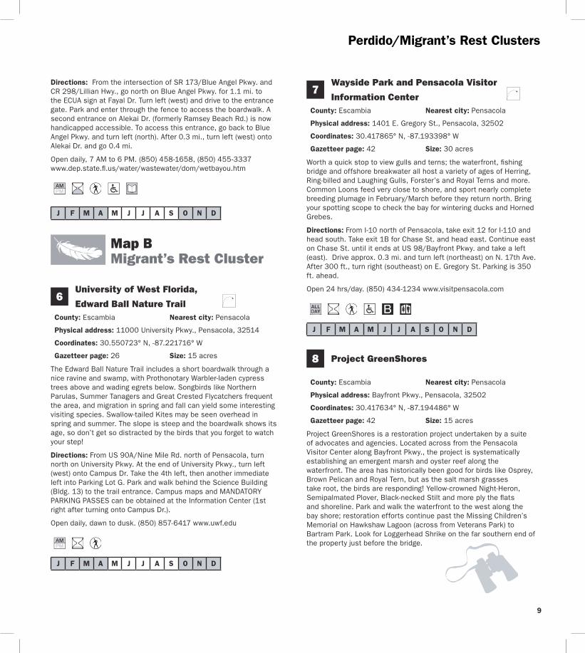
9
PerdidoMigrantrsquos Rest Clusters
Directions From the intersection of SR 173Blue Angel Pkwy and CR 298Lillian Hwy go north on Blue Angel Pkwy for 11 mi to the ECUA sign at Fayal Dr Turn left (west) and drive to the entrance gate Park and enter through the fence to access the boardwalk A second entrance on Alekai Dr (formerly Ramsey Beach Rd) is now handicapped accessible To access this entrance go back to Blue Angel Pkwy and turn left (north) After 03 mi turn left (west) onto Alekai Dr and go 04 mi
Open daily 7 AM to 6 PM (850) 458-1658 (850) 455-3337 wwwdepstatefluswaterwastewaterdomwetbayouhtm
J F M A M J J A S O N D
7
J F M A M J J A S O N D
J F M A M J J A S O N D
Map B Migrantrsquos Rest Cluster
6 University of West Florida
Edward Ball Nature Trail County Escambia Nearest city Pensacola
Physical address 11000 University Pkwy Pensacola 32514
Coordinates 30550723deg N -87221716deg W
Gazetteer page 26 Size 15 acres
The Edward Ball Nature Trail includes a short boardwalk through a nice ravine and swamp with Prothonotary Warbler-laden cypress trees above and wading egrets below Songbirds like Northern Parulas Summer Tanagers and Great Crested Flycatchers frequent the area and migration in spring and fall can yield some interesting visiting species Swallow-tailed Kites may be seen overhead in spring and summer The slope is steep and the boardwalk shows its age so donrsquot get so distracted by the birds that you forget to watch your step
Directions From US 90ANine Mile Rd north of Pensacola turn north on University Pkwy At the end of University Pkwy turn left (west) onto Campus Dr Take the 4th left then another immediate left into Parking Lot G Park and walk behind the Science Building (Bldg 13) to the trail entrance Campus maps and MANDATORY PARKING PASSES can be obtained at the Information Center (1st right after turning onto Campus Dr)
Open daily dawn to dusk (850) 857-6417 wwwuwfedu
Wayside Park and Pensacola Visitor
Information Center County Escambia Nearest city Pensacola
Physical address 1401 E Gregory St Pensacola 32502
Coordinates 30417865deg N -87193398deg W
Gazetteer page 42 Size 30 acres
Worth a quick stop to view gulls and terns the waterfront fishing bridge and offshore breakwater all host a variety of ages of Herring Ring-billed and Laughing Gulls Forsterrsquos and Royal Terns and more Common Loons feed very close to shore and sport nearly complete breeding plumage in FebruaryMarch before they return north Bring your spotting scope to check the bay for wintering ducks and Horned Grebes
Directions From I-10 north of Pensacola take exit 12 for I-110 and head south Take exit 1B for Chase St and head east Continue east on Chase St until it ends at US 98Bayfront Pkwy and take a left (east) Drive approx 03 mi and turn left (northeast) on N 17th Ave After 300 ft turn right (southeast) on E Gregory St Parking is 350 ft ahead
Open 24 hrsday (850) 434-1234 wwwvisitpensacolacom
8 Project GreenShores
County Escambia Nearest city Pensacola
Physical address Bayfront Pkwy Pensacola 32502
Coordinates 30417634deg N -87194486deg W
Gazetteer page 42 Size 15 acres
Project GreenShores is a restoration project undertaken by a suite of advocates and agencies Located across from the Pensacola Visitor Center along Bayfront Pkwy the project is systematically establishing an emergent marsh and oyster reef along the waterfront The area has historically been good for birds like Osprey Brown Pelican and Royal Tern but as the salt marsh grasses take root the birds are responding Yellow-crowned Night-Heron Semipalmated Plover Black-necked Stilt and more ply the flats and shoreline Park and walk the waterfront to the west along the bay shore restoration efforts continue past the Missing Childrenrsquos Memorial on Hawkshaw Lagoon (across from Veterans Park) to Bartram Park Look for Loggerhead Shrike on the far southern end of the property just before the bridge
Migrantrsquos Rest Cluster
J F M A M J J A S O N D
9
J F M A M J J A S O N D
J F M A M J J A S O N D
11
Directions From I-10 north of Pensacola take exit 12 for I-110 and head south Take exit 1B for Chase St and head east Continue east on Chase St until it ends at US 98Bayfront Pkwy and turn left (east) The site and parking are approx 03 mi on the right 100 ft past the intersection with N 17th Ave and 025 mi before the Pensacola Bay Bridge
Open daily dawn to dusk (850) 436-5652 wwwdepstateflusnorthwestEcosyssectiongreenshoreshtm
Shoreline Park South
County Santa Rosa Nearest city Gulf Breeze
Physical address 800 Shoreline Dr Gulf Breeze 32561
Coordinates 30354244deg N -87177670deg W
Gazetteer page 42 Size 100 acres
Shoreline Park South is a small sound-side park in Gulf Breeze which lies between Fort Pickens and the mainland as the bird flies This ensures itrsquos on the direct path of migrants coming in off the Gulf in spring In winter bird the waterfront for grebes and loons (occasional Pacific and Red-throated in years when vagrant birds are prevalent) Wintering ducks like Lesser Scaup Bufflehead and even occasional Common Goldeneye can be viewed from the pier Nearer the entrance bird the loop trails through oak hammock excellent for resident Pine Warblers Carolina Chickadees and Pileated Woodpeckers as well as migrant Black-throated Blue and Worm-eating Warblers Swainsonrsquos Thrushes Orchard Orioles and more This site is busy on warm weather weekends Recent amenities include a boardwalk nature trail waterfront boardwalk picnic shelters and restrooms Many park features are handicapped accessible A viewing deck with seats provides good elevation for scoping winter waterbirds
Directions From US 98 in Gulf Breeze turn west on Shoreline Dr (just west of Pensacola Beach Rdtoll bridge) Go 01 mi to the first intersection and turn left (southwest) to stay on Shoreline Dr The entrance is located 07 mi on the left (south) side of the road
Open 24 hoursday (850) 934-5140 wwwgulfbreezerecreationcentercom
1Gulf Islands National Seashore Fort Pickens Area
County Escambia Nearest city Pensacola Beach
Physical address 1400 Fort Pickens Rd Pensacola Beach 32561
Coordinates 30325672deg N -87181354deg W
Gazetteer page 42 Size 1742 acres
This migratory hotspot is not to be missed in spring as tired migrants make landfall after long overwater flights Batteries Langdon and Worth are both good stops for migrants closely check flowering oaks Please respect closed areas protecting nesting birds the beach here is prime for breeding Snowy Plovers and Least Terns spring through fall Black Terns are ubiquitous in summer and early fall By far the fort and surrounding trails offer this sitersquos most exciting birding In open areas surrounding the fortifications watch for sentinel flycatchers on any minor promontory Gray Kingbirds breed here and Scissor-tailed Flycatchers are occasional in winter The trails on the fortrsquos bayside can be extraordinary for migrant songbirds like Tennessee Cape May and Magnolia Warblers and more Morning is not necessarily the best time to see these birds long-term sighting logs from dedicated local birders indicate these migrants can make landfall in early afternoon Fallouts are exaggerated by early afternoon rain showers that ground migrants as soon as they reach land Migrating raptors cruise the duneline in October and April Loaner optics and field guides are available Fort Pickens Road is prone to storm-related closures check road condition at website below prior to departure
Directions From Pensacola take US 98 east approx 45 mi to the south side of Gulf Breeze Take SR 399Pensacola Beach Rd (toll bridge) south across Santa Rosa Sound to Pensacola Beach Turn right (southwest) at Fort Pickens Rd and head west for 25 mi to the entrance
Fort Pickens Area open 7 AM to 10 PM (850) 934-2600 Historic Fort Pickens open 8 AM to sunset wwwnpsgovguis
0
Pensacola Beach Gulf Pier
County Escambia Nearest city Pensacola Beach
Physical address 41 Fort Pickens Rd Pensacola Beach 32561
Coordinates 30332175deg N -87142344deg W
Gazetteer page 43 Size 025 miles
With binoculars alone this site offers a fare of gulls and terns comparable to other area beach sites However with a spotting scope and a little blustery weather this 025-mile pier can be a seawatcherrsquos dream offering a stable site away from the beach to scan out over the sea More common sightings are wintering
10
11
Migrantrsquos Rest Cluster
Common Loons and plunging gannets October through March However in periods of stormy weather in the Gulf of Mexico tantalizing seabirds like Bridled and Sooty Terns and Sooty Shearwaters have been spotted from this location Respect severe weather but certainly donrsquot let a little rain discourage you This site is primarily a fishing pier but welcomes birders too
Directions From Pensacola take US 98SR 30Gulf Breeze Pkwy south across the Pensacola Bay Bridge to the south side of Gulf Breeze Take SR 399Pensacola Beach Rd (toll bridge) south across Santa Rosa Sound to Pensacola Beach Turn right (southwest) at Fort Pickens Rd and go 01 mi to the first entrance on the left (south) side of the road (look for a large parking lot with a ldquobeach ballrdquo water tower)
Open 24 hoursday (850) 934-7200 wwwfishpensacolabeachpiercom
J F M A M J J A S O N D
J F M A M J J A S O N D
J F M A M J J A S O N D
12 Gulf Islands National Seashore Naval Live Oaks Area
County Santa Rosa Nearest city Gulf Breeze
Physical address 1801 Gulf Breeze Pkwy Gulf Breeze 32563
Coordinates 30364997deg N -87131275deg W
Gazetteer page 42 and 43 Size Size 1378 acres
This visitor center and park HQ for the national seashore spans the spit of land separating Santa Rosa Sound to the south from Pensacola Bay to the north From the sound-side shoreline south of the visitor center parking scope for Common Goldeneye Lesser Scaup and other wintering ducks As always in migration check the live oaks for which this area was named Black-and-white Warblers pick through resurrection fern on the sides of oaks in winter and Brown Creepers are occasionally found scaling the trees
Directions From Pensacola take US 98SR 30Gulf Breeze Pkwy south across the Pensacola Bay Bridge to Gulf Breeze Stay on US 98 East past the intersection with SR 399 the visitor center and headquarters are 18 mi ahead on the right (south) side of the road
Open 8 AM to sunset (850) 934-2600 wwwnpsgovguis
13 Garcon Point Water Management Area Garcon Point Trail
County Santa Rosa Nearest city MiltonGulf Breeze
Physical address SR 281CR191 Milton 32583
Coordinates 30470726deg N -87084151deg W (north entrance) 30459271deg N -87092904deg W (south entrance)
Gazetteer page 43 Size 3235 acres
Gorgeous wet prairie occupies much of this preserve with slightly elevated patches of longleaf pine-wiregrass community breaking the otherwise unobstructed horizon A habitat of extremes this landscape burns frequently and absorbs lots of rainfall trails may occasionally hold water so immersible shoes are recommended Biting flies and ticks are quite unpleasant from April to October but the sheer beauty of this site makes it a must-see from November to March Wet prairie sparrows like Henslowrsquos and LeContersquos occasionally winter here and Cooperrsquos Hawks cruise the prairie for prey like Eastern Towhees and Loggerhead Shrikes Yellow Rails have been found here in winter Pine Warblers call from the tree line and rare pitcher plants crowd the trail (stay on the trail to protect these Panhandle specialties) From the south entrance access the 17-mile loop trail through scrubby oaks and past an ephemeral wetland From the north trailhead the North Spur Trail runs 12 miles south to join the loop trail on its north border See the Florida Trail Associationrsquos website for additional information Access to and from Pensacola Beach via SR 821 requires toll and may result in delays during peak travel times
Directions From I-10 south of Milton take exit 22 for SR 281Avalon Blvd and head south After 4 mi this road will merge with CR 191 Garcon Point Rd Drive approx 07 mi past the intersection with CR 191 the north trailhead is on the left (east) side of the road The south trailhead is 1 mi farther also on the left (east) side of the road If coming from the south on SR 281 the southern entrance is located 025 mi north of the bridgersquos toll booth
Open dawn to dusk (850) 484-5125 (850) 539-5999 wwwnwfwmdstateflusrecreationyellowriverhtml wwwfloridatrailorgHikesfloridapanhandleGarconPointhtml
Migrantrsquos Rest Cluster D
avid Moynahan FW
C
Horseshoe Crabs
12
13
Blackwater Cluster
14
J F M A M J J A S O N D
15
J F M A M J J A S O N D
16 Blackwater Fisheries Center
Map C Blackwater Cluster
Blackwater River State Forest Hutton Unit
County Santa Rosa Nearest city Holt
Physical address Deaton Bridge Rd Milton 32583
Coordinates 30685874deg N -86876366deg W
Gazetteer page 27 Size 7629 acres
This site adjacent to Blackwater River State Park is worth a quick stop to listen for Bachmanrsquos Sparrow in spring and summer ndash if they are singing yoursquoll likely hear them from the parking lot The available habitat is turkey oakpine uplands common throughout the Panhandle and not as productive for birding as other habitats may be Still in springtime a quick peek can never hurt Less than 1 mile from the entrance on H9 Road (across from Boundary Line Rd) you should encounter species such as Red-headed Woodpecker Brown-headed Nuthatch Eastern Bluebird and Great Crested Flycatcher Gates are open to general vehicular traffic from May 1 to October 1 gates will be closed in hunting season (hunters check in through a different gate) If the gate on Deaton Bridge Rd is locked you may use the parking lot next to the gate and walk in Additional entrances are located at Pond Road off US 90 and at the intersection of Deaton Bridge Rd and Indian Ford Rd Take care driving on area clay roads ndash they can be slippery when wet The Florida National Scenic Trail winds through the site and is open to hikers year round A WMA map is available from the FWC website Seasonal hunting takes place at this GFBWT site please see page 55 for information on dates regulations and more
Directions From Milton take US 90 east for approx 95 mi to Harold Turn left (north) on Deaton Bridge Rd and drive 18 mi the entrance and parking area are on the left (west) side of the road directly across from Boundary Line Rd From I-10 eastbound take exit 31 for SR 87 and head north to US 90 Turn right (east) on US 90 and follow it for 58 mi to Deaton Bridge Rd From I-10 westbound take exit 45 for Log Lake Rd and go north to US 90 Turn left (west) and follow US 90 for 87 mi to Deaton Bridge Rd
Open dawn to dusk (850) 957-6140 wwwfl-dofcomstate_forestsblackwater_riverhtml MyFWCcomviewingrecreationwmascooperativeblackwater
Blackwater River State Park
County Santa Rosa Nearest city Holt
Physical address 7720 Deaton Bridge Rd Holt 32564
Coordinates 30711943deg N -86879987deg W
Gazetteer page 27 Size 635 acres
This site is a popular swimming canoeing and picnicking area in warm weather but offers nice access to floodplain hiking trails good for Yellow-billed Cuckoos and Hairy Woodpeckers in late spring and summer Broad-winged Red-tailed and Red-shouldered Hawks are common and Wood Thrushes and Prothonotary Warblers breed here Brown-headed Nuthatches squeak from pines in the uplands these delightful acrobats are a joy to watch The brief campground trail and the 09-mile Chain of Lakes Nature Trail are best for birding The trails can be wet at times of high water so wear shoes you donrsquot mind getting muddy Loaner optics and field guides are available
Directions From Milton take US 90 east for approx 95 mi to Harold Turn left (north) on Deaton Bridge Rd and drive 39 mi the entrance is on the right (east) side Additional parking areas (fee required) are located at either end of the bridge Access the Chain of Lakes Nature Trail at the south end of the bridge From I-10 eastbound take exit 31 for SR 87 and head north to US 90SR 10 Turn right (east) on US 90 and follow it for 58 mi to Deaton Bridge Rd From I-10 westbound take exit 45 for Log Lake Rd and go north to US 90 Turn left (west) and go 87 mi to Deaton Bridge Rd
Open year round 8 AM to sundown (850) 983-5363 wwwfloridastateparksorgblackwaterriver
County Santa Rosa Nearest city Holt
Physical address 8384 Fish Hatchery Rd Holt 32564
Coordinates 30729556deg N -86802542deg W
Gazetteer page 27 Size 590 acres
Nestled in the Blackwater River State Forestrsquos uplands this fish hatchery is an oasis of wading birds and shorebirds Stop at the entrance kiosk to check the sightings log and to pick up a checklist Walk the dikes between the aquaculture ponds looking for winter
14
Blackwater Cluster
waterfowl such as Ring-necked Ducks Blue-winged Teal and Wilsonrsquos Snipe at the muddy edges Wintering shorebirds include both yellowlegs Spotted Solitary and Pectoral Sandpipers and Semipalmated Plovers Forsterrsquos Terns Purple Martins and Northern Rough-winged Swallows skim over the ponds Northern Bobwhites and Wild Turkeys are common in the adjacent forest and wooded fields Ask at the office if yoursquod like a facility tour and also if hunting or prescribed fire would prohibit your birding in the woods of the state forestrsquos Carr Unit to the northeast Bachmanrsquos Sparrows sing here in spring and Henslowrsquos Sparrows occasionally overwinter
Directions From I-10 eastbound take exit 31 for SR 87 and head north to US 90SR 10 Turn right (east) and drive 139 mi to Cooper Ln outside of Holt Turn left (north) and go 01 mi to Johns Rd Turn left (west) and follow Johns RdBryant Bridge Rd (name change) for 3 mi The entrance is on the right (northeast) side of the road From
I-10 westbound take exit 45 for Log Lake Rd and go north to US 90SR 10 Turn left (west) and drive 05 mi Turn right (north) on Cooper Ln After 01 mi turn left on Johns RdBryant Bridge Rd The entrance is 3 mi ahead on the right
Open 730 AM to 4 PM MonndashFri weekends by appointment only (requires at least 2 weeks advance notice) (850) 957-6177
MyFWCcomviewingrecreationwmascooperativeblackwater
J F M A M J J A S O N D
Milton
CrestviewBaker
Harold
Holt
Munson
Blackwater River
Blackwater River
Shoal River
Johns Rd
Johns Rd
Bryant Bridge Rd
Buddy Hardy Rd
Live Oak Church Rd
N Karick Rd
Karick Lake Lower Rd
Ferd
on
Blvd
Bob Pitts Rd
Indian Ford Rd
Pond Rd
Cooper Ln Log Lake Rd
Boundary Line Rd
Deato
n
Br
idge R
d
Coldwater H o rs e Trail
Whiting Field Naval
Air Station
90
191
191
87
87
178
4
87
189
188
4
4
4
2
85
87A 90
56
45
3110
10
N
0 1 2 3 4
Miles
Birding Trail Site
To De FuniakSprings
To De FuniakSprings
To Pensacola
SAN
TA R
OSA
CO
O
KA
LOO
SA C
O
SAN
TA R
OSA
CO
O
KA
LOO
SA C
O
14
15
19
20
21
Thre
eN
otch
Rd
17
C
15
Blackwater Cluster
17 Naval Air Station Whiting Field Clear Creek Nature Trail
County Santa Rosa Nearest city Milton
Physical address Langley St Milton 32570
Coordinates 30707410deg N -87032045deg W
Gazetteer page 27 Size 80+ acres
As it descends through mixed pine-oak uplands this interesting 15-mile round-trip trail leads to a creek and associated wetland Listen for Red-breasted Nuthatches in fall in the uplands and Hermit Thrushes overwintering At the water Common Yellowthroats scold from brushy tangles and wading birds like Little Blue Herons and Least Bitterns are possible among the pitcher plants visible from the boardwalk This is part of a functioning military Naval Air Station and occasional noise from aircraft is to be expected Access may be limited during times of elevated homeland security levels so call in advance
Directions From Milton head north on SR 87 following signs to NAS Whiting Field Turn right (east) on CR 87ALangley St and explain at the security gate that you would like to visit Clear Creek Nature Trail Once through the gate follow NAS Whiting Field Dr to the trailhead parking area
Open dawn to dusk (850) 623-7602 wwwdodpiforgchecklistsnaswfhtm
J F M A M J J A S O N D
J F M A M J J A S O N D
J F M A M J J A S O N D
20
Blackwater River State Forest
Three Notch Rd (Hardy Rd to Coldwater Horse Trail)
County Santa Rosa Nearest city Milton
Physical address Three Notch Rd Milton 32570
Coordinates 30800828deg N -86950923deg W (south end) 30832354deg N -86942892deg W (north end)
Gazetteer page 27 Size 5 miles
This 5-mile stretch of Three Notch Rd offers easy safe roadside pulloffs with Red-cockaded Woodpecker (RCW) cavity trees ringed with white paint visible from the road RCWs are most easily seen in breeding season in the mornings when they emerge from their nest cavities to ferry food back to their waiting young Frequent prescribed fire keeps this habitat healthy so obey signs closing the area for this necessary management event Use caution on area clay roads which can be slippery when wet Also check trails north of Coldwater Horse Trail for RCWs if desired along the east and west sides of Three Notch Rd Seasonal hunting takes place at this GFBWT site please see page 55 for information on dates regulations and more
Directions From Milton take CR 191Munson Hwy north approx 14 mi to Buddy Hardy Rd Turn left (west) on Buddy Hardy Rd drive 07
18
mi and turn right (north) onto Three Notch Rd Drive towards the intersection with Coldwater Horse Trail pull off on shoulder as desired Trails criss-cross the area along Three Notch Rd and Coldwater Horse Trail from Coldwater Creek to Juniper Creek (south of SR 4 and west of CR 191) Coldwater Horse Trail leads eastward back to CR 191
Open dawn to dusk (850) 957-6140 wwwfl-dofcomstate_forestsblackwater_riverhtml
19 Blackwater River State Forest Bear Lake Loop Trail
County Santa Rosa Nearest city Baker
Physical address Bear Lake Rd Milton 32570
Coordinates 30855008deg N -86838233deg W
Gazetteer page 27 Size 200 acres
From the camping area hike the 4-mile trail that rings the lake watching for migrants like Ovenbirds and Swallow-tailed Kites in springtime Red-shouldered Hawks echo across the lake and Pied-billed Grebes dive hunting for fish Nearby uplands can be good for Chuck-willrsquos-widows and Wild Turkeys Take water and expect biting insects in warm weather The lake is popular with anglers in spring and fall There is no hunting on the trail or in the vicinity of the lake
Directions From Milton take CR 191Munson Hwy north to SR 4 in Munson Turn right (east) on SR 4 and proceed 20 mi to the entrance at Bear Lake Rd Turn left (north) the parking area is 06 mi ahead
Open dawn to dusk (850) 957-6140 wwwfl-dofcomstate_forestsblackwater_riverhtml
Blackwater River State Forest Karick Lake
County Okaloosa Nearest city Baker
Physical address N Karick Rd and Karick Lake Lower Rd Crestview 32531
Coordinates 30905009deg N -86656031deg W (upper entrance) 30894311deg N -86660076deg W (lower entrance)
Gazetteer page 28 Size 38 miles
Check these recreation areas for Bachmanrsquos Sparrows calling in the sandhills ducks and wading birds like Green Herons visible from
16
BlackwaterChoctawhatchee Clusters
the north access pier and songbirds like Yellow-throated Warblers and Red-eyed Vireos in the hardwoods around the lake A 38-mile loop trail circles around the lake traveling along sandhills gallberry midslopes and hardwood bottoms Pay attention to ecotones particularly those edges with hardwoods These can be good for migrants that prefer this habitat over drier sandhills Directions From Milton take CR 191Munson Hwy north to SR 4 in Munson and turn right (east) Follow SR 4 to its intersection with SR 189 in Baker and turn left (north) The south access (Karick Lake Lower Rd) is 8 mi ahead on the right The north access (N Karick Rd) is 08 mi farther north Open dawn to dusk (850) 957-6140 wwwfl -dofcomstate_forestsblackwater_riverhtml
J F M A M J J A S O N D
21Shoal River Wayside Par
(Bill Duggan Jr Park)
k
County Okaloosa Nearest city Crestview
Physical address 5999 SR 85 Crestview 32536
Coordinates 30698772deg N -86570501deg W
Gazetteer page 28 Size 55 acres
Freeport
Niceville
Valparaiso
Destin
GraytonBeach
Eglin Air Force Base
Choctawhatchee Bay
Choctawhatchee River
Gulf of Mexico
RockyBayou
Gulf of Mexico
Chat Holly Rd
John Sims Pkwy
Emerald Coast Pkwy
331
331
20
83
83A20
282
393
98
293
30
397
85
85285123
190
30
98
98
98
23
24
25
2726
28
N
0 1
Miles
2
Birding Trail Site
To PanamaCity
To Ft WaltonBeach
To DeFuniakSprings
D
Mad
iso
n St
W C
oll
ege
Blvd
OK
AL
OO
SA
CO
O
KA
LO
OS
A C
O
WA
LTO
N C
OW
ALT
ON
CO
O
KA
LO
OS
A C
O
WA
LTO
N C
O
30A83
283
30A
395
(toll)
17
J F M A M J J A S O N D
J F M A M J J A S O N D
23
J F M A M J J A S O N D
24
22
BlackwaterChoctawhatchee Clusters
Shoal River Wayside Park is worth a quick check for wading birds at the river and songbirds in the adjacent floodplain forest In this part of the Panhandle floodplain corridors along rivers like this create migrant highways through arid turkey oak and sand pine uplands Check the tree line and understory especially in spring migration for songbirds like Prairie Warblers and well camouflaged Veeries
Directions From I-10 south of Crestview take exit 56 for SR 85 Ferdon Blvd Go south for 18 mi Turn left (east) at Live Oak Church Rd and go 01 mi Turn right (southwest) and continue on Live Oak Church Rd for 01 mi Turn left (south) into the park
Open dawn to dusk (850) 689-5084 (850) 689-5772 wwwcookaloosaflus
Map D Choctawhatchee Cluster
Turkey Creek Park
County Okaloosa Nearest city Niceville
Physical address 340 John Sims Pkwy West Niceville 32578
Coordinates 30523676deg N -86497348deg W (main entrance) 30532812deg N -86502494deg W (Turkey Creek extension)
Gazetteer page 28 Size 075-mile boardwalk
Walk the scenic 075-mile boardwalk along tannic Turkey Creek through a river forest of titi maple cypress and bay Watch for Green Herons stalking minnows on low hanging branches over the water and Anhingas swimming in the creek Mississippi Kites are common in summer and songbirds like White-eyed Vireos breed here In warm weather visit on weekdays and early in the morning this is a popular swimming access and the revelry of swimmers riding inner tubes downstream can be disruptive to birding (albeit tempting to partake in) The boardwalk is ADA accessible but the city also provides rides on electric carts for the mobility impaired between 730 and 1100 AM on the first Wednesday of each month A second entrance for the North Turkey Creek Extension is located on W College Blvd which has a 900-ft boardwalk and a canoekayak launch
Directions From intersection of SR 20John Sims Pkwy East and SR 285N Partin Dr in Niceville drive west on SR 20 for 10 mi to Evans St Turn right (north) the park entrance is immediately on your left From the intersection of SR 190Valparaiso Pkwy and SR 397 John Sims Pkwy in Valparaiso go north on John Sims Pkwy for 13 mi across the bridge to Evans St Turn left (north) and immediately left again into the parking lot To access the new extension head east from the park on SR 20 to SR 85 Turn left (north) and go 09 mi to W College Blvd Turn left (west) and drive 06 mi past the hospital to the entrance on the left (south) side of the road
Open 630 AM to dark Tues - Sun North Turkey Creek Extension opens at 8 AM (850) 729-4062 wwwnicevilleorgturkeyhtml
Fred Gannon Rocky Bayou State Park
County Okaloosa Nearest city Niceville
Physical address 4281 SR 20 Niceville 32578
Gazetteer page 28 and 44 Size 346 acres
Coordinates 30495944deg N -86432791deg W
This waterfront park is located on Rocky Bayou in Choctawhatchee Bay Of its three trails Red Cedar and Rocky Bayou are more interesting for birds than Sand Pine Trail Walk the trails for migrants like Cedar Waxwings and Indigo Buntings check the trees in the campground area too The waterfront can offer vantages of diving ducks in winter Ospreys overhead and Spotted Sandpipers on rocky edges in winter The local Audubon chapter offers bird walks early on Friday mornings ndash call in advance for details Loaner optics and field guides are available
Directions From the intersection of SR 285 and SR 20 in Niceville drive approx 40 mi east on SR 20John Sims Pkwy The entrance to the park is on the left (north) side after crossing Rocky Bayou Bridge
Open year round 8 AM to sundown (850) 833-9144 wwwfloridastateparksorgrockybayou
Henderson Beach State Park
County Okaloosa Nearest city Destin
Physical address 17000 Emerald Coast Pkwy Destin 32541
Coordinates 30386928deg N -86447520deg W
Gazetteer page 44 Size 221 acres
Henderson Beach State Park offers nice beachfront for specialties like Snowy Plovers Least Terns American Oystercatchers and more Take care not to disturb beach-nesting birds which are often cryptic and blend easily with the sand they nest upon A nature trail by the beach access points winds through a small coastal hammock in a stretch of coastline where little of this important habitat remains Watch for migrant songbirds here in spring and raptors making landfall or following the duneline in April and October The campground has some nice trees worth checking as access allows ask for permission at the entrance gate and be considerate of campers This site gets busy in warm weather Loaner optics and field guides are available
Choctawhatchee Cluster
J F M A M J J A S O N D
J F M A M J J A S O N D
26
J F M A M J J A S O N D
Directions From the intersection of SR 293Danny Wuerffel Way (toll bridge) and US 98SR 30Emerald Coast Pkwy east of Destin drive 15 mi west on US 98 to the park entrance on the left (south) side of the highway
Open year round 8 AM to sundown (850) 837-7550 wwwfloridastateparksorghendersonbeach
25 Topsail Hill Preserve State Park
County Walton Nearest city Sandestin
Physical address 7525 W County Hwy 30A Santa Rosa Beach 32459
Coordinates 30371282deg N -86272744deg W (main entrance) 30375556deg N -86299507deg W (Topsail Rd entrance)
Gazetteer page 45 Size 1643 acres
Topsail Hill Preserve State Park offers inland trails through coastal scrub and past rare coastal dune (freshwater) lakes The 25-mile Morris Lake Trail is slightly more productive than the Campbell Lake Trail although either will yield Eastern Bluebirds Eastern Kingbirds Red-headed Woodpeckers and Brown-headed Nuthatches to name a few Check the beachfront for gulls and Sandwich Least and Royal Terns Snowy Plovers nest here and shorebirds ply the shoals near the outfall for Morris Lake at the Gulf Scope the surf for Common Loons Horned Grebes and Northern Gannets winter through spring The beach is heavily visited in warm weather so plan accordingly Educational programs are offered call for details
Directions From the intersection of SR 293Danny Wuerffel Way (toll bridge) and US 98SR 30Emerald Coast Pkwy east of Destin drive 85 mi east on US 98 and turn right (southeast) on CR 30A the entrance is approx 02 mi on the right (west) side of the road A second entrance is located on Topsail Rd at US 98 14 mi west of the intersection with CR 30A Use this entrance for direct access to the Morris Lake and Campbell Lake Trails (call ahead as entrance may be closed if road is flooded)
Open year round 8 AM to sundown (850) 267-8330 wwwfloridastateparksorgtopsailhill
Grayton Beach State Park
County Walton Nearest city Point Washington
Physical address 357 Main Park Rd Santa Rosa Beach 32459
Coordinates 30334117deg N -86158050deg W
Gazetteer page 45 Size 2227 acres
Grayton Beach State Park is very popular with beachgoers in warm weather but in cooler months is worth checking On the north side of CR 30A the 42-mile Grayton Beach Hike and Bike Trail runs through pine flatwoods and along the north end of Western Lake (a brackish coastal dune lake) which can be good for wading birds Bald Eagle Barred Owl Brown-headed Nuthatch Pied-billed Grebe and more For longer hikes the Lake Loop Trail connects to Point Washington State Forestrsquos (site 27) extensive trail system Donrsquot miss the 1-mile interpretive Grayton Beach Nature Trail which begins at the beach parking area As it winds through sand dunes and under a sand live oak canopy look for Savannah Sparrow Eastern Towhee and Orange-crowned Warbler an additional loop also runs through pine flatwoods (listen for Eastern Bluebird) and along the southern end of Western Lake (check for Common Loon in winter) The beachfront offers plovers terns and gulls (Bonapartersquos in winter) and plunging gannets out to sea October through March As with all coastal sites watch for raptors cruising the beachfront and migrants arriving off the Gulf in spring Loaner optics and field guides are available
Directions From the intersection of US 98 and US 331 east of Destin drive east approx 15 mi and then turn right (south) on CR 283 Follow CR 283 for 17 mi to CR 30A and turn left (east) the entrance is on the right (south) side after 05 mi
Open year round 8 AM to sundown (850) 267-8300 wwwfloridastateparksorggraytonbeach
27 Point Washington State Forest
County Walton Nearest city Point Washington
Physical address S CR 395 Santa Rosa Beach 32459
Coordinates 30342148deg N -86131466deg W
Gazetteer page 45 Size 15131 acres
Point Washington State Forest offers 3- 5- and 10-mile hiking loops through longleaf pine flatwoods coastal scrub and sandhills Bachmanrsquos Sparrows are very likely to be heard singing in spring in areas of wiregrass and palmetto in the southern half of the 3-mile loop The eastern boundary of this loop crosses the west arm of Peach Creek where you can listen for songbirds and watch for Red-shouldered Hawks Cooperrsquos Hawks occasion the flatwoods and Eastern Towhees and Common Yellowthroats are abundant Trail system connects to Grayton Beach State Park (site 26) for
18
19
De Funiak Springs
331
9090
280A
183
183
81
10
183
280
83
181
181A
81
331
10
ToMarianna
To Freeport
ToCrestview
N
0 1
Miles
2
29
E85
96
Birding Trail Site
Rest Area
WA
LTO
N C
O
WA
LTO
N C
O
HO
LMES
CO
H
OLM
ES C
O
WA
LTO
N C
O
HO
LMES
CO
Directions From the intersection of US 331SR 83 and SR 20 in Freeport the entrance is 16 mi west on the south side of SR 20 (past Tucker Town Rd)
Open dawn to dusk (850) 835-2822 wwwfreeportfl oridagov
J F M A M J J A S O N D
Map EDogwood Cluster
29 Ponce de Leon Springs State Park
County Holmes Nearest city Ponce de Leon
Physical address 2860 Ponce de Leon Springs Rd Ponce de Leon 32455
Coordinates 30722979deg N -85930385deg W
Gazetteer page 30 Size 420 acres
Worth checking in migration this sitersquos real strength is wintering birds especially those at the southernmost limit of their range Birds like Brown Creeper and Golden-crowned Kinglet are possible at this site your chances improve with your ability to identify birds by sound Hike both short trails ndash Spring Run and Sandy Creek ndash stopping to
extended birding adventures Seasonal hunting takes place at this GFBWT site please see page 55 for information on dates regulations and more
Directions From the intersection of US 98 and US 331 east of Destin drive east approx 30 mi and turn right (south) on CR 395 Trailhead parking is 11 mi on the left (east) side of the road
Open dawn to dusk (850) 267-8325 wwwfl -dofcomstate_forestspoint_washingtonhtml
J F M A M J J A S O N D
28 Harry A Laird Sr City Park
County Walton Nearest city Freeport
Physical address SR 20 E Freeport 32439
Coordinates 30501614deg N -86145701deg W
Gazetteer page 29 and 45 Size 13 acres
This small wayside park has a brief boardwalk along a creek lined with hardwoods The area is worth checking in migration only for songbirds like waterthrushes and Worm-eating and Hooded Warblers Weekend afternoons can be busy with picnickers and playground visitors but weekdays are left for you and the birds
ChoctawhatcheeDogwood Clusters
DogwoodKentucky Warbler Clusters
listen carefully in the shady hardwood forest This park can be busy with swimmers in warm weather so weekday and early morning birding may prove the most rewarding
Directions From I-10 east of De Funiak Springs take exit 96 and head north on SR 81 for 10 mi Turn right (east) onto US 90SR 10 after 02 mi then turn right (south) again onto CR 181A the entrance is 05 mi on the right (west) side of the road
Open year round 8 AM to sundown (850) 836-4281 wwwfloridastateparksorgponcedeleonsprings
J F M A M J J A S O N D
30
J F M A M J J A S O N D
J F M A M J J A S O N D
Map F Kentucky Warbler Cluster
Falling Waters State Park
County Washington Nearest city Chipley
Physical address 1130 State Park Rd Chipley 32428
Coordinates 30731352deg N -85529023deg W
Gazetteer page 31 Size 173 acres
Falling Waters State Park makes for a nice hour-long hike exploring the sinkholes waterfalls lake and surrounding uplands via the Wiregrass and Sinkhole trails Watch for Red-headed Woodpeckers in the uplands and migrant songbirds like Gray-cheeked Thrushes in the leafy understory of dogwood and azalea beneath the magnolia and white oaks As always when in this part of northwest Florida northern species like Dark-eyed Juncos are possible in winter Check for ducks and waders at the lake edge Scan the butterfly garden for resident and migratory butterflies
Directions From I-10 east of De Funiak Springs take exit 120 and head south on SR 77 After 08 mi turn left (east) onto CR 77A State Park Rd the entrance is 17 mi ahead (road dead ends into park)
Open year round 8 AM to sundown (850) 638-6130 wwwfloridastateparksorgfallingwaters
31
32
Florida Caverns State Park
County Jackson Nearest city Marianna
Physical address 3345 Caverns Rd Marianna 32446
Coordinates 30808352deg N -85212422deg W
Gazetteer page 32 Size 1279 acres
Florida Caverns State Park has some of the best-preserved uplands in northwest Florida as well as mixed-hardwood swamps lining the drainage basin of the Chipola River Known for northern species like Red-breasted Nuthatches (in pine forest) and Winter Wrens this site is ideal for birding with miles of remote trails Access both the Fish Hatchery Loop Trails and the Pine Island Loop Trails from the Blue Hole Swimming Area Keep in mind that the Management Trail (part of the Pine Island system) runs north into the Upper Chipola Wildlife Management Area where hunting seasons will be in effect Cave tours are available at regular intervals and fill quickly An onsite canoe concession allows you to access the Upper Chipola River Water Management Area (site 32) Butterflying is best here in late summer and early fall Check near the visitor center for the Silvery Checkerspot which in Florida occurs only in Jackson County The picnic areas and roadsides have a diversity of swallowtails and sulphurs
Directions From US 90SR 10 in Marianna head north on SR 166 CR 167Jefferson St (becomes Caverns Rd) the entrance is 27 mi on the left (west) side of the road
Open year round 8 AM to sundown (850) 482-9598 wwwfloridastateparksorgfloridacaverns
Upper Chipola River Water Management Area
County Jackson Nearest city Marianna
Physical address 3345 Caverns Rd Marianna 32446
Bumpnose RdChristoff Ferry Lndg Marianna 32446
Caverns Rd at Chipola River bridge Marianna 32446
Coordinates 30808352deg N -85212422deg W (park entrance)
30850068deg N -85259576deg W (Christoff Ferry Landing)
30792445deg N -85222941deg W (bridge)
Gazetteer page 32 Size 7377 acres
For the more intrepid explorer this rustic river is kept clear enough of obstructions to make a nice day of paddling and birding Launch from Florida Caverns State Park (site 31) and paddle upriver toward Christoff Ferry Landing on the Upper Chipola River Water Management Area where the river forks at the confluence with Waddells Mill Creek When yoursquore done paddling float back watching for brilliant Prothonotary Warblers and Limpkins lurking along the shore Take water and a map and allow enough time to return before the park closes at dusk Christoff Ferry Landing on Bumpnose Rd is
20
21
CR 77A (State
Park Rd)
Cav
erns
Rd
Marianna
Chipley
77
273
77
277
71276A
73
73
71
90
231
231
167
164
276
167
162
169
277
276
164
195
276 276
10
75
75
90 10
10 10
HO
LMES
CO
30
31
N
0 1
Miles
2
F
To DeFuniak Springs
To Panama City
To Alabama
To Tallahassee
120 130 136
142
Jeffe
rson
St
32B
32A
Bumpnose Rd
WA
SHIN
GTO
N C
O
JAC
KSO
N C
O
WA
SHIN
GTO
N C
O
JAC
KSO
N C
O 133
Chipola River
Pen
nsyl
vani
aA
ve
Birding Trail Site Rest Area
166
Kentucky Warbler Cluster
Danny Bales
Kentucky Warbler
Kentucky WarblerIndigo Bunting Clusters
J F M A M J J A S O N D
33
J F M A M J J A S O N D
34
J F M A M J J A S O N D
35
another launch site but because of its secluded location the state park is a better choice You may also launch from the south end of the Chipola River bridge on SR 166CR 167Caverns Rd Seasonal hunting takes place at this GFBWT site please see page 55 for information on dates regulations and more
Directions The boat launch site is within Florida Caverns State Park from US 90 in Marianna head north on SR 166CR 167Jefferson St (becomes Caverns Rd) the entrance is approx 27 mi on the left (west) side of the road Paddle upriver toward Christoff Ferry Landing (B) To reach Christoff Ferry Landing from Marianna head west on US 90 to Pennsylvania Ave Turn right (north) and drive 52 mi (name soon changes to Bumpnose Rd) Turn right (east) the launch site is 03 mi ahead
Open dawn to dusk (850) 482-9522 (850) 539-5999 wwwnwfwmdstateflusrecreationchipolariverhtm
Map G Indigo Bunting Cluster
Pitts Spring Recreation Area
County Bay Nearest city Youngstown
Physical address Econfina Creek Landing Youngstown 32466
Coordinates 30431468deg N -85545768deg W
Gazetteer page 47 Size 10 acres
This site is part of the 41000-acre Econfina Creek Water Management Area As a popular swimming hole Pitts Spring can be busy on warm afternoons but in early mornings or on colder days it offers a nice access to slopefloodplain forest popular with songbirds like Wood Thrushes and Kentucky Warblers The entrance gate to the small parking area is open daily April through September and on weekends and holidays October through March However interested users are welcome to park outside the gate and enter on foot to enjoy the trails in the immediate area of the spring Opposite the spring is a launch point to canoe Econfina Creek Nearby canoe concessionaires can offer advice on routes and creek conditions like many Panhandle creeks the Econfina can be fast flowing and challenging with occasional obstructions that may require portages
Directions From US 231 in Fountain (northeast of Panama City) drive 20 mi south and turn right (west) on SR 20 the entrance is approx 82 mi ahead on the right (north) side of the highway at Econfina Creek Landing From Panama City head northeast on US 231SR 75 to CR 2301Blue Springs Rd Turn left (north) and go 130 mi to SR 20 Turn left (west) and go 07 mi Turn right (north) immediately past the bridge onto Econfina Creek Landing
Open 9 AM to 7 PM daily Apr-Sept weekends and holidays only OctshyMar (850) 539-5999 wwwnwfwmdstateflus
Pine Log State Forest
County Bay Nearest city Ebro
Physical address 5583 Longleaf Rd Ebro 32437
Coordinates 30423912deg N -85881046deg W
Gazetteer page 46 Size 6911 acres
Although there are 13 miles of hiking trails at this state forest the most rewarding birding at this site is via the Campground Loop and Dutch Tiemann Trails accessed from the camping area The former is marked with red blazes and hugs the cypress margin of a lake for approx 2 miles Watch for nesting Pileated Woodpeckers and Prothonotary Warblers as well as ducks on the lake in winter The Dutch Tiemann Trail is 6 miles long and stretches south through pinewoods good for Great Crested Flycatchers and Great Horned Owls down to Pine Log Creek and back north to the campground Take water and sunscreen bugs may be prohibitive in warm weather Seasonal hunting takes place at this GFBWT site please see page 55 for information on dates regulations and more
Directions From the intersection of US 98 and and SR 79 west of Panama City drive north on SR 79 for 141 mi Turn left (west) on Environmental Rd approx 10 mi before Ebro After 03 mi make the first right (go north) on Long Leaf Rd and enter the Sand Pine Recreation Area Park at the campground
Open dawn to dusk (850) 535-2888 wwwfl-dofcomstate_forestspine_loghtml
Camp Helen State Park
County Bay Nearest city Inlet Beach Laguna Beach
Physical address 23937 Panama City Beach Pkwy Panama City Beach 32413
Coordinates 30275428deg N -85990431deg W
Gazetteer page 46 Size 183 acres
Two miles of loop trails are available at this park The main trail starts at the Rainbow Cottages runs south across a footbridge then loops through a coastal live oak hammock and dune system A path from the looprsquos south end leads to beachfront where Black Terns are
22
23
Laguna BeachLynn Haven
Panama City Beach Panama City
Parker
Ebro
Tyndall Air Force Base
Econ
fina
Cree
k
Intracoastal Waterway
Gulf of Mexico
Environmental Rd
Lake Dr
Hilltop Ln
Hathaway Bridge
Beck Ave
10th St
Beach Dr
23rd St
11th St
19th St
Fran
kfor
d Av
e
BaldwinRd
77
77
388
79
792081
7998
98
2230
22ABUS
98
231
77
20
20
390
389
391
388
75
231
30
ALT
98
2301
2321
2302
2315
390
39
392
3031
WASHINGTON CO BAY CO
WA
LTO
N C
O 34
33
39
38
36
37
35
To Fountain
To PortSt Joe
To Freeport
To Destin
N
0 1
Miles
2
Birding Trail SiteG
Lake PowellWest Bay
StAndrew
Bay
Indigo Bunting Cluster
Indigo Bunting Cluster
J F M A M J J A S O N D
36
J F M A M J J A S O N D
37
J F M A M J J A S O N D
38
possible in summer Black-bellied and Piping Plovers in winter Least Terns and Snowy Plovers have nested in the park A spur trail runs from the looprsquos east side to Lake Powell one of the largest coastal dune lakes in Florida Coastal dune lakes are rare and in the US occur only on the Gulf Coast Salt and freshwater mixing at this inlet offers productive feeding for terns year-round and wintering ducks like Redheads
Directions The entrance is on the south side of US 98 70 mi west of SR 79N Arnold Rd on the west side of the Phillips Inlet bridge
Open year round 8 AM to sundown (850) 233-5059 wwwfloridastateparksorgcamphelen
St Andrews State Park
County Bay Nearest city Panama City Beach
Physical address 4607 State Park Ln Panama City 32408
Coordinates 30135113deg N -85742506deg W
Gazetteer page 46 Size 1169 acres
Scan the Gulf from the end of the fishing pier on the peninsularsquos south (Gulf) side for Brown Pelicans Least Terns and gulls in warmer months and gannets plunging near the shore in winter At the peninsularsquos east end beaches north of the jetty fishing area are productive for shorebirds like Snowy Plovers and Willets Black Skimmers occasionally loaf here Gator Lake hosts a heron rookery in spring (Great Blue Herons Great and Snowy Egrets) Check the Buttonbush Marsh Overlook adjacent to the boat parking for Least Bitterns and Wood Ducks Pine flatwoods throughout are home to Brown Thrashers Loggerhead Shrikes and Eastern Towhees
Directions In Panama City take US 98 west across the Hathaway Bridge to CR 3031Thomas Dr and turn left (south) Follow CR 3031 to its end at the intersection with CR 39 and CR 392 Bear left (straight) onto CR 39State Park Ln the site entrance is ahead
Open year round 8 AM to sundown (850) 233-5140 wwwfloridastateparksorgstandrews
St Andrews Bird Trail Oaks By the Bay Park
County Bay Nearest city Panama City
Physical address 2701 W 10th St Panama City 32401
Coordinates 30167245deg N -85701504deg W
Gazetteer page 46 Size 5 acres
Particularly rewarding for beginners this small marina is worth a quick stop if yoursquore in the area The waterfront boardwalk (west-facing) has a series of educational signs on the arearsquos more common birds like Double-crested Cormorants Brown Pelicans herons and egrets The boardwalk ends at Oaks By the Bay Park to the south where oaks can be attractive for warblers in April and October A dune walkover here provides access to the beachfront for chance encounters with shorebirds like yellowlegs and Dunlin as well as terns diving ducks and loons on the bay in winter
Directions From US 98 in Panama City head south on Beck Ave to its intersection with 10th St Park your vehicle at Oaks By The Bay Park (directly across 10th St from this intersection) or turn right (west) on 10th St and park at St Andrews Marina
Open daily dawn to dusk (850) 872-7208 wwwhistoricstandrewscombusiness-district wwwpcgovorg
Lynn Haven Sports Complex and Nature Trail
County Bay Nearest city Lynn Haven
Physical address 2201 Recreation Dr Panama City 32405
Coordinates 30229328deg N -85615548deg W
Gazetteer page 47 Size 60 acres
This complex of ball fields yields more birds than you might think due in large part to the adjacent lake and nature trail On the lake on the east side of the complex check for wintering ducks like Ring-necked and Lesser Scaup a Rossrsquos Goose has wintered here recently Next follow the trail east of the lake along the boardwalk through a small bayhead Some large trees in this mature wetland hammock make for interesting flocks of migrants in October and April Brushy areas north of the lake and on the west and south perimeters of the complex may be good for wintering sparrows Loaner optics and field guides are available
Directions From the intersection of CR 390 and US 231SR 75 in Lynn Haven drive west on CR 390 for 22 mi to Hilltop Ln Turn left (south) at the end of Hilltop Ln turn left (east) onto Recreation Dr Park at the lake on the east side of the complex
24
25
Larry Lynch
Wilsonrsquos Plover
Open 24 hoursday (850) 271-5547 wwwcityoflynnhavencomleisuresportscomplexhtm
J F M A M J J A S O N D
39 Parker Environmental Exploratorium Park
County Bay Nearest city Panama City
Physical address 4700 Lake Dr Panama City 32404
Coordinates 30134811deg N -85606771deg W
Gazetteer page 47 Size 5 acres
This delightful little town park offers a waterfront pier with views of Ospreys Yellow-crowned Night-Herons Purple Martins and Least
Indigo Bunting Cluster
Terns among others Walk the parkrsquos brief trail for more common woodland species such as Carolina Wrens White-throated Sparrows Chimney Swifts and Great Crested Flycatchers A butterfly garden on site is worth checking for occasional Ruby-throated Hummingbirds as well as butterflies like buckeyes and Gulf Fritillaries
Directions From the intersection of US 98 and SR 22 east of Panama City drive south on US 98 for 125 mi to Lake Dr and turn right (west) The parking lot at Martin Lake is 09 mi ahead
Open dawn to dusk (850) 871-4104 wwwdcastateflusfctparks
Indigo Bunting Cluster
J F M A M J J A S O N D
Cape Cluster
Danny B
ales
40
J F M A M J J A S O N D
41
J F M A M J J A S O N D
42 St Vincent National Wildlife Refuge
Baltimore Oriole
Map H Cape Cluster
St Joseph Bay State Buffer Preserve Deal Tract
County Gulf Nearest city Port Saint Joe
Physical address Cape San Blas RdCR 30E Port Saint Joe 32456
Coordinates 29683711deg N -85367049deg W
Gazetteer page 59 Size 200 acres
Located on the bay side of St Joseph Peninsula this parcel offers a casual hike through sand pine scrub to a fork in the trail To the right follow the trail to a large tower and dock overlooking St Joseph Bay where you can scope for ducks on the bay shorebirds along the edges and raptors migrating in October To the left at the fork the trail leads to a hardwood hammock with potential for spring songbird migrants like Hooded Warblers Remember migrants in this part of the state can make landfall after 11 AM so donrsquot abandon a site too early Biting insects can be fierce and the trails offer little shade bring insect repellent and drinking water
Directions From Port St Joe take US 98US 319SR 30 east (head south) approx 2 mi Turn right (south) on SR 30A drive 67 mi and turn right (west) on SR 30ECape San Blas Rd the entrance and parking are 41 mi on the right (east) side of the road
Open dawn to dusk (850) 229-1787 wwwdepstatefluscoastalsites
St Joseph Peninsula State Park
County Gulf Nearest city Port Saint Joe
Physical address 8899 Cape San Blas Rd Port Saint Joe 32456
Coordinates 29745276deg N -85395412deg W
Gazetteer page 59 Size 2716 acres
Because of its peninsular shape and position sheltering a large stretch of coastline from the Gulf this property is a remarkable migratory hotspot for raptors songbirds and even butterflies and dragonflies in fall Hike the spring beaches for Snowy and Piping Plovers (with caution not to disturb them) watch for gannets plunging offshore in fall and winter and loons cormorants and ducks wintering in the surf and bay Check the interior of the peninsula for songbird migrants like Black-throated Blue and Chestnut-sided Warblers making landfall in April Raptors like Broad-winged Hawks and Swallow-tailed Kites start arriving off the Gulf in late Feb and March Canoe concessionaires are available outside the park Permits are available for after-hours access camping is allowed by reservation Loaner optics and field guides are available
Directions From Port St Joe take US 98US 319SR 30 east (head south) approx 2 mi Turn right (south) on SR 30A drive 67 mi and turn right (west) on SR 30E the entrance is 85 mi ahead
Open 8 AM to sundown (850) 227-1327 wwwfloridastateparksorgstjoseph
County Franklin Nearest city Port Saint Joe
Physical address Indian Pass RdCR 30B Port Saint Joe 32456
Coordinates 29683374deg N -85222347deg W
Gazetteer page 60 Size 12358 acres
This extremely rustic refuge is under-birded in large part because it takes some effort to access it Cross Indian Pass either by the private ferry or with your own boat This barrier island is very large prepare to hike the extensive sand roads or bring a bike Be sure to pick up a map at the refuge office in Apalachicola at the Indian Pass boat ramp or download one online and donrsquot forget water and bug spray Never fear though your hard work will be repaid Seaside Sparrows populate the salt marsh on the east side of the island Interior wetlands host Least Bitterns and ducks fodder for Peregrine Falcons and other raptors in migration American Oystercatchers and a variety of plovers nest on the beach (please respect areas closed for their protection) and the islandrsquos hammocks are a haven for returning songbird migrants in March and April Three- to four-day hunts in fall and winter close the island to other uses please see page 55 for information on dates regulations and more
26
27
Cape Cluster
Port St Joe
HowardCreek
MexicoBeach
Gulf of Mexico
St Joseph Bay
Apalac
hicola
Bay
St Vincent Sound
Murphy Rd O
ld Millville Rd
Whit
e Ci
ty R
d
98
98
98
71
387
30
30E 30
30
71
30A
386387
381
41
40
42
43
N
0 1
Miles
2
Birding Trail Site
BAY CO
GULF CO
FRA
NK
LIN
CO
St Vincent Island
To Apalachicola
To Panama City
H
30B
Lake Wimlico
CapePitcher Plant amp Peregrine Clusters
J F M A M J J A S O N D
J F M A M J J A S O N D
44
J F M A M J J A S O N D
Directions From Airport Rd in Apalachicola take US 98US 319 SR 30 west for 53 mi and turn left on CR 30 at the fork Drive 98 mi and turn left (south) on CR 30BIndian Pass Rd in Indian Pass Follow the road east for 29 mi to the ferry site at the end of the road
Open dawn to dusk (850) 653-8808 wwwfwsgovsaintvincent
43 Apalachicola River Wildlife and Environmental Area Old Agricultural Fields
County Gulf Nearest city Wewahitchka Port Saint Joe
Physical address S Murphy Rd Wewahitchka 32465
Coordinates 29890676deg N -85069347deg W
Gazetteer page 60 Size 2150 acres
This part of the Wildlife and Environmental Area lies on the riverrsquos west side and includes roughly 1100 acres of old agricultural fields mown and planted for hunting deer turkey and quail The same management techniques that benefit these species also make the area prime for sparrows including the usual Swamp Song and Savannah plus the less common White-throated White-crowned Field Vesper and Grasshopper among others Mississippi and Swallow-tailed Kites feast on insects above the fields in summer Southeastern American Kestrels Cooperrsquos Hawks and Red-tailed Hawks hunt here year round The best plan of attack get a map at the office on the way in and drive Tram Boggy Branch Bean Field Palmetto and Indian Roads Feel free to park on the roadside and walk the fields for sparrows Ephemeral wetlands throughout the area are worth checking for wintering waterfowl also A recreation guide for the ARWEA is available ndash call (850) 488-8755 or order one at MyFWCcom Seasonal hunting takes place at this GFBWT site please see page 55 for information on dates regulations and more
Directions From US 98US 319SR 30 in Port St Joe take SR 71 north for 93 mi and turn right (east) on CR 387Doc Whitfield Rd Drive 82 mi and turn right (south) on Murphy Rd in Howard Creek the FWC office (06 mi ahead on the lefteast side of the road) can provide maps of area roads
Open dawn to dusk (850) 827-2934 MyFWCcomviewingrecreationwmasleadapalachicola-river
Map I Pitcher Plant amp Peregrine Cluster
St George Island State Park
County Franklin Nearest city St George Island
Physical address 1900 E Gulf Beach Dr St George Island 32328
Coordinates 29684697deg N -84795493deg W
Gazetteer page 61 Size 2023 acres
St George Island State Park is regularly rated one of Floridarsquos most beautiful beaches but what all the beachgoers donrsquot realize is that it has spectacular birdwatching too Bonapartersquos Gulls are reliable from winter to spring Snowy Plovers and American Oystercatchers nest here and Gull-billed Terns cruise the beach in summer Northern Gannets dive for fish offshore October through April and spring migrants like Swallow-tailed Kites Common Nighthawks and Green Herons can be seen arriving off the ocean in March and April The sandhill trail from the camping area and the oaks surrounding the youth camp are both excellent spots for migrant songbirds like Blue Grosbeaks and Scarlet Tanagers in April Therersquos something to see year-round but birding is best and beach visitor numbers are lowest October through April
Directions From US 98US 319SR 30 in Eastpoint take SR 300 Island Drive south for 56 mi across the bridge to St George Island Turn left (east) on CR 300Gulf Beach Dr the park entrance is 43 mi ahead
Open year round 8 AM to sundown (850) 927-2111 wwwfloridastateparksorgstgeorgeisland
45 Apalachicola National Estuarine Research Reserve Unit 4
County Franklin Nearest city St George Island
Physical address E 6th St St George Island 32328
Coordinates 29670753deg N -84851869deg W
Gazetteer page 60 Size 75 acres
This small preserve on the sound side of St George Island is a nice companion to the larger more well-known migrant fallout site at St George Island State Park (site 44) Unmarked trails leading off from the parking area at the end of 6th St wind through a coastal pine forest and give vantages of the sound and shoreline Watch for shore- and seabirds like Royal Terns American Oystercatchers and Laughing Gulls as well as migrants moving through Common Nighthawks Scarlet Tanagers Baltimore Orioles and Swallow-tailed Kites all pass
28
29
Sumatra
Eastpoint
CarrabelleBeach
Apalachicola
FortGadsden
Gulf of Mexico
St George Sound
Tatersquos Hell Swamp
Tatersquos Hell State Forest
Apalachicola National Forest
Apalachicola Bay
Apal
achi
cola
Riv
er
Pine Ave
6th St
Bloody Bluff Rd
TowerRd
Brickyard
RdF R 129
WrightLake Rd
FR 101
Fort Gadsden Rd
SW 8th St
Gulf Beach Dr
FR 180
FR
123
65
98
98
65
65
319
30
65
655
37922
LIBERTY COFRANKLIN COGULF CO
4544
48
46
46
47
49
50
52
53
54
N
0 1
Miles
2
Birding Trail Site
To Bristol
To PortSt Joe
To Carrabelle
I
San
d B
each
Rd
Deep Creek Rd
Tow
er R
d
FR 22
51
New
Riv
er
John
Alle
n R
d
300
300
Pitcher Plant amp Peregrine Cluster
Pitcher Plant amp Peregrine Cluster
through coastal areas like these as they arrive off the Gulf each spring Come prepared with insect repellent and drinking water
Directions From US 98US 319SR 30 in Eastpoint take SR 300 Island Drive south for 56 mi across bridge to St George Island Turn left (east) on CR 300Gulf Beach Dr and go 08 mi to 6th St Turn left (north) and go 02 mi to the end Look for a gravel road and small gazebo at the site entrance
Open dawn to dusk (850) 670-4783 nerrsnoaagov wwwdepstatefluscoastalsitesapalachicola
J F M A M J J A S O N D
Tatersquos Hell State Forest 46 High Bluff Coastal Hiking Trail
County Franklin Nearest city CarrabelleEastpoint
Physical address 2381 W US 98 Carrabelle 32322 (east entrance) 2985 W US 98 Eastpoint 32328 (west entrance)
Coordinates 29808446deg N -84728881deg W (east entrance) 29788651deg N -84766344deg W (west entrance)
Gazetteer page 61 Size 4 miles
Catch a glimpse of the vast 202437-acre Tatersquos Hell State Forest on this scenic trail From either parking area on US 98 a nature trail leads 4 miles through sand pine scrub good for Brown-headed Nuthatches Red-bellied Woodpeckers and Eastern Towhees year-round Listen for Yellow-breasted Chats and Orchard Orioles singing in springsummer In migration Summer and Scarlet Tanagers can be found in the pines Bald Eagles have nested northeast of the eastern parking area so watch for flyovers A nice spot for a hike worth checking in migration Florida Black Bears live within the forest look for tracks and other signs along the trail Seasonal hunting takes place at this GFBWT site please see page 55 for information on dates regulations and more
Directions From the intersection of CR 67 and US 98US 319SR 30 in Carabelle (east end of bridge) drive west on US 98 for 47 mi the trailhead entrance and eastern parking area are on the right (north) side of the road The eastern parking area is 32 mi west of the intersection of US 98 and Gulf Beach Rd in Carrabelle Beach The western trailheadparking area is 27 mi further west (south) From Eastpoint travel east on US 98 the western entrance is 46 mi east of the intersection with SR 65
Open dawn to dusk (850) 697-3734 wwwfl-dofcomstate_foreststates_hellhtml
J F M A M J J A S O N D
Apalachicola River Wildlife and 47 Environmental Area Cash Bayou
County Franklin Nearest city Eastpoint
Physical address SR 65 Eastpoint 32328
Coordinates 29819334deg N -84850006deg W
Gazetteer page 61 Size 100 acres
If yoursquore traveling between Sumatra and Eastpoint itrsquos worth taking a moment to pull off at the edge of Cash Bayou to take in the scenery scan for waterbirds like Bald Eagles and American Bitterns and check the brief trails for songbirds Better yet launch your canoe or kayak from this landing and bird the bayou by boat A recreation guide for the ARWEA is available ndash call (850) 488-8755 or order one at MyFWCcom Seasonal hunting takes place at this GFBWT site please see page 55 for information on dates regulations and more
Directions From US 98US 319SR 30 in Eastpoint drive east to SR 65 Turn left (north) and go 46 mi Though not well-marked you may park on the left (southwest) side of SR 65 just before the bridge
Open dawn to dusk (850) 827-2934 MyFWCcomviewingrecreationwmasleadapalachicola-river
J F M A M J J A S O N D
Apalachicola River Wildlife and 48 Environmental Area Sand Beach Tower
and Area Roads County Franklin Nearest city Eastpoint
Physical address Sand Beach Rd Eastpoint 32328
Coordinates 29784001deg N -84910698deg W
Gazetteer page 60 Size 12000 acres
Sand Beach Rd ends at a canoekayak launch pier and viewing tower in a nice hammock where Yellow-throated Warblers and White-breasted Nuthatches are possible Scan the reeds for waders like Little Blue Herons and from the tower scope East Bay for loons grebes and wintering ducks Ospreys and Bald Eagles nest in the area and both Mississippi and Swallow-tailed Kites are likely in summer here in the Apalachicola River basin The area roads can be interesting birding and butterflying for intrepid explorers particularly Tank Island Rd and Butcher Pen Landing In spring (good) or fall (best) check the flower patches along these roads particularly at low wet spots for marsh skippers such as Broad-winged Dion Palatka and Twin-spot Shallow streams across the road (low water crossings) have firm limestone bottoms and are not an obstacle to 2WD vehicles except during very high water These are a hydrologically sensitive alternative to culverts Seasonal hunting takes place at this GFBWT site please see page 55 for information on dates regulations and more
30
31
Pitcher Plant amp Peregrine Cluster
J F M A M J J A S O N D
49
J F M A M J J A S O N D
50
J F M A M J J A S O N D
51
Directions From US 98US 319SR 30 east of Eastpoint drive north on SR 65 for 86 mi Turn left (south) on Sand Beach Rd to enter the site An informational kiosk containing maps of area roads is located on the right (west) side of the road The viewing tower is located 28 mi down Sand Beach Rd
Open dawn to dusk (850) 827-2934 MyFWCcomviewingrecreationwmasleadapalachicola-river
Tatersquos Hell State Forest Deep Creek Tract
County Franklin Nearest city Eastpoint
Physical address Tower Rd and Deep Creek Rd Eastpoint 32328
Coordinates 29840886deg N -84903438deg W
Gazetteer page 60 Size 2 miles
Two miles of dirt roads along the Deep Creek Tract give you quick easy access to a wet prairie in the Apalachicola River basin Insect-eating pitcher plants line the ditches around this prairie which measures several hundred acres Watching for other recreational users bird Tower Rd by foot or from your car as well as the first 075 miles of Deep Creek Rd which divides the prairie in two Watch for typical overwintering wetland sparrows like skulky LeContersquos Grasshopper and Henslowrsquos as well as more common Swamp and Song Sparrows Swallow-tailed Kites use the cypress domes from March to August wading birds like Snowy Egrets and Little Blue Herons are most concentrated from March to June In winter ducks use the prairiersquos interior and American Bitterns may be seen along the edge Bald Eagles hawks and woodpeckers occur year-round By summer the sun is punishing and bugs are fierce hence the state forestrsquos name Seasonal hunting takes place at this GFBWT site please see page 55 for information on dates regulations and more
Directions From US 98US 319SR 30 east of Eastpoint drive north on SR 65 for 73 mi and turn right (north) on Tower Rd After 11 mi bear right (north) at the fork the site is along the left (west) side of Tower Rd and south side of Deep Creek Rd
Open dawn to dusk (850) 697-3734 wwwfl-dofcomstate_foreststates_hellhtml MyFWCcomviewingrecreationwmascooperativetates-hell
Apalachicola River Wildlife and Environmental Area Bloody Bluff Tract
County Franklin Nearest city Sumatra
Physical address Bloody Bluff Rd Eastpoint 32328
Coordinates 29869528deg N -84975057deg W
Gazetteer page 60 Size 4800 acres
Along the drive down Bloody Bluff Rd watch the edges for sparrows including Chipping Swamp and Song and listen in spring for Bachmanrsquos Sparrows The loop trail at the boat ramp at the end of the road can be good for songbirds like Yellow-throated Warblers and Blue-headed Vireos and Swallow-tailed and Mississippi Kites frequent the river run Most roads in this area can be interesting for birding (Creek Rd and Old County Rd have been productive for sparrows in the past) and several species of rare plants occur on the area This site is very rustic and there are some low water crossings on the dirt roads but these washes are hard bottomed (and accordingly passable in 2WD except in times of very high water) Seasonal hunting takes place at this GFBWT site please see page 55 for information on dates regulations and more
Directions From US 98US 319SR 30 east of Eastpoint drive north on SR 65 for 142 mi Turn left (west) on Bloody Bluff Rd to enter the site
Open dawn to dusk (850) 827-2934 MyFWCcomviewingrecreationwmasleadapalachicola-river
Apalachicola National Forest Fort Gadsden Historical Site
County Franklin Nearest city Sumatra
Physical address Fort Gadsden Rd Sumatra 32328
Coordinates 29940532deg N -85007360deg W
Gazetteer page 60
This site of a British fort dating back to the War of 1812 is slowly returning to the nature it was eked out of centuries ago Fortifications and historical signage are surrounded by the Apalachicola National Forestrsquos flatwoods on one side good for Common Yellowthroats and the occasional Bachmanrsquos Sparrow on the other side the shoreline at the broad brown Apalachicola River is lined with hardwoods and cypress home to singing Northern Parulas and Prothonotary Warblers Hike the flatwoods trail from the parking area and walk the waterfront in migration Breeding raptors like Red-shouldered Hawks and Mississippi Kites are raucous in springsummer Longleaf pines used by Red-cockaded Woodpeckers as cavity trees are ringed with white paint
J F M A M J J A S O N D
Open 24 hoursday (850) 643-2282 wwwfsfedusr8floridaapalachicola
Pitcher Plant amp Peregrine Cluster
Directions From the intersection of SR 65 and 8th StCR 22 in Sumatra travel south on SR 65 for 4 mi Turn right (west) on FR 129Brickyard Rd and follow for 21 mi Turn left (south) on Fort Gadsden Rd and continue for 07 mi to the site entrance
Open 8 AM to 8 PM (850) 643-2282 wwwfsfedusr8floridaapalachicola
J F M A M J J A S O N D
5 Apalachicola National Forest Wright Lake
County Franklin Nearest city Sumatra
Physical address NF 101Wright Lake Rd Bristol 32321
Coordinates 30000129deg N -85001991deg W
Gazetteer page 48 and 60
Two trails at this site a 025-mile trail around the lake and a 5-mile one traverse stretches of basin swamp and longleaf pine-wiregrass community Plants and animals in the latter community type have come to depend on frequent fire that keeps the understory low and open stimulating pine seeds to germinate and wiregrass to flower Since natural fire is feared by people itrsquos been suppressed in much of Florida allowing many remaining examples of this community to become overgrown and unsuitable for the animals that are uncompromisingly dependent on it Here in the national forest prescribed fire is used to keep pinewoods healthy making it one of the best places to see Red-cockaded Woodpeckers (RCWs) and Bachmanrsquos Sparrows Spring mornings are best for spotting both when sparrow males are singing ldquohere kitty-kitty-kitty-kittyrdquo on their territories and RCWs are busy coming and going from their nest cavities carrying food to their young Seasonal hunting takes place at this GFBWT site along the 5-mile trail please see page 55 for information on dates regulations and more
Directions From the intersection of SR 65 and 8th StCR 22 in Sumatra travel south on SR 65 for 19 mi to FR 101Wright Lake Rd Turn right (west) and follow FR 101Wright Lake Rd for 16 mi to the site
53 Apalachicola National Forest County Road 22 Pond
County Liberty Nearest city Sumatra
Physical address SW 8th StCR 22 Bristol 32321
Coordinates 30022150deg N -84955450deg W
Gazetteer page 48
While there are Red-cockaded Woodpecker (RCW) cavity trees ringed with white paint visible throughout the 571000-acre national forest this site offers the opportunity to park and hike to view the birds on foot without danger from passing traffic From the small parking area hike south to the small lake where ducks like Lesser Scaup may be found occasionally in winter The west side of the lake is a good foraging and nesting area for the woodpeckers Around the cavity entrances yoursquoll notice sap running from holes drilled by the woodpeckers this is thought to deter snakes from raiding the nests Please take care not to approach the cavity trees too closely these birds are protected by law and harassment is not tolerated Patient observers will easily see RCWs on spring mornings as they emerge and then begin bringing food to chicks in the cavity early evenings are good too Please stay on the trails to avoid trampling some of the sensitive and rare plants that occur in this area Seasonal hunting takes place at this GFBWT site please see page 55 for information on dates regulations and more
Directions From SR 20 just west of Bristol take SR 12 south for 214 mi to SR 65 in Wilma Go south on SR 65 for 100 mi to Sumatra and turn left (east) on SW 8th StCR 22 Go 14 mi down this wide unpaved road (also known as FR 22) A narrow woods road to the site is on the right (south) side Park on SW 8th StCR 22FR 22 and walk the woods road to the pond
Open dawn to dusk (850) 643-2282 wwwfsfedusr8floridaapalachicola
2
Apalachicola National Forest Post Office Bay Forest Road 123 Northeast
County Liberty Nearest city Sumatra
Physical address Forest Roads 123 and 180 Bristol 32321
Coordinates 30089149deg N -85042806deg W
Gazetteer page 48 Size 66 miles
This 66-mile spectacular scenic drive passes through wet savannas and longleaf pine forest in some of the best condition yoursquoll find anywhere in the southeast Watch for carnivorous plants including four species of pitcher plants growing in roadside wetlands Stop at roadside pulloffs to explore looking for breeding Red-cockaded Woodpeckers Bachmanrsquos Sparrows and Swainsonrsquos Warblers Winter can be good for rarer sparrows like Henslowrsquos and LeContersquos in the soggy flatwoods and savannas Butterfly viewing is good all year but best in fall When the blazing stars
J F M A M J J A S O N D
32
54
33
Pitcher Plant amp PeregrineBluffs Clusters
(Liatris) are blooming along CR 379 or the forest roads visitors may find impressive numbers and a wide diversity of species Special butterflies that occur here include Wild Indigo Duskywing Florida Dusted Skipper and Berryrsquos Skipper Take care not to trample delicate plant life by walking off trails Seasonal hunting takes place at this GFBWT site please see page 55 for information on dates regulations and more
Directions From the intersection of SR 65 and SW 8th StCR 22 in Sumatra travel north on SR 65 for 06 mi Turn left (west) onto CR 379 The best access point for FR 123 is 59 mi ahead on the right (east) side of the road This road can be driven as a loop with stops to view RCW clusters and savannas drive FR 123 for 33 mi until it ends at FR 180 Turn left (west) and travel FR 180 for another 33 mi FR 180 will return you to CR 379 15 mi further north of your starting point
Open dawn to dusk (850) 643-2282 wwwfsfedusr8floridaapalachicola
J F M A M J J A S O N D
Map J Bluffs Cluster
Apalachicola Bluffs and Ravines Preserve 55 Garden of Eden Trail County Liberty Nearest city Bristol
Physical address Garden of Eden Rd Bristol 32321
Coordinates 30451730deg N -84968490deg W
Gazetteer page 48 Size 6295 acres
At 135 feet above the Apalachicola River Alum Bluff is the largest geological exposure in Florida In fact the topography of this site feels nothing like what most people expect from Florida Hike the steep 375-mile trail through longleaf pine sandhills upland mixed hardwoods along the tops of steephead ravines down into slope forests across shallow streams and out to the bluff Listen for Wood Thrushes Hooded Warblers Barred Owls and Broad-winged Hawks along the way Butterfly viewing is good in spring and fall In the dry sandhills expect Southern Dogface Cloudless Sulphur and other pierids (whites and yellows) plus various duskywings including Sleepy and Juvenalrsquos in spring Also check for Dotted Skipper in the ravines search for Spring and Summer Azures and Carolina Satyr Not for the faint of heart this hike will make you earn the spectacular views of the Apalachicola River but theyrsquore well worth the effort Watch your footing and definitely bring water While therersquos no hunting on this property The Nature Conservancy encourages visitors to wear bright colors in season for safety
Directions From SR 20 in Bristol take SR 12 north for 14 mi Turn left (west) at Garden of Eden Rd (look for ldquoApalachicola Bluff-Garden of Edenrdquo sign)
Open dawn to dusk (850) 643-2756 wwwnatureorg
J F M A M J J A S O N D
56 Torreya State Park
County Liberty Nearest city Bristol
Physical address 2576 NW Torreya Park Rd Bristol 32321
Coordinates 30558707deg N -84949714deg W
Gazetteer page 32 Size 2650 acres
This park is named after the Torreya tree the worldrsquos rarest evergreen which only grows on bluffs on the eastern side of the Apalachicola River Still in decline this tree is the subject of much study and can be seen here alongside wonderful vantages of the Apalachicola River and interesting birds The most productive birding spots are the areas of the trail around Stone Bridge down by the river northwest of the historic home and on the trails to Rock Bluff Primitive Campground As in much of extreme north Florida
Jaret Daniels
Red-banded Hairstreak
Bluffs Cluster
Lake Seminole
Apala
chicol
a Rive
r
Chattahoochee
Blountstown
Bristol
Sneads
Greensboro
Hosford
Juniper
69
97
12
20 65
20
71
20
90
90
269
268
270
1641
270A
271
286
280
275
275
69A
69
274
69
67
12
274
270
270
12
268
270
71
8
8
10
10
12
286
270
10
10
GADSDEN COLIBERTY CO
57
58
56
55
N
0 1
Miles
2 J
To Marianna
To Tallahassee
To Bainbridge GA
GEORGIA
174
166
162 Flat Creek Rd
158
152
Legi
on R
d
Torreya State Park Rd
To Apalachicola
Riv
erRd
JACKSON COCALHOUN COJACKSON COCALHOUN CO
Birding Trail Site Rest Area
Garden of Eden Rd
1641
1641
34
35
Bluffs Cluster
watch for northern birds like Winter Wren Louisiana Waterthrush Golden-crowned Kinglet and Brown Creeper Brown-headed Nuthatch and Bachmanrsquos Sparrow are possible in the sandhills and the high canopies along the river can be good for Yellow-throated Vireo in spring Birding by ear skills are very useful here Spring and fall are ideal times for butterfly enthusiasts to visit This park is one of the most reliable spots in Florida for Mourning Cloak (early spring) May is good for seeing Banded Kingrsquos and Striped Hairstreaks a fall day can produce more than a dozen skipper species The park features more than 17 miles of hiking trails and numerous camping options
Directions From I-10 west of Quincy take exit 174 for SR 12 and go toward Greensboro Stay on SR 12 through Greensboro and continue (approx 14 mi total from I-10) until the intersection with CR 1641 Turn right (north) on CR 1641 and continue left (northwest) at the fork with CR 270 Bear right (northwest) at the next fork with CR 270 Bear right at the next fork (CR 1641 becomes Torreya State Park Rd) and follow the signs to the park entrance Note some maps show CR 1641 as CR 271
Open year round 8 AM to sundown (850) 643-2674 wwwfloridastateparksorgtorreya
57 Three Rivers State Park
County Jackson Nearest city Sneads
Physical address 7908 Three Rivers Park Rd Sneads 32460
Coordinates 30739096deg N -84936161deg W
Gazetteer page 32 Size 667 acres
Pine and hardwood uplands with big old trees characterize this park on the south shore of Lake Seminole This lake is actually a reservoir created at the confluence of the Flint and Chattahoochee Rivers where they form the Apalachicolamdashthe opposite shoreline lies in Georgia Bird the Lakeside Trail which begins near the campground as well as the Half Dry Creek Trail by the picnic area Habitat and location are good for Kentucky Warbler and Louisiana Waterthrush in springsummer Otherwise wintering birds characteristic of the area including Red-breasted Nuthatch and Golden-crowned Kinglet are rare but possible in cooler months In winter also scope the lake from two birding blindsmdashyou never know what wintering waterfowl you may find A Yellow-billed Loon wintered on a reservoir south of Atlanta in 2003-04 Who knows what else is out there simply waiting for birders to find it Loaner optics and field guides are available at the entrance station
Directions From I-10 take exit 158 for CR 286 Head north for 52 mi to US 90SR 10 in Sneads Turn left (west) and go 04 mi Turn right (north) on CR 271River Rd and drive 21 mi Turn right (east) at Three Rivers Park Rd The entrance is just ahead
Open year round 8 AM to sundown (850) 482-9006 wwwfloridastateparksorgthreerivers
J F M A M J J A S O N D
Road signs guide visitors to each destination in the Panhandle Section of the Great Florida Birding and Wildlife Trail
C
W
Fresi
k K
raM
J F M A M J J A S O N D
BluffsTalquin Clusters
58 Sneads Park
County Jackson Nearest city Sneads
Physical address Legion Rd Sneads 32460
Coordinates 30727696deg N -84906788deg W
Gazetteer page 32 Size 64 acres
This small waterfront park on Lake Seminole is worth a stop if yoursquore in the area to scope the open water for wintering ducks like Redheads Canvasbacks Lesser Scaup Ring-necked Ducks Bufflehead American Wigeon and more Thousands of American Coots are often visible on the lake in winter scan for Horned Grebes and Common Loons as well Up for exploring The park includes a boat ramp for access to the lake Fields along the right (east) side of Legion Rd north of the baseball diamonds may have wintering geese such as Canada Snow Greater White-fronted and Rossrsquos Check the roadside wires for American Kestrels Western Kingbirds (rare) have also been sighted here
Directions From I-10 take exit 158 for CR 286 Head north for 52 mi to US 90SR 10 in Sneads Turn right (east) and go 09 mi Turn left (north) on Legion Rd and drive 15 mi to the parking area on the lake
Open dawn to dusk (850) 593-6636
J F M A M J J A S O N D
Map K Talquin Cluster
Joe Budd Wildlife Management Area 59 at Lake Talquin State Forest County Gadsden Nearest city Midway
Physical address Office Rd and Peters Rd Midway 32343
Coordinates 30509365deg N -84538308deg W (office) 30492610deg N -84503975deg W (Peters Rd at Cattle Gap Rd)
Gazetteer page 33 and 49 Size 11039 acres
An extensive system of side roads closed to vehicles is open to exploration via foot bicycle and equestrian traffic and will yield wintering mixed flocks of warblers Wild Turkeys in the open fields and Northern Bobwhites in the pinewoods After turning on Office Rd a large open pasture and dove field on both sides of the road are good birding for wintering sparrows Mourning Doves Eastern Meadowlarks and American Kestrels and also serve some years as a display ground for courting American Woodcocks at dawn and dusk Mississippi and Swallow-tailed Kites feed over pastures in spring summer Check edges of fields and woodlands for Blue Grosbeaks in summer as well At the end of Office Rd a dike trail runs 07 miles
one-way past sloughs good for warblers and Wood Ducks Wood Storks are sometimes present at the Joe Budd Aquatic Education Center on Budd Pond off Cattle Gap Rd The trail at the end of Plantation Rd offers a vantage of Lake Talquin similar to High Bluffrsquos (site 60) Seasonal hunting takes place at this GFBWT site please see page 55 for information on dates regulations and more The area is closed to other uses on hunt days A WMA map is available from the website below
Directions From I-10 west of Tallahassee take exit 192 onto US 90SR 10 and head northwest After 20 mi turn left (southwest) towards Midway onto CR 268MLK Blvd Continue west for 6 mi on CR 268MLK Blvd (changes to Highbridge Rd) and turn left (south) on Office Rd to reach WMA headquarters Other WMA roads can be accessed via Peters Rd (See directions for site 60 veer right onto Cattle Gap Rd to access Joe Budd WMA)
Open dawn to dusk closed on hunt days (850) 627-1773 MyFWCcomviewingrecreationwmasleadjoe-budd
J F M A M J J A S O N D
Lake Talquin State Forest 60 High Bluff Recreation Area County Gadsden Nearest city Midway
Physical address High Bluff Landing Rd Midway 32343
Coordinates 30461752deg N -84497412deg W
Gazetteer page 49 and 50 Size 2 acres
Scan the lake from the fishing pier looking for waders along the shoreline and in offshore trees as well as wintering ducks on the open water like Green-winged Teal and Lesser Scaup Better yet explore the lake from the water Songbirds like Black-throated Blue Warblers and Northern and Louisiana Waterthrushes use the hardwoods lining the lakersquos edge in migration Seasonal hunting takes place at this GFBWT site please see page 55 for information on dates regulations and more
Directions From I-10 west of Tallahassee take exit 192 for US 90SR 10 and head northwest After 20 mi turn left (southwest) towards Midway onto CR 268MLK Blvd Go 24 mi on CR 268 MLK Blvd to Peters Rd and turn left (west) Drive 11 mi and turn left (south) onto High Bluff Landing Rd which dead ends at the site after 26 mi
Open dawn to dusk (850) 488-1871 wwwfl-dofcomstate_forestslake_talquinhtml
J F M A M J J A S O N D
36
37
Talquin Cluster
Danny Bales
An eloquent songster the Wood Thrush is a breeding bird of the Panhandle and extreme North Florida It feeds mainly on insects
Lake Talquin State Forest 61 Bear Creek Educational Forest County Gadsden Nearest city Quincy
Physical address 8125 Pat Thomas Pkwy Quincy 32351
Coordinates 30478155deg N -84626724deg W
Gazetteer page 49 Size 492 acres
The entrance trail to this site is a paved interpretive trail which then connects to the 25-mile Ravine Trail and the 30-mile Bear Creek Trail The former hugs the creek ravine and its hardwood forest is good for migrants like Wood Thrushes and Veeries The pine flatwoods of the longer Bear Creek Trail are good for Northern Bobwhites and Wild Turkeys Take water and insect repellent and pick up a map at the entrance kiosk This site offers something for people of all birding skill and mobility levels Butterfly viewing here is best in spring Check flowering trees especially along the Ravine Trail for gossamer-wing butterflies such as Henryrsquos Elfin Banded Hairstreak and Spring and Summer Azures
Directions From I-10 south of Quincy take exit 181 for SR 267 Pat Thomas Pkwy Drive south for 43 mi and cross CR 65B the entrance is 04 mi further south on the left (east) side of the road
Open dawn to dusk (850) 488-1871 wwwfl-dofcomstate_forestslake_talquinhtml
Jaret Daniels
The Eastern Tiger Swallowtail is a large familiar butterfly found throughout most of Florida Males are yellow but females can be either black or yellow The caterpillars feed on trees such as red maple wild cherry sweetbay and tulip tree Look for adults feeding on thistle ironweed and milkweed in meadows parks and roadsides
J F M A M J J A S O N D
CO
Talquin Cluster
Lake Talquin
Office Rd
Peters Rd
Plan
tation
Rd
Blountstown Hwy
Quincy
Wetumpka
Midway
Fort Braden
20
65
267
267
267 65
12
90
90
375
65B 65B
268 161
270
270
20
267
8
8
10
65C
10
10
60
62
61
59
N
0 1
Mile s
2
Birding Trail Site K
To Tallahassee
To Tallahassee
To Marianna
To Havana
To Georgia
HighBlu
ff Lan
dingR
d
Highbridge Rd
Coes Landing Rd
B l o x h a m C u t o f f R d
268
181
174
192
GADSDEN COGADSDEN CO
LEON CO
LEON CO
LIB
ERTY
LIB
ERTY
CO
Cattle Gap Rd
38
39
Talquin Cluster Jaret D
aniels D
anny Bales
Northern Bobwhite
40
TalquinWhite-breasted Nuthatch Clusters
Lake
Jackson
Old
Bai
nbrid
ge R
d
Faulk
Dr
Millers
Landing Rd
N M
erid
ian
Rd Maclay Rd
Killarney Way
Raymond Diehl Rd
Vassar Rd
Tennessee StMahan Dr
Buck Lake Rd
Pedrick Rd
Center
ville R
d
Mag
nolia
Dr
6th Ave
7th Ave
Thom
asvi
lle R
d
Cap
ital C
ircle
N Monroe St
Tallahassee
Bradfordville
20
31927
319
27
90
0345
0342
155
151
0361
263
0347
61 9010
61
20
61
63
10
371
363
1568
8
8 10 10
69
68
67B
67A6663
64
65
L
To Thomasville GA
To LakeCity
ToCrawfordville
To Quincy192
196
194
203
199
209
N
0 1
Miles
2
GA
DS
DE
N C
O
LEO
N C
O
Sham
rock St
Crowder
Rd
Birding Trail Site
Rest Area
62Lake Talquin State Forest Fort Braden Trails
County Leon Nearest city Tallahassee
Physical address SR 20Blountstown Hwy Tallahassee 32310
Coordinates 30438199deg N -84495804deg W
Gazetteer page 49 and 50 Size 1242 acres
This site offers extensive hiking trails that are blazed in orange (compared to horse trails in pink or yellow) Pick up a map at the entrance and bring water One of the best trail choices is the Center Loop hike north from the parking area and stay right at every split on the orange-blazed trail to make a 2-mile loop back to the parking area The trail will take you through open areas and xeric oak uplands good for Wild Turkeys and White-eyed Vireos then reach bluffs overlooking Lake Talquin It follows the lake edge for nearly a mile before circling back through the uplands Watch overhead
for raptors and scan the lake for wintering ducks and wading birds Weedy and brushy areas have wintering sparrows including Chipping Song and White-throated
Directions From the intersection of SR 263Capital Circle and SR 20Blountstown Hwy in Tallahassee take SR 20 west for 87 mi the trailhead parking area is on the right (north) side of the road
Open dawn to dusk (850) 488-1871 wwwfl -dofcomstate_forestslake_talquinhtml
J F M A M J J A S O N D
J F M A M J J A S O N D
41
63
64
White-breasted Nuthatch Cluster
Map L White-breasted Nuthatch Cluster
J Lee Vause Park
County Leon Nearest city Tallahassee
Physical address 6024 Old Bainbridge Rd Tallahassee 32303
Coordinates 30537105deg N -84361323deg W
Gazetteer page 34 Size 26 acres
This small park has a well-developed center but down by the lake its sunny woody edges are a haven for birds like Orange-crowned Warblers and the occasional Yellow-breasted Chat A boardwalk and pier provide a view of Lake Jackson where you can look for a diversity of wading birds like Wood Storks as well as wintering ducks and coots Donrsquot forget flyovers by Ospreys and Bald Eagles as well as breeding Red-shouldered Red-tailed and Broad-winged Hawks in spring and summer
Directions From I-10 in Tallahassee take exit 199 for US 27N Monroe St Drive north for 46 mi and turn right (north) on CR 0361 Old Bainbridge Rd the park is 03 mi ahead on the right (east) side of the road
Open dawn to dusk (850) 606-1470 wwwleoncountyflgovparkspark_indexasp
Faulk Drive Landing
County Leon Nearest city Tallahassee
Physical address Faulk Dr Tallahassee 32303
Coordinates 30522392deg N -84322033deg W
Gazetteer page 34 Size 02 acres
Another access to Lake Jackson this one is a little more rustic and your tires (not to mention your feet) may get muddy at times of higher water Itrsquos best to park back from the landing and walk in watching fence posts and small oaks for flycatchers and warblers At the landing scan for egrets herons White Ibises and waterfowl Black-bellied Whistling-Ducks have turned up here as have Roseate Spoonbills The grassy area to the south of the landing may have Common Ground-Doves Eastern Bluebirds and Common Yellowthroats plus sparrows (such as Swamp and Savannah) in winter Launch a canoe or kayak here to explore Lake Jackson in more detail Worth a stop if yoursquore in the area Seasonal hunting takes place at this GFBWT site please see page 55 for information on dates regulations and more
Directions From I-10 in Tallahassee take exit 199 for US 27N Monroe St Drive north for 27 mi and turn right (northeast) on Faulk Dr the site is 14 mi ahead at the end of the road
Open dawn to dusk (850) 606-1470 wwwleoncountyflgovparkspark_indexasp
J F M A M J J A S O N D
65 Crowder Landing
County Leon Nearest city Tallahassee
Physical address Crowder Rd Tallahassee 32303
Coordinates 30507436deg N -84313444deg W
Gazetteer page 34 Size 06 acres
This small boat landing warrants a quick stop if yoursquore in the area because it provides another vantage of Lake Jackson Wintering ducks and coots are plentiful on the lake in winter as are wading birds like Snowy Egrets and Little Blue Herons Sandhill Cranes appear on occasion and in 2002 a Hudsonian Godwit was discovered here Lake Jackson is known for its tendency to disappear down a sinkhole in its middle at times of low water to birders itrsquos known for less common flycatchers (Vermillion for example) and songbirds in migration When itrsquos hot itrsquos hot When itrsquos nothellip
Directions From I-10 in Tallahassee take exit 199 for US 27N Monroe St Drive north for 17 mi and turn right (east) on Crowder Rd Follow Crowder Rd for 12 mi as it bends north then east the site is at the end on the lake
Open dawn to dusk (850) 606-1470 wwwleoncountyflgovparkspark_indexasp
J F M A M J J A S O N D
66 Elinor Klapp-Phipps Park
County Leon Nearest city Tallahassee
Physical address Miller Landing Rd Tallahassee 32312
Coordinates 30536493deg N -84280792deg W
Gazetteer page 34 Size 670 acres
Elinor Klapp-Phipps Park on Lake Jackson has areas of longleaf pine restoration but its real asset is the beautiful deciduous slope forest following the trickle of small streams down to the big lake Eastern Bluebirds Indigo Buntings and Wild Turkeys use open grassy areas along the powerline entrance and horse trailer entrance As the trails dive into the hammock start watching and listening for migrants like Wood and Gray-cheeked Thrushes and Blackburnian Warblers
J F M A M J J A S O N D
67
White-breasted Nuthatch Cluster
Reinhard Geisler
White-breasted Nuthatch
Down by the large bat house on Lake Victoria at stop 17 scope for Anhingas Tricolored Herons and Ospreys Black-bellied Whistling-Ducks have bred here recently The Lake Jackson area is known for unusual sightings like occasional wintering Western Tanagers so bird with an open mind Butterfly viewing is also quite good at this park spring through fall Unlike many sites mid-summer has an impressive variety of butterfly species look for spread-winged skippers including Silver-spotted Golden-banded Hoary Edge and Southern Cloudywing along the woodland trails and in the open meadows Trails at this park are extensive and winding Pick up a trail map and butterfly checklist at the entrance (or download them from the website below) and pay attention to your chosen route
Directions From I-10 in Tallahassee take exit 203 for US 319SR 61Thomasville Rd Drive north for 09 mi and turn left (west) on Maclay Rd Follow Maclay Rd for 22 mi to its end and turn right (north) on N Meridian Rd Drive 10 mi and turn left (west) on Millerrsquos Landing Rd the park entrance is 02 mi ahead on the left (south) side of the road
Open dawn to dusk (850) 891-3866 (850) 891-3975 wwwtalgovcomparksparksphippscfm
Alfred B Maclay Gardens State Park
County Leon Nearest city Tallahassee
Physical address 3540 Thomasville Rd Tallahassee 32309
Coordinates 30534672deg N -84277454deg W (Lake Overstreet) 30513532deg N -84247467deg W (main entrance)
Gazetteer page 34 Size 1179 acres
More widely known for its manicured gardens this park also offers native habitat that is better for birdwatching Try the brief trails along the lake at the Lake Hall Recreation Area for wintering Orange-crowned Warblers and Blue-headed Vireos A few Dark-eyed Juncos make an appearance here in winter Brown Creepers and Winter Wrens may also be present Check the lakes for wintering ducks and then for drinking Purple Martins beginning in February For a longer hike hit the Lake Overstreet multi-use trails (5 miles worth) off Meridian Road These are more rustic so be sure to pick up a map and bring water Birds like Red-headed Woodpeckers Brown-headed and White-breasted Nuthatches Great Horned Owls and Chuck-willsshywidows can all be found here The recreation area and gardens have wheelchair access
Directions (A) Lake Overstreet Trailhead From the intersection of Meridian and Maclay roads drive north on Meridian 09 mi turn left (west) and enter the parking lot for Forest Meadows Park amp Athletic Center the trailhead is directly across the street on the east side of Meridian (B) Main entrance From I-10 in Tallahassee take exit 203 for US 319SR 61Thomasville Rd Drive north for 09 mi and turn left (west) on Maclay Rd The park entrance is 02 mi on the right (north) side of the road
42
43
White-breasted Nuthatch Cluster
Open year round 8 AM to sundown (850) 487-4556 wwwfloridastateparksorgmaclaygardens
J F M A M J J A S O N D
68 A J Henry Park
County Leon Nearest city Tallahassee
Physical address 3000 A J Henry Park Dr Tallahassee 32309
Coordinates 30507040deg N -84217947deg W (north entrance) 30503435deg N -84218606deg W (south entrance)
Gazetteer page 34 and 50 Size 72 acres
A J Henry Park is a small city property with some nice topography and habitats including hardwood forest-covered slopes which descend down to a lake Accordingly this park attracts fallouts of migrants like Veery Ovenbird and Magnolia Warbler among others Raptors like Mississippi Kite and Broad-winged Hawk hunt for prey here in late spring and summer and Blue-winged Teal Ring-necked Duck and the occasional Redhead or Common Goldeneye can be found on the lake in winter The area surrounding the lake and the lower (north) parking area offer the most productive birding Extensive trails at the upper (south) parking area are appealing but the thicker understory can make it hard to spot birds frustrating those who donrsquot know bird calls and songs
Directions From I-10 in Tallahassee take exit 203 for US 319SR 61Thomasville Rd Drive north for 09 mi to Killarney Way and turn right (southeast) There are two approaches to the site off of this road For the south entrance proceed east on Killarney Way and turn right (south) onto Raymond Diehl Rd then turn left (east) on Vassar Rd Take Vassar Rd to its end and turn right (south) on Whitney Dr The park is 150 yds on the left (east) side of the road For the north entrance follow Killarney Way to the end and turn right (southeast) on Shamrock St After 03 mi turn right (south) on Gardenview Way and right (southwest) again after 03 mi onto A J Henry Park Dr The entrance is 02 mi ahead
Open 8 AM to dusk (850) 891-3866 wwwtalgovcomparksparksajhenrycfm
David M
oynahan
Common Goldeneye
Danny Bales
Rusty Blackbird
J F M A M J J A S O N D
White-breasted Nuthatch Mississippi Kite Clusters
69 J R Alford Greenway
County Leon Nearest city Tallahassee
Physical address 2500 S Pedrick Rd Tallahassee 32317
Coordinates 30444486deg N -84175759deg W
Gazetteer page 50 Size 874 acres
This greenway is a collection of old pastures and woodlands now used for passive recreation Seventeen miles of multi-use trails invite many hours of exploration From the parking area follow the trail due east across the first pasture (watch for Purple Martins and Eastern Bluebirds around the gourds and nest boxes) and veer either way at the fork to continue through a series of open fields Watch overhead for Red-tailed Hawks mixed flocks of wintering Palm Warblers and White-throated Sparrows flit in the weedy edges Pastures are managed for a mosaic of early succession habitats wintering Grasshopper Sparrows skulk in the grass (when itrsquos left high) as do Eastern Meadowlarks American Kestrels Eastern Phoebes and Loggerhead Shrikes stand lookout on snags and Wood Storks and Double-crested Cormorants can be seen flying overhead to Lake Lafayette at sunset From the parking lot another trail leads to the south and winds east through hardwoods good for Red-shouldered and Cooperrsquos Hawks Download a map and pay attention to your route Trails can be confusing at times a GPS unit is quite useful here Consider biking this property to cover more ground
Directions From the intersection of US 319Capital Circle and US 90 Tennessee StMahan Dr in Tallahassee drive 07 mi east on US 90 and turn right (east) on Buck Lake Rd After 20 mi turn right (south) onto Pedrick Rd the entrance and parking are 16 mi ahead at the end of the road
Open dawn to dusk (850) 606-1470 wwwleoncountyflgovparksgreenwaysasp
J F M A M J J A S O N D
Jaret Daniels
J F M A M J J A S O N D
Map M Mississippi Kite Cluster
70 Apalachicola National Forest Leon Sinks Geological Area
County Leon Nearest city Woodville
Physical address US 319Crawfordville Hwy Tallahassee 32305
Coordinates 30306785deg N -84345082deg W
Gazetteer page 50 Size 640 acres
This recreation area in the east portion of the Apalachicola National Forest is different from the lower longleaf savannah habitats of the
tracts closer to the river Here higher sandhills of pine and turkey oak are broken by erosion in the underlying limestone causing deep dramatic crystal blue sinkholes which are rimmed with hardwoods Upon entering the hiking trail turn left at the T-junction for the shorter trail (17 miles) and return on the short-cut (05 mile) through a tupelo swamp Listen for Barred Owls Northern Parulas and Prothonotary Warblers near the wetlands and watch for Blue-headed Vireos and Carolina Chickadees in the pinewoods By turning right at the T-junction yoursquoll choose the longer 25-mile loop past a series of large sinkholes Watch for Wild Turkeys Hermit Thrushes and White-eyed Vireos in the sandhills as well as songbirds like Yellow-billed Cuckoos in hardwoods sloping into the sinks In spring wild azaleas along the Gum Swamp Trail attract many swallowtail butterflies Little Wood-Satyr and Red-spotted Purple can occur in any wooded stretch Near the sinkholes look for Golden-banded Skippers Bring water and sunscreen
Directions From the intersection of US 319SR 263Capital Circle SW and US 319SR 369SR 61Crawfordville Rd in Tallahassee drive south on Crawfordville Rd for 58 mi the site is on the right (west) side of the road
Open year round 8 AM to 8 PM (850) 926-3561 wwwfsfedusr8floridaapalachicola
One of the most famous and recognizable butterflies in North America the Monarch undertakes an extensive migration each fall to hibernation sites in California and Mexico Large numbers gather on the Gulf Coast in October at locations like St Marks National Wildlife Refuge in Wakulla County A festival held at the refuge each year coincides with the Monarchrsquos migration Milkweeds are important plants for both caterpillars and adults
44
45
Mississippi Kite Cluster
StMarks
Newport
Wakulla
Medart
ShellPoint
Crawfordville
Sopchoppy
Woodville
Panacea
ApalachicolaNationalForest
St M
arks
Rive
r
Wakulla River
ApalacheeBay
Gulf of Mexico
Ochlockonee Bay
OchlockoneeRiver Rd
Sheldon St
ParkAve
OtterLake Rd
Lighthouse
Rd
Bottoms
Rd
Wak
ulla
Spr
ings
Rd
Woo
dvill
e H
wy
Bald
Poi
nt
Rd
Cra
wfo
rdvi
lle H
wy
98
98
98
319
61
267
267
363
363
372
369
374
375
267
61
365
356
356
356
319
98 30
61
30
367A
30
319365
368
365
365
367
367
59
365
372
375
372A372A
370
22
98
2192
2195
2204
WAKULLA CO
FRANKLIN CO
LEON CO
WAKULLA CO
70
71
73
72
7475
76
77
78
N
0 1
Miles
2
Birding Trail Site
ToPerry
ToApalachicola
ToTallahassee
M
Bloxham Cutoff Rd
Rose St
Sopchoppy Hwy
Alligator Dr
Sopc
hopp
y H
wy
Mississippi Kite Cluster R
einhard Geisler
Mississippi Kite
46
47
71
J F M A M J J A S O N D
J F M A M J J A S O N D
72 see ldquoGatewaysrdquo on page 3 for more information
73
Mississippi Kite Cluster
Edward Ball Wakulla Springs State Park
County Wakulla Nearest city Wakulla Springs
Physical address 550 Wakulla Park Dr Wakulla Springs 32327
Coordinates 30243337deg N -84310614deg W
Gazetteer page 50 Size 6055 acres
Hiking trails throughout this park provide access to floodplain forest good for Summer Tanagers and Ovenbirds in migration and Great Crested Flycatchers and Northern Parulas in summer The primary attraction however is the access to Wakullarsquos first magnitude spring From the pier look for Anhingas Common Moorhens Pied-billed Grebes and wintering American Wigeons as well as roosting Black Vultures in the cypress Better yet take one of the parkrsquos river cruises to get excellent views of the aforementioned plus Least Bitterns Yellow-crowned Night-Herons Barred Owls and White Ibises Alligators Suwannee River Cooters and mullet are commonly seen manatees are sometimes found in the river and spring as well In years past this park was known for Limpkins but today they are almost never seen here However the park staff is reintroducing native apple snails the Limpkinrsquos main prey item to entice Limpkins to return The spectacular 1930s-era lodge has roosting Chimney Swifts in summer Butterfly viewing is best here in late spring and fall Many swallowtail and hairstreak species are seen on flowering trees and shrubs in spring Texan Crescents and Appalachian Browns are regularly seen on the hiking trails north of the Wakulla River The park hosts an extensive wildlife and birding festival each spring
Directions From the intersection of SR 263Capital Circle SW and US 319SR 369SR 61Crawfordville Rd in Tallahassee drive south on Crawfordville Rd for 21 mi Take a slight left to stay on SR 61 Wakulla Springs Rd and go 74 mi Turn left (east) on SR 267Bloxham Cutoff Rd the site is 01 mi ahead on the right (south) side of the road
Open year round 8 AM to sundown (850) 926-0700 wwwfloridastateparksorgwakullasprings
St Marks National Wildlife Refuge St Marks Unit (Headquarters) Gateway
County WakullaJefferson Nearest city St Marks
Physical address 1255 Lighthouse Rd Crawfordville 32327
Coordinates 30156008deg N -84150652deg W
Gazetteer page 50 and 51 Size 29529 acres
Spanning four counties and with more than 300 recorded bird species the 68000-acre St Marks NWR is a must-see The St Marks Unit includes refuge headquarters and the historic St Marks Lighthouse itrsquos also the unit most popular with birders and wildlife
viewers for good reason Stop briefly at the visitor center for a map and to check the sightings log A pond and trail here can be good for White-throated Sparrows Pileated Woodpeckers Belted Kingfishers Eastern Phoebes and more but other trails are more rewarding From north to south along the main road the helicopter pad accessed from the primitive hiking trails is good for wintering sparrows such as Henslowrsquos East River Pool can be good for waterfowl in winter Stoney Bayou Pool and the Mounds Pools hold shovelers coots and the spectrum of wading birds in winter and the trail around Mounds Pool 3 is particularly good for Northern Pintails and Snow Geese in winter Stoney Bayou Pool 2 and Mounds Pool 3 are also good places to look for American Black Ducks The Headquarters Pond viewing platform offers the occasional Sora and Purple Gallinule as well as wintering teal and year-round waders The Mounds Trail around Tower Pond is very good for migrant songbirds like Yellow-billed Cuckoos and Indigo Buntings as well as Brown-headed Nuthatches in the pines and ducks and shorebirds in the pond At the roadrsquos terminus at the lighthouse look for common wintering waterfowl plus Redheads Canvasbacks Nelsonrsquos Sparrows shorebirds and more Scaup Bufflehead Horned Grebes and Common and Red-throated Loons winter in the Gulf and Least Bitterns Seaside Sparrows shorebirds and Clapper Rails breed in the marshes Oystercatchers pelicans and gulls loaf on pilings and offshore oyster bars Butterfly viewing is best here in fall especially September and October Monarch butterflies congregate here along Apalachee Bay on their fall migration to Mexico a Monarch festival is held each October to celebrate this phenomenon Hundreds of Monarchs may be seen on a mid-October day Along Lighthouse Dr keep your eyes open for Gulf Fritillaries and Long-tailed Skippers plus American Alligators Bobcats Northern River Otters and Florida Black Bears Though you may not see one just yet a Whooping Crane reintroduction project began in 2009 Bring water food sun protection and bug spray
Directions From the intersection of US 98SR 30 and SR 363 Woodville Hwy north of the town of St Marks drive east on US 98 approx 25 mi and turn right (south) on CR 59Lighthouse Rd just east of the St Marks River Bridge The refuge entrance is 30 mi ahead the visitor center is 06 mi farther south on the right
Open dawn to dusk (850) 925-6121 wwwfwsgovsaintmarks
Shell Point Beach Park
County Wakulla Nearest city Crawfordville
Physical address Beaty Taff Dr Crawfordville 32327
Coordinates 30058004deg N -84290519deg W
Gazetteer page 50
This Wakulla County park is worth a quick stop for a picnic lunch and a look for shorebirds The parking area offers an easy vantage of
Mississippi Kite Cluster
J F M A M J J A S O N D
J F M A M J J A S O N D
75
J F M A M J J A S O N D
loafing shorebirds in fall-winter-spring such as Short-billed Dowitchers Dunlin Willets Marbled Godwits Black Skimmers and more Keep an eye peeled for the occasional migrating Peregrine Falcon watching the shorebirds even more closely than you Summer is busy with swimmingboating visitors Shorebirds are more diverse and plentiful in cool weather months
Directions From the intersection of US 98SR 30 and SR 363 Woodville Hwy north of St Marks drive west on US 98 approx 80 mi and turn left (south) on CR 365Spring Creek Hwy Turn left after 20 mi onto CR 367Shell Point Rd Continue approx 5 mi on CR 367 (do not take CR 367A at the fork) and turn left (southeast) on Beaty Taff Dr Go 02 mi to the parking area on the right (south) side of the road
Open dawn to dusk (850) 926-7227 wwwwcprdcom
74 Bottoms Road Boat Ramp
County Wakulla Nearest city Panacea
Physical address Bottoms Rd Panacea 32346
Coordinates 30016052deg N -84368326deg W
Gazetteer page 50
Bottoms Road extends out through salt marsh to a county-owned boat launch on the Gulf Along the way watch and listen for Clapper Rails Virginia Rails (winter) and wading birds in the marsh plus Northern Harriers cruising the flats in winter The marsh is also a good place to look for Nelsonrsquos Sparrow (winter) and Seaside Sparrow (year-round) From the shoulder along the road scope the offshore sandbars for loafing terns gulls and shorebirds The large dirt pull-off on the east side of the road (05 miles north of the boat ramp) is private property The marsh is locally known for occasional Short-eared Owl sightings in winter so watch for these daytime hunters gliding low over the marsh like Northern Harriers or perched on low posts amidst the rushes From the boat ramp scan the waters for ducks and scoters
Directions From the intersection of US 98SR 30 and SR 363 Woodville Hwy north of the town of St Marks drive west on US 98 for 166 mi and turn left (east) on CR 372ABottoms Rd just before the town of Panacea Park along the shoulder (where safe) and at the boat ramp (26 mi ahead) at the end of the road
Open dawn to dusk
St Marks National Wildlife Refuge Otter Lake Recreation Area
County Wakulla Nearest city Panacea
Physical address Otter Lake Rd Panacea 32346
Coordinates 30026031deg N -84416565deg W
Gazetteer page 50 Size 11387 acres
Though not as famous as the St Marks Unit St Marks NWRrsquos Panacea Unit offers good birding too Make a quick trip to the picnic area and boat launch at the end to check the cypress for Prothonotary Warblers and occasional wading birds or choose to hike one of the longer trails the south Piney Ridge Trail loop (5 miles) or the north Otter Lake Trail loop (9 miles) The latter runs through pinewoods interrupted by occasional bayheads and wetlands Watch for Red-headed and Red-cockaded Woodpeckers Wild Turkeys and Northern Bobwhites At dusk check the boat launch for Wood Storks egrets and both vultures coming to roost Ospreys nest in the area Swallow-tailed Kites can be seen soaring overhead in spring and summer There is some hunting along the hiking trails so check the trailhead signs before entering and carry water and sunscreen with you See page 55 for more information
Directions From the intersection of US 98SR 30 and SR 363 Woodville Hwy north of the town of St Marks drive west on US 98 for 175 mi and turn right (west) on CR 372AOtter Lake Rd The site is at the west end of Otter Lake Rd
Open dawn to dusk (850) 925-6121 wwwfwsgovsaintmarks
76 Bald Point State Park
County Franklin Nearest city Alligator Point
Physical address Bald Point Rd Alligator Point 32346
Coordinates 29937605deg N -84337327deg W (main entrance) 29914581deg N -84336804deg W (Sunrise Beach access)
Gazetteer page 61 inset Size 4859 acres
Located on the south side of Ochlockonee Bay this state park offers great birding and wildlife viewing Its geography and location provide a prime vantage of the raptor migration in October as Peregrine Falcons Northern Harriers and others cruise down the beach Overwintering shorebirds like Black-bellied Plovers and Dunlin use the beach and estuary and when horseshoe crabs are spawning (which can be impressive) large numbers of shorebirds gather to feast on the crabsrsquo eggs A few sea turtles also nest here in summer In spring migratory songbirds like Black-throated Green Warblers and Indigo Buntings make landfall in the parkrsquos hammocks live oaks surrounding the upper parking area can be quite good Year-round listen for raucous Clapper Rails and Marsh Wrens from the observation boardwalk which overlooks pristine marshes near the upper parking lot Groove-billed Anis are rare winter visitors An extensive hiking trail network begins 16 miles south of the main entrance gate on the west side of the road across from the Sunrise
48
49
Beach access (no fee) These foot trails wind through mesic wet and scrubby flatwoods (home to Brown-headed Nuthatches) and around freshwater marshes swamps and ponds which have wading birds and ducks when water levels are favorable The park is also a staging point for Monarch butterflies on their fall trans-Gulf migration Large numbers of several other species concentrate here in fall as well including Gulf Fritillary Common Buckeye Long-tailed Skipper and Ocola Skipper In early spring Eastern Pygmy Blues can be abundant in the salt marsh Ceraunus Blues can be common in fall Guided tours are available for groups call 2 weeks in advance Fishing and sunbathing are popular in nice weather
Directions From Panacea drive west (head south) on US 98SR 30 for 7 mi and turn left (southeast) on CR 370Alligator Dr Drive 38 mi and turn left (east) on Bald Point Rd the main entrance gate is 28 mi ahead Sunrise Beach and trailhead access are 12 mi north of the intersection with Alligator Dr
Open year round 8 AM to sundown (850) 349-9146 wwwfloridastateparksorgbaldpoint
J F M A M J J A S O N D
77 Ochlockonee River State Park
County Wakulla Nearest city Sopchoppy
Physical address 429 State Park Rd Sopchoppy 32358
Coordinates 29998902deg N -84485259deg W
Gazetteer page 50 and 61 inset Size 543 acres
Upon entering this state park ask at the gate for the locations of active Red-cockaded Woodpecker (RCWs) cavities or recent sightings Head to the parking area at the end of the road and in the
Mississippi Kite Cluster
anny Bales
Blair W
itherington
Snowy Plover
northeastern corner take the ldquoScenic Driverdquo loop road which you may drive bike or walk Watch and listen for RCWs Pine Warblers Eastern Towhees and Common Yellowthroats You may also hike the Pine Flatwoods Trail which originates at the same parking lot This park is well-known for its ldquosnow whiterdquo Eastern Gray Squirrels (no they are not albinos) If you choose to launch a canoe here ask at the gate about water levels and clearance Prothonotary Warblers and Wood Storks may be seen along the river as well as skulking Green Herons Limpkins and Least Bitterns in the brushy margins For early morning access consider camping overnight and enjoy the sounds of Chuckwills-widows and Eastern Screech-Owls after dark
Directions From the intersection of Rose St and US 319SR 377 Sopchoppy Hwy in Sopchoppy head south on Sopchoppy Hwy for 44 mi Turn left (east) on Ochlockonee River Rd the entrance is 12 mi ahead
Open year round 8 AM to sundown (850) 962-2771 w Dwwfloridastateparksorgochlockoneeriver
shy
J F M A M J J A S O N D
County Wakulla Nearest city Sopchoppy
Physical address 252 Park Ave Sopchoppy 32358
Coordinates 30050507deg N -84498079deg W
Gazetteer page 49 and 50 Size 50 acres
If yoursquore in the area itrsquos worth stopping by briefly to visit this small city park on the Sopchoppy River Check the boardwalk and waterfront for night-herons and Prothonotary Warblers and hike the short trail to the left side of the property upon entering In the thicker hardwoods of the hiking trail yoursquoll find migrants like Yellow-billed Cuckoos in spring as well as Mississippi and Swallow-tailed Kites circling overhead in warmer months This site can be a busy boat launch in warm weather Consider launching a canoe from this spot to explore the Sopchoppy River more extensively
Directions From the intersection of Rose St and US 319SR 377 Sopchoppy Hwy in Sopchoppy head south on Sopchoppy Hwy for 04 mi Turn right (west) on Sheldon St and go 04 mi Turn left (south) on Park Ave and drive 05 mi The entrance is on the right (west) side of the road
Open dawn to dusk (850) 962-4611 (850) 962-5486
78 Myron B Hodge City Park
J F M A M J J A S O N D
Mississippi Kite Cluster
Named for its fast darting flight the Whirlabout is a common ldquograss skipperrdquo that occurs in the Panhandle and peninsula most of the year Host plants for the caterpillar include a variety of grasses Shepherdrsquos needle and lantana provide nectar for adults
Danny Bales
50
51
_________________________________________________________________
Mark Kiser FW
C
Birders and wildlife watchers contribute more than $3 billion to Floridarsquos economy each year
About this guide This Trail guide along with guides for the East West and South Trail Sections can be downloaded from the Great Florida Birding and Wildlife Trail website at wwwfloridabirdingtrailcom Additional copies of all four Trail guides may be ordered from the website or by using the form on this page As information for a particular site may change after Trail guides are printed please check the website before heading out on your trip for the most up-to-date information Please report any errors to GFBTMyFWCcom Thanks
Cut
alo
ng d
otte
d lin
e
Mail-in response slip
Birder and wildlife viewer ID Mail-in response form
Name___________________________________________________________
Street __________________________________________________________
City _____________________________________________________________
State _____________ County _____________________________________
Zip______________________ Country _____________________________
E-mail___________________________________________________________
Home phone ____________________________________________________
Work phone _____________________________________________________
Request for information
_____Add my name to your mailing list
_____Send mailings electronically
_____Send a bird checklist ndash also available online
_____Send a Birding and Wildlife Trail sponsorship packet
_____Send a Birding and Wildlife Trail brochure
_____Send a Birding and Wildlife Trail Guide ndash also available online
East ________ West ________ South_______ Panhandle _______
_____Send ldquoBirdwatching Basicsrdquo ndash also available online
Other ___________________________________________________________
wwwfloridabirdingtrailcom
The Great Florida Birding and Wildlife Trail is a program of the Florida Fish and Wildlife Conservation Commission
_____________________________________________________
_____________________________________________________
_____________________________________________________
_____________________________________________________
_____________________________________________________
_____________________________________________________
Cut
alo
ng d
otte
d lin
e
Rate the Trail Mail-in response form
Your country state and county of origin ______________
Where did you hear about the Trail__________________
What is your goal in using the Trail (eg finding a specific species of bird seeing a diversity of birds and wildlife or simply enjoying the outdoors) _____________
How long have you had this guide___________________
How many sites have you visited____________________
Which site was the best Why ______________________
Which site was worst Why ________________________
How many days have you spent birding or wildlife viewing in the last month ______________________________
How long was your last trip on the Birding and Wildlife Trail _______________________________________________
How much money did you spend on lodging food and gas on the above trip $_____________________________
Will you recommend the Trail to friends _____________
Please detach and mail us your valued response to the GFBWT address on page 53 Thank you
St Vincent National Wildlife Refuge
Myron B Hodge City Park
Mark and Selena Kiser
Mark Kiser FW
C
52
Birding and wildlife viewing ethics Donrsquot you hate it when the doorbell or telephone rings just as you settle down to dinner or a nap While mere nuisances to us disruptions in feeding and nesting routines can spell disaster for birds and other wildlife especially the cumulative effect of frequent disruptions a common occurrence at busy sites When a nesting bird is forced to fly it may leave eggs or young exposed to temperature extremes or predators A migratory bird may be exhausted and hungry from a long flight ndash it needs to rest and eat With care and common sense we can all help protect the wildlife we love to watch
Consider these points n Stay back from concentrations of nesting or loafing
waterbirds ndash a spotting scope may be a better choice than binoculars
n Walk around groups of birds on the beach rather than forcing them to fly
n Sit or crouch so that you appear smaller Keep movements slow and steady rather than fast or sporadic
n If viewing from your car stay inside as much as possible It acts as a viewing ldquoblindrdquo and the birds are less likely to fly if they donrsquot recognize you as human
n Stay on roads trails and paths to minimize habitat disturbance
n Do you occasionally use recordings to attract birds If so remember not to overuse them or to try to attract rare or protected species Also do not use them during the nesting season Be aware that some locations prohibit the use of recordings
n For more information please see the American Birding Associationrsquos Code of Ethics at
wwwabaorgaboutethicshtml FWCrsquos viewing ethics at MyFWCcomviewingadventures and the Nature Photographerrsquos Network ethics page at wwwnaturephotographersnetethicshtml
Birding and wildlife viewing resources There are many more resources for birding and wildlife viewing in Florida Before your trip check the Internet for area rare bird alert hotlines and statewide birding listservs to get an idea of whatrsquos being seen If yoursquore staying in an area for a longer visit check local book and nature stores for area guides published by local Audubon chapters or birders The Great Florida Birding and Wildlife Trail guidebooks and the trip-planning tool at wwwfloridabirdingtrailcom are just a taste of the
information available to plan your ultimate Florida birding and wildlife viewing vacation
For more informationhellip
Or to be added to the mailing list for the Great Florida Birding and Wildlife Trailrsquos newsletter Kite Tales fill in the response form (including your name and address on page 51) and mail to
Great Florida Birding and Wildlife Trail (or GFBWT) 620 South Meridian Street Tallahassee FL 32399-1600
or visit the Birding and Wildlife Trailrsquos website at wwwfloridabirdingtrailcom
The Kite Tales newsletter includes news about the Trail and Trail-related events across the state Information also is available regarding Trail sponsorship site nominations for upcoming Trail sections tips for better birding and the economic impact of this flourishing pastime Take part in the continued development of this great resource for birders and wildlife watchers of all skill levels while enjoying and ensuring continued concern for the conservation of Floridarsquos fabulous avian and wildlife treasures
Birders and wildlife viewers Flex your economic muscles Florida communities have long made land use choices to attract traditional tourists and their dollars Birding and wildlife viewing are big business in Florida too but communities will only recognize that if wersquore visible Your visibility and economic impact can encourage wildlife conservation
Some ways you can make yourself more visible n Wear bird and wildlife t-shirts n Take your binoculars into the restaurant with you n Ask local residents in restaurants hotels gas
stations etc about where good birding and wildlife viewing locations might be in their area
n Leave birder calling cards whenever you spend money helping vendors make the connection between healthy wildlands and healthy economies (cards may be downloaded from wwwfloridabirdingtrailcom)
n Put a birding bumper sticker or window decal on your car or business It speaks for itself so you donrsquot have to
Conserve wildlife by watching wildlife Itrsquos more than a hobby itrsquos a legacy
53
For the birds The Great Florida Birding and Wildlife Trail helps everyone enjoy and conserve Floridarsquos wildlife and wildlife habitat A donation to the Wildlife Foundation of Florida helps us expand and enhance the Birding and Wildlife Trail experience With your support we can continue to protect Floridarsquos natural resources for future generations to enjoy
mail your check to
Wildlife Foundation of Florida Attn GFBWT PO Box 6181 Tallahassee FL 32314-6181
Note Please write GFBWT in the memo section of your check
Support the Birding and Wildlife Trail with your purchase of official GFBWT merchandise We offer several T-shirt designs a stylish baseball cap a bumper sticker and a vinyl cling sticker Proudly wearing birding apparel and displaying birding stickers on your vehicle help communities recognize you as a wildlife watcher and conservationist and sale proceeds benefit the Birding and Wildlife Trail program Order yours today at wwwfloridabirdingtrailcom
If you would like to make a donation please
54
Sharing Floridarsquos public lands during hunting season
Floridarsquos residents and visitors are fortunate to have an abundance of public and private lands open for wildlife viewing and other outdoor recreation Seasonal hunting takes place on many of these public lands that are part of the Great Florida Birding and Wildlife Trail Some of these lands - wildlife management areas and wildlife refuges ndash were acquired and are managed with revenue generated from the sale of hunting licenses and taxes on various types of sporting goods Birders and hunters can and do share these lands as well as a love for the outdoors and conservation
Some Birding and Wildlife Trail sites are closed during hunting seasons Other sites allow multiple activities including birding and hiking to take place during hunts If the site you plan to visit has a hunting icon in this guidebook please visit the FWCrsquos website at MyFWC comhunting or MyFWCcomviewingrecreation to find information on hunting seasons dates times of day area closures regulations WMA maps and more In the words of Pete Dunne legendary birder author (and hunter too) ldquoawareness of your statersquos (and sitersquos) hunting regulations and what game is and is not in season will help you make better decisions in the fieldrdquo Trip planning is important ndash do your homework prior to arriving at your destination Birders need not stay home nor avoid all huntable lands during hunting season However when venturing outdoors during hunting season wear blaze orange for visibility and safety
Birders and hunters in Florida have access to the largest wildlife management area (WMA) system in the United States with nearly 6 million acres of lands established as WMAs or Wildlife and Environmental Areas (WEAs) On the majority of these lands the FWC is a cooperating manager working in conjunction with other government agencies and private landowners to conserve wildlife and provide quality outdoor experiences for the public The FWC is the landowner or ldquoleadrdquo managing agency for nearly 50 WMAs and WEAs totaling millions of acres On these lands the FWC is responsible for land stewardship wildlife conservation and a wide range of recreation
activities including birding hunting fishing and wildlife viewing The FWCrsquos Office of Recreation Services where the Great Florida Birding and Wildlife Trail program is administered also develops public access amenities on these lead WMAs
Mark Kiser FW
C
Photographers birders and other wildlife viewers enjoy quality outdoor experiences on Floridarsquos wildlife management areas
55
Meaghan M
anning
The lavishly-plumaged Purple Gallinule breeds in the Florida Panhandle and peninsula and may be found throughout the peninsula in winter This colorful railrsquos enormous yellow feet are well-suited for walking on floating vegetation as it searches for seeds fruits and aquatic invertebrates
This guide is a product of the Florida Fish and Wildlife Conservation Commissionrsquos Office of Recreation Services
Special Thanks We thank each of the site managersowners donors partners and cooperators who have been instrumental in developing the Great Florida Birding and Wildlife Trail Sally and Dean Jue and David Harder provided additional assistance with butterfly viewing information for this guide
Credits New trail developmenttext by Mark Kiser Selena Kiser Jerrie Lindsey and Anne Glick Florida Fish and Wildlife Conservation Commission Original trail developmenttext by Julie Wraithmell Michael Welch and Adam Kent Maps by Creative Force Inc Graphic design editing and layout by Lizabeth West and Ann Marie Tavares Florida Fish and Wildlife Conservation Commission
56
________________________________________________________________________________________________________________________________
________________________________________________________________________________________________________________________________
________________________________________________________________________________________________________________________________
________________________________________________________________________________________________________________________________
________________________________________________________________________________________________________________________________
________________________________________________________________________________________________________________________________
________________________________________________________________________________________________________________________________
________________________________________________________________________________________________________________________________
________________________________________________________________________________________________________________________________
________________________________________________________________________________________________________________________________
________________________________________________________________________________________________________________________________
________________________________________________________________________________________________________________________________
________________________________________________________________________________________________________________________________
________________________________________________________________________________________________________________________________
________________________________________________________________________________________________________________________________
________________________________________________________________________________________________________________________________
________________________________________________________________________________________________________________________________
________________________________________________________________________________________________________________________________
________________________________________________________________________________________________________________________________
Field Notes D
avid Moynahan FW
C
Pitcher plants Apalachicola National Forest Post Office Bay
57
________________________________________________________________________________________________________________________________
________________________________________________________________________________________________________________________________
________________________________________________________________________________________________________________________________
________________________________________________________________________________________________________________________________
________________________________________________________________________________________________________________________________
________________________________________________________________________________________________________________________________
________________________________________________________________________________________________________________________________
________________________________________________________________________________________________________________________________
________________________________________________________________________________________________________________________________
________________________________________________________________________________________________________________________________
________________________________________________________________________________________________________________________________
________________________________________________________________________________________________________________________________
________________________________________________________________________________________________________________________________
________________________________________________________________________________________________________________________________
________________________________________________________________________________________________________________________________
________________________________________________________________________________________________________________________________
________________________________________________________________________________________________________________________________
________________________________________________________________________________________________________________________________
________________________________________________________________________________________________________________________________
Field Notes D
avid Moynahan FW
C
Least Terns Gulf Islands National Seashore
58
2
How to Use this GuideWe hope this guide will help you quickly and easily identify Panhandle Section birding and wildlife viewing sites of interest to you Sites have met criteria ensuring they are good for birding and are able to withstand birder use Maps show ldquoclustersrdquo of 1 to 10 sites within an hourrsquos drive of one another The map above shows the locations of these clusters the letter in each box corresponds to the map for that cluster Descriptions and directions for sites accompany each cluster map You may want to use the maps in this guide along with a more detailed map book such as a DeLorme Florida Atlas and Gazetteer
Map Key(see page 3 for City Locator)
A Perdido Cluster H Cape Cluster
B Migrantrsquos Rest Cluster I Pitcher Plant amp Peregrine Cluster
C Blackwater Cluster J Bluffs Cluster
D Choctawhatchee Cluster K Talquin Cluster
E Dogwood Cluster L White-breasted Nuthatch Cluster
F Kentucky Warbler Cluster M Mississippi Kite Cluster
LegendNot a primary Trail site but ldquoWorth A Visitrdquo if yoursquore already in the area
Some viewing is barrier-free
Sites good for beginners
Sites best for those with ability to ID bird calls
Restroom available
Entrance fee required
Tours educational signage andor nature center on site
Seasonal hunting on site
Access by appointment only
Site can be birded by car
Site can be birded by boat
Site can be birded by foot
Site can be birded by bicycle
Site can be birded by horseback
Site is good for a single sought-after species
Camping available
Site has good butterfly viewing
Best months for each site will be shaded
Best time of day for birding morning evening both morning and evening and all day
Recommended length of visit quick stop a few hours all day
Danny Bales
American Black Duck
Danny Bales
Swainsonrsquos Warbler
resi Kan
lee S
nd akra
M
Apalachicola Bluffs and Ravines Preserve
59
printed on recycled paper 32011
The Great Florida Birding and Wildlife Trail is a project of the Florida Fish and Wildlife Conservation Commission
Marbled G
odwit by Joan M
iller
Many thanks to our generous sponsors
Gulf Powerwwwgulfpowercom
National Fish and Wildlife Foundationwwwnfwforg
Cover photo Brown-headed Nuthatch by Danny Bales
wwwfloridabirdingtrailcom
In partnership with
Florida Park Service Florida Department of Transportation
US Fish and Wildlife US Department ofService Transportation Federal
Hiighway Administration
Migrantrsquos Rest Cluster
J F M A M J J A S O N D
9
J F M A M J J A S O N D
J F M A M J J A S O N D
11
Directions From I-10 north of Pensacola take exit 12 for I-110 and head south Take exit 1B for Chase St and head east Continue east on Chase St until it ends at US 98Bayfront Pkwy and turn left (east) The site and parking are approx 03 mi on the right 100 ft past the intersection with N 17th Ave and 025 mi before the Pensacola Bay Bridge
Open daily dawn to dusk (850) 436-5652 wwwdepstateflusnorthwestEcosyssectiongreenshoreshtm
Shoreline Park South
County Santa Rosa Nearest city Gulf Breeze
Physical address 800 Shoreline Dr Gulf Breeze 32561
Coordinates 30354244deg N -87177670deg W
Gazetteer page 42 Size 100 acres
Shoreline Park South is a small sound-side park in Gulf Breeze which lies between Fort Pickens and the mainland as the bird flies This ensures itrsquos on the direct path of migrants coming in off the Gulf in spring In winter bird the waterfront for grebes and loons (occasional Pacific and Red-throated in years when vagrant birds are prevalent) Wintering ducks like Lesser Scaup Bufflehead and even occasional Common Goldeneye can be viewed from the pier Nearer the entrance bird the loop trails through oak hammock excellent for resident Pine Warblers Carolina Chickadees and Pileated Woodpeckers as well as migrant Black-throated Blue and Worm-eating Warblers Swainsonrsquos Thrushes Orchard Orioles and more This site is busy on warm weather weekends Recent amenities include a boardwalk nature trail waterfront boardwalk picnic shelters and restrooms Many park features are handicapped accessible A viewing deck with seats provides good elevation for scoping winter waterbirds
Directions From US 98 in Gulf Breeze turn west on Shoreline Dr (just west of Pensacola Beach Rdtoll bridge) Go 01 mi to the first intersection and turn left (southwest) to stay on Shoreline Dr The entrance is located 07 mi on the left (south) side of the road
Open 24 hoursday (850) 934-5140 wwwgulfbreezerecreationcentercom
1Gulf Islands National Seashore Fort Pickens Area
County Escambia Nearest city Pensacola Beach
Physical address 1400 Fort Pickens Rd Pensacola Beach 32561
Coordinates 30325672deg N -87181354deg W
Gazetteer page 42 Size 1742 acres
This migratory hotspot is not to be missed in spring as tired migrants make landfall after long overwater flights Batteries Langdon and Worth are both good stops for migrants closely check flowering oaks Please respect closed areas protecting nesting birds the beach here is prime for breeding Snowy Plovers and Least Terns spring through fall Black Terns are ubiquitous in summer and early fall By far the fort and surrounding trails offer this sitersquos most exciting birding In open areas surrounding the fortifications watch for sentinel flycatchers on any minor promontory Gray Kingbirds breed here and Scissor-tailed Flycatchers are occasional in winter The trails on the fortrsquos bayside can be extraordinary for migrant songbirds like Tennessee Cape May and Magnolia Warblers and more Morning is not necessarily the best time to see these birds long-term sighting logs from dedicated local birders indicate these migrants can make landfall in early afternoon Fallouts are exaggerated by early afternoon rain showers that ground migrants as soon as they reach land Migrating raptors cruise the duneline in October and April Loaner optics and field guides are available Fort Pickens Road is prone to storm-related closures check road condition at website below prior to departure
Directions From Pensacola take US 98 east approx 45 mi to the south side of Gulf Breeze Take SR 399Pensacola Beach Rd (toll bridge) south across Santa Rosa Sound to Pensacola Beach Turn right (southwest) at Fort Pickens Rd and head west for 25 mi to the entrance
Fort Pickens Area open 7 AM to 10 PM (850) 934-2600 Historic Fort Pickens open 8 AM to sunset wwwnpsgovguis
0
Pensacola Beach Gulf Pier
County Escambia Nearest city Pensacola Beach
Physical address 41 Fort Pickens Rd Pensacola Beach 32561
Coordinates 30332175deg N -87142344deg W
Gazetteer page 43 Size 025 miles
With binoculars alone this site offers a fare of gulls and terns comparable to other area beach sites However with a spotting scope and a little blustery weather this 025-mile pier can be a seawatcherrsquos dream offering a stable site away from the beach to scan out over the sea More common sightings are wintering
10
11
Migrantrsquos Rest Cluster
Common Loons and plunging gannets October through March However in periods of stormy weather in the Gulf of Mexico tantalizing seabirds like Bridled and Sooty Terns and Sooty Shearwaters have been spotted from this location Respect severe weather but certainly donrsquot let a little rain discourage you This site is primarily a fishing pier but welcomes birders too
Directions From Pensacola take US 98SR 30Gulf Breeze Pkwy south across the Pensacola Bay Bridge to the south side of Gulf Breeze Take SR 399Pensacola Beach Rd (toll bridge) south across Santa Rosa Sound to Pensacola Beach Turn right (southwest) at Fort Pickens Rd and go 01 mi to the first entrance on the left (south) side of the road (look for a large parking lot with a ldquobeach ballrdquo water tower)
Open 24 hoursday (850) 934-7200 wwwfishpensacolabeachpiercom
J F M A M J J A S O N D
J F M A M J J A S O N D
J F M A M J J A S O N D
12 Gulf Islands National Seashore Naval Live Oaks Area
County Santa Rosa Nearest city Gulf Breeze
Physical address 1801 Gulf Breeze Pkwy Gulf Breeze 32563
Coordinates 30364997deg N -87131275deg W
Gazetteer page 42 and 43 Size Size 1378 acres
This visitor center and park HQ for the national seashore spans the spit of land separating Santa Rosa Sound to the south from Pensacola Bay to the north From the sound-side shoreline south of the visitor center parking scope for Common Goldeneye Lesser Scaup and other wintering ducks As always in migration check the live oaks for which this area was named Black-and-white Warblers pick through resurrection fern on the sides of oaks in winter and Brown Creepers are occasionally found scaling the trees
Directions From Pensacola take US 98SR 30Gulf Breeze Pkwy south across the Pensacola Bay Bridge to Gulf Breeze Stay on US 98 East past the intersection with SR 399 the visitor center and headquarters are 18 mi ahead on the right (south) side of the road
Open 8 AM to sunset (850) 934-2600 wwwnpsgovguis
13 Garcon Point Water Management Area Garcon Point Trail
County Santa Rosa Nearest city MiltonGulf Breeze
Physical address SR 281CR191 Milton 32583
Coordinates 30470726deg N -87084151deg W (north entrance) 30459271deg N -87092904deg W (south entrance)
Gazetteer page 43 Size 3235 acres
Gorgeous wet prairie occupies much of this preserve with slightly elevated patches of longleaf pine-wiregrass community breaking the otherwise unobstructed horizon A habitat of extremes this landscape burns frequently and absorbs lots of rainfall trails may occasionally hold water so immersible shoes are recommended Biting flies and ticks are quite unpleasant from April to October but the sheer beauty of this site makes it a must-see from November to March Wet prairie sparrows like Henslowrsquos and LeContersquos occasionally winter here and Cooperrsquos Hawks cruise the prairie for prey like Eastern Towhees and Loggerhead Shrikes Yellow Rails have been found here in winter Pine Warblers call from the tree line and rare pitcher plants crowd the trail (stay on the trail to protect these Panhandle specialties) From the south entrance access the 17-mile loop trail through scrubby oaks and past an ephemeral wetland From the north trailhead the North Spur Trail runs 12 miles south to join the loop trail on its north border See the Florida Trail Associationrsquos website for additional information Access to and from Pensacola Beach via SR 821 requires toll and may result in delays during peak travel times
Directions From I-10 south of Milton take exit 22 for SR 281Avalon Blvd and head south After 4 mi this road will merge with CR 191 Garcon Point Rd Drive approx 07 mi past the intersection with CR 191 the north trailhead is on the left (east) side of the road The south trailhead is 1 mi farther also on the left (east) side of the road If coming from the south on SR 281 the southern entrance is located 025 mi north of the bridgersquos toll booth
Open dawn to dusk (850) 484-5125 (850) 539-5999 wwwnwfwmdstateflusrecreationyellowriverhtml wwwfloridatrailorgHikesfloridapanhandleGarconPointhtml
Migrantrsquos Rest Cluster D
avid Moynahan FW
C
Horseshoe Crabs
12
13
Blackwater Cluster
14
J F M A M J J A S O N D
15
J F M A M J J A S O N D
16 Blackwater Fisheries Center
Map C Blackwater Cluster
Blackwater River State Forest Hutton Unit
County Santa Rosa Nearest city Holt
Physical address Deaton Bridge Rd Milton 32583
Coordinates 30685874deg N -86876366deg W
Gazetteer page 27 Size 7629 acres
This site adjacent to Blackwater River State Park is worth a quick stop to listen for Bachmanrsquos Sparrow in spring and summer ndash if they are singing yoursquoll likely hear them from the parking lot The available habitat is turkey oakpine uplands common throughout the Panhandle and not as productive for birding as other habitats may be Still in springtime a quick peek can never hurt Less than 1 mile from the entrance on H9 Road (across from Boundary Line Rd) you should encounter species such as Red-headed Woodpecker Brown-headed Nuthatch Eastern Bluebird and Great Crested Flycatcher Gates are open to general vehicular traffic from May 1 to October 1 gates will be closed in hunting season (hunters check in through a different gate) If the gate on Deaton Bridge Rd is locked you may use the parking lot next to the gate and walk in Additional entrances are located at Pond Road off US 90 and at the intersection of Deaton Bridge Rd and Indian Ford Rd Take care driving on area clay roads ndash they can be slippery when wet The Florida National Scenic Trail winds through the site and is open to hikers year round A WMA map is available from the FWC website Seasonal hunting takes place at this GFBWT site please see page 55 for information on dates regulations and more
Directions From Milton take US 90 east for approx 95 mi to Harold Turn left (north) on Deaton Bridge Rd and drive 18 mi the entrance and parking area are on the left (west) side of the road directly across from Boundary Line Rd From I-10 eastbound take exit 31 for SR 87 and head north to US 90 Turn right (east) on US 90 and follow it for 58 mi to Deaton Bridge Rd From I-10 westbound take exit 45 for Log Lake Rd and go north to US 90 Turn left (west) and follow US 90 for 87 mi to Deaton Bridge Rd
Open dawn to dusk (850) 957-6140 wwwfl-dofcomstate_forestsblackwater_riverhtml MyFWCcomviewingrecreationwmascooperativeblackwater
Blackwater River State Park
County Santa Rosa Nearest city Holt
Physical address 7720 Deaton Bridge Rd Holt 32564
Coordinates 30711943deg N -86879987deg W
Gazetteer page 27 Size 635 acres
This site is a popular swimming canoeing and picnicking area in warm weather but offers nice access to floodplain hiking trails good for Yellow-billed Cuckoos and Hairy Woodpeckers in late spring and summer Broad-winged Red-tailed and Red-shouldered Hawks are common and Wood Thrushes and Prothonotary Warblers breed here Brown-headed Nuthatches squeak from pines in the uplands these delightful acrobats are a joy to watch The brief campground trail and the 09-mile Chain of Lakes Nature Trail are best for birding The trails can be wet at times of high water so wear shoes you donrsquot mind getting muddy Loaner optics and field guides are available
Directions From Milton take US 90 east for approx 95 mi to Harold Turn left (north) on Deaton Bridge Rd and drive 39 mi the entrance is on the right (east) side Additional parking areas (fee required) are located at either end of the bridge Access the Chain of Lakes Nature Trail at the south end of the bridge From I-10 eastbound take exit 31 for SR 87 and head north to US 90SR 10 Turn right (east) on US 90 and follow it for 58 mi to Deaton Bridge Rd From I-10 westbound take exit 45 for Log Lake Rd and go north to US 90 Turn left (west) and go 87 mi to Deaton Bridge Rd
Open year round 8 AM to sundown (850) 983-5363 wwwfloridastateparksorgblackwaterriver
County Santa Rosa Nearest city Holt
Physical address 8384 Fish Hatchery Rd Holt 32564
Coordinates 30729556deg N -86802542deg W
Gazetteer page 27 Size 590 acres
Nestled in the Blackwater River State Forestrsquos uplands this fish hatchery is an oasis of wading birds and shorebirds Stop at the entrance kiosk to check the sightings log and to pick up a checklist Walk the dikes between the aquaculture ponds looking for winter
14
Blackwater Cluster
waterfowl such as Ring-necked Ducks Blue-winged Teal and Wilsonrsquos Snipe at the muddy edges Wintering shorebirds include both yellowlegs Spotted Solitary and Pectoral Sandpipers and Semipalmated Plovers Forsterrsquos Terns Purple Martins and Northern Rough-winged Swallows skim over the ponds Northern Bobwhites and Wild Turkeys are common in the adjacent forest and wooded fields Ask at the office if yoursquod like a facility tour and also if hunting or prescribed fire would prohibit your birding in the woods of the state forestrsquos Carr Unit to the northeast Bachmanrsquos Sparrows sing here in spring and Henslowrsquos Sparrows occasionally overwinter
Directions From I-10 eastbound take exit 31 for SR 87 and head north to US 90SR 10 Turn right (east) and drive 139 mi to Cooper Ln outside of Holt Turn left (north) and go 01 mi to Johns Rd Turn left (west) and follow Johns RdBryant Bridge Rd (name change) for 3 mi The entrance is on the right (northeast) side of the road From
I-10 westbound take exit 45 for Log Lake Rd and go north to US 90SR 10 Turn left (west) and drive 05 mi Turn right (north) on Cooper Ln After 01 mi turn left on Johns RdBryant Bridge Rd The entrance is 3 mi ahead on the right
Open 730 AM to 4 PM MonndashFri weekends by appointment only (requires at least 2 weeks advance notice) (850) 957-6177
MyFWCcomviewingrecreationwmascooperativeblackwater
J F M A M J J A S O N D
Milton
CrestviewBaker
Harold
Holt
Munson
Blackwater River
Blackwater River
Shoal River
Johns Rd
Johns Rd
Bryant Bridge Rd
Buddy Hardy Rd
Live Oak Church Rd
N Karick Rd
Karick Lake Lower Rd
Ferd
on
Blvd
Bob Pitts Rd
Indian Ford Rd
Pond Rd
Cooper Ln Log Lake Rd
Boundary Line Rd
Deato
n
Br
idge R
d
Coldwater H o rs e Trail
Whiting Field Naval
Air Station
90
191
191
87
87
178
4
87
189
188
4
4
4
2
85
87A 90
56
45
3110
10
N
0 1 2 3 4
Miles
Birding Trail Site
To De FuniakSprings
To De FuniakSprings
To Pensacola
SAN
TA R
OSA
CO
O
KA
LOO
SA C
O
SAN
TA R
OSA
CO
O
KA
LOO
SA C
O
14
15
19
20
21
Thre
eN
otch
Rd
17
C
15
Blackwater Cluster
17 Naval Air Station Whiting Field Clear Creek Nature Trail
County Santa Rosa Nearest city Milton
Physical address Langley St Milton 32570
Coordinates 30707410deg N -87032045deg W
Gazetteer page 27 Size 80+ acres
As it descends through mixed pine-oak uplands this interesting 15-mile round-trip trail leads to a creek and associated wetland Listen for Red-breasted Nuthatches in fall in the uplands and Hermit Thrushes overwintering At the water Common Yellowthroats scold from brushy tangles and wading birds like Little Blue Herons and Least Bitterns are possible among the pitcher plants visible from the boardwalk This is part of a functioning military Naval Air Station and occasional noise from aircraft is to be expected Access may be limited during times of elevated homeland security levels so call in advance
Directions From Milton head north on SR 87 following signs to NAS Whiting Field Turn right (east) on CR 87ALangley St and explain at the security gate that you would like to visit Clear Creek Nature Trail Once through the gate follow NAS Whiting Field Dr to the trailhead parking area
Open dawn to dusk (850) 623-7602 wwwdodpiforgchecklistsnaswfhtm
J F M A M J J A S O N D
J F M A M J J A S O N D
J F M A M J J A S O N D
20
Blackwater River State Forest
Three Notch Rd (Hardy Rd to Coldwater Horse Trail)
County Santa Rosa Nearest city Milton
Physical address Three Notch Rd Milton 32570
Coordinates 30800828deg N -86950923deg W (south end) 30832354deg N -86942892deg W (north end)
Gazetteer page 27 Size 5 miles
This 5-mile stretch of Three Notch Rd offers easy safe roadside pulloffs with Red-cockaded Woodpecker (RCW) cavity trees ringed with white paint visible from the road RCWs are most easily seen in breeding season in the mornings when they emerge from their nest cavities to ferry food back to their waiting young Frequent prescribed fire keeps this habitat healthy so obey signs closing the area for this necessary management event Use caution on area clay roads which can be slippery when wet Also check trails north of Coldwater Horse Trail for RCWs if desired along the east and west sides of Three Notch Rd Seasonal hunting takes place at this GFBWT site please see page 55 for information on dates regulations and more
Directions From Milton take CR 191Munson Hwy north approx 14 mi to Buddy Hardy Rd Turn left (west) on Buddy Hardy Rd drive 07
18
mi and turn right (north) onto Three Notch Rd Drive towards the intersection with Coldwater Horse Trail pull off on shoulder as desired Trails criss-cross the area along Three Notch Rd and Coldwater Horse Trail from Coldwater Creek to Juniper Creek (south of SR 4 and west of CR 191) Coldwater Horse Trail leads eastward back to CR 191
Open dawn to dusk (850) 957-6140 wwwfl-dofcomstate_forestsblackwater_riverhtml
19 Blackwater River State Forest Bear Lake Loop Trail
County Santa Rosa Nearest city Baker
Physical address Bear Lake Rd Milton 32570
Coordinates 30855008deg N -86838233deg W
Gazetteer page 27 Size 200 acres
From the camping area hike the 4-mile trail that rings the lake watching for migrants like Ovenbirds and Swallow-tailed Kites in springtime Red-shouldered Hawks echo across the lake and Pied-billed Grebes dive hunting for fish Nearby uplands can be good for Chuck-willrsquos-widows and Wild Turkeys Take water and expect biting insects in warm weather The lake is popular with anglers in spring and fall There is no hunting on the trail or in the vicinity of the lake
Directions From Milton take CR 191Munson Hwy north to SR 4 in Munson Turn right (east) on SR 4 and proceed 20 mi to the entrance at Bear Lake Rd Turn left (north) the parking area is 06 mi ahead
Open dawn to dusk (850) 957-6140 wwwfl-dofcomstate_forestsblackwater_riverhtml
Blackwater River State Forest Karick Lake
County Okaloosa Nearest city Baker
Physical address N Karick Rd and Karick Lake Lower Rd Crestview 32531
Coordinates 30905009deg N -86656031deg W (upper entrance) 30894311deg N -86660076deg W (lower entrance)
Gazetteer page 28 Size 38 miles
Check these recreation areas for Bachmanrsquos Sparrows calling in the sandhills ducks and wading birds like Green Herons visible from
16
BlackwaterChoctawhatchee Clusters
the north access pier and songbirds like Yellow-throated Warblers and Red-eyed Vireos in the hardwoods around the lake A 38-mile loop trail circles around the lake traveling along sandhills gallberry midslopes and hardwood bottoms Pay attention to ecotones particularly those edges with hardwoods These can be good for migrants that prefer this habitat over drier sandhills Directions From Milton take CR 191Munson Hwy north to SR 4 in Munson and turn right (east) Follow SR 4 to its intersection with SR 189 in Baker and turn left (north) The south access (Karick Lake Lower Rd) is 8 mi ahead on the right The north access (N Karick Rd) is 08 mi farther north Open dawn to dusk (850) 957-6140 wwwfl -dofcomstate_forestsblackwater_riverhtml
J F M A M J J A S O N D
21Shoal River Wayside Par
(Bill Duggan Jr Park)
k
County Okaloosa Nearest city Crestview
Physical address 5999 SR 85 Crestview 32536
Coordinates 30698772deg N -86570501deg W
Gazetteer page 28 Size 55 acres
Freeport
Niceville
Valparaiso
Destin
GraytonBeach
Eglin Air Force Base
Choctawhatchee Bay
Choctawhatchee River
Gulf of Mexico
RockyBayou
Gulf of Mexico
Chat Holly Rd
John Sims Pkwy
Emerald Coast Pkwy
331
331
20
83
83A20
282
393
98
293
30
397
85
85285123
190
30
98
98
98
23
24
25
2726
28
N
0 1
Miles
2
Birding Trail Site
To PanamaCity
To Ft WaltonBeach
To DeFuniakSprings
D
Mad
iso
n St
W C
oll
ege
Blvd
OK
AL
OO
SA
CO
O
KA
LO
OS
A C
O
WA
LTO
N C
OW
ALT
ON
CO
O
KA
LO
OS
A C
O
WA
LTO
N C
O
30A83
283
30A
395
(toll)
17
J F M A M J J A S O N D
J F M A M J J A S O N D
23
J F M A M J J A S O N D
24
22
BlackwaterChoctawhatchee Clusters
Shoal River Wayside Park is worth a quick check for wading birds at the river and songbirds in the adjacent floodplain forest In this part of the Panhandle floodplain corridors along rivers like this create migrant highways through arid turkey oak and sand pine uplands Check the tree line and understory especially in spring migration for songbirds like Prairie Warblers and well camouflaged Veeries
Directions From I-10 south of Crestview take exit 56 for SR 85 Ferdon Blvd Go south for 18 mi Turn left (east) at Live Oak Church Rd and go 01 mi Turn right (southwest) and continue on Live Oak Church Rd for 01 mi Turn left (south) into the park
Open dawn to dusk (850) 689-5084 (850) 689-5772 wwwcookaloosaflus
Map D Choctawhatchee Cluster
Turkey Creek Park
County Okaloosa Nearest city Niceville
Physical address 340 John Sims Pkwy West Niceville 32578
Coordinates 30523676deg N -86497348deg W (main entrance) 30532812deg N -86502494deg W (Turkey Creek extension)
Gazetteer page 28 Size 075-mile boardwalk
Walk the scenic 075-mile boardwalk along tannic Turkey Creek through a river forest of titi maple cypress and bay Watch for Green Herons stalking minnows on low hanging branches over the water and Anhingas swimming in the creek Mississippi Kites are common in summer and songbirds like White-eyed Vireos breed here In warm weather visit on weekdays and early in the morning this is a popular swimming access and the revelry of swimmers riding inner tubes downstream can be disruptive to birding (albeit tempting to partake in) The boardwalk is ADA accessible but the city also provides rides on electric carts for the mobility impaired between 730 and 1100 AM on the first Wednesday of each month A second entrance for the North Turkey Creek Extension is located on W College Blvd which has a 900-ft boardwalk and a canoekayak launch
Directions From intersection of SR 20John Sims Pkwy East and SR 285N Partin Dr in Niceville drive west on SR 20 for 10 mi to Evans St Turn right (north) the park entrance is immediately on your left From the intersection of SR 190Valparaiso Pkwy and SR 397 John Sims Pkwy in Valparaiso go north on John Sims Pkwy for 13 mi across the bridge to Evans St Turn left (north) and immediately left again into the parking lot To access the new extension head east from the park on SR 20 to SR 85 Turn left (north) and go 09 mi to W College Blvd Turn left (west) and drive 06 mi past the hospital to the entrance on the left (south) side of the road
Open 630 AM to dark Tues - Sun North Turkey Creek Extension opens at 8 AM (850) 729-4062 wwwnicevilleorgturkeyhtml
Fred Gannon Rocky Bayou State Park
County Okaloosa Nearest city Niceville
Physical address 4281 SR 20 Niceville 32578
Gazetteer page 28 and 44 Size 346 acres
Coordinates 30495944deg N -86432791deg W
This waterfront park is located on Rocky Bayou in Choctawhatchee Bay Of its three trails Red Cedar and Rocky Bayou are more interesting for birds than Sand Pine Trail Walk the trails for migrants like Cedar Waxwings and Indigo Buntings check the trees in the campground area too The waterfront can offer vantages of diving ducks in winter Ospreys overhead and Spotted Sandpipers on rocky edges in winter The local Audubon chapter offers bird walks early on Friday mornings ndash call in advance for details Loaner optics and field guides are available
Directions From the intersection of SR 285 and SR 20 in Niceville drive approx 40 mi east on SR 20John Sims Pkwy The entrance to the park is on the left (north) side after crossing Rocky Bayou Bridge
Open year round 8 AM to sundown (850) 833-9144 wwwfloridastateparksorgrockybayou
Henderson Beach State Park
County Okaloosa Nearest city Destin
Physical address 17000 Emerald Coast Pkwy Destin 32541
Coordinates 30386928deg N -86447520deg W
Gazetteer page 44 Size 221 acres
Henderson Beach State Park offers nice beachfront for specialties like Snowy Plovers Least Terns American Oystercatchers and more Take care not to disturb beach-nesting birds which are often cryptic and blend easily with the sand they nest upon A nature trail by the beach access points winds through a small coastal hammock in a stretch of coastline where little of this important habitat remains Watch for migrant songbirds here in spring and raptors making landfall or following the duneline in April and October The campground has some nice trees worth checking as access allows ask for permission at the entrance gate and be considerate of campers This site gets busy in warm weather Loaner optics and field guides are available
Choctawhatchee Cluster
J F M A M J J A S O N D
J F M A M J J A S O N D
26
J F M A M J J A S O N D
Directions From the intersection of SR 293Danny Wuerffel Way (toll bridge) and US 98SR 30Emerald Coast Pkwy east of Destin drive 15 mi west on US 98 to the park entrance on the left (south) side of the highway
Open year round 8 AM to sundown (850) 837-7550 wwwfloridastateparksorghendersonbeach
25 Topsail Hill Preserve State Park
County Walton Nearest city Sandestin
Physical address 7525 W County Hwy 30A Santa Rosa Beach 32459
Coordinates 30371282deg N -86272744deg W (main entrance) 30375556deg N -86299507deg W (Topsail Rd entrance)
Gazetteer page 45 Size 1643 acres
Topsail Hill Preserve State Park offers inland trails through coastal scrub and past rare coastal dune (freshwater) lakes The 25-mile Morris Lake Trail is slightly more productive than the Campbell Lake Trail although either will yield Eastern Bluebirds Eastern Kingbirds Red-headed Woodpeckers and Brown-headed Nuthatches to name a few Check the beachfront for gulls and Sandwich Least and Royal Terns Snowy Plovers nest here and shorebirds ply the shoals near the outfall for Morris Lake at the Gulf Scope the surf for Common Loons Horned Grebes and Northern Gannets winter through spring The beach is heavily visited in warm weather so plan accordingly Educational programs are offered call for details
Directions From the intersection of SR 293Danny Wuerffel Way (toll bridge) and US 98SR 30Emerald Coast Pkwy east of Destin drive 85 mi east on US 98 and turn right (southeast) on CR 30A the entrance is approx 02 mi on the right (west) side of the road A second entrance is located on Topsail Rd at US 98 14 mi west of the intersection with CR 30A Use this entrance for direct access to the Morris Lake and Campbell Lake Trails (call ahead as entrance may be closed if road is flooded)
Open year round 8 AM to sundown (850) 267-8330 wwwfloridastateparksorgtopsailhill
Grayton Beach State Park
County Walton Nearest city Point Washington
Physical address 357 Main Park Rd Santa Rosa Beach 32459
Coordinates 30334117deg N -86158050deg W
Gazetteer page 45 Size 2227 acres
Grayton Beach State Park is very popular with beachgoers in warm weather but in cooler months is worth checking On the north side of CR 30A the 42-mile Grayton Beach Hike and Bike Trail runs through pine flatwoods and along the north end of Western Lake (a brackish coastal dune lake) which can be good for wading birds Bald Eagle Barred Owl Brown-headed Nuthatch Pied-billed Grebe and more For longer hikes the Lake Loop Trail connects to Point Washington State Forestrsquos (site 27) extensive trail system Donrsquot miss the 1-mile interpretive Grayton Beach Nature Trail which begins at the beach parking area As it winds through sand dunes and under a sand live oak canopy look for Savannah Sparrow Eastern Towhee and Orange-crowned Warbler an additional loop also runs through pine flatwoods (listen for Eastern Bluebird) and along the southern end of Western Lake (check for Common Loon in winter) The beachfront offers plovers terns and gulls (Bonapartersquos in winter) and plunging gannets out to sea October through March As with all coastal sites watch for raptors cruising the beachfront and migrants arriving off the Gulf in spring Loaner optics and field guides are available
Directions From the intersection of US 98 and US 331 east of Destin drive east approx 15 mi and then turn right (south) on CR 283 Follow CR 283 for 17 mi to CR 30A and turn left (east) the entrance is on the right (south) side after 05 mi
Open year round 8 AM to sundown (850) 267-8300 wwwfloridastateparksorggraytonbeach
27 Point Washington State Forest
County Walton Nearest city Point Washington
Physical address S CR 395 Santa Rosa Beach 32459
Coordinates 30342148deg N -86131466deg W
Gazetteer page 45 Size 15131 acres
Point Washington State Forest offers 3- 5- and 10-mile hiking loops through longleaf pine flatwoods coastal scrub and sandhills Bachmanrsquos Sparrows are very likely to be heard singing in spring in areas of wiregrass and palmetto in the southern half of the 3-mile loop The eastern boundary of this loop crosses the west arm of Peach Creek where you can listen for songbirds and watch for Red-shouldered Hawks Cooperrsquos Hawks occasion the flatwoods and Eastern Towhees and Common Yellowthroats are abundant Trail system connects to Grayton Beach State Park (site 26) for
18
19
De Funiak Springs
331
9090
280A
183
183
81
10
183
280
83
181
181A
81
331
10
ToMarianna
To Freeport
ToCrestview
N
0 1
Miles
2
29
E85
96
Birding Trail Site
Rest Area
WA
LTO
N C
O
WA
LTO
N C
O
HO
LMES
CO
H
OLM
ES C
O
WA
LTO
N C
O
HO
LMES
CO
Directions From the intersection of US 331SR 83 and SR 20 in Freeport the entrance is 16 mi west on the south side of SR 20 (past Tucker Town Rd)
Open dawn to dusk (850) 835-2822 wwwfreeportfl oridagov
J F M A M J J A S O N D
Map EDogwood Cluster
29 Ponce de Leon Springs State Park
County Holmes Nearest city Ponce de Leon
Physical address 2860 Ponce de Leon Springs Rd Ponce de Leon 32455
Coordinates 30722979deg N -85930385deg W
Gazetteer page 30 Size 420 acres
Worth checking in migration this sitersquos real strength is wintering birds especially those at the southernmost limit of their range Birds like Brown Creeper and Golden-crowned Kinglet are possible at this site your chances improve with your ability to identify birds by sound Hike both short trails ndash Spring Run and Sandy Creek ndash stopping to
extended birding adventures Seasonal hunting takes place at this GFBWT site please see page 55 for information on dates regulations and more
Directions From the intersection of US 98 and US 331 east of Destin drive east approx 30 mi and turn right (south) on CR 395 Trailhead parking is 11 mi on the left (east) side of the road
Open dawn to dusk (850) 267-8325 wwwfl -dofcomstate_forestspoint_washingtonhtml
J F M A M J J A S O N D
28 Harry A Laird Sr City Park
County Walton Nearest city Freeport
Physical address SR 20 E Freeport 32439
Coordinates 30501614deg N -86145701deg W
Gazetteer page 29 and 45 Size 13 acres
This small wayside park has a brief boardwalk along a creek lined with hardwoods The area is worth checking in migration only for songbirds like waterthrushes and Worm-eating and Hooded Warblers Weekend afternoons can be busy with picnickers and playground visitors but weekdays are left for you and the birds
ChoctawhatcheeDogwood Clusters
DogwoodKentucky Warbler Clusters
listen carefully in the shady hardwood forest This park can be busy with swimmers in warm weather so weekday and early morning birding may prove the most rewarding
Directions From I-10 east of De Funiak Springs take exit 96 and head north on SR 81 for 10 mi Turn right (east) onto US 90SR 10 after 02 mi then turn right (south) again onto CR 181A the entrance is 05 mi on the right (west) side of the road
Open year round 8 AM to sundown (850) 836-4281 wwwfloridastateparksorgponcedeleonsprings
J F M A M J J A S O N D
30
J F M A M J J A S O N D
J F M A M J J A S O N D
Map F Kentucky Warbler Cluster
Falling Waters State Park
County Washington Nearest city Chipley
Physical address 1130 State Park Rd Chipley 32428
Coordinates 30731352deg N -85529023deg W
Gazetteer page 31 Size 173 acres
Falling Waters State Park makes for a nice hour-long hike exploring the sinkholes waterfalls lake and surrounding uplands via the Wiregrass and Sinkhole trails Watch for Red-headed Woodpeckers in the uplands and migrant songbirds like Gray-cheeked Thrushes in the leafy understory of dogwood and azalea beneath the magnolia and white oaks As always when in this part of northwest Florida northern species like Dark-eyed Juncos are possible in winter Check for ducks and waders at the lake edge Scan the butterfly garden for resident and migratory butterflies
Directions From I-10 east of De Funiak Springs take exit 120 and head south on SR 77 After 08 mi turn left (east) onto CR 77A State Park Rd the entrance is 17 mi ahead (road dead ends into park)
Open year round 8 AM to sundown (850) 638-6130 wwwfloridastateparksorgfallingwaters
31
32
Florida Caverns State Park
County Jackson Nearest city Marianna
Physical address 3345 Caverns Rd Marianna 32446
Coordinates 30808352deg N -85212422deg W
Gazetteer page 32 Size 1279 acres
Florida Caverns State Park has some of the best-preserved uplands in northwest Florida as well as mixed-hardwood swamps lining the drainage basin of the Chipola River Known for northern species like Red-breasted Nuthatches (in pine forest) and Winter Wrens this site is ideal for birding with miles of remote trails Access both the Fish Hatchery Loop Trails and the Pine Island Loop Trails from the Blue Hole Swimming Area Keep in mind that the Management Trail (part of the Pine Island system) runs north into the Upper Chipola Wildlife Management Area where hunting seasons will be in effect Cave tours are available at regular intervals and fill quickly An onsite canoe concession allows you to access the Upper Chipola River Water Management Area (site 32) Butterflying is best here in late summer and early fall Check near the visitor center for the Silvery Checkerspot which in Florida occurs only in Jackson County The picnic areas and roadsides have a diversity of swallowtails and sulphurs
Directions From US 90SR 10 in Marianna head north on SR 166 CR 167Jefferson St (becomes Caverns Rd) the entrance is 27 mi on the left (west) side of the road
Open year round 8 AM to sundown (850) 482-9598 wwwfloridastateparksorgfloridacaverns
Upper Chipola River Water Management Area
County Jackson Nearest city Marianna
Physical address 3345 Caverns Rd Marianna 32446
Bumpnose RdChristoff Ferry Lndg Marianna 32446
Caverns Rd at Chipola River bridge Marianna 32446
Coordinates 30808352deg N -85212422deg W (park entrance)
30850068deg N -85259576deg W (Christoff Ferry Landing)
30792445deg N -85222941deg W (bridge)
Gazetteer page 32 Size 7377 acres
For the more intrepid explorer this rustic river is kept clear enough of obstructions to make a nice day of paddling and birding Launch from Florida Caverns State Park (site 31) and paddle upriver toward Christoff Ferry Landing on the Upper Chipola River Water Management Area where the river forks at the confluence with Waddells Mill Creek When yoursquore done paddling float back watching for brilliant Prothonotary Warblers and Limpkins lurking along the shore Take water and a map and allow enough time to return before the park closes at dusk Christoff Ferry Landing on Bumpnose Rd is
20
21
CR 77A (State
Park Rd)
Cav
erns
Rd
Marianna
Chipley
77
273
77
277
71276A
73
73
71
90
231
231
167
164
276
167
162
169
277
276
164
195
276 276
10
75
75
90 10
10 10
HO
LMES
CO
30
31
N
0 1
Miles
2
F
To DeFuniak Springs
To Panama City
To Alabama
To Tallahassee
120 130 136
142
Jeffe
rson
St
32B
32A
Bumpnose Rd
WA
SHIN
GTO
N C
O
JAC
KSO
N C
O
WA
SHIN
GTO
N C
O
JAC
KSO
N C
O 133
Chipola River
Pen
nsyl
vani
aA
ve
Birding Trail Site Rest Area
166
Kentucky Warbler Cluster
Danny Bales
Kentucky Warbler
Kentucky WarblerIndigo Bunting Clusters
J F M A M J J A S O N D
33
J F M A M J J A S O N D
34
J F M A M J J A S O N D
35
another launch site but because of its secluded location the state park is a better choice You may also launch from the south end of the Chipola River bridge on SR 166CR 167Caverns Rd Seasonal hunting takes place at this GFBWT site please see page 55 for information on dates regulations and more
Directions The boat launch site is within Florida Caverns State Park from US 90 in Marianna head north on SR 166CR 167Jefferson St (becomes Caverns Rd) the entrance is approx 27 mi on the left (west) side of the road Paddle upriver toward Christoff Ferry Landing (B) To reach Christoff Ferry Landing from Marianna head west on US 90 to Pennsylvania Ave Turn right (north) and drive 52 mi (name soon changes to Bumpnose Rd) Turn right (east) the launch site is 03 mi ahead
Open dawn to dusk (850) 482-9522 (850) 539-5999 wwwnwfwmdstateflusrecreationchipolariverhtm
Map G Indigo Bunting Cluster
Pitts Spring Recreation Area
County Bay Nearest city Youngstown
Physical address Econfina Creek Landing Youngstown 32466
Coordinates 30431468deg N -85545768deg W
Gazetteer page 47 Size 10 acres
This site is part of the 41000-acre Econfina Creek Water Management Area As a popular swimming hole Pitts Spring can be busy on warm afternoons but in early mornings or on colder days it offers a nice access to slopefloodplain forest popular with songbirds like Wood Thrushes and Kentucky Warblers The entrance gate to the small parking area is open daily April through September and on weekends and holidays October through March However interested users are welcome to park outside the gate and enter on foot to enjoy the trails in the immediate area of the spring Opposite the spring is a launch point to canoe Econfina Creek Nearby canoe concessionaires can offer advice on routes and creek conditions like many Panhandle creeks the Econfina can be fast flowing and challenging with occasional obstructions that may require portages
Directions From US 231 in Fountain (northeast of Panama City) drive 20 mi south and turn right (west) on SR 20 the entrance is approx 82 mi ahead on the right (north) side of the highway at Econfina Creek Landing From Panama City head northeast on US 231SR 75 to CR 2301Blue Springs Rd Turn left (north) and go 130 mi to SR 20 Turn left (west) and go 07 mi Turn right (north) immediately past the bridge onto Econfina Creek Landing
Open 9 AM to 7 PM daily Apr-Sept weekends and holidays only OctshyMar (850) 539-5999 wwwnwfwmdstateflus
Pine Log State Forest
County Bay Nearest city Ebro
Physical address 5583 Longleaf Rd Ebro 32437
Coordinates 30423912deg N -85881046deg W
Gazetteer page 46 Size 6911 acres
Although there are 13 miles of hiking trails at this state forest the most rewarding birding at this site is via the Campground Loop and Dutch Tiemann Trails accessed from the camping area The former is marked with red blazes and hugs the cypress margin of a lake for approx 2 miles Watch for nesting Pileated Woodpeckers and Prothonotary Warblers as well as ducks on the lake in winter The Dutch Tiemann Trail is 6 miles long and stretches south through pinewoods good for Great Crested Flycatchers and Great Horned Owls down to Pine Log Creek and back north to the campground Take water and sunscreen bugs may be prohibitive in warm weather Seasonal hunting takes place at this GFBWT site please see page 55 for information on dates regulations and more
Directions From the intersection of US 98 and and SR 79 west of Panama City drive north on SR 79 for 141 mi Turn left (west) on Environmental Rd approx 10 mi before Ebro After 03 mi make the first right (go north) on Long Leaf Rd and enter the Sand Pine Recreation Area Park at the campground
Open dawn to dusk (850) 535-2888 wwwfl-dofcomstate_forestspine_loghtml
Camp Helen State Park
County Bay Nearest city Inlet Beach Laguna Beach
Physical address 23937 Panama City Beach Pkwy Panama City Beach 32413
Coordinates 30275428deg N -85990431deg W
Gazetteer page 46 Size 183 acres
Two miles of loop trails are available at this park The main trail starts at the Rainbow Cottages runs south across a footbridge then loops through a coastal live oak hammock and dune system A path from the looprsquos south end leads to beachfront where Black Terns are
22
23
Laguna BeachLynn Haven
Panama City Beach Panama City
Parker
Ebro
Tyndall Air Force Base
Econ
fina
Cree
k
Intracoastal Waterway
Gulf of Mexico
Environmental Rd
Lake Dr
Hilltop Ln
Hathaway Bridge
Beck Ave
10th St
Beach Dr
23rd St
11th St
19th St
Fran
kfor
d Av
e
BaldwinRd
77
77
388
79
792081
7998
98
2230
22ABUS
98
231
77
20
20
390
389
391
388
75
231
30
ALT
98
2301
2321
2302
2315
390
39
392
3031
WASHINGTON CO BAY CO
WA
LTO
N C
O 34
33
39
38
36
37
35
To Fountain
To PortSt Joe
To Freeport
To Destin
N
0 1
Miles
2
Birding Trail SiteG
Lake PowellWest Bay
StAndrew
Bay
Indigo Bunting Cluster
Indigo Bunting Cluster
J F M A M J J A S O N D
36
J F M A M J J A S O N D
37
J F M A M J J A S O N D
38
possible in summer Black-bellied and Piping Plovers in winter Least Terns and Snowy Plovers have nested in the park A spur trail runs from the looprsquos east side to Lake Powell one of the largest coastal dune lakes in Florida Coastal dune lakes are rare and in the US occur only on the Gulf Coast Salt and freshwater mixing at this inlet offers productive feeding for terns year-round and wintering ducks like Redheads
Directions The entrance is on the south side of US 98 70 mi west of SR 79N Arnold Rd on the west side of the Phillips Inlet bridge
Open year round 8 AM to sundown (850) 233-5059 wwwfloridastateparksorgcamphelen
St Andrews State Park
County Bay Nearest city Panama City Beach
Physical address 4607 State Park Ln Panama City 32408
Coordinates 30135113deg N -85742506deg W
Gazetteer page 46 Size 1169 acres
Scan the Gulf from the end of the fishing pier on the peninsularsquos south (Gulf) side for Brown Pelicans Least Terns and gulls in warmer months and gannets plunging near the shore in winter At the peninsularsquos east end beaches north of the jetty fishing area are productive for shorebirds like Snowy Plovers and Willets Black Skimmers occasionally loaf here Gator Lake hosts a heron rookery in spring (Great Blue Herons Great and Snowy Egrets) Check the Buttonbush Marsh Overlook adjacent to the boat parking for Least Bitterns and Wood Ducks Pine flatwoods throughout are home to Brown Thrashers Loggerhead Shrikes and Eastern Towhees
Directions In Panama City take US 98 west across the Hathaway Bridge to CR 3031Thomas Dr and turn left (south) Follow CR 3031 to its end at the intersection with CR 39 and CR 392 Bear left (straight) onto CR 39State Park Ln the site entrance is ahead
Open year round 8 AM to sundown (850) 233-5140 wwwfloridastateparksorgstandrews
St Andrews Bird Trail Oaks By the Bay Park
County Bay Nearest city Panama City
Physical address 2701 W 10th St Panama City 32401
Coordinates 30167245deg N -85701504deg W
Gazetteer page 46 Size 5 acres
Particularly rewarding for beginners this small marina is worth a quick stop if yoursquore in the area The waterfront boardwalk (west-facing) has a series of educational signs on the arearsquos more common birds like Double-crested Cormorants Brown Pelicans herons and egrets The boardwalk ends at Oaks By the Bay Park to the south where oaks can be attractive for warblers in April and October A dune walkover here provides access to the beachfront for chance encounters with shorebirds like yellowlegs and Dunlin as well as terns diving ducks and loons on the bay in winter
Directions From US 98 in Panama City head south on Beck Ave to its intersection with 10th St Park your vehicle at Oaks By The Bay Park (directly across 10th St from this intersection) or turn right (west) on 10th St and park at St Andrews Marina
Open daily dawn to dusk (850) 872-7208 wwwhistoricstandrewscombusiness-district wwwpcgovorg
Lynn Haven Sports Complex and Nature Trail
County Bay Nearest city Lynn Haven
Physical address 2201 Recreation Dr Panama City 32405
Coordinates 30229328deg N -85615548deg W
Gazetteer page 47 Size 60 acres
This complex of ball fields yields more birds than you might think due in large part to the adjacent lake and nature trail On the lake on the east side of the complex check for wintering ducks like Ring-necked and Lesser Scaup a Rossrsquos Goose has wintered here recently Next follow the trail east of the lake along the boardwalk through a small bayhead Some large trees in this mature wetland hammock make for interesting flocks of migrants in October and April Brushy areas north of the lake and on the west and south perimeters of the complex may be good for wintering sparrows Loaner optics and field guides are available
Directions From the intersection of CR 390 and US 231SR 75 in Lynn Haven drive west on CR 390 for 22 mi to Hilltop Ln Turn left (south) at the end of Hilltop Ln turn left (east) onto Recreation Dr Park at the lake on the east side of the complex
24
25
Larry Lynch
Wilsonrsquos Plover
Open 24 hoursday (850) 271-5547 wwwcityoflynnhavencomleisuresportscomplexhtm
J F M A M J J A S O N D
39 Parker Environmental Exploratorium Park
County Bay Nearest city Panama City
Physical address 4700 Lake Dr Panama City 32404
Coordinates 30134811deg N -85606771deg W
Gazetteer page 47 Size 5 acres
This delightful little town park offers a waterfront pier with views of Ospreys Yellow-crowned Night-Herons Purple Martins and Least
Indigo Bunting Cluster
Terns among others Walk the parkrsquos brief trail for more common woodland species such as Carolina Wrens White-throated Sparrows Chimney Swifts and Great Crested Flycatchers A butterfly garden on site is worth checking for occasional Ruby-throated Hummingbirds as well as butterflies like buckeyes and Gulf Fritillaries
Directions From the intersection of US 98 and SR 22 east of Panama City drive south on US 98 for 125 mi to Lake Dr and turn right (west) The parking lot at Martin Lake is 09 mi ahead
Open dawn to dusk (850) 871-4104 wwwdcastateflusfctparks
Indigo Bunting Cluster
J F M A M J J A S O N D
Cape Cluster
Danny B
ales
40
J F M A M J J A S O N D
41
J F M A M J J A S O N D
42 St Vincent National Wildlife Refuge
Baltimore Oriole
Map H Cape Cluster
St Joseph Bay State Buffer Preserve Deal Tract
County Gulf Nearest city Port Saint Joe
Physical address Cape San Blas RdCR 30E Port Saint Joe 32456
Coordinates 29683711deg N -85367049deg W
Gazetteer page 59 Size 200 acres
Located on the bay side of St Joseph Peninsula this parcel offers a casual hike through sand pine scrub to a fork in the trail To the right follow the trail to a large tower and dock overlooking St Joseph Bay where you can scope for ducks on the bay shorebirds along the edges and raptors migrating in October To the left at the fork the trail leads to a hardwood hammock with potential for spring songbird migrants like Hooded Warblers Remember migrants in this part of the state can make landfall after 11 AM so donrsquot abandon a site too early Biting insects can be fierce and the trails offer little shade bring insect repellent and drinking water
Directions From Port St Joe take US 98US 319SR 30 east (head south) approx 2 mi Turn right (south) on SR 30A drive 67 mi and turn right (west) on SR 30ECape San Blas Rd the entrance and parking are 41 mi on the right (east) side of the road
Open dawn to dusk (850) 229-1787 wwwdepstatefluscoastalsites
St Joseph Peninsula State Park
County Gulf Nearest city Port Saint Joe
Physical address 8899 Cape San Blas Rd Port Saint Joe 32456
Coordinates 29745276deg N -85395412deg W
Gazetteer page 59 Size 2716 acres
Because of its peninsular shape and position sheltering a large stretch of coastline from the Gulf this property is a remarkable migratory hotspot for raptors songbirds and even butterflies and dragonflies in fall Hike the spring beaches for Snowy and Piping Plovers (with caution not to disturb them) watch for gannets plunging offshore in fall and winter and loons cormorants and ducks wintering in the surf and bay Check the interior of the peninsula for songbird migrants like Black-throated Blue and Chestnut-sided Warblers making landfall in April Raptors like Broad-winged Hawks and Swallow-tailed Kites start arriving off the Gulf in late Feb and March Canoe concessionaires are available outside the park Permits are available for after-hours access camping is allowed by reservation Loaner optics and field guides are available
Directions From Port St Joe take US 98US 319SR 30 east (head south) approx 2 mi Turn right (south) on SR 30A drive 67 mi and turn right (west) on SR 30E the entrance is 85 mi ahead
Open 8 AM to sundown (850) 227-1327 wwwfloridastateparksorgstjoseph
County Franklin Nearest city Port Saint Joe
Physical address Indian Pass RdCR 30B Port Saint Joe 32456
Coordinates 29683374deg N -85222347deg W
Gazetteer page 60 Size 12358 acres
This extremely rustic refuge is under-birded in large part because it takes some effort to access it Cross Indian Pass either by the private ferry or with your own boat This barrier island is very large prepare to hike the extensive sand roads or bring a bike Be sure to pick up a map at the refuge office in Apalachicola at the Indian Pass boat ramp or download one online and donrsquot forget water and bug spray Never fear though your hard work will be repaid Seaside Sparrows populate the salt marsh on the east side of the island Interior wetlands host Least Bitterns and ducks fodder for Peregrine Falcons and other raptors in migration American Oystercatchers and a variety of plovers nest on the beach (please respect areas closed for their protection) and the islandrsquos hammocks are a haven for returning songbird migrants in March and April Three- to four-day hunts in fall and winter close the island to other uses please see page 55 for information on dates regulations and more
26
27
Cape Cluster
Port St Joe
HowardCreek
MexicoBeach
Gulf of Mexico
St Joseph Bay
Apalac
hicola
Bay
St Vincent Sound
Murphy Rd O
ld Millville Rd
Whit
e Ci
ty R
d
98
98
98
71
387
30
30E 30
30
71
30A
386387
381
41
40
42
43
N
0 1
Miles
2
Birding Trail Site
BAY CO
GULF CO
FRA
NK
LIN
CO
St Vincent Island
To Apalachicola
To Panama City
H
30B
Lake Wimlico
CapePitcher Plant amp Peregrine Clusters
J F M A M J J A S O N D
J F M A M J J A S O N D
44
J F M A M J J A S O N D
Directions From Airport Rd in Apalachicola take US 98US 319 SR 30 west for 53 mi and turn left on CR 30 at the fork Drive 98 mi and turn left (south) on CR 30BIndian Pass Rd in Indian Pass Follow the road east for 29 mi to the ferry site at the end of the road
Open dawn to dusk (850) 653-8808 wwwfwsgovsaintvincent
43 Apalachicola River Wildlife and Environmental Area Old Agricultural Fields
County Gulf Nearest city Wewahitchka Port Saint Joe
Physical address S Murphy Rd Wewahitchka 32465
Coordinates 29890676deg N -85069347deg W
Gazetteer page 60 Size 2150 acres
This part of the Wildlife and Environmental Area lies on the riverrsquos west side and includes roughly 1100 acres of old agricultural fields mown and planted for hunting deer turkey and quail The same management techniques that benefit these species also make the area prime for sparrows including the usual Swamp Song and Savannah plus the less common White-throated White-crowned Field Vesper and Grasshopper among others Mississippi and Swallow-tailed Kites feast on insects above the fields in summer Southeastern American Kestrels Cooperrsquos Hawks and Red-tailed Hawks hunt here year round The best plan of attack get a map at the office on the way in and drive Tram Boggy Branch Bean Field Palmetto and Indian Roads Feel free to park on the roadside and walk the fields for sparrows Ephemeral wetlands throughout the area are worth checking for wintering waterfowl also A recreation guide for the ARWEA is available ndash call (850) 488-8755 or order one at MyFWCcom Seasonal hunting takes place at this GFBWT site please see page 55 for information on dates regulations and more
Directions From US 98US 319SR 30 in Port St Joe take SR 71 north for 93 mi and turn right (east) on CR 387Doc Whitfield Rd Drive 82 mi and turn right (south) on Murphy Rd in Howard Creek the FWC office (06 mi ahead on the lefteast side of the road) can provide maps of area roads
Open dawn to dusk (850) 827-2934 MyFWCcomviewingrecreationwmasleadapalachicola-river
Map I Pitcher Plant amp Peregrine Cluster
St George Island State Park
County Franklin Nearest city St George Island
Physical address 1900 E Gulf Beach Dr St George Island 32328
Coordinates 29684697deg N -84795493deg W
Gazetteer page 61 Size 2023 acres
St George Island State Park is regularly rated one of Floridarsquos most beautiful beaches but what all the beachgoers donrsquot realize is that it has spectacular birdwatching too Bonapartersquos Gulls are reliable from winter to spring Snowy Plovers and American Oystercatchers nest here and Gull-billed Terns cruise the beach in summer Northern Gannets dive for fish offshore October through April and spring migrants like Swallow-tailed Kites Common Nighthawks and Green Herons can be seen arriving off the ocean in March and April The sandhill trail from the camping area and the oaks surrounding the youth camp are both excellent spots for migrant songbirds like Blue Grosbeaks and Scarlet Tanagers in April Therersquos something to see year-round but birding is best and beach visitor numbers are lowest October through April
Directions From US 98US 319SR 30 in Eastpoint take SR 300 Island Drive south for 56 mi across the bridge to St George Island Turn left (east) on CR 300Gulf Beach Dr the park entrance is 43 mi ahead
Open year round 8 AM to sundown (850) 927-2111 wwwfloridastateparksorgstgeorgeisland
45 Apalachicola National Estuarine Research Reserve Unit 4
County Franklin Nearest city St George Island
Physical address E 6th St St George Island 32328
Coordinates 29670753deg N -84851869deg W
Gazetteer page 60 Size 75 acres
This small preserve on the sound side of St George Island is a nice companion to the larger more well-known migrant fallout site at St George Island State Park (site 44) Unmarked trails leading off from the parking area at the end of 6th St wind through a coastal pine forest and give vantages of the sound and shoreline Watch for shore- and seabirds like Royal Terns American Oystercatchers and Laughing Gulls as well as migrants moving through Common Nighthawks Scarlet Tanagers Baltimore Orioles and Swallow-tailed Kites all pass
28
29
Sumatra
Eastpoint
CarrabelleBeach
Apalachicola
FortGadsden
Gulf of Mexico
St George Sound
Tatersquos Hell Swamp
Tatersquos Hell State Forest
Apalachicola National Forest
Apalachicola Bay
Apal
achi
cola
Riv
er
Pine Ave
6th St
Bloody Bluff Rd
TowerRd
Brickyard
RdF R 129
WrightLake Rd
FR 101
Fort Gadsden Rd
SW 8th St
Gulf Beach Dr
FR 180
FR
123
65
98
98
65
65
319
30
65
655
37922
LIBERTY COFRANKLIN COGULF CO
4544
48
46
46
47
49
50
52
53
54
N
0 1
Miles
2
Birding Trail Site
To Bristol
To PortSt Joe
To Carrabelle
I
San
d B
each
Rd
Deep Creek Rd
Tow
er R
d
FR 22
51
New
Riv
er
John
Alle
n R
d
300
300
Pitcher Plant amp Peregrine Cluster
Pitcher Plant amp Peregrine Cluster
through coastal areas like these as they arrive off the Gulf each spring Come prepared with insect repellent and drinking water
Directions From US 98US 319SR 30 in Eastpoint take SR 300 Island Drive south for 56 mi across bridge to St George Island Turn left (east) on CR 300Gulf Beach Dr and go 08 mi to 6th St Turn left (north) and go 02 mi to the end Look for a gravel road and small gazebo at the site entrance
Open dawn to dusk (850) 670-4783 nerrsnoaagov wwwdepstatefluscoastalsitesapalachicola
J F M A M J J A S O N D
Tatersquos Hell State Forest 46 High Bluff Coastal Hiking Trail
County Franklin Nearest city CarrabelleEastpoint
Physical address 2381 W US 98 Carrabelle 32322 (east entrance) 2985 W US 98 Eastpoint 32328 (west entrance)
Coordinates 29808446deg N -84728881deg W (east entrance) 29788651deg N -84766344deg W (west entrance)
Gazetteer page 61 Size 4 miles
Catch a glimpse of the vast 202437-acre Tatersquos Hell State Forest on this scenic trail From either parking area on US 98 a nature trail leads 4 miles through sand pine scrub good for Brown-headed Nuthatches Red-bellied Woodpeckers and Eastern Towhees year-round Listen for Yellow-breasted Chats and Orchard Orioles singing in springsummer In migration Summer and Scarlet Tanagers can be found in the pines Bald Eagles have nested northeast of the eastern parking area so watch for flyovers A nice spot for a hike worth checking in migration Florida Black Bears live within the forest look for tracks and other signs along the trail Seasonal hunting takes place at this GFBWT site please see page 55 for information on dates regulations and more
Directions From the intersection of CR 67 and US 98US 319SR 30 in Carabelle (east end of bridge) drive west on US 98 for 47 mi the trailhead entrance and eastern parking area are on the right (north) side of the road The eastern parking area is 32 mi west of the intersection of US 98 and Gulf Beach Rd in Carrabelle Beach The western trailheadparking area is 27 mi further west (south) From Eastpoint travel east on US 98 the western entrance is 46 mi east of the intersection with SR 65
Open dawn to dusk (850) 697-3734 wwwfl-dofcomstate_foreststates_hellhtml
J F M A M J J A S O N D
Apalachicola River Wildlife and 47 Environmental Area Cash Bayou
County Franklin Nearest city Eastpoint
Physical address SR 65 Eastpoint 32328
Coordinates 29819334deg N -84850006deg W
Gazetteer page 61 Size 100 acres
If yoursquore traveling between Sumatra and Eastpoint itrsquos worth taking a moment to pull off at the edge of Cash Bayou to take in the scenery scan for waterbirds like Bald Eagles and American Bitterns and check the brief trails for songbirds Better yet launch your canoe or kayak from this landing and bird the bayou by boat A recreation guide for the ARWEA is available ndash call (850) 488-8755 or order one at MyFWCcom Seasonal hunting takes place at this GFBWT site please see page 55 for information on dates regulations and more
Directions From US 98US 319SR 30 in Eastpoint drive east to SR 65 Turn left (north) and go 46 mi Though not well-marked you may park on the left (southwest) side of SR 65 just before the bridge
Open dawn to dusk (850) 827-2934 MyFWCcomviewingrecreationwmasleadapalachicola-river
J F M A M J J A S O N D
Apalachicola River Wildlife and 48 Environmental Area Sand Beach Tower
and Area Roads County Franklin Nearest city Eastpoint
Physical address Sand Beach Rd Eastpoint 32328
Coordinates 29784001deg N -84910698deg W
Gazetteer page 60 Size 12000 acres
Sand Beach Rd ends at a canoekayak launch pier and viewing tower in a nice hammock where Yellow-throated Warblers and White-breasted Nuthatches are possible Scan the reeds for waders like Little Blue Herons and from the tower scope East Bay for loons grebes and wintering ducks Ospreys and Bald Eagles nest in the area and both Mississippi and Swallow-tailed Kites are likely in summer here in the Apalachicola River basin The area roads can be interesting birding and butterflying for intrepid explorers particularly Tank Island Rd and Butcher Pen Landing In spring (good) or fall (best) check the flower patches along these roads particularly at low wet spots for marsh skippers such as Broad-winged Dion Palatka and Twin-spot Shallow streams across the road (low water crossings) have firm limestone bottoms and are not an obstacle to 2WD vehicles except during very high water These are a hydrologically sensitive alternative to culverts Seasonal hunting takes place at this GFBWT site please see page 55 for information on dates regulations and more
30
31
Pitcher Plant amp Peregrine Cluster
J F M A M J J A S O N D
49
J F M A M J J A S O N D
50
J F M A M J J A S O N D
51
Directions From US 98US 319SR 30 east of Eastpoint drive north on SR 65 for 86 mi Turn left (south) on Sand Beach Rd to enter the site An informational kiosk containing maps of area roads is located on the right (west) side of the road The viewing tower is located 28 mi down Sand Beach Rd
Open dawn to dusk (850) 827-2934 MyFWCcomviewingrecreationwmasleadapalachicola-river
Tatersquos Hell State Forest Deep Creek Tract
County Franklin Nearest city Eastpoint
Physical address Tower Rd and Deep Creek Rd Eastpoint 32328
Coordinates 29840886deg N -84903438deg W
Gazetteer page 60 Size 2 miles
Two miles of dirt roads along the Deep Creek Tract give you quick easy access to a wet prairie in the Apalachicola River basin Insect-eating pitcher plants line the ditches around this prairie which measures several hundred acres Watching for other recreational users bird Tower Rd by foot or from your car as well as the first 075 miles of Deep Creek Rd which divides the prairie in two Watch for typical overwintering wetland sparrows like skulky LeContersquos Grasshopper and Henslowrsquos as well as more common Swamp and Song Sparrows Swallow-tailed Kites use the cypress domes from March to August wading birds like Snowy Egrets and Little Blue Herons are most concentrated from March to June In winter ducks use the prairiersquos interior and American Bitterns may be seen along the edge Bald Eagles hawks and woodpeckers occur year-round By summer the sun is punishing and bugs are fierce hence the state forestrsquos name Seasonal hunting takes place at this GFBWT site please see page 55 for information on dates regulations and more
Directions From US 98US 319SR 30 east of Eastpoint drive north on SR 65 for 73 mi and turn right (north) on Tower Rd After 11 mi bear right (north) at the fork the site is along the left (west) side of Tower Rd and south side of Deep Creek Rd
Open dawn to dusk (850) 697-3734 wwwfl-dofcomstate_foreststates_hellhtml MyFWCcomviewingrecreationwmascooperativetates-hell
Apalachicola River Wildlife and Environmental Area Bloody Bluff Tract
County Franklin Nearest city Sumatra
Physical address Bloody Bluff Rd Eastpoint 32328
Coordinates 29869528deg N -84975057deg W
Gazetteer page 60 Size 4800 acres
Along the drive down Bloody Bluff Rd watch the edges for sparrows including Chipping Swamp and Song and listen in spring for Bachmanrsquos Sparrows The loop trail at the boat ramp at the end of the road can be good for songbirds like Yellow-throated Warblers and Blue-headed Vireos and Swallow-tailed and Mississippi Kites frequent the river run Most roads in this area can be interesting for birding (Creek Rd and Old County Rd have been productive for sparrows in the past) and several species of rare plants occur on the area This site is very rustic and there are some low water crossings on the dirt roads but these washes are hard bottomed (and accordingly passable in 2WD except in times of very high water) Seasonal hunting takes place at this GFBWT site please see page 55 for information on dates regulations and more
Directions From US 98US 319SR 30 east of Eastpoint drive north on SR 65 for 142 mi Turn left (west) on Bloody Bluff Rd to enter the site
Open dawn to dusk (850) 827-2934 MyFWCcomviewingrecreationwmasleadapalachicola-river
Apalachicola National Forest Fort Gadsden Historical Site
County Franklin Nearest city Sumatra
Physical address Fort Gadsden Rd Sumatra 32328
Coordinates 29940532deg N -85007360deg W
Gazetteer page 60
This site of a British fort dating back to the War of 1812 is slowly returning to the nature it was eked out of centuries ago Fortifications and historical signage are surrounded by the Apalachicola National Forestrsquos flatwoods on one side good for Common Yellowthroats and the occasional Bachmanrsquos Sparrow on the other side the shoreline at the broad brown Apalachicola River is lined with hardwoods and cypress home to singing Northern Parulas and Prothonotary Warblers Hike the flatwoods trail from the parking area and walk the waterfront in migration Breeding raptors like Red-shouldered Hawks and Mississippi Kites are raucous in springsummer Longleaf pines used by Red-cockaded Woodpeckers as cavity trees are ringed with white paint
J F M A M J J A S O N D
Open 24 hoursday (850) 643-2282 wwwfsfedusr8floridaapalachicola
Pitcher Plant amp Peregrine Cluster
Directions From the intersection of SR 65 and 8th StCR 22 in Sumatra travel south on SR 65 for 4 mi Turn right (west) on FR 129Brickyard Rd and follow for 21 mi Turn left (south) on Fort Gadsden Rd and continue for 07 mi to the site entrance
Open 8 AM to 8 PM (850) 643-2282 wwwfsfedusr8floridaapalachicola
J F M A M J J A S O N D
5 Apalachicola National Forest Wright Lake
County Franklin Nearest city Sumatra
Physical address NF 101Wright Lake Rd Bristol 32321
Coordinates 30000129deg N -85001991deg W
Gazetteer page 48 and 60
Two trails at this site a 025-mile trail around the lake and a 5-mile one traverse stretches of basin swamp and longleaf pine-wiregrass community Plants and animals in the latter community type have come to depend on frequent fire that keeps the understory low and open stimulating pine seeds to germinate and wiregrass to flower Since natural fire is feared by people itrsquos been suppressed in much of Florida allowing many remaining examples of this community to become overgrown and unsuitable for the animals that are uncompromisingly dependent on it Here in the national forest prescribed fire is used to keep pinewoods healthy making it one of the best places to see Red-cockaded Woodpeckers (RCWs) and Bachmanrsquos Sparrows Spring mornings are best for spotting both when sparrow males are singing ldquohere kitty-kitty-kitty-kittyrdquo on their territories and RCWs are busy coming and going from their nest cavities carrying food to their young Seasonal hunting takes place at this GFBWT site along the 5-mile trail please see page 55 for information on dates regulations and more
Directions From the intersection of SR 65 and 8th StCR 22 in Sumatra travel south on SR 65 for 19 mi to FR 101Wright Lake Rd Turn right (west) and follow FR 101Wright Lake Rd for 16 mi to the site
53 Apalachicola National Forest County Road 22 Pond
County Liberty Nearest city Sumatra
Physical address SW 8th StCR 22 Bristol 32321
Coordinates 30022150deg N -84955450deg W
Gazetteer page 48
While there are Red-cockaded Woodpecker (RCW) cavity trees ringed with white paint visible throughout the 571000-acre national forest this site offers the opportunity to park and hike to view the birds on foot without danger from passing traffic From the small parking area hike south to the small lake where ducks like Lesser Scaup may be found occasionally in winter The west side of the lake is a good foraging and nesting area for the woodpeckers Around the cavity entrances yoursquoll notice sap running from holes drilled by the woodpeckers this is thought to deter snakes from raiding the nests Please take care not to approach the cavity trees too closely these birds are protected by law and harassment is not tolerated Patient observers will easily see RCWs on spring mornings as they emerge and then begin bringing food to chicks in the cavity early evenings are good too Please stay on the trails to avoid trampling some of the sensitive and rare plants that occur in this area Seasonal hunting takes place at this GFBWT site please see page 55 for information on dates regulations and more
Directions From SR 20 just west of Bristol take SR 12 south for 214 mi to SR 65 in Wilma Go south on SR 65 for 100 mi to Sumatra and turn left (east) on SW 8th StCR 22 Go 14 mi down this wide unpaved road (also known as FR 22) A narrow woods road to the site is on the right (south) side Park on SW 8th StCR 22FR 22 and walk the woods road to the pond
Open dawn to dusk (850) 643-2282 wwwfsfedusr8floridaapalachicola
2
Apalachicola National Forest Post Office Bay Forest Road 123 Northeast
County Liberty Nearest city Sumatra
Physical address Forest Roads 123 and 180 Bristol 32321
Coordinates 30089149deg N -85042806deg W
Gazetteer page 48 Size 66 miles
This 66-mile spectacular scenic drive passes through wet savannas and longleaf pine forest in some of the best condition yoursquoll find anywhere in the southeast Watch for carnivorous plants including four species of pitcher plants growing in roadside wetlands Stop at roadside pulloffs to explore looking for breeding Red-cockaded Woodpeckers Bachmanrsquos Sparrows and Swainsonrsquos Warblers Winter can be good for rarer sparrows like Henslowrsquos and LeContersquos in the soggy flatwoods and savannas Butterfly viewing is good all year but best in fall When the blazing stars
J F M A M J J A S O N D
32
54
33
Pitcher Plant amp PeregrineBluffs Clusters
(Liatris) are blooming along CR 379 or the forest roads visitors may find impressive numbers and a wide diversity of species Special butterflies that occur here include Wild Indigo Duskywing Florida Dusted Skipper and Berryrsquos Skipper Take care not to trample delicate plant life by walking off trails Seasonal hunting takes place at this GFBWT site please see page 55 for information on dates regulations and more
Directions From the intersection of SR 65 and SW 8th StCR 22 in Sumatra travel north on SR 65 for 06 mi Turn left (west) onto CR 379 The best access point for FR 123 is 59 mi ahead on the right (east) side of the road This road can be driven as a loop with stops to view RCW clusters and savannas drive FR 123 for 33 mi until it ends at FR 180 Turn left (west) and travel FR 180 for another 33 mi FR 180 will return you to CR 379 15 mi further north of your starting point
Open dawn to dusk (850) 643-2282 wwwfsfedusr8floridaapalachicola
J F M A M J J A S O N D
Map J Bluffs Cluster
Apalachicola Bluffs and Ravines Preserve 55 Garden of Eden Trail County Liberty Nearest city Bristol
Physical address Garden of Eden Rd Bristol 32321
Coordinates 30451730deg N -84968490deg W
Gazetteer page 48 Size 6295 acres
At 135 feet above the Apalachicola River Alum Bluff is the largest geological exposure in Florida In fact the topography of this site feels nothing like what most people expect from Florida Hike the steep 375-mile trail through longleaf pine sandhills upland mixed hardwoods along the tops of steephead ravines down into slope forests across shallow streams and out to the bluff Listen for Wood Thrushes Hooded Warblers Barred Owls and Broad-winged Hawks along the way Butterfly viewing is good in spring and fall In the dry sandhills expect Southern Dogface Cloudless Sulphur and other pierids (whites and yellows) plus various duskywings including Sleepy and Juvenalrsquos in spring Also check for Dotted Skipper in the ravines search for Spring and Summer Azures and Carolina Satyr Not for the faint of heart this hike will make you earn the spectacular views of the Apalachicola River but theyrsquore well worth the effort Watch your footing and definitely bring water While therersquos no hunting on this property The Nature Conservancy encourages visitors to wear bright colors in season for safety
Directions From SR 20 in Bristol take SR 12 north for 14 mi Turn left (west) at Garden of Eden Rd (look for ldquoApalachicola Bluff-Garden of Edenrdquo sign)
Open dawn to dusk (850) 643-2756 wwwnatureorg
J F M A M J J A S O N D
56 Torreya State Park
County Liberty Nearest city Bristol
Physical address 2576 NW Torreya Park Rd Bristol 32321
Coordinates 30558707deg N -84949714deg W
Gazetteer page 32 Size 2650 acres
This park is named after the Torreya tree the worldrsquos rarest evergreen which only grows on bluffs on the eastern side of the Apalachicola River Still in decline this tree is the subject of much study and can be seen here alongside wonderful vantages of the Apalachicola River and interesting birds The most productive birding spots are the areas of the trail around Stone Bridge down by the river northwest of the historic home and on the trails to Rock Bluff Primitive Campground As in much of extreme north Florida
Jaret Daniels
Red-banded Hairstreak
Bluffs Cluster
Lake Seminole
Apala
chicol
a Rive
r
Chattahoochee
Blountstown
Bristol
Sneads
Greensboro
Hosford
Juniper
69
97
12
20 65
20
71
20
90
90
269
268
270
1641
270A
271
286
280
275
275
69A
69
274
69
67
12
274
270
270
12
268
270
71
8
8
10
10
12
286
270
10
10
GADSDEN COLIBERTY CO
57
58
56
55
N
0 1
Miles
2 J
To Marianna
To Tallahassee
To Bainbridge GA
GEORGIA
174
166
162 Flat Creek Rd
158
152
Legi
on R
d
Torreya State Park Rd
To Apalachicola
Riv
erRd
JACKSON COCALHOUN COJACKSON COCALHOUN CO
Birding Trail Site Rest Area
Garden of Eden Rd
1641
1641
34
35
Bluffs Cluster
watch for northern birds like Winter Wren Louisiana Waterthrush Golden-crowned Kinglet and Brown Creeper Brown-headed Nuthatch and Bachmanrsquos Sparrow are possible in the sandhills and the high canopies along the river can be good for Yellow-throated Vireo in spring Birding by ear skills are very useful here Spring and fall are ideal times for butterfly enthusiasts to visit This park is one of the most reliable spots in Florida for Mourning Cloak (early spring) May is good for seeing Banded Kingrsquos and Striped Hairstreaks a fall day can produce more than a dozen skipper species The park features more than 17 miles of hiking trails and numerous camping options
Directions From I-10 west of Quincy take exit 174 for SR 12 and go toward Greensboro Stay on SR 12 through Greensboro and continue (approx 14 mi total from I-10) until the intersection with CR 1641 Turn right (north) on CR 1641 and continue left (northwest) at the fork with CR 270 Bear right (northwest) at the next fork with CR 270 Bear right at the next fork (CR 1641 becomes Torreya State Park Rd) and follow the signs to the park entrance Note some maps show CR 1641 as CR 271
Open year round 8 AM to sundown (850) 643-2674 wwwfloridastateparksorgtorreya
57 Three Rivers State Park
County Jackson Nearest city Sneads
Physical address 7908 Three Rivers Park Rd Sneads 32460
Coordinates 30739096deg N -84936161deg W
Gazetteer page 32 Size 667 acres
Pine and hardwood uplands with big old trees characterize this park on the south shore of Lake Seminole This lake is actually a reservoir created at the confluence of the Flint and Chattahoochee Rivers where they form the Apalachicolamdashthe opposite shoreline lies in Georgia Bird the Lakeside Trail which begins near the campground as well as the Half Dry Creek Trail by the picnic area Habitat and location are good for Kentucky Warbler and Louisiana Waterthrush in springsummer Otherwise wintering birds characteristic of the area including Red-breasted Nuthatch and Golden-crowned Kinglet are rare but possible in cooler months In winter also scope the lake from two birding blindsmdashyou never know what wintering waterfowl you may find A Yellow-billed Loon wintered on a reservoir south of Atlanta in 2003-04 Who knows what else is out there simply waiting for birders to find it Loaner optics and field guides are available at the entrance station
Directions From I-10 take exit 158 for CR 286 Head north for 52 mi to US 90SR 10 in Sneads Turn left (west) and go 04 mi Turn right (north) on CR 271River Rd and drive 21 mi Turn right (east) at Three Rivers Park Rd The entrance is just ahead
Open year round 8 AM to sundown (850) 482-9006 wwwfloridastateparksorgthreerivers
J F M A M J J A S O N D
Road signs guide visitors to each destination in the Panhandle Section of the Great Florida Birding and Wildlife Trail
C
W
Fresi
k K
raM
J F M A M J J A S O N D
BluffsTalquin Clusters
58 Sneads Park
County Jackson Nearest city Sneads
Physical address Legion Rd Sneads 32460
Coordinates 30727696deg N -84906788deg W
Gazetteer page 32 Size 64 acres
This small waterfront park on Lake Seminole is worth a stop if yoursquore in the area to scope the open water for wintering ducks like Redheads Canvasbacks Lesser Scaup Ring-necked Ducks Bufflehead American Wigeon and more Thousands of American Coots are often visible on the lake in winter scan for Horned Grebes and Common Loons as well Up for exploring The park includes a boat ramp for access to the lake Fields along the right (east) side of Legion Rd north of the baseball diamonds may have wintering geese such as Canada Snow Greater White-fronted and Rossrsquos Check the roadside wires for American Kestrels Western Kingbirds (rare) have also been sighted here
Directions From I-10 take exit 158 for CR 286 Head north for 52 mi to US 90SR 10 in Sneads Turn right (east) and go 09 mi Turn left (north) on Legion Rd and drive 15 mi to the parking area on the lake
Open dawn to dusk (850) 593-6636
J F M A M J J A S O N D
Map K Talquin Cluster
Joe Budd Wildlife Management Area 59 at Lake Talquin State Forest County Gadsden Nearest city Midway
Physical address Office Rd and Peters Rd Midway 32343
Coordinates 30509365deg N -84538308deg W (office) 30492610deg N -84503975deg W (Peters Rd at Cattle Gap Rd)
Gazetteer page 33 and 49 Size 11039 acres
An extensive system of side roads closed to vehicles is open to exploration via foot bicycle and equestrian traffic and will yield wintering mixed flocks of warblers Wild Turkeys in the open fields and Northern Bobwhites in the pinewoods After turning on Office Rd a large open pasture and dove field on both sides of the road are good birding for wintering sparrows Mourning Doves Eastern Meadowlarks and American Kestrels and also serve some years as a display ground for courting American Woodcocks at dawn and dusk Mississippi and Swallow-tailed Kites feed over pastures in spring summer Check edges of fields and woodlands for Blue Grosbeaks in summer as well At the end of Office Rd a dike trail runs 07 miles
one-way past sloughs good for warblers and Wood Ducks Wood Storks are sometimes present at the Joe Budd Aquatic Education Center on Budd Pond off Cattle Gap Rd The trail at the end of Plantation Rd offers a vantage of Lake Talquin similar to High Bluffrsquos (site 60) Seasonal hunting takes place at this GFBWT site please see page 55 for information on dates regulations and more The area is closed to other uses on hunt days A WMA map is available from the website below
Directions From I-10 west of Tallahassee take exit 192 onto US 90SR 10 and head northwest After 20 mi turn left (southwest) towards Midway onto CR 268MLK Blvd Continue west for 6 mi on CR 268MLK Blvd (changes to Highbridge Rd) and turn left (south) on Office Rd to reach WMA headquarters Other WMA roads can be accessed via Peters Rd (See directions for site 60 veer right onto Cattle Gap Rd to access Joe Budd WMA)
Open dawn to dusk closed on hunt days (850) 627-1773 MyFWCcomviewingrecreationwmasleadjoe-budd
J F M A M J J A S O N D
Lake Talquin State Forest 60 High Bluff Recreation Area County Gadsden Nearest city Midway
Physical address High Bluff Landing Rd Midway 32343
Coordinates 30461752deg N -84497412deg W
Gazetteer page 49 and 50 Size 2 acres
Scan the lake from the fishing pier looking for waders along the shoreline and in offshore trees as well as wintering ducks on the open water like Green-winged Teal and Lesser Scaup Better yet explore the lake from the water Songbirds like Black-throated Blue Warblers and Northern and Louisiana Waterthrushes use the hardwoods lining the lakersquos edge in migration Seasonal hunting takes place at this GFBWT site please see page 55 for information on dates regulations and more
Directions From I-10 west of Tallahassee take exit 192 for US 90SR 10 and head northwest After 20 mi turn left (southwest) towards Midway onto CR 268MLK Blvd Go 24 mi on CR 268 MLK Blvd to Peters Rd and turn left (west) Drive 11 mi and turn left (south) onto High Bluff Landing Rd which dead ends at the site after 26 mi
Open dawn to dusk (850) 488-1871 wwwfl-dofcomstate_forestslake_talquinhtml
J F M A M J J A S O N D
36
37
Talquin Cluster
Danny Bales
An eloquent songster the Wood Thrush is a breeding bird of the Panhandle and extreme North Florida It feeds mainly on insects
Lake Talquin State Forest 61 Bear Creek Educational Forest County Gadsden Nearest city Quincy
Physical address 8125 Pat Thomas Pkwy Quincy 32351
Coordinates 30478155deg N -84626724deg W
Gazetteer page 49 Size 492 acres
The entrance trail to this site is a paved interpretive trail which then connects to the 25-mile Ravine Trail and the 30-mile Bear Creek Trail The former hugs the creek ravine and its hardwood forest is good for migrants like Wood Thrushes and Veeries The pine flatwoods of the longer Bear Creek Trail are good for Northern Bobwhites and Wild Turkeys Take water and insect repellent and pick up a map at the entrance kiosk This site offers something for people of all birding skill and mobility levels Butterfly viewing here is best in spring Check flowering trees especially along the Ravine Trail for gossamer-wing butterflies such as Henryrsquos Elfin Banded Hairstreak and Spring and Summer Azures
Directions From I-10 south of Quincy take exit 181 for SR 267 Pat Thomas Pkwy Drive south for 43 mi and cross CR 65B the entrance is 04 mi further south on the left (east) side of the road
Open dawn to dusk (850) 488-1871 wwwfl-dofcomstate_forestslake_talquinhtml
Jaret Daniels
The Eastern Tiger Swallowtail is a large familiar butterfly found throughout most of Florida Males are yellow but females can be either black or yellow The caterpillars feed on trees such as red maple wild cherry sweetbay and tulip tree Look for adults feeding on thistle ironweed and milkweed in meadows parks and roadsides
J F M A M J J A S O N D
CO
Talquin Cluster
Lake Talquin
Office Rd
Peters Rd
Plan
tation
Rd
Blountstown Hwy
Quincy
Wetumpka
Midway
Fort Braden
20
65
267
267
267 65
12
90
90
375
65B 65B
268 161
270
270
20
267
8
8
10
65C
10
10
60
62
61
59
N
0 1
Mile s
2
Birding Trail Site K
To Tallahassee
To Tallahassee
To Marianna
To Havana
To Georgia
HighBlu
ff Lan
dingR
d
Highbridge Rd
Coes Landing Rd
B l o x h a m C u t o f f R d
268
181
174
192
GADSDEN COGADSDEN CO
LEON CO
LEON CO
LIB
ERTY
LIB
ERTY
CO
Cattle Gap Rd
38
39
Talquin Cluster Jaret D
aniels D
anny Bales
Northern Bobwhite
40
TalquinWhite-breasted Nuthatch Clusters
Lake
Jackson
Old
Bai
nbrid
ge R
d
Faulk
Dr
Millers
Landing Rd
N M
erid
ian
Rd Maclay Rd
Killarney Way
Raymond Diehl Rd
Vassar Rd
Tennessee StMahan Dr
Buck Lake Rd
Pedrick Rd
Center
ville R
d
Mag
nolia
Dr
6th Ave
7th Ave
Thom
asvi
lle R
d
Cap
ital C
ircle
N Monroe St
Tallahassee
Bradfordville
20
31927
319
27
90
0345
0342
155
151
0361
263
0347
61 9010
61
20
61
63
10
371
363
1568
8
8 10 10
69
68
67B
67A6663
64
65
L
To Thomasville GA
To LakeCity
ToCrawfordville
To Quincy192
196
194
203
199
209
N
0 1
Miles
2
GA
DS
DE
N C
O
LEO
N C
O
Sham
rock St
Crowder
Rd
Birding Trail Site
Rest Area
62Lake Talquin State Forest Fort Braden Trails
County Leon Nearest city Tallahassee
Physical address SR 20Blountstown Hwy Tallahassee 32310
Coordinates 30438199deg N -84495804deg W
Gazetteer page 49 and 50 Size 1242 acres
This site offers extensive hiking trails that are blazed in orange (compared to horse trails in pink or yellow) Pick up a map at the entrance and bring water One of the best trail choices is the Center Loop hike north from the parking area and stay right at every split on the orange-blazed trail to make a 2-mile loop back to the parking area The trail will take you through open areas and xeric oak uplands good for Wild Turkeys and White-eyed Vireos then reach bluffs overlooking Lake Talquin It follows the lake edge for nearly a mile before circling back through the uplands Watch overhead
for raptors and scan the lake for wintering ducks and wading birds Weedy and brushy areas have wintering sparrows including Chipping Song and White-throated
Directions From the intersection of SR 263Capital Circle and SR 20Blountstown Hwy in Tallahassee take SR 20 west for 87 mi the trailhead parking area is on the right (north) side of the road
Open dawn to dusk (850) 488-1871 wwwfl -dofcomstate_forestslake_talquinhtml
J F M A M J J A S O N D
J F M A M J J A S O N D
41
63
64
White-breasted Nuthatch Cluster
Map L White-breasted Nuthatch Cluster
J Lee Vause Park
County Leon Nearest city Tallahassee
Physical address 6024 Old Bainbridge Rd Tallahassee 32303
Coordinates 30537105deg N -84361323deg W
Gazetteer page 34 Size 26 acres
This small park has a well-developed center but down by the lake its sunny woody edges are a haven for birds like Orange-crowned Warblers and the occasional Yellow-breasted Chat A boardwalk and pier provide a view of Lake Jackson where you can look for a diversity of wading birds like Wood Storks as well as wintering ducks and coots Donrsquot forget flyovers by Ospreys and Bald Eagles as well as breeding Red-shouldered Red-tailed and Broad-winged Hawks in spring and summer
Directions From I-10 in Tallahassee take exit 199 for US 27N Monroe St Drive north for 46 mi and turn right (north) on CR 0361 Old Bainbridge Rd the park is 03 mi ahead on the right (east) side of the road
Open dawn to dusk (850) 606-1470 wwwleoncountyflgovparkspark_indexasp
Faulk Drive Landing
County Leon Nearest city Tallahassee
Physical address Faulk Dr Tallahassee 32303
Coordinates 30522392deg N -84322033deg W
Gazetteer page 34 Size 02 acres
Another access to Lake Jackson this one is a little more rustic and your tires (not to mention your feet) may get muddy at times of higher water Itrsquos best to park back from the landing and walk in watching fence posts and small oaks for flycatchers and warblers At the landing scan for egrets herons White Ibises and waterfowl Black-bellied Whistling-Ducks have turned up here as have Roseate Spoonbills The grassy area to the south of the landing may have Common Ground-Doves Eastern Bluebirds and Common Yellowthroats plus sparrows (such as Swamp and Savannah) in winter Launch a canoe or kayak here to explore Lake Jackson in more detail Worth a stop if yoursquore in the area Seasonal hunting takes place at this GFBWT site please see page 55 for information on dates regulations and more
Directions From I-10 in Tallahassee take exit 199 for US 27N Monroe St Drive north for 27 mi and turn right (northeast) on Faulk Dr the site is 14 mi ahead at the end of the road
Open dawn to dusk (850) 606-1470 wwwleoncountyflgovparkspark_indexasp
J F M A M J J A S O N D
65 Crowder Landing
County Leon Nearest city Tallahassee
Physical address Crowder Rd Tallahassee 32303
Coordinates 30507436deg N -84313444deg W
Gazetteer page 34 Size 06 acres
This small boat landing warrants a quick stop if yoursquore in the area because it provides another vantage of Lake Jackson Wintering ducks and coots are plentiful on the lake in winter as are wading birds like Snowy Egrets and Little Blue Herons Sandhill Cranes appear on occasion and in 2002 a Hudsonian Godwit was discovered here Lake Jackson is known for its tendency to disappear down a sinkhole in its middle at times of low water to birders itrsquos known for less common flycatchers (Vermillion for example) and songbirds in migration When itrsquos hot itrsquos hot When itrsquos nothellip
Directions From I-10 in Tallahassee take exit 199 for US 27N Monroe St Drive north for 17 mi and turn right (east) on Crowder Rd Follow Crowder Rd for 12 mi as it bends north then east the site is at the end on the lake
Open dawn to dusk (850) 606-1470 wwwleoncountyflgovparkspark_indexasp
J F M A M J J A S O N D
66 Elinor Klapp-Phipps Park
County Leon Nearest city Tallahassee
Physical address Miller Landing Rd Tallahassee 32312
Coordinates 30536493deg N -84280792deg W
Gazetteer page 34 Size 670 acres
Elinor Klapp-Phipps Park on Lake Jackson has areas of longleaf pine restoration but its real asset is the beautiful deciduous slope forest following the trickle of small streams down to the big lake Eastern Bluebirds Indigo Buntings and Wild Turkeys use open grassy areas along the powerline entrance and horse trailer entrance As the trails dive into the hammock start watching and listening for migrants like Wood and Gray-cheeked Thrushes and Blackburnian Warblers
J F M A M J J A S O N D
67
White-breasted Nuthatch Cluster
Reinhard Geisler
White-breasted Nuthatch
Down by the large bat house on Lake Victoria at stop 17 scope for Anhingas Tricolored Herons and Ospreys Black-bellied Whistling-Ducks have bred here recently The Lake Jackson area is known for unusual sightings like occasional wintering Western Tanagers so bird with an open mind Butterfly viewing is also quite good at this park spring through fall Unlike many sites mid-summer has an impressive variety of butterfly species look for spread-winged skippers including Silver-spotted Golden-banded Hoary Edge and Southern Cloudywing along the woodland trails and in the open meadows Trails at this park are extensive and winding Pick up a trail map and butterfly checklist at the entrance (or download them from the website below) and pay attention to your chosen route
Directions From I-10 in Tallahassee take exit 203 for US 319SR 61Thomasville Rd Drive north for 09 mi and turn left (west) on Maclay Rd Follow Maclay Rd for 22 mi to its end and turn right (north) on N Meridian Rd Drive 10 mi and turn left (west) on Millerrsquos Landing Rd the park entrance is 02 mi ahead on the left (south) side of the road
Open dawn to dusk (850) 891-3866 (850) 891-3975 wwwtalgovcomparksparksphippscfm
Alfred B Maclay Gardens State Park
County Leon Nearest city Tallahassee
Physical address 3540 Thomasville Rd Tallahassee 32309
Coordinates 30534672deg N -84277454deg W (Lake Overstreet) 30513532deg N -84247467deg W (main entrance)
Gazetteer page 34 Size 1179 acres
More widely known for its manicured gardens this park also offers native habitat that is better for birdwatching Try the brief trails along the lake at the Lake Hall Recreation Area for wintering Orange-crowned Warblers and Blue-headed Vireos A few Dark-eyed Juncos make an appearance here in winter Brown Creepers and Winter Wrens may also be present Check the lakes for wintering ducks and then for drinking Purple Martins beginning in February For a longer hike hit the Lake Overstreet multi-use trails (5 miles worth) off Meridian Road These are more rustic so be sure to pick up a map and bring water Birds like Red-headed Woodpeckers Brown-headed and White-breasted Nuthatches Great Horned Owls and Chuck-willsshywidows can all be found here The recreation area and gardens have wheelchair access
Directions (A) Lake Overstreet Trailhead From the intersection of Meridian and Maclay roads drive north on Meridian 09 mi turn left (west) and enter the parking lot for Forest Meadows Park amp Athletic Center the trailhead is directly across the street on the east side of Meridian (B) Main entrance From I-10 in Tallahassee take exit 203 for US 319SR 61Thomasville Rd Drive north for 09 mi and turn left (west) on Maclay Rd The park entrance is 02 mi on the right (north) side of the road
42
43
White-breasted Nuthatch Cluster
Open year round 8 AM to sundown (850) 487-4556 wwwfloridastateparksorgmaclaygardens
J F M A M J J A S O N D
68 A J Henry Park
County Leon Nearest city Tallahassee
Physical address 3000 A J Henry Park Dr Tallahassee 32309
Coordinates 30507040deg N -84217947deg W (north entrance) 30503435deg N -84218606deg W (south entrance)
Gazetteer page 34 and 50 Size 72 acres
A J Henry Park is a small city property with some nice topography and habitats including hardwood forest-covered slopes which descend down to a lake Accordingly this park attracts fallouts of migrants like Veery Ovenbird and Magnolia Warbler among others Raptors like Mississippi Kite and Broad-winged Hawk hunt for prey here in late spring and summer and Blue-winged Teal Ring-necked Duck and the occasional Redhead or Common Goldeneye can be found on the lake in winter The area surrounding the lake and the lower (north) parking area offer the most productive birding Extensive trails at the upper (south) parking area are appealing but the thicker understory can make it hard to spot birds frustrating those who donrsquot know bird calls and songs
Directions From I-10 in Tallahassee take exit 203 for US 319SR 61Thomasville Rd Drive north for 09 mi to Killarney Way and turn right (southeast) There are two approaches to the site off of this road For the south entrance proceed east on Killarney Way and turn right (south) onto Raymond Diehl Rd then turn left (east) on Vassar Rd Take Vassar Rd to its end and turn right (south) on Whitney Dr The park is 150 yds on the left (east) side of the road For the north entrance follow Killarney Way to the end and turn right (southeast) on Shamrock St After 03 mi turn right (south) on Gardenview Way and right (southwest) again after 03 mi onto A J Henry Park Dr The entrance is 02 mi ahead
Open 8 AM to dusk (850) 891-3866 wwwtalgovcomparksparksajhenrycfm
David M
oynahan
Common Goldeneye
Danny Bales
Rusty Blackbird
J F M A M J J A S O N D
White-breasted Nuthatch Mississippi Kite Clusters
69 J R Alford Greenway
County Leon Nearest city Tallahassee
Physical address 2500 S Pedrick Rd Tallahassee 32317
Coordinates 30444486deg N -84175759deg W
Gazetteer page 50 Size 874 acres
This greenway is a collection of old pastures and woodlands now used for passive recreation Seventeen miles of multi-use trails invite many hours of exploration From the parking area follow the trail due east across the first pasture (watch for Purple Martins and Eastern Bluebirds around the gourds and nest boxes) and veer either way at the fork to continue through a series of open fields Watch overhead for Red-tailed Hawks mixed flocks of wintering Palm Warblers and White-throated Sparrows flit in the weedy edges Pastures are managed for a mosaic of early succession habitats wintering Grasshopper Sparrows skulk in the grass (when itrsquos left high) as do Eastern Meadowlarks American Kestrels Eastern Phoebes and Loggerhead Shrikes stand lookout on snags and Wood Storks and Double-crested Cormorants can be seen flying overhead to Lake Lafayette at sunset From the parking lot another trail leads to the south and winds east through hardwoods good for Red-shouldered and Cooperrsquos Hawks Download a map and pay attention to your route Trails can be confusing at times a GPS unit is quite useful here Consider biking this property to cover more ground
Directions From the intersection of US 319Capital Circle and US 90 Tennessee StMahan Dr in Tallahassee drive 07 mi east on US 90 and turn right (east) on Buck Lake Rd After 20 mi turn right (south) onto Pedrick Rd the entrance and parking are 16 mi ahead at the end of the road
Open dawn to dusk (850) 606-1470 wwwleoncountyflgovparksgreenwaysasp
J F M A M J J A S O N D
Jaret Daniels
J F M A M J J A S O N D
Map M Mississippi Kite Cluster
70 Apalachicola National Forest Leon Sinks Geological Area
County Leon Nearest city Woodville
Physical address US 319Crawfordville Hwy Tallahassee 32305
Coordinates 30306785deg N -84345082deg W
Gazetteer page 50 Size 640 acres
This recreation area in the east portion of the Apalachicola National Forest is different from the lower longleaf savannah habitats of the
tracts closer to the river Here higher sandhills of pine and turkey oak are broken by erosion in the underlying limestone causing deep dramatic crystal blue sinkholes which are rimmed with hardwoods Upon entering the hiking trail turn left at the T-junction for the shorter trail (17 miles) and return on the short-cut (05 mile) through a tupelo swamp Listen for Barred Owls Northern Parulas and Prothonotary Warblers near the wetlands and watch for Blue-headed Vireos and Carolina Chickadees in the pinewoods By turning right at the T-junction yoursquoll choose the longer 25-mile loop past a series of large sinkholes Watch for Wild Turkeys Hermit Thrushes and White-eyed Vireos in the sandhills as well as songbirds like Yellow-billed Cuckoos in hardwoods sloping into the sinks In spring wild azaleas along the Gum Swamp Trail attract many swallowtail butterflies Little Wood-Satyr and Red-spotted Purple can occur in any wooded stretch Near the sinkholes look for Golden-banded Skippers Bring water and sunscreen
Directions From the intersection of US 319SR 263Capital Circle SW and US 319SR 369SR 61Crawfordville Rd in Tallahassee drive south on Crawfordville Rd for 58 mi the site is on the right (west) side of the road
Open year round 8 AM to 8 PM (850) 926-3561 wwwfsfedusr8floridaapalachicola
One of the most famous and recognizable butterflies in North America the Monarch undertakes an extensive migration each fall to hibernation sites in California and Mexico Large numbers gather on the Gulf Coast in October at locations like St Marks National Wildlife Refuge in Wakulla County A festival held at the refuge each year coincides with the Monarchrsquos migration Milkweeds are important plants for both caterpillars and adults
44
45
Mississippi Kite Cluster
StMarks
Newport
Wakulla
Medart
ShellPoint
Crawfordville
Sopchoppy
Woodville
Panacea
ApalachicolaNationalForest
St M
arks
Rive
r
Wakulla River
ApalacheeBay
Gulf of Mexico
Ochlockonee Bay
OchlockoneeRiver Rd
Sheldon St
ParkAve
OtterLake Rd
Lighthouse
Rd
Bottoms
Rd
Wak
ulla
Spr
ings
Rd
Woo
dvill
e H
wy
Bald
Poi
nt
Rd
Cra
wfo
rdvi
lle H
wy
98
98
98
319
61
267
267
363
363
372
369
374
375
267
61
365
356
356
356
319
98 30
61
30
367A
30
319365
368
365
365
367
367
59
365
372
375
372A372A
370
22
98
2192
2195
2204
WAKULLA CO
FRANKLIN CO
LEON CO
WAKULLA CO
70
71
73
72
7475
76
77
78
N
0 1
Miles
2
Birding Trail Site
ToPerry
ToApalachicola
ToTallahassee
M
Bloxham Cutoff Rd
Rose St
Sopchoppy Hwy
Alligator Dr
Sopc
hopp
y H
wy
Mississippi Kite Cluster R
einhard Geisler
Mississippi Kite
46
47
71
J F M A M J J A S O N D
J F M A M J J A S O N D
72 see ldquoGatewaysrdquo on page 3 for more information
73
Mississippi Kite Cluster
Edward Ball Wakulla Springs State Park
County Wakulla Nearest city Wakulla Springs
Physical address 550 Wakulla Park Dr Wakulla Springs 32327
Coordinates 30243337deg N -84310614deg W
Gazetteer page 50 Size 6055 acres
Hiking trails throughout this park provide access to floodplain forest good for Summer Tanagers and Ovenbirds in migration and Great Crested Flycatchers and Northern Parulas in summer The primary attraction however is the access to Wakullarsquos first magnitude spring From the pier look for Anhingas Common Moorhens Pied-billed Grebes and wintering American Wigeons as well as roosting Black Vultures in the cypress Better yet take one of the parkrsquos river cruises to get excellent views of the aforementioned plus Least Bitterns Yellow-crowned Night-Herons Barred Owls and White Ibises Alligators Suwannee River Cooters and mullet are commonly seen manatees are sometimes found in the river and spring as well In years past this park was known for Limpkins but today they are almost never seen here However the park staff is reintroducing native apple snails the Limpkinrsquos main prey item to entice Limpkins to return The spectacular 1930s-era lodge has roosting Chimney Swifts in summer Butterfly viewing is best here in late spring and fall Many swallowtail and hairstreak species are seen on flowering trees and shrubs in spring Texan Crescents and Appalachian Browns are regularly seen on the hiking trails north of the Wakulla River The park hosts an extensive wildlife and birding festival each spring
Directions From the intersection of SR 263Capital Circle SW and US 319SR 369SR 61Crawfordville Rd in Tallahassee drive south on Crawfordville Rd for 21 mi Take a slight left to stay on SR 61 Wakulla Springs Rd and go 74 mi Turn left (east) on SR 267Bloxham Cutoff Rd the site is 01 mi ahead on the right (south) side of the road
Open year round 8 AM to sundown (850) 926-0700 wwwfloridastateparksorgwakullasprings
St Marks National Wildlife Refuge St Marks Unit (Headquarters) Gateway
County WakullaJefferson Nearest city St Marks
Physical address 1255 Lighthouse Rd Crawfordville 32327
Coordinates 30156008deg N -84150652deg W
Gazetteer page 50 and 51 Size 29529 acres
Spanning four counties and with more than 300 recorded bird species the 68000-acre St Marks NWR is a must-see The St Marks Unit includes refuge headquarters and the historic St Marks Lighthouse itrsquos also the unit most popular with birders and wildlife
viewers for good reason Stop briefly at the visitor center for a map and to check the sightings log A pond and trail here can be good for White-throated Sparrows Pileated Woodpeckers Belted Kingfishers Eastern Phoebes and more but other trails are more rewarding From north to south along the main road the helicopter pad accessed from the primitive hiking trails is good for wintering sparrows such as Henslowrsquos East River Pool can be good for waterfowl in winter Stoney Bayou Pool and the Mounds Pools hold shovelers coots and the spectrum of wading birds in winter and the trail around Mounds Pool 3 is particularly good for Northern Pintails and Snow Geese in winter Stoney Bayou Pool 2 and Mounds Pool 3 are also good places to look for American Black Ducks The Headquarters Pond viewing platform offers the occasional Sora and Purple Gallinule as well as wintering teal and year-round waders The Mounds Trail around Tower Pond is very good for migrant songbirds like Yellow-billed Cuckoos and Indigo Buntings as well as Brown-headed Nuthatches in the pines and ducks and shorebirds in the pond At the roadrsquos terminus at the lighthouse look for common wintering waterfowl plus Redheads Canvasbacks Nelsonrsquos Sparrows shorebirds and more Scaup Bufflehead Horned Grebes and Common and Red-throated Loons winter in the Gulf and Least Bitterns Seaside Sparrows shorebirds and Clapper Rails breed in the marshes Oystercatchers pelicans and gulls loaf on pilings and offshore oyster bars Butterfly viewing is best here in fall especially September and October Monarch butterflies congregate here along Apalachee Bay on their fall migration to Mexico a Monarch festival is held each October to celebrate this phenomenon Hundreds of Monarchs may be seen on a mid-October day Along Lighthouse Dr keep your eyes open for Gulf Fritillaries and Long-tailed Skippers plus American Alligators Bobcats Northern River Otters and Florida Black Bears Though you may not see one just yet a Whooping Crane reintroduction project began in 2009 Bring water food sun protection and bug spray
Directions From the intersection of US 98SR 30 and SR 363 Woodville Hwy north of the town of St Marks drive east on US 98 approx 25 mi and turn right (south) on CR 59Lighthouse Rd just east of the St Marks River Bridge The refuge entrance is 30 mi ahead the visitor center is 06 mi farther south on the right
Open dawn to dusk (850) 925-6121 wwwfwsgovsaintmarks
Shell Point Beach Park
County Wakulla Nearest city Crawfordville
Physical address Beaty Taff Dr Crawfordville 32327
Coordinates 30058004deg N -84290519deg W
Gazetteer page 50
This Wakulla County park is worth a quick stop for a picnic lunch and a look for shorebirds The parking area offers an easy vantage of
Mississippi Kite Cluster
J F M A M J J A S O N D
J F M A M J J A S O N D
75
J F M A M J J A S O N D
loafing shorebirds in fall-winter-spring such as Short-billed Dowitchers Dunlin Willets Marbled Godwits Black Skimmers and more Keep an eye peeled for the occasional migrating Peregrine Falcon watching the shorebirds even more closely than you Summer is busy with swimmingboating visitors Shorebirds are more diverse and plentiful in cool weather months
Directions From the intersection of US 98SR 30 and SR 363 Woodville Hwy north of St Marks drive west on US 98 approx 80 mi and turn left (south) on CR 365Spring Creek Hwy Turn left after 20 mi onto CR 367Shell Point Rd Continue approx 5 mi on CR 367 (do not take CR 367A at the fork) and turn left (southeast) on Beaty Taff Dr Go 02 mi to the parking area on the right (south) side of the road
Open dawn to dusk (850) 926-7227 wwwwcprdcom
74 Bottoms Road Boat Ramp
County Wakulla Nearest city Panacea
Physical address Bottoms Rd Panacea 32346
Coordinates 30016052deg N -84368326deg W
Gazetteer page 50
Bottoms Road extends out through salt marsh to a county-owned boat launch on the Gulf Along the way watch and listen for Clapper Rails Virginia Rails (winter) and wading birds in the marsh plus Northern Harriers cruising the flats in winter The marsh is also a good place to look for Nelsonrsquos Sparrow (winter) and Seaside Sparrow (year-round) From the shoulder along the road scope the offshore sandbars for loafing terns gulls and shorebirds The large dirt pull-off on the east side of the road (05 miles north of the boat ramp) is private property The marsh is locally known for occasional Short-eared Owl sightings in winter so watch for these daytime hunters gliding low over the marsh like Northern Harriers or perched on low posts amidst the rushes From the boat ramp scan the waters for ducks and scoters
Directions From the intersection of US 98SR 30 and SR 363 Woodville Hwy north of the town of St Marks drive west on US 98 for 166 mi and turn left (east) on CR 372ABottoms Rd just before the town of Panacea Park along the shoulder (where safe) and at the boat ramp (26 mi ahead) at the end of the road
Open dawn to dusk
St Marks National Wildlife Refuge Otter Lake Recreation Area
County Wakulla Nearest city Panacea
Physical address Otter Lake Rd Panacea 32346
Coordinates 30026031deg N -84416565deg W
Gazetteer page 50 Size 11387 acres
Though not as famous as the St Marks Unit St Marks NWRrsquos Panacea Unit offers good birding too Make a quick trip to the picnic area and boat launch at the end to check the cypress for Prothonotary Warblers and occasional wading birds or choose to hike one of the longer trails the south Piney Ridge Trail loop (5 miles) or the north Otter Lake Trail loop (9 miles) The latter runs through pinewoods interrupted by occasional bayheads and wetlands Watch for Red-headed and Red-cockaded Woodpeckers Wild Turkeys and Northern Bobwhites At dusk check the boat launch for Wood Storks egrets and both vultures coming to roost Ospreys nest in the area Swallow-tailed Kites can be seen soaring overhead in spring and summer There is some hunting along the hiking trails so check the trailhead signs before entering and carry water and sunscreen with you See page 55 for more information
Directions From the intersection of US 98SR 30 and SR 363 Woodville Hwy north of the town of St Marks drive west on US 98 for 175 mi and turn right (west) on CR 372AOtter Lake Rd The site is at the west end of Otter Lake Rd
Open dawn to dusk (850) 925-6121 wwwfwsgovsaintmarks
76 Bald Point State Park
County Franklin Nearest city Alligator Point
Physical address Bald Point Rd Alligator Point 32346
Coordinates 29937605deg N -84337327deg W (main entrance) 29914581deg N -84336804deg W (Sunrise Beach access)
Gazetteer page 61 inset Size 4859 acres
Located on the south side of Ochlockonee Bay this state park offers great birding and wildlife viewing Its geography and location provide a prime vantage of the raptor migration in October as Peregrine Falcons Northern Harriers and others cruise down the beach Overwintering shorebirds like Black-bellied Plovers and Dunlin use the beach and estuary and when horseshoe crabs are spawning (which can be impressive) large numbers of shorebirds gather to feast on the crabsrsquo eggs A few sea turtles also nest here in summer In spring migratory songbirds like Black-throated Green Warblers and Indigo Buntings make landfall in the parkrsquos hammocks live oaks surrounding the upper parking area can be quite good Year-round listen for raucous Clapper Rails and Marsh Wrens from the observation boardwalk which overlooks pristine marshes near the upper parking lot Groove-billed Anis are rare winter visitors An extensive hiking trail network begins 16 miles south of the main entrance gate on the west side of the road across from the Sunrise
48
49
Beach access (no fee) These foot trails wind through mesic wet and scrubby flatwoods (home to Brown-headed Nuthatches) and around freshwater marshes swamps and ponds which have wading birds and ducks when water levels are favorable The park is also a staging point for Monarch butterflies on their fall trans-Gulf migration Large numbers of several other species concentrate here in fall as well including Gulf Fritillary Common Buckeye Long-tailed Skipper and Ocola Skipper In early spring Eastern Pygmy Blues can be abundant in the salt marsh Ceraunus Blues can be common in fall Guided tours are available for groups call 2 weeks in advance Fishing and sunbathing are popular in nice weather
Directions From Panacea drive west (head south) on US 98SR 30 for 7 mi and turn left (southeast) on CR 370Alligator Dr Drive 38 mi and turn left (east) on Bald Point Rd the main entrance gate is 28 mi ahead Sunrise Beach and trailhead access are 12 mi north of the intersection with Alligator Dr
Open year round 8 AM to sundown (850) 349-9146 wwwfloridastateparksorgbaldpoint
J F M A M J J A S O N D
77 Ochlockonee River State Park
County Wakulla Nearest city Sopchoppy
Physical address 429 State Park Rd Sopchoppy 32358
Coordinates 29998902deg N -84485259deg W
Gazetteer page 50 and 61 inset Size 543 acres
Upon entering this state park ask at the gate for the locations of active Red-cockaded Woodpecker (RCWs) cavities or recent sightings Head to the parking area at the end of the road and in the
Mississippi Kite Cluster
anny Bales
Blair W
itherington
Snowy Plover
northeastern corner take the ldquoScenic Driverdquo loop road which you may drive bike or walk Watch and listen for RCWs Pine Warblers Eastern Towhees and Common Yellowthroats You may also hike the Pine Flatwoods Trail which originates at the same parking lot This park is well-known for its ldquosnow whiterdquo Eastern Gray Squirrels (no they are not albinos) If you choose to launch a canoe here ask at the gate about water levels and clearance Prothonotary Warblers and Wood Storks may be seen along the river as well as skulking Green Herons Limpkins and Least Bitterns in the brushy margins For early morning access consider camping overnight and enjoy the sounds of Chuckwills-widows and Eastern Screech-Owls after dark
Directions From the intersection of Rose St and US 319SR 377 Sopchoppy Hwy in Sopchoppy head south on Sopchoppy Hwy for 44 mi Turn left (east) on Ochlockonee River Rd the entrance is 12 mi ahead
Open year round 8 AM to sundown (850) 962-2771 w Dwwfloridastateparksorgochlockoneeriver
shy
J F M A M J J A S O N D
County Wakulla Nearest city Sopchoppy
Physical address 252 Park Ave Sopchoppy 32358
Coordinates 30050507deg N -84498079deg W
Gazetteer page 49 and 50 Size 50 acres
If yoursquore in the area itrsquos worth stopping by briefly to visit this small city park on the Sopchoppy River Check the boardwalk and waterfront for night-herons and Prothonotary Warblers and hike the short trail to the left side of the property upon entering In the thicker hardwoods of the hiking trail yoursquoll find migrants like Yellow-billed Cuckoos in spring as well as Mississippi and Swallow-tailed Kites circling overhead in warmer months This site can be a busy boat launch in warm weather Consider launching a canoe from this spot to explore the Sopchoppy River more extensively
Directions From the intersection of Rose St and US 319SR 377 Sopchoppy Hwy in Sopchoppy head south on Sopchoppy Hwy for 04 mi Turn right (west) on Sheldon St and go 04 mi Turn left (south) on Park Ave and drive 05 mi The entrance is on the right (west) side of the road
Open dawn to dusk (850) 962-4611 (850) 962-5486
78 Myron B Hodge City Park
J F M A M J J A S O N D
Mississippi Kite Cluster
Named for its fast darting flight the Whirlabout is a common ldquograss skipperrdquo that occurs in the Panhandle and peninsula most of the year Host plants for the caterpillar include a variety of grasses Shepherdrsquos needle and lantana provide nectar for adults
Danny Bales
50
51
_________________________________________________________________
Mark Kiser FW
C
Birders and wildlife watchers contribute more than $3 billion to Floridarsquos economy each year
About this guide This Trail guide along with guides for the East West and South Trail Sections can be downloaded from the Great Florida Birding and Wildlife Trail website at wwwfloridabirdingtrailcom Additional copies of all four Trail guides may be ordered from the website or by using the form on this page As information for a particular site may change after Trail guides are printed please check the website before heading out on your trip for the most up-to-date information Please report any errors to GFBTMyFWCcom Thanks
Cut
alo
ng d
otte
d lin
e
Mail-in response slip
Birder and wildlife viewer ID Mail-in response form
Name___________________________________________________________
Street __________________________________________________________
City _____________________________________________________________
State _____________ County _____________________________________
Zip______________________ Country _____________________________
E-mail___________________________________________________________
Home phone ____________________________________________________
Work phone _____________________________________________________
Request for information
_____Add my name to your mailing list
_____Send mailings electronically
_____Send a bird checklist ndash also available online
_____Send a Birding and Wildlife Trail sponsorship packet
_____Send a Birding and Wildlife Trail brochure
_____Send a Birding and Wildlife Trail Guide ndash also available online
East ________ West ________ South_______ Panhandle _______
_____Send ldquoBirdwatching Basicsrdquo ndash also available online
Other ___________________________________________________________
wwwfloridabirdingtrailcom
The Great Florida Birding and Wildlife Trail is a program of the Florida Fish and Wildlife Conservation Commission
_____________________________________________________
_____________________________________________________
_____________________________________________________
_____________________________________________________
_____________________________________________________
_____________________________________________________
Cut
alo
ng d
otte
d lin
e
Rate the Trail Mail-in response form
Your country state and county of origin ______________
Where did you hear about the Trail__________________
What is your goal in using the Trail (eg finding a specific species of bird seeing a diversity of birds and wildlife or simply enjoying the outdoors) _____________
How long have you had this guide___________________
How many sites have you visited____________________
Which site was the best Why ______________________
Which site was worst Why ________________________
How many days have you spent birding or wildlife viewing in the last month ______________________________
How long was your last trip on the Birding and Wildlife Trail _______________________________________________
How much money did you spend on lodging food and gas on the above trip $_____________________________
Will you recommend the Trail to friends _____________
Please detach and mail us your valued response to the GFBWT address on page 53 Thank you
St Vincent National Wildlife Refuge
Myron B Hodge City Park
Mark and Selena Kiser
Mark Kiser FW
C
52
Birding and wildlife viewing ethics Donrsquot you hate it when the doorbell or telephone rings just as you settle down to dinner or a nap While mere nuisances to us disruptions in feeding and nesting routines can spell disaster for birds and other wildlife especially the cumulative effect of frequent disruptions a common occurrence at busy sites When a nesting bird is forced to fly it may leave eggs or young exposed to temperature extremes or predators A migratory bird may be exhausted and hungry from a long flight ndash it needs to rest and eat With care and common sense we can all help protect the wildlife we love to watch
Consider these points n Stay back from concentrations of nesting or loafing
waterbirds ndash a spotting scope may be a better choice than binoculars
n Walk around groups of birds on the beach rather than forcing them to fly
n Sit or crouch so that you appear smaller Keep movements slow and steady rather than fast or sporadic
n If viewing from your car stay inside as much as possible It acts as a viewing ldquoblindrdquo and the birds are less likely to fly if they donrsquot recognize you as human
n Stay on roads trails and paths to minimize habitat disturbance
n Do you occasionally use recordings to attract birds If so remember not to overuse them or to try to attract rare or protected species Also do not use them during the nesting season Be aware that some locations prohibit the use of recordings
n For more information please see the American Birding Associationrsquos Code of Ethics at
wwwabaorgaboutethicshtml FWCrsquos viewing ethics at MyFWCcomviewingadventures and the Nature Photographerrsquos Network ethics page at wwwnaturephotographersnetethicshtml
Birding and wildlife viewing resources There are many more resources for birding and wildlife viewing in Florida Before your trip check the Internet for area rare bird alert hotlines and statewide birding listservs to get an idea of whatrsquos being seen If yoursquore staying in an area for a longer visit check local book and nature stores for area guides published by local Audubon chapters or birders The Great Florida Birding and Wildlife Trail guidebooks and the trip-planning tool at wwwfloridabirdingtrailcom are just a taste of the
information available to plan your ultimate Florida birding and wildlife viewing vacation
For more informationhellip
Or to be added to the mailing list for the Great Florida Birding and Wildlife Trailrsquos newsletter Kite Tales fill in the response form (including your name and address on page 51) and mail to
Great Florida Birding and Wildlife Trail (or GFBWT) 620 South Meridian Street Tallahassee FL 32399-1600
or visit the Birding and Wildlife Trailrsquos website at wwwfloridabirdingtrailcom
The Kite Tales newsletter includes news about the Trail and Trail-related events across the state Information also is available regarding Trail sponsorship site nominations for upcoming Trail sections tips for better birding and the economic impact of this flourishing pastime Take part in the continued development of this great resource for birders and wildlife watchers of all skill levels while enjoying and ensuring continued concern for the conservation of Floridarsquos fabulous avian and wildlife treasures
Birders and wildlife viewers Flex your economic muscles Florida communities have long made land use choices to attract traditional tourists and their dollars Birding and wildlife viewing are big business in Florida too but communities will only recognize that if wersquore visible Your visibility and economic impact can encourage wildlife conservation
Some ways you can make yourself more visible n Wear bird and wildlife t-shirts n Take your binoculars into the restaurant with you n Ask local residents in restaurants hotels gas
stations etc about where good birding and wildlife viewing locations might be in their area
n Leave birder calling cards whenever you spend money helping vendors make the connection between healthy wildlands and healthy economies (cards may be downloaded from wwwfloridabirdingtrailcom)
n Put a birding bumper sticker or window decal on your car or business It speaks for itself so you donrsquot have to
Conserve wildlife by watching wildlife Itrsquos more than a hobby itrsquos a legacy
53
For the birds The Great Florida Birding and Wildlife Trail helps everyone enjoy and conserve Floridarsquos wildlife and wildlife habitat A donation to the Wildlife Foundation of Florida helps us expand and enhance the Birding and Wildlife Trail experience With your support we can continue to protect Floridarsquos natural resources for future generations to enjoy
mail your check to
Wildlife Foundation of Florida Attn GFBWT PO Box 6181 Tallahassee FL 32314-6181
Note Please write GFBWT in the memo section of your check
Support the Birding and Wildlife Trail with your purchase of official GFBWT merchandise We offer several T-shirt designs a stylish baseball cap a bumper sticker and a vinyl cling sticker Proudly wearing birding apparel and displaying birding stickers on your vehicle help communities recognize you as a wildlife watcher and conservationist and sale proceeds benefit the Birding and Wildlife Trail program Order yours today at wwwfloridabirdingtrailcom
If you would like to make a donation please
54
Sharing Floridarsquos public lands during hunting season
Floridarsquos residents and visitors are fortunate to have an abundance of public and private lands open for wildlife viewing and other outdoor recreation Seasonal hunting takes place on many of these public lands that are part of the Great Florida Birding and Wildlife Trail Some of these lands - wildlife management areas and wildlife refuges ndash were acquired and are managed with revenue generated from the sale of hunting licenses and taxes on various types of sporting goods Birders and hunters can and do share these lands as well as a love for the outdoors and conservation
Some Birding and Wildlife Trail sites are closed during hunting seasons Other sites allow multiple activities including birding and hiking to take place during hunts If the site you plan to visit has a hunting icon in this guidebook please visit the FWCrsquos website at MyFWC comhunting or MyFWCcomviewingrecreation to find information on hunting seasons dates times of day area closures regulations WMA maps and more In the words of Pete Dunne legendary birder author (and hunter too) ldquoawareness of your statersquos (and sitersquos) hunting regulations and what game is and is not in season will help you make better decisions in the fieldrdquo Trip planning is important ndash do your homework prior to arriving at your destination Birders need not stay home nor avoid all huntable lands during hunting season However when venturing outdoors during hunting season wear blaze orange for visibility and safety
Birders and hunters in Florida have access to the largest wildlife management area (WMA) system in the United States with nearly 6 million acres of lands established as WMAs or Wildlife and Environmental Areas (WEAs) On the majority of these lands the FWC is a cooperating manager working in conjunction with other government agencies and private landowners to conserve wildlife and provide quality outdoor experiences for the public The FWC is the landowner or ldquoleadrdquo managing agency for nearly 50 WMAs and WEAs totaling millions of acres On these lands the FWC is responsible for land stewardship wildlife conservation and a wide range of recreation
activities including birding hunting fishing and wildlife viewing The FWCrsquos Office of Recreation Services where the Great Florida Birding and Wildlife Trail program is administered also develops public access amenities on these lead WMAs
Mark Kiser FW
C
Photographers birders and other wildlife viewers enjoy quality outdoor experiences on Floridarsquos wildlife management areas
55
Meaghan M
anning
The lavishly-plumaged Purple Gallinule breeds in the Florida Panhandle and peninsula and may be found throughout the peninsula in winter This colorful railrsquos enormous yellow feet are well-suited for walking on floating vegetation as it searches for seeds fruits and aquatic invertebrates
This guide is a product of the Florida Fish and Wildlife Conservation Commissionrsquos Office of Recreation Services
Special Thanks We thank each of the site managersowners donors partners and cooperators who have been instrumental in developing the Great Florida Birding and Wildlife Trail Sally and Dean Jue and David Harder provided additional assistance with butterfly viewing information for this guide
Credits New trail developmenttext by Mark Kiser Selena Kiser Jerrie Lindsey and Anne Glick Florida Fish and Wildlife Conservation Commission Original trail developmenttext by Julie Wraithmell Michael Welch and Adam Kent Maps by Creative Force Inc Graphic design editing and layout by Lizabeth West and Ann Marie Tavares Florida Fish and Wildlife Conservation Commission
56
________________________________________________________________________________________________________________________________
________________________________________________________________________________________________________________________________
________________________________________________________________________________________________________________________________
________________________________________________________________________________________________________________________________
________________________________________________________________________________________________________________________________
________________________________________________________________________________________________________________________________
________________________________________________________________________________________________________________________________
________________________________________________________________________________________________________________________________
________________________________________________________________________________________________________________________________
________________________________________________________________________________________________________________________________
________________________________________________________________________________________________________________________________
________________________________________________________________________________________________________________________________
________________________________________________________________________________________________________________________________
________________________________________________________________________________________________________________________________
________________________________________________________________________________________________________________________________
________________________________________________________________________________________________________________________________
________________________________________________________________________________________________________________________________
________________________________________________________________________________________________________________________________
________________________________________________________________________________________________________________________________
Field Notes D
avid Moynahan FW
C
Pitcher plants Apalachicola National Forest Post Office Bay
57
________________________________________________________________________________________________________________________________
________________________________________________________________________________________________________________________________
________________________________________________________________________________________________________________________________
________________________________________________________________________________________________________________________________
________________________________________________________________________________________________________________________________
________________________________________________________________________________________________________________________________
________________________________________________________________________________________________________________________________
________________________________________________________________________________________________________________________________
________________________________________________________________________________________________________________________________
________________________________________________________________________________________________________________________________
________________________________________________________________________________________________________________________________
________________________________________________________________________________________________________________________________
________________________________________________________________________________________________________________________________
________________________________________________________________________________________________________________________________
________________________________________________________________________________________________________________________________
________________________________________________________________________________________________________________________________
________________________________________________________________________________________________________________________________
________________________________________________________________________________________________________________________________
________________________________________________________________________________________________________________________________
Field Notes D
avid Moynahan FW
C
Least Terns Gulf Islands National Seashore
58
2
How to Use this GuideWe hope this guide will help you quickly and easily identify Panhandle Section birding and wildlife viewing sites of interest to you Sites have met criteria ensuring they are good for birding and are able to withstand birder use Maps show ldquoclustersrdquo of 1 to 10 sites within an hourrsquos drive of one another The map above shows the locations of these clusters the letter in each box corresponds to the map for that cluster Descriptions and directions for sites accompany each cluster map You may want to use the maps in this guide along with a more detailed map book such as a DeLorme Florida Atlas and Gazetteer
Map Key(see page 3 for City Locator)
A Perdido Cluster H Cape Cluster
B Migrantrsquos Rest Cluster I Pitcher Plant amp Peregrine Cluster
C Blackwater Cluster J Bluffs Cluster
D Choctawhatchee Cluster K Talquin Cluster
E Dogwood Cluster L White-breasted Nuthatch Cluster
F Kentucky Warbler Cluster M Mississippi Kite Cluster
LegendNot a primary Trail site but ldquoWorth A Visitrdquo if yoursquore already in the area
Some viewing is barrier-free
Sites good for beginners
Sites best for those with ability to ID bird calls
Restroom available
Entrance fee required
Tours educational signage andor nature center on site
Seasonal hunting on site
Access by appointment only
Site can be birded by car
Site can be birded by boat
Site can be birded by foot
Site can be birded by bicycle
Site can be birded by horseback
Site is good for a single sought-after species
Camping available
Site has good butterfly viewing
Best months for each site will be shaded
Best time of day for birding morning evening both morning and evening and all day
Recommended length of visit quick stop a few hours all day
Danny Bales
American Black Duck
Danny Bales
Swainsonrsquos Warbler
resi Kan
lee S
nd akra
M
Apalachicola Bluffs and Ravines Preserve
59
printed on recycled paper 32011
The Great Florida Birding and Wildlife Trail is a project of the Florida Fish and Wildlife Conservation Commission
Marbled G
odwit by Joan M
iller
Many thanks to our generous sponsors
Gulf Powerwwwgulfpowercom
National Fish and Wildlife Foundationwwwnfwforg
Cover photo Brown-headed Nuthatch by Danny Bales
wwwfloridabirdingtrailcom
In partnership with
Florida Park Service Florida Department of Transportation
US Fish and Wildlife US Department ofService Transportation Federal
Hiighway Administration
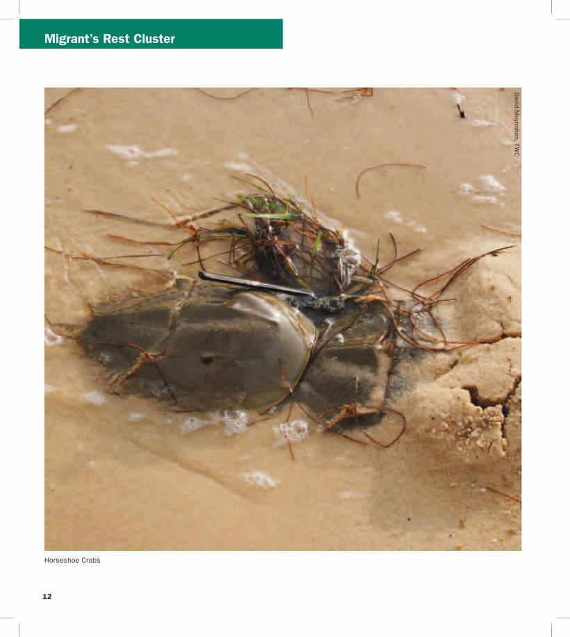
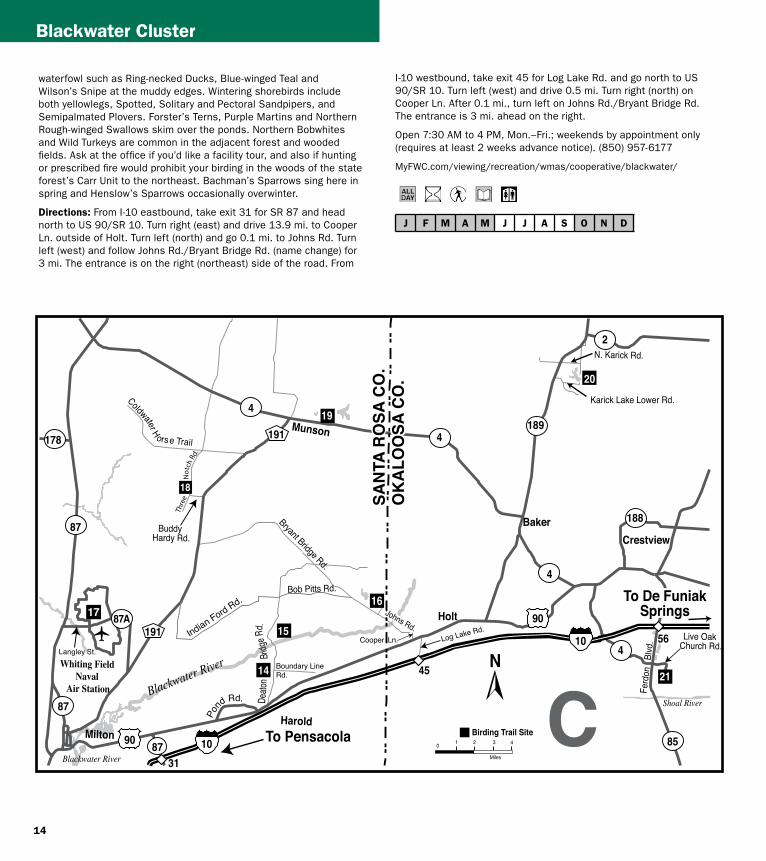
14
Blackwater Cluster
waterfowl such as Ring-necked Ducks Blue-winged Teal and Wilsonrsquos Snipe at the muddy edges Wintering shorebirds include both yellowlegs Spotted Solitary and Pectoral Sandpipers and Semipalmated Plovers Forsterrsquos Terns Purple Martins and Northern Rough-winged Swallows skim over the ponds Northern Bobwhites and Wild Turkeys are common in the adjacent forest and wooded fields Ask at the office if yoursquod like a facility tour and also if hunting or prescribed fire would prohibit your birding in the woods of the state forestrsquos Carr Unit to the northeast Bachmanrsquos Sparrows sing here in spring and Henslowrsquos Sparrows occasionally overwinter
Directions From I-10 eastbound take exit 31 for SR 87 and head north to US 90SR 10 Turn right (east) and drive 139 mi to Cooper Ln outside of Holt Turn left (north) and go 01 mi to Johns Rd Turn left (west) and follow Johns RdBryant Bridge Rd (name change) for 3 mi The entrance is on the right (northeast) side of the road From
I-10 westbound take exit 45 for Log Lake Rd and go north to US 90SR 10 Turn left (west) and drive 05 mi Turn right (north) on Cooper Ln After 01 mi turn left on Johns RdBryant Bridge Rd The entrance is 3 mi ahead on the right
Open 730 AM to 4 PM MonndashFri weekends by appointment only (requires at least 2 weeks advance notice) (850) 957-6177
MyFWCcomviewingrecreationwmascooperativeblackwater
J F M A M J J A S O N D
Milton
CrestviewBaker
Harold
Holt
Munson
Blackwater River
Blackwater River
Shoal River
Johns Rd
Johns Rd
Bryant Bridge Rd
Buddy Hardy Rd
Live Oak Church Rd
N Karick Rd
Karick Lake Lower Rd
Ferd
on
Blvd
Bob Pitts Rd
Indian Ford Rd
Pond Rd
Cooper Ln Log Lake Rd
Boundary Line Rd
Deato
n
Br
idge R
d
Coldwater H o rs e Trail
Whiting Field Naval
Air Station
90
191
191
87
87
178
4
87
189
188
4
4
4
2
85
87A 90
56
45
3110
10
N
0 1 2 3 4
Miles
Birding Trail Site
To De FuniakSprings
To De FuniakSprings
To Pensacola
SAN
TA R
OSA
CO
O
KA
LOO
SA C
O
SAN
TA R
OSA
CO
O
KA
LOO
SA C
O
14
15
19
20
21
Thre
eN
otch
Rd
17
C
15
Blackwater Cluster
17 Naval Air Station Whiting Field Clear Creek Nature Trail
County Santa Rosa Nearest city Milton
Physical address Langley St Milton 32570
Coordinates 30707410deg N -87032045deg W
Gazetteer page 27 Size 80+ acres
As it descends through mixed pine-oak uplands this interesting 15-mile round-trip trail leads to a creek and associated wetland Listen for Red-breasted Nuthatches in fall in the uplands and Hermit Thrushes overwintering At the water Common Yellowthroats scold from brushy tangles and wading birds like Little Blue Herons and Least Bitterns are possible among the pitcher plants visible from the boardwalk This is part of a functioning military Naval Air Station and occasional noise from aircraft is to be expected Access may be limited during times of elevated homeland security levels so call in advance
Directions From Milton head north on SR 87 following signs to NAS Whiting Field Turn right (east) on CR 87ALangley St and explain at the security gate that you would like to visit Clear Creek Nature Trail Once through the gate follow NAS Whiting Field Dr to the trailhead parking area
Open dawn to dusk (850) 623-7602 wwwdodpiforgchecklistsnaswfhtm
J F M A M J J A S O N D
J F M A M J J A S O N D
J F M A M J J A S O N D
20
Blackwater River State Forest
Three Notch Rd (Hardy Rd to Coldwater Horse Trail)
County Santa Rosa Nearest city Milton
Physical address Three Notch Rd Milton 32570
Coordinates 30800828deg N -86950923deg W (south end) 30832354deg N -86942892deg W (north end)
Gazetteer page 27 Size 5 miles
This 5-mile stretch of Three Notch Rd offers easy safe roadside pulloffs with Red-cockaded Woodpecker (RCW) cavity trees ringed with white paint visible from the road RCWs are most easily seen in breeding season in the mornings when they emerge from their nest cavities to ferry food back to their waiting young Frequent prescribed fire keeps this habitat healthy so obey signs closing the area for this necessary management event Use caution on area clay roads which can be slippery when wet Also check trails north of Coldwater Horse Trail for RCWs if desired along the east and west sides of Three Notch Rd Seasonal hunting takes place at this GFBWT site please see page 55 for information on dates regulations and more
Directions From Milton take CR 191Munson Hwy north approx 14 mi to Buddy Hardy Rd Turn left (west) on Buddy Hardy Rd drive 07
18
mi and turn right (north) onto Three Notch Rd Drive towards the intersection with Coldwater Horse Trail pull off on shoulder as desired Trails criss-cross the area along Three Notch Rd and Coldwater Horse Trail from Coldwater Creek to Juniper Creek (south of SR 4 and west of CR 191) Coldwater Horse Trail leads eastward back to CR 191
Open dawn to dusk (850) 957-6140 wwwfl-dofcomstate_forestsblackwater_riverhtml
19 Blackwater River State Forest Bear Lake Loop Trail
County Santa Rosa Nearest city Baker
Physical address Bear Lake Rd Milton 32570
Coordinates 30855008deg N -86838233deg W
Gazetteer page 27 Size 200 acres
From the camping area hike the 4-mile trail that rings the lake watching for migrants like Ovenbirds and Swallow-tailed Kites in springtime Red-shouldered Hawks echo across the lake and Pied-billed Grebes dive hunting for fish Nearby uplands can be good for Chuck-willrsquos-widows and Wild Turkeys Take water and expect biting insects in warm weather The lake is popular with anglers in spring and fall There is no hunting on the trail or in the vicinity of the lake
Directions From Milton take CR 191Munson Hwy north to SR 4 in Munson Turn right (east) on SR 4 and proceed 20 mi to the entrance at Bear Lake Rd Turn left (north) the parking area is 06 mi ahead
Open dawn to dusk (850) 957-6140 wwwfl-dofcomstate_forestsblackwater_riverhtml
Blackwater River State Forest Karick Lake
County Okaloosa Nearest city Baker
Physical address N Karick Rd and Karick Lake Lower Rd Crestview 32531
Coordinates 30905009deg N -86656031deg W (upper entrance) 30894311deg N -86660076deg W (lower entrance)
Gazetteer page 28 Size 38 miles
Check these recreation areas for Bachmanrsquos Sparrows calling in the sandhills ducks and wading birds like Green Herons visible from
16
BlackwaterChoctawhatchee Clusters
the north access pier and songbirds like Yellow-throated Warblers and Red-eyed Vireos in the hardwoods around the lake A 38-mile loop trail circles around the lake traveling along sandhills gallberry midslopes and hardwood bottoms Pay attention to ecotones particularly those edges with hardwoods These can be good for migrants that prefer this habitat over drier sandhills Directions From Milton take CR 191Munson Hwy north to SR 4 in Munson and turn right (east) Follow SR 4 to its intersection with SR 189 in Baker and turn left (north) The south access (Karick Lake Lower Rd) is 8 mi ahead on the right The north access (N Karick Rd) is 08 mi farther north Open dawn to dusk (850) 957-6140 wwwfl -dofcomstate_forestsblackwater_riverhtml
J F M A M J J A S O N D
21Shoal River Wayside Par
(Bill Duggan Jr Park)
k
County Okaloosa Nearest city Crestview
Physical address 5999 SR 85 Crestview 32536
Coordinates 30698772deg N -86570501deg W
Gazetteer page 28 Size 55 acres
Freeport
Niceville
Valparaiso
Destin
GraytonBeach
Eglin Air Force Base
Choctawhatchee Bay
Choctawhatchee River
Gulf of Mexico
RockyBayou
Gulf of Mexico
Chat Holly Rd
John Sims Pkwy
Emerald Coast Pkwy
331
331
20
83
83A20
282
393
98
293
30
397
85
85285123
190
30
98
98
98
23
24
25
2726
28
N
0 1
Miles
2
Birding Trail Site
To PanamaCity
To Ft WaltonBeach
To DeFuniakSprings
D
Mad
iso
n St
W C
oll
ege
Blvd
OK
AL
OO
SA
CO
O
KA
LO
OS
A C
O
WA
LTO
N C
OW
ALT
ON
CO
O
KA
LO
OS
A C
O
WA
LTO
N C
O
30A83
283
30A
395
(toll)
17
J F M A M J J A S O N D
J F M A M J J A S O N D
23
J F M A M J J A S O N D
24
22
BlackwaterChoctawhatchee Clusters
Shoal River Wayside Park is worth a quick check for wading birds at the river and songbirds in the adjacent floodplain forest In this part of the Panhandle floodplain corridors along rivers like this create migrant highways through arid turkey oak and sand pine uplands Check the tree line and understory especially in spring migration for songbirds like Prairie Warblers and well camouflaged Veeries
Directions From I-10 south of Crestview take exit 56 for SR 85 Ferdon Blvd Go south for 18 mi Turn left (east) at Live Oak Church Rd and go 01 mi Turn right (southwest) and continue on Live Oak Church Rd for 01 mi Turn left (south) into the park
Open dawn to dusk (850) 689-5084 (850) 689-5772 wwwcookaloosaflus
Map D Choctawhatchee Cluster
Turkey Creek Park
County Okaloosa Nearest city Niceville
Physical address 340 John Sims Pkwy West Niceville 32578
Coordinates 30523676deg N -86497348deg W (main entrance) 30532812deg N -86502494deg W (Turkey Creek extension)
Gazetteer page 28 Size 075-mile boardwalk
Walk the scenic 075-mile boardwalk along tannic Turkey Creek through a river forest of titi maple cypress and bay Watch for Green Herons stalking minnows on low hanging branches over the water and Anhingas swimming in the creek Mississippi Kites are common in summer and songbirds like White-eyed Vireos breed here In warm weather visit on weekdays and early in the morning this is a popular swimming access and the revelry of swimmers riding inner tubes downstream can be disruptive to birding (albeit tempting to partake in) The boardwalk is ADA accessible but the city also provides rides on electric carts for the mobility impaired between 730 and 1100 AM on the first Wednesday of each month A second entrance for the North Turkey Creek Extension is located on W College Blvd which has a 900-ft boardwalk and a canoekayak launch
Directions From intersection of SR 20John Sims Pkwy East and SR 285N Partin Dr in Niceville drive west on SR 20 for 10 mi to Evans St Turn right (north) the park entrance is immediately on your left From the intersection of SR 190Valparaiso Pkwy and SR 397 John Sims Pkwy in Valparaiso go north on John Sims Pkwy for 13 mi across the bridge to Evans St Turn left (north) and immediately left again into the parking lot To access the new extension head east from the park on SR 20 to SR 85 Turn left (north) and go 09 mi to W College Blvd Turn left (west) and drive 06 mi past the hospital to the entrance on the left (south) side of the road
Open 630 AM to dark Tues - Sun North Turkey Creek Extension opens at 8 AM (850) 729-4062 wwwnicevilleorgturkeyhtml
Fred Gannon Rocky Bayou State Park
County Okaloosa Nearest city Niceville
Physical address 4281 SR 20 Niceville 32578
Gazetteer page 28 and 44 Size 346 acres
Coordinates 30495944deg N -86432791deg W
This waterfront park is located on Rocky Bayou in Choctawhatchee Bay Of its three trails Red Cedar and Rocky Bayou are more interesting for birds than Sand Pine Trail Walk the trails for migrants like Cedar Waxwings and Indigo Buntings check the trees in the campground area too The waterfront can offer vantages of diving ducks in winter Ospreys overhead and Spotted Sandpipers on rocky edges in winter The local Audubon chapter offers bird walks early on Friday mornings ndash call in advance for details Loaner optics and field guides are available
Directions From the intersection of SR 285 and SR 20 in Niceville drive approx 40 mi east on SR 20John Sims Pkwy The entrance to the park is on the left (north) side after crossing Rocky Bayou Bridge
Open year round 8 AM to sundown (850) 833-9144 wwwfloridastateparksorgrockybayou
Henderson Beach State Park
County Okaloosa Nearest city Destin
Physical address 17000 Emerald Coast Pkwy Destin 32541
Coordinates 30386928deg N -86447520deg W
Gazetteer page 44 Size 221 acres
Henderson Beach State Park offers nice beachfront for specialties like Snowy Plovers Least Terns American Oystercatchers and more Take care not to disturb beach-nesting birds which are often cryptic and blend easily with the sand they nest upon A nature trail by the beach access points winds through a small coastal hammock in a stretch of coastline where little of this important habitat remains Watch for migrant songbirds here in spring and raptors making landfall or following the duneline in April and October The campground has some nice trees worth checking as access allows ask for permission at the entrance gate and be considerate of campers This site gets busy in warm weather Loaner optics and field guides are available
Choctawhatchee Cluster
J F M A M J J A S O N D
J F M A M J J A S O N D
26
J F M A M J J A S O N D
Directions From the intersection of SR 293Danny Wuerffel Way (toll bridge) and US 98SR 30Emerald Coast Pkwy east of Destin drive 15 mi west on US 98 to the park entrance on the left (south) side of the highway
Open year round 8 AM to sundown (850) 837-7550 wwwfloridastateparksorghendersonbeach
25 Topsail Hill Preserve State Park
County Walton Nearest city Sandestin
Physical address 7525 W County Hwy 30A Santa Rosa Beach 32459
Coordinates 30371282deg N -86272744deg W (main entrance) 30375556deg N -86299507deg W (Topsail Rd entrance)
Gazetteer page 45 Size 1643 acres
Topsail Hill Preserve State Park offers inland trails through coastal scrub and past rare coastal dune (freshwater) lakes The 25-mile Morris Lake Trail is slightly more productive than the Campbell Lake Trail although either will yield Eastern Bluebirds Eastern Kingbirds Red-headed Woodpeckers and Brown-headed Nuthatches to name a few Check the beachfront for gulls and Sandwich Least and Royal Terns Snowy Plovers nest here and shorebirds ply the shoals near the outfall for Morris Lake at the Gulf Scope the surf for Common Loons Horned Grebes and Northern Gannets winter through spring The beach is heavily visited in warm weather so plan accordingly Educational programs are offered call for details
Directions From the intersection of SR 293Danny Wuerffel Way (toll bridge) and US 98SR 30Emerald Coast Pkwy east of Destin drive 85 mi east on US 98 and turn right (southeast) on CR 30A the entrance is approx 02 mi on the right (west) side of the road A second entrance is located on Topsail Rd at US 98 14 mi west of the intersection with CR 30A Use this entrance for direct access to the Morris Lake and Campbell Lake Trails (call ahead as entrance may be closed if road is flooded)
Open year round 8 AM to sundown (850) 267-8330 wwwfloridastateparksorgtopsailhill
Grayton Beach State Park
County Walton Nearest city Point Washington
Physical address 357 Main Park Rd Santa Rosa Beach 32459
Coordinates 30334117deg N -86158050deg W
Gazetteer page 45 Size 2227 acres
Grayton Beach State Park is very popular with beachgoers in warm weather but in cooler months is worth checking On the north side of CR 30A the 42-mile Grayton Beach Hike and Bike Trail runs through pine flatwoods and along the north end of Western Lake (a brackish coastal dune lake) which can be good for wading birds Bald Eagle Barred Owl Brown-headed Nuthatch Pied-billed Grebe and more For longer hikes the Lake Loop Trail connects to Point Washington State Forestrsquos (site 27) extensive trail system Donrsquot miss the 1-mile interpretive Grayton Beach Nature Trail which begins at the beach parking area As it winds through sand dunes and under a sand live oak canopy look for Savannah Sparrow Eastern Towhee and Orange-crowned Warbler an additional loop also runs through pine flatwoods (listen for Eastern Bluebird) and along the southern end of Western Lake (check for Common Loon in winter) The beachfront offers plovers terns and gulls (Bonapartersquos in winter) and plunging gannets out to sea October through March As with all coastal sites watch for raptors cruising the beachfront and migrants arriving off the Gulf in spring Loaner optics and field guides are available
Directions From the intersection of US 98 and US 331 east of Destin drive east approx 15 mi and then turn right (south) on CR 283 Follow CR 283 for 17 mi to CR 30A and turn left (east) the entrance is on the right (south) side after 05 mi
Open year round 8 AM to sundown (850) 267-8300 wwwfloridastateparksorggraytonbeach
27 Point Washington State Forest
County Walton Nearest city Point Washington
Physical address S CR 395 Santa Rosa Beach 32459
Coordinates 30342148deg N -86131466deg W
Gazetteer page 45 Size 15131 acres
Point Washington State Forest offers 3- 5- and 10-mile hiking loops through longleaf pine flatwoods coastal scrub and sandhills Bachmanrsquos Sparrows are very likely to be heard singing in spring in areas of wiregrass and palmetto in the southern half of the 3-mile loop The eastern boundary of this loop crosses the west arm of Peach Creek where you can listen for songbirds and watch for Red-shouldered Hawks Cooperrsquos Hawks occasion the flatwoods and Eastern Towhees and Common Yellowthroats are abundant Trail system connects to Grayton Beach State Park (site 26) for
18
19
De Funiak Springs
331
9090
280A
183
183
81
10
183
280
83
181
181A
81
331
10
ToMarianna
To Freeport
ToCrestview
N
0 1
Miles
2
29
E85
96
Birding Trail Site
Rest Area
WA
LTO
N C
O
WA
LTO
N C
O
HO
LMES
CO
H
OLM
ES C
O
WA
LTO
N C
O
HO
LMES
CO
Directions From the intersection of US 331SR 83 and SR 20 in Freeport the entrance is 16 mi west on the south side of SR 20 (past Tucker Town Rd)
Open dawn to dusk (850) 835-2822 wwwfreeportfl oridagov
J F M A M J J A S O N D
Map EDogwood Cluster
29 Ponce de Leon Springs State Park
County Holmes Nearest city Ponce de Leon
Physical address 2860 Ponce de Leon Springs Rd Ponce de Leon 32455
Coordinates 30722979deg N -85930385deg W
Gazetteer page 30 Size 420 acres
Worth checking in migration this sitersquos real strength is wintering birds especially those at the southernmost limit of their range Birds like Brown Creeper and Golden-crowned Kinglet are possible at this site your chances improve with your ability to identify birds by sound Hike both short trails ndash Spring Run and Sandy Creek ndash stopping to
extended birding adventures Seasonal hunting takes place at this GFBWT site please see page 55 for information on dates regulations and more
Directions From the intersection of US 98 and US 331 east of Destin drive east approx 30 mi and turn right (south) on CR 395 Trailhead parking is 11 mi on the left (east) side of the road
Open dawn to dusk (850) 267-8325 wwwfl -dofcomstate_forestspoint_washingtonhtml
J F M A M J J A S O N D
28 Harry A Laird Sr City Park
County Walton Nearest city Freeport
Physical address SR 20 E Freeport 32439
Coordinates 30501614deg N -86145701deg W
Gazetteer page 29 and 45 Size 13 acres
This small wayside park has a brief boardwalk along a creek lined with hardwoods The area is worth checking in migration only for songbirds like waterthrushes and Worm-eating and Hooded Warblers Weekend afternoons can be busy with picnickers and playground visitors but weekdays are left for you and the birds
ChoctawhatcheeDogwood Clusters
DogwoodKentucky Warbler Clusters
listen carefully in the shady hardwood forest This park can be busy with swimmers in warm weather so weekday and early morning birding may prove the most rewarding
Directions From I-10 east of De Funiak Springs take exit 96 and head north on SR 81 for 10 mi Turn right (east) onto US 90SR 10 after 02 mi then turn right (south) again onto CR 181A the entrance is 05 mi on the right (west) side of the road
Open year round 8 AM to sundown (850) 836-4281 wwwfloridastateparksorgponcedeleonsprings
J F M A M J J A S O N D
30
J F M A M J J A S O N D
J F M A M J J A S O N D
Map F Kentucky Warbler Cluster
Falling Waters State Park
County Washington Nearest city Chipley
Physical address 1130 State Park Rd Chipley 32428
Coordinates 30731352deg N -85529023deg W
Gazetteer page 31 Size 173 acres
Falling Waters State Park makes for a nice hour-long hike exploring the sinkholes waterfalls lake and surrounding uplands via the Wiregrass and Sinkhole trails Watch for Red-headed Woodpeckers in the uplands and migrant songbirds like Gray-cheeked Thrushes in the leafy understory of dogwood and azalea beneath the magnolia and white oaks As always when in this part of northwest Florida northern species like Dark-eyed Juncos are possible in winter Check for ducks and waders at the lake edge Scan the butterfly garden for resident and migratory butterflies
Directions From I-10 east of De Funiak Springs take exit 120 and head south on SR 77 After 08 mi turn left (east) onto CR 77A State Park Rd the entrance is 17 mi ahead (road dead ends into park)
Open year round 8 AM to sundown (850) 638-6130 wwwfloridastateparksorgfallingwaters
31
32
Florida Caverns State Park
County Jackson Nearest city Marianna
Physical address 3345 Caverns Rd Marianna 32446
Coordinates 30808352deg N -85212422deg W
Gazetteer page 32 Size 1279 acres
Florida Caverns State Park has some of the best-preserved uplands in northwest Florida as well as mixed-hardwood swamps lining the drainage basin of the Chipola River Known for northern species like Red-breasted Nuthatches (in pine forest) and Winter Wrens this site is ideal for birding with miles of remote trails Access both the Fish Hatchery Loop Trails and the Pine Island Loop Trails from the Blue Hole Swimming Area Keep in mind that the Management Trail (part of the Pine Island system) runs north into the Upper Chipola Wildlife Management Area where hunting seasons will be in effect Cave tours are available at regular intervals and fill quickly An onsite canoe concession allows you to access the Upper Chipola River Water Management Area (site 32) Butterflying is best here in late summer and early fall Check near the visitor center for the Silvery Checkerspot which in Florida occurs only in Jackson County The picnic areas and roadsides have a diversity of swallowtails and sulphurs
Directions From US 90SR 10 in Marianna head north on SR 166 CR 167Jefferson St (becomes Caverns Rd) the entrance is 27 mi on the left (west) side of the road
Open year round 8 AM to sundown (850) 482-9598 wwwfloridastateparksorgfloridacaverns
Upper Chipola River Water Management Area
County Jackson Nearest city Marianna
Physical address 3345 Caverns Rd Marianna 32446
Bumpnose RdChristoff Ferry Lndg Marianna 32446
Caverns Rd at Chipola River bridge Marianna 32446
Coordinates 30808352deg N -85212422deg W (park entrance)
30850068deg N -85259576deg W (Christoff Ferry Landing)
30792445deg N -85222941deg W (bridge)
Gazetteer page 32 Size 7377 acres
For the more intrepid explorer this rustic river is kept clear enough of obstructions to make a nice day of paddling and birding Launch from Florida Caverns State Park (site 31) and paddle upriver toward Christoff Ferry Landing on the Upper Chipola River Water Management Area where the river forks at the confluence with Waddells Mill Creek When yoursquore done paddling float back watching for brilliant Prothonotary Warblers and Limpkins lurking along the shore Take water and a map and allow enough time to return before the park closes at dusk Christoff Ferry Landing on Bumpnose Rd is
20
21
CR 77A (State
Park Rd)
Cav
erns
Rd
Marianna
Chipley
77
273
77
277
71276A
73
73
71
90
231
231
167
164
276
167
162
169
277
276
164
195
276 276
10
75
75
90 10
10 10
HO
LMES
CO
30
31
N
0 1
Miles
2
F
To DeFuniak Springs
To Panama City
To Alabama
To Tallahassee
120 130 136
142
Jeffe
rson
St
32B
32A
Bumpnose Rd
WA
SHIN
GTO
N C
O
JAC
KSO
N C
O
WA
SHIN
GTO
N C
O
JAC
KSO
N C
O 133
Chipola River
Pen
nsyl
vani
aA
ve
Birding Trail Site Rest Area
166
Kentucky Warbler Cluster
Danny Bales
Kentucky Warbler
Kentucky WarblerIndigo Bunting Clusters
J F M A M J J A S O N D
33
J F M A M J J A S O N D
34
J F M A M J J A S O N D
35
another launch site but because of its secluded location the state park is a better choice You may also launch from the south end of the Chipola River bridge on SR 166CR 167Caverns Rd Seasonal hunting takes place at this GFBWT site please see page 55 for information on dates regulations and more
Directions The boat launch site is within Florida Caverns State Park from US 90 in Marianna head north on SR 166CR 167Jefferson St (becomes Caverns Rd) the entrance is approx 27 mi on the left (west) side of the road Paddle upriver toward Christoff Ferry Landing (B) To reach Christoff Ferry Landing from Marianna head west on US 90 to Pennsylvania Ave Turn right (north) and drive 52 mi (name soon changes to Bumpnose Rd) Turn right (east) the launch site is 03 mi ahead
Open dawn to dusk (850) 482-9522 (850) 539-5999 wwwnwfwmdstateflusrecreationchipolariverhtm
Map G Indigo Bunting Cluster
Pitts Spring Recreation Area
County Bay Nearest city Youngstown
Physical address Econfina Creek Landing Youngstown 32466
Coordinates 30431468deg N -85545768deg W
Gazetteer page 47 Size 10 acres
This site is part of the 41000-acre Econfina Creek Water Management Area As a popular swimming hole Pitts Spring can be busy on warm afternoons but in early mornings or on colder days it offers a nice access to slopefloodplain forest popular with songbirds like Wood Thrushes and Kentucky Warblers The entrance gate to the small parking area is open daily April through September and on weekends and holidays October through March However interested users are welcome to park outside the gate and enter on foot to enjoy the trails in the immediate area of the spring Opposite the spring is a launch point to canoe Econfina Creek Nearby canoe concessionaires can offer advice on routes and creek conditions like many Panhandle creeks the Econfina can be fast flowing and challenging with occasional obstructions that may require portages
Directions From US 231 in Fountain (northeast of Panama City) drive 20 mi south and turn right (west) on SR 20 the entrance is approx 82 mi ahead on the right (north) side of the highway at Econfina Creek Landing From Panama City head northeast on US 231SR 75 to CR 2301Blue Springs Rd Turn left (north) and go 130 mi to SR 20 Turn left (west) and go 07 mi Turn right (north) immediately past the bridge onto Econfina Creek Landing
Open 9 AM to 7 PM daily Apr-Sept weekends and holidays only OctshyMar (850) 539-5999 wwwnwfwmdstateflus
Pine Log State Forest
County Bay Nearest city Ebro
Physical address 5583 Longleaf Rd Ebro 32437
Coordinates 30423912deg N -85881046deg W
Gazetteer page 46 Size 6911 acres
Although there are 13 miles of hiking trails at this state forest the most rewarding birding at this site is via the Campground Loop and Dutch Tiemann Trails accessed from the camping area The former is marked with red blazes and hugs the cypress margin of a lake for approx 2 miles Watch for nesting Pileated Woodpeckers and Prothonotary Warblers as well as ducks on the lake in winter The Dutch Tiemann Trail is 6 miles long and stretches south through pinewoods good for Great Crested Flycatchers and Great Horned Owls down to Pine Log Creek and back north to the campground Take water and sunscreen bugs may be prohibitive in warm weather Seasonal hunting takes place at this GFBWT site please see page 55 for information on dates regulations and more
Directions From the intersection of US 98 and and SR 79 west of Panama City drive north on SR 79 for 141 mi Turn left (west) on Environmental Rd approx 10 mi before Ebro After 03 mi make the first right (go north) on Long Leaf Rd and enter the Sand Pine Recreation Area Park at the campground
Open dawn to dusk (850) 535-2888 wwwfl-dofcomstate_forestspine_loghtml
Camp Helen State Park
County Bay Nearest city Inlet Beach Laguna Beach
Physical address 23937 Panama City Beach Pkwy Panama City Beach 32413
Coordinates 30275428deg N -85990431deg W
Gazetteer page 46 Size 183 acres
Two miles of loop trails are available at this park The main trail starts at the Rainbow Cottages runs south across a footbridge then loops through a coastal live oak hammock and dune system A path from the looprsquos south end leads to beachfront where Black Terns are
22
23
Laguna BeachLynn Haven
Panama City Beach Panama City
Parker
Ebro
Tyndall Air Force Base
Econ
fina
Cree
k
Intracoastal Waterway
Gulf of Mexico
Environmental Rd
Lake Dr
Hilltop Ln
Hathaway Bridge
Beck Ave
10th St
Beach Dr
23rd St
11th St
19th St
Fran
kfor
d Av
e
BaldwinRd
77
77
388
79
792081
7998
98
2230
22ABUS
98
231
77
20
20
390
389
391
388
75
231
30
ALT
98
2301
2321
2302
2315
390
39
392
3031
WASHINGTON CO BAY CO
WA
LTO
N C
O 34
33
39
38
36
37
35
To Fountain
To PortSt Joe
To Freeport
To Destin
N
0 1
Miles
2
Birding Trail SiteG
Lake PowellWest Bay
StAndrew
Bay
Indigo Bunting Cluster
Indigo Bunting Cluster
J F M A M J J A S O N D
36
J F M A M J J A S O N D
37
J F M A M J J A S O N D
38
possible in summer Black-bellied and Piping Plovers in winter Least Terns and Snowy Plovers have nested in the park A spur trail runs from the looprsquos east side to Lake Powell one of the largest coastal dune lakes in Florida Coastal dune lakes are rare and in the US occur only on the Gulf Coast Salt and freshwater mixing at this inlet offers productive feeding for terns year-round and wintering ducks like Redheads
Directions The entrance is on the south side of US 98 70 mi west of SR 79N Arnold Rd on the west side of the Phillips Inlet bridge
Open year round 8 AM to sundown (850) 233-5059 wwwfloridastateparksorgcamphelen
St Andrews State Park
County Bay Nearest city Panama City Beach
Physical address 4607 State Park Ln Panama City 32408
Coordinates 30135113deg N -85742506deg W
Gazetteer page 46 Size 1169 acres
Scan the Gulf from the end of the fishing pier on the peninsularsquos south (Gulf) side for Brown Pelicans Least Terns and gulls in warmer months and gannets plunging near the shore in winter At the peninsularsquos east end beaches north of the jetty fishing area are productive for shorebirds like Snowy Plovers and Willets Black Skimmers occasionally loaf here Gator Lake hosts a heron rookery in spring (Great Blue Herons Great and Snowy Egrets) Check the Buttonbush Marsh Overlook adjacent to the boat parking for Least Bitterns and Wood Ducks Pine flatwoods throughout are home to Brown Thrashers Loggerhead Shrikes and Eastern Towhees
Directions In Panama City take US 98 west across the Hathaway Bridge to CR 3031Thomas Dr and turn left (south) Follow CR 3031 to its end at the intersection with CR 39 and CR 392 Bear left (straight) onto CR 39State Park Ln the site entrance is ahead
Open year round 8 AM to sundown (850) 233-5140 wwwfloridastateparksorgstandrews
St Andrews Bird Trail Oaks By the Bay Park
County Bay Nearest city Panama City
Physical address 2701 W 10th St Panama City 32401
Coordinates 30167245deg N -85701504deg W
Gazetteer page 46 Size 5 acres
Particularly rewarding for beginners this small marina is worth a quick stop if yoursquore in the area The waterfront boardwalk (west-facing) has a series of educational signs on the arearsquos more common birds like Double-crested Cormorants Brown Pelicans herons and egrets The boardwalk ends at Oaks By the Bay Park to the south where oaks can be attractive for warblers in April and October A dune walkover here provides access to the beachfront for chance encounters with shorebirds like yellowlegs and Dunlin as well as terns diving ducks and loons on the bay in winter
Directions From US 98 in Panama City head south on Beck Ave to its intersection with 10th St Park your vehicle at Oaks By The Bay Park (directly across 10th St from this intersection) or turn right (west) on 10th St and park at St Andrews Marina
Open daily dawn to dusk (850) 872-7208 wwwhistoricstandrewscombusiness-district wwwpcgovorg
Lynn Haven Sports Complex and Nature Trail
County Bay Nearest city Lynn Haven
Physical address 2201 Recreation Dr Panama City 32405
Coordinates 30229328deg N -85615548deg W
Gazetteer page 47 Size 60 acres
This complex of ball fields yields more birds than you might think due in large part to the adjacent lake and nature trail On the lake on the east side of the complex check for wintering ducks like Ring-necked and Lesser Scaup a Rossrsquos Goose has wintered here recently Next follow the trail east of the lake along the boardwalk through a small bayhead Some large trees in this mature wetland hammock make for interesting flocks of migrants in October and April Brushy areas north of the lake and on the west and south perimeters of the complex may be good for wintering sparrows Loaner optics and field guides are available
Directions From the intersection of CR 390 and US 231SR 75 in Lynn Haven drive west on CR 390 for 22 mi to Hilltop Ln Turn left (south) at the end of Hilltop Ln turn left (east) onto Recreation Dr Park at the lake on the east side of the complex
24
25
Larry Lynch
Wilsonrsquos Plover
Open 24 hoursday (850) 271-5547 wwwcityoflynnhavencomleisuresportscomplexhtm
J F M A M J J A S O N D
39 Parker Environmental Exploratorium Park
County Bay Nearest city Panama City
Physical address 4700 Lake Dr Panama City 32404
Coordinates 30134811deg N -85606771deg W
Gazetteer page 47 Size 5 acres
This delightful little town park offers a waterfront pier with views of Ospreys Yellow-crowned Night-Herons Purple Martins and Least
Indigo Bunting Cluster
Terns among others Walk the parkrsquos brief trail for more common woodland species such as Carolina Wrens White-throated Sparrows Chimney Swifts and Great Crested Flycatchers A butterfly garden on site is worth checking for occasional Ruby-throated Hummingbirds as well as butterflies like buckeyes and Gulf Fritillaries
Directions From the intersection of US 98 and SR 22 east of Panama City drive south on US 98 for 125 mi to Lake Dr and turn right (west) The parking lot at Martin Lake is 09 mi ahead
Open dawn to dusk (850) 871-4104 wwwdcastateflusfctparks
Indigo Bunting Cluster
J F M A M J J A S O N D
Cape Cluster
Danny B
ales
40
J F M A M J J A S O N D
41
J F M A M J J A S O N D
42 St Vincent National Wildlife Refuge
Baltimore Oriole
Map H Cape Cluster
St Joseph Bay State Buffer Preserve Deal Tract
County Gulf Nearest city Port Saint Joe
Physical address Cape San Blas RdCR 30E Port Saint Joe 32456
Coordinates 29683711deg N -85367049deg W
Gazetteer page 59 Size 200 acres
Located on the bay side of St Joseph Peninsula this parcel offers a casual hike through sand pine scrub to a fork in the trail To the right follow the trail to a large tower and dock overlooking St Joseph Bay where you can scope for ducks on the bay shorebirds along the edges and raptors migrating in October To the left at the fork the trail leads to a hardwood hammock with potential for spring songbird migrants like Hooded Warblers Remember migrants in this part of the state can make landfall after 11 AM so donrsquot abandon a site too early Biting insects can be fierce and the trails offer little shade bring insect repellent and drinking water
Directions From Port St Joe take US 98US 319SR 30 east (head south) approx 2 mi Turn right (south) on SR 30A drive 67 mi and turn right (west) on SR 30ECape San Blas Rd the entrance and parking are 41 mi on the right (east) side of the road
Open dawn to dusk (850) 229-1787 wwwdepstatefluscoastalsites
St Joseph Peninsula State Park
County Gulf Nearest city Port Saint Joe
Physical address 8899 Cape San Blas Rd Port Saint Joe 32456
Coordinates 29745276deg N -85395412deg W
Gazetteer page 59 Size 2716 acres
Because of its peninsular shape and position sheltering a large stretch of coastline from the Gulf this property is a remarkable migratory hotspot for raptors songbirds and even butterflies and dragonflies in fall Hike the spring beaches for Snowy and Piping Plovers (with caution not to disturb them) watch for gannets plunging offshore in fall and winter and loons cormorants and ducks wintering in the surf and bay Check the interior of the peninsula for songbird migrants like Black-throated Blue and Chestnut-sided Warblers making landfall in April Raptors like Broad-winged Hawks and Swallow-tailed Kites start arriving off the Gulf in late Feb and March Canoe concessionaires are available outside the park Permits are available for after-hours access camping is allowed by reservation Loaner optics and field guides are available
Directions From Port St Joe take US 98US 319SR 30 east (head south) approx 2 mi Turn right (south) on SR 30A drive 67 mi and turn right (west) on SR 30E the entrance is 85 mi ahead
Open 8 AM to sundown (850) 227-1327 wwwfloridastateparksorgstjoseph
County Franklin Nearest city Port Saint Joe
Physical address Indian Pass RdCR 30B Port Saint Joe 32456
Coordinates 29683374deg N -85222347deg W
Gazetteer page 60 Size 12358 acres
This extremely rustic refuge is under-birded in large part because it takes some effort to access it Cross Indian Pass either by the private ferry or with your own boat This barrier island is very large prepare to hike the extensive sand roads or bring a bike Be sure to pick up a map at the refuge office in Apalachicola at the Indian Pass boat ramp or download one online and donrsquot forget water and bug spray Never fear though your hard work will be repaid Seaside Sparrows populate the salt marsh on the east side of the island Interior wetlands host Least Bitterns and ducks fodder for Peregrine Falcons and other raptors in migration American Oystercatchers and a variety of plovers nest on the beach (please respect areas closed for their protection) and the islandrsquos hammocks are a haven for returning songbird migrants in March and April Three- to four-day hunts in fall and winter close the island to other uses please see page 55 for information on dates regulations and more
26
27
Cape Cluster
Port St Joe
HowardCreek
MexicoBeach
Gulf of Mexico
St Joseph Bay
Apalac
hicola
Bay
St Vincent Sound
Murphy Rd O
ld Millville Rd
Whit
e Ci
ty R
d
98
98
98
71
387
30
30E 30
30
71
30A
386387
381
41
40
42
43
N
0 1
Miles
2
Birding Trail Site
BAY CO
GULF CO
FRA
NK
LIN
CO
St Vincent Island
To Apalachicola
To Panama City
H
30B
Lake Wimlico
CapePitcher Plant amp Peregrine Clusters
J F M A M J J A S O N D
J F M A M J J A S O N D
44
J F M A M J J A S O N D
Directions From Airport Rd in Apalachicola take US 98US 319 SR 30 west for 53 mi and turn left on CR 30 at the fork Drive 98 mi and turn left (south) on CR 30BIndian Pass Rd in Indian Pass Follow the road east for 29 mi to the ferry site at the end of the road
Open dawn to dusk (850) 653-8808 wwwfwsgovsaintvincent
43 Apalachicola River Wildlife and Environmental Area Old Agricultural Fields
County Gulf Nearest city Wewahitchka Port Saint Joe
Physical address S Murphy Rd Wewahitchka 32465
Coordinates 29890676deg N -85069347deg W
Gazetteer page 60 Size 2150 acres
This part of the Wildlife and Environmental Area lies on the riverrsquos west side and includes roughly 1100 acres of old agricultural fields mown and planted for hunting deer turkey and quail The same management techniques that benefit these species also make the area prime for sparrows including the usual Swamp Song and Savannah plus the less common White-throated White-crowned Field Vesper and Grasshopper among others Mississippi and Swallow-tailed Kites feast on insects above the fields in summer Southeastern American Kestrels Cooperrsquos Hawks and Red-tailed Hawks hunt here year round The best plan of attack get a map at the office on the way in and drive Tram Boggy Branch Bean Field Palmetto and Indian Roads Feel free to park on the roadside and walk the fields for sparrows Ephemeral wetlands throughout the area are worth checking for wintering waterfowl also A recreation guide for the ARWEA is available ndash call (850) 488-8755 or order one at MyFWCcom Seasonal hunting takes place at this GFBWT site please see page 55 for information on dates regulations and more
Directions From US 98US 319SR 30 in Port St Joe take SR 71 north for 93 mi and turn right (east) on CR 387Doc Whitfield Rd Drive 82 mi and turn right (south) on Murphy Rd in Howard Creek the FWC office (06 mi ahead on the lefteast side of the road) can provide maps of area roads
Open dawn to dusk (850) 827-2934 MyFWCcomviewingrecreationwmasleadapalachicola-river
Map I Pitcher Plant amp Peregrine Cluster
St George Island State Park
County Franklin Nearest city St George Island
Physical address 1900 E Gulf Beach Dr St George Island 32328
Coordinates 29684697deg N -84795493deg W
Gazetteer page 61 Size 2023 acres
St George Island State Park is regularly rated one of Floridarsquos most beautiful beaches but what all the beachgoers donrsquot realize is that it has spectacular birdwatching too Bonapartersquos Gulls are reliable from winter to spring Snowy Plovers and American Oystercatchers nest here and Gull-billed Terns cruise the beach in summer Northern Gannets dive for fish offshore October through April and spring migrants like Swallow-tailed Kites Common Nighthawks and Green Herons can be seen arriving off the ocean in March and April The sandhill trail from the camping area and the oaks surrounding the youth camp are both excellent spots for migrant songbirds like Blue Grosbeaks and Scarlet Tanagers in April Therersquos something to see year-round but birding is best and beach visitor numbers are lowest October through April
Directions From US 98US 319SR 30 in Eastpoint take SR 300 Island Drive south for 56 mi across the bridge to St George Island Turn left (east) on CR 300Gulf Beach Dr the park entrance is 43 mi ahead
Open year round 8 AM to sundown (850) 927-2111 wwwfloridastateparksorgstgeorgeisland
45 Apalachicola National Estuarine Research Reserve Unit 4
County Franklin Nearest city St George Island
Physical address E 6th St St George Island 32328
Coordinates 29670753deg N -84851869deg W
Gazetteer page 60 Size 75 acres
This small preserve on the sound side of St George Island is a nice companion to the larger more well-known migrant fallout site at St George Island State Park (site 44) Unmarked trails leading off from the parking area at the end of 6th St wind through a coastal pine forest and give vantages of the sound and shoreline Watch for shore- and seabirds like Royal Terns American Oystercatchers and Laughing Gulls as well as migrants moving through Common Nighthawks Scarlet Tanagers Baltimore Orioles and Swallow-tailed Kites all pass
28
29
Sumatra
Eastpoint
CarrabelleBeach
Apalachicola
FortGadsden
Gulf of Mexico
St George Sound
Tatersquos Hell Swamp
Tatersquos Hell State Forest
Apalachicola National Forest
Apalachicola Bay
Apal
achi
cola
Riv
er
Pine Ave
6th St
Bloody Bluff Rd
TowerRd
Brickyard
RdF R 129
WrightLake Rd
FR 101
Fort Gadsden Rd
SW 8th St
Gulf Beach Dr
FR 180
FR
123
65
98
98
65
65
319
30
65
655
37922
LIBERTY COFRANKLIN COGULF CO
4544
48
46
46
47
49
50
52
53
54
N
0 1
Miles
2
Birding Trail Site
To Bristol
To PortSt Joe
To Carrabelle
I
San
d B
each
Rd
Deep Creek Rd
Tow
er R
d
FR 22
51
New
Riv
er
John
Alle
n R
d
300
300
Pitcher Plant amp Peregrine Cluster
Pitcher Plant amp Peregrine Cluster
through coastal areas like these as they arrive off the Gulf each spring Come prepared with insect repellent and drinking water
Directions From US 98US 319SR 30 in Eastpoint take SR 300 Island Drive south for 56 mi across bridge to St George Island Turn left (east) on CR 300Gulf Beach Dr and go 08 mi to 6th St Turn left (north) and go 02 mi to the end Look for a gravel road and small gazebo at the site entrance
Open dawn to dusk (850) 670-4783 nerrsnoaagov wwwdepstatefluscoastalsitesapalachicola
J F M A M J J A S O N D
Tatersquos Hell State Forest 46 High Bluff Coastal Hiking Trail
County Franklin Nearest city CarrabelleEastpoint
Physical address 2381 W US 98 Carrabelle 32322 (east entrance) 2985 W US 98 Eastpoint 32328 (west entrance)
Coordinates 29808446deg N -84728881deg W (east entrance) 29788651deg N -84766344deg W (west entrance)
Gazetteer page 61 Size 4 miles
Catch a glimpse of the vast 202437-acre Tatersquos Hell State Forest on this scenic trail From either parking area on US 98 a nature trail leads 4 miles through sand pine scrub good for Brown-headed Nuthatches Red-bellied Woodpeckers and Eastern Towhees year-round Listen for Yellow-breasted Chats and Orchard Orioles singing in springsummer In migration Summer and Scarlet Tanagers can be found in the pines Bald Eagles have nested northeast of the eastern parking area so watch for flyovers A nice spot for a hike worth checking in migration Florida Black Bears live within the forest look for tracks and other signs along the trail Seasonal hunting takes place at this GFBWT site please see page 55 for information on dates regulations and more
Directions From the intersection of CR 67 and US 98US 319SR 30 in Carabelle (east end of bridge) drive west on US 98 for 47 mi the trailhead entrance and eastern parking area are on the right (north) side of the road The eastern parking area is 32 mi west of the intersection of US 98 and Gulf Beach Rd in Carrabelle Beach The western trailheadparking area is 27 mi further west (south) From Eastpoint travel east on US 98 the western entrance is 46 mi east of the intersection with SR 65
Open dawn to dusk (850) 697-3734 wwwfl-dofcomstate_foreststates_hellhtml
J F M A M J J A S O N D
Apalachicola River Wildlife and 47 Environmental Area Cash Bayou
County Franklin Nearest city Eastpoint
Physical address SR 65 Eastpoint 32328
Coordinates 29819334deg N -84850006deg W
Gazetteer page 61 Size 100 acres
If yoursquore traveling between Sumatra and Eastpoint itrsquos worth taking a moment to pull off at the edge of Cash Bayou to take in the scenery scan for waterbirds like Bald Eagles and American Bitterns and check the brief trails for songbirds Better yet launch your canoe or kayak from this landing and bird the bayou by boat A recreation guide for the ARWEA is available ndash call (850) 488-8755 or order one at MyFWCcom Seasonal hunting takes place at this GFBWT site please see page 55 for information on dates regulations and more
Directions From US 98US 319SR 30 in Eastpoint drive east to SR 65 Turn left (north) and go 46 mi Though not well-marked you may park on the left (southwest) side of SR 65 just before the bridge
Open dawn to dusk (850) 827-2934 MyFWCcomviewingrecreationwmasleadapalachicola-river
J F M A M J J A S O N D
Apalachicola River Wildlife and 48 Environmental Area Sand Beach Tower
and Area Roads County Franklin Nearest city Eastpoint
Physical address Sand Beach Rd Eastpoint 32328
Coordinates 29784001deg N -84910698deg W
Gazetteer page 60 Size 12000 acres
Sand Beach Rd ends at a canoekayak launch pier and viewing tower in a nice hammock where Yellow-throated Warblers and White-breasted Nuthatches are possible Scan the reeds for waders like Little Blue Herons and from the tower scope East Bay for loons grebes and wintering ducks Ospreys and Bald Eagles nest in the area and both Mississippi and Swallow-tailed Kites are likely in summer here in the Apalachicola River basin The area roads can be interesting birding and butterflying for intrepid explorers particularly Tank Island Rd and Butcher Pen Landing In spring (good) or fall (best) check the flower patches along these roads particularly at low wet spots for marsh skippers such as Broad-winged Dion Palatka and Twin-spot Shallow streams across the road (low water crossings) have firm limestone bottoms and are not an obstacle to 2WD vehicles except during very high water These are a hydrologically sensitive alternative to culverts Seasonal hunting takes place at this GFBWT site please see page 55 for information on dates regulations and more
30
31
Pitcher Plant amp Peregrine Cluster
J F M A M J J A S O N D
49
J F M A M J J A S O N D
50
J F M A M J J A S O N D
51
Directions From US 98US 319SR 30 east of Eastpoint drive north on SR 65 for 86 mi Turn left (south) on Sand Beach Rd to enter the site An informational kiosk containing maps of area roads is located on the right (west) side of the road The viewing tower is located 28 mi down Sand Beach Rd
Open dawn to dusk (850) 827-2934 MyFWCcomviewingrecreationwmasleadapalachicola-river
Tatersquos Hell State Forest Deep Creek Tract
County Franklin Nearest city Eastpoint
Physical address Tower Rd and Deep Creek Rd Eastpoint 32328
Coordinates 29840886deg N -84903438deg W
Gazetteer page 60 Size 2 miles
Two miles of dirt roads along the Deep Creek Tract give you quick easy access to a wet prairie in the Apalachicola River basin Insect-eating pitcher plants line the ditches around this prairie which measures several hundred acres Watching for other recreational users bird Tower Rd by foot or from your car as well as the first 075 miles of Deep Creek Rd which divides the prairie in two Watch for typical overwintering wetland sparrows like skulky LeContersquos Grasshopper and Henslowrsquos as well as more common Swamp and Song Sparrows Swallow-tailed Kites use the cypress domes from March to August wading birds like Snowy Egrets and Little Blue Herons are most concentrated from March to June In winter ducks use the prairiersquos interior and American Bitterns may be seen along the edge Bald Eagles hawks and woodpeckers occur year-round By summer the sun is punishing and bugs are fierce hence the state forestrsquos name Seasonal hunting takes place at this GFBWT site please see page 55 for information on dates regulations and more
Directions From US 98US 319SR 30 east of Eastpoint drive north on SR 65 for 73 mi and turn right (north) on Tower Rd After 11 mi bear right (north) at the fork the site is along the left (west) side of Tower Rd and south side of Deep Creek Rd
Open dawn to dusk (850) 697-3734 wwwfl-dofcomstate_foreststates_hellhtml MyFWCcomviewingrecreationwmascooperativetates-hell
Apalachicola River Wildlife and Environmental Area Bloody Bluff Tract
County Franklin Nearest city Sumatra
Physical address Bloody Bluff Rd Eastpoint 32328
Coordinates 29869528deg N -84975057deg W
Gazetteer page 60 Size 4800 acres
Along the drive down Bloody Bluff Rd watch the edges for sparrows including Chipping Swamp and Song and listen in spring for Bachmanrsquos Sparrows The loop trail at the boat ramp at the end of the road can be good for songbirds like Yellow-throated Warblers and Blue-headed Vireos and Swallow-tailed and Mississippi Kites frequent the river run Most roads in this area can be interesting for birding (Creek Rd and Old County Rd have been productive for sparrows in the past) and several species of rare plants occur on the area This site is very rustic and there are some low water crossings on the dirt roads but these washes are hard bottomed (and accordingly passable in 2WD except in times of very high water) Seasonal hunting takes place at this GFBWT site please see page 55 for information on dates regulations and more
Directions From US 98US 319SR 30 east of Eastpoint drive north on SR 65 for 142 mi Turn left (west) on Bloody Bluff Rd to enter the site
Open dawn to dusk (850) 827-2934 MyFWCcomviewingrecreationwmasleadapalachicola-river
Apalachicola National Forest Fort Gadsden Historical Site
County Franklin Nearest city Sumatra
Physical address Fort Gadsden Rd Sumatra 32328
Coordinates 29940532deg N -85007360deg W
Gazetteer page 60
This site of a British fort dating back to the War of 1812 is slowly returning to the nature it was eked out of centuries ago Fortifications and historical signage are surrounded by the Apalachicola National Forestrsquos flatwoods on one side good for Common Yellowthroats and the occasional Bachmanrsquos Sparrow on the other side the shoreline at the broad brown Apalachicola River is lined with hardwoods and cypress home to singing Northern Parulas and Prothonotary Warblers Hike the flatwoods trail from the parking area and walk the waterfront in migration Breeding raptors like Red-shouldered Hawks and Mississippi Kites are raucous in springsummer Longleaf pines used by Red-cockaded Woodpeckers as cavity trees are ringed with white paint
J F M A M J J A S O N D
Open 24 hoursday (850) 643-2282 wwwfsfedusr8floridaapalachicola
Pitcher Plant amp Peregrine Cluster
Directions From the intersection of SR 65 and 8th StCR 22 in Sumatra travel south on SR 65 for 4 mi Turn right (west) on FR 129Brickyard Rd and follow for 21 mi Turn left (south) on Fort Gadsden Rd and continue for 07 mi to the site entrance
Open 8 AM to 8 PM (850) 643-2282 wwwfsfedusr8floridaapalachicola
J F M A M J J A S O N D
5 Apalachicola National Forest Wright Lake
County Franklin Nearest city Sumatra
Physical address NF 101Wright Lake Rd Bristol 32321
Coordinates 30000129deg N -85001991deg W
Gazetteer page 48 and 60
Two trails at this site a 025-mile trail around the lake and a 5-mile one traverse stretches of basin swamp and longleaf pine-wiregrass community Plants and animals in the latter community type have come to depend on frequent fire that keeps the understory low and open stimulating pine seeds to germinate and wiregrass to flower Since natural fire is feared by people itrsquos been suppressed in much of Florida allowing many remaining examples of this community to become overgrown and unsuitable for the animals that are uncompromisingly dependent on it Here in the national forest prescribed fire is used to keep pinewoods healthy making it one of the best places to see Red-cockaded Woodpeckers (RCWs) and Bachmanrsquos Sparrows Spring mornings are best for spotting both when sparrow males are singing ldquohere kitty-kitty-kitty-kittyrdquo on their territories and RCWs are busy coming and going from their nest cavities carrying food to their young Seasonal hunting takes place at this GFBWT site along the 5-mile trail please see page 55 for information on dates regulations and more
Directions From the intersection of SR 65 and 8th StCR 22 in Sumatra travel south on SR 65 for 19 mi to FR 101Wright Lake Rd Turn right (west) and follow FR 101Wright Lake Rd for 16 mi to the site
53 Apalachicola National Forest County Road 22 Pond
County Liberty Nearest city Sumatra
Physical address SW 8th StCR 22 Bristol 32321
Coordinates 30022150deg N -84955450deg W
Gazetteer page 48
While there are Red-cockaded Woodpecker (RCW) cavity trees ringed with white paint visible throughout the 571000-acre national forest this site offers the opportunity to park and hike to view the birds on foot without danger from passing traffic From the small parking area hike south to the small lake where ducks like Lesser Scaup may be found occasionally in winter The west side of the lake is a good foraging and nesting area for the woodpeckers Around the cavity entrances yoursquoll notice sap running from holes drilled by the woodpeckers this is thought to deter snakes from raiding the nests Please take care not to approach the cavity trees too closely these birds are protected by law and harassment is not tolerated Patient observers will easily see RCWs on spring mornings as they emerge and then begin bringing food to chicks in the cavity early evenings are good too Please stay on the trails to avoid trampling some of the sensitive and rare plants that occur in this area Seasonal hunting takes place at this GFBWT site please see page 55 for information on dates regulations and more
Directions From SR 20 just west of Bristol take SR 12 south for 214 mi to SR 65 in Wilma Go south on SR 65 for 100 mi to Sumatra and turn left (east) on SW 8th StCR 22 Go 14 mi down this wide unpaved road (also known as FR 22) A narrow woods road to the site is on the right (south) side Park on SW 8th StCR 22FR 22 and walk the woods road to the pond
Open dawn to dusk (850) 643-2282 wwwfsfedusr8floridaapalachicola
2
Apalachicola National Forest Post Office Bay Forest Road 123 Northeast
County Liberty Nearest city Sumatra
Physical address Forest Roads 123 and 180 Bristol 32321
Coordinates 30089149deg N -85042806deg W
Gazetteer page 48 Size 66 miles
This 66-mile spectacular scenic drive passes through wet savannas and longleaf pine forest in some of the best condition yoursquoll find anywhere in the southeast Watch for carnivorous plants including four species of pitcher plants growing in roadside wetlands Stop at roadside pulloffs to explore looking for breeding Red-cockaded Woodpeckers Bachmanrsquos Sparrows and Swainsonrsquos Warblers Winter can be good for rarer sparrows like Henslowrsquos and LeContersquos in the soggy flatwoods and savannas Butterfly viewing is good all year but best in fall When the blazing stars
J F M A M J J A S O N D
32
54
33
Pitcher Plant amp PeregrineBluffs Clusters
(Liatris) are blooming along CR 379 or the forest roads visitors may find impressive numbers and a wide diversity of species Special butterflies that occur here include Wild Indigo Duskywing Florida Dusted Skipper and Berryrsquos Skipper Take care not to trample delicate plant life by walking off trails Seasonal hunting takes place at this GFBWT site please see page 55 for information on dates regulations and more
Directions From the intersection of SR 65 and SW 8th StCR 22 in Sumatra travel north on SR 65 for 06 mi Turn left (west) onto CR 379 The best access point for FR 123 is 59 mi ahead on the right (east) side of the road This road can be driven as a loop with stops to view RCW clusters and savannas drive FR 123 for 33 mi until it ends at FR 180 Turn left (west) and travel FR 180 for another 33 mi FR 180 will return you to CR 379 15 mi further north of your starting point
Open dawn to dusk (850) 643-2282 wwwfsfedusr8floridaapalachicola
J F M A M J J A S O N D
Map J Bluffs Cluster
Apalachicola Bluffs and Ravines Preserve 55 Garden of Eden Trail County Liberty Nearest city Bristol
Physical address Garden of Eden Rd Bristol 32321
Coordinates 30451730deg N -84968490deg W
Gazetteer page 48 Size 6295 acres
At 135 feet above the Apalachicola River Alum Bluff is the largest geological exposure in Florida In fact the topography of this site feels nothing like what most people expect from Florida Hike the steep 375-mile trail through longleaf pine sandhills upland mixed hardwoods along the tops of steephead ravines down into slope forests across shallow streams and out to the bluff Listen for Wood Thrushes Hooded Warblers Barred Owls and Broad-winged Hawks along the way Butterfly viewing is good in spring and fall In the dry sandhills expect Southern Dogface Cloudless Sulphur and other pierids (whites and yellows) plus various duskywings including Sleepy and Juvenalrsquos in spring Also check for Dotted Skipper in the ravines search for Spring and Summer Azures and Carolina Satyr Not for the faint of heart this hike will make you earn the spectacular views of the Apalachicola River but theyrsquore well worth the effort Watch your footing and definitely bring water While therersquos no hunting on this property The Nature Conservancy encourages visitors to wear bright colors in season for safety
Directions From SR 20 in Bristol take SR 12 north for 14 mi Turn left (west) at Garden of Eden Rd (look for ldquoApalachicola Bluff-Garden of Edenrdquo sign)
Open dawn to dusk (850) 643-2756 wwwnatureorg
J F M A M J J A S O N D
56 Torreya State Park
County Liberty Nearest city Bristol
Physical address 2576 NW Torreya Park Rd Bristol 32321
Coordinates 30558707deg N -84949714deg W
Gazetteer page 32 Size 2650 acres
This park is named after the Torreya tree the worldrsquos rarest evergreen which only grows on bluffs on the eastern side of the Apalachicola River Still in decline this tree is the subject of much study and can be seen here alongside wonderful vantages of the Apalachicola River and interesting birds The most productive birding spots are the areas of the trail around Stone Bridge down by the river northwest of the historic home and on the trails to Rock Bluff Primitive Campground As in much of extreme north Florida
Jaret Daniels
Red-banded Hairstreak
Bluffs Cluster
Lake Seminole
Apala
chicol
a Rive
r
Chattahoochee
Blountstown
Bristol
Sneads
Greensboro
Hosford
Juniper
69
97
12
20 65
20
71
20
90
90
269
268
270
1641
270A
271
286
280
275
275
69A
69
274
69
67
12
274
270
270
12
268
270
71
8
8
10
10
12
286
270
10
10
GADSDEN COLIBERTY CO
57
58
56
55
N
0 1
Miles
2 J
To Marianna
To Tallahassee
To Bainbridge GA
GEORGIA
174
166
162 Flat Creek Rd
158
152
Legi
on R
d
Torreya State Park Rd
To Apalachicola
Riv
erRd
JACKSON COCALHOUN COJACKSON COCALHOUN CO
Birding Trail Site Rest Area
Garden of Eden Rd
1641
1641
34
35
Bluffs Cluster
watch for northern birds like Winter Wren Louisiana Waterthrush Golden-crowned Kinglet and Brown Creeper Brown-headed Nuthatch and Bachmanrsquos Sparrow are possible in the sandhills and the high canopies along the river can be good for Yellow-throated Vireo in spring Birding by ear skills are very useful here Spring and fall are ideal times for butterfly enthusiasts to visit This park is one of the most reliable spots in Florida for Mourning Cloak (early spring) May is good for seeing Banded Kingrsquos and Striped Hairstreaks a fall day can produce more than a dozen skipper species The park features more than 17 miles of hiking trails and numerous camping options
Directions From I-10 west of Quincy take exit 174 for SR 12 and go toward Greensboro Stay on SR 12 through Greensboro and continue (approx 14 mi total from I-10) until the intersection with CR 1641 Turn right (north) on CR 1641 and continue left (northwest) at the fork with CR 270 Bear right (northwest) at the next fork with CR 270 Bear right at the next fork (CR 1641 becomes Torreya State Park Rd) and follow the signs to the park entrance Note some maps show CR 1641 as CR 271
Open year round 8 AM to sundown (850) 643-2674 wwwfloridastateparksorgtorreya
57 Three Rivers State Park
County Jackson Nearest city Sneads
Physical address 7908 Three Rivers Park Rd Sneads 32460
Coordinates 30739096deg N -84936161deg W
Gazetteer page 32 Size 667 acres
Pine and hardwood uplands with big old trees characterize this park on the south shore of Lake Seminole This lake is actually a reservoir created at the confluence of the Flint and Chattahoochee Rivers where they form the Apalachicolamdashthe opposite shoreline lies in Georgia Bird the Lakeside Trail which begins near the campground as well as the Half Dry Creek Trail by the picnic area Habitat and location are good for Kentucky Warbler and Louisiana Waterthrush in springsummer Otherwise wintering birds characteristic of the area including Red-breasted Nuthatch and Golden-crowned Kinglet are rare but possible in cooler months In winter also scope the lake from two birding blindsmdashyou never know what wintering waterfowl you may find A Yellow-billed Loon wintered on a reservoir south of Atlanta in 2003-04 Who knows what else is out there simply waiting for birders to find it Loaner optics and field guides are available at the entrance station
Directions From I-10 take exit 158 for CR 286 Head north for 52 mi to US 90SR 10 in Sneads Turn left (west) and go 04 mi Turn right (north) on CR 271River Rd and drive 21 mi Turn right (east) at Three Rivers Park Rd The entrance is just ahead
Open year round 8 AM to sundown (850) 482-9006 wwwfloridastateparksorgthreerivers
J F M A M J J A S O N D
Road signs guide visitors to each destination in the Panhandle Section of the Great Florida Birding and Wildlife Trail
C
W
Fresi
k K
raM
J F M A M J J A S O N D
BluffsTalquin Clusters
58 Sneads Park
County Jackson Nearest city Sneads
Physical address Legion Rd Sneads 32460
Coordinates 30727696deg N -84906788deg W
Gazetteer page 32 Size 64 acres
This small waterfront park on Lake Seminole is worth a stop if yoursquore in the area to scope the open water for wintering ducks like Redheads Canvasbacks Lesser Scaup Ring-necked Ducks Bufflehead American Wigeon and more Thousands of American Coots are often visible on the lake in winter scan for Horned Grebes and Common Loons as well Up for exploring The park includes a boat ramp for access to the lake Fields along the right (east) side of Legion Rd north of the baseball diamonds may have wintering geese such as Canada Snow Greater White-fronted and Rossrsquos Check the roadside wires for American Kestrels Western Kingbirds (rare) have also been sighted here
Directions From I-10 take exit 158 for CR 286 Head north for 52 mi to US 90SR 10 in Sneads Turn right (east) and go 09 mi Turn left (north) on Legion Rd and drive 15 mi to the parking area on the lake
Open dawn to dusk (850) 593-6636
J F M A M J J A S O N D
Map K Talquin Cluster
Joe Budd Wildlife Management Area 59 at Lake Talquin State Forest County Gadsden Nearest city Midway
Physical address Office Rd and Peters Rd Midway 32343
Coordinates 30509365deg N -84538308deg W (office) 30492610deg N -84503975deg W (Peters Rd at Cattle Gap Rd)
Gazetteer page 33 and 49 Size 11039 acres
An extensive system of side roads closed to vehicles is open to exploration via foot bicycle and equestrian traffic and will yield wintering mixed flocks of warblers Wild Turkeys in the open fields and Northern Bobwhites in the pinewoods After turning on Office Rd a large open pasture and dove field on both sides of the road are good birding for wintering sparrows Mourning Doves Eastern Meadowlarks and American Kestrels and also serve some years as a display ground for courting American Woodcocks at dawn and dusk Mississippi and Swallow-tailed Kites feed over pastures in spring summer Check edges of fields and woodlands for Blue Grosbeaks in summer as well At the end of Office Rd a dike trail runs 07 miles
one-way past sloughs good for warblers and Wood Ducks Wood Storks are sometimes present at the Joe Budd Aquatic Education Center on Budd Pond off Cattle Gap Rd The trail at the end of Plantation Rd offers a vantage of Lake Talquin similar to High Bluffrsquos (site 60) Seasonal hunting takes place at this GFBWT site please see page 55 for information on dates regulations and more The area is closed to other uses on hunt days A WMA map is available from the website below
Directions From I-10 west of Tallahassee take exit 192 onto US 90SR 10 and head northwest After 20 mi turn left (southwest) towards Midway onto CR 268MLK Blvd Continue west for 6 mi on CR 268MLK Blvd (changes to Highbridge Rd) and turn left (south) on Office Rd to reach WMA headquarters Other WMA roads can be accessed via Peters Rd (See directions for site 60 veer right onto Cattle Gap Rd to access Joe Budd WMA)
Open dawn to dusk closed on hunt days (850) 627-1773 MyFWCcomviewingrecreationwmasleadjoe-budd
J F M A M J J A S O N D
Lake Talquin State Forest 60 High Bluff Recreation Area County Gadsden Nearest city Midway
Physical address High Bluff Landing Rd Midway 32343
Coordinates 30461752deg N -84497412deg W
Gazetteer page 49 and 50 Size 2 acres
Scan the lake from the fishing pier looking for waders along the shoreline and in offshore trees as well as wintering ducks on the open water like Green-winged Teal and Lesser Scaup Better yet explore the lake from the water Songbirds like Black-throated Blue Warblers and Northern and Louisiana Waterthrushes use the hardwoods lining the lakersquos edge in migration Seasonal hunting takes place at this GFBWT site please see page 55 for information on dates regulations and more
Directions From I-10 west of Tallahassee take exit 192 for US 90SR 10 and head northwest After 20 mi turn left (southwest) towards Midway onto CR 268MLK Blvd Go 24 mi on CR 268 MLK Blvd to Peters Rd and turn left (west) Drive 11 mi and turn left (south) onto High Bluff Landing Rd which dead ends at the site after 26 mi
Open dawn to dusk (850) 488-1871 wwwfl-dofcomstate_forestslake_talquinhtml
J F M A M J J A S O N D
36
37
Talquin Cluster
Danny Bales
An eloquent songster the Wood Thrush is a breeding bird of the Panhandle and extreme North Florida It feeds mainly on insects
Lake Talquin State Forest 61 Bear Creek Educational Forest County Gadsden Nearest city Quincy
Physical address 8125 Pat Thomas Pkwy Quincy 32351
Coordinates 30478155deg N -84626724deg W
Gazetteer page 49 Size 492 acres
The entrance trail to this site is a paved interpretive trail which then connects to the 25-mile Ravine Trail and the 30-mile Bear Creek Trail The former hugs the creek ravine and its hardwood forest is good for migrants like Wood Thrushes and Veeries The pine flatwoods of the longer Bear Creek Trail are good for Northern Bobwhites and Wild Turkeys Take water and insect repellent and pick up a map at the entrance kiosk This site offers something for people of all birding skill and mobility levels Butterfly viewing here is best in spring Check flowering trees especially along the Ravine Trail for gossamer-wing butterflies such as Henryrsquos Elfin Banded Hairstreak and Spring and Summer Azures
Directions From I-10 south of Quincy take exit 181 for SR 267 Pat Thomas Pkwy Drive south for 43 mi and cross CR 65B the entrance is 04 mi further south on the left (east) side of the road
Open dawn to dusk (850) 488-1871 wwwfl-dofcomstate_forestslake_talquinhtml
Jaret Daniels
The Eastern Tiger Swallowtail is a large familiar butterfly found throughout most of Florida Males are yellow but females can be either black or yellow The caterpillars feed on trees such as red maple wild cherry sweetbay and tulip tree Look for adults feeding on thistle ironweed and milkweed in meadows parks and roadsides
J F M A M J J A S O N D
CO
Talquin Cluster
Lake Talquin
Office Rd
Peters Rd
Plan
tation
Rd
Blountstown Hwy
Quincy
Wetumpka
Midway
Fort Braden
20
65
267
267
267 65
12
90
90
375
65B 65B
268 161
270
270
20
267
8
8
10
65C
10
10
60
62
61
59
N
0 1
Mile s
2
Birding Trail Site K
To Tallahassee
To Tallahassee
To Marianna
To Havana
To Georgia
HighBlu
ff Lan
dingR
d
Highbridge Rd
Coes Landing Rd
B l o x h a m C u t o f f R d
268
181
174
192
GADSDEN COGADSDEN CO
LEON CO
LEON CO
LIB
ERTY
LIB
ERTY
CO
Cattle Gap Rd
38
39
Talquin Cluster Jaret D
aniels D
anny Bales
Northern Bobwhite
40
TalquinWhite-breasted Nuthatch Clusters
Lake
Jackson
Old
Bai
nbrid
ge R
d
Faulk
Dr
Millers
Landing Rd
N M
erid
ian
Rd Maclay Rd
Killarney Way
Raymond Diehl Rd
Vassar Rd
Tennessee StMahan Dr
Buck Lake Rd
Pedrick Rd
Center
ville R
d
Mag
nolia
Dr
6th Ave
7th Ave
Thom
asvi
lle R
d
Cap
ital C
ircle
N Monroe St
Tallahassee
Bradfordville
20
31927
319
27
90
0345
0342
155
151
0361
263
0347
61 9010
61
20
61
63
10
371
363
1568
8
8 10 10
69
68
67B
67A6663
64
65
L
To Thomasville GA
To LakeCity
ToCrawfordville
To Quincy192
196
194
203
199
209
N
0 1
Miles
2
GA
DS
DE
N C
O
LEO
N C
O
Sham
rock St
Crowder
Rd
Birding Trail Site
Rest Area
62Lake Talquin State Forest Fort Braden Trails
County Leon Nearest city Tallahassee
Physical address SR 20Blountstown Hwy Tallahassee 32310
Coordinates 30438199deg N -84495804deg W
Gazetteer page 49 and 50 Size 1242 acres
This site offers extensive hiking trails that are blazed in orange (compared to horse trails in pink or yellow) Pick up a map at the entrance and bring water One of the best trail choices is the Center Loop hike north from the parking area and stay right at every split on the orange-blazed trail to make a 2-mile loop back to the parking area The trail will take you through open areas and xeric oak uplands good for Wild Turkeys and White-eyed Vireos then reach bluffs overlooking Lake Talquin It follows the lake edge for nearly a mile before circling back through the uplands Watch overhead
for raptors and scan the lake for wintering ducks and wading birds Weedy and brushy areas have wintering sparrows including Chipping Song and White-throated
Directions From the intersection of SR 263Capital Circle and SR 20Blountstown Hwy in Tallahassee take SR 20 west for 87 mi the trailhead parking area is on the right (north) side of the road
Open dawn to dusk (850) 488-1871 wwwfl -dofcomstate_forestslake_talquinhtml
J F M A M J J A S O N D
J F M A M J J A S O N D
41
63
64
White-breasted Nuthatch Cluster
Map L White-breasted Nuthatch Cluster
J Lee Vause Park
County Leon Nearest city Tallahassee
Physical address 6024 Old Bainbridge Rd Tallahassee 32303
Coordinates 30537105deg N -84361323deg W
Gazetteer page 34 Size 26 acres
This small park has a well-developed center but down by the lake its sunny woody edges are a haven for birds like Orange-crowned Warblers and the occasional Yellow-breasted Chat A boardwalk and pier provide a view of Lake Jackson where you can look for a diversity of wading birds like Wood Storks as well as wintering ducks and coots Donrsquot forget flyovers by Ospreys and Bald Eagles as well as breeding Red-shouldered Red-tailed and Broad-winged Hawks in spring and summer
Directions From I-10 in Tallahassee take exit 199 for US 27N Monroe St Drive north for 46 mi and turn right (north) on CR 0361 Old Bainbridge Rd the park is 03 mi ahead on the right (east) side of the road
Open dawn to dusk (850) 606-1470 wwwleoncountyflgovparkspark_indexasp
Faulk Drive Landing
County Leon Nearest city Tallahassee
Physical address Faulk Dr Tallahassee 32303
Coordinates 30522392deg N -84322033deg W
Gazetteer page 34 Size 02 acres
Another access to Lake Jackson this one is a little more rustic and your tires (not to mention your feet) may get muddy at times of higher water Itrsquos best to park back from the landing and walk in watching fence posts and small oaks for flycatchers and warblers At the landing scan for egrets herons White Ibises and waterfowl Black-bellied Whistling-Ducks have turned up here as have Roseate Spoonbills The grassy area to the south of the landing may have Common Ground-Doves Eastern Bluebirds and Common Yellowthroats plus sparrows (such as Swamp and Savannah) in winter Launch a canoe or kayak here to explore Lake Jackson in more detail Worth a stop if yoursquore in the area Seasonal hunting takes place at this GFBWT site please see page 55 for information on dates regulations and more
Directions From I-10 in Tallahassee take exit 199 for US 27N Monroe St Drive north for 27 mi and turn right (northeast) on Faulk Dr the site is 14 mi ahead at the end of the road
Open dawn to dusk (850) 606-1470 wwwleoncountyflgovparkspark_indexasp
J F M A M J J A S O N D
65 Crowder Landing
County Leon Nearest city Tallahassee
Physical address Crowder Rd Tallahassee 32303
Coordinates 30507436deg N -84313444deg W
Gazetteer page 34 Size 06 acres
This small boat landing warrants a quick stop if yoursquore in the area because it provides another vantage of Lake Jackson Wintering ducks and coots are plentiful on the lake in winter as are wading birds like Snowy Egrets and Little Blue Herons Sandhill Cranes appear on occasion and in 2002 a Hudsonian Godwit was discovered here Lake Jackson is known for its tendency to disappear down a sinkhole in its middle at times of low water to birders itrsquos known for less common flycatchers (Vermillion for example) and songbirds in migration When itrsquos hot itrsquos hot When itrsquos nothellip
Directions From I-10 in Tallahassee take exit 199 for US 27N Monroe St Drive north for 17 mi and turn right (east) on Crowder Rd Follow Crowder Rd for 12 mi as it bends north then east the site is at the end on the lake
Open dawn to dusk (850) 606-1470 wwwleoncountyflgovparkspark_indexasp
J F M A M J J A S O N D
66 Elinor Klapp-Phipps Park
County Leon Nearest city Tallahassee
Physical address Miller Landing Rd Tallahassee 32312
Coordinates 30536493deg N -84280792deg W
Gazetteer page 34 Size 670 acres
Elinor Klapp-Phipps Park on Lake Jackson has areas of longleaf pine restoration but its real asset is the beautiful deciduous slope forest following the trickle of small streams down to the big lake Eastern Bluebirds Indigo Buntings and Wild Turkeys use open grassy areas along the powerline entrance and horse trailer entrance As the trails dive into the hammock start watching and listening for migrants like Wood and Gray-cheeked Thrushes and Blackburnian Warblers
J F M A M J J A S O N D
67
White-breasted Nuthatch Cluster
Reinhard Geisler
White-breasted Nuthatch
Down by the large bat house on Lake Victoria at stop 17 scope for Anhingas Tricolored Herons and Ospreys Black-bellied Whistling-Ducks have bred here recently The Lake Jackson area is known for unusual sightings like occasional wintering Western Tanagers so bird with an open mind Butterfly viewing is also quite good at this park spring through fall Unlike many sites mid-summer has an impressive variety of butterfly species look for spread-winged skippers including Silver-spotted Golden-banded Hoary Edge and Southern Cloudywing along the woodland trails and in the open meadows Trails at this park are extensive and winding Pick up a trail map and butterfly checklist at the entrance (or download them from the website below) and pay attention to your chosen route
Directions From I-10 in Tallahassee take exit 203 for US 319SR 61Thomasville Rd Drive north for 09 mi and turn left (west) on Maclay Rd Follow Maclay Rd for 22 mi to its end and turn right (north) on N Meridian Rd Drive 10 mi and turn left (west) on Millerrsquos Landing Rd the park entrance is 02 mi ahead on the left (south) side of the road
Open dawn to dusk (850) 891-3866 (850) 891-3975 wwwtalgovcomparksparksphippscfm
Alfred B Maclay Gardens State Park
County Leon Nearest city Tallahassee
Physical address 3540 Thomasville Rd Tallahassee 32309
Coordinates 30534672deg N -84277454deg W (Lake Overstreet) 30513532deg N -84247467deg W (main entrance)
Gazetteer page 34 Size 1179 acres
More widely known for its manicured gardens this park also offers native habitat that is better for birdwatching Try the brief trails along the lake at the Lake Hall Recreation Area for wintering Orange-crowned Warblers and Blue-headed Vireos A few Dark-eyed Juncos make an appearance here in winter Brown Creepers and Winter Wrens may also be present Check the lakes for wintering ducks and then for drinking Purple Martins beginning in February For a longer hike hit the Lake Overstreet multi-use trails (5 miles worth) off Meridian Road These are more rustic so be sure to pick up a map and bring water Birds like Red-headed Woodpeckers Brown-headed and White-breasted Nuthatches Great Horned Owls and Chuck-willsshywidows can all be found here The recreation area and gardens have wheelchair access
Directions (A) Lake Overstreet Trailhead From the intersection of Meridian and Maclay roads drive north on Meridian 09 mi turn left (west) and enter the parking lot for Forest Meadows Park amp Athletic Center the trailhead is directly across the street on the east side of Meridian (B) Main entrance From I-10 in Tallahassee take exit 203 for US 319SR 61Thomasville Rd Drive north for 09 mi and turn left (west) on Maclay Rd The park entrance is 02 mi on the right (north) side of the road
42
43
White-breasted Nuthatch Cluster
Open year round 8 AM to sundown (850) 487-4556 wwwfloridastateparksorgmaclaygardens
J F M A M J J A S O N D
68 A J Henry Park
County Leon Nearest city Tallahassee
Physical address 3000 A J Henry Park Dr Tallahassee 32309
Coordinates 30507040deg N -84217947deg W (north entrance) 30503435deg N -84218606deg W (south entrance)
Gazetteer page 34 and 50 Size 72 acres
A J Henry Park is a small city property with some nice topography and habitats including hardwood forest-covered slopes which descend down to a lake Accordingly this park attracts fallouts of migrants like Veery Ovenbird and Magnolia Warbler among others Raptors like Mississippi Kite and Broad-winged Hawk hunt for prey here in late spring and summer and Blue-winged Teal Ring-necked Duck and the occasional Redhead or Common Goldeneye can be found on the lake in winter The area surrounding the lake and the lower (north) parking area offer the most productive birding Extensive trails at the upper (south) parking area are appealing but the thicker understory can make it hard to spot birds frustrating those who donrsquot know bird calls and songs
Directions From I-10 in Tallahassee take exit 203 for US 319SR 61Thomasville Rd Drive north for 09 mi to Killarney Way and turn right (southeast) There are two approaches to the site off of this road For the south entrance proceed east on Killarney Way and turn right (south) onto Raymond Diehl Rd then turn left (east) on Vassar Rd Take Vassar Rd to its end and turn right (south) on Whitney Dr The park is 150 yds on the left (east) side of the road For the north entrance follow Killarney Way to the end and turn right (southeast) on Shamrock St After 03 mi turn right (south) on Gardenview Way and right (southwest) again after 03 mi onto A J Henry Park Dr The entrance is 02 mi ahead
Open 8 AM to dusk (850) 891-3866 wwwtalgovcomparksparksajhenrycfm
David M
oynahan
Common Goldeneye
Danny Bales
Rusty Blackbird
J F M A M J J A S O N D
White-breasted Nuthatch Mississippi Kite Clusters
69 J R Alford Greenway
County Leon Nearest city Tallahassee
Physical address 2500 S Pedrick Rd Tallahassee 32317
Coordinates 30444486deg N -84175759deg W
Gazetteer page 50 Size 874 acres
This greenway is a collection of old pastures and woodlands now used for passive recreation Seventeen miles of multi-use trails invite many hours of exploration From the parking area follow the trail due east across the first pasture (watch for Purple Martins and Eastern Bluebirds around the gourds and nest boxes) and veer either way at the fork to continue through a series of open fields Watch overhead for Red-tailed Hawks mixed flocks of wintering Palm Warblers and White-throated Sparrows flit in the weedy edges Pastures are managed for a mosaic of early succession habitats wintering Grasshopper Sparrows skulk in the grass (when itrsquos left high) as do Eastern Meadowlarks American Kestrels Eastern Phoebes and Loggerhead Shrikes stand lookout on snags and Wood Storks and Double-crested Cormorants can be seen flying overhead to Lake Lafayette at sunset From the parking lot another trail leads to the south and winds east through hardwoods good for Red-shouldered and Cooperrsquos Hawks Download a map and pay attention to your route Trails can be confusing at times a GPS unit is quite useful here Consider biking this property to cover more ground
Directions From the intersection of US 319Capital Circle and US 90 Tennessee StMahan Dr in Tallahassee drive 07 mi east on US 90 and turn right (east) on Buck Lake Rd After 20 mi turn right (south) onto Pedrick Rd the entrance and parking are 16 mi ahead at the end of the road
Open dawn to dusk (850) 606-1470 wwwleoncountyflgovparksgreenwaysasp
J F M A M J J A S O N D
Jaret Daniels
J F M A M J J A S O N D
Map M Mississippi Kite Cluster
70 Apalachicola National Forest Leon Sinks Geological Area
County Leon Nearest city Woodville
Physical address US 319Crawfordville Hwy Tallahassee 32305
Coordinates 30306785deg N -84345082deg W
Gazetteer page 50 Size 640 acres
This recreation area in the east portion of the Apalachicola National Forest is different from the lower longleaf savannah habitats of the
tracts closer to the river Here higher sandhills of pine and turkey oak are broken by erosion in the underlying limestone causing deep dramatic crystal blue sinkholes which are rimmed with hardwoods Upon entering the hiking trail turn left at the T-junction for the shorter trail (17 miles) and return on the short-cut (05 mile) through a tupelo swamp Listen for Barred Owls Northern Parulas and Prothonotary Warblers near the wetlands and watch for Blue-headed Vireos and Carolina Chickadees in the pinewoods By turning right at the T-junction yoursquoll choose the longer 25-mile loop past a series of large sinkholes Watch for Wild Turkeys Hermit Thrushes and White-eyed Vireos in the sandhills as well as songbirds like Yellow-billed Cuckoos in hardwoods sloping into the sinks In spring wild azaleas along the Gum Swamp Trail attract many swallowtail butterflies Little Wood-Satyr and Red-spotted Purple can occur in any wooded stretch Near the sinkholes look for Golden-banded Skippers Bring water and sunscreen
Directions From the intersection of US 319SR 263Capital Circle SW and US 319SR 369SR 61Crawfordville Rd in Tallahassee drive south on Crawfordville Rd for 58 mi the site is on the right (west) side of the road
Open year round 8 AM to 8 PM (850) 926-3561 wwwfsfedusr8floridaapalachicola
One of the most famous and recognizable butterflies in North America the Monarch undertakes an extensive migration each fall to hibernation sites in California and Mexico Large numbers gather on the Gulf Coast in October at locations like St Marks National Wildlife Refuge in Wakulla County A festival held at the refuge each year coincides with the Monarchrsquos migration Milkweeds are important plants for both caterpillars and adults
44
45
Mississippi Kite Cluster
StMarks
Newport
Wakulla
Medart
ShellPoint
Crawfordville
Sopchoppy
Woodville
Panacea
ApalachicolaNationalForest
St M
arks
Rive
r
Wakulla River
ApalacheeBay
Gulf of Mexico
Ochlockonee Bay
OchlockoneeRiver Rd
Sheldon St
ParkAve
OtterLake Rd
Lighthouse
Rd
Bottoms
Rd
Wak
ulla
Spr
ings
Rd
Woo
dvill
e H
wy
Bald
Poi
nt
Rd
Cra
wfo
rdvi
lle H
wy
98
98
98
319
61
267
267
363
363
372
369
374
375
267
61
365
356
356
356
319
98 30
61
30
367A
30
319365
368
365
365
367
367
59
365
372
375
372A372A
370
22
98
2192
2195
2204
WAKULLA CO
FRANKLIN CO
LEON CO
WAKULLA CO
70
71
73
72
7475
76
77
78
N
0 1
Miles
2
Birding Trail Site
ToPerry
ToApalachicola
ToTallahassee
M
Bloxham Cutoff Rd
Rose St
Sopchoppy Hwy
Alligator Dr
Sopc
hopp
y H
wy
Mississippi Kite Cluster R
einhard Geisler
Mississippi Kite
46
47
71
J F M A M J J A S O N D
J F M A M J J A S O N D
72 see ldquoGatewaysrdquo on page 3 for more information
73
Mississippi Kite Cluster
Edward Ball Wakulla Springs State Park
County Wakulla Nearest city Wakulla Springs
Physical address 550 Wakulla Park Dr Wakulla Springs 32327
Coordinates 30243337deg N -84310614deg W
Gazetteer page 50 Size 6055 acres
Hiking trails throughout this park provide access to floodplain forest good for Summer Tanagers and Ovenbirds in migration and Great Crested Flycatchers and Northern Parulas in summer The primary attraction however is the access to Wakullarsquos first magnitude spring From the pier look for Anhingas Common Moorhens Pied-billed Grebes and wintering American Wigeons as well as roosting Black Vultures in the cypress Better yet take one of the parkrsquos river cruises to get excellent views of the aforementioned plus Least Bitterns Yellow-crowned Night-Herons Barred Owls and White Ibises Alligators Suwannee River Cooters and mullet are commonly seen manatees are sometimes found in the river and spring as well In years past this park was known for Limpkins but today they are almost never seen here However the park staff is reintroducing native apple snails the Limpkinrsquos main prey item to entice Limpkins to return The spectacular 1930s-era lodge has roosting Chimney Swifts in summer Butterfly viewing is best here in late spring and fall Many swallowtail and hairstreak species are seen on flowering trees and shrubs in spring Texan Crescents and Appalachian Browns are regularly seen on the hiking trails north of the Wakulla River The park hosts an extensive wildlife and birding festival each spring
Directions From the intersection of SR 263Capital Circle SW and US 319SR 369SR 61Crawfordville Rd in Tallahassee drive south on Crawfordville Rd for 21 mi Take a slight left to stay on SR 61 Wakulla Springs Rd and go 74 mi Turn left (east) on SR 267Bloxham Cutoff Rd the site is 01 mi ahead on the right (south) side of the road
Open year round 8 AM to sundown (850) 926-0700 wwwfloridastateparksorgwakullasprings
St Marks National Wildlife Refuge St Marks Unit (Headquarters) Gateway
County WakullaJefferson Nearest city St Marks
Physical address 1255 Lighthouse Rd Crawfordville 32327
Coordinates 30156008deg N -84150652deg W
Gazetteer page 50 and 51 Size 29529 acres
Spanning four counties and with more than 300 recorded bird species the 68000-acre St Marks NWR is a must-see The St Marks Unit includes refuge headquarters and the historic St Marks Lighthouse itrsquos also the unit most popular with birders and wildlife
viewers for good reason Stop briefly at the visitor center for a map and to check the sightings log A pond and trail here can be good for White-throated Sparrows Pileated Woodpeckers Belted Kingfishers Eastern Phoebes and more but other trails are more rewarding From north to south along the main road the helicopter pad accessed from the primitive hiking trails is good for wintering sparrows such as Henslowrsquos East River Pool can be good for waterfowl in winter Stoney Bayou Pool and the Mounds Pools hold shovelers coots and the spectrum of wading birds in winter and the trail around Mounds Pool 3 is particularly good for Northern Pintails and Snow Geese in winter Stoney Bayou Pool 2 and Mounds Pool 3 are also good places to look for American Black Ducks The Headquarters Pond viewing platform offers the occasional Sora and Purple Gallinule as well as wintering teal and year-round waders The Mounds Trail around Tower Pond is very good for migrant songbirds like Yellow-billed Cuckoos and Indigo Buntings as well as Brown-headed Nuthatches in the pines and ducks and shorebirds in the pond At the roadrsquos terminus at the lighthouse look for common wintering waterfowl plus Redheads Canvasbacks Nelsonrsquos Sparrows shorebirds and more Scaup Bufflehead Horned Grebes and Common and Red-throated Loons winter in the Gulf and Least Bitterns Seaside Sparrows shorebirds and Clapper Rails breed in the marshes Oystercatchers pelicans and gulls loaf on pilings and offshore oyster bars Butterfly viewing is best here in fall especially September and October Monarch butterflies congregate here along Apalachee Bay on their fall migration to Mexico a Monarch festival is held each October to celebrate this phenomenon Hundreds of Monarchs may be seen on a mid-October day Along Lighthouse Dr keep your eyes open for Gulf Fritillaries and Long-tailed Skippers plus American Alligators Bobcats Northern River Otters and Florida Black Bears Though you may not see one just yet a Whooping Crane reintroduction project began in 2009 Bring water food sun protection and bug spray
Directions From the intersection of US 98SR 30 and SR 363 Woodville Hwy north of the town of St Marks drive east on US 98 approx 25 mi and turn right (south) on CR 59Lighthouse Rd just east of the St Marks River Bridge The refuge entrance is 30 mi ahead the visitor center is 06 mi farther south on the right
Open dawn to dusk (850) 925-6121 wwwfwsgovsaintmarks
Shell Point Beach Park
County Wakulla Nearest city Crawfordville
Physical address Beaty Taff Dr Crawfordville 32327
Coordinates 30058004deg N -84290519deg W
Gazetteer page 50
This Wakulla County park is worth a quick stop for a picnic lunch and a look for shorebirds The parking area offers an easy vantage of
Mississippi Kite Cluster
J F M A M J J A S O N D
J F M A M J J A S O N D
75
J F M A M J J A S O N D
loafing shorebirds in fall-winter-spring such as Short-billed Dowitchers Dunlin Willets Marbled Godwits Black Skimmers and more Keep an eye peeled for the occasional migrating Peregrine Falcon watching the shorebirds even more closely than you Summer is busy with swimmingboating visitors Shorebirds are more diverse and plentiful in cool weather months
Directions From the intersection of US 98SR 30 and SR 363 Woodville Hwy north of St Marks drive west on US 98 approx 80 mi and turn left (south) on CR 365Spring Creek Hwy Turn left after 20 mi onto CR 367Shell Point Rd Continue approx 5 mi on CR 367 (do not take CR 367A at the fork) and turn left (southeast) on Beaty Taff Dr Go 02 mi to the parking area on the right (south) side of the road
Open dawn to dusk (850) 926-7227 wwwwcprdcom
74 Bottoms Road Boat Ramp
County Wakulla Nearest city Panacea
Physical address Bottoms Rd Panacea 32346
Coordinates 30016052deg N -84368326deg W
Gazetteer page 50
Bottoms Road extends out through salt marsh to a county-owned boat launch on the Gulf Along the way watch and listen for Clapper Rails Virginia Rails (winter) and wading birds in the marsh plus Northern Harriers cruising the flats in winter The marsh is also a good place to look for Nelsonrsquos Sparrow (winter) and Seaside Sparrow (year-round) From the shoulder along the road scope the offshore sandbars for loafing terns gulls and shorebirds The large dirt pull-off on the east side of the road (05 miles north of the boat ramp) is private property The marsh is locally known for occasional Short-eared Owl sightings in winter so watch for these daytime hunters gliding low over the marsh like Northern Harriers or perched on low posts amidst the rushes From the boat ramp scan the waters for ducks and scoters
Directions From the intersection of US 98SR 30 and SR 363 Woodville Hwy north of the town of St Marks drive west on US 98 for 166 mi and turn left (east) on CR 372ABottoms Rd just before the town of Panacea Park along the shoulder (where safe) and at the boat ramp (26 mi ahead) at the end of the road
Open dawn to dusk
St Marks National Wildlife Refuge Otter Lake Recreation Area
County Wakulla Nearest city Panacea
Physical address Otter Lake Rd Panacea 32346
Coordinates 30026031deg N -84416565deg W
Gazetteer page 50 Size 11387 acres
Though not as famous as the St Marks Unit St Marks NWRrsquos Panacea Unit offers good birding too Make a quick trip to the picnic area and boat launch at the end to check the cypress for Prothonotary Warblers and occasional wading birds or choose to hike one of the longer trails the south Piney Ridge Trail loop (5 miles) or the north Otter Lake Trail loop (9 miles) The latter runs through pinewoods interrupted by occasional bayheads and wetlands Watch for Red-headed and Red-cockaded Woodpeckers Wild Turkeys and Northern Bobwhites At dusk check the boat launch for Wood Storks egrets and both vultures coming to roost Ospreys nest in the area Swallow-tailed Kites can be seen soaring overhead in spring and summer There is some hunting along the hiking trails so check the trailhead signs before entering and carry water and sunscreen with you See page 55 for more information
Directions From the intersection of US 98SR 30 and SR 363 Woodville Hwy north of the town of St Marks drive west on US 98 for 175 mi and turn right (west) on CR 372AOtter Lake Rd The site is at the west end of Otter Lake Rd
Open dawn to dusk (850) 925-6121 wwwfwsgovsaintmarks
76 Bald Point State Park
County Franklin Nearest city Alligator Point
Physical address Bald Point Rd Alligator Point 32346
Coordinates 29937605deg N -84337327deg W (main entrance) 29914581deg N -84336804deg W (Sunrise Beach access)
Gazetteer page 61 inset Size 4859 acres
Located on the south side of Ochlockonee Bay this state park offers great birding and wildlife viewing Its geography and location provide a prime vantage of the raptor migration in October as Peregrine Falcons Northern Harriers and others cruise down the beach Overwintering shorebirds like Black-bellied Plovers and Dunlin use the beach and estuary and when horseshoe crabs are spawning (which can be impressive) large numbers of shorebirds gather to feast on the crabsrsquo eggs A few sea turtles also nest here in summer In spring migratory songbirds like Black-throated Green Warblers and Indigo Buntings make landfall in the parkrsquos hammocks live oaks surrounding the upper parking area can be quite good Year-round listen for raucous Clapper Rails and Marsh Wrens from the observation boardwalk which overlooks pristine marshes near the upper parking lot Groove-billed Anis are rare winter visitors An extensive hiking trail network begins 16 miles south of the main entrance gate on the west side of the road across from the Sunrise
48
49
Beach access (no fee) These foot trails wind through mesic wet and scrubby flatwoods (home to Brown-headed Nuthatches) and around freshwater marshes swamps and ponds which have wading birds and ducks when water levels are favorable The park is also a staging point for Monarch butterflies on their fall trans-Gulf migration Large numbers of several other species concentrate here in fall as well including Gulf Fritillary Common Buckeye Long-tailed Skipper and Ocola Skipper In early spring Eastern Pygmy Blues can be abundant in the salt marsh Ceraunus Blues can be common in fall Guided tours are available for groups call 2 weeks in advance Fishing and sunbathing are popular in nice weather
Directions From Panacea drive west (head south) on US 98SR 30 for 7 mi and turn left (southeast) on CR 370Alligator Dr Drive 38 mi and turn left (east) on Bald Point Rd the main entrance gate is 28 mi ahead Sunrise Beach and trailhead access are 12 mi north of the intersection with Alligator Dr
Open year round 8 AM to sundown (850) 349-9146 wwwfloridastateparksorgbaldpoint
J F M A M J J A S O N D
77 Ochlockonee River State Park
County Wakulla Nearest city Sopchoppy
Physical address 429 State Park Rd Sopchoppy 32358
Coordinates 29998902deg N -84485259deg W
Gazetteer page 50 and 61 inset Size 543 acres
Upon entering this state park ask at the gate for the locations of active Red-cockaded Woodpecker (RCWs) cavities or recent sightings Head to the parking area at the end of the road and in the
Mississippi Kite Cluster
anny Bales
Blair W
itherington
Snowy Plover
northeastern corner take the ldquoScenic Driverdquo loop road which you may drive bike or walk Watch and listen for RCWs Pine Warblers Eastern Towhees and Common Yellowthroats You may also hike the Pine Flatwoods Trail which originates at the same parking lot This park is well-known for its ldquosnow whiterdquo Eastern Gray Squirrels (no they are not albinos) If you choose to launch a canoe here ask at the gate about water levels and clearance Prothonotary Warblers and Wood Storks may be seen along the river as well as skulking Green Herons Limpkins and Least Bitterns in the brushy margins For early morning access consider camping overnight and enjoy the sounds of Chuckwills-widows and Eastern Screech-Owls after dark
Directions From the intersection of Rose St and US 319SR 377 Sopchoppy Hwy in Sopchoppy head south on Sopchoppy Hwy for 44 mi Turn left (east) on Ochlockonee River Rd the entrance is 12 mi ahead
Open year round 8 AM to sundown (850) 962-2771 w Dwwfloridastateparksorgochlockoneeriver
shy
J F M A M J J A S O N D
County Wakulla Nearest city Sopchoppy
Physical address 252 Park Ave Sopchoppy 32358
Coordinates 30050507deg N -84498079deg W
Gazetteer page 49 and 50 Size 50 acres
If yoursquore in the area itrsquos worth stopping by briefly to visit this small city park on the Sopchoppy River Check the boardwalk and waterfront for night-herons and Prothonotary Warblers and hike the short trail to the left side of the property upon entering In the thicker hardwoods of the hiking trail yoursquoll find migrants like Yellow-billed Cuckoos in spring as well as Mississippi and Swallow-tailed Kites circling overhead in warmer months This site can be a busy boat launch in warm weather Consider launching a canoe from this spot to explore the Sopchoppy River more extensively
Directions From the intersection of Rose St and US 319SR 377 Sopchoppy Hwy in Sopchoppy head south on Sopchoppy Hwy for 04 mi Turn right (west) on Sheldon St and go 04 mi Turn left (south) on Park Ave and drive 05 mi The entrance is on the right (west) side of the road
Open dawn to dusk (850) 962-4611 (850) 962-5486
78 Myron B Hodge City Park
J F M A M J J A S O N D
Mississippi Kite Cluster
Named for its fast darting flight the Whirlabout is a common ldquograss skipperrdquo that occurs in the Panhandle and peninsula most of the year Host plants for the caterpillar include a variety of grasses Shepherdrsquos needle and lantana provide nectar for adults
Danny Bales
50
51
_________________________________________________________________
Mark Kiser FW
C
Birders and wildlife watchers contribute more than $3 billion to Floridarsquos economy each year
About this guide This Trail guide along with guides for the East West and South Trail Sections can be downloaded from the Great Florida Birding and Wildlife Trail website at wwwfloridabirdingtrailcom Additional copies of all four Trail guides may be ordered from the website or by using the form on this page As information for a particular site may change after Trail guides are printed please check the website before heading out on your trip for the most up-to-date information Please report any errors to GFBTMyFWCcom Thanks
Cut
alo
ng d
otte
d lin
e
Mail-in response slip
Birder and wildlife viewer ID Mail-in response form
Name___________________________________________________________
Street __________________________________________________________
City _____________________________________________________________
State _____________ County _____________________________________
Zip______________________ Country _____________________________
E-mail___________________________________________________________
Home phone ____________________________________________________
Work phone _____________________________________________________
Request for information
_____Add my name to your mailing list
_____Send mailings electronically
_____Send a bird checklist ndash also available online
_____Send a Birding and Wildlife Trail sponsorship packet
_____Send a Birding and Wildlife Trail brochure
_____Send a Birding and Wildlife Trail Guide ndash also available online
East ________ West ________ South_______ Panhandle _______
_____Send ldquoBirdwatching Basicsrdquo ndash also available online
Other ___________________________________________________________
wwwfloridabirdingtrailcom
The Great Florida Birding and Wildlife Trail is a program of the Florida Fish and Wildlife Conservation Commission
_____________________________________________________
_____________________________________________________
_____________________________________________________
_____________________________________________________
_____________________________________________________
_____________________________________________________
Cut
alo
ng d
otte
d lin
e
Rate the Trail Mail-in response form
Your country state and county of origin ______________
Where did you hear about the Trail__________________
What is your goal in using the Trail (eg finding a specific species of bird seeing a diversity of birds and wildlife or simply enjoying the outdoors) _____________
How long have you had this guide___________________
How many sites have you visited____________________
Which site was the best Why ______________________
Which site was worst Why ________________________
How many days have you spent birding or wildlife viewing in the last month ______________________________
How long was your last trip on the Birding and Wildlife Trail _______________________________________________
How much money did you spend on lodging food and gas on the above trip $_____________________________
Will you recommend the Trail to friends _____________
Please detach and mail us your valued response to the GFBWT address on page 53 Thank you
St Vincent National Wildlife Refuge
Myron B Hodge City Park
Mark and Selena Kiser
Mark Kiser FW
C
52
Birding and wildlife viewing ethics Donrsquot you hate it when the doorbell or telephone rings just as you settle down to dinner or a nap While mere nuisances to us disruptions in feeding and nesting routines can spell disaster for birds and other wildlife especially the cumulative effect of frequent disruptions a common occurrence at busy sites When a nesting bird is forced to fly it may leave eggs or young exposed to temperature extremes or predators A migratory bird may be exhausted and hungry from a long flight ndash it needs to rest and eat With care and common sense we can all help protect the wildlife we love to watch
Consider these points n Stay back from concentrations of nesting or loafing
waterbirds ndash a spotting scope may be a better choice than binoculars
n Walk around groups of birds on the beach rather than forcing them to fly
n Sit or crouch so that you appear smaller Keep movements slow and steady rather than fast or sporadic
n If viewing from your car stay inside as much as possible It acts as a viewing ldquoblindrdquo and the birds are less likely to fly if they donrsquot recognize you as human
n Stay on roads trails and paths to minimize habitat disturbance
n Do you occasionally use recordings to attract birds If so remember not to overuse them or to try to attract rare or protected species Also do not use them during the nesting season Be aware that some locations prohibit the use of recordings
n For more information please see the American Birding Associationrsquos Code of Ethics at
wwwabaorgaboutethicshtml FWCrsquos viewing ethics at MyFWCcomviewingadventures and the Nature Photographerrsquos Network ethics page at wwwnaturephotographersnetethicshtml
Birding and wildlife viewing resources There are many more resources for birding and wildlife viewing in Florida Before your trip check the Internet for area rare bird alert hotlines and statewide birding listservs to get an idea of whatrsquos being seen If yoursquore staying in an area for a longer visit check local book and nature stores for area guides published by local Audubon chapters or birders The Great Florida Birding and Wildlife Trail guidebooks and the trip-planning tool at wwwfloridabirdingtrailcom are just a taste of the
information available to plan your ultimate Florida birding and wildlife viewing vacation
For more informationhellip
Or to be added to the mailing list for the Great Florida Birding and Wildlife Trailrsquos newsletter Kite Tales fill in the response form (including your name and address on page 51) and mail to
Great Florida Birding and Wildlife Trail (or GFBWT) 620 South Meridian Street Tallahassee FL 32399-1600
or visit the Birding and Wildlife Trailrsquos website at wwwfloridabirdingtrailcom
The Kite Tales newsletter includes news about the Trail and Trail-related events across the state Information also is available regarding Trail sponsorship site nominations for upcoming Trail sections tips for better birding and the economic impact of this flourishing pastime Take part in the continued development of this great resource for birders and wildlife watchers of all skill levels while enjoying and ensuring continued concern for the conservation of Floridarsquos fabulous avian and wildlife treasures
Birders and wildlife viewers Flex your economic muscles Florida communities have long made land use choices to attract traditional tourists and their dollars Birding and wildlife viewing are big business in Florida too but communities will only recognize that if wersquore visible Your visibility and economic impact can encourage wildlife conservation
Some ways you can make yourself more visible n Wear bird and wildlife t-shirts n Take your binoculars into the restaurant with you n Ask local residents in restaurants hotels gas
stations etc about where good birding and wildlife viewing locations might be in their area
n Leave birder calling cards whenever you spend money helping vendors make the connection between healthy wildlands and healthy economies (cards may be downloaded from wwwfloridabirdingtrailcom)
n Put a birding bumper sticker or window decal on your car or business It speaks for itself so you donrsquot have to
Conserve wildlife by watching wildlife Itrsquos more than a hobby itrsquos a legacy
53
For the birds The Great Florida Birding and Wildlife Trail helps everyone enjoy and conserve Floridarsquos wildlife and wildlife habitat A donation to the Wildlife Foundation of Florida helps us expand and enhance the Birding and Wildlife Trail experience With your support we can continue to protect Floridarsquos natural resources for future generations to enjoy
mail your check to
Wildlife Foundation of Florida Attn GFBWT PO Box 6181 Tallahassee FL 32314-6181
Note Please write GFBWT in the memo section of your check
Support the Birding and Wildlife Trail with your purchase of official GFBWT merchandise We offer several T-shirt designs a stylish baseball cap a bumper sticker and a vinyl cling sticker Proudly wearing birding apparel and displaying birding stickers on your vehicle help communities recognize you as a wildlife watcher and conservationist and sale proceeds benefit the Birding and Wildlife Trail program Order yours today at wwwfloridabirdingtrailcom
If you would like to make a donation please
54
Sharing Floridarsquos public lands during hunting season
Floridarsquos residents and visitors are fortunate to have an abundance of public and private lands open for wildlife viewing and other outdoor recreation Seasonal hunting takes place on many of these public lands that are part of the Great Florida Birding and Wildlife Trail Some of these lands - wildlife management areas and wildlife refuges ndash were acquired and are managed with revenue generated from the sale of hunting licenses and taxes on various types of sporting goods Birders and hunters can and do share these lands as well as a love for the outdoors and conservation
Some Birding and Wildlife Trail sites are closed during hunting seasons Other sites allow multiple activities including birding and hiking to take place during hunts If the site you plan to visit has a hunting icon in this guidebook please visit the FWCrsquos website at MyFWC comhunting or MyFWCcomviewingrecreation to find information on hunting seasons dates times of day area closures regulations WMA maps and more In the words of Pete Dunne legendary birder author (and hunter too) ldquoawareness of your statersquos (and sitersquos) hunting regulations and what game is and is not in season will help you make better decisions in the fieldrdquo Trip planning is important ndash do your homework prior to arriving at your destination Birders need not stay home nor avoid all huntable lands during hunting season However when venturing outdoors during hunting season wear blaze orange for visibility and safety
Birders and hunters in Florida have access to the largest wildlife management area (WMA) system in the United States with nearly 6 million acres of lands established as WMAs or Wildlife and Environmental Areas (WEAs) On the majority of these lands the FWC is a cooperating manager working in conjunction with other government agencies and private landowners to conserve wildlife and provide quality outdoor experiences for the public The FWC is the landowner or ldquoleadrdquo managing agency for nearly 50 WMAs and WEAs totaling millions of acres On these lands the FWC is responsible for land stewardship wildlife conservation and a wide range of recreation
activities including birding hunting fishing and wildlife viewing The FWCrsquos Office of Recreation Services where the Great Florida Birding and Wildlife Trail program is administered also develops public access amenities on these lead WMAs
Mark Kiser FW
C
Photographers birders and other wildlife viewers enjoy quality outdoor experiences on Floridarsquos wildlife management areas
55
Meaghan M
anning
The lavishly-plumaged Purple Gallinule breeds in the Florida Panhandle and peninsula and may be found throughout the peninsula in winter This colorful railrsquos enormous yellow feet are well-suited for walking on floating vegetation as it searches for seeds fruits and aquatic invertebrates
This guide is a product of the Florida Fish and Wildlife Conservation Commissionrsquos Office of Recreation Services
Special Thanks We thank each of the site managersowners donors partners and cooperators who have been instrumental in developing the Great Florida Birding and Wildlife Trail Sally and Dean Jue and David Harder provided additional assistance with butterfly viewing information for this guide
Credits New trail developmenttext by Mark Kiser Selena Kiser Jerrie Lindsey and Anne Glick Florida Fish and Wildlife Conservation Commission Original trail developmenttext by Julie Wraithmell Michael Welch and Adam Kent Maps by Creative Force Inc Graphic design editing and layout by Lizabeth West and Ann Marie Tavares Florida Fish and Wildlife Conservation Commission
56
________________________________________________________________________________________________________________________________
________________________________________________________________________________________________________________________________
________________________________________________________________________________________________________________________________
________________________________________________________________________________________________________________________________
________________________________________________________________________________________________________________________________
________________________________________________________________________________________________________________________________
________________________________________________________________________________________________________________________________
________________________________________________________________________________________________________________________________
________________________________________________________________________________________________________________________________
________________________________________________________________________________________________________________________________
________________________________________________________________________________________________________________________________
________________________________________________________________________________________________________________________________
________________________________________________________________________________________________________________________________
________________________________________________________________________________________________________________________________
________________________________________________________________________________________________________________________________
________________________________________________________________________________________________________________________________
________________________________________________________________________________________________________________________________
________________________________________________________________________________________________________________________________
________________________________________________________________________________________________________________________________
Field Notes D
avid Moynahan FW
C
Pitcher plants Apalachicola National Forest Post Office Bay
57
________________________________________________________________________________________________________________________________
________________________________________________________________________________________________________________________________
________________________________________________________________________________________________________________________________
________________________________________________________________________________________________________________________________
________________________________________________________________________________________________________________________________
________________________________________________________________________________________________________________________________
________________________________________________________________________________________________________________________________
________________________________________________________________________________________________________________________________
________________________________________________________________________________________________________________________________
________________________________________________________________________________________________________________________________
________________________________________________________________________________________________________________________________
________________________________________________________________________________________________________________________________
________________________________________________________________________________________________________________________________
________________________________________________________________________________________________________________________________
________________________________________________________________________________________________________________________________
________________________________________________________________________________________________________________________________
________________________________________________________________________________________________________________________________
________________________________________________________________________________________________________________________________
________________________________________________________________________________________________________________________________
Field Notes D
avid Moynahan FW
C
Least Terns Gulf Islands National Seashore
58
2
How to Use this GuideWe hope this guide will help you quickly and easily identify Panhandle Section birding and wildlife viewing sites of interest to you Sites have met criteria ensuring they are good for birding and are able to withstand birder use Maps show ldquoclustersrdquo of 1 to 10 sites within an hourrsquos drive of one another The map above shows the locations of these clusters the letter in each box corresponds to the map for that cluster Descriptions and directions for sites accompany each cluster map You may want to use the maps in this guide along with a more detailed map book such as a DeLorme Florida Atlas and Gazetteer
Map Key(see page 3 for City Locator)
A Perdido Cluster H Cape Cluster
B Migrantrsquos Rest Cluster I Pitcher Plant amp Peregrine Cluster
C Blackwater Cluster J Bluffs Cluster
D Choctawhatchee Cluster K Talquin Cluster
E Dogwood Cluster L White-breasted Nuthatch Cluster
F Kentucky Warbler Cluster M Mississippi Kite Cluster
LegendNot a primary Trail site but ldquoWorth A Visitrdquo if yoursquore already in the area
Some viewing is barrier-free
Sites good for beginners
Sites best for those with ability to ID bird calls
Restroom available
Entrance fee required
Tours educational signage andor nature center on site
Seasonal hunting on site
Access by appointment only
Site can be birded by car
Site can be birded by boat
Site can be birded by foot
Site can be birded by bicycle
Site can be birded by horseback
Site is good for a single sought-after species
Camping available
Site has good butterfly viewing
Best months for each site will be shaded
Best time of day for birding morning evening both morning and evening and all day
Recommended length of visit quick stop a few hours all day
Danny Bales
American Black Duck
Danny Bales
Swainsonrsquos Warbler
resi Kan
lee S
nd akra
M
Apalachicola Bluffs and Ravines Preserve
59
printed on recycled paper 32011
The Great Florida Birding and Wildlife Trail is a project of the Florida Fish and Wildlife Conservation Commission
Marbled G
odwit by Joan M
iller
Many thanks to our generous sponsors
Gulf Powerwwwgulfpowercom
National Fish and Wildlife Foundationwwwnfwforg
Cover photo Brown-headed Nuthatch by Danny Bales
wwwfloridabirdingtrailcom
In partnership with
Florida Park Service Florida Department of Transportation
US Fish and Wildlife US Department ofService Transportation Federal
Hiighway Administration
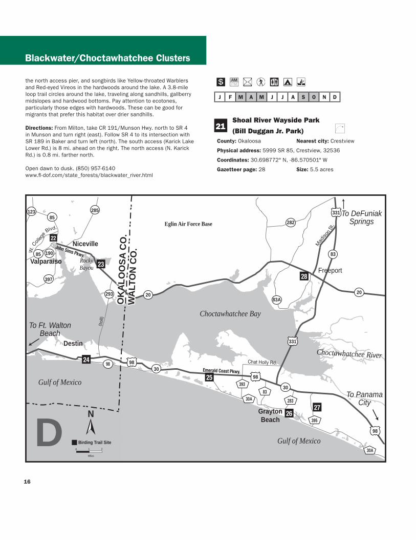
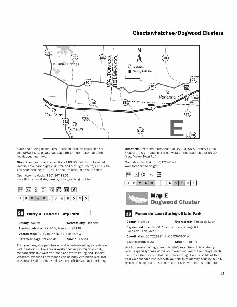
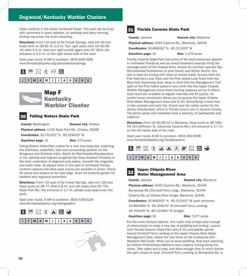
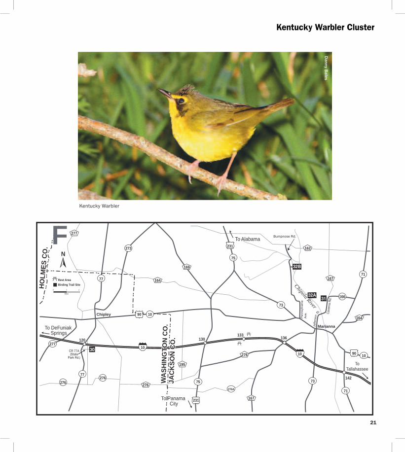
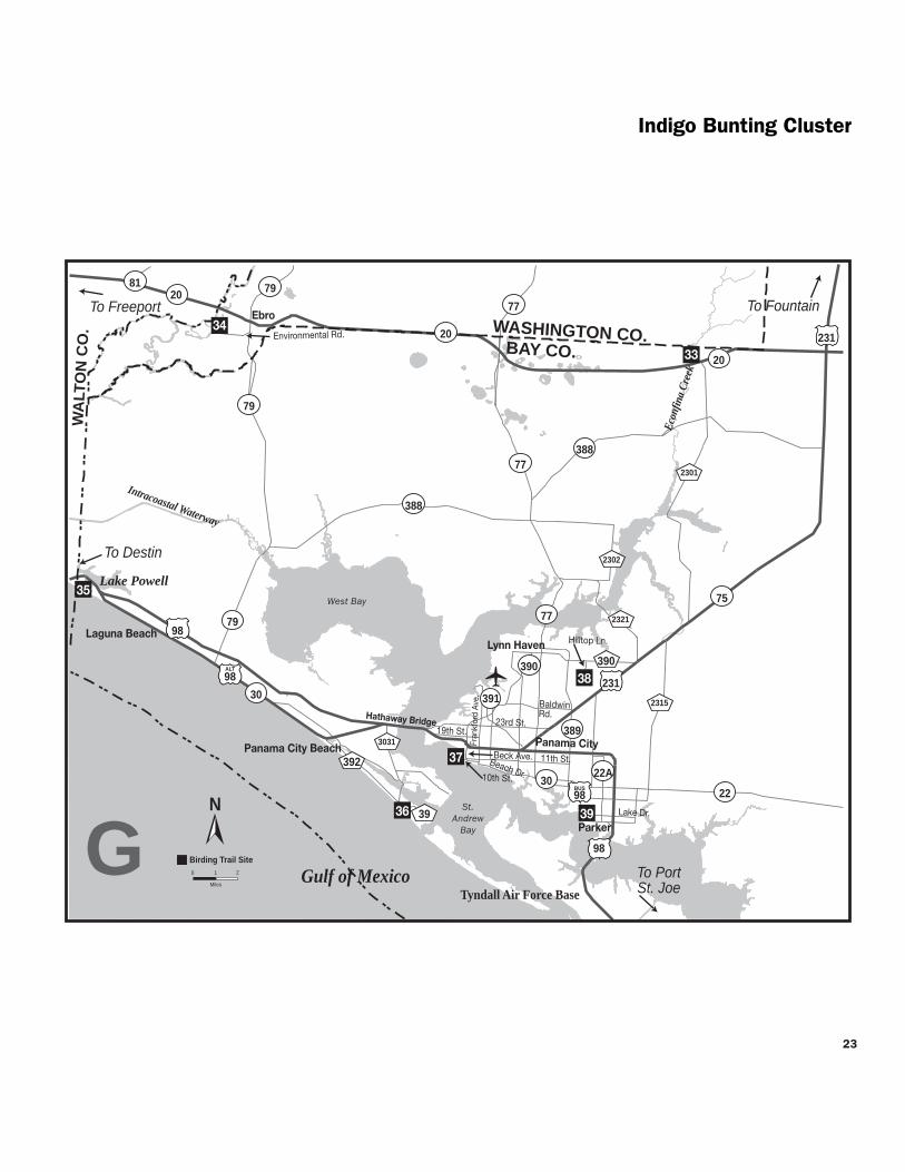
Indigo Bunting Cluster
J F M A M J J A S O N D
36
J F M A M J J A S O N D
37
J F M A M J J A S O N D
38
possible in summer Black-bellied and Piping Plovers in winter Least Terns and Snowy Plovers have nested in the park A spur trail runs from the looprsquos east side to Lake Powell one of the largest coastal dune lakes in Florida Coastal dune lakes are rare and in the US occur only on the Gulf Coast Salt and freshwater mixing at this inlet offers productive feeding for terns year-round and wintering ducks like Redheads
Directions The entrance is on the south side of US 98 70 mi west of SR 79N Arnold Rd on the west side of the Phillips Inlet bridge
Open year round 8 AM to sundown (850) 233-5059 wwwfloridastateparksorgcamphelen
St Andrews State Park
County Bay Nearest city Panama City Beach
Physical address 4607 State Park Ln Panama City 32408
Coordinates 30135113deg N -85742506deg W
Gazetteer page 46 Size 1169 acres
Scan the Gulf from the end of the fishing pier on the peninsularsquos south (Gulf) side for Brown Pelicans Least Terns and gulls in warmer months and gannets plunging near the shore in winter At the peninsularsquos east end beaches north of the jetty fishing area are productive for shorebirds like Snowy Plovers and Willets Black Skimmers occasionally loaf here Gator Lake hosts a heron rookery in spring (Great Blue Herons Great and Snowy Egrets) Check the Buttonbush Marsh Overlook adjacent to the boat parking for Least Bitterns and Wood Ducks Pine flatwoods throughout are home to Brown Thrashers Loggerhead Shrikes and Eastern Towhees
Directions In Panama City take US 98 west across the Hathaway Bridge to CR 3031Thomas Dr and turn left (south) Follow CR 3031 to its end at the intersection with CR 39 and CR 392 Bear left (straight) onto CR 39State Park Ln the site entrance is ahead
Open year round 8 AM to sundown (850) 233-5140 wwwfloridastateparksorgstandrews
St Andrews Bird Trail Oaks By the Bay Park
County Bay Nearest city Panama City
Physical address 2701 W 10th St Panama City 32401
Coordinates 30167245deg N -85701504deg W
Gazetteer page 46 Size 5 acres
Particularly rewarding for beginners this small marina is worth a quick stop if yoursquore in the area The waterfront boardwalk (west-facing) has a series of educational signs on the arearsquos more common birds like Double-crested Cormorants Brown Pelicans herons and egrets The boardwalk ends at Oaks By the Bay Park to the south where oaks can be attractive for warblers in April and October A dune walkover here provides access to the beachfront for chance encounters with shorebirds like yellowlegs and Dunlin as well as terns diving ducks and loons on the bay in winter
Directions From US 98 in Panama City head south on Beck Ave to its intersection with 10th St Park your vehicle at Oaks By The Bay Park (directly across 10th St from this intersection) or turn right (west) on 10th St and park at St Andrews Marina
Open daily dawn to dusk (850) 872-7208 wwwhistoricstandrewscombusiness-district wwwpcgovorg
Lynn Haven Sports Complex and Nature Trail
County Bay Nearest city Lynn Haven
Physical address 2201 Recreation Dr Panama City 32405
Coordinates 30229328deg N -85615548deg W
Gazetteer page 47 Size 60 acres
This complex of ball fields yields more birds than you might think due in large part to the adjacent lake and nature trail On the lake on the east side of the complex check for wintering ducks like Ring-necked and Lesser Scaup a Rossrsquos Goose has wintered here recently Next follow the trail east of the lake along the boardwalk through a small bayhead Some large trees in this mature wetland hammock make for interesting flocks of migrants in October and April Brushy areas north of the lake and on the west and south perimeters of the complex may be good for wintering sparrows Loaner optics and field guides are available
Directions From the intersection of CR 390 and US 231SR 75 in Lynn Haven drive west on CR 390 for 22 mi to Hilltop Ln Turn left (south) at the end of Hilltop Ln turn left (east) onto Recreation Dr Park at the lake on the east side of the complex
24
25
Larry Lynch
Wilsonrsquos Plover
Open 24 hoursday (850) 271-5547 wwwcityoflynnhavencomleisuresportscomplexhtm
J F M A M J J A S O N D
39 Parker Environmental Exploratorium Park
County Bay Nearest city Panama City
Physical address 4700 Lake Dr Panama City 32404
Coordinates 30134811deg N -85606771deg W
Gazetteer page 47 Size 5 acres
This delightful little town park offers a waterfront pier with views of Ospreys Yellow-crowned Night-Herons Purple Martins and Least
Indigo Bunting Cluster
Terns among others Walk the parkrsquos brief trail for more common woodland species such as Carolina Wrens White-throated Sparrows Chimney Swifts and Great Crested Flycatchers A butterfly garden on site is worth checking for occasional Ruby-throated Hummingbirds as well as butterflies like buckeyes and Gulf Fritillaries
Directions From the intersection of US 98 and SR 22 east of Panama City drive south on US 98 for 125 mi to Lake Dr and turn right (west) The parking lot at Martin Lake is 09 mi ahead
Open dawn to dusk (850) 871-4104 wwwdcastateflusfctparks
Indigo Bunting Cluster
J F M A M J J A S O N D
Cape Cluster
Danny B
ales
40
J F M A M J J A S O N D
41
J F M A M J J A S O N D
42 St Vincent National Wildlife Refuge
Baltimore Oriole
Map H Cape Cluster
St Joseph Bay State Buffer Preserve Deal Tract
County Gulf Nearest city Port Saint Joe
Physical address Cape San Blas RdCR 30E Port Saint Joe 32456
Coordinates 29683711deg N -85367049deg W
Gazetteer page 59 Size 200 acres
Located on the bay side of St Joseph Peninsula this parcel offers a casual hike through sand pine scrub to a fork in the trail To the right follow the trail to a large tower and dock overlooking St Joseph Bay where you can scope for ducks on the bay shorebirds along the edges and raptors migrating in October To the left at the fork the trail leads to a hardwood hammock with potential for spring songbird migrants like Hooded Warblers Remember migrants in this part of the state can make landfall after 11 AM so donrsquot abandon a site too early Biting insects can be fierce and the trails offer little shade bring insect repellent and drinking water
Directions From Port St Joe take US 98US 319SR 30 east (head south) approx 2 mi Turn right (south) on SR 30A drive 67 mi and turn right (west) on SR 30ECape San Blas Rd the entrance and parking are 41 mi on the right (east) side of the road
Open dawn to dusk (850) 229-1787 wwwdepstatefluscoastalsites
St Joseph Peninsula State Park
County Gulf Nearest city Port Saint Joe
Physical address 8899 Cape San Blas Rd Port Saint Joe 32456
Coordinates 29745276deg N -85395412deg W
Gazetteer page 59 Size 2716 acres
Because of its peninsular shape and position sheltering a large stretch of coastline from the Gulf this property is a remarkable migratory hotspot for raptors songbirds and even butterflies and dragonflies in fall Hike the spring beaches for Snowy and Piping Plovers (with caution not to disturb them) watch for gannets plunging offshore in fall and winter and loons cormorants and ducks wintering in the surf and bay Check the interior of the peninsula for songbird migrants like Black-throated Blue and Chestnut-sided Warblers making landfall in April Raptors like Broad-winged Hawks and Swallow-tailed Kites start arriving off the Gulf in late Feb and March Canoe concessionaires are available outside the park Permits are available for after-hours access camping is allowed by reservation Loaner optics and field guides are available
Directions From Port St Joe take US 98US 319SR 30 east (head south) approx 2 mi Turn right (south) on SR 30A drive 67 mi and turn right (west) on SR 30E the entrance is 85 mi ahead
Open 8 AM to sundown (850) 227-1327 wwwfloridastateparksorgstjoseph
County Franklin Nearest city Port Saint Joe
Physical address Indian Pass RdCR 30B Port Saint Joe 32456
Coordinates 29683374deg N -85222347deg W
Gazetteer page 60 Size 12358 acres
This extremely rustic refuge is under-birded in large part because it takes some effort to access it Cross Indian Pass either by the private ferry or with your own boat This barrier island is very large prepare to hike the extensive sand roads or bring a bike Be sure to pick up a map at the refuge office in Apalachicola at the Indian Pass boat ramp or download one online and donrsquot forget water and bug spray Never fear though your hard work will be repaid Seaside Sparrows populate the salt marsh on the east side of the island Interior wetlands host Least Bitterns and ducks fodder for Peregrine Falcons and other raptors in migration American Oystercatchers and a variety of plovers nest on the beach (please respect areas closed for their protection) and the islandrsquos hammocks are a haven for returning songbird migrants in March and April Three- to four-day hunts in fall and winter close the island to other uses please see page 55 for information on dates regulations and more
26
27
Cape Cluster
Port St Joe
HowardCreek
MexicoBeach
Gulf of Mexico
St Joseph Bay
Apalac
hicola
Bay
St Vincent Sound
Murphy Rd O
ld Millville Rd
Whit
e Ci
ty R
d
98
98
98
71
387
30
30E 30
30
71
30A
386387
381
41
40
42
43
N
0 1
Miles
2
Birding Trail Site
BAY CO
GULF CO
FRA
NK
LIN
CO
St Vincent Island
To Apalachicola
To Panama City
H
30B
Lake Wimlico
CapePitcher Plant amp Peregrine Clusters
J F M A M J J A S O N D
J F M A M J J A S O N D
44
J F M A M J J A S O N D
Directions From Airport Rd in Apalachicola take US 98US 319 SR 30 west for 53 mi and turn left on CR 30 at the fork Drive 98 mi and turn left (south) on CR 30BIndian Pass Rd in Indian Pass Follow the road east for 29 mi to the ferry site at the end of the road
Open dawn to dusk (850) 653-8808 wwwfwsgovsaintvincent
43 Apalachicola River Wildlife and Environmental Area Old Agricultural Fields
County Gulf Nearest city Wewahitchka Port Saint Joe
Physical address S Murphy Rd Wewahitchka 32465
Coordinates 29890676deg N -85069347deg W
Gazetteer page 60 Size 2150 acres
This part of the Wildlife and Environmental Area lies on the riverrsquos west side and includes roughly 1100 acres of old agricultural fields mown and planted for hunting deer turkey and quail The same management techniques that benefit these species also make the area prime for sparrows including the usual Swamp Song and Savannah plus the less common White-throated White-crowned Field Vesper and Grasshopper among others Mississippi and Swallow-tailed Kites feast on insects above the fields in summer Southeastern American Kestrels Cooperrsquos Hawks and Red-tailed Hawks hunt here year round The best plan of attack get a map at the office on the way in and drive Tram Boggy Branch Bean Field Palmetto and Indian Roads Feel free to park on the roadside and walk the fields for sparrows Ephemeral wetlands throughout the area are worth checking for wintering waterfowl also A recreation guide for the ARWEA is available ndash call (850) 488-8755 or order one at MyFWCcom Seasonal hunting takes place at this GFBWT site please see page 55 for information on dates regulations and more
Directions From US 98US 319SR 30 in Port St Joe take SR 71 north for 93 mi and turn right (east) on CR 387Doc Whitfield Rd Drive 82 mi and turn right (south) on Murphy Rd in Howard Creek the FWC office (06 mi ahead on the lefteast side of the road) can provide maps of area roads
Open dawn to dusk (850) 827-2934 MyFWCcomviewingrecreationwmasleadapalachicola-river
Map I Pitcher Plant amp Peregrine Cluster
St George Island State Park
County Franklin Nearest city St George Island
Physical address 1900 E Gulf Beach Dr St George Island 32328
Coordinates 29684697deg N -84795493deg W
Gazetteer page 61 Size 2023 acres
St George Island State Park is regularly rated one of Floridarsquos most beautiful beaches but what all the beachgoers donrsquot realize is that it has spectacular birdwatching too Bonapartersquos Gulls are reliable from winter to spring Snowy Plovers and American Oystercatchers nest here and Gull-billed Terns cruise the beach in summer Northern Gannets dive for fish offshore October through April and spring migrants like Swallow-tailed Kites Common Nighthawks and Green Herons can be seen arriving off the ocean in March and April The sandhill trail from the camping area and the oaks surrounding the youth camp are both excellent spots for migrant songbirds like Blue Grosbeaks and Scarlet Tanagers in April Therersquos something to see year-round but birding is best and beach visitor numbers are lowest October through April
Directions From US 98US 319SR 30 in Eastpoint take SR 300 Island Drive south for 56 mi across the bridge to St George Island Turn left (east) on CR 300Gulf Beach Dr the park entrance is 43 mi ahead
Open year round 8 AM to sundown (850) 927-2111 wwwfloridastateparksorgstgeorgeisland
45 Apalachicola National Estuarine Research Reserve Unit 4
County Franklin Nearest city St George Island
Physical address E 6th St St George Island 32328
Coordinates 29670753deg N -84851869deg W
Gazetteer page 60 Size 75 acres
This small preserve on the sound side of St George Island is a nice companion to the larger more well-known migrant fallout site at St George Island State Park (site 44) Unmarked trails leading off from the parking area at the end of 6th St wind through a coastal pine forest and give vantages of the sound and shoreline Watch for shore- and seabirds like Royal Terns American Oystercatchers and Laughing Gulls as well as migrants moving through Common Nighthawks Scarlet Tanagers Baltimore Orioles and Swallow-tailed Kites all pass
28
29
Sumatra
Eastpoint
CarrabelleBeach
Apalachicola
FortGadsden
Gulf of Mexico
St George Sound
Tatersquos Hell Swamp
Tatersquos Hell State Forest
Apalachicola National Forest
Apalachicola Bay
Apal
achi
cola
Riv
er
Pine Ave
6th St
Bloody Bluff Rd
TowerRd
Brickyard
RdF R 129
WrightLake Rd
FR 101
Fort Gadsden Rd
SW 8th St
Gulf Beach Dr
FR 180
FR
123
65
98
98
65
65
319
30
65
655
37922
LIBERTY COFRANKLIN COGULF CO
4544
48
46
46
47
49
50
52
53
54
N
0 1
Miles
2
Birding Trail Site
To Bristol
To PortSt Joe
To Carrabelle
I
San
d B
each
Rd
Deep Creek Rd
Tow
er R
d
FR 22
51
New
Riv
er
John
Alle
n R
d
300
300
Pitcher Plant amp Peregrine Cluster
Pitcher Plant amp Peregrine Cluster
through coastal areas like these as they arrive off the Gulf each spring Come prepared with insect repellent and drinking water
Directions From US 98US 319SR 30 in Eastpoint take SR 300 Island Drive south for 56 mi across bridge to St George Island Turn left (east) on CR 300Gulf Beach Dr and go 08 mi to 6th St Turn left (north) and go 02 mi to the end Look for a gravel road and small gazebo at the site entrance
Open dawn to dusk (850) 670-4783 nerrsnoaagov wwwdepstatefluscoastalsitesapalachicola
J F M A M J J A S O N D
Tatersquos Hell State Forest 46 High Bluff Coastal Hiking Trail
County Franklin Nearest city CarrabelleEastpoint
Physical address 2381 W US 98 Carrabelle 32322 (east entrance) 2985 W US 98 Eastpoint 32328 (west entrance)
Coordinates 29808446deg N -84728881deg W (east entrance) 29788651deg N -84766344deg W (west entrance)
Gazetteer page 61 Size 4 miles
Catch a glimpse of the vast 202437-acre Tatersquos Hell State Forest on this scenic trail From either parking area on US 98 a nature trail leads 4 miles through sand pine scrub good for Brown-headed Nuthatches Red-bellied Woodpeckers and Eastern Towhees year-round Listen for Yellow-breasted Chats and Orchard Orioles singing in springsummer In migration Summer and Scarlet Tanagers can be found in the pines Bald Eagles have nested northeast of the eastern parking area so watch for flyovers A nice spot for a hike worth checking in migration Florida Black Bears live within the forest look for tracks and other signs along the trail Seasonal hunting takes place at this GFBWT site please see page 55 for information on dates regulations and more
Directions From the intersection of CR 67 and US 98US 319SR 30 in Carabelle (east end of bridge) drive west on US 98 for 47 mi the trailhead entrance and eastern parking area are on the right (north) side of the road The eastern parking area is 32 mi west of the intersection of US 98 and Gulf Beach Rd in Carrabelle Beach The western trailheadparking area is 27 mi further west (south) From Eastpoint travel east on US 98 the western entrance is 46 mi east of the intersection with SR 65
Open dawn to dusk (850) 697-3734 wwwfl-dofcomstate_foreststates_hellhtml
J F M A M J J A S O N D
Apalachicola River Wildlife and 47 Environmental Area Cash Bayou
County Franklin Nearest city Eastpoint
Physical address SR 65 Eastpoint 32328
Coordinates 29819334deg N -84850006deg W
Gazetteer page 61 Size 100 acres
If yoursquore traveling between Sumatra and Eastpoint itrsquos worth taking a moment to pull off at the edge of Cash Bayou to take in the scenery scan for waterbirds like Bald Eagles and American Bitterns and check the brief trails for songbirds Better yet launch your canoe or kayak from this landing and bird the bayou by boat A recreation guide for the ARWEA is available ndash call (850) 488-8755 or order one at MyFWCcom Seasonal hunting takes place at this GFBWT site please see page 55 for information on dates regulations and more
Directions From US 98US 319SR 30 in Eastpoint drive east to SR 65 Turn left (north) and go 46 mi Though not well-marked you may park on the left (southwest) side of SR 65 just before the bridge
Open dawn to dusk (850) 827-2934 MyFWCcomviewingrecreationwmasleadapalachicola-river
J F M A M J J A S O N D
Apalachicola River Wildlife and 48 Environmental Area Sand Beach Tower
and Area Roads County Franklin Nearest city Eastpoint
Physical address Sand Beach Rd Eastpoint 32328
Coordinates 29784001deg N -84910698deg W
Gazetteer page 60 Size 12000 acres
Sand Beach Rd ends at a canoekayak launch pier and viewing tower in a nice hammock where Yellow-throated Warblers and White-breasted Nuthatches are possible Scan the reeds for waders like Little Blue Herons and from the tower scope East Bay for loons grebes and wintering ducks Ospreys and Bald Eagles nest in the area and both Mississippi and Swallow-tailed Kites are likely in summer here in the Apalachicola River basin The area roads can be interesting birding and butterflying for intrepid explorers particularly Tank Island Rd and Butcher Pen Landing In spring (good) or fall (best) check the flower patches along these roads particularly at low wet spots for marsh skippers such as Broad-winged Dion Palatka and Twin-spot Shallow streams across the road (low water crossings) have firm limestone bottoms and are not an obstacle to 2WD vehicles except during very high water These are a hydrologically sensitive alternative to culverts Seasonal hunting takes place at this GFBWT site please see page 55 for information on dates regulations and more
30
31
Pitcher Plant amp Peregrine Cluster
J F M A M J J A S O N D
49
J F M A M J J A S O N D
50
J F M A M J J A S O N D
51
Directions From US 98US 319SR 30 east of Eastpoint drive north on SR 65 for 86 mi Turn left (south) on Sand Beach Rd to enter the site An informational kiosk containing maps of area roads is located on the right (west) side of the road The viewing tower is located 28 mi down Sand Beach Rd
Open dawn to dusk (850) 827-2934 MyFWCcomviewingrecreationwmasleadapalachicola-river
Tatersquos Hell State Forest Deep Creek Tract
County Franklin Nearest city Eastpoint
Physical address Tower Rd and Deep Creek Rd Eastpoint 32328
Coordinates 29840886deg N -84903438deg W
Gazetteer page 60 Size 2 miles
Two miles of dirt roads along the Deep Creek Tract give you quick easy access to a wet prairie in the Apalachicola River basin Insect-eating pitcher plants line the ditches around this prairie which measures several hundred acres Watching for other recreational users bird Tower Rd by foot or from your car as well as the first 075 miles of Deep Creek Rd which divides the prairie in two Watch for typical overwintering wetland sparrows like skulky LeContersquos Grasshopper and Henslowrsquos as well as more common Swamp and Song Sparrows Swallow-tailed Kites use the cypress domes from March to August wading birds like Snowy Egrets and Little Blue Herons are most concentrated from March to June In winter ducks use the prairiersquos interior and American Bitterns may be seen along the edge Bald Eagles hawks and woodpeckers occur year-round By summer the sun is punishing and bugs are fierce hence the state forestrsquos name Seasonal hunting takes place at this GFBWT site please see page 55 for information on dates regulations and more
Directions From US 98US 319SR 30 east of Eastpoint drive north on SR 65 for 73 mi and turn right (north) on Tower Rd After 11 mi bear right (north) at the fork the site is along the left (west) side of Tower Rd and south side of Deep Creek Rd
Open dawn to dusk (850) 697-3734 wwwfl-dofcomstate_foreststates_hellhtml MyFWCcomviewingrecreationwmascooperativetates-hell
Apalachicola River Wildlife and Environmental Area Bloody Bluff Tract
County Franklin Nearest city Sumatra
Physical address Bloody Bluff Rd Eastpoint 32328
Coordinates 29869528deg N -84975057deg W
Gazetteer page 60 Size 4800 acres
Along the drive down Bloody Bluff Rd watch the edges for sparrows including Chipping Swamp and Song and listen in spring for Bachmanrsquos Sparrows The loop trail at the boat ramp at the end of the road can be good for songbirds like Yellow-throated Warblers and Blue-headed Vireos and Swallow-tailed and Mississippi Kites frequent the river run Most roads in this area can be interesting for birding (Creek Rd and Old County Rd have been productive for sparrows in the past) and several species of rare plants occur on the area This site is very rustic and there are some low water crossings on the dirt roads but these washes are hard bottomed (and accordingly passable in 2WD except in times of very high water) Seasonal hunting takes place at this GFBWT site please see page 55 for information on dates regulations and more
Directions From US 98US 319SR 30 east of Eastpoint drive north on SR 65 for 142 mi Turn left (west) on Bloody Bluff Rd to enter the site
Open dawn to dusk (850) 827-2934 MyFWCcomviewingrecreationwmasleadapalachicola-river
Apalachicola National Forest Fort Gadsden Historical Site
County Franklin Nearest city Sumatra
Physical address Fort Gadsden Rd Sumatra 32328
Coordinates 29940532deg N -85007360deg W
Gazetteer page 60
This site of a British fort dating back to the War of 1812 is slowly returning to the nature it was eked out of centuries ago Fortifications and historical signage are surrounded by the Apalachicola National Forestrsquos flatwoods on one side good for Common Yellowthroats and the occasional Bachmanrsquos Sparrow on the other side the shoreline at the broad brown Apalachicola River is lined with hardwoods and cypress home to singing Northern Parulas and Prothonotary Warblers Hike the flatwoods trail from the parking area and walk the waterfront in migration Breeding raptors like Red-shouldered Hawks and Mississippi Kites are raucous in springsummer Longleaf pines used by Red-cockaded Woodpeckers as cavity trees are ringed with white paint
J F M A M J J A S O N D
Open 24 hoursday (850) 643-2282 wwwfsfedusr8floridaapalachicola
Pitcher Plant amp Peregrine Cluster
Directions From the intersection of SR 65 and 8th StCR 22 in Sumatra travel south on SR 65 for 4 mi Turn right (west) on FR 129Brickyard Rd and follow for 21 mi Turn left (south) on Fort Gadsden Rd and continue for 07 mi to the site entrance
Open 8 AM to 8 PM (850) 643-2282 wwwfsfedusr8floridaapalachicola
J F M A M J J A S O N D
5 Apalachicola National Forest Wright Lake
County Franklin Nearest city Sumatra
Physical address NF 101Wright Lake Rd Bristol 32321
Coordinates 30000129deg N -85001991deg W
Gazetteer page 48 and 60
Two trails at this site a 025-mile trail around the lake and a 5-mile one traverse stretches of basin swamp and longleaf pine-wiregrass community Plants and animals in the latter community type have come to depend on frequent fire that keeps the understory low and open stimulating pine seeds to germinate and wiregrass to flower Since natural fire is feared by people itrsquos been suppressed in much of Florida allowing many remaining examples of this community to become overgrown and unsuitable for the animals that are uncompromisingly dependent on it Here in the national forest prescribed fire is used to keep pinewoods healthy making it one of the best places to see Red-cockaded Woodpeckers (RCWs) and Bachmanrsquos Sparrows Spring mornings are best for spotting both when sparrow males are singing ldquohere kitty-kitty-kitty-kittyrdquo on their territories and RCWs are busy coming and going from their nest cavities carrying food to their young Seasonal hunting takes place at this GFBWT site along the 5-mile trail please see page 55 for information on dates regulations and more
Directions From the intersection of SR 65 and 8th StCR 22 in Sumatra travel south on SR 65 for 19 mi to FR 101Wright Lake Rd Turn right (west) and follow FR 101Wright Lake Rd for 16 mi to the site
53 Apalachicola National Forest County Road 22 Pond
County Liberty Nearest city Sumatra
Physical address SW 8th StCR 22 Bristol 32321
Coordinates 30022150deg N -84955450deg W
Gazetteer page 48
While there are Red-cockaded Woodpecker (RCW) cavity trees ringed with white paint visible throughout the 571000-acre national forest this site offers the opportunity to park and hike to view the birds on foot without danger from passing traffic From the small parking area hike south to the small lake where ducks like Lesser Scaup may be found occasionally in winter The west side of the lake is a good foraging and nesting area for the woodpeckers Around the cavity entrances yoursquoll notice sap running from holes drilled by the woodpeckers this is thought to deter snakes from raiding the nests Please take care not to approach the cavity trees too closely these birds are protected by law and harassment is not tolerated Patient observers will easily see RCWs on spring mornings as they emerge and then begin bringing food to chicks in the cavity early evenings are good too Please stay on the trails to avoid trampling some of the sensitive and rare plants that occur in this area Seasonal hunting takes place at this GFBWT site please see page 55 for information on dates regulations and more
Directions From SR 20 just west of Bristol take SR 12 south for 214 mi to SR 65 in Wilma Go south on SR 65 for 100 mi to Sumatra and turn left (east) on SW 8th StCR 22 Go 14 mi down this wide unpaved road (also known as FR 22) A narrow woods road to the site is on the right (south) side Park on SW 8th StCR 22FR 22 and walk the woods road to the pond
Open dawn to dusk (850) 643-2282 wwwfsfedusr8floridaapalachicola
2
Apalachicola National Forest Post Office Bay Forest Road 123 Northeast
County Liberty Nearest city Sumatra
Physical address Forest Roads 123 and 180 Bristol 32321
Coordinates 30089149deg N -85042806deg W
Gazetteer page 48 Size 66 miles
This 66-mile spectacular scenic drive passes through wet savannas and longleaf pine forest in some of the best condition yoursquoll find anywhere in the southeast Watch for carnivorous plants including four species of pitcher plants growing in roadside wetlands Stop at roadside pulloffs to explore looking for breeding Red-cockaded Woodpeckers Bachmanrsquos Sparrows and Swainsonrsquos Warblers Winter can be good for rarer sparrows like Henslowrsquos and LeContersquos in the soggy flatwoods and savannas Butterfly viewing is good all year but best in fall When the blazing stars
J F M A M J J A S O N D
32
54
33
Pitcher Plant amp PeregrineBluffs Clusters
(Liatris) are blooming along CR 379 or the forest roads visitors may find impressive numbers and a wide diversity of species Special butterflies that occur here include Wild Indigo Duskywing Florida Dusted Skipper and Berryrsquos Skipper Take care not to trample delicate plant life by walking off trails Seasonal hunting takes place at this GFBWT site please see page 55 for information on dates regulations and more
Directions From the intersection of SR 65 and SW 8th StCR 22 in Sumatra travel north on SR 65 for 06 mi Turn left (west) onto CR 379 The best access point for FR 123 is 59 mi ahead on the right (east) side of the road This road can be driven as a loop with stops to view RCW clusters and savannas drive FR 123 for 33 mi until it ends at FR 180 Turn left (west) and travel FR 180 for another 33 mi FR 180 will return you to CR 379 15 mi further north of your starting point
Open dawn to dusk (850) 643-2282 wwwfsfedusr8floridaapalachicola
J F M A M J J A S O N D
Map J Bluffs Cluster
Apalachicola Bluffs and Ravines Preserve 55 Garden of Eden Trail County Liberty Nearest city Bristol
Physical address Garden of Eden Rd Bristol 32321
Coordinates 30451730deg N -84968490deg W
Gazetteer page 48 Size 6295 acres
At 135 feet above the Apalachicola River Alum Bluff is the largest geological exposure in Florida In fact the topography of this site feels nothing like what most people expect from Florida Hike the steep 375-mile trail through longleaf pine sandhills upland mixed hardwoods along the tops of steephead ravines down into slope forests across shallow streams and out to the bluff Listen for Wood Thrushes Hooded Warblers Barred Owls and Broad-winged Hawks along the way Butterfly viewing is good in spring and fall In the dry sandhills expect Southern Dogface Cloudless Sulphur and other pierids (whites and yellows) plus various duskywings including Sleepy and Juvenalrsquos in spring Also check for Dotted Skipper in the ravines search for Spring and Summer Azures and Carolina Satyr Not for the faint of heart this hike will make you earn the spectacular views of the Apalachicola River but theyrsquore well worth the effort Watch your footing and definitely bring water While therersquos no hunting on this property The Nature Conservancy encourages visitors to wear bright colors in season for safety
Directions From SR 20 in Bristol take SR 12 north for 14 mi Turn left (west) at Garden of Eden Rd (look for ldquoApalachicola Bluff-Garden of Edenrdquo sign)
Open dawn to dusk (850) 643-2756 wwwnatureorg
J F M A M J J A S O N D
56 Torreya State Park
County Liberty Nearest city Bristol
Physical address 2576 NW Torreya Park Rd Bristol 32321
Coordinates 30558707deg N -84949714deg W
Gazetteer page 32 Size 2650 acres
This park is named after the Torreya tree the worldrsquos rarest evergreen which only grows on bluffs on the eastern side of the Apalachicola River Still in decline this tree is the subject of much study and can be seen here alongside wonderful vantages of the Apalachicola River and interesting birds The most productive birding spots are the areas of the trail around Stone Bridge down by the river northwest of the historic home and on the trails to Rock Bluff Primitive Campground As in much of extreme north Florida
Jaret Daniels
Red-banded Hairstreak
Bluffs Cluster
Lake Seminole
Apala
chicol
a Rive
r
Chattahoochee
Blountstown
Bristol
Sneads
Greensboro
Hosford
Juniper
69
97
12
20 65
20
71
20
90
90
269
268
270
1641
270A
271
286
280
275
275
69A
69
274
69
67
12
274
270
270
12
268
270
71
8
8
10
10
12
286
270
10
10
GADSDEN COLIBERTY CO
57
58
56
55
N
0 1
Miles
2 J
To Marianna
To Tallahassee
To Bainbridge GA
GEORGIA
174
166
162 Flat Creek Rd
158
152
Legi
on R
d
Torreya State Park Rd
To Apalachicola
Riv
erRd
JACKSON COCALHOUN COJACKSON COCALHOUN CO
Birding Trail Site Rest Area
Garden of Eden Rd
1641
1641
34
35
Bluffs Cluster
watch for northern birds like Winter Wren Louisiana Waterthrush Golden-crowned Kinglet and Brown Creeper Brown-headed Nuthatch and Bachmanrsquos Sparrow are possible in the sandhills and the high canopies along the river can be good for Yellow-throated Vireo in spring Birding by ear skills are very useful here Spring and fall are ideal times for butterfly enthusiasts to visit This park is one of the most reliable spots in Florida for Mourning Cloak (early spring) May is good for seeing Banded Kingrsquos and Striped Hairstreaks a fall day can produce more than a dozen skipper species The park features more than 17 miles of hiking trails and numerous camping options
Directions From I-10 west of Quincy take exit 174 for SR 12 and go toward Greensboro Stay on SR 12 through Greensboro and continue (approx 14 mi total from I-10) until the intersection with CR 1641 Turn right (north) on CR 1641 and continue left (northwest) at the fork with CR 270 Bear right (northwest) at the next fork with CR 270 Bear right at the next fork (CR 1641 becomes Torreya State Park Rd) and follow the signs to the park entrance Note some maps show CR 1641 as CR 271
Open year round 8 AM to sundown (850) 643-2674 wwwfloridastateparksorgtorreya
57 Three Rivers State Park
County Jackson Nearest city Sneads
Physical address 7908 Three Rivers Park Rd Sneads 32460
Coordinates 30739096deg N -84936161deg W
Gazetteer page 32 Size 667 acres
Pine and hardwood uplands with big old trees characterize this park on the south shore of Lake Seminole This lake is actually a reservoir created at the confluence of the Flint and Chattahoochee Rivers where they form the Apalachicolamdashthe opposite shoreline lies in Georgia Bird the Lakeside Trail which begins near the campground as well as the Half Dry Creek Trail by the picnic area Habitat and location are good for Kentucky Warbler and Louisiana Waterthrush in springsummer Otherwise wintering birds characteristic of the area including Red-breasted Nuthatch and Golden-crowned Kinglet are rare but possible in cooler months In winter also scope the lake from two birding blindsmdashyou never know what wintering waterfowl you may find A Yellow-billed Loon wintered on a reservoir south of Atlanta in 2003-04 Who knows what else is out there simply waiting for birders to find it Loaner optics and field guides are available at the entrance station
Directions From I-10 take exit 158 for CR 286 Head north for 52 mi to US 90SR 10 in Sneads Turn left (west) and go 04 mi Turn right (north) on CR 271River Rd and drive 21 mi Turn right (east) at Three Rivers Park Rd The entrance is just ahead
Open year round 8 AM to sundown (850) 482-9006 wwwfloridastateparksorgthreerivers
J F M A M J J A S O N D
Road signs guide visitors to each destination in the Panhandle Section of the Great Florida Birding and Wildlife Trail
C
W
Fresi
k K
raM
J F M A M J J A S O N D
BluffsTalquin Clusters
58 Sneads Park
County Jackson Nearest city Sneads
Physical address Legion Rd Sneads 32460
Coordinates 30727696deg N -84906788deg W
Gazetteer page 32 Size 64 acres
This small waterfront park on Lake Seminole is worth a stop if yoursquore in the area to scope the open water for wintering ducks like Redheads Canvasbacks Lesser Scaup Ring-necked Ducks Bufflehead American Wigeon and more Thousands of American Coots are often visible on the lake in winter scan for Horned Grebes and Common Loons as well Up for exploring The park includes a boat ramp for access to the lake Fields along the right (east) side of Legion Rd north of the baseball diamonds may have wintering geese such as Canada Snow Greater White-fronted and Rossrsquos Check the roadside wires for American Kestrels Western Kingbirds (rare) have also been sighted here
Directions From I-10 take exit 158 for CR 286 Head north for 52 mi to US 90SR 10 in Sneads Turn right (east) and go 09 mi Turn left (north) on Legion Rd and drive 15 mi to the parking area on the lake
Open dawn to dusk (850) 593-6636
J F M A M J J A S O N D
Map K Talquin Cluster
Joe Budd Wildlife Management Area 59 at Lake Talquin State Forest County Gadsden Nearest city Midway
Physical address Office Rd and Peters Rd Midway 32343
Coordinates 30509365deg N -84538308deg W (office) 30492610deg N -84503975deg W (Peters Rd at Cattle Gap Rd)
Gazetteer page 33 and 49 Size 11039 acres
An extensive system of side roads closed to vehicles is open to exploration via foot bicycle and equestrian traffic and will yield wintering mixed flocks of warblers Wild Turkeys in the open fields and Northern Bobwhites in the pinewoods After turning on Office Rd a large open pasture and dove field on both sides of the road are good birding for wintering sparrows Mourning Doves Eastern Meadowlarks and American Kestrels and also serve some years as a display ground for courting American Woodcocks at dawn and dusk Mississippi and Swallow-tailed Kites feed over pastures in spring summer Check edges of fields and woodlands for Blue Grosbeaks in summer as well At the end of Office Rd a dike trail runs 07 miles
one-way past sloughs good for warblers and Wood Ducks Wood Storks are sometimes present at the Joe Budd Aquatic Education Center on Budd Pond off Cattle Gap Rd The trail at the end of Plantation Rd offers a vantage of Lake Talquin similar to High Bluffrsquos (site 60) Seasonal hunting takes place at this GFBWT site please see page 55 for information on dates regulations and more The area is closed to other uses on hunt days A WMA map is available from the website below
Directions From I-10 west of Tallahassee take exit 192 onto US 90SR 10 and head northwest After 20 mi turn left (southwest) towards Midway onto CR 268MLK Blvd Continue west for 6 mi on CR 268MLK Blvd (changes to Highbridge Rd) and turn left (south) on Office Rd to reach WMA headquarters Other WMA roads can be accessed via Peters Rd (See directions for site 60 veer right onto Cattle Gap Rd to access Joe Budd WMA)
Open dawn to dusk closed on hunt days (850) 627-1773 MyFWCcomviewingrecreationwmasleadjoe-budd
J F M A M J J A S O N D
Lake Talquin State Forest 60 High Bluff Recreation Area County Gadsden Nearest city Midway
Physical address High Bluff Landing Rd Midway 32343
Coordinates 30461752deg N -84497412deg W
Gazetteer page 49 and 50 Size 2 acres
Scan the lake from the fishing pier looking for waders along the shoreline and in offshore trees as well as wintering ducks on the open water like Green-winged Teal and Lesser Scaup Better yet explore the lake from the water Songbirds like Black-throated Blue Warblers and Northern and Louisiana Waterthrushes use the hardwoods lining the lakersquos edge in migration Seasonal hunting takes place at this GFBWT site please see page 55 for information on dates regulations and more
Directions From I-10 west of Tallahassee take exit 192 for US 90SR 10 and head northwest After 20 mi turn left (southwest) towards Midway onto CR 268MLK Blvd Go 24 mi on CR 268 MLK Blvd to Peters Rd and turn left (west) Drive 11 mi and turn left (south) onto High Bluff Landing Rd which dead ends at the site after 26 mi
Open dawn to dusk (850) 488-1871 wwwfl-dofcomstate_forestslake_talquinhtml
J F M A M J J A S O N D
36
37
Talquin Cluster
Danny Bales
An eloquent songster the Wood Thrush is a breeding bird of the Panhandle and extreme North Florida It feeds mainly on insects
Lake Talquin State Forest 61 Bear Creek Educational Forest County Gadsden Nearest city Quincy
Physical address 8125 Pat Thomas Pkwy Quincy 32351
Coordinates 30478155deg N -84626724deg W
Gazetteer page 49 Size 492 acres
The entrance trail to this site is a paved interpretive trail which then connects to the 25-mile Ravine Trail and the 30-mile Bear Creek Trail The former hugs the creek ravine and its hardwood forest is good for migrants like Wood Thrushes and Veeries The pine flatwoods of the longer Bear Creek Trail are good for Northern Bobwhites and Wild Turkeys Take water and insect repellent and pick up a map at the entrance kiosk This site offers something for people of all birding skill and mobility levels Butterfly viewing here is best in spring Check flowering trees especially along the Ravine Trail for gossamer-wing butterflies such as Henryrsquos Elfin Banded Hairstreak and Spring and Summer Azures
Directions From I-10 south of Quincy take exit 181 for SR 267 Pat Thomas Pkwy Drive south for 43 mi and cross CR 65B the entrance is 04 mi further south on the left (east) side of the road
Open dawn to dusk (850) 488-1871 wwwfl-dofcomstate_forestslake_talquinhtml
Jaret Daniels
The Eastern Tiger Swallowtail is a large familiar butterfly found throughout most of Florida Males are yellow but females can be either black or yellow The caterpillars feed on trees such as red maple wild cherry sweetbay and tulip tree Look for adults feeding on thistle ironweed and milkweed in meadows parks and roadsides
J F M A M J J A S O N D
CO
Talquin Cluster
Lake Talquin
Office Rd
Peters Rd
Plan
tation
Rd
Blountstown Hwy
Quincy
Wetumpka
Midway
Fort Braden
20
65
267
267
267 65
12
90
90
375
65B 65B
268 161
270
270
20
267
8
8
10
65C
10
10
60
62
61
59
N
0 1
Mile s
2
Birding Trail Site K
To Tallahassee
To Tallahassee
To Marianna
To Havana
To Georgia
HighBlu
ff Lan
dingR
d
Highbridge Rd
Coes Landing Rd
B l o x h a m C u t o f f R d
268
181
174
192
GADSDEN COGADSDEN CO
LEON CO
LEON CO
LIB
ERTY
LIB
ERTY
CO
Cattle Gap Rd
38
39
Talquin Cluster Jaret D
aniels D
anny Bales
Northern Bobwhite
40
TalquinWhite-breasted Nuthatch Clusters
Lake
Jackson
Old
Bai
nbrid
ge R
d
Faulk
Dr
Millers
Landing Rd
N M
erid
ian
Rd Maclay Rd
Killarney Way
Raymond Diehl Rd
Vassar Rd
Tennessee StMahan Dr
Buck Lake Rd
Pedrick Rd
Center
ville R
d
Mag
nolia
Dr
6th Ave
7th Ave
Thom
asvi
lle R
d
Cap
ital C
ircle
N Monroe St
Tallahassee
Bradfordville
20
31927
319
27
90
0345
0342
155
151
0361
263
0347
61 9010
61
20
61
63
10
371
363
1568
8
8 10 10
69
68
67B
67A6663
64
65
L
To Thomasville GA
To LakeCity
ToCrawfordville
To Quincy192
196
194
203
199
209
N
0 1
Miles
2
GA
DS
DE
N C
O
LEO
N C
O
Sham
rock St
Crowder
Rd
Birding Trail Site
Rest Area
62Lake Talquin State Forest Fort Braden Trails
County Leon Nearest city Tallahassee
Physical address SR 20Blountstown Hwy Tallahassee 32310
Coordinates 30438199deg N -84495804deg W
Gazetteer page 49 and 50 Size 1242 acres
This site offers extensive hiking trails that are blazed in orange (compared to horse trails in pink or yellow) Pick up a map at the entrance and bring water One of the best trail choices is the Center Loop hike north from the parking area and stay right at every split on the orange-blazed trail to make a 2-mile loop back to the parking area The trail will take you through open areas and xeric oak uplands good for Wild Turkeys and White-eyed Vireos then reach bluffs overlooking Lake Talquin It follows the lake edge for nearly a mile before circling back through the uplands Watch overhead
for raptors and scan the lake for wintering ducks and wading birds Weedy and brushy areas have wintering sparrows including Chipping Song and White-throated
Directions From the intersection of SR 263Capital Circle and SR 20Blountstown Hwy in Tallahassee take SR 20 west for 87 mi the trailhead parking area is on the right (north) side of the road
Open dawn to dusk (850) 488-1871 wwwfl -dofcomstate_forestslake_talquinhtml
J F M A M J J A S O N D
J F M A M J J A S O N D
41
63
64
White-breasted Nuthatch Cluster
Map L White-breasted Nuthatch Cluster
J Lee Vause Park
County Leon Nearest city Tallahassee
Physical address 6024 Old Bainbridge Rd Tallahassee 32303
Coordinates 30537105deg N -84361323deg W
Gazetteer page 34 Size 26 acres
This small park has a well-developed center but down by the lake its sunny woody edges are a haven for birds like Orange-crowned Warblers and the occasional Yellow-breasted Chat A boardwalk and pier provide a view of Lake Jackson where you can look for a diversity of wading birds like Wood Storks as well as wintering ducks and coots Donrsquot forget flyovers by Ospreys and Bald Eagles as well as breeding Red-shouldered Red-tailed and Broad-winged Hawks in spring and summer
Directions From I-10 in Tallahassee take exit 199 for US 27N Monroe St Drive north for 46 mi and turn right (north) on CR 0361 Old Bainbridge Rd the park is 03 mi ahead on the right (east) side of the road
Open dawn to dusk (850) 606-1470 wwwleoncountyflgovparkspark_indexasp
Faulk Drive Landing
County Leon Nearest city Tallahassee
Physical address Faulk Dr Tallahassee 32303
Coordinates 30522392deg N -84322033deg W
Gazetteer page 34 Size 02 acres
Another access to Lake Jackson this one is a little more rustic and your tires (not to mention your feet) may get muddy at times of higher water Itrsquos best to park back from the landing and walk in watching fence posts and small oaks for flycatchers and warblers At the landing scan for egrets herons White Ibises and waterfowl Black-bellied Whistling-Ducks have turned up here as have Roseate Spoonbills The grassy area to the south of the landing may have Common Ground-Doves Eastern Bluebirds and Common Yellowthroats plus sparrows (such as Swamp and Savannah) in winter Launch a canoe or kayak here to explore Lake Jackson in more detail Worth a stop if yoursquore in the area Seasonal hunting takes place at this GFBWT site please see page 55 for information on dates regulations and more
Directions From I-10 in Tallahassee take exit 199 for US 27N Monroe St Drive north for 27 mi and turn right (northeast) on Faulk Dr the site is 14 mi ahead at the end of the road
Open dawn to dusk (850) 606-1470 wwwleoncountyflgovparkspark_indexasp
J F M A M J J A S O N D
65 Crowder Landing
County Leon Nearest city Tallahassee
Physical address Crowder Rd Tallahassee 32303
Coordinates 30507436deg N -84313444deg W
Gazetteer page 34 Size 06 acres
This small boat landing warrants a quick stop if yoursquore in the area because it provides another vantage of Lake Jackson Wintering ducks and coots are plentiful on the lake in winter as are wading birds like Snowy Egrets and Little Blue Herons Sandhill Cranes appear on occasion and in 2002 a Hudsonian Godwit was discovered here Lake Jackson is known for its tendency to disappear down a sinkhole in its middle at times of low water to birders itrsquos known for less common flycatchers (Vermillion for example) and songbirds in migration When itrsquos hot itrsquos hot When itrsquos nothellip
Directions From I-10 in Tallahassee take exit 199 for US 27N Monroe St Drive north for 17 mi and turn right (east) on Crowder Rd Follow Crowder Rd for 12 mi as it bends north then east the site is at the end on the lake
Open dawn to dusk (850) 606-1470 wwwleoncountyflgovparkspark_indexasp
J F M A M J J A S O N D
66 Elinor Klapp-Phipps Park
County Leon Nearest city Tallahassee
Physical address Miller Landing Rd Tallahassee 32312
Coordinates 30536493deg N -84280792deg W
Gazetteer page 34 Size 670 acres
Elinor Klapp-Phipps Park on Lake Jackson has areas of longleaf pine restoration but its real asset is the beautiful deciduous slope forest following the trickle of small streams down to the big lake Eastern Bluebirds Indigo Buntings and Wild Turkeys use open grassy areas along the powerline entrance and horse trailer entrance As the trails dive into the hammock start watching and listening for migrants like Wood and Gray-cheeked Thrushes and Blackburnian Warblers
J F M A M J J A S O N D
67
White-breasted Nuthatch Cluster
Reinhard Geisler
White-breasted Nuthatch
Down by the large bat house on Lake Victoria at stop 17 scope for Anhingas Tricolored Herons and Ospreys Black-bellied Whistling-Ducks have bred here recently The Lake Jackson area is known for unusual sightings like occasional wintering Western Tanagers so bird with an open mind Butterfly viewing is also quite good at this park spring through fall Unlike many sites mid-summer has an impressive variety of butterfly species look for spread-winged skippers including Silver-spotted Golden-banded Hoary Edge and Southern Cloudywing along the woodland trails and in the open meadows Trails at this park are extensive and winding Pick up a trail map and butterfly checklist at the entrance (or download them from the website below) and pay attention to your chosen route
Directions From I-10 in Tallahassee take exit 203 for US 319SR 61Thomasville Rd Drive north for 09 mi and turn left (west) on Maclay Rd Follow Maclay Rd for 22 mi to its end and turn right (north) on N Meridian Rd Drive 10 mi and turn left (west) on Millerrsquos Landing Rd the park entrance is 02 mi ahead on the left (south) side of the road
Open dawn to dusk (850) 891-3866 (850) 891-3975 wwwtalgovcomparksparksphippscfm
Alfred B Maclay Gardens State Park
County Leon Nearest city Tallahassee
Physical address 3540 Thomasville Rd Tallahassee 32309
Coordinates 30534672deg N -84277454deg W (Lake Overstreet) 30513532deg N -84247467deg W (main entrance)
Gazetteer page 34 Size 1179 acres
More widely known for its manicured gardens this park also offers native habitat that is better for birdwatching Try the brief trails along the lake at the Lake Hall Recreation Area for wintering Orange-crowned Warblers and Blue-headed Vireos A few Dark-eyed Juncos make an appearance here in winter Brown Creepers and Winter Wrens may also be present Check the lakes for wintering ducks and then for drinking Purple Martins beginning in February For a longer hike hit the Lake Overstreet multi-use trails (5 miles worth) off Meridian Road These are more rustic so be sure to pick up a map and bring water Birds like Red-headed Woodpeckers Brown-headed and White-breasted Nuthatches Great Horned Owls and Chuck-willsshywidows can all be found here The recreation area and gardens have wheelchair access
Directions (A) Lake Overstreet Trailhead From the intersection of Meridian and Maclay roads drive north on Meridian 09 mi turn left (west) and enter the parking lot for Forest Meadows Park amp Athletic Center the trailhead is directly across the street on the east side of Meridian (B) Main entrance From I-10 in Tallahassee take exit 203 for US 319SR 61Thomasville Rd Drive north for 09 mi and turn left (west) on Maclay Rd The park entrance is 02 mi on the right (north) side of the road
42
43
White-breasted Nuthatch Cluster
Open year round 8 AM to sundown (850) 487-4556 wwwfloridastateparksorgmaclaygardens
J F M A M J J A S O N D
68 A J Henry Park
County Leon Nearest city Tallahassee
Physical address 3000 A J Henry Park Dr Tallahassee 32309
Coordinates 30507040deg N -84217947deg W (north entrance) 30503435deg N -84218606deg W (south entrance)
Gazetteer page 34 and 50 Size 72 acres
A J Henry Park is a small city property with some nice topography and habitats including hardwood forest-covered slopes which descend down to a lake Accordingly this park attracts fallouts of migrants like Veery Ovenbird and Magnolia Warbler among others Raptors like Mississippi Kite and Broad-winged Hawk hunt for prey here in late spring and summer and Blue-winged Teal Ring-necked Duck and the occasional Redhead or Common Goldeneye can be found on the lake in winter The area surrounding the lake and the lower (north) parking area offer the most productive birding Extensive trails at the upper (south) parking area are appealing but the thicker understory can make it hard to spot birds frustrating those who donrsquot know bird calls and songs
Directions From I-10 in Tallahassee take exit 203 for US 319SR 61Thomasville Rd Drive north for 09 mi to Killarney Way and turn right (southeast) There are two approaches to the site off of this road For the south entrance proceed east on Killarney Way and turn right (south) onto Raymond Diehl Rd then turn left (east) on Vassar Rd Take Vassar Rd to its end and turn right (south) on Whitney Dr The park is 150 yds on the left (east) side of the road For the north entrance follow Killarney Way to the end and turn right (southeast) on Shamrock St After 03 mi turn right (south) on Gardenview Way and right (southwest) again after 03 mi onto A J Henry Park Dr The entrance is 02 mi ahead
Open 8 AM to dusk (850) 891-3866 wwwtalgovcomparksparksajhenrycfm
David M
oynahan
Common Goldeneye
Danny Bales
Rusty Blackbird
J F M A M J J A S O N D
White-breasted Nuthatch Mississippi Kite Clusters
69 J R Alford Greenway
County Leon Nearest city Tallahassee
Physical address 2500 S Pedrick Rd Tallahassee 32317
Coordinates 30444486deg N -84175759deg W
Gazetteer page 50 Size 874 acres
This greenway is a collection of old pastures and woodlands now used for passive recreation Seventeen miles of multi-use trails invite many hours of exploration From the parking area follow the trail due east across the first pasture (watch for Purple Martins and Eastern Bluebirds around the gourds and nest boxes) and veer either way at the fork to continue through a series of open fields Watch overhead for Red-tailed Hawks mixed flocks of wintering Palm Warblers and White-throated Sparrows flit in the weedy edges Pastures are managed for a mosaic of early succession habitats wintering Grasshopper Sparrows skulk in the grass (when itrsquos left high) as do Eastern Meadowlarks American Kestrels Eastern Phoebes and Loggerhead Shrikes stand lookout on snags and Wood Storks and Double-crested Cormorants can be seen flying overhead to Lake Lafayette at sunset From the parking lot another trail leads to the south and winds east through hardwoods good for Red-shouldered and Cooperrsquos Hawks Download a map and pay attention to your route Trails can be confusing at times a GPS unit is quite useful here Consider biking this property to cover more ground
Directions From the intersection of US 319Capital Circle and US 90 Tennessee StMahan Dr in Tallahassee drive 07 mi east on US 90 and turn right (east) on Buck Lake Rd After 20 mi turn right (south) onto Pedrick Rd the entrance and parking are 16 mi ahead at the end of the road
Open dawn to dusk (850) 606-1470 wwwleoncountyflgovparksgreenwaysasp
J F M A M J J A S O N D
Jaret Daniels
J F M A M J J A S O N D
Map M Mississippi Kite Cluster
70 Apalachicola National Forest Leon Sinks Geological Area
County Leon Nearest city Woodville
Physical address US 319Crawfordville Hwy Tallahassee 32305
Coordinates 30306785deg N -84345082deg W
Gazetteer page 50 Size 640 acres
This recreation area in the east portion of the Apalachicola National Forest is different from the lower longleaf savannah habitats of the
tracts closer to the river Here higher sandhills of pine and turkey oak are broken by erosion in the underlying limestone causing deep dramatic crystal blue sinkholes which are rimmed with hardwoods Upon entering the hiking trail turn left at the T-junction for the shorter trail (17 miles) and return on the short-cut (05 mile) through a tupelo swamp Listen for Barred Owls Northern Parulas and Prothonotary Warblers near the wetlands and watch for Blue-headed Vireos and Carolina Chickadees in the pinewoods By turning right at the T-junction yoursquoll choose the longer 25-mile loop past a series of large sinkholes Watch for Wild Turkeys Hermit Thrushes and White-eyed Vireos in the sandhills as well as songbirds like Yellow-billed Cuckoos in hardwoods sloping into the sinks In spring wild azaleas along the Gum Swamp Trail attract many swallowtail butterflies Little Wood-Satyr and Red-spotted Purple can occur in any wooded stretch Near the sinkholes look for Golden-banded Skippers Bring water and sunscreen
Directions From the intersection of US 319SR 263Capital Circle SW and US 319SR 369SR 61Crawfordville Rd in Tallahassee drive south on Crawfordville Rd for 58 mi the site is on the right (west) side of the road
Open year round 8 AM to 8 PM (850) 926-3561 wwwfsfedusr8floridaapalachicola
One of the most famous and recognizable butterflies in North America the Monarch undertakes an extensive migration each fall to hibernation sites in California and Mexico Large numbers gather on the Gulf Coast in October at locations like St Marks National Wildlife Refuge in Wakulla County A festival held at the refuge each year coincides with the Monarchrsquos migration Milkweeds are important plants for both caterpillars and adults
44
45
Mississippi Kite Cluster
StMarks
Newport
Wakulla
Medart
ShellPoint
Crawfordville
Sopchoppy
Woodville
Panacea
ApalachicolaNationalForest
St M
arks
Rive
r
Wakulla River
ApalacheeBay
Gulf of Mexico
Ochlockonee Bay
OchlockoneeRiver Rd
Sheldon St
ParkAve
OtterLake Rd
Lighthouse
Rd
Bottoms
Rd
Wak
ulla
Spr
ings
Rd
Woo
dvill
e H
wy
Bald
Poi
nt
Rd
Cra
wfo
rdvi
lle H
wy
98
98
98
319
61
267
267
363
363
372
369
374
375
267
61
365
356
356
356
319
98 30
61
30
367A
30
319365
368
365
365
367
367
59
365
372
375
372A372A
370
22
98
2192
2195
2204
WAKULLA CO
FRANKLIN CO
LEON CO
WAKULLA CO
70
71
73
72
7475
76
77
78
N
0 1
Miles
2
Birding Trail Site
ToPerry
ToApalachicola
ToTallahassee
M
Bloxham Cutoff Rd
Rose St
Sopchoppy Hwy
Alligator Dr
Sopc
hopp
y H
wy
Mississippi Kite Cluster R
einhard Geisler
Mississippi Kite
46
47
71
J F M A M J J A S O N D
J F M A M J J A S O N D
72 see ldquoGatewaysrdquo on page 3 for more information
73
Mississippi Kite Cluster
Edward Ball Wakulla Springs State Park
County Wakulla Nearest city Wakulla Springs
Physical address 550 Wakulla Park Dr Wakulla Springs 32327
Coordinates 30243337deg N -84310614deg W
Gazetteer page 50 Size 6055 acres
Hiking trails throughout this park provide access to floodplain forest good for Summer Tanagers and Ovenbirds in migration and Great Crested Flycatchers and Northern Parulas in summer The primary attraction however is the access to Wakullarsquos first magnitude spring From the pier look for Anhingas Common Moorhens Pied-billed Grebes and wintering American Wigeons as well as roosting Black Vultures in the cypress Better yet take one of the parkrsquos river cruises to get excellent views of the aforementioned plus Least Bitterns Yellow-crowned Night-Herons Barred Owls and White Ibises Alligators Suwannee River Cooters and mullet are commonly seen manatees are sometimes found in the river and spring as well In years past this park was known for Limpkins but today they are almost never seen here However the park staff is reintroducing native apple snails the Limpkinrsquos main prey item to entice Limpkins to return The spectacular 1930s-era lodge has roosting Chimney Swifts in summer Butterfly viewing is best here in late spring and fall Many swallowtail and hairstreak species are seen on flowering trees and shrubs in spring Texan Crescents and Appalachian Browns are regularly seen on the hiking trails north of the Wakulla River The park hosts an extensive wildlife and birding festival each spring
Directions From the intersection of SR 263Capital Circle SW and US 319SR 369SR 61Crawfordville Rd in Tallahassee drive south on Crawfordville Rd for 21 mi Take a slight left to stay on SR 61 Wakulla Springs Rd and go 74 mi Turn left (east) on SR 267Bloxham Cutoff Rd the site is 01 mi ahead on the right (south) side of the road
Open year round 8 AM to sundown (850) 926-0700 wwwfloridastateparksorgwakullasprings
St Marks National Wildlife Refuge St Marks Unit (Headquarters) Gateway
County WakullaJefferson Nearest city St Marks
Physical address 1255 Lighthouse Rd Crawfordville 32327
Coordinates 30156008deg N -84150652deg W
Gazetteer page 50 and 51 Size 29529 acres
Spanning four counties and with more than 300 recorded bird species the 68000-acre St Marks NWR is a must-see The St Marks Unit includes refuge headquarters and the historic St Marks Lighthouse itrsquos also the unit most popular with birders and wildlife
viewers for good reason Stop briefly at the visitor center for a map and to check the sightings log A pond and trail here can be good for White-throated Sparrows Pileated Woodpeckers Belted Kingfishers Eastern Phoebes and more but other trails are more rewarding From north to south along the main road the helicopter pad accessed from the primitive hiking trails is good for wintering sparrows such as Henslowrsquos East River Pool can be good for waterfowl in winter Stoney Bayou Pool and the Mounds Pools hold shovelers coots and the spectrum of wading birds in winter and the trail around Mounds Pool 3 is particularly good for Northern Pintails and Snow Geese in winter Stoney Bayou Pool 2 and Mounds Pool 3 are also good places to look for American Black Ducks The Headquarters Pond viewing platform offers the occasional Sora and Purple Gallinule as well as wintering teal and year-round waders The Mounds Trail around Tower Pond is very good for migrant songbirds like Yellow-billed Cuckoos and Indigo Buntings as well as Brown-headed Nuthatches in the pines and ducks and shorebirds in the pond At the roadrsquos terminus at the lighthouse look for common wintering waterfowl plus Redheads Canvasbacks Nelsonrsquos Sparrows shorebirds and more Scaup Bufflehead Horned Grebes and Common and Red-throated Loons winter in the Gulf and Least Bitterns Seaside Sparrows shorebirds and Clapper Rails breed in the marshes Oystercatchers pelicans and gulls loaf on pilings and offshore oyster bars Butterfly viewing is best here in fall especially September and October Monarch butterflies congregate here along Apalachee Bay on their fall migration to Mexico a Monarch festival is held each October to celebrate this phenomenon Hundreds of Monarchs may be seen on a mid-October day Along Lighthouse Dr keep your eyes open for Gulf Fritillaries and Long-tailed Skippers plus American Alligators Bobcats Northern River Otters and Florida Black Bears Though you may not see one just yet a Whooping Crane reintroduction project began in 2009 Bring water food sun protection and bug spray
Directions From the intersection of US 98SR 30 and SR 363 Woodville Hwy north of the town of St Marks drive east on US 98 approx 25 mi and turn right (south) on CR 59Lighthouse Rd just east of the St Marks River Bridge The refuge entrance is 30 mi ahead the visitor center is 06 mi farther south on the right
Open dawn to dusk (850) 925-6121 wwwfwsgovsaintmarks
Shell Point Beach Park
County Wakulla Nearest city Crawfordville
Physical address Beaty Taff Dr Crawfordville 32327
Coordinates 30058004deg N -84290519deg W
Gazetteer page 50
This Wakulla County park is worth a quick stop for a picnic lunch and a look for shorebirds The parking area offers an easy vantage of
Mississippi Kite Cluster
J F M A M J J A S O N D
J F M A M J J A S O N D
75
J F M A M J J A S O N D
loafing shorebirds in fall-winter-spring such as Short-billed Dowitchers Dunlin Willets Marbled Godwits Black Skimmers and more Keep an eye peeled for the occasional migrating Peregrine Falcon watching the shorebirds even more closely than you Summer is busy with swimmingboating visitors Shorebirds are more diverse and plentiful in cool weather months
Directions From the intersection of US 98SR 30 and SR 363 Woodville Hwy north of St Marks drive west on US 98 approx 80 mi and turn left (south) on CR 365Spring Creek Hwy Turn left after 20 mi onto CR 367Shell Point Rd Continue approx 5 mi on CR 367 (do not take CR 367A at the fork) and turn left (southeast) on Beaty Taff Dr Go 02 mi to the parking area on the right (south) side of the road
Open dawn to dusk (850) 926-7227 wwwwcprdcom
74 Bottoms Road Boat Ramp
County Wakulla Nearest city Panacea
Physical address Bottoms Rd Panacea 32346
Coordinates 30016052deg N -84368326deg W
Gazetteer page 50
Bottoms Road extends out through salt marsh to a county-owned boat launch on the Gulf Along the way watch and listen for Clapper Rails Virginia Rails (winter) and wading birds in the marsh plus Northern Harriers cruising the flats in winter The marsh is also a good place to look for Nelsonrsquos Sparrow (winter) and Seaside Sparrow (year-round) From the shoulder along the road scope the offshore sandbars for loafing terns gulls and shorebirds The large dirt pull-off on the east side of the road (05 miles north of the boat ramp) is private property The marsh is locally known for occasional Short-eared Owl sightings in winter so watch for these daytime hunters gliding low over the marsh like Northern Harriers or perched on low posts amidst the rushes From the boat ramp scan the waters for ducks and scoters
Directions From the intersection of US 98SR 30 and SR 363 Woodville Hwy north of the town of St Marks drive west on US 98 for 166 mi and turn left (east) on CR 372ABottoms Rd just before the town of Panacea Park along the shoulder (where safe) and at the boat ramp (26 mi ahead) at the end of the road
Open dawn to dusk
St Marks National Wildlife Refuge Otter Lake Recreation Area
County Wakulla Nearest city Panacea
Physical address Otter Lake Rd Panacea 32346
Coordinates 30026031deg N -84416565deg W
Gazetteer page 50 Size 11387 acres
Though not as famous as the St Marks Unit St Marks NWRrsquos Panacea Unit offers good birding too Make a quick trip to the picnic area and boat launch at the end to check the cypress for Prothonotary Warblers and occasional wading birds or choose to hike one of the longer trails the south Piney Ridge Trail loop (5 miles) or the north Otter Lake Trail loop (9 miles) The latter runs through pinewoods interrupted by occasional bayheads and wetlands Watch for Red-headed and Red-cockaded Woodpeckers Wild Turkeys and Northern Bobwhites At dusk check the boat launch for Wood Storks egrets and both vultures coming to roost Ospreys nest in the area Swallow-tailed Kites can be seen soaring overhead in spring and summer There is some hunting along the hiking trails so check the trailhead signs before entering and carry water and sunscreen with you See page 55 for more information
Directions From the intersection of US 98SR 30 and SR 363 Woodville Hwy north of the town of St Marks drive west on US 98 for 175 mi and turn right (west) on CR 372AOtter Lake Rd The site is at the west end of Otter Lake Rd
Open dawn to dusk (850) 925-6121 wwwfwsgovsaintmarks
76 Bald Point State Park
County Franklin Nearest city Alligator Point
Physical address Bald Point Rd Alligator Point 32346
Coordinates 29937605deg N -84337327deg W (main entrance) 29914581deg N -84336804deg W (Sunrise Beach access)
Gazetteer page 61 inset Size 4859 acres
Located on the south side of Ochlockonee Bay this state park offers great birding and wildlife viewing Its geography and location provide a prime vantage of the raptor migration in October as Peregrine Falcons Northern Harriers and others cruise down the beach Overwintering shorebirds like Black-bellied Plovers and Dunlin use the beach and estuary and when horseshoe crabs are spawning (which can be impressive) large numbers of shorebirds gather to feast on the crabsrsquo eggs A few sea turtles also nest here in summer In spring migratory songbirds like Black-throated Green Warblers and Indigo Buntings make landfall in the parkrsquos hammocks live oaks surrounding the upper parking area can be quite good Year-round listen for raucous Clapper Rails and Marsh Wrens from the observation boardwalk which overlooks pristine marshes near the upper parking lot Groove-billed Anis are rare winter visitors An extensive hiking trail network begins 16 miles south of the main entrance gate on the west side of the road across from the Sunrise
48
49
Beach access (no fee) These foot trails wind through mesic wet and scrubby flatwoods (home to Brown-headed Nuthatches) and around freshwater marshes swamps and ponds which have wading birds and ducks when water levels are favorable The park is also a staging point for Monarch butterflies on their fall trans-Gulf migration Large numbers of several other species concentrate here in fall as well including Gulf Fritillary Common Buckeye Long-tailed Skipper and Ocola Skipper In early spring Eastern Pygmy Blues can be abundant in the salt marsh Ceraunus Blues can be common in fall Guided tours are available for groups call 2 weeks in advance Fishing and sunbathing are popular in nice weather
Directions From Panacea drive west (head south) on US 98SR 30 for 7 mi and turn left (southeast) on CR 370Alligator Dr Drive 38 mi and turn left (east) on Bald Point Rd the main entrance gate is 28 mi ahead Sunrise Beach and trailhead access are 12 mi north of the intersection with Alligator Dr
Open year round 8 AM to sundown (850) 349-9146 wwwfloridastateparksorgbaldpoint
J F M A M J J A S O N D
77 Ochlockonee River State Park
County Wakulla Nearest city Sopchoppy
Physical address 429 State Park Rd Sopchoppy 32358
Coordinates 29998902deg N -84485259deg W
Gazetteer page 50 and 61 inset Size 543 acres
Upon entering this state park ask at the gate for the locations of active Red-cockaded Woodpecker (RCWs) cavities or recent sightings Head to the parking area at the end of the road and in the
Mississippi Kite Cluster
anny Bales
Blair W
itherington
Snowy Plover
northeastern corner take the ldquoScenic Driverdquo loop road which you may drive bike or walk Watch and listen for RCWs Pine Warblers Eastern Towhees and Common Yellowthroats You may also hike the Pine Flatwoods Trail which originates at the same parking lot This park is well-known for its ldquosnow whiterdquo Eastern Gray Squirrels (no they are not albinos) If you choose to launch a canoe here ask at the gate about water levels and clearance Prothonotary Warblers and Wood Storks may be seen along the river as well as skulking Green Herons Limpkins and Least Bitterns in the brushy margins For early morning access consider camping overnight and enjoy the sounds of Chuckwills-widows and Eastern Screech-Owls after dark
Directions From the intersection of Rose St and US 319SR 377 Sopchoppy Hwy in Sopchoppy head south on Sopchoppy Hwy for 44 mi Turn left (east) on Ochlockonee River Rd the entrance is 12 mi ahead
Open year round 8 AM to sundown (850) 962-2771 w Dwwfloridastateparksorgochlockoneeriver
shy
J F M A M J J A S O N D
County Wakulla Nearest city Sopchoppy
Physical address 252 Park Ave Sopchoppy 32358
Coordinates 30050507deg N -84498079deg W
Gazetteer page 49 and 50 Size 50 acres
If yoursquore in the area itrsquos worth stopping by briefly to visit this small city park on the Sopchoppy River Check the boardwalk and waterfront for night-herons and Prothonotary Warblers and hike the short trail to the left side of the property upon entering In the thicker hardwoods of the hiking trail yoursquoll find migrants like Yellow-billed Cuckoos in spring as well as Mississippi and Swallow-tailed Kites circling overhead in warmer months This site can be a busy boat launch in warm weather Consider launching a canoe from this spot to explore the Sopchoppy River more extensively
Directions From the intersection of Rose St and US 319SR 377 Sopchoppy Hwy in Sopchoppy head south on Sopchoppy Hwy for 04 mi Turn right (west) on Sheldon St and go 04 mi Turn left (south) on Park Ave and drive 05 mi The entrance is on the right (west) side of the road
Open dawn to dusk (850) 962-4611 (850) 962-5486
78 Myron B Hodge City Park
J F M A M J J A S O N D
Mississippi Kite Cluster
Named for its fast darting flight the Whirlabout is a common ldquograss skipperrdquo that occurs in the Panhandle and peninsula most of the year Host plants for the caterpillar include a variety of grasses Shepherdrsquos needle and lantana provide nectar for adults
Danny Bales
50
51
_________________________________________________________________
Mark Kiser FW
C
Birders and wildlife watchers contribute more than $3 billion to Floridarsquos economy each year
About this guide This Trail guide along with guides for the East West and South Trail Sections can be downloaded from the Great Florida Birding and Wildlife Trail website at wwwfloridabirdingtrailcom Additional copies of all four Trail guides may be ordered from the website or by using the form on this page As information for a particular site may change after Trail guides are printed please check the website before heading out on your trip for the most up-to-date information Please report any errors to GFBTMyFWCcom Thanks
Cut
alo
ng d
otte
d lin
e
Mail-in response slip
Birder and wildlife viewer ID Mail-in response form
Name___________________________________________________________
Street __________________________________________________________
City _____________________________________________________________
State _____________ County _____________________________________
Zip______________________ Country _____________________________
E-mail___________________________________________________________
Home phone ____________________________________________________
Work phone _____________________________________________________
Request for information
_____Add my name to your mailing list
_____Send mailings electronically
_____Send a bird checklist ndash also available online
_____Send a Birding and Wildlife Trail sponsorship packet
_____Send a Birding and Wildlife Trail brochure
_____Send a Birding and Wildlife Trail Guide ndash also available online
East ________ West ________ South_______ Panhandle _______
_____Send ldquoBirdwatching Basicsrdquo ndash also available online
Other ___________________________________________________________
wwwfloridabirdingtrailcom
The Great Florida Birding and Wildlife Trail is a program of the Florida Fish and Wildlife Conservation Commission
_____________________________________________________
_____________________________________________________
_____________________________________________________
_____________________________________________________
_____________________________________________________
_____________________________________________________
Cut
alo
ng d
otte
d lin
e
Rate the Trail Mail-in response form
Your country state and county of origin ______________
Where did you hear about the Trail__________________
What is your goal in using the Trail (eg finding a specific species of bird seeing a diversity of birds and wildlife or simply enjoying the outdoors) _____________
How long have you had this guide___________________
How many sites have you visited____________________
Which site was the best Why ______________________
Which site was worst Why ________________________
How many days have you spent birding or wildlife viewing in the last month ______________________________
How long was your last trip on the Birding and Wildlife Trail _______________________________________________
How much money did you spend on lodging food and gas on the above trip $_____________________________
Will you recommend the Trail to friends _____________
Please detach and mail us your valued response to the GFBWT address on page 53 Thank you
St Vincent National Wildlife Refuge
Myron B Hodge City Park
Mark and Selena Kiser
Mark Kiser FW
C
52
Birding and wildlife viewing ethics Donrsquot you hate it when the doorbell or telephone rings just as you settle down to dinner or a nap While mere nuisances to us disruptions in feeding and nesting routines can spell disaster for birds and other wildlife especially the cumulative effect of frequent disruptions a common occurrence at busy sites When a nesting bird is forced to fly it may leave eggs or young exposed to temperature extremes or predators A migratory bird may be exhausted and hungry from a long flight ndash it needs to rest and eat With care and common sense we can all help protect the wildlife we love to watch
Consider these points n Stay back from concentrations of nesting or loafing
waterbirds ndash a spotting scope may be a better choice than binoculars
n Walk around groups of birds on the beach rather than forcing them to fly
n Sit or crouch so that you appear smaller Keep movements slow and steady rather than fast or sporadic
n If viewing from your car stay inside as much as possible It acts as a viewing ldquoblindrdquo and the birds are less likely to fly if they donrsquot recognize you as human
n Stay on roads trails and paths to minimize habitat disturbance
n Do you occasionally use recordings to attract birds If so remember not to overuse them or to try to attract rare or protected species Also do not use them during the nesting season Be aware that some locations prohibit the use of recordings
n For more information please see the American Birding Associationrsquos Code of Ethics at
wwwabaorgaboutethicshtml FWCrsquos viewing ethics at MyFWCcomviewingadventures and the Nature Photographerrsquos Network ethics page at wwwnaturephotographersnetethicshtml
Birding and wildlife viewing resources There are many more resources for birding and wildlife viewing in Florida Before your trip check the Internet for area rare bird alert hotlines and statewide birding listservs to get an idea of whatrsquos being seen If yoursquore staying in an area for a longer visit check local book and nature stores for area guides published by local Audubon chapters or birders The Great Florida Birding and Wildlife Trail guidebooks and the trip-planning tool at wwwfloridabirdingtrailcom are just a taste of the
information available to plan your ultimate Florida birding and wildlife viewing vacation
For more informationhellip
Or to be added to the mailing list for the Great Florida Birding and Wildlife Trailrsquos newsletter Kite Tales fill in the response form (including your name and address on page 51) and mail to
Great Florida Birding and Wildlife Trail (or GFBWT) 620 South Meridian Street Tallahassee FL 32399-1600
or visit the Birding and Wildlife Trailrsquos website at wwwfloridabirdingtrailcom
The Kite Tales newsletter includes news about the Trail and Trail-related events across the state Information also is available regarding Trail sponsorship site nominations for upcoming Trail sections tips for better birding and the economic impact of this flourishing pastime Take part in the continued development of this great resource for birders and wildlife watchers of all skill levels while enjoying and ensuring continued concern for the conservation of Floridarsquos fabulous avian and wildlife treasures
Birders and wildlife viewers Flex your economic muscles Florida communities have long made land use choices to attract traditional tourists and their dollars Birding and wildlife viewing are big business in Florida too but communities will only recognize that if wersquore visible Your visibility and economic impact can encourage wildlife conservation
Some ways you can make yourself more visible n Wear bird and wildlife t-shirts n Take your binoculars into the restaurant with you n Ask local residents in restaurants hotels gas
stations etc about where good birding and wildlife viewing locations might be in their area
n Leave birder calling cards whenever you spend money helping vendors make the connection between healthy wildlands and healthy economies (cards may be downloaded from wwwfloridabirdingtrailcom)
n Put a birding bumper sticker or window decal on your car or business It speaks for itself so you donrsquot have to
Conserve wildlife by watching wildlife Itrsquos more than a hobby itrsquos a legacy
53
For the birds The Great Florida Birding and Wildlife Trail helps everyone enjoy and conserve Floridarsquos wildlife and wildlife habitat A donation to the Wildlife Foundation of Florida helps us expand and enhance the Birding and Wildlife Trail experience With your support we can continue to protect Floridarsquos natural resources for future generations to enjoy
mail your check to
Wildlife Foundation of Florida Attn GFBWT PO Box 6181 Tallahassee FL 32314-6181
Note Please write GFBWT in the memo section of your check
Support the Birding and Wildlife Trail with your purchase of official GFBWT merchandise We offer several T-shirt designs a stylish baseball cap a bumper sticker and a vinyl cling sticker Proudly wearing birding apparel and displaying birding stickers on your vehicle help communities recognize you as a wildlife watcher and conservationist and sale proceeds benefit the Birding and Wildlife Trail program Order yours today at wwwfloridabirdingtrailcom
If you would like to make a donation please
54
Sharing Floridarsquos public lands during hunting season
Floridarsquos residents and visitors are fortunate to have an abundance of public and private lands open for wildlife viewing and other outdoor recreation Seasonal hunting takes place on many of these public lands that are part of the Great Florida Birding and Wildlife Trail Some of these lands - wildlife management areas and wildlife refuges ndash were acquired and are managed with revenue generated from the sale of hunting licenses and taxes on various types of sporting goods Birders and hunters can and do share these lands as well as a love for the outdoors and conservation
Some Birding and Wildlife Trail sites are closed during hunting seasons Other sites allow multiple activities including birding and hiking to take place during hunts If the site you plan to visit has a hunting icon in this guidebook please visit the FWCrsquos website at MyFWC comhunting or MyFWCcomviewingrecreation to find information on hunting seasons dates times of day area closures regulations WMA maps and more In the words of Pete Dunne legendary birder author (and hunter too) ldquoawareness of your statersquos (and sitersquos) hunting regulations and what game is and is not in season will help you make better decisions in the fieldrdquo Trip planning is important ndash do your homework prior to arriving at your destination Birders need not stay home nor avoid all huntable lands during hunting season However when venturing outdoors during hunting season wear blaze orange for visibility and safety
Birders and hunters in Florida have access to the largest wildlife management area (WMA) system in the United States with nearly 6 million acres of lands established as WMAs or Wildlife and Environmental Areas (WEAs) On the majority of these lands the FWC is a cooperating manager working in conjunction with other government agencies and private landowners to conserve wildlife and provide quality outdoor experiences for the public The FWC is the landowner or ldquoleadrdquo managing agency for nearly 50 WMAs and WEAs totaling millions of acres On these lands the FWC is responsible for land stewardship wildlife conservation and a wide range of recreation
activities including birding hunting fishing and wildlife viewing The FWCrsquos Office of Recreation Services where the Great Florida Birding and Wildlife Trail program is administered also develops public access amenities on these lead WMAs
Mark Kiser FW
C
Photographers birders and other wildlife viewers enjoy quality outdoor experiences on Floridarsquos wildlife management areas
55
Meaghan M
anning
The lavishly-plumaged Purple Gallinule breeds in the Florida Panhandle and peninsula and may be found throughout the peninsula in winter This colorful railrsquos enormous yellow feet are well-suited for walking on floating vegetation as it searches for seeds fruits and aquatic invertebrates
This guide is a product of the Florida Fish and Wildlife Conservation Commissionrsquos Office of Recreation Services
Special Thanks We thank each of the site managersowners donors partners and cooperators who have been instrumental in developing the Great Florida Birding and Wildlife Trail Sally and Dean Jue and David Harder provided additional assistance with butterfly viewing information for this guide
Credits New trail developmenttext by Mark Kiser Selena Kiser Jerrie Lindsey and Anne Glick Florida Fish and Wildlife Conservation Commission Original trail developmenttext by Julie Wraithmell Michael Welch and Adam Kent Maps by Creative Force Inc Graphic design editing and layout by Lizabeth West and Ann Marie Tavares Florida Fish and Wildlife Conservation Commission
56
________________________________________________________________________________________________________________________________
________________________________________________________________________________________________________________________________
________________________________________________________________________________________________________________________________
________________________________________________________________________________________________________________________________
________________________________________________________________________________________________________________________________
________________________________________________________________________________________________________________________________
________________________________________________________________________________________________________________________________
________________________________________________________________________________________________________________________________
________________________________________________________________________________________________________________________________
________________________________________________________________________________________________________________________________
________________________________________________________________________________________________________________________________
________________________________________________________________________________________________________________________________
________________________________________________________________________________________________________________________________
________________________________________________________________________________________________________________________________
________________________________________________________________________________________________________________________________
________________________________________________________________________________________________________________________________
________________________________________________________________________________________________________________________________
________________________________________________________________________________________________________________________________
________________________________________________________________________________________________________________________________
Field Notes D
avid Moynahan FW
C
Pitcher plants Apalachicola National Forest Post Office Bay
57
________________________________________________________________________________________________________________________________
________________________________________________________________________________________________________________________________
________________________________________________________________________________________________________________________________
________________________________________________________________________________________________________________________________
________________________________________________________________________________________________________________________________
________________________________________________________________________________________________________________________________
________________________________________________________________________________________________________________________________
________________________________________________________________________________________________________________________________
________________________________________________________________________________________________________________________________
________________________________________________________________________________________________________________________________
________________________________________________________________________________________________________________________________
________________________________________________________________________________________________________________________________
________________________________________________________________________________________________________________________________
________________________________________________________________________________________________________________________________
________________________________________________________________________________________________________________________________
________________________________________________________________________________________________________________________________
________________________________________________________________________________________________________________________________
________________________________________________________________________________________________________________________________
________________________________________________________________________________________________________________________________
Field Notes D
avid Moynahan FW
C
Least Terns Gulf Islands National Seashore
58
2
How to Use this GuideWe hope this guide will help you quickly and easily identify Panhandle Section birding and wildlife viewing sites of interest to you Sites have met criteria ensuring they are good for birding and are able to withstand birder use Maps show ldquoclustersrdquo of 1 to 10 sites within an hourrsquos drive of one another The map above shows the locations of these clusters the letter in each box corresponds to the map for that cluster Descriptions and directions for sites accompany each cluster map You may want to use the maps in this guide along with a more detailed map book such as a DeLorme Florida Atlas and Gazetteer
Map Key(see page 3 for City Locator)
A Perdido Cluster H Cape Cluster
B Migrantrsquos Rest Cluster I Pitcher Plant amp Peregrine Cluster
C Blackwater Cluster J Bluffs Cluster
D Choctawhatchee Cluster K Talquin Cluster
E Dogwood Cluster L White-breasted Nuthatch Cluster
F Kentucky Warbler Cluster M Mississippi Kite Cluster
LegendNot a primary Trail site but ldquoWorth A Visitrdquo if yoursquore already in the area
Some viewing is barrier-free
Sites good for beginners
Sites best for those with ability to ID bird calls
Restroom available
Entrance fee required
Tours educational signage andor nature center on site
Seasonal hunting on site
Access by appointment only
Site can be birded by car
Site can be birded by boat
Site can be birded by foot
Site can be birded by bicycle
Site can be birded by horseback
Site is good for a single sought-after species
Camping available
Site has good butterfly viewing
Best months for each site will be shaded
Best time of day for birding morning evening both morning and evening and all day
Recommended length of visit quick stop a few hours all day
Danny Bales
American Black Duck
Danny Bales
Swainsonrsquos Warbler
resi Kan
lee S
nd akra
M
Apalachicola Bluffs and Ravines Preserve
59
printed on recycled paper 32011
The Great Florida Birding and Wildlife Trail is a project of the Florida Fish and Wildlife Conservation Commission
Marbled G
odwit by Joan M
iller
Many thanks to our generous sponsors
Gulf Powerwwwgulfpowercom
National Fish and Wildlife Foundationwwwnfwforg
Cover photo Brown-headed Nuthatch by Danny Bales
wwwfloridabirdingtrailcom
In partnership with
Florida Park Service Florida Department of Transportation
US Fish and Wildlife US Department ofService Transportation Federal
Hiighway Administration
Cape Cluster
Danny B
ales
40
J F M A M J J A S O N D
41
J F M A M J J A S O N D
42 St Vincent National Wildlife Refuge
Baltimore Oriole
Map H Cape Cluster
St Joseph Bay State Buffer Preserve Deal Tract
County Gulf Nearest city Port Saint Joe
Physical address Cape San Blas RdCR 30E Port Saint Joe 32456
Coordinates 29683711deg N -85367049deg W
Gazetteer page 59 Size 200 acres
Located on the bay side of St Joseph Peninsula this parcel offers a casual hike through sand pine scrub to a fork in the trail To the right follow the trail to a large tower and dock overlooking St Joseph Bay where you can scope for ducks on the bay shorebirds along the edges and raptors migrating in October To the left at the fork the trail leads to a hardwood hammock with potential for spring songbird migrants like Hooded Warblers Remember migrants in this part of the state can make landfall after 11 AM so donrsquot abandon a site too early Biting insects can be fierce and the trails offer little shade bring insect repellent and drinking water
Directions From Port St Joe take US 98US 319SR 30 east (head south) approx 2 mi Turn right (south) on SR 30A drive 67 mi and turn right (west) on SR 30ECape San Blas Rd the entrance and parking are 41 mi on the right (east) side of the road
Open dawn to dusk (850) 229-1787 wwwdepstatefluscoastalsites
St Joseph Peninsula State Park
County Gulf Nearest city Port Saint Joe
Physical address 8899 Cape San Blas Rd Port Saint Joe 32456
Coordinates 29745276deg N -85395412deg W
Gazetteer page 59 Size 2716 acres
Because of its peninsular shape and position sheltering a large stretch of coastline from the Gulf this property is a remarkable migratory hotspot for raptors songbirds and even butterflies and dragonflies in fall Hike the spring beaches for Snowy and Piping Plovers (with caution not to disturb them) watch for gannets plunging offshore in fall and winter and loons cormorants and ducks wintering in the surf and bay Check the interior of the peninsula for songbird migrants like Black-throated Blue and Chestnut-sided Warblers making landfall in April Raptors like Broad-winged Hawks and Swallow-tailed Kites start arriving off the Gulf in late Feb and March Canoe concessionaires are available outside the park Permits are available for after-hours access camping is allowed by reservation Loaner optics and field guides are available
Directions From Port St Joe take US 98US 319SR 30 east (head south) approx 2 mi Turn right (south) on SR 30A drive 67 mi and turn right (west) on SR 30E the entrance is 85 mi ahead
Open 8 AM to sundown (850) 227-1327 wwwfloridastateparksorgstjoseph
County Franklin Nearest city Port Saint Joe
Physical address Indian Pass RdCR 30B Port Saint Joe 32456
Coordinates 29683374deg N -85222347deg W
Gazetteer page 60 Size 12358 acres
This extremely rustic refuge is under-birded in large part because it takes some effort to access it Cross Indian Pass either by the private ferry or with your own boat This barrier island is very large prepare to hike the extensive sand roads or bring a bike Be sure to pick up a map at the refuge office in Apalachicola at the Indian Pass boat ramp or download one online and donrsquot forget water and bug spray Never fear though your hard work will be repaid Seaside Sparrows populate the salt marsh on the east side of the island Interior wetlands host Least Bitterns and ducks fodder for Peregrine Falcons and other raptors in migration American Oystercatchers and a variety of plovers nest on the beach (please respect areas closed for their protection) and the islandrsquos hammocks are a haven for returning songbird migrants in March and April Three- to four-day hunts in fall and winter close the island to other uses please see page 55 for information on dates regulations and more
26
27
Cape Cluster
Port St Joe
HowardCreek
MexicoBeach
Gulf of Mexico
St Joseph Bay
Apalac
hicola
Bay
St Vincent Sound
Murphy Rd O
ld Millville Rd
Whit
e Ci
ty R
d
98
98
98
71
387
30
30E 30
30
71
30A
386387
381
41
40
42
43
N
0 1
Miles
2
Birding Trail Site
BAY CO
GULF CO
FRA
NK
LIN
CO
St Vincent Island
To Apalachicola
To Panama City
H
30B
Lake Wimlico
CapePitcher Plant amp Peregrine Clusters
J F M A M J J A S O N D
J F M A M J J A S O N D
44
J F M A M J J A S O N D
Directions From Airport Rd in Apalachicola take US 98US 319 SR 30 west for 53 mi and turn left on CR 30 at the fork Drive 98 mi and turn left (south) on CR 30BIndian Pass Rd in Indian Pass Follow the road east for 29 mi to the ferry site at the end of the road
Open dawn to dusk (850) 653-8808 wwwfwsgovsaintvincent
43 Apalachicola River Wildlife and Environmental Area Old Agricultural Fields
County Gulf Nearest city Wewahitchka Port Saint Joe
Physical address S Murphy Rd Wewahitchka 32465
Coordinates 29890676deg N -85069347deg W
Gazetteer page 60 Size 2150 acres
This part of the Wildlife and Environmental Area lies on the riverrsquos west side and includes roughly 1100 acres of old agricultural fields mown and planted for hunting deer turkey and quail The same management techniques that benefit these species also make the area prime for sparrows including the usual Swamp Song and Savannah plus the less common White-throated White-crowned Field Vesper and Grasshopper among others Mississippi and Swallow-tailed Kites feast on insects above the fields in summer Southeastern American Kestrels Cooperrsquos Hawks and Red-tailed Hawks hunt here year round The best plan of attack get a map at the office on the way in and drive Tram Boggy Branch Bean Field Palmetto and Indian Roads Feel free to park on the roadside and walk the fields for sparrows Ephemeral wetlands throughout the area are worth checking for wintering waterfowl also A recreation guide for the ARWEA is available ndash call (850) 488-8755 or order one at MyFWCcom Seasonal hunting takes place at this GFBWT site please see page 55 for information on dates regulations and more
Directions From US 98US 319SR 30 in Port St Joe take SR 71 north for 93 mi and turn right (east) on CR 387Doc Whitfield Rd Drive 82 mi and turn right (south) on Murphy Rd in Howard Creek the FWC office (06 mi ahead on the lefteast side of the road) can provide maps of area roads
Open dawn to dusk (850) 827-2934 MyFWCcomviewingrecreationwmasleadapalachicola-river
Map I Pitcher Plant amp Peregrine Cluster
St George Island State Park
County Franklin Nearest city St George Island
Physical address 1900 E Gulf Beach Dr St George Island 32328
Coordinates 29684697deg N -84795493deg W
Gazetteer page 61 Size 2023 acres
St George Island State Park is regularly rated one of Floridarsquos most beautiful beaches but what all the beachgoers donrsquot realize is that it has spectacular birdwatching too Bonapartersquos Gulls are reliable from winter to spring Snowy Plovers and American Oystercatchers nest here and Gull-billed Terns cruise the beach in summer Northern Gannets dive for fish offshore October through April and spring migrants like Swallow-tailed Kites Common Nighthawks and Green Herons can be seen arriving off the ocean in March and April The sandhill trail from the camping area and the oaks surrounding the youth camp are both excellent spots for migrant songbirds like Blue Grosbeaks and Scarlet Tanagers in April Therersquos something to see year-round but birding is best and beach visitor numbers are lowest October through April
Directions From US 98US 319SR 30 in Eastpoint take SR 300 Island Drive south for 56 mi across the bridge to St George Island Turn left (east) on CR 300Gulf Beach Dr the park entrance is 43 mi ahead
Open year round 8 AM to sundown (850) 927-2111 wwwfloridastateparksorgstgeorgeisland
45 Apalachicola National Estuarine Research Reserve Unit 4
County Franklin Nearest city St George Island
Physical address E 6th St St George Island 32328
Coordinates 29670753deg N -84851869deg W
Gazetteer page 60 Size 75 acres
This small preserve on the sound side of St George Island is a nice companion to the larger more well-known migrant fallout site at St George Island State Park (site 44) Unmarked trails leading off from the parking area at the end of 6th St wind through a coastal pine forest and give vantages of the sound and shoreline Watch for shore- and seabirds like Royal Terns American Oystercatchers and Laughing Gulls as well as migrants moving through Common Nighthawks Scarlet Tanagers Baltimore Orioles and Swallow-tailed Kites all pass
28
29
Sumatra
Eastpoint
CarrabelleBeach
Apalachicola
FortGadsden
Gulf of Mexico
St George Sound
Tatersquos Hell Swamp
Tatersquos Hell State Forest
Apalachicola National Forest
Apalachicola Bay
Apal
achi
cola
Riv
er
Pine Ave
6th St
Bloody Bluff Rd
TowerRd
Brickyard
RdF R 129
WrightLake Rd
FR 101
Fort Gadsden Rd
SW 8th St
Gulf Beach Dr
FR 180
FR
123
65
98
98
65
65
319
30
65
655
37922
LIBERTY COFRANKLIN COGULF CO
4544
48
46
46
47
49
50
52
53
54
N
0 1
Miles
2
Birding Trail Site
To Bristol
To PortSt Joe
To Carrabelle
I
San
d B
each
Rd
Deep Creek Rd
Tow
er R
d
FR 22
51
New
Riv
er
John
Alle
n R
d
300
300
Pitcher Plant amp Peregrine Cluster
Pitcher Plant amp Peregrine Cluster
through coastal areas like these as they arrive off the Gulf each spring Come prepared with insect repellent and drinking water
Directions From US 98US 319SR 30 in Eastpoint take SR 300 Island Drive south for 56 mi across bridge to St George Island Turn left (east) on CR 300Gulf Beach Dr and go 08 mi to 6th St Turn left (north) and go 02 mi to the end Look for a gravel road and small gazebo at the site entrance
Open dawn to dusk (850) 670-4783 nerrsnoaagov wwwdepstatefluscoastalsitesapalachicola
J F M A M J J A S O N D
Tatersquos Hell State Forest 46 High Bluff Coastal Hiking Trail
County Franklin Nearest city CarrabelleEastpoint
Physical address 2381 W US 98 Carrabelle 32322 (east entrance) 2985 W US 98 Eastpoint 32328 (west entrance)
Coordinates 29808446deg N -84728881deg W (east entrance) 29788651deg N -84766344deg W (west entrance)
Gazetteer page 61 Size 4 miles
Catch a glimpse of the vast 202437-acre Tatersquos Hell State Forest on this scenic trail From either parking area on US 98 a nature trail leads 4 miles through sand pine scrub good for Brown-headed Nuthatches Red-bellied Woodpeckers and Eastern Towhees year-round Listen for Yellow-breasted Chats and Orchard Orioles singing in springsummer In migration Summer and Scarlet Tanagers can be found in the pines Bald Eagles have nested northeast of the eastern parking area so watch for flyovers A nice spot for a hike worth checking in migration Florida Black Bears live within the forest look for tracks and other signs along the trail Seasonal hunting takes place at this GFBWT site please see page 55 for information on dates regulations and more
Directions From the intersection of CR 67 and US 98US 319SR 30 in Carabelle (east end of bridge) drive west on US 98 for 47 mi the trailhead entrance and eastern parking area are on the right (north) side of the road The eastern parking area is 32 mi west of the intersection of US 98 and Gulf Beach Rd in Carrabelle Beach The western trailheadparking area is 27 mi further west (south) From Eastpoint travel east on US 98 the western entrance is 46 mi east of the intersection with SR 65
Open dawn to dusk (850) 697-3734 wwwfl-dofcomstate_foreststates_hellhtml
J F M A M J J A S O N D
Apalachicola River Wildlife and 47 Environmental Area Cash Bayou
County Franklin Nearest city Eastpoint
Physical address SR 65 Eastpoint 32328
Coordinates 29819334deg N -84850006deg W
Gazetteer page 61 Size 100 acres
If yoursquore traveling between Sumatra and Eastpoint itrsquos worth taking a moment to pull off at the edge of Cash Bayou to take in the scenery scan for waterbirds like Bald Eagles and American Bitterns and check the brief trails for songbirds Better yet launch your canoe or kayak from this landing and bird the bayou by boat A recreation guide for the ARWEA is available ndash call (850) 488-8755 or order one at MyFWCcom Seasonal hunting takes place at this GFBWT site please see page 55 for information on dates regulations and more
Directions From US 98US 319SR 30 in Eastpoint drive east to SR 65 Turn left (north) and go 46 mi Though not well-marked you may park on the left (southwest) side of SR 65 just before the bridge
Open dawn to dusk (850) 827-2934 MyFWCcomviewingrecreationwmasleadapalachicola-river
J F M A M J J A S O N D
Apalachicola River Wildlife and 48 Environmental Area Sand Beach Tower
and Area Roads County Franklin Nearest city Eastpoint
Physical address Sand Beach Rd Eastpoint 32328
Coordinates 29784001deg N -84910698deg W
Gazetteer page 60 Size 12000 acres
Sand Beach Rd ends at a canoekayak launch pier and viewing tower in a nice hammock where Yellow-throated Warblers and White-breasted Nuthatches are possible Scan the reeds for waders like Little Blue Herons and from the tower scope East Bay for loons grebes and wintering ducks Ospreys and Bald Eagles nest in the area and both Mississippi and Swallow-tailed Kites are likely in summer here in the Apalachicola River basin The area roads can be interesting birding and butterflying for intrepid explorers particularly Tank Island Rd and Butcher Pen Landing In spring (good) or fall (best) check the flower patches along these roads particularly at low wet spots for marsh skippers such as Broad-winged Dion Palatka and Twin-spot Shallow streams across the road (low water crossings) have firm limestone bottoms and are not an obstacle to 2WD vehicles except during very high water These are a hydrologically sensitive alternative to culverts Seasonal hunting takes place at this GFBWT site please see page 55 for information on dates regulations and more
30
31
Pitcher Plant amp Peregrine Cluster
J F M A M J J A S O N D
49
J F M A M J J A S O N D
50
J F M A M J J A S O N D
51
Directions From US 98US 319SR 30 east of Eastpoint drive north on SR 65 for 86 mi Turn left (south) on Sand Beach Rd to enter the site An informational kiosk containing maps of area roads is located on the right (west) side of the road The viewing tower is located 28 mi down Sand Beach Rd
Open dawn to dusk (850) 827-2934 MyFWCcomviewingrecreationwmasleadapalachicola-river
Tatersquos Hell State Forest Deep Creek Tract
County Franklin Nearest city Eastpoint
Physical address Tower Rd and Deep Creek Rd Eastpoint 32328
Coordinates 29840886deg N -84903438deg W
Gazetteer page 60 Size 2 miles
Two miles of dirt roads along the Deep Creek Tract give you quick easy access to a wet prairie in the Apalachicola River basin Insect-eating pitcher plants line the ditches around this prairie which measures several hundred acres Watching for other recreational users bird Tower Rd by foot or from your car as well as the first 075 miles of Deep Creek Rd which divides the prairie in two Watch for typical overwintering wetland sparrows like skulky LeContersquos Grasshopper and Henslowrsquos as well as more common Swamp and Song Sparrows Swallow-tailed Kites use the cypress domes from March to August wading birds like Snowy Egrets and Little Blue Herons are most concentrated from March to June In winter ducks use the prairiersquos interior and American Bitterns may be seen along the edge Bald Eagles hawks and woodpeckers occur year-round By summer the sun is punishing and bugs are fierce hence the state forestrsquos name Seasonal hunting takes place at this GFBWT site please see page 55 for information on dates regulations and more
Directions From US 98US 319SR 30 east of Eastpoint drive north on SR 65 for 73 mi and turn right (north) on Tower Rd After 11 mi bear right (north) at the fork the site is along the left (west) side of Tower Rd and south side of Deep Creek Rd
Open dawn to dusk (850) 697-3734 wwwfl-dofcomstate_foreststates_hellhtml MyFWCcomviewingrecreationwmascooperativetates-hell
Apalachicola River Wildlife and Environmental Area Bloody Bluff Tract
County Franklin Nearest city Sumatra
Physical address Bloody Bluff Rd Eastpoint 32328
Coordinates 29869528deg N -84975057deg W
Gazetteer page 60 Size 4800 acres
Along the drive down Bloody Bluff Rd watch the edges for sparrows including Chipping Swamp and Song and listen in spring for Bachmanrsquos Sparrows The loop trail at the boat ramp at the end of the road can be good for songbirds like Yellow-throated Warblers and Blue-headed Vireos and Swallow-tailed and Mississippi Kites frequent the river run Most roads in this area can be interesting for birding (Creek Rd and Old County Rd have been productive for sparrows in the past) and several species of rare plants occur on the area This site is very rustic and there are some low water crossings on the dirt roads but these washes are hard bottomed (and accordingly passable in 2WD except in times of very high water) Seasonal hunting takes place at this GFBWT site please see page 55 for information on dates regulations and more
Directions From US 98US 319SR 30 east of Eastpoint drive north on SR 65 for 142 mi Turn left (west) on Bloody Bluff Rd to enter the site
Open dawn to dusk (850) 827-2934 MyFWCcomviewingrecreationwmasleadapalachicola-river
Apalachicola National Forest Fort Gadsden Historical Site
County Franklin Nearest city Sumatra
Physical address Fort Gadsden Rd Sumatra 32328
Coordinates 29940532deg N -85007360deg W
Gazetteer page 60
This site of a British fort dating back to the War of 1812 is slowly returning to the nature it was eked out of centuries ago Fortifications and historical signage are surrounded by the Apalachicola National Forestrsquos flatwoods on one side good for Common Yellowthroats and the occasional Bachmanrsquos Sparrow on the other side the shoreline at the broad brown Apalachicola River is lined with hardwoods and cypress home to singing Northern Parulas and Prothonotary Warblers Hike the flatwoods trail from the parking area and walk the waterfront in migration Breeding raptors like Red-shouldered Hawks and Mississippi Kites are raucous in springsummer Longleaf pines used by Red-cockaded Woodpeckers as cavity trees are ringed with white paint
J F M A M J J A S O N D
Open 24 hoursday (850) 643-2282 wwwfsfedusr8floridaapalachicola
Pitcher Plant amp Peregrine Cluster
Directions From the intersection of SR 65 and 8th StCR 22 in Sumatra travel south on SR 65 for 4 mi Turn right (west) on FR 129Brickyard Rd and follow for 21 mi Turn left (south) on Fort Gadsden Rd and continue for 07 mi to the site entrance
Open 8 AM to 8 PM (850) 643-2282 wwwfsfedusr8floridaapalachicola
J F M A M J J A S O N D
5 Apalachicola National Forest Wright Lake
County Franklin Nearest city Sumatra
Physical address NF 101Wright Lake Rd Bristol 32321
Coordinates 30000129deg N -85001991deg W
Gazetteer page 48 and 60
Two trails at this site a 025-mile trail around the lake and a 5-mile one traverse stretches of basin swamp and longleaf pine-wiregrass community Plants and animals in the latter community type have come to depend on frequent fire that keeps the understory low and open stimulating pine seeds to germinate and wiregrass to flower Since natural fire is feared by people itrsquos been suppressed in much of Florida allowing many remaining examples of this community to become overgrown and unsuitable for the animals that are uncompromisingly dependent on it Here in the national forest prescribed fire is used to keep pinewoods healthy making it one of the best places to see Red-cockaded Woodpeckers (RCWs) and Bachmanrsquos Sparrows Spring mornings are best for spotting both when sparrow males are singing ldquohere kitty-kitty-kitty-kittyrdquo on their territories and RCWs are busy coming and going from their nest cavities carrying food to their young Seasonal hunting takes place at this GFBWT site along the 5-mile trail please see page 55 for information on dates regulations and more
Directions From the intersection of SR 65 and 8th StCR 22 in Sumatra travel south on SR 65 for 19 mi to FR 101Wright Lake Rd Turn right (west) and follow FR 101Wright Lake Rd for 16 mi to the site
53 Apalachicola National Forest County Road 22 Pond
County Liberty Nearest city Sumatra
Physical address SW 8th StCR 22 Bristol 32321
Coordinates 30022150deg N -84955450deg W
Gazetteer page 48
While there are Red-cockaded Woodpecker (RCW) cavity trees ringed with white paint visible throughout the 571000-acre national forest this site offers the opportunity to park and hike to view the birds on foot without danger from passing traffic From the small parking area hike south to the small lake where ducks like Lesser Scaup may be found occasionally in winter The west side of the lake is a good foraging and nesting area for the woodpeckers Around the cavity entrances yoursquoll notice sap running from holes drilled by the woodpeckers this is thought to deter snakes from raiding the nests Please take care not to approach the cavity trees too closely these birds are protected by law and harassment is not tolerated Patient observers will easily see RCWs on spring mornings as they emerge and then begin bringing food to chicks in the cavity early evenings are good too Please stay on the trails to avoid trampling some of the sensitive and rare plants that occur in this area Seasonal hunting takes place at this GFBWT site please see page 55 for information on dates regulations and more
Directions From SR 20 just west of Bristol take SR 12 south for 214 mi to SR 65 in Wilma Go south on SR 65 for 100 mi to Sumatra and turn left (east) on SW 8th StCR 22 Go 14 mi down this wide unpaved road (also known as FR 22) A narrow woods road to the site is on the right (south) side Park on SW 8th StCR 22FR 22 and walk the woods road to the pond
Open dawn to dusk (850) 643-2282 wwwfsfedusr8floridaapalachicola
2
Apalachicola National Forest Post Office Bay Forest Road 123 Northeast
County Liberty Nearest city Sumatra
Physical address Forest Roads 123 and 180 Bristol 32321
Coordinates 30089149deg N -85042806deg W
Gazetteer page 48 Size 66 miles
This 66-mile spectacular scenic drive passes through wet savannas and longleaf pine forest in some of the best condition yoursquoll find anywhere in the southeast Watch for carnivorous plants including four species of pitcher plants growing in roadside wetlands Stop at roadside pulloffs to explore looking for breeding Red-cockaded Woodpeckers Bachmanrsquos Sparrows and Swainsonrsquos Warblers Winter can be good for rarer sparrows like Henslowrsquos and LeContersquos in the soggy flatwoods and savannas Butterfly viewing is good all year but best in fall When the blazing stars
J F M A M J J A S O N D
32
54
33
Pitcher Plant amp PeregrineBluffs Clusters
(Liatris) are blooming along CR 379 or the forest roads visitors may find impressive numbers and a wide diversity of species Special butterflies that occur here include Wild Indigo Duskywing Florida Dusted Skipper and Berryrsquos Skipper Take care not to trample delicate plant life by walking off trails Seasonal hunting takes place at this GFBWT site please see page 55 for information on dates regulations and more
Directions From the intersection of SR 65 and SW 8th StCR 22 in Sumatra travel north on SR 65 for 06 mi Turn left (west) onto CR 379 The best access point for FR 123 is 59 mi ahead on the right (east) side of the road This road can be driven as a loop with stops to view RCW clusters and savannas drive FR 123 for 33 mi until it ends at FR 180 Turn left (west) and travel FR 180 for another 33 mi FR 180 will return you to CR 379 15 mi further north of your starting point
Open dawn to dusk (850) 643-2282 wwwfsfedusr8floridaapalachicola
J F M A M J J A S O N D
Map J Bluffs Cluster
Apalachicola Bluffs and Ravines Preserve 55 Garden of Eden Trail County Liberty Nearest city Bristol
Physical address Garden of Eden Rd Bristol 32321
Coordinates 30451730deg N -84968490deg W
Gazetteer page 48 Size 6295 acres
At 135 feet above the Apalachicola River Alum Bluff is the largest geological exposure in Florida In fact the topography of this site feels nothing like what most people expect from Florida Hike the steep 375-mile trail through longleaf pine sandhills upland mixed hardwoods along the tops of steephead ravines down into slope forests across shallow streams and out to the bluff Listen for Wood Thrushes Hooded Warblers Barred Owls and Broad-winged Hawks along the way Butterfly viewing is good in spring and fall In the dry sandhills expect Southern Dogface Cloudless Sulphur and other pierids (whites and yellows) plus various duskywings including Sleepy and Juvenalrsquos in spring Also check for Dotted Skipper in the ravines search for Spring and Summer Azures and Carolina Satyr Not for the faint of heart this hike will make you earn the spectacular views of the Apalachicola River but theyrsquore well worth the effort Watch your footing and definitely bring water While therersquos no hunting on this property The Nature Conservancy encourages visitors to wear bright colors in season for safety
Directions From SR 20 in Bristol take SR 12 north for 14 mi Turn left (west) at Garden of Eden Rd (look for ldquoApalachicola Bluff-Garden of Edenrdquo sign)
Open dawn to dusk (850) 643-2756 wwwnatureorg
J F M A M J J A S O N D
56 Torreya State Park
County Liberty Nearest city Bristol
Physical address 2576 NW Torreya Park Rd Bristol 32321
Coordinates 30558707deg N -84949714deg W
Gazetteer page 32 Size 2650 acres
This park is named after the Torreya tree the worldrsquos rarest evergreen which only grows on bluffs on the eastern side of the Apalachicola River Still in decline this tree is the subject of much study and can be seen here alongside wonderful vantages of the Apalachicola River and interesting birds The most productive birding spots are the areas of the trail around Stone Bridge down by the river northwest of the historic home and on the trails to Rock Bluff Primitive Campground As in much of extreme north Florida
Jaret Daniels
Red-banded Hairstreak
Bluffs Cluster
Lake Seminole
Apala
chicol
a Rive
r
Chattahoochee
Blountstown
Bristol
Sneads
Greensboro
Hosford
Juniper
69
97
12
20 65
20
71
20
90
90
269
268
270
1641
270A
271
286
280
275
275
69A
69
274
69
67
12
274
270
270
12
268
270
71
8
8
10
10
12
286
270
10
10
GADSDEN COLIBERTY CO
57
58
56
55
N
0 1
Miles
2 J
To Marianna
To Tallahassee
To Bainbridge GA
GEORGIA
174
166
162 Flat Creek Rd
158
152
Legi
on R
d
Torreya State Park Rd
To Apalachicola
Riv
erRd
JACKSON COCALHOUN COJACKSON COCALHOUN CO
Birding Trail Site Rest Area
Garden of Eden Rd
1641
1641
34
35
Bluffs Cluster
watch for northern birds like Winter Wren Louisiana Waterthrush Golden-crowned Kinglet and Brown Creeper Brown-headed Nuthatch and Bachmanrsquos Sparrow are possible in the sandhills and the high canopies along the river can be good for Yellow-throated Vireo in spring Birding by ear skills are very useful here Spring and fall are ideal times for butterfly enthusiasts to visit This park is one of the most reliable spots in Florida for Mourning Cloak (early spring) May is good for seeing Banded Kingrsquos and Striped Hairstreaks a fall day can produce more than a dozen skipper species The park features more than 17 miles of hiking trails and numerous camping options
Directions From I-10 west of Quincy take exit 174 for SR 12 and go toward Greensboro Stay on SR 12 through Greensboro and continue (approx 14 mi total from I-10) until the intersection with CR 1641 Turn right (north) on CR 1641 and continue left (northwest) at the fork with CR 270 Bear right (northwest) at the next fork with CR 270 Bear right at the next fork (CR 1641 becomes Torreya State Park Rd) and follow the signs to the park entrance Note some maps show CR 1641 as CR 271
Open year round 8 AM to sundown (850) 643-2674 wwwfloridastateparksorgtorreya
57 Three Rivers State Park
County Jackson Nearest city Sneads
Physical address 7908 Three Rivers Park Rd Sneads 32460
Coordinates 30739096deg N -84936161deg W
Gazetteer page 32 Size 667 acres
Pine and hardwood uplands with big old trees characterize this park on the south shore of Lake Seminole This lake is actually a reservoir created at the confluence of the Flint and Chattahoochee Rivers where they form the Apalachicolamdashthe opposite shoreline lies in Georgia Bird the Lakeside Trail which begins near the campground as well as the Half Dry Creek Trail by the picnic area Habitat and location are good for Kentucky Warbler and Louisiana Waterthrush in springsummer Otherwise wintering birds characteristic of the area including Red-breasted Nuthatch and Golden-crowned Kinglet are rare but possible in cooler months In winter also scope the lake from two birding blindsmdashyou never know what wintering waterfowl you may find A Yellow-billed Loon wintered on a reservoir south of Atlanta in 2003-04 Who knows what else is out there simply waiting for birders to find it Loaner optics and field guides are available at the entrance station
Directions From I-10 take exit 158 for CR 286 Head north for 52 mi to US 90SR 10 in Sneads Turn left (west) and go 04 mi Turn right (north) on CR 271River Rd and drive 21 mi Turn right (east) at Three Rivers Park Rd The entrance is just ahead
Open year round 8 AM to sundown (850) 482-9006 wwwfloridastateparksorgthreerivers
J F M A M J J A S O N D
Road signs guide visitors to each destination in the Panhandle Section of the Great Florida Birding and Wildlife Trail
C
W
Fresi
k K
raM
J F M A M J J A S O N D
BluffsTalquin Clusters
58 Sneads Park
County Jackson Nearest city Sneads
Physical address Legion Rd Sneads 32460
Coordinates 30727696deg N -84906788deg W
Gazetteer page 32 Size 64 acres
This small waterfront park on Lake Seminole is worth a stop if yoursquore in the area to scope the open water for wintering ducks like Redheads Canvasbacks Lesser Scaup Ring-necked Ducks Bufflehead American Wigeon and more Thousands of American Coots are often visible on the lake in winter scan for Horned Grebes and Common Loons as well Up for exploring The park includes a boat ramp for access to the lake Fields along the right (east) side of Legion Rd north of the baseball diamonds may have wintering geese such as Canada Snow Greater White-fronted and Rossrsquos Check the roadside wires for American Kestrels Western Kingbirds (rare) have also been sighted here
Directions From I-10 take exit 158 for CR 286 Head north for 52 mi to US 90SR 10 in Sneads Turn right (east) and go 09 mi Turn left (north) on Legion Rd and drive 15 mi to the parking area on the lake
Open dawn to dusk (850) 593-6636
J F M A M J J A S O N D
Map K Talquin Cluster
Joe Budd Wildlife Management Area 59 at Lake Talquin State Forest County Gadsden Nearest city Midway
Physical address Office Rd and Peters Rd Midway 32343
Coordinates 30509365deg N -84538308deg W (office) 30492610deg N -84503975deg W (Peters Rd at Cattle Gap Rd)
Gazetteer page 33 and 49 Size 11039 acres
An extensive system of side roads closed to vehicles is open to exploration via foot bicycle and equestrian traffic and will yield wintering mixed flocks of warblers Wild Turkeys in the open fields and Northern Bobwhites in the pinewoods After turning on Office Rd a large open pasture and dove field on both sides of the road are good birding for wintering sparrows Mourning Doves Eastern Meadowlarks and American Kestrels and also serve some years as a display ground for courting American Woodcocks at dawn and dusk Mississippi and Swallow-tailed Kites feed over pastures in spring summer Check edges of fields and woodlands for Blue Grosbeaks in summer as well At the end of Office Rd a dike trail runs 07 miles
one-way past sloughs good for warblers and Wood Ducks Wood Storks are sometimes present at the Joe Budd Aquatic Education Center on Budd Pond off Cattle Gap Rd The trail at the end of Plantation Rd offers a vantage of Lake Talquin similar to High Bluffrsquos (site 60) Seasonal hunting takes place at this GFBWT site please see page 55 for information on dates regulations and more The area is closed to other uses on hunt days A WMA map is available from the website below
Directions From I-10 west of Tallahassee take exit 192 onto US 90SR 10 and head northwest After 20 mi turn left (southwest) towards Midway onto CR 268MLK Blvd Continue west for 6 mi on CR 268MLK Blvd (changes to Highbridge Rd) and turn left (south) on Office Rd to reach WMA headquarters Other WMA roads can be accessed via Peters Rd (See directions for site 60 veer right onto Cattle Gap Rd to access Joe Budd WMA)
Open dawn to dusk closed on hunt days (850) 627-1773 MyFWCcomviewingrecreationwmasleadjoe-budd
J F M A M J J A S O N D
Lake Talquin State Forest 60 High Bluff Recreation Area County Gadsden Nearest city Midway
Physical address High Bluff Landing Rd Midway 32343
Coordinates 30461752deg N -84497412deg W
Gazetteer page 49 and 50 Size 2 acres
Scan the lake from the fishing pier looking for waders along the shoreline and in offshore trees as well as wintering ducks on the open water like Green-winged Teal and Lesser Scaup Better yet explore the lake from the water Songbirds like Black-throated Blue Warblers and Northern and Louisiana Waterthrushes use the hardwoods lining the lakersquos edge in migration Seasonal hunting takes place at this GFBWT site please see page 55 for information on dates regulations and more
Directions From I-10 west of Tallahassee take exit 192 for US 90SR 10 and head northwest After 20 mi turn left (southwest) towards Midway onto CR 268MLK Blvd Go 24 mi on CR 268 MLK Blvd to Peters Rd and turn left (west) Drive 11 mi and turn left (south) onto High Bluff Landing Rd which dead ends at the site after 26 mi
Open dawn to dusk (850) 488-1871 wwwfl-dofcomstate_forestslake_talquinhtml
J F M A M J J A S O N D
36
37
Talquin Cluster
Danny Bales
An eloquent songster the Wood Thrush is a breeding bird of the Panhandle and extreme North Florida It feeds mainly on insects
Lake Talquin State Forest 61 Bear Creek Educational Forest County Gadsden Nearest city Quincy
Physical address 8125 Pat Thomas Pkwy Quincy 32351
Coordinates 30478155deg N -84626724deg W
Gazetteer page 49 Size 492 acres
The entrance trail to this site is a paved interpretive trail which then connects to the 25-mile Ravine Trail and the 30-mile Bear Creek Trail The former hugs the creek ravine and its hardwood forest is good for migrants like Wood Thrushes and Veeries The pine flatwoods of the longer Bear Creek Trail are good for Northern Bobwhites and Wild Turkeys Take water and insect repellent and pick up a map at the entrance kiosk This site offers something for people of all birding skill and mobility levels Butterfly viewing here is best in spring Check flowering trees especially along the Ravine Trail for gossamer-wing butterflies such as Henryrsquos Elfin Banded Hairstreak and Spring and Summer Azures
Directions From I-10 south of Quincy take exit 181 for SR 267 Pat Thomas Pkwy Drive south for 43 mi and cross CR 65B the entrance is 04 mi further south on the left (east) side of the road
Open dawn to dusk (850) 488-1871 wwwfl-dofcomstate_forestslake_talquinhtml
Jaret Daniels
The Eastern Tiger Swallowtail is a large familiar butterfly found throughout most of Florida Males are yellow but females can be either black or yellow The caterpillars feed on trees such as red maple wild cherry sweetbay and tulip tree Look for adults feeding on thistle ironweed and milkweed in meadows parks and roadsides
J F M A M J J A S O N D
CO
Talquin Cluster
Lake Talquin
Office Rd
Peters Rd
Plan
tation
Rd
Blountstown Hwy
Quincy
Wetumpka
Midway
Fort Braden
20
65
267
267
267 65
12
90
90
375
65B 65B
268 161
270
270
20
267
8
8
10
65C
10
10
60
62
61
59
N
0 1
Mile s
2
Birding Trail Site K
To Tallahassee
To Tallahassee
To Marianna
To Havana
To Georgia
HighBlu
ff Lan
dingR
d
Highbridge Rd
Coes Landing Rd
B l o x h a m C u t o f f R d
268
181
174
192
GADSDEN COGADSDEN CO
LEON CO
LEON CO
LIB
ERTY
LIB
ERTY
CO
Cattle Gap Rd
38
39
Talquin Cluster Jaret D
aniels D
anny Bales
Northern Bobwhite
40
TalquinWhite-breasted Nuthatch Clusters
Lake
Jackson
Old
Bai
nbrid
ge R
d
Faulk
Dr
Millers
Landing Rd
N M
erid
ian
Rd Maclay Rd
Killarney Way
Raymond Diehl Rd
Vassar Rd
Tennessee StMahan Dr
Buck Lake Rd
Pedrick Rd
Center
ville R
d
Mag
nolia
Dr
6th Ave
7th Ave
Thom
asvi
lle R
d
Cap
ital C
ircle
N Monroe St
Tallahassee
Bradfordville
20
31927
319
27
90
0345
0342
155
151
0361
263
0347
61 9010
61
20
61
63
10
371
363
1568
8
8 10 10
69
68
67B
67A6663
64
65
L
To Thomasville GA
To LakeCity
ToCrawfordville
To Quincy192
196
194
203
199
209
N
0 1
Miles
2
GA
DS
DE
N C
O
LEO
N C
O
Sham
rock St
Crowder
Rd
Birding Trail Site
Rest Area
62Lake Talquin State Forest Fort Braden Trails
County Leon Nearest city Tallahassee
Physical address SR 20Blountstown Hwy Tallahassee 32310
Coordinates 30438199deg N -84495804deg W
Gazetteer page 49 and 50 Size 1242 acres
This site offers extensive hiking trails that are blazed in orange (compared to horse trails in pink or yellow) Pick up a map at the entrance and bring water One of the best trail choices is the Center Loop hike north from the parking area and stay right at every split on the orange-blazed trail to make a 2-mile loop back to the parking area The trail will take you through open areas and xeric oak uplands good for Wild Turkeys and White-eyed Vireos then reach bluffs overlooking Lake Talquin It follows the lake edge for nearly a mile before circling back through the uplands Watch overhead
for raptors and scan the lake for wintering ducks and wading birds Weedy and brushy areas have wintering sparrows including Chipping Song and White-throated
Directions From the intersection of SR 263Capital Circle and SR 20Blountstown Hwy in Tallahassee take SR 20 west for 87 mi the trailhead parking area is on the right (north) side of the road
Open dawn to dusk (850) 488-1871 wwwfl -dofcomstate_forestslake_talquinhtml
J F M A M J J A S O N D
J F M A M J J A S O N D
41
63
64
White-breasted Nuthatch Cluster
Map L White-breasted Nuthatch Cluster
J Lee Vause Park
County Leon Nearest city Tallahassee
Physical address 6024 Old Bainbridge Rd Tallahassee 32303
Coordinates 30537105deg N -84361323deg W
Gazetteer page 34 Size 26 acres
This small park has a well-developed center but down by the lake its sunny woody edges are a haven for birds like Orange-crowned Warblers and the occasional Yellow-breasted Chat A boardwalk and pier provide a view of Lake Jackson where you can look for a diversity of wading birds like Wood Storks as well as wintering ducks and coots Donrsquot forget flyovers by Ospreys and Bald Eagles as well as breeding Red-shouldered Red-tailed and Broad-winged Hawks in spring and summer
Directions From I-10 in Tallahassee take exit 199 for US 27N Monroe St Drive north for 46 mi and turn right (north) on CR 0361 Old Bainbridge Rd the park is 03 mi ahead on the right (east) side of the road
Open dawn to dusk (850) 606-1470 wwwleoncountyflgovparkspark_indexasp
Faulk Drive Landing
County Leon Nearest city Tallahassee
Physical address Faulk Dr Tallahassee 32303
Coordinates 30522392deg N -84322033deg W
Gazetteer page 34 Size 02 acres
Another access to Lake Jackson this one is a little more rustic and your tires (not to mention your feet) may get muddy at times of higher water Itrsquos best to park back from the landing and walk in watching fence posts and small oaks for flycatchers and warblers At the landing scan for egrets herons White Ibises and waterfowl Black-bellied Whistling-Ducks have turned up here as have Roseate Spoonbills The grassy area to the south of the landing may have Common Ground-Doves Eastern Bluebirds and Common Yellowthroats plus sparrows (such as Swamp and Savannah) in winter Launch a canoe or kayak here to explore Lake Jackson in more detail Worth a stop if yoursquore in the area Seasonal hunting takes place at this GFBWT site please see page 55 for information on dates regulations and more
Directions From I-10 in Tallahassee take exit 199 for US 27N Monroe St Drive north for 27 mi and turn right (northeast) on Faulk Dr the site is 14 mi ahead at the end of the road
Open dawn to dusk (850) 606-1470 wwwleoncountyflgovparkspark_indexasp
J F M A M J J A S O N D
65 Crowder Landing
County Leon Nearest city Tallahassee
Physical address Crowder Rd Tallahassee 32303
Coordinates 30507436deg N -84313444deg W
Gazetteer page 34 Size 06 acres
This small boat landing warrants a quick stop if yoursquore in the area because it provides another vantage of Lake Jackson Wintering ducks and coots are plentiful on the lake in winter as are wading birds like Snowy Egrets and Little Blue Herons Sandhill Cranes appear on occasion and in 2002 a Hudsonian Godwit was discovered here Lake Jackson is known for its tendency to disappear down a sinkhole in its middle at times of low water to birders itrsquos known for less common flycatchers (Vermillion for example) and songbirds in migration When itrsquos hot itrsquos hot When itrsquos nothellip
Directions From I-10 in Tallahassee take exit 199 for US 27N Monroe St Drive north for 17 mi and turn right (east) on Crowder Rd Follow Crowder Rd for 12 mi as it bends north then east the site is at the end on the lake
Open dawn to dusk (850) 606-1470 wwwleoncountyflgovparkspark_indexasp
J F M A M J J A S O N D
66 Elinor Klapp-Phipps Park
County Leon Nearest city Tallahassee
Physical address Miller Landing Rd Tallahassee 32312
Coordinates 30536493deg N -84280792deg W
Gazetteer page 34 Size 670 acres
Elinor Klapp-Phipps Park on Lake Jackson has areas of longleaf pine restoration but its real asset is the beautiful deciduous slope forest following the trickle of small streams down to the big lake Eastern Bluebirds Indigo Buntings and Wild Turkeys use open grassy areas along the powerline entrance and horse trailer entrance As the trails dive into the hammock start watching and listening for migrants like Wood and Gray-cheeked Thrushes and Blackburnian Warblers
J F M A M J J A S O N D
67
White-breasted Nuthatch Cluster
Reinhard Geisler
White-breasted Nuthatch
Down by the large bat house on Lake Victoria at stop 17 scope for Anhingas Tricolored Herons and Ospreys Black-bellied Whistling-Ducks have bred here recently The Lake Jackson area is known for unusual sightings like occasional wintering Western Tanagers so bird with an open mind Butterfly viewing is also quite good at this park spring through fall Unlike many sites mid-summer has an impressive variety of butterfly species look for spread-winged skippers including Silver-spotted Golden-banded Hoary Edge and Southern Cloudywing along the woodland trails and in the open meadows Trails at this park are extensive and winding Pick up a trail map and butterfly checklist at the entrance (or download them from the website below) and pay attention to your chosen route
Directions From I-10 in Tallahassee take exit 203 for US 319SR 61Thomasville Rd Drive north for 09 mi and turn left (west) on Maclay Rd Follow Maclay Rd for 22 mi to its end and turn right (north) on N Meridian Rd Drive 10 mi and turn left (west) on Millerrsquos Landing Rd the park entrance is 02 mi ahead on the left (south) side of the road
Open dawn to dusk (850) 891-3866 (850) 891-3975 wwwtalgovcomparksparksphippscfm
Alfred B Maclay Gardens State Park
County Leon Nearest city Tallahassee
Physical address 3540 Thomasville Rd Tallahassee 32309
Coordinates 30534672deg N -84277454deg W (Lake Overstreet) 30513532deg N -84247467deg W (main entrance)
Gazetteer page 34 Size 1179 acres
More widely known for its manicured gardens this park also offers native habitat that is better for birdwatching Try the brief trails along the lake at the Lake Hall Recreation Area for wintering Orange-crowned Warblers and Blue-headed Vireos A few Dark-eyed Juncos make an appearance here in winter Brown Creepers and Winter Wrens may also be present Check the lakes for wintering ducks and then for drinking Purple Martins beginning in February For a longer hike hit the Lake Overstreet multi-use trails (5 miles worth) off Meridian Road These are more rustic so be sure to pick up a map and bring water Birds like Red-headed Woodpeckers Brown-headed and White-breasted Nuthatches Great Horned Owls and Chuck-willsshywidows can all be found here The recreation area and gardens have wheelchair access
Directions (A) Lake Overstreet Trailhead From the intersection of Meridian and Maclay roads drive north on Meridian 09 mi turn left (west) and enter the parking lot for Forest Meadows Park amp Athletic Center the trailhead is directly across the street on the east side of Meridian (B) Main entrance From I-10 in Tallahassee take exit 203 for US 319SR 61Thomasville Rd Drive north for 09 mi and turn left (west) on Maclay Rd The park entrance is 02 mi on the right (north) side of the road
42
43
White-breasted Nuthatch Cluster
Open year round 8 AM to sundown (850) 487-4556 wwwfloridastateparksorgmaclaygardens
J F M A M J J A S O N D
68 A J Henry Park
County Leon Nearest city Tallahassee
Physical address 3000 A J Henry Park Dr Tallahassee 32309
Coordinates 30507040deg N -84217947deg W (north entrance) 30503435deg N -84218606deg W (south entrance)
Gazetteer page 34 and 50 Size 72 acres
A J Henry Park is a small city property with some nice topography and habitats including hardwood forest-covered slopes which descend down to a lake Accordingly this park attracts fallouts of migrants like Veery Ovenbird and Magnolia Warbler among others Raptors like Mississippi Kite and Broad-winged Hawk hunt for prey here in late spring and summer and Blue-winged Teal Ring-necked Duck and the occasional Redhead or Common Goldeneye can be found on the lake in winter The area surrounding the lake and the lower (north) parking area offer the most productive birding Extensive trails at the upper (south) parking area are appealing but the thicker understory can make it hard to spot birds frustrating those who donrsquot know bird calls and songs
Directions From I-10 in Tallahassee take exit 203 for US 319SR 61Thomasville Rd Drive north for 09 mi to Killarney Way and turn right (southeast) There are two approaches to the site off of this road For the south entrance proceed east on Killarney Way and turn right (south) onto Raymond Diehl Rd then turn left (east) on Vassar Rd Take Vassar Rd to its end and turn right (south) on Whitney Dr The park is 150 yds on the left (east) side of the road For the north entrance follow Killarney Way to the end and turn right (southeast) on Shamrock St After 03 mi turn right (south) on Gardenview Way and right (southwest) again after 03 mi onto A J Henry Park Dr The entrance is 02 mi ahead
Open 8 AM to dusk (850) 891-3866 wwwtalgovcomparksparksajhenrycfm
David M
oynahan
Common Goldeneye
Danny Bales
Rusty Blackbird
J F M A M J J A S O N D
White-breasted Nuthatch Mississippi Kite Clusters
69 J R Alford Greenway
County Leon Nearest city Tallahassee
Physical address 2500 S Pedrick Rd Tallahassee 32317
Coordinates 30444486deg N -84175759deg W
Gazetteer page 50 Size 874 acres
This greenway is a collection of old pastures and woodlands now used for passive recreation Seventeen miles of multi-use trails invite many hours of exploration From the parking area follow the trail due east across the first pasture (watch for Purple Martins and Eastern Bluebirds around the gourds and nest boxes) and veer either way at the fork to continue through a series of open fields Watch overhead for Red-tailed Hawks mixed flocks of wintering Palm Warblers and White-throated Sparrows flit in the weedy edges Pastures are managed for a mosaic of early succession habitats wintering Grasshopper Sparrows skulk in the grass (when itrsquos left high) as do Eastern Meadowlarks American Kestrels Eastern Phoebes and Loggerhead Shrikes stand lookout on snags and Wood Storks and Double-crested Cormorants can be seen flying overhead to Lake Lafayette at sunset From the parking lot another trail leads to the south and winds east through hardwoods good for Red-shouldered and Cooperrsquos Hawks Download a map and pay attention to your route Trails can be confusing at times a GPS unit is quite useful here Consider biking this property to cover more ground
Directions From the intersection of US 319Capital Circle and US 90 Tennessee StMahan Dr in Tallahassee drive 07 mi east on US 90 and turn right (east) on Buck Lake Rd After 20 mi turn right (south) onto Pedrick Rd the entrance and parking are 16 mi ahead at the end of the road
Open dawn to dusk (850) 606-1470 wwwleoncountyflgovparksgreenwaysasp
J F M A M J J A S O N D
Jaret Daniels
J F M A M J J A S O N D
Map M Mississippi Kite Cluster
70 Apalachicola National Forest Leon Sinks Geological Area
County Leon Nearest city Woodville
Physical address US 319Crawfordville Hwy Tallahassee 32305
Coordinates 30306785deg N -84345082deg W
Gazetteer page 50 Size 640 acres
This recreation area in the east portion of the Apalachicola National Forest is different from the lower longleaf savannah habitats of the
tracts closer to the river Here higher sandhills of pine and turkey oak are broken by erosion in the underlying limestone causing deep dramatic crystal blue sinkholes which are rimmed with hardwoods Upon entering the hiking trail turn left at the T-junction for the shorter trail (17 miles) and return on the short-cut (05 mile) through a tupelo swamp Listen for Barred Owls Northern Parulas and Prothonotary Warblers near the wetlands and watch for Blue-headed Vireos and Carolina Chickadees in the pinewoods By turning right at the T-junction yoursquoll choose the longer 25-mile loop past a series of large sinkholes Watch for Wild Turkeys Hermit Thrushes and White-eyed Vireos in the sandhills as well as songbirds like Yellow-billed Cuckoos in hardwoods sloping into the sinks In spring wild azaleas along the Gum Swamp Trail attract many swallowtail butterflies Little Wood-Satyr and Red-spotted Purple can occur in any wooded stretch Near the sinkholes look for Golden-banded Skippers Bring water and sunscreen
Directions From the intersection of US 319SR 263Capital Circle SW and US 319SR 369SR 61Crawfordville Rd in Tallahassee drive south on Crawfordville Rd for 58 mi the site is on the right (west) side of the road
Open year round 8 AM to 8 PM (850) 926-3561 wwwfsfedusr8floridaapalachicola
One of the most famous and recognizable butterflies in North America the Monarch undertakes an extensive migration each fall to hibernation sites in California and Mexico Large numbers gather on the Gulf Coast in October at locations like St Marks National Wildlife Refuge in Wakulla County A festival held at the refuge each year coincides with the Monarchrsquos migration Milkweeds are important plants for both caterpillars and adults
44
45
Mississippi Kite Cluster
StMarks
Newport
Wakulla
Medart
ShellPoint
Crawfordville
Sopchoppy
Woodville
Panacea
ApalachicolaNationalForest
St M
arks
Rive
r
Wakulla River
ApalacheeBay
Gulf of Mexico
Ochlockonee Bay
OchlockoneeRiver Rd
Sheldon St
ParkAve
OtterLake Rd
Lighthouse
Rd
Bottoms
Rd
Wak
ulla
Spr
ings
Rd
Woo
dvill
e H
wy
Bald
Poi
nt
Rd
Cra
wfo
rdvi
lle H
wy
98
98
98
319
61
267
267
363
363
372
369
374
375
267
61
365
356
356
356
319
98 30
61
30
367A
30
319365
368
365
365
367
367
59
365
372
375
372A372A
370
22
98
2192
2195
2204
WAKULLA CO
FRANKLIN CO
LEON CO
WAKULLA CO
70
71
73
72
7475
76
77
78
N
0 1
Miles
2
Birding Trail Site
ToPerry
ToApalachicola
ToTallahassee
M
Bloxham Cutoff Rd
Rose St
Sopchoppy Hwy
Alligator Dr
Sopc
hopp
y H
wy
Mississippi Kite Cluster R
einhard Geisler
Mississippi Kite
46
47
71
J F M A M J J A S O N D
J F M A M J J A S O N D
72 see ldquoGatewaysrdquo on page 3 for more information
73
Mississippi Kite Cluster
Edward Ball Wakulla Springs State Park
County Wakulla Nearest city Wakulla Springs
Physical address 550 Wakulla Park Dr Wakulla Springs 32327
Coordinates 30243337deg N -84310614deg W
Gazetteer page 50 Size 6055 acres
Hiking trails throughout this park provide access to floodplain forest good for Summer Tanagers and Ovenbirds in migration and Great Crested Flycatchers and Northern Parulas in summer The primary attraction however is the access to Wakullarsquos first magnitude spring From the pier look for Anhingas Common Moorhens Pied-billed Grebes and wintering American Wigeons as well as roosting Black Vultures in the cypress Better yet take one of the parkrsquos river cruises to get excellent views of the aforementioned plus Least Bitterns Yellow-crowned Night-Herons Barred Owls and White Ibises Alligators Suwannee River Cooters and mullet are commonly seen manatees are sometimes found in the river and spring as well In years past this park was known for Limpkins but today they are almost never seen here However the park staff is reintroducing native apple snails the Limpkinrsquos main prey item to entice Limpkins to return The spectacular 1930s-era lodge has roosting Chimney Swifts in summer Butterfly viewing is best here in late spring and fall Many swallowtail and hairstreak species are seen on flowering trees and shrubs in spring Texan Crescents and Appalachian Browns are regularly seen on the hiking trails north of the Wakulla River The park hosts an extensive wildlife and birding festival each spring
Directions From the intersection of SR 263Capital Circle SW and US 319SR 369SR 61Crawfordville Rd in Tallahassee drive south on Crawfordville Rd for 21 mi Take a slight left to stay on SR 61 Wakulla Springs Rd and go 74 mi Turn left (east) on SR 267Bloxham Cutoff Rd the site is 01 mi ahead on the right (south) side of the road
Open year round 8 AM to sundown (850) 926-0700 wwwfloridastateparksorgwakullasprings
St Marks National Wildlife Refuge St Marks Unit (Headquarters) Gateway
County WakullaJefferson Nearest city St Marks
Physical address 1255 Lighthouse Rd Crawfordville 32327
Coordinates 30156008deg N -84150652deg W
Gazetteer page 50 and 51 Size 29529 acres
Spanning four counties and with more than 300 recorded bird species the 68000-acre St Marks NWR is a must-see The St Marks Unit includes refuge headquarters and the historic St Marks Lighthouse itrsquos also the unit most popular with birders and wildlife
viewers for good reason Stop briefly at the visitor center for a map and to check the sightings log A pond and trail here can be good for White-throated Sparrows Pileated Woodpeckers Belted Kingfishers Eastern Phoebes and more but other trails are more rewarding From north to south along the main road the helicopter pad accessed from the primitive hiking trails is good for wintering sparrows such as Henslowrsquos East River Pool can be good for waterfowl in winter Stoney Bayou Pool and the Mounds Pools hold shovelers coots and the spectrum of wading birds in winter and the trail around Mounds Pool 3 is particularly good for Northern Pintails and Snow Geese in winter Stoney Bayou Pool 2 and Mounds Pool 3 are also good places to look for American Black Ducks The Headquarters Pond viewing platform offers the occasional Sora and Purple Gallinule as well as wintering teal and year-round waders The Mounds Trail around Tower Pond is very good for migrant songbirds like Yellow-billed Cuckoos and Indigo Buntings as well as Brown-headed Nuthatches in the pines and ducks and shorebirds in the pond At the roadrsquos terminus at the lighthouse look for common wintering waterfowl plus Redheads Canvasbacks Nelsonrsquos Sparrows shorebirds and more Scaup Bufflehead Horned Grebes and Common and Red-throated Loons winter in the Gulf and Least Bitterns Seaside Sparrows shorebirds and Clapper Rails breed in the marshes Oystercatchers pelicans and gulls loaf on pilings and offshore oyster bars Butterfly viewing is best here in fall especially September and October Monarch butterflies congregate here along Apalachee Bay on their fall migration to Mexico a Monarch festival is held each October to celebrate this phenomenon Hundreds of Monarchs may be seen on a mid-October day Along Lighthouse Dr keep your eyes open for Gulf Fritillaries and Long-tailed Skippers plus American Alligators Bobcats Northern River Otters and Florida Black Bears Though you may not see one just yet a Whooping Crane reintroduction project began in 2009 Bring water food sun protection and bug spray
Directions From the intersection of US 98SR 30 and SR 363 Woodville Hwy north of the town of St Marks drive east on US 98 approx 25 mi and turn right (south) on CR 59Lighthouse Rd just east of the St Marks River Bridge The refuge entrance is 30 mi ahead the visitor center is 06 mi farther south on the right
Open dawn to dusk (850) 925-6121 wwwfwsgovsaintmarks
Shell Point Beach Park
County Wakulla Nearest city Crawfordville
Physical address Beaty Taff Dr Crawfordville 32327
Coordinates 30058004deg N -84290519deg W
Gazetteer page 50
This Wakulla County park is worth a quick stop for a picnic lunch and a look for shorebirds The parking area offers an easy vantage of
Mississippi Kite Cluster
J F M A M J J A S O N D
J F M A M J J A S O N D
75
J F M A M J J A S O N D
loafing shorebirds in fall-winter-spring such as Short-billed Dowitchers Dunlin Willets Marbled Godwits Black Skimmers and more Keep an eye peeled for the occasional migrating Peregrine Falcon watching the shorebirds even more closely than you Summer is busy with swimmingboating visitors Shorebirds are more diverse and plentiful in cool weather months
Directions From the intersection of US 98SR 30 and SR 363 Woodville Hwy north of St Marks drive west on US 98 approx 80 mi and turn left (south) on CR 365Spring Creek Hwy Turn left after 20 mi onto CR 367Shell Point Rd Continue approx 5 mi on CR 367 (do not take CR 367A at the fork) and turn left (southeast) on Beaty Taff Dr Go 02 mi to the parking area on the right (south) side of the road
Open dawn to dusk (850) 926-7227 wwwwcprdcom
74 Bottoms Road Boat Ramp
County Wakulla Nearest city Panacea
Physical address Bottoms Rd Panacea 32346
Coordinates 30016052deg N -84368326deg W
Gazetteer page 50
Bottoms Road extends out through salt marsh to a county-owned boat launch on the Gulf Along the way watch and listen for Clapper Rails Virginia Rails (winter) and wading birds in the marsh plus Northern Harriers cruising the flats in winter The marsh is also a good place to look for Nelsonrsquos Sparrow (winter) and Seaside Sparrow (year-round) From the shoulder along the road scope the offshore sandbars for loafing terns gulls and shorebirds The large dirt pull-off on the east side of the road (05 miles north of the boat ramp) is private property The marsh is locally known for occasional Short-eared Owl sightings in winter so watch for these daytime hunters gliding low over the marsh like Northern Harriers or perched on low posts amidst the rushes From the boat ramp scan the waters for ducks and scoters
Directions From the intersection of US 98SR 30 and SR 363 Woodville Hwy north of the town of St Marks drive west on US 98 for 166 mi and turn left (east) on CR 372ABottoms Rd just before the town of Panacea Park along the shoulder (where safe) and at the boat ramp (26 mi ahead) at the end of the road
Open dawn to dusk
St Marks National Wildlife Refuge Otter Lake Recreation Area
County Wakulla Nearest city Panacea
Physical address Otter Lake Rd Panacea 32346
Coordinates 30026031deg N -84416565deg W
Gazetteer page 50 Size 11387 acres
Though not as famous as the St Marks Unit St Marks NWRrsquos Panacea Unit offers good birding too Make a quick trip to the picnic area and boat launch at the end to check the cypress for Prothonotary Warblers and occasional wading birds or choose to hike one of the longer trails the south Piney Ridge Trail loop (5 miles) or the north Otter Lake Trail loop (9 miles) The latter runs through pinewoods interrupted by occasional bayheads and wetlands Watch for Red-headed and Red-cockaded Woodpeckers Wild Turkeys and Northern Bobwhites At dusk check the boat launch for Wood Storks egrets and both vultures coming to roost Ospreys nest in the area Swallow-tailed Kites can be seen soaring overhead in spring and summer There is some hunting along the hiking trails so check the trailhead signs before entering and carry water and sunscreen with you See page 55 for more information
Directions From the intersection of US 98SR 30 and SR 363 Woodville Hwy north of the town of St Marks drive west on US 98 for 175 mi and turn right (west) on CR 372AOtter Lake Rd The site is at the west end of Otter Lake Rd
Open dawn to dusk (850) 925-6121 wwwfwsgovsaintmarks
76 Bald Point State Park
County Franklin Nearest city Alligator Point
Physical address Bald Point Rd Alligator Point 32346
Coordinates 29937605deg N -84337327deg W (main entrance) 29914581deg N -84336804deg W (Sunrise Beach access)
Gazetteer page 61 inset Size 4859 acres
Located on the south side of Ochlockonee Bay this state park offers great birding and wildlife viewing Its geography and location provide a prime vantage of the raptor migration in October as Peregrine Falcons Northern Harriers and others cruise down the beach Overwintering shorebirds like Black-bellied Plovers and Dunlin use the beach and estuary and when horseshoe crabs are spawning (which can be impressive) large numbers of shorebirds gather to feast on the crabsrsquo eggs A few sea turtles also nest here in summer In spring migratory songbirds like Black-throated Green Warblers and Indigo Buntings make landfall in the parkrsquos hammocks live oaks surrounding the upper parking area can be quite good Year-round listen for raucous Clapper Rails and Marsh Wrens from the observation boardwalk which overlooks pristine marshes near the upper parking lot Groove-billed Anis are rare winter visitors An extensive hiking trail network begins 16 miles south of the main entrance gate on the west side of the road across from the Sunrise
48
49
Beach access (no fee) These foot trails wind through mesic wet and scrubby flatwoods (home to Brown-headed Nuthatches) and around freshwater marshes swamps and ponds which have wading birds and ducks when water levels are favorable The park is also a staging point for Monarch butterflies on their fall trans-Gulf migration Large numbers of several other species concentrate here in fall as well including Gulf Fritillary Common Buckeye Long-tailed Skipper and Ocola Skipper In early spring Eastern Pygmy Blues can be abundant in the salt marsh Ceraunus Blues can be common in fall Guided tours are available for groups call 2 weeks in advance Fishing and sunbathing are popular in nice weather
Directions From Panacea drive west (head south) on US 98SR 30 for 7 mi and turn left (southeast) on CR 370Alligator Dr Drive 38 mi and turn left (east) on Bald Point Rd the main entrance gate is 28 mi ahead Sunrise Beach and trailhead access are 12 mi north of the intersection with Alligator Dr
Open year round 8 AM to sundown (850) 349-9146 wwwfloridastateparksorgbaldpoint
J F M A M J J A S O N D
77 Ochlockonee River State Park
County Wakulla Nearest city Sopchoppy
Physical address 429 State Park Rd Sopchoppy 32358
Coordinates 29998902deg N -84485259deg W
Gazetteer page 50 and 61 inset Size 543 acres
Upon entering this state park ask at the gate for the locations of active Red-cockaded Woodpecker (RCWs) cavities or recent sightings Head to the parking area at the end of the road and in the
Mississippi Kite Cluster
anny Bales
Blair W
itherington
Snowy Plover
northeastern corner take the ldquoScenic Driverdquo loop road which you may drive bike or walk Watch and listen for RCWs Pine Warblers Eastern Towhees and Common Yellowthroats You may also hike the Pine Flatwoods Trail which originates at the same parking lot This park is well-known for its ldquosnow whiterdquo Eastern Gray Squirrels (no they are not albinos) If you choose to launch a canoe here ask at the gate about water levels and clearance Prothonotary Warblers and Wood Storks may be seen along the river as well as skulking Green Herons Limpkins and Least Bitterns in the brushy margins For early morning access consider camping overnight and enjoy the sounds of Chuckwills-widows and Eastern Screech-Owls after dark
Directions From the intersection of Rose St and US 319SR 377 Sopchoppy Hwy in Sopchoppy head south on Sopchoppy Hwy for 44 mi Turn left (east) on Ochlockonee River Rd the entrance is 12 mi ahead
Open year round 8 AM to sundown (850) 962-2771 w Dwwfloridastateparksorgochlockoneeriver
shy
J F M A M J J A S O N D
County Wakulla Nearest city Sopchoppy
Physical address 252 Park Ave Sopchoppy 32358
Coordinates 30050507deg N -84498079deg W
Gazetteer page 49 and 50 Size 50 acres
If yoursquore in the area itrsquos worth stopping by briefly to visit this small city park on the Sopchoppy River Check the boardwalk and waterfront for night-herons and Prothonotary Warblers and hike the short trail to the left side of the property upon entering In the thicker hardwoods of the hiking trail yoursquoll find migrants like Yellow-billed Cuckoos in spring as well as Mississippi and Swallow-tailed Kites circling overhead in warmer months This site can be a busy boat launch in warm weather Consider launching a canoe from this spot to explore the Sopchoppy River more extensively
Directions From the intersection of Rose St and US 319SR 377 Sopchoppy Hwy in Sopchoppy head south on Sopchoppy Hwy for 04 mi Turn right (west) on Sheldon St and go 04 mi Turn left (south) on Park Ave and drive 05 mi The entrance is on the right (west) side of the road
Open dawn to dusk (850) 962-4611 (850) 962-5486
78 Myron B Hodge City Park
J F M A M J J A S O N D
Mississippi Kite Cluster
Named for its fast darting flight the Whirlabout is a common ldquograss skipperrdquo that occurs in the Panhandle and peninsula most of the year Host plants for the caterpillar include a variety of grasses Shepherdrsquos needle and lantana provide nectar for adults
Danny Bales
50
51
_________________________________________________________________
Mark Kiser FW
C
Birders and wildlife watchers contribute more than $3 billion to Floridarsquos economy each year
About this guide This Trail guide along with guides for the East West and South Trail Sections can be downloaded from the Great Florida Birding and Wildlife Trail website at wwwfloridabirdingtrailcom Additional copies of all four Trail guides may be ordered from the website or by using the form on this page As information for a particular site may change after Trail guides are printed please check the website before heading out on your trip for the most up-to-date information Please report any errors to GFBTMyFWCcom Thanks
Cut
alo
ng d
otte
d lin
e
Mail-in response slip
Birder and wildlife viewer ID Mail-in response form
Name___________________________________________________________
Street __________________________________________________________
City _____________________________________________________________
State _____________ County _____________________________________
Zip______________________ Country _____________________________
E-mail___________________________________________________________
Home phone ____________________________________________________
Work phone _____________________________________________________
Request for information
_____Add my name to your mailing list
_____Send mailings electronically
_____Send a bird checklist ndash also available online
_____Send a Birding and Wildlife Trail sponsorship packet
_____Send a Birding and Wildlife Trail brochure
_____Send a Birding and Wildlife Trail Guide ndash also available online
East ________ West ________ South_______ Panhandle _______
_____Send ldquoBirdwatching Basicsrdquo ndash also available online
Other ___________________________________________________________
wwwfloridabirdingtrailcom
The Great Florida Birding and Wildlife Trail is a program of the Florida Fish and Wildlife Conservation Commission
_____________________________________________________
_____________________________________________________
_____________________________________________________
_____________________________________________________
_____________________________________________________
_____________________________________________________
Cut
alo
ng d
otte
d lin
e
Rate the Trail Mail-in response form
Your country state and county of origin ______________
Where did you hear about the Trail__________________
What is your goal in using the Trail (eg finding a specific species of bird seeing a diversity of birds and wildlife or simply enjoying the outdoors) _____________
How long have you had this guide___________________
How many sites have you visited____________________
Which site was the best Why ______________________
Which site was worst Why ________________________
How many days have you spent birding or wildlife viewing in the last month ______________________________
How long was your last trip on the Birding and Wildlife Trail _______________________________________________
How much money did you spend on lodging food and gas on the above trip $_____________________________
Will you recommend the Trail to friends _____________
Please detach and mail us your valued response to the GFBWT address on page 53 Thank you
St Vincent National Wildlife Refuge
Myron B Hodge City Park
Mark and Selena Kiser
Mark Kiser FW
C
52
Birding and wildlife viewing ethics Donrsquot you hate it when the doorbell or telephone rings just as you settle down to dinner or a nap While mere nuisances to us disruptions in feeding and nesting routines can spell disaster for birds and other wildlife especially the cumulative effect of frequent disruptions a common occurrence at busy sites When a nesting bird is forced to fly it may leave eggs or young exposed to temperature extremes or predators A migratory bird may be exhausted and hungry from a long flight ndash it needs to rest and eat With care and common sense we can all help protect the wildlife we love to watch
Consider these points n Stay back from concentrations of nesting or loafing
waterbirds ndash a spotting scope may be a better choice than binoculars
n Walk around groups of birds on the beach rather than forcing them to fly
n Sit or crouch so that you appear smaller Keep movements slow and steady rather than fast or sporadic
n If viewing from your car stay inside as much as possible It acts as a viewing ldquoblindrdquo and the birds are less likely to fly if they donrsquot recognize you as human
n Stay on roads trails and paths to minimize habitat disturbance
n Do you occasionally use recordings to attract birds If so remember not to overuse them or to try to attract rare or protected species Also do not use them during the nesting season Be aware that some locations prohibit the use of recordings
n For more information please see the American Birding Associationrsquos Code of Ethics at
wwwabaorgaboutethicshtml FWCrsquos viewing ethics at MyFWCcomviewingadventures and the Nature Photographerrsquos Network ethics page at wwwnaturephotographersnetethicshtml
Birding and wildlife viewing resources There are many more resources for birding and wildlife viewing in Florida Before your trip check the Internet for area rare bird alert hotlines and statewide birding listservs to get an idea of whatrsquos being seen If yoursquore staying in an area for a longer visit check local book and nature stores for area guides published by local Audubon chapters or birders The Great Florida Birding and Wildlife Trail guidebooks and the trip-planning tool at wwwfloridabirdingtrailcom are just a taste of the
information available to plan your ultimate Florida birding and wildlife viewing vacation
For more informationhellip
Or to be added to the mailing list for the Great Florida Birding and Wildlife Trailrsquos newsletter Kite Tales fill in the response form (including your name and address on page 51) and mail to
Great Florida Birding and Wildlife Trail (or GFBWT) 620 South Meridian Street Tallahassee FL 32399-1600
or visit the Birding and Wildlife Trailrsquos website at wwwfloridabirdingtrailcom
The Kite Tales newsletter includes news about the Trail and Trail-related events across the state Information also is available regarding Trail sponsorship site nominations for upcoming Trail sections tips for better birding and the economic impact of this flourishing pastime Take part in the continued development of this great resource for birders and wildlife watchers of all skill levels while enjoying and ensuring continued concern for the conservation of Floridarsquos fabulous avian and wildlife treasures
Birders and wildlife viewers Flex your economic muscles Florida communities have long made land use choices to attract traditional tourists and their dollars Birding and wildlife viewing are big business in Florida too but communities will only recognize that if wersquore visible Your visibility and economic impact can encourage wildlife conservation
Some ways you can make yourself more visible n Wear bird and wildlife t-shirts n Take your binoculars into the restaurant with you n Ask local residents in restaurants hotels gas
stations etc about where good birding and wildlife viewing locations might be in their area
n Leave birder calling cards whenever you spend money helping vendors make the connection between healthy wildlands and healthy economies (cards may be downloaded from wwwfloridabirdingtrailcom)
n Put a birding bumper sticker or window decal on your car or business It speaks for itself so you donrsquot have to
Conserve wildlife by watching wildlife Itrsquos more than a hobby itrsquos a legacy
53
For the birds The Great Florida Birding and Wildlife Trail helps everyone enjoy and conserve Floridarsquos wildlife and wildlife habitat A donation to the Wildlife Foundation of Florida helps us expand and enhance the Birding and Wildlife Trail experience With your support we can continue to protect Floridarsquos natural resources for future generations to enjoy
mail your check to
Wildlife Foundation of Florida Attn GFBWT PO Box 6181 Tallahassee FL 32314-6181
Note Please write GFBWT in the memo section of your check
Support the Birding and Wildlife Trail with your purchase of official GFBWT merchandise We offer several T-shirt designs a stylish baseball cap a bumper sticker and a vinyl cling sticker Proudly wearing birding apparel and displaying birding stickers on your vehicle help communities recognize you as a wildlife watcher and conservationist and sale proceeds benefit the Birding and Wildlife Trail program Order yours today at wwwfloridabirdingtrailcom
If you would like to make a donation please
54
Sharing Floridarsquos public lands during hunting season
Floridarsquos residents and visitors are fortunate to have an abundance of public and private lands open for wildlife viewing and other outdoor recreation Seasonal hunting takes place on many of these public lands that are part of the Great Florida Birding and Wildlife Trail Some of these lands - wildlife management areas and wildlife refuges ndash were acquired and are managed with revenue generated from the sale of hunting licenses and taxes on various types of sporting goods Birders and hunters can and do share these lands as well as a love for the outdoors and conservation
Some Birding and Wildlife Trail sites are closed during hunting seasons Other sites allow multiple activities including birding and hiking to take place during hunts If the site you plan to visit has a hunting icon in this guidebook please visit the FWCrsquos website at MyFWC comhunting or MyFWCcomviewingrecreation to find information on hunting seasons dates times of day area closures regulations WMA maps and more In the words of Pete Dunne legendary birder author (and hunter too) ldquoawareness of your statersquos (and sitersquos) hunting regulations and what game is and is not in season will help you make better decisions in the fieldrdquo Trip planning is important ndash do your homework prior to arriving at your destination Birders need not stay home nor avoid all huntable lands during hunting season However when venturing outdoors during hunting season wear blaze orange for visibility and safety
Birders and hunters in Florida have access to the largest wildlife management area (WMA) system in the United States with nearly 6 million acres of lands established as WMAs or Wildlife and Environmental Areas (WEAs) On the majority of these lands the FWC is a cooperating manager working in conjunction with other government agencies and private landowners to conserve wildlife and provide quality outdoor experiences for the public The FWC is the landowner or ldquoleadrdquo managing agency for nearly 50 WMAs and WEAs totaling millions of acres On these lands the FWC is responsible for land stewardship wildlife conservation and a wide range of recreation
activities including birding hunting fishing and wildlife viewing The FWCrsquos Office of Recreation Services where the Great Florida Birding and Wildlife Trail program is administered also develops public access amenities on these lead WMAs
Mark Kiser FW
C
Photographers birders and other wildlife viewers enjoy quality outdoor experiences on Floridarsquos wildlife management areas
55
Meaghan M
anning
The lavishly-plumaged Purple Gallinule breeds in the Florida Panhandle and peninsula and may be found throughout the peninsula in winter This colorful railrsquos enormous yellow feet are well-suited for walking on floating vegetation as it searches for seeds fruits and aquatic invertebrates
This guide is a product of the Florida Fish and Wildlife Conservation Commissionrsquos Office of Recreation Services
Special Thanks We thank each of the site managersowners donors partners and cooperators who have been instrumental in developing the Great Florida Birding and Wildlife Trail Sally and Dean Jue and David Harder provided additional assistance with butterfly viewing information for this guide
Credits New trail developmenttext by Mark Kiser Selena Kiser Jerrie Lindsey and Anne Glick Florida Fish and Wildlife Conservation Commission Original trail developmenttext by Julie Wraithmell Michael Welch and Adam Kent Maps by Creative Force Inc Graphic design editing and layout by Lizabeth West and Ann Marie Tavares Florida Fish and Wildlife Conservation Commission
56
________________________________________________________________________________________________________________________________
________________________________________________________________________________________________________________________________
________________________________________________________________________________________________________________________________
________________________________________________________________________________________________________________________________
________________________________________________________________________________________________________________________________
________________________________________________________________________________________________________________________________
________________________________________________________________________________________________________________________________
________________________________________________________________________________________________________________________________
________________________________________________________________________________________________________________________________
________________________________________________________________________________________________________________________________
________________________________________________________________________________________________________________________________
________________________________________________________________________________________________________________________________
________________________________________________________________________________________________________________________________
________________________________________________________________________________________________________________________________
________________________________________________________________________________________________________________________________
________________________________________________________________________________________________________________________________
________________________________________________________________________________________________________________________________
________________________________________________________________________________________________________________________________
________________________________________________________________________________________________________________________________
Field Notes D
avid Moynahan FW
C
Pitcher plants Apalachicola National Forest Post Office Bay
57
________________________________________________________________________________________________________________________________
________________________________________________________________________________________________________________________________
________________________________________________________________________________________________________________________________
________________________________________________________________________________________________________________________________
________________________________________________________________________________________________________________________________
________________________________________________________________________________________________________________________________
________________________________________________________________________________________________________________________________
________________________________________________________________________________________________________________________________
________________________________________________________________________________________________________________________________
________________________________________________________________________________________________________________________________
________________________________________________________________________________________________________________________________
________________________________________________________________________________________________________________________________
________________________________________________________________________________________________________________________________
________________________________________________________________________________________________________________________________
________________________________________________________________________________________________________________________________
________________________________________________________________________________________________________________________________
________________________________________________________________________________________________________________________________
________________________________________________________________________________________________________________________________
________________________________________________________________________________________________________________________________
Field Notes D
avid Moynahan FW
C
Least Terns Gulf Islands National Seashore
58
2
How to Use this GuideWe hope this guide will help you quickly and easily identify Panhandle Section birding and wildlife viewing sites of interest to you Sites have met criteria ensuring they are good for birding and are able to withstand birder use Maps show ldquoclustersrdquo of 1 to 10 sites within an hourrsquos drive of one another The map above shows the locations of these clusters the letter in each box corresponds to the map for that cluster Descriptions and directions for sites accompany each cluster map You may want to use the maps in this guide along with a more detailed map book such as a DeLorme Florida Atlas and Gazetteer
Map Key(see page 3 for City Locator)
A Perdido Cluster H Cape Cluster
B Migrantrsquos Rest Cluster I Pitcher Plant amp Peregrine Cluster
C Blackwater Cluster J Bluffs Cluster
D Choctawhatchee Cluster K Talquin Cluster
E Dogwood Cluster L White-breasted Nuthatch Cluster
F Kentucky Warbler Cluster M Mississippi Kite Cluster
LegendNot a primary Trail site but ldquoWorth A Visitrdquo if yoursquore already in the area
Some viewing is barrier-free
Sites good for beginners
Sites best for those with ability to ID bird calls
Restroom available
Entrance fee required
Tours educational signage andor nature center on site
Seasonal hunting on site
Access by appointment only
Site can be birded by car
Site can be birded by boat
Site can be birded by foot
Site can be birded by bicycle
Site can be birded by horseback
Site is good for a single sought-after species
Camping available
Site has good butterfly viewing
Best months for each site will be shaded
Best time of day for birding morning evening both morning and evening and all day
Recommended length of visit quick stop a few hours all day
Danny Bales
American Black Duck
Danny Bales
Swainsonrsquos Warbler
resi Kan
lee S
nd akra
M
Apalachicola Bluffs and Ravines Preserve
59
printed on recycled paper 32011
The Great Florida Birding and Wildlife Trail is a project of the Florida Fish and Wildlife Conservation Commission
Marbled G
odwit by Joan M
iller
Many thanks to our generous sponsors
Gulf Powerwwwgulfpowercom
National Fish and Wildlife Foundationwwwnfwforg
Cover photo Brown-headed Nuthatch by Danny Bales
wwwfloridabirdingtrailcom
In partnership with
Florida Park Service Florida Department of Transportation
US Fish and Wildlife US Department ofService Transportation Federal
Hiighway Administration
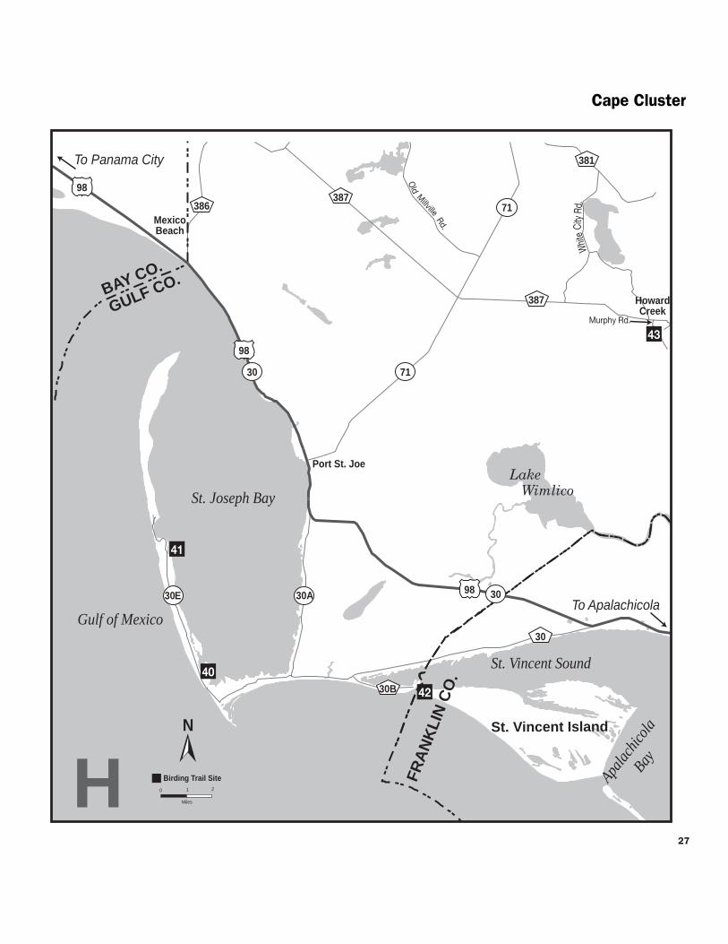
27
Cape Cluster
Port St Joe
HowardCreek
MexicoBeach
Gulf of Mexico
St Joseph Bay
Apalac
hicola
Bay
St Vincent Sound
Murphy Rd O
ld Millville Rd
Whit
e Ci
ty R
d
98
98
98
71
387
30
30E 30
30
71
30A
386387
381
41
40
42
43
N
0 1
Miles
2
Birding Trail Site
BAY CO
GULF CO
FRA
NK
LIN
CO
St Vincent Island
To Apalachicola
To Panama City
H
30B
Lake Wimlico
CapePitcher Plant amp Peregrine Clusters
J F M A M J J A S O N D
J F M A M J J A S O N D
44
J F M A M J J A S O N D
Directions From Airport Rd in Apalachicola take US 98US 319 SR 30 west for 53 mi and turn left on CR 30 at the fork Drive 98 mi and turn left (south) on CR 30BIndian Pass Rd in Indian Pass Follow the road east for 29 mi to the ferry site at the end of the road
Open dawn to dusk (850) 653-8808 wwwfwsgovsaintvincent
43 Apalachicola River Wildlife and Environmental Area Old Agricultural Fields
County Gulf Nearest city Wewahitchka Port Saint Joe
Physical address S Murphy Rd Wewahitchka 32465
Coordinates 29890676deg N -85069347deg W
Gazetteer page 60 Size 2150 acres
This part of the Wildlife and Environmental Area lies on the riverrsquos west side and includes roughly 1100 acres of old agricultural fields mown and planted for hunting deer turkey and quail The same management techniques that benefit these species also make the area prime for sparrows including the usual Swamp Song and Savannah plus the less common White-throated White-crowned Field Vesper and Grasshopper among others Mississippi and Swallow-tailed Kites feast on insects above the fields in summer Southeastern American Kestrels Cooperrsquos Hawks and Red-tailed Hawks hunt here year round The best plan of attack get a map at the office on the way in and drive Tram Boggy Branch Bean Field Palmetto and Indian Roads Feel free to park on the roadside and walk the fields for sparrows Ephemeral wetlands throughout the area are worth checking for wintering waterfowl also A recreation guide for the ARWEA is available ndash call (850) 488-8755 or order one at MyFWCcom Seasonal hunting takes place at this GFBWT site please see page 55 for information on dates regulations and more
Directions From US 98US 319SR 30 in Port St Joe take SR 71 north for 93 mi and turn right (east) on CR 387Doc Whitfield Rd Drive 82 mi and turn right (south) on Murphy Rd in Howard Creek the FWC office (06 mi ahead on the lefteast side of the road) can provide maps of area roads
Open dawn to dusk (850) 827-2934 MyFWCcomviewingrecreationwmasleadapalachicola-river
Map I Pitcher Plant amp Peregrine Cluster
St George Island State Park
County Franklin Nearest city St George Island
Physical address 1900 E Gulf Beach Dr St George Island 32328
Coordinates 29684697deg N -84795493deg W
Gazetteer page 61 Size 2023 acres
St George Island State Park is regularly rated one of Floridarsquos most beautiful beaches but what all the beachgoers donrsquot realize is that it has spectacular birdwatching too Bonapartersquos Gulls are reliable from winter to spring Snowy Plovers and American Oystercatchers nest here and Gull-billed Terns cruise the beach in summer Northern Gannets dive for fish offshore October through April and spring migrants like Swallow-tailed Kites Common Nighthawks and Green Herons can be seen arriving off the ocean in March and April The sandhill trail from the camping area and the oaks surrounding the youth camp are both excellent spots for migrant songbirds like Blue Grosbeaks and Scarlet Tanagers in April Therersquos something to see year-round but birding is best and beach visitor numbers are lowest October through April
Directions From US 98US 319SR 30 in Eastpoint take SR 300 Island Drive south for 56 mi across the bridge to St George Island Turn left (east) on CR 300Gulf Beach Dr the park entrance is 43 mi ahead
Open year round 8 AM to sundown (850) 927-2111 wwwfloridastateparksorgstgeorgeisland
45 Apalachicola National Estuarine Research Reserve Unit 4
County Franklin Nearest city St George Island
Physical address E 6th St St George Island 32328
Coordinates 29670753deg N -84851869deg W
Gazetteer page 60 Size 75 acres
This small preserve on the sound side of St George Island is a nice companion to the larger more well-known migrant fallout site at St George Island State Park (site 44) Unmarked trails leading off from the parking area at the end of 6th St wind through a coastal pine forest and give vantages of the sound and shoreline Watch for shore- and seabirds like Royal Terns American Oystercatchers and Laughing Gulls as well as migrants moving through Common Nighthawks Scarlet Tanagers Baltimore Orioles and Swallow-tailed Kites all pass
28
29
Sumatra
Eastpoint
CarrabelleBeach
Apalachicola
FortGadsden
Gulf of Mexico
St George Sound
Tatersquos Hell Swamp
Tatersquos Hell State Forest
Apalachicola National Forest
Apalachicola Bay
Apal
achi
cola
Riv
er
Pine Ave
6th St
Bloody Bluff Rd
TowerRd
Brickyard
RdF R 129
WrightLake Rd
FR 101
Fort Gadsden Rd
SW 8th St
Gulf Beach Dr
FR 180
FR
123
65
98
98
65
65
319
30
65
655
37922
LIBERTY COFRANKLIN COGULF CO
4544
48
46
46
47
49
50
52
53
54
N
0 1
Miles
2
Birding Trail Site
To Bristol
To PortSt Joe
To Carrabelle
I
San
d B
each
Rd
Deep Creek Rd
Tow
er R
d
FR 22
51
New
Riv
er
John
Alle
n R
d
300
300
Pitcher Plant amp Peregrine Cluster
Pitcher Plant amp Peregrine Cluster
through coastal areas like these as they arrive off the Gulf each spring Come prepared with insect repellent and drinking water
Directions From US 98US 319SR 30 in Eastpoint take SR 300 Island Drive south for 56 mi across bridge to St George Island Turn left (east) on CR 300Gulf Beach Dr and go 08 mi to 6th St Turn left (north) and go 02 mi to the end Look for a gravel road and small gazebo at the site entrance
Open dawn to dusk (850) 670-4783 nerrsnoaagov wwwdepstatefluscoastalsitesapalachicola
J F M A M J J A S O N D
Tatersquos Hell State Forest 46 High Bluff Coastal Hiking Trail
County Franklin Nearest city CarrabelleEastpoint
Physical address 2381 W US 98 Carrabelle 32322 (east entrance) 2985 W US 98 Eastpoint 32328 (west entrance)
Coordinates 29808446deg N -84728881deg W (east entrance) 29788651deg N -84766344deg W (west entrance)
Gazetteer page 61 Size 4 miles
Catch a glimpse of the vast 202437-acre Tatersquos Hell State Forest on this scenic trail From either parking area on US 98 a nature trail leads 4 miles through sand pine scrub good for Brown-headed Nuthatches Red-bellied Woodpeckers and Eastern Towhees year-round Listen for Yellow-breasted Chats and Orchard Orioles singing in springsummer In migration Summer and Scarlet Tanagers can be found in the pines Bald Eagles have nested northeast of the eastern parking area so watch for flyovers A nice spot for a hike worth checking in migration Florida Black Bears live within the forest look for tracks and other signs along the trail Seasonal hunting takes place at this GFBWT site please see page 55 for information on dates regulations and more
Directions From the intersection of CR 67 and US 98US 319SR 30 in Carabelle (east end of bridge) drive west on US 98 for 47 mi the trailhead entrance and eastern parking area are on the right (north) side of the road The eastern parking area is 32 mi west of the intersection of US 98 and Gulf Beach Rd in Carrabelle Beach The western trailheadparking area is 27 mi further west (south) From Eastpoint travel east on US 98 the western entrance is 46 mi east of the intersection with SR 65
Open dawn to dusk (850) 697-3734 wwwfl-dofcomstate_foreststates_hellhtml
J F M A M J J A S O N D
Apalachicola River Wildlife and 47 Environmental Area Cash Bayou
County Franklin Nearest city Eastpoint
Physical address SR 65 Eastpoint 32328
Coordinates 29819334deg N -84850006deg W
Gazetteer page 61 Size 100 acres
If yoursquore traveling between Sumatra and Eastpoint itrsquos worth taking a moment to pull off at the edge of Cash Bayou to take in the scenery scan for waterbirds like Bald Eagles and American Bitterns and check the brief trails for songbirds Better yet launch your canoe or kayak from this landing and bird the bayou by boat A recreation guide for the ARWEA is available ndash call (850) 488-8755 or order one at MyFWCcom Seasonal hunting takes place at this GFBWT site please see page 55 for information on dates regulations and more
Directions From US 98US 319SR 30 in Eastpoint drive east to SR 65 Turn left (north) and go 46 mi Though not well-marked you may park on the left (southwest) side of SR 65 just before the bridge
Open dawn to dusk (850) 827-2934 MyFWCcomviewingrecreationwmasleadapalachicola-river
J F M A M J J A S O N D
Apalachicola River Wildlife and 48 Environmental Area Sand Beach Tower
and Area Roads County Franklin Nearest city Eastpoint
Physical address Sand Beach Rd Eastpoint 32328
Coordinates 29784001deg N -84910698deg W
Gazetteer page 60 Size 12000 acres
Sand Beach Rd ends at a canoekayak launch pier and viewing tower in a nice hammock where Yellow-throated Warblers and White-breasted Nuthatches are possible Scan the reeds for waders like Little Blue Herons and from the tower scope East Bay for loons grebes and wintering ducks Ospreys and Bald Eagles nest in the area and both Mississippi and Swallow-tailed Kites are likely in summer here in the Apalachicola River basin The area roads can be interesting birding and butterflying for intrepid explorers particularly Tank Island Rd and Butcher Pen Landing In spring (good) or fall (best) check the flower patches along these roads particularly at low wet spots for marsh skippers such as Broad-winged Dion Palatka and Twin-spot Shallow streams across the road (low water crossings) have firm limestone bottoms and are not an obstacle to 2WD vehicles except during very high water These are a hydrologically sensitive alternative to culverts Seasonal hunting takes place at this GFBWT site please see page 55 for information on dates regulations and more
30
31
Pitcher Plant amp Peregrine Cluster
J F M A M J J A S O N D
49
J F M A M J J A S O N D
50
J F M A M J J A S O N D
51
Directions From US 98US 319SR 30 east of Eastpoint drive north on SR 65 for 86 mi Turn left (south) on Sand Beach Rd to enter the site An informational kiosk containing maps of area roads is located on the right (west) side of the road The viewing tower is located 28 mi down Sand Beach Rd
Open dawn to dusk (850) 827-2934 MyFWCcomviewingrecreationwmasleadapalachicola-river
Tatersquos Hell State Forest Deep Creek Tract
County Franklin Nearest city Eastpoint
Physical address Tower Rd and Deep Creek Rd Eastpoint 32328
Coordinates 29840886deg N -84903438deg W
Gazetteer page 60 Size 2 miles
Two miles of dirt roads along the Deep Creek Tract give you quick easy access to a wet prairie in the Apalachicola River basin Insect-eating pitcher plants line the ditches around this prairie which measures several hundred acres Watching for other recreational users bird Tower Rd by foot or from your car as well as the first 075 miles of Deep Creek Rd which divides the prairie in two Watch for typical overwintering wetland sparrows like skulky LeContersquos Grasshopper and Henslowrsquos as well as more common Swamp and Song Sparrows Swallow-tailed Kites use the cypress domes from March to August wading birds like Snowy Egrets and Little Blue Herons are most concentrated from March to June In winter ducks use the prairiersquos interior and American Bitterns may be seen along the edge Bald Eagles hawks and woodpeckers occur year-round By summer the sun is punishing and bugs are fierce hence the state forestrsquos name Seasonal hunting takes place at this GFBWT site please see page 55 for information on dates regulations and more
Directions From US 98US 319SR 30 east of Eastpoint drive north on SR 65 for 73 mi and turn right (north) on Tower Rd After 11 mi bear right (north) at the fork the site is along the left (west) side of Tower Rd and south side of Deep Creek Rd
Open dawn to dusk (850) 697-3734 wwwfl-dofcomstate_foreststates_hellhtml MyFWCcomviewingrecreationwmascooperativetates-hell
Apalachicola River Wildlife and Environmental Area Bloody Bluff Tract
County Franklin Nearest city Sumatra
Physical address Bloody Bluff Rd Eastpoint 32328
Coordinates 29869528deg N -84975057deg W
Gazetteer page 60 Size 4800 acres
Along the drive down Bloody Bluff Rd watch the edges for sparrows including Chipping Swamp and Song and listen in spring for Bachmanrsquos Sparrows The loop trail at the boat ramp at the end of the road can be good for songbirds like Yellow-throated Warblers and Blue-headed Vireos and Swallow-tailed and Mississippi Kites frequent the river run Most roads in this area can be interesting for birding (Creek Rd and Old County Rd have been productive for sparrows in the past) and several species of rare plants occur on the area This site is very rustic and there are some low water crossings on the dirt roads but these washes are hard bottomed (and accordingly passable in 2WD except in times of very high water) Seasonal hunting takes place at this GFBWT site please see page 55 for information on dates regulations and more
Directions From US 98US 319SR 30 east of Eastpoint drive north on SR 65 for 142 mi Turn left (west) on Bloody Bluff Rd to enter the site
Open dawn to dusk (850) 827-2934 MyFWCcomviewingrecreationwmasleadapalachicola-river
Apalachicola National Forest Fort Gadsden Historical Site
County Franklin Nearest city Sumatra
Physical address Fort Gadsden Rd Sumatra 32328
Coordinates 29940532deg N -85007360deg W
Gazetteer page 60
This site of a British fort dating back to the War of 1812 is slowly returning to the nature it was eked out of centuries ago Fortifications and historical signage are surrounded by the Apalachicola National Forestrsquos flatwoods on one side good for Common Yellowthroats and the occasional Bachmanrsquos Sparrow on the other side the shoreline at the broad brown Apalachicola River is lined with hardwoods and cypress home to singing Northern Parulas and Prothonotary Warblers Hike the flatwoods trail from the parking area and walk the waterfront in migration Breeding raptors like Red-shouldered Hawks and Mississippi Kites are raucous in springsummer Longleaf pines used by Red-cockaded Woodpeckers as cavity trees are ringed with white paint
J F M A M J J A S O N D
Open 24 hoursday (850) 643-2282 wwwfsfedusr8floridaapalachicola
Pitcher Plant amp Peregrine Cluster
Directions From the intersection of SR 65 and 8th StCR 22 in Sumatra travel south on SR 65 for 4 mi Turn right (west) on FR 129Brickyard Rd and follow for 21 mi Turn left (south) on Fort Gadsden Rd and continue for 07 mi to the site entrance
Open 8 AM to 8 PM (850) 643-2282 wwwfsfedusr8floridaapalachicola
J F M A M J J A S O N D
5 Apalachicola National Forest Wright Lake
County Franklin Nearest city Sumatra
Physical address NF 101Wright Lake Rd Bristol 32321
Coordinates 30000129deg N -85001991deg W
Gazetteer page 48 and 60
Two trails at this site a 025-mile trail around the lake and a 5-mile one traverse stretches of basin swamp and longleaf pine-wiregrass community Plants and animals in the latter community type have come to depend on frequent fire that keeps the understory low and open stimulating pine seeds to germinate and wiregrass to flower Since natural fire is feared by people itrsquos been suppressed in much of Florida allowing many remaining examples of this community to become overgrown and unsuitable for the animals that are uncompromisingly dependent on it Here in the national forest prescribed fire is used to keep pinewoods healthy making it one of the best places to see Red-cockaded Woodpeckers (RCWs) and Bachmanrsquos Sparrows Spring mornings are best for spotting both when sparrow males are singing ldquohere kitty-kitty-kitty-kittyrdquo on their territories and RCWs are busy coming and going from their nest cavities carrying food to their young Seasonal hunting takes place at this GFBWT site along the 5-mile trail please see page 55 for information on dates regulations and more
Directions From the intersection of SR 65 and 8th StCR 22 in Sumatra travel south on SR 65 for 19 mi to FR 101Wright Lake Rd Turn right (west) and follow FR 101Wright Lake Rd for 16 mi to the site
53 Apalachicola National Forest County Road 22 Pond
County Liberty Nearest city Sumatra
Physical address SW 8th StCR 22 Bristol 32321
Coordinates 30022150deg N -84955450deg W
Gazetteer page 48
While there are Red-cockaded Woodpecker (RCW) cavity trees ringed with white paint visible throughout the 571000-acre national forest this site offers the opportunity to park and hike to view the birds on foot without danger from passing traffic From the small parking area hike south to the small lake where ducks like Lesser Scaup may be found occasionally in winter The west side of the lake is a good foraging and nesting area for the woodpeckers Around the cavity entrances yoursquoll notice sap running from holes drilled by the woodpeckers this is thought to deter snakes from raiding the nests Please take care not to approach the cavity trees too closely these birds are protected by law and harassment is not tolerated Patient observers will easily see RCWs on spring mornings as they emerge and then begin bringing food to chicks in the cavity early evenings are good too Please stay on the trails to avoid trampling some of the sensitive and rare plants that occur in this area Seasonal hunting takes place at this GFBWT site please see page 55 for information on dates regulations and more
Directions From SR 20 just west of Bristol take SR 12 south for 214 mi to SR 65 in Wilma Go south on SR 65 for 100 mi to Sumatra and turn left (east) on SW 8th StCR 22 Go 14 mi down this wide unpaved road (also known as FR 22) A narrow woods road to the site is on the right (south) side Park on SW 8th StCR 22FR 22 and walk the woods road to the pond
Open dawn to dusk (850) 643-2282 wwwfsfedusr8floridaapalachicola
2
Apalachicola National Forest Post Office Bay Forest Road 123 Northeast
County Liberty Nearest city Sumatra
Physical address Forest Roads 123 and 180 Bristol 32321
Coordinates 30089149deg N -85042806deg W
Gazetteer page 48 Size 66 miles
This 66-mile spectacular scenic drive passes through wet savannas and longleaf pine forest in some of the best condition yoursquoll find anywhere in the southeast Watch for carnivorous plants including four species of pitcher plants growing in roadside wetlands Stop at roadside pulloffs to explore looking for breeding Red-cockaded Woodpeckers Bachmanrsquos Sparrows and Swainsonrsquos Warblers Winter can be good for rarer sparrows like Henslowrsquos and LeContersquos in the soggy flatwoods and savannas Butterfly viewing is good all year but best in fall When the blazing stars
J F M A M J J A S O N D
32
54
33
Pitcher Plant amp PeregrineBluffs Clusters
(Liatris) are blooming along CR 379 or the forest roads visitors may find impressive numbers and a wide diversity of species Special butterflies that occur here include Wild Indigo Duskywing Florida Dusted Skipper and Berryrsquos Skipper Take care not to trample delicate plant life by walking off trails Seasonal hunting takes place at this GFBWT site please see page 55 for information on dates regulations and more
Directions From the intersection of SR 65 and SW 8th StCR 22 in Sumatra travel north on SR 65 for 06 mi Turn left (west) onto CR 379 The best access point for FR 123 is 59 mi ahead on the right (east) side of the road This road can be driven as a loop with stops to view RCW clusters and savannas drive FR 123 for 33 mi until it ends at FR 180 Turn left (west) and travel FR 180 for another 33 mi FR 180 will return you to CR 379 15 mi further north of your starting point
Open dawn to dusk (850) 643-2282 wwwfsfedusr8floridaapalachicola
J F M A M J J A S O N D
Map J Bluffs Cluster
Apalachicola Bluffs and Ravines Preserve 55 Garden of Eden Trail County Liberty Nearest city Bristol
Physical address Garden of Eden Rd Bristol 32321
Coordinates 30451730deg N -84968490deg W
Gazetteer page 48 Size 6295 acres
At 135 feet above the Apalachicola River Alum Bluff is the largest geological exposure in Florida In fact the topography of this site feels nothing like what most people expect from Florida Hike the steep 375-mile trail through longleaf pine sandhills upland mixed hardwoods along the tops of steephead ravines down into slope forests across shallow streams and out to the bluff Listen for Wood Thrushes Hooded Warblers Barred Owls and Broad-winged Hawks along the way Butterfly viewing is good in spring and fall In the dry sandhills expect Southern Dogface Cloudless Sulphur and other pierids (whites and yellows) plus various duskywings including Sleepy and Juvenalrsquos in spring Also check for Dotted Skipper in the ravines search for Spring and Summer Azures and Carolina Satyr Not for the faint of heart this hike will make you earn the spectacular views of the Apalachicola River but theyrsquore well worth the effort Watch your footing and definitely bring water While therersquos no hunting on this property The Nature Conservancy encourages visitors to wear bright colors in season for safety
Directions From SR 20 in Bristol take SR 12 north for 14 mi Turn left (west) at Garden of Eden Rd (look for ldquoApalachicola Bluff-Garden of Edenrdquo sign)
Open dawn to dusk (850) 643-2756 wwwnatureorg
J F M A M J J A S O N D
56 Torreya State Park
County Liberty Nearest city Bristol
Physical address 2576 NW Torreya Park Rd Bristol 32321
Coordinates 30558707deg N -84949714deg W
Gazetteer page 32 Size 2650 acres
This park is named after the Torreya tree the worldrsquos rarest evergreen which only grows on bluffs on the eastern side of the Apalachicola River Still in decline this tree is the subject of much study and can be seen here alongside wonderful vantages of the Apalachicola River and interesting birds The most productive birding spots are the areas of the trail around Stone Bridge down by the river northwest of the historic home and on the trails to Rock Bluff Primitive Campground As in much of extreme north Florida
Jaret Daniels
Red-banded Hairstreak
Bluffs Cluster
Lake Seminole
Apala
chicol
a Rive
r
Chattahoochee
Blountstown
Bristol
Sneads
Greensboro
Hosford
Juniper
69
97
12
20 65
20
71
20
90
90
269
268
270
1641
270A
271
286
280
275
275
69A
69
274
69
67
12
274
270
270
12
268
270
71
8
8
10
10
12
286
270
10
10
GADSDEN COLIBERTY CO
57
58
56
55
N
0 1
Miles
2 J
To Marianna
To Tallahassee
To Bainbridge GA
GEORGIA
174
166
162 Flat Creek Rd
158
152
Legi
on R
d
Torreya State Park Rd
To Apalachicola
Riv
erRd
JACKSON COCALHOUN COJACKSON COCALHOUN CO
Birding Trail Site Rest Area
Garden of Eden Rd
1641
1641
34
35
Bluffs Cluster
watch for northern birds like Winter Wren Louisiana Waterthrush Golden-crowned Kinglet and Brown Creeper Brown-headed Nuthatch and Bachmanrsquos Sparrow are possible in the sandhills and the high canopies along the river can be good for Yellow-throated Vireo in spring Birding by ear skills are very useful here Spring and fall are ideal times for butterfly enthusiasts to visit This park is one of the most reliable spots in Florida for Mourning Cloak (early spring) May is good for seeing Banded Kingrsquos and Striped Hairstreaks a fall day can produce more than a dozen skipper species The park features more than 17 miles of hiking trails and numerous camping options
Directions From I-10 west of Quincy take exit 174 for SR 12 and go toward Greensboro Stay on SR 12 through Greensboro and continue (approx 14 mi total from I-10) until the intersection with CR 1641 Turn right (north) on CR 1641 and continue left (northwest) at the fork with CR 270 Bear right (northwest) at the next fork with CR 270 Bear right at the next fork (CR 1641 becomes Torreya State Park Rd) and follow the signs to the park entrance Note some maps show CR 1641 as CR 271
Open year round 8 AM to sundown (850) 643-2674 wwwfloridastateparksorgtorreya
57 Three Rivers State Park
County Jackson Nearest city Sneads
Physical address 7908 Three Rivers Park Rd Sneads 32460
Coordinates 30739096deg N -84936161deg W
Gazetteer page 32 Size 667 acres
Pine and hardwood uplands with big old trees characterize this park on the south shore of Lake Seminole This lake is actually a reservoir created at the confluence of the Flint and Chattahoochee Rivers where they form the Apalachicolamdashthe opposite shoreline lies in Georgia Bird the Lakeside Trail which begins near the campground as well as the Half Dry Creek Trail by the picnic area Habitat and location are good for Kentucky Warbler and Louisiana Waterthrush in springsummer Otherwise wintering birds characteristic of the area including Red-breasted Nuthatch and Golden-crowned Kinglet are rare but possible in cooler months In winter also scope the lake from two birding blindsmdashyou never know what wintering waterfowl you may find A Yellow-billed Loon wintered on a reservoir south of Atlanta in 2003-04 Who knows what else is out there simply waiting for birders to find it Loaner optics and field guides are available at the entrance station
Directions From I-10 take exit 158 for CR 286 Head north for 52 mi to US 90SR 10 in Sneads Turn left (west) and go 04 mi Turn right (north) on CR 271River Rd and drive 21 mi Turn right (east) at Three Rivers Park Rd The entrance is just ahead
Open year round 8 AM to sundown (850) 482-9006 wwwfloridastateparksorgthreerivers
J F M A M J J A S O N D
Road signs guide visitors to each destination in the Panhandle Section of the Great Florida Birding and Wildlife Trail
C
W
Fresi
k K
raM
J F M A M J J A S O N D
BluffsTalquin Clusters
58 Sneads Park
County Jackson Nearest city Sneads
Physical address Legion Rd Sneads 32460
Coordinates 30727696deg N -84906788deg W
Gazetteer page 32 Size 64 acres
This small waterfront park on Lake Seminole is worth a stop if yoursquore in the area to scope the open water for wintering ducks like Redheads Canvasbacks Lesser Scaup Ring-necked Ducks Bufflehead American Wigeon and more Thousands of American Coots are often visible on the lake in winter scan for Horned Grebes and Common Loons as well Up for exploring The park includes a boat ramp for access to the lake Fields along the right (east) side of Legion Rd north of the baseball diamonds may have wintering geese such as Canada Snow Greater White-fronted and Rossrsquos Check the roadside wires for American Kestrels Western Kingbirds (rare) have also been sighted here
Directions From I-10 take exit 158 for CR 286 Head north for 52 mi to US 90SR 10 in Sneads Turn right (east) and go 09 mi Turn left (north) on Legion Rd and drive 15 mi to the parking area on the lake
Open dawn to dusk (850) 593-6636
J F M A M J J A S O N D
Map K Talquin Cluster
Joe Budd Wildlife Management Area 59 at Lake Talquin State Forest County Gadsden Nearest city Midway
Physical address Office Rd and Peters Rd Midway 32343
Coordinates 30509365deg N -84538308deg W (office) 30492610deg N -84503975deg W (Peters Rd at Cattle Gap Rd)
Gazetteer page 33 and 49 Size 11039 acres
An extensive system of side roads closed to vehicles is open to exploration via foot bicycle and equestrian traffic and will yield wintering mixed flocks of warblers Wild Turkeys in the open fields and Northern Bobwhites in the pinewoods After turning on Office Rd a large open pasture and dove field on both sides of the road are good birding for wintering sparrows Mourning Doves Eastern Meadowlarks and American Kestrels and also serve some years as a display ground for courting American Woodcocks at dawn and dusk Mississippi and Swallow-tailed Kites feed over pastures in spring summer Check edges of fields and woodlands for Blue Grosbeaks in summer as well At the end of Office Rd a dike trail runs 07 miles
one-way past sloughs good for warblers and Wood Ducks Wood Storks are sometimes present at the Joe Budd Aquatic Education Center on Budd Pond off Cattle Gap Rd The trail at the end of Plantation Rd offers a vantage of Lake Talquin similar to High Bluffrsquos (site 60) Seasonal hunting takes place at this GFBWT site please see page 55 for information on dates regulations and more The area is closed to other uses on hunt days A WMA map is available from the website below
Directions From I-10 west of Tallahassee take exit 192 onto US 90SR 10 and head northwest After 20 mi turn left (southwest) towards Midway onto CR 268MLK Blvd Continue west for 6 mi on CR 268MLK Blvd (changes to Highbridge Rd) and turn left (south) on Office Rd to reach WMA headquarters Other WMA roads can be accessed via Peters Rd (See directions for site 60 veer right onto Cattle Gap Rd to access Joe Budd WMA)
Open dawn to dusk closed on hunt days (850) 627-1773 MyFWCcomviewingrecreationwmasleadjoe-budd
J F M A M J J A S O N D
Lake Talquin State Forest 60 High Bluff Recreation Area County Gadsden Nearest city Midway
Physical address High Bluff Landing Rd Midway 32343
Coordinates 30461752deg N -84497412deg W
Gazetteer page 49 and 50 Size 2 acres
Scan the lake from the fishing pier looking for waders along the shoreline and in offshore trees as well as wintering ducks on the open water like Green-winged Teal and Lesser Scaup Better yet explore the lake from the water Songbirds like Black-throated Blue Warblers and Northern and Louisiana Waterthrushes use the hardwoods lining the lakersquos edge in migration Seasonal hunting takes place at this GFBWT site please see page 55 for information on dates regulations and more
Directions From I-10 west of Tallahassee take exit 192 for US 90SR 10 and head northwest After 20 mi turn left (southwest) towards Midway onto CR 268MLK Blvd Go 24 mi on CR 268 MLK Blvd to Peters Rd and turn left (west) Drive 11 mi and turn left (south) onto High Bluff Landing Rd which dead ends at the site after 26 mi
Open dawn to dusk (850) 488-1871 wwwfl-dofcomstate_forestslake_talquinhtml
J F M A M J J A S O N D
36
37
Talquin Cluster
Danny Bales
An eloquent songster the Wood Thrush is a breeding bird of the Panhandle and extreme North Florida It feeds mainly on insects
Lake Talquin State Forest 61 Bear Creek Educational Forest County Gadsden Nearest city Quincy
Physical address 8125 Pat Thomas Pkwy Quincy 32351
Coordinates 30478155deg N -84626724deg W
Gazetteer page 49 Size 492 acres
The entrance trail to this site is a paved interpretive trail which then connects to the 25-mile Ravine Trail and the 30-mile Bear Creek Trail The former hugs the creek ravine and its hardwood forest is good for migrants like Wood Thrushes and Veeries The pine flatwoods of the longer Bear Creek Trail are good for Northern Bobwhites and Wild Turkeys Take water and insect repellent and pick up a map at the entrance kiosk This site offers something for people of all birding skill and mobility levels Butterfly viewing here is best in spring Check flowering trees especially along the Ravine Trail for gossamer-wing butterflies such as Henryrsquos Elfin Banded Hairstreak and Spring and Summer Azures
Directions From I-10 south of Quincy take exit 181 for SR 267 Pat Thomas Pkwy Drive south for 43 mi and cross CR 65B the entrance is 04 mi further south on the left (east) side of the road
Open dawn to dusk (850) 488-1871 wwwfl-dofcomstate_forestslake_talquinhtml
Jaret Daniels
The Eastern Tiger Swallowtail is a large familiar butterfly found throughout most of Florida Males are yellow but females can be either black or yellow The caterpillars feed on trees such as red maple wild cherry sweetbay and tulip tree Look for adults feeding on thistle ironweed and milkweed in meadows parks and roadsides
J F M A M J J A S O N D
CO
Talquin Cluster
Lake Talquin
Office Rd
Peters Rd
Plan
tation
Rd
Blountstown Hwy
Quincy
Wetumpka
Midway
Fort Braden
20
65
267
267
267 65
12
90
90
375
65B 65B
268 161
270
270
20
267
8
8
10
65C
10
10
60
62
61
59
N
0 1
Mile s
2
Birding Trail Site K
To Tallahassee
To Tallahassee
To Marianna
To Havana
To Georgia
HighBlu
ff Lan
dingR
d
Highbridge Rd
Coes Landing Rd
B l o x h a m C u t o f f R d
268
181
174
192
GADSDEN COGADSDEN CO
LEON CO
LEON CO
LIB
ERTY
LIB
ERTY
CO
Cattle Gap Rd
38
39
Talquin Cluster Jaret D
aniels D
anny Bales
Northern Bobwhite
40
TalquinWhite-breasted Nuthatch Clusters
Lake
Jackson
Old
Bai
nbrid
ge R
d
Faulk
Dr
Millers
Landing Rd
N M
erid
ian
Rd Maclay Rd
Killarney Way
Raymond Diehl Rd
Vassar Rd
Tennessee StMahan Dr
Buck Lake Rd
Pedrick Rd
Center
ville R
d
Mag
nolia
Dr
6th Ave
7th Ave
Thom
asvi
lle R
d
Cap
ital C
ircle
N Monroe St
Tallahassee
Bradfordville
20
31927
319
27
90
0345
0342
155
151
0361
263
0347
61 9010
61
20
61
63
10
371
363
1568
8
8 10 10
69
68
67B
67A6663
64
65
L
To Thomasville GA
To LakeCity
ToCrawfordville
To Quincy192
196
194
203
199
209
N
0 1
Miles
2
GA
DS
DE
N C
O
LEO
N C
O
Sham
rock St
Crowder
Rd
Birding Trail Site
Rest Area
62Lake Talquin State Forest Fort Braden Trails
County Leon Nearest city Tallahassee
Physical address SR 20Blountstown Hwy Tallahassee 32310
Coordinates 30438199deg N -84495804deg W
Gazetteer page 49 and 50 Size 1242 acres
This site offers extensive hiking trails that are blazed in orange (compared to horse trails in pink or yellow) Pick up a map at the entrance and bring water One of the best trail choices is the Center Loop hike north from the parking area and stay right at every split on the orange-blazed trail to make a 2-mile loop back to the parking area The trail will take you through open areas and xeric oak uplands good for Wild Turkeys and White-eyed Vireos then reach bluffs overlooking Lake Talquin It follows the lake edge for nearly a mile before circling back through the uplands Watch overhead
for raptors and scan the lake for wintering ducks and wading birds Weedy and brushy areas have wintering sparrows including Chipping Song and White-throated
Directions From the intersection of SR 263Capital Circle and SR 20Blountstown Hwy in Tallahassee take SR 20 west for 87 mi the trailhead parking area is on the right (north) side of the road
Open dawn to dusk (850) 488-1871 wwwfl -dofcomstate_forestslake_talquinhtml
J F M A M J J A S O N D
J F M A M J J A S O N D
41
63
64
White-breasted Nuthatch Cluster
Map L White-breasted Nuthatch Cluster
J Lee Vause Park
County Leon Nearest city Tallahassee
Physical address 6024 Old Bainbridge Rd Tallahassee 32303
Coordinates 30537105deg N -84361323deg W
Gazetteer page 34 Size 26 acres
This small park has a well-developed center but down by the lake its sunny woody edges are a haven for birds like Orange-crowned Warblers and the occasional Yellow-breasted Chat A boardwalk and pier provide a view of Lake Jackson where you can look for a diversity of wading birds like Wood Storks as well as wintering ducks and coots Donrsquot forget flyovers by Ospreys and Bald Eagles as well as breeding Red-shouldered Red-tailed and Broad-winged Hawks in spring and summer
Directions From I-10 in Tallahassee take exit 199 for US 27N Monroe St Drive north for 46 mi and turn right (north) on CR 0361 Old Bainbridge Rd the park is 03 mi ahead on the right (east) side of the road
Open dawn to dusk (850) 606-1470 wwwleoncountyflgovparkspark_indexasp
Faulk Drive Landing
County Leon Nearest city Tallahassee
Physical address Faulk Dr Tallahassee 32303
Coordinates 30522392deg N -84322033deg W
Gazetteer page 34 Size 02 acres
Another access to Lake Jackson this one is a little more rustic and your tires (not to mention your feet) may get muddy at times of higher water Itrsquos best to park back from the landing and walk in watching fence posts and small oaks for flycatchers and warblers At the landing scan for egrets herons White Ibises and waterfowl Black-bellied Whistling-Ducks have turned up here as have Roseate Spoonbills The grassy area to the south of the landing may have Common Ground-Doves Eastern Bluebirds and Common Yellowthroats plus sparrows (such as Swamp and Savannah) in winter Launch a canoe or kayak here to explore Lake Jackson in more detail Worth a stop if yoursquore in the area Seasonal hunting takes place at this GFBWT site please see page 55 for information on dates regulations and more
Directions From I-10 in Tallahassee take exit 199 for US 27N Monroe St Drive north for 27 mi and turn right (northeast) on Faulk Dr the site is 14 mi ahead at the end of the road
Open dawn to dusk (850) 606-1470 wwwleoncountyflgovparkspark_indexasp
J F M A M J J A S O N D
65 Crowder Landing
County Leon Nearest city Tallahassee
Physical address Crowder Rd Tallahassee 32303
Coordinates 30507436deg N -84313444deg W
Gazetteer page 34 Size 06 acres
This small boat landing warrants a quick stop if yoursquore in the area because it provides another vantage of Lake Jackson Wintering ducks and coots are plentiful on the lake in winter as are wading birds like Snowy Egrets and Little Blue Herons Sandhill Cranes appear on occasion and in 2002 a Hudsonian Godwit was discovered here Lake Jackson is known for its tendency to disappear down a sinkhole in its middle at times of low water to birders itrsquos known for less common flycatchers (Vermillion for example) and songbirds in migration When itrsquos hot itrsquos hot When itrsquos nothellip
Directions From I-10 in Tallahassee take exit 199 for US 27N Monroe St Drive north for 17 mi and turn right (east) on Crowder Rd Follow Crowder Rd for 12 mi as it bends north then east the site is at the end on the lake
Open dawn to dusk (850) 606-1470 wwwleoncountyflgovparkspark_indexasp
J F M A M J J A S O N D
66 Elinor Klapp-Phipps Park
County Leon Nearest city Tallahassee
Physical address Miller Landing Rd Tallahassee 32312
Coordinates 30536493deg N -84280792deg W
Gazetteer page 34 Size 670 acres
Elinor Klapp-Phipps Park on Lake Jackson has areas of longleaf pine restoration but its real asset is the beautiful deciduous slope forest following the trickle of small streams down to the big lake Eastern Bluebirds Indigo Buntings and Wild Turkeys use open grassy areas along the powerline entrance and horse trailer entrance As the trails dive into the hammock start watching and listening for migrants like Wood and Gray-cheeked Thrushes and Blackburnian Warblers
J F M A M J J A S O N D
67
White-breasted Nuthatch Cluster
Reinhard Geisler
White-breasted Nuthatch
Down by the large bat house on Lake Victoria at stop 17 scope for Anhingas Tricolored Herons and Ospreys Black-bellied Whistling-Ducks have bred here recently The Lake Jackson area is known for unusual sightings like occasional wintering Western Tanagers so bird with an open mind Butterfly viewing is also quite good at this park spring through fall Unlike many sites mid-summer has an impressive variety of butterfly species look for spread-winged skippers including Silver-spotted Golden-banded Hoary Edge and Southern Cloudywing along the woodland trails and in the open meadows Trails at this park are extensive and winding Pick up a trail map and butterfly checklist at the entrance (or download them from the website below) and pay attention to your chosen route
Directions From I-10 in Tallahassee take exit 203 for US 319SR 61Thomasville Rd Drive north for 09 mi and turn left (west) on Maclay Rd Follow Maclay Rd for 22 mi to its end and turn right (north) on N Meridian Rd Drive 10 mi and turn left (west) on Millerrsquos Landing Rd the park entrance is 02 mi ahead on the left (south) side of the road
Open dawn to dusk (850) 891-3866 (850) 891-3975 wwwtalgovcomparksparksphippscfm
Alfred B Maclay Gardens State Park
County Leon Nearest city Tallahassee
Physical address 3540 Thomasville Rd Tallahassee 32309
Coordinates 30534672deg N -84277454deg W (Lake Overstreet) 30513532deg N -84247467deg W (main entrance)
Gazetteer page 34 Size 1179 acres
More widely known for its manicured gardens this park also offers native habitat that is better for birdwatching Try the brief trails along the lake at the Lake Hall Recreation Area for wintering Orange-crowned Warblers and Blue-headed Vireos A few Dark-eyed Juncos make an appearance here in winter Brown Creepers and Winter Wrens may also be present Check the lakes for wintering ducks and then for drinking Purple Martins beginning in February For a longer hike hit the Lake Overstreet multi-use trails (5 miles worth) off Meridian Road These are more rustic so be sure to pick up a map and bring water Birds like Red-headed Woodpeckers Brown-headed and White-breasted Nuthatches Great Horned Owls and Chuck-willsshywidows can all be found here The recreation area and gardens have wheelchair access
Directions (A) Lake Overstreet Trailhead From the intersection of Meridian and Maclay roads drive north on Meridian 09 mi turn left (west) and enter the parking lot for Forest Meadows Park amp Athletic Center the trailhead is directly across the street on the east side of Meridian (B) Main entrance From I-10 in Tallahassee take exit 203 for US 319SR 61Thomasville Rd Drive north for 09 mi and turn left (west) on Maclay Rd The park entrance is 02 mi on the right (north) side of the road
42
43
White-breasted Nuthatch Cluster
Open year round 8 AM to sundown (850) 487-4556 wwwfloridastateparksorgmaclaygardens
J F M A M J J A S O N D
68 A J Henry Park
County Leon Nearest city Tallahassee
Physical address 3000 A J Henry Park Dr Tallahassee 32309
Coordinates 30507040deg N -84217947deg W (north entrance) 30503435deg N -84218606deg W (south entrance)
Gazetteer page 34 and 50 Size 72 acres
A J Henry Park is a small city property with some nice topography and habitats including hardwood forest-covered slopes which descend down to a lake Accordingly this park attracts fallouts of migrants like Veery Ovenbird and Magnolia Warbler among others Raptors like Mississippi Kite and Broad-winged Hawk hunt for prey here in late spring and summer and Blue-winged Teal Ring-necked Duck and the occasional Redhead or Common Goldeneye can be found on the lake in winter The area surrounding the lake and the lower (north) parking area offer the most productive birding Extensive trails at the upper (south) parking area are appealing but the thicker understory can make it hard to spot birds frustrating those who donrsquot know bird calls and songs
Directions From I-10 in Tallahassee take exit 203 for US 319SR 61Thomasville Rd Drive north for 09 mi to Killarney Way and turn right (southeast) There are two approaches to the site off of this road For the south entrance proceed east on Killarney Way and turn right (south) onto Raymond Diehl Rd then turn left (east) on Vassar Rd Take Vassar Rd to its end and turn right (south) on Whitney Dr The park is 150 yds on the left (east) side of the road For the north entrance follow Killarney Way to the end and turn right (southeast) on Shamrock St After 03 mi turn right (south) on Gardenview Way and right (southwest) again after 03 mi onto A J Henry Park Dr The entrance is 02 mi ahead
Open 8 AM to dusk (850) 891-3866 wwwtalgovcomparksparksajhenrycfm
David M
oynahan
Common Goldeneye
Danny Bales
Rusty Blackbird
J F M A M J J A S O N D
White-breasted Nuthatch Mississippi Kite Clusters
69 J R Alford Greenway
County Leon Nearest city Tallahassee
Physical address 2500 S Pedrick Rd Tallahassee 32317
Coordinates 30444486deg N -84175759deg W
Gazetteer page 50 Size 874 acres
This greenway is a collection of old pastures and woodlands now used for passive recreation Seventeen miles of multi-use trails invite many hours of exploration From the parking area follow the trail due east across the first pasture (watch for Purple Martins and Eastern Bluebirds around the gourds and nest boxes) and veer either way at the fork to continue through a series of open fields Watch overhead for Red-tailed Hawks mixed flocks of wintering Palm Warblers and White-throated Sparrows flit in the weedy edges Pastures are managed for a mosaic of early succession habitats wintering Grasshopper Sparrows skulk in the grass (when itrsquos left high) as do Eastern Meadowlarks American Kestrels Eastern Phoebes and Loggerhead Shrikes stand lookout on snags and Wood Storks and Double-crested Cormorants can be seen flying overhead to Lake Lafayette at sunset From the parking lot another trail leads to the south and winds east through hardwoods good for Red-shouldered and Cooperrsquos Hawks Download a map and pay attention to your route Trails can be confusing at times a GPS unit is quite useful here Consider biking this property to cover more ground
Directions From the intersection of US 319Capital Circle and US 90 Tennessee StMahan Dr in Tallahassee drive 07 mi east on US 90 and turn right (east) on Buck Lake Rd After 20 mi turn right (south) onto Pedrick Rd the entrance and parking are 16 mi ahead at the end of the road
Open dawn to dusk (850) 606-1470 wwwleoncountyflgovparksgreenwaysasp
J F M A M J J A S O N D
Jaret Daniels
J F M A M J J A S O N D
Map M Mississippi Kite Cluster
70 Apalachicola National Forest Leon Sinks Geological Area
County Leon Nearest city Woodville
Physical address US 319Crawfordville Hwy Tallahassee 32305
Coordinates 30306785deg N -84345082deg W
Gazetteer page 50 Size 640 acres
This recreation area in the east portion of the Apalachicola National Forest is different from the lower longleaf savannah habitats of the
tracts closer to the river Here higher sandhills of pine and turkey oak are broken by erosion in the underlying limestone causing deep dramatic crystal blue sinkholes which are rimmed with hardwoods Upon entering the hiking trail turn left at the T-junction for the shorter trail (17 miles) and return on the short-cut (05 mile) through a tupelo swamp Listen for Barred Owls Northern Parulas and Prothonotary Warblers near the wetlands and watch for Blue-headed Vireos and Carolina Chickadees in the pinewoods By turning right at the T-junction yoursquoll choose the longer 25-mile loop past a series of large sinkholes Watch for Wild Turkeys Hermit Thrushes and White-eyed Vireos in the sandhills as well as songbirds like Yellow-billed Cuckoos in hardwoods sloping into the sinks In spring wild azaleas along the Gum Swamp Trail attract many swallowtail butterflies Little Wood-Satyr and Red-spotted Purple can occur in any wooded stretch Near the sinkholes look for Golden-banded Skippers Bring water and sunscreen
Directions From the intersection of US 319SR 263Capital Circle SW and US 319SR 369SR 61Crawfordville Rd in Tallahassee drive south on Crawfordville Rd for 58 mi the site is on the right (west) side of the road
Open year round 8 AM to 8 PM (850) 926-3561 wwwfsfedusr8floridaapalachicola
One of the most famous and recognizable butterflies in North America the Monarch undertakes an extensive migration each fall to hibernation sites in California and Mexico Large numbers gather on the Gulf Coast in October at locations like St Marks National Wildlife Refuge in Wakulla County A festival held at the refuge each year coincides with the Monarchrsquos migration Milkweeds are important plants for both caterpillars and adults
44
45
Mississippi Kite Cluster
StMarks
Newport
Wakulla
Medart
ShellPoint
Crawfordville
Sopchoppy
Woodville
Panacea
ApalachicolaNationalForest
St M
arks
Rive
r
Wakulla River
ApalacheeBay
Gulf of Mexico
Ochlockonee Bay
OchlockoneeRiver Rd
Sheldon St
ParkAve
OtterLake Rd
Lighthouse
Rd
Bottoms
Rd
Wak
ulla
Spr
ings
Rd
Woo
dvill
e H
wy
Bald
Poi
nt
Rd
Cra
wfo
rdvi
lle H
wy
98
98
98
319
61
267
267
363
363
372
369
374
375
267
61
365
356
356
356
319
98 30
61
30
367A
30
319365
368
365
365
367
367
59
365
372
375
372A372A
370
22
98
2192
2195
2204
WAKULLA CO
FRANKLIN CO
LEON CO
WAKULLA CO
70
71
73
72
7475
76
77
78
N
0 1
Miles
2
Birding Trail Site
ToPerry
ToApalachicola
ToTallahassee
M
Bloxham Cutoff Rd
Rose St
Sopchoppy Hwy
Alligator Dr
Sopc
hopp
y H
wy
Mississippi Kite Cluster R
einhard Geisler
Mississippi Kite
46
47
71
J F M A M J J A S O N D
J F M A M J J A S O N D
72 see ldquoGatewaysrdquo on page 3 for more information
73
Mississippi Kite Cluster
Edward Ball Wakulla Springs State Park
County Wakulla Nearest city Wakulla Springs
Physical address 550 Wakulla Park Dr Wakulla Springs 32327
Coordinates 30243337deg N -84310614deg W
Gazetteer page 50 Size 6055 acres
Hiking trails throughout this park provide access to floodplain forest good for Summer Tanagers and Ovenbirds in migration and Great Crested Flycatchers and Northern Parulas in summer The primary attraction however is the access to Wakullarsquos first magnitude spring From the pier look for Anhingas Common Moorhens Pied-billed Grebes and wintering American Wigeons as well as roosting Black Vultures in the cypress Better yet take one of the parkrsquos river cruises to get excellent views of the aforementioned plus Least Bitterns Yellow-crowned Night-Herons Barred Owls and White Ibises Alligators Suwannee River Cooters and mullet are commonly seen manatees are sometimes found in the river and spring as well In years past this park was known for Limpkins but today they are almost never seen here However the park staff is reintroducing native apple snails the Limpkinrsquos main prey item to entice Limpkins to return The spectacular 1930s-era lodge has roosting Chimney Swifts in summer Butterfly viewing is best here in late spring and fall Many swallowtail and hairstreak species are seen on flowering trees and shrubs in spring Texan Crescents and Appalachian Browns are regularly seen on the hiking trails north of the Wakulla River The park hosts an extensive wildlife and birding festival each spring
Directions From the intersection of SR 263Capital Circle SW and US 319SR 369SR 61Crawfordville Rd in Tallahassee drive south on Crawfordville Rd for 21 mi Take a slight left to stay on SR 61 Wakulla Springs Rd and go 74 mi Turn left (east) on SR 267Bloxham Cutoff Rd the site is 01 mi ahead on the right (south) side of the road
Open year round 8 AM to sundown (850) 926-0700 wwwfloridastateparksorgwakullasprings
St Marks National Wildlife Refuge St Marks Unit (Headquarters) Gateway
County WakullaJefferson Nearest city St Marks
Physical address 1255 Lighthouse Rd Crawfordville 32327
Coordinates 30156008deg N -84150652deg W
Gazetteer page 50 and 51 Size 29529 acres
Spanning four counties and with more than 300 recorded bird species the 68000-acre St Marks NWR is a must-see The St Marks Unit includes refuge headquarters and the historic St Marks Lighthouse itrsquos also the unit most popular with birders and wildlife
viewers for good reason Stop briefly at the visitor center for a map and to check the sightings log A pond and trail here can be good for White-throated Sparrows Pileated Woodpeckers Belted Kingfishers Eastern Phoebes and more but other trails are more rewarding From north to south along the main road the helicopter pad accessed from the primitive hiking trails is good for wintering sparrows such as Henslowrsquos East River Pool can be good for waterfowl in winter Stoney Bayou Pool and the Mounds Pools hold shovelers coots and the spectrum of wading birds in winter and the trail around Mounds Pool 3 is particularly good for Northern Pintails and Snow Geese in winter Stoney Bayou Pool 2 and Mounds Pool 3 are also good places to look for American Black Ducks The Headquarters Pond viewing platform offers the occasional Sora and Purple Gallinule as well as wintering teal and year-round waders The Mounds Trail around Tower Pond is very good for migrant songbirds like Yellow-billed Cuckoos and Indigo Buntings as well as Brown-headed Nuthatches in the pines and ducks and shorebirds in the pond At the roadrsquos terminus at the lighthouse look for common wintering waterfowl plus Redheads Canvasbacks Nelsonrsquos Sparrows shorebirds and more Scaup Bufflehead Horned Grebes and Common and Red-throated Loons winter in the Gulf and Least Bitterns Seaside Sparrows shorebirds and Clapper Rails breed in the marshes Oystercatchers pelicans and gulls loaf on pilings and offshore oyster bars Butterfly viewing is best here in fall especially September and October Monarch butterflies congregate here along Apalachee Bay on their fall migration to Mexico a Monarch festival is held each October to celebrate this phenomenon Hundreds of Monarchs may be seen on a mid-October day Along Lighthouse Dr keep your eyes open for Gulf Fritillaries and Long-tailed Skippers plus American Alligators Bobcats Northern River Otters and Florida Black Bears Though you may not see one just yet a Whooping Crane reintroduction project began in 2009 Bring water food sun protection and bug spray
Directions From the intersection of US 98SR 30 and SR 363 Woodville Hwy north of the town of St Marks drive east on US 98 approx 25 mi and turn right (south) on CR 59Lighthouse Rd just east of the St Marks River Bridge The refuge entrance is 30 mi ahead the visitor center is 06 mi farther south on the right
Open dawn to dusk (850) 925-6121 wwwfwsgovsaintmarks
Shell Point Beach Park
County Wakulla Nearest city Crawfordville
Physical address Beaty Taff Dr Crawfordville 32327
Coordinates 30058004deg N -84290519deg W
Gazetteer page 50
This Wakulla County park is worth a quick stop for a picnic lunch and a look for shorebirds The parking area offers an easy vantage of
Mississippi Kite Cluster
J F M A M J J A S O N D
J F M A M J J A S O N D
75
J F M A M J J A S O N D
loafing shorebirds in fall-winter-spring such as Short-billed Dowitchers Dunlin Willets Marbled Godwits Black Skimmers and more Keep an eye peeled for the occasional migrating Peregrine Falcon watching the shorebirds even more closely than you Summer is busy with swimmingboating visitors Shorebirds are more diverse and plentiful in cool weather months
Directions From the intersection of US 98SR 30 and SR 363 Woodville Hwy north of St Marks drive west on US 98 approx 80 mi and turn left (south) on CR 365Spring Creek Hwy Turn left after 20 mi onto CR 367Shell Point Rd Continue approx 5 mi on CR 367 (do not take CR 367A at the fork) and turn left (southeast) on Beaty Taff Dr Go 02 mi to the parking area on the right (south) side of the road
Open dawn to dusk (850) 926-7227 wwwwcprdcom
74 Bottoms Road Boat Ramp
County Wakulla Nearest city Panacea
Physical address Bottoms Rd Panacea 32346
Coordinates 30016052deg N -84368326deg W
Gazetteer page 50
Bottoms Road extends out through salt marsh to a county-owned boat launch on the Gulf Along the way watch and listen for Clapper Rails Virginia Rails (winter) and wading birds in the marsh plus Northern Harriers cruising the flats in winter The marsh is also a good place to look for Nelsonrsquos Sparrow (winter) and Seaside Sparrow (year-round) From the shoulder along the road scope the offshore sandbars for loafing terns gulls and shorebirds The large dirt pull-off on the east side of the road (05 miles north of the boat ramp) is private property The marsh is locally known for occasional Short-eared Owl sightings in winter so watch for these daytime hunters gliding low over the marsh like Northern Harriers or perched on low posts amidst the rushes From the boat ramp scan the waters for ducks and scoters
Directions From the intersection of US 98SR 30 and SR 363 Woodville Hwy north of the town of St Marks drive west on US 98 for 166 mi and turn left (east) on CR 372ABottoms Rd just before the town of Panacea Park along the shoulder (where safe) and at the boat ramp (26 mi ahead) at the end of the road
Open dawn to dusk
St Marks National Wildlife Refuge Otter Lake Recreation Area
County Wakulla Nearest city Panacea
Physical address Otter Lake Rd Panacea 32346
Coordinates 30026031deg N -84416565deg W
Gazetteer page 50 Size 11387 acres
Though not as famous as the St Marks Unit St Marks NWRrsquos Panacea Unit offers good birding too Make a quick trip to the picnic area and boat launch at the end to check the cypress for Prothonotary Warblers and occasional wading birds or choose to hike one of the longer trails the south Piney Ridge Trail loop (5 miles) or the north Otter Lake Trail loop (9 miles) The latter runs through pinewoods interrupted by occasional bayheads and wetlands Watch for Red-headed and Red-cockaded Woodpeckers Wild Turkeys and Northern Bobwhites At dusk check the boat launch for Wood Storks egrets and both vultures coming to roost Ospreys nest in the area Swallow-tailed Kites can be seen soaring overhead in spring and summer There is some hunting along the hiking trails so check the trailhead signs before entering and carry water and sunscreen with you See page 55 for more information
Directions From the intersection of US 98SR 30 and SR 363 Woodville Hwy north of the town of St Marks drive west on US 98 for 175 mi and turn right (west) on CR 372AOtter Lake Rd The site is at the west end of Otter Lake Rd
Open dawn to dusk (850) 925-6121 wwwfwsgovsaintmarks
76 Bald Point State Park
County Franklin Nearest city Alligator Point
Physical address Bald Point Rd Alligator Point 32346
Coordinates 29937605deg N -84337327deg W (main entrance) 29914581deg N -84336804deg W (Sunrise Beach access)
Gazetteer page 61 inset Size 4859 acres
Located on the south side of Ochlockonee Bay this state park offers great birding and wildlife viewing Its geography and location provide a prime vantage of the raptor migration in October as Peregrine Falcons Northern Harriers and others cruise down the beach Overwintering shorebirds like Black-bellied Plovers and Dunlin use the beach and estuary and when horseshoe crabs are spawning (which can be impressive) large numbers of shorebirds gather to feast on the crabsrsquo eggs A few sea turtles also nest here in summer In spring migratory songbirds like Black-throated Green Warblers and Indigo Buntings make landfall in the parkrsquos hammocks live oaks surrounding the upper parking area can be quite good Year-round listen for raucous Clapper Rails and Marsh Wrens from the observation boardwalk which overlooks pristine marshes near the upper parking lot Groove-billed Anis are rare winter visitors An extensive hiking trail network begins 16 miles south of the main entrance gate on the west side of the road across from the Sunrise
48
49
Beach access (no fee) These foot trails wind through mesic wet and scrubby flatwoods (home to Brown-headed Nuthatches) and around freshwater marshes swamps and ponds which have wading birds and ducks when water levels are favorable The park is also a staging point for Monarch butterflies on their fall trans-Gulf migration Large numbers of several other species concentrate here in fall as well including Gulf Fritillary Common Buckeye Long-tailed Skipper and Ocola Skipper In early spring Eastern Pygmy Blues can be abundant in the salt marsh Ceraunus Blues can be common in fall Guided tours are available for groups call 2 weeks in advance Fishing and sunbathing are popular in nice weather
Directions From Panacea drive west (head south) on US 98SR 30 for 7 mi and turn left (southeast) on CR 370Alligator Dr Drive 38 mi and turn left (east) on Bald Point Rd the main entrance gate is 28 mi ahead Sunrise Beach and trailhead access are 12 mi north of the intersection with Alligator Dr
Open year round 8 AM to sundown (850) 349-9146 wwwfloridastateparksorgbaldpoint
J F M A M J J A S O N D
77 Ochlockonee River State Park
County Wakulla Nearest city Sopchoppy
Physical address 429 State Park Rd Sopchoppy 32358
Coordinates 29998902deg N -84485259deg W
Gazetteer page 50 and 61 inset Size 543 acres
Upon entering this state park ask at the gate for the locations of active Red-cockaded Woodpecker (RCWs) cavities or recent sightings Head to the parking area at the end of the road and in the
Mississippi Kite Cluster
anny Bales
Blair W
itherington
Snowy Plover
northeastern corner take the ldquoScenic Driverdquo loop road which you may drive bike or walk Watch and listen for RCWs Pine Warblers Eastern Towhees and Common Yellowthroats You may also hike the Pine Flatwoods Trail which originates at the same parking lot This park is well-known for its ldquosnow whiterdquo Eastern Gray Squirrels (no they are not albinos) If you choose to launch a canoe here ask at the gate about water levels and clearance Prothonotary Warblers and Wood Storks may be seen along the river as well as skulking Green Herons Limpkins and Least Bitterns in the brushy margins For early morning access consider camping overnight and enjoy the sounds of Chuckwills-widows and Eastern Screech-Owls after dark
Directions From the intersection of Rose St and US 319SR 377 Sopchoppy Hwy in Sopchoppy head south on Sopchoppy Hwy for 44 mi Turn left (east) on Ochlockonee River Rd the entrance is 12 mi ahead
Open year round 8 AM to sundown (850) 962-2771 w Dwwfloridastateparksorgochlockoneeriver
shy
J F M A M J J A S O N D
County Wakulla Nearest city Sopchoppy
Physical address 252 Park Ave Sopchoppy 32358
Coordinates 30050507deg N -84498079deg W
Gazetteer page 49 and 50 Size 50 acres
If yoursquore in the area itrsquos worth stopping by briefly to visit this small city park on the Sopchoppy River Check the boardwalk and waterfront for night-herons and Prothonotary Warblers and hike the short trail to the left side of the property upon entering In the thicker hardwoods of the hiking trail yoursquoll find migrants like Yellow-billed Cuckoos in spring as well as Mississippi and Swallow-tailed Kites circling overhead in warmer months This site can be a busy boat launch in warm weather Consider launching a canoe from this spot to explore the Sopchoppy River more extensively
Directions From the intersection of Rose St and US 319SR 377 Sopchoppy Hwy in Sopchoppy head south on Sopchoppy Hwy for 04 mi Turn right (west) on Sheldon St and go 04 mi Turn left (south) on Park Ave and drive 05 mi The entrance is on the right (west) side of the road
Open dawn to dusk (850) 962-4611 (850) 962-5486
78 Myron B Hodge City Park
J F M A M J J A S O N D
Mississippi Kite Cluster
Named for its fast darting flight the Whirlabout is a common ldquograss skipperrdquo that occurs in the Panhandle and peninsula most of the year Host plants for the caterpillar include a variety of grasses Shepherdrsquos needle and lantana provide nectar for adults
Danny Bales
50
51
_________________________________________________________________
Mark Kiser FW
C
Birders and wildlife watchers contribute more than $3 billion to Floridarsquos economy each year
About this guide This Trail guide along with guides for the East West and South Trail Sections can be downloaded from the Great Florida Birding and Wildlife Trail website at wwwfloridabirdingtrailcom Additional copies of all four Trail guides may be ordered from the website or by using the form on this page As information for a particular site may change after Trail guides are printed please check the website before heading out on your trip for the most up-to-date information Please report any errors to GFBTMyFWCcom Thanks
Cut
alo
ng d
otte
d lin
e
Mail-in response slip
Birder and wildlife viewer ID Mail-in response form
Name___________________________________________________________
Street __________________________________________________________
City _____________________________________________________________
State _____________ County _____________________________________
Zip______________________ Country _____________________________
E-mail___________________________________________________________
Home phone ____________________________________________________
Work phone _____________________________________________________
Request for information
_____Add my name to your mailing list
_____Send mailings electronically
_____Send a bird checklist ndash also available online
_____Send a Birding and Wildlife Trail sponsorship packet
_____Send a Birding and Wildlife Trail brochure
_____Send a Birding and Wildlife Trail Guide ndash also available online
East ________ West ________ South_______ Panhandle _______
_____Send ldquoBirdwatching Basicsrdquo ndash also available online
Other ___________________________________________________________
wwwfloridabirdingtrailcom
The Great Florida Birding and Wildlife Trail is a program of the Florida Fish and Wildlife Conservation Commission
_____________________________________________________
_____________________________________________________
_____________________________________________________
_____________________________________________________
_____________________________________________________
_____________________________________________________
Cut
alo
ng d
otte
d lin
e
Rate the Trail Mail-in response form
Your country state and county of origin ______________
Where did you hear about the Trail__________________
What is your goal in using the Trail (eg finding a specific species of bird seeing a diversity of birds and wildlife or simply enjoying the outdoors) _____________
How long have you had this guide___________________
How many sites have you visited____________________
Which site was the best Why ______________________
Which site was worst Why ________________________
How many days have you spent birding or wildlife viewing in the last month ______________________________
How long was your last trip on the Birding and Wildlife Trail _______________________________________________
How much money did you spend on lodging food and gas on the above trip $_____________________________
Will you recommend the Trail to friends _____________
Please detach and mail us your valued response to the GFBWT address on page 53 Thank you
St Vincent National Wildlife Refuge
Myron B Hodge City Park
Mark and Selena Kiser
Mark Kiser FW
C
52
Birding and wildlife viewing ethics Donrsquot you hate it when the doorbell or telephone rings just as you settle down to dinner or a nap While mere nuisances to us disruptions in feeding and nesting routines can spell disaster for birds and other wildlife especially the cumulative effect of frequent disruptions a common occurrence at busy sites When a nesting bird is forced to fly it may leave eggs or young exposed to temperature extremes or predators A migratory bird may be exhausted and hungry from a long flight ndash it needs to rest and eat With care and common sense we can all help protect the wildlife we love to watch
Consider these points n Stay back from concentrations of nesting or loafing
waterbirds ndash a spotting scope may be a better choice than binoculars
n Walk around groups of birds on the beach rather than forcing them to fly
n Sit or crouch so that you appear smaller Keep movements slow and steady rather than fast or sporadic
n If viewing from your car stay inside as much as possible It acts as a viewing ldquoblindrdquo and the birds are less likely to fly if they donrsquot recognize you as human
n Stay on roads trails and paths to minimize habitat disturbance
n Do you occasionally use recordings to attract birds If so remember not to overuse them or to try to attract rare or protected species Also do not use them during the nesting season Be aware that some locations prohibit the use of recordings
n For more information please see the American Birding Associationrsquos Code of Ethics at
wwwabaorgaboutethicshtml FWCrsquos viewing ethics at MyFWCcomviewingadventures and the Nature Photographerrsquos Network ethics page at wwwnaturephotographersnetethicshtml
Birding and wildlife viewing resources There are many more resources for birding and wildlife viewing in Florida Before your trip check the Internet for area rare bird alert hotlines and statewide birding listservs to get an idea of whatrsquos being seen If yoursquore staying in an area for a longer visit check local book and nature stores for area guides published by local Audubon chapters or birders The Great Florida Birding and Wildlife Trail guidebooks and the trip-planning tool at wwwfloridabirdingtrailcom are just a taste of the
information available to plan your ultimate Florida birding and wildlife viewing vacation
For more informationhellip
Or to be added to the mailing list for the Great Florida Birding and Wildlife Trailrsquos newsletter Kite Tales fill in the response form (including your name and address on page 51) and mail to
Great Florida Birding and Wildlife Trail (or GFBWT) 620 South Meridian Street Tallahassee FL 32399-1600
or visit the Birding and Wildlife Trailrsquos website at wwwfloridabirdingtrailcom
The Kite Tales newsletter includes news about the Trail and Trail-related events across the state Information also is available regarding Trail sponsorship site nominations for upcoming Trail sections tips for better birding and the economic impact of this flourishing pastime Take part in the continued development of this great resource for birders and wildlife watchers of all skill levels while enjoying and ensuring continued concern for the conservation of Floridarsquos fabulous avian and wildlife treasures
Birders and wildlife viewers Flex your economic muscles Florida communities have long made land use choices to attract traditional tourists and their dollars Birding and wildlife viewing are big business in Florida too but communities will only recognize that if wersquore visible Your visibility and economic impact can encourage wildlife conservation
Some ways you can make yourself more visible n Wear bird and wildlife t-shirts n Take your binoculars into the restaurant with you n Ask local residents in restaurants hotels gas
stations etc about where good birding and wildlife viewing locations might be in their area
n Leave birder calling cards whenever you spend money helping vendors make the connection between healthy wildlands and healthy economies (cards may be downloaded from wwwfloridabirdingtrailcom)
n Put a birding bumper sticker or window decal on your car or business It speaks for itself so you donrsquot have to
Conserve wildlife by watching wildlife Itrsquos more than a hobby itrsquos a legacy
53
For the birds The Great Florida Birding and Wildlife Trail helps everyone enjoy and conserve Floridarsquos wildlife and wildlife habitat A donation to the Wildlife Foundation of Florida helps us expand and enhance the Birding and Wildlife Trail experience With your support we can continue to protect Floridarsquos natural resources for future generations to enjoy
mail your check to
Wildlife Foundation of Florida Attn GFBWT PO Box 6181 Tallahassee FL 32314-6181
Note Please write GFBWT in the memo section of your check
Support the Birding and Wildlife Trail with your purchase of official GFBWT merchandise We offer several T-shirt designs a stylish baseball cap a bumper sticker and a vinyl cling sticker Proudly wearing birding apparel and displaying birding stickers on your vehicle help communities recognize you as a wildlife watcher and conservationist and sale proceeds benefit the Birding and Wildlife Trail program Order yours today at wwwfloridabirdingtrailcom
If you would like to make a donation please
54
Sharing Floridarsquos public lands during hunting season
Floridarsquos residents and visitors are fortunate to have an abundance of public and private lands open for wildlife viewing and other outdoor recreation Seasonal hunting takes place on many of these public lands that are part of the Great Florida Birding and Wildlife Trail Some of these lands - wildlife management areas and wildlife refuges ndash were acquired and are managed with revenue generated from the sale of hunting licenses and taxes on various types of sporting goods Birders and hunters can and do share these lands as well as a love for the outdoors and conservation
Some Birding and Wildlife Trail sites are closed during hunting seasons Other sites allow multiple activities including birding and hiking to take place during hunts If the site you plan to visit has a hunting icon in this guidebook please visit the FWCrsquos website at MyFWC comhunting or MyFWCcomviewingrecreation to find information on hunting seasons dates times of day area closures regulations WMA maps and more In the words of Pete Dunne legendary birder author (and hunter too) ldquoawareness of your statersquos (and sitersquos) hunting regulations and what game is and is not in season will help you make better decisions in the fieldrdquo Trip planning is important ndash do your homework prior to arriving at your destination Birders need not stay home nor avoid all huntable lands during hunting season However when venturing outdoors during hunting season wear blaze orange for visibility and safety
Birders and hunters in Florida have access to the largest wildlife management area (WMA) system in the United States with nearly 6 million acres of lands established as WMAs or Wildlife and Environmental Areas (WEAs) On the majority of these lands the FWC is a cooperating manager working in conjunction with other government agencies and private landowners to conserve wildlife and provide quality outdoor experiences for the public The FWC is the landowner or ldquoleadrdquo managing agency for nearly 50 WMAs and WEAs totaling millions of acres On these lands the FWC is responsible for land stewardship wildlife conservation and a wide range of recreation
activities including birding hunting fishing and wildlife viewing The FWCrsquos Office of Recreation Services where the Great Florida Birding and Wildlife Trail program is administered also develops public access amenities on these lead WMAs
Mark Kiser FW
C
Photographers birders and other wildlife viewers enjoy quality outdoor experiences on Floridarsquos wildlife management areas
55
Meaghan M
anning
The lavishly-plumaged Purple Gallinule breeds in the Florida Panhandle and peninsula and may be found throughout the peninsula in winter This colorful railrsquos enormous yellow feet are well-suited for walking on floating vegetation as it searches for seeds fruits and aquatic invertebrates
This guide is a product of the Florida Fish and Wildlife Conservation Commissionrsquos Office of Recreation Services
Special Thanks We thank each of the site managersowners donors partners and cooperators who have been instrumental in developing the Great Florida Birding and Wildlife Trail Sally and Dean Jue and David Harder provided additional assistance with butterfly viewing information for this guide
Credits New trail developmenttext by Mark Kiser Selena Kiser Jerrie Lindsey and Anne Glick Florida Fish and Wildlife Conservation Commission Original trail developmenttext by Julie Wraithmell Michael Welch and Adam Kent Maps by Creative Force Inc Graphic design editing and layout by Lizabeth West and Ann Marie Tavares Florida Fish and Wildlife Conservation Commission
56
________________________________________________________________________________________________________________________________
________________________________________________________________________________________________________________________________
________________________________________________________________________________________________________________________________
________________________________________________________________________________________________________________________________
________________________________________________________________________________________________________________________________
________________________________________________________________________________________________________________________________
________________________________________________________________________________________________________________________________
________________________________________________________________________________________________________________________________
________________________________________________________________________________________________________________________________
________________________________________________________________________________________________________________________________
________________________________________________________________________________________________________________________________
________________________________________________________________________________________________________________________________
________________________________________________________________________________________________________________________________
________________________________________________________________________________________________________________________________
________________________________________________________________________________________________________________________________
________________________________________________________________________________________________________________________________
________________________________________________________________________________________________________________________________
________________________________________________________________________________________________________________________________
________________________________________________________________________________________________________________________________
Field Notes D
avid Moynahan FW
C
Pitcher plants Apalachicola National Forest Post Office Bay
57
________________________________________________________________________________________________________________________________
________________________________________________________________________________________________________________________________
________________________________________________________________________________________________________________________________
________________________________________________________________________________________________________________________________
________________________________________________________________________________________________________________________________
________________________________________________________________________________________________________________________________
________________________________________________________________________________________________________________________________
________________________________________________________________________________________________________________________________
________________________________________________________________________________________________________________________________
________________________________________________________________________________________________________________________________
________________________________________________________________________________________________________________________________
________________________________________________________________________________________________________________________________
________________________________________________________________________________________________________________________________
________________________________________________________________________________________________________________________________
________________________________________________________________________________________________________________________________
________________________________________________________________________________________________________________________________
________________________________________________________________________________________________________________________________
________________________________________________________________________________________________________________________________
________________________________________________________________________________________________________________________________
Field Notes D
avid Moynahan FW
C
Least Terns Gulf Islands National Seashore
58
2
How to Use this GuideWe hope this guide will help you quickly and easily identify Panhandle Section birding and wildlife viewing sites of interest to you Sites have met criteria ensuring they are good for birding and are able to withstand birder use Maps show ldquoclustersrdquo of 1 to 10 sites within an hourrsquos drive of one another The map above shows the locations of these clusters the letter in each box corresponds to the map for that cluster Descriptions and directions for sites accompany each cluster map You may want to use the maps in this guide along with a more detailed map book such as a DeLorme Florida Atlas and Gazetteer
Map Key(see page 3 for City Locator)
A Perdido Cluster H Cape Cluster
B Migrantrsquos Rest Cluster I Pitcher Plant amp Peregrine Cluster
C Blackwater Cluster J Bluffs Cluster
D Choctawhatchee Cluster K Talquin Cluster
E Dogwood Cluster L White-breasted Nuthatch Cluster
F Kentucky Warbler Cluster M Mississippi Kite Cluster
LegendNot a primary Trail site but ldquoWorth A Visitrdquo if yoursquore already in the area
Some viewing is barrier-free
Sites good for beginners
Sites best for those with ability to ID bird calls
Restroom available
Entrance fee required
Tours educational signage andor nature center on site
Seasonal hunting on site
Access by appointment only
Site can be birded by car
Site can be birded by boat
Site can be birded by foot
Site can be birded by bicycle
Site can be birded by horseback
Site is good for a single sought-after species
Camping available
Site has good butterfly viewing
Best months for each site will be shaded
Best time of day for birding morning evening both morning and evening and all day
Recommended length of visit quick stop a few hours all day
Danny Bales
American Black Duck
Danny Bales
Swainsonrsquos Warbler
resi Kan
lee S
nd akra
M
Apalachicola Bluffs and Ravines Preserve
59
printed on recycled paper 32011
The Great Florida Birding and Wildlife Trail is a project of the Florida Fish and Wildlife Conservation Commission
Marbled G
odwit by Joan M
iller
Many thanks to our generous sponsors
Gulf Powerwwwgulfpowercom
National Fish and Wildlife Foundationwwwnfwforg
Cover photo Brown-headed Nuthatch by Danny Bales
wwwfloridabirdingtrailcom
In partnership with
Florida Park Service Florida Department of Transportation
US Fish and Wildlife US Department ofService Transportation Federal
Hiighway Administration
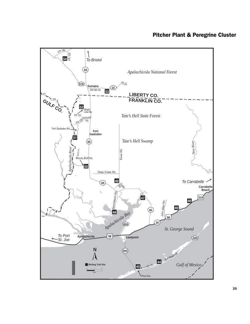

Pitcher Plant amp Peregrine Cluster
through coastal areas like these as they arrive off the Gulf each spring Come prepared with insect repellent and drinking water
Directions From US 98US 319SR 30 in Eastpoint take SR 300 Island Drive south for 56 mi across bridge to St George Island Turn left (east) on CR 300Gulf Beach Dr and go 08 mi to 6th St Turn left (north) and go 02 mi to the end Look for a gravel road and small gazebo at the site entrance
Open dawn to dusk (850) 670-4783 nerrsnoaagov wwwdepstatefluscoastalsitesapalachicola
J F M A M J J A S O N D
Tatersquos Hell State Forest 46 High Bluff Coastal Hiking Trail
County Franklin Nearest city CarrabelleEastpoint
Physical address 2381 W US 98 Carrabelle 32322 (east entrance) 2985 W US 98 Eastpoint 32328 (west entrance)
Coordinates 29808446deg N -84728881deg W (east entrance) 29788651deg N -84766344deg W (west entrance)
Gazetteer page 61 Size 4 miles
Catch a glimpse of the vast 202437-acre Tatersquos Hell State Forest on this scenic trail From either parking area on US 98 a nature trail leads 4 miles through sand pine scrub good for Brown-headed Nuthatches Red-bellied Woodpeckers and Eastern Towhees year-round Listen for Yellow-breasted Chats and Orchard Orioles singing in springsummer In migration Summer and Scarlet Tanagers can be found in the pines Bald Eagles have nested northeast of the eastern parking area so watch for flyovers A nice spot for a hike worth checking in migration Florida Black Bears live within the forest look for tracks and other signs along the trail Seasonal hunting takes place at this GFBWT site please see page 55 for information on dates regulations and more
Directions From the intersection of CR 67 and US 98US 319SR 30 in Carabelle (east end of bridge) drive west on US 98 for 47 mi the trailhead entrance and eastern parking area are on the right (north) side of the road The eastern parking area is 32 mi west of the intersection of US 98 and Gulf Beach Rd in Carrabelle Beach The western trailheadparking area is 27 mi further west (south) From Eastpoint travel east on US 98 the western entrance is 46 mi east of the intersection with SR 65
Open dawn to dusk (850) 697-3734 wwwfl-dofcomstate_foreststates_hellhtml
J F M A M J J A S O N D
Apalachicola River Wildlife and 47 Environmental Area Cash Bayou
County Franklin Nearest city Eastpoint
Physical address SR 65 Eastpoint 32328
Coordinates 29819334deg N -84850006deg W
Gazetteer page 61 Size 100 acres
If yoursquore traveling between Sumatra and Eastpoint itrsquos worth taking a moment to pull off at the edge of Cash Bayou to take in the scenery scan for waterbirds like Bald Eagles and American Bitterns and check the brief trails for songbirds Better yet launch your canoe or kayak from this landing and bird the bayou by boat A recreation guide for the ARWEA is available ndash call (850) 488-8755 or order one at MyFWCcom Seasonal hunting takes place at this GFBWT site please see page 55 for information on dates regulations and more
Directions From US 98US 319SR 30 in Eastpoint drive east to SR 65 Turn left (north) and go 46 mi Though not well-marked you may park on the left (southwest) side of SR 65 just before the bridge
Open dawn to dusk (850) 827-2934 MyFWCcomviewingrecreationwmasleadapalachicola-river
J F M A M J J A S O N D
Apalachicola River Wildlife and 48 Environmental Area Sand Beach Tower
and Area Roads County Franklin Nearest city Eastpoint
Physical address Sand Beach Rd Eastpoint 32328
Coordinates 29784001deg N -84910698deg W
Gazetteer page 60 Size 12000 acres
Sand Beach Rd ends at a canoekayak launch pier and viewing tower in a nice hammock where Yellow-throated Warblers and White-breasted Nuthatches are possible Scan the reeds for waders like Little Blue Herons and from the tower scope East Bay for loons grebes and wintering ducks Ospreys and Bald Eagles nest in the area and both Mississippi and Swallow-tailed Kites are likely in summer here in the Apalachicola River basin The area roads can be interesting birding and butterflying for intrepid explorers particularly Tank Island Rd and Butcher Pen Landing In spring (good) or fall (best) check the flower patches along these roads particularly at low wet spots for marsh skippers such as Broad-winged Dion Palatka and Twin-spot Shallow streams across the road (low water crossings) have firm limestone bottoms and are not an obstacle to 2WD vehicles except during very high water These are a hydrologically sensitive alternative to culverts Seasonal hunting takes place at this GFBWT site please see page 55 for information on dates regulations and more
30
31
Pitcher Plant amp Peregrine Cluster
J F M A M J J A S O N D
49
J F M A M J J A S O N D
50
J F M A M J J A S O N D
51
Directions From US 98US 319SR 30 east of Eastpoint drive north on SR 65 for 86 mi Turn left (south) on Sand Beach Rd to enter the site An informational kiosk containing maps of area roads is located on the right (west) side of the road The viewing tower is located 28 mi down Sand Beach Rd
Open dawn to dusk (850) 827-2934 MyFWCcomviewingrecreationwmasleadapalachicola-river
Tatersquos Hell State Forest Deep Creek Tract
County Franklin Nearest city Eastpoint
Physical address Tower Rd and Deep Creek Rd Eastpoint 32328
Coordinates 29840886deg N -84903438deg W
Gazetteer page 60 Size 2 miles
Two miles of dirt roads along the Deep Creek Tract give you quick easy access to a wet prairie in the Apalachicola River basin Insect-eating pitcher plants line the ditches around this prairie which measures several hundred acres Watching for other recreational users bird Tower Rd by foot or from your car as well as the first 075 miles of Deep Creek Rd which divides the prairie in two Watch for typical overwintering wetland sparrows like skulky LeContersquos Grasshopper and Henslowrsquos as well as more common Swamp and Song Sparrows Swallow-tailed Kites use the cypress domes from March to August wading birds like Snowy Egrets and Little Blue Herons are most concentrated from March to June In winter ducks use the prairiersquos interior and American Bitterns may be seen along the edge Bald Eagles hawks and woodpeckers occur year-round By summer the sun is punishing and bugs are fierce hence the state forestrsquos name Seasonal hunting takes place at this GFBWT site please see page 55 for information on dates regulations and more
Directions From US 98US 319SR 30 east of Eastpoint drive north on SR 65 for 73 mi and turn right (north) on Tower Rd After 11 mi bear right (north) at the fork the site is along the left (west) side of Tower Rd and south side of Deep Creek Rd
Open dawn to dusk (850) 697-3734 wwwfl-dofcomstate_foreststates_hellhtml MyFWCcomviewingrecreationwmascooperativetates-hell
Apalachicola River Wildlife and Environmental Area Bloody Bluff Tract
County Franklin Nearest city Sumatra
Physical address Bloody Bluff Rd Eastpoint 32328
Coordinates 29869528deg N -84975057deg W
Gazetteer page 60 Size 4800 acres
Along the drive down Bloody Bluff Rd watch the edges for sparrows including Chipping Swamp and Song and listen in spring for Bachmanrsquos Sparrows The loop trail at the boat ramp at the end of the road can be good for songbirds like Yellow-throated Warblers and Blue-headed Vireos and Swallow-tailed and Mississippi Kites frequent the river run Most roads in this area can be interesting for birding (Creek Rd and Old County Rd have been productive for sparrows in the past) and several species of rare plants occur on the area This site is very rustic and there are some low water crossings on the dirt roads but these washes are hard bottomed (and accordingly passable in 2WD except in times of very high water) Seasonal hunting takes place at this GFBWT site please see page 55 for information on dates regulations and more
Directions From US 98US 319SR 30 east of Eastpoint drive north on SR 65 for 142 mi Turn left (west) on Bloody Bluff Rd to enter the site
Open dawn to dusk (850) 827-2934 MyFWCcomviewingrecreationwmasleadapalachicola-river
Apalachicola National Forest Fort Gadsden Historical Site
County Franklin Nearest city Sumatra
Physical address Fort Gadsden Rd Sumatra 32328
Coordinates 29940532deg N -85007360deg W
Gazetteer page 60
This site of a British fort dating back to the War of 1812 is slowly returning to the nature it was eked out of centuries ago Fortifications and historical signage are surrounded by the Apalachicola National Forestrsquos flatwoods on one side good for Common Yellowthroats and the occasional Bachmanrsquos Sparrow on the other side the shoreline at the broad brown Apalachicola River is lined with hardwoods and cypress home to singing Northern Parulas and Prothonotary Warblers Hike the flatwoods trail from the parking area and walk the waterfront in migration Breeding raptors like Red-shouldered Hawks and Mississippi Kites are raucous in springsummer Longleaf pines used by Red-cockaded Woodpeckers as cavity trees are ringed with white paint
J F M A M J J A S O N D
Open 24 hoursday (850) 643-2282 wwwfsfedusr8floridaapalachicola
Pitcher Plant amp Peregrine Cluster
Directions From the intersection of SR 65 and 8th StCR 22 in Sumatra travel south on SR 65 for 4 mi Turn right (west) on FR 129Brickyard Rd and follow for 21 mi Turn left (south) on Fort Gadsden Rd and continue for 07 mi to the site entrance
Open 8 AM to 8 PM (850) 643-2282 wwwfsfedusr8floridaapalachicola
J F M A M J J A S O N D
5 Apalachicola National Forest Wright Lake
County Franklin Nearest city Sumatra
Physical address NF 101Wright Lake Rd Bristol 32321
Coordinates 30000129deg N -85001991deg W
Gazetteer page 48 and 60
Two trails at this site a 025-mile trail around the lake and a 5-mile one traverse stretches of basin swamp and longleaf pine-wiregrass community Plants and animals in the latter community type have come to depend on frequent fire that keeps the understory low and open stimulating pine seeds to germinate and wiregrass to flower Since natural fire is feared by people itrsquos been suppressed in much of Florida allowing many remaining examples of this community to become overgrown and unsuitable for the animals that are uncompromisingly dependent on it Here in the national forest prescribed fire is used to keep pinewoods healthy making it one of the best places to see Red-cockaded Woodpeckers (RCWs) and Bachmanrsquos Sparrows Spring mornings are best for spotting both when sparrow males are singing ldquohere kitty-kitty-kitty-kittyrdquo on their territories and RCWs are busy coming and going from their nest cavities carrying food to their young Seasonal hunting takes place at this GFBWT site along the 5-mile trail please see page 55 for information on dates regulations and more
Directions From the intersection of SR 65 and 8th StCR 22 in Sumatra travel south on SR 65 for 19 mi to FR 101Wright Lake Rd Turn right (west) and follow FR 101Wright Lake Rd for 16 mi to the site
53 Apalachicola National Forest County Road 22 Pond
County Liberty Nearest city Sumatra
Physical address SW 8th StCR 22 Bristol 32321
Coordinates 30022150deg N -84955450deg W
Gazetteer page 48
While there are Red-cockaded Woodpecker (RCW) cavity trees ringed with white paint visible throughout the 571000-acre national forest this site offers the opportunity to park and hike to view the birds on foot without danger from passing traffic From the small parking area hike south to the small lake where ducks like Lesser Scaup may be found occasionally in winter The west side of the lake is a good foraging and nesting area for the woodpeckers Around the cavity entrances yoursquoll notice sap running from holes drilled by the woodpeckers this is thought to deter snakes from raiding the nests Please take care not to approach the cavity trees too closely these birds are protected by law and harassment is not tolerated Patient observers will easily see RCWs on spring mornings as they emerge and then begin bringing food to chicks in the cavity early evenings are good too Please stay on the trails to avoid trampling some of the sensitive and rare plants that occur in this area Seasonal hunting takes place at this GFBWT site please see page 55 for information on dates regulations and more
Directions From SR 20 just west of Bristol take SR 12 south for 214 mi to SR 65 in Wilma Go south on SR 65 for 100 mi to Sumatra and turn left (east) on SW 8th StCR 22 Go 14 mi down this wide unpaved road (also known as FR 22) A narrow woods road to the site is on the right (south) side Park on SW 8th StCR 22FR 22 and walk the woods road to the pond
Open dawn to dusk (850) 643-2282 wwwfsfedusr8floridaapalachicola
2
Apalachicola National Forest Post Office Bay Forest Road 123 Northeast
County Liberty Nearest city Sumatra
Physical address Forest Roads 123 and 180 Bristol 32321
Coordinates 30089149deg N -85042806deg W
Gazetteer page 48 Size 66 miles
This 66-mile spectacular scenic drive passes through wet savannas and longleaf pine forest in some of the best condition yoursquoll find anywhere in the southeast Watch for carnivorous plants including four species of pitcher plants growing in roadside wetlands Stop at roadside pulloffs to explore looking for breeding Red-cockaded Woodpeckers Bachmanrsquos Sparrows and Swainsonrsquos Warblers Winter can be good for rarer sparrows like Henslowrsquos and LeContersquos in the soggy flatwoods and savannas Butterfly viewing is good all year but best in fall When the blazing stars
J F M A M J J A S O N D
32
54
33
Pitcher Plant amp PeregrineBluffs Clusters
(Liatris) are blooming along CR 379 or the forest roads visitors may find impressive numbers and a wide diversity of species Special butterflies that occur here include Wild Indigo Duskywing Florida Dusted Skipper and Berryrsquos Skipper Take care not to trample delicate plant life by walking off trails Seasonal hunting takes place at this GFBWT site please see page 55 for information on dates regulations and more
Directions From the intersection of SR 65 and SW 8th StCR 22 in Sumatra travel north on SR 65 for 06 mi Turn left (west) onto CR 379 The best access point for FR 123 is 59 mi ahead on the right (east) side of the road This road can be driven as a loop with stops to view RCW clusters and savannas drive FR 123 for 33 mi until it ends at FR 180 Turn left (west) and travel FR 180 for another 33 mi FR 180 will return you to CR 379 15 mi further north of your starting point
Open dawn to dusk (850) 643-2282 wwwfsfedusr8floridaapalachicola
J F M A M J J A S O N D
Map J Bluffs Cluster
Apalachicola Bluffs and Ravines Preserve 55 Garden of Eden Trail County Liberty Nearest city Bristol
Physical address Garden of Eden Rd Bristol 32321
Coordinates 30451730deg N -84968490deg W
Gazetteer page 48 Size 6295 acres
At 135 feet above the Apalachicola River Alum Bluff is the largest geological exposure in Florida In fact the topography of this site feels nothing like what most people expect from Florida Hike the steep 375-mile trail through longleaf pine sandhills upland mixed hardwoods along the tops of steephead ravines down into slope forests across shallow streams and out to the bluff Listen for Wood Thrushes Hooded Warblers Barred Owls and Broad-winged Hawks along the way Butterfly viewing is good in spring and fall In the dry sandhills expect Southern Dogface Cloudless Sulphur and other pierids (whites and yellows) plus various duskywings including Sleepy and Juvenalrsquos in spring Also check for Dotted Skipper in the ravines search for Spring and Summer Azures and Carolina Satyr Not for the faint of heart this hike will make you earn the spectacular views of the Apalachicola River but theyrsquore well worth the effort Watch your footing and definitely bring water While therersquos no hunting on this property The Nature Conservancy encourages visitors to wear bright colors in season for safety
Directions From SR 20 in Bristol take SR 12 north for 14 mi Turn left (west) at Garden of Eden Rd (look for ldquoApalachicola Bluff-Garden of Edenrdquo sign)
Open dawn to dusk (850) 643-2756 wwwnatureorg
J F M A M J J A S O N D
56 Torreya State Park
County Liberty Nearest city Bristol
Physical address 2576 NW Torreya Park Rd Bristol 32321
Coordinates 30558707deg N -84949714deg W
Gazetteer page 32 Size 2650 acres
This park is named after the Torreya tree the worldrsquos rarest evergreen which only grows on bluffs on the eastern side of the Apalachicola River Still in decline this tree is the subject of much study and can be seen here alongside wonderful vantages of the Apalachicola River and interesting birds The most productive birding spots are the areas of the trail around Stone Bridge down by the river northwest of the historic home and on the trails to Rock Bluff Primitive Campground As in much of extreme north Florida
Jaret Daniels
Red-banded Hairstreak
Bluffs Cluster
Lake Seminole
Apala
chicol
a Rive
r
Chattahoochee
Blountstown
Bristol
Sneads
Greensboro
Hosford
Juniper
69
97
12
20 65
20
71
20
90
90
269
268
270
1641
270A
271
286
280
275
275
69A
69
274
69
67
12
274
270
270
12
268
270
71
8
8
10
10
12
286
270
10
10
GADSDEN COLIBERTY CO
57
58
56
55
N
0 1
Miles
2 J
To Marianna
To Tallahassee
To Bainbridge GA
GEORGIA
174
166
162 Flat Creek Rd
158
152
Legi
on R
d
Torreya State Park Rd
To Apalachicola
Riv
erRd
JACKSON COCALHOUN COJACKSON COCALHOUN CO
Birding Trail Site Rest Area
Garden of Eden Rd
1641
1641
34
35
Bluffs Cluster
watch for northern birds like Winter Wren Louisiana Waterthrush Golden-crowned Kinglet and Brown Creeper Brown-headed Nuthatch and Bachmanrsquos Sparrow are possible in the sandhills and the high canopies along the river can be good for Yellow-throated Vireo in spring Birding by ear skills are very useful here Spring and fall are ideal times for butterfly enthusiasts to visit This park is one of the most reliable spots in Florida for Mourning Cloak (early spring) May is good for seeing Banded Kingrsquos and Striped Hairstreaks a fall day can produce more than a dozen skipper species The park features more than 17 miles of hiking trails and numerous camping options
Directions From I-10 west of Quincy take exit 174 for SR 12 and go toward Greensboro Stay on SR 12 through Greensboro and continue (approx 14 mi total from I-10) until the intersection with CR 1641 Turn right (north) on CR 1641 and continue left (northwest) at the fork with CR 270 Bear right (northwest) at the next fork with CR 270 Bear right at the next fork (CR 1641 becomes Torreya State Park Rd) and follow the signs to the park entrance Note some maps show CR 1641 as CR 271
Open year round 8 AM to sundown (850) 643-2674 wwwfloridastateparksorgtorreya
57 Three Rivers State Park
County Jackson Nearest city Sneads
Physical address 7908 Three Rivers Park Rd Sneads 32460
Coordinates 30739096deg N -84936161deg W
Gazetteer page 32 Size 667 acres
Pine and hardwood uplands with big old trees characterize this park on the south shore of Lake Seminole This lake is actually a reservoir created at the confluence of the Flint and Chattahoochee Rivers where they form the Apalachicolamdashthe opposite shoreline lies in Georgia Bird the Lakeside Trail which begins near the campground as well as the Half Dry Creek Trail by the picnic area Habitat and location are good for Kentucky Warbler and Louisiana Waterthrush in springsummer Otherwise wintering birds characteristic of the area including Red-breasted Nuthatch and Golden-crowned Kinglet are rare but possible in cooler months In winter also scope the lake from two birding blindsmdashyou never know what wintering waterfowl you may find A Yellow-billed Loon wintered on a reservoir south of Atlanta in 2003-04 Who knows what else is out there simply waiting for birders to find it Loaner optics and field guides are available at the entrance station
Directions From I-10 take exit 158 for CR 286 Head north for 52 mi to US 90SR 10 in Sneads Turn left (west) and go 04 mi Turn right (north) on CR 271River Rd and drive 21 mi Turn right (east) at Three Rivers Park Rd The entrance is just ahead
Open year round 8 AM to sundown (850) 482-9006 wwwfloridastateparksorgthreerivers
J F M A M J J A S O N D
Road signs guide visitors to each destination in the Panhandle Section of the Great Florida Birding and Wildlife Trail
C
W
Fresi
k K
raM
J F M A M J J A S O N D
BluffsTalquin Clusters
58 Sneads Park
County Jackson Nearest city Sneads
Physical address Legion Rd Sneads 32460
Coordinates 30727696deg N -84906788deg W
Gazetteer page 32 Size 64 acres
This small waterfront park on Lake Seminole is worth a stop if yoursquore in the area to scope the open water for wintering ducks like Redheads Canvasbacks Lesser Scaup Ring-necked Ducks Bufflehead American Wigeon and more Thousands of American Coots are often visible on the lake in winter scan for Horned Grebes and Common Loons as well Up for exploring The park includes a boat ramp for access to the lake Fields along the right (east) side of Legion Rd north of the baseball diamonds may have wintering geese such as Canada Snow Greater White-fronted and Rossrsquos Check the roadside wires for American Kestrels Western Kingbirds (rare) have also been sighted here
Directions From I-10 take exit 158 for CR 286 Head north for 52 mi to US 90SR 10 in Sneads Turn right (east) and go 09 mi Turn left (north) on Legion Rd and drive 15 mi to the parking area on the lake
Open dawn to dusk (850) 593-6636
J F M A M J J A S O N D
Map K Talquin Cluster
Joe Budd Wildlife Management Area 59 at Lake Talquin State Forest County Gadsden Nearest city Midway
Physical address Office Rd and Peters Rd Midway 32343
Coordinates 30509365deg N -84538308deg W (office) 30492610deg N -84503975deg W (Peters Rd at Cattle Gap Rd)
Gazetteer page 33 and 49 Size 11039 acres
An extensive system of side roads closed to vehicles is open to exploration via foot bicycle and equestrian traffic and will yield wintering mixed flocks of warblers Wild Turkeys in the open fields and Northern Bobwhites in the pinewoods After turning on Office Rd a large open pasture and dove field on both sides of the road are good birding for wintering sparrows Mourning Doves Eastern Meadowlarks and American Kestrels and also serve some years as a display ground for courting American Woodcocks at dawn and dusk Mississippi and Swallow-tailed Kites feed over pastures in spring summer Check edges of fields and woodlands for Blue Grosbeaks in summer as well At the end of Office Rd a dike trail runs 07 miles
one-way past sloughs good for warblers and Wood Ducks Wood Storks are sometimes present at the Joe Budd Aquatic Education Center on Budd Pond off Cattle Gap Rd The trail at the end of Plantation Rd offers a vantage of Lake Talquin similar to High Bluffrsquos (site 60) Seasonal hunting takes place at this GFBWT site please see page 55 for information on dates regulations and more The area is closed to other uses on hunt days A WMA map is available from the website below
Directions From I-10 west of Tallahassee take exit 192 onto US 90SR 10 and head northwest After 20 mi turn left (southwest) towards Midway onto CR 268MLK Blvd Continue west for 6 mi on CR 268MLK Blvd (changes to Highbridge Rd) and turn left (south) on Office Rd to reach WMA headquarters Other WMA roads can be accessed via Peters Rd (See directions for site 60 veer right onto Cattle Gap Rd to access Joe Budd WMA)
Open dawn to dusk closed on hunt days (850) 627-1773 MyFWCcomviewingrecreationwmasleadjoe-budd
J F M A M J J A S O N D
Lake Talquin State Forest 60 High Bluff Recreation Area County Gadsden Nearest city Midway
Physical address High Bluff Landing Rd Midway 32343
Coordinates 30461752deg N -84497412deg W
Gazetteer page 49 and 50 Size 2 acres
Scan the lake from the fishing pier looking for waders along the shoreline and in offshore trees as well as wintering ducks on the open water like Green-winged Teal and Lesser Scaup Better yet explore the lake from the water Songbirds like Black-throated Blue Warblers and Northern and Louisiana Waterthrushes use the hardwoods lining the lakersquos edge in migration Seasonal hunting takes place at this GFBWT site please see page 55 for information on dates regulations and more
Directions From I-10 west of Tallahassee take exit 192 for US 90SR 10 and head northwest After 20 mi turn left (southwest) towards Midway onto CR 268MLK Blvd Go 24 mi on CR 268 MLK Blvd to Peters Rd and turn left (west) Drive 11 mi and turn left (south) onto High Bluff Landing Rd which dead ends at the site after 26 mi
Open dawn to dusk (850) 488-1871 wwwfl-dofcomstate_forestslake_talquinhtml
J F M A M J J A S O N D
36
37
Talquin Cluster
Danny Bales
An eloquent songster the Wood Thrush is a breeding bird of the Panhandle and extreme North Florida It feeds mainly on insects
Lake Talquin State Forest 61 Bear Creek Educational Forest County Gadsden Nearest city Quincy
Physical address 8125 Pat Thomas Pkwy Quincy 32351
Coordinates 30478155deg N -84626724deg W
Gazetteer page 49 Size 492 acres
The entrance trail to this site is a paved interpretive trail which then connects to the 25-mile Ravine Trail and the 30-mile Bear Creek Trail The former hugs the creek ravine and its hardwood forest is good for migrants like Wood Thrushes and Veeries The pine flatwoods of the longer Bear Creek Trail are good for Northern Bobwhites and Wild Turkeys Take water and insect repellent and pick up a map at the entrance kiosk This site offers something for people of all birding skill and mobility levels Butterfly viewing here is best in spring Check flowering trees especially along the Ravine Trail for gossamer-wing butterflies such as Henryrsquos Elfin Banded Hairstreak and Spring and Summer Azures
Directions From I-10 south of Quincy take exit 181 for SR 267 Pat Thomas Pkwy Drive south for 43 mi and cross CR 65B the entrance is 04 mi further south on the left (east) side of the road
Open dawn to dusk (850) 488-1871 wwwfl-dofcomstate_forestslake_talquinhtml
Jaret Daniels
The Eastern Tiger Swallowtail is a large familiar butterfly found throughout most of Florida Males are yellow but females can be either black or yellow The caterpillars feed on trees such as red maple wild cherry sweetbay and tulip tree Look for adults feeding on thistle ironweed and milkweed in meadows parks and roadsides
J F M A M J J A S O N D
CO
Talquin Cluster
Lake Talquin
Office Rd
Peters Rd
Plan
tation
Rd
Blountstown Hwy
Quincy
Wetumpka
Midway
Fort Braden
20
65
267
267
267 65
12
90
90
375
65B 65B
268 161
270
270
20
267
8
8
10
65C
10
10
60
62
61
59
N
0 1
Mile s
2
Birding Trail Site K
To Tallahassee
To Tallahassee
To Marianna
To Havana
To Georgia
HighBlu
ff Lan
dingR
d
Highbridge Rd
Coes Landing Rd
B l o x h a m C u t o f f R d
268
181
174
192
GADSDEN COGADSDEN CO
LEON CO
LEON CO
LIB
ERTY
LIB
ERTY
CO
Cattle Gap Rd
38
39
Talquin Cluster Jaret D
aniels D
anny Bales
Northern Bobwhite
40
TalquinWhite-breasted Nuthatch Clusters
Lake
Jackson
Old
Bai
nbrid
ge R
d
Faulk
Dr
Millers
Landing Rd
N M
erid
ian
Rd Maclay Rd
Killarney Way
Raymond Diehl Rd
Vassar Rd
Tennessee StMahan Dr
Buck Lake Rd
Pedrick Rd
Center
ville R
d
Mag
nolia
Dr
6th Ave
7th Ave
Thom
asvi
lle R
d
Cap
ital C
ircle
N Monroe St
Tallahassee
Bradfordville
20
31927
319
27
90
0345
0342
155
151
0361
263
0347
61 9010
61
20
61
63
10
371
363
1568
8
8 10 10
69
68
67B
67A6663
64
65
L
To Thomasville GA
To LakeCity
ToCrawfordville
To Quincy192
196
194
203
199
209
N
0 1
Miles
2
GA
DS
DE
N C
O
LEO
N C
O
Sham
rock St
Crowder
Rd
Birding Trail Site
Rest Area
62Lake Talquin State Forest Fort Braden Trails
County Leon Nearest city Tallahassee
Physical address SR 20Blountstown Hwy Tallahassee 32310
Coordinates 30438199deg N -84495804deg W
Gazetteer page 49 and 50 Size 1242 acres
This site offers extensive hiking trails that are blazed in orange (compared to horse trails in pink or yellow) Pick up a map at the entrance and bring water One of the best trail choices is the Center Loop hike north from the parking area and stay right at every split on the orange-blazed trail to make a 2-mile loop back to the parking area The trail will take you through open areas and xeric oak uplands good for Wild Turkeys and White-eyed Vireos then reach bluffs overlooking Lake Talquin It follows the lake edge for nearly a mile before circling back through the uplands Watch overhead
for raptors and scan the lake for wintering ducks and wading birds Weedy and brushy areas have wintering sparrows including Chipping Song and White-throated
Directions From the intersection of SR 263Capital Circle and SR 20Blountstown Hwy in Tallahassee take SR 20 west for 87 mi the trailhead parking area is on the right (north) side of the road
Open dawn to dusk (850) 488-1871 wwwfl -dofcomstate_forestslake_talquinhtml
J F M A M J J A S O N D
J F M A M J J A S O N D
41
63
64
White-breasted Nuthatch Cluster
Map L White-breasted Nuthatch Cluster
J Lee Vause Park
County Leon Nearest city Tallahassee
Physical address 6024 Old Bainbridge Rd Tallahassee 32303
Coordinates 30537105deg N -84361323deg W
Gazetteer page 34 Size 26 acres
This small park has a well-developed center but down by the lake its sunny woody edges are a haven for birds like Orange-crowned Warblers and the occasional Yellow-breasted Chat A boardwalk and pier provide a view of Lake Jackson where you can look for a diversity of wading birds like Wood Storks as well as wintering ducks and coots Donrsquot forget flyovers by Ospreys and Bald Eagles as well as breeding Red-shouldered Red-tailed and Broad-winged Hawks in spring and summer
Directions From I-10 in Tallahassee take exit 199 for US 27N Monroe St Drive north for 46 mi and turn right (north) on CR 0361 Old Bainbridge Rd the park is 03 mi ahead on the right (east) side of the road
Open dawn to dusk (850) 606-1470 wwwleoncountyflgovparkspark_indexasp
Faulk Drive Landing
County Leon Nearest city Tallahassee
Physical address Faulk Dr Tallahassee 32303
Coordinates 30522392deg N -84322033deg W
Gazetteer page 34 Size 02 acres
Another access to Lake Jackson this one is a little more rustic and your tires (not to mention your feet) may get muddy at times of higher water Itrsquos best to park back from the landing and walk in watching fence posts and small oaks for flycatchers and warblers At the landing scan for egrets herons White Ibises and waterfowl Black-bellied Whistling-Ducks have turned up here as have Roseate Spoonbills The grassy area to the south of the landing may have Common Ground-Doves Eastern Bluebirds and Common Yellowthroats plus sparrows (such as Swamp and Savannah) in winter Launch a canoe or kayak here to explore Lake Jackson in more detail Worth a stop if yoursquore in the area Seasonal hunting takes place at this GFBWT site please see page 55 for information on dates regulations and more
Directions From I-10 in Tallahassee take exit 199 for US 27N Monroe St Drive north for 27 mi and turn right (northeast) on Faulk Dr the site is 14 mi ahead at the end of the road
Open dawn to dusk (850) 606-1470 wwwleoncountyflgovparkspark_indexasp
J F M A M J J A S O N D
65 Crowder Landing
County Leon Nearest city Tallahassee
Physical address Crowder Rd Tallahassee 32303
Coordinates 30507436deg N -84313444deg W
Gazetteer page 34 Size 06 acres
This small boat landing warrants a quick stop if yoursquore in the area because it provides another vantage of Lake Jackson Wintering ducks and coots are plentiful on the lake in winter as are wading birds like Snowy Egrets and Little Blue Herons Sandhill Cranes appear on occasion and in 2002 a Hudsonian Godwit was discovered here Lake Jackson is known for its tendency to disappear down a sinkhole in its middle at times of low water to birders itrsquos known for less common flycatchers (Vermillion for example) and songbirds in migration When itrsquos hot itrsquos hot When itrsquos nothellip
Directions From I-10 in Tallahassee take exit 199 for US 27N Monroe St Drive north for 17 mi and turn right (east) on Crowder Rd Follow Crowder Rd for 12 mi as it bends north then east the site is at the end on the lake
Open dawn to dusk (850) 606-1470 wwwleoncountyflgovparkspark_indexasp
J F M A M J J A S O N D
66 Elinor Klapp-Phipps Park
County Leon Nearest city Tallahassee
Physical address Miller Landing Rd Tallahassee 32312
Coordinates 30536493deg N -84280792deg W
Gazetteer page 34 Size 670 acres
Elinor Klapp-Phipps Park on Lake Jackson has areas of longleaf pine restoration but its real asset is the beautiful deciduous slope forest following the trickle of small streams down to the big lake Eastern Bluebirds Indigo Buntings and Wild Turkeys use open grassy areas along the powerline entrance and horse trailer entrance As the trails dive into the hammock start watching and listening for migrants like Wood and Gray-cheeked Thrushes and Blackburnian Warblers
J F M A M J J A S O N D
67
White-breasted Nuthatch Cluster
Reinhard Geisler
White-breasted Nuthatch
Down by the large bat house on Lake Victoria at stop 17 scope for Anhingas Tricolored Herons and Ospreys Black-bellied Whistling-Ducks have bred here recently The Lake Jackson area is known for unusual sightings like occasional wintering Western Tanagers so bird with an open mind Butterfly viewing is also quite good at this park spring through fall Unlike many sites mid-summer has an impressive variety of butterfly species look for spread-winged skippers including Silver-spotted Golden-banded Hoary Edge and Southern Cloudywing along the woodland trails and in the open meadows Trails at this park are extensive and winding Pick up a trail map and butterfly checklist at the entrance (or download them from the website below) and pay attention to your chosen route
Directions From I-10 in Tallahassee take exit 203 for US 319SR 61Thomasville Rd Drive north for 09 mi and turn left (west) on Maclay Rd Follow Maclay Rd for 22 mi to its end and turn right (north) on N Meridian Rd Drive 10 mi and turn left (west) on Millerrsquos Landing Rd the park entrance is 02 mi ahead on the left (south) side of the road
Open dawn to dusk (850) 891-3866 (850) 891-3975 wwwtalgovcomparksparksphippscfm
Alfred B Maclay Gardens State Park
County Leon Nearest city Tallahassee
Physical address 3540 Thomasville Rd Tallahassee 32309
Coordinates 30534672deg N -84277454deg W (Lake Overstreet) 30513532deg N -84247467deg W (main entrance)
Gazetteer page 34 Size 1179 acres
More widely known for its manicured gardens this park also offers native habitat that is better for birdwatching Try the brief trails along the lake at the Lake Hall Recreation Area for wintering Orange-crowned Warblers and Blue-headed Vireos A few Dark-eyed Juncos make an appearance here in winter Brown Creepers and Winter Wrens may also be present Check the lakes for wintering ducks and then for drinking Purple Martins beginning in February For a longer hike hit the Lake Overstreet multi-use trails (5 miles worth) off Meridian Road These are more rustic so be sure to pick up a map and bring water Birds like Red-headed Woodpeckers Brown-headed and White-breasted Nuthatches Great Horned Owls and Chuck-willsshywidows can all be found here The recreation area and gardens have wheelchair access
Directions (A) Lake Overstreet Trailhead From the intersection of Meridian and Maclay roads drive north on Meridian 09 mi turn left (west) and enter the parking lot for Forest Meadows Park amp Athletic Center the trailhead is directly across the street on the east side of Meridian (B) Main entrance From I-10 in Tallahassee take exit 203 for US 319SR 61Thomasville Rd Drive north for 09 mi and turn left (west) on Maclay Rd The park entrance is 02 mi on the right (north) side of the road
42
43
White-breasted Nuthatch Cluster
Open year round 8 AM to sundown (850) 487-4556 wwwfloridastateparksorgmaclaygardens
J F M A M J J A S O N D
68 A J Henry Park
County Leon Nearest city Tallahassee
Physical address 3000 A J Henry Park Dr Tallahassee 32309
Coordinates 30507040deg N -84217947deg W (north entrance) 30503435deg N -84218606deg W (south entrance)
Gazetteer page 34 and 50 Size 72 acres
A J Henry Park is a small city property with some nice topography and habitats including hardwood forest-covered slopes which descend down to a lake Accordingly this park attracts fallouts of migrants like Veery Ovenbird and Magnolia Warbler among others Raptors like Mississippi Kite and Broad-winged Hawk hunt for prey here in late spring and summer and Blue-winged Teal Ring-necked Duck and the occasional Redhead or Common Goldeneye can be found on the lake in winter The area surrounding the lake and the lower (north) parking area offer the most productive birding Extensive trails at the upper (south) parking area are appealing but the thicker understory can make it hard to spot birds frustrating those who donrsquot know bird calls and songs
Directions From I-10 in Tallahassee take exit 203 for US 319SR 61Thomasville Rd Drive north for 09 mi to Killarney Way and turn right (southeast) There are two approaches to the site off of this road For the south entrance proceed east on Killarney Way and turn right (south) onto Raymond Diehl Rd then turn left (east) on Vassar Rd Take Vassar Rd to its end and turn right (south) on Whitney Dr The park is 150 yds on the left (east) side of the road For the north entrance follow Killarney Way to the end and turn right (southeast) on Shamrock St After 03 mi turn right (south) on Gardenview Way and right (southwest) again after 03 mi onto A J Henry Park Dr The entrance is 02 mi ahead
Open 8 AM to dusk (850) 891-3866 wwwtalgovcomparksparksajhenrycfm
David M
oynahan
Common Goldeneye
Danny Bales
Rusty Blackbird
J F M A M J J A S O N D
White-breasted Nuthatch Mississippi Kite Clusters
69 J R Alford Greenway
County Leon Nearest city Tallahassee
Physical address 2500 S Pedrick Rd Tallahassee 32317
Coordinates 30444486deg N -84175759deg W
Gazetteer page 50 Size 874 acres
This greenway is a collection of old pastures and woodlands now used for passive recreation Seventeen miles of multi-use trails invite many hours of exploration From the parking area follow the trail due east across the first pasture (watch for Purple Martins and Eastern Bluebirds around the gourds and nest boxes) and veer either way at the fork to continue through a series of open fields Watch overhead for Red-tailed Hawks mixed flocks of wintering Palm Warblers and White-throated Sparrows flit in the weedy edges Pastures are managed for a mosaic of early succession habitats wintering Grasshopper Sparrows skulk in the grass (when itrsquos left high) as do Eastern Meadowlarks American Kestrels Eastern Phoebes and Loggerhead Shrikes stand lookout on snags and Wood Storks and Double-crested Cormorants can be seen flying overhead to Lake Lafayette at sunset From the parking lot another trail leads to the south and winds east through hardwoods good for Red-shouldered and Cooperrsquos Hawks Download a map and pay attention to your route Trails can be confusing at times a GPS unit is quite useful here Consider biking this property to cover more ground
Directions From the intersection of US 319Capital Circle and US 90 Tennessee StMahan Dr in Tallahassee drive 07 mi east on US 90 and turn right (east) on Buck Lake Rd After 20 mi turn right (south) onto Pedrick Rd the entrance and parking are 16 mi ahead at the end of the road
Open dawn to dusk (850) 606-1470 wwwleoncountyflgovparksgreenwaysasp
J F M A M J J A S O N D
Jaret Daniels
J F M A M J J A S O N D
Map M Mississippi Kite Cluster
70 Apalachicola National Forest Leon Sinks Geological Area
County Leon Nearest city Woodville
Physical address US 319Crawfordville Hwy Tallahassee 32305
Coordinates 30306785deg N -84345082deg W
Gazetteer page 50 Size 640 acres
This recreation area in the east portion of the Apalachicola National Forest is different from the lower longleaf savannah habitats of the
tracts closer to the river Here higher sandhills of pine and turkey oak are broken by erosion in the underlying limestone causing deep dramatic crystal blue sinkholes which are rimmed with hardwoods Upon entering the hiking trail turn left at the T-junction for the shorter trail (17 miles) and return on the short-cut (05 mile) through a tupelo swamp Listen for Barred Owls Northern Parulas and Prothonotary Warblers near the wetlands and watch for Blue-headed Vireos and Carolina Chickadees in the pinewoods By turning right at the T-junction yoursquoll choose the longer 25-mile loop past a series of large sinkholes Watch for Wild Turkeys Hermit Thrushes and White-eyed Vireos in the sandhills as well as songbirds like Yellow-billed Cuckoos in hardwoods sloping into the sinks In spring wild azaleas along the Gum Swamp Trail attract many swallowtail butterflies Little Wood-Satyr and Red-spotted Purple can occur in any wooded stretch Near the sinkholes look for Golden-banded Skippers Bring water and sunscreen
Directions From the intersection of US 319SR 263Capital Circle SW and US 319SR 369SR 61Crawfordville Rd in Tallahassee drive south on Crawfordville Rd for 58 mi the site is on the right (west) side of the road
Open year round 8 AM to 8 PM (850) 926-3561 wwwfsfedusr8floridaapalachicola
One of the most famous and recognizable butterflies in North America the Monarch undertakes an extensive migration each fall to hibernation sites in California and Mexico Large numbers gather on the Gulf Coast in October at locations like St Marks National Wildlife Refuge in Wakulla County A festival held at the refuge each year coincides with the Monarchrsquos migration Milkweeds are important plants for both caterpillars and adults
44
45
Mississippi Kite Cluster
StMarks
Newport
Wakulla
Medart
ShellPoint
Crawfordville
Sopchoppy
Woodville
Panacea
ApalachicolaNationalForest
St M
arks
Rive
r
Wakulla River
ApalacheeBay
Gulf of Mexico
Ochlockonee Bay
OchlockoneeRiver Rd
Sheldon St
ParkAve
OtterLake Rd
Lighthouse
Rd
Bottoms
Rd
Wak
ulla
Spr
ings
Rd
Woo
dvill
e H
wy
Bald
Poi
nt
Rd
Cra
wfo
rdvi
lle H
wy
98
98
98
319
61
267
267
363
363
372
369
374
375
267
61
365
356
356
356
319
98 30
61
30
367A
30
319365
368
365
365
367
367
59
365
372
375
372A372A
370
22
98
2192
2195
2204
WAKULLA CO
FRANKLIN CO
LEON CO
WAKULLA CO
70
71
73
72
7475
76
77
78
N
0 1
Miles
2
Birding Trail Site
ToPerry
ToApalachicola
ToTallahassee
M
Bloxham Cutoff Rd
Rose St
Sopchoppy Hwy
Alligator Dr
Sopc
hopp
y H
wy
Mississippi Kite Cluster R
einhard Geisler
Mississippi Kite
46
47
71
J F M A M J J A S O N D
J F M A M J J A S O N D
72 see ldquoGatewaysrdquo on page 3 for more information
73
Mississippi Kite Cluster
Edward Ball Wakulla Springs State Park
County Wakulla Nearest city Wakulla Springs
Physical address 550 Wakulla Park Dr Wakulla Springs 32327
Coordinates 30243337deg N -84310614deg W
Gazetteer page 50 Size 6055 acres
Hiking trails throughout this park provide access to floodplain forest good for Summer Tanagers and Ovenbirds in migration and Great Crested Flycatchers and Northern Parulas in summer The primary attraction however is the access to Wakullarsquos first magnitude spring From the pier look for Anhingas Common Moorhens Pied-billed Grebes and wintering American Wigeons as well as roosting Black Vultures in the cypress Better yet take one of the parkrsquos river cruises to get excellent views of the aforementioned plus Least Bitterns Yellow-crowned Night-Herons Barred Owls and White Ibises Alligators Suwannee River Cooters and mullet are commonly seen manatees are sometimes found in the river and spring as well In years past this park was known for Limpkins but today they are almost never seen here However the park staff is reintroducing native apple snails the Limpkinrsquos main prey item to entice Limpkins to return The spectacular 1930s-era lodge has roosting Chimney Swifts in summer Butterfly viewing is best here in late spring and fall Many swallowtail and hairstreak species are seen on flowering trees and shrubs in spring Texan Crescents and Appalachian Browns are regularly seen on the hiking trails north of the Wakulla River The park hosts an extensive wildlife and birding festival each spring
Directions From the intersection of SR 263Capital Circle SW and US 319SR 369SR 61Crawfordville Rd in Tallahassee drive south on Crawfordville Rd for 21 mi Take a slight left to stay on SR 61 Wakulla Springs Rd and go 74 mi Turn left (east) on SR 267Bloxham Cutoff Rd the site is 01 mi ahead on the right (south) side of the road
Open year round 8 AM to sundown (850) 926-0700 wwwfloridastateparksorgwakullasprings
St Marks National Wildlife Refuge St Marks Unit (Headquarters) Gateway
County WakullaJefferson Nearest city St Marks
Physical address 1255 Lighthouse Rd Crawfordville 32327
Coordinates 30156008deg N -84150652deg W
Gazetteer page 50 and 51 Size 29529 acres
Spanning four counties and with more than 300 recorded bird species the 68000-acre St Marks NWR is a must-see The St Marks Unit includes refuge headquarters and the historic St Marks Lighthouse itrsquos also the unit most popular with birders and wildlife
viewers for good reason Stop briefly at the visitor center for a map and to check the sightings log A pond and trail here can be good for White-throated Sparrows Pileated Woodpeckers Belted Kingfishers Eastern Phoebes and more but other trails are more rewarding From north to south along the main road the helicopter pad accessed from the primitive hiking trails is good for wintering sparrows such as Henslowrsquos East River Pool can be good for waterfowl in winter Stoney Bayou Pool and the Mounds Pools hold shovelers coots and the spectrum of wading birds in winter and the trail around Mounds Pool 3 is particularly good for Northern Pintails and Snow Geese in winter Stoney Bayou Pool 2 and Mounds Pool 3 are also good places to look for American Black Ducks The Headquarters Pond viewing platform offers the occasional Sora and Purple Gallinule as well as wintering teal and year-round waders The Mounds Trail around Tower Pond is very good for migrant songbirds like Yellow-billed Cuckoos and Indigo Buntings as well as Brown-headed Nuthatches in the pines and ducks and shorebirds in the pond At the roadrsquos terminus at the lighthouse look for common wintering waterfowl plus Redheads Canvasbacks Nelsonrsquos Sparrows shorebirds and more Scaup Bufflehead Horned Grebes and Common and Red-throated Loons winter in the Gulf and Least Bitterns Seaside Sparrows shorebirds and Clapper Rails breed in the marshes Oystercatchers pelicans and gulls loaf on pilings and offshore oyster bars Butterfly viewing is best here in fall especially September and October Monarch butterflies congregate here along Apalachee Bay on their fall migration to Mexico a Monarch festival is held each October to celebrate this phenomenon Hundreds of Monarchs may be seen on a mid-October day Along Lighthouse Dr keep your eyes open for Gulf Fritillaries and Long-tailed Skippers plus American Alligators Bobcats Northern River Otters and Florida Black Bears Though you may not see one just yet a Whooping Crane reintroduction project began in 2009 Bring water food sun protection and bug spray
Directions From the intersection of US 98SR 30 and SR 363 Woodville Hwy north of the town of St Marks drive east on US 98 approx 25 mi and turn right (south) on CR 59Lighthouse Rd just east of the St Marks River Bridge The refuge entrance is 30 mi ahead the visitor center is 06 mi farther south on the right
Open dawn to dusk (850) 925-6121 wwwfwsgovsaintmarks
Shell Point Beach Park
County Wakulla Nearest city Crawfordville
Physical address Beaty Taff Dr Crawfordville 32327
Coordinates 30058004deg N -84290519deg W
Gazetteer page 50
This Wakulla County park is worth a quick stop for a picnic lunch and a look for shorebirds The parking area offers an easy vantage of
Mississippi Kite Cluster
J F M A M J J A S O N D
J F M A M J J A S O N D
75
J F M A M J J A S O N D
loafing shorebirds in fall-winter-spring such as Short-billed Dowitchers Dunlin Willets Marbled Godwits Black Skimmers and more Keep an eye peeled for the occasional migrating Peregrine Falcon watching the shorebirds even more closely than you Summer is busy with swimmingboating visitors Shorebirds are more diverse and plentiful in cool weather months
Directions From the intersection of US 98SR 30 and SR 363 Woodville Hwy north of St Marks drive west on US 98 approx 80 mi and turn left (south) on CR 365Spring Creek Hwy Turn left after 20 mi onto CR 367Shell Point Rd Continue approx 5 mi on CR 367 (do not take CR 367A at the fork) and turn left (southeast) on Beaty Taff Dr Go 02 mi to the parking area on the right (south) side of the road
Open dawn to dusk (850) 926-7227 wwwwcprdcom
74 Bottoms Road Boat Ramp
County Wakulla Nearest city Panacea
Physical address Bottoms Rd Panacea 32346
Coordinates 30016052deg N -84368326deg W
Gazetteer page 50
Bottoms Road extends out through salt marsh to a county-owned boat launch on the Gulf Along the way watch and listen for Clapper Rails Virginia Rails (winter) and wading birds in the marsh plus Northern Harriers cruising the flats in winter The marsh is also a good place to look for Nelsonrsquos Sparrow (winter) and Seaside Sparrow (year-round) From the shoulder along the road scope the offshore sandbars for loafing terns gulls and shorebirds The large dirt pull-off on the east side of the road (05 miles north of the boat ramp) is private property The marsh is locally known for occasional Short-eared Owl sightings in winter so watch for these daytime hunters gliding low over the marsh like Northern Harriers or perched on low posts amidst the rushes From the boat ramp scan the waters for ducks and scoters
Directions From the intersection of US 98SR 30 and SR 363 Woodville Hwy north of the town of St Marks drive west on US 98 for 166 mi and turn left (east) on CR 372ABottoms Rd just before the town of Panacea Park along the shoulder (where safe) and at the boat ramp (26 mi ahead) at the end of the road
Open dawn to dusk
St Marks National Wildlife Refuge Otter Lake Recreation Area
County Wakulla Nearest city Panacea
Physical address Otter Lake Rd Panacea 32346
Coordinates 30026031deg N -84416565deg W
Gazetteer page 50 Size 11387 acres
Though not as famous as the St Marks Unit St Marks NWRrsquos Panacea Unit offers good birding too Make a quick trip to the picnic area and boat launch at the end to check the cypress for Prothonotary Warblers and occasional wading birds or choose to hike one of the longer trails the south Piney Ridge Trail loop (5 miles) or the north Otter Lake Trail loop (9 miles) The latter runs through pinewoods interrupted by occasional bayheads and wetlands Watch for Red-headed and Red-cockaded Woodpeckers Wild Turkeys and Northern Bobwhites At dusk check the boat launch for Wood Storks egrets and both vultures coming to roost Ospreys nest in the area Swallow-tailed Kites can be seen soaring overhead in spring and summer There is some hunting along the hiking trails so check the trailhead signs before entering and carry water and sunscreen with you See page 55 for more information
Directions From the intersection of US 98SR 30 and SR 363 Woodville Hwy north of the town of St Marks drive west on US 98 for 175 mi and turn right (west) on CR 372AOtter Lake Rd The site is at the west end of Otter Lake Rd
Open dawn to dusk (850) 925-6121 wwwfwsgovsaintmarks
76 Bald Point State Park
County Franklin Nearest city Alligator Point
Physical address Bald Point Rd Alligator Point 32346
Coordinates 29937605deg N -84337327deg W (main entrance) 29914581deg N -84336804deg W (Sunrise Beach access)
Gazetteer page 61 inset Size 4859 acres
Located on the south side of Ochlockonee Bay this state park offers great birding and wildlife viewing Its geography and location provide a prime vantage of the raptor migration in October as Peregrine Falcons Northern Harriers and others cruise down the beach Overwintering shorebirds like Black-bellied Plovers and Dunlin use the beach and estuary and when horseshoe crabs are spawning (which can be impressive) large numbers of shorebirds gather to feast on the crabsrsquo eggs A few sea turtles also nest here in summer In spring migratory songbirds like Black-throated Green Warblers and Indigo Buntings make landfall in the parkrsquos hammocks live oaks surrounding the upper parking area can be quite good Year-round listen for raucous Clapper Rails and Marsh Wrens from the observation boardwalk which overlooks pristine marshes near the upper parking lot Groove-billed Anis are rare winter visitors An extensive hiking trail network begins 16 miles south of the main entrance gate on the west side of the road across from the Sunrise
48
49
Beach access (no fee) These foot trails wind through mesic wet and scrubby flatwoods (home to Brown-headed Nuthatches) and around freshwater marshes swamps and ponds which have wading birds and ducks when water levels are favorable The park is also a staging point for Monarch butterflies on their fall trans-Gulf migration Large numbers of several other species concentrate here in fall as well including Gulf Fritillary Common Buckeye Long-tailed Skipper and Ocola Skipper In early spring Eastern Pygmy Blues can be abundant in the salt marsh Ceraunus Blues can be common in fall Guided tours are available for groups call 2 weeks in advance Fishing and sunbathing are popular in nice weather
Directions From Panacea drive west (head south) on US 98SR 30 for 7 mi and turn left (southeast) on CR 370Alligator Dr Drive 38 mi and turn left (east) on Bald Point Rd the main entrance gate is 28 mi ahead Sunrise Beach and trailhead access are 12 mi north of the intersection with Alligator Dr
Open year round 8 AM to sundown (850) 349-9146 wwwfloridastateparksorgbaldpoint
J F M A M J J A S O N D
77 Ochlockonee River State Park
County Wakulla Nearest city Sopchoppy
Physical address 429 State Park Rd Sopchoppy 32358
Coordinates 29998902deg N -84485259deg W
Gazetteer page 50 and 61 inset Size 543 acres
Upon entering this state park ask at the gate for the locations of active Red-cockaded Woodpecker (RCWs) cavities or recent sightings Head to the parking area at the end of the road and in the
Mississippi Kite Cluster
anny Bales
Blair W
itherington
Snowy Plover
northeastern corner take the ldquoScenic Driverdquo loop road which you may drive bike or walk Watch and listen for RCWs Pine Warblers Eastern Towhees and Common Yellowthroats You may also hike the Pine Flatwoods Trail which originates at the same parking lot This park is well-known for its ldquosnow whiterdquo Eastern Gray Squirrels (no they are not albinos) If you choose to launch a canoe here ask at the gate about water levels and clearance Prothonotary Warblers and Wood Storks may be seen along the river as well as skulking Green Herons Limpkins and Least Bitterns in the brushy margins For early morning access consider camping overnight and enjoy the sounds of Chuckwills-widows and Eastern Screech-Owls after dark
Directions From the intersection of Rose St and US 319SR 377 Sopchoppy Hwy in Sopchoppy head south on Sopchoppy Hwy for 44 mi Turn left (east) on Ochlockonee River Rd the entrance is 12 mi ahead
Open year round 8 AM to sundown (850) 962-2771 w Dwwfloridastateparksorgochlockoneeriver
shy
J F M A M J J A S O N D
County Wakulla Nearest city Sopchoppy
Physical address 252 Park Ave Sopchoppy 32358
Coordinates 30050507deg N -84498079deg W
Gazetteer page 49 and 50 Size 50 acres
If yoursquore in the area itrsquos worth stopping by briefly to visit this small city park on the Sopchoppy River Check the boardwalk and waterfront for night-herons and Prothonotary Warblers and hike the short trail to the left side of the property upon entering In the thicker hardwoods of the hiking trail yoursquoll find migrants like Yellow-billed Cuckoos in spring as well as Mississippi and Swallow-tailed Kites circling overhead in warmer months This site can be a busy boat launch in warm weather Consider launching a canoe from this spot to explore the Sopchoppy River more extensively
Directions From the intersection of Rose St and US 319SR 377 Sopchoppy Hwy in Sopchoppy head south on Sopchoppy Hwy for 04 mi Turn right (west) on Sheldon St and go 04 mi Turn left (south) on Park Ave and drive 05 mi The entrance is on the right (west) side of the road
Open dawn to dusk (850) 962-4611 (850) 962-5486
78 Myron B Hodge City Park
J F M A M J J A S O N D
Mississippi Kite Cluster
Named for its fast darting flight the Whirlabout is a common ldquograss skipperrdquo that occurs in the Panhandle and peninsula most of the year Host plants for the caterpillar include a variety of grasses Shepherdrsquos needle and lantana provide nectar for adults
Danny Bales
50
51
_________________________________________________________________
Mark Kiser FW
C
Birders and wildlife watchers contribute more than $3 billion to Floridarsquos economy each year
About this guide This Trail guide along with guides for the East West and South Trail Sections can be downloaded from the Great Florida Birding and Wildlife Trail website at wwwfloridabirdingtrailcom Additional copies of all four Trail guides may be ordered from the website or by using the form on this page As information for a particular site may change after Trail guides are printed please check the website before heading out on your trip for the most up-to-date information Please report any errors to GFBTMyFWCcom Thanks
Cut
alo
ng d
otte
d lin
e
Mail-in response slip
Birder and wildlife viewer ID Mail-in response form
Name___________________________________________________________
Street __________________________________________________________
City _____________________________________________________________
State _____________ County _____________________________________
Zip______________________ Country _____________________________
E-mail___________________________________________________________
Home phone ____________________________________________________
Work phone _____________________________________________________
Request for information
_____Add my name to your mailing list
_____Send mailings electronically
_____Send a bird checklist ndash also available online
_____Send a Birding and Wildlife Trail sponsorship packet
_____Send a Birding and Wildlife Trail brochure
_____Send a Birding and Wildlife Trail Guide ndash also available online
East ________ West ________ South_______ Panhandle _______
_____Send ldquoBirdwatching Basicsrdquo ndash also available online
Other ___________________________________________________________
wwwfloridabirdingtrailcom
The Great Florida Birding and Wildlife Trail is a program of the Florida Fish and Wildlife Conservation Commission
_____________________________________________________
_____________________________________________________
_____________________________________________________
_____________________________________________________
_____________________________________________________
_____________________________________________________
Cut
alo
ng d
otte
d lin
e
Rate the Trail Mail-in response form
Your country state and county of origin ______________
Where did you hear about the Trail__________________
What is your goal in using the Trail (eg finding a specific species of bird seeing a diversity of birds and wildlife or simply enjoying the outdoors) _____________
How long have you had this guide___________________
How many sites have you visited____________________
Which site was the best Why ______________________
Which site was worst Why ________________________
How many days have you spent birding or wildlife viewing in the last month ______________________________
How long was your last trip on the Birding and Wildlife Trail _______________________________________________
How much money did you spend on lodging food and gas on the above trip $_____________________________
Will you recommend the Trail to friends _____________
Please detach and mail us your valued response to the GFBWT address on page 53 Thank you
St Vincent National Wildlife Refuge
Myron B Hodge City Park
Mark and Selena Kiser
Mark Kiser FW
C
52
Birding and wildlife viewing ethics Donrsquot you hate it when the doorbell or telephone rings just as you settle down to dinner or a nap While mere nuisances to us disruptions in feeding and nesting routines can spell disaster for birds and other wildlife especially the cumulative effect of frequent disruptions a common occurrence at busy sites When a nesting bird is forced to fly it may leave eggs or young exposed to temperature extremes or predators A migratory bird may be exhausted and hungry from a long flight ndash it needs to rest and eat With care and common sense we can all help protect the wildlife we love to watch
Consider these points n Stay back from concentrations of nesting or loafing
waterbirds ndash a spotting scope may be a better choice than binoculars
n Walk around groups of birds on the beach rather than forcing them to fly
n Sit or crouch so that you appear smaller Keep movements slow and steady rather than fast or sporadic
n If viewing from your car stay inside as much as possible It acts as a viewing ldquoblindrdquo and the birds are less likely to fly if they donrsquot recognize you as human
n Stay on roads trails and paths to minimize habitat disturbance
n Do you occasionally use recordings to attract birds If so remember not to overuse them or to try to attract rare or protected species Also do not use them during the nesting season Be aware that some locations prohibit the use of recordings
n For more information please see the American Birding Associationrsquos Code of Ethics at
wwwabaorgaboutethicshtml FWCrsquos viewing ethics at MyFWCcomviewingadventures and the Nature Photographerrsquos Network ethics page at wwwnaturephotographersnetethicshtml
Birding and wildlife viewing resources There are many more resources for birding and wildlife viewing in Florida Before your trip check the Internet for area rare bird alert hotlines and statewide birding listservs to get an idea of whatrsquos being seen If yoursquore staying in an area for a longer visit check local book and nature stores for area guides published by local Audubon chapters or birders The Great Florida Birding and Wildlife Trail guidebooks and the trip-planning tool at wwwfloridabirdingtrailcom are just a taste of the
information available to plan your ultimate Florida birding and wildlife viewing vacation
For more informationhellip
Or to be added to the mailing list for the Great Florida Birding and Wildlife Trailrsquos newsletter Kite Tales fill in the response form (including your name and address on page 51) and mail to
Great Florida Birding and Wildlife Trail (or GFBWT) 620 South Meridian Street Tallahassee FL 32399-1600
or visit the Birding and Wildlife Trailrsquos website at wwwfloridabirdingtrailcom
The Kite Tales newsletter includes news about the Trail and Trail-related events across the state Information also is available regarding Trail sponsorship site nominations for upcoming Trail sections tips for better birding and the economic impact of this flourishing pastime Take part in the continued development of this great resource for birders and wildlife watchers of all skill levels while enjoying and ensuring continued concern for the conservation of Floridarsquos fabulous avian and wildlife treasures
Birders and wildlife viewers Flex your economic muscles Florida communities have long made land use choices to attract traditional tourists and their dollars Birding and wildlife viewing are big business in Florida too but communities will only recognize that if wersquore visible Your visibility and economic impact can encourage wildlife conservation
Some ways you can make yourself more visible n Wear bird and wildlife t-shirts n Take your binoculars into the restaurant with you n Ask local residents in restaurants hotels gas
stations etc about where good birding and wildlife viewing locations might be in their area
n Leave birder calling cards whenever you spend money helping vendors make the connection between healthy wildlands and healthy economies (cards may be downloaded from wwwfloridabirdingtrailcom)
n Put a birding bumper sticker or window decal on your car or business It speaks for itself so you donrsquot have to
Conserve wildlife by watching wildlife Itrsquos more than a hobby itrsquos a legacy
53
For the birds The Great Florida Birding and Wildlife Trail helps everyone enjoy and conserve Floridarsquos wildlife and wildlife habitat A donation to the Wildlife Foundation of Florida helps us expand and enhance the Birding and Wildlife Trail experience With your support we can continue to protect Floridarsquos natural resources for future generations to enjoy
mail your check to
Wildlife Foundation of Florida Attn GFBWT PO Box 6181 Tallahassee FL 32314-6181
Note Please write GFBWT in the memo section of your check
Support the Birding and Wildlife Trail with your purchase of official GFBWT merchandise We offer several T-shirt designs a stylish baseball cap a bumper sticker and a vinyl cling sticker Proudly wearing birding apparel and displaying birding stickers on your vehicle help communities recognize you as a wildlife watcher and conservationist and sale proceeds benefit the Birding and Wildlife Trail program Order yours today at wwwfloridabirdingtrailcom
If you would like to make a donation please
54
Sharing Floridarsquos public lands during hunting season
Floridarsquos residents and visitors are fortunate to have an abundance of public and private lands open for wildlife viewing and other outdoor recreation Seasonal hunting takes place on many of these public lands that are part of the Great Florida Birding and Wildlife Trail Some of these lands - wildlife management areas and wildlife refuges ndash were acquired and are managed with revenue generated from the sale of hunting licenses and taxes on various types of sporting goods Birders and hunters can and do share these lands as well as a love for the outdoors and conservation
Some Birding and Wildlife Trail sites are closed during hunting seasons Other sites allow multiple activities including birding and hiking to take place during hunts If the site you plan to visit has a hunting icon in this guidebook please visit the FWCrsquos website at MyFWC comhunting or MyFWCcomviewingrecreation to find information on hunting seasons dates times of day area closures regulations WMA maps and more In the words of Pete Dunne legendary birder author (and hunter too) ldquoawareness of your statersquos (and sitersquos) hunting regulations and what game is and is not in season will help you make better decisions in the fieldrdquo Trip planning is important ndash do your homework prior to arriving at your destination Birders need not stay home nor avoid all huntable lands during hunting season However when venturing outdoors during hunting season wear blaze orange for visibility and safety
Birders and hunters in Florida have access to the largest wildlife management area (WMA) system in the United States with nearly 6 million acres of lands established as WMAs or Wildlife and Environmental Areas (WEAs) On the majority of these lands the FWC is a cooperating manager working in conjunction with other government agencies and private landowners to conserve wildlife and provide quality outdoor experiences for the public The FWC is the landowner or ldquoleadrdquo managing agency for nearly 50 WMAs and WEAs totaling millions of acres On these lands the FWC is responsible for land stewardship wildlife conservation and a wide range of recreation
activities including birding hunting fishing and wildlife viewing The FWCrsquos Office of Recreation Services where the Great Florida Birding and Wildlife Trail program is administered also develops public access amenities on these lead WMAs
Mark Kiser FW
C
Photographers birders and other wildlife viewers enjoy quality outdoor experiences on Floridarsquos wildlife management areas
55
Meaghan M
anning
The lavishly-plumaged Purple Gallinule breeds in the Florida Panhandle and peninsula and may be found throughout the peninsula in winter This colorful railrsquos enormous yellow feet are well-suited for walking on floating vegetation as it searches for seeds fruits and aquatic invertebrates
This guide is a product of the Florida Fish and Wildlife Conservation Commissionrsquos Office of Recreation Services
Special Thanks We thank each of the site managersowners donors partners and cooperators who have been instrumental in developing the Great Florida Birding and Wildlife Trail Sally and Dean Jue and David Harder provided additional assistance with butterfly viewing information for this guide
Credits New trail developmenttext by Mark Kiser Selena Kiser Jerrie Lindsey and Anne Glick Florida Fish and Wildlife Conservation Commission Original trail developmenttext by Julie Wraithmell Michael Welch and Adam Kent Maps by Creative Force Inc Graphic design editing and layout by Lizabeth West and Ann Marie Tavares Florida Fish and Wildlife Conservation Commission
56
________________________________________________________________________________________________________________________________
________________________________________________________________________________________________________________________________
________________________________________________________________________________________________________________________________
________________________________________________________________________________________________________________________________
________________________________________________________________________________________________________________________________
________________________________________________________________________________________________________________________________
________________________________________________________________________________________________________________________________
________________________________________________________________________________________________________________________________
________________________________________________________________________________________________________________________________
________________________________________________________________________________________________________________________________
________________________________________________________________________________________________________________________________
________________________________________________________________________________________________________________________________
________________________________________________________________________________________________________________________________
________________________________________________________________________________________________________________________________
________________________________________________________________________________________________________________________________
________________________________________________________________________________________________________________________________
________________________________________________________________________________________________________________________________
________________________________________________________________________________________________________________________________
________________________________________________________________________________________________________________________________
Field Notes D
avid Moynahan FW
C
Pitcher plants Apalachicola National Forest Post Office Bay
57
________________________________________________________________________________________________________________________________
________________________________________________________________________________________________________________________________
________________________________________________________________________________________________________________________________
________________________________________________________________________________________________________________________________
________________________________________________________________________________________________________________________________
________________________________________________________________________________________________________________________________
________________________________________________________________________________________________________________________________
________________________________________________________________________________________________________________________________
________________________________________________________________________________________________________________________________
________________________________________________________________________________________________________________________________
________________________________________________________________________________________________________________________________
________________________________________________________________________________________________________________________________
________________________________________________________________________________________________________________________________
________________________________________________________________________________________________________________________________
________________________________________________________________________________________________________________________________
________________________________________________________________________________________________________________________________
________________________________________________________________________________________________________________________________
________________________________________________________________________________________________________________________________
________________________________________________________________________________________________________________________________
Field Notes D
avid Moynahan FW
C
Least Terns Gulf Islands National Seashore
58
2
How to Use this GuideWe hope this guide will help you quickly and easily identify Panhandle Section birding and wildlife viewing sites of interest to you Sites have met criteria ensuring they are good for birding and are able to withstand birder use Maps show ldquoclustersrdquo of 1 to 10 sites within an hourrsquos drive of one another The map above shows the locations of these clusters the letter in each box corresponds to the map for that cluster Descriptions and directions for sites accompany each cluster map You may want to use the maps in this guide along with a more detailed map book such as a DeLorme Florida Atlas and Gazetteer
Map Key(see page 3 for City Locator)
A Perdido Cluster H Cape Cluster
B Migrantrsquos Rest Cluster I Pitcher Plant amp Peregrine Cluster
C Blackwater Cluster J Bluffs Cluster
D Choctawhatchee Cluster K Talquin Cluster
E Dogwood Cluster L White-breasted Nuthatch Cluster
F Kentucky Warbler Cluster M Mississippi Kite Cluster
LegendNot a primary Trail site but ldquoWorth A Visitrdquo if yoursquore already in the area
Some viewing is barrier-free
Sites good for beginners
Sites best for those with ability to ID bird calls
Restroom available
Entrance fee required
Tours educational signage andor nature center on site
Seasonal hunting on site
Access by appointment only
Site can be birded by car
Site can be birded by boat
Site can be birded by foot
Site can be birded by bicycle
Site can be birded by horseback
Site is good for a single sought-after species
Camping available
Site has good butterfly viewing
Best months for each site will be shaded
Best time of day for birding morning evening both morning and evening and all day
Recommended length of visit quick stop a few hours all day
Danny Bales
American Black Duck
Danny Bales
Swainsonrsquos Warbler
resi Kan
lee S
nd akra
M
Apalachicola Bluffs and Ravines Preserve
59
printed on recycled paper 32011
The Great Florida Birding and Wildlife Trail is a project of the Florida Fish and Wildlife Conservation Commission
Marbled G
odwit by Joan M
iller
Many thanks to our generous sponsors
Gulf Powerwwwgulfpowercom
National Fish and Wildlife Foundationwwwnfwforg
Cover photo Brown-headed Nuthatch by Danny Bales
wwwfloridabirdingtrailcom
In partnership with
Florida Park Service Florida Department of Transportation
US Fish and Wildlife US Department ofService Transportation Federal
Hiighway Administration
J F M A M J J A S O N D
Open 24 hoursday (850) 643-2282 wwwfsfedusr8floridaapalachicola
Pitcher Plant amp Peregrine Cluster
Directions From the intersection of SR 65 and 8th StCR 22 in Sumatra travel south on SR 65 for 4 mi Turn right (west) on FR 129Brickyard Rd and follow for 21 mi Turn left (south) on Fort Gadsden Rd and continue for 07 mi to the site entrance
Open 8 AM to 8 PM (850) 643-2282 wwwfsfedusr8floridaapalachicola
J F M A M J J A S O N D
5 Apalachicola National Forest Wright Lake
County Franklin Nearest city Sumatra
Physical address NF 101Wright Lake Rd Bristol 32321
Coordinates 30000129deg N -85001991deg W
Gazetteer page 48 and 60
Two trails at this site a 025-mile trail around the lake and a 5-mile one traverse stretches of basin swamp and longleaf pine-wiregrass community Plants and animals in the latter community type have come to depend on frequent fire that keeps the understory low and open stimulating pine seeds to germinate and wiregrass to flower Since natural fire is feared by people itrsquos been suppressed in much of Florida allowing many remaining examples of this community to become overgrown and unsuitable for the animals that are uncompromisingly dependent on it Here in the national forest prescribed fire is used to keep pinewoods healthy making it one of the best places to see Red-cockaded Woodpeckers (RCWs) and Bachmanrsquos Sparrows Spring mornings are best for spotting both when sparrow males are singing ldquohere kitty-kitty-kitty-kittyrdquo on their territories and RCWs are busy coming and going from their nest cavities carrying food to their young Seasonal hunting takes place at this GFBWT site along the 5-mile trail please see page 55 for information on dates regulations and more
Directions From the intersection of SR 65 and 8th StCR 22 in Sumatra travel south on SR 65 for 19 mi to FR 101Wright Lake Rd Turn right (west) and follow FR 101Wright Lake Rd for 16 mi to the site
53 Apalachicola National Forest County Road 22 Pond
County Liberty Nearest city Sumatra
Physical address SW 8th StCR 22 Bristol 32321
Coordinates 30022150deg N -84955450deg W
Gazetteer page 48
While there are Red-cockaded Woodpecker (RCW) cavity trees ringed with white paint visible throughout the 571000-acre national forest this site offers the opportunity to park and hike to view the birds on foot without danger from passing traffic From the small parking area hike south to the small lake where ducks like Lesser Scaup may be found occasionally in winter The west side of the lake is a good foraging and nesting area for the woodpeckers Around the cavity entrances yoursquoll notice sap running from holes drilled by the woodpeckers this is thought to deter snakes from raiding the nests Please take care not to approach the cavity trees too closely these birds are protected by law and harassment is not tolerated Patient observers will easily see RCWs on spring mornings as they emerge and then begin bringing food to chicks in the cavity early evenings are good too Please stay on the trails to avoid trampling some of the sensitive and rare plants that occur in this area Seasonal hunting takes place at this GFBWT site please see page 55 for information on dates regulations and more
Directions From SR 20 just west of Bristol take SR 12 south for 214 mi to SR 65 in Wilma Go south on SR 65 for 100 mi to Sumatra and turn left (east) on SW 8th StCR 22 Go 14 mi down this wide unpaved road (also known as FR 22) A narrow woods road to the site is on the right (south) side Park on SW 8th StCR 22FR 22 and walk the woods road to the pond
Open dawn to dusk (850) 643-2282 wwwfsfedusr8floridaapalachicola
2
Apalachicola National Forest Post Office Bay Forest Road 123 Northeast
County Liberty Nearest city Sumatra
Physical address Forest Roads 123 and 180 Bristol 32321
Coordinates 30089149deg N -85042806deg W
Gazetteer page 48 Size 66 miles
This 66-mile spectacular scenic drive passes through wet savannas and longleaf pine forest in some of the best condition yoursquoll find anywhere in the southeast Watch for carnivorous plants including four species of pitcher plants growing in roadside wetlands Stop at roadside pulloffs to explore looking for breeding Red-cockaded Woodpeckers Bachmanrsquos Sparrows and Swainsonrsquos Warblers Winter can be good for rarer sparrows like Henslowrsquos and LeContersquos in the soggy flatwoods and savannas Butterfly viewing is good all year but best in fall When the blazing stars
J F M A M J J A S O N D
32
54
33
Pitcher Plant amp PeregrineBluffs Clusters
(Liatris) are blooming along CR 379 or the forest roads visitors may find impressive numbers and a wide diversity of species Special butterflies that occur here include Wild Indigo Duskywing Florida Dusted Skipper and Berryrsquos Skipper Take care not to trample delicate plant life by walking off trails Seasonal hunting takes place at this GFBWT site please see page 55 for information on dates regulations and more
Directions From the intersection of SR 65 and SW 8th StCR 22 in Sumatra travel north on SR 65 for 06 mi Turn left (west) onto CR 379 The best access point for FR 123 is 59 mi ahead on the right (east) side of the road This road can be driven as a loop with stops to view RCW clusters and savannas drive FR 123 for 33 mi until it ends at FR 180 Turn left (west) and travel FR 180 for another 33 mi FR 180 will return you to CR 379 15 mi further north of your starting point
Open dawn to dusk (850) 643-2282 wwwfsfedusr8floridaapalachicola
J F M A M J J A S O N D
Map J Bluffs Cluster
Apalachicola Bluffs and Ravines Preserve 55 Garden of Eden Trail County Liberty Nearest city Bristol
Physical address Garden of Eden Rd Bristol 32321
Coordinates 30451730deg N -84968490deg W
Gazetteer page 48 Size 6295 acres
At 135 feet above the Apalachicola River Alum Bluff is the largest geological exposure in Florida In fact the topography of this site feels nothing like what most people expect from Florida Hike the steep 375-mile trail through longleaf pine sandhills upland mixed hardwoods along the tops of steephead ravines down into slope forests across shallow streams and out to the bluff Listen for Wood Thrushes Hooded Warblers Barred Owls and Broad-winged Hawks along the way Butterfly viewing is good in spring and fall In the dry sandhills expect Southern Dogface Cloudless Sulphur and other pierids (whites and yellows) plus various duskywings including Sleepy and Juvenalrsquos in spring Also check for Dotted Skipper in the ravines search for Spring and Summer Azures and Carolina Satyr Not for the faint of heart this hike will make you earn the spectacular views of the Apalachicola River but theyrsquore well worth the effort Watch your footing and definitely bring water While therersquos no hunting on this property The Nature Conservancy encourages visitors to wear bright colors in season for safety
Directions From SR 20 in Bristol take SR 12 north for 14 mi Turn left (west) at Garden of Eden Rd (look for ldquoApalachicola Bluff-Garden of Edenrdquo sign)
Open dawn to dusk (850) 643-2756 wwwnatureorg
J F M A M J J A S O N D
56 Torreya State Park
County Liberty Nearest city Bristol
Physical address 2576 NW Torreya Park Rd Bristol 32321
Coordinates 30558707deg N -84949714deg W
Gazetteer page 32 Size 2650 acres
This park is named after the Torreya tree the worldrsquos rarest evergreen which only grows on bluffs on the eastern side of the Apalachicola River Still in decline this tree is the subject of much study and can be seen here alongside wonderful vantages of the Apalachicola River and interesting birds The most productive birding spots are the areas of the trail around Stone Bridge down by the river northwest of the historic home and on the trails to Rock Bluff Primitive Campground As in much of extreme north Florida
Jaret Daniels
Red-banded Hairstreak
Bluffs Cluster
Lake Seminole
Apala
chicol
a Rive
r
Chattahoochee
Blountstown
Bristol
Sneads
Greensboro
Hosford
Juniper
69
97
12
20 65
20
71
20
90
90
269
268
270
1641
270A
271
286
280
275
275
69A
69
274
69
67
12
274
270
270
12
268
270
71
8
8
10
10
12
286
270
10
10
GADSDEN COLIBERTY CO
57
58
56
55
N
0 1
Miles
2 J
To Marianna
To Tallahassee
To Bainbridge GA
GEORGIA
174
166
162 Flat Creek Rd
158
152
Legi
on R
d
Torreya State Park Rd
To Apalachicola
Riv
erRd
JACKSON COCALHOUN COJACKSON COCALHOUN CO
Birding Trail Site Rest Area
Garden of Eden Rd
1641
1641
34
35
Bluffs Cluster
watch for northern birds like Winter Wren Louisiana Waterthrush Golden-crowned Kinglet and Brown Creeper Brown-headed Nuthatch and Bachmanrsquos Sparrow are possible in the sandhills and the high canopies along the river can be good for Yellow-throated Vireo in spring Birding by ear skills are very useful here Spring and fall are ideal times for butterfly enthusiasts to visit This park is one of the most reliable spots in Florida for Mourning Cloak (early spring) May is good for seeing Banded Kingrsquos and Striped Hairstreaks a fall day can produce more than a dozen skipper species The park features more than 17 miles of hiking trails and numerous camping options
Directions From I-10 west of Quincy take exit 174 for SR 12 and go toward Greensboro Stay on SR 12 through Greensboro and continue (approx 14 mi total from I-10) until the intersection with CR 1641 Turn right (north) on CR 1641 and continue left (northwest) at the fork with CR 270 Bear right (northwest) at the next fork with CR 270 Bear right at the next fork (CR 1641 becomes Torreya State Park Rd) and follow the signs to the park entrance Note some maps show CR 1641 as CR 271
Open year round 8 AM to sundown (850) 643-2674 wwwfloridastateparksorgtorreya
57 Three Rivers State Park
County Jackson Nearest city Sneads
Physical address 7908 Three Rivers Park Rd Sneads 32460
Coordinates 30739096deg N -84936161deg W
Gazetteer page 32 Size 667 acres
Pine and hardwood uplands with big old trees characterize this park on the south shore of Lake Seminole This lake is actually a reservoir created at the confluence of the Flint and Chattahoochee Rivers where they form the Apalachicolamdashthe opposite shoreline lies in Georgia Bird the Lakeside Trail which begins near the campground as well as the Half Dry Creek Trail by the picnic area Habitat and location are good for Kentucky Warbler and Louisiana Waterthrush in springsummer Otherwise wintering birds characteristic of the area including Red-breasted Nuthatch and Golden-crowned Kinglet are rare but possible in cooler months In winter also scope the lake from two birding blindsmdashyou never know what wintering waterfowl you may find A Yellow-billed Loon wintered on a reservoir south of Atlanta in 2003-04 Who knows what else is out there simply waiting for birders to find it Loaner optics and field guides are available at the entrance station
Directions From I-10 take exit 158 for CR 286 Head north for 52 mi to US 90SR 10 in Sneads Turn left (west) and go 04 mi Turn right (north) on CR 271River Rd and drive 21 mi Turn right (east) at Three Rivers Park Rd The entrance is just ahead
Open year round 8 AM to sundown (850) 482-9006 wwwfloridastateparksorgthreerivers
J F M A M J J A S O N D
Road signs guide visitors to each destination in the Panhandle Section of the Great Florida Birding and Wildlife Trail
C
W
Fresi
k K
raM
J F M A M J J A S O N D
BluffsTalquin Clusters
58 Sneads Park
County Jackson Nearest city Sneads
Physical address Legion Rd Sneads 32460
Coordinates 30727696deg N -84906788deg W
Gazetteer page 32 Size 64 acres
This small waterfront park on Lake Seminole is worth a stop if yoursquore in the area to scope the open water for wintering ducks like Redheads Canvasbacks Lesser Scaup Ring-necked Ducks Bufflehead American Wigeon and more Thousands of American Coots are often visible on the lake in winter scan for Horned Grebes and Common Loons as well Up for exploring The park includes a boat ramp for access to the lake Fields along the right (east) side of Legion Rd north of the baseball diamonds may have wintering geese such as Canada Snow Greater White-fronted and Rossrsquos Check the roadside wires for American Kestrels Western Kingbirds (rare) have also been sighted here
Directions From I-10 take exit 158 for CR 286 Head north for 52 mi to US 90SR 10 in Sneads Turn right (east) and go 09 mi Turn left (north) on Legion Rd and drive 15 mi to the parking area on the lake
Open dawn to dusk (850) 593-6636
J F M A M J J A S O N D
Map K Talquin Cluster
Joe Budd Wildlife Management Area 59 at Lake Talquin State Forest County Gadsden Nearest city Midway
Physical address Office Rd and Peters Rd Midway 32343
Coordinates 30509365deg N -84538308deg W (office) 30492610deg N -84503975deg W (Peters Rd at Cattle Gap Rd)
Gazetteer page 33 and 49 Size 11039 acres
An extensive system of side roads closed to vehicles is open to exploration via foot bicycle and equestrian traffic and will yield wintering mixed flocks of warblers Wild Turkeys in the open fields and Northern Bobwhites in the pinewoods After turning on Office Rd a large open pasture and dove field on both sides of the road are good birding for wintering sparrows Mourning Doves Eastern Meadowlarks and American Kestrels and also serve some years as a display ground for courting American Woodcocks at dawn and dusk Mississippi and Swallow-tailed Kites feed over pastures in spring summer Check edges of fields and woodlands for Blue Grosbeaks in summer as well At the end of Office Rd a dike trail runs 07 miles
one-way past sloughs good for warblers and Wood Ducks Wood Storks are sometimes present at the Joe Budd Aquatic Education Center on Budd Pond off Cattle Gap Rd The trail at the end of Plantation Rd offers a vantage of Lake Talquin similar to High Bluffrsquos (site 60) Seasonal hunting takes place at this GFBWT site please see page 55 for information on dates regulations and more The area is closed to other uses on hunt days A WMA map is available from the website below
Directions From I-10 west of Tallahassee take exit 192 onto US 90SR 10 and head northwest After 20 mi turn left (southwest) towards Midway onto CR 268MLK Blvd Continue west for 6 mi on CR 268MLK Blvd (changes to Highbridge Rd) and turn left (south) on Office Rd to reach WMA headquarters Other WMA roads can be accessed via Peters Rd (See directions for site 60 veer right onto Cattle Gap Rd to access Joe Budd WMA)
Open dawn to dusk closed on hunt days (850) 627-1773 MyFWCcomviewingrecreationwmasleadjoe-budd
J F M A M J J A S O N D
Lake Talquin State Forest 60 High Bluff Recreation Area County Gadsden Nearest city Midway
Physical address High Bluff Landing Rd Midway 32343
Coordinates 30461752deg N -84497412deg W
Gazetteer page 49 and 50 Size 2 acres
Scan the lake from the fishing pier looking for waders along the shoreline and in offshore trees as well as wintering ducks on the open water like Green-winged Teal and Lesser Scaup Better yet explore the lake from the water Songbirds like Black-throated Blue Warblers and Northern and Louisiana Waterthrushes use the hardwoods lining the lakersquos edge in migration Seasonal hunting takes place at this GFBWT site please see page 55 for information on dates regulations and more
Directions From I-10 west of Tallahassee take exit 192 for US 90SR 10 and head northwest After 20 mi turn left (southwest) towards Midway onto CR 268MLK Blvd Go 24 mi on CR 268 MLK Blvd to Peters Rd and turn left (west) Drive 11 mi and turn left (south) onto High Bluff Landing Rd which dead ends at the site after 26 mi
Open dawn to dusk (850) 488-1871 wwwfl-dofcomstate_forestslake_talquinhtml
J F M A M J J A S O N D
36
37
Talquin Cluster
Danny Bales
An eloquent songster the Wood Thrush is a breeding bird of the Panhandle and extreme North Florida It feeds mainly on insects
Lake Talquin State Forest 61 Bear Creek Educational Forest County Gadsden Nearest city Quincy
Physical address 8125 Pat Thomas Pkwy Quincy 32351
Coordinates 30478155deg N -84626724deg W
Gazetteer page 49 Size 492 acres
The entrance trail to this site is a paved interpretive trail which then connects to the 25-mile Ravine Trail and the 30-mile Bear Creek Trail The former hugs the creek ravine and its hardwood forest is good for migrants like Wood Thrushes and Veeries The pine flatwoods of the longer Bear Creek Trail are good for Northern Bobwhites and Wild Turkeys Take water and insect repellent and pick up a map at the entrance kiosk This site offers something for people of all birding skill and mobility levels Butterfly viewing here is best in spring Check flowering trees especially along the Ravine Trail for gossamer-wing butterflies such as Henryrsquos Elfin Banded Hairstreak and Spring and Summer Azures
Directions From I-10 south of Quincy take exit 181 for SR 267 Pat Thomas Pkwy Drive south for 43 mi and cross CR 65B the entrance is 04 mi further south on the left (east) side of the road
Open dawn to dusk (850) 488-1871 wwwfl-dofcomstate_forestslake_talquinhtml
Jaret Daniels
The Eastern Tiger Swallowtail is a large familiar butterfly found throughout most of Florida Males are yellow but females can be either black or yellow The caterpillars feed on trees such as red maple wild cherry sweetbay and tulip tree Look for adults feeding on thistle ironweed and milkweed in meadows parks and roadsides
J F M A M J J A S O N D
CO
Talquin Cluster
Lake Talquin
Office Rd
Peters Rd
Plan
tation
Rd
Blountstown Hwy
Quincy
Wetumpka
Midway
Fort Braden
20
65
267
267
267 65
12
90
90
375
65B 65B
268 161
270
270
20
267
8
8
10
65C
10
10
60
62
61
59
N
0 1
Mile s
2
Birding Trail Site K
To Tallahassee
To Tallahassee
To Marianna
To Havana
To Georgia
HighBlu
ff Lan
dingR
d
Highbridge Rd
Coes Landing Rd
B l o x h a m C u t o f f R d
268
181
174
192
GADSDEN COGADSDEN CO
LEON CO
LEON CO
LIB
ERTY
LIB
ERTY
CO
Cattle Gap Rd
38
39
Talquin Cluster Jaret D
aniels D
anny Bales
Northern Bobwhite
40
TalquinWhite-breasted Nuthatch Clusters
Lake
Jackson
Old
Bai
nbrid
ge R
d
Faulk
Dr
Millers
Landing Rd
N M
erid
ian
Rd Maclay Rd
Killarney Way
Raymond Diehl Rd
Vassar Rd
Tennessee StMahan Dr
Buck Lake Rd
Pedrick Rd
Center
ville R
d
Mag
nolia
Dr
6th Ave
7th Ave
Thom
asvi
lle R
d
Cap
ital C
ircle
N Monroe St
Tallahassee
Bradfordville
20
31927
319
27
90
0345
0342
155
151
0361
263
0347
61 9010
61
20
61
63
10
371
363
1568
8
8 10 10
69
68
67B
67A6663
64
65
L
To Thomasville GA
To LakeCity
ToCrawfordville
To Quincy192
196
194
203
199
209
N
0 1
Miles
2
GA
DS
DE
N C
O
LEO
N C
O
Sham
rock St
Crowder
Rd
Birding Trail Site
Rest Area
62Lake Talquin State Forest Fort Braden Trails
County Leon Nearest city Tallahassee
Physical address SR 20Blountstown Hwy Tallahassee 32310
Coordinates 30438199deg N -84495804deg W
Gazetteer page 49 and 50 Size 1242 acres
This site offers extensive hiking trails that are blazed in orange (compared to horse trails in pink or yellow) Pick up a map at the entrance and bring water One of the best trail choices is the Center Loop hike north from the parking area and stay right at every split on the orange-blazed trail to make a 2-mile loop back to the parking area The trail will take you through open areas and xeric oak uplands good for Wild Turkeys and White-eyed Vireos then reach bluffs overlooking Lake Talquin It follows the lake edge for nearly a mile before circling back through the uplands Watch overhead
for raptors and scan the lake for wintering ducks and wading birds Weedy and brushy areas have wintering sparrows including Chipping Song and White-throated
Directions From the intersection of SR 263Capital Circle and SR 20Blountstown Hwy in Tallahassee take SR 20 west for 87 mi the trailhead parking area is on the right (north) side of the road
Open dawn to dusk (850) 488-1871 wwwfl -dofcomstate_forestslake_talquinhtml
J F M A M J J A S O N D
J F M A M J J A S O N D
41
63
64
White-breasted Nuthatch Cluster
Map L White-breasted Nuthatch Cluster
J Lee Vause Park
County Leon Nearest city Tallahassee
Physical address 6024 Old Bainbridge Rd Tallahassee 32303
Coordinates 30537105deg N -84361323deg W
Gazetteer page 34 Size 26 acres
This small park has a well-developed center but down by the lake its sunny woody edges are a haven for birds like Orange-crowned Warblers and the occasional Yellow-breasted Chat A boardwalk and pier provide a view of Lake Jackson where you can look for a diversity of wading birds like Wood Storks as well as wintering ducks and coots Donrsquot forget flyovers by Ospreys and Bald Eagles as well as breeding Red-shouldered Red-tailed and Broad-winged Hawks in spring and summer
Directions From I-10 in Tallahassee take exit 199 for US 27N Monroe St Drive north for 46 mi and turn right (north) on CR 0361 Old Bainbridge Rd the park is 03 mi ahead on the right (east) side of the road
Open dawn to dusk (850) 606-1470 wwwleoncountyflgovparkspark_indexasp
Faulk Drive Landing
County Leon Nearest city Tallahassee
Physical address Faulk Dr Tallahassee 32303
Coordinates 30522392deg N -84322033deg W
Gazetteer page 34 Size 02 acres
Another access to Lake Jackson this one is a little more rustic and your tires (not to mention your feet) may get muddy at times of higher water Itrsquos best to park back from the landing and walk in watching fence posts and small oaks for flycatchers and warblers At the landing scan for egrets herons White Ibises and waterfowl Black-bellied Whistling-Ducks have turned up here as have Roseate Spoonbills The grassy area to the south of the landing may have Common Ground-Doves Eastern Bluebirds and Common Yellowthroats plus sparrows (such as Swamp and Savannah) in winter Launch a canoe or kayak here to explore Lake Jackson in more detail Worth a stop if yoursquore in the area Seasonal hunting takes place at this GFBWT site please see page 55 for information on dates regulations and more
Directions From I-10 in Tallahassee take exit 199 for US 27N Monroe St Drive north for 27 mi and turn right (northeast) on Faulk Dr the site is 14 mi ahead at the end of the road
Open dawn to dusk (850) 606-1470 wwwleoncountyflgovparkspark_indexasp
J F M A M J J A S O N D
65 Crowder Landing
County Leon Nearest city Tallahassee
Physical address Crowder Rd Tallahassee 32303
Coordinates 30507436deg N -84313444deg W
Gazetteer page 34 Size 06 acres
This small boat landing warrants a quick stop if yoursquore in the area because it provides another vantage of Lake Jackson Wintering ducks and coots are plentiful on the lake in winter as are wading birds like Snowy Egrets and Little Blue Herons Sandhill Cranes appear on occasion and in 2002 a Hudsonian Godwit was discovered here Lake Jackson is known for its tendency to disappear down a sinkhole in its middle at times of low water to birders itrsquos known for less common flycatchers (Vermillion for example) and songbirds in migration When itrsquos hot itrsquos hot When itrsquos nothellip
Directions From I-10 in Tallahassee take exit 199 for US 27N Monroe St Drive north for 17 mi and turn right (east) on Crowder Rd Follow Crowder Rd for 12 mi as it bends north then east the site is at the end on the lake
Open dawn to dusk (850) 606-1470 wwwleoncountyflgovparkspark_indexasp
J F M A M J J A S O N D
66 Elinor Klapp-Phipps Park
County Leon Nearest city Tallahassee
Physical address Miller Landing Rd Tallahassee 32312
Coordinates 30536493deg N -84280792deg W
Gazetteer page 34 Size 670 acres
Elinor Klapp-Phipps Park on Lake Jackson has areas of longleaf pine restoration but its real asset is the beautiful deciduous slope forest following the trickle of small streams down to the big lake Eastern Bluebirds Indigo Buntings and Wild Turkeys use open grassy areas along the powerline entrance and horse trailer entrance As the trails dive into the hammock start watching and listening for migrants like Wood and Gray-cheeked Thrushes and Blackburnian Warblers
J F M A M J J A S O N D
67
White-breasted Nuthatch Cluster
Reinhard Geisler
White-breasted Nuthatch
Down by the large bat house on Lake Victoria at stop 17 scope for Anhingas Tricolored Herons and Ospreys Black-bellied Whistling-Ducks have bred here recently The Lake Jackson area is known for unusual sightings like occasional wintering Western Tanagers so bird with an open mind Butterfly viewing is also quite good at this park spring through fall Unlike many sites mid-summer has an impressive variety of butterfly species look for spread-winged skippers including Silver-spotted Golden-banded Hoary Edge and Southern Cloudywing along the woodland trails and in the open meadows Trails at this park are extensive and winding Pick up a trail map and butterfly checklist at the entrance (or download them from the website below) and pay attention to your chosen route
Directions From I-10 in Tallahassee take exit 203 for US 319SR 61Thomasville Rd Drive north for 09 mi and turn left (west) on Maclay Rd Follow Maclay Rd for 22 mi to its end and turn right (north) on N Meridian Rd Drive 10 mi and turn left (west) on Millerrsquos Landing Rd the park entrance is 02 mi ahead on the left (south) side of the road
Open dawn to dusk (850) 891-3866 (850) 891-3975 wwwtalgovcomparksparksphippscfm
Alfred B Maclay Gardens State Park
County Leon Nearest city Tallahassee
Physical address 3540 Thomasville Rd Tallahassee 32309
Coordinates 30534672deg N -84277454deg W (Lake Overstreet) 30513532deg N -84247467deg W (main entrance)
Gazetteer page 34 Size 1179 acres
More widely known for its manicured gardens this park also offers native habitat that is better for birdwatching Try the brief trails along the lake at the Lake Hall Recreation Area for wintering Orange-crowned Warblers and Blue-headed Vireos A few Dark-eyed Juncos make an appearance here in winter Brown Creepers and Winter Wrens may also be present Check the lakes for wintering ducks and then for drinking Purple Martins beginning in February For a longer hike hit the Lake Overstreet multi-use trails (5 miles worth) off Meridian Road These are more rustic so be sure to pick up a map and bring water Birds like Red-headed Woodpeckers Brown-headed and White-breasted Nuthatches Great Horned Owls and Chuck-willsshywidows can all be found here The recreation area and gardens have wheelchair access
Directions (A) Lake Overstreet Trailhead From the intersection of Meridian and Maclay roads drive north on Meridian 09 mi turn left (west) and enter the parking lot for Forest Meadows Park amp Athletic Center the trailhead is directly across the street on the east side of Meridian (B) Main entrance From I-10 in Tallahassee take exit 203 for US 319SR 61Thomasville Rd Drive north for 09 mi and turn left (west) on Maclay Rd The park entrance is 02 mi on the right (north) side of the road
42
43
White-breasted Nuthatch Cluster
Open year round 8 AM to sundown (850) 487-4556 wwwfloridastateparksorgmaclaygardens
J F M A M J J A S O N D
68 A J Henry Park
County Leon Nearest city Tallahassee
Physical address 3000 A J Henry Park Dr Tallahassee 32309
Coordinates 30507040deg N -84217947deg W (north entrance) 30503435deg N -84218606deg W (south entrance)
Gazetteer page 34 and 50 Size 72 acres
A J Henry Park is a small city property with some nice topography and habitats including hardwood forest-covered slopes which descend down to a lake Accordingly this park attracts fallouts of migrants like Veery Ovenbird and Magnolia Warbler among others Raptors like Mississippi Kite and Broad-winged Hawk hunt for prey here in late spring and summer and Blue-winged Teal Ring-necked Duck and the occasional Redhead or Common Goldeneye can be found on the lake in winter The area surrounding the lake and the lower (north) parking area offer the most productive birding Extensive trails at the upper (south) parking area are appealing but the thicker understory can make it hard to spot birds frustrating those who donrsquot know bird calls and songs
Directions From I-10 in Tallahassee take exit 203 for US 319SR 61Thomasville Rd Drive north for 09 mi to Killarney Way and turn right (southeast) There are two approaches to the site off of this road For the south entrance proceed east on Killarney Way and turn right (south) onto Raymond Diehl Rd then turn left (east) on Vassar Rd Take Vassar Rd to its end and turn right (south) on Whitney Dr The park is 150 yds on the left (east) side of the road For the north entrance follow Killarney Way to the end and turn right (southeast) on Shamrock St After 03 mi turn right (south) on Gardenview Way and right (southwest) again after 03 mi onto A J Henry Park Dr The entrance is 02 mi ahead
Open 8 AM to dusk (850) 891-3866 wwwtalgovcomparksparksajhenrycfm
David M
oynahan
Common Goldeneye
Danny Bales
Rusty Blackbird
J F M A M J J A S O N D
White-breasted Nuthatch Mississippi Kite Clusters
69 J R Alford Greenway
County Leon Nearest city Tallahassee
Physical address 2500 S Pedrick Rd Tallahassee 32317
Coordinates 30444486deg N -84175759deg W
Gazetteer page 50 Size 874 acres
This greenway is a collection of old pastures and woodlands now used for passive recreation Seventeen miles of multi-use trails invite many hours of exploration From the parking area follow the trail due east across the first pasture (watch for Purple Martins and Eastern Bluebirds around the gourds and nest boxes) and veer either way at the fork to continue through a series of open fields Watch overhead for Red-tailed Hawks mixed flocks of wintering Palm Warblers and White-throated Sparrows flit in the weedy edges Pastures are managed for a mosaic of early succession habitats wintering Grasshopper Sparrows skulk in the grass (when itrsquos left high) as do Eastern Meadowlarks American Kestrels Eastern Phoebes and Loggerhead Shrikes stand lookout on snags and Wood Storks and Double-crested Cormorants can be seen flying overhead to Lake Lafayette at sunset From the parking lot another trail leads to the south and winds east through hardwoods good for Red-shouldered and Cooperrsquos Hawks Download a map and pay attention to your route Trails can be confusing at times a GPS unit is quite useful here Consider biking this property to cover more ground
Directions From the intersection of US 319Capital Circle and US 90 Tennessee StMahan Dr in Tallahassee drive 07 mi east on US 90 and turn right (east) on Buck Lake Rd After 20 mi turn right (south) onto Pedrick Rd the entrance and parking are 16 mi ahead at the end of the road
Open dawn to dusk (850) 606-1470 wwwleoncountyflgovparksgreenwaysasp
J F M A M J J A S O N D
Jaret Daniels
J F M A M J J A S O N D
Map M Mississippi Kite Cluster
70 Apalachicola National Forest Leon Sinks Geological Area
County Leon Nearest city Woodville
Physical address US 319Crawfordville Hwy Tallahassee 32305
Coordinates 30306785deg N -84345082deg W
Gazetteer page 50 Size 640 acres
This recreation area in the east portion of the Apalachicola National Forest is different from the lower longleaf savannah habitats of the
tracts closer to the river Here higher sandhills of pine and turkey oak are broken by erosion in the underlying limestone causing deep dramatic crystal blue sinkholes which are rimmed with hardwoods Upon entering the hiking trail turn left at the T-junction for the shorter trail (17 miles) and return on the short-cut (05 mile) through a tupelo swamp Listen for Barred Owls Northern Parulas and Prothonotary Warblers near the wetlands and watch for Blue-headed Vireos and Carolina Chickadees in the pinewoods By turning right at the T-junction yoursquoll choose the longer 25-mile loop past a series of large sinkholes Watch for Wild Turkeys Hermit Thrushes and White-eyed Vireos in the sandhills as well as songbirds like Yellow-billed Cuckoos in hardwoods sloping into the sinks In spring wild azaleas along the Gum Swamp Trail attract many swallowtail butterflies Little Wood-Satyr and Red-spotted Purple can occur in any wooded stretch Near the sinkholes look for Golden-banded Skippers Bring water and sunscreen
Directions From the intersection of US 319SR 263Capital Circle SW and US 319SR 369SR 61Crawfordville Rd in Tallahassee drive south on Crawfordville Rd for 58 mi the site is on the right (west) side of the road
Open year round 8 AM to 8 PM (850) 926-3561 wwwfsfedusr8floridaapalachicola
One of the most famous and recognizable butterflies in North America the Monarch undertakes an extensive migration each fall to hibernation sites in California and Mexico Large numbers gather on the Gulf Coast in October at locations like St Marks National Wildlife Refuge in Wakulla County A festival held at the refuge each year coincides with the Monarchrsquos migration Milkweeds are important plants for both caterpillars and adults
44
45
Mississippi Kite Cluster
StMarks
Newport
Wakulla
Medart
ShellPoint
Crawfordville
Sopchoppy
Woodville
Panacea
ApalachicolaNationalForest
St M
arks
Rive
r
Wakulla River
ApalacheeBay
Gulf of Mexico
Ochlockonee Bay
OchlockoneeRiver Rd
Sheldon St
ParkAve
OtterLake Rd
Lighthouse
Rd
Bottoms
Rd
Wak
ulla
Spr
ings
Rd
Woo
dvill
e H
wy
Bald
Poi
nt
Rd
Cra
wfo
rdvi
lle H
wy
98
98
98
319
61
267
267
363
363
372
369
374
375
267
61
365
356
356
356
319
98 30
61
30
367A
30
319365
368
365
365
367
367
59
365
372
375
372A372A
370
22
98
2192
2195
2204
WAKULLA CO
FRANKLIN CO
LEON CO
WAKULLA CO
70
71
73
72
7475
76
77
78
N
0 1
Miles
2
Birding Trail Site
ToPerry
ToApalachicola
ToTallahassee
M
Bloxham Cutoff Rd
Rose St
Sopchoppy Hwy
Alligator Dr
Sopc
hopp
y H
wy
Mississippi Kite Cluster R
einhard Geisler
Mississippi Kite
46
47
71
J F M A M J J A S O N D
J F M A M J J A S O N D
72 see ldquoGatewaysrdquo on page 3 for more information
73
Mississippi Kite Cluster
Edward Ball Wakulla Springs State Park
County Wakulla Nearest city Wakulla Springs
Physical address 550 Wakulla Park Dr Wakulla Springs 32327
Coordinates 30243337deg N -84310614deg W
Gazetteer page 50 Size 6055 acres
Hiking trails throughout this park provide access to floodplain forest good for Summer Tanagers and Ovenbirds in migration and Great Crested Flycatchers and Northern Parulas in summer The primary attraction however is the access to Wakullarsquos first magnitude spring From the pier look for Anhingas Common Moorhens Pied-billed Grebes and wintering American Wigeons as well as roosting Black Vultures in the cypress Better yet take one of the parkrsquos river cruises to get excellent views of the aforementioned plus Least Bitterns Yellow-crowned Night-Herons Barred Owls and White Ibises Alligators Suwannee River Cooters and mullet are commonly seen manatees are sometimes found in the river and spring as well In years past this park was known for Limpkins but today they are almost never seen here However the park staff is reintroducing native apple snails the Limpkinrsquos main prey item to entice Limpkins to return The spectacular 1930s-era lodge has roosting Chimney Swifts in summer Butterfly viewing is best here in late spring and fall Many swallowtail and hairstreak species are seen on flowering trees and shrubs in spring Texan Crescents and Appalachian Browns are regularly seen on the hiking trails north of the Wakulla River The park hosts an extensive wildlife and birding festival each spring
Directions From the intersection of SR 263Capital Circle SW and US 319SR 369SR 61Crawfordville Rd in Tallahassee drive south on Crawfordville Rd for 21 mi Take a slight left to stay on SR 61 Wakulla Springs Rd and go 74 mi Turn left (east) on SR 267Bloxham Cutoff Rd the site is 01 mi ahead on the right (south) side of the road
Open year round 8 AM to sundown (850) 926-0700 wwwfloridastateparksorgwakullasprings
St Marks National Wildlife Refuge St Marks Unit (Headquarters) Gateway
County WakullaJefferson Nearest city St Marks
Physical address 1255 Lighthouse Rd Crawfordville 32327
Coordinates 30156008deg N -84150652deg W
Gazetteer page 50 and 51 Size 29529 acres
Spanning four counties and with more than 300 recorded bird species the 68000-acre St Marks NWR is a must-see The St Marks Unit includes refuge headquarters and the historic St Marks Lighthouse itrsquos also the unit most popular with birders and wildlife
viewers for good reason Stop briefly at the visitor center for a map and to check the sightings log A pond and trail here can be good for White-throated Sparrows Pileated Woodpeckers Belted Kingfishers Eastern Phoebes and more but other trails are more rewarding From north to south along the main road the helicopter pad accessed from the primitive hiking trails is good for wintering sparrows such as Henslowrsquos East River Pool can be good for waterfowl in winter Stoney Bayou Pool and the Mounds Pools hold shovelers coots and the spectrum of wading birds in winter and the trail around Mounds Pool 3 is particularly good for Northern Pintails and Snow Geese in winter Stoney Bayou Pool 2 and Mounds Pool 3 are also good places to look for American Black Ducks The Headquarters Pond viewing platform offers the occasional Sora and Purple Gallinule as well as wintering teal and year-round waders The Mounds Trail around Tower Pond is very good for migrant songbirds like Yellow-billed Cuckoos and Indigo Buntings as well as Brown-headed Nuthatches in the pines and ducks and shorebirds in the pond At the roadrsquos terminus at the lighthouse look for common wintering waterfowl plus Redheads Canvasbacks Nelsonrsquos Sparrows shorebirds and more Scaup Bufflehead Horned Grebes and Common and Red-throated Loons winter in the Gulf and Least Bitterns Seaside Sparrows shorebirds and Clapper Rails breed in the marshes Oystercatchers pelicans and gulls loaf on pilings and offshore oyster bars Butterfly viewing is best here in fall especially September and October Monarch butterflies congregate here along Apalachee Bay on their fall migration to Mexico a Monarch festival is held each October to celebrate this phenomenon Hundreds of Monarchs may be seen on a mid-October day Along Lighthouse Dr keep your eyes open for Gulf Fritillaries and Long-tailed Skippers plus American Alligators Bobcats Northern River Otters and Florida Black Bears Though you may not see one just yet a Whooping Crane reintroduction project began in 2009 Bring water food sun protection and bug spray
Directions From the intersection of US 98SR 30 and SR 363 Woodville Hwy north of the town of St Marks drive east on US 98 approx 25 mi and turn right (south) on CR 59Lighthouse Rd just east of the St Marks River Bridge The refuge entrance is 30 mi ahead the visitor center is 06 mi farther south on the right
Open dawn to dusk (850) 925-6121 wwwfwsgovsaintmarks
Shell Point Beach Park
County Wakulla Nearest city Crawfordville
Physical address Beaty Taff Dr Crawfordville 32327
Coordinates 30058004deg N -84290519deg W
Gazetteer page 50
This Wakulla County park is worth a quick stop for a picnic lunch and a look for shorebirds The parking area offers an easy vantage of
Mississippi Kite Cluster
J F M A M J J A S O N D
J F M A M J J A S O N D
75
J F M A M J J A S O N D
loafing shorebirds in fall-winter-spring such as Short-billed Dowitchers Dunlin Willets Marbled Godwits Black Skimmers and more Keep an eye peeled for the occasional migrating Peregrine Falcon watching the shorebirds even more closely than you Summer is busy with swimmingboating visitors Shorebirds are more diverse and plentiful in cool weather months
Directions From the intersection of US 98SR 30 and SR 363 Woodville Hwy north of St Marks drive west on US 98 approx 80 mi and turn left (south) on CR 365Spring Creek Hwy Turn left after 20 mi onto CR 367Shell Point Rd Continue approx 5 mi on CR 367 (do not take CR 367A at the fork) and turn left (southeast) on Beaty Taff Dr Go 02 mi to the parking area on the right (south) side of the road
Open dawn to dusk (850) 926-7227 wwwwcprdcom
74 Bottoms Road Boat Ramp
County Wakulla Nearest city Panacea
Physical address Bottoms Rd Panacea 32346
Coordinates 30016052deg N -84368326deg W
Gazetteer page 50
Bottoms Road extends out through salt marsh to a county-owned boat launch on the Gulf Along the way watch and listen for Clapper Rails Virginia Rails (winter) and wading birds in the marsh plus Northern Harriers cruising the flats in winter The marsh is also a good place to look for Nelsonrsquos Sparrow (winter) and Seaside Sparrow (year-round) From the shoulder along the road scope the offshore sandbars for loafing terns gulls and shorebirds The large dirt pull-off on the east side of the road (05 miles north of the boat ramp) is private property The marsh is locally known for occasional Short-eared Owl sightings in winter so watch for these daytime hunters gliding low over the marsh like Northern Harriers or perched on low posts amidst the rushes From the boat ramp scan the waters for ducks and scoters
Directions From the intersection of US 98SR 30 and SR 363 Woodville Hwy north of the town of St Marks drive west on US 98 for 166 mi and turn left (east) on CR 372ABottoms Rd just before the town of Panacea Park along the shoulder (where safe) and at the boat ramp (26 mi ahead) at the end of the road
Open dawn to dusk
St Marks National Wildlife Refuge Otter Lake Recreation Area
County Wakulla Nearest city Panacea
Physical address Otter Lake Rd Panacea 32346
Coordinates 30026031deg N -84416565deg W
Gazetteer page 50 Size 11387 acres
Though not as famous as the St Marks Unit St Marks NWRrsquos Panacea Unit offers good birding too Make a quick trip to the picnic area and boat launch at the end to check the cypress for Prothonotary Warblers and occasional wading birds or choose to hike one of the longer trails the south Piney Ridge Trail loop (5 miles) or the north Otter Lake Trail loop (9 miles) The latter runs through pinewoods interrupted by occasional bayheads and wetlands Watch for Red-headed and Red-cockaded Woodpeckers Wild Turkeys and Northern Bobwhites At dusk check the boat launch for Wood Storks egrets and both vultures coming to roost Ospreys nest in the area Swallow-tailed Kites can be seen soaring overhead in spring and summer There is some hunting along the hiking trails so check the trailhead signs before entering and carry water and sunscreen with you See page 55 for more information
Directions From the intersection of US 98SR 30 and SR 363 Woodville Hwy north of the town of St Marks drive west on US 98 for 175 mi and turn right (west) on CR 372AOtter Lake Rd The site is at the west end of Otter Lake Rd
Open dawn to dusk (850) 925-6121 wwwfwsgovsaintmarks
76 Bald Point State Park
County Franklin Nearest city Alligator Point
Physical address Bald Point Rd Alligator Point 32346
Coordinates 29937605deg N -84337327deg W (main entrance) 29914581deg N -84336804deg W (Sunrise Beach access)
Gazetteer page 61 inset Size 4859 acres
Located on the south side of Ochlockonee Bay this state park offers great birding and wildlife viewing Its geography and location provide a prime vantage of the raptor migration in October as Peregrine Falcons Northern Harriers and others cruise down the beach Overwintering shorebirds like Black-bellied Plovers and Dunlin use the beach and estuary and when horseshoe crabs are spawning (which can be impressive) large numbers of shorebirds gather to feast on the crabsrsquo eggs A few sea turtles also nest here in summer In spring migratory songbirds like Black-throated Green Warblers and Indigo Buntings make landfall in the parkrsquos hammocks live oaks surrounding the upper parking area can be quite good Year-round listen for raucous Clapper Rails and Marsh Wrens from the observation boardwalk which overlooks pristine marshes near the upper parking lot Groove-billed Anis are rare winter visitors An extensive hiking trail network begins 16 miles south of the main entrance gate on the west side of the road across from the Sunrise
48
49
Beach access (no fee) These foot trails wind through mesic wet and scrubby flatwoods (home to Brown-headed Nuthatches) and around freshwater marshes swamps and ponds which have wading birds and ducks when water levels are favorable The park is also a staging point for Monarch butterflies on their fall trans-Gulf migration Large numbers of several other species concentrate here in fall as well including Gulf Fritillary Common Buckeye Long-tailed Skipper and Ocola Skipper In early spring Eastern Pygmy Blues can be abundant in the salt marsh Ceraunus Blues can be common in fall Guided tours are available for groups call 2 weeks in advance Fishing and sunbathing are popular in nice weather
Directions From Panacea drive west (head south) on US 98SR 30 for 7 mi and turn left (southeast) on CR 370Alligator Dr Drive 38 mi and turn left (east) on Bald Point Rd the main entrance gate is 28 mi ahead Sunrise Beach and trailhead access are 12 mi north of the intersection with Alligator Dr
Open year round 8 AM to sundown (850) 349-9146 wwwfloridastateparksorgbaldpoint
J F M A M J J A S O N D
77 Ochlockonee River State Park
County Wakulla Nearest city Sopchoppy
Physical address 429 State Park Rd Sopchoppy 32358
Coordinates 29998902deg N -84485259deg W
Gazetteer page 50 and 61 inset Size 543 acres
Upon entering this state park ask at the gate for the locations of active Red-cockaded Woodpecker (RCWs) cavities or recent sightings Head to the parking area at the end of the road and in the
Mississippi Kite Cluster
anny Bales
Blair W
itherington
Snowy Plover
northeastern corner take the ldquoScenic Driverdquo loop road which you may drive bike or walk Watch and listen for RCWs Pine Warblers Eastern Towhees and Common Yellowthroats You may also hike the Pine Flatwoods Trail which originates at the same parking lot This park is well-known for its ldquosnow whiterdquo Eastern Gray Squirrels (no they are not albinos) If you choose to launch a canoe here ask at the gate about water levels and clearance Prothonotary Warblers and Wood Storks may be seen along the river as well as skulking Green Herons Limpkins and Least Bitterns in the brushy margins For early morning access consider camping overnight and enjoy the sounds of Chuckwills-widows and Eastern Screech-Owls after dark
Directions From the intersection of Rose St and US 319SR 377 Sopchoppy Hwy in Sopchoppy head south on Sopchoppy Hwy for 44 mi Turn left (east) on Ochlockonee River Rd the entrance is 12 mi ahead
Open year round 8 AM to sundown (850) 962-2771 w Dwwfloridastateparksorgochlockoneeriver
shy
J F M A M J J A S O N D
County Wakulla Nearest city Sopchoppy
Physical address 252 Park Ave Sopchoppy 32358
Coordinates 30050507deg N -84498079deg W
Gazetteer page 49 and 50 Size 50 acres
If yoursquore in the area itrsquos worth stopping by briefly to visit this small city park on the Sopchoppy River Check the boardwalk and waterfront for night-herons and Prothonotary Warblers and hike the short trail to the left side of the property upon entering In the thicker hardwoods of the hiking trail yoursquoll find migrants like Yellow-billed Cuckoos in spring as well as Mississippi and Swallow-tailed Kites circling overhead in warmer months This site can be a busy boat launch in warm weather Consider launching a canoe from this spot to explore the Sopchoppy River more extensively
Directions From the intersection of Rose St and US 319SR 377 Sopchoppy Hwy in Sopchoppy head south on Sopchoppy Hwy for 04 mi Turn right (west) on Sheldon St and go 04 mi Turn left (south) on Park Ave and drive 05 mi The entrance is on the right (west) side of the road
Open dawn to dusk (850) 962-4611 (850) 962-5486
78 Myron B Hodge City Park
J F M A M J J A S O N D
Mississippi Kite Cluster
Named for its fast darting flight the Whirlabout is a common ldquograss skipperrdquo that occurs in the Panhandle and peninsula most of the year Host plants for the caterpillar include a variety of grasses Shepherdrsquos needle and lantana provide nectar for adults
Danny Bales
50
51
_________________________________________________________________
Mark Kiser FW
C
Birders and wildlife watchers contribute more than $3 billion to Floridarsquos economy each year
About this guide This Trail guide along with guides for the East West and South Trail Sections can be downloaded from the Great Florida Birding and Wildlife Trail website at wwwfloridabirdingtrailcom Additional copies of all four Trail guides may be ordered from the website or by using the form on this page As information for a particular site may change after Trail guides are printed please check the website before heading out on your trip for the most up-to-date information Please report any errors to GFBTMyFWCcom Thanks
Cut
alo
ng d
otte
d lin
e
Mail-in response slip
Birder and wildlife viewer ID Mail-in response form
Name___________________________________________________________
Street __________________________________________________________
City _____________________________________________________________
State _____________ County _____________________________________
Zip______________________ Country _____________________________
E-mail___________________________________________________________
Home phone ____________________________________________________
Work phone _____________________________________________________
Request for information
_____Add my name to your mailing list
_____Send mailings electronically
_____Send a bird checklist ndash also available online
_____Send a Birding and Wildlife Trail sponsorship packet
_____Send a Birding and Wildlife Trail brochure
_____Send a Birding and Wildlife Trail Guide ndash also available online
East ________ West ________ South_______ Panhandle _______
_____Send ldquoBirdwatching Basicsrdquo ndash also available online
Other ___________________________________________________________
wwwfloridabirdingtrailcom
The Great Florida Birding and Wildlife Trail is a program of the Florida Fish and Wildlife Conservation Commission
_____________________________________________________
_____________________________________________________
_____________________________________________________
_____________________________________________________
_____________________________________________________
_____________________________________________________
Cut
alo
ng d
otte
d lin
e
Rate the Trail Mail-in response form
Your country state and county of origin ______________
Where did you hear about the Trail__________________
What is your goal in using the Trail (eg finding a specific species of bird seeing a diversity of birds and wildlife or simply enjoying the outdoors) _____________
How long have you had this guide___________________
How many sites have you visited____________________
Which site was the best Why ______________________
Which site was worst Why ________________________
How many days have you spent birding or wildlife viewing in the last month ______________________________
How long was your last trip on the Birding and Wildlife Trail _______________________________________________
How much money did you spend on lodging food and gas on the above trip $_____________________________
Will you recommend the Trail to friends _____________
Please detach and mail us your valued response to the GFBWT address on page 53 Thank you
St Vincent National Wildlife Refuge
Myron B Hodge City Park
Mark and Selena Kiser
Mark Kiser FW
C
52
Birding and wildlife viewing ethics Donrsquot you hate it when the doorbell or telephone rings just as you settle down to dinner or a nap While mere nuisances to us disruptions in feeding and nesting routines can spell disaster for birds and other wildlife especially the cumulative effect of frequent disruptions a common occurrence at busy sites When a nesting bird is forced to fly it may leave eggs or young exposed to temperature extremes or predators A migratory bird may be exhausted and hungry from a long flight ndash it needs to rest and eat With care and common sense we can all help protect the wildlife we love to watch
Consider these points n Stay back from concentrations of nesting or loafing
waterbirds ndash a spotting scope may be a better choice than binoculars
n Walk around groups of birds on the beach rather than forcing them to fly
n Sit or crouch so that you appear smaller Keep movements slow and steady rather than fast or sporadic
n If viewing from your car stay inside as much as possible It acts as a viewing ldquoblindrdquo and the birds are less likely to fly if they donrsquot recognize you as human
n Stay on roads trails and paths to minimize habitat disturbance
n Do you occasionally use recordings to attract birds If so remember not to overuse them or to try to attract rare or protected species Also do not use them during the nesting season Be aware that some locations prohibit the use of recordings
n For more information please see the American Birding Associationrsquos Code of Ethics at
wwwabaorgaboutethicshtml FWCrsquos viewing ethics at MyFWCcomviewingadventures and the Nature Photographerrsquos Network ethics page at wwwnaturephotographersnetethicshtml
Birding and wildlife viewing resources There are many more resources for birding and wildlife viewing in Florida Before your trip check the Internet for area rare bird alert hotlines and statewide birding listservs to get an idea of whatrsquos being seen If yoursquore staying in an area for a longer visit check local book and nature stores for area guides published by local Audubon chapters or birders The Great Florida Birding and Wildlife Trail guidebooks and the trip-planning tool at wwwfloridabirdingtrailcom are just a taste of the
information available to plan your ultimate Florida birding and wildlife viewing vacation
For more informationhellip
Or to be added to the mailing list for the Great Florida Birding and Wildlife Trailrsquos newsletter Kite Tales fill in the response form (including your name and address on page 51) and mail to
Great Florida Birding and Wildlife Trail (or GFBWT) 620 South Meridian Street Tallahassee FL 32399-1600
or visit the Birding and Wildlife Trailrsquos website at wwwfloridabirdingtrailcom
The Kite Tales newsletter includes news about the Trail and Trail-related events across the state Information also is available regarding Trail sponsorship site nominations for upcoming Trail sections tips for better birding and the economic impact of this flourishing pastime Take part in the continued development of this great resource for birders and wildlife watchers of all skill levels while enjoying and ensuring continued concern for the conservation of Floridarsquos fabulous avian and wildlife treasures
Birders and wildlife viewers Flex your economic muscles Florida communities have long made land use choices to attract traditional tourists and their dollars Birding and wildlife viewing are big business in Florida too but communities will only recognize that if wersquore visible Your visibility and economic impact can encourage wildlife conservation
Some ways you can make yourself more visible n Wear bird and wildlife t-shirts n Take your binoculars into the restaurant with you n Ask local residents in restaurants hotels gas
stations etc about where good birding and wildlife viewing locations might be in their area
n Leave birder calling cards whenever you spend money helping vendors make the connection between healthy wildlands and healthy economies (cards may be downloaded from wwwfloridabirdingtrailcom)
n Put a birding bumper sticker or window decal on your car or business It speaks for itself so you donrsquot have to
Conserve wildlife by watching wildlife Itrsquos more than a hobby itrsquos a legacy
53
For the birds The Great Florida Birding and Wildlife Trail helps everyone enjoy and conserve Floridarsquos wildlife and wildlife habitat A donation to the Wildlife Foundation of Florida helps us expand and enhance the Birding and Wildlife Trail experience With your support we can continue to protect Floridarsquos natural resources for future generations to enjoy
mail your check to
Wildlife Foundation of Florida Attn GFBWT PO Box 6181 Tallahassee FL 32314-6181
Note Please write GFBWT in the memo section of your check
Support the Birding and Wildlife Trail with your purchase of official GFBWT merchandise We offer several T-shirt designs a stylish baseball cap a bumper sticker and a vinyl cling sticker Proudly wearing birding apparel and displaying birding stickers on your vehicle help communities recognize you as a wildlife watcher and conservationist and sale proceeds benefit the Birding and Wildlife Trail program Order yours today at wwwfloridabirdingtrailcom
If you would like to make a donation please
54
Sharing Floridarsquos public lands during hunting season
Floridarsquos residents and visitors are fortunate to have an abundance of public and private lands open for wildlife viewing and other outdoor recreation Seasonal hunting takes place on many of these public lands that are part of the Great Florida Birding and Wildlife Trail Some of these lands - wildlife management areas and wildlife refuges ndash were acquired and are managed with revenue generated from the sale of hunting licenses and taxes on various types of sporting goods Birders and hunters can and do share these lands as well as a love for the outdoors and conservation
Some Birding and Wildlife Trail sites are closed during hunting seasons Other sites allow multiple activities including birding and hiking to take place during hunts If the site you plan to visit has a hunting icon in this guidebook please visit the FWCrsquos website at MyFWC comhunting or MyFWCcomviewingrecreation to find information on hunting seasons dates times of day area closures regulations WMA maps and more In the words of Pete Dunne legendary birder author (and hunter too) ldquoawareness of your statersquos (and sitersquos) hunting regulations and what game is and is not in season will help you make better decisions in the fieldrdquo Trip planning is important ndash do your homework prior to arriving at your destination Birders need not stay home nor avoid all huntable lands during hunting season However when venturing outdoors during hunting season wear blaze orange for visibility and safety
Birders and hunters in Florida have access to the largest wildlife management area (WMA) system in the United States with nearly 6 million acres of lands established as WMAs or Wildlife and Environmental Areas (WEAs) On the majority of these lands the FWC is a cooperating manager working in conjunction with other government agencies and private landowners to conserve wildlife and provide quality outdoor experiences for the public The FWC is the landowner or ldquoleadrdquo managing agency for nearly 50 WMAs and WEAs totaling millions of acres On these lands the FWC is responsible for land stewardship wildlife conservation and a wide range of recreation
activities including birding hunting fishing and wildlife viewing The FWCrsquos Office of Recreation Services where the Great Florida Birding and Wildlife Trail program is administered also develops public access amenities on these lead WMAs
Mark Kiser FW
C
Photographers birders and other wildlife viewers enjoy quality outdoor experiences on Floridarsquos wildlife management areas
55
Meaghan M
anning
The lavishly-plumaged Purple Gallinule breeds in the Florida Panhandle and peninsula and may be found throughout the peninsula in winter This colorful railrsquos enormous yellow feet are well-suited for walking on floating vegetation as it searches for seeds fruits and aquatic invertebrates
This guide is a product of the Florida Fish and Wildlife Conservation Commissionrsquos Office of Recreation Services
Special Thanks We thank each of the site managersowners donors partners and cooperators who have been instrumental in developing the Great Florida Birding and Wildlife Trail Sally and Dean Jue and David Harder provided additional assistance with butterfly viewing information for this guide
Credits New trail developmenttext by Mark Kiser Selena Kiser Jerrie Lindsey and Anne Glick Florida Fish and Wildlife Conservation Commission Original trail developmenttext by Julie Wraithmell Michael Welch and Adam Kent Maps by Creative Force Inc Graphic design editing and layout by Lizabeth West and Ann Marie Tavares Florida Fish and Wildlife Conservation Commission
56
________________________________________________________________________________________________________________________________
________________________________________________________________________________________________________________________________
________________________________________________________________________________________________________________________________
________________________________________________________________________________________________________________________________
________________________________________________________________________________________________________________________________
________________________________________________________________________________________________________________________________
________________________________________________________________________________________________________________________________
________________________________________________________________________________________________________________________________
________________________________________________________________________________________________________________________________
________________________________________________________________________________________________________________________________
________________________________________________________________________________________________________________________________
________________________________________________________________________________________________________________________________
________________________________________________________________________________________________________________________________
________________________________________________________________________________________________________________________________
________________________________________________________________________________________________________________________________
________________________________________________________________________________________________________________________________
________________________________________________________________________________________________________________________________
________________________________________________________________________________________________________________________________
________________________________________________________________________________________________________________________________
Field Notes D
avid Moynahan FW
C
Pitcher plants Apalachicola National Forest Post Office Bay
57
________________________________________________________________________________________________________________________________
________________________________________________________________________________________________________________________________
________________________________________________________________________________________________________________________________
________________________________________________________________________________________________________________________________
________________________________________________________________________________________________________________________________
________________________________________________________________________________________________________________________________
________________________________________________________________________________________________________________________________
________________________________________________________________________________________________________________________________
________________________________________________________________________________________________________________________________
________________________________________________________________________________________________________________________________
________________________________________________________________________________________________________________________________
________________________________________________________________________________________________________________________________
________________________________________________________________________________________________________________________________
________________________________________________________________________________________________________________________________
________________________________________________________________________________________________________________________________
________________________________________________________________________________________________________________________________
________________________________________________________________________________________________________________________________
________________________________________________________________________________________________________________________________
________________________________________________________________________________________________________________________________
Field Notes D
avid Moynahan FW
C
Least Terns Gulf Islands National Seashore
58
2
How to Use this GuideWe hope this guide will help you quickly and easily identify Panhandle Section birding and wildlife viewing sites of interest to you Sites have met criteria ensuring they are good for birding and are able to withstand birder use Maps show ldquoclustersrdquo of 1 to 10 sites within an hourrsquos drive of one another The map above shows the locations of these clusters the letter in each box corresponds to the map for that cluster Descriptions and directions for sites accompany each cluster map You may want to use the maps in this guide along with a more detailed map book such as a DeLorme Florida Atlas and Gazetteer
Map Key(see page 3 for City Locator)
A Perdido Cluster H Cape Cluster
B Migrantrsquos Rest Cluster I Pitcher Plant amp Peregrine Cluster
C Blackwater Cluster J Bluffs Cluster
D Choctawhatchee Cluster K Talquin Cluster
E Dogwood Cluster L White-breasted Nuthatch Cluster
F Kentucky Warbler Cluster M Mississippi Kite Cluster
LegendNot a primary Trail site but ldquoWorth A Visitrdquo if yoursquore already in the area
Some viewing is barrier-free
Sites good for beginners
Sites best for those with ability to ID bird calls
Restroom available
Entrance fee required
Tours educational signage andor nature center on site
Seasonal hunting on site
Access by appointment only
Site can be birded by car
Site can be birded by boat
Site can be birded by foot
Site can be birded by bicycle
Site can be birded by horseback
Site is good for a single sought-after species
Camping available
Site has good butterfly viewing
Best months for each site will be shaded
Best time of day for birding morning evening both morning and evening and all day
Recommended length of visit quick stop a few hours all day
Danny Bales
American Black Duck
Danny Bales
Swainsonrsquos Warbler
resi Kan
lee S
nd akra
M
Apalachicola Bluffs and Ravines Preserve
59
printed on recycled paper 32011
The Great Florida Birding and Wildlife Trail is a project of the Florida Fish and Wildlife Conservation Commission
Marbled G
odwit by Joan M
iller
Many thanks to our generous sponsors
Gulf Powerwwwgulfpowercom
National Fish and Wildlife Foundationwwwnfwforg
Cover photo Brown-headed Nuthatch by Danny Bales
wwwfloridabirdingtrailcom
In partnership with
Florida Park Service Florida Department of Transportation
US Fish and Wildlife US Department ofService Transportation Federal
Hiighway Administration
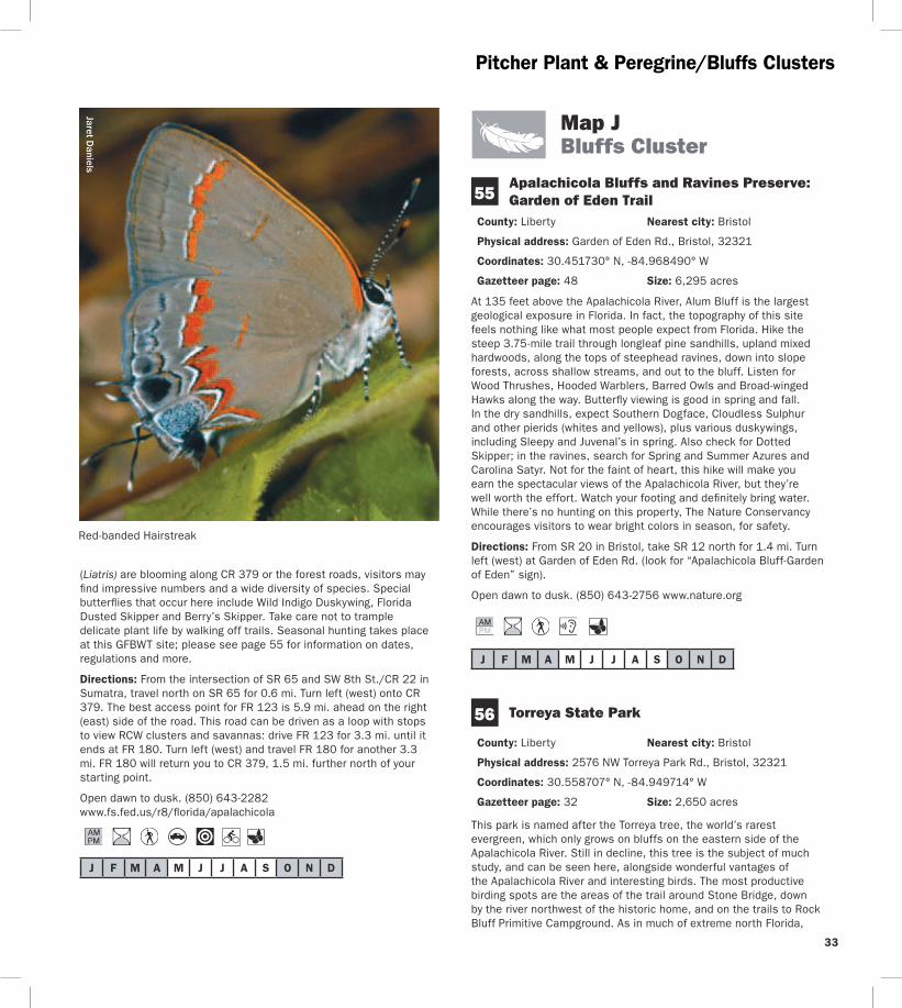

Bluffs Cluster
Lake Seminole
Apala
chicol
a Rive
r
Chattahoochee
Blountstown
Bristol
Sneads
Greensboro
Hosford
Juniper
69
97
12
20 65
20
71
20
90
90
269
268
270
1641
270A
271
286
280
275
275
69A
69
274
69
67
12
274
270
270
12
268
270
71
8
8
10
10
12
286
270
10
10
GADSDEN COLIBERTY CO
57
58
56
55
N
0 1
Miles
2 J
To Marianna
To Tallahassee
To Bainbridge GA
GEORGIA
174
166
162 Flat Creek Rd
158
152
Legi
on R
d
Torreya State Park Rd
To Apalachicola
Riv
erRd
JACKSON COCALHOUN COJACKSON COCALHOUN CO
Birding Trail Site Rest Area
Garden of Eden Rd
1641
1641
34
35
Bluffs Cluster
watch for northern birds like Winter Wren Louisiana Waterthrush Golden-crowned Kinglet and Brown Creeper Brown-headed Nuthatch and Bachmanrsquos Sparrow are possible in the sandhills and the high canopies along the river can be good for Yellow-throated Vireo in spring Birding by ear skills are very useful here Spring and fall are ideal times for butterfly enthusiasts to visit This park is one of the most reliable spots in Florida for Mourning Cloak (early spring) May is good for seeing Banded Kingrsquos and Striped Hairstreaks a fall day can produce more than a dozen skipper species The park features more than 17 miles of hiking trails and numerous camping options
Directions From I-10 west of Quincy take exit 174 for SR 12 and go toward Greensboro Stay on SR 12 through Greensboro and continue (approx 14 mi total from I-10) until the intersection with CR 1641 Turn right (north) on CR 1641 and continue left (northwest) at the fork with CR 270 Bear right (northwest) at the next fork with CR 270 Bear right at the next fork (CR 1641 becomes Torreya State Park Rd) and follow the signs to the park entrance Note some maps show CR 1641 as CR 271
Open year round 8 AM to sundown (850) 643-2674 wwwfloridastateparksorgtorreya
57 Three Rivers State Park
County Jackson Nearest city Sneads
Physical address 7908 Three Rivers Park Rd Sneads 32460
Coordinates 30739096deg N -84936161deg W
Gazetteer page 32 Size 667 acres
Pine and hardwood uplands with big old trees characterize this park on the south shore of Lake Seminole This lake is actually a reservoir created at the confluence of the Flint and Chattahoochee Rivers where they form the Apalachicolamdashthe opposite shoreline lies in Georgia Bird the Lakeside Trail which begins near the campground as well as the Half Dry Creek Trail by the picnic area Habitat and location are good for Kentucky Warbler and Louisiana Waterthrush in springsummer Otherwise wintering birds characteristic of the area including Red-breasted Nuthatch and Golden-crowned Kinglet are rare but possible in cooler months In winter also scope the lake from two birding blindsmdashyou never know what wintering waterfowl you may find A Yellow-billed Loon wintered on a reservoir south of Atlanta in 2003-04 Who knows what else is out there simply waiting for birders to find it Loaner optics and field guides are available at the entrance station
Directions From I-10 take exit 158 for CR 286 Head north for 52 mi to US 90SR 10 in Sneads Turn left (west) and go 04 mi Turn right (north) on CR 271River Rd and drive 21 mi Turn right (east) at Three Rivers Park Rd The entrance is just ahead
Open year round 8 AM to sundown (850) 482-9006 wwwfloridastateparksorgthreerivers
J F M A M J J A S O N D
Road signs guide visitors to each destination in the Panhandle Section of the Great Florida Birding and Wildlife Trail
C
W
Fresi
k K
raM
J F M A M J J A S O N D
BluffsTalquin Clusters
58 Sneads Park
County Jackson Nearest city Sneads
Physical address Legion Rd Sneads 32460
Coordinates 30727696deg N -84906788deg W
Gazetteer page 32 Size 64 acres
This small waterfront park on Lake Seminole is worth a stop if yoursquore in the area to scope the open water for wintering ducks like Redheads Canvasbacks Lesser Scaup Ring-necked Ducks Bufflehead American Wigeon and more Thousands of American Coots are often visible on the lake in winter scan for Horned Grebes and Common Loons as well Up for exploring The park includes a boat ramp for access to the lake Fields along the right (east) side of Legion Rd north of the baseball diamonds may have wintering geese such as Canada Snow Greater White-fronted and Rossrsquos Check the roadside wires for American Kestrels Western Kingbirds (rare) have also been sighted here
Directions From I-10 take exit 158 for CR 286 Head north for 52 mi to US 90SR 10 in Sneads Turn right (east) and go 09 mi Turn left (north) on Legion Rd and drive 15 mi to the parking area on the lake
Open dawn to dusk (850) 593-6636
J F M A M J J A S O N D
Map K Talquin Cluster
Joe Budd Wildlife Management Area 59 at Lake Talquin State Forest County Gadsden Nearest city Midway
Physical address Office Rd and Peters Rd Midway 32343
Coordinates 30509365deg N -84538308deg W (office) 30492610deg N -84503975deg W (Peters Rd at Cattle Gap Rd)
Gazetteer page 33 and 49 Size 11039 acres
An extensive system of side roads closed to vehicles is open to exploration via foot bicycle and equestrian traffic and will yield wintering mixed flocks of warblers Wild Turkeys in the open fields and Northern Bobwhites in the pinewoods After turning on Office Rd a large open pasture and dove field on both sides of the road are good birding for wintering sparrows Mourning Doves Eastern Meadowlarks and American Kestrels and also serve some years as a display ground for courting American Woodcocks at dawn and dusk Mississippi and Swallow-tailed Kites feed over pastures in spring summer Check edges of fields and woodlands for Blue Grosbeaks in summer as well At the end of Office Rd a dike trail runs 07 miles
one-way past sloughs good for warblers and Wood Ducks Wood Storks are sometimes present at the Joe Budd Aquatic Education Center on Budd Pond off Cattle Gap Rd The trail at the end of Plantation Rd offers a vantage of Lake Talquin similar to High Bluffrsquos (site 60) Seasonal hunting takes place at this GFBWT site please see page 55 for information on dates regulations and more The area is closed to other uses on hunt days A WMA map is available from the website below
Directions From I-10 west of Tallahassee take exit 192 onto US 90SR 10 and head northwest After 20 mi turn left (southwest) towards Midway onto CR 268MLK Blvd Continue west for 6 mi on CR 268MLK Blvd (changes to Highbridge Rd) and turn left (south) on Office Rd to reach WMA headquarters Other WMA roads can be accessed via Peters Rd (See directions for site 60 veer right onto Cattle Gap Rd to access Joe Budd WMA)
Open dawn to dusk closed on hunt days (850) 627-1773 MyFWCcomviewingrecreationwmasleadjoe-budd
J F M A M J J A S O N D
Lake Talquin State Forest 60 High Bluff Recreation Area County Gadsden Nearest city Midway
Physical address High Bluff Landing Rd Midway 32343
Coordinates 30461752deg N -84497412deg W
Gazetteer page 49 and 50 Size 2 acres
Scan the lake from the fishing pier looking for waders along the shoreline and in offshore trees as well as wintering ducks on the open water like Green-winged Teal and Lesser Scaup Better yet explore the lake from the water Songbirds like Black-throated Blue Warblers and Northern and Louisiana Waterthrushes use the hardwoods lining the lakersquos edge in migration Seasonal hunting takes place at this GFBWT site please see page 55 for information on dates regulations and more
Directions From I-10 west of Tallahassee take exit 192 for US 90SR 10 and head northwest After 20 mi turn left (southwest) towards Midway onto CR 268MLK Blvd Go 24 mi on CR 268 MLK Blvd to Peters Rd and turn left (west) Drive 11 mi and turn left (south) onto High Bluff Landing Rd which dead ends at the site after 26 mi
Open dawn to dusk (850) 488-1871 wwwfl-dofcomstate_forestslake_talquinhtml
J F M A M J J A S O N D
36
37
Talquin Cluster
Danny Bales
An eloquent songster the Wood Thrush is a breeding bird of the Panhandle and extreme North Florida It feeds mainly on insects
Lake Talquin State Forest 61 Bear Creek Educational Forest County Gadsden Nearest city Quincy
Physical address 8125 Pat Thomas Pkwy Quincy 32351
Coordinates 30478155deg N -84626724deg W
Gazetteer page 49 Size 492 acres
The entrance trail to this site is a paved interpretive trail which then connects to the 25-mile Ravine Trail and the 30-mile Bear Creek Trail The former hugs the creek ravine and its hardwood forest is good for migrants like Wood Thrushes and Veeries The pine flatwoods of the longer Bear Creek Trail are good for Northern Bobwhites and Wild Turkeys Take water and insect repellent and pick up a map at the entrance kiosk This site offers something for people of all birding skill and mobility levels Butterfly viewing here is best in spring Check flowering trees especially along the Ravine Trail for gossamer-wing butterflies such as Henryrsquos Elfin Banded Hairstreak and Spring and Summer Azures
Directions From I-10 south of Quincy take exit 181 for SR 267 Pat Thomas Pkwy Drive south for 43 mi and cross CR 65B the entrance is 04 mi further south on the left (east) side of the road
Open dawn to dusk (850) 488-1871 wwwfl-dofcomstate_forestslake_talquinhtml
Jaret Daniels
The Eastern Tiger Swallowtail is a large familiar butterfly found throughout most of Florida Males are yellow but females can be either black or yellow The caterpillars feed on trees such as red maple wild cherry sweetbay and tulip tree Look for adults feeding on thistle ironweed and milkweed in meadows parks and roadsides
J F M A M J J A S O N D
CO
Talquin Cluster
Lake Talquin
Office Rd
Peters Rd
Plan
tation
Rd
Blountstown Hwy
Quincy
Wetumpka
Midway
Fort Braden
20
65
267
267
267 65
12
90
90
375
65B 65B
268 161
270
270
20
267
8
8
10
65C
10
10
60
62
61
59
N
0 1
Mile s
2
Birding Trail Site K
To Tallahassee
To Tallahassee
To Marianna
To Havana
To Georgia
HighBlu
ff Lan
dingR
d
Highbridge Rd
Coes Landing Rd
B l o x h a m C u t o f f R d
268
181
174
192
GADSDEN COGADSDEN CO
LEON CO
LEON CO
LIB
ERTY
LIB
ERTY
CO
Cattle Gap Rd
38
39
Talquin Cluster Jaret D
aniels D
anny Bales
Northern Bobwhite
40
TalquinWhite-breasted Nuthatch Clusters
Lake
Jackson
Old
Bai
nbrid
ge R
d
Faulk
Dr
Millers
Landing Rd
N M
erid
ian
Rd Maclay Rd
Killarney Way
Raymond Diehl Rd
Vassar Rd
Tennessee StMahan Dr
Buck Lake Rd
Pedrick Rd
Center
ville R
d
Mag
nolia
Dr
6th Ave
7th Ave
Thom
asvi
lle R
d
Cap
ital C
ircle
N Monroe St
Tallahassee
Bradfordville
20
31927
319
27
90
0345
0342
155
151
0361
263
0347
61 9010
61
20
61
63
10
371
363
1568
8
8 10 10
69
68
67B
67A6663
64
65
L
To Thomasville GA
To LakeCity
ToCrawfordville
To Quincy192
196
194
203
199
209
N
0 1
Miles
2
GA
DS
DE
N C
O
LEO
N C
O
Sham
rock St
Crowder
Rd
Birding Trail Site
Rest Area
62Lake Talquin State Forest Fort Braden Trails
County Leon Nearest city Tallahassee
Physical address SR 20Blountstown Hwy Tallahassee 32310
Coordinates 30438199deg N -84495804deg W
Gazetteer page 49 and 50 Size 1242 acres
This site offers extensive hiking trails that are blazed in orange (compared to horse trails in pink or yellow) Pick up a map at the entrance and bring water One of the best trail choices is the Center Loop hike north from the parking area and stay right at every split on the orange-blazed trail to make a 2-mile loop back to the parking area The trail will take you through open areas and xeric oak uplands good for Wild Turkeys and White-eyed Vireos then reach bluffs overlooking Lake Talquin It follows the lake edge for nearly a mile before circling back through the uplands Watch overhead
for raptors and scan the lake for wintering ducks and wading birds Weedy and brushy areas have wintering sparrows including Chipping Song and White-throated
Directions From the intersection of SR 263Capital Circle and SR 20Blountstown Hwy in Tallahassee take SR 20 west for 87 mi the trailhead parking area is on the right (north) side of the road
Open dawn to dusk (850) 488-1871 wwwfl -dofcomstate_forestslake_talquinhtml
J F M A M J J A S O N D
J F M A M J J A S O N D
41
63
64
White-breasted Nuthatch Cluster
Map L White-breasted Nuthatch Cluster
J Lee Vause Park
County Leon Nearest city Tallahassee
Physical address 6024 Old Bainbridge Rd Tallahassee 32303
Coordinates 30537105deg N -84361323deg W
Gazetteer page 34 Size 26 acres
This small park has a well-developed center but down by the lake its sunny woody edges are a haven for birds like Orange-crowned Warblers and the occasional Yellow-breasted Chat A boardwalk and pier provide a view of Lake Jackson where you can look for a diversity of wading birds like Wood Storks as well as wintering ducks and coots Donrsquot forget flyovers by Ospreys and Bald Eagles as well as breeding Red-shouldered Red-tailed and Broad-winged Hawks in spring and summer
Directions From I-10 in Tallahassee take exit 199 for US 27N Monroe St Drive north for 46 mi and turn right (north) on CR 0361 Old Bainbridge Rd the park is 03 mi ahead on the right (east) side of the road
Open dawn to dusk (850) 606-1470 wwwleoncountyflgovparkspark_indexasp
Faulk Drive Landing
County Leon Nearest city Tallahassee
Physical address Faulk Dr Tallahassee 32303
Coordinates 30522392deg N -84322033deg W
Gazetteer page 34 Size 02 acres
Another access to Lake Jackson this one is a little more rustic and your tires (not to mention your feet) may get muddy at times of higher water Itrsquos best to park back from the landing and walk in watching fence posts and small oaks for flycatchers and warblers At the landing scan for egrets herons White Ibises and waterfowl Black-bellied Whistling-Ducks have turned up here as have Roseate Spoonbills The grassy area to the south of the landing may have Common Ground-Doves Eastern Bluebirds and Common Yellowthroats plus sparrows (such as Swamp and Savannah) in winter Launch a canoe or kayak here to explore Lake Jackson in more detail Worth a stop if yoursquore in the area Seasonal hunting takes place at this GFBWT site please see page 55 for information on dates regulations and more
Directions From I-10 in Tallahassee take exit 199 for US 27N Monroe St Drive north for 27 mi and turn right (northeast) on Faulk Dr the site is 14 mi ahead at the end of the road
Open dawn to dusk (850) 606-1470 wwwleoncountyflgovparkspark_indexasp
J F M A M J J A S O N D
65 Crowder Landing
County Leon Nearest city Tallahassee
Physical address Crowder Rd Tallahassee 32303
Coordinates 30507436deg N -84313444deg W
Gazetteer page 34 Size 06 acres
This small boat landing warrants a quick stop if yoursquore in the area because it provides another vantage of Lake Jackson Wintering ducks and coots are plentiful on the lake in winter as are wading birds like Snowy Egrets and Little Blue Herons Sandhill Cranes appear on occasion and in 2002 a Hudsonian Godwit was discovered here Lake Jackson is known for its tendency to disappear down a sinkhole in its middle at times of low water to birders itrsquos known for less common flycatchers (Vermillion for example) and songbirds in migration When itrsquos hot itrsquos hot When itrsquos nothellip
Directions From I-10 in Tallahassee take exit 199 for US 27N Monroe St Drive north for 17 mi and turn right (east) on Crowder Rd Follow Crowder Rd for 12 mi as it bends north then east the site is at the end on the lake
Open dawn to dusk (850) 606-1470 wwwleoncountyflgovparkspark_indexasp
J F M A M J J A S O N D
66 Elinor Klapp-Phipps Park
County Leon Nearest city Tallahassee
Physical address Miller Landing Rd Tallahassee 32312
Coordinates 30536493deg N -84280792deg W
Gazetteer page 34 Size 670 acres
Elinor Klapp-Phipps Park on Lake Jackson has areas of longleaf pine restoration but its real asset is the beautiful deciduous slope forest following the trickle of small streams down to the big lake Eastern Bluebirds Indigo Buntings and Wild Turkeys use open grassy areas along the powerline entrance and horse trailer entrance As the trails dive into the hammock start watching and listening for migrants like Wood and Gray-cheeked Thrushes and Blackburnian Warblers
J F M A M J J A S O N D
67
White-breasted Nuthatch Cluster
Reinhard Geisler
White-breasted Nuthatch
Down by the large bat house on Lake Victoria at stop 17 scope for Anhingas Tricolored Herons and Ospreys Black-bellied Whistling-Ducks have bred here recently The Lake Jackson area is known for unusual sightings like occasional wintering Western Tanagers so bird with an open mind Butterfly viewing is also quite good at this park spring through fall Unlike many sites mid-summer has an impressive variety of butterfly species look for spread-winged skippers including Silver-spotted Golden-banded Hoary Edge and Southern Cloudywing along the woodland trails and in the open meadows Trails at this park are extensive and winding Pick up a trail map and butterfly checklist at the entrance (or download them from the website below) and pay attention to your chosen route
Directions From I-10 in Tallahassee take exit 203 for US 319SR 61Thomasville Rd Drive north for 09 mi and turn left (west) on Maclay Rd Follow Maclay Rd for 22 mi to its end and turn right (north) on N Meridian Rd Drive 10 mi and turn left (west) on Millerrsquos Landing Rd the park entrance is 02 mi ahead on the left (south) side of the road
Open dawn to dusk (850) 891-3866 (850) 891-3975 wwwtalgovcomparksparksphippscfm
Alfred B Maclay Gardens State Park
County Leon Nearest city Tallahassee
Physical address 3540 Thomasville Rd Tallahassee 32309
Coordinates 30534672deg N -84277454deg W (Lake Overstreet) 30513532deg N -84247467deg W (main entrance)
Gazetteer page 34 Size 1179 acres
More widely known for its manicured gardens this park also offers native habitat that is better for birdwatching Try the brief trails along the lake at the Lake Hall Recreation Area for wintering Orange-crowned Warblers and Blue-headed Vireos A few Dark-eyed Juncos make an appearance here in winter Brown Creepers and Winter Wrens may also be present Check the lakes for wintering ducks and then for drinking Purple Martins beginning in February For a longer hike hit the Lake Overstreet multi-use trails (5 miles worth) off Meridian Road These are more rustic so be sure to pick up a map and bring water Birds like Red-headed Woodpeckers Brown-headed and White-breasted Nuthatches Great Horned Owls and Chuck-willsshywidows can all be found here The recreation area and gardens have wheelchair access
Directions (A) Lake Overstreet Trailhead From the intersection of Meridian and Maclay roads drive north on Meridian 09 mi turn left (west) and enter the parking lot for Forest Meadows Park amp Athletic Center the trailhead is directly across the street on the east side of Meridian (B) Main entrance From I-10 in Tallahassee take exit 203 for US 319SR 61Thomasville Rd Drive north for 09 mi and turn left (west) on Maclay Rd The park entrance is 02 mi on the right (north) side of the road
42
43
White-breasted Nuthatch Cluster
Open year round 8 AM to sundown (850) 487-4556 wwwfloridastateparksorgmaclaygardens
J F M A M J J A S O N D
68 A J Henry Park
County Leon Nearest city Tallahassee
Physical address 3000 A J Henry Park Dr Tallahassee 32309
Coordinates 30507040deg N -84217947deg W (north entrance) 30503435deg N -84218606deg W (south entrance)
Gazetteer page 34 and 50 Size 72 acres
A J Henry Park is a small city property with some nice topography and habitats including hardwood forest-covered slopes which descend down to a lake Accordingly this park attracts fallouts of migrants like Veery Ovenbird and Magnolia Warbler among others Raptors like Mississippi Kite and Broad-winged Hawk hunt for prey here in late spring and summer and Blue-winged Teal Ring-necked Duck and the occasional Redhead or Common Goldeneye can be found on the lake in winter The area surrounding the lake and the lower (north) parking area offer the most productive birding Extensive trails at the upper (south) parking area are appealing but the thicker understory can make it hard to spot birds frustrating those who donrsquot know bird calls and songs
Directions From I-10 in Tallahassee take exit 203 for US 319SR 61Thomasville Rd Drive north for 09 mi to Killarney Way and turn right (southeast) There are two approaches to the site off of this road For the south entrance proceed east on Killarney Way and turn right (south) onto Raymond Diehl Rd then turn left (east) on Vassar Rd Take Vassar Rd to its end and turn right (south) on Whitney Dr The park is 150 yds on the left (east) side of the road For the north entrance follow Killarney Way to the end and turn right (southeast) on Shamrock St After 03 mi turn right (south) on Gardenview Way and right (southwest) again after 03 mi onto A J Henry Park Dr The entrance is 02 mi ahead
Open 8 AM to dusk (850) 891-3866 wwwtalgovcomparksparksajhenrycfm
David M
oynahan
Common Goldeneye
Danny Bales
Rusty Blackbird
J F M A M J J A S O N D
White-breasted Nuthatch Mississippi Kite Clusters
69 J R Alford Greenway
County Leon Nearest city Tallahassee
Physical address 2500 S Pedrick Rd Tallahassee 32317
Coordinates 30444486deg N -84175759deg W
Gazetteer page 50 Size 874 acres
This greenway is a collection of old pastures and woodlands now used for passive recreation Seventeen miles of multi-use trails invite many hours of exploration From the parking area follow the trail due east across the first pasture (watch for Purple Martins and Eastern Bluebirds around the gourds and nest boxes) and veer either way at the fork to continue through a series of open fields Watch overhead for Red-tailed Hawks mixed flocks of wintering Palm Warblers and White-throated Sparrows flit in the weedy edges Pastures are managed for a mosaic of early succession habitats wintering Grasshopper Sparrows skulk in the grass (when itrsquos left high) as do Eastern Meadowlarks American Kestrels Eastern Phoebes and Loggerhead Shrikes stand lookout on snags and Wood Storks and Double-crested Cormorants can be seen flying overhead to Lake Lafayette at sunset From the parking lot another trail leads to the south and winds east through hardwoods good for Red-shouldered and Cooperrsquos Hawks Download a map and pay attention to your route Trails can be confusing at times a GPS unit is quite useful here Consider biking this property to cover more ground
Directions From the intersection of US 319Capital Circle and US 90 Tennessee StMahan Dr in Tallahassee drive 07 mi east on US 90 and turn right (east) on Buck Lake Rd After 20 mi turn right (south) onto Pedrick Rd the entrance and parking are 16 mi ahead at the end of the road
Open dawn to dusk (850) 606-1470 wwwleoncountyflgovparksgreenwaysasp
J F M A M J J A S O N D
Jaret Daniels
J F M A M J J A S O N D
Map M Mississippi Kite Cluster
70 Apalachicola National Forest Leon Sinks Geological Area
County Leon Nearest city Woodville
Physical address US 319Crawfordville Hwy Tallahassee 32305
Coordinates 30306785deg N -84345082deg W
Gazetteer page 50 Size 640 acres
This recreation area in the east portion of the Apalachicola National Forest is different from the lower longleaf savannah habitats of the
tracts closer to the river Here higher sandhills of pine and turkey oak are broken by erosion in the underlying limestone causing deep dramatic crystal blue sinkholes which are rimmed with hardwoods Upon entering the hiking trail turn left at the T-junction for the shorter trail (17 miles) and return on the short-cut (05 mile) through a tupelo swamp Listen for Barred Owls Northern Parulas and Prothonotary Warblers near the wetlands and watch for Blue-headed Vireos and Carolina Chickadees in the pinewoods By turning right at the T-junction yoursquoll choose the longer 25-mile loop past a series of large sinkholes Watch for Wild Turkeys Hermit Thrushes and White-eyed Vireos in the sandhills as well as songbirds like Yellow-billed Cuckoos in hardwoods sloping into the sinks In spring wild azaleas along the Gum Swamp Trail attract many swallowtail butterflies Little Wood-Satyr and Red-spotted Purple can occur in any wooded stretch Near the sinkholes look for Golden-banded Skippers Bring water and sunscreen
Directions From the intersection of US 319SR 263Capital Circle SW and US 319SR 369SR 61Crawfordville Rd in Tallahassee drive south on Crawfordville Rd for 58 mi the site is on the right (west) side of the road
Open year round 8 AM to 8 PM (850) 926-3561 wwwfsfedusr8floridaapalachicola
One of the most famous and recognizable butterflies in North America the Monarch undertakes an extensive migration each fall to hibernation sites in California and Mexico Large numbers gather on the Gulf Coast in October at locations like St Marks National Wildlife Refuge in Wakulla County A festival held at the refuge each year coincides with the Monarchrsquos migration Milkweeds are important plants for both caterpillars and adults
44
45
Mississippi Kite Cluster
StMarks
Newport
Wakulla
Medart
ShellPoint
Crawfordville
Sopchoppy
Woodville
Panacea
ApalachicolaNationalForest
St M
arks
Rive
r
Wakulla River
ApalacheeBay
Gulf of Mexico
Ochlockonee Bay
OchlockoneeRiver Rd
Sheldon St
ParkAve
OtterLake Rd
Lighthouse
Rd
Bottoms
Rd
Wak
ulla
Spr
ings
Rd
Woo
dvill
e H
wy
Bald
Poi
nt
Rd
Cra
wfo
rdvi
lle H
wy
98
98
98
319
61
267
267
363
363
372
369
374
375
267
61
365
356
356
356
319
98 30
61
30
367A
30
319365
368
365
365
367
367
59
365
372
375
372A372A
370
22
98
2192
2195
2204
WAKULLA CO
FRANKLIN CO
LEON CO
WAKULLA CO
70
71
73
72
7475
76
77
78
N
0 1
Miles
2
Birding Trail Site
ToPerry
ToApalachicola
ToTallahassee
M
Bloxham Cutoff Rd
Rose St
Sopchoppy Hwy
Alligator Dr
Sopc
hopp
y H
wy
Mississippi Kite Cluster R
einhard Geisler
Mississippi Kite
46
47
71
J F M A M J J A S O N D
J F M A M J J A S O N D
72 see ldquoGatewaysrdquo on page 3 for more information
73
Mississippi Kite Cluster
Edward Ball Wakulla Springs State Park
County Wakulla Nearest city Wakulla Springs
Physical address 550 Wakulla Park Dr Wakulla Springs 32327
Coordinates 30243337deg N -84310614deg W
Gazetteer page 50 Size 6055 acres
Hiking trails throughout this park provide access to floodplain forest good for Summer Tanagers and Ovenbirds in migration and Great Crested Flycatchers and Northern Parulas in summer The primary attraction however is the access to Wakullarsquos first magnitude spring From the pier look for Anhingas Common Moorhens Pied-billed Grebes and wintering American Wigeons as well as roosting Black Vultures in the cypress Better yet take one of the parkrsquos river cruises to get excellent views of the aforementioned plus Least Bitterns Yellow-crowned Night-Herons Barred Owls and White Ibises Alligators Suwannee River Cooters and mullet are commonly seen manatees are sometimes found in the river and spring as well In years past this park was known for Limpkins but today they are almost never seen here However the park staff is reintroducing native apple snails the Limpkinrsquos main prey item to entice Limpkins to return The spectacular 1930s-era lodge has roosting Chimney Swifts in summer Butterfly viewing is best here in late spring and fall Many swallowtail and hairstreak species are seen on flowering trees and shrubs in spring Texan Crescents and Appalachian Browns are regularly seen on the hiking trails north of the Wakulla River The park hosts an extensive wildlife and birding festival each spring
Directions From the intersection of SR 263Capital Circle SW and US 319SR 369SR 61Crawfordville Rd in Tallahassee drive south on Crawfordville Rd for 21 mi Take a slight left to stay on SR 61 Wakulla Springs Rd and go 74 mi Turn left (east) on SR 267Bloxham Cutoff Rd the site is 01 mi ahead on the right (south) side of the road
Open year round 8 AM to sundown (850) 926-0700 wwwfloridastateparksorgwakullasprings
St Marks National Wildlife Refuge St Marks Unit (Headquarters) Gateway
County WakullaJefferson Nearest city St Marks
Physical address 1255 Lighthouse Rd Crawfordville 32327
Coordinates 30156008deg N -84150652deg W
Gazetteer page 50 and 51 Size 29529 acres
Spanning four counties and with more than 300 recorded bird species the 68000-acre St Marks NWR is a must-see The St Marks Unit includes refuge headquarters and the historic St Marks Lighthouse itrsquos also the unit most popular with birders and wildlife
viewers for good reason Stop briefly at the visitor center for a map and to check the sightings log A pond and trail here can be good for White-throated Sparrows Pileated Woodpeckers Belted Kingfishers Eastern Phoebes and more but other trails are more rewarding From north to south along the main road the helicopter pad accessed from the primitive hiking trails is good for wintering sparrows such as Henslowrsquos East River Pool can be good for waterfowl in winter Stoney Bayou Pool and the Mounds Pools hold shovelers coots and the spectrum of wading birds in winter and the trail around Mounds Pool 3 is particularly good for Northern Pintails and Snow Geese in winter Stoney Bayou Pool 2 and Mounds Pool 3 are also good places to look for American Black Ducks The Headquarters Pond viewing platform offers the occasional Sora and Purple Gallinule as well as wintering teal and year-round waders The Mounds Trail around Tower Pond is very good for migrant songbirds like Yellow-billed Cuckoos and Indigo Buntings as well as Brown-headed Nuthatches in the pines and ducks and shorebirds in the pond At the roadrsquos terminus at the lighthouse look for common wintering waterfowl plus Redheads Canvasbacks Nelsonrsquos Sparrows shorebirds and more Scaup Bufflehead Horned Grebes and Common and Red-throated Loons winter in the Gulf and Least Bitterns Seaside Sparrows shorebirds and Clapper Rails breed in the marshes Oystercatchers pelicans and gulls loaf on pilings and offshore oyster bars Butterfly viewing is best here in fall especially September and October Monarch butterflies congregate here along Apalachee Bay on their fall migration to Mexico a Monarch festival is held each October to celebrate this phenomenon Hundreds of Monarchs may be seen on a mid-October day Along Lighthouse Dr keep your eyes open for Gulf Fritillaries and Long-tailed Skippers plus American Alligators Bobcats Northern River Otters and Florida Black Bears Though you may not see one just yet a Whooping Crane reintroduction project began in 2009 Bring water food sun protection and bug spray
Directions From the intersection of US 98SR 30 and SR 363 Woodville Hwy north of the town of St Marks drive east on US 98 approx 25 mi and turn right (south) on CR 59Lighthouse Rd just east of the St Marks River Bridge The refuge entrance is 30 mi ahead the visitor center is 06 mi farther south on the right
Open dawn to dusk (850) 925-6121 wwwfwsgovsaintmarks
Shell Point Beach Park
County Wakulla Nearest city Crawfordville
Physical address Beaty Taff Dr Crawfordville 32327
Coordinates 30058004deg N -84290519deg W
Gazetteer page 50
This Wakulla County park is worth a quick stop for a picnic lunch and a look for shorebirds The parking area offers an easy vantage of
Mississippi Kite Cluster
J F M A M J J A S O N D
J F M A M J J A S O N D
75
J F M A M J J A S O N D
loafing shorebirds in fall-winter-spring such as Short-billed Dowitchers Dunlin Willets Marbled Godwits Black Skimmers and more Keep an eye peeled for the occasional migrating Peregrine Falcon watching the shorebirds even more closely than you Summer is busy with swimmingboating visitors Shorebirds are more diverse and plentiful in cool weather months
Directions From the intersection of US 98SR 30 and SR 363 Woodville Hwy north of St Marks drive west on US 98 approx 80 mi and turn left (south) on CR 365Spring Creek Hwy Turn left after 20 mi onto CR 367Shell Point Rd Continue approx 5 mi on CR 367 (do not take CR 367A at the fork) and turn left (southeast) on Beaty Taff Dr Go 02 mi to the parking area on the right (south) side of the road
Open dawn to dusk (850) 926-7227 wwwwcprdcom
74 Bottoms Road Boat Ramp
County Wakulla Nearest city Panacea
Physical address Bottoms Rd Panacea 32346
Coordinates 30016052deg N -84368326deg W
Gazetteer page 50
Bottoms Road extends out through salt marsh to a county-owned boat launch on the Gulf Along the way watch and listen for Clapper Rails Virginia Rails (winter) and wading birds in the marsh plus Northern Harriers cruising the flats in winter The marsh is also a good place to look for Nelsonrsquos Sparrow (winter) and Seaside Sparrow (year-round) From the shoulder along the road scope the offshore sandbars for loafing terns gulls and shorebirds The large dirt pull-off on the east side of the road (05 miles north of the boat ramp) is private property The marsh is locally known for occasional Short-eared Owl sightings in winter so watch for these daytime hunters gliding low over the marsh like Northern Harriers or perched on low posts amidst the rushes From the boat ramp scan the waters for ducks and scoters
Directions From the intersection of US 98SR 30 and SR 363 Woodville Hwy north of the town of St Marks drive west on US 98 for 166 mi and turn left (east) on CR 372ABottoms Rd just before the town of Panacea Park along the shoulder (where safe) and at the boat ramp (26 mi ahead) at the end of the road
Open dawn to dusk
St Marks National Wildlife Refuge Otter Lake Recreation Area
County Wakulla Nearest city Panacea
Physical address Otter Lake Rd Panacea 32346
Coordinates 30026031deg N -84416565deg W
Gazetteer page 50 Size 11387 acres
Though not as famous as the St Marks Unit St Marks NWRrsquos Panacea Unit offers good birding too Make a quick trip to the picnic area and boat launch at the end to check the cypress for Prothonotary Warblers and occasional wading birds or choose to hike one of the longer trails the south Piney Ridge Trail loop (5 miles) or the north Otter Lake Trail loop (9 miles) The latter runs through pinewoods interrupted by occasional bayheads and wetlands Watch for Red-headed and Red-cockaded Woodpeckers Wild Turkeys and Northern Bobwhites At dusk check the boat launch for Wood Storks egrets and both vultures coming to roost Ospreys nest in the area Swallow-tailed Kites can be seen soaring overhead in spring and summer There is some hunting along the hiking trails so check the trailhead signs before entering and carry water and sunscreen with you See page 55 for more information
Directions From the intersection of US 98SR 30 and SR 363 Woodville Hwy north of the town of St Marks drive west on US 98 for 175 mi and turn right (west) on CR 372AOtter Lake Rd The site is at the west end of Otter Lake Rd
Open dawn to dusk (850) 925-6121 wwwfwsgovsaintmarks
76 Bald Point State Park
County Franklin Nearest city Alligator Point
Physical address Bald Point Rd Alligator Point 32346
Coordinates 29937605deg N -84337327deg W (main entrance) 29914581deg N -84336804deg W (Sunrise Beach access)
Gazetteer page 61 inset Size 4859 acres
Located on the south side of Ochlockonee Bay this state park offers great birding and wildlife viewing Its geography and location provide a prime vantage of the raptor migration in October as Peregrine Falcons Northern Harriers and others cruise down the beach Overwintering shorebirds like Black-bellied Plovers and Dunlin use the beach and estuary and when horseshoe crabs are spawning (which can be impressive) large numbers of shorebirds gather to feast on the crabsrsquo eggs A few sea turtles also nest here in summer In spring migratory songbirds like Black-throated Green Warblers and Indigo Buntings make landfall in the parkrsquos hammocks live oaks surrounding the upper parking area can be quite good Year-round listen for raucous Clapper Rails and Marsh Wrens from the observation boardwalk which overlooks pristine marshes near the upper parking lot Groove-billed Anis are rare winter visitors An extensive hiking trail network begins 16 miles south of the main entrance gate on the west side of the road across from the Sunrise
48
49
Beach access (no fee) These foot trails wind through mesic wet and scrubby flatwoods (home to Brown-headed Nuthatches) and around freshwater marshes swamps and ponds which have wading birds and ducks when water levels are favorable The park is also a staging point for Monarch butterflies on their fall trans-Gulf migration Large numbers of several other species concentrate here in fall as well including Gulf Fritillary Common Buckeye Long-tailed Skipper and Ocola Skipper In early spring Eastern Pygmy Blues can be abundant in the salt marsh Ceraunus Blues can be common in fall Guided tours are available for groups call 2 weeks in advance Fishing and sunbathing are popular in nice weather
Directions From Panacea drive west (head south) on US 98SR 30 for 7 mi and turn left (southeast) on CR 370Alligator Dr Drive 38 mi and turn left (east) on Bald Point Rd the main entrance gate is 28 mi ahead Sunrise Beach and trailhead access are 12 mi north of the intersection with Alligator Dr
Open year round 8 AM to sundown (850) 349-9146 wwwfloridastateparksorgbaldpoint
J F M A M J J A S O N D
77 Ochlockonee River State Park
County Wakulla Nearest city Sopchoppy
Physical address 429 State Park Rd Sopchoppy 32358
Coordinates 29998902deg N -84485259deg W
Gazetteer page 50 and 61 inset Size 543 acres
Upon entering this state park ask at the gate for the locations of active Red-cockaded Woodpecker (RCWs) cavities or recent sightings Head to the parking area at the end of the road and in the
Mississippi Kite Cluster
anny Bales
Blair W
itherington
Snowy Plover
northeastern corner take the ldquoScenic Driverdquo loop road which you may drive bike or walk Watch and listen for RCWs Pine Warblers Eastern Towhees and Common Yellowthroats You may also hike the Pine Flatwoods Trail which originates at the same parking lot This park is well-known for its ldquosnow whiterdquo Eastern Gray Squirrels (no they are not albinos) If you choose to launch a canoe here ask at the gate about water levels and clearance Prothonotary Warblers and Wood Storks may be seen along the river as well as skulking Green Herons Limpkins and Least Bitterns in the brushy margins For early morning access consider camping overnight and enjoy the sounds of Chuckwills-widows and Eastern Screech-Owls after dark
Directions From the intersection of Rose St and US 319SR 377 Sopchoppy Hwy in Sopchoppy head south on Sopchoppy Hwy for 44 mi Turn left (east) on Ochlockonee River Rd the entrance is 12 mi ahead
Open year round 8 AM to sundown (850) 962-2771 w Dwwfloridastateparksorgochlockoneeriver
shy
J F M A M J J A S O N D
County Wakulla Nearest city Sopchoppy
Physical address 252 Park Ave Sopchoppy 32358
Coordinates 30050507deg N -84498079deg W
Gazetteer page 49 and 50 Size 50 acres
If yoursquore in the area itrsquos worth stopping by briefly to visit this small city park on the Sopchoppy River Check the boardwalk and waterfront for night-herons and Prothonotary Warblers and hike the short trail to the left side of the property upon entering In the thicker hardwoods of the hiking trail yoursquoll find migrants like Yellow-billed Cuckoos in spring as well as Mississippi and Swallow-tailed Kites circling overhead in warmer months This site can be a busy boat launch in warm weather Consider launching a canoe from this spot to explore the Sopchoppy River more extensively
Directions From the intersection of Rose St and US 319SR 377 Sopchoppy Hwy in Sopchoppy head south on Sopchoppy Hwy for 04 mi Turn right (west) on Sheldon St and go 04 mi Turn left (south) on Park Ave and drive 05 mi The entrance is on the right (west) side of the road
Open dawn to dusk (850) 962-4611 (850) 962-5486
78 Myron B Hodge City Park
J F M A M J J A S O N D
Mississippi Kite Cluster
Named for its fast darting flight the Whirlabout is a common ldquograss skipperrdquo that occurs in the Panhandle and peninsula most of the year Host plants for the caterpillar include a variety of grasses Shepherdrsquos needle and lantana provide nectar for adults
Danny Bales
50
51
_________________________________________________________________
Mark Kiser FW
C
Birders and wildlife watchers contribute more than $3 billion to Floridarsquos economy each year
About this guide This Trail guide along with guides for the East West and South Trail Sections can be downloaded from the Great Florida Birding and Wildlife Trail website at wwwfloridabirdingtrailcom Additional copies of all four Trail guides may be ordered from the website or by using the form on this page As information for a particular site may change after Trail guides are printed please check the website before heading out on your trip for the most up-to-date information Please report any errors to GFBTMyFWCcom Thanks
Cut
alo
ng d
otte
d lin
e
Mail-in response slip
Birder and wildlife viewer ID Mail-in response form
Name___________________________________________________________
Street __________________________________________________________
City _____________________________________________________________
State _____________ County _____________________________________
Zip______________________ Country _____________________________
E-mail___________________________________________________________
Home phone ____________________________________________________
Work phone _____________________________________________________
Request for information
_____Add my name to your mailing list
_____Send mailings electronically
_____Send a bird checklist ndash also available online
_____Send a Birding and Wildlife Trail sponsorship packet
_____Send a Birding and Wildlife Trail brochure
_____Send a Birding and Wildlife Trail Guide ndash also available online
East ________ West ________ South_______ Panhandle _______
_____Send ldquoBirdwatching Basicsrdquo ndash also available online
Other ___________________________________________________________
wwwfloridabirdingtrailcom
The Great Florida Birding and Wildlife Trail is a program of the Florida Fish and Wildlife Conservation Commission
_____________________________________________________
_____________________________________________________
_____________________________________________________
_____________________________________________________
_____________________________________________________
_____________________________________________________
Cut
alo
ng d
otte
d lin
e
Rate the Trail Mail-in response form
Your country state and county of origin ______________
Where did you hear about the Trail__________________
What is your goal in using the Trail (eg finding a specific species of bird seeing a diversity of birds and wildlife or simply enjoying the outdoors) _____________
How long have you had this guide___________________
How many sites have you visited____________________
Which site was the best Why ______________________
Which site was worst Why ________________________
How many days have you spent birding or wildlife viewing in the last month ______________________________
How long was your last trip on the Birding and Wildlife Trail _______________________________________________
How much money did you spend on lodging food and gas on the above trip $_____________________________
Will you recommend the Trail to friends _____________
Please detach and mail us your valued response to the GFBWT address on page 53 Thank you
St Vincent National Wildlife Refuge
Myron B Hodge City Park
Mark and Selena Kiser
Mark Kiser FW
C
52
Birding and wildlife viewing ethics Donrsquot you hate it when the doorbell or telephone rings just as you settle down to dinner or a nap While mere nuisances to us disruptions in feeding and nesting routines can spell disaster for birds and other wildlife especially the cumulative effect of frequent disruptions a common occurrence at busy sites When a nesting bird is forced to fly it may leave eggs or young exposed to temperature extremes or predators A migratory bird may be exhausted and hungry from a long flight ndash it needs to rest and eat With care and common sense we can all help protect the wildlife we love to watch
Consider these points n Stay back from concentrations of nesting or loafing
waterbirds ndash a spotting scope may be a better choice than binoculars
n Walk around groups of birds on the beach rather than forcing them to fly
n Sit or crouch so that you appear smaller Keep movements slow and steady rather than fast or sporadic
n If viewing from your car stay inside as much as possible It acts as a viewing ldquoblindrdquo and the birds are less likely to fly if they donrsquot recognize you as human
n Stay on roads trails and paths to minimize habitat disturbance
n Do you occasionally use recordings to attract birds If so remember not to overuse them or to try to attract rare or protected species Also do not use them during the nesting season Be aware that some locations prohibit the use of recordings
n For more information please see the American Birding Associationrsquos Code of Ethics at
wwwabaorgaboutethicshtml FWCrsquos viewing ethics at MyFWCcomviewingadventures and the Nature Photographerrsquos Network ethics page at wwwnaturephotographersnetethicshtml
Birding and wildlife viewing resources There are many more resources for birding and wildlife viewing in Florida Before your trip check the Internet for area rare bird alert hotlines and statewide birding listservs to get an idea of whatrsquos being seen If yoursquore staying in an area for a longer visit check local book and nature stores for area guides published by local Audubon chapters or birders The Great Florida Birding and Wildlife Trail guidebooks and the trip-planning tool at wwwfloridabirdingtrailcom are just a taste of the
information available to plan your ultimate Florida birding and wildlife viewing vacation
For more informationhellip
Or to be added to the mailing list for the Great Florida Birding and Wildlife Trailrsquos newsletter Kite Tales fill in the response form (including your name and address on page 51) and mail to
Great Florida Birding and Wildlife Trail (or GFBWT) 620 South Meridian Street Tallahassee FL 32399-1600
or visit the Birding and Wildlife Trailrsquos website at wwwfloridabirdingtrailcom
The Kite Tales newsletter includes news about the Trail and Trail-related events across the state Information also is available regarding Trail sponsorship site nominations for upcoming Trail sections tips for better birding and the economic impact of this flourishing pastime Take part in the continued development of this great resource for birders and wildlife watchers of all skill levels while enjoying and ensuring continued concern for the conservation of Floridarsquos fabulous avian and wildlife treasures
Birders and wildlife viewers Flex your economic muscles Florida communities have long made land use choices to attract traditional tourists and their dollars Birding and wildlife viewing are big business in Florida too but communities will only recognize that if wersquore visible Your visibility and economic impact can encourage wildlife conservation
Some ways you can make yourself more visible n Wear bird and wildlife t-shirts n Take your binoculars into the restaurant with you n Ask local residents in restaurants hotels gas
stations etc about where good birding and wildlife viewing locations might be in their area
n Leave birder calling cards whenever you spend money helping vendors make the connection between healthy wildlands and healthy economies (cards may be downloaded from wwwfloridabirdingtrailcom)
n Put a birding bumper sticker or window decal on your car or business It speaks for itself so you donrsquot have to
Conserve wildlife by watching wildlife Itrsquos more than a hobby itrsquos a legacy
53
For the birds The Great Florida Birding and Wildlife Trail helps everyone enjoy and conserve Floridarsquos wildlife and wildlife habitat A donation to the Wildlife Foundation of Florida helps us expand and enhance the Birding and Wildlife Trail experience With your support we can continue to protect Floridarsquos natural resources for future generations to enjoy
mail your check to
Wildlife Foundation of Florida Attn GFBWT PO Box 6181 Tallahassee FL 32314-6181
Note Please write GFBWT in the memo section of your check
Support the Birding and Wildlife Trail with your purchase of official GFBWT merchandise We offer several T-shirt designs a stylish baseball cap a bumper sticker and a vinyl cling sticker Proudly wearing birding apparel and displaying birding stickers on your vehicle help communities recognize you as a wildlife watcher and conservationist and sale proceeds benefit the Birding and Wildlife Trail program Order yours today at wwwfloridabirdingtrailcom
If you would like to make a donation please
54
Sharing Floridarsquos public lands during hunting season
Floridarsquos residents and visitors are fortunate to have an abundance of public and private lands open for wildlife viewing and other outdoor recreation Seasonal hunting takes place on many of these public lands that are part of the Great Florida Birding and Wildlife Trail Some of these lands - wildlife management areas and wildlife refuges ndash were acquired and are managed with revenue generated from the sale of hunting licenses and taxes on various types of sporting goods Birders and hunters can and do share these lands as well as a love for the outdoors and conservation
Some Birding and Wildlife Trail sites are closed during hunting seasons Other sites allow multiple activities including birding and hiking to take place during hunts If the site you plan to visit has a hunting icon in this guidebook please visit the FWCrsquos website at MyFWC comhunting or MyFWCcomviewingrecreation to find information on hunting seasons dates times of day area closures regulations WMA maps and more In the words of Pete Dunne legendary birder author (and hunter too) ldquoawareness of your statersquos (and sitersquos) hunting regulations and what game is and is not in season will help you make better decisions in the fieldrdquo Trip planning is important ndash do your homework prior to arriving at your destination Birders need not stay home nor avoid all huntable lands during hunting season However when venturing outdoors during hunting season wear blaze orange for visibility and safety
Birders and hunters in Florida have access to the largest wildlife management area (WMA) system in the United States with nearly 6 million acres of lands established as WMAs or Wildlife and Environmental Areas (WEAs) On the majority of these lands the FWC is a cooperating manager working in conjunction with other government agencies and private landowners to conserve wildlife and provide quality outdoor experiences for the public The FWC is the landowner or ldquoleadrdquo managing agency for nearly 50 WMAs and WEAs totaling millions of acres On these lands the FWC is responsible for land stewardship wildlife conservation and a wide range of recreation
activities including birding hunting fishing and wildlife viewing The FWCrsquos Office of Recreation Services where the Great Florida Birding and Wildlife Trail program is administered also develops public access amenities on these lead WMAs
Mark Kiser FW
C
Photographers birders and other wildlife viewers enjoy quality outdoor experiences on Floridarsquos wildlife management areas
55
Meaghan M
anning
The lavishly-plumaged Purple Gallinule breeds in the Florida Panhandle and peninsula and may be found throughout the peninsula in winter This colorful railrsquos enormous yellow feet are well-suited for walking on floating vegetation as it searches for seeds fruits and aquatic invertebrates
This guide is a product of the Florida Fish and Wildlife Conservation Commissionrsquos Office of Recreation Services
Special Thanks We thank each of the site managersowners donors partners and cooperators who have been instrumental in developing the Great Florida Birding and Wildlife Trail Sally and Dean Jue and David Harder provided additional assistance with butterfly viewing information for this guide
Credits New trail developmenttext by Mark Kiser Selena Kiser Jerrie Lindsey and Anne Glick Florida Fish and Wildlife Conservation Commission Original trail developmenttext by Julie Wraithmell Michael Welch and Adam Kent Maps by Creative Force Inc Graphic design editing and layout by Lizabeth West and Ann Marie Tavares Florida Fish and Wildlife Conservation Commission
56
________________________________________________________________________________________________________________________________
________________________________________________________________________________________________________________________________
________________________________________________________________________________________________________________________________
________________________________________________________________________________________________________________________________
________________________________________________________________________________________________________________________________
________________________________________________________________________________________________________________________________
________________________________________________________________________________________________________________________________
________________________________________________________________________________________________________________________________
________________________________________________________________________________________________________________________________
________________________________________________________________________________________________________________________________
________________________________________________________________________________________________________________________________
________________________________________________________________________________________________________________________________
________________________________________________________________________________________________________________________________
________________________________________________________________________________________________________________________________
________________________________________________________________________________________________________________________________
________________________________________________________________________________________________________________________________
________________________________________________________________________________________________________________________________
________________________________________________________________________________________________________________________________
________________________________________________________________________________________________________________________________
Field Notes D
avid Moynahan FW
C
Pitcher plants Apalachicola National Forest Post Office Bay
57
________________________________________________________________________________________________________________________________
________________________________________________________________________________________________________________________________
________________________________________________________________________________________________________________________________
________________________________________________________________________________________________________________________________
________________________________________________________________________________________________________________________________
________________________________________________________________________________________________________________________________
________________________________________________________________________________________________________________________________
________________________________________________________________________________________________________________________________
________________________________________________________________________________________________________________________________
________________________________________________________________________________________________________________________________
________________________________________________________________________________________________________________________________
________________________________________________________________________________________________________________________________
________________________________________________________________________________________________________________________________
________________________________________________________________________________________________________________________________
________________________________________________________________________________________________________________________________
________________________________________________________________________________________________________________________________
________________________________________________________________________________________________________________________________
________________________________________________________________________________________________________________________________
________________________________________________________________________________________________________________________________
Field Notes D
avid Moynahan FW
C
Least Terns Gulf Islands National Seashore
58
2
How to Use this GuideWe hope this guide will help you quickly and easily identify Panhandle Section birding and wildlife viewing sites of interest to you Sites have met criteria ensuring they are good for birding and are able to withstand birder use Maps show ldquoclustersrdquo of 1 to 10 sites within an hourrsquos drive of one another The map above shows the locations of these clusters the letter in each box corresponds to the map for that cluster Descriptions and directions for sites accompany each cluster map You may want to use the maps in this guide along with a more detailed map book such as a DeLorme Florida Atlas and Gazetteer
Map Key(see page 3 for City Locator)
A Perdido Cluster H Cape Cluster
B Migrantrsquos Rest Cluster I Pitcher Plant amp Peregrine Cluster
C Blackwater Cluster J Bluffs Cluster
D Choctawhatchee Cluster K Talquin Cluster
E Dogwood Cluster L White-breasted Nuthatch Cluster
F Kentucky Warbler Cluster M Mississippi Kite Cluster
LegendNot a primary Trail site but ldquoWorth A Visitrdquo if yoursquore already in the area
Some viewing is barrier-free
Sites good for beginners
Sites best for those with ability to ID bird calls
Restroom available
Entrance fee required
Tours educational signage andor nature center on site
Seasonal hunting on site
Access by appointment only
Site can be birded by car
Site can be birded by boat
Site can be birded by foot
Site can be birded by bicycle
Site can be birded by horseback
Site is good for a single sought-after species
Camping available
Site has good butterfly viewing
Best months for each site will be shaded
Best time of day for birding morning evening both morning and evening and all day
Recommended length of visit quick stop a few hours all day
Danny Bales
American Black Duck
Danny Bales
Swainsonrsquos Warbler
resi Kan
lee S
nd akra
M
Apalachicola Bluffs and Ravines Preserve
59
printed on recycled paper 32011
The Great Florida Birding and Wildlife Trail is a project of the Florida Fish and Wildlife Conservation Commission
Marbled G
odwit by Joan M
iller
Many thanks to our generous sponsors
Gulf Powerwwwgulfpowercom
National Fish and Wildlife Foundationwwwnfwforg
Cover photo Brown-headed Nuthatch by Danny Bales
wwwfloridabirdingtrailcom
In partnership with
Florida Park Service Florida Department of Transportation
US Fish and Wildlife US Department ofService Transportation Federal
Hiighway Administration
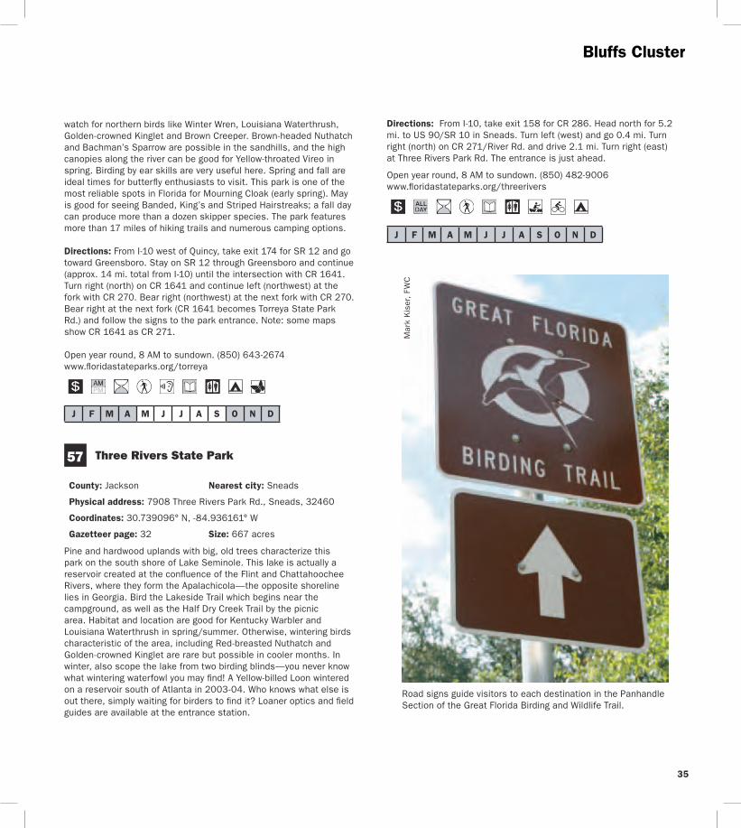
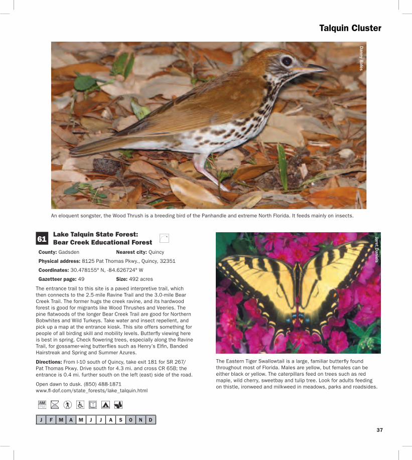
CO
Talquin Cluster
Lake Talquin
Office Rd
Peters Rd
Plan
tation
Rd
Blountstown Hwy
Quincy
Wetumpka
Midway
Fort Braden
20
65
267
267
267 65
12
90
90
375
65B 65B
268 161
270
270
20
267
8
8
10
65C
10
10
60
62
61
59
N
0 1
Mile s
2
Birding Trail Site K
To Tallahassee
To Tallahassee
To Marianna
To Havana
To Georgia
HighBlu
ff Lan
dingR
d
Highbridge Rd
Coes Landing Rd
B l o x h a m C u t o f f R d
268
181
174
192
GADSDEN COGADSDEN CO
LEON CO
LEON CO
LIB
ERTY
LIB
ERTY
CO
Cattle Gap Rd
38
39
Talquin Cluster Jaret D
aniels D
anny Bales
Northern Bobwhite
40
TalquinWhite-breasted Nuthatch Clusters
Lake
Jackson
Old
Bai
nbrid
ge R
d
Faulk
Dr
Millers
Landing Rd
N M
erid
ian
Rd Maclay Rd
Killarney Way
Raymond Diehl Rd
Vassar Rd
Tennessee StMahan Dr
Buck Lake Rd
Pedrick Rd
Center
ville R
d
Mag
nolia
Dr
6th Ave
7th Ave
Thom
asvi
lle R
d
Cap
ital C
ircle
N Monroe St
Tallahassee
Bradfordville
20
31927
319
27
90
0345
0342
155
151
0361
263
0347
61 9010
61
20
61
63
10
371
363
1568
8
8 10 10
69
68
67B
67A6663
64
65
L
To Thomasville GA
To LakeCity
ToCrawfordville
To Quincy192
196
194
203
199
209
N
0 1
Miles
2
GA
DS
DE
N C
O
LEO
N C
O
Sham
rock St
Crowder
Rd
Birding Trail Site
Rest Area
62Lake Talquin State Forest Fort Braden Trails
County Leon Nearest city Tallahassee
Physical address SR 20Blountstown Hwy Tallahassee 32310
Coordinates 30438199deg N -84495804deg W
Gazetteer page 49 and 50 Size 1242 acres
This site offers extensive hiking trails that are blazed in orange (compared to horse trails in pink or yellow) Pick up a map at the entrance and bring water One of the best trail choices is the Center Loop hike north from the parking area and stay right at every split on the orange-blazed trail to make a 2-mile loop back to the parking area The trail will take you through open areas and xeric oak uplands good for Wild Turkeys and White-eyed Vireos then reach bluffs overlooking Lake Talquin It follows the lake edge for nearly a mile before circling back through the uplands Watch overhead
for raptors and scan the lake for wintering ducks and wading birds Weedy and brushy areas have wintering sparrows including Chipping Song and White-throated
Directions From the intersection of SR 263Capital Circle and SR 20Blountstown Hwy in Tallahassee take SR 20 west for 87 mi the trailhead parking area is on the right (north) side of the road
Open dawn to dusk (850) 488-1871 wwwfl -dofcomstate_forestslake_talquinhtml
J F M A M J J A S O N D
J F M A M J J A S O N D
41
63
64
White-breasted Nuthatch Cluster
Map L White-breasted Nuthatch Cluster
J Lee Vause Park
County Leon Nearest city Tallahassee
Physical address 6024 Old Bainbridge Rd Tallahassee 32303
Coordinates 30537105deg N -84361323deg W
Gazetteer page 34 Size 26 acres
This small park has a well-developed center but down by the lake its sunny woody edges are a haven for birds like Orange-crowned Warblers and the occasional Yellow-breasted Chat A boardwalk and pier provide a view of Lake Jackson where you can look for a diversity of wading birds like Wood Storks as well as wintering ducks and coots Donrsquot forget flyovers by Ospreys and Bald Eagles as well as breeding Red-shouldered Red-tailed and Broad-winged Hawks in spring and summer
Directions From I-10 in Tallahassee take exit 199 for US 27N Monroe St Drive north for 46 mi and turn right (north) on CR 0361 Old Bainbridge Rd the park is 03 mi ahead on the right (east) side of the road
Open dawn to dusk (850) 606-1470 wwwleoncountyflgovparkspark_indexasp
Faulk Drive Landing
County Leon Nearest city Tallahassee
Physical address Faulk Dr Tallahassee 32303
Coordinates 30522392deg N -84322033deg W
Gazetteer page 34 Size 02 acres
Another access to Lake Jackson this one is a little more rustic and your tires (not to mention your feet) may get muddy at times of higher water Itrsquos best to park back from the landing and walk in watching fence posts and small oaks for flycatchers and warblers At the landing scan for egrets herons White Ibises and waterfowl Black-bellied Whistling-Ducks have turned up here as have Roseate Spoonbills The grassy area to the south of the landing may have Common Ground-Doves Eastern Bluebirds and Common Yellowthroats plus sparrows (such as Swamp and Savannah) in winter Launch a canoe or kayak here to explore Lake Jackson in more detail Worth a stop if yoursquore in the area Seasonal hunting takes place at this GFBWT site please see page 55 for information on dates regulations and more
Directions From I-10 in Tallahassee take exit 199 for US 27N Monroe St Drive north for 27 mi and turn right (northeast) on Faulk Dr the site is 14 mi ahead at the end of the road
Open dawn to dusk (850) 606-1470 wwwleoncountyflgovparkspark_indexasp
J F M A M J J A S O N D
65 Crowder Landing
County Leon Nearest city Tallahassee
Physical address Crowder Rd Tallahassee 32303
Coordinates 30507436deg N -84313444deg W
Gazetteer page 34 Size 06 acres
This small boat landing warrants a quick stop if yoursquore in the area because it provides another vantage of Lake Jackson Wintering ducks and coots are plentiful on the lake in winter as are wading birds like Snowy Egrets and Little Blue Herons Sandhill Cranes appear on occasion and in 2002 a Hudsonian Godwit was discovered here Lake Jackson is known for its tendency to disappear down a sinkhole in its middle at times of low water to birders itrsquos known for less common flycatchers (Vermillion for example) and songbirds in migration When itrsquos hot itrsquos hot When itrsquos nothellip
Directions From I-10 in Tallahassee take exit 199 for US 27N Monroe St Drive north for 17 mi and turn right (east) on Crowder Rd Follow Crowder Rd for 12 mi as it bends north then east the site is at the end on the lake
Open dawn to dusk (850) 606-1470 wwwleoncountyflgovparkspark_indexasp
J F M A M J J A S O N D
66 Elinor Klapp-Phipps Park
County Leon Nearest city Tallahassee
Physical address Miller Landing Rd Tallahassee 32312
Coordinates 30536493deg N -84280792deg W
Gazetteer page 34 Size 670 acres
Elinor Klapp-Phipps Park on Lake Jackson has areas of longleaf pine restoration but its real asset is the beautiful deciduous slope forest following the trickle of small streams down to the big lake Eastern Bluebirds Indigo Buntings and Wild Turkeys use open grassy areas along the powerline entrance and horse trailer entrance As the trails dive into the hammock start watching and listening for migrants like Wood and Gray-cheeked Thrushes and Blackburnian Warblers
J F M A M J J A S O N D
67
White-breasted Nuthatch Cluster
Reinhard Geisler
White-breasted Nuthatch
Down by the large bat house on Lake Victoria at stop 17 scope for Anhingas Tricolored Herons and Ospreys Black-bellied Whistling-Ducks have bred here recently The Lake Jackson area is known for unusual sightings like occasional wintering Western Tanagers so bird with an open mind Butterfly viewing is also quite good at this park spring through fall Unlike many sites mid-summer has an impressive variety of butterfly species look for spread-winged skippers including Silver-spotted Golden-banded Hoary Edge and Southern Cloudywing along the woodland trails and in the open meadows Trails at this park are extensive and winding Pick up a trail map and butterfly checklist at the entrance (or download them from the website below) and pay attention to your chosen route
Directions From I-10 in Tallahassee take exit 203 for US 319SR 61Thomasville Rd Drive north for 09 mi and turn left (west) on Maclay Rd Follow Maclay Rd for 22 mi to its end and turn right (north) on N Meridian Rd Drive 10 mi and turn left (west) on Millerrsquos Landing Rd the park entrance is 02 mi ahead on the left (south) side of the road
Open dawn to dusk (850) 891-3866 (850) 891-3975 wwwtalgovcomparksparksphippscfm
Alfred B Maclay Gardens State Park
County Leon Nearest city Tallahassee
Physical address 3540 Thomasville Rd Tallahassee 32309
Coordinates 30534672deg N -84277454deg W (Lake Overstreet) 30513532deg N -84247467deg W (main entrance)
Gazetteer page 34 Size 1179 acres
More widely known for its manicured gardens this park also offers native habitat that is better for birdwatching Try the brief trails along the lake at the Lake Hall Recreation Area for wintering Orange-crowned Warblers and Blue-headed Vireos A few Dark-eyed Juncos make an appearance here in winter Brown Creepers and Winter Wrens may also be present Check the lakes for wintering ducks and then for drinking Purple Martins beginning in February For a longer hike hit the Lake Overstreet multi-use trails (5 miles worth) off Meridian Road These are more rustic so be sure to pick up a map and bring water Birds like Red-headed Woodpeckers Brown-headed and White-breasted Nuthatches Great Horned Owls and Chuck-willsshywidows can all be found here The recreation area and gardens have wheelchair access
Directions (A) Lake Overstreet Trailhead From the intersection of Meridian and Maclay roads drive north on Meridian 09 mi turn left (west) and enter the parking lot for Forest Meadows Park amp Athletic Center the trailhead is directly across the street on the east side of Meridian (B) Main entrance From I-10 in Tallahassee take exit 203 for US 319SR 61Thomasville Rd Drive north for 09 mi and turn left (west) on Maclay Rd The park entrance is 02 mi on the right (north) side of the road
42
43
White-breasted Nuthatch Cluster
Open year round 8 AM to sundown (850) 487-4556 wwwfloridastateparksorgmaclaygardens
J F M A M J J A S O N D
68 A J Henry Park
County Leon Nearest city Tallahassee
Physical address 3000 A J Henry Park Dr Tallahassee 32309
Coordinates 30507040deg N -84217947deg W (north entrance) 30503435deg N -84218606deg W (south entrance)
Gazetteer page 34 and 50 Size 72 acres
A J Henry Park is a small city property with some nice topography and habitats including hardwood forest-covered slopes which descend down to a lake Accordingly this park attracts fallouts of migrants like Veery Ovenbird and Magnolia Warbler among others Raptors like Mississippi Kite and Broad-winged Hawk hunt for prey here in late spring and summer and Blue-winged Teal Ring-necked Duck and the occasional Redhead or Common Goldeneye can be found on the lake in winter The area surrounding the lake and the lower (north) parking area offer the most productive birding Extensive trails at the upper (south) parking area are appealing but the thicker understory can make it hard to spot birds frustrating those who donrsquot know bird calls and songs
Directions From I-10 in Tallahassee take exit 203 for US 319SR 61Thomasville Rd Drive north for 09 mi to Killarney Way and turn right (southeast) There are two approaches to the site off of this road For the south entrance proceed east on Killarney Way and turn right (south) onto Raymond Diehl Rd then turn left (east) on Vassar Rd Take Vassar Rd to its end and turn right (south) on Whitney Dr The park is 150 yds on the left (east) side of the road For the north entrance follow Killarney Way to the end and turn right (southeast) on Shamrock St After 03 mi turn right (south) on Gardenview Way and right (southwest) again after 03 mi onto A J Henry Park Dr The entrance is 02 mi ahead
Open 8 AM to dusk (850) 891-3866 wwwtalgovcomparksparksajhenrycfm
David M
oynahan
Common Goldeneye
Danny Bales
Rusty Blackbird
J F M A M J J A S O N D
White-breasted Nuthatch Mississippi Kite Clusters
69 J R Alford Greenway
County Leon Nearest city Tallahassee
Physical address 2500 S Pedrick Rd Tallahassee 32317
Coordinates 30444486deg N -84175759deg W
Gazetteer page 50 Size 874 acres
This greenway is a collection of old pastures and woodlands now used for passive recreation Seventeen miles of multi-use trails invite many hours of exploration From the parking area follow the trail due east across the first pasture (watch for Purple Martins and Eastern Bluebirds around the gourds and nest boxes) and veer either way at the fork to continue through a series of open fields Watch overhead for Red-tailed Hawks mixed flocks of wintering Palm Warblers and White-throated Sparrows flit in the weedy edges Pastures are managed for a mosaic of early succession habitats wintering Grasshopper Sparrows skulk in the grass (when itrsquos left high) as do Eastern Meadowlarks American Kestrels Eastern Phoebes and Loggerhead Shrikes stand lookout on snags and Wood Storks and Double-crested Cormorants can be seen flying overhead to Lake Lafayette at sunset From the parking lot another trail leads to the south and winds east through hardwoods good for Red-shouldered and Cooperrsquos Hawks Download a map and pay attention to your route Trails can be confusing at times a GPS unit is quite useful here Consider biking this property to cover more ground
Directions From the intersection of US 319Capital Circle and US 90 Tennessee StMahan Dr in Tallahassee drive 07 mi east on US 90 and turn right (east) on Buck Lake Rd After 20 mi turn right (south) onto Pedrick Rd the entrance and parking are 16 mi ahead at the end of the road
Open dawn to dusk (850) 606-1470 wwwleoncountyflgovparksgreenwaysasp
J F M A M J J A S O N D
Jaret Daniels
J F M A M J J A S O N D
Map M Mississippi Kite Cluster
70 Apalachicola National Forest Leon Sinks Geological Area
County Leon Nearest city Woodville
Physical address US 319Crawfordville Hwy Tallahassee 32305
Coordinates 30306785deg N -84345082deg W
Gazetteer page 50 Size 640 acres
This recreation area in the east portion of the Apalachicola National Forest is different from the lower longleaf savannah habitats of the
tracts closer to the river Here higher sandhills of pine and turkey oak are broken by erosion in the underlying limestone causing deep dramatic crystal blue sinkholes which are rimmed with hardwoods Upon entering the hiking trail turn left at the T-junction for the shorter trail (17 miles) and return on the short-cut (05 mile) through a tupelo swamp Listen for Barred Owls Northern Parulas and Prothonotary Warblers near the wetlands and watch for Blue-headed Vireos and Carolina Chickadees in the pinewoods By turning right at the T-junction yoursquoll choose the longer 25-mile loop past a series of large sinkholes Watch for Wild Turkeys Hermit Thrushes and White-eyed Vireos in the sandhills as well as songbirds like Yellow-billed Cuckoos in hardwoods sloping into the sinks In spring wild azaleas along the Gum Swamp Trail attract many swallowtail butterflies Little Wood-Satyr and Red-spotted Purple can occur in any wooded stretch Near the sinkholes look for Golden-banded Skippers Bring water and sunscreen
Directions From the intersection of US 319SR 263Capital Circle SW and US 319SR 369SR 61Crawfordville Rd in Tallahassee drive south on Crawfordville Rd for 58 mi the site is on the right (west) side of the road
Open year round 8 AM to 8 PM (850) 926-3561 wwwfsfedusr8floridaapalachicola
One of the most famous and recognizable butterflies in North America the Monarch undertakes an extensive migration each fall to hibernation sites in California and Mexico Large numbers gather on the Gulf Coast in October at locations like St Marks National Wildlife Refuge in Wakulla County A festival held at the refuge each year coincides with the Monarchrsquos migration Milkweeds are important plants for both caterpillars and adults
44
45
Mississippi Kite Cluster
StMarks
Newport
Wakulla
Medart
ShellPoint
Crawfordville
Sopchoppy
Woodville
Panacea
ApalachicolaNationalForest
St M
arks
Rive
r
Wakulla River
ApalacheeBay
Gulf of Mexico
Ochlockonee Bay
OchlockoneeRiver Rd
Sheldon St
ParkAve
OtterLake Rd
Lighthouse
Rd
Bottoms
Rd
Wak
ulla
Spr
ings
Rd
Woo
dvill
e H
wy
Bald
Poi
nt
Rd
Cra
wfo
rdvi
lle H
wy
98
98
98
319
61
267
267
363
363
372
369
374
375
267
61
365
356
356
356
319
98 30
61
30
367A
30
319365
368
365
365
367
367
59
365
372
375
372A372A
370
22
98
2192
2195
2204
WAKULLA CO
FRANKLIN CO
LEON CO
WAKULLA CO
70
71
73
72
7475
76
77
78
N
0 1
Miles
2
Birding Trail Site
ToPerry
ToApalachicola
ToTallahassee
M
Bloxham Cutoff Rd
Rose St
Sopchoppy Hwy
Alligator Dr
Sopc
hopp
y H
wy
Mississippi Kite Cluster R
einhard Geisler
Mississippi Kite
46
47
71
J F M A M J J A S O N D
J F M A M J J A S O N D
72 see ldquoGatewaysrdquo on page 3 for more information
73
Mississippi Kite Cluster
Edward Ball Wakulla Springs State Park
County Wakulla Nearest city Wakulla Springs
Physical address 550 Wakulla Park Dr Wakulla Springs 32327
Coordinates 30243337deg N -84310614deg W
Gazetteer page 50 Size 6055 acres
Hiking trails throughout this park provide access to floodplain forest good for Summer Tanagers and Ovenbirds in migration and Great Crested Flycatchers and Northern Parulas in summer The primary attraction however is the access to Wakullarsquos first magnitude spring From the pier look for Anhingas Common Moorhens Pied-billed Grebes and wintering American Wigeons as well as roosting Black Vultures in the cypress Better yet take one of the parkrsquos river cruises to get excellent views of the aforementioned plus Least Bitterns Yellow-crowned Night-Herons Barred Owls and White Ibises Alligators Suwannee River Cooters and mullet are commonly seen manatees are sometimes found in the river and spring as well In years past this park was known for Limpkins but today they are almost never seen here However the park staff is reintroducing native apple snails the Limpkinrsquos main prey item to entice Limpkins to return The spectacular 1930s-era lodge has roosting Chimney Swifts in summer Butterfly viewing is best here in late spring and fall Many swallowtail and hairstreak species are seen on flowering trees and shrubs in spring Texan Crescents and Appalachian Browns are regularly seen on the hiking trails north of the Wakulla River The park hosts an extensive wildlife and birding festival each spring
Directions From the intersection of SR 263Capital Circle SW and US 319SR 369SR 61Crawfordville Rd in Tallahassee drive south on Crawfordville Rd for 21 mi Take a slight left to stay on SR 61 Wakulla Springs Rd and go 74 mi Turn left (east) on SR 267Bloxham Cutoff Rd the site is 01 mi ahead on the right (south) side of the road
Open year round 8 AM to sundown (850) 926-0700 wwwfloridastateparksorgwakullasprings
St Marks National Wildlife Refuge St Marks Unit (Headquarters) Gateway
County WakullaJefferson Nearest city St Marks
Physical address 1255 Lighthouse Rd Crawfordville 32327
Coordinates 30156008deg N -84150652deg W
Gazetteer page 50 and 51 Size 29529 acres
Spanning four counties and with more than 300 recorded bird species the 68000-acre St Marks NWR is a must-see The St Marks Unit includes refuge headquarters and the historic St Marks Lighthouse itrsquos also the unit most popular with birders and wildlife
viewers for good reason Stop briefly at the visitor center for a map and to check the sightings log A pond and trail here can be good for White-throated Sparrows Pileated Woodpeckers Belted Kingfishers Eastern Phoebes and more but other trails are more rewarding From north to south along the main road the helicopter pad accessed from the primitive hiking trails is good for wintering sparrows such as Henslowrsquos East River Pool can be good for waterfowl in winter Stoney Bayou Pool and the Mounds Pools hold shovelers coots and the spectrum of wading birds in winter and the trail around Mounds Pool 3 is particularly good for Northern Pintails and Snow Geese in winter Stoney Bayou Pool 2 and Mounds Pool 3 are also good places to look for American Black Ducks The Headquarters Pond viewing platform offers the occasional Sora and Purple Gallinule as well as wintering teal and year-round waders The Mounds Trail around Tower Pond is very good for migrant songbirds like Yellow-billed Cuckoos and Indigo Buntings as well as Brown-headed Nuthatches in the pines and ducks and shorebirds in the pond At the roadrsquos terminus at the lighthouse look for common wintering waterfowl plus Redheads Canvasbacks Nelsonrsquos Sparrows shorebirds and more Scaup Bufflehead Horned Grebes and Common and Red-throated Loons winter in the Gulf and Least Bitterns Seaside Sparrows shorebirds and Clapper Rails breed in the marshes Oystercatchers pelicans and gulls loaf on pilings and offshore oyster bars Butterfly viewing is best here in fall especially September and October Monarch butterflies congregate here along Apalachee Bay on their fall migration to Mexico a Monarch festival is held each October to celebrate this phenomenon Hundreds of Monarchs may be seen on a mid-October day Along Lighthouse Dr keep your eyes open for Gulf Fritillaries and Long-tailed Skippers plus American Alligators Bobcats Northern River Otters and Florida Black Bears Though you may not see one just yet a Whooping Crane reintroduction project began in 2009 Bring water food sun protection and bug spray
Directions From the intersection of US 98SR 30 and SR 363 Woodville Hwy north of the town of St Marks drive east on US 98 approx 25 mi and turn right (south) on CR 59Lighthouse Rd just east of the St Marks River Bridge The refuge entrance is 30 mi ahead the visitor center is 06 mi farther south on the right
Open dawn to dusk (850) 925-6121 wwwfwsgovsaintmarks
Shell Point Beach Park
County Wakulla Nearest city Crawfordville
Physical address Beaty Taff Dr Crawfordville 32327
Coordinates 30058004deg N -84290519deg W
Gazetteer page 50
This Wakulla County park is worth a quick stop for a picnic lunch and a look for shorebirds The parking area offers an easy vantage of
Mississippi Kite Cluster
J F M A M J J A S O N D
J F M A M J J A S O N D
75
J F M A M J J A S O N D
loafing shorebirds in fall-winter-spring such as Short-billed Dowitchers Dunlin Willets Marbled Godwits Black Skimmers and more Keep an eye peeled for the occasional migrating Peregrine Falcon watching the shorebirds even more closely than you Summer is busy with swimmingboating visitors Shorebirds are more diverse and plentiful in cool weather months
Directions From the intersection of US 98SR 30 and SR 363 Woodville Hwy north of St Marks drive west on US 98 approx 80 mi and turn left (south) on CR 365Spring Creek Hwy Turn left after 20 mi onto CR 367Shell Point Rd Continue approx 5 mi on CR 367 (do not take CR 367A at the fork) and turn left (southeast) on Beaty Taff Dr Go 02 mi to the parking area on the right (south) side of the road
Open dawn to dusk (850) 926-7227 wwwwcprdcom
74 Bottoms Road Boat Ramp
County Wakulla Nearest city Panacea
Physical address Bottoms Rd Panacea 32346
Coordinates 30016052deg N -84368326deg W
Gazetteer page 50
Bottoms Road extends out through salt marsh to a county-owned boat launch on the Gulf Along the way watch and listen for Clapper Rails Virginia Rails (winter) and wading birds in the marsh plus Northern Harriers cruising the flats in winter The marsh is also a good place to look for Nelsonrsquos Sparrow (winter) and Seaside Sparrow (year-round) From the shoulder along the road scope the offshore sandbars for loafing terns gulls and shorebirds The large dirt pull-off on the east side of the road (05 miles north of the boat ramp) is private property The marsh is locally known for occasional Short-eared Owl sightings in winter so watch for these daytime hunters gliding low over the marsh like Northern Harriers or perched on low posts amidst the rushes From the boat ramp scan the waters for ducks and scoters
Directions From the intersection of US 98SR 30 and SR 363 Woodville Hwy north of the town of St Marks drive west on US 98 for 166 mi and turn left (east) on CR 372ABottoms Rd just before the town of Panacea Park along the shoulder (where safe) and at the boat ramp (26 mi ahead) at the end of the road
Open dawn to dusk
St Marks National Wildlife Refuge Otter Lake Recreation Area
County Wakulla Nearest city Panacea
Physical address Otter Lake Rd Panacea 32346
Coordinates 30026031deg N -84416565deg W
Gazetteer page 50 Size 11387 acres
Though not as famous as the St Marks Unit St Marks NWRrsquos Panacea Unit offers good birding too Make a quick trip to the picnic area and boat launch at the end to check the cypress for Prothonotary Warblers and occasional wading birds or choose to hike one of the longer trails the south Piney Ridge Trail loop (5 miles) or the north Otter Lake Trail loop (9 miles) The latter runs through pinewoods interrupted by occasional bayheads and wetlands Watch for Red-headed and Red-cockaded Woodpeckers Wild Turkeys and Northern Bobwhites At dusk check the boat launch for Wood Storks egrets and both vultures coming to roost Ospreys nest in the area Swallow-tailed Kites can be seen soaring overhead in spring and summer There is some hunting along the hiking trails so check the trailhead signs before entering and carry water and sunscreen with you See page 55 for more information
Directions From the intersection of US 98SR 30 and SR 363 Woodville Hwy north of the town of St Marks drive west on US 98 for 175 mi and turn right (west) on CR 372AOtter Lake Rd The site is at the west end of Otter Lake Rd
Open dawn to dusk (850) 925-6121 wwwfwsgovsaintmarks
76 Bald Point State Park
County Franklin Nearest city Alligator Point
Physical address Bald Point Rd Alligator Point 32346
Coordinates 29937605deg N -84337327deg W (main entrance) 29914581deg N -84336804deg W (Sunrise Beach access)
Gazetteer page 61 inset Size 4859 acres
Located on the south side of Ochlockonee Bay this state park offers great birding and wildlife viewing Its geography and location provide a prime vantage of the raptor migration in October as Peregrine Falcons Northern Harriers and others cruise down the beach Overwintering shorebirds like Black-bellied Plovers and Dunlin use the beach and estuary and when horseshoe crabs are spawning (which can be impressive) large numbers of shorebirds gather to feast on the crabsrsquo eggs A few sea turtles also nest here in summer In spring migratory songbirds like Black-throated Green Warblers and Indigo Buntings make landfall in the parkrsquos hammocks live oaks surrounding the upper parking area can be quite good Year-round listen for raucous Clapper Rails and Marsh Wrens from the observation boardwalk which overlooks pristine marshes near the upper parking lot Groove-billed Anis are rare winter visitors An extensive hiking trail network begins 16 miles south of the main entrance gate on the west side of the road across from the Sunrise
48
49
Beach access (no fee) These foot trails wind through mesic wet and scrubby flatwoods (home to Brown-headed Nuthatches) and around freshwater marshes swamps and ponds which have wading birds and ducks when water levels are favorable The park is also a staging point for Monarch butterflies on their fall trans-Gulf migration Large numbers of several other species concentrate here in fall as well including Gulf Fritillary Common Buckeye Long-tailed Skipper and Ocola Skipper In early spring Eastern Pygmy Blues can be abundant in the salt marsh Ceraunus Blues can be common in fall Guided tours are available for groups call 2 weeks in advance Fishing and sunbathing are popular in nice weather
Directions From Panacea drive west (head south) on US 98SR 30 for 7 mi and turn left (southeast) on CR 370Alligator Dr Drive 38 mi and turn left (east) on Bald Point Rd the main entrance gate is 28 mi ahead Sunrise Beach and trailhead access are 12 mi north of the intersection with Alligator Dr
Open year round 8 AM to sundown (850) 349-9146 wwwfloridastateparksorgbaldpoint
J F M A M J J A S O N D
77 Ochlockonee River State Park
County Wakulla Nearest city Sopchoppy
Physical address 429 State Park Rd Sopchoppy 32358
Coordinates 29998902deg N -84485259deg W
Gazetteer page 50 and 61 inset Size 543 acres
Upon entering this state park ask at the gate for the locations of active Red-cockaded Woodpecker (RCWs) cavities or recent sightings Head to the parking area at the end of the road and in the
Mississippi Kite Cluster
anny Bales
Blair W
itherington
Snowy Plover
northeastern corner take the ldquoScenic Driverdquo loop road which you may drive bike or walk Watch and listen for RCWs Pine Warblers Eastern Towhees and Common Yellowthroats You may also hike the Pine Flatwoods Trail which originates at the same parking lot This park is well-known for its ldquosnow whiterdquo Eastern Gray Squirrels (no they are not albinos) If you choose to launch a canoe here ask at the gate about water levels and clearance Prothonotary Warblers and Wood Storks may be seen along the river as well as skulking Green Herons Limpkins and Least Bitterns in the brushy margins For early morning access consider camping overnight and enjoy the sounds of Chuckwills-widows and Eastern Screech-Owls after dark
Directions From the intersection of Rose St and US 319SR 377 Sopchoppy Hwy in Sopchoppy head south on Sopchoppy Hwy for 44 mi Turn left (east) on Ochlockonee River Rd the entrance is 12 mi ahead
Open year round 8 AM to sundown (850) 962-2771 w Dwwfloridastateparksorgochlockoneeriver
shy
J F M A M J J A S O N D
County Wakulla Nearest city Sopchoppy
Physical address 252 Park Ave Sopchoppy 32358
Coordinates 30050507deg N -84498079deg W
Gazetteer page 49 and 50 Size 50 acres
If yoursquore in the area itrsquos worth stopping by briefly to visit this small city park on the Sopchoppy River Check the boardwalk and waterfront for night-herons and Prothonotary Warblers and hike the short trail to the left side of the property upon entering In the thicker hardwoods of the hiking trail yoursquoll find migrants like Yellow-billed Cuckoos in spring as well as Mississippi and Swallow-tailed Kites circling overhead in warmer months This site can be a busy boat launch in warm weather Consider launching a canoe from this spot to explore the Sopchoppy River more extensively
Directions From the intersection of Rose St and US 319SR 377 Sopchoppy Hwy in Sopchoppy head south on Sopchoppy Hwy for 04 mi Turn right (west) on Sheldon St and go 04 mi Turn left (south) on Park Ave and drive 05 mi The entrance is on the right (west) side of the road
Open dawn to dusk (850) 962-4611 (850) 962-5486
78 Myron B Hodge City Park
J F M A M J J A S O N D
Mississippi Kite Cluster
Named for its fast darting flight the Whirlabout is a common ldquograss skipperrdquo that occurs in the Panhandle and peninsula most of the year Host plants for the caterpillar include a variety of grasses Shepherdrsquos needle and lantana provide nectar for adults
Danny Bales
50
51
_________________________________________________________________
Mark Kiser FW
C
Birders and wildlife watchers contribute more than $3 billion to Floridarsquos economy each year
About this guide This Trail guide along with guides for the East West and South Trail Sections can be downloaded from the Great Florida Birding and Wildlife Trail website at wwwfloridabirdingtrailcom Additional copies of all four Trail guides may be ordered from the website or by using the form on this page As information for a particular site may change after Trail guides are printed please check the website before heading out on your trip for the most up-to-date information Please report any errors to GFBTMyFWCcom Thanks
Cut
alo
ng d
otte
d lin
e
Mail-in response slip
Birder and wildlife viewer ID Mail-in response form
Name___________________________________________________________
Street __________________________________________________________
City _____________________________________________________________
State _____________ County _____________________________________
Zip______________________ Country _____________________________
E-mail___________________________________________________________
Home phone ____________________________________________________
Work phone _____________________________________________________
Request for information
_____Add my name to your mailing list
_____Send mailings electronically
_____Send a bird checklist ndash also available online
_____Send a Birding and Wildlife Trail sponsorship packet
_____Send a Birding and Wildlife Trail brochure
_____Send a Birding and Wildlife Trail Guide ndash also available online
East ________ West ________ South_______ Panhandle _______
_____Send ldquoBirdwatching Basicsrdquo ndash also available online
Other ___________________________________________________________
wwwfloridabirdingtrailcom
The Great Florida Birding and Wildlife Trail is a program of the Florida Fish and Wildlife Conservation Commission
_____________________________________________________
_____________________________________________________
_____________________________________________________
_____________________________________________________
_____________________________________________________
_____________________________________________________
Cut
alo
ng d
otte
d lin
e
Rate the Trail Mail-in response form
Your country state and county of origin ______________
Where did you hear about the Trail__________________
What is your goal in using the Trail (eg finding a specific species of bird seeing a diversity of birds and wildlife or simply enjoying the outdoors) _____________
How long have you had this guide___________________
How many sites have you visited____________________
Which site was the best Why ______________________
Which site was worst Why ________________________
How many days have you spent birding or wildlife viewing in the last month ______________________________
How long was your last trip on the Birding and Wildlife Trail _______________________________________________
How much money did you spend on lodging food and gas on the above trip $_____________________________
Will you recommend the Trail to friends _____________
Please detach and mail us your valued response to the GFBWT address on page 53 Thank you
St Vincent National Wildlife Refuge
Myron B Hodge City Park
Mark and Selena Kiser
Mark Kiser FW
C
52
Birding and wildlife viewing ethics Donrsquot you hate it when the doorbell or telephone rings just as you settle down to dinner or a nap While mere nuisances to us disruptions in feeding and nesting routines can spell disaster for birds and other wildlife especially the cumulative effect of frequent disruptions a common occurrence at busy sites When a nesting bird is forced to fly it may leave eggs or young exposed to temperature extremes or predators A migratory bird may be exhausted and hungry from a long flight ndash it needs to rest and eat With care and common sense we can all help protect the wildlife we love to watch
Consider these points n Stay back from concentrations of nesting or loafing
waterbirds ndash a spotting scope may be a better choice than binoculars
n Walk around groups of birds on the beach rather than forcing them to fly
n Sit or crouch so that you appear smaller Keep movements slow and steady rather than fast or sporadic
n If viewing from your car stay inside as much as possible It acts as a viewing ldquoblindrdquo and the birds are less likely to fly if they donrsquot recognize you as human
n Stay on roads trails and paths to minimize habitat disturbance
n Do you occasionally use recordings to attract birds If so remember not to overuse them or to try to attract rare or protected species Also do not use them during the nesting season Be aware that some locations prohibit the use of recordings
n For more information please see the American Birding Associationrsquos Code of Ethics at
wwwabaorgaboutethicshtml FWCrsquos viewing ethics at MyFWCcomviewingadventures and the Nature Photographerrsquos Network ethics page at wwwnaturephotographersnetethicshtml
Birding and wildlife viewing resources There are many more resources for birding and wildlife viewing in Florida Before your trip check the Internet for area rare bird alert hotlines and statewide birding listservs to get an idea of whatrsquos being seen If yoursquore staying in an area for a longer visit check local book and nature stores for area guides published by local Audubon chapters or birders The Great Florida Birding and Wildlife Trail guidebooks and the trip-planning tool at wwwfloridabirdingtrailcom are just a taste of the
information available to plan your ultimate Florida birding and wildlife viewing vacation
For more informationhellip
Or to be added to the mailing list for the Great Florida Birding and Wildlife Trailrsquos newsletter Kite Tales fill in the response form (including your name and address on page 51) and mail to
Great Florida Birding and Wildlife Trail (or GFBWT) 620 South Meridian Street Tallahassee FL 32399-1600
or visit the Birding and Wildlife Trailrsquos website at wwwfloridabirdingtrailcom
The Kite Tales newsletter includes news about the Trail and Trail-related events across the state Information also is available regarding Trail sponsorship site nominations for upcoming Trail sections tips for better birding and the economic impact of this flourishing pastime Take part in the continued development of this great resource for birders and wildlife watchers of all skill levels while enjoying and ensuring continued concern for the conservation of Floridarsquos fabulous avian and wildlife treasures
Birders and wildlife viewers Flex your economic muscles Florida communities have long made land use choices to attract traditional tourists and their dollars Birding and wildlife viewing are big business in Florida too but communities will only recognize that if wersquore visible Your visibility and economic impact can encourage wildlife conservation
Some ways you can make yourself more visible n Wear bird and wildlife t-shirts n Take your binoculars into the restaurant with you n Ask local residents in restaurants hotels gas
stations etc about where good birding and wildlife viewing locations might be in their area
n Leave birder calling cards whenever you spend money helping vendors make the connection between healthy wildlands and healthy economies (cards may be downloaded from wwwfloridabirdingtrailcom)
n Put a birding bumper sticker or window decal on your car or business It speaks for itself so you donrsquot have to
Conserve wildlife by watching wildlife Itrsquos more than a hobby itrsquos a legacy
53
For the birds The Great Florida Birding and Wildlife Trail helps everyone enjoy and conserve Floridarsquos wildlife and wildlife habitat A donation to the Wildlife Foundation of Florida helps us expand and enhance the Birding and Wildlife Trail experience With your support we can continue to protect Floridarsquos natural resources for future generations to enjoy
mail your check to
Wildlife Foundation of Florida Attn GFBWT PO Box 6181 Tallahassee FL 32314-6181
Note Please write GFBWT in the memo section of your check
Support the Birding and Wildlife Trail with your purchase of official GFBWT merchandise We offer several T-shirt designs a stylish baseball cap a bumper sticker and a vinyl cling sticker Proudly wearing birding apparel and displaying birding stickers on your vehicle help communities recognize you as a wildlife watcher and conservationist and sale proceeds benefit the Birding and Wildlife Trail program Order yours today at wwwfloridabirdingtrailcom
If you would like to make a donation please
54
Sharing Floridarsquos public lands during hunting season
Floridarsquos residents and visitors are fortunate to have an abundance of public and private lands open for wildlife viewing and other outdoor recreation Seasonal hunting takes place on many of these public lands that are part of the Great Florida Birding and Wildlife Trail Some of these lands - wildlife management areas and wildlife refuges ndash were acquired and are managed with revenue generated from the sale of hunting licenses and taxes on various types of sporting goods Birders and hunters can and do share these lands as well as a love for the outdoors and conservation
Some Birding and Wildlife Trail sites are closed during hunting seasons Other sites allow multiple activities including birding and hiking to take place during hunts If the site you plan to visit has a hunting icon in this guidebook please visit the FWCrsquos website at MyFWC comhunting or MyFWCcomviewingrecreation to find information on hunting seasons dates times of day area closures regulations WMA maps and more In the words of Pete Dunne legendary birder author (and hunter too) ldquoawareness of your statersquos (and sitersquos) hunting regulations and what game is and is not in season will help you make better decisions in the fieldrdquo Trip planning is important ndash do your homework prior to arriving at your destination Birders need not stay home nor avoid all huntable lands during hunting season However when venturing outdoors during hunting season wear blaze orange for visibility and safety
Birders and hunters in Florida have access to the largest wildlife management area (WMA) system in the United States with nearly 6 million acres of lands established as WMAs or Wildlife and Environmental Areas (WEAs) On the majority of these lands the FWC is a cooperating manager working in conjunction with other government agencies and private landowners to conserve wildlife and provide quality outdoor experiences for the public The FWC is the landowner or ldquoleadrdquo managing agency for nearly 50 WMAs and WEAs totaling millions of acres On these lands the FWC is responsible for land stewardship wildlife conservation and a wide range of recreation
activities including birding hunting fishing and wildlife viewing The FWCrsquos Office of Recreation Services where the Great Florida Birding and Wildlife Trail program is administered also develops public access amenities on these lead WMAs
Mark Kiser FW
C
Photographers birders and other wildlife viewers enjoy quality outdoor experiences on Floridarsquos wildlife management areas
55
Meaghan M
anning
The lavishly-plumaged Purple Gallinule breeds in the Florida Panhandle and peninsula and may be found throughout the peninsula in winter This colorful railrsquos enormous yellow feet are well-suited for walking on floating vegetation as it searches for seeds fruits and aquatic invertebrates
This guide is a product of the Florida Fish and Wildlife Conservation Commissionrsquos Office of Recreation Services
Special Thanks We thank each of the site managersowners donors partners and cooperators who have been instrumental in developing the Great Florida Birding and Wildlife Trail Sally and Dean Jue and David Harder provided additional assistance with butterfly viewing information for this guide
Credits New trail developmenttext by Mark Kiser Selena Kiser Jerrie Lindsey and Anne Glick Florida Fish and Wildlife Conservation Commission Original trail developmenttext by Julie Wraithmell Michael Welch and Adam Kent Maps by Creative Force Inc Graphic design editing and layout by Lizabeth West and Ann Marie Tavares Florida Fish and Wildlife Conservation Commission
56
________________________________________________________________________________________________________________________________
________________________________________________________________________________________________________________________________
________________________________________________________________________________________________________________________________
________________________________________________________________________________________________________________________________
________________________________________________________________________________________________________________________________
________________________________________________________________________________________________________________________________
________________________________________________________________________________________________________________________________
________________________________________________________________________________________________________________________________
________________________________________________________________________________________________________________________________
________________________________________________________________________________________________________________________________
________________________________________________________________________________________________________________________________
________________________________________________________________________________________________________________________________
________________________________________________________________________________________________________________________________
________________________________________________________________________________________________________________________________
________________________________________________________________________________________________________________________________
________________________________________________________________________________________________________________________________
________________________________________________________________________________________________________________________________
________________________________________________________________________________________________________________________________
________________________________________________________________________________________________________________________________
Field Notes D
avid Moynahan FW
C
Pitcher plants Apalachicola National Forest Post Office Bay
57
________________________________________________________________________________________________________________________________
________________________________________________________________________________________________________________________________
________________________________________________________________________________________________________________________________
________________________________________________________________________________________________________________________________
________________________________________________________________________________________________________________________________
________________________________________________________________________________________________________________________________
________________________________________________________________________________________________________________________________
________________________________________________________________________________________________________________________________
________________________________________________________________________________________________________________________________
________________________________________________________________________________________________________________________________
________________________________________________________________________________________________________________________________
________________________________________________________________________________________________________________________________
________________________________________________________________________________________________________________________________
________________________________________________________________________________________________________________________________
________________________________________________________________________________________________________________________________
________________________________________________________________________________________________________________________________
________________________________________________________________________________________________________________________________
________________________________________________________________________________________________________________________________
________________________________________________________________________________________________________________________________
Field Notes D
avid Moynahan FW
C
Least Terns Gulf Islands National Seashore
58
2
How to Use this GuideWe hope this guide will help you quickly and easily identify Panhandle Section birding and wildlife viewing sites of interest to you Sites have met criteria ensuring they are good for birding and are able to withstand birder use Maps show ldquoclustersrdquo of 1 to 10 sites within an hourrsquos drive of one another The map above shows the locations of these clusters the letter in each box corresponds to the map for that cluster Descriptions and directions for sites accompany each cluster map You may want to use the maps in this guide along with a more detailed map book such as a DeLorme Florida Atlas and Gazetteer
Map Key(see page 3 for City Locator)
A Perdido Cluster H Cape Cluster
B Migrantrsquos Rest Cluster I Pitcher Plant amp Peregrine Cluster
C Blackwater Cluster J Bluffs Cluster
D Choctawhatchee Cluster K Talquin Cluster
E Dogwood Cluster L White-breasted Nuthatch Cluster
F Kentucky Warbler Cluster M Mississippi Kite Cluster
LegendNot a primary Trail site but ldquoWorth A Visitrdquo if yoursquore already in the area
Some viewing is barrier-free
Sites good for beginners
Sites best for those with ability to ID bird calls
Restroom available
Entrance fee required
Tours educational signage andor nature center on site
Seasonal hunting on site
Access by appointment only
Site can be birded by car
Site can be birded by boat
Site can be birded by foot
Site can be birded by bicycle
Site can be birded by horseback
Site is good for a single sought-after species
Camping available
Site has good butterfly viewing
Best months for each site will be shaded
Best time of day for birding morning evening both morning and evening and all day
Recommended length of visit quick stop a few hours all day
Danny Bales
American Black Duck
Danny Bales
Swainsonrsquos Warbler
resi Kan
lee S
nd akra
M
Apalachicola Bluffs and Ravines Preserve
59
printed on recycled paper 32011
The Great Florida Birding and Wildlife Trail is a project of the Florida Fish and Wildlife Conservation Commission
Marbled G
odwit by Joan M
iller
Many thanks to our generous sponsors
Gulf Powerwwwgulfpowercom
National Fish and Wildlife Foundationwwwnfwforg
Cover photo Brown-headed Nuthatch by Danny Bales
wwwfloridabirdingtrailcom
In partnership with
Florida Park Service Florida Department of Transportation
US Fish and Wildlife US Department ofService Transportation Federal
Hiighway Administration
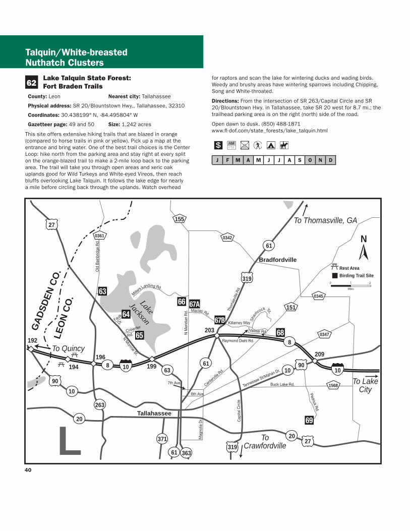
J F M A M J J A S O N D
41
63
64
White-breasted Nuthatch Cluster
Map L White-breasted Nuthatch Cluster
J Lee Vause Park
County Leon Nearest city Tallahassee
Physical address 6024 Old Bainbridge Rd Tallahassee 32303
Coordinates 30537105deg N -84361323deg W
Gazetteer page 34 Size 26 acres
This small park has a well-developed center but down by the lake its sunny woody edges are a haven for birds like Orange-crowned Warblers and the occasional Yellow-breasted Chat A boardwalk and pier provide a view of Lake Jackson where you can look for a diversity of wading birds like Wood Storks as well as wintering ducks and coots Donrsquot forget flyovers by Ospreys and Bald Eagles as well as breeding Red-shouldered Red-tailed and Broad-winged Hawks in spring and summer
Directions From I-10 in Tallahassee take exit 199 for US 27N Monroe St Drive north for 46 mi and turn right (north) on CR 0361 Old Bainbridge Rd the park is 03 mi ahead on the right (east) side of the road
Open dawn to dusk (850) 606-1470 wwwleoncountyflgovparkspark_indexasp
Faulk Drive Landing
County Leon Nearest city Tallahassee
Physical address Faulk Dr Tallahassee 32303
Coordinates 30522392deg N -84322033deg W
Gazetteer page 34 Size 02 acres
Another access to Lake Jackson this one is a little more rustic and your tires (not to mention your feet) may get muddy at times of higher water Itrsquos best to park back from the landing and walk in watching fence posts and small oaks for flycatchers and warblers At the landing scan for egrets herons White Ibises and waterfowl Black-bellied Whistling-Ducks have turned up here as have Roseate Spoonbills The grassy area to the south of the landing may have Common Ground-Doves Eastern Bluebirds and Common Yellowthroats plus sparrows (such as Swamp and Savannah) in winter Launch a canoe or kayak here to explore Lake Jackson in more detail Worth a stop if yoursquore in the area Seasonal hunting takes place at this GFBWT site please see page 55 for information on dates regulations and more
Directions From I-10 in Tallahassee take exit 199 for US 27N Monroe St Drive north for 27 mi and turn right (northeast) on Faulk Dr the site is 14 mi ahead at the end of the road
Open dawn to dusk (850) 606-1470 wwwleoncountyflgovparkspark_indexasp
J F M A M J J A S O N D
65 Crowder Landing
County Leon Nearest city Tallahassee
Physical address Crowder Rd Tallahassee 32303
Coordinates 30507436deg N -84313444deg W
Gazetteer page 34 Size 06 acres
This small boat landing warrants a quick stop if yoursquore in the area because it provides another vantage of Lake Jackson Wintering ducks and coots are plentiful on the lake in winter as are wading birds like Snowy Egrets and Little Blue Herons Sandhill Cranes appear on occasion and in 2002 a Hudsonian Godwit was discovered here Lake Jackson is known for its tendency to disappear down a sinkhole in its middle at times of low water to birders itrsquos known for less common flycatchers (Vermillion for example) and songbirds in migration When itrsquos hot itrsquos hot When itrsquos nothellip
Directions From I-10 in Tallahassee take exit 199 for US 27N Monroe St Drive north for 17 mi and turn right (east) on Crowder Rd Follow Crowder Rd for 12 mi as it bends north then east the site is at the end on the lake
Open dawn to dusk (850) 606-1470 wwwleoncountyflgovparkspark_indexasp
J F M A M J J A S O N D
66 Elinor Klapp-Phipps Park
County Leon Nearest city Tallahassee
Physical address Miller Landing Rd Tallahassee 32312
Coordinates 30536493deg N -84280792deg W
Gazetteer page 34 Size 670 acres
Elinor Klapp-Phipps Park on Lake Jackson has areas of longleaf pine restoration but its real asset is the beautiful deciduous slope forest following the trickle of small streams down to the big lake Eastern Bluebirds Indigo Buntings and Wild Turkeys use open grassy areas along the powerline entrance and horse trailer entrance As the trails dive into the hammock start watching and listening for migrants like Wood and Gray-cheeked Thrushes and Blackburnian Warblers
J F M A M J J A S O N D
67
White-breasted Nuthatch Cluster
Reinhard Geisler
White-breasted Nuthatch
Down by the large bat house on Lake Victoria at stop 17 scope for Anhingas Tricolored Herons and Ospreys Black-bellied Whistling-Ducks have bred here recently The Lake Jackson area is known for unusual sightings like occasional wintering Western Tanagers so bird with an open mind Butterfly viewing is also quite good at this park spring through fall Unlike many sites mid-summer has an impressive variety of butterfly species look for spread-winged skippers including Silver-spotted Golden-banded Hoary Edge and Southern Cloudywing along the woodland trails and in the open meadows Trails at this park are extensive and winding Pick up a trail map and butterfly checklist at the entrance (or download them from the website below) and pay attention to your chosen route
Directions From I-10 in Tallahassee take exit 203 for US 319SR 61Thomasville Rd Drive north for 09 mi and turn left (west) on Maclay Rd Follow Maclay Rd for 22 mi to its end and turn right (north) on N Meridian Rd Drive 10 mi and turn left (west) on Millerrsquos Landing Rd the park entrance is 02 mi ahead on the left (south) side of the road
Open dawn to dusk (850) 891-3866 (850) 891-3975 wwwtalgovcomparksparksphippscfm
Alfred B Maclay Gardens State Park
County Leon Nearest city Tallahassee
Physical address 3540 Thomasville Rd Tallahassee 32309
Coordinates 30534672deg N -84277454deg W (Lake Overstreet) 30513532deg N -84247467deg W (main entrance)
Gazetteer page 34 Size 1179 acres
More widely known for its manicured gardens this park also offers native habitat that is better for birdwatching Try the brief trails along the lake at the Lake Hall Recreation Area for wintering Orange-crowned Warblers and Blue-headed Vireos A few Dark-eyed Juncos make an appearance here in winter Brown Creepers and Winter Wrens may also be present Check the lakes for wintering ducks and then for drinking Purple Martins beginning in February For a longer hike hit the Lake Overstreet multi-use trails (5 miles worth) off Meridian Road These are more rustic so be sure to pick up a map and bring water Birds like Red-headed Woodpeckers Brown-headed and White-breasted Nuthatches Great Horned Owls and Chuck-willsshywidows can all be found here The recreation area and gardens have wheelchair access
Directions (A) Lake Overstreet Trailhead From the intersection of Meridian and Maclay roads drive north on Meridian 09 mi turn left (west) and enter the parking lot for Forest Meadows Park amp Athletic Center the trailhead is directly across the street on the east side of Meridian (B) Main entrance From I-10 in Tallahassee take exit 203 for US 319SR 61Thomasville Rd Drive north for 09 mi and turn left (west) on Maclay Rd The park entrance is 02 mi on the right (north) side of the road
42
43
White-breasted Nuthatch Cluster
Open year round 8 AM to sundown (850) 487-4556 wwwfloridastateparksorgmaclaygardens
J F M A M J J A S O N D
68 A J Henry Park
County Leon Nearest city Tallahassee
Physical address 3000 A J Henry Park Dr Tallahassee 32309
Coordinates 30507040deg N -84217947deg W (north entrance) 30503435deg N -84218606deg W (south entrance)
Gazetteer page 34 and 50 Size 72 acres
A J Henry Park is a small city property with some nice topography and habitats including hardwood forest-covered slopes which descend down to a lake Accordingly this park attracts fallouts of migrants like Veery Ovenbird and Magnolia Warbler among others Raptors like Mississippi Kite and Broad-winged Hawk hunt for prey here in late spring and summer and Blue-winged Teal Ring-necked Duck and the occasional Redhead or Common Goldeneye can be found on the lake in winter The area surrounding the lake and the lower (north) parking area offer the most productive birding Extensive trails at the upper (south) parking area are appealing but the thicker understory can make it hard to spot birds frustrating those who donrsquot know bird calls and songs
Directions From I-10 in Tallahassee take exit 203 for US 319SR 61Thomasville Rd Drive north for 09 mi to Killarney Way and turn right (southeast) There are two approaches to the site off of this road For the south entrance proceed east on Killarney Way and turn right (south) onto Raymond Diehl Rd then turn left (east) on Vassar Rd Take Vassar Rd to its end and turn right (south) on Whitney Dr The park is 150 yds on the left (east) side of the road For the north entrance follow Killarney Way to the end and turn right (southeast) on Shamrock St After 03 mi turn right (south) on Gardenview Way and right (southwest) again after 03 mi onto A J Henry Park Dr The entrance is 02 mi ahead
Open 8 AM to dusk (850) 891-3866 wwwtalgovcomparksparksajhenrycfm
David M
oynahan
Common Goldeneye
Danny Bales
Rusty Blackbird
J F M A M J J A S O N D
White-breasted Nuthatch Mississippi Kite Clusters
69 J R Alford Greenway
County Leon Nearest city Tallahassee
Physical address 2500 S Pedrick Rd Tallahassee 32317
Coordinates 30444486deg N -84175759deg W
Gazetteer page 50 Size 874 acres
This greenway is a collection of old pastures and woodlands now used for passive recreation Seventeen miles of multi-use trails invite many hours of exploration From the parking area follow the trail due east across the first pasture (watch for Purple Martins and Eastern Bluebirds around the gourds and nest boxes) and veer either way at the fork to continue through a series of open fields Watch overhead for Red-tailed Hawks mixed flocks of wintering Palm Warblers and White-throated Sparrows flit in the weedy edges Pastures are managed for a mosaic of early succession habitats wintering Grasshopper Sparrows skulk in the grass (when itrsquos left high) as do Eastern Meadowlarks American Kestrels Eastern Phoebes and Loggerhead Shrikes stand lookout on snags and Wood Storks and Double-crested Cormorants can be seen flying overhead to Lake Lafayette at sunset From the parking lot another trail leads to the south and winds east through hardwoods good for Red-shouldered and Cooperrsquos Hawks Download a map and pay attention to your route Trails can be confusing at times a GPS unit is quite useful here Consider biking this property to cover more ground
Directions From the intersection of US 319Capital Circle and US 90 Tennessee StMahan Dr in Tallahassee drive 07 mi east on US 90 and turn right (east) on Buck Lake Rd After 20 mi turn right (south) onto Pedrick Rd the entrance and parking are 16 mi ahead at the end of the road
Open dawn to dusk (850) 606-1470 wwwleoncountyflgovparksgreenwaysasp
J F M A M J J A S O N D
Jaret Daniels
J F M A M J J A S O N D
Map M Mississippi Kite Cluster
70 Apalachicola National Forest Leon Sinks Geological Area
County Leon Nearest city Woodville
Physical address US 319Crawfordville Hwy Tallahassee 32305
Coordinates 30306785deg N -84345082deg W
Gazetteer page 50 Size 640 acres
This recreation area in the east portion of the Apalachicola National Forest is different from the lower longleaf savannah habitats of the
tracts closer to the river Here higher sandhills of pine and turkey oak are broken by erosion in the underlying limestone causing deep dramatic crystal blue sinkholes which are rimmed with hardwoods Upon entering the hiking trail turn left at the T-junction for the shorter trail (17 miles) and return on the short-cut (05 mile) through a tupelo swamp Listen for Barred Owls Northern Parulas and Prothonotary Warblers near the wetlands and watch for Blue-headed Vireos and Carolina Chickadees in the pinewoods By turning right at the T-junction yoursquoll choose the longer 25-mile loop past a series of large sinkholes Watch for Wild Turkeys Hermit Thrushes and White-eyed Vireos in the sandhills as well as songbirds like Yellow-billed Cuckoos in hardwoods sloping into the sinks In spring wild azaleas along the Gum Swamp Trail attract many swallowtail butterflies Little Wood-Satyr and Red-spotted Purple can occur in any wooded stretch Near the sinkholes look for Golden-banded Skippers Bring water and sunscreen
Directions From the intersection of US 319SR 263Capital Circle SW and US 319SR 369SR 61Crawfordville Rd in Tallahassee drive south on Crawfordville Rd for 58 mi the site is on the right (west) side of the road
Open year round 8 AM to 8 PM (850) 926-3561 wwwfsfedusr8floridaapalachicola
One of the most famous and recognizable butterflies in North America the Monarch undertakes an extensive migration each fall to hibernation sites in California and Mexico Large numbers gather on the Gulf Coast in October at locations like St Marks National Wildlife Refuge in Wakulla County A festival held at the refuge each year coincides with the Monarchrsquos migration Milkweeds are important plants for both caterpillars and adults
44
45
Mississippi Kite Cluster
StMarks
Newport
Wakulla
Medart
ShellPoint
Crawfordville
Sopchoppy
Woodville
Panacea
ApalachicolaNationalForest
St M
arks
Rive
r
Wakulla River
ApalacheeBay
Gulf of Mexico
Ochlockonee Bay
OchlockoneeRiver Rd
Sheldon St
ParkAve
OtterLake Rd
Lighthouse
Rd
Bottoms
Rd
Wak
ulla
Spr
ings
Rd
Woo
dvill
e H
wy
Bald
Poi
nt
Rd
Cra
wfo
rdvi
lle H
wy
98
98
98
319
61
267
267
363
363
372
369
374
375
267
61
365
356
356
356
319
98 30
61
30
367A
30
319365
368
365
365
367
367
59
365
372
375
372A372A
370
22
98
2192
2195
2204
WAKULLA CO
FRANKLIN CO
LEON CO
WAKULLA CO
70
71
73
72
7475
76
77
78
N
0 1
Miles
2
Birding Trail Site
ToPerry
ToApalachicola
ToTallahassee
M
Bloxham Cutoff Rd
Rose St
Sopchoppy Hwy
Alligator Dr
Sopc
hopp
y H
wy
Mississippi Kite Cluster R
einhard Geisler
Mississippi Kite
46
47
71
J F M A M J J A S O N D
J F M A M J J A S O N D
72 see ldquoGatewaysrdquo on page 3 for more information
73
Mississippi Kite Cluster
Edward Ball Wakulla Springs State Park
County Wakulla Nearest city Wakulla Springs
Physical address 550 Wakulla Park Dr Wakulla Springs 32327
Coordinates 30243337deg N -84310614deg W
Gazetteer page 50 Size 6055 acres
Hiking trails throughout this park provide access to floodplain forest good for Summer Tanagers and Ovenbirds in migration and Great Crested Flycatchers and Northern Parulas in summer The primary attraction however is the access to Wakullarsquos first magnitude spring From the pier look for Anhingas Common Moorhens Pied-billed Grebes and wintering American Wigeons as well as roosting Black Vultures in the cypress Better yet take one of the parkrsquos river cruises to get excellent views of the aforementioned plus Least Bitterns Yellow-crowned Night-Herons Barred Owls and White Ibises Alligators Suwannee River Cooters and mullet are commonly seen manatees are sometimes found in the river and spring as well In years past this park was known for Limpkins but today they are almost never seen here However the park staff is reintroducing native apple snails the Limpkinrsquos main prey item to entice Limpkins to return The spectacular 1930s-era lodge has roosting Chimney Swifts in summer Butterfly viewing is best here in late spring and fall Many swallowtail and hairstreak species are seen on flowering trees and shrubs in spring Texan Crescents and Appalachian Browns are regularly seen on the hiking trails north of the Wakulla River The park hosts an extensive wildlife and birding festival each spring
Directions From the intersection of SR 263Capital Circle SW and US 319SR 369SR 61Crawfordville Rd in Tallahassee drive south on Crawfordville Rd for 21 mi Take a slight left to stay on SR 61 Wakulla Springs Rd and go 74 mi Turn left (east) on SR 267Bloxham Cutoff Rd the site is 01 mi ahead on the right (south) side of the road
Open year round 8 AM to sundown (850) 926-0700 wwwfloridastateparksorgwakullasprings
St Marks National Wildlife Refuge St Marks Unit (Headquarters) Gateway
County WakullaJefferson Nearest city St Marks
Physical address 1255 Lighthouse Rd Crawfordville 32327
Coordinates 30156008deg N -84150652deg W
Gazetteer page 50 and 51 Size 29529 acres
Spanning four counties and with more than 300 recorded bird species the 68000-acre St Marks NWR is a must-see The St Marks Unit includes refuge headquarters and the historic St Marks Lighthouse itrsquos also the unit most popular with birders and wildlife
viewers for good reason Stop briefly at the visitor center for a map and to check the sightings log A pond and trail here can be good for White-throated Sparrows Pileated Woodpeckers Belted Kingfishers Eastern Phoebes and more but other trails are more rewarding From north to south along the main road the helicopter pad accessed from the primitive hiking trails is good for wintering sparrows such as Henslowrsquos East River Pool can be good for waterfowl in winter Stoney Bayou Pool and the Mounds Pools hold shovelers coots and the spectrum of wading birds in winter and the trail around Mounds Pool 3 is particularly good for Northern Pintails and Snow Geese in winter Stoney Bayou Pool 2 and Mounds Pool 3 are also good places to look for American Black Ducks The Headquarters Pond viewing platform offers the occasional Sora and Purple Gallinule as well as wintering teal and year-round waders The Mounds Trail around Tower Pond is very good for migrant songbirds like Yellow-billed Cuckoos and Indigo Buntings as well as Brown-headed Nuthatches in the pines and ducks and shorebirds in the pond At the roadrsquos terminus at the lighthouse look for common wintering waterfowl plus Redheads Canvasbacks Nelsonrsquos Sparrows shorebirds and more Scaup Bufflehead Horned Grebes and Common and Red-throated Loons winter in the Gulf and Least Bitterns Seaside Sparrows shorebirds and Clapper Rails breed in the marshes Oystercatchers pelicans and gulls loaf on pilings and offshore oyster bars Butterfly viewing is best here in fall especially September and October Monarch butterflies congregate here along Apalachee Bay on their fall migration to Mexico a Monarch festival is held each October to celebrate this phenomenon Hundreds of Monarchs may be seen on a mid-October day Along Lighthouse Dr keep your eyes open for Gulf Fritillaries and Long-tailed Skippers plus American Alligators Bobcats Northern River Otters and Florida Black Bears Though you may not see one just yet a Whooping Crane reintroduction project began in 2009 Bring water food sun protection and bug spray
Directions From the intersection of US 98SR 30 and SR 363 Woodville Hwy north of the town of St Marks drive east on US 98 approx 25 mi and turn right (south) on CR 59Lighthouse Rd just east of the St Marks River Bridge The refuge entrance is 30 mi ahead the visitor center is 06 mi farther south on the right
Open dawn to dusk (850) 925-6121 wwwfwsgovsaintmarks
Shell Point Beach Park
County Wakulla Nearest city Crawfordville
Physical address Beaty Taff Dr Crawfordville 32327
Coordinates 30058004deg N -84290519deg W
Gazetteer page 50
This Wakulla County park is worth a quick stop for a picnic lunch and a look for shorebirds The parking area offers an easy vantage of
Mississippi Kite Cluster
J F M A M J J A S O N D
J F M A M J J A S O N D
75
J F M A M J J A S O N D
loafing shorebirds in fall-winter-spring such as Short-billed Dowitchers Dunlin Willets Marbled Godwits Black Skimmers and more Keep an eye peeled for the occasional migrating Peregrine Falcon watching the shorebirds even more closely than you Summer is busy with swimmingboating visitors Shorebirds are more diverse and plentiful in cool weather months
Directions From the intersection of US 98SR 30 and SR 363 Woodville Hwy north of St Marks drive west on US 98 approx 80 mi and turn left (south) on CR 365Spring Creek Hwy Turn left after 20 mi onto CR 367Shell Point Rd Continue approx 5 mi on CR 367 (do not take CR 367A at the fork) and turn left (southeast) on Beaty Taff Dr Go 02 mi to the parking area on the right (south) side of the road
Open dawn to dusk (850) 926-7227 wwwwcprdcom
74 Bottoms Road Boat Ramp
County Wakulla Nearest city Panacea
Physical address Bottoms Rd Panacea 32346
Coordinates 30016052deg N -84368326deg W
Gazetteer page 50
Bottoms Road extends out through salt marsh to a county-owned boat launch on the Gulf Along the way watch and listen for Clapper Rails Virginia Rails (winter) and wading birds in the marsh plus Northern Harriers cruising the flats in winter The marsh is also a good place to look for Nelsonrsquos Sparrow (winter) and Seaside Sparrow (year-round) From the shoulder along the road scope the offshore sandbars for loafing terns gulls and shorebirds The large dirt pull-off on the east side of the road (05 miles north of the boat ramp) is private property The marsh is locally known for occasional Short-eared Owl sightings in winter so watch for these daytime hunters gliding low over the marsh like Northern Harriers or perched on low posts amidst the rushes From the boat ramp scan the waters for ducks and scoters
Directions From the intersection of US 98SR 30 and SR 363 Woodville Hwy north of the town of St Marks drive west on US 98 for 166 mi and turn left (east) on CR 372ABottoms Rd just before the town of Panacea Park along the shoulder (where safe) and at the boat ramp (26 mi ahead) at the end of the road
Open dawn to dusk
St Marks National Wildlife Refuge Otter Lake Recreation Area
County Wakulla Nearest city Panacea
Physical address Otter Lake Rd Panacea 32346
Coordinates 30026031deg N -84416565deg W
Gazetteer page 50 Size 11387 acres
Though not as famous as the St Marks Unit St Marks NWRrsquos Panacea Unit offers good birding too Make a quick trip to the picnic area and boat launch at the end to check the cypress for Prothonotary Warblers and occasional wading birds or choose to hike one of the longer trails the south Piney Ridge Trail loop (5 miles) or the north Otter Lake Trail loop (9 miles) The latter runs through pinewoods interrupted by occasional bayheads and wetlands Watch for Red-headed and Red-cockaded Woodpeckers Wild Turkeys and Northern Bobwhites At dusk check the boat launch for Wood Storks egrets and both vultures coming to roost Ospreys nest in the area Swallow-tailed Kites can be seen soaring overhead in spring and summer There is some hunting along the hiking trails so check the trailhead signs before entering and carry water and sunscreen with you See page 55 for more information
Directions From the intersection of US 98SR 30 and SR 363 Woodville Hwy north of the town of St Marks drive west on US 98 for 175 mi and turn right (west) on CR 372AOtter Lake Rd The site is at the west end of Otter Lake Rd
Open dawn to dusk (850) 925-6121 wwwfwsgovsaintmarks
76 Bald Point State Park
County Franklin Nearest city Alligator Point
Physical address Bald Point Rd Alligator Point 32346
Coordinates 29937605deg N -84337327deg W (main entrance) 29914581deg N -84336804deg W (Sunrise Beach access)
Gazetteer page 61 inset Size 4859 acres
Located on the south side of Ochlockonee Bay this state park offers great birding and wildlife viewing Its geography and location provide a prime vantage of the raptor migration in October as Peregrine Falcons Northern Harriers and others cruise down the beach Overwintering shorebirds like Black-bellied Plovers and Dunlin use the beach and estuary and when horseshoe crabs are spawning (which can be impressive) large numbers of shorebirds gather to feast on the crabsrsquo eggs A few sea turtles also nest here in summer In spring migratory songbirds like Black-throated Green Warblers and Indigo Buntings make landfall in the parkrsquos hammocks live oaks surrounding the upper parking area can be quite good Year-round listen for raucous Clapper Rails and Marsh Wrens from the observation boardwalk which overlooks pristine marshes near the upper parking lot Groove-billed Anis are rare winter visitors An extensive hiking trail network begins 16 miles south of the main entrance gate on the west side of the road across from the Sunrise
48
49
Beach access (no fee) These foot trails wind through mesic wet and scrubby flatwoods (home to Brown-headed Nuthatches) and around freshwater marshes swamps and ponds which have wading birds and ducks when water levels are favorable The park is also a staging point for Monarch butterflies on their fall trans-Gulf migration Large numbers of several other species concentrate here in fall as well including Gulf Fritillary Common Buckeye Long-tailed Skipper and Ocola Skipper In early spring Eastern Pygmy Blues can be abundant in the salt marsh Ceraunus Blues can be common in fall Guided tours are available for groups call 2 weeks in advance Fishing and sunbathing are popular in nice weather
Directions From Panacea drive west (head south) on US 98SR 30 for 7 mi and turn left (southeast) on CR 370Alligator Dr Drive 38 mi and turn left (east) on Bald Point Rd the main entrance gate is 28 mi ahead Sunrise Beach and trailhead access are 12 mi north of the intersection with Alligator Dr
Open year round 8 AM to sundown (850) 349-9146 wwwfloridastateparksorgbaldpoint
J F M A M J J A S O N D
77 Ochlockonee River State Park
County Wakulla Nearest city Sopchoppy
Physical address 429 State Park Rd Sopchoppy 32358
Coordinates 29998902deg N -84485259deg W
Gazetteer page 50 and 61 inset Size 543 acres
Upon entering this state park ask at the gate for the locations of active Red-cockaded Woodpecker (RCWs) cavities or recent sightings Head to the parking area at the end of the road and in the
Mississippi Kite Cluster
anny Bales
Blair W
itherington
Snowy Plover
northeastern corner take the ldquoScenic Driverdquo loop road which you may drive bike or walk Watch and listen for RCWs Pine Warblers Eastern Towhees and Common Yellowthroats You may also hike the Pine Flatwoods Trail which originates at the same parking lot This park is well-known for its ldquosnow whiterdquo Eastern Gray Squirrels (no they are not albinos) If you choose to launch a canoe here ask at the gate about water levels and clearance Prothonotary Warblers and Wood Storks may be seen along the river as well as skulking Green Herons Limpkins and Least Bitterns in the brushy margins For early morning access consider camping overnight and enjoy the sounds of Chuckwills-widows and Eastern Screech-Owls after dark
Directions From the intersection of Rose St and US 319SR 377 Sopchoppy Hwy in Sopchoppy head south on Sopchoppy Hwy for 44 mi Turn left (east) on Ochlockonee River Rd the entrance is 12 mi ahead
Open year round 8 AM to sundown (850) 962-2771 w Dwwfloridastateparksorgochlockoneeriver
shy
J F M A M J J A S O N D
County Wakulla Nearest city Sopchoppy
Physical address 252 Park Ave Sopchoppy 32358
Coordinates 30050507deg N -84498079deg W
Gazetteer page 49 and 50 Size 50 acres
If yoursquore in the area itrsquos worth stopping by briefly to visit this small city park on the Sopchoppy River Check the boardwalk and waterfront for night-herons and Prothonotary Warblers and hike the short trail to the left side of the property upon entering In the thicker hardwoods of the hiking trail yoursquoll find migrants like Yellow-billed Cuckoos in spring as well as Mississippi and Swallow-tailed Kites circling overhead in warmer months This site can be a busy boat launch in warm weather Consider launching a canoe from this spot to explore the Sopchoppy River more extensively
Directions From the intersection of Rose St and US 319SR 377 Sopchoppy Hwy in Sopchoppy head south on Sopchoppy Hwy for 04 mi Turn right (west) on Sheldon St and go 04 mi Turn left (south) on Park Ave and drive 05 mi The entrance is on the right (west) side of the road
Open dawn to dusk (850) 962-4611 (850) 962-5486
78 Myron B Hodge City Park
J F M A M J J A S O N D
Mississippi Kite Cluster
Named for its fast darting flight the Whirlabout is a common ldquograss skipperrdquo that occurs in the Panhandle and peninsula most of the year Host plants for the caterpillar include a variety of grasses Shepherdrsquos needle and lantana provide nectar for adults
Danny Bales
50
51
_________________________________________________________________
Mark Kiser FW
C
Birders and wildlife watchers contribute more than $3 billion to Floridarsquos economy each year
About this guide This Trail guide along with guides for the East West and South Trail Sections can be downloaded from the Great Florida Birding and Wildlife Trail website at wwwfloridabirdingtrailcom Additional copies of all four Trail guides may be ordered from the website or by using the form on this page As information for a particular site may change after Trail guides are printed please check the website before heading out on your trip for the most up-to-date information Please report any errors to GFBTMyFWCcom Thanks
Cut
alo
ng d
otte
d lin
e
Mail-in response slip
Birder and wildlife viewer ID Mail-in response form
Name___________________________________________________________
Street __________________________________________________________
City _____________________________________________________________
State _____________ County _____________________________________
Zip______________________ Country _____________________________
E-mail___________________________________________________________
Home phone ____________________________________________________
Work phone _____________________________________________________
Request for information
_____Add my name to your mailing list
_____Send mailings electronically
_____Send a bird checklist ndash also available online
_____Send a Birding and Wildlife Trail sponsorship packet
_____Send a Birding and Wildlife Trail brochure
_____Send a Birding and Wildlife Trail Guide ndash also available online
East ________ West ________ South_______ Panhandle _______
_____Send ldquoBirdwatching Basicsrdquo ndash also available online
Other ___________________________________________________________
wwwfloridabirdingtrailcom
The Great Florida Birding and Wildlife Trail is a program of the Florida Fish and Wildlife Conservation Commission
_____________________________________________________
_____________________________________________________
_____________________________________________________
_____________________________________________________
_____________________________________________________
_____________________________________________________
Cut
alo
ng d
otte
d lin
e
Rate the Trail Mail-in response form
Your country state and county of origin ______________
Where did you hear about the Trail__________________
What is your goal in using the Trail (eg finding a specific species of bird seeing a diversity of birds and wildlife or simply enjoying the outdoors) _____________
How long have you had this guide___________________
How many sites have you visited____________________
Which site was the best Why ______________________
Which site was worst Why ________________________
How many days have you spent birding or wildlife viewing in the last month ______________________________
How long was your last trip on the Birding and Wildlife Trail _______________________________________________
How much money did you spend on lodging food and gas on the above trip $_____________________________
Will you recommend the Trail to friends _____________
Please detach and mail us your valued response to the GFBWT address on page 53 Thank you
St Vincent National Wildlife Refuge
Myron B Hodge City Park
Mark and Selena Kiser
Mark Kiser FW
C
52
Birding and wildlife viewing ethics Donrsquot you hate it when the doorbell or telephone rings just as you settle down to dinner or a nap While mere nuisances to us disruptions in feeding and nesting routines can spell disaster for birds and other wildlife especially the cumulative effect of frequent disruptions a common occurrence at busy sites When a nesting bird is forced to fly it may leave eggs or young exposed to temperature extremes or predators A migratory bird may be exhausted and hungry from a long flight ndash it needs to rest and eat With care and common sense we can all help protect the wildlife we love to watch
Consider these points n Stay back from concentrations of nesting or loafing
waterbirds ndash a spotting scope may be a better choice than binoculars
n Walk around groups of birds on the beach rather than forcing them to fly
n Sit or crouch so that you appear smaller Keep movements slow and steady rather than fast or sporadic
n If viewing from your car stay inside as much as possible It acts as a viewing ldquoblindrdquo and the birds are less likely to fly if they donrsquot recognize you as human
n Stay on roads trails and paths to minimize habitat disturbance
n Do you occasionally use recordings to attract birds If so remember not to overuse them or to try to attract rare or protected species Also do not use them during the nesting season Be aware that some locations prohibit the use of recordings
n For more information please see the American Birding Associationrsquos Code of Ethics at
wwwabaorgaboutethicshtml FWCrsquos viewing ethics at MyFWCcomviewingadventures and the Nature Photographerrsquos Network ethics page at wwwnaturephotographersnetethicshtml
Birding and wildlife viewing resources There are many more resources for birding and wildlife viewing in Florida Before your trip check the Internet for area rare bird alert hotlines and statewide birding listservs to get an idea of whatrsquos being seen If yoursquore staying in an area for a longer visit check local book and nature stores for area guides published by local Audubon chapters or birders The Great Florida Birding and Wildlife Trail guidebooks and the trip-planning tool at wwwfloridabirdingtrailcom are just a taste of the
information available to plan your ultimate Florida birding and wildlife viewing vacation
For more informationhellip
Or to be added to the mailing list for the Great Florida Birding and Wildlife Trailrsquos newsletter Kite Tales fill in the response form (including your name and address on page 51) and mail to
Great Florida Birding and Wildlife Trail (or GFBWT) 620 South Meridian Street Tallahassee FL 32399-1600
or visit the Birding and Wildlife Trailrsquos website at wwwfloridabirdingtrailcom
The Kite Tales newsletter includes news about the Trail and Trail-related events across the state Information also is available regarding Trail sponsorship site nominations for upcoming Trail sections tips for better birding and the economic impact of this flourishing pastime Take part in the continued development of this great resource for birders and wildlife watchers of all skill levels while enjoying and ensuring continued concern for the conservation of Floridarsquos fabulous avian and wildlife treasures
Birders and wildlife viewers Flex your economic muscles Florida communities have long made land use choices to attract traditional tourists and their dollars Birding and wildlife viewing are big business in Florida too but communities will only recognize that if wersquore visible Your visibility and economic impact can encourage wildlife conservation
Some ways you can make yourself more visible n Wear bird and wildlife t-shirts n Take your binoculars into the restaurant with you n Ask local residents in restaurants hotels gas
stations etc about where good birding and wildlife viewing locations might be in their area
n Leave birder calling cards whenever you spend money helping vendors make the connection between healthy wildlands and healthy economies (cards may be downloaded from wwwfloridabirdingtrailcom)
n Put a birding bumper sticker or window decal on your car or business It speaks for itself so you donrsquot have to
Conserve wildlife by watching wildlife Itrsquos more than a hobby itrsquos a legacy
53
For the birds The Great Florida Birding and Wildlife Trail helps everyone enjoy and conserve Floridarsquos wildlife and wildlife habitat A donation to the Wildlife Foundation of Florida helps us expand and enhance the Birding and Wildlife Trail experience With your support we can continue to protect Floridarsquos natural resources for future generations to enjoy
mail your check to
Wildlife Foundation of Florida Attn GFBWT PO Box 6181 Tallahassee FL 32314-6181
Note Please write GFBWT in the memo section of your check
Support the Birding and Wildlife Trail with your purchase of official GFBWT merchandise We offer several T-shirt designs a stylish baseball cap a bumper sticker and a vinyl cling sticker Proudly wearing birding apparel and displaying birding stickers on your vehicle help communities recognize you as a wildlife watcher and conservationist and sale proceeds benefit the Birding and Wildlife Trail program Order yours today at wwwfloridabirdingtrailcom
If you would like to make a donation please
54
Sharing Floridarsquos public lands during hunting season
Floridarsquos residents and visitors are fortunate to have an abundance of public and private lands open for wildlife viewing and other outdoor recreation Seasonal hunting takes place on many of these public lands that are part of the Great Florida Birding and Wildlife Trail Some of these lands - wildlife management areas and wildlife refuges ndash were acquired and are managed with revenue generated from the sale of hunting licenses and taxes on various types of sporting goods Birders and hunters can and do share these lands as well as a love for the outdoors and conservation
Some Birding and Wildlife Trail sites are closed during hunting seasons Other sites allow multiple activities including birding and hiking to take place during hunts If the site you plan to visit has a hunting icon in this guidebook please visit the FWCrsquos website at MyFWC comhunting or MyFWCcomviewingrecreation to find information on hunting seasons dates times of day area closures regulations WMA maps and more In the words of Pete Dunne legendary birder author (and hunter too) ldquoawareness of your statersquos (and sitersquos) hunting regulations and what game is and is not in season will help you make better decisions in the fieldrdquo Trip planning is important ndash do your homework prior to arriving at your destination Birders need not stay home nor avoid all huntable lands during hunting season However when venturing outdoors during hunting season wear blaze orange for visibility and safety
Birders and hunters in Florida have access to the largest wildlife management area (WMA) system in the United States with nearly 6 million acres of lands established as WMAs or Wildlife and Environmental Areas (WEAs) On the majority of these lands the FWC is a cooperating manager working in conjunction with other government agencies and private landowners to conserve wildlife and provide quality outdoor experiences for the public The FWC is the landowner or ldquoleadrdquo managing agency for nearly 50 WMAs and WEAs totaling millions of acres On these lands the FWC is responsible for land stewardship wildlife conservation and a wide range of recreation
activities including birding hunting fishing and wildlife viewing The FWCrsquos Office of Recreation Services where the Great Florida Birding and Wildlife Trail program is administered also develops public access amenities on these lead WMAs
Mark Kiser FW
C
Photographers birders and other wildlife viewers enjoy quality outdoor experiences on Floridarsquos wildlife management areas
55
Meaghan M
anning
The lavishly-plumaged Purple Gallinule breeds in the Florida Panhandle and peninsula and may be found throughout the peninsula in winter This colorful railrsquos enormous yellow feet are well-suited for walking on floating vegetation as it searches for seeds fruits and aquatic invertebrates
This guide is a product of the Florida Fish and Wildlife Conservation Commissionrsquos Office of Recreation Services
Special Thanks We thank each of the site managersowners donors partners and cooperators who have been instrumental in developing the Great Florida Birding and Wildlife Trail Sally and Dean Jue and David Harder provided additional assistance with butterfly viewing information for this guide
Credits New trail developmenttext by Mark Kiser Selena Kiser Jerrie Lindsey and Anne Glick Florida Fish and Wildlife Conservation Commission Original trail developmenttext by Julie Wraithmell Michael Welch and Adam Kent Maps by Creative Force Inc Graphic design editing and layout by Lizabeth West and Ann Marie Tavares Florida Fish and Wildlife Conservation Commission
56
________________________________________________________________________________________________________________________________
________________________________________________________________________________________________________________________________
________________________________________________________________________________________________________________________________
________________________________________________________________________________________________________________________________
________________________________________________________________________________________________________________________________
________________________________________________________________________________________________________________________________
________________________________________________________________________________________________________________________________
________________________________________________________________________________________________________________________________
________________________________________________________________________________________________________________________________
________________________________________________________________________________________________________________________________
________________________________________________________________________________________________________________________________
________________________________________________________________________________________________________________________________
________________________________________________________________________________________________________________________________
________________________________________________________________________________________________________________________________
________________________________________________________________________________________________________________________________
________________________________________________________________________________________________________________________________
________________________________________________________________________________________________________________________________
________________________________________________________________________________________________________________________________
________________________________________________________________________________________________________________________________
Field Notes D
avid Moynahan FW
C
Pitcher plants Apalachicola National Forest Post Office Bay
57
________________________________________________________________________________________________________________________________
________________________________________________________________________________________________________________________________
________________________________________________________________________________________________________________________________
________________________________________________________________________________________________________________________________
________________________________________________________________________________________________________________________________
________________________________________________________________________________________________________________________________
________________________________________________________________________________________________________________________________
________________________________________________________________________________________________________________________________
________________________________________________________________________________________________________________________________
________________________________________________________________________________________________________________________________
________________________________________________________________________________________________________________________________
________________________________________________________________________________________________________________________________
________________________________________________________________________________________________________________________________
________________________________________________________________________________________________________________________________
________________________________________________________________________________________________________________________________
________________________________________________________________________________________________________________________________
________________________________________________________________________________________________________________________________
________________________________________________________________________________________________________________________________
________________________________________________________________________________________________________________________________
Field Notes D
avid Moynahan FW
C
Least Terns Gulf Islands National Seashore
58
2
How to Use this GuideWe hope this guide will help you quickly and easily identify Panhandle Section birding and wildlife viewing sites of interest to you Sites have met criteria ensuring they are good for birding and are able to withstand birder use Maps show ldquoclustersrdquo of 1 to 10 sites within an hourrsquos drive of one another The map above shows the locations of these clusters the letter in each box corresponds to the map for that cluster Descriptions and directions for sites accompany each cluster map You may want to use the maps in this guide along with a more detailed map book such as a DeLorme Florida Atlas and Gazetteer
Map Key(see page 3 for City Locator)
A Perdido Cluster H Cape Cluster
B Migrantrsquos Rest Cluster I Pitcher Plant amp Peregrine Cluster
C Blackwater Cluster J Bluffs Cluster
D Choctawhatchee Cluster K Talquin Cluster
E Dogwood Cluster L White-breasted Nuthatch Cluster
F Kentucky Warbler Cluster M Mississippi Kite Cluster
LegendNot a primary Trail site but ldquoWorth A Visitrdquo if yoursquore already in the area
Some viewing is barrier-free
Sites good for beginners
Sites best for those with ability to ID bird calls
Restroom available
Entrance fee required
Tours educational signage andor nature center on site
Seasonal hunting on site
Access by appointment only
Site can be birded by car
Site can be birded by boat
Site can be birded by foot
Site can be birded by bicycle
Site can be birded by horseback
Site is good for a single sought-after species
Camping available
Site has good butterfly viewing
Best months for each site will be shaded
Best time of day for birding morning evening both morning and evening and all day
Recommended length of visit quick stop a few hours all day
Danny Bales
American Black Duck
Danny Bales
Swainsonrsquos Warbler
resi Kan
lee S
nd akra
M
Apalachicola Bluffs and Ravines Preserve
59
printed on recycled paper 32011
The Great Florida Birding and Wildlife Trail is a project of the Florida Fish and Wildlife Conservation Commission
Marbled G
odwit by Joan M
iller
Many thanks to our generous sponsors
Gulf Powerwwwgulfpowercom
National Fish and Wildlife Foundationwwwnfwforg
Cover photo Brown-headed Nuthatch by Danny Bales
wwwfloridabirdingtrailcom
In partnership with
Florida Park Service Florida Department of Transportation
US Fish and Wildlife US Department ofService Transportation Federal
Hiighway Administration
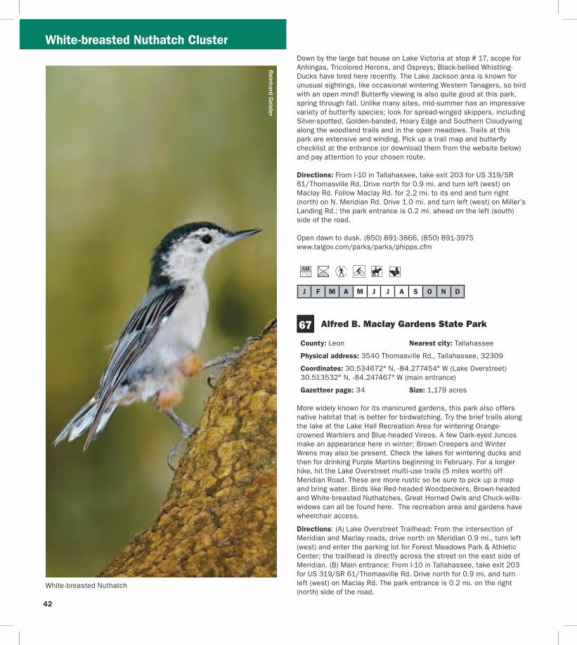
J F M A M J J A S O N D
67
White-breasted Nuthatch Cluster
Reinhard Geisler
White-breasted Nuthatch
Down by the large bat house on Lake Victoria at stop 17 scope for Anhingas Tricolored Herons and Ospreys Black-bellied Whistling-Ducks have bred here recently The Lake Jackson area is known for unusual sightings like occasional wintering Western Tanagers so bird with an open mind Butterfly viewing is also quite good at this park spring through fall Unlike many sites mid-summer has an impressive variety of butterfly species look for spread-winged skippers including Silver-spotted Golden-banded Hoary Edge and Southern Cloudywing along the woodland trails and in the open meadows Trails at this park are extensive and winding Pick up a trail map and butterfly checklist at the entrance (or download them from the website below) and pay attention to your chosen route
Directions From I-10 in Tallahassee take exit 203 for US 319SR 61Thomasville Rd Drive north for 09 mi and turn left (west) on Maclay Rd Follow Maclay Rd for 22 mi to its end and turn right (north) on N Meridian Rd Drive 10 mi and turn left (west) on Millerrsquos Landing Rd the park entrance is 02 mi ahead on the left (south) side of the road
Open dawn to dusk (850) 891-3866 (850) 891-3975 wwwtalgovcomparksparksphippscfm
Alfred B Maclay Gardens State Park
County Leon Nearest city Tallahassee
Physical address 3540 Thomasville Rd Tallahassee 32309
Coordinates 30534672deg N -84277454deg W (Lake Overstreet) 30513532deg N -84247467deg W (main entrance)
Gazetteer page 34 Size 1179 acres
More widely known for its manicured gardens this park also offers native habitat that is better for birdwatching Try the brief trails along the lake at the Lake Hall Recreation Area for wintering Orange-crowned Warblers and Blue-headed Vireos A few Dark-eyed Juncos make an appearance here in winter Brown Creepers and Winter Wrens may also be present Check the lakes for wintering ducks and then for drinking Purple Martins beginning in February For a longer hike hit the Lake Overstreet multi-use trails (5 miles worth) off Meridian Road These are more rustic so be sure to pick up a map and bring water Birds like Red-headed Woodpeckers Brown-headed and White-breasted Nuthatches Great Horned Owls and Chuck-willsshywidows can all be found here The recreation area and gardens have wheelchair access
Directions (A) Lake Overstreet Trailhead From the intersection of Meridian and Maclay roads drive north on Meridian 09 mi turn left (west) and enter the parking lot for Forest Meadows Park amp Athletic Center the trailhead is directly across the street on the east side of Meridian (B) Main entrance From I-10 in Tallahassee take exit 203 for US 319SR 61Thomasville Rd Drive north for 09 mi and turn left (west) on Maclay Rd The park entrance is 02 mi on the right (north) side of the road
42
43
White-breasted Nuthatch Cluster
Open year round 8 AM to sundown (850) 487-4556 wwwfloridastateparksorgmaclaygardens
J F M A M J J A S O N D
68 A J Henry Park
County Leon Nearest city Tallahassee
Physical address 3000 A J Henry Park Dr Tallahassee 32309
Coordinates 30507040deg N -84217947deg W (north entrance) 30503435deg N -84218606deg W (south entrance)
Gazetteer page 34 and 50 Size 72 acres
A J Henry Park is a small city property with some nice topography and habitats including hardwood forest-covered slopes which descend down to a lake Accordingly this park attracts fallouts of migrants like Veery Ovenbird and Magnolia Warbler among others Raptors like Mississippi Kite and Broad-winged Hawk hunt for prey here in late spring and summer and Blue-winged Teal Ring-necked Duck and the occasional Redhead or Common Goldeneye can be found on the lake in winter The area surrounding the lake and the lower (north) parking area offer the most productive birding Extensive trails at the upper (south) parking area are appealing but the thicker understory can make it hard to spot birds frustrating those who donrsquot know bird calls and songs
Directions From I-10 in Tallahassee take exit 203 for US 319SR 61Thomasville Rd Drive north for 09 mi to Killarney Way and turn right (southeast) There are two approaches to the site off of this road For the south entrance proceed east on Killarney Way and turn right (south) onto Raymond Diehl Rd then turn left (east) on Vassar Rd Take Vassar Rd to its end and turn right (south) on Whitney Dr The park is 150 yds on the left (east) side of the road For the north entrance follow Killarney Way to the end and turn right (southeast) on Shamrock St After 03 mi turn right (south) on Gardenview Way and right (southwest) again after 03 mi onto A J Henry Park Dr The entrance is 02 mi ahead
Open 8 AM to dusk (850) 891-3866 wwwtalgovcomparksparksajhenrycfm
David M
oynahan
Common Goldeneye
Danny Bales
Rusty Blackbird
J F M A M J J A S O N D
White-breasted Nuthatch Mississippi Kite Clusters
69 J R Alford Greenway
County Leon Nearest city Tallahassee
Physical address 2500 S Pedrick Rd Tallahassee 32317
Coordinates 30444486deg N -84175759deg W
Gazetteer page 50 Size 874 acres
This greenway is a collection of old pastures and woodlands now used for passive recreation Seventeen miles of multi-use trails invite many hours of exploration From the parking area follow the trail due east across the first pasture (watch for Purple Martins and Eastern Bluebirds around the gourds and nest boxes) and veer either way at the fork to continue through a series of open fields Watch overhead for Red-tailed Hawks mixed flocks of wintering Palm Warblers and White-throated Sparrows flit in the weedy edges Pastures are managed for a mosaic of early succession habitats wintering Grasshopper Sparrows skulk in the grass (when itrsquos left high) as do Eastern Meadowlarks American Kestrels Eastern Phoebes and Loggerhead Shrikes stand lookout on snags and Wood Storks and Double-crested Cormorants can be seen flying overhead to Lake Lafayette at sunset From the parking lot another trail leads to the south and winds east through hardwoods good for Red-shouldered and Cooperrsquos Hawks Download a map and pay attention to your route Trails can be confusing at times a GPS unit is quite useful here Consider biking this property to cover more ground
Directions From the intersection of US 319Capital Circle and US 90 Tennessee StMahan Dr in Tallahassee drive 07 mi east on US 90 and turn right (east) on Buck Lake Rd After 20 mi turn right (south) onto Pedrick Rd the entrance and parking are 16 mi ahead at the end of the road
Open dawn to dusk (850) 606-1470 wwwleoncountyflgovparksgreenwaysasp
J F M A M J J A S O N D
Jaret Daniels
J F M A M J J A S O N D
Map M Mississippi Kite Cluster
70 Apalachicola National Forest Leon Sinks Geological Area
County Leon Nearest city Woodville
Physical address US 319Crawfordville Hwy Tallahassee 32305
Coordinates 30306785deg N -84345082deg W
Gazetteer page 50 Size 640 acres
This recreation area in the east portion of the Apalachicola National Forest is different from the lower longleaf savannah habitats of the
tracts closer to the river Here higher sandhills of pine and turkey oak are broken by erosion in the underlying limestone causing deep dramatic crystal blue sinkholes which are rimmed with hardwoods Upon entering the hiking trail turn left at the T-junction for the shorter trail (17 miles) and return on the short-cut (05 mile) through a tupelo swamp Listen for Barred Owls Northern Parulas and Prothonotary Warblers near the wetlands and watch for Blue-headed Vireos and Carolina Chickadees in the pinewoods By turning right at the T-junction yoursquoll choose the longer 25-mile loop past a series of large sinkholes Watch for Wild Turkeys Hermit Thrushes and White-eyed Vireos in the sandhills as well as songbirds like Yellow-billed Cuckoos in hardwoods sloping into the sinks In spring wild azaleas along the Gum Swamp Trail attract many swallowtail butterflies Little Wood-Satyr and Red-spotted Purple can occur in any wooded stretch Near the sinkholes look for Golden-banded Skippers Bring water and sunscreen
Directions From the intersection of US 319SR 263Capital Circle SW and US 319SR 369SR 61Crawfordville Rd in Tallahassee drive south on Crawfordville Rd for 58 mi the site is on the right (west) side of the road
Open year round 8 AM to 8 PM (850) 926-3561 wwwfsfedusr8floridaapalachicola
One of the most famous and recognizable butterflies in North America the Monarch undertakes an extensive migration each fall to hibernation sites in California and Mexico Large numbers gather on the Gulf Coast in October at locations like St Marks National Wildlife Refuge in Wakulla County A festival held at the refuge each year coincides with the Monarchrsquos migration Milkweeds are important plants for both caterpillars and adults
44
45
Mississippi Kite Cluster
StMarks
Newport
Wakulla
Medart
ShellPoint
Crawfordville
Sopchoppy
Woodville
Panacea
ApalachicolaNationalForest
St M
arks
Rive
r
Wakulla River
ApalacheeBay
Gulf of Mexico
Ochlockonee Bay
OchlockoneeRiver Rd
Sheldon St
ParkAve
OtterLake Rd
Lighthouse
Rd
Bottoms
Rd
Wak
ulla
Spr
ings
Rd
Woo
dvill
e H
wy
Bald
Poi
nt
Rd
Cra
wfo
rdvi
lle H
wy
98
98
98
319
61
267
267
363
363
372
369
374
375
267
61
365
356
356
356
319
98 30
61
30
367A
30
319365
368
365
365
367
367
59
365
372
375
372A372A
370
22
98
2192
2195
2204
WAKULLA CO
FRANKLIN CO
LEON CO
WAKULLA CO
70
71
73
72
7475
76
77
78
N
0 1
Miles
2
Birding Trail Site
ToPerry
ToApalachicola
ToTallahassee
M
Bloxham Cutoff Rd
Rose St
Sopchoppy Hwy
Alligator Dr
Sopc
hopp
y H
wy
Mississippi Kite Cluster R
einhard Geisler
Mississippi Kite
46
47
71
J F M A M J J A S O N D
J F M A M J J A S O N D
72 see ldquoGatewaysrdquo on page 3 for more information
73
Mississippi Kite Cluster
Edward Ball Wakulla Springs State Park
County Wakulla Nearest city Wakulla Springs
Physical address 550 Wakulla Park Dr Wakulla Springs 32327
Coordinates 30243337deg N -84310614deg W
Gazetteer page 50 Size 6055 acres
Hiking trails throughout this park provide access to floodplain forest good for Summer Tanagers and Ovenbirds in migration and Great Crested Flycatchers and Northern Parulas in summer The primary attraction however is the access to Wakullarsquos first magnitude spring From the pier look for Anhingas Common Moorhens Pied-billed Grebes and wintering American Wigeons as well as roosting Black Vultures in the cypress Better yet take one of the parkrsquos river cruises to get excellent views of the aforementioned plus Least Bitterns Yellow-crowned Night-Herons Barred Owls and White Ibises Alligators Suwannee River Cooters and mullet are commonly seen manatees are sometimes found in the river and spring as well In years past this park was known for Limpkins but today they are almost never seen here However the park staff is reintroducing native apple snails the Limpkinrsquos main prey item to entice Limpkins to return The spectacular 1930s-era lodge has roosting Chimney Swifts in summer Butterfly viewing is best here in late spring and fall Many swallowtail and hairstreak species are seen on flowering trees and shrubs in spring Texan Crescents and Appalachian Browns are regularly seen on the hiking trails north of the Wakulla River The park hosts an extensive wildlife and birding festival each spring
Directions From the intersection of SR 263Capital Circle SW and US 319SR 369SR 61Crawfordville Rd in Tallahassee drive south on Crawfordville Rd for 21 mi Take a slight left to stay on SR 61 Wakulla Springs Rd and go 74 mi Turn left (east) on SR 267Bloxham Cutoff Rd the site is 01 mi ahead on the right (south) side of the road
Open year round 8 AM to sundown (850) 926-0700 wwwfloridastateparksorgwakullasprings
St Marks National Wildlife Refuge St Marks Unit (Headquarters) Gateway
County WakullaJefferson Nearest city St Marks
Physical address 1255 Lighthouse Rd Crawfordville 32327
Coordinates 30156008deg N -84150652deg W
Gazetteer page 50 and 51 Size 29529 acres
Spanning four counties and with more than 300 recorded bird species the 68000-acre St Marks NWR is a must-see The St Marks Unit includes refuge headquarters and the historic St Marks Lighthouse itrsquos also the unit most popular with birders and wildlife
viewers for good reason Stop briefly at the visitor center for a map and to check the sightings log A pond and trail here can be good for White-throated Sparrows Pileated Woodpeckers Belted Kingfishers Eastern Phoebes and more but other trails are more rewarding From north to south along the main road the helicopter pad accessed from the primitive hiking trails is good for wintering sparrows such as Henslowrsquos East River Pool can be good for waterfowl in winter Stoney Bayou Pool and the Mounds Pools hold shovelers coots and the spectrum of wading birds in winter and the trail around Mounds Pool 3 is particularly good for Northern Pintails and Snow Geese in winter Stoney Bayou Pool 2 and Mounds Pool 3 are also good places to look for American Black Ducks The Headquarters Pond viewing platform offers the occasional Sora and Purple Gallinule as well as wintering teal and year-round waders The Mounds Trail around Tower Pond is very good for migrant songbirds like Yellow-billed Cuckoos and Indigo Buntings as well as Brown-headed Nuthatches in the pines and ducks and shorebirds in the pond At the roadrsquos terminus at the lighthouse look for common wintering waterfowl plus Redheads Canvasbacks Nelsonrsquos Sparrows shorebirds and more Scaup Bufflehead Horned Grebes and Common and Red-throated Loons winter in the Gulf and Least Bitterns Seaside Sparrows shorebirds and Clapper Rails breed in the marshes Oystercatchers pelicans and gulls loaf on pilings and offshore oyster bars Butterfly viewing is best here in fall especially September and October Monarch butterflies congregate here along Apalachee Bay on their fall migration to Mexico a Monarch festival is held each October to celebrate this phenomenon Hundreds of Monarchs may be seen on a mid-October day Along Lighthouse Dr keep your eyes open for Gulf Fritillaries and Long-tailed Skippers plus American Alligators Bobcats Northern River Otters and Florida Black Bears Though you may not see one just yet a Whooping Crane reintroduction project began in 2009 Bring water food sun protection and bug spray
Directions From the intersection of US 98SR 30 and SR 363 Woodville Hwy north of the town of St Marks drive east on US 98 approx 25 mi and turn right (south) on CR 59Lighthouse Rd just east of the St Marks River Bridge The refuge entrance is 30 mi ahead the visitor center is 06 mi farther south on the right
Open dawn to dusk (850) 925-6121 wwwfwsgovsaintmarks
Shell Point Beach Park
County Wakulla Nearest city Crawfordville
Physical address Beaty Taff Dr Crawfordville 32327
Coordinates 30058004deg N -84290519deg W
Gazetteer page 50
This Wakulla County park is worth a quick stop for a picnic lunch and a look for shorebirds The parking area offers an easy vantage of
Mississippi Kite Cluster
J F M A M J J A S O N D
J F M A M J J A S O N D
75
J F M A M J J A S O N D
loafing shorebirds in fall-winter-spring such as Short-billed Dowitchers Dunlin Willets Marbled Godwits Black Skimmers and more Keep an eye peeled for the occasional migrating Peregrine Falcon watching the shorebirds even more closely than you Summer is busy with swimmingboating visitors Shorebirds are more diverse and plentiful in cool weather months
Directions From the intersection of US 98SR 30 and SR 363 Woodville Hwy north of St Marks drive west on US 98 approx 80 mi and turn left (south) on CR 365Spring Creek Hwy Turn left after 20 mi onto CR 367Shell Point Rd Continue approx 5 mi on CR 367 (do not take CR 367A at the fork) and turn left (southeast) on Beaty Taff Dr Go 02 mi to the parking area on the right (south) side of the road
Open dawn to dusk (850) 926-7227 wwwwcprdcom
74 Bottoms Road Boat Ramp
County Wakulla Nearest city Panacea
Physical address Bottoms Rd Panacea 32346
Coordinates 30016052deg N -84368326deg W
Gazetteer page 50
Bottoms Road extends out through salt marsh to a county-owned boat launch on the Gulf Along the way watch and listen for Clapper Rails Virginia Rails (winter) and wading birds in the marsh plus Northern Harriers cruising the flats in winter The marsh is also a good place to look for Nelsonrsquos Sparrow (winter) and Seaside Sparrow (year-round) From the shoulder along the road scope the offshore sandbars for loafing terns gulls and shorebirds The large dirt pull-off on the east side of the road (05 miles north of the boat ramp) is private property The marsh is locally known for occasional Short-eared Owl sightings in winter so watch for these daytime hunters gliding low over the marsh like Northern Harriers or perched on low posts amidst the rushes From the boat ramp scan the waters for ducks and scoters
Directions From the intersection of US 98SR 30 and SR 363 Woodville Hwy north of the town of St Marks drive west on US 98 for 166 mi and turn left (east) on CR 372ABottoms Rd just before the town of Panacea Park along the shoulder (where safe) and at the boat ramp (26 mi ahead) at the end of the road
Open dawn to dusk
St Marks National Wildlife Refuge Otter Lake Recreation Area
County Wakulla Nearest city Panacea
Physical address Otter Lake Rd Panacea 32346
Coordinates 30026031deg N -84416565deg W
Gazetteer page 50 Size 11387 acres
Though not as famous as the St Marks Unit St Marks NWRrsquos Panacea Unit offers good birding too Make a quick trip to the picnic area and boat launch at the end to check the cypress for Prothonotary Warblers and occasional wading birds or choose to hike one of the longer trails the south Piney Ridge Trail loop (5 miles) or the north Otter Lake Trail loop (9 miles) The latter runs through pinewoods interrupted by occasional bayheads and wetlands Watch for Red-headed and Red-cockaded Woodpeckers Wild Turkeys and Northern Bobwhites At dusk check the boat launch for Wood Storks egrets and both vultures coming to roost Ospreys nest in the area Swallow-tailed Kites can be seen soaring overhead in spring and summer There is some hunting along the hiking trails so check the trailhead signs before entering and carry water and sunscreen with you See page 55 for more information
Directions From the intersection of US 98SR 30 and SR 363 Woodville Hwy north of the town of St Marks drive west on US 98 for 175 mi and turn right (west) on CR 372AOtter Lake Rd The site is at the west end of Otter Lake Rd
Open dawn to dusk (850) 925-6121 wwwfwsgovsaintmarks
76 Bald Point State Park
County Franklin Nearest city Alligator Point
Physical address Bald Point Rd Alligator Point 32346
Coordinates 29937605deg N -84337327deg W (main entrance) 29914581deg N -84336804deg W (Sunrise Beach access)
Gazetteer page 61 inset Size 4859 acres
Located on the south side of Ochlockonee Bay this state park offers great birding and wildlife viewing Its geography and location provide a prime vantage of the raptor migration in October as Peregrine Falcons Northern Harriers and others cruise down the beach Overwintering shorebirds like Black-bellied Plovers and Dunlin use the beach and estuary and when horseshoe crabs are spawning (which can be impressive) large numbers of shorebirds gather to feast on the crabsrsquo eggs A few sea turtles also nest here in summer In spring migratory songbirds like Black-throated Green Warblers and Indigo Buntings make landfall in the parkrsquos hammocks live oaks surrounding the upper parking area can be quite good Year-round listen for raucous Clapper Rails and Marsh Wrens from the observation boardwalk which overlooks pristine marshes near the upper parking lot Groove-billed Anis are rare winter visitors An extensive hiking trail network begins 16 miles south of the main entrance gate on the west side of the road across from the Sunrise
48
49
Beach access (no fee) These foot trails wind through mesic wet and scrubby flatwoods (home to Brown-headed Nuthatches) and around freshwater marshes swamps and ponds which have wading birds and ducks when water levels are favorable The park is also a staging point for Monarch butterflies on their fall trans-Gulf migration Large numbers of several other species concentrate here in fall as well including Gulf Fritillary Common Buckeye Long-tailed Skipper and Ocola Skipper In early spring Eastern Pygmy Blues can be abundant in the salt marsh Ceraunus Blues can be common in fall Guided tours are available for groups call 2 weeks in advance Fishing and sunbathing are popular in nice weather
Directions From Panacea drive west (head south) on US 98SR 30 for 7 mi and turn left (southeast) on CR 370Alligator Dr Drive 38 mi and turn left (east) on Bald Point Rd the main entrance gate is 28 mi ahead Sunrise Beach and trailhead access are 12 mi north of the intersection with Alligator Dr
Open year round 8 AM to sundown (850) 349-9146 wwwfloridastateparksorgbaldpoint
J F M A M J J A S O N D
77 Ochlockonee River State Park
County Wakulla Nearest city Sopchoppy
Physical address 429 State Park Rd Sopchoppy 32358
Coordinates 29998902deg N -84485259deg W
Gazetteer page 50 and 61 inset Size 543 acres
Upon entering this state park ask at the gate for the locations of active Red-cockaded Woodpecker (RCWs) cavities or recent sightings Head to the parking area at the end of the road and in the
Mississippi Kite Cluster
anny Bales
Blair W
itherington
Snowy Plover
northeastern corner take the ldquoScenic Driverdquo loop road which you may drive bike or walk Watch and listen for RCWs Pine Warblers Eastern Towhees and Common Yellowthroats You may also hike the Pine Flatwoods Trail which originates at the same parking lot This park is well-known for its ldquosnow whiterdquo Eastern Gray Squirrels (no they are not albinos) If you choose to launch a canoe here ask at the gate about water levels and clearance Prothonotary Warblers and Wood Storks may be seen along the river as well as skulking Green Herons Limpkins and Least Bitterns in the brushy margins For early morning access consider camping overnight and enjoy the sounds of Chuckwills-widows and Eastern Screech-Owls after dark
Directions From the intersection of Rose St and US 319SR 377 Sopchoppy Hwy in Sopchoppy head south on Sopchoppy Hwy for 44 mi Turn left (east) on Ochlockonee River Rd the entrance is 12 mi ahead
Open year round 8 AM to sundown (850) 962-2771 w Dwwfloridastateparksorgochlockoneeriver
shy
J F M A M J J A S O N D
County Wakulla Nearest city Sopchoppy
Physical address 252 Park Ave Sopchoppy 32358
Coordinates 30050507deg N -84498079deg W
Gazetteer page 49 and 50 Size 50 acres
If yoursquore in the area itrsquos worth stopping by briefly to visit this small city park on the Sopchoppy River Check the boardwalk and waterfront for night-herons and Prothonotary Warblers and hike the short trail to the left side of the property upon entering In the thicker hardwoods of the hiking trail yoursquoll find migrants like Yellow-billed Cuckoos in spring as well as Mississippi and Swallow-tailed Kites circling overhead in warmer months This site can be a busy boat launch in warm weather Consider launching a canoe from this spot to explore the Sopchoppy River more extensively
Directions From the intersection of Rose St and US 319SR 377 Sopchoppy Hwy in Sopchoppy head south on Sopchoppy Hwy for 04 mi Turn right (west) on Sheldon St and go 04 mi Turn left (south) on Park Ave and drive 05 mi The entrance is on the right (west) side of the road
Open dawn to dusk (850) 962-4611 (850) 962-5486
78 Myron B Hodge City Park
J F M A M J J A S O N D
Mississippi Kite Cluster
Named for its fast darting flight the Whirlabout is a common ldquograss skipperrdquo that occurs in the Panhandle and peninsula most of the year Host plants for the caterpillar include a variety of grasses Shepherdrsquos needle and lantana provide nectar for adults
Danny Bales
50
51
_________________________________________________________________
Mark Kiser FW
C
Birders and wildlife watchers contribute more than $3 billion to Floridarsquos economy each year
About this guide This Trail guide along with guides for the East West and South Trail Sections can be downloaded from the Great Florida Birding and Wildlife Trail website at wwwfloridabirdingtrailcom Additional copies of all four Trail guides may be ordered from the website or by using the form on this page As information for a particular site may change after Trail guides are printed please check the website before heading out on your trip for the most up-to-date information Please report any errors to GFBTMyFWCcom Thanks
Cut
alo
ng d
otte
d lin
e
Mail-in response slip
Birder and wildlife viewer ID Mail-in response form
Name___________________________________________________________
Street __________________________________________________________
City _____________________________________________________________
State _____________ County _____________________________________
Zip______________________ Country _____________________________
E-mail___________________________________________________________
Home phone ____________________________________________________
Work phone _____________________________________________________
Request for information
_____Add my name to your mailing list
_____Send mailings electronically
_____Send a bird checklist ndash also available online
_____Send a Birding and Wildlife Trail sponsorship packet
_____Send a Birding and Wildlife Trail brochure
_____Send a Birding and Wildlife Trail Guide ndash also available online
East ________ West ________ South_______ Panhandle _______
_____Send ldquoBirdwatching Basicsrdquo ndash also available online
Other ___________________________________________________________
wwwfloridabirdingtrailcom
The Great Florida Birding and Wildlife Trail is a program of the Florida Fish and Wildlife Conservation Commission
_____________________________________________________
_____________________________________________________
_____________________________________________________
_____________________________________________________
_____________________________________________________
_____________________________________________________
Cut
alo
ng d
otte
d lin
e
Rate the Trail Mail-in response form
Your country state and county of origin ______________
Where did you hear about the Trail__________________
What is your goal in using the Trail (eg finding a specific species of bird seeing a diversity of birds and wildlife or simply enjoying the outdoors) _____________
How long have you had this guide___________________
How many sites have you visited____________________
Which site was the best Why ______________________
Which site was worst Why ________________________
How many days have you spent birding or wildlife viewing in the last month ______________________________
How long was your last trip on the Birding and Wildlife Trail _______________________________________________
How much money did you spend on lodging food and gas on the above trip $_____________________________
Will you recommend the Trail to friends _____________
Please detach and mail us your valued response to the GFBWT address on page 53 Thank you
St Vincent National Wildlife Refuge
Myron B Hodge City Park
Mark and Selena Kiser
Mark Kiser FW
C
52
Birding and wildlife viewing ethics Donrsquot you hate it when the doorbell or telephone rings just as you settle down to dinner or a nap While mere nuisances to us disruptions in feeding and nesting routines can spell disaster for birds and other wildlife especially the cumulative effect of frequent disruptions a common occurrence at busy sites When a nesting bird is forced to fly it may leave eggs or young exposed to temperature extremes or predators A migratory bird may be exhausted and hungry from a long flight ndash it needs to rest and eat With care and common sense we can all help protect the wildlife we love to watch
Consider these points n Stay back from concentrations of nesting or loafing
waterbirds ndash a spotting scope may be a better choice than binoculars
n Walk around groups of birds on the beach rather than forcing them to fly
n Sit or crouch so that you appear smaller Keep movements slow and steady rather than fast or sporadic
n If viewing from your car stay inside as much as possible It acts as a viewing ldquoblindrdquo and the birds are less likely to fly if they donrsquot recognize you as human
n Stay on roads trails and paths to minimize habitat disturbance
n Do you occasionally use recordings to attract birds If so remember not to overuse them or to try to attract rare or protected species Also do not use them during the nesting season Be aware that some locations prohibit the use of recordings
n For more information please see the American Birding Associationrsquos Code of Ethics at
wwwabaorgaboutethicshtml FWCrsquos viewing ethics at MyFWCcomviewingadventures and the Nature Photographerrsquos Network ethics page at wwwnaturephotographersnetethicshtml
Birding and wildlife viewing resources There are many more resources for birding and wildlife viewing in Florida Before your trip check the Internet for area rare bird alert hotlines and statewide birding listservs to get an idea of whatrsquos being seen If yoursquore staying in an area for a longer visit check local book and nature stores for area guides published by local Audubon chapters or birders The Great Florida Birding and Wildlife Trail guidebooks and the trip-planning tool at wwwfloridabirdingtrailcom are just a taste of the
information available to plan your ultimate Florida birding and wildlife viewing vacation
For more informationhellip
Or to be added to the mailing list for the Great Florida Birding and Wildlife Trailrsquos newsletter Kite Tales fill in the response form (including your name and address on page 51) and mail to
Great Florida Birding and Wildlife Trail (or GFBWT) 620 South Meridian Street Tallahassee FL 32399-1600
or visit the Birding and Wildlife Trailrsquos website at wwwfloridabirdingtrailcom
The Kite Tales newsletter includes news about the Trail and Trail-related events across the state Information also is available regarding Trail sponsorship site nominations for upcoming Trail sections tips for better birding and the economic impact of this flourishing pastime Take part in the continued development of this great resource for birders and wildlife watchers of all skill levels while enjoying and ensuring continued concern for the conservation of Floridarsquos fabulous avian and wildlife treasures
Birders and wildlife viewers Flex your economic muscles Florida communities have long made land use choices to attract traditional tourists and their dollars Birding and wildlife viewing are big business in Florida too but communities will only recognize that if wersquore visible Your visibility and economic impact can encourage wildlife conservation
Some ways you can make yourself more visible n Wear bird and wildlife t-shirts n Take your binoculars into the restaurant with you n Ask local residents in restaurants hotels gas
stations etc about where good birding and wildlife viewing locations might be in their area
n Leave birder calling cards whenever you spend money helping vendors make the connection between healthy wildlands and healthy economies (cards may be downloaded from wwwfloridabirdingtrailcom)
n Put a birding bumper sticker or window decal on your car or business It speaks for itself so you donrsquot have to
Conserve wildlife by watching wildlife Itrsquos more than a hobby itrsquos a legacy
53
For the birds The Great Florida Birding and Wildlife Trail helps everyone enjoy and conserve Floridarsquos wildlife and wildlife habitat A donation to the Wildlife Foundation of Florida helps us expand and enhance the Birding and Wildlife Trail experience With your support we can continue to protect Floridarsquos natural resources for future generations to enjoy
mail your check to
Wildlife Foundation of Florida Attn GFBWT PO Box 6181 Tallahassee FL 32314-6181
Note Please write GFBWT in the memo section of your check
Support the Birding and Wildlife Trail with your purchase of official GFBWT merchandise We offer several T-shirt designs a stylish baseball cap a bumper sticker and a vinyl cling sticker Proudly wearing birding apparel and displaying birding stickers on your vehicle help communities recognize you as a wildlife watcher and conservationist and sale proceeds benefit the Birding and Wildlife Trail program Order yours today at wwwfloridabirdingtrailcom
If you would like to make a donation please
54
Sharing Floridarsquos public lands during hunting season
Floridarsquos residents and visitors are fortunate to have an abundance of public and private lands open for wildlife viewing and other outdoor recreation Seasonal hunting takes place on many of these public lands that are part of the Great Florida Birding and Wildlife Trail Some of these lands - wildlife management areas and wildlife refuges ndash were acquired and are managed with revenue generated from the sale of hunting licenses and taxes on various types of sporting goods Birders and hunters can and do share these lands as well as a love for the outdoors and conservation
Some Birding and Wildlife Trail sites are closed during hunting seasons Other sites allow multiple activities including birding and hiking to take place during hunts If the site you plan to visit has a hunting icon in this guidebook please visit the FWCrsquos website at MyFWC comhunting or MyFWCcomviewingrecreation to find information on hunting seasons dates times of day area closures regulations WMA maps and more In the words of Pete Dunne legendary birder author (and hunter too) ldquoawareness of your statersquos (and sitersquos) hunting regulations and what game is and is not in season will help you make better decisions in the fieldrdquo Trip planning is important ndash do your homework prior to arriving at your destination Birders need not stay home nor avoid all huntable lands during hunting season However when venturing outdoors during hunting season wear blaze orange for visibility and safety
Birders and hunters in Florida have access to the largest wildlife management area (WMA) system in the United States with nearly 6 million acres of lands established as WMAs or Wildlife and Environmental Areas (WEAs) On the majority of these lands the FWC is a cooperating manager working in conjunction with other government agencies and private landowners to conserve wildlife and provide quality outdoor experiences for the public The FWC is the landowner or ldquoleadrdquo managing agency for nearly 50 WMAs and WEAs totaling millions of acres On these lands the FWC is responsible for land stewardship wildlife conservation and a wide range of recreation
activities including birding hunting fishing and wildlife viewing The FWCrsquos Office of Recreation Services where the Great Florida Birding and Wildlife Trail program is administered also develops public access amenities on these lead WMAs
Mark Kiser FW
C
Photographers birders and other wildlife viewers enjoy quality outdoor experiences on Floridarsquos wildlife management areas
55
Meaghan M
anning
The lavishly-plumaged Purple Gallinule breeds in the Florida Panhandle and peninsula and may be found throughout the peninsula in winter This colorful railrsquos enormous yellow feet are well-suited for walking on floating vegetation as it searches for seeds fruits and aquatic invertebrates
This guide is a product of the Florida Fish and Wildlife Conservation Commissionrsquos Office of Recreation Services
Special Thanks We thank each of the site managersowners donors partners and cooperators who have been instrumental in developing the Great Florida Birding and Wildlife Trail Sally and Dean Jue and David Harder provided additional assistance with butterfly viewing information for this guide
Credits New trail developmenttext by Mark Kiser Selena Kiser Jerrie Lindsey and Anne Glick Florida Fish and Wildlife Conservation Commission Original trail developmenttext by Julie Wraithmell Michael Welch and Adam Kent Maps by Creative Force Inc Graphic design editing and layout by Lizabeth West and Ann Marie Tavares Florida Fish and Wildlife Conservation Commission
56
________________________________________________________________________________________________________________________________
________________________________________________________________________________________________________________________________
________________________________________________________________________________________________________________________________
________________________________________________________________________________________________________________________________
________________________________________________________________________________________________________________________________
________________________________________________________________________________________________________________________________
________________________________________________________________________________________________________________________________
________________________________________________________________________________________________________________________________
________________________________________________________________________________________________________________________________
________________________________________________________________________________________________________________________________
________________________________________________________________________________________________________________________________
________________________________________________________________________________________________________________________________
________________________________________________________________________________________________________________________________
________________________________________________________________________________________________________________________________
________________________________________________________________________________________________________________________________
________________________________________________________________________________________________________________________________
________________________________________________________________________________________________________________________________
________________________________________________________________________________________________________________________________
________________________________________________________________________________________________________________________________
Field Notes D
avid Moynahan FW
C
Pitcher plants Apalachicola National Forest Post Office Bay
57
________________________________________________________________________________________________________________________________
________________________________________________________________________________________________________________________________
________________________________________________________________________________________________________________________________
________________________________________________________________________________________________________________________________
________________________________________________________________________________________________________________________________
________________________________________________________________________________________________________________________________
________________________________________________________________________________________________________________________________
________________________________________________________________________________________________________________________________
________________________________________________________________________________________________________________________________
________________________________________________________________________________________________________________________________
________________________________________________________________________________________________________________________________
________________________________________________________________________________________________________________________________
________________________________________________________________________________________________________________________________
________________________________________________________________________________________________________________________________
________________________________________________________________________________________________________________________________
________________________________________________________________________________________________________________________________
________________________________________________________________________________________________________________________________
________________________________________________________________________________________________________________________________
________________________________________________________________________________________________________________________________
Field Notes D
avid Moynahan FW
C
Least Terns Gulf Islands National Seashore
58
2
How to Use this GuideWe hope this guide will help you quickly and easily identify Panhandle Section birding and wildlife viewing sites of interest to you Sites have met criteria ensuring they are good for birding and are able to withstand birder use Maps show ldquoclustersrdquo of 1 to 10 sites within an hourrsquos drive of one another The map above shows the locations of these clusters the letter in each box corresponds to the map for that cluster Descriptions and directions for sites accompany each cluster map You may want to use the maps in this guide along with a more detailed map book such as a DeLorme Florida Atlas and Gazetteer
Map Key(see page 3 for City Locator)
A Perdido Cluster H Cape Cluster
B Migrantrsquos Rest Cluster I Pitcher Plant amp Peregrine Cluster
C Blackwater Cluster J Bluffs Cluster
D Choctawhatchee Cluster K Talquin Cluster
E Dogwood Cluster L White-breasted Nuthatch Cluster
F Kentucky Warbler Cluster M Mississippi Kite Cluster
LegendNot a primary Trail site but ldquoWorth A Visitrdquo if yoursquore already in the area
Some viewing is barrier-free
Sites good for beginners
Sites best for those with ability to ID bird calls
Restroom available
Entrance fee required
Tours educational signage andor nature center on site
Seasonal hunting on site
Access by appointment only
Site can be birded by car
Site can be birded by boat
Site can be birded by foot
Site can be birded by bicycle
Site can be birded by horseback
Site is good for a single sought-after species
Camping available
Site has good butterfly viewing
Best months for each site will be shaded
Best time of day for birding morning evening both morning and evening and all day
Recommended length of visit quick stop a few hours all day
Danny Bales
American Black Duck
Danny Bales
Swainsonrsquos Warbler
resi Kan
lee S
nd akra
M
Apalachicola Bluffs and Ravines Preserve
59
printed on recycled paper 32011
The Great Florida Birding and Wildlife Trail is a project of the Florida Fish and Wildlife Conservation Commission
Marbled G
odwit by Joan M
iller
Many thanks to our generous sponsors
Gulf Powerwwwgulfpowercom
National Fish and Wildlife Foundationwwwnfwforg
Cover photo Brown-headed Nuthatch by Danny Bales
wwwfloridabirdingtrailcom
In partnership with
Florida Park Service Florida Department of Transportation
US Fish and Wildlife US Department ofService Transportation Federal
Hiighway Administration
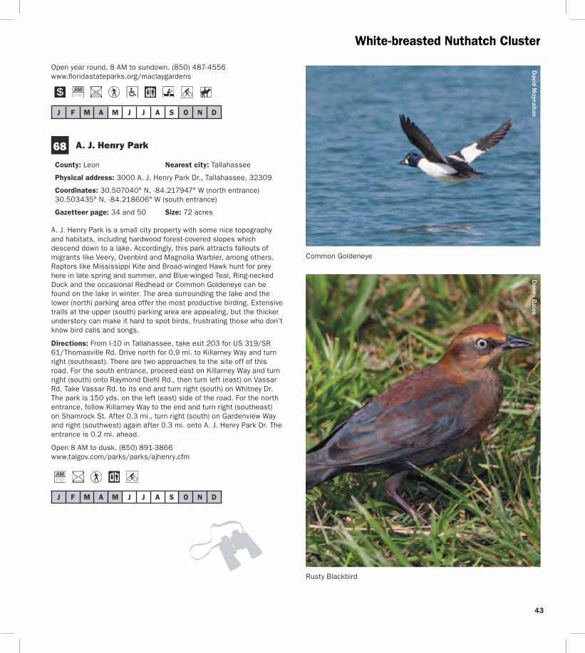
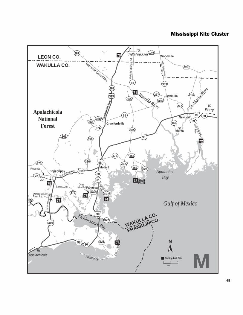
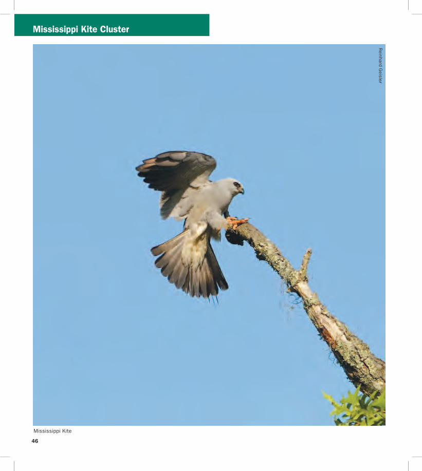

Mississippi Kite Cluster
J F M A M J J A S O N D
J F M A M J J A S O N D
75
J F M A M J J A S O N D
loafing shorebirds in fall-winter-spring such as Short-billed Dowitchers Dunlin Willets Marbled Godwits Black Skimmers and more Keep an eye peeled for the occasional migrating Peregrine Falcon watching the shorebirds even more closely than you Summer is busy with swimmingboating visitors Shorebirds are more diverse and plentiful in cool weather months
Directions From the intersection of US 98SR 30 and SR 363 Woodville Hwy north of St Marks drive west on US 98 approx 80 mi and turn left (south) on CR 365Spring Creek Hwy Turn left after 20 mi onto CR 367Shell Point Rd Continue approx 5 mi on CR 367 (do not take CR 367A at the fork) and turn left (southeast) on Beaty Taff Dr Go 02 mi to the parking area on the right (south) side of the road
Open dawn to dusk (850) 926-7227 wwwwcprdcom
74 Bottoms Road Boat Ramp
County Wakulla Nearest city Panacea
Physical address Bottoms Rd Panacea 32346
Coordinates 30016052deg N -84368326deg W
Gazetteer page 50
Bottoms Road extends out through salt marsh to a county-owned boat launch on the Gulf Along the way watch and listen for Clapper Rails Virginia Rails (winter) and wading birds in the marsh plus Northern Harriers cruising the flats in winter The marsh is also a good place to look for Nelsonrsquos Sparrow (winter) and Seaside Sparrow (year-round) From the shoulder along the road scope the offshore sandbars for loafing terns gulls and shorebirds The large dirt pull-off on the east side of the road (05 miles north of the boat ramp) is private property The marsh is locally known for occasional Short-eared Owl sightings in winter so watch for these daytime hunters gliding low over the marsh like Northern Harriers or perched on low posts amidst the rushes From the boat ramp scan the waters for ducks and scoters
Directions From the intersection of US 98SR 30 and SR 363 Woodville Hwy north of the town of St Marks drive west on US 98 for 166 mi and turn left (east) on CR 372ABottoms Rd just before the town of Panacea Park along the shoulder (where safe) and at the boat ramp (26 mi ahead) at the end of the road
Open dawn to dusk
St Marks National Wildlife Refuge Otter Lake Recreation Area
County Wakulla Nearest city Panacea
Physical address Otter Lake Rd Panacea 32346
Coordinates 30026031deg N -84416565deg W
Gazetteer page 50 Size 11387 acres
Though not as famous as the St Marks Unit St Marks NWRrsquos Panacea Unit offers good birding too Make a quick trip to the picnic area and boat launch at the end to check the cypress for Prothonotary Warblers and occasional wading birds or choose to hike one of the longer trails the south Piney Ridge Trail loop (5 miles) or the north Otter Lake Trail loop (9 miles) The latter runs through pinewoods interrupted by occasional bayheads and wetlands Watch for Red-headed and Red-cockaded Woodpeckers Wild Turkeys and Northern Bobwhites At dusk check the boat launch for Wood Storks egrets and both vultures coming to roost Ospreys nest in the area Swallow-tailed Kites can be seen soaring overhead in spring and summer There is some hunting along the hiking trails so check the trailhead signs before entering and carry water and sunscreen with you See page 55 for more information
Directions From the intersection of US 98SR 30 and SR 363 Woodville Hwy north of the town of St Marks drive west on US 98 for 175 mi and turn right (west) on CR 372AOtter Lake Rd The site is at the west end of Otter Lake Rd
Open dawn to dusk (850) 925-6121 wwwfwsgovsaintmarks
76 Bald Point State Park
County Franklin Nearest city Alligator Point
Physical address Bald Point Rd Alligator Point 32346
Coordinates 29937605deg N -84337327deg W (main entrance) 29914581deg N -84336804deg W (Sunrise Beach access)
Gazetteer page 61 inset Size 4859 acres
Located on the south side of Ochlockonee Bay this state park offers great birding and wildlife viewing Its geography and location provide a prime vantage of the raptor migration in October as Peregrine Falcons Northern Harriers and others cruise down the beach Overwintering shorebirds like Black-bellied Plovers and Dunlin use the beach and estuary and when horseshoe crabs are spawning (which can be impressive) large numbers of shorebirds gather to feast on the crabsrsquo eggs A few sea turtles also nest here in summer In spring migratory songbirds like Black-throated Green Warblers and Indigo Buntings make landfall in the parkrsquos hammocks live oaks surrounding the upper parking area can be quite good Year-round listen for raucous Clapper Rails and Marsh Wrens from the observation boardwalk which overlooks pristine marshes near the upper parking lot Groove-billed Anis are rare winter visitors An extensive hiking trail network begins 16 miles south of the main entrance gate on the west side of the road across from the Sunrise
48
49
Beach access (no fee) These foot trails wind through mesic wet and scrubby flatwoods (home to Brown-headed Nuthatches) and around freshwater marshes swamps and ponds which have wading birds and ducks when water levels are favorable The park is also a staging point for Monarch butterflies on their fall trans-Gulf migration Large numbers of several other species concentrate here in fall as well including Gulf Fritillary Common Buckeye Long-tailed Skipper and Ocola Skipper In early spring Eastern Pygmy Blues can be abundant in the salt marsh Ceraunus Blues can be common in fall Guided tours are available for groups call 2 weeks in advance Fishing and sunbathing are popular in nice weather
Directions From Panacea drive west (head south) on US 98SR 30 for 7 mi and turn left (southeast) on CR 370Alligator Dr Drive 38 mi and turn left (east) on Bald Point Rd the main entrance gate is 28 mi ahead Sunrise Beach and trailhead access are 12 mi north of the intersection with Alligator Dr
Open year round 8 AM to sundown (850) 349-9146 wwwfloridastateparksorgbaldpoint
J F M A M J J A S O N D
77 Ochlockonee River State Park
County Wakulla Nearest city Sopchoppy
Physical address 429 State Park Rd Sopchoppy 32358
Coordinates 29998902deg N -84485259deg W
Gazetteer page 50 and 61 inset Size 543 acres
Upon entering this state park ask at the gate for the locations of active Red-cockaded Woodpecker (RCWs) cavities or recent sightings Head to the parking area at the end of the road and in the
Mississippi Kite Cluster
anny Bales
Blair W
itherington
Snowy Plover
northeastern corner take the ldquoScenic Driverdquo loop road which you may drive bike or walk Watch and listen for RCWs Pine Warblers Eastern Towhees and Common Yellowthroats You may also hike the Pine Flatwoods Trail which originates at the same parking lot This park is well-known for its ldquosnow whiterdquo Eastern Gray Squirrels (no they are not albinos) If you choose to launch a canoe here ask at the gate about water levels and clearance Prothonotary Warblers and Wood Storks may be seen along the river as well as skulking Green Herons Limpkins and Least Bitterns in the brushy margins For early morning access consider camping overnight and enjoy the sounds of Chuckwills-widows and Eastern Screech-Owls after dark
Directions From the intersection of Rose St and US 319SR 377 Sopchoppy Hwy in Sopchoppy head south on Sopchoppy Hwy for 44 mi Turn left (east) on Ochlockonee River Rd the entrance is 12 mi ahead
Open year round 8 AM to sundown (850) 962-2771 w Dwwfloridastateparksorgochlockoneeriver
shy
J F M A M J J A S O N D
County Wakulla Nearest city Sopchoppy
Physical address 252 Park Ave Sopchoppy 32358
Coordinates 30050507deg N -84498079deg W
Gazetteer page 49 and 50 Size 50 acres
If yoursquore in the area itrsquos worth stopping by briefly to visit this small city park on the Sopchoppy River Check the boardwalk and waterfront for night-herons and Prothonotary Warblers and hike the short trail to the left side of the property upon entering In the thicker hardwoods of the hiking trail yoursquoll find migrants like Yellow-billed Cuckoos in spring as well as Mississippi and Swallow-tailed Kites circling overhead in warmer months This site can be a busy boat launch in warm weather Consider launching a canoe from this spot to explore the Sopchoppy River more extensively
Directions From the intersection of Rose St and US 319SR 377 Sopchoppy Hwy in Sopchoppy head south on Sopchoppy Hwy for 04 mi Turn right (west) on Sheldon St and go 04 mi Turn left (south) on Park Ave and drive 05 mi The entrance is on the right (west) side of the road
Open dawn to dusk (850) 962-4611 (850) 962-5486
78 Myron B Hodge City Park
J F M A M J J A S O N D
Mississippi Kite Cluster
Named for its fast darting flight the Whirlabout is a common ldquograss skipperrdquo that occurs in the Panhandle and peninsula most of the year Host plants for the caterpillar include a variety of grasses Shepherdrsquos needle and lantana provide nectar for adults
Danny Bales
50
51
_________________________________________________________________
Mark Kiser FW
C
Birders and wildlife watchers contribute more than $3 billion to Floridarsquos economy each year
About this guide This Trail guide along with guides for the East West and South Trail Sections can be downloaded from the Great Florida Birding and Wildlife Trail website at wwwfloridabirdingtrailcom Additional copies of all four Trail guides may be ordered from the website or by using the form on this page As information for a particular site may change after Trail guides are printed please check the website before heading out on your trip for the most up-to-date information Please report any errors to GFBTMyFWCcom Thanks
Cut
alo
ng d
otte
d lin
e
Mail-in response slip
Birder and wildlife viewer ID Mail-in response form
Name___________________________________________________________
Street __________________________________________________________
City _____________________________________________________________
State _____________ County _____________________________________
Zip______________________ Country _____________________________
E-mail___________________________________________________________
Home phone ____________________________________________________
Work phone _____________________________________________________
Request for information
_____Add my name to your mailing list
_____Send mailings electronically
_____Send a bird checklist ndash also available online
_____Send a Birding and Wildlife Trail sponsorship packet
_____Send a Birding and Wildlife Trail brochure
_____Send a Birding and Wildlife Trail Guide ndash also available online
East ________ West ________ South_______ Panhandle _______
_____Send ldquoBirdwatching Basicsrdquo ndash also available online
Other ___________________________________________________________
wwwfloridabirdingtrailcom
The Great Florida Birding and Wildlife Trail is a program of the Florida Fish and Wildlife Conservation Commission
_____________________________________________________
_____________________________________________________
_____________________________________________________
_____________________________________________________
_____________________________________________________
_____________________________________________________
Cut
alo
ng d
otte
d lin
e
Rate the Trail Mail-in response form
Your country state and county of origin ______________
Where did you hear about the Trail__________________
What is your goal in using the Trail (eg finding a specific species of bird seeing a diversity of birds and wildlife or simply enjoying the outdoors) _____________
How long have you had this guide___________________
How many sites have you visited____________________
Which site was the best Why ______________________
Which site was worst Why ________________________
How many days have you spent birding or wildlife viewing in the last month ______________________________
How long was your last trip on the Birding and Wildlife Trail _______________________________________________
How much money did you spend on lodging food and gas on the above trip $_____________________________
Will you recommend the Trail to friends _____________
Please detach and mail us your valued response to the GFBWT address on page 53 Thank you
St Vincent National Wildlife Refuge
Myron B Hodge City Park
Mark and Selena Kiser
Mark Kiser FW
C
52
Birding and wildlife viewing ethics Donrsquot you hate it when the doorbell or telephone rings just as you settle down to dinner or a nap While mere nuisances to us disruptions in feeding and nesting routines can spell disaster for birds and other wildlife especially the cumulative effect of frequent disruptions a common occurrence at busy sites When a nesting bird is forced to fly it may leave eggs or young exposed to temperature extremes or predators A migratory bird may be exhausted and hungry from a long flight ndash it needs to rest and eat With care and common sense we can all help protect the wildlife we love to watch
Consider these points n Stay back from concentrations of nesting or loafing
waterbirds ndash a spotting scope may be a better choice than binoculars
n Walk around groups of birds on the beach rather than forcing them to fly
n Sit or crouch so that you appear smaller Keep movements slow and steady rather than fast or sporadic
n If viewing from your car stay inside as much as possible It acts as a viewing ldquoblindrdquo and the birds are less likely to fly if they donrsquot recognize you as human
n Stay on roads trails and paths to minimize habitat disturbance
n Do you occasionally use recordings to attract birds If so remember not to overuse them or to try to attract rare or protected species Also do not use them during the nesting season Be aware that some locations prohibit the use of recordings
n For more information please see the American Birding Associationrsquos Code of Ethics at
wwwabaorgaboutethicshtml FWCrsquos viewing ethics at MyFWCcomviewingadventures and the Nature Photographerrsquos Network ethics page at wwwnaturephotographersnetethicshtml
Birding and wildlife viewing resources There are many more resources for birding and wildlife viewing in Florida Before your trip check the Internet for area rare bird alert hotlines and statewide birding listservs to get an idea of whatrsquos being seen If yoursquore staying in an area for a longer visit check local book and nature stores for area guides published by local Audubon chapters or birders The Great Florida Birding and Wildlife Trail guidebooks and the trip-planning tool at wwwfloridabirdingtrailcom are just a taste of the
information available to plan your ultimate Florida birding and wildlife viewing vacation
For more informationhellip
Or to be added to the mailing list for the Great Florida Birding and Wildlife Trailrsquos newsletter Kite Tales fill in the response form (including your name and address on page 51) and mail to
Great Florida Birding and Wildlife Trail (or GFBWT) 620 South Meridian Street Tallahassee FL 32399-1600
or visit the Birding and Wildlife Trailrsquos website at wwwfloridabirdingtrailcom
The Kite Tales newsletter includes news about the Trail and Trail-related events across the state Information also is available regarding Trail sponsorship site nominations for upcoming Trail sections tips for better birding and the economic impact of this flourishing pastime Take part in the continued development of this great resource for birders and wildlife watchers of all skill levels while enjoying and ensuring continued concern for the conservation of Floridarsquos fabulous avian and wildlife treasures
Birders and wildlife viewers Flex your economic muscles Florida communities have long made land use choices to attract traditional tourists and their dollars Birding and wildlife viewing are big business in Florida too but communities will only recognize that if wersquore visible Your visibility and economic impact can encourage wildlife conservation
Some ways you can make yourself more visible n Wear bird and wildlife t-shirts n Take your binoculars into the restaurant with you n Ask local residents in restaurants hotels gas
stations etc about where good birding and wildlife viewing locations might be in their area
n Leave birder calling cards whenever you spend money helping vendors make the connection between healthy wildlands and healthy economies (cards may be downloaded from wwwfloridabirdingtrailcom)
n Put a birding bumper sticker or window decal on your car or business It speaks for itself so you donrsquot have to
Conserve wildlife by watching wildlife Itrsquos more than a hobby itrsquos a legacy
53
For the birds The Great Florida Birding and Wildlife Trail helps everyone enjoy and conserve Floridarsquos wildlife and wildlife habitat A donation to the Wildlife Foundation of Florida helps us expand and enhance the Birding and Wildlife Trail experience With your support we can continue to protect Floridarsquos natural resources for future generations to enjoy
mail your check to
Wildlife Foundation of Florida Attn GFBWT PO Box 6181 Tallahassee FL 32314-6181
Note Please write GFBWT in the memo section of your check
Support the Birding and Wildlife Trail with your purchase of official GFBWT merchandise We offer several T-shirt designs a stylish baseball cap a bumper sticker and a vinyl cling sticker Proudly wearing birding apparel and displaying birding stickers on your vehicle help communities recognize you as a wildlife watcher and conservationist and sale proceeds benefit the Birding and Wildlife Trail program Order yours today at wwwfloridabirdingtrailcom
If you would like to make a donation please
54
Sharing Floridarsquos public lands during hunting season
Floridarsquos residents and visitors are fortunate to have an abundance of public and private lands open for wildlife viewing and other outdoor recreation Seasonal hunting takes place on many of these public lands that are part of the Great Florida Birding and Wildlife Trail Some of these lands - wildlife management areas and wildlife refuges ndash were acquired and are managed with revenue generated from the sale of hunting licenses and taxes on various types of sporting goods Birders and hunters can and do share these lands as well as a love for the outdoors and conservation
Some Birding and Wildlife Trail sites are closed during hunting seasons Other sites allow multiple activities including birding and hiking to take place during hunts If the site you plan to visit has a hunting icon in this guidebook please visit the FWCrsquos website at MyFWC comhunting or MyFWCcomviewingrecreation to find information on hunting seasons dates times of day area closures regulations WMA maps and more In the words of Pete Dunne legendary birder author (and hunter too) ldquoawareness of your statersquos (and sitersquos) hunting regulations and what game is and is not in season will help you make better decisions in the fieldrdquo Trip planning is important ndash do your homework prior to arriving at your destination Birders need not stay home nor avoid all huntable lands during hunting season However when venturing outdoors during hunting season wear blaze orange for visibility and safety
Birders and hunters in Florida have access to the largest wildlife management area (WMA) system in the United States with nearly 6 million acres of lands established as WMAs or Wildlife and Environmental Areas (WEAs) On the majority of these lands the FWC is a cooperating manager working in conjunction with other government agencies and private landowners to conserve wildlife and provide quality outdoor experiences for the public The FWC is the landowner or ldquoleadrdquo managing agency for nearly 50 WMAs and WEAs totaling millions of acres On these lands the FWC is responsible for land stewardship wildlife conservation and a wide range of recreation
activities including birding hunting fishing and wildlife viewing The FWCrsquos Office of Recreation Services where the Great Florida Birding and Wildlife Trail program is administered also develops public access amenities on these lead WMAs
Mark Kiser FW
C
Photographers birders and other wildlife viewers enjoy quality outdoor experiences on Floridarsquos wildlife management areas
55
Meaghan M
anning
The lavishly-plumaged Purple Gallinule breeds in the Florida Panhandle and peninsula and may be found throughout the peninsula in winter This colorful railrsquos enormous yellow feet are well-suited for walking on floating vegetation as it searches for seeds fruits and aquatic invertebrates
This guide is a product of the Florida Fish and Wildlife Conservation Commissionrsquos Office of Recreation Services
Special Thanks We thank each of the site managersowners donors partners and cooperators who have been instrumental in developing the Great Florida Birding and Wildlife Trail Sally and Dean Jue and David Harder provided additional assistance with butterfly viewing information for this guide
Credits New trail developmenttext by Mark Kiser Selena Kiser Jerrie Lindsey and Anne Glick Florida Fish and Wildlife Conservation Commission Original trail developmenttext by Julie Wraithmell Michael Welch and Adam Kent Maps by Creative Force Inc Graphic design editing and layout by Lizabeth West and Ann Marie Tavares Florida Fish and Wildlife Conservation Commission
56
________________________________________________________________________________________________________________________________
________________________________________________________________________________________________________________________________
________________________________________________________________________________________________________________________________
________________________________________________________________________________________________________________________________
________________________________________________________________________________________________________________________________
________________________________________________________________________________________________________________________________
________________________________________________________________________________________________________________________________
________________________________________________________________________________________________________________________________
________________________________________________________________________________________________________________________________
________________________________________________________________________________________________________________________________
________________________________________________________________________________________________________________________________
________________________________________________________________________________________________________________________________
________________________________________________________________________________________________________________________________
________________________________________________________________________________________________________________________________
________________________________________________________________________________________________________________________________
________________________________________________________________________________________________________________________________
________________________________________________________________________________________________________________________________
________________________________________________________________________________________________________________________________
________________________________________________________________________________________________________________________________
Field Notes D
avid Moynahan FW
C
Pitcher plants Apalachicola National Forest Post Office Bay
57
________________________________________________________________________________________________________________________________
________________________________________________________________________________________________________________________________
________________________________________________________________________________________________________________________________
________________________________________________________________________________________________________________________________
________________________________________________________________________________________________________________________________
________________________________________________________________________________________________________________________________
________________________________________________________________________________________________________________________________
________________________________________________________________________________________________________________________________
________________________________________________________________________________________________________________________________
________________________________________________________________________________________________________________________________
________________________________________________________________________________________________________________________________
________________________________________________________________________________________________________________________________
________________________________________________________________________________________________________________________________
________________________________________________________________________________________________________________________________
________________________________________________________________________________________________________________________________
________________________________________________________________________________________________________________________________
________________________________________________________________________________________________________________________________
________________________________________________________________________________________________________________________________
________________________________________________________________________________________________________________________________
Field Notes D
avid Moynahan FW
C
Least Terns Gulf Islands National Seashore
58
2
How to Use this GuideWe hope this guide will help you quickly and easily identify Panhandle Section birding and wildlife viewing sites of interest to you Sites have met criteria ensuring they are good for birding and are able to withstand birder use Maps show ldquoclustersrdquo of 1 to 10 sites within an hourrsquos drive of one another The map above shows the locations of these clusters the letter in each box corresponds to the map for that cluster Descriptions and directions for sites accompany each cluster map You may want to use the maps in this guide along with a more detailed map book such as a DeLorme Florida Atlas and Gazetteer
Map Key(see page 3 for City Locator)
A Perdido Cluster H Cape Cluster
B Migrantrsquos Rest Cluster I Pitcher Plant amp Peregrine Cluster
C Blackwater Cluster J Bluffs Cluster
D Choctawhatchee Cluster K Talquin Cluster
E Dogwood Cluster L White-breasted Nuthatch Cluster
F Kentucky Warbler Cluster M Mississippi Kite Cluster
LegendNot a primary Trail site but ldquoWorth A Visitrdquo if yoursquore already in the area
Some viewing is barrier-free
Sites good for beginners
Sites best for those with ability to ID bird calls
Restroom available
Entrance fee required
Tours educational signage andor nature center on site
Seasonal hunting on site
Access by appointment only
Site can be birded by car
Site can be birded by boat
Site can be birded by foot
Site can be birded by bicycle
Site can be birded by horseback
Site is good for a single sought-after species
Camping available
Site has good butterfly viewing
Best months for each site will be shaded
Best time of day for birding morning evening both morning and evening and all day
Recommended length of visit quick stop a few hours all day
Danny Bales
American Black Duck
Danny Bales
Swainsonrsquos Warbler
resi Kan
lee S
nd akra
M
Apalachicola Bluffs and Ravines Preserve
59
printed on recycled paper 32011
The Great Florida Birding and Wildlife Trail is a project of the Florida Fish and Wildlife Conservation Commission
Marbled G
odwit by Joan M
iller
Many thanks to our generous sponsors
Gulf Powerwwwgulfpowercom
National Fish and Wildlife Foundationwwwnfwforg
Cover photo Brown-headed Nuthatch by Danny Bales
wwwfloridabirdingtrailcom
In partnership with
Florida Park Service Florida Department of Transportation
US Fish and Wildlife US Department ofService Transportation Federal
Hiighway Administration
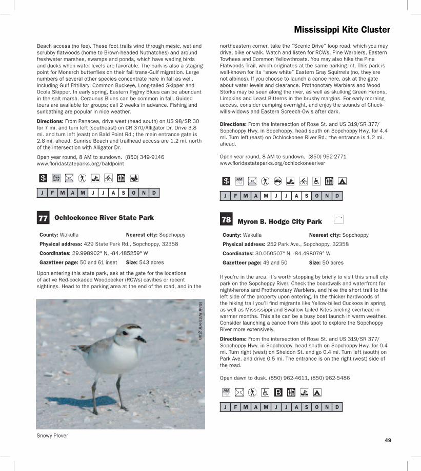
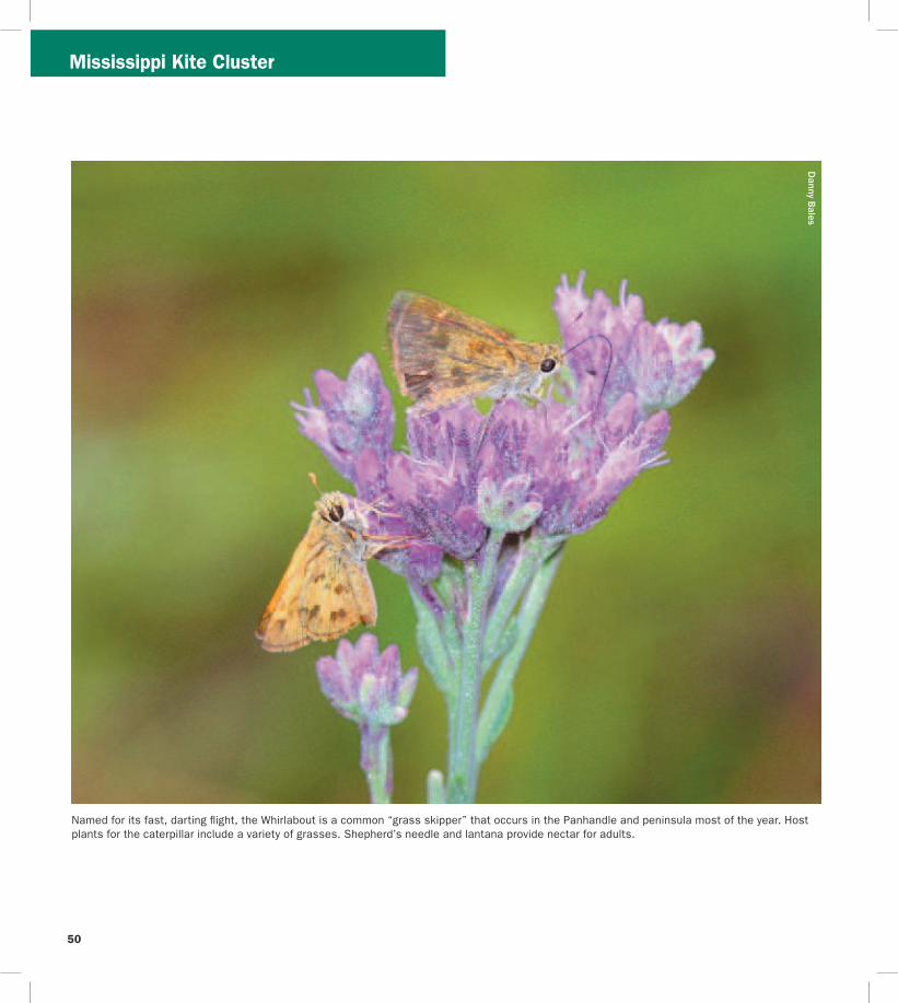

_____________________________________________________
_____________________________________________________
_____________________________________________________
_____________________________________________________
_____________________________________________________
_____________________________________________________
Cut
alo
ng d
otte
d lin
e
Rate the Trail Mail-in response form
Your country state and county of origin ______________
Where did you hear about the Trail__________________
What is your goal in using the Trail (eg finding a specific species of bird seeing a diversity of birds and wildlife or simply enjoying the outdoors) _____________
How long have you had this guide___________________
How many sites have you visited____________________
Which site was the best Why ______________________
Which site was worst Why ________________________
How many days have you spent birding or wildlife viewing in the last month ______________________________
How long was your last trip on the Birding and Wildlife Trail _______________________________________________
How much money did you spend on lodging food and gas on the above trip $_____________________________
Will you recommend the Trail to friends _____________
Please detach and mail us your valued response to the GFBWT address on page 53 Thank you
St Vincent National Wildlife Refuge
Myron B Hodge City Park
Mark and Selena Kiser
Mark Kiser FW
C
52
Birding and wildlife viewing ethics Donrsquot you hate it when the doorbell or telephone rings just as you settle down to dinner or a nap While mere nuisances to us disruptions in feeding and nesting routines can spell disaster for birds and other wildlife especially the cumulative effect of frequent disruptions a common occurrence at busy sites When a nesting bird is forced to fly it may leave eggs or young exposed to temperature extremes or predators A migratory bird may be exhausted and hungry from a long flight ndash it needs to rest and eat With care and common sense we can all help protect the wildlife we love to watch
Consider these points n Stay back from concentrations of nesting or loafing
waterbirds ndash a spotting scope may be a better choice than binoculars
n Walk around groups of birds on the beach rather than forcing them to fly
n Sit or crouch so that you appear smaller Keep movements slow and steady rather than fast or sporadic
n If viewing from your car stay inside as much as possible It acts as a viewing ldquoblindrdquo and the birds are less likely to fly if they donrsquot recognize you as human
n Stay on roads trails and paths to minimize habitat disturbance
n Do you occasionally use recordings to attract birds If so remember not to overuse them or to try to attract rare or protected species Also do not use them during the nesting season Be aware that some locations prohibit the use of recordings
n For more information please see the American Birding Associationrsquos Code of Ethics at
wwwabaorgaboutethicshtml FWCrsquos viewing ethics at MyFWCcomviewingadventures and the Nature Photographerrsquos Network ethics page at wwwnaturephotographersnetethicshtml
Birding and wildlife viewing resources There are many more resources for birding and wildlife viewing in Florida Before your trip check the Internet for area rare bird alert hotlines and statewide birding listservs to get an idea of whatrsquos being seen If yoursquore staying in an area for a longer visit check local book and nature stores for area guides published by local Audubon chapters or birders The Great Florida Birding and Wildlife Trail guidebooks and the trip-planning tool at wwwfloridabirdingtrailcom are just a taste of the
information available to plan your ultimate Florida birding and wildlife viewing vacation
For more informationhellip
Or to be added to the mailing list for the Great Florida Birding and Wildlife Trailrsquos newsletter Kite Tales fill in the response form (including your name and address on page 51) and mail to
Great Florida Birding and Wildlife Trail (or GFBWT) 620 South Meridian Street Tallahassee FL 32399-1600
or visit the Birding and Wildlife Trailrsquos website at wwwfloridabirdingtrailcom
The Kite Tales newsletter includes news about the Trail and Trail-related events across the state Information also is available regarding Trail sponsorship site nominations for upcoming Trail sections tips for better birding and the economic impact of this flourishing pastime Take part in the continued development of this great resource for birders and wildlife watchers of all skill levels while enjoying and ensuring continued concern for the conservation of Floridarsquos fabulous avian and wildlife treasures
Birders and wildlife viewers Flex your economic muscles Florida communities have long made land use choices to attract traditional tourists and their dollars Birding and wildlife viewing are big business in Florida too but communities will only recognize that if wersquore visible Your visibility and economic impact can encourage wildlife conservation
Some ways you can make yourself more visible n Wear bird and wildlife t-shirts n Take your binoculars into the restaurant with you n Ask local residents in restaurants hotels gas
stations etc about where good birding and wildlife viewing locations might be in their area
n Leave birder calling cards whenever you spend money helping vendors make the connection between healthy wildlands and healthy economies (cards may be downloaded from wwwfloridabirdingtrailcom)
n Put a birding bumper sticker or window decal on your car or business It speaks for itself so you donrsquot have to
Conserve wildlife by watching wildlife Itrsquos more than a hobby itrsquos a legacy
53
For the birds The Great Florida Birding and Wildlife Trail helps everyone enjoy and conserve Floridarsquos wildlife and wildlife habitat A donation to the Wildlife Foundation of Florida helps us expand and enhance the Birding and Wildlife Trail experience With your support we can continue to protect Floridarsquos natural resources for future generations to enjoy
mail your check to
Wildlife Foundation of Florida Attn GFBWT PO Box 6181 Tallahassee FL 32314-6181
Note Please write GFBWT in the memo section of your check
Support the Birding and Wildlife Trail with your purchase of official GFBWT merchandise We offer several T-shirt designs a stylish baseball cap a bumper sticker and a vinyl cling sticker Proudly wearing birding apparel and displaying birding stickers on your vehicle help communities recognize you as a wildlife watcher and conservationist and sale proceeds benefit the Birding and Wildlife Trail program Order yours today at wwwfloridabirdingtrailcom
If you would like to make a donation please
54
Sharing Floridarsquos public lands during hunting season
Floridarsquos residents and visitors are fortunate to have an abundance of public and private lands open for wildlife viewing and other outdoor recreation Seasonal hunting takes place on many of these public lands that are part of the Great Florida Birding and Wildlife Trail Some of these lands - wildlife management areas and wildlife refuges ndash were acquired and are managed with revenue generated from the sale of hunting licenses and taxes on various types of sporting goods Birders and hunters can and do share these lands as well as a love for the outdoors and conservation
Some Birding and Wildlife Trail sites are closed during hunting seasons Other sites allow multiple activities including birding and hiking to take place during hunts If the site you plan to visit has a hunting icon in this guidebook please visit the FWCrsquos website at MyFWC comhunting or MyFWCcomviewingrecreation to find information on hunting seasons dates times of day area closures regulations WMA maps and more In the words of Pete Dunne legendary birder author (and hunter too) ldquoawareness of your statersquos (and sitersquos) hunting regulations and what game is and is not in season will help you make better decisions in the fieldrdquo Trip planning is important ndash do your homework prior to arriving at your destination Birders need not stay home nor avoid all huntable lands during hunting season However when venturing outdoors during hunting season wear blaze orange for visibility and safety
Birders and hunters in Florida have access to the largest wildlife management area (WMA) system in the United States with nearly 6 million acres of lands established as WMAs or Wildlife and Environmental Areas (WEAs) On the majority of these lands the FWC is a cooperating manager working in conjunction with other government agencies and private landowners to conserve wildlife and provide quality outdoor experiences for the public The FWC is the landowner or ldquoleadrdquo managing agency for nearly 50 WMAs and WEAs totaling millions of acres On these lands the FWC is responsible for land stewardship wildlife conservation and a wide range of recreation
activities including birding hunting fishing and wildlife viewing The FWCrsquos Office of Recreation Services where the Great Florida Birding and Wildlife Trail program is administered also develops public access amenities on these lead WMAs
Mark Kiser FW
C
Photographers birders and other wildlife viewers enjoy quality outdoor experiences on Floridarsquos wildlife management areas
55
Meaghan M
anning
The lavishly-plumaged Purple Gallinule breeds in the Florida Panhandle and peninsula and may be found throughout the peninsula in winter This colorful railrsquos enormous yellow feet are well-suited for walking on floating vegetation as it searches for seeds fruits and aquatic invertebrates
This guide is a product of the Florida Fish and Wildlife Conservation Commissionrsquos Office of Recreation Services
Special Thanks We thank each of the site managersowners donors partners and cooperators who have been instrumental in developing the Great Florida Birding and Wildlife Trail Sally and Dean Jue and David Harder provided additional assistance with butterfly viewing information for this guide
Credits New trail developmenttext by Mark Kiser Selena Kiser Jerrie Lindsey and Anne Glick Florida Fish and Wildlife Conservation Commission Original trail developmenttext by Julie Wraithmell Michael Welch and Adam Kent Maps by Creative Force Inc Graphic design editing and layout by Lizabeth West and Ann Marie Tavares Florida Fish and Wildlife Conservation Commission
56
________________________________________________________________________________________________________________________________
________________________________________________________________________________________________________________________________
________________________________________________________________________________________________________________________________
________________________________________________________________________________________________________________________________
________________________________________________________________________________________________________________________________
________________________________________________________________________________________________________________________________
________________________________________________________________________________________________________________________________
________________________________________________________________________________________________________________________________
________________________________________________________________________________________________________________________________
________________________________________________________________________________________________________________________________
________________________________________________________________________________________________________________________________
________________________________________________________________________________________________________________________________
________________________________________________________________________________________________________________________________
________________________________________________________________________________________________________________________________
________________________________________________________________________________________________________________________________
________________________________________________________________________________________________________________________________
________________________________________________________________________________________________________________________________
________________________________________________________________________________________________________________________________
________________________________________________________________________________________________________________________________
Field Notes D
avid Moynahan FW
C
Pitcher plants Apalachicola National Forest Post Office Bay
57
________________________________________________________________________________________________________________________________
________________________________________________________________________________________________________________________________
________________________________________________________________________________________________________________________________
________________________________________________________________________________________________________________________________
________________________________________________________________________________________________________________________________
________________________________________________________________________________________________________________________________
________________________________________________________________________________________________________________________________
________________________________________________________________________________________________________________________________
________________________________________________________________________________________________________________________________
________________________________________________________________________________________________________________________________
________________________________________________________________________________________________________________________________
________________________________________________________________________________________________________________________________
________________________________________________________________________________________________________________________________
________________________________________________________________________________________________________________________________
________________________________________________________________________________________________________________________________
________________________________________________________________________________________________________________________________
________________________________________________________________________________________________________________________________
________________________________________________________________________________________________________________________________
________________________________________________________________________________________________________________________________
Field Notes D
avid Moynahan FW
C
Least Terns Gulf Islands National Seashore
58
2
How to Use this GuideWe hope this guide will help you quickly and easily identify Panhandle Section birding and wildlife viewing sites of interest to you Sites have met criteria ensuring they are good for birding and are able to withstand birder use Maps show ldquoclustersrdquo of 1 to 10 sites within an hourrsquos drive of one another The map above shows the locations of these clusters the letter in each box corresponds to the map for that cluster Descriptions and directions for sites accompany each cluster map You may want to use the maps in this guide along with a more detailed map book such as a DeLorme Florida Atlas and Gazetteer
Map Key(see page 3 for City Locator)
A Perdido Cluster H Cape Cluster
B Migrantrsquos Rest Cluster I Pitcher Plant amp Peregrine Cluster
C Blackwater Cluster J Bluffs Cluster
D Choctawhatchee Cluster K Talquin Cluster
E Dogwood Cluster L White-breasted Nuthatch Cluster
F Kentucky Warbler Cluster M Mississippi Kite Cluster
LegendNot a primary Trail site but ldquoWorth A Visitrdquo if yoursquore already in the area
Some viewing is barrier-free
Sites good for beginners
Sites best for those with ability to ID bird calls
Restroom available
Entrance fee required
Tours educational signage andor nature center on site
Seasonal hunting on site
Access by appointment only
Site can be birded by car
Site can be birded by boat
Site can be birded by foot
Site can be birded by bicycle
Site can be birded by horseback
Site is good for a single sought-after species
Camping available
Site has good butterfly viewing
Best months for each site will be shaded
Best time of day for birding morning evening both morning and evening and all day
Recommended length of visit quick stop a few hours all day
Danny Bales
American Black Duck
Danny Bales
Swainsonrsquos Warbler
resi Kan
lee S
nd akra
M
Apalachicola Bluffs and Ravines Preserve
59
printed on recycled paper 32011
The Great Florida Birding and Wildlife Trail is a project of the Florida Fish and Wildlife Conservation Commission
Marbled G
odwit by Joan M
iller
Many thanks to our generous sponsors
Gulf Powerwwwgulfpowercom
National Fish and Wildlife Foundationwwwnfwforg
Cover photo Brown-headed Nuthatch by Danny Bales
wwwfloridabirdingtrailcom
In partnership with
Florida Park Service Florida Department of Transportation
US Fish and Wildlife US Department ofService Transportation Federal
Hiighway Administration
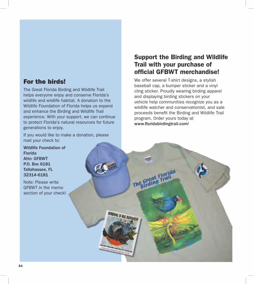
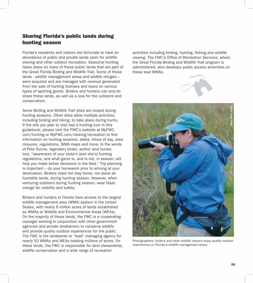
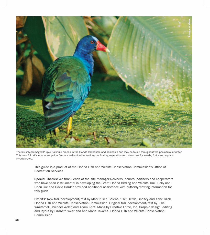
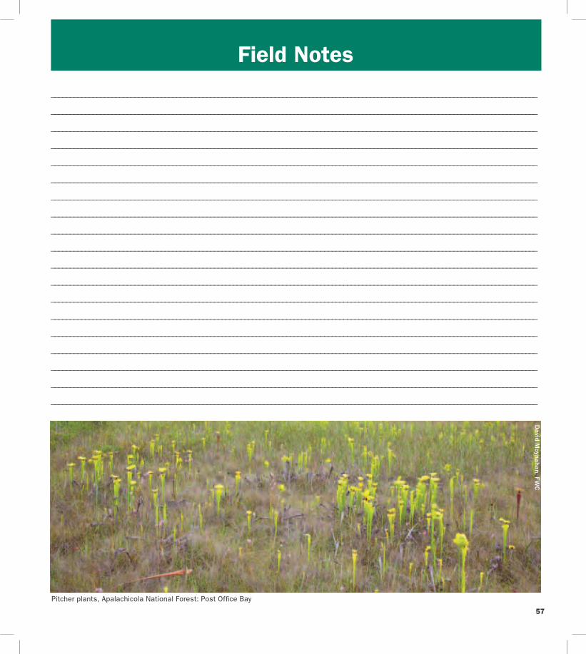
________________________________________________________________________________________________________________________________
________________________________________________________________________________________________________________________________
________________________________________________________________________________________________________________________________
________________________________________________________________________________________________________________________________
________________________________________________________________________________________________________________________________
________________________________________________________________________________________________________________________________
________________________________________________________________________________________________________________________________
________________________________________________________________________________________________________________________________
________________________________________________________________________________________________________________________________
________________________________________________________________________________________________________________________________
________________________________________________________________________________________________________________________________
________________________________________________________________________________________________________________________________
________________________________________________________________________________________________________________________________
________________________________________________________________________________________________________________________________
________________________________________________________________________________________________________________________________
________________________________________________________________________________________________________________________________
________________________________________________________________________________________________________________________________
________________________________________________________________________________________________________________________________
________________________________________________________________________________________________________________________________
Field Notes D
avid Moynahan FW
C
Pitcher plants Apalachicola National Forest Post Office Bay
57
________________________________________________________________________________________________________________________________
________________________________________________________________________________________________________________________________
________________________________________________________________________________________________________________________________
________________________________________________________________________________________________________________________________
________________________________________________________________________________________________________________________________
________________________________________________________________________________________________________________________________
________________________________________________________________________________________________________________________________
________________________________________________________________________________________________________________________________
________________________________________________________________________________________________________________________________
________________________________________________________________________________________________________________________________
________________________________________________________________________________________________________________________________
________________________________________________________________________________________________________________________________
________________________________________________________________________________________________________________________________
________________________________________________________________________________________________________________________________
________________________________________________________________________________________________________________________________
________________________________________________________________________________________________________________________________
________________________________________________________________________________________________________________________________
________________________________________________________________________________________________________________________________
________________________________________________________________________________________________________________________________
Field Notes D
avid Moynahan FW
C
Least Terns Gulf Islands National Seashore
58
2
How to Use this GuideWe hope this guide will help you quickly and easily identify Panhandle Section birding and wildlife viewing sites of interest to you Sites have met criteria ensuring they are good for birding and are able to withstand birder use Maps show ldquoclustersrdquo of 1 to 10 sites within an hourrsquos drive of one another The map above shows the locations of these clusters the letter in each box corresponds to the map for that cluster Descriptions and directions for sites accompany each cluster map You may want to use the maps in this guide along with a more detailed map book such as a DeLorme Florida Atlas and Gazetteer
Map Key(see page 3 for City Locator)
A Perdido Cluster H Cape Cluster
B Migrantrsquos Rest Cluster I Pitcher Plant amp Peregrine Cluster
C Blackwater Cluster J Bluffs Cluster
D Choctawhatchee Cluster K Talquin Cluster
E Dogwood Cluster L White-breasted Nuthatch Cluster
F Kentucky Warbler Cluster M Mississippi Kite Cluster
LegendNot a primary Trail site but ldquoWorth A Visitrdquo if yoursquore already in the area
Some viewing is barrier-free
Sites good for beginners
Sites best for those with ability to ID bird calls
Restroom available
Entrance fee required
Tours educational signage andor nature center on site
Seasonal hunting on site
Access by appointment only
Site can be birded by car
Site can be birded by boat
Site can be birded by foot
Site can be birded by bicycle
Site can be birded by horseback
Site is good for a single sought-after species
Camping available
Site has good butterfly viewing
Best months for each site will be shaded
Best time of day for birding morning evening both morning and evening and all day
Recommended length of visit quick stop a few hours all day
Danny Bales
American Black Duck
Danny Bales
Swainsonrsquos Warbler
resi Kan
lee S
nd akra
M
Apalachicola Bluffs and Ravines Preserve
59
printed on recycled paper 32011
The Great Florida Birding and Wildlife Trail is a project of the Florida Fish and Wildlife Conservation Commission
Marbled G
odwit by Joan M
iller
Many thanks to our generous sponsors
Gulf Powerwwwgulfpowercom
National Fish and Wildlife Foundationwwwnfwforg
Cover photo Brown-headed Nuthatch by Danny Bales
wwwfloridabirdingtrailcom
In partnership with
Florida Park Service Florida Department of Transportation
US Fish and Wildlife US Department ofService Transportation Federal
Hiighway Administration
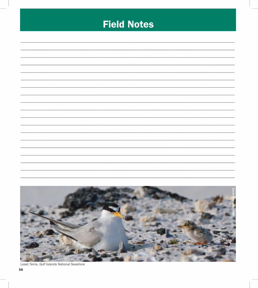
________________________________________________________________________________________________________________________________
________________________________________________________________________________________________________________________________
________________________________________________________________________________________________________________________________
________________________________________________________________________________________________________________________________
________________________________________________________________________________________________________________________________
________________________________________________________________________________________________________________________________
________________________________________________________________________________________________________________________________
________________________________________________________________________________________________________________________________
________________________________________________________________________________________________________________________________
________________________________________________________________________________________________________________________________
________________________________________________________________________________________________________________________________
________________________________________________________________________________________________________________________________
________________________________________________________________________________________________________________________________
________________________________________________________________________________________________________________________________
________________________________________________________________________________________________________________________________
________________________________________________________________________________________________________________________________
________________________________________________________________________________________________________________________________
________________________________________________________________________________________________________________________________
________________________________________________________________________________________________________________________________
Field Notes D
avid Moynahan FW
C
Least Terns Gulf Islands National Seashore
58
2
How to Use this GuideWe hope this guide will help you quickly and easily identify Panhandle Section birding and wildlife viewing sites of interest to you Sites have met criteria ensuring they are good for birding and are able to withstand birder use Maps show ldquoclustersrdquo of 1 to 10 sites within an hourrsquos drive of one another The map above shows the locations of these clusters the letter in each box corresponds to the map for that cluster Descriptions and directions for sites accompany each cluster map You may want to use the maps in this guide along with a more detailed map book such as a DeLorme Florida Atlas and Gazetteer
Map Key(see page 3 for City Locator)
A Perdido Cluster H Cape Cluster
B Migrantrsquos Rest Cluster I Pitcher Plant amp Peregrine Cluster
C Blackwater Cluster J Bluffs Cluster
D Choctawhatchee Cluster K Talquin Cluster
E Dogwood Cluster L White-breasted Nuthatch Cluster
F Kentucky Warbler Cluster M Mississippi Kite Cluster
LegendNot a primary Trail site but ldquoWorth A Visitrdquo if yoursquore already in the area
Some viewing is barrier-free
Sites good for beginners
Sites best for those with ability to ID bird calls
Restroom available
Entrance fee required
Tours educational signage andor nature center on site
Seasonal hunting on site
Access by appointment only
Site can be birded by car
Site can be birded by boat
Site can be birded by foot
Site can be birded by bicycle
Site can be birded by horseback
Site is good for a single sought-after species
Camping available
Site has good butterfly viewing
Best months for each site will be shaded
Best time of day for birding morning evening both morning and evening and all day
Recommended length of visit quick stop a few hours all day
Danny Bales
American Black Duck
Danny Bales
Swainsonrsquos Warbler
resi Kan
lee S
nd akra
M
Apalachicola Bluffs and Ravines Preserve
59
printed on recycled paper 32011
The Great Florida Birding and Wildlife Trail is a project of the Florida Fish and Wildlife Conservation Commission
Marbled G
odwit by Joan M
iller
Many thanks to our generous sponsors
Gulf Powerwwwgulfpowercom
National Fish and Wildlife Foundationwwwnfwforg
Cover photo Brown-headed Nuthatch by Danny Bales
wwwfloridabirdingtrailcom
In partnership with
Florida Park Service Florida Department of Transportation
US Fish and Wildlife US Department ofService Transportation Federal
Hiighway Administration
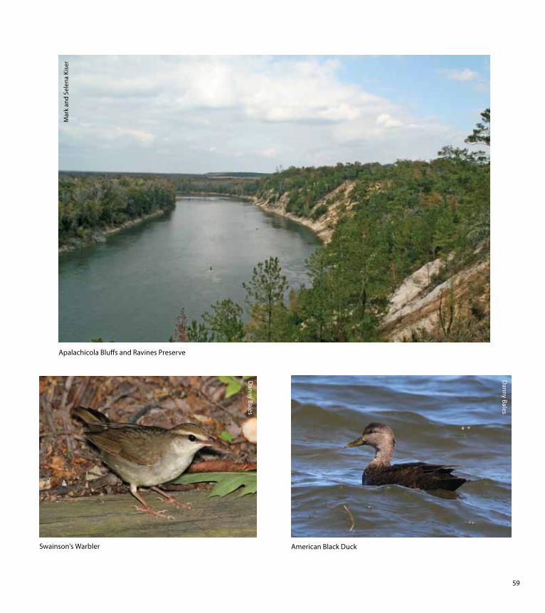