passive seismic for mapping and estimating the … · passive seismic for mapping and estimating...
TRANSCRIPT
Passive Seismic formapping and estimating the
depth of paleochannels
ASEG Passive Seismic WorkshopAdelaide, August 2016
Matt Owers

Mapping paleochannels in order to:
1.Find specific mineral deposits (such as U, Au, potash, etc.) in the paleochannels
2.Avoid the deep parts of the paleochannel while exploring for targets under the paleochannel, i.e. avoid collecting pointless geochemical samples and/or carrying out unnecessary drilling
Other methods commonly used to map paleochannels:
1.EM – probably the most common method
2.Gravity – can be ambiguous
3.Seismic reflection or refraction – very costly
4.High resolution magnetics – only where basement is magnetic
5.IP ?
6.Drilling!
Each method has advantages and disadvantages
Tromino passive seismic has a couple of clear advantages:
1. Fast – easily acquire up to 80 readings a day with two-man crew
2. Simple – don’t need to be a geophysicist to use the instrument
3. Reliable – while amplitudes may vary from day-to-day, the peak frequency remains consistent
4. Lightweight – can carry them with you on a plane
5. Powered by 2 AA batteries
6. QC and initial processing software comes with the instrument
7. Cheap!
Tromino surveying for depth of cover mapping will become a common tool for mineral exploration programs – part of every exploration geologist’s toolkit!

Multiple H/V peaks are possible with peaks occurring at resonant frequencies relating to each subsequent layer
We hope to see a high amplitude, low frequency H/V peak corresponding to the paleochannel sediment-basement interface
A velocity model can be produced for each field reading, and velocity models can be constrained by taking readings at drillhole locations where the depths to geological horizons are known
Modelling is carried out so that the shape of the velocity model roughly matches the measured H/V amplitude vs frequency profile
The final result is a depth vs shear wave velocity profile for a particular site, set of transects or a mapped area
The calculated depths obtained from the modelling can then be contoured to show the geometry of the paleochannel below surface

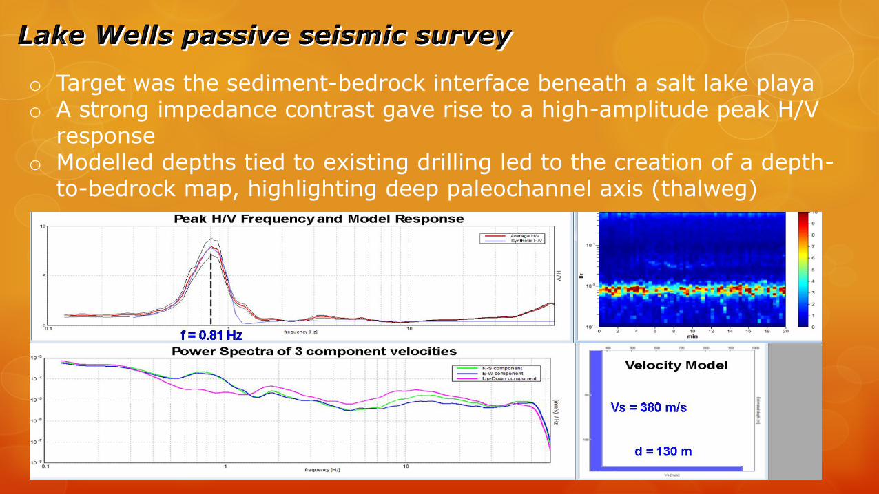
o Target was the sediment-bedrock interface beneath a salt lake playao A strong impedance contrast gave rise to a high-amplitude peak H/V
responseo Modelled depths tied to existing drilling led to the creation of a depth-
to-bedrock map, highlighting deep paleochannel axis (thalweg)
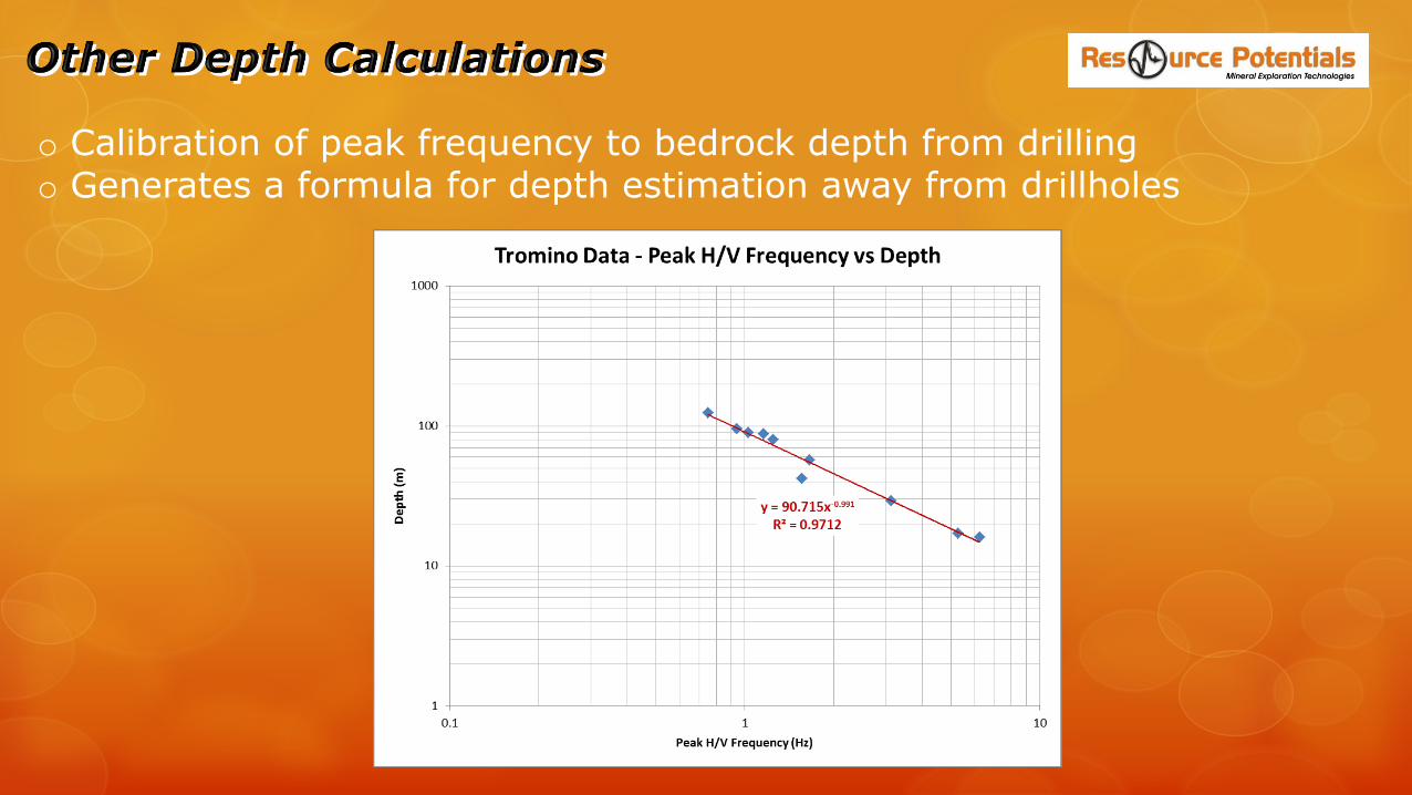
o Calibration of peak frequency to bedrock depth from drillingo Generates a formula for depth estimation away from drillholes
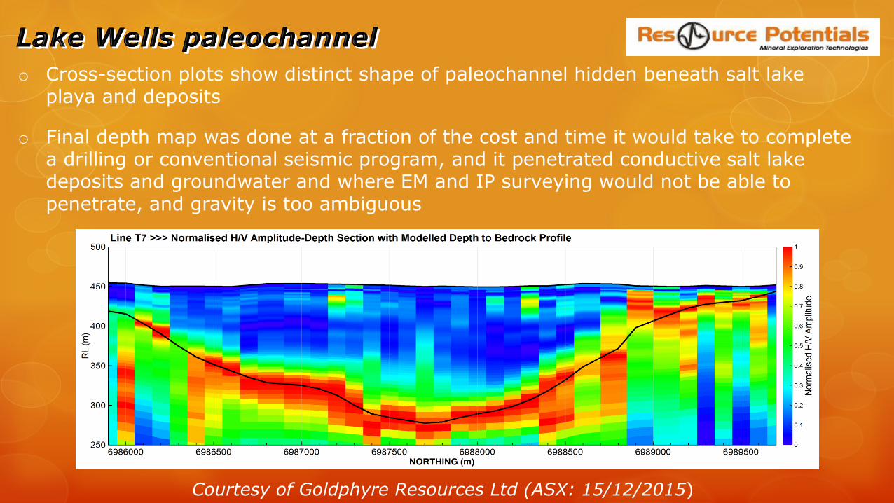
o Cross-section plots show distinct shape of paleochannel hidden beneath salt lake playa and deposits
o Final depth map was done at a fraction of the cost and time it would take to complete a drilling or conventional seismic program, and it penetrated conductive salt lake deposits and groundwater and where EM and IP surveying would not be able to penetrate, and gravity is too ambiguous
Courtesy of Goldphyre Resources Ltd (ASX: 15/12/2015)
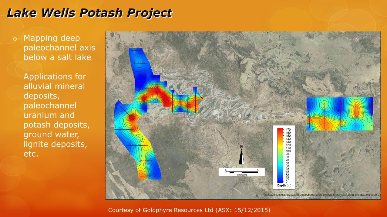
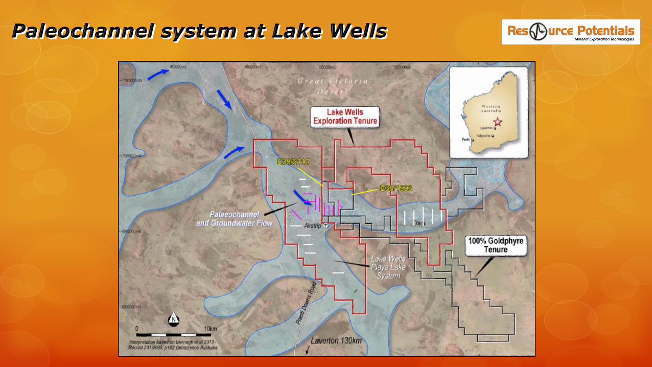
o Mapping deep paleochannel axis below a salt lake
Applications for alluvial mineral deposits, paleochannel uranium and potash deposits, ground water, lignite deposits, etc.
Courtesy of Goldphyre Resources Ltd (ASX: 15/12/2015)
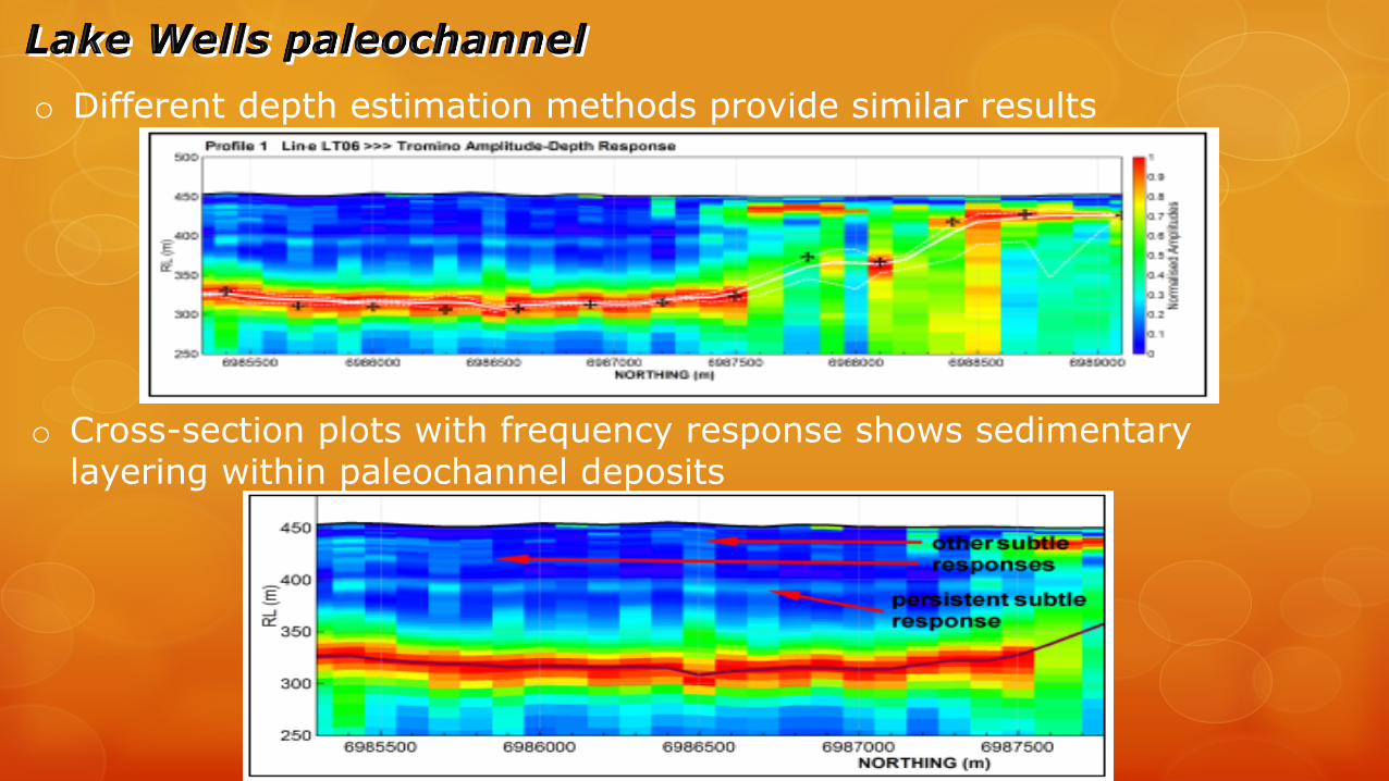
o Different depth estimation methods provide similar results
o Cross-section plots with frequency response shows sedimentary layering within paleochannel deposits

o Then proved with drilling
o Mapping deep paleochannel central axis used to locate new (high cost) rotary mud drillholes
o Coarse grained reservoir hit at the base of two 167 m deep drillholes
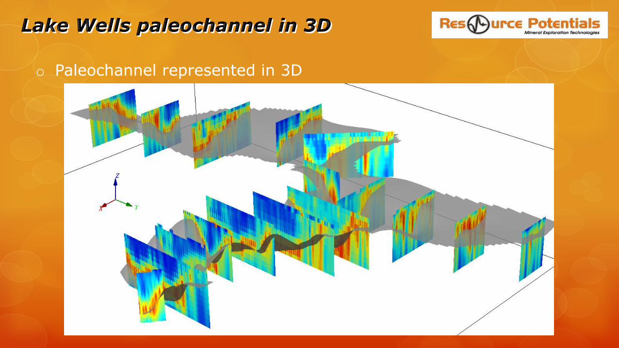
o Paleochannel represented in 3D

o Cross-section plot show distinct shape of paleochannel
o An airborne EM survey was previously flown over the area
Courtesy of Energy Metals Limited (ASX: 28/10/2015)
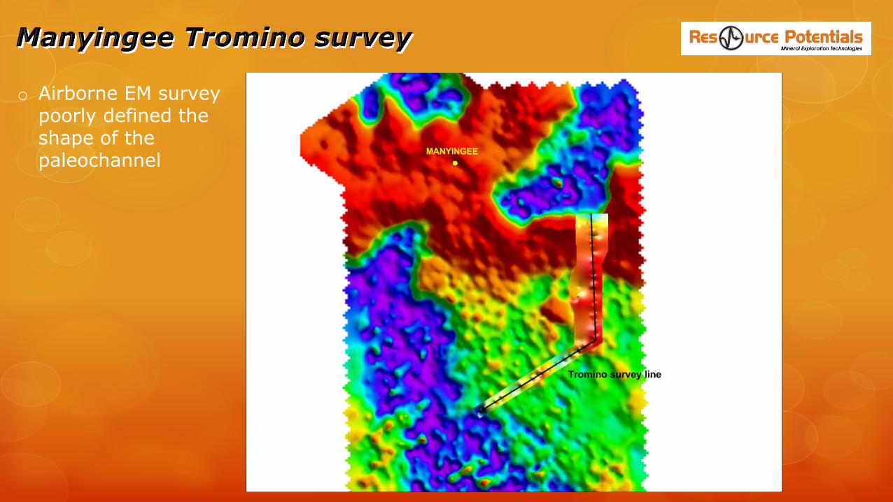
o Airborne EM survey poorly defined the shape of the paleochannel
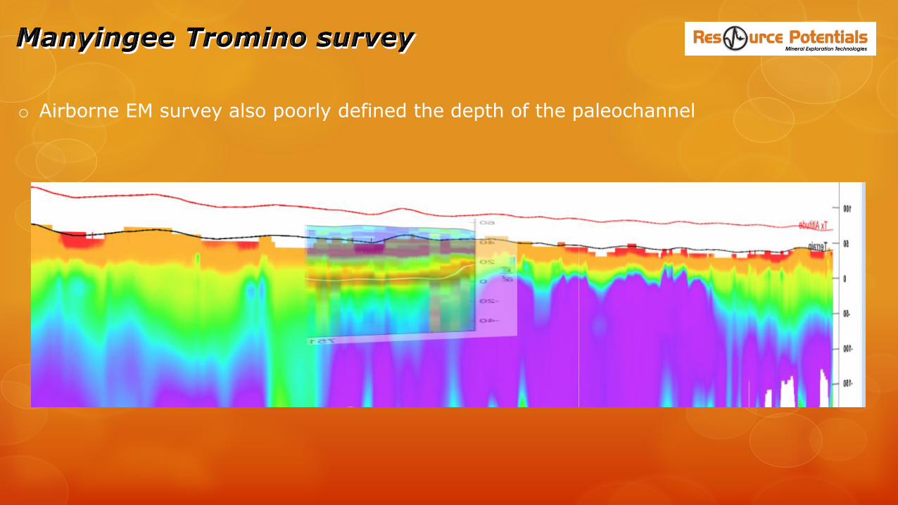
o Airborne EM survey also poorly defined the depth of the paleochannel

o Small “Proof of concept” survey for gold producer in the Kambalda areao Tromino survey lines easily mapped paleochannel both on and off the salt lakeo EM survey worked quite well but was slow and expensive
Survey line off to side of salt lake
Survey line over salt lake

o Tromino survey acquired in July 2016: 3 survey lines oriented N-NNE over known uranium deposit
o U deposit is a vertically-dipping sandstone-hosted stratiform body with some late remobilisation
o Faults interpreted from high resolution aeromagnetic survey (flown late 2014)

o Passive seismic peak H/V frequency highlighted the depth to fresh bedrock/base of cover
o High amplitude response over main U target -> highlighted another potential target

o Passive seismic clearly mapped the paleovalley…
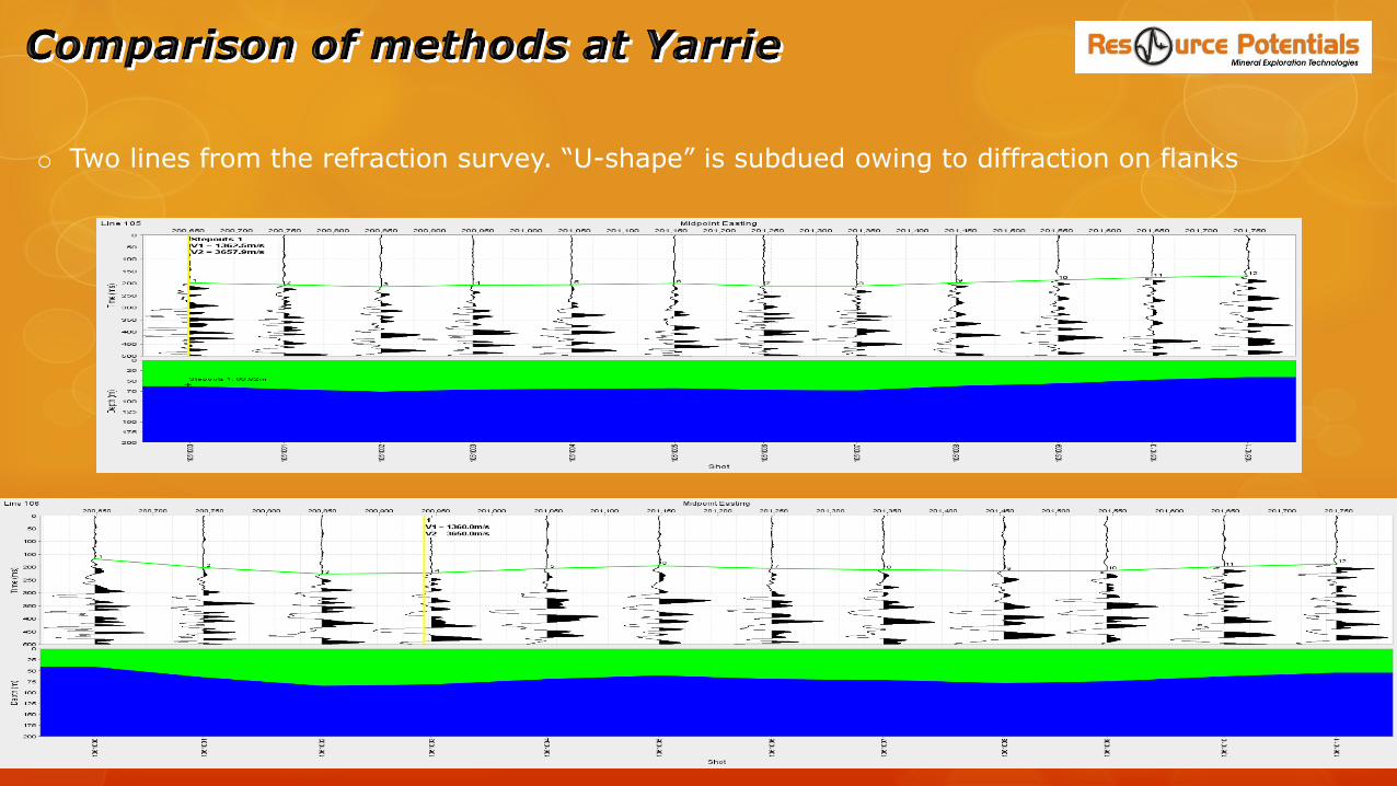
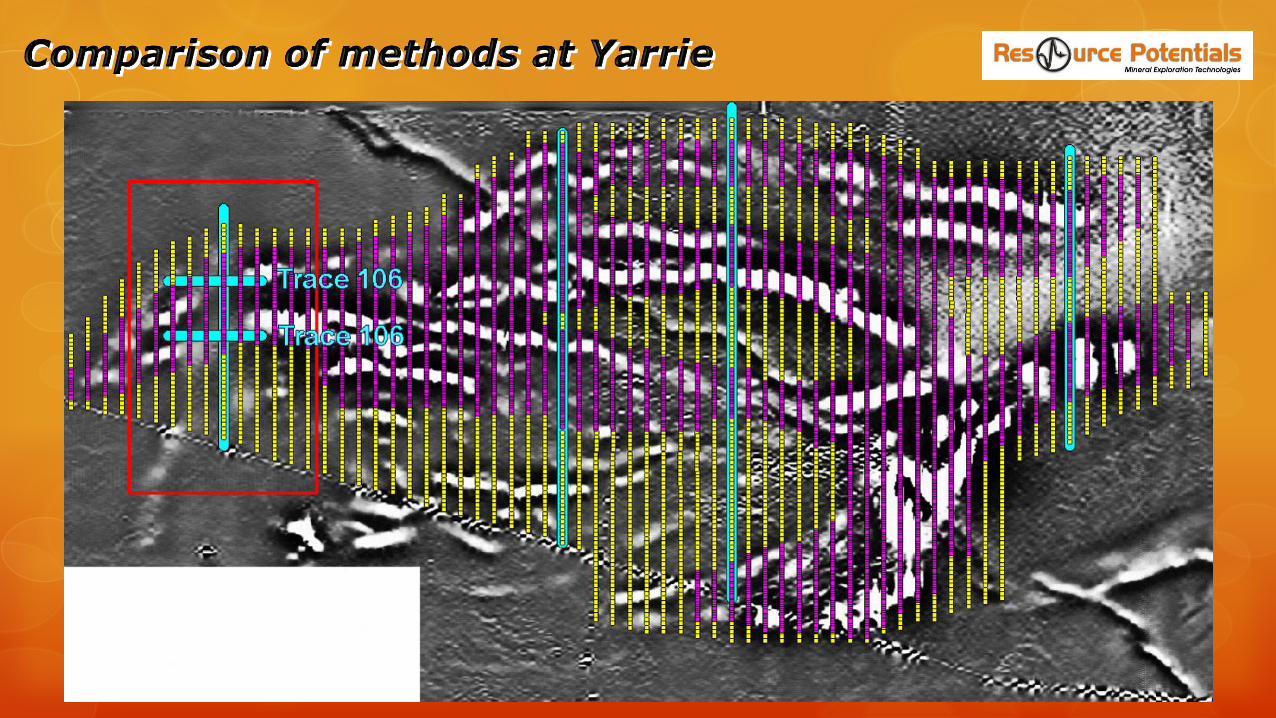
o Two lines from the refraction survey. “U-shape” is subdued owing to diffraction on flanks

The passive seismic method is an innovative use of existing technology that will impact the future of exploration in regolith covered areas and direct detection of paleochannel and other basin-related mineral deposits
Tromino seismometers are small, lightweight, fully self-contained, easy to use, two units can leap-frog during surveying to collect 40 stations per day per field operator, data processing to be carried out by specially trained geoscientists using Grilla software which comes with the Tromino
The Tromino instrument and software package is the only “industry ready” passive seismic system available