protecting michigan’s wetlands michigan’s wetlands a guide for local governments table of...
TRANSCRIPT

Protecting Michigan’s WetlandsA Guide for Local Governments
Edited byGrenetta Thomassey, PhD
Policy Director, Tip of the Mitt Watershed Council
A publication of the Tip of the Mitt Watershed Council426 Bay Street • Petoskey, MI 49770
(231) 347-1181 • www.watershedcouncil.org
ISBN: 978-1-889313-12-2
Copyright © 2007 by Tip of Mitt Watershed CouncilCover Photo: “Spring Lake, Petoskey, MI” taken by Kristy Beyer
Book Layout & Design: Dog Eat Dog Graphic Design

PROTECTING MICHIGAN’S WETLANDSA Guide For Local Governments
Table of Contents
CHAPTER 1: Why Local Wetland Protection? 3
CHAPTER 2: Why Are Wetlands Important? 9What are Wetlands? 11Wetland Functions and Values 15
CHAPTER 3: The Existing Legal Framework 21
CHAPTER 4: Local Wetland Ordinances 29
CHAPTER 5: Additional Options for Local Protection of Wetlands 35
Use of Local Regulatory ProgramsCommunity Option #1: Natural Features Setback Ordinance 36Community Option #2: Soil Erosion and Sedimentation
Control Ordinance 38Community Option #3: Floodplain Management Ordinance 40
Use of Site PlanningCommunity Option #4: Site Plan Review Regulations 42Community Option #5: Linking Local Approval to State
and Federal Permits 44Community Option #6: Lot Split or Lot Division Regulations 46Community Option #7: Local Stormwater Management 48Community Option #8: Open Space Zoning and
Conservation Design 50Community Option #9: Performance Based Zoning 52Community Option #10: Performance Guarantees 54Community Option #11: Environmental Planning in
Public Infrastructure Projects 56
Use of Voluntary ProtectionCommunity Option #12: Partnerships Between Local Units
of Government and Landowners 58
CHAPTER 6: Responsible Regulation: A Recipe For Community Success 61

2
Why Local Wetland Protection?
This guidebook is designed for you – the local government official or interested citizen who faces important questions aboutwetlands. Why should you consider protecting them. We hopethat the information contained in the following pages will helpyou understand why wetlands are important, and provide information to help you make decisions about the wetlands in your local community.

CHAPTER 1: Why Local Wetland Protection?
Local communities are often at the center of debates regarding changes in land use. How many times have you heard these comments?
“I never used to have flooding problems on my property, but since my neighborfilled in the low spots on their property my yard floods all the time.”
“We used to have so much wildlife in this area, now we hardly have any.”
“I moved to this area to get away from the city, now all we’re seeing built are strip malls and parking lots.”
Local governments often hear comments like these as residents in their communities grapplewith growth and the subsequent loss of open space and wetlands. This guidebook is designed to help local officials and concerned citizens understand how wetlands providebenefits to communities, and the regulations that govern wetlands. It offers effective toolsthat can help local governments protect wetlands and other open spaces.
3

Why Local Government Involvement?As communities grow, differences can arise between landowners who would like to developtheir property and other property owners who wish to preserve wetlands, waterways, andopen space in their neighborhood or community. Because the wetland permitting processallows for public notice and public comment, wetland issues are at the forefront of manyof these disputes. These environmental conflicts are particularly common in rapidly developing areas where people moved to escape from urban and suburban landscapes.Citizens usually look to local officials first when attempting to resolve land use conflicts. Forthis reason it is essential that local officials have an understanding of the intimate role thatwetlands play in their community’s environmental health.
Wetlands are a crucial part of a community’s natural plumbing system. They help protectMichigan communities from the ravages of flooding, purify polluted runoff, and help stabilizeerodible shorelines. The ecological functions that wetlands provide help numerous propertyowners. Conversely, land use alterations that disturb or alter wetland areas can create nuisances or cause damage to surrounding land owners (e.g., downstream flooding as a result of upstream wetland filling), as well as affect broader public health issues (e.g.,wetland loss can lead to water quality impairment of lakes and streams). It is critical thatlocal officials understand these dynamics so they can help to prevent the environmentalconsequences associated with wetland loss.
How Wetlands Protect the Community Bottom LineObjections to protecting wetland areas are sometimes based on the premise that the resulting economic loss outweighs the open space, recreational, and ecological benefitsprovided by wetlands. This argument has lost much of its credibility as the understandingof the connection between wetlands, water resources, and public health grows.
Today, you are more likely to find studies detailing how suburban style development has a greater fiscal impact on local governments than the preservation of open space. In fact, time and again, research has shown that the cost of providing services to new development, such as roads, sewers, police, and fire is greater to the local community
than the revenues brought in by the increased property taxes. For example, a Wisconsin studyshowed that for each $1 million in new residential development,$30 is added to each tax bill to pay for the additional police,schools, fire and utilities.
4

While wetlands have been historically maligned, today they are more frequently appreciatedfor the critical role they play in water resource and wildlife protection. This can be difficult todefine to the public. The most obvious functions wetlands provide communities include:
■ Flood control■ Water quality protection■ Shoreline stabilization■ Wildlife/fisheries habitat
When wetlands are destroyed, communitieslose these important functions and the economic benefits that come with them.The loss of these wetland functions cancreate both hidden and obvious economiccosts for communities and private propertyowners. (The functions and values thatwetlands provide Michigan communities isdiscussed in greater detail in Chapter 2.)
When issues of land use regulations arise, local units of government often must weigh thecosts and benefits of a project. Although it is obvious that these ecosystems are valuable,it is difficult to place a dollar value on the range of ecological functions that wetlands provide.This difficulty is due to many inherent problems associated with evaluating the dollar valueof wetlands, three of which are discussed below.
■ The dollar value of certain wetland functions can be difficult to quantify. Wetlands are valuable for many different reasons. Each wetland performs many different functions,the value of which often depends upon the person making the evaluation. Some functions are relatively easy to quantify (e.g., the value of the standing timber in a cedar swamp), while others are nearly impossible (e.g., the value of seeing a bobcat stalk a snowshoe hare in the same swamp).
■ Economic benefit derived from wetland functions may not be realized by the landowner. Many wetland functions provide services that benefit the public as much (if not more) than the individual landowner. It is precisely because wetland functions are valued bysociety that regulations have been passed to protect them. However, some wetland functions, such as the flood storage capacity provided by a wetland located in the headwaters of a major river system, benefit downstream property owners more than the actual landowner. For another example, consider the owner of a large marsh adjacent to a lake. The landowner does not economically benefit from the bass, pike, and other wetland-dependent fish that are caught in the lake by other anglers.
5

■ It may take years to realize the economic benefits of wetland protection. Perhaps the most critical problem with attempting to quantify wetland values is the issue of time frame.Wetlands provide ecological functions in perpetuity. Private entrepreneurs typically expect to recoup their investments within 10 to 30 years. Comparisons between short-term higheconomic yield projects and long-term ecological functions are inappropriate because economic analysis typically discounts the future value. Because of this, the short-term decision regarding whether to convert a wetland (assuming the absence of regulations) will sometimes favor wetland destruction. It is important to remember that the destructionof wetlands by permanent conversion (e.g., house construction, filling, or draining) removes the ecological functions forever.
Michigan’s Tradition of Home RuleProactive efforts by local governments to preserve the quality of life in their communities are part of the rich history of home rule in Michigan. In an era of budget cutting and fiscalconservatism at the state and federal level, local governments must accept the responsibilityof environmental protection.
Local decision makers have numerous land use tools available that can help them effectively,and with little cost, protect sensitive landscapes valuable to their community. Building permits,zoning authority, a wetland permit program, enforcement of the sanitary code, and soil erosion control review all fall under the authority of local government – and within each ofthese areas exists an opportunity to protect wetlands. Whether it be in the form of vigoroussite plan review or in the establishment of open space zoning techniques, local governmentshave the ability, authority, and responsibility to protect their community’s character at thesame time as they are protecting the overall public and environmental health for the long term.
6

7
Opportunities for ProtectionThere are many tools available to help local governments act in the public interest to protectwetlands. If local officials accept their responsibility and work to protect wetlands, the futuregenerations will be able to experience (and surely find value in) the leap of a largemouthbass on the end of their line, abundant game in marshes and swamps across the state,and high quality water resources for a variety of uses.
The following is a guide to aid local officials and interested citizens in understanding the biological functions that wetlands provide Michigan communities, the regulations that govern these landscapes, and the tools that local governments have available to betterprotect wetland environments within their jurisdiction. Protecting the water resources of a community does not always require elaborate or expensive regulations. The followingchapters outline the wide variety of wetland protection techniques that are available, from the simple enforcement of existing statutes to a comprehensive wetland protection ordinance.

8
WETLAND LOSSES
Michigan has lost approximately one-half
of its wetland resources since European settlement due to filling and draining.
- U.S. Fish and Wildlife Service
Why Are WetlandsImportant?

CHAPTER 2: Why Are Wetlands Important?
An old farm adage, “too thick to drink and too thin to plow,” describes both the nature ofwetlands as a transitional zone between upland and aquatic habitats, as well as the lack of value attributed to them in the past.
When this country was first settled by Europeans, few of the functions of wetlandswere recognized, let alone valued as important to society. Prior to the mid-1970s, the destruction of wetlands through dredging, draining, and filling were accepted practices.As a result, according to the U.S. Fish and Wildlife Service, Michigan has lost approximatelyone-half of its wetland resources since European settlement due to filling and draining.
Wetlands act as natural sponges, protecting water quality, attenuating flood events, stabilizingour shorelines and stream banks, storing excess stormwater, providing bountiful fish andwildlife habitat, recharging our ground water supplies, and creating tremendous recreational,research, and tourism opportunities. In short, wetlands help maintain and protect the economic vitality of our communities and the high quality of life that we enjoy in Michigan.
9
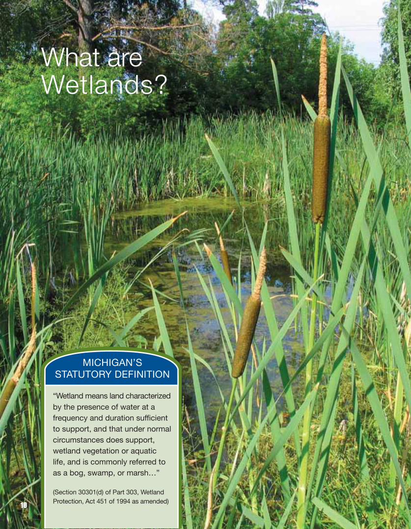
What areWetlands?
MICHIGAN’S STATUTORY DEFINITION
“Wetland means land characterizedby the presence of water at a frequency and duration sufficientto support, and that under normalcircumstances does support,wetland vegetation or aquatic life, and is commonly referred toas a bog, swamp, or marsh…”
(Section 30301(d) of Part 303, WetlandProtection, Act 451 of 1994 as amended)
10

What are Wetlands?Wetlands are unique ecosystems found in the transitional zone between deep water andupland habitat.
Wetlands are typically differentiated from upland habitats by three common characteristics:■ Wetland Vegetation: plants adapted to life in water or saturated conditions.■ Wetland Hydrology: the presence of water at a frequency and duration sufficient to
support wetland vegetation or aquatic life.■ Hydric Soils: soils that form under conditions of saturation, flooding or ponding
long enough during the growing season to develop anaerobic conditions (no oxygen)in the upper part.
When considering whether an area should be developed or protected because it is a wetland,a delineation should be conducted by a professional. This delineation will define the edgesof the wetland and identify what sections development activity should avoid, in order topreserve the functions and values provided by the wetland area. Some physical indicationscan be used to help decide if a wetland delineation is needed. If the ground is soggy in the spring, or if water pools in depressions in the spring or after a rain, it is possible that a wetland is present on the property. If fallen leaves are black or very darkly stained, and if vegetation is different than in the higher ground around the area, these are also good indicators that a professional delineation should be conducted.
WetlandVegetation
WetlandHydrology
Hydric Soils
11

Michigan is fortunate to contain a diversityof wetland types ranging from coastalmarshes to small isolated bogs.
Aquatic BedAreas of shallow permanent water that aredominated by plants that grow on or belowthe surface of the water.
Vernal PoolsSmall pools located in oak-hickory, beech-maple forests, and northern hardwood-coniferforests. They provide critical breeding habitatfor amphibians and invertebrates, and feeding sites for many other species.
Great Lakes Coastal WetlandsThe hydrology of these wetlands is driven byGreat Lakes water level fluctuations. Thereare different types of these rare wetlands dueto substrate (sand, clay, muck) and exposureto wind and wave action: barrier-beachwetland, protected embayment, tombolo,interdunal-swale, and drowned river mouth.All are very important to the health of theGreat Lakes.
Interdunal Swale WetlandA wetland dominated by grass-like vegetation that occurs in the low areas between sand dunes or beach ridges along the Great Lakes shoreline.
Examples of Wetlands Found In Michigan
12
Aquatic Bed
Vernal Pool
Great Lakes Coastal WetlandProtected Embayment Interdunal SwaleGreat Lakes Coastal WetlandProtected Embayment

SwampWooded wetland that is inundated or saturated periodically, such as a Cedar,Hardwood or Shrub-scrub Swamp. In addition to providing flood control andgroundwater recharge, swamps providecritical habitat for plants, birds, fish, and invertebrates.
MarshThese wetlands are often associated withlakes and rivers, and are permanently or periodically covered by standing or slow-moving water and dominated by grass-likevegetation. Because they typically contain a very high level of nutrients, freshwatermarshes are one of the most productiveecosystems on earth.
PeatlandsPeat-accumulating wetland that includesboth bogs and fens. A bog is isolated fromgroundwater (acidic), while a fen receivesinputs of groundwater (basic). Both containunique plants adapted to pH conditions.
Wet PrairieWet prairies once covered the flat lakeplainsof southern Michigan, but are now consid-ered rare. They typically experience seasonalflooding and are among the most diverseplant communities in Michigan.
13
Wet Prairie Bog
Marsh
Swamp

WETLANDS ARE KNOWN TO BE...
the most biologically productive ecosystems in the temperate
regions of the earth. Their biological productivity rivals
that of tropical rainforests and involves complex nutrient
and energy cycles.
Wetland Functions and Values
14

Wetland Functions and ValuesWhy are wetlands important? Through the work of scientists, hunters, anglers, naturalists,and land managers, we are now better able to answer this question than ever before. Wetlands are complex ecosystems that provide numerous benefits to society. In Michiganthese benefits increase in significance as we continue to lose wetlands. The valuable ecological functions of wetlands, and the aesthetically pleasing open space they provide,benefit local economies and enhance the quality of life for Michigan communities and their visitors.
When discussing the importance of wetlands, the terms “wetland functions” and “wetlandvalues” are often used. Wetland functions, such as sediment control and flood storage, are natural processes that continue regardless of their perceived value. Value is usually associated with goods and services that wetlands provide. For this reason, wetland values,such as water quality maintenance and flood protection, are the goods and services thatwetlands provide. Some common wetland functions and values are listed below.
Fish and Wildlife HabitatWetlands are considered “Nature’s Nurseries.” Some species spend their entire lives inwetlands, while others utilize them intermittently for feeding or rearing their young. Most freshwater fish are considered wetland dependent and many important sport fishes spawn in or near wetlands. Like fish, many bird species are dependent on wetlands for either migratory resting places, breeding or feeding grounds, or cover from predators. Nearly all of Michigan’s amphibians are wetland dependent, especially for breeding.
15

Wetlands serve as the preferred habitat for many mammals such as muskrat, beaver, otter, mink, and raccoon. In Northern Michigan, cedar swamps are critical to white-taileddeer for many reasons, including winter browse and important thermal cover during harsh winters. With Michigan’s economy so heavily dependent on tourist dollars from hunting,fishing, wildlife observation, and other forms of outdoor recreation associated with wetlands, this function is an economic powerhouse.
More than one-third of all threatened or endangered animal species in the United States either live in wetland areas or depend on them. This is especially critical considering thatwetlands comprise only about five percent of the lower 48 United States. In Michigan, atleast 41 listed, threatened, and endangered species of animals depend upon wetlands atsome point in their life cycle. Examples of Michigan’s threatened or endangered animalsthat rely on wetlands include the bald eagle, osprey, common loon, and king rail. Of Michigan’s total 395 rare plant species, 194 of them are found in wetland habitats.
Water Quality ProtectionA major function of wetlands is the preservation of water quality. Wetlands act as “Nature’sKidneys” by removing polluting nutrients and sediments from surface and ground water. Although less well known than providing fish and wildlife habitat, this wetland function isvery important to local units of government, particularly in watersheds that are connectedto the municipal water supply.
For example, excess inputs of nutrients, such as phosphorus and nitrogen, can causesevere problems in aquatic ecosystems. Nutrients are necessary, but they can be aclassic example of how “too much of a goodthing is bad.” Excess nutrients can cause anundesirable increase in algae and aquaticplant growth. The result is water that is reminiscent of pea soup, weed-choked lakes,depleted dissolved oxygen levels, and therapid aging or eutrophication of a lake. In the Great Lakes Region, the massive algaeblooms and depleted dissolved oxygen levelsof Lake Erie in the early 1970’s is a classic example of what happens to an aquatic system under the strain of too many nutrients.
16

Sedimentation ControlAs sediment-laden water flows through a wetland from the surrounding watershed, thesediments are deposited, or trapped, in the wetland. This reduces siltation into lakes, rivers,and streams.
There is a strong tendency for heavy metals and other toxic chemicals to attach to thesediment particles found in surface water runoff. Wetlands can trap these pollutants andremove them from the water. However, when the natural ability of wetlands to function asfilters is over-stressed from human inputs, the wetland and its functions can be destroyed.In fact, when overloaded, wetlands can actually become sources of pollutants, exportingmaterials that have been filtered and stored for centuries.
Flood PreventionWetlands act as hydrologic sponges, temporarily storing flood waters and releasingthem slowly, thus reducing flood peaks andprotecting downstream property owners fromflood damage.
Wetlands and adjacent floodplains often formnatural floodways that convey flood waters fromupland to downstream points. These functionsbecome increasingly important in urban areaswhere development has increased the rateand volume of runoff.
Each year, many Michigan communities experience severe flooding and millions of dollarsin damage is caused by flooding across the United States. Due to the below market costof federal flood insurance and other forms of federal assistance to help flood victims, theAmerican taxpayer bears the majority of the financial burden of flood damage. The floodstorage and conveyance functions of wetlands can help to prevent flooding, resulting insubstantial savings to the taxpayer. The most dramatic example of how this can go wrongoccurred in August 2005, when Hurricane Katrina hit the Gulf Coast. Historically, coastalwetlands in the region acted as buffers for communities against storm surges. Unfortunately,years of dredging for navigation canals, oil and gas exploration, and construction of a vastlevee system all combined to devastate those wetlands and the natural storm shield theyprovided. Rebuilding the Gulf Coast will come at a tremendous cost because developmentwas not designed to incorporate the valuable features that wetlands provided. Fortunately,due to Michigan’s geography, our communities are not subject to this magnitude of flooding. However, wetlands can still provide significant flood protection and storageto Michigan’s communities.
Shoreline ProtectionIn their natural condition, wetlands function as a barrier to erosion along shorelines. The rootsystems of wetland plants stabilize soil at the water’s edge and enhance soil accumulationat the shoreline. Wetland vegetation along shorelines reduces erosion by dampening wave action and slowing current speed.
17

Education and ResearchWetlands serve as wonderful outdoor classrooms,providing excellent opportunities for discovery andliving examples of nearly all ecological principles.Boardwalks and observation platforms have beenconstructed in many wetlands across the state to facilitate educational activities. Many localgovernments have featured their wetland resourcesin various ways, preserving them in parks andother recreational or educational settings.
Recreational OpportunitiesWildlife-related recreation is a $22 billion industry in the Great Lakes states. In Michigan alone,anglers spend more than $1.5 billion on their sport and generate nearly $3 billion in totaleconomic output. Since nearly all sport fishes, many popular game animals, and most fur-bearing animals depend on wetlands for their survival, healthy and functioning wetlandecosystems are necessary to maintain the resource base for this segment of the economy.Bird watching also is becoming an important tourist activity in the off-season.
Ground Water RechargeWetlands are usually found where the ground water table intersects or is close to the landsurface. They are usually sites of ground water discharge (places where ground waterseeps or flows to the earth’s surface) and are important in providing high quality water forour lakes and streams, especially in dry months. On the other hand, some wetlands arefound where water moves into the ground water system, serving as a source of groundwater recharge. These wetlands replenish groundwater supplies, and their filtering capacitycan also help protect groundwater quality. The recharge potential of a wetland varies according to a variety of factors, including wetland type, geographic location, subsurfacegeology, soil type, and precipitation.
Water SupplyWhether it is used for recreation, drinking water, or industrial processes, everyone needsclean water. On the delivery side of the water equation, clean water resulting from thewater quality maintenance function of wetlands helps to keep water treatment costs low.Ground water is vulnerable to contamination at many recharge areas. The filtering capacityof wetlands and the absence of pollution-generating uses in wetlands serve to protect vulnerable aquifers. For this reason, the federal Safe Drinking Water Act contains a provisionto encourage local governments to protect wetlands and watersheds determined to be important to municipal water supplies.
18

Food and Fiber ProductionWetlands support many commercial activities. They provide a variety of natural productsincluding blueberries, cranberries, and wild rice. Wetland grasses are hayed in manyplaces for winter livestock feed. Forested wetlands, such as cedar swamps, can providesustained yields of valuable timber if harvested with careful management and planning. It must be noted that many commercial activities, such as, logging, livestock grazing, or cranberry cultivation, can severely degrade wetlands if not done on a small scale withthe utmost care.
Aesthetic ValuesThe richness of the plant and animal communities found in wetlands make them some ofMichigan’s most beautiful natural environments. Rare, threatened, and endangered plantand animal species provide added interest for naturalists. Wetlands provide valuable openspace for visual and recreational enjoyment. In many cases throughout the state, protectedwetlands have been shown to enhance the value of neighboring properties due to thesefactors. Perhaps the most valued function of wetlands is the space they provide for introspection and quiet reflection. The stresses of a busy day seem to fade away when one is watching a Great Blue Heron fishing in the marsh.
SummaryMany of the wetland functions discussed above benefit local units of government and members of their communities. Accordingly, local units of governments have a responsibility to protect these functions by maintaining wetlands.
19

WHY ADD LOCAL PROTECTION?
■ Federal and state laws provide limited protection to isolated wetlands.
■ Isolated wetlands that are nototherwise protected provide important functions and values.
■ Isolated wetlands become more important for habitat and flood storage as an area develops.
■ Local governments are wellsuited to integrate wetlands into land use decisions.
The Existing Legal Framework
20

CHAPTER 3: The Existing Legal Framework
At the heart of Michigan’s wetland regulatory program is Part 303, Wetlands Protection, ofthe Natural Resources and Environmental Protection Act (Act 451 of 1994 as amended),formerly referred to as the Goemaere-Anderson Wetlands Protection Act (Act 203 of 1979).The Michigan Department of Environmental Quality (MDEQ) administers this statute. TheMDEQ has also assumed the administration of Section 404 of the federal Clean Water Act, which protects wetlands at the federal level.
Part 303 includes several provisions:1) It establishes a state policy to protect the public against the loss of wetlands
and makes explicit findings as to the benefits wetlands provide.
2) It establishes a permit program regulating most activities that alter wetlands.
3) It provides enforcement language and sets maximum penalties for violations.
4) It explicitly authorizes regulation of wetlands by local governments.
The activities that are regulated by Part 303 only apply to wetlands as defined in the Act.The definition of wetlands in the Act has two components. First, Part 303 defines a wetland as:
“land characterized by the presence of water at a frequency and duration sufficientto support, and that under normal circumstances does support, wetland vegetationor aquatic life, and is commonly referred to as a bog, swamp, or marsh.”
21
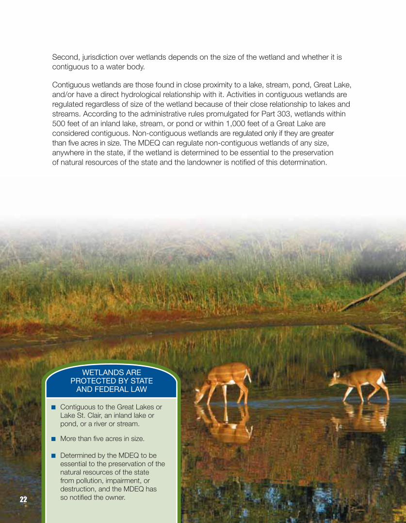
Second, jurisdiction over wetlands depends on the size of the wetland and whether it iscontiguous to a water body.
Contiguous wetlands are those found in close proximity to a lake, stream, pond, Great Lake,and/or have a direct hydrological relationship with it. Activities in contiguous wetlands areregulated regardless of size of the wetland because of their close relationship to lakes andstreams. According to the administrative rules promulgated for Part 303, wetlands within500 feet of an inland lake, stream, or pond or within 1,000 feet of a Great Lake are considered contiguous. Non-contiguous wetlands are regulated only if they are greater than five acres in size. The MDEQ can regulate non-contiguous wetlands of any size, anywhere in the state, if the wetland is determined to be essential to the preservation of natural resources of the state and the landowner is notified of this determination.
WETLANDS ARE PROTECTED BY STATE
AND FEDERAL LAW
■ Contiguous to the Great Lakes or Lake St. Clair, an inland lake or pond, or a river or stream.
■ More than five acres in size.
■ Determined by the MDEQ to be essential to the preservation of the natural resources of the state from pollution, impairment, or destruction, and the MDEQ has so notified the owner.22

PermitsUnder Part 303, a permit is required for the following activities in regulated wetlands:deposit or place fill material in a wetland; dredge, remove, or permit removal of soil or minerals from a wetland; construct, operate, or maintain any use or development in a wetland; or drain surface water from a wetland.
Part 303 includes specific standards that must be met before a permit is issued. The permit standards essentially involve the application of three “tests” to each application.
1) Is the project in the public interest?
2) Has the applicant shown that impacts are not unacceptable?
3) Is the project dependent on being placed in a wetland; does a feasible and prudent alternative exist?
REGULATEDACTIVITIES IN WETLANDS
Under Part 303, a permit is needed to:
■ Place fill in a wetland.
■ Dredge or remove soil or mineralsfrom a wetland.
■ Construct, operate, or maintain anyuse or development in a wetland.
■ Drain surface water from a wetland.23

To determine whether the activity is in the public interest, the benefit from the proposedproject is balanced against the detriments of the activity according to the following general criteria:
■ The relative extent of the public and private need for the proposed activity. (The MDEQ must give serious consideration to findings of necessity made by other state agencies.)
■ The availability of feasible and prudent alternative locations and methods to accomplishthe expected benefits from the activity. (Note that an analysis of alternatives is requiredunder this subsection even if the project is wetland dependent.)
■ The extent and permanence of the beneficial or detrimental effects on the public and private uses of the area, including the benefits the wetland provides.
■ The probable impact of each proposal in relation to the cumulative effect created by other existing and anticipated activities in the watershed.
■ The probable impact on recognized historic, cultural, scenic, ecological, or recreational values and on the public health or fish or wildlife.
■ The size of the wetland being considered.
■ The amount of remaining wetland in the general area.
■ Proximity to any waterway.
■ Economic value, both public and private, of the proposed land change to the general area.
Part 303 requires that the decision reflect the national and state concern for the protectionof natural resources from pollution, impairment, and destruction.
To determine whether impacts to aquatic resources are unacceptable, the MDEQ mustconsider the pubic interest criteria and the criteria set forth in the legislative findings of Part 303. The legislature found that a loss of a wetland may deprive the people of the state of some or all of the following benefits derived from wetlands:
■ Flood and storm control by the hydrologic absorption and storage capacity of the wetland.
■ Protection of subsurface water resources and provision of valuable watersheds and recharging ground water supplies.
■ Pollution treatment by serving as a biological and chemical oxidation basin.
24

■ Erosion control by serving as a sedimentation area and filtering basin, absorbing siltand organic matter.
■ Wildlife habitat by providing breeding, nesting, and feeding grounds and cover for many forms of wildlife, waterfowl (including migratory waterfowl), and rare, threatened,or endangered wildlife species.
■ Sources of nutrients in water food cycles and nursery grounds and sanctuaries for fish.
A wetland dependent activity is one that must have wetland conditions (wetland hydrology,soils, and/or plants) to fulfill its basic purpose. If an activity can be undertaken on an upland site then it is not wetland dependent. One activity that is typically considered wetland dependent is peat extraction.
The language of Part 303 establishes a presumption that there is an alternative to impactinga wetland and that a permit cannot be issued unless the applicant demonstrates that thereis no feasible and prudent alternative. Feasible and prudent alternatives include other locations,project size and configurations, and methods. If the MDEQ finds that an applicant has failedto demonstrate that there are no feasible and prudent alternatives, then it must deny a permit.
The MDEQ also administers Part 301, Inland Lakes and Streams, and Part 325, GreatLakes Submerged Lands of the Natural Resources and Environmental Protection Act (Act 451 of 1994 as amended).
In situations where two or more resource management acts apply, MDEQ reviews one permit application under the criteria of all the applicable acts. This permit consolidation prevents unnecessary duplication of permits and review processes.
25

ExemptionsDuring the legislative process when Part 303 was originally passed in 1979, some activitieswere exempted from the need for a wetlands permit. These exemptions include:
■ Recreational activities such as fishing, trapping, hunting, boating, swimming and hiking.■ Silviculture and lumbering activities including harvesting of commercial forest products.■ Specified agricultural activities, including grazing, cultivation, and minor drainage.■ Maintenance of county drains.■ Specified power line or small gas pipeline construction, if impacts are minimized.■ Forest and farm roads if Best Management Practices (BMPs) are followed.
MitigationIf the MDEQ determines that a project meets the criteria described above and issues a permit authorizing wetland impacts that are determined to be unavoidable, Part 303 authorizes the MDEQ to require the applicant to take actions to mitigate the loss of wetlandarea and function. The mitigation guidelines in Part 303’s administrative rules require:
■ A no net loss of wetlands.■ A preference for wetland restoration.■ Mitigated wetlands be of a similar ecological type.■ Mitigation projects near the same site as the impacted wetland or within the same
watershed in most cases.■ Consideration be given to replacement of predominant functional values lost within
the impacted wetland.■ Financial assurances that the mitigation will be completed. ■ Ratios of mitigation ranging from 1.5 – 5: 1, depending on the type of wetland
impacted, and 10:1 and special provisions for preservation as mitigation.■ Permanent protection must be established for the mitigated wetlands.
MITIGATION
Permitting sequence: ■ Avoid wetlands■ Minimize impacts■ Mitigate for unavoidable
impacts26

27

Local WetlandOrdinances
28

CHAPTER 4: Local Wetland Ordinances
In Michigan, local government has traditionally shouldered the primary responsibility for landuse control through zoning. Local wetlands protection, in addition to MDEQ regulation, is consistent with this home rule tradition. Part 303 authorizes municipalities to regulate wetlands using the same definition, regulatory standards, and application procedures established in Part 303. This authority is supplemental to the existing authority of a municipality to enact zoning ordinances in the public interest under the County, Township,and City, and Village Zoning Enabling Acts. Under these acts, local governments can usevarious tools, including protecting native vegetation and requiring buffer strips around naturalfeatures such as wetlands. Given the importance of the functions and values that wetlandsprovide, some local governments in Michigan have adopted local wetland ordinances.
29
Everyone Benefits from Local Wetland OrdinancesMany benefits result from the local regulation of wetlands in addition to the state and federal programs: the wetland benefits, the individual applicant benefits, and the generalpublic benefits.
Benefits to wetlands by filling gaps in state and federal law and increasing support:■ Protection of small isolated wetlands not subject to state or federal regulation.■ Local involvement allows for early integration of wetland protection during the
development of site plans (e.g., conservation planning, see Chapter 5).■ Difficult for MDEQ staff alone to monitor all activities that can occur throughout
the entire state.
Benefits to the applicant by addressing wetlands early in the project:■ Reduced costs and time delays that result from improper planning.■ Local government can provide incentives (density bonuses, variances, etc.).■ Complete applications may expedite state and federal processes.■ Violations/conflicts with other laws may be avoided.■ Nature sells!
Benefits to the community by enhancing wetland protection:■ Helps foster better land use decisions.■ Improves water quality, reduces flood damage, protects wildlife habitat,
and preserves valuable open space and recreational areas.■ Reduces tax payer dollars spent replacing lost wetland functions and values.■ Savings for individual homeowners by avoiding costs of repairing settling
foundations and leaky basements.■ Preserves the special features unique to the community.■ Protects the local economy by enhancing the quality of life.
30

Elements to ConsiderWhat wetlands should be regulated?If your local government decides to enact a wetland ordinance, you must decide what wetlands should be regulated:
■ Only those regulated by MDEQ?■ Only those NOT regulated by MDEQ?■ All wetlands regardless of size?■ All wetlands to a certain arbitrary size?
Small wetlands provide unique benefits to wildlife and the ecosystem, including criticalbreeding habitats for amphibians. Because small wetlands provide unique benefits, manycommunities regulate all wetlands regardless of size or regulate down to 1/4 of an acre.Once your community decides what wetlands to regulate, there are a number of importantelements that must be taken into account by local governments wishing to enact a localwetland ordinance.
Part 303 Requirements for Local OrdinancesPart 303 includes requirements for local units of government to follow if they wish to regulate wetlands. These include:
■ A wetland ordinance cannot require a permit for activities exempted from regulationunder Part 303.
■ A wetland ordinance must use the same wetland definition as in Part 303, except that the local government can regulate isolated wetlands smaller than 5 acres.
■ Local units of government must publish a wetland inventory before adopting a wetland ordinance. This inventory serves as a general guide and does not delineate jurisdictional boundaries.
■ Local units of government that adopt wetland ordinances must notify the MDEQ. ■ If a local government wishes to regulate a wetland less than 2 acres in size, the
local government must grant a permit unless it is determined that the wetland is essential to the preservation of the community's natural resources according to criteria in Part 303.
■ Local governments must make decisions on wetland permit applications in 90 daysunless waived by the applicant.
■ Local governments must forward a copy of each application to the MDEQ, alongwith state application fees for projects.
■ Local governments must process wetland applications in a manner that ensures that the same entity makes decisions on site plans, plats, and wetlands and cannot require an applicant to submit to a hearing on the application before more than onelocal government decision-making body.
Mapping first makes sense!Part 303 requires a local inventory of your community’s wetlands. This is not a jurisdictionalmap – it is only for planning and notification purposes. Thanks to the growth in GIS andavailable data, wetland inventories are easy and relatively inexpensive to create. However,this inventory does not substitute for on-site review.
31

Landowners must be notified on the inventory map’s availability. Creating the wetland inventory map early in the process builds awareness of wetland resources in the communityand builds support for protection among stakeholders. The map is required by Part 303but is valuable beyond just for wetland protection. It can also be used for preparing amaster plan and making planning and zoning decisions.
MDEQ PermitsIf a community has a local wetland ordinance, a permit applicant must also request a permit from the MDEQ. The local permit review process should be conducted in the sametime frame as the state review process. Approval from both the MDEQ and the localgovernment are necessary in order to proceed with the project.
Perceived “Costs” to Enacting a Local Ordinance Some common concerns regarding a local ordinance include worries that economic, community, and job growth/development will be slowed or halted. Other objections voiced may include worries that lawsuits will bankrupt the community, or that takingsclaims will be filed. However, all of these concerns can be addressed. Communities withwetland ordinances are among Michigan’s fastest growing. Also, well-crafted and fairly administered wetland ordinances are very defensible and rarely challenged. To date,there have been no successful takings claims against local wetland ordinances. Finally,local ordinances that protect important community assets are popular—as long as theydevelop ownership among community stakeholders.
An Example of a Local Wetland Ordinance is available at: www.michigan.gov/deqwetlands
32

33

Additional Options For Local Protection of Wetlands
34

CHAPTER 5: Additional OptionsFor Local Protection of Wetlands
In addition to enacting a stand-alone wetland ordinance, there are various wetland protectiontools available to local governments. Wetland protection can take many forms, and in most cases it should reflect the needs of the resources and the concern of the community.Some communities integrate wetland protection provisions into their site plan reviewprocess, while others maintain comprehensive stand-alone ordinances complete withmaps designating wetland areas. The form of wetland protection that a community islikely to pursue is dependent on a number of variables, some of which include: politicalclimate, available funding or funding mechanisms, administrative capacity, etc. Some ofthe most common protection options are discussed in this section, including:
Use of Local Regulatory Programs■ Community Option #1: Natural Features Setback Ordinances■ Community Option #2: Soil Erosion and Sedimentation Control Ordinances■ Community Option #3: Floodplain Management Ordinances
Use of Site Planning■ Community Option #4: Site Plan Review Regulations■ Community Option #5: Linking Local Approval to State and Federal Permits■ Community Option #6: Lot Split or Lot Division Regulations■ Community Option #7: Local Stormwater Management■ Community Option #8: Open Space Zoning and Conservation Design■ Community Option #9: Performance Based Zoning■ Community Option #10: Performance Guarantees■ Community Option #11: Environmental Planning in Public Infrastructure Projects
Use of Voluntary Protection■ Community Option #12: Partnerships Between Local Units
of Government and Landowners
At a minimum, local governments can review state and federal wetland dredge and fill applications that apply to their area. This should include an analysis of the local zoning ordinance to ensure compliance with any local provisions that might be used to protect the wetland. If a project violates the local ordinance, the MDEQ and the U.S. Army Corpsof Engineers, where applicable, should be notified during the public comment process. Inaddition, the local zoning administrator or reviewing body should be made aware of theproposed activity to ensure appropriate local review. Keep in mind that local governmentshave 45 days to review the application and provide comments – while citizens only have20 days.
35

COMMUNITY OPTION #1
Natural Features Setback OrdinancesBecause people are drawn to the water, residential and recreational pressure to developproperties along lakes, streams, and wetlands is immense – the same natural features thatattract people to our communities are at a high risk for being degraded or destroyed by adjacent development.
One way to protect important natural features in your community is to require “setbacks,”which are intended to provide a buffer between the natural feature and development. Thiscan be accomplished by including a natural features setback as part of the zoning ordinanceto ensure that buildings or various activities, such as grading or cutting vegetation, are located a safe distance from a wetland or other natural feature.
Natural feature setbacks can protect local rivers and streams, lake shorelines, and wetlands.They also provide additional benefits including:
■ Protection of surface water run-off and water quality for pollution prevention.
■ Assistance in beneficial water recharge for drinking, irrigation and other purposes.
■ Provision of water storage areas during storm events.
■ Preservation of aesthetic views andenjoyment of natural resources.
■ Stabilization and protection of soil resources,including the prevention of erosion and prohibition of loss due to moving water.
■ Protection of wildlife habitat, includingpreservation of threatened and endangeredspecies habitat.
Natural feature setbacks are typically 25 to 40 feet in width, but larger setbacks (up to200 feet) are desirable for best protection of the adjacent resource. Setbacks should not be included in a wetland regulatory ordinance. However, local governments can require setbacksfrom wetlands in a separate zoning ordinance.
An example of a natural feature setback ordinance can be found on the Huron River Watershed Council’s website at www. hrwc.org.
36
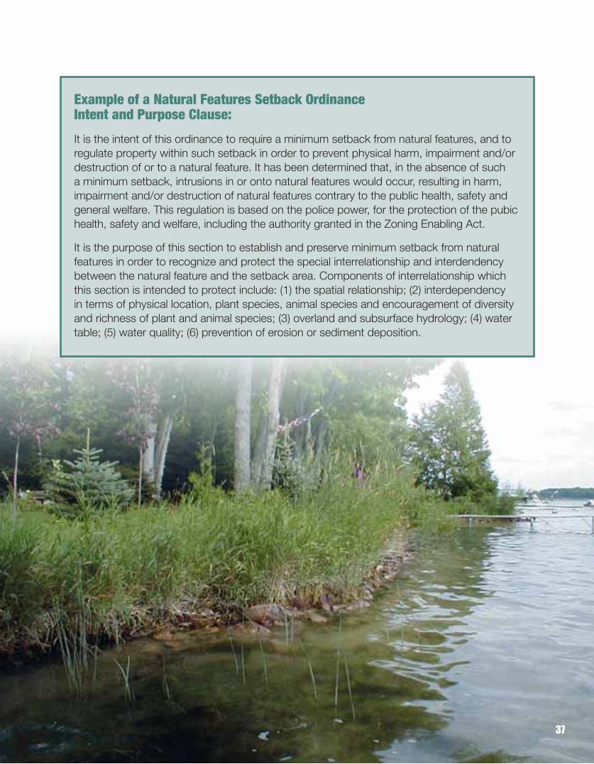
Example of a Natural Features Setback Ordinance Intent and Purpose Clause:
It is the intent of this ordinance to require a minimum setback from natural features, and toregulate property within such setback in order to prevent physical harm, impairment and/ordestruction of or to a natural feature. It has been determined that, in the absence of such a minimum setback, intrusions in or onto natural features would occur, resulting in harm, impairment and/or destruction of natural features contrary to the public health, safety andgeneral welfare. This regulation is based on the police power, for the protection of the pubichealth, safety and welfare, including the authority granted in the Zoning Enabling Act.
It is the purpose of this section to establish and preserve minimum setback from natural features in order to recognize and protect the special interrelationship and interdendency between the natural feature and the setback area. Components of interrelationship whichthis section is intended to protect include: (1) the spatial relationship; (2) interdependency in terms of physical location, plant species, animal species and encouragement of diversityand richness of plant and animal species; (3) overland and subsurface hydrology; (4) watertable; (5) water quality; (6) prevention of erosion or sediment deposition.
37

Soil Erosion and Sedimentation Control OrdinancesSediment can be a significant contributor to the decline in wetland viability by reducing waterdepths, decreasing sunlight penetration, and smothering plant and animal species. Additionally,contaminants such as pesticides, heavy metals, oil and grease, bacteria, plant nutrients, andother chemical wastes are often attached to the sediment and deposited into wetlands. Part 91,Soil Erosion and Sedimentation Control (SESC), of the Natural Resources and EnvironmentalProtection Act (Act 451 of 1994 as amended) formerly Act 347 of 1972, was enacted to protect the waters of the state from sedimentation caused by unchecked soil erosion.
Part 91 gives the primary responsibility for administering the statute to the counties. TheCounty Board of Commissioners must designate a county enforcing agency such as the DrainCommissioner, Road Commission, Building Department, or the local Soil Conservation Districtto administer the soil erosion control program on behalf of the county. Counties may administerthis by using a resolution or an SESC Ordinance. SESC ordinances can be more restrictive thanthe statute. Part 91 allows cities, villages, charter townships, and some general law townshipsto assume responsibility within their jurisdictions by adopting a MDEQ-approved SESC Ordinance.The costs of administering county/local erosion programs may be covered by charging fees forinspections, permits, and reviewing plans.
Similar to other regulatory programs, Part 91 requires permits for all regulated activities. Permitsare required for all earth changes that disturb one or more acres OR that are within 500 feet of a lake or stream. Plowing, tilling, and some logging and mining activities are exempt underPart 91. Since wetlands are often contiguous to lakes and streams, Part 91 may be a usefultool for protecting wetlands. Given that SESC Ordinances can be more restrictive than thestatute, the county or local governmental agency may require (if desired) SESC permits within500 feet of wetlands, lakes, or streams. Prior to receiving a permit, the applicant must completean application and develop a soil erosion and sedimentation control plan to minimize erosionand off-site sedimentation.
COMMUNITY OPTION #2
Summary■ Adopt a county/local ordinance subject to approval from the MDEQ.
■ Designate enforcing agency (e.g., Drain Commissioner, Road Commission, Building Department, or the local Soil Conservation District).
■ Review and approve soil erosion and sediment control permit applications.
38

Seven Principles of Erosion/Sediment Control to be Incorporated Into Every Plan and Construction Activity
1. Design and construct terrain features such as slopes and drainage ways to minimize theerosion potential of the exposed site based on the soil type, time of year, proximity to water ways, duration of exposure, length/steepness of the slope, and the anticipated volume and intensity of runoff.
2. Minimize the surface area of unstabilized soils left unprotected and vulnerable to runoff andwind at any one time.
3. Minimize the amount of time that unstabilized soil areas are exposed to erosive forces.
4. Protect and shield exposed soil areas with a cover of live vegetation, mulch, or approved erosion resistant material during the temporary and permanent control periods of construction.
5. Avoid concentrating runoff. When concentrated runoff cannot be avoided, runoff velocitiesmust be reduced to non-erosive velocities.
6. Trap eroded sediments on-site with temporary and permanent barriers, basins or other sediment retention devices while allowing for the controlled discharge of runoff waters at non-erosive velocities.
7. Implement a continuous inspection and maintenance program.
Incorporating these principles will help prevent this.
39

Floodplain Management OrdinancesProtecting floodplains from development is an urgent public health and safety matter for officialsin many Michigan communities. Floodplains are the natural low areas adjacent to surface waterbodies that hold floodwaters. Since it’s common to find extensive wetlands in the floodplainsof rivers, lakes, and streams, floodplain management generally involves wetland protection.
When floodplains are altered by development, filling, sedimentation, and/or vegetation destruction, their ability to handle floodwaters are greatly reduced, aggravating flooding andsubsequent flood damages, especially downstream. Communities throughout the state havedeveloped specific regulations to control development in floodplains. Local floodplain regulations generally promote the following goals:
■ Limit the alteration of natural flood plains, streams, wetlands and natural protective barriers (e.g., floodplain slopes) that store and attenuate flood waters.
■ Control activities like filling, grading, and dredging, which may increase flooding.
■ Prevent encroachment on stream channels and wetlands.
■ Prevent construction of flood barriers that will unnaturally divert flood waters or may increase flood hazards in other areas.
■ Slow runoff volume and rate to reduce flooding, sedimentation, and channel and property damage.
■ Promote intergovernmental cooperation (state, federal, and local coordination) through consistent application of regulations, so one unit of government does not transport flooding problems to another because of poor floodplain management.
■ Require the elevation of structures above the 100-year flood elevation to reduce the damage.
■ Save community’s dollars by preserving natural flood protection features.
There are a number of options available for floodplain protection. The MDEQ has jurisdictionover many floodplain areas, yet local governments can regulate development in floodplainsthrough a separate floodplain ordinance or through special provisions in the zoning ordinanceor building code. Coordinating state and local floodplain regulations is essential for appropriatemanagement of floodplains.
COMMUNITY OPTION #3
40

Defining and Mapping FloodplainsOne of the first steps in protecting floodplains is to delineate the floodplain area on an officialmap. This map becomes the basis for local regulations. (Using floodplain regulations will notprotect isolated wetlands, or wetlands not found within the designated floodplain.) Many Michigancommunities already have official floodplain maps, developed by the Federal EmergencyManagement Act (FEMA). These maps are known as a Flood Insurance Rate Maps.
If a hazard map does not exist for a community, then the expertise of a wetland scientist or hydrologist may be required. The use of the National Wetlands Inventory (NWI) Maps, Michigan Resource Inventory System (MIRIS) maps, soil surveys, current aerial photos,U.S.G.S. topographic maps, and some field verification is usually required. This map will serve as a guide, not as a detailed site specific map.
Zoning for Floodplain Protection Floodplain zoning ordinances regulate the types of land uses that are permitted in the floodplain. Floodplain zoning districts only allow uses that are not susceptible to flood damage (e.g. recreation facilities, agriculture, conservation/education areas, and planned unit developments that cluster buildings out of the flood prone areas). Many communities with flooding problems participate in the National Flood Insurance Program (NFIP).
Planning and Public Floodplain Acquisition for Greenways and Parklands Pro-active planning for community greenways located in floodplain areas can create manyeconomic benefits for a community. Park and recreation plans often target the acquisition of floodplain areas for use as passive nature recreation areas or for more intensive forms of recreation that are not permanently damaged by flooding (e.g., soccer or softball fields).Since floodplains are vulnerable to periodic flooding and the ability to develop these lands is marginal, they can oftenbe purchased at reducedprices. Strategic long-rangeplanning for protection andacquisition of floodplains by parks and recreation commissions can contributesignificantly to the protectionof riparian wetlands as well as improve the quality of lifebenefits for the community.
41
Site Plan Review RegulationsGood development design strengthens economic activity, improves community attitudes,reduces nuisance impacts, decreases the cost of development, improves property values, and enhances public safety. For these reasons, it is in a community’s interest to conduct a site plan review process. Site plans are the documents and drawings that present informationshowing what an applicant for zoning approval wants to achieve on a parcel of land. Becausegood site plans usually include information on stormwater patterns, topography, soils, andwetland locations, they can help local decision makers better assess what might be necessaryto protect water resources before construction begins.
Local Site Plan Review RegulationsSite plan review regulations are provisions in a zoning ordinance for the administrative reviewof the physical layout of proposed projects to assure the standards contained in the zoning ordinance are complied with as each property is developed. Many local governments alreadyadminister site plan review as part of their planning process, so adding wetland review oftendoes not add to the administrative work load.
In addition to specifying the procedures for submission and approval of site plans, site plan review regulations also identify the land uses subject to review and the individual or body responsible for administering the review. Site plan review typically requires professional assistance and trained decision makers if it is to be used most effectively. This may require hiring outside consultants with the cost borne by fees paid by applicants. Site plan review isoften applied to commercial/industrial facilities, and other uses that require a more detailed review to look at number of parking spaces, structure size, and development in sensitive environmental areas such as wetlands.
The inclusion of standards within site plan review regulations is essential to ensure effectiveand legally rooted review decisions. Standards typically used include: data submittal standards,nondiscretionary review standards, discretionary review standards, and conditional standardsto ensure ordinance conformance.
The most important of these are discretionary standards, which address issues ranging fromimpacts on the environment and adjoining land uses, in conformance with any related federal,state or county regulations. If development does not proceed according to an approved siteplan, legal means (such as performance guarantees mentioned under Community Option #10)can be initiated to require enforcement.
COMMUNITY OPTION #4
42

Local Site Plan Review and Designing Developments to Protect WetlandsWetland protection can be integrated into both residential and commercial development plans. To plan developments that protect wetlands, an assessment of the wetland should first be conducted. This assessment should include (at a minimum):
■ Wetland boundaries■ Wetland size■ Wetland type■ Connections to other bodies of water■ Critical upland habitat that should be protected along with the wetland
Once these are determined, the next step is to determine what type of development is mostcompatible with protecting wetlands on the site.
The layout for buildings and roads should be designed to avoid wetlands altogether, or if unavoidable, minimize wetland crossings. How the upland adjacent to a wetland will be developed has important implications for the long-term health of the wetland. Important considerations include establishment of greenbelts and buffer zones around wetlands, managing the quantity and quality of stormwater in a way that does not harm the wetland,human access and use of the wetland, and land use practices (e.g., fertilizer and pesticide use) as discussed in Community Option #7.
43

Linking Local Approval to State and Federal PermitsA local government’s most basic approach to wetland protection is to tie local approval for a proposed development to the acquisition of the necessary state and federal wetland permits required for project completion. This regulatory technique links approval for all zoning andsubdivision to all local, state, and federal permits.
The advantages of a regulatory networking approach include: ■ It ensures wetland issues are considered early in the planning process.■ It facilitates communication between local government and federal and state
regulatory agencies.■ It ensures wetlands are regulated to state and federal standards at a minimum.■ It provides information on water resources to the local government with
little additional cost.■ It can help local governments better understand the environmental aspects of
project design utilizing existing regulations rather than creating new ones.
The disadvantages to linking approvals are that it leaves some significant land use decisions regarding wetlands entirely up to state and federal officials, and critical isolated wetlands and habitats may not be protected on any level. If local governments would like to be more involved or more protective in the wetlands decision-making process, other options should be investigated.
44
COMMUNITY OPTION #5

Step 1: Encourage those in the process of planning land development to conduct awetland delineation prior to designing the project. This is an important way to avoid wetlands and wetland regulations altogether. Providing a list of wetland consultants toproperty owners will facilitate this process. You can also recommend using the MDEQWetland Identification Program.
Step 2: Land developers should be informed in the early stages of site planning that project approval is conditional on the project receiving the proper federal and state permits. A community may stamp on the permit something to the effect of “Permit Approval Conditional to the Acquisition of Necessary State and Federal Wetland Permits.”
Step 3: Provide easily accessible educational materials on wetlands to individuals interested in land development. MDEQ produces fact sheets on the wetland regulatory process, which can be accessed at www.michigan.gov/wetlands_deq.
If local governments pursue this easy but effective option, some local wetland conflicts can beavoided altogether.
45

Lot Split or Lot Division RegulationsUnchecked land division can remove forever large amounts of forests and farmland from production. It can also unnecessarily burden public facilities and services by the creation of vast “rural development.” Finally, poorly planned land divisions can create parcels that may require the destruction of wetlands to adequately site houses.
The Land Division Act, Act 288 of 1967 as amended (formally known as the Subdivision ControlAct) does not regulate the creation of parcels greater than 40 acres in size. The Land Division Actrequires approval from the MDEQ for the preliminary plat of any subdivision containing lots within oraffected by a floodplain, and any subdivision involving land abutting a lake or stream where publicrights may be affected. Local governments interested in having more control over land divisions inorder to protect wetlands can create local based land division and subdivision regulations.
Local Land Division RegulationsIf land division trends appear to be alarming, a local government can consider adopting a land division regulation. Local land division regulations apply to all lands. These regulations serve to prevent the creation of “unbuildable parcels” with lot width, depth, area, shape and/or frontagethat do not meet ordinance minimums, and ensure that access meets minimum public safety anddrainage standards. They are also structured to prevent the unnecessary fragmentation of valuablenatural resource areas and to prevent a proliferation of strip commercial parcels along major roadways.
Land division regulations can help prevent over-development along rural corridors and premature obsolescence of rural roads.
COMMUNITY OPTION #6
46

47
Elements To Consider Locally■ Location of natural or artificial drainage courses, lakes, streams, wetlands, critical
sand dunes, threatened or endangered species, unusual topography, and majorstands of trees.
■ The size, shape, orientation, and existing zoning of the lots and parcels should be appropriate for the type of development and land use contemplated. No split shouldbe approved that would conflict with existing drainage ditches, natural watercourses, easements, or public rights-of-way.
■ Parcel splits should minimize the division of wetland areas and other natural features. No parcel should be created solely of critical sand dune, wetland, lake or river bottom, or stream bed.

Local Stormwater ManagementStormwater management regulations are designed to address the challenges posed by floodingand nonpoint source pollution. The term “nonpoint” refers to pollutants that originate from diffusesources rather than a specific point or an easily identified source (e.g., from snow melt orstormwater runoff versus an outlet pipe). Stormwater runoff can carry with it high concentrationsof sediment (soil particles), hydrocarbons and other hazardous chemicals, pesticides, bacteria,nutrients, and heavy metals.
Local governments are becoming increasingly involved in the administration of stormwatermanagement activities, particularly in rapidly urbanizing areas where the impacts of developmenton water quality and quantity are most pronounced. In many areas of Michigan, polluted runofffrom lawns, roads, and agricultural areas account for as much as 70% of the water qualityproblems of a waterway.
Research shows that when an urbanizing watershed reaches a level of 10% impervious cover(roads, parking lots, rooftops), the water quality and fish habitat problems rapidly accelerate. Byusing effective site planning to manage stormwater and soil erosion, local governments canprotect wetlands and waterways from siltation, avoid the creation of excessive imperviousness,and minimize alterations in hydrology.
Site Planning for Stormwater ManagementSite planning (detailed in Community Option #4) is an invaluable tool local governments can usewhen attempting to control the amount, quality, and timing of runoff to prevent its damaging effects on natural resources, private property, and public infrastructure. In the early stages ofthe site plan process, the environmentally sensitive areas (e.g., wetlands, floodplains, andsteep slopes ) should be identified. Wetlands and wetland protection are an essential component in any stormwater management system.
COMMUNITY OPTION #7
Stormwater Management Considerations■ Consider watershed boundaries and wetlands in planning, not political boundaries.■ Discourage use of natural wetlands to treat stormwater – instead encourage low impact
development, creation of rain gardens, green roofs, wet detention basins, and otherengineered solutions throughout the local area.
■ Control quantity, timing, and quality of runoff.■ Limit impervious areas.■ Encourage “green” infrastructure.■ Require routine maintenance.■ Treat “first flush” runoff, meaning the peak concentrations of contaminants that occur
at the initial stage of runoff events.
48

The following are a few elements that should be considered when reviewing site plans forstormwater management:
■ Protect streambank and other natural vegetation and provide setbacks.■ Prohibit direct discharge of stormwater into wetlands.■ Prevent fill in wetlands, floodplains, and other natural stormwater collection areas.■ Set a limit on the percentage of impervious surfaces in a development.■ Reduce design demands for curbs and gutters, allow replacement with
grassed swales where appropriate.■ Limit impervious surfaces by reducing parking area requirements.■ Require pervious surfaces whenever possible.■ Require a stormwater management plan at the site plan review stage for new, modified
or expanded developments.■ Ensure proper installation and maintenance of stormwater control measures to preserve
the natural runoff system on and adjacent to development sites. An example of thiswould be requiring grading plans for private road development and driveways to divertstormwater from washing out these areas.
The U.S. EPA has developed a guide entitled Protecting Wetlands: A Guide to StormwaterBest Management Practices, which is available at www.epa.gov/owow/wetlands/watersheds.
Urban Cooperation Agreements and Stormwater ManagementSince stormwater runoff does not respect municipal boundaries, it makes sense for local governments to coordinate with surrounding units of government on stormwater management.Cooperative agreements among local governments, known as urban cooperation agreements(UCA), are legally allowed under the Urban Cooperation Act of 1967. It has become increasinglycommon to manage and fund trans-boundary matters such as fire services, recreational facilities,and water and sewer services using UCAs. Stormwater management is no different.
Prior to adopting a local plan, an area-widestormwater management plan can providethe rationale and guidelines for local regulation. Once these regional guidelineshave been established, it is much easierfor local governments to develop their individual ordinances. UCAs can easily be applied to a public works program that would allow for construction of systems for stormwater management that might include area-wide retentionbasins, monitoring programs, and financingmechanisms, such as special assessmentsor utility fees.
Rain gardens absorb and treat stormwatrer.
49

Open Space Zoning and Conservation DesignOpen space zoning regulations are techniques used by communities to accommodate growthwhile preserving wetlands and other natural resources, rural character, prime agricultural and forest lands, scenic views, historic landmarks, and other special features that are important to thecommunity. Open space zoning enables communities to require a certain percentage of a site to be preserved as open space to protect these resouces.
There are four fundamental components of open space zoning:
1) Special site features are inventoried and mapped. 2) A significant portion of the site is protected as permanent open space. 3) Building envelopes are sited to respect special features and preserve the quantity and
quality of open space on the site.4) Viewsheds are protected by maintaining a low visual impact, particularly along
public roadways and waters.
Techniques for Open Space and Conservation DesignBelow is a brief description of some of the more established land use tools that can protect bothopen space and wetlands.
Conservation SubdivisionConservation subdivision allows for clustering of building sites to provide open space protectionof areas that contain wetlands, steep slopes, views, agricultural lands, and other special features.Clustering building sites not only protects sensitive landscapes, it also provides more open spacefor recreation and can preserve scenic views that contribute to higher property values. Additionally,a more compact site design can significantly lower the costs of infrastructure, surveying, and engineering.
50
Traditional Subdivision Design (shown at left)
Grid layout with little regard fornatural and special features
BEACH
COMMUNITY OPTION #8
Conservation Design (shown at right)
Trees, wetlands, scenic views, and
natural features are retained. All homes
have lake views. All residents have equal
access to the shoreline. Single-loaded
roads provide more privacy and better
views. Trails make a pedestrian and
recreation-friendly development.

51
The image of condominium complexes or tightly packed dwellings is often associated with conservation subdivision, but in actuality this is usually not the case in open space zoning. Rather, open space zoning reduces lot size, but the open space found adjacent to and surrounding the lots give a sense of much larger lots.
Conservation EasementsConservation easements can be used to provide permanent land protection. The explosive growthof the land trust movements in Michigan and nationwide is allowing local governments to createpublic-private partnerships in land protection. This topic is more thoroughly discussed underCommunity Option #12.
Planned Unit DevelopmentsPlanned unit developments (PUD) are authorized under state enabling acts to provide opportunitiesfor more flexible land use and site development. PUDs generally encourage site designs that integratestructures and uses with natural site characteristics to minimize impacts on the site and adjoiningproperties and include planned open space. PUDs can create larger areas of open space throughclustering of units than lot-by-lot development. PUD projects must undergo a site plan reviewprocess, and thus these regulations are administratively more complex than traditional lot areaand bulk regulations.
Implementing Open Space ZoningWhen local government pursues open space zoning, the regulations should reflect the community’scomprehensive plan to assure legal validity. Site development regulations should be consistent withlocal rural character, privacy, and open space access. Permitting should be no more difficult thanfor traditional subdivisions and if substantially easier, will result in more open space projects. Insome cases, density bonuses for open space projects should be considered to increase financialattractiveness of open space developments.
What Does Conservation Design Add Up To?Preservation of natural features +
Private lots and common areas +
Increased sense of community & social opportunities +
Shoreline use concentrated in single dock area__________________________________________________________
HIGHER PROPERTY VALUES!

Performance Based ZoningTraditional community zoning techniques are designed to allow specific land use activities (commercial, residential, industrial) only in pre-defined geographic areas, or zones. Zoning commissions then have the task of reviewing proposed projects in reference to approved zoningmaps that detail the areas where certain land uses are prohibited, authorized, or are authorizedwith certain conditions.
Performance based zoning, on the other hand, does not divide land uses into separate zoning districts. Instead, land use is regulated by particular performance standards that developers must meet. If developers agree to meet these pre-defined standards, then a project can be sitedin a broader range of geographic settings. Typical performance standards include wetland protection, amount of impervious surface, building density, waterfront setbacks, buffering requirements, and open space ratios. Examples of performance standards that protect wetlands:
■ Prevent filling of wetlands by sand, gravel, solid wastes, or structures.■ Protect wetland water supply (quantity).■ Protect wetland soils.■ Maintain free circulation of wetland waters.■ Protect wetland vegetation from cutting and grading.
A significant benefit of performance based zoning is that it allows communities to promote infill in underutilized urban and suburban areas, in turn limiting the progress of sprawl. The practice of infilling has the tendency to revitalize economically distressed neighborhoods by providing agreater diversity of residential and commercial uses. To ensure there is a compatibility betweenland uses, buffers and setbacks should be included as in the community’s performance standards.
COMMUNITY OPTION #9
52

The other significant benefit of performance based zoning is that it gives developers a certain flexibility in designing a plan as long as all the conditions laid out by the local government are met.Developers then have a broad range of design options that they can pursue, many of which canprovide significant cost savings. For example, if a developer is required to limit impervious surfaceand protect slopes greater than fifteen percent, the developer then can cluster buildings, mixbuilding types, and alter road layout to meet those performance standards.
How is Performance Based Zoning Unique?■ It does not divide land use into separate zoning districts (residential,
commercial, industrial)
■ Regulates land use by particular, pre-defined standards to which developersmust adhere (including wetland protection and waterfront setbacks)
■ Helps revitalize communities by promoting infill and limiting sprawl
■ Offers flexibility and cost savings to developers
53

Performance GuaranteesPerformance guarantees are traditionally used by local governments as a legal mechanism to ensure that developers establish predefined improvements as conditions of local project approval. Performance guarantees are a form of “insurance” to protect a community from unmarketable sites due to project abandonment or partial completion, where required public or environmental improvements have not been completed.
Roads, sidewalks, lighting, and utilities are all common site features for which local governmentscan require performance guarantees in the form of surety bonds, cash, or cash equivalence. The guarantee is returned to the developer when the project improvements are completed within a specified timeline and an agreed upon project site plan. Performance guarantees can be
used to protect wetlands by assuringthat proposed land alterations are constructed as specified by communityplanners. For example, if a stormwaterfeature, such as infiltration swales or detention basins, are required to treatrunoff before it enters a wetland, a performance guarantee will help assurethat these stormwater treatment featuresare properly constructed. Performanceguarantees enable communities to paythe cost to protect or restore wetlandsor other sensitive features, if thedeveloper or contractor fails to do so.
COMMUNITY OPTION #10
Why Use PerformanceGuarantees?
They are collected as“insurance” to protect a community if a developmentproject goes wrong.
54
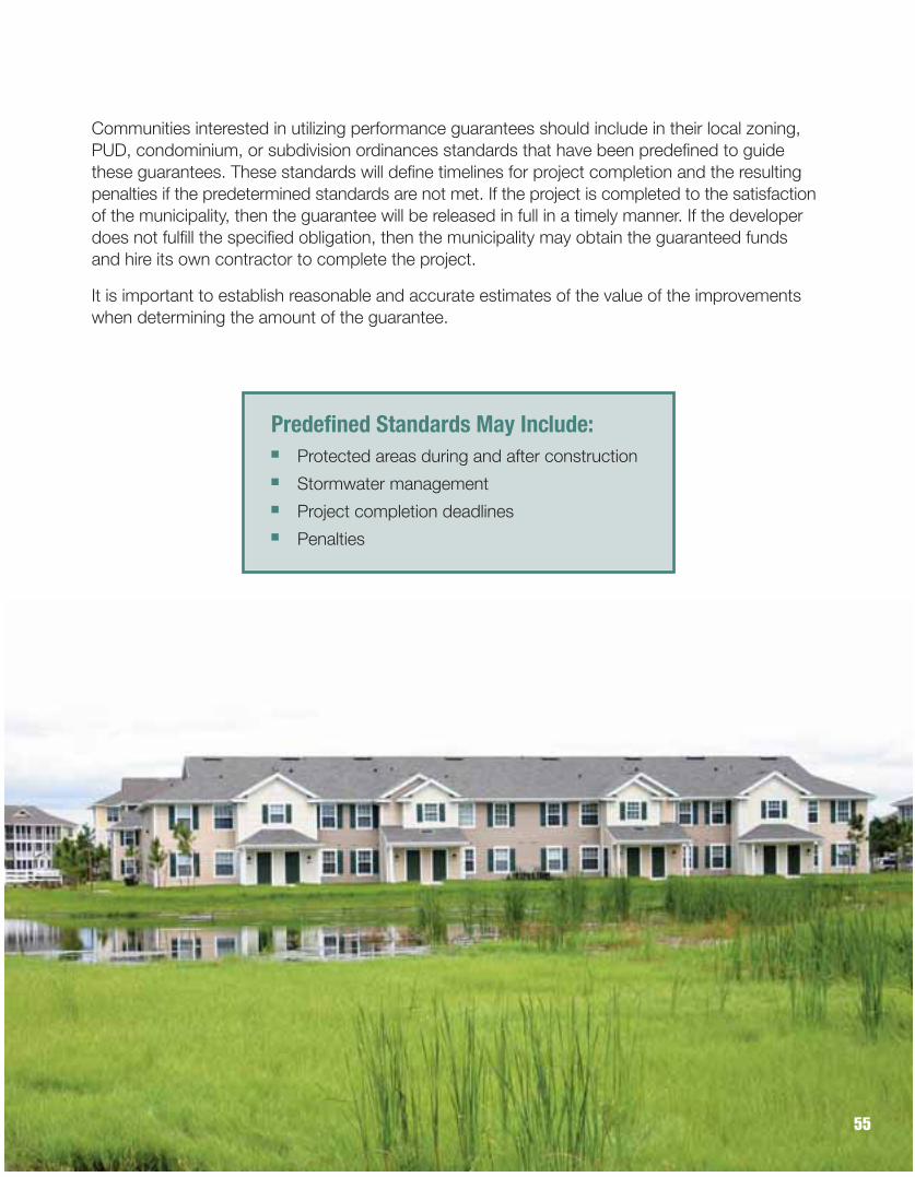
55
Communities interested in utilizing performance guarantees should include in their local zoning,PUD, condominium, or subdivision ordinances standards that have been predefined to guidethese guarantees. These standards will define timelines for project completion and the resultingpenalties if the predetermined standards are not met. If the project is completed to the satisfactionof the municipality, then the guarantee will be released in full in a timely manner. If the developerdoes not fulfill the specified obligation, then the municipality may obtain the guaranteed funds and hire its own contractor to complete the project.
It is important to establish reasonable and accurate estimates of the value of the improvementswhen determining the amount of the guarantee.
Predefined Standards May Include:■ Protected areas during and after construction■ Stormwater management■ Project completion deadlines■ Penalties

Environmental Planning in Public Infrastructure ProjectsAs communities grow, it is usually necessary to upgrade and expand public infrastructure. One of the responsibilities of local government is to plan to improve public infrastructure with an eye to directing growth into areas that will have the least environmental impact. Some of the mostcommon growth-inducing actions that local governments undertake are road building and widening, sewering, water main construction, and siting the locations of schools. Typically, these growth-inducing actions lead to subdivision and commercial development. Consideration of the location of wetlands and water resources during master planning can help direct growth-inducing activities away from environmentally sensitive landscapes.
Of all infrastructure improvements, sewer expansion has the greatest potential to have environmentalimpact when it comes to wetlands. Often times the only factor limiting building in wetlands is theinability to site fully functioning septic systems. When sewers are installed in areas with a highwater table and abundant wetlands – areas considered unsuitable for on-site septic disposal –it tends to direct development into those areas.
Many Michigan communities, due to their small size or limited institutional capacity, lack any type ofcomprehensive planning and zoning that can help direct and control growth. In those communitiesit is commonly the development of a public infrastructure plan that determines where communitygrowth will occur. In other communities where a master plan exists, or is in the process of beingdeveloped, a sewer facility plan should be included in the master plan. The extent of municipalsewers should be determined in part by the need to protect drinking water, lakes, streams, andwetlands. Indeed, the protection of these water resources is the primary reason why sewers are established.
What do public infrastructure projectshave to do with wetland protection at the local level?
Infrastructure typically induces residential and commercial development. Local government can plan and direct growth to areas that need infill and away from sensitive areas.
COMMUNITY OPTION #11
56

57
To Sewer or Not To SewerBelow are considerations that should be taken into account when determining where futuresewer projects should be allowed in areas where there is an abundance of water resources.(All conditions should be met.)■ There is an existing, documented waste treatment problem that cannot be solved by
any other feasible and prudent on-site alternative.■ Dense development currently exists. More that 100 homes per mile and average lot size
of less that 0.5 acres are standard criteria identified by the U.S. EPA.■ Areas that are environmentally sensitive (pertaining to water resources) are absent,
or are identified and afforded adequate protection through deed restriction, zoning, or other types of protection methods.
■ Sewage is treated using current best management practices, and the treated effluent isunlikely to have a negative impact on water resources in downstream communities.
■ The diversion of water will not negatively impact the hydrology or ecosystem(s) in and adjacent to the newly sewered area.
By assuring that all these conditions are met, communities can help prevent negative water resource impacts that sewering can create.

Partnerships Between Local Units of Government and LandownersBecause of their love for the land, many property owners with wetlands want to permanentlyprotect their property. Local governments can assist in this process by gaining a firm understandingof the many protection options that are available to private landowners. Donations or sale of propertyto a conservation organization, or the creation of what is known as a conservation easement, caneffectively protect wetlands in perpetuity. In addition to benefiting individual property owners, localcommunities benefit from the voluntary and permanent protection of wetlands. Because of this,provisions in the tax codes allow for financial benefits in the form of income and property tax reductions.
DonationWith a land donation, the owner gives his or her land (or a specified part of it) to a qualified non-profit organization or governmental agency for conservation purposes. A donor’s gift of land is tax deductible and each donation has different tax advantages for different individuals.Landowners considering donation of wetland property are encouraged to retain a tax attorney or accountant to analyze the tax consequences.
Conservation EasementsA conservation easement is a voluntary agreement that is used to transfer certain rights concerning the use of land to a qualified non-profit organization, governmental body, or otherlegal entity without transferring title to the land. In Michigan, Part 21 of the Michigan Natural Resources and Environmental Protection Act (Act 451 of 1994 as amended) (formerly the Conservation and Historic Preservation Easement Act; Act 197 of 1980), authorizes the creationof voluntary conservation easements. A conservation easement under this statute can providelimitations on the use of, or can prohibit certain acts on, a parcel of land. The easement is considered a conveyance of real property and must be recorded with the register of deeds in the appropriate county to be enforceable against a subsequent purchaser of the property. A common misconception about conservation easements is that the land must be open to publicaccess. The public does not have access to property protected by a conservation easement unless the landowner who grants the easement specifically allows it.
To be eligible for a tax deduction, conservation easements must be granted in perpetuity by thelandowner. Several tax benefits may be available to the grantor, including deduction of the valueof an easement as a charitable contribution, as determined by the amount by which the easementreduces the market value of the property. In addition, the development restrictions placed on aproperty by a conservation easement may also result in reducing property taxes. As with land donations, if a conservation easement is considered, an attorney or accountant should be consulted for an analysis of possible tax benefits.
COMMUNITY OPTION #12
58

59
Deed Restrictions and CovenantsDeed restrictions are clauses placed in deeds restricting the future use of land. When property containing wetlands is transferred, deed restrictions can prohibit uses or activities by the newowners that would destroy, damage, or modify wetlands. A covenant is a contract between alandowner and another party stating that the landowner will use or refrain from using their land in a certain manner. Like a deed restriction, a covenant can require that landowners refrain fromactivities that will damage wetlands. Once placed in deeds, covenants become deed restrictions.
Although deed restrictions and covenants have been used across the country to protect wetlands,their use in Michigan is not as effective as conservation easements. Unlike a conservation easementthat is granted to and signed by an organization that has a commitment and responsibility to resource protection, the enforcement of deed restrictions and covenants is less reliable. There is nocontinuity of oversight, unlike the continuous ownership of an easement holder. It is also relativelyeasy for a future landowner to petition the courts to vacate a particular deed restriction. Althoughit is theoretically possible to modify a conservation easement, many changes are prohibited byfederal regulations where income tax deductions are involved and all signatories to the easementmust agree to proposed changes. It is unlikely that a qualified organization would agree to modifications of a conservation easement that would result in adverse wetland impacts.
Purchase of Wetland AreasLocal units of government can acquire wetlands for floodplain protection, the development ofgreenways, and as part of a community-wide water quality protection program. If there is broadcommunity support for land acquisition efforts, and at times an educational effort is needed tobuild support for funding such efforts, then the revenue can be generated through ballot proposalsfor specified land parcels, bond issuance, or millages/assessments.
For more information on opportunities for public-private partnerships in land protection in Michigan, visit the Heart of the Lakes Center for Land Conservation Policy website atwww.heartofthelakes.org.

Responsible Regulation:A Recipe For Community Success
60

CHAPTER 6: Responsible Regulation: A Recipe for Community Success
For communities interested in protecting wetlands and other sensitive environmental features,there are strategies that should be helpful in successful passage and implementation of wetland regulations and ensuring that the long-term goal of wetland protection will stand up to legal challenge.
Wetland regulations attempt to navigate the sometimes rocky waters of determining where anindividual’s property rights end and where the public’s interest in resource protection begins.An analogy that is sometimes helpful is the example of the fist and the nose: my individual“right” to swing my fist is restricted by my responsibility to respect your nose. In the terms ofwetland regulation, the rights of a property owner to alter wetlands (dredge, fill, drain, etc.) islimited by the responsibility to act in a way that does not impact their neighbors or the largercommunity. Of course, there are situations when it is legally and morally acceptable for myfist to connect with someone’s nose (e.g., self defense). Likewise, there are situations inwhich activities regulated by wetland laws are permitted to occur (e.g., when all less damagingalternatives have been utilized and impacts have been mitigated).
61

The Fifth Amendment of the U.S. Constitution provides in part: “nor shall private propertybe taken for public use, without just compensation.” This is known as the “Takings Clause.”The government’s physical invasion of private land, whether by roadway, public park, or for the construction of city hall, entitles the owner to “just compensation.” In our system,this private land owner’s loss has been compensated by the public treasury. The conceptof “regulatory takings” is a relatively new legal concept. If a decline in property value resultsnot from a physical invasion of the land, but rather from the enforcement of a regulationthen this is called a regulatory taking.
If local environmental protection measures are carefully crafted and applied fairly, it is unlikely that a regulatory taking will occur. On the other hand, it is likely that a regulatorytaking has occurred if the following two conditions have been met:
• The regulation does not substantially advance legitimate public interests.
• The regulation denies the landowner virtually all economical uses of the land.
Below are some of the most important considerations that will help ensure that a protection program will be fair, equitable, and legal.
Understand Your OptionsDetermine what’s best for your community based upon previous planning efforts, includingsuch things as existing Master Plans or Comprehensive Plans. Understand exactly whatwetland resources exist in your community, and solicit input from State and Federal Agenciesthat may have jurisdiction. Also, take stock of any available funding sources and make anattempt to gauge the political will so that educational efforts can be effective.
62

Establish Reasonable GoalsAny attempts to protect sensitive lands will fail if the goals and means to the goals are notviewed as reasonable. One way to ensure that a protection effort is reasonable is to clearlyarticulate exactly why the protection effort is necessary. In the case of wetland protection,efforts will be more likely viewed as reasonable if it is clearly understood that by protectingwetlands, the laws are protecting the public from harm from flooding, degraded waterquality, and the loss of fisheries and wildlife.
Educate Your CommunityUse various methods to bring about an understanding in the community about the functions, values, and benefits provided by wetlands. For example, wage a “coffee cup campaign,”use word of mouth and local newspapers to highlight these issues, and do a local inventoryof wetland resources.
Involve the Public and Key Stakeholders to Build Community SupportBe sure to include members of the regulated community and all stakeholders, such as developers and contractors, realtors, river and/or lake associations, environmental groups,and citizens at large. Form an advisory committee to help with these effort. Issue public notices and have public meetings and hearings on all drafts of any ordinance or regulatoryproposals. Reach out to all affected stakeholders and be sure to fully answer any questions that arise.
Make Sure Final Language is Legally DefensibleUtilize model ordinances that are available. Consult yourmunicipal attorney as you proceed.
Implement and Administer Fully and FairlyEnforcement and penalties are unpopular, but they are important, and consistency is crucial.
Maintain Economic Viability of PropertiesAnother aspect of reasonableness is the ability of alandowner to continue to utilize their land. If an aggrievedlandowner believes that a government sponsored protectioneffort, or regulation, has removed the ability to utilize his or her land, then they may file a “takings” suit. As noted earlier, environmental regulations can generally stand the challenge of takings suits as long as the regulated property has not been deprived of all economic use.
How to Avoid aRegulatory Taking■ Carefully craft regulations
with input from all community stakeholders
■ Establish reasonable goals
■ Maintain economic viabilityof properties (exemptions alone constitute economic viability of most properties)
■ Consistently apply regulations
■ Communicate and educate
■ Review by municipal attorney
63

64
Open Communication Between Local Officials and LandownersMaintaining open channels of communication between local officials and landowners is away to ensure landowners are aware of the numerous land protection options available tothem, and the economic and environmental purposes of the regulations. Local officials willbenefit from open dialogue by gaining a better understanding of the needs of landowners.
Local LeadershipFor local wetland protection to succeed, it requires the existence of local champions.Champions can be individuals from the local government or from any sector of the community. It is important that their opinions are respected by a broad range of citizens.Without the existence of local champions, attempts to establish protection programs will often languish, or existing programs will lack any enforcement efforts.
Public Support for ConservationWetland protection efforts require broad public support for them to be successful. Any typeof regulation will ultimately fail if residents of the community do not understand and supportthe need for the protection effort.

Meanwhile, we welcome you to join the Local Government Wetland Network listserve..
■ Share your experiences!■ Get your questions answered!■ Support others who are working to protect their community assets!
To join the listserve, called the Michigan Local Government Wetland Network (mlgowetnet),
go to www.great-lakes.net. Select the Environment link, then e-mail lists, then private, then
scroll down to “General Environment” where you will find “mlgowetnet.” Click on that link
for subscription information.
For additional information contact:
East Michigan Environmental Action Council21220 West 14 Mile Road Bloomfield Hills, MI 48301
(248) 258-5188www.emeac.org
Tip of the Mitt Watershed Council426 Bay Street
Petoskey, MI 49770(231) 347-1181
www.watershedcouncil.org
Michigan Department of Environmental QualityFor Local Ordinance Questions
(517) 373-1170For other wetland information:
1-800-662-9278www.michigan.gov/deqwetlands
www.watershedcouncil.org

Protecting Michigan’s WetlandsA Guide for Local Governments
ISBN: 978-1-889313-12-2
A C K N O W L E D G E M E N T S