protecting our shared water resources. is an educational tool promotes water quality awareness can...
TRANSCRIPT

Protecting Our Shared
Water Resources


Is an educational tool
Promotes water quality awareness
Can recognize environmentally courteous farmers

MANAGEMENT OF SITE CONDITIONS
4 3 2 1 RANKBest Good Fair Poor (up to 3 wells)
Site IdentificationLOCATION OF WELL #1 #2 #3
1. Type of well Off-site private or Drilled well. Driven well. Dug well (has the municipal source potential for the (therefore site most pollutantsconditions or manage- to enter into the ment practices do not water flow).affect your well quality).
2. Position of Upslope from all Downhill from sources Downslope from Well is located in a water well in sources of contam- of contamination, most sources of depression. Ponding relation to ination, and all surface and surface water contamination, and occurs around the potential sources water is diverted away runoff is diverted some surface water well during storms.of contamination from well.a from casing. runoff reaches well.
3. Distance More than 300 feet 150-300 feet from a 75-150 feet from a Less than 75 feetbetween well and from a contamination contamination contamination from a contaminationpotential sources source. source. source. source.of contaminationa Sources of contamination include septic system absorption areas, pesticide and fertilizer handling areas, barnyards, and other similar areas.
Site Identification #1.


A cooperative effort among:
Penn State Cooperative Extension
Pennsylvania Association of Conservation Districts
Pennsylvania Department of Agriculture
Pennsylvania Department of Environmental Protection
USDA Natural Resources Conservation Service

System Includes:
Introduction
PreliminaryScreening Quiz
Farmstead Map
Worksheets
Wrap-up Activities
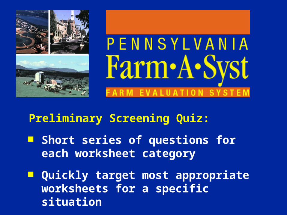
Preliminary Screening Quiz:
Short series of questions for each worksheet category
Quickly target most appropriate worksheets for a specific situation

Farmstead Map:
Sketch of farmstead/farm to locate significant features related to water quality
Source of useful information for completing worksheets
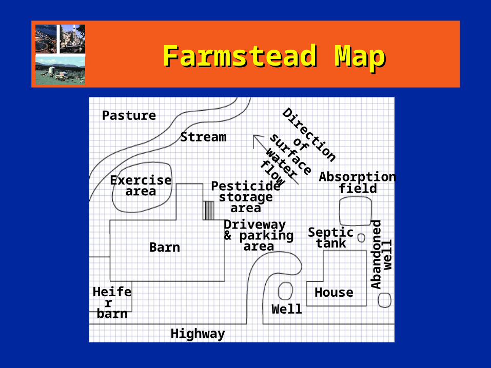
Farmstead MapFarmstead Map
Pasture
Stream
Driveway & parking
area
Pesticidestorage area
Exercisearea
Heifer barn
Barn
WellHouse
Septic tank
Absorption field
Direction
of surface
water flow
Ab
and
on
edw
ell
Highway

Worksheets:1. Water Well Condition and Construction2. Pesticide and Fertilizer Storage and Handling3. Household Wastewater Treatment System4. Barnyard Conditions and Management5. Milkhouse Waste Management6. Stream and Drainageway Management7. Petroleum Storage and Handling8. Silage Storage Management9. Animal Waste Storage and Management10. Animal Waste Land Application Management

Worksheet Contents: Why be concerned? How to rank groundwater and surface
water protection using this worksheet How to complete the worksheet Ranking matrix How to use these ranks Glossary Acknowledgements

Wrap-up Activities:
Overall Farmstead Ranking — evaluation of conditions and options for improvement
Post-Evaluation Survey — to be used as part of an educational program


Separation DistancesSeparation Distances
Well
Septic Tanks50 feet
Septic Leach Fields
100 feet
Barnyards300 feet


Casing HeightCasing Height
1 foot


Well Condition and Well Condition and ConstructionConstruction
Type of well
Age of well
Position
Separation distances
Condition of casing and cap
Well sealing
Casing depth
Casing height
Backflow
Abandoned wells


Water well
300 feet minimumseparation distance
Storage & Handling Area


Location Geologic materials Amounts and types Length of storage Clean-up Security of storage
Containers Mixing areas Water source Backflow prevention Supervision Container disposal Clean-up
Pesticide and Pesticide and Fertilizer Storage Fertilizer Storage
and Handlingand Handling


Septic system drain field
Wellhead
100 feet separation distance


Age of system
Separation distances
Quality and quantity
Household WastewaterHousehold Wastewater
Treatment system
Septic tank pumping
Disposal of septage


Water well
100 feet minimumseparation distance
Barnyard


Separation distances
Clean water management
Runoff control
Scraping practices
Vegetative cover
Animal access
Animal density/size
BarnyardBarnyardManagementManagement


Discharge path
Clean-up practices
Tank condition
Tank cleaning
Storage period
Separation distances
Land application
Milkhouse WasteMilkhouse WasteManagementManagement


Frequency of flow
Surface water entry
Buffer strips
Drain outlets
Maintenance
Streambank conditions
Fish cover
Overstory cover
Adjacent vegetation
Channel alteration
Livestock access
Stream bottom
Stream and Stream and DrainagewayDrainagewayManagementManagement


Petroleum Storage Petroleum Storage and Handlingand Handling
Soil drainage
Slope of land
Separation distances
Tank installation
Spill protection
Piping
Type and age of tank
Corrosion protection
Tank location
Tank support
Tank enclosure
Secondary containment
Integrity testing
Inventory monitoring
Unused tanks
Fueling procedures
Fire safety
Disposal of petroleum fluids


Silage Storage Silage Storage ManagementManagement
Crop moisture content
Separation distances
Clean water management
Subsurface drainage
Traffic areas
Floor and roof condition
Lining
Management
Effluent collection system


Animal Waste Storage Animal Waste Storage and Managementand Management
Storage structure
Storage pond
Stack facility
Separation distances
Location of floodplains
Storage capacity
Storage status
Reception and transfer system
Water diversion
Inspections
Unloading and handling
Emergency action plan
Dead animal disposal


Animal Waste Land Animal Waste Land Application ManagementApplication Management
Soil testing frequency
Soil sampling patterns
Animal waste sampling
Nutrient management
Allocation to fields
Use of records
Actual application rates
Supplemental fertilizer
Calibration of application equipment
Application areas
Record keeping
Uniformity of land application
Timing of application
Treatment after application
Field runoff protection
Perennial stream protection
Conservation plan

Overall Farm RankingOverall Farm Ranking
OverallOverall
RankingRanking
AverageAverage
ScoreScore
RankingRanking
44 33 22 11
Water WellsWater Wells 3.13.1 x x
ChemicalsChemicals 2.52.5 x x
HouseholdHousehold 3.03.0 xx
BarnyardBarnyard 1.51.5 xx
MilkhouseMilkhouse 3.53.5 xx
Overall RankOverall Rank 2.72.7 x x

Conditions andConditions andImprovementsImprovements
EVALUATING CONDITIONSEVALUATING CONDITIONSBest or Good RankingBest or Good Ranking Fair or Poor RankingFair or Poor Ranking1. 1. ____________________________________________ 1. ______________________ 1. ______________________2. 2. ____________________________________________ 2. ______________________ 2. ______________________
PLANNING IMPROVEMENTSPLANNING IMPROVEMENTS1.________________________________________________________ 1.________________________________________________________ 2.________________________________________________________2.________________________________________________________
IMPLEMENTING IMPROVEMENTSIMPLEMENTING IMPROVEMENTS TIMING TIMING (circle one)(circle one)
1.________________________________________________________1.________________________________________________________
2.________________________________________________________2.________________________________________________________
Within aWithin a Within two toWithin two toImmediatelyImmediately monthmonth This yearThis year five yearsfive years
Within aWithin a Within two toWithin two toImmediatelyImmediately monthmonth This yearThis year five yearsfive years

CONFIDENTIALITY
It is not the intent of this educational program to keep records of individual results. However, the landowner may share them with others who can help develop a resource management plan.

Project Coordinators:
Barry Frantz, PA Association of Conservation Districts and USDA NRCS
Les Lanyon, Penn State Department of Agronomy and Cooperative Extension
Jerry Martin, Penn State Cooperative Extension

Support for this program provided by:
Department of Environmental Resources 319(h)
Chesapeake Bay Program
USDA Special Project No. 91-EHUA-1-0061
Slide set developed by: Les Lanyon, Penn State Department of Agronomy
and Cooperative Extension Jerry Martin, Penn State Cooperative Extension Shelly Ogline, formerly Penn State Cooperative
ExtensionAdditional slides provided by:
National Farm*A*Syst office Frank Lucas, USDA-NRCS, Pequea-Mill Creek Project
