published in: arch+ legislating architecture, english
TRANSCRIPT
Case Study
THE HIGHRISE TYPOLOGY IN São PauloMarcos L. Rosa
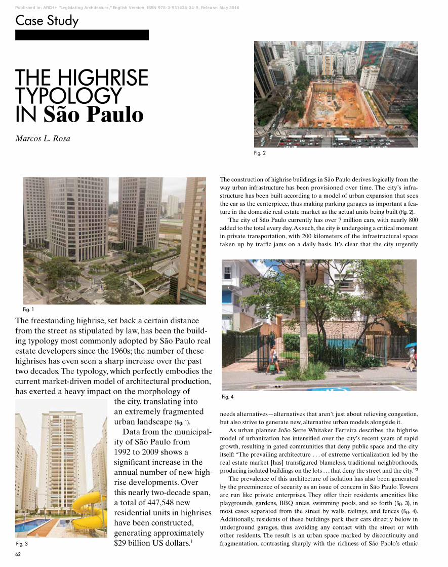
The freestanding highrise, set back a certain distance from the street as stipulated by law, has been the build-ing typology most commonly adopted by São Paulo real estate developers since the 1960s; the number of these highrises has even seen a sharp increase over the past two decades. The typology, which perfectly embodies the current market-driven model of architectural production, has exerted a heavy impact on the morphology of
the city, translating into an extremely fragmented urban landscape ( fig. 1).
Data from the municipal-ity of São Paulo from 1992 to 2009 shows a significant increase in the annual number of new high-rise developments. Over this nearly two-decade span, a total of 447,548 new residential units in highrises have been constructed, generating approximately $29 billion US dollars.1
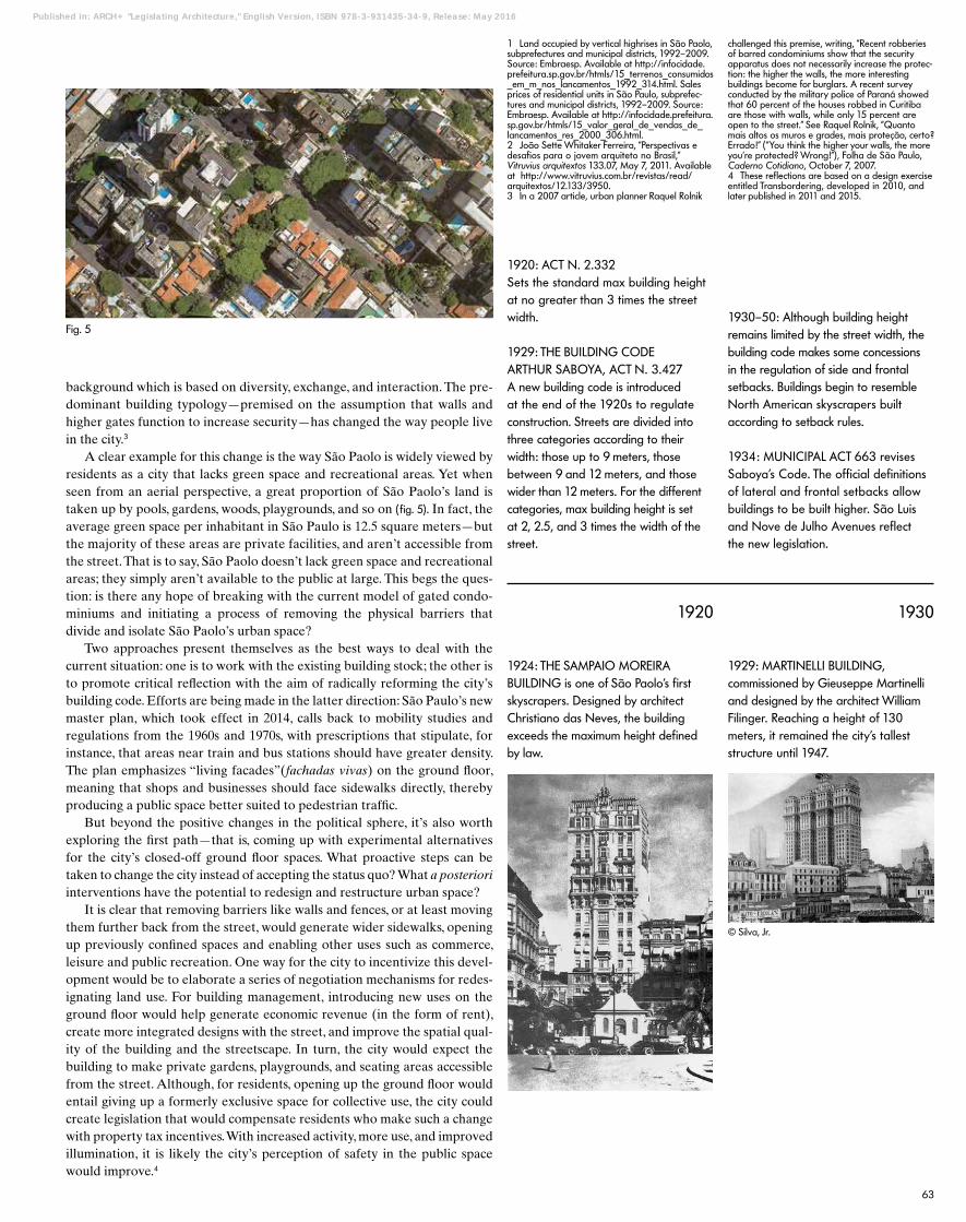
The construction of highrise buildings in São Paulo derives logically from the way urban infrastructure has been provisioned over time. The city’s infra-structure has been built according to a model of urban expansion that sees the car as the centerpiece, thus making parking garages as important a fea-ture in the domestic real estate market as the actual units being built ( fig. 2).
The city of São Paulo currently has over 7 million cars, with nearly 800 added to the total every day. As such, the city is undergoing a critical moment in private transportation, with 200 kilometers of the infrastructural space taken up by traffic jams on a daily basis. It’s clear that the city urgently
Fig. 1
Fig. 3
Fig. 2
Fig. 4
needs alternatives—alternatives that aren’t just about relieving congestion, but also strive to generate new, alternative urban models alongside it.
As urban planner João Sette Whitaker Ferreira describes, the highrise model of urbanization has intensified over the city’s recent years of rapid growth, resulting in gated communities that deny public space and the city itself: “The prevailing architecture . . . of extreme verticalization led by the real estate market [has] transfigured blameless, traditional neighborhoods, producing isolated buildings on the lots . . . that deny the street and the city.”2
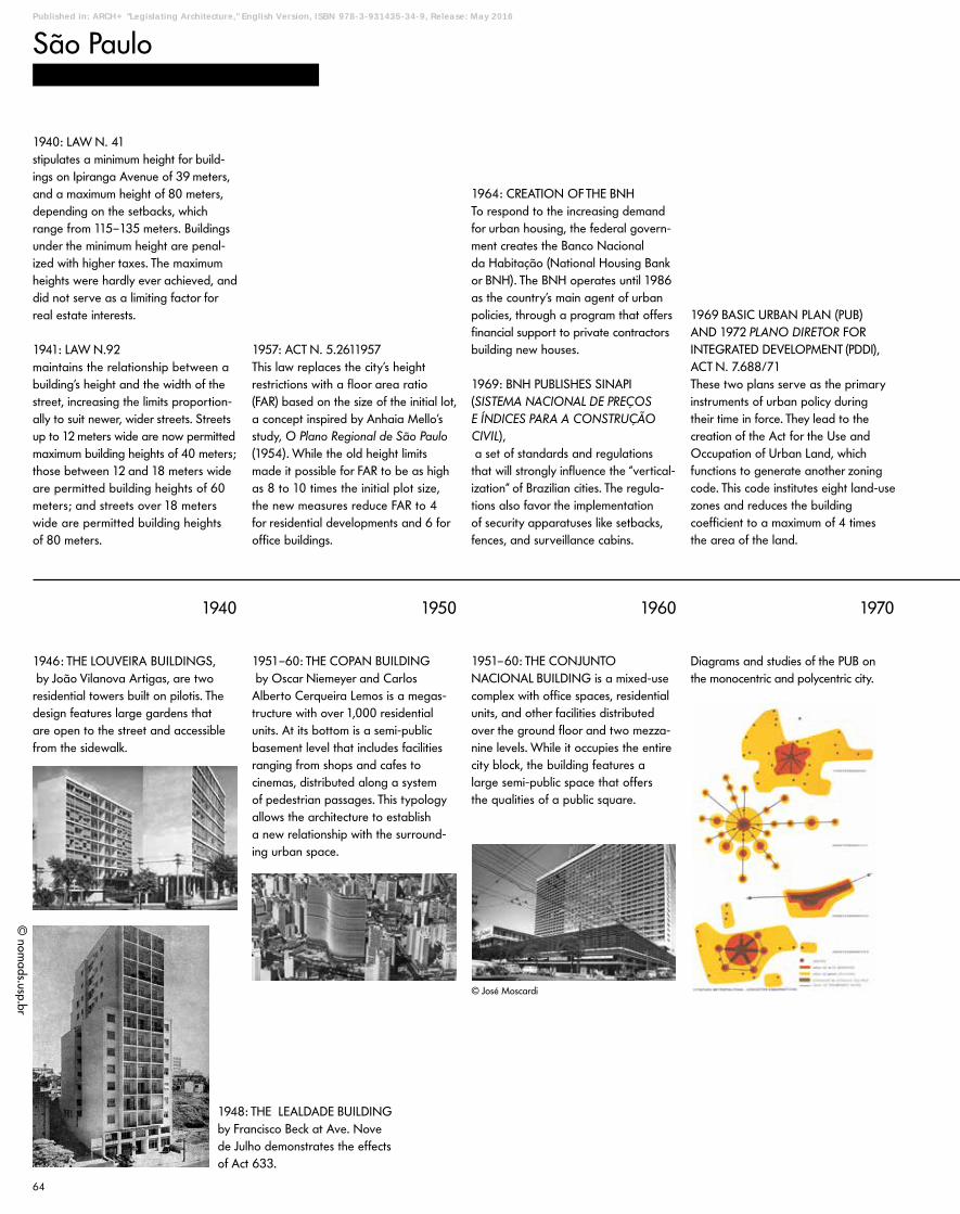
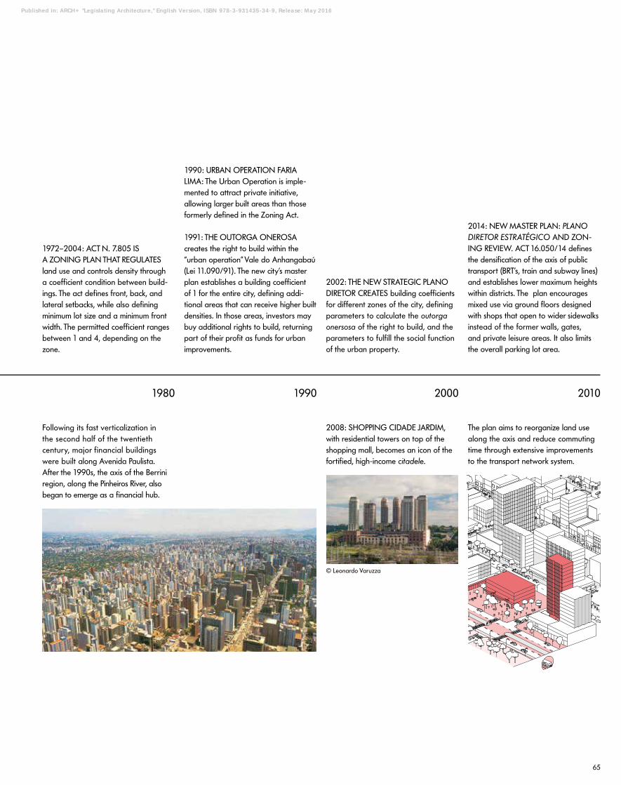
The prevalence of this architecture of isolation has also been generated by the preeminence of security as an issue of concern in São Paulo. Towers are run like private enterprises. They offer their residents amenities like playgrounds, gardens, BBQ areas, swimming pools, and so forth ( fig. 3), in most cases separated from the street by walls, railings, and fences ( fig. 4).
Additionally, residents of these buildings park their cars directly below in underground garages, thus avoiding any contact with the street or with other residents. The result is an urban space marked by discontinuity and fragmentation, contrasting sharply with the richness of São Paolo’s ethnic
62
S49-80_Arch224.indd 62 28.04.16 13:16
Published in: ARCH+ "Legislating Architecture," English Version, ISBN 978-3-931435-34-9, Release: May 2016
1 Land occupied by vertical highrises in São Paolo, subprefectures and municipal districts, 1992–2009. Source: Embraesp. Available at http://infocidade.prefeitura.sp.gov.br/htmls/15_terrenos_consumidos _em_m_nos_lancamentos_1992_314.html. Sales prices of residential units in São Paulo, subprefec-tures and municipal districts, 1992–2009. Source: Embraesp. Available at http://infocidade.prefeitura.sp.gov.br/htmls/15_valor_geral_de_vendas_de_lancamentos_res_2000_306.html.2 João Sette Whitaker Ferreira, “Perspectivas e desafios para o jovem arquiteto no Brasil,” Vitruvius arquitextos 133.07, May 7, 2011. Available at http://www.vitruvius.com.br/revistas/read/ arquitextos/12.133/3950. 3 In a 2007 article, urban planner Raquel Rolnik
1920: ACT N. 2.332Sets the standard max building height at no greater than 3 times the street width.
1920 1930
1929: THE BUILDING CODE ARTHUR SABOYA, ACT N. 3.427 A new building code is introduced at the end of the 1920s to regulate construction. Streets are divided into three categories according to their width: those up to 9 meters, those between 9 and 12 meters, and those wider than 12 meters. For the different categories, max building height is set at 2, 2.5, and 3 times the width of the street.
1930–50: Although building height remains limited by the street width, the building code makes some concessions in the regulation of side and frontal setbacks. Buildings begin to resemble North American skyscrapers built according to setback rules.
1924: THE SAMPAIO MOREIRA BUILDING is one of São Paolo’s first skyscrapers. Designed by architect Christiano das Neves, the building exceeds the maximum height defined by law.
1929: MARTINELLI BUILDING, commissioned by Gieuseppe Martinelli and designed by the architect William Filinger. Reaching a height of 130 meters, it remained the city’s tallest structure until 1947.
1934: MUNICIPAL ACT 663 revises Saboya’s Code. The official definitions of lateral and frontal setbacks allow buildings to be built higher. São Luis and Nove de Julho Avenues reflect the new legislation.
background which is based on diversity, exchange, and interaction. The pre-dominant building typology—premised on the assumption that walls and higher gates function to increase security—has changed the way people live in the city.3
A clear example for this change is the way São Paolo is widely viewed by residents as a city that lacks green space and recreational areas. Yet when seen from an aerial perspective, a great proportion of São Paolo’s land is taken up by pools, gardens, woods, playgrounds, and so on ( fig. 5). In fact, the average green space per inhabitant in São Paulo is 12.5 square meters—but the majority of these areas are private facilities, and aren’t accessible from the street. That is to say, São Paolo doesn’t lack green space and recreational areas; they simply aren’t available to the public at large. This begs the ques-tion: is there any hope of breaking with the current model of gated condo-miniums and initiating a process of removing the physical barriers that divide and isolate São Paolo’s urban space?
Two approaches present themselves as the best ways to deal with the current situation: one is to work with the existing building stock; the other is to promote critical reflection with the aim of radically reforming the city’s building code. Efforts are being made in the latter direction: São Paulo’s new master plan, which took effect in 2014, calls back to mobility studies and regulations from the 1960s and 1970s, with prescriptions that stipulate, for instance, that areas near train and bus stations should have greater density. The plan emphasizes “living facades”(fachadas vivas) on the ground floor, meaning that shops and businesses should face sidewalks directly, thereby producing a public space better suited to pedestrian traffic.
But beyond the positive changes in the political sphere, it’s also worth exploring the first path—that is, coming up with experimental alternatives for the city’s closed-off ground floor spaces. What proactive steps can be taken to change the city instead of accepting the status quo? What a posteriori interventions have the potential to redesign and restructure urban space?
It is clear that removing barriers like walls and fences, or at least moving them further back from the street, would generate wider sidewalks, opening up previously confined spaces and enabling other uses such as commerce, leisure and public recreation. One way for the city to incentivize this devel-opment would be to elaborate a series of negotiation mechanisms for redes-ignating land use. For building management, introducing new uses on the ground floor would help generate economic revenue (in the form of rent), create more integrated designs with the street, and improve the spatial qual-ity of the building and the streetscape. In turn, the city would expect the building to make private gardens, playgrounds, and seating areas accessible from the street. Although, for residents, opening up the ground floor would entail giving up a formerly exclusive space for collective use, the city could create legislation that would compensate residents who make such a change with property tax incentives. With increased activity, more use, and improved illumination, it is likely the city’s perception of safety in the public space would improve.4
challenged this premise, writing, “Recent robberies of barred condominiums show that the security apparatus does not necessarily increase the protec-tion: the higher the walls, the more interesting buildings become for burglars. A recent survey conducted by the military police of Paraná showed that 60 percent of the houses robbed in Curitiba are those with walls, while only 15 percent are open to the street.” See Raquel Rolnik, “Quanto mais altos os muros e grades, mais proteção, certo? Errado!” (“You think the higher your walls, the more you’re protected? Wrong!”), Folha de São Paulo, Caderno Cotidiano, October 7, 2007.4 These reflections are based on a design exercise entitled Transbordering, developed in 2010, and later published in 2011 and 2015.
Fig. 5
© Silva, Jr.
63
S49-80_Arch224.indd 63 28.04.16 13:16
Published in: ARCH+ "Legislating Architecture," English Version, ISBN 978-3-931435-34-9, Release: May 2016
São Paulo
19601940 19701950
1940: LAW N. 41 stipulates a minimum height for build-ings on Ipiranga Avenue of 39 meters, and a maximum height of 80 meters, depending on the setbacks, which range from 115–135 meters. Buildings under the minimum height are penal-ized with higher taxes. The maximum heights were hardly ever achieved, and did not serve as a limiting factor for real estate interests.
1941: LAW N.92 maintains the relationship between a building’s height and the width of the street, increasing the limits proportion-ally to suit newer, wider streets. Streets up to 12 meters wide are now permitted maximum building heights of 40 meters; those between 12 and 18 meters wide are permitted building heights of 60 meters; and streets over 18 meters wide are permitted building heights of 80 meters.
1957: ACT N. 5.2611957This law replaces the city’s height restrictions with a floor area ratio (FAR) based on the size of the initial lot, a concept inspired by Anhaia Mello’s study, O Plano Regional de São Paulo (1954). While the old height limits made it possible for FAR to be as high as 8 to 10 times the initial plot size, the new measures reduce FAR to 4 for residential developments and 6 for office buildings.
1964: CREATION OF THE BNHTo respond to the increasing demand for urban housing, the federal govern-ment creates the Banco Nacional da Habitação (National Housing Bank or BNH). The BNH operates until 1986 as the country’s main agent of urban policies, through a program that offers financial support to private contractors building new houses.
1969: BNH PUBLISHES SINAPI (SISTEMA NACIONAL DE PREÇOS E ÍNDICES PARA A CONSTRUÇÃO CIVIL), a set of standards and regulations that will strongly influence the “vertical-ization” of Brazilian cities. The regula-tions also favor the implementation of security apparatuses like setbacks, fences, and surveillance cabins.
1969 BASIC URBAN PLAN (PUB) AND 1972 PLANO DIRETOR FOR INTEGRATED DEVELOPMENT (PDDI), ACT N. 7.688/71 These two plans serve as the primary instruments of urban policy during their time in force. They lead to the creation of the Act for the Use and Occupation of Urban Land, which functions to generate another zoning code. This code institutes eight land-use zones and reduces the building coefficient to a maximum of 4 times the area of the land.
Diagrams and studies of the PUB on the monocentric and polycentric city.
1946: THE LOUVEIRA BUILDINGS, by João Vilanova Artigas, are two residential towers built on pilotis. The design features large gardens that are open to the street and accessible from the sidewalk.
1951–60: THE COPAN BUILDING by Oscar Niemeyer and Carlos Alberto Cerqueira Lemos is a megas-tructure with over 1,000 residential units. At its bottom is a semi-public basement level that includes facilities ranging from shops and cafes to cinemas, distributed along a system of pedestrian passages. This typology allows the architecture to establish a new relationship with the surround-ing urban space.
1951–60: THE CONJUNTO NACIONAL BUILDING is a mixed-use complex with office spaces, residential units, and other facilities distributed over the ground floor and two mezza-nine levels. While it occupies the entire city block, the building features a large semi-public space that offers the qualities of a public square.
© José Moscardi
1948: THE LEALDADE BUILDING by Francisco Beck at Ave. Nove de Julho demonstrates the effects of Act 633.
© nom
ads.usp.br
64
S49-80_Arch224.indd 64 28.04.16 13:16
2000 20101980 1990
1972–2004: ACT N. 7.805 IS A ZONING PLAN THAT REGULATESland use and controls density through a coefficient condition between build-ings. The act defines front, back, and lateral setbacks, while also defining minimum lot size and a minimum front width. The permitted coefficient ranges between 1 and 4, depending on the zone.
1990: URBAN OPERATION FARIA LIMA: The Urban Operation is imple-mented to attract private initiative, allowing larger built areas than those formerly defined in the Zoning Act.
1991: THE OUTORGA ONEROSA creates the right to build within the “urban operation” Vale do Anhangabaú (Lei 11.090/91). The new city’s master plan establishes a building coefficient of 1 for the entire city, defining addi-tional areas that can receive higher built densities. In those areas, investors may buy additional rights to build, returning part of their profit as funds for urban improvements.
Following its fast verticalization in the second half of the twentieth century, major financial buildings were built along Avenida Paulista. After the 1990s, the axis of the Berrini region, along the Pinheiros River, also began to emerge as a financial hub.
2002: THE NEW STRATEGIC PLANO DIRETOR CREATES building coefficients for different zones of the city, defining parameters to calculate the outorga onersosa of the right to build, and the parameters to fulfill the social function of the urban property.
2008: SHOPPING CIDADE JARDIM, with residential towers on top of the shopping mall, becomes an icon of the fortified, high-income citadele.
2014: NEW MASTER PLAN: PLANO DIRETOR ESTRATÉGICO AND ZON-ING REVIEW. ACT 16.050/14 defines the densification of the axis of public transport (BRT’s, train and subway lines) and establishes lower maximum heights within districts. The plan encourages mixed use via ground floors designed with shops that open to wider sidewalks instead of the former walls, gates, and private leisure areas. It also limits the overall parking lot area.
The plan aims to reorganize land use along the axis and reduce commuting time through extensive improvements to the transport network system.
© Leonardo Varuzza
-
65
S49-80_Arch224.indd 65 28.04.16 13:17
Published in: ARCH+ "Legislating Architecture," English Version, ISBN 978-3-931435-34-9, Release: May 2016