publishing data to the web with arcgis online -...
TRANSCRIPT

1
ArcGIS Online: publishing geospatial data to
the web using the EEA infrastructure
Introduction
ArcGIS Online is a workspace and a web platform for creating and sharing maps.
It is possible to upload your data, create a layer or a map, define the extent, set some visualization
options, assign permissions to your layer or map, share, and create web mapping applications or story
maps.
This document will focus on the uploading data and publishing to the web capabilities of ArcGIS Online.
For information about the other capabilities please visit http://doc.arcgis.com/en/arcgis-online/ or
contact someone at IDM3.
IMPORTANT: when to use ArcGIS Online to publish geospatial data
The ArcGIS online platform is designed to host small datasets, for example demographic datasets.
The EEA requires that datasets uploaded to ArcGIS online are relatively small in size, and should not
exceed 1-2MB, or around 5000 records. This is to keep the agencies costs down and keep in line with
our ArcGIS online pricing plan. It is for this reason that ArcGIS online should not be used to host large
datasets, and tiled image services must NOT be uploaded to ArcGIS online.
To publish bigger datasets and image services, please refer to the ArcGIS Server: publishing geospatial
data to the web using the EEA infrastructure document.
To be able to upload to the EEA, first you need to be given access rights. To gain access rights you should
email your EEA project manager and CC Sebastien Petit ([email protected]) stating your
Eionet account and /or ArcGIS online account username, to gain access rights.
ArcGIS Online Publishing Explained
ArcGIS online is used by the EEA and its partners to produce and manage web maps. Web maps can
bring a number of web services together. These can then be saved and wrapped around a graphic user
interface to produce online galleries and other views. They can then be consumed by end users who
may want to present them in meetings, conferences etc. These web maps are hosted by the cloud, and
can be re-used inside web sites or mobile devices. ArcGIS online also organises EEA applications and
services into a number of groups relevant for their content (for example BISE, Natura2000).
ArcGIS online can be managed comfortably by regular users without development skills, once a level of
technical familiarity is reached.
2
Small sized GIS datasets including Excel, CSV-files, KML or shapefiles (as well as script tools, models, etc.)
can also be uploaded to ArcGIS online, where they can be shared with other organisations, groups and
users.
For further information about how to add items to ArcGIS Online please check:
http://doc.arcgis.com/en/arcgis-online/share-maps/add-items.htm
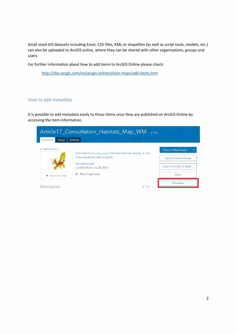
How to add metadata
It is possible to add metadata easily to those items once they are published on ArcGIS Online by
accessing the item information.
3
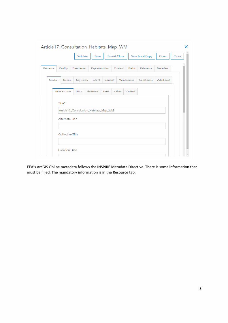
EEA’s ArcGIS Online metadata follows the INSPIRE Metadata Directive. There is some information that
must be filled. The mandatory information is in the Resource tab.
4
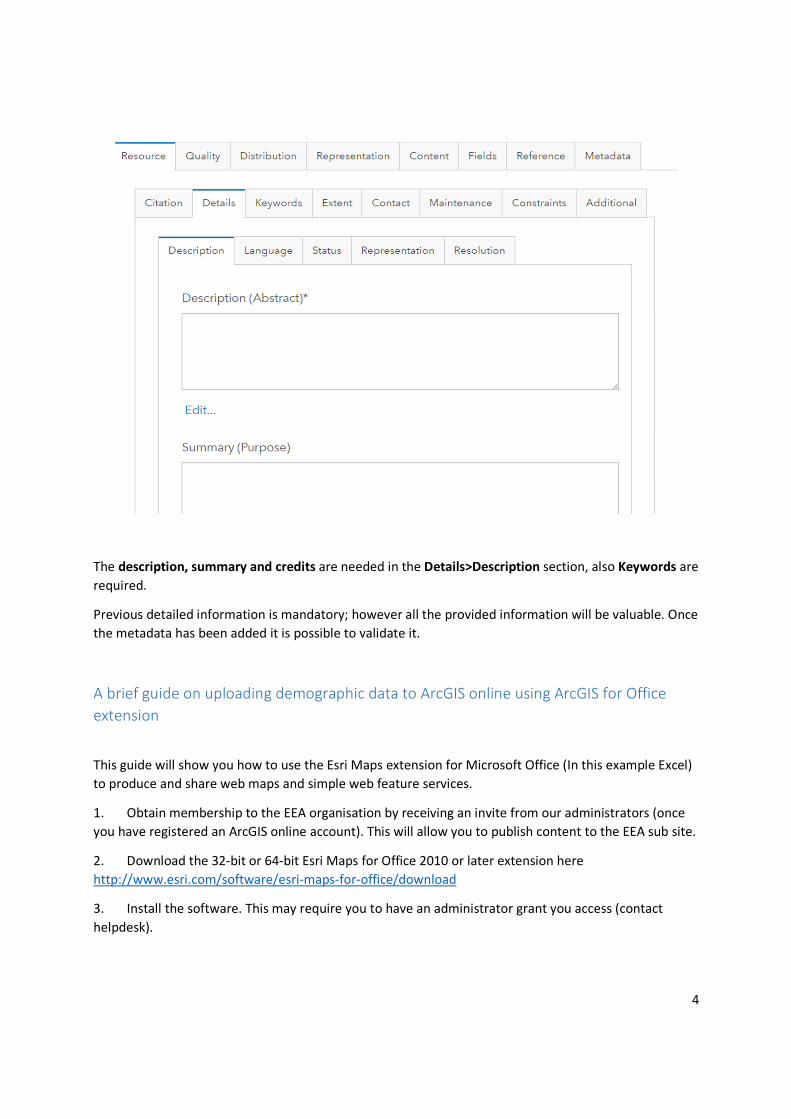
The description, summary and credits are needed in the Details>Description section, also Keywords are
required.
Previous detailed information is mandatory; however all the provided information will be valuable. Once
the metadata has been added it is possible to validate it.
A brief guide on uploading demographic data to ArcGIS online using ArcGIS for Office
extension
This guide will show you how to use the Esri Maps extension for Microsoft Office (In this example Excel)
to produce and share web maps and simple web feature services.
1. Obtain membership to the EEA organisation by receiving an invite from our administrators (once
you have registered an ArcGIS online account). This will allow you to publish content to the EEA sub site.
2. Download the 32-bit or 64-bit Esri Maps for Office 2010 or later extension here
http://www.esri.com/software/esri-maps-for-office/download
3. Install the software. This may require you to have an administrator grant you access (contact
helpdesk).
5
4. Esri Maps for Office has to be configured to login to the Organization URL. Go to File->Esri Maps
and change the ArcGIS Connection URL to match your organization (https://eea.maps.arcgis.com). This
option can also be set for the installation settings.
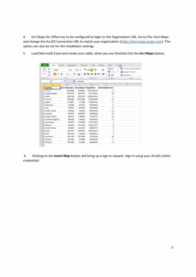
5. Load Microsoft Excel and create your table, when you are finished click the Esri Maps button.
6. Clicking on the Insert Map button will bring up a sign-in request. Sign in using your ArcGIS online
credentials

6
7. Once logged in you should click on the Add Excel Data button. If you have the table open chose
Cell Range, and drag over the cells you want to map.
8. Next you can select the Location Type from the applet box based on the demographic data you are
mapping (e.g. Countries, cities, states) - for later – how to create your own selection datasets (e.g.
bioregions – whatever you want).

7
9. Proceed to Next and Add Your Data to the Map
10. Esri Maps will now process for a few seconds to add your data to the base map. At this point you
can click on the Style button to change your symbology to display according to the tabular data
11. Once you are satisfied with the Style Configuration, press OK

8
12. Note that there are many ways in which you can customise your maps. A good online reference can
be found here http://resources.arcgis.com/en/help/esri-maps-
office/index.html#//029300000026000000
13. When you are satisfied with your map, you can share it as a layer. Note that you will only have the
option of sharing layers and publishing your maps if you are given publisher privileges. If your Share
Layer and Share Map buttons are greyed out you can contact Sebastien Petit at the Agency to ask for
temporary publisher permissions.
14. To share your data as a web feature service click on Share Layer and give your layer an appropriate
name. Here you can select which organisations and groups you wish to share the data with. Making your
data publically available will mean that anyone can consume it, even without an ArcGIS online account.
15. In a similar way you can click on Share Map to upload your maps to ArcGIS Online as web maps.

9
16. Now when you log into the ArcGIS online site you should be able to see the uploaded feature
service and map in your ‘My Content’ tab.