queen elizabeth 2 - gov.uk · red rock 1 red rock 2 interpretation page 1 13 15 19 24 27 . 1....
TRANSCRIPT

Report of the Investigation into the
Grounding of Passenger Vessel
QUEEN ELIZABETH 2
on 7 August 1992
Marine Accident Investigation Branch 5/7 Brunswick Place
SOUTHAMPTON Hants SO1 2AN


Section 1
PART I
Section 2
Section 3
Section 4
PART II
Section 5
Section 6
Section 7
PART III
Section 8
Section 9
Figure 1
Figure 2
Figure 3
Figure 4
Figure 5
Figure 6
CONTENTS
Summary
FACTUAL ACCOUNT
Particulars of Vessel
Particulars of Passage
Narrative
DISCUSSION OF CONTRIBUTORY FACTORS
Factors affecting Draught
Factors affecting the Available Depth of Water
Passage Planning and Conduct
CONCLUSION
Findings
Recommendations
QUEEN ELIZABETH 2 in Drydock at Boston
Passage Plan
Tank Plan
Red Rock 1
Red Rock 2
Interpretation
Page
1
13
15
19
24
27

1. SUMMARY
On 7 August 1992, QUEEN ELIZABETH 2, a United Kingdom registered passenger vessel with 1824 passengers and 1003 crew members on board, grounded on uncharted and previously unsurveyed rocks located to the south of Cuttyhunk Island, USA.
The vessel was on passage from Martha’s Vineyard to New York and was proceeding under pilotage. The weather was fine with light winds. There was no sea or swell and visibility was good.
Following the grounding, key members of the ship’s complement acted swiftly in assessing the extent of damage and steps were satisfactorily taken to monitor and limit ingress of water. Appropriate use was made of designated damage control equipment provided on board the vessel, and there was no resultant oil pollution of any significance.
Damage was largely confined to the forward half of the vessel and was concentrated in the areas of the keel and associated bottom plating. Ingress of water to the vessel was contained within deep and double-bottom tanks and caused no adverse effect on stability.
There were no injuries. Passengers were kept informed of the prevailing situation following the grounding until they were successfully disembarked from the vessel.
The immediate causes of the grounding were that the depth of water was significantly less than that shown on the chart; and that the height of tide had been over-estimated and the effect of squat was substantially greater than had been allowed for. Contributory factors included high speed and failure to heed fully the guidance provided in Merchant Shipping Notice No M.854 with respect to the planning and conduct of passages.
Cautionary advice is published as to the degree of reliability which ought to be placed on charts; but a crucial factor is the age and nature of the survey on which the chart is based, and this information is not provided on the charts which were in use. Some advice is published on squat but its scope is a t present very limited. It is recommended that the responsible authorities should seek to remedy both these deficiencies.
To conform with the usage adopted in evidence and documents put before the Inspector and referred to in this Report, it variously quotes feet, metres and fathoms:
1 metre = 3.28 feet 1 fathom = 6 feet
Times in this Report are Eastern Daylight Saving Time (GMT -4) except where otherwise stated.
1
PART I FACTUAL ACCOUNT
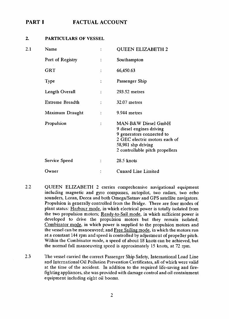
2. PARTICULARS OF VESSEL
2.1 Name QUEEN ELIZABETH 2
Port of Registry Southampton
G R T 66,450.63
Type Passenger Ship
Length Overall 293.52 metres
Extreme Breadth 32.07 metres
Maximum Draught 9.944 metres
Propulsion
Service Speed
Owner
MAN-B&W Diesel GmbH 9 diesel engines driving 9 generators connected to 2 GEC electric motors each of 58,981 shp driving 2 controllable pitch propellers
28.5 knots
Cunard Line Limited
2.2 QUEEN ELIZABETH 2 carries comprehensive navigational equipment including magnetic and gyro compasses, autopilot, two radars, two echo sounders, Loran, Decca and both Omega/Satnav and GPS satellite navigators. Propulsion is generally controlled from the Bridge. There are four modes of plant status: Harbour mode, in which electrical power is totally isolated from the two propulsion motors; mode, in which sufficient power is developed to drive the propulsion motors but they remain isolated; Combinator mode, in which power is supplied to the propulsion motors and the vessel can be manoeuvred; and Free Sailing mode, in which the motors run at a constant 144 rpm and speed is controlled by adjustment of propeller pitch. Within the Combinator mode, a speed of about 18 knots can be achieved, but the normal full manoeuvring speed is approximately 15 knots, at 72 rpm.
2.3 The vessel carried the correct Passenger Ship Safety, International Load Line and International Oil Pollution Prevention Certificates, all of which were valid at the time of the accident. In addition to the required life-saving and fire- fighting appliances, she was provided with damage control and oil containment equipment including eight oil booms.
2

2.4 Bridge Manning
2.4.1 General
At sea, the Bridge is manned by a First Officer and a Second Officer during each of 6 four-hour watches in each day. Additionally, a deck rating is assigned to each watch.
During periods of arrival or departure from a port, the Bridge is additionally manned by the Master, a second deck rating and, where applicable, a Pilot.
When departing from an anchorage, the Second Officer of the Watch is required to supervise the weighing of the anchor. During such periods, the Staff Captain attends on the Bridge.
2.4.2 At Time of Grounding
The Bridge was manned by the Master, the First Officer of the Watch, the Second Officer of the Watch, the Pilot and two deck ratings.
The Master was 58 years old and of British nationality. He held a Master Mariner (Foreign-Going) Certificate of Competency and had been in command of passenger vessels since 1982.
The First Officer of the Watch was 36 years old and held a Class 1 (Master Mariner) Certificate of Competency. He had served some 18 years a t sea, including 5 years experience as a watchkeeping Chief Officer in tankers before joining QUEEN ELIZABETH 2 in May 1992. He was of British nationality.
The Second Officer of the Watch had previously served 17 years with the Royal Fleet Auxiliary before initially joining QUEEN ELIZABETH 2 in April 1991. He was 36 years old, of British nationality, and held a Class 2 Certificate of Competency.
The Pilot held a State Pilotage Commission for District 3 of the State of Massachusetts which incorporates the waters of Vineyard Sound. H e was 49 years old and had been an active pilot since 1973.
The helmsman was of Philippine nationality. He was 33 years old and had previously served 7 years in a deck rating capacity. He held an EDH Certificate and, after initially joining QUEEN ELIZABETH 2 in April 1992, had steered the vessel many times at sea and on arrival and departure from port.
The other deck rating was also of Philippine nationality. He was 36 years old and held a Certificate of Competency as AB. He had 9 years experience at sea and joined QUEEN ELIZABETH 2 in October 1991.
3

2.4.3 Navigating Officer
The Navigating Officer was one of the three First Officers on board. He was British, 38 years old and held a Class 1 (Master Mariner) Certificate of Competency. He had 20 years experience at sea and had initially joined QUEEN ELIZABETH 2 as Second Officer approximately two-and-a-half years prior to the incident.
4

3. PARTICULARS OF PASSAGE
3.1 Arrival at Martha's Vineyard
On 3 August, QUEEN ELIZABETH 2 commenced a cruise from New York with scheduled calls a t Bar Harbour, St John, Halifax and Martha's Vineyard before returning to New York.
The vessel departed from her berth at Halifax at approximately 1820 hrs Local Time (GMT-3) on 6 August with draughts of 31 feet 9 inches forward and 32 feet 4 inches aft. Her passage towards Martha's Vineyard took her south of Nantucket Shoals and then north towards Vineyard Sound.
A Pilot was embarked at 1142 hrs on 7 August in a position with Gay Head bearing 074 at a range of 4.15 miles. The vessel then proceeded in Combinator mode through Vineyard Sound towards her intended anchorage off Oak Bluffs.
At 1317 hrs, the vessel anchored in a position with East Chop Point bearing 213 (T) distant 0.74 miles.
3.2 Departure Passage Plan
QUEEN ELIZABETH 2 was scheduled to depart from her anchorage at 2000 hrs on 7 August and to arrive at her berth in New York at 0730 hrs on 8 August.
A departure passage plan had been prepared by the Navigating Officer. The plan required the vessel to follow a series of charted rhumbline courses to an arranged pilot disembarkation position in Latitude 41 20'.0N, Longitude 71 15'.0W.
The planned courselines were drawn on the following charts:
BA Chart No L(L-C)2456 (corrected to No 1858/1992)
BA Chart No L(L-C)2890 (corrected to No 1285/1992)
(These are British Admiralty Charts)
(h e r ea f te r " C h art 245 6”)
(hereafter "Chart 2890")
NOAA Chart No 13238 (uncorrected) NOAA Chart No 13233 (uncorrected) (These are US National Oceanic and Atmospheric Administration Charts)
The Navigating Officer had formulated a Course Card for the passage from Martha's Vineyard to New York.
5

He intended that the N O M charts should be used only for reference purposes and had endorsed N O M Chart No 13233 to that effect.
The passage plan initially required the vessel to make good a course of 291 (T) to a position 1.5 miles from Nobska Point. From this position, a base course of was required so as to leave No 26 and No 28 Buoys to starboard and No 27 Buoy to port.
The passage plan then required the vessel to make good a course of 242 (T) in order to leave the NA Buoy close to starboard and to proceed to a position in Latitude 41 20'.5N, Longitude 71 00'.0W. From this position, a base course of was required in order to arrive at the arranged pilot disembarkation position in Latitude 41 Longitude 71 15'.0W.
The predicted times of High Water for Sandy Hook, New York Bay, on 7 August were 0329 hrs and 1606 hrs. Chart 2456 incorporates tidal stream information with reference to High Water a t Sandy Hook. At each of the appropriate tidal stream diamonds marked on the chart, the Navigating Officer indicated the approximate predicted tidal stream for an estimated time of transit based upon an anchorage departure time of 2000 hrs.
The predicted times and heights of High and Low Water for Martha's Vineyard on 7 August had previously been calculated and tabulated as follows:
LW
0112 hrs 0727 hrs 1321 hrs 2004 hrs
0. 1m 0.4m 0. 1m 0.6m
The Navigating Officer indicated, with pencilled hatchmarks, the following charted areas of shallow water:
Chart 2456 - an area of less than 10 fathoms charted sounding extending from Sow and Pigs Reef to a position approximately miles south of Cuttyhunk Island.
Chart 2890 - an area of between 8 and 10 fathoms charted sounding labelled Browns Ledge.
Chart 2890 - an area of between 5 fathoms 4 feet and 10 fathoms charted sounding in a position approximately 2 miles north-east of Browns Ledge.
Prior to departure, during the afternoon of 7 August the Master viewed and agreed the passage plan.
6

4.
4.1
NARRATIVE
Events prior to the Grounding
Bridge navigational equipment, steering modes, communications and the propulsion control system were tested and recorded to that effect at 1830 hrs on 7 August.
At approximately 1930 hrs, the two master gyro compasses were checked for alignment. The gyro compass headings were then checked against the digital gyro heading display located forward of the helmsman position. The display was found to have an error of 1 Low. The radar gyro compass repeaters were found to have errors of approximately All errors were removed by manual adjustment.
The weather was fine with light winds. There was no sea or swell and visibility was good. Sunset was at 1951 hrs.
With the propulsion power plant in Combinator mode, the vessel commenced weighing anchor a t 2033 hrs. The Second Officer of the Watch was stationed forward at this time. The Bridge was manned by the Master, the Pilot, the Staff Captain, the First Officer of the Watch and 2 deck ratings. There were 1,824 passengers on board and a crew complement of 1,003. Of the 1,824 passengers, 1,554 were American and 107 were British. All of the watertight doors, located below the margin line and fitted in bulkheads which are required to be watertight, were closed in accordance with The Merchant Shipping (Closing of Openings in Hulls and Watertight Bulkheads) Regulations 1987.
Both radars were operating in the north-up relative motion mode. The forward radar was set primarily on the 6-mile range scale. The after radar was set on the 3-mile range scale. The Loran, Omega and GPS Satellite Navigators and two echo sounders were all operational. The vessel was upright and her departure draughts were calculated to be 32 feet 4 inches forward and 31 feet 4 inches aft. A metacentric height of 1.68 metres was calculated for her departure condition.
The Pilot informed the Master that it was his intention, prior to turning on to the course through Vineyard Sound, to bear up towards No 26 Buoy in order to ensure that the vessel would be well clear to the north of Middle Ground and Lucas Shoal.
The Master had the con. The Staff Captain monitored and operated the combinator handles as instructed by the Master. The First Officer monitored the navigation of the vessel. One of the deck ratings was designated as helmsman while the other made occasional entries in the Movement Book generally relating to the engine control status and also to the position of the vessel when passing navigational marks.
7

The anchor was aweigh at 2048 hrs. The Second Officer of the Watch then proceeded to the Bridge and took over navigational duties from the First Officer. The First Officer took over the combinator controls from the Staff Captain after which the Staff Captain left the Bridge.
The Master set a course towards Nobska Point and then handed the con of the vessel to the Pilot. He remained on the Bridge.
There was a variety of small boat traffic around the vessel and ferries were frequently transitting between Oak Bluffs, Vineyard Haven and Woods Hole.
The Second Officer amended the approximate tidal stream indications at each of the appropriate tidal stream diamonds marked on Chart 2456 in order to allow for the late departure of the vessel.
In the vicinity of No 26 Buoy, the vessel was turned on to a base course of 237 (T). Helm orders were verbally given to the helmsman by the Pilot, who primarily navigated the vessel by his visual observation of lighted navigational aids. He positioned himself close to the manoeuvring console and intermittently changed the range scale of the forward radar display as he deemed necessary.
The Second Officer set the after radar display to the off-centre mode in order to increase his range of radar detection ahead.
At 2118 hrs, he commenced plotting positions at 6-minute intervals using the ranges and bearings of land detected to starboard and displayed on the after radar screen. The positions were plotted initially on NOAA Chart No 13233 and then transferred to Chart 2456.
The density of traffic had reduced. At the suggestion of the Master, and with the agreement of the Pilot, it was decided to increase the speed of the vessel.
At 2120 hrs, Free Sailing mode was selected and then, by adjustment of the combinator handles, the speed was gradually increased to approximately 25 knots.
The heading of the vessel was altered as necessary in order to keep No 28 Buoy and the NA Buoy in a direction to starboard.
At 2142 hrs, the Second Officer plotted the position of the vessel on NOAA Chart No 13233. He then projected a DR position for 2148 hrs and marked it on the chart. The projected position assumed a course of 242 (T) and a speed of approximately 23.5 knots. He then transferred both positions to Chart 2456.
8

At 2144 hrs, the NA Buoy was left close abeam on the starboard side. The heading of the vessel was then altered to on the instruction of the Pilot. (There is some conflict in the recollection of witnesses as to whether the alteration was to 248 ,250 or 255 but examination of the course recorder strongly indicates 250 as most probable.)
The Second Officer changed the working chart and, a t 2148 hrs, plotted the position of the vessel on Chart 2890. He then projected an anticipated track based upon the new course being steered. The projected track passed through the hatchmarked area north-east of Browns Ledge.
The Pilot consulted the chart at this time and the Second Officer drew his attention to the 2148 hrs plotted position and to the projected track. A decision to pass to the south of Browns Ledge was then agreed by the Master, the Pilot and the Second Officer and the heading of the vessel was altered to 240 (G) on the instruction of the Pilot.
At 2154 hrs, the Second Officer plotted the position of the vessel from which he projected a rhumbline track of 240 (T). He then plotted a DR position for 2200 hrs assuming an approximate speed of 23.5 knots. The Master and the Pilot observed the projected track and noted that it ran to a point which was clear and to the south of Browns Ledge.
4.2 The Grounding
At 2158 hrs, the vessel experienced two periods of heavy vibration in quick succession. During the second period, the First Officer adjusted the combinator handles to zero position on the instruction of the Master. The Second Officer plotted the position of the vessel on Chart 2890 using a radar range and bearing of the south-west point of Cuttyhunk Island.
From the Engine Control Room, the pitch of the propellers was manually reduced by approximately 20% following an automatic activation of high engine load alarms.
The Master called the Engine Control Room, by means of a talk-back communication system. The Staff Chief Engineer, who was the senior engineer in the Engine Control Room, reported that the propeller shafts were still turning at 144 rpm and that he was instructing his staff to check for possible damage.
The Second Officer reported to the Master that the vessel was in an area where the chart indicated a sounding of 6 fathoms 3 feet.
Additional personnel, including the Chief Officer and the Senior First Officer, arrived on the Bridge.
9

The Pilot checked the charted position of the vessel with his own observation of the after radar display.
The Pilot and the Master concurred that the vessel had probably passed through an area in which there was a lesser sounding than that charted.
4.3 Events Following the Grounding
At 2201 hrs, the GPS Satellite Navigator indicated a position of Latitude 41 21'.8N, Longitude 070 58'.4W and a prevailing course and speed made good of and 6.8 knots respectively.
Shortly after this, the helmsman indicated that the vessel had lost steerage way. By adjustment of the combinator handles to Position 1, the Master increased propeller pitch in order to provide an ahead speed of approximately 4 knots.
The Chief Officer was instructed by the Master to have internal soundings taken in order to determine the extent of any damage.
The Chief Officer dispatched the Senior First Officer to check hold spaces, a carpenter to sound dry tanks and void spaces, and the designated Stability Officer, who was one of the Second Officers on board, to monitor tank soundings in the Safety Control Room.
The Master instructed the Staff Captain to broadcast a general announcement throughout the ship advising that the vessel had passed through an area of shallow water and had experienced "shallow water effect".
A sounding pipe for No 1 Saltwater Double-Bottom Ballast Tank was found to be fractured within the Forward Tunnel space of the Engine Room and water was observed to be issuing from the pipe into the space. A wooden bung was inserted into the pipe in order to stem the flow and ballast pumping operations were commenced from No 1 Saltwater Double-Bottom Ballast Tank to the sea.
It was soon established that No 10 Fuel Oil Overflow Double-Bottom Tank, which had previously been empty, was now full. An officer was instructed to proceed aft in order to confirm whether or not there were any signs of oil in the water.
The Master broadcast a general announcement throughout the ship to the effect that the vessel appeared to have struck an underwater object but that she was quite safe and the matter was being investigated. At 2236 hrs, the Pilot reported the incident by VHF radio to the United States Coast Guard (USCG) at Point Judith.
10

The Stability Officer returned to the Bridge and recalculated the departure stability of the vessel allowing for No 10 Fuel Oil Double-Bottom Tank to be full. The Chief Officer assessed the resultant change in stability to be minor and recommended to the Master that no countering action was necessary at that time.
The Ship Services Manager (an Engineer Officer) arrived on the Bridge with the ship’s plans and an assessment of resultant damage was commenced.
No 15 Freshwater Double-Bottom Tank, which had previously been slack, was found to be full and pressurised.
A cofferdam, located between No 13, 14 and 15 Freshwater Double-Bottom Tanks and No 8, 9 and 10 Fuel Oil Double-Bottom Tanks, was also found to be full.
The Senior First Officer reported some buckling in the tank top of No 3 Hold. Shoring operations were commenced in way of the distortions.
A possible sighting of oil in the water was reported to the Master and, a t 2252 hrs, the Pilot informed the USCG of this. At 2255 hrs, the vessel was instructed to anchor and await the arrival of a USCG boarding party.
The Master broadcast general announcements throughout the ship to the effect that the vessel had been instructed by the USCG to anchor. He advised that the vessel had sustained bottom damage but that she was in no danger.
The Master instructed the Chief Officer to prepare a lifeboat for launching. He also issued instructions for the vessel’s oil containment equipment to be made ready.
At 2332 hrs, the vessel was anchored in a position with Buzzards Lighthouse bearing 027 (T) distant 5.6 miles.
At 2348 hrs, No 11 Lifeboat was lowered to the water and a search for signs of oil pollution was undertaken under the supervision of the Chief Officer. The lifeboat circled the vessel during which time the Chief Officer reported a light sheen on the water surface in the area below the port bridge wing. He also reported the draughts of the vessel which were noted to equate to those calculated by the Stability Officer. No visible damage was reported.
At 2400 hrs, ballast pumping operations from No 1 Saltwater Double-Bottom Ballast Tank were terminated.
No 14 Freshwater Double-Bottom Tank was found to be pressurised. The contents of No 14 and No 15 Freshwater Double-Bottom Tanks were sampled and found to contain saltwater.
11

At 0215 hrs on 8 August, the vessel was boarded by USCG officials.
The Forward Engine Room Void Space was found to be making water
Bilge water from holding tanks and floodwater from the Forward Engine Room Void Space was transferred to No 11 and No 12 Saltwater Double- Bottom Tanks.
By 0650 hrs, a USCG anti-pollution boom had been rigged around the vessel. From 0700 hrs to 0725 hrs, floodwater from the Forward Engine Room Void Space was pumped directly overboard under USCG observation. From 0730 hrs to 0823 hrs, water was pumped overboard from No 12 Saltwater Double- Bottom Tank. From 0825 hrs to 0840 hrs, water was pumped overboard from No 11 Saltwater Double-Bottom Tank.
Diving operations, intended to assess the extent of shell damage, were undertaken between 1200 hrs and 1350 hrs during which time the anti- pollution boom was removed. At 1405 hrs, the passenger launch SCHAMONCHI arrived alongside. A total of 555 passengers were disembarked from QUEEN ELIZABETH 2 and the launch departed at 1500 hrs.
From 1420 hrs to 1425 hrs and from 1517 hrs to 1745 hrs, floodwater from the Forward Engine Room Void Space was pumped directly overboard.
At 1730 hrs, the vessel proceeded towards Newport and, at 2006 hrs, anchored in a position with Brenton Reef Lighthouse bearing 182 distant 0.67 mile.
Disembarkation of the remaining passengers commenced at 2040 hrs. Transportation of passengers from the vessel to Newport was undertaken by Nos 9, 10, 11 and 12 Lifeboats, Alpha and Beta Launches, and two shore tenders, VIKING QUEEN and SPIRIT OF NEWPORT. The disembarkation of all passengers was completed at 0220 hrs on 9 August.
The vessel subsequently proceeded towards Boston for drydocking and full damage assessment. She arrived on 10 August 1992.
4.4 Extent of Damage
Resultant damage was largely confined to the forward half of the vessel and was concentrated in the areas of the keel and associated bottom plating. The degree of damage to the shell plating ranged from an intermittent longitudinal rupture in way of the keel strake to general plate indentation and surface scoring.
Internal damage was sustained to associated frames and longitudinals located below the level of the double-bottom tank top.
12

PART II DISCUSSION OF CONTRIBUTORY FACTORS
5. FACTORS AFFECTING DRAUGHT
5.1 Stationary Departure Draught
It has been reported that the departure draughts of QUEEN ELIZABETH 2 are visually taken, as a matter of routine, whenever it is practicable under the prevailing conditions. Prior to departure from her anchorage off Oak Bluffs on 7 August, the movement of water around the vessel was too great for an accurate assessment of her draughts by visual means.
The stationary forward and after departure draughts of the vessel were calculated to be 32 feet 4 inches and 31 feet 4 inches respectively. An apparent light ship reduction of 307.5 tonnes and an apparent light ship shift of 0.06 metres aft were incorporated into the calculation. The corrections were based upon a comparison made between the visual and calculated draughts of the vessel recorded on departure from Halifax on 6 August.
Visual draughts of the vessel were subsequently taken following the grounding. The draughts are reported to have equated to those determined by calculation for the damaged condition using the above values for apparent light ship reduction and shift. It is therefore reasonable to assume that the calculated stationary departure draughts of 32 feet 4 inches forward and 31 feet 4 inches aft were correct.
5.2 Weather Conditions
The wind direction and strength at 2000 hrs and 2400 hrs on 7 August were recorded as south by east Force 3 and southerly Force 2 respectively.
During the passage from Oak Bluffs, the wind was estimated to be south-east in direction and between 8 and 10 knots in speed. No sea or swell was experienced and the overall effect of the prevailing weather conditions is reported to have caused little or no vessel movement.
It is considered that any increase in draught due to vessel movement caused by the prevailing weather conditions would have been minimal.
1 Longitudinal Centre of Gravity
13

5.3 Squat
Merchant Shipping Notice No M.930 entitled "Interaction Between Ships" provides information to owners, masters, pilots and tug-masters with respect to hydrodynamic interaction. Appendix 2 of the Notice warns against high speeds in very shallow water due to the danger of grounding because of squat. It advises that an increase in draught of well over 10% has been observed at speeds of about 10 knots but when speed is reduced squat rapidly diminishes.
The Mariner's Handbook discusses squat in general terms and provides approximate values for the effect of squat calculated for a tanker of 27 metres beam and 11 metres draught when navigating in a channel of particular dimensions at 10 knots. It warns that at higher speeds the effect increases.
Squat manifests itself in two ways: first, by lowering the ship bodily so that the depth of clear water under the keel is reduced' and second, by changing the trim which may further reduce the under-keel clearance. It is recognised that the magnitude of the effect for a particular vessel in a given circumstance will depend upon a number of factors including the vessel's speed, length, draught and block co-efficient, the depth of water and the topography of the sea-bed.
The phenomenon is well known to mariners in broad terms, but neither M.930 nor The Mariner's Handbook go into much detail. A good deal of theoretical and experimental work has been carried out on the subject, especially in relation to tankers, but at present the results have not been summarised in a convenient form in any of the publications generally carried by ships. Some of the work suggests that common assumptions, particularly those concerning the effect on trim, are not entirely valid.
Like most ships, QUEEN ELIZABETH 2 was provided with no information specifically relating to the effect of squat on her own particular hull form when operating under a range of anticipated circumstances and conditions.
In the absence of such information, the Master estimated that, in the prevailing circumstances, the vessel would squat between one and one-and-a- half feet and would trim by the stern.
Strictly, this does not alter the draught, but the displacement of water from beneath the ship gives the effect of an increase in draught.
14

6.
6.1
FACTORS AFFECTING THE AVAILABLE DEPTH OF WATER
Charted Sounding Data
6.1.1 Charts in Use
Parts of the United States of America Navigation Safety Regulations relate to the use of charts in the navigable waters of the US. Chart 2456 and Chart 2890 comply with the above regulations and are considered to be of large enough scale and to have sufficient detail to make safe navigation of the area possible. It is a condition of compliance with the regulations that the charts are corrected to keep them up-to-date.
The area of grounding is within the coverage of both charts. All of the information presented on Charts 2456 and 2890 is taken from United States Government charts. Charted soundings in the grounding area are frequent and regularly spaced. However, no reference is made on either chart as to the date of the hydrographic surveys on which the chart is based.
Both charts were used for the departure passage from Oak Bluffs on 7 August. They had been corrected in accordance with Admiralty Notices to Mariners issued prior to the incident with the exception of Notice to Mariners No 2270 / 1992 which is applicable to Chart 2890 and was issued on 1 August 1992. This Notice to Mariners concerns the insertion of additional charted soundings in the vicinity of Point Judith and had no relevance to the grounding.
6.1.2 Hydrographic Survey
The grounding position plotted by the Second Officer on Chart 2890 is in Latitude 41 22’.1N, Longitude 070 Charted soundings, located within 0.5 mile of this position, were taken from a hydrographic survey conducted by the US Coast and Geodetic Survey in 1939 and include a least depth of 6 fathoms 3 feet (ie 39 feet) in close proximity to the grounding position. The nature of the seabed is charted as rock. A previous survey, which was conducted in 1887 and accomplished using lead line soundings, recorded greater depths in the area.
Instructions for the 1939 survey listed the following sounding line spacing requirements:
15

Depth Range Maximum Distance Between Sounding; Lines
Less than 6 fathoms 200 metres
6 to 10 fathom curve 400 metres
10 to 20 fathom curve 800 metres
Within 0.5 mile of the grounding position, a sounding line spacing of 400 metres was achieved. Soundings were acquired by means of a non-recording echo sounding machine providing an estimated vertical accuracy to within 1 foot and a seabed coverage diameter of approximately 0.4 times the depth of water.
Charts 2456 and 2890 are on a scale of 1:100,000. The traditional UK standard for surveys on such a scale was for sounding lines to be spaced at a maximum of 500 metres. Such a standard was achieved within 0.5 mile of the grounding position. However, an area is usually surveyed at a larger scale than it is charted. In UK waters an area such as this would, today, be surveyed at a scale of 1125,000 with a line spacing of 125 metres. Areas with depths less than 40 metres would be inter-lined at 62.5 metre spacing. Full sidescan sonar coverage would also be necessary to detect any dangers to navigation lying between sounding lines. Thus, the 1939 survey would not meet present day standards.
6.2 Height of Tide
The closest location to the grounding position for which tidal data is tabulated in the Admiralty Tide Tables, Volume 2, 1992 (NP 202-92), is Gay Head. At 2158 hrs on 7 August, the predicted height of tide at Gay Head was approximately 0.12 metre (ie 0.4 foot) above chart datum.
The US National Oceanic and Atmospheric Administration has since determined an actual height of tide of 0.77 foot above chart datum at the vessel for the time of grounding.
6.3 Post Grounding Survey
A hydrographic survey of the grounding area was commenced by NOAA on 10 August 1992. An initial investigation was made of an area within 800 metres of the reported grounding position. The survey vessel, RUDE, ran a series of eas/west sonar lines and discovered a group of boulders located to the north-east of the reported position. Depths in the order of 37 feet were recorded in this area and further sonar and sounding lines were run at a reduced spacing in order to precisely determine the topography of the seabed and the depth of water above it.
16

A survey depth of 39 feet below chart datum (adjusted for predicted tides) was recorded in the exact position of the charted sounding of 6 fathoms 3 feet.
Two weighted buoys were dropped in a depth of 34 feet located approximately 300 metres north-east of the reported position. The buoys were connected by a ground line of approximately 100 metres in length. Divers followed the ground line and found no evidence of grounding.
The weighted buoys were then dropped in a depth of 36 feet located approximately 450 metres north-east of the reported position. Divers followed the ground line between the buoys and discovered a solitary boulder some 12 feet in diameter. The top of the boulder (subsequently termed "Red Rock I") was observed to be flat and clear of marine growth. The divers took some samples of a red-coloured material which they found on the top surface of the rock. Pneumatic depth gauge measurements were then taken and a least depth of 34.5 feet below chart datum (adjusted for predicted tides) was recorded.
The weighted buoys were then dropped in a depth of 34 feet located on a projected track of 240°(T) at an approximate distance of 150 metres from "Red Rock I". The divers immediately discovered a rock (subsequently termed "Red Rock II") which appeared to be fractured and totally absent of marine growth. An abundance of steel filings and paint chips were located on the top of the rock and several large boulders were also found in the immediate vicinity. Pneumatic depth gauge and echo sounding measurements were taken above "Red Rock II" and a least depth of 33.1 feet below chart datum (adjusted for predicted tides) was recorded.
A projected track of 240 (T) from "Red Rock II" was followed by the divers and, for a distance of approximately 70 metres, several boulders were found which were observed to be devoid of marine growth.
The least recorded depth of the survey was 31.5 feet below chart datum (adjusted for predicted tides) which was located approximately 300 metres east of "Red Rock I". No evidence of grounding was found at this location.
The least depths of "Red Rock I" and "Red Rock II" were subsequently re- calculated for the determined actual height of tide at the time of measurement. The least depths below chart datum were computed to be 34.2 feet and 33.4 feet respectively. The survey least depth was similarly corrected and computed to be 31.5 feet below chart datum.
An analysis of paint and metal samples, subsequently taken from the hull of QUEEN ELIZABETH 2 together with those recovered from "Red Rock I" and "Red Rock II", was undertaken by the US National Transportation Safety Board. The findings confirm an elemental consistency in all of the samples analysed.
17

It is considered that QUEEN ELIZABETH 2 initially grounded on "Red Rock I". The effect of the hull contacting with and passing across the top surface of the rock was to remove marine growth from the contact area of the rock. After approximately 12 seconds, the vessel grounded heavily on "Red Rock II". The evidence suggests that this second contact was much heavier than the first and caused several boulders to be disturbed as the hull passed across the top surface of the rock.
18

PASSAGE PLANNING AND CONDUCT 7.
7.1 Planning
7.1.1 Passage Plan - QUEEN ELIZABETH 2
Neither the Master nor the Navigating Officer had previously visited Martha’s Vineyard.
The Navigating Officer constructed a departure passage plan from Martha’s Vineyard between 1 and 2 weeks in advance of the vessel’s scheduled call. His plan required the vessel to initially follow the buoyed channel through Vineyard Sound. On reaching a position with Buzzards Lighthouse bearing 320 (T) distant 2.4 miles, the plan required the vessel to make good a course of 276 (T) to a position in the vicinity of the charted Pilot disembarkation point off Brenton Reef. It is noted that a rhumbline course of approximately 252 (T) would have been required in order to proceed directly from the NA Buoy to a position with Buzzards Lighthouse bearing 320°(T) distant 2.4 miles.
Some two days before the scheduled call, the Navigating Officer modified the original passage plan in order to allow for the pilot to be disembarked in an agreed position of Latitude 41 20’.0N, Longitude 071 15’.0W.
On modifying the passage plan, the Navigating Officer pencilled hatchmarks on Charts 2456 and 2890 to indicate areas of shallow water. The hatchmarked area extending from Sow and Pigs Reef on Chart 2456 included the sounding of 6 fathoms 3 feet near which the ship grounded. This area was not hatchmarked on Chart 2890 because the Navigating Officer considered that, by the time the latter chart was brought into use, the vessel would already have proceeded beyond the shallow water area of concern. The least charted sounding over which the vessel was required to pass was 6 fathoms 4 feet in a position close to the NA Buoy.
Company Instructions aboard the vessel draw attention to Annual Notice to Mariners No 15 / 1992 which concerns Under-keel Allowance. The Notice advises mariners to navigate with adequate under-keel clearance at all times, making due allowances for all the factors that are likely to reduce the depth of water beneath the keel. The Mariner’s Handbook (NP100) lists those factors which should be taken into account and also discusses, a t length, the limitations of hydrographic surveys and the importance of considering the date of such surveys rather than the appearance of a chart in assessing the reliability of charted information.
19

No specific discussion took place between the Master and the Navigating Officer with respect to establishing a minimum under-keel clearance for the planned passage. However, each was satisfied that sufficient allowance had been made.
7.1.2 Passage Plan - Pilot
It was the intention of the Pilot to essentially follow the buoyed channel through Vineyard Sound on reciprocal courses to those undertaken, without incident, upon the vessel’s arrival. On leaving the NA Buoy close to starboard, he intended to steer for a position approximately 2 miles south of the south-west point of Cuttyhunk Island. He then intended to make good a westerly course towards the agreed pilot disembarkation point. It is noted that the Pilot’s intended plan closely resembled the plan originally constructed by the Navigating Officer. Again, the least charted sounding over which the vessel was required to pass was 6 fathoms 4 feet in the vicinity of the NA Buoy. The plan was in accordance with the Pilot’s normal departure route. However, on previous occasions the vessels concerned were of lesser draught than QUEEN ELIZABETH 2.
7.2 Passage Conduct
7.2.1 Master / Pilot Exchange
No prior discussion took place between the Pilot and the Master or any other member of the Bridge Team with respect to the courses to be followed by the vessel after passing the NA Buoy. The Pilot did not consult the vessel’s working charts in this respect and was, therefore, unaware that the vessel’s passage plan was contrary to his own.
The Pilot was already aware of the vessel’s manoeuvring characteristics having piloted her on arrival at Martha’s Vineyard and on one previous occasion.
The Annex to Merchant Shipping Notice No M.854 recommends that, in addition to being advised by the Master of the manoeuvring characteristics and basic details of the vessel, the Pilot should be clearly consulted on the passage plan to be followed. Additionally, the Annex draws attention to the fact that although a previously constructed plan may have to be changed after embarking the Pilot, this in no way detracts from the real value of a plan, which is to mark out in advance where the vessel should not proceed.
20

7.2.2 Position Monitoring
Position fixing through Vineyard Sound was undertaken by the Second Officer on a regular 6-minute basis. The positions were determined from comprehensive radar information used in conjunction with the larger scale NOAA Chart No 13233. The fixes were initially plotted on the NOAA Chart and then transferred to Chart 2456. On each occasion, the estimated track of the vessel was projected and an estimated position for the next 6-minute interval fix was plotted.
The passage between Nobska Point and the NA Buoy was undertaken on a number of steered gyro compass headings in order to counter the effects of the prevailing weather and tidal conditions and so make good the planned course of Prior to arrival at Martha's Vineyard on 7 August, the gyro compass error was calculated to be zero and it is assumed that it remained zero throughout the departure passage.
At 2142 hrs, the Second Officer projected an estimated position for 2148 hrs based upon his assumption that a course of would be made good. However, after passing the NA Buoy at 2144 hrs, the Pilot, in accordance with his own passage plan, ordered a course to steer of 250 (G). Although the Second Officer realised that a course alteration had been made, he was unaware of the Pilot's intentions and so did not immediately appreciate that there was significant deviation from the vessel's planned track.
The deviation remained undetected by the Bridge Team until the Second Officer, having changed the working chart, plotted the position of the vessel at 2148 hrs from which he projected a rhumbline track based upon the new course being steered. Appreciating then that the projected track passed near Brown's Ledge through an area hatchmarked on the chart to indicate shallow water, he drew the attention of the Pilot to the plotted position and to the projected track. However, he did not appreciate that the track also passed through an area south of Sow and Pigs Reef which had been hatchmarked on the previous working chart, Chart 2456, but not on Chart 2890 which was now his working chart.
The Annex to Merchant Shipping Notice No M.854 draws attention to the need for close and continuous monitoring of the vessel's progress along the planned track and recommends the use of all available navigational equipment for this purpose. It specifically refers to the advantage of continually monitoring the position of the vessel using radar parallel indexing techniques.
21
7.2.3
7.2.4
Change of Plan
The Pilot and the Master agreed to alter the course of the vessel to port in order to pass to the south of Browns Ledge. The Master’s decision was based upon his desire to keep clear of both Sow and Pigs Reef and also Browns Ledge. The Pilot’s agreement to the Master’s decision was based upon his recognition that such an alteration of course was prudent and that such action was preferable to the Bridge Team. Although the Pilot was aware that a sounding of 6 fathoms 3 feet existed in the area, it was not specifically noted by anyone of the Bridge Team as being located on the revised track.
It is apparent that insufficient time was available to appraise the situation properly. However, had the hatchmarked area on the previous working chart indicating shallow water to the south of Sow and Pigs Reef been duplicated on the current working chart, the Pilot and the Bridge Team might have been alerted to the potential hazard. If, in addition, the Second Officer had used parallel indexing it is likely that he would have appreciated very soon after the NA Buoy was passed that the vessel, on her new heading, would traverse this relatively shallow water. It is probable that this would have led to the decision to alter to a more southerly course being taken earlier and the area being avoided.
Speed Increase
The vessel had been delayed in her departure from Oak Bluffs. In order to ensure that the scheduled arrival time in New York could still be met, the Master, with the agreement of the Pilot, increased the speed of the vessel to approximately 25 knots. In determining whether or not such a speed was safe, the Master was required by the International Regulations for Preventing Collisions at Sea 1972, to take into account, among other factors, the draught of the vessel in relation to the available depth of water.
The least charted sounding over which the Master expected the vessel to pass was 40 feet at which time he estimated the height of tide would be approximately 2 feet (0.6 metre). With a mean stationary draught of approximately 32 feet, an estimated squat of between 12 and 18 inches and with little or no movement being experienced by the vessel, it follows that the Master expected a minimum under-keel clearance in the order of between 8 and 9 feet.
Both M.930 and The Mariner’s Handbook indicate that squat of about 10% draught is likely at a speed of 10 knots, and that the effect increases with higher speeds. The Mariner’s Handbook also says that the effect on trim is normally to increase trim by the stern and that the effect also varies with speed.
22

For QUEEN ELIZABETH 2 at the time of the accident, an allowance of 10% would have given squat of 3.2 feet. The expected effect on trim would have acted to reduce this amount as she was initially trimmed by the head, but against that the fact that speed was much greater than 10 knots should have been expected to cause an increase. In the absence of any specific data, it would have been prudent to have assumed that, a t best, the effects of trim and speed would cancel each other out and to have allowed at least the figure of 3.2 feet. (From the depth of water now known over the rocks which the ship struck, it appears that the actual squat, a t the bow, must have been of that order.)
If this figure had been used, and if the predicted height of tide had been more accurately calculated as about half a foot instead of two feet, the apparent under-keel clearance becomes approximately 5 feet. Given the limitations which ought to be placed on the reliability of charts, and the uncertainty as to the precise amount of squat - in particular the effect on it of high speed - it would have been prudent, had the Master recognised this lower figure, not to have increased speed until the ship was well clear of all relatively shallow water.
23

PART III CONCLUSION
8. Findings
8.1 QUEEN ELIZABETH 2 grounded twice in quick succession at approximately 2158 hrs (GMT-4) on 7 August 1992. The initial grounding position was in Latitude 41 22’.2N, Longitude 070 57’SW where at that time there was a maximum depth of water of 35.0 feet. The second grounding position was in Latitude 41 22’.2N, Longitude 070 where the maximum depth of water was 34.2 feet. The charts in use did not show the correct depths below chart datum at the grounding positions.
It is assumed that the stationary forward and after draughts of the vessel were 32.3 feet and 31.3 feet respectively. On the assumption that no change in draught was caused by the effect of the prevailing weather conditions, it is apparent that the effect of squat on the vessel caused the bow to sink by at least 2.7 feet. The extent of resultant damage suggests that, on grounding, the vessel was trimmed by the head. The Master had expected squat of one to one-and-a-half feet, with change of trim by the stern. It is clear that he underestimated the magnitude of squat effect upon his vessel in the prevailing circumstances.
8.2 Tidal data had previously been calculated for Martha’s Vineyard using tabulated predictions for Vineyard Haven. With reference to such data, the Master overestimated the height of tide at the vessel for the time of grounding, a t about 2 feet above datum. Prior calculation of the predicted height of tide at Gay Head for the time of transit would have provided a good indication of the predicted height of tide at the vessel on passing the NA Buoy at which point the Master expected to encounter the least sounding for the departure passage. This would have given a height above datum of about half a foot.
The immediate causes of the accident were, therefore, the presence of significantly shallower depths than those charted, together with an overestimation of the height of tide and an underestimation of the effect of squat.
8.3 The rocks on which QUEEN ELIZABETH 2 grounded are located in an area between adjacent sounding lines established by the US Coast and Geodetic Survey in 1939 which were not indicated on either the NOAA or BA charts in use aboard the vessel. Within 0.5 mile of the rocks, the survey established a least depth of 39 feet below chart datum and that is the least charted sounding shown within 0.5 mile of the grounding position plotted on Chart 2890.
24

Charts 2456 and 2890 indicate that the charted information presented is taken from recent US Government charts. However, they do not indicate the dates of survey upon which the US Government charts are based. In the absence of such survey data, the Master was restricted in his ability to assess the reliability of the charts.
It is considered that the Master was deceived by the appearance of the charts in use and placed undue reliance upon the information presented. It is also considered probable that if the correct depths had appeared on the chart, the need to avoid the area south of Sow and Pigs Reef would have been recognised by both Master and Pilot and a different course, to keep clear of it, would have been set from the NA Buoy.
8.4 Prior to departure, the Pilot was not consulted with respect to the passage plan to be followed after passing the NA Buoy. Such consultation would have revealed the differences between the vessel’s intended passage compared with that of the Pilot and a single plan could then have been agreed and understood by the Pilot and the Bridge Team before departure. It is evident that the vessel would not have transitted the grounding positions had either of the originally intended passage plans been strictly followed. It is also evident that neither the Master, the Pilot nor the Second Officer appreciated that the revised track passed in close proximity to a charted sounding of 6 fathoms 3 feet.
8.5 The position of the vessel was determined at regular intervals by satisfactory means and an estimated position was projected ahead on each occasion. Prudent use was made of the available larger scale NOAA charts for reference purposes. However, it is evident that the progress of the vessel was not continually monitored during the 6-minute interval between position fixes. After passing the NA Buoy at 2144 hrs, a deviation from the vessel’s intended track remained unappreciated until the position of the vessel was fixed at 2148 hrs. The magnitude of the deviation was enhanced by the high speed of the vessel. Radar parallel indexing techniques would have provided a simple and effective means for continually monitoring the vessel’s position.
8.6 In determining that an increase of speed to 25 knots was safe, it is considered that the Master, although having confirmed the Pilot’s agreement, omitted to take full account of the effect of squat, the possible unreliability of charted information and the predicted height of tide throughout the departure passage.
8.7 Guidance with respect to the planning and conduct of passages is provided in Merchant Shipping Notice No M.854 which is required to be consulted by the ship’s officers in accordance with Company Instructions and the Master’s Standing Orders. The Notice, among many other things, stresses the need for
25

close co-operation between the ship’s Bridge Team and the Pilot; for account to be taken of squat in assessing safe speed; and for the vessel’s progress to be continuously monitored. It refers specifically to the advantages of parallel indexing. While it is clear that in many respects much effort was put into following good practice, in these particular matters it is considered that the guidance given in the Notice was not fully heeded.
8.8 The ingress of water to the vessel due to grounding was contained within deep and double-bottom tanks and caused no adverse effect on stability. Key members of the ship’s complement acted swiftly in assessing the extent of resultant damage and steps were satisfactorily taken to monitor any further ingress of water.
8.9 Appropriate use was made of designated damage control equipment provided on board the vessel. Floodwater was pumped overboard under controlled conditions with a USCG anti-pollution boom positioned around the vessel. There was no oil pollution of any significance.
8.10 There were no resultant injuries to personnel. Passengers were kept informed of the prevailing situation following the grounding until they were successfully disembarked from the vessel.
26

9. RECOMMENDATIONS
9.1 The UK Hydrographic Office should, where applicable, endeavour to provide charted information relating to the dates and coverage areas of surveys conducted by other national authorities upon which a particular Admiralty chart is based.
9.2 Marine Directorate should provide further guidance on squat so that its effect on a particular vessel, when operating under a range of anticipated circumstances and conditions, may be reasonably estimated in cases where no specific data based on manoeuvring trials or computer simulation is available.
27


