questionnaire for environmental appraisal
TRANSCRIPT

QUESTIONNAIRE FOR ENVIRONMENTAL APPRAISAL
(MINING SECTOR PROJECTS)
I. General Information
A. Name of the project : Digwadih Colliery Underground expansion project
B. Objective of the project : To produce coal and subsequent washing in order to meet the increased demand of steel grade coal in our steel plant at Jamshedpur C. Location of mine (s) :
Village Tehsil District State
Digwadih Jharia Dhanbad Jharkhand
D. Does the proposal relate to:
1. New mine Yes No
2. Expansion
(i) Increase in ML area Yes No (ii) Increase in annual Yes No Production
3. Renewal of ML Yes No
4. Modernisation Yes No
II. Site Information
A. Geographical Information :
1. Latitude 2. Longitude
3. Survey of India Topo sheet No. (Optional) 4. Elevation above Mean Sea Level
B. Total Lease Area (in ha.):
Note 1: All information given in the form of annexures should be part of this file itself. Annexures as separate files will not be accepted.
Note 2: Please enter x in appropriate box where answer is Yes/No
23o 41’ 40” to 23o 43’ 00” N
86o 23’ 30” to 86o 24’ 30”
√
√
√
√
√
73 I/6
142 m to 154 m
314.57

C. Dominant nature of terrain 1. Flat Yes No
2. Undulated Yes Yes No No
3. Hilly Yes No 4. Coastal Yes No
III. Land usage of the mining lease area (in ha.)
A. Agricultural (Private Land)
B. Forest
C. Waste land (Govt. land)
D. Grazing
F. Marshy G. Surface water bodies H. Other (Specify) (Tata Steel + Railways + Villages) Total
IV. Whether the mine lease area falls in seismically active zone ?
Yes No Zone No.
If yes, earth quakes in last 10 years A. Severity (Scale) Not Applicable B. Impact i.e. Damage to 1. Life Yes No. 2. Property Yes No. 3. Existing mine Yes No.
√
√
√
13.65
Nil
Nil
Nil
Nil
4.99
295.93
314.57
√
√

V. Whether the proposed project falls in landslide prone zone?
Yes No
VI. Break-up of the Land use proposed
A. Mining Lease Area (in hectares)
1. Area to be mined
2. Storage for top soil
3. Overburden/Dumps
4. Mineral storage 5. Infrastructure (workshop, Administrative Building) 6. Roads 7. Rails 8. Green Belt 9. Township 10. Tailing Pond 11. Effluent treatment plant
12. Coal handling plant/ Mineral separation plant
13. Other (Specify) (Water bodies & Villages)
14. Total Area
B. Township (outside mine lease) Not Applicable 1. Total Area 2. No. of dwelling units 3. Distance from mine site
√
Not Applicable
Not Applicable
Not Applicable
Not Applicable
8.17
1.24
46.76
2.25
88.71
Not Applicable
-
-
13.65 +153.8 = 167.45
314.57
-
-
-

VII. Distance of water bodies (in Km):
Distance Of River Bank * Other Water bodies* Sea/creek/lake etc. (specify)
Mine lease boundary 5000 m away from Damodar River
Not Applicable
Ancillary facilities Not Applicable Not Applicable
*From highest flood line / high tide line
VIII. For project falling within CRZ Not Applicable
A. Whether the mineral to be mined is of rare/ strategic nature and not available outside CRZ?
Yes No
If so, annex a scaled location map duly certified* by the Chief Hydrographer
indicating low tide line* (LTL), high tide line* (HTL), mining lease area and its distance from LTL and HTL, sand dunes and settlements within 10 km.
IX. Indicate aerial distance from the periphery of core zone / buffer zone of
following (up to 10 km):
S. No.
Areas Name Aerial Distance from (inkm.) CORE BUFFER ZONE ZONE
1 National Park - -
2 Sanctuary/Tiger Reserve / Elephant/any other Reserve
- -
3 Core Zone of Biosphere Reserve
- -
4 Habitat for migratory birds - -
5 Archaeological sites (i) Notified (ii) Others
- -
6 Defence Installation - -
7 Industries/Thermal Power Plants
FBC power plant of Tata Steel
2 km
8 Other Mines BCCL and Tata Steel
In vicinity
9 Airports Ranchi 160 kms
10 Railway Lines Bhaga – Adra line (SE)
50 m
11 National / State Highways State Highway 20 kms

X. Description * of flora & fauna in the core and buffer zones. [* Consult the Wildlife (Protection) Act, 1972 as amended subsequently and list
species with (1) Common name (2) Scientific name and (3) under which schedule of the Wildlife (Protection) Act,1972 and as amended subsequently ,the identified species fall. Get the list authenticated by an Expert in the field / credible scientific institute / Chief Wildlife Warden office.]
A. Flora Core Zone Buffer Zone 1. Agricultural crops Paddy Paddy 2. Commercial crops - Nil 3. Plantation
2.25 -
4. Natural vegetation / forest type - Mahua, Peepal, Bargad, Sisum, Palas.
5. Grass lands - Nil 6. Endangered species - Nil 7. Endemic species - Nil 8. Others (Specify) - Annexure – I
B. Fauna 1. Total listing of faunal elements - Annexure – II 2. Endangered species - Nil 3. Endemic species - Nil 4. Migratory species - Nil 5. Route of migratory species - Nil 6. Details of aquatic fauna, if
applicable - Nil
XI. Details of mineral reserves. (as per approved Mining Plan)
Quantity (in million tonnes)
(1) Proved
(2) Indicated
(3) Inferred
(4) Mineable reserves
XII. Major geological formation / disturbances in the mine area (A) Geological & Structural maps submitted Yes No
(B) Geomorphological contour Yes Yes No No
map / section submitted
23.71
10.63
12.31
46.65
√
√

(C)
1. Faults 2. Dykes 3. Shear Zone 4. Folds 5. Other weak zones
(D) Source of data
XIII. Production of mineral and life of mine A. Rated capacity of mine (millon tonne/annum) B. Life of mine (Years) C. Lease period (Years) D. Date of expiry of lease (D /M /Y) E. In case of existing mines 1. Date of opening of mine 2. Avg. production in the last five years ( million tonnes/annum )
3. Avg./ Projected production for the next 10 years ( million tonnes/annum )
F. Whether plans & sections provided? Yes No.
XIV. Type and method of mining operations
S. No.
A. TYPE S. No. B. METHOD
1. Opencast - 1. Manual -
2. Underground √ 2. Semi-mechanised -
3. Both - 3. Mechanised √
√
√
-
-
-
0.6 TPA
20 YEARS
999 YEARS
03.09.2901
17.04.1918
0.345
0.6
√
Geological exploration report generated by Tata Steel

XV. Ancillary operations for mineral processing
A. Existing B. Additional
XVI. Loading, transportation and unloading of mineral and waste rocks on surface:
A. Manual. B. Tubs, mine cars, etc. C. Scrapper, shovels, dumpers/trucks. D. Conveyors (belt, chain, etc.)
E. Others (specify).
XVII. Mine Details
A. Open-cast mines Not Applicable
1. Stripping ratio (mineral to over burden in tonne/ m3) 2. Thickness of top soil (in m.) (i) Minimum
(ii) Maximum
(iii) Avg. 3. Thickness of overburden (in m.) (i) Minimum
(ii) Maximum
(iii) Avg.
. B. Underground mines
Depth (m) Thickness (m)
1. Seam/ Ore body
-
-
-
-
-
-
-
642 2.94 – 3.77
1.0 MTPA – Jamadoba Washery (captive) presently washing coal from Jamadoba Group of Collieries and supplying clean coal to Jamshedpur Steel works.
Undergoing expansion to 2.0. MTPA
Not Applicable
Not Applicable
Not Applicable
Underground belt conveyor network system
Not Applicable

2. Mode of entry into the mine
(i) Shaft
(ii) Adit
(iii) Incline
3. Details of machinery to be used
(i) On surface - Winder and Main mechanical Ventilator (ii) At Face - SDL/ Auxiliary Fan (iii) For transportation - Conveyor belt (iv) Others - Pump/ Motors/ Compressor/ Haulage
4. Method of stopping (metallic ferrous mines) Not applicable (i) Open (ii) Filled
(iii) Shrinkage (iv) Caving (v) Combination of above (vi) Others (Specify)
5. Depillaring method
(i) Caving (ii) Stowing (iii) Partial extraction
6. Ventilation arrangement
(i) Existing (ii) Proposed
7. Subsidence (i) Anticipated subsidence (in m.)
(ii) Magnitude of surface strains
√
-
-
-
√
-
0.219
1.86
Fan House of capacity 7200Cum/per minute of air
Not Applicable

(iii) Slope change (iv) Identified possible subsidence areas (v) Major impacts on natural drainage pattern, human habitat,
water bodies, etc. (vi) Salient features of subsidence monitoring and control.
XVIII. Surface drainage pattern at mine site
A. What is the pre-mining surface drainage pattern at the site? Not Applicable B. Do you propose any modification / diversion in Yes No
the existing natural drainage pattern? Provide location map indicating contours, direction of flow of water, and proposed route/changes, if any i.e. realignment of river/nallah/ any other water body falling within core zone.
XIX. Vehicular traffic density Type No. of vehicles per day
A. Existing B. After the proposed activity C. Whether the existing road Yes No
network is adequate?
D. If no, provide details of alternative proposal
XX. Mineral(s) transportation from the mine site Qty. (in TPD) Percentage (%)
A. Road B. Rail C. Conveyors D. Rope way E. Water ways F. Pipeline G. Other (Specify)
Total
√
Diesel / Petrol 450/400
Diesel / Petrol 500/400
√
Not Applicable Not Applicable
Not Applicable Not Applicable
2000 100
Not Applicable Not Applicable
Not Applicable Not Applicable
Not Applicable Not Applicable
Not Applicable Not Applicable
2000 100
5.5
√
None
Regularly monitoring conducted by CIMFR, Dhanbad and ensure proper stowing.

XXI. Status of mining lease area (in ha.)
S. No.
Purpose Required (Mining Lease Area) Acquired To be acquired
Govt. Private Govt. Private Govt. Private
Forest Others
Agricultural Others Forest Others Agricultural
Others Forest Others Agricultural Others
1. Mining area
-
2. Area for storage/dumps
-
3. Ancillary facilities (processing plant etc.)
-
4. Tailing dam/pond
-
5. Township
88.71
6. Area for green belt development
2.25
7. Roads, Railways etc.
1.24 (road) 46.76(rail)
8. Other infrastructure (specify) Water bodies
& Villages(Workshop, Administrative
Building)
13.65 153.8
8.17
Total
13.65 300.93
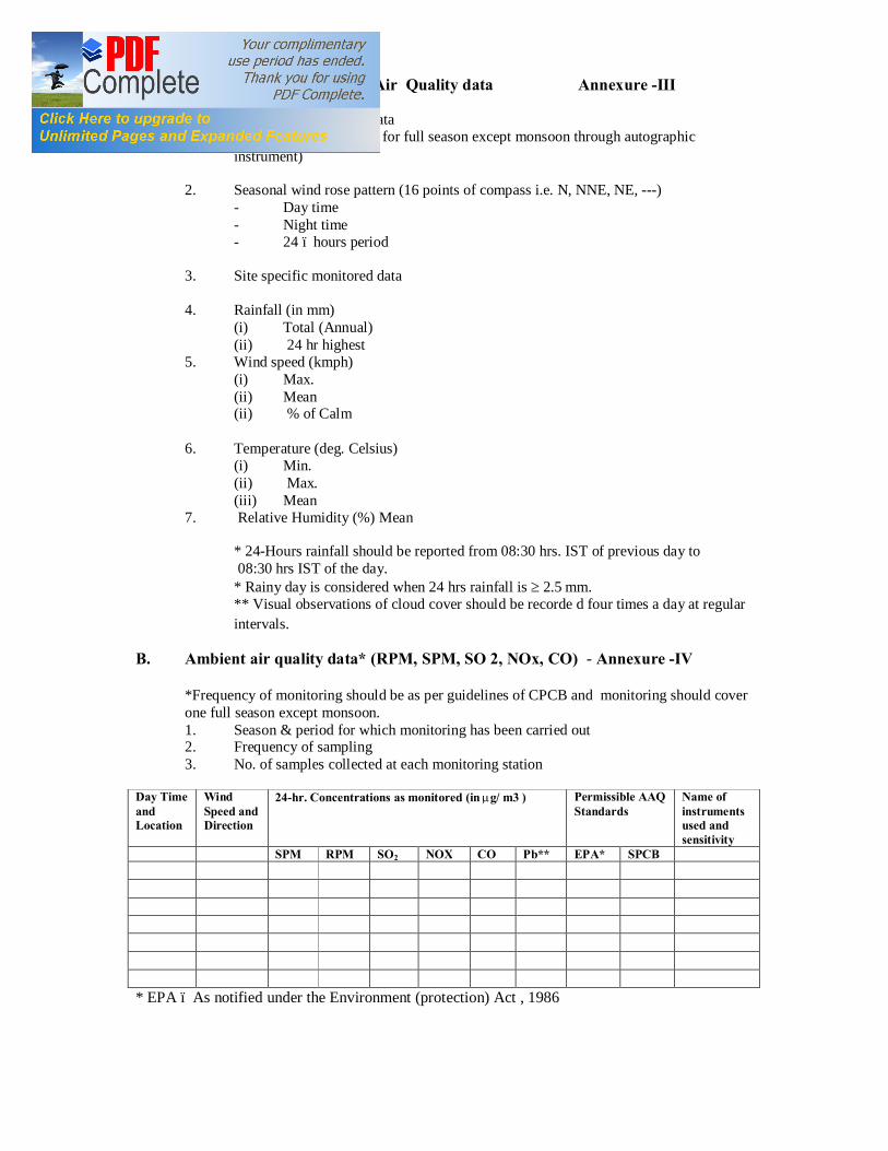
XXII. Baseline Meteorological & Air Quality data Annexure -III A. 1. Micro-meteorological data
(Continuous monitoring for full season except monsoon through autographic instrument)
2. Seasonal wind rose pattern (16 points of compass i.e. N, NNE, NE, ---) - Day time - Night time - 24 – hours period
3. Site specific monitored data
4. Rainfall (in mm) (i) Total (Annual) (ii) 24 hr highest
5. Wind speed (kmph) (i) Max. (ii) Mean (ii) % of Calm
6. Temperature (deg. Celsius) (i) Min. (ii) Max. (iii) Mean
7. Relative Humidity (%) Mean
* 24-Hours rainfall should be reported from 08:30 hrs. IST of previous day to 08:30 hrs IST of the day. * Rainy day is considered when 24 hrs rainfall is ≥ 2.5 mm. ** Visual observations of cloud cover should be recorde d four times a day at regular intervals.
B. Ambient air quality data* (RPM, SPM, SO 2, NOx, CO) - Annexure -IV *Frequency of monitoring should be as per guidelines of CPCB and monitoring should cover one full season except monsoon. 1. Season & period for which monitoring has been carried out 2. Frequency of sampling 3. No. of samples collected at each monitoring station
Day Time and Location
Wind Speed and Direction
24-hr. Concentrations as monitored (in µg/ m3 ) Permissible AAQ Standards
Name of instruments used and sensitivity
SPM RPM SO2 NOX CO Pb** EPA* SPCB * EPA – As notified under the Environment (protection) Act , 1986

AAQ as monitored (24 hourly)
SPM RPM SO2 NOX CO Pb** Max.
Min.
Mean
98 percentile
** For mineral specific site only # Annex a location map indicating location of AAQ stations, their direction & distance w.r.t. project site. # Attach additional sheets as required to provide complete data as monitored for one season.
XXIII. Stack emission detail , if any Not applicable (Frequency of stack monitoring should be as per CPCB guidelines)
Sl. No.
Process / unit of operation (e.g. DG Set, Boiler)
Height of stack (m)
Internal top dia. (m)
Flue gas exit velocity (m/sec)
Emission rate (kg/hr) Heat emission rate from top of stack (K.cal/hr)
Exhaust / Flue Gas
Temperature in
degrees celcius.
SPM NOx SO2 CO
A Equipment used for stack monitoring
XXIV. Details of fugitive emissions during mining operations Not applicable XXV. Air Quality Impact Prediction (AQIP) Not applicable A. 1. Details of model(s) used for AQIP including grid
size, terrain features, and input meteorological data
2. Maximum incremental GLC values of pollutants based on prediction exercise
(in ug/m3) Sl. No.
Pollutants Incremental Value
Ambient Air Quality
Resultant Air Quality
1. SPM 2. RPM 3. SO2 4. NOX 5. CO

XXVI. Water requirement (m3/day)
Purpose Avg. Demand Peak Demand
A. Mine site 1. Mine operation 3432 - 2. Land reclamation Not Applicable - 3. Dust suppression 10 -
4. Drinking 1100 - 5. Green Belt 5 - 6. Beneficiation Not applicable - 7. Washeries Not applicable - 8. Fire Service Not applicable - 9. Others (irrigation) 1689 - B. Township 1. Green Belt Not applicable - 2. Domestic 1035 - 3. Other (specify) Not applicable -
Total 7255 XXVII. Source of water supply*
S. No. Source m3/day
1 River (name) Nil
2 Ground water Nil
3. Mine water (sump/pit) 7255
4 Other surface water bodies (pl. specify) Not Applicable
*Annex a copy of sanction letter from the concerned authority for drawing water
XXVIII. Lean season flow in case of river (cumecs) Not Applicable XXIX. Ground water potential of the area A. Average water table (metres) below ground level 1. Pre-monsoon 2. Post-monsoon
B. Annual recharge rate (cubic metres) C. Avg. withdrawal rate (cubic metres)
7.98
2.78
-
-

XXX. Physico-chemical analysis* of water at intake point (*All parameters as
per drinking water standards) - Annexure -V
XXXI. Competing users of the water source
The water consumption pattern will remain the same even after the expansion of project.
Sl. No.
Usage Present Consumption Including pumping
(m3/day)
Additional proposed as per local plan
(m3/day)
Total (m3/day)
Surface Ground/
Surface Ground
Surface Ground
1. Irrigation
2. Industry
3. Mining
4. Others (Specify)
Total
XXXII. Waste Water Management A. Daily discharge (m3/day) from different sources
1. Mine discharge
2. Workshop
3. Domestic 4. Beneficiation 5. Washeries 6. Others (Specify) 7. Total
B. Are you planning to provide waste water treatment plant? Yes No If yes, provide a flow sheet for treatment.
C. Quantity of water recycled / reused/
to be recycled in 1. Percentage 2. M3 /day
7255
Nil
1130
Nil
Nil
-
√
-
-
-

D. Point of final discharge
Final Point Quantity discharged (in m3/day)
1. Surface (i) Agricultural land (ii) Waste land (iii) Forest land (iv) Green belt
2. River -
3. Lake -
4. Estuary -
5. Sea -
Total 7255
E. Users of discharge water
1. Human Yes No 2. Livestock Yes No 3. Irrigation Yes No 4. Industry Yes No
5. Others (specify
F. Details of the Water body where final effluent is/will be discharged :
Not Applicable Cumecs
1. Average flow rate 2. Lean season flow rate 3. Aquatic life 4. Analysis of river water 100 meters upstream and 100 meters downstream of discharge point.
√
√
√
√
Villages and township

XXXIII. Water balance statement in the form of flow diagram indicating source (s), consumption (section-wise) and output.
Source underground mine water
XXXIV. Solid Waste : Not Applicable
A. Solid waste quantity and quality
Name
(Lump/fines/slurry/ Sludge/others)
Composition Quantity (m3/month)
Method of disposal
Mining activity* a. Top Soil b. Over burden c. Others (specify)
Effluent Treatment Plant (sludge)
Total
Annex layout plan indicating the dump sites
B. 1. Does waste (s) contain any hazardous/toxic substance/ radioactive materials or Yes No heavy metals?
2. If yes, provide details and precautionary measures.
C. Recovery and recycling possibilities
D. Possible user (s) of the solid waste E. 1. Is the solid waste suitable for Yes No
backfilling 2. If yes, when do you propose
to start backfilling. Solid waste (s) Accumulated
(A) To be generated
(B) % of A & B to be
backfilled A B
Over burden Others (specify)
7255KL/day
3432 KL/day for stowing
1689 KL/day for irrigation & gardening
1035 KL/day for colony & villages
1100 KL/day for water treatment plant

F. Reclamation & rehabilitation plan
G. In case waste is to be dumped on the ground, indicate
(1) Associated environmental problems : Nil
(2) Number & type of waste dumps:
(i) Height of dumps (in m)
(ii) Slope of dump (angle)
(iii) Proposed bio-engg mitigation measures
XXXV. Noise level (dB) : Annexure - VI
A. Source
Sl. No. Source Noise Level (dB) Max Min Mean
B. Abatement measures : Provision of Ear Plug & Ear Muff
XXXVI. Fuel / Energy requirements
(A) Total power requirement (in MW)
S. No. Mine Site Township Others (specify) Total 1 Present 1.0 2 - 3.0
2 Proposed / additional
1.5 2 - 3.5
Total - - - -
` (B) Source of power (in MW)
S. No. SEB/Grid* Captive power plant DG Sets 1 Present
DVC / Captive Power Plant NO
2 Proposed
DVC / Captive Power Plant NO
Total
[* Annex a copy of the sanction letter from the concerned authority] (C) Details of fuels : Not Applicable
S.No. Fuel Daily Consumption (TPD)
Calorific value (Kcals/kg)
% Ash % Sulphur
Existing Proposed 1 2 3
HSD LSHS Other (specify)

XXXVII. Storage of inflammable / explosive materials
S. No. Name Number of Storages Consumption
(in TPD) Maximum Quantity at
any point of time 1 Diesel - - - 2 Fuel Oil Not applicable - -
3 Explosives
One Magazine 450 Kg/day 2600 Kgs
4 Other (pl specify) - - -
XXXVIII. Occupational and community health, safety and hygiene
A. What major occupational and community health and safety hazards (surface and U/g fire, inundation, explosion, etc.) are anticipated?
Dust pollution
B. What provisions have been made/ proposed to be made to conform to health and safety requirements?
Water spraying measures to suppress the dust.
C. In case of an existing mine, furnish a comprehensive report on health status of the workers. Annexure-VII
D. Mineralogical composition of RPM (dust)
Free silica : 1.65 to 2.82%
E. Details of PPE’s provided/ to be provided to the workers
Ear Muff, Ear Plugs, Dust Mask, Safety Shoe, Safety Helmet, First Aid Box etc.
F. Information on radiation protection measures, if applicable.
Not applicable
XXXIX. Plantation
A. Lease area (in ha.) Existing mine New mine
(i) Area broken up
(ii) To be broken up (iii) Unbroken area
B. Total Township area (in ha.)
- -
- -
- -
88.71

C. Area afforested and proposed (in ha.)
Peripheral Dumps Roads Township Others
(i) Existing (ii) Proposed
D. No. and type of trees planted and proposed?
(1) Existing
(i) When plantation was started? Year (ii) No. (iii) Survival rate % (iv) Type of species (v) Avg. Height (in m)
(2) Proposed
Type of species Number (per ha.)
Legostromia, neem, Karanj etc. 2500 per ha
XL. Human Settlement
Core Zone Buffer Zone Population* - 333625
Number of households - 65661
[* As per latest available census record or actual survey]
XLI. Rehabilitation & Resettlement (R&R) Plan* : Not Applicable
A. Name and no. of villages falling within
1. Core zone 2. 500m from the blasting site(s) 3. Township site B. Village(s) affected by the project
S. No.
Village name (within mine lease)
Population Occupation Average Annual Income
Tribal Others
-
0.5 Lacs
30 %
2.25
10.0
Sisam, Gamahar, Teak etc.
5mtr.

C. Population to be displaced/ land oustees
Name of village(s) falling within Number of oustees Land (only)
Homestead (only)
Land and Homestead (both)
Mining Lease 1. 2.
Township Site 1. 2.
D. Whether R&R plan has been finalised? If yes, salient features of R&R plan for
oustees. (i) Site where the people are proposed to be resettled & facilities to be provided.
(ii) Compensation package including funds earmarked
(iii) Agency /Authority responsible for their resettlement.
(iv) Period by which resettlement of Project Affected People (PAP) will be over
XLII. Pollution Control
A. Details of pollution control measures
S. No.
Existing Proposed
1 Air
Dust suppression measures through water sprinkling.
Will continue for future
2 Water Effluent management system in central workshop. Mine water being settled in settling tanks.
Additional Mine water will be utilized internally
3. Noise Use of Ear plug for worker Plantation around fanhouse, use of ear muffs
4. Solid waste Not applicable Not applicable
B. For existing units :
1. Difficulties encountered in implementing pollution control measures/ Environmental management plan. None
2. Efficiency of each of the pollution control equipment/ system installed
S.No. Name of the system/ equipment
Design efficiency % Present working efficiency %
Not Applicable

C. For proposed units
S.No. Name of the system/ equipment Design efficiency %
Not Applicable
XLIII. Capital cost of the project (in Rs. Lakh) 2500 Lakhs
(As proposed to the funding agency/ financial institution)
XLIV. Cost of environmental protection measures in Rs. Lakh
S No Description Total Capital (in lakhs)
Phasing in years
PS-1 1 2 3 4 5 A Env. Baseline data generation and
EMP preparation, fees to consultants, etc.
20.0 20
B Green belt development around fan house, service buildings, etc.
15.0 5 5 5
C Pollution and monitoring equipment/ scientific studies
15.0 10 5
D Pollution abatement facilities 15.0 10 5
E Effluent Treatment Plant 20.0 10 10
Total 85.0 lakhs 20 5 15 30 15
XLV. Amount earmarked for socio-economic welfare measures for the nearby villages other than R&R plans.
A. Villages (name) to be adopted, if any . B. Socio-economic package C. Amount earmarked (in Rs. Lakh) XLVI. Public Hearing
A. Date of Advertisement: B. Newspapers in which the advertisement
appeared :
C. Date of public hearing (DD/MM/YYYY)
Already 26 villages adopted by Tata Steel Jharia Division through CSR Cell , TSRDS.
-
19.08.2012
Hindustan Times & Prabhat Khabar (Dhanbad).
21.09.2012
Rs. 4 crores approx. for the entire Jharia Division

D. Public Hearing Panel chaired by & members present:
1. Shri A. K. Singh, Additional Collector (Supply), Dhanbad, 2. Shri Dinesh Prasad Singh Regional Officer, Dhanbad, JSPCB 3. Shri K.K.Pathak JEE JSPCB Dhanbad 4. Shri Jagdish Mahto, JEE, JSPCB Ranchi. 5. Shri S.K.Singh, Dy. General Manager, Jharia 6. Shri Manish Mishra, Chief Jamadoba Group, 7. Shri S.S.Hota, Chief HR/IR, 8. Shri R.K.Jain, Head Safety and Environment 9. Shri Jasbir Singh, Head Digwadih Colliery, 10. Captain Manish Sinha, Head Administration 11. Shri Manoj Kumar Gupta, Head Environment
E. No. of people attended the public hearing meeting
and number of people from the lease area.
F. Summary/details of public hearing in tabular form.
Issues raised by the Public
Response/Commitment of Project Proponents
Suggestions made by the Public Hearing Panel
Drinking water facility for villagers.
Laying down of pipe network for supply of drinking water. Supply of water through tanker.
Admitted by the panel members.
Repair and cleaning of drains and roads and removal of garbage regularly.
Maintenance of drains will be done regularly. In case of roads, small repair works will be taken up.
Admitted and suggestion for frequent monitoring.
Maximum Nos. of tree Plantation
Regular tree plantation is carried out already. Distribution of trees to the villagers on demand.
Admitted by the panel members.
Medical facilities for villagers
A mobile clinic consisting of one Doctor and three paramedical personnel is already functioning on preventive measures on weekly basis in all surrounding villagers.
Admitted with the suggestion to increase the frequency.
Free Electricity and water to be provided to the villages.
Water is already provided. Transformers, bulbs, switches, etc will be given but no free electricity will be given.
Admitted by the panel members.
Free coaching to small children
Coaching facilities are already available for the children and all can avail it from the nearby villages.
Admitted by the panel members.
Cleaning of parks and ponds as well as heightening of wall around sand yard
Parks and ponds will be maintained through our CSR wing TSRDS. Wall around sand yard to be increased in height.
Admitted by the panel members.
244 244

XLVII. Whether the following approvals* (wherever applicable) have been obtained?
A. Site clearance from MoEF NA Yes No
B. NOC from SPCB Yes No
C. NOC from Atomic Energy Division NA Yes No
D. Mining plan approval from IBM / Yes No Ministry of Coal
E. Forestry clearance under FCA, 1980 NA Yes No F. NOC from Chief Controller of Yes No Explosives G. Commitment regarding availability NA Yes No
of water and power from the concerned State Authorities
[* Annex copies] XLVIII. Was / Is there any court case relating to the project or related activities? If so, details thereof. None The data and information given in this proforma are true to the best of my knowledge and belief.
Sanjay Kumar Singh General Manager (Jharia) Tata Steel Ltd., Jharia Division Date: Signature of the applicant with full name & address Place: Given under the seal of organization
on behalf of whom the applicant is signing
√
√
√

Annexure - I
Prominent Floral Species
S.N. Local Name Hindi Name Botanical Name I. LARGE TREE 1. Arjun Arjun, Koha Terminalia arjuna 2. Aam Aam Mangifera indica 3. Imli Imli Tamarindus indica 4. Kathgular Kathumar Ficus hispida 5. Kala Siris Kala Siras Albizzia lebbek 6. Kem(mundi) Mundi Mitragyna parviflora 7. Kher Kher Acacia catechu 8. Gamari Khamhar,Khamher Gmelina arborea 9. Gular Dumar Ficus glomerata 10. Chichwa Chichwa Albizzia odoratissima 11. Jamun Jamun ,Jam Syzygium cumini 12. Dhaman Dhaman,Dhankoot Grewia tiliaefolia 13. Neem Neem Azardirachta indica 14. Palas Chhawla Butea monosperma 15. Pakar Pakar Ficus infectoria 16. Pangara Hadua Erythrina Suberosa 17. Pipal Pipal Ficus religiosa 18. Pula Baranga Kydia Calycina 19. Bar Bargad, Bar Ficus bengalensis 20. Bahera Bahera Terminalia belerica 21. Bijasal Bija, Murga Pterocarpus marsupium 22. Bel Bel Aegle marmelos 23. Mahua Mahua Madhuca indica 24. Shisum Kala Shisum Daibergia latifolia 25. Safed Siris Karhi Albizzia procera 26. Sagaun Sagaun Tectona grandis 27. Sal Sarai Shorea robusta 28. Salai Salai, Salenh Boswellia serrata 29. Semal Semra Salmalia malabarica 30. Sonpaker Karhber Ficus tomentosa 31. Hari Hari, Harar Terminalia Chebula 32. Haldu Haldu, Kalmi Adina Cardifolia SMALL TREES 33. Agaltara Dhanbaher, Karkacha Cassia fistula 34. Kachnar Kachnar Bauhinia variegata 35. Kathjamun Kathjamun Syxyglum heyneacum 36. Keblar Keblar Bauhinia purpuraca 37. Galgal Gabandi Cochlospermum religionsum 38. Gilchi Barri Casearia elliptica 39. Ghont Ghonthar Zizyphus xylopyra 40. Ber Ber Zizophus jujuba 41. Bhilma Bhilma Scenecarpus anacardium SHRUBS AND UNDER SHRUBS 42. Aapamarg Chirchita Achyranthes aspera 43. Arandi Arandi Ricinus Communis 44. Aak Aak Calotropis gigantea 45. Karonda Karonda Carissa opaca

46. Kurchi Kurchi, Keria Holarrhena antidysentrica 47. Kela jangli Jangli kela Musa sapiertum 48. Gokhru Gokhru Tribulus terrestris 49. Jodhrali Wanmasuri Antidesma ghassembilla 50. Jharneri Jhakheri Zizyphus nummularia 51. Tulsi Tulsi Ocimum sanctum 51. Thuar Thuar Euphorbia nerifolia 52. Nirguri Nirguri Vitex negundo 53. Nil Birhul Indigofera pulchella 54. Panar Chrot, Chkora Cassia tora 55. Baibirang Baibirang Embelia robusta 56. Besharam Besharam Ipomoea pes-caparae 57. Bhatkaya Bhatkatya Solanum nigrum 58. Mohaty Mohaty Vernonia divergens 59. Raimuniya Raimuniya Lantana camara 60. Sitafal Sitafal Anona squamosa 61. Harsingar Sehrua Nyctanthes arbortristis 62. Bantulsi Bantulsi Daedalacanthus purpuriens 63. Makor Makor Zizyphus oenoblia 64. Ratanjot Ratanjot Jatropha curacas 65. Raimuniya Raimuniya Latana acovleata CLIMBERS 66. Nagbel Dudhi Cryptolepis buchanani 67. Roni Ael Acacia pennata 68. Kiwach Kewach Mucuna prurita 69. Mahul Mohlain Bauhinia vahlii 70. Gouj Gurar, Gurari, Gohrani Milletia auriculata 71. Amarbel Amarbel Cuscuta reflexa GRASSES 72. Dub Dub Cynodon dactylon 73. Kash Kash Saccharum spontaneum 74. Khash Urai Vetivaria zizanioides 75. Bharbel Kail Dichanthium annulatum 76. Munj Munj Erianthus munja 77. Rusha Rusha Cymbopogon martini 78. Bhurbhushi Bhurbhushi Eragrostis tenella 79. Kush Kusha Desmostachya bipinnata 80. Kusul Kusul, Lampa Heteropogon contortus 81. Bans Bans Dendrocalamus strictus
Annexure – II
Different Species of Fauna in buffer zones
Sl. No. Scientific Name Schedule Local Name English Name 1 Hemiechinus auritus collaries IV (4-A) -- Hedgehog 2 Suncus murinus -- Chhachhundar Musk-Shrew 3 Cynopterus sphinx V (3) Chamgadar Short nosed fruit bat 4 Hyaena III (12) Lakarbagha Striped hyaena 5 Herpestes edwardsi IV (6-A) Newla Common Mongoose
6 Funambulus Pennanti Gilhari Common five Stripped Squirrel
7 Bandicota bengalensis V (6) Chuha Field rat

8 Rattus rattus-refescena V (6) Chuha Common house rat 9 Golund ellioti V (6) Chuha The Indian bush rat
10 Sus Scrofa III (19) Suar Indian wild Boar 11 Bubulcus obis IV (22) Gai Bagla Cattle egret 12 Egretta garzetta Bara Bagla Large Egret 13 Elanus caeruleus Kapasi Blackwinged kite 14 Milvus migrans Chil Common pariah kite 15 Francolinus fromcolinus IV (51) Kala Titar Black partridge 16 Francolinus pondicerianus IV (51) Safed Titar Gray partridge 17 Cotuenix coturnix IV (51) Bater Common or gray quail 18 Francolinus pictus IV (51) Kala Titar Painted Partridge
19 Galloperdix spondica Chhoti jangli murgi
Red spur fowl
20 Gallus gallus Jangli murgi Red jangle fowl 21 Grus grus IV (16) Bagla saras Common crane
22 Hydrophasianus chirurgus V (36) Pihua Pheasant tailed Jacana
23 Treron phoenicoptera IV (54) Harial Common green pigeon
24 Columba livia IV (54) Kabutar Blue rock pigeon 25 Psittacula Krameri IV (50) Tota Rose ringed parakeet 26 Cuculus varius IV (17) Papiha Cuckoo,
Brain fever bira 27 Eudynamys scolopceae Koel Koel 28 Clamator jacobinus IV (17) Papiha chatak Pied crested Cuckoo 29 Bubo bubo IV (48) Uloo Owl
30 Glaucidium radiatum Janglee Chogharh
Owlet
31 Alcedo atthis IV (37) Chotta Kilkila Small blue kingfisher or Common kingfisher
32 Haleyan pileata IV (37) Korila Black capped kingfisher
33 Merops superciliosus Bada patringa Blue cheeked bee eater
34 Merops orientalis Patringa Green bee eater 35 Coracias bengalensis IV (59) Nilkanth Indian roller Blue jay 36 Upupa epops Hudhud Indian Hoopoe
37 Dinopim bengalense IV (79) Kathfora Golden backed woodpecker
38 Pitta brachura IV (55-A) Navrang Indian Pitta 39 Oriolus oriolus IV (47) Pilak Golden Oriole
40 Dicrurus adsimilis IV (20) Bhujang King crow; Black Drongo
41 Dicrurus caerulescens IV (20) Pahari Bhujang White bellied drango
42 Dicrurus paradiseus IV Bhimraj Large Racket tailed drango
43 Aerodotheres tristis IV (45) Maina Common Maina 44 Corvus macrorhynchos Junglee Koua Junglee crow 45 Pericrocotus cinnamomaus IV (8) Bulal Small minivet 46 Pycnonotus jocosus IV (8) Pahari Bulbul Red whisked Bulbul 47 Pycnonotus cafer IV (8) Bulbul Red vented Bulbul

Annexure – III
Micro-Meteorological Data for the Study Area
Period Temp(0C) Relative Humidity (%)
Wind Speed (km/hr)
Dominant Wind Direction
Rainfall (mm) Month Max Min Max. Min Max Min
April 2011 38.8 22.1 83 36 4.7 0.1 SE 5.8
May 2011 42.3 20.0 84 48 3.9 0.1 WSW 4.6
June 2011 40.3 22.3 94 49 4.5 0.1 SW 139.1
Annexure – IIV
Air Quality Data of Digwadih Colliery
Stn. Code
Monitoring Stations
Statistical Parameters
Concentration (µg/m3) PM2.5 PM10 SO2 NOx
Core Zone (Industrial Area) (A1) Digwadih
office area Minimum 36.0 71.2 21.9 23.9 Maximum 55.5 117.2 29.5 51.7 Average 45.8 94.8 27.1 42.9 Std. Deviation 6.4 13.8 2.0 8.2
98 Percentile 55.4 117.0 29.4 51.0 Buffer Zone (A2) Digwadih
Colony Minimum 43.5 70.2 19.4 28.6 Maximum 66.2 114.1 30.9 50.9 Average 53.9 92.2 25.8 41.6 Std. Deviation 7.0 13.3 3.1 7.3
98 Percentile 64.8 112.7 30.7 50.2 (A3) Joraphokhar Minimum 40.5 69.9 20.6 30.1
Maximum 67.1 117.7 35.2 48.3 Average 53.0 92.4 30.4 40.2 Std. Deviation 7.6 13.7 4.0 5.7
98 Percentile 65.1 114.7 34.5 48.0 (A4 ) Bhaga R.S Minimum 42.3 72.9 24.5 39.8
Maximum 63.6 109.6 33.8 50.8 Average 51.3 88.9 28.5 45.0 Std. Deviation 6.2 10.9 2.5 3.1
98 Percentile 63.1 109.2 33.3 50.3 (A5 ) Dungri Minimum 29.3 53.7 20.8 24.8
Maximum 51.9 100.1 30.9 45.9 Average 40.6 78.6 27.8 36.6 Std. Deviation 7.2 13.3 3.2 7.2
98 Percentile 51.7 99.6 30.8 45.2

ANNEXURE – V
Physico-chemical characteristics of effluent (mine water)
S.N. Parameter Digwadih Inland Surface water IS:2490
1. Colour and odour Colorless Of Annexure-1 2. Suspended solids mg/l, max. 39.8 100 3. pH value 7.7 5.5 to 9.0 4. Temperature (0C) 26.4 Shall not exceed
5ºC above the receiving water temperature
5. Total Dissolved Solids mg/l 502 2100 6. Oil and grease, mg/l max. 2.87 10 7. Total residual chlorine, mg/l max. 0.28 1.0 8. Ammonical nitrogen (as N), mg/l
max. 6.76 50
9. Total nitrogen (as N), mg/l max. 8.56 100 10. Free ammonia (as NH3), mg/l max. 4.23 5.0 11. Biochemical oxygen demand, BOD
(3 days at 27ºC), mg/l max. 5.67 30
12. Chemical oxygen demand, mg/l max.
67.8 250
13. Arsenic (as As), mg/l max. 0.012 0.2 14. Mercury (as Hg), mg/l max. 0.008 0.01 15. Lead (as Pb), mg/l max. 0.034 0.1 16. Cadmium (as Cd), mg/l max. 0.012 2.0 17. Hexavalent chromium (as Cr+6),
mg/l max. 0.037 0.1
18. Total Chromium (as Cr), mg/l max. 0.065 2.0 19. Copper (as Cu), mg/l max. 0.032 3.0 20. Zinc (as Zn), mg/l max. 0.098 5.0 21. Selenium (as Se), mg/l max. 0.009 0.05 22. Nickel (as Ni), mg/l max. 0.025 3.0 23. Cyanide (as CN), mg/l max. 0.009 0.2 24. Fluoride (as F), mg/l max. 1.67 2.0 25. Dissolved phosphates (as P), mg/l
max. 0.67 5.0
26. Sulphide (as S), mg/l max. 0.95 2.0 27. Phenolic compounds (as C6H5OH),
mg/l max. 0.072 1.0
28. Radioactive materials α emitters micro cure, mg/l max.
b. β emitters micro cure, mg/l max.
ND
10-7
10-6 29. Manganese (as Mn) 0.097 2 mg/l 30. Iron (as Fe) 0.314 3 mg/l 31. Vanadium (as V) 0.116 0.2 mg/l 32. Nitrate Nitrogen 93.05 10 mg/l
ND=Not Detected, BDL: Below detection limit

ANNEXURE – VI
Noise Level of the Study Area
Stn. Code
Monitoring Station Instantaneous SPL, dB (A) (max
Average Leq in dB(A) Day Night
Residential Area N1 Digwadih Colony 52.0 40.00 35.00 N2 Supervisor’s Flat 53.0 38.20 33.00 T. L. V. of Noise in dB(A) 55.00 45 Sensitive Area N3 Central Hospital 42.0 37.10 30.00 N4 D.A.V. School 43.0 38.00 25.00 N5 Digwadih Club 41.0 37.00 24.00 T. L. V. of Noise in dB(A) 50.00 40.00 Commercial Area
N6 Security Gate 52.00 60.00 54.00 N7 Agent Office complex 51.60 65.00 55.00 N8 Jamadoba colliery Canteen 46.00 69.00 56.00 N9 Near W.T.P. Gate 51.23 70.00 65.00 T. L. V. of Noise in dB(A) 75.00 70.00

ANNEXURE – VII
HEALTH STATUS OF THE WORKERS
Activities Status Total no. of persons to be covered for Medical Examination. 6000 Total no. of persons covered with % compliance. 98.90% Status of Abnormalities - 4 Parameters (Diabetes, Hypertension, High Cholesterol, Obesity/Overweight)
No of diabetecs (High risk) 115 No of High B P Cases (High risk) 1523 No of HighCholesterol (High risk) 112 No of Obesity cases 231 No of Overweight cases 654
% of abnormal cases covered under Wellness@Workplace program (Individual counseling / group counseling / treatment / follow up / yoga, pranayam, physical activity)
Individual counselling 12% Group counselling 45%
Follow up 10% Base line Health Index 12.9 Improvement in Health Index 13.01 Status of distribution of Health Card 100% No. of awareness classes 12 Other activities 1. Ergonomics 12 Sessions
2. Stress Management 4 Sessions 3. Physical Exercise 4 Sessions 4. Hb% Estimation 100%
5. Display of Health Related Posters
In all Canteens, Departments
and Collieries.