regional flood management and mitigation centre …. hourt lessons... · lessons learnt from the...
TRANSCRIPT
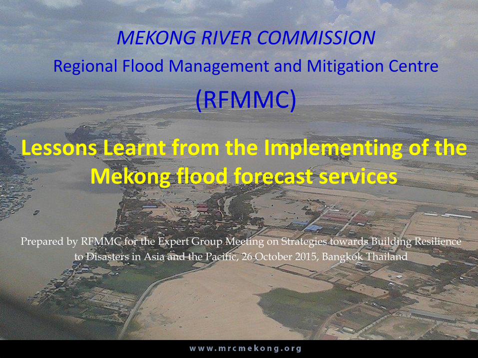
Lessons Learnt from the Implementing of the Mekong flood forecast services
Prepared by RFMMC for the Expert Group Meeting on Strategies towards Building Resilience
to Disasters in Asia and the Pacific, 26 October 2015, Bangkok Thailand
MEKONG RIVER COMMISSION
Regional Flood Management and Mitigation Centre
(RFMMC)
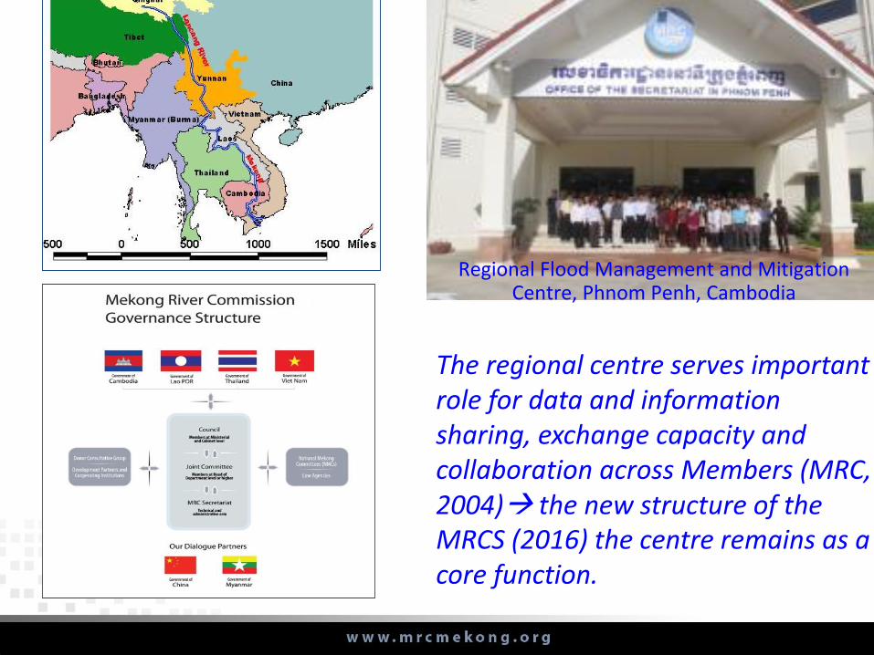
The regional centre serves important role for data and information sharing, exchange capacity and collaboration across Members (MRC, 2004) the new structure of the MRCS (2016) the centre remains as a core function.
Regional Flood Management and Mitigation Centre, Phnom Penh, Cambodia
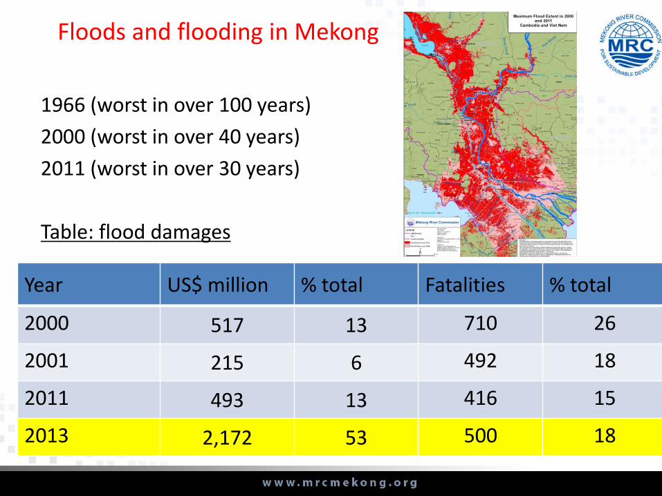
Year US$ million % total Fatalities % total
2000 517 13 710 26
2001 215 6 492 18
2011 493 13 416 15
2013 2,172 53 500 18
1966 (worst in over 100 years)
2000 (worst in over 40 years)
2011 (worst in over 30 years)
Table: flood damages
Floods and flooding in Mekong
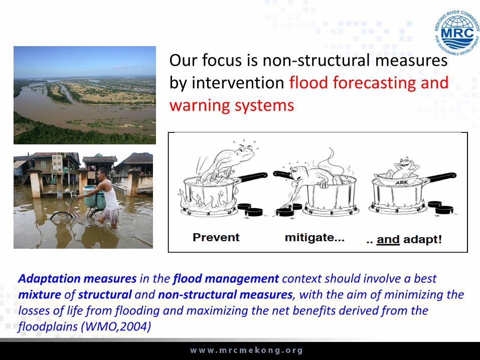
Adaptation measures in the flood management context should involve a best mixture of structural and non-structural measures, with the aim of minimizing the losses of life from flooding and maximizing the net benefits derived from the floodplains (WMO,2004)
Our focus is non-structural measures by intervention flood forecasting andwarning systems
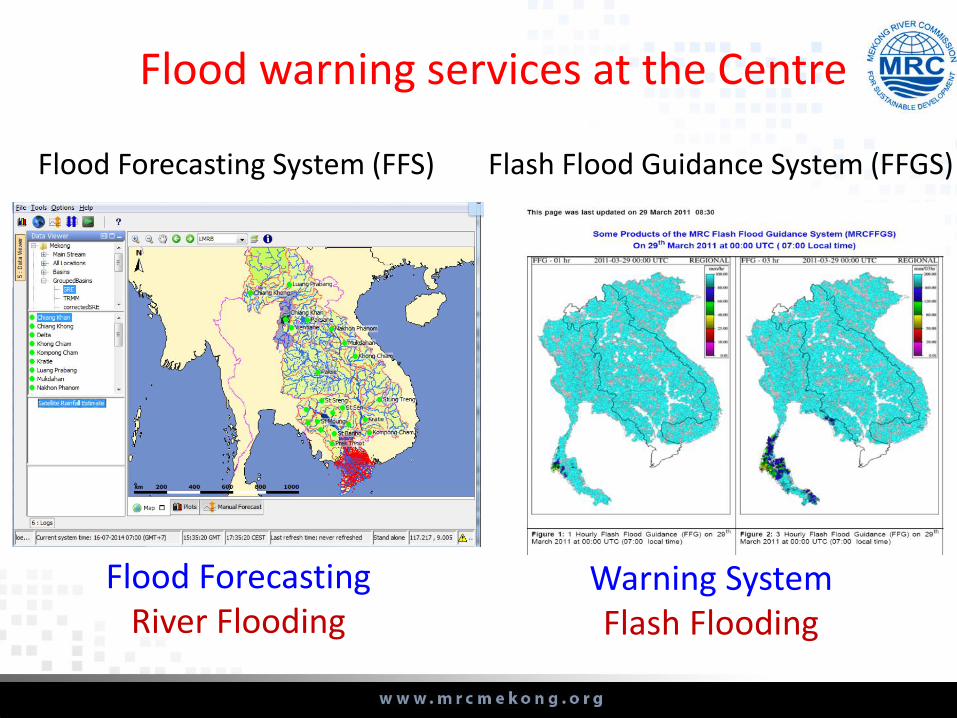
Flood warning services at the Centre
Flash Flood Guidance System (FFGS)
Warning SystemFlash Flooding
Flood ForecastingRiver Flooding
Flood Forecasting System (FFS)

5-7 days lead time Short-term flood forecasting and river monitoring for 22 locations along the Mekong mainstream rom Chiang Sean, Thailand to ChauDoc/Tan Chau, Vietnam.
REGRESION MODEL•Type: Statistical model•Area: from Stung Treng to Chau Doc.
ISIS MODEL •Type: Hydrodynamic model•Area from Kratie to Chau Doc
URBS MODEL •Type: Hydrological model.•Area: LMB
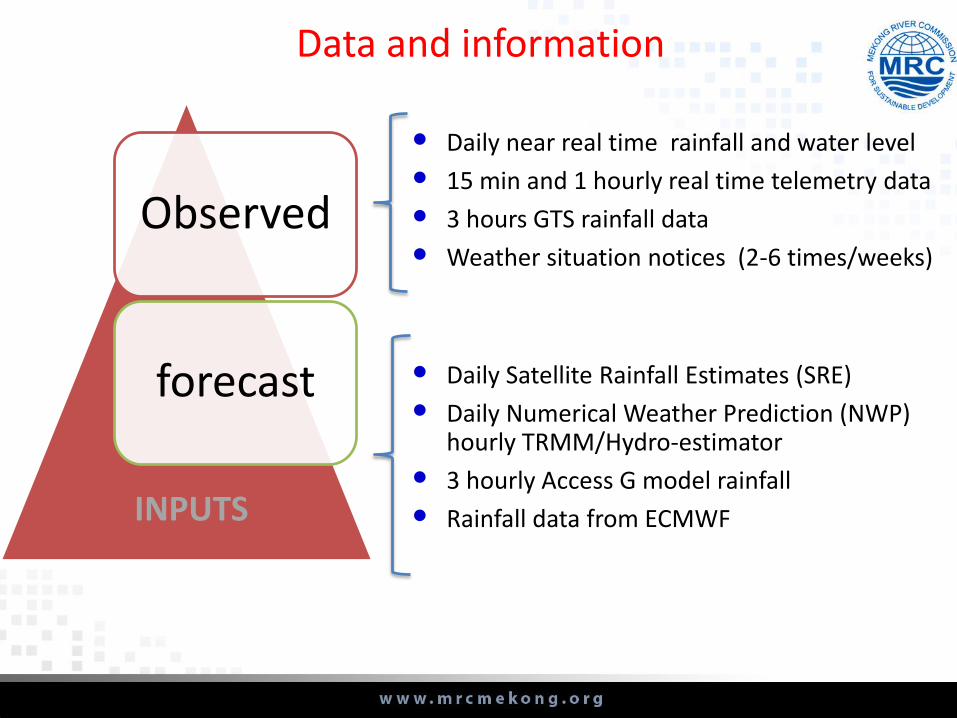
• Daily Satellite Rainfall Estimates (SRE)
• Daily Numerical Weather Prediction (NWP) hourly TRMM/Hydro-estimator
• 3 hourly Access G model rainfall
• Rainfall data from ECMWF
Observed
forecast
INPUTS
• Daily near real time rainfall and water level
• 15 min and 1 hourly real time telemetry data
• 3 hours GTS rainfall data
• Weather situation notices (2-6 times/weeks)
Data and information

Hydmet software stored observed data
• time records• import/export functions• reporting functions• etc
HYMET TOOL is a potential data sharing tool/mechanism (re: MRC regional technical gathering workshop, 2013&2014)
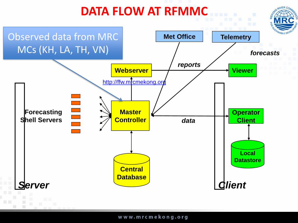
Master
Controller
Central
Database
Webserver
Forecasting
Shell Servers
Viewer
Operator
Client
Server Client
Viewerreports
data
forecasts
Telemetry
Local
Datastore
Met Office
DATA FLOW AT RFMMC
Observed data from MRC MCs (KH, LA, TH, VN)
http://ffw.mrcmekong.org
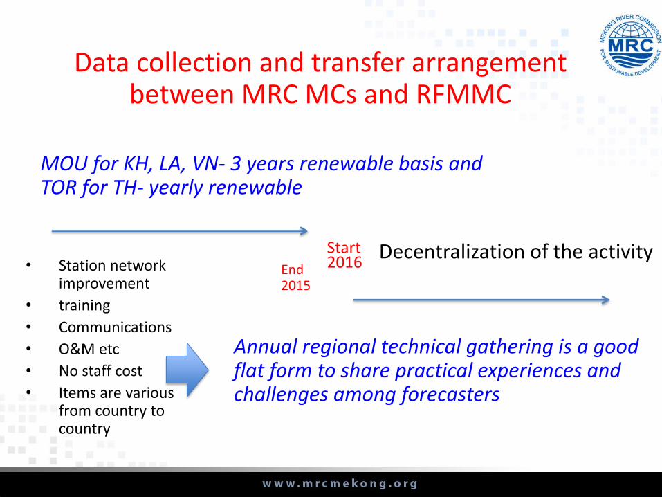
Data collection and transfer arrangement between MRC MCs and RFMMC
End 2015
Start 2016
MOU for KH, LA, VN- 3 years renewable basis and TOR for TH- yearly renewable
• Station network improvement
• training
• Communications
• O&M etc
• No staff cost
• Items are various from country to country
Decentralization of the activity
Annual regional technical gathering is a good flat form to share practical experiences and challenges among forecasters
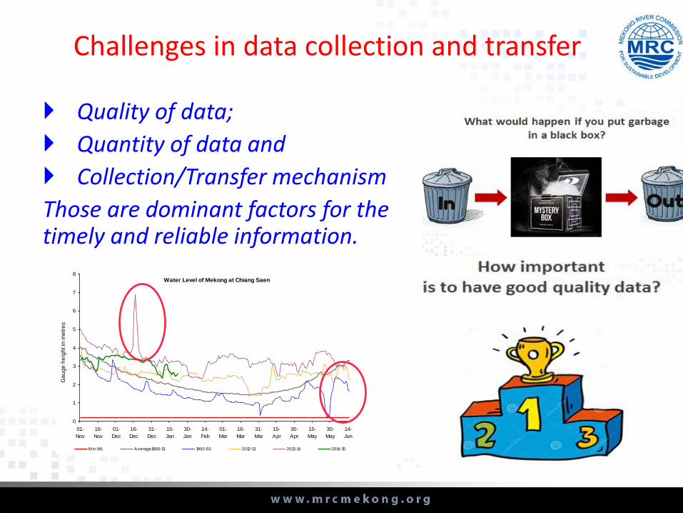
Quality of data;
Quantity of data and
Collection/Transfer mechanism
Those are dominant factors for the timely and reliable information.
Challenges in data collection and transfer
Water Level of Mekong at Chiang Saen
0
1
2
3
4
5
6
7
8
01-
Nov
16-
Nov
01-
Dec
16-
Dec
31-
Dec
15-
Jan
30-
Jan
14-
Feb
01-
Mar
16-
Mar
31-
Mar
15-
Apr
30-
Apr
15-
May
30-
May
14-
Jun
Ga
ug
e h
eig
ht in
me
tre
s
M in WL Average1980-13 1992-93 2012-13 2013-14 2014-15
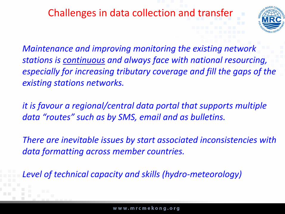
Maintenance and improving monitoring the existing network stations is continuous and always face with national resourcing, especially for increasing tributary coverage and fill the gaps of the existing stations networks.
it is favour a regional/central data portal that supports multiple data “routes” such as by SMS, email and as bulletins.
There are inevitable issues by start associated inconsistencies with data formatting across member countries.
Level of technical capacity and skills (hydro-meteorology)
Challenges in data collection and transfer
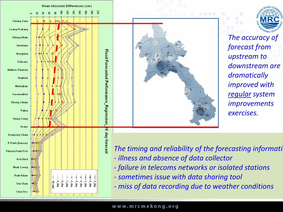
The accuracy of forecast from upstream to downstream are dramatically improved with regular system improvements exercises.
The timing and reliability of the forecasting information - illness and absence of data collector- failure in telecoms networks or isolated stations- sometimes issue with data sharing tool - miss of data recording due to weather conditions

Dissemination of flood warning at the RFMMC
Flood in formation can be accessed
from http://ffw.mrcmekong.org/
Face book
MRC webpage
E-mail to
groups of
recipients from
government
agencies to
IO’s& NGO’s
concerned

The“billboards” provided valuable community level training and awareness raising-- provides valuable insight into roles, responsibilities for the end users (thru groups of people represented and well respected by a majority of communities such as monks, village heads
Limitations of communication and messaging at the local and community levels.
Challenges in dissemination of flood warning
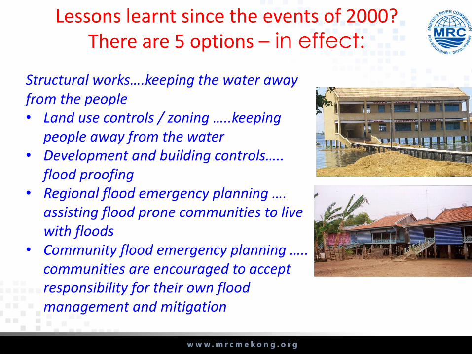
Lessons learnt since the events of 2000? There are 5 options – in effect:
Structural works….keeping the water away from the people• Land use controls / zoning …..keeping
people away from the water• Development and building controls…..
flood proofing• Regional flood emergency planning ….
assisting flood prone communities to live with floods
• Community flood emergency planning ….. communities are encouraged to accept responsibility for their own flood management and mitigation
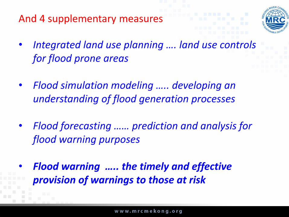
And 4 supplementary measures
• Integrated land use planning …. land use controls for flood prone areas
• Flood simulation modeling ….. developing an understanding of flood generation processes
• Flood forecasting …… prediction and analysis for flood warning purposes
• Flood warning ….. the timely and effective provision of warnings to those at risk

Conclusion and ways forward
Floods become severe and frequent causing more damages and fatalities
Investment in data is critical and a basic step towards better management of flood risks
Two major measures should be taken by either one and/or few parties concerned
Further strengthen our work at, streamline
communication and messaging to community
Thank you very much for your attention!
Number of selected slides are obtained from MRC MCs as references (ref MRC MCs, Technical gathering workshop in 2015)
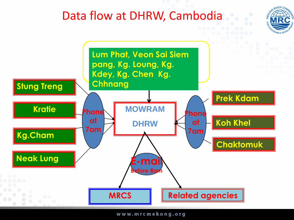
Stung Treng
Kratie
Kg.Cham
Neak Lung
Prek Kdam
Koh Khel
Chaktomuk
MOWRAM
DHRW
MRCS Related agencies
Phone
at
7am
E-mailBefore 8am
Phone
at
7am
Data flow at DHRW, Cambodia
Lum Phat, Veon Sai Siem
pang, Kg. Loung, Kg.
Kdey, Kg. Chen Kg.
Chhnang
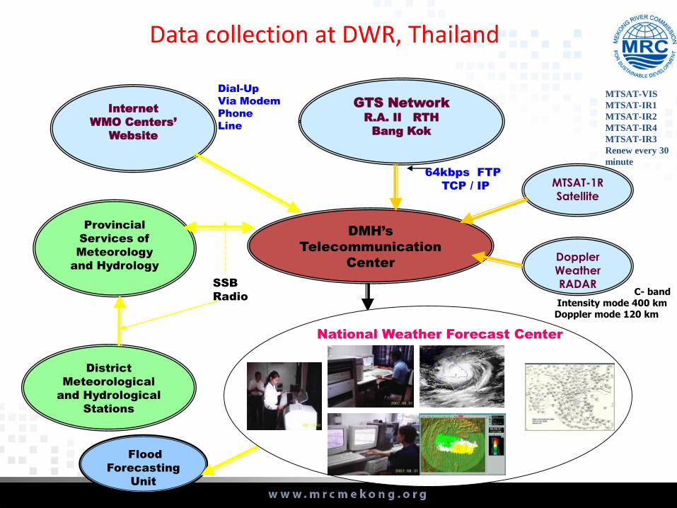
Data collection at DWR, Thailand
DMH’s
Telecommunication
Center
GTS Network
R.A. II RTH
Bang Kok
Internet
WMO Centers’
Website
Flood
Forecasting
Unit
Provincial
Services of
Meteorology
and Hydrology
District
Meteorological
and Hydrological
Stations
64kbps FTP
TCP / IP
Dial-Up
Via Modem
Phone
Line
SSB
Radio
MTSAT-1R
Satellite
Doppler
Weather
RADAR
National Weather Forecast Center
C- bandIntensity mode 400 km Doppler mode 120 km
MTSAT-VIS
MTSAT-IR1
MTSAT-IR2
MTSAT-IR4
MTSAT-IR3
Renew every 30
minute

Dissemination of flood warning in DHRW of Cambodia
10 near real time
Hydrological
stations
MASS MEDIA (TVS,
RADIOS,
NEWSPAPERS, …)
Flood Bulletin,
and Flood
Warning
Concern line agencies
(Gov. Nat. Committees,
NGOs, UN agencies,
MRCS, …)
DHRW
MOWRAM
Fax, Email,
Website

Organization structure for disseminating of weather and flood forecast and warning in Lao P.D.R
Provincial Hydro-Meteo Stations
Dept. of Meteorology and Hydrology (DMH)
Head Quarter office in Lao P.D.RMRCSLNMC
Prime Minister’s
Office
MAF Mass Media
TV,Radio, News
Provincial
Hydro-Meteo
Stations
Provincial
TV
MEM
Others
NDMO
Line Ministries
concerned
Provincial
Agriculture
and Forestry
services
Electricity
Hydro-Power
Remark:
LNMC: Lao national Mekong Committee
MRC: Mekong River Commission
MAF: Ministry of agriculture and forestry
NDMO: National Disaster Management office
MM : Ministry of Energy and Mining
MoNRE
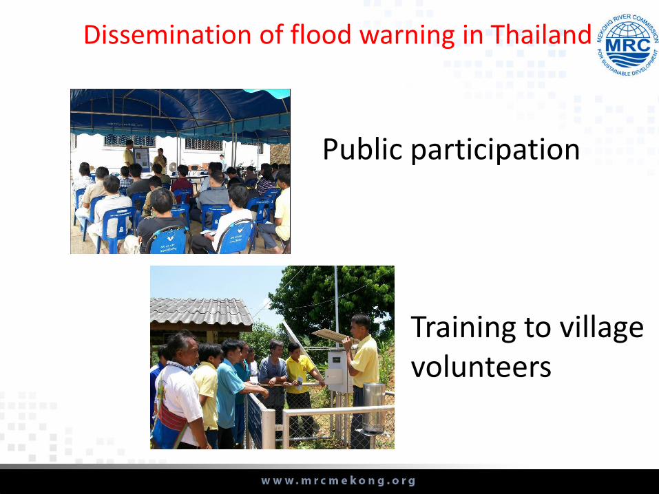
Public participation
Training to village volunteers
Dissemination of flood warning in Thailand
Media
Local Authorities
Media
Media
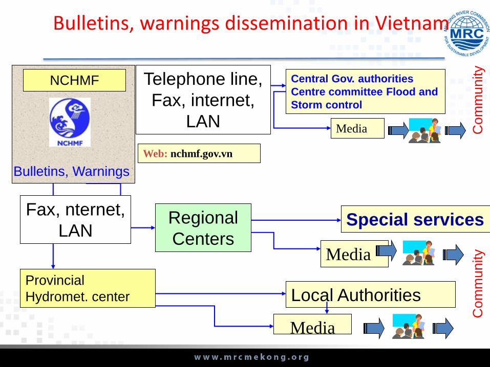
Bulletins, warnings dissemination in Vietnam
NCHMF Telephone line,
Fax, internet,
LAN
Provincial
Hydromet. center
Regional
Centers
Fax, nternet,
LAN
Co
mm
un
ity
Special services
Central Gov. authorities
Centre committee Flood and
Storm control
Web: nchmf.gov.vn
Bulletins, Warnings
Co
mm
un
ity