reserve pit and brine pond studies in north dakota · reserve pit and brine pond studies in north...
TRANSCRIPT
Ed Murphy
Reserve Pit and Brine Pond Studies in North Dakota
Presented to the
Energy Development and Transmission Committee Senator Rich Wardner, Chair
Minot, ND April 8, 2014
Ed Murphy North Dakota Department of Mineral Resources
Geologica l Survey
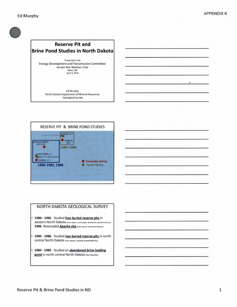
RESERVE PIT & BRINE POND STUDIES
STRATTON SWD#1 ~MNO. I
. WINOERL ~ISONNORTH NO.I
UNITC133
• 1984-1986
~REEKI·II "A" (NCT-A)N0.1
• FEDERAl. 1-5 • Vulnerable Setting 1980-1982,1986 • Typical Setting
NORTH DAKOTA GEOLOGICAL SURVEY
• 1980 - 1982 Studied four buried reserve pits in western North Dakota lone report, one paper, numerous presentations) .
1986 Resampled Apache site (one report. one presentation) .
• 1984- 1986 Studied two buried reserve pits in northcentra I North Dakota lone report, severa l presentations).
• 1984- 1985 Studied an abandoned brine holding pond in north-central North Dakota (two repo rts).
Reserve Pit & Brine Pond Studies in ND
APPENDIX K
1
Ed Murphy 4/8/2014
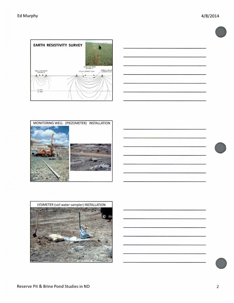
EARTH RESISTIVITY SURVEY
METER) INSTALLATION
Reserve Pit & Brine Pond Studies in ND 2

Ed Murphy
Dimensions: ~~r;t;o;ii,_...., 1SO feet x 60 feet
10 feet deep
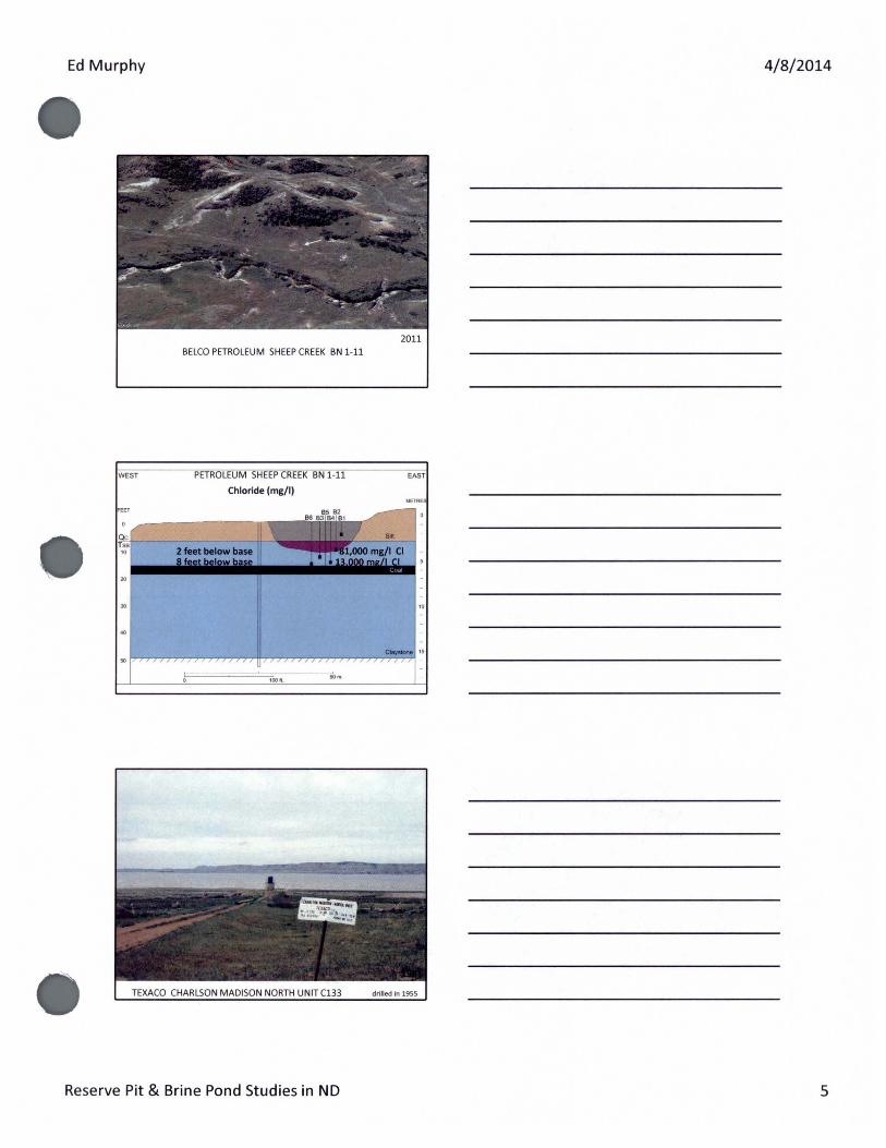
TEXACO GOV'T A (NCT-1) #1 drilled in 1960 BELCO PETROLEUM SHEEP CREEK BN 1-11 drilled in 1977
4/8/2014
Reserve Pit & Brine Pond Studies in ND 3

Ed Murphy 4/8/2014
TEXACO GOV'T A (NCT-1) #1
Reserve Pit & Brine Pond Studies in ND 4
Ed Murphy 4/8/2014
2011 BELCO PETROLEUM SHEEP CREEK BN 1-11
Reserve Pit & Brine Pond Studies in ND 5
Ed Murphy
SOUTH FEET
60
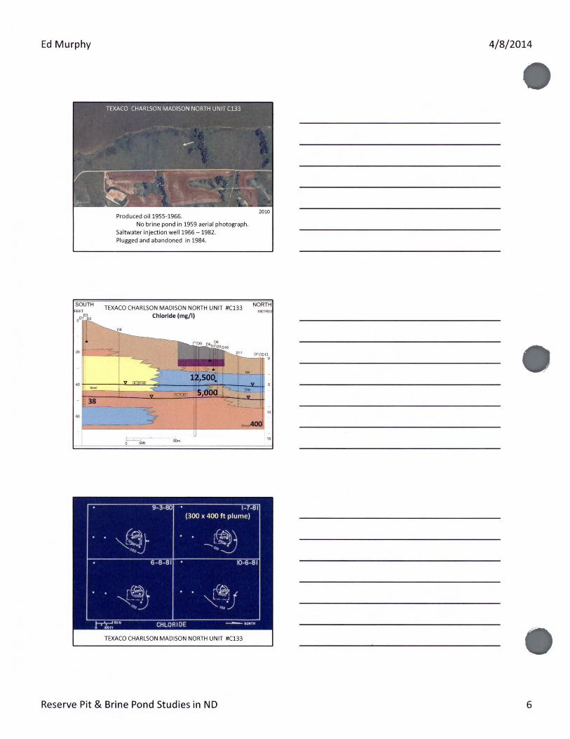
Produced oil1955-1966. No brine pond in 1959 aerial photograph.
Saltwater injection well1966 -1982. Plugged and abandoned in 1984.
TEXACO CHARLSON MADISON NORTH UNIT #C133
Chloride (mg/1)
t== .... 50m.
2010
NORTH METRE
"
9- 3-80 1-7-81 (300 x 400ft plume)
'*~· ~~ -....... l !..~aw •
'"' 6-8 - 81 ID-6-81
;~~ . f~j ~--; ~--; 'oo '00
. 1-r'r-' "' 0 IOOFI
CHLORIDE
TEXACO CHARLSON MADISON NORTH UNIT #C133
Reserve Pit & Brine Pond Studies in ND
4/8/2014
6

Ed Murphy 4/8/2014
Reserve Pit & Brine Pond Studies in ND 7

Ed Murphy
WEST
APACHE FEDERAL 1-5 Installing monitoring wells in 1981.
APACHE FEDERAL 1-5 Chloride (mg/1)
Reserve Pit & Brine Pond Studies in ND
4/8/2014
EAST
8

Ed Murphy
RESERVE PIT STUDY WESTERN NORTH DAKOTA
• Leachate is being generated from buried drilling fluid at each of the four western ND study sites.
• The amount of leachate reaching the water table is assumed minimized by clay attenuation and evapotranspiration.
• Very little leachate is likely reaching the saturated zone at the two study sites in the Rough rider Field based on the reduction seen in the unsaturated zone.
RESERVE PIT STUDY WESTERN NORTH DAKOTA
• Leachate at Federall-5 covers an area of 250 x 250 feet. - Chromates detectable in leachate within the unsaturated zone but not in the
saturated zone -levels were higher in the saturated zone in 1986.
• Leachate plume in the Texaco Charlson Madison (North) Unit is approximately 300 x 400 feet in the upper saturated zone (top 40 feet).
• This study determined that leachate will be generated by the current method of reserve pit reclamation. Therefore, it is important to focus attention in areas where leachate will degrade the groundwater.
RESERVE PIT STUDY: WESTERN NORTH DAKOTA 1986 CONCLUSIONS
• In general, groundwater chemistries and the extent of the leachate plume relatively unchanged from 1981 to 1986 at Apache Federal1-5 site.
• Suggested alternative methods for environmentally sensitive sites including closed mud system, solidification, solids control system, central disposal sites- noted central disposal sites must be carefully chosen because the increased volume increases the chances for widespread groundwater contamination.
• There are settings such as the Little Missouri River floodplain, Little Muddy, etc where there should be no burial of waste drilling fluid.
Reserve Pit & Brine Pond Studies in ND
4/8/2014
9
Ed Murphy
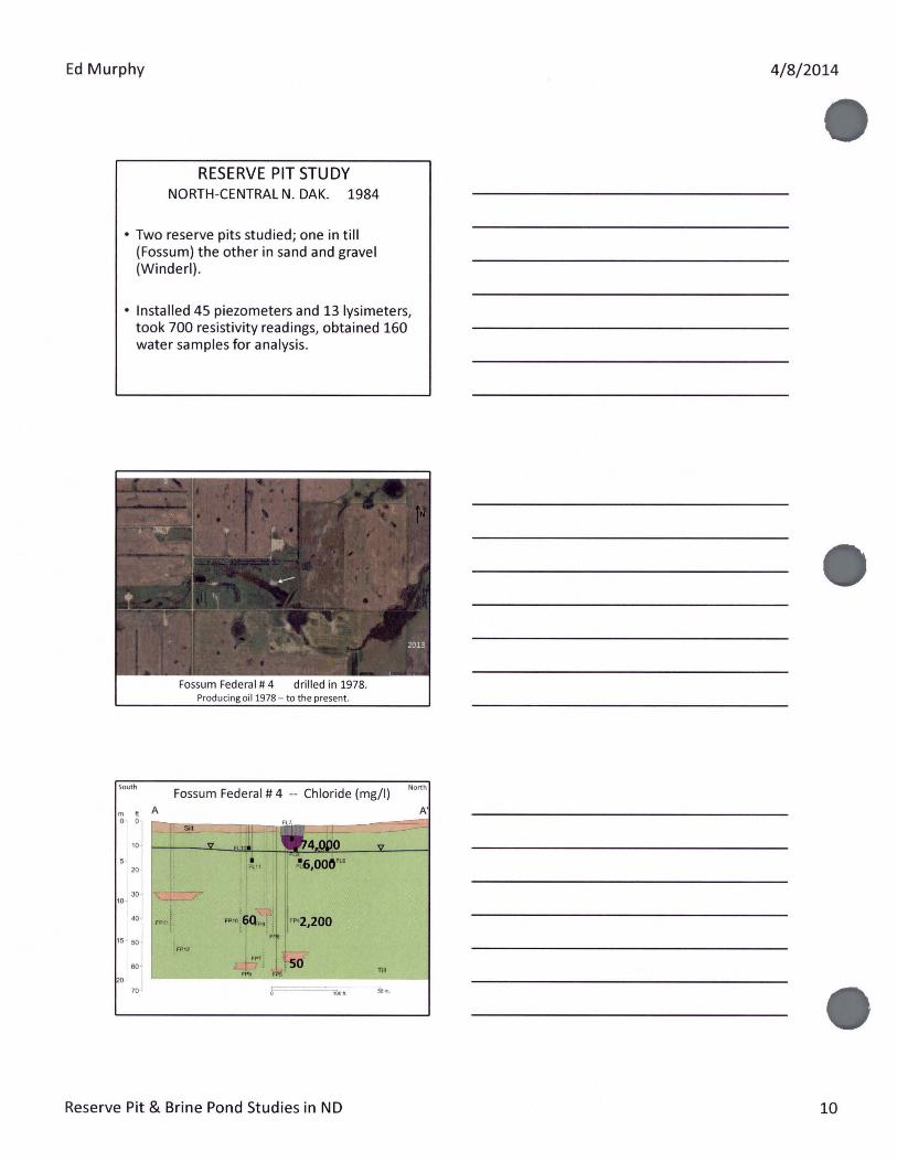
RESERVE PIT STUDY NORTH-CENTRAL N. DAK. 1984
• Two reserve pits studied; one in till (Fossum) the other in sand and gravel (Winder!).
• Installed 45 piezometers and 13 lysimeters, took 700 resistivity readings, obtained 160 water samples for analysis.
• ill'!' ... .. -• '·
• 1 ""'
2013
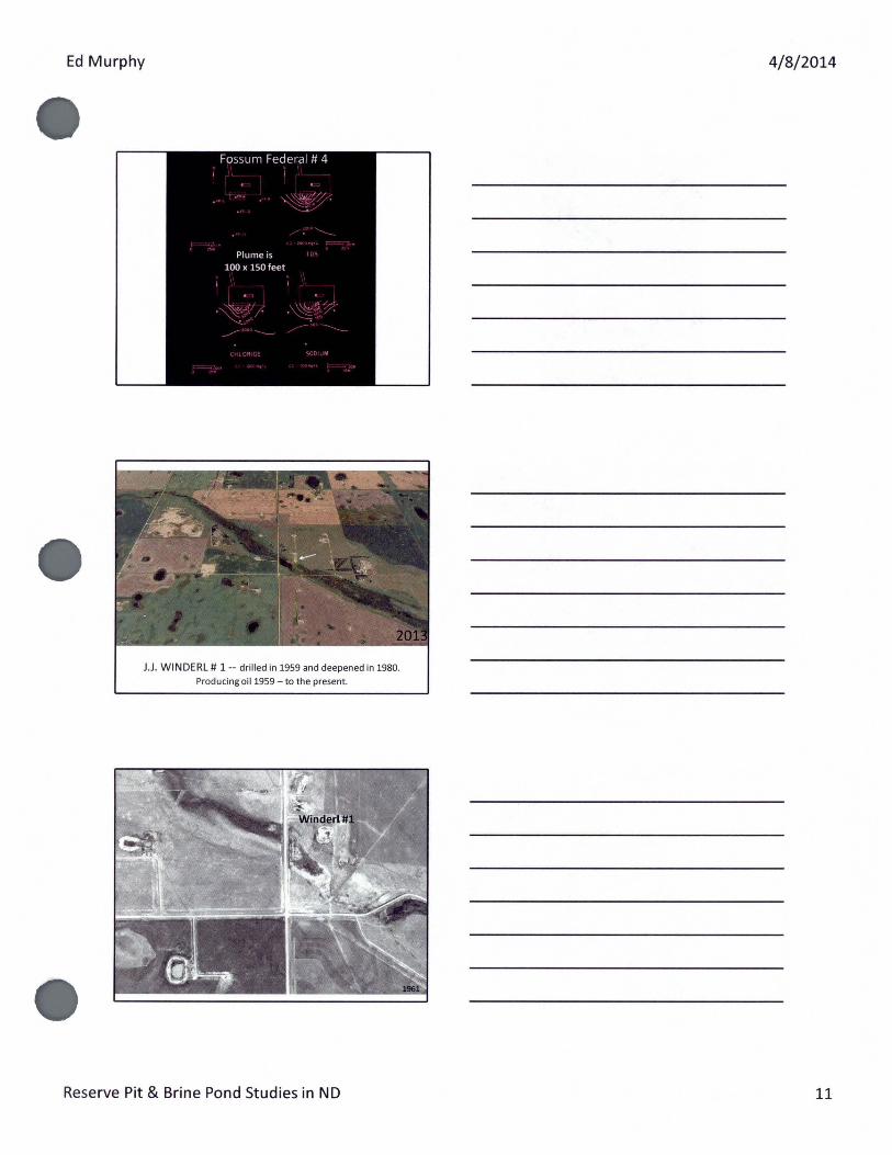
Fossum Federal# 4 drilled in 1978. Producong oil1978 - to the present - to the present.
South Fossum Federal# 4 -- Chloride (mg/1)
North
10
5-
J I .~6,000"' 20 FL11
30 10 -
····ltQ-:, ''·"'2,200 40
15 ~ 50 "" FP12
60 Till
70
Reserve Pit & Brine Pond Studies in ND
4/8/2014
10
Ed Murphy 4/8/2014
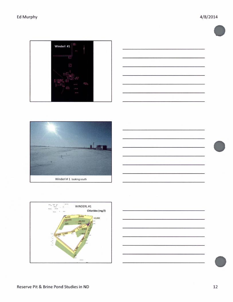
J.J. WINDERL # 1-- drilled in 1959 and deepened in 1980.
Producing oil1959- to the present.
Reserve Pit & Brine Pond Studies in ND 11
Ed Murphy 4/8/2014
WINDERL#l
·-· . -· Chlorides (mg/1)
10,000
Reserve Pit & Brine Pond Studies in ND 12
Ed Murphy
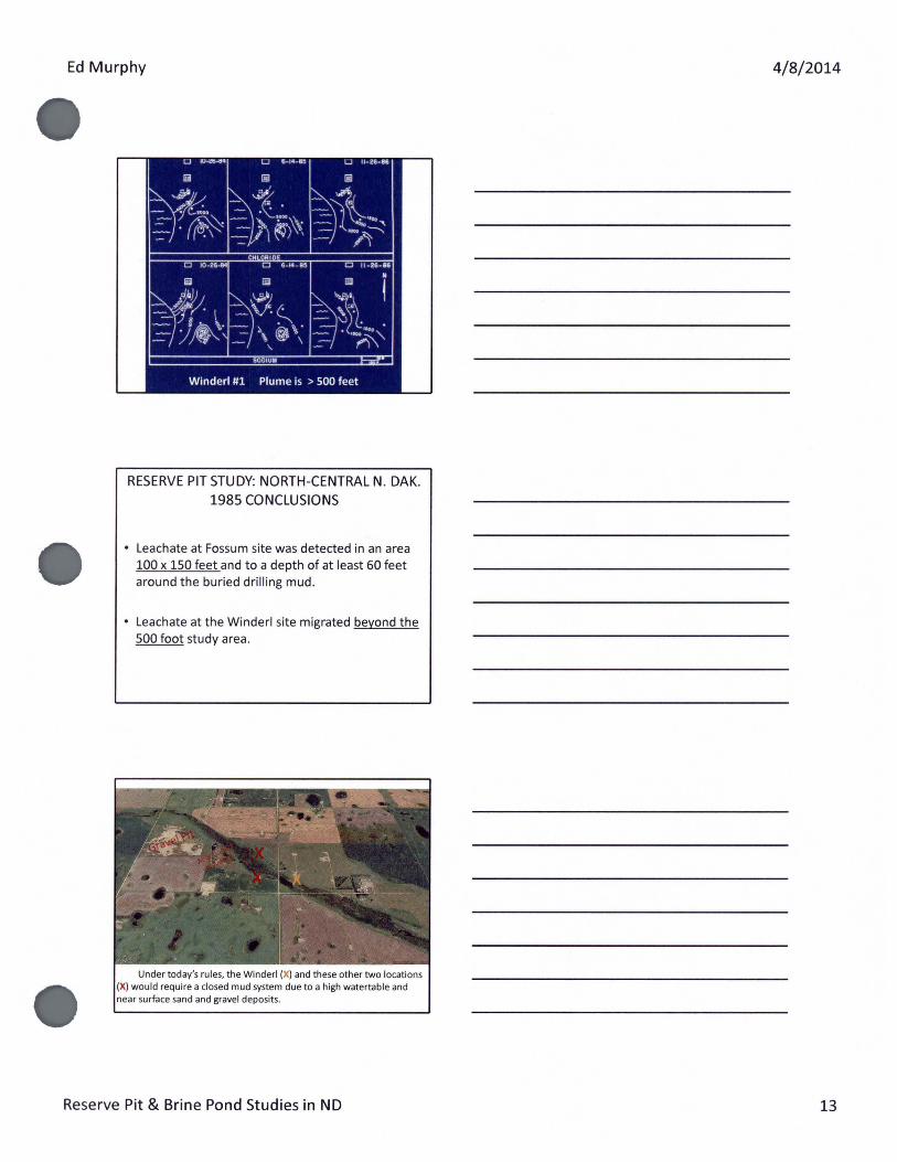
RESERVE PIT STUDY: NORTH-CENTRAL N. OAK. 1985 CONCLUSIONS
• Leachate at Fossum site was detected in an area 100 x 150 feet and to a depth of at least 60 feet around the buried drilling mud.
• Leachate at the Winder! site migrated beyond the 500 foot study area.
Under today's rules, the Winderl (X) and these other two locations (X) would require a closed mud system due to a high watertable and near surface sand and gravel deposits.
Reserve Pit & Brine Pond Studies in ND
4/8/2014
13

Ed Murphy
BRINE HOLDING PONDS
WILEY FIELD Madison Pool
I CUMULATIVE PRODUCTION (as oll /1/82)
9,078,035 Barrels of oil 18,063,255 Barrel o1 salt wat&f
I Total Dissolved Solids (TDS) of brines in the Wylie
Field range from 19,000 to 250,000 mg/1 (seawater
30,000- 50,000).
BRINE HOLDING PONDS
Operated in North Dakota from 1951-1982.
NDGS personnel began field investigating and condemning brine holding ponds in the 1960s.
The exact number of brine ponds that existed from 1951-1982 is unknown (est. 2,000-3,000) .
Reserve Pit & Brine Pond Studies in ND
4/8/2014
14
Ed Murphy
BRINE HOLDING PONDS
Dimensions:
45 x 60ft up to 90 x 180ft
4 to 9 feet deep
1) Unlined
2) Clay liner
3) Polyethylene liner
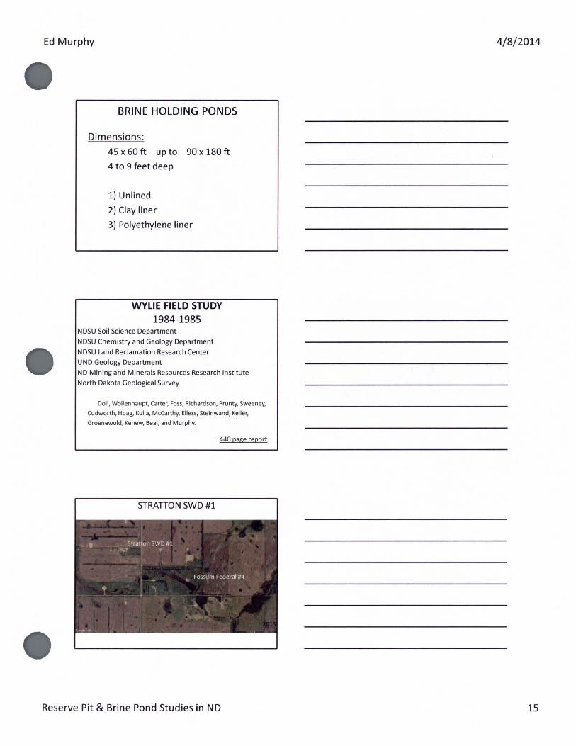
WYLIE FIELD STUDY 1984-1985
NDSU Soil Science Department
NDSU Chemistry and Geology Department
NDSU Land Reclamation Research Center
UND Geology Department
ND Mining and Minerals Resources Research Institute
North Dakota Geological Survey
Doll, Wollenhaupt, Carter, Foss, Richardson, Prunty, Sweeney,
Cudworth, Hoag, Kulla, McCarthy, Elless, Steinwand, Keller,
Groenewold, Kehew, Bear, and Murphy.
440 page report
STRATION SWD #1
Reserve Pit & Brine Pond Studies in ND
4/8/2014
15

Ed Murphy
Drilled in 1959 by Cardinal Petroleum (Edson Brown #1). Produced oil from 1959-1970. Converted to a saltwater disposal well by Phillips Petroleum in 1978 (Stratton SWD #1).
The site contained two brine holding ponds from 1959 to at least 1970 (with dimensions of 100 x 90ft and 60 x 100ft and 5 feet deep).
well produced 178,000 barrels of saltwater.
WYLIE FIELD STUDY 1984-1985
NDSU Chemistry and Geology Department
NDSU Soil Science Department.
Characterization of Detrimental Effects of Salts and Other Chemical Constituents Carried in Surface and Subsurface Water from Mine and Drilling Fluid Disposal Pits Buried During Oil Development
Studied seven sites, Stratton SWD #1 is their Fl Site. 48 shallow Giddings cores (10-15 feet deep).
193 saturated paste extract
80 XRD analyses.
Reserve Pit & Brine Pond Studies in ND
4/8/2014
16
Ed Murphy
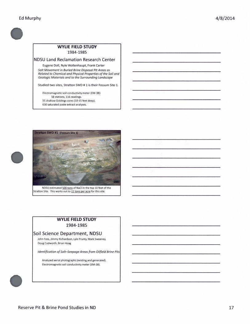
WYLIE FIELD STUDY 1984-1985
NDSU Land Reclamation Research Center Eugene Doll, Nyle Wollenhaupt, Frank Carter
Salt Movement in Buried Brine Disposal Pit Areas as Related to Chemical and Physical Properties of the Soil and Geologic Materials and to the Surrounding Landscape
Studied two sites, Stratton SWD # 1 is their Fossum Site 1.
Electromagnetic soil conductivity meter (EM-38) :
58 stations, 116 readings.
55 shallow Giddings cores (10-15 feet deep).
630 saturated paste extract analyses.
estimated 500 tons of NaCI in the top 10 feet of the Site. This works out to 22 tons per acre for this site.
WYLIE FIELD STUDY 1984-1985
Soil Science Department, NDSU John Foss, Jimmy Richardson, Lyle Prunty, Mark Sweeney,
Doug Cudworth, Brian Haag
Identification of Salt-Seepage Areas from Oilfield Brine Pits
Analyzed aerial photographs (existing and generated).
Electromagnetic soil conductivity meter (EM-38).
Reserve Pit & Brine Pond Studies in ND
4/8/2014
17
Ed Murphy
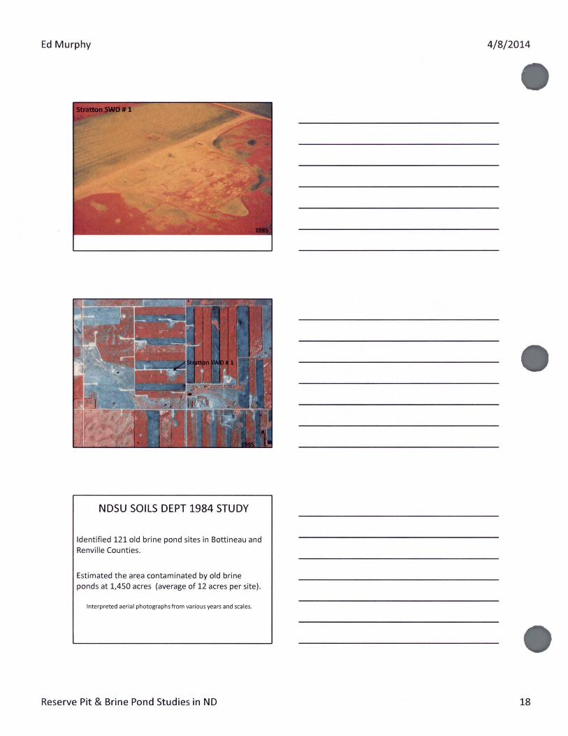
NDSU SOILS DEPT 1984 STUDY
Identified 121 old brine pond sites in Bottineau and Renville Counties.
Estimated the area contaminated by old brine ponds at 1,450 acres (average of 12 acres per site).
Interpreted aerial photographs from various years and scales.
Reserve Pit & Brine Pond Studies in ND
4/8/2014
18

Ed Murphy
NDSU SOILS DEPT 1984 STUDY Wylie Field
Studied an area of 15 square miles in Wylie Field and identified 60 old brine pond locations.
Interpreted aerial photographs from various years and scales.
NDSU SOILS DEPT 1984 STUDY
Wylie Field
Mapped 23 of the 60 sites.
Salt-impacted area ranged from 0 to 42 acres at each site.
Average impact of 11.5 acres per site.
Total impact of 266 acres.
Electromagnetic soil conductivity meter (EM-38).
Reserve Pit & Brine Pond Studies in ND
4/8/2014
19

Ed Murphy
1 79- 7 )6 aaae
t 11111:11111_"011 __ .. - ;;, _
Stratton SWD (Site 58)
WYLIE FIELD STUDY 1984-1985
North Dakota Geological Survey
UND Geology Department
ND Mining and Minerals Resources Research Institute Gerry Groenewold, Alan Kehew, Willie Bea l, Ed Murphy
Movement of Leachate From a Buried Oil and Gas BrineDisposal Pand in the Wylie Field, Bottineau County, NO
Studied only the Stratton SWD #1 28 piezometers (down to 220 feet) , 8 lysimeters.
60 water samples.
36 resistivity stations (504 readings) .
Reserve Pit & Brine Pond Studies in ND
4/ 8/2014
20

Ed Murphy
Installing monitoring wells at t he Stratton SWD #1 in 1984.
STRATTON SWD #1 Chlorides mg/1
Reserve Pit & Brine Pond Studies in ND
4/8/2014
21

Ed Murphy
STRATTON SWD #1
A high salt plume extends laterally around the site over an area of 250,000 ft2 (about 6 acres) .
This plume extends to a depth of more than 80 feet (highest concentrations in top 40 feet) .
Brine plume restricted to till and not impacting any useable water supply (ND Hea lth Dept concurred in 2006).
Chloride levels at 160 feet (500 - 750 mg/1) appear to be coming from the underlying Fox Hills Formation.
Stratton SWD #1
Fox Hills
CHLORIDE LEVELS IN THE FOX HILLS FORMATION
"""' ec::::, Nu~•te-r ... -~ w•• Billings 47 43 29 McKenzie 170 34 NA Mountrail 265 1 1 Williams 491 7 4 Ward NA 0 0 Divide 1220 7 3 Burke NA 0 0 Renville 4351 7 1 West Bottineau 1514 11 11 McHenry 654 41 24 East Bottineau 192 8 8 Rolette 282 4 1
Kimberly Fischer, NOSWC, 2014
Reserve Pit & Brine Pond Studies in ND
4/8/2014
22

Ed Murphy
• 4
. L....
:~ ... · ~~····:': ·. ·~: ::-_.:-··. . =::;:, · Ia::. ·.'.
BOTTINEAU COUNTY !
••
4 • L_
•
!BOTTINEAU COUNTY I ~-
••
•
':. . •
··,.
Fox Hills w~n·; ·
.. .. •
Fox Hills Wells
FOX HILLS WELLS AND
OIL & GAS WELLS
L> Stratton Site
FOX HILLS WELLS AND
SALTWATER DISPOSAL WELLS
L> Stratton Site
FOX HILLS WELLS AND
··:.· WATER
• •, ·. ·· .. ·
• •
Fox Hills Wells
•..... . "' ·-. ~-·· . .... -. .. . <>$.
~~illsWellf
INJECTION WELLS
L> Stratton Site
Reserve Pit & Brine Pond Studies in ND
4/8/2014
23

Ed Murphy 4/8/2014
RECOMMENDED REMEDIATION METHODS 1985
PUMPING WELLS Hydraulic conductiv ity of the till is too low to be effective.
Expensive.
IMPERMEABLE MEMBRANE Would minimize the spread of brine in the unsaturated zone.
Bentonite.
Would not be a long-term solution.
MOUNDING/CAPPING THE SITE Would reduce the generation of brine leachate from overland flow. Bentonite and fill.
Would not be a long-term solution.
INFILTRATION GALLERY (Gravel-filled ditch)
Wou ld minimize the spread of brine in the unsat urated zone.
Would be a long-term solution .
INFILTRATION GALLERY
Erickson Central Tank Battery, Bottineau County 19_?_ -- 1997
Reserve Pit & Brine Pond Studies in ND 24

Ed Murphy
Erickson Central Tank Battery, Bottineau County
ATIEMPTS TO CLEAN UP OLD BRINE
PONDS IN THE WYLIE FIELD 2006-2010
Sites Stratton DOl (Stratton SWD #1) Bull BlR Wilms A DOl Haugen Bl Durn in A & DOl
2006-2010 Wylie Field Study Sites
Reserve Pit & Brine Pond Studies in ND
4/8/2014
25
Ed Murphy
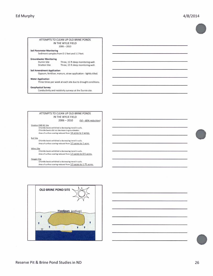
ATTEMPTS TO CLEAN UP OLD BRINE PONDS IN THE WYLIE FIELD
2006-2010
Soil Parameter Monitoring Sediment samples from 0-1 feet and 1-2 feet.
Groundwater Monitoring Durnin Site Stratton Site
Soil Amendment Application
Three, 15ft deep monitoring well. Three, 15ft deep monitoring well.
Gypsum, fertilizer, manure, straw application--lightly tilled .
Water Application Three times per week at each site due to drought conditions.
Geophysical Survey Conductivity and resistivity su rveys at the Durnin site.
ATTEMPTS TO CLEAN UP OLD BRINE PONDS IN THE WYLIE FIELD
2006 -2010 (50- 80% reduction)
Stratton SWO #1 Site Chloride levels exhibited a decreasing trend in soils. Chloride levels did not decrease in groundwater.
Area of surface scaring reduced from 14 acres to 3 acres.
Chloride levels exhibited a decreasing trend in soils.
Area of surface scaring reduced from 3.5 acres to 1 acre.
Wilms Site Chloride levels exhibited a decreasing trend in soils.
Area of surface scaring reduced from 1.5 acres to 0.5 acres.
Haugen Site Chloride levels exhibited a decreasing trend in soils.
Area of surface scaring reduced from 3.5 acres to 1. 75 acres.
OLD BRINE POND SITE ~
Reserve Pit & Brine Pond Studies in ND
4/8/2014
26

Ed Murphy 4/8/2014
' '
In the Future
Reserve Pit & Brine Pond Studies in ND 27

Ed Murphy
DURNIN SITE
El.ECll'IICAlAES!ST~,TY~SIA_fS. !>.1'5 CONOCOPMIU.JPSCCIWP4'i"f •WUY>jl,li.J
-~-"*-
REJECTED REMEDIATION METHODS IN THE WYLIE FIELD
2006-2010
REMOVE IMPACTED SEDIMENT
Evaluated removing salt impacted sediment across six acres to a depth of four feet (38,000 cubic yards).
Install a 30 mil plastic liner.
Replace with clean fill.
Risky due to likelihood that salt would find its way into the clean fill.
REJECTED REMEDIATION METHODS IN THE WYLIE FIELD
2006-2010
DRAIN TILE SYSTEM
Evaluated installing a drain tile system down to a depth of 20 feet to dewater and flush the system.
Potential for no viable disposal method.
Believe the groundwater impacted area extends beyond site and would continue to migrate into this site into the future.
Reserve Pit & Brine Pond Studies in ND
4/8/2014
28

Ed Murphy
ADVANCES IN RESISTIVITY
Taken at depth of interest with vertical electrodes.
Surveys now use AC current verses DC current. Measure actual soil / ground water resistivity vs. »apparent» resistivity.
Bulk soil measurements can be taken around an electrode, in planes between two electrodes.
Advances in statistical computer modeling can further increase the resolution of the electric data for 2-D or 3-D display.
Hell Creek Environmental Services
ADVANCES IN DRAIN TILE
AND IRRIGATION FLUID CHEMISTRY
Agassiz Drain Tile
INFILTRATION GALLERY
Reserve Pit & Brine Pond Studies in NO
4/8/2014
29